One of the main attractions of La Caldera de Taburiente National Park is the magical ‘Cascadade Colores’ or Cascade of Colours: a semi-natural waterfall practically hidden on a deviation along the trail through the Las Angustias ravine. In a bend of the Rivanceras ravine you will suddenly come across a six-metre-high wall, painted by nature in tones of green, yellow and orange, where water falls all year around.
The orange and yellow hues come from the iron in the ravine’s water, which has one of the highest concentrations of iron in La Palma, whereas the greens are from the algae and mosses. The result is a palette of colours that change with the season and the flow of water from the ravine. To enjoy this gift to the senses all you have to do is walk along the access path to this hidden corner of the park.
Cascade of Colours in the Las Angustias ravine
One of the main attractions of La Caldera de Taburiente National Park is the magical ‘Cascadade Colores’ or Cascade of Colours: a semi-natural waterfall practically hidden on a deviation along the trail through the Las Angustias ravine. In a bend of the Rivanceras ravine you will suddenly come across a six-metre-high wall, painted by nature in tones of green, yellow and orange, where water falls all year around.
The orange and yellow hues come from the iron in the ravine’s water, which has one of the highest concentrations of iron in La Palma, whereas the greens are from the algae and mosses. The result is a palette of colours that change with the season and the flow of water from the ravine. To enjoy this gift to the senses all you have to do is walk along the access path to this hidden corner of the park.
Read less
Imagen
Subtítulo
La Caldera de Taburiente National Park
Título
A camping area in La Caldera de Taburiente
A camping area in La Caldera de Taburiente
The camping area in the centre of La Caldera de Taburiente National Park is the only way to spend the night in the interior of this natural space and the best way to feel its raw, wild essence. The flora and fauna of the island of La Palma pose no danger whatsoever, so a night in the open air or in a tent under the majestic pine trees of Taburiente is definitely a safe and enriching experience.
Staying overnight is free of charge, but you will have to book a place in advance. The access is via a 5.5-kilometre trail, which starts out in Los Brecitos and ends at the Taburiente stream. Facilities include wooden tables and chairs, running water, toilets and showers as well as security personnel. Just beside the camping zone is the circular building of the Taburiente service centre, where you’ll find information about the many different walks through the zone and the rich natural resources of the park.
Read less
Imagen
Subtítulo
La Caldera de Taburiente National Park
Título
Network of trails in La Caldera de Taburiente
Network of trails in La Caldera de Taburiente
Within La Caldera de Taburiente National Park you can only move about on foot. Because of this, there is a truly excellent network of pathways and trails, all perfectly signposted and very well maintained. The main access points to the park are at the La Cumbrecita viewing point, just 25 minutes’ drive from the El Paso Visitors Centre, and at Los Brecitos, an hour’s drive from the town of Los Llanos de Aridane.
To give you a general idea, the network has one long trail, the GR-131, which leads you around the border of the crater and reaches the summit of the island itself, the Roque de los Muchachos (2,426 metres) and many shorter varieties of the PRLP-13 path, which take you between watery ravines covered with pine trees. The most popular walk is that which zigzags slowly down from Los Brecitos through the winding ravine of Las Angustias.
Read less
Imagen
Subtítulo
La Caldera de Taburiente National Park
Título
Taburiente beach
Taburiente beachInside
La Caldera de Taburiente National Park, far from La Palma’s coastline, you will discover a special kind of beach. These are sands of pebbles and gravel which line the banks of one of the few continuous water flows in the Canary Islands; the Taburiente stream. Here walkers can enjoy the murmur of water while contemplating the spectacular steep slopes of the crater.
To get to Taburiente beach you need to descend along the path from Los Brecitos to the camping area. The route lasts around two hours, and will take you through pine-covered slopes until you come to the freezing Taburiente waters, which meander between random –shaped rocks and small woods of intense shades of green. Just a short distance away you will find the camping area and the service centre.
Read less
Imagen
Subtítulo
La Caldera de Taburiente National Park
Título
Roque de los Muchachos Astrophysics Observatory
Roque de los Muchachos Astrophysics Observatory
The Roque de los Muchachos Astrophysics Observatory is home to a collection of more than 10 great pieces of equipment for solar and nocturnal observation. At almost 2,400 metres above sea level along the northern side of La Caldera de Taburiente National Park, the complex is now a Unesco Astronomy Heritage Site and is a fascinating place, both inside and out.
The observatory is close to the LP-4 road, an hour and 20 minutes’ drive from the island capital, Santa Cruz de La Palma. The installations, which include the largest optical telescope in the world, Grantecan, can be visited in groups during the daytime, providing a reservation is made beforehand. There are also private companies that organise astronomy safari trips to this and other astronomy observation points in La Palma, an island which has a Starlight certificate for the exceptional quality of its skies.
Read less
Imagen
Subtítulo
La Caldera de Taburiente National Park
Título
El Paso Visitors Centre
El Paso Visitors Centre
The natural treasures of La Caldera de Taburiente National Park are best discovered with boots and a backpack. That said, the El Paso Visitors Centre offers an informative virtual visit of the park that no potential visitor should miss. From its perfect model of the island to the audio-visual film about the origin of the crater (caldera), everything at the centre is easy to understand and very illustrative.
The centre explains the park’s geology, flora and fauna, emphasising the extreme value of the number of endemic species that you won’t find anywhere else in the world. It also outlines how the crater played an important part in the management of La Palma’s water and its economy, as well as the key role it held in the conquest of the Canary Islands by the Spanish in the 15th Century.
Read less
Caldera de Taburiente | Hello Canary Islands
Rugged trekking in the heart of La Palma
Located in the heart of the island of La Palma, the national park of Caldera de Taburiente offers several possibilities for trekkers. Besides the excursion within the park which takes you out along the ravine of Las Angustias, the nearby area also includes routes through the neighbouring Pino de la Virgen (Pine of Our Lady), which goes along the recreational area of Cumbrecita and even up to the peak of Bejenado in order to enjoy the unique view of inside the Caldera (crater).
A pathway suitable for all ages
The pathway at the entrance to Caldera de Taburiente is extensive and rather difficult. However, there is the option of shortening the trek if we take the route from Los Brecitos and only take in the entrance and exit of the interior recreational area along the ravine of Las Angustias. Whichever route you take, take suitable clothing and footwear, sun cream, food and cold drinks. Lomo de Los Caballos is located at the exit, where there is an information point and a parking area.
Length
12,5 km
Localidad
El Paso
Archivos
Imagen Archivo
Imágenes
Imagen
Imagen
Imagen
Imagen
Imagen
Imagen
Imagen
Imagen
Imagen
Imagen
TENERIFE
TENERIFE
GRAN CANARIA
GRAN CANARIA
FUERTEVENTURA
FUERTEVENTURA
LANZAROTE
LANZAROTE
LA GRACIOSA
LA GRACIOSA
LA GOMERA
LA GOMERA
LA PALMA
LA PALMA
EL HIERRO
EL HIERRO
No te lo puedes perder
Imagen
Subtítulo
Caldera de Taburiente National Park, La Palma
Título
Los Brecitos Viewpoint
The trail begins at the lay-by for vehicle access, gently winding around a slope home to a pine forest including Myrica faya, heather and other shrubs such as Cistus. The route will cross a series of ravines, with the first, known as Ciempiés, always full of water.
The trail begins at the lay-by for vehicle access, gently winding around a slope home to a pine forest including Myrica faya, heather and other shrubs such as Cistus. The route will cross a series of ravines, with the first, known as Ciempiés, always full of water.
Read less
Imagen
Subtítulo
Caldera de Taburiente National Park, La Palma
Título
Lomo de Tenerra and its agricultural heritage
This area found in the interior of the park serves as a reminder of La Caldera’s history in agriculture and livestock. Up until quite recently, the orchards found here were used to grow tobacco, with the outlines of the plots still visible today. The panoramic view of Los Agujeritos is particularly beautiful, with the jagged vertical rock faces standing out like teeth in the landscape.
This area found in the interior of the park serves as a reminder of La Caldera’s history in agriculture and livestock. Up until quite recently, the orchards found here were used to grow tobacco, with the outlines of the plots still visible today. The panoramic view of Los Agujeritos is particularly beautiful, with the jagged vertical rock faces standing out like teeth in the landscape.
Read less
Imagen
Subtítulo
Caldera de Taburiente National Park, La Palma
Título
Traves Rock
Shortly after moving on from Lomo de Tenerra, the next eye-catching landmark is a gigantic rock in Traves Ravine. Deposited in the river channel, the rock is a visual reminder of the erosion that created La Caldera and a showcase of rock flora, such as the various species of tree houseleeks belonging to the Aeonium genus that expertly snake up rocks and vertical rock faces.
Shortly after moving on from Lomo de Tenerra, the next eye-catching landmark is a gigantic rock in Traves Ravine. Deposited in the river channel, the rock is a visual reminder of the erosion that created La Caldera and a showcase of rock flora, such as the various species of tree houseleeks belonging to the Aeonium genus that expertly snake up rocks and vertical rock faces.
Read less
Imagen
Subtítulo
Caldera de Taburiente National Park, La Palma
Título
A rocky ravine
The processes of erosion cause constant rock fall in La Caldera. This ravine is a fine example, and we can see straightaway why the park is named for its rounded rocks. A glance up to the higher walls quickly gives us an idea of how this spectacular river channel was formed over time. Archaeological remains have been found in the region, as La Palma’s native peoples used some of these gigantic rocks as refuges.
The processes of erosion cause constant rock fall in La Caldera. This ravine is a fine example, and we can see straightaway why the park is named for its rounded rocks. A glance up to the higher walls quickly gives us an idea of how this spectacular river channel was formed over time. Archaeological remains have been found in the region, as La Palma’s native peoples used some of these gigantic rocks as refuges.
Read less
Imagen
Subtítulo
Caldera de Taburiente National Park, La Palma
Título
Tagasaste Viewpoint
This spectacular panorama of La Caldera features a striking set of sedimentary rocks to the left, while to the right we can see an area of vegetation on the slope marking the source of Indian bay, formerly used by farmers for growing yams.
This spectacular panorama of La Caldera features a striking set of sedimentary rocks to the left, while to the right we can see an area of vegetation on the slope marking the source of Indian bay, formerly used by farmers for growing yams.
Read less
Imagen
Subtítulo
Caldera de Taburiente National Park, La Palma
Título
Bombas de Agua Ravine
This ravine is typical of the park’s interior, revealing the effects of the processes of erosion. Along with the Risco Liso Ravine, it surrounds a region used for cultivation up until the 1980s, and which is currently under reforestation. The higher reaches of the ravines are home to various springs and gallery forests at the sources of the park’s main water resources.
This ravine is typical of the park’s interior, revealing the effects of the processes of erosion. Along with the Risco Liso Ravine, it surrounds a region used for cultivation up until the 1980s, and which is currently under reforestation. The higher reaches of the ravines are home to various springs and gallery forests at the sources of the park’s main water resources.
Read less
Imagen
Subtítulo
Caldera de Taburiente National Park, La Palma
Título
An inland beach
This ravine deposit has become known as Taburiente beach, due to its popularity as a bathing spot among locals. The small forest of willow trees on the riverbank represents the best example of its type in the park. Willow trees have fallen into decline due to the removal of water from rivers for water resources, lending this area a particular significance and providing an opportunity for the park to increase its extension
Visitors to Taburiente beach will find a visitors’ centre, a campsite, a small exhibition, services and a first aid post.
Read less
Imagen
Subtítulo
Caldera de Taburiente National Park, La Palma
Título
Reventón descent
Making our way past the visitors’ centre brings us onto a different slope as we begin snaking down Alemendro Amargo Ravine. Known as El Reventón, the descent is particularly uneven, starting with the river at over 100 metres above sea level. On our descent, we’ll spot Idafe Rock rising up where the ravines meet. This spectacular monolith is linked to the magical religious world of the benahoritas, the indigenous inhabitants of La Palma.
Making our way past the visitors’ centre brings us onto a different slope as we begin snaking down Alemendro Amargo Ravine. Known as El Reventón, the descent is particularly uneven, starting with the river at over 100 metres above sea level. On our descent, we’ll spot Idafe Rock rising up where the ravines meet. This spectacular monolith is linked to the magical religious world of the benahoritas, the indigenous inhabitants of La Palma.
Read less
Imagen
Subtítulo
Caldera de Taburiente National Park, La Palma
Título
Yellow waters and a colourful cascade
Moving down past Idafe Rock leads us to the confluence of the Almendro Amargo Ravine (which we’ve just followed down) with the Limonero or Rivaceras Ravine, which stands out for the yellowish tone of its water, due to the iron ore present at the source. A 10-minute ascent upstream leads us to the Cascada de Colores waterfall, a small natural drop to have been artificially enhanced, where the combination of the yellowish water and the surrounding mosses creates a true feast for the eyes.
Moving down past Idafe Rock leads us to the confluence of the Almendro Amargo Ravine (which we’ve just followed down) with the Limonero or Rivaceras Ravine, which stands out for the yellowish tone of its water, due to the iron ore present at the source. A 10-minute ascent upstream leads us to the Cascada de Colores waterfall, a small natural drop to have been artificially enhanced, where the combination of the yellowish water and the surrounding mosses creates a true feast for the eyes.
Read less
Imagen
Subtítulo
Caldera de Taburiente National Park, La Palma
Título
The meeting of the waters
The waters of the Taburiente and Alemendro Amargo Ravines mix at this point, making their way down Las Angustias Ravine to leave La Caldera at the river mouth. A concrete construction may be spotted on the ravine banks, and this is used to divert the river water for agricultural use. The construction uses an ingenious system to remove solids that slow the water flow, meaning it must be cleaned periodically.
The waters of the Taburiente and Alemendro Amargo Ravines mix at this point, making their way down Las Angustias Ravine to leave La Caldera at the river mouth. A concrete construction may be spotted on the ravine banks, and this is used to divert the river water for agricultural use. The construction uses an ingenious system to remove solids that slow the water flow, meaning it must be cleaned periodically.
Read less
Imagen
Subtítulo
Caldera de Taburiente National Park, La Palma
Título
Las Angustias Ravine
The last five kilometres running along the ravine and the surrounding slopes are across slightly more challenging terrain. The vegetation progressively shifts from pines to shrub formations dotted with Tabaibas by the end, and all of this is offset by the beautiful geological features of the walls of the river channel.
The last five kilometres running along the ravine and the surrounding slopes are across slightly more challenging terrain. The vegetation progressively shifts from pines to shrub formations dotted with Tabaibas by the end, and all of this is offset by the beautiful geological features of the walls of the river channel.
Read less
Imagen
Subtítulo
Caldera de Taburiente National Park, La Palma
Título
La Palma’s founding rocks
The most striking feature in the final part of the route is the so-called basal complex, formed of rocks to have been produced in underwater eruptions during the process by which the island was created. It is only in the more shallow areas of Las Angustias Ravine that such rocks are visible on La Palma, with the geological phenomenon only seen in one other part of the Canary Islands in Fuerteventura. The rocks stand out for their green colour and format in a series of small cavities, normally separated by a line of rock in a different colour
The most striking feature in the final part of the route is the so-called basal complex, formed of rocks to have been produced in underwater eruptions during the process by which the island was created. It is only in the more shallow areas of Las Angustias Ravine that such rocks are visible on La Palma, with the geological phenomenon only seen in one other part of the Canary Islands in Fuerteventura. The rocks stand out for their green colour and format in a series of small cavities, normally separated by a line of rock in a different colour
Read less
Sustainability
Sostenibilidad
– Never leave waste of any type lying around, including cigarette butts. Leftover food leads to a proliferation of rats and wild cats, which pose a serious threat to the fauna.
– Respect the animals. Do not bother them or feed them. If you see an injured specimen, you can call the emergency number: 112. Do not pick flowers or plants.
– Do not pick up or take away stones or any other item from the natural environment. And do not move them to pile them up into sadly famous ‘towers’.
– Respect the signposting along trails. Leaving the set paths causes damage to the environment and could also be dangerous for you and anyone with you.
– It is safer to keep your pet on a lead.
– Try not to alter the peace of the environment with excessive noise (loud music, yelling, etc.).
La Palma Hiking: How to Hike Caldera de Taburiente
With misty forests, soaring volcanic cliffs and eerie craters – and 600 miles of trails – unspoiled La Palma is catnip for hikers.
It’s the “it” island for hiking in the Canary Islands.
I love hiking, so naturally I wanted to step out for a day of La Palma hiking when our cruise ship visited the island.
While the Seabourn Odysseyoffered a great guided hike on La Gomera, it didn’t offer a hiking excursion on La Palma.
So that meant searching online in advance for the best hike on La Palma that we could do – that would also get us back to our ship in time.
For us (my mother and I), a DIY hiking tour turned out to be the best option.
With La Palma island looking like this, we knew we wanted to hike it!
La Palma hiking
Upon arriving in La Palma, we popped in at the Tourist Information Center by the cruise port entrance for maps and information.
Then we set off to catch the #300 public bus.
Destination?
Caldera de Taburiente National Park – tops on the list of things to do in La Palma – with Canary Island pine forests and great hiking trails.
It was a public holiday, so the buses weren’t as frequent as normal. No matter. The bus came eventually. And we found ourselves at the national park’s Visitor Center.
From there, we caught a taxi (as do most visitors) for the 10-minute ride up to the park’s La Cumbrecita viewpoint to start our hike.
Caldera de Taburiente, La Palma
The views from the top of the caldera are quite stunning!
And oh, what a view there was at the top!
Caldera de Taburiente is the largest erosion crater in the world – five miles in diameter.
It was created from water erosion around a volcano that blew up some 2 million years ago.
Encircled by towering peaks more than a mile high, the crater cradles an abundance of waterfalls and gullies, flowering plants and trees.
We didn’t have time to hike to the bottom of the caldera; next time! (Credit: Visit La Palma)
At this elevation, clouds can roll in and and sometimes block your view.
But we were lucky, enjoying clear blue skies and brilliant sunshine. The only clouds were like spoonfuls of whipped cream crowning the tops of the mountains.
We have great hiking in Canada too: Check out this epic day hike to Joffre Lakes
A walk in the park
The Caldera de Taburiente hike serves up fabulous views!
There are several trails within the park.
We picked the loop from Mirador de la Cumbrecita (“mirador” means lookout in Spanish) to Loma de los Chozas to Mirador de los Roques, then back to La Cumbrecita.
This short loop (about two-and-a-half miles) would offer the most bang for our buck in the time we had.
From the La Cumbrecita viewpoint facing the caldera, we turned left. The first stretch of the wide dirt trail is virtually flat, going slightly downhill.
Information signs explained the geological features along the way.
After about 20 minutes of walking, we reached the triangular viewpoint of Lomo de las Chozas.
Soarking peaks a mile high encircle the crater
There really are few words to describe the views of the jagged sculpted mountains that fan out in front of you here.
Just drink it all in – the sheer awesomeness of nature at its wildest.
I shivered with goosebumps as I gazed at the incredible scene.
A couple eat lunch on a break from their hike
At this point, many visitors turn around and go back to the paved La Cumbrecita parking lot.
We turned right to follow a much narrower trail (maybe three feet wide) cutting across the mountainside to the Mirador de los Roques site.
This section of the trail took us to the Mirador de los Roques viewpoint
Another awe-inspiring viewpoint!
We found a couple of rocks to sit on and munched on our ship-made sandwiches we’d brought along.
From there, the return stretch to La Cumbrecita is a zig-zag path uphill, perhaps a 15-minute hike.
Back at the top, we waited for the return taxi, along with another couple who had also hiked in the park. It took a while, but one did come.
And at the Visitor Center, the public bus arrived on schedule for the ride back to the cruise port – and we returned to the ship in good time before it set sail from La Palma.
All in all, a fabulous La Palma hiking day! And it was fun to get out by ourselves and experience a little slice of the island the way we wanted.
Trail to Lomo de las Chozas and Mirador de los Roques
Distance: Almost 2½ miles
Hiking time: 1½ to 2 hours at a leisurely pace with many photographic stops
Difficulty: Easy
Love hiking? Read this! Hiking Table Mountain in Cape Town isn’t exactly a walk in the park (unless you take the cable car up and walk on top of the mountain)
Caldera de Taburiente hiking: How to DIY
You don’t need to take an organized tour or cruise ship excursion to explore Caldera de Taburiente National Park.
It’s quite easy to visit the park and hike there on your own (most cruises don’t offer hiking tours in the park).
La Palma bus:
The #300 bus is the public bus to to Caldera de Taburiente. The bus stop is a couple of blocks from the cruise port by the BP station.
Buses normally run every 30 minutes.
Travel time to Caldera de Taburiente National Park:
Total travel time from the cruise port at Santa Cruz is about an hour – 45 minutes by bus on a winding scenic road, then a 10-minute taxi ride to La Cumbrecita.
Taxi to La Cumbrecita:
The taxi ride between the park’s Visitor Center and La Cumbrecita costs the set price of 9 Euros, no matter how many passengers. Hikers often share a taxi, so see if you can share a ride with other waiting hikers.
At Mirador de la Cumbrecita, there’s a small paved parking lot and a taxi stand. A taxi usually runs back and forth between the park’s Visitor Center and La Cumbrecita, but you might have to wait a while.
If a taxi doesn’t show up at La Cumbrecita for your return trip, you’ll have to walk back down to the Visitor Center through the pine forest beside the road – not hard, just a bit of a slog (about five miles).
Taxi tour:
Instead of taking the bus, you could organize a taxi from the cruise port to the national park’s Visitor Center, but you can’t count on finding a taxi for the return trip back to the cruise port.
You might have to arrange for your taxi to wait for you while you hike, at a cost of about 30 Euros an hour.
Be prepared:
Once you reach La Cumbrecita, there are no services or facilities. Be sure you pack water and snacks or lunch.
La Palma map
I’ve pin-pointed the Visitor Center for Caldera de Taburiente. (You can zoom in or out on this Google map.)
Other La Palma hikes
The whole island of La Palma is a UNESCO Biosphere Reserve. Other dramatically beautiful natural places include Los Tilos and Volcan San Antonio.
It’s little wonder then that there’s more hiking in La Palma to be enjoyed beyond Caldera de Taburiente.
Also check out these hiking trails on La Palma.
There are some spectacular hikes on the the north coast of La Palma too (Credit: Visit La Palma)
Canary Islands hiking
La Palma is said to be the best Canary Island for hiking. But we also enjoyed hiking in the Canary Islands on other stops on our cruise (at La Gomera and El Hierro).
More resources for hiking in the Canary Island archipelago:
Easy to challenging hikes on the Canary Islands tourism website
Epic Canary Island hikes on Culture Trip
Three best trails for hiking in Gran Canaria on Lonely Planet
Planning your next trip?
See the following helpful services:
Our Travel Resources Guide | Get airline booking tips. Discover great travel, tour and car rental companies. And find crazy useful trip planning info!
Booking.com | Score a “wow” hotel – or at least a decent one.
GetYourGuide | Check out the best local guided tours and book skip-the-line tickets to attractions.
World Nomads | Never travel without insurance! World Nomads offers great coverage for adventurous travelers under 70 (including for surfing, scuba diving and bungee jumping).
Our Travel Shop | Find the best travel gear. We suggest these comfy travel sandals for city walking, the beach and kicking about.
CDC | We follow CDC travel guidelines to see what medications and vaccinations are needed for trips. You can get vaccines at your pharmacy, travel medical clinic or doctor’s office.
Pssst! If you make a booking or purchase through our site, we may earn a small commission (at no cost to you). Thanks!
Pin to Pinterest!
If this information was helpful, pin this image to your Pinterest board so others can find it too!
Luxury travel journalists and SATW, NATJA and TMAC “Best Travel Blog” award winners, Janice and George are the publishers of Sand In My Suitcase. Between them, they’ve traveled to all 7 continents.
Find destination guides, global food-and-wine stories, luxury hotel reviews, articles on cultural explorations and soft adventure trips, cruise reviews and information, insanely useful travel tips and more!
Share
Tweet
La Palma: Caldera de Taburiente National Park Guided Hike
Day trip
Add to wishlist
Day trip
Activity provider:
La Palma Outdoor
Likely to sell out
Discover the Caldera de Taburiente Park on a guided hiking tour from the Los Brecitos observation deck and stop at the Waterfall of Colors. Enjoy a bus transfer from several La Palma meeting points.
About this activity
Free cancellation
Cancel up to 24 hours in advance to receive a full refund
Reserve now & pay later
Keep your travel plans flexible — book your spot and pay nothing today.
Duration 6 hours
Check availability to see starting times.
Live tour guide
English, German, Spanish
Pickup optional
The bus stops to pick up guests at the the Bus stop no. 5, or Estación de Guaguas Santa Cruz de La Palma line 500, at 9:05 AM.
Private group available
Stroll through rocky vegetation and in the shade of Canary pine and cedar trees
Capture pictures of the bright colors of the mineral-rich Waterfall of Colors
Listen to your guide tell stories about the history this stunning national park
Pass over wooden bridges and babbling streams, and through deep ravines
Experience lush heart of the National Park of La Caldera de Taburiente
Explore the Caldera de Taburiente National Park on a guided hiking tour with bus pickup and drop-off from meeting points on the island. Admire this park which encompasses a crater that is 8 kilometers in diameter and 1,800 meters deep. Pass through ravines and view the Waterfall of Colors.
Board a comfortable and air-conditioned bus at one of the centrally-located meeting points in La Palma. Relax on the scenic drive to the Los Llanos de Aridane Bus Station. Transfer to a spacious 4X4-bus ride to the Los Brecitos observation deck.
Begin your hike with sweeping mountain views. Walk through rocky vegetation and under cedar and pine trees. Keep an eye out for local birds as you follow your guide along the PR LP 13 trail to uncover the lush heart of the National Park of La Caldera de Taburiente.
Pass over wooden bridges that span sparking streams. Stop to swim in the cool waters of Playa de Taburiente. Rest before traveling the through the Taburiente ravine to get to the vibrantly colored Waterfall of Colors.
Finally, take the Las Angustias ravine through volcanic formations to get to the Los Llanos de Aridane Bus Station. Transfer back to your meeting point on the bus.
Hiking tour
Guide
Transfer from various points or self transfer to meeting point, depending on option selected
Hotel pickup and drop-off
Food and drinks
Pregnant women
People with mobility impairments
Please park in the parking lot if you come directly with your own car.
Open in Google Maps ⟶
Overall rating
4.2
/5
based on 5 reviews
Sort by:
Traveler type:
All traveler types
Couples
Group of friends
Solo travelers
Families
Star rating:
All star ratings
5 stars
4 stars
3 stars
2 stars
1 star
Friendly knowledgeable guide
The excursion did not start on time or the duration was as expected. The distance was also far from expected. On the other hand, we stopped to eat in the sun, there being recommended places along the route. As a positive point, the guide explained and indicated very well.
Product ID: 415696
La Palma and Caldera de Taburiente
Today the whole island of La Palma is under the status of a UNESCO biosphere reserve, after initially in 1983 the laurel forest of Los Tilos was established as a first biosphere reserve, which was the first on all Canary Islands. It is an outstanding fact that in this reserve a complete terrestrial surface is protected including large surfaces of absolutely pristine ecosystems and a legacy of human influenced habitats. Since 2011 the island represents the first UNESCO starlight reserve worldwide. The central part of the island is preserved as a national park “Caldera de Taburiente” established as early as 1954.
Fig. 1: Northern coast of La Palma with semi-arid succulent shrubland (at the left Dracaena drago and Euphorbia canariensis) including the single habitat of Lotus eremiticus on almost inaccessibly steep rocks.
With 87.000 inhabitants in total on more than 700 km2, population density is low on the island. In addition, large parts are simply inaccessible and unfavourable for human settlements. Tourism and agriculture (bananas and other crops) are the main income. Thus, nature is the most valuable resource of the island.
La Palma is the northwestern island of the Canary Islands, positioned in the Atlantic Ocean off the coast of northwestern Africa (Fig. 1). La Palma is a relatively young volcanic island reaching an age of roughly 1.7 Ma (Carracedo et al. 2002). The maximum elevation measures 2426 m, the area 708 km2 (Carracedo et al. 2002). Climatically, La Palma is a ‘mini-continent’ exhibiting a subtropical climate with not very pronounced seasonality but moist winter and dry summer (Garzón-Machado et al. 2013). But, the climatic conditions differ considerably within the island.
Annual precipitation ranges from about 170 mm to almost 1400 mm, annual temperature from about 9 to around 22°C (Irl & Beierkuhnlein 2011). These strong differences are not only related to the altitudinal gradient. La Palma is strongly influenced by the trade winds blowing from the Northeast. This creates a climatic divide of the island. The windward side is generally more humid receiving the most precipitation and higher cloud cover, while the leeward side is dryer and has more insolation. La Palma is the most humid island of the Canarian archipelago.
However, above the trade wind-induced cloud zone a thermal inversion layer exists, generally exhibiting dry conditions and possessing the possibility of snow and ice in winter (García-Herrera et al. 2001).
Fig. 2: Laurel forest – a relict ecosystem from the Tertiary period that is characterised by constant humidity and shade. Most species are clonal as the options for reproduction are rare.
The vegetation zones directly follow the climatic gradients (Fernández-Palacios & de Nicolás 1995). These zones range from halophytic communities in arid coastal areas to succulent scrub and thermophile woodlands in semi-arid lower elevations, over the endemic Canary Pine forest in mid elevations to a high-elevation summit scrub. On the windward side a palaeo-endemic evergreen humid laurel forest and a slightly less humid tree heath-Morella faya forest exist at mid elevations in the zone of the trade wind clouds instead of the Canary Pine forest (del Arco-Aguilar et al. 2010, Garzón-Machado et al. 2013).
According to Acebes Ginovés et al. (2010) La Palma possesses 37 single island endemic plants (which is an underestimated number as various scientifically un-published species are known, 210 archipelago endemics to the Canary Islands).
The Caldera de Taburiente National Park (Parque Nacional de La Caldera de Taburiente), is located on the island of La Palma in the archipelago of the Canary Islands, Spain. This park ranges between 250 and 2426 m a.s.l. Large areas of the park are simply inaccessible due to steepness and instable rocky substrates. This supports natural processes and reduces the influences of visitors to narrow margins of the very few paths through the park. However, the restricted access to the ecosystems also avoids precise mapping and field work. Sophisticated remote sensing and modelling approaches are urgently required due to the extreme three-dimensional structure of the surface.
Fig. 4: Caldera de Taburiente summit area close to the Roque de los Muchachos in 2400 m a.s.l.. The national park covers large surfaces that are absolutely inaccessible to humans. Even climbing is impossible due to the loose texture of the volcanic parent material. Remote sensing is challenging due to the frequent cloud layers in the caldera.
The park is dominated by endemic plant species. Especially, the vegetation is characterised by a high percentage of endemics and especially single island endemics. Recently, even plant species that are new to science were found in the national park. Europe has the responsibility to safeguard this biological heritage.
Fig. 3a,b: The Canary Pine forest that is shaped by forest fires is substantial for the water budged of the island as it is collecting the fog and cloud interception with its surface roughness and long leaves.
This park is one of the very few examples of untouched and pristine ecosystems within the whole area of the European Union. These ecosystems are unique but also characteristic for islands. Large areas are covered by Canary Pine forest (Pinus canariensis). In the deeply incised gorges and valleys, flowing water exists all year that is supported by permanent springs. This is unique for the Canary Islands.
Along these brooks and rivers in the Barranco de los Angustinos, Canary Willow (Salix canariensis) woodlands exist, where Pericallis papyracea is frequent.
Fig. 5: View into the caldera and its natural pine ecosystems. This circus-like structure was a natural fortress for the last independent tribe of the Guanche people. Until recent years, single island endemic species are discovered at steep slopes that are new to science.
In the summit area, single island endemics that do not exist in other places of the world are frequent. Following species are remarkable and unique: Genista benehoavensis, Adenocarpus viscosus ssp. spartioides, Echium gentianioides, Echium wildpretii ssp. trichosyphon, Descurainia gilva, Arrhenatherum calderae, Viola palmensis. The rocky outcrops are occupied by a large set of island endemic species (e.g. Aeonium palmense, Aeonium nobile, Aenonium davidbramwellii, Senecio palmense, Tolpis calderae). In the shady and moist places relicts of the tertiary flora such as Woodwardia radicans are to be found. The forest ecosystems are strongly influenced by natural wildfires. Species such as Pinus canariensis or Cistus symphitifolius are perfectly adapted to these disturbances. However, Europeans have introduced non-native invasive herbivores (rabbits, goats, rats) that have caused severe damage to the sensitive vegetation since centuries. Here again, novel approaches for restoration and preservation are urgently needed. Furthermore, the extraction of water from this catchment for irrigation purposes, which is based on traditional regulations, is a challenge for nature conservation, but sound data on the impacts of this uses are missing.
The national park area is of high importance for cultural aspects, too. This was the site where the last tribe of the native Guanche people survived, using the steep slopes of the caldera as a national fortress. Artefacts and sacred places of this culture exist in the national park. The geomorphological shape of the crater-like structure is the locus typicus for the term “caldera” which was given to this specific landscape by Leopold von Buch at begin of the 19th century. However, it turned out much later that the caldera structure on La Palma was created mainly by erosion and not by the collapse of a magmatic chamber.
In general, island ecosystems are known to be extraordinarily sensitive to human impact. Europe has the responsibility to protect these ecosystems that are of global importance. La Palma still hosts natural ecosystems and a large series of endemic species. In contrast to other European islands such as the Azores, invasion processes are still of low importance. However, the steep slopes and the moist climate make it impossible to access major parts of the island. Remote sensing approaches are urgently needed, here!
References
Irl, SDH; Steinbauer, MJ; Babel, W; Beierkuhnlein, C; Blume-Werry, G; Messinger, J; Palomares-Martínez, A; Strohmeier, S; Jentsch, A: An 11-yr exclosure experiment in a hgih-elevation island ecosystem: introduced herbivore impact on shrub species rechness, seedling recruitment and popluation dynamics, Journal of Vegetation Science, 23, 1114-1125 (2012)
Irl, S; Steinbauer, M; Epperlein, L; Harter, D; Jentsch, A; Pätz, S; Wohlfahrt, C; Beierkuhnlein, C: The hitchhiker’s guide to island endemism – biodiversity and endemic perennial plant species in roadside and surrounding vegetation, Biodiversity and Conservation, 23, 2273–2287 (2014)
Steinbauer, M; Beierkuhnlein, C: Characteristic Pattern of Species Diversity on the Canary Islands, Erdkunde, 64(1), 57-71 (2010)
Steinbauer, M; Dolos, K; Field, R; Reineking, B; Beierkuhnlein, C: Re-evaluating the general dynamic theory of oceanic island biogeography, Frontiers of Biogeography, 5(3), 185-194 (2013)
Steinbauer, M; Otto, R; Naranjo-Cigala, A; Beierkuhnlein, C; Fernandez-Palacios, JM: Increase of island endemism with altitude – speciation processes on oceanic islands, Ecography, 35, 23-32 (2012)
Click here to download a poster of the protected area.
Climbing, Hiking & Mountaineering : SummitPost
Caldera de Taburiente
La Palma, Spain, Africa
La Palma, Spain, Africa
Gangolf Haub
Add photos
See all photos
Page Type:
Area/Range
Lat/Lon:
28. 73000°N / 17.87°W
Elevation:
7960 ft / 2426 m
Sign the Climber’s Log!
Overview
Caldera de Taburiente with its external slopes takes up the complete northern half of the island of La Palma (Islas Canarias). It is, simply said, the largest erosion crater on this planet. Just figure the following statistics:
Circumference: 29km (14miles)
Diameter: 9km (5miles)
Average height of the caldera wall: 2000m (6000ft)
Highest summit: Roque de los Muchachos: 2426m (7959ft)
Outside elevation: 0m (0ft)
Inside elevation: 700m (2100ft)
All this results in one of the truly most impressive mountain ranges you can find. All the highest mountains of La Palma are located on the crest of the crater, easy to access from the outside but impossible to get at from inside the caldera. Here you can find vertical walls of up to 1500m height, notably the ones to the north-east of the crater. The Caldera is open on its southwestern side, where Rio de Taburiente, the only river on the Canarias, has carved out a deep gorge (Barranco de las Angustias) towards the sea. This gorge in itself is worth seeing since even here you can find those 100m walls.
Caldera de Taburiente is the leftover of a giant volcanic mountain range rather than a single volcano. It consists of rather lose material (no climbing through the walls) which is in a permanent state of erosion. When we visited Piedra Llana on the crater rim we could hear a huge landslide on the inside of the caldera when several tons of rock toppled into the crater. Today’s form of the caldera was created 550.000 years ago when huge chunks of the mountain range slid into the sea to the western side of the island. Ever since wind and rain have sculpted the rocks to leave truly impressive towers.
Since climbing is no option around Caldera de Taburiente it is a veritable hiking paradise. There are two access possibilities for the inside of the crater, one along Barranco de las Angustias, to the southwest, on from the Cumbrecita saddle, which is located almost directly to the south of the caldera, in a place where the rim suddenly drops from 2000m to 1500m. Moreover there is a beautiful two day trekking trail along the rim of the caldera, the “Ruta de la Cresteria”, which starts at sea level and does a 270° circle of the crater before ending at Reventon Pass, where the Cumbre Nueva Mountain Range starts. It can be combined with the equally beautiful (but completely different) “Ruta de los Volcanes” along the crest of the Cumbre Vieja Mountain Range in the south of the island. This would result in a three or four day treck without any real shelters. Consequently it should only be done in perfect weather conditions.
Oh yes, the weather: usually you can expect clear skies in the mornings. Depending on the amount of humidity still in the air and on the ground over the day clouds build up on the inside of the crater (starting in the north-west). These clouds usually hover around the caldera crest only occasionally leaving enough room to look into the crater itself. On humid days the whole caldera will shroud itself in clouds while on arid days the eastern part will be left free of fog. In this case, in the evening you’ll have perfect skies again.
Panoramic View
Roque PalmeroRoque ChicoRoque de los MuchachosPico de la Fuente NuevaPico del AtaúdPico de la CruzPiedra LlanaPico de la NieveRoque de la FortalezzaRoque del HusoRoque de la Brovera MachaRoque Salvaje
Panoramic shot of the Caldera de Taburiente. Hide / Show Annotations
Mountains on the Crest
As said above, the caldera crest is home to the highest mountains of La Palma. Many of them can easily be reached by a road which serves the (multiple) astrophysical observatories near Roque de los Muchachos. The highest summits are located to the northern and eastern sides of the caldera and all reach elevations of more than 2200m. The “Ruta de la Cresteria” does not lead across the summits so a little side stepping is always necessary. Starting from Puerto Tazarcorte you will see the following summits:
Hoya Grande (1297m)
Risco de la Pareditas (1699m)
Sommada Alta (1927m)
Roque Palmero (2306m)
Roque Chico (2368m)
Roque de los Muchachos (2426m)
Cruz del Fraile (2325m)
Pico de la Fuente Nueva (2375m)
Pared de Roberto (2349m)
Pico de la Cruz (2351m)
Piedra Llana (2314m)
Pico de la Cruz (2252m)
Pico de la Nieve (2232m)
Pico de la Sabina (2137m)
Pico de la Veta de la Arena (2118m)
Pico del Cedro (1943m)
Piedras del Catre (2017m)
Punta de los Roques (2085m)
Pico Bejenado (1844m)
Picachos Andén (1384m)
Getting There
Photo credit: Image Science and Analysis Laboratory, NASA-Johnson Space Center. 2 Nov. 2004. “Astronaut Photography of Earth – Quick View.” (6 Apr. 2005).
La Palma, like all the other Canarian Islands can easily be reached from almost all major European airports. The airport is rather small and compared to Tenerife or Gran Canaria air trafic is rather low. There are almost no regular flights but all year round you’ll be able to book charter flights.
Inside the Caldera
There are two trailheads for the inside of the crater:
Barranco de los Angustias
This trailhead is at the south-western end of the caldera. There are two ways to reach the inside from here – through the gorge or via a trail, which leads along to the west of it. In wet conditions (winter spring) Rio de Taburiente carries too much water for the gorge to be accessible.
You reach the parking lot at Barranco de las Angustias by travelling LP-1 north from the airport. After a short while LP-2 turns off westwards and crosses the Cumbre Nueva Ridge through a large tunnel. Take LP-2 towards Los Llanos, where you need to turn north-east into the Caldera. There are signs for Caldera de Taburiente.
Mirador de la Cumbrecita
Between Punta de los Roques and Pico Bejenado there is a deep cut in the caldera wall, where the Cumbrecita Saddle is located. This is a touristy spot with a short and easy loop trail where hundreds of tourons will be found. From here a trail (PR LP 13.1) leads into the crater below the walls of Pico de la Nieve and Piedra Llana. This trail can only be hiked in secure weather conditions because it is prone to heavy and serious landslides. During our stay it was closed.
To reach Cumbrecita, again follow LP-1 and LP-2 (see above) through the Cumbre Nueva Tunnel. Shortly after the tunnel LP-202 turn off to the right (north) – there is the Caldera de Taburiente Information Centre at the intersection. Follow this road, it will lead you to the Cumbrecita Saddle. But: be prepared to have to park your car far from Cumbrecita since the parking lots are very small.
Caldera Crest
The crest of Caldera de Taburiente is most easily reached by the mountain road LP-22. If you want to start the Ruta de la Cresteria from sea level you have to go to Puerto Tarzacorte instead. The other entry point for the Ruta is Reventon Pass which you will most easily reach from the little Chapel Ermita de la Virgen del Pino.
Mountain Road LP-22
Follow LP-1 from the airport through the capital of Santa Cruz. After the city at El Morro LP-22 turns off to the left (west). There are signs for the observatories at Roque de los Muchachos. Follow the winding road towards Pico de la Nieve, Pico de la Cruz or Roque de los Muchachos.
Puerto Tazarcorte
Follow LP-1 and LP-2 through the Cumbre Nueva Tunnel in direction of Los Llanos. After Los Llanos head for Tazarcorte (LP-122), where you turn right (north) to Puerto Tazarcorte. The climb begins directly at the beachfront and follows a beautiful Camino Real throgh the wall of El Time.
Ermita de la Virgen del Pino
Again follow LP-1 and LP-2 through the Cumbre Nueva Tunnel. At the Visitor Centre turn onto LP-202 like you would go to Cumbrecita (see above). After about 1km turn to the right (east). There are already signs for the Ermita which is at the end of the road.
Red Tape
Caldera de Taburiente is part of Parque Nacional Caldera de Taburiente, which was created in 1954 and which consists of an area of 4690ha. On the inside of the crater the folowing restrictions apply:
stay on the marked trails – several parts of the caldera are off-limits alltogether
no camping within the caldera. There is a campground at Playa de Taburiente which you can use if you have obtained a permit beforehand. Only one day stays are permitted.
When To Climb
The caldera can be climbed/hiked all year round. In winter and spring you might encounter heavy rains which means landslides and a flooded Barranco de las Angustias. On the rim you often find snow and – believe it or not – crampons might be required, especially when the snow gets rained upon and ice layers form.
Accommodation
Camping is a bit of a problem on La Palma. There are some official campgrounds in the north but the one near Los Canarios is still a project. There are, however, a couple of “Zonas Recreativas” where sometimes you are allowed to pitch a tent. For the caldera this would be at Playa de Taburiente for which you have to obtain a one day permit beforehand. It can be obtained at the visitor’s center at the intersection of LP-2 and LP-202 (sse Getting there for the Cumbrecita Trailhead).
Other accommodations are no problem. Every European travel office will be able to book hotels, rooms and apartments for you. I won’t include any links here because all of them definitely are commercial. Another option is to rent a finca (rural house) from the owners directly. You’ll have to google for these but sometimes prices are low enough for the scheme to be worthwhile.
Weather Conditions
I’m a bit at a loss here. Usually all year round the Canarias have the same weather with litlle alterations: north-eastern trade winds which deposit fog and dew on the north-eastern slopes of the islands. The eastern and southern parts usually are very dry and there you’ll get some hours of sunshine each day. Especially on the higher islands like La Palma you usually don’t have to worry about weather too much. The mountaintops will stick out of the clouds.
Now here’s my problem: when we were on our vacation to La Palma in late Febuary 2005 we had a week of fierce western winds which were loaded with moisture. We had veritable downpours for ours on end and several times couldn’t even drive by car because the roads were flooded. I’m quite sure that this was a freak phenomenon. The western side of La Palma usually gets 28cm (19 inches) of rain per year!
There are no reliable weather forecasts for the mountain regions of La Palma. Often a cloudless day turns into a foggy one within half an hour. Especially the Cumbre Vieja Range is prone to these fogs and here orientation among the lava and scree fields gets very difficult. This is the main reason why you should never leave the trails there.
Forecasts for the coastal regions, however are available. You have to subtract 1°C for every 100m of altitude so that Roque de los Muchachos will still be near freezing when the coasts have already fine and sunny beach weather. The following table gives a little overview about the average weather data of the capital of Santa Cruz:
Month
Jan
Feb
Mar
Apr
May
Jun
Jul
Aug
Sep
Oct
Nov
Dec
Avg. day temp.[°C / °F]
21 / 70
21 / 70
22 / 72
22 / 72
22 / 72
24 / 75
25 / 77
26 / 79
26 / 79
26 / 79
24 / 75
22 / 72
Avg. night temp.[°C / °F]
15 / 59
14 / 57
15 / 59
16 / 61
17 / 63
18 / 64
19 / 66
21 / 70
21 / 70
19 / 66
18 / 64
16 / 61
Water temp.[°C / °F]
19 / 66
18 / 64
19 / 66
19 / 66
19 / 66
20 / 68
22 / 72
23 / 73
22 / 72
22 / 72
21 / 70
20 / 68
Sunny Hours / Day
5
6
6
7
8
9
10
9
8
6
5
5
Maps ‘n’ Books
Please excuse me if I only post German maps and books. I know there are editions in all European languages but I’m not aware of them. Any help is very welcome!
Maps
I have used a fantastic map by Freytag & Berndt which shows all of the many hiking and biking trails of the island. With its scale of 1:30000 it is still large enough to be usefu for car tours as well. Moreover here you will find all the new designations and acronyms (which were changed some few years back).
La Palma
1:30000
Edition Freytag & Berndt
ISBN: 3-7079-0346-X
Books
The guidebook I used is every bit as good as the map with excellent tour descriptions. It is available in English as well but I am not sure about the quality of the translation.
La Palma
A. and W. Wolfsperger
Rother Verlag
ISBN:
3-7633-4246-X (German)
3-7633-4808-5 (English)
Images
View Caldera de Taburiente Image Gallery – 123 Images
Table of Contents
Overview
Panoramic View
Mountains on the Crest
Getting There
Red Tape
When To Climb
Accommodation
Weather Conditions
Maps ‘n’ Books
Additions & Corrections
Images
You need to login in order to vote!
Don’t have an account?
Register now for FREE
Rating available
Suggested routes for you
People who climb the same things as you
Comments Available
Create Albums
Register Here
Kaldera-de-Taburent Park-Palma-Natural Zones
Home
Natural Reserves
National Park of Calder-de-Taburrant
National Parsing on Palma Island
in photographs in photographs it is impossible to imagine all the beauty of this extraordinary caldera with a diameter of eight and a depth of one and a half kilometers, covered with a dense forest of Canarian pine and dotted with deep gorges. All this is better to see with your own eyes. The Caldera de Taburiente National Park, located in the central part of Isla Bonita (Spanish for “beautiful island”, as Palma is called), is considered the main attraction here. On the island, which is considered a UNESCO Biosphere Reserve, nature has preserved its geological and biological richness and diversity.
Caldera de Taburiente is Palma’s main attraction.
Excursions to observe the night sky, hiking trails through the most beautiful places on the island, swimming next to picturesque waterfalls… There is something to do here. Therefore, in order to get acquainted with the secrets of Taburiente, you need to put on comfortable shoes and go for a walk along its forest paths that run among the monumental pines … Or go around all the buildings of the tourist center of El Paso, and then go to the La Cumbrecita observation deck located on the edge of the caldera.
Add to my guide
669 M
National Park
and still do not miss:
Cascade de Colores in the Las Angostias
camping in Calder de Taburcenta
-Tabhurnt
Taburcent Beach
Astrophysical Observatory Rock-de-Muchachos
El-Paso tourist center
Close
cascade de-kolores in the Las Austastias
One of the main sights de Taburiente is a picturesque waterfall called “Cascada de Colores” (Spanish for “colorful waterfall”). We are talking about a half-natural water rapid, hiding behind the turn of the hiking trail in the Las Angustias Gorge. A rock six meters high, along which water falls throughout the year, painted in various shades of green, yellow and orange, is located in one of the bends of the Rivanceros Gorge.
The yellow and orange colors come from the iron found in the waters of the gorge, one of the most ferruginous on the island of Palma. Green colors are given by algae and moss. As a result, we have a multi-colored palette of colors that changes with the seasons and the amount of water in the gorge. To admire this beauty, you need to take a walk along the hiking trail leading here.
Close
Camping in Caldera de Taburiente
Camping, located in the heart of the Caldera de Taburiente National Park, is the only accommodation option in this natural area and the best way to experience the true spirit of the park. The flora and fauna of the island of Palma are practically safe, so a night in a tent or bivouac under the open sky among the majestic pine trees of Taburiente will give you an unforgettable experience.
The campsite is free of charge, but must be booked in advance. A five and a half kilometer long hiking trail leads here, which starts in Los Brecitos and ends near the Taburiente stream. The campsite has amenities such as wooden tables, water, toilets and showers, and security. Nearby is the tourist center of Taburiente, where visitors to the park are provided with information on hiking trails and the nature reserve itself.
Close
Hiking trails in Caldera de Taburiente
The central part of the Caldera de Taburiente National Park is only accessible on foot. Therefore, there are many well-marked and very well-groomed trails. The park has two main entrances: La Cumbrecita, a 27-minute drive from the El Paso tourist center, and Los Brecitos, one hour by car from the village of Los Llanos de Aridane.
Visitors are offered two options: the long route, GR-131, which runs around the caldera and leads to the top of the island of Palma – Muchachos rock (2. 426 meters), and numerous short routes PRLP-13, leading tourists among the gorges with streams and pine groves. The most popular is the route descending from Los Brecitos and passing through the winding gorge of Las Angustias.
Close
Taburiente Beach
In the central part of the Caldera de Taburiente National Park, far from the coast of the island of Palma, there is a special beach. We are talking about a pebbly area washed by one of the few non-drying streams in the Canary Islands – Taburiente. Here the traveler can enjoy the murmur of the water while admiring the impressive precipitous bottom of the caldera.
The Los Brecitos trail leads to Taburiente Beach, descending to the campsite. A walk along the picturesque slopes covered with Canarian pine will take approximately two hours. At the end of the path you will see the cold stream of Taburiente, meandering among the rocks of bizarre shape and coastal groves of bright green hues. Nearby there is a campsite and a tourist center.
Close
Roque de los Muchachos Astrophysical Observatory
Roque de los Muchachos Astrophysical Observatory is a complex of more than 10 facilities for observing the sun and the night sky. This observatory, located at an altitude of almost 2.400 meters, on the northern edge of the Caldera de Taburiente National Park and with the status of a UNESCO Astronomical Heritage Site, is a very interesting place both outside and inside, where special excursions are organized for visitors.
The observatory is located next to the LP-4 highway, it takes 1 hour and 20 minutes by car from the capital of the island, Santa Cruz de La Palma. The facilities of the complex, one of which is the Grantekan, the largest optical telescope in the world, can be visited during the day and in groups upon prior reservation. There are also private firms offering astronomical safaris to this and other astronomical observation sites on Palma, an island that holds the Starlight certificate, awarded for the superb quality of the sky.
Close
El Paso Visitor Center
The best way to experience the natural treasures of the Caldera de Taburiente National Park is to wear comfortable shoes and a backpack. However, it will be equally interesting to visit the El Paso Visitor Center, which offers a virtual tour of the park with a detailed story about its features. All presentation materials, from the layout of the island of Palma to audiovisual demonstrations, are easy to understand and well illustrated.
Here you will learn about the geological characteristics, flora and fauna of the park. Particular attention is paid to the value of many endemic varieties of the island, which can not be found anywhere else in the world. Also, visitors will be told about the crucial role of this caldera in the water supply and economy of the island. And, of course, you can learn about the key role of Palma in the conquest of the Canary Islands by the Spaniards in the 15th century.
INFORMATION OF INTEREST
Caldera de Taburiente – Palma – Hiking trails
Home
Paths
Calder-de-Taburcenta
Trekking Silvestre Por El Corazón de la Palma
in the Calder Tower of Patrism, located in the center of Palm. many possibilities are offered. In addition to the tour from the entrance to the park to the exit through the Las Angustias gorge, there are other trails in its vicinity: to Pino de la Virgen, along the Cumbrecita recreation area and climbing to the top of Begenado, from where impressive panoramic views of the caldera open.
Un sendero adaptado a todas las edades
The first hiking trail in Caldera de Taburiente is large enough and notable for its difficulty. But the path can be shortened if you choose the route from Los Brecitos and bypass only the entrance and exit from the central recreation area through the Las Angustias Gorge. In any case, don’t forget hiking clothing and footwear, sunscreen, and food and drink. At the exit, before returning to Los Llanos de Aridanes, you can have a bite of tapas and a refreshing drink at the Lomo de los Caballos lookout.
ADD TO MY GUIDE
Close
Download further information
Click to see, download or print more info.
La Caldera de Taburiente
757 M
6 HORAS
Lawn
and still do not miss:
Viewing site Lositos
9003 Roca de Traves
Ravine with huge rocks
Tagasasta viewing platform
Bombas de-de-aga
Bombs
Cool descent El-Reventon
Yellow Water and Color Waterfall
DOS AGAS
LAS ANAGUSTIAS
PALMA
Close
Los Bresitos Lookout
Caldera de Taburiente, La Palma
The trail starts at the point where vehicles arrive and winds easily up a hillside overgrown with pines, ferns, heather and other shrubs such as rockrose. The route crosses a series of ravines, the first of which, the Barranco del Ciempies (“Centipede Gorge”), is always filled with water.
Close
Agricultural history of the Lomo de Tenerra ridge
Caldera de Taburiente, La Palma
This ridge is located on the territory of La Caldera and reminds us of the agricultural past of the park. Until recently, tobacco was grown on its irrigated lands, and even today traces of terraces can be seen here. The panoramic view of Los Aguheritos is especially beautiful – several peaks in the form of stone battlements, forming a landscape in the form of a sheer wall.
Close
Rock of La Roca de Traves
Caldera de Taburiente, La Palma
Not far from the Lomo de Tenerra ridge, attention is drawn to a gigantic rock lying in the ravine of Barranco de Traves. The fact that the stone lies in the bed of a ravine indicates the erosion that led to the formation of La Caldera. This is a real exhibition of rock flora climbing over rocks and sheer walls. Various representatives of the Crassulaceae family are found here, including those belonging to the genus Aeonium and Grenovia.
Close
A ravine with huge rocks
Caldera de Taburiente, La Palma
Erosion in the Caldera leads to constant rock fall. This ravine is an excellent example of this, and when looking at the rounded stones and the rocks hanging over them, we immediately understand how its picturesque surface was formed over time. Archaeological evidence has been found in the area that the aborigines of La Palma used these huge rocks as a refuge.
Close
Tagaste Viewpoint
Caldera de Taburiente, La Palma
From here you have a beautiful view of La Caldera. On the left you can see a group of rocks of sedimentary origin, and on the right, along the slope, in dense vegetation, the Viñatigo spring is hidden, formerly used for irrigation when growing nyamsa.
Close
Bombas de Agua ravine
Caldera de Taburiente, La Palma
The appearance of this ravine is typical for the interior of the park and contains traces of erosion processes. Together with another ravine, Risko-Liso, they run on both sides of the ridge, which until the 1980s was cultivated for agricultural purposes, and now there is a process of reforestation. In the upper reaches of these ravines, there are various springs and tunnels that supply such an important resource for the park – water.
Close
Inland beach
Caldera de Taburiente, La Palma
This body of water in a ravine is known as Playa de Taburiente (“Taburiente beach”), but there is no actual beach, and it owes its name to the fact that many inhabitants of the island came here to bathe. A willow grove grows along the edges of the channel – the most remarkable specimen in the park. The number of willow groves is declining due to the use of water resources, which leads to a decrease in the water level in the channels, so the willows growing here are even more valuable, and the park is trying to increase their number.
Near Playa de Taburiente there is a tourist center with a camping area, a small exhibition, toilets and a first aid station.
Close
El Reventón steep descent
Caldera de Taburiente, La Palma
Passing past the tourist center, we reach another slope and descend the Almendro Amargo ravine. This area is known as El Reventon and is a very steep slope that begins with a channel more than a hundred meters long. On the way down, we will meet the Idafe stone, located at the confluence of two ravines. This impressive monolith is connected with the world of religious beliefs of the natives of La Palma, the Benaorites.
Close
Yellow waters and colored waterfall
Caldera de Taburiente, La Palma
Below the Idafe rock, two ravines converge – Almendo Amargo, along which we descended, and Limonero, or Rivaseras. The rivulet flowing in the second of them is interesting in that its water has a yellow color due to the high content of iron. Ten minutes from where the two rivers join is the Cascada de Colores (“Colored Waterfall”), a small natural cliff that is a beautiful sight thanks to the combination of yellow waters and moss.
Close
Dos Aguas
Caldera de Taburiente, La Palma
Here the rivers of the Taburiente and Almendro Amargo ravines merge together and rush from La Caldera along the Las Angustias ravine. A concrete structure stretches along the ravine, which diverts water for agricultural use. The channel is equipped with an ingenious system for filtering water from solid particles, which requires cleaning from time to time.
Close
Las Angustias Ravine
Caldera de Taburiente, La Palma
The last five kilometers of the trail pass through this ravine and along its side trails in the most difficult sections. The nature of the vegetation is gradually changing, the pine forest is replaced by thickets of shrubs, and at the end of the path, against the backdrop of the picturesque stone walls of the gorge, there is spurge.
Close
Foundation of La Palma
Caldera de Taburiente, La Palma
On the final section of the route, the so-called “base complex” is of particular interest. This is a rock that came to the surface as a result of underwater eruptions during the formation of the island. In the middle and lower part of the Las Angustias ravine, this breed comes to light. This geological phenomenon in the Canary Islands can only be found here and on the island of Fuerteventura. This rock is distinguished by a greenish tint and the shape of the cells, which are separated by a layer of stone of a different shade.
Interesting information
90,000 tours of Canary Isars La Palma Spain 2022, ✈ Rest Rest Rest
High season
June
Temperature
Air: +24 … +28 ° C C Water: +21…+24 °C
Currency
Euro
Canary Islands La Palma
La Palma is one of the archipelago of the Atlantic Ocean. Belongs to Spain.
Gorgeous beaches with black volcanic sand are the main feature of the Atlantic coast of the island.
The most amazing place of the island is the observatory at an altitude of 2400 m.
Description of hotels
About the resort
Tours to this resort
About the resort
What to buy?
Handicrafts. Openwork tablecloths, souvenir windmills, wooden boxes, painted kitchen boards – you can find all this in local markets.
Sweets. Palm honey is a delicious dessert and an excellent cure for colds. The island also sells fragrant prickly pear cactus jam. Canarian delicacies will remind you of your La Palma vacation package.
Alcohol. Aromatic liqueurs are made from bananas, blackberries, mint, dracaena juice. Sangria, honey rum and Malvasia wine are also in demand.
Jewelry. Original exquisite jewelry made of pearls and mother-of-pearl will delight the fairer sex.
Tax Free
Not valid.
Where to photograph/what to photograph?
Caldera de Taburiente National Park. Here you will see mountains, a 2 km deep crater, lush pine trees and long gorges. Canarian lizards, yellow-headed kinglets and hawks live in the park. The observation deck of Mount Muchachos offers a picturesque view of the surroundings.
Barranco del Agua Gorge. Ancient aborigines lived in these places. Dense vegetation, beautiful waterfalls, sheer cliffs, caves and independent choice of the route attract crowds of tourists. After the tour to sunny La Palma, you will have colorful photos.
Mosaic park. Wander along the mosaic paths and stone bridges, enjoy the beauty of ponds, flowers and trees, feel the charm of nature.
Plaza de España. Cozy place is considered the heart of the capital of La Palma. The 16th-century town hall with Renaissance architecture is mesmerizing, and the stone fountain provides coolness in the summer heat.
Where, why?
Impressions – Observatory Roque de los Muchachos . The observatory has the second largest telescope in the world. Observation of the sky guarantees vivid emotions for tourists.
Cultural heritage – the fortress of Santa Catalina. The 16th-17th century fort was used as warehouses for a long time. Today Saint Catalina is a cultural heritage of La Palma.
History – museum of archeology. Here vacationers learn more about the life, beliefs, habitat and traditions of the natives. Traveling on a package tour to La Palma, a lot of new things await.
Good mood – Avenida Maritima promenade. People come here for inspiration. Ancient colonial buildings, multi-colored wooden balconies, picturesque ocean views, cheerful souvenir sellers – life on the waterfront is in full swing.
Geography and landscape
La Palma is washed by the Atlantic Ocean. Belongs to Spain.
The climate is subtropical.
The landscape of the island is mountainous. The highest point is Mount Roque de los Muchachos (2,423 m).
Emergency Service Phones
Emergency Call: 112. Fire Service: 080. Police: Ambulance: 06.
of the Russian Federation
9019
located in Barcelona and Madrid.
Reasons to go
Beaches. Clear water, fresh seafood, palm trees and bright sunshine attract tourists to the island of La Palma. The highlight of the local beaches is black volcanic sand.
Tourist walks. La Palma is made for hiking – it is the greenest island in the Canary archipelago. Laurel and pine forests, ferns grow here. Thanks to the tour to La Palma, you will enjoy the local beauties.
Diving. If you want to see underwater grottoes, canyons, caves, La Palma is what you need. Rays, flute fish, flounders, octopuses and turtles hide among the picturesque relief.
Sky observation. An astronomical observatory operates at an altitude of 2,400 m. The light of electric lamps does not penetrate here, so you can observe the stars and planets in a clear sky.
Did you know…
Since 2002, La Palma has been protected by UNESCO as a Biosphere Reserve. There are no polluting enterprises here.
Taxis on the island are white cars. You can call a car from a La Palma hotel, cafe or shop.
Tenegua volcano last erupted in 1971.
La Palma is famous for the production of palm honey. It is made from guarapo, the juice of date palms.
Travel hacks
With a bono card, you save on bus travel. Such tickets are sold at local kiosks and shops.
Renting a car makes life easier. Tourists leave the La Palma hotel and choose the route for the tour themselves.
The island’s shops are open from 10:00 to 13:30 and from 17:00 to 20:00. Working hours of shopping centers: from 10:00 to 20:00 (22:00). The day off is Sunday.
In bars and restaurants it is customary to leave a tip in the amount of 5-10% of the total order.
What to drink/eat?
Meat:
Potache. Rich soup made from potatoes, beans, pork, zucchini, cabbage and lentils. Caldo de pescado. Fish broth with potatoes, tomatoes, bell peppers, garlic and spices. Rabbit in spicy sauce. The meat is marinated in a sauce of white wine, wine vinegar, garlic, pepper and olive oil. Then the rabbit pieces are fried in a pan until golden brown.
Vegetarian:
Caldo de milo. Vegetable broth made from corn, tomatoes, onions, potatoes, herbs and spices.
Snack:
Gofio. Tortillas made from crushed roasted corn, barley and wheat grains with water or milk.
Drinks:
Local wine “Malvasia” and beer “Dorada”, “Tropical”.
AVILA
Alicante
Almeria
Alcheras
Asturia
BAREIRA
Barcelona
Bilbao
Guadalahara 9000 Ibiza
Cadiz
Calella
Gomera Canaries
Canary Isars Chanaria Canary
Canary Isars Irro
Canary Islands La Kalma
Canar Isars-va Lansarota
Canary Fresh Tenerife
Canar Ferriyrteventh
9000
Catalonia
Cordoba
Barcelona Costa
Blanca
Brava Costa
Costa de la Luz
Costa del Azar
Costa del Garraf
Costa del Maresme
Costa del Sol
Costa Drada
Costa Kalida
Costa tropical
La Corunia
Leon
Madrid
Mallorca
9000 Menorca
Mursia
Navarra
Ovedo
Palma de Majorca
Rio0004
Sierra Nevada
Tarragona
Toledo
Formentera
Can I help you?
We will select the best tour for you in a few minutes
By clicking on the button, you consent to the processing of personal data and agree to the privacy policy
Thank you! We will contact you as soon as possible
049.
html
Tourists told about the rest on the island of Palma during the volcanic eruption
Tourists told about the rest on the island of Palma during the eruption of the volcano
Tourists who find themselves on the Canarian island of Palma at the time of a volcanic eruption are in no hurry to leave the resort, a RIA Novosti correspondent reports. RIA Novosti, 09/28/2021
EL PASO (Spain), September 22 – RIA Novosti. Tourists who find themselves on the Canarian island of Palma at the time of the volcanic eruption are in no hurry to leave the resort, RIA Novosti correspondent reports. The Dutch Jost and Ben came to Palma this year for the fourth time. “We love it here. The sea, the weather is usually nice,” Yost laughs, pointing at the rain. They stayed at a hotel in Fuencaliente. After the eruption began, tourists were asked to leave, but the Dutch decided to stay. Yost’s girl is from Russia. He admitted that he did not tell her where he was at the moment. Only the parents know, who “are very worried and persuade them to leave.” “But I don’t think it’s dangerous here,” says the Dutchman. Thunder from the volcano is heard at intervals of several minutes, and fire and smoke rise above the mountain. A couple from Belgium Guy and Rebecca on Palma have been resting for three weeks and are going to leave, as planned, in early October. They rented a house and planned to go hiking here, “but now you can’t walk anywhere in the mountains.” Asked if they think it’s safe to stay on the island, Guy asks for advice: “Maybe it’s really better to leave?” Spouses from the Spanish city of Bilbao (Basque Country) Ichaso and Pedro arrived yesterday, although the eruption has been the main news in the country for several days. “We planned everything for a long time and decided not to cancel it. But as a result, our plans are changing. We wanted to walk the entire island, spend the night in a tent in the Caldera de Taburiente National Park. But we were just now told from the park that this is impossible,” – Spaniards are outraged. On the day of arrival, they still went to the mountains. A couple of kilometers from the volcano, they were stopped by the civil guard, who was surprised by the tourists in this area. On another observation deck, a young man is making sketches of a drawing. He just arrived from Tenerife, where he studies. “This is the first picture of a volcano in history,” he laughs. Sunday afternoon on the island of Palma (Canary Islands) began an eruption of the Cumbre Vieja volcanic ridge in the municipality of El Paso. Earlier, the National Geographic Institute of Spain recorded an increase in seismic activity on the island of Palma, more than 25 thousand earthquakes occurred in a week. More than six thousand people were evacuated, more than a hundred houses were damaged.
volcano, spain, canary islands, news – tourism, tourists, tourism, sea holidays, accidents, safety, basque country, volcanic eruption on the island of palma
tourism, volcano, spain, canary islands, news – tourism, tourists, Tourism, Leisure at sea, Incidents, Security, Basque Country, Volcanic eruption on the island of Palma
EL PASO (Spain), September 22 – RIA Novosti. Tourists who find themselves on the Canarian island of Palma at the time of a volcanic eruption are in no hurry to leave the resort, a RIA Novosti correspondent reports.
The Dutch Jost and Ben came to Palma this year for the fourth time. “We love it here. The sea, the weather is usually nice,” Yost laughs, pointing at the rain. They stayed at a hotel in Fuencaliente. After the eruption began, tourists were asked to leave, but the Dutch decided to stay.
“We arrived just last Sunday when the eruption began. And we will leave as planned this Sunday. We are having a great time, swimming in the pool, and now we came to see the volcano,” says Jost. As a place of observation, they chose the terrace of a furniture store near El Paso.
Yost’s girlfriend is from Russia. He admitted that he did not tell her where he was at the moment. Only the parents know, who “are very worried and persuade them to leave.” “But I don’t think it’s dangerous here,” says the Dutchman. Thunder rolls from the volcano are heard at intervals of several minutes, and fire and smoke rise above the mountain.
Belgian couple Guy and Rebecca on Palma have been on holiday for three weeks now and are going to leave as planned in early October. They rented a house and planned to go hiking here, “but now you can’t walk anywhere in the mountains.” Asked if they think it’s safe to stay on the island, Guy asks for advice: “Maybe it’s really better to leave?”
September 21, 2021, 15:35Worldwide
Lava-spewing volcano in the Canary Islands began to destroy houses
A couple from the Spanish city of Bilbao (Basque Country) Ichaso and Pedro arrived yesterday, although the eruption has been the main news in the country for several days. “We planned everything for a long time and decided not to cancel it. But as a result, our plans are changing. We wanted to walk the entire island, spend the night in a tent in the Caldera de Taburiente National Park. But we were just now told from the park that this is impossible,” – Spaniards are outraged.
On the day of arrival, they still went to the mountains. A couple of kilometers from the volcano, they were stopped by the civil guard, who was surprised by the tourists in this area.
September 22, 2021, 03:58 Tourism
Argentina will gradually open its borders to foreigners
On another observation deck, a young man sketches a drawing. He just arrived from Tenerife, where he studies. “This is the first picture of a volcano in history,” he laughs.
On Sunday afternoon on the island of Palma (Canary Islands), the Cumbre Vieja volcanic ridge in the municipality of El Paso began to erupt. Earlier, the National Geographic Institute of Spain recorded an increase in seismic activity on the island of Palma, more than 25 thousand earthquakes occurred in a week. More than six thousand people were evacuated, more than a hundred houses were damaged.
September 20, 2021, 14:04Tourism
Up to ten thousand people are planned to be evacuated in the Canary Islands because of the volcano . Starting your journey on the island of Tenerife in a comfortable car, accompanied by a professional Russian-speaking guide, you will head to the port, from where you will sail on a modern ferry towards the island of La Palma.
Landscape on La Palma
During the tour you will climb to the crater of the volcano, enjoy the mountain and ocean panoramas, drive along the picturesque valleys and breathtaking gorges, walk through the unique laurel forest, preserved from the prehistoric period.
On the island of La Palma, the capital of the island awaits you – the stunningly beautiful city of Santa Cruz: a lively promenade and an atmospheric historic center with colonial buildings, ancient palaces and temples will not leave you indifferent. During the tour you will be able to see the mysterious petroglyphs – rock carvings of the ancient inhabitants of the island, similar to the writing of the prehistoric British and images in the Aztec style. How is this possible? You will learn about these and other secrets of the Canary Islands during your trip to La Palma. And the most attractive thing is that we will make an individual tour route for you, so that you see exactly what is interesting to you.
Why La Palma?
La Palma is one of the youngest islands of the Canary archipelago, but it arose, like the others, in the same way: after the eruption of a supervolcano.
Today there are many extinct and still active craters. The last major eruption, which lasted three whole weeks, occurred here in 1971: lava flows and bizarre formations of frozen stone are still visible throughout the island.
Vegetation on the slopes of the volcano
The island of La Palma is metaphorically called a “beautiful” and “green” island – and this is true. The slopes of the mountains and volcanoes are covered with emerald vegetation, and the valleys amaze with magnificent flowering that lasts all year round. Thanks to the unique laurel forests preserved on the island, it has the status of a UNESCO biosphere reserve. This provides not only amazingly fresh air, but also an unusually clear sky: telescopes are installed throughout the island, and several international astronomical stations are located in the mountains.
Observatory on La Palma
If, after a noisy holiday in Tenerife, you want to immerse yourself in an atmosphere of peace and tranquility, this is the right place for you. The island of La Palma has retained the charm of a quiet island life and a truly Canarian flavor, not spoiled by the bustle of tourists. What else is La Palma famous for? The famous designer Manolo Blahnik was born here, and Madonna dedicated her song to the island. And even Columbus, before traveling to the shores of the New World, stopped off the coast of a green island.
What to see on La Palma?
It’s worth starting your trip around the island from getting to know its capital – the city of Santa Cruz. Once it was a major port, a kind of transit point on the way from Europe to America. Today, Santa Cruz is just a small, but devilishly charming town that beckons you to stroll along its clean and bright streets, framed by bright Canarian-style houses.
Santa Cruz de la Palma
In the historic center, it is worth seeing the Plaza de España and the Constitution, the 16th century Ayuntamiento Town Hall, the magnificent Salazar Palace on Dali Street, and the 16th century New World Church. The House of Tobacco deserves special attention – a museum where you can buy the best cigars in the Canaries, which will be an excellent souvenir.
Tobacco Museum on La Palma
The picturesque promenade of Avenida Marittima, where it is pleasant to walk at any time of the day, also makes a wonderful impression. During a trip to La Palma, a visit to the archaeological area of La Sarza is a must. Here were found the mysterious rock paintings of the ancient inhabitants of the island – benajoares.
Rock paintings
Most often there are images of circles, lines and spirals, however, among other things, images of a woman with the head of an insect were found – similar ones were made by the Aztecs. Some of the petroglyphs resemble the oldest British script, which was created earlier than Stonehenge. How the benajoares got to the island lost in the ocean remains a mystery. According to the testimonies of the first settlers, they were fair-skinned, blue-eyed and had no knowledge of navigation. You will learn more about these and other secrets of the Canary Islands during individual excursions from the island of Tenerife.
Natural resources of La Palma
One of the main natural attractions of the island is Los Tilos Biosphere Reserve, which is under the protection of UNESCO. Here, on the rocks of the Barranco del Agua gorge, the oldest laurel forest of laurasilva grows, which once covered most of Europe. The last ice age wiped it off the face of the earth, leaving only small fragments in the Canary Islands. You can walk through the shady forest with giant ferns and moss-covered trees, as if immersed in a prehistoric era when dragons and dinosaurs ruled the world. By the way, during the tour you will find out how dragons and elephants are related to the dragon tree, and why its “blood” is considered sacred here.
The second must-see place on the island of La Palma is La Caldera de Taburiente, a giant crater formed by a powerful volcanic eruption. Its diameter is 8 km, and the height of almost sheer walls reaches 2,000 m. A stunning view is provided by an unearthly combination of rocky rock faults, frozen lava flows, bizarre rocks and unusual green vegetation, palm oases and orchards covering the slopes. Stunning photos and extraordinary impressions are the invariable result of a trip to the caldera.
La Caldera de Taburiente National Park
If you want to combine a beach holiday in Tenerife with an excursion to other islands of the Canary archipelago, a private excursion to the island of La Palma with a private guide is what you should pay attention to. Here you will recharge with peace and tranquility, get acquainted with the traditional Canarian way of life and recharge with positive emotions for a long time.
Tour of La Palma: the essentials
Walk through the Lavrosilva forest of the pre-glacial period;
Visit to the giant volcano crater;
Study of the mysterious petroglyphs of the natives;
The capital of the island of Santa Cruz with a stunningly beautiful historic center and promenade;
Find out how dragons and the Canary Islands are connected;
Visit the Tobacco Museum where the best cigars in the Canaries are made.
Tour prices
Tour to La Palma has no fixed price. The cost is determined individually, depending on the season, the number of tourists and the class of the hotel on the island.
Send request
Please fill in all fields of the form.
Your name
Your e-mail
Your phone number (Viber, WhatsApp) Please leave this field empty.Please leave this field empty.
Message
how was it? La Caldera de Taburiente National Park
The first part is here
La Palma or, as the Spaniards also call it, La Isla Bonita (Beautiful Island), an extremely rare place visited by Russian-speaking tourists. The main contingent: the British and Germans. Russian speech for almost a week of stay, we have not heard even once. Although, of course, there are reviews of Russian tourists and stories of Russians living permanently on the island on the Internet. I looked after La Palma four years ago, when we were going to the Canary Islands for the first time. Then it didn’t work out and as a result we visited Lanzarote, which we don’t regret a bit. But of course I wanted to see the greenest island of the Canaries.
In preparation for the trip on some official website, I downloaded this guide with maps of the island and the main cities http://www.koser.hut2.ru/La%20Palma%20map.pdf. The island is, as it were, divided in half by a mountain range. Previously, in order to get from the eastern side of the island (where the port, capital and airport) had to go round and round through the south of the island. Now a system of tunnels has been made in the middle, including a one and a half kilometer long one. The controversial question of how to go faster, the navigator argued that it doesn’t matter in time. We drove through the center of the island, but neither one nor the other way saves from serpentine roads. It is probably better to rest on the western side. There are more beaches, although we did not go here for them. The population of the island is only 80 thousand people, compare with the millions of Tenerife and Gran Canaria. With hotels on the island, in principle, tension. There is only one large hotel, it proudly rises like a ship on the beach of Puerto Naos, the reviews on it are far from the best. The rest is practically only private hotels, which are actually village houses or part of them. This option of residence suited us, especially since we still took a car, without it you can’t go to the island at all – it’s pointless. As a result, we booked this hotel http://www.otzyv.ru/read.php?id=161254 After arrival, they again searched for him for a long time, the navigator circled us around the private sector on the outskirts of the town of Los Llanos (that’s right, with two “l”). How we found the hotel is a whole story, which is told in the review on it. We settled in, late in the evening, there are no shops nearby, I want to eat, something was left with me from Tenerife, but not enough. We left with my son in search of shops, it’s good that they immediately stopped a local on some kind of van. He told us that, in principle, nothing works anywhere at this time, not a single store at all. We returned to the hotel, met a German neighbor with her daughter. We talked, they were surprised that we were from Russia, and our tourists rarely seem to bring us here. We arrived for a month. Walking in the mountains, hiking. Having learned that we were starving, they brought us simple food and even beer. Many thanks to them, they are very sincere people. We woke up early and looked at the sky with surprise for a long time. Here it is necessary to say separately about the weather on the island. I don’t know about the east coast, but on the north it makes no sense to wake up before 10 am (which means one in the afternoon in our opinion). Everything is covered with clouds, fog hangs over the ocean, not cold, but not hot either, somewhere around plus 20. It was like that all the days that we lived there. I will immediately share my general impressions of the island. In general, the village. One such large village, but with simply fantastic nature. A completely different climate, can not be compared with Tenerife, much less with Lanzarote and Fuertoventura. Humid, very green. And at the same time, excellent beaches, although we gave them only one day, but the impressions are very positive, as well as from the island as a whole. I emphasize once again: without a car, do not even think about it. Not driving – we cross out La Palma. In the morning we rushed for groceries (still overcast), went to Los Llanos (four kilometers from the hotel) for the first and last time. Crazy town. We drove around for half an hour to park. We went to the local market in the center – one and a half stalls selling some kind of garbage. There is a Vip Market supermarket nearby (or Viper, I don’t remember exactly). Excellent shop. Everything is in the widest range. Later stocked up in the same supermarket in the town of El Paso , it’s a little further, but we still drove through it every day. First day decided to blunt the seals on the beach. Let’s go first to Playa Nueva . They arrived, laughed and left. Enchanting pile of cobblestones. Benefit near Puerto Naos . Five kilometers from the hotel. Tiny coastal resort town, less than a thousand people, clean and tidy. The most famous beach Black sand, excellent entrance to the ocean, equipped with free toilets. showers. The embankment was really under repair, but we don’t care. Here it is, the most populated beach of the island
Second day. Finally began to look for what they came for. Mountains, views! The most famous place is Mirador del Roque de los Muchahos. The most famous astrophysical laboratory is right there . It’s a long drive, an hour and a half. Three-quarters of the road – serpentines, the further, the more fun. Especially when the alpine pine forests begin. You can take a short walk from the mirador, there is a path and an excellent observation deck. I must say that in the very center of the island there is a huge volcano crater, more than 20 km in diameter. Apparently left after the explosion thereof. Accordingly, the most wonderful views from the edges of the crater wall. Well, Mirador del Roque de los Muchahos is the northern edge of the crater. Road on the way. We are already above the clouds
. Even after the Teide volcano and all the magnificent views of Madeira. The views are great! The domes of the observatory fit especially well here. Just some alien landscape.
Generally speaking, an infernal number of all kinds of hiking trails run diagonally through the crater of the volcano. All roads are marked with signs. But there are no short ones. At least from 12 kilometers and up to 50-70 km! Those. this is clearly one itinerary for several days. So, who is fond of – you have to go for a month. This is a real relaxation and connection with nature. The whole island is covered with pine forests, the smell of resin is such that you want to fall on a layer of fallen pine needles and lie there forever. Third day. We are now going to the southern tip of the crater, it is next to us, literally outside the town of El Paso, Mirador la Cumbrecita . We drive in the morning, as I expect an ambush, which inevitably happens. The fact is that this entire crater of the volcano and the immediate surroundings are the territory of the national park Caldera de Taburiente . And in order to enter some of its sections, you need permission, which is issued by the management of this very park, or rather in its branches Centros de Informacion de Turismo (CIT) . There is nothing wrong here, permission is free and it is issued to everyone. But in this way, the authorities are trying to control the number of cars entering certain points at the same time. I will say right away that it turns out they suck, but this is their problem. For tourists, this happens as follows: you arrive at the required point (the same la Cumbrecita mirador) and take this very permission at the CIT office, which is located at the entrance, but! We arrived at 10 a.m. (this particular office is open from 10 a.m. to 6 p.m., on Saturday and Sunday from 10 a. m. to 2 p.m.), and permission could only be issued to us from 11:30 a.m., citing the fact that many cars had already arrived. The alternative was to walk. Yeah, something in the region of 7 kilometers in the heat, in the forest and uphill. Well, thank you. Waiting an hour and a half did not smile, so we took a permit for 13:00 and decided to rush to the very south of the island. The permit is a piece of paper with your last name (you must show at least a license), the date and window of your stay in the park (in our case, from 13 to 16 hours). I’ll upset those who suffer right away: you can’t get through without a permit, a barrier and an aunt. In the meantime, we went to the very south of the island: we planned to see the lighthouse (faro) and the salt factory (salinas). It seems to be not far to go: some thirty-odd kilometers, but the road passes along a winding mountain serpentine, which was still being actively repaired. It is often physically impossible to drive more than 30 km / h. The views along the way are good, but dragged for more than an hour. You need to go to the very south of the island, focusing on the town of Fuencaliente . There are already two lighthouses: an old one and a very old one. Neither one nor the other is anything special, just for the sake of general development. Naturally, there is no passage to the lighthouses, they are simply closed.
There is also a small deserted beach with a depressed fishing village.
Near a typical salt factory, we saw exactly the same in Lanzarote, but at that time it was impossible to go inside and walk around the courtyards. Here, there is such an opportunity, although half of the paths for tourists are being actively repaired. In general, it is quite informative, if there is a half-day window, then it is quite possible to get to see it. If desired, you can even buy both food and bath salts, although in the nearest supermarket it will also be half the price. In fact, it makes sense to go here for the whole day for the sake of the hiking route to Volcano Teneguia . Judging by the signs, the route is only about 6 kilometers one way, and besides, the volcano is not high, so no special difficulties are expected. We did not have time, unfortunately, we walked among the salt courtyards and drove back. I also managed to lose my car key while walking (!) and we spent half an hour looking for it.
The factory does not shun manual labor at all
Salt milling and packaging workshop. On the left is a makeshift counter with products.
Finally, at two o’clock in the afternoon, we entered the territory of the national park and climbed by car along an extremely narrow road to the parking lot la Cumbrecita. Right from here there are no special views, but there is a rather simple route for a couple of kilometers, which I recommend to go through, and it is on the long version. No skills and abilities are needed here, ordinary sneakers and desire are quite enough.
Trail visible on the left
Thus, large-scale landslides occur
The fourth day. The time spent on the island was rapidly ending. Not enough I allocated days to La Palma. It was decided to go to the tobacco factory, and then to the waterfalls in Los Tilos in the northeast of the island. If anyone does not know, tobacco is grown on La Palma and cigars are made that are not inferior in quality to the famous Cuban ones. This is exactly the case, I personally made sure of the quality, and I had the opportunity to compare it with Cuban cigars, which was brought at the same time by a familiar Cuban from his historical homeland. Actually, only two cigar factories have survived, one small in Brena Alto (under his own tobacco museum ) and quite a serious production in Brena Baja. It is extremely difficult to find information on the Internet in Russian, and there is not much of it in Spanish either. It’s good that we had two brochures about these factories in our room. As follows from the brochures, only the Tobacco Museum in Brena Alto was open on Saturday, so we had no choice. How to find it. The occupation is not at all easy, so I give you a scan of the brochure
I stuck it in this leaflet for a long time and realized that it would not help me in any way in my search. Therefore, I just lay out a map with the exact coordinates of the museum 28.667324,-17.787193
Entrance to the museum costs 3 euros. We were the only visitors, which surprised me in general. The exposition tells about the history of the emergence of the tobacco industry in Canra, and briefly touches upon other export industries: bananas, cochineal (natural dye for fabrics). The museum is small, but there are monitors in each room, where you can play videos in English, which are quite interesting even with a superficial knowledge of the language. There is also a small courtyard where tobacco grows, in the presence of an elderly seigneur who sorts out tobacco leaves and hangs them to dry.
Auntie, who plays the role of a cashier and, to the best of her ability, a guide, also rolls cigars from ready-made tobacco on a special machine, if you wish, you can even do it yourself.
Also, of course, there is a shop with their own products. The price of cigars is low, but actually almost the same as in other stores on the island and in duty free in Tenerife: from 1 to 4 euros per cigar. There are packages of 5 or 10 cigars, boxes of 20-30 pieces and individual cigars in an individual gift box. I scored different types of 2 with something euros apiece. My aunt speaks zero English, she couldn’t answer any questions I had, but she promptly called a friend of hers, who spoke English quite well. The range of products on the poster
And the one we bought
Very satisfied with our visit to the museum, we went to the north of the island to Los Tilos. Found with the help of the navigator fairly quickly. We drove along the mountain road to the end, until we ran into the tourist information office, there is a small museum right there. There we were told that the trail to the waterfalls was closed due to apparently past rains. I now think that this is still reinsurance and it was necessary to go at your own peril and risk. But the trouble is that we did not know at all in which direction and how much to go. The tour office told us that the route to mirador 9 was open0944 Espigon Atravesado
(something like Crossed Peaks), just a couple of kilometers. The route starts just below the tourist office, the road goes sharply uphill. Issued a brochure. Route scan here.
I’ll tell you straight away: don’t go! Lost time, an hour of stomping up the wide forest road,
in order to see this at the end:
albeit with such a view
So the conclusion can be made like this: either waterfalls, or, well, this Los Tilos. Day five. At 12 we slowly checked out of the hotel and went to the capital of the island Santa Cruz de la Palma . It was Sunday, the car was abandoned somewhere close to the center. Weekend market on the square near the port. Locals sell their products and other garbage. We bought home-made liqueurs from a nice elderly couple there, first we tried these liqueurs until such a good noise in our head, we talked with the sellers. It turns out they were part of some kind of cruise tour in St. Petersburg, delighted with our city. Happens. Then we examined the town itself, quiet, provincial, colonial, in no way similar to the capital. In the center there is the loudly called Plaza de España (Plaza de Espana). Piglet ten by ten meters.
We arrived at a local attraction: Santa Catalina fortress. Of course closed. Well, right: why work on Sunday. After lunch, everything is completely closed, including the Sunday market.
We had a snack “what God sent” and moved towards the airport, returned the car and at 18:00 flew from the island to Fuertoventura with a transfer in Tenerife. Who knew that on this day we were not destined to get to the end point of the route and we have a lot of spent nerve cells ahead of us. To be continued…
As mentioned above, tourism does not dominate the island, and this can only be rejoiced at. Although the beaches of La Palma are good, they are few due to the peculiarities of the coast, which is an almost continuous line of rocks. In addition to the “classic” ones, offering an ordinary beach holiday, there are specialized ones: Playa Nueva suitable for surfing and nudist Las Monjas.
Popular resorts of La Palma: quiet Los Cancajos on the east coast and cheerful Puerto Naos on the west. Of course, there are well-equipped beaches in the capital: one of them stretches all the way to the port.
Santa Cruz de la Palma. The main man-made attraction of the island is its capital. Here, the ancient coastal streets, built up with magnificent buildings, mainly in the Renaissance style, are perfectly preserved.
Caldera de Taburiente National Park. Natural attraction No. 1, which is a giant basin (caldera) on the site of a once-existing volcano. Now it is a flourishing fertile valley. For connoisseurs of comfort, special areas for rest and snacks are organized, even with barbecue facilities.
Barranco de las Angustias. The most picturesque gorge, overgrown with lush vegetation.
Caves formed during volcanic activity.
Tenegua and San Antonio volcanoes.
Number of inhabitants of La Palma
The population of the island is approximately 87,000.
Climate, nature and ecology of La Palma
The landscape of the south of the island is adorned with a mountain range, more precisely, a ridge of volcanic cones, ending in the south with the dormant volcano Tenegua. In the north is the highest mountain of La Palma – Roque de Los Muchachos (2426 m), as well as the world’s largest caldera Taburiente with a diameter of more than 10 km (a vast basin formed after an eruption at the site of the crater). At the top of the mountain there is an observatory with the largest telescope in the Northern Hemisphere. True, it is closed to the public.
More than a third of the island is occupied by pine forests and laurel groves. La Palma is the only island in the archipelago where there are, albeit small, rivers. The soils of the island are fertile, so agriculture is developed here.
La Palma is located in a subtropical arid climate zone, with no significant changes in weather conditions throughout the year. Daytime temperatures in winter are +18⁰ … +21⁰, in summer: +25⁰ … +28⁰. The sea warms up to a comfortable +22⁰ in early June and begins to cool down only in early November. The water temperature never drops below +18⁰, but not everyone likes a refreshing swim. The amount of precipitation is low and is about 300 mm per year. Rains are more common in late autumn and early spring.
The easiest way to get to the Beautiful Green Island is by plane: not far from the capital there is an airport that even accepts international flights. There is also a ferry service to neighboring islands.
It’s no secret that in the XVII – XVIII centuries. AD, Spain and England were great maritime powers and controlled most of the sea routes. Serious battles were unfolding for increasing influence, in all parts of the world. One of the stumbling blocks for the filibusters of both countries was the island of La Palma, located in the Canary archipelago. Its hard-to-reach, rocky shores were a good natural defense against attacks from the sea, so both of them dreamed of gaining a foothold on this island.
In the championship of volcanic formations, better known as the Canary Islands, La Palma ranks fifth in size, but not in importance. Towering 2.5 thousand meters above the archipelago, the island keeps evidence of glorious, epic battles on its territory. From the moment the Spaniards decided to introduce the local Guanche tribe to civilization until the beginning of the 20th century, battles did not stop here. The natives lost this battle for their island and were forced to either assimilate into Spanish society or die.
La Palma Beach
The rocky, in some places impregnable shores of the island, it would seem, should have nothing to do with the beaches, however, this most beautiful corner boasts gorgeous sandy shores, where tourist recreation is in the first place. The equipment of local beaches is put on a grand scale. There is everything here: from beach cabanas and sun loungers with umbrellas, to stations where you can rent any equipment for outdoor activities, whether it’s fishing, diving or surfing.
Not far from the village of Breca Baia, one of the most visited by travelers, Cancayos beach is located, consisting of several bays protected from strong winds. There is a separate children’s pool, taking into account all safety precautions. A sufficient number of cafeterias and various bars have been built around the beach in order to satisfy the tastes of the most demanding tourists.
La Palma is the center of beaches for every taste. There is even a beach for nudists (the only official one). The descent to the water is also the most diverse – from long pedestrian descents near Los Nogales, which is not far from the community of Puntalanna, to the most popular Puerto Naos, spread among coconut palms. At this point it is worth stopping and examining it more closely.
Most of the tourists who have visited the island of La Palma consider the resort of Puerto Naos to be the pearl of the island, and it’s hard to argue with that. It has its own microclimate – even in rainy weather throughout the island, it is almost always sunny here. The town is surrounded by huge volcanic rocks and this creates the conditions for constant rising currents of warm air. Ideal for paragliding.
You don’t have to be a topographer to realize that Puerto Naos is the largest beach on the island of La Palma. Black volcanic sand will not bring joy, only in very hot weather (it heats up very quickly), but here vacationers are unexpectedly lucky, it rarely gets really hot here. Black sand has a remarkable advantage over all others – it does not leave marks on the body. After drying a little, it is enough just to shake it off.
Another advantage of this beach is its unique equipment for people with disabilities. For them, there are special slopes, handrails for the visually impaired and much more. On the beach of Puerto Naos, Red Cross service employees are constantly on duty, showers are equipped right on the street and, like a cherry on the cake for couples with children, magnificent playgrounds.
Speaking about the beaches of the island of La Palma, we should also mention such places as: Las Muñas; Charco Verde; Fuencaliente; La Fayana; surfers’ paradise – Playa Nueva Los Guirres and well-equipped Tazacorte, where several fish restaurants are located, preparing dishes from the catch of local fishermen. They fish in the field of view of vacationers and, in a good mood, sing native songs. Those who have heard and observed this share these impressions with complete delight.
Puerto Naos beach. La palma island. Spain
Attractions of the island of La Palma
The size of the island does not matter when it comes to the number of attractions located on it. It is curious that having visited, it was on the island of La Palma in the 19th century, Baron von Buch, for the first time used the term “caldera”, meaning the inner cauldron of a volcano (caldera – cauldron (Spanish)). It is easy to assume that this comparison came to his mind while studying the Caldera de Taburiente crater, which has now become a national park. To view this majestic monument of natural activity, various tourist routes and viewing platforms are provided.
For romantic tourists, it will be interesting to look at the “Mountain of Guys” (Roque de los Muchachos), about which native guides will tell many interesting stories. Here is the highest point of the island, which offers a view not only of the entire local relief, but also of the neighboring islands of La Palma.
It is better to climb the mountain by car, but the descent is better to overcome along the tourist route, on foot or by bicycle. During the daytime, you can visit one of the main assets of the island – a scientific astrophysical observatory located on this mountain. A fantastic picture, located among the clouds of buildings, will be imprinted in your memory for a long time.
For lovers of urban landscapes, there is also something to see on the island. The magnificent promenade of Avenida Marittima has absorbed the most curious examples of medieval architecture. Amazing facades of buildings look into the ocean waters, striking the traveler’s imagination.
Avenida Marittima promenade. Island of La Palma. Spain
Walk through the Plaza de España, in the heart of Santa Cruz de la Palma, the capital of the island. The unusual, triangular shape of the square is framed by majestic Renaissance buildings. This is both the City Hall and the Church of the Savior, notable for its unique, painted vaults. Be sure to visit the Tobacco Museum, even if you are not a smoker. The guides will take you on an exciting tour of the island’s past, which has found a place for the production of tobacco products.
To describe in one article, all the beauties of the fabulous island of La Palma is an impossible task, however, if you are eager to visit here, then this is not the merit of the author, but the magnificence of the local nature and the glorious history of the island.
For some tourists, a trip to La Palma is associated with a beach holiday and measured walks around the city, but for others, La Palma is hiking. The island offers countless forest and mountain routes – from one-day to multi-day trips with overnight stays in tents in the forest. Most of the museum-reserves and viewing platforms are also located under the open sky, so La Palma is considered an island for outdoor activities.
The best time for trekking is spring and autumn, when it is not very hot. Rock climbing is also possible in the mountainous area, and caving in the cave areas of Villa de Mazo. You can get acquainted with the beauties of the island not only on foot, but also on horseback, like a real conquistador. One of the most exciting routes starts in Fuencaliente and ends in the territory of Caldera de Taberiente.
The island is washed by the beautiful Atalatic Ocean – that’s where expanse for lovers of boat trips, sailing, kayaking and fishing. During sightseeing walks along the sea, you can meet dolphins. Fans of a more extreme holiday on La Palma can go diving, paragliding and mountain biking.
Transport features of La Palma
Although La Palma is an island of walkers, the most convenient way to get around the island is by car, as most of the touristic national parks and viewpoints are located outside the city. Be prepared for the fact that La Palma is more of a mountainous area with steep serpentine roads. To rent a car, you will need to provide a driver’s license, a voucher and a Visa, AMEX, Mastercard credit card. To drive a car and to rent it abroad, you must have an international driver’s license, which you can issue at the MREO STSI.
Another way to get around is, of course, the buses that run right here on time. Each stop has a route map and timetable. You can buy bus tickets directly from the driver, or purchase a travel ticket (bono card). The fare from Los Canjajos to Santa Cruz de La Palma (7-10 minutes drive) will be approximately 1.5 euros. And from Santa Cruz de La Palma to Los Llanos or Fuencalente (an hour drive) is about 2.5 euros.
Do you remember the advertisement of a chocolate bar: a girl with a beautiful figure is basking near a palm tree against the backdrop of the turquoise sea and drinking coconut milk?.. Today we will tell you about a place where you can not only experience heavenly pleasure, but also test real feelings.
Palm – “true” island
A small piece of land in the middle of the ocean, created as a result of the eruption of an underwater volcano, today is surrounded by green gardens of indescribable beauty. Palma has become famous for its special atmosphere, which is often noted by those who have been there. And if other Canary Islands attract tourists with active sports and relaxing on impeccable shores, then Palma has its own magic.
Being surrounded by “living” inanimate nature, a person returns to his essence, remembers the soul. Perhaps that is why there are such conflicting reviews about Palma: it attracts some, it repels others, forever.
Have you already felt the force of attraction? Then welcome to the island of Palma! It occupies only 708 square kilometers, so we have no doubt that you will want to explore it all. And we anticipate the first question upon arrival.
Where to rent a car?
You can rent it right at the airport, so don’t rush to leave it. To do this, you need to have a driver’s (international) license, a voucher and a credit card. The list of required documents does not end there, so we advise you to take care of the full package of documents in advance and book a car in advance. By the way, if you are under 21, the company may not give the car back. In some regions, the critical age reaches 23 years.
Rent a car to get more out of Palma!
And finally, a couple of reminders about the rules of the road, which are highly recommended on the island of Palma:
everyone must be allowed to pass at the pedestrian crossing. In this place, it is not customary for pedestrians to fear for the carelessness of the driver. In addition to people, goats, cats, dogs and rabbits can jump out onto the road. Be careful, especially at night!
it is not accepted to overtake cars on the right;
Want to overtake a car while in the leftmost lane? Turn on the left turn signal – they will understand you and give in; If you want to slow down, first put your hand to the left or turn on the left turn signal. So you warn about the stop following you. On a mountain road with poor visibility before turning – horn;
yellow marking prohibits parking a car;
fine for exceeding the speed limit by 20 km/h will be €100;
for driving under the influence of alcohol can face jail time;
and lastly, representatives of the traffic police do not take bribes
Housing on the island Palm
Now let’s talk about housing. What do you want: villa, hacienda, cottage or apartment?
Fazenda keeps a long history within its walls. Sometimes she is two hundred years old. A cozy rural house with gardens, a swimming pool and everything you need will plunge you into complete peace and give you an unforgettable experience. Weekly rent will cost at least €300-400. The price may include cleaning, transfer to the airport, yacht rental and much more.
Apartments on the island Palma is promised a no less comfortable stay, but directly in the resort town, where, in addition to the pool and terrace, you can see the beach and bars-restaurants not far away. The cost is from €300.
Spacious villas will cost you €1000 per week. And for lovers of relaxation with an agricultural “tinge”, cottages are suitable: cozy small houses with a plot of land, a garden or a kitchen garden. You will have to pay €350 or more for them.
Separately, I would like to tell you about one unique hotel for adults. Have you ever wanted to spend a couple of unforgettable days in the museum? The Hacienda de Abajo hotel offers to walk past the relics and feel like an exhibit in some sense. The history of the estate begins in the 16th century, but it was opened only in 2012 after a thorough restoration. This is probably why the price tag is quite acceptable: from €92 per night. The hotel is located in the quiet historical center of the resort town of Tazacorte, surrounded by banana plantations and with magnificent views of the Atlantic Ocean.
Beaches
In the same place, in Tazacorte, there is an eternally sunny beach, on which gloomy clouds do not cast shadows even in winter. And at night along the coast, dozens of fishermen in boats wait for their catch. The light of the lamps, reflected in the dark water, and the male singing are mesmerizing! The table below shows a few more notable beaches.
Puerto Naos beach on Palma
Be sure to take a dip in the natural pools of Charco azul in San Andres on the island of Palma (Spain)
Despite the small area of the island and our rather lyrical introduction, there is something for everyone here. But the priority, of course, are excursions. Here is just a small list of places to go and things to see…
Attractions
The main attraction of the island is its nature. And amazingly clean air. Since 2002, Palma has been recognized as a World Biosphere Reserve. About 35 percent of its area is covered with pine and laurel forests.
Caldera de Taburiente National Park. Extensive forests and mountains make the island ideal for hiking.
Colored waterfall in the Caldera de Taburiente National Park.
Together with ferns, dragon trees and other species (more than twenty of them) they form a “dome” that shelters the ancient north of the island. These are the “last of the Mohicans” forests, endangered representatives that for many years covered the south of Europe. Especially for lovers of romance and solitude, trails have been laid here, along which you can walk, “wrapped up” in fog and feeling the breath of wildlife.
A good botanical garden is located a couple of steps from the central part of the city of Los Llanos. Not far from it is the Maroparque zoo with exotic birds and animals: pompous peacocks, fastidious toucans, slender herons, etc. sit in the aviaries.
Los Llanos de Aridane is the largest city on the island. Here you can take some spectacular photos against the backdrop of bright facades.
Las Manchas has an original mosaic square of the Four Stones. Here, a small but beautiful fountain, numerous gazebos and benches, as well as a stage for performances are buried in greenery. It is convenient that the house-museum of wine was attached very close. Here you can taste and even buy the vaunted Canarian wines.
Santa Cruz de La Palma is the capital of the island. The city is notable for the facades of houses in the colonial style.
Be sure to visit the cactus garden on the way to El Paso. There are more than seven hundred exotic species there.
For museum lovers:
in the Cigar Museum you will get acquainted with the stages of making high-quality cigars, which are quite comparable in quality to Cuban cigars;
at the Silk Museum you will see the process of silk production. When leaving, do not forget to buy something for yourself or as a souvenir;
Palma also has the only banana museum in the world, where you will be told in detail about the impact of the banana on the society and economy of the island. The fact is that this product is the most cultivated and exported
There are a lot of viewing platforms scattered all over the island (free of charge!), from where absolutely fantastic landscapes open up for every taste: the coast and cities, amazing sunsets and the vast ocean.
A well-known fact that we have no right not to mention is an astronomical observatory that studies the entire northern hemisphere of the planet. If you decide to visit this delightful place, be sure to register in advance and bring warm clothes and comfortable shoes. The observatory is located on the highest point of the island: 2400 meters above sea level.
A couple of facts that were not included in the article:
Tenerife is so far the only island in the Canary Islands with which there is an international air connection. Therefore, you will have to get to Palma “the old fashioned way”, with transfers.
There is practically no crime in this place, life is measured and calm.
In addition to the forests on the Palm, you can admire the extensive heather fields.
Since scientists are monitoring our Universe around the clock, special lighting has been installed on the roads, which does not interfere with astrophysicists’ work.
There are several place names that include the word “Palm”. Do not confuse them, so as not to be instead of the Canary Island of Palma, for example, Palma de Mallorca, which is on about. Majorca.
The average air temperature during the year is approximately 22-24 °C.
The palm tree is able to provide itself with vegetables and fruits. And the potato crop is harvested here four times a year.
There are not many places for tourists on the island – not enough: only seven thousand. So, hurry up!;)
The palm tree is known for producing delicious honey.
Active recreation
In this regard, there are no less opportunities on the island than the number of attractions. Surprised? It seems, what else can you do in a place surrounded by azure warm water, under the gentle sun? Here’s what:
diving or spearfishing. If you have already mastered scuba diving, it’s time to get down to business smarter. True, there are many conditions for spearfishing to take place. First, not every fish can be caught. Secondly, not on every day and, thirdly, not in any place you like. In addition, prey cannot be sold, and there must be a license to fish. If these restrictions have discouraged you from hunting underwater, well, you can just go fishing. Catching a rich catch – no matter where you are: in a boat or under water – is always a pleasure. Or even easier: just go on a boat trip. It’s not bad too;
climbing or paragliding. And for this, and for another type of entertainment, there is everything you need here. By the way, Palm Island is considered one of the most ideal places for free flights;
arrange a real marathon or explore the route on foot, visiting the ancient caves. You can use the mountain bike
Please note the possibility of a tour of the acropark, which is very close to the Refugio del Pilar. Hanging bridges, cables and nets will dilute a relaxing holiday with vivid impressions.
Gastronomy
It’s delicious everywhere. A little unusual – the influence of many national cultures affects: Spanish, European, Latin American, African and not only. The basis of the dishes is still fresh seafood of excellent quality and impeccable taste. Add to this excellent home-made wine, amazing desserts and, as they say, “impossible to resist”! Prices in restaurants range from €10-15, with wine the amount increases to €50. By the way, dinner on Palma starts late and can drag on until midnight.
A.
April sees the emergence of spring sunshine across Europe. You can expect up to 9 hours of daily sun in the Mediterranean and temperatures in the low 20s, though it will feel warmer in the sun. This is the start of the summer season and prices are low, particularly if you avoid Easter (9 April in 2023). Follow the links below for details of prices, dates and booking terms. Travelling alone? See the best singles holidays in April.
Where’s hot in Europe in April
Country
Destination
Average highs
Average hours of sun
Cyprus
Limassol
22°C
9 hours
Greece
Crete
20°C
8 hours
Turkey
Dalaman
22°C
9 hours
Malta
Valletta
20°C
8 hours
Spain
Seville
23°C
8 hours
Spain
Canary Islands
21°C
8 hours
1.
Cyprus
Average highs in April: 22ºC
Average daily sunshine: 9 hours
Flying time from UK: 4 hours 30 minutes
The Mediterranean island of Cyprus is about as far south as you can get before you bump into the Middle East. In fact, it’s on a similar latitude to Lebanon and Tunisia. After that long flight, you can look forward to near-guaranteed hot weather. If you want to enjoy the beautiful countryside rent one of these villas. If you don’t want to stay in one place, try a fly-drive or a self-guided walking holiday.
2. Crete
Average highs in April: 20ºC
Average daily sunshine: 8 hours
Flying time from UK: 3 hours 45 minutes
The most southerly of the Greek islands, Crete is a large island with a huge variety of holiday options. Avoid the resort of Malia, which is full of boozy young Brits, and head to one of the pretty resorts such as Chania, or head into the countryside where you should stay at a boutique hotel. There is lots of good walking on the island, most famously the Samaria Gorge, and it’s worth renting a car to explore some of the island (it’s big, so don’t be too ambitious). The food is excellent and the people are friendly. If you get a chance to visit during Orthodox Easter, that can be very exciting. April is a perfect time to see the wildflowers: check out this group walking holiday in Western Crete. See more about the hottest Greek islands in April.
3. Southern Turkey
Average highs in April: 22ºC
Average daily sunshine: 9 hours
Flying time from UK: 4 hours (Dalaman)
Turkey is a vast country. If you visit Istanbul in April you can expect temperatures of 16ºC but head to the south – the Aegean Coast – and you’ll enjoy highs of around 22ºC and more. This part of Turkey can be sensational in April, with sparkling seas (a bit chilly for swimming), lovely sunsets and wild flowers on the hillsides. The best small resorts include Kalkan and Fethiye. See the hottest places to stay in Turkey in April.
4. Malta and Gozo
Average highs in April: 20ºC
Average daily sunshine: 8 hours
Flying time from UK: 3 hours 10 minutes (Malta)
The sister islands of Malta and Gozo offer exciting possibilities with great weather in April. Malta is packed with history and culture and is a great destination if you want to explore rather than just lie on a beach. Sleepy Gozo is quieter, more remote, with lovely beaches, walking and cycling paths, and famous dive spots. You should be able to pick up some special offers in April. For hotels, we recommend the Westin Dragonara Resort and The Xara Palace Relais & Chateau on Malta, and the Kempinski Hotel San Lawrenz and Ta’ Cenc on Gozo.
5. Seville
Average highs in April: 23ºC
Average daily sunshine: 8 hours
Flying time from UK: 2 hours 45 minutes
Of all Europe’s cities, Seville is known for being unbearably hot in summer when temperatures can top 40ºC. But it’s also among the most beautiful cities in Europe, and it’s the home of tapas and flamenco. The Moorish Real Alcazar, and the giant cathedral, are not to be missed. April is a busy time in Seville. People come from across Andalucia to take part in the Feria (April Fair) and you may in town for Semana Santa, the raucous and beautiful week leading up to Easter. See the best hotels in Seville and more of the hottest places in Spain in April.
6. Canary Islands
Average highs in April: 21ºC
Average daily sunshine: 8 hours
Flying time from UK: 4 hours
The Canaries offer year-round sunshine, though temperatures can be a bit chilly in winter. By April they are warming up nicely, though it’s not too hot for some sightseeing on Tenerife where you can explore San Cristóbal de La Laguna and Spain’s highest peak, the dormant volcano, Mount Teide. Lanzarote has 300 volcanic cones and several white beaches, plus great windsurfing. If you really want to escape the crowds, fly to tiny La Palma. Find the hottest Canary Islands in April.
See what weather to expect in Europe in other months:
October | November | December | January | February | March | April | May
Also see the hottest places in Italy in April.
Up to 40% off your next holiday
* Did you know you can save up to 40% on holiday prices? See our latest travel deals and enter your email address below to get updates every fortnight.
Last updated: 24 August 2022
Best Places to Visit in April in Europe
796
shares
With winter’s chill fading beneath the sun, flowers lining majestic boulevards and Easter festivities in full swing, springtime is always a good time to pack your bags for Europe. In fact, some might say it’s one of the best times to visit.
Shoulder season prices collide with fewer tourists and the exuberant atmosphere of locals as they venture back out into the great outdoors.
In terms of where to go on holiday in April, this is a great time to stroll through the continent’s most popular cities before the soaring heat of summer arrives. Flourishing landscapes are a dream come true for hikers and festivals mark the season of growth and rebirth.
With the best of all worlds on offer, this is a month where European destinations bloom to match the season.
There’s an overall feeling of excitement and anticipation surrounding the best places to visit in Europe in April. Unique Easter traditions decorate the streets, world-famous gardens are at their colourful best and alfresco cafes spill onto the cobblestones to make the most of refreshing, crisp air and ever-increasing temperatures.
Give your senses the feast they deserve, at some of the most beautiful places in Europe.
BARCELONA, SPAIN
The always lively Barcelona bursts into spring with bright gardens and a range of seasonal events. This is the end of the low season for one of the world’s most visited cities, so it’s possible to take advantage of fewer crowds while also enjoying pleasant temperatures. You’ll appreciate this while lining up outside to get into La Sagrada Familia and navigating the colourful chaos of La Rambla.
The Sant Jordi festival is a highlight of this April vacation, which is basically a Spanish version of Valentine’s Day. It’s customary to give books and flowers to loved ones and you’ll find plenty of cultural activities to enjoy within the festive vibe.
Processions and services take place during Holy Week on Good Friday and Palm Sunday. And don’t miss out on trying the Spanish Easter cake, La Mona de Pascua.
Read the best day trips from Barcelona here.
PARIS, FRANCE
Paris is romantic at any time of year, however, spring adds a special flavour to one of the most beautiful places to visit in Europe.
To kick off the extra romance, pale pink cherry blossoms drape the city in springtime colour, from the cobbled streets of Montmartre to the courtyard of Petit Palais. If you’re a keen photographer, seek out spots to capture the pretty blooms with the Eiffel Tower in the background.
Romance just isn’t the same without chocolate and Easter sees the city’s master chocolatiers go all out with delectable creations. Drool over ornate eggs and sculptures in window displays, especially the high-end variety found in Saint-Germain-des-Prés.
To balance out the chocolate overload, stock up on new-season fresh produce, like luscious strawberries, at neighbourhood markets across the city.
Cultural highlights range from Easter services in majestic churches and classical music concerts, alongside Easter egg hunts and egg decorating workshops that the kids will love. However, with nature adorning the city’s stunning parks in floral colour, a simple picnic is all it takes to soak up the splendour of Paris in spring.
Read how to spend 4 days in Paris here.
ROME, ITALY
To witness Holy Week in all its glory, the best place to travel in Europe in April is Rome. The Vatican takes centre stage and, to attend a Papal Mass, you’ll need to reserve free tickets several months in advance.
Among a range of events is the Easter Sunday Holy Mass, held by Pope Francis in Saint Peter’s Square. You’ll need to jostle for space with thousands of pilgrims to hear the Easter message and blessing, but you won’t forget the experience.
Outside of Holy Week, the immense tourist crowds haven’t quite hit the Eternal City yet. Mild temperatures are perfect for long walks to take in the Colosseum, the Roman Forum, the Trevi Fountain, the Pantheon and vibrant piazzas.
You’ll also see the famous Spanish Steps decorated with hundreds of azaleas. Just remember that fines apply for sitting and eating on the steps, so take your gelato elsewhere.
Read our walking tour of Rome guide here.
CRETE, GREECE
Looking
for the best islands to visit in April? Crete
starts to heat up and, though the ocean will certainly be refreshing, sunny
days provide the perfect antidote. Though dazzling beaches like Fallasarna and
Balos Lagoon are a top drawcard, it’s the wildflower-covered inland landscapes
that make this island a top spot for April sun holidays.
Better
yet, temperatures are simply perfect for hiking through the countryside and
making the most of wild orchids, poppies and field gladiolus. Drive through
rugged, mountainous regions to sleepy villages to see Crete as the locals do.
Taste your way around the vineyards and sample succulent produce in friendly
tavernas.
Enjoy
leisurely, historic explorations of the Knossos Minoan Palace, the old leper
colony of Spinalonga and the Heraklion Archaeological Museum. Back to those beaches though, and this is
your chance for people-free photos and moments of peace on pink-hued Elafonisi.
SEVILLE, SPAIN
Seville’s fairytale streets are awash with orange blossoms at the beginning of the month, bringing with them the sweet scent of spring. On this backdrop, you’ll sink into a sightseeing enchantment while strolling among attractions like the Royal Alcazar Palace, the gothic Seville Cathedral and the atmospheric plazas of Santa Cruz.
Holy Week, or Semana Santa, heralds the arrival of Easter with extravagant processions featuring massive religious statues, in tribute to the Passion of Jesus Christ.
You won’t have time to catch your breath, with the Feria de Abril following close behind. This Seville Fair offers a week of dancing, drinking, eating and joy, where you’ll see traditional Andalusian dress and plenty of late nights.
But wait, that’s not all that makes Seville one of the best cities to visit in April. The annual Sevilla Swing Festival takes place in this month too. It’s a celebration of world music with live performances, dance classes, exhibitions and markets. Speaking of which, get set to tantalise your taste buds with seasonal produce at markets throughout the Spanish city.
ISTANBUL, TURKEY
Longer
and warmer days mean it’s time to come out and play in Istanbul. It’s festivals
that make this city one of the best places to go on
holiday in April. From art exhibitions to music concerts and parades,
you don’t have to walk far to run into a celebration of the season.
The
city’s most famous parks, including Gulhane Park, Sultanahmet Square, Emirgan
Park and Yildiz Park, host the annual Tulip Festival. The flower is an iconic
symbol that’s long played a starring role in Turkish arts. Along with around
120 different types of beautiful blooms to admire, art and cultural activities
offer plenty of things to do within the explosion of colour.
Movie buffs can’t miss the International Film Festival, held at cultural centres and cinemas across the Beyoglu and Kadikoy districts.
In between all that, mild temperatures are ideal for taking a Bosphorus cruise, pounding the pavement along Istiklal Street and ticking the iconic landmarks of Hagia Sophia, the Blue Mosque and Topkapi Palace off your bucket list.
LISSE, NETHERLANDS
If you’ve ever wanted to immerse yourself in a sea of flowers that seem to drift to the horizon, the Netherlands is home to one of the best places to visit in Europe in spring. The town of Lisse rests at the heart of the flower-bulb region, near the Dutch coast and within a short drive of Amsterdam.
It’s here that you’ll find the famous Keukenhof, one of the world’s largest flower gardens. With over seven million tulips, hyacinths, daffodils and more, the garden is at its blooming best in April. In fact, it’s only open from mid-March to mid-May and each year a different theme marks the season. Not surprisingly, the park attracts over a million visitors each season, so it’s best to arrive early and avoid the weekends.
Though it makes for a popular day trip from Amsterdam and the seaside towns of Noordwijk, Bloemendaal and Zandvoort, it pays to stick around for a few days. Hire a bike to venture off on your own exploration of the surrounding tulip fields all the way to Haarlem, on a dedicated cycling route through the centre of the flowering region.
FUERTEVENTURA, CANARY ISLANDS
The warmest place in Europe in April is found on any one of the Canary Islands, so take your pick. When you’re craving the beach, Fuerteventura arguably boasts the archipelago’s best stretches of sand, with over 150 kilometres of beaches.
The Parque Natural de Corralejo hosts some of the most spectacular, with windswept sand dunes on one side and Red Mountain volcano on the other.
Inland from the turquoise seas, meander through the pretty, whitewashed towns of Antigua, Betancuria and La Oliva. Climb the sacred Montana de Tindaya, the oldest mountain in the Canaries, for views stretching as far as Lanzarote.
After hopping around the island’s sights, head back to your beachfront resort for cocktails by the pool, as one does in the Canary Islands.
CINQUE TERRE, ITALY
Cinque Terre is one of the top holiday places in Europe, but its ethereal beauty also means that peak seasons here are crowded, expensive, and often too hot to enjoy the ancient system of footpaths that span the five UNESCO-listed villages.
Spring invites you to stroll more comfortably as you soak up dramatic views of pastel buildings, gardens and vineyards etched into the sides of soaring cliffs.
To escape daytrippers, stay for a few nights in one of the enchanting towns. Vernazza is often included as one of Italy’s most beautiful small towns, framed by a natural harbour and adorned with steep, quaint streets linking cafes, historical buildings, and a charming seaside piazzetta.
Manarola is awash with grapevines and medieval sights. Nearby, Riomaggiore is the largest of the five and possibly the most photographed, especially at sunset. Monterosso is the spot for a day at the beach, on a backdrop spliced by lemon trees, and Corniglia sits up high in the vineyards for a quiet retreat.
Further Reading: Best Beaches in Cinque Terre / Visiting the Towns of the Cinque Terre
STOCKHOLM, SWEDEN
As
March turns into April, Stockholm emerges from long winter days like a
butterfly from a cocoon. There’s still a nip in the air, but alfresco cafes pop
out to line the streets, complete with cosy heaters and blankets when needed.
The city is known for its green spaces and this is the time to see them,
especially in Kungstradgarden.
The majestic park features rows of cotton-candy cherry blossoms (one of the best places in Europe to see cherry blossoms in April) and the annual Japanese festival beneath the magical, pink canopy. For culture-vultures, Stockholm is one of the best cities to see in Europe during the shoulder season, not to mention a lot less expensive at this time.
This is the month of the annual Culture Night, where galleries, theatres, museums, studios, libraries and more open their doors for free to show you the highlights of the city’s rich cultural life.
Five fun ways to celebrate Easter in
Europe
From the traditional to the decidedly quirky, Easter celebrations across Europe are reason enough to pop these countries at the top of your list for April holiday destinations.
Easter in
Hungary
Easter
Monday is a holiday in Hungary and there’s a lot more going on than just eating
chocolate eggs. The Easter tradition of ‘sprinkling’ is a ritual left over from
cleansing rites in pagan times, and involves dousing each other with water or
perfume.
Easter in
Armenia
Painted
hard-boiled egg fights are what Easter Monday is all about for kids in Armenia.
The fight consists of tapping someone else’s egg with yours, to see which one
cracks first. The owner of the longest-lasting, crack-free egg wins!
Easter in
Germany
Can’t
wait to put your Christmas tree up every year? Visit Germany in April and you
can decorate an Easter egg tree instead! They’re known as Ostereierbaum and the eggs are usually hand-blown and beautifully
painted.
Easter in
Finland
If
it’s Halloween you love, head to Finland for Easter. On Holy Saturday and Palm
Sunday, children dress up as little witches and go door to door casting spells
for a healthy year, in exchange for a sweet treat.
Easter in
Greece
A
Greek Easter could include the dazzling spectacle of homemade floating lanterns
released into the night sky, especially in the city of Leonidio. At the same
time, burning effigies of Judas light up the ground below.
The best places to visit in April in Europe all offer landscapes swiftly blooming with the season’s cheerful colour. Combined with fascinating Easter traditions and temperatures custom-made for comfortable exploration, there’s no reason why you shouldn’t breathe in the sweet smell of spring in the top European cities.
Pin this for later!
796
shares
Where is warm in Spring in Europe? TOP 30 warm & hot places!
Looking for hot & warm places to visit in Europe in Spring? We’ve covered the warmest places in March, April and May in Europe!
For many, Europe means lazing on the beach under beautiful sunny skies. And, while this can make for a great holiday, it can also make for a more expensive one. The summer is the busiest time of year for Europe, especially over the school holidays.
Those looking for lower prices, milder weather, and smaller crowds, should think about heading to Europe in the Spring, where there are plenty of great destinations to explore.
Spring in Europe types:
Warmest places in Europe in March:
Tenerife
Hottest place in Europe in April:
Sicily
Best weather in Europe in May:
French Riviera
Hottest place in Europe in March:
Cyprus
Warmest places in Europe in April:
Lisbon
Hottest places in Europe in May:
Zakynthos
When is spring in Europe?
March, April and May are the spring months in Europe. It really is a great time to plan your next adventure and Europe in spring is just beautiful!
When does spring start in Europe exactly? The first day of spring in Europe astronomically occurs on the 20 March.
So where to go in spring? From amazing European islands to stunning beaches in Europe, there are many places to visit in Europe in spring!
Where is warm in Europe in spring? Here are just some of the best places to visit in Europe during the spring.
Hottest places in Europe in May
Explore the best places to visit in Spring in Europe – top ideas for holidays in March, April or May:
Where is warm in March in Europe?
So, where is hot in March in Europe? There are lots of fantastic options for travellers looking to visit Europe in March, whether they want warm weather or a city break. As Easter often falls in March, however, it’s worth remembering this when booking a trip. While March will generally be quiet, Easter and the surrounding weeks before and after the Easter weekend won’t be.
This means the benefits travellers might be looking for like lower prices, and fewer crowds will be in short supply.
Our list of top warm places to visit in March in Europe:
1. Cyprus
Where is hot in Europe in march? The island of Cyprus sits in the Eastern Mediterranean and is a popular travel destination in spring. Throughout March, temperatures are around the mid-teens, and most of the winter rainfall is over with, making it a great time to visit.
Popular resorts such as Paphos and Larnaca are much quieter in March, as the summer season really begins after the Easter weekend. From waterside towns to mountain top villages, there is plenty to see and do around Cyprus in the springtime.
Best resorts to stay in Cyprus in Spring:
NissiBlu Beach Resort
Adams Beach Hotel
Capo Bay Hotel
Warm in Europe in March: Cyprus Vladimir Sazonov/Shutterstock.com
2. Gran Canaria
Where is hot in March Europe? With average daytime temperatures of 21oC, Gran Canaria is ideal for those wanting to relax on the beach or get outdoors and explore. The rocky cliffs of Playa del Cura, for example, are perfect for hiking, offering stunning sea views and hidden coves.
The more adventurous can head to Caldera de Bandama, which
stands over 3,000 feet high. Like the cliffs of Playa del Cura, Caldera de
Bandama offers incredible views. Travellers need a car to get to the top but
can walk down into the crater where they’ll find overgrown orange groves.
Come the evening, the temperatures cool, meaning a light jacket is needed. This is the perfect time to enjoy the island’s nightlife, however, along with some great local food.
Spain is one of the top warm European countries in March to visit and Gran Canaria is perfect for the early Spring sun.
Where to stay during a Spring holiday in Gran Canaria:
BULL Reina Isabel & SPA
Hotel Riu Palace Oasis
Palm Oasis Maspalomas
Gran Canaria: a warm place to visit in March in Europe
3. Gibraltar
Looking for hot European countries in March? Gibraltar is a fascinating place to visit at any time of year, with its unique mix of cultures and beautiful scenery. The British overseas territory reaches highs of 18 degrees in March, with an average of 6 hours of daily sunshine.
For English travellers, Gibraltar is a bit of a home away from home, with classic seaside hotels, fish and chip shops and traditional pubs. However, the climate is much nicer; the natural landscape is fascinating, with some unusual wildlife, such as the Gibraltar Barbary macaques. There are also some unique Spanish features that can’t be found at home.
Best hotels to stay in Gibraltar in Spring:
Rock Hotel
Sunborn Gibraltar
Ohtels Campo De Gibraltar
Where to go in March that is hot Europe: Gibraltar Sergey Dzyuba/Shutterstock.com
4. Tenerife
Where in Europe is hot in march? The beautiful island of Tenerife is a wonderful destination at any time of year, but it truly comes to life in the springtime. Visiting Tenerife in March, you can expect average temperatures of 19 degrees, the perfect weather for exploring the island without getting too hot.
As the largest of the Canary Islands, Tenerife offers plenty of attractions, sights and activities for tourists all year round. Teide National Park is truly beautiful, with Mount Teide in the centre, which is an active volcano that can be reached by cable car. Tenerife also boasts one of the best water parks in the world, Siam Park, and plenty of yellow and black sand beaches.
Best resorts to stay in Tenerife in Spring:
Hotel Jardin Tropical
Vincci Selección La Plantación del Sur
Santa Barbara Golf and Ocean Club By Diamond Resorts
Warmest place in Europe in march: Tenerife
5. London
Best places to visit in March in Europe? London isn’t as warm as Gran Canaria. It is, however, perfect for travellers looking to explore this historic city and avoid the crowds (for the most part). Kensington Palace Gardens, one of the best parks in London, is a good place to start because the crocuses and daffodils are in bloom.
Plus, there are lots of annual events in March. March 17th, for example, is St. Patricks Day while March 22nd is Mother’s Day, an excellent time to go for a traditionally British Afternoon Tea if booked early.
Easter also generally falls in March, as does the Oxford/Cambridge boat race – if you fancy a day trip out of London. London does a great job of celebrating all of these so check local listings for what’s going on or, in the case of the boat race, where to get the best view.
Warm places in Europe in March: London
6. Azores
Warm weather in March in Europe? The Azores is known for being perfectly pleasant all year round, with temperatures never dropping too low or climbing too high. Just north of Madeira and the Canary Islands, Azores has an average temperature of 16 degrees in March.
During the spring, the Azores is much quieter, as fewer tourists choose to visit outside of the highs of summer. Some of the top activities for the Azores in March include whale watching, hiking, island hopping and more.
Warm in March Europe: Azores Mikadun/Shutterstock.com
7. Naples
Recommended by Amber from fooddrinkdestinations.com
Looking for hot places in Europe in March? One thought comes to when you hear the word Naples – pizza. The birthplace of this beloved food, Naples is a year-round destination. It’s also a great destination in March, just as spring hits this coastal city. Thanks to its location on the Gulf of Naples, the city’s climate is quite mild most of the year.
Summers are generally very warm with winters cool and damp. In the Spring, temperatures hoover around 18°C (65°F) with only occasional rainfall. It’s these mild Spring temperatures that have made Naples a destination to visit dating back to Roman times. Aside from ideal weather conditions for sightseeing, Spring is a great time to visit Naples because of the lower numbers of tourists visiting the city.
One of the biggest draws for tourists to Naples is its close proximity to the ancient city of Pompeii. Only 25 km from the centre of Naples, Pompeii is flooded with tourists during the summer high season. With fewer tourists visiting in March, Pompeii is more easily explored in the Spring. Experiencing Naples maritime history is a must when visiting. Several tour companies offer day cruises over to the Isle of Capri, providing breathtaking views of Naples and the Amalfi Coast.
Getting back to pizza, taking a food tour in Naples that showcases the city’s iconic dish needs to be on everyone’s to-do list. Naples is a walkable city especially in the Spring and exploring the plethora of famous pizza restaurants scattered around the city is a great way to spend a few days.
So, if you ask yourself where in Europe is warm in March, Naples could be the answer!
Warm places in March in Europe: Naples
8. Athens
Where to go for hot places in March Europe? March is an excellent time to visit Athens, as the bustling crowds found in summer have not yet arrived, but the weather is beginning to warm. Wildflowers begin to bloom throughout the city, with average daytime temperatures of 15 degrees—a pleasant temperature for strolling around the ancient streets and discovering everything that Athens has to offer.
All the major historical sites such as Parthenon and the Old Temple of Athena are open to visitors, and many local shops and restaurants will be ready for business.
Warm weather March Europe: Athens Samot/Shutterstock.com
9. Ronda
Where is warm in Europe in March? One of Spain’s most visited places, this ancient city has so much to explore. This includes the Real Maestranza Bullring, one of the oldest and most beautiful in Spain (meaning it is worth a visit for the architecture, even if you don’t want to see a bullfight in Ronda). However, it is Puente Neuvo gorge in Ronda that is the beautiful photo stop. And the views from this beautiful bridge are spectacular! Then there are the Arabic Baths and Mondragon Palace; both built in the 13th Century.
The palace, which was once home to Queen Isabella and King Ferdinand, is now a museum that looks at Ronda’s rich past. It also has some beautiful gardens it’s worth taking time to explore, as are the terraced Cuenca Gardens. And, one of the best things about visiting in March, is visitors won’t need to wait long to get into any of these.
Spain is one of the hottest part of Europe in march and Ronda is great for a weekend trip in March!
Where is it warm in March in Europe? Ronda
10. Lanzarote
Hot places to go in March in Europe? Another of the Canary Islands, Lanzarote begins to get much warmer in March and throughout early spring. Temperatures can vary from 22 to 18 degrees, and the sun shines for a full 8 hours a day in March.
Must-visit highlights in Lanzarote include the Timanfaya National Park, Costa Teguise resort and the idyllic town of Puerto del Carmon. Tourists can enjoy the warm spring weather on one of Lanzarote’s many beaches or relaxing by the pool in a luxurious resort.
Hot places to visit in March in Europe: Lanzarote
Where is warm in April in Europe?
Where is hot in April in Europe? There is a saying in the UK that April showers bring May flowers. However, this doesn’t necessarily apply in the rest of Europe, where the flowers start to bloom earlier. This means visiting Europe in Spring is a must for people who love gardens or want a different type of holiday.
What can be more different, for example, than walking through fields of brightly coloured and beautifully scented flowers? That is what you’ll get in Keukenhof and Madeira.
Our list of top warm places to visit in April in Europe:
11. Keukenhof
Best places to visit in April in Europe? Located in the town of Lisse in the Netherlands, Keukenhof is also called the Garden of Europe. Covering almost 80 acres, around seven million bulbs are planted in Keukenhof every year. They’re planted in stages, meaning the flowers bloom over the course of about eight weeks between Mid-March and Mid-May.
Mid-April is considered the best time to visit for those who
want to see tulips. Other flowers on
display include carnations, daffodils, hyacinths, irises and roses. Unlike other
places people might visit in the Spring, however, expect Keukenhof to be busy.
Over 1.5 million people visit every year in the eight weeks it’s open, which is
about twice as many as that visit the Eiffel Tower over the same period.
Keukenhof: a warm place to visit in April in Europe
12. Lisbon
Recommended by Frankie from asthebirdfliesblog.com
Where is hot in Europe in April? Personally, I think there is never a bad time to visit Lisbon for a weekend but it’s fair to say that Lisbon in April is a really great time to go. It’s warm, but not too hot, and it’s also not going to be as busy as the summer months.
Portugal is a one of the top warm countries in April to visit in Europe and the weather in Lisbon is typically around 20 degrees Celsius, though it could very easily be warmer. For some of us Northern Europeans, this will feel like early summer! The only thing you need to remember is that the evenings and nights won’t be as warm.
With this fine weather – that should also be quite dry – you can easily explore Lisbon in April on foot, although you may want to go on one of Lisbon’s famous vintage trams to avoid the hills. But here’s the thing about the hills; they offer so many wonderful viewpoints over the city, especially at sunset, which you won’t have to wait very late for if you travel there in April (around 8 – 8.30 pm).
You may also want to take a day trip out to the beaches along the coast but be warned, while the sun may be shining all day in Lisbon in April, the sea will be very cold!
Is Lisbon on your list of best warm places in April Europe?
Hot places in Europe in April: Lisbon
13. Algarve
Where’s hot in April in Europe? The most southern area in Portugal, the Algarve, is a popular destination in April thanks to its warm climate. The average temperature is 16 degrees, but it can climb to mid-twenties at the warmest parts of the day.
The region is famed for its many golf resorts and Atlantic beaches, and there are plenty of restaurants, bars and hotels for tourists to enjoy. During the spring, the coastal towns are beginning to swing into action for the season but are still considerably quieter than in summer.
Where in Europe is warm in April: Algarve
14. Venice
Where is hot in April Europe? In Italy! Once Easter is over, Venice settles down to a lovely, calm, pace in April. The weather has started to turn, though the evenings can be cool, and visitors should get mainly sunny days. One of the best things about Venice in April is seeing the walled gardens beginning to spring to life. Wisteria falls over the tops of these walls, offering beautiful colours and wonderful scents.
When visiting Venice in April, the canals are much less busy, meaning visitors are much more likely to be able to get a water bus up and down the Grand Canal. This will be a highlight of any trip. Other places to visit are the Basilica of San Sebastiano, Burano Island, and the Rialto Bridge.
Would you add Venice to your lsit of top hot places in April in Europe to visit?
Warm places to go in April in Europe: Venice
15. Crete
Warm places in Europe in April? Crete is the largest of the Greek islands, and its tourist season begins to kick off in April. The average temperature is 20 degrees, making it one of the warmest European spots to visit during the spring.
April is a great time to visit Crete for sightseeing, hiking and exploring the many wineries on the island. Restaurants and bars will begin to open throughout the month, and by the end of April, Crete will be busy with tourists again.
Warmest place in Europe in April: Crete DaLiu/Shutterstock.com
16. Sicily
Recommended by Mar from onceinalifetimejourney.com
Where in Europe is hot in April? April sees some great strolling temperatures in Sicily in April with highs of around 18°C. The weather is starting to improve and days become longer, so you have more time to explore the fascinating island. As it’s outside of the peak summer months, there won’t be the usual crowds offloading from the cruise ships when it can be quite frantic. So you can explore Don Corleone’s home at a more relaxed pace, the way it was meant to be explored.
You can visit the quaint towns which became famous after Copala shot parts of The Godfather in Savoca and Forza d’Agro. Stroll through Taormina’s main pedestrian Corso Umberto street and April IX Square, sail the UNESCO-inscribed Aeolian Archipelago, taste unique volcanic wines in Trapani and Marsala, and explore the Greek and Roman ruins of Syracuse or in the Valley of the Temples. Try to find Inspector Montalbano at UNESCO-listed Ragusa or try climbing the active Etna volcano, but this will still be a much colder activity.
The best things to do in Sicily revolve around culture, ocean and food so don’t forget to pig out on the best Sicilian food like cannoli and granita.
Hot places to go in April Europe: Sicily
17. Madeira
Hot places to visit in April in Europe? Visitors are almost guaranteed sunny days when visiting Madeira in April when the sun shines more than in most other European countries. This means it’s a great time to get outdoors and explore this rocky island. One of the best ways to do this is to head out on the Levada walks and hiking trails. Not only do these take you into the heart of the island, but visitors also get to see some incredible flora and fauna. This shouldn’t be a surprise; Maderia is known as the Garden Island.
Its capital city is Funchal, which has some great restaurants nestled into winding streets. Set above the city is the Botanical Gardens. As it’s quite a hike, it’s a good idea to take the cable car up to the Gardens. The adventurous can then take a toboggan ride down (where speeds can reach 40 miles an hour).
Portugal is one of our favourite warm European countries in April to visit and Madeira is always a great choice!
Where is warm in April Europe? Madeira
18. Dubrovnik
Where is warm in Europe in April? On the Dalmatian Coast in Croatia sits the popular destination of Dubrovnik. During the height of summer, Dubrovnik becomes filled with tourists as it is commonplace for cruise ships to stop off. However, in the spring visitors can enjoy everything Dubrovnik has to offer without the crowds.
With highs of 16 degrees in April, the daytime temperatures are perfect for sightseeing. In the evenings, temperatures can drop to a chilly 7 degrees, so be sure to pack a jacket.
Where’s hot in Europe in April: Dubrovnik Juan B/Shutterstock. com
19. Valletta
Recommended by Ben from thesabbaticalguide.com
Where is it hot in April in Europe? This is probably one of the warmest holiday destinations in April in Europe!
Malta is on average the warmest country in Europe, so visiting any time of the year will give you the sunshine escape you are looking for. If I had to pick one month though it would be April, as the temperature is back above 20 degrees but the main bulk of tourists have not yet arrived, so you should have much more relaxing experience.
Valletta is Malta’s capital city and has become a really popular destination after its 2018 European Capital Of Culture award. Valletta can easily be visited in a day, with St John’s Cathedral, The Barrakka Gardens and Lascaris War Rooms being my personal highlights.
April is also a great time to be in Valletta due to the Easter celebrations. Most Maltese are Catholic and actively participate in religious services, with the Holy Week of Easter seeing statues paraded through the streets, huge feasts and Easter Sunday celebrations.
Where’s warm in April in Europe? Valletta
20. Puglia
Where is it hot in Europe in April? Puglia is famed for its whitewashed hillside towns, miles of Mediterranean coastline, and ancient farmland. The southernmost region in Italy offers comfortable temperatures in April, with an average of 17 degrees.
Spring is one of the best times to visit Puglia because of the beautiful blossoming wildflowers and quieter tourist attractions. Puglia is known for being the ‘heel’ of Italy’s boot, and visitors love the local wineries and delicious pasta made from the hard durum wheat grown in the region.
Hottest places in Europe in April: Puglia Josef Skacel/Shutterstock.com
Where is warm in May in Europe?
So, where is hot in May in Europe? As Spring draws to an end, the weather starts to heat up in much of Europe, making it a good time to try and catch some sun. Because sunny days can’t always be guaranteed, however, most holiday destinations are still quiet. This makes May a great time to visit some of Europe’s most popular destinations.
Our list of the best warm places to visit in May in Europe:
21. Amalfi Coast
Best places to visit in May in Europe? Italy is one of the best warm countries in May to visit – perfect for warm holidays in May!
Visitors visiting the Amalfi Coast will find a quieter pace of life than some other parts of Italy. Renting a car is a good idea here, letting tourists travel along the coastline and take in the views. Along the way, they can visit churches and museums before stopping off for long lunches or an aperitif.
Those wanting to venture farther afield should consider a
trip to Capri, an island known for its style and glamour. A boat trip is also a
good idea, letting visitors take in a different angle on the rugged coastline.
Finally, visitors should take in the famous city of Sorrento, which takes a day
to walk around but is well worth it; just remember to take walking shoes.
Amalfi Coast: a warm place to visit in May in Europe
22. Dordogne
Recommended by Jenny from travelynnfamily.com
Best warm places in Europe in May? The Dordogne is arguably the prettiest region of France, and May is the perfect time to visit as the weather is nicely warming up, yet the summer droves of tourists have not quite yet arrived.
This is not the place to tick off-sites, but rather spend your days wandering quaint medieval towns (like Domme and Sarlat) and enjoying outstanding haute cuisine al fresco. If you’re feeling energetic and need to work off those calories after a long lunch, then a kayak along the either the Dordogne or Vézère rivers in a must. There are numerous hire points along the rivers. It’s also worth visiting the ancient rock art sites in the region, some of which is thousands of years old; the caves at Lascaux are world-famous and for good reason.
Allow at least a week to drink in the Dordogne vibes. Staying in the countryside gîte with self-catering facilities is a great idea. But if you’re visiting the Dordogne with kids, you may want to look at one of the camping and holiday parks in the region as they will have a pool and playground.
Warm places in May in Europe: Dordogne
23. Sardinia
Best hot places in Europe May? In the Mediterranean Sea is the large Italian island of Sardinia, featuring 2,000 km of coastline and a mountainous interior, ideal for hiking and exploring. The rugged landscape is dotted with mysterious Bronze Age stone ruins which are shaped like beehives and known as nuraghi.
May is the perfect time to visit Sardinia, as the island begins to enjoy long hours of sunshine and temperatures around 23 degrees. There is plenty to see and do in Sardinia in the springtime, such as visiting the Castello Quarter and Cagliari Cathedral.
Warmest holiday destinations in May in Europe: Sardinia
24. Zakynthos
Where is hot in Europe in May? Also known as Zante, this Greek island has two very different sides to it. The first is the one most visitors know as a major destination for those on package holidays. The other side of the island is much quieter, especially during Springtime, and much more rural. This doesn’t mean it isn’t worth visiting. It does mean visitors will get to experience the island much more like a local.
To the southwest of the Zakynthos island, there are traditional villages, a must for those looking for local cuisine. To the west, there are rugged cliffs for those who like to hike and amazing views, with cliffs plummeting into turquoise waters. Finally, wherever you go, you’ll find beautiful sandy beaches, with white sands and blue seas and you may be able to spot turtles too.
So, is Zante on your list of the hot places to go in May in Europe?
Hot places in May Europe: Zakynthos
25. Rome
Recommended by Wendy from thenomadicvegan.com
Looking for hot places in Europe in May? Rome is beautiful at any time of year, but May is possibly the best month of all to visit this historic city. Temperatures average around 21 degrees Celsius, rainfall is pretty low, and the days start to get longer. You can expect to get about nine hours of sunshine each day, which means you’ll be able to enjoy an al fresco dining experience at one of Rome’s many great restaurants with outdoor terrace seating.
But be sure to leave plenty of time for sightseeing too! There’s so much to see and do here, with relics from the ancient Roman Empire, medieval towers, Renaissance churches and Baroque palaces all jumbled up together. Allow a full day for the ancient city, which includes the Colosseum, the Roman Forum and the remains of the emperors’ palaces on the Palatine Hill. You’ll also need a full day to do justice to the Vatican, including St. Peter’s Basilica, the Sistine Chapel and the rest of the Vatican Museums.
And then there are other must-see sights sprinkled throughout the city, like the Pantheon, the Trevi Fountain and the Spanish Steps. Plus so many lesser-known places to be discovered, too! Give yourself time to wander the side streets, soak up the atmosphere and make some discoveries of your own.
Warm places in May Europe: Rome
26. Sarajevo
Recommended by Ellis from backpackadventures.org
Hot places in May in Europe? If you are looking to visit a warm place in spring in Europe, Sarajevo is a very good candidate. Not only is it one of the most charming cities in Southeastern Europe, but it also has excellent weather in Spring. In May temperatures can already reach up to 20 degrees Celsius.
Other reasons to visit Sarajevo in May is because of the May music
festivities. A yearly event in which the oldest musical university in Sarajevo
is showcasing its highlights. If you are more into films there is also the Viva
film festival. A documentary film festival with the purpose to promote
interreligious dialogue, ecotourism and protecting the environment.
With the surrounding mountains, Sarajevo has lots of opportunities for eco-tourism and hiking. May is the start of the hiking season and a great time when the alpine meadows are in bloom. The easiest way to reach the mountains from Sarajevo is to take the cable car to Mount Trebevic.
Sarajevo is one of the most multicultural cities in Europe. The scenic old town brings you right back to the Ottoman times. But there is also the impressive Austrio-Hungarian architecture and interesting museums about the cities past. With so many things to do in Sarajevo its a great city to visit in Europe at any time of the year, but May is one of the best months.
Where is hot in May Europe? Sarajevo
27. French Riviera
Looking for warm places to go in May in Europe? The French Riviera is a must-visit destination for anyone travelling in Europe or looking for a weekend break. In the summer the region becomes very busy with endless crowds heading to the French Riviera for sightseeing and sunbathing. May is the perfect time to visit, with temperatures of 16 degrees, the climate is pleasant without being too hot to explore.
The French Riviera runs all along the Mediterranean coastline of France, from Saint Tropez to the border of Italy, so there is plenty of choice in the area.
Warmest places in Europe in May: French Riviera
28. Bruges
Hot places to go in May in Europe? Wherever you go in Bruges, you’ll find beautiful views, which is why the whole of Bruges is a UNESCO World Heritage Site. There are so many wonderful historical sites to visit in the city. While Bruges is a city, it does feel more like a village. Given the city’s reputation for beer, a good place to start might be the Brugs Biermuseum or Brouwerij De Halve Maan Brewery. Set in the city centre, this then lets visitors take in some of the sights. These include Belfort, an 83-foot tower, and the mediaeval Gate of Ghent.
Wherever visitors turn they will see amazing architecture
including Saint Saviour’s Cathedral and City Hall. They also shouldn’t miss out
on Sint-Janshuis Mill, a windmill that overlooks the city. With so much to see
and do, a guided tour is a good idea and worth the investment. You’ll uncover
so many secrets about this charming, unforgettable, fairytale city.
Warm weather in May in Europe: Bruges
29. Rhodes
Recommended by Jo from wherejogoes.com
Where is warm in May Europe? Greece is one of the best warm European countries in May to visit! Rhodes in May, the perfect time to visit. Long days of sunshine, virtually no rain, a balmy average temperature of 20 degrees Celsius and a high of 24 make this the ideal Spring destination.
Yes, you may need to grab a jacket for the evening when you’re sitting in a bar overlooking the harbour enjoying a local aperitif, but that’s no hardship. You’ll be avoiding both the scorching summer temperatures and the crowds and can explore what the island has to offer without the tourist influx.
Rhodes Town boasts the oldest intact medieval street in Europe, the fortress and one-time headquarters of the Knights Templar, an acropolis, walled town and a pretty Greek harbour. Fans of classical and Ottoman history will be in their element with many museums to explore. To discover modern-day Rhodes town, head to the harbour where windmills line up alongside the fishing boats.
Elsewhere on the island, Lindos is an absolute gem. A whitewashed village straight from a postcard draped in bougainvillaea and crowned by an acropolis. We took a boat trip from here, sailing through clear turquoise waters with dolphins playing in our wake. The rooftop bars and restaurants of Lindos give a perfect, bay-wide view across the town.
For the
hospitality, warmth, culture and history of Greece, Rhodes in May is the
perfect stop.
Where in Europe is hot in May? Rhodes
30. Umbria
Recommended by Annabel from smudgedpostcard.com
Hot places to visit in May in Europe? Visit Umbria in May and you’ll enjoy one of Italy’s most incredible regions before the crowds descend. You’ll also see Umbria at its absolute best.
Highlights of Umbria include the mosaic encrusted cathedral of Orvieto, the 14th-century frescoes at the Basilica of St Francis in Assisi and the epic history of Perugia. However, once you get off the beaten track you’ll also discover some of the region’s delightful hidden gems: incredible red wine at Montefalco, the narrow alleys ways of pretty hilltop Spello and the lovely central piazza in the town of Todi.
Late spring in Umbria also offers visitors the chance to drive one of Italy’s most appealing routes at its most scenic time of year. The road from Norcia into the snow-capped Sibillini Mountains will see the plains of Castelluccio carpeted with wildflowers, an incredible sight.
Umbria with kids is a great holiday: the region is packed with fun historical sites such as ancient ruins and castles to climb. There’s a chocolate factory to tour and fun outdoor pursuits including a giant waterfall which can be switched off due to impressive Roman engineering. May is a great time to bring the kids to Umbria before it gets too hot.
Where is it hot in May in Europe? Umbria
Love travelling in Europe?
Read our other articles related to this stunning continent:
Best beaches in Europe
Winter sun Europe
Most romantic places in Europe
Best weekend getaways Europe
Best hikes in Europe
Car rental Europe
Spring in Europe FAQ:
Which countries are hot in March in Europe?
Cyprus, Gibraltar and Spain are amongst the hottest countries in Europe you can visit early Spring in March.
Where can I go for sun in March in Europe?
If you are looking for sunny destinations in Europe for a trip in March then consider Lanzarote or Azores!
Which countries are hot in April in Europe?
Malta and Portugal are our two favourite European countries to visit in April.
Where has the best weather in May Europe?
There are many stunning European places with beautiful weather in May – from Italy’s Amalfi Coast to best Greek island called Zakynthos!
Where is hot and cheap in May in Europe?
May is a perfect month in Europe to find some bargains – from visiting islands like Sardinia to some of the best holiday destinations on the French Riviera!
Where will you visit in Spring in Europe?
No matter what a person’s interests or how they want to spend their holidays, there really is something for everyone in Spring in Europe. There are so many benefits too, including lower prices and fewer crowds. For most of our destinations, there is warmer weather that makes getting out and about an enjoyable experience.
For all of them, there is plenty to do, and will make you rethink when the best time to visit Europe really is!
Hottest European countries in April
Articles you may like:
Best Cotswold villages to visit – TOP 25 villages in Cotswold!
Guide to the Alps in Austria – TOP attractions in Austrian Alps!
How to visit Zugspitze? A STUNNING trip to Germany’s highest mountain!
Reynisfjara Beach – the best black sand beach in Iceland!
Where is hot in April?
The hottest places to go on holiday in April
On average, some of the hottest places to visit in April are:
Cancun (36. 7 °C)
Orlando (28.3 °C)
Cairo (28.1 °C)
Marrakesh (25.4 °C)
Las Vegas (25.2 °C)
Lanzarote (23.7 °C)
Costa del Sol (21.8 °C)
Bodrum (21.4 °C)
Kos (21.4 °C)
Albufeira (20.7 °C)
Where can I go on holiday in April?
Temperature in Cancun in April
Cancun’s average temperature in April is 36.7 °C
Situated on the south east coast of Mexico, Cancun has a tropical climate with very warm temperatures throughout the year and April is no exception. Temperatures rise to a maximum average of 36.7 ºC meaning the majority of days are very hot and dry.
April marks the end of the dry and cooler season in Cancun. During this month the likelihood of rainfall occurring and the amount of rainfall steadily increases with an average of 55 mm of rain falling during April.
Days are largely dry, warm and sunny with minimal cloud cover and light coastal breezes to make it feel slightly cooler.
Read more about the weather in Cancun
Temperature in Orlando in April
Orlando’s average temperature in April is 28.3 °C
The Theme Park Capital of the World and home to Walt Disney Resort, Orlando is a popular tourist destination all year round with its sub-tropical climate and little seasonal variation.
A typical day in April is hot and sunny. The average daily maximum reaches 28.3 ºC alongside around 9 hours of daily sunshine. Sitting outside of the wet season April is one of the driest months in Orlando with the amount of rainfall decreasing significantly to 46 mm.
Read more about the weather in Orlando
Temperature in Cairo in April
Cairo’s average temperature in April is 28.1 °C
The capital city of Egypt, Cairo is situated on the banks of the Nile River. It is the largest city in Africa with a population of close to 7 million people.
Cairo’s desert climate means that days are warm and rainfall is low and rare throughout the year. The weather in April continues this trend. April sees the last of the slightly cooler and more comfortable temperatures in comparison with the following summer months with average maximums of 28.1 ºC. The sun shines for around 10 hours daily, making days hot and sunny with minimal cloud cover. Average total rainfall for the month is around 5 mm.
During April there is a risk of hot ‘scirocco’ winds blowing, bringing dust and sandstorms to the city, while average rainfall for the month is 38 mm.
Read more about the weather in Cairo
Temperature in Marrakesh in April
Marrakesh’s average temperature in April is 25.4 °C
Marrakesh is an inland city in the south-west of Morocco near the Atlas Mountains. The desert landscape and Mediterranean climate mean that like much of the year April is a warm month to visit.
Tourist numbers begin to rise in April as the temperature increases to a maximum average of 25.4 ºC. However noticeable drops in temperature do occur during the night making it feel considerably cooler. Throughout the month you can expect around 8 hours of daily sunshine alongside only 31 mm of average rainfall. Rainfall is relatively low this month but falls as short storms.
In spite of relatively low wind speeds at around 5.9 mph, sandstorms can blow in from the Sahara during the spring months.
Read more about the weather in Marrakesh
Temperature in Las Vegas in April
Las Vegas’ average temperature in April is 25.2 °C
The subtropical, hot desert climate means that April is a warm and dry month in Las Vegas.
Peaking at an average of a more comfortable 25.2 ºC, April makes for a more comfortable climate in Las Vegas before the blisteringly hot temperatures of the summer months.
As the month progresses the likelihood of rainfall occurring during your stay decreases. April sees an average of just 5 mm of rainfall during the month. Daily sunshine hours rise to an average of 11 making the majority of days warm and bright.
Read more about the weather in Las Vegas
Temperature in Lanzarote in April
Lanzarote’s average temperature in April is 23.7 °C
Sitting only 127 km away from the Sahara Desert, Lanzarote enjoys a pleasant climate all year round and is one of the most visited tourist destinations across Europe.
The hottest of the Canary Islands, Lanzarote’s temperatures rise to an average maximum of 23.7 ºC in April. However wind speeds do pick up this month and reach around 14.5 mph making the days feel cooler. Cloud coverage remains relatively consistent throughout the month at 44% whilst daily sunshine increases to 9 hours.
Precipitation falls to a total average of 6 mm in April with the likelihood of it occurring reducing as the month progresses.
Read more about the weather in Lanzarote
Temperature in Costa del Sol in April
Costa del Sol’s average temperature in April is 21.8 °C
The Costa del Sol increasingly becomes the Coast of the Sun as April progresses with daily sunshine hours increasing to around 8 per day whilst rainfall decreases to an average of 43 mm across the month.
Similar to the majority of Spain the temperature begins to steadily increase during April reaching 20 ºC on occasions and peaking at an average of 21.8 ºC. However light winds or breezes feeding in throughout the day will make the days feel cooler.
Days in April are highly unpredictable, usually beginning bright and sunny before becoming cooler, breezier and experiencing some showers later into the afternoon.
Read more about the weather in Costa del Sol
Temperature in Bodrum in April
Bodrum’s average temperature in April is 21.4 °C
Sitting on Turkey’s south-west coast, Bodrum is a popular tourist destination thanks to its Mediterranean climate and incredible beaches.
April sees temperatures rising to a comfortable maximum of 21.4 ºC. Daily sunshine hours extend to around 8 hours a day meaning days are sunny but occasionally interrupted by minor showers as average total rainfall for the month decreases to 44 mm.
In spite of minimal changes in humidity levels from the previous month, higher temperatures and less wind mean that it feels increasingly humid as the month progresses. Sea temperatures, on the other hand, are cooler at this time of year at 17 ºC.
Read more about the weather in Bodrum
Temperature in Kos in April
Kos’ average temperature in April is 21.4 °C
Situated in the Aegean Sea, Kos is part of the Dodecanese Islands and has a Mediterranean climate.
Following a mild winter, April signals the start of the warm season ahead of summer. Temperatures rise gradually throughout the month, heading towards a more comfortable peak average of 21.4 ºC making it feel considerably warmer than March.
As the temperature rises, rainfall decreases throughout the month with an average monthly rainfall of 44 mm. Throughout the month cloud coverage will also fall gradually leading to warm and sunny days.
Read more about the weather in Kos
Temperature in Albufeira in April
Albufeira’s average temperature in April is 20.7 °C
A coastal city in the southern Algarve region of Portugal, Albufeira is a popular tourist destination for much of the year.
The Mediterranean climate in Albufeira produces hot summers and mild winters. April sees many weather-related improvements. Temperatures increase throughout the month as we head toward the summer period, peaking at a maximum average of around 20.7 ºC. However nights are still considerably cooler falling to minimums of 11 ºC.
One of the sunniest regions in Europe, daily sunshine increases to 8 hours a day.
Read more about the weather in Albufeira
The 10 Warmest Destinations for Winter Sun in Europe
Treat yourself to a sunny winter break
Is Autumn one of your favourite seasons? It is indeed a glorious season when leaves turn orange and
red, the sky changes colour, the forest becomes a true painting with a thousand shades of gold. But it means that winter is coming! The days are getting shorter, you feel the lack of natural
light on your body and your morale takes a dip.
Time to avoid depression and recharge your batteries in the sun. Prepare your holidays in beautiful destinations where, even in winter, the sun is at the rendez-vous.
Take your sunglasses, sunscreen, swimsuit, reserve your flight at the best price guaranteed, your hotel and your activities.
Go on, treat yourself to a sunny break in the warmest and sunniest destinations for winter sun in Europe.
Funchal, Madeira – Copyright Matthieu Cadiou / European Best Destinations
1. Madeira
Portugal
Our teams have travelled all over Europe, from North to South, West to East but we have yet to see any place more beautiful than Madeira.
Madeira has a perfect climate, never too hot, never too cold. Madeira is a perfect destination for leisure activities, sports activities, rest or rejuvenation in hotels immersed in nature or
luxury hotels; everything you dream of is in Madeira.
Come trekking, watch the dolphins or rest on the beaches of Porto Santo. Madeira is the perfect destination to discover all year long with family, lovers, and friends. The temperature is almost the same throughout the day,
neither too hot nor too cold; do not expect a white Christmas in Madeira but you will enjoy a stroll in the beautiful Christmas market
dressed simply in a t-shirt that will be good enough to face 18 degrees/ 64 Fahrenheit, average at this time of the year. Welcome to Paradise!
For nature lovers we advise you to book your room at the hotel Quinta do Furao and for lovers of the most beautiful hotels in the world, we recommend
the hotel Belmond Reid’s Palace, a sublime 5-star hotel where Churchill and Lady Churchill resided.
How to get there: Book your flights to Funchal and your accommodation, tours & activities in
Madeira.
Where to stay: “Hotel Porto Mare – Portobay” offers 4 restaurants, 6 bars and 5 swimming pools
plan your stay
Copyright Parilov
2.
Malta
Malta
Malta is the perfect compromise between idleness, gastronomy and cultural tourism. Alternate the days of discovery of the island of Malta with rest days by the hotel pool. The average temperature in winter is 16 degrees, (61 F) and does not drop below 14 degrees (57 F).
So, leave sledges, hats and gloves at home and pack your sunglasses and spring clothes for a dream holiday on the island of Malta.
For its excellent value for money and its perfect location we recommend the Grand Hotel Excelsior and the superbly located hotel Ursulino Valletta. Also book your best activities in Malta such as a
vintage bus ride or a private tour with a local operator.
How to get there: Book your flights to Valletta and your accommodation at the best price.
Where to stay: “Grand Hotel Excelsior”. Set just outside the historic entrance
to Valletta.
plan your stay
Copyright Matthieu Cadiou / European Best Destinations
3.
The Algarve
Portugal
Royals, celebrities from around the world, families, nature lovers, birdwatchers, trekkers, nightclubbers, everyone finds happiness in the Algarve,
a destination to discover throughout the year. The Algarve is like a good friend always smiling, always in a good mood, warming your heart
and taking away the worries of the day.
The Algarve is an incredible destination that offers sublime hotels at very attractive prices in winter such as the Pine Cliffs Hotel located in Albufeira, the EPIC SANA Algarve Hotel or for small budgets who want to enjoy sea
views the Muthu Oura Praia Hotel.
How to get there: Book your flights to Faro, your accommodation and tours & activities in the
Algarve.
Where to stay: “Portobay Falesia” features direct access to the white sandy Falésia Beach.
plan your stay
Copyright Matthieu Cadiou / European Best Destinations
4.
Tenerife
Spain
We think that the 20 degrees (68 F) in November-December-January will be sufficient to allow you to recharge your batteries, go to the beach and get a tan in the middle of winter while your
friends freeze in the cold pacing the most beautiful Christmas markets in Europe.
Book your dream holiday in Tenerife today by selecting your accommodation at the best price as well as your tours and activities in
Tenerife such as Whales and Dolphins tours.
How to get there: Book your flights to Tenerife Airport, your accommodation and tours and activities in
Tenerife.
Where to stay: “Jardin de la Paz”. Pleasant location and beautiful views.
plan your stay
Copyright Matthieu Cadiou / European Best Destinations
5. Mijas
Spain
This beautiful and charming little town in Spain is totally different from other European destinations. Its sunny climate throughout the year makes it one of the best destinations for a sunny
holiday in Europe in winter.
The warm air of the sea will warm you up and recharge your batteries. It is very rare to see snow in Mijas in winter, in fact it happens every ten years and the last time was in 2012. Book your accommodation at the best price in Mijas and come to enjoy one of the most
beautiful destinations in Europe.
Find peace and quiet at the la Perla de Torrenueva thanks to its location metres from the beach.
How to get there: Book your flights to Malaga, your accommodation in Mijas or Malaga and your tours & activities in
Andalusia.
Where to stay: “TRH Mijas”. This charming Andalusian style hotel is located between the beach and the mountains.
plan your stay
kirill_makarov
6. Cyprus
The name “Limassol”, the capital of Cyprus, immediately evokes holidays in the sun. Come and discover one of the most beautiful islands in Europe and one of the best destinations in Europe to
enjoy the sun all year long.
You can explore the history of the island or its most beautiful monuments or rest on its hot sand, see idyllic landscapes, go diving or just sunbathe on the “Pissouri”, “Santa Barbara” or the
“Vrysoudia” beaches. They all fly the “Blue Flag”.
The island is perfect also for sailing, water sports, walks, shopping.
How to get there: Book your flights to Larnaca International Airport, your accommodation in Cyprus and your tours & activities
in Cyprus.
Where to stay: “Amathus Beach Hotel” with direct access to the Mediterranean beach
plan your stay
Copyright Wilar
7. Bora Bora
Tahiti – French Polynesia
Even though it is far from Paris, this is France, French Polynesia to be exact. The island
of Bora Bora is a real small paradise on earth. Small because it is only 8 km long and 5 km wide.
Come and discover its extinct volcano, its lagoon, its reef. The real name of the island is “Pora Pora” which means “the first born” because it is the first volcanic island of this archipelago to
have emerged from the ocean. People now call it “Bora Bora” because it’s easier to pronounce.
Book your accommodation on the island of Bora Bora as well as your tours and activities such
as a private whale-watching tour.
How to get there: Book your flights to Motu Mute Airport, your accommodation in Bora Bora and your tours & activities
in French Polynesia.
Where to stay: “Le Bora Bora by Pearl Resorts” overlooks the turquoise waters of the Bora
Bora Lagoon.
plan your stay
Copyright RossHelen
8. Lanzarote
Spain
This Canary Island enjoys permanent sunshine throughout the year. Lanzarote has a favourable microclimate and more than 2500 hours of
sunshine a year, a record in Europe. The temperature in winter is never lower than 14 degrees (57 F) and goes up to 20 degrees (68 F) on sunny days.
This island is perfect to rest, to sunbathe on the beach and to discover the main attractions of the island such as the Timanfaya National Park.
Book your activities &
tours in Lanzarote such as a “Volcanoes and Caves Tour” or a “2.5 hour Sunset and Dolphins Cruise” and book your accommodation in Lanzarote.
How to get there: Book your flights to Lanzarote, your accommodation in Lanzarote and your tours & activities
in Lanzarote.
Where to stay: “Las Costas” located close to a golden sandy beach and the “Iberostar Lanzarote Park” with pool and sea views.
plan your stay
Copyright Matthieu Cadiou / European Best Destinations
9.
Malaga
Spain
Malaga is a great city surrounded by other jewels of European tourism such as the “Caminito del Rey”, this incredible walk along the mountains
of Spain and exceptional small cities like Ronda and its famous bridge ranked among the most beautiful bridges of Europe.
During the coldest months, you will enjoy at least 5 hours of sunshine a day in Malaga (compare this with 1 hour for London in December) and average temperatures of 17 degrees (63 F) in the
daytime.
Come and load with sunshine this winter by booking your accommodation in Malaga as well as your activities and tours in
Malaga such as a “Gourmet tapas tasting tour”.
How to get there: Book your flights to Malaga,
your accommodation in Malaga and your tours & activities
in Andalusia.
Where to stay: “La Casa Azul B&B” in the centre of Malaga for its very good value for money.
plan your stay
Copyright Georgios Tsichlis
10. Crete
Greece
Discover the vineyards of Crete and the famous Cretan diet known to make centenarians of its inhabitants. But perhaps their secret is not in
their olive oil, in their wine nor in their diet based on fish and vegetables, maybe this longevity and joy of living comes from the incredible sunshine they enjoy.
During December, the ‘worst’ month of the year, you are sure to enjoy at least 5 hours of sun a day (compare this with 1 hour a day in London) and temperatures reach an average of 17 degrees (63
F).
Do not waste time and book your hotel, B&B, apartment in Crete and your tours and activities such as
an “afternoon sailing trip to the Dia Island” or a full day tour of Heraklion.
How to get there: Book your flights to Chania or Heraklion Airports,
your accommodation in Crete and your tours & activities in Crete.
Where to stay: “Nostos Beach Boutique Hotel” located just steps from the beautiful Bali Beach.
plan your stay
Plan your trip to Europe
HotelsFlightsActivities
Best of Europe
Best European destinations for Winter Sun
Where is hot in April? 11 best destinations
April’s hottest holiday destinations range from Bolivia’s spellbinding salt flats to a rejuvenated African archipelago once frequented by the Sixties and Seventies jet set. They include two neon-streaked cities: gamblers’ haven Las Vegas and Bangkok, where Thai new year water fights take place.
In Europe, Spain’s sprawling Costa del Sol and history-packed Cyprus are among the best options. In the Caribbean, it’s St Croix, a US Virgin Island little known to Brits. No potential April destination is more distinctive than Bhutan, with its teetering Buddhist monasteries, and none more glamorous than Tel Aviv in Israel, where food, fashion, design and beach scenes thrillingly converge.
Main photo: Red Rock Canyon conservation area near Las Vegas (Alamy)
*This article contains affiliate links.
All products and brands mentioned in this article are selected by our writers and editors based on first-hand experience or customer feedback. We feature properties from a specially selected list of trusted operators who are of a standard that we believe our readers expect. This article contains links which are ads and if you click on a link and buy a product we will earn revenue. These links are signposted with an asterisk. The revenue generated will help us to support the content of this website and to continue to invest in our award-winning journalism.
Show more
Show less
1. Las Vegas, US
Average temperature 19C For those solely visiting Sin City in order to gamble, researching a specific month’s weather is somewhat pointless: after all, each casino will deliver the same air conditioning and artificial light inside. Everyone else, however, should visit in April. That applies to travellers keen on day trips to the spectacular Hoover Dam, or on helicopter rides over the Grand Canyon. It applies to anyone driving on to Los Angeles via the Mojave Desert, as well as those bound for Death Valley National Park’s scorched salt flats. And it certainly applies to part-time hedonists as keen on wandering the Strip to see a mock Eiffel Tower and a lava-spewing volcano as playing some poker or roulette. Why? Because April in Las Vegas is like a fine British summer day — wonderfully warm and sunny.
Book a stay*
The sand dunes near Maspalomas (Alamy)
2. Gran Canaria, Spain
Average temperature 20C Spain’s third largest Canary Island and second-most populous, Gran Canaria is great for authenticity and atmosphere. April — outside the Easter school holidays — represents an especially great time to come, thanks to its increasingly warm weather. Despite the density of humans, much escapism awaits, chiefly in the golden Maspalomas sand dunes nature reserve or at Artenara, a large mountain village whose Mirador de Unamuno viewpoint makes most jaws drop. Lounge on the many sandy beaches during sunny days and, if it happens to rain, learn about Christopher Columbus in capital Las Palmas’s handsome Casa de Colón museum. Mild April, before truly sweltering temperatures take hold, is the time to visit for hikes through Gran Canaria’s leafy north.
Book a stay*
A boab tree in the Kimberley, Western Australia (Alamy)
3. Perth, Australia
Average temperature 19C Although autumn is firmly underway in Australia, its warmer west stays balmy in April. That includes isolated Perth, whose stunning renaissance was seemingly confirmed when Qantas launched a 17-hour direct flight from London Heathrow in 2018. A place once dubbed “Dullsville” now possesses enviable boutique hotels, buzz-generating neighbourhood restaurants and a hip, young population. Factor in beaches plus the Art Gallery of Western Australia’s superb Aboriginal art collection, and this is now the Aussie city to visit. Not that you should remain there: the rest of Western Australia is also bountiful. Deservedly earning top billing are the remote Kimberley region’s immense gorges, crocodile-filled Fitzroy River and 41,000-year-old rock art. Ningaloo Reef’s colourful corals and the Swan Valley’s acclaimed wineries are no less satisfying to experience.
Book a stay*
4. Bhutan
Average temperature 16C April’s climate is ideal for cultural tours around central Asia’s most enigmatic kingdom. Though temperatures climb as winter fades, it’s not unpleasantly sultry and the monsoon remains months away. Across many hillsides or Himalayan slopes, rhododendrons add pops of pink or white to the views. Known for its government’s use of “gross national happiness” to guide policy, Bhutan is predominantly Buddhist, hence you’ll find teetering, cliffside monasteries such as the Tiger’s Nest and a full calendar of celebrations that include April’s Tsechu festival in the Paro Valley — an engrossing spectacle featuring masked and colourfully garbed dancers. The government sets a minimum price for tourism packages in Bhutan that must be paid in US dollars, which covers accommodation, food, transportation and guiding, but the chance to see such a unique destination amply justifies this.
Salar de Uyuni salt flats (Getty Images)
5. Bolivia
Average temperature 18C Though reliant on capricious weather gods, April usually offers a best-of-both-worlds scenario on Bolivia’s scintillating Salar de Uyuni salt flats. These never look better than when basins of water on their crusted, bright-white surface create a memorable mirror-like effect. As the month progresses, rains completely cease and sunshine resumes, baking the flats dry, but visit early enough and that reflective sheen should still be present in plenty of spots. All the while, as pools recede, it becomes much easier for 4×4 tours to traverse the flats and take visitors to flamingo-flecked lagoons, hot springs, spurting geysers, smoking volcanoes or eerie cacti “islands”. Relatively crowd-free during this shoulder season, Bolivia’s other stand-outs include South America’s largest lake (by surface area at least), Titicaca, and the wondrous Andean views from high-altitude capital La Paz.
One of Tel Aviv’s many Bauhaus-style buildings (Alamy)
6. Tel Aviv, Israel
Average temperature 19C April also marks a sweet spot in Israel’s most glamorous city. Lying on the southeastern Mediterranean, Tel Aviv enjoys pleasant temperatures, happily short of the summer months’ intense heat, but reasonable accommodation prices in April, with peak season not yet underway. Its various golden-sand beaches will be buzzing on blue-sky days, as will every daybed-dotted rooftop bar. On less clement occasions, there’s plenty more to see. Israeli food is having a moment and this is where to dive in, thanks to celebrity chefs such as Eyal Shani, a world-leading vegan scene and in-vogue restaurants that only open once a week. Culture-wise, the dazzling White City area has a Unesco-protected expanse of Bauhaus buildings to explore, and old neighbouring port, Jaffa, holds a fabulous flea market each day.
Book a stay*
Street art in Paphos (Alamy)
7.
Cyprus
Average temperature 17C In the southeast Mediterranean, Cyprus is mild year-round, apart from deepest winter — and sometimes even then. Come April, it’s one of the best destinations in Europe for reliable sunshine and warmth. So where to go? Paphos, on the west coast and beloved of Britons, blends sandy beaches with an attractive, restaurant-lined harbour and world-class historical sights ranging from mosaic-covered Roman ruins to Aphrodite’s mythical birthplace. Thirty miles to the north is the Blue Lagoon, which should be quieter than normal outside the Easter holidays. Larnaca combines city and beach, while Ayia Napa’s hedonistic resorts lie to the east and Limassol, in the centre of the south coast, is the unofficial gastronomic capital. The cooler Troodos mountains inland are dotted with underrated winemakers between farms where moreish halloumi is produced.
Book a stay*
Carambola Beach, St Croix (Getty Images)
8. St Croix, US Virgin Islands
Average temperature 25C Depending how each year’s calendar falls, the bigger-name Caribbean islands can endure raucous spring-break crowds in April. Despite being an American territory, that’s not an issue in the quieter US Virgin Islands. About 40 miles south of its counterparts, St Croix is the biggest isle, yet blessed with more of a local, lived-in vibe. Cruise ships aren’t common, leaving fern-swathed mountains, an extensive botanical garden, two 18th-century forts and lush white-sand coves all pleasingly untouristy. Perhaps the biggest draws are superb snorkelling and scuba-diving, with walls and wrecks aplenty on the north coast. Late April usually heralds Taste of St Croix, a short festival in main town Christiansted that celebrates local Crucian dishes and entices big-name cooks.
Book a stay*
Songkran water festival (Getty Images)
9. Bangkok, Thailand
Average temperature 31C Bangkok in mid-April: sunshine, sizzling street food, shopping and… Super Soakers? Oh yes. Chiefly celebrated from April 13-15, the Thai new year festival of Songkran is basically a big water fight. Everyone except orange-clad monks is game for a drenching, with the act a symbolic way that Buddhists in Thailand wash off the previous 12 months’ misfortunes or failings. It’s a religious holiday across the capital too, with street parties and stages everywhere. Westerners tend to congregate, as ever, along the temporarily pedestrianised Khao San Road. To get doused by balloon-throwing locals, make for Silom. Once you’ve dried off and seen enough of Bangkok, consider decamping to one of Thailand’s paradise islands. All promise decadent heat, but Koh Samui and Koh Phangan should be among the most pleasant.
Book a stay*
Malaga Pompidou Centre (Alamy)
10. Costa del Sol, Spain
Average temperature 16C If you’d rather remain in mainland Europe in April, this famous seaboard in southern Spain often lives up to its name at this time of year. The average daily temperatures are very good for the continent in mid-spring, with that Mediterranean climate accompanied, of course, by Mediterranean food: typically cold gazpacho, spicy prawns and fried fish tapas. On days when the sandy beaches at Nerja or Benalmadena aren’t in play, inland Andalusia offers a wealth of day trips — Seville, Granada and sherry-making Jerez de la Frontera are leading contenders — while Malaga’s rejuvenation is exemplified by its new Pompidou Centre outpost. To the west, pricey nightclubs and pricier yachts dot Marbella’s exclusive Golden Mile, and most resort hotels include spas where one can wallow or massage away winter’s worries.
Book a stay*
A beach picnic on Bazaruto Island (Getty Images)
11. Bazaruto Archipelago, Mozambique
Average temperature 25C This six-island chain supposedly had its heyday in the mid-20th century, before civil war broke out in Mozambique from 1977-1992. Just as in the country’s Gorongosa National Park on the mainland (which is also making a comeback after decades of poaching), a torrent of celebrity visitors — Bob Dylan, Mick Jagger and co — flew in for a mixture of revelry, revelation and repose. But who says Bazaruto can’t rise again, or have an even better, more eco-friendly golden period? That looks increasingly possible due to a wave of ultra-sustainable resorts keen to provide sumptuous comfort, lay on exciting experiences, from cave-system dive expeditions to sunset dhow boat trips, and safeguard the islands’ dune-backed sandy beaches, savannahs, mangrove swamps and dugong-patrolled marine park. Aided by an average of seven hours of sunshine each day, wherever you go it’s likely to be hot in April.
Book a stay*
Where is hot in February?
Where is hot in March?
Where is hot in May?
Take me there
Inspired to book a April trip? Here are the best packages from Tui Holidays where you can save an extra £150 on selected holidays for departures up to 30th April 2022. Min spend £800 (T&C’s apply) and BA Holidays. And if you’re still unsure of where you want to go or what type of holiday to book, get in touch here and one of the Designer Travel experts will be in contact to help you arrange your perfect tailor-made break.
Where to go to Europe in April: 9 interesting destinations
More and more tourists choose April for holidays in Europe, despite the fact that the swimming season is still closed during this period. And there are several good reasons for this. Firstly, the month is ideal for city walks and sightseeing trips. Secondly, the cost of living at this time is much lower than the summer price tags. The relevance of the topic persuaded us to compile our own selection of options for where to go to Europe in April. When compiling the list, we took into account weather conditions, the cost of accommodation and meals. We did not take into account flight prices, since their values depend on many factors, such as the point of departure, the time the ticket was booked, the availability of discounts, etc.
Barcelona, Spain
Air temperature
+ 18-20°C
Sea water
+ 14-15 °C
Rainfall
41.5 mm
Wind
Weak – 3.5 m/s.
Accommodation
From 30 € per day
If the question is where to go to Europe in April cheaply, then you should consider such a direction as Barcelona, Spain. In general, any city located in the south of the country is suitable for a spring trip, since the weather conditions will be quite comfortable. But we will focus our attention on Barcelona, the capital of autonomous Catalonia.
In April, Barcelona is especially beautiful, and it will be very pleasant to relax here. It is in this month that the city wakes up from hibernation: warm weather sets in, gardens begin to bloom, parks turn green, and residents are preparing for the opening of the next season. In April, the water in the sea is quite cold, you won’t be able to swim. But still, many tourists and locals visit the beaches in order to bask in the warm sunshine.
Going to rest in Barcelona is worth it, first of all, for sightseeing trips. The capital of Catalonia is rich in attractions: be sure to look at the Sagrada Familia, visit the famous Park Güell and the green Ciutadella Park, go to Mount Tibidabo. In addition, a number of important events take place in Barcelona in April:
Holy Week. A magnificent celebration of Easter with a solemn procession through the streets.
Fair Fiera de Abril. A gastronomic celebration peppered with flamenco dancing
Valentine’s Day. Barcelona has its own holiday, celebrated on April 23, when the city is decorated with romantic paraphernalia.
Eat cheap in Barcelona: 7 € is enough to order a fast food menu. For 11 € you can dine in an inexpensive establishment. Well, 20 € is enough for you to have a full meal in a mid-range restaurant.
How to save money on visiting attractions in Barcelona, read here, and how to get around the city by metro on this page. Where it is better for a tourist to stay – see an overview of the areas of Barcelona.
Booking.com
Malta
Air temperature
+ 18-19 °C
Sea water
+ 16.5°C
Rainfall
10.8 mm
Wind
Moderate – 6. 6 m/s.
Accommodation
From 24 € per day
Malta is a miniature island nation located in the Mediterranean Sea, famous for its picturesque landscapes and architectural monuments. The country has long gained popularity among travelers, so if you are deciding where to relax in Europe in April, do not lose sight of this option.
It is worth visiting Malta in April for several reasons. Firstly, this month you can rent cheap accommodation on the island. Secondly, April is a period of warm, dry weather, and although it is still too early to swim, the flowering and fragrance of fruit and berry crops will not leave you indifferent. And thirdly, important festivals and festivities are held on the island during this period. Among them, it is worth going to:
Mgarra Strawberry Festival. The holiday is accompanied by songs and dances and, of course, an abundance of strawberry desserts.
Easter celebration. Bright processions and carnival processions are guaranteed.
Among other things, Malta has a lot of historical and natural sites, which would be an omission not to visit in April. The greatest interest here is the Cathedral of St. John, the Palace of the Grand Master, the cave of Ghar Dalam and the island of Gozo.
In Malta you will find a lot of cafes and eateries, and prices are quite high compared to most of Europe. You can dine inexpensively only in fast food restaurants (8 €). But a trip to an average-level institution will cost an average of 50 € for two.
Rome, Italy
Air temperature
+ 20-22°C
Sea water
+ 16°C
Rainfall
35.8 mm
Wind
Light – 3.2 m/s.
Accommodation
From 27 € per day
It is possible to have a rest in April in Europe inexpensively even in the most popular tourist spots, such as Italy. Not only Rome, but also any other city in the country is suitable for a vacation, as the weather is comfortable everywhere. But we will stop in the capital and see how the rest is here in April.
This is an auspicious period for exploring Roman sights. The famous Colosseum, the Spanish Steps, the Arch of Constantine, the Capitoline Hill are just a small part of what awaits you in the capital of Italy. In addition to visiting the historical sights in Rome in April, you can take a tour of the Tiber on a cruise ship and enjoy breathtaking views.
It is worth going to Rome in April for the sake of numerous celebrations. Festa Della Primavera deserves special attention – a bright event when the Spanish Square is decorated with lush flowers, surrounded by local singers and dancers. Well, the main celebration is celebrated on April 21 – the birthday of the Italian capital. The event is held on a grand scale and includes gladiator fights, colorful fairs, theatrical performances, exciting horse races. Just for the sake of this event, it is already worth arranging a vacation in Europe in April.
Rome is literally dotted with restaurants, cafes and bars, but the only cheap food here is in small eateries and pizzerias, where a snack will cost about 15 €. In establishments of a higher status for lunch, you will spend at least 25-30 € per person.
Prague, Czech Republic
Air temperature
+ 14-15 °C
Rainfall
48.1 mm
Wind
Weak – 3.7 m/s.
Accommodation
From 14 € per day
When deciding where to go to Europe in April, you need to take into account both the acceptability of weather conditions and the intensity of the trip itself. Inexpensive, warm, and, most importantly, you can actively relax in the Czech Republic, in Prague.
Prague is one of the richest capitals in Europe in sights, so the aesthetic pleasure of walking around the spring city is guaranteed. St. Vito’s Cathedral, the Dancing House, Prague Castle, Charles Bridge, the Powder Tower are just some of the iconic locations that are incredibly popular with travelers.
Traveling to Europe to Prague in April will be interesting for all shopping lovers. This month, the capital’s boutiques and shopping centers are organizing grand sales, so you will have a great opportunity to buy cheap clothes, souvenirs and accessories. Of the April holidays in Prague, Easter deserves the most attention, when themed fairs and concerts take place on the main city squares.
Prague is one of the few European capitals where you can have an inexpensive lunch in a decent restaurant, even in the center. For example, a multi-course lunch for two in an average establishment will cost only 30 €. You can always find food at lower prices in eateries and fast foods, where the average bill does not exceed 5-7 €.
Athens, Greece
Air temperature
+20-22°C
Sea water
+16. 1°C
Rainfall
29.4 mm
Wind
Weak – 3.7 m/s.
Accommodation
From 21 € per day
Where it’s really warm in Europe in April is Athens, Greece. And although it is still too early to swim at this time, you can relax in the resort very comfortably: sometimes the air here warms up to 25 -27°C. This is an excellent period to explore the architectural monuments and natural sites of the city. The undoubted advantage of a trip to Athens in April is the opportunity to relax inexpensively: compared to the high season, the difference in spending can be 30-40% less.
It is especially convenient to rest here in the first half of the month, when there are not so many tourists yet, and, accordingly, the lines to the sights are not so long. And there is something to see in Athens: you should definitely go to the ancient Acropolis and the temple of Olympian Zeus, visit the Athenian and Roman Agora, and study the exhibits of the main Athenian museums. It is important to know that on April 18, Greece celebrates International Museum Day, and in honor of the holiday, many attractions do not require an entrance fee.
Of course, Athens is full of catering establishments, and prices are quite moderate by European standards. So, you can have a bite to eat in a budget eatery for 6 €, and in an inexpensive restaurant – for 10 €. A full meal in a decent restaurant will cost 40-50 € for two.
Vienna, Austria
Air temperature
+ 16-17 °C
Rainfall
33.5 mm
Wind
Weak – 4.3 m/s.
Accommodation
From 48 € per day
When answering the question of where to go to Europe in April, one cannot fail to mention such a direction as Vienna, Austria. And although this is not the most budget option from our list, it is still worth paying attention to. And that’s why.
Firstly, this is a great time to get acquainted with the architecture and museums of the city. The weather is conducive to long walks along the central streets and the main square of Stephansplatz, during which you will meet with the main Viennese sights: St. Stephen’s Cathedral, the largest Hofburg Palace, the Plague Column and other architectural monuments.
Secondly, in April, Vienna, like many European cities, is already beginning to smell fragrant and immersed in greenery. And this is especially important when visiting the famous Viennese Schönbrunn and Belvedere castles. After all, both palaces are famous for their lush gardens, the beauty of which can be appreciated only in spring and summer.
Thirdly, it’s worth going to Vienna in April for a vacation because of the numerous social events, such as:
Cyclists Parade. During the holiday fairs, competitions, as well as a stunt show with the participation of professional cyclists await you.
Wine fair. The event is attended by over two hundred wine producers, who offer everyone to taste their products.
April Viennese balls. The event will allow you to plunge into the aristocratic atmosphere and enjoy graceful dance styles.
The dates of the above events change every year. Look for exact information on the official website of the Austrian capital.
Although Vienna is considered one of the most expensive cities in Europe, you can dine here relatively cheaply. There are few budget establishments in the very center of the city, but outside of Stephansplatz it is quite easy to find street food for 4-5 €. You can also have a cheap meal in restaurants far from the center, where the check for one person does not exceed 10-15 €.
Note! Read about the tourist map of Vienna and its advantages here, and where it is better to stay in this article.
Choose your accommodation and find out the Prices using this form
Booking. com
Dubrovnik, Croatia
Air temperature
+17-20°C
Sea water
+15-16 °C
Rainfall
58.3 mm
Wind
Weak – 3.7 m/s.
Accommodation
From 25 € per day
In April, many cities in Europe give you the opportunity to have a rest inexpensively, but at the same time very worthy. Dubrovnik in Croatia also gives such a chance. It is located in the southeast of the country on the Adriatic coast. Swimming in April on the beaches of the Croatian resort is unlikely to succeed, but this is the most suitable month for organizing outdoor activities.
The weather is conducive to long walks and sightseeing trips. Be sure to visit the Prince’s Palace, the Cathedral of the Assumption of the Virgin Mary and the Franciscan Monastery. Take a walk along Stradun, the main street of Dubrovnik, full of cozy cafes and restaurants, near which street musicians often perform. Well, if you decide to relax one hundred percent, definitely go to the Lovrijenac fortress and the miniature island of Lokrum.
Eating out in Dubrovnik is inexpensive. Budget street food costs between 4-6 €, fast food – 7-8 €, lunch in a modest restaurant – 11 €.
Booking.com
Budapest, Hungary
Air temperature
+ 18-22 °C
Rainfall
29.8 mm
Wind
Weak – 4.0 m/s.
Accommodation
From 20 € per day
If you still have doubts about where to have a cheap vacation in Europe in April, we strongly recommend that you turn your attention to Budapest, the capital of Hungary. This is one of the brightest European cities, which is distinguished by moderate prices and comfortable spring weather.
How to relax and what to do in Budapest in April? Of course, it is worth taking a walk around the city, inspired by its endless architectural monuments. Appreciate the grace of St. Stephen’s Basilica and the grandeur of the Hungarian Parliament, enjoy the breathtaking city landscapes that open from the Fisherman’s Bastion. And to improve your body, visit the famous Gellert healing baths. Also in April it will be very important to visit the capital’s zoo.
Budapest, like many cities in Europe, is simply dotted with various establishments. A hearty sandwich with coffee to eat here will cost you only 2-3 €. Dine in a decent restaurant can also be inexpensive: for a meal per person, you will pay about 10-15 €.
Choose your accommodation and ask for prices using this form
Booking.com
Lisbon, Portugal
Air temperature
+19-23 °C
Sea water
+15-16 °C
Rainfall
66.6 mm
Wind
Weak – 4.4 m/s.
Accommodation
From 13 € per night
Lisbon is another European city where you can go in April and have a cheap vacation. During this period, the weather simply favors an active sightseeing vacation. At the same time, the prices for accommodation in the Portuguese capital will please even travelers with a modest budget.
What can you do in Lisbon in April? Undoubtedly worth it:
Take a stroll through the famous Lisbon districts Bairro Alto and Alfama, visit the Commerce Square.
Get acquainted with the architectural highlights of the capital in the face of the Jeronimos Monastery and the Castle of St. George
Visit the gastronomic festival “Fish in Lisbon”, where chefs from all over the world offer to taste their culinary masterpieces. See the Peixe em Lisboa website for the exact date of the event.
In Lisbon there is always an opportunity to eat inexpensively. In a budget institution, lunch for one person will cost 8-9 €, a snack – 5-6 €. But a hearty meal in a mid-range restaurant will cost 15-20 €. See a selection of the best restaurants in the city here.
Now we have fully answered the question of where to go to Europe in April, providing the most acceptable options. You just have to choose the direction you like and start preparing for the trip.
9000 9000 9000 9000 9000 9000 9000 – this is how you can briefly describe the amazing Marrakech – one of the four imperial cities of Morocco. The very hot climate of this region for most of the year does not allow you to properly explore its palaces, mosques and parks, but in April there are all conditions for this. The beautiful warm weather allows you to walk freely along its ancient streets, visit the noisy oriental bazaars and see with your own eyes the famous Red City – an ancient medina with a magnificent “square of severed heads” (Jemaa-El-Fna). Fakirs, snake charmers, jugglers and fire swallowers – there are so many exotic things here that there will be enough for more than one day of exciting walks. Marrakech is two-faced and unpredictable – narrow, winding and often very dirty streets can lead to a real miracle. These are the amazingly beautiful Ben Yusuf Madrasah (Medersa Ben Youssef), the luxurious Bahia Palace (Palais Al Bahja), the mausoleum of Sidi Abu al-Abbas (Mosque of Abu Abbas) and the tombs of the Saadian dynasty (Saadian Tombs) with their stunning Hall of Twelve Columns.
One of America’s most popular ski resorts is located in the heart of the Rocky Mountains. The largest international competitions in alpine skiing, freestyle and snowboarding are often held here. The second half of April is the most noisy and fun time. Mid-spring marks the end of the winter season with music and parties everywhere, culminating in the election of the season’s king and queen.
Holidays in Aspen in April will appeal to lovers of active holidays. In the spring it is very beautiful here and you can travel a lot. For example, take a ride to one of the small wine-producing towns in the area and try the local wines. Nearby is John Denver Sanctuary Park – a great place for walking with children and picnics. You can also go to the peaks of the Maroon Bells – one of the most picturesque places in Colorado.
One of the best places to visit in April is undoubtedly Tel Aviv. Unusually mild for Israel, the weather creates the perfect setting to explore this wonderful city – a stunning combination of modern skyscrapers and ancient neighborhoods with narrow streets, Mediterranean beaches and hot desert.
Taking advantage of the lack of heat, you can wander around the old districts of Jaffa with its small vintage shops and winding cobbled streets. And then – walk along the luxurious embankment, decorated throughout its length with fancy high-rise buildings. Tel Aviv is famous for its vibrant nightlife – after 21:00 numerous night bars and discos start working, and you can see people walking along the streets until the morning. Most establishments are located in the southern part of the city and in the old port of Jaffa.
In April, Israel celebrates Pesach – during the holiday, almost all museums can be entered for free. This is a great opportunity to admire the exhibitions at the Tel Aviv Museum of Art or learn about the history of different cultures in the halls of Eretz Israel and at the excavation sites.
The small town of Indio is located about 200 km from Los Angeles. He gained international fame with the Coachella Valley Music and Arts Festival in April. This event was held for the first time at 7 p.m.99 and immediately became the largest, most famous and profitable of all such events. It is mainly devoted to music of various genres, but at the same time, numerous art and sculpture exhibitions are held in the city.
The main goal of the festival is to invite fashionable artists who are loved by the public. However, it is not necessary that they occupy the first positions in the charts. Over the years, Björk, Beastie Boys, Red Hot Chili Peppers, Roger Waters, Lady Gaga, Paul McCartney, Kanye West and many other world-class stars have performed on stages. A trip to Coachella Fest is an opportunity not only to have fun, but also to see the performances of your idols live.
In April, Tenerife is too cool for a beach holiday – the water has not yet warmed up properly. But you can already dive and ride a board – in the northern part of the island there are many beaches with suitable waves. Vacationers with children will love Loro Park in the suburbs of Puerto de la Cruz, which has long become one of the main attractions of the island.
A lot of tourists come here to take part in the celebration of Catholic Easter. It is celebrated with folk festivals, theatrical performances and folklore concerts. Also in Tenerife there are many interesting excursions. For example, a boat trip to the huge cliffs of Los Gigantes, where whales often appear, hiking in the Teide Reserve, in the Masca Gorge or in the park of the Pyramids of Guimar (Piramides de Guimar).
April is one of the best months of the year to explore ancient Porto. It is still quite cool here, but a small number of tourists and, as a result, low prices make the rest pleasant and very interesting. You can freely wander through the narrow streets of Ribeira, almost deserted in spring, and visit the Livraria Lello bookstore without any queues. Not only is it considered the most beautiful in the world, but it is also very popular among fans of the Harry Potter series – its interiors inspired J.K. Rowling to write the first book about a young wizard. And when you get tired of walking around the city, you can go on a cruise on the Douro River for a few days. In April, the landscapes of Portugal are breathtakingly beautiful, and during the excursions there will be a chance to walk through the ancient villages and taste the amazing port wine in the wine center.
early April Love and Happiness, Snow melts and spring sun appears . Winter has just ended, and I would like to return to summer soon. The month is marked by moderate comfortable warmth, the absence of crowds of tourists and the picturesque flowering of nature. Fortunately, there are beautiful countries on earth that are ready to meet you at this time of the year with warm rays, as well as azure seas and oceans. Let’s tell you which resorts you can have a chic vacation at sea in April.
Content
1 OAE
2 Jordan
3 Seychelles
4 Mexico
5 GOA (India)
6 Maldives
7 Philippines 8 Morocco
9004 9 omnemo 9 omnima 9004 Canary Islands
12 Cuba
13 Thailand
14 Egypt
15 Sri Lanka
16 Tanzania
17 Mauritan
18 Indonesia, Bali
19 Hainan, China
20 Tunisa
21 Costa Rica
22 Gambia
23 Resorts of Russia
24 Resorts for rest in April on the sea
UAE 9000 9000 9000 9000
Lovers of the soft tan is a journey to the United Arabic emirates. In April, the climate here is the mildest and most comfortable for tourists. The temperature of water and air is practically the same, it warms up to about + 25- + 30 degrees. For lovers of cultural recreation, exhibitions, festivals, fairs are open.
In addition, there are incredibly exciting reviews of Arabian horses, shows of wedding dresses. For everyone there is entertainment to taste, for those who love nature and history, welcome to Fujera. In the UAE, you can buy fur coats, cars, jewelry at attractive prices.
See prices for tours in the UAE
Why not go on a cruise? Prices are very affordable! Mediterranean Sea from 239€, Caribbean Sea from 254€, Emirates from 409€, Asia from 169€.
Jordan
The country where you can successfully combine a beach holiday on the shores of the gentle sea with exciting excursions to sacred places and unique cities is Jordan. Aqaba – its main attraction – the Red Sea, it is pleasant to relax here all year round.
One of the most popular entertainment here is boat trips on glass bottom boats. The city has preserved many ancient monuments and picturesque ruins, for example, the ruins of an ancient Christian church built in the first century. History buffs will be interested in visiting the Mamluk Fort, which was built in the early 16th century. The highest flag in the world rises in front of the entrance.
Jordan is a country where you can sunbathe and swim in the Red Sea in the morning, and relax in one of the Dead Sea spa centers in the evening. This is the only place in the world with such a combination of healing factors: unique sunlight, climatic conditions, oxygenated air and, of course, mineral-rich mud and water. Rest, health and a lot of impressions will give you a trip to the two seas of Jordan, the Red and the Dead.
View prices for tours to Jordan
Seychelles
Seychelles can only be compared with precious stones that are framed by the turquoise blue water of the Indian Ocean. All 115 islands of the magnificent Seychelles are supremely beautiful. They create a real tropical eden. Surprise deserves not only mountain forests, which are home to unique flora and fauna, but also the cleanest sandy beaches that frame amazing granite rocks, where there is a feeling of heaven on earth. Quiet tropical beauty is broken only by the sound of the ocean.
Don’t miss out on the authentic Creole cuisine. In addition, tourists are attracted by the stunning water world, coconut plantations. There are practically no winds, the humidity decreases, the air temperature does not fall below +25 degrees, at the same time the water warms up to +29 degrees. During this time you can take part in the fishing festival. It is also a pleasure to visit the capital and national reserves.
See prices for tours to the Seychelles
Mexico
This country has gained deserved popularity and love of tourists all over the world. Gorgeous beaches in Acapulco, on the Pacific coast and Cancun in the south of the country, are among the most popular resorts for travelers in April, as the rainy season begins in May. Mexico has something to offer even the most whimsical resort guests: a unique landscape, traces of the ancient Mayan and Aztec civilizations, the colonial past of Mexico and much more.
In April, the Mexicans celebrate Holy Week, you can take part in the carnival dedicated to this holiday. The Caribbean Sea is simply gorgeous, its color changing from emerald to dark blue. White sandy beaches sparkle with their cleanliness. Mexico is a country with numerous cultural and natural features, the cordiality and cheerfulness of the locals will remain in your memory for a long time.
See prices for tours to Mexico
Goa (India)
We recommend visiting GOA – this is one of the smallest states in India, 120 km of white sand beaches washed by the Arabian Sea. In this region, cows roam quietly on the beach, many colorful birds, both small and large, an abundance of wildlife, rice plantations, women in colorful saris, Buddhist temples, spice plantations, this is not the whole range of Indian diversity that you will be invited to see. and evaluate.
In the evenings on the beach you can meet very creative personalities who will delight your ears with drum music and your eyes with interesting dances, fire shows and other talents. Along the coast there are many small cafes for every taste. The average temperature in April here is +30 degrees, which makes this place ideal for lovers of the sea, sun and sand.
Goa is conditionally divided into northern and southern parts, each of which has its own characteristics. The youthful and liveliest is northern GOA, and you should go to the southern one if you want to relax in silence. Songs, dances, a holiday every day – this is a feature of the national Indian culture.
See prices for tours in Goa
Maldives
If mother nature had a crown, this pearl would shine in it – the Maldives. Here you will enjoy magnificent landscapes, taste real freedom and bliss. All you need is to decide on an unforgettable trip to these idyllic skeletons, like postcards come to life, depicting a corner of paradise. Sapphire waters, golden beaches and emerald forests.
Here you can choose quiet beaches for relaxation or more active types of recreation, especially since the temperature favors +32°C air and +28°C water. Those who love water sports will have their eyes wide open: scuba diving and water skiing, sailboats and paragliders, everything is at your service. For those who do not like to get wet, there is another way to enjoy the beauty – several special underwater restaurants located 5 meters below sea level, where visitors can enjoy a circular view of underwater beauties.
Maldives is the best place in the world for romantics. The bungalows stand above the very ocean, water splashing under it. You will wake up in a bed strewn with flower petals. You will also be offered all kinds of spa treatments and signature massages. In recent years, marriages in the Maldives have been very popular.
It is impossible to dream of a more romantic beginning of a life together. On land, the Maldives is charming, but underwater it is simply beautiful. Just do not look for mountains here, they are not here. The islands are quite small, so it is very convenient to travel around them by bike. Wherever you go, the ocean will meet you everywhere.
View prices for tours to the Maldives
Philippines
The last dry month in the Philippines is hot, sunny weather. The average daily temperature reaches + 35 ° C, there is almost no rain, as the rainy season is just about to come into its own. The temperature regime in different parts of the country is somewhat different, but local waters are consistently warm up to +28°C. April is a popular month in terms of tourism, and therefore it is worth planning a trip to the Philippines in advance.
Such excitement arises due to the fact that in April there are numerous celebrations and festivals dedicated to the Easter holiday. The middle of spring is the brightest and most picturesque time to visit this country: rice fields are blooming, fruits of various colors are pouring on the trees.
April is probably the best month for sightseeing tours, for example, to the Chocolate Hills, Taal Volcano or Boracay Island. Diving tours are also the goal of many tourists. Palawan, Puerto Galera or Manila offer the beauty of the underwater world and excellent conditions for exploring them.
See prices for tours to the Philippines
Morocco
A soft and comfortable stay is guaranteed for those who plan a trip to Morocco. Excellent weather without the scorching summer sun and seasonal rains – the temperature rarely rises to more than +28 degrees. Such weather becomes ideal for sightseeing tours around the country, however, it is not conducive to swimming, since the water usually warms up to only +19 degrees, but this only applies to the first half of the month. Then there is a noticeable warming, when the water temperature rises sharply, becoming sufficient for swimming with children.
At this time, many families go on vacation to Agadir, which is especially suitable for a family vacation. Sightseeing tours to the oldest cities of Morocco – Casablanca, Marrakech, Essaouira – will fill the rest with bright colors, allowing guests of the country to immerse themselves in the original flavor of the historical centers of ancient Morocco. Fans of surfing, parasailing, windsurfing and similar water sports can also safely choose April as their time to visit Morocco.
See prices for tours in Morocco
Vietnam
The best choice for a trip to Vietnam. The swimming season is just beginning here, the sun is warm and bright, there is not too much rainfall. A rich excursion program is guaranteed for those who plan to visit Vietnam this month. A trip to Hanoi will make a particularly vivid impression, where the thermometer consistently shows a mark of +30 degrees. For outdoor activities, the resorts of central Vietnam are more suitable, where fans of yachting, diving, surfing, and parachuting are active.
Ho Chi Minh City, a popular tourist destination, is not the best choice for a holiday at this time, as it registers the highest temperatures. Phu Quoc is one of the most beautiful islands in Vietnam, famous for its gorgeous beaches, tropical forests, coconut trees and waterfalls, and also suffers from influx of tourists who want to plunge into the warm sea and the virgin beauty of the local nature. The water is on average warmed up to +22 degrees.
Find tours to Vietnam
Dominican Republic
The Dominican Republic is a real tourist Paradise, which is spread among the waves of the Caribbean Sea. The birthplace of elite cigars, snow-white beaches and incendiary music. The peak of the tourist season in the Dominican Republic falls on February and March, but by April the main flow of tourists thins out, as the rainy season begins. No full-blown downpours 24/7, but the weather is getting less mild nonetheless. The air warms up to +30 degrees, but it becomes very humid, which complicates the rest for some guests of the country.
The water warms up to +27°С, which makes it very comfortable for swimming. The center of sightseeing tours often becomes the capital of the Dominican Republic – Santo Domingo with its luxurious architecture, preserved since the founding of the city here by Christopher Columbus. The center of family vacations is shifting to Punta Cuna with its five-star hotels and well-groomed beaches. Diving, windsurfing and other water sports are becoming especially popular in the Boca Chica lagoon, which is reliably protected by a coral reef.
See prices for tours to the Dominican Republic
Canary Islands
This archipelago never disappoints tourists regardless of the time of year – twelve months of the year the most comfortable conditions for recreation prevail here, and April is no exception. Do not be afraid of suffocating heat – the air temperature rises only to + 25 ° C. Thanks to its favorable geographical location, the Canary Islands are ideal for most types of beach holidays this month.
Lush vegetation and the waters of the Atlantic Ocean, warmed up to +21°C, attract tourists. Many islands of the archipelago are worth visiting, but the so-called miniature continents – Gran Canaria, La Palma and Tenerife, are especially popular, where surfers and yachtsmen often go.
View prices for tours in Tenerife
Cuba
Cuban architecture, cigars, brandy and revolutionaries – this country is bright and diverse. A trip here is always an adventure – a kind of immersion in the multi-colored world of salsa, spices and luxury, which is adjacent to naked poverty. In April, the tourist season in Cuba comes to an end.
The tropical island becomes less crowded than during the winter holidays, but it is at this time that it is best to relax in such resorts usually flooded with tourists as Varadero, where a large-scale acoustic music festival is held, Havana with its salsa music festival, Santiago- de Cuba or Manzanillo. The average air temperature in Cuba does not exceed +29 degrees, while the waters of the Caribbean Sea warm up to +26°C.
View prices for tours to Cuba
Thailand
Thailand is not in vain considered the pearl of the Asian tourist world. Here there is an ideal overlay of contrasts: for fans of a leisurely beach holiday – well-groomed sandy beaches, a warm tropical climate and the azure of the sea; those who come to Thailand in search of the notorious oriental exotic can find themselves or not get lost in cities like Bangkok with neon nightlife, an abundance of clubs and entertainment for every taste and budget.
In addition, Thailand has a bright local architecture and ancient cultural traditions, and therefore the excursion component of the rest will also be unforgettable. Despite the fact that the temperature rarely drops below +33°C, light rains provide life-giving freshness, while the water steadily warms up to +30°C. A nice bonus for visiting Thailand are discounts that invariably appear in most local establishments.
View prices for tours to Thailand
Egypt
Egyptian resorts provide tourists with the opportunity to combine a measured beach holiday with an exciting rich excursion program. April is considered to be a favorable month for visiting the country of pharaohs and majestic pyramids. In the middle of spring, moderate heat comes without the exhausting stuffiness inherent in the high summer season. The temperature of water and air does not fall below +25 degrees.
The resort of Hurghada, located on the Red Sea coast, is famous for its luxurious sandy beaches and hotel complexes. The hotels have a vast green area with swimming pools, bars, playgrounds and sports grounds. Pure fine sand, a turquoise sea and tall palm trees will appeal to tourists with all their hearts. The diversity of the underwater world of the Red Sea, saturated with corals and bright fish, will not leave anyone indifferent.
View prices for tours to Egypt
Sri Lanka
The picturesque island nation of Sri Lanka attracts tourists with its picturesque beauty of pristine tropical nature. The raging greenery, the sound of the waves of the Indian Ocean caressing the ear and the fragrant flowering trees encourage a meditative peaceful rest. April is the start of the wet season. Resorts are systematically immersed in the power of downpours and winds.
At the same time, the air temperature exceeds +30 degrees. Daytime solar heat will alternate with evening precipitation. The epicenter of tourists’ attention is concentrated in the wonderful resort corner of Unawatuna. A cozy village is located on the shore of a curved bay.
The wide sandy coast with palm trees and fruit trees is protected from big waves by coral reefs, which ensures safe swimming for vacationers. The beach is filled with sunbeds, umbrellas and all kinds of boats, scooters, catamarans for rent. Along the line of the beach stretches a string of cafeterias. Tourists can stay in bungalows or small hotels.
See prices for tours to Sri Lanka
Tanzania
Tanzania, one of the original countries of East Africa, wins the attention of even the most sophisticated and experienced travelers. Pristine wildlife, unforgettable safaris through national reserves, grandiose mountain ranges and picturesque islands with exotic coasts – all this brings a unique charm to Tanzania.
The azure waters of the Indian Ocean surround the unique island of Zanzibar, which promises a magnificent beach holiday at any time of the year. In April, dry and sunny weather sets in here, when the rainy season begins in other regions of Tanzania. The average air temperature is +28°С.
The coastline of the island is wrapped in fine coral sand and surrounded by coconut palms. Staying in Zanzibar, tourists will forget about worldly worries and feel the calm atmosphere. Part of the territory of the island is occupied by the jungle of mangroves, where various wild animals live. The standard list of resort activities will expand the palette of impressions: boat trips, hiking tours in the reserve, diving, snorkeling and much more.
See prices for tours to Tanzania
Mauritius
Surrounded by a barrier of coral reefs, the wonderful island of Mauritius is lost in the southern expanses of the Indian Sea. This is one of the most picturesque corners of the globe, striking with contrasting and beautiful landscapes. Lush tropical vegetation, serene sandy beaches, mountain ranges with lush forests, boundless plains, extinct volcanoes, waterfalls and lakes form an unforgettable colorful picture.
Hotel complexes will pleasantly surprise guests with a high level of service. Weather conditions allow tourists to enjoy sunbathing on the sandy shore under the crowns of palm trees and swimming in the emerald waters of warm lagoons. The air temperature rises above +29°C. Exhausting heat is easily tolerated thanks to cool winds.
View prices for tours to Mauritius
Indonesia, Bali
The unsurpassed Indonesian archipelago is one of the flagships of the Asian tourist destination. The mysterious island is washed by the waters of the Indian and Pacific oceans. This heavenly corner of the planet will open its guests to the interweaving of various picturesque landscapes with spiritual cultural traditions. Stunning natural beauties are concentrated here: lush jungles, alpine forests, savannahs, rice terraces, palm groves, dormant volcanoes, waterfall valleys and snow-white beaches.
Majestic temple complexes and palace buildings give the landscape its unique splendor. The southern part of the island attracts attention with developed resorts, where hotels with well-groomed territories are located.
Long coastlines covered with soft white and yellow sand. Tourists in Bali can spend a great time on the coast or retire to the bosom of pristine nature. The height of the calendar spring is characterized by the gradual establishment of sunny, hot and dry weather. Fans of idle reclining on the beaches will be pleased with the warm waters of the ocean (+29degrees). The thermometer rises above +30 ° С.
See prices for tours on about. Bali
Hainan, China
The fabulous island of Hainan is the only place in China with a pronounced tropical climate. Arriving in Hainan, you will find yourself in paradise, where you will be met by the gentle sun, the azure sea, and a pleasant sea breeze. Water and air here warms up to +25°С. Nature gave the island of Hainan a unique beauty. You will see fabulous landscapes and unique tropical forests.
Hainan is a unique corner of nature, which deservedly received the name “Land of Longevity”. No wonder tourists from all over the world come here to restore health and inner harmony. In Hainan, you can not only bask in the sun, but also see numerous sights, dive into the depths of the sea and get to know its amazing inhabitants. Here you will find happiness, peace and a truly magnificent holiday. In the south of the island is the picturesque city of Sanya, which is the undisputed leader in terms of environmental performance.
The “Natural Oxygen Bar”, as it is called, houses the most famous hotel chains, which are ready to provide tourists with excellent conditions for recreation and programs for improving the body. In addition, various fashion shows, festive events, entertainment shows are regularly held in the city of Sanya, because it is here that the recreation center is concentrated, which means that no one will be bored.
See prices for tours to Hainan
Tunisia
Tunisia is a great alternative to such currently popular countries as Turkey and Egypt. Tunisia is a crossroads between east and west, where Arabian flavor reigns with French charm. It will delight you with gorgeous wide sandy beaches, which is very important if you are going on vacation with children. Most of the hotels are located on the first coastline. The air warms up to +21°-+22°С degrees.
Quiet coves with opal-colored waters that are still cool, so you can get well in the famous Tunisian thalassotherapy centers. An incredible combination, on the one hand, fragrant orange groves, on the other hand, dead dune deserts. Tunisia has a great history, which is connected with the Roman Empire, Carthage. To date, many historically valuable objects have been preserved, therefore, a very diverse excursion program awaits you. You will see an amazing interweaving of European modernity and ancient civilization.
Find cheap tours to Tunisia
Costa Rica
Connoisseurs of the beauty of wild nature, untouched civilization, will be impressed by the original state of Costa Rica. This region is a tropical reserve, on the territory of which there are numerous volcanoes, alpine meadows, relict forests, lush jungle thickets, waterfalls, caves and magnificent sandy beaches.
A favorite tourist destination is the province of Guanacaste, famous for its Pacific coastline. It is sunny all year round with minimal rainfall. The air temperature does not fall below 25 degrees. Luxurious beaches are lined with palm trees, cliffs and mangrove trees. A national park with a variety of flora and fauna will appear in all its glory. Comfortable hotels are located in the resort to accommodate tourists.
The Gambia
The small country of the Gambia will interest travelers with its pristine nature, amazing richness of flora and fauna, as well as colorful African culture. The state has its own outlet to the Atlantic Ocean, which attracts many tourists. The weather will pamper vacationers with sunny warmth. The thermometer bars show more than +28°С.
The waters of the turquoise ocean warm up to +25°C. The coastline with sandy beaches is replete with hotels that provide guests with a decent level of service. The resorts offer a variety of types of recreation: a serene pastime on the ocean under the crowns of palm trees, water activities, walks in nature reserves, visits to all kinds of bars and restaurants. The Gambia boasts national parks, where almost all the wild animals of the African continent live.
Russian resorts
With the onset of warm spring days, the southern regions of Russia are filled with bright natural colors, which are transformed after cold winter days. Domestic resorts of the Black Sea coast, such as cities and towns of the Crimea and the Krasnodar Territory, are beginning to welcome their guests. Well-groomed green embankments are full of coniferous plants and fragrant flowers. There is no need to talk about the beach season yet – the azure waters of the Black Sea are warming up slowly. Many hotels have heated outdoor pools.
The air temperature is +13-19°С. Favorable weather conditions allow tourists to take a fascinating walk through the historical and picturesque places of the resorts of the Crimea and the Krasnodar Territory. Of interest are mountain valleys with waterfalls, reserves of ancient forests, majestic canyons, grandiose rocks, deep bays, botanical gardens. It is worth paying attention to man-made architectural sights. These are luxurious palaces, ancient temples and sports complexes.
Sea resorts in April on the map
Have there always been such severe winters in Europe?
Winters in Europe, as you know, due to the proximity to the Atlantic, as a rule, are much milder than in Russia. The farther to the east, the more the influence of the rapidly cooling continent affects. But how will air currents develop in the troposphere, what processes will prevail – western or eastern? – the situation changes from year to year, and even during one winter, changes in the forms of atmospheric circulation can occur. When Eastern processes prevail, the “Russian winter” comes to Europe. But even in warm winters, the invasion of the cold of the north for Europe can turn into serious difficulties. The peculiarity of the geographical position of Europe is such that periods of comfortable mild weather can be abruptly replaced by bad weather, entailing significant problems and damage for Europeans, especially in winter.
Auroal Air Auroles (0.1ºС) in Europe in December 1891-2010.
Here are some retrospective extracts from recent weather reports.
2001:
Western Europe began the year with unusually warm weather. However, already in February, heat was retained only in the south of Europe (anomaly 2°C), and cold came to the north (anomalies -2 … -3°C), in March the anomalies increased to -4 … -5°C. Cold prevailed throughout Western Europe in April as well. Even in the north of Italy, in Austria and southern Germany frosts were repeatedly noted.
November and especially December in Western Europe turned out to be unusually cold again. December 2001 was the coldest December since the beginning of the last century. The previous cold record belonged to 1917. Even in Spain and southern France in December 2001. the temperature dropped to -18…-20 °С and lower. Large negative anomalies formed in the east of Europe – in Greece, Romania, Slovakia, Ukraine, Belarus (down to -6 °С), frosts here on some days reached -30 °С.
2002:
The winter was warm and generally did not bring much hardship.
2003:
The beginning of the year turned out to be very cold for Europeans, and January became the frostiest in the last 16 years. In France, Spain and Portugal, the weather was very similar to the “Russian winter”. The average monthly air temperature in January and February in most European countries was below the norm by 2-4°C, and in Hungary even by 5-6°C. The weather during these months was very unstable. Severe cooling was replaced by rapid warming. During one of them, an ice flood in the north-east of Romania caused huge economic damage to the country, heavy rains in the Benelux countries, in Germany, in northern France, in the UK, the Czech Republic and Slovakia caused a rise in water in the rivers, floods began. The melting of the Alpine snows at this time only exacerbated the situation. However, then in most European countries, the amount of precipitation began to decline sharply, and there was a trend towards a shortage of precipitation, which led to a severe drought in the summer.
The only exception was the Mediterranean basin, which suffered from bad weather for a long time. February was especially difficult. From Spain to Israel to Lebanon, more than twice the normal amount of rain fell, often with unusual snow. Snow storms hit the east of Spain, then the Bosphorus, then Israel, paralyzing traffic on the roads, in ports and in the air.
At the same time, cold air masses of Arctic origin more than once invaded the European continent. So, on Christmas Eve, a hurricane swept over Europe (wind speed in some places exceeded 40 m / s) led to a sharp cooling, which was accompanied by catastrophic snowfalls. Ice and sleet turned the freeways into a skating rink. Tens of thousands of people on the eve of the holiday were blocked in cars, trains and airport terminals. In the mountains of Bavaria, the air temperature dropped to -40 °C.
2004:
2004 was a generous year for natural disasters. It began with severe January cold weather in almost all of Europe. In the UK, the thermometer dropped to such unusually low levels that it gave rise to the local media to call the current situation “Siberian frosts”. The weather was very cold in Poland and the Baltic countries. In Turkey and Romania, people died from frost, and even in the vicinity of Madrid, a temperature of -20 ° was recorded. The cold was accompanied by intense precipitation almost throughout the entire territory, except for Scandinavia, the Baltic states and part of the Iberian Peninsula. Hurricanes with showers hit the UK, France, Denmark, the Benelux countries; floods began in Paris, Baden-Baden and Bavaria. Romania and Bulgaria have experienced their heaviest snowfalls in 40 years. Due to a snow storm, traffic through the Bosphorus was closed. In Romania, Bulgaria, Greece, Turkey, Ukraine, Israel, 2-3 monthly rainfall fell. In February, the elements continued to rage: heavy snowfalls paralyzed Greece, northern Italy and the Crimea; snowfalls, downpours and floods were noted in England and Wales.
2005:
If 2004 began in Europe with severe cold, then at the beginning of 2005, on the contrary, unusual heat came here. In a number of countries, for the first time in the dead of winter, spring phenological phenomena were noted – flowering of plants and fruit trees. The average monthly air temperature exceeded the norm in Central and Eastern Europe by 2-5º, and in Scandinavia by 4-6º. Only in the extreme south of Europe in Italy, Spain and Portugal was the air temperature below normal. In the mountains of northern Italy, frosts reached 30º, and in Rome the thermometer dropped almost to zero. Snow cyclones brought heavy snowfalls to Scandinavia and Eastern Europe. It was snowing even in the vicinity of Rome, Naples and Sardinia. Warm January weather gave way to February cold weather, which dominated most of the month throughout Europe, with the exception of Scandinavia and Great Britain. In Bulgaria, the air temperature dropped to -34º, which has not happened here for more than 50 years. Frosts paralyzed the activities of public utilities in Bosnia. Hospitals, schools and other children’s institutions were closed. In Greece, the thermometer dropped below -20º. Many lakes have frozen over, something that has never happened here. In France, extremely low temperatures in February led to an overall coldest winter in 33 years, although there were no severe colds in December and January. In early February, heavy snowfalls hit Austria, Germany, Bulgaria, Greece, and Albania. Snow drifts repeatedly paralyzed traffic on the roads. In many European countries, the monthly norms of precipitation were exceeded by 2-2.5 times.
Spring has come to Europe late. Winter cold continued and even intensified in the first days of March. In France, the thermometer dropped below -30º; there has not been such a cold at this time of the year for the past 33 years. A similar air temperature was recorded in the south of Germany, which has not been observed here since 1901. In Rome, on the night of March 1st to 2nd, the lowest air temperature over the past 100 years was recorded, and in the mountainous regions of Italy, where the air temperature dropped to -32º – over the past 200 years. All temperature records were broken in sunny Spain: frosts hit 25º in the province of Navarre. At the other end of Europe: in the Czech Republic, Slovenia, Slovakia – the cold in March reached 30º. If in the second half of the month spring did come to the west of Europe, then in Eastern Europe the cold remained until the end of the month.
The bad weather that hit Europe at the end of November brought heavy snowfalls that turned into snowstorms, which is an extremely rare occurrence at this time of the year. In Münster (Germany), up to 50 cm fell in a month. snow. This has never happened here. Heavy rains flooded Italy. River level The Tiber in the Italian capital has risen to its highest level in 50 years. Across Europe, rail, air and road transport were disrupted.
Cold weather persisted in Western Europe in December as well. This was especially felt by residents of Spain and the south of France, where the average air temperature for the month turned out to be 2-3º below the norm. All of Europe in December was under a thick layer of snow. In places, up to 150 mm of precipitation fell during the day. As a result, roads were paralyzed and flights were cancelled. In the Czech Republic, Poland, Hungary and some other countries, the amount of precipitation for the month exceeded the norm by 2-2.5 times.
2006:
The bad weather with severe cooling that hit Europe in the last month of autumn and persisted until the end of 2005 continued into the beginning of the new 2006. The arctic cold for a long time bound almost the entire Eurasian space from the Atlantic to the Pacific Ocean with frost. The cold also penetrated the south of Eastern Europe. In Georgia, the air temperature dropped to -30°; in the east of Ukraine – up to -40 ° (there have not been such frosts here for more than 100 years). Thirty-degree frosts came to Poland. Deaths from hypothermia have been registered in Ukraine, Romania, Poland, the Czech Republic, Bulgaria, and Greece. In Poland alone, 140 people died from the cold.
The frosts and snowfalls that hit Europe this winter have led to the fact that a stable snow cover has been established in latitudes much more southerly than usual. All Eastern and most of Central Europe are covered with snow. Snow keeps even in the north of Greece.
In the last month of winter, the western part of the temperate latitudes of the Eastern Hemisphere was under the influence of cold air masses. Therefore, in February, the average monthly air temperature throughout Europe, with the exception of Scandinavia, was significantly below the norm. In Eastern Europe, in Belarus, in eastern Ukraine (in Sumy, Poltava, Kharkiv, Dnepropetrovsk regions), in southern Finland, in Latvia, Poland, the Czech Republic, Slovakia, as well as in the extreme west of the continent in France and Spain, it was colder than usual on average by 2-3° . .. In Kosovo, heavy rains and melting snow led to flooding at the end of February. Spring did not come to Europe for a long time. Back in March, frequent intrusions of arctic air led to a sharp drop in temperature. So, for example, in Great Britain it dropped to -6°, which is absolutely not typical here for spring weather. As a result, the average temperature in March across Europe as a whole turned out to be below the norm. The last time this happened was 10 years ago in 1996. In Trondheim, the anomaly of the mean monthly air temperature was -5.3°, in Helsinki – -3.8°, in Ljubljana and Minsk – -3.1°, in Berlin – -2.8°, in Warsaw – -2.6 °, in Copenhagen – -2.3 °, in Prague – -2.1 °.
2007 :
Winter 2006-2007 in Europe was one of the warmest (due to December and January).
In the first month of the new year, the average monthly air temperature anomalies exceeded 2-6°, and January 2007 became the warmest in the history of the continent. The average air temperature for the month was 0.7° higher than the previous maximum set in 1936. Even in the first ten days of the month on the French Riviera, the air temperature was 19°. The swimming season has reopened, the cherry blossoms have blossomed. In France, the record for the maximum air temperature for this month, set in 1922, was broken. However, in the third decade, nature began to repay its debts to Europe for cold and snow.
At the beginning of the year, precipitation mainly fell in the countries of Northern and Eastern Europe. In places in the Baltic Republics, in Germany, Poland, the anomalies amounted to 200-300%. Abundant rains and winds accompanied a powerful storm system that passed through the north of the continent in mid-January. The wind speed exceeded 45 m/s. Snow fell in Europe only in the third decade of January, and the intensity of snowfall was immediately very high. Roads in Austria, the Czech Republic, Sweden were blocked by fresh snow, which led to numerous accidents and casualties. And in the south of Europe, precipitation was still not observed. On about. Crete had not seen them for three months in a row. Olive trees are under threat. Although the last month of winter saw sufficient precipitation in most of Europe, however, in the Alpine countries, in southeastern Europe, in Turkey, Finland and in southern Sweden, they were still noticeably less than the norm. For the ski resorts of France, Switzerland, Austria, this was a disaster. In fact, the winter holiday season is broken here. But on the 7th and 8th of February, the south of Great Britain was hit by a snowfall, recognized by British meteorologists as the heaviest not only for the whole winter, but also for the last few years. It resulted in airport closures, commuter rail shutdowns that caused havoc during peak hours, and miles of traffic jams on freeways. The damage from this natural disaster is estimated at &400 million. turned out to be the warmest in Europe since 1892 g, and the same as in the ETR, mainly due to anomalously warm December and January.
2008:
The winter of 2008 was the warmest since 2007.
Warm weather prevailed in Europe at the beginning of the year. In most of central Europe, temperature anomalies in January amounted to +2°…+3°, and in Scandinavia – +5°…+7°. As a result, the temperature of January 2008, averaged over the entire area of the continent, is the second in the ranked series. Only January of the previous year, 2007, turned out to be somewhat warmer. A lot of precipitation fell in the north of Europe: Germany, Poland, Scandinavian countries (1.5-2.0 norms).
Heavy snowfalls hit Bulgaria and Romania at the beginning of the month. Here, as well as in the west of the continent, in France and Great Britain, precipitation for the month was the norm. The rest of Europe was mostly dry.
The heat remained in February as well. Anomalies of average monthly air temperature turned out to be approximately the same as in the previous month. In a number of countries, new records of daily air temperature have been set. February 2008 is the fourth warmest in Europe with 1891 year. The second warmest was the winter. Its average temperature is 0.4° less than in the previous winter of 2006/2007, which is recognized as the warmest in the history of the continent. Now the winter of 2007/2008 is recognized as the warmest one. in Scandinavia. Few precipitations were observed in February. Only Finland, Sweden and Norway could boast of their abundance. Here, the amount of precipitation that fell during the month was mainly the norm, and in some places even slightly more. At times, wet and heavy snow fell in Greece and Turkey.
2009:
At the beginning of January, the cold hit Europe. The air temperature in the north of Germany and Poland dropped to -25°…-29°. Colds like these have not been seen in the UK and Ireland since January 1991. Coastal sea ice appeared off the coast of England and Wales, extending up to 800 meters into the open sea. This has not been seen here for 18 years. In the Dutch port of Rotterdam, icebreakers had to be used to escort ships, which last happened 13 years ago. Then, however, the air temperature in Western and Central Europe returned to its usual values. However, the cold beginning of the month was enough for the monthly average temperature to drop below normal. In Belgium, Holland, northern France and Germany, it was 2° or more colder than usual. In Brussels, the anomaly is -2.0°, in Paris and Berlin – -2.2°, in Nuremberg – -2.8°.
During January, Europe repeatedly fell into snow captivity, then it was flooded with rain. The strongest showers took place in the Balkans, where in some places more than 100 mm of precipitation fell in a day. Therefore, their monthly amounts in Serbia, Bulgaria, Romania, Croatia, Macedonia, as well as in the west of Turkey, exceeded the norm by 1. 5-2.0 times. Both at the beginning and at the end of the month, snowstorms hit France, northern Spain and Italy. The wind speed exceeded 50m/s and in some places snowdrifts reached a height of two meters, which led to the closure of airports and the cessation of traffic on the roads. France has not seen such snowfalls for more than 20 years. At the Milan Zoo, the animals were reportedly fed warm oatmeal and croissants, as normal food was quickly covered in snow and froze. In Southern Europe, precipitation in general for the month was more than the norm, approximately 1.5-2.0 times, and in Central and Northern Europe it was about the norm or less.
In February, conditions were generally close to normal, however, in the western part of Europe it was somewhat colder than usual, and in the eastern part – warmer. New maximums of daily air temperature were registered in Ukraine and Moldova. Last winter in Europe became noticeably colder than the previous two, but still its average temperature exceeded the norm.
In February, the continent, as in January, was either covered with snow or flooded with rain. At the beginning of the month, heavy snowfalls hit the UK, western France, and Spain. In the UK, they are rated as the strongest in the last 20 years. The snow penetrated far to the south, and even the Canary Islands were covered with a white blanket. In the middle of the month, snow fell on Sicily and at the same time powerful downpours whipped through the territories of the countries of southeastern Europe. And at the end of the month, snow charges hit the Mediterranean coast of Turkey. In the health resort beloved by Russians – Antalya – for the first time, local residents saw snow on the streets of their resort.
2010:
At the beginning of the year, the Siberian cold covered Europe. January 2010 was called “Russian winter” here. In Norway, Germany, Poland, Romania, Latvia, Belarus, Ukraine, Turkey, the thermometer dropped to record lows. In Stockholm, the average temperature anomaly was -5°, Berlin – -4.8°, Warsaw – -4.9°, Prague – -2.6°. Frosts raged from England to the Baltic states and Ukraine. Off the coast of Germany, for the first time in the last 25 years, icebreakers were used to guide ships to the port. coastal ice thickness exceeded 30 cm. Europeans have not seen such cold weather since 1987 True, those frosts were even more severe. For the first time in all these years, the temperature in January was below normal.
Only the countries of the southern part of the continent were in relative warmth: in Greece, Bulgaria, Italy anomalies were about +1°.
Heavy and sleet covered Central and Eastern Europe in January. Snowdrifts up to 1.5m. covered Poland and Germany. Due to snowfall, many ski resorts had to be closed. Traffic on the autobahns came to a halt. For the first time in 50 years, we saw snow in the south of Spain in Seville. Cyclones passed through the countries of Southern Europe in a continuous succession, flooding Spain, southern Italy, the Balkans, Turkey, and Cyprus with rain. In Montenegro and Albania, heavy rains have led to the highest rise in water levels in the border lake Skadar in 50 years. The amount of precipitation for the month exceeded the norm in some places by 2-4 times. And only in Northern Europe it was dry.
And in February, most of Europe, except for the southern countries, continued to suffer from severe frosts. This is especially true for Scandinavia, where the average monthly temperature anomalies are -2°…-4°. On some nights, the thermometer in Norway and Sweden fell below -40°. In general, the last winter for Europeans became very cold. Colds of similar duration were absent here for almost 20 years. This winter, the cold “Siberian anticyclone” was clearly stronger than the warm Atlantic cyclones that usually warm Europe at this time of the year. The cyclones that crossed Europe, both along the southern and northern trajectories, carried a large amount of precipitation to almost all countries of the continent. Less than the norm was observed only in certain areas of Scandinavia and Germany, and in the rest of the territory – the norm and more. Moreover, in many countries: Portugal, Spain, France, Italy, the countries of the Balkan Peninsula, Belarus, Ukraine – they exceeded the norm by 2-4 times. For the first time in a quarter of a century, snow fell on the streets of Rome.
On the last day of the month Europe was hit by one of the most ferocious hurricanes. The element swept over Portugal, Spain, France and claimed the lives of dozens of people who, in general, could not leave their homes when they were flooded with water due to a dam break. Powerful streams destroyed the plantings, washed away the fertile layer of the earth on hundreds of hectares. 4500 hectares of agricultural land are not subject to restoration. Recently, hurricanes on the west coast of France have become an increasingly frequent occurrence.
Last winter, according to the British Meteorological Service, was the harshest and snowiest in England for the last 30 years.
2011:
In December 2010, the cold air took over all of Europe.
Average air temperature anomalies (ºС) in Europe in December 2010
The average temperature of the month repeated the absolute minimum set in 1933g. Almost everywhere the anomalies of mean monthly air temperature are negative. Ireland has experienced the worst cold in the past 25 years. London, which has the longest record of weather records, has an absolute minimum air temperature in December, and the average temperature of the month is the lowest since 1890. The Swedish Meteorological Service reported that December 2010. – the coldest in the country over the past 110 years. Monthly average temperature anomalies were: -6.6º in Oslo, -6.4º in Stockholm, -6.1º in Berlin, -5.0º in Belfast and Prague, -4. 7º in Copenhagen, -4.6º in Warsaw and Vilnius, -4.6º in Helsinki and Riga – -4.3º, Brussels – -4.1º, Paris – -3.7º, Vienna – -3.4º, Kyiv – -2.0º. In many countries of the continent, new minimums of daily temperatures have been set. Dozens of people became victims of cold weather in Poland, Germany, Austria, Great Britain.
The whole of Europe was drowned in snow and rain. Cyclones carried showers to the Balkans and Italy. In Serbia, the water level in the rivers has risen to the highest levels in the last 100 years. Again, as in January 2010, Skadar Lake burst its banks. Downpours have caused massive flooding and landslides in Croatia, Bosnia and Herzegovina. About 70% of the territory of Montenegro was under water. In Albania, these floods are considered the worst in the history of the country. The central part of Venice was flooded. Snowfalls covered Europe from Britain to the Urals. The snow paralyzed traffic. The airfields of Scotland, England, Germany, France, the Netherlands, Belgium, and Switzerland were closed. Tens of thousands of passengers are stranded in airports, trains and on the autobahns. Scotland hit by heaviest snowfall since 1963g. Snow fell on the island of Capri for the first time in history. Almost everywhere in Europe, the amount of precipitation for the month blocked the norm by 1.5-3.0 times.
After a severe December cold, very warm weather came to Europe in January. In the middle of the month the air temperature rose to +10º…+15º. But in general, for the month it turned out to be close to normal in most countries, with the exception of Eastern Europe, where the temperature exceeded the norm by about 2º (Poland, Hungary, Romania, Ukraine, the Baltic countries, Belarus).
Precipitation this month was excessively high only in the Baltic countries (2.0-2.5 norms), near the norm in the north of the continent (Poland, Germany, Benelux countries) and less than the norm in the countries located to the south. Due to the strong warming, there was a rapid melting of snow, which led to powerful floods in Germany, Holland, Belgium, and France. In February, temperature conditions were close to normal in most of Europe. However, in the east and northeast of the continent (Ukraine, Belarus, the Baltic countries, Sweden, Finland, Poland, Slovakia, Hungary, Slovenia, Croatia, Romania, Moldova) it was noticeably colder than usual (anomalies -2 … -3º, and in Finland up to -5…-6º). New records for the minimum daily air temperature were also observed here. Fast ice has formed along the coast of Ukraine in the Black and Azov Seas. This phenomenon is quite rare. So, in Odessa it was last observed 30 years ago.
Where to go with children in April
In April it is prescribed to wake up to life, and you have no energy at all – as Uncle Fyodor’s mother used to say, you barely have the strength to watch TV. A multivitamin, reasonable exercise, or, more pleasantly, a family trip can fix this.
You can go to the sea to warm up after a long winter. You can also go to the mountains – enjoy skiing under the dazzling spring sun.
You can choose one of the most popular cities – the main flow of tourists will rush there a little later. And you can buy tickets to a grandiose amusement park – who said that they were created only for children?
Read about the beaches, skiing, excursions and entertainment that will breathe new life into you in the Kid Passage review.
Contents
Holidays with a child in April: pros and cons
Weather at popular resorts
Sea and beach – El Gouna (Egypt) – Sharjah (UAE) – Eilat (Israel) – Pattaya (Thailand) – Nha Trang (Vietnam) – Sanya (China) – Cayo Coco (Cuba) – Grand Bahama – Playa del Carmen (Mesquica)
Excursion holidays – Barcelona (Spain) – Ljubljana (Slovenia) – Crete (Greece)
Amusement parks – Disneyland (France) – Movie Gate (Germany) – Gardaland (Italy)
Holidays, events and festivals
Where to go in Russia in April – Veliky Novgorod – Sochi – Elbrus
Where to go in Ukraine in April – Odessa – Chernivtsi – Uzhhorod
Prices for holidays with children in April
How to save money
Where not to go
Tips for traveling with children
Holidays with a child in April: pros and cons
The main advantage of traveling in April is the variety of leisure options. In the middle of spring, it is comfortable not only in distant exotic countries:
the sea is getting warmer in the resorts of the Middle East;
amusement parks in Europe come into operation;
on sightseeing trips, you can walk, and not hide from the cold in museums.
The peak of interest in excursions is usually in the summer, so there is a chance to see all the most interesting without the crowds of tourists. This is especially nice if you are planning a short vacation.
It is much better to spend a few days in April with a child in a beautiful city with museums and parks than to spend a day on a flight, experience the difficulties of changing time zones and acclimatization, and even not having time to really enjoy the sea and beaches.
The main disadvantage of April trips is the rise in prices. Holidays have an effect (Easter often falls in April) and the approach of the high season. Unstable weather in Europe will also have to be counted among the disadvantages: it is advisable to take warm clothes with you so that the sudden cold does not take you by surprise.
So where to go with children in April? It’s time to get down to specifics.
Weather at popular resorts
Which spring do you like best? Hot, as in Egypt, Thailand or Mexico – there you want to sunbathe all day long. Frosty, as in Germany or Finland – there is still so much snow in the mountains that skiers are overjoyed.
Moderate, like in Spain or Greece – the sun is warm, but it does not interfere with sightseeing. Meteorological data indicate that in April you can find a resort with any weather:
Resort
Daily t
Night t
t water
El Gouna
+28.5°C
+20.9 °С
+22.8 °С
Sharjah
+31.7 °С
+26.7 °C
+25.3 °C
Eilat
+28.2 °С
+16.8 °С
+22. 1 °С
Pattaya
+32.7 °С
+28.8 °С
+30.1 °С
Nha Trang
+31.1 °С
+24.2 °С
+27.4 °С
Sanya
+29.4 °C
+23.7 °С
+26.3 °C
Cayo Coco
+27.7 °С
+23.8 °С
+26.6 °C
Grand Bahama
+26.4 °С
+22.6 °С
+25.3 °C
Playa del Carmen
+29.0 °С
+23.9 °С
+27.3 °C
Barcelona
+17.9 °C
+12.4 °С
+14.6 °C
Crete
+19.8 °С
+13.6 °С
+17.1 °С
Sochi
+15.3 °С
+8.4 °C
+11.5°C
Odessa
+13.4 °C
+8.9 °C
+8.7 °C
Arm
+1.1°C
-3. 6°C
Oberstdorf
+8.4°C
+0.3°C
Gudauri
+7.0 °C
-1.5 °С
Ljubljana
+15.8 °С
+5.7 °C
Bottrop
+14.1°С
+7.4 °C
Verona
+17.3 °С
+8.7 °C
Paris
+14.8 °С
+7.9 °С
Veliky Novgorod
+7.9 °C
+2.2°C
Elbrus
+9.6 °C
-1.2°C
Chernivtsi
+15.2 °С
+6.9 °C
Uzhgorod
+16.0 °С
+6.2°C
Sea and beach
To have a rest on the sea, in April you don’t have to go to distant lands. Confident warmth returns to Egypt, the UAE, Israel – a short flight separates you from the beaches and the hot sun. But the resorts of Southeast Asia and the Caribbean are not going to give up.
El Gouna, Egypt
You will like:
small quiet resort;
shallow, rapidly warming sea;
newly built family hotels.
Please note:
sandstorms possible;
some hotels stand on the banks of artificial canals;
main attractions are in Hurghada.
It is only possible to find warmth in Egypt without heat, so that the sea is not cold, only in the middle of spring and autumn. In April, the air temperature in El Gouna reaches +25-30°C during the day and +18-25°C at night, the water temperature in the Red Sea rises to +22-24°C.
The sea in the resort is shallow , near the shore the water warms up quickly enough that even kids can swim. It is important to note that not all first-line hotels are located on the sea coast. El Gouna is divided by channels into small islands, many hotels equip beaches on the banks of the channels. It happens that a free transfer is organized to the sea for guests.
The resort is most suitable for families with small children, who need animation in the hotel. If you are traveling with older children, visit Hurghada: any of the three water parks, a dolphinarium, an aquarium, and the Sand City sand sculpture museum are worth a visit.
Cairo, Giza, Luxor can still be included in the holiday program with children in Egypt in April – in May it will become too hot for such excursions.
Family holidays in El Gouna
Things to do and see
The best hotels in El Gouna for families with children
Sharjah, UAE
You will like:
self-sufficient resort half an hour from Dubai;
huge parks with playgrounds for children;
has a good selection of excursions and activities.
Please note:
tides are pronounced in the resort;
some hotels require renovation;
hotel category may be overstated.
Only a month remains before the UAE feels the brunt of the tropical desert climate. And in April, the air temperature does not always rise above +30°С, the water in the Persian Gulf warms up from +24°С to +27°С, and you can still enjoy a beach holiday.
The beaches in Sharjah are long, sandy, with a gentle entry into the water. Hotels and the municipality take care of the improvement of the coast, but with children it is best to sunbathe on private beaches.
If you want to dedicate a vacation with children in April abroad not only to sunbathing, visit the Arab Wildlife Center, Desert Park, and an interactive science museum. The list of the best entertainment in Sharjah will include the Adventureland indoor amusement park and the Discovery Centre.
Sharjah has enough family hotels on the first line, but in order not to be disappointed in the service, we recommend choosing four- and five-star hotels of international chains or those hotels about which tourists leave positive reviews.
To Sharjah with children: an author’s review Kidpassage
Things to do in Sharjah
Hotels Sharjah
Eilat, Israel
You will like:
fashionable resort;
many family hotels;
vacationers are less than in the high season.
Please note:
it is more convenient to get to the resort with a transfer in Tel Aviv;
at night it may get colder up to +13-15°С;
at Coral Reef Beach, aquashoes will come in handy.
The Red Sea off the coast of Eilat in April warms up to +21-23°C. But the air temperature at the same time is + 25-30 ° C, so you can have a good time on the beach and even swim – many notice that the sea is getting warmer by the middle of the day.
If the water seems cold, it’s easy to transfer your swim to the hotel pool. Most hotels create all the conditions for sunbathing, and many tourists prefer to sunbathe near the pool.
Hotels also take care of the improvement of the beaches. And although the high season has not yet arrived, the coast is fully prepared for recreation. The silence in the resort on the eve of the high season is one of the reasons to go to the sea in April with a child. Eilat hotels are not empty all year round, but in the middle of spring it is much calmer here than during the holidays.
In addition, Eilat has a lot of interesting things for children. Let’s mention at least “ Underwater Observatory”, where you can see a real coral reef and the inhabitants of the Red Sea, “Dolphin Reef” , an area for swimming with dolphins in the open sea, and Botanical Garden – a corner of the jungle in the desert.
Pattaya, Thailand
You will like:
price reduction due to the end of the high season;
many interesting excursions;
a sufficient number of expensive and budget hotels.
Please note:
in April the humidity of the air rises strongly;
in the Central area a lot of nightlife;
may need mosquito repellent.
Pattaya has recently been considered a suitable place for families with children. But it is Pattaya that is one of the best options for relaxing with a child in April in Thailand.
In some resorts it rains more often, but here for the whole month there are only a few night showers. At the same time, the air temperature does not exceed + 30-32 ° C during the day and + 27-28 ° C at night, and the water in the Gulf of Thailand is almost hot, about + 30-31 ° C.
In order for a beach holiday to bring only pleasure, it is important to choose an area with a clear sea and a well-groomed coast. Good beaches for families with kids are Jomtien and Pratumnak , you can also relax in the Wongamat area.
A definite plus of Pattaya is a varied cultural program. At the Khao Kaew Zoo you can get acquainted with animals, in the Nong Nooch Tropical Park – with exotic fauna, in the Mini Siam Park – with the architectural treasures of Thailand. There are also water parks and an amusement park in the resort.
Please note that even family hotels in Pattaya only offer breakfast – but often with a good selection of children’s meals.
Vacation in Pattaya
Best Family Fun Pattaya
Pattaya hotels for families with children: Kid Passage collection
Nha Trang, Vietnam
You will like:
sandy beaches and calm seas;
level of service in hotels;
plenty of family entertainment;
large selection of European restaurants and familiar products.
Please note:
during April, the humidity of the air increases significantly;
there are many vacationers at the resort;
road involves several transfers.
In May, Nha Trang will be hot and stuffy, and in early April you can still sunbathe and swim with your child without any discomfort. The air temperature is kept at around +30°C during the day and +25°C at night, the water temperature in the South China Sea ranges from +26°C to +29°C. Humidity is slightly higher than in winter, but it rains very rarely.
Local authorities take care of the beaches of the resort, and I must say, the infrastructure is quite decent everywhere. The seven-kilometer central beach is one of the most convenient for recreation: it is easy to get to, it is well equipped, the flat bottom and calm sea are suitable for bathing children.
When thinking about your holiday plan, make time for a visit to the Vinpearl amusement park and the best water park in Vietnam, to visit the Chin Nguyen Aquarium and the Zoo on Ho Lan Island.
Plus Nha Trang – a variety of hotels, from solid to budget, and the ability to organize children’s meals without the hassle. Habitual dishes are prepared in cafes and restaurants of European cuisine, the necessary products are easy to find in shops and markets.
Sanya, China
You will like:
comfortable, respectable resort;
is a great place for a relaxing holiday;
large selection of family entertainment;
Chinese traditional medicine treatment.
Please note:
the weather is often cloudy but not rainy;
expensive housing is located in Yalunvan, budget – in Dadonghai and Sanyavan;
cheap hotels should be selected based on reviews.
Thermometers in the Sanya resort in April show about +30°С during the day and +25°С at night. Approximately the same temperature in Egypt and the United Arab Emirates, only there it is perceived as heat, and in Sanya – as a pleasant warmth. True, the sky is often covered with clouds, but this does not prevent you from getting a good tan and swimming in the South China Sea, which is warmed up to + 25-28 ° С.
The spacious beaches of Sanya are ideal for relaxing with a child : the coast is sandy, the entrance to the water is gentle, the water is calm and clear, the coastal infrastructure is excellent. And since there are coral reefs, underwater caves and sunken ships near the resort, you can devote a vacation at sea in April with children to learning diving.
A highlight of your trip to the resort is Aquaventure Water Park (how about a slide through the shark pool?), Aquarium, Monkey Island and Luhuitou Nature Park.
There are no problems with housing or food in Sanya. You can choose one of the family hotels with entertainment for children or a modest but cozy guest house; go to an expensive restaurant or eat tasty and inexpensive food in a tiny cafe. Establishments of European cuisine, even with menus in Russian, are also common.
Cayo Coco, Cuba
You will like:
long sandy beaches in a protected area;
perfect weather for a beach holiday;
all inclusive in hotels.
Please note:
the sky is often overcast;
there is little entertainment on the island;
from the airport to the resort can only be reached by taxi or rented car.
It is hot and rainy in Cuba in summer, hurricanes come in autumn, the sea is stormy in winter, but in spring the weather calls to the beach. The conditions for relaxing with children in April at sea are as follows: air temperature + 25-30 ° C during the day and + 20-25 ° C at night, water temperature in the Atlantic Ocean + 26-27 ° C, short rains – no more than four, the length of the light day is close to the maximum.
If you choose the chic sandy beaches of Cayo Coco for sunbathing, it is advisable to stock up on safety shoes so as not to get hurt on the corals. But it is precisely because of the largest coral reef in the Caribbean that divers come here.
Expensive hotels lined up along the coast of Cayo Coco, which equip the adjacent part of the beach. The hotels also provide catering and leisure activities for guests – the all-inclusive concept is popular here.
If that’s not enough, you can complete your vacation with a cruise to neighboring islands, an excursion to Cienfuegos, whose historic center is listed as a UNESCO World Heritage Site, or to the colorful Camagüey.
Grand Bahama
You will like:
idyllic beaches in bays;
various entertainment;
large selection of apartments and villas.
Please note:
the route lies through the airport of Nassau Island;
cloudy weather often keeps in April;
few family hotels.
In April, the air and water temperature in the Bahamas is approximately equal – about +25-27°C. What could be better for those who want to sunbathe and swim but can’t stand the heat?
In the bays of the island of Grand Bahama it is so nice to sit on the sand, close your eyes and listen to the Atlantic Ocean tossing and turning lazily. Or vice versa, go to Tiger Beach, where they organize a dive among tiger sharks. Or swim above the coral reef in Paradise Bay, looking for rare black corals with your eyes.
The tour program in Grand Bahama is also impressive. With children, you can visit Lucayan National Park, where there are natural attractions and playgrounds. Some will be especially pleased with the village of Jack-Ter, where pirates once lived, while Pirate’s Cove water park plays up the pirate theme.
If you’re flying through Nassau Airport, stop by the capital of the Bahamas to visit the Junkanoo World museum, which highlights the archipelago’s carnival culture.
The hotels in Grand Bahama are quite democratic, most tourists prefer to rent apartments or villas.
Playa del Carmen, Mexico
You will like:
heavenly beaches on the Caribbean coast;
unique amusement park “Shkaret”;
family hotels with a full range of services for children.
Please note:
flight can take up to a day;
there are a lot of youth entertainments in the resort;
it is recommended to use only the official taxi service.
It seems that there is no bad weather in Mexico, but a beach holiday with children in April is always especially successful. When the sea temperature is +27-30°C, and the Caribbean Sea temperature is +26-27°C, nothing else is needed but a sun lounger on the beach and a suitable sunscreen.
The beaches of Playa del Carmen are covered with the finest white sand , and the sea has such a complex shade that it seems to have absorbed the blue of the sky, the green of the palms, and the weightless foam of the clouds. How picturesque the Caribbean coast of Mexico is in general can be seen if you go on a sea excursion to Cancun.
As for other entertainment, Xcaret Park is located 5 km from the resort – it is an ethnographic museum, a natural park and an entertainment center at the same time. Parts of this park called Xenses and Xplor are designed for outdoor enthusiasts.
It takes only two hours to get to Chichen Itza, the sacred city of the Maya.
Alpine skiing
Skiers notice that the season has become shorter in many winter resorts. So, in order to be guaranteed to ride in the middle of spring, you need to choose a resort where the season usually ends no earlier than May. There are such places, for example, in the Arctic, the Alps, in the Caucasus.
Ruka, Finland
You’ll like:
one of the largest winter resorts in Finland;
good snow cover until early May;
several children’s winter parks.
Please note:
in April the same ski pass prices apply as in winter;
the best transfer option is a flight from Helsinki to Kuusamo;
the nearest attractions are located 200-240 km from the resort.
Ruka, a ski resort near the Arctic Circle, covered with snow for a long time. Even if you come here with children at the end of April, you will find a light frost (at night it gets cold to -5-10°C) and good coverage on the slopes.
Ruka has more than 30 pistes, equally easy and difficult. Children who are skiing for the first time will love the snow towns on the frontal slope of the Rukatunturi fell and in the Vuosseli area. Ski school instructors work with children of 3-4 years of age, from 5-6 years old children can learn to snowboard.
The resort is remote from major cities, but it’s not boring at all. In its arsenal – cross-country skiing routes, forest landscapes of the Oulanka National Park, reindeer and dog sledding, ice karting. But game rooms and swimming pools can only be found in hotels.
Many Ruka hotels are very close to the ski lifts. If the accommodation is located away from the ski areas, you can get there by ski bus.
Family vacation in Ruka
Things to do and see
Oberstdorf, Germany
You will like:
the longest ski slope in Germany;
ski passes are one and a half times cheaper than in winter;
rich après-ski program for families with children;
Neuschwanstein Castle is an hour’s drive from the resort.
Please note:
trails are mainly for beginners;
at the end of April, problems with snow are possible;
two ski areas are located away from the main hotels.
The heights in the Bavarian Alps are not that great, but in Oberstdorf it still snows in mid-spring. At the same time, the daytime air temperature rises to + 10 ° C, the sun often shines, so you can spend a lot of time on the slopes.
This German resort is considered a good place to put a child on skis. The most suitable area for children’s activities is the Zellereck area, where a winter town operates and where blue slopes predominate.
More experienced skiers and snowboarders spend time in the Vellhorn area. And the Nebelhorn zone is interesting with a 7.5 km long track – the longest in Germany.
Holidays in April with a child can be completed with an excursion to the castles of Neuschwanstein and Hohenschwangau. And since the road to the resort, as a rule, lies through Munich, it is worth staying in the capital of Bavaria for the sake of visiting the museums of Nymphenburg Castle, or the BMW Museum, or the magical amusement park Märchenwald.
Rest in Oberstdorf
Things to do in Oberstdorf with children
Best resort hotels
Gudauri, Georgia
You will like:
direct buses and minibuses from Tbilisi;
long season due to high altitudes;
active development of tourism infrastructure.
Please note:
ski schools accept children from 7 years old;
newly built hotels are often located far from ski lifts;
there is a risk of avalanches.
The snow-covered slopes of the Caucasus are worthy of a painter’s brush. And the ski infrastructure of the Gudauri resort is worthy of coming here with a child. Modern ski lifts, prepared slopes, ski schools with a territory for children’s activities, high-quality equipment at rental points – skiing causes positive emotions.
Gudauri slopes are located at an altitude of 2000-3200 meters. Despite the fact that in April the daily air temperature rises to +7°C, the snow cover is good enough even for freeriding (there are also areas for virgin skiing in the resort).
Most of the slopes of the resort are designed for beginners, but 5 difficult slopes have a varied, interesting terrain.
The choice of hotels and apartments in Gudauri is large, housing is being actively built near the village – however, it is often removed from the ski lifts. The resort has shops and restaurants, so it is not difficult to organize baby food.
In Gudauri with children
Family hotels Gudauri
Excursion rest
A tight excursion is not a contraindication for traveling with children. Many museums know how to interest children, besides, a serious excursion can always be supplemented with entertainment. Here are some of the best places to visit with kids in April.
Barcelona
You will like:
sunny and cool weather;
a huge number of excursions and entertainment;
savings on travel and excursions with the Barcelona Card;
tourists are much less than in summer.
Please note:
a cold wind often blows in April, especially near the sea;
there are always long queues at the Sagrada Familia;
Shops and markets may not be open on Sundays.
Where to relax with a child in April, so that you are lucky with the weather and museums? In Barcelona, which itself is like a museum, the middle of spring is the most pleasant time. The temperature still does not rise above + 17-18 ° С, but the sun is shining, short rains awaken the trees to life, and you want to walk all day long.
The minimum program for any tourist in Barcelona includes the creations of Gaudí (Sagrada Familia, Casa Batlló, Park Güell), Las Ramblas, the Spanish Village and the FC Barcelona Museum.
With children in the Catalan capital, we recommend visiting the interactive science museums CosmoCaixa and Blau, one of the best aquariums in Europe and the Maritime Museum, tours of which sometimes resemble a game.
In April, the amusement park on Mount Tibidabo and the singing fountains in front of the National Art Museum of Catalonia are already open. In addition, with a child, you can simply go to one of the many parks with playgrounds.
Barcelona for children
Where to stay in Barcelona with children
What to see in Barcelona
Ljubljana
You will like:
calm and cozy city;
many cheap hotels;
is a good option for a short break.
Please note:
temperature in April fluctuates from +7°С to +22°С;
hotels typically urban, with a minimum of services for children;
there are toll roads in Slovenia.
Which of the European capitals is both beautiful and very quiet? One of the first, perhaps, is remembered by Ljubljana. The Slovenian capital has about 300 thousand inhabitants, few tourists in the low season and many attractions – what you need for a holiday with children in April.
Traditionally, acquaintance with the city begins with a visit to the Ljubljana Castle, with walks along the bridges, with the search for bronze dragons. On a warm day, you can add a visit to the botanical garden, the zoo and the city park “Tivoli” with playgrounds.
Since April can be cold, take note of the indoor water park Atlantis, children’s city of professions Minicity and interactive center “House of Experiments” .
In the list of the best museums in Ljubljana, we will include the ethnographic museum, one of the halls of which is reserved for baby cradles, and the natural history museum with a genuine mammoth skeleton.
To Ljubljana with children
Hotel prices in Ljubljana
Things to do with children in Ljubljana
Crete
You will like:
world famous sights;
plenty of entertainment for children;
lack of crowds of tourists.
Please note:
April nights are rather cold;
water parks are not yet open;
relatively few flights.
Traveling around Crete in the summer heat is a so-so pleasure, and you don’t want to take days off from a beach holiday. But in the spring, you can calmly see the legendary Palace of Knossos and not melt from the heat.
The sights of Crete are both history and mythology. According to the myths, Zeus was born on the island: in the cave of Dikti even today you can see objects used for religious ceremonies. The cave of Melidoni is known as the home of Talos, the bronze guardian of Crete. The palace of Knossos was considered the home of the Minotaur.
The exhibits of the archaeological and historical museums in Heraklion are more connected to reality – they tell about the Minoan civilization and the life of the ancient Cretans.
In addition to the architectural and natural beauties, Crete is rich in entertainment for children. In the spring, the Amazonas bird zoo, the Labyrinth park (with the Minotaur, as usual), Dinosauria Park are already open. It is also worth visiting the best aquarium in Greece Cretaquarium.
If you go to Crete with children in mid-April, you might be able to sunbathe on the beach. At the beginning of the month, the air is only warmed up to +14-20°C, but then the temperature can rise to +24-25°C.
Family holidays in Crete
Excursions and entertainment Crete
The best hotels of the island
Amusement parks
There are many great amusement parks in Europe, but they are all closed in winter. The new season starts in April – it’s time to try out the coolest attractions without waiting in lines. Still, we advise you to dress warmly: in the first half of the month, the temperature is rarely higher than + 10-15 ° C, and then heat is not guaranteed.
Disneyland, Paris
You will like:
festive atmosphere;
spectacular attractions for children and adults;
Disney parade and various performances;
no large queues.
Please note:
Magical Shuttle and Disneyland Paris Express buses run from Paris to the park;
the difference in the price of adult and children’s tickets is negligible;
Fast pass must be taken separately at each attraction.
Disneyland is a real wonderland. And Disneyland Paris, in this case, is two countries, because it includes two theme parks. And it will take at least two days to absorb all the magic of the Disney world.
The main attractions for children are located in Disneyland Park. It is here that processions of cartoon characters take place, it is here that an old carousel is installed, it is here that the Sleeping Beauty Castle is located.
In general, here you can meet the pirates of the Caribbean, and Indiana Jones, and Tarzan, and the heroes of Star Wars.
The entertainment at Walt Disney Studios Park is organized to acquaint visitors with the filming process. Here they show special effects and stunt tricks, they invite you to work on the creation of films and cartoons.
The Parisian complex also includes Disney Village with shops and restaurants, several hotels and a golf course.
Movie Park, Germany
You will like:
several thematic areas for children of different ages;
Speedy Pass for skip-the-line access to rides;
special conditions for parents with babies.
Please note:
Tickets are significantly more expensive when purchased at the box office than when purchased online;
the park’s water rides are closed in spring;
from Düsseldorf by train takes about an hour.
The world of cinema is amazing. But it’s even more amazing when the atmosphere of the films comes to life in the amusement park. And that’s what happens in Movie Park. Here you can experience adventures with the heroes of the Ice Age, visit the Looney Tunes cartoons, or, conversely, penetrate the gloomy Gotham City.
The attractions of the park are so varied that you don’t want to miss any of them. But you still need to set aside time to visit the Hollywood Film Museum, get into the procession of movie characters and see the show with the participation of stuntmen.
The territory of the park is rather large, and if your child gets tired of walking, you can rent a stroller. If you are going to buy tickets for two days, you can stay at one of the park’s hotels.
Gardaland, Italy
You will like:
cozy, very green area;
original design of attractions;
indoor entertainment areas in case of bad weather.
Please note:
most of the rides are for children;
separate tickets are valid for the amusement park and aquarium;
is not very convenient to reach by public transport.
Where to fly with a child in April to get into real spring? Park Gardaland on the shores of Lake Garda is already shrouded in a cloud of fresh greenery – and the rides seem even brighter and more inviting against this background.
Fantasy, a play area for the little ones, plays with favorite children’s looks from Peter Pan to Peppa Pig. The Adventure Zone offers attractions for the whole family, with the Mammut rollercoaster being especially interesting. The name of the Adrenaline zone speaks for itself – notorious thrill-seekers are waiting here.
The park also includes the Sea Life Aquarium. It has 13 themed areas, and it’s hard to say which is more interesting – huge sharks or small seahorses.
Let’s add that you need to come to the park also in summer to visit the unique Legoland water park.
Events, holidays and festivals
Before deciding where to go on vacation in April with a child, it is useful to look at the holiday calendar. Street carnivals or folk festivals can be no less interesting than the sights.
Very often in April falls Catholic and Orthodox Easter . Even if you do not pay attention to the religious meaning of the holiday, it is very interesting to learn about special traditions (for example, in Germany, children look for eggs hidden by an Easter bunny, and in the USA they roll krashenka across the lawn with a spoon) and special dishes (in Greece, they bake tsoureki braids, in Italy there is Easter pizza, in Finland they cook mämmi – something like porridge made from rye flour and malt with cream).
Also in April the Jewish holiday Pesach , dedicated to the deliverance of the Jewish people from Egyptian slavery, falls. For Passover, matzah is baked, crispy flatbread made from unfermented dough, and on the festive table there must be bitter herbs and grape wine.
April 1 in many countries is called April Fool’s Day , or Fool’s Day a. But if somewhere the matter is limited only to jokes and practical jokes, then in Odessa they organize the festival “Humorina” , which is a place for all kinds of humor.
Thailand celebrates songkran in mid-April – New Year . On this day, Buddha statues are washed in temples, and ordinary residents pour water on each other right on the streets.
The third week of April in the Netherlands is traditionally dedicated to the Flower Parade . Platforms with giant flower arrangements move from city to city – you should ask in advance about the route.
In addition, tulips, daffodils, hyacinths bloom in April, and all tourists try to get to the Keukenhof park, which is especially beautiful at this time.
Tulip Festival is also held in Istanbul. It starts on April 1 and lasts for a whole month, and you can not only admire the flowering, but also take part in planting flowers.
The occasion to visit Rome in the spring is The founding day of the city , which is celebrated on April 21st. The holiday begins with the symbolic opening of the city gates, and continues with a procession of citizens in historical costumes, demonstrative fights of the gladiator school and folk festivals.
Where to go in Russia in April
Rest with a child in April in Russia is usually devoted to excursions. But in the spring there is still a chance to go skiing, and you can already get out to the sea – if not to sunbathe, but to breathe in the healing air.
Here are some ideas for making your travels more interesting.
Veliky Novgorod
You will like:
fortress and temples inscribed on the UNESCO World Heritage List;
special excursions and quests for children;
good tourist infrastructure.
Please note:
slight frost possible at night;
there are few children’s entertainments in the city;
the city is suitable for holidays with schoolchildren.
Lessons of ancient history with access to nature – this is how excursions around Veliky Novgorod can be called. Here and Rurik’s settlement, and Yaroslav’s court, and Novgorod citadel, and birch bark letters – everything is real, everything stretches a thread deep into the centuries.
It is especially interesting for children when a posadnik leads a tour of the citadel, a falconer tells about hunting with birds at Sokoliny Dvor, and in the Novgorod Printing Center they teach how to make paper and create engravings. The knowledge gained on excursions will be useful in the quest “The Secret of the Old City” (if you complete the tasks correctly, you can find the treasure).
There is not enough entertainment for children in the city, but game rooms in shopping centers and the Wonder Island entertainment complex will come to the rescue.
Veliky Novgorod has a well-established tourist infrastructure. This is manifested in the work of the tourist information center, and in the service of hotels, and in the presence of family cafes with a children’s menu.
Holidays in Veliky Novgorod with children
Sochi
You will like:
opening of the season in Sochi Park;
abundance of green areas for walking;
good prices in hotels.
Please note:
possible cooling down to +8-10°С;
not all attractions may work in Sochi Park;
part of the hotels is closed.
A portion of fresh sea air and useful ultraviolet without crowds and sky-high prices is Sochi in April. Until the beach season has begun on the Black Sea, you can relax calmly, take a walk by the sea and find time for excursions.
The main activity in the seaside resort in spring is walking. With children, you can go to the Riviera Park, at the same time looking into the dolphinarium and aquarium, or to the arboretum, where sakuras, magnolias and rhododendrons bloom.
If you’re lucky with the weather, visit the grandiose entertainment center “Sochi Park” (Adler). Usually its rides start working in the second half of April. In case of cold weather, plan a trip to the largest oceanarium in Russia, Sochi Discovery World Aquarium.
Excursions in the Sochi National Park can also be planned for the spring. At this time, waterfalls and mountain rivers are especially full-flowing.
Sochi for children
Things to do and see
Elbrus
You will like:
stable snow cover;
modern gondola lifts;
good ski infrastructure.
Please note:
the road involves several transfers;
there are only three slopes in the resort;
the price of the ski pass does not change during the season.
In the spring, the ski resorts of the Caucasus are gradually curtailing their work. Where to go with children in April in Russia to catch a good snow cover? On Elbrus, where the tracks start from a height of 3000-3800 thousand meters, snow lies even in May, so the middle of spring is suitable for comfortable skiing.
There are only three pistes in the resort: an easy one with a length of 2 km and two more difficult ones with a length of 5 km each. The most interesting is the descent of Krugozor – Azau glade.
There is no special entertainment in the resort, you can only count on the pool and the children’s playroom in the hotel. But in spring, excursions to the Azau waterfalls and Maiden’s braids, to the Terskol gorge, to the Narzan Glade diversify the rest. By the way, there are many sources with healing waters in the Elbrus region, so there is a chance to heal.
Where to go in Ukraine in April
April weather in Ukraine is unpredictable – sometimes the sun warms up almost like summer, sometimes frosts hit and snow falls. Therefore, for spring trips, it is better to choose southern cities, where there are more chances to find warmth and sunshine. We share ideas where to go with children in April in Ukraine.
Odessa
You will like:
colorful city with rich history;
extensive parks over the sea;
interesting excursion program.
Please note:
many courtyards can only be reached with a guided tour;
rides in Shevchenko park are not working yet;
a sharp cold snap is possible.
“The fountain is covered with bird cherry, French Boulevard is all in bloom…” Have you ever thought that the song is about spring Odessa? Bird cherry blooms at the end of April, and on the boulevard you can even catch the first lilac flowers.
However, even a slight green haze suits this city. Spring is the best time for walking along the old streets, looking at mansions, reading memorial plaques, turning into Odessa courtyards and listening to a special local speech.
The main attractions of Odessa are known to all: Deribasovskaya, Primorsky Boulevard, the monument to Duke, the Potemkin Stairs leading to the Black Sea. Next to them there are a dozen and a half museums – children can be taken to the archaeological museum, to the museum of the navy, to the literary museum or (why not, especially if you have already read “12 chairs”) to the smuggling museum.
As for special entertainment for children, we recommend fabulous performances at the Odessa Opera and Ballet Theatre. Here they give “Snow White”, “Aibolit” and other children’s performances.
Chernivtsi
You will like:
resemblance to the most beautiful cities in Europe;
amazing building of Chernivtsi University;
tulips bloom in Mamaevtsy.
Please note:
April weather is changeable, often windy;
The mountain river Prut sometimes floods the lower part of the city;
there is little entertainment for children in the city.
For the city at the foot of the Carpathians, the air temperature in April +6°С and +20°С is the norm. But this is not so important when all attention is focused on the architecture of Chernivtsi. Usually the main point of the program is a visit to the university – the former residence of the metropolitans of Bukovina and Dalmatia, included in the UNESCO World Heritage List.
In the appearance of the city, many recognize Vienna, Prague, even Paris: the buildings in the historical center are so beautiful.
Among Chernivtsi museums, children will surely like the ethnographic open-air museum, where a typical Bukovinian village is recreated. In the art museum, among other things, about 3 thousand Bukovinian and Hutsul Easter eggs are exhibited. The building of this museum cannot be overlooked: its facade is decorated with a majolica panel, on which the provinces of Austria-Hungary are depicted in the form of gods.
At the end of April we recommend a trip to the village of Mamaevtsy. Here, in the suburbs of Chernivtsi, is the Valley of Tulips. When the valley is covered with a multi-colored carpet, it’s time for the tulip festival – but you can admire the flowering outside of this event.
Uzhhorod
You will like:
festival “Sakura-fest”;
scenic walks;
original Transcarpathian cuisine.
Please note:
temperature at night can drop to +2-5°C;
a lot of people come to the cherry blossom festival;
there is no entertainment for kids in the city.
In Uzhgorod, perhaps, they do not know the Japanese word “hanami”, which means admiring flowers. But this does not prevent thousands of people from flocking here in the second half of April, when the Uzhgorod sakura blossoms. A festival is timed to coincide with this event, where there is a place for tasting wines and dishes of Transcarpathian cuisine, folk music, and a crafts fair.
However, this is not the only reason to choose Uzhhorod for a holiday with a child in Ukraine in April. The city is rich in attractions that will interest young tourists. Children like the castle, the ethnographic museum, and mini-sculptures on the embankment of the river Uzh. The botanical garden is also worth a visit, where familiar apple trees bloom no less beautifully than exotic Japanese cherries.
Uzhgorod has acquired several good hotels, but tourists with children often rent apartments. There are enough cafes and restaurants in the city with dishes of Ukrainian and, in particular, Transcarpathian cuisine – we recommend trying banosh with cheese and rich bograch.
Prices for holidays with children in April
It cannot be said that the cost of holidays in April is somehow reduced compared to March. This is partly due to the fact that in some resorts the most comfortable time comes between the winter coolness and summer heat, and partly due to the fact that major holidays fall in April.
In any case, for a seven-day vacation for one person, you will have to spend at least 400-500 euros. For that kind of money you can go to Egypt and the UAE. A trip to Thailand and Vietnam will cost from 650 euros, to Israel and China – from 700 euros. At least 900 euros must be allocated to visit Cuba. Holidays in Mexico will cost approximately 1500 euros.
In ski resorts, despite the end of the season, prices are reduced a little. For example, for 7 days of skiing in Germany you need to pay about 700 euros, in Finland – twice as much. Prices will go down when the resorts begin to feel the lack of snow.
Excursion tours will also cost at least 500 euros. Holidays in Slovenia and Crete will be somewhat cheaper, more expensive in Spain and France.
How to save money
Two ways to have a cheap vacation in April are booking tours early or choosing destinations where the high season has not yet begun/already ended. If you book tickets, hotels or buy tours many months in advance for a trip, you can have a pleasant vacation in the resort that you dream of.
Low season travel should be carefully considered. For example, there is nothing good in getting to those resorts in Thailand and Vietnam where it is already raining. But a trip to Turkey, Greece, Tunisia will allow you to look at these countries not only as a place for a beach holiday.
In April it is important to check the dates of major holidays. So, flights and accommodation become noticeably more expensive a week before Easter.
In addition, the cities of your native country are always suitable for a budget holiday. For example, a vacation in the Black Sea region in the spring is at least three times cheaper than in the summer, and there are no less opportunities for recovery.
Where not to go
In April, there is such a huge list of suitable countries for holidays that it is difficult to make a mistake and choose the wrong direction. Still, a few caveats wouldn’t hurt.
In some resorts in Southeast Asia, the rainy season begins. At the end of April, showers can spoil your vacation in Fukuoka (Vietnam), Phuket (Thailand) or Langkawi (Malaysia).
If you dream of a beach holiday, don’t go in April to the Canaries (Spain), to Turkey, Tunisia, Morocco – even if you manage to sunbathe there, the water will still be too cold for swimming.
The list of options where you can relax with a child in April should not include the ski resorts of Poland, the Czech Republic, Slovakia, especially if you are going to go at the end of the month. We recommend studying the latest reviews about Alpine ski resorts – recently the season ends faster than usual, even on high-altitude slopes.
Recommendations for holidays with children
Preparing for a trip with a small child is quite troublesome. You have to take a lot of things for the little one, pick up a transfer with a minimum of transfers, look for a hotel with a children’s menu or a resort where there are supermarkets with the usual food. Fortunately, in April, there are more opportunities for traveling with a baby.
It’s a great time to relax in Egypt, UAE, Israel. These countries can be reached by direct flight, and their tourist infrastructure is designed for families with children.
It is better to go to the countries of Southeast Asia if you take at least a couple of weeks on vacation. Part of the time will be spent on acclimatization, and only then will a good rest begin.
We recommend traveling to Mexico and other Caribbean resorts with older children. They will more easily endure a long journey, they will be more interested in excursions to natural parks, diving and sea cruises. Well, amusement parks will provide the best recreation for both children and adults.
It remains to add that with the advent of spring, the activity of the sun increases even where it is still quite cold. So, it’s time to pick up sunscreen. In the special material of the Kid Passage you will find all the information on how to choose a product depending on the age of the child and the type of skin.
Beach holiday
Choose your style of beach holiday! Do you prefer a serene vacation with the whole family by the gentle sea?
Do you like to spend nights in the company of friends on the dance floor under the southern sky?
Are you going to a sunny resort to combine healing sea bathing, outdoor activities and water activities?
We will help you make the right choice and find the best beach holiday in any season.
We invite you to find out where and in what month it is better to go on vacation to the sea.
DECEMBER:
The end of the year, the holidays are coming and the long January holidays, and you are being kicked out on vacation. Where to go on vacation in December? The choice is large enough. If you suddenly have to celebrate the New Year away from your native places, it’s not scary, you will definitely be offered a festive dinner and entertainment.
Exotic places of rest are attractive, where the air temperature at this time is kept at the level of 30 degrees.
Relatively inexpensive you can relax in Thailand. There is practically no rain in the southeast and west of the country. Acclimatization is very easy.
In Goa, India is the peak of the swimming season. The resort is very popular, at this time there are many tourists.
Dominican Republic is one of the top five places to stay in December due to its comfortable climate and excellent hotel service. The Boca Chica lagoon attracts tourists with its beauty and beautiful beach. Dominican Republic attracts divers with the opportunity to get acquainted with the underwater museum of the city of Bayahibe, where the remains of the Spanish galleons are located. At this time there are very comfortable conditions for diving.
The hurricane season ended in Cuba . The temperature of water and air is almost the same, 25 degrees.
Vietnam offers a combination of relaxation on the beach with treatment in mud springs.
Lovers of luxury holidays will love fishing in the Maldives. In Bali you can go diving, the water and air temperature is about 28 degrees.
In South Africa interesting safari trips are organized in Kenya.
JANUARY:
Diving enthusiasts are waiting for Maldives, Thailand, Palau, Vietnam, Japan, Canaries, GOA, Bali and Dominican Republic. Water in the sea 25-30 degrees, many interesting objects to observe. You can go to Egypt, but it’s cool there in January. The cheapest diving, according to tourists, in Vietnam.
UAE and Africa invite to safari. In South Africa and Kenya you can see lions, antelopes and other African animals in their natural habitat, get acquainted with unique plants.
Many lovers of lying on the sand, concerned about where to go in January , choose resorts in Brazil, the Dominican Republic and Cuba. Very comfortable conditions – air and water temperature is kept at 20 – 25 degrees, clean white sand beaches and quality service.
Very attractive Canary Islands. Excellent climate, it is possible to visit volcanoes. At Mauritius high humidity, temperature 25-30 degrees. A wonderful holiday in Thailand. The air warms up to 30 degrees, warm water is like fresh milk.
FEBRUARY:
Many consider February to be one of the least favorite months of the year. The last, shortest winter month, in fact, lasts unbearably long. Frost, wind, lack of sunlight – all this causes sadness and melancholy. Everyone dreams of only one thing – summer would soon come, so that they could soak up the sun, lie down on fragrant grass, plunge into the arms of gentle waves. Why wait so long? You can now fulfill your dream – take a vacation and go to warm countries. You will be surprised that at this time of the year you can have a great rest, and not expensive.
Of course, the best alternative to our cold winter is a vacation in the southern countries, or those that are closest to the Equator. Let’s start, perhaps, from the most popular and budgetary – vacation in Egypt . The tourist season in this country lasts a whole year. Here you will find: excellent hotels, various entertainments, excursions to ancient civilizations, colorful oriental markets, etc. In addition, the beaches are almost empty at this time of the year. The water temperature is quite acceptable for swimming (22-24 degrees). The only negative is that at this time of the year there are strong winds, and the air temperature at night can drop to +15. In this regard, we recommend that you bring warm clothes with you.
A trip to United Arab Emirates will cost you a little more, but believe me – this is a fairy tale in reality. Everything here impresses with its luxury: cities are buried in greenery, a huge number of fountains, luxury hotels with excellent service, inside of which: restaurants, shops, galleries, courts, swimming pools. Entertainment is on every corner. The air temperature warms up to +24 °С, water – up to +20 °С. Recently, such resort cities as Sharjah and Abu Dhabi are gaining popularity, which are in no way inferior to Dubai, and tours to them are much cheaper.
If you want to see heaven on earth, go to Maldives . This is where you can enjoy the silence and feel the complete merging with nature. Blue lagoons, coral reefs, lush vegetation – all this emphasizes the virgin beauty of the islands, and the color of the locals creates a special mood for relaxation. Here the average daily air temperature is +25 °C, the water warms up to +24 °C. That is why many show business stars come to retire to the Maldives, although tours here are not cheap.
Are you still wondering where to go on holiday in February? Then wave to Mexico , the land of the ancient Mayans and Aztecs. The level of service in hotels is very high, and local beaches are considered the best in the world. The sea of extraordinary beauty is soft turquoise off the coast, in the distance it is already like a dark emerald. The shell rock that covers Mexican beaches does not warm up even in the heat (after all, the air temperature in February reaches 35 °), so walking on it is very pleasant.
An excellent exotic place for a February holiday is Goa is the heart of India. Beautiful beaches, high quality hotel service, interesting excursions to ancient monuments – all this will not leave anyone indifferent. And the weather will not let you down: sunny days, complete lack of precipitation, warm gentle sea, the temperature of which does not fall below 27 °. And here you can have plenty of fun, because the city has a lot of dance floors with incendiary music, it’s not for nothing that some celebrities have chosen this place, preferring Goa to other resorts.
And finally, what is exotic without Thailand ? February ends the cold season in this country, but do not be afraid of this. As they say, Thais are cold, Russians are hot. Judge for yourself, the air temperature in February is 20-28 degrees. True, it still rains in February, but this applies only to the central regions. On the coast, they are short-lived and fall out mainly only at night. But the impressions of Thai cuisine and their famous massage will last you for a long time, also at a very modest price, because the cost of the tour in February is an order of magnitude lower than in the season.
MAR.
Egypt . The most favorite and frequently visited place of course is Egypt. Many consider Egypt to be the best holiday destination in March. However, it is still quite cold here this month, so tourists may feel some discomfort. The air temperature is about + 25 degrees. Also in March, sandstorms rage in Egypt, which may not end for quite some time. But still, tourists are attracted by rather low prices for accommodation and excursions during this period of time.
UAE For example, holidays in the United Arab Emirates. Here, the air temperature in March, as well as in Egypt, reaches + 25 degrees, the water temperature up to + 20 degrees. Tourists are attracted to holidays in the UAE in early spring with large sales that take place in shopping centers. At affordable prices, you can buy things from the best world brands.
A trip to Brazil will give you a lot of impressions. You can make a trip along the longest river – the Amazon. The weather in March is quite hot here, the air warms up to + 30 degrees, the water – up to + 27 degrees.
China. On the island of Hainan in March, the height of the golden season. The weather is warm, comfortable for a beach holiday. On the southern coast of the island, the air temperature reaches + 30 degrees, and water – up to + 25 degrees.
In Vietnam in March, the weather is quite unstable. It may rain during this time. If you go to rest, then to the south of the country, where the temperature is more comfortable.
Visiting Singapore in March may not please tourists with frequent weather changes. However, the air temperature is not higher than + 28 degrees, which is perfect for a comfortable stay.
The island of Cuba can also experience frequent precipitation and strong winds. However, this month is considered the dry season in Cuba.
A wonderful holiday in March awaits you in Mexico . The air temperature is not lower than + 27 degrees, the water temperature is not lower than + 24 degrees. This, of course, attracts tourists from all over the world.
Dominican Republic and Canary Islands tempt tourists with paradise beaches, cozy rest and amazing nature. If you are ready to fly across the ocean, then welcome to the paradise on earth!
In March you can also go to Jordan . The water temperature of the Dead Sea is around + 21 degrees all year round, which allows you to feel quite comfortable in the water. Warm weather allows tourists to safely visit the sights of the city.
APR.
Did you have a vacation in April and don’t know where to spend it? Do not despair, April is a wonderful time to relax, because the March cold is behind us, nature is gradually awakening from its winter sleep, the first greenery and the first bird trills. The cost of tours is not expensive, because April is considered the off-season period, many resorts are just beginning to prepare for the influx of tourists and offer good discounts for their guests. So hurry up to buy tickets, because before the May holidays their cost will increase dramatically. And in our article we will tell you where to go on vacation in April so that your spring vacation will bring you only positive emotions.
Welcome to Cuba , the largest island in the Caribbean. This is a country of cigars and rum, dances and carnivals. In April, it is better to go to Varadero (135 km from Havana) – an excellent resort with excellent hotels for different budgets and tastes. Here you can visit restaurants, taste national Cuban dishes, visit a diving center, and also see one of the best golf courses in the world. The famous beaches of this city consist of the finest white sand, and crystal clear water with a temperature of +26 ° will allow you to fully enjoy your vacation on Liberty Island.
It is impossible not to advise for spring holidays Sri Lanka, where summer lasts a whole year. Bright natural colors combined with the hospitality of the local people will make your holiday in Ceylon one of the most memorable in your life. Where else can you see emerald mountain peaks rising above coconut groves and endless tea plantations? You can enjoy the splendor of Buddhist temples, take part in carnival processions and taste the specific Sri Lankan cuisine. Visit a country where there is no fuss familiar to us, and the quiet rustle of the waves is occasionally disturbed by the cheerful cries of monkeys.
Well, if you are wondering where to go on vacation in April with children , we recommend Canary Islands . Their main attractions are magnificent nature, warm weather and healing volcanic sand. Tourists love the southern islands of Tenerife, La Palma and Gran Canaria because there is no sweltering heat, and mountain ranges save them from unwanted precipitation and strong winds. For children, there are a lot of parks with animals, as well as water rides and pools. And most importantly, you will not encounter a language barrier, the menu in the restaurant, and everything you need will be available to you in Russian.
For those who have not yet decided where to go on vacation in April, but know for sure that they want exotic things, the best solution would be a trip to Japan . Exquisite tea ceremonies, samurai castles, mysterious temples – these are just a small part of the richest culture that you will get to know. April is the best time to visit Japan, because this is the time of cherry blossom, the symbol of this country. You will never forget the originality of Japanese architecture due to the limited space, underwater tunnels and beautiful bridges built using the most advanced technology. Discover the country of active volcanoes and snow-white mountain peaks, and this trip, without exaggeration, will become the most memorable in your life.
MAY.
May is a great month for those who want to spend it on tourist tours. Many popular resorts are just starting to fill up with vacationers, the water has almost warmed up, there is still no suffocating heat, and prices are below seasonal, which is good news. Moreover, the May holidays provide an opportunity to escape for a week from the frantic rhythm of everyday work.
The choice of places for tourism at this time of the year is very large, and our task is to tell you where to go on vacation in May in order to expand your horizons as much as possible and bring with you a charge of vivacity and good mood.
It is quite suitable for a holiday at the end of spring The Kingdom of Morocco is a state about which countless legends and myths are composed. In no other country of the African continent you will find such beautiful landscapes: rocky cliffs, pristine lakes, silver waterfalls, cedar forests, tangerine and orange groves. The air here is filled with aromas of spicy spices, and the sounds of oriental melodies are heard from all sides. This land with its ancient cities of Marrakech, Fes, Meknes and Rabat, whose history is filled with glory and deeds. Here you can visit open bazaars where they sell luxurious carpets, bright oriental jewelry, amazing leather and wooden products. By visiting this country, you will dissolve into the magical world of the Thousand and One Nights fairy tales.
You can get a beautiful tan at resorts in Israel. The weather here in May is warm, sometimes even hot. The beach season is already open. For relaxation in the last month of spring, it is preferable to choose resorts located on the Dead, Mediterranean and Galilee Seas. Of course, Israel cannot be considered only from the side of a beach holiday. Once in the Holy Land, you must definitely get acquainted with the history and culture of this country. In May, locals celebrate the main state holiday – Independence Day. You will see the full power of the Israeli army in the military parades that will be held throughout the country on this day, and you will also be able to participate in folk festivals, accompanied by theatrical performances and dances.
You can have a great time in Montenegro . At this time of the year, its resorts are actively preparing for the influx of tourists. Beautiful hotels with swimming pools, long beaches, clean air, chic nature and hospitality of local residents – this is what awaits you in Montenegro, as Montenegro is also called. On the territory of the state there are magnificent national parks and nature protection zones, a lot of historical and architectural monuments. In May, you will be able to celebrate Independence Day and the Day of St. Vasily Ostrozhsky, the patron saint of this country, together with the residents.
And if you want to spend time with your baby on the beach, we suggest you go to Dominican Republic. A pleasant journey and an incredibly beautiful resort awaits you. You will fully enjoy sunbathing on the ocean coast, you will see real tropics, fast mountain rivers. Rest here will not only strengthen your health with your baby, but will also give you the opportunity to learn diving and surfing. And experienced instructors will definitely help you with this.
JUN.
June is perhaps the most favorable time for rest. Where to relax in June? The choice is wide enough.
At this time of the year, especially high prices and crowded beaches can be avoided. After all, for example, in the resorts of the Mediterranean, the beach season is just beginning, as well as in the countries located on the shores of the Red Sea. If you go to Europe at this time, then the absence of annoying and exhausting heat will be a huge plus.
Now you should pay special attention to prices. In June, they are significantly more affordable than in other summer months. In addition, those who want to relax should not have any problems with acquiring vouchers to traditionally popular destinations (Turkey, Tunisia, Croatia, Egypt, etc.).
True, not in all resort places at this time of the year you can easily swim in the sea and enjoy its warmth. At the beginning of the season, it is not yet warm enough. For example, in countries such as Spain, Croatia, Morocco, northern Italy or the Aegean coast of Turkey, the sea is still cold. Nevertheless, all other types of recreation, primarily excursion or sanatorium, are always at the service of vacationers.
As for seaside vacations abroad in June, there is no need to invent something new, but simply pay attention to traditional seaside warm countries, such as Egypt, Turkey, Tunisia or Thailand . These resorts have many advantages and have long established themselves on a fairly positive side. And most importantly, warm weather and swimming in the sea at the beginning of the season are guaranteed. In addition, you can save money and not experience constant discomfort from the abundance of vacationers on the beach. And if you decide to relax with a child, then a fairly comfortable weather will be a big plus for him. Well, the last, but far from unimportant fact. In these countries, you can not be afraid of the language barrier. It so happened that almost all locals speak Russian to some extent .
As for the islands of the Mediterranean , in June the most popular tours are to the Greek island Crete . You can also freely travel to Malta. It is in June that most national holidays take place here, which fully reveal all national characteristics. Well, nature in these places reaches the peak of its magnificence and beauty in the first month of summer.
Well, of course, you shouldn’t forget about Canary Islands. Everything is always consistently good here – the weather, the infrastructure, and the level of service.
If you want to spend time on the water, then a sea cruise in the Mediterranean, the Baltic countries or Scandinavia is just perfect. Moreover, as practice shows, it is best to choose a cruise lasting no more than three days. You should especially heed this advice if you need to relax with children. As for the price issue, the most economical option for cruises (but of sufficient quality) is the Baltic option.
JUL.
Any country in the Mediterranean basin is ideal for a holiday in July. The water is already warm, but there is no scorching heat. In Italy, Greece, and Spain the air warms up to 29 degrees, the sea temperature is 25 degrees. Somewhat cooler in Portugal. The most comfortable conditions in Madeira. In Sicily, Mallorca and Malta a fresh breeze makes it easy to endure the heat.
It is very hot in Tunisia and Turkey . The air temperature reaches 35 degrees, water – 27 degrees.
Israel also has hot weather (air temperature up to 40 degrees), but it is easier on the shores of the Mediterranean and Dead Seas due to the fresh wind from the sea.
The purest water of the Adriatic Sea, virgin nature, sandy and pebbly beaches surrounded by pine trees, mild climate, all this creates excellent conditions for relaxation in Montenegro and Croatia. Air warms up to 29 degrees, water – 26 degrees.
The cheapest holiday in Bulgaria, Turkey and Tunisia.
Holidays with children. The most suitable place for families with children is the coast of the Black and Mediterranean Seas. Resorts in Bulgaria have long enjoyed a well-deserved reputation as a place for family holidays. Resorts in Turkey and Spain also have everything you need for families with children. Comfortable hotels provide babysitting services, playgrounds, a special children’s menu, attractions and animators for vacationers. The Costa resort in Spain and the Costa Dorada amusement park are very popular.
The most attractive holiday in July is on board cruise ship . Modern liners are equipped with everything necessary for a comfortable stay. Ships ply the expanses of the Mediterranean, Black and Red Seas, sail along the Danube, Volga and Rhine. The journey will be expensive, but a good rest is guaranteed.
A traditional summer vacation spot – Black Sea coast of the Krasnodar Territory. Swimming in the gentle sea and serene pastime on the beach can be diversified with sightseeing trips. Local tourist offices have developed many interesting routes.
AUGUST.
August is a wonderful month for rest, the sweltering heat is gone, pleasant warm weather and gentle sea tempt you to go on a trip. But we must admit that you will not be alone in your desire to enjoy all the delights of the outgoing summer. August is the “high season” at many resorts, and therefore you need to take care of choosing a route, booking tickets and hotels in advance. So what should we choose?
A traditionally attractive holiday destination for beach lovers is Turkey. Beautiful beaches, excellent service, warm sea – and all this is relatively inexpensive. It is quite hot, the air temperature reaches 30 degrees, the water temperature is 25-27 degrees. If you get tired of lying on the beach, you can go sightseeing, there are a lot of them in the vicinity of the resorts.
Or add some thrill to your vacation with water skiing, windsurfing, rafting and skydiving. Parents with children are waiting for water parks
On the Aegean coast, in Marmaris and Bodrum , the rest will not be so hot.
In Egypt the temperature is more comfortable at this time for recreation than in June and July.
Very hot at this time in Greece . The temperature can reach 40 degrees. Somewhat cooler on about Crete . The temperature of the water creates a delightful feeling of comfort and relaxation. Beautiful sandy beaches with fine clean sand are combined with magnificent nature, olive groves and orange orchards. And of course, local attractions cannot but attract your attention. On about Rhodes and Corfu are also not very hot. Rhodes provides a variety of opportunities for recreation – there are calm beaches, lively Faliraki. Corfu is famous for its magnificent landscapes.
Young people prefer to relax in Cyprus and Malta.
In Tunisia , which is located in the north of Africa, a fresh sea breeze always blows at this time.
A wonderful place to relax island Tenerife . Luxurious beaches and cool currents of the Atlantic Ocean create a wonderful environment for vacationers.
Côte d’Azur is suitable for lovers of secular holidays. Nice, St. Tropez and Cannes provide all the conditions for a brilliant holiday.
If you don’t like the heat, we recommend that you pay attention to Bulgaria. Warm water (23-25 degrees) and comfortable air temperature (up to 25 degrees) create favorable conditions for families with children. Resorts in Bulgaria are also ready to offer medical procedures. Many attractions will attract the attention of those who are tired of relaxing on the sand.
Croatia and Montenegro are a very attractive place to stay. It is also not very hot here, the beautiful Adriatic Sea, comfortable hotels, and, of course, many attractions.
Italy is full of tourists this month, despite the suffocating heat (up to 40 degrees), which is complemented by high humidity. Nevertheless, the Adriatic Sea attracts a huge number of tourists here, so those who would like to see the beautiful architectural structures of Italy would like to recommend choosing a different time of the year for this.
As always, this time of year is attractive for vacations in Russia and Ukraine at the Black Sea coast. In the Krasnodar Territory they offer rest and treatment with mineral waters. The resorts of Tuapse, Anapa, Sochi, Adler and Gelendzhik are ready to receive vacationers. I would like the level of service to match the high cost of services.
SEP.
Summer is over and you haven’t had time to spend your holidays? Don’t despair, everything is just beginning for you. It’s not for nothing that September is called the “velvet season”. It is in this month that experienced tourists pack their bags and go on vacation. The sun is becoming more merciful, the beaches are free of crowds, many resorts offer nice discounts – these are just a small part of what you will appreciate when you go on vacation in early autumn. So, where to go on holiday in September?
Jordan is the perfect place to spend your holidays. Warm, rather even hot, weather is beneficial for taking water procedures. You can get a charge of vivacity and improve your health on the coast of the Dead Sea, where numerous spa centers are located. And for spearfishing or diving, the resorts of the Red Sea are quite suitable. The most interesting excursions will help you touch the history of the ancient biblical cities. You can admire the ancient fortresses, mosques, ancient temples, the remains of Byzantine buildings. Well, if you want to see the mysterious, “alien” beauty, be sure to visit Petra – a city of stone blocks and sand.
For holidays with children, choose Tunisia. Warm, windless weather reigns there in September. In the northern part of Hammamet you will find a wonderful water park for your kids with numerous water attractions, and in the southern part there is an amusement park. You can taste more than 100 types of ice cream at the Casa Del Gelata cafe in Sousse, where you can also see beautiful singing fountains. And adventure lovers will be able to meet sunset and dawn in the desert, ride camels, and even arrange an extreme jeep safari through the dunes.
September is the best time to visit Cyprus. The air temperature in this season is equal to the water temperature, approximately +28 °. The main crowds of tourists have already left the hotels, it’s time to enjoy the silence and calmly consider all the sights of the island. Comfortable hotels, excellent service, beautiful nature – all this cannot but rejoice. In the first decade of September, a wine festival is traditionally held in Cyprus, where you can not only taste this drink, but also taste delicious Greek cuisine.
Pleasant in September for tourism and Vietnam, in its northern part the wet season is coming to an end, and in the middle part it is just beginning. In southern Vietnam, there are a lot of rains at this time of the year, but they are short and do not particularly affect the quality of rest. The average air temperature in September is 23°. This country attracts with its ancient culture and unique nature: a mythological dragon that lives in the waters of the beautiful Ha Long Bay, endless rice fields, tombs of emperors, and you will also taste amazing Vietnamese cuisine await you.
And finally, where to relax in September, if not in Bali. This is the perfect time of year to visit this island. The weather is warm, the sun is gentle, the ocean is clear, there is practically no precipitation. In the hotels you will find first-class service, and the locals will treat you with due hospitality. On the island, you can enjoy a beach holiday all day, and then, meet the sunset in one of the restaurants, sipping a cocktail, you can go shopping, or just walk through the forests and squares, admiring the indescribable beauty of Balinese nature.
OCTOBER.
So, let’s start our review of tours with a review of European countries. Here you will not be bored, no matter what is on the street – rain or sun. A great option is to go to Italy, where it is still relatively warm, from 18 to 25 degrees, but in the evening it is fresher, so do not forget to dress warmly. Another plus of traveling to Italy is the low season, respectively, and the prices will be very democratic, which is good news.
If you don’t know exactly where to relax in October, choose seaside resorts, you won’t regret it, however, here you will have to carefully think about your place of stay, because there are not so many places in the world when it will be warm in the water and Swimwear is not cold.
The weather in many resorts is unpredictable, there are places where it will be both hot and cold, and no one will give an accurate forecast. But you can still swim in Cyprus or Italy, of course, but it’s better to leave these places for excursions. If you look further, to Goa or Thailand, October spoiled the weather here too, in many countries this period is the rainy season, although the showers are not so terrible, it rains almost every day, but it disappears as quickly as it came.
Of course, you can go to the above places, but it is better to choose those options where it is not stormy, and the gentle sun looks at the tourists. Egypt is the best choice. Yes, it is trite, but the most optimal solution to the problem is where to go in October.
If Egypt has finally become boring, you can go to resorts in Jordan, the Canary Islands or Cuba. In addition, in October the tourist season begins in UAE, and Dominican Republic will please you. It rains very rarely here in October, so you can have an insanely interesting holiday on the beach and in activity, despite the time of year.
NOV.
It’s raining, the sky is gloomy, the first snow, and you have a vacation. Where to go on vacation in November? The choice is huge both for those who prefer to calmly wander through unfamiliar places and soak up the beach, and for outdoor enthusiasts. In November, school holidays, so you should think about a joint vacation with your child.
Comfortable conditions during this period are observed in almost all seaside resorts.
The air temperature is kept at 20-28 degrees, the water temperature is 24 degrees.
In Egypt off-season, few tourists, dry, almost no rain. Israel has finally come to the end of the period of suffocating heat.
The end of the rainy season and the “cool season” awaits lovers of exotic holidays in Cuba and the Dominican Republic, in Thailand, India and Cambodia. However, the climate in Cuba is very humid, there may be problems with acclimatization.
Thailand is very popular. Relaxing on beautiful beaches will not cost too much.
“High season” and, accordingly, the influx of tourists and expensive holidays offer Maldives, Miami and China.
It is easy to see why families flock to Palma, the largest city on Spain’s Balearic Island of Majorca, during the school Easter break. With temperatures reaching as high as 19°C in the afternoon and an average 10 hours of sun per day, the resort makes for a welcome change from the British weather! The length of the days increases gradually in the course of the monthhere is a 1.11-hour difference in day length between the first and last days. April 1 is the shortest with 12.40 daylight hours; April 30 is the longest with 13.51 hours of daylight.
It is this increase in day length that is responsible for the increase in sunshine hours. In April, there are 10 hours of sunshine per day, already two hours more than in March.
Temperature
April is characterised by increasing temperatures. The average daily high temperature is now 19°C and the average daily low temperature is 7°C. Both temperatures, however, increase significantly in the course of the month, respectively from 18°C to 21°C and from 7°C to 10°C. The overall average temperature in April is 13°C. The sea temperature keeps on increasing as well. The Mediterranean Sea now average 16°C, one degree more than in March, but still way below the annual maximum of 26°C in August.
Rainfall
There is a chance of rain on 9 days of the month, but there is so much to do at this time of the year that a few April showers are unlikely to put much of a dampener on proceedings. The total amount of rainfall is 50mm, which makes April, together with November and January, the second wettest month of the year. Only October, with a total of 70mm, receives more precipitation. However, it is good to remember that 9 days with rainfall also means that there are 21 days (or three full weeks) without any rainfall whatsoever!
The chance that you will experience rainfall on any given April day averages 32% and that percentage doesn’t change very much in the course of the month. The most likely type of rainfall is moderate rain, happening on 47% of the days with rainfall. Drizzle, light rain and thunderstorms are all equally as likely to happen and each is observed on 17% of the rainy days.
Cloud Cover
Cloud cover averages 42% in April and doesn’t vary significantly throughout the month either. This percentage means that a day in April is generally partly cloudy. More specifically, a typical April day is clear or mostly clear 47% of the time, partly cloudy 27% of the time, and overcast or mostly cloudy only 18% of the time.
Hotels in Palma in April
Hostal Ritzi
The Hostal Ritzi in the historic sector of Palma could be an ideal base for your holiday. This cheap accommodation oozes character and is a friendly place. Located close to both cultural attractions and vibrant nightspots, this hostalry (not the same as a hostel) offers comfortable rooms and a TV lounge and dining room.
Hotel Araxa
If you would rather be in a quieter part of the city then the 3-star Hotel Araxa might be just what you’re looking for. Despite being in a residential area, this hotel is just a few-minutes’ walk away from attractions like the Bellver Castle and the seafront promenade. It has all the facilities that you may expect from a hotel in a beach destination like Palma, including a spa, fitness centre, bar, restaurant and swimming pool.
Beaches in Palma in April
Palma Beach
The kids won’t want to spend all of their time sightseeing; they’ll need to burn off some of that excess energy, and where better to do that but at Palma Beach. The fine white sand and crystal-clear, calm waters are an open invitation for fun in the sun! The beach also features a beautiful promenade, toilets, water sports equipment rentals and a visitor centre.
Bars and Restaurants
Es Fum Restaurant
Located within the St Regis Mardavall Mallorca Resort, the Es Fum Restaurant is arguably one of the best restaurants in town. It is run by Michelin-starred chef Rafael Sanchez and serves downright exquisite food. Its menu consists of cuisine from all over the world, from the Americas to Asia and from Europe to the Pacific.
Things to do in Palma in April
Palma Aquarium
Palma Aquarium is a must see if you have children. The marine park has more than 8,000 animals of 700 different species, a play area and restaurants so you can enjoy a full day adventure. It is a major attraction in Palma; a place where you could easily spend a full afternoon exploring the various exhibitions and seeing all kinds of marine life, from sharks to jellyfish and turtles. Several different aquaria showcase marine life from the open ocean, the Mediterranean Sea and tropical seas. The jungle area features tropical waterfalls and rainforestshis area is actually a rooftop garden, the largest one in Spain!
City Sightseeing
You may also enjoy a sightseeing tour of the city. You can buy a hop-on-hop-off 24-hour ticket with City Sightseeing and see everything this wonderful city has to offer from the comfort of an open-top bus. The bus route runs past all important highlights and attractions and you can get off and on everywhere you wanthis is great way to get a first impression of the city and get your bearings.
Palma de Mallorca, Spain weather in April: average temperature & climate
Planning a trip to Palma de Mallorca?
Save all the best places to visit with WanderlogDownload the travel planning app everyone’s been raving about
Learn more
General weather summary
Moderately chilly with a gentle breeze
Feels like
16%
Daily chance of prec.
0.049 in
Amount
13.2 mph
Wind speed
72%
Humidity
13.2 hrs
Daylight length
7:13am
Sunrise
8:25pm
Sunset
55%
Cloud cover
Sweater
What to wear
Build, organize, and map your itinerary to Palma de Mallorca with our free trip planner.
What is the average temperature in April
The average temperature in Palma de Mallorca in April for a typical day ranges from a high of 64°F (18°C) and a low of 57°F (14°C). Some would describe it as moderately chilly with a gentle breeze.
For comparison, the hottest month in Palma de Mallorca, August, has days with highs of 84°F (29°C) and lows of 77°F (25°C). The coldest month, February has days with highs of 57°F (14°C) and lows of 52°F (11°C). This graph shows how an average day looks like in Palma de Mallorca in April based on historical data.
Highs and lows in Palma de Mallorca in Apr
How much does it rain in April
In Palma de Mallorca in April, there’s a 16% chance of rain on an average day. And on the average day it rains or snows, we get 0.00 in (0.1 mm) of precipitation. In more common terms of how much that is, some would describe it as not rainy at all.
The wettest month in Palma de Mallorca is November with a 21% chance of precipitation on a typical day and gets 0.06 inches (1.5 mm) of precipitation, while the dryest month in Palma de Mallorca is July with a 1.8% chance of precipitation on a typical day and gets 0. 06 inches (1.5 mm) of precipitation. These graphs show the probability of it raining/snowing in April and the amount of rainfall.
Chance of rain or snow on an average Palma de Mallorca day by month
Average precipitation by hour of day
How cloudy is Palma de Mallorca in April
The average amount of time that the sky is clear or sunny (partly cloudy or less) in Palma de Mallorca during April is 13.3 hours (55% of the day). For comparison, the day with the most clear, sunny days in Palma de Mallorca is July with 20.5 hours while November has the shortest amount of cloud-free hours of only 13.2 hours. This graph shows the average amount of sunshine in Palma de Mallorca in April based on historical data.
Monthly clear skies percent of time in Palma de Mallorca
When is the sunrise and sunset in April
The average day in Palma de Mallorca during April has 13.2 hours of daylight, with sunrise at 7:13 am and sunset at 8:25 pm.
The day with the longest amount of daylight in Palma de Mallorca is June 22nd with 15. 0 hours while December 20th has the shortest amount of daylight of only 9.4 hours.
This graph shows the average amount of daylight in Palma de Mallorca in April based on historical data.
Average hours of daylight in Palma de Mallorca by month
How humid is it in April
In April, Palma de Mallorca is moderately humid with an average amount of 72% (relative humidity), which could be described as humid but cool. March has the highest relative humidity at 72% and is the least humid in July at 62%. This graph shows the average amount of humidity in Palma de Mallorca throughout April based on historical data.
Average relative humidity in Palma de Mallorca by month
How windy is it in April in Palma de Mallorca
Historically, the wind in Palma de Mallorca during April blows at an average speed of 13.2 mph (21.2 kph). The windiest month is February with an average wind speed of 15.5 mph (24.9 kph), while the calmest month is July with an average wind speed of 9. 3 mph (14.9 kph). This graph shows the average wind speed in Palma de Mallorca in April based on historical data.
Average monthly wind speed in Palma de Mallorca
What to wear in April
With an average high of 64°F (18°C) and a low of 57°F (14°C), it generally feels moderately chilly with a gentle breeze. With that in mind, most people would dress in something moderately warm like a sweater.
What’s the weather like in Palma de Mallorca the rest of the year?
We’ve collected the weather data for Palma de Mallorca during all other months of the year too:
Weather in Palma de Mallorca in January
Weather in Palma de Mallorca in February
Weather in Palma de Mallorca in March
Weather in Palma de Mallorca in May
Weather in Palma de Mallorca in June
Weather in Palma de Mallorca in July
Weather in Palma de Mallorca in August
Weather in Palma de Mallorca in September
Weather in Palma de Mallorca in October
Weather in Palma de Mallorca in November
Weather in Palma de Mallorca in December
Where does this data come from?
Weather data for Palma de Mallorca was collected from the MERRA-2 project from NASA, which used a climate model combined with historical data from weather stations around the world to estimate what the conditions were like for every point on the Earth.
For all data based on historical data, we’ve averaged the data from the past 11 years (2010-2020). For example, for the hourly temperature at 10am, we’ve looked at the temperature at 10am on every day in April (e.g., April 1, April 2, etc. in 2010, 2011, etc.) and took the arithmetic mean. We did not smooth the data, so for example, our daily temperature line will have some randomness due to the fact that weather is random in the first place.
Best of categories in Palma de Mallorca
Restaurants
Attractions
Cafes
Other eats
Outdoor diningDiners
DinnerFine dining
LunchMichelin star restaurants
New restaurantsRomantic restaurants
Trendy restaurants
Cheap eats
Breakfast and brunch
Bakeries
Romantic places
Family restaurants
Museums
Shopping
Bars
Top searches in Palma de Mallorca
Slide 1 of 3
Family hotels
Cheap hotels
Popular road trips from Palma de Mallorca
Slide 1 of 30
Palma de Mallorca to
Barcelona
Palma de Mallorca to
Paris
Palma de Mallorca to
London
Palma de Mallorca to
Madrid
Palma de Mallorca to
Rome
Palma de Mallorca to
Valencia
Palma de Mallorca to
Lisbon
Palma de Mallorca to
Amsterdam
Palma de Mallorca to
Florence
Palma de Mallorca to
Milan
Palma de Mallorca to
Seville
Palma de Mallorca to
Berlin
Palma de Mallorca to
Prague
Palma de Mallorca to
Venice
Palma de Mallorca to
Benidorm
Palma de Mallorca to
Granada
Palma de Mallorca to
Budapest
Palma de Mallorca to
Vienna
Palma de Mallorca to
Edinburgh
Palma de Mallorca to
Dublin
Palma de Mallorca to
Ranelagh
Palma de Mallorca to
Marrakech
Palma de Mallorca to
Turin
Palma de Mallorca to
Ibiza Town
Palma de Mallorca to
Brussels
Palma de Mallorca to
Porto
Palma de Mallorca to
Munich
Palma de Mallorca to
Cordoba
Palma de Mallorca to
Naples
Palma de Mallorca to
Malaga
All road trips from Palma de Mallorca
Palma de Mallorca to Barcelona drive
Palma de Mallorca to Paris drive
Palma de Mallorca to London drive
Palma de Mallorca to Madrid drive
Palma de Mallorca to Rome drive
Palma de Mallorca to Valencia drive
Palma de Mallorca to Lisbon drive
Palma de Mallorca to Amsterdam drive
Palma de Mallorca to Florence drive
Palma de Mallorca to Milan drive
Palma de Mallorca to Seville drive
Palma de Mallorca to Berlin drive
Palma de Mallorca to Prague drive
Palma de Mallorca to Venice drive
Palma de Mallorca to Benidorm drive
Palma de Mallorca to Granada drive
Palma de Mallorca to Budapest drive
Palma de Mallorca to Vienna drive
Palma de Mallorca to Edinburgh drive
Palma de Mallorca to Dublin drive
Palma de Mallorca to Ranelagh drive
Palma de Mallorca to Marrakech drive
Palma de Mallorca to Turin drive
Palma de Mallorca to Ibiza Town drive
Palma de Mallorca to Brussels drive
Palma de Mallorca to Porto drive
Palma de Mallorca to Munich drive
Palma de Mallorca to Cordoba drive
Palma de Mallorca to Naples drive
Palma de Mallorca to Malaga drive
Looking for day-by-day itineraries in Palma de Mallorca?
Get inspired for your trip to Palma de Mallorca with our curated itineraries that are jam-packed with popular attractions everyday! Check them out here:
1-Day Palma de Mallorca Itinerary
2-Day Palma de Mallorca Itinerary
3-Day Palma de Mallorca Itinerary
4-Day Palma de Mallorca Itinerary
5-Day Palma de Mallorca Itinerary
The Best Things to See and Do
Mallorca in April is a true gem. It is a very good time to travel to Mallorca, especially if it coincides with Easter time. During April most of the tourist places open as it is the start of the new season, normally related to Easter holidays. The april weather is really nice and there are many things to do and to visit without being very busy.
Table of Contents
Mallorca Weather in April
Majorca weather in April is lovely and slowly the average temperatures increase, as we get close to May. Still at night time is a bit chilly and there could be some rainy days. The days are long with at least 10 hours of sunshine, so plenty of time to f.e. to enjoy a walk at Majorca beaches. We can recommed April as one of the best times to visit the island, if you would like to avoid huge amount of people. Below you will see the most frequent questions about the Majorca weather in April:
How warm is Mallorca in April?
Mallorca is warm in April, and the highest temperature recorded in April in Mallorca is 29 degrees. As average the day temperature is 19 degrees, but at noon it can reach 25 degrees and at night time 12-14 degrees.
Can you sunbathe in Majorca in April?
In April it is warm enough to sunbathe in Mallorca. The sea temperature is still low, but you can already enjoy refreshing swimming time.
What should I pack with this weather?
In your suitcase to travel to Majorca in April (or to the other Balearic Island), you will need shorts, light trousers, T shirts during the day and a cardigan for night time. Don’t forget the beach stuff such as towel, bikini and sun cream. Many beach hotels are already open. If you are planning to come with your little ones, you can also choose between several family resorts in Majorca. They have a shops with basic beach and holidays things, so no worries if you forget something from home.
What time is the sunset and the sunrise?
The Sunrise is at around 07:30 and the sunset at 20:30 approximately.
Mallorca Holidays and Events in April
Without any doubt the main event in April in Mallorca is the Easter Holidays. Being a catholic country, Spain has some rich cultural traditions in Easter. Mallorca is no exception to that. Easter break is one of the best recommended times to visit our beautiful balearic island and have possibility to meet with local traditions.
In Mallorca Easter is celebrated very festive and whole month of April is eventful. For some people it is a start of the new Majorca travel season, and for others the most important religious celebration and the greatest tradition.
If you are planning to visit Mallorca during Easter you should reserve some time and join one of the impressive processions. They are organized around the island, but the main events take place in Palma de Mallorca. The most worthy ones to see are organized on Palm Sunday and Holy Friday. Easter in Mallorca is a nice time to meet with friends and family. If april weather allows many picnics and meetings are organized at Majorca beaches or barbeque areas around whole island.
For more information about the Easter Processions and how to organize your Majorca travel to not miss anything important, we recommend our experts article:
Easter Processions in Mallorca
Easter processions are very important in Mallorca. You can now (since 2018) enjoy 9 of them during the Holy Week. Our local experts prepared for you the ultimate guide about those celebrations, with dates, infos and routes…
Easter is also a good time to try local cuisine with specialities of the season like Robiols. They are sweet half-moon shaped pastries made from flour, sugar and egg and filled with marmalade, angel’s hair (made from pumpkin), or “brossat” (curd cheese). For more culinary delicious details you can check our special article about Easter in Mallorca.
Palma International Boat Show
The port of Palma is one of the most important ones in the Mediterranean Sea. At the end of April it holds the Palma boat show exhibition with more than 82000 square meters dedicated to nautical tourism. On this fair, you will find some super yachts, big boats, traditional boats… and many stalls related to this type of tourism. There are also some food events related to the fair, which are a good option to taste delicious tapas made with products from the sea. You can spot the opportunity and found nice deals to stay in one of the beach hotels in Palma de Mallorca during this time. Many of them has stunning sea/port views.
What to See and Do in Majorca in April
With over 10 hours of sunlight, there are many things to see and do in Mallorca in April. The island is still not as busy as it will be in the next months comings, so it is an ideal time to visit it, enjoy Majorca beaches or still not crowdy attractions. In April, we start offering bus tours and boat trips. You can check on our excursion page the available options by filtering for the desired dates. If you are staying in one of the family resorts in Mallorca – Alcudia, Puerto Alcudia, Puerto Pollensa, Can Picafort – you can also ask for our tours in your reception desk.
Tourist attractions in Mallorca
One of the most common questions that travelers have, when thinking about coming in April to Mallorca is to know if everything is open. The answer is yes. As Easter is normally in April, most of the tourist places take the opportunity to open this month. This includes theme parks such as Katmandu Park or Marineland amongst the most popular ones. The water parks still remain close, as they don’t open until May. But we have also the solution for that… you can visit one of the best Majorca beaches and have plenty of space for you and your towel 😉
Boat trips
One of the top things to do in Mallorca is a boat trip. Unfortunately, not all the boat trips are available in April. Most of the boat companies doesn’t start until May, especially the big catamarans. You can find some small catamaran options for maximum of 12 people available, but sometimes they require a minimum of people to run the trip.
Some great boat options in April are the boat trip to Formentor or the 1-hour boat trip in the bay of Palma. Another option available during Easter is the Sunrise and dolphin boat trip departing from Port de Alcudia. Sea temperature is maybe not perfect for humans, but for sure amazing for dolphins around the Balearic Islands.
Beaches and walking
If the April weather is nice, visit to one of Mallorcan beaches can be a very good option. As the water is still cold, you might not want to spend all day there, just a few hours to enjoy the views and the sunshine. A very good option in April in Majorca is to combine the visit to a beach with a walk. There are some lovely walks in Mallorca passing beaches or hidden coves, and this can be a perfect thing to do in April. If you stay in the north of Mallorca (where we are based), we have some recommendations:
A walk from Alcudia to Coll Baix Beach. This is a very small secluded cove.
For similar places ideas, please have a look on our special article:
Hidden Coves in Mallorca
Local experts article with recommendations of hidden coves in Mallorca. If you are looking for a nice place to relax in quiet and nature… this article is for you…
Visit the Alcudia market on Tuesday or Sunday, and then do a coastal walk to Barcares, More Hotel and Sant Joan and Sant Pere beaches. Remember! Any Majorca travel is complete without a visit to the local market and trying some specialities from the area.
To prepare the most of your local market in Alcudia experience, enjoy our guide with all useful informations:
Alcudia Market Guide
Alcudia Market is one of the top recommendations for activities and things to do in Alcudia. Check our experts info about what to buy, what days it takes place, the timetable…
For those staying in Port de Pollensa, a walk to Cala Boquer or a walk from Port Pollensa to Cala San Vicente. Focused on the avarage temperatures and some windy times, we recommend to bring a jacket with you on those routes.
For all Majorca beaches and sunbathing fans our experts prepared the list of the best XX beaches near Alcudia:
XX best beaches near Alcudia
There are more than 200 beaches in Mallorca’s beautiful coastline. Our experts have prepared this article for you to help you choose the best beach near Alcudia and in the north area of the island of Mallorca.
We would recommend you to visit Mallorca in April. The good weather is combined with holiday cheaper prices (and some last-minute deals), the options of many things to do and the possibility of enjoy some quiet beach days sunbathing and relaxing.
We hope you have found this article about Majorca in April useful, and that it helps you to plan your perfect Majorca travel. If you liked the article, please share it on Facebook so other travelers can see it. If you have some extra suggestions for April in Mallorca, leave us your comment and we will add it to the article.
Would you like to visit Mallorca in another month? Check our articles for more information:
Facebook
Twitter
Instagram
Tripadvisor
In NoFrills Excursions we offer a wide range of the best quality tours and activities in Mallorca. We cooperate only with trusted local providers with the highest level of customer service. All of them provide clear and concise information about the pickup, timetables and itineraries. The issue of the price is always important, so click on the button below to find out about all our special prices and discounts.
Weather Palma de Mallorca in April 2023: Temperature & Climate
Are you planning a holiday with hopefully nice weather in Palma de Mallorca in April 2023? Here you can find all information about the weather in Palma de Mallorca in April:
>>Overview: Palma de Mallorca Weather and Climate in April
>>Palma de Mallorca weather by month // weather averages
>>Palma de Mallorca weather in April // weather averages
>>Current temperature and weather forecast for Palma de Mallorca
Palma de Mallorca weather by month // weather averages
<>
Avg. Temperature °C (°F)
Min. Temperature °C (°F)
Max. Temperature °C (°F)
Precipitation / Rainfall mm (in)
Humidity (%)
Rainy days (d)
avg. Sun hours (hours)
January
11
(51.8)
8.8
(47.9)
13.2
(55.8)
35
(1.4)
77%
4
7.0
February
10.8
(51.4)
8.4
(47.1)
13.2
(55.8)
34
(1.3)
74%
4
7.0
March
12.7
(54.8)
9.8
(49.7)
15.6
(60.1)
27
(1.1)
72%
4
9.0
April
15.1
(59.2)
12.1
(53.7)
18.3
(64. 9)
37
(1.5)
71%
4
10.0
May
18.5
(65.4)
15.1
(59.2)
21.9
(71.5)
31
(1.2)
68%
4
12.0
June
23
(73.4)
19.1
(66.4)
26.8
(80.2)
16
(0.6)
63%
2
13.0
July
25.7
(78.3)
21.9
(71.5)
29.6
(85.3)
5
(0.2)
62%
1
12.0
August
25.9
(78.7)
22.5
(72.5)
29.7
(85.5)
19
(0.7)
64%
2
11.0
September
22. 9
(73.2)
20.2
(68.3)
25.9
(78.7)
41
(1.6)
69%
5
9.0
October
19.6
(67.4)
17.3
(63.2)
22.3
(72.1)
58
(2.3)
74%
6
8.0
November
15
(58.9)
13
(55.4)
17
(62.6)
57
(2.2)
75%
6
7.0
December
12.2
(53.9)
10.2
(50.4)
14.3
(57.7)
42
(1.7)
76%
4
7.0
January
February
March
April
May
June
July
August
September
October
November
December
Avg. Temperature °C (°F)
11 °C
(51.8) °F
10.8 °C
(51.4) °F
12.7 °C
(54.8) °F
15.1 °C
(59.2) °F
18.5 °C
(65.4) °F
23 °C
(73.4) °F
25.7 °C
(78.3) °F
25.9 °C
(78.7) °F
22.9 °C
(73.2) °F
19.6 °C
(67.4) °F
15 °C
(58.9) °F
12.2 °C
(53.9) °F
Min. Temperature °C (°F)
8.8 °C
(47.9) °F
8.4 °C
(47.1) °F
9.8 °C
(49.7) °F
12.1 °C
(53.7) °F
15.1 °C
(59.2) °F
19.1 °C
(66.4) °F
21.9 °C
(71.5) °F
22.5 °C
(72.5) °F
20.2 °C
(68.3) °F
17.3 °C
(63.2) °F
13 °C
(55. 4) °F
10.2 °C
(50.4) °F
Max. Temperature °C (°F)
13.2 °C
(55.8) °F
13.2 °C
(55.8) °F
15.6 °C
(60.1) °F
18.3 °C
(64.9) °F
21.9 °C
(71.5) °F
26.8 °C
(80.2) °F
29.6 °C
(85.3) °F
29.7 °C
(85.5) °F
25.9 °C
(78.7) °F
22.3 °C
(72.1) °F
17 °C
(62.6) °F
14.3 °C
(57.7) °F
Precipitation / Rainfall mm (in)
35
(1)
34
(1)
27
(1)
37
(1)
31
(1)
16
(0)
5
(0)
19
(0)
41
(1)
58
(2)
57
(2)
42
(1)
Humidity(%)
77%
74%
72%
71%
68%
63%
62%
64%
69%
74%
75%
76%
Rainy days (d)
5
5
4
5
3
2
1
2
5
6
6
5
avg. Sun hours (hours)
6.6
7.3
9.0
10.1
11.6
12.5
12.3
11.2
9.3
8.1
6.9
6.5
Data: 1991 – 2021 Min. Temperature °C (°F), Max. Temperature °C (°F), Precipitation / Rainfall mm (in), Humidity, Rainy days.
Data: 1999 – 2019: avg. Sun hours
Palma de Mallorca weather and climate for further months
Palma de Mallorca in January
Palma de Mallorca in February
Palma de Mallorca in March
Palma de Mallorca in May
Palma de Mallorca in June
Palma de Mallorca in July
Palma de Mallorca in August
Palma de Mallorca in September
Palma de Mallorca in October
Palma de Mallorca in November
Palma de Mallorca in December
Palma de Mallorca weather in April // weather averages
beta
Temperature (°C) | (°F)
Temperature max. (°C) | (°F)
Temperature min. (°C) | (°F)
Water Temperature (°C) | (°F)
Precipitation / Rainfall (mm) | (inch.)
1. April
14 °C | 57 °F
17 °C | 63 °F
11 °C | 51 °F
15 °C | 59 °F
0.0 mm | 0.0 inch.
2. April
14 °C | 57 °F
17 °C | 63 °F
11 °C | 52 °F
15 °C | 59 °F
0.1 mm | 0.0 inch.
3. April
14 °C | 57 °F
17 °C | 63 °F
11 °C | 52 °F
15 °C | 59 °F
0.1 mm | 0.0 inch.
4. April
14 °C | 57 °F
17 °C | 62 °F
11 °C | 52 °F
15 °C | 59 °F
0.0 mm | 0.0 inch.
5. April
14 °C | 57 °F
17 °C | 63 °F
11 °C | 52 °F
15 °C | 59 °F
0.0 mm | 0.0 inch.
6. April
14 °C | 57 °F
17 °C | 63 °F
11 °C | 51 °F
15 °C | 59 °F
0. 0 mm | 0.0 inch.
7. April
14 °C | 58 °F
17 °C | 63 °F
11 °C | 52 °F
15 °C | 59 °F
0.0 mm | 0.0 inch.
8. April
14 °C | 57 °F
17 °C | 62 °F
11 °C | 52 °F
15 °C | 59 °F
0.0 mm | 0.0 inch.
9. April
14 °C | 57 °F
17 °C | 63 °F
11 °C | 52 °F
15 °C | 59 °F
0.0 mm | 0.0 inch.
10. April
14 °C | 58 °F
17 °C | 63 °F
11 °C | 52 °F
15 °C | 60 °F
0.0 mm | 0.0 inch.
11. April
14 °C | 58 °F
17 °C | 63 °F
11 °C | 52 °F
15 °C | 60 °F
0.1 mm | 0.0 inch.
12. April
14 °C | 58 °F
17 °C | 63 °F
11 °C | 52 °F
15 °C | 60 °F
0.1 mm | 0.0 inch.
13. April
14 °C | 58 °F
17 °C | 63 °F
11 °C | 52 °F
15 °C | 60 °F
0. 0 mm | 0.0 inch.
14. April
15 °C | 58 °F
18 °C | 64 °F
12 °C | 53 °F
16 °C | 60 °F
0.0 mm | 0.0 inch.
15. April
15 °C | 58 °F
18 °C | 64 °F
12 °C | 54 °F
16 °C | 60 °F
0.1 mm | 0.0 inch.
16. April
15 °C | 58 °F
18 °C | 64 °F
12 °C | 53 °F
16 °C | 60 °F
0.0 mm | 0.0 inch.
17. April
15 °C | 58 °F
18 °C | 64 °F
11 °C | 53 °F
16 °C | 60 °F
0.0 mm | 0.0 inch.
18. April
15 °C | 59 °F
18 °C | 64 °F
12 °C | 53 °F
16 °C | 61 °F
0.0 mm | 0.0 inch.
19. April
15 °C | 59 °F
18 °C | 65 °F
12 °C | 54 °F
16 °C | 61 °F
0.0 mm | 0.0 inch.
20. April
15 °C | 59 °F
18 °C | 64 °F
12 °C | 54 °F
16 °C | 61 °F
0. 1 mm | 0.0 inch.
21. April
15 °C | 60 °F
19 °C | 66 °F
12 °C | 54 °F
16 °C | 61 °F
0.1 mm | 0.0 inch.
22. April
15 °C | 60 °F
19 °C | 65 °F
12 °C | 54 °F
16 °C | 61 °F
0.9 mm | 0.0 inch.
23. April
16 °C | 61 °F
20 °C | 67 °F
13 °C | 55 °F
16 °C | 61 °F
0.2 mm | 0.0 inch.
24. April
16 °C | 61 °F
19 °C | 66 °F
13 °C | 55 °F
16 °C | 62 °F
0.0 mm | 0.0 inch.
25. April
16 °C | 61 °F
19 °C | 67 °F
13 °C | 55 °F
16 °C | 62 °F
0.1 mm | 0.0 inch.
26. April
16 °C | 61 °F
20 °C | 67 °F
13 °C | 55 °F
17 °C | 62 °F
0.0 mm | 0.0 inch.
27. April
16 °C | 61 °F
19 °C | 67 °F
13 °C | 55 °F
17 °C | 62 °F
0. 0 mm | 0.0 inch.
28. April
16 °C | 61 °F
20 °C | 68 °F
13 °C | 55 °F
17 °C | 62 °F
0.0 mm | 0.0 inch.
29. April
16 °C | 61 °F
20 °C | 67 °F
13 °C | 56 °F
17 °C | 62 °F
0.0 mm | 0.0 inch.
30. April
16 °C | 61 °F
19 °C | 67 °F
13 °C | 55 °F
17 °C | 62 °F
0.1 mm | 0.0 inch.
Data: 1999 – 2019
Weather in Majorca in April 2022: Hot Enough To Sunbathe?
The weather in Majorca in April sees a significant improvement which coincides with the first full month of spring. The average daytime temperature now increases to 14 – 15 Celsius. This is quite a jump from the average yearly temperatures of this popular island.
Quick Links
April Weather
Med Temperature
Resort Temperatures
More Months
April Stats
Rainy Days
The island of Majorca is very much a hot weather location. Most tend to head here as the weather improves. April does see it’s fair share of tourism as the days become warmer. The climate here is like Ibiza during this month an the eastern coast of the Spanish mainland.
The daily high temperature in Majorca during April is 19 Celsius which is more suitable if you want to sunbathe. These conditions are more common at the end of the month as it gets closer to May. The average low temperature here is 12 – 13 Celsius which is still on the chilly side. The evenings will also seem quite cold still dropping to 7 – 8 Celsius at times.
The weather in Majorca in April does improve in other areas apart from the sun temperature. The sea sees an increase in temperature and the hours of sunshine increase also. It’s unlikely the beautiful beaches and coves here will be buzzing with activity yet. Between the month of May until September is when the tourism season is in full swing.
Mediterranean Temperature
The sea temperature warms to 16 Celsius during April from 15 Celsius in March. This will likely be on the chilly side if you are thinking about having a swim. The end of April will see a further increase to 18 Celsius which may be ok for some to have a paddle. The sea will continue to warm up each month before peaking at 26 Celsius in August. You can check the current sea temperature here or learn about future sea temperatures.
Palma de Mallorca
The capital Palma de Mallorca is one of the top places to visit which sees some of the best temperatures on the island during April. This is also the case for most of the top areas in the south.
The typical outdoor temperature here is 16°C which is a touch warmer than the northern resorts. This will continue to increase around May. The high for April is 19°C with a low of 15°C on average.
One small down side is the amount of rain and rainy days here during April. Palma can see as many as 10 days of rainfall which is heavier earlier in the month. The plus side is most areas in the north will be wetter now.
Resort Temperatures
Below are the average temperatures of some of the other leading resorts across the island.
Santa Ponsa
Puerto Pollensa
Cala d’Or
Average Temperature
16°C
14°C
15°C
High
19°C
17°C
18°C
Low
12°C
11°C
11°C
Sea Temp
16°C
16°C
16°C
More Monthly & Yearly Climate
March Climate
October Climate
Majorca April Weather Stats
The average temperature in April during the day is 14 – 15 Celsius
The temperature of the sea is now 16 Celsius
On average there are 10 hours of sun to enjoy during April
Some of the best temperatures across the island can be found in the capital Palma. Conditions here will be a shade warmer than the northern areas.
You can expect between 5 – 6 days of rainfall
The daily high temperature increases to 19 Celsius
April sees a daily low of 12 Celsius
Check Hotels
Booking.com
Hours of Sunshine
The hours of sunshine in April will now increase to 10 from 9 during March. The arrival of spring towards the end of March saw the hours of sun increase. The sunshine hours will continue to increase as we approach the summer. July will see the hours of sun peak at 13 hours at the height of summer.
Rainfall in April
April see on average 5 – 6 days of rainfall. April and May generally see quite a bit of rainfall leading up to summer. The precipitation levels are still quite high now which will yield plenty of rain. The summer months as one may expect are much drier than the spring months here.
Alcúdia in April
The climate in Alcúdia in April sees another increase in the daily temperature as we enter the first full month of spring. The average temperature now climbs to 15 Celsius. The high temperature in April is 18 Celsius which will increase further closer to May.
The sea temperature finally sees an increase from the year low of the last 3 months. 16 Celsius is still on the chilly side for swimming but this also increases closer to May. April is one of the wettest months of the year with around 12 days of rainfall.
Sponsored Links
Booking.com
weather by month, temperature, precipitation, when to go
The climate of Majorca (or Mallorca), the largest of the Balearic Islands, is Mediterranean, with mild winters and hot, sunny summers, which are a bit sultry but tempered by sea breezes.
In Palma, the largest city, the average temperature ranges from 10°C (50 °F) in January and February to 25.5 °C (78 °F) in August. Here are the average temperatures.
Majorca – Average temperatures (1991-2020)
Month
Min (°C)
Max (°C)
Mean (°C)
Min (°F)
Max (°F)
Mean (°F)
January
4.3
15.5
9.9
40
60
49.9
February
4.3
15.6
10
40
60
49.9
March
5.8
17. 8
11.8
42
64
53.3
April
8.2
20.4
14.3
47
69
57.7
May
11.8
24.2
18
53
76
64.5
June
15.9
28.5
22.2
61
83
72
July
18.8
31.4
25.1
66
89
77.2
August
19.6
31.6
25.6
67
89
78.1
September
16.8
28
22.4
62
82
72.4
October
13.4
24.1
18.7
56
75
65.7
November
8.8
19.2
14
48
67
57. 2
December
5.8
16.5
11.1
42
62
52
Year
11.2
22.8
16.95
52.1
73
62.5
Rainfall, at least at sea level, is not abundant, since it amounts to about 400 millimeters (16 inches) per year, and follows the Mediterranean pattern, so it’s more common in autumn and winter, it gradually decreases during spring, and reaches a minimum in summer, when it almost never rains. Here is the average precipitation.
Majorca – Average precipitation
Month
Millimeters
Inches
Days
January
35
1.4
5
February
30
1.2
5
March
30
1. 2
5
April
35
1.4
5
May
25
1
4
June
15
0.6
2
July
7
0.3
1
August
16
0.6
2
September
50
2
4
October
70
2.8
6
November
50
2
6
December
45
1.8
6
Year
405
15.9
51
In the northern part, the island is occupied by a mountain range, called Sierra de Tramontana, whose highest peak is Puig Major, 1,445 meters (4,741 feet) high. These mountains, which overlook the sea, have a colder climate because of altitude, and in winter, they can be covered with snow. In addition, they are more windy, and receive higher precipitation, up to 1,200 mm (47 in) per year, so they are also greener, and not by accident, they are covered with forests.
Majorca is a quite windy island, especially from October to April. However, the mountains to the north partially protect the plain from the north wind (“tramontana”) that blows from France, creating a cold and humid microclimate in winter, compared to the other islands belonging to the Balearic archipelago.
South of Mallorca, we find the small archipelago of Cabrera, made up of small islands and islets, which are protected in the national maritime-terrestrial park of the same name.
Winter, from December to February, is mild, with many sunny days, but also with periods of rain and wind.
On clear nights, it can get quite cold, and the temperature can approach the freezing point. Sometimes, there can be cold and windy days, with highs below 10 °C (50 °F), which can be followed by light frosts, with night temperatures a few degrees below freezing.
However, even if the temperature is not very low, the humidity increases the feeling of cold, also because old houses are not well heated and thermally insulated. On rainy days, the humidity is so high that laundry does not dry even inside the house.
In Palma, the record cold, -6 °C (21 °F), was recorded in January 1985. More recently, the temperature dropped to -4.5 °C (24 °F) in February 2012.
Snowfalls in Mallorca are very rare, at least at sea level. Sometimes it can snow at the Lluc sanctuary, located in the northern mountains at 500 meters (1,650 feet) above sea level. Even more rarely, it can snow in Fornalutx, on the north side of the Sierra de Tramontana, at 140 meters (460 ft) above sea level.
In January 1985, the month of the record cold, it snowed a lot but only in the northern half of the island. In January 1999, it snowed in the east of the island (see Manacor, Felanitx), and a few flakes were also seen in Palma.
In Palma, after the 1956 snowfall that affected the whole island, a light white blanket formed in February 1983, January 2005 and February 2012.
Summer, from June to mid-September, is hot and sunny, with rare thundershowers. The humidity increases the feeling of mugginess, but the breeze gives some relief. There can be very hot periods, which generally last a few days, in which the temperature reaches 37/38 °C (99/100 °F).
The highest record is 41.5 °C (106.5 °F) and was recorded in June 2001. In addition, the temperature reached 40.5 °C (105 °F) in July 1983 and in July 2020.
The amount of sunshine in Majorca is not very good in winter, when Atlantic or Mediterranean depressions can affect the island, however, there is a moderate amount of sunny days even in this period. Spring is a sunny season, especially in May. The sunniest period is from June to August, when sunny days are the norm. In September, the first Atlantic disturbances can reach the island, so, the sun in autumn is not always guaranteed.
On average, there are 2,750 hours of sunshine per year. Here are the average sunshine hours per day.
Majorca – Sunshine hours
Month
Average
Total
January
5.5
165
February
6
165
March
6.5
200
April
8
235
May
9
285
June
10.5
315
July
11
340
August
10
315
September
7. 5
220
October
6.5
205
November
5.5
160
December
5
150
Year
7.6
2760
The sea in Majorca is warm enough for swimming from July to September, while in June and October it is quite cool. Here are the average sea temperatures.
Majorca – Sea temperature
Month
Celsius (°C)
Fahrenheit (°F)
January
14
57
February
14
57
March
14
57
April
15
59
May
17
63
June
21
70
July
24
75
August
26
79
September
24
75
October
22
72
November
18
64
December
16
61
Year
18. 8
65.8
Best Time
The best time to visit Majorca for a beach holiday is the summer, from June to mid-September. The water temperature is comfortable enough from July to September, although in September, which overall is still a good month (especially in the first half), the first periods of bad weather may occur. June is a sunny month, but the sea is still a bit cool; in May, the sea is cold, and sometimes the air can be a bit cold as well, especially in the first half of the month.
April and May are suitable to visit the island and its cities; summer is the best season for hiking in the mountains, while sometimes it can be too hot for hiking and visiting the cities of the plain. In October, the temperatures are mild, but the days are shorter and the weather can be rainy and windy.
Majorca – Weather by month
Based on the period 1991-2020
(January – February – March – April – May – June – July – August – September – October – November – December)
In January, the coldest month of the year, the weather in Majorca is usually mild. The average temperature is of 9.9 °C (50 °F), with a minimum of 4.3 °C (39.8 °F) and a maximum of 15.5 °C (59.9 °F). On the coldest nights of the month, the temperature usually drops to around -1 °C (30 °F). However, it dropped to -4 °C (24.8 °F) in January 2005. On the warmest days of the month, the temperature usually reaches around 19.5 °C (67 °F). However, it reached 22 °C (71.6 °F) in January 2007. Precipitation amounts to 35 mm (1.4 in), distributed over 5 days. The day lasts on average 9 hours and 40 minutes. There are on average 5.5 hours of sunshine per day. So, the sun shines 54% of the time. The average humidity is 81%. Hence, the air is normally humid. The average wind speed is 10 kph (6 mph). The average sea temperature is of 14 °C (57 °F). Therefore, the sea is very cold for swimming.
In February, the weather in Majorca is usually mild. The average temperature is of 10.0 °C (50 °F), with a minimum of 4. 3 °C (39.7 °F) and a maximum of 15.6 °C (60.1 °F). On the coldest nights of the month, the temperature usually drops to around -1 °C (30 °F). However, it dropped to -4.4 °C (24.1 °F) in February 2012. On the warmest days of the month, the temperature usually reaches around 20 °C (68 °F). However, it reached 23 °C (73.4 °F) in February 2019. Precipitation amounts to 30 mm (1.2 in), distributed over 5 days. The day lasts on average 10 hours and 40 minutes. There are on average 6 hours of sunshine per day. So, the sun shines 55% of the time. The average humidity is 79%. Hence, the air is normally humid. The average wind speed is 10 kph (6 mph). The average sea temperature is of 14 °C (57 °F). Therefore, the sea is very cold for swimming.
In March, the weather in Majorca is usually mild. The average temperature is of 11.8 °C (53 °F), with a minimum of 5.8 °C (42.5 °F) and a maximum of 17.8 °C (64.1 °F). On the coldest nights, which normally occur at the beginning of the month, the temperature usually drops to around 0 °C (32 °F). However, it dropped to -2.8 °C (27 °F) in March 2005. On the warmest days, which normally occur at the end of the month, the temperature usually reaches around 23 °C (73 °F). However, it reached 28.6 °C (83.5 °F) in March 2001. Precipitation amounts to 30 mm (1.2 in), distributed over 5 days. The day lasts on average 12 hours and 0 minutes. There are on average 6.5 hours of sunshine per day. So, the sun shines 54% of the time. The average humidity is 76%. Hence, the air is normally humid. The average wind speed is 11 kph (7 mph). The average sea temperature is of 14 °C (57 °F). Therefore, the sea is very cold for swimming.
In April, the weather in Majorca is usually mild. The average temperature is of 14.3 °C (58 °F), with a minimum of 8.2 °C (46.8 °F) and a maximum of 20. 4 °C (68.7 °F). On the coldest nights, which normally occur at the beginning of the month, the temperature usually drops to around 2.5 °C (36.5 °F). However, it dropped to 0 °C (32 °F) in April 1991. On the warmest days, which normally occur at the end of the month, the temperature usually reaches around 25.5 °C (78 °F). However, it reached 30.1 °C (86.2 °F) in April 2012. Precipitation amounts to 35 mm (1.4 in), distributed over 5 days. The day lasts on average 13 hours and 20 minutes. There are on average 8 hours of sunshine per day. So, the sun shines 58% of the time. The average humidity is 74%. Hence, the air is normally humid. The average wind speed is 12 kph (7 mph). The average sea temperature is of 15 °C (59 °F). Therefore, the sea is cold for swimming.
In May, the weather in Majorca is usually very mild. The average temperature is of 18.0 °C (64 °F), with a minimum of 11.8 °C (53.3 °F) and a maximum of 24. 2 °C (75.6 °F). On the coldest nights, which normally occur at the beginning of the month, the temperature usually drops to around 7 °C (44 °F). However, it dropped to 3.4 °C (38.1 °F) in May 2001. On the warmest days, which normally occur at the end of the month, the temperature usually reaches around 30 °C (86 °F). However, it reached 34.2 °C (93.6 °F) in May 2009. Precipitation amounts to 25 mm (1 in), distributed over 4 days. The day lasts on average 14 hours and 25 minutes. So the days are long. There are on average 9 hours of sunshine per day. So, the sun shines 63% of the time. The average humidity is 71%. Hence, the air is normally humid. The average wind speed is 11 kph (7 mph). The average sea temperature is of 17 °C (62.5 °F). Therefore, the sea is cold for swimming.
In June, the weather in Majorca is usually warm. The average temperature is of 22.2 °C (72 °F), with a minimum of 15.9 °C (60. 7 °F) and a maximum of 28.5 °C (83.3 °F). On the coldest nights, which normally occur at the beginning of the month, the temperature usually drops to around 11.5 °C (52.5 °F). However, it dropped to 8 °C (46.4 °F) in June 1991. On the warmest days, which normally occur at the end of the month, the temperature usually reaches around 34.5 °C (94.5 °F). However, it reached 41.4 °C (106.5 °F) in June 2001. Precipitation amounts to 15 mm (0.6 in), distributed over 2 days. The day lasts on average 14 hours and 55 minutes. So the days are long. June 21, the summer solstice, is the longest day of the year in the Northern Hemisphere. There are on average 10.5 hours of sunshine per day. So, the sun shines 71% of the time. The average humidity is 67%. The average wind speed is 11 kph (7 mph). The average sea temperature is of 21 °C (70 °F). Therefore, the sea is cool for swimming.
In July, the weather in Majorca is usually warm to hot. The average temperature is of 25.1 °C (77 °F), with a minimum of 18.8 °C (65.9 °F) and a maximum of 31.4 °C (88.6 °F). On the coldest nights of the month, the temperature usually drops to around 14.5 °C (58.5 °F). However, it dropped to 11.6 °C (52.9 °F) in July 1991. On the warmest days of the month, the temperature usually reaches around 37 °C (99 °F). However, it reached 41 °C (105.8 °F) in July 2020. Precipitation amounts to only 7 mm (0.3 in), and all occurs in one day. The day lasts on average 14 hours and 35 minutes. So the days are long. There are on average 11 hours of sunshine per day. So, the sun shines 76% of the time. The average humidity is 67%. The average wind speed is 11 kph (7 mph). The average sea temperature is of 24 °C (75 °F). Therefore, the sea is warm enough for swimming.
In August, the hottest month of the year, the weather in Majorca is usually warm to hot. The average temperature is of 25. 6 °C (78 °F), with a minimum of 19.6 °C (67.2 °F) and a maximum of 31.6 °C (88.9 °F). On the coldest nights of the month, the temperature usually drops to around 15.5 °C (60 °F). However, it dropped to 11 °C (51.8 °F) in August 1993. On the warmest days of the month, the temperature usually reaches around 37 °C (98.5 °F). However, it reached 40.2 °C (104.4 °F) in August 1999. Precipitation amounts to 16 mm (0.6 in), distributed over 2 days. The day lasts on average 13 hours and 35 minutes. There are on average 10 hours of sunshine per day. So, the sun shines 75% of the time. The average humidity is 70%. The average wind speed is 11 kph (7 mph). The average sea temperature is of 26 °C (79 °F). Therefore, the sea is warm enough for swimming.
In September, the weather in Majorca is usually warm. The average temperature is of 22.4 °C (72 °F), with a minimum of 16.8 °C (62.3 °F) and a maximum of 28 °C (82. 5 °F). On the coldest nights, which normally occur at the end of the month, the temperature usually drops to around 11.5 °C (52.5 °F). However, it dropped to 7.6 °C (45.7 °F) in September 2007. On the warmest days, which normally occur at the beginning of the month, the temperature usually reaches around 32.5 °C (91 °F). However, it reached 38.2 °C (100.8 °F) in September 2004. Precipitation amounts to 50 mm (2 in), distributed over 4 days. The day lasts on average 12 hours and 25 minutes. There are on average 7.5 hours of sunshine per day. So, the sun shines 60% of the time. The average humidity is 74%. Hence, the air is normally humid. The average wind speed is 10 kph (6 mph). The average sea temperature is of 24 °C (75 °F). Therefore, the sea is warm enough for swimming.
In October, the weather in Majorca is usually warm. The average temperature is of 18.7 °C (66 °F), with a minimum of 13.4 °C (56 °F) and a maximum of 24. 1 °C (75.4 °F). On the coldest nights, which normally occur at the end of the month, the temperature usually drops to around 7.5 °C (45.5 °F). However, it dropped to 4 °C (39.2 °F) in October 1992. On the warmest days, which normally occur at the beginning of the month, the temperature usually reaches around 29 °C (84.5 °F). However, it reached 33.6 °C (92.5 °F) in October 2014. Precipitation amounts to 70 mm (2.8 in), distributed over 6 days. The day lasts on average 11 hours and 5 minutes. There are on average 6.5 hours of sunshine per day. So, the sun shines 59% of the time. The average humidity is 78%. Hence, the air is normally humid. The average wind speed is 10 kph (6 mph). The average sea temperature is of 22 °C (71.5 °F). Therefore, the sea is cool for swimming.
In November, the weather in Majorca is usually mild. The average temperature is of 14.0 °C (57 °F), with a minimum of 8.8 °C (47. 8 °F) and a maximum of 19.2 °C (66.6 °F). On the coldest nights, which normally occur at the end of the month, the temperature usually drops to around 3 °C (37.5 °F). However, it dropped to -0.5 °C (31.1 °F) in November 2007. On the warmest days, which normally occur at the beginning of the month, the temperature usually reaches around 24 °C (75 °F). However, it reached 27.2 °C (81 °F) in November 2014. Precipitation amounts to 50 mm (2 in), distributed over 6 days. The day lasts on average 10 hours and 0 minutes. There are on average 5.5 hours of sunshine per day. So, the sun shines 54% of the time. The average humidity is 80%. Hence, the air is normally humid. The average wind speed is 10 kph (6 mph). The average sea temperature is of 18 °C (64.5 °F). Therefore, the sea is cold for swimming.
In December, the weather in Majorca is usually mild. The average temperature is of 11.1 °C (52 °F), with a minimum of 5. 8 °C (42.4 °F) and a maximum of 16.5 °C (61.6 °F). On the coldest nights of the month, the temperature usually drops to around 0 °C (32 °F). However, it dropped to -3 °C (26.6 °F) in December 2009. On the warmest days of the month, the temperature usually reaches around 20.5 °C (69 °F). However, it reached 23.8 °C (74.8 °F) in December 1995. Precipitation amounts to 45 mm (1.8 in), distributed over 6 days. The day lasts on average 9 hours and 25 minutes. December 21, the winter solstice, is the shortest day of the year in the Northern Hemisphere. There are on average 5 hours of sunshine per day. So, the sun shines 52% of the time. The average humidity is 81%. Hence, the air is normally humid. The average wind speed is 10 kph (6 mph). The average sea temperature is of 16 °C (61 °F). Therefore, the sea is cold for swimming.
Weather in Palma in April 2022-2021 🌊 and water temperature at “365 Celsius”
According to our rating system, which is confirmed by the reviews of tourists who have visited Spain, the weather is bad in Palma in April, this month’s rating is 3. 3 out of five.
Temperature in Palma in April
Average temperature during the day:
+20.0°C
Average temperature at night:
+13.5°C
Sea water temperature:
+16.0°C
Number of sunny days:
21 days
Rainy days: Rainfall:
1 day 26.7 mm
Monthly weather comparison in Palma Water temperature in Spain in April
Should I go on vacation in April?
3
.
3
The climate is unfavorable, there are few tourists. According to our data, the weather in Palma in April and the water temperature is bad. At this time, the cold sea has an average temperature of +16.0°C. There is practically no rain, about 1 day per month, 26.7 mm of precipitation falls. Sunny weather lasts at least 21 days. According to the reviews of tourists who have visited Spain, you should not go on vacation in Palma in April.
Please note:
Weather in Palma in March:
rating 3.2 (out of 5),
air +16.0°C , sea: +14.2°C,
rain 1 day
Weather in Palma in May:
rating 4.2 (out of 5),
air +22.5°C , sea: +18.6°C,
rain 0 days
Details
for 3 days
for week
for 10 days
for 14 days
for the month
for weekend
water for 14 days
for 5 days
for 7 days
2 weeks
today
tomorrow
water now
9, 2020, 2021: the maximum air temperature reaches +25. 2°C, the minimum recorded values are +15.1°C. At night the temperature in Palma in April drops to +16.2°C…+11.1°C. On average, the difference between day and night is 6.5°C. What is the weather forecast in Palma at the end of April and the beginning of the month indicated on the chart, in Spain almost everywhere the situation is similar.
Palma water temperature in April
Weather forecast and sea water temperature in Palma in April ranges from +14.2°C to +17.4°C. At its lows, it can be considered not comfortable for swimming adults and children. In the previous month, the sea is colder by about 1.8°C. The next month the water is 2.6°C warmer. In April, according to tourists in Palma, the climate is not very suitable for recreation, also due to the uncomfortable temperature of the water in the sea almost anywhere in Spain.
Rating, rainy days and precipitation in April and other months.
The rating in a period of five months fluctuates from 3.2 to 4.7 points. The number of rainy days in April is 1, and it ranks 1st for this indicator for the year. Precipitation is 26.7 mm, this is the 5th place among all months. At the same time, in the previous period, 1.7 mm less rainfall, in the next month, 20 mm less. The weather in Palma in April in the first and second half of the month is shown in the summary table for 2018, 2019, 2020, 2021 years.
Wind speed
The average speed in April is 3.8 m/s with maximum wind gusts up to 5.8 m/s.
Climate summary
Day
Day air temperature
Water temperature
1
+20. 9°C
+14.7°C
2
+21.7°C
+14.9°C
3
+15.1°C
+14.5°C
4
+16. 9°C
+14.2°C
5
+19.4°C
+14.4°C
6
+20.8°C
+15.3°C
7
+21. 9°C
+15.1°C
8
+23.1°C
+15.2°C
9
+21.6°C
+15.5°C
10
+22. 2°C
+15.8°C
11
+21.9°C
+15.9°C
12
+21.1°C
+15.5°C
13
+23. 1°C
+15.8°C
14
+23.4°C
+15.9°C
15
+22.3°C
+16.8°C
16
+22. 4°C
+16.9°C
17
+22.2°C
+16.9°C
18
+20.8°C
+16.5°C
19
+22. 3°C
+16.9°C
20
+19.4°C
+16.7°C
21
+21.3°C
+16.9°C
22
+20. 8°C
+17.1°C
23
+23.4°C
+17.2°C
24
+22.7°C
+17.4°C
25
+18. 4°C
+17.4°C
26
+21.8°C
+17.1°C
27
+20.1°C
+16.9°C
28
+20. 8°C
+17.0°C
29
+25.2°C
+17.0°C
30
+24.3°C
+17.2°C
Weather now
Palma
+32°
Feeling: +36°C
Yu 4m/s
Precipitation: 0%
Forecast 10 days / 14 days
Pay attention to other cities:
Paguera weather in April
Palma Nova weather in April
Weather on La Palma in April.
Sea water temperature in April. Weather by months.
Sea weather / Spain / Weather on La Palma / Weather in APRIL
March
April
May
Daytime average temperature
+19°C
+20°C
+22°C
Average temperature at night
+17°C
+17°C
+19°C
Sea water temperature
+19°C
+20°C
+21°C
Number of sunny days
17 days
20 days
19 days
Day length
11.6 – 12.4 hours
12.4 – 13.2 hours
13.3 – 13.8 hours
Number of rainy days
1 day
1 day
0 days
Rainfall
23. 7 mm
16.9 mm
7.5 mm
Average wind speed
6.2 m / s
5.1 m / s
5.7 m / s
Weather on La Palma for months
January
February
April
May
June 9005 July 9000
Weather on La Palma now •
Weather forecast for 14 days •
Sea water temperature •
Air temperature •
Weather by month •
Weather in the resorts of Spain
Air temperature on La Palma in April
The graph below provides detailed information about the daytime and nighttime temperatures in La Palma in April.
Select the year you are interested in to see daily April temperatures for that year.
The average air temperature in April over the past 5 years is 20.1°C during the day and 17.5°C at night.
To get data on the air temperature in La Palma for other months, go to the “Weather by months” section.
Data for:
April
2019
2022
2021
2020
2019
The graph below provides detailed information about the water temperature in La Palma in April.
Select the year you are interested in to see daily April temperatures for that year.
The average water temperature in La Palma in April over the past 5 years is 19.8°C.
To get water temperature data for other months, go to the “Weather by months” section.
Data for:
April Sunny days on La Palma in April
The chart below shows the number of sunny, cloudy and overcast days you can expect on La Palma in April.
The forecast is based on information about the weather in this resort, collected over the past five years.
However, such a forecast cannot be accurate and should only serve as a rough guide.
Rainy days on La Palma in April
The graph below shows the probability of precipitation of varying strengths on La Palma in April.
The forecast is based on rainfall information for this resort collected over the past five years.
However, such a forecast cannot be accurate and should only serve as a rough guide.
Windy days on La Palma in April
The graph below shows information on how strong the wind can be in La Palma in April.
The forecast is based on information about the strength of the wind at this resort, collected over the past five years.
However, such a forecast cannot be accurate and should only serve as a rough guide.
Weather on La Palma for months
January
February
April
May
June
July
August
La Parse
9000 9000 9000 9000 December December December December December December December December December December December December December December December December December December December 9000 WEATHER NOW
Sunday, September 11
Time: 11:00
SEA WATER TEMPERATURE: 25°C
Search
10 DAY WEATHER FORECAST
September 12
25°C
1 m / s
September 13
25°C
2 m / s
September 14
23°C
3 m / s
September 15
23°C
5 m / s
September 16
23°C
6 m / s
September 17
23°C
4 m / s
September 18
23°C
3 m / s
September 19
23°C
3 m / s
September 20
23°C
2 m / s
September 21
23°C
6 m / s
Water temperature in the sea
07 September
24. 4
September 10
24.2 °C0009
September 12,
24.6 ° C
24.9 ° C
9000
9000 9000 9000 9000
September 15
24.7 °C
MONTHLY WEATHER on La Palma
TEMPERATURE:
AIR
WATER
January
+20 ° C
+19 ° C
9000 ° C
+19 ° C
April
+20 ° C
+20 ° C
9000 +21 OM
June
+22 ° C
+23 ° C
July
9000.
9000 +25 +25 ° C 9000 9000 9000 9000 9000 9000
+23 ° C
+26 ° C
9,0007
September
+24 ° C
9000. +24 °C
November
+23 ° C
+22 ° C
December
+20 ° C
0 9000 9000 9000 9000 9000 9000
Alicante
+32 ° C
009
+35 ° C
Grand Canarius
+27 ° C
Costa-Brava
9000 9000 9000
9000 9000 9000 9000 9000 9000
Lloret-de-Mar
+27 ° C
MAYERKA
+31 ° C
9000 9000 9000
9000
000
0009000
+28 ° C
Palma-de-Mayorca
+31 ° C
9000 9000 9000 9000 9000 9000 9000
Tenerife
+25 ° C
9,0007
Torrevieha
9000 ° C
9000
9000
All resorts
WARMEST MONTH
August
Average daily temperature:
+26°C
Maximum:
+35°C
Minimum:
+19°C
WARMEST WATER IN THE SEA
September
Average water temperature:
+24°C
Maximum:
+26°C
Minimum:
+23°C
THE MOST SUNNY MONTH
August
Number of sunny days:
25 days
Average cloudy:
16. 9%
Day length:
13h 7m
DRIEST MONTH
May
Probability of rain:
0.0%
Monthly precipitation:
7.5mm
Average cloudiness :
26.8%
Weather in Palma in April. Sea water temperature in April. Weather by months.
Sea weather / Spain / Palma weather / APRIL weather
March
April
May
Daytime average temperature
+17°C
+19°C
+23°C
Average temperature at night
+10°C
+12°C
+16°C
Sea water temperature
+14°C
+16°C
+19°C
Number of sunny days
18 days
18 days
24 days
Day length
11. 3 – 12.6 hours
12.6 – 13.8 hours
13.9 – 14.8 hours
Number of rainy days
1 day
2 days
1 day
Rainfall
23.9 mm
31.7 mm
13.9 mm
Average wind speed
4.5 m / s
4.0 m / s
3.4 m / s
Monthly weather in Palma
JANUARY
FEBRUARY
MARCH
APRIL
MAY
JUNE
03
AUGUST
SEP
OCTOBER
NOVEMBER
DEC
Weather in Palma now •
Weather forecast for 14 days •
Sea water temperature •
Air temperature •
Weather by month •
Weather in the resorts of Spain
Air temperature in Palma in April
The graph below provides detailed information about the daytime and nighttime temperatures in Palma in April.
Select the year you are interested in to see daily April temperatures for that year.
The average air temperature in April over the past 5 years is 19.4°C during the day and 12.3°C at night.
To get data on the air temperature in Palma for other months, go to the “Weather by months” section.
Data for:
April
2022
2021
2020
2019
2018
The graph below provides detailed information about the water temperature in Palma in April.
Select the year you are interested in to see daily April temperatures for that year.
The average sea surface temperature in April for the last 5 years is 15.9°C in Palma.
To get water temperature data for other months, go to the “Weather by months” section.
Data for:
April Sunny days in Palma in April
2022
2021
2020
The chart below shows the number of sunny, cloudy and overcast days you can expect in Palma in April.
The forecast is based on information about the weather in this resort, collected over the past five years.
However, such a forecast cannot be accurate and should only serve as a rough guide.
Rainy days in Palma in April
The graph below displays the chances of rainfall of varying strengths in Palma in April.
The forecast is based on rainfall information for this resort collected over the past five years.
However, such a forecast cannot be accurate and should only serve as a rough guide.
Windy days in Palma in April
The graph below shows information on how strong the wind can be in Palma in April.
The forecast is based on information about the strength of the wind at this resort, collected over the past five years.
However, such a forecast cannot be accurate and should only serve as a rough guide.
Weather in Palm for months
January
February
Mart
April
May
June
July
August
October 9005
555555555555555555555555555555555555555555555555555555555555EMED December December December December December December December December December December December December December December December December December December December December December December December December December December 9000 WEATHER NOW
Sunday, September 11
Time: 12:00
SEA TEMPERATURE: 29°C
Search
10 DAY WEATHER FORECAST
September 12,
35°C
7 m / s
September 13
34°C
3 m / s
September 14
31°C
7 m / s
September 15
27°C
5 m / s
September 16
27°C
2 m / s
September 17
24°C
11 m / s
September 18
26°C
6 m / s
September 19
28°C
2 m / s
September 20
28°C
2 m / s
September 21
28°C
3 m / s
Water temperature in the sea
07 September
28. 9 ° C
08
28.7
September 10
28.8 ° C
8
September 12,
28.4 ° C
September 13
28.1 ° C
9000
9000 9000 9000 9000 9000 9000 9000 9000 9000 9000 9000 9000 9000 9000 9000 9000 9000 9000 ° C 9000 ° C 9000 ° C 9000 ° C 9000 ° ° C 9000 ° ° C 9000 ° ° C 9000 September 15
What is the air temperature, is there a chance of rain and is it possible to swim? Palma de Mallorca in April – read on the Tour Calendar!
Contents
What is the weather like in April in Palma de Mallorca
Compared to March, April in Palma de Mallorca is 2-4 degrees warmer. The air temperature in the daytime in the city rises to +20.2°C, at night +10.7°C. Usually in April in Palma de Mallorca there are no more than two rainy days. The water temperature in April is +15.9 °C.
Average temperature
+16°
Air temperature during the day
+20°
Air temperature at night
+11°
Water temperature
+16°
Rainfall (mm)
30 mm
Rain
2 days
Sunny days
21 days
Humidity
74%
Day length
13 hours
All monthsMay >
Air temperature in Palma de Mallorca in April
The air temperature in April in Palma de Mallorca during the day is +20 °C, at night: +11 °C. The maximum value for April in the afternoon was noted on 04/14/2017 and equaled +28 °C, the minimum on 04/08/2016: +9 °C.
Water temperature in Palma de Mallorca in April
The water temperature in April in Palma de Mallorca averages around +16°C, which is too cold for swimming. The highest value for April was recorded on 04/18/2017 and equaled +18 °C, the lowest on 04/04/2022: +11 °C.
How many sunny days per month
There are 21 sunny, 2 cloudy and 7 cloudy days per month, so the weather in Palma de Mallorca in April is quite sunny.
Palma de Mallorca in April Things to do?
Tour-Calendar assessed the possibility of types of recreation on a scale from 0 to 5 .
Beach holidays
1.5
Excursions
5
Bicycle
5
Sport
5
April weather archive in Palma de Mallorca
Look at the weather in Palma de Mallorca in recent years in April days.
Happy
At night
Apr 1
Clear
+13°
+8°
+13°
Apr 2
Clear
+15°
+9°
+13°
Apr 3
Clear
+11°
+8°
+12°
Apr 4
Overcast
+11°
+9°
+11°
Apr 5
Cloudy
+14°
+10°
+11°
Apr 6
Light rain
+15°
+9°
+11°
Apr 7
Clear
+20°
+12°
+12°
Apr 8
Sunny
+20°
+8°
+12°
9 Apr
Partly cloudy
+17°
+12°
+13°
Apr 10
Clear
+17°
+12°
+13°
Apr 11
Clear
+17°
+12°
+13°
Apr 12
Sunny
+19°
+14°
+14°
Apr 13
Light rain shower
+15°
+14°
+14°
Apr 14
Partly cloudy
+19°
+13°
+14°
Apr 15
Clear
+21°
+13°
+15°
Apr 16
Clear
+21°
+14°
+15°
17 Apr
Clear
+22°
+9°
+16°
Apr 18
Clear
+18°
+14°
+16°
19 Apr
Clear
+24°
+14°
+16°
Apr 20
Rain in places
+17°
+12°
+16°
21 Apr
Light rain shower
+15°
+12°
+16°
Apr 22
Partly cloudy
+18°
+14°
+15°
Apr 23
Clear
+17°
+13°
+15°
Apr 24
Clear
+19°
+14°
+15°
25 Apr
Clear
+20°
+14°
+15°
Apr 26
Clear
+20°
+13°
+15°
Apr 27
Partly cloudy
+21°
+14°
+16°
Apr 28
Clear
+20°
+15°
+16°
Apr 29
Clear
+25°
+14°
+16°
Apr 30
Clear
+21°
+14°
+17°
show all
Weather in Palma de Mallorca in other months:
January ·
February ·
March ·
April ·
May ·
June ·
July ·
August ·
September ·
October ·
November ·
December
Weather forecast for Palma April 17 – detailed weather forecast for Palma (Spain) for April 17 April
Horoscope for today
April 17, 2022
At night
+11°
partly cloudy
feels like +9°C
762 mm
87%
3 m/s
Morning
+16°
clear
feels like +16°C
762 mm
77%
1 m/s
Daytime
+25°
clear
feels like +23°C 9clear
It is felt as+15 ° C
762 mm
55%
2 m/s
Sunrise
07:09
Council
20:29 9000 9000
Longitarity of the day
9005
full moon
April 17, 2021
At night
+7°
partly cloudy
feels like +6°C
762 mm
66%
0 m/s
Morning
+11°
cloud
feels like +9°C
762 mm
62%
2 m/s
1
Daytime
+10°
cloudy
feels like +7°C
763 mm
71%
3 m/s
2
Evening
+8°
cloudy
feels like +7°C
763 mm
87%
1 m/s
Sunrise
07:09
Code
20:29 9000 2020
At night
+14°
partly cloudy
feels like +14°C
762 mm
100%
1 m/s
In the morning
+15°
cloudy
feels like +15°C
762 mm
100%
2 m/s
Daytime
+22°
partly cloudy
feels like +21°C
762 mm
69%
4 m/s
Evening
+18°
partly cloudy
It is felt as+17 ° C
761 mm
83%
3 m/s
Sunrise
07:09
Council
20:29
Longitude of the day
13:21 9:21
Moon phase
waning
April 17, 2019
At night
+11°
partly cloudy
feels like +11°C
765 mm
94%
1 m/s
In the morning
+13°
partly cloudy
feels like +12°C
764 mm
88%
2 m/s
Daytime
+19°
partly cloudy
feels like +17°C
762 mm
68%
4 m/s
Evening
+16°
partly cloudy
It is felt as+13 ° C
762 mm
72%
5 m/s
Sunrise
07:10
Council
20:28 9000 9000
full moon
April 17, 2018
At night
+9°
partly cloudy
feels like +9°C
765 mm
100%
0 m/s
Morning
+13°
clear
feels like +13°C
766 mm
88%
0 m/s
Daytime
+19°
partly cloudy
feels like +16°C
767 mm
68%
6 m/s
Evening
+17°
clear
feels like +17°C
767 mm
77%
1 m/s
Sunrise
07:09
Council
20:29 9000
Longitarity
+10°
partly cloudy
feels like +9°C
765 mm
93%
1 m/s
In the morning
+14°
partly cloudy
feels like +14°C
765 mm 9clear
feels like +17°C
764 mm
60%
6 m/s
Evening
+18°
clear
It is felt as+18 ° C
762 mm
64%
1 m/s
Sunrise
07:09
Council
20:29
Longitude of the day
9005
descending
April 17, 2016
At night
+16°
cloudy
feels like +17°C
759 mm
94%
1 m/s
In the morning
+18°
cloudy
feels like +19°C
759 mm
88%
1 m/s
Daytime
+22°
partly cloudy
feels like +18°C
760 mm
57%
8 m/s
Evening
+18°
clear
It is felt as+19 ° C
761 mm
77%
1 m/s
Sunrise
07:09
Council
20:29
Longitarity of the day
9005
growing
April 17, 2015
At night
+14°
cloudy
feels like +14°C
762 mm
94%
2 m/s
In the morning
+16°
partly cloudy
feels like +15°C
762 mm
88%
3 m/s
Daytime
+21°
cloudy
feels like +19°C
762 mm
64%
5 m/s
Evening
+17°
partly cloudy
feels like +18°C
762 mm
72%
0 m/s
Sunrise
07:10
Council
20:28
Longitage of the day
13:19
Moon
April 17, 2014
at night
9005 +10 ° 9000
Clear clear
feels like +8°C
764 mm
76%
2 m/s
In the morning
+14°
partly cloudy
feels like +14°C
764 mm
77%
1 m/s
Day
+19°
partly cloudy
feels like +16°C
764 mm
68%
7 m/s
Evening
+17°
clear
It is felt as+17 ° C
762 mm
77%
2 m/s
Sunrise
07:09
Council
20:29 9000 9000
full moon
April 17, 2013
At night
+11°
clear
feels like +11°C
766 mm
94%
1 m/s
In the morning
+15°
partly cloudy
feels like +16°C
767 mm
88%
0 m/s
During the day
+20°
partly cloudy
feels like +18°C
766 mm
68%
5 m/s
Evening
+16°
clear
It is felt as+17 ° C
765 mm
77%
0 m/s
Sunrise
07:09
Council
20:29 9000 9000
growing
April 17, 2012
At night
+10°
partly cloudy
feels like +8°C
762 mm
82%
3 m/s
In the morning
+12°
partly cloudy
feels like +10°C
762 mm
62%
3 m/s
Daytime
+16°
partly cloudy
feels like +12°C
761 mm
48%
6 m/s
Evening
+13°
partly cloudy
feels like +9°C
759 mm
62%
6 m/s
Sunrise
07:09
Sunset
20:29
Longitude of the day
13:20
Moon phase
waning
feels like +5°C
765 mm
87%
2 m/s
Morning
+12°
clear
feels like +12°C
765 mm
76%
0 m/s
Daytime
+19°
partly cloudy
feels like +16°C
765 mm
49%
5 m/s
Evening
+15°
partly cloudy
It is felt as+14 ° C
765 mm
63%
1 m/s
Sunrise
07:10
Council
20:28 9000 9000
full moon
April 17, 2010
At night
+13°
cloudy
feels like +13°C
762 mm
88%
0 m/s
Morning
+13°
cloud
feels like +14°C
762 mm
94%
0 m/s
Daytime
+17°
cloudy
feels like +15°C
762 mm
63%
3 m/s
Evening
+12°
clear
feels like +12°C
761 mm
82%
0 m/s
Sunrise
07:09
Hall
20:29 9000
Longitage of the day
13:20
Moon
+12°
clear
feels like +10°C
759 mm
94%
4 m/s
In the morning
+15°
partly cloudy
feels like +15°C
759 mm
77%
1 m/s
Daytime
+18°
partly cloudy
feels like +14°C
759 mm
56%
6 m/s
Evening
+14°
partly cloudy
It is felt as+13 ° C
760 mm
72%
2 m/s
Sunrise
07:09
Code
20:29
Longitarity of the day
003
descending
Weather on La Palma in April.
Water temperature in La Palma in april Weather by months.
Weather by months/Spain/La Palma/April
Resorts in Spain
All resorts
La Palma on the world map
Other countries
All countries
Monthly weather
Month
Temperature
at night
afternoon
January
+18°C
+20°C
February
+16°C
+19°C
March
+16°C
+20°C
April
+18°C
+22°C
May
+19°C
+24°C
June
+20°C
+26°C
July
+22°C
+28°C
August
+23°C
+29°C
September
+23°C
+28°C
October
+22°C
+27°C
November
+20°C
+24°C
December
+18°C
+22°C
According to our observations, as well as reviews of tourists who visited Spain, we can say that the weather in Kemer in September is expected to be quite good. The average daily air temperature in April is 21.7 °C, while the temperature of the water in the sea will be 19.4 °C.
Weather in April
Daytime average temperature Nighttime average temperature
+21.7 °C +17.5 °C
Sea water temperature
+19.4 °C
Number of sunny days Length of daylight hours
24 days 12 hours 51 minutes
Rainy days Rainfall
1 day 12 mm
Average wind speed
18.1 m/s
Is it worth going to La Palma for a holiday in April?
Comfort
64. 4%
Taking into account all the available weather data on La Palma in April (air and water temperature, amount and intensity of rains, cloudiness, day length and wind strength), we calculated the comfort level at this resort, which amounted to 64.4 %. Please also note that the comfort level in May will be higher and will be 69.0 %
Monthly comfort level
On the graph below you can see the comfort level on La Palma calculated by us for each month. The most comfortable months for a holiday on La Palma are September, July and August. Months with the minimum level of comfort are January, March and February.
Monthly comparison of weather in La Palma
Select the month you are interested in from the list below if you want to receive detailed information about the weather in La Palma at other times.
December
January
February
March
April
May
June
July
August
September
October
November
Air temperature on La Palma in April
Daytime air temperature in April ranges from 20. 3°C to 23.3°C, at night from 16.6°C to 16.6°C respectively. At the same time, the average air temperature is 21.7 °C during the day, and 17.5 °C at night. The difference between daytime and nighttime air temperatures reaches an average of 4.2°C per month.
Water temperature in La Palma in April
In April, the water in La Palma can be chilly. The water temperature in the sea does not fall below 18.9°C, while the maximum figure can reach 20.1°C. The average water temperature in April is 19.4 °C, which is 0.5°C higher than in March and 0.9°C lower than in May.
Rainy days and precipitation in April
The average rainfall for La Palma in April is 12 mm, with a typical rainfall of around 1 days. According to our observations and hysmeteo data, the probability of rainy weather is 3.3 %. In this case, most often it will be a light drizzle.
Sunny, cloudy and cloudy days
On La Palma in April there are usually about 24 sunny, 6 cloudy and 0 cloudy days. The day length (from dawn to dusk) is 12 hours and 51 minutes. The number of hours of sunshine when the sun’s rays reach the earth’s surface, taking into account the average cloud cover for the month, is 10 hours and 14 minutes per day.
Wind on La Palma in April
The graph below shows the probability of winds of different strengths during the month. The average wind speed on La Palma in April is 18.1 m/s.
Weather in April in other resorts in Spain
We bring to your attention a summary of the weather in other popular resorts in Spain in April. Select the resort you are interested in to get more detailed information.
Wind direction and speed
mph
Choose wind speed units
mphkm/hknotsm/sBeaufort
Wind direction and speed in miles per hour
S
5
S
5
SSW
5
SSW
6
SSW
6
SSW
6
S
6
S
5
E
5
ENE
5
ENE
5
ENE
5
E
5
Wind gust mph
Wind gust in miles per hour
13
15
16
17
18
19
19
18
18
16
14
12
12
Visibility
Choose visibility units
descriptionkm
Visibility
VG
VG
VG
VG
VG
VG
VG
VG
VG
VG
VG
VG
VG
Humidity
Humidity
69%
64%
59%
58%
58%
57%
57%
58%
58%
62%
67%
71%
75%
UV
UV
6
8
10
9
8
7
5
3
1
1
–
–
–
Time
00:00
01:00
02:00
03:00
04:00
05:00
06:00
07:00
08:00
09:00
10:00
11:00
12:00
13:00
14:00
15:00
16:00
17:00
18:00
19:00
20:00
21:00
22:00
23:00
Weather symbol
Chance of precipitation
Chance of precipitation
<5%
<5%
<5%
<5%
<5%
<5%
<5%
<5%
<5%
10%
10%
10%
10%
10%
10%
10%
10%
10%
10%
10%
10%
<5%
<5%
<5%
Temperature
°C
Choose temperature units
°C°F
Temperature in degrees Celsius
25°
24°
24°
24°
24°
23°
23°
23°
23°
24°
24°
25°
25°
26°
26°
26°
26°
26°
26°
26°
25°
25°
25°
24°
Feels like temperature
°C
Feels like temperature in
degrees Celsius
5″>
27°
26°
26°
26°
26°
25°
25°
25°
25°
26°
26°
26°
27°
27°
27°
27°
27°
27°
27°
27°
27°
27°
26°
26°
Wind direction and speed
mph
Choose wind speed units
mphkm/hknotsm/sBeaufort
Wind direction and speed in miles per hour
E
5
ESE
5
ESE
5
ESE
5
ESE
4
ESE
4
ESE
4
ESE
3
ESE
4
WSW
4
E
4
SSW
5
SSW
5
SSW
6
SSW
7
SW
7
SW
8
SSW
7
SE
7
SE
7
SE
6
ESE
5
E
5
ESE
4
Wind gust mph
Wind gust in miles per hour
11
10
10
11
11
10
8
7
8
10
11
12
14
16
17
18
19
18
18
17
16
14
13
11
Visibility
Choose visibility units
descriptionkm
Visibility
VG
VG
VG
G
G
G
M
M
M
G
G
G
G
G
G
G
G
G
G
G
G
VG
VG
VG
Humidity
Humidity
78%
81%
83%
84%
86%
87%
88%
89%
86%
83%
80%
77%
75%
72%
71%
70%
69%
69%
69%
70%
72%
74%
76%
78%
UV
UV
–
–
–
–
–
–
–
–
1
2
2
4
5
6
6
6
5
4
2
1
1
–
–
–
Time
00:00
01:00
04:00
07:00
10:00
13:00
16:00
19:00
22:00
Weather symbol
Chance of precipitation
Chance of precipitation
<5%
<5%
<5%
<5%
<5%
<5%
<5%
<5%
<5%
Temperature
°C
Choose temperature units
°C°F
Temperature in degrees Celsius
24°
24°
23°
22°
24°
27°
28°
27°
25°
Feels like temperature
°C
Feels like temperature in
degrees Celsius
84″>
26°
26°
25°
24°
26°
29°
29°
28°
26°
Wind direction and speed
mph
Choose wind speed units
mphkm/hknotsm/sBeaufort
Wind direction and speed in miles per hour
E
4
ESE
4
E
4
NNW
3
NW
3
SSE
5
E
6
ENE
6
NE
5
Wind gust mph
Wind gust in miles per hour
10
9
7
7
9
17
19
16
10
Visibility
Choose visibility units
descriptionkm
Visibility
VG
VG
G
G
VG
VG
VG
VG
VG
Humidity
Humidity
81%
84%
88%
87%
73%
61%
60%
65%
72%
UV
UV
–
–
–
–
3
9
6
1
–
Time
01:00
04:00
07:00
10:00
13:00
16:00
19:00
22:00
Weather symbol
Chance of precipitation
Chance of precipitation
<5%
<5%
<5%
<5%
<5%
<5%
<5%
<5%
Temperature
°C
Choose temperature units
°C°F
Temperature in degrees Celsius
24°
23°
22°
25°
28°
28°
26°
25°
Feels like temperature
°C
Feels like temperature in
degrees Celsius
39″>
25°
24°
23°
26°
29°
29°
27°
26°
Wind direction and speed
mph
Choose wind speed units
mphkm/hknotsm/sBeaufort
Wind direction and speed in miles per hour
NE
4
NNE
4
N
5
N
4
NE
5
NE
7
NE
7
NE
5
Wind gust mph
Wind gust in miles per hour
8
7
8
9
16
21
15
9
Visibility
Choose visibility units
descriptionkm
Visibility
VG
VG
VG
VG
VG
VG
VG
VG
Humidity
Humidity
82%
85%
87%
68%
58%
58%
64%
76%
UV
UV
–
–
–
3
10
6
1
–
Time
01:00
04:00
07:00
10:00
13:00
16:00
19:00
22:00
Weather symbol
Chance of precipitation
Chance of precipitation
<5%
<5%
<5%
<5%
<5%
<5%
<5%
<5%
Temperature
°C
Choose temperature units
°C°F
Temperature in degrees Celsius
23°
22°
22°
25°
28°
28°
26°
24°
Feels like temperature
°C
Feels like temperature in
degrees Celsius
01″>
25°
24°
23°
26°
29°
29°
27°
26°
Wind direction and speed
mph
Choose wind speed units
mphkm/hknotsm/sBeaufort
Wind direction and speed in miles per hour
NNE
4
NNW
4
N
5
N
4
NE
4
NE
7
NE
7
NE
4
Wind gust mph
Wind gust in miles per hour
6
7
7
9
17
21
16
9
Visibility
Choose visibility units
descriptionkm
Visibility
VG
VG
G
VG
VG
VG
VG
VG
Humidity
Humidity
84%
86%
88%
68%
57%
57%
64%
77%
UV
UV
–
–
–
3
10
6
1
–
Time
01:00
04:00
07:00
10:00
13:00
16:00
19:00
22:00
Weather symbol
Chance of precipitation
Chance of precipitation
<5%
<5%
<5%
<5%
<5%
10%
10%
<5%
Temperature
°C
Choose temperature units
°C°F
Temperature in degrees Celsius
23°
22°
21°
25°
28°
27°
26°
25°
Feels like temperature
°C
Feels like temperature in
degrees Celsius
7″>
25°
24°
23°
26°
29°
28°
27°
26°
Wind direction and speed
mph
Choose wind speed units
mphkm/hknotsm/sBeaufort
Wind direction and speed in miles per hour
N
4
N
4
N
4
NNW
3
ESE
5
SE
7
ESE
6
WNW
4
Wind gust mph
Wind gust in miles per hour
7
7
7
9
19
21
16
10
Visibility
Choose visibility units
descriptionkm
Visibility
VG
G
G
VG
VG
VG
VG
VG
Humidity
Humidity
84%
86%
88%
68%
58%
60%
65%
75%
UV
UV
–
–
–
3
9
5
1
–
Time
01:00
04:00
07:00
10:00
13:00
16:00
19:00
22:00
Weather symbol
Chance of precipitation
Chance of precipitation
<5%
<5%
<5%
10%
10%
40%
30%
10%
Temperature
°C
Choose temperature units
°C°F
Temperature in degrees Celsius
23°
23°
23°
25°
26°
27°
26°
25°
Feels like temperature
°C
Feels like temperature in
degrees Celsius
27″>
25°
25°
24°
26°
27°
27°
27°
26°
Wind direction and speed
mph
Choose wind speed units
mphkm/hknotsm/sBeaufort
Wind direction and speed in miles per hour
SSW
3
WSW
4
WSW
4
SSW
5
SSW
7
SSW
8
SSW
7
SSE
6
Wind gust mph
Wind gust in miles per hour
8
7
8
10
18
19
13
11
Visibility
Choose visibility units
descriptionkm
Visibility
VG
G
G
VG
VG
VG
VG
VG
Humidity
Humidity
82%
86%
87%
71%
62%
61%
63%
73%
UV
UV
–
–
–
3
8
5
1
–
Tenerife-Sur (Spain) weather – Met Office
Sunny.
Clear changing to cloudy by lunchtime.
Clear.
Clear.
Clear.
Clear.
Partly cloudy changing to sunny by late morning.
Time
11:00
12:00
13:00
14:00
15:00
16:00
17:00
18:00
19:00
20:00
21:00
22:00
23:00
Weather symbol
Chance of precipitation
Chance of precipitation
<5%
<5%
<5%
<5%
<5%
<5%
<5%
<5%
<5%
<5%
<5%
<5%
<5%
Temperature
°C
Choose temperature units
°C°F
Temperature in degrees Celsius
25°
26°
27°
27°
28°
27°
27°
27°
26°
24°
24°
23°
23°
Feels like temperature
°C
Feels like temperature in
degrees Celsius
94″>
27°
28°
29°
29°
29°
29°
28°
28°
27°
26°
26°
25°
25°
Wind direction and speed
mph
Choose wind speed units
mphkm/hknotsm/sBeaufort
Wind direction and speed in miles per hour
S
13
S
16
SSW
18
SSW
19
SSW
19
SSW
19
SSW
18
S
17
S
15
S
14
NE
13
ENE
11
ENE
10
Wind gust mph
Wind gust in miles per hour
22
26
30
31
31
32
31
29
27
24
21
17
16
Visibility
Choose visibility units
descriptionkm
Visibility
VG
VG
VG
VG
VG
VG
VG
VG
VG
VG
VG
VG
VG
Humidity
Humidity
69%
64%
59%
58%
58%
57%
57%
58%
58%
62%
67%
71%
75%
UV
UV
6
8
10
9
8
7
5
3
1
1
–
–
–
Time
00:00
01:00
02:00
03:00
04:00
05:00
06:00
07:00
08:00
09:00
10:00
11:00
12:00
13:00
14:00
15:00
16:00
17:00
18:00
19:00
20:00
21:00
22:00
23:00
Weather symbol
Chance of precipitation
Chance of precipitation
<5%
<5%
<5%
<5%
<5%
<5%
<5%
<5%
<5%
10%
10%
10%
10%
10%
10%
10%
10%
10%
10%
10%
10%
<5%
<5%
<5%
Temperature
°C
Choose temperature units
°C°F
Temperature in degrees Celsius
23°
23°
23°
23°
23°
23°
23°
22°
22°
23°
24°
25°
25°
26°
26°
26°
26°
25°
25°
24°
23°
23°
23°
23°
Feels like temperature
°C
Feels like temperature in
degrees Celsius
29″>
25°
25°
25°
25°
25°
25°
25°
25°
25°
26°
26°
26°
27°
27°
27°
27°
27°
26°
26°
26°
25°
25°
25°
25°
Wind direction and speed
mph
Choose wind speed units
mphkm/hknotsm/sBeaufort
Wind direction and speed in miles per hour
ENE
9
ENE
8
ENE
7
ENE
7
ENE
7
E
6
E
6
ESE
6
E
6
SE
7
SE
10
SSW
13
SSW
16
SSW
18
SSW
19
SSW
19
SW
19
SSW
19
SSW
17
SSW
16
SE
14
ESE
12
ENE
9
E
8
Wind gust mph
Wind gust in miles per hour
14
13
12
11
11
10
9
9
11
13
17
20
25
28
29
30
30
28
26
23
20
17
14
13
Visibility
Choose visibility units
descriptionkm
Visibility
VG
VG
VG
G
G
G
M
M
M
G
G
G
G
G
G
G
G
G
G
G
G
VG
VG
VG
Humidity
Humidity
78%
81%
83%
84%
86%
87%
88%
89%
86%
83%
80%
77%
75%
72%
71%
70%
69%
69%
69%
70%
72%
74%
76%
78%
UV
UV
–
–
–
–
–
–
–
–
1
2
2
4
5
6
6
6
5
4
2
1
1
–
–
–
Time
00:00
01:00
04:00
07:00
10:00
13:00
16:00
19:00
22:00
Weather symbol
Chance of precipitation
Chance of precipitation
<5%
<5%
<5%
<5%
<5%
<5%
<5%
<5%
<5%
Temperature
°C
Choose temperature units
°C°F
Temperature in degrees Celsius
23°
23°
22°
22°
24°
26°
26°
25°
23°
Feels like temperature
°C
Feels like temperature in
degrees Celsius
73″>
25°
25°
24°
24°
26°
28°
28°
26°
25°
Wind direction and speed
mph
Choose wind speed units
mphkm/hknotsm/sBeaufort
Wind direction and speed in miles per hour
E
8
E
8
E
7
N
5
WSW
7
SSW
17
SSW
18
S
15
E
8
Wind gust mph
Wind gust in miles per hour
13
12
10
9
14
29
31
24
14
Visibility
Choose visibility units
descriptionkm
Visibility
VG
VG
G
G
VG
VG
VG
VG
VG
Humidity
Humidity
81%
84%
88%
87%
73%
61%
60%
65%
72%
UV
UV
–
–
–
–
3
9
6
1
–
Time
01:00
04:00
07:00
10:00
13:00
16:00
19:00
22:00
Weather symbol
Chance of precipitation
Chance of precipitation
<5%
<5%
<5%
<5%
<5%
<5%
<5%
<5%
Temperature
°C
Choose temperature units
°C°F
Temperature in degrees Celsius
23°
22°
22°
24°
26°
27°
25°
23°
Feels like temperature
°C
Feels like temperature in
degrees Celsius
63″>
25°
24°
23°
26°
28°
28°
26°
25°
Wind direction and speed
mph
Choose wind speed units
mphkm/hknotsm/sBeaufort
Wind direction and speed in miles per hour
E
7
NNE
7
NNE
6
N
8
SSE
15
S
17
ESE
14
E
8
Wind gust mph
Wind gust in miles per hour
10
9
8
13
28
33
24
12
Visibility
Choose visibility units
descriptionkm
Visibility
VG
VG
VG
VG
VG
VG
VG
VG
Humidity
Humidity
82%
85%
87%
68%
58%
58%
64%
76%
UV
UV
–
–
–
3
10
6
1
–
Time
01:00
04:00
07:00
10:00
13:00
16:00
19:00
22:00
Weather symbol
Chance of precipitation
Chance of precipitation
<5%
<5%
<5%
<5%
<5%
<5%
<5%
<5%
Temperature
°C
Choose temperature units
°C°F
Temperature in degrees Celsius
22°
22°
22°
24°
27°
27°
24°
23°
Feels like temperature
°C
Feels like temperature in
degrees Celsius
3″>
24°
23°
23°
26°
28°
28°
26°
25°
Wind direction and speed
mph
Choose wind speed units
mphkm/hknotsm/sBeaufort
Wind direction and speed in miles per hour
SSE
6
WNW
6
NW
6
NW
7
S
15
S
17
SE
14
ENE
7
Wind gust mph
Wind gust in miles per hour
8
9
8
13
28
33
25
13
Visibility
Choose visibility units
descriptionkm
Visibility
VG
VG
G
VG
VG
VG
VG
VG
Humidity
Humidity
84%
86%
88%
68%
57%
57%
64%
77%
UV
UV
–
–
–
3
10
6
1
–
Time
01:00
04:00
07:00
10:00
13:00
16:00
19:00
22:00
Weather symbol
Chance of precipitation
Chance of precipitation
<5%
<5%
<5%
<5%
<5%
10%
10%
<5%
Temperature
°C
Choose temperature units
°C°F
Temperature in degrees Celsius
22°
22°
22°
24°
26°
26°
24°
23°
Feels like temperature
°C
Feels like temperature in
degrees Celsius
02″>
24°
23°
23°
26°
28°
27°
26°
25°
Wind direction and speed
mph
Choose wind speed units
mphkm/hknotsm/sBeaufort
Wind direction and speed in miles per hour
NNE
6
NNW
6
N
5
NNW
7
SSW
16
SSW
19
S
15
SW
8
Wind gust mph
Wind gust in miles per hour
8
9
8
12
30
33
23
13
Visibility
Choose visibility units
descriptionkm
Visibility
VG
G
G
VG
VG
VG
VG
VG
Humidity
Humidity
84%
86%
88%
68%
58%
60%
65%
75%
UV
UV
–
–
–
3
9
5
1
–
Time
01:00
04:00
07:00
10:00
13:00
16:00
19:00
22:00
Weather symbol
Chance of precipitation
Chance of precipitation
<5%
<5%
<5%
10%
10%
40%
30%
10%
Temperature
°C
Choose temperature units
°C°F
Temperature in degrees Celsius
22°
22°
22°
24°
26°
26°
24°
23°
Feels like temperature
°C
Feels like temperature in
degrees Celsius
3″>
24°
24°
24°
26°
26°
26°
25°
25°
Wind direction and speed
mph
Choose wind speed units
mphkm/hknotsm/sBeaufort
Wind direction and speed in miles per hour
SW
5
WSW
5
WSW
5
SW
8
SSW
19
SW
21
SW
16
W
10
Wind gust mph
Wind gust in miles per hour
8
8
7
14
30
31
22
14
Visibility
Choose visibility units
descriptionkm
Visibility
VG
G
G
VG
VG
VG
VG
VG
Humidity
Humidity
82%
86%
87%
71%
61%
61%
63%
73%
UV
UV
–
–
–
3
8
5
1
–
Santa Cruz De Tenerife (Spain) weather
Sunny.
Clear.
Clear.
Clear.
Partly cloudy changing to sunny by late morning.
Clear.
Clear.
Time
11:00
12:00
13:00
14:00
15:00
16:00
17:00
18:00
19:00
20:00
21:00
22:00
23:00
Weather symbol
Chance of precipitation
Chance of precipitation
<5%
<5%
<5%
<5%
<5%
<5%
<5%
<5%
<5%
<5%
<5%
<5%
<5%
Temperature
°C
Choose temperature units
°C°F
Temperature in degrees Celsius
28°
28°
29°
29°
29°
30°
30°
29°
29°
27°
26°
25°
24°
Feels like temperature
°C
Feels like temperature in
degrees Celsius
23″>
29°
30°
31°
31°
31°
32°
31°
31°
30°
28°
27°
26°
26°
Wind direction and speed
mph
Choose wind speed units
mphkm/hknotsm/sBeaufort
Wind direction and speed in miles per hour
SW
6
WSW
6
W
7
W
7
W
7
W
7
W
7
N
7
N
6
NNW
6
NNW
5
NNW
5
NNW
5
Wind gust mph
Wind gust in miles per hour
12
13
15
16
16
16
16
16
16
15
14
13
12
Visibility
Choose visibility units
descriptionkm
Visibility
VG
VG
VG
VG
VG
VG
VG
VG
VG
VG
G
G
G
Humidity
Humidity
76%
74%
71%
70%
70%
69%
70%
71%
72%
76%
79%
83%
83%
UV
UV
5
7
10
8
7
6
4
3
1
1
–
–
–
Time
00:00
01:00
02:00
03:00
04:00
05:00
06:00
07:00
08:00
09:00
10:00
11:00
12:00
13:00
14:00
15:00
16:00
17:00
18:00
19:00
20:00
21:00
22:00
23:00
Weather symbol
Chance of precipitation
Chance of precipitation
<5%
<5%
<5%
<5%
<5%
<5%
<5%
<5%
<5%
<5%
<5%
<5%
<5%
<5%
<5%
<5%
<5%
<5%
<5%
<5%
<5%
<5%
<5%
<5%
Temperature
°C
Choose temperature units
°C°F
Temperature in degrees Celsius
24°
24°
23°
23°
23°
23°
23°
22°
23°
24°
26°
27°
28°
28°
29°
29°
29°
29°
29°
28°
26°
25°
25°
24°
Feels like temperature
°C
Feels like temperature in
degrees Celsius
46″>
25°
25°
25°
25°
24°
24°
24°
24°
24°
26°
27°
28°
29°
29°
29°
29°
29°
29°
29°
28°
27°
26°
25°
25°
Wind direction and speed
mph
Choose wind speed units
mphkm/hknotsm/sBeaufort
Wind direction and speed in miles per hour
NNW
5
NNW
4
NNE
4
N
4
N
4
N
3
N
4
N
3
NNW
3
NW
4
NNW
5
N
6
N
7
NNE
7
N
8
N
8
N
8
N
8
N
7
N
7
NNW
6
NNW
5
NNW
5
NNW
5
Wind gust mph
Wind gust in miles per hour
11
10
10
10
10
9
9
9
10
11
12
14
16
17
17
18
18
18
17
17
16
15
14
13
Visibility
Choose visibility units
descriptionkm
Visibility
G
G
G
G
G
G
G
G
G
VG
VG
VG
VG
VG
VG
VG
VG
VG
VG
VG
VG
VG
VG
VG
Humidity
Humidity
84%
85%
85%
85%
85%
84%
84%
83%
80%
77%
74%
72%
71%
69%
68%
68%
67%
68%
69%
69%
72%
74%
77%
77%
UV
UV
–
–
–
–
–
–
–
–
1
2
3
5
7
9
8
7
6
4
3
1
1
–
–
–
Time
00:00
01:00
04:00
07:00
10:00
13:00
16:00
19:00
22:00
Weather symbol
Chance of precipitation
Chance of precipitation
<5%
<5%
<5%
<5%
<5%
<5%
<5%
<5%
<5%
Temperature
°C
Choose temperature units
°C°F
Temperature in degrees Celsius
24°
24°
23°
22°
26°
28°
29°
28°
25°
Feels like temperature
°C
Feels like temperature in
degrees Celsius
77″>
25°
24°
24°
23°
27°
29°
29°
28°
25°
Wind direction and speed
mph
Choose wind speed units
mphkm/hknotsm/sBeaufort
Wind direction and speed in miles per hour
NNW
5
NNW
4
NNW
4
NNW
3
N
5
N
7
NNE
8
NNE
7
N
5
Wind gust mph
Wind gust in miles per hour
12
11
10
10
13
17
19
19
15
Visibility
Choose visibility units
descriptionkm
Visibility
VG
VG
VG
G
VG
VG
VG
VG
VG
Humidity
Humidity
77%
77%
78%
77%
70%
66%
67%
72%
74%
UV
UV
–
–
–
–
3
9
6
1
–
Time
01:00
04:00
07:00
10:00
13:00
16:00
19:00
22:00
Weather symbol
Chance of precipitation
Chance of precipitation
<5%
<5%
<5%
<5%
<5%
<5%
<5%
<5%
Temperature
°C
Choose temperature units
°C°F
Temperature in degrees Celsius
24°
23°
22°
26°
28°
29°
28°
25°
Feels like temperature
°C
Feels like temperature in
degrees Celsius
68″>
24°
23°
22°
25°
27°
28°
27°
24°
Wind direction and speed
mph
Choose wind speed units
mphkm/hknotsm/sBeaufort
Wind direction and speed in miles per hour
N
4
N
4
N
4
N
5
N
8
N
8
N
7
N
6
Wind gust mph
Wind gust in miles per hour
13
13
13
16
20
21
20
17
Visibility
Choose visibility units
descriptionkm
Visibility
VG
VG
VG
VG
VG
VG
VG
VG
Humidity
Humidity
75%
74%
73%
68%
66%
66%
69%
74%
UV
UV
–
–
–
3
9
6
1
–
Time
01:00
04:00
07:00
10:00
13:00
16:00
19:00
22:00
Weather symbol
Chance of precipitation
Chance of precipitation
<5%
<5%
<5%
<5%
<5%
<5%
<5%
<5%
Temperature
°C
Choose temperature units
°C°F
Temperature in degrees Celsius
24°
23°
22°
26°
28°
28°
27°
25°
Feels like temperature
°C
Feels like temperature in
degrees Celsius
04″>
23°
22°
22°
25°
27°
28°
26°
24°
Wind direction and speed
mph
Choose wind speed units
mphkm/hknotsm/sBeaufort
Wind direction and speed in miles per hour
N
4
N
4
N
4
N
5
N
8
N
8
N
8
N
6
Wind gust mph
Wind gust in miles per hour
15
14
13
16
20
22
21
17
Visibility
Choose visibility units
descriptionkm
Visibility
VG
VG
VG
VG
VG
VG
VG
VG
Humidity
Humidity
76%
77%
78%
75%
72%
71%
73%
75%
UV
UV
–
–
–
3
9
6
1
–
Time
01:00
04:00
07:00
10:00
13:00
16:00
19:00
22:00
Weather symbol
Chance of precipitation
Chance of precipitation
<5%
<5%
<5%
<5%
<5%
<5%
<5%
<5%
Temperature
°C
Choose temperature units
°C°F
Temperature in degrees Celsius
23°
23°
22°
26°
28°
29°
28°
25°
Feels like temperature
°C
Feels like temperature in
degrees Celsius
86″>
23°
22°
22°
26°
28°
29°
28°
26°
Wind direction and speed
mph
Choose wind speed units
mphkm/hknotsm/sBeaufort
Wind direction and speed in miles per hour
N
4
N
4
N
4
N
5
N
7
NNW
7
N
6
NNE
5
Wind gust mph
Wind gust in miles per hour
15
14
13
15
17
18
16
13
Visibility
Choose visibility units
descriptionkm
Visibility
VG
VG
VG
VG
VG
VG
VG
VG
Humidity
Humidity
76%
77%
77%
74%
70%
69%
71%
75%
UV
UV
–
–
–
3
9
6
1
–
Time
01:00
04:00
07:00
10:00
13:00
16:00
19:00
22:00
Weather symbol
Chance of precipitation
Chance of precipitation
<5%
<5%
<5%
10%
10%
10%
10%
10%
Temperature
°C
Choose temperature units
°C°F
Temperature in degrees Celsius
23°
23°
22°
26°
28°
29°
28°
25°
Feels like temperature
°C
Feels like temperature in
degrees Celsius
75″>
25°
24°
24°
27°
29°
30°
29°
26°
Wind direction and speed
mph
Choose wind speed units
mphkm/hknotsm/sBeaufort
Wind direction and speed in miles per hour
NNE
4
NW
4
NNW
3
SE
5
NNE
7
NNE
7
NNE
6
NE
5
Wind gust mph
Wind gust in miles per hour
10
9
8
10
14
15
13
11
Visibility
Choose visibility units
descriptionkm
Visibility
VG
G
G
VG
VG
VG
VG
VG
Humidity
Humidity
77%
78%
79%
73%
70%
69%
70%
74%
UV
UV
–
–
–
3
9
6
1
–
Costa Adeje (Spain) weather – Met Office
Sunny.
Partly cloudy changing to light showers by late morning.
Partly cloudy changing to sunny by late morning.
Clear.
Partly cloudy changing to sunny by late morning.
Partly cloudy changing to sunny intervals by late morning.
Clear changing to light showers by lunchtime.
Time
11:00
12:00
13:00
14:00
15:00
16:00
17:00
18:00
19:00
20:00
21:00
22:00
23:00
Weather symbol
Chance of precipitation
Chance of precipitation
<5%
<5%
<5%
<5%
<5%
<5%
<5%
<5%
<5%
<5%
<5%
<5%
<5%
Temperature
°C
Choose temperature units
°C°F
Temperature in degrees Celsius
23°
24°
25°
25°
25°
26°
26°
26°
26°
25°
25°
24°
24°
Feels like temperature
°C
Feels like temperature in
degrees Celsius
55″>
26°
26°
27°
27°
27°
27°
27°
27°
28°
27°
27°
27°
26°
Wind direction and speed
mph
Choose wind speed units
mphkm/hknotsm/sBeaufort
Wind direction and speed in miles per hour
NW
3
W
4
WSW
5
W
5
W
6
W
7
W
6
W
6
WNW
6
NW
6
N
5
NNE
5
NNE
4
Wind gust mph
Wind gust in miles per hour
9
9
10
11
11
12
11
11
10
10
10
10
9
Visibility
Choose visibility units
descriptionkm
Visibility
G
VG
VG
VG
VG
VG
VG
VG
VG
VG
VG
VG
VG
Humidity
Humidity
85%
84%
82%
82%
82%
81%
81%
81%
81%
82%
83%
84%
84%
UV
UV
5
8
10
9
8
7
5
3
1
1
–
–
–
Time
00:00
01:00
02:00
03:00
04:00
05:00
06:00
07:00
08:00
09:00
10:00
11:00
12:00
13:00
14:00
15:00
16:00
17:00
18:00
19:00
20:00
21:00
22:00
23:00
Weather symbol
Chance of precipitation
Chance of precipitation
<5%
<5%
<5%
<5%
<5%
<5%
<5%
<5%
<5%
40%
40%
40%
40%
40%
40%
10%
10%
10%
<5%
<5%
<5%
<5%
<5%
<5%
Temperature
°C
Choose temperature units
°C°F
Temperature in degrees Celsius
24°
23°
23°
23°
22°
22°
22°
22°
22°
23°
23°
23°
23°
24°
24°
24°
24°
24°
24°
24°
24°
24°
23°
23°
Feels like temperature
°C
Feels like temperature in
degrees Celsius
86″>
26°
26°
25°
25°
24°
24°
24°
24°
24°
25°
25°
25°
25°
25°
25°
25°
25°
25°
25°
26°
25°
25°
25°
25°
Wind direction and speed
mph
Choose wind speed units
mphkm/hknotsm/sBeaufort
Wind direction and speed in miles per hour
NNE
3
N
2
NNE
2
NE
3
NE
3
NE
3
NE
3
NE
3
NE
3
ENE
3
WSW
3
SW
4
SW
5
SW
5
SW
6
SW
6
SW
6
WSW
6
WSW
5
WSW
5
WSW
5
NNE
4
NE
4
NE
4
Wind gust mph
Wind gust in miles per hour
8
7
7
7
7
7
7
7
8
9
10
11
12
14
14
14
15
14
13
12
11
10
10
10
Visibility
Choose visibility units
descriptionkm
Visibility
G
G
G
G
G
G
M
M
M
M
M
M
M
M
M
G
G
G
VG
VG
VG
VG
VG
VG
Humidity
Humidity
85%
86%
87%
88%
89%
90%
90%
91%
89%
88%
86%
85%
84%
83%
81%
80%
79%
78%
77%
76%
78%
79%
81%
82%
UV
UV
–
–
–
–
–
–
–
–
1
1
2
3
5
6
6
5
5
3
2
1
1
–
–
–
Time
00:00
01:00
04:00
07:00
10:00
13:00
16:00
19:00
22:00
Weather symbol
Chance of precipitation
Chance of precipitation
<5%
<5%
<5%
<5%
<5%
<5%
<5%
<5%
<5%
Temperature
°C
Choose temperature units
°C°F
Temperature in degrees Celsius
23°
22°
22°
22°
23°
24°
25°
24°
23°
Feels like temperature
°C
Feels like temperature in
degrees Celsius
46″>
24°
24°
24°
23°
24°
25°
25°
25°
25°
Wind direction and speed
mph
Choose wind speed units
mphkm/hknotsm/sBeaufort
Wind direction and speed in miles per hour
NE
4
NE
4
NNE
3
NNE
3
W
3
WSW
5
WSW
6
WSW
5
NW
4
Wind gust mph
Wind gust in miles per hour
9
9
9
8
10
13
13
11
9
Visibility
Choose visibility units
descriptionkm
Visibility
G
G
G
G
G
VG
VG
VG
VG
Humidity
Humidity
83%
85%
85%
86%
80%
72%
69%
69%
76%
UV
UV
–
–
–
–
3
10
7
1
–
Time
01:00
04:00
07:00
10:00
13:00
16:00
19:00
22:00
Weather symbol
Chance of precipitation
Chance of precipitation
<5%
<5%
<5%
10%
10%
<5%
<5%
<5%
Temperature
°C
Choose temperature units
°C°F
Temperature in degrees Celsius
23°
22°
22°
23°
24°
25°
24°
23°
Feels like temperature
°C
Feels like temperature in
degrees Celsius
56″>
25°
24°
23°
24°
25°
25°
25°
25°
Wind direction and speed
mph
Choose wind speed units
mphkm/hknotsm/sBeaufort
Wind direction and speed in miles per hour
NW
3
NNE
4
NE
4
NW
4
WSW
5
WSW
5
WSW
4
WNW
4
Wind gust mph
Wind gust in miles per hour
9
9
9
9
12
14
11
10
Visibility
Choose visibility units
descriptionkm
Visibility
VG
G
M
G
VG
VG
VG
VG
Humidity
Humidity
80%
81%
82%
76%
70%
68%
69%
74%
UV
UV
–
–
–
3
10
6
1
–
Time
01:00
04:00
07:00
10:00
13:00
16:00
19:00
22:00
Weather symbol
Chance of precipitation
Chance of precipitation
<5%
<5%
10%
10%
<5%
<5%
<5%
<5%
Temperature
°C
Choose temperature units
°C°F
Temperature in degrees Celsius
23°
22°
22°
23°
25°
25°
24°
23°
Feels like temperature
°C
Feels like temperature in
degrees Celsius
28″>
24°
24°
23°
24°
26°
26°
25°
25°
Wind direction and speed
mph
Choose wind speed units
mphkm/hknotsm/sBeaufort
Wind direction and speed in miles per hour
NW
4
NNE
5
NNE
5
NW
4
W
5
W
6
W
5
WNW
4
Wind gust mph
Wind gust in miles per hour
10
11
11
11
13
15
13
11
Visibility
Choose visibility units
descriptionkm
Visibility
VG
M
M
G
VG
VG
VG
G
Humidity
Humidity
77%
79%
79%
74%
68%
69%
72%
76%
UV
UV
–
–
–
3
9
6
1
–
Time
01:00
04:00
07:00
10:00
13:00
16:00
19:00
22:00
Weather symbol
Chance of precipitation
Chance of precipitation
10%
10%
10%
10%
<5%
<5%
<5%
<5%
Temperature
°C
Choose temperature units
°C°F
Temperature in degrees Celsius
23°
22°
22°
23°
24°
24°
24°
24°
Feels like temperature
°C
Feels like temperature in
degrees Celsius
93″>
24°
23°
23°
24°
25°
25°
25°
25°
Wind direction and speed
mph
Choose wind speed units
mphkm/hknotsm/sBeaufort
Wind direction and speed in miles per hour
NW
5
NNW
5
N
5
N
4
W
6
W
7
W
5
NNW
4
Wind gust mph
Wind gust in miles per hour
11
12
11
11
14
15
12
10
Visibility
Choose visibility units
descriptionkm
Visibility
G
G
G
G
VG
VG
VG
VG
Humidity
Humidity
78%
79%
79%
75%
68%
70%
71%
74%
UV
UV
–
–
–
3
9
6
1
–
Time
01:00
04:00
07:00
10:00
13:00
16:00
19:00
22:00
Weather symbol
Chance of precipitation
Chance of precipitation
<5%
<5%
10%
10%
40%
40%
10%
10%
Temperature
°C
Choose temperature units
°C°F
Temperature in degrees Celsius
23°
23°
22°
23°
24°
24°
24°
24°
Feels like temperature
°C
Feels like temperature in
degrees Celsius
46″>
24°
24°
24°
25°
25°
24°
25°
25°
Wind direction and speed
mph
Choose wind speed units
mphkm/hknotsm/sBeaufort
Wind direction and speed in miles per hour
NNW
4
NW
3
NNW
3
W
3
WSW
6
WSW
7
W
6
W
4
Wind gust mph
Wind gust in miles per hour
8
8
7
8
12
13
10
7
Visibility
Choose visibility units
descriptionkm
Visibility
G
G
G
G
G
G
G
G
Humidity
Humidity
78%
80%
81%
77%
73%
74%
73%
75%
UV
UV
–
–
–
3
8
5
1
–
Tenerife, Canary Islands – Weather Forecast
The warmest day over the next 25 days weather in Tenerife is forecast to be
Tuesday 20th September 2022 at
29°C
(84°F)
and the warmest night on
Monday 12th September 2022 at
22°C
(72°F).
The average temperature over the next 25 days in Tenerife from this forecast is
26°C
(79°F)
and there will be 1 day of sunshine
.
The average for September is
23°C
(73°F).
Mon 12 Sep
9:00 24°C
(75°F)
12:00 26°C
(79°F)
15:00 28°C
(82°F)
18:00 27°C
(81°F)
21:00 25°C
(77°F)
Tue 13 Sep
0:00 24°C
(75°F)
3:00 24°C
(75°F)
6:00 23°C
(73°F)
9:00 23°C
(73°F)
12:00 26°C
(79°F)
15:00 27°C
(81°F)
18:00 26°C
(79°F)
21:00 25°C
(77°F)
Wed 14 Sep
0:00 24°C
(75°F)
3:00 23°C
(73°F)
6:00 22°C
(72°F)
9:00 24°C
(75°F)
12:00 26°C
(79°F)
15:00 27°C
(81°F)
18:00 26°C
(79°F)
21:00 24°C
(75°F)
Thu 15 Sep
0:00 24°C
(75°F)
3:00 24°C
(75°F)
6:00 22°C
(72°F)
9:00 24°C
(75°F)
12:00 26°C
(79°F)
15:00 27°C
(81°F)
18:00 26°C
(79°F)
21:00 24°C
(75°F)
Fri 16 Sep
0:00 24°C
(75°F)
3:00 23°C
(73°F)
6:00 22°C
(72°F)
9:00 23°C
(73°F)
12:00 25°C
(77°F)
15:00 26°C
(79°F)
18:00 26°C
(79°F)
21:00 24°C
(75°F)
Sat 17 Sep
0:00 23°C
(73°F)
3:00 23°C
(73°F)
6:00 22°C
(72°F)
9:00 23°C
(73°F)
12:00 25°C
(77°F)
15:00 26°C
(79°F)
18:00 25°C
(77°F)
21:00 23°C
(73°F)
Sun 18 Sep
0:00 23°C
(73°F)
3:00 22°C
(72°F)
6:00 22°C
(72°F)
9:00 23°C
(73°F)
12:00 25°C
(77°F)
15:00 26°C
(79°F)
18:00 25°C
(77°F)
21:00 24°C
(75°F)
Mon 19 Sep
0:00 23°C
(73°F)
3:00 23°C
(73°F)
6:00 22°C
(72°F)
9:00 23°C
(73°F)
12:00 25°C
(77°F)
15:00 26°C
(79°F)
18:00 25°C
(77°F)
21:00 23°C
(73°F)
Tue 20 Sep
0:00 23°C
(73°F)
3:00 22°C
(72°F)
6:00 21°C
(70°F)
9:00 23°C
(73°F)
12:00 26°C
(79°F)
15:00 28°C
(82°F)
18:00 26°C
(79°F)
21:00 24°C
(75°F)
Wed 21 Sep
0:00 23°C
(73°F)
3:00 23°C
(73°F)
6:00 22°C
(72°F)
9:00 23°C
(73°F)
12:00 26°C
(79°F)
15:00 27°C
(81°F)
18:00 26°C
(79°F)
21:00 24°C
(75°F)
Thu 22 Sep
0:00 23°C
(73°F)
3:00 23°C
(73°F)
6:00 22°C
(72°F)
Show more
Santa Cruz de Tenerife, Canary Islands, Spain 10-Day Weather Forecast – The Weather Channel
As of 10:26 WEST
Today
28°/22°
Partly CloudyPartly Cloudy
Rain
8%
Wind
W
16 km/h
Arrow Up
Mon 12 | Day
28°
Partly Cloudy
Wind
W
16 km/h
Partly cloudy. High 28ºC. Winds W at 10 to 15 km/h.
Humidity
Humidity70%
UV Level
UV Index10 of 10
Sun Rise
Sunrise7:48
Sunset
Sunset20:13
Mon 12 | Night
22°
Partly Cloudy Night
Wind
WNW
23 km/h
Partly cloudy. Low 22ºC. Winds WNW at 15 to 30 km/h.
Humidity
Humidity85%
UV Level
UV Index0 of 10
Moon Rise
Moonrise21:47
Moon Phase – Day 17
Waning Gibbous
Moon Set
Moonset9:45
Tue 13
28°/22°
Mostly SunnyMostly Sunny
Rain
12%
Wind
WNW
23 km/h
Arrow Down
Tue 13 | Day
28°
Mostly Sunny
Wind
WNW
23 km/h
Generally clear. High 28ºC. Winds WNW at 15 to 30 km/h.
Humidity
Humidity71%
UV Level
UV Index10 of 10
Sun Rise
Sunrise7:48
Sunset
Sunset20:12
Tue 13 | Night
22°
Mostly Clear Night
Wind
WNW
22 km/h
Generally clear. Low 22ºC. Winds WNW at 15 to 30 km/h.
Humidity
Humidity80%
UV Level
UV Index0 of 10
Moon Rise
Moonrise22:19
Moon Phase – Day 18
Waning Gibbous
Moon Set
Moonset10:46
Wed 14
28°/22°
Mostly SunnyMostly Sunny
Rain
10%
Wind
WNW
22 km/h
Arrow Down
Wed 14 | Day
28°
Mostly Sunny
Wind
WNW
22 km/h
Generally clear. High 28ºC. Winds WNW at 15 to 30 km/h.
Humidity
Humidity73%
UV Level
UV Index10 of 10
Sun Rise
Sunrise7:49
Sunset
Sunset20:11
Wed 14 | Night
22°
Mostly Clear Night
Wind
WNW
24 km/h
Generally clear. Low 22ºC. Winds WNW at 15 to 30 km/h.
Humidity
Humidity85%
UV Level
UV Index0 of 10
Moon Rise
Moonrise22:53
Moon Phase – Day 19
Waning Gibbous
Moon Set
Moonset11:45
Thu 15
28°/22°
Mostly SunnyMostly Sunny
Rain
17%
Wind
NW
26 km/h
Arrow Down
Thu 15 | Day
28°
Mostly Sunny
Wind
NW
26 km/h
Generally clear. High 28ºC. Winds NW at 15 to 30 km/h.
Humidity
Humidity73%
UV Level
UV Index10 of 10
Sun Rise
Sunrise7:49
Sunset
Sunset20:10
Thu 15 | Night
22°
Scattered Showers Night
Wind
WNW
27 km/h
Showers late at night. Low 22ºC. Winds WNW at 15 to 30 km/h. Chance of rain 40%.
Humidity
Humidity85%
UV Level
UV Index0 of 10
Moon Rise
Moonrise23:30
Moon Phase – Day 20
Waning Gibbous
Moon Set
Moonset12:44
Fri 16
27°/22°
Scattered ShowersAM Showers
Rain
50%
Wind
NW
27 km/h
Arrow Down
Fri 16 | Day
27°
Scattered Showers
Wind
NW
27 km/h
Morning showers. High 27ºC. Winds NW at 15 to 30 km/h. Chance of rain 50%.
Humidity
Humidity77%
UV Level
UV Index10 of 10
Sun Rise
Sunrise7:50
Sunset
Sunset20:08
Fri 16 | Night
22°
Scattered Showers
Wind
WNW
28 km/h
Showers. Low 22ºC. Winds WNW at 15 to 30 km/h. Chance of rain 50%.
Humidity
Humidity86%
UV Level
UV Index0 of 10
Moon Rise
Moonrise–
Moon Phase – Day 21
Waning Gibbous
Moon Set
Moonset13:42
Sat 17
27°/22°
Scattered ShowersAM Showers
Rain
40%
Wind
WNW
23 km/h
Arrow Down
Sat 17 | Day
27°
Scattered Showers
Wind
WNW
23 km/h
Morning showers. High 27ºC. Winds WNW at 15 to 30 km/h. Chance of rain 40%.
Humidity
Humidity77%
UV Level
UV Index10 of 10
Sun Rise
Sunrise7:50
Sunset
Sunset20:07
Sat 17 | Night
22°
Scattered Showers Night
Wind
W
23 km/h
Showers late at night. Low 22ºC. Winds W at 15 to 30 km/h. Chance of rain 60%.
Humidity
Humidity86%
UV Level
UV Index0 of 10
Moon Rise
Moonrise0:11
Moon Phase – Day 22
Last Quarter
Moon Set
Moonset14:39
Sun 18
27°/22°
Scattered ShowersShowers
Rain
70%
Wind
W
14 km/h
Arrow Down
Sun 18 | Day
27°
Scattered Showers
Wind
W
14 km/h
Showers. High 27ºC. Winds W at 10 to 15 km/h. Chance of rain 70%.
Humidity
Humidity78%
UV Level
UV Index10 of 10
Sun Rise
Sunrise7:51
Sunset
Sunset20:06
Sun 18 | Night
22°
Scattered Thunderstorms Night
Wind
W
13 km/h
Thunderstorms early. Low 22ºC. Winds W at 10 to 15 km/h. Chance of rain 60%.
Humidity
Humidity87%
UV Level
UV Index0 of 10
Moon Rise
Moonrise0:56
Moon Phase – Day 22
Last Quarter
Moon Set
Moonset15:33
Mon 19
27°/22°
Scattered ShowersPM Showers
Rain
30%
Wind
WSW
14 km/h
Arrow Down
Mon 19 | Day
27°
Scattered Showers
Wind
WSW
14 km/h
Afternoon showers. High 27ºC. Winds WSW at 10 to 15 km/h. Chance of rain 30%.
Humidity
Humidity78%
UV Level
UV Index10 of 10
Sun Rise
Sunrise7:51
Sunset
Sunset20:05
Mon 19 | Night
22°
Partly Cloudy Night
Wind
W
13 km/h
Partly cloudy. Low 22ºC. Winds W at 10 to 15 km/h.
Humidity
Humidity87%
UV Level
UV Index0 of 10
Moon Rise
Moonrise1:45
Moon Phase – Day 23
Waning Crescent
Moon Set
Moonset16:24
Tue 20
27°/22°
Mostly SunnyMostly Sunny
Rain
7%
Wind
W
17 km/h
Arrow Down
Tue 20 | Day
27°
Mostly Sunny
Wind
W
17 km/h
Generally clear. High 27ºC. Winds W at 15 to 25 km/h.
Humidity
Humidity76%
UV Level
UV Index10 of 10
Sun Rise
Sunrise7:52
Sunset
Sunset20:04
Tue 20 | Night
22°
Partly Cloudy Night
Wind
WNW
18 km/h
Partly cloudy. Low 22ºC. Winds WNW at 15 to 25 km/h.
Humidity
Humidity84%
UV Level
UV Index0 of 10
Moon Rise
Moonrise2:39
Moon Phase – Day 24
Waning Crescent
Moon Set
Moonset17:09
Wed 21
27°/22°
Partly CloudyPartly Cloudy
Rain
14%
Wind
NW
23 km/h
Arrow Down
Wed 21 | Day
27°
Partly Cloudy
Wind
NW
23 km/h
Partly cloudy. High 27ºC. Winds NW at 15 to 30 km/h.
Humidity
Humidity75%
UV Level
UV Index10 of 10
Sun Rise
Sunrise7:52
Sunset
Sunset20:02
Wed 21 | Night
22°
Partly Cloudy Night
Wind
NW
23 km/h
Partly cloudy. Low 22ºC. Winds NW at 15 to 30 km/h.
Humidity
Humidity82%
UV Level
UV Index0 of 10
Moon Rise
Moonrise3:34
Moon Phase – Day 25
Waning Crescent
Moon Set
Moonset17:50
Thu 22
27°/22°
Partly CloudyPartly Cloudy
Rain
6%
Wind
NW
23 km/h
Arrow Down
Thu 22 | Day
27°
Partly Cloudy
Wind
NW
23 km/h
Partly cloudy. High 27ºC. Winds NW at 15 to 30 km/h.
Humidity
Humidity75%
UV Level
UV Index10 of 10
Sun Rise
Sunrise7:53
Sunset
Sunset20:01
Thu 22 | Night
22°
Partly Cloudy Night
Wind
NW
23 km/h
Partly cloudy. Low 22ºC. Winds NW at 15 to 30 km/h.
Humidity
Humidity83%
UV Level
UV Index0 of 10
Moon Rise
Moonrise4:32
Moon Phase – Day 26
Waning Crescent
Moon Set
Moonset18:27
Fri 23
26°/22°
Partly CloudyPartly Cloudy
Rain
6%
Wind
NW
23 km/h
Arrow Down
Fri 23 | Day
26°
Partly Cloudy
Wind
NW
23 km/h
Partly cloudy. High 26ºC. Winds NW at 15 to 30 km/h.
Humidity
Humidity74%
UV Level
UV Index9 of 10
Sun Rise
Sunrise7:53
Sunset
Sunset20:00
Fri 23 | Night
22°
Partly Cloudy Night
Wind
NW
23 km/h
Partly cloudy. Low 22ºC. Winds NW at 15 to 30 km/h.
Humidity
Humidity82%
UV Level
UV Index0 of 10
Moon Rise
Moonrise5:28
Moon Phase – Day 27
Waning Crescent
Moon Set
Moonset19:00
Sat 24
26°/21°
Partly CloudyPartly Cloudy
Rain
5%
Wind
NW
23 km/h
Arrow Down
Sat 24 | Day
26°
Partly Cloudy
Wind
NW
23 km/h
Partly cloudy. High 26ºC. Winds NW at 15 to 30 km/h.
Humidity
Humidity72%
UV Level
UV Index9 of 10
Sun Rise
Sunrise7:54
Sunset
Sunset19:59
Sat 24 | Night
21°
Partly Cloudy Night
Wind
NW
23 km/h
Partly cloudy. Low 21ºC. Winds NW at 15 to 30 km/h.
Humidity
Humidity81%
UV Level
UV Index0 of 10
Moon Rise
Moonrise6:25
Moon Phase – Day 28
Waning Crescent
Moon Set
Moonset19:31
Sun 25
27°/22°
Partly CloudyPartly Cloudy
Rain
5%
Wind
NW
22 km/h
Arrow Down
Sun 25 | Day
27°
Partly Cloudy
Wind
NW
22 km/h
Partly cloudy. High 27ºC. Winds NW at 15 to 30 km/h.
Humidity
Humidity73%
UV Level
UV Index9 of 10
Sun Rise
Sunrise7:54
Sunset
Sunset19:58
Sun 25 | Night
22°
Partly Cloudy Night
Wind
NW
22 km/h
Partly cloudy. Low 22ºC. Winds NW at 15 to 30 km/h.
Humidity
Humidity82%
UV Level
UV Index0 of 10
Moon Rise
Moonrise7:22
Moon Phase – Day 29
New
Moon Set
Moonset20:02
Mon 26
26°/22°
Partly CloudyPartly Cloudy
Rain
12%
Wind
NW
23 km/h
Arrow Down
Mon 26 | Day
26°
Partly Cloudy
Wind
NW
23 km/h
Partly cloudy. High 26ºC. Winds NW at 15 to 30 km/h.
Humidity
Humidity72%
UV Level
UV Index8 of 10
Sun Rise
Sunrise7:55
Sunset
Sunset19:56
Mon 26 | Night
22°
Partly Cloudy Night
Wind
NW
23 km/h
Partly cloudy. Low 22ºC. Winds NW at 15 to 30 km/h.
Weather in Tenerife for 14 days, accurate weather forecast for Tenerife for 14 days (Spain)
Detailed weather forecast for Tenerife for 14 days, accurate data on air temperature, cloud cover, precipitation, pressure, wind strength and direction.
HOUSEDENDELADELABLE OF ALLECTIONARYABIOMETE … Archive
Weather Forecast for 14 days
View:
ATMICTIONS Temperature ° C
CHDS
PIELDERITY0015 Precipitation %
Pressure mmHg Art.
Speed Wind m/s
Humidity Air
Monday, September 12
Night
+23 °
+23 °
760
760
760 900
760 900 900
760 900 900
760
760
760 900 9ATH
Day
+27 °
+29 °
2%
760
67%
Tuesday, 13 September
Night
+23 °
+23 °
2%
760
1.4
88%
+27 761
3.6
68%
Wednesday, September 14,
Night
+23 °
+23 °
2%
1. 7
+27°
+30 °
17%
762
3.5
73%
Thursday, 15
Night
3.2 °
2,72
1.9
89%
day
+28 °
+30 °
12%
763
4.1
Friday
Friday
Friday
+22°
760
3.7
62%
Sunday, 18 September 18,
Night
+22 °
74%
759
1.7
1.7
, Day
+26 °
+28 °
77%
759
3. 5
70%
Monday, September 19
+22 ° +23 ° +23 ° +23 ° C. ° C 58%
69%
Wednesday, September 21
Night
+21 °
+21 °
762
1.3
83%
+31 °
48%
762
5.0
68%
Thursday, 22
Night
°
+23 °
3
5.1
Temperature in Tenerife for 14 days
Interactive graph of temperature changes in Tenerife for the period from 12 to 25 September.
The minimum daily temperature is predicted at +26°C, the maximum +28°C. At night, the minimum air temperature will be +21°C, and the maximum +23°C
Weather in large and nearby cities
Art.
93
UV index
1
All data
Moon phase: waning moon
Details
Updated 26 min. Back  Region: Canary Islands El Medano Los Gigantes Santa Cruz de Tenerife La Laguna Puerto de la Cruz Teide Caldera
Tenerife weather visualization
What is the weather like in Tenerife?
Tourists often ask the question: what is the weather like in Tenerife? There is no single answer to this question – the island has 6 climatic and several dozen microclimatic zones. At the same time, in Las Americas and Costa Adeje, the air temperature can be +27 and calm, in El Medano +23 and the strongest wind, in La Laguna and Santiago Del Teide +7 and rain, and in the Las Cañadas Caldera and on the slopes Teide – even snow lies.
The snowy peak of the Teide volcano
Tenerife’s climate is affected globally by:
Passat wind
At a latitude of 28°, this is a northeasterly wind. The trade wind blows almost the whole year, but in autumn and winter it shifts closer to the equator, and intensifies in summer. It is caused by two phenomena – the rise of heated air masses in the equatorial zone and the Coriolis force caused by the rotation of the Earth.
Big day February 3, 2019, windsurfing, kitesurfing and surfing in El Medano, Tenerife
High mountains
If on the low Canary Islands of Fuerteventura, Lanzarote the trade wind moves air masses without encountering any special obstacles, then on Tenerife in the mountains clouds linger and form. The air rises up the slopes, cools and, having overcome the dew point, turns into a dense curtain of clouds.
View from a height of more than 3000 meters
Cold Canary Current
Thanks to it, the water temperature in summer and autumn is 22-24°C, in winter and spring – 19-21°C. Therefore, there is practically no strong heat here. But there is almost no cold weather below + 14 ° C on the coast either – the ocean equalizes the air temperature.
Azores High
This is a high pressure area in the North Atlantic near the Azores. Thanks to this phenomenon, there is no pronounced tropical rainy season in the Canaries. Tropical cyclones also form here, but they rarely touch the Canary Islands – once every six months or a year, it can cover the islands with rain for only 2-3 days. At the same time, the Teide caldera can experience sub-zero temperatures and snowfalls.
Sahara Desert
Kalima comes from here, it is also called Sirocco, Khamsin in different countries. This is a warm front formed by a desert sandstorm. Hot air with a suspension of sand rises 2-4 thousand meters above sea level, in the Canary Islands it dissolves clouds, but the sky becomes sandy in color, and the Sun is pale and looks like the Moon. Usually such weather comes for several days 1-2 times a month in summer and much less frequently in winter. During this period, the temperature in the mountains can be 5-10°C higher than on the coast and reach 30-35°C.
Journey through the western part of Tenerife
On the east coast, it is dry and sunny, but windy, as the trade wind blows along the coast without finding obstacles. To the southeast of the island – El Poris, Abades, Tahao, El Medano – the wind intensifies. This side is preferred by those who want to breathe sea air all the time and cannot stand the heat. Even in summer, the daytime temperature here rarely exceeds +28.
Teaching kite surfing at a kite school in El Medano, Tenerife
On the southwest coast, on the contrary, a wind shadow can blow a light, barely perceptible southwest breeze, caused by the temperature difference between the earth and the ocean. This is the zone with the warmest climate on the island, in summer the temperature is about +20 at night, +28 during the day, in winter +16 at night and +23 during the day, summer all year round. Therefore, for beach lovers, most of the resorts are located here – Los Cristianos, Las Americas, Costa Adeje, Alcala, Los Gigantes.
View of the southwest coast of Tenerife
Of course, there are days when the global wind around the island turns to the west. Then the opposite is true, calm weather in the southeast and windy in the southwest. But this is an infrequent occurrence.
Tenerife trip through Teide and Anaga
Weather on Tenerife for months
weather on the southern coast Tenerife
t °
Rain0012 22 ° C
15 ° C
1 day
February
22 ° C
15 ° C
23 ° C
16 ° C
1 Day
April
23 ° C
16 ° C
1 day
24 ° C
17 ° C
June June
June June
June June
26 19°C
no
July
28 ° C
20 ° C
No
August
21 ° C
Sepa
28
no
October
27 ° C
20 ° C
1 day
25 ° C
18 ° C
900
17°C
3 days
Clouds linger on the slopes of the mountains of the northern part of the island, so the climate in the area of Orotava, Puerto De La Cruz, Garachico is mild and humid. The temperature differs markedly depending on the altitude above sea level.
Weather in the la Orotava, Tenerife
Weather in the north0012 4 days
February
20 ° C
15 ° C
3 days
21 ° C
9 ° C
3 days
C
16 ° C
2 days
May
23 ° C
17 ° C
No
June
C
9003 9003 9003 9003 9003 9003 July
28°C
Weather in La Lagoon:
Tenerife trip through Teide and Anaga
Month
T °
t ° at night
Rain
16 ° C 16 ° C 16 ° C 16 ° C
° C
16 ° C
° C
16 ° C
16 ° C Days
February
17 ° C
11 ° C
7 days
March
18 ° C
11 ° C
9ATERS
11°C
5 days
May
20 ° C
13 ° C
3 days
June
22 ° C
14 ° C
2 days
9001 ° C
16 ° C
1 day
August
26 ° C
17 ° C
September
25 ° C
17 ° C
2
October
23 ° C
16 ° C
6 days
November
20 ° C
8 days
17 ° C
12 days
Depending on the altitude, the vegetation of the island changes along with the climate.
Altitude 0 – 700 m above sea level. There are many sunny days and rarely rainfall. Dry rocky soil. Many types of succulent plants grow here – Ceropegia, spurge (tabaiba), aeonium (stone rose), prickly pear cacti, echinopsis.
Thermophilic forests 200-600 m. This zone has higher humidity and cloudiness, less sun.
Varieties of palm trees, juniper, olive tree, endemic species – Maytenus Canariensis, blooming bindweed, geranium, cineraria grow here.
Laurisilva 500-1000 m. Relic forest preserved from the Cenozoic era.
Laurisilva Fairy Forest, Anaga mountain range
It consists of varieties of laurel trees (Til, Perseus, Apollonia Canaria), heather tree, ferns.
Tenerife Hiking, Chinamada, Anaga Ridge
On the western pass between the Teno Ridge and the Caldera, there are plains with poppies, fennel, blackberries, figs and almonds.
A treelike dandelion also grows here.
Among the ridges on the pass, at an altitude of about 1000 m above sea level, thanks to natural pits, or small calderas, small lakes were formed by rains, one of the largest sources of fresh water on the island.
Mirik-heather thickets 1000-1500 m. Dryer forest than laurisilva.
Hiking trail in Tenerife, Chinamada, Anaga ridge
Pine forest 800-2000 m. It encircles the Teide caldera along the entire perimeter and consists of endemic Canarian pine.
Tenerife Sosos Forests
This pine tree feeds on moisture from the clouds formed by the trade winds.
High mountains over 2000 m. This is the Las Cañadas caldera with the peaks of Teide (3718 m), Pico Viejo (3135 m), Guajara (2720 m).
Here the daily temperature difference can reach 17 degrees and more, with night frosts.
From November to April, during the passage of cold cyclones, snow falls here, which quickly melts in the caldera, but on the slopes of Teide it can lie until May.
Summary.
If you want a beach holiday, and also in the coldest months from the new year to April, the southwest coast awaits you: Los Cristianos, Las Americas, Costa Adeje, Callao Salvaje, Alcala, Puerto Santiago, Los Gigantes.
If you want to relax, breathing clean sea air and not afraid of the wind, you will be comfortable on the eastern part of the island: El Medano, El Poris, Abades, Candelaria.
If you want to avoid direct sunlight, heat, but don’t like the wind either, welcome to Garachico, Puerto de la Cruz, Bahamar. There is often overcast sleepy weather and high humidity, but not hot.
Breathe the forest mountain air and live in an old authentic town? Vilaflor, Arona, Santiago Del Teide, Los Llanos. Lower and a little warmer – Icod, La Orotava, Los Realejos, La Laguna.
And you can choose the climate of the day just by driving around the island!
90,000 water and air temperature for months
Content
A little about Tenerife
Climate Features
Ecology
In what time is it better to go
Tenerife for months
in January
April
May
June
July
August
September
October
November
0003
Flora and fauna are diverse and include about 1000 unique species. One of the main symbols of the island is the dracaena. At a short distance from each other, Canarian and balsam spurges are located, which is typical for the desert or arid regions.
If you go up the island, you can find vegetation typical of the Mediterranean: pine forests and climbing shrubs. For a long time, the tribes living in this area called it “Snow Mountain”.
The population of the island is about 1.100.000 inhabitants and the national language is Spanish. The time difference with Moscow is 2 hours in summer and 3 hours in winter. The local currency is Euro.
Climate features
Tenerife’s varied relief of volcanoes and mountains has formed many climatic zones on a small island. According to different assessment methods, there are from 4 to 28 such zones. What does this mean for a tourist? In practice, this means that at the same time in different places on the island the weather will vary significantly.
On the beaches of the southern part of Tenerife it is sunny and warm, on the north coast there is a strong wind and frequent rains, in the mountains at an altitude of up to 1000-1500 meters it is humid and cool, and above 2000 meters it is very dry and rather cold. And all this diversity fits on a small island, so Tenerife is often called a continent in miniature.
Advice: if you are caught in Tenerife by bad weather, do not rush to get upset. Take a ride to other resorts – with a probability of 95% you will find a sunny and warm place. You can just wait, the wind will disperse the clouds, and the weather will improve. The weather can change quite quickly, literally in half an hour or an hour. This is especially true in winter.
The most significant difference in weather between the northern and southern parts of the island, separated by mountains and volcanoes. Northeast winds bring strong waves and clouds to the north coast of Tenerife. It is much colder here than on the south coast, and it is comfortable to sunbathe and swim only during the warm period, from June to October.
The south coast is much drier and warmer, because the high mountains hold back rain clouds and wind. The vegetation here is much less than in the north, but the beach season lasts all year round.
At the same time, the air temperature in Tenerife during the year fluctuates very slightly, no more than 10 ºС. Therefore, the weather changes insignificantly and very smoothly.
The water temperature in Tenerife varies even less, and averages 22 ºС.
For your convenience, I have grouped the information on the weather in Tenerife by regions, as the temperature varies significantly in different resorts.
Ecology
Local residents and numerous tourism companies are concerned that the archipelago’s ecological health may be in jeopardy.
There is a danger that an oil platform will be set up 40 miles off the coastline of Lanzarote and Fuertenventura to explore for oil. If the drilling of the seabed is approved and an accidental oil spill occurs, the ecological well-being of the islands is in danger.
When is the best time to go? The water temperature stays around 20° – 23°C all the time. The air temperature in winter ranges from 20 ° C to 26 ° C, in summer – from 23 ° C to 29°C But these are average figures.
Due to the geographical location and relief features of the island, the weather conditions differ significantly depending on the location. For example, in the north of the island, in the forest of La Esperanza, it is usually 10 degrees colder – about 12 degrees during the day.
In the south of the island it is always a few degrees warmer and there is almost no rain. Therefore, for a beach holiday, choose Las Americas, Costa Adeje or my favorite Los Gigantes, where the water is even warmer. September or October is the best time for swimming. In winter, you can also swim, but the water is jaunty, about 20 ° C, but you can sunbathe without any problems.
The best months to visit are September and October, while the coldest months are February and March.
Monthly weather in Tenerife
Next, consider what the weather will be like for 12 months in a paradise place.
In January
January in Tenerife is the coldest month of the calendar year. However, if your vacation falls on it, do not despair. After all, even a harsh January in Tenerife is similar to a warm April in Russia. The daily temperature minimum in the resorts of the northern part of the island is 11 C, the average temperature here is 14-15 C. At night, the thermometer drops to 9C. In the south, the air temperature is more comfortable: during the day it is 21 C, while the night temperature is higher than the northern daytime temperature (14-15 C). As for the water temperature, it is almost the same in the northern and southern parts of Tenerife (19 and 20 C, respectively).
All travelers who come to rest in January should take into account that at this time of the year the air humidity is quite high. The number of rainy days is 6-7 days per month. At this time, the sky is covered with clouds, a strong wind blows. Swimming in such weather is problematic because of the large waves. Going on vacation in January, be sure to bring a warm sweater, jacket, head scarf or hat. Such clothes will allow you to feel comfortable in the evenings or on excursions in Tenerife in the daytime.
In February
February is the last month of the calendar winter. This is the time when the inhabitants of cold countries are already completely tired of snow, frost and blizzards. Therefore, many tourists go to Tenerife in February. What to expect from the February weather for people who want to bask on this Canary Island? It’s raining in Tenerife this month. According to the British Weather Archive for 10 years, the number of rainy days here is 2-3 days. But there is little precipitation (14 mm.) And the rains do not last long. The sky is cloudy. The number of sunny days is usually 16-17. The water temperature in the Atlantic Ocean is 18-19degrees. And many tourists prefer to swim in indoor pools. This is especially true of the northern part of the island. But at this time of the year, surfers can swim perfectly on the waves.
Sunbathing here is also comfortable in February, as the clouds do not interfere with sunbathing. But the use of a protective cream is a must. Daytime temperatures in February range from 19 to 23 degrees (north and south of Tenerife), at night the thermometer drops to 12 degrees. As in January, warm clothes at night in February will come in handy. Thus, in February in Tenerife you can swim and sunbathe, as well as visit the annual carnival, which traditionally takes place this month in the Canaries.
In March
In the first month of spring weather in Tenerife it is already possible to swim in the ocean, but only in the first half of the day. The daily air temperature at this time in the north of the island is 20 degrees above zero, in the south – 22-27. At night it is still quite cool: from 13 to 16 degrees. Three weeks a month you will enjoy sunny days, so you can safely go to the beach for a beautiful tan. In March, in Tenerife, tourists can watch Kalima. This is a natural phenomenon in which strong winds blow from the African Sahara desert. They bring sand with them to Tenerife.
A sandstorm sweeps high above the ground and the grains of sand disperse there. The storm covers the sun with a light haze. If you look at the shadows from objects, they are almost invisible. Kalima can hide mountain peaks and neighboring islands from your eyes. The air temperature during Kalima rises, it becomes hot. All tourists who will witness Kalima should not forget about protective creams. Sunglasses, as well as a hat or headscarf, will not interfere. Kalima usually lasts 2-3 days, then March weather returns to the Canary Islands.
In April
April is already spring on the Canary Island. The air during the day warms up to 22 degrees in the north and up to 20-27 in the south. At night it also gets warmer +17. By the end of the month, the air at night is already comfortable, but in early April, a light jacket on your shoulders will not hurt you. At this time, you can still observe cloudy days, they are especially characteristic of the northern part of Tenerife. It can also rain there. Precipitation in April usually falls at night.
As for the water temperature, in April it warms up to 20 degrees. But many tourists are still in no hurry to swim in the ocean and prefer indoor pools in hotels or heated outdoor ones. Tourists who want to come on holiday to Tenerife in April will not be bored here. In addition to the ocean and beach holidays, the island offers its guests a lot of interesting things. At this time, the main Christian holiday, Easter, is usually celebrated; it is celebrated here with great pomp. So true Catholics will not regret that they visited Tenerife in the spring.
May
The last month of spring, the warmest in Santa Cruz de Tenerife, with temperatures between 17.8°C and 24.1°C. Daylight hours last 8 hours, and the water in the sea becomes softer and more comfortable for swimming – 20.3 ° C. The weather in Tenerife in May is ideal for visiting the island. In addition, various events take place here during this period: on May 5, Tenerife celebrates the anniversary of the volcanic eruption of 1706 that destroyed the city of Garachico, and on May 30, the islanders celebrate the founding of the autonomous parliament of the Canary Islands on 1983 year.
June
The average rainfall in Tenerife in June is zero. Daylight hours are extended by 1 hour. Temperatures range from 25°C during the day to 17°C at night.
July
Due to the maximum temperature of 27°C, this month is considered the best for swimming. The average air humidity is 58%, July is the least wet month, and rainfall is still minimal. In the middle of summer the sea warms up to 22°C.
August
This is the warmest month, with an average high temperature of 29°C during the day and an average low temperature of 21.9°C at night. The sea water temperature in August is 22.8°C and there is still no precipitation.
September
Water and air temperature. In September, the weather in the Canary Islands is heavenly. The air temperature is +28°С, and the water in the Atlantic Ocean reaches maximum levels of +23…+24°С. In shallow water and in small bays, it is even warmer.
Weather conditions. Daylight hours are reduced to 11. 9hours, but there is still a lot of heat. The weather is clear. In September, there are only 3 rainy days, the amount of precipitation does not exceed 50 mm, and the winds are small.
Reviews of tourists. When the velvet season begins in the resorts of the Mediterranean, the influx of tourists begins in the Canary Islands. Warm sea water beckons like a magnet! According to vacationers, the high season in Tenerife has only two drawbacks – a large crowd of people and exorbitant prices.
October
Water and air temperature. Vacationers like soft and warm autumn. Air temperature +26°С. The water in the ocean is still warm +23°С.
Weather conditions. There are no more than 5 rainy days per month. The rest of the time the sun shines. There are no strong winds yet.
Reviews of tourists. In October, the high season in Tenerife continues. On holidays it is nice to sunbathe, swim in the sea, walk and explore the picturesque corners of the island. If you are traveling with children, we recommend booking a hotel room with a heated pool.
November
Water and air temperature. At the end of autumn in the Canary Islands it gets colder up to +23…+25°С. The water temperature in the ocean is +22°С. Swim to your heart’s content!
Weather conditions. There are fewer sunny days in November. The sky is often covered with clouds and it gets windy. Compared to September, the amount of precipitation remains the same – 4-5 days per month.
Reviews of tourists. In Tenerife comes the holiday season for windsurfers and kitesurfers. Most of all fans of riding the waves gather in the coastal town of El Medano. In the mecca of surfers, the wind speed reaches 25 m/s.
December
Water and air temperature. In the first month of winter, the weather in Tenerife is warm. The air temperature is +23°С, and the sea water is +22°С.
Weather conditions. Green and fresh December in the Canary Islands pleases the eye! The sun illuminates the rows of date palms and green hillsides. Humidity is high at 75% and the number of rainy days increases to six.
Reviews of tourists. December is a great time for excursions. Visit colorful medieval villages, see the sights of the island’s capital, Santa Cruz de Tenerife, and climb Mount Teide. It is already covered with snow and looks very picturesque.
Water temperature
The temperature of the ocean off the coast of Tenerife is determined by the cold Canary Current, washing the archipelago. Therefore, the water here during the year is always cooler than it could be at the latitude of Miami: from 18-19°C in February-March to 23-24°C in September-October.
In the water area of the waves-protected beaches of the resorts of the southern part of the island, the water warms up better in the African sun. Even in February-March (the least favorable time of the year for swimming in the ocean), it often reaches 20 ° C by noon in cloudy weather. But for heat-loving tourists, in order to avoid unjustified expectations, we recommend that when planning your vacation in Tenerife, still focus on the water temperature on the diagram.
Where to live
On large islands, there are a huge number of offers in inexpensive and cozy hotels: an overnight stay will cost 30-40 euros per person per day. There are also very good hostels where you can stay for about 20-25 euros per day.
On the less popular islands of El Hierro, La Palma and Lanzarote, there are fewer offers, but the prices are not as high. A room in a 3-star hotel costs about 25 euros.
Tourists highly recommend the following hotels in the Canary Islands:
Apartaments Islamar Arrecife (Av. Rafael Gonzalez 15, 35500 Arrecife, Lanzarote) is a cozy hotel with excellent service on the ocean.
Brenas Garden Aparthotel (Urb. Finca Amado II, 38712 Brena Baja, La Palma) is a small hotel with great views from the rooms.
Silken Atlantida Santa Cruz (Avenida Tres de Mayo | (corner of Aurea Díaz Flores), 38005 Santa Cruz de Tenerife, Tenerife) – excellent location and comfort.
Hotel Faycan (Calle Nicolas Estevanez 61, 35007 Las Palmas de Gran Canaria, Gran Canaria) – perhaps the best value for money on this island.
JM Puerto del Rosario (Avenida Ruperto Gonzalez Negrin 9, 35600 Puerto del Rosario, Fuerteventura) – small rooms with modern facilities and a good location.
Apartments Los Telares (Calle Convento | Main Road 10 (GM-1 Km. 17), 38820 Hermigua, La Gomera) is a remote hotel where peace and quiet reign. Near banana plantations and mountains.
Hotel Ida Ines (Calle Belgara Alta 2, 38911 Frontera, El Hierro) is a modern hotel with all the amenities for a quality stay.
Mobile phone and internet
I use an Orange SIM card. For €10 per month they provide 7Gb. Calls within Spain are also inexpensive. You can buy a SIM card on the island or in advance from Russia here.
If you travel several times a year, it is more profitable to buy one of the tourist sim cards. They work all over the world. Internet prices are good too. A detailed review of the sims is here.
If your apartment has poor internet or no internet at all, you can rent a mobile WIFI router with unlimited internet. It’s enough for the whole family. The issue price is about €5 per day.
What currency to bring and how to pay
Only euros are accepted on the islands, and even in banks it is not so easy to exchange dollars for euros. So bring euros with you.
Beaches
You can swim or sunbathe in Tenerife in any place you like. There are no private, purchased beaches here. There are natural beaches with black sand and artificial ones with light sand. They brought it from Africa. By the way, about her. Do not forget that the Canary Islands are not that far from the equator. And there, if you remember their geography course, well, it’s very hot. Therefore, even if clouds are running across the sky of Tenerife, and a light breeze is running through the body, the chances of burning out still remain high. Don’t forget protective gear.
Soothing information for zoophobes: Walking through the forests of Tenerife, climbing high on the rocks, you will not meet birds of prey or animals, as well as dangerous insects. Sharks and other marine reptiles do not swim to the shores of the ocean. In this regard, everything on the island is quiet, calm and safe even for children. And representatives of the rich plant world, which bloom here especially beautifully in spring, are taken to amaze your imagination.
On the beach you can ride jet skis, water bikes, bananas, try to catch up with the boat, flying on a parachute (parasailing) for your money. All this will cost €3-50.
Cuisine
Canarian cuisine is a symbiosis of global gastronomic passions that have received a response of approval from the indigenous people. The basis is, of course, Spanish cuisine. But the proximity of Africa could not but affect the “same” taste. Added a couple of “spicy notes” Latin America, where at one time, if you study history, the islanders sailed to work. And the proximity of the ocean with its inhabitants completed the formation of the traditional Canarian menu, which you will get your hands on when visiting the restaurant. Oh yes! Not without fast food, of course. A touch of modernity cannot be wiped off the face of the earth, even if you want to relax as a “savage”.
Are you salivating yet? Well, let’s add specifics:
Gofio – bread-not bread, barley dough with a special taste. It can be considered as an independent side dish for meat. And you can even find it in the composition of some dessert.
Once in Tenerife, you will definitely get acquainted with Canarian red and green sauces, which are traditionally served here for lunch and dinner.
Papas arrugadas are ordinary potatoes boiled in an unusual way. Would you say trite? It is unlikely that papas merchants will agree with you. For one kilogram they usually ask for € 8. What is the secret? In a special kind of potato that looks different and tastes incredible.
Everything is clear with fish. There is a lot of it, it is fresh, valued above meat. True, there is one caveat: a truly delicious fish can not be tasted in some well-known restaurant in a popular resort. Will have to move farther. For example, the village of Tahao will please fish gourmets and will not ask for a lot of money for it.
As meat you will be offered rabbit, goat, chicken or chicken, beef and pork in various variations from soups to stews.
The island has the whole alphabet of fruits and their derivatives. Would you like to try palm honey? And, of course, cheeses are incomparable. They are usually made from sheep and goat milk.
Picturesque places and cities worth visiting
Benijo beach is a beautiful place, but not for swimming. The wild beach, surrounded by high mountains, is more suitable for a romantic contemplation of natural views.
Esperanza pine forest gives way to fragrant eucalyptus trees. There is a special ethereal aroma here. You can walk through the forest with health benefits for a long time and for free.
Dragon tree in Ikod, access to which is allowed only for money. No one knows how old this dracaena is and why its juice is red like blood. And in the same place, in a quiet town, there is a butterfly center where you can enjoy communication with winged charmers to your heart’s content. Excursions to Igod de los Vinos include free tasting of local wines. Perhaps someone will like this information.
Gomera Island is located thirty kilometers from Tenerife. This is a place that attracts lovers of hiking trails with a backpack on their backs.
The Basilica of Candelaria is a place of pilgrimage for Christians and not only. Here is the sacred sculpture of the Black-faced Madonna, which even Buddhists come to bow to. By the way, many esotericists claim that the Black Madonnas, of which there are not so many found in the whole wide world, have a unique energy that goes beyond the understanding of the Christian religion. Every year on August 14 and 15, pilgrims arrive in Candelaria to visit the Basilica in the rhythm of mass festivities and to the sound of fireworks and bow to the sacred Madonna. In the immediate vicinity of this place, the bronze kings of the island rise majestically – nine sculptures with sad faces. What the former rulers of paradise places grieve about, you can find out by ordering a city tour. In fairness, it should be noted that the main temple of Tenerife – the cathedral – is located in La Laguna. We will probably move on to it.
La Laguna is the cultural capital and the oldest city of Tenerife. Many buildings, which are more than one century old, have been preserved here in their original form. Therefore, UNESCO took the city under its protection. Walking here and there, you will find yourself on the threshold of the convent with the imperishable body of the nun La Servita. At one time, she performed miracles of healing. Further you will find several luxurious palaces, a museum of history and anthropology. Actually, each house in the center of the Laguna has its own curious history.
The official capital of Tenerife is Santa Cruz – a modern bustling city where tourists arrive from all over the world. Here, too, there is something to see and where to walk. But the main event of the city is the carnival, which is held every year. This large-scale holiday in terms of the number of participants once got into the Guinness Book of Records. Many tourists come to the island in February-March just to get to this enchanting show.
Attractions Tenerife
The colorful island of Tenerife is known for its unique architectural, historical and natural attractions. Excursion trips include visits to various museums, acquaintance with the local culture and mentality of the inhabitants.
In the east of Tenerife there is one cultural and historical site. These are the pyramids of Guimar. What is the purpose of their construction? Even today they cannot give an answer. The material for the construction of structures was the material after the solidification of the lava. “Bricks” were stacked one on top of the other, and at the same time they did not strengthen anything else.
After visiting the mysterious pyramids, you should visit the old castle, whose name is San Miguel. It is located in a picturesque place and emotional interesting performances are played for guests. The castle was built for the purpose of holding tournaments for knights and theatrical performances.
For connoisseurs of natural beauty, it is necessary to visit the town of Icod de los Vinos, where you can admire the famous Dragon Tree (“Dracaena draco”), resembling a large cactus. Its age is more than 3000 years.
Undoubtedly, the main attraction created by nature and the eternal symbol of the island is the Teide volcano. Absolutely everyone can walk along the incredibly beautiful Martian slopes. Not far from the volcano stretched unusually bewitching National Park.
The Tenerife Auditorium, where musical events are organized at a good level, can be attributed to the historical and cultural object. The only masterpiece of its kind is the Pueblo Chico Park (“Pueblo Chico”), where various models of the most interesting objects of the Canary Islands are concentrated.
Tenerife for children
If the southern part of the island, where the sun is hotter and the ocean is calmer, is more suitable for families with children, then you should go north for entertainment – to the gates of Loro Parque. This is the best place in Tenerife. No zoo in the world can boast of such an impressive collection of exotic birds. A sea of impressions is given to guests by spectacular shows, the main characters of which are parrots, dolphins, orcas and sea lions. Must-sees are the penguinarium and the shark tunnel.
At the box office, immediately take a “twin ticket”, which will allow you to visit another very popular place – Siam Park. This water park is one of the largest in all of Europe; it impresses not only with the grandeur of the rides and the height of the waves (3.3 m!), but also with its architecture. Its slides look like giant snakes intertwined with each other, and a creepy dragon lies in wait at the start of the downhill. This is the idea: Siam Park is a piece of Thailand, wedged between Europe and Africa.
The park will be interesting for both children and adults, but some people may not have grown up to its entertainment yet. Toddlers who want to ride too will find Aqualand’s slides less intimidating. He, they say, is already old and shabby, but not formidable at all. And the performances of dolphins may well compete with the performances of Loro Park.
You can admire the raptors, which demonstrate miracles of training, in the Eagle Park, also known as “Jungle Park”. His calling card is impressive shows with the participation of proud birds. Raccoons and monkeys roam in the man-made jungle, not embarrassed by people. The most unfriendly representatives of the animal world – lions, tigers, jaguars, crocodiles – are under the supervision of the administration.
A lot of fun awaits the guests of the Monkey Park. Do not forget to grab dates at the entrance – the monkeys are spoiled here. For a long time, children freeze near the enclosures with fluffy and completely tame lemurs, it is not even forbidden to play with them.
Diving
One of the entertainments on the island is scuba diving. The best places for this are the southern and southwestern coasts. In other parts, the weather often interferes, there are many waves, more often it rains.
Most of the dive centers in Tenerife are located in Las Americas and Costa Adeje. This option is suitable for beginners and those who do not want to go to dive sites on their own. It should be understood that you will not dive near the resorts, you will be taken to quieter corners, where the best conditions for diving and a richer water world. True, some unscrupulous centers even offer tourists to dive near Las Americas, where all the fish are scared away by bathing tourists and jet skis with boats. As a result, you will get a negative experience from diving in Tenerife.
Therefore, we recommend that experienced and sophisticated divers immediately go to places where professionals start. First of all, this is a small resort Costa del Silencio. You can also go to Las Galletas, Punta de la Rasca, Playa Paraiso and Punta de Teno. Here prices are much lower than in Las Americas. The best dive site is considered to be Los Chuchos, where the richest marine life is. You will be surrounded by stingrays, fur cats, eagles, turtles and many smaller fish.
Other Tenerife dive sites: Punta Blanka, Condesito, Faro, Punta Rasca, Cueva de Palm Mar, Falla Uno, El Arco, Champinones, Montania Amorill, Huesi Mountain, Punta Negro.
If you want to explore caves, grottoes and shipwrecks, Cueva de los Serebros and El Condesito are the places to go.
Those who live in the north of Tenerife should go diving to Atlantis, Aquario, Barranco Seco.
Tenerife provides many good opportunities for quality and pleasant shopping.
First, there are two periods of big sales: summer and winter. Summer lasts from July 1 to August 31, and winter begins after the end of the Christmas holidays on January 7 and ends on March 6, shortly before the start of the tourist season.
But apart from sales, there are interesting offers.
First of all, shopping lovers are attracted by the so-called “Golden Mile” – the central street in Playa de Las Americas, where most shops and shopping centers with clothes and accessories of any price category are concentrated: from budget brands to luxury brands.
In the city of Costa Adeje, there is a new modern Siam mall, in which not only shops, but also entertainment for children in the form of playgrounds and attractions.
At the same time, in the capital of the island – Santa Cruz de la Tenerife – there are many more shopping centers, so after a “warm-up” on the coast, shopping professionals go there.
We advise you to pay special attention to regional souvenirs and products that you can bring from Tenerife:
Honey – for many tourists it is an amazing discovery that Tenerife has beautiful apiaries where delicious honey is produced every year.
Sauces – most dishes have such an original taste because local chefs know how to choose sauces for each of them.
Jewelry and souvenirs made of pearls – in local shops you can find wonderful products made from sea pearls.
Products or jewelry made from olivine, a semi-precious stone found in Tenerife as a result of past eruptions of Mount Teide.
Wine – the island is part of Spain, so on its territory you can find a full range of Spanish wines with different shades and tastes.
For those looking for something old and unique, we recommend visiting the local flea market in Puerto de la Cruz, which is open two days a week morning – on Saturday and Wednesday or in Santa Cruz on Sundays.
The best excursions according to reviews
You can explore the island on your own, but sometimes you should turn to professional guides to tell interesting facts and also lead unexplored routes.
Overview – a little bit of everything in a nutshell to get a general idea of this amazing island that holds many mysteries and secrets.
Visit the Jolly Roger – a fascinating tour of real pirate places.
Unexplored Tenerife – there are other places on the island hidden from the eyes of curious tourists. That’s where we propose to go.
Sunrise on the volcano – perhaps this sunrise will be remembered for a lifetime, because not everyone manages to meet the beginning of a new day on the Teide volcano! And while waiting for the first rays of the sun, the participants of the excursion will be able to see the huge starry sky.
Spinning Yacht Ride – even novice fishermen will enjoy this offshore trip with the opportunity to catch some underwater life in person.
See examples of interesting excursions in the video “In search of adventure with Mikhail Kozhukhov – Tenerife”:
Useful tips for travelers
Some tips to make your vacation in the Canary Islands more enjoyable and economical:
book accommodation in advance – so book your accommodation in advance it will cost you less.
don’t waste your money on useless magnets and other trinkets. Bring home as souvenirs the products of local artisans that are sold in the markets and souvenir shops: ceramics, embroidery, crafts from Canary pine, pearl jewelry. And also local wines are famous all over the world;
When renting a car, take the car for at least three days. Usually, under this condition, customers are given a significant discount;
Be sure to try national Spanish dishes in local restaurants: thick soups with meat and various vegetables, marinated pork carne de fiesta. And also look into the fishermen’s taverns, where fish and seafood dishes are excellently cooked.
Weather on Tenerife for 10 days, weather forecast for Tenerife (Spain) for 10 days
Hosomedeliad for 14 days a month … Archive
Forecast for 10 days
Type:
atmospheric phenomena temperature °C
Feels as °C
Probability precipitation %
Pressure mmHg Art.
Speed Wind m/s
Humidity Air
Monday, September 12
Night
+23 °
+23 °
760
760
760 900
760 900 900
760 900 900
760
760
760 900 9ATH
Morning
+24°
+24°
2%
759
0. 9
89%
Day
+27 °
+29 °
2%
760
3.4
67%
%
759
2.9
78%
07:48
20:13
Tuesday, September 13
Night
+23 °
+23 °
2% 760
1.4
88%
Night
+23 °
+23 °
2%
761
1.7
79%
Morning
+23 °
+24 ° 9001,101,10
1.0
86%
Day
+27 °
+30 °
17%
762
3.5
73%
8%
762
66%
Evening
+25 °
+25 °
5%
762
3.8
73%
6:5000 September
Night
+22 °
+23 °
20%
763
2. 1
88%
+23 °
+24 ° 900 ° 900 ° 900 ° 900 ° 900 ° 900
762
1.8
89%
Day
+27 °
+29 °
57%
762
4.1
63%
%
761
3.5
77%
07:50
20:08 762
2.0
89%
Morning
+23 °
+24 °
59%
760
89%
+29
760
3.7
62%
2
Sunday 18 September
Night
+22 °
+23 °
74%
759
1.7
79%
+22 758
0.8
79%
Day
+26 °
+28 °
759
3. 5
,
1111212
, 25°
65%
758
2.8
71%
07:51
20:06
Monday, September 19
Night
+23 °
1.2
87%
Morning
+22 °
+23 °
40%
759
1.1
82%
63%
761
3.4
69%
2
Tuesday, September 20
Night
+21 °
+21 °
40%
761
1.5
900
21%
761
1.3
83%
Morning
+23 °
+24 °
29%
761
1. 0
84%
day
48%
762
5.0
68%
evening
+26 °
+26 °
4%
762
5.0
5.0
5.0
5.0
5.0
20:02
3 days5 daysWeather for 10 daysForecast for September 21Weekend
Temperature in Tenerife for 10 days
Interactive graph of temperature changes in Tenerife for the period from 12 to 21 September.
The minimum daily temperature is predicted at +26°C, the maximum +28°C. At night, the minimum air temperature will be +21°C, and the maximum +23°C
Weather in large and nearby cities
Art.
93
UV index
1
All data
Moon phase: waning moon
Details
Updated 27 min. Back  Region: Canary Islands
The second name of the Canary Islands is the “Islands of Eternal Spring”. And this name should be taken literally. The climate of the archipelago is characterized by warm weather. During the calendar year, there is no scorching heat and really cold days here. It is always comfortable to be here, and the water temperature in Tenerife never drops below 18 degrees Celsius. But what is the weather like for months on the largest Canary Island?
Weather in Tenerife in January
January in Tenerife is the coldest month of the calendar year. However, if your vacation falls on it, do not despair. After all, even a harsh January in Tenerife is similar to a warm April in Russia. The daily temperature minimum in the resorts of the northern part of the island is 11 C, the average temperature here is 14-15 C. At night, the thermometer drops to 9C. In the south, the air temperature is more comfortable: during the day it is 21 C, while the night temperature is higher than the northern daytime temperature (14-15 C). As for the water temperature, it is almost the same in the northern and southern parts of Tenerife (19 and 20 C, respectively).
All travelers who come to rest in January should take into account that at this time of the year the air humidity is quite high. The number of rainy days is 6-7 days per month. At this time, the sky is covered with clouds, a strong wind blows. Swimming in such weather is problematic because of the large waves. Going on vacation in January, be sure to bring a warm sweater, jacket, head scarf or hat. Such clothes will allow you to feel comfortable in the evenings or on excursions in Tenerife in the daytime.
February in Tenerife is a great time for surfing
Weather in Tenerife in February
February is the last month of the calendar winter. This is the time when the inhabitants of cold countries are already completely tired of snow, frost and blizzards. Therefore, many tourists go to Tenerife in February. What to expect from the February weather for people who want to bask on this Canary Island? It’s raining in Tenerife this month. According to the British Weather Archive for 10 years, the number of rainy days here is 2-3 days. But there is little precipitation (14 mm.) And the rains do not last long. The sky is cloudy. The number of sunny days is usually 16-17. The water temperature in the Atlantic Ocean is 18-19degrees. And many tourists prefer to swim in indoor pools. This is especially true of the northern part of the island. But at this time of the year, surfers can swim perfectly on the waves.
Sunbathing here is also comfortable in February, as the clouds do not interfere with sunbathing. But the use of a protective cream is a must. Daytime temperatures in February range from 19 to 23 degrees (north and south of Tenerife), at night the thermometer drops to 12 degrees. As in January, warm clothes at night in February will come in handy. Thus, in February in Tenerife you can swim and sunbathe, as well as visit the annual carnival, which traditionally takes place this month in the Canaries.
Weather in Tenerife in March
In the first month of spring weather in Tenerife, you can already swim in the ocean, but only in the first half of the day. The daily air temperature at this time in the north of the island is 20 degrees above zero, in the south – 22-27. At night it is still quite cool: from 13 to 16 degrees. Three weeks a month you will enjoy sunny days, so you can safely go to the beach for a beautiful tan. In March, in Tenerife, tourists can watch Kalima. This is a natural phenomenon in which strong winds blow from the African Sahara desert. They bring sand with them to Tenerife.
A sandstorm sweeps high above the ground and the grains of sand disperse there. The storm covers the sun with a light haze. If you look at the shadows from objects, they are almost invisible. Kalima can hide mountain peaks and neighboring islands from your eyes. The air temperature during Kalima rises, it becomes hot. All tourists who will witness Kalima should not forget about protective creams. Sunglasses, as well as a hat or headscarf, will not interfere. Kalima usually lasts 2-3 days, then March weather returns to the Canary Islands.
Kalima on the island of Tenerife in March
Weather in Tenerife in April
April is already a real spring on the Canary Island. The air during the day warms up to 22 degrees in the north and up to 20-27 in the south. At night it also gets warmer +17. By the end of the month, the air at night is already comfortable, but in early April, a light jacket on your shoulders will not hurt you. At this time, you can still observe cloudy days, they are especially characteristic of the northern part of Tenerife. It can also rain there. Precipitation in April usually falls at night. As for the water temperature, in April it warms up to 20 degrees. But many tourists are still in no hurry to swim in the ocean and prefer indoor pools in hotels or heated outdoor ones. Tourists who want to come on holiday to Tenerife in April will not be bored here. In addition to the ocean and beach holidays, the island offers its guests a lot of interesting things. At this time, the main Christian holiday, Easter, is usually celebrated; it is celebrated here with great pomp. So true Catholics will not regret that they visited Tenerife in the spring.
Weather in Tenerife in May
If you are going to Tenerife in May, this will be a good decision. May is considered one of the best months of the year in the Canary Islands. At this time of the year there is no scorching heat and strong winds. The air temperature during the daytime is from 21 to 24 degrees. There are days when the thermometer rises to 28-29 degrees, but almost the entire month the weather is warm and comfortable. It gets warmer at night too. The temperature difference is from 14 to 17-18 degrees. For most of the month, the weather in Tenerife in May gives the guests of the island sunny days. About 10 days a month you can see clouds in the sky. In the north of the island it can rain for 2-3 days. Therefore, if you will have a rest in May in the northern part of the island, it will not be superfluous to take an umbrella or a raincoat with you. And what about swimming? If you are eager to plunge into the waters of the Atlantic, then in May, especially in the second half of it, you can do this. The water temperature in the ocean is 20-21 degrees. Those travelers who love warmer water can walk along the coast of the island on a clear morning or warm evening and admire the magical landscapes of Tenerife.
May in Tenerife is a good time for diving
Weather in Tenerife in June
With the beginning of summer, more and more travelers go to warmer climes. The holiday season is coming. As for Tenerife, coming here in June is definitely worth it. It is not yet too crowded, and the prices do not bite yet. As for the weather, it will please you with all its pluses. The weather in Tenerife in June is already a real summer. The air at this time of the year warms up to 23 degrees. As usual, there are exceptions in the form of several hot days (28-30 degrees above zero). At night, the temperature ranges from 16 to 18 degrees. Ocean water is not yet quite comfortable for those who like to spend long hours on the waves. But you can still take a dip and swim a little, especially since the breakwaters protect the lagoons and beaches from stormy waves. June water temperature is similar to May: on average 20-21 degrees above zero. At this time of the year, you can already start diving, see the underwater world of the Canary Islands. There is practically no rain (1-2 days for the whole month). A bright sun shines from the sky for half a month, and clouds are observed for the remaining time. Do not forget that even in cloudy weather the sun is active, so you should protect your skin from the harmful effects of ultraviolet radiation. Also you are waiting for water rides in Siam Park or Loro Park. They will especially please children and teenagers.
Weather in Tenerife in July
If you like warmth and heat, July is the perfect time to travel to Tenerife. The weather in July is clear and sunny. There are almost no cloudy days. Also in this summer month, the probability of precipitation is almost zero. During the daytime, the air temperature averages 26 degrees. At night, the air warms up to 18 degrees. In July, it is no longer necessary to take warm clothes with you on vacation. But if you have a desire to climb high in the mountains, then it is better to take a sweater with you. Also, all travelers who want to visit Tenerife in July should be aware that this is the windiest month of the calendar year. Constant winds blow in the south of the island, but they do not bring cold. The sun is active, and do not forget about protective creams and hats. The water in the ocean warms up to 22 degrees, which makes swimming very comfortable. In addition to swimming, you can engage in various water sports (paraselling, kite surfing, riding a banana or jet ski, etc.). There are already more tourists at this time of the year than in June, but not as many as in the peak season. The prices are also not the highest. Therefore, July is a good time for a vacation on the island of Tenerife.
The beaches of Tenerife in July – the swimming season is in full swing
Tenerife weather in August
August in Tenerife is not yet considered one of the most expensive months of the year. In Europe, the high season begins. In Tenerife at this time of the year, there are much more vacationers only towards the end of the month. Many families come to rest with children. In the Canary Islands, children will definitely not be bored in August. They will be able to spend time on the warm beach sand, building castles and sculptures from it. They will be able to splash in the ocean for a long time, because the temperature in it is 22 degrees. And sometimes it goes up. Also, with children, you can go to the amusement parks Aqualand or Siam Park. Days in August are hotter than in July (from 26 to 29degrees). But there are fewer sunny days. In a month, 7 days can be cloudy. At this time of the year it is still windy in the south of the island. At night it is warm – 19-20 degrees. Rainy days happen in Tenerife in August. Usually there are 3-4 of them. In the middle of the month (August 15) the religious feast of the Virgin Mary of Candellaria takes place on the island. She is considered the patroness of the Canary Islands. There are solemn processions in the streets. The holiday is accompanied by festivities, showing scenes from the Gospel and fireworks.
Weather in Tenerife in September
Everyone goes to Tenerife in September. This is one of the most expensive holidays in the Canary Islands. In Europe, the beach season is already gradually on the decline, but in this part of the planet, summer continues its reign. If you are not limited in funds, if you like to see many of the same travelers around you, if you cannot stand the cold by nature, then come to the island in September. Tenerife in the first autumn month is magical and warm. The daytime air temperature is now 26-27 degrees, and it is also warm at night. It happens that at night the air warms up even more than during the day. Such is the peculiarity of the local climate. And in September you will be pleased with the ocean. At this time of the year it is the warmest. The water temperature reaches its maximum in Tenerife. It’s 23-24 degrees. Now even the most capricious travelers can afford to spend 5-10 minutes in the ocean waters. September days are still sunny and clear. But sometimes there are rainfalls. They are usually short-term and do not bring cold. Cloudy in September in Tenerife is about 6-7 days for the whole month. And the wind is weaker than in August. September in the Canary Islands is truly a paradise for a vacation or honeymoon.
September is one of the best months for a holiday in Tenerife
Weather in Tenerife in October
It is still quite warm in October on the Canary Island of Tenerife. During the day, the air temperature averages 26 degrees, at night the thermometer shows 23-24 degrees. But the ocean at this time of the year begins to gradually cool down. The water temperature drops by 1-2 degrees, especially towards the end of the month. Now it is 22 degrees. If for adults it is still quite comfortable water, then it is better for children to spend time in pools. As for beach holidays and sunbathing, the days are clear at this time of the year. Most of the month you can sunbathe and do not forget about sunscreen. At this time of the year, the difference between the north and south of the island becomes more significant. Now more tourists go to rest in the southern resorts of Tenerife. In the north, in October, the air becomes fresher in the mornings. Precipitation falls in the form of rain (4-5 days per month). In the evenings in the north of Tenerife, you will already need warm clothes. In October, you can enjoy traveling around the island and see its beauty. The Teide and Anaga National Parks will give you a lot of pleasure. Tenerife webcams online will show you these magical places. October is also a very good month for surfing. And in the second autumn month, you will be pleased with housing prices and various entertainments, as there are fewer tourists on the island and the peak season is over.
Weather in Tenerife in November
In the last month of calendar autumn, winter comes to Tenerife. Snow, of course, does not fall here, but the air temperature drops. Now between the northern and southern parts of the island the temperature difference is 3-5 degrees. During the day in the south of Tenerife from 23 to 24-25 degrees. In the north – 21-23. In the evenings, you can no longer do without warm clothes. In the south – 21, in the north – 19 degrees of heat. In November, the weather in Tenerife still pleases with sunshine, but cloudy days occur 6-7 days a month. In November, people go to the Canary Islands to see the national parks of the island, the pyramids of Guimar, and fortresses. It is easy to get around the island by car. Rent a car in Tenerife will allow you to see more attractions in a short period of time. But the bathing season is coming to an end. In early November, the ocean is still quite warm -22 degrees, by the end of the month the temperature drops to 21-20. In the south of Tenerife, you can still swim, but in the north, big waves make the process of swimming unpleasant. But November is very good for surfing. Come to El Medano (south) this month. Surfers from all over the world gather here to conquer wave after wave.
The huge pools in Tenerife are the best choice in the winter months
Tenerife weather in December
December in Tenerife is one of the rainiest months. At this time of the year, precipitation falls both in the north and in the south of the island. There are many cloudy days, especially in the northern resorts. Often, rainfall and fog are a hindrance to traveling around the island, as they prevent you from enjoying the views from the high points of Tenerife. As for the air temperature, during the day it is quite comfortable: 20-21 – in the south, 19-18 degrees. But in the evenings and at night the air cools even more. Now the thermometer can drop from 18 to 13 degrees. The temperature of the water in the ocean can be equal to the daytime air temperature in the south, but the wind and big waves scare away bathers from the water element. You can hardly see people on the beaches, as they prefer to spend time in indoor pools or restaurants overlooking the ocean. If you are interested in what the resorts of Tenerife look like in December, live webcams Tenerife will help you see it at any time of the day.
Each person will decide for himself when it is better to come to the Canary Islands, but you need to relax in Tenerife at least once in your life. And you will definitely be lucky with the weather, because it is not for nothing that the Canary Islands are “eternal spring”.
The most comfortable stay in Tenerife: monthly weather
Tenerife is an amazing island of the Canary archipelago, where you want to be constantly. The climate in Tenerife is mild, characterized by the minimum average annual temperature fluctuation, and it is recognized as the most preferable for people of all ages. This is one of the resorts in Europe, where the swimming season lasts 6 months, and you can simply bask in the sun by the ocean throughout the year. To see how comfortable it is to live in the Canaries, let’s see what the weather is like in Tenerife by months.
Despite the fact that the island is relatively small, the climate there changes markedly when moving across the territory from south to north. In the southern part, the weather is drier and hotter, it is here that you can enjoy a beach holiday all year round. In the north of the island, the climate is also mild, although not so warm, especially in winter.
And now let’s take a closer look at the climate in Tenerife and the temperature of the water in the Atlantic Ocean off its coast, by months.
Winter in Tenerife: warm and little rain
The mild winter climate invariably attracts those who want to soak up the sun and spend time on the warm coast to the resorts of the Canary archipelago. And if you hardly want to swim in the waters of the Atlantic, then you can definitely go surfing, go on excursions to sights, climb the snowy peak of Teide, or just walk.
December
If we talk about the winter weather in the Canary Islands and Tenerife by months, then we can say this about December: nature pleases with bright green hues, sun and freshness.
In December, the average air temperature during the day is +18…+21°С, at night – about +15°С. Water keeps the temperature at +20.5°C.
The number of sunny days is impressive: 25. It rains only 2 days a month, while the air humidity is quite high – 75%.
January
January is the coldest month in the Canaries.
In the northern part of Tenerife, cold northeast winds blow, the weather is rainy, but the sun pleases with its presence quite often: more than half a month. In the southern resorts, the weather is good: there are 22 sunny days per month, precipitation can be no more than 5-6 days.
In Santa Cruz de Tenerife in January the daytime temperature is +17…+20°C, the nighttime temperature is +14°C. In the south, in particular in the resort of Playa de las Americas, it is usually warmer – about + 21 ° C during the day.
The waters of the Atlantic Ocean warm up to +19…+20°С. You can take a dip, but you will hardly want to swim in water of this temperature for a long time.
February
If we compare January and February, then for these months the weather in Tenerife and the water temperature in the ocean near its coast are almost the same.
There are 3-4 rainy days on the north side of the island, and only 2 on the south. Sunny weather in February usually pleases for 15-19 days.
In the last month of winter, the temperature on the thermometer during the day does not fall below +18°C, at night it stays at an average of +13°C.
Anyone who wants to take sea baths should be prepared for the fact that the water in the Atlantic is quite cool – about +19°C. A good solution would be to book accommodation in those hotels that have their own heated pools.
Spring is the time to observe the local nature
Spring in the Canary archipelago can be briefly described as follows: the richness of colors and the brightness of aromas in perfect weather. In the spring, it makes sense to come to Tenerife to engage in outdoor activities and go on sightseeing tours: you can climb to the top of Teide, go on a boat trip in the ocean to watch whales.
Let’s see how the water temperature and the weather in Tenerife change by months in spring.
March
Since March, the weather conditions in Tenerife begin to change little by little. During the day, the air temperature on the coast often exceeds + 20 ° C, which means that it is already quite possible to walk in light dresses, shorts and T-shirts. Evenings and early mornings are still quite fresh, so a warm sweater and a thin jacket are a must.
In March, the number of sunny days already increases to 21, while cloudy and rainy days, on the contrary, decrease to 1.
The water in the ocean remains at the same temperature: +19°C. All in all, the water is as invigorating as it is during the winter months.
April
With the month of April in Tenerife and all the Canary Islands, the weather comes really spring and warm. April is the time of transition from the low season to the high, beach season.
The average daily temperature background is determined by +21°C, although often the thermometer shows +24°C. At the same time, the average night temperature is not yet high – about + 14 ° C.
The days are gradually getting longer and the sun more active. There are 22 sunny days in a month.
The water in the Atlantic Ocean has not yet warmed up, and its temperature remains the same, that is, +19°C.
Precipitation is very low. Rains fall mainly in the northern part of Tenerife, and they are always short-lived.
May
In the last month of spring in the Canaries, the beach season is already open.
The average temperature in May is as follows: during the day +24°С, at night +16°С. The length of daylight hours increases, as does the number of sunny days: there are 25 of them.
The number of days when it rains is reduced to almost zero, although at the beginning of the month the probability of precipitation is slightly higher. Humidity is about 64%.
As for the water in the Atlantic off the coast of Tenerife, the average is +19°C, and in some places +21°C.
Summer is the high season in the Canary Islands
Living in Tenerife is extremely comfortable in summer: pleasant weather without sweltering heat, and the water is at least not “fresh milk”, but not cold either. In summer, fans of beach pastime and outdoor activities, lovers of eco-tours and water activities come here.
How does the weather in Tenerife differ from month to month?
June
June is the peak of the high season in Tenerife.
With the onset of June, there is an increase in night temperature to +18…+20°С, daytime temperature to +25…+27°С, although sometimes the thermometer rises to +30°С. In the northern part of the island, the daytime temperature is +24°C, the nighttime temperature is +17°C. But at the same time, any heat in the Canary Islands is easily tolerated, because the air is always fresh.
In the first summer month, daylight reaches its maximum value – 13.9hours. In addition, the weather is almost always clear and sunny: 25-27 cloudless days.
June is the driest month on the resort islands. The average rainfall for this pore is 12.8 mm.
The water temperature in Tenerife is increasing: on average it is +22°C. but since the water is still not too warm, it makes sense for families who go on vacation with children to rent a hotel room with a heated pool.
July
In the middle of summer the weather in Tenerife is even warmer than in the previous month. No wonder the bathing season is getting really massive. By the way, it is at this time that many families with children come to relax by the ocean.
During the day the air temperature on the coast reaches +28…+30°C. Given that the water in the ocean at this time is already warmed up to + 22 ° C, it is clear that this time is ideal for sunbathing and swimming. Warm night weather (+20°C) allows you to make pleasant walks near the water, have fun at night discos.
There are incredibly many sunny days: 29-30, that is, almost the entire month. The sky is covered with clouds only in the mornings, but by the afternoon they safely disperse. Rainy days this month can have a maximum of 1.
Choose accommodation and find out prices using this form
Booking.com
August
August is the warmest month on the resort island and the peak of the high holiday season. This period is great for beach time.
The daily temperature of the last summer month is very close to +30°С, although the average value for the whole island remains at +26°С. At night, the average air temperature is +21°C. Such heat is much easier to bear thanks to the fresh winds blowing from the ocean.
It is usually sunny in the Canary Islands in August: 23-25 days of cloudless weather and only 3 days of rain.
Compared to the summer months, the water temperature in Tenerife reaches its highest position in August: +23°C.
Autumn is the time of the velvet season
Although the climate in Tenerife is not characterized by any “extremes”, there is still a time of the year on this island when it is most convenient to combine various types of recreation.
What is the water in the ocean, and what is the air temperature in Tenerife by months in autumn?
September
Velvet season in the Canary Islands is marked by another influx of tourists. As many tourists note, this season has only two drawbacks: high crowds and too high prices.
The weather of the beginning of autumn is almost similar to the weather of August and quite fits the definition of “paradise”. Temperature indicators of air are at the level of +28°C. The water temperature reaches the highest annual rates of +23…+24°С, and in small quiet bays it is even higher.
The length of daylight decreases to 11.9-12.7 hours, but the weather is mostly clear: the sky remains cloudless for 21 days.
At the beginning of autumn there are only 3 days with rain, precipitation is 45-50 mm, it can be a little windy.
October
The velvet season lasts for almost the whole of October in Tenerife, and the end of the active swimming season takes place towards the end of the month.
Daytime temperature background gradually acquires values of +26…+22°C, nighttime +18…+19°C
The water in the ocean is still the warmest this month, for example, +23°С in the water area near Santa Cruz de Tenerife.
In October, the number of rainy days already increases to 5, precipitation is 68-80 mm. The bright sun shines for 17 days, there are no strong winds yet.
November
In November, the air temperature in the Canary archipelago gradually decreases, approaching an average of +22°C. The water in the ocean is still warm: + 21 … + 22 ° С, in Candelaria the temperature is even slightly higher.
Compared to September, the same amount of precipitation falls (68-81 mm), but there are more rainy days: 6-8. Accordingly, the sky is often covered with clouds, it becomes windy.
Six incredible trails to hike on the island — This Expansive Adventure
𝘐𝘮𝘢𝘨𝘦 𝘋𝘦𝘴𝘤𝘳𝘪𝘱𝘵𝘪𝘰𝘯: The image is landscape in format and is pictured in a red, brown and orange desert like landscape. It looks volcanic. There are a multitude of the colours mentioned above swirling through the sandy mountains with a blue sky. The landscape looks arid and feels hot.
Lanzarote, set in the Canary Islands, isn’t really the first place you think of when thinking of adventure. The island has developed a little bit of a reputation as somewhere to go for party or beach package holidays. However, look a little further and you’ll find an incredible, volcanic landscape with an interesting array of hiking trails just waiting to be explored. Off the back of the release of their film, As Far As Can Be, Fay & Matt explore their favourite hiking trails in the park as seen in the film.
Editor note: As of November 2021, all trails in this article have been updated to embedded Outdooractive routes available for download.
As you may well have seen, we recently launched our new documentary, ‘As Far As Can Be’. The film is all about the idea of looking back to see how far you’ve come and how looking back can allow you to build confidence, reflect and push into the unknown in ways you may not have done before. The film is based around our recent trip to Lanzarote.
Set in the Canary Islands, Lanzarote was one of the first places we visited just over four years ago when we were beginning our journey in adventure and this trip truly catapulted us onto a path of growth that lead us to where we are now.
The film follows the idea that within the trip, we’d revisit the hikes that we undertook all those years ago to see just how much we’d grown, and it was an incredible experience. If you haven’t watched the film yet, you can head straight to TEA:TV streaming to watch:
As an accompanying article to the launch of the film on TEA TV, we’ve put together all of the hikes, guides and information for you if you’re thinking of planning a trip to this incredible place.
When you delve a little bit further into how the island looks, you’ll see that there is a whole lot of adventure to be had in this incredible, volcanic landscape. It truly is like nothing we’ve ever experienced before and is one of our absolute favorite places. What’s also great is, if your experience is anything like ours, you’ll find yourself completely alone on pretty much all your hikes, making for a great experience of solitude.
𝘐𝘮𝘢𝘨𝘦 𝘋𝘦𝘴𝘤𝘳𝘪𝘱𝘵𝘪𝘰𝘯: Matt walks along a path through a volcano – with oranges, reds, browns, greens and natural earthy coloured rocks all around him.
Lanzarote is known for its volcanoes with its last eruption being in 1824. Its classed as dormant although in some areas of Timanfaya National Park, you can still feel the heat under the surface (although these are carefully protected areas and many areas of the park are inaccessible to the public or without tours and guides).
When you arrive on the island, we’d recommend taking your hire car and driving to the Visitor center situated in the National Park. From here, you can pay a relatively small fee to drive up a private road to load onto a bus where you’ll be taken around the twists and turns of the most protected areas of the National Park. This is an incredible experience in its own right and you’ll really be glad you did it, even if it does feel a little touristy.
Generally, getting around the island is very easy, and of course the experiences we documented in As Far As Can Be are only really a tiny amount of the places, hikes and wilderness experiences you can have on the island. The island is quite small, so it often means very little driving to get to all of the different hikes – and most of the hikes that we included below are all relatively short distances from each other. We stayed in a place called La Asomada and many of the hikes included were roughly 10 to 15 minutes away in the car – a really welcome experience if you’re often used to driving long distances to hikes, meaning you can spend more time connecting with nature and doing the things you love.
Image description: A landscape image. Fay and Matt mostly fill the frame and have their backs to the camera. They are both wearing heavy backpacks and are looking out at a view of a volcanic landscape. Matt has his right arm over Fay’s shoulders and Matt is stood to the left of Fay. They are both taking in the view.
A word of warning, but absolutely not one to put you off – it does get incredibly hot on the island. The thing that makes Lanzarote great is the fact that it has a fairly temperate climate all year round, making it an ideal place to go for an adventure in the European or North American winter months. In winter, you can expect temperatures anywhere between 15c and 23c on average every day. The first time we visited four years ago, we didn’t wear a jacket once. Interesting, when we returned in July, the temperatures were on average higher, ranging anywhere between 24c and 32c on our visit. What was different was that on our trip in winter four years ago, we had bright blue, crisp skies every day. On our summer adventure, the weather was a little changeable. When we visited, there was a storm passing, so this likely had something to do with it, but we found we actually preferred how the weather felt in winter.
It also has a habit of getting very windy on the island. This is largely due to the fact that it is a small island, in the middle of the Atlantic Ocean with very little shelter due to its relatively low-lying topography. You’ll generally experience some degree of wind whenever you visit, but because of the storm that was passing through, some days we experienced winds up to 50mph. Which was intense and made some of the hikes a little tiresome when walking into a headwind! You’ll be able to notice in our documentary that our hair is blowing all over the place and many of our interviews are met with a marriage of wind and voice (haha).
The wind, however, can actually provide a welcome respite from the close heat, but do not let the fact that it is windy fool you – you need to be wearing sun cream or protecting your skin from the sun in whatever way works for you. We learnt a little the hard way with this and forgot to reapply cream one day and came back very red!
Image description: A landscape image. The foreground is framed with volcanic rubble – in deep browns and covered in green lichen. The background of the image is a volcano which is many colours of red, orange and yellow. The sky is blue with backlit clouds.
Talking of the relatively low-lying topography, we heard it mentioned when we first looked into visiting that Lanzarote was a great place to go on your first adventure trip. We’d agree – the mountains aren’t crazy high and there is something to suit a wide range of skills and experience levels. Even if you’re more experienced in the outdoors, we still think there is a lot here for you, but this is also a fantastic location to visit if you perhaps want to try mixing hiking with relaxing on the beach. Or if you have different ideas of what you want from a trip now to your family. None of the hikes we’ve outlined here are particularly long apart from the Timanfaya Coastal Path, so most can be done within a couple of hours, meaning that the adventure experience doesn’t necessarily need to take over the whole trip. If this is the case for you, we’d recommend setting out earlyish to do the hike, meaning you’ll come back with a big chunk of the day to spend with the group you’re travelling with.
We’d also recommend, that as conditions for travel are changing all of the time in light of the continuing coronavirus situation, to check in with your Government official restrictions and advice for safe travel. We’d always recommend travelling with comprehensive insurance and checking the cancellation and flexibility of all of your bookings in the event that you do need to move your trip.
Below, you’ll find all of the hikes, in the order we did them on the incredible island of Lanzarote.
𝘐𝘮𝘢𝘨𝘦 𝘥𝘦𝘴𝘤𝘳𝘪𝘱𝘵𝘪𝘰𝘯: Landscape image. Fay is walking along a path through a volcanic, mountainous landscape with her back to the camera. There are many earthy colours that make up the scene – such as browns, reds and oranges. It is slightly overcast.
Day One – Montana Tinasoria
What you’ll experience: As you wind up the path that hugs into the mountain, you’ll be generously greeted by extensive grapevines growing in holes in the lava (which we learnt is to protect the fruit from the strong winds on the island). This is a fantastic hike to introduce you to the offerings of Lanzarote. It eases you into the mountain topography of the island whilst proving stunning views of the Martian style landscape, with a view into the National Park where you’ll set foot tomorrow. This hike is exposed, like all hikes on the island so on very hot days it can be quite hard work. We’d recommend lots of sun cream, a hat and plenty of water (as an estimate, we took 3l each and drank pretty much all of it). The hike to the top of the mountain is really lovely – and we found this hike relatively easy this time around. If you’re used to the Peak District in the UK, or even the South Downs, this hike should feel well within reach.
Day Two – Montana Los Rodeos
What you’ll experience: Like a number of the hikes in Lanzarote and the Timanfaya National Park, the walk in at the beginning until you get to the base of the crater certainly isn’t to be sniffed at, but it is part and parcel of the topography here. The views, however on the walk in are fantastic – lava fields for days and gives you time to get your legs warmed up for a steep, but short climb up to the top of Montana Los Rodeos. The path down from the summit retraces your steps from the way up, and as a walk down becomes a steep, slightly loose scree slope. Don’t let this put you off, just pay extra attention to your footing. We actually feel like you get better views on the hike back down, and the views out as you’re heading down from the summit which will be on your left are absolutely spectacular! Allow plenty of time for this hike – you’ll be stopping to take photographs and take in the scenery pretty often.
Image description: A landscape image. The image is of a vast volcano and you can see into the caldera to the base of the volcano. A wide angle shot that shows a vast landscape of volcanoes and lava fields in the background. The main colour palette in this image is orange, red, yellow and brown.
Day Three, Part One – Montana Colorada
What you’ll experience: You’ll notice from the route when you load into your mapping software that it goes up to the summit, then down, then back round a different way. It might seem a little counter intuitive, but the extra effort (which is mere km’s rather than a sizeable distance) is well worth it to catch the views on this breathtaking hike in all their beauty. Even if you don’t fancy going to the top of the volcano, you’ll still have a brilliant experience around the base of the crater – every angle looks different and again, you’ll be stopping lots for photo breaks and to marvel at what an incredible world we live in. If you look at a map of Lanzarote, you’ll see that there is massive potential from this hike to join onto other calderas, volcanoes and mountains as many of the trails connect, making the opportunity to have a much longer day.
Day Three, Part Two – Montana Cuervo
What you’ll experience: Just ever so slightly down the road from Montana Colorada you’ll find an incredible experience – you get to go into an actual volcano. Even though it is short with relatively little ascent or descent, this is one of our favorite hikes on the whole island. The colours you see, the different textures you encounter, you’ll get sucked up into a beautiful, rich tapestry like you’ve never seen before. Leave plenty of time for this hike – especially in the crater where you’ll find your eyes enticed by any number of beautiful, other worldly formations. We really feel like this is a must do experience!
Image description: A landscape image which pictures a straight on shot of a volcano and its surrounding landscape. This image has browns, reds and yellows all throughout it showing soft curves of the volcano.
Day Four – Caldera Blanca
What you’ll experience: Probably one of the best-known hikes on the island, this is a must do but it also makes for a beautiful hike. This hike is so prominent, firstly because the caldera itself is white and cream in colour making it stand out from some of the other prominent peaks in the area, but also because it has intact, polished walls which is very different too. There are a few sections on this hike where you’re walking along a ridge and do feel a little exposed, but also very manageable. Be warned again like with all hikes on the island, this hike is exposed with no shade at all so come prepared with lots of water, sun cream and come to terms with the idea that you’re most likely going to get a little sweaty. The hike itself is a beautiful adventure and the views from the rim of the caldera are breathtaking.
Day Five – Timanfaya Coastal Path
What you’ll experience: This hike provides quite a different experience from most of the other peaks covered on previous days and takes in the ‘journey along the way’ rather than being about a particular summit. You couldn’t ask for a better way to explore that notion and spend a day. The great thing about this hike as well, because it is a linear trail, is that if you’re not feeling up to the whole hike, you can cut it short, turning back whenever feels good for you. The views on one side of the bright blue ocean crashing against the contrasting black volcanic rocks with the Timanfaya National Park mountains on your other side is truly an unforgettable experience. Starting off at one of the most picturesque beaches and finishing in the iconic El Golfo makes this hike varied, interesting and one not to miss.
Image description: A landscape image. Matt walks through a volcanic landscape from left to right, his gaze on the floor. The volcanoes around him are greens, yellows and browns. He is walking through undergrowth and has a number of grasses and reeds around him. He is wearing red trousers, a grey hoody and is also wearing a backpack.
AUTHOR:
THIS EXPANSIVE ADVENTURE
From adventures and ultimate destination guides to mindset hacks and photography, we’re passionate about helping you to live a life full of adventure in whatever way feels good to you, without the fuss.
YOU CAN ALSO SHARE ON SOCIAL MEDIA USING THE LINKS HERE:
DestinationsFay Doyletravel, travel guides, travel inspiration, Travel Destination, travel photography, travel confidence, Adventure Holiday, adventure mindset, adventure holiday, america hiking, London, London adventure, London hiking, South Downs national park, southern england, hiking in england, England, England hiking, britain, hiking in britain, canaries, tenswim, obt31 Comments
0 Likes
Top 20 Hikes and Walks in Lanzarote
komoot
Discover
Route planner
Features
Our Tour recommendations are based on thousands of activities completed by other people on komoot.
Learn More
Less than 100 miles from the coast of Morocco, walks in Lanzarote can be enjoyed throughout the year. One of Spain’s Canary Islands, you’ll find hiking trails criss-crossing from coast to volcano and back to coast, all in a single day. Rocky, with low mountains and desertlike terrain, there’s little to block your view of the Atlantic Ocean wherever you’re walking.
Formed through volcanic eruption, you’ll pass by numerous small calderas on any of Lanzarote’s hikes and crunch over lava millions of years old. Peer into the bowl of Caldera Blanca in Los Volcanes Natural Park or head to the north and hike to Mirador del Rio with its jaw-dropping views of tiny, neighbouring Graciosa.
With flat routes as well as rocky ascents, you’ll always find a hike to suit. When hunger strikes, villages throughout Lanzarote provide outstanding lunches, especially if you opt for local Canarian potatoes and mojo sauce.
Intermediate
9.13 mi
2.1 mph
1,350 ft
1,350 ft
Intermediate Hiking Tour. Good fitness required. Easily-accessible paths. Suitable for all skill levels.
Intermediate
4.79 mi
2.3 mph
375 ft
375 ft
Intermediate Hiking Tour. Good fitness required. Easily-accessible paths. Suitable for all skill levels.
Sign Up To Discover Places Like This
Get recommendations on the best single tracks, peaks, & plenty of other exciting outdoor places.
Intermediate
5.04 mi
2.3 mph
375 ft
375 ft
Intermediate Hiking Tour. Good fitness required. Easily-accessible paths. Suitable for all skill levels.
Easy hike. Great for any fitness level. Easily-accessible paths. Suitable for all skill levels.
Intermediate
5.28 mi
2.3 mph
350 ft
350 ft
Intermediate Hiking Tour. Good fitness required. Easily-accessible paths. Suitable for all skill levels.
Lanzarote’s best walks and hikes on the map
loading
Popular around Lanzarote
Spend time outdoors – active hikes in Germany’s Thuringia
Hiking Collection by Thüringen entdecken
The Rennsteig — Thuringia’s most beautiful hiking route
Hiking Collection by Thüringer Wald
Road Cycling Routes in Lanzarote
Road Cycling Collection by komoot
Cycling in Lanzarote
Bike Touring Collection by komoot
Running Trails in Lanzarote
Running Collection by komoot
MTB Trails in Lanzarote
Mountain Biking Collection by komoot
Find the perfect Tour
Explore the most popular Tours in Lanzarote
Road Cycling Routes in Lanzarote
Cycling in Lanzarote
Running Trails in Lanzarote
MTB Trails in Lanzarote
Discover the most popular attractions in Lanzarote
Attractions in Lanzarote
3 Beautiful Hikes in Lanzarote
As I am sure you will have realised, Lanzarote is a volcanic island and after the volcanoes erupted in the 1700’s, it formed many mountains and numerous craters which we now have the priveledge to expore. There are tons of walks to discover across this incredible landscape but here are 3 beautiful hikes in Lanzarote.
I have highlighted my favourite hikes in Lanzarote which have breathtaking views once you hit the top.
#1 – Playa del Risco (El Mirador)
Think Jurrasic Park meets the beach.
Right now (February/March) the island is green and so the cliffs down to the beach remind me of Jurrasic Park. During the summer months the cliffs will return to their natural browns, though will still be as beautiful.
This walk is a steep one, although doable for those who are relatively fit.
How long does it take to walk to Playa del Risco?
Duration:
1.5 hours round trip (+ extra hours to soak up the sun at the beach).
I timed the walk back up the steep cliff side and it took a total of 48 minutes, with 3 short rest breaks. The way down was slightly quicker, although you need to take care as there is loose gravel.
Is it safe to walk to Playa del Risco?
Terrain:
The path down is clearly marked and easy to find. It can be slippy at parts due to the loose gravel however it is doable. Just take it easy 🙂
If you aren’t very fit, you will most probably struggle on this hike. Coming back up is tough, however making this journey, you will be rewarded with the softest sand, and a clear view of La Graciosa island.
It is definitely worth the trip.
How to get to Playa del Risco (El Mirador)
Drive to the famous El Mirador del Rio. When you arrive you will see multiple cars parked on your left-hand side. Don’t park here, keep driving and follow the coastal road round to the left. This road is stunning, with incredible views overlooking La Graciosa.
Make sure you keep an eye on the road and not on the views (it’s a hard task!).
Follow the coastal road all the way until it veers off left inland. You will then see a sign for parking on your right hand-side and you will be taken down a cobble path. Opposite the entrance to the car park is a small boutique hotel.
Park your car, take your belongings with you and head towards the cliff. You will find the stairs that take you down to the start of the path.
In summary, here is the most important information you need to know about hiking to Playa de los Riscos
Address: Mirador del Rio Opening hours: 24/7 Entrance fee: Free Hike duration: 1.5-2 hours total walk time plus time to enjoy the beach Great for: Exercise lovers, hikers, adventurers, beach lovers Not so great for: People very scared of heights (it’s not that bad I promise!). Unfit people (the hill back up is tough!) / have the correct footwear to walk across the rocks (trainers are fine).
3 Beautiful Hikes in Lanzarote
#2 – Caldera Blanca
Caldera Blanca is one of 3 beautiful hikes in Lanzarote and should NOT be missed. It is a giant crater overlooking the famous Timanfaya National Park.
The greatest bonus about visiting Caldera Blanca is that it is part of the National Park, however it is under a different protection, meaning you can visit it without restrictions!
This crater is huge! You can walk all the way around the top and see 360 views of the island from here. It overlooks both Famara/La Graciosa and the National Park of Timanfaya.
How long does it take to climb Caldera Blanca Lanzarote?
This is a tricky question to answer because it depends solely on your level of fitness, and whether you stop to take tons of photos like I do. The amount of time it takes to climb Caldera Blanca will also vary depending on whether you decide to talk round the top of the entire crater.
Here is a breakdown of what it took me to do each of the stages (I walk relatively fast).
+ 35 minutes from the car park to the bottom of the crater
+ 10 minutes from the bottom of the crater to the lowest point of the crater top
+ 35 minutes from the lowest point of the crater to the highest point (walking left)
+ 45 minutes from the highest point back to the lowest point in the opposite direction (completing a full circle). Take note that this way is a bit more challenging and a small section does require you to make small climbs.
+ 40 minutes back to the car
+ 30 minutes for rest stops / photos
How long does it take to walk the Caldera Blanca volcano?
In summary, it depends on your level of fitness, and how fast you choose to walk it. It took me a total of 3.15 hours including a few short rests and photo opportunities.
Terrain in Caldera Blanca:
Okay, so the terrain changes throughout the walk. From the carpark to the bottom of the crater, you walk across big stones that have been used to carve out a path. After a while my ankles began to ache so if you have supportive shoes, take them with you.
Scaling up the side of the crater is easy, it’s the typical dirt path that you find across the island.
Once you are up the top of the crater, there is a mix of dirt path, and rocks such as these shown below in the photo.
Watch Out For…
Once you arrive at the bottom of the crater, it is pretty hard to spot the path going up the side of the volcano.
You will see a few abandoned rock walls (looks like where they used to keep animals). Standing next to these walls, facing the direction of the crater, walk to your left. There is a slightly visible path that will easily make you question if you are going the right way. You are.
After a few minutes, look out for the path to your right that leads up the side of the crater.
How to get to Caldera Blanca
Head to Google Maps and type in “Volcanic Trail Parking”. If you are not currently in Lanzarote, you may need to add the postcode to help you find it easier: 35560 Tinajo, Las Palmas.
Follow the maps and you’ll arrive at an off-road car park. Park your car, take your belongings and follow the footpath through the lava fields towards the crater.
Be Aware: It is illegal to walk off the outlined paths in the National Park of Lanzarote. This is both a protection to the incredible landscape, but also to yourself. The lava is known for sinking and it can be dangerous if you stand on an area that isn’t as stable as you think.
TIP! Take a jumper with you, the wind at the top is cold! (This may not be necessary in the middle of summer – but I wouldn’t know).
In Summary, here is the most important information you need to know about hiking Caldera Blanca Lanzarote:
Address: Volcanic Trail Parking, 35560 Tinajo, Las Palmas Opening hours: 24/7 Entrance fee: Free Hike duration: 3-4 hours depending on fitness level/rest time Great for: Exercise lovers, hikers, adventurers Not so great for: People very scared of heights (it’s not that bad I promise!). People who don’t want to do a long walk / have the correct footwear to walk across the rocks (trainers are fine!).
Number 3 on my 3 Beautiful Hikes in Lanzarote lists is:
#3 Monta
ña Negra + Volcan El Cuervo
Volcan El Cuervo is a crater that you can explore in Lanzarote and is actually a UNESCO world heritage site.
The walkway to the crater is spectacular as you are surrounded by lava fields, with the fire mountains in the background.
How long does it take to hike Volcan El Cuervo Lanzarote?
Volcan El Cuervo is approximately a 15-20 minute flat walk from the car park. When you arrive at the bottom of the mountain, you can walk either left, all the way around the crater, or right, a shortcut to the centre.
I would not class this as a hike, however it is definitely worth a visit, especially as you’ll already be in the area ready to tackle Montaña Negra.
Spend some time wondering around the site, then make your way back to the carpark.
Across the road you will see a big mountain – this is Montaña Negra.
It’s time to climb it.
There is a clear path at the right hand side of the mountain but it is SO steep. Instead of going this way, walk to the left-hand side of the mountain and you will find a more accessible path. The route zig-zags up the side of it which makes it way safer than going to other way.
3 beautiful hikes in Lanzarote
How long does it take to hike Monta
ña Negra?
If you walk at a steady pace, this hike will take you around 35 minutes.
The view from the top is one of my favourites on Lanzarote. You can see the ocean on all 4 sides of the island from up there giving you an all-round view of Lanzarote.
Plus, you get to see the famous Volcan El Cuervo from above!
What amazes me the most is the contrast in colours this island has, and they are clearly visible from this view point. The black lava rocks, the red firey mountains, the green plants, oranges, yellows, the blues and turquoise waters. It is honestly a vast colour palette.
As a photographer I also noticed the shadows that the clouds portray on the land which make the landscape even more impressing from above.
This hike is a constant incline so can be heavy on the legs but is it 100% worth the climb!
How to get to Montaña Negra & Volcan El Cuervo
Volcan El Cuervo is a popular tourist spot so you simply need to type it into Google Maps and it will take you straight there.
Once you are on the long stretch of road from Tias towards Tinajo, simply look out for the car park, which is located around 200 metres after the ‘Welcome to the Municipality of Tinajo’ sign, on the left hand side.
In Summary, here is the most important information you need to know about hiking Volcan El Cuervo:
In Summary, here is the most important information you need to know about hiking Montaña Negra:
Address: Volcan El Cuervo, Tinajo Opening hours: 24/7 Entrance fee: Free Hike duration: 1.15 hours total walk plus rest time/photo opportunities Great for: Hikers, physically fit individuals
I love this island, and I really hope you love it too!
If you do any of the 3 beautiful hikes in Lanzarote that I have outlined above, I’d love to here about your experience. Leave a comment below or send me a message on Instagram here.
The Definitive Guide to Trekking the Canary Islands
If you like to walk and discover the best destinations on foot, strap on your boots and don’t miss out on this definitive hiking guide explaining the best excursions you can embark on during your next visit to the enigmatic Canary Island.
Lanzarote, the Island of Colors and Contrasts
Lanzarote is known worldwide for its fabulous beaches, its volcanic landscape, and the amazing climate that it boasts practically all year round. Its peculiar environment forms an internationally recognized ecosystem ideal for relaxing and getting lost in its volcanoes, caves, and virgin beaches. Timanfaya National Park is, literally, another world. It offers one of the most impressive visual spectacles in the Canary Islands.
Lanzarote is perfect for getting lost in it and discovering its infinite possibilities for all lovers of trekking or hiking.Hiking in Lanzorte is a fantastic destination for nature lovers. In addition, the island of Lanzarote is known as “the island of eternal spring”, since its climate is very mild, and it only receives 16 days of rain per year. This means that it is almost always a good time to go hiking.
The 10 hiking trails that you cannot miss
If you want to know about the best trails to enjoy nature and unique views, do not miss this post where, in addition, we will give you some tips so that you get the most out of your trip.
Photo by Visitar Canarias
Camino de los Gracioseros
One of the best places to go hiking in Lanzarote is in the La Graciosa area. It is a trail that is only a few kilometers, but the difficulty depends on whether you do it downhill or uphill. The first part of the trail, around Yé towards Guinate, is along a cobbled path and zigzags down. Then the trail goes through Famara’s cliffs, and the volcanic rocks make it a bit slippery. The coastline views during the walk are fantastic, and you can admire several native species of fauna and flora.
Photo by Canary Trekking
Sendero de Guatiza
This is one of the most beautiful trails. It is not a challenging hike, but the path is quite long. A total of 27.5 km that crosses Tinguatón, and it is also part of the Natural Park of the Volcanoes and Los Valles, a place like no other on the island where traditional buildings are still preserved.
De Femés a Papagayo
Another excursion that you cannot miss in Lanzarote is one that goes from Femés to Papagayo. It offers the best of the island: mountain views, views of the coastline that stretch to the Atlantic and Fuerteventura, and, of course, the spectacular beaches. It begins in Fémes, a very small town. They are approximately 4 km long and the hike lasts about 4 hours.
El Golfo a Charco de los Clicos
This 10.6 km hike begins in El Golfo, a small fishing village on the west coast of Lanzarote. El Golfo a Charco de los Clicos is another excursion on the island that is worth exploring, as it offers incredible views of the volcanic landscape. The path reaches the Charco de los Clicos or Charco Verde, a small lagoon formed by filtered seawater that acquires green tones and contrasts with the beach’s black sand. It is a very particular place since the ground is very dark due to the black volcanic sand.
De Haria a El Bosquecillo
The Haria and El Bosquecillo area is one of the best locations for hiking in Lanzarote. This path connects the two areas, beginning in Haria and stretching 8 km long. It consists of two viewpoints: the Montaña Ganda Viewpoint and El Bosquecillo. The view of the idyllic beach of Famara from the Mirador El Bosquecillo is fantastic.
Playa Quemada a Puerto del Carmen
Playa Quemada is the starting point for another hike in Lanzarote. The walk is quite easy, although it is a 12 km round trip, so you will have to go well supplied with water and snacks. The trail passes through Puerto Calero, a charming marina with water taxis to Puerto del Carmen. It is a fantastic experience, especially if you need to stop to rest as this tour is demanding.
Caldera Blanca
It is one of the highest peaks on the island and one of the best places for hiking on Lanzarote’s island. The walk passes through a large volcanic area. The walk is completed on a lava surface formed through the eruptions of 1730 and 1736 and lasts 4 hours. The starting point is the church of Nuestra Señora de los Dolores. The trail follows marked routes, a track, and even an asphalt road. This is an easy walk, suitable for families with children.
Cueva de los Verdes
Another lovely area for hiking is Cueva de los Verdes, near Haría. The trail is easy and perfect for families with children. It is a 2 km trail and begins in a 6 km volcanic gallery. An eruption formed the cave from nearby Mount Corona, which took place between 3,000 and 5,000 years ago.
La Graciosa
Caleta de Sebo, the capital of La Graciosa, can be reached by ferry from Orzola, located in the north of Lanzarote. Once there, there are several tropical beaches and promenades to enjoy.
Photo by Hola Islas Canarias
Our excursion to Los Ajaches
And last but not least, we recommend the excursion we do from Sandos Papagayo, our hotel in Lanzarote. Live the Nature Experience, and experience where you will discover, among other things, a magnificent walk through the Parque Natural de los Ajaches. A unique place you will learn key facts about flora and fauna, the island’s history and other information of interest. The experience also includes a gastronomic workshop to learn how to prepare a typical Canarian dish. You can consult more information about the experience and the excursion when you click here
Some recommendations and curiosities for the hiking routes in Lanzarote
Here are some tips that you should keep in mind when embarking on these walks:
For the Los Gracioseros excursion, we recommend driving to the vicinity of the Mirador de Yé. This path in itself is simple, but it is quite demanding on a physical level due to the steep slope.
On this same excursion, you can see La Graciosa, Montaña Clara, Roque del Oeste, and Alegranza, so it is always recommended to check the weather forecast for clear days.
On some excursions, you have to take into account the excess of stone, which forces you to be very concentrated on the terrain you are on! So, always wear good footwear.
Some excursions are not suitable for children, so it is always advisable to make sure that if you are traveling as a family and want to do it together, you take into account the difficulties of each excursion.
It is very important to wear comfortable and suitable clothing and shoes.
Being well-provisioned is essential. Always hike with plenty of water,some food that provides energy, a hat, and sunscreen.
When to go hiking in Lanzarote?
Thanks to the spring weather, you can go hiking at any time of the year. However, one thing to keep in mind is the lack of shade on most trails – for this reason, make sure to wear a hat, apply sunscreen, and drink plenty of water.
Is it safe to travel to Lanzarote?
Lanzarote is one of the areas least affected by Covid-19 in the world, and this makes the island one of the safest destinations to visit with the highest safety and hygiene conditions. Hotel establishments are gradually beginning to regain activity, and the main tourist attractions, shops, and restaurants are already operating. Since Sunday June 21st, it has been possible to travel to Lanzarote from any country in the Schengen area without carrying out any quarantine (remember to check your country’s regulations when you return from your vacation before traveling).
Accommodation
At our hotel, Sandos Papagayo,, you will have the possibility to spend a family vacation surrounded by nature and, in addition, discover all the hiking routes that we proposed, including our fabulous excursion to Los Ajaches that is included in the Live the Nature Experience.
Sandos Papagayo
Depending on your needs, you can enjoy one type of vacation plan or another. You can see them here:
Bed and breakfast
Half pension
All inclusive
Also, you can check the safety and hygiene measures that we have established in our accommodation here
Remember that we have different promotions depending on what you need. If you travel alone, as a family, with a partner, or over 55 years old, you will find offers and promotions to enjoy on your next vacation at the best price.
If you are a fan of nature and you like to dive, Lanzarote is your destination. Do you dive? Your new spot is Lanzarote. Discover everything that the island offers you under the sea.
At our hotel, Sandos Atlantic Gardens, you will find the peace and tranquility necessary to enjoy an unforgettable vacation in an idyllic and natural environment where you can disconnect and reconnect with yourself. You will have the possibility to spend a romantic vacation surrounded by nature and, in addition, discover the fabulous Timanfaya National Park with its routes, including our fabulous excursion to The Red Mountain that is included in the Live the Volcano Experience.
You can also check the safety and hygiene measures that we have established in our accommodation and travel safe since the Canarian government has reinforced its commitment to the safety and tranquility of travelers by offering guaranteed travel coverage that covers medical expenses, medical repatriation or extension of the stay in quarantine for 15 days.
Also, remember that we have different offers depending on what you need. If you travel alone, with a partner, or if you are over 55 years old, you will find offers and promotions so that you can enjoy your next vacation at the best price.
The best short, mid, and long range walks
With great weather all-year round and a stunning volcanic landscape, Lanzarote is one of those destinations we keep returning to. We’re not the only ones returning year after year too, as this island has become a must visit destination for sun seekers as well as hikers and walkers.
Lanzarote is famous for its unique volcanic landscape and the dramatic colours created as a result of it – all of which has made this island a great place for walking and hiking.
As we truly believe the best way to see this special part of the world is to discover the island by foot, we felt compelled to share with you the best walks in Lanzarote. (Recommended: Camping in Lanzarote).
To make things easy, we’ve split our favourite walks in Lanzarote into short, mid, and long range trails, and detail them below!
Each one has something that makes it special – be that spectacular views, deserted beaches or the opportunity to walk in the scars of past dramatic volcanic activity.
Expect moonscape landscapes, and an island like no other.
Hiking in Lanzarote: Short range walks
Puerto del Carmen to Puerto Calero
This trail between two towns should take around 45 minutes to an hour to complete, and will have you walking along clifftops on a spectacular piece of Lanzarote coastline.
Expect gorgeous sea views across to the island of Fuerteventura, plenty of wildlife spotting opportunities in the sea and on land, and the chance to grab a well earned drink or meal in the charming town of Puerto Calero which has plenty of excellent cafes and restaurants.
There’s some lovely sunbathing and fishing spots along the trail too, so many places to enjoy the sun on your stroll. The walk itself isn’t too difficult, but as there are steep parts in places make sure you wear proper shoes. Plus, if you don’t want to walk back you can return to Puerto del Carmen by bus or water taxi.
You can find a great detailed description of the walk, showing you where it starts and each stage, by clicking here.
Volcán Montaña Colorada
This 2 mile loop trail is accessible to all abilities and ages, and will take you around a little volcano that sits in moon-like surroundings. On the walk look out for a massive rock around 6 meters high and 5 meters wide that stands out in the otherwise flat landscape beside Volcán Montaña Colorada – this rock was spewed out by the volcano during the last eruption!
In fact this volcano is still active, and lies in the Timanfaya Volcanic National Park – a volcanic wasteland made up of lava and eruption debris. It’s incredibly unique, and well worth visiting. Just make sure you take water and sunscreen as there’s very little shade.
The walk is well signposted and there’s a small gravel parking lot at the start of the trail. To get there take the LZ30 Road and turn off at LZ56 going northwards. About two miles along that road on the right hand side you will find the parking spaces.
Monte Corona
This is another volcano hike, but this one will take you up to the peak and is little known amongst tourists.
Situated in wild rural Lanzarote, this 2 mile hike is easy but has some difficult parts, and you will need proper footwear because of the uneven lava-carved landscape that you’ll be walking on.
Reaching the crater isn’t too difficult despite it’s elevation of 609m, and getting there will take you through centuries-old farming land as well as wild flowers. The ascent to the peak is well worth it as the views into the massive crater, as well as the panoramic views of the north coast, are fantastic.
The trail, which should take 1-1.5 hours to complete, starts at the ancient village of Yé, and you can park at the pretty church in the village. See a map of this fantastic little Lanzarote hike here.
La Laja – Playa de La Cocina
This hike is actually on La Grasico, the island that sits just over a mile off Lanzarote’s northern coast. First get the ferry from Órzola to Caleta de Sebo in La Grasico. Beside this town is La Laja where this 4 mile hike on Lanzarote’s sister island begins.
The walk follows the southern coastline of the island, and will take you past two wonderful beaches. One of those, Playa de La Francesa, has gorgeous turquoise water and is a great spot for sunbathing and swimming. The walk ends at the foot of Montana Amarilla – a 175m hill that you can climb if you wish, and which has great views across to Lanzarote.
In total this walk (without climbing Montana Amarilla) will take around an hour and a half. You can find a map here.
Hiking in Lanzarote: Mid range walks
Caldera Blanca
This 6 mile hike takes you to a massive extinct volcano, and because it lies outside of the Timanfaya Volcanic National Park there’s no restrictions on hiking up to the crater edge and circling the caldera.
The trail starts at the lava fields and zigzags through it until you reach the base of the volcano. The ascent – which will take you to an elevation of 458m – can be a little tough in places, making this a moderately difficult hike. However at that height you get some fantastic panoramic views of the island and out across the Atlantic.
You will then reach the crater’s edge and the massive green-tinged caldera which you can walk around, but be careful of strong winds and wear proper shoes as the edge is uneven. We advise only walking around the volcano’s crater if the weather is good.
This trail will take 3-4 hours in total, so can easily be finished by midday. You can see directions for reaching the start of the trail, and more details about this walk, by clicking here.
El Golfo – Playa Paso
We love this 6 mile walk in Lanzarote because it has it all: volcanic craters, wildlife spotting opportunities, seaviews from dramatic clifftops, and to finish it off, it ends at the stunning black sand beach of Playa Paso.
Half of the trail runs along a clifftop and the flora and fauna here – especially the birdlife – is some of the best on the island. You will need proper footwear though as the path is quite rocky and the lava fields are sharp underfoot, but all in all it’s an easy hike.
Expect an astonishing contrast of blue against black as waves crash against lava sculpted rock. This is probably our favorite walk in Lanzarote, and usually takes 2-3 hours in total. You can see a map of it here.
Playa del Risco
This 6 mile hike is a looped trail, and will take you through forest and salt flats to a lovely little beach called Playa del Risco which has gorgeous turquoise water and good sand for sunbathing. This beach isn’t well known by tourists, so you will likely find it deserted when you arrive. A rarity for any beach in Lanzarote.
The hike is difficult in places, so you will need to have a decent level of fitness and good footwear. Along with a private beach this hike will expose you to fantastic views over to Lanzarote’s sister island of La Graciosa.
Expect this hike to take around 3 hours to complete, but you should definitely take some time to enjoy Playa del Risco. See the trail map here.
Hiking in Lanzarote: Long range walks
Caleta de Famara – Pico Maramajo – Peñas del ChacheLoop
This 12.5 mile hike takes you from the famous surfing spot of Caleta de Famara and it’s huge black cliffs up to Pico Maramajo, and then on to Lanzarote’s highest mountain Peñas del Chache, before looping back round to the start.
The peak stands at 670m tall, and as you would expect, it has some of the best views in Lanzarote. The hike has some steep parts in places, but if you have a decent level of fitness it shouldn’t cause too many issues.
In total expect this hike to take around 5-6 hours to complete – well worth it for the views alone. See a map of the trail here.
Ruta Ciclista del Norte de Lanzarote
As you may have guessed from the name, this 40 mile trail is primarily used by bikes, but is also walked by expert hikers who want challenging terrain. This loop trail spans nearly half of Lanzarote, and is one of the best ways to see the island’s unique geology that’s been formed by thousands of years of volcanic activity.
Expect beaches, volcanos, clifftops, spectacular sea views and more as you traverse Lanzarote’s north. You’ll hike through Corona Volcano as well as the pretty towns of Haria and Teguise.
This route will take two to three days and you’ll need to either sort out accommodation on the way or camp. Wild camping in Lanzarote is officially illegal, however free campsites exist on the island. Some people do wild camp too, and you can learn more information on camping here, and see a map of the full trail here.
Recommended for hiking and walking in Lanzarote
The best hikes on Lanzarote | EasyJet
El Golfo to Charco de los Clicos
The emerald lagoon at los Clicos / Image: Adobe Stock
El Golfo, a diddy little fishing settlement on the west coast of the island, is worth a nose around in itself – Penélope Cruz, no less, shot some of stylish Pedro Almodóvar flick Broken Embraces here. But really it’s all about this 10km or so round trip along the well-signed, bubble-studded lava flows to Charco de los Clicos, an eye-catching lagoon that’s a lurid popping green colour thanks to its distinctive algae population. Set against the moody black-sand backdrop, it’s all very cinematic.
Make your way to the village of Mancha Blanca and look out for directions saying ‘Camino al Cráter’, which literally means ‘path to crater’. The 2.5km way is rocky and uneven but well signposted with helpful English and Spanish guides to the local geology. When you reach the big crater you can do a big loop, or scoot down the side at one of the little paths, marked out with rock piles. Or if you’re tired there’s a smaller crater called Montaña Caldereta halfway along the pathway – note the humidity inside, which made it a hotspot for agriculture back in the day.
Mancha Blanca, Tinajo
Famara beach to Peñas Del Chache
Take in the entire island from its loftiest point / Image: Alamy
The highest point on Lanzarote, at 671m above sea level, is not for the faint-hearted. But if you’re feeling robust and you’re carrying plenty of food and water the 8.2km signposted round trip up to Peñas Del Chache from pretty Famara beach is a revelation. Lanzarote revels in its reputation for rocky lunar weirdness, but up here during spring and winter the grass all around is thick and lush and studded with wildflowers. And the view from the crazy windy summit will blow you away.
Los Ajaches is a big, dramatic volcanic rock formation in the southwest of Lanzarote. Start your adventure in the village of Fermés, cross the main road (can’t miss it) and head up unpaved El Filo street. Pass the farm to the right and you should see the zigzag path to the summit. Look out for remnants of former residents – shepherd’s caves and the like – on your jaunt, plus majestic birds of prey and knockout views at the very top. It’s a steep 6km amble, but oh-so rewarding.
Fermés,Yaiza
Cueva de los Verdes
Technicolour tunnels are the pull here / Image: 123rf
Boasting the unusual perk, for a hiking trail, of being pretty much all-weather, the underground Cueva de los Verdes is quite the trip. It’s fully 6km long from end to end, but the lava tunnel that’s accessible for hiking is a more modest 2km, making it ideal for walkers with kids in tow. Created by the eruption of Volcán de la Corona some 3,000 years ago, it was transformed by visionary Fuerteventura artist Jesús Soto into a beguiling grotto of colour and shadow sure to delight even the most reluctant rambler. Find it to the north west of the LZ-1 north of Punta Mujeres, at the same junction as Jameos del Agua.
Committed hikers won’t mind the short ferry hop (every 30 minutes from Órzola) over to Lanzarote’s dinky sister island of La Graciosa. If you’ve only got an afternoon to spare, the gentle 6km jaunt west along the coast from the docks – past the broad sweep of Bahía del Salado and across Playa de La Francesa’s crystal-clear waters – is properly picturesque. At the end you can slog up Montaña Amarilla, or take it easy on Playa de La Cocina, a little slice of turquoise heaven in its own peaceful protected cove.
You probably don’t associate rocky, extraterrestrial-looking Lanzarote with dense foliage. Well set yourself straight on this eye-opening 8km course, which starts on the Calle Rincón de Aganada near the César Manrique museum in the pretty, whitewashed town of Haría. Pass the ruined house, then the low wall on your left and the overgrown stone circle (also to your left). Gingerly approach the cliffside and follow it to the viewpoint El Bosquecillo, which is surrounded by shrubbery and the most amazing view down to Famara. Take a pause to enjoy the picnic you most definitely should have brought along with you.
Western Haria
Book flights to Lanzarote
Book holidays to Lanzarote
TOP 25 attractions of Lanzarote: beaches, surfing and volcano
Welcome to the most unusual Canarian island – Lanzarote! We have collected the most interesting places and sights of Lanzarote in this guide: the best beaches, how to get from the airport in Arrecife, what to see on the island! Read and add our selection to your favorites so as not to miss the best!
Your office Hiking Tenerife
Lanzarote – an island of volcanoes and surfing
What immediately catches your eye when you fly here or look at the pictures? Of course, countless volcanoes. The most famous are in the Timanfaya National Park. But here they are everywhere, not only in Mal Pais.
In addition to volcanoes, Lanzarote is famous for its surf spots and beaches. There are a lot of them here, for different levels of skiing: there are reef breaks, and there are beach breaks. According to professionals, surfing in Lanzarote is among the top three in Europe, along with Portugal and the Basque Country.
In summer and autumn there are a lot of tourists. Extreme lovers come from all over Europe to enroll in a surf school and learn how to catch waves. Do you want to know where to study?
Famara – the best beach in Lanzarote
We just love this place! Immediately fell in love with him that starry night. And that’s why.
Lanzarote is the most comfortable surf spot in all of the Canary Islands. It is even called the Atlantic Hawaii. If you have tried surfing in Tenerife, then you know that the spots there are reef and quite dangerous. Famara has a sandy beach and beach break, which is great to study on. Of course, there are also adult spots nearby, but professionals can find them themselves.
Famara has a huge 6 km beach and many good surf schools. A classic system with surf camps, European breakfasts and apartments – hostels, nightly fun and everything you need for a youth holiday. You can book a tour in advance, or you can just rent a board for 10 euros a day and surf until you leave. Every morning on the beach begins with a warm-up, and then the students go to catch the waves.
Weather
The weather here is wonderful: long sunny days, a stable climate and a water temperature of 20 degrees. Waves come to Lanzarote all year round, but the best time is from November to March. In winter, the wave height reaches 4 meters. Sometimes a strong wind blows here, then the athletes take out their kites. Kitesurf in Famara is beautiful: even wind, big waves and comfortable spot. A large amount of space and onshore direction make learning here very fast and comfortable. Kitesurfing in Tenerife is much more difficult due to the large number of people in the small lagoon.
There is a relatively large selection of accommodation. You can live in an apartment in the village of Caleta de Famara, live in a school hostel or rent a villa in the nearby Urbanizacion. Choose according to your budget. Searching in advance reduces the price and increases the number of options.
In the village of Caleta de Famara, part of the road and yards are ordinary sand. It’s very soulful! On the other side of the surf spot rises the famous landmark of Lanzarote – the Risco de Famara cliffs. At the top is the El Rio viewpoint, from which you can see the island of La Graciosa. You can walk here along the route from Famara. Sunsets and sunrises are simply amazing: blue ocean, white beach, purple sky and brown rocks. This is an unforgettable sight! On the other side of the village there is a national park with dozens of volcanoes.
Lansport’s surf is great, and Famara’s beach and spot is a gem among the island’s attractions.
Beaches Lanzarote
The island has a wide variety of bays: some are crowded with tourists, others are completely deserted. To see the most beautiful beaches of the Canaries, it is worth renting a car and moving around freely, guided by the map.
Lanzarote’s main beaches are in the areas of Famara, Playa Blanca, Puerto del Carmen and Costa Teguise.
The beaches around Playa Blanca are predominantly white sand and without strong waves. There are many tourist apartments and restaurants here. Top spots: Playa Blanca, Playa Dorada and Flamingo. Here you can take a ferry and sail to Fuerteventura to the beautiful Corralejo area with clear blue water and white sand.
The beaches in Papagayo Bay are some of the most beautiful in Lanzarote. They are located on the southern cape of the island. The amazing nature of the Canaries opens through the bays of Mujeres, Pozo, Cera, Papagayo and Congrio. Pictures of these wild places in Lanzarote will keep you warm on long winter evenings. There is little infrastructure and a lot of nudists. Be careful =)
Area Puerto del Carmen is considered the most touristic, and its beaches are the most crowded attractions. It is worth noting Playa Grande, Playa de los Pocillos and Playa Matagorda. Almost everywhere there is golden sand, natural pools and small rocks. This area is closest to Lanzarote Airport.
The beaches of Costa Teguise are covered with soft light sand. The main one is Las Cucharas, and around it is los Charcos, windless El Jabillo, sparsely populated Playa Bastian and Playa Ancla. This area is closest to Arrecife. Here, in addition to tourists, many city dwellers rest.
In a word, if you like sun loungers and tourist infrastructure, then choose the southern and eastern resorts on the map. And if you want to visit wild places, then go to the Famara region and to the north of the island.
Wine, malvasia and cheese
What kind of cuisine is this Canary Island famous for? The most important thing you should try in Lanzarote is malvasia with local goat cheese ! They learned to grow wine here in lava tuff. On the slopes and in the hollows, winemakers make small castles and plant grapes in them. An amazing sight! The deserted volcanic island of Lanzarote is rich in its green vineyards and white houses.
Malvasia is a sweet white wine from Ancient Greece. In the Canary Islands, it was possible to keep the European grapevine intact and without loss. It is believed that volcanic soils give Malvasia a special taste. You can check this in any winery in the La Geria district, in the central part of Lanzarote, next to Timanfaya Park.
The most popular wines in Lanzarote are: white Seco Malvasia from El Grifo, dessert Rosado from La Geria, Malvasia Semidulce from Bermejo and Amalia Rubicon. Now you know what to bring home from the Canary Islands =).
Be sure to add Canarian goat cheese to the wine! This is a real delicacy. In Lanzarote, the cheese is divided into fresh and soft Tierno, hard Semicurado aged for 3 months and hard and spicy Curado ripening for 6 months.
In addition to wine and cheese, Lanzarote is worth eating fish. A large selection of seafood is here because Arrfecife is the main fishing port of all the Canary Islands.
Timanfaya National Park
The national park was created in 1974 on the site of the Fire Mountains eruptions in the 18th and 19th centuries. Today, the devil Cesar Manrique meets all tourists at the entrance to the lands of Mal Pais.
The easiest way to get here is by renting a car along the LZ-67 highway. You cannot enter the park with your own car. After paying 10 euros for entry, you park your car in the parking lot and get on the bus. Then begins the Ruta de Los Volcanes circular tour of the Timanfaya National Park, which lasts 35 minutes. The tour is included in the ticket price. Usually, after a trip, tourists go to the El Diablo restaurant, which was built by Cesar Manrique. Here the main attraction is fish and meat fried in geothermal heat from the bowels of the volcano. While walking to the restaurant, the caretaker will show you the numbers with dormant volcanoes: burning dry grass with heat and turning water into a geyser.
For trekking enthusiasts, Timanfaya Park has two hiking trails: Ruta del Litoral and Ruta de Termesana. Each route must be booked in advance. The hike takes place with an organized group once a day.
Mirador del Río and Graciosa Island
Some of the most beautiful photographs of Lanzarote can be taken from this site. The observation deck is located on the northwestern part of the island. An impressive road among volcanoes leads here. The creator of Mirador del Rio is Cesar Manrique, the main creator of the island. A wide panorama opens from inside the art object, the entrance costs 5 euros. You can sit at the bar inside and spend a few hours enjoying the view of the horizon and the ocean.
Viewpoint Mirador del Río overlooks the small island of La Graciosa. It is especially beautiful in sunset rays. If you have time, then it is worth taking a boat trip to this islet. There is no car traffic on La Gracios and everyone uses bicycles. Very nice =)
Cesar Manrique
It is this artist and architect who owns the modern style of Lanzarote. Cesar Manrique was born in Arrecife and created many interesting works on the island. By the way, he was very fond of Famara beach. The architect studied at the University of La Laguna and Madrid, worked in New York, and then returned to his native land. Here he received many orders from the administration of the Canary Islands and bought a house in Yaiza.
Over the years, Cesar Manrique has left us some very interesting sights:
Jameos del Agua is a concert hall in the grotto of the Cueva de los Verde cave. In addition to its unique cultural significance, Jameos del Agua also has an important natural mission. Unique albino crustaceans live in the water of the cave, which you will not find anywhere else.
Cesar Manrique created the Peasant’s House in the tradition of Lanzarote architecture.
Taro de Taiche, the place where the architect lived among the lava fields, has become another place of pilgrimage for tourists.
Other attractions of Lanzarote by César Manrique: cactus garden, Mirador del Río viewpoint, San José Castle, Devil’s restaurant in the Fire Mountains Park and the Vault.
Cueva de los Verdes
If you like extreme sports and outdoor activities, then you should visit this place. Cueva de los Verdes is one of the longest volcanic caves in the world. It appeared due to a volcanic eruption. It is over 6 kilometers long.
Tourists are allowed in through the entrance at the Mal Pais plateau. There is nothing terrible in the cave: calm music plays everywhere and lanterns hang. Passing through the various corridors of the Cueva de los Verdes cave, tourists enter the Jameos del Agua concert hall.
The famous El Quemao
El Quemao is a giant wave that surfers often compare to the Hawaiian Pipeline. It is located in the north of the island, opposite the port of La Santa. When the south wind blows, the El Quemao wave rises 3 meters in size and forms an excellent pipe. This is a very fast wave. Only experienced and professional riders can catch it. From January to March, every year a prestigious tournament takes place here. Surfers come here from all over the world! If you find yourself here at this time, be sure to come to La Santa. You can take cool photos and see the best athletes.
How to get around the island
The easiest and best way to explore Lanzarote is to rent a car from the airport. Next, take our guide, open the map and look at the interesting sights of the island. From the photos above, you can easily decide what exactly you want to see and do not miss.
Leave your impressions and questions in the comments =)
Your team Hiking Tenerife
Share article:
Tags:
Wine of the Canary Islands
Lanzarote – Guide in Russian
Canary Islands, Spain
One of the most picturesque places on earth – Lanzarote island . It impresses with its fantastic landscapes of volcanic origin. The alternation of solidified lava and volcanic cones of different colors forms a unique spectacle – “lunar landscapes”. This is an island-reserve, most of its territory is protected.
Lanzarote is one of the most picturesque islands on the planet, it is an island of fire-breathing mountains, it has about three hundred volcanoes of various sizes. The last volcanic eruptions were in 1730, when 30 volcanoes woke up at the same time. They lasted for six years, the result of their activities was very destructive – the island lost 1/3 of the fertile land, they were covered with basalt and ash. Now all that can be seen there is lunar landscapes of stones, solidified lava and a complete absence of vegetation.
Volcanic processes are active even now – lava passes quite close to the surface of the earth, heating it.
Lanzarote is a popular Canarian resort that attracts tourists with its excellent beaches, extraordinary nature and opportunities for diving and surfing.
The capital of Lanzarote is the city of Arrecife. The highest point of the island is Mount Peñas del Chas, 670 meters above sea level.
Lanzarote is divided into 7 municipalities:
Aria
Arrecife
San Bartoleme
Teguise
Tias
Tinajo
Yaiza
Lanzarote is part of the province of Gran Canaria.
Description
Lanzarote is one of the Canary Islands belonging to Spain. Accordingly, it is part of the European Union.
Time
Lanzarote, like the other Canary Islands, live on Greenwich meridian time (GMT), but from April to October, the clock is set to + 1 hour (GMT + 1). The time difference with Moscow is 2 hours from April to May and 3 hours in other months.
Language
The official language of Lanzarote is Spanish (Castilian), but the dialect of the Canarians is much closer to the Spanish spoken in Latin America (Puerto Rico, Cuba, Venezuela) than to the language of mainland Spain. Locals in Lanzarote abbreviate some words, replace “z” with “s” and speak very fast. If you plan to communicate in Spanish, feel free to ask to speak more slowly. Also in the speech of local residents there are words that come from the language of the indigenous population.
Also, in tourist areas, sellers, waiters, service personnel speak English and German. The Russian language is not common, but you can find a Russian-speaking guide in Tenerife for excursions around the island.
Visa
Lanzarote is subject to European Union visa regulations. Spain is part of the Schengen zone, therefore, to visit the island, citizens of Russia, Belarus, Kazakhstan, etc. it is enough to have a valid Schengen visa.
If you do not have a visa, you can get it at the Consulate of Spain, it is quite loyal to tourists and often gives multiple visas such as: C2, C3, C4.
You can apply for a visa in person at the consular section of the Embassy of Spain or use the services of intermediaries.
A package of documents for obtaining a visa in Lanzarote
Questionnaire
2 color photographs
Original passport and a copy of all its pages
Canceled passports, if there were Schengen visas.
Copy of all completed pages of the national passport
Hotel or apartment reservation, round-trip tickets
Medical insurance for the entire period of stay in the country
Documents confirming income and solvency (certificate of employment, bank statements). The account must have at least 65 euros on the day of stay.
List of documents
Currency, money
In Lanzarote, the main currency is the euro. In circulation there are banknotes of different denominations from 5 to 500 euros, coins of 1 and 2 euros and from 1 to 50 cents. It is much easier to use bank cards for payments. But when paying with a bank card, you should have an identity card with a photo with you.
Banks in Lanzarote are open from 09:00 to 14:00 on weekdays and from 09:00 to 13:00 on Saturdays, banks are closed on Sundays.
You can change money at banks, exchange offices (cambios) that are available in hotels and tourist offices.
Communications, Internet
If you can’t imagine a vacation without permanent Internet access, the easiest solution is to buy a SIM card from one of the mobile operators. The choice of tariffs is large, on average, for 8-20 euros you can buy 10-20 GB of 4G mobile Internet and a certain number of minutes of mobile communication within the network and to other numbers of Spanish mobile operators.
The largest mobile operators: Orange, Vodafone, Movistar. There are also virtual operators Lebara, Lyka, YoiGo operating in the Canary Islands. They often offer very interesting tariffs for mobile Internet.
You can buy a starter pack in a supermarket, airport, seaport, tourist office. To purchase, you must present an ID. You can top up your account via the Internet, in a store, at a gas station, in the office of a mobile operator.
Free Wi-Fi is also available in most cafés and restaurants.
Food prices
The cost of food in supermarkets and markets is comparable to Moscow prices, some products are cheaper, some are more expensive. For example, a liter of milk in a supermarket costs 0.80 Euros, a kilo of local yellow cheese costs 10 Euros, a bottle of famous brand beer costs 2 Euros, a bottle of local beer costs 0.80 Euros, local Malvasia wine starts from 6 Euros per bottle.
The average price of a dinner for two without alcohol is 35 euros, but the portions are usually huge. The cost of a serving of seafood, which restaurants in Lanzarote are famous for, is about 20 euros.
A cup of cappuccino costs €2, an espresso €1.40.
The cost of alcohol is cheaper than in Russia: a bottle of gin Seagram’s Extra Dry Gin costs 8.80 euros, rum Captain Morgan White Rum – 12 euros, whiskey Johnnie Walker Red Label – 13 euros.
The cost of a pack of cigarettes is from 2.5 euros to 3.20 euros.
What to buy
What to bring from Lanzarote as souvenirs? Popular souvenirs to buy in Lanzarote: local white sweet wines Malvasia, goat cheeses, red and green sauce Mojo , olive oil, smoked fish, saffron. Lanzarote also grows organic Aloe Vera and produces cosmetic products from it. Aloe Vera cosmetics will be a good gift and a useful purchase.
What else can you bring from Lanzarote? Products of local artisans: textiles, leather goods, ceramics.
Climate, weather, water temperature
Due to its geographical position, the climate in Lanzarote is comfortable throughout the year. The average annual air temperature is +21°C. It is the easternmost of the Canary Islands and the closest to Africa, so the island has little rainfall and is almost always sunny. Air masses from the Sahara penetrate Lanzarote, so the climate of the island is more arid than on other islands of the Canary archipelago.
The water temperature in the Atlantic Ocean off the coast never drops below +20°C.
The Canary Current and oceanic air masses also have a great influence on the climate. They make it soft and comfortable.
Rainfall in Lanzarote is negligible and the climate is arid. For the year, an average of 111.7 mm falls. precipitation.
Unlike other islands of the Canary archipelago, Lanzarote does not have a large elevation difference, the climate is similar in different parts of the island, but in the northern part it is more windy.
Watersports enthusiasts will find waves here throughout the year, but the biggest waves are from November to March. In winter there are waves up to 4 meters high. It certainly attracts surfers and kitesurfers.
Mean monthly temperatures and annual precipitation
January
February
March
April
May
June
July
August
September
October
November
December
Year
Max. Temp. ( °C )
20.4
21.1
22.5
22.8
24.0
25.5
27.8
28.9
28.7
26.4
23.8
21.3
Ø
24.5
Min. temperature (°C)
13. 4
13.5
14.2
14.5
15.8
17.7
19.6
20.4
20.2
18.4
16.5
14.5
Ø
16.6
>Precipitation ( mm –
25
18
12
6
2
0
0
0
2
6
15
26
Σ
112
Dn. light ( h/s )
6.6
7.1
7.4
8.3
9.1
9.0
9.1
8. 8
7.4
7.2
6.7
6.0
Ø
7.7
Rain ( days )
3
2
2
1
0
0
0
0
1
1
4
5
Σ
19
Temp. water (°C)
18
18
17
17
18
20
20
21
22
22
20
19
Ø
19.3
Moisture ( % )
73
72
70
69
70
71
72
71
73
73
72
74
Ø
71. 7
Weather in Lanzarote in winter
The coldest period in Lanzarote is December and January, the average temperature reaches +21.1°-22.2C, rainfall is 25.4mm. A little warmer on the island in February, the amount of rain is significantly reduced. The water temperature in the ocean in winter is +18-20°C.
Winter holidays in December, January, February are better planned if you prefer visiting sights and interesting places to a beach holiday.
Lanzarote also attracts tourists on New Year’s Eve, yet the island is quite warm and sunny during this period. For example, some people come here to surf during the New Year holidays.
Spring weather in Lanzarote
Spring weather in Lanzarote is consistently warm, with almost no rain. The average daytime air temperature from March to May ranges from +21°С to +24°С. The water temperature in the ocean is +19°C.
Weather in Lanzarote in summer
In summer in Lanzarote, the air temperature rises to +25-+28°C, a pleasant sea breeze makes the local climate extremely pleasant. The water in the ocean warms up to + 20-22 ° С. July and August are the high season, often during this period Lanzarote is chosen for families with children.
Weather in Lanzarote in autumn
With the onset of autumn, the holiday season does not stop. If you are thinking about where to go on vacation in September-October, Lanzarote is a good choice. At this time, the winds stop, autumn is still warm (+24-26°C), the water heats up to +23°C. Many consider this to be the best time to visit Lanzarote. In November it starts to get colder.
Map
If you find Lanzarote on a world map, it becomes clear that geographically it is much closer to Africa than to Europe. On the map of the Canary Islands, it is located to the north of everything. The closest island in the archipelago is Fuerteventura.
Lanzarote is 62 km long and 21 km wide. The area of the island is 846 sq. km, it also includes small islands belonging to Lanzarote and located nearby – La Graciosa, Montalla Clara and Alegranza.
PDF Map – 39 MBDownload
Transport
How to get to Lanzarote? Sea and air communication is available. There are no direct flights to Lanzarote from Russia and other CIS countries, but this will not be a problem when planning a vacation. For European countries, Lanzarote has long been a familiar travel destination. Lanzarote Airport receives international flights from 19 countries. Air and sea communications between Lanzarote and other islands of the Canary archipelago are also well developed.
Air transport
When planning a trip from Russia to Lanzarote, you can choose two options – with a transfer in Tenerife or in one of the European capitals. About 40 airlines from Italy, Germany, Austria, Finland, Spain, Estonia, Denmark, France, Poland, Portugal and other countries fly to Lanzarote. You can choose a convenient connection in one of the European capitals. A flight to Lanzarote via Tenerife is also a very interesting option, the cost of a flight on domestic flights is low (20-30 Euros). Although it happens that European low-cost airlines offer even more favorable rates.
Tenerife-Lanzarote flight time is 50 minutes. Flights between the islands are operated by Binter Canarias and Islas Airways. Direct flights between Lanzarote and other islands of the Canary archipelago are only available to Tenerife and Gran Canaria.
Airport
Cesar Manrique Lanzarote Airport (IATA: ACE ICAO: GCRR) is located 5 km from the island’s capital, Arrecife. It is the third largest airport in the Canary Islands in terms of passenger traffic.
The airport receives domestic and international flights. About 60% of all flights are German and British airlines. During the year, the airport receives more than 7 million passengers.
Lanzarote Airport has two terminals: international and domestic.
You can get to your holiday destination from the airport by bus, taxi or by renting a car.
Maritime transport
Maritime communication with the island of Lanzarote is well developed. The seaports of the island are a popular stopover for cruise ships, private yachts and pleasure boats. Between the islands of the Canary archipelago, as well as between Lanzarote and mainland Spain, ferries of companies run:
Muelle de los Mármoles is located 7 km from the city center and has a car rental service. The second cruise dock La Boca de Puerto Naos is located 1 km from the city center.
Transmediterranea ferries also leave from the capital’s port. Ferries of other companies depart from the port of the resort town of Playa Blanca.
Land transport
You can get around Lanzarote by regular buses Inercity Bus , by taxi or by renting a car.
Bus service covers all settlements of the island, airport, attractions. There are 13 bus routes in total. You can check the current schedule on the company’s website or use the Moovit mobile app. You can pay for the trip directly to the driver. The ticket price is 1.40 Euro. For payment, you need to prepare money without change or a banknote with a face value of not more than 10 euros.
Lanzarote has several taxi companies. The cost of a taxi ride is comparable to a taxi in Tenerife and Gran Canaria. Rates differ on weekdays and weekends.
The most convenient way to get around Lanzarote is to rent a car. You can rent a car at the representative office of one of the companies providing such a service, at the airport, seaports, in the capital and resorts.
During the high season, we recommend booking a car in advance on the website of rental companies. International companies Avis, Europcar, Hertz, TopCar, GoldCar and several local rental services operate in Lanzarote.
The cost of a car for rent starts from 20 euros per day. Requirements are standard: international driving license, age from 23 years, driving experience – from 2 years.
Car search aggregator
Nature
The nature of Lanzarote is unusual and original, the landscape of the island was formed under the influence of volcanic processes. Lanzarote is called the island of 300 volcanoes, most of them are active now. To preserve the unique nature of the island, several protected natural areas were created, and in 1993 it was declared a UNESCO Biosphere Reserve.
Protected natural areas
Lanzarote has 13 protected natural areas. Timanfaya National Park was first created in 1974. It is the largest and most famous.
In 1988, in the north of the island, the Chinijo Natural Park was created.
Also in Lanzarote are: Los Vulcanos Natural Park, Cueva de los Naturalistas Natural Monument, Tenegüime Protected Area, Los Ayajes National Monument, La Corona Volcano, La Geria Protected Landscape, Atlantis Tunnel, Janubio Salt Lakes, Charco Verde, natural space of Jameos del Agua, Famara island.
The total area of protected natural areas is 35029 hectares or 41% of the territory of Lanzarote.
Natural symbols of the island
Lanzarote has its own natural symbols. The first of these is a small blind crab, a rare endemic decapod that lives in the salt lakes of Jameos del Agua. The crab is quite small, its length is about 1 cm, it has a pale color.
The second natural symbol of Lanzarote is the Euphorbia balsamic plant. It is a treelike perennial shrub. It is found in Asia, Africa and Lanzarote. It grows on sand dunes and rocks, adjacent to the plains with cacti.
Euphorbia balsamic juice was used by the aborigines to treat pain, and they also made a special drink from it. This plant is grown locally as hedges to protect fields from pests.
Flora
The flora of Lanzarote is not as rich as that of neighboring islands. This is due to a shortage. In total, about 500 species of plants grow on its territory, including 17 species of which are endemic. The local flora has adapted to the difficult conditions. Mostly succulents, Canarian date palms, Canarian pine, wild olive trees, laurel trees, ferns grow here. In winter, the local vegetation looks more vibrant after the rains.
Lichens and mushrooms can also be found in the rocks, there are about 180 species of them.
Fauna
The fauna of Lanzarote is poor, consisting of bats, reptiles and birds. Of the mammals of Lanzarote, camels live, which were previously used in agriculture. Of the birds, you can see falcons and Egyptian vultures, which are endangered species. In Lanzarote, you can find an endemic species of reptile that lives only on the Canary Islands – the lizard Gallotia.
Reserves
Timanfaya National Park
The Timanfaya region is Lanzarote’s calling card, a place visited by millions of tourists every year. This national park is a fantastic volcanic landscape with craters, hardened lava, huge areas of barren land covered with ash. There are more than 25 volcanoes in the park. Timanfaya National Park covers an area of 51.07 sq. km, it is located in the municipalities of Yaiza and Tinajo. The symbol of Timanfaya was the statue of El Diablo, created by Cesar Manrique.
The last volcanic eruptions in Lanzarote occurred relatively recently. On September 1, 1730, the fiery mountain Montañas del Fuego rose from the bowels of the earth in this area. The eruption lasted for six whole years. During this time, about 30 more craters were formed, spewing lava to the surface. This radically changed the island, its surface turned into barren land. The Timanfaya region acquired its modern look.
The last time volcanoes erupted was in 1824, but their activity was not so significant.
Now the volcanoes are dormant, but in some places the lava flows very close to the surface, heating it up.
Timanfaya National Park is one of the most unusual places on earth, you can see it during organized excursions. Walking alone in the park is prohibited.
La Corona Volcano and Badlands
La Corona Volcano is located in the northeastern part of Lanzarote, its height is 600 meters above sea level. Its last eruption took place about 5 thousand years ago simultaneously with 4 other volcanoes of the island. During its eruption, it threw out a huge amount of ash, which, settling, formed wide plains in the southeast of the island, where fertile land is now located. The lava flowed in an easterly direction, where the badlands of Malpais de la Corona formed. Even now, nothing grows in this part of the island. Lava also formed the tunnel systems and caves of Jameos del Agua and Cuevas de los Verdes.
El-Jable
El-Jable – dune landscapes consisting of special sand of organic origin. Sand dunes run through the entire central part of Lanzarote, starting at the beaches of Phanara. They were formed as a result of the collision of the northeast and northwest trade winds. The dune landscapes of El Jable look very picturesque and are of considerable interest to biologists.
Famara-Guatifay
The Famara-Guatifay mountain range is located in the north of Lanzarote, the ridge also includes the highest point of the island – Las Peñas del Chache Peak, 670 meters above sea level. Its part of the Risco de Fanara rock plunges into the sea . The mountain range is the oldest geological formation in the Canaries. Famara Guatifay plays an important role in shaping Lanzarote’s climate.
Massif de Los Ajaches
Massif Los Ajaches, located in the south of Lanzarote, is an ancient volcanic formation dating back over 20 million years. It consists of rocky plains and mountain ranges. Of considerable interest are the caves located in the mountains and the rock paintings that have been preserved there.
Beaches
Compared to Tenerife, Gran Canaria and Fuerteventura, Lanzarote does not have many beaches. Only a tenth of the coastline has a smooth entry into the water. But guests of the island will not be left without a beach holiday – all resorts have equipped beaches, natural or man-made.
All beaches of Lanzarote are municipal, they are free, but the rental of umbrellas and sunbeds is paid.
Playa Grande is a large beach in Lanzarote, located in Puerto del Carmen. Covered in golden sand. Playas Boulevard runs along the beach, where there are shops, nightclubs, restaurants, bike paths.
The beach is 1190 meters long and 100 meters wide. Well equipped, there is everything you need to relax: rental of sunbeds, umbrellas, showers, toilets. There are lifeguards on the beach. There is a parking lot.
The sea around Playa Grande is calm, without big waves. It is suitable for families and children.
Playa de Famara – located in the northwestern part of Lanzarote, this is the longest beach of the island, its length is 6000 m. But trade winds, big waves and undercurrents blow in this place. Because of this, it is popular with surfers, windsurfers and kitesurfers.
Lifeguards work on the beach, there are no sunbeds and umbrellas for rent.
Playa Mujeres is a golden sandy beach located in the heart of the natural monument of Los Ayaches. The beach is 395 meters wide and 39 meters wide. The ocean in this place is calm, without big waves and with a gentle entry into the water. The beach is surrounded by sand dunes. Previously, it was known as a nudist beach, now everyone has a rest on it, regardless of their addiction to naturism. Playa Mujeres has a parking lot, but there is no other infrastructure for vacationers on the beach.
Playa Papagayo is one of the most beautiful beaches in Lanzarote. It is spacious, covered with golden yellow sand, surrounded by rocks. On one of the rocks there is a single restaurant, there is also a parking lot, there is no other infrastructure. The beach is 120 meters long and 15 meters wide. The ocean in this place is calm, there are no big waves.
Charco del Palo is a beach in the nudist resort of the same name, located in the northeast of Lanzarote. The resort was founded in 1970 and it was the first nudist beach in the Canary Islands. It is located in a secluded area. The coast is rocky, there are three bays for swimming.
Los Charcones – natural pools created by solidified lava. This picturesque place is located near Playa Blanca. This is a beautiful secluded place with several pools of different sizes and depths. The seabed in the pools is rocky. There is no infrastructure nearby.
Playa Blanca – city beach of the resort of the same name. A promenade with shops, cafes, restaurants and even a casino runs along it. The beach is sandy, the sea is shallow, with a gentle entry into the water. There is no rental of umbrellas and sunbeds, lifeguards do not work. Suitable for families.
Playa del Jablillo is one of the three beaches in Costa Teguise. The beach is rocky with sandy areas. The beach is protected by breakwaters, so there are no waves on it. At low tide, the beach turns into a natural pool. This is a popular beach for beginner divers.
This beach is ideal for families with children. It has the necessary infrastructure (rental of sunbeds, umbrellas, showers, etc. ). There are lifeguards on the beach.
Caleton Blanco is a white sand beach in the municipality of Aria. The beach is 50 meters long and 10 meters wide. The beach is located in a natural bay and is protected from the waves. Suitable for families with children. From the infrastructure there is only parking for cars.
Playa Chica is a natural beach with golden sand in the Los Mojones area of the Puerto del Carmen resort. The beach is crowded, suitable for families. From the infrastructure there are bathrooms, a diving school. There are several restaurants near the beach. This beach is popular among diving and snorkeling enthusiasts due to the rich underwater world.
Charca de La Novia is one of the most impressive beaches in Lanzarote, located 30 km from Arrecife. The turquoise waters of the ocean are dotted with hardened volcanic lava. Semicircles and circles of lava rock create natural pools. The ocean in this place is shallow, the beach is protected from the wind. There is parking near the beach, no other amenities.
Playa Montana Bermeja – beach near the village El Golfo , covered with black volcanic sand. The length of the beach is 400 meters. The beach is not particularly suitable for swimming due to waves and dangerous currents. The beach is worth a visit to fish for crabs, of which there are a lot, and admire the rugged beauty of Montaglia Bermeja. It is located next to the road, has a place for parking.
History
The indigenous people of Lanzarote are Majo, they settled on the island around 500 BC, researchers believe that they came from the northern coast of Africa. Maggio have Beber roots. At that time, the island was called Titerogakent, which means “Red Mountain”
Maggio. Who they were and where they came from
Very often all the indigenous inhabitants of the Canary Islands are called Guanches, but this is not entirely true. The Guanches, in fact, inhabited only Tenerife.
When Lancelotto Malocello first arrived in Lanzarote in the 14th century, the locals called themselves Maggio (Mayo).
Scientists have established that the Majo arrived on the island from North Africa, from the area between Tunisia and the southern border of the Sahara desert. The closest relatives of the Majos are the Barbary people of the Maghreb. They lived in identical dwellings (deep houses). This fact is also confirmed by rock paintings found in Lanzarote, they are similar to rock paintings found in northwest Africa. Majo pottery has common features with the ceramics of the late Saharan Neolithic.
The surviving remains of the Majo language have made it possible to establish that it belongs to the branch of the Berbero-Canarian languages.
Maggio had their own written language, this is confirmed by the found engravings with the alphabet. The letters in it are similar to Pompey’s cursive and slightly reminiscent of Latin.
Little is known about majo’s physical appearance. It has been reliably established that they were of medium or high growth, were strong, with features of Mediterranean and Central African origin. In the Norman chronicle, the Majos are described as a beautiful and well-organized people.
Maggios have traditionally lived in natural and man-made caves. But in Lanzarote they also lived in the villages in the so-called “deep houses”, where the floor was dug deep and most of the room was located below ground level. Often volcanic tunnels were used as dwelling rooms.
The Maggios mostly lived in the central part of the island of El Jable. The residence of the king was located in the city of Zonzamas.
Mojo believed in a single god, but there was also a cult of the elements of nature, the locals turned to them with requests for rain.
Maggios also set up idols, one of the most famous being the Zonzamas Idol.
The main activity of majos is agriculture and livestock, they also fished and collected shells. They mainly grew barley, which was used to make gofio. Mojo raised goats, produced cheese and butter from milk.
Majo’s social structure was quite interesting. The main core of society was the clan family, while the genealogy was conducted along the maternal line. Also in Lanzarote, polyandry was practiced, according to which a woman could have three husbands at the same time.
Lanzarote was little known in antiquity, the mention of it is found among the Phoenicians, they visited it in search of lichen, from which red dye was produced in those days. Mentions of the Canaries are also found among the Romans, in particular, Pliny the Elder described the islands of the archipelago and local residents.
The first European to visit Lanzarote was Lanceloto Malocello, this Genoese sailor visited the island in 1312 and even gave it his name. For the first time on European nautical charts, the island was marked in 1339.year. In the following decades, Lanzarote was repeatedly attacked by ships from Europe, the purpose of their expeditions was gold, slaves, and fur.
European expeditions to Lanzarote led to a sharp decline in the local population.
The island was finally conquered in 1402 by Juan de Bethencourt and Gadifer de la Salle, who served the Castilian king Enrique III. But since in those days the island was not of particular value, Juan de Betancourt ceded it to his relative Maciot de Betancourt. For 4 centuries, Lanzarote became a feudal land descendant of Betancourt and the Andalusian nobility.
During this period, Lanzarote suffered numerous raids from pirates and Berbers.
Timan eruption f aia
In 1730, a large eruption of the Timanfaya volcano occurred on Lanzarote, it lasted 6 years. This natural disaster completely changed Lanzarote, ten cities were wiped off the face of the earth (Rodeo, Tingafa, Montalla Blanca, Santa Catalina, Matetas, Yaretas, Peñaia de Palmas, San Juan, Testeina). Volcanic lava covered a quarter of the island.
Almost 100 years later, another volcanic eruption occurred, it happened in 1824. Because of him, there was a famine on the island, because the volcanic lava destroyed the future crop. Because of this, most of the population left Lanzarote.
In 1811 the feudal system was abolished and municipalities were created.
In the second half of the 20th century, tourism began to develop in Lanzarote.
The first desalination plant: the end of thirst
But the development of tourism has long been hampered by the lack of fresh water. There have always been water problems in Lanzarote, they were the cause of hunger and mass migration of local residents. The creation of a reservoir did not solve the problem, its water was barely enough to provide 36 thousand local residents.
The solution to the problem was found in 1965, on the initiative of the Diaz Riho brothers, the first desalination plant was installed in Lanzarote. It was one of the very first desalination plants in the world. Its launch was of great importance for the island, since a sufficient amount of water allowed the development of many sectors of the economy. The desalination plant used solar evaporation technology.
This desalination plant is no longer in use and has been replaced by a more modern one with reverse osmosis technology.
Manrique and the beginning of tourism
In the 20th century, the rapid development of the island began, General Franco, the Spanish dictator, ordered the active development of tourism in the 60s of the last century, most of the coastal areas were built up with hotels and tourist infrastructure. This fate did not pass and Lanzarote. The island was in danger of losing its identity and uniqueness.
A great influence on the development of Lanzarote belongs to Cesar Manrique. It was thanks to his activities that Lanzarote retained its originality and originality. He was born and lived in Lanzarote, educated in painting and art, and an incomplete architectural education. He traveled a lot, worked on joint projects with famous architects and artists.
César Manrique understood how important tourism was to the development of Lanzarote, but he was categorically against the mindless building up of the coast with hotels. He promoted the development of ecotourism, so that people come here for the sake of the unique landscape, beautiful nature and the ocean. Over the years, he has fought against illegal development and has done a lot to preserve the beauty of Lanzarote. Thanks to his activities, Lanzarote has no multi-storey buildings and limited outdoor advertising.
In addition, Cesar Manrique has made a very tangible contribution to the cultural heritage of the island. Many sights of Lanzarote were created by him. The world-famous Jameos del Agua cave, which the artist turned into a fabulous tropical garden and concert venue, is world famous.
He also created the Cactus Garden, which has the largest collection of cacti.
According to his project, the observation deck Mirador del Rio was built on a high cliff.
Lanzarote today
Lanzarote is the third most populated among the islands of the Canary archipelago. Its popularity among tourists is growing rapidly, more than 50 thousand people visit it every year.
Population
The population of Lanzarote is about 152 thousand people. More than a third of the population of Lanzarote live in the capital of the island, the number of its inhabitants is 56 thousand people. The population of Lanzarote is growing rapidly and has doubled in the last 30 years. At the same time, the average age of local residents is only 38.9years. Over 25% of the island’s population has non-Spanish citizenship.
Religion
The main religion of Lanzarote is Catholicism, it is believed that the island is under the protection of the two saints of San Martial and Virgen de Los Dolores. The main holiday in Lanzarote takes place on September 15, when Saint Virgen de los Dolores is honored.
Sports
Like everywhere else in Spain, people in Lanzarote love football. The Lanzarote football team is called Union Deportiva Lanzarote. Before season 2009/2010, she played in the second division, now she plays in the third.
Women’s handball and some local sports are also popular among the local population: Canary wrestling, Canarian ball, canary stick fight.
Developed in Lanzarote and water sports: regattas, windsurfing, surfing.
The island hosts the qualifying round for the Ironman Triathlon World Championship.
Surfing (schools)
Lanzarote is one of the most popular surf destinations. There are several reasons for this. First of all, it is the local climate that allows you to surf all year round. In addition, due to weather conditions, there are always waves off the coast of Lanzarote.
The island is suitable for the first steps in surfing and for experienced surfers, Lanzarote has spots for every taste.
El Quemao is one of the best places to surf. The beach is located in the northwest near the village of La Santa. This place often has very strong and fast waves with pipes. The best conditions for surfing on this beach are from October to March. The conditions for skiing are most suitable for professional surfers.
Caleta de Famara is the beach on the left side of the San Juan resort. It is known for its left handed waves which attract experienced athletes. This beach hosts the prestigious World Qualifying Series and local surfer competitions.
The best conditions for surfing on Caleta de Famara beach from September to May.
Calima Surf School S L is an international surf and kite surf school on Caleta de Famara beach. The school offers group and individual lessons for children and adults. Surf lessons cost from 35 euros per person. The school has its own housing for rent, camps are held regularly. Equipment rental is also available.
Red Star Surf & Yoga Camp is a surf and kite school on Caleta de Famara beach. The school offers lessons for adults and children, beginners and advanced surfers. You can buy one lesson with an instructor or a course for 3-5-7 days, in a group and individually. A group lesson for 1 day costs 45 euros, an individual lesson costs 100 euros. The price includes all equipment. The school also has board rentals. The school has Russian-speaking instructors.
VolcanoKite & Surf School is a kite and surf school on Caleta de Famara beach. A single surf lesson costs 55 euros. You can also buy a package of 5 lessons for 250 euros or a package for 7 days with accommodation and training for 397 euros. A 5 day kitesurf course will cost 400 euros. The price includes transfer, instructor services and equipment rental.
Surf School Lanzarote is the surf school of the international group Surf Insight. The school offers its own training system, developed by one of its founders. The school is located on the beach of Caleta de Famara. Like other surf schools, Surf School Lanzarote offers one-time sessions and multi-day courses with accommodation and daily training. One lesson costs 65 euros, for 5 days – 259euros, for 10 days – 489 euros.
Surf School Lanzarote La Santa Procenter is a surf school on the beach of Caleta de Famara, offering training for adults and children. A one-day lesson costs 50 euros in a group and 85 euros individually, a three-day course – 140 euros, a five-day training – 225 euros. The surf school also has its own equipment rental and shop.
Surf & SUP School In Lanzarote / Lava Flow Surf – Puerto del Carmen beach surf school offers lessons for beginners, advanced and professional surfers. The cost of a one-time lesson is from 35 euros for a 2-hour lesson. There are also seven-day surf camps, the cost depends on the type of accommodation.
Lanzasurf Surf & Yoga Camp is a surf and yoga school in Playa Famara. Offers surf lessons and equipment rentals. Surf lessons with an instructor for the whole day will cost 55 euros, a three-day course – 160 euros, a 5-day course – 250 euros, individual two-hour lessons – 100 euros.
Kaboti Surf school Lanzarote – surf school in Playa Blanca offers individual training, group training, surf camps, surfing with accommodation. There is also an interesting offer for learning to surf for families with children. Individual training starts from 59 euros per person, there are packages for 3-5-7-10 days.
Volcano Surf School is the only surf school in Costa Teguise, but lessons are held on the beaches of Famara, Orzola and Arrieta. Depending on the level of training, trips to other locations are also possible. The cost of training is from 40 euros for an adult for a two-hour lesson. The school also works with children. There is a rental of boards and equipment.
Diving
Lanzarote is considered one of the best diving destinations in Europe. This is facilitated by good weather throughout the year, a rich underwater world and a bizarre relief of the seabed, formed as a result of volcanic eruptions. The water temperature in the ocean does not fall below +18°C in winter, and warms up to +24°C in summer. In the water, good visibility is 25-30 meters. The diving season in Lanzarote does not end all year round.
There are hundreds of diving schools and equipment rentals on the beaches of Lanzarote. There are courses for beginners where you can get a certificate and dives for professionals.
One of the most famous diving centers in Lanzarote is Atlantis Diving Lanzarote . It is located in Puerto del Carmen. The diving center offers many interesting programs for diving.
Manta Diving Lanzarote – one of the top ten diving centers in Lanzarote, certified by TripAdvisor. This center’s introductory diving course won the Traveler’s Choice Award. A full range of PADI courses are offered. You can get a certificate in just 2 days. It is located in one of the best places for diving – on Playa Chica beach.
Dive College Lanzarote is a diving center on Playa Blanca, in the south of Lanzarote. Offers dives for professionals and beginners, PADI diving and freediving courses.
Native Diving Lanzarote is a diving center in the Costa Teguise resort, in the center you can get SSI and PADI certificates. Various types of diving are available, including in special SEA TREK helmets, with special underwater scooters. You can also rent snorkeling equipment at the centre.
Cities and municipalities
The island is divided into 7 municipalities, so the main cities will be the same number – the capitals of the municipalities
Arrecife – the capital of Lanzarote, the largest city of the island. Arrecife is located in the east of Lanzarote. The city was founded in the 14th century, once it was a small village, which gradually turned into a beautiful city with many attractions and its own unique flavor. Arrecife has a seaport where ferries and cruise ships arrive.
San Bartolomé is a city in the central part of Lanzarote, this is where the island’s airport is located. Playa Honda Beach is located in the city. Of the attractions worth a visit ethnographic museum
Puerto del Carmen – the main tourist center of Lanzarote, the resort is located in the southeast of the island. On the main street of Puerto del Carmen, life is in full swing around the clock – bars, restaurants, nightclubs work. The city has a well-preserved old city center with authentic architecture, beautiful buildings and a unique atmosphere
Teguise is a city and municipality stretching from the east coast to the west. Under his control are other small islands, including about. La Graciosa
Tías is a city and municipality in Lanzarote, located on the smooth slope of the Montalla Blanca mountain. The main attraction of the city is the Church of Our Lady of Candelaria.
Tinajo – located in the west. The main industries are agriculture (grapes, fruit trees, onions) and tourism (sports, trekking and surfing). Located in places: La Santa (surf) and Timanfaya National Park (other types of tourism).
Yaiza is a city and municipality in the south of Lanzarote, it is the southernmost and westernmost city of the island. The city is interesting for its traditional architecture and beautiful landscape design.
Resorts
The best places to stay in Lanzarote depend on the type of holiday you prefer. Everyone can find the perfect vacation spot, local resorts are very different from each other. You can find where to relax with children, spend a honeymoon, go surfing or diving.
The best places for a family beach holiday are located in the south of the island. The Playa Blanca resort is ideal for this, thanks to the beautiful beaches without big waves, developed tourist infrastructure, and a large selection of housing.
Lovers of a relaxing holiday on the beach without crowds of people nearby will appreciate the beaches of Papagayo. In Arrecife, tourists are expected by comfortable beaches with fine white sand, shops, discos, shopping centers.
Fans of all kinds of entertainment on vacation should head to Puerto del Carmen. This is the largest resort in Lanzarote with well-maintained beaches and entertainment for every taste.
A surfer destination is Caleta de Famara, where there is a large beach with good conditions for skiing. Playa Famara has several surfing and diving schools. Athletes will also enjoy a vacation in La Santa, where you can surf and play other sports.
Caleta de Famara is a small fishing village on the north coast. Located in the Chinijo Nature Reserve. The village has one of the best beaches for surfing and windsurfing, it is also called the European Hawaii. In the city you can rent accommodation for a vacation, there is a bicycle rental.
Teguise is a resort city ten kilometers from the capital. This is a modern city, built in the 70s of the 20th century to attract tourists. Cesar Manrique participated in the creation of the architectural project of Costa Teguise, it was he who designed the main decoration of the city – the fishing village of Pueblo Marinero, located in the city center. It contains bars, shops and restaurants. The city has all the conditions for a comfortable stay – golf courses, a large water park and tennis courts have been built.
Playa Blanca is a resort town in the south of Lanzarote in the municipality of Yaiza. Popular with tourists because of the good beach in Bocaina Bay, protected from the wind. Near Playa Blanca is Timanfaya National Park, Los Vulcanes Natural Park and other attractions. The city has a well-developed tourist infrastructure, bars, restaurants, discos, shopping centers. All conditions for sports and excursions have been created.
La Santa is a sports resort in the northwest of the island, located near the lagoon of the same name. The resort has all the conditions for practicing various sports, including team sports. There are also good trails for walking and cycling.
Puerto Calero is a quiet resort town without crowded beaches and evening entertainment. This is a respectable expensive resort for an exclusive holiday. In Puerto Calero there is a parking lot for private yachts, from where you can go on a sea excursion or try a dive in a submarine. Also in the city is the Whale and Dolphin Museum.
Where is the best place to stay in Lanzarote? The choice of accommodation depends on the purpose of the vacation. Divers and surfers often choose accommodation provided by surf schools. For a relaxing family holiday, you can rent an apartment or rent a hotel room. Housing is available in different price categories.
Hotels
In Lanzarote, the choice of hotels is quite large, about two thousand hotels and apartments of different sizes and stars are represented on the booking services. There are hotels of well-known international and local chains operating on the island: h20, Iberostar, Barceló, Occidental.
Prices in the summer season in these hotels start from 90 euros per person. But hotel options are available with lower prices – 40-50 euros per day.
Culture and traditions
The culture of Lanzarote could well have been lost when tourism began to develop rapidly. But, thanks to the activities of Cesar Manrique, it was possible to preserve a significant part of the cultural heritage. He and his partners created cultural and art centers and unique architectural objects.
Folk music survives in Lanzarote, if you’re lucky you can hear a small ukulele-like musical instrument called a timple being played. Traditional songs are performed to his accompaniment. You can hear them at the festivals that are held on the island.
Lanzarote also hosts Lucha Canaria, a traditional form of wrestling somewhat reminiscent of sumo. The main goal of the opponents is to throw each other to the ground.
National traditions are preserved in crafts. With the help of primitive tools, dishes, lamps, all kinds of vessels, small clay figurines are made in local pottery workshops.
Beautiful and rather unusual products are made from palm leaves. Rugs, bags, jewelry are woven from them.
Teguise produces timple musical instruments.
Holidays
The most popular holiday in Lanzarote is dedicated to Our Lady of Los Dolores, also known as Our Lady of Los Vulcanos, the patroness of the island. It takes place on September 15 in the municipality of Tinajo, but residents from all over the island come to the holiday. Pilgrims in traditional dress go to the city of Mancha Blanca, which turns into the center of Canarian culture for a few days. There is a fair where local artisans sell their goods and a folklore festival where participants come from other islands of the Canary archipelago.
Other local holidays are not tied to specific dates and depend on the day of Easter.
The Lanzarote Carnival is of maritime origin and takes place in the capital. During the carnival, impressive parades, noisy parties are held, the queen of the carnival is chosen, the best costume.
Also in the calendar of holidays there is a festival in honor of the patron saint of Arrecife Saint-Jean de Clermont, the patron saint of the city, holidays in honor of Nuestra Señora del Carmen, the patroness of sailors.
January 6th is a favorite children’s holiday – parade Dia De Los Reyes , during which the three magic kings Balthazar, Kaspar and Melchor scatter sweets.
In addition to religious holidays, Lanzarote annually celebrates International Surfing Day on June 24th. In the resort towns, incendiary parties are held, where famous DJs from all over the world play.
At the beginning of July, the Jameos Music Festival takes place in the park Jameos del Agua , where famous musicians perform.
Cuisine and wine
The cuisine of Lanzarote is in many ways similar to the traditional Canarian cuisine, but it also has its own differences. The first is the abundance of fish and seafood dishes. Fishing on the island has a long tradition and still plays an important role in the economy. When ordering a fish dish in one of the local restaurants, you can be sure of its freshness.
The choice of fish dishes is very large, but we recommend trying:
Grilled octopus (Pulpo a la plancha or Pulpo a la Gallega), served with Canarian potatoes and salad.
Shrimps in garlic sauce (Gambas al ajillo)
Black and white clams.
Meat dishes will not disappoint either, you should definitely order fried, grilled or stewed black Canary pig meat. It is also used to prepare chicharrones, a pork skin dish.
Canarian stewed or fried rabbit with potatoes is a traditional food that has been on the menu since Aboriginal times.
An important role in the nutrition of the islanders is played by the meat of goats, which are massively bred here. It is used to make the famous young goat roast Cabrito .
Papas arrugadas, new potatoes boiled in very salty water, are served as a side dish in Lanzarote. It is served with Moho verde or Moho picon sauce.
Of course, gofio, a flour made from roasted grains, is on the menu.
Lanzarote is especially proud of its cheeses. They are produced according to traditional recipes passed down from generation to generation.
Cheese is made from raw goat’s milk. Cheese can be: young (fresh), soft, bold, aged. Cheeses from Lanzarote cheese factories have repeatedly received prestigious awards at specialized exhibitions.
The wines of Lanzarote are known all over the world and the island produces white, red, rosé and sparkling wines. Vineyards cover 3300 hectares, most of them are located around the Natural Park La Geria . Due to the volcanic soil and the peculiarities of grape growing, the wines have a very rich taste. The vine also grows in other municipalities of the island.
The most famous wines of Lanzarote: Malvasia, Listan Blanco, Listan Negro, Moscatel, Diego.
Restaurants
There are many restaurants in Lanzarote, there are establishments for every taste: serving seafood, with traditional Canarian cuisine, Spanish, Italian, Indian, steakhouses, Japanese and Chinese. You can choose depending on your mood, financial capabilities and food preferences. But one restaurant is a must-visit for everyone without exception. It has long become a local landmark. This is the El Diablo restaurant located on the volcano. All food in it is cooked without electricity and gas – the restaurant’s oven is built around the mouth of the volcano, the food is cooked from the heat that it emits.
Restaurant El Diablo is located in the center of the Timanfaya National Park. It was conceived and designed by Cesar Manrique, who named the restaurant’s oven a volcano grill.
El Diablo’s menu includes grilled steaks, chicken, sausages, potatoes, fish and seafood.
The restaurant has large panoramic windows that allow you to enjoy a magnificent view of the volcanic mountains of Montañas del Fuego, consisting of hundreds of dormant volcanoes.
The restaurant is open daily from 9-00 to 17-00, the average check per person is 24 euros.
Places of interest
Jameos del Agua Cave
Another must-visit place is Jameos del Agua, a natural cave, part of a volcanic tunnel in which Cesar Manrique created in 1965 a unique object that has transformed this volcanic landscape and breathed new life into it. This cultural property consists of two parts: Hameo Chico and Hameo Grande .
Hameo Chico starts from a volcanic grotto with many plants, then you get to a salt lake where blind crabs live. The lake has a beautiful backlight that allows you to see its inhabitants.
Jameo Grande is a large cave with a concert hall for 600 people with unique acoustics.
Also, the cave complex has an artificial open-air lagoon. Its bright blue color contrasts sharply with the black volcanic rock, creating an incredible effect. But swimming in the lagoon is prohibited.
The cave complex has its own restaurant and bar.
Cave of Jameos del Agua
Vineyards
La Geria
Vineyards La Geria are located in the central part of the island. They are a very interesting sight and have long become the hallmark of Lanzarote. The vineyards are located in the Timanfaya National Park, their feature is the soil, in fact it is volcanic lava and ash. Due to the acute lack of moisture, local farmers found a way out – they cover the holes with vines with stones. This helps the vine to collect atmospheric moisture. In addition, the stones protect the plants from the wind.
The peculiarities of the soil and climate give the grapes a very rich and bright taste.
La Geria Vineyards
Cactus Garden
Cactus Garden (J ardín de Cactus de Lanzarote ) is another creation of Cesar Manrique, his project was developed in 1970, but it did not open until 1990.
The Cactus Garden is located in the northern part of Lanzarote in the city of Guatiza. At the entrance to the park is a metal sculpture created by César Manrique. It is surprisingly similar to a real cactus.
The Garden has one of the largest collections of cacti in the world, it consists of 1100 species.
The entrance ticket costs 5.5 euros for an adult. Opening hours: from 10-00 to 17-00.
Cactus Garden
Charco de Los Clicos Lagoon
A small lagoon Charco de los Clicos located on El Golfo beach at the foot of the mountain. It is a small natural pool with a diameter of 100 meters. This is an old volcanic crater with sea water. The green color of the lagoon is given by algae. The contrast between the rugged beauty of the mountains, the black volcanic sand and the bright green of the lagoon is impressive.
Charco de Los Clicos
Los Hervideros
Los Hervideros
A bizarre creation of nature, located near the resort of Playa Blanca. Los Hervideros is a volcanic massif or many underwater caves of various sizes and shapes, formed as a result of the solidification of volcanic lava in water.
Cliffs of Los Hervideros
El Cuervo Volcano Crater
El Cuervo
Lanzarote is an island of volcanoes and one of the most impressive is El Cuervo, now dormant. If you wish, you can visit its crater, you can get there on foot. Landscapes inside the crater look very futuristic and resemble deserted lands. The rugged beauty of this place is mesmerizing.
El Cuervo Volcano
Red Mountain (Montaña Roja)
Montaña Roja
An extinct volcano located in the southern part of the island. Its name translates as “Red Mountain”. The height of the volcano is only 194 meters above sea level, the ascent to its top takes about half an hour. Around the crater of the volcano there is a walking path along which you can walk and see the surrounding landscapes.
Red Mountain
Sunset on the beach of Playa de Papagayo
Playa de Papagayo
Lovers of romance and natural beauties can meet the order on the beach of Papagayo. This secluded beach between rocks is one of the best places in Lanzarote to enjoy the variety of colors as the sun dips below the horizon.
Papagayo Beach
Janubio Salt Lakes
Salinas del Janubio
Evaporation ponds Salinas del Janubio , sea salt lakes located near Playa Blanca . Now it is a protected natural area. This is one of the most unique salt pans in the world. It was founded in 1895 in a natural lagoon formed by a volcanic eruption.
Saltworks is an unusual landscape object and has long been a local landmark.
Salinas de Janubio
El Patio Museum
Museo Agrícola El Patio
El Patio Agricultural Museum ( Museo Agrícola El Patio ) is located in the village of Tiagua and is one of the oldest farmhouses in Lanzarote. In the museum you can get acquainted with the agricultural and architectural traditions of the island. You can also buy quality wines and cheeses in the shop nearby.
El Patio Museum
Los Verdes Cave
Cueva de los Verdes
Cueva de los Verdes is one of the largest volcanic caves in the world. It was formed as a result of a volcanic eruption 5 thousand years ago. The length of the cave is 6.1 km, it starts at the crater of the Korona volcano and ends at the ocean coast. The width of Cueva de los Verdes in some places reaches 24 m, the height is 15 m, the height difference is 230 m. The tourist route is about a kilometer long and passes through halls, narrow passages and corridors. Music constantly sounds in the cave, creating a special atmosphere.
Los Verdes Cave
César Manrique House Museum in Aria
César Manrique House Museum ( Haria – Casa Museo de César Manrique ), where he lived his last years. The house is located in a palm grove, it used to be a dilapidated farmhouse built in the Canarian style. During the restoration and construction, the architecture of the house was preserved. Cesar Manrique lived in this house until 1992, the museum was opened in 2013.
The interior and exterior environment allows you to get to know the famous artist better.
House Museum in Aria
Fort Santa Barbara
El Castillo de Santa Bárbara
In the northern part of Lanzarote, Teguise is a place where history comes alive. Above the city, on the edge of the extinct Guanapay volcano, stands the Castillo de Santa Barbara ( Castillo de Santa Barbara in Teguise ) with two towers. It was built in the 16th century to monitor the northern and southern coasts. In 1998, a museum of pirates was organized in the fortress. From the walls of the castle offers a beautiful view of the island. The exposition of the museum will appeal to children.
Santa Barbara Fortress
San José Fortress
Castillo de San José
Castillo de San José is a historical fortress in Arrecife, built between 1776-1779 to defend against pirates. In 1970, the fortress was restored, the interior was designed by Cesar Manrique. In 1976, the Museum of Modern Art was opened in the fortress of San José. The exposition consists of works by Spanish artists.
San Jose Castle
San Gabriel Castle
Castillo de San Gabriel is the first fortress built on the island. The castle was built in 1576 but was burnt down. In 1587 it was rebuilt on a small island. Since 1972, the castle houses the Archaeological and Ethnographic Museums.
San Gabriel Castle
Las Coloradas Castle
Castle Castillo de las Coloradas in Playa Blanca, located on the waterfront, near the Rubicon Marina. It was built in the 18th century and was used as a watchtower. The tower had a drawbridge and a dwelling for soldiers.
Las Coloradas Castle
Los Dolores Chapel
Chapel and Church Ermita de los Dolores Our Lady of Sorrows is located in the city of Mancha Blanca, municipality of Tinajo. Also, Our Lady of Sorrows is known as Our Lady of the Volcanoes. This is the most revered saint in Lanzarote and her patroness.
The temple was built in 1780 in the traditional Canarian style.
Los Dolores Chapel
Femés Village
Femés
Femés is a small village on the slopes of Atalaya de Femes, located between the two resorts of Playa Blanca and Puerto del Carmen. This place is definitely worth a visit to admire the beautiful views. At the end of the village square is the Balcón de Femés viewpoint, overlooking the El Rubicon plain and Los Ayaches.
Femes village
El Golfo
El Golfo
Seaside village famous for its green lagoon Charco de Los Clicos and a large number of fish restaurants.
El Golfo village
César Manrique Foundation
In 1966, César Manrique returned to Lanzarote and decided to build a house for himself on a piece of land that was lifeless volcanic lava. His house became an architectural masterpiece, where lava caves became part of the house. Unusual architecture harmoniously complements the original furniture, the play of light. From 19For 92 years, the cultural Cesar Manrique Foundation was opened in the house, it was created to preserve the legacy of the great artist. Also in the museum you can see paintings by Picasso, Chillida and other paintings from his collection.
César Manrique Foundation
Lanzarote Atlantic Museum (under water)
One of the most unusual museums is located 12 meters underwater off the coast of Playa de Las Coloradas . British sculptor Jason Decaires Taylor created sculptures of people going about their daily activities. These sculptures were placed on the bottom of the ocean. To see the sculptures, you need to go on an excursion, which is carried out by almost all diving schools.
Atlantic Museum
Lagomar House Museum
House Museum Lagomar Museum , located in the residence of the famous Hollywood actor Omar Sharif . The house was built in 1970 by architect Jesús Soto , who collaborated extensively with Cesar Manrique . The house was erected on the site of a former quarry, next to volcanic rocks. The influence of Cesar Manrique is very felt in the design of the villa – the rocks have become part of the interior. Now the house-museum is open to tourists.
Lagomar Museum
El Grifo wine cellar
El Grifo
The famous bodega Bodega El Grifo with its own wine museum and library. This is one of the oldest wineries in Lanzarote, it was founded at the end of the 18th century. The vineyards of the winery are located on volcanic lava, the grapes from them are harvested by hand. Every year, the El Grifo bodega produces about 500,000 bottles of wine: three types of malvasia, black leaf, brut, muscat, rose and red. Tours with wine tastings are held at the winery and in the museum. The winery has a shop where you can buy wine.
El Grifo Winery
El Campesino House Museum
Casa Museo Del Campesino
Farmhouse Museum Casa Museo Del Campesino is located in San Bartolome and was created by César Manrique to acquaint visitors to the island with the traditions , crafts and everyday life of the peasants of Lanzarote.
Museum tour will introduce you to traditional architecture, agriculture, local cuisine and crafts. The museum is decorated with avant-garde sculpture created by César Manrique.
In addition to the museum, the complex includes a tavern and a restaurant with an outdoor terrace. The restaurant hosts a tasting of traditional dishes: goat stew, caldo de millo, sanchojo de black, served with Lanzarote wines. There is also a large selection of local goat cheeses on the menu.
Farmhouse Museum
Entertainment
What else can you do during your holiday in Lanzarote? The choice of entertainment is considerable, you can find entertainment for all ages and tastes.
Water sports
Lanzarote is called the European Hawaii for a reason, the coast of the island is perfect for surfing, windsurfing, kitesurfing, diving and snorkeling. Almost every beach has several surf schools and equipment rentals. Various programs are available for beginners and experienced athletes.
If you are tired of the beach, you can take a walk along Costa Teguise, go to one of the many restaurants, wander along the promenade and the old streets of the city.
Nightlife
After a beach holiday or water sports, we recommend you enjoy the nightlife. Nightlife is concentrated in popular resorts, the liveliest night discos and clubs are in Puerto del Carmen, Playa Blanca and Arrecife. A feature of nightlife in Lanzarote is that discos and nightclubs start working early and close quite early.
In Puerto del Carmen clubs, discos, bars are located next to each other around Avenida de Las Playas, next to El Varadero and near Playa Grande beach.
Puerto del Carmen also has a casino where you can try your luck at roulette and gaming tables.
The nightlife in Playa Blanca is less lively, mainly concentrated in a few nightclubs and bars located in the port and on the waterfront.
Arrecife has a great selection of bars with all kinds of music and discos. In the capital, night entertainment starts late – after 23-00 and runs until the morning.
Rancho Texas Park
The only zoo in Lanzarote, consisting of water and land parts. The zoo is quite large, in the collection of animals there are raccoons, white tigers, snakes, bison, armadillos, cougars, deer, rabbits, skunks, exotic birds.
During the day, the zoo hosts several shows: dolphins, sea lions, birds of prey and parrots. One of the most spectacular is the dolphin show, 4 dolphins participate in the performance.
Don’t forget your swimsuits and swimming trunks when you go to Texas Ranch, they will come in handy in the Splash Zone, where there are pools, water slides and other water activities. You can also go canoeing and ponies.
There are several restaurants and bars in the park.
Water parks
Lanzarote has two water parks. Aqualava is located in Playa Blanca, it is part of the Relaxia Lanzasur Club hotel complex, but other visitors are allowed into it. The water park has a children’s area with shallow pools and attractions in the form of a castle. For adults, there is a wave pool, a lazy river and several large slides. The second water park is located in Costa Teguise, in addition to water slides and pools, the entertainment complex includes: karting, a paintball location, a climbing wall, and a children’s playroom. You can spend the whole day in the water park with interest.
Markets Lanzarote
It’s hard to imagine a shopping holiday. The best place to buy original souvenirs in Lanzarote is the local markets. They work in almost all cities, but only on certain days. In the markets, local artisans and merchants sell pottery, palm leaf weaving, cheeses, wines, clothing, jewelry, aloe vera cosmetics and more.
Market opening hours:
Arrecife – Wednesday from 9:00 to 14:00
Costa Teguise – Friday from 17:00 to 22:00
Teguise – Sunday from 09:00 to 14:00
La Concha – Wednesday and Saturday from 09:00 to 14:00
Marina Rubicon – Wednesday and Saturday 09:00 to 14:00
Tias – Saturday 09:00 to 14:00
Haria – Saturday 10:00 to 14:00
Mancha Blanca – Sunday 09:00 to 14:00
Port Rubicon
Tourist complex in the heart of Playa Blanca, built in 2003. It includes a private marina for yachts with 550 berths, capable of accommodating boats up to 50 meters in length, village Marina Rubicón Village , where a large number of bars, restaurants, shops, supermarkets are concentrated. Atlantis Underwater Museum is located 300 meters from Marina Rubicon .
Lookouts
Mirador del Río is Lanzarote’s best lookout point, located on the cape of Bateria del Río. It offers an excellent view of the mountains of Lanzarote, the beaches and islands of the Chinijo archipelago.
The observation deck was designed by Cesar Manrique and is considered one of his most beautiful creations. The tower of the observation deck harmoniously merged with the rock; instead of a foundation, it has an array of volcanic lava.
The observation deck has open and closed terraces. The complex also includes a restaurant, its wall is made of glass.
The observation deck is open from 10:00 to 17:45, the entrance ticket for adults costs 4. 5 euros.
Mirador del Rio
How to get there
Getting there by plane – air connection
Destinations are detailed on the page: flightconnections.com
As we can see on the flight schedule, the airport has many direct connections. It is possible to get by air by direct flights by plane from: Italy, Ireland, England, Germany, France, the Netherlands, the Czech Republic, Belgium.
Arriving by ferry
If you find yourself on one of the neighboring Canary Islands, there is a developed ferry service between the archipelago. They are operated by two cargo-passenger ferry companies. Remember, you can take a car with you, for this you need to pay a little more for tickets and indicate its characteristics on the website when booking.
If you are on vacation in Tenerife and you have no desire to drive a car, then it is quite possible to order a driver with your own vehicle. To do this, follow the link:
driver in Tenerife
Prices in this case will be negotiable and not by the hour as indicated on the web page.
Naviera Armas
Fred Olsen
The most luxurious way to get there is to take a cruise in the Atlantic Ocean. You need to choose with a stop at the port of Arrecife, and then you will definitely visit this piece of paradise.
Get a quote for cruises
Official tourism website: turismolanzarote.com
Canary Islands
Lanzarote, Canary Islands. Photos, attractions on the map, how to get there, prices for tours
Content
Lanzarote is an island of volcanic origin, belonging to Spain and part of the Canary Islands.
Where Lanzarote is located
The island is located in the Atlantic Ocean, its coordinates are 29° 0′ north latitude and 13° 40′ west longitude. Located at a distance of 140 km from Africa and 2000 km from mainland Spain.
There are no direct flights from Russia to Lanzarote. From Moscow you can get by plane to Tenerife, the flight takes about 7 hours. Then the flight to the island of Lanzarote for 50 minutes, the ticket price of a local airline is 100 €.
There are also ferries from Tenerife which take almost 8 hours. Another option is a flight from Moscow with a transfer in Madrid or Barcelona, or direct flights from European cities (Helsinki, London, Berlin, Amsterdam).
Climatic conditions, best time to travel
The climate on the island is subtropical, the air temperature varies from month to month by a small number of degrees. Due to the constantly blowing winds, it is almost never very hot on the island.
Number of sunny days in Lanzarote, Canary Islands
Winds very quickly carry clouds over the island, precipitation does not fall, so it is almost always sunny on Lanzarote. And because of the cold Canary Current, the temperature of the water in the ocean is not warmer than 23 ° C even in the hottest months, but does not fall below 1
Beaches
All the beaches on Lanzarote are public and free, each one unique and impressive with its magnificent scenery.
Playa Del Reducto
Beautiful artificial beach with fine clean sand, clear water and palm trees is located in the heart of the capital and is suitable for families with children. For 3 € per day you can rent a sun lounger, and for 2 € you can rent an umbrella. On the coast there are showers, toilets, bars and restaurants.
Playa de Papagayo Beach
Surrounded by high cliffs, the white sandy beach is of volcanic origin. Its length is 120 m, the beach is located in the south of Lanzarote on the territory of the Los Ajaches National Natural Park, a fee of 3 € is charged for entering the park. Here you can see nature in its original form, untouched by civilization.
Playa Chica beach
On the south coast in the resort of Puerto Del Carmen in the bay between the rocks formed from the hardened lava of the volcano, there is a beach with a convenient entrance to the water and a clean sandy bottom. There is a diving school on the coast. Divers are very fond of scuba diving in this particular part of the island.
Playa de Famara beach (Playa de Famara)
In the northwestern part, near the village of the same name, Playa de Famara, is the longest beach in Lanzarote. A strong wind constantly blows here, which raises intense waves and creates ideal conditions for surfing. On the beach there are surf schools and equipment shops.
Playa Flamingo Beach
Beach with fine white sand and easy entry into the water is good for families with children. It is located in the northwest of Lanzarote, in the resort of Playa Blanca. The length of the beach is 225 m. There are no strong waves here. On the coast there are numerous bars, restaurants, shops. Sun lounger rental costs 3 € per day, an umbrella – 2 €, there is a shower, water activities (snorkeling).
Active holidays
Lanzarote (Canary Islands) is a unique island that inspires tourists to active holidays in different directions. For example, surfing – from gliding along the waves of the ocean on a special board (surfboard).
On the coast of the island, in the fishing village of Famara, on its main street and close to the ocean, there is a surfing school “DreamSurf”, where classes are taught by instructors who have the necessary certificates. The school has all the necessary equipment, which is rented for a fee.
Classes are held daily on the beach from 11:00 to 15:00 in Italian, German and Russian. An individual surf lesson with an instructor, lasting 4 hours a day, costs 100€. You can also rent surf equipment separately, for the price: board – 15 € per day, wetsuit – 3 € per day.
Diving – diving with a snorkel, mask or scuba gear. On the beach of Playa Flamingo there is a dive center “Delphinus Diving School”, where experienced certified instructors conduct snorkeling and diving classes. For the lesson, you need to purchase diving insurance, its cost for one day is 5 €, one dive from the shore or a dive boat is € 100.
Winter on the island is the ideal time of year for hang gliding. On the north coast of Famara, at the foot of the Risco cliff, is the FAMARAISO hang gliding training school. It offers tandem flights with a professional pilot at a cost of 120€ and a complete hang gliding training consisting of 5 lessons of 100€ each.
Nightlife
Puerto del Carmen is a resort with an intense nightlife. Fans of Spanish cuisine in the restaurant “La Carmencita del Puerto” can try snacks, Mediterranean and European cuisine, fish, meat delicacies, vegetable dishes, Spanish wine. Dinner will cost 60€.
Cafe la Ola, with a large dance floor, is open daily from 10:00 am to 3:00 am and serves Thai dishes along with international and Spanish cuisine. The average check is € 50.
The Venue bar is open daily from 12:00 to 24:00, matches are broadcast live on TV screens for fans of various sports, and karaoke is available during breaks. Here, a mug of branded Italian beer costs 2.5 €.
Cerveceria San Miguel, a lively pub in the Playa Blanca resort with a night disco, has meat and fish dishes on the menu, is open daily from 10.00 to 3.00, a mug of Spanish beer – 2 €.
Paya Blanca is home to the Waikiki Bar, open daily from 20:00 to 04:30. The disco is open all night, there are TVs for broadcasting sports matches. Delicious burgers, sandwiches and chicken dishes, a selection of cocktails and beer, the average check is -30€.
Lanzarote Attractions
Lanzarote (Canary Islands) is an island with many unusual and memorable sights.
Cueva de los Verdes Cave
More than five thousand years ago, after the Corona volcano stopped erupting in the north of Lanzarote, the Cueva de los Verdes cave appeared. The length of the cave is 6 km, the width is 24 m, the air temperature during the year is 19°C. In one of the grottoes of the cave, a real concert hall is equipped, where an orchestra periodically plays. At the bottom of the cave next to the underground lake is a restaurant.
Opening hours: daily from 10:00 to 18:00.
Ticket price: adult – 9 €, children (from 7–12 years old) – 4.50 €.
Timanfaya National Park
The volcanic park is located in the southwestern part of the island of Lanzarote, its area is more than 51 square meters. km, on the territory there are active geysers and more than two hundred dormant volcanoes.
Tour of the park is by bus only, there is a walking tour with English and Spanish speaking guides. The park hosts a show with a volcano, and the restaurant “El Diablo”, located on top of an active volcano, will prepare dishes from Canarian cuisine.
Opening hours: daily from 9:00 to 17:45.
Ticket price: adult – 9 €, children (from 7 to 12 years old) – 4.50 €.
El Grifo Wine Museum
The museum is a working factory with its own vineyard and large wine cellar. Here you can get acquainted with the ways of making wine in the Canary Islands, try any of the 13 varieties of wine.
Opening hours: daily from 10:30 to 18:00.
Admission is free, a glass of wine €2, a bottle €11.5.
Viewpoint Mirador del Rio
The viewpoint is located among the mountains of Risco de Famara in the north of Lanzarote. The building is built into the rock, has three levels and several viewing terraces, from which you can view the ocean, mountains and beaches through a telescope, and take photos.
Opening hours: daily from 10:00 to 17:45.
Ticket price: adult – 4.5 €, children (from 7-12 years old) – 2.25 €.
Cesar Manrique House Museum
House Museum dedicated to the work of the famous native of the island – Cesar Manrique, who is the famous author of many architectural buildings in Lanzarote, as well as a creative person who changed the face of the island. On two levels of the house-museum, the works of the master are combined with the natural landscape.
Ticket price: adult – 8 €, children under 12 years old – free of charge.
Castle of San Gabriel
The castle is a national park, located on an island near the city of Arressife, and was built in the XVI century to repel filibusters. Within the walls of the castle are historical and ethnographic museums.
Opening hours: daily 10:00-17:00.
Ticket price: adult – 8 €, children under 12 years old – free of charge.
Cactus Garden
The garden designed by the architect Cesar Manrique is located in the city of Guatiza in the municipality of Teguise. More than a thousand species of cacti grow on the territory. The garden is made in the Japanese style, at the entrance there is a giant metal figure of a cactus, its author is Cesar Manrique. There is a cafeteria and a shop on site.
Opening hours: daily from 10:00 to 17:45.
Ticket price: adults €5.50, children (7-12 years old) €2.75.
Museum of Cetaceans
In the southern part of the island, in the city of Puerto Calero, the Museum of Cetaceans presents 27 species of these mammals that live in the waters of the Canary Archipelago, and also tells about ways to protect and protect cetaceans.
Opening hours: Tuesday – Saturday from 10:00-18:00.
Ticket price: adults €8, children under 7 free.
Atlantic Underwater Museum
The only underwater museum in Europe is located at a depth of 15 m in the Playa Blanca area. The total exhibition area is 2500 m2, the museum exhibits 300 life-size human statues. It is better to view the exhibition of the underwater museum with scuba gear or on a boat with a special transparent bottom. The dive is carried out by a diving school located in the resort of Playa Blanca.
The price for two dives and entrance to the museum is 148€.
Palacio Spinola Museum in Teguise
In the municipality of Teguise, in the Plaza de San Miguel, is the house-museum of the Palacio Spinola, which was previously a residential mansion. The exposition of the museum allows you to get acquainted with the life of aristocratic society in the XVIII century.
Opening hours: Tuesday-Saturday from 8:30 am to 7:30 pm.
Ticket price: adults €6, children and teenagers under 18 free of charge.
Tours of Lanzarote
A taxi tour along the south coast with a visit to Lanzarote from Playa Blanca costs 104 € for 4 hours, in the north – 147 €, total excursion 230 €, duration – 9 hours.
You can see the south and north of the island by bus in a day, the cost is 20€. A tour of the island can be done on a large tourist bus for 20-30 €, it can be purchased at any tourist centers on the island.
Itinerary to explore Lanzarote on your own for 1-2 days
Guided tours of Lanzarote’s historical sites are available in Spanish and English. Sightseeing, accompanied by a Russian-speaking guide, can be ordered independently through sites on the Internet. Sightseeing of the Canaries archipelago takes no more than two days.
On the first day you can go to the northern part of the island and visit the ancient capital of Lanzarote – the city of Teguise, then an excursion to the fortress of Santa Barbara, located on the top of the volcano. In the village with the name – Valley of a Thousand Palms, you can see the landscapes of the island in its original form before the volcanic eruption, then you need to visit the beaches of the Orzola resort.
Next is the Mirador del Rio site in the Risco mountains, Cueva de Los Verdes cave, famous for its concert hall. A trip to the Cactus Garden and Lagomar – the current house-museum, built into the rock by the architect Cesar Manrique. At the end – the beach of surfers Famara and the fishing village of La Santa with a sports center on the territory.
The second day is no less busy – the architectural complex of Campesino with an underground restaurant, a fancy house-museum of the architect Cesar Manrique. Visiting wineries located on the “wine” road La Geria and wine tasting, then Los Volcanes Park, where the volcano is located, the first to erupt, Timanfaya Park – with the Devil’s Restaurant, where food is cooked in the heat emanating from the volcano.
Volcanic cuisine of El Diablo restaurant (Lanzarote, Spain).
You must see the villages of Yasaia and Uga, where camels live, riding tourists in the Timanfaya park, Salinas del Janubio – places where Atlantic salt is “grown” for residents, black lava sand with semi-precious stones (olivines) on El Golfo Bay and Papagayo Beach with its original nature.
Excursion price: 1-3 people – about €297, 4-6 people – 94€ per person, 7-8 people – 89€ per person. The price includes bus transfer and guide services, does not include meals and entrance fees.
Hotels in Lanzarote
Dozens of hotels located in different parts of the island with different price levels and range of services offer their services for a comfortable stay on the island.
Lani’s Suites de Luxe – Adults Only
Lani’s Suites de Luxe – Adults Only is a luxurious oceanfront hotel in Puerto del Carmen. The hotel rooms have air conditioning, TV, safe, coffee machine, hairdryer, cozy bathrobes.
On the territory there is a swimming pool, a solarium, a massage room, several restaurants, free wireless internet, rooms are cleaned daily, tourist service is constant, there is a transfer from / to the hotel.
Room type:
Standard Suite. Price: from €330 – 467 per night.
Super Suite with Spa Bath. Prices from €453-573 per night.
Two-Bedroom Master Suite. Price – from €573 – 706 per night.
Arrecife Gran Hotel & Spa
In the capital, next to the Del Reducto beach, in the building recognized as the highest on the island, the five-star Arrecife Gran Hotel & Spa is located. From the windows of the hotel rooms you can see the beach or the landscape of the city, there is air conditioning, free Internet access. There is a restaurant on the eighteenth floor of the building. One of several bars is located on the roof of the hotel.
Room type:
Double. Cost: from €144 – 228 per night.
Double room with sea view. Cost: from €156 – 249 per night.
Lux. Cost: from €256 – 397 per night.
Suite with Sea View (3 Adults).
Cost: from €284 – 424 per night.
5. Superior Suite with King Size Sofa (4 people).
Cost: from €80 – 966 per night.
6. Standard double room (for 1 person)
Cost: from €105 – 152 per night.
Hotel Lancelot
The beautiful Hotel Lancelot is located in the center of the capital, opposite the Del Reducto beach on Mancomunidad Avenue, 9. There is a fitness center on site, free Wi-Fi, a swimming pool, bars and restaurants.
Room type:
Double. Price: from €88 -132 per night.
Double room with sea view. Price: from €93 – 146 per night.
Hostal San Gines
The San Gines Guest House in Arrecife is located near the ferry pier. Nearby is the beach, many bars and restaurants. Wireless internet is available on the territory, there is a storage room and there is a shared kitchen for cooking.
Room type:
Single room with shared bathroom. Cost: 28€ per night.
Single room with private bathroom.
Cost: 36€ per night.
3. Double with TV and bathroom.
Cost: 40€ per night;
Hotel Residencia Cardona
In the center of the capital and next to the beach is the hotel “Residencial Cardona”, Demokrasia street, 11. The room has free Wi-Fi and a TV. On the territory there are automatic installations with drinks and snacks, there is a dining room with the necessary kitchen equipment.
Room type:
Double. Price: 47€ per night.
Triple. Price: 53€ per night.
Single. Price: 42€ per night.
Where to eat on the island
The island has many restaurants and bars with national dishes from around the world. For example, the Asia Delicious restaurant in the Puerto del Carmen resort presents a menu with Chinese, Japanese, Thai cuisines, sushi, rolls, signature desserts are offered, the price of dinner in such a restaurant is about 80 €.
Italian specialties – pizza, pasta, salads and desserts can be tasted at Daniele pizza al taglio restaurant in Playa Honda. The average check is 20€. In the city of Tias, in the restaurant “La Cabana”, dishes of Mediterranean, European, British cuisines are presented, a varied wine list, you can have a bite to eat here for 40 €.
In the fishing village of Orzola Restaurant “Mirador El Roque” will surprise you with a large selection of seafood, Mediterranean, European, Spanish cuisines. The menu includes prawns with garlic, mussels, grilled fish, meat, Spanish appetizers and an assortment of salads. A hearty lunch costs an average of 22 €.
And the Chacho Fresh Burger bar in the resort of Playa Blanca within 10-20 € will allow lovers of Spanish, British, American cuisines to have a delicious meal. This place has a large selection of vegetable salads, burgers and desserts.
How to get around Lanzarote
Lanzarote (Canary Islands) is a land area with ideal road surfaces for bus and car travel.
The most convenient way to travel between the capital of the island of Lanzarote – the city of Aressife and the resort centers is by bus. The bus service starts at 6:00 and ends at 22:00, buses run strictly according to the schedule. The fare depends on the distance of the resort from the airport and ranges from 1.2€ to 3.2€. With a BonoBus magnetic card, the fare will be reduced by 20%.
The best way to get to the hinterland is by taxi or rental car. Taxi prices are the same, but a trip at night and outside the city will cost more than during the day and in the city. For example, a taxi ride from the airport to Arrecife will cost 12€, and to the resort of Orsola – 45€. You can order a taxi by phone from a restaurant, hotel, shop.
A rental car is cheaper than a taxi, this way of transportation is more convenient than a bus. The cost of renting an economy class car for a week will cost about 20€ per day, a jeep rental – from 60€. The age of the driver must be at least 25 years old, driving experience – at least 3 years, from the documents you need a passport and a driver’s license.
The cost of tours in Lanzarote
Coral Travel offers tours to the island at the following prices: A trip for 8 days (7 nights) with accommodation in a four-star hotel for two adults – about 1916 €.
The first timers full guide to the Canary Islands 2022
written by
Joanne Owen
updated 8/27/2021
The Canary Islands are home to the world’s second biggest Carnival and Dropdown content the highest mountain in Spain Dropdown content as well as world-class wines and beaches. The seven most visited of the archipelago’s islands – Tenerife, Fuerteventura, Gran Canaria, Lanzarote, La Palma, La Gomera and El Hierro – all have a lot to offer travellers.
And from awe-inspiring environments, to epic history – Christopher Columbus stopped here while sailing in search of the New World – these island oases off the coast of Africa Dropdown content are nothing if not diverse.
Find out which island is best for you in our guide to the Canary Islands. The information in this article is taken from The Rough Guide to Spain Dropdown content, your essential travel guide for Spain.
Which of the Canary Islands is best?
The diversity of landscapes on the Canary Islands really is staggering, spanning dramatic deserts and snow-capped mountains, verdant valleys and towering cliffs. Then there’s the seemingly infinite number of beaches – of both the black and white sand variety – take a look at our guide to finding the best beaches in Gran Canaria Dropdown content as proof
What’s more, the Canaries are volcanic (hence that black sand), and volcanic islands are never dull. For example, La Palma’s Teneguia erupted as recently as 1971 – if you find that thought exciting take a look at our guide to the top 20 volcanoes around the world Dropdown content.
All that diversity considered, it’s not a question of which island is best – rather, it’s a case of which is best for you. And the good thing is, no matter what your travel style, there’s an island to suits your needs.
Pining for back-to-nature adventures? Seeking a secluded beach spot? Want to sample world-class water-sports? All this (and a whole lot more) is covered in our Canary Islands overview – written with first-timers in mind.
The largest of the Canary Islands in size – and in terms of tourist numbers – Tenerife is especially suited to families and couples whose interests diverge – say one of you is a confirmed beach bum while the other likes to hike, it’s also one of our best places to visit in winter for sun Dropdown content.
While Tenerife’s dry southern strip is its tourist epicentre – a string of resorts, restaurants, water parks and bars beloved by Brits – most of the island’s attractions lie beyond this entertainment enclave.
On the north coast, picturesque Puerto de la Cruz has been attracting northern Europeans for over a century, with much of its colonial grandeur remaining intact, despite the commercialisation of its seafront promenade.
Fans of Spanish food Dropdown content and old-time charm would do well to visit La Orotava, an unspoiled town perched on a steep hill above Puerto de la Cruz. Blessed with stately mansions, ancient churches and cobbled streets, it’s also home to an abundance of beautiful local restaurants.
Meandering La Orotava is unquestionably one of the best ways to explore the Canary Islands against an elegant backdrop. And, if you’re not set on staying right on the beach, the town also has a host of charming places to stay.
To experience Tenerife’s jaw-dropping crowning glory, head inland through cool pine forests to Teide National Park, home to the eponymous iconic volcano, and Spain’s highest peak. The epic lunar landscape around Mount Teide is best seen from a cable car in the company of a local guide as part of a wider island tour.
Tenerife is also home to Spain’s biggest (and craziest) carnival. Taking over the capital, Santa Cruz de Tenerife, for three weeks in February and its floats and costumes rival the style of show no restraint at Rio Carnival, Brazil Dropdown content.
All things considered, Tenerife does nothing by half – resort-life, old town charm, mountains or fiestas, find out more in our Rough Guide Tenerife & La Gomera Dropdown content.
Where to stay in Tenerife
For La Orotava stays: Riad style Hotel Alhambra is a elegant, classic mansion in La Orotava designed around a central courtyard and featuring a beautiful, exotic garden.
For beach stays:
For luxury stays: Ritz Carlton Abama on the southwest coast overlooks the ocean, it has seven pools, spa, golf course, tennis academy and a private golden-sand beach.
Find more accommodation options in Tenerife
Fuerteventura – best for wind-sports and beaches
Next up in our guide to the Canary Islands is Fuerteventura. The second largest island, Fuerteventura lies less than a hundred kilometres away from the African coast and is one of the least developed islands.
Wind-swept, sandy and barren, it boasts the best beaches of the archipelago – an estimated 152 of them, most of which are blessed with fine golden sand. For more stunning Spanish sands take a look at our guide to the 20 best beaches in Spain Dropdown content.
Once a sleepy fishing port, unpretentious Corralejo is now a lively seaside resort town with a mix of Brits, Germans and locals contributing to its vibe. This tapas-bar-rich town is also close to some of the island’s top natural attractions.
But the main highlight is Corralejo National Park, a swathe of protected sand dunes best explored (in bone-shaking style) on a buggy or quad bike trip. Alternatively try a 4×4 fix with a juddering jeep tour which takes in Cofete Natural Park – think cacti and incredible coves.
If you’re seeking a beautiful beach experience, look no further than the soft sand of Playa del Moro. Its epic, windy setting gives it an appealing wildness, and it’s also one of the area’s best places to surf.
World renowned for wind-sports, Fuerteventura’s Glass Beach (also known as El Burro and Playa del Moro) is another excellent option for surfing and kiting. The island is also a hotspot for snorkelling and dolphin-watching.
Lastly, no visit to Fuerteventura would be complete without heading to idyllic Isla de Lobos. Travelling to, and exploring, this largely uninhabited nature reserve is rewarding for nature-lovers and families alike.
Take the fifteen-minute ferry from town which you can book in advance, alternatively you can cruise there on a catamaran or even opt for a sailing tour which takes in La Caldera – a half-submerged volcanic mountain – as well as Faro Martiño lighthouse, El Puertito and La Concha beach.
Where to stay in Fuerteventura
For Corralejo stays: Riad style Hotel Alhambra is a elegant, classic mansion in La Orotava designed around a central courtyard and featuring a beautiful, exotic garden.
For beach stays:
For family stays:
Find more accommodation options in Fuerteventura
Gran Canaria – best for diverse landscapes
The third largest of the Canary Islands, Gran Canaria comes a close second to Tenerife in terms of having all-round appeal – dramatic scenery, perfect beaches, lively resorts, cultural sites aplenty, and restaurants worth writing home about.
Gran Canaria’s dramatic landscape comes courtesy of its classic volcanic cone profile and if you’re up for an adventure take a look at our guide to exploring the rugged heart of Gran Canaria on foot Dropdown content.
The island’s mountainous nature also causes huge climate variations. So you might leave Las Palmas in damp and cloudy conditions and an hour later be enjoying blazing hot sun on the spectacular Maspalomas Dunes, vast swathes of sand designated a nature reserve in 1994, and one of the island’s must-see sites.
As for Las Palmas itself? At once a major commercial hub, historical centre, cosmopolitan resort, and essential seaport, this is arguably the most beguiling of Canarian capitals.
Adorned with attractive museums and galleries, it’s a stunning place to amble of an afternoon with an informed Canary Islands travel guide taking you on an Old Town walking tour. Gran Canaria overall is a popular walking destination, with a network of well-marked trails you can tackle solo, or with a guide.
For an easy hike to an epic sight the entire family can enjoy, head to Roque Nublo. Given that this mighty rock (it’s one of the largest natural crags in the world) was once worshiped by the island’s indigenous population, this is sure to satisfy culture vultures and outdoorsy types alike.
Elsewhere, Gran Canaria’s mountainous centre offers excellent panoramas, pine forests, almond groves, gnarled mountains, sheer cliffs and cloudy peaks.
Where to stay in Gran Canaria
For rural stays: Hotel Rural El Refugio is a charming nineteenth-century Canarian country house overlooks the picturesque Tejeda countryside.
For beach stays:
For family stays:
Find more accommodation options in Gran Canaria
continued below
Related articles from the blog
Lanzarote – best for elegant ambience
The youngest of the seven main islands, stylish Lanzarote is also the most aesthetically pleasing – largely thanks to the work of one man. César Manrique was a visionary architect who stamped his creative architectural style (not a million miles from Gaudi’s Modernista movement) on lots of local projects.
Lanzarote-born Manrique spent most of his life on the island and created a legacy that visitors can learn about at his former studio home, which now houses the César Manrique Foundation. If you’re looking to absorb Canary Islands’ tourist information with an arty angle (and in elegant surroundings), it doesn’t get better than this.
To see the magical side of Manrique’s vision in situ, head to Jameos del Agua. The first visitor attraction Manrique designed, this mood-music accompanied fantasy journey through a gorgeous volcanic grotto and underground lagoon really is out-of-this-world. You’ll emerge into a tropical paradise thinking you’ve been transported to the South Seas.
Alongside Manrique’s unique architectural vision, Lanzarote is also known for its idiosyncratic viticulture that sees Malvasia wine grapes grown in the island’s craters.
Seeing as the island’s wine is made distinct by its volcanic terrain, it makes good sense to combine wine-tasting with a visit to the island’s geological highlight, volcanic Timanfaya National Park. A tour which adds La Geria wine-growing region to Timanfaya National Park is a perfect 2-for-1 treat Lanzarote style.
Alternatively, combine a tour of Timanfaya National Park with a visit to Manrique’s Jameos del Agua and the Cueva de los Verdes, one of the world’s longest lava tubes.
For family-friendly resort life, plus golden beaches and a bustling marina that’s perfect for people watching, Playa Blanca comes up trumps. It’s also where you catch the forty-minute ferry to Fuerteventura.
Speaking of ferries, for a more remote (and incredibly beautiful) beach experience, head to tiny La Graciosa – a picture-perfect place to get away from it all for the day. And if you’re in the mood for even more idyllic shores take a look at the 20 best beaches in Italy Dropdown content.
Where to stay in Lanzarote
For boutique stays: Hotel Rural El Refugio is a charming nineteenth-century Canarian country house overlooks the picturesque Tejeda countryside.
For beach stays:
For family stays:
Find more accommodation options in Lanzarote
La Palma – best for jaw-dropping scenery
Given that entire island of La Palma has been declared a UNESCO biosphere reserve for its remarkable scenery – some parts dramatically volcanic, others lushly forested – it’s no wonder that the most north-westerly of the Canary Islands is known as both La Isla Bonita (The Beautiful Island) and La Isla Verde (The Green Island).
The capital, Santa Cruz de la Palma, is an attractive history-rich town that’s well worth a day (or two) of exploration. Clean and bright with a mix of traditional and modern architecture, back in the day (namely, the Renaissance era), it was the third most important port of the Spanish Empire, after Seville and Antwerp.
A cool way to uncover La Palma’s volcanic origins (in both senses of the word “cool” – these caves are chilly) is to take a guided tour of the unique 500-metre-long, 3-metre-wide lava tunnel.
Moving now from subterranean exploration to peak adventuring, the pinnacle of La Palma’s scenic highlights is the Caldera de Taburiente National Park, where the finest views of the archipelago can be seen from Roque de los Muchachos.
You can drive most of the way up and then ramble around the volcanic mound on foot. Blanketed in dense Canarian pine woods, and zigzagged with deep ravines, the park is a picture-perfect paradise for ramblers.
For more cave-based action, but this time observed from the water, visiting the volcanic Cueva Bonita sea cave comes highly recommended.
A guided kayaking trip lets you visit the surreal fisherman’s village of Proís de Candelaria (a small cove in which locals have built homes in the sea caves), before paddling along the coast and entering breath-taking Cueva Bonita.
Where to stay in La Palma
For town stays: Hotel Rural El Refugio is a charming nineteenth-century Canarian country house overlooks the picturesque Tejeda countryside.
Columbian history, rugged terrain, and honey rum – more on that later – La Gomera is cheese to Tenerife’s chalk. It’s a mountainous island, criss-crossed by long, winding roads, with a coastline dominated by dramatic cliffs – and few beaches.
All of which means, even though the island is easily reached from Tenerife’s popular southern resorts (you can also catch ferries from La Palma and El Hierro), La Gomera feels a world away.
San Sebastián de La Gomera, the island’s main town, is petit, pretty, and where Columbus stocked up on supplies before leaving the known world in September 1492 (a pavement mosaic on the Plaza de las Américas shows the route of his voyage).
For stunning views overlooking San Sebastián and over to Tenerife, you might want to investigate booking a stay at Parador Conde de la Gomera. If you’re keen on paradors, you might also like 9 of the best pousadas in Portugal Dropdown content.
But the real jewel in La Gomera’s crown is its interior – lots of vertiginous (and mostly) verdant valleys that are often capped by clouds, with the Parque Nacional de Garajonay at its heart.
Declared a UNESCO World Heritage Site in 1986 (fascinating fact: a third of this little island has been divided into 17 UNESCO-designated protected areas), this park has a well-marked circular trail and contains rare laurel forests, subtropical plant species and archaeological sites – all the while serving up sweeping views.
Though small in size, La Gomera is big on delivering food and drink specialties, such as almogrote, a spicy (and addictive) cheese paste.
To wash it down, there’s lots of local wine to choose from, or ronmiel liqueur (literally, rum honey). While Canarian rum is popular on all the islands, this is a La Gomera speciality, as is guarapo – a honey-like syrup made from the heated sap of Canarian palm trees.
To uncover La Gomera’s history – from pre-Spanish days to the present – in stunning surroundings, a visit to the Ethnographic Museum is a must. Or, to enjoy more typical tourist experiences (seaside dining and drinking, a black-sand beach, and diving facilities), head to the little town of Valle Gran Rey.
Where to stay in La Gomera
For luxury stays: Parador Conde de la Gomera features a clifftop location, tropical gardens, and blend of Castilian and Elizabethan décor and is one of the best places to stay on La Gomera.
For coast stays:
For town stays:
Find more accommodation options in La Gomera
El Hierro – best for utter escape
Last (but not least) in our guide to the Canary Islands comes rustic El Hierro – the smallest and most south-westerly island in the archipelago is also the hardest to get to, and the least set-up for tourists.
This is where Columbus said goodbye to Europe Dropdown content, where nature still feels raw and unspoiled, where the landscape is dominated by sheer cliffs and rugged hills – due in no small part to the fact that the island has the archipelago’s highest density of volcanoes.
So, if you’re looking for bouncing bars in the company of 24-hour party people, this isn’t the island for you. And, as with La Gomera, if you’re looking for picture-perfect beaches, this isn’t your nirvana either. El Hierro is a sanctuary from tourist trappings – a haven for divers, hikers, and get-away-from-it-all-ers.
Valverde, the only Canarian capital located inland (it was built 2300ft above sea level to protect it from pirate raids) is small, with a cluster of friendly bars and restaurants. The town’s Casa de las Quinteras is worth visiting to pick-up local crafts.
Other impressive inland sights include the Tubo Volcánico, a 295-foot volcanic cave, and El Sabinal, a forest of juniper trees (sabinosas) that have been twisted, gnarled and bent by the wind. If you’re desperate for a bit of beach time, Playa del Verodal is El Hierro’s best.
For fine dining and diving, you’ll want to head to La Restinga, a laidback fishing village with a black sand beach, diving centre, and bunch of good fish restaurants. Neighbouring Bahía de Naos is a marine nature reserve.
Where to stay in El Hierro
For luxury stays: Balneario Pozo de la Salud offers style with spa-pampering and every room features sea or mountain view, there’s also an ocean terrace for guests to enjoy.
For coast stays:
For town stays:
Find more accommodation options in El Hierro
Ready for a trip to Spain? Check out the Rough Guide to Spain Dropdown content. If you travel further in Dropdown contentSpain read more about the best time to go Dropdown content and the best places to visit Dropdown content. For inspiration use our Spain itineraries Dropdown content Dropdown content or speak to our local experts Dropdown content. A bit more hands on, learn about getting there Dropdown content, getting around the country Dropdown content and where to stay Dropdown content once you are there. And don’t forget to buy travel insurance Dropdown content before you go.
We may earn commission when you click on links in this article, but this does not influence our editorial standards – we only recommend services that we genuinely believe will enhance your travel experiences.
Travel advice for Spain
written by
Joanne Owen
updated 8/27/2021
Joanne is a Pembrokeshire-born writer with a passion for the nature, cultures and histories of the Caribbean region, especially Dominica. Also passionate about inspiring a love of adventure in young people, she’s the author of several books for children and young adults, hosts international writing workshops, and has written articles on the Caribbean and inspirational community initiatives for Rough Guides. Follow her @JoanneOwen on Twitter and @joanneowenwrites on Instagram.
see do
Spain
coasts islands
walking hiking trekking
Planning on your own? Prepare for your trip
Use Rough Guides’ trusted partners for great rates
Find even more inspiration for Spain here
Ready to travel and discover
Spain?
Get support from our local experts for stress-free planning & worry-free travels
The Canary Islands, Spain: a Complete Travel Guide
The Canary Islands, Spain: a Complete Travel Guide
Search iconA magnifying glass. It indicates, “Click to perform a search”.
Chevron iconIt indicates an expandable section or menu, or sometimes previous / next navigation options.HOMEPAGE
Travel
Save Article IconA bookmarkShare iconAn curved arrow pointing right.
Download the app
Balate Dorin/Shutterstock
Spain’s Canary Islands are Europe’s hidden gem, with year-round sunshine and warm weather.
Each island has distinct attractions like volcanic beaches, otherworldly sand dunes, and scenic hiking.
Visit Insider’s hub for travel guides, tips, and recommendations.
LoadingSomething is loading.
When I moved to Madrid from the US nearly 15 years ago, most of my fellow expat friends took vacations to popular Spanish cities like Seville or Barcelona.
But not me.
In lieu of castles in La Mancha or the weaving streets of Andalusia, I preferred to spend every free moment on the Canary Islands, a volcanic archipelago that’s often considered to be Spain’s Hawaii.
The region has held such endless intrigue that I’m looking to purchase a home on the Canaries to forever enjoy these islands — my only holdup is that I can’t decide which one to call home.
I’ve been visiting the Canary Islands regularly for 15 years.
Courtesy of Lori Zaino
The Canaries are made up of seven main islands: Tenerife, Gran Canaria, Lanzarote, Fuerteventura, El Hierro, La Gomera, and La Palma. Each is distinct, with year-round sunshine and no rainy season. Here’s an introduction to familiarize yourself with each island:
Tenerife: The most developed island. Come for surfing, black- and white-sand beaches, hikes to the highest peak in Spain, and lively, international dining and nightlife.
Gran Canaria: One of the larger islands, relax and enjoy its Sahara-style sand dunes and family-friendly beaches.
Fuerteventura: A standout for remote golden-sand beaches that are perfect for lounging and windy waves for surfers.
Lanzarote: Home to volcanic hikes, wine tasting, culture and art, and a more luxurious, higher-end vibe for travelers wanting all the extras.
La Palma: Nicknamed La Isla Bonita, or, beautiful island, here you’ll find astrotourism, hiking, and remote black-sand beaches.
El Hierro: Expect eco-friendly tourism, a local feel, and diving and snorkeling in crystal-clear waters.
La Gomera: Savor magical woodland hikes and a no-frills, traditional food scene.
The Canaries are home to dramatic landscapes, like the one on Fuerteventura.
Rubén Acosta for Insider
This guide will highlight some of the best attractions, cuisine, and accommodations on each island to help you decide which destination(s) is right for you and how to plan your visit. Here’s everything you need to know about traveling to the Canary Islands through the eyes of a local.
Explore Insider’s guide to visiting the Canary Islands
→ My tips on how to get to and around the Canary Islands, based on 15 years of visiting
→ I’ve spent hundreds of nights in Canary Island hotels. These 10 are some of the most captivating places you’ll ever stay.
→ Here’s where to find the most authentic local food on the Canary Islands
→ How to plan the ultimate Canary Island itinerary: the best beaches, hiking, and one-of-a-kind activities
→ The Canary Islands are open to visitors, but here’s what you should know about restrictions, weather, and the best time to go
Sign up for notifications from Insider! Stay up to date with what you want to know.
Subscribe to push notifications
Deal iconAn icon in the shape of a lightning bolt.
Chevron iconIt indicates an expandable section or menu, or sometimes previous / next navigation options.
Canary Islands: Things To Know Before You Go
The Canary Islands are an archipelago located in the Atlantic Ocean, 71.5 miles off the coast of Morocco. There are eight major inhabited islands: Tenerife, Gran Canaria, Fuerteventura, La Gomera, El Hierro, La Palma, Lanzarote, and the tiny La Graciosa. The autonomous community is part of Spain, which means that passport and/or visa requirements are the same. Before booking your trip to the Canary Islands, make sure you are up to date on any current COVID-related restrictions, which can change at short notice.
With such a big choice of islands, we will show you which is the best according to your interests and abilities and provide insight on the climate, the best time to visit, and how to get around the islands, followed by a few practical tips to make your vacation a success.
1. Climate
Due to their location off the coast of Africa, The Canaries, as they are popularly called, have a subtropical, dry climate year-round. It’s no coincidence that they are a favorite winter destination for northern Europeans who want to escape their home country’s cold. Summer months see a big tourist boom too, so spring and fall are the best times to visit, not only because of the pleasant weather but also because there are fewer crowds and prices are lower. Most rainfall happens in February, November, and December.
Tenerife is a peculiarity, as the island’s volcano, Mount Teide, divides it into two climate zones: the dry, desert-like, acrid south and the much greener north because of more rainfall and cloud cover.
Occasionally, trade winds will carry dust over from the Sahara. Known as la Calima, which translates to “the haze,” the wind event reduces visibility and air quality for two to three days, covering everything in a layer of dust.
2.
Getting Around The Islands
The Canaries have three international airports: Tenerife North and Tenerife South, which are both located in Tenerife’s capital city, Santa Cruz de Tenerife, and Gran Canaria. Other islands with domestic airports are Lanzarote and La Palma. Practically anywhere in Europe can be reached in 5 hours or less.
The best way to move between islands is by ferry. It’s also the most enjoyable one. Three companies operate ferry services: Fred Olsen, Naviera Armas, and Transmediterranea, with Tenerife and Gran Canaria as the hub.
3. Language
The official language is Spanish, but English is widely understood, so you’ll have no problem. In addition, there is the local dialect. Here are two words that differ from Spanish that may be useful: guagua for bus and papa for potatoes. Yes, potatoes are a staple in Canarian cuisine!
La Gomera has its own language, although you’ll probably not hear it. Silbo Gomera is the centuries-old whistle language used to communicate across the deep valleys of the island. To keep the tradition alive, it’s taught in the local schools. Ask some locals to show you if you are interested.
Cofete Beach on the Southern Tip of Fuerteventura during Sunset (Photo Credit: Lukas Bischoff Photograph / Shutterstock)
4. For Beach Lovers
The Canary Islands are of volcanic origin, which accounts for the islands’ many black sand beaches. But there are spectacular white ones too, complete with giant desert-like dunes. One of the best is Mas Palomas, a 1.2-mile-long white beach in the south of Gran Canaria. As it is also a tourist resort and development, it’s not a place for solitude. If you wish to enjoy far less visited white beaches, head to Fuerteventura, the oldest of the Canary Islands, or to tiny La Graciosa, just a hop across the water from Lanzarote. Why not experience a black beach too, flanked by bizarre rock formations? Head for Playa de los Gigantes or Playa de las Americas in Tenerife.
Those who are interested in watersports such as surfing, kitesurfing, windsurfing, and even paragliding, will find plenty of opportunities at area beaches. Snorkelers and divers should check out La Restinga Marine Reserve on the southernmost tip of El Hierro. Close to the nature preserve of Lobos island, this protected area is teeming with marine life, such as rays, barracuda, and dolphins.
The landscape of the Canary Islands is full of contrasts. From volcanos and lava fields to forests and fertile green valleys, you will be spoilt for choice. With four national parks and six biosphere reserves, there is something for every taste and physical ability. The largest and probably best known is the huge Parque Nacional del Teide, or Teide National Park, in Tenerife which has the 12,000-foot-high volcano of the same name at its center. In addition to being the home of Mt. Teide, the park is also a UNESCO World Heritage Site. Rock formations and lava flows can be seen as far as the eye can reach. If you are fit enough, you can climb up to the summit — if not, you can take the cable car and walk down.
Otherworldly Timanfaya National Park takes up nearly a quarter of the island of Lanzarote. Here, you can ride a camel across the lunar-like terrain, made entirely of volcanic soil.
By contrast, there is the fertile Orotava Valley in the north of Tenerife, where banana plantations and vineyards dominate the landscape. The wines are famous.
Beautiful cave in Jameos del Agua, Lanzarote, Canary Islands, Spain (Photo Credit: Fominayaphoto / Shutterstock.com)
Dubbed La Isla Bonita, (the Pretty Island), La Palma is also known as the “green island” because of its pine forests. The island features another beautiful park: Caldera de Taburiente. The island of La Gomera is home to one of the world’s largest and best-preserved laurel forests, which can be found in the impressive Garajonay National Park. Something not to be missed is Jameos del Agua in Lanzarote. It’s a system of interconnected lava tubes created by volcanic eruptions. You can walk the tubes on a guided tour past an interior lake, and there is even dining and music.
Summer Milky Way over Sant Antonio Volcano and vineyards in La Palma, Canary Islands (Photo Credit: peresanz / Shutterstock.com)
6. For Stargazers
Because the Canaries are blessed with one of the world’s clearest night skies, they have become a popular destination for scientists as well as enthusiastic amateurs. If you love to have your head in the stars, there are many observation points with gigantic telescopes. Here are the best: La Gomera and Mirado de el Santo to observe the Milky Way, La Palma and Observatory Roque de Los Muchachos and San Borondon (a natural platform jutting out over the Atlantic Ocean), and of course, Tenerife with Las Cañadas del Teide and Mount Guajara and Mount Izaña.
Colorful sculpture at the Cesar Manrique Foundation in Lanzarote (Photo credit: Jorge Ferreiro / Shutterstock.com)
7. For Lovers Of Art, Culture, And Architecture
It’s not just the wonders of nature that make the Canary Islands so unique; man-made works of art define a great part of the islands. Lanzarote is practically shaped by one artist: Cesar Manrique. His works are everywhere, including his house (now a museum), the above-mentioned Jameaos del Agua, and many more.
While in Lanzarote, visit the port city of Arrecife, where you can see the lovely 17th-century Iglesia de San Ginés (Church of Saint Genesius) and its ornate Mudéjar-style ceiling in the picturesque Plaza de Las Palmas. San José Castle, an ancient fortress, has been transformed into The International Museum of Contemporary Art.
As my fellow TravelAwaits writer Richard Nahem notes in his article, My 3 Favorite Experiences On This Lesser-Known European Tropical Island, “Historically, Tenerife was a stop for explorers, including Columbus, en route to America and played an important role in Spanish colonization. There’s a significant cultural heritage in the villages of La Laguna and Garachico and even a connection to Hispanic American culture waiting to be explored.”
Las Palmas de Gran Canaria, the capital of Gran Canaria, was founded in 1478 and is a treasure trove of architecture of many centuries, museums, theatres, congress centers, and elegant townhouses decorated with statues and flower-filled balconies. There are parks, the Atlantic Center of Modern Art, and a beautiful marina. It’s my favorite city in the Canaries.
Carnival of Las Palmas (Photo Credit: Samuel Mederos Medina / Shutterstock.com)
An outstanding cultural event is the carnival of Las Palmas, often equal to the one in Rio. It’s celebrated each year in February.
We have already mentioned the whistle language, and here is another tradition you shouldn’t miss: salto del pastor, or “the shepherd’s leap.” It is now a popular sport practiced throughout the islands but has its roots in the traditions of the original inhabitants. They used long poles with sharp iron tips used to traverse deep ravines and difficult territory in giant jumps.
8. For Foodies
Before visiting the Canary Islands, you should know about the best local food and drink to make your experience complete. The food is hearty and delicious, relying on what the islands grow. Grilled meat and fish (tuna and swordfish mostly) are accompanied by papas arrugadas. That’s the omnipresent Canarian potato, much smaller than other potatoes and with a flavor provided by the volcanic soil. Papas arrugadas, wrinkled potatoes, are boiled in their skin, sprinkled with salt, and topped with a spicy sauce then served as a snack or with the main dish. For colder months, rancho Canario, a thick noodle stew with chicken and potatoes beats the cold. Baifo is marinated goat, and bienmesabe is a thick sweet puree made from almonds, egg yolk, sugar, and lemon zest and often served with ice cream.
The Canaries have a fine choice of wine. They mostly produce white wines, but there are a few reds and roses too. Many vineyards are to be found on the island of Tenerife, but the most unusual are in Lanzarote. The wines are planted and shielded against the winds in volcanic ash-covered semicircles backed by stones. The wines of the Canaries, often based on Malvasia and Palomino grapes, all have a distinct flavor.
9. Practical Tips
Pack beach and summer clothes, but don’t forget a sweater for colder nights. As you can see, even if you don’t climb el Teide, there is a lot of walking as the best means of transport and that calls for good walking shoes. Reserve flip-flops for the beach.
The currency is the euro and credit cards are accepted just about anywhere, but have cash for bus fares and the like.
If you are American, make sure you have adaptors to plug your electronics in. Voltage is 220 to 240! You don’t want to blow them out.
Tipping culture is nothing like in the U.S. In restaurants, service charge is already included but nothing stops you from leaving a tip if you had very good service.
Related Reading:
My 3 Favorite Experiences On This Lesser-Known European Tropical Island
10 Best Experiences On The Canary Islands
11 Fantastic Stargazing Spots In The Canary Islands
Mini Guide to the Canary Islands
Closer to Africa than to Europe, just off Morocco’s north-west coast, the Canary Islands are renowned for their year-round temperate climate, beautiful beaches and ideal conditions for watersports.
The archipelago is actually formed of the peaks of an ancient volcano range – evident in the many black sandy beaches that dot the islands.
The Canaries are made up of 13 individual islands, with the largest and most popular for holidays being Tenerife, Lanzarote, Fuerteventura and Gran Canaria.
If you’re planning on visiting, here’s our mini guide to the Canary Islands.
Check out our post on the best sunglasses for the beach.
Guide to the Canary Islands
When is the best time to visit the Canary Islands?
The Canary Island’s famously benefit from warm, sunny weather all year round – making them an ideal choice for a winter sun holiday. The most popular resorts on the larger islands of Tenerife and Gran Canaria will be lively throughout the year, with the busiest months being July and August. Prices tend to peak over the peak summer period and over the Christmas and Easter school holidays.
How can you get the best Canary Island deal?
You’ll get the best deal on Canary Islands’ holidays by booking well in advance. The cheapest rooms in the most popular hotels and resorts tend to sell out fast, so you need to get in there quick to pick up the bargains! Opting to travel off peak in spring (April-May) or autumn (September-October) will see reduced prices on both flights and hotels, with the cheapest periods being between October-Christmas and between New Year and Easter. Remember that holidays over the Easter and half term school holidays will see a steep rise in prices.
Search for accommodation deals on Booking below:
Booking.com
Preparation before you arrive in the Canary Islands
Those travelling to the Canaries from anywhere within the EU do not require a visa to visit. Many citizens of countries from outside the EU, such as the UK, US, New Zealand and Australia, will not need a visa for stays of less than 90 days. Check with your embassy if you are unsure. View the visa requirements here.
Regardless of where you are from, all visitors will need a valid passport. There are no tropical diseases or unusual, nasty infections that can hurt you in the Canaries – and as such you will not need special vaccinations of health precautions. It is important to note however that the sun can get very hot in the peak summer months, so always remember to take sufficiently strong sun lotion.
Destinations in the Canary Islands
Check out this guide to the Canary Islands destinations to pick the best destination to plan your holiday around.
Gran Canaria
The virtually circular island of Gran Canaria has been described as a ‘continent in miniature’ due to the wide range of landscapes found here; from imposing cliffs and undulating sand dunes on the coast, to soaring mountains and lush valleys inland.
Top resorts for families and couples include Puerto Rico and Maspalomas, with attractive beaches and wide range of facilities. For the best beaches on the island, check out the huge, man-made beach at Playa Amadores or the long fine sandy beach at Las Palmas.
The beaches on Gran Canaria tend to be more commercial and better serviced than beaches on islands such as Fuerteventura – however what you gain in convenience you lose in terms of rugged, wild beauty. Those looking for the best spot for nightlife on the island will undoubtedly head to Playa del Ingles, where the clubs stay open late into the night.
Related Read: Visit Gran Canaria
Gran Canaria in the Canary Islands, Spain
Lanzarote
A place of stark and startling beauty, Lanzarote is very much an island of contrasts. The powdery white-sand beaches of the coast, lapped by turquoise waters and overlooked by tiny fishing villages, make this a popular beach holiday destination.
Head inland however and you’ll find an awesome, otherworldly landscape of dunes, volcanoes and geysers – almost a scene from another planet.
Those looking for the liveliest nightlife on the island should head to Puerto el Carmen, where there is a boisterous and varied bar scene. For families looking for a lively atmosphere and plenty of family amenities, Costa Teguise and Playa Blanca are ideal. The best beaches on the island are the secluded, rugged bays of Papagayo, found on Lanzarote’s far southern tip.
To experience the island’s breath-taking volcanic interior, take a tour of the Timanfaya National Park – you can hike or bike around the amazing scenery here. La Geria is the place to head for wine buffs, with dense vineyards producing some fantastic wines. And for shopping, the promenade of Playa Blanca’s Marina Rubicon is the place to be.
Related Reads: Visiting Lanzarote in the Canary Islands during COVID-19 & The Ultimate Lanzarote Itinerary: 3 to 7 Day Itineraries
Tenerife
Attracting over 10 million visitors a year, Tenerife is the largest and most popular of the Canary Islands. While Tenerife has something of a reputation for beaches, beer and sun, there’s much more to the island than this. A visit to the ethereal interior of the island is a must – a landscape of silent pine forests, intercut with plains of volcanic black ash and glistening rivers of fossilised lava flows – known as the Teide National Park.
Loro Parque in Santa de la Cruz makes a great day out for families – housing the world’s largest collection of parrots as well as gorillas, tigers, alligators, jaguars, chimpanzees, lions, dolphins and plenty of other animals.
For those who are here primarily for the sun and sand however, the south is where you’ll find the beach resorts of Playa de las Americas, Los Cristianos and Costa Adeje. The best beaches in the south are probably Playa del Duque in Costa Adeje, Playa el Camison in Las Americas and Playa las Vistas in Los Cristianos. In the north, Las Teresitas near Santa Cruz is the most attractive stretch of coastline.
Related Read: Exploring the Roads in Tenerife
Fuerteventura
Fuerteventura boasts fine sandy beaches all along its coast and a spacious, desert-like interior that gives the impression of a huge, floating piece of the Sahara.
Families looking for a resort with plenty of amenities and a nice child-friendly atmosphere should consider the popular resorts of Corralejo or Caleta de Fuste, while older couples may prefer the laid back vibe, huge sandy beaches and glorious sunsets of south-coast resorts such as Costa Calma.
Fuerteventura is all about the coast, with the best beaches in the Canaries said to be found here. Clubbing on the island is far less frenetic than you’ll find on Tenerife or Gran Canaria, with Corralejo probably having the liveliest nightlife scene.
Fuerteventura in the Canary Islands, Spain
We hope that our guide to the Canary Islands gives you enough information to plan a holiday to the sunny islands!
Things to do in Puerto de la Cruz in the Canary Islands
Beautiful Places in Spain to Add to your Itinerary
Author
Travel Dudes
I’m sure you’ve had similar experiences I had whilst traveling. You’re in a certain place and a fellow traveler, or a local, tip you off on a little-known beach, bar or accommodation. Great travel tips from other travelers or locals always add something special to our travels. That was the inspiration for Travel Dudes.
24 Best Things To See And Do In The Canary Islands – Hand Luggage Only
11.3k
SHARES
The Canary Islands have always been a firm favourite to visit. Perched off the coast of north-west Africa, these Spanish islands (including; Tenerife, Gran Canaria, Fuerteventura and Lanzarote) are just too beautiful to miss.
Full disclosure, I really have to be honest, It never felt like ‘my cup of tea’ and for so many years I kind of resigned the Canary Islands to the back of my holiday lust list.
I mean, I’d visited as a child and loved it but as a newly graduated ‘adult’ it always seemed at the back of my travelling lust list! How wrong I was! 😱
Thankfully, mistakes like mine are rectified with one amazing trip (and that’s all it took to get me hooked on this incredible island chain). One thing that some travellers don’t realise is that the islands are actually completely different and much more diverse than we give them credit for.
I mean, where can you see soaring hills, volcanic landscapes, hike gorgeous canyons, discover beautiful little towns, eat your weight in yummy Spanish cuisine and relax in the mini island deserts.
To help you along your way to the Canary Islands, take a look at my map I created below (I’ve pushed the islands a little closer together just for ease of use).
Each of the islands is home to some amazing and unique sites that I’m almost certain you’ll love to visit. So what are you waiting for?
La Gomera Island
1.) Roque Agando
One of the most striking natural landscapes in the Canary Islands, Roque Agando is one place you shouldn’t miss on La Gomera.
Make sure to hike early in the morning and stay along prescribed routes. You won’t be able to get to the top (as it’s forbidden) but the view is actually much better up close.
It’s an incredible natural site to see and one that held great significance to the original Berber inhabitants of the Canary Islands, who had built a whole range of shrines and sacrificial points in the mountains.
2
.) Hermigua
Hermigua is a gorgeous area of La Gomera! Think gorgeous green ravines, little villages and the imposing twin rocks Roques de San Pedro – a gorgeous natural site that’s well worth seeing.
After a day in the countryside, head over to Hermigua beach for a paddle in the cool seas.
Just be careful as tides can be strong here. Always listen to local advice and only swim when it’s safe to do so.
3.) El Monumento Natural de Los Roques
Perched almost in the centre of La Gomera, this dramatic scene is easily viewed if your driving… so there’s no need for lots of hiking gear or an Olympian spirit to get there. Head on the road TF-713 from the Capital San Sebastian. The whole drive is incredible and the best way to see the canyons, mountain ranges and an almost untouched landscape.
If you listen carefully, you might also hear the world’s most unique language, Silbo Gomero!!! A language made from whistling, it was traditionally used for inhabitants to communicate long distances.
Apparently, due to the terrain, the whistling noises could be heard up to 5km away, so listen carefully. Who needs phones, right! 🤣
4.) Sail around La Gomera
From the capital city of San Sebastian, you can actually join some epic sailing tours of the gorgeous island and the beautiful waters.
Head over to places like Canary Sail or Oceano Whale Watching that depart on the other side of the island at Valle Gran Rey.
El Hierro Island
5.) Bathe in Charco Azul
Perched on one of the lesser-known Canary Islands (El Hierro), the stunning bathing pools of Charco Azul are a pretty unique place to experience here.
Located in the valley of El Golfo, this gorgeous volcanic creation and turquoise waters are the BEST place to spend a few hours relaxing the day away. Bliss.
6.) Candeleria Chapel Frontera
Towered over by the volcanic mountains of El Hierro, this intimate little chapel is a beautiful sight against the dark, coarse volcanic rock that surrounds it!
A special little chapel that’s perched in some awesome natural surroundings.
7.) Watch the sunset at Mirador de la Peña
Probably one of the best viewpoints on the island. Head over to Mirador De La Peña around sunset and see this gorgeous island swap day for night.
The food menu is pretty reasonably priced and tasty (although, don’t expect Michelin Star style meals).
8.) Hike around El Hierro
El Hierro has some incredible hiking trails to enjoy, especially early in the morning! Follow the signed routes around the island (which you can view here) for some impressive sites.
Don’t be fooled by that wind, though – the sun is strong so dip yourself in lots of sunblock and carry plenty of water! No one wants to come off a hike looking like a raisin! 🤣
9. ) Visit the gorgeous town of Teror
The pretty town of Teror is one place you have to visit whilst in Gran Canaria.
Make sure to visit the historic Basilica, wander the tiny cobbled streets and ogle at the colourful houses. Most definitely more gorgeous than Teror-fying.
Sorry, I couldn’t resist! 🤣
Read more: Best things to do in Gran Canaria
10.) Explore the Cathedral of Arucas
Located in the historic town of Arucas, The Church of San Juan Bautista is one of the island’s most iconic Catholic Temples (or Cathedrals).
Arucas is home to a whole array of gorgeous little restaurants too, like Gourie 3, who serve the town’s best desserts.
Read more: Best things to do in Gran Canaria
11.) Climb Roque Nublo
Translated to Cloud Rock, this dramatic natural formation sits in the centre of the island.
Roughly 80 metres tall, this impressive icon of the island is well worth a visit.
Just make sure you take a guide (or are an experienced hiker) if you plan to make it to the very top.
Read more: Best things to do in Gran Canaria
12.) Ride the waves of El Cotillo
In the north-west of the island, El Cotillo beach and the surrounding landscape is a great place to go if you want to enjoy one of those well-earned beach days.
Enjoy the sandy beach or take your board and ride some of the region’s waves.
It’s a gorgeous place that I loved visiting! Also, take a look at visiting El Cotillo.
Read more: Best things to do in Fuerteventura
13.) Enjoy the annual Kite Festival
Okay, this has to be one of the coolest kite festivals in Europe! Each year, the Fuerteventura sand dunes are filled with literally hundreds of kites that take to the sky.
You can see more about the Dunes, in our post, here.
Read more: Best things to do in Fuerteventura
14. ) See the Milky Way with two kings
The Morro Velosa Statues are two kings that overlook the gorgeous mountains of Fuerteventura. We headed here around 11 pm in the evening and stayed until 1 am counting loads of shooting stars and capturing the Milky Way high above.
Also, take a look at the camera settings to use at the Morro Velosa Statues. It was truly beautiful.
Read more: Best things to do in Fuerteventura
15.) Sail to Lobos Island
Lobos Island is around 20 minutes from Fuerteventura.
We travelled by catamaran, where we had lunch on the boat, dived into the gorgeous sea and had a few hours to discover this gorgeous island.
Read more: Best things to do in Fuerteventura
16.) See the dramatic Los Gigantes cliffs
The clue is in the name, right… these are som Gigantic cliffs.
On the west coast of Tenerife, they are easy to spot; in fact, they are hard to miss!
The cliffs are probably one of the island’s most popular sites to see so expect other travellers. Head across around sunset for some epic views.
Read more: Best things to do in Tenerife
17.) Visit Teide National Park
One of the biggest National Parks in the Canary Islands, Teide National Park (in Tenerife) is a must-visit for all us travellers heading to the Canary Islands. Make sure to visit Teide Volcano which is covered in snow during certain times of the year.
Around the park, you’ll see lava flows, vents, huge craters and shed loads of petrified lava. It’s a geologist’s dream.
Read more: Best things to do in Tenerife
18.) Explore La Orotava
Perched in the north of the Tenerife Island, La Orotava is a pretty large town by Canary Island standards.
Make sure to visit Plaza de San Francisco, head inside Iglesia de La Concepción and see the gorgeous El Ayuntamiento building that sits pretty in the town centre.
Read more: Best things to do in Tenerife
La Palma Island
19. ) Watch an island sunset
It’s hard to avoid the gorgeous rocky seafront of La Palma, which is especially pretty around sunset.
Find yourself a vantage point, enjoy the lapping waves and watch the sunset across the rippling ocean – it really is a stunning island for sunset.
20.) See the Sea of Clouds at La Cumbrecita Viewpoint
One of the best places to experience Taburiente National Park, La Cumbrecita Viewpoint is the perched relatively high in the mountains of La Palma. Pack your comfy shoes, grab some water and head up for some impressive views.
If you’re lucky, you might even see the ‘sea of clouds’ that drives its way into the valley below. It’s magnificent.
21.) Visit a city on top of a lava flow
Santa Cruz is one of the island’s largest cities and situated right on top of a historic lava flow that devoured the region. Make sure to visit Church of Santo Domingo,
The neighbourhood of San Telmo and gorge on some of the cities amazing (and fresh) seafood.
22.) Enjoy Papagayo beach and Ajaches
If you’re looking for a little rest and recuperation, head of to gorgeous Papagayo Beach which is pretty unique for the island.
Make sure to visit early in the morning when the sun is less strong and the crowds much less.
Read more: Best things to do in Lanzarote
23.) Explore the city of Arrecife
The city of Arrecife is one of Lanzarote’s larger hubs to explore. Make sure you visit the Castle of San José, visit the Yellow House and take a dip in Playa de las Cucharas (if all that city exploring has worked up a sweat).
Whilst on the coast front itself, take a walk over the Bridge of Las Bolas, too. The city is filled with a whole heap of historic sites.
Read more: Best things to do in Lanzarote
24.) Explore the caves of Jameos del Agua
Jameros Del Agua, is part of a historic lava formation that stretches over 6km in this region.
Nowadays, Jameros Del Agua has opened up some of the underground caves for us visitors to explore.
Expect to see the albino crabs that call this cave system home; it’s a gorgeous place to explore. Now, it can get pretty busy (time-dependent) so plan around non-peak times for the best experience.
Read more: Best things to do in Lanzarote
10 Best Things To Do In Lanzarote
Check Out The Very Best Of Great Britain!
Pop Over To Our YouTube Channel For Travel Videos!
11.3k
SHARES
Guide to Canary Islands Vacation
The Canaries consist of seven main islands. Of these, in order of the number of visitors, Tenerife, Gran Canaria, Lanzarote and Fuerteventura are the most popular. The islands of La Palma, La Gomera, and El Hierro receive significantly fewer tourists, with annual visitors numbering in the low hundreds of thousands rather than the millions.
1. Tenerife
Tenerife’s beaches are the main reason people visit the island
One of the most popular package holiday destinations for Brits and Germans, the center of this island is dominated by Mt. Teide, the third tallest volcano in the world as measured from the sea floor.
Highlights
Tenerife’s beaches are the main reason people visit the island.
Explore Mt. Teide National Park.
The UNESCO World Heritage site is designated as one of the ‘12 Treasures of Spain’.
Whale and dolphin spotting, big game fishing, water sports and many more are some of the major activities in the island.
Tenerife has excellent tourist infrastructure, accommodation options, facilities, transfers, etc.
Lowlights
With nearly six million visitors annually, Tenerife is not the place for a tranquil getaway.
Don’t expect to find much authentic Canarian culture anywhere near the main tourist drags.
Who is it for?
Tenerife is a destination for anyone looking for a classic beach holiday, whether families, couples or groups looking to party. There are accommodation options for all tastes, there is plenty to keep everyone occupied and the national park provides an obvious day trip if you grow bored of lazing in the sun.
Where to stay?
The most famous resorts are Playa de las Americas and Los Cristianos. Both have a wide selection of hotel accommodation and decent beaches. Of the two, Playa de las Americas has a livelier nightlife.
2. Gran Canaria
Gran Canaria is a destination for anyone looking for a beach holiday
Similar in many respects to Tenerife — indeed, a strong rivalry exists between the two islands — Gran Canaria is slightly smaller and receives slightly fewer visitors, but some believe it to be a more discerning choice.
Highlights
The otherworldly dunes of Maspalomas also made the shortlist for the ‘12 Treasures of Spain’.
The beaches of Gran Canaria are generally considered superior to those on Tenerife.
Gran Canaria is known as a place to party and arguably offers a better night out than the rest of the islands.
Lowlights
Another victim of its success, the island often seems overcrowded.
Like Tenerife, Gran Canaria has a reputation as a major mass-tourism destination.
Who is it for?
Gran Canaria, like Tenerife, is a destination for anyone looking for a beach holiday. There are resorts suited to families, places that will appeal to couples and plenty going on after the sun goes down to please those who want to go out to party. Maspalomas is also a popular destination for the LGBT community.
Where to stay?
Playa del Inglés is the most famous place to stay if you like to party. Puerto Rico has a good beach and plenty of accommodation and eating choices, making it a good option for families.
3. Lanzarote
The arid landscape of Lanzarote features some wonderful beaches
Famous for its arid, desert-like landscapes, Lanzarote does not receive the number of tourists of either Tenerife or Gran Canaria. With a smaller local population, it offers a much less frenetic holiday destination and more room to breathe.
Highlights
Lanzarote’s desolate, volcanic scenery is among the most striking in the Canaries.
Less visited than Tenerife or Gran Canaria and more sparsely populated.
Visit Timanfaya National Park to take in and learn about the island’s volcanic landscape.
Increasingly a destination for hiking, cycling, surfing, kitesurfing, windsurfing and more.
Lowlights
For some, the landscape may appear too dry and devoid of life.
Who is it for?
Lanzarote can cater to all kinds of traveler, including couples, families and more active types. While nightlife exists, Lanzarote will appeal more to those in search of a laidback, downbeat style of holiday.
Where to stay?
Puerto del Carmen was Lanzarote’s original resort and is the place to head for those looking for a lively vibe. Playa Blanca in the south of the island is good for people who prefer more upmarket resorts.
4. Fuerteventura
Peaceful walks on the soft, sandy beaches of Fuerteventura make it a wonderful getaway
The second largest island in the Canaries, after Tenerife, Fuerteventura is home to some of the most beautiful beaches in Europe. Miles of sandy beaches, surrounded by pristine waters, and the interesting landscape of the rest of the island, makes this a winner with holiday-goers.
Highlights
A stunning island of graceful cliffs, uncrowded beaches and turquoise seas.
The least visited of the ‘big four’ — you will have a much more relaxing, peaceful holiday.
This island has much to discover when exploring independently in a rented car, making it perfect for solo travellers.
The winds for which the island was named make it popular with windsurfers and kitesurfers.
Lowlights
Less tourist infrastructure and resorts that can be less appealing for many.
Strong winds make the beaches less attractive for sunbathing and swimming.
Who is it for?
Fuerteventura is best for adventurous travelers or those trying to escape the crowds. If you enjoy branching off from the beaten track or taking part in water sports, it is ideal. It might prove less suitable for families since there are fewer activities to keep children occupied.
Where to stay?
Costa Calma in the south of the island is a good choice for fans of water sports. Corralejo in the north of Fuerteventura is the most popular resort on the island and is the place to head if you want the best choice of facilities.
5. La Palma, La Gomera and El Hierro
Hike through the world’s largest existing laurisilva rainforest in La GomeraThe bustling city of Santa Cruz in La Palma is the base for most tourists
These three smaller and lesser visited islands lie at the western end of the archipelago. While they are all different and each has its own character, they differ from the larger islands in that they are not beach holiday destinations. Rather, they all boast wonderful opportunities for outdoor activities; in particular, these islands are playgrounds for hiking enthusiasts.
Of the three, La Palma is the most populous and has the most sophisticated towns. It is often referred to as La Isla Bonita, meaning ‘the pretty isle’, and is regarded as the most beautiful of the Canaries.
La Gomera is known for its wild scenery and difficult terrain, so much so that the people there developed a special whistled language known as el silbo that allows them to communicate across the valleys.
Mysterious El Hierro was once thought to be the world’s westernmost point of land, and it still retains an edge-of-the-world feel. It is sparsely populated, and even the capital is no more than a village.
Highlights
Visit La Palma’s old towns for a glimpse of the Canaries as they once were.
Explore Caldera de Taburiente National Park, La Palma, a UNESCO Biosphere Reserve.
Hike through the world’s largest existing laurisilva rainforest in the UNESCO-listed Garajonay National Park in La Gomera.
Dive off at El Hierro, possibly the best diving spot in the whole of Spain.
All three islands are perfect for hikers, with many well-marked and rewarding trails.
Lowlights
The islands are probably not suitable for people looking for beach holidays.
No flights to La Gomera or El Hierro from mainland Europe. Arrival is either by plane or ferry from other islands.
Who are they for?
These islands are for those looking for somewhere original and off the beaten track. While each island has its own charms, what they have in common is the fact that they are far less commonly visited and have no big resorts. They are a good choice for nature lovers, hikers and those interested in rural tourism. They are less suitable for families and not at all for people looking to party.
Where to stay?
The intriguing historical capital of La Palma is Santa Cruz de la Palma, a good place to start your exploration of this island. San Sebastián de La Gomera, the capital of La Gomera, is where ferries from Tenerife arrive, but the main tourist area is Valle Gran Rey. El Hierro’s capital is Valverde, a small village that makes for a pleasant place to stay.
Tenerife – a guide to the island, what to see
Home / /
/
Mikhail Schwartz
36
This is the largest and perhaps the most visited of the Canary Islands. Famous for its black beaches, the handsome Teide volcano and the Russian-speaking community. There are 12 climatic zones on the island – tropical forests and volcanic semi-deserts, mountain gorges and dunes, beaches with black and white sand. You won’t be bored!
The best view of Teide
Find out when it is better to fly, which beach to choose, where there are beaches with white sand, and where – with black, how to get from the airport, compare the main car rental offices. We live in Tenerife, so all the information is first hand.
What to do in Tenerife?
Ride the road through the center of the island, climb Mount Teide by cable car, take a photo with the rock cake (La Tarta)
Visit Anaga Park, sunbathe naked on Benijo beach or go hiking
Sunbathe on the black volcanic sand at La Arena or Puerto de la Cruz
Watch killer whales in Loro Parque
Watch whales and dolphins on a boat trip
Hike Chinyero Volcanoes
Swim at Terricitas Beach ( can be combined with Anaga)
Go to a small track and see the best view of the Teide volcano.
Try rabbit stew, Canarian potatoes and Canarian sauces
Swim in a natural volcanic pool, such as Los Gigantes or Bajamar
How to get to Tenerife
You can get to the island by ferry (several days) or by plane. The cheapest way to fly to Tenerife is from Barcelona, Malaga, Madrid, Valencia, Porto, London, Milan. I advise you to take a direct flight from Moscow. Flight time is about 8 hours. Aeroflot has direct flights. Look for cheap tickets using the low price calendar.
Where to live in Tenerife
Where to live in Tenerife
If you are traveling with children, then I advise you to stay in Costa Adeje. There is excellent infrastructure and the best beaches with breakwaters. For romantics, Los Gigantes is suitable with a gorgeous view of the rocks and the black sand beach of La Arena or the city-botanical garden of Puerto de la Cruz in the north of the island. The best spots for surfers in El Medano and Las Americas. And for trips around the north of the island and to Anaga Park, it is better to settle for a few days in the modern city in the rocks of Radazul.
City reviews on Tenerife
Bahamar
Vilaflor
Garachiko
icod-de-vinos
Costa del Silencio
Los Giants
Loskristianos
Plaii Paraiiso
Playa-de-American
Puerto de L-Krus
Radasha
Santa-Crus-de-Tenerife
El Medano
My Tenerife reports
How much do hotels and apartments in Tenerife cost?
The average price of apartments for a company of 2 to 4 people is €60-120. It is more convenient to book through Booking, apply the “apartments” filter when searching. Good apartments are usually booked 2-6 months in advance. So I highly recommend booking well in advance.
Good hotels cost closer to €100 and breakfast and dinner options around €120 per night. The most expensive hotels in Costa Adeje, Las Americas. There are also cheap options out there.
Mobile communication and Internet in Tenerife
Mobile communication and Internet in Tenerife
I use Drimsim and Tez SIM cards. If you travel several times a year, it is more profitable to buy one of the tourist sims. They work all over the world. Internet prices are good too. A detailed review of the sims is here.
What is there in Tenerife that is not available elsewhere?
Unusual volcanoes of course! There are 12 climatic zones on the island – tropical forests and volcanic semi-deserts, mountain gorges and dunes, beaches with black and white sand. You definitely won’t be bored! This is the only place in the European Union where you can swim in winter. Good replacement for Thailand.
Tenerife attractions
Do I need a visa and insurance?
The Canary Islands is a territory of Spain. This means that Russians will need a Schengen visa. How to get a visa to Spain on your own, I wrote here.
What currency to carry and how to pay on the island?
Only euros are accepted on the islands, and even in banks it is not so easy to exchange dollars for euros. So bring euros with you.
I use a Tinkoff Black euro card. I pay for her purchases and withdraw cash without commission. You can order a card and get 6 months of free service here.
How to get from Tenerife airport?
You can take the regular bus 111 to Los Cristianos or Costa Adeje. Buses running every 20-30 minutes.
Detailed instructions on how to get from Tenerife airport to Costa Adeje by bus here or how to get from the airport to Las Americas here.
To get there by taxi, you need to leave the airport building. The taxi signs will guide you to the right exit. Get in the first taxi in line. The cost of a trip to Los Cristianos or Costa Adeje is about €35-40.
The most profitable option is to pre-order a transfer through GetTransfer. The cost of a trip to Los Cristianos or Costa Adeje is about €18-25. It’s cheaper than a taxi.
Public transport in Tenerife
Bus in Tenerife
The island has an excellent bus network of the company Titsa. It is most convenient to build routes in Google maps. There is also a timetable. You can pay for the trip in cash to the driver, but it is cheaper to buy a Ten + card at Titsa kiosks or vending machines. One card is allowed to pay for tickets for several people at once. The card costs €2, but it needs to be topped up. Download the transport route map here. See bus timetables and prices at titisa.com
Tenerife travel cards
If you plan to use the buses every day, then buy a Travelcard. The cost of the card for 1 day is €10, for 7 days – €50. Buy your pass through the Ten+ Movil app.
Download the transport map →
In order not to depend on the bus schedule, it is worth renting a car.
Where to rent a car in Tenerife?
Renting a car in Tenerife
Renting a car with basic insurance will cost from €30–50 per day, and with full insurance – €40–70. But to find such attractive prices, you need to order a car via the Internet at least 1-2 months before the trip. On the spot prices are almost 2 times higher.
I advise you to rent from Thrifty, Hertz, Sixt, Europcar, Budget, Avis. These companies have new cars in excellent condition. Avoid Goldcar and Pluscar. If you want to travel with a car on a ferry between the islands, then choose a Cicar with full insurance.
Search through economybookings and rentalcars search engines. Budget full insurance for about €18-25 per day and buy it when you pick up the car on the spot.
How to rent a car in Tenerife without a credit card
If you do not have a Visa / Mastercard bank card, then select offers with a cash deposit on the localrent website. This is a reliable search engine for local rental offices. Look for options with payment of the deposit in cash, and prepayment with a Russian card.
Don’t forget to read my Tenerife car rental review.
Road routes in Tenerife
Roads in Tenerife are of excellent quality. Dirt roads are almost non-existent. Street parking on the island is free, with the exception of some streets in Los Gigantes and in Santa Cruz.
I recommend 3 main routes:
Route through the center of the island to see Teide
Route around the island on the highway, and stop at Candelaria, Santa Cruz, La Laguna, Puerto de la Cruz.
Drive north of Tenerife to Anaga Park and visit the viewpoints along the way.
Other routes →
Hiking trails in Tenerife
Walk around Chinyero Volcano
Tenerife is a paradise for hikers. I counted at least 80 official routes. All routes are well marked. Along the way, you will come across information boards with maps, signposts, and just markers on rocks.
Start with these three routes:
Route around Chinyero Volcano
Anaga Park. Descend from Chamorga village to Bermejo beach
Climb Roque del Conde
More hiking trails here.
Hiking trails in Tenerife
Which excursions to take in Tenerife?
Whale Watching in Tenerife
If you are without a car, book a bus tour to the Teide volcano.
Or go on a day boat trip and watch whales with dolphins.
Take a day trip to the nearby island of La Gomera. The price of the tour already includes a ticket for the ferry, bus, lunch and a guide in Russian. How to order, I wrote here.
Climb the Teide volcano with an English-speaking guide. Or visit the observatories with your guide.
What to do with children?
The island has everything you need for children. Lots of playgrounds, great beaches and interesting entertainment.
Go to Loro Parque to see killer whales, dolphins, fur seals and parrots. If there is no transport, get a park ticket along with a transfer here.
Ride the waterslides at Siam Park, the best water park in the world. Buy tickets in advance here.
Ride on a Viking ship.
Or go underwater in the yellow submarine. Children will be delighted.
When is the best time to go to Tenerife?
Teresitas Beach
In Tenerife, you can relax all year round. The water temperature stays around 20° – 23°C all the time. The air temperature in winter ranges from 20 ° C to 26 ° C, in summer – from 23 ° C to 29°C But these are average figures. Due to the geographical location and relief features of the island, the weather conditions differ significantly depending on the location. For example, in the north of the island, in the forest of La Esperanza, it is usually 10 degrees colder – about 12 degrees during the day.
In the south of the island it is always a few degrees warmer and there is almost no rain. Therefore, for a beach holiday, choose Las Americas, Costa Adeje or my favorite Los Gigantes, where the water is even warmer. September or October is the best time for swimming. In winter, you can also swim, but the water is jaunty, about 20 ° C, but you can sunbathe without any problems.
The best months to visit are September and October, while the coldest months are February and March.
28 climate zones – find your favorite place!
Mount Teide in the snow in March
Mountains divide the island into two main climatic zones: humid north and dry south. The north is distinguished by its rich vegetation and rather cool winter nights. The south is distinguished by a more sunny and dry climate with small differences in daily and seasonal temperatures.
Traveling around the island, you can get under heavy rain in the north, swim in the warm sea under the bright rays of the sun in the south, and go to the center of the island, see the snow-capped top of the Teide volcano.
In addition to the main climatic differences between north and south, there are more than two dozen microclimatic zones on the island. Therefore, Tenerife has so many different landscapes: tropical forests and volcanic semi-deserts, mountain gorges and dunes, beaches with black and white sand.
How to go to neighboring islands?
The most accessible island is La Gomera. He is very close. It can be reached by ferry Fred Olsen or Armas. Or just buy a tour. The price will be about the same, but there will be a guide, bus and lunch.
By car, direct ferry access is only possible to La Gomera and Gran Canaria. Rental companies, except for Cicar, most often prohibit movement to other islands.
I prefer to travel between islands by plane. Binter, Canary Fly and Air Europe fly here. Flights cost from €25 to €80. Fly to any island in just 30-60 minutes. At the airport, I just rent a car.
Be careful. If airlines offer tickets for residents and for non-residents, then buy a ticket for non-residents. Otherwise, they may not be allowed on the flight!
Tenerife Beaches
Terisitas Beach
It is important to note that all the beaches of the resort island are completely free. The most snow-white and most visited beach is Playa de Las Teresitas. It is located near the capital. The beach is very unusual: its white sand was brought from the Sahara desert. But the water in this area is colder and there are no hotels nearby.
Jardin Beach in Puerto de la Cruz
Most of the island’s beaches are covered with black volcanic sand . Such sand has a beneficial effect on human health. A large number of black beaches can be found in the city of Puerto de la Cruz. If golden sand is your thing, then head to Playa de la Vista in Los Cristianos.
Again, for a comfortable stay, choose Las Americas, Costa Adeje or Los Gigantes.
See my selection:
Tenerife’s 8 best beaches
Tenerife resorts
Tenerife beaches
Almost all resorts are located in the southern part of the island, where the weather is great all year round. In the northern part there is only 1 normal resort – Puerto de la Cruz.
Let’s choose where to stay:
Playa de las Americas
Costa Adeje
Los Gigantes, Puerto de Santiago and La Arena
Los Cristianos
Puerto de la Cruz
Playa Paraiso (Playa Paraiso)
El Medano (El Medano)
What to see in Tenerife?
Teide Volcano National Park
Teide National Park
One of the striking sights of Tenerife is the Teide National Park (Parque Nacional del Teide). Teide Volcano (3719m) – the highest point of the Canaries and all of Spain. Its name means “snow mountain”. Many directors have used volcano landscapes in their films. For example, Star Wars was filmed here.
Take the cable car up to the top of Teide,
Get permission to visit the crater in advance,
Stay overnight at the Parador de Las Cañadas del Teide
Find the rare tajinaste flowers that bloom in May
Read more about Teide0127
Loro Parque
Loro Parque
Loro Parque is one of the most favorite attractions of all tourists. The park is a huge entertainment complex, which includes a huge aquarium, a zoo, a botanical garden. Here you will see clumsy penguins, colorful exotic parrots, bloodthirsty killer whales, friendly dolphins, handsome lions and many other animals with your own eyes. The kids will love it!
More about Loro Parque
Eagles Park
Park of the Eagles in Tenerife
Park of the Eagles (Jungle Park) is another interesting place. Here, on the territory of 75,000 sq.m, more than 500 species of wild animals roam. The presentation of trained birds of prey is a kind of “highlight” of the park. I really liked it, I advise you to visit!
More about Orlov Park
What to bring from Tenerife?
The most delicious sauces of this brand
The main Canarian souvenir is food. As it is now fashionable to say, “prohibited.” Hard goat cheeses, jamon, Canarian mojo sauces in glass jars, La Gomera palm honey, Ron Miel honey rum, banana liqueur, cactus jam (from prickly pear fruit), beyota jamon Iberica, Canarian honey.
What else to bring, read here.
What to bring →
How to get from Tenerife airport?
Tenerife has two airports:
Tenerife South Airport (Aeropuerto de Tenerife Sur, TFS)
Tenerife North Airport (Aeropuerto de Tenerife Norte, TFN).
Most international flights arrive at the south airport. The northern one is used mainly for communication with mainland Spain and other islands of the Canary archipelago.
I recommend a cheap airport transfer from Kiwi Taxi or a cheap shuttle bus on intui.
How to get from the airport?
Is it safe in Tenerife
Yes, you can safely walk at night, you will not be robbed. But, unfortunately, there are many thieves and pickpockets on the island. Do not leave valuables on the beach or in the car.
Get a free Canaries course:
Canary Islands, what to see, which one is better?
Contents:
) is an archipelago in the Atlantic Ocean, consisting of 8 large and 5 small islands. All of them are of volcanic origin. The Canary Islands belong to Spain, but territorially they are closest to Morocco.
Dogo Canaria Coat of arms
The name of the archipelago comes from the Latin Canariae Insulae , which means “Isles of Dogs”. In the past, the Canaries were inhabited by large dogs, which were discovered by the first expedition of King Juba II of Mauritania. Two individuals were caught and taken with them to Mauritania. In the future, this gave the name to the archipelago as a whole. Confirmation of this theory can be found in the writings of the ancient Roman scientist Pliny.
The Canaries are a popular holiday destination for European tourists. Due to the unique climate, the holiday season in the archipelago does not end all year round. In addition to a beach holiday, the Canaries attract with their unique nature, delicious cuisine, a large number of attractions and excellent infrastructure.
Tenerife
Gran Canaria
La Gomera
La Graciosa
La Palma
Lanzarote
Fuerteventura
El Iro0018
History of the Canary Islands
The Canary Islands have been inhabited since antiquity. The indigenous population is the Guanches, Bimbaches (Fr. Hierro), Aurites, and Makhorers. They were related peoples, but they also had significant cultural differences. Before the arrival of Europeans, the inhabitants of the Canaries practically did not interact with each other.
According to the description of the Spanish and other conquerors, the Guanches belonged to the Caucasoid type, had light skin, blond or dark hair, gray or blue eyes.
To this day, descriptions of the special language of the Guanches have survived – they could communicate simply by moving their lips. No less interesting is the whistle language, which was used to transmit messages over long distances. On about. Homer and now the whistling language of silbo homero has been preserved.
Various theories have been put forward about the origin of the Guanches and other indigenous peoples, including their connection with the inhabitants of ancient Atlantis.
Modern scientific theories
link the Guanches with the Berbers, because
their languages are similar.
But an unambiguous answer to
this question is not, because the anthropological
type of indigenous people of the Canary Islands
corresponds to geographic latitude.
The Guanches were farmers
and cattle breeding, bred pigs, goats
and sheep. They made tools
stone and obsidian. Lived in natural
and man-made caves. The tribes were ruled
leaders.
In 1402, the conquest of the archipelago by Europeans began. Gran Canaria and Gomera were captured by the French and declared lands of Castile and León. In 1404, Jean de Bethencourt was proclaimed king of the Canaries.
The inhabitants of Tenerife did not give up and tried to fight the invaders, which led to heavy losses among the Guanches. Tenerife began to conquer the Spaniards in 1494, and on September 29, 1496, the complete conquest of the Canaries was announced.
Most of the natives subsequently died from various strains of influenza, typhoid, tuberculosis and other diseases introduced by Europeans.
The Canaries acquired a special significance after the discovery of America by Columbus. They became an important point on the way from Europe to America. For this reason, the archipelago became a tidbit for conquerors and often suffered from attacks by pirates. The Canary archipelago was repeatedly captured by the Moroccans, the Dutch, and the British.
Moroccans in 1586 and 1596
captured Lanzarote.
In 1959, Las Palmas was attacked by Francis Drake’s .
1599 the Dutch destroyed Las Palmas.
1657 British under command
Robert Blake defeated by the Spanish
ships fighting for Tenerife.
The real flag from the ship Horatio Nelson
1797 ships commanded by
Admiral Nelson tried to capture
Santa Cruz de Tenerife. It’s believed that
it was in this battle that he lost his arm.
Cannon – Tiger, from which Admiral Nelson lost his right hand
From 1821 Las Islas Canarias became part of Spain with its capital in Santa Cruz de Tenerife.
Climate of the Canary Islands
Despite its proximity to the African coast, the climate of the Canary Islands has very little in common with Africa. Throughout the archipelago, a tropical trade wind climate reigns, which is characterized by minimal temperature changes, warm and dry weather. The local climatic zone is greatly influenced by the interaction of wet trade winds from the Atlantic Ocean and dry harmattan winds from Africa.
No island in the Canary archipelago is cold even in the dead of winter and there is no rainy season.
The temperature in the Canary Islands is quite comfortable at any time of the year. But due to the relief, individual islands have their own climatic features. Tenerife, Palma and Gran Canaria have volcanoes and mountains that influence the weather in different parts of them. At the foot of the mountains it is usually dry and warm, but the higher you go to the top, the lower the air temperature. Mountain peaks are covered with snow in winter. This gives rise to great climatic diversity, for example, Tenerife has 28 microclimatic zones, and the weather in the north and south differs significantly, despite the relatively small size of its area.
Tenerife is called the “island of eternal spring”, the average annual temperature on it changes insignificantly, fluctuations are no more than 7 degrees. In Gran Canaria, the minimum daily temperature in winter is + 20 ° C, in summer – + 30 ° C. Lanzarote is known for the almost complete absence of rain, and Fuerteventura for stable temperatures all year round and strong winds.
Example: Gran Canaria airport climate data
Month
January
February
March
April
May
June
July
August
September
October
November
December
Annual
Abs. Max. pace. (°C)
29.5
30.9
34.0
34.3
36.0
36.9
44.2
39.0
39.0
36.0
36.2
29.4
44.2
Max. usr. pace. (°C)
20.8
21.2
22.3
22.6
23.6
25.3
26.9
27.5
27.2
26.2
24.2
22.2
24.2
Mean pace. (°C)
17.9
18.2
19.0
19.4
20.4
22.0
23.8
24.6
24.3
23.1
21.2
19.2
21.1
Temp. min. avg. (°C)
15.0
15.0
15.7
16.2
17.3
19.2
20.8
21.6
21.4
20.1
18.1
16.2
18.0
Temp. min. abs. (°C)
8.0
7.5
6.5
9.0
11.3
12.0
14.8
16.0
14.6
14.0
7.0
9.7
6.5
Precipitation (mm)
25
24
12
6
1
0
0
0
9
16
22
31
151
Rainy days (≥ )
3.1
3.0
2.3
1.3
0.3
0.1
0.0
0.1
1.1
2.4
3. 9
4.5
22.1
Sundial
184
191
229
228
272
281
308
300
242
220
185
179
2819
Relative humidity (%)
65
66
64
64
65
66
65
66
68
9049one
69
67
68
66
Source: AEMET
Climate data Tenerife south
Climate data Tenerife south – Costa Adeje resort
Month
January
February
March
April
May
June
July
August
September
October
November
December
Annual
Medium Max. (°C)
20
21
21
23
25
27
28
30
29
27
24
22
25
Medium minimum (°C)
16
15
17
17
18
20
21
22
22
20
18
17
18
Precipitation (mm)
32
35
38
12
4
1
0
2
7
19
34
43
19
[hide]
Weather in the Canary Islands
by months
Weather in January
The Canary Islands delight with warm comfortable weather in winter. On the largest island of the Tenerife archipelago, during the day in January it is never less than + 20 ° C, at night – + 14 ° C, but at this time it sometimes rains. The water temperature in the ocean is +19°C.
Fuerteventura air during the day
heats up to +25°С, at night +14°С.
Gran Canaria also pleases with warmth, the air temperature there is a couple of degrees higher than in Tenerife, while there are fewer rainy days.
Lanzarote is colder in winter: during the day the air warms up to +19°C, at night – up to +13°C. Similar temperature indicators and on about. La Palma.
Weather in February
Weather in the Canary Islands in February is quite conducive to a relaxed holiday.
In Tenerife, Fuerteventura, the air temperature does not change much and stays at +14 – +20°С.
A little warmer in Gran Canaria
– + 15- + 21 ° С, daylight hours continue
around 11 o’clock.
In Lanzarote and La Palma
the air warms up to +13-+19°С.
Weather in March
warm, the weather is great for
excursions and travel. Temperature
water in the ocean + 18-19 ° С, which does not contribute to
swimming, but on the beaches you can take
sunbathing. love this period
water sports fans.
In Tenerife, the air temperature in March is +15°C at night and +21°C during the day, daylight hours last 12 hours
Similar weather at this time in Fuerteventura and Lanzarote, 1-2 degrees warmer in Gran Canaria.
On La Palma by day air
heats up to +20°С, at night up to +14°С.
Weather in April
In April it gets even warmer in the Canary Islands, the water in the ocean heats up to +20-21°C, daylight hours increase to 13 hours. At this time, everything turns green, the weather is warm, but not hot. An ideal time for outdoor activities and trips to this paradise.
In Tenerife and Fuerteventura
during the day the air temperature reaches +22°С,
at night +15°С. On Gran Canaria one degree
warmer.
On Lanzarote +20°C during the day, at night
+13°С, La Palma — +14-+21°С.
Weather in May
tourist season, which contributes
rise in average daily temperature
air.
In Tenerife during the day +24°С, at night
+16°С, daylight hours last 14 hours.
There is practically no rain. Similar
temperatures in May and
Gran Canaria.
In May to Fuerteventura
surfers come and
windsurfing. During the day it is warm + 23 ° С, at night
+16°С.
Lanzarot temperature
air is the same as in Fuerteventura,
but no strong winds. This is excellent
time to see the local national
a park.
On La Palma temperature
indicators are kept at + 22 ° С
during the day and +15°C at night.
Weather in June
June in the Canary Islands is already quite comfortable for full beach air. The water in the ocean is not fresh milk yet, but it heats up to an acceptable + 21 ° C.
Air temperature at
Tenerife and Gran Canaria during the day reaches
+26°С, at night +18°С, daylight continues
14 hours.
Fuerteventura and Lancerot
— comfortable +18-+25°С open new
recreational opportunities and
walks.
La Palma is a little cooler
— +17-24°C, but also quite warm.
Weather in July
In June Canary Islands
visited by a maximum of tourists, resort
the season is in full swing. June weather
ideal for a beach holiday,
water in the ocean heats up to + 22-23 ° C,
daylight hours last 14 hours.
The air temperature in Tenerife, Gran Canaria, Fuerteventura rises to +27-28°C during the day and up to +19-20°C at night. Lanzarote and La Palma are a couple of degrees cooler.
Weather in August
In August, the temperature reaches its annual maximums, during the day the air heats up to +29°C and above, at night – up to +21°C, the water temperature in the ocean – +23-24°C. Equally warm throughout the Canary archipelago.
Weather in September
it’s time, there are fewer tourists, but
the weather pleases with warmth, sun and gentle
by sea.
In Tenerife and Gran Canaria
the air is heated up to +28°C during the day and up to
+20°C at night, ocean water warms up
up to +23°С. daylight hours in september
is 12 hours.
In Fuerteventura, Lanzarote
and La Palma, during the day the air warms up to
+26-27°С and up to +20°С.
Weather in October
October is a great time,
to spend time in the Canaries
islands. At this time the ocean is still enough
warm, air temperature during the day –
+25-27°С, at night +22-23°С. Daylight is a little
decreases, in October it is equal to 11 hours.
In October, the first rains already occur.
Weather in November
November is still quite comfortable for a beach holiday, the water temperature stays at +22-24°С, the air heats up to +23°С during the day and +17-18°С. In November, Tenerife and La Palma have up to 8 rainy days, Gran Canaria and Fuerteventura – 3-4 days with rain, daylight hours last 11 hours. Rains, as a rule, are short-term and do not interfere with rest. This is a great time for excursions.
Weather in December
In December, the water in the ocean cools down to +20°С, but the weather remains warm. During the day in the Canary archipelago, the air heats up to a comfortable + 20-22 ° C, in the evening and at night you may already need warm clothes, since the air temperature does not exceed + 14-16 ° C. Daylight hours in December last 10 hours.
Geography of the Canary Islands
How many Canary Islands are there? 7 large and 6 small. The largest in the Canary archipelago is Tenerife, its area is 2057 sq. km. The second largest is Fuerteventura (1659 sq. km). The third is Gran Canaria (1532 sq. km). Followed by: Lanzarote (795 sq. km), La Palma (708 sq. km), La Gomera (378 sq. km) and El Hierro (277 sq. km). Of the small ones, only people live on La Graciosa.
The Canary archipelago, together with the Azores and Cape Verde Islands and Madeira, form Macronesia.
Where are the Canary Islands? If you find the Canary Islands on a world map, it will be clear that geographically they are much closer to Africa than to Europe. The distance to the coast of Spain is 1300 km, and to Africa – 96 km.
Map of the Canary Islands
Map of the Canary Islands
located in a semicircle from the southwest to
northeast, they stretch for 500 km.
Las Islas Canarias are located in the Atlantic Ocean. They are located between 27°38′ and 29° 35 ′ North latitude and 13 ° 20 ′ and 18 ° 14 ′ West longitude
1
Tenerife
2
Grand Canarius
Fuerteventure
4
Lansarot
5
LA Palm La Calm
6
La Gomer
7
El Jerro
8 9000
What kind of visa do I need to travel?
Schengen or national Spanish.
Getting a Spanish visa is quite easy,
it is one of the most popular tourist
directions. Visa Application Centers in Spain
work in 28 cities of the Russian Federation,
which makes it much easier to get
visas.
Visa to the Canary Islands
quite realistic to do it yourself,
without resorting to intermediaries. Usually,
the decision to grant a visa is made
within 5-10 working days after
submission of a package of documents.
Spanish Visa Application Centers
one of the most loyal, rejection rate
in the issuance of visas is extremely low. Even in clean
it is quite possible to get a passport
three-month Schengen. If before already
there were Schengen visas, quite real
chances for a semi-annual and annual visa.
For a tourist trip, you need a Schengen visa type C. It allows you to stay in the country for no more than 90 days within six months.
To apply for
visa, you need to make an appointment.
You can do this through the website of the visa
center.
To obtain a Schengen
visa, you need to prepare the following
package of documents:
Questionnaire completed in English or Spanish
International passport with a validity period of at least 3 months from the end of the trip
2 color photographs
A photocopy of a general passport
A photocopy of an old passport, if any 9008
Certificate from the place of work, which indicates the position, length of service, income.
Bank statement for the amount of 76 euros for each day of stay.
Travel medical insurance
Copy of ticket and hotel reservation
Documents for movable and immovable property.
The main thing that the visa officer looks at
officer – financial viability,
but a housewife can get a visa,
student, unemployed, if there is sponsorship
letter, bank statement
bank deposit.
There are also refusals to extradite
visas. Most often due to incorrect
formalized documents, violation
migration policy in the past, filing
false information.
Transport in the Canaries
islands
The transport system of the Canary Islands can be divided into two types: connecting them together and serving a specific island.
There is a transport connection between the mainland of Spain and the major islands, both by air and by sea.
Ferries
Sea port in the Canary Islands – shipping company Armas
Ferries run between the mainland and the islands of the Canary archipelago and between some of them.
The ferry trip from Spain to the Canaries will be quite long. Sea ferry transportation is carried out by the company Trasmediterranea . Its ferries depart from the city of Cadiz to Gran Canaria and Tenerife. The road to Tenerife will take 60 hours, to Gran Canaria – 40 hours.
A ticket for a seat will cost about 150 euros , a separate cabin will cost much more – about 600 euros . Ferries run between Spain and the Canaries 4 times a month.
You can buy a ticket online at
company website. There is also available the exact
timetable.
A ferry between the OM is carried out by three companies:
Fred OLSEN
Naviera Armas
Acciona Trasmediterrarana
,000 9,000 9000 Parks of these steamers are worth it. The fastest ferries are Fred Olsen , for example a trip from Gran Canaria to about. Fuerteventura ferry Fred Olsen will take about two hours, while the Armas and Axion ferries will take all six hours.
Ferry Fred Olsen will take you from Tenerife to Gran Canaria in an hour, and Armas and Axion in 3-4 hours. But the cost of the trip is also different, a trip by ferry Fred Olsen will cost 45-84 euros, Armas and Axion – 23-36 euros.
Flight
Flight to the Canary Islands is possible from Spain and other European cities. All the islands of the archipelago have international airports, and in Tenerife there are even two of them, they are located in its different parts – in the north and in the south. Airports accept international and domestic flights.
From Russia there is direct air communication only with about. Tenerife, but with one change, you can get to the rest of the Canary archipelago. Most likely to buy cheap tickets for flights from Barcelona and Madrid, where Iberia, Air Europe, Spanair, Jet Airways, Smart Wings, Vueling, Edelweiss fly. You can also search for flights with transfers in Berlin, Prague, Brussels.
The plane can also be used to travel to the neighboring island of the archipelago. There are 9 airlines flying between them all0369 Canaryfly and Binter Canarias . Such flights are very short, the longest flight Tenerife – Lanzarote lasts an hour, a flight to other islands of the archipelago takes no more than half an hour.
If there are plans to make such a trip, it is better to buy tickets in advance, domestic flights are very popular.
Canary Islands Airports
Tenerife
Tenerife South Airport
Tenerife North Airport
Gran Canaria: Gran Canaria Airport (Las Palmas)
La Palma: La Palma Airport, Santa Cruz de La Palma
Fuerteventura: Fuerteventura Airport
Lanzarote: Lanzarote Airport
La Gomera : Gomera Airport
El Hierro: El Hierro Airport
La Graciosa: Ferry only
Flights to Canary Islands
Flights to Tenerife
Flights
Flights to Gran Canaria
0003
Air tickets to La Palma
Air tickets to La Gomera
Air tickets to Lanzarote
Language in the Canary Islands
Going on a trip, many people are concerned about the question – what is the language in the Canary Islands? The Canaries belong to Spain, respectively, the only official language is Spanish (Castilian). But the remoteness from the mainland, the influence of the language of the indigenous population, was the reason for the formation of the Canarian dialect of the Spanish language. It is similar to Andalusian, but has its own characteristics.
In big cities and resorts, ordinary Spanish is usually used, but in small villages and where the local population prevails, the Canarian dialect is used, which is characterized by shortening of words, differences in the pronunciation of some sounds. The speech of the Canarians can be difficult to understand because of some words that have survived only in the Canaries and have long been forgotten on the mainland. Also in the Canarian dialect there are a number of borrowings from the Guanche language.
On La Gomera, a unique whistling language, silbo, has been preserved to this day. It was used by the indigenous people to send messages over long distances.
Attractions
Canary Islands
What to see in the Canaries
islands? Everyone asks this question
tourist planning vacation. Canaries so
rich in natural and historical
sights that are the only
Difficulties that may arise
it’s like squeezing all the excursions in
limited vacation time.
At the service of tourists unique
natural parks and reserves,
architectural monuments, entertainment
infrastructure.
What to see in Gran Canaria
Teide Volcano
Teide Volcano
Teide. most famous
natural landmark of the Canary Islands
located in Tenerife. Teide Volcano –
the highest point in Spain, its height
is 3718 m. It is surrounded by the National
Teide Park, on its territory you can
see unique endemic plants,
rocks of fantastic shape and space
landscapes.
Teide Volcano
Corralejo Natural Park
Corralejo Natural Park ( Parque natural de Corralejo ) is located in the northeast of Fuerteventura. On its territory are the famous dunes of El Jable, the Montalla Roja volcano and gorgeous beaches. The vegetation in the park is sparse, desert, but exotic birds, rare insects and reptiles live in the park.
Timanfaya National Park
Timanfaya National Park ( Parque Nacional de Timanfaya ) is located on Lanzarote. This is a park with fantastic landscapes of volcanic origin, reminiscent of Martian ones. On its territory there are about 220 dormant small and medium-sized volcanoes. The park covers an area of 51 sq. km.
Timanfaya
Anaga Relic Forest
Anaga Forest
Anaga Relic Forest in Tenerife will appeal to lovers of nature and hiking. It is located on the northeastern slope of the Teide volcano. Most of the trees in the forest have the same appearance as they did 20 million years ago. In the forest of Anaga, unique species of endemic plants have been preserved.
The Maspalomas Dunes
The Maspalomas Dunes (Dunas de Maspalomas) is a place of fantastic beauty located in the southern part of Gran Canaria. They cover an area of 403 hectares and are a reduced copy of the desert. Among the dunes you can find rare animals and unique plants.
Masca Gorge
Masca Gorge
Masca Gorge (Barranco de Masca) is a natural attraction in Tenerife, a place that will appeal to lovers of beautiful landscapes. The gorge has a volcanic nature. It is located in the northwest, not far from the cliffs of Los Gigantes. A 9 km long hiking trail runs along the Mask Gorge.
Masca – a village in the gorge
Tamadaba National Park
Tamadaba National Park ( Parque natural de Tamadaba ) is the largest attraction of Gran Canaria. The park is located on 7.5 thousand hectares at an altitude of 1000 meters above sea level. Several dozen species of plants grow on the territory of the park, which are found only here.
Green Lagoon (Charco Verde)
Green Lagoon (Charco Verde) is one of the main attractions of Lanzarote. The lagoon was formed in 1730 as a result of a volcanic eruption. Green Lagoon is a small lake with bright green water surrounded by rocks of volcanic origin.
Los Clicos Lagoon
Jameos del Agua Cave
Jameos del Agua Caves on Lanzarote is part of a cave complex. Unlike other caves, Jameos del Agua has been altered by man. Under the leadership of Cesar Manrique, a unique complex was created. The cave consists of a couple of grottoes, an open gallery and an artificial lagoon with turquoise water. A concert hall is organized in a large grotto. There is also an underground restaurant in the complex.
Jameos del Agua Cave
Wolf Island
Wolf Island ( Isla de Lobos ) is located near Fuerteventura, it attracts with untouched wildlife and the opportunity to see endemic plants.
Guimar Pyramids
Guimar Pyramids (Pirámides de Güímar) is an interesting architectural monument located in Tenerife. The pyramids have a regular geometric shape and are built of stones of volcanic origin. It is not known exactly who built them.
Columbus House Museum
Columbus House Museum (Casa Museo de Colón) is the main attraction of Gran Canaria. This is the former residence of the governor, built in the distant 15th century. The exposition of the museum is located in 12 halls, in the courtyard and even in the basement.
Archaeological Museum and Cave of Pintada
Cueva Pintada Museum Park (Museo y Parque Arqueológico Cueva Pintada) is a large museum complex built on the site of a former Guanche settlement in Gran Canaria. Excavations are underway on the territory of the museum.
Cueva Pintada Cave
Salt Museum
Salt Museum ( Museo de la Sal ) is located in Fuerteventura, its exposition introduces the process of sea salt mining.
Viera y Clavijo Botanical Garden
Viera y Clavijo Botanical Garden in Gra Canaria (Jardín Botánico Canario Viera y Clavijo) is located on the mountain slopes, on its territory there is a huge collection of rare plants from all over the world. The Botanical Garden covers an area of 27 hectares.
Palmitos Park
Palmitos Park ( Palmitos Park ) is located in the south of Gran Canaria, it combines the functions of a nature reserve, a zoo and an entertainment area. The park has a large collection of plants, insects and animals, including 1000 species of palms, 150 species of birds
Loro Parque
Loro Parque and killer whale show
Loro Parque is one of the most wonderful places in Tenerife. The park is home to 300 species of parrots, penguins, dolphins and killer whales.
Loro park
Oasis Park
Oasis park (Oasis park) – a natural area in the southeast of Fuertoventura, with an area of 80 square meters. km. The park successfully coexists with a botanical garden, a zoo, petting zoos.
The best island in the Canaries
islands
There is no definite answer to the question which island of the Canary archipelago is the best. It is better to start your acquaintance with the Canaries from Tenerife. This is the largest island in terms of area, with a well-developed tourist infrastructure, beautiful beaches and many attractions.
The main attraction of Tenerife is the Teide volcano
Fuerteventura is suitable for a measured relaxing holiday, it attracts with its many kilometers of beaches, a small number of people. It is also very popular with surfers.
Each Fr. Kanar is unique and has its own unique features. The second most popular tourist destination is Gran Canaria. In the center of it is the long-extinct volcano Pico de las Nieves. Gran Canaria is a continent in miniature, where the desert gives way to the jungle and the sea coast with three hundred beaches.
Which island to choose when going to the Canary Islands? It all depends on what kind of vacation you prefer. The first thing to consider is transport links, Tenerife and Gran Canaria are much more developed as resorts. The airports of these islands receive a huge number of flights from all over the world. This allows you to choose a convenient connection and buy cheap plane tickets.
Tenerife is famous for its natural and climatic diversity. You can always find a holiday resort on it to your liking: lively Las Americas, respectable Costa Adeje, the dream of surfers El Medano, calm Puerto de la Cruz.
Gran Canaria attracts with its gorgeous sandy beaches and dunes, there are many resorts where surfers and windsurfers come.
Fuerteventura, La Palma has beautiful beaches and hotels, but they have their own specifics. Fuerteventura is constantly windy, so it is more suitable for water sports. La Palma attracts with a sea of greenery, a unique relief and camphor beaches. It will also be interesting for divers, for those who love outdoor activities, hiking.
Lanzarote and La Gomera are more interesting as a place where you can go on a one-two-day excursion, while relaxing in Tenerife or Gran Canaria.
Communication, Internet in the Canary Islands
To always stay on
communications and access to the Internet,
going on holiday to the Canaries
islands, worth buying prepaid
SIM card of one of the local operators
mobile communications.
They sell SIM cards at each
step by step: in supermarkets, post offices,
computer clubs, mobile
connections. To buy a SIM card, you need
provide a passport.
Several
major mobile operators and about
ten small ones, while the prices for mobile
communication and the Internet can hardly be called low.
Major operators: Movistar, Vodafone, Orange. Small ones: Masmovil, Yoigo, Lebara, DigiMovil, Hits, Luca.
Movistar Cellular Company
If you don’t need a big
mobile traffic volume, sim card
Movistar will be excellent and
an inexpensive solution. Mobile operator
offers the Tuenti fare for 7 euros. For these
money you get 50 minutes for calls
to Spanish mobile phones
operators, 200 sms and one GB of internet traffic.
If the Internet is over, it can be
buy separately through the application or
on the site. GB internet extra
will cost 3.5 euros.
When calling, the operator charges a connection fee of 18 cents.
Vodafone cellular company
A prepaid mobile communication package with 1 GB of internet will cost about 15 euros. The advantages of this operator are free outgoing calls.
Cellular company Orange
If the priority is large
stock of Internet traffic worth paying
attention to Orange tariffs.
This mobile operator focuses on
Internet, it is most often chosen in
as a home provider
the Internet. Monthly traffic is
limited, but after 50 GB speed
connections are significantly reduced.
Guide in Russian recommends you the best rate in Spain with Orange. Here you save, and all the more so because you can buy or order a SIM card while in Russia, that is, in advance. You do not need to look for an office in Europe and study the proposed rates. To get a discount 10% from our travel site, use the coupon:
Coupon 10% discount: tenerife-orange
Order a SIM card
Cellular company Digi Mobil
This mobile operator is the most popular among tourists and locals. The minimum package costs only 5 euros and includes 100 minutes of calls and 1 GB of internet. For 15 euros you will get 800 minutes of calls and 5 GB of internet.
Cellular company Lebara
Lebara – another mobile
operator popular with tourists. Package
with 4 GB of internet will cost about 14
Euro. Calls to Lebara numbers are free
and unlimited in time. Top up
account can be done through the website.
Small mobile operators often offer very favorable tariffs for communication and Internet, but the quality of communication, coverage, work of the support service can be seriously lame.
Hotels in the Canary Islands
Canary Islands is a popular resort where tourists arrive at any time of the year. Great beaches, developed infrastructure, a large selection of hotels contribute to a good rest.
On the coast of Tenerife, Gran
Canaria, Fuerteventura can be found
luxury 5 * hotels and inexpensive 3-4 *.
There are famous hotels in the Canaries
world-class networks: h20,
Best, Melia
Hotels International,
Iberostar.
When booking a room in a network
hotel you can be sure of a high
service level.
The cost of accommodation in hotels starts from 15 euros per bed in a hostel, a room in a 4-5 * hotel will cost 45-80 euros per day.
Please note:
Tenerife
Tenerife (early morning) – resort of Los Cristianos
Tenerife – the largest and most populous island. Canary archipelago. A popular European resort, thanks to its unique climate, tourists come to Tenerife all year round. Despite its relatively small size, its southern and northern parts are significantly different climatically. The south of Tenerife is protected by a mountain plateau from cold trade winds, so in its southern part there is practically no rain and it is always sunny. In the South are the popular resorts of Las Americas, Los Cristianos and Costa Adeje.
The north of Tenerife is characterized by a more humid climate, which favorably affects the amount of vegetation around. There is always a lot of greenery in its northern part; grapes, vegetables and fruits are grown in fertile valleys. In the northeast is its capital, the city of Santa Cruz de Tenerife.
Despite the cooler weather, tourism is also developing in this area, blown by the northern trade winds. The very first resort of Tenerife is Puerto de la Cruz. It is located in the north and is traditionally popular with tourists from Western Europe.
Holidays in Tenerife are not only sun and beaches, it will be interesting for its natural and historical attractions, as well as amusement parks.
For an unforgettable vacation,
definitely worth climbing the volcano
Teide, which is the highest
point of Spain, walk through the gorge
Mask, admire the cliffs of Los Gigantes.
With children it is worth visiting Siam Park,
Loro Park, Eagles Park.
Tenerife
Gran Canaria
Gran Canaria is the third largest and the second most populous in the Canary archipelago. It is located just 60 miles from the African coast. The Pico de las Nieves volcano in the central part divides it into northern and southern parts. Volcano height – 1949 m. The capital of Gran Canaria and the second capital of the Autonomous Community of the Canaries is Las Palmas de Gran Canaria.
Gran Canaria is called
continent in miniature, in one day
you can visit the mountains, where quite
cool, the dunes of Maspalamos, reminiscent of
desert and coastline.
Most of the hotels and equipped beaches are located in its southern part. It is reliably protected from winds and cold trade winds. The northern beaches of Gran Canaria attract surfers, windsurfers, as it is always windy there.
The most spectacular beach in Gran Canaria is the beach of Maspalomas, the beach in the capital is not far behind, it has a length of 4 km.
Main tourist centers
Gran Canaria: Maspalomas, Puerto Rico
and Puerto de Morgan.
Gran Canaria’s most famous attraction is the sand dunes of Maspalomas, a desert in miniature. Also in Gran Canaria there is an interesting Botanical Garden, the Archaeological Museum and the House of Columbus, the Crocodile Park and the caldera of the Bandama volcano. With children, it is worth visiting the Holiday World amusement park, the Ocean Park water amusement park and the water park.
Gran Canaria
Fuerteventura
Fuerteventura is considered the second largest island of the Canary archipelago. But, despite its size, it is sparsely populated, the tourist infrastructure is poorly developed. Once Fuerteventura was almost completely covered with forest, but during the time of the Spanish conquistadors, the forests were cut down to build ships. Today, the vegetation on it is very sparse, it is practically not protected from the winds.
Its capital is Puerto del Rosario.
The main resorts of Fuerteventura are located on the Jandia Peninsula: Costa Calma, Playa Matorral, Morro del Jable, Playa de Corralejo, Caleta del Fustes. They are ideal for a relaxing family holiday.
Fuerta has dozens of white sand beaches. The beaches to the north and west are popular with surfers due to the constant winds.
The largest beach in Fuerteventura is Sotavento, located in its eastern part. Its length is 30 km.
Attractions on
the island is not very much. The main one
– Corralejo Dunes National Park.
The highest point, Pico de da Sarza, is 807 meters high and there are several scenic hiking trails along the mountain.
Exotic plant lovers
must visit the cactus park, where
collected a collection of 2500 species of succulents.
It will be very interesting to visit
in the town of Betancuria, where
preserved old buildings. Also in
the city is located archaeological
museum.
Lanzarote
Lanzarote is the fourth
square and the easternmost
location among the Canaries
islands. Lanzarote is very different
from neighbors, because on its surface
there are about 300 volcanoes. That’s why
it is also called the “island of fire-breathing
mountains.” Much of Lanzarote
covered with volcanic ash and basalt.
Business card of Lanzarote – unique
lunar landscapes. significant portion
the islands are part of the nature reserve,
so places where you can walk freely,
limited.
Best beaches in Lanzarote
located in the southern part of the island,
bay of Papagayo. white sand,
turquoise sea and clear water
attract tourists.
There are only three resorts on Lanzarote:
Costa Teguise, Playa Blanca and
Puerto del Carmen and because of the constant
winds they are more popular with surfers,
than beach lovers.
From the sights
in Lanzarote a certain interest
represents the Castillo de San José,
built in the 18th century. Inside the castle
is the Museum of Modern Art.
It is also worth seeing the La Corona volcanic massif, the Cueva de los Verdes cave, the green El Golfo crater.
objects created together by nature
and man: Cactus garden, rocks
Famara, Jameos del Agua caves. it
the creations of Cesar Manrique, a friend of Picasso.
Lanzarote
La Palma
A small island belonging to the Canary archipelago. It is of volcanic origin, some volcanoes are still active, the last eruption was at 1971 years. La Palma is very green and the warmest of the Canary Islands. In 2002, La Palma was declared a World Biosphere Reserve by UNESCO. This is one of the few places on the planet where relict pine and laurel forests have been preserved.
But tourism on La Palma is still developing – because of the rocky coastline, there is a lack of comfortable beaches.
The most famous resorts of La Palma: La Fajana, Santa Cruz, Los Concajos, Charco Azul.
The biggest black beach
volcanic sand located on
resort of Puerto Naos. He repeatedly
was awarded the Blue Flag
confirms its purity and safety.
Charco Verde beach is suitable for families with children.
Attractions on
little island. Historical and
architectural objects are concentrated
in the capital, so if you wish
get to know the history of the island better, as well as
admire the old architecture
head to Santa Cruz de la Palma.
La Gomera
La Gomera – the capital of San Sebastian de La Gomera
La Gomera is one of the most beautiful in the Canary archipelago, but as a resort it is underdeveloped. Most tourists come to La Gomera for a day trip.
The only resort here is Valle Gran Rey, which covers an area of several villages. Rest in the resort, mainly European tourists.
The capital is San Sebastian de la Gomera. Most of the attractions are concentrated there. During the tour, it is worth seeing the Fortress of Christopher Columbus, the Church of Virgen de Asuncion, where, according to legend, Christopher Columbus prayed before his journey, the Torre del Conde Tower. It is no less interesting to walk through the laurel forests, where trees reach 20 meters in height, mountain paths and gorges.
In the local National Park
Garajonay collected about 450 species of rare
plants.
La Gomera
El Hierro
El Hierro is the smallest of the Canary Islands. It is of volcanic origin and the last underwater volcanic eruption occurred quite recently – in 2011. Tourism is practically not developed, since there are almost no sandy beaches on El Hierro.
The capital is the city of Valverde.
A few tourists come here to go diving in the resort of La Restinga, which has the status of a marine nature reserve.
The only historical
monument – the church of Santa Maria de la Cosepsion,
built in 1767.
Also on El Hierro is the natural reserve of La Gartario, home to rare species of lizards.
El Hierro
La Graciosa
La Graciosa
La Graciosa is the only inhabited island of the small islands of the Canary archipelago. Its total area is only 27 square meters. km and is located just 2 km from Lanzarote. La Graciosa is not touristy, the local population is fishermen and port workers.
There are only two settlements here – the villages of Caleta del Cebo and Pedro Barba.
Car traffic is prohibited on La Graciosa, the only available transport is a bicycle.
There are no hotels on it, so tourists come for one day.
The main attraction of the island is the magnificent beach with golden sand Playa de las Conchas.
Tenerife Island
Resorts of Spain >> Canary Islands >> Tenerife Island
TENERIFE ISLAND
Before you – the most detailed Russian-language virtual guide to the island of Tenerife. On its pages, we tried to collect as much practical and simply interesting information about this wonderful island and we hope that it will be useful for those tourists who have already chosen Tenerife as the place for their future vacation, and for those who are just thinking about where to go next once.
The short address of our guide is www.goTenerife.ru
Also, be sure to recommend that you visit the special FORUM ABOUT HOLIDAYS IN TENERIFE – a place where you can discuss all aspects of holidays on the island with other participants, read reviews from tourists and tell about your own impressions, get useful tips and answers to questions, which are not fully covered on the site.
Forum address – forum.goTenerife.ru
Tenerife guide sections:
About the island – general information about Tenerife: location, history and legends, main tourist centers and the capital of the island. Volumetric plan of Tenerife. Ten reasons why you should choose Tenerife.
View Section >>
Weather in Tenerife – information about the climate of the island, the average monthly temperature of air and water. Current temperature in different parts of the island. Satellite photo of the Canary Islands.
View section >>
How to get there – details on how you can get to Tenerife, move around the island and communication between the Canary Islands. Description and photographs of aircraft. Public transport fares, bus and sea ferry schedules. Taxi rates.
View Section >>
Tenerife resorts – popularly about the most popular holiday destinations in Tenerife. Description, photos and maps of resorts with the location of hotels.
View section >>
Tenerife hotels – everything about the hotels and apartments of the island: a detailed description, location map, list of services, photos, comments. Reference information: what are the categories of hotels, types of rooms, types of food, services, etc.
View Section >>
Tenerife beaches – location, description and photos of all the important beaches of the island. Services on the beaches and their cost. Information for naturists.
View section >>
Canarian cuisine – descriptions and photos of traditional Canarian cuisine, recommended restaurants, recipes, “fish translator”.
View Section >>
Car rental – information about the cost of renting cars of different classes in Tenerife, local roads, gasoline, traffic rules, parking and fines. Booking cars online.
View section >>
Flora and fauna – a section about everything that grows, runs, jumps, crawls and flies on the island of Tenerife, as well as swims around it. And where can you see it all?
View Section >>
Entertainment – for the first time on the Internet, detailed information about all the most interesting things that are in Tenerife is collected in one place! Description and photos, location on the island, diagrams and maps, opening hours and ticket prices – everything that will help you plan and organize your vacation correctly.
View section >>
Excursions – the program and cost of excursions in Russian, which are held in Tenerife by our partners. Individual excursions, charter of boats and yachts, fishing in the ocean, diving. ..
View section >>
Photo album – our exclusive photos of various parts of Tenerife: Las Americas, Teide volcano, Loro Parque, pyramids, Masca Gorge, Butterfly Center…
View section >>
Webcams – cameras are installed in different parts of the island of Tenerife that broadcast the “picture” directly to the Internet and provide the opportunity to see Tenerife in real time.
View Section >>
Your photos is a section exclusively for amateur photos taken by tourists on the island of Tenerife. The authors who sent the most interesting pictures receive gifts from the site.
View section >>
Tourist Stories – Here you can find stories and personal impressions about the holidays in Tenerife, written and published by tourists, as well as interesting materials about the island taken from travel publications.
View Section >>
Departure Tips – A few practical tips, especially useful for first-time travelers to Tenerife. A sample of filling out a migration card, the necessary phones, a mini-phrasebook.
View Section >>
Insurance – why does a tourist need an international medical insurance policy, how much does it cost and how does it “work”.
View Section >>
Our partners – a few words about those who are looking forward to you in Tenerife and where to turn with questions and problems on the island.
View section >>
FORUM is a place where you can talk about your own impressions, read reviews from tourists, get useful tips and answers to questions that may not be fully covered on this site.
View section >>
Canary Islands – travel guide: what to see and how to get there, the best places to stay
Tenerife is a unique island where past, present and future come together. Modern monuments in Santa Cruz (Santa Cruz) and the ancient pyramids in Guimar, a huge museum of archeology for history buffs and a chic beach El Medano (El Medano) for windsurfers, the lost cave of the winds (Cueva del Viento) and the Teide volcano, which has not yet faded out.
From the end of February to the beginning of March, the island is transformed – in all the cities of Tenerife, the famous carnival begins. Funny melodies are heard from everywhere, residents and guests are dancing and having fun until they drop. This is the second largest carnival after the Brazilian one.
Photo: Beautiful landscape of Tenerife
Throughout the year, colorful romerias take place in different parts of Tenerife – religious processions organized in honor of a patron saint. As a rule, festive carts drive through the streets, from which musicians and procession participants treat passers-by with pleasure.
On May 3, the city of Los Realejos after sunset resembles a city under siege due to the numerous salutes and fireworks that soar into the air by the hundreds. The organizers claim that the local show is one of the best in all of Europe.
Tenerife landscapes can be seen in this video:
In June (dates change from year to year) in the city of La Orotava (La Orotava) is an amazing Carpet Day. At the same time, the essence of the holiday has nothing to do with real woven carpets. All patterns are made using multi-colored sand. Tourists love to come to see the process of creating unusual patterns and ornaments.
June 24th is worth a visit to the popular feast of St. Juan, when thousands of participants gather on the beaches and after midnight run to swim, as it is believed that the water on this night has a healing power.
And local stores and malls have big sales. The most significant, summer, begins on July 1 and lasts until the last day of August.
Briefly about the region
The Canary Islands is the most remote autonomous region in Spain, located near the northwestern coast of Africa.
The Canaries is an amazing place with a special atmosphere, indescribable landscapes of the tropics, dunes, volcanoes, waterfalls, clean beaches and azure waters. The capitals of the autonomy are the cities of Santa Cruz de Tenerife and Las Palmas de Gran Canaria, replacing each other every four years.
Photo: Santa Cruz de Tenerife
The Canary Islands is a heavenly place where you can relax all year round. Almost no European beach resort can afford such luxury.
7 islands: Tenerife, Gran Canaria, Fuerteventura, Lanzarote, El Hierro, La Palma and La Gomera. Most often, tourists choose the first two – the infrastructure is appropriate. However, each of them will be remembered by guests for a long time. These are amazing mountains, the Teide volcano, black sand on the beaches, Martian landscapes in the Timanfaya park, sheer cliffs of Los Organos and junipers of an unusual shape and even ancient pyramids.
See beautiful places in the Canary Islands in this video:
Tenerife hosts the most popular and largest carnival in the Old World. For two weeks in February, everyday life stops and everyone becomes an active participant in the colorful show.
Twice a year there are sales season in stores – in the winter from January 6 to the end of February and throughout the summer. At this time, there is a chance to buy clothes and accessories of luxury brands for ridiculous money.
Things to do in Tenerife
The churches and temples of Tenerife are interesting and closely related to the era of the conquistadors. Their architecture, which is a fusion of several styles, will appeal to aesthetes. The Church of the Immaculate Conception of the Blessed Virgin Mary is famous for its wooden decor and stained glass windows.
Cultural development is worth visiting museums. The Museum of Nature and Man houses classical collections of antiquities and historical artifacts from the life of the island. The TEA Art Gallery presents avant-garde exhibitions of contemporary art.
Fans of mysteries and antiquities are waiting for the pyramids. Although they are inferior in monumentality to the Egyptian ones, they have the same halo of mystery.
Nature is the main asset of Tenerife. Beautiful views, fabulous forests, long walks through mountain valleys – this is what residents of megacities, who rarely leave their apartments and offices, need. Mount Teide is the highest point of the Canary Islands and a sacred place of the Guanches. Wet laurel groves in the Anaga mountains look like scenery from a fairy tale.
Geography of the Canary Islands
Photo: Timanfaya National Park The Canary Islands is an Atlantic archipelago formed by 7 volcanic islands:
Tenerife is the largest island with the most exotic and diverse landscape. Against the backdrop of cacti, banana plantations and forests, the Teide volcano rises majestically (3,718 m). In the south, the beaches are covered with special black volcanic sand, there are beaches with white sand brought from the Sahara;
Fuerteventura – the second largest island, which is famous for its endless beaches and the opportunity to retire;
Gran Canaria – this island is called “a continent in miniature” for its variety of landscapes from luxurious beaches, parks and dune desert;
Lanzarote – it is called “the island of fire-breathing mountains” because of the three hundred volcanoes on its territory;
El Hierro is the smallest and most western island, where you can see unusual coasts and landscapes, groves of Barbary arborvitae and the “end of the world”;
La Palma, the greenest corner of the Canary Islands for hikers, whose beaches have both normal and black sand;
La Gomera is an interesting island full of mountain peaks and hiking trails.
There are 4 national parks in the Canary Islands that stagger the imagination:
Caldera Taburiente (Palma Island) – a grandiose crater 10 km in diameter, served as the last stronghold of the Guanches overtaken by the conquistadors;
Garajonay (O. Homer) – laurel forests mysterious in the fog, which remained from the ancient subtropical forest;
Teide (Tenerife Island) – the highest mountain-volcano in Spain (3718 m) in a huge pit where the rarest plants grow;
Timanfaya (Lanzarote) is a land of fire-breathing mountains, craters and eye-catching Martian landscapes.
Climate
The trade winds constantly bring warm air from the Moroccan coast – this is the edge of a year-round resort. Throughout the year, the coast is moderately hot and dry, and you can cool off in the mountains, or while swimming in the ocean. Sometimes an unpleasant suffocating and dusty wind blows from Africa – sirocco (kalima).
Jungle Park
For a vacation with a child, it is better to choose the southwest coast near the southern airport where your plane will arrive. If the child is of an inquisitive age and is interested in wildlife, you can start exploring the island from Jungle Park. The park is located in the foothills and can be reached in about half an hour from the coast. Parking near the park is both paid and quite official free along the road.
Even in the hottest time it will not be hot in the park – tropical vegetation saves not only people, but also animals. The park has several contact zones where you can touch different animals, for example, a lemur or an iguana. Or chat with a parrot that will sit on your shoulder. When entering the park, be sure to take a booklet with the show schedule so as not to miss the feeding of funny penguins, see the show of sea lions, feed parrots with seeds at the show of exotic birds. But the most important thing is the show of eagles and other large birds. It is a must see! It is hard to believe that large birds of prey, which are released into free flight, are attached to a person and follow his instructions. Even the marabou, a repulsive species of bird, is included in the performance.
This park is worth spending a whole day to visit. In addition to a variety of animals, there is a suspension route along which the child will definitely want to go. You can also ride on a high-speed bobsled track. There is a cafe on the territory of the park, but you can bring food with you – this is not prohibited.
How to get and move around
Photo: Map of Tenerife There are direct and connecting flights to the islands. Usually fly to Tenerife and Gran Canaria. A round-trip ticket from Moscow costs about 500 euros with a transfer and up to 1000 euros for a direct flight.
Photo: Map of the island of Gran Canaria
From St. Petersburg to the Canary Islands can only be reached with transfers for about 600 euros per person.
Photo: Map of Fuerteventura
Ferries run between the islands. There are almost always empty seats, and a car is also transported for an additional fee. The cost of a ferry ticket is 30-40 euros one way, depending on the route.
Photo: Detailed map of Lanzarote
The local carrier Binter Canarias also flies. Airplane tickets are not much more expensive – 40-60 euros.
Photo: Detailed map of the island of El Hierro
To conveniently travel to the sights and beaches of the Canary Islands, it is easier to rent a car. This pleasure will cost about 25-30 euros per day.
Photo: Map of the island of La Gomera
Museums
Museum of Nature and Man
Museum founded in 1958, located in the former building of the local hospital. Exhibitions introduce visitors to the biological and botanical richness of the archipelago, paleontological and archaeological finds. The most visited exposition is the mummies of the Guanches, the natives of the island. The spectacle leaves a strong impression. The museum has a scientific library.
Art Center TEA
Art Center opened in 2008. Inside a gray concrete building with a series of high windows, several galleries are equipped. The permanent exhibition features works by surrealist Oscar Dominguez. Sculptures and paintings of the famous native of Tenerife evoke conflicting feelings – from admiration to disgust. Temporary exhibition space given to avant-garde Spanish artists.
Museum of History
The exhibitions tell about important stages in the development of the island and the events that influenced the life of the inhabitants of Tenerife. The exhibition presents archaeological finds, important documents, old maps, pieces of furniture and carriages. The museum building itself occupies a 16th-century mansion with a wooden carved gallery and a shady patio.
Why go
Canary Islands – 7 islands with 4 picturesque national parks and many UNESCO protected areas, as well as amazing beaches and the Atlantic Ocean. delicious cuisine, wine and fruits.
When to go
The Canaries are waiting for tourists all year round, but the best time for a comfortable trip is May to October. Tourists whose countries have harsh winters choose autumn-winter trips to the Canary Islands to hide from the cold.
Culture of the Canary Islands
Photo: The painting depicts the natives of Tenerife – Guanches Initially, Guanches lived on the islands – light-skinned blondes or brunettes, who were subsequently conquered by the Spaniards in the 15th century, and then exterminated or sold into slavery. The small part that remained mixed with the Spaniards and lost their language.
Interesting!
The Guanches are the natives of the island of Tenerife, and on the other islands lived mahorers, aurites, bimbache, since there was no connection between the islands until the 15th century.
Colonial buildings (15th century) are preserved in Santa Cruz de Tenerife and Las Palmas de Gran Canaria. Other cities were formed already in the 20th century from small fishing villages.
The main source of income is tourism, but there are others, for example, the layer of volcanic ash turned out to be excellent soil for special grape varieties, from which Canarian wine is then made.
Architecture
Auditorio de Tenerife
The snow-white concert hall, reminiscent of a giant wave, immediately attracts attention. The avant-garde building designed by Calatrava Vallas was built in 2003, since then it has become the hallmark of the capital of the island of Santa Cruz.
The large hall can accommodate 1616 spectators, the small one – 422 people. The terraces that line the façade offer panoramic views of the Atlantic.
San Miguel Castle
Despite its medieval appearance, San Miguel Castle is a remake, located in the town of the same name. The architects tried to make the fortress as realistic as possible in order to create the full effect of immersion in the past.
Massive walls, round towers, loopholes, a moat and a folding gate-bridge – everything is like in fairy tales about knights and princesses. Real jousting tournaments are held in the castle courtyard. There is a restaurant and a souvenir shop.
Güimar Pyramids
Step pyramids made of processed volcanic stones, terraces and upper platforms covered with gravel. The purpose of the objects and the time of their construction is unknown. It is believed that the pyramids arose long before the arrival of the Guanches on the island.
All 6 pyramids are oriented towards the Sun. The study of these ancient objects was carried out by Thor Heyerdahl, whose activities are dedicated to the museum located at the base of the complex.
Main towns and places of interest
On the island of Gran Canaria there are magnificent dunes in the Maspalomas zone, the ancient city of Galdar, canyons, Cueva Pintada caves with colorful Guanche paintings, the original village of Pueblo Canario, the Aqualand water park.
The island of Tenerife attracts tourists with the mountain-volcano Teide and extraordinary black beach sand.
Photo: Tenerife Island
Lanzarote Island surprises with its Martian landscape and the Timanfaya nature reserve with the Mirador del Rio viewpoint.
La Gomera is the foggy laurel forests of the Garajonay National Park and natural columns and basalt, reminiscent of the pipes of the Las Organos organ.
On the island of Hierro, you can see the Norman settlement and Lagartario park.
On the island of Palma there is the Taburiente reserve – a grandiose crater 10 km in diameter, petroglyphs of La Sarza.
Fuerteventura is a wild paradise, a land of surfers and divers, caves and windmills, the Betancuria Museum on an extinct crater.
Tourist map
Tenerife, the largest island of the Caribbean archipelago, rich in historical and natural treasures
Gran Caria is famous not only for its natural but also for its architectural attractions0003
What to do in the Canary Islands
Photo: Holidays on the islands The Canary Islands are a paradise for tourists. We have collected the top 20 most important things to do when you arrive in the Canary Islands:
Lie on a black beach on the ocean.
Try the real Canarian meat soup Rancho Canaria in Fuertoventura.
Take a surfboard and catch a wave.
Feel like you’re on an alien planet in the lunar landscape of Tenerife.
Visit Columbus’ house in Tenerife and then climb a copy of his ship on La Palma.
Climb to the top of Chinyero volcano crater.
Visit the Chameol del Agua cave complex in Lanzarote.
Go to the observatory on La Palma.
Snorkel in the pristine lagoons of Lanzarote.
Stand on the edge of Cape Orchilla on El Hierro.
Relax on the black sand of Tenerife.
Drink Canarian wine, made from grapes grown on volcanic ash.
Hike one of the trekking routes of the Anaga Park, such as the Path of Senses or Chamorga.
Take a photo on Mars in Lanzarote.
Enjoy the panorama of Mount Teide with a refreshing drink.
Visit Timanfaya Park to taste meat cooked over a volcano crater.
See unusual vineyards on the volcano of Lanzarote.
Indulge in romantic feelings on the dunes of Maspalomas.
Try to decipher the messages of the Guanches in the caves of Cueva Pintada.
Rest your soul in the bosom of Fuerteventura nature.
12. Siam Park
Siam Park is the best place in Tenerife where you can relax after visiting all the listed attractions. To date, the park has set itself the goal of bypassing all other water parks in Europe in terms of entertainment. The entertainment arsenal of Siam Park is so diverse and rich that there are practically no attractions in the world that would not be here. Water attractions are complemented by laser shows and other “quirks”, bringing visitors into indescribable delight. Siam Park is especially recommended for those who have a rest in Tenerife with the whole family.
Having visited Tenerife, you can join both natural and man-made outstanding places, each of which carries charm and secrets. Visiting the sights of Tenerife for a lifetime will place in your memory stormy memories of this trip.
You have already voted
Shopping (What and where to buy)
Photo: Shopping in the Canary Islands The main shopping is located in Tenerife and Gran Canaria, but other islands also sell interesting authentic souvenirs to remember this exciting trip.
Top 5 most popular purchases in the Canary Islands:
Obsidian is a piece of solidified lava.
Mojo sauce – in stores there is a huge selection of different flavors in beautiful bottles.
Palm honey is not actually honey, but a syrup made from the heart of date palms.
Cactus jam is a dessert made from the fruit of a certain type of cactus.
Ceramic figurines – in small villages, local artisans create real hand-made masterpieces.
In the tourist cities of Las Americas (Las Americas) and Costa Adeje (Costa Adeje) in Tenerife, a huge number of shopping centers and various branded stores.
Gran Canaria will delight guests with an abundance of choice of goods in Las Palmas (Las Palmas) and Playa del Ingles (Playa del Ingles).
Prices
The Canary Islands uses the euro. It is advisable to change rubles for foreign currency before the trip, otherwise the exchange rate on the spot will be very unfavorable.
A cup of coffee in a cafe costs an average of 1.70 euros.
Dine in a restaurant costs about 20-25 euros per person. At the same time, many of them have a la carte offers – a set lunch. This option is cheaper – an average of 10-15 euros.
Cost of products:
Bread – 1.10 euros
Milk 1 l – 0.70 euros
Chicken 1 kg – 5.60 euros
tomatoes 1 kg – 0.90 euros
Fish (Dorada) 1 kg – 6.5 euros
One taxi ride costs an average of 25-40 euros, depending on how far you need to travel.
The average budget for a trip to the Canary Islands per person per day is approximately 100-120 euros.
Monkey Park
If after visiting the Jungle Park the need to communicate with the animal world is not satisfied, go to Monkey Park, which is located in Las Americas very close to the freeway. In this park, as the name implies, you can see a lot of monkeys. At the entrance to the park, containers with food for pets are sold – you cannot bring your own food into this park, bags are checked!
This zoo also has several contact areas that are of great interest to children and adults. Friendly lemurs are not at all afraid of people and allow you to take selfies with them. Guinea pigs crawl underfoot, iguanas are indifferent to people and allow themselves to be touched and fed. Birds and turtles are also not afraid of people. You can feed almost all animals here – even an impressive-looking chimpanzee stretches his hand between the bars of the cage for a treat. There are many colorful parrots and other tropical birds here. But still, the park is not too big, in a couple of hours you can walk around the whole and have plenty to talk with his pets.
Where to live
Photo: Hotel Apartments Los Telares On large islands, there are a lot of offers in inexpensive and cozy hotels: an overnight stay will cost 30-40 euros per person per day. There are also very good hostels where you can stay for about 20-25 euros per day.
On the less popular islands of El Hierro, La Palma and Lanzarote, there are fewer offers, but the prices are not as high. A room in a 3-star hotel costs about 25 euros.
Tourists highly recommend the following hotels in the Canary Islands:
Apartaments Islamar Arrecife (Av. Rafael Gonzalez 15, 35500 Arrecife, Lanzarote) is a cozy hotel with excellent service on the ocean.
Brenas Garden Aparthotel (Urb. Finca Amado II, 38712 Brena Baja, La Palma) is a small hotel with great views from the rooms.
Silken Atlantida Santa Cruz (Avenida Tres de Mayo | (corner of Aurea Díaz Flores), 38005 Santa Cruz de Tenerife, Tenerife) – excellent location and comfort.
Hotel Faycan (Calle Nicolas Estevanez 61, 35007 Las Palmas de Gran Canaria, Gran Canaria) – perhaps the best value for money on this island.
JM Puerto del Rosario (Avenida Ruperto Gonzalez Negrin 9, 35600 Puerto del Rosario, Fuerteventura) – small rooms with modern facilities and a good location.
Apartments Los Telares (Calle Convento | Main Road 10 (GM-1 Km. 17), 38820 Hermigua, La Gomera) is a remote hotel where peace and quiet reign. Near banana plantations and mountains.
Hotel Ida Ines (Calle Belgara Alta 2, 38911 Frontera, El Hierro) is a modern hotel with all amenities for a quality stay.
Tour plan, tours for 1-3-7 days
We have put together an interesting plan for an exciting trip to the Canary Islands, trying to capture all the very best that you cannot pass by. Ferries are recommended to travel between the islands. If you have at your disposal not 10 days, but a full two weeks, then we advise you to devote one day to the islands of La Palma and La Gomera.
Afternoon
Morning
Lunch
Evening
1
Tenerife. Los Gigantes. Relax on the beach next to the rocks.
Trip to Teide Park
Puerto de la Cruz. Botanical Garden. Castle of Saint Felipe.
2
Tenerife. Loro Parque
Santa Cruz de Tenerife. The unique building of the Auditorio in Art Nouveau style. Historic center with churches and streets.
3
Tenerife. Costa Adeje. Siam Park water park.
Walk along the beaches along the sea.
4
Gran Canaria.
Artenara Park.
Cueva Pintada. Black Church in Arucas.
5
Gran Canaria. Palmitos Park with a wonderful dolphin show.
Jardin Canario Botanical Garden. Telde town.
6
Gran Canaria. Port of Isleta. Rest on the ocean.
Underwater Sculpture Museum Museo Atlantico.
Columbus House Museum. The Nestor Museum is the Pinacoteca of an outstanding Canarian artist.
7
Fuerteventura.
Oasis Park. Ahui town.
Lobos Island.
8
Relax on the beach of Corralejo, one of the best on the island.
Caleta de Fuste. The Dream House Museum, which contains thousands of models of transport, dolls and even entire dollhouses.
Walk along the promenade near the port of Puerto del Rosario.
9
Lanzarote Island. Timanfaya National Park.
Teguise streets.
Yaysa village.
10
Volcanic caves and the unusual landscape of Cueva de los Naturalistas.
House Museum of César Manrique, a brilliant architect and sculptor who managed to combine natural caves and formations with modern technology to create an original house.
Walk along the coast of Arrecife along the promenades.
Aqualand
Aqualand (Aqualand Aqualand) is a water park in the south of Tenerife, which lost its popularity after the opening of the large-scale Siam Park. Both water parks are nearby, so it’s up to you to choose. In my opinion, Aqualand will appeal to non-extremals and people who hate standing in lines for hours to ride down the slide. Well, Aqualand is much more adapted for children.
Located: Adeje (Adeje), near Los Cristianos and Las Americas.
Entrance fee: 19.5 euros adults, 13 euros children yes
Photo: Paella with seafood Although the Canary Islands also have dishes from mainland Spain, they also have their own culinary specialties.
Must-try things in the Canary Islands:
Paella with seafood. According to travelers, the best paella is prepared in El Rincon del Arroz restaurant in Tenerife (Avenida Sabandenos S/N | Los Cristianos).
Jacket potatoes (papas arrugadas), they are adored here – on the menu. Served with mojo sauce. Moreover, each institution has its own recipe for its preparation. On the island of Gran Canaria, the most delicious papas arrugadas are served at the El Senador restaurant (Paseo Faro del, 2, 35100, Maspalomas, Gran Canaria).
Gofio (gofio) – flour from fried grains of barley, corn, sometimes beans. Flour products are prepared from it, which are served with dishes instead of bread. A delicious snack is served at the Chip-Chipi Restaurant on La Palma (Lugar Juan Mayor 42).
Fried in olive oil with spices lamb or goat meat (Asado carne de cabra) – in Fuerteventura, it is recommended to try this dish at a place called Kiosco Bar Las Naves (Urb. Risco Prieto, calle El Henequen, Corralejo, La Oliva).
Rancho canario – thick and fatty meat soup of beef, chicken and rabbit with chickpeas. On the island of Lanzarote, it is most often ordered at the Patio Canario restaurant (Plaza de Pueblo, Avenida Islas Canarias).
Cuisine
Traditional dishes: Rancho canario bright thick soup, carne de fiesta marinated meat, amazing bienmesabe dessert of lemons, almonds, cinnamon and egg yolks, and fresh seafood. The Guanches left their culinary secret to the Canaries – gofio. This is not a standalone dish, but the basis for hundreds of dishes, made from ground roasted cereals and beans. Literally everything is prepared from gofio – from soup to ice cream.
Top reviewed tours
The Canary Islands are one of the most popular tourist destinations in Europe. And there are many interesting things here. We have collected the top 5 best excursions in the Canaries:
Fishing in the Atlantic Ocean – a modern boat equipped with the latest technology will take you away, and an experienced guide and captain will show and tell you who and how to catch.
Reach for the stars — a night tour of Tenerife with a powerful telescope, through which the celestial bodies will be almost in full view.
Sightseeing tour of Gran Canaria – see the main thing and not miss anything.
To the bottom of the sea – no, you don’t need to sink. It is necessary to use scuba gear and explore the underwater inhabitants without harm to your own health.
Walking through the caves of El Hierro – put on comfortable sports shoes and go in search of a treasure hidden by medieval pirates.
If you are into diving or love to watch the underwater world, then this video is for you:
Canary Islands, Spain – travel guide Planet of Hotels
To describe the island of Tenerife, the word “most” is perfect. The biggest. Most populous. The most visited by tourists (from 4 to 6 million guests a year). On its territory there are as many as 12 natural zones. On the slopes of the Teide volcano lies the Teno National Natural Park. And on the west coast, the cliffs of Los Gigantes reign. In terms of the number and variety of beaches, Tenerife overtakes all its counterparts in the archipelago. Connoisseurs of comfort will love Las Teresitas. El Bogliullo and El Ancon fascinate with their wild beauty.
Windy Montaña Roja and Fañabé attract kitesurfers and windsurfers from all over the world. The capital of the island and the province – Santa Cruz de Tenerife – is the venue for the largest and most colorful carnival in Spain. La Orotava is a city in the valley of the same name, which was built by the conquistadors back in 1502. Houses with colored facades and carved balconies are buried in the greenery of vines and fruit trees. Costa Adeje and Playa de Las Americas are the most fashionable and noisy resorts in Tenerife. The latter is famous for its nightlife in the Veronicas area.
Almost half of the population of the archipelago lives on the island of Gran Canaria. And here is the second capital city and the administrative center of the province – Las Palmas de Gran Canaria. It is famous for its chic beaches, luxurious hotels and beautiful architecture of the historic areas of La Vegueta and Triana. And the best parties on the island are held in the part of the city called Mesa y Lopez. San Agustin is a completely different resort. A respectable audience comes here to take care of their health in the largest thalassotherapy center in Europe – Thalasso Gloria. Maspalomas Costa Canaria is a tourist area in the south of the island. It consists of the resorts of Maspalomas, Playa del Inglés, San Agustin and Meloneras. Its trump cards are a well-developed infrastructure and stunning nature. Here is one of the main attractions of Gran Canaria – the Maspalomas Dunes natural reserve. Another special place on the island is the beautiful Barranco de Guayadec gorge, with prehistoric cave houses carved into the rocks.
La Palma is the greenest of all the islands in the archipelago. Its capital, Santa Cruz de La Palma, is small in size but boasts a rich historical past. It was founded in 1493. Here is the most unusual museum of the island – an exact copy of the ship “Santa Maria”, on which Christopher Columbus traveled. Due to the rocky coastline, there are not many beaches on La Palma. But the ones that are there are great. The largest of them is Puerto Naos. For cleanliness and the best infrastructure, it is awarded the Blue Flag. The mountain landscapes of La Palma are ideal for hiking. And the whole island is a great bait for outdoor enthusiasts. Divers, paragliders and mountain bikers come here. And yet, as it is not surprising – lovers of astronomy. This is because the Roque de los Muchachos observatory is located in the Caldera de Taburiente National Park at an altitude of 2.4 km. The southern part of the island is a real center of winemaking. Here the volcano Tenegiya slumbers. Grape vines grow on its slopes.
Those who want to take a break from the noise of crowded resorts tend to La Gomera. You can get here in just an hour from Tenerife by ferry. And moor in the port of San Sebastian de la Gomera, as Christopher Columbus once did before the discovery of America. In the house where the great traveler lived, the city authorities opened a small museum. Garajonay National Park occupies 10% of the island. Here, in moist laurel forests, many endemic plants have been preserved. One of the best views of La Gomera opens from the Palmarejo site. From here you can perfectly see the majestic Valle Gran Rey gorge. Its slopes are strewn with terraces, bright houses with bright roofs and palm oases. In the northern part of the island, on a rocky cliff, the picturesque town of Agulo settled down. And above it is the Mirador de Abrante, a restaurant and observation deck with glass walls and floors. It literally hangs over an abyss of 625 meters. A special attraction of the island is the rock of Los Organos. It can only be seen from the sea. Many pillars of once solidified magma rise up to 800 m from the water. From afar, it really looks like a huge organ.
Lanzarote is an ancient island of three hundred volcanoes. Their dark peaks and lava fields make the landscapes of Lanzarote absolutely alien. And yet, this island is unique in that in the second half of the 20th century, it all became a huge creative workshop for Cesar Manrique. The ingenious sculptor, artist and architect used the landscapes of Lanzarote as a canvas. In the grottoes of the volcanic caves of Jameos del Agua, he built a concert hall, an underground restaurant, a tropical garden with a lake and a science center. In the north of the island, in the village of Guatis, there is a Cactus Park. Here, on dark rocky terraces, about one and a half thousand species of these plants are planted. Nearby is the observation deck Mirador del Rio, built into a sheer cliff. From here you can see simply breathtaking landscapes. The Lanzarote International Museum of Contemporary Art was built by César Manrique on the ruins of the castle of San José. In addition to original architectural solutions and informative expositions, guests can enjoy an elegant restaurant overlooking the port of Arrecife. And the real natural treasures of the island are the beaches of Papagayo Bay and Timanfaya National Park.
El Hierro is an amazing and diverse island. Any traveler will be surprised at how quickly the landscapes change here. Desert hills and dense forests, rugged cliffs and picturesque plateaus, green fields and lush vineyards. Since 2000, the island and its coastal waters have been declared a biosphere reserve under the protection of UNESCO. And the principled position of its inhabitants is the preservation of the natural beauty of El Hierro. Therefore, construction is limited here, renewable energy sources are used and there are no artificial beaches at all. Yes, they are not needed, because the natural pools hidden between the rocks are simply beautiful. In the El Golfo Valley are the most picturesque of them – La Maceta, Charco Los Sargos and Charco Azul. And you can appreciate the beautiful view of the valley from the observation deck Mirador de la Peña, built by Cesar Manrique. El Hierro is simply a treasure for divers. There are 46 excellent diving locations here. The most popular is the territory of the La Restinga Marine Reserve. Frontera Rural Park is very similar to an enchanted forest. Here grow junipers bent to the ground, up to 8 meters high. They are considered the symbol of El Hierro.
The entire territory of the island of Fuerteventura is recognized by UNESCO as a biosphere reserve of world importance. And yet, thanks to the constant winds, it is simply made for windsurfing. Every year, Sotavento Beach hosts the world championship in this sport. The Morro del Jable and Playa de Corralejo areas are popular for deep sea fishing enthusiasts. For diving, the waters of the strait between the islands of Fuerteventura and Lobos are excellent. And the most beautiful landscapes are worth looking for in the Corralejo Natural Park. It is famous for its picturesque dunes. The beaches of Corralejo Dunes and La Cala de Cotillo are very popular with nudists. Nearby is the volcano Montaña Roja. From its top you can enjoy splendid panoramic views. The resort town of Corralejo is famous for its excellent beach, Baku water park and vibrant nightlife. The Jandia peninsula and its white sandy beaches are the perfect place for a relaxing holiday. The village of Betancuria was once the capital of the island. Snow-white houses with bright roofs hid right in the crater of a dormant volcano. Many architectural monuments from the time of the conquest have been preserved here.
Canary Islands. Guide to Veliky Novgorod: 101-TOVAR: Free delivery [Cross]
Spanish Port From Which Columbus Sailed In 1492 – Crossword Clue Answers
The crossword clue Spanish port from which Columbus sailed in 1492 with 5 letters was last seen on the January 01, 2015. We think the likely answer to this clue is PALOS. Below are all possible answers to this clue ordered by its rank. You can easily improve your search by specifying the number of letters in the answer.
Rank
Word
Clue
94%
PALOS
Spanish port from which Columbus sailed in 1492
4%
CADIZ
Port from which Columbus sailed
2%
MOSS
Spanish —
2%
NINOS
Boys, in Spanish
2%
GUAPO
Handsome, in Spanish
2%
TIA
Aunt, in Spanish
2%
SHIP
‘That ___ has sailed’
2%
ESPOSA
Wife, in Spanish
2%
PRIMO
Cousin, in Spanish
2%
ESO
That, in Spanish
2%
ROJO
Red, in Spanish
2%
DOS
Two, in Spanish
2%
OHIO
Columbus setting
2%
VIRGO
Group of stars runs into Spanish port
2%
CARTAGENA
Spanish port on the Mediterranean
2%
OSU
Coll. in Columbus
2%
NINA
It sailed in 1492
2%
OCEANBLUE
What Columbus sailed
2%
SPAIN
Whence Columbus sailed
2%
PALOSSPAIN
Whence Columbus sailed: Aug. 3, 1492
Refine the search results by specifying the number of letters. If certain letters are known already, you can provide them in the form of a pattern: “CA????”.
24 Hour Post Crossword Clue
Its National Anthem Is “Jana Gana Mana” Crossword Clue
Hard To Chew Parts Of Steaks Crossword Clue
Made A Tapestry, Say Crossword Clue
City On The Mississippi, For Short Crossword Clue
They Usually Include Olives, Anchovies And Hard Boiled Eggs Crossword Clue
Pot Winner’s Exclamation Crossword Clue
Flashy Party Decorations? Crossword Clue
“404 Page Not Found,” E.G Crossword Clue
Starburst? Crossword Clue
Entry Level Perk? Crossword Clue
A Lot To Manage? Crossword Clue
Horror Stories’ Skeletons? Crossword Clue
One’s Partner? Crossword Clue
Make Things Interesting, So To Speak Crossword Clue
Gym Ball? Crossword Clue
Nestlé Brand Crossword Clue
“Sorry, Did I Just Gross You Out?” Crossword Clue
“It’s Not You, It’s Me,” Maybe Crossword Clue
“Llama Llama Misses “: Rhyming Book By Anna Dewdney Crossword Clue
T. Rex, E.G Crossword Clue
Puts On, As Clothes Crossword Clue
Pajama Party, Usually Crossword Clue
Travel Guide? Crossword Clue
Sub Standard? Crossword Clue
Single Serving, Say Crossword Clue
Soak, In A Way Crossword Clue
Short List Of Stars? Crossword Clue
Revolutionary Group? Crossword Clue
Service Provider? Crossword Clue
Big Name Among Pool Players? Crossword Clue
Opposite Of A Speaking Fee? Crossword Clue
Good Ways To Save, Initially Crossword Clue
Settings For Some Tv Dramas, In Brief Crossword Clue
Self Esteem, From The French Crossword Clue
‘Oh, You Think?!’ Crossword Clue
Plush Items That Might Utter The Phrase Spelled By The Letters Between The Pairs Of Circles Crossword Clue
Prepare To Weep? Crossword Clue
Preschool Recitation Crossword Clue
Presoak, Wash And Rinse, E. G Crossword Clue
Protector Of Horus Crossword Clue
What’s Left Crossword Clue
Transfer, As Money Crossword Clue
Beth’s Preceder Crossword Clue
Teacher’s Advanced Deg Crossword Clue
Aunt To George, Charlotte And Louis Crossword Clue
“U R So Funny!” Crossword Clue
They’re Close To The Ropes Crossword Clue
Destination For An Underwater Drone, Perhaps Crossword Clue
“Rockaria!” Band Crossword Clue
We found 1 solutions for Spanish Port From Which Columbus Sailed In 1492.The top solutions is determined by popularity, ratings and frequency of searches. The most likely answer for the clue is PALOS.
With crossword-solver.io you will find 1 solutions. We use historic puzzles to find the best matches for your question. We add many new clues on a daily basis.
With our crossword solver search engine you have access to over 7 million clues. You can narrow down the possible answers by specifying the number of letters it contains. We found more than 1 answers for Spanish Port From Which Columbus Sailed In 1492.
1492 S E O’Donnell Ln, Port Saint Lucie, FL 34983 – MLS RX-10795387
This is a carousel with tiles that activate property listing cards. Use the previous and next buttons to navigate.
1/1
See This Home
Save This Listing
Share This Link
Close
1492 SE Odonnell Lane, Port Saint Lucie, FL 34983
$525,000
Save
Hide
Contact
Print
Share
Sold
Closed
Single Family
4 Beds
2 Full Baths
2,480 Sq. Ft.
Save
Hide
Share
1492 SE Odonnell Lane, Port Saint Lucie, FL 34983View this property at 1492 SE Odonnell Lane, Port Saint Lucie, FL 34983
1492 SE Odonnell LanePort Saint LucieFL34983
1 Photo
Map & Location
Street View
This is a carousel with tiles that activate property listing cards. Use the previous and next buttons to navigate.
1/1
See This Home
Save This Home
Share This Link
See This Home
Save This Home
Share This Link
Property Description
Full Property Details
Full Property Details for 1492 S E O’Donnell Ln
General
Sold For: $525,000
Taxes: $5,245
Status: Closed
Type: Single Family
MLS ID: RX-10795387
Added: 137 day(s) ago
Interior
Interior Features: Bar, Ctdrl/Vault Ceilings, Entry Lvl Lvng Area, French Door, Pantry, Pull Down Stairs, Roman Tub, Sky Light(s), Split Bedroom, Walk-In Closet
Appliances: Auto Garage Open, Dishwasher, Disposal, Dryer, Intercom, Microwave, Electric Range, Refrigerator, Washer, Water Heater – Elec
Other Room 4: Attic, Cabana Bath, Den/Office, Family, Laundry-Inside, Maid/In-Law, Pool Bath, Storage
Porch: 23 x 24
Additional Information
Pool Description: Gunite, Heated, In-Ground, Salt Chlorination, Screened, Solar Heat, Spa
Exterior
Exterior Features: Auto Sprinkler, Covered Patio, Custom Lighting, Fence, Fruit Tree(s), Screened Patio, Well Sprinkler
Parking
Garage Spaces: 2
Parking: 2+ Spaces, Driveway, Garage – Attached, RV/Boat, Street
Garage Description: 2 Spaces
Location
Area: 7170
County: St. Lucie
Development Name: Floresta Gardens
Subdivision: Port St Lucie Section 3
Driving Directions: Crosstown to Manth, Right on Walter’s Terrace and Left onto Odonnell
Heating & Cooling
Cooling Type: Central
Heating Type: Central
Utilities
Utility Description: Cable, Electric, Public Water, Septic
Structural Information
Construction: Brick, Frame
Roof: Composition Shingles
Windows/Doors: Blinds
Stories/Levels: 1.00
Square Feet: 2,480
Year Built: 1994
Lot Features
Property View: Pool
Zoning: RS-2PS
Lot Description: 1/4 to 1/2 Acre, Corner Lot, Paved Road, Public Road, West of US-1
Water Features
Water Front Type: None
Water Front Desc. : None
Water Front View: Pool
Financial Considerations
Tax Amount: $5,245.12
Terms: VA
Listed by Baron Real Estate Sold by Southern Key Realty
Get Pre-Approved Today
Be ready to buy your new home!
with our affiliated lender
Get Pre-Approved
Schools
Schools serving 1492 S E O’Donnell Ln
School District:St. Lucie Schools
Rating
Name
Grades
Distance
6
PK-5
0.5 mi
5
PK-8
2.2 mi
6
PK-5
2.8 mi
4
6-8
2. 8 mi
4
6-8
4.6 mi
5
9-12
3 mi
4
PK-5
3.2 mi
3
PK-5
4.2 mi
5
PK-5
4.3 mi
Disclaimer: School ratings provided by
GreatSchools. Ratings are on a scale of 1-10.
Learn more about GreatSchools ratings.
School attendance boundaries provided by Pitney Bowes and are for reference only. Contact the school directly to verify enrollment eligibility.
Price & Sales History for 1492 S E O’Donnell Ln
6/28/2022
Sold
$525,000
1.16%
MLS
5/25/2022
Price Reduced
$519,000
-5.64%
MLS
5/18/2022
Price Reduced
$550,000
-0.18%
MLS
4/26/2022
Listed
$551,000
—
MLS
Disclaimer: Historical sales information is derived from public records provided by the county offices. Information is not guaranteed and should be independently verified.
1492 SE Odonnell Lane, Port Saint Lucie, FL 34983 (MLS# RX-10795387) is a
Single Family property that was sold at $525,000 on June 28, 2022.
Want to learn more about 1492 SE Odonnell Lane?
Do you have questions about finding other
Single Family
real estate for sale
in Port Saint Lucie?
You can browse all Port Saint Lucie real estate or
contact a Coldwell Banker agent to request more information.
This property is no longer available to rent or to buy. This description is from July 07, 2022
Owner Occupied, Come see now! BEAUTIFUL SALT WATER POOL HOME. 4/2/2 that has been recently remodeled and updated with top of the line solar pool heater, new salt cell & pump. Situated on a park like landscaped oversized corner lot! Features Double Master Bedrooms with in-law suite with private access to pool & spa. Fully tiled, stainless appliances. Large updated kitchen that overlooks the pool and spa with Pass through bar to the lanai. Dual sinks in the guest cabana bathroom. Must see enormous family living area! FENCED YARD. Welcome to paradise yet centrally located to schools, parks, and great peaceful Florida living in your new entertaining Dream Home! Bring your RV & Boats.. City sewer hookup available. Home has city water already.
Home Highlights
Parking
2 Car Garage
Outdoor
Patio, Pool
Price/Sqft
No Info
Listed
135 days ago
Home Details for 1492 SE Odonnell Ln
Interior Features
Interior Details
Number of Rooms: 3Types of Rooms: Master Bedroom, Master Bathroom, Dining Room
Beds & Baths
Number of Bedrooms: 4Number of Bathrooms: 2Number of Bathrooms (full): 2
Dimensions and Layout
Living Area: 2480 Square Feet
Appliances & Utilities
Utilities: Cable Connected, Electricity ConnectedAppliances: Dishwasher, Disposal, Dryer, Microwave, Electric Range, Refrigerator, Washer, Electric Water HeaterDishwasherDisposalDryerLaundry: InsideMicrowaveRefrigeratorWasher
Heating & Cooling
Heating: CentralHas CoolingAir Conditioning: Central AirHas HeatingHeating Fuel: Central
Roof: Comp Shingle Year Roof Installed 2021Patio / Porch: Covered Patio, Screened PatioFencing: FencedVegetation: Fruit Tree(s)Exterior: Auto Sprinkler, Custom Lighting, Well SprinklerHas a Private Pool
Parking & Garage
Number of Garage Spaces: 2Number of Covered Spaces: 2Open Parking Spaces: 5No CarportHas a GarageHas an Attached GarageHas Open ParkingParking Spaces: 7Parking: 2+ Spaces,Driveway,Garage – Attached,RV/Boat,On Street,Auto Garage Open
Pool: Gunite, Heated, In Ground, Salt Water, Screen Enclosure, Solar Heat, Pool/Spa ComboPool
Frontage
Waterfront: NoneRoad Frontage: Public RoadRoad Surface Type: PavedNot on Waterfront
Water & Sewer
Sewer: Septic Tank
Property Information
Year Built
Year Built: 1994
Property Type / Style
Property Type: ResidentialProperty Subtype: Single Family ResidenceArchitecture: Mediterranean
Building
Building Name: Floresta GardensConstruction Materials: Brick, FrameNot a New Construction
Property Information
Condition: ResaleParcel Number: 342051008010000
Price & Status
List Price: $519,000
Status Change & Dates
Possession Timing: Funding
Active Status
MLS Status: Closed
See Virtual Tour
Location
Direction & Address
City: Port Saint LucieCommunity: Port St Lucie Section 3
School Information
Elementary School: Floresta Elementary SchoolJr High / Middle School: Somerset Academy Middle SchoolHigh School: Somerset Academy Charter High
Building
Building Area
Building Area: 4138 Square Feet
Community
Community Features: Bike – Jog, Fitness Trail
Association for this Listing: Beaches MLSNo HOA
Lot Information
Lot Area: 0. 32 acres
Listing Terms: Cash, Conventional, FHA, VA Loan
Tax Information
Annual Tax Amount: $5,245Tax Legal Description: PORT ST LUCIE-SECTION 03- BLK 416 LOT 1 (MAP 34/34S) (OR 4053-475)
The listing broker’s offer of compensation is made only to participants of the MLS where the listing is filed
Miscellaneous
Attic: Pull Down StairsWater View
Last check for updates: about 19 hours ago
Listed by Christy Torres, (860) 961-3500
Baron Real Estate
Bought with: Kim Freitas, (772) 263-2509, Southern Key Realty
Originating MLS: Beaches MLS
Source:
BeachesMLS, MLS#RX-10795387
Price History for 1492 SE Odonnell Ln
Event Details
Price
06/28/2022
Sold
BeachesMLS #RX-10795387
05/31/2022
Pending
BeachesMLS #RX-10795387
$519K
05/25/2022
PriceChange
BeachesMLS #RX-10795387
05/18/2022
PriceChange
BeachesMLS #RX-10795387
04/29/2022
Listed For Sale
BeachesMLS #RX-10795387
$551K
10/16/2017
Sold
Public Records
08/14/2017
Listed For Sale
Agent Provided
$299K
05/04/2017
ListingRemoved
Agent Provided
$300K
03/04/2017
Listed For Sale
Agent Provided
$300K
02/10/2016
Sold
Public Records
09/09/2015
Sold
Public Records
08/26/2015
ListingRemoved
Agent Provided
$0
08/04/2015
Listed For Sale
Agent Provided
$0
10/14/2004
Sold
Public Records
08/11/1999
Sold
Public Records
Property Taxes and Assessment
Year
2021
Tax
$5,245
Assessment
$258,700
Home facts updated by county records
LGBT Local Legal Protections
LGBT Legal Protections updated by Movement Advancement Project
All listings featuring the BMLS logo are provided by Beaches MLS, Inc. This information is not verified for authenticity or accuracy and is not guaranteed. Copyright 2022 Beaches Multiple Listing Service, Inc. Information is provided exclusively for consumers’ personal, non-commercial use and may not be used for any purpose other than to identify prospective properties consumers may be interested in purchasing. The listing broker’s offer of compensation is made to participants of BeachesMLS, where the listing is filed, as well as participants of MLSs participating in MLSAdvantage or a data share with BeachesMLS.
Homes for Rent Near 1492 SE Odonnell Ln
Skip to last item
Skip to first item
Off Market Homes Near 1492 SE Odonnell Ln
Skip to last item
Skip to first item
1492 SE Odonnell Ln, Port Saint Lucie, FL 34983 is a 4 bedroom, 2 bathroom single-family home built in 1994. This property is not currently available for sale. 1492 SE Odonnell Ln was last sold on Jun 28, 2022 for $525,000 (1% higher than the asking price of $519,000). The current Trulia Estimate for 1492 SE Odonnell Ln is $545,000.
Trulia is a registered Trademark of Zillow, Inc. Zillow, Inc. holds real estate brokerage licenses in all 50 states and D.C. and Zillow (Canada) Inc. holds real estate brokerage licenses in multiple provinces.
§ 442-H New York Standard Operating Procedures New York Fair Housing Notice TREC: Information about brokerage services, Consumer protection notice California DRE #1522444
Contact Zillow, Inc Brokerage
Zillow Group is committed to ensuring digital accessibility for individuals with disabilities. We are continuously working to improve the accessibility of our web experience for everyone, and we welcome feedback and accommodation requests. If you wish to report an issue or seek an accommodation, please let us know.
Well Known Ports (1492-2032) | Homepage of Jens Scheffler
Port
Kurz
Beschreibung
1492
stone-design-1
1493
netmap_lm
1494
ica
1495
cvc
1496
liberty-lm
1497
rfx-lm
1498
watcom-sql
1499
fhc
Federico Heinz Consultora
1500
vlsi-lm
VLSI License Manager
1501
sas-3
Satellite-data Acquisition System 3
1502
shivadiscovery
Shiva
1503
imtc-mcs
Databeam
1504
evb-elm
EVB Software Engineering License Manager
1505
funkproxy
Funk Software, Inc.
1506
utcd
Universal Time daemon (utcd)
1507
symplex
1508
diagmond
1509
robcad-lm
Robcad, Ltd. License Manager
1510
mvx-lm
Midland Valley Exploration Ltd. Lic. Man.
1511
3l-l1
1512
wins
Microsoft’s Windows Internet Name Service
1513
fujitsu-dtc
Fujitsu Systems Business of America, Inc
1514
fujitsu-dtcns
Fujitsu Systems Business of America, Inc
1515
ifor-protocol
1516
vpad
Virtual Places Audio data
1517
vpac
Virtual Places Audio control
1518
vpvd
Virtual Places Video data
1519
vpvc
Virtual Places Video control
1520
atm-zip-office
atm zip office
1521
ncube-lm
nCube License Manager
1522
rna-lm
Ricardo North America License Manager
1523
cichild-lm
1524
ingreslock
ingres
1525
orasrv
oracle
1525
prospero-np
Prospero Directory Service non-priv
1526
pdap-np
Prospero Data Access Prot non-priv
1527
tlisrv
oracle
1528
mciautoreg
1529
coauthor
oracle
1530
rap-service
1531
rap-listen
1532
miroconnect
1533
virtual-places
Virtual Places Software
1534
micromuse-lm
1535
ampr-info
1536
ampr-inter
1537
sdsc-lm
1538
3ds-lm
1539
intellistor-lm
Intellistor License Manager
1540
rds
1541
rds2
1542
gridgen-elmd
1543
simba-cs
1544
aspeclmd
1545
vistium-share
1546
abbaccuray
1547
laplink
1548
axon-lm
Axon License Manager
1549 (tcp)
shivahose
Shiva Hose
1549 (udp)
shivasound
Shiva Sound
1550
3m-image-lm
Image Storage license manager 3M Company
1551
hecmtl-db
1552
pciarray
1600
issd
1645 (udp)
#radius
RADIUS authentication protocol (old)
1646 (udp)
#radacct
RADIUS accounting protocol (old)
1650
nkd
1651
shiva_confsrvr
1652
xnmp
1661
netview-aix-1
1662
netview-aix-2
1663
netview-aix-3
1664
netview-aix-4
1665
netview-aix-5
1666
netview-aix-6
1667
netview-aix-7
1668
netview-aix-8
1669
netview-aix-9
1670
netview-aix-10
1671
netview-aix-11
1672
netview-aix-12
1723 (tcp)
pptp
Point-to-point tunnelling protocol
1812 (udp)
radius
RADIUS authentication protocol (IANA sanctioned)
1813 (udp)
radacct
RADIUS accounting protocol (IANA sanctioned)
1986
licensedaemon
cisco license management
1987
tr-rsrb-p1
cisco RSRB Priority 1 port
1988
tr-rsrb-p2
cisco RSRB Priority 2 port
1989
mshnet
MHSnet system
1989
tr-rsrb-p3
cisco RSRB Priority 3 port
1990
stun-p1
cisco STUN Priority 1 port
1991
stun-p2
cisco STUN Priority 2 port
1992
ipsendmsg
1992
stun-p3
cisco STUN Priority 3 port
1993
snmp-tcp-port
cisco SNMP TCP port
1994
stun-port
cisco serial tunnel port
1995
perf-port
cisco perf port
1996
tr-rsrb-port
cisco Remote SRB port
1997
gdp-port
cisco Gateway Discovery Protocol
1998
x25-svc-port
cisco X. 25 service (XOT)
1999
tcp-id-port
cisco identification port
2000
callbook
2001 (tcp)
dc
2001 (udp)
wizard
curry
2002
globe
2003 (tcp)
cfingerd
GNU finger
2004 (tcp)
mailbox
2004 (udp)
emce
CCWS mm conf
2005 (tcp)
berknet
2005 (udp)
oracle
2006 (tcp)
invokator
2006 (udp)
raid-cc
raid
2007 (tcp)
dectalk
2007 (udp)
raid-am
2008 (tcp)
conf
2008 (udp)
terminaldb
2009 (tcp)
news
2009 (udp)
whosockami
2010 (tcp)
search
2010 (udp)
pipe_server
2011 (tcp)
raid-cc
raid
2011 (udp)
servserv
2012 (tcp)
ttyinfo
2012 (udp)
raid-ac
2013 (tcp)
raid-am
2013 (udp)
raid-cd
2014 (tcp)
troff
2014 (udp)
raid-sf
2015 (tcp)
cypress
2015 (udp)
raid-cs
2016
bootserver
2017 (tcp)
cypress-stat
2017 (udp)
bootclient
2018 (tcp)
terminaldb
2018 (udp)
rellpack
2019 (tcp)
whosockami
2019 (udp)
about
2020
xinupageserver
2021 (tcp)
servexec
2021 (udp)
xinuexpansion1
2022 (tcp)
down
2022 (udp)
xinuexpansion2
2023
xinuexpansion3
2024
xinuexpansion4
2025 (tcp)
ellpack
2025 (udp)
xribs
2026
scrabble
2027
shadowserver
2028
submitserver
2030
device2
2032
blackboard
The First Voyage of Columbus
The First Voyage of Columbus
Christopher Columbus departed on his first voyage from the port of
Palos (near Huelva) in southern Spain, on August 3, 1492, in command of
three ships: the Nia, the Pinta
and the Santa Maria. His crew mostly came
from surrounding towns such as Lepe and Moguer.
Columbus called first at the Canary Islands, the westernmost Spanish
possessions. He was delayed there for four weeks by calm winds and the
need for repair and refit. Columbus left the island of Gomera on
September 6, 1492, but calms again left him within sight of the western
island of Hierro until September 8.
Columbus had expected the voyage to take four weeks, but that deadline
came and went without sighting land. The crews of his ships became restless
and some argued that a return to Spain was in order. On October 10, Columbus
struck a deal with his men: if no land was found in the next three days, they would
turn back for Spain. At two hours past midnight on October 12, land was
sighted by Rodrigo de Triana (also known as Juan Rodriguez), a sailor aboard the Pinta.
Columbus went ashore the next morning at an island he called San Salvador, which
the natives called Guanahani.
The identity of his landfall island
is in dispute, but it was most likely one of the Plana Cays in the Bahamas.
At Guanahani, Columbus met and traded with the Native Americans of the Lucayan tribe.
He also kidnapped several of the natives to act as guides before leaving two days later.
He stopped at three other islands in the Bahamas over the next two weeks, which
he named Santa Maria de la Concepcin, Fernandina, and Isabela.
These are most likely the Crooked-Acklins group, Long Island, and Fortune Island,
respectively. His final stop in the Bahamas was at the Ragged Islands, which
he called the Islas de Arena (Sand Islands). Following the directions of
his native guides, he arrived at Bariay Bay, Cuba on October 28.
The inter-island track of Columbus’s first
voyage, in red.Modern placenames are in black bold.Columbus’s
placenamesare in blue italic.
Columbus spent fruitless weeks in Cuba searching for gold, or for the
Chinese civilization he had read about from Marco Polo. He reached as far
west as Cayo Cruz on October 31 before north winds and increasing frustration
caused a change of plan. His kidnapped Native American guides had indicated that
gold was to be found on another island to the east, so Columbus reversed course.
While sailing north of Cuba on November 22, Martn Alonso Pinzn, captain of the
Pinta, left the other two ships without permission and sailed on
his own in search of an island called “Babeque” or “Baneque”, where he had been told
by his native guides that there was much gold. Columbus continued his exploration
of Cuba with the remaining two ships, rounding the eastern end and reaching as far
as Punta Guayacanes before he arrived at Hispaniola on December 5.
On Christmas Eve, the flagship Santa Maria grounded on a reef near
Cap Haitien and sank the next day. Columbus used the remains of the ship to build a
fort on shore, which he named La Navidad (Christmas). But the
tiny Nia could not hold all of the remaining crew, so Columbus
was forced to leave about 40 men behind to await his return from
Spain. He departed from La Navidad in the Nia on January 2, 1493.
Now down to just one ship, Columbus continued eastward along the
coast of Hispaniola, and was surprised when he came upon the Pinta on
January 6. Columbus’s anger at Pinzn was eased by his
relief at having another ship for his return to Spain, and by the fact that
Pinzn had finally found the long-sought gold nuggets in the bed of a local river.
The two ships departed Hispaniola from Samana Bay (in the modern
Dominican Republic) on January 16, but were again separated by a fierce
storm in the North Atlantic on February 14; Columbus and Pinzn each
believed that the other had perished. Columbus sighted the island of
Santa Maria in the Azores the next day. After a run-in with the local
governor, he arrived at Lisbon on March 4, and finally made it back to
his home port of Palos on March 15, 1493.
Meanwhile, Pinzn and the Pinta had missed the Azores and
arrived at the port of Bayona in northern Spain. After a stop to repair
the damaged ship, the Pinta limped into Palos just hours after
the Nia. Pinzn had expected to be proclaimed a hero, but the
honor had already been given to Columbus. Pinzn died a few days
later.
A summary of Columbus’s log of the voyage can be found
here.
The transatlantic track of Columbus’s first voyage, drawn on an isogonic chart
showing compass declination during 1492-93 according to the CALS3K magnetic model
of Korte & Constable 2003. Negative numbers indicate westerly declination in degrees,
while positive numbers are easterly. CALS3K is the only magnetic model that has been shown to
correctly replicate both of Columbus’s first two voyages. See
the transatlantic track page for details.
Return to The Columbus Navigation Homepage.
Christopher Columbus | Biography, Nationality, Voyages, Ships, Route, & Facts
Christopher Columbus
See all media
Born Between:
August 26, 1451 and October 31, 1451
Genoa
Died:
May 20, 1506
Valladolid
Spain
Notable Family Members:
son Diego Columbus
brother Bartholomew Columbus
See all related content →
Top Questions
What is Christopher Columbus known for?
Christopher Columbus was a navigator who explored the Americas under the flag of Spain.
Some people think of him as the “discoverer” of America, but this is not strictly true.
His voyages across the Atlantic paved the way for European colonization and exploitation of the Americas.
Read more below:
Legacy
Western colonialism
Read more about European expansion and colonialism.
European exploration
Read more about the history of European exploration.
What was Christopher Columbus looking for?
Columbus sailed in search of a route to Cathay (China) and India to bring back gold and spices that were highly sought in Europe. His patrons, Ferdinand II and Isabella I of Spain, hoped that his success would bring them greater status.
Read more below:
Life: Early career and preparation for the first voyage
Cathay
Learn more about the region medieval Europeans knew as “Cathay.”
Where did Christopher Columbus go?
Columbus made four transatlantic voyages: 1492–93, 1493–96, 1498–1500, and 1502–04. He traveled primarily to the Caribbean, including the Bahamas, Cuba, Santo Domingo, and Jamaica, and in his latter two voyages traveled to the coasts of eastern Central America and northern South America.
Read more below:
Life: The first voyage
Did Christopher Columbus discover America?
Some people say Columbus discovered America or the “New World,” but Vikings such as Leif Eriksson had visited North America centuries earlier, and Native American tribes had lived in the Americas for centuries before either Columbus or the Vikings arrived.
European exploration: The Age of Discovery
Read more about European exploration of North America.
Leif Erikson
Read more about Leif Eriksson.
What was the impact of Columbus’s travels?
Columbus’s journeys to the Americas opened the way for European countries to colonize and exploit those lands and their peoples.
Trade was soon established between Europe and the Americas. Plants native to the Americas (such as potatoes, tomatoes, and tobacco) were imported to Europe.
This trade route also paved the way for the slave trade between Europe, Africa, and the Americas.
Explorers and settlers brought with them diseases that had a devastating effect on Native American populations. Many native peoples perished or were driven from their homes by colonizers.
18 Food Crops Developed in the Americas
Read more about the Columbian exchange and food crops that were transported from the Americas to Europe.
Summary
Read a brief summary of this topic
Christopher Columbus, Italian Cristoforo Colombo, Spanish Cristóbal Colón, (born between August 26 and October 31?, 1451, Genoa [Italy]—died May 20, 1506, Valladolid, Spain), master navigator and admiral whose four transatlantic voyages (1492–93, 1493–96, 1498–1500, and 1502–04) opened the way for European exploration, exploitation, and colonization of the Americas. He has long been called the “discoverer” of the New World, although Vikings such as Leif Eriksson had visited North America five centuries earlier. Columbus made his transatlantic voyages under the sponsorship of Ferdinand II and Isabella I, the Catholic Monarchs of Aragon, Castile, and Leon in Spain. He was at first full of hope and ambition, an ambition partly gratified by his title “Admiral of the Ocean Sea,” awarded to him in April 1492, and by the grants enrolled in the Book of Privileges (a record of his titles and claims). However, he died a disappointed man.
The period between the quatercentenary celebrations of Columbus’s achievements in 1892–93 and the quincentenary ones of 1992 saw great advances in Columbus scholarship. Numerous books about Columbus appeared in the 1990s, and the insights of archaeologists and anthropologists began to complement those of sailors and historians. This effort gave rise to considerable debate. There was also a major shift in approach and interpretation; the older pro-European understanding gave way to one shaped from the perspective of the inhabitants of the Americas themselves. According to the older understanding, the “discovery” of the Americas was a great triumph, one in which Columbus played the part of hero in accomplishing the four voyages, in being the means of bringing great material profit to Spain and to other European countries, and in opening up the Americas to European settlement. The more recent perspective, however, has concentrated on the destructive side of the European conquest, emphasizing, for example, the disastrous impact of the slave trade and the ravages of imported disease on the indigenous peoples of the Caribbean region and the American continents. The sense of triumph has diminished accordingly, and the view of Columbus as hero has now been replaced, for many, by one of a man deeply flawed. While this second perception rarely doubts Columbus’s sincerity or abilities as a navigator, it emphatically removes him from his position of honour. Political activists of all kinds have intervened in the debate, further hindering the reconciliation of these disparate views.
Life
Early career and preparation for the first voyage
Little is known of Columbus’s early life. The vast majority of scholars, citing Columbus’s testament of 1498 and archival documents from Genoa and Savona, believe that he was born in Genoa to a Christian household; however, it has been claimed that he was a converted Jew or that he was born in Spain, Portugal, or elsewhere. Columbus was the eldest son of Domenico Colombo, a Genoese wool worker and merchant, and Susanna Fontanarossa, his wife. His career as a seaman began effectively in the Portuguese merchant marine. After surviving a shipwreck off Cape Saint Vincent at the southwestern point of Portugal in 1476, he based himself in Lisbon, together with his brother Bartholomew. Both were employed as chart makers, but Columbus was principally a seagoing entrepreneur. In 1477 he sailed to Iceland and Ireland with the merchant marine, and in 1478 he was buying sugar in Madeira as an agent for the Genoese firm of Centurioni. In 1479 he met and married Felipa Perestrello e Moniz, a member of an impoverished noble Portuguese family. Their son, Diego, was born in 1480. Between 1482 and 1485 Columbus traded along the Guinea and Gold coasts of tropical West Africa and made at least one voyage to the Portuguese fortress of São Jorge da Mina (now Elmina, Ghana) there, gaining knowledge of Portuguese navigation and the Atlantic wind systems along the way. Felipa died in 1485, and Columbus took as his mistress Beatriz Enríquez de Harana of Córdoba, by whom he had his second son, Ferdinand (born c. 1488).
In 1484 Columbus began seeking support for an Atlantic crossing from King John II of Portugal but was denied aid. (Some conspiracy theorists have alleged that Columbus made a secret pact with the monarch, but there is no evidence of this.) By 1486 Columbus was firmly in Spain, asking for patronage from King Ferdinand and Queen Isabella. After at least two rejections, he at last obtained royal support in January 1492. This was achieved chiefly through the interventions of the Spanish treasurer, Luis de Santángel, and of the Franciscan friars of La Rábida, near Huelva, with whom Columbus had stayed in the summer of 1491. Juan Pérez of La Rábida had been one of the queen’s confessors and perhaps procured him the crucial audience.
Britannica Quiz
European Exploration: Fact or Fiction?
Were the French the first Europeans to reach southern Africa? Was Christopher Columbus the first European to see South America? From southern Africa to Jamaica, navigate your way through this quiz of European exploration.
Christian missionary and anti-Islamic fervour, the power of Castile and Aragon, the fear of Portugal, the lust for gold, the desire for adventure, the hope of conquests, and Europe’s genuine need for a reliable supply of herbs and spices for cooking, preserving, and medicine all combined to produce an explosion of energy that launched the first voyage. Columbus had been present at the siege of Granada, which was the last Moorish stronghold to fall to Spain (January 2, 1492), and he was in fact riding back from Granada to La Rábida when he was recalled to the Spanish court and the vital royal audience. Granada’s fall had produced euphoria among Spanish Christians and encouraged designs of ultimate triumph over the Islamic world, albeit chiefly, perhaps, by the back way round the globe. A direct assault eastward could prove difficult, because the Ottoman Empire and other Islamic states in the region had been gaining strength at a pace that was threatening the Christian monarchies themselves. The Islamic powers had effectively closed the land routes to the East and made the sea route south from the Red Sea extremely hard to access.
In the letter that prefaces his journal of the first voyage, the admiral vividly evokes his own hopes and binds them all together with the conquest of the infidel, the victory of Christianity, and the westward route to discovery and Christian alliance:
Get a Britannica Premium subscription and gain access to exclusive content.
Subscribe Now
…and I saw the Moorish king come out of the gates of the city and kiss the royal hands of Your Highnesses…and Your Highnesses, as Catholic Christians…took thought to send me, Christopher Columbus, to the said parts of India, to see those princes and peoples and lands…and the manner which should be used to bring about their conversion to our holy faith, and ordained that I should not go by land to the eastward, by which way it was the custom to go, but by way of the west, by which down to this day we do not know certainly that anyone has passed; therefore, having driven out all the Jews from your realms and lordships in the same month of January, Your Highnesses commanded me that, with a sufficient fleet, I should go to the said parts of India, and for this accorded me great rewards and ennobled me so that from that time henceforth I might style myself “Don” and be high admiral of the Ocean Sea and viceroy and perpetual Governor of the islands and continent which I should discover…and that my eldest son should succeed to the same position, and so on from generation to generation forever.
Thus a great number of interests were involved in this adventure, which was, in essence, the attempt to find a route to the rich land of Cathay (China), to India, and to the fabled gold and spice islands of the East by sailing westward over what was presumed to be open sea. Columbus himself clearly hoped to rise from his humble beginnings in this way, to accumulate riches for his family, and to join the ranks of the nobility of Spain. In a similar manner, but at a more exalted level, the Catholic Monarchs hoped that such an enterprise would gain them greater status among the monarchies of Europe, especially against their main rival, Portugal. Then, in alliance with the papacy (in this case, with the Borgia pope Alexander VI [1492–1503]), they might hope to take the lead in the Christian war against the infidel.
At a more elevated level still, Franciscan brethren were preparing for the eventual end of the world, as they believed was prophesied in the Revelation to John. According to that eschatological vision, Christendom would recapture Jerusalem and install a Christian emperor in the Holy Land as a precondition for the coming and defeat of Antichrist, the Christian conversion of the whole human race, and the Last Judgment. Franciscans and others hoped that Columbus’s westward project would help to finance a Crusade to the Holy Land that might even be reinforced by, or coordinated with, offensives from the legendary ruler Prester John, who was thought to survive with his descendants in the lands to the east of the infidel. The emperor of Cathay—whom Europeans referred to as the Great Khan of the Golden Horde—was himself held to be interested in Christianity, and Columbus carefully carried a letter of friendship addressed to him by the Spanish monarchs. Finally, the Portuguese explorer Bartolomeu Dias was known to have pressed southward along the coast of West Africa, beyond São Jorge da Mina, in an effort to find an easterly route to Cathay and India by sea. It would never do to allow the Portuguese to find the sea route first.
1492 – Official discovery of America by Columbus – EADaily, October 12, 2019 – History of
Its shore became the first land on the American continent that Europeans saw, so this day is considered the official date of the “discovery of America”.
Columbus was born in Italy to a poor Genoese family. He studied at the University of Pavia and lived in Genoa until 1472, and then in Savona. In the 1470s, he participated in several sea trading expeditions.
It is believed that back in 1474, the astronomer and geographer Paolo Toscanelli informed Columbus in a letter that India can be reached by a much shorter sea route if you sail west. The assumption was based on the ancient doctrine of the sphericity of the Earth, however, the calculations of scientists of the 15th century about the size of the planet were incorrect. Based on them, Toscanelli believed that getting to India around the globe would be shorter than going around Africa through the Cape of Good Hope.
Columbus got excited about this idea and drew up his project of a sea voyage to India. Having made his own calculations on the basis of the Toscanelli map, he decided that it was most convenient to sail through the Canary Islands, from which, in his opinion, there were about five thousand kilometers in a straight line to Japan.
In 1476, Columbus moved to Portugal, where he lived for nine years. In 1483, he offers his project to the Portuguese king João II . There is evidence that at first the king wanted to support a bold project, but after a long study he rejected it. The likely reason was that the new sea route to India threatened the Portuguese monopoly on the spice trade.
In 1485, after his project was rejected in Lisbon, Columbus moved to Castile, where, with the support of mainly Andalusian merchants and bankers, he organized a government ocean expedition under his leadership.
The first expedition of Christopher Columbus (1492-1493) consisting of 91 people on the ships “Santa Maria”, “Pinta”, “Nina” left the port of Palos de la Frontera on August 3, 1492. On September 9, the squadron turned west from the Canary Islands, crossed the Atlantic Ocean in the subtropical zone and reached the island of San Salvador in the Bahamas, where Christopher Columbus landed on October 12, 1492 (the official date of the discovery of America).
On October 14-24, the Columbus expedition visited a number of other islands of the archipelago, and on October 28-December 5, they discovered and explored a section of the northeastern coast of Cuba. During this period, the Pint disappeared. Her captain Pinson Sr. was notable for unauthorized actions and repeatedly left the subordination. He left Columbus near the island of Cuba, hoping to discover another imaginary island.
On December 25, 1492, the flagship Santa Maria landed on the reefs. With the help of local residents, guns, supplies and valuable cargo were removed from the ship. From the wreckage of the ship on the island of Haiti, a fort was built, called La Navidad (Christmas). Columbus left 39 sailors here, armed the fort with cannons from the Santa Maria and left them supplies for a year, and on January 4, 149For 3 years, taking several islanders with him, he went to sea on a small “Ninya”.
On January 6, 1493, off the northern coast of Hispaniola, the Nina unexpectedly ran into the Pinta. Pinson Sr. explained his absence by the influence of weather conditions. Under the circumstances, Columbus decided not to initiate disciplinary proceedings, and on January 16, the two ships set out on their return journey.
The way back turned out to be difficult – in the Atlantic the ships were swept away by a storm and they lost each other again. However, in the end, everything ended well: 9March “Nina” anchored in Lisbon, where João II received Columbus as his most illustrious prince and ordered to supply him with everything necessary.
On March 15, Nina returns to Spain. On the same day, “Pinta” also comes there. Columbus brings with him the natives (who are called Indians in Europe), some gold, plants, fruits, and bird feathers never seen before in Europe.
Despite the rather modest results, the significance of the first expedition of Columbus turned out to be, without exaggeration, epochal. At the same time, the discoverer himself did not realize the true scale of his discoveries, despite the fact that after that he undertook three more expeditions. Until his death in 1506, Columbus continued to believe that the American lands he had discovered were part of Asia.
At the same time, the formal priority of Columbus in the discovery of America in the modern world is the subject of discussion. It has been established that the islands and coastal regions of North and Northeast America were visited by the Normans hundreds of years before Columbus. It is possible that Europeans and Africans from ancient times could accidentally reach the shores of tropical America.
However, the fact remains that only the discoveries of Columbus were of world-historical significance, since it was only after his voyages that the American lands entered the sphere of geographical representations.
Also on this day:
1960-The incident with Botin Khrushchev at the UN
1810-the first beer festival in Munich
1787-battle on the Kinburn Kos
90,000 first expedition of Christopher Kolumba (1492-1493)
On August 3, 1492, the first expedition of the navigator Christopher Columbus began, discovering new lands for Europeans.
Born in Genoa, Columbus became a sailor at an early age, sailing the Mediterranean in merchant ships. Then he settled in Portugal. Under the Portuguese flag, he sailed north to England and Ireland, sailed along the west coast of Africa to the Portuguese trading post of São Jorge da Mina (modern Ghana). He was engaged in trade, mapping and self-education. During this period, Columbus had the idea to get to India by the western route across the Atlantic Ocean.
At that time, many Western European countries were looking for sea routes to the countries of South and East Asia, which were then united under the common name “India”. From these countries, pepper, nutmeg, cloves, cinnamon, expensive silk fabrics came to Europe. Merchants from Europe could not penetrate the countries of Asia by land, as the Turkish conquests cut off traditional merchant ties with the East through the Mediterranean Sea. They were forced to purchase Asian goods from Arab merchants. Therefore, the Europeans were interested in finding a sea route to Asia, which would allow them to purchase Asian goods without intermediaries. In the 1480s, the Portuguese tried to go around Africa to get across the Indian Ocean to India.
Columbus suggested that Asia can be reached by moving west across the Atlantic Ocean. His theory was based on the ancient doctrine of the sphericity of the Earth and the incorrect calculations of scientists of the 15th century, who considered the globe to be much smaller in size, and also underestimated the real length of the Atlantic Ocean from west to east.
Between 1483 and 1484, Columbus tried to interest the Portuguese king João II with his plan of an expedition to Asia by the western route. The monarch submitted his project for examination to the scientists of the “Mathematical Junta” (Lisbon Academy of Astronomy and Mathematics). Experts recognized Columbus’s calculations as “fantastic”, and the king refused Columbus.
Having received no support, in 1485 Columbus went to Spain. There, at the beginning of 1486, he was introduced to the royal court and received an audience with the king and queen of Spain – Ferdinand II of Aragon and Isabella of Castile. The royal couple became interested in the project of a western route to Asia. A special commission was created to consider it, which issued an unfavorable conclusion in the summer of 1487, but the Spanish monarchs postponed the decision to organize an expedition until the end of the war they waged with the Emirate of Granada (the last Muslim state on the Iberian Peninsula).
In the autumn of 1488, Columbus visited Portugal, where he re-proposed his project to Juan II, but was again refused and returned to Spain.
In 1489, he unsuccessfully tried to interest the regent of France, Anne de Baeuze, and two Spanish dukes with the idea of sailing westward.
In January 1492, unable to withstand a long siege by the Spanish troops, Granada fell. After lengthy negotiations, the Spanish monarchs, overriding the objections of their advisers, agreed to subsidize Columbus’s expedition.
On April 17, 1492, the royal couple concluded a treaty (“capitulation”) with him in Santa Fe, granting him the title of nobleman, the titles of Admiral of the Sea-Ocean, Viceroy and Governor-General of all the islands and continents that he discovers. The rank of admiral gave Columbus the right to decide in disputes arising from trade matters, the position of viceroy made him the personal representative of the monarch, and the position of governor general provided the highest civil and military power. Columbus was given the right to receive a tenth of everything found in the new lands and an eighth of the profits from trading with foreign goods.
The Spanish Crown undertook to finance most of the expenses of the expedition. Part of the funds for it was given to the navigator by Italian merchants and financiers.
In the first expedition, Columbus equipped three ships: a four-masted sailing ship “Santa Maria” (as a flagship) and two caravels – “Santa Clara” (better known as “Nina” by the name of its owner) and “Pinta”, with a total team of 90 people. All three ships were small and were typical merchant ships of that era.
The Columbus fleet left the Spanish port of Palos on August 3, 1492. On August 9, she approached the Canary Islands. After repairing the Pinta on Homer Island, which had leaked, on September 6, heading west, the ships began crossing the Atlantic Ocean. The journey was uneventful with fair winds.
On September 16, the ships entered the Sargasso Sea, which Columbus described in his notebook as a bank of algae. Through this unusual body of water, he sailed most of his way to the Bahamas.
Having passed the Sargasso Sea, Columbus changed course on October 7, and the ships turned to the southwest. On October 12, 1492, land was discovered from the Pinta. The Spaniards reached the islands of the Bahamas, the first land they encountered in the Western Hemisphere. This day is considered the official date of the discovery of America.
Columbus landed on the coast, hoisted the banner of Castile on it and, having drawn up a notarial deed, formally took possession of the island.
He called the island San Salvador (St. Savior), and its inhabitants – Indians, believing that he was off the coast of India.
However, the discussion about the first landing site of Columbus is still ongoing. For a long time (1940-1982), Watling Island was considered San Salvador. In 1986, the American geographer George Judge processed all the collected materials on a computer and came to the conclusion that the first American land that Columbus saw was Samana Island (120 km southeast of Watling).
October 14-24, Columbus approached several more Bahamas. Having learned from the natives about the existence of a rich island in the south, the ships left the Bahamas on October 24 and sailed further to the southwest. On October 28, Columbus landed on the northeast coast of Cuba, which he named “Juana”. After that, the Spaniards, inspired by the stories of the natives, spent a month searching for the golden island of Baneque (modern Great Inagua).
On November 21, the captain of the “Pinta” Martin Pinson took his ship away, deciding to search for this island on his own. Having lost hope of finding Baneke, Columbus with the two remaining ships turned east and on December 5 reached the northwestern tip of the island of Bohio (modern Haiti), which he named Hispaniola (“Spanish”). Moving along the northern coast of Hispaniola, on December 25, the expedition approached the Holy Cape (modern Cap Haitien), where the Santa Maria ran aground and sank, but the crew escaped. With the help of local residents, guns, supplies and valuable cargo were removed from the ship. A fort was built from the wreckage of the ship – the first European settlement in America, named on the occasion of the Christmas holiday “Navidad” (“Christmas City”).
The loss of the ship forced Columbus to leave part of the team (39 people) in the established settlement and set off on the Nina on the way back. For the first time in the history of navigation, on his orders, Indian hammocks were adapted for sailor bunks. To prove that he had reached a part of the world previously unknown to Europeans, Columbus took with him seven captive inhabitants of the islands, outlandish bird feathers and fruits of plants unseen in Europe. Having visited the open islands, the Spaniards saw corn, tobacco, and potatoes for the first time.
On January 4, 1493, Columbus put to sea on the Nina and sailed east along the northern coast of Hispaniola. Two days later he met “Pint”. On January 16, both ships headed to the northeast, taking advantage of the favorable current – the Gulf Stream. On February 12, a storm arose, and on the night of February 14, the ships lost sight of each other. At dawn on February 15, the sailors saw the land, and Columbus determined that he was near the Azores. On February 18, the Nina managed to land on the coast of one of the islands – Santa Maria.
On February 24, Nina left the Azores. Two days later, she again fell into a storm, which on March 4 washed her ashore in Portugal. March 9 “Nina” anchored in the port of Lisbon. The crew needed a break, and the ship needed repairs. King Juan II gave Columbus an audience, at which the navigator informed him of the discovery of a western route to India. March 13 “Nina” was able to sail to Spain. On March 15, 1493, on the 225th day of sailing, the ship returned to the Spanish port of Palos. On the same day, “Pinta” also came there.
King Ferdinand II of Aragon and Queen Isabella of Castile gave Columbus a solemn reception and, in addition to the previously promised privileges, gave him permission for a new expedition.
During the first journey, Columbus discovered America, which he mistook for East Asia and called the West Indies. Europeans first set foot on the islands of the Caribbean – Juan (Cuba) and Hispaniola (Haiti). As a result of the expedition, the width of the Atlantic Ocean became reliably known, the Sargasso Sea was discovered, the flow of ocean water from west to east was established, and for the first time an incomprehensible behavior of the magnetic needle of the compass was noted. The political resonance of Columbus’s voyage was the “papal meridian”: the head of the Catholic Church established a demarcation line in the Atlantic, indicating different directions for rival Spain and Portugal to discover new lands.
In 1493-1504, Columbus made three more voyages across the Atlantic Ocean, as a result of which he discovered part of the Lesser Antilles, the coast of South and Central America. The navigator died in 1506, being fully convinced that the lands he had discovered were part of the Asian continent, and not a new continent.
The material was prepared on the basis of information from RIA Novosti and open sources
On December 6, 1492, Columbus discovered the island of Haiti
3525
Bookmark
The first expedition of the Spanish navigator Christopher
Columba began in 1492. Her goal was
search for a western route to India and
Japan.
In August 1492, Columbus, together with the Pinson brothers, began
his first expedition. A fleet of caravels “Pinta” and “Nina” and
four-masted sailboat “Santa Maria” , out
from the port of Spain in search of a western route to India and Japan.
The seafaring team consisted of 90 people, and at their head was
Christopher Columbus.
Only in October
travelers opened the land. Found area
they named San Salvador and placed a flag there
Castile. The next stop for the Columbus team was Cuba named by the navigator Juan, mistaking it for one of the peninsulas
East Asia. After that, the sailors headed for
east in search of Japan. On the way they lost one ship and
continued the expedition on the remaining ships. Heading for
east, the team reached Cape Maisie.
In early December, the new land became visible to the sailors. They are
entered the bay and named the cape after St. Nicholas. So
Columbus discovered the island of Haiti . Until the end of the 18th century
believed that the island was called “little Spain”, but later
it became clear that this was a mistake of cartographers. Columbus gave him
the name “Hispaniola”, which is translated from Spanish
means “Spanish”. The island got its name because
that these lands reminded Columbus of Castile.
Island Haiti – the second largest island of the Greater
Antilles in the Caribbean. From discovery by Columbus
Haiti was an island colony of Spain, but in 1697 Spain
ceded the western third of the island to France.
Indians, the local population of the island, were killed and brought to Haiti
slaves from Africa. Later, in January 1804, the island had
an independent state was created, headed by Jean-Jacques
Dessalines. During his time in power in the country,
many revolutions. His rule is considered despotic and
cruel, but Dessalines is recognized as a national hero
countries. One of the cities is named after him, and the anthem of Haiti
called “Dessalinena”.
Jean-Jacques Dessalines
Haiti’s independence was recognized by France in 1825. However,
a large contribution was demanded from the island. In 1915-1934 Haiti
occupied by the Americans, after which the elite rose to power
mulattoes. Now the island is located on its territory
Dominican Republic and Republic of Haiti.
Columbus Expeditions
1. 1492 – 1493
On his first voyage, he passed the Atlantic Ocean, discovered
Sargasso Sea and reached the Bahamas. 12 October 1492 years
considered to be the day of the discovery of America. Then Columbus reached
Saman Islands.
2. 1493 – 1496
The second campaign of the navigator is famous for the discovery of the Lesser Antilles
islands, Dominica and Jamaica.
3. 1498 – 1500
During these years, Columbus was able to reach the islands of Trinidad and Margarita and
marked the beginning of the discovery of South America. He made his trip to
fleet of six ships.
4. 1502 – 1506
During the last expedition, the navigator discovered Martinique, reached
to the Gulf of Honduras and explored the coast of Central
America along the Caribbean.
Map of the four expeditions of Columbus
Photo: Wikipedia.
The material was prepared on the basis of information from open
sources.
Author Oksana Shlyakhtina
December 6, 1492
Christopher Columbus
opening haiti
Information provided by the Information Agency “Scientific Russia”. Mass media registration certificate: IA No. ФС77-62580, issued
Federal Service for Supervision of Communications, Information Technology and Mass Communications on July 31, 2015.
SCIENCE FOR CHILDREN
12.09.22 — Technical work on the portal “Scientific Russia”
18:15 / Science and society
Mycelial fungus helped increase the synthesis of drugs for the treatment of liver diseases
14:00 Medicine 90.00
Climate change affects biogeochemical processes in the southern taiga forests
12:00 / Biology, Climate
Pioneer of the Far East
10:30 / Geography
Deputy Prime Minister Dmitry Chernyshenko announced the launch of the AI Development Center
21:15 / Information Technology, Science and Society Sergeev presented his election program at the North Caucasus Federal University
18:15 / Science and Society
The mathematical model will help to understand the dynamics of nanoparticles and viruses in cells
15:30 / Biology
An additional light-absorbing component made organic solar cells more efficient and durable
14:30 / Energy
TPU developed a mathematical model for the extraction of uranium and plutonium for the Proryv project
13:30 / Engineering, Physics
NRNU scientists created supersensitive method for detecting explosives
12:30 / Physics
In memory of the great scientist. Science in the global world. “Obvious – incredible” broadcast 05/10/2008
03/04/2019
In memory of the great scientist. Nanotechnologies. “Obvious – incredible” broadcast 08/3/2002
03/04/2019
Remembering Sergei Petrovich Kapitsa
02/14/2017
First expedition of Christopher Columbus
13018
Bookmark
The first expedition of Christopher Columbus began on August 3, 1492
on the ships “Santa Maria”, “Nina” and “Pinta”. These ships have sailed
from the harbor of the Spanish city of Palos de la Frontera. main goal
navigation was the discovery of the shortest sea route from Europe to
India. The flotilla team consisted of only 100 people. This
The journey launched Spain’s expansion into the New World.
On October 12, Columbus reached an island in the Bahamas – the first
the land they encountered in the Western Hemisphere. Columbus Island named
San Salvador (St. Savior), and its inhabitants – Indians,
believing that he was off the coast of India. This day is considered
official date for the discovery of America. So far among scientists
remains an open question as to which island, called
in the local language of Guanahani (modern Watling), and Columbus –
San Salvador, was discovered on October 12, 1492 – Watling Island
or Samana Key. What is not in doubt is the fact that this
was one of the Bahamas, which is part of the archipelago
Lucaya.
First expedition of Christopher Columbus
Columbus himself considered the new lands to be East Asia – the neighborhood
China, Japan or India. In the future, the Europeans for a long time
called the territories discovered by the Spanish navigators
West Indies, that is, the West Indies. In fact, India and
Indonesia in Europe was called the East Indies – East India.
March 15, 1493, on the 225th day of sailing, the ships of Columbus
returned to the Spanish port of Palos. King Ferdinand II
Aragonese and Queen Isabella of Castile provided
Christopher Columbus a solemn reception, and also gave permission
for a new expedition.
During the first voyage of Columbus, a European foot set foot for the first time
to the islands of the Caribbean – Juan (Cuba)
and Hispaniola (Haiti). The width has also become known
Atlantic Ocean, Sargasso Sea discovered, established
the flow of ocean water from west to east, for the first time it was
fixed the strange behavior of the magnetic needle of the compass.
In 1493-1504, Christopher Columbus made three more voyages.
across the Atlantic Ocean, as a result of which he discovered
part of the Lesser Antilles, coast of South
and Central America.
In honor of the famous navigator, a country in the South is named
America, a river in North America. Monuments to Christopher Columbus
installed in Spain, Italy, as well as in some countries
Latin America and the USA.
At one time, Columbus was called the “Admiral of the Sea-Ocean. ” However died
Spanish navigator in 1506 in poverty. Columbus to the end
of his days believed that he discovered part of the Asian continent, and not
new continent.
The material was prepared on the basis of information from open sources.
Photo – spain-dream.ru
Author Prepared by Evgenia Sakhno
Christopher Columbus
anniversaries
Information provided by the Information Agency “Scientific Russia”. Mass media registration certificate: IA No. ФС77-62580, issued
Federal Service for Supervision of Communications, Information Technology and Mass Communications on July 31, 2015.
SCIENCE FOR CHILDREN
09/12/22 – Technical work on the portal “Scientific Russia”
18:15 / Science and society
Mycelial fungus helped increase the synthesis of drugs for the treatment of liver diseases
14:00 / Biology, Medicine
Climate change affects biogeochemical processes in the southern taiga forests
12:00 / Biology , Climate
Pioneer of the Far East
10:30 / Geography
Deputy Prime Minister Dmitry Chernyshenko announced the launch of the AI Development Center
21:15 / Information technology, Science and society
A. M. Sergeev presented his election program at the North Caucasus Federal University
18:15 / Science and Society
The mathematical model will help to understand the dynamics of nanoparticles and viruses in cells
15:30 / Biology
durable
14:30 / Energy
TPU has developed a mathematical model for the extraction of uranium and plutonium for the Proryv project
13:30 / Engineering, Physics
NRNU MEPhI scientists have created an ultra-sensitive method for detecting explosives
12:30
In memory of the great scientist. Science in the global world. “Obvious – incredible” broadcast 05/10/2008
03/04/2019
In memory of the great scientist. Nanotechnologies. “Obvious – incredible” broadcast 3.08.2002
03/04/2019
Remembering Sergey Petrovich Kapitsa
02/14/2017
See all
1492 by christopher columbus – Translation into Russian – examples English
Premium
History
Favorites
Advertising
Download for Windows It’s free
Download our free app
Advertising
Advertising
No ads with Premium
English
Arabic
German
English
Spanish
French
Hebrew
Italian
Japanese
Dutch
Polish
Portuguese
Romanian
Russian
Swedish
Turkish
Ukrainian
Chinese
Russian
Synonyms
Arabic
German
English
Spanish
French
Hebrew
Italian
Japanese
Dutch
Polish
Portuguese
Romanian
Russian
Swedish
Turkish
Ukrainian
Chinese
Ukrainian
These examples may contain rude words based on your search.
These examples may contain colloquial words based on your search.
by christopher columbus
Christopher Columbus
Christopher Columbus
Christopher Columbus
The islands were sighted in 1492 by Christopher Columbus .
The islands were discovered in 1492 by Christopher Columbus .
This ancient colony, discovered in 1492 by Christopher Columbus , has kept its colonial roots, with distinct historical features throughout the island.
This ancient colony, discovered in 1492 by Christopher Columbus , has been able to remain true to its colonial past and immortalize its unique history in the incredible monuments found throughout the island.
The islands were sighted in 1492 by Christopher Columbus and were allegedly named “Islands of the Virgins” by him in honor of St. Ursula and her attendants.
The islands were discovered in 1492 by Christopher Columbus and are believed to have been named by him the Virgin (Maiden) Islands in honor of Saint Ursula and her companions.
Other results
October 12th Columbus Day Descubrimiento de América Commemorates the Discovery of the Americas in 1492 by the Italian navigator Christopher Columbus .
October 12 Columbus Day Descubrimiento de América Celebrates the discovery of America in 1492 by the Italian navigator Christopher Columbus .
1492 – Christopher Columbus reported strange lights and strange compass readings.
In 1492 Christopher Columbus reported strange lights and strange compass readings in the area.
In 1492 Christopher Columbus discovers America and the Spanish rulers start forming their empire.
In 1492 Christopher Columbus discovered America and the Spanish rulers began to form their empire.
1492 – Christopher Columbus ‘ first voyage.
1492 – First voyage of Christopher Columbus .
Bringing it forward many years to 1492 Christopher Columbus discovered not only America but also tobacco.
So, in 1492 Christopher Columbus discovered not only America, but also tobacco.
In 1492 Christopher Columbus arrived in America while searching for a direct western route to the Spice Islands.
In 1492, Christopher Columbus arrived in America in search of a direct western route to the spice islands.
On August 3, 1492 Christopher Columbus
When December 5, 1492 Christopher Columbus
In 1492 , Christopher Columbus unknowingly discovered the new continent.
B 1492 , without knowing it, Christopher Columbus discovered a new continent.
In 1492 , Christopher Columbus landed here.
In 1492 Christopher Columbus landed in this place.
In August 1492 Christopher Columbus stopped at Gomera in the Canary Islands, for wine and water, intending to stay only four days.
In August 1492, Christopher Columbus stopped at the island of Homer in the Canary Islands to resupply wine and water, intending to stay there for only four days.
Today In History: April 17, 1492 Christopher Columbus signs a contract with Spain to find a western route to the Indies.
HISTORICAL EVENTS APRIL 17: 1492 – Christopher Columbus signed a contract with Spain to open a new route to India.
The historical fact that most marked Huelva is the discovery of America, when in 1492 Christopher Columbus started from these lands the first of his voyages to the New World.
But the historical event that undoubtedly left the greatest mark on the people of Huelva was the discovery of America, since in 1492 Christopher Columbus made the first of his journeys to the New World from these lands.
October 12, 1492 Christopher Columbus , leading a Spanish expedition, landed on the island of Huanuni, in the archipelago of the Bahamas, starting a cultural bridge between the peoples of America and Spain, which remains until today.
October 12, 1492 Christopher Columbus , leading a Spanish expedition, landed on the island of Guanani, in the archipelago of the Bahamas, starting a cultural bridge between the peoples of America and Spain, which remains to this day.
But the historical event that has undoubtedly left the greatest mark on the people of Huelva was the discovery of America, as, in 1492 Christopher Columbus undertook the first of his voyages to the New World from these lands.
But the historical event that undoubtedly left the greatest mark on the people of Huelva was the discovery of America, since in 1492 Christopher Columbus made the first of his journeys to the New World from these lands.
In 1492 , Christopher Columbus set sail.
In 1492, Christopher Columbus set sail.
It was 1492 when Christopher Columbus explored and claimed the Island of Hispaniola on his maiden voyage.
In 1492 Christopher Columbus explores and proclaims the island of Hispaniola during his first voyage.
After his first voyage to the Americas in 1492 , Christopher Columbus took sweet potatoes back home to Europe.
In 1492 after his first trip to the American continent Christopher Columbus brought sweet potatoes to Europe.
Possibly inappropriate content
Examples are used only to help you translate the word or expression searched in various contexts. They are not selected or validated by us and can contain inappropriate terms or ideas. Please report examples to be edited or not to be displayed. Rude or colloquial translations are usually marked in red or orange.
Register to see more examples
It’s simple and it’s free
Register
Connect
No results found for this meaning.
Results: 2271. Exact: 3. Elapsed time: 254 ms.
More features with our free app
Voice and photo translation, offline features, synonyms0367 conjugation , learning games
Documents
corporate solutions
Conjugation
Synonyms
Grammar Check
Help&about
Word index: 1-300, 301-600, 601-900
Expression index: 1-400, 401-800, 801-1200
Phrase index: 1-400, 401-800, 801-1200
0 August 1492 Anno Domini. Port of La Frontera
Main page
Featured Articles
TOP 10 on the site
Preparation of disinfectant solutions of various concentrations
Technique of the lower direct ball delivery.
Franco-Prussian War (causes and consequences)
Organization of work of the treatment room
Semantic and mechanical memorization, their place and role in the assimilation of knowledge
Communication barriers and ways to overcome them
Processing of reusable medical devices
Samples of journalistic style text
Four types of rebalancing
Problems with answers for the All-Russian Olympiad in Law
We will help you write your papers!
DID YOU KNOW?
The influence of society on man
Preparation of disinfectant solutions of various concentrations
Practical work in geography for grade 6
Organization of work of the treatment room
Changes in inanimate nature in autumn
Treatment room cleaning
Solfeggio. All rules for solfeggio
Beam systems. Determination of support reactions and pinching moments
⇐ PreviousPage 5 of 9Next ⇒
The predawn wind terral, which in August always blows here from the mountains of the Sierra Morena, carries through the narrow streets port aromas – rotten algae, fish, glandular [191] Rio Tinto water and tarred wood. But once the port of Paloe knew better days and better smells!
There used to be a smell here of Malabar pepper, and ginger, and cinnamon, and other precious spices, a pinch of which is worth a whole cow or a couple of sheep. Countless loaders then rolled barrels of Chios mastic and expensive wines onto the piers, unloaded the finest, unprecedented fabrics, drove thin-legged horses with nervously trembling, shiny skin along the echoing gangways. Oh, yes, you never know! But all this – before the Mohammedans took Constantinople. Now it has become much more dangerous for Europeans to go along the ancient Mediterranean trade routes: the Turks now and then let other people’s merchant ships sink to the bottom. Only the Portuguese prosper. In their famous school of Henry the Navigator in Sagres, they managed to build caravels capable of sailing confidently in ocean waters, and now the dangers of El Mediterraneo[192] the Portuguese are not concerned: by the ocean they went to the rich gold coast of Africa and took possession of it, and also they rounded the Cape of Storms, from where it is within easy reach to the abundant East! That is why the Portuguese now call the Cape of Storms in a new way – Cabo da Boa Esperanca, the Cape of Good Hope. For them, it’s good! But in the Spanish ports – much more deserted and quieter. Thinned the forest of masts in the harbors. Shipowners are ruined. Families of loaders and sailors are begging.
And now, out of nowhere, a certain Genoese named Columbus appears before their royal majesties Isabella of Castile and Ferdinand of Aragon and claims that he knows for sure another, untrodden path to the cherished East: you just need to go around the globe, sailing the ocean to west . .. And he convinced the same, and royal majesties, and even experienced Palos captains – the Pinson brothers[193]! They say they even invested money. And the whole of Paloe knows perfectly well that these brothers will not put their hand in their pocket in vain, especially Alonso! Honest townspeople are also well aware of something else: if not for the support of the Genoese Pinsona, not a single sailor would have enrolled in the team of this madman for any money! Well, maybe only Vasquez, and his amigos would have signed up. Vasquez, being very drunk, killed the city crier in the spring. What was the matter, the townspeople told different things, but everyone agreed that the herald of Quintero had a voice, that the trumpet of the Last Judgment, and was a bully, the earth will rest in peace to him! So: Vasquez and his faithful amigos (they tried to arrange an escape for him, but they themselves ended up in prison for this) alguasil himself promised freedom if they sign up to sail with the Italian to the ends of the world [19four]. Is it any wonder they agreed!
In the end, there were enough sailors for three caravels.
Today they are seeing off this Genoese with the Pinson brothers. Of all their flotilla, only the Santa Maria is a decent ship of good Galician construction. The rest are not worth a good word. Especially “Santa Clara” nicknamed “Nina”: where on such a crumb – and into the Ocean!
… Unusual for such an early hour, such a crowd in the port. But the honest people of Palos have not sobered up even after yesterday’s feast of Our Lady Saint Angeles! That is why the eyes of the loaders, and the sea wolves, and their tired friends of the night craft are reddish-cloudy, like the waters of Rio Tinto! Increasingly, among the polyphony on the pier, bickering, singing, clapping and sorting out guitar strings, women’s sobs are heard, and some of the women begin to simply scream. And then, as it happens, when they heard their mothers, the babies in their arms also screamed: the howl rose – like a funeral! And that is understandable: husbands and sons leave their native Palos for an unknown ocean to some unknown, not otherwise, cursed land. Which, moreover, is either there or not. After all, even the Portuguese did not dare to swim so far. They take water and provisions with them for two months. In the Canary Islands, they will replenish the supply, and what then is unknown … And this gray-haired, nosy navigator Colon, who knows where it came from on their heads, is dragging them to certain death! Well, at least one thing consoled the families – they paid the sailors for four months in advance from the royal treasury!
From the platform, the escribano loudly reads the decree of Their Majesties. The crowd is silent. The royal banners frivolously surrender to the wind under the selfless solemn Latin of monks in coarse cassocks and cardinals in bright silk vestments with lace. Even the patroness of Palos, Saint Angeles, was taken out of the church of St. Jorge. The fair-haired saint, hoisted on her portable platform, is very similar to Queen Isabella and looks at the ships with humble sorrow.
And at this time, another caravel sails from the distant pier a little earlier than Columbus’s caravels. It is overflowing with mournful people who, in tears, look at the land disappearing behind the stern and whisper something – either farewell, or prayers, or curses. No one is escorting this caravel. The last Jews expelled by royal decree leave their native Spain [195]. Where they are sailing away – in Palos they do not know and do not want to know …
⇐ Previous123456789Next ⇒
See also:
How to listen correctly to an interlocutor
Typical mistakes when shooting basketball
The adoption of Christianity in Russia and its significance
US media
This page was last modified: 2021-01-14; views: 30; Page copyright infringement; We will help you write your paper!
Best Playa de las Americas (Tenerife) All Inclusive Resorts from 44 EUR/night in September 2022 — Booked.net
1-20 out of 68
Sort by:
high popularity
Price: low to high
Price: high to low
Guest rating: high to low
Popularity: high to low
Applied filters
Hotels
×
Resorts
×
View on map1000 m from City Center200 m from Piramide de Arona convention centre
Located next to Golf Las Americas, the venue comprises 535 rooms with sea views.
Very good11151115 reviews
From
€ 143
/nightSelect
Not available
View on map1000 m from City Center200 m from Papagayo Beach Club
This comfortable property near Chayofa pampers its guests with a private pool as well as steam baths, facials and massage treatments.
Very good384384 reviews
From
€ 166
/nightSelect
Not available
Cleopatra Palace HotelHotel
1000 m from City Center100 m from Piramide de Arona convention centre
The hotel offers a year-round outdoor pool, a top-quality restaurant and a sports bar.
Great10211021 reviews
From
€ 160
/nightSelect
Not available
Hotel Best TenerifeHotel
800 m from City Center200 m from Safari Shopping Centre
Offering a large pool along with a seasonal outdoor pool and a sun deck, the hotel boasts location in the centre of Playa de las Americas.
Great308308 reviews
From
€ 171
/nightSelect
Not available
Palm Beach – Excel Hotels & ResortsAparthotel
1. 1 km from City Center300 m from Papagayo Beach Club
Featuring a furnished balcony with views of the islands, this quiet apartment is set near Lava Lounge & Bar.
Great511511 reviews
From
€ 116
/nightSelect
Not available
Sol TenerifeHotel
800 m from City Center300 m from Papagayo Beach Club
The venue is set only 1.7 km from Aqualand, offering an outdoor restaurant along with archery, lawn tennis and ping pong.
Very good12181218 reviews
From
€ 105
/nightSelect
Not available
Alexandre Hotel GalaHotel
800 m from City Center300 m from Papagayo Beach Club
Centrally set close to Veronicas Strip, the venue offers a health club, a spa area and a solarium.
Very good284284 reviews
From
€ 156
/nightSelect
Not available
Gran Oasis ResortHotel
1. 2 km from City Center800 m from Golf Las Americas
Located adjacent to Chayofa in Playa de las Americas, this hotel offers 198 rooms and a fantastic view of the river.
Very good264264 reviews
From
€ 162
/nightSelect
Not available
Spring Hotel VulcanoHotel
800 m from City Center200 m from Safari Shopping Centre
Located close to Golf Las Americas, this venue has to offer a private pool onsite plus archery, lawn tennis and mini golf in the area.
Great128128 reviews
From
€ 179
/nightSelect
Not available
Kn Aparthotel ColumbusAparthotel
300 m from City Center600 m from The Patch
Guests can spend their days relaxing by a swimming pool or try bowling, volleyball and tennis which can be arranged by the hotel.
Very good406406 reviews
From
€ 320
/nightSelect
Not available
Sir AnthonyResort
1. 1 km from City Center300 m from Piramide de Arona convention centre
Located close to Siam Park and Safari Shopping Centre, this hotel welcomes guests since 1988 and offers steam baths and various massages.
Great127127 reviews
From
€ 328
/nightSelect
Not available
Green Garden Resort & SuitesHotel
600 m from City Center200 m from Golf Las Americas
The hotel includes a private swimming pool, boasting a spectacular location close to Veronicas Strip.
Very good291291 reviews
From
€ 219
/nightSelect
Not available
Catalonia Oro NegroHotel
300 m from City Center600 m from Golf Las Americas
An outdoor pool and a sundeck, an indoor heated swimming pool and a tennis centre are provided at the property, located in a leisure area next to Veronicas Strip.
Very good373373 reviews
From
€ 131
/nightSelect
Not available
Tigotan Lovers & Friends Playa De Las Americas – Adults OnlyHotel
500 m from City Center400 m from The Patch
Centrally located in Playa de las Americas, a few steps away from Siam Park, this hotel offers you a spa area and a Jacuzzi onsite along with a panoramic view of the mountain.
Great20002000 reviews
From
€ 189
/nightSelect
Not available
Aparthotel Udalla ParkAparthotel
600 m from City Center700 m from Piramide de Arona convention centre
A 24-hour restaurant is available in this hotel that boasts a magnificent location close to Veronicas Strip.
Very good555555 reviews
From
€ 96
/nightSelect
Not available
Hotel Zentral Center (Adults Only)Hotel
600 m from City Center400 m from Safari Shopping Centre
Featuring a rooftop pool, this excellent venue gives access to Veronicas Strip.
Very good307307 reviews
From
€ 85
/nightSelect
Not available
Spring Hotel BitacoraHotel
800 m from City Center300 m from The Patch
Located 1 km from the center of Playa de las Americas, the hotel offers a snack bar plus cots, child care and a playroom for children.
Great8484 reviews
From
€ 219
/nightSelect
Not available
Alexandre Hotel La SiestaHotel
Guests can dine in the barbeque restaurant or enjoy a saltwater pool of the hotel conveniently set in a south area.
Very good246246 reviews
From
€ 163
/nightSelect
Not available
h20 ConquistadorHotel
1. 1 km from City Center400 m from TIBU Tenerife
Guests of this charming hotel can enjoy an indoor swimming pool and light drinks at the coffee bar.
Very good483483 reviews
From
€ 210
/nightSelect
Not available
Europe Villa CortesResort
1.1 km from City Center400 m from Safari Shopping Centre
A summer terrace, an outdoor pool area and tennis courts are offered to guests of the deluxe hotel located in the centre of Playa de las Americas.
Great307307 reviews
From
€ 281
/nightSelect
Not available
Saved
Save
Filtering results
Please wait…
68 hotels found
NaN100
The Best All-Inclusive Resorts in Playa de las Americas, Tenerife
Take a look at the best all-inclusive resorts in Playa de las Americas.
See All Playa de las Americas Hotels
1
Playa de las Americas, Arona, Tenerife
The antithesis to the showy high-rise hotels that dominate this part of Playa de las Americas, the all-inclusive, upper-middle-range Parque Cristobal Tenerife is more like a rustic gated community, with low-lying structures, open spaces, and lots of grassy grounds. All 151 rooms are one- and two-bedroom bungalows, each with front yards, kitchens, living rooms, and free Wi-Fi; some have air-conditioning, but not all. Kid Suites come with beanbag chairs, PlayStations, and bottle warmers. There are four pools, a pool bar, a tapas bar, and a buffet restaurant serving all meals. A multi-use sports court, kids’ club, underground disco, and animation team are evidence of the hotel’s upbeat nature, but the vibe around the outlying bungalows is peaceful. All this, and the extremely family-friendly property is a three-minute walk from the beach. Travelers who are willing to swap personal outdoor space for rooms with ocean views could try h20 Conquistador.
2
Playa de las Americas, Arona, Tenerife
The 210-room upper-middle-range Gran Oasis Resort is located on the far edge of Golf Las Americas, about a 10-minute drive from the beach. The upscale and beachy apartments were all renovated in 2014 and 2015, and include full kitchens, living rooms, two flat-screen TVs, air-conditioning, and balconies or verandas (those with golf-course views have both). The hotel has three heated pools, three dining options, a huge game room, and a grocery store, plus it offers free shuttles to Siam Park and the beach. Travelers who don’t want shuttle rides or car drives to stand between them and the ocean could try the beachfront Parque Santiago III, but the rooms there are smaller and less fresh.
3
Playa de las Americas, Arona, Tenerife
The upper-middle-range, family-friendly Green Garden Resort and Suites is an all-inclusive optional property packed with charm and character. Its 121 apartments are attractive and spacious, all equipped with fully equipped kitchens, private balconies or terraces, and flat-screen TVs. The resort’s two restaurants — one buffet and one a la carte — are a cut above the norm, and there’s a well-stocked market on-site for self-catering guests. Extensive features for both adults and kids include three pools, a playground, daily entertainment, a small gym, and a Thai-style spa. The property is surrounded by the Las Americas golf course, but it’s a 30-minute walk from the beach, restaurants, and shops — the hotel does offer a free shuttle. Travelers looking to be closer to the action should check out the Parque Cristobal Tenerife, which is a 10-minute walk to the beach.
4
Playa de las Americas, Arona, Tenerife
The quiet and friendly budget-friendly Marola appeals to easygoing families, couples, and friend groups in need of a pleasant and favorably located hideaway. The 72 rooms consist of studios and one- and two-bedroom apartments, each equipped with a kitchenette, sleeper sofa, and private balcony overlooking either the pool or the lively street below and mountains in the background. The low-key pool scene features a heated pool, separate kids’ pool, snack and drink bar, white sun loungers, dwarf palms, and flowering plants — but no poolside animation or music. A game room with free Wi-Fi, a simple buffet restaurant with street terrace seating, a small fitness room, and laundry facilities are also found on-site. It’s worth comparing rates with next door sister property Marola Portosin, where the pool is slightly larger and rooms are a touch more modern.
5
Playa de las Americas, Arona, Tenerife
The 217-room, upper-middle-range Marylanza Suites & Spa is a low-key, family-friendly all-inclusive next to Golf Las Americas, about a 15-minute walk from the adrenalized beach zone. Its two-story buildings form a rectangular enclosure around two large pools, plus a separate kids’ pool and a poolside bar and grill. All rooms are air-conditioned apartment-style suites — some overlooking the pool or golf course — with kitchens, flat-screen TVs, and private patios or balconies. The hotel offers a buffet restaurant with a 15-day dinner program that prevents redundancy, as well as an a la carte restaurant, a lobby bar with local tapas and wines, and a disco with light entertainment at night. Notable are the excellent hydrotherapy spa and fitness facility, both of which incur extra fees. HD Parque Cristobal provides a similarly relaxed environment for families, but is just a three-minute walk from the beach.
6
Playa de las Americas, Arona, Tenerife
Spring Hotel Bitacora is a busy, family-friendly, mid-range resort hotel right in the bustling center of Playa de las Americas. The 314 rooms here come in two main categories: Standards and Superiors; the latter have a few perks such as bathrobes and pool/sea views, but the categories are otherwise more or less the same, with neutral decor, sofa beds, and balconies. It’s the amenities that really shine here, and the hotel features two huge pools (one for kids and one for everyone), a huge kids’ club with all sorts of slides and ball pits, and unusual nightly entertainment including acrobatics shows and regular performances by a popular local Eagles cover band. All-inclusive rates are available at the singular buffet restaurant. However, it’s noisy and hectic overall and those without kids will probably find it unbearable. If you fit into that category, consider checking out the slightly quieter Hotel Gala instead.
7
Playa de las Americas, Arona, Tenerife
The mid-range Hotel Olé Tropical offers contemporary rooms and leisure facilities outside of central Playa de las Americas, a 10-minute walk from the nearest beach. Numerous restaurants and bars are within walking distance, but past guests have complained of late-night noise — light-sleepers should request a room not facing the street. The 189 rooms are clean and up-to-date, outfitted with monochrome decor, air-conditioning, mini-fridges, and outdoor spaces, some with distant sea views. Features include an outdoor pool and separate kiddy pool, kids’ club, entertainment team, and spa services. A buffet restaurant and two bars are available, as are all-inclusive packages. Couples wanting something more romantic should consider the adult-only Hotel Sunprime Ocean View.
8
Playa de las Americas, Arona, Tenerife
The upscale, beachfront h20 Las Palmeras was one of the first hotels in the area, but thanks to a 2015 renovation, it’s also one of the freshest, with a bright, retro-modern look that is a major deviation from what is commonly found at Playa de las Americas hotels. But there’s substance as well as style. In addition to trendy decor, the 519 rooms have mini-fridges, air-conditioning, flat-screen LED TVs, and balconies or terraces — many with ocean views. Plus, Las Palmeras has so many features (three pools, five eateries, three bars, an exhaustive entertainment program…), you’d think it was in the middle of nowhere, not in the smack-dab center of town on a prime beachfront piece of land. Travelers looking for less of a big-resort experience could check out Aparthotel El Duque, a scaled-down all-inclusive that’s a short walk from Costa Adeje’s best beach.
9
Playa de las Americas, Arona, Tenerife
h20 Conquistador’s monstrous concrete exterior commands the coastline, but the 485-room upscale resort makes up for its unsightly bulk with a surprisingly fresh and contemporary interior design, warmhearted service, and a considerable set of features. Three pools, a gorgeous spa, seemingly endless buffet, and three distinct a la carte restaurants are standouts among the substantial offerings, not to mention direct beach access. Rooms are a squeeze, but come with mini-fridges, flat-screen TVs, and balconies, many overlooking the ocean. In all, the property has across-the-board appeal for all sorts of guests — families, couples, even the rare business traveler — but those looking for a quieter vibe (and the same killer location) could check out Parque Santiago IV.
10
Playa de las Americas, Arona, Tenerife
The 221-room, budget-oriented Aparthotel Parque de la Paz is a well-loved apartment-style hotel in central Playa de las Americas, a short walk from the beach. The complex has two buffet restaurants, a three-leaf-clover-shaped pool, a kids’ pool, and a pool bar, plus a full activities and entertainment schedule (year-round) and a popular all-inclusive option. Tidy one- and two-bedroom apartments are extremely basic and lack air-conditioning, but they cater well to guests on longer stays with kitchenettes and private balconies or terraces; most have ocean views. Travelers who want to be directly on the beach could consider Parque Santiago III, a property with similar accommodations and atmosphere, but no all-inclusive rates.
11
Playa de las Americas, Arona, Tenerife
The mid-range Park Club Europe Hotel is a family-friendly property located a 10-minute walk from two beaches, one of which is Playa de las Americas. There are numerous restaurants, bars, and shops nearby, yet the property remains largely quiet. The 241 rooms have either dated decor or contemporary stylish, though standard amenities include modern mosaic-tiled showers, flat-screen TVs, mini-fridges, and furnished balconies. Unfortunately, only upgraded units have air-conditioning and free Wi-Fi is limited to the lobby. Features are extensive, including a big pool, daily activities and nightly entertainment — which is reportedly mediocre — various sports facilities, and some animals for kids to feed. All-inclusive rates cover all meals and accompanying wine, beer, soft drinks, and water, but food receives mixed reviews. Couples may prefer the adult-only and more contemporary Hotel Sunprime Ocean View.
12
Costa Adeje, Adeje, Tenerife
The 354-room mid-range Hotel Troya has a prime location steps from the sand, overlooking Troya and El Bobo beaches. Rooms types and views vary, but all units have air-conditioning, soundproofing, private balconies, and free Wi-Fi. Shared features are abundant and appealing: a large pool with a shallow kids’ end, a buffet restaurant, a pool bar, a stylish solarium, and an enormous spa center — a somewhat rare commodity at Playa de las Americas hotels — with a hot tub, hydromassage pool, and thermal cabins. Note that Troya will close for three months in 2017 to complete renovations it began in 2013; this time, the hotel will completely redo the pool area and add an entire new floor of rooms. It’s worth comparing rates with Troya’s nearby sister property, Hotel Gala, which is slightly set back from the beach, but has equally impressive spa facilities.
13
Playa de las Americas, Arona, Tenerife
The mid-range Kn Columbus Aparthotel is a large hotel complex with generally attractive rates and a solid location a short walk from the beach. Its 580 studios and apartments are divided between the dated non-renovated rooms and the crisp, bright renovated ones with kitchenettes, though all have private balconies. The vast pool courtyard features two freshwater pools, a hot tub, and a kids’ wading pool, and a bar. There is also a main buffet restaurant serving all meals, as well as a pizzeria, plus the hotel is located next to a grocery store, making it easy for guests in rooms with kitchenettes to self-cater. Kn Columbus’ spa, several solariums, kids’ club with outdoor playground, arcade, and business center make it a decent pick for its residing families, couples, and groups of students on break. Travelers looking for more personal space could try one of Parque Cristobal Tenerife’s bungalows, all with yards and kitchens.
14
Playa de las Americas, Arona, Tenerife
La Siesta Hotel is a mid-range resort in the heart of Playa de las Americas, a five-minute walk from the beach. The 282 rooms come in two main categories — Standard and Club Alexandre — the latter of which have updated decor and pool views, while the former are dated and overlook the street. Amenities are plenty and include a huge restaurant with thematic dinners, a large central lagoon pool, a fitness center, a spa with a hydrotherapy circuit, and all sorts of indoor and outdoor games and activities, like air hockey and archery. While it’s a solid three-pearl choice, the lack of free hotel-wide Wi-Fi may put some travelers off; those who like to spend a lot of time online may want to consider Spring Hotel Bitacora, which offers free Wi-FI and iMacs in the lobby.
15
Playa de las Americas, Arona, Tenerife
The family-focused, three-pearl Compostela Beach Golf Club is a popular 156-apartment hotel with all-inclusive options. Though the resort’s name may lead travelers to believe otherwise, both the beach and entrance to the neighboring golf course are a 10-minute walk away. On-site there’s a decent-sized pool with a kiddy section, plus a bevy of kid-friendly amenities such as a kids club, game room, and daily entertainment program. Spacious and bright apartments have fully equipped kitchens but some dated furnishings; all except loft studios come with small private gardens or balconies. The buffet eatery’s food receives many negative reviews, but there are plenty of bars and restaurants within a few blocks. The resort offers good value overall, but it’s worth comparing rates with the similar Parque Cristobal Tenerife.
The Best Playa de las Americas All-inclusive Resorts – All-inclusive Resorts in Playa de las Americas
Check prices in Playa de las Americas for tonight, Sep 10 – Sep 11
Tonight
Sep 10 – Sep 11
Check prices in Playa de las Americas for tomorrow night, Sep 11 – Sep 12
Tomorrow night
Sep 11 – Sep 12
Check prices in Playa de las Americas for next weekend, Sep 16 – Sep 18
Next weekend
Sep 16 – Sep 18
HD Parque Cristobal Tenerife
3 out of 5
Rafael Puig Lluvina, 15, Playa de las Americas, Adeje, Arona, Tenerife, 38660
Fully refundableReserve now, pay when you stay
The price is $251 per night from Sep 11 to Sep 12$251
per night
Sep 11 – Sep 12
∞ Verified all-inclusive room rates! What’s included? Buffet meals and local beverages and soft drinks. Onsite entertainment and dance classes. The hotel also features free in-room WiFi, 2 outdoor pools, and a restaurant.
4.4/5 Wonderful! (183 reviews)
Hd Parque Cristobal
“Great hotel with plenty going on. Ideal location, helpful staff and very clean. We will definitely be back – the bungalow was great, all on the one level with sunbeds.”
Reviewed on Jul 8, 2022
HD Parque Cristobal Tenerife
Green Garden Resort & Suites
4 out of 5
Calle Landa Golf, 1, Playa de las Americas, Arona, Tenerife, 38650
Fully refundableReserve now, pay when you stay
The price is $159 per night from Oct 6 to Oct 7$159
per night
Oct 6 – Oct 7
∞ Verified all-inclusive room rates! What’s included? Buffet meals and local beverages and soft drinks. The aparthotel also features free in-room WiFi, 2 restaurants, and 2 outdoor pools.
4.4/5 Excellent! (99 reviews)
Perfect for family trip
“Excellent resort. Great for family with young children. Could not fault food or activities. Staff were all very friendly. The resort could benefit from a separate bar or restaurant as you end up eating breakfast, all dinners and having drinks and entertainment in the same room. A minor issue though. …”
Reviewed on Jun 8, 2022
Green Garden Resort & Suites
Coral Suites & Spa
4 out of 5
Calle Noelia Afonso Cabrera, 10, Playa de las Americas, Arona, Tenerife, 38660
∞ Verified all-inclusive room rates! What’s included? À la carte meals and local beverages and soft drinks. All onsite activities and use of facilities and equipment. The aparthotel also features free in-room WiFi, 2 outdoor pools, and a restaurant.
4.3/5 Excellent! (133 reviews)
Great Stay
“Hotel overall was great. The rooms were a decent size, a safe was included but you had to pay €15 for the week with a €6 deposit. The pool area was a great size, there wasnt any day time music which was a shame this would have made it perfect. The drinks were reasonably priced. The communal areas …”
Reviewed on Oct 7, 2021
Get rates
Coral Suites & Spa
Gran Oasis Resort
4 out of 5
Calle Meandro, s/n, Playa de las Americas, Arona, Tenerife, 38650
Fully refundableReserve now, pay when you stay
The price is $155 per night from Sep 22 to Sep 23$155
per night
Sep 22 – Sep 23
∞ Verified all-inclusive room rates! What’s included? Buffet meals and local beverages and soft drinks. Mini golf. Onsite entertainment. Beach shuttle. The aparthotel also features free in-room WiFi, 2 outdoor pools, and a restaurant.
4.3/5 Excellent! (167 reviews)
“The property itself was great, clean and comfortable beds and good facilities. The rooms were huge and well equipped with self catering needs. The location of the hotel was quiet and only a walking distance into Playa de las Americas. Would definitely like to stay here again.”
Reviewed on May 8, 2022
Gran Oasis Resort
Iberostar Bouganville Playa
4 out of 5
Calle Eugenio Dominguez, 23, Playa de las Americas, Adeje, Tenerife, 38679
The price is $193 per night from Sep 26 to Sep 27$193
per night
Sep 26 – Sep 27
∞ Verified all-inclusive room rates! What’s included? Buffet and à la carte meals, plus all beverages. The resort also features free water park access, free in-room WiFi, and 2 restaurants.
4.2/5 Excellent! (748 reviews)
“The best service at a resort hands down. Food was excellent & overall just a fun place to be.”
Reviewed on Sep 6, 2022
Iberostar Bouganville Playa
Don’t see what you’re looking for?
See all available properties in Playa de las Americas
View all properties
Lowest nightly price found within the past 24 hours based on a 1 night stay for 2 adults. Prices and availability subject to change. Additional terms may apply.
Resorts in Playa de las Américas from $76/night
Playa de las Américas
Playa de las Américas
Sun 9/11
Mon 9/12
Include flights
Best Playa de las Américas resorts
Most recommended Playa de las Américas resorts
Show all
Gran Oasis Resort
8.4 Excellent
$160+
$160+
Free Wi-Fi
Pool
Spa
Santa Barbara Golf and Ocean Club by Diamond Resorts
8.6 Excellent
$78+
$78+
Free Wi-Fi
Pool
Spa
Vincci Selección La Plantación del Sur – Adeje – Pool
Vincci Selección La Plantación del Sur
9 Excellent
$257+
$257+
Parking
Free Wi-Fi
Pool
Spa
Bahia Principe Fantasia Tenerife – San Miguel De Abona – Building
Bahia Principe Fantasia Tenerife
8. 8 Excellent
$235+
$235+
Free Wi-Fi
Pool
Spa
Royal Tenerife Country Club By Diamond Resorts – San Miguel De Abona – Pool
Royal Tenerife Country Club By Diamond Resorts
8.5 Excellent
$80+
$80+
Free Wi-Fi
Pool
Spa
Sunset Bay Club By Diamond Resorts – Adeje – Pool
Sunset Bay Club By Diamond Resorts
8.4 Excellent
$93+
$93+
Free Wi-Fi
Pool
Bahia Del Duque – Adeje – Pool
Bahia Del Duque
8.9 Excellent
$353+
$353+
Parking
Free Wi-Fi
Pool
Pet friendly
Mediterranean Palace – Adeje – Property amenity
Mediterranean Palace
8.2 Excellent
$140+
$140+
Parking
Free Wi-Fi
Pool
Spa
Gran Tacande Wellness & Relax Costa Adeje – Adeje – Pool
Gran Tacande Wellness & Relax Costa Adeje
8. 9 Excellent
$243+
$243+
Parking
Free Wi-Fi
Pool
Spa
Vincci Tenerife Golf – Los Abrigos – Pool
Vincci Tenerife Golf
7.8 Good
$91+
$91+
Free Wi-Fi
Pool
Spa
Sunset Harbour Club by Diamond Resorts – Adeje – Pool
Sunset Harbour Club by Diamond Resorts
8.7 Excellent
$115+
$115+
Free Wi-Fi
Pool
Royal Sunset Beach Club by Diamond Resorts – Adeje – Pool
Royal Sunset Beach Club by Diamond Resorts
8.7 Excellent
$152+
$152+
Free Wi-Fi
Pool
Sheraton La Caleta Resort & Spa, Costa Adeje, Tenerife – Adeje – Pool
Sheraton La Caleta Resort & Spa, Costa Adeje, Tenerife
8.7 Excellent
$179+
$179+
Free Wi-Fi
Pool
Pet friendly
Spa
Gf Fañabe – Adeje – Pool
Gf Fañabe
8 Excellent
$127+
$127+
Parking
Free Wi-Fi
Pool
Spa
Sunset View Club by Diamond Resorts – San Miguel De Abona – Pool
Sunset View Club by Diamond Resorts
8. 7 Excellent
$91+
$91+
Parking
Free Wi-Fi
Pool
Barceló Tenerife – San Miguel De Abona – Pool
Barceló Tenerife
8.3 Excellent
$170+
$170+
Free Wi-Fi
Pool
Spa
Iberostar Selection Anthelia – Adeje – Pool
Iberostar Selection Anthelia
8.9 Excellent
$275+
$275+
Parking
Free Wi-Fi
Pool
Spa
Labranda Bahía Y Villas Fañabé – Adeje – Pool
Labranda Bahía Y Villas Fañabé
6.8 Good
$145+
$145+
Free Wi-Fi
Pool
Pet friendly
Spa
Europe Villa Cortes – Arona – Beach
Europe Villa Cortes
9.1 Excellent
$239+
$239+
Parking
Free Wi-Fi
Pool
Chatur Playa Real Resort – Fañabé – Building
Chatur Playa Real Resort
7.7 Good
$169+
$169+
Free Wi-Fi
Pool
Spa
Go to map
3 stars4 stars5 stars
6+ Okay7+ Good8+ Great9+ Excellent
$28 – $127$127 – $226$226 – $325$325 – $424$424+ per night
Free cancellationFree breakfastFree parkingFree internet
How much is a Playa de las Américas resort?
Here are our most popular & best value resorts
3 stars
4 stars and above
Good to know
February
April
$128
$186
When to book a resort in Playa de las Américas
Price per night / 3-star resort. Prices are not fixed and may vary with time.
Average nightly price per month
Average nightly price
Top tips for finding Playa de las Américas resort deals
If you’re looking for a cheap resort in Santa Cruz de Tenerife, you should consider going during the low season. You’ll generally find lower-priced resorts in Santa Cruz de Tenerife in February and June.
Resort room prices vary depending on many factors but you’ll likely find the best resort deals in Santa Cruz de Tenerife if you stay on a Saturday. The most expensive day for resort bookings is Friday.
If you want to ensure you grab a bargain, try to book more than 90 days before your stay to get the best price for a Santa Cruz de Tenerife resort.
FAQs when booking a resort in Playa de las Américas
Resort prices in Playa de las Américas can vary depending on a number of factors. The average price for a resort in Playa de las Américas is $202 but KAYAK users have found resorts for as cheap as $62 in the last 3 days.
In the last 72 hours, KAYAK users have booked Playa de las Américas resort for this weekend for as low as $94. Users have also found 3 star hotels from $94 and 4-star plus hotels from $149.
The average price for a night in a resort in Playa de las Américas is $202 compared to $317 for a night in a hotel.
Resorts offer a fun-filled time for the entire family. Resorts in Playa de las Américas that are recommended as particularly family-friendly are Tenerife Royal Gardens, Green Garden Resort and Suites and Los Olivos Beach Resort.
Resorts are safe environments for travelers as long as they properly implement sanitary measures in response to coronavirus (COVID-19). However, we recommend getting in touch with the local authorities regarding safety procedures for resorts in Playa de las Américas. For more advice, please view our information page on what to know about coronavirus (COVID-19) and travel.
Where to find the best resorts in Playa de las Américas?
Landmarks in Playa de las Américas
Playa de Troya
Veronicas Strip
Piramide de Arona
Playa de las Américas, the most famous beach in Tenerife
Playa de las Américas has the great merit of pleasing visitors of every kind. This strip of golden sand lapped by crystal-clear waters is located in southern Tenerife between the municipalities of Adeje and Arona, although it mainly belongs to the former. The whole area is known by the same name and is one of the most important tourism hubs on the island, lying next to famous holiday destinations such as Los Cristianos and Costa Adeje. Tenerife in the Canary Islands has endless year-round tourist activities to tempt you and some of its best features are its wonderful temperatures (meaning the beaches can be enjoyed at any time of the year), lush nature, great food and excellent hotel infrastructure.
What is Playa de las Américas like?
The Playa de las Américas tourism hub has four artificial beaches for visitors to enjoy that were created using golden sand shipped in straight from the Sahara Desert in Africa. Together these beaches are known as the Playas de las Américas and they stretch out for over a kilometre. Each has its own name: Tierra Negra, El Bobo, Las Américas and Troya. However, they’re not identical. The Las Américas beach stands out for its size as it’s almost 500 metres long and 60 metres wide.
Tenerife Experiences
Catamarán FreeBird One Masca
from 49€
BOOK
One of the features that tourists most appreciate when they visit this coastline are the services on offer. There’s no need to bring a beach umbrella or sun lounger with you because you can hire them on the beach, and you’ll also find showers, shops and plenty of bars, cafés and restaurants. Further services on the beach include access for people with disabilities, a lifeguard service and children’s play areas.
Free cancellation
Playa de las Américas with the family
Playa de las Américas
If you’re travelling to Tenerife with children, the Playa de las Américas area has everything you could need for the holiday that has it all. You’ll find numerous hotels and apartments, shops selling anything you might need and terraces where you can put your feet up and enjoy a delicious ice cream. The beach, always the best children’s playground, has been adapted to enable access for people with disabilities and has lifeguards to assist you if necessary.
The Costa Adeje coastline boasts up to 14 beaches and the sand on each has a different texture and colour so you can try something new every day. The water temperature is around 24 degrees all year round making it perfect for family holidays.
Another great idea is spending a day at Siam Park, about 5 minutes from Playa de las Américas. It’s considered to be one of the best water parks in the world and the numerous rides are set in a theme park inspired by Thai culture—it does an excellent job of recreating temples and other Asian constructions.
Partying and fun
The ocean is the star attraction of Playa de las Américas during the day, but when the sun goes down relaxing promenades become a backdrop to wild dancing. During the night, the spotlight turns on an area known as Las Verónicas where nightclubs, cabarets and bars with live music shows are the big draw. Tourists staying in other areas of the island head here for a night out so there are a huge number of different leisure options of this type on offer. It’s clear that the daytime and evening vibes are completely different. If you love being in the thick of things and don’t want to drive a car during your holidays, this area is definitely the place for you to stay.
Leisure: water sports and golf
Holidays are usually a time for resting and also doing some sports. If you’re the sort of person who likes to make the most of your trip by getting in touch with nature, Playa de las Américas has a wide range of water sports for you to enjoy, including some that will get the adrenaline pumping such as water skiing and windsurfing. If you know how to scuba dive then you’ll have fun exploring Tenerife’s ocean floor. And if you’ve never tried this sport, you have the chance to dive for the first time here, as there are lots of diving schools in Costa Adeje.
Tenerife Experiences
Dolphin and whale watching on a yacht
from 75€
BOOK
Tenerife is also a privileged location for whale watching, so get ready to spot pilot whales, dolphins and other mammals who live in these safe waters. Experts often describe this environment as the best aquarium in the world because it’s almost impossible to take a boat trip without spotting some cetaceans.
If you’re travelling with the family, let yourself be tempted onto a pirate ship excursion or book a seat on a yellow submarine—experiences you’ll remember for the rest of your life.
Golf fans don’t have to travel far. Golf Las Américas is an 18-hole golf course dotted with lakes, offering spectacular views and fantastic greens. Another course that will interest golfers is Golf del Sur in San Miguel de Abona, where you can also check if your technique is up to speed.
Costa Adeje: a wealth of tourist attractions
Costa Adeje, where the Playa de las Américastourism hub is mainly located, is part of Adeje, which is the sixth largest municipality on the island and has an inland town centre. Just a few decades ago it would have been hard to imagine that the historic town of Adeje, with monuments such as the Fort House and Saint Ursula Church, would have been eclipsed by its coastline. However, today Costa Adeje is one of Tenerife’s biggest successes in terms of hotel infrastructure and tourist services.
Tenerife Experiences
Snorkelling and turtle-watching
from 49€
BOOK
While it’s highly tempting to spend your days lying on the beach and enjoying the long nights, we’re going to recommend discovering the area’s impressive nature. Don’t miss spectacular settings such as the Barranco del Infierno—a Special Nature Reserve and the start of a 6-km (round trip) hiking route with incredible views—and the Caldera del Rey.
Finally, after your intense days of holiday fun around Playa de las Américas, set aside some time for a relaxing afternoon by the ocean and wait patiently for the sun to go down because this area boasts some of the most stunning sunsets on the island.
Free cancellation
Playa de las Americas Holidays 2022 / 2023
ATOL protected
Price match guarantee
£39 low deposits
24-hour on holiday support
Going to
search
Overview
Travel guide
Travel advice
Things to do
Currency
For fun in the sun, you can’t beat Playa De Las Americas holidays. This vibrant and dynamic destination hums with energy all year round in its bars and nightclubs, where some of the world’s top DJs do guest spots all through the summer to keep everyone dancing from dusk to dawn. Once you’ve finished raving all night, take a morning stroll along powder-soft beaches and catch the ocean breeze as shimmering water laps gently against Tenerife’s south coast. Families are looked after too on Playa De Las Americas holidays, with plenty of attractions and resorts that are perfect for all ages. If it’s lazy days on a sun lounger, dipping your toes in the water, and building sandcastles that you’re after, then it’s easy to find a place to unwind among the fabulous beaches of Playa De Las Americas.
Things to do
There’s plenty to see and do in Playa de las Americas, whether you’re here with your friends for a week of dancing until dawn, or have the family with you for a fabulous beach holiday in the sun. Although it has a reputation as clubber’s central on Tenerife, holidays to Playa De Las Americas are just as good for families or couples. And with year-round sunshine, you can choose to take your break in high season, or during the quieter autumn and spring months. Adrenaline junkies will love the water sports on offer, while a trip into the interior of the island will take you on a journey of discovery through a unique landscape.
Vibrant nightlife Being the party capital of Tenerife, Playa de las Americas does not disappoint when it comes to a great night out. Party out on the strip until the sun comes up, or have a quieter night in one of their many bars and clubs. Mingle with the locals and make it a holiday to remember. If you delve into the nightlife scene deep enough, you may find some hidden gems.
Family friendly Away from heavy bass music and flashing lights, Playa de las Americas is incredibly family friendly. A wide range of activities including water parks, zoos, tours and paddle-friendly beaches, your children are guaranteed to have the time of their lives. Over half of the hotels in the resort are family friendly, many offering daytime clubs and night time entertainment, so you’ll definitely find one that is suitable for your needs.
Stunning beaches Tenerife boasts some of the most beautiful beaches in Europe. Particularly the unique volcanic beaches with black sand. Chill out with a group of friends, enjoy watching your child play or walk hand in hand with your partner under the stars. The beaches offer an amazing day out and what makes it better, is that it’s absolutely free.
More travel guides
We also have travel guides available for destinations, including: Andalusia | Balearic Islands | Barcelona | Canary Islands | Costa Almeria | Costa Adeje | Costa Blanca | Costa Brava | Costa Dorada | Costa del Sol | Fuerteventura | Gran Canaria | Lanzarote | Tenerife | Ibiza | Madrid | Malaga | Majorca | Menorca | Los Cristianos | Puerto de la Cruz
You can expect the mercury to hit over 30°C during the summer, with a cool sea breeze taking the edge off the heat. If you like it a little cooler but still sunny, then spring or autumn sees temperatures in the early to mid-20s (°C).
View live forecast
4.5 hours
Tenerife South airport is the closest to Playa De Las Americas.
Playa de las Americas is best for…
Night owls: The resort is packed with great clubs that open into the small hours. Head to Tramps nightclub in Starco to dance to awesome mixes spun by some of the world’s biggest DJs.
Families: Let the kids go wild in the magical water parks aross the island. A day out to cool off and have some family fun.
Beach lovers: Stretch out on miles of soft volcanic sands, with azure water lapping at gently sloping beaches, perfect for paddling or simply lazing around soaking up the sun.
Fast facts for Playa de las Americas
Language: The language spoken is Spanish, although English is also widely spoken throughout the resort.
Currency: The currency used is the Euro (€).
Local time: Playa de las Americas is the same time as GMT/UK time.
Fly to: Tenerife South Airport. The transfer to Playa de las Americas takes just 25 minutes.
Flight time from UK: The flight time to Playa de las Americas is 4.5 hours.
Tourist information: Further Playa De Las Americas tourist information can be found here.
Visa / Health: Before you travel, click here for recommendations and advice on visas and health.
Holiday destinations related to Playa de las Americas:
Puerto De La Cruz
Los Cristianos
Costa Adeje
Getting around Playa de las Americas
By taxi: You can’t miss Tenerife’s white taxis, which are all metered. If you’re planning to go exploring then talk to your taxi driver and set a fixed price before you set off.
By car hire: Pick up a hire car from the airport or outlets in the main towns and go on your own adventure. It’s a good tip to hire a 4×4 as some of the smaller roads inland can be a bit ‘rural’!
By bus: Hop on one of the bright green buses nicknamed “guaguas” that zoom around Tenerife. They’re a cheap and cheerful alternative to taxis.
By tram: Travel in style on board one of the sleek, modern trams that ferry tourists between Santa Cruz in the south and La Laguna in the north.
Events in Playa de las Americas
Dazzling costumes: Leave the clouds and the drizzle behind and join the fiesta in February and March when it’s carnival time. Get your dancing shoes on and party all night, when the island comes alive with dazzling costumes and joyful music that you won’t be able to resist! It’s time to take to the streets and party hard with the locals.
Colourful parades: Just a few weeks later, it’s time for the big Easter celebrations, with more processions and colourful parades as everyone gets into the festive spirit.
Dance party: The Arona Summer Festival raises the temperature even higher in August when international live acts and DJs turn the Olympic Stadium into one huge dance party.
Playa de las Americas safety and security
For the latest safety and security advice visit www.gov.uk/foreign-travel-advice/spain/health
Playa de las Americas weather
Temperature: Usually in the 30s (°C)
Summers are hot and dry, with the thermometer hitting the low 30s almost every day. However, an onshore breeze takes the bite out of the heat, making it tolerable even on the hottest days. If you prefer things a little cooler then the best time to plan a Playa De Las Americas holiday is in the spring or autumn, when the mercury drops back down to a more temperate early to mid-20s (°C). Keep an eye on the forecast if you plan to come in November, as this is when you may catch the occasional (if very short-lived) downpour.
Weather in Playa de las Americas for
January
February
March
April
May
June
July
August
September
October
November
December
Similar destinations
Los Cristianos
Pretty as a picture, Los Cristianos holidays take you to one of Tenerife’s most delightful resorts. It merges new facilities with traditional charm, giving you a taste of Canarian …
Find out more
Puerto de la Cruz
While most people head to the south of the island for the parties, the bars, and the banging clubs, you’ll find the northern coast of Tenerife has its own special charms too. . ..
Find out more
Costa Adeje
Costa Adeje holidays are super popular with all types of travellers. You can have family breaks in the sun, wild nights partying till dawn or laid-back …
Playa de Las Americas (Spanish: Playa de Las Americas) is one of the most popular resorts in the south of Tenerife (Canary Islands, Spain). Located on the coastline of the Atlantic Ocean, 77 km from the capital of the island, Santa Cruz de Tenerife. The resort is 20 km away from the South International Airport (Reina Sofia – TFS) and 80 km from the North Airport (Los Rodeos – TFN). The territory of Las Americas, together with the coastal zone, covers an area of 1.54 km². Managed and included in the municipal district of the city of Arona (Spanish: Arona).
Las Americas was created in the 1960s and was originally planned as a major tourist center. The coastline is about 2.4 km long, with one cultural beach, El Camison. The resort area is built up with hotels, residential complexes, villas and townhouses, with a wide variety of shops for shopping and shopping centers.
Travelers staying here are waiting for a developed infrastructure. The choice of hotels for every taste and budget. You will find a wide variety of restaurants with different cuisines, lounge cafes, bars, discos, SPA centers, casinos, the Pyramid of Arona concert hall, promenades along the Atlantic Ocean and everything you need for great entertainment in Tenerife. Fans of golf, tennis, diving and other sports will find something to do, and those people who prefer to combine a beach holiday with visiting interesting places will not be disappointed.
In the south, Playa de Las Americas borders on Los Cristianos and Costa Adeje, although in fact these three resorts have merged.
The central and eastern parts of Playa de Las Americas, which is closer to the resort of Los Cristianos, will suit those who prefer a quiet, relaxing family holiday with children, away from the hustle and bustle. Respectable hotels and expensive apartments are located here, such as “Parque Santiago III” or “Europe Villa Cortés”. Just in this area stretches for 750 meters in length Las Americas Avenue (Spanish Avenida Las Americas). Sometimes it is called “ Golden Mile “. This place in the evening attracts many vacationers in the south of Tenerife, as along the avenue there are restaurants, shops with iridescent signs, bars with live music, and a musical fountain in the Safari shopping center stops passers-by with its colorful lights and playful water jets rushing into the sky.
On the territory of the Golden Mile shopping centers, you will find shops and boutiques of famous world brands, where, as in all of Spain, there are sales with significant discounts (especially in the last days of their action, reaching up to 70%). The winter season of discounts starts from 07.01 to 06.03 and the summer season from 01.07 to 31.08. If you are completely determined to immerse yourself in shopping, then the best choice would be to go to the capital of Santa Cruz de Tenerife. You will find detailed information in the section shopping in Tenerife.
The rest of the vacationers who do not represent their rest without rich nightlife, clubs and night bars, hotels are selected in the western part of the resort-de resort. -Las Americas, near the youth hangout place “Las Veronicas”. Popular hotels here are Sol Tenerife 4* and Gala 4*. Tip: for those who want to sleep soundly at night without too much noise, it is better to decide on other hotels or, if possible, ask for rooms with access to the opposite side of the party places.
Reviews Playa de Las Americas
Weather
Playa de Las Americas is a favorite holiday destination for tourists from all over the world, because everything here is created specifically to provide comfortable conditions for relaxation and entertainment. And thanks to the unique climate of the southern coast of Tenerife, you can relax in Playa de Las Americas all year round. Choosing a vacation in the south, unlike its northern part, you are more likely to deprive yourself of unpredictable weather, since the Teide volcano, together with the high mountain range, does not allow the cold northern trade winds and clouds to pass, leaving them on the northern part of the island of Tenerife.
Average temperature in the south of Tenerife
Year
Jan.
Feb.
March
Apr.
May
June
July
Aug.
Sep.
Oct.
Nov.
Dec.
2016
19
21
23
18
21
21
23
24
26
23
23
23
2015
19
19
18
18
21
24
25
27
26
21
23
2014
90AL0005
Beaches
The special attraction of Las Americas is the beaches, clean, comfortable, with unusual grayish volcanic sand, brought from other Spanish territories. And which will certainly appeal to beach lovers. And what is especially nice – the beaches belong to the municipality and are free for vacationers 365 days a year and 24 hours a day. True, there are only two of them on the territory of the resort, one of them is Playa El Camison (Spanish: Playa de El camison), equipped with breakwaters to protect the coast and make swimming safe and enjoyable. The second beach – Playa Honda (Spanish: Playa de Honda) is not equipped, not equipped with everything necessary for cultural recreation, but is used mainly by surfers for boarding.
Mare Nostrum Resort
Europe Villa Cortés
Cleopatra Palace
h20 Conquistador
h20 Las Palmeras
La Siesta Tenerife
Spring Hotel Bitacora
Spring Hotel Vulcano
Hotel Best Tenerife
Sol Tenerife
Gala Tenerife
Olé Tropical
Zentral Center
Marylanza Suites & Spa
Tigotan Lovers & Friends
Vanilla Garden
Coral Compostela Beach
Andorra
Kn Hotels Columbus
Catalonia Oro Negro
Paraiso Royal
Sunprime Coral Suites
Park Club Europe
Piramides Resort
Coral California
Parque Santiago 1
Parque Santiago III
Parque Santiago IV
Tenerife Royal Gardens
Apartamentos Vistasur
Parque La Paz
Property for rent in Playa de Las Americas
Property for sale
If you spend a lot of time in Tenerife or you like this piece of paradise, then it’s time to make a profitable investment in real estate in the Canary Islands. Moreover, the price of housing has only increased in recent years. Spanish banks offer low interest on mortgages, from 2.5% per annum. Subject to all the rules of the bank, and this is the provision by you of all the necessary documents for a mortgage, the bank pays the seller 60% of the cost of the residential property. From our side, we provide the search for the necessary object, assistance in opening a bank account, a foreigner’s number – NIE, checking the object for legal purity, for existing debts, signing a contract of sale and purchase at a notary public with issuing it to you. Turnkey deal.
If you have purchased an object and would like to receive income from it on a monthly basis, then we offer you to use our services for renting it out or jointly with you, to inhabit and maintain it in the condition in which it was transferred to us.
Property for sale in Playa de Las Americas.
Places of interest
What to do?
Surfing
Water sports enthusiasts are invited to test their skills and stability on a surfboard. For beginners, there is a chance to be trained in schools where experienced masters will teach you how to surf and glide along the waves of the Atlantic Ocean. For those who have experience and want to practice, it will not be difficult to rent equipment (any equipment needed) and get down to business at Playa de Honda.
Surfing in Tenerife
Wine tour
To really get to know what Canarian wine is, you can only book a wine tour in Tenerife. You have the opportunity to taste fruit, muscat, red and dry wines, as well as taste locally produced rum and liquor. After you like something, you will be packed with wine in a special cardboard container, in which it is not a shame to bring and present a quality product to relatives, friends or colleagues. Wine is what is often brought from the Canary Islands for gifts and memories of a vacation.
In addition, your guide will take you to local artisan souvenir shops selling olivine and obsidian volcanic glass jewelry, grape-seed aloe cream, handmade lace, goat cheese, Canarian honey and more. You will visit nearby attractions during the trip, and when you get hungry, you will stop by a restaurant with Canary Islands cuisine. This tour can always be combined with a transfer, excursion or shopping, as its individuality opens up flexible itineraries.
Order a wine tour in Tenerife
Shopping
Shopping center “Safari” is a place not only for shopping in Tenerife, but also for small entertainment in the evening. Here you will find a promenade along Playa de Las Americas Avenue, which is surrounded by restaurants and bars with live music. In the central part of the Safari shopping center there is a fountain, but not simple, but with music and iridescent multi-colored lights, where water jets shoot to the beat of the music.
Shopping in Playa de Las Americas
Dance show
If possible, visit the Spanish dance show at the Piramide de Arona concert hall.
In almost 40 years of continuous activity, Carmen Mota, at the head of her company, offers a new show that embodies the most emblematic of the choreographic styles of her career. This show defines her personal aesthetic taste, focusing on the works of the last two decades presented in the Pyramid of Arona concert hall in Tenerife. Tradition and modernity come together in Antología, where the choreographic heritage of the Carmen Mota Compañía de Danza ensemble, filled with the richness and diversity of traditional Spanish dance, is presented to the audience in a new modern way. – Piramide de Arona
Flamenco Show
Nightclub
Papagayo (Spanish Papagayo) is a lounge bar and night dance club in Playa de Las Americas. During the day, it positions itself as a beach club with light music on the shores of the Atlantic Ocean. Attendance peaks on Saturday from 12 midnight to 5 am, and Thursday from 00:00 to 4 am. Papagayo is considered a trendy club in the south of Tenerife, with an open and well-ventilated space. In the club, you can not only order delicious cocktails, but also good, relatively inexpensive food. It is possible to reserve individual tables. If you visited the club before the start of all events and ordered some refreshments, then during the night disco, you do not need to pay extra to enter the dance floor. This rule was in effect before this article was written, but perhaps something will change in the future, and perhaps not.
Address: Av. Rafael Puig y Lluvina, 238660 Costa Adeje – S.C. de Tenerife, España, Phone: +(34) 922-788-916. Website: papagayobeachclub.com
Lounge Bar
Have fun at El Magic, a trendy night lounge bar. Located 10 meters from the concert hall “Piramide de Arona”. The glamorous and calm baroque atmosphere attracts every year people and those who want to have fun in the heart of the resort of Las Americas, those who are familiar with this place. Music played by local DJs in the style of 70, 80, 90s will find its fans and will not let you get bored on the dance floors of tanned bodies after the Canarian sun and the best spirits selected by experienced bartenders. Address: Mare Nostrum Resort, Avda. Las Américas, s/n, Playa de las Américas, 38660 Arona, Santa Cruz de Tenerife, Spain, Phone: +(34)922-751-669 Website: magicbartenerife.com
Spa
Visit SPA-center in the hotel “Marylanza Suites & Spa”. If you do not have a Jacuzzi or SPA services in your hotel or apartment, but you still have a desire to get water treatments, then you can do this by visiting the above-mentioned hotel. According to visitor reviews, this particular spa center in Playa de Las Americas enjoys a good reputation, but we assume that it is difficult to please everyone, but still. “Marylanza Suites & Spa” accepts guests not only living in this hotel, but also all those wishing to undergo water procedures. The cost of services is 20 euros – 2 hours. The price may change, but probably not much. Address: Los Arenales, 20, 38297 Arona, Santa Cruz de Tenerife, Spain Phone: +34 922-787-816 Website: marylanza.com
Boat trips
At the seaport of Los Cristianos, every day boat trips to grind whales and bottlenose dolphins are carried out, with a duration of 2 hours. Tickets are sold daily near the port, in special pavilions. If you have a desire to order an individual sea tour, sea fishing, then in the section – Yachts in Tenerife you will find all the necessary information.
Individual sightseeing tours
Go on an exciting sightseeing tour of the island and get to know the best places and sights of Tenerife, which are known by experienced guides of our company. By ordering an individual tour, you will definitely visit restaurants with real Canarian cuisine, taste Canarian wine, stop by souvenir and craft shops, visit fishing villages, black and yellow sand beaches, graceful natural monuments, frozen volcanic lava flows and all the observation decks of the National The Teide Park that you meet on your way. All the best is selected in our programs for our travelers who have contacted us.
Book a private tour
Water parks
Do you travel with children or do you like water slides? – then two water parks in Costa Adeje are waiting for you every day for pleasant entertainment. Do not forget that you can easily get to them on free buses. The only thing you need to check at the reception of the hotel where you are staying is the location of the stops of this type of transport.
Aqualand Costa Adeje – is famous for the best dolphin show in Tenerife, while the rest of its water attractions are inferior in novelty to the Siam Park water park located next to the vessel. But for young children there are a lot of slides and there are no queues for them, which is important lately, especially during the season. There are only thirteen attractions in Aqualand. It is better to buy tickets on the official website, the price is lower, and you can take sunbeds with the money saved, they are paid here. If there is no desire to spend money on food at a local bar, then the administration allows you to bring it with you. There is a discount for the second day of the visit. Read more: Aqualand Costa Adeje
Siam Park is one of the best water parks in the Canary Islands and in Europe. Due to its popularity, on some days it has long queues for descending from the rides. The solution to this problem is to purchase a VIP ticket for 119 euros.
Siam Park is immersed in lush vegetation, with waterfalls and marine predators in the aquarium. At the entrance to the water park, in an artificial water stadium, sea lions meet you, which only complements the beauty of this place. The territory has everything you need for a good rest, a shower with fresh water, a changing room, a toilet, boxes for valuables under video surveillance, bars and restaurants. There is a discount on admission when purchasing a “Twin Ticket” ticket, in conjunction with a visit to Loro Park. Visiting Siam Park for the second time costs less. Read more: Siam Park
Mount Chayophyta
Hiking Mount Chayophyta, which was created by the process of volcanic activity in the past. The mountain is located between the resorts of Playa de Las Americas and Los Cristianos and is clearly visible from the coastline, so there should not be any problems in finding it. Climbing up, you will see beautiful and unforgettable landscapes from a bird’s eye view (110 meters above sea level).
Lemur Coop
Monkey Park is primarily interesting for those who want to touch and feed fluffy animals, being in the same cage with them. This is a great opportunity to be in direct contact with ring-tailed lemurs, guinea pigs, saimiri monkeys, parrots and iguanas. For young children, this is an unusual acquaintance, which will surely plunge them into a pleasant shock and joy. All animals are vaccinated, so that fears of catching an infection are reduced to zero. Be sure to wash your hands when you leave. In addition, you will find a cactus botanical garden on the grounds of Monkey Park.
Jungle Park
Orlov Park or Jungle Park (Spanish: Jungle Park) is the largest zoo in the south of Tenerife. It is located 7 km from Las Americas, towards the Teide volcano. You can get to Eagles Park on special free buses that run daily through the streets of Playa de Las Americas. The park is a jungle immersed in dense vegetation, through which a rope hanging bridge is stretched. Shows with sea lions and birds of prey are held daily in the park. There is an exciting slide with a quick descent along a special chute – bobsleigh.
Golf
Golf gamblers should try their hand at the 6051 meter long 18 hole par 72 course. In addition to beautiful landscapes, you are offered various obstacles from ditches, ravines with water and a good favorable environment for playing. There are all amenities on the territory: a practice field, a locker room, a shower, a shop, a recreation room, a parking lot for 150 places, a meeting room, a restaurant, a golf school for beginners and other little things. Prices are listed on the official website. Address: Calle Landa Golf, 22, 38660 Las Américas, Santa Cruz de Tenerife Website: golflasamericas.com
Loro Park
Loro Park is one of the best zoos in the world, located in the north of the island, in the city of Puerto de La Cruz. Combines a large botanical garden with a grandiose collection of palm trees, orchids, cacti and dracaena. It attracts every day with its colorful shows with killer whales, sea lions, dolphins and the penguin planet. A huge aquarium with predators, marine fauna, rare plankton and jellyfish has been built on its territory. You will witness the birth and care of parrots. Families with children will please their little ones with a magical space made of mighty trees with rope ladders and a high-speed attraction “Train – Killer Whale”. Usually in Loro Park they spend up to 5 hours and 30 minutes.
Book a transfer to Loro Park
Reviews Playa de Las Americas
Map
Resort boundaries
Holidays in the resort of Playa de Las Americas
Hotels
one*
Alondra Park Apartamentos
Los Cardones
Oasis Golf Resort
Paraiso Royal
Playaflor Chill Out Resort
Rebecca
2*
Borinquen
Hotel Andorra Aptos. 2 Keys
Optimist
Oro Blanco Apartments
Paradero I
Paraiso Del Sol
Parque Cattleya
3*
Aparthotel Club Bonanza
Catalonia Oro Negro
Columbus
Green Garden Resort & Suites
Las pyramides
Park Club Europe
Parque Cristobal
Parque La Paz
Ponderosa
Sunprime Coral Suites and Spa
Udalla Park
Vista Sur Aptos.
four*
Best Tenerife
Bitacora
Cleopatra Palace (Ex Mare Nostrum)
Dream Noelia Sur
Gala
h20 Las Palmeras
La Siesta
Sol Tenerife
Vulcano
Zentral Center
5*
Europe Villa Cortes
Las Madrigueras
Mediterranean Palace
Sir Anthony
APP
Tenerife Royal Gardens
boarding houses
Compostela Beach Golf Club
Coral Beach
Parque Santiago III Y IV
Roulette Playa de Las Americas 4*
Playa de Las Americas – the main resort of the Canary Islands
Las Americas or Playa de Las Americas, is the largest resort in the Canary archipelago. It is he, along with his neighbor – the town of Los Cristianos – that receives the lion’s share of tourists coming to the Canary Islands.
Location and history of
Las Americas is located in the south of Tenerife, in a very picturesque place, next to a gorgeous sandy beach. From the capital of the island – the city of Santa Cruz – this resort is separated by 75 kilometers.
It should be noted that Las Americas is young, it appeared on the map of Tenerife only in the 70s of the last century. Moreover, it was originally a resort and beach project aimed at attracting tourists to the Canary Islands.
As for the name, according to official sources, “the city was named after the great navigator Christopher Columbus and his colleague Amerigo Vispucci.” So there is no smell of fawning over the USA here …
Leisure style
Las Americas is the most active and “party” resort in the Canary Islands. Its guests combine beach holidays with vibrant evening and nightlife. Fortunately, there are a lot of opportunities to “ignite” here. In the evenings, the center of Las Americas is literally buried in the lights of neon advertisements, quite reminiscent of Pattaya. The fun in the most popular bars and nightclubs usually ends only in the morning.
By the way, the center of the “hangout” in Las Americas is located in the area of the famous hotel “Sol Tenerife”. This is where most of the entertainment establishments are concentrated.
However, you should not think that absolutely the entire resort in the evenings, as they say, is shaking. For example, in the eastern part of the city, life usually calms down by midnight, so nothing interferes with the rest of tourists who prefer a relatively calm resort rhythm.
Swimming season and beaches of Las Americas
Las Americas, in fact, is a year-round resort. However, the most crowded here, of course, is in the winter months, when both Europeans and Russians come to Tenerife. The most pleasant period for swimming and sunbathing is from January to mid-March.
Officially, there are eight (!) beaches in Las Americas. All of them are protected from the ocean by stone breakwaters, so swimming is quite comfortable.
Entrance to the beaches is free, you only need to pay for equipment rental if you want to rent it.
Resort hotels Playa de Las Americas
The firstborn of the Las Americas hotel industry is the Grand Tinerfe Hotel, built in 1971. After that, at least seven dozen more hotels appeared in the resort, which are always happy to receive guests.
Las Americas has both very luxurious 5-star hotels and more than modest 2-star hotels. Our tourists usually prefer the “golden mean” – hotels of 3 and 4 star categories.
We add that the most respectable part of the resort is the western one. It is in it that the most expensive hotels are concentrated.
Things to Do in Las Americas
In addition to beaches and active evening life, guests of Las Americas have a solid selection of boat trips and excursions. In addition, it is at this resort that the famous Aqualand water park operates. By the way, it is located in the very center of the resort.
Resting in Las Americas, it is also worth visiting the medieval castle “San Miguel”, which regularly hosts costume shows and stylized jousting tournaments.
Nature lovers will certainly be attracted by the nearby Eagle Park and the Amazonia Reserve. Very curious and Cactus Park.
In general, while relaxing in the main resort of the island of Tenerife, everyone will find something interesting and useful for the intellect. And for the body – the gentle sun and warm ocean waters! ..
I want here!
Send an application for the selection of tour
Your name: *
Phone: *
Email:
Comment:
Enter code: *
By checking this box, I give my consent to the processing of my personal data in accordance with Law No. 152-FZ “On Personal Data” dated July 27, 2006 and accept the terms of the User Agreement
description of the resort and my advice
Sandy beaches, rocky landscapes, pristine nature and a unique microclimate for relaxation, rejuvenation and health – all this is Playa de Las Americas. An ideal place for lovers, party-goers and families with children.
Equipped in the 60-70s, the resort is highly appreciated by travelers due to its comfortable and mild climate, the richest variety of underwater world species, and an amazing choice of entertainment. The average daily temperature in winter is more than 22-24 C, and in summer up to 28C. This weather allows you to come and relax here all year round.
CONTENTS
Resort Features
Las Americas is a great place to relax, both for large companies and for couples with or without children. Although it is for families with children that I would recommend the quieter Adeje, located nearby. Las Americas is full of pubs, pizzerias and other fast food outlets – a real paradise for those who prefer entertainment and delicious food. The resort area has bars, nightclubs and restaurants.
Huge selection of accommodation for every taste and budget. Finding an option that suits your requirements and features is not difficult. Look for good hotels with real reviews on Booking.com.
Due to the popularity of the resort, there are quite a lot of people here, so do not expect privacy.
Personally, I prefer to stay in apartments in good condominiums for a long time in Tenerife. Prices are much cheaper, there is a kitchen where you can cook food. I definitely choose the option with a swimming pool (there are usually at least two of them – for children and adults), and a green area.
Tip: If you rent a car, choose a hotel or condominium with parking. Parking in the center and closer to the beaches is quite difficult, there are a lot of cars, and there are not enough parking spaces.
Beaches in Las Americas
The beaches of the resort are hand-finished, as the white sand you will walk on was brought from Africa and separately poured over the natural dark, volcanic sand. The result is a light gray mixture. Why cover up such beauty, which also has healing properties? It is believed that bright beaches are beautiful, so they are “ennobled” in this way.
All beaches have everything you need for a comfortable stay: changing rooms, toilets, showers, sunbeds and umbrellas, as well as kiosks selling soft drinks, beer and ice cream. It is worth noting the availability of any beach for visitors – unlike Turkey or Egypt, all beaches in Tenerife are free. However, you will have to pay for additional comfort – an umbrella with a sunbed will cost from 5 to 10 euros per day for two people.
Las Americas has two main beaches:
Playa del Camisón
Playa de las Américas
The beaches are not bad, with a good and smooth entry into the water, suitable for bathing children. Lifeguards are on duty. The water warms up quite well, so it is comfortable to swim all year round. There are quite a lot of people, but there is a place for everyone.
Weather in Playa de Las Americas
As I said earlier, it’s good to relax here all year round. Of course, in winter it is a little cooler here, especially at night. But during the day, just like in summer, you can enjoy the warmth of the Tenerife sun and gentle waves. The water temperature is from 20 to 25 C, a lot of sun – a great option for a beach holiday.
Attractions Las Americas
Siam Park, the best water park in the world, is located very close by. This honorary title has been received by the water amusement park for more than a year, so you should definitely visit it. Take a ride on the water slides and see a real floating river market like in Asian countries.
Orlov Park, or Jungle Park, is also nearby. Less popular than the hyped Loro Parque, it’s also worth a visit. Frankly, the first three trips to Tenerife, I was not there, reading in the reviews that he is inferior to Loro Park in everything. However, on my fourth trip, I found time to visit and was very impressed. It simply cannot be compared with Loro – a completely different concept. From the deserted resort coast you find yourself in a real jungle. There are very few people, a large area. You can hug and take pictures with the lemurs. I recommend.
If you prefer walking, I recommend visiting Arona Central Park in the heart of Las Americas. It has a great collection of tropical and native plants, and just a great place to walk.
Entertainment at the resort
Surf schools try to attract tourists with original advertising
Golf las Americas is an 18-hole golf course right in the center of the resort. Bright green fields, skillful landscape created by the best designers, an exciting game marked by the wealthiest and most influential people in the world – all these pleasures are available to everyone here.
For those who do not want to leave the beach even for a minute, there is also something to do. For example, you can ride boats or jet skis, take surfing lessons, go diving.
By the way, surfing is very popular in Las Americas. There are many surf schools and specialty shops. Classes are suitable even for beginners: here the most unprepared tourist will be taught tolerably stay on the board in a couple of days. So if you wanted to try surfing, but everything didn’t work out, it’s time to start in Tenerife.
Be sure to take a sea excursion where you will meet dolphins and whales. Such walks are of different duration, in my opinion, two hours is enough.
Nightlife in Playa de las Americas
The resort is the center of nightlife in Tenerife. Nightlife boils and rages on the central streets. There are also attractions here. For example, the Patch restaurant, famous throughout the resort. Here you can not only eat delicious food, but also dance for the year ahead. Popular DJs come here to entertain the audience with modern dance music from night to morning.
Bars in the night Las Americas in the Veronicas area
Good dance bars – Rags and Linekers. Here everyone will find something suitable for their musical preferences, usually pop and r&b are played. Many bars have good live music. The streets are full of revelers until the early hours of the morning, especially during the summer months.
There are also two casinos in the resort, but I am calm about gambling, so I can’t tell you anything about them.
What to see in the area?
Outside the city you can find the fascinating art galleries Kulturpark Mariposa and La Mus . They contain the best paintings, design objects, sculptures. For those who are interested, there is an opportunity to attend master classes and learn painting from the best masters on their own.
Monkey Park , or Monkey Park , is nearby. The park has been operating for over 20 years, and visitors always leave satisfied and happy. There are many types of monkeys here: monkeys, chimpanzees, mandrills and the public’s favorite – lemurs, with which you can play and take pictures. Children will be happy to feed turtles and parrots, play with guinea pigs. You can have a great time in the park – a pleasant green area, coolness.
If possible, visit the nearby mountain Roque del Conde . A special tourist route has been laid along this picturesque corner of mountain nature. From here, incredibly beautiful views of the sea, beaches and the entire surrounding area open up.
The route to the mountain starts in the town of Arona. The first stop is the Barranca de Las Casas Gorge.
The next stop is Las Arenas Gorge.
Behind him is the deep canyon of del Rey.
At the end of the ascent, you will have a magnificent view of the coastal area of Granadilla de Abona. There is also an old Canarian house, specially preserved in its original form for visiting and relaxing tourists.
You will see all this magnificence by walking along a narrow mountain path, where wild cacti, lavender and chamomile grow.
Prices: housing, meals, shopping
Los Americas is quite a democratic resort. There are luxurious restaurants and very inexpensive cafes. On average, prices are lower than in Los Gigantes.
Hotels and apartments
The average price for a good double room starts from 40-50 euros.
Very good apartments with a separate bedroom and a kitchen near the beach can be found for 30 euros. The choice is huge, look at Booking or AirBnB.
Made a mini-selection of the best hotels in Las Americas in terms of “price-quality” ratio for the average budget. Since I myself lived in only one of them, I focus on the reviews of travelers.
Hotel Cleopatra Palace 4* – is popular due to its proximity to the sea, impeccable service and cleanliness. Quite expensive (the usual price for a double room is about 200 euros with breakfast included), but you can catch a good discount. The famous Piramide de Arona concert hall is located on the territory.
Sol Tenerife 4 * – a very good four for an adequate price (about 60 euros for a double room with breakfast). I personally lived in it for a couple of days, I can’t say anything bad. It is very close to the beach and there are many shops nearby.
Palm Beach Tenerife 3 * – an inexpensive option for with good reviews. The average cost per room is about 50 euros.
Catering
Prices in cafes and restaurants almost do not differ from other popular southern resorts. The advantage is a very large selection of establishments, you can find an option for your budget.
A fast food snack will cost up to 5 euros. The average cost of a main course in a cafe is up to 10 euros, the average check is 15 euros per person.
Personally, for a quick bite, I like the local equivalent of KFC – deep-fried chicken breasts and legs. A pair of such pieces with french fries will cost 2-3 euros.
Tip: I recommend asking the cafe about the dish of the day and the menu of the day – usually it turns out much cheaper than the main menu.
Food prices in shops in the center of the resort are slightly higher than in large supermarkets, but generally not significant.
Shopping
Avenida de Las Américas – Golden Mile and the main shopping area for tourists. There are a huge number of large shops and open-air shops. Walking along this avenue, you will definitely not leave without shopping – at least one souvenir, let it fly back to your homeland with you.
Impromptu street markets, perfume shops, restaurants, shopping centers. On the street there are fountains that illuminate everything around with colorful lights at night. Many famous brand stores: Escada, Ideal Joyeros, Nike Store, Adidas, Timberland, Armani, Versace, Dolce&Gabbana.
After a successful shopping, have a rest in one of the many cafes, the food here is varied and delicious.
Personal experience
Playa de las Americas is not as noisy as it is described. At night, only a few central streets are filled with the sounds of club or restaurant music, loud cheerful conversations and laughter.
You can find both relatively quiet and peaceful places where locals live, as well as areas where vibrant life does not fade away.
There are quite a lot of people and cars, there are difficulties with parking in the city, so I recommend walking around the resort and leaving the car in the parking lot at the hotel.
If you don’t know where to stay, I can recommend areas in the central part of Playa de las Americas for lovers of noisy fun and constant movement. Veronicas Street is the center of festivities and fun that lasts here around the clock. Here the parties go on all night long. For a more relaxing holiday, choose the streets a little further away, then you will not be disturbed by tourists walking around.
For families with children, I would recommend neighboring Adeje, where there are more beaches and quieter, and for lovers of romantic sunsets against the backdrop of majestic cliffs – Los Gigantes.
Las Americas in Tenerife. Spain in Russian
Playa de Las Americas is a resort town in the southwestern part of the island. Here began one of the sea routes to America, hence the name. However, looking at Las Americas today, the name is more likely to be associated with contemporary American culture. Everything is very chic and on a grand scale: Hard Rock Cafe, a theater that looks more like a casino in Las Vegas, shopping centers sparkling with Rolexes from their windows, golf and tennis fields … Even on the streets you can hear more English (and Russian) speech – in a word, there is no Spanish flavor at all.
The city was founded almost from scratch in the 1970s, when tourism began to flourish in Tenerife. In the same years, the Aqualand water park appeared, and the Loro Zoo on the other side of the island was already actively attracting tourists from all over the world. Las Americas was built mainly for commercial purposes, and it is clearly felt. The place was chosen well, because in this part of the island the sun always shines and carefree resort life goes on as usual, while clouds frown in the north and in the mountains, driving tourists away from the beach. On the southern coast, it is warm in winter and not too hot in summer: the temperature in winter is not lower than 20 ° C, in summer it is not higher than 30 ° C.
The main attraction is, of course, the beach, where the azure waves caress the shore. You can swim on this stretch of coast from March to November, the ocean is quite calm, shallow near the coast, there are no big waves here, as in neighboring El Medano, so you can safely stay in Las Americas even with small children. Particularly courageous Russians swim in winter. Although the ocean is always cool and warms up to no more than 21 ° C, it is still more comfortable to swim in spring and summer.
There are many beaches here – eight, velvety sand is brought here from the Sahara desert for the delight of tourist eyes. Particularly good are Del Camison Beach near five-star hotels, Troya Beach, where young people come to smoothly move to the bars of the famous Las Veronicas neighborhood in the evening, as well as La Pinta, a family beach where there are many children happily flopping down from inflatable slides in water. In general, the beaches of Las Americas are quite quiet. It is dominated by people of mature age, mainly from England and Germany, there are few street vendors. The noisiest companies on the beach are locals, not crazed tourists, as, for example, in Barcelona. Theft is common, as in other tourist places in Spain, from the “lucky man” who fell asleep on the beach, they take everything that lies badly.
Tenerife South Airport is only 20 kilometers from Las Americas, which is very convenient. A taxi ride will cost 10-12 euros, by bus – only 3 euros.
Las Americas is the largest resort of the Canary Islands, while delighting with affordable prices. There are several 4- and 5-star hotels here, which often make great deals, as they have been strongly pressed by private traders renting apartments and villas via the Internet. As a result, in a good hotel you can stay at almost the same prices as in apartments, but get European service in addition.
In the center of the city there is a huge park covering an area of nearly 42 square meters. km. You will certainly enjoy the collection of tropical plants brought here from all over the world. In Las Americas, such a typically American sport as golf is developed. Anyone can learn how to hit the ball. And the beautiful half of humanity can, in the meantime, “shop” to its fullest! Numerous shopping centers offer a wide range of clothing, shoes and accessories: from the basic firms Zara, Mango and Desigual to luxury brands from around the world – Escada, Prada, D&G and others. And all this is sold without VAT, as the Canary Islands are a free economic zone.
There is no shortage of restaurants, cafes and bars in Las Americas: every evening you can have lunch and dinner in a new place. But do not look for tapas (they are not available in the Canary Islands in principle) or paella (it is better not to take it here). In Las Americas, all establishments offer a standard set of dishes at standard prices that are served in any resort in the world: pizza, pasta, burgers with fries, steaks. All food in restaurants is of high quality and inexpensive. There are also several Chinese restaurants and the ubiquitous fast food. Without trying the Canarian cuisine, you cannot leave Tenerife, so we advise you to look for small restaurants away from the beach or even in other cities, for example, in Icod de los Vinos, where you can also buy the famous local Malvasia wine, or in the port the city of Los Gigantes with its good fish cuisine.
If you are planning to have an active holiday, it will also be convenient for you to stay in Las Americas. The city is located at a short distance from the attractions: the capital of the island of Santa Cruz – in one direction, Masca Gorge and Los Gigantes – in the other, the shortest and most convenient way to the top of the Teide volcano also starts in Las Americas. Siam Park water park and San Miguel Castle, where the famous jousting tournament takes place, are also very close. From the port of Puerto Colon, yachts and catamarans depart for boat trips, and small specially equipped boats go for deep-sea fishing.
In order not to miss anything, come to Las Americas at the beginning of February, during the world-famous Canary Carnival, or at the end of June, when all of Spain freezes in anticipation of the most magical night of the year – the night of San Juan. Right on the beach, everyone will jump over the fire and make wishes, swim in the dark and dance until the morning.
Center for services for life and business “Spain in Russian” is your guide in the world of individual tourism. Organization of tours, routes, trips, tickets for various events, excursions with the best guides, organization of holidays. Services for demanding clients.
Your criticism helps us improve the content. Please write what is wrong.
Send
No
(0)
Playa de las Americas Tours – 2021
Playa de las Americas is a purpose-built resort in the southern and southwestern part of the municipality of Arona, close to the adjacent municipality of Adeje in the west of Tenerife, Canary Islands. Was built in 1960s next to the city of Los Cristianos and extends west to Costa Adeje.
The resort area of Playa de las Americas has bars, nightclubs, restaurants, hotels and beaches, most of which are artificial. Due to the fact that the resort, and Tenerife as a whole, is dominated by dark volcanic, yellow sand for the beach was specially brought from Africa. Playa de las Americas is the center of Tenerife’s nightlife centered around the popular Veronicas Strip and the Starco shopping centre.
Getting there
The island has two international airports. One is located in the northern part of Tenerife, near the city of Santa Cruz, the other is in the south. Flights from Russia arrive at the southern airport, while the northern one connects the island with the continental part of Europe. The most convenient way to get there is by direct regular flights of S7 Airines from Moscow. The cost of a round-trip ticket will be 250-300 euros. More budget options will be connections through the airports of Madrid and Barcelona and / to Vueing and Iberia. In this case, the flight to the tourist will cost 240-250 euros.
Playa de las Americas is located in the south of the island. From the northern airport, the distance to the resort is 90 km. You can get there by bus 343, which leaves every 2 hours and stops in Tenerife South. Travel time 1 hour 10 minutes, one-way ticket price 10 euros, exit at Magma stop
From Aeropuerto Tenerife Sur, you can take buses 111 and 343, which depart every 20 minutes. Travel time 25 minutes, one-way ticket price 4 euros, get off at the Magma stop.
Search for a tour in Playa de las Americas
Beaches of Playa de las Americas
Beautiful and cozy beaches have made the resort of Playa de las Americas one of the most famous on the island. Most of them are sandy, the sand for which was specially brought from the Sahara desert.
El Bobo
Playa de el Bobo, along with Troy I and II, is the oldest beach in Playa de las Americas. Located in the north of the resort, a 10-minute walk from Guaguas station, near the h20 Gran Tinerfe hotel. The length is 140 meters, the width is 50 meters. The coast is covered with dark sand, it is an easily accessible urban beach next to the promenade and the main hotels of Costa Adeje and Playa de las Americas. There is a shower and a playground on site.
Troya
Troya (Playa de Troya) is the oldest beach of Costa Adeje and the resort of Playa de las Americas. The length is 350 meters, the width is 60 meters. Located opposite the Palm Beach and Hesperia Troya hotels. The beach is covered with dark sand, there are umbrellas and sun loungers for an additional fee.
It is divided into Troy I and Troy II, which are adjacent to each other. Both resting places are protected by a breakwater, so they are ideal for families with small children. On the territory there is a point of the “Red Cross”, guarded by rescuers.
Honda Beach
Playa Honda is a sand and pebble beach with good surfing conditions. This place is also known by another name, Playa El Cabecito. Honda is one of five beaches in the popular resort of Playa de las Americas, south of the west coast of Tenerife. Among surfers, the beach is called “El Dedo” (meaning “finger”) due to the rock that juts out into the sea like a finger. There are several schools and surf shops here.
A wide promenade stretches around the beach with numerous restaurants, cafes and bars. This promenade connects all the beaches of the resort area. For swimming, the conditions of this place are not ideal, as rocks and pebbles cover most of the beach area. Numerous surfers will also not allow you to spend a relaxing beach holiday. However, for families with children, there are playgrounds and a trampoline on the beach.
El Camison
El Camison (Playa del Camison) – a sandy beach of fine golden sand 350 meters long and 40 meters wide. The coast is protected by two breakwaters, which makes it an ideal place for families with children. The water in the bay is calm, the entrance to the sea is gentle.
From the infrastructure on the beach there is a toilet, snack bars, sun loungers and umbrellas for an additional fee, as well as a beach club in the eastern part. Fans of outdoor activities have the opportunity to rent catamarans and boats with oars. On the waterfront you can find a large number of bars and restaurants, behind which hotels are compactly located on the horizon.
Attractions Playa de las Americas
Playa de las Americas is the capital of nightlife and the busiest resort in Tenerife. Thousands of revelers come to this bright and colorful place, which is famous for the holidays that go on 24 hours a day. The most popular street of the resort is Verónicas strip, one kilometer long, which is filled with nightclubs, cabaret bars, music venues with live music, shops and restaurants. The street that comes to life at night attracts young people from all over Tenerife. Neon lights, music from every door and people dancing in the street – it’s all about her.
The resort is difficult to recommend to tourists who prefer a calm and measured holiday on the coast. Many vacationers come here for a day or two to enjoy the atmosphere of carefree fun, visit a few nightclubs, and then head back to a more relaxed resort.
Arona Central Park
Parque Central de Arona is a 42,000 square meter public park in Arona, the tourist center of Playa de las Americas. The park was built in 2004 by order of the government of the island of Cabildo de Tenerife (Cabildo de Tenerife). The architects of the project were Jorge Mosquera Paniagua and botanist Carlo Morici. The Arona Park displays the typical flora of the Canary Islands.
Paths lined with tamarind and macadamia trees. A third of the area is covered by more than 40 types of palm trees mixed with tropical vegetation. During the construction of the park, Morici carried out the restoration of the endangered Canarian coastal scrub. On the territory you can also find the official tree of Arona, Pistacia atlantica, dragon trees and rare species of Canarian palms.
Water Park Siam Park
One of the best water parks in the Canary archipelago and throughout Spain is located in the resort of Playa de las Americas. Siam Park is a modern water park that provides a one-stop experience for the whole family. The brainchild of the famous entrepreneurs of the island, the Kissling family, is made in the traditional Thai style. The attractions of the park are one of the highest vertical slopes Tower of Power (height 28 meters) and a large artificial wave pool Wave Palace.
Nightlife in Playa de las Americas
Nightlife in Playa de las Americas takes place in two places. The first is known as The Patch! A very diverse and multicultural place with a wide range of musical influences, from Moroccan bongos to relaxing soul. Patch appeals to older audiences who enjoy memorable rave nights and remember what they were like in their youth.
The second location, known as Veronica’s Strip, is the opposite of Patch. Here are the famous bars of Tenerife, such as Lineker, Bobby’s Bar. Lively nightlife and fun atmosphere makes this place more suitable for young people.
Festivals
Every summer, Playa de las Americas hosts the “Summer Carnival”, a two-hour extravaganza of flowers, music and dance. Carnival was the idea of businessman Ismael Abbasi Rojas in collaboration with a private organization in Arona, which is meant to bring music and dance to the streets of the resort. The summer carnival begins at the Avenida Rafael Puig roundabout, the procession moves along the Golden Mile, and ends at the Pirámide de Arona.
Activities
The pride of Playa de las Americas is the 18-hole golf course Golf las Américas, located in the center of the resort. It offers fans of this sport stunning views, green fields and lakes.
In addition, the resort offers water sports such as water skiing, scuba diving and windsurfing, as well as a large number of boat trips, including whale and dolphin watching cruises, pirate ship trips and yellow submarine trips. boat.
Restaurants
L’Ameretto is a family-run Italian restaurant that cooks pizza and homemade pasta in its own oven. This place will be an excellent choice for lovers of Italian cuisine. Be sure to try signature cocktails that are full of rainbow colors! Address: Avenida Antonio Dominguez, 14, El Camison.
Finding a Chinese restaurant Khong-Tsha is as difficult as pronouncing its name. The lucky ones who manage to find this place will be greeted by a beautifully decorated entrance with yellow lotus flowers. Here you can try dishes such as fragrant crispy duck and fried shrimp in chili sauce. Address: Avenida Las Americas 5, Santiago Playa de las Americas Park.
Teppanyaki cuisine, the first in the south of Tenerife, has recently opened in Playa de las Americas. Natural ingredients of dishes are prepared in the presence of visitors. Slow Boat Teppanyaki also specializes in freshly made sushi and sashimi and has a good menu of Thai and Chinese food.
Map of attractions
Holidays in Playa de las Americas – the most popular resort in Tenerife
Contents
History of the resort
Tenerife’s government saw very quickly that tourism brought income to the city’s municipality, but the north of the island, with turbulent oceans, clouds and unpredictable rainfall, did not allow travelers to be received all year round.
Their eyes turned to the south, where the mountain range did not let in the cold trade winds and the rains were only a few times a year. At that time, the south of Tenerife was a semi-desert with rare bushes of the Canarian milkweed, which had learned to exist without moisture among the stones, and several small settlements of fishermen.
The government faced a difficult task: to build hotels of various categories and create a good infrastructure. Spanish and foreign investors were attracted to implement the project of turning an abandoned strip of coast into a modern resort. This was facilitated by the appearance of an international airport 20 km from the future city, which was inaugurated in 1978 by Queen Sofia herself. For several years, the airport bore the name of the Spanish Queen until it was renamed Tenerife International Airport – South .
City with numerous hotels, bars, restaurants, entertainment centers was built specifically for vacationers in just two decades and was named Playa de las Americas , which means “beach of America” in Spanish. Thus, the Spaniards emphasized the great feat of Columbus and his team, who discovered America. As a rule, local residents do not live in this city, but only come to work from all over the island.
Today the resort town stretches along the coast for 6 km and is visited by millions of tourists from Europe. Only 3% of the total number of tourists in the high season are residents of Russia. But many hotels, shopping centers and entertainment venues have recently been recruiting Russian-speaking employees. It has also become the norm in many restaurants and bars to bring menus in Russian to customers.
We advise you to visit the neighboring island – Lanzarote.
“Island of Volcanoes” – this name was assigned to the island, on the territory of which in the 18th century there were a series of destructive eruptions that destroyed ¼ of the surface of the entire island.
While in the Canary Islands, we advise you to try Canarian cuisine – the freshest seafood and meat delicacies.
Territorial division
The modern resort is territorially divided into the western part (Costa Adeje) and the eastern part (Playa de las Americas). The dry channel serves as a conditional boundary between them. The western part of the city is conducive to a quiet and respectable rest, as well as family holidays with children.
In the eastern part, the most lively and crowded with many clubs and discos, young people like to spend their holidays.
On the territories of both zones there are 7 beaches of artificial origin with imported fine gray sand. All beaches are protected from the high waves of the Atlantic Ocean by stone breakwaters. For many tourists, stone barriers become a convenient place for fishing.
On the shore you can always rent umbrellas, deck chairs, as well as ride jet skis, bananas, “tablets”, catamarans, boats and snow-white yachts. But in addition to the standard beach service, noisy sellers sell fruits on the beach and Chinese masseuses offer their services.
Beaches and hotels Playa de Las Americas
Playa del Duque
Playa del Duque – Playa del Duque is considered the best beach on the coast of the entire resort.
It is rightfully considered the first number, as it is very clean, beautiful and a decent audience rests here.
The locals themselves choose this beach as a holiday destination for the weekend.
Its length is about 450m, and its width is 90m.
Renting 1 sunbed costs 6€, 1 umbrella 6.70€ and the use of a closed shower and toilet 2.20€ .
Hotels near the beach:
BAHIA DEL DUQUE 5*
The hotel was opened in 1993. and has a territory of 120,000 sq.m, on which there are 21 individually designed mansions and luxurious villas, numerous parks, gardens, 8 pools with fresh and sea water, 10 bars, its own astronomical observatory, an exclusive SPA center, conference rooms, 3 floodlit tennis courts, 2 squash courts, playground.
The exclusive sector consists of four mansions called Casas Ducales – “Houses of the Dukes”, where additional services are provided such as: separate entrance, butler service, reading room, press in the room, wardrobe care service, etc.
RIU ARECAS 4*
The hotel is located 400 meters from the beach and is famous for the highest level of service. There are 371 rooms in several three-story and five-story buildings. On the territory there is a playground, 2 swimming pools with fresh water and 1 children’s pool, which are heated in winter.
It also provides daytime animation and evening shows.
ALTAMIRA 3 keys
Aparthotel is a large seven-story building, located on the first line of the ocean. On its territory there is a children’s pool, a heated pool, a supermarket, a restaurant and a bar.
The club offers a choice of 3 types of apartments: one-room studios, apartments with a living room and two or one bedroom.
Evening shows, daily animation, entertainment on the playground will entertain the hotel guests.
Also among the hotels located near the fashionable beach, it should be mentioned:
Sheraton la Caleta 5*
El Mirador 5*
Gran Tacande 5*
Riu Don Miguel Adults Only Hotel
Diamond By Solnes del Jardines Resort
El Beril 3 keys
Playa Torviscas / Fanabe
The largest beach of the whole resort is divided into 2 halves: Playa Fanabe and Playa Torviscas and has a length of 930m and a width of 60m.
The beach infrastructure is well developed and there are many water activities and attractions for children. There are several kiosks on the beach, and outside it is a shopping arcade with shops and restaurants.
1 sunbed with an umbrella costs 1 €, two sunbeds + an umbrella costs 15 €, use of an open or closed shower costs 1.20 €, and a toilet costs 0.50 €.
Near the beach there are such popular hotels as:
JARDINES DE NIVARIA 5* . The hotel was opened in 1997, and its territory is decorated with lush tropical vegetation, waterfalls and fountains. There are 2 adult pools, 1 children’s pool, an outdoor jacuzzi and a playground. Gym, sauna and bath are included in the price. Guests are offered 6 types of rooms: 172 doubles, 73 junior suites, 11 suites, 8 super suites, 1 presidential and 2 royal suites.
BAHIA PRINCESS 4* . Opened in 1999, 250m from Playa Fanabe beach. 2 five-story buildings with 279 rooms are made in a luxurious colonial style.
PARQUE DEL SOL 3 keys . A cozy aparthotel is located 300m from the beach and is ideal for a family holiday . A large swimming pool with a children’s section, jacuzzi, gym, playground, mini golf are at guests’ disposal. At 150m from the hotel there is a large supermarket “Giperdino”.
There are also other hotels near the beach:
Anthelia 5*
Torviscas Playa 4*
Esmeralda Playa 4*
Guayarmina Princess 4*
Sunwing Resort Fanabe 4*
Colon Guanahani 4*
Fanabe Costa Sur 4*
Los Olivos 3 keys
Sol Sun Beach 3 keys
Royal Sunset Beach 3 keys
Yucca Park 3 keys
Los Brezos 3 keys
Pueblo Torviscas 3 keys
Playa de Puerto Colon
The Playa de Puerto Colon beach with a length of 250m and a width of up to 50m is especially popular among couples with children, as there are almost no waves and the coastal zone is very warm .
The downside is the close location of the port and poor water circulation due to stone piers, which adversely affects the purity of the water.
Near the beach there is a shopping center and many restaurants.
Sunbed, umbrella will cost 4€. Jumping on the children’s water inflatable toy “Iceberg” costs 10€ for unlimited time and 5€/hour .
There are no 5-star beaches near the beach, only fours and threes:
La Pinta 4*
Flamingo Suites 4*
La Nina 4*
Flamingo Club 3*
Pueblo Torviscas 3 keys
Santa Maria 3*
Las Carabelas 3*
Los Hibiscos 3*
Los Geranios 3* etc.
Holidays with children in Spain is an excellent choice for a family trip. There are many resorts for different tastes, but for families with children it is better to give preference to the coast of Catalonia – Costa de Barcelona Maresme .
Children will be delighted with a visit to the Spanish Disneyland – Port Aventura theme park, which is combined with the newly built water park “Costa Caribe”.
If you have not yet decided on a place to stay – our review of the popular resorts in Spain should help in this matter.
Playa del Bobo
The small beach is 150m long and 60m wide. Sunbeds and umbrellas cost 6€, there is no toilet.
On its territory there are water activities and a kiosk.
Famous for the fact that near it stands the very first hotel of the resort Gran Tinerfe (1971), the so-called local “grandfather”.
h20 GRAN TINERFE 4*
.
The hotel is one 11-storey building with 310 rooms. On its territory there are 3 fresh water pools, 1 children’s pool, 3 bars and 1 mini club for children (only open during holidays). There is a casino in the hotel building.
The following hotels are also close to the beach:
Jardin Tropical 4*
Bouganville Playa 4*
Club Villamar 2 keys
Copacabana 2 keys
Bungamerica 2 keys
Parque las Americas 2 keys
Acapulco 2 keys
Playa de Troya
The beach with a length of 400m and a width of about 80m is located in the noisiest part of the city, near the “green” street Veronicas . We especially love the English youth, as there are very high waves in the ocean due to improperly designed barrage piers and there are water activities.
Sunbeds and umbrellas cost €3 each, indoor shower €1.5.
Several budget apartments near the beach:
Paradero 2 keys
Hacienda del Sol 2 keys
Palm Beach Club 2 keys
Bungamerica 2 keys
Paraiso del Sol 2 keys
Playa Honda
Playa Honda with a length of 250m and a width of up to 45m can hardly be called an ordinary beach, as the site is not landscaped and there are just umbrellas with sun loungers (6€ per set).
The entrance to the ocean is rocky, so couples with children do not rest here.
This is a favorite place for surfers, as there is a surf school here, and there are always big waves in the ocean.
Beach Hotels:
Europe Villa Cortes 5*
Conquistador 4*
La Siesta 4*
Las Palmeras 4*
Park Club Europe 3*
Parque Cristobal 3*
Paraiso Royal 3 keys
Parque Santiago I 3 keys
Parque Santiago II 3 keys
Los Cardones 3 keys
Playa del Camison
Playa del Camison 370m long and up to 40m wide recommended for families with children .
It is perfectly protected from the waves, and along the pedestrian promenade there are many beautiful well-groomed palm trees.
Prices for accommodation in local hotels are quite affordable, but the quality of service does not suffer from this and is at the traditional high level.
Water activities, outdoor showers, toilets and beach kiosks are available to tourists.
A set of sun loungers with umbrellas costs 6€.
Hotels near the beach:
MEDITERRANEAN PALACE 5*
Represents 1 large 6-storey semi-circular building with 535 rooms of various types. Decorated in a Mediterranean architectural style with a predominance of blue and blue hues with marble staircases, cylindrical columns and graceful statues.
Has a huge heated pool with a children’s section and a rooftop nudist pool. Attractive for tourists with affordable prices and high service.
CLEOPATRA PALACE 4*
Located on the first coastline and together with the hotels Marco Antonio Palace and Julio Cesar Palace forms a complex in the form of a kind of letter “P”. 199 rooms are located on four floors of the building.
The property features a “Roman” swimming pool surrounded by statues and columns, with a cool fountain and Jacuzzi in the center.
Near the beach there are also hotels:
Europe Villa Cortes 5*
Sir Anthony 5*
Vulcano 4*
Parque la Paz 3*
Compostela Beach 3 keys
Andorra 3*
Park Club Europe 3*
Tenerife Royal Garden 3 keys etc.
Water activities Playa de Las Americas
In addition to a beach holiday in the central part of Playa de Las Americas , you can take boat trips on yachts, catamarans, and go deep sea fishing on small specially equipped boats from Puerto Colon – the harbor of all sports and pleasure boats.
The name Puerto Colon is translated as “Port of Columbus”, named after the great navigator who visited the Canary Islands in 1492. on the way to the future America.
Water Sports & Charters offers a wide range of water activities at this port, including jet skiing, motorcycling, cycling, kayaking, parasailing, diving, fishing and boat trips, which usually include watching a dolphin colony and whales.
Particularly noteworthy is the underwater motorcycle , which is a moped with an attached space suit helmet. Within 25 minutes, those who wish dive several meters into the ocean and move on a motorcycle along the rocky bottom.
Water parks Playa de Las Americas
There are also two water parks within the city.
Siam Park , opened in 2008, located at Costa Adeje, salida 29, autopista TFE 1 dirección Sur.
The cost of 1 ticket for adults is 33€, for children from 3 to 11 years old – 22€.
It is advantageous to buy one ticket with a visit to two water parks , which costs €56 for adults and €37.50 for children.
In the “summer” season from May 1 to October 31, the park is open from 10:00 to 18:00, in the “winter” season – from 10:00 to 17:00.
In it, Christopher Kissling managed to recreate the atmosphere of Siam, the fabulous Thai kingdom, by combining the best ideas he got while traveling through Cambodia and Thailand.
Visitors are dazzled by the 30-meter Tower of Power slide with a glass corridor that leads through an aquarium with exotic fish. Almost vertical downhill slide attracts thrill-seekers.
Other attractions worth mentioning:
Wave Palace – amazingly beautiful beach with golden sand and a pool with giant waves that can accommodate 1,200 people
Lost City – the water town is full of various structures and mystical mysteries
The Volcano – laser show imitates a volcanic eruption and truly takes the breath away even from sophisticated tourists
The Dragon – water ride with endless curves and increasing speed
Jungle Snake – in the heart of the jungle, endless and ornate turns of the slide
The Giant – the slide develops a truly gigantic speed
No less attractive is Aqualand Water Park , located at Avenida de Austria, 15 – 38660 COSTA ADEJE, 2 km from the center of the resort.
In total, there are 15 attractions on the vast territory of the water park, including: TWISTER RACER, Super Slalom, Trampolín, Spiral, Crazy Race, Twister, Tornado, Kamikaze , etc. There is also a dolphinarium.
A visit to the show with trained dolphins is already included in the price of the water park ticket (adults €20, children aged 5-10 €13.75, 3-4 years €8.00). There is free parking near the water park.
Shops Playa de Las Americas
After the water activities of , there are many small department stores in with a wide range of beach products. Some even work at night.
Standing supermarket with low prices for food and hygiene products – Mercadona
Farmers’ market is located at Agromercado Adeje, 6 km from the center of the resort and is open on weekends from 9:00 to 13:00
Fans of thorough shopping should go to the capital of Tenerife – Santa Cruz , which is located 80 km from the resort
Restaurants, bars, pubs
You can walk in the evening along the 6-kilometer wide promenade and sit in a restaurant or pub, where a cultural program is provided with singing Freddie Mercury or Elvis Presley.
It is difficult to find real Canarian cuisine in such restaurants, as European dishes are mainly served: steaks, pizza, sandwiches.
Excellent food is prepared in the hotel restaurants (eg El Patio at the Jardin Tropical Hotel).
The cheapest option is McDonald’s where you can buy a set lunch for only 6€.
Concert Hall
Many tourists visit the Pyramid of Arona concert hall (Piramide de Arona), a spectacular pompous building in the shape of a truncated pyramid is easy to find on the border of the city with the small resort of Los Cristianos.
Its interior is similar to an ancient Greek temple.
Visitors here enjoy watching the passionate and temperamental Spanish ballet, which bears little resemblance to classical ballet.
Bright and dynamic performances are an “explosive mixture” of flamenco and Spanish folk dances. The hall has a capacity of 1,800 people and is equipped with the most modern audiovisual facilities.

 The flora and fauna of the island of La Palma pose no danger whatsoever, so a night in the open air or in a tent under the majestic pine trees of Taburiente is definitely a safe and enriching experience.

 The most popular walk is that which zigzags slowly down from Los Brecitos through the winding ravine of Las Angustias.
 At almost 2,400 metres above sea level along the northern side of La Caldera de Taburiente National Park, the complex is now a Unesco Astronomy Heritage Site and is a fascinating place, both inside and out.

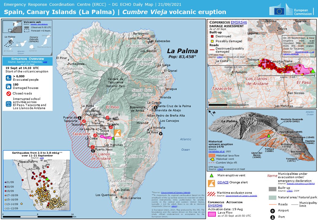 It also outlines how the crater played an important part in the management of La Palma’s water and its economy, as well as the key role it held in the conquest of the Canary Islands by the Spanish in the 15th Century.
  Whichever route you take, take suitable clothing and footwear, sun cream, food and cold drinks. Lomo de Los Caballos is located at the exit, where there is an information point and a parking area.
 The route will cross a series of ravines, with the first, known as Ciempiés, always full of water.
 Up until quite recently, the orchards found here were used to grow tobacco, with the outlines of the plots still visible today. The panoramic view of Los Agujeritos is particularly beautiful, with the jagged vertical rock faces standing out like teeth in the landscape.

 The higher reaches of the ravines are home to various springs and gallery forests at the sources of the park’s main water resources.
  Willow trees have fallen into decline due to the removal of water from rivers for water resources, lending this area a particular significance and providing an opportunity for the park to increase its extension
 Known as El Reventón, the descent is particularly uneven, starting with the river at over 100 metres above sea level. On our descent, we’ll spot Idafe Rock rising up where the ravines meet. This spectacular monolith is linked to the magical religious world of the benahoritas, the indigenous inhabitants of La Palma.
  A 10-minute ascent upstream leads us to the Cascada de Colores waterfall, a small natural drop to have been artificially enhanced, where the combination of the yellowish water and the surrounding mosses creates a true feast for the eyes.
  The construction uses an ingenious system to remove solids that slow the water flow, meaning it must be cleaned periodically.
  It is only in the more shallow areas of Las Angustias Ravine that such rocks are visible on La Palma, with the geological phenomenon only seen in one other part of the Canary Islands in Fuerteventura. The rocks stand out for their green colour and format in a series of small cavities, normally separated by a line of rock in a different colour
 Leftover food leads to a proliferation of rats and wild cats, which pose a serious threat to the fauna.
 No matter. The bus came eventually. And we found ourselves at the national park’s Visitor Center.
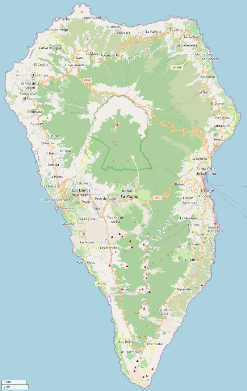


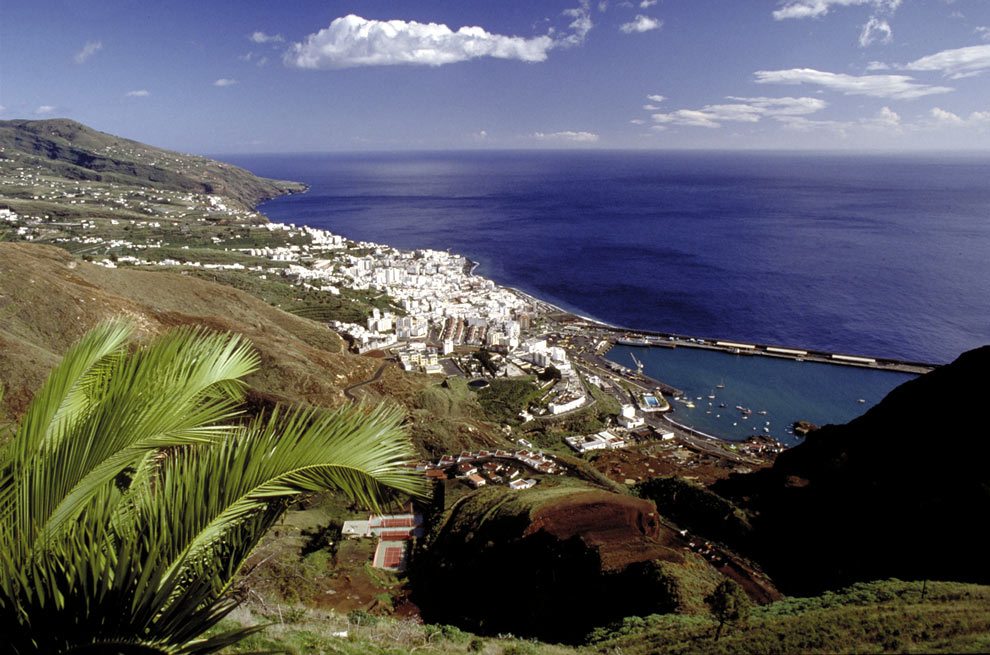 The bus stop is a couple of blocks from the cruise port by the BP station.
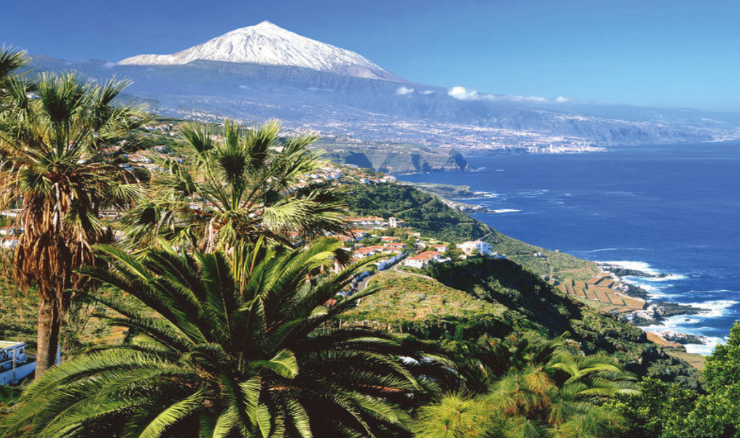 But we also enjoyed hiking in the Canary Islands on other stops on our cruise (at La Gomera and El Hierro).
 We suggest these comfy travel sandals for city walking, the beach and kicking about.
 Enjoy a bus transfer from several La Palma meeting points.
 Admire this park which encompasses a crater that is 8 kilometers in diameter and 1,800 meters deep. Pass through ravines and view the Waterfall of Colors.
 Transfer back to your meeting point on the bus.
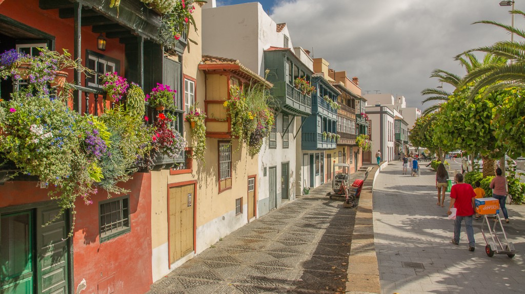 The distance was also far from expected. On the other hand, we stopped to eat in the sun, there being recommended places along the route. As a positive point, the guide explained and indicated very well.
 These strong differences are not only related to the altitudinal gradient. La Palma is strongly influenced by the trade winds blowing from the Northeast. This creates a climatic divide of the island. The windward side is generally more humid receiving the most precipitation and higher cloud cover, while the leeward side is dryer and has more insolation. La Palma is the most humid island of the Canarian archipelago.
 On the windward side a palaeo-endemic evergreen humid laurel forest and a slightly less humid tree heath-Morella faya forest exist at mid elevations in the zone of the trade wind clouds instead of the Canary Pine forest (del Arco-Aguilar et al. 2010, Garzón-Machado et al. 2013).
 Sophisticated remote sensing and modelling approaches are urgently required due to the extreme three-dimensional structure of the surface.
 Following species are remarkable and unique: Genista benehoavensis, Adenocarpus viscosus ssp. spartioides, Echium gentianioides, Echium wildpretii ssp. trichosyphon, Descurainia gilva, Arrhenatherum calderae, Viola palmensis. The rocky outcrops are occupied by a large set of island endemic species (e.g. Aeonium palmense, Aeonium nobile, Aenonium davidbramwellii, Senecio palmense, Tolpis calderae). In the shady and moist places relicts of the tertiary flora such as Woodwardia radicans are to be found. The forest ecosystems are strongly influenced by natural wildfires. Species such as Pinus canariensis or Cistus symphitifolius are perfectly adapted to these disturbances. However, Europeans have introduced non-native invasive herbivores (rabbits, goats, rats) that have caused severe damage to the sensitive vegetation since centuries. Here again, novel approaches for restoration and preservation are urgently needed.
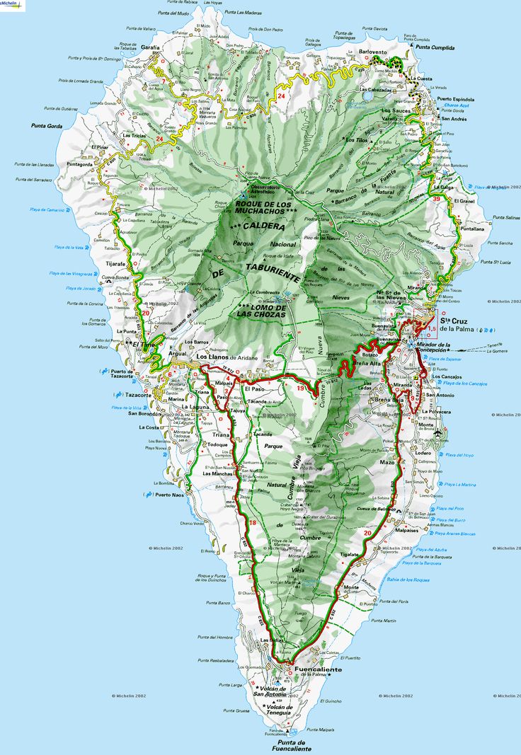 Furthermore, the extraction of water from this catchment for irrigation purposes, which is based on traditional regulations, is a challenge for nature conservation, but sound data on the impacts of this uses are missing.
 La Palma still hosts natural ecosystems and a large series of endemic species. In contrast to other European islands such as the Azores, invasion processes are still of low importance. However, the steep slopes and the moist climate make it impossible to access major parts of the island. Remote sensing approaches are urgently needed, here!
 73000°N / 17.87°W
 All the highest mountains of La Palma are located on the crest of the crater, easy to access from the outside but impossible to get at from inside the caldera. Here you can find vertical walls of up to 1500m height, notably the ones to the north-east of the crater. The Caldera is open on its southwestern side, where Rio de Taburiente, the only river on the Canarias, has carved out a deep gorge (Barranco de las Angustias) towards the sea. This gorge in itself is worth seeing since even here you can find those 100m walls.
 Ever since wind and rain have sculpted the rocks to leave truly impressive towers.
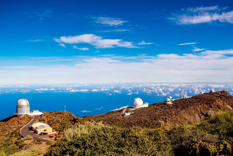 Many of them can easily be reached by a road which serves the (multiple) astrophysical observatories near Roque de los Muchachos. The highest summits are located to the northern and eastern sides of the caldera and all reach elevations of more than 2200m. The “Ruta de la Cresteria” does not lead across the summits so a little side stepping is always necessary. Starting from Puerto Tazarcorte you will see the following summits:
 2 Nov. 2004. “Astronaut Photography of Earth – Quick View.” (6 Apr. 2005).
 Take LP-2 towards Los Llanos, where you need to turn north-east into the Caldera. There are signs for Caldera de Taburiente.
 Take LP-2 towards Los Llanos, where you need to turn north-east into the Caldera. There are signs for Caldera de Taburiente.
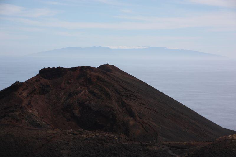
 In winter and spring you might encounter heavy rains which means landslides and a flooded Barranco de las Angustias. On the rim you often find snow and – believe it or not – crampons might be required, especially when the snow gets rained upon and ice layers form.
 Another option is to rent a finca (rural house) from the owners directly. You’ll have to google for these but sometimes prices are low enough for the scheme to be worthwhile.
 The western side of La Palma usually gets 28cm (19 inches) of rain per year!
  day temp.[°C / °F]
 I know there are editions in all European languages but I’m not aware of them. Any help is very welcome!
 All this is better to see with your own eyes. The Caldera de Taburiente National Park, located in the central part of Isla Bonita (Spanish for “beautiful island”, as Palma is called), is considered the main attraction here. On the island, which is considered a UNESCO Biosphere Reserve, nature has preserved its geological and biological richness and diversity.
  We are talking about a half-natural water rapid, hiding behind the turn of the hiking trail in the Las Angustias Gorge. A rock six meters high, along which water falls throughout the year, painted in various shades of green, yellow and orange, is located in one of the bends of the Rivanceros Gorge.
 426 meters), and numerous short routes PRLP-13, leading tourists among the gorges with streams and pine groves. The most popular is the route descending from Los Brecitos and passing through the winding gorge of Las Angustias.
  Nearby there is a campsite and a tourist center.

 In any case, don’t forget hiking clothing and footwear, sunscreen, and food and drink. At the exit, before returning to Los Llanos de Aridanes, you can have a bite of tapas and a refreshing drink at the Lomo de los Caballos lookout.
  The route crosses a series of ravines, the first of which, the Barranco del Ciempies (“Centipede Gorge”), is always filled with water.
  This is a real exhibition of rock flora climbing over rocks and sheer walls. Various representatives of the Crassulaceae family are found here, including those belonging to the genus Aeonium and Grenovia.
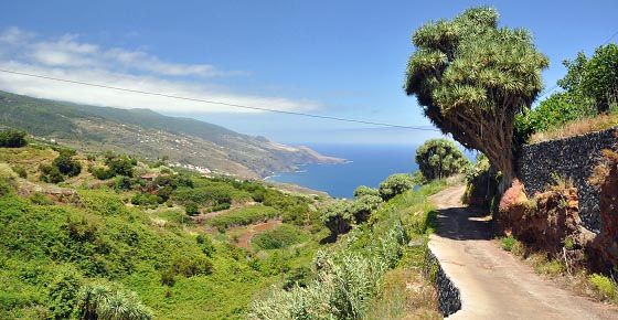

 Ten minutes from where the two rivers join is the Cascada de Colores (“Colored Waterfall”), a small natural cliff that is a beautiful sight thanks to the combination of yellow waters and moss.
 Belongs to Spain.
  Original exquisite jewelry made of pearls and mother-of-pearl will delight the fairer sex.
 .jpg) Cozy place is considered the heart of the capital of La Palma. The 16th-century town hall with Renaissance architecture is mesmerizing, and the stone fountain provides coolness in the summer heat.
Cozy place is considered the heart of the capital of La Palma. The 16th-century town hall with Renaissance architecture is mesmerizing, and the stone fountain provides coolness in the summer heat.  Ancient colonial buildings, multi-colored wooden balconies, picturesque ocean views, cheerful souvenir sellers – life on the waterfront is in full swing.
  Laurel and pine forests, ferns grow here. Thanks to the tour to La Palma, you will enjoy the local beauties.
  Such tickets are sold at local kiosks and shops.
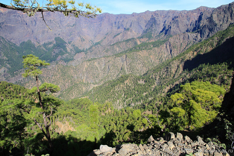 html
html  The Dutch Jost and Ben came to Palma this year for the fourth time. “We love it here. The sea, the weather is usually nice,” Yost laughs, pointing at the rain. They stayed at a hotel in Fuencaliente. After the eruption began, tourists were asked to leave, but the Dutch decided to stay. Yost’s girl is from Russia. He admitted that he did not tell her where he was at the moment. Only the parents know, who “are very worried and persuade them to leave.” “But I don’t think it’s dangerous here,” says the Dutchman. Thunder from the volcano is heard at intervals of several minutes, and fire and smoke rise above the mountain. A couple from Belgium Guy and Rebecca on Palma have been resting for three weeks and are going to leave, as planned, in early October. They rented a house and planned to go hiking here, “but now you can’t walk anywhere in the mountains.” Asked if they think it’s safe to stay on the island, Guy asks for advice: “Maybe it’s really better to leave?” Spouses from the Spanish city of Bilbao (Basque Country) Ichaso and Pedro arrived yesterday, although the eruption has been the main news in the country for several days.
 “We planned everything for a long time and decided not to cancel it. But as a result, our plans are changing. We wanted to walk the entire island, spend the night in a tent in the Caldera de Taburiente National Park. But we were just now told from the park that this is impossible,” – Spaniards are outraged. On the day of arrival, they still went to the mountains. A couple of kilometers from the volcano, they were stopped by the civil guard, who was surprised by the tourists in this area. On another observation deck, a young man is making sketches of a drawing. He just arrived from Tenerife, where he studies. “This is the first picture of a volcano in history,” he laughs. Sunday afternoon on the island of Palma (Canary Islands) began an eruption of the Cumbre Vieja volcanic ridge in the municipality of El Paso. Earlier, the National Geographic Institute of Spain recorded an increase in seismic activity on the island of Palma, more than 25 thousand earthquakes occurred in a week. More than six thousand people were evacuated, more than a hundred houses were damaged.
 xn--p1ai/ awards/
  After the eruption began, tourists were asked to leave, but the Dutch decided to stay.
  “We planned everything for a long time and decided not to cancel it. But as a result, our plans are changing. We wanted to walk the entire island, spend the night in a tent in the Caldera de Taburiente National Park. But we were just now told from the park that this is impossible,” – Spaniards are outraged.
  More than six thousand people were evacuated, more than a hundred houses were damaged.
  During the tour you will be able to see the mysterious petroglyphs – rock carvings of the ancient inhabitants of the island, similar to the writing of the prehistoric British and images in the Aztec style. How is this possible? You will learn about these and other secrets of the Canary Islands during your trip to La Palma. And the most attractive thing is that we will make an individual tour route for you, so that you see exactly what is interesting to you.
  The slopes of the mountains and volcanoes are covered with emerald vegetation, and the valleys amaze with magnificent flowering that lasts all year round. Thanks to the unique laurel forests preserved on the island, it has the status of a UNESCO biosphere reserve. This provides not only amazingly fresh air, but also an unusually clear sky: telescopes are installed throughout the island, and several international astronomical stations are located in the mountains.

 Here, on the rocks of the Barranco del Agua gorge, the oldest laurel forest of laurasilva grows, which once covered most of Europe. The last ice age wiped it off the face of the earth, leaving only small fragments in the Canary Islands. You can walk through the shady forest with giant ferns and moss-covered trees, as if immersed in a prehistoric era when dragons and dinosaurs ruled the world. By the way, during the tour you will find out how dragons and elephants are related to the dragon tree, and why its “blood” is considered sacred here.
 The cost is determined individually, depending on the season, the number of tourists and the class of the hotel on the island.
  Then it didn’t work out and as a result we visited Lanzarote, which we don’t regret a bit. But of course I wanted to see the greenest island of the Canaries.
  With hotels on the island, in principle, tension. There is only one large hotel, it proudly rises like a ship on the beach of Puerto Naos, the reviews on it are far from the best. The rest is practically only private hotels, which are actually village houses or part of them. This option of residence suited us, especially since we still took a car, without it you can’t go to the island at all – it’s pointless. As a result, we booked this hotel http://www.otzyv.ru/read.php?id=161254
  We returned to the hotel, met a German neighbor with her daughter. We talked, they were surprised that we were from Russia, and our tourists rarely seem to bring us here. We arrived for a month. Walking in the mountains, hiking. Having learned that we were starving, they brought us simple food and even beer. Many thanks to them, they are very sincere people.
  Humid, very green. And at the same time, excellent beaches, although we gave them only one day, but the impressions are very positive, as well as from the island as a whole. I emphasize once again: without a car, do not even think about it. Not driving – we cross out La Palma.
  Benefit near Puerto Naos
 Well, Mirador del Roque de los Muchahos is the northern edge of the crater.
  We drive in the morning, as I expect an ambush, which inevitably happens. The fact is that this entire crater of the volcano and the immediate surroundings are the territory of the national park Caldera de Taburiente
 m. to 2 p.m.), and permission could only be issued to us from 11:30 a.m., citing the fact that many cars had already arrived. The alternative was to walk. Yeah, something in the region of 7 kilometers in the heat, in the forest and uphill. Well, thank you. Waiting an hour and a half did not smile, so we took a permit for 13:00 and decided to rush to the very south of the island. The permit is a piece of paper with your last name (you must show at least a license), the date and window of your stay in the park (in our case, from 13 to 16 hours). I’ll upset those who suffer right away: you can’t get through without a permit, a barrier and an aunt.
  The views along the way are good, but dragged for more than an hour. You need to go to the very south of the island, focusing on the town of Fuencaliente
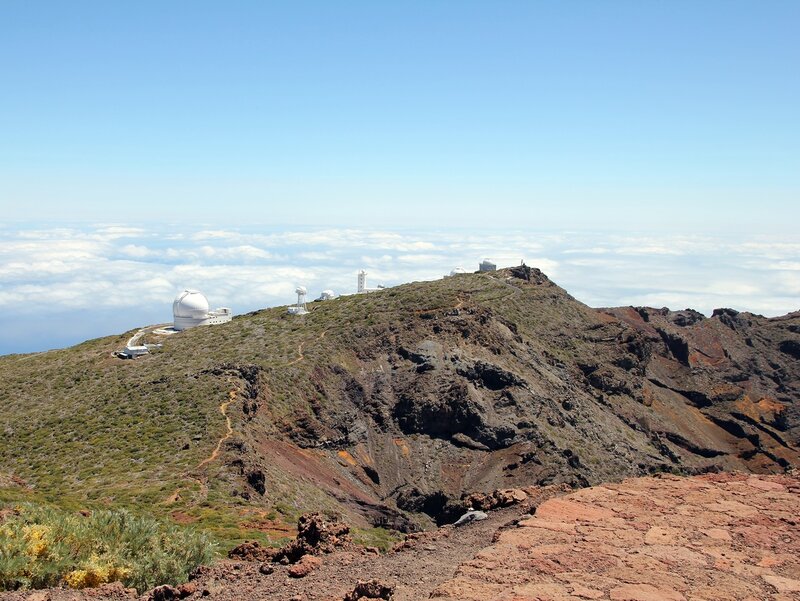 Judging by the signs, the route is only about 6 kilometers one way, and besides, the volcano is not high, so no special difficulties are expected. We did not have time, unfortunately, we walked among the salt courtyards and drove back. I also managed to lose my car key while walking (!) and we spent half an hour looking for it.


 But the trouble is that we did not know at all in which direction and how much to go. The tour office told us that the route to mirador 9 was open0944 Espigon Atravesado
 It turns out they were part of some kind of cruise tour in St. Petersburg, delighted with our city. Happens.
  In addition to the “classic” ones, offering an ordinary beach holiday, there are specialized ones: Playa Nueva suitable for surfing and nudist Las Monjas.

 Its hard-to-reach, rocky shores were a good natural defense against attacks from the sea, so both of them dreamed of gaining a foothold on this island.
  There is everything here: from beach cabanas and sun loungers with umbrellas, to stations where you can rent any equipment for outdoor activities, whether it’s fishing, diving or surfing.
  It has its own microclimate – even in rainy weather throughout the island, it is almost always sunny here. The town is surrounded by huge volcanic rocks and this creates the conditions for constant rising currents of warm air. Ideal for paragliding.
 To view this majestic monument of natural activity, various tourist routes and viewing platforms are provided.
  Amazing facades of buildings look into the ocean waters, striking the traveler’s imagination.
  The island offers countless forest and mountain routes – from one-day to multi-day trips with overnight stays in tents in the forest. Most of the museum-reserves and viewing platforms are also located under the open sky, so La Palma is considered an island for outdoor activities.
  Be prepared for the fact that La Palma is more of a mountainous area with steep serpentine roads. To rent a car, you will need to provide a driver’s license, a voucher and a Visa, AMEX, Mastercard credit card. To drive a car and to rent it abroad, you must have an international driver’s license, which you can issue at the MREO STSI.
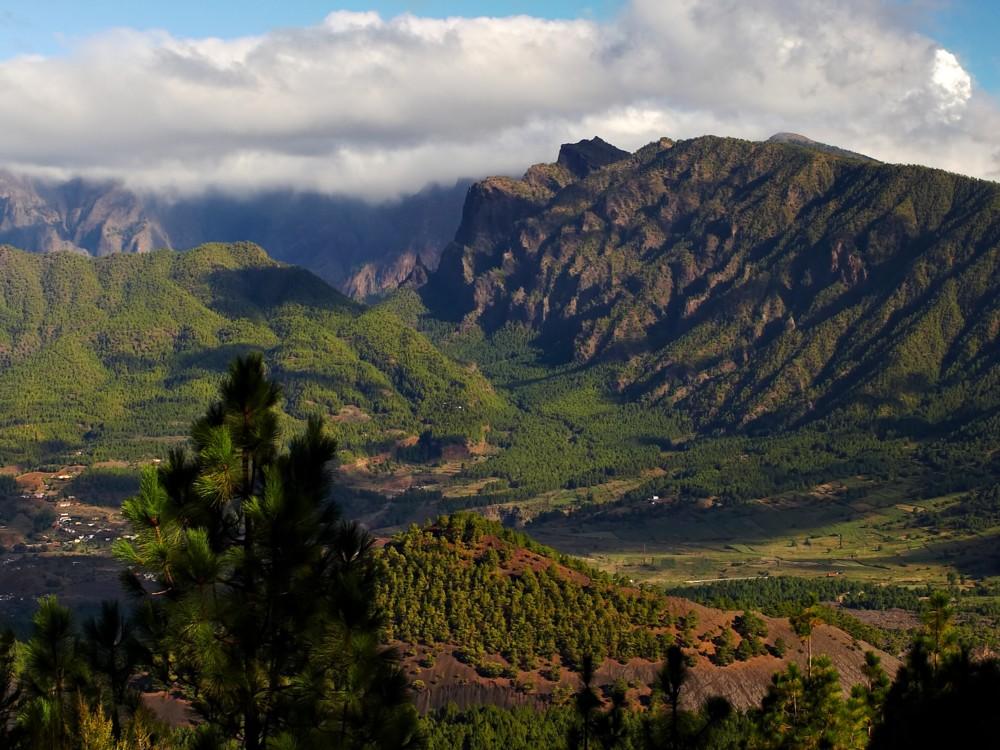 And we anticipate the first question upon arrival.
  So you warn about the stop following you. On a mountain road with poor visibility before turning – horn;
  The cost is from €300.
  And at night along the coast, dozens of fishermen in boats wait for their catch. The light of the lamps, reflected in the dark water, and the male singing are mesmerizing! The table below shows a few more notable beaches.
  Extensive forests and mountains make the island ideal for hiking.
 The fact is that this product is the most cultivated and exported
  Therefore, you will have to get to Palma “the old fashioned way”, with transfers.
 By the way, Palm Island is considered one of the most ideal places for free flights;
 There is lots of good walking on the island, most famously the Samaria Gorge, and it’s worth renting a car to explore some of the island (it’s big, so don’t be too ambitious). The food is excellent and the people are friendly. If you get a chance to visit during Orthodox Easter, that can be very exciting. April is a perfect time to see the wildflowers: check out this group walking holiday in Western Crete. See more about the hottest Greek islands in April.
 See the hottest places to stay in Turkey in April.
 But it’s also among the most beautiful cities in Europe, and it’s the home of tapas and flamenco. The Moorish Real Alcazar, and the giant cathedral, are not to be missed. April is a busy time in Seville. People come from across Andalucia to take part in the Feria (April Fair) and you may in town for Semana Santa, the raucous and beautiful week leading up to Easter. See the best hotels in Seville and more of the hottest places in Spain in April.
 If you really want to escape the crowds, fly to tiny La Palma. Find the hottest Canary Islands in April.
 You’ll appreciate this while lining up outside to get into La Sagrada Familia and navigating the colourful chaos of La Rambla.


 The flower is an iconic
 With over seven million tulips, hyacinths, daffodils and more, the garden is at its blooming best in April. In fact, it’s only open from mid-March to mid-May and each year a different theme marks the season. Not surprisingly, the park attracts over a million visitors each season, so it’s best to arrive early and avoid the weekends.
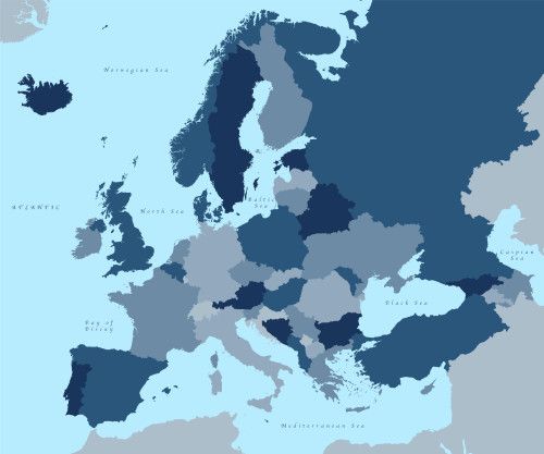


 And, while this can make for a great holiday, it can also make for a more expensive one. The summer is the busiest time of year for Europe, especially over the school holidays.
 Cyprus
 The rocky cliffs of Playa del Cura, for example, are perfect for hiking, offering stunning sea views and hidden coves.
  The British overseas territory reaches highs of 18 degrees in March, with an average of 6 hours of daily sunshine.

 Some of the top activities for the Azores in March include whale watching, hiking, island hopping and more.
 Athens
 However, it is Puente Neuvo gorge in Ronda that is the beautiful photo stop. And the views from this beautiful bridge are spectacular! Then there are the Arabic Baths and Mondragon Palace; both built in the 13th Century.
 Covering almost 80 acres, around seven million bulbs are planted in Keukenhof every year. They’re planted in stages, meaning the flowers bloom over the course of about eight weeks between Mid-March and Mid-May.
 Algarve
 Wisteria falls over the tops of these walls, offering beautiful colours and wonderful scents.
 Try to find Inspector Montalbano at UNESCO-listed Ragusa or try climbing the active Etna volcano, but this will still be a much colder activity.
 Set above the city is the Botanical Gardens. As it’s quite a hike, it’s a good idea to take the cable car up to the Gardens. The adventurous can then take a toboggan ride down (where speeds can reach 40 miles an hour).
  com
com
 This makes May a great time to visit some of Europe’s most popular destinations.
 Staying in the countryside gîte with self-catering facilities is a great idea. But if you’re visiting the Dordogne with kids, you may want to look at one of the camping and holiday parks in the region as they will have a pool and playground.
  Zakynthos
 Rome
Rome
 Peter’s Basilica, the Sistine Chapel and the rest of the Vatican Museums.
  If you are more into films there is also the Viva
 In the summer the region becomes very busy with endless crowds heading to the French Riviera for sightseeing and sunbathing. May is the perfect time to visit, with temperatures of 16 degrees, the climate is pleasant without being too hot to explore.
 These include Belfort, an 83-foot tower, and the mediaeval Gate of Ghent.
  You’ll be avoiding both the scorching summer temperatures and the crowds and can explore what the island has to offer without the tourist influx.
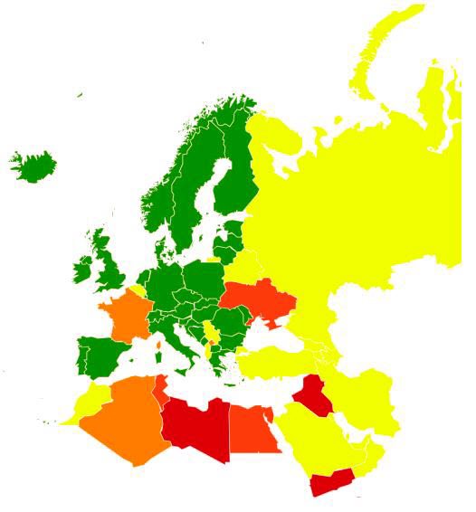

 7 °C)
7 °C)
 The weather in April continues this trend. April sees the last of the slightly cooler and more comfortable temperatures in comparison with the following summer months with average maximums of 28.1 ºC. The sun shines for around 10 hours daily, making days hot and sunny with minimal cloud cover. Average total rainfall for the month is around 5 mm.
 Throughout the month you can expect around 8 hours of daily sunshine alongside only 31 mm of average rainfall. Rainfall is relatively low this month but falls as short storms.

 Sea temperatures, on the other hand, are cooler at this time of year at 17 ºC.
 Malta
Malta The Algarve
 Tenerife
 Its sunny climate throughout the year makes it one of the best destinations for a sunny
 Come and discover one of the most beautiful islands in Europe and one of the best destinations in Europe to
 The island
 Lanzarote has a favourable microclimate and more than 2500 hours of
 Malaga


 Everyone else, however, should visit in April. That applies to travellers keen on day trips to the spectacular Hoover Dam, or on helicopter rides over the Grand Canyon. It applies to anyone driving on to Los Angeles via the Mojave Desert, as well as those bound for Death Valley National Park’s scorched salt flats. And it certainly applies to part-time hedonists as keen on wandering the Strip to see a mock Eiffel Tower and a lava-spewing volcano as playing some poker or roulette. Why? Because April in Las Vegas is like a fine British summer day — wonderfully warm and sunny.
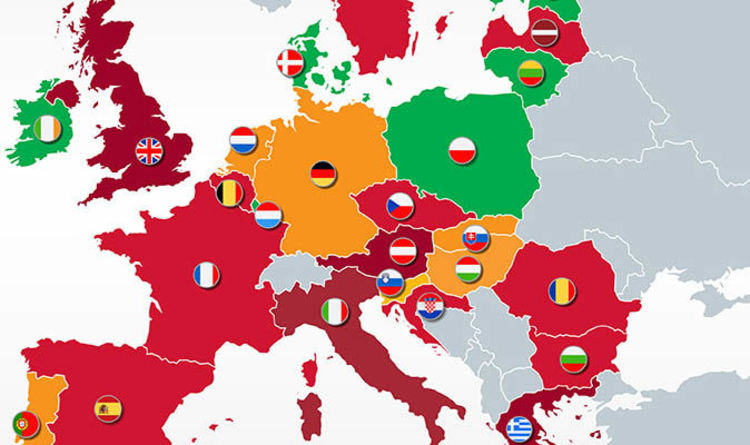 Lounge on the many sandy beaches during sunny days and, if it happens to rain, learn about Christopher Columbus in capital Las Palmas’s handsome Casa de Colón museum. Mild April, before truly sweltering temperatures take hold, is the time to visit for hikes through Gran Canaria’s leafy north.
 Deservedly earning top billing are the remote Kimberley region’s immense gorges, crocodile-filled Fitzroy River and 41,000-year-old rock art. Ningaloo Reef’s colourful corals and the Swan Valley’s acclaimed wineries are no less satisfying to experience.
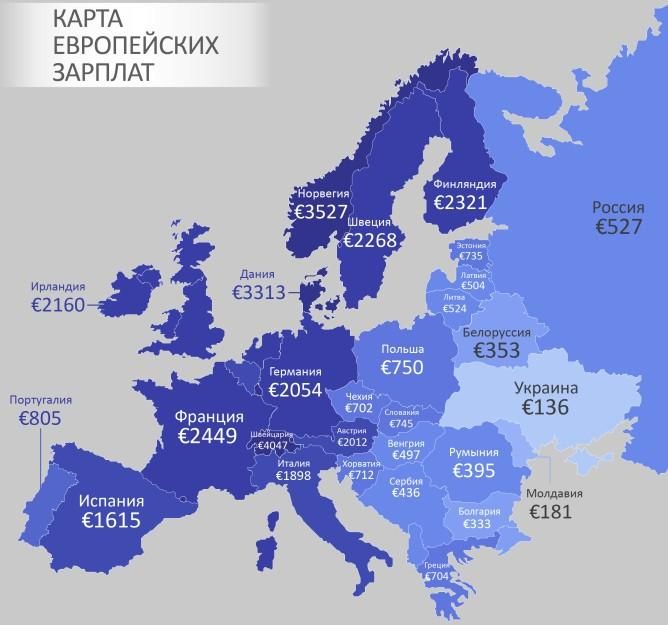
 Cyprus
 Despite being an American territory, that’s not an issue in the quieter US Virgin Islands. About 40 miles south of its counterparts, St Croix is the biggest isle, yet blessed with more of a local, lived-in vibe. Cruise ships aren’t common, leaving fern-swathed mountains, an extensive botanical garden, two 18th-century forts and lush white-sand coves all pleasingly untouristy. Perhaps the biggest draws are superb snorkelling and scuba-diving, with walls and wrecks aplenty on the north coast. Late April usually heralds Taste of St Croix, a short festival in main town Christiansted that celebrates local Crucian dishes and entices big-name cooks.
 It’s a religious holiday across the capital too, with street parties and stages everywhere. Westerners tend to congregate, as ever, along the temporarily pedestrianised Khao San Road. To get doused by balloon-throwing locals, make for Silom. Once you’ve dried off and seen enough of Bangkok, consider decamping to one of Thailand’s paradise islands. All promise decadent heat, but Koh Samui and Koh Phangan should be among the most pleasant.
 To the west, pricey nightclubs and pricier yachts dot Marbella’s exclusive Golden Mile, and most resort hotels include spas where one can wallow or massage away winter’s worries.
 Aided by an average of seven hours of sunshine each day, wherever you go it’s likely to be hot in April.
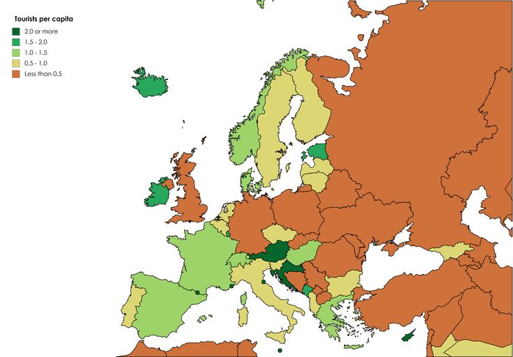 Firstly, the month is ideal for city walks and sightseeing trips. Secondly, the cost of living at this time is much lower than the summer price tags. The relevance of the topic persuaded us to compile our own selection of options for where to go to Europe in April. When compiling the list, we took into account weather conditions, the cost of accommodation and meals. We did not take into account flight prices, since their values depend on many factors, such as the point of departure, the time the ticket was booked, the availability of discounts, etc.
  In general, any city located in the south of the country is suitable for a spring trip, since the weather conditions will be quite comfortable. But we will focus our attention on Barcelona, the capital of autonomous Catalonia.
  A magnificent celebration of Easter with a solemn procession through the streets.
 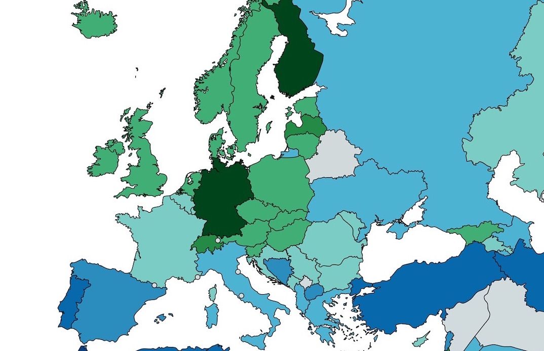 Bright processions and carnival processions are guaranteed.
  Not only Rome, but also any other city in the country is suitable for a vacation, as the weather is comfortable everywhere. But we will stop in the capital and see how the rest is here in April.
  Just for the sake of this event, it is already worth arranging a vacation in Europe in April.
  St. Vito’s Cathedral, the Dancing House, Prague Castle, Charles Bridge, the Powder Tower are just some of the iconic locations that are incredibly popular with travelers.
  1°C
1°C  It is important to know that on April 18, Greece celebrates International Museum Day, and in honor of the holiday, many attractions do not require an entrance fee.
 The event is attended by over two hundred wine producers, who offer everyone to taste their products.
 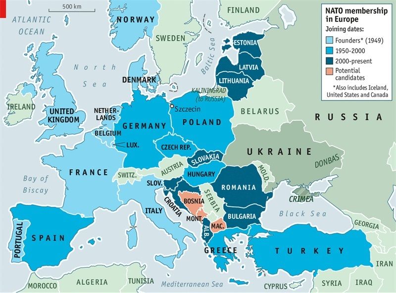 com
com Well, if you decide to relax one hundred percent, definitely go to the Lovrijenac fortress and the miniature island of Lokrum.
 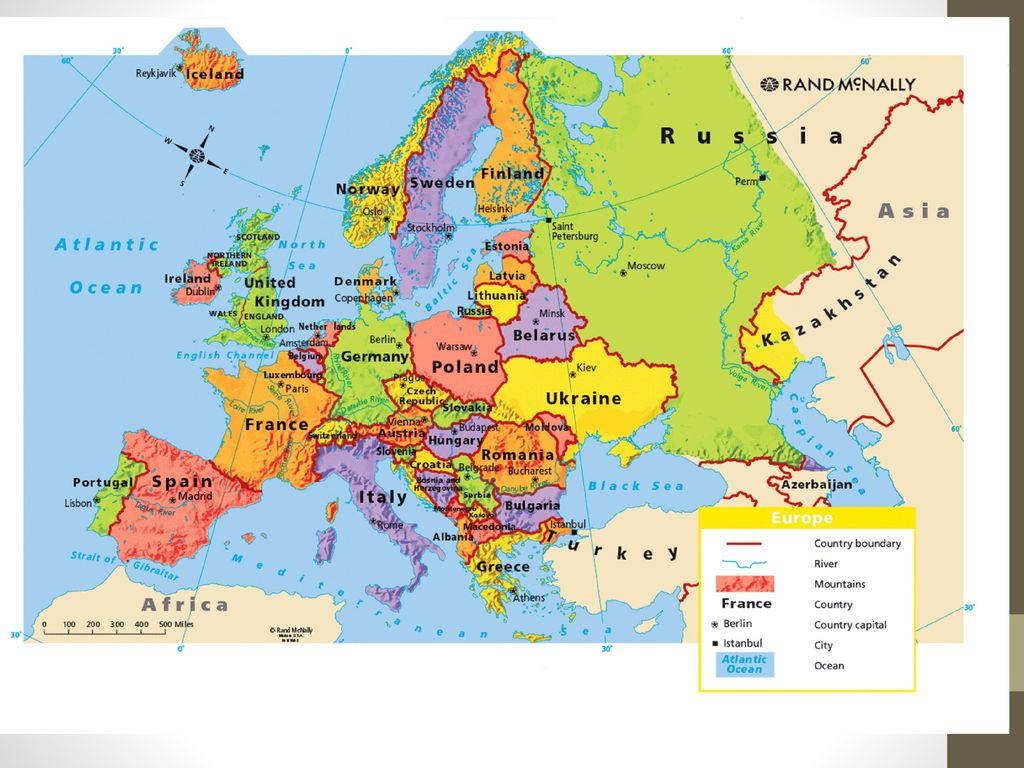 Appreciate the grace of St. Stephen’s Basilica and the grandeur of the Hungarian Parliament, enjoy the breathtaking city landscapes that open from the Fisherman’s Bastion. And to improve your body, visit the famous Gellert healing baths. Also in April it will be very important to visit the capital’s zoo.
  During this period, the weather simply favors an active sightseeing vacation. At the same time, the prices for accommodation in the Portuguese capital will please even travelers with a modest budget.
 Fakirs, snake charmers, jugglers and fire swallowers – there are so many exotic things here that there will be enough for more than one day of exciting walks. Marrakech is two-faced and unpredictable – narrow, winding and often very dirty streets can lead to a real miracle. These are the amazingly beautiful Ben Yusuf Madrasah (Medersa Ben Youssef), the luxurious Bahia Palace (Palais Al Bahja), the mausoleum of Sidi Abu al-Abbas (Mosque of Abu Abbas) and the tombs of the Saadian dynasty (Saadian Tombs) with their stunning Hall of Twelve Columns.
  The second half of April is the most noisy and fun time. Mid-spring marks the end of the winter season with music and parties everywhere, culminating in the election of the season’s king and queen.
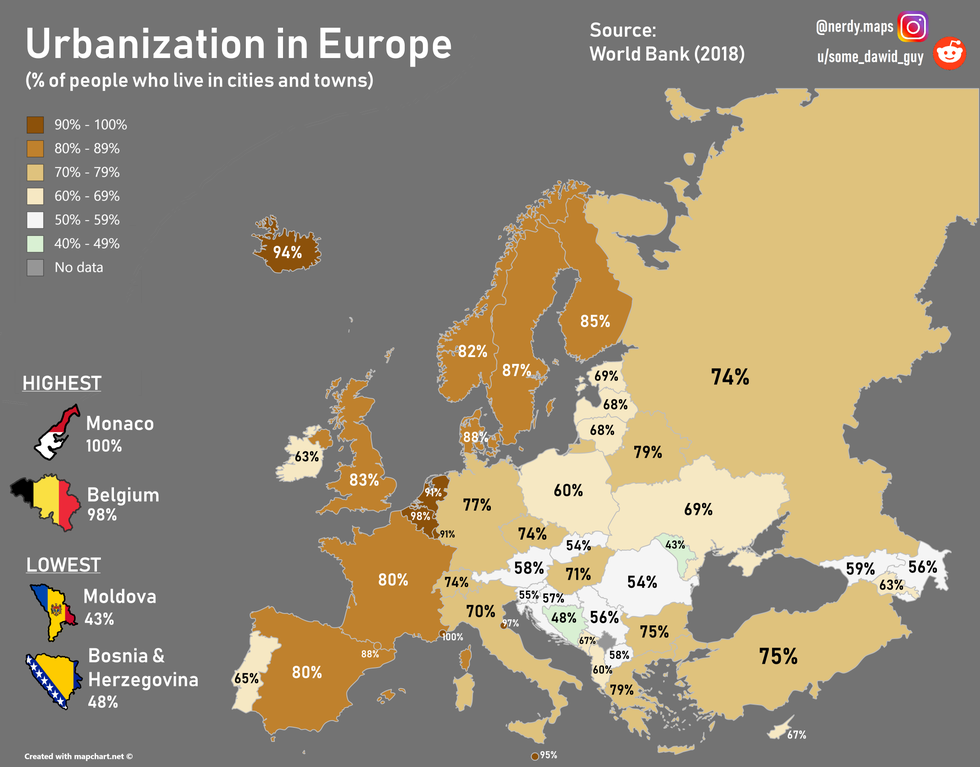
 He gained international fame with the Coachella Valley Music and Arts Festival in April. This event was held for the first time at 7 p.m.99 and immediately became the largest, most famous and profitable of all such events. It is mainly devoted to music of various genres, but at the same time, numerous art and sculpture exhibitions are held in the city.
 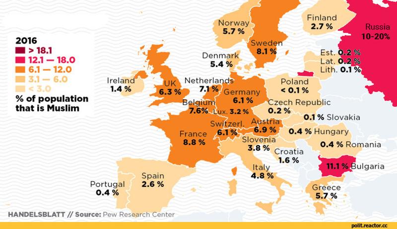 But you can already dive and ride a board – in the northern part of the island there are many beaches with suitable waves. Vacationers with children will love Loro Park in the suburbs of Puerto de la Cruz, which has long become one of the main attractions of the island.
  You can freely wander through the narrow streets of Ribeira, almost deserted in spring, and visit the Livraria Lello bookstore without any queues. Not only is it considered the most beautiful in the world, but it is also very popular among fans of the Harry Potter series – its interiors inspired J.K. Rowling to write the first book about a young wizard. And when you get tired of walking around the city, you can go on a cruise on the Douro River for a few days. In April, the landscapes of Portugal are breathtakingly beautiful, and during the excursions there will be a chance to walk through the ancient villages and taste the amazing port wine in the wine center.
  Winter has just ended, and I would like to return to summer soon. The month is marked by moderate comfortable warmth, the absence of crowds of tourists and the picturesque flowering of nature. Fortunately, there are beautiful countries on earth that are ready to meet you at this time of the year with warm rays, as well as azure seas and oceans. Let’s tell you which resorts you can have a chic vacation at sea in April.
  In April, the climate here is the mildest and most comfortable for tourists. The temperature of water and air is practically the same, it warms up to about + 25- + 30 degrees. For lovers of cultural recreation, exhibitions, festivals, fairs are open.
 All 115 islands of the magnificent Seychelles are supremely beautiful. They create a real tropical eden. Surprise deserves not only mountain forests, which are home to unique flora and fauna, but also the cleanest sandy beaches that frame amazing granite rocks, where there is a feeling of heaven on earth. Quiet tropical beauty is broken only by the sound of the ocean.
 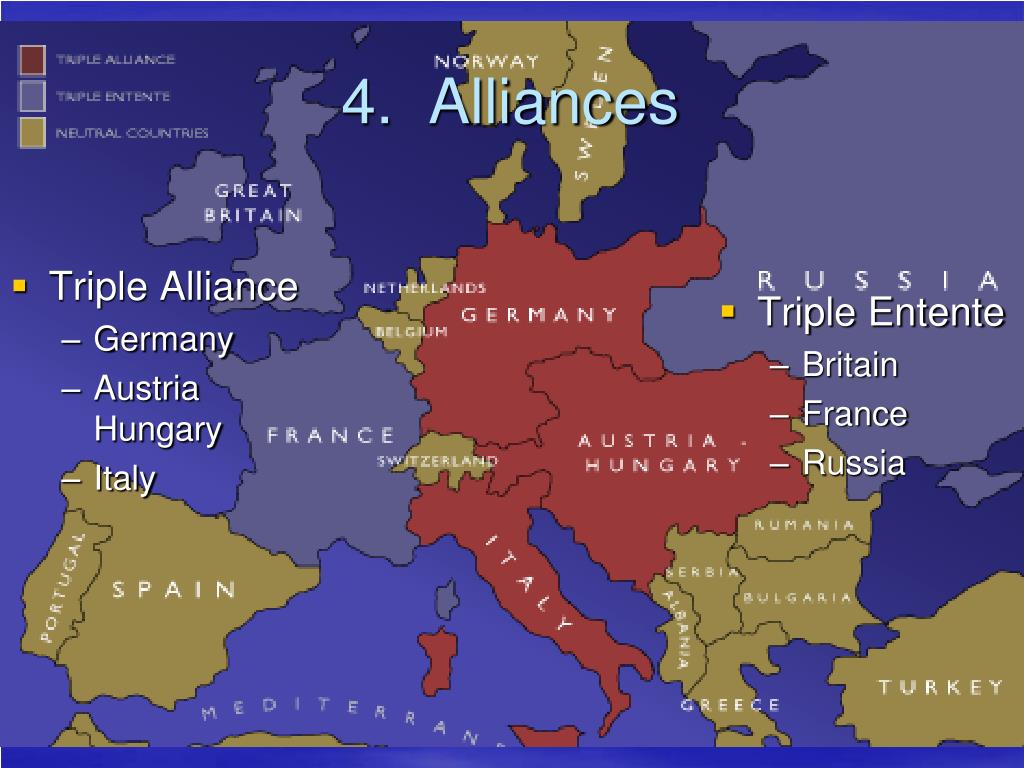 Mexico has something to offer even the most whimsical resort guests: a unique landscape, traces of the ancient Mayan and Aztec civilizations, the colonial past of Mexico and much more.
  and evaluate.
  Sapphire waters, golden beaches and emerald forests.
 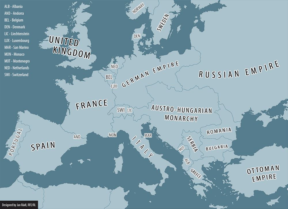 Just do not look for mountains here, they are not here. The islands are quite small, so it is very convenient to travel around them by bike. Wherever you go, the ocean will meet you everywhere.
 Sightseeing tours to the oldest cities of Morocco – Casablanca, Marrakech, Essaouira – will fill the rest with bright colors, allowing guests of the country to immerse themselves in the original flavor of the historical centers of ancient Morocco. Fans of surfing, parasailing, windsurfing and similar water sports can also safely choose April as their time to visit Morocco.
  Phu Quoc is one of the most beautiful islands in Vietnam, famous for its gorgeous beaches, tropical forests, coconut trees and waterfalls, and also suffers from influx of tourists who want to plunge into the warm sea and the virgin beauty of the local nature. The water is on average warmed up to +22 degrees.
  The center of sightseeing tours often becomes the capital of the Dominican Republic – Santo Domingo with its luxurious architecture, preserved since the founding of the city here by Christopher Columbus. The center of family vacations is shifting to Punta Cuna with its five-star hotels and well-groomed beaches. Diving, windsurfing and other water sports are becoming especially popular in the Boca Chica lagoon, which is reliably protected by a coral reef.
  Many islands of the archipelago are worth visiting, but the so-called miniature continents – Gran Canaria, La Palma and Tenerife, are especially popular, where surfers and yachtsmen often go.
 April is considered to be a favorable month for visiting the country of pharaohs and majestic pyramids. In the middle of spring, moderate heat comes without the exhausting stuffiness inherent in the high summer season. The temperature of water and air does not fall below +25 degrees.
  April is the start of the wet season. Resorts are systematically immersed in the power of downpours and winds.
 Lush tropical vegetation, serene sandy beaches, mountain ranges with lush forests, boundless plains, extinct volcanoes, waterfalls and lakes form an unforgettable colorful picture.
 Nature gave the island of Hainan a unique beauty. You will see fabulous landscapes and unique tropical forests.
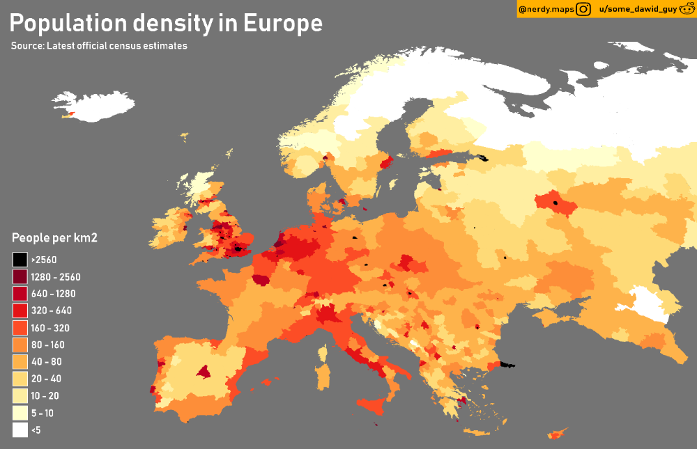
 The state has its own outlet to the Atlantic Ocean, which attracts many tourists. The weather will pamper vacationers with sunny warmth. The thermometer bars show more than +28°С.
  There is no need to talk about the beach season yet – the azure waters of the Black Sea are warming up slowly. Many hotels have heated outdoor pools.
  But how will air currents develop in the troposphere, what processes will prevail – western or eastern? – the situation changes from year to year, and even during one winter, changes in the forms of atmospheric circulation can occur. When Eastern processes prevail, the “Russian winter” comes to Europe. But even in warm winters, the invasion of the cold of the north for Europe can turn into serious difficulties. The peculiarity of the geographical position of Europe is such that periods of comfortable mild weather can be abruptly replaced by bad weather, entailing significant problems and damage for Europeans, especially in winter.
  However, already in February, heat was retained only in the south of Europe (anomaly 2°C), and cold came to the north (anomalies -2 … -3°C), in March the anomalies increased to -4 … -5°C. Cold prevailed throughout Western Europe in April as well. Even in the north of Italy, in Austria and southern Germany frosts were repeatedly noted.

 It began with severe January cold weather in almost all of Europe. In the UK, the thermometer dropped to such unusually low levels that it gave rise to the local media to call the current situation “Siberian frosts”. The weather was very cold in Poland and the Baltic countries. In Turkey and Romania, people died from frost, and even in the vicinity of Madrid, a temperature of -20 ° was recorded. The cold was accompanied by intense precipitation almost throughout the entire territory, except for Scandinavia, the Baltic states and part of the Iberian Peninsula. Hurricanes with showers hit the UK, France, Denmark, the Benelux countries; floods began in Paris, Baden-Baden and Bavaria. Romania and Bulgaria have experienced their heaviest snowfalls in 40 years. Due to a snow storm, traffic through the Bosphorus was closed. In Romania, Bulgaria, Greece, Turkey, Ukraine, Israel, 2-3 monthly rainfall fell. In February, the elements continued to rage: heavy snowfalls paralyzed Greece, northern Italy and the Crimea; snowfalls, downpours and floods were noted in England and Wales.
 In Bulgaria, the air temperature dropped to -34º, which has not happened here for more than 50 years. Frosts paralyzed the activities of public utilities in Bosnia. Hospitals, schools and other children’s institutions were closed. In Greece, the thermometer dropped below -20º. Many lakes have frozen over, something that has never happened here. In France, extremely low temperatures in February led to an overall coldest winter in 33 years, although there were no severe colds in December and January. In early February, heavy snowfalls hit Austria, Germany, Bulgaria, Greece, and Albania. Snow drifts repeatedly paralyzed traffic on the roads. In many European countries, the monthly norms of precipitation were exceeded by 2-2.5 times.
  In Rome, on the night of March 1st to 2nd, the lowest air temperature over the past 100 years was recorded, and in the mountainous regions of Italy, where the air temperature dropped to -32º – over the past 200 years. All temperature records were broken in sunny Spain: frosts hit 25º in the province of Navarre. At the other end of Europe: in the Czech Republic, Slovenia, Slovakia – the cold in March reached 30º. If in the second half of the month spring did come to the west of Europe, then in Eastern Europe the cold remained until the end of the month.
 In Georgia, the air temperature dropped to -30°; in the east of Ukraine – up to -40 ° (there have not been such frosts here for more than 100 years). Thirty-degree frosts came to Poland. Deaths from hypothermia have been registered in Ukraine, Romania, Poland, the Czech Republic, Bulgaria, and Greece. In Poland alone, 140 people died from the cold.
  .. In Kosovo, heavy rains and melting snow led to flooding at the end of February.
  The average air temperature for the month was 0.7° higher than the previous maximum set in 1936. Even in the first ten days of the month on the French Riviera, the air temperature was 19°. The swimming season has reopened, the cherry blossoms have blossomed. In France, the record for the maximum air temperature for this month, set in 1922, was broken. However, in the third decade, nature began to repay its debts to Europe for cold and snow.
  And in the south of Europe, precipitation was still not observed. On about. Crete had not seen them for three months in a row. Olive trees are under threat. Although the last month of winter saw sufficient precipitation in most of Europe, however, in the Alpine countries, in southeastern Europe, in Turkey, Finland and in southern Sweden, they were still noticeably less than the norm. For the ski resorts of France, Switzerland, Austria, this was a disaster. In fact, the winter holiday season is broken here. But on the 7th and 8th of February, the south of Great Britain was hit by a snowfall, recognized by British meteorologists as the heaviest not only for the whole winter, but also for the last few years. It resulted in airport closures, commuter rail shutdowns that caused havoc during peak hours, and miles of traffic jams on freeways. The damage from this natural disaster is estimated at &400 million. turned out to be the warmest in Europe since 1892 g, and the same as in the ETR, mainly due to anomalously warm December and January.
 In a number of countries, new records of daily air temperature have been set. February 2008 is the fourth warmest in Europe with 1891 year. The second warmest was the winter. Its average temperature is 0.4° less than in the previous winter of 2006/2007, which is recognized as the warmest in the history of the continent. Now the winter of 2007/2008 is recognized as the warmest one. in Scandinavia. Few precipitations were observed in February. Only Finland, Sweden and Norway could boast of their abundance. Here, the amount of precipitation that fell during the month was mainly the norm, and in some places even slightly more. At times, wet and heavy snow fell in Greece and Turkey.
 .png) Coastal sea ice appeared off the coast of England and Wales, extending up to 800 meters into the open sea. This has not been seen here for 18 years. In the Dutch port of Rotterdam, icebreakers had to be used to escort ships, which last happened 13 years ago. Then, however, the air temperature in Western and Central Europe returned to its usual values. However, the cold beginning of the month was enough for the monthly average temperature to drop below normal. In Belgium, Holland, northern France and Germany, it was 2° or more colder than usual. In Brussels, the anomaly is -2.0°, in Paris and Berlin – -2.2°, in Nuremberg – -2.8°.
Coastal sea ice appeared off the coast of England and Wales, extending up to 800 meters into the open sea. This has not been seen here for 18 years. In the Dutch port of Rotterdam, icebreakers had to be used to escort ships, which last happened 13 years ago. Then, however, the air temperature in Western and Central Europe returned to its usual values. However, the cold beginning of the month was enough for the monthly average temperature to drop below normal. In Belgium, Holland, northern France and Germany, it was 2° or more colder than usual. In Brussels, the anomaly is -2.0°, in Paris and Berlin – -2.2°, in Nuremberg – -2.8°.  5-2.0 times. Both at the beginning and at the end of the month, snowstorms hit France, northern Spain and Italy. The wind speed exceeded 50m/s and in some places snowdrifts reached a height of two meters, which led to the closure of airports and the cessation of traffic on the roads. France has not seen such snowfalls for more than 20 years. At the Milan Zoo, the animals were reportedly fed warm oatmeal and croissants, as normal food was quickly covered in snow and froze. In Southern Europe, precipitation in general for the month was more than the norm, approximately 1.5-2.0 times, and in Central and Northern Europe it was about the norm or less.
 In Stockholm, the average temperature anomaly was -5°, Berlin – -4.8°, Warsaw – -4.9°, Prague – -2.6°. Frosts raged from England to the Baltic states and Ukraine. Off the coast of Germany, for the first time in the last 25 years, icebreakers were used to guide ships to the port. coastal ice thickness exceeded 30 cm. Europeans have not seen such cold weather since 1987 True, those frosts were even more severe. For the first time in all these years, the temperature in January was below normal.
  In Montenegro and Albania, heavy rains have led to the highest rise in water levels in the border lake Skadar in 50 years. The amount of precipitation for the month exceeded the norm in some places by 2-4 times. And only in Northern Europe it was dry.
  Less than the norm was observed only in certain areas of Scandinavia and Germany, and in the rest of the territory – the norm and more. Moreover, in many countries: Portugal, Spain, France, Italy, the countries of the Balkan Peninsula, Belarus, Ukraine – they exceeded the norm by 2-4 times. For the first time in a quarter of a century, snow fell on the streets of Rome.
 7º in Copenhagen, -4.6º in Warsaw and Vilnius, -4.6º in Helsinki and Riga – -4.3º, Brussels – -4.1º, Paris – -3.7º, Vienna – -3.4º, Kyiv – -2.0º. In many countries of the continent, new minimums of daily temperatures have been set. Dozens of people became victims of cold weather in Poland, Germany, Austria, Great Britain.
  Tens of thousands of passengers are stranded in airports, trains and on the autobahns. Scotland hit by heaviest snowfall since 1963g. Snow fell on the island of Capri for the first time in history. Almost everywhere in Europe, the amount of precipitation for the month blocked the norm by 1.5-3.0 times.
  In February, temperature conditions were close to normal in most of Europe. However, in the east and northeast of the continent (Ukraine, Belarus, the Baltic countries, Sweden, Finland, Poland, Slovakia, Hungary, Slovenia, Croatia, Romania, Moldova) it was noticeably colder than usual (anomalies -2 … -3º, and in Finland up to -5…-6º). New records for the minimum daily air temperature were also observed here. Fast ice has formed along the coast of Ukraine in the Black and Azov Seas. This phenomenon is quite rare. So, in Odessa it was last observed 30 years ago.
  A multivitamin, reasonable exercise, or, more pleasantly, a family trip can fix this.
  In the middle of spring, it is comfortable not only in distant exotic countries:
 1 °С
1 °С  6°C
6°C  Confident warmth returns to Egypt, the UAE, Israel – a short flight separates you from the beaches and the hot sun. But the resorts of Southeast Asia and the Caribbean are not going to give up.
  It is important to note that not all first-line hotels are located on the sea coast. El Gouna is divided by channels into small islands, many hotels equip beaches on the banks of the channels. It happens that a free transfer is organized to the sea for guests.

 But the air temperature at the same time is + 25-30 ° C, so you can have a good time on the beach and even swim – many notice that the sea is getting warmer by the middle of the day.

 True, the sky is often covered with clouds, but this does not prevent you from getting a good tan and swimming in the South China Sea, which is warmed up to + 25-28 ° С.
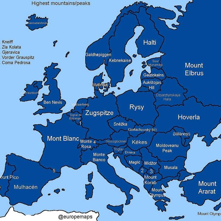
 But it is precisely because of the largest coral reef in the Caribbean that divers come here.

 How picturesque the Caribbean coast of Mexico is in general can be seen if you go on a sea excursion to Cancun.
 But game rooms and swimming pools can only be found in hotels.
  At the same time, the daytime air temperature rises to + 10 ° C, the sun often shines, so you can spend a lot of time on the slopes.
/granite-web-prod/47/d1/47d18878aa5f4ddfb866a4b3974d4ba0.jpeg)

 On a warm day, you can add a visit to the botanical garden, the zoo and the city park “Tivoli” with playgrounds.
 It is also worth visiting the best aquarium in Greece Cretaquarium.
 Here they show special effects and stunt tricks, they invite you to work on the creation of films and cartoons.
 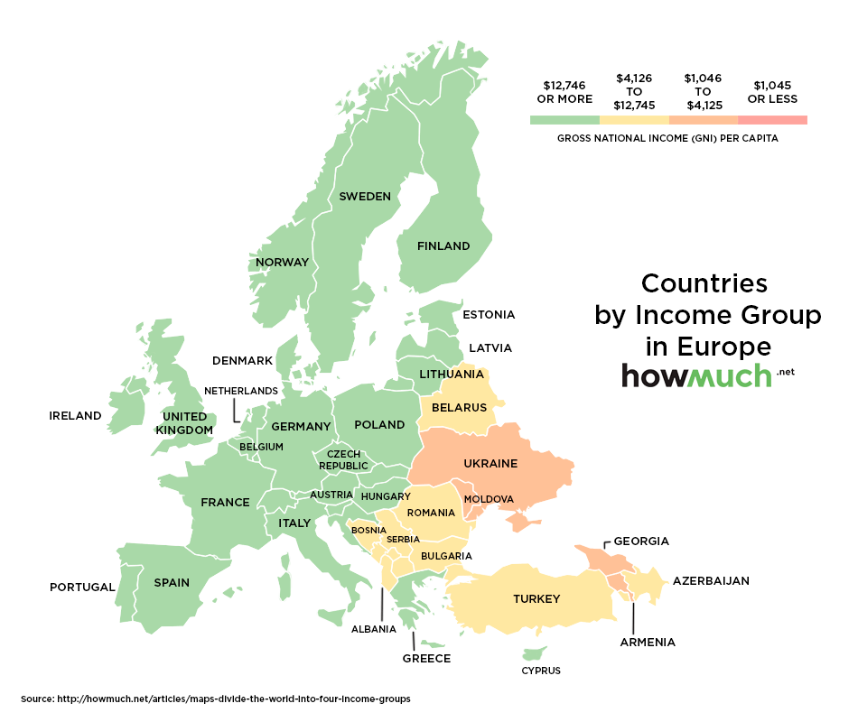 Here you can experience adventures with the heroes of the Ice Age, visit the Looney Tunes cartoons, or, conversely, penetrate the gloomy Gotham City.
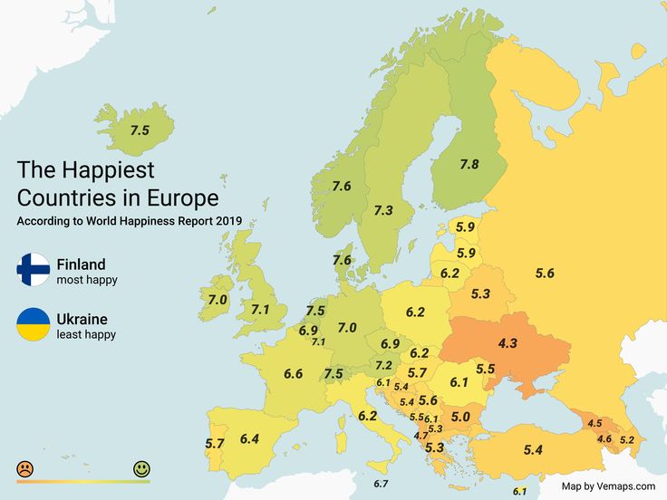 Street carnivals or folk festivals can be no less interesting than the sights.
  But if somewhere the matter is limited only to jokes and practical jokes, then in Odessa they organize the festival “Humorina” , which is a place for all kinds of humor.


 Therefore, for spring trips, it is better to choose southern cities, where there are more chances to find warmth and sunshine. We share ideas where to go with children in April in Ukraine.
  Spring is the best time for walking along the old streets, looking at mansions, reading memorial plaques, turning into Odessa courtyards and listening to a special local speech.
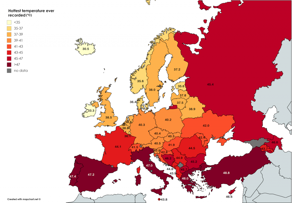 The building of this museum cannot be overlooked: its facade is decorated with a majolica panel, on which the provinces of Austria-Hungary are depicted in the form of gods.
  But this does not prevent thousands of people from flocking here in the second half of April, when the Uzhgorod sakura blossoms. A festival is timed to coincide with this event, where there is a place for tasting wines and dishes of Transcarpathian cuisine, folk music, and a crafts fair.
  This is partly due to the fact that in some resorts the most comfortable time comes between the winter coolness and summer heat, and partly due to the fact that major holidays fall in April.

 You have to take a lot of things for the little one, pick up a transfer with a minimum of transfers, look for a hotel with a children’s menu or a resort where there are supermarkets with the usual food. Fortunately, in April, there are more opportunities for traveling with a baby.
 Where to go on vacation in December? The choice is large enough. If you suddenly have to celebrate the New Year away from your native places, it’s not scary, you will definitely be offered a festive dinner and entertainment.
  At this time there are very comfortable conditions for diving.
  In South Africa and Kenya you can see lions, antelopes and other African animals in their natural habitat, get acquainted with unique plants.
  Everyone dreams of only one thing – summer would soon come, so that they could soak up the sun, lie down on fragrant grass, plunge into the arms of gentle waves. Why wait so long? You can now fulfill your dream – take a vacation and go to warm countries. You will be surprised that at this time of the year you can have a great rest, and not expensive.
 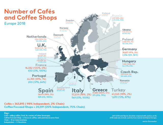 In this regard, we recommend that you bring warm clothes with you.
  That is why many show business stars come to retire to the Maldives, although tours here are not cheap.
  And here you can have plenty of fun, because the city has a lot of dance floors with incendiary music, it’s not for nothing that some celebrities have chosen this place, preferring Goa to other resorts.
  However, it is still quite cold here this month, so tourists may feel some discomfort. The air temperature is about + 25 degrees. Also in March, sandstorms rage in Egypt, which may not end for quite some time. But still, tourists are attracted by rather low prices for accommodation and excursions during this period of time.
  The weather is warm, comfortable for a beach holiday. On the southern coast of the island, the air temperature reaches + 30 degrees, and water – up to + 25 degrees.
  If you are ready to fly across the ocean, then welcome to the paradise on earth!
 Visit a country where there is no fuss familiar to us, and the quiet rustle of the waves is occasionally disturbed by the cheerful cries of monkeys.
  Exquisite tea ceremonies, samurai castles, mysterious temples – these are just a small part of the richest culture that you will get to know. April is the best time to visit Japan, because this is the time of cherry blossom, the symbol of this country. You will never forget the originality of Japanese architecture due to the limited space, underwater tunnels and beautiful bridges built using the most advanced technology. Discover the country of active volcanoes and snow-white mountain peaks, and this trip, without exaggeration, will become the most memorable in your life.
 On the territory of the state there are magnificent national parks and nature protection zones, a lot of historical and architectural monuments. In May, you will be able to celebrate Independence Day and the Day of St. Vasily Ostrozhsky, the patron saint of this country, together with the residents.
  After all, for example, in the resorts of the Mediterranean, the beach season is just beginning, as well as in the countries located on the shores of the Red Sea. If you go to Europe at this time, then the absence of annoying and exhausting heat will be a huge plus.
 You can also freely travel to Malta. It is in June that most national holidays take place here, which fully reveal all national characteristics. Well, nature in these places reaches the peak of its magnificence and beauty in the first month of summer.
  The water is already warm, but there is no scorching heat. In Italy, Greece, and Spain the air warms up to 29 degrees, the sea temperature is 25 degrees. Somewhat cooler in Portugal. The most comfortable conditions in Madeira. In Sicily, Mallorca and Malta a fresh breeze makes it easy to endure the heat.
 Swimming in the gentle sea and serene pastime on the beach can be diversified with sightseeing trips. Local tourist offices have developed many interesting routes.

 It is also not very hot here, the beautiful Adriatic Sea, comfortable hotels, and, of course, many attractions.
  It’s not for nothing that September is called the “velvet season”. It is in this month that experienced tourists pack their bags and go on vacation. The sun is becoming more merciful, the beaches are free of crowds, many resorts offer nice discounts – these are just a small part of what you will appreciate when you go on vacation in early autumn. So, where to go on holiday in September?
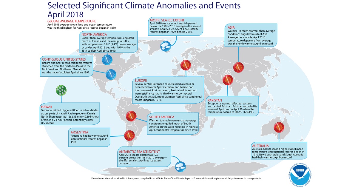
 If you look further, to Goa or Thailand, October spoiled the weather here too, in many countries this period is the rainy season, although the showers are not so terrible, it rains almost every day, but it disappears as quickly as it came.
 /granite-web-prod/a0/87/a087a0133db949e49bdb2a796c35e079.jpeg) Where to go on vacation in November? The choice is huge both for those who prefer to calmly wander through unfamiliar places and soak up the beach, and for outdoor enthusiasts. In November, school holidays, so you should think about a joint vacation with your child.
Where to go on vacation in November? The choice is huge both for those who prefer to calmly wander through unfamiliar places and soak up the beach, and for outdoor enthusiasts. In November, school holidays, so you should think about a joint vacation with your child. 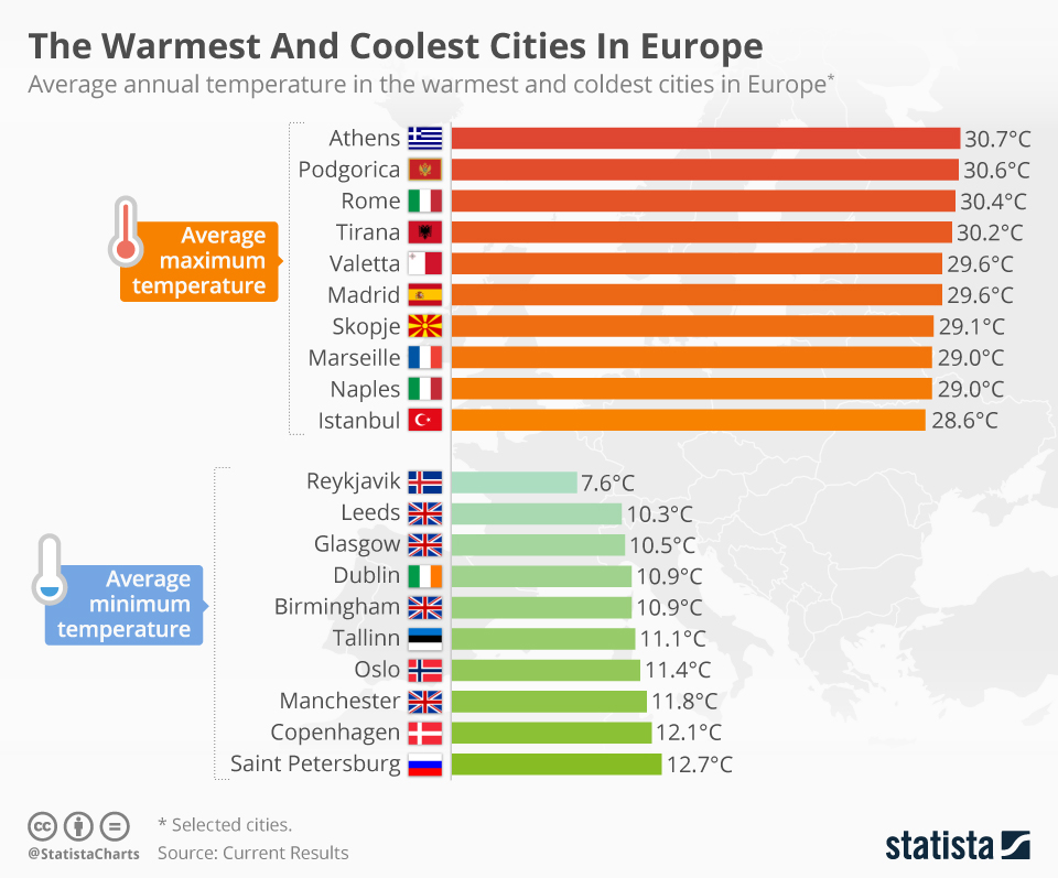
 The most likely type of rainfall is moderate rain, happening on 47% of the days with rainfall. Drizzle, light rain and thunderstorms are all equally as likely to happen and each is observed on 17% of the rainy days.
 Despite being in a residential area, this hotel is just a few-minutes’ walk away from attractions like the Bellver Castle and the seafront promenade. It has all the facilities that you may expect from a hotel in a beach destination like Palma, including a spa, fitness centre, bar, restaurant and swimming pool.
 Its menu consists of cuisine from all over the world, from the Americas to Asia and from Europe to the Pacific.
 The bus route runs past all important highlights and attractions and you can get off and on everywhere you wanthis is great way to get a first impression of the city and get your bearings.
 Some would describe it as moderately chilly with a gentle breeze.
 06 inches (1.5 mm) of precipitation. These graphs show the probability of it raining/snowing in April and the amount of rainfall.
 0 hours while December 20th has the shortest amount of daylight of only 9.4 hours.
 3 mph (14.9 kph). This graph shows the average wind speed in Palma de Mallorca in April based on historical data.
 It is a very good time to travel to Mallorca, especially if it coincides with Easter time. During April most of the tourist places open as it is the start of the new season, normally related to Easter holidays. The april weather is really nice and there are many things to do and to visit without being very busy.
 As average the day temperature is 19 degrees, but at noon it can reach 25 degrees and at night time 12-14 degrees.
 The most worthy ones to see are organized on Palm Sunday and Holy Friday. Easter in Mallorca is a nice time to meet with friends and family. If april weather allows many picnics and meetings are organized at Majorca beaches or barbeque areas around whole island.
 In April, we start offering bus tours and boat trips. You can check on our excursion page the available options by filtering for the desired dates. If you are staying in one of the family resorts in Mallorca – Alcudia, Puerto Alcudia, Puerto Pollensa, Can Picafort – you can also ask for our tours in your reception desk.
 Unfortunately, not all the boat trips are available in April. Most of the boat companies doesn’t start until May, especially the big catamarans. You can find some small catamaran options for maximum of 12 people available, but sometimes they require a minimum of people to run the trip.
 If you stay in the north of Mallorca (where we are based), we have some recommendations:
 Check our experts info about what to buy, what days it takes place, the timetable…
 If you liked the article, please share it on Facebook so other travelers can see it. If you have some extra suggestions for April in Mallorca, leave us your comment and we will add it to the article.
 Temperature °C (°F)
 9)
9) 9
9 Temperature °C (°F)
 4) °F
4) °F Sun hours (hours)
 (°C) | (°F)
 0 mm | 0.0 inch.
 0 mm | 0.0 inch.
 1 mm | 0.0 inch.
 0 mm | 0.0 inch.
 Most tend to head here as the weather improves. April does see it’s fair share of tourism as the days become warmer. The climate here is like Ibiza during this month an the eastern coast of the Spanish mainland.
 This will likely be on the chilly side if you are thinking about having a swim. The end of April will see a further increase to 18 Celsius which may be ok for some to have a paddle.

 Here are the average temperatures.
 8
8 2
2 2
2 These mountains, which overlook the sea, have a colder climate because of altitude, and in winter, they can be covered with snow. In addition, they are more windy, and receive higher precipitation, up to 1,200 mm (47 in) per year, so they are also greener, and not by accident, they are covered with forests.
 Sometimes, there can be cold and windy days, with highs below 10 °C (50 °F), which can be followed by light frosts, with night temperatures a few degrees below freezing.
 In January 1999, it snowed in the east of the island (see Manacor, Felanitx), and a few flakes were also seen in Palma.
 The sunniest period is from June to August, when sunny days are the norm. In September, the first Atlantic disturbances can reach the island, so, the sun in autumn is not always guaranteed.
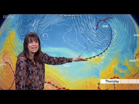 5
5 8
8 The average temperature is of 9.9 °C (50 °F), with a minimum of 4.3 °C (39.8 °F) and a maximum of 15.5 °C (59.9 °F).
  3 °C (39.7 °F) and a maximum of 15.6 °C (60.1 °F).
 4 °C (68.7 °F).
  2 °C (75.6 °F).
  7 °F) and a maximum of 28.5 °C (83.3 °F).
  The average temperature is of 25.1 °C (77 °F), with a minimum of 18.8 °C (65.9 °F) and a maximum of 31.4 °C (88.6 °F).
 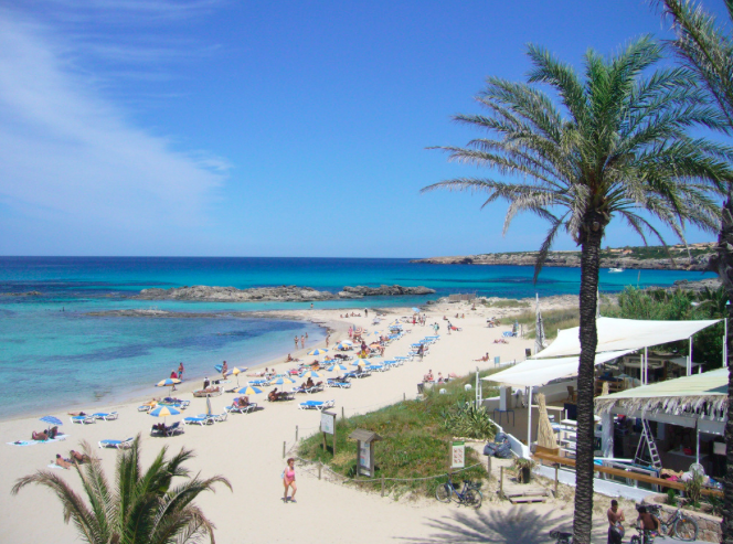 6 °C (78 °F), with a minimum of 19.6 °C (67.2 °F) and a maximum of 31.6 °C (88.9 °F).
  5 °F).
 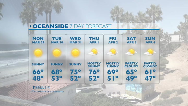 1 °C (75.4 °F).
  8 °F) and a maximum of 19.2 °C (66.6 °F).
  8 °C (42.4 °F) and a maximum of 16.5 °C (61.6 °F).
  3 out of five.
 2°C, the minimum recorded values are +15.1°C. At night the temperature in Palma in April drops to +16.2°C…+11.1°C. On average, the difference between day and night is 6.5°C. What is the weather forecast in Palma at the end of April and the beginning of the month indicated on the chart, in Spain almost everywhere the situation is similar.
 9°C
9°C  9°C
9°C  9°C
9°C  2°C
2°C  1°C
1°C  4°C
4°C  3°C
3°C  8°C
8°C  4°C
4°C  8°C
8°C  Sea water temperature in April. Weather by months.
 7 mm
7 mm 
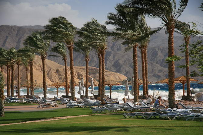
 4
4
 +24 °C
 9%
9%  3 – 12.6 hours
 9 ° C
9 ° C 
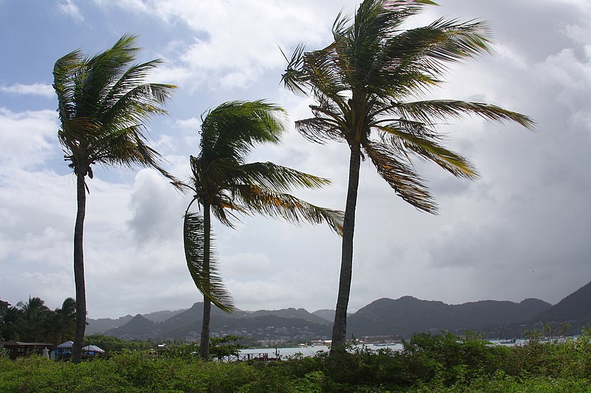 1%
1%  The maximum value for April in the afternoon was noted on 04/14/2017 and equaled +28 °C, the minimum on 04/08/2016: +9 °C.
 Water temperature in La Palma in april Weather by months.
 The average daily air temperature in April is 21.7 °C, while the temperature of the water in the sea will be 19.4 °C.
  4%
4%  3°C to 23.3°C, at night from 16.6°C to 16.6°C respectively. At the same time, the average air temperature is 21.7 °C during the day, and 17.5 °C at night. The difference between daytime and nighttime air temperatures reaches an average of 4.2°C per month.
  The day length (from dawn to dusk) is 12 hours and 51 minutes. The number of hours of sunshine when the sun’s rays reach the earth’s surface, taking into account the average cloud cover for the month, is 10 hours and 14 minutes per day.
  3°C
3°C 
 5″>
5″> 84″>
84″> 39″>
39″> 01″>
01″>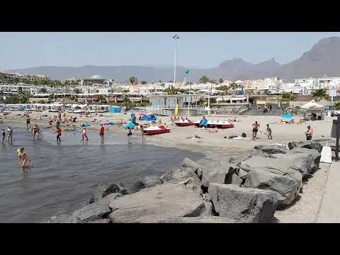 7″>
7″> 27″>
27″>
 94″>
94″> 29″>
29″> 73″>
73″> 63″>
63″> 3″>
3″> 02″>
02″> 3″>
3″>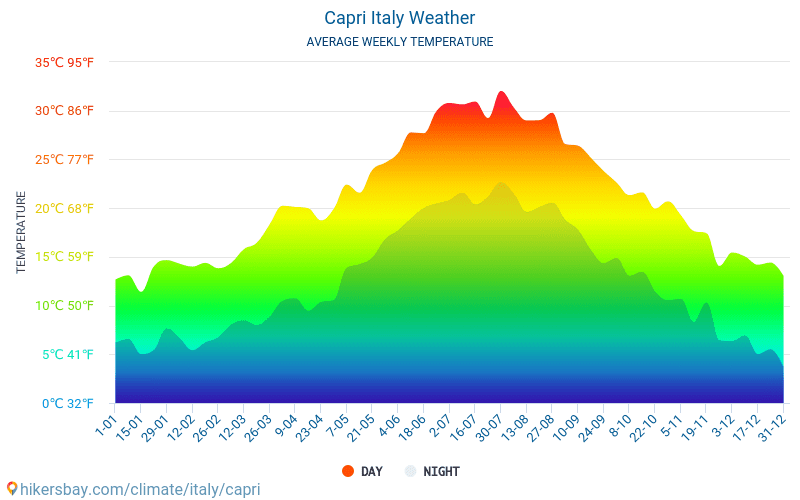
 23″>
23″> 46″>
46″>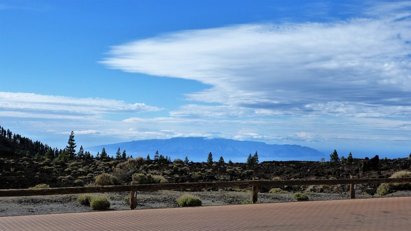 77″>
77″> 68″>
68″> 04″>
04″>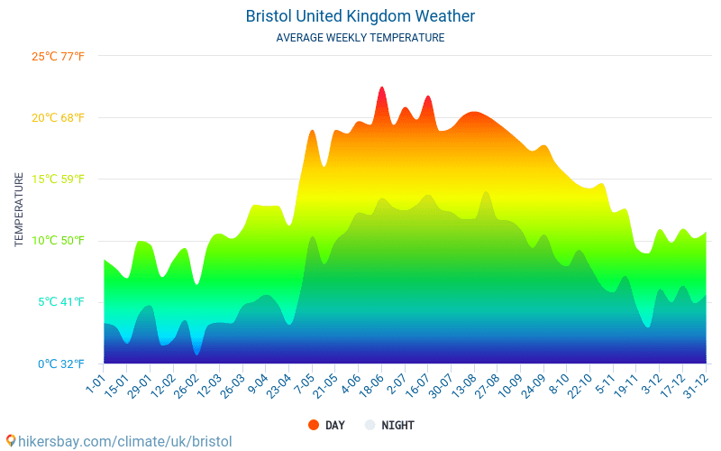 86″>
86″>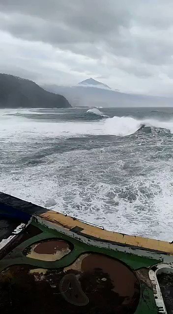 75″>
75″>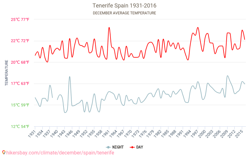
 55″>
55″> 86″>
86″> 46″>
46″> 56″>
56″> 28″>
28″> 93″>
93″> 46″>
46″>
 High 28ºC. Winds W at 10 to 15 km/h.
 High 28ºC. Winds WNW at 15 to 30 km/h.
 High 28ºC. Winds WNW at 15 to 30 km/h.
 High 28ºC. Winds NW at 15 to 30 km/h.
 High 27ºC. Winds NW at 15 to 30 km/h. Chance of rain 50%.
 High 27ºC. Winds WNW at 15 to 30 km/h. Chance of rain 40%.
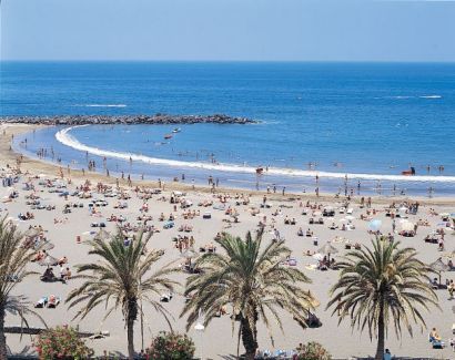 High 27ºC. Winds W at 10 to 15 km/h. Chance of rain 70%.
 High 27ºC. Winds WSW at 10 to 15 km/h. Chance of rain 30%.
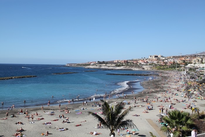 High 27ºC. Winds W at 15 to 25 km/h.
 High 27ºC. Winds NW at 15 to 30 km/h.
 High 27ºC. Winds NW at 15 to 30 km/h.
 High 26ºC. Winds NW at 15 to 30 km/h.
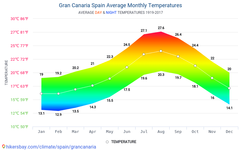 High 26ºC. Winds NW at 15 to 30 km/h.
 High 27ºC. Winds NW at 15 to 30 km/h.
 High 26ºC. Winds NW at 15 to 30 km/h.
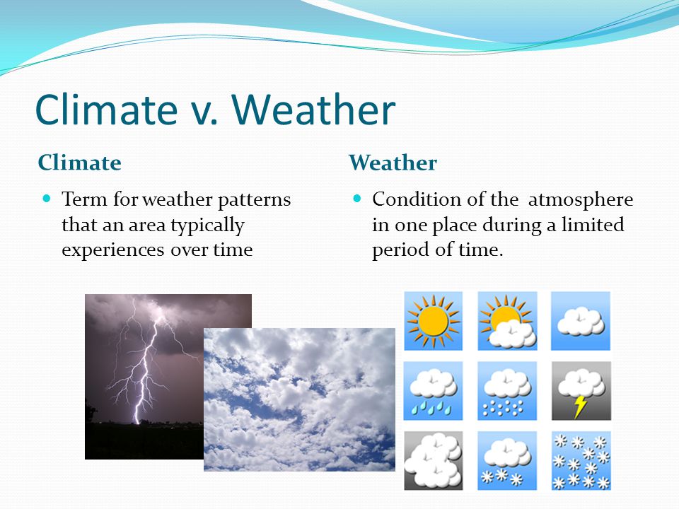 7
7  5
5 
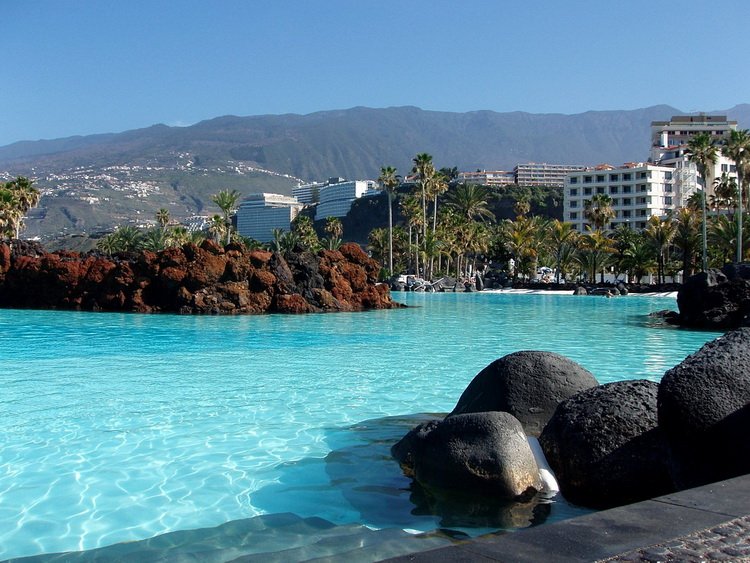 The trade wind blows almost the whole year, but in autumn and winter it shifts closer to the equator, and intensifies in summer. It is caused by two phenomena – the rise of heated air masses in the equatorial zone and the Coriolis force caused by the rotation of the Earth.
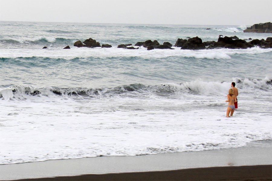
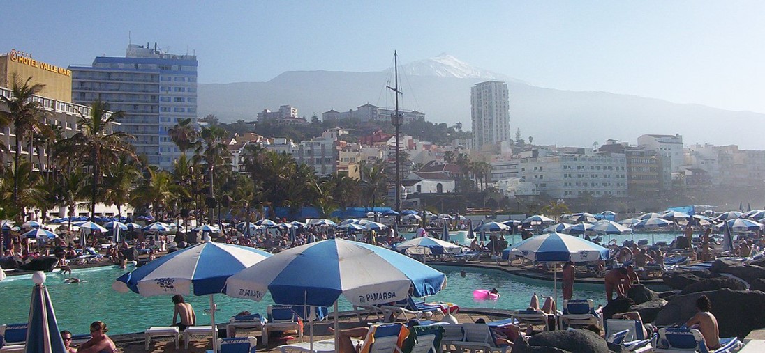

 The temperature differs markedly depending on the altitude above sea level.
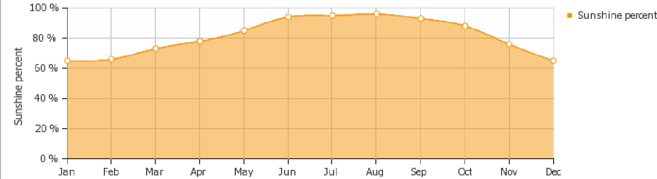


 One of the main symbols of the island is the dracaena. At a short distance from each other, Canarian and balsam spurges are located, which is typical for the desert or arid regions.
 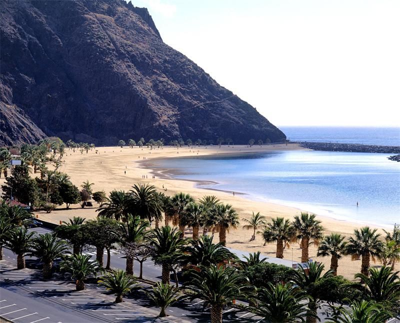 And all this diversity fits on a small island, so Tenerife is often called a continent in miniature.
 Due to the geographical location and relief features of the island, the weather conditions differ significantly depending on the location. For example, in the north of the island, in the forest of La Esperanza, it is usually 10 degrees colder – about 12 degrees during the day.
  After all, even a harsh January in Tenerife is similar to a warm April in Russia. The daily temperature minimum in the resorts of the northern part of the island is 11 C, the average temperature here is 14-15 C. At night, the thermometer drops to 9C. In the south, the air temperature is more comfortable: during the day it is 21 C, while the night temperature is higher than the northern daytime temperature (14-15 C). As for the water temperature, it is almost the same in the northern and southern parts of Tenerife (19 and 20 C, respectively).
 Daytime temperatures in February range from 19 to 23 degrees (north and south of Tenerife), at night the thermometer drops to 12 degrees. As in January, warm clothes at night in February will come in handy. Thus, in February in Tenerife you can swim and sunbathe, as well as visit the annual carnival, which traditionally takes place this month in the Canaries.
  The storm covers the sun with a light haze. If you look at the shadows from objects, they are almost invisible. Kalima can hide mountain peaks and neighboring islands from your eyes. The air temperature during Kalima rises, it becomes hot. All tourists who will witness Kalima should not forget about protective creams. Sunglasses, as well as a hat or headscarf, will not interfere. Kalima usually lasts 2-3 days, then March weather returns to the Canary Islands.
 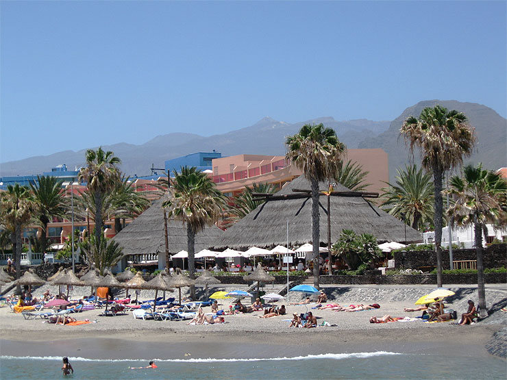 But many tourists are still in no hurry to swim in the ocean and prefer indoor pools in hotels or heated outdoor ones. Tourists who want to come on holiday to Tenerife in April will not be bored here. In addition to the ocean and beach holidays, the island offers its guests a lot of interesting things. At this time, the main Christian holiday, Easter, is usually celebrated; it is celebrated here with great pomp. So true Catholics will not regret that they visited Tenerife in the spring.
 9hours, but there is still a lot of heat. The weather is clear. In September, there are only 3 rainy days, the amount of precipitation does not exceed 50 mm, and the winds are small.

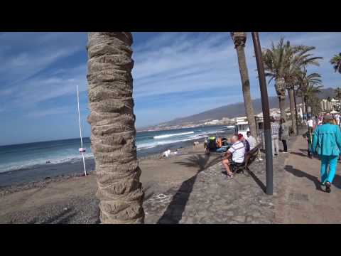
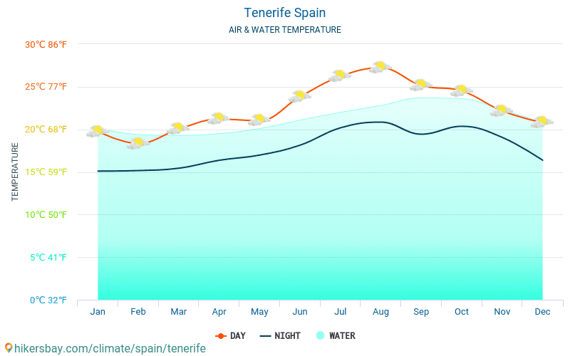
 It’s enough for the whole family. The issue price is about €5 per day.
  Sharks and other marine reptiles do not swim to the shores of the ocean. In this regard, everything on the island is quiet, calm and safe even for children. And representatives of the rich plant world, which bloom here especially beautifully in spring, are taken to amaze your imagination.
  Oh yes! Not without fast food, of course. A touch of modernity cannot be wiped off the face of the earth, even if you want to relax as a “savage”.
  Will have to move farther. For example, the village of Tahao will please fish gourmets and will not ask for a lot of money for it.
  And in the same place, in a quiet town, there is a butterfly center where you can enjoy communication with winged charmers to your heart’s content. Excursions to Igod de los Vinos include free tasting of local wines. Perhaps someone will like this information.
  What the former rulers of paradise places grieve about, you can find out by ordering a city tour. In fairness, it should be noted that the main temple of Tenerife – the cathedral – is located in La Laguna. We will probably move on to it.
  This large-scale holiday in terms of the number of participants once got into the Guinness Book of Records. Many tourists come to the island in February-March just to get to this enchanting show.
  The castle was built for the purpose of holding tournaments for knights and theatrical performances.
  This is the best place in Tenerife. No zoo in the world can boast of such an impressive collection of exotic birds. A sea of impressions is given to guests by spectacular shows, the main characters of which are parrots, dolphins, orcas and sea lions. Must-sees are the penguinarium and the shark tunnel.
  He, they say, is already old and shabby, but not formidable at all. And the performances of dolphins may well compete with the performances of Loro Park.

 Usually, under this condition, customers are given a significant discount;
  ru/ostrov-tenerife-dostoprimechatelnosti- kak-dobratsya-chto-posmotret-plan-putevki-i-luchshie-ekskursii.html
  9
9  1
1  5
5 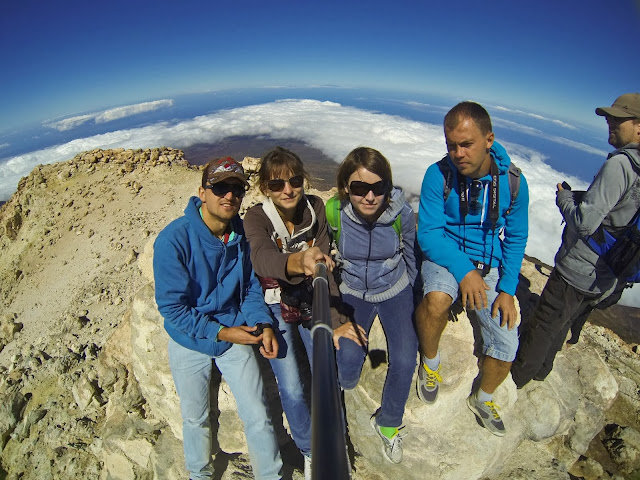 0
0
 Back  Region: Canary Islands
 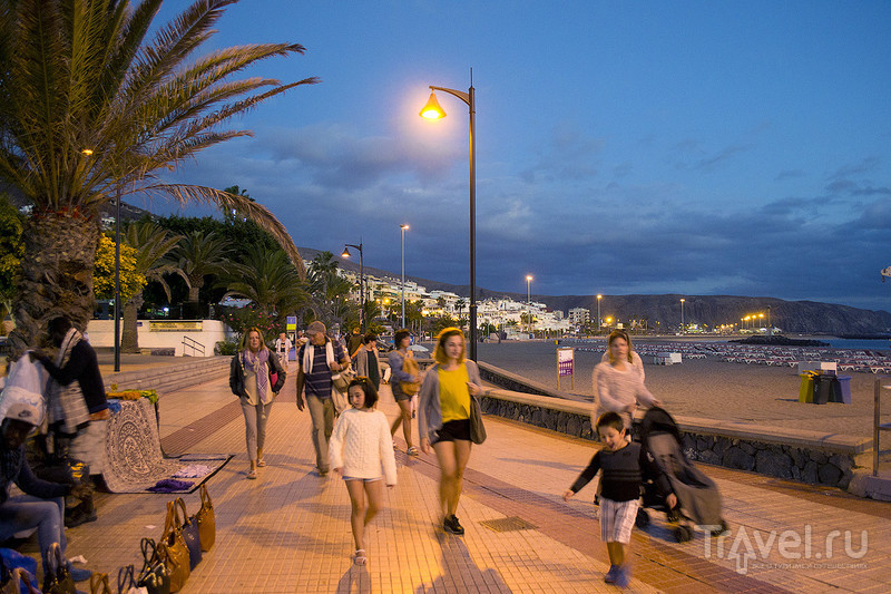 As for the water temperature, it is almost the same in the northern and southern parts of Tenerife (19 and 20 C, respectively).
 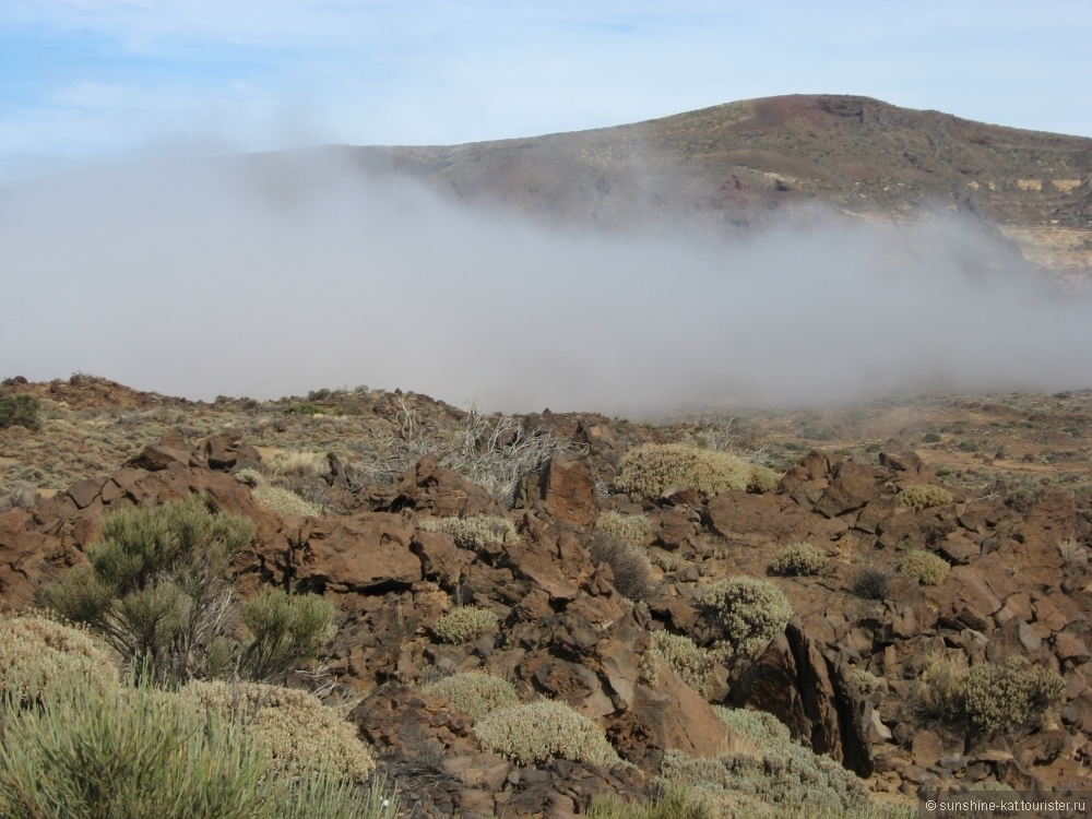 According to the British Weather Archive for 10 years, the number of rainy days here is 2-3 days. But there is little precipitation (14 mm.) And the rains do not last long. The sky is cloudy. The number of sunny days is usually 16-17. The water temperature in the Atlantic Ocean is 18-19degrees. And many tourists prefer to swim in indoor pools. This is especially true of the northern part of the island. But at this time of the year, surfers can swim perfectly on the waves.
  The daily air temperature at this time in the north of the island is 20 degrees above zero, in the south – 22-27. At night it is still quite cool: from 13 to 16 degrees. Three weeks a month you will enjoy sunny days, so you can safely go to the beach for a beautiful tan. In March, in Tenerife, tourists can watch Kalima. This is a natural phenomenon in which strong winds blow from the African Sahara desert. They bring sand with them to Tenerife.
 So true Catholics will not regret that they visited Tenerife in the spring.
  The water temperature in the ocean is 20-21 degrees. Those travelers who love warmer water can walk along the coast of the island on a clear morning or warm evening and admire the magical landscapes of Tenerife.
  June water temperature is similar to May: on average 20-21 degrees above zero. At this time of the year, you can already start diving, see the underwater world of the Canary Islands. There is practically no rain (1-2 days for the whole month). A bright sun shines from the sky for half a month, and clouds are observed for the remaining time. Do not forget that even in cloudy weather the sun is active, so you should protect your skin from the harmful effects of ultraviolet radiation. Also you are waiting for water rides in Siam Park or Loro Park. They will especially please children and teenagers.
  But if you have a desire to climb high in the mountains, then it is better to take a sweater with you. Also, all travelers who want to visit Tenerife in July should be aware that this is the windiest month of the calendar year. Constant winds blow in the south of the island, but they do not bring cold. The sun is active, and do not forget about protective creams and hats. The water in the ocean warms up to 22 degrees, which makes swimming very comfortable. In addition to swimming, you can engage in various water sports (paraselling, kite surfing, riding a banana or jet ski, etc.). There are already more tourists at this time of the year than in June, but not as many as in the peak season. The prices are also not the highest. Therefore, July is a good time for a vacation on the island of Tenerife.
  In Europe, the high season begins. In Tenerife at this time of the year, there are much more vacationers only towards the end of the month. Many families come to rest with children. In the Canary Islands, children will definitely not be bored in August. They will be able to spend time on the warm beach sand, building castles and sculptures from it. They will be able to splash in the ocean for a long time, because the temperature in it is 22 degrees. And sometimes it goes up. Also, with children, you can go to the amusement parks Aqualand or Siam Park. Days in August are hotter than in July (from 26 to 29degrees). But there are fewer sunny days. In a month, 7 days can be cloudy. At this time of the year it is still windy in the south of the island. At night it is warm – 19-20 degrees. Rainy days happen in Tenerife in August. Usually there are 3-4 of them. In the middle of the month (August 15) the religious feast of the Virgin Mary of Candellaria takes place on the island. She is considered the patroness of the Canary Islands.
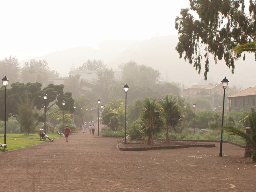 There are solemn processions in the streets. The holiday is accompanied by festivities, showing scenes from the Gospel and fireworks.
  It’s 23-24 degrees. Now even the most capricious travelers can afford to spend 5-10 minutes in the ocean waters. September days are still sunny and clear. But sometimes there are rainfalls. They are usually short-term and do not bring cold. Cloudy in September in Tenerife is about 6-7 days for the whole month. And the wind is weaker than in August. September in the Canary Islands is truly a paradise for a vacation or honeymoon.
 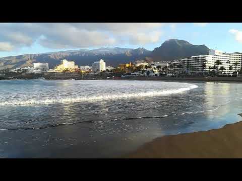 As for beach holidays and sunbathing, the days are clear at this time of the year. Most of the month you can sunbathe and do not forget about sunscreen. At this time of the year, the difference between the north and south of the island becomes more significant. Now more tourists go to rest in the southern resorts of Tenerife. In the north, in October, the air becomes fresher in the mornings. Precipitation falls in the form of rain (4-5 days per month). In the evenings in the north of Tenerife, you will already need warm clothes. In October, you can enjoy traveling around the island and see its beauty. The Teide and Anaga National Parks will give you a lot of pleasure. Tenerife webcams online will show you these magical places. October is also a very good month for surfing. And in the second autumn month, you will be pleased with housing prices and various entertainments, as there are fewer tourists on the island and the peak season is over.
  Snow, of course, does not fall here, but the air temperature drops. Now between the northern and southern parts of the island the temperature difference is 3-5 degrees. During the day in the south of Tenerife from 23 to 24-25 degrees. In the north – 21-23. In the evenings, you can no longer do without warm clothes. In the south – 21, in the north – 19 degrees of heat. In November, the weather in Tenerife still pleases with sunshine, but cloudy days occur 6-7 days a month. In November, people go to the Canary Islands to see the national parks of the island, the pyramids of Guimar, and fortresses. It is easy to get around the island by car. Rent a car in Tenerife will allow you to see more attractions in a short period of time. But the bathing season is coming to an end. In early November, the ocean is still quite warm -22 degrees, by the end of the month the temperature drops to 21-20. In the south of Tenerife, you can still swim, but in the north, big waves make the process of swimming unpleasant.
 But November is very good for surfing. Come to El Medano (south) this month. Surfers from all over the world gather here to conquer wave after wave.
 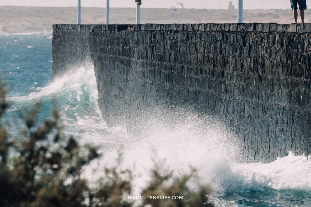 You can hardly see people on the beaches, as they prefer to spend time in indoor pools or restaurants overlooking the ocean. If you are interested in what the resorts of Tenerife look like in December, live webcams Tenerife will help you see it at any time of the day.
  To see how comfortable it is to live in the Canaries, let’s see what the weather is like in Tenerife by months.
 In the spring, it makes sense to come to Tenerife to engage in outdoor activities and go on sightseeing tours: you can climb to the top of Teide, go on a boat trip in the ocean to watch whales.
  April is the time of transition from the low season to the high, beach season.
  Humidity is about 64%.


 What was different was that on our trip in winter four years ago, we had bright blue, crisp skies every day. On our summer adventure, the weather was a little changeable. When we visited, there was a storm passing, so this likely had something to do with it, but we found we actually preferred how the weather felt in winter.
  We learnt a little the hard way with this and forgot to reapply cream one day and came back very red!
  None of the hikes we’ve outlined here are particularly long apart from the Timanfaya Coastal Path, so most can be done within a couple of hours, meaning that the adventure experience doesn’t necessarily need to take over the whole trip. If this is the case for you, we’d recommend setting out earlyish to do the hike, meaning you’ll come back with a big chunk of the day to spend with the group you’re travelling with.
  The hike to the top of the mountain is really lovely – and we found this hike relatively easy this time around. If you’re used to the Peak District in the UK, or even the South Downs, this hike should feel well within reach.
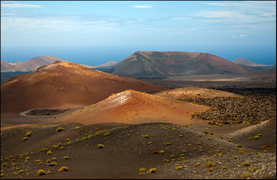
 If you look at a map of Lanzarote, you’ll see that there is massive potential from this hike to join onto other calderas, volcanoes and mountains as many of the trails connect, making the opportunity to have a much longer day.
 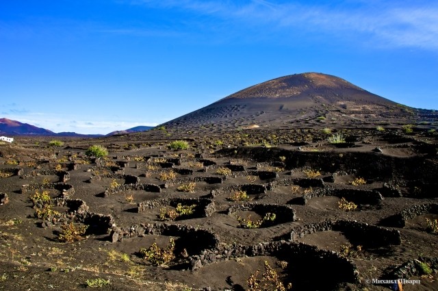 This image has browns, reds and yellows all throughout it showing soft curves of the volcano.
 You couldn’t ask for a better way to explore that notion and spend a day. The great thing about this hike as well, because it is a linear trail, is that if you’re not feeling up to the whole hike, you can cut it short, turning back whenever feels good for you. The views on one side of the bright blue ocean crashing against the contrasting black volcanic rocks with the Timanfaya National Park mountains on your other side is truly an unforgettable experience. Starting off at one of the most picturesque beaches and finishing in the iconic El Golfo makes this hike varied, interesting and one not to miss.

 Good fitness required. Easily-accessible paths. Suitable for all skill levels.
 76 mi
76 mi 78 mi
78 mi Good fitness required. Easily-accessible paths. Suitable for all skill levels.
 There are tons of walks to discover across this incredible landscape but here are 3 beautiful hikes in Lanzarote.
 It can be slippy at parts due to the loose gravel however it is doable. Just take it easy 🙂
  You will find the stairs that take you down to the start of the path.
 It overlooks both Famara/La Graciosa and the National Park of Timanfaya.
 Standing next to these walls, facing the direction of the crater, walk to your left. There is a slightly visible path that will easily make you question if you are going the right way. You are.


 Hiking in Lanzorte is a fantastic destination for nature lovers. In addition, the island of Lanzarote is known as “the island of eternal spring”, since its climate is very mild, and it only receives 16 days of rain per year. This means that it is almost always a good time to go hiking.
 Then the trail goes through Famara’s cliffs, and the volcanic rocks make it a bit slippery. The coastline views during the walk are fantastic, and you can admire several native species of fauna and flora.
 They are approximately 4 km long and the hike lasts about 4 hours.
 The view of the idyllic beach of Famara from the Mirador El Bosquecillo is fantastic.
 This is an easy walk, suitable for families with children.
 A unique place you will learn key facts about flora and fauna, the island’s history and other information of interest. The experience also includes a gastronomic workshop to learn how to prepare a typical Canarian dish. You can consult more information about the experience and the excursion when you click here
 Hotel establishments are gradually beginning to regain activity, and the main tourist attractions, shops, and restaurants are already operating. Since Sunday June 21st, it has been possible to travel to Lanzarote from any country in the Schengen area without carrying out any quarantine (remember to check your country’s regulations when you return from your vacation before traveling).
 If you travel alone, as a family, with a partner, or over 55 years old, you will find offers and promotions to enjoy on your next vacation at the best price.


 About two miles along that road on the right hand side you will find the parking spaces.
  First get the ferry from Órzola to Caleta de Sebo in La Grasico. Beside this town is La Laja where this 4 mile hike on Lanzarote’s sister island begins.


 This loop trail spans nearly half of Lanzarote, and is one of the best ways to see the island’s unique geology that’s been formed by thousands of years of volcanic activity.
 But really it’s all about this 10km or so round trip along the well-signed, bubble-studded lava flows to Charco de los Clicos, an eye-catching lagoon that’s a lurid popping green colour thanks to its distinctive algae population. Set against the moody black-sand backdrop, it’s all very cinematic.
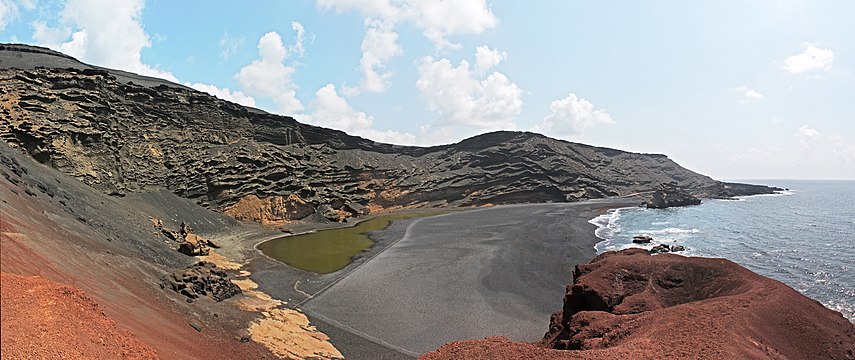 Look out for remnants of former residents – shepherd’s caves and the like – on your jaunt, plus majestic birds of prey and knockout views at the very top. It’s a steep 6km amble, but oh-so rewarding.
  If you’ve only got an afternoon to spare, the gentle 6km jaunt west along the coast from the docks – past the broad sweep of Bahía del Salado and across Playa de La Francesa’s crystal-clear waters – is properly picturesque. At the end you can slog up Montaña Amarilla, or take it easy on Playa de La Cocina, a little slice of turquoise heaven in its own peaceful protected cove.
  Take a pause to enjoy the picnic you most definitely should have brought along with you.
  The most famous are in the Timanfaya National Park. But here they are everywhere, not only in Mal Pais.
  Famara has a sandy beach and beach break, which is great to study on.
  Kitesurfing in Tenerife is much more difficult due to the large number of people in the small lagoon.
 The amazing nature of the Canaries opens through the bays of Mujeres, Pozo, Cera, Papagayo and Congrio. Pictures of these wild places in Lanzarote will keep you warm on long winter evenings.
  And if you want to visit wild places, then go to the Famara region and to the north of the island.
  Now you know what to bring home from the Canary Islands =).
  The tour is included in the ticket price.
  You can sit at the bar inside and spend a few hours enjoying the view of the horizon and the ocean.
  In addition to its unique cultural significance, Jameos del Agua also has an important natural mission. Unique albino crustaceans live in the water of the cave, which you will not find anywhere else.
  Passing through the various corridors of the Cueva de los Verdes cave, tourists enter the Jameos del Agua concert hall.
 The last volcanic eruptions were in 1730, when 30 volcanoes woke up at the same time. They lasted for six years, the result of their activities was very destructive – the island lost 1/3 of the fertile land, they were covered with basalt and ash. Now all that can be seen there is lunar landscapes of stones, solidified lava and a complete absence of vegetation.
 The Russian language is not common, but you can find a Russian-speaking guide in Tenerife for excursions around the island.
  The account must have at least 65 euros on the day of stay.
 The cost of a serving of seafood, which restaurants in Lanzarote are famous for, is about 20 euros.
  The average annual air temperature is +21°C. It is the easternmost of the Canary Islands and the closest to Africa, so the island has little rainfall and is almost always sunny. Air masses from the Sahara penetrate Lanzarote, so the climate of the island is more arid than on other islands of the Canary archipelago.
  In winter there are waves up to 4 meters high. It certainly attracts surfers and kitesurfers.
  4
4  8
8  7
7  The water in the ocean warms up to + 20-22 ° С. July and August are the high season, often during this period Lanzarote is chosen for families with children.
 Although it happens that European low-cost airlines offer even more favorable rates.
 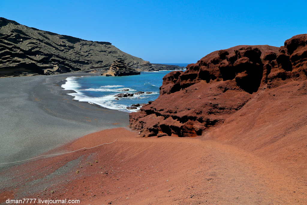 The seaports of the island are a popular stopover for cruise ships, private yachts and pleasure boats. Between the islands of the Canary archipelago, as well as between Lanzarote and mainland Spain, ferries of companies run:
 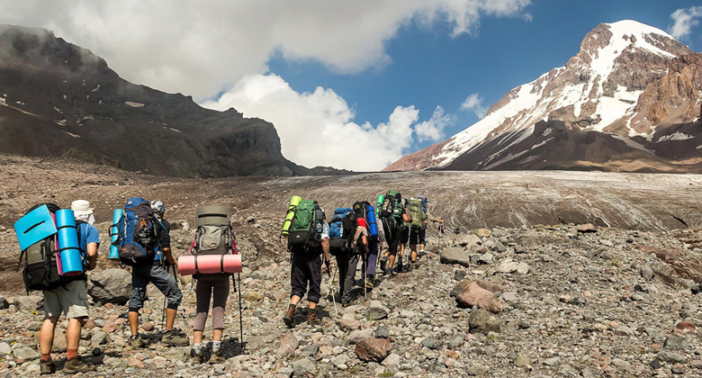 For payment, you need to prepare money without change or a banknote with a face value of not more than 10 euros.
  Lanzarote is called the island of 300 volcanoes, most of them are active now. To preserve the unique nature of the island, several protected natural areas were created, and in 1993 it was declared a UNESCO Biosphere Reserve.
  The crab is quite small, its length is about 1 cm, it has a pale color.
 On September 1, 1730, the fiery mountain Montañas del Fuego rose from the bowels of the earth in this area. The eruption lasted for six whole years. During this time, about 30 more craters were formed, spewing lava to the surface. This radically changed the island, its surface turned into barren land. The Timanfaya region acquired its modern look.
 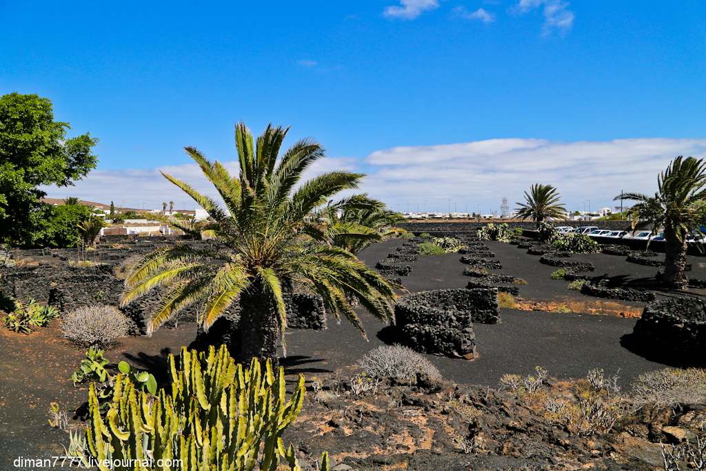 The lava flowed in an easterly direction, where the badlands of Malpais de la Corona formed. Even now, nothing grows in this part of the island. Lava also formed the tunnel systems and caves of Jameos del Agua and Cuevas de los Verdes.
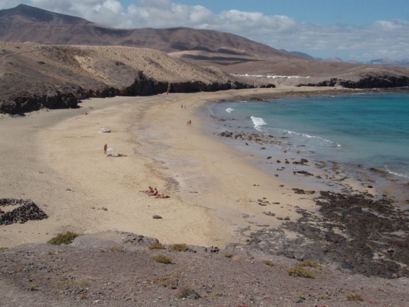 Well equipped, there is everything you need to relax: rental of sunbeds, umbrellas, showers, toilets. There are lifeguards on the beach. There is a parking lot.
  Previously, it was known as a nudist beach, now everyone has a rest on it, regardless of their addiction to naturism. Playa Mujeres has a parking lot, but there is no other infrastructure for vacationers on the beach.
  This picturesque place is located near Playa Blanca. This is a beautiful secluded place with several pools of different sizes and depths. The seabed in the pools is rocky. There is no infrastructure nearby.
  ). There are lifeguards on the beach.
  Semicircles and circles of lava rock create natural pools. The ocean in this place is shallow, the beach is protected from the wind. There is parking near the beach, no other amenities.
  The Guanches, in fact, inhabited only Tenerife.
 They mainly grew barley, which was used to make gofio. Mojo raised goats, produced cheese and butter from milk.
 Because of him, there was a famine on the island, because the volcanic lava destroyed the future crop. Because of this, most of the population left Lanzarote.
  The desalination plant used solar evaporation technology.
  He promoted the development of ecotourism, so that people come here for the sake of the unique landscape, beautiful nature and the ocean. Over the years, he has fought against illegal development and has done a lot to preserve the beauty of Lanzarote. Thanks to his activities, Lanzarote has no multi-storey buildings and limited outdoor advertising.

 It is known for its left handed waves which attract experienced athletes. This beach hosts the prestigious World Qualifying Series and local surfer competitions.
  A group lesson for 1 day costs 45 euros, an individual lesson costs 100 euros. The price includes all equipment. The school also has board rentals. The school has Russian-speaking instructors.
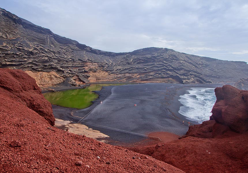
 Offers surf lessons and equipment rentals. Surf lessons with an instructor for the whole day will cost 55 euros, a three-day course – 160 euros, a 5-day course – 250 euros, individual two-hour lessons – 100 euros.
  This is facilitated by good weather throughout the year, a rich underwater world and a bizarre relief of the seabed, formed as a result of volcanic eruptions. The water temperature in the ocean does not fall below +18°C in winter, and warms up to +24°C in summer. In the water, good visibility is 25-30 meters. The diving season in Lanzarote does not end all year round.
  You can get a certificate in just 2 days. It is located in one of the best places for diving – on Playa Chica beach.
  Arrecife has a seaport where ferries and cruise ships arrive.
 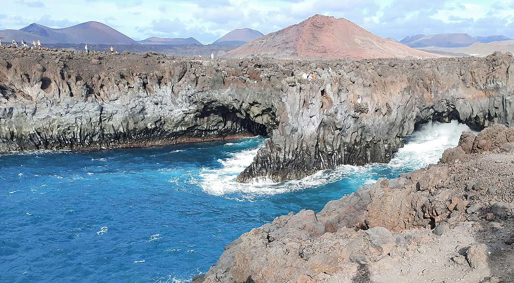 The main attraction of the city is the Church of Our Lady of Candelaria.
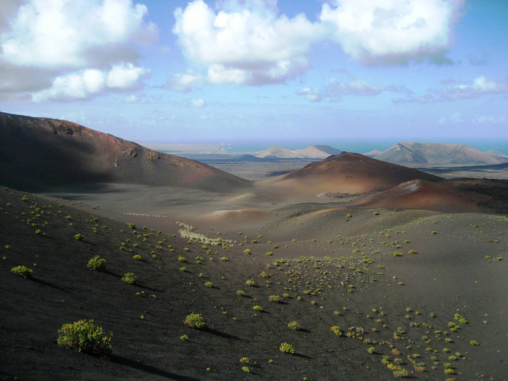

 There are hotels of well-known international and local chains operating on the island: h20, Iberostar, Barceló, Occidental.


 The first is the abundance of fish and seafood dishes. Fishing on the island has a long tradition and still plays an important role in the economy. When ordering a fish dish in one of the local restaurants, you can be sure of its freshness.


 At the entrance to the park is a metal sculpture created by César Manrique. It is surprisingly similar to a real cactus.

 It was formed as a result of a volcanic eruption 5 thousand years ago. The length of the cave is 6.1 km, it starts at the crater of the Korona volcano and ends at the ocean coast. The width of Cueva de los Verdes in some places reaches 24 m, the height is 15 m, the height difference is 230 m. The tourist route is about a kilometer long and passes through halls, narrow passages and corridors. Music constantly sounds in the cave, creating a special atmosphere.
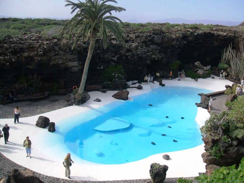

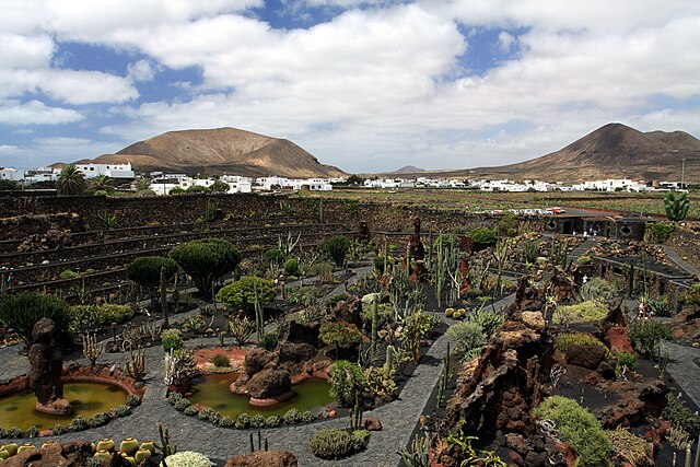 Also in the museum you can see paintings by Picasso, Chillida and other paintings from his collection.
  Now the house-museum is open to tourists.
 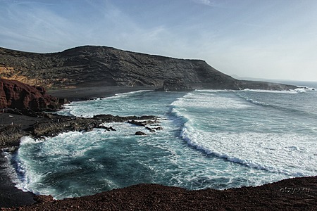 The museum is decorated with avant-garde sculpture created by César Manrique.
 The zoo is quite large, in the collection of animals there are raccoons, white tigers, snakes, bison, armadillos, cougars, deer, rabbits, skunks, exotic birds.
  The second water park is located in Costa Teguise, in addition to water slides and pools, the entertainment complex includes: karting, a paintball location, a climbing wall, and a children’s playroom. You can spend the whole day in the water park with interest.
 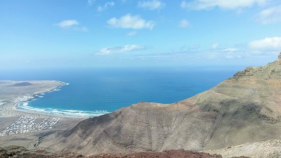 It includes a private marina for yachts with 550 berths, capable of accommodating boats up to 50 meters in length, village Marina Rubicón Village , where a large number of bars, restaurants, shops, supermarkets are concentrated. Atlantis Underwater Museum is located 300 meters from Marina Rubicon .
  5 euros.

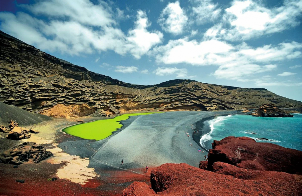 For 3 € per day you can rent a sun lounger, and for 2 € you can rent an umbrella. On the coast there are showers, toilets, bars and restaurants.
  A strong wind constantly blows here, which raises intense waves and creates ideal conditions for surfing. On the beach there are surf schools and equipment shops.
 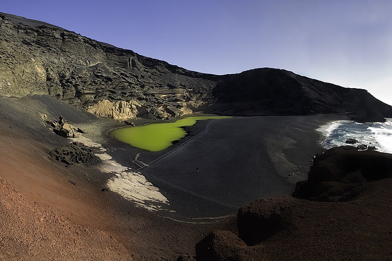 The school has all the necessary equipment, which is rented for a fee.
 Delicious burgers, sandwiches and chicken dishes, a selection of cocktails and beer, the average check is -30€.
  km, on the territory there are active geysers and more than two hundred dormant volcanoes.

 The total exhibition area is 2500 m2, the museum exhibits 300 life-size human statues. It is better to view the exhibition of the underwater museum with scuba gear or on a boat with a special transparent bottom. The dive is carried out by a diving school located in the resort of Playa Blanca.
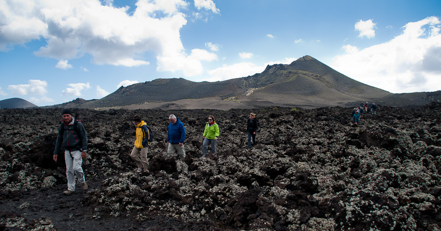 A trip to the Cactus Garden and Lagomar – the current house-museum, built into the rock by the architect Cesar Manrique. At the end – the beach of surfers Famara and the fishing village of La Santa with a sports center on the territory.
 Prices from €453-573 per night.
  Standard double room (for 1 person)
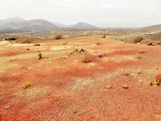
 The average check is 20€. In the city of Tias, in the restaurant “La Cabana”, dishes of Mediterranean, European, British cuisines are presented, a varied wine list, you can have a bite to eat here for 40 €.
  The bus service starts at 6:00 and ends at 22:00, buses run strictly according to the schedule. The fare depends on the distance of the resort from the airport and ranges from 1.2€ to 3.2€. With a BonoBus magnetic card, the fare will be reduced by 20%.

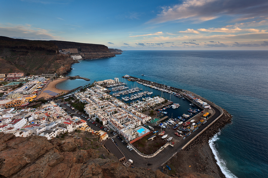 The epic lunar landscape around Mount Teide is best seen from a cable car in the company of a local guide as part of a wider island tour.
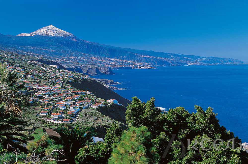


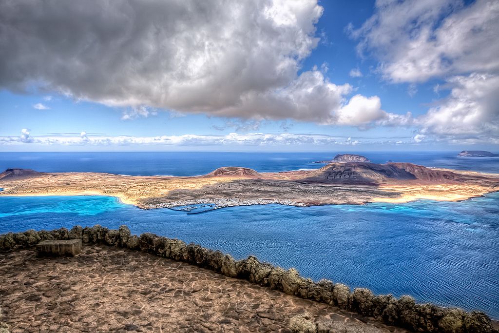
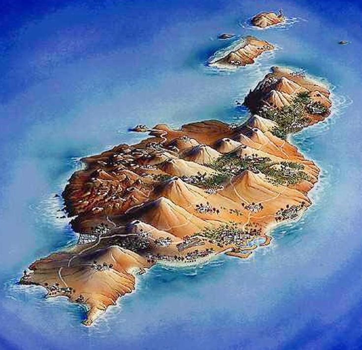
 The town’s Casa de las Quinteras is worth visiting to pick-up local crafts.
  If you travel further in Dropdown contentSpain read more about the best time to go Dropdown content and the best places to visit Dropdown content. For inspiration use our Spain itineraries Dropdown content Dropdown content or speak to our local experts Dropdown content. A bit more hands on, learn about getting there Dropdown content, getting around the country Dropdown content and where to stay Dropdown content once you are there. And don’t forget to buy travel insurance Dropdown content before you go.
 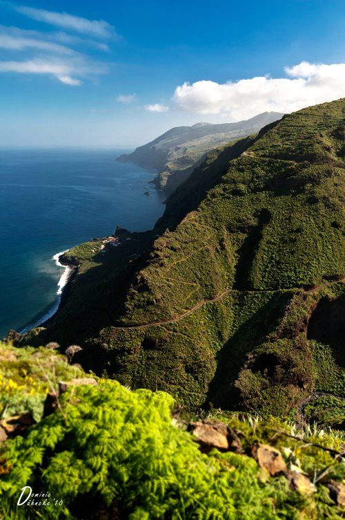 Also passionate about inspiring a love of adventure in young people, she’s the author of several books for children and young adults, hosts international writing workshops, and has written articles on the Caribbean and inspirational community initiatives for Rough Guides. Follow her @JoanneOwen on Twitter and @joanneowenwrites on Instagram.
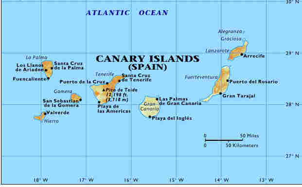


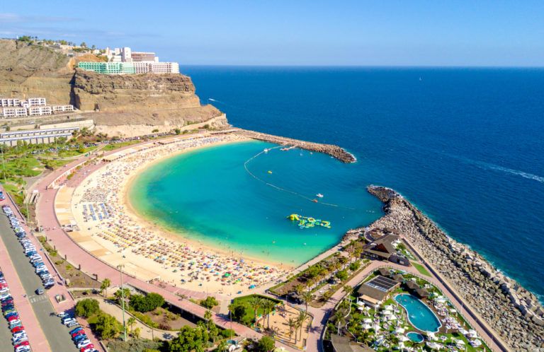
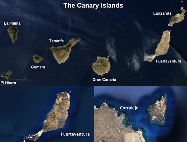 Here’s everything you need to know about traveling to the Canary Islands through the eyes of a local.
 Snorkelers and divers should check out La Restinga Marine Reserve on the southernmost tip of El Hierro. Close to the nature preserve of Lobos island, this protected area is teeming with marine life, such as rays, barracuda, and dolphins.
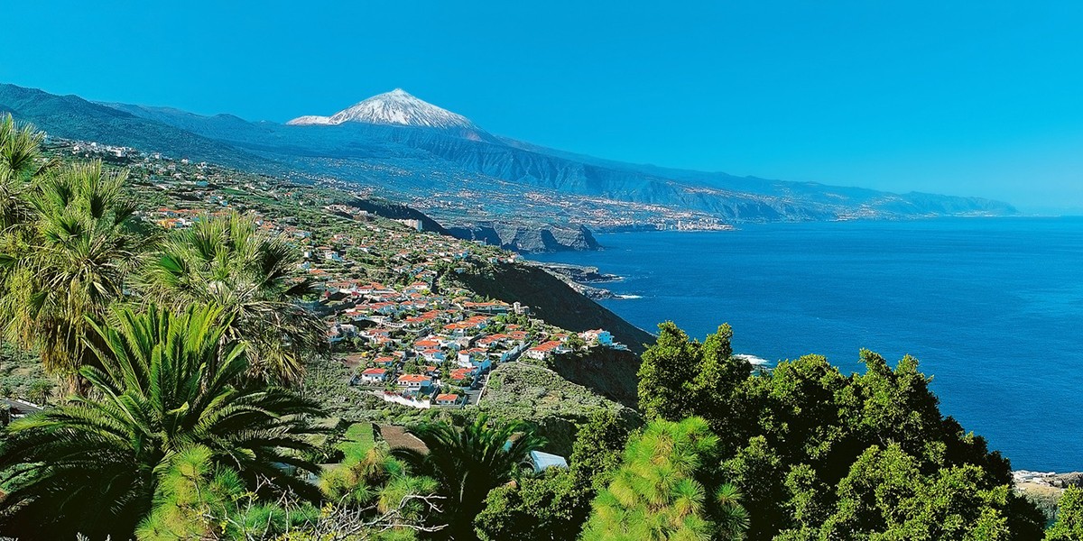 If you are fit enough, you can climb up to the summit — if not, you can take the cable car and walk down.
 You can walk the tubes on a guided tour past an interior lake, and there is even dining and music.
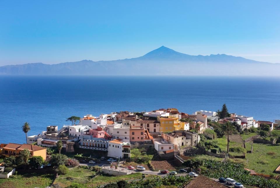 Lanzarote is practically shaped by one artist: Cesar Manrique. His works are everywhere, including his house (now a museum), the above-mentioned Jameaos del Agua, and many more.
  There are parks, the Atlantic Center of Modern Art, and a beautiful marina. It’s my favorite city in the Canaries.
 That’s the omnipresent Canarian potato, much smaller than other potatoes and with a flavor provided by the volcanic soil. Papas arrugadas, wrinkled potatoes, are boiled in their skin, sprinkled with salt, and topped with a spicy sauce then served as a snack or with the main dish. For colder months, rancho Canario, a thick noodle stew with chicken and potatoes beats the cold. Baifo is marinated goat, and bienmesabe is a thick sweet puree made from almonds, egg yolk, sugar, and lemon zest and often served with ice cream.
 As you can see, even if you don’t climb el Teide, there is a lot of walking as the best means of transport and that calls for good walking shoes. Reserve flip-flops for the beach.
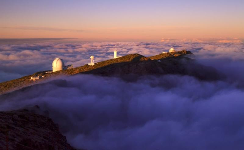 The cheapest rooms in the most popular hotels and resorts tend to sell out fast, so you need to get in there quick to pick up the bargains! Opting to travel off peak in spring (April-May) or autumn (September-October) will see reduced prices on both flights and hotels, with the cheapest periods being between October-Christmas and between New Year and Easter. Remember that holidays over the Easter and half term school holidays will see a steep rise in prices.
  There are no tropical diseases or unusual, nasty infections that can hurt you in the Canaries – and as such you will not need special vaccinations of health precautions. It is important to note however that the sun can get very hot in the peak summer months, so always remember to take sufficiently strong sun lotion.
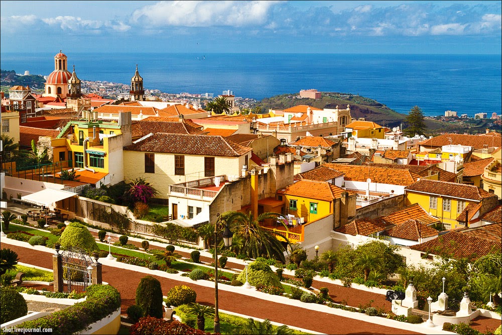
 For families looking for a lively atmosphere and plenty of family amenities, Costa Teguise and Playa Blanca are ideal. The best beaches on the island are the secluded, rugged bays of Papagayo, found on Lanzarote’s far southern tip.
 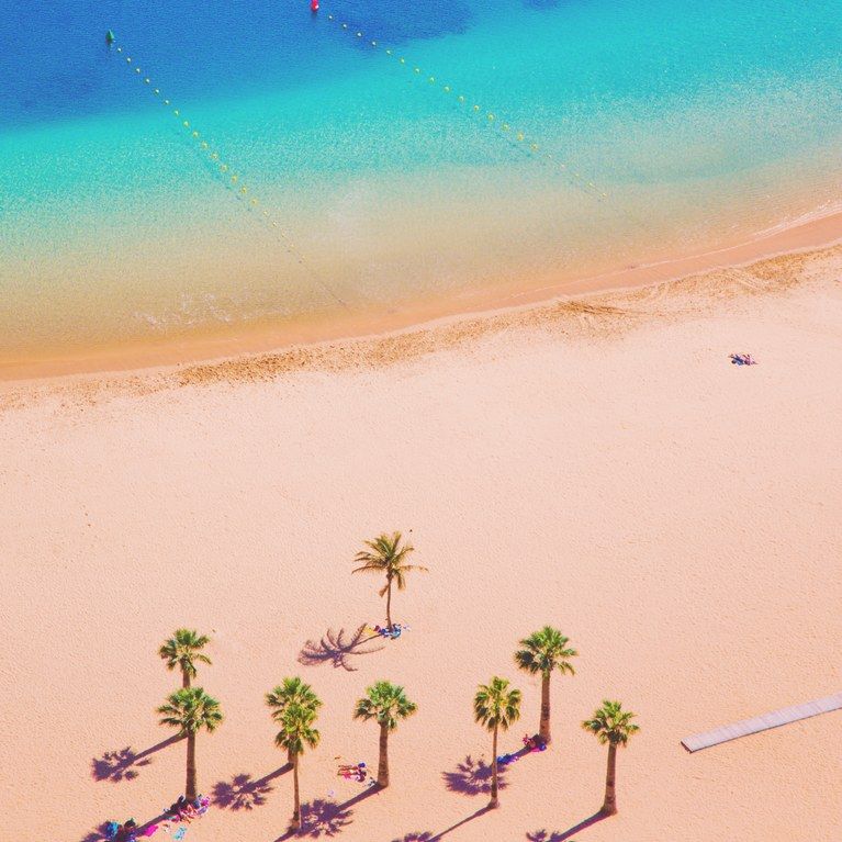 A visit to the ethereal interior of the island is a must – a landscape of silent pine forests, intercut with plains of volcanic black ash and glistening rivers of fossilised lava flows – known as the Teide National Park.
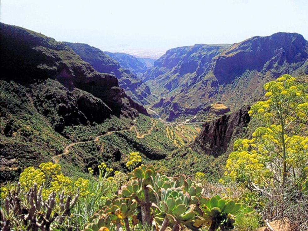
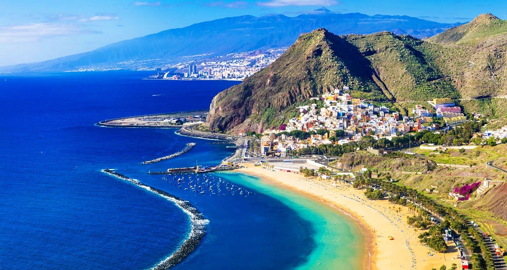 One thing that some travellers don’t realise is that the islands are actually completely different and much more diverse than we give them credit for.
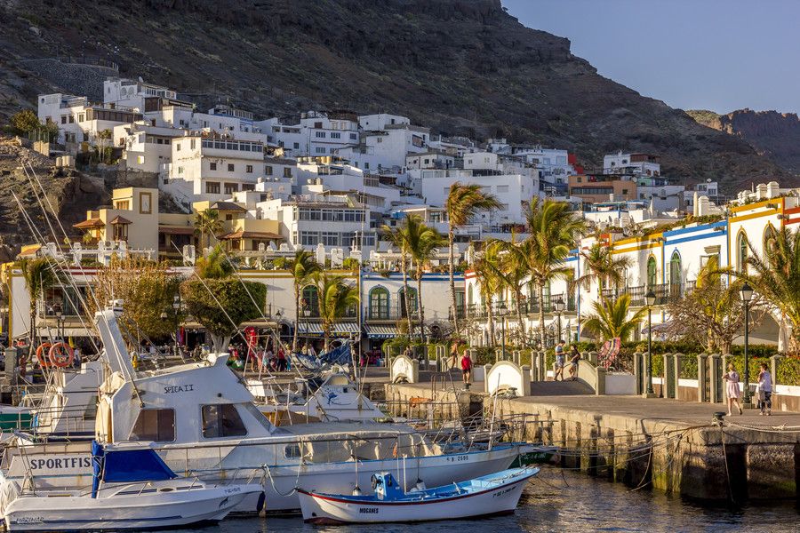
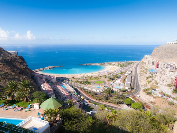
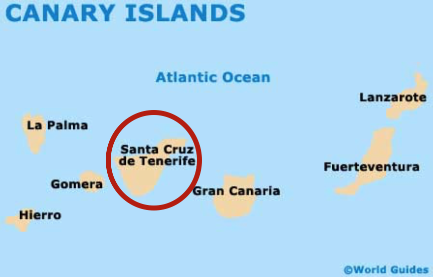 Bliss.
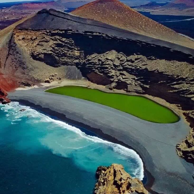 ) Visit the gorgeous town of Teror

 ) See the Milky Way with two kings
 Head across around sunset for some epic views.
 ) Watch an island sunset
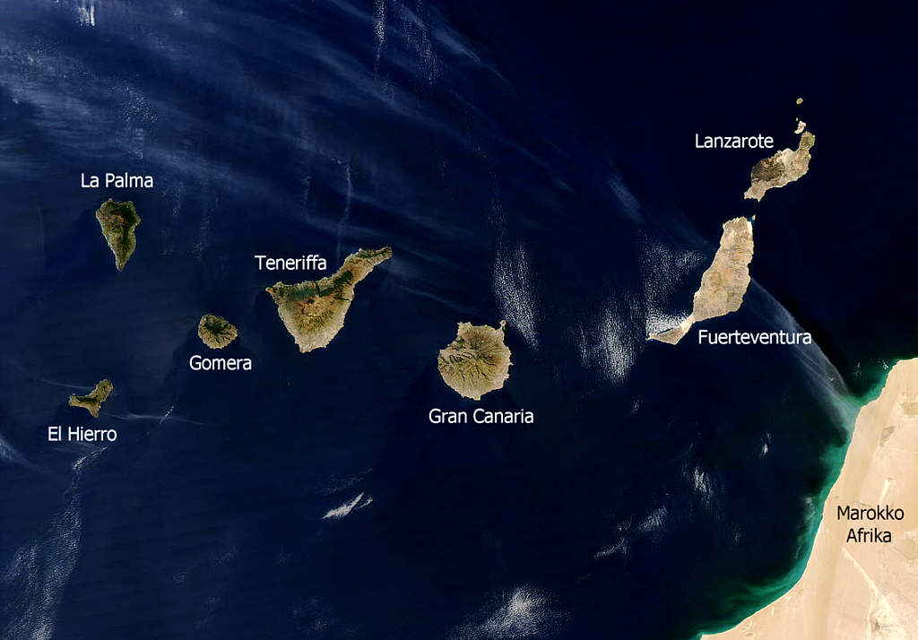

 The islands of La Palma, La Gomera, and El Hierro receive significantly fewer tourists, with annual visitors numbering in the low hundreds of thousands rather than the millions.
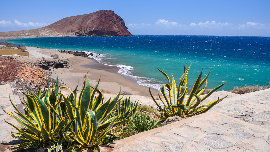
 Puerto Rico has a good beach and plenty of accommodation and eating choices, making it a good option for families.
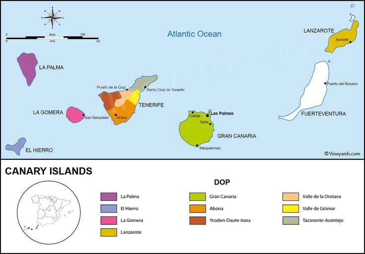 While nightlife exists, Lanzarote will appeal more to those in search of a laidback, downbeat style of holiday.
 While they are all different and each has its own character, they differ from the larger islands in that they are not beach holiday destinations. Rather, they all boast wonderful opportunities for outdoor activities; in particular, these islands are playgrounds for hiking enthusiasts.
 They are less suitable for families and not at all for people looking to party.
 You won’t be bored!
 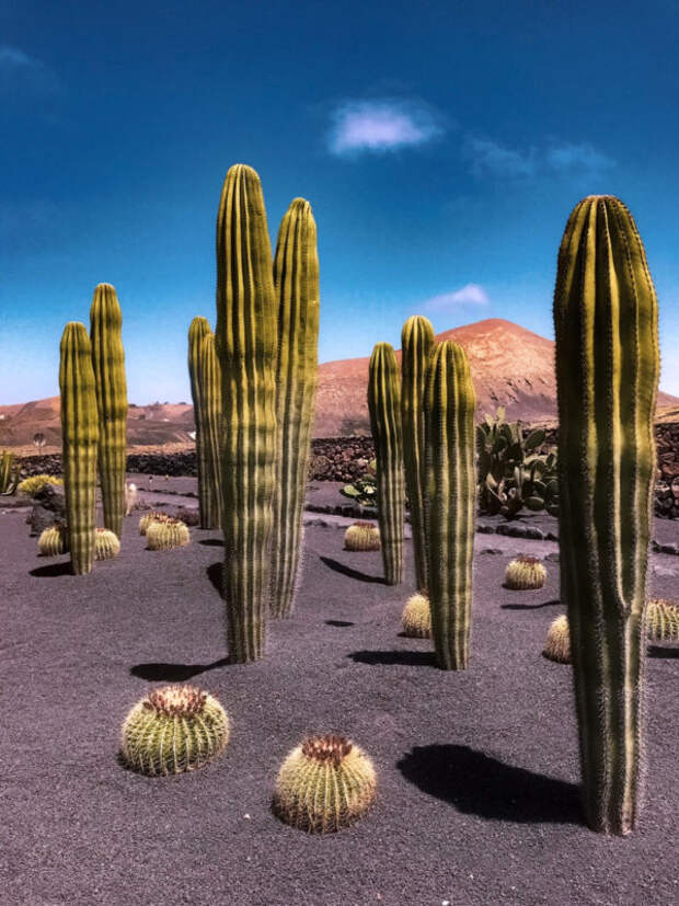 The cheapest way to fly to Tenerife is from Barcelona, Malaga, Madrid, Valencia, Porto, London, Milan. I advise you to take a direct flight from Moscow. Flight time is about 8 hours. Aeroflot has direct flights. Look for cheap tickets using the low price calendar.
 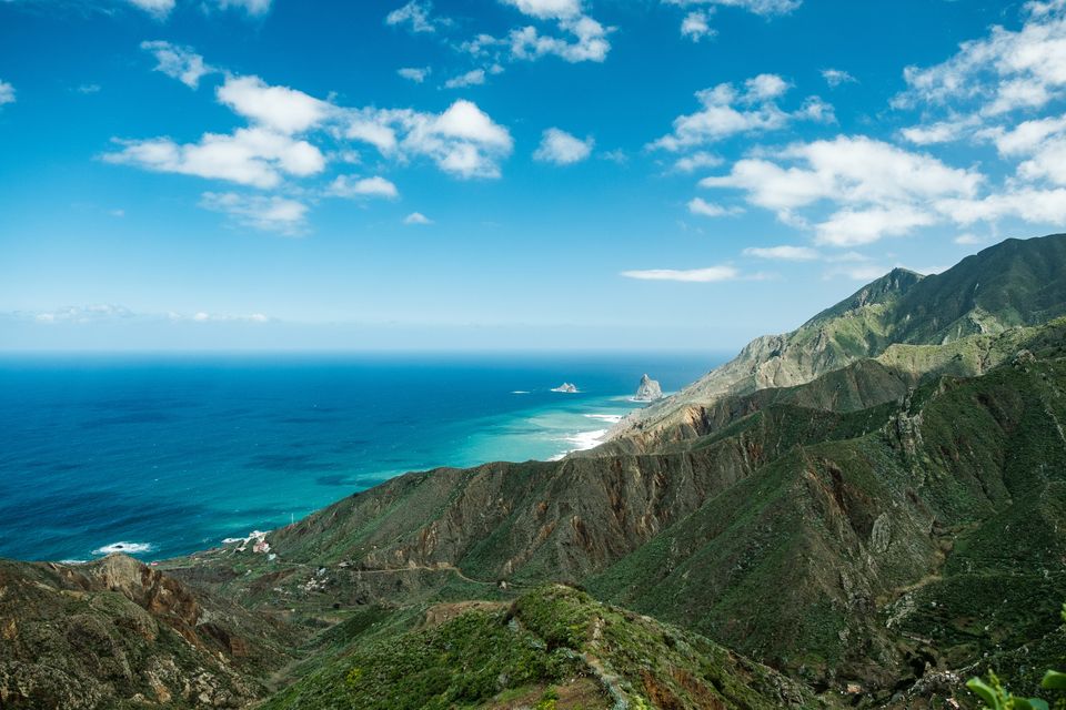 It is more convenient to book through Booking, apply the “apartments” filter when searching. Good apartments are usually booked 2-6 months in advance. So I highly recommend booking well in advance.
  Good replacement for Thailand.
  The taxi signs will guide you to the right exit. Get in the first taxi in line. The cost of a trip to Los Cristianos or Costa Adeje is about €35-40.
  Buy your pass through the Ten+ Movil app.
  This is a reliable search engine for local rental offices. Look for options with payment of the deposit in cash, and prepayment with a Russian card.
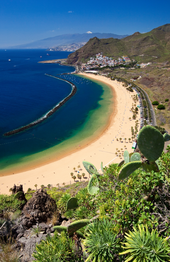
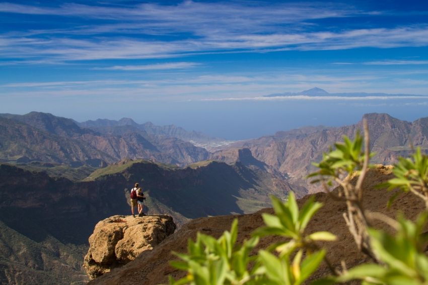 If there is no transport, get a park ticket along with a transfer here.
 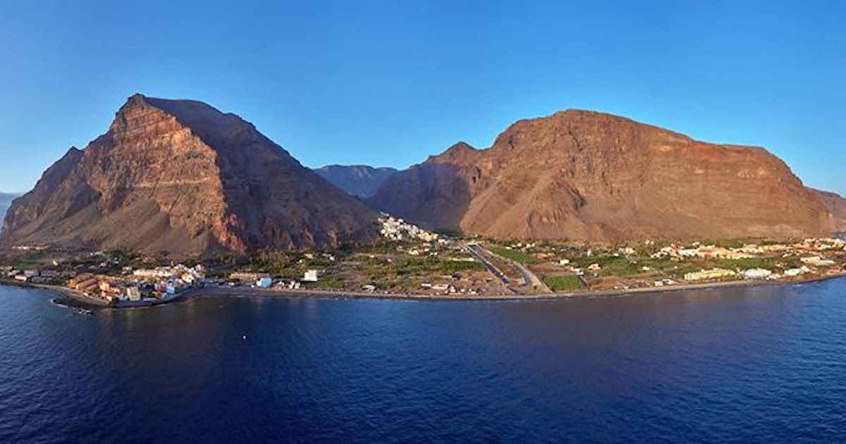 September or October is the best time for swimming. In winter, you can also swim, but the water is jaunty, about 20 ° C, but you can sunbathe without any problems.
 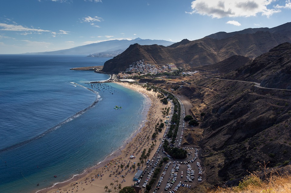 Therefore, Tenerife has so many different landscapes: tropical forests and volcanic semi-deserts, mountain gorges and dunes, beaches with black and white sand.
  The most snow-white and most visited beach is Playa de Las Teresitas. It is located near the capital. The beach is very unusual: its white sand was brought from the Sahara desert. But the water in this area is colder and there are no hotels nearby.
 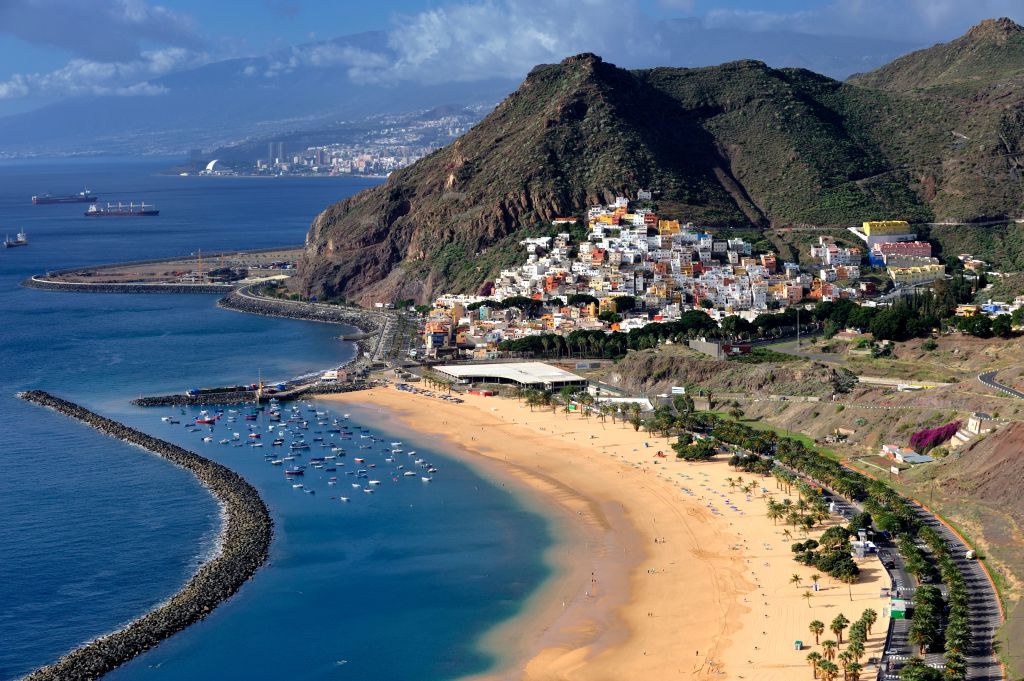 Teide Volcano (3719m) – the highest point of the Canaries and all of Spain. Its name means “snow mountain”. Many directors have used volcano landscapes in their films. For example, Star Wars was filmed here.
  Here, on the territory of 75,000 sq.m, more than 500 species of wild animals roam. The presentation of trained birds of prey is a kind of “highlight” of the park. I really liked it, I advise you to visit!
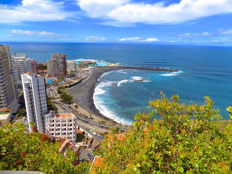
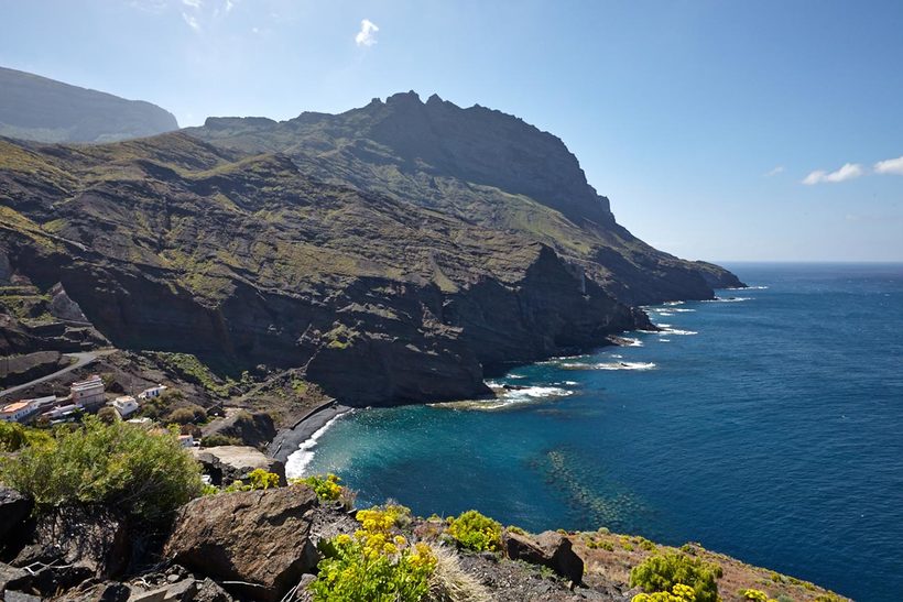 In the future, this gave the name to the archipelago as a whole. Confirmation of this theory can be found in the writings of the ancient Roman scientist Pliny.
 They made tools
 The Canary archipelago was repeatedly captured by the Moroccans, the Dutch, and the British.
  The local climatic zone is greatly influenced by the interaction of wet trade winds from the Atlantic Ocean and dry harmattan winds from Africa.
 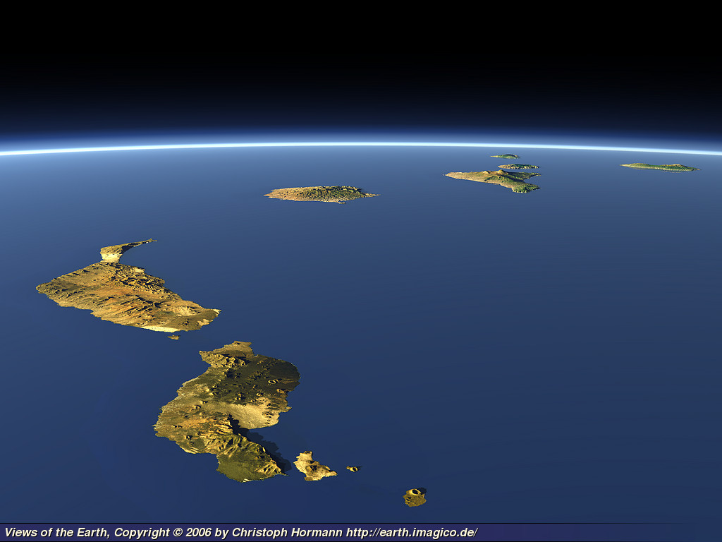 In Gran Canaria, the minimum daily temperature in winter is + 20 ° C, in summer – + 30 ° C. Lanzarote is known for the almost complete absence of rain, and Fuerteventura for stable temperatures all year round and strong winds.
  usr. pace. (°C)
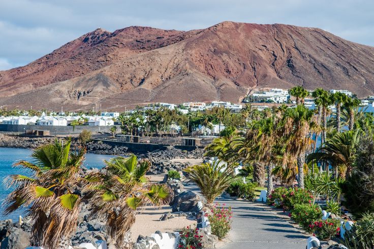 min. abs. (°C)
 9
9
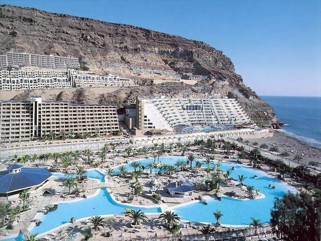 (°C)
(°C)
 The water temperature in the ocean is +19°C.
  love this period
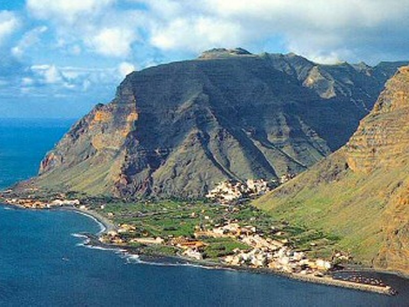
 June weather
 At this time the ocean is still enough
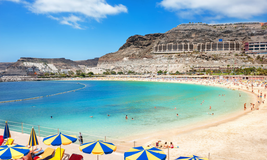
 They are located between 27°38′ and 29° 35 ′ North latitude and 13 ° 20 ′ and 18 ° 14 ′ West longitude
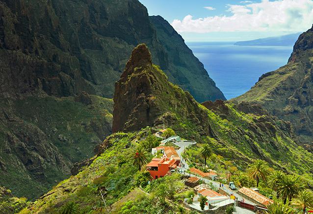

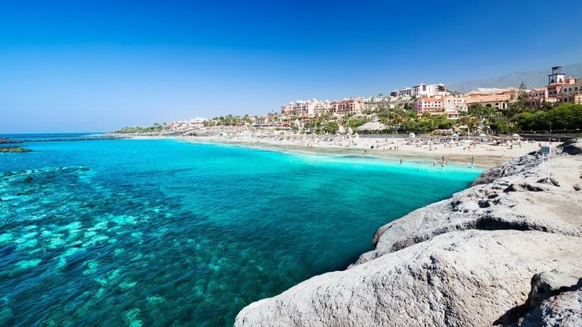
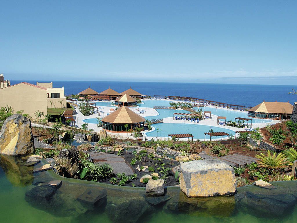 There are 9 airlines flying between them all0369 Canaryfly and Binter Canarias . Such flights are very short, the longest flight Tenerife – Lanzarote lasts an hour, a flight to other islands of the archipelago takes no more than half an hour.
  But the remoteness from the mainland, the influence of the language of the indigenous population, was the reason for the formation of the Canarian dialect of the Spanish language. It is similar to Andalusian, but has its own characteristics.
  Canaries so
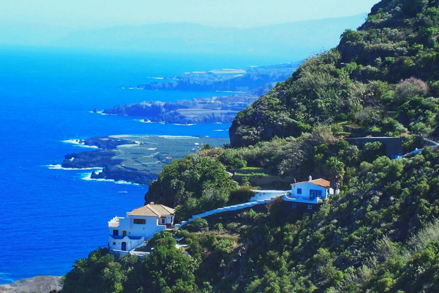
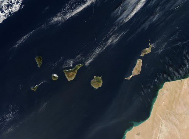 Unlike other caves, Jameos del Agua has been altered by man. Under the leadership of Cesar Manrique, a unique complex was created. The cave consists of a couple of grottoes, an open gallery and an artificial lagoon with turquoise water. A concert hall is organized in a large grotto. There is also an underground restaurant in the complex.
  The exposition of the museum is located in 12 halls, in the courtyard and even in the basement.
 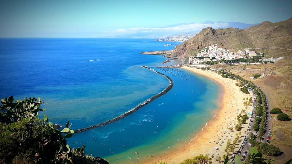 The park has a large collection of plants, insects and animals, including 1000 species of palms, 150 species of birds
  It is also very popular with surfers.
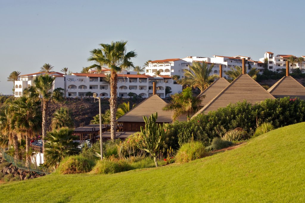

 Monthly traffic is
 Canary archipelago. A popular European resort, thanks to its unique climate, tourists come to Tenerife all year round. Despite its relatively small size, its southern and northern parts are significantly different climatically. The south of Tenerife is protected by a mountain plateau from cold trade winds, so in its southern part there is practically no rain and it is always sunny. In the South are the popular resorts of Las Americas, Los Cristianos and Costa Adeje.
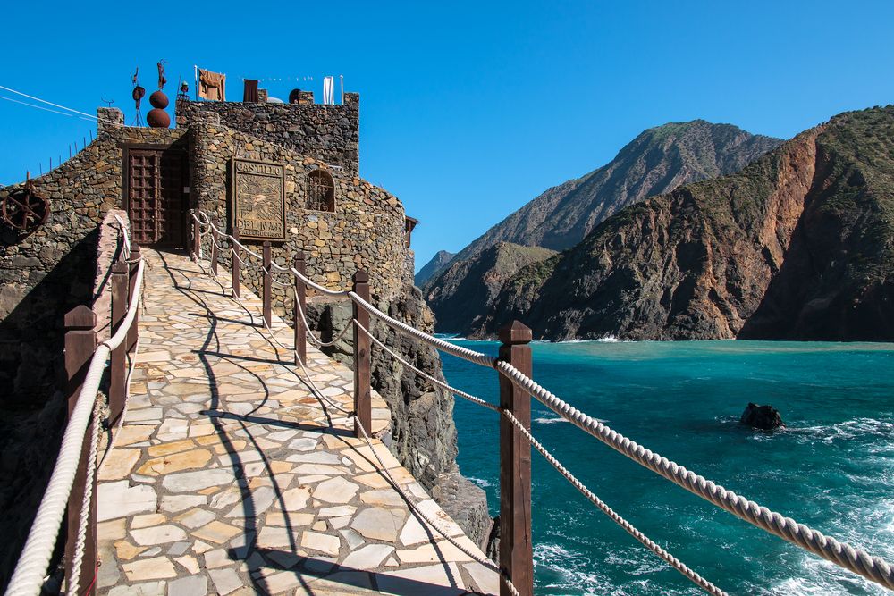
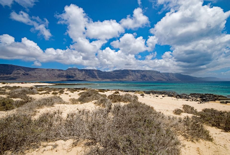
 But, despite its size, it is sparsely populated, the tourist infrastructure is poorly developed. Once Fuerteventura was almost completely covered with forest, but during the time of the Spanish conquistadors, the forests were cut down to build ships. Today, the vegetation on it is very sparse, it is practically not protected from the winds.
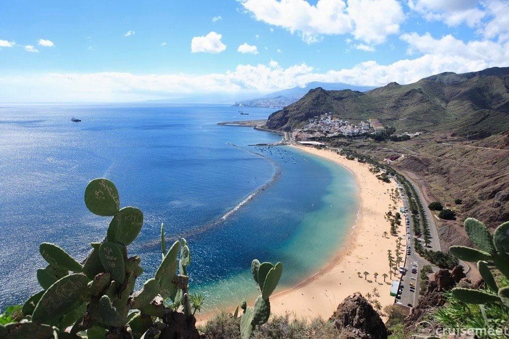


 During the tour, it is worth seeing the Fortress of Christopher Columbus, the Church of Virgen de Asuncion, where, according to legend, Christopher Columbus prayed before his journey, the Torre del Conde Tower. It is no less interesting to walk through the laurel forests, where trees reach 20 meters in height, mountain paths and gorges.
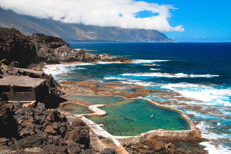

 Volumetric plan of Tenerife.

 ..
..


 As a rule, festive carts drive through the streets, from which musicians and procession participants treat passers-by with pleasure.
  The most significant, summer, begins on July 1 and lasts until the last day of August.
 The TEA Art Gallery presents avant-garde exhibitions of contemporary art.
  In the south, the beaches are covered with special black volcanic sand, there are beaches with white sand brought from the Sahara;
  Homer) – laurel forests mysterious in the fog, which remained from the ancient subtropical forest;
 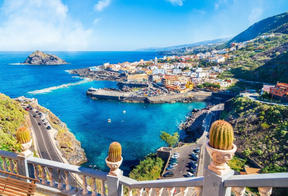 Parking near the park is both paid and quite official free along the road.
  You can also ride on a high-speed bobsled track. There is a cafe on the territory of the park, but you can bring food with you – this is not prohibited.
 Temporary exhibition space given to avant-garde Spanish artists.
  The small part that remained mixed with the Spaniards and lost their language.
 The study of these ancient objects was carried out by Thor Heyerdahl, whose activities are dedicated to the museum located at the base of the complex.

 To date, the park has set itself the goal of bypassing all other water parks in Europe in terms of entertainment. The entertainment arsenal of Siam Park is so diverse and rich that there are practically no attractions in the world that would not be here. Water attractions are complemented by laser shows and other “quirks”, bringing visitors into indescribable delight. Siam Park is especially recommended for those who have a rest in Tenerife with the whole family.
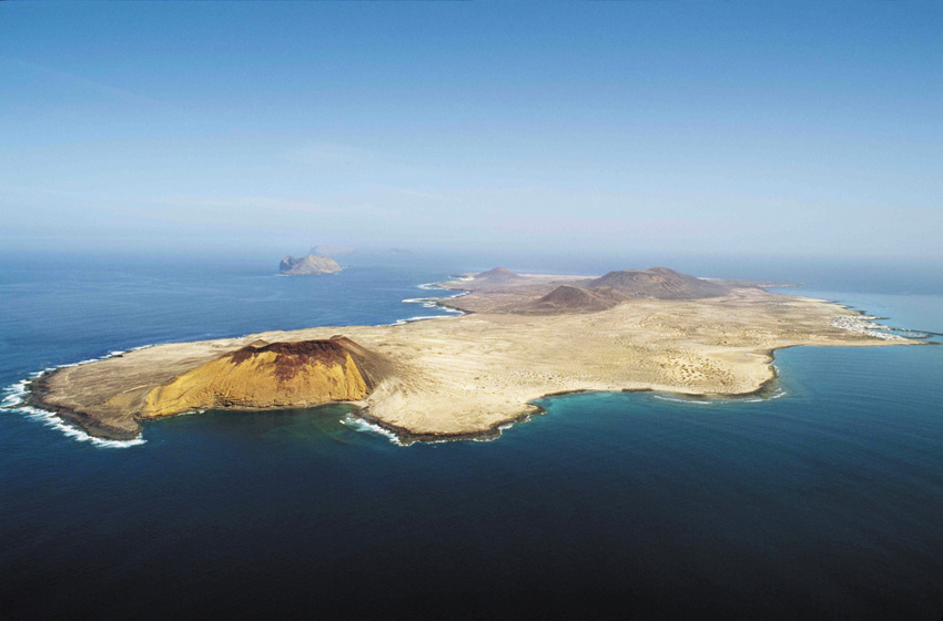
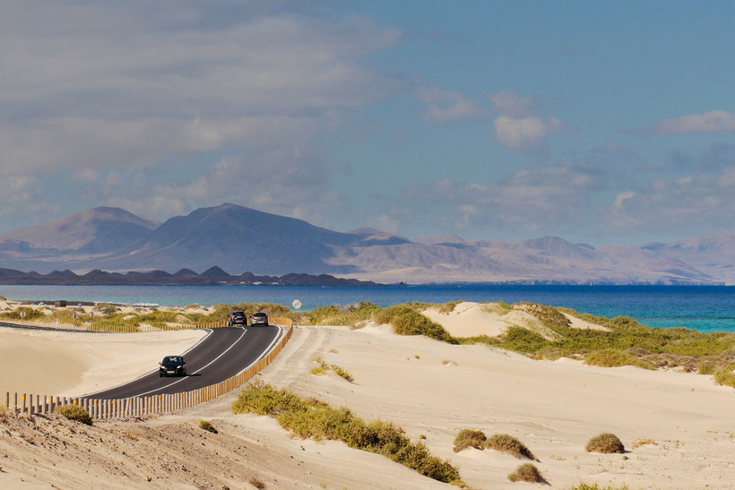 At the same time, many of them have a la carte offers – a set lunch. This option is cheaper – an average of 10-15 euros.
  Friendly lemurs are not at all afraid of people and allow you to take selfies with them. Guinea pigs crawl underfoot, iguanas are indifferent to people and allow themselves to be touched and fed. Birds and turtles are also not afraid of people. You can feed almost all animals here – even an impressive-looking chimpanzee stretches his hand between the bars of the cage for a treat. There are many colorful parrots and other tropical birds here. But still, the park is not too big, in a couple of hours you can walk around the whole and have plenty to talk with his pets.
 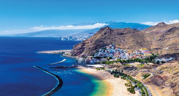 A room in a 3-star hotel costs about 25 euros.
 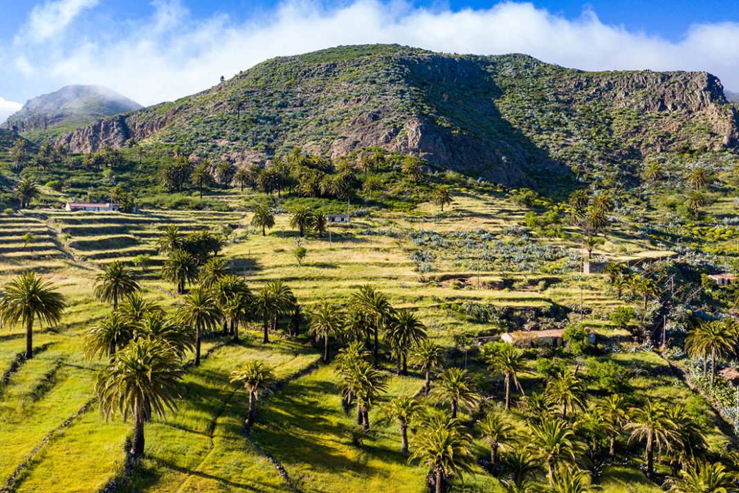 Near banana plantations and mountains.
  Historic center with churches and streets.

 A delicious snack is served at the Chip-Chipi Restaurant on La Palma (Lugar Juan Mayor 42).
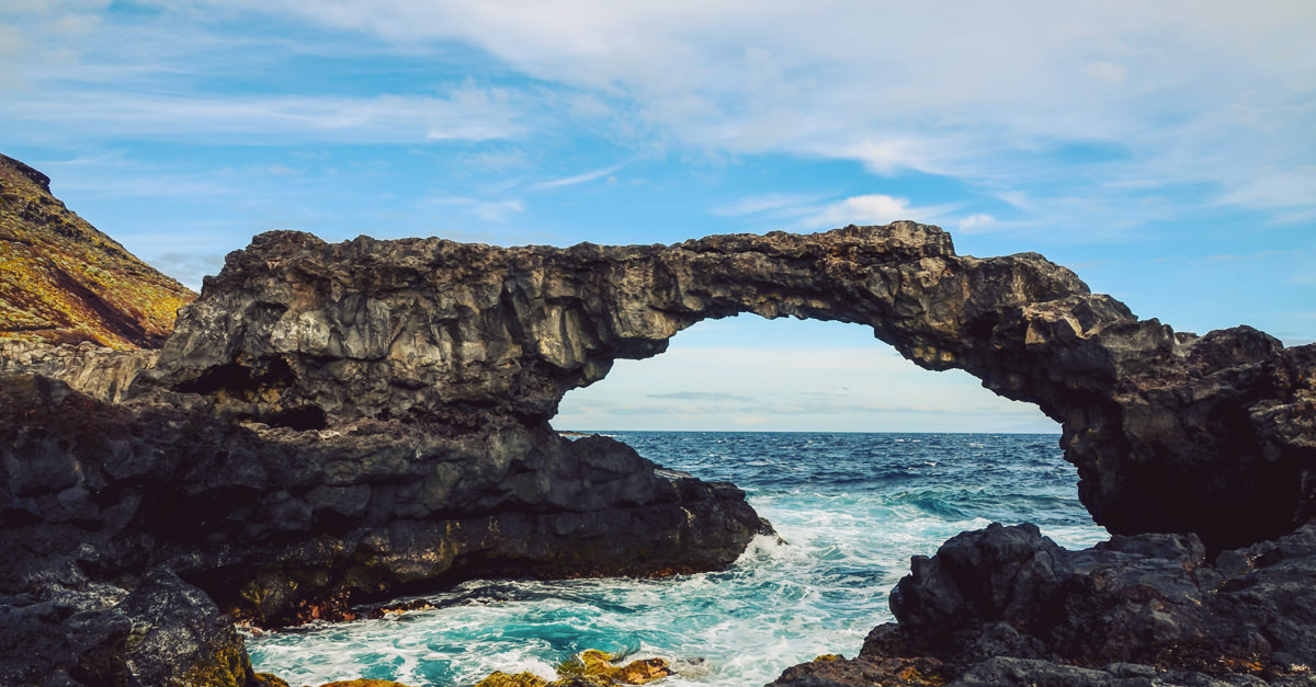 The biggest. Most populous. The most visited by tourists (from 4 to 6 million guests a year). On its territory there are as many as 12 natural zones. On the slopes of the Teide volcano lies the Teno National Natural Park. And on the west coast, the cliffs of Los Gigantes reign. In terms of the number and variety of beaches, Tenerife overtakes all its counterparts in the archipelago. Connoisseurs of comfort will love Las Teresitas. El Bogliullo and El Ancon fascinate with their wild beauty.
 The latter is famous for its nightlife in the Veronicas area.


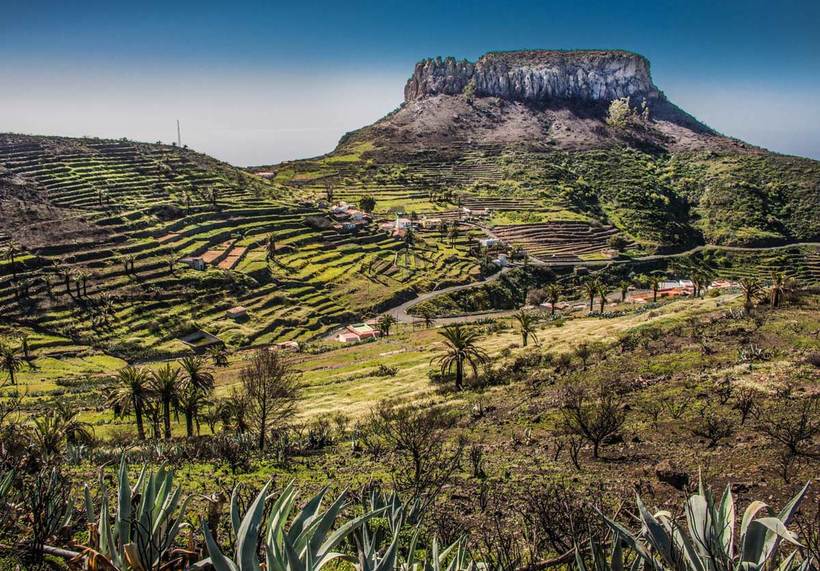 It can only be seen from the sea. Many pillars of once solidified magma rise up to 800 m from the water. From afar, it really looks like a huge organ.
  In addition to original architectural solutions and informative expositions, guests can enjoy an elegant restaurant overlooking the port of Arrecife. And the real natural treasures of the island are the beaches of Papagayo Bay and Timanfaya National Park.
  And you can appreciate the beautiful view of the valley from the observation deck Mirador de la Peña, built by Cesar Manrique. El Hierro is simply a treasure for divers. There are 46 excellent diving locations here. The most popular is the territory of the La Restinga Marine Reserve. Frontera Rural Park is very similar to an enchanted forest. Here grow junipers bent to the ground, up to 8 meters high. They are considered the symbol of El Hierro.
  It is famous for its picturesque dunes. The beaches of Corralejo Dunes and La Cala de Cotillo are very popular with nudists. Nearby is the volcano Montaña Roja. From its top you can enjoy splendid panoramic views. The resort town of Corralejo is famous for its excellent beach, Baku water park and vibrant nightlife. The Jandia peninsula and its white sandy beaches are the perfect place for a relaxing holiday. The village of Betancuria was once the capital of the island. Snow-white houses with bright roofs hid right in the crater of a dormant volcano. Many architectural monuments from the time of the conquest have been preserved here.
  Guide
Guide  regmarkets.ru/listpreview/idata2/b7/de/b7de502b84ef21d2ec3c49997f9c6af3.jpg”>
  Mettiga
 Korneeva N.V. Weight: 205, Number of pages: 128, Product volume: 0.2926
 Mass radio library (MRB). Issue…

 Rex, E.G Crossword Clue
 G Crossword Clue

 Ft.
Ft. Lucie
Lucie : None
 8 mi
8 mi Information is not guaranteed and should be independently verified.
 Ft.
Ft. Ft.
Ft. Ft.
Ft.
 Welcome to paradise yet centrally located to schools, parks, and great peaceful Florida living in your new entertaining Dream Home! Bring your RV & Boats.. City sewer hookup available. Home has city water already.
 00Accessibility: Customized Wheelchair Accessible, Accessible DoorsFloors: Tile
 32 acres
 This information is not verified for authenticity or accuracy and is not guaranteed. Copyright 2022 Beaches Multiple Listing Service, Inc. Information is provided exclusively for consumers’ personal, non-commercial use and may not be used for any purpose other than to identify prospective properties consumers may be interested in purchasing.
 1492 SE Odonnell Ln was last sold on Jun 28, 2022 for $525,000 (1% higher than the asking price of $519,000). The current Trulia Estimate for 1492 SE Odonnell Ln is $545,000.

 25 service (XOT)
 His crew mostly came
 He reached as far
 He departed from La Navidad in the Nia on January 2, 1493.
 After a stop to repair
 He traveled primarily to the Caribbean, including the Bahamas, Cuba, Santo Domingo, and Jamaica, and in his latter two voyages traveled to the coasts of eastern Central America and northern South America.
 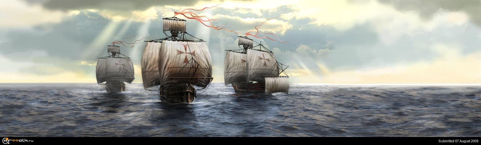 Plants native to the Americas (such as potatoes, tomatoes, and tobacco) were imported to Europe.
 He has long been called the “discoverer” of the New World, although Vikings such as Leif Eriksson had visited North America five centuries earlier. Columbus made his transatlantic voyages under the sponsorship of Ferdinand II and Isabella I, the Catholic Monarchs of Aragon, Castile, and Leon in Spain. He was at first full of hope and ambition, an ambition partly gratified by his title “Admiral of the Ocean Sea,” awarded to him in April 1492, and by the grants enrolled in the Book of Privileges (a record of his titles and claims). However, he died a disappointed man.
 According to the older understanding, the “discovery” of the Americas was a great triumph, one in which Columbus played the part of hero in accomplishing the four voyages, in being the means of bringing great material profit to Spain and to other European countries, and in opening up the Americas to European settlement. The more recent perspective, however, has concentrated on the destructive side of the European conquest, emphasizing, for example, the disastrous impact of the slave trade and the ravages of imported disease on the indigenous peoples of the Caribbean region and the American continents. The sense of triumph has diminished accordingly, and the view of Columbus as hero has now been replaced, for many, by one of a man deeply flawed. While this second perception rarely doubts Columbus’s sincerity or abilities as a navigator, it emphatically removes him from his position of honour. Political activists of all kinds have intervened in the debate, further hindering the reconciliation of these disparate views.
 This was achieved chiefly through the interventions of the Spanish treasurer, Luis de Santángel, and of the Franciscan friars of La Rábida, near Huelva, with whom Columbus had stayed in the summer of 1491. Juan Pérez of La Rábida had been one of the queen’s confessors and perhaps procured him the crucial audience.
 Granada’s fall had produced euphoria among Spanish Christians and encouraged designs of ultimate triumph over the Islamic world, albeit chiefly, perhaps, by the back way round the globe. A direct assault eastward could prove difficult, because the Ottoman Empire and other Islamic states in the region had been gaining strength at a pace that was threatening the Christian monarchies themselves. The Islamic powers had effectively closed the land routes to the East and made the sea route south from the Red Sea extremely hard to access.
 According to that eschatological vision, Christendom would recapture Jerusalem and install a Christian emperor in the Holy Land as a precondition for the coming and defeat of Antichrist, the Christian conversion of the whole human race, and the Last Judgment. Franciscans and others hoped that Columbus’s westward project would help to finance a Crusade to the Holy Land that might even be reinforced by, or coordinated with, offensives from the legendary ruler Prester John, who was thought to survive with his descendants in the lands to the east of the infidel. The emperor of Cathay—whom Europeans referred to as the Great Khan of the Golden Horde—was himself held to be interested in Christianity, and Columbus carefully carried a letter of friendship addressed to him by the Spanish monarchs. Finally, the Portuguese explorer Bartolomeu Dias was known to have pressed southward along the coast of West Africa, beyond São Jorge da Mina, in an effort to find an easterly route to Cathay and India by sea.
 It would never do to allow the Portuguese to find the sea route first.
 On September 9, the squadron turned west from the Canary Islands, crossed the Atlantic Ocean in the subtropical zone and reached the island of San Salvador in the Bahamas, where Christopher Columbus landed on October 12, 1492 (the official date of the discovery of America).
  Columbus left 39 sailors here, armed the fort with cannons from the Santa Maria and left them supplies for a year, and on January 4, 149For 3 years, taking several islanders with him, he went to sea on a small “Ninya”.

 From these countries, pepper, nutmeg, cloves, cinnamon, expensive silk fabrics came to Europe. Merchants from Europe could not penetrate the countries of Asia by land, as the Turkish conquests cut off traditional merchant ties with the East through the Mediterranean Sea. They were forced to purchase Asian goods from Arab merchants. Therefore, the Europeans were interested in finding a sea route to Asia, which would allow them to purchase Asian goods without intermediaries. In the 1480s, the Portuguese tried to go around Africa to get across the Indian Ocean to India.
  The monarch submitted his project for examination to the scientists of the “Mathematical Junta” (Lisbon Academy of Astronomy and Mathematics). Experts recognized Columbus’s calculations as “fantastic”, and the king refused Columbus.


 A fort was built from the wreckage of the ship – the first European settlement in America, named on the occasion of the Christmas holiday “Navidad” (“Christmas City”).
  On February 12, a storm arose, and on the night of February 14, the ships lost sight of each other. At dawn on February 15, the sailors saw the land, and Columbus determined that he was near the Azores. On February 18, the Nina managed to land on the coast of one of the islands – Santa Maria.

 The next stop for the Columbus team was
 From discovery by Columbus
 1492 – 1493

 Science in the global world. “Obvious – incredible” broadcast 05/10/2008
  Columbus Island named
 King Ferdinand II
 ” However died
 M. Sergeev presented his election program at the North Caucasus Federal University
 Ursula and her attendants.


 Rude or colloquial translations are usually marked in red or orange.

 Determination of support reactions and pinching moments
 Only the Portuguese prosper. In their famous school of Henry the Navigator in Sagres, they managed to build caravels capable of sailing confidently in ocean waters, and now the dangers of El Mediterraneo[192] the Portuguese are not concerned: by the ocean they went to the rich gold coast of Africa and took possession of it, and also they rounded the Cape of Storms, from where it is within easy reach to the abundant East! That is why the Portuguese now call the Cape of Storms in a new way – Cabo da Boa Esperanca, the Cape of Good Hope. For them, it’s good! But in the Spanish ports – much more deserted and quieter. Thinned the forest of masts in the harbors. Shipowners are ruined. Families of loaders and sailors are begging.
  .. And he convinced the same, and royal majesties, and even experienced Palos captains – the Pinson brothers[193]! They say they even invested money. And the whole of Paloe knows perfectly well that these brothers will not put their hand in their pocket in vain, especially Alonso! Honest townspeople are also well aware of something else: if not for the support of the Genoese Pinsona, not a single sailor would have enrolled in the team of this madman for any money! Well, maybe only Vasquez, and his amigos would have signed up. Vasquez, being very drunk, killed the city crier in the spring. What was the matter, the townspeople told different things, but everyone agreed that the herald of Quintero had a voice, that the trumpet of the Last Judgment, and was a bully, the earth will rest in peace to him! So: Vasquez and his faithful amigos (they tried to arrange an escape for him, but they themselves ended up in prison for this) alguasil himself promised freedom if they sign up to sail with the Italian to the ends of the world [19four].
 Is it any wonder they agreed!
  Which, moreover, is either there or not. After all, even the Portuguese did not dare to swim so far. They take water and provisions with them for two months. In the Canary Islands, they will replenish the supply, and what then is unknown … And this gray-haired, nosy navigator Colon, who knows where it came from on their heads, is dragging them to certain death! Well, at least one thing consoled the families – they paid the sailors for four months in advance from the royal treasury!
  It is overflowing with mournful people who, in tears, look at the land disappearing behind the stern and whisper something – either farewell, or prayers, or curses. No one is escorting this caravel. The last Jews expelled by royal decree leave their native Spain [195]. Where they are sailing away – in Palos they do not know and do not want to know …
 1 km from City Center300 m from Papagayo Beach Club
 2 km from City Center800 m from Golf Las Americas
 1 km from City Center300 m from Piramide de Arona convention centre
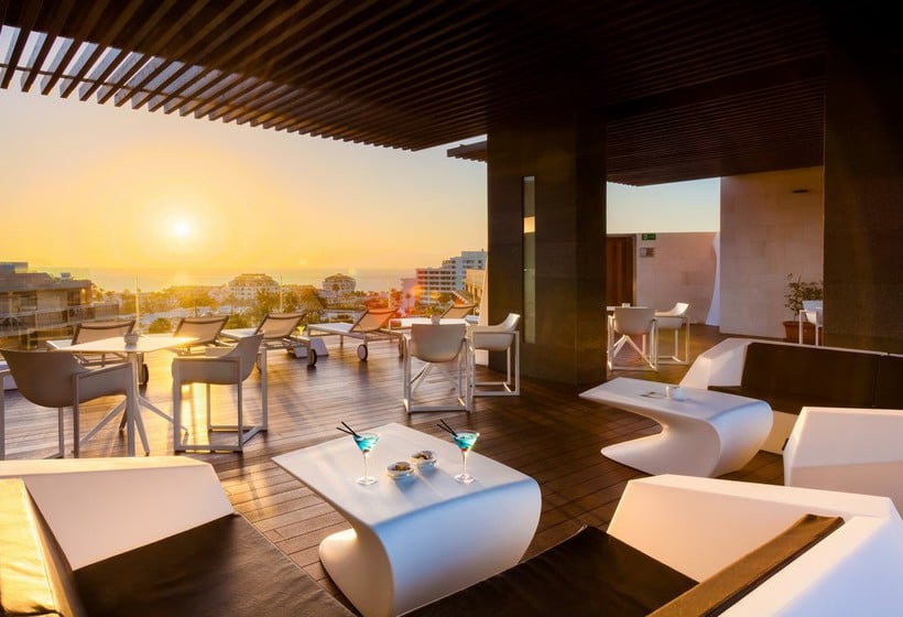
 1 km from City Center400 m from TIBU Tenerife
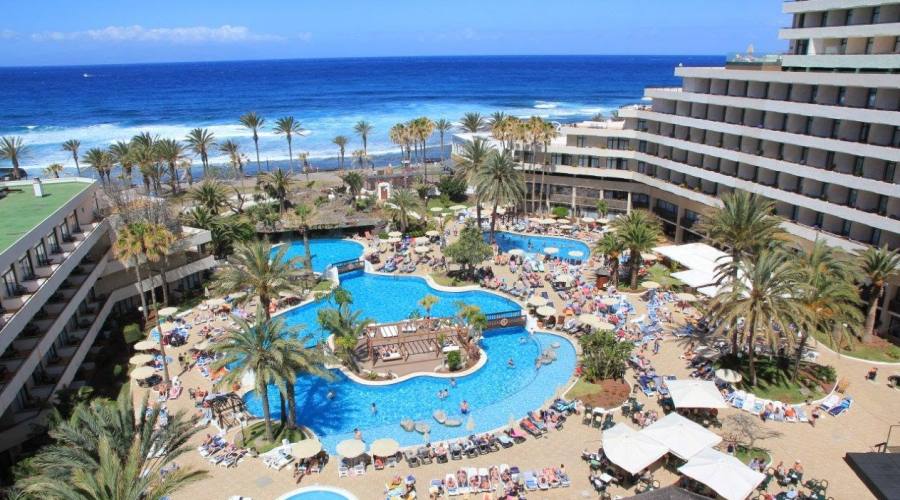 All 151 rooms are one- and two-bedroom bungalows, each with front yards, kitchens, living rooms, and free Wi-Fi; some have air-conditioning, but not all. Kid Suites come with beanbag chairs, PlayStations, and bottle warmers. There are four pools, a pool bar, a tapas bar, and a buffet restaurant serving all meals. A multi-use sports court, kids’ club, underground disco, and animation team are evidence of the hotel’s upbeat nature, but the vibe around the outlying bungalows is peaceful. All this, and the extremely family-friendly property is a three-minute walk from the beach. Travelers who are willing to swap personal outdoor space for rooms with ocean views could try h20 Conquistador.
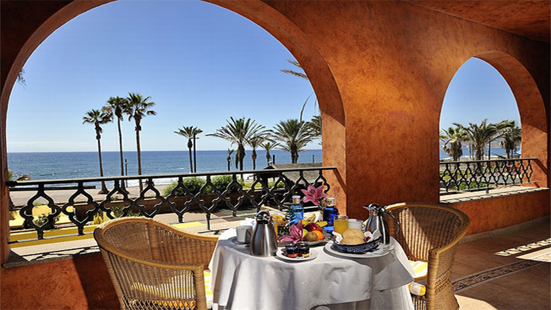 The hotel has three heated pools, three dining options, a huge game room, and a grocery store, plus it offers free shuttles to Siam Park and the beach. Travelers who don’t want shuttle rides or car drives to stand between them and the ocean could try the beachfront Parque Santiago III, but the rooms there are smaller and less fresh.
 The property is surrounded by the Las Americas golf course, but it’s a 30-minute walk from the beach, restaurants, and shops — the hotel does offer a free shuttle. Travelers looking to be closer to the action should check out the Parque Cristobal Tenerife, which is a 10-minute walk to the beach.
 It’s worth comparing rates with next door sister property Marola Portosin, where the pool is slightly larger and rooms are a touch more modern.
  HD Parque Cristobal provides a similarly relaxed environment for families, but is just a three-minute walk from the beach.
 If you fit into that category, consider checking out the slightly quieter Hotel Gala instead.
 But there’s substance as well as style. In addition to trendy decor, the 519 rooms have mini-fridges, air-conditioning, flat-screen LED TVs, and balconies or terraces — many with ocean views. Plus, Las Palmeras has so many features (three pools, five eateries, three bars, an exhaustive entertainment program…), you’d think it was in the middle of nowhere, not in the smack-dab center of town on a prime beachfront piece of land. Travelers looking for less of a big-resort experience could check out Aparthotel El Duque, a scaled-down all-inclusive that’s a short walk from Costa Adeje’s best beach.
 Rooms are a squeeze, but come with mini-fridges, flat-screen TVs, and balconies, many overlooking the ocean. In all, the property has across-the-board appeal for all sorts of guests — families, couples, even the rare business traveler — but those looking for a quieter vibe (and the same killer location) could check out Parque Santiago IV.
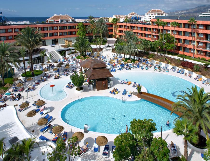 Travelers who want to be directly on the beach could consider Parque Santiago III, a property with similar accommodations and atmosphere, but no all-inclusive rates.
 Couples may prefer the adult-only and more contemporary Hotel Sunprime Ocean View.

 Though the resort’s name may lead travelers to believe otherwise, both the beach and entrance to the neighboring golf course are a 10-minute walk away. On-site there’s a decent-sized pool with a kiddy section, plus a bevy of kid-friendly amenities such as a kids club, game room, and daily entertainment program. Spacious and bright apartments have fully equipped kitchens but some dated furnishings; all except loft studios come with small private gardens or balconies. The buffet eatery’s food receives many negative reviews, but there are plenty of bars and restaurants within a few blocks. The resort offers good value overall, but it’s worth comparing rates with the similar Parque Cristobal Tenerife.
 Onsite entertainment and dance classes. The hotel also features free in-room WiFi, 2 outdoor pools, and a restaurant.
 Great for family with young children. Could not fault food or activities. Staff were all very friendly. The resort could benefit from a separate bar or restaurant as you end up eating breakfast, all dinners and having drinks and entertainment in the same room. A minor issue though. …”
 The pool area was a great size, there wasnt any day time music which was a shame this would have made it perfect. The drinks were reasonably priced. The communal areas …”
 The location of the hotel was quiet and only a walking distance into Playa de las Americas. Would definitely like to stay here again.”
 Prices and availability subject to change. Additional terms may apply.
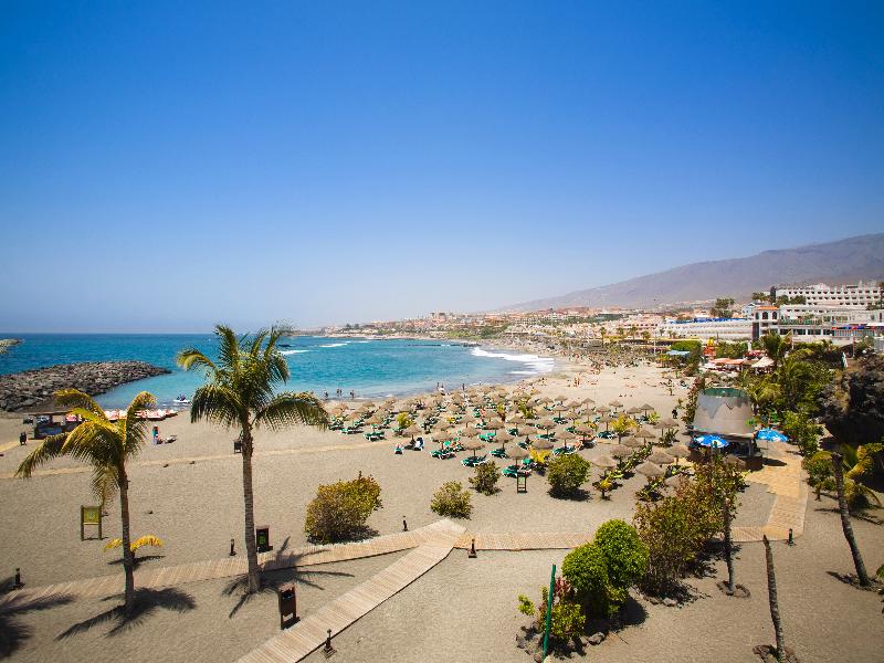 8 Excellent
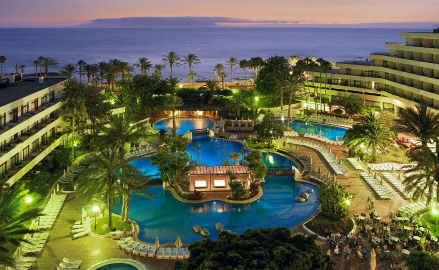 9 Excellent
 7 Excellent
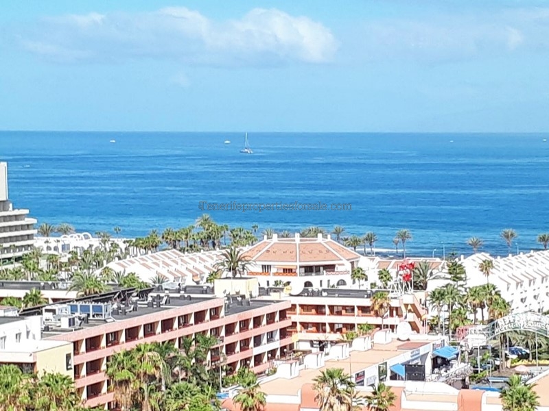 Prices are not fixed and may vary with time.
 Together these beaches are known as the Playas de las Américas and they stretch out for over a kilometre. Each has its own name: Tierra Negra, El Bobo, Las Américas and Troya. However, they’re not identical. The Las Américas beach stands out for its size as it’s almost 500 metres long and 60 metres wide.
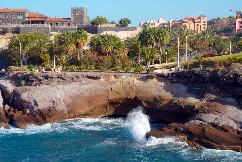 You’ll find numerous hotels and apartments, shops selling anything you might need and terraces where you can put your feet up and enjoy a delicious ice cream. The beach, always the best children’s playground, has been adapted to enable access for people with disabilities and has lifeguards to assist you if necessary.
 During the night, the spotlight turns on an area known as Las Verónicas where nightclubs, cabarets and bars with live music shows are the big draw. Tourists staying in other areas of the island head here for a night out so there are a huge number of different leisure options of this type on offer. It’s clear that the daytime and evening vibes are completely different. If you love being in the thick of things and don’t want to drive a car during your holidays, this area is definitely the place for you to stay.
 And if you’ve never tried this sport, you have the chance to dive for the first time here, as there are lots of diving schools in Costa Adeje.

 This vibrant and dynamic destination hums with energy all year round in its bars and nightclubs, where some of the world’s top DJs do guest spots all through the summer to keep everyone dancing from dusk to dawn. Once you’ve finished raving all night, take a morning stroll along powder-soft beaches and catch the ocean breeze as shimmering water laps gently against Tenerife’s south coast. Families are looked after too on Playa De Las Americas holidays, with plenty of attractions and resorts that are perfect for all ages. If it’s lazy days on a sun lounger, dipping your toes in the water, and building sandcastles that you’re after, then it’s easy to find a place to unwind among the fabulous beaches of Playa De Las Americas.
 And with year-round sunshine, you can choose to take your break in high season, or during the quieter autumn and spring months. Adrenaline junkies will love the water sports on offer, while a trip into the interior of the island will take you on a journey of discovery through a unique landscape.
  Over half of the hotels in the resort are family friendly, many offering daytime clubs and night time entertainment, so you’ll definitely find one that is suitable for your needs.
 If you like it a little cooler but still sunny, then spring or autumn sees temperatures in the early to mid-20s (°C).


 ..
.. org/BreadcrumbList”>


 The winter season of discounts starts from 07.01 to 06.03 and the summer season from 01.07 to 31.08. If you are completely determined to immerse yourself in shopping, then the best choice would be to go to the capital of Santa Cruz de Tenerife. You will find detailed information in the section shopping in Tenerife.
  And thanks to the unique climate of the southern coast of Tenerife, you can relax in Playa de Las Americas all year round. Choosing a vacation in the south, unlike its northern part, you are more likely to deprive yourself of unpredictable weather, since the Teide volcano, together with the high mountain range, does not allow the cold northern trade winds and clouds to pass, leaving them on the northern part of the island of Tenerife.
  And which will certainly appeal to beach lovers. And what is especially nice – the beaches belong to the municipality and are free for vacationers 365 days a year and 24 hours a day. True, there are only two of them on the territory of the resort, one of them is Playa El Camison (Spanish: Playa de El camison), equipped with breakwaters to protect the coast and make swimming safe and enjoyable. The second beach – Playa Honda (Spanish: Playa de Honda) is not equipped, not equipped with everything necessary for cultural recreation, but is used mainly by surfers for boarding.
  Moreover, the price of housing has only increased in recent years. Spanish banks offer low interest on mortgages, from 2.5% per annum. Subject to all the rules of the bank, and this is the provision by you of all the necessary documents for a mortgage, the bank pays the seller 60% of the cost of the residential property. From our side, we provide the search for the necessary object, assistance in opening a bank account, a foreigner’s number – NIE, checking the object for legal purity, for existing debts, signing a contract of sale and purchase at a notary public with issuing it to you. Turnkey deal.
  For beginners, there is a chance to be trained in schools where experienced masters will teach you how to surf and glide along the waves of the Atlantic Ocean. For those who have experience and want to practice, it will not be difficult to rent equipment (any equipment needed) and get down to business at Playa de Honda.
  You will visit nearby attractions during the trip, and when you get hungry, you will stop by a restaurant with Canary Islands cuisine. This tour can always be combined with a transfer, excursion or shopping, as its individuality opens up flexible itineraries.
 Papagayo is considered a trendy club in the south of Tenerife, with an open and well-ventilated space. In the club, you can not only order delicious cocktails, but also good, relatively inexpensive food. It is possible to reserve individual tables. If you visited the club before the start of all events and ordered some refreshments, then during the night disco, you do not need to pay extra to enter the dance floor. This rule was in effect before this article was written, but perhaps something will change in the future, and perhaps not.
  Music played by local DJs in the style of 70, 80, 90s will find its fans and will not let you get bored on the dance floors of tanned bodies after the Canarian sun and the best spirits selected by experienced bartenders.
  The cost of services is 20 euros – 2 hours. The price may change, but probably not much.
  All the best is selected in our programs for our travelers who have contacted us.
  If there is no desire to spend money on food at a local bar, then the administration allows you to bring it with you. There is a discount for the second day of the visit. Read more: Aqualand Costa Adeje
  Read more: Siam Park
  In addition, you will find a cactus botanical garden on the grounds of Monkey Park.
  Prices are listed on the official website.
  2 Keys
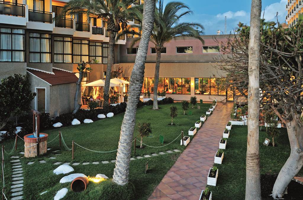 It is he, along with his neighbor – the town of Los Cristianos – that receives the lion’s share of tourists coming to the Canary Islands.
  Fortunately, there are a lot of opportunities to “ignite” here. In the evenings, the center of Las Americas is literally buried in the lights of neon advertisements, quite reminiscent of Pattaya. The fun in the most popular bars and nightclubs usually ends only in the morning.
 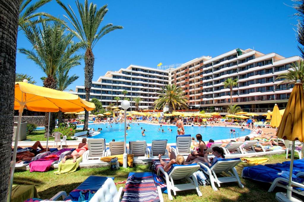 The most pleasant period for swimming and sunbathing is from January to mid-March.
  In addition, it is at this resort that the famous Aqualand water park operates. By the way, it is located in the very center of the resort.
  152-FZ “On Personal Data” dated July 27, 2006 and accept the terms of the User Agreement
 Las Americas is full of pubs, pizzerias and other fast food outlets – a real paradise for those who prefer entertainment and delicious food. The resort area has bars, nightclubs and restaurants.
 Lifeguards are on duty. The water warms up quite well, so it is comfortable to swim all year round. There are quite a lot of people, but there is a place for everyone.
  Frankly, the first three trips to Tenerife, I was not there, reading in the reviews that he is inferior to Loro Park in everything. However, on my fourth trip, I found time to visit and was very impressed. It simply cannot be compared with Loro – a completely different concept. From the deserted resort coast you find yourself in a real jungle. There are very few people, a large area. You can hug and take pictures with the lemurs. I recommend.
 Popular DJs come here to entertain the audience with modern dance music from night to morning.
  The park has been operating for over 20 years, and visitors always leave satisfied and happy. There are many types of monkeys here: monkeys, chimpanzees, mandrills and the public’s favorite – lemurs, with which you can play and take pictures. Children will be happy to feed turtles and parrots, play with guinea pigs. You can have a great time in the park – a pleasant green area, coolness.
  There is also an old Canarian house, specially preserved in its original form for visiting and relaxing tourists.
  Quite expensive (the usual price for a double room is about 200 euros with breakfast included), but you can catch a good discount. The famous Piramide de Arona concert hall is located on the territory.
  A pair of such pieces with french fries will cost 2-3 euros.

 The place was chosen well, because in this part of the island the sun always shines and carefree resort life goes on as usual, while clouds frown in the north and in the mountains, driving tourists away from the beach. On the southern coast, it is warm in winter and not too hot in summer: the temperature in winter is not lower than 20 ° C, in summer it is not higher than 30 ° C.
 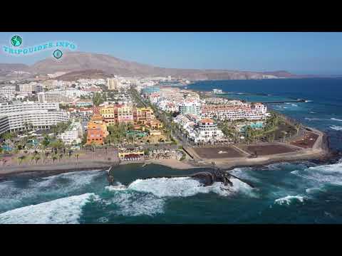 Particularly good are Del Camison Beach near five-star hotels, Troya Beach, where young people come to smoothly move to the bars of the famous Las Veronicas neighborhood in the evening, as well as La Pinta, a family beach where there are many children happily flopping down from inflatable slides in water. In general, the beaches of Las Americas are quite quiet. It is dominated by people of mature age, mainly from England and Germany, there are few street vendors. The noisiest companies on the beach are locals, not crazed tourists, as, for example, in Barcelona. Theft is common, as in other tourist places in Spain, from the “lucky man” who fell asleep on the beach, they take everything that lies badly.
  There are several 4- and 5-star hotels here, which often make great deals, as they have been strongly pressed by private traders renting apartments and villas via the Internet. As a result, in a good hotel you can stay at almost the same prices as in apartments, but get European service in addition.
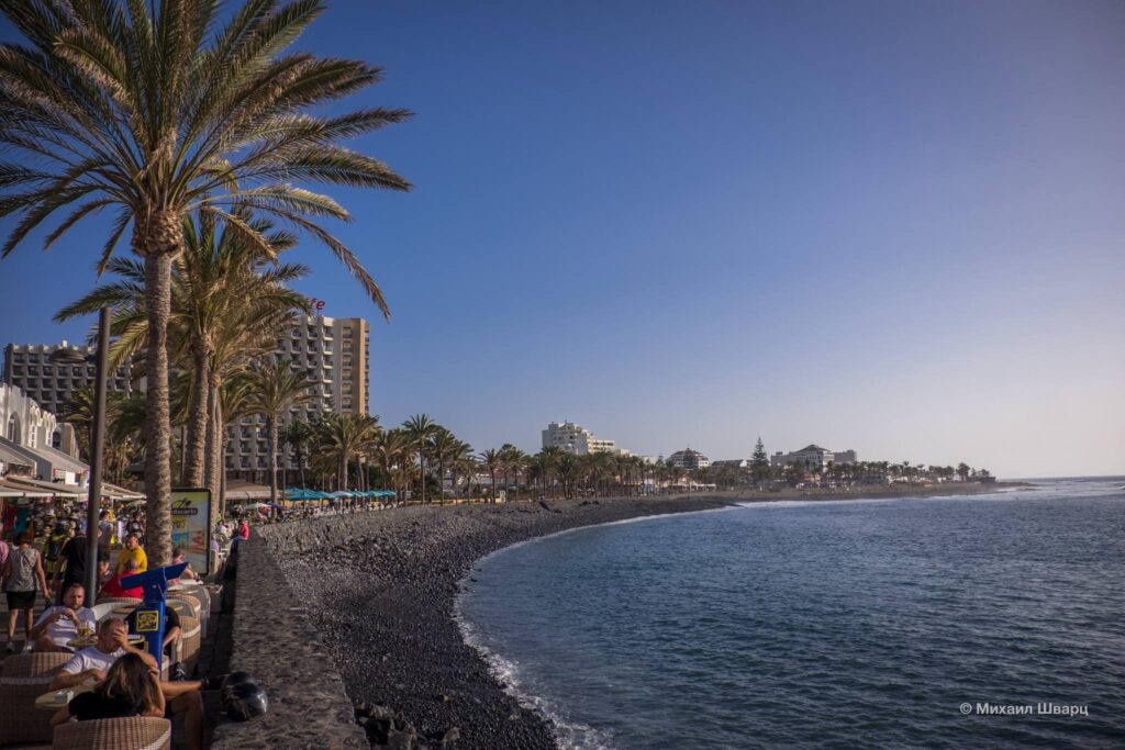 The city is located at a short distance from the attractions: the capital of the island of Santa Cruz – in one direction, Masca Gorge and Los Gigantes – in the other, the shortest and most convenient way to the top of the Teide volcano also starts in Las Americas. Siam Park water park and San Miguel Castle, where the famous jousting tournament takes place, are also very close. From the port of Puerto Colon, yachts and catamarans depart for boat trips, and small specially equipped boats go for deep-sea fishing.
 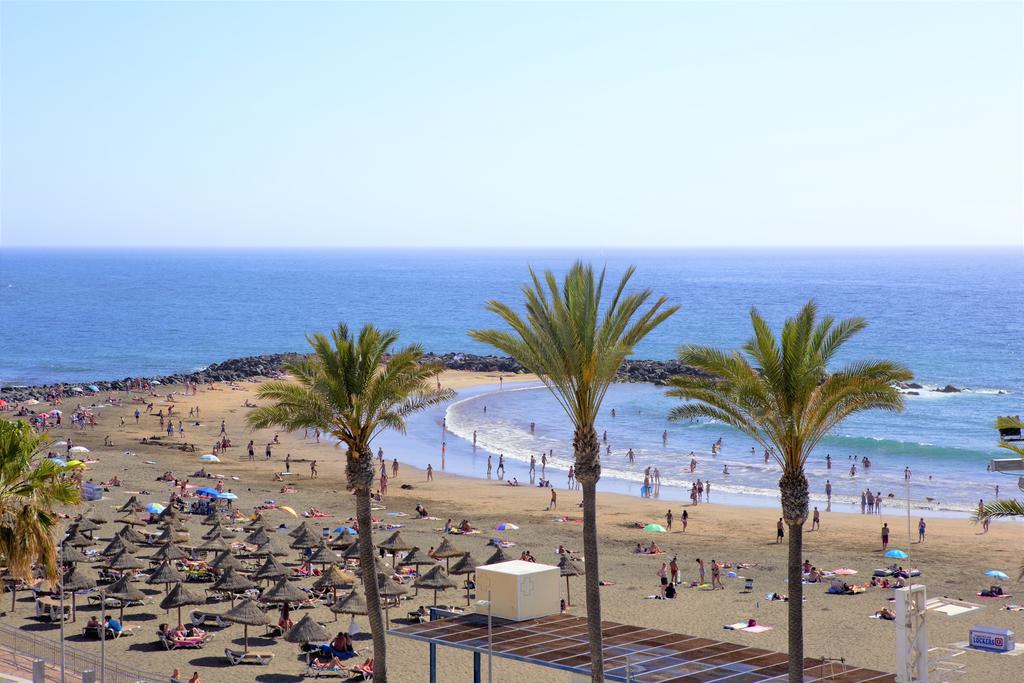 Organization of tours, routes, trips, tickets for various events, excursions with the best guides, organization of holidays. Services for demanding clients.
  Due to the fact that the resort, and Tenerife as a whole, is dominated by dark volcanic, yellow sand for the beach was specially brought from Africa. Playa de las Americas is the center of Tenerife’s nightlife centered around the popular Veronicas Strip and the Starco shopping centre.
  From the northern airport, the distance to the resort is 90 km. You can get there by bus 343, which leaves every 2 hours and stops in Tenerife South. Travel time 1 hour 10 minutes, one-way ticket price 10 euros, exit at Magma stop
  There is a shower and a playground on site.
  There are several schools and surf shops here.
 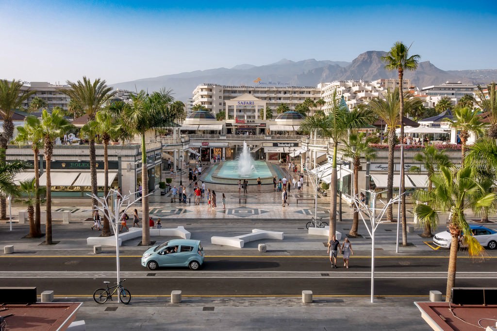 On the waterfront you can find a large number of bars and restaurants, behind which hotels are compactly located on the horizon.
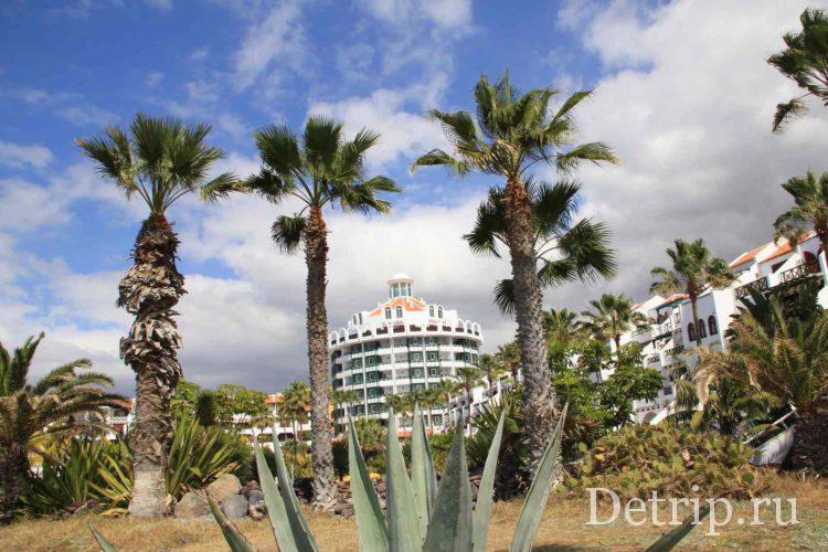
 The brainchild of the famous entrepreneurs of the island, the Kissling family, is made in the traditional Thai style. The attractions of the park are one of the highest vertical slopes Tower of Power (height 28 meters) and a large artificial wave pool Wave Palace.
  Carnival was the idea of businessman Ismael Abbasi Rojas in collaboration with a private organization in Arona, which is meant to bring music and dance to the streets of the resort. The summer carnival begins at the Avenida Rafael Puig roundabout, the procession moves along the Golden Mile, and ends at the Pirámide de Arona.

 Thus, the Spaniards emphasized the great feat of Columbus and his team, who discovered America. As a rule, local residents do not live in this city, but only come to work from all over the island.


 There are 2 adult pools, 1 children’s pool, an outdoor jacuzzi and a playground.

 We especially love the English youth, as there are very high waves in the ocean due to improperly designed barrage piers and there are water activities.
 199 rooms are located on four floors of the building.