Canary Islands with you. Our guide to Europe’s top destination is free.
Covid Travel Restriction
Things to Do
Pozo Izquierdo
Strong winds and massive waves—there are plenty of those in Pozo Izquierdo. This town in Gran Canaria is considered the
Read More »
Places
El Palmar
If you’re looking for a quiet, picturesque town to relax in during your visit to Tenerife, El Palmar is perfect.
Read More »
Places
Haría
Looking for a unique and exciting vacation destination? Look no further than Haría, Lanzarote. This municipality is home to some
Read More »
Places
Las Cañadas
The caldera of Las Cañadas is one of the most spectacular and unique sights on the island of Tenerife. This
Read More »
Places
La Geria
Welcome to La Geria, Lanzarote – the wine lover’s paradise! This is a must-see destination for anyone visiting the Canary
Read More »
Things to Do
Las Vistas Beach
Tenerife’s Las Vistas Beach is a world-famous destination for vacationers from throughout the world, especially Europe. The beach’s golden sand
Read More »
Places
Playa San Juan
Playa San Juan is a beautiful black sand beach located in Guia de Isora on the island of Tenerife. This
Read More »
Places
Playa de Veril
If you’re looking for a breathtaking beach to relax on during your time in Gran Canaria, Playa de Veril is
Read More »
About Canary Islands Info
The seven main islands of the Canaries are among the best destinations in the world. For Europeans, the all-year summer-like condition makes it an ideal escape from the harsh winter season. Featuring gorgeous beaches and stunning geologic formations, the Canary Islands has attracted tens of millions of visitors yearly. On this site, we cover everything there is to know about the islands, from getting to and around, things to do, to food and accommodation.
IF YOU’RE THINKING ABOUT VISITING THE CANARY ISLANDS
you’ll want to read this first!
The Canary Islands are a popular tourist destination for a reason – they offer everything from stunning beaches to lush mountain scenery. This guide will provide you with all the information you need to make the most of your visit to these beautiful islands. We’ll tell you about the best places to stay, what to see and do, and how to get around. So whether you’re planning a holiday or just curious about these fascinating islands, read on for everything you need to know!
History
The Canary Islands are located off the coast of North Africa. Their original inhabitants, the Guanches, arrived in the archipelago as early as 1000 BCE, or perhaps earlier. They were genetically similar to the Berbers who lived on the mainland of North Africa. Surprisingly, they were the first indigenous people to reside in this area, as it appears that the Azores, Cape Verde, and Madeira were unoccupied before the Europeans arrived.
The Arab traders arrived on Gran Canaria in 999, and from the 13th to the 14th centuries, they would be visited by French, Genoese, Majorcan, and Portuguese mariners. In the 15th century, French and Portuguese forces occupied several of the islands. In 1462, however, they were given to the Spanish in a treaty, and by the 16th century, Spain would have control of all of them, using the isles as a base for their westward explorations.
Over time, the Guanches were absorbed into the rest of society, but many of their customs and traditions have been preserved.
You might be wondering how the name the Canary Islands came about.
Many historians believe that the Latin name Canariae insulae, which means “Islands of the Dogs,” was applied initially only to Gran Canaria but has given rise to the Canary Islands’ name. According to the historian Pliny the Elder, the Mauretanian king Juba II dubbed the island “Dog Island” because it was home to an enormous number of huge dogs.
Another theory is that the “canaries” were a kind of monk seal (endangered species known as canis marinus or “sea dog”) that had previously inhabited the Canary Islands and no longer existed. The Latin term canarius comes from canis, which means “dog.”
What You Need to Know
When planning a vacation to the Canary Islands, there are some things you should know. The first is that, while the Canary Islands as a whole have an excellent climate, they are not identical. For example, on islands with interior mountains, you may discover microclimates based on slope exposure and altitude.
The second thing to keep in mind is that there are various landscapes to explore on each island. Tenerife, for example, has both black volcanic beaches and snow-capped peaks, while Lanzarote is known for its dunes and lava fields.
Finally, each of the seven islands has its own unique culture, attractions, and mode of transportation. Read on so you can plan your vacation accordingly.
Climate
The Canary Islands have a mild and pleasant subtropical climate all year long, with no significant temperature variations from day to night. The average maximum temperatures are between 20°C and 30°C, while the average minimum temperatures range from 15°C to 21°C.
The climates of the islands depend on their exposure to the northeast trade winds, differing from mild and humid to hot and dry. The eastern islands are semi-dry, while the western islands receive more rainfall.
The Canary Islands have a pleasant summer, with plenty of sunshine. Rainfall is modest, with December to February being the wettest months.
The winters in the Canary Islands are mild; they appear to be quite similar to European springs, with average minimum temperatures of approximately 15°C and maximum averages of around 20°C. It may be a little colder than the rest of the islands during the winter months on El Hierro, La Palma, and along the northern coasts of Tenerife and Gran Canaria. Snow frequently falls on top of Teide volcano in December and January.
Many people regard the Canary Islands’ climate as one of the world’s finest. With mild temperatures throughout the year, the archipelago has long been a sought-after holiday destination for travelers, especially Europeans. You may go to the islands at any time of year; all you have to do is choose which ones suit your fancy best.
Language
The official language in the Canary Islands is Spanish, as it is throughout Spain. However, English and German are also commonly spoken. Almost all commercial establishments on the islands, such as shops, restaurants, hotels, and so on, have at least one person that speaks English or German. Furthermore, information boards and signs are available in Spanish, English, and German, making them easy to comprehend.
The Canarian language is distinct from Spanish spoken on the mainland. This is due to the archipelago’s geography and heavy Canarian emigration to the Caribbean, allowing it to take a significant amount of outside influence, which caused cultural and linguistic changes.
There are plenty of similarities between Caribbean Spanish and Canarian Spanish.
For those who speak flawless Castilian Spanish (i.e., the language of the mainland, excluding Catalonia), you will notice these unique distinctions between the two variations of Spanish:
The Canary Islands does not employ the word “vosotros,” which is a plural form of “you.” Use “ustedes” instead when speaking with an Islander. It applies to the entire archipelago, except La Gomera and La Palma.
Castilian Spanish pronounces the letter c or z with a ‘th’ sound, while in the Canary Islands, they are instead pronounced with an s, similar to how it is in South America.
You may hear English words spoken with a Spanish accent, so they don’t sound exactly the same but are still recognizable. For example, in Canarian Spanish, the word knife is pronounced ‘naife.’
Some words with fascinating origins. For instance, “quinegua” for potato is a diminutive variation of ‘King Edward,’ whose seeds were brought to the Canary Islands.
Getting To and Around
The three international airports that serve the Canary Islands are Tenerife North, Tenerife South, and Gran Canaria. Lanzarote and La Palma are other islands with domestic airports.
Ferries are the most efficient and enjoyable means of traveling between islands. Fred Olsen, Naviera Armas, and Transmediterranea are the three ferry services available, with Tenerife and Gran Canaria as their hubs.
The official language in the Canary Islands is Spanish, as it is throughout Spain. However, English and German are also commonly spoken. Almost all commercial establishments on the islands, such as shops, restaurants, hotels, and so on, have at least one person that speaks English or German. Furthermore, information boards and signs are available in Spanish, English, and German, making them easy to comprehend.
The Canarian language is distinct from Spanish spoken on the mainland. This is due to the archipelago’s geography and heavy Canarian emigration to the Caribbean, allowing it to take a significant amount of outside influence, which caused cultural and linguistic changes.
There are plenty of similarities between Caribbean Spanish and Canarian Spanish.
Canarian islanders refer to buses as guaguas. Taking the bus isn’t necessarily the quickest or most convenient option for getting around, but it is safe and cheap. Keep in mind, though, that services are often reduced to a minimum on Sundays and holidays.
Each island has a different bus company, please check the individual websites for updated bus routes and timelines:
El Hierro: TransHierro / Fuerteventura: Tiadhe / Gran Canaria: Guaguas / Lanzarote: Intercity Bus / La Gomera: Guagua Gomera / La Palma: Transportes Insular La Palma (TILP) / Tenerife: Transportes interurbanos de Tenerife, S. A. (TITSA)
Rental Car
In the Canary Islands, rental cars are highly advised for travelers looking to go beyond the resort. You may rent automobiles at airports, hotels, and stand-alone locations in major tourist towns. Manual and automatic rental automobiles are available, although the latter is more expensive.
While excellent paved roads abound throughout the Canary Islands, you may need to go off-road to reach remote beaches or hidden, far-flung locations. Make sure you double-check with the car-rental company to ensure that it’s allowed.
Who Is the Canary Islands For
When it comes to selecting the best Canary Islands getaway, it might be challenging to determine which one is ideal for you. Each of the seven islands has its distinct personality and set of attractions. We can help you decide which island would be ideal for you based on your interests and abilities. Following that, we’ll provide some climate information, as well as the best time to visit and other important information, followed by a few valuable suggestions to guarantee a wonderful trip.
For Beach Goers
The Canary Islands are volcanic in origin. This explains the islands’ numerous black beaches, but there are breathtaking white ones as well. Mas Palomas, a 1.2-mile long beach with a massive desert-like dune on Gran Canaria’s south coast, is one of the finest. On the other hand, the lively Playa de Las Américas, with its three gorgeous beaches, is known for its all-year-round nightlife.
If you wish to enjoy less frequented white beaches, head to Fuerteventura, the oldest of the Canary Islands. In its north, you will find Grandes Playas de Corralejo, part of Corralejo Natural Park. It is a 3km-long stretch that is ideal for long walks and water sports, with the most incredible view of the island of Los Lobos. Another excellent option is the tiny La Graciosa, a 20- to 30-minute ferry ride away from Lanzarote. Often called the eighth Canary Island, it is a paradisiacal place perfect for those who seek peace and quiet.
For Nature Lovers
The landscape of the Canary Islands is enthralling. You’ll have a hard time choosing where to go from all of the contrasts in this region. There’s something for everyone, from volcanoes and lava fields to forests and fertile green valleys, so you’re sure to find something that suits your interests. Every taste and physical capability is catered for with four national parks and six biosphere reserves.
The Teide National Park is a great location to admire awe-inspiring creations of volcanoes. Anyone who has marveled at its breathtaking lava flows and unrivaled sky views will understand how this natural wonder became one of Europe’s most visited national parks.
El Pico de Teide, which measures 15 kilometers in diameter and was formed by various eruptions, is the main draw of this Unesco World Heritage Site. It is Spain’s tallest peak, measuring 3.718 meters above sea level, and is located in the middle of Tenerife. The third-largest volcano in the world, it is still considered an active volcano today, but it is entirely safe to visit and attracts over 2 million tourists each year. The fit may walk up to El Teide by foot, but it can be tough going at 2,200m, especially in the summer. There is also a cable car lift that takes 10 minutes to reach the 3,550m viewpoint. The view is breathtaking whether you climb or take the car; you can see all of Tenerife on a clear day.
Jameos del Agua, in the north of Lanzarote, is another must-see volcanic formation. It has a natural underground lagoon within the cave itself, which is home to a blind albino crab species that is unique in the world. The cafe inside the cave is the perfect spot for enjoying its peaceful, almost magical ambiance. On the other hand, the amphitheater was constructed within a volcanic cave and takes advantage of the sound qualities of this subterranean environment.
La Gomera’s Garajonay and its legendary laurel woodlands are the polar opposite. The laurisilva, which flourished in great numbers millions of years ago, is now rare and found only in a handful of places throughout the world. Garajonay National Park‘s lush 4,000-hectare vegetation is one of these locations where nature continues to reign supreme.
For Stargazers
The Canary Islands are regarded as a paradise for stargazers, housing three Starlight Reserves, an indicator of low light pollution in the archipelago. The sky’s conditions for viewing stars are such that the IAC Observatories’ Law covers them for Astronomical Quality. You can see a wide range of constellations from all of the islands, but it’s on La Palma and Tenerife that the three IAC international astronomy observatories are located. There are guided tours of the observatories. You could also spend a pleasant starry night in an open and spacious location, ideally a high place with minimal lighting, to appreciate the night sky in all its beauty.
The Canary Islands’ most popular star viewing locations are:
El Hierro: Orchilla lighthouse
Fuerteventura: Morro Velosa viewpoint, Tefia Observation Point
Gran Canaria: Mirador del Pico de los Pozos de Las Nieves viewpoint, Mirador de LaSabinilla, Roque Saucillo, Llanos de Garañon
Lanzarote: Peñas del Chache Lookout
La Gomera: Alto de Garajonay, Las Nieves recreation area
La Palma: Roque de los Muchachos, San Antonio Volcano viewpoint, Llano del Jable viewpoint, San Bartolo viewpoint, San Borondón viewpoint
Tenerife: Las Cañadas del Teide, Guajara Mountain, Masca viewpoint
For Art, Architecture, and Culture Enthusiasts
The Canary Islands has cultivated a reputation for its stunning beaches, excellent weather, and pleasant people. What people don’t know about this island chain is that it also boasts some real architectural masterpieces. The European Gothic and Neoclassical architectural styles were introduced during the Spanish colonial period. Canarian architecture has evolved over time, but classic style, modernism, and ecology coexist in perfect balance on the archipelago.
The twin-towered Santa Ana Cathedral, the first church in the Canaries, is located at the center of the Vegueta district. It was erected on orders from Isabella I of Castile and Ferdinand II of Aragon after Gran Canaria was taken in 1478. Impressing for several centuries now, this magnificent structure displays Gothic, Renaissance, and Neoclassical architectural features.
The Tilos Bridge is on La Palma, and it connects the capital city, Santa Cruz de La Palma, to the northern municipalities. Offering breathtaking views of La Isla Bonita (the beautiful island), this architectural masterpiece appears to hang like a mystical bridge over the Barranco del Agua of La Palma. It is also the longest and highest arch bridge ever built in Spain, a true feat of engineering.
The Mirador del Río, on the island of Lanzarote, was created by great Canarian artist César Manrique and is the perfect example of blending seamlessly with the environment. From the volcanic crags where this hidden gem is found, visitors may take in a stunning panoramic view of the cliff of Famara and Chinijo Archipelago, the second-largest archipelago of the Canary Islands.
A creation by architect Santiago Calatrava, Adán Martín’s Auditorium, known simply as Tenerife’s Auditorium, stands in a prime location on the seafront. It’s a stunning 20th-century masterpiece with a meticulous exterior design and an elegant interior. It’s in some ways comparable to the Sydney Opera House in Australia, which blends water and white to create a sleek waveform profile against the backdrop of the sea.
The Church of San Juan Bautista, better known as the Cathedral of Arucas, is a beautiful Neoclassical church with an intriguing architectural past. Despite its historic architectural style, it was only built in the early 20th century and took less than 70 years to complete. The current San Juan Bautista Church occupies the site of an earlier church established in 1515.
The Canary Islands are a must-see for art fans and those interested in learning more about the culture of the archipelago. The chain of islands has a diverse culture, and one way to explore that culture is by visiting one of its many museums or partaking in a festivity. This list will help you find out which one is for you.
The Historical Centre of Las Palmas de Gran Canaria is home to the Atlantic Centre of Modern Art (CAAM). It has become a prominent contemporary art museum that focuses on the artistic culture of three continents: Africa, America, and Europe. The exhibition features a wide range of works, including paintings, drawings, sculptures, mail art, and other fascinating art projects relating to the three-continent theme.
The Santa Cruz de Tenerife Carnival in Tenerife is the world’s second-largest carnival, after Rio de Janeiro. For 15 days, color, rhythm, and flamboyance spill out onto the city’s streets. Because of its distinctive flavor and spectacular display, the event is described as “more Brazilian” than other Spanish carnivals.
When it comes to traditions you shouldn’t miss, two immediately come to mind–Silbo Gomero and salto del pastor.
Silbo Gomero is a whistled language unique to La Gomera. Whistles may be heard up to three kilometers away under ideal conditions. Many islanders still use the language daily. They can even tell who they’re talking to by the sound of their whistle: just like with a person’s voice, each individual’s whistle is distinct.
Also a custom among indigenous communities, salto del pastor, or “shepherd’s leap,” began with shepherds using long wooden poles to cross ravines and steep slopes to keep up with their goats. It is now a popular sport played throughout the islands, where participants use long sticks with sharp iron tips to make giant leaps.
For Gastronomic Adventurers
A visit to the Canary Islands is not complete until you’ve tried the best local food and drink. The cuisine is hearty and delectable, relying on the islands’ produce. Papas arrugadas, the Canarian potato grown from volcanic soil, go with grilled meat and fish (usually tuna or swordfish). These potatoes, which are wrinkled and smaller than the regular ones, are cooked whole in their skin, salted, and served with flavorful pepper sauces: mojo verde, mojo rojo, and mojo picon. They’re suitable for snacking or as part of a meal.
Rancho Canario, a hearty noodle soup with chicken and potatoes, is the way to go for colder months. Baifo, made from young Canarian goat marinated in bay leaves, garlic, oregano, and thyme, is also very popular. For dessert, try bienmesabe, a sweet paste made with almonds, cinnamon, egg yolks, honey, and sugar syrup with lemon zest. This heavenly dish means “it tastes good to me” in English, and it most definitely is!
The Canary Islands have a good selection of wine. The majority of their wines are white, but there are a few reds and roses as well. Tenerife has several vineyards, although the most unique are found on Lanzarote. The Canaries’ wines, including Malvasia and Palomino grapes, all have a distinct flavor profile.
Canary Islands:
For Anyone, Anytime
The Canary Islands are a great place to visit because there’s so much to do and see. Beautiful beaches, a picturesque environment, and various activities to keep you occupied are just a few of the benefits. The archipelago offers plenty more if you’re interested in history and culture. The islands’ rich history dates back centuries, with many interesting buildings and monuments awaiting discovery. There are also loads of excellent restaurants that will satisfy all your cravings. Furthermore, the weather is nice, and the people are kind and pleasant.
TOP PLACES TO GO
Tenerife
Gran Canaria
Lanzarote
Fuerteventura
La Palma
La Gomera
El Hierro
Tenerife
Gran Canaria
Lanzarote
Fuerteventura
La Palma
La Gomera
El Hierro
About Us
Learn About Us We Are Happy To Guide You It’s hard not to fall in love with the Canary Islands. Crystal clear waters, breathtaking geological
Read More »
Guest on our blog
We are delighted to have you as a guest on our blog atCanaryislandsinfo.co.uk! Canaryislandsinfo.co.uk is a travel destination guide website covering comprehensive information of Europe’s
Read More »
Contact Us
Contact Us Share Your Amazing Canary Islands Experience After a fun-filled adventure at the Canaries, how about sharing your experience? Our team of writers would
Read More »
Canary Islands Vacation Packages 2022
Top destinations in Canary Islands
Canary Islands Flight and Hotel Deals
4Dreams Hotel
3 out of 5
Price was $706, price is now $645 per person
$706
$645
per person
Nov 10 – Nov 16
Roundtrip non-stop flight included
New York (NYC) to Tenerife (TFS)
3. 7/5 Good! (275 reviews)
The property is in a great location and the staff were very friendly and helpful. The hotel is very tired and our bedroom window opens into a central void which means you can literally hear everything others with similar rooms are doing. Overall it was ok for the money paid.
Reviewed on Feb 8, 2020
Gran Melia Palacio de Isora
5 out of 5
Price was $2,312, price is now $2,154 per person
$2,312
$2,154
per person
Oct 24 – Nov 2
Roundtrip non-stop flight included
New York (JFK) to Tenerife (TFS)
4.4/5 Excellent! (377 reviews)
The facilities were very good and the food was also excellent. However, whilst some of the staff were friendly and helpful, a lot were not. We paid for all inclusive and it was anything but – meal times were awkward for children and you couldn’t get food unless you paid extra at different times. So many items of drinks and food were ‘pay extra’ that it was more like a full board offering than all inclusive.
Reviewed on Jul 8, 2022
Las Terrazas de Abama Suites
5 out of 5
Price was $1,959, price is now $1,838 per person
$1,959
$1,838
per person
Oct 18 – Oct 25
Roundtrip non-stop flight included
Newark (EWR) to Tenerife (TFS)
4.7/5 Exceptional! (54 reviews)
Lovely property, great staff, quiet, great place to go and recharge the batteries, will be going back soon
Reviewed on Jul 10, 2022
Hotel Botanico & The Oriental Spa Garden
5 out of 5
Price was $1,779, price is now $1,674 per person
$1,779
$1,674
per person
Nov 28 – Dec 5
Roundtrip non-stop flight included
Newark (EWR) to Tenerife (TFS)
4. 7/5 Exceptional! (427 reviews)
The Botanico is a very beautiful property with terrific service. The pools are beautiful and the breakfast quite tasty. Easy to get taxis from the hotel and still walking distance to many places including the beautiful Botanic Gardens nearby.
Reviewed on Aug 30, 2022
Hollywood Mirage
3.5 out of 5
Price was $990, price is now $932 per person
$990
$932
per person
Oct 24 – Nov 2
Roundtrip non-stop flight included
New York (JFK) to Tenerife (TFS)
4.3/5 Excellent! (448 reviews)
I like the fact that washing supplies(washing liquid,sponge,kitchen towel etc… ) were provided as this was unexpected.
Didnt like that some fixures were faulty/broken i.e. sliding waredrobe doors, shower head holder
Reviewed on Aug 29, 2022
Where to stay in Canary Islands
Find the best Canary Islands areas and neighborhoods for the activities you enjoy most. Learn more about Canary Islands
Costa Adeje
1 out of top 10 points of interest in this area
4.5/5Wonderful!(87 area reviews)
Are you interested in stunning beaches, fantastic nightlife, and popular shops? A visit to Costa Adeje might be the perfect thing. You can also explore top sights like Puerto Colon Marina and La Pinta Beach.
Find hotel + flight trips in Costa Adeje
Caleta de Fuste
4.5/5Wonderful!(5 area reviews)
Investigate the boutiques, bars and restaurants along the pretty seafront before indulging in beach activities: swimming, windsurfing, scuba diving and more.
Find hotel + flight trips in Caleta de Fuste
Costa Calma
Costa Calma is known for its beaches, and you can plan a trip to Costa Calma Beach and Sotavento de Jandia Beach while you’re in town.
Find hotel + flight trips in Costa Calma
Costa Meloneras
3/5(3 area reviews)
Visitors highly recommend Costa Meloneras for its abundant dining options, and you can make a stop by Meloneras Beach while you’re in town.
Find hotel + flight trips in Costa Meloneras
Campo Internacional Maspalomas
4/5Very Good!(1 area review)
Golf courses, beaches, and gardens highlight some of the noteworthy features of Campo Internacional Maspalomas. Make a stop by Maspalomas Golf Course or Maspalomas Botanical Garden while you’re exploring the neighborhood.
Find hotel + flight trips in Campo Internacional Maspalomas
Canary Islands Hotel Deals
Lopesan Costa Meloneras Resort & Spa
5 out of 5
Mar Mediterraneo 1, Meloneras, San Bartolome de Tirajana, Gran Canaria, 35100
Fully refundableReserve now, pay when you stay
The price is $166 per night from Oct 9 to Oct 10$166
per night
Oct 9 – Oct 10
4.5/5 Wonderful! (761 reviews)
“Amazing hotel”
Reviewed on Aug 29, 2022
Lopesan Costa Meloneras Resort & Spa
Bahia Principe Fantasia Tenerife – All Inclusive
5 out of 5
Avenida JM Galván Bello, San Miguel de Abona, Canary Islands, 38639
Fully refundableReserve now, pay when you stay
The price is $215 per night from Sep 18 to Sep 19$215
per night
Sep 18 – Sep 19
4. 5/5 Wonderful! (379 reviews)
“Beautiful hotel, rooms spacious & clean. The tiles around the pool tho are a nightmare, so slippy. Its possibly the only real downside of this hotel. The shows are brilliant, our favourite was the carnival, the cast/crew are just great, very professional”
Reviewed on Jul 13, 2022
Bahia Principe Fantasia Tenerife – All Inclusive
Santa Barbara Golf and Ocean Club by Diamond Resorts
4 out of 5
Avenida del Atlantico, s/n, Golf del Sur, San Miguel de Abona, 38639
4.4/5 Excellent! (2,342 reviews)
“This is a really great resort. I loved my villa, it was huge! Everything is super clean and in good condition. The customer service is great. Definitely opt in for WhatsApp messages, it was so convenient to check times of events etc by just sending a WhatsApp to staff instead of walking to the front …”
Reviewed on Sep 13, 2022
Get rates
Santa Barbara Golf and Ocean Club by Diamond Resorts
See all 21994 properties in Canary Islands
Lowest nightly price found within the past 24 hours based on a 1 night stay for 2 adults. Prices and availability subject to change. Additional terms may apply.
Frequently asked questions
How much does a Canary Islands vacation package cost?
Explore the best of Canary Islands from just $645. Choose from a wonderful selection of hotels, flights and rental cars to suit your budget. Pick up even better deals when you add a few activities or tours to your vacation package.
If I’m not able to travel, can I cancel my Canary Islands vacation package?
Don’t worry if you’re rethinking your Canary Islands vacation package — you can cancel or change your booking. And if you’ve booked it within the last 24 hours, you may be able to do it for free. However, bookings made more than 24 hours ago may incur fees from your airline, hotel or car rental company. We understand life can sometimes throw a spanner in the works, so make your way to our Customer Service Portal if that occurs. When you’re ready to make changes, we’re ready to help.
How do I get a cheap travel package to Canary Islands?
It’s easy. Just bundle everything together. Hotels, rental cars and flights — combine whatever you need into a Canary Islands vacation package and save up to $366. Score even more bargains when you add extras such as sightseeing tours to your booking. But here’s the most impressive part. You have the flexibility to customize your trip your way. We offer more than 550 air carriers and 1,000,000 properties across the globe, so that everyone has a chance to travel and fulfill those vacation dreams.
Where should I stay in Canary Islands?
There are plenty of great places to stay in Canary Islands, including Teguise. This destination boasts much-loved attractions including Cesar Manrique Foundation and Cactus Garden. Alternatively, head to Pajara, where you’ll find Sotavento de Jandia Beach and Cofete Beach. If you’re here for a while, journey to both exciting destinations!
What are the top hotels in Canary Islands?When is the best time of year to visit Canary Islands?
The best time to visit Canary Islands comes down to your preferences. If you’re vacationing on a budget, you might want to avoid , which is considered to be the most expensive time of year. is usually when you’ll score the best deals. To experience the atmosphere of peak season, pack your bags for . are the quietest months to visit and a good idea if you want to get away from the crowds.
How far in advance should I book my Canary Islands vacation?
The earlier you book, the better. Airlines typically release flight tickets around a year ahead of departure, and this is an excellent opportunity to land some of the lowest prices. Just been told you need to take some vacation time in a few weeks? Don’t fret. Expedia are never short on fantastic bargains to send you on the getaway of your dreams, at an affordable price.
What does an Expedia Canary Islands travel package include?
Packages include rental cars, hotels and flights, but you can mix and match them to create your ideal Canary Islands trip. You can also add on a few tours and activities once you’ve made your booking. You’re the boss! When you bundle your bookings with Expedia, you’ll enjoy discounts you won’t find elsewhere.
What should I know before booking a Canary Islands travel package?
You’ll enjoy impressive savings when you bundle your hotels, flights and rental cars into a travel package. Not only that, booking everything in one place makes trip planning much easier. So why waste time or money? Whether you’re putting together a luxury city stay with your love or a budget solo adventure, explore our package deals today.
Does Expedia offer Book Now, Pay Later Canary Islands vacation packages?
Thanks to the joint efforts of Expedia and online lender Affirm, you can spread the price of your travel package over a number of payments. For financial freedom, take a look at our Book Now, Pay Later option and work out a payment schedule to match your situation.
Can I choose my airline with a Canary Islands Expedia vacation package?
Yes, definitely. Expedia has more than 550 airline partners to select from worldwide. With all that choice at your fingertips, finding the ideal carrier to whisk you off to Canary Islands won’t be hard.
Can I travel to Canary Islands right now?
Find information about Canary Islands quarantine policies, travel restrictions and much more by heading to our Covid-19 Travel Advisor.
Popular places to visit
Things to do
See all activities in Canary Islands
More trip options
Top cities in Canary Islands
Vacations and getaways similar to Canary Islands
More Types of Vacations
Themed Vacations in Canary Islands
Expedia’s Latest Trends
Vuelos a las Islas Canarias
Information on regulations for travel to the Canary Islands
* Given the rapidly evolving international response to the COVID-19 outbreak, Air Europa cannot guarantee the accuracy and timeliness of the information published on this page. We recommend that you check the information on the official agency links before travelling. Updated information: 21/03/2022 15:50 h.
Regulations and recommendations
Check the official links, where you can confirm the updated information you need to know before you start your trip. In addition, if you have a code-share flight, please check the website of the airline operating the flight. Check the COVID-19 measures taken by SkyTeam airlines.
Travelling from Spanish territory?
For journeys from other communities to the Canary Islands.
Travelling from a foreign country?
For travel from a foreign country to the Canary Islands.
If you are travelling from Spanish territory to the Canary Islands
Do I need to present a PCR test or certificate to fly?
It is not necessary to pass any sanitary control if you travel to the Canary Islands from Spanish territory.
Will I have to quarantine?
Quarantine is not required.
What do I need to bring with me to pass through airport screening?
Passengers on domestic flights are exempt from documentary control.
If you are travelling from a foreign country to the Canary Islands
Do I need to present a PCR test or certificate to fly?
At the airport of departure from a country that does not belong to the European Union or the Schengen Area, all passengers shall be informed that they must undergo a health check before entering Spain at the first Spanish airport at which the passenger arrives. These checks may include taking a temperature, a documentary check and a visual check of the passenger’s condition.
As of 07 June 2021 all passengers aged 12 years and over arriving from a country or risk area listed below must have one of the options:
Must include at least the following information: name and surname of the holder; date of vaccination, indicating the date of the last dose administered; type of vaccine administered; number of doses administered/full course; issuing country; identification of the body issuing the vaccination certificate.
Note: Passengers coming from countries not included in the list of exempted countries will be allowed entry for tourism if they have a certificate of vaccination issued by the authorities of the country of origin after 14 days of the administration of the last dose required to complete the vaccination course.
Exception: In the case of passengers resident in the UK coming directly from the UK:
UK nationals and residents on tourist travel: in addition to the vaccination certificate, NAAT tests authorised for non-essential travel will also be considered valid. Antigen tests and recovery certificates are not accepted.
EU citizens and UK nationals and residents on essential travel: Vaccination certificates, diagnostic tests (NAAT test and antigen test) and recovery certificates are accepted.
Diagnostic Test for Active Infection (PDIA) for SARS-CoV-2 with negative result:
Molecular nucleic acid amplification test (NAAT), the sample of which has been obtained within 72 hours prior to arrival in Spain. Molecular tests such as: RT-PCR, RT-LAMP, TMA and other tests based on equivalent molecular techniques will be accepted.
CoVID-19 antigen detection test, the sample of which has been obtained within 48 hours prior to arrival in Spain. EU-approved antigens will be accepted.
Other diagnostic tests such as rapid antibody tests or high throughput serology (ELISA, CLIA, ECLIA) will not be accepted.
The PDIA document must be the original, in paper or electronic format and contain the name and surname of the holder, date of sample collection, type of test performed, issuing country.
Recovery Certificate:
Recovery certificates issued by the competent authority or by a medical service at least 11 days after the first positive diagnostic test will be accepted as valid.
The validity of the certificate shall end 180 days from the date of sampling.
The recovery certificate shall include at least the following information: name and surname of the holder, date of sampling of the first positive diagnostic test for SARS-CoV-2, type of NAAT test performed, issuing country.
It is possible that some people who want to travel to Spain have a persistent positive PCR after having passed the disease, being already cured and not being contagious. In these cases, check the following documentation:
Certificate of their last PCR, carried out within 72 hours prior to their arrival in Spain.
Clinical report expressly stating that the person is cured and not contagious despite having a positive PCR. The report must expressly state a sentence similar to the following: “Mr/Ms XXXXX may travel by air, as he/she is not contagious, despite having a positive PCR for CoVID-19”.
The list of high-risk countries / areas can be obtained at: https://www. mscbs.gob.es and https://www.spth.gob.es.
PDIA, vaccination certificate or certificate of recovery shall not be required for passengers arriving from countries not included in the list.
All passengers arriving from Brazil and South Africa will be tested for antigens.
Exception: Crews of international means of transport necessary to carry out the transport work, passengers under 12 years of age are exempt but must be in possession of the QR code obtained after completion of the FCS through SpTH and seafarers arriving in Spain returning from their campaign on board a ship or in transit to embark and disembark, having to justify their status as crew members and the impediments for the performance of PCR / TMA / other molecular tests.
Additionally, passengers on international flights to the Canary Islands must present a PDIA test:
Acceptable PDIA: RT-PCR of CoVID-19 (72 hours before) with negative result, Approved rapid antigen detection test with a specificity of more than 97% and a sensitivity of more than 80% with negative result, certificate of having received the second dose of the vaccine within 8 months prior to travel or at least 1 dose of a vaccine authorised by the EMA more than 15 days prior to travel and within the previous 4 months or medical certificate of having passed the disease in the last 6 months.
The supporting documentation must be the original, in Spanish and can be submitted in paper or electronic format.
Note: If a passenger has not undergone an AIDP, he/she should be isolated at his/her residence and undergo an AIDP within 72 hours of arrival and the result should be forwarded to the local Health Authority ([email protected]). Isolation must be maintained until a negative diagnostic test is obtained and sent back or until epidemiological discharge, as appropriate.
Exceptions: Passengers under 12 years of age, passengers in transit with final destination another country or another part of the national territory, passengers who can prove that they have been outside the Canary Islands for less than 72 hours regardless of their place of residence.
Will I have to quarantine?
There is no mandatory automatic quarantine.
What do I need to bring with me to pass through airport screening?
If you are travelling to Spain from abroad, it is compulsory for all passengers to have filled in the Ministry of Health’s “Health Control Form” (FCS) individually before arrival or via the SpTH app. Once completed, you will obtain a QR that must be presented upon arrival in Spain:
Create your FCS form
Passengers coming from countries or zones not included in the list of countries at risk must complete the FCS via SpTH and will obtain a QR code with the designation “FAST CONTROL” which will enable the health control processes on arrival to be carried out more quickly.
The seat in the FCS is mandatory, but can be changed up to arrival (generates a new QR code to the passenger).
Passengers will be denied boarding:
Who do not present a QR code as passengers without a QR code will be inadmissible on arrival with the corresponding obligations and penalties for UX.
Who are in possession of a QR code identified as ‘DOCUMENTAL CONTROL’ and do not provide a certificate of vaccination, diagnostic test or recovery.
Exempted: crew members on duty and crew members on status flights travelling with appropriate company evidence.
Verification process at origin station:
Passengers will be checked before being allowed to board that they have the generated QR code (in digital or paper format – this means that customers can also carry their QR code printed on paper).
The QR code is also mandatory for connecting transits.
Additionally, from 18 December 2020, passengers on international flights with final destination the Canary Islands travelling for non-justified reasons will also have to fill in a Responsible Declaration.
COVID-19
Safety standards and liquids
Articles containing liquids or substances of similar consistency may be carried in a maximum of 10 containers of 100ml (1 litre in total).
Read more
COVID-19
Travel Regulations
At Air Europa we are committed to safety and security, taking care of our customers and employees remains our No. 1 priority. If you need to consult more topics of interest related to COVID-19, we recommend you access our “you can be assured” section.
Read more
COVID-19
Carry-on baggage
We recommend that you check your hand luggage, in order to make boarding and disembarking faster and safer, thus ensuring that there is minimum contact with external objects inside the aircraft. This service is free of charge as it is part of Air Europa’s security measures to prevent Covid 19.
Canary Islands Travel Advice
How Safe are the Canary Islands?
Threat level: Low
COVID-19 Situation in the Canary Islands
The nationwide state of alarm declared on the 25th of October due to a resurgence in COVID-19 cases ended on the 9th of May 2021. However, restrictions can be applied at regional level including local curfews, so you should monitor local news.
Since the 24th of May, UK holidaymakers can travel to Spain for tourism. However, Spain is on the UK government’s amber list of countries that pose a COVID-19 risk, which means that travellers should not go unless it is for essential, family or business reasons. On their return, travellers are required to fill in the passenger locator form, to present a negative PCR COVID-19 test result before travelling, to quarantine at home for 10 days and to take a sequencing test on day 2 and day 8 after their arrival.
Nationals from the European Union (except Portugal) and Schengen-area countries are now allowed to visit Spain without having to quarantine on their arrival but travellers from risk countries must present a negative COVID-19 PCR test result on arrival, taken no more than 48 hours before arrival. Alternatively, they can present a certificate of vaccination that shows they have received two doses of an EU-approved COVID-19 vaccine at least 14 days prior to travelling or a certificate of recovery. Further to this, travellers will be subject to temperature check, a visual health assessment and must fill in a health declaration form 48 hours prior to travelling to indicate the address where they will be staying, their contact details and history of exposure to COVID 19. Please note that due to a surge in cases, you will be required to quarantine on your return to the UK and other EU countries.
However, people must maintain social distancing of 1.5m, facemasks are mandatory in public except when swimming, at the beach and playing sport and gatherings of more than 6 people are banned. Regional authorities have restricted the capacity of restaurants and bars as well as operational hours and in some areas, such public venues have been closed. A track and trace system is also in place in facilities welcoming the public.
See our healthcare section for preventive measures against the disease.
Security in the Canary Islands
The current travel advice for the Canary Islands is to remain cautious throughout your visit, however the risk of trouble or attack is extremely low.
The Canary Islands are part of Spain and are located just off the southern coast of Morocco, the 7 main islands are considered to be on the outermost parts of Europe. The islands are a popular tourist destination, as such the security is at a relatively high standard and crime rates are low.
Intelligent Protection International Limited provides Security and Bodyguard Servcies across the Canary Islands and Spain. If you are interested in these services, please see: Bodyguard Services in Spain.
Recent Security Risk Events
In 2015, 40 African migrants landed on a beach in Gran Canaria, one of the Canary Islands. Migrants trying to reach the country have long troubled the Canary Islands, however the Spanish navy have begun patrols around the islands in an attempt to protect them from migrant ships reaching their destination.
Security Risks
Although there is a hightened risk of terrorism for Spain, this does not apply to the Canary Islands except for the tightened security on the islands.
Some of the islands are known to be party destinations for tourists such as Tenerife. Partying and excessive alcohol consumption at these destinations can leave tourists vulnerable to crimes including muggings, anti-social behaviour and drink spiking. Whilst these issues are relatively rare, tourists are advised to remain aware at all times and do not drink excessive amounts in order to stay in control.
The Canary Islands’s International Relations
International Relations
The international relations are mostly associated with Spain’s relations. On behalf of the islands, Spain has developed and broaden its contacts with sub-Saharan Africa and countries such as Mauritius and Mali in order to deal with the issues of illegal immigration to the Canary Islands.
Travelling around the Canary Islands
Roads can be winding but are in excellent condition. Exploring the island by car is considered to be the most effective method, and vehicles can be hired at airports. You should book these in advance for smaller islands.
When travelling by car in Spain, British nationals do not need an International Driving Permit (IDP) but a motor insurance green card issued by their car insurer is required to drive a UK-registered car in the EU.
Every island has sufficient public transport that can take you to main points of interest. If you are looking to visit multiple islands during your visit, there are fast ferries that can transport you between them.
Commercial Travel Risk Services
Intelligent Protection International Limited provides companies and organisations with Commercial Travel Risk Services designed to mitigate risks of staff when they travel for business. If you are interested in these services, please see: Commercial Travel Risk Services.
Emergency Services in the Canary Islands
Police emergency: 112 Policía Guardia Civil: 062 (responsible for national security) Policía Municipal: 091 (responsibility for local traffic control, minor offences) Fire emergency: 112 Medical emergency: 112 Coast Guard: +34 91 755 91 33
The Canary Islands Overview
Capital: Santa Cruz de Tenerife
Capital: Las Palmas
Official languages: Spanish Religion: Christianity Currency: Euro Time now in Santa Cruz de Tenerife:
Spain Telephone: +34 928 26 2508 Emergency Consular Team: based in London, +44 020 7008 1500 Email:[email protected]
Visa requirements for the Canary Islands
Providing you are staying for less than three months, most nationalities will be able to enter the country without the need for a visa. Your passport should be valid for at least three months. Check with you local Spanish Embassy for more information.
Healthcare and Immunisations
Due to the coronavirus outbreak that is affecting the country, it is recommended to self-isolate, wear a face mask in public places, apply good hygiene practices, maintain social distancing and avoid unnecessary travel and gatherings.
It is advised that visitors to the Canary Islands are up-to-date with primary boosters such as MMR. It is further recommended that most travellers get a Tetanus vaccination. Check with your local health professional prior to travel if you are unsure.
You should be wary of heat exhaustion as the sun can be extreme on the islands. Ensure that you drink sufficient amounts of water throughout the day to avoid this.
The Spanish healthcare system extends to the Canary Islands, as such it has excellent facilities. For EU citizens, an EHIC card will allow visitors to receive medical care at the same cost that a local would pay. It is not a substitute for medical insurance and it is highly advised that you purchase comprehensive insurance too.
Many tourists prefer to drink bottled water as most of the tap water is desalinated sea water and can taste strange to those not used to it.
News Feed
Map of the Canary Islands
Disclaimer:
You are responsible for your own safety abroad and for making the decision to travel.
The information contained in this Travel Advice for the Canary Islands is provided for information only. Whilst care is taken to ensure that this country brief is as up-to-date and accurate as possible, it is provided on an “as is” basis without any representation or endorsement made and without warranty of any kind, express or implied. Intelligent Protection International Limited does not assume responsibility and shall not be liable for any damages in connection to the information provided.
Travel advice for the Canary Islands, Spain
All categoriesTravel Advice For FuerteventuraTravel Advice For Gran CanariaTravel Advice For LanzaroteTravel Advice For Tenerife
Wondering what is the situation in the Canary Island in regards to the Coronavirus pandemic? Did you have a holiday planned in the Canary Islands which is now affected by the current situation with the Coronavirus spread?
Spain is a popular holiday destination for people from all over the world and it is constantly among the most visited countries in the world because it has a multitude of attractions and beautiful cities, great food, incredible beaches, friendly people and good weather.
Did you know that there are over several thousand species of jellyfish known in the world right now? However, you can rest assured when planning a holiday to the Canary Islands, because there aren’t that many species of jellyfish found in the waters around the archipelago.
Many visitors to the Canary Islands, especially those heading over to the archipelago for the first time, have this dilemma of whether they’ll have to face a lot of mosquitoes in the Canary Islands or not.
Turismo de Canarias has announced a strategy according to which they plan to promote the islands as ‘the office with the best climate in the world’. These will be developed throughout this year to attract remote workers from around the world they will have a budget of 500,000 euros to promote the destinations in this sense.
Planning a trip to Tenerife and you’re looking for the best places to take amazing Instagram photos to post? Well, in that case, you’ve chosen a great holiday destination, since Tenerife is full of great places to visit, where you can take fabulous photos, especially if you do a bit of planning ahead of time.
Since the start of the pandemic, the Canary Islands have become a place of interest for digital nomads and remote workers, especially ones coming from Europe.
Winter in Europe usually means low temperatures and snow, depending on the country that you’re planning to visit. However, if you’re not a fan of snow and cold winter weather, there are still a few places in Europe where the temperatures are mild and the weather allows for visitors to enjoy some much-needed winter sun.
Fuerteventura, the second-largest Canary Island, is a great place to visit for families since you have endless beaches, beautiful weather all year round and the atmosphere on the island is laid-back and relaxed.
This is a popular question from people who come on holiday to Tenerife and the Canary Islands in general for the first time and don’t know what to expect. Tipping can be a confusing topic depending on where you’re coming from since there are big differences across different cultures.
Tenerife is the largest and most popular of the Canary Islands and during the past years, tourism has grown, reaching 6 million tourists in 2016. With these numbers, it’s clear that the island has become a popular tourist destination, especially for European visitors.
This is our dedicated page for updates on the Coronavirus situation in Fuerteventura, one of the Canary Islands in Spain. For those planning a visit to the island and wondering if it’s safe to come or not, we will publish here the info regarding the total number of cases, current active cases, as well as any other details shared by the local authorities.
The Canary Islands have become a very popular destination during the last years, especially during the winter months. The no.1 reason is the warm weather, so if you want to know which is the hottest Canary Island in winter, depending on the month when you plan to visit, we have made a comparison between the most visited destinations in the archipelago.
What is the new normality in Spain and what are the rules for foreign visitors traveling to Spain this summer? The summer season of 2020 comes with some changes and new rules that we all have to respect in order to keep everyone safe.
The Governing Council approved, in its extraordinary session, the updating of certain prevention measures established by the Government Agreement of June 19, 2020, in order to better handle the health crisis caused by COVID-19.
Of all the Canary Islands, people usually tend to make a comparison between Tenerife and Gran Canaria and sometimes between Lanzarote and Fuerteventura. But every island has its own charm and unique characteristics, which makes it special and different from the rest in the archipelago.
Planning your upcoming trip to Tenerife and wondering how much spending money you will need? In this article, we will try to show you and give you some examples of how much things cost in Tenerife and what travel budget you need as a holidaymaker in order to visit this popular Canary Island.
If it’s your first time planning a visit to Lanzarote (or the Canary Islands in general) you may be wondering if it’s a safe destination and which places you should avoid.
Tenerife is a great place to visit, even if you’re only stopping over for a day during your cruise. As the most visited island in the archipelago, Tenerife offers plenty of activities for everybody and after your short visit, you will definitely want to come back to spend more time here.
If this is your first time planning a holiday to Tenerife, you may find yourself asking if this destination is worth visiting or it’s right for you and your family. We are declared fans of Tenerife and come over as often as we can, so in this article, we’ll try to present the reasons why you should also come and visit Tenerife.
If you are planning your first holiday to Tenerife you may be asking yourself how much time do you need in order to see the island and discover some of the best sights.
Tenerife is a year round holiday destination, with warm weather and sunny days during all seasons, while the temperatures stay fairly constant throughout the year, as opposed to the rest of Europe where they vary by a lot between winter and summer.
If we lived in an ideal world, we wouldn’t have to have to choose between travel destinations and we would simply go everywhere we wanted.
The Canary Islands are a popular holiday destination, especially for Brits and Europeans in general, who are looking for a sunny place where they can escape the cold weather back home in winter.
Tenerife is a super popular travel destination, especially among visitors from the UK and other European countries.
Fuerteventura is the second largest Canary Island after Tenerife and it’s mostly recognized for its amazing beaches, some of the best in all of the archipelago.
Gran Canaria is the second largest of the Canary Islands in terms of population and tourism, especially among visitors from European countries like the UK, Germany, Poland and all of Scandinavia.The island is filled with lovely beaches and also offers a diverse landscape, with many things to do for those visitors who wish to explore its best sights and attractions.
It’s no secret that the Canaries are a popular destination during the cold season, as they are the warmest destination in Europe during winter, due to their sub-tropical desert climate.
SPAIN – probably the best destination in Europe for a warm and sunny holiday in Europe, no matter the season. Besides mainland Spain, the country has several islands which make the perfect setting for a great holiday, so today we will try to compare the most disputed and famed of them all: the Canaries vs the Balearics.
The Canary Islands enjoy a privileged climate all year round, with mild temperatures in winter that allow visitors to spend time on the beach or even swim in the ocean.
Lanzarote, as the rest of the Canary Islands, is a year round destination, so anytime you’ll decide to come over, it will most likely be sunny and warm.
Mount Teide is the 3rd highest volcano in the world and the highest peak in Spain, so normally many of the visitors who come to Tenerife wish to go up to the top.
Tenerife is advertised as the island of the eternal spring, so people are often confused as for what to pack for their holiday.
Travelling to Canary Islands | Basic Information | Surfinn.travel
Language
Canary Islands has Spanish as its official languages. Although, each island speaks with a slightly different accent. English is highly spoken and understood along the islands due to its touristic orientation. But don’t worry, our Surfinn staff is quite diversified and fluent in many languages!
Climate
We can consider that Canary Islands have an eternal springtime. Temperatures between the seasons vary only some 6º C, and the monthly islands average temperatures are from 18º to 24º C (64,4 and 75,2ºF).
Due to the islands geographical location, some 4º from the tropic of cancer and very close to the African coast, the islands’ climate is subtropical.
The surprising landscape, with high mountains covered by snow very close to the beaches, offer you a beautiful landscape. No more than that (no cold guaranteed!). Water temperature varies from 22º C in summer to 19º C in winter. Occasionally, in La Palma, Tenerife and Gran Canaria you may find tropical rains from time to time, while Fuerteventura and Lanzarote are very dry and guarantee sunshine almost without interruption.
Cuisine
Canarian cuisine is a mix between Spanish, Latin and African cultures. Most of Canarian cuisine is a variety of fresh vegetables, fruit and fish, generally light meals, easier to digest in a warm climate. Meat is usually consumed as a part of stews or as steaks.
The local fish is quite good. You will find a wide variety of international recipes of fish and seafood, too. Two popular fish dishes from Tenerife are Caldereta, a meal with tomatoes, goat meat and potatoes and the Sancocho Canario, a salted fish, usually white, in a “mojo” sauce.
Time
Local time is GMT.
Electricity
Electrical current is 220 volts, 50Hz. outlets will fit the Europlug – round two-pin plugs.
Health
There are no health risks attached to travel to Canary Islands. Health facilities are good and reciprocal health agreements exist with most European countries, including the UK, whose citizens can receive low-cost emergency care at state hospitals. It is advisable that travellers obtain a European Health Insurance Card (EHIC) before travel. Dental care and repatriation costs are not covered under this agreement, and medical insurance is therefore advised.
Safety
Safety is not a problem for travel in Canary Islands but there is a rising incidence of petty theft and pick pocketing in crowded tourist areas, so reasonable care should be taken.
Duty Free
Tax on luxury products and alcohol and tobacco is very low compared to most European countries (including Spain). For this, the Canary Islands aren’t seen as a normal part of the European Union so you can bring back only certain amounts of these goods.
When travelling from a non-EU country (including the Canary Islands, the Channel islands and Gibraltar) you can bring the following into the European Union for your own use without paying EU tax or duty:
200 cigarettes; or 100 cigarillos; or 50 cigars; or 250g of tobacco;
60cc of perfume;
2 litres of still table wine;
250cc of eau de toilette;
1 litre of spirits or strong liqueurs over 22% volume; or 2 litres of fortified wine*, sparkling wine or other liqueurs *such as port or sherry; and
£145 worth of all other goods including gifts and souvenirs.
If you have any more than these allowances you must declare the goods. If you do not, you are breaking the law and may be prosecuted.
Entry requirements – Visas
The Schengen Treaty is fully applied in Canary Islands. For EU countries or those under the Schengen Treaty, you may remain in Canary Islands as a tourist for a period not exceeding three months. It is a legal requirement for foreigners to show some form of identification on request.
You need a valid passport or identity document for entry to and exit from Canary Islands. There is no minimum passport/document validity requirement but you should ensure that it is valid for the proposed period of your stay.
For other nationalities, procedures and required documents change according to different protocols established with those countries. Please check it in your country before travelling.
A minor under the age of 18 travelling to Canary Islands must either:
be accompanied by a parent or guardian,
carry a letter of authorisation to travel from a parent or guardian. The letter should name the adult responsible for the minor during his/her stay.
How to get there
You can get to Canary Islands by plane, or ferry. Many flight companies, including low-cost, operate more than one daily flight to Canary Islands. There are plenty direct flights from almost all countries in Europe and overseas to many airports all across Canary Islands. All Surfinn Surf Camps are located in no more than 1 hour from the closest airport.
You can check here all the flight companies flying to Canary Islands
The last way from the airport/station to the surf camp can be done by bus, taxi or transfer. We always send to costumers all customized info about “how to get there” between the arrival point and the selected surf camp. Surfinn transfers must be booked in advance.
There are a few ferry connections from mainland Spain (from Cadiz port) or Portugal (from Portimao port).
Communications
The international access code for Canary Islands is +34, just like Spain. There are no area or city codes required. The outgoing code is 00 followed by the relevant country code (e.g. 0044 for the United Kingdom). Canary Islands is well covered by all modern mobile phone networks. Internet cafes are available in most towns and resorts.
Useful contacts
SOS: 112
Ambulance: 112
Fire Brigade: 080 or 112
Maritime/sea rescue: 900 202 202
National police: 091
Local Police: 092
Civil Guard: 062
Traffic: 900 123 505
Consumer information: 900 775 757
Power supplies: 900 248 248
Tourist Information: 971 301 900
Duty Pharmacies: 010
Health Rapid Response Line: 902 111 444
Social Help Centrel: 900 703 030
Drugs: 900 161 515
HIV/AIDS: 900 111 000
Pregnancy Information: 913 941 589
Poison: 915 620 420
Red Cross: 902 222 292
Crisis line/Help line/Suicide calls: 934 144 848
Cancer Information Line: 900 100 036
Children’s Helpline: 900 202 010
Telephone line problems: 1002
Credit Cards
American Express: 915 720 303
Mastercard: 900 971 231
Diners Card: 915 474 000
Visa: 900 991 124
Lost Travellers Cheques: 900 994 403
Useful information about the Canary Islands for tourists
Airports
All Canary Islands have airports.
Tenerife: Reina Sofia (Tenerife Sur), Tel: 922-759-000; Los Rodeos (Tenerife Norte), Tel: 922-635-998.
La Palma: tel.: 922-426-140.
El Hierro: Tel: 922-553-700.
La Gomera: tel.: 922-873-000.
Gran Canaria: Aeropuerto de Gando, tel.: 928-579-000.
Lanzarote: tel.: 928-846-001.
Fuerteventura: tel.: 928-860-600.
Taxis are available at all airports. Express buses run to major airports. There are offices of car rental companies in the arrivals terminals. Tourists coming to large hotels are met at airports by special buses and representatives of travel companies. For more information, please visit www.spanish-airport-guide.com.
Travel budget
To better prepare you for your trip to the Canary Islands, we provide a list of approximate prices. Prices are indicative as they change frequently. Inflation leads to the fact that prices in Spain, as elsewhere, are constantly rising.
Accommodation. The cost of a double room can range from 30 euros in a boarding house or hostel to 360-420 euros in five-star hotels. A cozy room in a three-star hotel will cost you about 90 euros per night. Prices are highly dependent on the season – the cheapest time to settle in the Canary Islands is from May to June and from September to October.
Attractions. There is a small fee for entry to museums and gardens, usually 2-3 euros. The main attractions, where you can spend the whole day, will cost more – 10-15 euros. Children’s tickets are 50% cheaper.
Car rental. On average, car rental, including insurance and taxes, will cost 35 euros per day in large rental companies. It is best to rent a car for a week. You can get a serious discount if you book a car in advance via the Internet.
Air tickets. Airfare can vary greatly. The minimum prices for air tickets to Tenerife from Aeroflot airline are 274 euros + airport taxes of about 50 euros (during the low season), however, if you are planning a trip in the summer months, then the minimum prices offered by Aeroflot airlines are from 546 euros. The cost is also affected by which flight you fly: direct or with a transfer.
Food and drink. Continental breakfast at the bar will cost about 4-5 euros. The cheapest set lunch (menu del dia) with one drink costs about 8 euros. The average cost of a three-course dinner menu with homemade wine will be about 25 euros per person. In expensive restaurants, this amount will double.
Fuel. Gasoline is inexpensive – about 0.80 euros per liter.
Taxi. Taxi prices are quite reasonable. In Gran Canaria, a trip from Gando Airport to Las Palmas will cost about 20 euros. In Tenerife, the fare from Reina Sofia airport to Playa de Las Americas costs about 18 euros. Trips within cities will cost no more than 4 euros.
Car rental
Naturally, in order to rent a car, you must be over 21 years old and have a valid driver’s license and at least a year of driving experience. You will need a passport and a credit card providing a deposit. You can take a car with an automatic transmission, but they are few and more expensive. Airports and major cities have offices of international car rental companies.
There are many similar companies in the Canary Islands. CICAR (Canary Islands Car) has been operating for over 30 years, tel.: 928-822-900, www.cicar.com. There are branches of this company on all the islands, and you can easily recognize them by the bright, modern logo created by Cesar Manrique. There are branches of Strawberry Autos on the four largest islands (www.strawberry-autos.com). You can always take and return the car at the airport.
Clothing
In addition to summer clothes and swimwear, stock up on a sweater or jacket for chilly evenings and air-conditioned shops and restaurants. On mountain excursions you will need warm clothes and sturdy shoes. In winter, you can not do without a raincoat.
On the islands, dress is informal, although in expensive hotels, restaurants and casinos it is better for men to have jackets and ties.
You can sunbathe topless near the hotel pools. You should not take to the streets of cities, go to churches and museums in shorts, bikini swimsuits and overly revealing clothes.
Complaints
All hotels and restaurants are required by law to have a complaint book (hojas de reclamaciones) available upon request. If the complaint is serious, then the completed form should be sent to the Ministry of Tourism. Try to solve your problem before this procedure, as after leaving the islands it will be difficult for you to follow the fate of your application.
Be sure to inform the local tourist office of your complaint and, in an emergency, the police. You will definitely be helped.
Driving a car
Conditions. The same rules apply in the Canary Islands as in Spain and throughout Europe. Movement right-hand, overtaking on the left, the advantage of the obstacle on the right. The speed limit on highways is 120 km/h, on main roads 100 km/h, in built-up areas 50 km/h, in residential areas 20 km/h.
The quality of roads on the islands varies. Santa Cruz de Tenerife has six-lane pistes, and Gran Canaria has an excellent network of pistes in the Las Palmas area. But in rural areas there are still a lot of country roads. In every large and even small provincial cities, traffic is very busy, and one-way streets can drive you crazy. In cities, cars should only be used when absolutely necessary.
There are many narrow mountain roads on the islands where you have to signal at every turn. At any time, goats or a donkey may appear on the road, pulling a wagon. There are potholes on the mountain roads, and sometimes stones fall from the mountains. Always slow down when passing through towns and villages. Any trip will take more time than you think when you look at the map. Riding in the mountains all day is very tiring, so try to rest more often
Parking. It is almost impossible to find a parking space in capitals and large cities. Parking against traffic is prohibited.
Fuel. Gasoline in the Canary Islands is much cheaper than in other European countries. Lead-free gasoline is called sin plomo. Some major gas stations are open 24/7 and most accept credit cards. Gas stations are scarce in rural areas.
Traffic police. The Guardia Civil patrols the roads on black motorcycles. In cities, traffic is handled by the municipal police. For violation of the rules, a fine is collected on the spot.
Rules of the road. You must carry your driving license with you at all times. We advise you to bring photocopies of the main pages of your passport. If you drive your own car, your insurance company will provide you with a green card and other documents required to drive in Spain. If you have rented a car, the insurance documents are provided by the car rental company. Seat belts must be fastened. Children under 10 must sit in the back.
Electricity
Mains voltage is 220V, but there are still 125V outlets here and there. You will need an adapter for continental outlets, and Americans will need a 110V transformer.
Consular Section of the Russian Embassy. Madrid, c/Joaquin Costa 33, tel.: (8-10-34) 914-112-957, fax: (8-10-34) 915-627-830, e-mail: [email protected].
Consulate of the Russian Federation. Barcelona, av. Pearson 34 Tel: (8-10-34) 932-800-220, (8-10-34) 931-805-432 10-34) 932-040-246, e-mail: [email protected].
Emergency services
The emergency numbers are the same on all islands.
General phone: 112
Police: 091
Local police: 092
Civil Guard: 062
Ambulance: 061
Firefighters: 080
Health and medical care
Any medical care other than basic emergency care is very expensive. Do not leave home without adequate insurance, which includes repatriation in case of serious injury or illness.
The EHIC allows citizens of the European Union to use health care free of charge. You can get it by mail or online. When seeking help, check with the doctor if he works within the Spanish health service. Treatment and medicines will have to be paid on the spot. You will receive a refund when you return home, so keep all receipts and prescriptions.
Pharmacies. Pharmacies work, as well as shops. The city has at least one pharmacy on duty (farmacia de guardia), which is open around the clock. Its location is indicated on the windows of all other pharmacies, as well as in newspapers.
Language
Spanish is spoken in the Canary Islands, although it differs slightly from mainland Spain. The islanders don’t “whisper” when they make s or z sounds. The speech of the inhabitants of the Canaries is very rhythmic, it resembles the speech of Latin Americans. In circulation there are many words and expressions that came from the New World. The most common expression is guagua (pronounced “waua”), meaning “bus”, and papa, meaning “potato”. In tourist areas, many people speak or at least understand German, English and French.
Mass media
Radio and television (radio, television). Many hotels have satellite TV with many channels in different languages, including CNN. On the major islands, there are English-language news releases, which include useful information for tourists. TV Canarias is a local TV station that talks about the sights of the islands. Radio FM 95.3 MHz stations broadcast in English; Power FM 91.2 MHz; Waves FM 96.8 MHz.
Newspapers and magazines. Many British and European newspapers are sold in major resorts, Santa Cruz de Tenerife and Las Palmas on the day of publication. The same applies to the European edition of the New York Herald Tribune. There are many English-language publications and travel brochures on the islands (most of them are free). Check out Holiday Gazette & Tourist Guide (monthly), Island Connections (www.ic-web.com and www.news-canarias.net).
An excellent guide to restaurants and hotels comes out once a year. This is Que Bueno (Tenerife and Gran Canaria have their own editions in English and Spanish).
If you speak Spanish, read the local newspapers Canarias7, La Provincia: Diario de Las Palmas. They contain information about cultural events. These publications can be viewed even if the language skills are very poor.
Post office
People come to the post office to send postcards and letters, not to call. Stamps (sellos or timbres) can be bought at tobacconists (estanco / tabacos) and most shops that sell postcards. Information can be found at www.correos.es.
Letterboxes painted yellow. If extranjero is written above one of the slots, it is for letters sent abroad.
Taxi
Taxi is marked with the letters SP (servicio publico) on the front and rear bumpers of the car. In addition, taxis have a green light on the windshield or a green “libre” sign, which means that the car is free. The main taxi stands have fixed prices for the main routes. Usually the prices are quite reasonable. If you have any doubts, ask the driver for a price before you travel.
Taxes
Impuesto Generalisado Indirecto Canario (IGIC) tax of 5% is added to all invoices.
Telephones
In addition to telephone centers, Telefonica (www.telefonica.es) has local and international call boxes in all cities. The machines have instructions in English and codes for different countries. International calls are expensive, so stock up on a solid supply of coins. Some phones accept credit cards. From many you can only call with a phone card (tarjeta telefdnica). Such cards can be bought at tobacco and street kiosks. To call abroad, you need to wait for a dial tone, dial 00, wait for the second dial tone, dial the country code, area code and subscriber number.
Calling from a hotel room is incredibly expensive unless you use a calling card or similar system from your local international service provider (AT&T or MCI). Ask your supplier for the toll-free code in the country you are going to (the codes are different for each country), as it is difficult to find this code locally.
The most convenient and economical way (but available only in large cities and resorts) is private companies, which have kiosks in shops, shopping centers and other public places. The prices in such machines are much more attractive, and the conversation is paid at the end.
The code of the international operator is 025. The code of Russia is 7, the code of Moscow is 495 or 499. The code of the province of Santa Cruz de Tenerife, which includes Tenerife, El Hierro, La Gomera and La Palma, is 922; the code for the province of Las Palmas de Gran Canaria, which includes Gran Canaria, Lanzarote and Fuerteventura, is 928. These codes must always be dialed, even for local calls.
Time difference
Time difference with Moscow is 3 hours. In this case, tipping is optional. If there is no such amount, then add 10%. Taxi drivers and hairdressers count on the same tips. In bars, customers usually leave a few coins, rounding up the bill. It is customary for a hotel receptionist to give you 1 euro for bringing heavy suitcases to your room. Tips for maids depend on the length of your stay.
Toilets
In the Canary Islands, toilets are most often referred to as servicios or aseos, although WC or retretes signs can be seen. There are almost no public toilets, but you can always use the toilets in hotels, bars and restaurants. If you went to the bar for this purpose, then order at least coffee. Some cafe owners do not ask random guests questions. Others lock the toilet with a key so that passers-by do not use it.
Water
You can drink tap water, but it doesn’t taste good. Spaniards prefer to drink bottled water.
Information for the disabled
Wheelchair ramps are available at all major airports and in many hotels and apartments. Disabled people feel especially comfortable in Los Cristianos in Tenerife. For more information, see Disability View, Craven Publishing, 15-39 Durham Street, Kinning Park, Glasgow GB1 IBS, Tel: 0141-419-0044, www.disabilityview.co.uk.
Tourist Offices
Information about the Canary Islands can be found at www.spain.info or at the offices of the Spanish Institute of Tourism.
In the Canaries, information can be obtained from local tourist offices. Most of them speak English and German. Tourist offices are usually open from Monday to Friday in the morning and evening, on Saturdays only in the morning.
Tenerife. Santa Cruz de Tenerife: Cabildo Insular, Plaza de Espana, Tel: 922-239-592. Information about the entire island. Airport (Tenerife Sur Reina Sofia): tel.: 922-392-037.
Playa de las Americas: Avda Rafael Puig 19, Tel: 922-797-668.
Playa de Las Vistas: Paseo Maritimo, Tel: 922-787-011.
El Medano: Plaza de los Principes de Espana, Tel: 922-176-002.
La Laguna: La Carrera 7, Bajo, Casa de Alvaredo Bracamonte, tel.: 922-63-11-94.
La Orotava: Calle Carrera del Escultor Estevez 2, Tel: 922-323-041.
Los Cristianos: Centro Cultural, Calle General Franco s/n (opposite the gas station), tel.: 922-757-137.
Puerto de la Cruz: Casa de la Aduana, Calle Las Lonjas, Tel: 922-386-000.
Santiago del Teide: Centro Comercial Seguro el Sol, Calle Manuel Ravelo 20, tel./fax: 922-860-348.
El Hierro. Valverde: Calle Dr Quintero Magdaleno 4 Tel: 922-550-302.
La Gomera. San Sebastian: Calle Real 4, tel: 922-141-512.
Playa de Santiago: Edificio Las Vistas, Local 8, Avda Maritima s/n, Tel: 922-895-650.
Valle Gran Rey: Calle Lepanto s/n, La Playa, tel. / fax: 922-805-458.
La Palma. Santa Cruz de La Palma: Avda Maritima 34, Tel: 922-423-340.
Los Llanos de Aridane: Llano de Arugal 31, Casa Massieu, Tel: 922-401-899.
Gran Canaria. Las Palmas: Patronato de Turismo, Leon at Castillo 17, Tel: 928-219-600; Parque San Telmo, Calle Rafael Cabrera s/n, Tel: 928-446-824; Pueblo Canario, Plaza de las Palmeras 3, tel./fax: 928-243-593. Airport: tel.: 928-574-117.
Agüymes: Plaza de San Anton s/n, tel.: 928-124-183.
Maspalomas: Avda Turoperador Tui s/n, Tel: 928-769-585.
Playa del Inglés: Avda de Espana/Avda EEUU Tel: 928-771-550.
Puerto de Mogan / Puerto Rico: Avda de Mogan, Local 329, Tel: 928-560-029.
Teror: Casa Huerta 1, Plaza Nuestra Senora del Pino 6, Tel: 928-613-808.
Lanzarote. Arrecife: Bias Cabrera Felipe, Tel: 928-811-762. Airport: tel.: 928-820-704.
Puerto del Carmen: Avda Maritima de las Playas, Tel: 928-515-337.
Playa Blanca / Yaiza: El Varadero s/n, Tel: 928-519-018.
Fuerteventura Puerto del Rosario: Avda de la Constitution 5, Tel: 928-530-844. Airport: tel.: 928-866-235.
Corralejo: Plaza Grande de Corralejo, Tel: 928-866-235.
See also: Photo of Switzerland, Sights of Ecuador, Cities of Tanzania, Tajikistan, Tivat, Uppsala, Alekseev-Akatov Monastery, Big Almaty Lake
Canary Islands | Solo Travel Site, Hotels, Hosting Tour Operators, Flights
Canary Islands is a territory that consists of 13 volcanic islands located in the Atlantic Ocean, a thousand kilometers from Spain itself and only 115 kilometers from the African coast. The Canary Islands include seven large islands: La Gomera, El Hierro, La Palma and Tenerife, which is considered the largest and most populous island, located in the center of the Canary Islands and covers an area of 2057 km2. These four islands form the province of Santa Cruz de Tenerife. The province of Las Palmas de Gran Canaria includes the islands of Fuerteventura, Gran Canaria and Lanzarote. In addition, they include the five small islands of the Chinijo Archipelago (La Graciosa, Alegranza, Roque del Este, Montaña Clara, and Roque del Oeste) and Lobos Island, an uninhabited island.
There is a version that the Canary Islands got their name because of the large number of large dogs that lived on the islands several hundred years ago. The descendants of these dogs are now very popular in Spain – the Canarian hunting dog (outwardly they resemble mastiffs). Two dogs are even depicted on the coat of arms of the Canary Islands. According to another version, it was believed that the name came from canaries – birds that live on the island. However, this version is considered to be incorrect, since it is in honor of the native habitat, the Canary Islands, that this cute bird is named.
The history of the islands dates back to ancient times. The indigenous population is considered to be the Guanches tribes, whose origin is exactly unknown to anyone. They were and remain one of the biggest historical mysteries. The Guanches looked tall, fair-skinned, blond, often found among them red-haired and blue-eyed. A feature of their communication among themselves was a slight movement of their lips, while they did not utter a single sound. They had access to the whistling language “silbo”, which they used to transmit information over long distances (up to 15 km.), As well as a completely unique system of hieroglyphic writing. Guaches mastered the art of mummification of the dead, possessed the original art of stone processing and special architecture, and also bred bardino shepherd dogs. At the same time, they lived at the level of the primitive communal system.
Due to its location, the islands have always been a tasty morsel for various conquerors. For many centuries, the Guaches defended their native home, but their primitive weapons of stone-tipped spears could not for long withstand the more modern weapons of the invaders at that time. Yes, and the plague epidemic greatly weakened them. In the end, they were still defeated by the Spaniards. Since then, technological progress began to develop on the islands, and after the discovery of America by Christopher Columbus in 149In the year 2, they turned into the most important maritime transit transport point on the way from the Old World to the New.
In the Canary Islands, the extraction of high-quality clay for pottery production was established, sugar was produced from local cane, winemaking was actively developing, Canarian rum is famous all over the world.
The climate in the Canary Islands is moderately hot and mild, which is a good advantage for a comfortable stay. Summer in the Canary Islands is not very hot, winter is mostly warm, with little rainfall. The water temperature in the Canary Islands is almost unchanged and does not fall below + 18C in the winter months, + 21C in April and May, from June to November the water temperature on the beaches reaches + 23 + 24C. For lovers of warm water, this is the best time to relax.
The hottest month is August, but thanks to the presence of the cold Canary current, the heat softens and does not interfere with a comfortable stay. Mountain ranges separate the islands of Tenerife, Gran Canaria and La Palma. Because of this, there is a big difference in weather and climate between north and south. Strong winds and moisture-saturated clouds cannot overcome the mountain ranges, therefore, in the southern regions of the islands, the weather is sunny and dry almost all year round. Northeast wet and cool trade winds save you from the sweltering heat.
The majority of travelers are concentrated on the sandy beaches of Tenerife, the largest island, above which the snow-capped peak of Teide rises. The next popular holiday destination is Gran Canaria with its rich nature. La Palma is distinguished by green landscapes. The unusual lunar landscapes of Lanzarote or the deserts of Fuerteventura contrast with this island. Gomera is overgrown with subtropical groves of palms and laurels, and the tiny cliffs of Hierro, due to being exposed to winds, end in rows of intertwined junipers.
The tourism infrastructure is fairly well developed. Travelers in the Canary Islands can expect the most luxurious beaches, museums and galleries, theme parks, shopping centers and shops, casinos and nightclubs. In addition to the standard rest on the beach, outdoor enthusiasts will also find something to do here. Diving, windsurfing, kitesurfing, sport fishing and many other water sports are well developed here. For this, special centers are equipped here, having in their arsenal the most modern equipment and qualified specialists who can train beginners.
Archives Useful information – Siesta life
Pavel Nikolenko 05/04/2016 1675
Everyone who travels around Tenerife will find it useful to know some details related to movement around the island itself and between the islands of the archipelago. What type of transport do you prefer? Is it cheaper to rent a car? What kind of transport, besides the bus and cars, can you count on? What about the prices? All these, and a number of other important nuances, we will try to highlight in our material, specially selected to help your most comfortable movement using transport in Tenerife.
FULL TEXT OF THE ARTICLE
Galina Melnik 03/25/2016 1123
Hi, I want to divert you a little from the sights and tell you about our wonderful pet – the fluffy cat Barsik. The cat, in fact, was brought from somewhere in a village near Voronezh and safely presented to me seven years ago. Only when the moment came to move to the island of Tenerife, we could not leave this miracle, because he is practically a member of our family! Here is his story and at the same time the rules for importing animals into Spain.
FULL TEXT OF THE ARTICLE
Galina Melnik 01/15/2016 1544
Hola, amigos! How is your mood? The New Year holidays are already over and people are gradually returning to their normal rhythm of life, but the fun begins in Tenerife! After the celebration of Catholic Christmas, mass sales started on January 7th. This women’s paradise will continue until March 6, and discounts by the end of sales will reach 80%!
Let’s find out together about the main shopping places, key stores, brands and special features of the discount season in Tenerife. Go!
FULL TEXT OF THE ARTICLE
Pavel Nikolenko 01/11/2016 591
Hello, dear readers. We all love to relax, don’t we? When choosing a holiday destination, many people choose Spain and the Canary Islands because of their good climate. Everyone is concerned about the question: what is the weather like in Tenerife now? Is it worth it to fly that far? Definitely worth it! In the article we will discuss this topic in detail, find out how this wonderful island attracts tourists and why you can relax in Tenerife all year round.
FULL TEXT OF THE ARTICLE
Pavel Nikolenko 01/08/2016 440
Hello, dear blog readers! The series of our stories about the Canary Islands is coming to an end. In the previous articles in the series, we told you general information about the inhabited islands of the Canary archipelago, about the attractions of each island and entertainment on them. In this article you will find general information about the uninhabited but visited by tourists islands. Go!
FULL TEXT OF ARTICLE
Pavel Nikolenko 01/06/2016 421
Hello! Happy new year, friends! How did you spend New Year’s Eve? We, exactly as we wrote in the article about the festive table of the Spaniards, had a little snack and went to Los Gigantes Square. There was music and dancing and fireworks and even a kind of Christmas tree!) Write to us in the comments to the article about your New Year’s Eve, but for now we will continue the story about the inhabited islands of the Canary archipelago.
You already know about the historical port of La Gomera, the zero meridian of El Hierro, got acquainted with the diversity of Tenerife, with the reserved La Palma and the popular Gran Canaria. Next in line are the last inhabited islands of the Canary archipelago – Fuerteventura and Lanzarote.
FULL TEXT OF THE ARTICLE
Galina Melnik 12/29/2015 521
Hello friends! Are you ready for the holidays? The pace of people’s lives in the New Year’s weeks increases: everyone seeks to solve problems and pending cases in order to meet the New Year with a calm heart. Every second woman is now busy convulsively compiling a menu for the New Year’s table. Have you written a meter-long list of necessary products? Did you manage to prepare gifts and decorate the Christmas tree? Take a break and find out how the Spaniards celebrate the new year, what the Spanish festive table looks like and how the celebration goes. After reading the article to the end, you will change your idea of how to spend New Year’s Eve and find out what they are preparing for the new year in Spain!
FULL TEXT OF THE ARTICLE
Galina Melnik 12/25/2015 303
Hello! On the eve of the New Year holidays, we decided to talk about how the New Year is celebrated in Spain and Tenerife in particular. Customs and traditions undoubtedly differ, as well as the scale of the holiday itself. In our family, the Olivier basin will still be prepared, the online broadcast of the address of the President of Russia will be turned on, and the apartment will be decorated.
FULL TEXT OF ARTICLE
Pavel Nikolenko 12/23/2015 393
Hello, dear friends! You have already got acquainted with the beautiful islands of La Gomera, El Hierro and our beloved Tenerife. In continuation of the topic, we will tell you about the green island of La Palma and Gran Canaria. You will find here a list of attractions with a brief description.
Pavel Nikolenko 12/18/2015 1081
Hello friends! We continue the story of the inhabited islands of the Canary archipelago. In the first part, we talked about the wonderful island of La Gomera and the small island of El Hierro. In this article you will find general information about the island of eternal spring – Tenerife. List of attractions and activities, as well as their brief description. We will introduce you to this amazing island and give you a general idea of this paradise.
Full text of Article
90,000 APPLE -TOURS – Canar Islands
Canary Islands (Canary Islands)
Tours to Canar Islands
9000 9000 Hotels of Canary Islands, Reviews and photographs)
Information about the Canary Islands
Video guide around the world
Holidays in Canary Islands is very popular among Russian and European tourists. What attracts the Canaries? The Canary Islands are bright sunshine all year round, mild climate, sandy beaches, exotic nature, great hotels and first-class European service, the opportunity to practice all water sports and have fun until the morning in the nightclubs of the two main islands Gran Canaria and Tenerife . The Canary Islands are one of the most important centers of European tourism. Despite the remoteness, the Canary archipelago is also Spain. The uniqueness of the Canary Islands is determined by their volcanic origin and special position in the Atlantic Ocean. The Canary Islands (Spain) are located 1000 km south of the Iberian Peninsula and only 115 km from the African coast
Tenerife is the largest and most popular of the Canary Islands. Russians like to relax in Tenerife because there is a direct flight to the island from Moscow. Holidays in Tenerife will not leave anyone indifferent.
The weather in Tenerife is always beautiful, just like in the other Canary Islands. You can be sure that bad weather in Tenerife will not ruin your holiday. The water temperature in Tenerife never drops below 20 C. Such a water temperature in Tenerife creates ideal conditions for living and relaxing. There are few places in the world where such stability of water temperature is observed.
Gran Canaria is an island of natural contrasts. At first glance, Gran Canaria and Tenerife are quite similar. However, they are different islands. In the south of Gran Canaria, an amazing creation of nature awaits you – a piece of the Sahara on the ocean. The dunes are the hallmark of Maspalomas, the main tourist area of the island. The air and water temperature is always 1–2°C higher than in Tenerife, which is noticeable in winter. Holidays in Gran Canaria are more calm and measured. In addition, there are very few of our compatriots here.
Windswept Fuerteventura , with the best beaches in the Canary Islands, is more like a desert with waterless hills. Fuerteventura is an ideal place for a quiet and measured beach holiday. Rest on about. Fuerteventura is a great choice if you want a real break from worries. The main attraction of this island is many kilometers of beaches with light fine sand. And the steady wind has made Fuerteventura a world-famous center for windsurfing. Rest on about. Fuerteventura will be remembered for a lifetime!
The most volcanic of the Canary Islands – Lanzarote attracts with its unearthly landscapes. Barren Lanzarote has managed to combine the charms of untouched landscape with the conveniences of modern tourism. Tourists are attracted here by unusual volcanic landscapes and magnificent sandy beaches.
La Palma is the greenest of all the Canary Islands. In fact, the entire island is a huge mountain covered with lush vegetation descending in ledges to the ocean. People come here to enjoy the tranquility of secluded beaches and walks among the splendor of lush nature.
Lovers of solitude will obviously prefer the legendary island of Hierro , covered with relic forest Gomera island or La Palma , lovers of fun with chic – Gran Canaria or Tenerife.
Canary Islands has both precipitous coasts and wide beaches that can be gently sloping or form complex dune formations. Tours to the Canary Islands are very popular among tourists who appreciate a truly heavenly vacation.
The geologically oldest islands with a large shelf (Lanzarote, Fuerteventura and Gran Canaria) have the longest beaches, almost all of white sand. The coast of the western islands (Tenerife, Palma) is usually more steep, although there are also beaches, mainly from volcanic sand. On the island of Tenerife, some of the beaches are artificially covered with golden sand brought from the Sahara or extracted from the depths of the sea, for example, the beaches of the villages of Las Teresitas and Las Americas.
The nature of the Canary Islands is unique and varied. The Canaries amaze with their landforms and vegetation, so unlike African or European. The uniqueness of the Canary Islands is explained by the fact that the archipelago has not experienced two abrupt climate changes: glaciation in southern Europe and desertification in northern Africa.
The Canaries occupy one of the first places in the world in terms of their biological wealth , as few other archipelagos, including the Hawaiian and Galapagos Islands, have such a number of native species.
In addition to the fact that Canary Islands have a real history, there are many legends about them. The most significant holidays in the Canaries are, without a doubt, the February carnivals.
The hotels in the Canary Islands are all excellent. Rest in Canary hotels you will remember for a lifetime!!!
Tenerife Island
Canary Islands is a hot spot for lovers of a colorful resort holiday. Here, democratic prices, excellent infrastructure and optimal conditions for an eventful vacation. Approximately 10 million tourists visit the islands every year, most of them British and Germans.
This place has also become a favorite resort for our compatriots, who, despite the myths about the high cost and elitism, discovered the Canary Islands and fell in love with them passionately.
Often the first acquaintance with the archipelago begins with the largest island – Tenerife. This is because this island has the best conditions for recreation – a developed network of hotels, excursion programs, and a convenient direct flight. Tenerife is the most famous of all the Canary Islands and has a lot to offer vacationers.
Features of recreation in Tenerife
Compared with the resorts in Turkey and Egypt, in the Canary Islands all the fun begins outside the hotel. Let us consider in detail what advantages and disadvantages the Canary Islands have for different categories of vacationers.
If you are planning a relaxing family holiday with children, do not like excessive heat and humidity, and prefer to enrich yourself culturally, the Canary Islands are the perfect place for you.
Who doesn’t like island holidays?
Firstly, for those who like to hang out and party at night, like in Ibiza.
Secondly, for those vacationers who prefer to swim only in the warm ocean and dream of large deserted beaches with sand dunes.
Finally, a vacation in Tenerife is a fundamentally different vacation from a Turkish or Egyptian destination. If you do not recognize anything but the latter, then the Canary Islands will surely disappoint you.
We also note that the values of Turkish recreation are categorically unacceptable here. For example, it is completely unjustified to take all-inclusive packages to the Canary Islands.
In Turkey and Egypt, as you know, the infrastructure outside the hotel is not developed, so the rest is concentrated within the hotel-beach. What can not be said about Tenerife, which indulges holidaymakers with views and exotics.
The best option for trips to the archipelago is half board, that is, breakfast and dinner.
General information about Tenerife
Geographically, the island of Tenerife has a triangular shape, comparable in area to two territories of Moscow. In the very center of the island is the highest point of Tenerife – Mount Teide. This is the main attraction of the island, if you wish, you can climb here.
The resorts of Costa Adeje and Las Americas are the main tourist area of the island. They are deployed in the southern part of Tenerife. It is here that the weather conditions are the best, the coast is protected from waves thanks to sandy beaches, and the concentration of compatriots on holiday is the highest. According to statistics, Russian tourists here make up 4 percent of all holiday-goers. At the same time, this area is devoid of color, as the tourism business is firmly rooted here.
Interestingly, Tenerife still does not have a corporate emblem. It uses the brand of our colleagues from the Tenerife Tourism Corporation.
Note that only twenty kilometers from the main tourist area is the southern airport, which receives charter flights from the Russian Federation. In the north of the island there is another “air gate” – focused on local traffic.
In the center of the north coast is the city of Puerto de la Cruz. Differs in a leisurely life, an alternative option for those holidaymakers who want to feel the flavor of the area.
The atmosphere here is completely different, but there are problems with swimming in the ocean, and the weather is not so favorable.
The third location on the island is the capital. This is a port city, which as a resort is not of particular interest, but it is definitely worth a visit. After all, the capital. Passenger ferries depart from here to the rest of the Canary Islands.
High quality motorway along the coast. It is free and makes moving around the island a pleasant and stress-free experience.
Useful information
Tenerife is part of the seven major Canary Islands. It is located at a distance of 1200 km from Spain, which owns the archipelago.
From here to Africa 300 km, therefore, geographically, the islands belong to the African continent.
The Canaries on the political map of the world
The islands are an autonomous community within Spain. Administratively, the archipelago is divided into two territorial units – provinces.
The official language is Spanish, but in developed tourist regions they understand English and even, in some places, Russian. To travel to Tenerife you will need a Schengen visa. The official currency of the island is the euro. Here, cashless payments are widespread almost everywhere.
As for the time zone, the time in Tenerife differs from Moscow by four hours in winter and by three hours in summer. The time difference with mainland Spain is one hour.
If you are interested in shopping, seasonal sales are held twice a year in stores. In winter – January-February, in summer – July-August. The island has its own economic system, low VAT. It sells cheap imported alcohol, you can buy elite perfumes at competitive prices.
If you are interested in buying electronics, it is better to buy them in stores in the capital. Often, right on the street, you may be offered to buy goods of dubious quality.
They are usually sold by Indians. The latter can be scammers, so beware of purchasing equipment from them. Especially if you pay with a credit card.
Telephone communication
If you want to call to Russia, you can do it from the hotel room using the code 0 007 (area or operator code) (number).
If you are making a call while roaming, then you need to dial +7 (city or operator code) (number), from a payphone – 007 (required operator or city code) (number).
To call Spain, dial +34 (and 9 digits) from your mobile phone. And to dial a Spanish number from a landline telephone, call as follows – 8 1034 (and 9 digits of the number).
Property Security
Standard precautions here. Do not leave things in the car. For this it is better to use the trunk. In addition, you should not take valuables (money, cameras, mobile phones) to the beach. Otherwise, you will have to follow them in turn, leaving things under supervision. All the most valuable can and should be stored in a hotel safe.
If you have large valuables, such as a laptop, then leaving the room it is better to put it in your suitcase.
You won’t need to carry your passport with you at all times, so it’s also a good idea to put it in a safe. But you should definitely have at least some kind of identification with you. It may be required to pay for purchases in supermarkets.
Enjoy your holiday in Tenerife!
The amazing nature of Spain and the Canary Islands
Descriptions of the wonderful nature of Spain often begin with the words: “most”, “most”, “most”. Admire the magnificent variety of these “very”. For example, The Canary Islands have the best climate in the world and, at the same time, semi-deserts in the southeast are the most convenient place to study the life of tarantulas and scorpions! On the island of La Palma, the largest volcano crater on the planet flaunts, and the ice circus of Gavarnie in the Pyrenees is the best among the Alpine circuses.
Most of Spain’s surface is mountains and plateaus. The Pyrenean landscapes are simply breathtaking! Mighty ridges, snow-capped peaks, swift mountain rivers, amazingly picturesque valleys, bottomless canyons, alpine lakes, dense forests, alpine meadows. The Pyrenees are second only to the Alps in height in Europe.
And here are the landscape contrasts of the Meseta, the largest plateau in Europe! Semi-deserts and dry saline steppes with very poor vegetation coexist with beautiful agricultural landscapes – olive plantations, vineyards, fields of wheat and barley. The lowlands, which border a narrow strip of the coast of peninsulas, large islands and sometimes go deep into river valleys, are characterized by Mediterranean landscapes with evergreen vegetation, cheerful fruit groves, and pastures.
There is a real desert in the country – Tabernas! Due to its resemblance to the North American deserts, it is called the “Wild West”. Due to the “alien” landscapes, the desert has become a popular location for filming movies.
Spain has some of the most beautiful islands in the world! These are Canaries and the Balearic Islands. Characteristic island landscapes are sunny beaches, volcanoes, megaliths, valleys immersed in greenery and bizarre rocks. The country has “the largest swimming pool in the world”! This is the Mar Menor (small sea) with 70 km of coastline and crystal clear waters. This is the largest salt lake in Europe.
Spain is also the fjords of Galicia, lava fields and black beaches of the Canary Islands , the lunar landscapes of Tenerife, the amazing forms of weathered rocks in Antequera, the yellow Teresitas beach, the sand on which was brought from the Sahara.
The country’s climate is incredibly rich and varied. Spain is the southernmost and hottest country in Europe. It is also one of the sunniest European countries. But it is characterized by sharp climatic contrasts. Where there are lowlands, the climate is Mediterranean, i.e. dry hot summer, mild rainy winter, early spring and long warm autumn. As you climb into the mountains, the climate approaches the Central European temperate. The Meseta plateau has a continental climate. The locals characterize it this way: “three months of cold and 9months of hell! The northwestern and northern regions hold the lead in Europe for the abundance of precipitation, and the southeastern and central regions for their absence!
The best microclimate in the world in the Canary Islands. Eternal spring reigns here! In the Canary Islands, more than half of the representatives of the flora are found nowhere else on Earth. For example, the dragon tree in other parts of the world can only be found in the form of fossils. Outlandish flowers, such as a Christmas flower, also grow here.
The uniqueness of Spanish nature is undeniable! Difficult mountainous terrain, remote Pyrenees, the proximity of Africa, the southernmost location in Europe, the Atlantic Ocean and the Mediterranean Sea, washing the shores, wonderful islands – all this creates a unique and unique halo that envelops Spain.
You can book your unforgettable tour to Spain on our website and pay online or at one of our sales offices.
What you need to know when going to Cyprus?
How to understand the variety of opportunities for recreation in Cyprus, and how not to miss anything. You might be surprised at how much there is to do anywhere on the island.
Read more
5 most beautiful places in Mexico: what to see for the curious tourist
Mexico is characterized by a few key features: burritos in the stomach, tequila in the shot, luxury hotels in Cancun, Mayan ghosts in mysterious cities and unbridled fun on the Day of the Dead.
The warmest day over the next 25 days weather in Golf del sur is forecast to be
Friday 16th September 2022 at
28°C
(82°F)
and the warmest night on
Friday 16th September 2022 at
22°C
(72°F).
The average temperature over the next 25 days in Golf del sur from this forecast is
27°C
(81°F)
and there will be 4 days of sunshine
.
The average for September is
25°C
(77°F).
Fri 16 Sep
3:00 22°C
(72°F)
6:00 22°C
(72°F)
9:00 24°C
(75°F)
12:00 26°C
(79°F)
15:00 28°C
(82°F)
18:00 26°C
(79°F)
21:00 25°C
(77°F)
Sat 17 Sep
0:00 24°C
(75°F)
3:00 23°C
(73°F)
6:00 23°C
(73°F)
9:00 23°C
(73°F)
12:00 26°C
(79°F)
15:00 27°C
(81°F)
18:00 26°C
(79°F)
21:00 25°C
(77°F)
Sun 18 Sep
0:00 24°C
(75°F)
3:00 23°C
(73°F)
6:00 22°C
(72°F)
9:00 24°C
(75°F)
12:00 25°C
(77°F)
15:00 27°C
(81°F)
18:00 26°C
(79°F)
21:00 24°C
(75°F)
Mon 19 Sep
0:00 24°C
(75°F)
3:00 23°C
(73°F)
6:00 22°C
(72°F)
9:00 24°C
(75°F)
12:00 25°C
(77°F)
15:00 27°C
(81°F)
18:00 25°C
(77°F)
21:00 24°C
(75°F)
Tue 20 Sep
0:00 24°C
(75°F)
3:00 23°C
(73°F)
6:00 22°C
(72°F)
9:00 24°C
(75°F)
12:00 26°C
(79°F)
15:00 27°C
(81°F)
18:00 26°C
(79°F)
21:00 24°C
(75°F)
Wed 21 Sep
0:00 24°C
(75°F)
3:00 23°C
(73°F)
6:00 22°C
(72°F)
9:00 23°C
(73°F)
12:00 25°C
(77°F)
15:00 27°C
(81°F)
18:00 26°C
(79°F)
21:00 24°C
(75°F)
Thu 22 Sep
0:00 23°C
(73°F)
3:00 23°C
(73°F)
6:00 22°C
(72°F)
9:00 23°C
(73°F)
12:00 26°C
(79°F)
15:00 28°C
(82°F)
18:00 26°C
(79°F)
21:00 24°C
(75°F)
Fri 23 Sep
0:00 23°C
(73°F)
3:00 23°C
(73°F)
6:00 22°C
(72°F)
9:00 23°C
(73°F)
12:00 26°C
(79°F)
15:00 27°C
(81°F)
18:00 25°C
(77°F)
21:00 24°C
(75°F)
Sat 24 Sep
0:00 23°C
(73°F)
3:00 23°C
(73°F)
6:00 22°C
(72°F)
9:00 23°C
(73°F)
12:00 26°C
(79°F)
15:00 27°C
(81°F)
18:00 26°C
(79°F)
21:00 24°C
(75°F)
Sun 25 Sep
0:00 23°C
(73°F)
3:00 23°C
(73°F)
6:00 22°C
(72°F)
9:00 23°C
(73°F)
12:00 25°C
(77°F)
15:00 28°C
(82°F)
18:00 25°C
(77°F)
21:00 23°C
(73°F)
Mon 26 Sep
0:00 23°C
(73°F)
Show more
Golf del sur, CN 10-Day Weather Forecast – The Weather Channel
As of 3:56 WEST
Today
27°/22°
Mostly SunnyMostly Sunny
Rain
14%
Wind
SE
12 mph
Arrow Up
Fri 16 | Day
27°
Mostly Sunny
Wind
SE
12 mph
Generally clear. High 27ºC. Winds SE at 10 to 15 mph.
Humidity
Humidity75%
UV Level
UV Index10 of 10
Sun Rise
Sunrise7:51
Sunset
Sunset20:10
Fri 16 | Night
22°
Mostly Clear Night
Wind
ENE
11 mph
Generally clear. Low 22ºC. Winds ENE at 10 to 15 mph.
Humidity
Humidity77%
UV Level
UV Index0 of 10
Moon Rise
Moonrise–
Moon Phase – Day 21
Waning Gibbous
Moon Set
Moonset13:42
Sat 17
27°/22°
Mostly SunnyMostly Sunny
Rain
24%
Wind
S
13 mph
Arrow Down
Sat 17 | Day
27°
Mostly Sunny
Wind
S
13 mph
Generally clear. High 27ºC. Winds S at 10 to 20 mph.
Humidity
Humidity72%
UV Level
UV Index10 of 10
Sun Rise
Sunrise7:52
Sunset
Sunset20:09
Sat 17 | Night
22°
Partly Cloudy Night
Wind
S
10 mph
Partly cloudy. Low 22ºC. ESE winds shifting to SW at 10 to 15 mph.
Humidity
Humidity79%
UV Level
UV Index0 of 10
Moon Rise
Moonrise0:14
Moon Phase – Day 22
Last Quarter
Moon Set
Moonset14:39
Sun 18
26°/22°
RainRain
Rain
77%
Wind
S
12 mph
Arrow Down
Sun 18 | Day
26°
Rain
Wind
S
12 mph
Rain. High 26ºC. Winds S at 10 to 15 mph. Chance of rain 80%.
Humidity
Humidity74%
UV Level
UV Index10 of 10
Sun Rise
Sunrise7:52
Sunset
Sunset20:07
Sun 18 | Night
22°
Scattered Showers
Wind
SE
9 mph
Showers. Low 22ºC. Winds SE at 5 to 10 mph. Chance of rain 50%.
Humidity
Humidity80%
UV Level
UV Index0 of 10
Moon Rise
Moonrise0:59
Moon Phase – Day 22
Last Quarter
Moon Set
Moonset15:33
Mon 19
26°/22°
Scattered ShowersShowers
Rain
76%
Wind
SSE
11 mph
Arrow Down
Mon 19 | Day
26°
Scattered Showers
Wind
SSE
11 mph
Showers. High 26ºC. Winds SSE at 10 to 15 mph. Chance of rain 80%.
Humidity
Humidity76%
UV Level
UV Index10 of 10
Sun Rise
Sunrise7:53
Sunset
Sunset20:06
Mon 19 | Night
22°
Scattered Showers Night
Wind
E
7 mph
Showers early. Low 22ºC. Winds E at 5 to 10 mph. Chance of rain 50%.
Humidity
Humidity80%
UV Level
UV Index0 of 10
Moon Rise
Moonrise1:48
Moon Phase – Day 23
Waning Crescent
Moon Set
Moonset16:24
Tue 20
26°/22°
Scattered ShowersPM Showers
Rain
43%
Wind
E
14 mph
Arrow Down
Tue 20 | Day
26°
Scattered Showers
Wind
E
14 mph
Afternoon showers. High 26ºC. Winds E at 10 to 20 mph. Chance of rain 40%.
Humidity
Humidity73%
UV Level
UV Index10 of 10
Sun Rise
Sunrise7:53
Sunset
Sunset20:05
Tue 20 | Night
22°
Scattered Showers Night
Wind
ENE
11 mph
Showers early. Low 22ºC. Winds ENE at 10 to 15 mph. Chance of rain 40%.
Humidity
Humidity78%
UV Level
UV Index0 of 10
Moon Rise
Moonrise2:42
Moon Phase – Day 24
Waning Crescent
Moon Set
Moonset17:09
Wed 21
27°/22°
Mostly SunnyMostly Sunny
Rain
8%
Wind
ENE
15 mph
Arrow Down
Wed 21 | Day
27°
Mostly Sunny
Wind
ENE
15 mph
Generally clear. High 27ºC. Winds ENE at 10 to 20 mph.
Humidity
Humidity70%
UV Level
UV Index10 of 10
Sun Rise
Sunrise7:54
Sunset
Sunset20:04
Wed 21 | Night
22°
Mostly Clear Night
Wind
ENE
14 mph
Generally clear. Low 22ºC. Winds ENE at 10 to 20 mph.
Humidity
Humidity76%
UV Level
UV Index0 of 10
Moon Rise
Moonrise3:37
Moon Phase – Day 25
Waning Crescent
Moon Set
Moonset17:51
Thu 22
27°/22°
SunnySunny
Rain
8%
Wind
ENE
17 mph
Arrow Down
Thu 22 | Day
27°
Sunny
Wind
ENE
17 mph
Generally clear. High 27ºC. Winds ENE at 10 to 20 mph.
Humidity
Humidity70%
UV Level
UV Index10 of 10
Sun Rise
Sunrise7:54
Sunset
Sunset20:03
Thu 22 | Night
22°
Mostly Clear Night
Wind
ENE
15 mph
Generally clear. Low 22ºC. Winds ENE at 10 to 20 mph.
Humidity
Humidity75%
UV Level
UV Index0 of 10
Moon Rise
Moonrise4:34
Moon Phase – Day 26
Waning Crescent
Moon Set
Moonset18:28
Fri 23
27°/22°
Mostly SunnyMostly Sunny
Rain
5%
Wind
ENE
15 mph
Arrow Down
Fri 23 | Day
27°
Mostly Sunny
Wind
ENE
15 mph
Generally clear. High 27ºC. Winds ENE at 10 to 20 mph.
Humidity
Humidity69%
UV Level
UV Index10 of 10
Sun Rise
Sunrise7:55
Sunset
Sunset20:01
Fri 23 | Night
22°
Mostly Clear Night
Wind
ENE
13 mph
Generally clear. Low 22ºC. Winds ENE at 10 to 20 mph.
Humidity
Humidity76%
UV Level
UV Index0 of 10
Moon Rise
Moonrise5:30
Moon Phase – Day 27
Waning Crescent
Moon Set
Moonset19:01
Sat 24
27°/21°
Partly CloudyPartly Cloudy
Rain
10%
Wind
E
13 mph
Arrow Down
Sat 24 | Day
27°
Partly Cloudy
Wind
E
13 mph
Partly cloudy. High 27ºC. Winds E at 10 to 20 mph.
Humidity
Humidity70%
UV Level
UV Index9 of 10
Sun Rise
Sunrise7:55
Sunset
Sunset20:00
Sat 24 | Night
21°
Partly Cloudy Night
Wind
ENE
12 mph
Partly cloudy. Low 21ºC. Winds ENE at 10 to 15 mph.
Humidity
Humidity77%
UV Level
UV Index0 of 10
Moon Rise
Moonrise6:27
Moon Phase – Day 28
Waning Crescent
Moon Set
Moonset19:32
Sun 25
26°/21°
Partly CloudyPartly Cloudy
Rain
23%
Wind
E
14 mph
Arrow Down
Sun 25 | Day
26°
Partly Cloudy
Wind
E
14 mph
Partly cloudy. High 26ºC. Winds E at 10 to 20 mph.
Humidity
Humidity69%
UV Level
UV Index9 of 10
Sun Rise
Sunrise7:56
Sunset
Sunset19:59
Sun 25 | Night
21°
Partly Cloudy Night
Wind
ENE
12 mph
Partly cloudy. Low 21ºC. Winds ENE at 10 to 15 mph.
Humidity
Humidity75%
UV Level
UV Index0 of 10
Moon Rise
Moonrise7:24
Moon Phase – Day 29
New
Moon Set
Moonset20:03
Mon 26
26°/21°
Partly CloudyPartly Cloudy
Rain
9%
Wind
E
13 mph
Arrow Down
Mon 26 | Day
26°
Partly Cloudy
Wind
E
13 mph
Partly cloudy. High 26ºC. Winds E at 10 to 15 mph.
Humidity
Humidity69%
UV Level
UV Index9 of 10
Sun Rise
Sunrise7:56
Sunset
Sunset19:58
Mon 26 | Night
21°
Partly Cloudy Night
Wind
E
11 mph
Partly cloudy. Low 21ºC. Winds E at 10 to 15 mph.
Humidity
Humidity75%
UV Level
UV Index0 of 10
Moon Rise
Moonrise8:21
Moon Phase – Day 0
New
Moon Set
Moonset20:34
Tue 27
26°/21°
Partly CloudyPartly Cloudy
Rain
16%
Wind
E
13 mph
Arrow Down
Tue 27 | Day
26°
Partly Cloudy
Wind
E
13 mph
Partly cloudy. High 26ºC. Winds E at 10 to 15 mph.
Humidity
Humidity69%
UV Level
UV Index9 of 10
Sun Rise
Sunrise7:57
Sunset
Sunset19:57
Tue 27 | Night
21°
Partly Cloudy Night
Wind
ENE
12 mph
Partly cloudy. Low 21ºC. Winds ENE at 10 to 15 mph.
Humidity
Humidity76%
UV Level
UV Index0 of 10
Moon Rise
Moonrise9:19
Moon Phase – Day 1
Waxing Crescent
Moon Set
Moonset21:05
Wed 28
26°/22°
Partly CloudyPartly Cloudy
Rain
5%
Wind
E
14 mph
Arrow Down
Wed 28 | Day
26°
Partly Cloudy
Wind
E
14 mph
Partly cloudy. High 26ºC. Winds E at 10 to 20 mph.
Humidity
Humidity69%
UV Level
UV Index9 of 10
Sun Rise
Sunrise7:57
Sunset
Sunset19:55
Wed 28 | Night
22°
Partly Cloudy Night
Wind
ENE
12 mph
Partly cloudy. Low 22ºC. Winds ENE at 10 to 15 mph.
Humidity
Humidity75%
UV Level
UV Index0 of 10
Moon Rise
Moonrise10:20
Moon Phase – Day 2
Waxing Crescent
Moon Set
Moonset21:40
Thu 29
27°/21°
Partly CloudyPartly Cloudy
Rain
11%
Wind
ESE
14 mph
Arrow Down
Thu 29 | Day
27°
Partly Cloudy
Wind
ESE
14 mph
Partly cloudy. High 27ºC. Winds ESE at 10 to 20 mph.
Humidity
Humidity69%
UV Level
UV Index9 of 10
Sun Rise
Sunrise7:58
Sunset
Sunset19:54
Thu 29 | Night
21°
Partly Cloudy Night
Wind
ENE
12 mph
Partly cloudy. Low 21ºC. Winds ENE at 10 to 15 mph.
Humidity
Humidity76%
UV Level
UV Index0 of 10
Moon Rise
Moonrise11:23
Moon Phase – Day 3
Waxing Crescent
Moon Set
Moonset22:20
Fri 30
27°/22°
Partly CloudyPartly Cloudy
Rain
4%
Wind
ESE
12 mph
Arrow Down
Fri 30 | Day
27°
Partly Cloudy
Wind
ESE
12 mph
Partly cloudy. High 27ºC. Winds ESE at 10 to 15 mph.
Humidity
Humidity68%
UV Level
UV Index9 of 10
Sun Rise
Sunrise7:58
Sunset
Sunset19:53
Fri 30 | Night
22°
Partly Cloudy Night
Wind
ENE
10 mph
Partly cloudy. Low 22ºC. Winds ENE at 5 to 10 mph.
Golf del Sur, Spain weather in July: average temperature & climate
Planning a trip to Golf del Sur?
Save all the best places to visit with WanderlogDownload the travel planning app everyone’s been raving about
Learn more
General weather summary
Pleasantly warm and breezy
Feels like
0%
Daily chance of prec.
0.006 in
Amount
18.6 mph
Wind speed
76%
Humidity
13.7 hrs
Daylight length
7:19am
Sunrise
9:03pm
Sunset
92%
Cloud cover
T-shirt
What to wear
Build, organize, and map your itinerary to Golf del Sur with our free trip planner.
What is the average temperature in July
The average temperature in Golf del Sur in July for a typical day ranges from a high of 75°F (24°C) and a low of 70°F (21°C). Some would describe it as pleasantly warm and breezy.
For comparison, the hottest month in Golf del Sur, September, has days with highs of 77°F (25°C) and lows of 72°F (22°C). The coldest month, February has days with highs of 66°F (19°C) and lows of 62°F (17°C). This graph shows how an average day looks like in Golf del Sur in July based on historical data.
Highs and lows in Golf del Sur in Jul
How much does it rain in July
In Golf del Sur in July, there’s a 0% chance of rain on an average day. And on the average day it rains or snows, we get Infinity in (Infinity mm) of precipitation. In more common terms of how much that is, some would describe it as heavy, pouring rain.
The wettest month in Golf del Sur is October with a 4% chance of precipitation on a typical day and gets 0.01 inches (0.2 mm) of precipitation, while the dryest month in Golf del Sur is July with a 0.0% chance of precipitation on a typical day and gets 0.01 inches (0.2 mm) of precipitation. These graphs show the probability of it raining/snowing in July and the amount of rainfall.
Chance of rain or snow on an average Golf del Sur day by month
Average precipitation by hour of day
How cloudy is Golf del Sur in July
The average amount of time that the sky is clear or sunny (partly cloudy or less) in Golf del Sur during July is 22.1 hours (92% of the day). For comparison, the day with the most clear, sunny days in Golf del Sur is July with 22.1 hours while November has the shortest amount of cloud-free hours of only 13. 9 hours. This graph shows the average amount of sunshine in Golf del Sur in July based on historical data.
Monthly clear skies percent of time in Golf del Sur
When is the sunrise and sunset in July
The average day in Golf del Sur during July has 13.7 hours of daylight, with sunrise at 7:19 am and sunset at 9:03 pm.
The day with the longest amount of daylight in Golf del Sur is June 19th with 13.9 hours while December 23rd has the shortest amount of daylight of only 10.3 hours.
This graph shows the average amount of daylight in Golf del Sur in July based on historical data.
Average hours of daylight in Golf del Sur by month
How humid is it in July
In July, Golf del Sur is moderately humid with an average amount of 76% (relative humidity), which could be described as humid but cool. July has the highest relative humidity at 76% and is the least humid in January at 67%. This graph shows the average amount of humidity in Golf del Sur throughout July based on historical data.
Average relative humidity in Golf del Sur by month
How windy is it in July in Golf del Sur
Historically, the wind in Golf del Sur during July blows at an average speed of 18.6 mph (29.9 kph). The windiest month is July with an average wind speed of 18.6 mph (29.9 kph), while the calmest month is October with an average wind speed of 11.2 mph (18.0 kph). This graph shows the average wind speed in Golf del Sur in July based on historical data.
Average monthly wind speed in Golf del Sur
What to wear in July
With an average high of 75°F (24°C) and a low of 70°F (21°C), it generally feels pleasantly warm and breezy. With that in mind, most people would dress in something light like your favorite t-shirt.
What’s the weather like in Golf del Sur the rest of the year?
We’ve collected the weather data for Golf del Sur during all other months of the year too:
Weather in Golf del Sur in January
Weather in Golf del Sur in February
Weather in Golf del Sur in March
Weather in Golf del Sur in April
Weather in Golf del Sur in May
Weather in Golf del Sur in June
Weather in Golf del Sur in August
Weather in Golf del Sur in September
Weather in Golf del Sur in October
Weather in Golf del Sur in November
Weather in Golf del Sur in December
Where does this data come from?
Weather data for Golf del Sur was collected from the MERRA-2 project from NASA, which used a climate model combined with historical data from weather stations around the world to estimate what the conditions were like for every point on the Earth.
For all data based on historical data, we’ve averaged the data from the past 11 years (2010-2020). For example, for the hourly temperature at 10am, we’ve looked at the temperature at 10am on every day in July (e.g., July 1, July 2, etc. in 2010, 2011, etc.) and took the arithmetic mean. We did not smooth the data, so for example, our daily temperature line will have some randomness due to the fact that weather is random in the first place.
Best of categories in Golf del Sur
Restaurants
Breakfast and brunch
Family restaurants
Other eats
Outdoor diningLunch
DinnerRomantic restaurants
Italian restaurants
Popular road trips from Golf del Sur
Slide 1 of 30
Golf del Sur to
Maspalomas
Golf del Sur to
Las Palmas de Gran Canaria
Golf del Sur to
La Oliva
Golf del Sur to
Puerto Del Carmen
Golf del Sur to
Morro del Jable
Golf del Sur to
Playa del Ingles
Golf del Sur to
Fuencaliente de la Palma
Golf del Sur to
Pajara
Golf del Sur to
La Restinga
Golf del Sur to
Costa Teguise
Golf del Sur to
Corralejo
Golf del Sur to
Tinajo
Golf del Sur to
Santa Cruz de la Palma
Golf del Sur to
Punta Mujeres
Golf del Sur to
Frontera
Golf del Sur to
Costa Calma
Golf del Sur to
Puerto de Mogan
Golf del Sur to
Tazacorte
Golf del Sur to
Playa Blanca
Golf del Sur to
Guatiza
Golf del Sur to
Playa de Jandia
Golf del Sur to
San Andres y Sauces
Golf del Sur to
Amadores
Golf del Sur to
Caleta de Fuste
Golf del Sur to
Arucas
Golf del Sur to
Brena Baja
Golf del Sur to
Haria
Golf del Sur to
Puerto Rico
Golf del Sur to
El Cotillo
Golf del Sur to
Galdar
All road trips from Golf del Sur
Golf del Sur to Maspalomas drive
Golf del Sur to Las Palmas de Gran Canaria drive
Golf del Sur to La Oliva drive
Golf del Sur to Puerto Del Carmen drive
Golf del Sur to Morro del Jable drive
Golf del Sur to Playa del Ingles drive
Golf del Sur to Fuencaliente de la Palma drive
Golf del Sur to Pajara drive
Golf del Sur to La Restinga drive
Golf del Sur to Costa Teguise drive
Golf del Sur to Corralejo drive
Golf del Sur to Tinajo drive
Golf del Sur to Santa Cruz de la Palma drive
Golf del Sur to Punta Mujeres drive
Golf del Sur to Frontera drive
Golf del Sur to Costa Calma drive
Golf del Sur to Puerto de Mogan drive
Golf del Sur to Tazacorte drive
Golf del Sur to Playa Blanca drive
Golf del Sur to Guatiza drive
Golf del Sur to Playa de Jandia drive
Golf del Sur to San Andres y Sauces drive
Golf del Sur to Amadores drive
Golf del Sur to Caleta de Fuste drive
Golf del Sur to Arucas drive
Golf del Sur to Brena Baja drive
Golf del Sur to Haria drive
Golf del Sur to Puerto Rico drive
Golf del Sur to El Cotillo drive
Golf del Sur to Galdar drive
Detailed and Extended Weather Forecast in Golf del Sur, Province of Santa Cruz de Tenerife, Canary Islands
Most accurate and detailed weather forecast in Golf del Sur for 10 days, today, tomorrow, week, and weekend. Golf del Sur, Province of Santa Cruz de Tenerife, Canary Islands, Spain
Detailed and Extended Weather Forecast in Golf del Sur, Province of Santa Cruz de Tenerife, Canary Islands
SpainCanary IslandsProvince of Santa Cruz de TenerifeGolf del Sur
The exact time in Golf del Sur:
3
:
5
6
A
M
Local Time.
Time Zone: GMT 1
Summer Time (+1 hour)
* weather indicated in local time
Weather forecast on Friday16Septemberin Golf del Sur
Weather forecast on Saturday17Septemberin Golf del Sur
Weather forecast on Sunday18Septemberin Golf del Sur
Weather forecast on Monday19Septemberin Golf del Sur
Weather forecast on Tuesday20Septemberin Golf del Sur
Weather forecast on Wednesday21Septemberin Golf del Sur
Weather forecast on Thursday22Septemberin Golf del Sur
Weather forecast on Friday23Septemberin Golf del Sur
Weather forecast on Saturday24Septemberin Golf del Sur
Weather forecast on Sunday25Septemberin Golf del Sur
Weather forecast on Monday26Septemberin Golf del Sur
A UV index reading of 8 to 10 means very high risk of harm from unprotected sun exposure.
Take extra precautions because unprotected skin and eyes will be damaged and can burn quickly.
Minimize sun exposure between 10 a.m. and 4 p.m. If outdoors, seek shade and wear sun protective clothing,
a wide-brimmed hat, and UV-blocking sunglasses. Generously apply broad spectrum SPF 30+ sunscreen
every 2 hours, even on cloudy days, and after swimming or sweating.
Bright surfaces, such as sand, water, and snow, will increase UV exposure.
nightfrom 03:00 AM to 06:00 AM
+72…+73 °FPartly cloudy sky
Wind: light breeze, southern, at a speed of 2-4 mph
On the ground:
Wind felt on face; leaves rustle; ordinary vanes moved by wind.
On the sea:
Small wavelets, still short, but more pronounced. Crests have a glassy appearance and do not break.
Wind gusts: 11 mph Relative humidity: 85-90% Cloudiness: 23% Atmospheric pressure: 30 “Hg State of the sea: calm (rippled), wave height of 0,66 ft Visibility: 94-100%
morningfrom 06:01 AM to 12:00 PM
+72…+73 °FPartly cloudy sky
Wind: light breeze, southwest, at a speed of 2-4 mph Wind gusts: 9 mph Relative humidity: 80-85% Cloudiness: 35% Atmospheric pressure: 30 “Hg State of the sea: calm (rippled), wave height of 0,66 ft Visibility: 100%
afternoonfrom 12:01 PM to 06:00 PM
+77 °FCloudy sky
Wind: light breeze, southern, at a speed of 4-7 mph Wind gusts: 11 mph Relative humidity: 72-80% Cloudiness: 94% Atmospheric pressure: 30 “Hg State of the sea: calm (rippled), wave height of 0,66 ft Visibility: 100%
eveningfrom 06:01 PM to 12:00 AM
+73. ..+75 °FPartly cloudy sky
Wind: gentle breeze, southern, at a speed of 4-9 mph
On the ground:
Leaves and small twigs in constant motion; wind extends light flag.
On the sea:
Large wavelets. Crests begin to break. Foam of glassy appearance. Perhaps scattered white horses.
Wind gusts: 16 mph Relative humidity: 80-88% Cloudiness: 94% Atmospheric pressure: 30 “Hg State of the sea: smooth (wavelets), wave height of 1,97 ft Visibility: 100%
What is the weather in Golf del Sur on Friday, September 16, 2022?
Friday, September 16, 2022 the weather in Golf del Sur will be like this:
during the night the air temperature drops to +72. ..+73°F, dew point: +64,526°F; ratio of temperature, wind speed and humidity: Somewhat uncomfortable for most people at upper edge;
precipitation is not expected, light breeze wind blowing from the south at a speed of 2-4 mph, in the sky, sometimes there are small clouds; clothes that we recommend you to wear: open sandals, shoes, closed sandals, kedy, flip flops, socks, stockings, tights, shorts, skirt, pants, trousers, easy dress, t-shirt, short-sleeved shirt, blouse; now astronomical season is summer;
in the morning the air temperature drops to +72…+73°F, dew point: +63,158°F; ratio of temperature, wind speed and humidity: Somewhat uncomfortable for most people at upper edge;
precipitation is not expected, light breeze wind blowing from the south-west at a speed of 2-4 mph, in the sky, sometimes there are small clouds; recommended clothing: open sandals, shoes, closed sandals, kedy, flip flops, socks, stockings, tights, shorts, skirt, pants, trousers, easy dress, t-shirt, short-sleeved shirt, blouse; now astronomical season is summer;
in the afternoon the air temperature warms up to +77°F, dew point: +66,614°F; ratio of temperature, wind speed and humidity: Somewhat uncomfortable for most people at upper edge;
precipitation is not expected, light breeze wind blowing from the south at a speed of 4-7 mph, overcast sky; clothes for this weather: open sandals, flip flops, shorts, skirt, easy dress, t-shirt; now astronomical season is summer;
in the evening the air temperature drops to +73. ..+75°F, dew point: +67,1°F; ratio of temperature, wind speed and humidity: Somewhat uncomfortable for most people at upper edge;
precipitation is not expected, gentle breeze wind blowing from the south at a speed of 4-9 mph, in the sky, sometimes there are small clouds; what to wear: open sandals, flip flops, shorts, skirt, easy dress, t-shirt; now astronomical season is summer;
Wind: light breeze, southwest, at a speed of 2-4 mph Wind gusts: 9 mph Relative humidity: 88-90% Cloudiness: 36% Atmospheric pressure: 29,9-30 “Hg State of the sea: calm (rippled), wave height of 0,66 ft Visibility: 100%
morningfrom 06:01 AM to 12:00 PM
+72…+75 °FPartly cloudy sky
Wind: light breeze, southwest, at a speed of 2-4 mph Wind gusts: 9 mph Relative humidity: 77-88% Cloudiness: 35% Atmospheric pressure: 29,9-30 “Hg State of the sea: calm (rippled), wave height of 0,66 ft Visibility: 100%
afternoonfrom 12:01 PM to 06:00 PM
+77 °FPartly cloudy sky
Wind: gentle breeze, southwest, at a speed of 4-11 mph Wind gusts: 18 mph Relative humidity: 66-71% Cloudiness: 78% Atmospheric pressure: 29,9-30 “Hg State of the sea: smooth (wavelets), wave height of 1,97 ft Visibility: 100%
eveningfrom 06:01 PM to 12:00 AM
+73. ..+77 °FPartly cloudy sky
Wind: light breeze, southern, at a speed of 4-7 mph Wind gusts: 13 mph Relative humidity: 70-93% Cloudiness: 33% Atmospheric pressure: 29,8-29,9 “Hg State of the sea: calm (rippled), wave height of 0,66 ft Visibility: 100%
What is the weather in Golf del Sur on Saturday, September 17, 2022?
Saturday, September 17, 2022 weather conditions in Golf del Sur will be as follows:
during the night the air temperature drops to +72…+73°F, dew point: +66,38°F; ratio of temperature, wind speed and humidity: Somewhat uncomfortable for most people at upper edge;
precipitation is not expected, light breeze wind blowing from the south-west at a speed of 2-4 mph, in the sky, sometimes there are small clouds; it is best to wear: open sandals, shoes, closed sandals, kedy, flip flops, socks, stockings, tights, shorts, skirt, pants, trousers, easy dress, t-shirt, short-sleeved shirt, blouse; now astronomical season is summer;
in the morning the air temperature will be +72. ..+75°F, dew point: +66,092°F; ratio of temperature, wind speed and humidity: Somewhat uncomfortable for most people at upper edge;
precipitation is not expected, light breeze wind blowing from the south-west at a speed of 2-4 mph, in the sky, sometimes there are small clouds; the best clothes for this weather: open sandals, shoes, closed sandals, kedy, flip flops, socks, stockings, tights, shorts, skirt, pants, trousers, easy dress, t-shirt, short-sleeved shirt, blouse; now astronomical season is summer;
in the afternoon the air temperature warms up to +77°F, dew point: +66,434°F; ratio of temperature, wind speed and humidity: OK for most, but all perceive the humidity at upper edge;
precipitation is not expected, gentle breeze wind blowing from the south-west at a speed of 4-11 mph, in the sky, sometimes there are small clouds; clothes for these weather conditions: open sandals, flip flops, shorts, skirt, easy dress, t-shirt; now astronomical season is summer;
in the evening the air temperature drops to +73. ..+77°F, dew point: +66,344°F; ratio of temperature, wind speed and humidity: Somewhat uncomfortable for most people at upper edge;
precipitation is not expected, light breeze wind blowing from the south at a speed of 4-7 mph, in the sky, sometimes there are small clouds; what to wear to be in shape: open sandals, flip flops, shorts, skirt, easy dress, t-shirt; now astronomical season is summer;
day length is 12 hours and 17 minutes
Sunday, September 18, 2022
Sun:
Sunrise 07:53 AM, Sunset 08:08 PM.
Moon:
Moonrise 12:59 AM, Moonset 03:34 PM, Moon Phase: in its last quarter
Earth’s magnetic field: Unstable
Water temperature: +66 °F
Solar ultraviolet index: 8,5 (Very high)
nightfrom 12:01 AM to 06:00 AM
+72. ..+73 °FPartly cloudy sky
Wind: light breeze, southeast, at a speed of 4 mph Wind gusts: 9 mph Relative humidity: 86-91% Cloudiness: 36% Atmospheric pressure: 29,8-29,9 “Hg State of the sea: calm (rippled), wave height of 0,66 ft Visibility: 100%
morningfrom 06:01 AM to 12:00 PM
+72…+75 °FPartly cloudy sky
Wind: light breeze, southwest, at a speed of 2-7 mph Wind gusts: 11 mph Relative humidity: 76-88% Cloudiness: 27% Atmospheric pressure: 29,8 “Hg State of the sea: calm (rippled), wave height of 0,66 ft Visibility: 97-100%
afternoonfrom 12:01 PM to 06:00 PM
+75. ..+77 °FLight rain
Wind: light breeze, western, at a speed of 7 mph Wind gusts: 16 mph Relative humidity: 73-75% Cloudiness: 60% Atmospheric pressure: 29,8-29,9 “Hg State of the sea: calm (rippled), wave height of 0,66 ft Precipitations: 0,02 inch Visibility: 76-100%
eveningfrom 06:01 PM to 12:00 AM
+73…+75 °FLight rain
Wind: light breeze, southern, at a speed of 2-7 mph Wind gusts: 11 mph Relative humidity: 76-89% Cloudiness: 58% Atmospheric pressure: 29,8-29,9 “Hg State of the sea: calm (rippled), wave height of 0,66 ft Precipitations: 0,008 inch Visibility: 95-100%
What is the weather in Golf del Sur on Sunday, September 18, 2022?
Sunday, September 18, 2022
the weather in Golf del Sur will be like this:
during the night the air temperature drops to +72. ..+73°F, dew point: +65,534°F; ratio of temperature, wind speed and humidity: Somewhat uncomfortable for most people at upper edge;
precipitation is not expected, light breeze wind blowing from the south-east at a speed of 4 mph, in the sky, sometimes there are small clouds; clothes that we recommend you to wear: open sandals, shoes, closed sandals, kedy, flip flops, socks, stockings, tights, shorts, skirt, pants, trousers, easy dress, t-shirt, short-sleeved shirt, blouse; now astronomical season is summer;
in the morning the air temperature will be +72…+75°F, dew point: +65,318°F; ratio of temperature, wind speed and humidity: Somewhat uncomfortable for most people at upper edge;
precipitation is not expected, light breeze wind blowing from the south-west at a speed of 2-7 mph, in the sky, sometimes there are small clouds; recommended clothing: open sandals, shoes, closed sandals, kedy, flip flops, socks, stockings, tights, shorts, skirt, pants, trousers, easy dress, t-shirt, short-sleeved shirt, blouse; now astronomical season is summer;
in the afternoon the air temperature warms up to +75. ..+77°F, dew point: +67,334°F; ratio of temperature, wind speed and humidity: Somewhat uncomfortable for most people at upper edge; in some places there may be a little rain, we recommend that you bring an umbrella, light breeze wind blowing from the west at a speed of 7 mph, overcast sky; clothes for this weather: open sandals, flip flops, shorts, skirt, easy dress, t-shirt; now astronomical season is summer;
in the evening the air temperature drops to +73…+75°F, dew point: +67,424°F; ratio of temperature, wind speed and humidity: Somewhat uncomfortable for most people at upper edge; in some places there may be a little rain, we recommend that you bring an umbrella, light breeze wind blowing from the south at a speed of 2-7 mph, overcast sky; what to wear: open sandals, flip flops, shorts, skirt, easy dress, t-shirt; now astronomical season is summer;
day length is 12 hours and 15 minutes
Monday, September 19, 2022
Sun:
Sunrise 07:53 AM, Sunset 08:07 PM.
Moon:
Moonrise 01:49 AM, Moonset 04:24 PM, Moon Phase: in its last quarter
Earth’s magnetic field: Quiet
Water temperature: +66 °F
Solar ultraviolet index: 8,5 (Very high)
nightfrom 12:01 AM to 06:00 AM
+72…+73 °FPartly cloudy sky
Wind: light air, northern, at a speed of 2 mph
On the ground:
Direction of wind shown by smoke drift, but not by wind vanes.
On the sea:
Ripples with the appearance of scales are formed, but without foam crests.
Wind gusts: 4 mph Relative humidity: 88-91% Cloudiness: 34% Atmospheric pressure: 29,8-29,9 “Hg State of the sea: calm (glassy), wave height of 0,33 ft Visibility: 82-100%
morningfrom 06:01 AM to 12:00 PM
+72. ..+73 °FLight rain
Wind: light air, eastern, at a speed of 2 mph Wind gusts: 7 mph Relative humidity: 79-87% Cloudiness: 28% Atmospheric pressure: 29,9 “Hg State of the sea: calm (glassy), wave height of 0,33 ft Precipitations: 0,004 inch Visibility: 100%
afternoonfrom 12:01 PM to 06:00 PM
+75 °FPartly cloudy sky
Wind: light breeze, southern, at a speed of 4-7 mph Wind gusts: 9 mph Relative humidity: 71-75% Cloudiness: 61% Atmospheric pressure: 29,9-30 “Hg State of the sea: calm (rippled), wave height of 0,66 ft Visibility: 94-100%
eveningfrom 06:01 PM to 12:00 AM
+73. ..+75 °FPartly cloudy sky
Wind: gentle breeze, southern, at a speed of 2-11 mph Wind gusts: 13 mph Relative humidity: 76-88% Cloudiness: 42% Atmospheric pressure: 29,9-30 “Hg State of the sea: smooth (wavelets), wave height of 1,97 ft Visibility: 92-100%
What is the weather in Golf del Sur on Monday, September 19, 2022?
Monday, September 19, 2022 the meteorological situation in Golf del Sur will be as follows:
during the night the air temperature drops to +72…+73°F, dew point: +66,38°F; ratio of temperature, wind speed and humidity: Somewhat uncomfortable for most people at upper edge;
precipitation is not expected, light air wind blowing from the north at a speed of 2 mph, in the sky, sometimes there are small clouds; it is best to wear: open sandals, shoes, closed sandals, kedy, flip flops, socks, stockings, tights, shorts, skirt, pants, trousers, easy dress, t-shirt, short-sleeved shirt, blouse; now astronomical season is summer;
in the morning the air temperature drops to +72. ..+73°F, dew point: +65,03°F; ratio of temperature, wind speed and humidity: Somewhat uncomfortable for most people at upper edge; in some places there may be a little rain, we recommend that you bring an umbrella, light air wind blowing from the east at a speed of 2 mph, overcast sky; the best clothes for this weather: open sandals, shoes, closed sandals, kedy, flip flops, socks, stockings, tights, shorts, skirt, pants, trousers, easy dress, t-shirt, short-sleeved shirt, blouse; now astronomical season is summer;
in the afternoon the air temperature warms up to +75°F, dew point: +66,02°F; ratio of temperature, wind speed and humidity: OK for most, but all perceive the humidity at upper edge;
precipitation is not expected, light breeze wind blowing from the south at a speed of 4-7 mph, in the sky, sometimes there are small clouds; clothes for these weather conditions: open sandals, flip flops, shorts, skirt, easy dress, t-shirt; now astronomical season is summer;
in the evening the air temperature drops to +73. ..+75°F, dew point: +66,65°F; ratio of temperature, wind speed and humidity: Somewhat uncomfortable for most people at upper edge;
precipitation is not expected, gentle breeze wind blowing from the south at a speed of 2-11 mph, in the sky, sometimes there are small clouds; what to wear to be in shape: open sandals, flip flops, shorts, skirt, easy dress, t-shirt; now astronomical season is summer;
day length is 12 hours and 14 minutes
Tuesday, September 20, 2022
Sun:
Sunrise 07:54 AM, Sunset 08:05 PM.
Moon:
Moonrise 02:42 AM, Moonset 05:10 PM, Moon Phase: in its last quarter
Earth’s magnetic field: Quiet
Water temperature: +66 °F
Solar ultraviolet index: 8 (Very high)
nightfrom 12:01 AM to 06:00 AM
+72. ..+73 °FPartly cloudy sky
Wind: gentle breeze, northeast, at a speed of 11 mph Relative humidity: 88-90% Cloudiness: 90% Atmospheric pressure: 30 “Hg State of the sea: smooth (wavelets), wave height of 1,97 ft Visibility: 92-99%
morningfrom 06:01 AM to 12:00 PM
+72…+73 °FPartly cloudy sky
Wind: gentle breeze, northeast, at a speed of 9 mph Wind gusts: 11 mph Relative humidity: 70-89% Cloudiness: 43% Atmospheric pressure: 30 “Hg State of the sea: smooth (wavelets), wave height of 1,97 ft Visibility: 92-100%
afternoonfrom 12:01 PM to 06:00 PM
+75. ..+77 °FPartly cloudy sky
Wind: gentle breeze, southeast, at a speed of 9-11 mph Relative humidity: 63-69% Cloudiness: 46% Atmospheric pressure: 30 “Hg State of the sea: smooth (wavelets), wave height of 1,97 ft Visibility: 96-100%
eveningfrom 06:01 PM to 12:00 AM
+73…+75 °FLight rain
Wind: gentle breeze, eastern, at a speed of 9-11 mph Relative humidity: 72-88% Cloudiness: 76% Atmospheric pressure: 30 “Hg State of the sea: smooth (wavelets), wave height of 1,97 ft Precipitations: 0,028 inch Visibility: 96-100%
What is the weather in Golf del Sur on Tuesday, September 20, 2022?
Tuesday, September 20, 2022 the weather forecast for Golf del Sur is:
during the night the air temperature drops to +72. ..+73°F, dew point: +67,064°F; ratio of temperature, wind speed and humidity: Somewhat uncomfortable for most people at upper edge;
precipitation is not expected, gentle breeze wind blowing from the north-east at a speed of 11 mph, in the sky, sometimes there are small clouds; clothes that we recommend you to wear: open sandals, shoes, closed sandals, kedy, flip flops, socks, stockings, tights, shorts, skirt, pants, trousers, easy dress, t-shirt, short-sleeved shirt, blouse; now astronomical season is summer;
in the morning the air temperature drops to +72…+73°F, dew point: +64,292°F; ratio of temperature, wind speed and humidity: OK for most, but all perceive the humidity at upper edge;
precipitation is not expected, gentle breeze wind blowing from the north-east at a speed of 9 mph, in the sky, sometimes there are small clouds; recommended clothing: open sandals, shoes, closed sandals, kedy, flip flops, socks, stockings, tights, shorts, skirt, pants, trousers, easy dress, t-shirt, short-sleeved shirt, blouse; now astronomical season is summer;
in the afternoon the air temperature warms up to +75. ..+77°F, dew point: +64,184°F; ratio of temperature, wind speed and humidity: Comfortable;
precipitation is not expected, gentle breeze wind blowing from the south-east at a speed of 9-11 mph, in the sky, sometimes there are small clouds; clothes for this weather: open sandals, flip flops, shorts, skirt, easy dress, t-shirt; now astronomical season is summer;
in the evening the air temperature drops to +73…+75°F, dew point: +66,434°F; ratio of temperature, wind speed and humidity: OK for most, but all perceive the humidity at upper edge; in some places there may be a little rain, we recommend that you bring an umbrella, gentle breeze wind blowing from the east at a speed of 9-11 mph, overcast sky; what to wear: open sandals, flip flops, shorts, skirt, easy dress, t-shirt; now astronomical season is summer;
Wind: gentle breeze, northeast, at a speed of 11 mph Wind gusts: 13 mph Relative humidity: 87-89% Cloudiness: 61% Atmospheric pressure: 29,9-30 “Hg State of the sea: smooth (wavelets), wave height of 1,97 ft Visibility: 98-100%
morningfrom 06:01 AM to 12:00 PM
+72…+73 °FPartly cloudy sky
Wind: gentle breeze, eastern, at a speed of 7-9 mph Wind gusts: 11 mph Relative humidity: 74-90% Cloudiness: 35% Atmospheric pressure: 30 “Hg State of the sea: smooth (wavelets), wave height of 1,97 ft Visibility: 96-100%
afternoonfrom 12:01 PM to 06:00 PM
+75. ..+77 °FPartly cloudy sky
Wind: gentle breeze, southeast, at a speed of 9-11 mph Wind gusts: 13 mph Relative humidity: 62-72% Cloudiness: 37% Atmospheric pressure: 29,9-30 “Hg State of the sea: smooth (wavelets), wave height of 1,97 ft Visibility: 98-100%
eveningfrom 06:01 PM to 12:00 AM
+73…+75 °FLight rain
Wind: moderate breeze, eastern, at a speed of 13-16 mph
On the ground:
Raises dust and loose paper; small branches are moved.
On the sea:
Small waves, becoming larger; fairly frequent white horses.
Wind gusts: 18 mph Relative humidity: 77-88% Cloudiness: 55% Atmospheric pressure: 30 “Hg State of the sea: slight, wave height of 3,28 ft Precipitations: 0,008 inch Visibility: 96-98%
What is the weather in Golf del Sur on Wednesday, September 21, 2022?
Wednesday, September 21, 2022 the weather in Golf del Sur will be like this:
during the night the air temperature drops to +72…+73°F, dew point: +66,758°F; ratio of temperature, wind speed and humidity: OK for most, but all perceive the humidity at upper edge;
precipitation is not expected, gentle breeze wind blowing from the north-east at a speed of 11 mph, in the sky, sometimes there are small clouds; it is best to wear: open sandals, shoes, closed sandals, kedy, flip flops, socks, stockings, tights, shorts, skirt, pants, trousers, easy dress, t-shirt, short-sleeved shirt, blouse; now astronomical season is summer;
in the morning the air temperature drops to +72. ..+73°F, dew point: +65,444°F; ratio of temperature, wind speed and humidity: OK for most, but all perceive the humidity at upper edge;
precipitation is not expected, gentle breeze wind blowing from the east at a speed of 7-9 mph, in the sky, sometimes there are small clouds; the best clothes for this weather: open sandals, shoes, closed sandals, kedy, flip flops, socks, stockings, tights, shorts, skirt, pants, trousers, easy dress, t-shirt, short-sleeved shirt, blouse; now astronomical season is summer;
in the afternoon the air temperature warms up to +75…+77°F, dew point: +64,724°F; ratio of temperature, wind speed and humidity: Comfortable;
precipitation is not expected, gentle breeze wind blowing from the south-east at a speed of 9-11 mph, in the sky, sometimes there are small clouds; clothes for these weather conditions: open sandals, flip flops, shorts, skirt, easy dress, t-shirt; now astronomical season is summer;
in the evening the air temperature drops to +73. ..+75°F, dew point: +68°F; ratio of temperature, wind speed and humidity: OK for most, but all perceive the humidity at upper edge; in some places there may be a little rain, we recommend that you bring an umbrella, moderate breeze wind blowing from the east at a speed of 13-16 mph, overcast sky; what to wear to be in shape: open sandals, flip flops, shorts, skirt, easy dress, t-shirt; now astronomical season is summer;
Wind: moderate breeze, northeast, at a speed of 11-13 mph Wind gusts: 16 mph Relative humidity: 86-91% Cloudiness: 48% Atmospheric pressure: 29,9-30 “Hg State of the sea: slight, wave height of 3,28 ft Visibility: 96-100%
morningfrom 06:01 AM to 12:00 PM
+72…+73 °FPartly cloudy sky
Wind: gentle breeze, northeast, at a speed of 7-9 mph Wind gusts: 11 mph Relative humidity: 75-90% Cloudiness: 38% Atmospheric pressure: 29,9-30 “Hg State of the sea: smooth (wavelets), wave height of 1,97 ft Visibility: 96-100%
afternoonfrom 12:01 PM to 06:00 PM
+75. ..+77 °FPartly cloudy sky
Wind: moderate breeze, northeast, at a speed of 9-16 mph Relative humidity: 64-70% Cloudiness: 39% Atmospheric pressure: 30 “Hg State of the sea: slight, wave height of 3,28 ft Visibility: 100%
eveningfrom 06:01 PM to 12:00 AM
+73…+77 °FPartly cloudy sky
Wind: moderate breeze, northeast, at a speed of 13-16 mph Relative humidity: 71-83% Cloudiness: 41% Atmospheric pressure: 30 “Hg State of the sea: slight, wave height of 3,28 ft Visibility: 100%
What is the weather in Golf del Sur on Thursday, September 22, 2022?
Thursday, September 22, 2022 weather conditions in Golf del Sur will be as follows:
during the night the air temperature drops to +72. ..+73°F, dew point: +66,992°F; ratio of temperature, wind speed and humidity: OK for most, but all perceive the humidity at upper edge;
precipitation is not expected, moderate breeze wind blowing from the north-east at a speed of 11-13 mph, in the sky, sometimes there are small clouds; clothes that we recommend you to wear: open sandals, shoes, closed sandals, kedy, flip flops, socks, stockings, tights, shorts, skirt, pants, trousers, easy dress, t-shirt, short-sleeved shirt, blouse; now astronomical season is summer;
in the morning the air temperature drops to +72…+73°F, dew point: +66,02°F; ratio of temperature, wind speed and humidity: OK for most, but all perceive the humidity at upper edge;
precipitation is not expected, gentle breeze wind blowing from the north-east at a speed of 7-9 mph, in the sky, sometimes there are small clouds; recommended clothing: open sandals, shoes, closed sandals, kedy, flip flops, socks, stockings, tights, shorts, skirt, pants, trousers, easy dress, t-shirt, short-sleeved shirt, blouse; now astronomical season is summer;
in the afternoon the air temperature warms up to +75. ..+77°F, dew point: +65,318°F; ratio of temperature, wind speed and humidity: Comfortable;
precipitation is not expected, moderate breeze wind blowing from the north-east at a speed of 9-16 mph, in the sky, sometimes there are small clouds; clothes for this weather: open sandals, flip flops, shorts, skirt, easy dress, t-shirt; now astronomical season is summer;
in the evening the air temperature drops to +73…+77°F, dew point: +66,542°F; ratio of temperature, wind speed and humidity: Comfortable;
precipitation is not expected, moderate breeze wind blowing from the north-east at a speed of 13-16 mph, in the sky, sometimes there are small clouds; what to wear: open sandals, flip flops, shorts, skirt, easy dress, t-shirt; now astronomical season is summer;
Wind: moderate breeze, northeast, at a speed of 11-13 mph Relative humidity: 71-87% Cloudiness: 29% Atmospheric pressure: 29,9-30 “Hg State of the sea: slight, wave height of 3,28 ft Visibility: 100%
morningfrom 06:01 AM to 12:00 PM
+72 °FPartly cloudy sky
Wind: gentle breeze, northeast, at a speed of 11 mph Relative humidity: 68-72% Cloudiness: 24% Atmospheric pressure: 30 “Hg State of the sea: smooth (wavelets), wave height of 1,97 ft Visibility: 100%
afternoonfrom 12:01 PM to 06:00 PM
+73 °FClear sky
Wind: gentle breeze, eastern, at a speed of 9-11 mph Relative humidity: 67-68% Cloudiness: 23% Atmospheric pressure: 30 “Hg State of the sea: smooth (wavelets), wave height of 1,97 ft Visibility: 100%
eveningfrom 06:01 PM to 12:00 AM
+72 °FClear sky
Wind: gentle breeze, eastern, at a speed of 9-11 mph Wind gusts: 13 mph Relative humidity: 69-73% Cloudiness: 4% Atmospheric pressure: 30 “Hg State of the sea: smooth (wavelets), wave height of 1,97 ft Visibility: 100%
What is the weather in Golf del Sur on Friday, September 23, 2022?
Friday, September 23, 2022
the weather in Golf del Sur will be like this:
during the night the air temperature drops to +72. ..+73°F, dew point: +61,574°F; ratio of temperature, wind speed and humidity: OK for most, but all perceive the humidity at upper edge;
precipitation is not expected, moderate breeze wind blowing from the north-east at a speed of 11-13 mph, in the sky, sometimes there are small clouds; it is best to wear: open sandals, shoes, closed sandals, kedy, flip flops, socks, stockings, tights, shorts, skirt, pants, trousers, easy dress, t-shirt, short-sleeved shirt, blouse; now astronomical season is autumn;
in the morning the air temperature drops to +72°F, dew point: +61,106°F; ratio of temperature, wind speed and humidity: Comfortable;
precipitation is not expected, gentle breeze wind blowing from the north-east at a speed of 11 mph, in the sky, sometimes there are small clouds; the best clothes for this weather: shoes, closed sandals, kedy, socks, stockings, tights, skirt, pants, trousers, short-sleeved shirt, blouse; now astronomical season is autumn;
in the afternoon the air temperature warms up to +73°F, dew point: +61,412°F; ratio of temperature, wind speed and humidity: Comfortable;
precipitation is not expected, gentle breeze wind blowing from the east at a speed of 9-11 mph, clear sky; clothes for these weather conditions: open sandals, flip flops, shorts, skirt, easy dress, t-shirt; now astronomical season is autumn;
in the evening the air temperature drops to +72°F, dew point: +62,024°F; ratio of temperature, wind speed and humidity: Comfortable;
precipitation is not expected, gentle breeze wind blowing from the east at a speed of 9-11 mph, clear sky; what to wear to be in shape: shoes, closed sandals, kedy, socks, stockings, tights, skirt, pants, trousers, short-sleeved shirt, blouse; now astronomical season is autumn;
Wind: gentle breeze, northeast, at a speed of 9 mph Wind gusts: 11 mph Relative humidity: 72-74% Cloudiness: 13% Atmospheric pressure: 30 “Hg State of the sea: smooth (wavelets), wave height of 1,97 ft Visibility: 100%
morningfrom 06:01 AM to 12:00 PM
+70…+72 °FPartly cloudy sky
Wind: gentle breeze, eastern, at a speed of 7-9 mph Wind gusts: 11 mph Relative humidity: 70-74% Cloudiness: 24% Atmospheric pressure: 30 “Hg State of the sea: smooth (wavelets), wave height of 1,97 ft Visibility: 100%
afternoonfrom 12:01 PM to 06:00 PM
+72. ..+73 °FLight rain
Wind: light breeze, northeast, at a speed of 2-7 mph Relative humidity: 71-78% Cloudiness: 50% Atmospheric pressure: 30 “Hg State of the sea: calm (rippled), wave height of 0,66 ft Precipitations: 0,008 inch Visibility: 97-100%
eveningfrom 06:01 PM to 12:00 AM
+72 °FLight rain
Wind: light breeze, northeast, at a speed of 2-4 mph Wind gusts: 7 mph Relative humidity: 77-79% Cloudiness: 72% Atmospheric pressure: 30 “Hg State of the sea: calm (rippled), wave height of 0,66 ft Precipitations: 0,012 inch Visibility: 76-96%
What is the weather in Golf del Sur on Saturday, September 24, 2022?
Saturday, September 24, 2022 the meteorological situation in Golf del Sur will be as follows:
during the night the air temperature drops to +72°F, dew point: +62,132°F; ratio of temperature, wind speed and humidity: Comfortable;
precipitation is not expected, gentle breeze wind blowing from the north-east at a speed of 9 mph, clear sky; clothes that we recommend you to wear: shoes, closed sandals, kedy, socks, stockings, tights, skirt, pants, trousers, short-sleeved shirt, blouse; now astronomical season is autumn;
in the morning the air temperature drops to +70. ..+72°F, dew point: +61,844°F; ratio of temperature, wind speed and humidity: Comfortable;
precipitation is not expected, gentle breeze wind blowing from the east at a speed of 7-9 mph, in the sky, sometimes there are small clouds; recommended clothing: shoes, closed sandals, kedy, socks, stockings, tights, skirt, pants, trousers, short-sleeved shirt, blouse; now astronomical season is autumn;
in the afternoon the air temperature warms up to +72…+73°F, dew point: +62,438°F; ratio of temperature, wind speed and humidity: OK for most, but all perceive the humidity at upper edge; in some places there may be a little rain, we recommend that you bring an umbrella, light breeze wind blowing from the north-east at a speed of 2-7 mph, overcast sky; clothes for this weather: open sandals, shoes, closed sandals, kedy, flip flops, socks, stockings, tights, shorts, skirt, pants, trousers, easy dress, t-shirt, short-sleeved shirt, blouse; now astronomical season is autumn;
in the evening the air temperature drops to +72°F, dew point: +63,644°F; ratio of temperature, wind speed and humidity: OK for most, but all perceive the humidity at upper edge; in some places there may be a little rain, we recommend that you bring an umbrella, light breeze wind blowing from the north-east at a speed of 2-4 mph, overcast sky; what to wear: shoes, closed sandals, kedy, socks, stockings, tights, skirt, pants, trousers, short-sleeved shirt, blouse; now astronomical season is autumn;
day length is 12 hours and 05 minutes
Sunday, September 25, 2022
Sun:
Sunrise 07:56 AM, Sunset 08:00 PM.
Moon:
Moonrise 07:24 AM, Moonset 08:04 PM, Moon Phase: new Moon
Earth’s magnetic field: Active
Water temperature: +64 °F
nightfrom 12:01 AM to 06:00 AM
+70…+72 °FPartly cloudy sky
Wind: light breeze, northeast, at a speed of 7 mph Wind gusts: 9 mph Relative humidity: 71-76% Cloudiness: 87% Atmospheric pressure: 30 “Hg State of the sea: calm (rippled), wave height of 0,66 ft Visibility: 89-100%
morningfrom 06:01 AM to 12:00 PM
+70…+72 °FPartly cloudy sky
Wind: gentle breeze, eastern, at a speed of 7-9 mph Wind gusts: 11 mph Relative humidity: 64-70% Cloudiness: 52% Atmospheric pressure: 30 “Hg State of the sea: smooth (wavelets), wave height of 1,97 ft Visibility: 100%
afternoonfrom 12:01 PM to 06:00 PM
+72 °FPartly cloudy sky
Wind: gentle breeze, eastern, at a speed of 7-11 mph Relative humidity: 65-68% Cloudiness: 43% Atmospheric pressure: 30 “Hg State of the sea: smooth (wavelets), wave height of 1,97 ft Visibility: 100%
eveningfrom 06:01 PM to 12:00 AM
+70. ..+72 °FPartly cloudy sky
Wind: light breeze, northeast, at a speed of 4-7 mph Wind gusts: 9 mph Relative humidity: 68-72% Cloudiness: 45% Atmospheric pressure: 30 “Hg State of the sea: calm (rippled), wave height of 0,66 ft Visibility: 99-100%
What is the weather in Golf del Sur on Sunday, September 25, 2022?
Sunday, September 25, 2022 the weather forecast for Golf del Sur is:
during the night the air temperature drops to +70…+72°F, dew point: +60,044°F; ratio of temperature, wind speed and humidity: Comfortable;
precipitation is not expected, light breeze wind blowing from the north-east at a speed of 7 mph, in the sky, sometimes there are small clouds; it is best to wear: shoes, closed sandals, kedy, socks, stockings, tights, skirt, pants, trousers, short-sleeved shirt, blouse; now astronomical season is autumn;
in the morning the air temperature drops to +70. ..+72°F, dew point: +58,01°F; ratio of temperature, wind speed and humidity: Very comfortable;
precipitation is not expected, gentle breeze wind blowing from the east at a speed of 7-9 mph, in the sky, sometimes there are small clouds; the best clothes for this weather: shoes, closed sandals, kedy, socks, stockings, tights, skirt, pants, trousers, short-sleeved shirt, blouse; now astronomical season is autumn;
in the afternoon the air temperature will be +72°F, dew point: +59,09°F; ratio of temperature, wind speed and humidity: Very comfortable;
precipitation is not expected, gentle breeze wind blowing from the east at a speed of 7-11 mph, in the sky, sometimes there are small clouds; clothes for these weather conditions: shoes, closed sandals, kedy, socks, stockings, tights, skirt, pants, trousers, short-sleeved shirt, blouse; now astronomical season is autumn;
in the evening the air temperature drops to +70. ..+72°F, dew point: +60,206°F; ratio of temperature, wind speed and humidity: Comfortable;
precipitation is not expected, light breeze wind blowing from the north-east at a speed of 4-7 mph, in the sky, sometimes there are small clouds; what to wear to be in shape: shoes, closed sandals, kedy, socks, stockings, tights, skirt, pants, trousers, short-sleeved shirt, blouse; now astronomical season is autumn;
day length is 12 hours and 04 minutes
Monday, September 26, 2022
Sun:
Sunrise 07:57 AM, Sunset 07:58 PM.
Moon:
Moonrise 08:22 AM, Moonset 08:34 PM, Moon Phase: new Moon
Earth’s magnetic field: Active
Water temperature: +64 °F
nightfrom 12:01 AM to 06:00 AM
+70 °FClear sky
Wind: light breeze, northeast, at a speed of 2-4 mph Wind gusts: 7 mph Relative humidity: 72-73% Cloudiness: 22% Atmospheric pressure: 30 “Hg State of the sea: calm (rippled), wave height of 0,66 ft Visibility: 97-100%
morningfrom 06:01 AM to 12:00 PM
+70 °FClear sky
Wind: light breeze, northeast, at a speed of 4 mph Wind gusts: 7 mph Relative humidity: 69-74% Cloudiness: 12% Atmospheric pressure: 30 “Hg State of the sea: calm (rippled), wave height of 0,66 ft Visibility: 94-100%
afternoonfrom 12:01 PM to 06:00 PM
+72 °FPartly cloudy sky
Wind: gentle breeze, eastern, at a speed of 7-9 mph Wind gusts: 11 mph Relative humidity: 66-68% Cloudiness: 40% Atmospheric pressure: 30 “Hg State of the sea: smooth (wavelets), wave height of 1,97 ft Visibility: 100%
eveningfrom 06:01 PM to 12:00 AM
+72 °FClear sky
Wind: gentle breeze, eastern, at a speed of 7-11 mph Relative humidity: 68-74% Cloudiness: 18% Atmospheric pressure: 30 “Hg State of the sea: smooth (wavelets), wave height of 1,97 ft Visibility: 100%
What is the weather in Golf del Sur on Monday, September 26, 2022?
Monday, September 26, 2022 the weather in Golf del Sur will be like this:
during the night the air temperature drops to +70°F, dew point: +60,116°F; ratio of temperature, wind speed and humidity: Comfortable;
precipitation is not expected, light breeze wind blowing from the north-east at a speed of 2-4 mph, clear sky; clothes that we recommend you to wear: shoes, closed sandals, kedy, socks, stockings, tights, skirt, pants, trousers, short-sleeved shirt, blouse; now astronomical season is autumn;
in the morning the air temperature warms up to +70°F, dew point: +60,278°F; ratio of temperature, wind speed and humidity: Comfortable;
precipitation is not expected, light breeze wind blowing from the north-east at a speed of 4 mph, clear sky; recommended clothing: shoes, closed sandals, kedy, socks, stockings, tights, skirt, pants, trousers, short-sleeved shirt, blouse; now astronomical season is autumn;
in the afternoon the air temperature warms up to +72°F, dew point: +59,864°F; ratio of temperature, wind speed and humidity: Comfortable;
precipitation is not expected, gentle breeze wind blowing from the east at a speed of 7-9 mph, in the sky, sometimes there are small clouds; clothes for this weather: shoes, closed sandals, kedy, socks, stockings, tights, skirt, pants, trousers, short-sleeved shirt, blouse; now astronomical season is autumn;
in the evening the air temperature drops to +72°F, dew point: +60,782°F; ratio of temperature, wind speed and humidity: Comfortable;
precipitation is not expected, gentle breeze wind blowing from the east at a speed of 7-11 mph, clear sky; what to wear: shoes, closed sandals, kedy, socks, stockings, tights, skirt, pants, trousers, short-sleeved shirt, blouse; now astronomical season is autumn;
day length is 12 hours and 01 minutes
hourly weather forecast in Golf del Surweather in Golf del Surtemperature in Golf del Surtodays weather in Golf del Surweather in Golf del Sur tomorrowweather in Golf del Sur for 3 daysweather in Golf del Sur for 5 daysweather in Golf del Sur for a weeksunrise and sunset in Golf del Surrising and setting of the Moon in Golf del Surcurrent time in Golf del Sur
see hourly weather forecast in Golf del Sur
Temperature trend on the chart
Weather in Nearby Cities
Las Galletas
El Medano
San Isidro
San Miguel De Abona
Granadilla de Abona
Arona
Los Cristianos
Playa de las Americas
Vilaflor
Adeje
Lomo de Arico
Guía de Isora
Playa de San Juan
Fasnia
Tenerife
Puerto de Santiago
Los Gigantes
Güimar
Santiago del Teide
Los Realejos
Masca
La Guancha
Realejo Alto
Arafo
Icod de los Vinos
Saint Vincent
San Juan de la Rambla
La Orotava
Garachico
Los Silos
Candelaria
Puerto de la Cruz
Tanque
Santa Úrsula
Buenavista del Norte
La Victoria de Acentejo
La Matanza de Acentejo
San Sebastián de la Gomera
El Sauzal
Tacoronte
Playa de Santiago
La Laguna
Hermigua
Santa Cruz de Tenerife
Agulo
Tegueste
Alajero
Vallehermoso
Taganana
San Nicolás
Mogán
Agaete
Puerto Rico
Artenara
Galdar
Guia
Tejeda
Moya
Valleseco
San Bartolomé
Firgas
Teror
Maspalomas
Playa del Ingles
Vega de San Mateo
Santa Lucia (Gran Canaria)
Arucas
Santa Brígida
Valsequillo de Gran Canaria
Agüimes
Ingenio
Vecindario
Las Palmas de Gran Canaria
Telde
Cruce de Arinaga
Carrizal
Valverde
Mazo
Fuencaliente de la Palma
Brena Baja
Breña Alta
Santa Cruz de La Palma
Puntallana
El Pinar
Frontera
Garachiko
La Restinga
Puerto Naos
El Paso
Los Llanos de Aridane
Tazacorte
Barlovento
Tijarafe
Garafia
Puntagorda
Costa Calma
Ajuy
Pájara
Fuerteventura
Tuineje
Weather on the map
Javascript must be enabled in order to use Google Maps.
Some useful data
This project is supported by MeteoTrend
Detailed and Extended Weather Forecast in Golf del Sur, Province of Santa Cruz de Tenerife, Canary Islands
MeteoState: Be prepared with the most accurate and detailed weather forecast for Golf del Sur with high temperature, low temperature, precipitation, dew point, humidity, wind speed and direction, atmospheric pressure, relative humidity, including current conditions, setting and rising of the Sun and Moon, Moon phase, geomagnetic forecast, state of the sea, wave height, assistance in the selection of clothes. Golf del Sur, Province of Santa Cruz de Tenerife, Canary Islands, Spain Privacy Policy
Options of displaying of weather forecast
Show Time:
in 24 hour format in 12 hour format
Show Temperature:
in Celsius degrees °C in Fahrenheit degrees °F
Show Pressure:
in millimeters of mercury (mm Hg) in hectopascals (hPa) / millibars in inch Hg (“Hg)
Show Wind Speed:
in meters per second (m/s) in kilometers per hour (km/h) in miles per hour (mph)
Show Height:
in meters in foots in yards
Show Precipitations:
in millimeters (mm) in inches
Show Distances:
in meters in yards in kilometers in miles
Golf del Sur weather averages for planning holidays, Tenerife
Usually
in September
25
18
8
Weather by month
Now
Today
27
5
5-day forecast
TUI: Free child places for summer 2023
Sale
Book family holidays for less in summer 2023
Save with 1000s of free child places
Spread the cost with £0 deposits & direct debit
Go to TUI deal >>
View all TUI offers
TUI deal finder
Recommended for Tenerife
TUI
British Airways
First Choice
Jet2holidays
The weather guide for Tenerife (Golf del Sur) shows long term weather averages processed from data supplied by CRU (University of East Anglia) & today’s weather forecast provided by meteoblue. Find out more about our data sources.
Jan
Feb
Mar
Apr
May
Jun
Jul
Aug
Sep
Oct
Nov
Dec
Metric (°C / mm) | Imperial (°F / inches)
Back to top
More about Tenerife
8 experiences exclusive to Tenerife
Budget-friendly experiences in Tenerife
7 of the best luxury hotels in Tenerife
Which is the hottest month in Golf del Sur?
The hottest time of year in Golf del Sur is normally August. Expect maximum daytime temperatures to reach 26°C with moderate heat and humidity.
Which month has the most rain in Golf del Sur?
In terms of rainfall, December is usually the wettest month in Golf del Sur with 77mm on average. There are normally 6 days in December with some rain.
When is it sunniest in Golf del Sur?
The sunniest time of year in Golf del Sur is normally August with bright sunshine on average for 72% of daylight hours; that’s 9 hours of sunshine per day.
When is the sea warmest in Golf del Sur?
The sea is usually at its warmest in Golf del Sur in September when the water temperature reaches 24°C.
What is the flight time to Tenerife from the UK?
The flight time to Tenerife from the UK is typically 4.5 hours.
What is the time difference between Tenerife and the UK?
The time difference between Tenerife and the UK is GMT+0 hours.
What is the main language spoken in Tenerife?
The main language spoken in Tenerife is Spanish.
Learn a language for Tenerife with Busuu*, Lingoda* and Mondly*.
What is the currency in Tenerife?
The currency in Tenerife is the Euro (EUR).
Send money to Tenerife with XE Money Transfers*.
Which plugs are used in Tenerife?
Tenerife uses electrical plug type C (230 Volts).
Which side of the road do they drive on in Tenerife?
They drive on the right side of the road in Tenerife.
Compare Golf del Sur weather with the UK
Below the Golf del Sur weather chart shows average maximum daytime temperature for Golf del Sur, Tenerife, Canary Islands, Spain and the UK (London).
Maximum daytime temperature (°C)
Golf del Sur, Tenerife, Canary Islands, Spain
UK (London)
Jan
Feb
Mar
Apr
May
Jun
Jul
Aug
Sep
Oct
Nov
Dec
Metric (°C / mm) | Imperial (°F / inches)
Compare more Golf del Sur weather >>
Back to top
Related posts
New airline routes & holiday destinations
Top 10 summer sun holiday destinations in August
Top 10 winter sun holiday destinations in April
Popular travel offers
Marella Cruises: £300 off sailings in 2023 + late deals
First Choice: £150 off September & £100 off Caribbean
easyJet: Top deals on beach holidays & city breaks
Back to Holiday Weather
Top ^
*affiliate links: find out how we are funded and why this helps us remain free to use.
Water temperature in Golf del Sur in Atlantic Ocean now
The most detailed information about the water temperature in Golf del Sur in Atlantic Ocean (Canary Islands, Spain). Forecast of changes in water temperature for the next 10 days. Statistics by months for recent years. Information about the neighboring resorts. Weather forecast in Golf del Sur for a week.
Analysis and forecast
The water temperature today roughly corresponds to the average value on this day in recent years. Its value has rise both over the past 20 days and over the past week. Exactly a year ago, on this day, the water temperature in this location was 24°C. Water temperature range in Golf del Sur in September is from 22 to 25 degrees.
According to our forecast, in the coming days, the water temperature value in Golf del Sur will slightly drop and in 10 days it will be 22.8°C.
Table of water temperature values in Golf del Sur
Day
Fact*
Average**
Forecast***
Sep 9
22. 6°C
23.5°C
Sep 10
22.7°C
23.3°C
Sep 11
22.9°C
23.0°C
Sep 12
23.2°C
23.3°C
Sep 13
23.0°C
23.0°C
Sep 14
23.3°C
23.0°C
Sep 15
23.3°C
23.8°C
Sep 16
23.3°C
23.5°C
Sep 17
23.8°C
23.6°C
Sep 18
23.3°C
23.1°C
Sep 19
23.3°C
23.1°C
Sep 20
22.8°C
22.6°C
Sep 21
23.0°C
22.8°C
Sep 22
23.3°C
23.1°C
Sep 23
23.3°C
23.1°C
* Fact – Actual value of water temperature ** Average – Average water temperature on this day in past years *** Forecast – Our forecast for the water temperature
Actual nearshore temperatures may vary by several degrees from the indicated values. This is noticeable after heavy rain or after prolonged periods of strong winds. Some downstream winds cause cold, deep waters to replace surface waters that have been warmed by the sun.
To develop a forecast, we use our own mathematical model, which takes into account the current change in water temperature, historical data and the main weather trends, wind strength and direction, air temperature in each specific region. We also take into account data for other resorts in Spain.
Annual graph of average water temperature change in Golf del Sur
Water temperature in Golf del Sur by month
Golf del Sur located in the northern hemisphere, at latitude 28 degrees. The comfortable water temperature for swimming is set here in January, usually at the beginning of the month. During a year in Golf del Sur there are 212 days of swimming. In general, the swimming season ends In December. Average annual water temperature on the coast in Golf del Sur is 21. 0°C, by the seasons: in winter 19.8°C, in spring 19.3°C, in summer 21.9°C, in autumn 23.1°C. Minimum water temperature (18.3°C) in Golf del Sur it happens in February, maximum (24.3°C) in October.
You can find out detailed data on how the water temperature in Golf del Sur changes in each specific month:
January
February
March
April
May
June
July
August
September
October
November
December
Golf del Sur: general information and map
Original name
Golf del Sur
Continent
Europe
Country
Spain
Region
Canary Islands
Reservoir
Atlantic Ocean
The local time
03:57
Timezone
UTC+1
Sunrise
07:50
Sunset
20:14
Length of the day
12 hours 23 minutes
Neighboring cities and resorts
City
Water*
Distance**
Los Abrigos
24. 1°C
1km
Las Rosas
23.5°C
5km
La Tejita
23.7°C
5km
Las Galletas
23.7°C
6km
El Medano
23.3°C
7km
Palm-Mar
24.0°C
10km
Los Cristianos
23.2°C
11km
Playa-de-Las-Americas
23.7°C
13km
Costa Adeje
23.6°C
14km
Adeje
24.1°C
14km
La Caleta
23.8°C
17km
Guia de Isora
23.6°C
25km
* Water temperature in this place today ** Straight line distance in kilometers
The warmest water today in Spain recorded in Banyalbufar, its value is 29.3°C. Lowest – in Fisterra, there water temperature now 16.5°C. Average water temperature in the country today – 23.3°C.
Water temperature data in Golf del Sur and neighboring towns and resorts collected from various sources, using buoys, using satellite maps of sea, river and lake surfaces of the NOAA agency.
We use data from various local authorities in each specific location of the world to more accurately reflect temperature values.
The nearest airport is located in a 3 kilometers. This is Tenerife South (TFS) airport. We have no information as to whether it is valid and what flights it receives or sends.
Golf del Sur: weather forecast
The weather forecast is shown in local time in Golf del Sur
TODAY
04:00
23.4°C
11km/h
feels like 23.8°C, Clear (clear sky) humidity: 78%, clouds: 4%
07:00
23.3°C
5km/h
feels like 23.7°C, Clear (clear sky) humidity: 78%, clouds: 3%
10:00
24.2°C
6km/h
feels like 24.7°C, Clear (clear sky) humidity: 76%, clouds: 4%
13:00
24.5°C
7km/h
feels like 25.0°C, Clear (clear sky) humidity: 75%, clouds: 10%
Requires enhanced protection. Wait out the afternoon hours indoors. Stay in the shade outdoors. Be sure to wear long sleeves, a hat, and use sunscreen.
Night from 03:00 to 06:00
+22 9000 … +23 ° C
WIL0005 light , south , speed 1-2 m/sec
On land:
Flags and pennants fluctuate slightly
At sea:
Weak short waves at sea. The ridges do not tip over and appear glassy. At sea, short waves are up to 30 centimeters high and up to 1-2 meters long.
Wind gusts: 5 m/s Relative air humidity: 85-90% Clouds: 23% rt. Art. Excitement at sea: Shtil , wave height up to 0. 2 m. Visibility: 94-100%
Morning to 12:00
+22 … +23 °C Partly cloudy
Wind: Light , South-West , speed 1-2 m/sec Gusts of wind: 4 m/sec 9000 Relative humidity: 80-85% Cloudiness: 35% Atmospheric pressure: 761-763 mm. rt. Art. Sea waves: calm , wave height up to 0.2 m. Visibility: 100%
0179
day from 12:01 to 18:00
+25 ° C Cloudy
Wind: LEGSKY , South 2-3 m/S Wind gusts: 5 m/s Relative air humidity: 72-80% Cloudiness: 94% Atmospheric pressure: mm 76005 rt. Art. Swell at sea: calm , wave height up to 0.2 m. Visibility: 100%
Eve C Small cloud cover
Wind: Weak , South , speed 2-4 m/sec
on land:
leaves and thin branches of trees with foliage continuous the wind develops light flags. The smoke, as it were, licks off the top of the pipe and is pulled out by the wind almost horizontally (at a wind speed of 4 m / s or more). Tall grass and grain crops begin to sway.
At sea:
Light sea. Short, well-defined waves are noticeable. The crests of the waves capsize, forming a vitreous foam, occasionally small white lambs are formed. The average wave height is from 60 centimeters to 1 meter, the length reaches 6 meters.
Wind gusts: 7 m/s Relative air humidity: 80-88% Cloudiness: 94% Atmospheric pressure: 26005 76005 rt. Art. Sea roughness: light , wave height up to 0.6 m.
weather will be like this: temperature-humidity ratio: unpleasant for most people ;
precipitation is not expected, light breeze wind blowing from the south at a speed of 1-2 m/s , in the sky, in places, small clouds; recommended clothing: open sandals, shoes, closed sandals, sneakers, slippers, socks, stockings, tights, shorts, skirt, pants, trousers, light dress, T-shirt, short-sleeved shirt, jacket; astronomical season: summer;
in the morning the air temperature will drop to +22…+23°C, dew point: +17.31°C; temperature-humidity ratio: unpleasant for most people ;
precipitation is not expected, light breeze wind blowing from the south-west at a speed of 1-2 m/s , in the sky, in places, small clouds; clothes for the season: open sandals, shoes, closed sandals, sneakers, slippers, socks, knee-highs, tights, shorts, skirt, pants, trousers, light dress, T-shirt, short-sleeved shirt, jacket; astronomical season: summer;
during the day the air warms up to +25°C, dew point: +19. 23°C; temperature-humidity ratio: unpleasant for most people ;
precipitation is not expected, light breeze wind blowing from the south at a speed of 2-3 m/s , cloudy sky; what to wear: open sandals, slippers, shorts, skirt, light dress, T-shirt; astronomical season: summer;
in the evening the air temperature drops to +23…+24°C, dew point: +19.5°C; temperature-humidity ratio: unpleasant for most people ;
precipitation is not expected, light breeze wind blowing from the south at a speed of 2-4 m/s , in the sky, in places, small clouds; clothes according to the weather: open sandals, slippers, shorts, skirt, light dress, T-shirt; astronomical season: summer;
Duration of the day 12:18
Saturday, September 17, 2022
Sun:
Sunrise 07:52 , Hall of Sun 20:09 .
Moon:
Sunrise of the Moon 00:14 , Moon’s visit 14:40 , Phase Moon
Active Active Field0179
The temperature of the sea water: +19 ° C
Ultraviolet index: 9. 6 (very high)
00
+22 … +23 ° C Small cloud cover
Wind: Light , South-West , speed 1-2 m/sec 9000 Drink wind: 4 m/s Relative air humidity: 88-90% Cloudiness: 36% Atmospheric pressure: 760-761 mm. rt. Art. Excitement in the sea: Shtil , wave height up to 0.2 m. Visibility: 100%
Morning to 12:00:00
9000 +000 9000 + 22 … +24 °C Partly cloudy
Wind: Light , South-West , speed 1-2 m/sec Wind gusts: 4 m/sec Relative humidity: 77-88% Cloudiness: 35% Atmospheric pressure: 760-761 mm. rt. Art. Waves at sea: calm , wave height up to 0.2 m. Visibility: 100%0005 Day from 12:01 to 18:00
+25 ° C Small cloud cover
Wind: Weak , South-Western , speed 2-5 m/second Wind gusts: 8 m/s Relative air humidity: 66-71% rt. Art. Sea waves: light , wave height up to 0.6 m. Visibility: 100%
Eve C Small cloud cover
Wind: Light , South , Speed 2-3 m/s GOODS OF WIR: 6 m/sec -93% Clouds: 33% Atmospheric pressure: 758-759 mm. rt. Art. Sea waves: calm , wave height up to 0. 2 m. Visibility: 100%
the weather will be like this:
at night the air temperature drops to +22…+23°C, dew point: +19.1°C; temperature-humidity ratio: unpleasant for most people ;
precipitation is not expected, light breeze wind blowing from the south-west at a speed of 1-2 m/s , in the sky, in places, small clouds; recommended clothing: open sandals, shoes, closed sandals, sneakers, slippers, socks, stockings, tights, shorts, skirt, pants, trousers, light dress, T-shirt, short-sleeved shirt, jacket; astronomical season: summer;
in the morning the air temperature will be +22…+24°C, dew point: +18.94°C; temperature-humidity ratio: unpleasant for most people ;
precipitation is not expected, light breeze wind blowing from the south-west at a speed of 1-2 m/s , in the sky, in places, small clouds; clothes for the season: open sandals, shoes, closed sandals, sneakers, slippers, socks, knee-highs, tights, shorts, skirt, pants, trousers, light dress, T-shirt, short-sleeved shirt, jacket; astronomical season: summer;
during the day the air warms up to +25°C, dew point: +19. 13°C; temperature-humidity ratio: comfortable for most, but the upper limit of humidity is felt;
precipitation is not expected, light breeze wind blowing from the south-west at a speed of 2-5 m/s , in the sky, in places, small clouds; what to wear: open sandals, slippers, shorts, skirt, light dress, T-shirt; astronomical season: summer;
in the evening the air temperature drops to +23…+25°C, dew point: +19.08°C; temperature-humidity ratio: unpleasant for most people ;
precipitation is not expected, light breeze wind blowing from the south at a speed of 2-3 m/s , in the sky, in places, small clouds; clothes according to the weather: open sandals, slippers, shorts, skirt, light dress, T-shirt; astronomical season: summer;
Duration of the day 12:17
Sunday, September 18, 2022
Sun:
Sunrise 07:53 , Hall of Sun 20:08 .
Moon:
Luno Sunrise 00:59 , Moon’s visit 15:34 , Phase of the Moon: Last quarter
Wind: Light , South-East , speed 2 m/second Vends of winds of winds. : 4 m/s Relative air humidity: 86-91% Cloudiness: 36% Atmospheric pressure: 757-759 mm. rt. Art. Excitement in the sea: Shtil , wave height up to 0. 2 m. Visibility: 100%
Morning to 12:00:00
9000 +000 9000 + 22 … +24 °C Partly cloudy
Wind: Light , South-West , speed 1-3 m/sec wind gusts: 5 m/sec Relative humidity: 76-88% Cloud cover: 27% Atmospheric pressure: 757-758 mm. rt. Art. Sea waves: calm , wave height up to 0.2 m. Visibility: 97-100%0005 day from 12:01 to 18:00
+24 … +25 ° C Short -term rains
Wind: Light West , speed 3 m/sec Wind gusts: 7 m/sec Relative air humidity: 73-75% Cloudness: 60% Atmospheric pressure: 757-759 mm. rt. Art. Sea waves: calm , wave height up to 0.2 m. Rainfall: 0.5 mm. Visibility: 76-100%
Eve
Wind: light , south , speed 1-3 m/s Wind gusts: 5 m/s Relative humidity: 0005 76-89% Cloudiness: 58% Atmospheric pressure: 757-759 mm. rt. Art. Sea waves: calm , wave height up to 0.2 m. Rainfall: 0.2 mm. Visibility: 95-100%
Sunday, September 18, 2022 at Golf dele Sur
the nature of the weather will be as follows:
at night the air temperature will drop to +22…+23°C, dew point: +18.63°C; temperature-humidity ratio: is unpleasant for most people ;
precipitation is not expected, light breeze wind blowing from the south-east at a speed of 2 m/s , in the sky, in places, small clouds; recommended clothing: open sandals, shoes, closed sandals, sneakers, slippers, socks, stockings, tights, shorts, skirt, pants, trousers, light dress, T-shirt, short-sleeved shirt, jacket; astronomical season: summer;
in the morning the air temperature will be +22. ..+24°C, dew point: +18.51°C; temperature-humidity ratio: is unpleasant for most people ;
precipitation is not expected, light breeze wind blowing from the south-west at a speed of 1-3 m/s , in the sky, in places, small clouds; clothes for the season: open sandals, shoes, closed sandals, sneakers, slippers, socks, knee-highs, tights, shorts, skirt, pants, trousers, light dress, T-shirt, short-sleeved shirt, jacket; astronomical season: summer;
during the day the air warms up to +24…+25°C, dew point: +19.63°C; temperature-humidity ratio: is unpleasant for most people ; it will rain in some places , it is recommended to take an umbrella, light breeze blowing from the west at a speed of 3 m/s , overcast sky; what to wear: open sandals, slippers, shorts, skirt, light dress, T-shirt; astronomical season: summer;
in the evening the air temperature drops to +23. ..+24°C, dew point: +19.68°C; temperature-humidity ratio: unpleasant for most people ; it will rain in some places , it is recommended to take an umbrella, light breeze blowing from the south at a speed of 1-3 m/s , overcast sky; clothes according to the weather: open sandals, slippers, shorts, skirt, light dress, T-shirt; astronomical season: summer;
day length 12:15
Monday, September 19, 2022
Sun:
Sunrise: 905 070179
Night from 00:01 until 06:00
+22 … +23 ° C Small clouds
Wind: TIHIY , North , Speed , Speed 1 m/s
On land:
The wind is barely felt as a light breeze, and then only at times. The leaves of the trees are motionless. The smoke deviates slightly from the vertical direction. The direction of the wind is determined by the movement of the smoke, not the wind vane.
At sea:
Light seas. There are light ripples on the sea, the waves are weak, there is no foam on the crests of the waves. Wave height up to 10 centimeters, length up to 30 centimeters.
Wind gusts: 2 m/s Relative air humidity: 88-91% Cloudiness: 34% Atmospheric pressure: 9026 mm 90.78 75 rt. Art. Sea waves: dead calm , wave height up to 0.1 m. 9021 Wind: Quiet , East , speed 1 m/sec wind gusts: 3 m/sec Relative humidity: 79-87% Clouds: 28% Atmospheric pressure: 759-760 mm. rt. Art. Sea waves: dead calm , wave height up to 0.1 m. Visibility: 100%
9000 , speed 2-3 m/s Wind gusts: 4 m/s Relative air humidity: 71-75% Cloudiness: 61% Atmospheric pressure: 760-761 mm. rt. Art. Excitement at sea: Shtil , wave height up to 0.2 m. Visibility: 94-100%
9000 +23 … +24 °C Partly cloudy
Wind: Weak , South , Speed 1-5 m/sec Wind gusts: 6 m/sec Relative air humidity: 76-88% 9000 Cloudy 42% Atmospheric pressure: 760-761 mm. rt. Art. Sea waves: light , wave height up to 0.6 m.September 2022 at Golf dele Sur
the weather will be like this:
at night the air temperature drops to +22…+23°C, dew point: +19.1°C; temperature-humidity ratio: unpleasant for most people ;
precipitation is not expected, light breeze wind blowing from the north at a speed of 1 m/s , in the sky, in places, small clouds; recommended clothing: open sandals, shoes, closed sandals, sneakers, slippers, socks, stockings, tights, shorts, skirt, pants, trousers, light dress, T-shirt, short-sleeved shirt, jacket; astronomical season: summer;
in the morning the air temperature will drop to +22…+23°C, dew point: +18.35°C; temperature-humidity ratio: unpleasant for most people ; it will rain in some places , it is recommended to take an umbrella, light breeze blowing from the east at a speed of 1 m/s , overcast sky; clothes for the season: open sandals, shoes, closed sandals, sneakers, slippers, socks, knee-highs, tights, shorts, skirt, pants, trousers, light dress, T-shirt, short-sleeved shirt, jacket; astronomical season: summer;
during the day the air will warm up to +24°C, dew point: +18. 9°C; temperature-humidity ratio: comfortable for most, but the upper limit of humidity is felt;
precipitation is not expected, light breeze wind blowing from the south at a speed of 2-3 m/s , in the sky, in places, small clouds; what to wear: open sandals, slippers, shorts, skirt, light dress, T-shirt; astronomical season: summer;
in the evening the air temperature drops to +23…+24°C, dew point: +19.25°C; temperature-humidity ratio: unpleasant for most people ;
precipitation is not expected, light breeze wind blowing from the south at a speed of 1-5 m/s , in the sky, in places, small clouds; clothes according to the weather: open sandals, slippers, shorts, skirt, light dress, T-shirt; astronomical season: summer;
day length 12:14
Tuesday 20 September 2022
Sun:
Night from 00:01 to 06:00
+22 . .. +23 ° C
9000, , weak northeast , speed 5 m/s Relative air humidity: 88-90% Cloudiness: 90% rt. Art. Sea waves: Small , wave height up to 0.6 m. Visibility: 92-99%
from 06:01 to 12:00
9000 +22 … +23 ° C Small cloudy
Wind: Weak , North-East , speed 4 m/sec Wind gusts: 5 m/second air: 70-89% Cloudiness: 43% Atmospheric pressure: 761-762 mm. rt. Art. Excitement in the sea: Small , wave height up to 0.6 m. Visibility: 92-100%
9000 +24 … +25 °C Partly cloudy
Wind: light , southeast , speed 4-5 m/s Relative humidity: 63-69% Cloudiness: 46% Atmospheric pressure: 761-762 mm. rt. Art. Excitement in the sea: Small , wave height up to 0.6 m. Visibility: 96-100%
9000 +23 … +24 °C Showers
Wind: Weak , East , Speed 4-5 m/sec Relative humidity: 72-88% Clouds: 76% Atmospheric pressure: 761 mm. rt. Art. Sea waves: slight , wave height up to 0.6 m. Rainfall: 0.7 mm. Visibility: 96-100%
Tuesday, September 20, 2022 at Golfe Dele Sure
weather will be like this: temperature-humidity ratio: unpleasant for most people ;
precipitation is not expected, light breeze wind blowing from the north-east at a speed of 5 m/s , in the sky, in places, small clouds; recommended clothing: open sandals, shoes, closed sandals, sneakers, slippers, socks, stockings, tights, shorts, skirt, pants, trousers, light dress, T-shirt, short-sleeved shirt, jacket; astronomical season: summer;
in the morning the air temperature will drop to +22. ..+23°C, dew point: +17.94°C; temperature-humidity ratio: comfortable for most, but the upper limit of humidity is felt;
precipitation is not expected, light breeze wind blowing from the north-east at a speed of 4 m/s , in the sky, in places, small clouds; clothes for the season: open sandals, shoes, closed sandals, sneakers, slippers, socks, knee-highs, tights, shorts, skirt, pants, trousers, light dress, T-shirt, short-sleeved shirt, jacket; astronomical season: summer;
during the day the air warms up to +24…+25°C, dew point: +17.88°C; temperature-humidity ratio: comfortable;
precipitation is not expected, light breeze wind blowing from the south-east at a speed of 4-5 m/s , in the sky, in places, small clouds; what to wear: open sandals, slippers, shorts, skirt, light dress, T-shirt; astronomical season: summer;
in the evening the air temperature drops to +23…+24°C, dew point: +19. 13°C; temperature-humidity ratio: comfortable for most, but the upper limit of humidity is felt; it will rain in some places , it is recommended to take an umbrella, light breeze blowing from the east at a speed of 4-5 m/s , overcast sky; clothes according to the weather: open sandals, slippers, shorts, skirt, light dress, T-shirt; astronomical season: summer;
day length 12:11
Wednesday 21 September 2022
Sun:
Sunrise: 904 070006 Small cloud cover
Wind: Weak , North-East , Speed 5 m/sec Wind gusts: 6 m/sec/sec/sec/sec/sec/sec/sec: 87- 89% Cloudiness: 61% Atmospheric pressure: 760-762 mm. rt. Art. Sea waves: light , wave height up to 0. 6 m. Visibility: 98-100%
Morning from 06:01 to 12:00
+22 … +23 ° C
WIR WIND Weak , Eastern , speed 3-4 m/sec wind gusts: 5 m/sec Relative humidity: 74-90% Clogys: 35% atmospheric atmospheric atmospheric atmospheric pressure: 761 mm. rt. Art. Excitement in the sea: Small , wave height up to 0.6 m. Visibility: 96-100%
9000 +24 … +25 ° C Small cloud cover
Wind: Weak , South-East , speed 4-5 m/sec Wind gusts: 6 m/s Relative humidity: 62-72% Cloudiness: 37% Atmospheric pressure: 760-761 mm. rt. Art. Excitement at sea: Small , wave height up to 0.6 m. Visibility: 98-100%
9000 +23 … +24 °C Showers
Wind: moderate , east , speed 6-7 m/s
On land:
The wind raises dust and light pieces of paper. Thin branches of trees and without foliage sway. The smoke is mixed in the air, losing its shape. This is the best wind for wind turbine operation. Waves run through tall grass and crops.
At sea:
Moderate sea. The waves are elongated, the crests of some of them capsize, forming swirling foam in places – white lambs, which are visible in many places. The wave height is from 1 to 1.5 meters, the length reaches 15 meters
Wind gusts: 8 m/s Relative air humidity: 77-88% Clouds: 55% Atmospheric pressure: 861 mm. rt. Art. Sea waves: light , wave height up to 1 m. Rainfall: 0.2 mm. Visibility: 96-98%
Wednesday 21 September 2022 at Golf dele Sur
the weather will be like this:
at night air temperature drops to +22…+23°C, dew point: +19.31°C; temperature-humidity ratio: comfortable for most, but the upper limit of humidity is felt;
precipitation is not expected, light breeze wind blowing from the north-east at a speed of 5 m/s , in the sky, in places, small clouds; recommended clothing: open sandals, shoes, closed sandals, sneakers, slippers, socks, stockings, tights, shorts, skirt, pants, trousers, light dress, T-shirt, short-sleeved shirt, jacket; astronomical season: summer;
in the morning the air temperature will drop to +22…+23°C, dew point: +18.58°C; temperature-humidity ratio: comfortable for most, but the upper limit of humidity is felt;
precipitation is not expected, light breeze wind blowing from the east at a speed of 3-4 m/s , in the sky, in places, small clouds; clothes for the season: open sandals, shoes, closed sandals, sneakers, slippers, socks, knee-highs, tights, shorts, skirt, pants, trousers, light dress, T-shirt, short-sleeved shirt, jacket; astronomical season: summer;
during the day the air warms up to +24. ..+25°C, dew point: +18.18°C; temperature-humidity ratio: comfortable;
precipitation is not expected, light breeze wind blowing from the south-east at a speed of 4-5 m/s , in the sky, in places, small clouds; what to wear: open sandals, slippers, shorts, skirt, light dress, T-shirt; astronomical season: summer;
in the evening the air temperature drops to +23…+24°C, dew point: +20°C; temperature-humidity ratio: comfortable for most, but the upper limit of humidity is felt; it will rain in some places , it is recommended to take an umbrella, moderate breeze blowing from the east at a speed of 6-7 m/s , overcast sky; clothes according to the weather: open sandals, slippers, shorts, skirt, light dress, T-shirt; astronomical season: summer;
day length 12:10
Thursday, September 22, 2022
Sun:
Sunrise: 9005 5 070006 Small cloud cover
Wind: Moderate , North-East , speed 5-6 m/sec Gults of wind: 7 m/sec 86-91% Cloudiness: 48% Atmospheric pressure: 760-761 mm. rt. Art. Sea roughness: light , wave height up to 1 m. Visibility: 96-100%
Morning from 06:01 to 12:00
+22 … +23 ° C 9000
wind:
wind:
wind:
wind Weak , North-East , speed 3-4 m/sec Wind gusts: 5 m/sec Relative humidity: 75-90% Cloudy: 38% Atmospheric pressure: 760-762 mm. rt. Art. Excitement in the sea: Small , wave height up to 0.6 m. Visibility: 96-100%
9000 +24 … +25 ° C Small cloud cover
Wind: Moderate , North-East , speed 4-7 m/sec Relative humidity: 64-70% Cloudiness: 39% Atmospheric pressure: 761-762 mm. rt. Art. Excitement at sea: Light , wave height up to 1 m. Visibility: 100%
9000 … +25 °C Partly cloudy
Wind: moderate , northeast , speed 6-7 m/s Relative humidity: 71-83% Cloudiness: 41% Atmospheric pressure: 761-7862 mm. rt. Art. Sea roughness: light , wave height up to 1 m. Visibility: 100%
the nature of the weather will be as follows:.44°C; temperature-humidity ratio: comfortable for most, but the upper limit of humidity is felt;
precipitation is not expected, moderate breeze wind blowing from the north-east at a speed of 5-6 m/s , in the sky, in places, small clouds; recommended clothing: open sandals, shoes, closed sandals, sneakers, slippers, socks, stockings, tights, shorts, skirt, pants, trousers, light dress, T-shirt, short-sleeved shirt, jacket; astronomical season: summer;
morning air temperature drops to +22. ..+23°C, dew point: +18.9°C; temperature-humidity ratio: comfortable for most, but the upper limit of humidity is felt;
precipitation is not expected, light breeze wind blowing from the north-east at a speed of 3-4 m/s , in the sky, in places, small clouds; clothes for the season: open sandals, shoes, closed sandals, sneakers, slippers, socks, knee-highs, tights, shorts, skirt, pants, trousers, light dress, T-shirt, short-sleeved shirt, jacket; astronomical season: summer;
during the day the air warms up to +24…+25°C, dew point: +18.51°C; temperature-humidity ratio: comfortable;
precipitation is not expected, moderate breeze wind blowing from the north-east at a speed of 4-7 m/s , in the sky, in places, small clouds; what to wear: open sandals, slippers, shorts, skirt, light dress, T-shirt; astronomical season: summer;
in the evening the air temperature drops to +23…+25°C, dew point: +19. 19°C; temperature-humidity ratio: comfortable;
precipitation is not expected, moderate breeze wind blowing from the north-east at a speed of 6-7 m/s , in the sky, in places, small clouds; clothes according to the weather: open sandals, slippers, shorts, skirt, light dress, T-shirt; astronomical season: summer;
Duration of the day 12:08
Friday, September 23, 2022
Sun:
Sunrise 07:55 , Hall of Sun 20:02 .
Moon:
Moonrise 05:31 , Moonset , speed 5-6 m/s Relative humidity: 71-87% Cloudiness: 29% Atmospheric pressure: 760-7862 mm rt. Art. Excitement at sea: Light , wave height up to 1 m. Visibility: 100%
C Partly cloudy
Wind: Weak , North-East , speed 5 m/sec Relative humidity: 68-72% Cloudness: 24% Atmospheric pressure: 761-762222222 mm. rt. Art. Excitement at sea: Small , wave height up to 0.6 m. Visibility: 100%
183
+23 ° C Clear
Wind: Weak , East , speed 4-5 m/sec Relative humidity: 67-68% 9000 Cloudy 23% Atmospheric pressure: 761-762 mm. rt. Art. Sea waves: light , wave height up to 0.6 m.0180 evening from 18:01 to 00:00
+22 ° C Clear
Wind: Weak , East , speed 4-5 m/second 666666666666 Wind gusts: 6 m/s Relative air humidity: 69-73% Cloudiness: 4% Atmospheric pressure: 761-7862 mm. rt. Art. Sea waves: light , wave height up to 0. 6 m.
the weather will be like this:
at night the air temperature drops to +22…+23°C, dew point: +16.43°C; temperature-humidity ratio: comfortable for most, but the upper limit of humidity is felt;
precipitation is not expected, moderate breeze wind blowing from the north-east at a speed of 5-6 m/s , in the sky, in places, small clouds; recommended clothing: open sandals, shoes, closed sandals, sneakers, slippers, socks, stockings, tights, shorts, skirt, pants, trousers, light dress, T-shirt, short-sleeved shirt, jacket; astronomical season: autumn;
in the morning the air temperature drops to +22°C, dew point: +16.17°C; temperature-humidity ratio: comfortable;
precipitation is not expected, light breeze wind blowing from the north-east at a speed of 5 m/s , in the sky, in places, small clouds; clothing for the season: shoes, closed sandals, sneakers, socks, stockings, tights, skirt, pants, trousers, short-sleeved shirt, jacket; astronomical season: autumn;
during the day the air warms up to +23°C, dew point: +16. 34°C; temperature-humidity ratio: comfortable;
precipitation is not expected, light breeze blowing from the east at a speed of 4-5 m/s , the sky is clear; what to wear: open sandals, slippers, shorts, skirt, light dress, T-shirt; astronomical season: autumn;
evening temperature drops to +22°C, dew point: +16.68°C; temperature-humidity ratio: comfortable;
precipitation is not expected, light breeze wind blowing from the east at a speed of 4-5 m/s , clear sky; clothes according to the weather: shoes, closed sandals, sneakers, socks, stockings, tights, skirt, pants, trousers, short-sleeved shirt, jacket; astronomical season: autumn;
Duration of the day 12:07
Saturday, September 24, 2022
Sun:
Sunrise 07:56 , Hall of Sun 20:01 .
Moon:
Luno Sunrise 06:28 , Moon Council 19:33 , Luna Phase
Active Active Field0179
The temperature of the sea water: +18 ° C
from 00:01 to 06:00
9000 +22 ° C 000 9000 9000 9000 9000 9000 9000 9000 9000 9000 9000 9000 9000 9000 9000 9000 9000 9000 9000 9000 9000 9000 9000. : Weak , North-East , speed 4 m/sec Wind gusts: 5 m/sec Relative humidity: 72-74% Clouds: 13% 9% 9%0006 Atmospheric pressure: 761-762 mm. rt. Art. Excitement in the sea: Small , wave height up to 0.6 m. Visibility: 100%
21 … +22 °C Partly cloudy
0232 Wind gusts: 5 m/s Relative air humidity: 70-74% Cloudiness: 24% Atmospheric pressure: 762 mm. rt. Art. Excitement in the sea: Small , wave height up to 0.6 m. Visibility: 100%
9000 22 … +23 °C Showers
Wind: Light , North-Eastern , speed 1-3 m/sec Relative humidity: 71-78% Cloudy: 50% 9000% 9000 atmospheric pressure: atmospheric pressure: atmospheric pressure: atmospheric pressure: atmospheric pressure: 761-762 mm. rt. Art. Sea waves: calm , wave height up to 0.2 m. Rainfall: 0.2 mm. Visibility: 97-100%
Evening from 18:01 to 00:00
+22 ° C Short-term rains
Wind: Light , North-East , speed 1-2 /sec Wind gusts: 3 m/sec Relative air humidity: 77-79% rt. Art. Sea waves: calm , wave height up to 0.2 m. Rainfall: 0.3 mm. Visibility: 76-96%
Saturday, September 24, 2022 at Golf dele Sur
the nature of the weather will be as follows:
at night the air temperature drops to +22°C, dew point: +16.74°C; temperature-humidity ratio: comfortable;
precipitation is not expected, light breeze wind blowing from the north-east at a speed of 4 m/s , clear sky; recommended clothing: shoes, closed sandals, sneakers, socks, stockings, tights, skirt, pants, trousers, short-sleeved shirt, jacket; astronomical season: autumn;
in the morning the air temperature will drop to +21. ..+22°C, dew point: +16.58°C; temperature-humidity ratio: comfortable;
precipitation is not expected, light breeze wind blowing from the east at a speed of 3-4 m/s , in the sky, in places, small clouds; clothing for the season: shoes, closed sandals, sneakers, socks, stockings, tights, skirt, pants, trousers, short-sleeved shirt, jacket; astronomical season: autumn;
during the day the air warms up to +22…+23°C, dew point: +16.91°C; temperature-humidity ratio: comfortable for most, but the upper limit of humidity is felt; it will rain in some places , it is recommended to take an umbrella, light breeze blowing from the north-east at a speed of 1-3 m/s , overcast sky; what to wear: open sandals, shoes, closed sandals, sneakers, slippers, socks, stockings, tights, shorts, skirt, pants, trousers, light dress, T-shirt, short-sleeved shirt, jacket; astronomical season: autumn;
in the evening the air temperature drops to +22°C, dew point: +17. 58°C; temperature-humidity ratio: comfortable for most, but the upper limit of humidity is felt; it will rain in some places , it is recommended to take an umbrella, light breeze blowing from the north-east at a speed of 1-2 m/s , overcast sky; clothes according to the weather: shoes, closed sandals, sneakers, socks, stockings, tights, skirt, pants, trousers, short-sleeved shirt, jacket; astronomical season: autumn;
Duration of the day 12:05
Sunday, September 25, 2022
Sun:
Sunrise 07:56 , Hall of Sun 20:00 .
Moon:
Luno Sunrise 07:24 , Moon Council 20:04 , Phase Moon: New Moon
Wind: Light , North-East , speed 3 m/sec Wind gusts: 4 m/sec 9000 Relative air humidity: 71-76% 9000% 9000% 9000% 9000% 9000% 9000% 9000% 9000% Cloudiness: 87% Atmospheric pressure: 761-763 mm. rt. Art. Excitement at sea: Shtil , wave height up to 0.2 m. Visibility: 89-100%
Morning to 12:00
+21 … +22 °C Cloudy
Wind: light , east , speed 3-4 m/sec Wind gusts: 5 m/sec Relative humidity: 64-70% Cloudy: 52% Atmospheric pressure: 761-762 mm. rt. Art. Excitement in the sea: Small , wave height up to 0.6 m. Visibility: 100%
9000 22 °C Partly cloudy
Wind: Weak , East , speed 3-5 m/sec Relative humidity: 65-68% Cloudness: 43% Atmospheric pressure: 761 -762 mm. rt. Art. Excitement in the sea: Small , wave height up to 0.6 m. Visibility: 100%
016
+21 … +22 ° C Small cloud cover
Wind: Light , North-East , speed 2-3 m/sec GUPERS : 4 m/s Relative air humidity: 68-72% Cloudiness: 45% Atmospheric pressure: 761-763 mm. rt. Art. Swell at sea: calm , wave height up to 0.2 m.
the weather will be like this:
at night the air temperature drops to +21…+22°C, dew point: +15.58°C; temperature-humidity ratio: comfortable;
precipitation is not expected, light breeze wind blowing from the north-east at a speed of 3 m/s , in the sky, in places, small clouds; recommended clothing: shoes, closed sandals, sneakers, socks, stockings, tights, skirt, pants, trousers, short-sleeved shirt, jacket; astronomical season: autumn;
in the morning the air temperature will drop to +21…+22°C, dew point: +14.45°C; temperature-humidity ratio: very comfortable;
precipitation is not expected, light breeze wind blowing from the east at a speed of 3-4 m/s , in the sky, in places, small clouds; clothing for the season: shoes, closed sandals, sneakers, socks, stockings, tights, skirt, pants, trousers, short-sleeved shirt, jacket; astronomical season: autumn;
during the day the air temperature will be +22°C, dew point: +15. 05°C; temperature-humidity ratio: very comfortable;
precipitation is not expected, light breeze blowing from the east at a speed of 3-5 m/s , in the sky, in places, small clouds; what to wear: shoes, closed sandals, sneakers, socks, stockings, tights, skirt, pants, trousers, short-sleeved shirt, jacket; astronomical season: autumn;
in the evening the air temperature drops to +21…+22°C, dew point: +15.67°C; temperature-humidity ratio: comfortable;
precipitation is not expected, light breeze wind blowing from the north-east at a speed of 2-3 m/s , in the sky, in places, small clouds; clothes according to the weather: shoes, closed sandals, sneakers, socks, stockings, tights, skirt, pants, trousers, short-sleeved shirt, jacket; astronomical season: autumn;
Duration of the day 12:04
Monday, September 26, 2022
Sun:
Sunrise of the Sun 07:57 , OPARE 19000 19:58 .
Moon:
Luno Sunrise 08:22 , Moon Council 20:34 , Luno Phase: New Moon
Active 9000
The temperature of the sea water: +18 ° C
Night from 00:01 to 06:00
9000 +21 ° C ,0005,0005 Light , North-Eastern , speed 1-2 m/sec Wind gusts: 3 m/sec Relative humidity: 72-73% Clogys: 22% 22%% Atmospheric pressure: 762-763 mm. rt. Art. Excitement at sea: Shtil , wave height up to 0.2 m. Visibility: 97-100%
Morning to 12:00
Wind gusts0257 m/s Relative air humidity: 69-74% Cloudiness: 12% Atmospheric pressure: 761-762 mm. rt. Art. Excitement at sea: Shtil , wave height up to 0.2 m. Visibility: 94-100%
9000 +22 °C Partly cloudy
Wind: Weak , Eastern , speed 3-4 m/sec Wind gusts: 5 m/sec Relative humidity: 66-68% Cloudy: 40% 9000 Atmospheric pressure: 761-763 mm. rt. Art. Excitement in the sea: Small , wave height up to 0.6 m. Visibility: 100%
016
+22 ° C Clear
Wind: Weak , East , speed 3-5 m/sec Relative humidity: 68-74% Options. : 18% Atmospheric pressure: 761-763 mm. rt. Art. Waves at sea: light , wave height up to 0.6 m.0005 Golfe Dele Sure
the nature of the weather will be as follows:
at night the air temperature drops to +21°C, dew point: +15.62°C; temperature-humidity ratio: comfortable;
precipitation is not expected, light breeze wind blowing from the north-east at a speed of 1-2 m/s , clear sky; recommended clothing: shoes, closed sandals, sneakers, socks, stockings, tights, skirt, pants, trousers, short-sleeved shirt, jacket; astronomical season: autumn;
in the morning the air will warm up to +21°C, dew point: +15.71°C; temperature-humidity ratio: comfortable;
precipitation is not expected, light breeze wind blowing from the north-east at a speed of 2 m/s , clear sky; clothing for the season: shoes, closed sandals, sneakers, socks, stockings, tights, skirt, pants, trousers, short-sleeved shirt, jacket; astronomical season: autumn;
during the day the air warms up to +22°C, dew point: +15. 48°C; temperature-humidity ratio: comfortable;
precipitation is not expected, light breeze blowing from the east at a speed of 3-4 m/s , in the sky, in places, small clouds; what to wear: shoes, closed sandals, sneakers, socks, stockings, tights, skirt, pants, trousers, short-sleeved shirt, jacket; astronomical season: autumn;
evening air temperature drops to +22°C, dew point: +15.99°C; temperature-humidity ratio: comfortable;
precipitation is not expected, light breeze wind blowing from the east at a speed of 3-5 m/s , clear sky; clothes according to the weather: shoes, closed sandals, sneakers, socks, stockings, tights, skirt, pants, trousers, short-sleeved shirt, jacket; astronomical season: autumn;
day length 12:01
Golf de Villens-sur-Seine – Bluegreen Golf 18 holes
20 minutes from the business center of La Defense, a varied route with gentle hills.
Phone:
Reviews
share
route
Website
Favori
Send mail
demand
Previous
next
Packaging
Le The Villennes golf course is located in Yvelines 20km to west of Paris . The 18-hole Villennes-sur-Seine golf course unfolds in a wooded natural area and gently rolls , near the loops of the Seine and the forest of Saint-Germain-en-Laye.
Ce The wide inland course offers a very varied itinerary. Quite flat, it is accessible to players of any skill level. Its many dog paws, the heavily sloping lawn and the few water hazards make this a very enjoyable course to play.
For your golf practice Celadon de Villennes is equipped with:
Practical area: 99 stations, 23 of which are covered.
1 putting green
2 pitching greens
2 training bunkers
1 compact course: 6 holes par 18
1 practice hole
Hotels and accommodation
Are you looking for a hotel or accommodation in: “France, Ile-de-France, Yvelines”, on or near the golf course “Golf de Villenes-sur-Seine”? Select your dates and use our partner Booking.com to book the hotel or accommodation of your choice. The best rates and availability for your stay, weekend or golf vacation. All hotels and accommodation options near Golfe de Villien-sur-Seine. Order now!
Booking.com
FlyOverGreen
Photo gallery
Week / weekend
18 years in public: 42 euros / 64 euros
18-26 years: 23 € / 35 €
9 years in public: 33 EUR / 47 EUR
Compact: 18 € / 18 €
Contact information
+ 33 1 39 08 18 18
[email protected]
78670 Route d’Orgeval
Location
News
weather
Weather France, Ile-de-France, Yvelines: Golfe-de-Villenes-sur-Seine – 7 day forecast
Bluegreen Golf Course Villennes-sur-Seine offers you completely private lessons, from beginner to advanced, in individual lessons or group training.
Hotel & Catering
Come and discover local products at Villennes Golf Restaurant for a family or business lunch or after a round of golf. Restaurant is open to all and can be privatized to organize special events: weddings, birthdays, seminars. It can accommodate 45 people.
Schedules : The restaurant is open all week from 12:00 to 15:00 and weekends from 12:15 to 30:30.
FAQ
Where is Villennes-sur-Seine Golf Club located?
Golfe-de-Villein-sur-Seine is located at the following address: 78670 Route d’Orgeval, Villein-sur-Seine, France, 48., 1.98940.
What is the total distance to Villennes-sur-Seine golf course?
The total distance from the Villennes-sur-Seine golf course from Back-Tees is 5625 meters.
In what year was the Golf de Villennes-sur-Seine created?
Golf de Villennes-sur-Seine was established in 1985.
Who is the architect of the Golf de Villennes-sur-Seine?
The Villennes-sur-Seine golf course was designed by Robert BERTE.
What is the number of holes and the name of the main golf course in Villennes-sur-Seine?
VILLAINS The 18-hole golf course Golf de Villennes-sur-Seine is classified in the category: golf courses, 18 or more holes in France, Ile-de-France, Yvelines.
What is the total face value of the Golf de Villennes-sur-Seine?
Golf de Villennes-sur-Seine has a total area of 70 golf courses.
How do I book football at Golf de Villennes-sur-Seine?
You can book your first game at Golf de Villennes-sur-Seine by calling +33 1 39 08 18 18.
What services and equipment are available at Golf de Villennes-sur-Seine?
At the Golf de Villennes-sur-Seine you will find the following facilities and services: snack bar, manual cart, teachers, green driveway, small playground, club rental, practice, workshop, putting green, restaurant, conference rooms, seminar, dressing room. rooms, Wi-Fi Internet in Club House
How can I get and display the route to the Golf de Villennes-sur-Seine?
GPS coordinates of Golfe-de-Villene-sur-Seine: Latitude: 48. – Longitude: 1.98940. To easily calculate and find the route to reach the Golf de Villennes-sur-Seine, click on the following link => Golf course in Villennes-sur-Seine
Find other golf courses
Services
Play golf
specifications
Main course
VILLENNE 18 holes
70
Longueur
5625 meters
Gentlemen’s slope
123
Slope Women
121
architect
Robert BERTET
year of creation
1985
Sponsor
Add your review
You may also be interested in
Golf de Béthemont is located just 20 minutes from Paris and 15 minutes from La Défense. This flagship Parisian golf course covers an area of 65 hectares. The quality of the course and its facilities make it a reference golf course in Ile-de-France. Historique Created in 1989, the Golf de Béthemont is still the only work in France by German champion Bernhard Langer (two-time Masters winner). “It is the attention paid to many small details that separates a good course from a great one.” Course
18 holes: 72 par. Distances: white 6035 5 m, yellow 550 5 m, blue 128 4 m, red 770 4 m.
The Béthemont course promises enthusiasts a new golf experience. The route carefully respects the wooded and hilly environment of the property: narrow fairways between trees, steep pits with bends, water hazards, sheltered bunkers lined with oaks. Quite technical and often difficult to read, Betemon Greens require perfect care. Amateurs and experienced players will be able to succumb to the charm of this exceptional course. Training grounds
Practice: 26 positions, including 13 covered Put greens and a pinch of greens 6-hole compact natural course
Architect: Bernhard LANGER
France, Ile-de-France, Yvelines , hotel reservation near Golfe de Betémont – Best Booking
18 holes 5926 meters
Services: Snack Bar, Hand Cart, Teachers, Golf Cart, Green Driveway, Small Playground, Club Rental, Coaching , Proshop, Putting green, Restaurant, Conference rooms Seminar, Locker rooms, Wi-Fi Internet in Club House
Opened in 1992, Joyenval Golf Course is an exceptional private club dedicated to its members and their guests.
Joyenval Golf Course is located in a protected area in the heart of the Marley Forest. Just 20 minutes from Port Mayo, the club offers two championship courses signed by Robert Trent Jones Sr.
Identical in design, the two 18-hole courses are open courses with wide, gently sloping greens protected by many jagged bunkers, the trademark of today’s most famous golf architect. Another proof of design quality, Marly and Retz will challenge top golfers and remain accessible to golfers of all levels. Marley Course
Par 72 of 6,177 Meters
In the pure tradition of Robert Trent Jones Sr. fields, carved bunkers accentuate the often-raised greenery. Marly is a technical track with alternating wide and narrow greenery, but always steep and fast, on the border with magnificent nature. Double greens 6 and 17 (2,500 m²) can impose 50 m of putt. On the 11th, the impressive descent of par 3 offers a view of the old outbuildings and our linden tree, the symbol of Joyenval. Following street 12, short par 4, you will cross the site of the former abbey of Joyenval. The signature 18th hole is a par 5 uphill. Overlooking the club house, its 10 bunkers surrounded by tall grass, with a double green plateau, it offers golfers the ultimate challenge. Retz Route
Par 72 of 6,242 meters
It invites players to walk two kilometers from the Club House. The field overlooking the forest is wild and well maintained. You will quickly forget that you are so close to Paris. Robert Trent Jones Sr. invites players to take a walk in the wilderness of Retz. The Retz course offers wonderful and varied holes: 4 and 5, narrow and wooded, require skill and strategy. From hole number 6, it crosses here and there through Buzo Street, which crosses the territory, often creating obstacles in the game. Hole 11, a very impressive par 3, is considered the most difficult hole of the two courses. The Retz course, which is lined with paths, is open for golf cart driving almost all year round.
Architect: Robert TRENT JONES Sr.
France, Ile-de-France, Yvelines – Golf holidays, hotel booking near Golfe de Joyenval – Book at the best price , Teachers, Golf Cart, Driveway, Small Playground, Club Rental, Compact Course, Practice, Workshop, Putting Green, Restaurant, Meeting Rooms Seminar, Changing Rooms, Wi-Fi Club House Internet Connection
Feucherolles Golf Course is a prestigious golf course at the gates of Paris. Green fields and fairways spread over 65 beautifully hilly hectares in the northeast of Yvelines, 12 minutes from Saint-Germain-en-Laye.
The Feucherolles golf course is particularly robust and has a very interesting technical aspect. Indeed, built with the greatest respect for the environment, this place, heavily forested and punctuated by 5 lakes, blends in perfectly with the surrounding landscape.
Designed by the American J. M. Poello, it was opened in 1992. The Feucherolles golf course has matured today, placing it among the most beautiful golf courses in western Paris. 18-hole course Par 72 (36 and 36) and regular (two par 5 and two par 3 out and back). Its length is 6348 meters. This is a complex and technical course that you will have to go through many times before mastering it. Indeed, many obstacles are within Drive’s reach and require careful course calibration to get around them.
Aesthetically, this golf course is excellent, quite hilly, with water hazards and century old trees. Even if there is no game, the golf trip will be unforgettable. Training Grounds
Practice with 3 Closed Positions 2 Putting Greens Swing Green.
Architect: Jean Marie POELLO
France, Ile-de-France, Yvelines – Golf holidays, booking a hotel near Golfe de Fecherols – Booking at the best price
FEUCHEROLLES 18 holes 6348 meters
Services: Snack Bar, Hand Cart, Teachers, Golf Cart, Green Driveway, Small Play Area, Club Rental, Training, Proshop, Putting Green, Restaurant, Meeting Rooms Seminar, Changing rooms, Wi-Fi Internet in Club House
The 10 best hotels close to
Français
Omaha Beach Golf Club Port-en-Bessin-Huppin, France
Stars
5 stars
4 stars
3 stars
2 stars
1 star
Review score
Excellent: 9+
Very good: 8+
Good: 7+
Fairly good: 6+
Our recommendations
Lowest price at the beginning
Number of stars and price
Rating + number of reviews
Mercure Bayeux Omaha Beach
Port-en-Bessin-Huppain (0.5 miles from Omaha Beach Golf Club)
B&B Le 6.3 Resto Home is located a 3-minute walk from Port-en-Bessin-Huppin.
Expand
Collapse
8.8
Amazing
222 reviews
Price from
€ 96
per night
Check Availability
Residence Pierre & Vacances Green Beach
Hotel in Port-en-Bessin-Huppain
(0.8 miles from Omaha Beach Golf Club)
The Hotel Port-en-Bessin is located in Port-en-Bessin, between the beaches where the Allied landings in Normandy took place, in the heart of the historical region of Normandy, in a charming 18th century castle…
Expand
Collapse
8.9
Fantastic
162 reviews
Check Availability
Appartement du Port
Port-en-Bessin-Huppin (0.7 miles from Omaha Beach Golf Club)
Located in Port-en-Bessin-Huppin, 300 meters from Criquet-Vauban, La maison du postier features a terrace. The windows offer views of the sea and the city.
Expand
Collapse
9.1
Excellent
26 reviews
Price from
€ 167
per night
Check Availability
See more properties near Omaha Beach Golf Club
Booked hotel near Omaha Beach Golf Club
#1
8. 5
Very well
886 reviews
#2
Booked hotel near Omaha Beach Golf Club
8.7
amazing
591 reviews
#3
Booked hotel near Omaha Beach Golf Club
8.1
Very well
1,979 reviews
#4
Booked hotel near Omaha Beach Golf Club
7.6
Good
2 748 reviews
#5
Booked hotel near Omaha Beach Golf Club
7.9
Good
1,050 reviews
#6
Booked hotel near Omaha Beach Golf Club
7.5
Good
1 217 reviews
No. 7
Booked hotel near Omaha Beach Golf Club
8.3
Very well
1,191 reviews
No. 8
Booked hotel near Omaha Beach Golf Club
7.6
Good
940 reviews
No. 9
Booked hotel near Omaha Beach Golf Club
7.5
Good
1 612 reviews
No. 10
Booked hotel near Omaha Beach Golf Club
7.1
Good
900 reviews
Breakfast offered
The hotel is located on a quiet pedestrian street in the heart of the historic city centre, just 400 meters from the Bayeux Tapestry Museum.
Location, comfortable bed, great breakfast, good staff
Expand
Collapse
From € 100.60 per night
8.1
Very well
586 reviews
Breakfast offered
Ferme de la Ranconnière is 3 km from the Normandy Coast. It offers traditionally furnished rooms, each with a private bathroom, satellite TV and free Wi-Fi.
Gorgeous place, old mansion with wonderful large and well maintained garden.
Expand
Collapse
From € 121.80 per night
8.8
amazing
390 reviews
Breakfast offered
When describing this magnificent 18th-century castle, two words come to mind: splendor and elegance. This architectural monument stands among exquisite French gardens and parks.
It is the most amazing place, beautiful location. We are looking forward to returning to the…
Expand
Collapse
From € 238.20 per night
8.7
amazing
96 reviews
Breakfast offered
The charming Campanile Bayeux is located in a quiet area near the center of Bayeux and offers en suite rooms with free Wi-Fi. Free parking is available on site.
beds were comfortable and good location
Expand
Collapse
From € 79.40 per night
7.5
Good
1 217 reviews
Breakfast offered
Located 400 meters from Bayeux Cathedral in the center of the medieval city, this hotel features a restaurant with a courtyard and a garden, rooms with a private bathroom and satellite TV.
Location, swim pool/spa & bar, room, beds, hotel, parking available
Expand
Collapse
From € 105.44 per night
7.9
Good
1,050 reviews
Breakfast offered
This Première Classe is just a 5-minute drive from Highway 13 on the outskirts of Bayeux. It offers air-conditioned rooms with free Wi-Fi and free private parking.
The location can be called good, although the hotel is located not in the center.
Expand
Collapse
From € 57.74 per night
7. 6
Good
2 748 reviews
Breakfast offered
This 17th-century mansion has been converted into a charming hotel with a gastronomic restaurant and an outdoor heated pool which is accessible all year round.
Everything!! The staff was incredibly friendly, the location was great.
Expand
Collapse
From € 155.77 per night
7.7
Good
958 reviews
Breakfast offered
Novotel Bayeux is located between Caen and Cherbourg in Normandy. The hotel is just 1 km from the famous Bayeux Carpet and the historic city centre.
Great Options for Breakfast for all the family.
Expand
Collapse
From € 103.34 per night
7.7
Good
591 reviews
Budget hotel
Le Manoir De Mathan is located in Crepont, a 30-minute drive from Caen and 3 km from the D-Day beaches.
Le Manoir de Mathan is in a great location in quiet village very close to the sea and surrounded by. ..
Expand
Collapse
From € 95.80 per night
9.3
Perfect
273 reviews
Budget hotel
ibis budget Bayeux is located between Caen and Cherbourg, just off exit 36 of the N13 motorway and just 13 km from the beaches of the Allied landings in Normandy.
It is a cheap hotel but nice. I like that it is right next to a restaurant if you want to eat dinner…
Expand
Collapse
From € 53.60 per night
8.1
Very well
1,979 reviews
Budget hotel
Situated in Combes, 2.1 km from Criquet-Vauban, Hôtel Restaurant le clos de l’ Ancien Pressoir has a restaurant, free private parking, a bar and a garden. It offers family rooms and a terrace.
Great rooms in a beautiful old farmhouse compound located a short drive from Bayeux and quite close…
Expand
Collapse
From € 70.10 per night
8.4
Very well
740 reviews
Budget hotel
Less than a 5-minute walk from Château de Crelli, this hotel offers free Wi-Fi throughout, a restaurant, free parking and en suite rooms.
The restaurant was excellent and bar area lovely.
Expand
Collapse
From € 80 per night
8.6
amazing
213 reviews
Budget hotel
The 3-star Domaine De L’hostreiere is located next to Omaha Beach in the heart of Normandy Bessin. It offers spacious rooms with a warm welcome.
Our stay was very pleasant. It was a perfect location, the owner/manager was very nice and…
Expand
Collapse
From € 91 per night
8.3
Very well
492 reviews
Budget hotel
Hotel La Rosiere welcomes you in a green setting 3 km from the landing beach. It offers a modern calm setting, ideal for your visit to the region.
lovely immaculately clean place! staff lovely breakfast excellent.
Expand
Collapse
From € 73.20 per night
8.4
Very well
494 reviews
Budget hotel
The Gold Beach Hotel is located just 200 meters from the beach at Asnelles-sur-Mer and within walking distance of other beaches where Allied troops landed during the Normandy operation.
Only the cost and good pressure of hot water in the bathroom.
Expand
Collapse
From € 68 per night
7.5
Good
1,612 reviews
Budget hotel
Dday House is located in Saint-Laurent-sur-Mer, 100 meters from Omaha Beach. It offers a restaurant, free private parking, a bar and a terrace. The hotel has family rooms.
Great to take the kids in the pool, and have a few drinks at the bar.
Expand
Collapse
From € 96 per night
7.1
Good
373 reviews
Excellent location
Villa Lara is a small luxury boutique hotel located in the historic center of Bayeux.
I have stayed in hundreds of hotels in my life but I have to say from the moment we arrived it felt…
Expand
Collapse
From € 400.40 per night
9.6
Fabulous
99 reviews
Excellent location
Château Saint Gilles is located in Bayeux, 4 km from Baron Gerard Museum. The property has a restaurant, free private parking, a bar and a shared lounge.
The breakfast was delicious. The owners were friendly and made us feel welcome.
Expand
Collapse
From € 220.70 per night
9.6
Fabulous
511 reviews
Excellent location
Set in an 18th-century building, Domaine de Bayeux is located in the center of Bayeux.
Convenient location, good breakfast, friendly staff, private parking
Expand
Collapse
From € 78.10 per night
9.2
Perfect
470 reviews
Excellent location
Situated in Bayeux, within 100 meters of Baron Gerard Museum and 200 meters of Bayeux Tapestry Museum, La Maison de Mathilde offers accommodation with free WiFi. The guest house was built in the Middle Ages.
room and bathroom were big and clean. hotel position was perfect. staff friendly and professional.
Expand
Collapse
From € 191.60 per night
8. 9
amazing
299 reviews
Excellent location
Château de Bernesq – Chateau et Haras en Normandie is located in Bernesq, a 16th century castle and factory in Normandy.
The nicest people work at this hotel. Very service minded, very kind and honest.
Expand
Collapse
From € 221 per night
8.9
amazing
75 reviews
Excellent location
Surrounded by gardens, this hotel is located just 20 meters from Omaha Beach in Normandy. It offers en suite rooms, a restaurant and free parking on site.
location is superb – minutes from Omaha beach. comfy bed attentive and good staff. food excellent
Expand
Collapse
From € 114 per night
8.7
amazing
525 reviews
Excellent location
The 18th century Hotel d’Argouges is located in the heart of Bayeux, set back from the road, in a peaceful countryside setting. Free Wi-Fi is available for 1 device per room.
The hotel is located in an old building. The interiors are stunning and take you back in time.
Expand
Collapse
From € 111.10 per night
8.7
amazing
387 reviews
Excellent location
This charming hotel is housed in a former post office from the 18th century, in one of the oldest quarters of Bayeux.
I liked everything very much, comfortable, clean, cozy and in a very beautiful place
Expand
Collapse
From € 133.20 per night
8.7
amazing
591 reviews
Golf on the French Riviera, Golf clubs in Monaco, Nice, Cannes
I want to know more
Zoom
map
18 places found
Sort:
Popularity
Name
Practice – PRACTICE GOLF CENTER
Nice
Golf
Golf Compact – NICE CC
Nice
Golf
Practice – GRASSE
Grasse
Golf
Golf 18 trous – OPIO VALBONNE
Valbonne
Golf
Practice – SOPHIA COUNTRY CLUB
Antibes
Golf
Golf 18 trous – GRANDE BASTIDE
Grasse
Golf
Golf 18 trous – RIVIERA GOLF DE BARBOSSI
Mandelieu-la-Napoule
Golf
Golf 18 trous – CLAUX AMIC
Grasse
Golf
Golf 9 trous – VICTORIA GOLF CLUB
Valbonne
Golf
Golf 18+9 trous – SAINT DONAT
Grasse
Golf
Golf 18+9 trous – GOLF OLD COURSE CANNES MANDELIEU
Mandelieu-la-Napoule
Golf
Golf 18 trous – BIOT
Biot
Golf
Golf 9 trous – VILLENEUVE LOUBET
Villeneuve-Loubet
Golf
Golf 18 trous – ROYAL MOUGINS
Mougins
Golf
Golf 9 trous – LE PROVENCAL GOLF
Biot
Golf
Golf Compact – ACADEMIE AUTIERO
Biot
Golf
Golf 18 trous – MONTE CARLO
Monaco
Golf
Golf 18 trous – CANNES MOUGINS
Mougins
Golf
A sport for the wealthy; not so long ago, golf was practically inaccessible to the ordinary
traveler, but today everything has changed. Golf clubs on the Cote d’Azur always
ready to receive guests, offering them a combination of excellent conditions for the game,
additional service and stunning natural beauty. There are golf courses in
different cities, and in total there are two dozen of them on the coast.
Courses and holes: how many in total?
The choice of golf courses begins with a level that can provide
Club:
Beginner is characterized by optimal conditions for beginners and those who are just
recently mastered the art of hammering balls into the holes.
Medium allows you to play with interesting opponents, because you have already mastered
basic punches and some skill came.
Professional means that the player can do almost everything, because
picky about the choice of the field on which he will play.
Among all the fields known in this region of France, one and a half dozen can be distinguished
those that are in close proximity to the sea. Four more are located
in the mountains, which means that you have to set aside the whole day for the game in order to
comfortably drive to the golf club and return to the hotel in the evening. By number of holes
the courses are divided into 9 and 18 holes, but you can also find training courses in the region
fields.
Recreation with a twist
The coast of France is not a cheap pleasure. However, by choosing a club from the network, you can
get a so-called golf pass that allows you to play on different courses. How
as a rule, its cost includes one game on each of the games listed on the card
sites.
One of the best clubs with tradition located in the mountains near Monaco.
Originally closed, the Monte Carlo Golf Club impresses
respectability and gives luxurious views of the surroundings.
The oldest golf club in Mandelieu-la-Napoule is considered to be
“Old Kors”. It is easy to meet members of the royal families of Europe on the field, and
the founder of the club is the great Russian prince Mikhail.
Golf clubs on the French Riviera are different from other European ones
in that they are located in close proximity to the sea, whose breath
felt during the game. A special highlight is also given by the proximity of medieval
attractions – castles and fortresses that can be visited on the way.
Show forecast
Japanese Garden
Around Cannes Film Festival 2015
Monaco Port Hercule
Rose Festival in La Colle-sur-Loup
Around Cannes Film Festival 2015
Around Cannes Film Festival 2015
Cannes Film Festival
Around Cannes Film Festival 2015
Menton Lemon Festival
Nice Carnival
Menton Lemon Festival
Petanque House Museum in Vallauris Golfe-Juan
Tourrettes-sur-Loup Violets Festival
5
Monaco Yacht Club
June 2016
Cote d’Azur
Monaco
Monte Carlo
Fete du Citron
Stage “America’s Cup” Louis Vuitton Cup
Menton Lemon Festival
Cannes
Nice Carnival
Monaco Yacht Club
Napoleon in Golfe-Juan
Rose Festival in La Colle-sur-Loup
5
Tourrettes-sur-Loup Violets Festival
Rosary of Princess Grasse in Monaco
Nice. Beach
Lemon Festival
Nice Carnival
Shrovetide in Monaco February 22, 2015
3
Cannes
Tourrettes-sur-Loup – vintage charm
International horse racing competitions
Nice Carnival
Cruise ship calls at Port Hercule in Monaco
International Horse Racing
city
Cannes Film Festival
Biot
Women’s Night Run Worldclass Monaco
Japanese Garden
swimming pool in the yacht club
Tourrettes-sur-Loup Violets Festival
Nice
1st Monaco e-Prix
Share your impressions upload your photos
Download Photo
Weather in the Golf de dex for the week
Weather in the golf case for week
9012 9000 Golf Del Sur
Friday, September 16, 2022
Sun:
Sunrise 07:52 , Sunset 08:10 pm
Moon:
Sunrise of the Moon -:-, Moon icy 13:43 , Luno Phase: Waning Moon
Requires enhanced protection. Wait out the afternoon hours indoors. Stay in the shade outdoors. Be sure to wear long sleeves, a hat, and use sunscreen.
night from 04:00 to 06:00
Temperature:
+220006
The nature of the weather and weather conditions:
Small cloud cover
Wind: Light , South , Speed 1-2 m/sec 9000
on land:
winds Feel like a continuous light stream of air, it is felt by the face, the leaves rustle weakly at times, the weather vane begins to turn. Flags and pennants fluctuate slightly
At sea:
Weak short waves at sea. The ridges do not tip over and appear glassy. At sea, short waves are up to 30 centimeters high and up to 1-2 meters long.
Wind gusts: 5 m/s Relative air humidity: 85-90% Clouds: 23% rt. Art. Excitement at sea: Shtil , wave height up to 0.2 m. Visibility: 94-100%
Morning to 12:00
Air temperature:
+22 … +23 ° C
The nature of the weather and weather conditions:
Small cloud cover
Wind: Light , South-Western , speed 1-2 m/sec 9000 Wind impuls 4 m/s Relative air humidity: 80-85% Cloudiness: 35% Atmospheric pressure: 761-763 mm. rt. Art. Swell at sea: calm , wave height up to 0.2 m. Visibility: 100%
day from 12:01 to 18:00
Air temperature:
9000 +25 ° C 66
The nature of the weather and weather conditions:
Cloudy
Wind: Light , South , speed 2-3 m/sec Wind gusts: 5 m/sec Relative humidity: 72-80% Cloudiness: 94% Atmospheric pressure: 761-763 mm. rt. Art. Excitement at sea: Shtil , wave height up to 0.2 m. Visibility: 100%
9000 air:
+23 … +24 °C
Weather and weather conditions:
Partly cloudy
Wind: Weak , South , speed 2-4 m/sec
on land:
leaves and thin branches of trees with foliage continuously fluctuate, the wind develops lung flags. The smoke, as it were, licks off the top of the pipe and is pulled out by the wind almost horizontally (at a wind speed of 4 m / s or more). Tall grass and grain crops begin to sway.
At sea:
Light sea. Short, well-defined waves are noticeable. The crests of the waves capsize, forming a vitreous foam, occasionally small white lambs are formed. The average wave height is from 60 centimeters to 1 meter, the length reaches 6 meters.
Wind gusts: 7 m/s Relative air humidity: 80-88% Clouds: 94% rt. Art. Excitement in the sea: Small , wave height up to 0.6 m. Visibility: 100%
Saturday, September 17, 2022
Sun:
SUN AR 07:52
Night from 00:01 to 06:00
Air temperature:
+22 . .. +23 ° C
The nature of the weather and meteor conditions:
Small cloudy 000 9000
Wind: Light , South-West , speed 1-2 m/sec Wind gusts: 4 m/sec relative humidity: 88-90% 6666666666 Cloudiness: 36% Atmospheric pressure: 760-761 mm. rt. Art. Excitement at sea: Shtil , wave height up to 0.2 m. Visibility: 100%
Morning to 12:00:00
temperature air:
+22 … +24 °C
Weather and meteorological conditions:
Partly cloudy
Wind: Light , South-West , speed 1-2 m/sec Wind gusts: 4 m/sec relative air humidity: 77-88% 000 Cloudiness: 35% Atmospheric pressure: 760-761 mm. rt. Art. Sea roughness: calm , wave height up to 0.2 m.0005 759-761 mm. rt. Art. Excitement at sea: Small , wave height up to 0.6 m. Visibility: 100%
9000 Air:
+23 … +25 ° C
The nature of the weather and weather conditions:
Small cloud cover
Wind: LEGUAK , South 9000, South0006, speed 2-3 m/sec Wind gusts: 6 m/sec Relative air humidity: 70-93% Cloudness: 33% Atmospheric pressure: 758– 759 mm. rt. Art. Excitement at sea: calm , wave height up to 0.2 m. Visibility: 100%
Wind: Light , South-West , speed 1-3 m/sec GUESTIONS: 5 m/sec 9000 Relative humidity: 76-88% Cloudiness: 27% Atmospheric pressure: 757-758 mm. rt. Art. Swell at sea: calm , wave height up to 0.2 m.0179
day from 12:01 to 18:00
Air temperature:
+24 … +25 ° C
The nature of the weather and weather conditions:
Short -term rains
Wind: Light , West , speed 3 m/sec wind gusts: 7 m/sec Relative air humidity: 73-75% 9000 Cloudy: 60% Atmospheric pressure: 757-759 mm. rt. Art. Sea waves: calm , wave height up to 0.2 m. Rainfall: 0.5 mm. Visibility: 76-100%
Eve Weather and weather conditions:
Showers
Wind: Light , South , speed 1-3 m/sec GUESTIONS: 5 m/sec 9000 Relative humidity: 76-89% 9000% 9000% 9000% 9000% 9000% Cloudiness: 58% Atmospheric pressure: 757-759 mm. rt. Art. Sea waves: calm , wave height up to 0.2 m. Rainfall: 0.2 mm. Visibility:
The temperature of the sea water: +19 ° C
Ultraviolet index: 8.5 (very high)
9000
Air temperature:
+22 . .. +23 ° C
The nature of the weather and weather conditions:
Small cloud cover
Wind: Quiet 9000, Severny 9 ore
006 , speed
1 m/s
On land:
The wind is barely felt as a light breeze, and then only at times. The leaves of the trees are motionless. The smoke deviates slightly from the vertical direction. The direction of the wind is determined by the movement of the smoke, not the wind vane.
At sea:
Light seas. There are light ripples on the sea, the waves are weak, there is no foam on the crests of the waves. Wave height up to 10 centimeters, length up to 30 centimeters.
Wind gusts: 2 m/s Relative humidity: 88-91% Cloudiness: 34% Atmospheric pressure: 758-759 mm. rt. Art. Excitement in the sea: Full calm , wave height up to 0.1 m. Visibility: 82-100%
Morning to 12:00
3
Air temperature:
+22 … +23 °C
The nature of the weather and weather conditions:
Short -term rains
Wind: Tikhiy , East , speed 1 m/sec Wind Hurry: 3 m/sec humidity: 79-87% Cloudiness: 28% Atmospheric pressure: 759-760 mm. rt. Art. Waves at sea: dead calm , wave height up to 0.1 m. Rainfall: 0.1 mm. Visibility: 100%
9000
Wind: light , south , speed 2-3 m/s Wind gusts: 4 0257 m/s Relative humidity: 71-75% Cloudiness: 61% Atmospheric pressure: 760-761 mm. rt. Art. Excitement at sea: Shtil , wave height up to 0.2 m. Visibility: 94-100%
9000
Air temperature:
+23 … +24 °C
Weather and meteorological conditions:
Small cloud cover
Wind: Weak , South , Speed 1-5 m/s GOODS OF WIND: 6 m/sec -88% Cloudiness: 42% Atmospheric pressure: 760-761 mm. rt. Art. Sea waves: light , wave height up to 0.6 m. Visibility:
The temperature of the sea water: +19 ° C
Ultraviolet index: 8 (very high)
9000 9000
Air temperature:
+22 … +23 ° C
The nature of the weather and weather conditions:
Small cloud cover
Wind: Weak , North-East 0006 , speed 5 m/s Relative humidity: 88-90% Cloudiness: 90% Atmospheric pressure: 761 mm. rt. Art. Excitement at sea: Small , wave height up to 0.6 m. Visibility: 92-99%
Morning to 12:00
Air temperature:
+22 … +23 °C
The nature of the weather and weather conditions:
Small cloudy
Wind: Weak , North-East , Speed 4 m/sec 9000 Wind Hurry: 5 m/s Relative humidity: 70-89% Cloudiness: 43% Atmospheric pressure: 761-762 mm. rt. Art. Sea waves: light , wave height up to 0.6 m. Visibility: 92-100%
9000 … +25 ° C
The nature of the weather and weather conditions:
Small cloud cover
Wind: Weak , Southeast , speed 4-5 m/sec
Relative humidity: 63-69% Cloudiness: 46% Atmospheric pressure: 761-762 mm. rt. Art. Excitement in the sea: Small , wave height up to 0.6 m. Visibility: 96-100%
9000
Air temperature:
+23 … +24 °C
Weather and weather conditions:
Showers
Wind: Weak , East , Speed 4-5 m/sec Relative humidity: 72-88% Clogys: 76% 9000% 9000 Atmospheric pressure: 761 mm. rt. Art. Sea waves: slight , wave height up to 0.6 m. Rainfall: 0.7 mm. Visibility: 96-100%
Night from 00:01 to 06:00
Air temperature:
+22 +23 ° C 9000
The nature of the weather and meteor Small cloud cover
Wind: Weak , North-East , speed 5 m/sec Wind gusts: 6 m/sec 9000 Relative humidity: 87-89% Cloudiness: 61% Atmospheric pressure: 760-762 mm. rt. Art. Excitement at sea: Small , wave height up to 0.6 m. Visibility: 98-100%
Morning to 12:00
Air temperature:
+22 … +23 °C
Weather and weather conditions:
Partly cloudy
Wind: Weak , East , Speed 3-4 m/sec Wind gusts: 5 m/sec Relative humidity: 74-90% Cloud cover: 35% Atmospheric pressure: 761 mm. rt. Art. Sea waves: light , wave height up to 0.6 m.0178
day from 12:01 to 18:00
Air temperature:
+24 … +25 ° C
The nature of the weather and meteorological conditions:
Small clouds
Wind: Weak , South-East , speed 4-5 m/sec Wind gusts: 6 m/sec Relative humidity: 62-72% Clouds: 37% Atmospheric pressure: 760-761 mm. rt. Art. Excitement at sea: Small , wave height up to 0.6 m. Visibility: 98-100%
9000
Air temperature:
+23 … +24 °C
Weather and weather conditions:
Showers
Wind: moderate , east , speed 6-7 m/s
On land:
The wind raises dust and light pieces of paper. Thin branches of trees and without foliage sway. The smoke is mixed in the air, losing its shape. This is the best wind for wind turbine operation. Waves run through tall grass and crops.
At sea:
Moderate sea. The waves are elongated, the crests of some of them capsize, forming swirling foam in places – white lambs, which are visible in many places. The wave height is from 1 to 1. 5 meters, the length reaches 15 meters
Wind gusts: 8 m/s Relative air humidity: 77-88% Clouds: 55% Atmospheric pressure: 861 mm. rt. Art. Sea waves: light , wave height up to 1 m. Rainfall: 0.2 mm. Visibility: 96-98%
Thursday, September 22, 2022
Sun:
Air temperature:
+22 … +23 ° C
The nature of the weather and weather conditions:
Small cloud cover
Wind: moderate speed 5-6 m/s Wind gusts: 7 m/s Relative air humidity: 86-91% Cloudiness: 480005 760-761 mm. rt. Art. Excitement at sea: Light , wave height up to 1 m. Visibility: 96-100%
Morning to 12:00
Temperature Air:
+22 … +23 ° C
The nature of the weather and weather conditions:
Small cloud cover
Wind: Weak , North-East 0006, speed 3-4 m/sec wind gusts: 5 m/sec Relative air humidity: 75-90% Cloudness: 38% Atmospheric pressure: 760-760 762 mm. rt. Art. Excitement in the sea: Small , wave height up to 0.6 m. Visibility: 96-100%
9000
Air temperature:
+24 … +25 ° C
The nature of the weather and weather conditions:
Small cloud cover
Wind: moderate , North-east , speed 4 4 -7 m/s Relative air humidity: 64-70% Cloudiness: 39% Atmospheric pressure: 761-762 mm. rt. Art. Sea waves: Light , wave height up to 1 m. Visibility: 100%
weather forecast for Golf Del Sure Sur temperature in Golf Del Sur hour weather forecast for Golf Del Sur today weather in Golf Del Sur tomorrow weather in Golf Del Sur for 3 daysweather in Golf Del Sur for 5 days and sunset in Golfe Dele Suret Sunrise and moonset in Golfo Dele Suret Time in Golfo Dele Suré
Reference and geographic data
Travel guide to France – all the information you need for a traveler
Contents
France is an amazing country in terms of cultural heritage and natural attractions, as well as the ability of the French to live beautifully. It’s worth a look!
Location
France is located in the very west of Europe and makes up a significant part of it. It borders in the south with Spain and Andorra, in the north with Great Britain, in the west with Italy, Switzerland, Germany, Belgium and Luxembourg.
But this is not the whole of France. The country includes several overseas territories, mainly islands located in the Pacific, Indian and Atlantic oceans.
Difference and commonality of cultures
The country is very diverse due to its favorable territorial location at different latitudes between the Atlantic Ocean and the Mediterranean Sea.
Features of life and the pace of life, national local cultures and languages in the northern regions are strikingly different from the central and even more so from the south.
For example, Breton is not at all like Languedoc. Pas de Calais and Picardy are different planets compared to Provence and Languedoc. For the inhabitants of the south, everything above Paris is cold and rain. But this, of course, is not at all the case. And this diversity is the beauty of France.
By type of holiday
Let’s try to guide you in the difficult choice of where to go in France.
Cultural rest
First of all, Paris is the city where such famous museums and galleries as the Louvre, D’Orsay, the National Gallery in the Grand Palais are located.
Near Paris, half an hour by RER, you will find the royal castles of Versailles and Fontainebleau. A little further Chantilly and Pierrefonds. If you rent a car for a few days, then only 2 hours from Paris and you are in the Loire Valley, where many castles are associated with royalty in history.
The central square around the pyramid of the Louvre
Amusement parks
Will be interesting not only for children, but also for adults, especially Puy du Fou near the Cholet with a chic night performance. Tickets must be booked several months in advance. Disneyland and Asterix parks are located near Paris and are convenient to visit during the day or stay overnight in themed hotels in the parks.
Entrance to the Disneyland amusement park
Beach holidays
Beach places on the Atlantic and in the English Channel.
The Island of Re near La Rochelle and the Island of Oleron just below. The beaches of the resort of Le Touquet on the coast of the English Channel. The long beaches in La Baule are a very popular place with Parisians, many of whom have cottages here, because Paris is only 2 hours away by high-speed train.
Small but well-maintained beaches in Saint-Malo are a good addition to the city of corsairs. The Gulf of Morbihan and the islands of Ouah and Oedic in Brittany. In the evening, when a few tourists leave, small cozy bays remain deserted on the islands.
Spacious beaches in Brittany (Northwest France)
Gorgeous beaches of the Pyla dune near Bordeaux – turquoise water and white hot sand.
Biarritz is a popular destination for surfers.
Beach places on the Mediterranean.
All along the French coastline from Perpignan to the border with Italy you will find beautiful beaches, more crowded in the big cities and freer in the smaller resort towns such as San Raphael, Agde, Narbonne…
Beach locations in the Overseas Territories.
Just listen! Beaches in Martinique, Tahiti, Reunion, Guadeloupe, French Guiana, Mayotte, New Caledonia…
Beaches in French Guiana
Health resorts
In France you will find many professional thalassotherapy centers. Most of them are located on the Atlantic coast, but there are thalassotherapy centers on the Mediterranean Sea, for example, in Bandol. On the Atlantic, the most popular centers are in Pornic, Dinard, Le Touque … The resort at the Evian thermal springs near Lake Geneva is known all over the world.
Gastronomy
You know that in 2010 French gastronomy was inscribed on the UNESCO Intangible Cultural Heritage List.
Bouillabaisse is Marseille’s culinary calling card.
What to try in specific historical districts:
In Paris, a crispy baguette and a crispy croissant.
In Alsace, white Alsatian wines, choukrut and regional beers.
In Aquitaine, Bordeaux wines, Perigault truffles and Bayonne ham.
In Auvergne, local blue cheese and Auvergne stew.
In Burgundy, of course, Burgundy wines and Bourguignon meat with Dijon mustard.
In Brittany – seafood from the Atlantic, pancakes and biscuits with cider, high-calorie Breton pastries.
In the Loire Valley – goat cheeses, mushrooms, light red wines and white wines from the Sèvres and Maine valleys.
In Champagne-Ardennes – of course, champagne.
In Corsica – powerful southern wines and a variety of dry sausages.
In Franche-Comté – Raclette and Comte cheeses, Morteau and Montbéliard sausages.
In Languedoc-Roussillon – full-bodied southern wines.
Loren pie in Lorraine.
In the Southern Pyrenees – cassoulet.
In Nord-Pas de Calais – Nordic beers.
In Normandy – Calvados, Normandy pie and 32 types of cheese!
Cognac in Poitou-Charentes.
In Provence and on the Côte d’Azur, bouillabaisse soup, olive oil, macaroons and rose wine (Rosé).
In Rhône-Alpes – Beaufort hard cheese, strong Genepie tincture.
In the Overseas Territories, exotic fruits and seafood.
Vineyards
Vineyards are scattered throughout France, with the possible exception of Brittany and Hauts-de-France.
The most famous wine in the world is Bordeaux, in France it is just one of the wine regions.
Burgundy wines from Burgundy, champagne from Champagne, cognac from Charente are also world famous.
Wines and spirits less known in our country: Calvados from Normandy, white wines from Alsace, Armagnac and light wines of the Loire.
“Vine Road” in Alsace (North-East of France)
In the northern regions, there are a lot of interesting sorts of beer brewed with ABV from 5-6%, some of them are similar to English ale. Proximity to England.
The French are an active people, so the opportunities for sports in France are huge.
Rural idyll
An option for a relaxing holiday in nature. A little walk, a little wine, a little gastronomy. You can rent an inexpensive chalet in the mountains or a small house in Provence. 6500 apartments, villas and rural houses in all regions of France. Very reasonable prices. From 150 euros / 7 nights / 2-6 guests – a fully equipped house or apartment.
For holidays
New Year and Christmas is a romantic trip to Paris or Strasbourg. Christmas markets are held in all cities, but in Paris and Strasbourg they are the most colorful. In summer and spring, there are many festive events in the south of France – carnivals in Nice and Menton, the Cannes Film Festival …
Regional travel
If you are planning to visit certain regions of France, then find out what interesting things can be seen in each of them. What makes this or that French region especially different from each other.
Ile-de-France
The region of France in which Paris is located is Ile-de-France. The most famous and visited region of the country.
In addition to the popular attractions of Paris: Eiffel Tower, Montmartre, Notre Dame Cathedral, Champs Elysees, Arc de Triomphe, Louvre, Moulin Rouge cabaret, etc., around Paris you will find many castles, most of which belonged to members of royal families – this is Fontainebleau , Versailles and others …
French Disneyland is located in Ile-de-France, perhaps one of the most visited places in the country.
Center and Loire Valley
It is in this region that most of the famous castles of France, located along the Loire, are concentrated. Everyone knows Chenonceau, Chambord, Amboise, Chinon, Saumur, Villandry and others.
The most interesting cities are: Tours, Angers, Blois, Orleans. You can swim and sunbathe on the Loire.
Western Loire
A region which is a continuation of the Center and the Loire Valley. It is interesting to visit it on the way from Paris along the Loire, visiting castles along the way.
Be sure to stop by Nantes, the former capital of Brittany. Taste crepe with various fillings with cider in the many cafes near Queen Anne’s castle. Crepe is a local version of pancakes made from buckwheat flour. Be sure to try the local white wine Muscadet Sur Lie – from 3 euros per bottle.
The bridge across the Loire to the city of Saint-Nazar is very impressive in its size. Here, by the way, the landing ship Mistral was moored for a long time.
New Aquitaine
Quite a large region overlooking the Atlantic and ideal for gastronomic tourism. It is here that the famous Bordeaux is produced.
It is interesting to visit the luxurious castles of winemakers: Chateau Margaux, Chateau Mouton Rothschild, Chateau Lafitte Rothschild, Chateau Haut-Brillon and others. Tastings are held in many castles.
In Périgord, you should try dishes with truffles and look for the mushrooms themselves. For lovers of mountain walks, the Pyrenees on the border with Spain will be of interest.
This is where the famous Limoges porcelain is produced. The Milvash en Limousin and Périgord Limousin nature reserves are located in the region.
Poitou-Charentes is the highest point of the region. There are three places that are known to almost everyone – these are La Rochelle, Cognac and Fort Boyard. La Rochelle has a large aquarium complex.
Brittany
A very interesting and original region, almost deprived of the attention of our tourists.
It is interesting to visit the coast of pink granite, the cities of Vannes, Quimper and, of course, Saint-Malo – the city of corsairs.
Many delicious local beers are sold in souvenir shops.
Burgundy-Franche-Comté
Just like Aquitaine, the region is known for its vineyards and Burgundy wine.
Many historical buildings in the Romanesque style are well preserved, including 4 abbeys: Cluny, Vézelay, Autun, Tournus. Charming villages and castles are scattered throughout.
Franche-Comte is located in the east of the region, on the border with Switzerland. A little mountainous, but not as high as the Alps.
Will be of interest to lovers of untouched nature. Here are the national parks of Haut Jura and de Balon des Vosges. Quite a lot of medieval castles.
Corsica
Throughout its history, the island has constantly changed rulers, which certainly affected the character traits of the Corsicans – proud and independent. Many still do not recognize France as their state and speak a mixture of Italian and French.
What to visit. Napoleon was born and lived here. An interesting mountain route GR20 runs along the central part of the island.
When approaching the island, the turquoise color of the water is impressive. Groups of motorcycle travelers love to relax here.
The city of Bonifacio and the former capital of Corsica, Corte, are impressive.
Occitania
Southern region on the border with Spain. The beaches stretching along the Mediterranean Sea rest in the west on the Pyrenees.
On the eastern border of Languedoc-Roussillon is the famous cultural and historical triangle Nimes-Arles-Avignon.
The beautiful medieval city of Carcassonne is located in the central part.
Midi-Pyrenees – the largest part of Occitania with the capital of the region in Toulouse – a major cultural center. Its department of Gers is the birthplace of Armagnac.
Midi-Pyrenees is home to some of the most beautiful mountain villages in France. On its southern part you will find mountain natural parks and Andorran ski resorts.
Grand Est
An area rich in cultural and natural resources on the borders with Germany, Belgium and Luxembourg.
It keeps many memories of World War II. The famous Battle of Verdun took place here.
In Metz, be sure to visit the main cathedral, decorated with stained glass windows by Marc Chagall. Place Stanislaus in Nancy.
Of natural attractions – three national parks and the Vosges mountain range.
From health-improving – thermal resorts Vitel and Bans-les-Bains.
To the west are Champagne-Ardenne, the birthplace of champagne with a 600 km long champagne road.
Reims Cathedral, included in the UNESCO World Heritage List. French kings have always been crowned in Reims, starting with the baptism of the king of the Franks – Clovis (Clovis).
Alsace is a region with German pragmatism and French recklessness. The main cities are Colmar and Strasbourg. It is interesting to drive along the Road of Wines and the Road of Beer. Visit ancient castles.
What to bring home. A highly developed handicraft production of faience, crystal, ceramics and embroidery, which has preserved traditions over the centuries.
Hauts-de-France
The northernmost region of France. From here, under the English Channel, trains depart for the UK. Here is the aristocratic resort of Le Touquet with a thalassotherapy center.
On wide beaches, we advise you to ride the Charoval (canoe on wheels with a sail). About 30 euros for 2 hours of fun. Light training takes place on site.
If you happen to be in Nord-Pas de Calais in September, then visit the carnival procession in Dunkirk.
Picardy is part of the Hauts-de-France region, located some 30 km north of Paris and extends to the English Channel.
We advise you to visit two interesting castles in this region – Chantilly and Pierrefonds. Both look like castles from Jean Marais films.
Pierrefonds Castle
Children will be interested in the entertainment park “Asterix”.
In the woods around the Château de Chantilly, there are “avenues” for horseback riding and walks. Literally next to the castle is a huge hippodrome and a museum of the history of the hippodrome.
Normandy
Normandy is home to some of France’s most visited attractions – the abbey city of Mont Saint-Michel and Claude Monet’s garden at Giverny.
Surfers will love to experience the waves in Deauville, and gourmets can taste 32 varieties of cheese, calvados and cider.
An amazingly beautiful region that has inspired many creative people, from artists to writers. This is where the romantic and sad story of the Umbrellas of Cherbourg began.
Auvergne-Rhone-Alpes
The region is located in central France and is known as the land of extinct volcanoes and untouched nature. The highest point of the Auvergne is Mount Sancy (1886 meters).
What to visit. Le Pal Amusement Park, which combines a large amusement park and a zoo on its territory.
Vulcania Leisure Park and Scientific and Cultural Center for Volcanology.
Rhône-Alpes is primarily a ski area. It is here that up to 95% of skiers in France come to.
Here is the second highest peak in Europe – Mont Blanc. The first is Elbrus.
Worth a visit are the pretty mountain towns of Chambéry and Annecy. Be sure to visit Lyon and walk along the narrow Traboules. Try Beaufort hard cheese.
Provence-Alpes-Côte d’Azur
A very multifaceted region. Here you will find the beaches of the Cote d’Azur, and ski resorts, and cultural and historical cities like Avignon and Arles. Marseille is one of the largest cities in France. The most beautiful Verdon gorge, along the bottom of which you can walk. Camargue National Park. And be sure to try the bouillabaisse soup in Marseille.
Many well-known artists painted their paintings in Provence. Lavender fields of indescribable color and aroma stretch here. Small and pretty resort towns of St. Tropez and Frejus.
Cote d’Azur stretches to the border with Italy, and includes well-known resort towns: Nice, Cannes, Monte Carlo.
Here is the kingdom of Monaco with a beautiful palace, park, oceanographic museum and casino.
Every year, about 150 different festivals take place on the entire Cote d’Azur – almost every other day.
Which Overseas Territories France owns
France has the longest coastline in the world, not least thanks to the Overseas Territories and French possessions in Antarctica.
Guadeloupe;
French Guiana;
Martinique;
New Caledonia;
Reunion;
French Polynesia and Tahiti;
Mayotte.
Visa
Russians, like most citizens of post-Soviet countries, need a visa to visit France. An exception is citizens of Ukraine, they do not need a tourist visa.
France is a member of the Schengen Union and issues Schengen visas giving the right to enter and move freely through the territories of 26 states.
What you need to get a visa and how to apply for it.
Medical and insurance
Travel insurance is required to visit France. Both for obtaining a visa and for crossing the border (may be asked to present). A weekly insurance with a coverage of 35,000 euros will cost 5 euros. Don’t skimp on health and safety.
How to get to France
By plane
Of course, the most convenient way is by plane. Direct flights are operated to Paris, Nice and Lyon by Aeroflot and Air France. The number of flights and destinations is highly dependent on seasonality. In the summer, their number in the southern direction increases.
Direct flights to Paris are carried out from Belarus by Belavia, from Kyiv by Air France, Ukrainian Airlines and SkyUp Airlines.
Travel time:
The difference in flight time to Paris, Nice or Lyon is almost the same, + -10 minutes.
from Moscow – 4 hours;
from St. Petersburg – 3 hours 40 minutes;
from Yekaterinburg – 6 hours;
from Minsk – 3 hours;
from Kyiv – 3 hours.
Low price calendar
How to fly cheaper
Find indirect flights with one or more transfers. The cost of such a flight will be twice cheaper than a direct flight. If you search in advance, you can find a successful connecting flight at one of the European airports with a transfer waiting time of only 45 minutes.
If the waiting time is longer, then it can be spent on the Internet, since almost all European airports provide free WiFi. Or sit in a paid Lounge, where “all inclusive” for 50 euros.
In any case, it will be cheaper than a direct flight.
From which cities in Russia, the Republic of Belarus and Ukraine do planes fly to France.
Direct and indirect flights to Paris are operated from the following cities:
From Russia
From the Republic of Belarus
From Ukraine
Flights from some cities may not operate during low seasons!
By train
From Moscow to France, once a week trains leave for Paris and Nice.
The trains are equipped with comfortable compartments designed for one, two or four people.
Train service
Travel time
Train ticket price
On the way, trains cross Belarus, Poland, Germany, the Czech Republic, Austria and Italy.
How and where to purchase a railway ticket …
by bus
Route cost and travel time:
from Minsk
from Kyiv
on the bus:
toilet;
climate control;
comfort seats;
seat belts;
WiFi;
sockets for 220v;
individual lighting.
The current equipment of the bus is indicated when booking in the “Flight Details”. Be careful.
Where and how to buy a ticket for an international bus flight…
By own car
Depending on the chosen route, the shortest distance to the capital of France from the capital of Russia is 2900 km, from the capital of Belarus – 2200 km, from the capital of Ukraine – 2400 km.
How to get around within the country
Public transport
If you choose public transport, the fastest train is the most convenient and inexpensive.
In France, the high-speed rail (TGV) network is very developed. Ticket prices are quite low if purchased in advance. For example, the cost of a ticket Paris – Nice can start from 25 euros one way.
The average speed of the train is 200 km/h (300 at the maximum). For example, from Paris to the Atlantic coast, the road will take only a couple of hours. (Directions, train schedules and ticket prices…)
Individual transport
There are two most convenient options here:
Rent a car or motorcycle. From the pros: – low cost of car rental; – well developed road network, including toll motorways; – any freeway is duplicated by a free and often more scenic regional highway.
La Palma is referred to as La Isla Bonita (the pretty island) and there are many reasons for this. Locals from the Canary islands rarely dispute that La Palma is the most beautiful of all the Canary Islands. Each of the islands in the archipelago has something special and unique, but the lush vegetation and beauty of the central mountains where la Caldera de Taburiente stands to offer a deep contrast with the black volcanic landscapes and coves of the South.
La Palma is a place to relax and the local pace. You will not feel stressed anywhere in the island and there is no area where you will feel crowded. Hikers have known La Palma for a long time, and so have also do star-gazing fans. La Palma is probably the best option to enjoy both activities in the Canary islands.
La Palma guide – Contents
Best of La Palma in a nutshell
Where is La Palma?
La Palma is the second most western island in the archipelago after El Hierro and the second most northern island after Lanzarote.
It has the shape of a heart or of a tooth and a size of 708 square kilometers. La Palma is the second-highest island; the massive Caldera de Taburiente dominates the central part of the island and the Roque de los Muchachos, at 2,426 meters, is the second-highest point on the island after Mount Teide. The central and northern parts are green while the south of La Palma offers a moon-like landscape very similar to the one found in Lanzarote.
So many things to enjoy!
La Palma is a paradise for hikers and hiking is with no doubt the number 1 activity on the island. Guided hiking tours are available and are not a bad option since many of the less frequented paths can become difficult due to overgrowing plants.
But there is much more than hiking! La Palma is a great destination for wine lovers and Malvasia grape offers some fantastic local wines. Star-gazing is also a very popular activity in La Palma and despite the Observatory at Roque de los Muchachos is not always opened for visits, La Palma offers one of the clearest skies in the Northern hemisphere. Local guided tours are organized all year round and offer a great experience.
La Palma also offers good diving opportunities and the most recent volcanic eruptions have created some pretty interesting underwater sights. Despite scuba-diving in La Palma is not as spectacular as diving in Lanzarote, you will be able to enjoy particularly clear waters and abundant submarine fauna.
Las but not least, La Palma is well-known for the quality of its woodwork, pottery and basketry and some local markets like the one at Los Llanos or Garafia offer good opportunities for local shopping.
Quick facts about La Palma
Close to 80,000 people population concentrate in Santa Cruz de La Palma and in the western part of the island.
Over 700 species of Flora of which 50 are only to be found in La Palma are numbers that speak about the ecological value of the island. There are some impressive laurel forests in the northeast of the island.
La palma´s economy is led by agriculture: banana plantations are to be found everywhere in the island ad annual production has only grown in recent decades in detriment of wine. Wine trade was once very important but it is far less profitable than banana and vines were removed to get banana trees planted instead.
Water supply is not a main problem in La Palma unlike for some of its “sisters” in the Canary archipelago.
La Palma is the most humid of the Canary islands, with over 700 mm of annual rainfall.
Natural parks and hiking
La Caldera del Taburiente is la Palma´s top tourist attraction. It is one of Spain´s top National parks, a tittle reserved to the best natural areas of the country. But there are many more natural areas that can be enjoyed in La Palma. La Ruta de los Volcanes is a great example. It can be enjoyed from Fuencaliente and offers a moon-like landscape. The Northern part of La Palma also offers excellent natural areas: from cliffs in the least explore areas in the northern coast, to the amazing laurel forests in the north east.
Whale and dolphin wacthing
Daily excursions departure from Tazacorte port to enjoy dolphins and small whales. Sightings can be enjoyed nearly always and despite La Palma offers less resident population than the waters between La Gomera and Tenerife, this is a great activity to enjoy in the island.
Brief history of La Palma
The island had a fantastic name before the arrival of Spanish troops: Benahoare. Benahoare means “My Homeland” and was organized in 12 different cantons which had a chief each (mencey). Local “benahoaritas” were described as the tallest of all inhabitants in the Canary Islands, and women described as “Amazonian” and fierce fighters. Due to its geography, La Palma was one of the last islands to be conquered. The island became rich in the 16th century thanks to the exports of sugar, honey and wine. Today, La Palma is still the island where locals are keener to enjoy very sweet desserts.
Wealth brought also problems and the port of Santa Cruz de la Palma was attacked on a good number of occasions by pirates, including the famous Frenchman, François Le Clerc. You can learn more about the history of the Canary islands on this article
Weather in La Palma
Other islands in the Canary islands
El Hierro, Canary islands
El Hierro is the smallest island in the Canary islands and the least known of them all. This makes of el Hierro the island where things have stayed more unchanged. Eco-friendly, home of the giant lizard and of fantastic juniper trees, el Hierro offers the best scubadiving in the iCanary slands and a a very relaxing, tourist free atmosphere where you can enjoy the real Canarian islands
La Gomera, Canary islands
La Gomera is the second smalles island in the Canary islands but with no doubt one of the most beautiful islands. The Garajonay national park boasts the most impressive laurel forest in the archipelago. Locals from La Gomera have managed to keep some of its ancient traditions and culture. These include the Silvo, a way to communicate which is unique to La Gomera.
Fuerteventura, Canary islands
La Palma, known as “La Isla bonita” as the beautiful island is the second highest island in the Canary islands and a hikers heaven. La Palma offers spectacular star-gazing opportunities and a stress-free destination for nature lovers
Gran Canaria
Gran Canaria offfers a bit of all the best to be found in the Canary islands. Excellent beaches, quaint villages, one of the best historic districts and beautiful natural areas. Discover in this guide all the things Gran Canaria offers and build your perfect holiday in the island!
Lanzarote, Canary islands
Lanzarote is an amazing place. Its dark soils and blue waters contrast with white houses and vineyards caved in the ground. Learn more about this magical gift of nature and how to spend a superb holiday riding camels, enjoying art, fantastic hotels and the best waves in the Canary islands
Tenerife, Canary islands
Tenerife is the largest island in the Canary Islands with over 2,0oo square kilometers. km². Tenerife is probably the best-known island in the archipelago, but also the biggest victims of misconceptions. Tenerife offers much more than what the mass-tourist destination portrait suggests.
Island of La Palma: “La Isla Bonita” of the Canary Islands
Have you ever heard of La Palma? You may be thinking of La Palma de Mallorca, but this is actually the island of La Palma. One of the Canary Islands, it is locally known as “La Isla Bonita”, meaning “the pretty island”.
Last year in 2021, the island of La Palma suffered a tragic volcanic eruption, devastating a large area of the Island. Now they are recovering, and the island is welcoming tourists to explore again! Each Canary Island has its own charm, and La Palma certainly does live up to that. Keep reading and you’ll learn why!
Let’s jump right in! Here is everything you need to know about visiting the island of La Palma in the Canary Islands.
Entry Requirements
Language, Currency, & Outlets
What to Eat
Getting There
Move Around
Things to Do
Safety
How to Dress, Weather, & Packing
Where is the Island of La Palma?
La Palma is one of Canary Islands, which are located off the coast of Northern Africa (belonging to Spain). It is situated in the north west corner of the archipelago, and can be seen on the map below.
La Palma is the north western most island of the Canary Islands.
How to Get to the Island of La Palma
La Palma can be reached both by flight and ferry. Additionally, the island of La Palma is on quite a few cruise ship itineraries.
Getting to the Island of La Palma by Flight
The Island of La Palma receives the most of its traffic from the island of Tenerife, and a few flights from Gran Canaria (Las Palmas). You can also find domestic flights from Madrid through Iberia.
As far as International flights, there are a few cities in Europe that do fly direct to La Palma. These include London, Manchester, and Geneva. The airport is located right outside the capital, Santa Cruz de La Palma, and the code is SPC.
Make sure to search for flights to “Santa Cruz de la Palma“. La Palma refers to the island of Mallorca, and Las Palmas refers to the island of Gran Canaria.
Getting to the Island of La Palma by Ferry
Another popular way to get to the island of La Palma is by ferry. There are two companies in the market that serve the Canary Islands, and they are Fred Olsen and Armas Navarrias.
La Palma has one direct ferry to and from La Gomera through Armas Navarrias,. There are also several direct ferries from Tenerife with Fred Olsen and Armas. The ferry from La Gomera is at 7 am, and doesn’t happen every day, so make sure you check schedules beforehand.
There is one ferry terminal in La Palma, and it is located in the capital of Santa Cruz de la Palma. It is walking distance from the historical center, and tickets can be purchased in the office or online.
Entry Requirements for the Canary Islands
The Canary Islands are part of Spain, so all of the requirements are the exact same. Chances are you’ll be coming to La Palma from another part of Spain, so you won’t really have to worry about additional requirements. Nevertheless, we will share all you need to know.
Visa Requirements for the Canary Islands
When it comes to visas for Spain, many countries have a free 90 day stay in the European Union. Keep in mind the 90/180 rule, if you are planning on traveling to other countries within the Schengen Zone. You can only spend 90/180 days in the countries of the EU in total.
For example, we are spending 2 months in the Canary Islands, and one month in mainland Spain, which means we need to stay outside of the Schengen Zone for 90 days, avoiding any countries that are in this part of Europe.
Covid Entry Requirements for the Canary Islands
The Canary Islands happen to be a little behind with things when it comes to Covid. While many countries are easing restrictions, things are still pretty strict in this chain of islands.
They are still using masks inside, and we even had to wear our masks inside the one night club in La Palma. You will find that many people still wear masks amongst each other even outside at times.
In order to enter Spain you need to be fully vaccinated, or to show a negative PCR test or a certificate saying you’ve recovered from Covid. Vaccination cards are valid from 270 days of issue. If it has expired you will need to get the booster before traveling to Spain.
Update: As of April 22nd, 2022 masks are no longer mandates for wearing masks indoors. However, it is still required on public transportation.
Travel on your own terms!
With our Free Travel Planner, you will be able to plan step by step your future trips without having to stress about forgetting anything.
Grab your copy for free when you sign up for our newsletter!
Download for free
Local Adjustments
Here are some of the basic things to adjust yourself to visiting the Canary Islands, and Spain in general.
Language
The official language of the Canary Islands is Spanish. However, the accent on the islands is quite different than mainland Spain, and sounds much more like Spanish from islands of the Caribbean.
A few words differ as well, such as bus, which is called “guagua”. You will also find that the island of La Palma has many British and German visitors. So it is common to find signs, menus, and such in both English and German.
Currency
The official currency of the Canary Islands is the same as the rest of Spain- the euro. Right now (March 2022) every USD is equivalent t0 .90 euros, and every GDP is equivalent to 1.2 euros. Credit cards are accepted in most establishments, so you won’t need much cash while on the island.
Outlets
The electrical outlets in the Canary Islands are the same as in the rest of Spain, and all over the EU. They use plug types C, E, & F. La Palma operates on 230V with a standard frequency of 50Hz.
Is the Water Potable?
In some islands (even in the Canary Islands) the water is not suitable for drinking. However, the tap water in La Palma is potable, and totally safe for drinking.
Don’t have time to read the whole article and want to save it for later? Just pin it!
Food & Drink in the Island of La Palma
The Canary Islands have a great mix of Spanish cuisine, as well as their own specialities. Some of our favorite things that you should try include:
Seafood: Take advantage of the fresh catches in the area.
Mojo: There are a few types of mojo, which is a typical Canarian sauce served on the table with bread, made of garlic. Usually you’ll find the red one (made with pepper) and the green one (cilantro based).
Papas Arrugadas: These small round potatoes are served as a starter or side, and mostly come with mojo to be dipped in.
Conejo: Rabbit is a very popular dish served in the Canary Islands, and is usually cooked in a home made sauce or entirely fried.
Cabra: Goat is another common animal served in restaurants, and usually cooked in the sauce of the house.
All Your Travels
in One Book
Transform your travel memories into a unique book, with personalized pages, country by country.
Things to Do on the Island of La Palma
The island of La Palma is small, but It definitely has much more to do than you would think! Here are some awesome things to add to your list while visiting.
Visit the Natural Pools
The island of the La Palma has some really incredible natural pools that we suggest you to check out! Unfortunately, when we went, they were completely overflowed due to the immense waves crashing down into them. However, they were beautiful to see nonetheless.
Some of the best natural pools can be found in the northeast of the island such as La Fajana and Church Azul, or you can find some smaller ones along the coast of the region of Garafia. You can also head to Fuencaliente, where there are quite a few natural pools awaiting.
Some of the best natural pools are at Charco Azul.
Check Out the Fishing Villages
One of the wildest thing about the island of La Palma is that there are small houses that are built right into the cliffs and mountainsides!
There are a few fishing villages that are built right on the seaside of the cliffs, and they are truly jaw-dropping.
Two of the ones we visited were Puerto Punta Gorda and Poris de Candelaria, both in the northwest of the island. For us, Poris de Candelaria is absolutely a must-see while in La Palma, and a great place to swim in the summertime.
Poris de Candelaria is a small fishing village in a cave.
Go to the Black Sand Beaches
One of our favorite thing to do in the Canary Islands is to enjoy the array of stunning black sand beaches. La Palma has quite a few great ones to check out.
We personally love Los Nogales, which is north of Santa Cruz, Tazacorte on the west coast (great for sunset), and the few beaches scattered through the southern tip of Fuencaliente.
Walk Through the Rainforest
One of the best spots to visit in La Palma is Los Tilos. This park is free of charge to enter, and is best reached by car. There are a few trails and viewpoints you can check out. The main highlight is the waterfall, which is just a short 10-20 minute hike.
Go on a Hike
The island of La Palma is full of natural beauty, and hiking allows you to get some spectacular views of what the volcanos have to offer.
Head to Caldera de Taburiente for a one hour trail visiting 3 viewpoints of the greenery in the crater, or trek deeper to discover the Cascada de Colores, which multicolored rocks surrounding waterfalls. Fuencaliente also has a great hike that is 3 hours walking along black volcano rock down to the salt pools, which we’ll talk further about in a moment.
There are tons of beautiful hikes around the island of La Palma.
Admire the Views
Being that the island of La Palma is very mountainous, it’s no wonder that there are a ton of great viewpoints! We suggest just driving and stopping at whichever ones you can, as they are marked with a camera icon, and pretty easy to come by.
Some of the popular viewpoints are Mirador del Time (outside Los Llanos), Mirador de la Cumbre (inside Caldera de Taburiente), and Mirador de la Concepcion, which overlooks the whole capital of Santa Cruz city and port.
Stay Up To Date📫
We have a non-spammy weekly newsletter, where we give travel tips, and exclusive content and discounts.
JOin US
Walk Above the Clouds
Speaking of viewpoints, this is our absolute favorite one! Roque de los Muchachos is the highest point of the island, and if you’re lucky, you’ll be able to find yourself above an entire blanket of clouds.
We think it’s truly a stunning place to visit at any time of the day. Leave yourself time to enjoy the blue skies, golden sunset, or the sky lighting up with stars.
The viewpoint of Roque de Los Muchachos is above the clouds.
Explore Astrology
Right up where Roque de los Muchachos, you can find several astronomy observatories. That is because there is no light pollution, and you can really appreciate the stars at their best up there. The area really will make you feel like you are on another planet.
Learn about the stars, take in some stunning views, or try astrophotography for some epic photos with the Milky Way.
At the top of the island there is a number of stations for astronomy.
Check Out the Salt Pools and Lighthouse of Fuencaliente
One of our favorite areas of the island is Fuencaliente, the southern tip of La Palma.
Fuencaliente is a great place to spend a full day, as you can enjoy the salt pools and lighthouse. We suggest going for sunset and having a drink or a nice meal at the restaurant at the bottom.
Check which days are open, as hours and days of operation vary greatly in the Canary Islands. The restaurant is not open every day.
While you’re in Fuencaliente, you should also check out the small beaches scattered along the western tip of the island. We loved Playa y Bajas de la Zamora for it’s little restaurant perched above the beach, and El Aljibe for it’s small natural pools.
Fuencaliente has a great hike, lighthouse, and salt ponds.
Stroll Around the Colorful Cities
We visited La Palma right after visiting El Hierro, where there were no real cities. Santa Cruz, the capital, has a very cute historical area worth checking out, and Los Llanos is also a great city to enjoy.
The historical center of Santa Cruz de la Palma is super colorful.
The historical center of Santa Cruz de la Palma is super vibrant, and is famous for its typical balconies full of flowers. You can also head to Tazacorte for the small colorful village that it offers, and the beach area with shops and restaurants lined right above the black sands.
Visit the Local Markets
We also loved the local market right next to the Aqueducto de Argual (aqueduct of Argual). Every Sunday morning you can find local vendors selling their arts, crafts, and antiques. If you’re looking to take home a souvenir or something unique, then this is your place.
Every Sunday there is a market in Tazacorte.
Buy Volcanic Jewelry
When the volcano erupted in La Palma, the tourism of the island took a huge hit. Now the island is open again, and one of the most unique souvenir you can get is jewelry made from the volcanic rock that was left from the eruption.
Not only the jewelry super different an beautiful, but it supports the local businesses across the island.
Our personal favorite shop was right in the center of the capital, called Artesania Chandy. The jewelry is stunning, affordable, and handmade by a family that has been living in La Palma for decades.
Artesania Chandy is a local shop with volcano jewelry.
Moving Around the Island of La Palma
La Palma is definitely most easily navigable by car. Rental car companies can be found in the capital of Santa Cruz, at the airport, and in the second biggest city of Los Llanos. The roads are well paved, but can be very windy, so we suggest getting a smaller car to get around.
Driving around the island of La Palma you experience some stunning scenery.
It’s important to note that due to the volcanic eruption, some of the roads are closed connecting Los Llanos (the west side of the island) to Fuencaliente (the south of the island). So if you want to visit the south of La Palma, ignore Google Maps, and go through Santa Cruz to get there.
If you don’t want to rent a car, you can still get around by public transportation, known as the “guagua” or the bus. It services many of the main areas of La Palma, and there are also taxis found in the most popular areas.
Where to Stay in La Palma
The two best places to stay in La Palma are in the cities of Santa Cruz and Los Llanos. They are in areas where you can easily walk to restaurants, shops, and supermarkets, and are both well connected with the rest of the island.
Los Llanos is located close to the west coast, where you can enjoy warmer weather, great sunsets, and some awesome restaurants. Santa Cruz is located near the airport. and is where the port is. It is a great place to be able to easily get almost anywhere on the island, and has plenty to offer (although the weather can be temperamental).
If you are a young or solo traveler, we suggest staying in Hostelit, which is an affordable capsule hostel located right in the center. They offer free breakfast, have a balcony, and it’s clean and well equipped.
Transform your photos
One click is all it takes to make your photos look stunning. Get our latest package of Lightroom presets, Into The Wild.
Is the Island of La Palma Safe?
La Palma, just like the rest of the Canary Islands, is a very safe place to travel for families, women, and solo travelers. Many may wonder is the island of La Palma is safe due to the eruption that happened. The volcano erupted quite a bit ago, and doesn’t appear to have any more activity coming up to worry about.
The island of La Palma was devastated by a volcano, but is now very safe to visit.
Other Things to Know About Visiting the Island of La Palma
Now you know the best things to do around the island of La Palma, how to get around, and the best foods to try. So here are a few other things to know when visiting.
The Best Time to Visit the Island of La Palma
The Canary Islands are pretty great to visit year round! However, we found that of all the islands, we wished we would have went a little later in the spring. This is because it gets pretty cold in the mountains, and the waves are so strong they overflow the natural pools that the island of La Palma is so well known for.
One thing we can appreciate though is that we were able to see a pretty unique formation at roque de los muchachos. Being so high up in the mountains, the entire area was covered in frost and icicles, giving it a pretty stunning look. However, it was extremely windy and cold, making it pretty difficult to enjoy the area to its full potential.
The top of Roque de los Muchachos is covered in frost in the winter months.
Weather & Packing for the Island of La Palma
The weather is pretty warm in the winter compared to the rest of Europe, and you can definitely get some beach days in! If you visit at this time, you will want to be ready for any kind of weather.
Being that the island is very hilly, the weather changes dramatically. Our one piece of advice is to layer up, and bring a swimsuit, sneakers, and jacket to be prepared for the different types of landscapes and climates.
One day we were lying on the beach in the morning, and then later drove up to the highest point of the island, where it was freezing. So make sure you are prepared for every season when visiting the island of La Palma.
Buy Us A Coffee ☕
As coffee lovers, we always enjoy the energy of caffeine. Ithelps us get the best free travel guides out there for you! 😄
Buy us a coffee
La Palma truly lives up to its name “The Pretty Island”. The volcano is mesmerizing, and there is a variety of landscapes for its visitors to enjoy.
We spent one week on the island, and felt that it was more than enough to enjoy what La Palma has to offer. Planning on visiting the other Canary Islands? Make sure to check out what the other islands have to offer!
Need help planning your next trip? Well, now with Scratch Your Mapa Travel Planning you can explore more and send less! Want to learn how? Simply click here for more details.
Here are some other articles that you’ll love:
July 25, 2022
Are you looking for the best things to
July 18, 2022
Have you ever heard of Feria de Abril,
July 11, 2022
Sevilla is one of the most beautiful cities
July 4, 2022
Have you ever heard of the Canary Islands
June 27, 2022
Are you wondering what to do in Tenerife?
June 20, 2022
Are you looking for the perfect day trip
Like this article? Please share it with your family and friends, so that we can continue to keep creating free travel guides for you! It takes just a second, and would mean the world to us. Thanks for being here!
La Palma: La Isla Bonita of the Canaries
La Palma is not only one of the most beautiful islands in the Canaries but also the world. Featuring lush forests up north juxtaposed by arid volcanic land down south, its two faces blends in and culminates at its peaks that serve as a gateway to the stars and the rest of the universe.
Unlike some of its busier neighboring islands, La Palma has remained untouched. As such, it offers holiday makers pristine beaches and ancient forests, as well as stunning geologic formations. Step into the island, and it feels like stepping into the world where time ceases to exist as the past and the present merge to unite man with nature.
UNESCO Biosphere Reserve
In 1983, La Palma is the first of the Canary Islands to become a reserve. At first, it was only the towns of El Canal and Los Tilos. In 2002, the whole island waved its reserve status flag with pride.
Aside from its people, La Palma’s trump card is its awe-inspiring scenery. Dubbed as wild beauty of the Canaries, La Palma is a place of eternal spring, evergreen nature, and splendid land and seascapes. In general, this gem is a great place to connect with nature under clear skies, relax on isolated beaches or hike through deep gorges and past volcanoes.
Things to Do in La Palma
In 1983, El Canal and Los Tiles were the first areas declared as a reserve. But by 2002, the reserve status extended to the whole island. From the surrounding shores to the volcanic peaks, the whole island of La Palma became a UNESCO Biosphere Reserve. As such, most of La Palma’s 708.32 km2 remains pristine and provides a safe habitat for its diverse flora and fauna.
Historical Towns and Heritage Sites
Over 80,000 people are living in the 14 municipalities of La Palma with most in the capital city of Santa Cruz de La Palma. In many of its small towns, there is an air of tranquility as well as history. From the villages perched on hills to urbane beachfront areas, each offers its distinct charm.
Santa Cruz de La Palma Old Town
Those who have a penchant for beautiful old towns will have the time of their lives at Santa Cruz de La Palma. The history of this remarkable place is as colorful as its historic quarters.
Strolling around the Old Town, visitors will see age-old mansions and buildings exuding traditional Canarian architecture. Even its cobblestone paths and gorgeous stately houses still breathe colonialism. As such, this small and cozy town has been declared a Cultural Asset in the historic-artistic category.
Santa Cruz de La Palma, viewed from the ocean, is like staring at a striking painting. Pastel-tinted villages set against the volcano dominating the backdrop, it is as if this is where God’s and man’s creation met.
Los Llanos de Aridane Old Town
Los Llanos de Aridane is a picturesque town located on the west of the island. Its Old Town encapsulates the traditions of the La Palma. Soak up the colonial atmosphere and follow the cobbled streets that lead to the Church of Los Remedios. In front of this 17th-century church is Plaza de Espana which houses some of the oldest Indian Laurel Trees in the archipelago. Wandering around this pedestrian zone, visitors can’t help but admire the well-preserved traditional houses. Quaint cafes also dot the area, perfect for those who want to savor local delicacies while passing the time.
Villa de Mazo
For guests wanting to have the best souvenirs from the island, Villa de Mazo is the place to be. This town, located only a few minutes from the airport, has a plethora of traditional crafts such as its famous embroidery. After souvenir shopping, proceed to the local market which has the freshest produce from town. Here, visitors will find the finest qualities of fruits and wines straight from the town’s vineyards.
Tazacorte
Just like the old quarters of other towns on the island, Tazacorte features cobblestone paths and traditional 16th-century houses. Set in the elevated part of the town, visitors can have a delightful peek into the island’s past all the while savoring the views of the Atlantic Ocean. Tazacorte is also known for its Banana Museum, the only museum in Europe dedicated to the tropical fruit. Opened in 2004, it houses interesting exhibits about the origin, variations and the fruit’s significance to the history and economy of La Palma.
In the northwestern part of La Palma is Las Tricias, a peaceful suburb where rich history and the beauty of nature meet. Breathe in fresh, countryside air while walking down the “Dream Path,” a route from the village center to ancient caves where the Guanches lived. This route traverses a landscape of orange and almond orchards, making for a rejuvenating stroll. Other interesting spots are the old windmill, scattered traditional houses and an attractive row of Dragon Trees.
Beaches
To most visitors, the Canaries is synonymous with beaches. Thanks to its gorgeous sunny climate and a fantastic location in the Atlantic Ocean, visitors can pack as many swimsuits as they want any time of the year. Home to tens of unspoiled beaches, La Palma, is a beach and nature lovers’ paradise. Endless spits of dark volcanic sands and azure waters await.
Playa del Faro
Volcanic rock and sand beach and the dramatic views of nearby cliffs await at Playa El Faro. This beach features two lighthouses, marking the southernmost tip of the island. On most days, its calm waters and gentle waves make it a perfect place for a refreshing dip. Also, it is accessible by public transport and has ample parking spaces. Despite its popularity, this wild beauty managed to maintain its remoteness and tranquility.
Dubbed as ‘the green puddle’ of La Palma, Playa de Charco Verde boasts 150 meters of beautiful dark sand beach. Surrounded by cliffs and banana plantations, the water in Charco Verde is shallow and turquoise-colored. As such, this beach is a favorite among families with kids in tow. The calm waves are soothing to the senses and ideal for a relaxing swim.
Playa de Los Cancajos
Protected by breakwaters made of volcanic rock, Los Cancajos Beach guarantees gentle waters throughout the year. Aside from excellent swimming conditions, the abundant marine life and stunning underwater caves allow for exceptional diving and snorkeling experiences.
This semi-urban beach is complete with necessary facilities including parking spaces, toilets, and showers. Sunbeds and parasols are available for hire. After long hours of basking in the glory of the La Palma sun, wander to the nearby restaurants where for some fresh seafood dishes.
Playa de Puerto Naos
Waving the blue flag with pride since 2007, Puerto Naos is among the most valuable beaches on the island. Boasting 600 meters of unsullied black sand beach, it is the largest beach in La Palma. After having some splashing fun in the waters, bathers may take shade on the palm-dotted coastline under one of the parasols. There are also some kiosks on the beach offering refreshing drinks and even sundresses. As the day ends, the promenade comes to life with its slew of bars, restaurants, and cafes for every taste and budget.
Rated excellent by over 70% of its visitors, Playa Nogales is easily one of the best beaches on the island. Situated at the bottom of the cliffs of Puntallana, this beach requires a strenuous 10-minute descending walk from the parking lot. But the bright dark sands backed by soaring cliffs are worth every difficult step. On windy days, the waves tend to be harsh making it a perfect spot for surfing. Moreover, the isolation of this hidden gem makes it a favorite among nudists and those who need extra helpings of peace and tranquility.
National Parks and Natural Wonders
La Palma’s extraordinary natural beauty is full of surprises. With so many things to see and each being unique, it’s impossible to describe all of them with one adjective. Indeed, it’s astonishing landscape and indigenous flora and fauna inspire visitors to explore each corner of the island.
Caldera de Taburiente National Park
In the heart of La Palma lies its icon, the breathtaking Caldera de Taburiente National Park. This volcanic caldera, formed millions of years ago by erosion, is where the island is in its more pristine state. Wandering around, visitors will find themselves immersed in nature passing through cascading waterfalls, freshwater springs, and beautiful walking trails surrounded by dense Canarian pine woods.
Cumbre Vieja National Park, known as the “Spine of La Palma,” extends from the center to the southern part of the subtropical island. Take a walk over the mighty and historic volcanoes through trails passing by prehistoric lava flows, and onto the precipices that offer dazzling surrounding views. Visitors surely won’t miss the stark contrast of lush pine forest that and the dark color of the volcanic earth.
Volcanoes of Teneguia National Monument
Visiting the volcanoes of Teneguia and San Antonio is like stepping into Mars. The 1971 eruption that resulted in a landscape of volcanic ash and petrified lava flows is still fresh in the air. From the crater, its highest peak, hikers can savor the views of one of the most beautiful volcanic panoramas in all of the archipelago. Also seen beyond the arid landscapes are the town of Fuencaliente, the Playa del Faro, and the vast Atlantic Ocean.
Roque de Los Muchachos Viewpoint
Enjoy a sweeping view on the edge of the Taburiente crater, the highest point in La Palma. At over 2,200 meters above sea level, Roque de Los Muchachos rewards its visitors with the views of the surrounding landscapes and an immensely deep and large crater below. On a cloudless day, even the neighboring Tenerife, La Gomera, and El Hierro can be seen hovering over the ocean. Situated in a National Park, visitors can’t go to La Palma without paying a visit to this one of a kind viewpoint.
One of the most visited viewpoints is the La Cumbrecita. Besides offering a spectacular view, it is also the start of the Ruta de Las Galerías route which leads to the camping site of Caldera de Taburiente.
Los Tilos Forest
When viewed from the motorways, Los Tilos Forest looks like a large bunch of broccoli. Experience a thousand shades of greens in this dense prehistoric Lauri Silva forest. Hike through a jungle of endemic flora and stumble upon cascading waterfalls, tunnels, and meandering springs. One of the last surviving laurel forests in the world, visitors get the chance to walk where the dinosaurs wandered millions of years ago.
Museums and Churches
Another way to get to know La Palma, next to exploring its natural wonders, is by visiting its excellent museums and churches. A day won’t be enough to gain an in-depth understanding of the island’s rich history and heritage. But visiting some of these spots should offer a closer look at the island’s rich history.
Santuario de la Virgen de Las Nieves
Sitting in a tranquil spot surrounded by greenery is Santuario de la Virgen de Las Nieves. The façade of this Canarian-style Catholic church is simple and elegant. Stepping inside, visitors will be in awe of the fabulous ornate interior. Mudejar-carved ceiling, eye-catching sculptures, and chandeliers surround the altar of the Virgin Mary. Its 14th-century sculpture is the oldest religious statue in the Canary Islands.
Church of El Salvador (Iglesia del Salvador)
Located in the administrative capital of the island, the Church of El Salvador sits peacefully on one side of Plaza España. This baroque-style church looks like a fortress on the outside and features a Renaissance portico. Guests venturing inside set their eyes on one of the most remarkable Mudejar ceilings in the Canary Islands.
The Insular Museum, housed in a former 16th-century monastery, is the biggest museum in La Palma. Visitors will find excellent exhibits ranging from Guanche items to stuffed endemic animals. Delightful Hispanic-American paintings and top quality contemporary art are also carefully displayed in galleries.
The Naval Museum (Museo Naval)
This eye-catching museum looks like the Santa Maria, Christopher Columbus’ ship, stranded in the heart of Santa Cruz de La Palma. It would be a shame not to visit this excellent museum when visiting the island’s capital. It features some of the most magnificent model ships among other equally impressive marine-related exhibits. History buffs will also find the ancient nautical letters and valuable scrolls from the Indian Courts interesting.
El Paso Silk Museum
At El Paso Silk Museum, visitors not only learn about its history but are also taken through the whole process of silk making. This fun and interactive museum houses ancient looms and jars of colorful dyes. Silk was produced on the island since the 16th century, but it is only the town of El Paso that still does it. This museum is also the last traditional silk factory in Europe, making a visit even more meaningful.
Tazacorte Banana Museum
Learn more about the island’s number one export at Tazacorte Banana Museum. Dedicated to the banana industry of La Palma, visitors gain an in-depth understanding of this tropical fruit. After a couple of hours wandering around, head on to the terrace for some relaxing time while sampling their complimentary banana. Also, the terrace offers unrivaled views of banana plantations cascading down the Atlantic Ocean.
Stargazing in La Palma
The clean and clear skies of La Palma are one of the best in the world for stargazing and astronomy. The location of the island and its climate makes the cloud act as a natural mirror, blocking light pollution from the towns beneath. Furthermore, the island is a starlight reserve which means that strict light pollution laws protect it. Go on a guided night tour at a viewpoint or get as close to the cosmos as possible through the island’s observatory.
Roque de Los Muchachos Observatory
Situated at almost 2,400 meters above sea level, visitors can’t help but feel as if the stars are within their reach. The world-class Roque de Los Muchachos Observatory, without a doubt, is the best place for stargazing. It is also home to the largest optical telescope ever created and has the most extensive fleets of telescopes worldwide.
The viewpoint of the San Antonio Volcano in Cumbre Vieja offers the widest window to the universe at night time. Situated at an altitude of over 600 meters above sea level, it allows for a view of multiple constellations even with the naked eye. Even without a telescope, visitors can still see the bright skies up close and wish upon a million twinkling stars.
Theme Parks
La Palma is not completely devoid of modern amenities. For instance, it is also home to a few amusing theme parks. Here, visitors learn more about the native plants and animals, as well as have fun.
Maro Parque
Built on the slopes of the El Galeon’s ravine, Maro Parque is located just a few minutes from Santa Cruz de La Palma. The park, spanning over 7,000 m2, is dedicated to conserving exotic animals. Guests will have a chance to get up close and personal with marmosets, different species of reptiles, raptors, ostriches and more. There is also a colorful aviary that houses cranes, parrots, and turkeys.
Palmex Cactus
The exotic garden, located in El Paso, features more than 700 fascinating species of cactus. At Palmex Cactus, guests can also buy seeds as a souvenir, as well as tools and other materials to plant their succulents.
In the heart of El Paso is Paraiso de Las Aves, a zoological and botanical garden. Here, visitors will find animals in danger of extinction such as the Calau de Malabar. For a deeper understanding of these animal and plant species, the park conducts guided tour at an additional cost.
Food and Drinks
Discover the eclectic gastronomic scene in La Palma. Over the years, the island has been receptive towards the habits and customs of its colonists and immigrants. This is especially true when it comes to its cuisines. The varied options, local or international, and sometimes a mixture of both, never fail to tantalize the taste buds of its visitors.
Fine Dining
For couples celebrating special moments or tourists wanting to try every local experience available, why not spend some extra bucks for a meal? The fine dining restaurants in La Palma does not disappoint from their excellent staff service to delicious and freshly prepared cuisines.
Restaurante El Sitio
Exquisite in its content and its cuisine, El Sitio offers a unique and incomparable dining experience to its guests. Innovative flavors, heady scent, and subtle nuances combine in a local cuisine with international influences. Inside the restaurants, visitors may dine in style under shimmering chandeliers, delicate porcelains, and elegant furniture.
Restaurante El Sitio
Restaurante El Rincon de Moraga
This restaurant, set in a stunning old building, is a favorite among families celebrating milestones or simply having a good time. It’s local and international cuisines are well regarded by its patrons and even first-timers. Besides beautifully plated and delicious food, they also offer exquisite wines to complement the meals.
Mid-Range Dining
When visiting new places, visitors will never go wrong with mid-range restaurants. Not too fancy, not too plain; just the right amount of good food for a reasonable price. Among the thousands of restaurants in La Palma, perhaps 70% of them lies in this category. As such, guests will have a plethora of options to choose when it comes to mid-range restaurants.
Bar Charco Azul
A restaurant and bar situated by the beach, Bar Charco Azul serves the freshest seafood dishes in town. Its owner is a hands-on fisherman who makes sure that the food served is fresh and worth every penny.
Casa Osmunda
This restaurant, set in a rustic house with dark red paintings and wooden furniture, screams Spanish on all corners. Casa Osmunda is in a league of its own, way above all other similar restaurants in La Palma. Fresh tuna on avocado, delicious braised duck and a marmalade that’s to die for – these are the favorite dishes from the menu. Spanish wines are also available for an affordable price.
Chipi-Chipi
At Chipi-Chipi, guests can enjoy some great meals in a great location. A variety of mouthwatering grilled meats, served with loads of wrinkly potatoes and spicy sauce awaits here. Dishes are mostly Canarian which visitors can enjoy feasting on in the pretty garden or the central terrace.
Get Cozy and Great Food at Chipi-Chipi
Budget-Friendly Restaurants
When on holiday, eating at fine-dining restaurants from breakfast to dinner is ideal, but it’s not always the case. That is true for young couples and families who’d rather spend their money on adventures than meals that come with different sets of knives and forks. With a multitude of restaurants serving affordable yet mouthwatering selections, visitors looking to stretch their budgets in La Palma will never run out of options.
El Cafe de Don Manuel
For those wanting to have a quick bite while exploring the island capital, El Cafe de Don Manuel is the perfect stop. This café, set in an old building, serves the best coffee and green tea in town. Drop by at this charming café and feel energized for the rest of the day exploring the old borough of Santa Cruz.
Restaurante El Campesino
This family-run restaurant offers a warm and friendly dining experience to its guests. Located in Barlovento, it is a favorite pre- or post-hike stop. They serve a variety of delicious local cuisines from breakfast to late dinner.
Restaurante El Campesino
Tapas Trekking
Situated in the shadow of the evocative 18th-century church, Tapas Trekking keeps it simple with a menu of tapas and platters to share ranging from homemade croquet to local cheese and ham.
Accommodation
Although often outshined by its neighboring islands in the Canaries, La Palma never fails to captivate the hearts of its visitors. Hence, those who have visited once surely return. With the steady stream of tourists, more and more accommodations have set up location around the island’s favorite destinations. These vary from posh beachfront hotels to cozy cottages in remote rural towns.
Hotels
There are several luxurious and serviced hotels spread across the island near its top holiday destinations. Aside from great amenities and service, these posh accommodations boast top-notch locations, either perched up on a hill or set a couple of steps from the waters.
h20 Taburiente Playa
Situated right up against the coast, the serene h20 Taburiente Playa lays a beach and walking trails right at its visitors’ feet. Like Los Cancajos, the town it sits in, this 4-star hotel is serene. Guests tend to gear up and head for the mountains or spend some time at one of the nearby beaches. Every facility, from the restaurant that has an ocean view terrace to the pools skimmed by palm gardens, is designed for relaxation and taking it easy.
When at La Palma Princess & Teneguia Princess, visitors checking in for a short holiday will never run out of pools to dip in. The hotel has 11 pools, including a huge one with bridges. There is also a buffet restaurant specializing in delicious Canarian cuisine with excellent views. Perched on a cliff, guests wake up to the view of surrounding banana groves and the shimmering Atlantic Ocean. Outside, there is a bus stop for guests who want to get out and about the town.
Hotel Sol Palma
Located on the slopes of a rugged hillside, just a couple of steps from the beach, Hotel Sol La Palma provides a back-to-nature ambiance with style. This hotel is surrounded by a banana plantation and features an outdoor pool set in the midst of palm trees, sunbeds and parasols. Its rooms are spacious and comfortable with views of either the ocean or the mountains.
Holiday Rentals
La Palma boasts a wide variety of country cottage and gites-type accommodation in most parts of the island. These holiday rentals are bookable via the government-run websites and various agencies.
Parador de La Palma
This bed and breakfast sports a hacienda look with its out-of-the-way setting and stunning views of the ocean. It’s moderately new building has a traditional twist, with a watchtower and a Moorish courtyard to give it an authentic Canarian-style feel. This complex, situated on a hill in a secluded spot, is cocooned in 44 hectares of tropical garden. The old town and volcanic beach in Santa Cruz are just a 10-minute bus ride away.
Scenic View from Parador de La Palma B&B
La Casita
La Casita is a romantic Canarian cottage get-away located in the rural north of La Palma. This holiday rental, situated on a Spanish estate, has been restored to provide comfortable yet quality self-catering cottage. It sports a countryside atmosphere with panoramic views of the Atlantic Ocean. There is a bus stop conveniently located some 50 meters away for those wishing to explore the nearby places.
Getting to and Around
The La Isla Bonita of the Canaries is located in the northwest of Tenerife and La Gomera. Interisland travel in the archipelago by ship is a reliable and cost-effective option. From the others islands, some ferries take visitors straight to the beating heart of the island, Santa Cruz de La Palma.
For those who are not fond of traveling through the waters, the option to take a plane is also available. It means riding on a turboprop ATR-72 by one of the local airlines to the island’s capital. Arriving guests may start off at the Santa Cruz de La Palma Old Town upon setting foot on the island shores.
Once on the island, getting about and around is easy with car hires. Driving is the best way to discover remote destinations of La Palma. The roads in are well-maintained and signposted.
Taking public transport is also an excellent option. Buses provide on time and reliable service for less than €2. Alternatively, some visitors can use taxis to get around the island. The fare is a little over €1 per kilometer.
La Isla Bonita of the Canaries
Some people call La Palma the Wild Beauty of the Canaries, while others refer to it as the Green Pearl. But for most, it is the La Isla Bonita.
Seeing La Palma for the first time is like discovering a treasure pot at the end of the rainbow. With holiday resorts playing second fiddle to awe-inspiring volcanic landscapes and pine trees, this island reveals a lesser-known side of the Canary Islands. It’s excellent hiking trails, lush flora and fauna, and clear skies more than compensate for the absence of gold and white sand beaches. Indeed, experiencing this island is experiencing nature at its finest state.
Aside from lush natural landscapes, there is also a multitude of charming towns and villages that allow visitors to have a glimpse of the island’s beautiful history and heritage. The capital’s dreamy old town, age-old baroque churches, and excellent museums all add up to the beauty of this island. And, provided unimpeded development stays at bay, it is likely to remain that way.
La Palma – Turismo Rural Isla Bonita
Getting to know La Palma, The “Isla Bonita”
Welcome to La Palma , the ” Pretty Island “. Preparing your holidays? Considering a trip to La Palma and need information? Let us give you a quick overview.
On the island of La Palma , the most north-westerly of the Canary Islands , just over eighty thousand people inhabit an area of 708 sq km. The local islanders, known as palmeros , are said to be “friendly people” who are “never in a hurry”. We like to think this is true and try to act accordingly. In this day and age, when everything has to be done at breakneck speed, with no time to spare, we like to take things at a gentler pace, steadily, without rushing, and to grant ourselves at least some control over the clock.
On La Palma , the distances in kilometres do not accurately reflect the real distances. Here, everything is measured in time: the valid question is “how long does it take?” From the most easterly point, Santa Cruz de La Palma , to the most westerly, Tazacorte, it takes about 45 minutes by car, and from the northernmost part, Villa de Garafía, to the southernmost, Fuencaliente, approximately two and a half hours. That is, of course, provided you don’t get “lost” in one of the island’s many quaint corners, or too absorbed by the landscape – which is precisely what happens to most people on holiday here!
The highest point on the island is Roque de Los Muchachos (2,426m), one of the places arousing the most interest among visitors. The site of one of the world’s most powerful telescope arrays – the Roque de Los Muchachos Observatory -, a fantastic panoramic view of the Caldera de Taburiente National Park can also be enjoyed from there.
Once on La Palma , there are 6 things you mustn’t miss doing:
A hike, even if only a short one; with a network of over 1,000 kilometres of sign-posted paths to choose from, there are routes to suit all tastes. Among the most popular are the Caldera de Taburiente National Park, the Volcano Route , and the springs of Marcos y Cordero-Los Tilos. But be warned: these are among the longest ones!
A session of star observation. The exceptional quality of the island’s night skies, which are further protected by a specific “Sky Law” designed to minimise light pollution, are the main reason why many countries have installed their telescopes here. Would you like to learn more about the universe and the stars with a portable telescope?
A visit to museums and ethnographic centres. They act as a window into our culture. There is a wide range to choose from: the Belmaco Archaeological Park , the Casa Roja Museum , the Pottery Workshop of El Molino, the Banana Museum , Wine Museum , Mojo Museum , Silk Museum , the Archaeological Park of La Zarza and la Zarcita , etc
A car trip through the villages and rural zones on the island. You’ll discover many picturesque spots with real charm.
A walk through the old part of the capital at night. Better at the weekend when it’s livelier and, if you’re lucky, you might even find a local group performing live music in the street, with Cuban rhythms setting the style. La Palma is a peaceful, safe island and its capital, Santa Cruz de La Palma , provides a good example.
Going to the beach. On La Palma there are plenty of coves with black sand or pebble beaches and, if you go north, the natural seawater pools of La Fajana and Charco Azul are among the highlights.
Laguna de Barlovento
Faro de Fuencaliente
Molino Llano Negro
San Bartolo y el perro
Roque de Los Muchachos
As a reward, once you’ve done everything, why not treat yourself to a local speciality and tomarte un barraquito.If you don’t know what it is, just ask and give it a try!
In addition, the following suggestions might also be included in your agenda:
• Watching the sunrise from Roque de Los Muchachos
• Visiting: the Caldera de Taburiente, the Forest of Los Tilos , the Volcano San Antonio and Cubo de La Galga
• Watching the sunset from Playa Tazacorte
• Eating fresh fish at Casa Goyo or having lunch at the Jardín de La Sal.
Temperatures on La Palma tend to be mild. The greenery on the hillsides testifies to this fact, and also means that there has to be rain occasionally. Depending on the season, we suggest you bring adequate clothing, that is, both light and warm garments that you can put on and take off depending on the time of day.
In 2002, the entire island of La Palma was declared a “World Biosphere Reserve” by UNESCO. It was the great variety of landscapes which, to a large extent, contributed to this, as every bend in the road reveals a new vista: barren lava flows which alternate with lush pine forests, deep ravines and high cliffs, small coves with their beaches of black sand, summits covered with laurel forest, and, somewhere or other, a herd of goats crossing the road.
In 2006, La Palma became the first place in the world to de declared a “Sustainable Tourist Destination”. It is our desire that all those who visit us feel at home, like “so many other palmeros “, that they get to know our traditions, take part in our fiestas (the Descent of the Virgin, the Indianos, the Crosses, Corpus Christi, etc), but above all, that they have memorable experiences during their holidays on the island, which in turn can help us preserve it for future generations.
Experience that “Isla Bonita” feeling, which has captivated so many of our visitors, and tell us about it on your return.
Come and feel La Palma for yourself!
Isla Cuban-Latin Kitchen & Rum Bar menu in La Palma, California, USA
Home
La Palma, California
Isla Cuban-Latin Kitchen & Rum Bar Menu
FOOD
ATMOSPHERE
Sorry, we don’t have photos for this restaurant right now.
Show me other restaurants
Sorry, we don’t have photos for this restaurant right now.
Show me other restaurants
Reviews
4.6
⭑
⭑
⭑
⭑
⭑
5 reviews
Google
⭑
⭑
⭑
⭑
⭑
Google Reviews
Loris Pesante-Reyes
This was our first time here and I could not be more delighted with all the friendly service and the quality of the food and drinks.
I’m puertorican and the Mofongo took me on a trip to my beloved island Puerto Rico. I loved the fact that the Chef came to introduce himself to all of us and to make sure all of our food was to our likings. Thank you Chef !!
We were also so pleased on how wheelchair friendly it was and how the staff was so accommodating for all of us, that is A+ for us.
Thank you for a wonderful experience in your establishment ??
H Sánchez
Wow!! Amazing food, so beautifully platted. You can taste the authenticity of every plate I tasted from the salmon, the oxtail,the mofongo de shrimp and the Lomo saltiado. Great ambiance very attentive waitstaff and the live band just put it over the top. Highly recommend this restaurant come with friends and family. My wife and kids loved it. Make sure you have a reservation or else you’ll have a bit of a wait for a table. Oh yes one more thing… try their signature drinks. The matatan and the Punta Cana, they were delicious ?. The owners were super nice they treated us to a dessert once they knew we were from New York. Thanks again your food was amazing ?.
SAM CHOI (Sam)
Best Cuban food in Orange County. Less than $170 for a party of 5 people (not including tip). I highly recommend the Iron Beer soda, the Cuban coffee with milk, and the Tres Leches cake.
Fab TV
I just discovered this very cool super tasty Cuban restaurant ?Isla Cubana?!!! The empanadas are awesome,the ceviche is great full of shrimp and the Tostones were absolutely delicious! ????????????? The drinks are fabulous too!!!???
Luis Huang
Wow. Just wow. Best Cuban food in OC?
If you have the fortune of having Denise as your server, she is absolutely amazing. Gave me the best menu suggestions and drink order suggestion. What a treat.
Come here Thur-Sat evenings for live music ?? (Cuban of course! )
Alice Comer
This was our first time there and it was busy for a Friday night. I would recommend making reservations ahead of time. Since it was just two of us we were able to sit at the bar and have our dinner served there. The bartenders were fantastic and the food was delicious! I would definitely come back again
Heather N.
I have been wanting to go here for over a year. I finally went today.
I went in at 3pm so no wait. While I was not greeted immediately they made up for it by the service and delicate food. I got to enjoy my meal on the patio. I ordered The Cubano. It did not disappoint. The bread was toasted correctly. The meat and cheese inside was perfect. Love definitely was present in this dish.
Frank was a great server because he left me alone to enjoy every single bite of my meal.
I got the strongest drink possible for me on the menu.
I think this establishment is fairly priced. It was very clean and a great atmosphere. I will tell everyone about this place. So good! I cannot wait to come back.
Di Anne Padovano
This place was great! Omg the everything ? It was literally all delicious and beautiful! I will note that they had doors open on a hot day and no AC but I love the heat and I felt great.
Did I mention how lovely the location. From the pictures, it may look a bit bigger than it is, but still lovely and the servers were kind and attentive.
More Google Reviews
It’s caribbean night! Isla Cuban-Latín Kitchen & Rum Bar has incredible selection of caribbean food. Visit them in La Palma today and try their salads to enjoy delicious food with the whole family! For more information about them and their menu, call (562) 305-3413.
Restaurants near Isla Cuban-Latin Kitchen & Rum Bar in La Palma
Herrington’s Sierra Pines Resort Restaurant – canadian (419.72 mi) The Buckhorn Bar and Mountain Creek Restaurant – american (419.73 mi) Sardine Lake Resort – american (422.82 mi) Stateline Bar & Grill – american (572.68 mi) Spruce Tree Terrace Café – american (581.29 mi)
Cities near La Palma
Lakewood, CA (2 mi), Artesia, CA (2 mi), Cerritos, CA (3 mi), La Mirada, CA (3 mi), Norwalk, CA (3 mi), Buena Park, CA (4 mi), Cypress, CA (4 mi), Bellflower, CA (6 mi), Whittier, CA (6 mi)
Towns near La Palma
Hawaiian Gardens, CA (3 mi), Los Alamitos, CA (4 mi), Stanton, CA (5 mi), Santa Fe Springs, CA (6 mi), Paramount, CA (8 mi), Signal Hill, CA (9 mi), Bell Gardens, CA (10 mi), Compton, CA (10 mi), Sunset Beach, CA (10 mi), Lynwood, CA (10 mi), Hacienda Heights, CA (11 mi), Cudahy, CA (11 mi)
Explore restaurants in La Palma
Sirved has 16 restaurant menus for La Palma, California. Want a specific cuisine? Check out our best lists for Italian, Mexican or Asian in La Palma. Dietary need? Let us show you all the gluten free, vegetarian or vegan options. Search Sirved for things like tacos 🌮, steak , wings , sushi 🍣 and more. Need just a kids menu or drink menu? Sirved categorizes our menus to make exploring easier.
Frequent searches leading to this page
isla cuban-latin in la palma reviews, isla cuban-latin kitchen & rum bar in la palma, isla cuban-latin menu, lunch menu for isla cuban-latin, isla cuban-latin in la palma, isla cuban-latin kitchen & rum bar menu photos
About La Palma – Balans Travel La Palma
any
1 guest
2 guests
3 guests
4 guests
5 guests
6 guests
7 guests
8 guests
9 guests
10 guests
11 guests
12 guests
13 guests
14 guests
15 guests
Home
About La Palma
Your search results
6 March, 2016 by admin
La Palma is one of the most beautiful islands of the Canary Islands.
Known as “Isla Bonita” (pretty island), or “Isla Verde” (green island), La Palma carries its own charm and character and being largely unspoilt and undeveloped, it offers a more natural, peaceful and relaxed environment than some of the other well-known Canary Islands. If you’ve been to Madeira, you may find some areas similar and the upper volcanic regions compare to Mount Teide in Tenerife.
It is part of Spain, and it is fairly autonomous.
Want to know what’s happening during your holiday on La Palma? Check here and/or here for the events on La Palma.
Webcam Cumbrecita
Webcam Fancy
Webcam playa Puerto Naos.
Webcam playa Tazacorte.
Webcam Tazacorte.
Webcam Roque de los Muchachos.
Webcam Puntagorda.
Size and population of La Palma
La Palma is approximately 45 kilometres long, and the broadest part is about 25 kilometres wide. It has a surface area of around 720 square kilometres. La Palma has about 85,000 inhabitants, who mostly live in the western valley and along the east coast. The largest source of income is agriculture (banana cultivation and such).
Public Holiday
01-01 New Year´s Day
06-01 Epiphany
01-05 Labour Day
30-05 Día de Canarias
25-07 Santiago
15-08 Assumption (Asunción de la Virgen)
12-10 National Day
01-11 All Saints Day
06-12 Constitution Day
08-12 Immaculate Conception
25-12 Christmas
Variable holidays (national): Carnival (February / March) – the main celebration of the year, lasts all week Easter Processions (March / April) White Thursday, Good Friday & Easter (March / April) Pentecost (May / June)
Geography
A large part of La Palma consists of volcanic rock formations – it is, in fact, the top of a volcano.
A mountain range, called the “Cumbra Vieja”, runs through the middle of the island. It consists of (quite fertile) volcanic stone. The highest part of this mountain range is just below 2,500 meters high, and it causes a great climatic contrasts; this results in great varieties in vegetation and nature.
The foot of the island La Palma is about 3,500 meters below sea level.
The last instant of volcanic activity was in 1971, in the southern part of La Palma.
Climate and temperature on La Palma
The northern and north-eastern parts of La Palma are more humid and cool than the rest of the island. Trade winds dominate this area, which makes it rainier than the western part. The south and especially the west part of La Palma are sunny and dry. These parts have a subtropical climate, which means the temperature is usually between 20 and 25 degrees Celsius, the whole year round (below a certain altitude of course). La Palma is truly the island of eternal spring.
Click here for the weather on La Palma.
Month
Day
Night
Sun hours
Days of rain
Temp water
January
18
14
5
14
17
February
18
14
5
12
17
March
19
15
6
8
17
April
21
16
6
6
18
May
23
17
7
3
18
June
24
18
8
2
19
July
25
19
8
2
20
August
26
20
8
3
21
September
26
20
8
5
22
October
24
19
7
9
22
November
22
17
6
14
21
December
20
16
5
15
19
Vegetation on La Palma
La Palma, a green island! It is also known as “La Isla Verde” and “La Isla Bonita”. It is the greenest of the Canary Islands. La Palma has different vegetation zones: Mediterranean dry vegetation on lava fields, pine forests on plateaus, and hardwood forests in the Northeast. 170 different types of indigenous, typically Canarian plants grow on La Palma, not to mention the rich vegetation of laurel forests, cactuses, enormous ferns, almond trees and citrus trees. La Palma has brightly coloured plants, and it is also the home of the characteristic Canary Islands Dragon Tree.
La Palma’s coast line
The island’s coast line is known for its steep volcanic cliffs, bays, volcanic beaches and banana plantations. As there are no white beaches here, tourism has not yet taken over.
Important advice
La Palma is an island in the Atlantic Ocean, the sea can be more dangerous than you might think! NEVER WALK ALONE IN THE MOUNTAINS OR SWIM ALL ALONE IN THE ATLANTIC OCEAN.
* Flags on the beach: green = good, yellow = caution, red = forbidden to swim.
* Do not swim in areas that are not identified as beach.
* Don’t get too close to the coast when there are high waves, and never go in the Atlantic when there are high waves.
* If you go hiking, stay on marked trails, do not deviate from the marked trails. Always let someone know where you are going to hike, leave a note on the table, for example.
Phone numbers on La Palma
Alarm number (international) 112
Dr. Prondzynski (German/English) El Paso: (0034) 922 49 72 87
Dr. Voss (German/English) El Paso: (0034) 922 48 60 28
Centro de Salud Los Llanos: (0034) 922 40 31 91
Airport La Palma: (0034) 922 42 61 00
Taxi Los Llanos: (0034) 922 46 27 40
Taxi Tazacorte: (0034) 922 48 06 52
Taxi English: (0034) 628 676 110
La isla verde. Island of La Palma
La Palma is one of the islands of the Canary archipelago, declared a world biosphere reserve by UNESCO in 2002. This is one of the greenest places on the planet with the largest number of elevation changes. Black volcanic beaches, the caldera of a huge volcano, ancient and mysterious mountain channels, salt mines, banana plantations, seafood and the ocean – all this is la isla bonita.
The island’s main town, Santa Cruz de la Palma, is famous for its colonial architecture, colorful balconies and cozy everyday scenes.
We visited the island in January, at this time there are few tourists, the weather is excellent +18-20 C, the trees are strewn with oranges and tangerines, and a three-room apartment with a panoramic view of the ocean can be rented for 25 euros per day.
But the main thing that makes the island worth visiting is hiking. More than 30 well-marked routes for every taste and varying difficulty. The starting and finishing points of the routes can be reached by ordinary regular buses.
Perhaps the most interesting route (PR LP 6) is the path to the mountain springs (Nacimientos Marcos y Cordero). The full route is 25 km long with a total vertical drop of about 3800 meters (about 1900 up, and then the same back), so put a whole day on it. The route starts from the village of Los Sauces and for the first time goes through a virgin evergreen and humid forest with vines and ferns taller than human growth.
Then we find ourselves at the edge of the gorge, at the level of the clouds.
This is where the fun begins: 13 tunnels made in the rock at the beginning of the 20th century in order for water from mountain springs to flow through special open channels to settlements on the coast. The tunnels are different in height (1-2 meters, that is, in some you will have to walk crouching), some of them have windows that naturally illuminate the path and allow you to view the gorge, while others can get you in the shower because of the water pouring from the stone ceiling .
At the exit of the last tunnel, we come to springs where you can dine with freshly baked bread, fouettes and ham. It is not necessary to go down the same path – it is better to go further through the gorge.
Another interesting route (PR LP 12.2) is smugglers’ cove, located on the west coast of the island. Behind one of the huge rocks, a small village suddenly opens up, pressed into the rock. Completely invisible from afar, it is filled with the romantic atmosphere of pirate adventure novels.
The described pair of routes is not all that this amazing island has to offer. Active volcanoes, hydrogen sulfide, black sand, wind and salt mines await those who go to the very south of the island (the southern part of the GR 131 trail). And in the center of La Palma, there is the world’s largest volcanic caldera, overgrown with pine forests, along which there are also many different routes.
In addition, an astronomical center with several telescopes has been built on the island, which has the unofficial name los ojos del mundo (the eyes of the planet). The reason for choosing a place is simple: the number of cloudless days in a year is so large that it allows you to conduct research almost every day. And for everyone else, this means that you can enjoy the beauty of nature all year round. And that’s exactly the reason to come.
The site may use materials from Facebook and Instagram Internet resources owned by Meta Platforms Inc., which is prohibited in the Russian Federation.
The smartest animals
The most intelligent animals
They can cry and laugh, learn from their own mistakes, create complex social structures and their own languages for communication
Marina Sinitsyna
September 15, 2022
Why doesn’t a man have a mating season?
Why doesn’t a man have a mating season?
Does nature take care of us or vice versa? How do we differ from animals in the sexual issue
Julia Skopich
September 14, 2022
Nepalese Sherpa Rules of Life
The rules of life of the Nepalese Sherpa
How do those for whom there is only one way – to the mountains? “My Planet” talked with a guide from Nepal and found out who the Sherpas are and what is important for them in life
Ivan Kuznetsov
September 13, 2022
A puppy guarded an elderly woman with dementia who went missing for two days
September 15, 2022
Lightning struck a guy playing console at home
September 15, 2022
Named 17 countries issuing tourist Schengen to Russians
September 15, 2022
A diver found an 8000 year old skeleton in a flooded cave
September 15, 2022
From house and above: the biggest waves in the world
The smallest birds in the world: top 10
The largest forests on earth
The deepest metro stations in the world: top 10
Where penguins live
Animals of the Red Book of Russia
10 biggest planes in the world
We use cookies
JSC “My Planet” uses cookies to improve the operation and use of the site https://moya-planeta. ru/. More detailed information about the Policy of JSC “My Planet” on working with cookies can be found here, about the Policy of JSC “My Planet” regarding the processing of personal data can be found here. By continuing to use the site https://moya-planeta.ru/, you confirm that you have been informed about the use of cookies by the site https://moya-planeta.ru/ and agree with the Policy of JSC “My Planet” on working with cookies. files. You can disable cookies in your browser settings.
La Palma – Manamana
My love story with the Canary Islands is not an ordinary one. For the first time I landed on the island of La Palma. Isla Bonita, as the Canarians call it. So I will begin my series of photo essays from La Palma.
Puerto de la Estaca
First of all, La Palma is the greenest and most fertile island. As if to confirm the name, half of the island is divided into neat terraces and planted with banana palms. The climate in the Canary Islands is rather arid, and bananas love humidity. Therefore, the ground inside the terraces-baths is slightly heated. So walking through banana plantations in weekend shoes is not recommended. But bananas are not the most interesting thing on La Palma.
Endless banana plantations
The capital of the island, Santa Cruz is a very quiet, pretty and provincial town. Noteworthy are the old buildings with signature balconies, several forts, and a wooden ship-museum. Walking along the main street in the evening and sitting in one of the many restaurants is a pleasure.
Santa Cruz de la Palma
A very modern marina with floating pontoons with cells, until recently it was mostly empty, then it was distinguished by nasty tidal currents inside, so we always tore a couple of mooring lines during the night. The unhurried Canarians could not put a gate at the entrance to the marina. But this year, they finally did.
Marina Santa Cruz
On the other side of the island is the resort town of Tazacorte. It has a second marina, a municipal one. Small, but also quite comfortable.
Tazacorte
La Palma dominates the Caldeira Taburiente National Park – a large volcanic crater, inside which is a funnel overgrown with forest, going hundreds of meters deep. From the northern part, the height of the crater reaches 2426 meters, so snow sometimes falls here in winter. At the highest point, the Roque de los Muchachos observatory was built, it is one of the five most important observatories in the world. Due to the geographical position of the Canary Islands, clouds form here at an altitude of 1000 m to 2000 m, thus creating a natural shield from the illumination of cities. You can get to the observatory on a tour, but only during the day and strictly by appointment.
This stick hints that there are snow drifts here in winter and it is not so easy to get to the Roque los Muchachos observatory
But you can go around the caldeira in a circle and look inside the forest from three sides. To go down into the crater, you must again reserve a parking space on the edge of the crater by appointment, because the parking lot is designed for only 40 places. The descent and ascent takes four hours. You can arrive by taxi or at 5 o’clock, when the barrier on the road to the parking lot is already raised, at least look into the caldeira from above. From the caldeira to the west, a river with multi-colored waterfalls flows through a beautiful canyon.
The bewitching sight of the forest going deep into the forest beckons to go down. It is necessary to start in the morning, because the night in the caldeira comes quickly.
North of La Palma is an explosion of impressions. These are two natural pools in black rocks: Charco Azul and La Fajana.
Bath Charco Azul
I liked the second one even more, for its scale and cozy restaurant. Swimming in a pool that is covered by an ocean wave is an adrenaline rush without the danger of being swept into the abyss. And swimming in a natural pool on Palma is not Tenerife with its eternal crowds, there are very few people here.
La Fajana Bath
Then, north is the prehistoric laurel forest of Tilos with a magnificent waterfall. Not just a pathetic trickle, only turning into a stream during the winter rains. There is even a hydroelectric power plant. And the forest is like getting into the tropics. Or the Azores. In general, driving past Tilos is strictly not recommended.
Waterfall in the forest of Tilos. For a walk in the forest, comfortable shoes are recommended “tanks are not afraid of mud”
Also in the north, I would note the most beautiful mountain road from the observatory to Hoya Grande, with pine forests on both sides. The ground in these forests is strewn with large bright red needles, the combination with green pines and blue skies is strikingly bright.
Pine forests north of the caldeira
The south of La Palma also abounds with interesting places. Volcanoes, wineries, saltworks and beaches. But first things first. Tenegia Volcano is very fresh, the last eruption was in 1971. The visit goes hand in hand with the neighboring San Antonio volcano, but it is also interesting to stop on the road leading from the village of Los Canarios to the Fuencaliente lighthouse and observe the lava flows pouring out of Teneguia.
San Antonio Volcano
In the same Los Canarios, it is worth going to the Teneguia bodega and tasting local wines. There are quite a lot of vineyards on Palma. The wines are mostly dry, I like their malvasia.
Wine tasting to the left
If you are partial to salt and salty foods, welcome to the Fuencaliente Saltworks. In any case, the place is picturesque and worth a visit.
Fuencaliente saltworks with restaurant and branded salt shop
In 1949, the San Juan volcano began to erupt. A lava river flowed from the middle of the island to the sea and buried a decent piece of fertile land in the southwest of the island. In addition to the impressively solidified lava, a volcanic pipe formed near the village of Las Palomas – a cave 500 meters long with two entrances. Visiting the cave is by appointment only. Walking along the footbridges over the frozen lava river is a must!
Lava river and volcanic pipe Las Palomas
Next to the lava river is my favorite beach on La Palma, Charco Verde. Firstly, it is the warmest there, the beach is protected from the prevailing northeast winds by a high cliff.
Charco Verde Beach
Secondly, the sand on this beach is the finest and blackest that I have seen in the Canary Islands. It sticks very funny to a wet body after bathing. And if you look at the beach from above, from the mountain, then the sea in this place really has a green tint.
Fine volcanic sand sticks to wet feet and turns jet black
between tragedy and tourism – DW – 04.11.2021
Photo: Emilio Morenatti/AP/picture alliance
CultureSpain
Stefanie Müller | Viktor Weitz
November 4, 2021
While on the small Canarian island of Palma, some are fleeing an erupting volcano, others are flying there as gaffer tourists. The island is between tragedy and tourism.
Even before landing in Santa Cruz de La Palma, passengers from Madrid try to film on smartphones from the porthole smoke and lava of an active volcano. But the pilot is forced to disappoint them: “Today the wind is blowing from the other side.” A few days ago, it was raining ash on Palma. Even the airport had to be partially closed. Goggles and headgear were mandatory for tourists and residents of the island to prevent ash from getting into their eyes. On other days even gas masks were needed.
But these photos and social media posts are detrimental to Palma’s tourism business. Because the green volcanic island, which is no larger than Hamburg, is desperately trying to save the winter tourist season, which is usually popular with wealthy German citizens. But cleaning and sweeping up the ashes is of little use; at the Hacienda San Jorge, black ash sticks to the feet of guests by the pool. The streets are covered with a thick black layer from the latest acid rain.
Hotel Director Karim Gaggstatter Photo: Stefanie Claudia Müller/DW
“First there was a pandemic, now a new trouble has come,” hotel director Karim Gaggstatter laments in an interview with DW. He fears a wave of bankruptcies of small hotels and restaurants, which already have unsustainable debts. Many inhabitants of the island are annoyed by gaffers.
A spectacle like on New Year’s Eve
The accumulation of a large number of journalists on the island surprises its inhabitants, but the volcanic eruption is not. Over the past 70 years there have been three of them: in 1949, 1971 and present. Tourists will learn about this during a tour of the island. The first tour of this “introductory tourism” was offered by Isla Bonita Tours and Getholiday. Now other travel agencies have followed suit. The desire to get into the volcanic zone of Cumbre Vieja is so great that travel agencies even help each other in organizing trips.
There are day and night tours. At night, the sight is no doubt more impressive, and the atmosphere in the buses that bring tourists is almost joyful – where else can you see such vivid natural disasters! Near the most densely populated regional center, Los Llanos de Aridane, couples hugging tightly, look at the sky. Some even have bottles of sparkling wine prepared for this occasion. A spectacle like fireworks on New Year’s Eve, but with small tremors and lava sweeping away everything in its path.
Victims and onlookers stand side by side
In just a few weeks, everything has changed on Palma. “Tourists used to come to the island for at least a week, but now they most often book hotels for only three days to see the volcanic eruption and return to a safer place again,” emphasizes guide Romeo Weber in an interview with DW.
Tour guide Romeo Weber welcomes tourists Photo: Stefanie Claudia Müller/DW
He is pleased to be able to work again without thinking about how ethical such tourism is. His overnight trips in a small black Mercedes bus last six hours. Some residents of the island, who have lost or live in fear of losing their homes and property, stand next to onlookers. Some mourn the lost, others make sure that their evacuated homes are not plundered by marauders.
Tourists watch the eruption of volcano Photo: Stefanie Claudia Müller/DW
“The new type of tourism will attract amateur explorers from many countries and, of course, serious scientists to the island in the long term,” says hotel director Karim Gaggstatter. Here you can observe and study the effects of climate change. The island is divided into two climatic zones from north to south by a mountain range up to 2400 meters high, on which there are not only active volcanoes, but also the most important astronomical observatory in Europe – on Mount Roque de los Muchachos.
A new European landmark?
Clear starry sky of Palma. The view of the boiling lava of an active volcano from the church in the small town of Tajuya is especially impressive for tourists this evening. Where there are organized groups of tourists, there are also policemen. Unauthorized people should not enter the protection zone around the crater.
The presence of the police should also deter looters, as 8,000 houses remain unattended on the island. Drones have been circling over the volcano for several weeks, providing Spanish security services with vital information for further evacuations. Already, about 2,000 private homes and businesses have been reduced to rubble or razed to the ground. “That’s one of the reasons we don’t openly advertise tours yet,” Gaggstatter explains. But in the long run, the 31-year-old German believes Palma will have to cash in on the volcano, as sad as that sounds.
Business during the tragedy
Jonas Perez, head of Isla Bonita Tours, hopes so too. His phone hasn’t been hung up since several media outlets reported on tours offered by his firm. A multilingual and charismatic islander, Jonas Perez answers all inquiries and even writes customized proposals. His wife coordinates all the work from her mother-in-law’s living room. Perez’s home is located at the foot of a volcano in Puerto Naos, so his family was also evacuated.
Jonas Perez filming a volcano eruption with a smartphone Photo: Stefanie Claudia Müller/DW
He can’t hide his joy at business success due to the emergency. His clients now come from all over the world, such as the writer Javier Sanz, who lives in Galicia, a historic region in the northwest of the Iberian Peninsula. He brought high-quality binoculars with him and remarks: “I’ve climbed the mountains a few times by myself, but with a group it’s even more impressive.” Karim Gaggstatter himself had not yet participated in a specially organized excursion, but at night he went to the volcano alone and was very impressed by the sight. “No one knows how long he will be active, so we must come to terms and think about how we can continue to live with him,” – says the director of the hotel.
See also:
Write to the editor
Advertisement
Skip section Top topic
1 page of 3
Skip section Other publications DW Canary Islands
The locals of La Palma like to call their island “La Isla Bonita” (Pretty Island), and the minute you first see its peak pines, you begin to understand why. The northwest of the Canary Islands has a lot to offer, mixing lush rainforests, rugged volcanoes, verdant mountains and barren desert landscapes.
This island is often an otherworldly place where you can cross the desert cliff through the damp clouds on the plateau, or drive through unlit tunnels carved out of stone. La Palma feels as remote as you are likely to find in Spain – of course you will see a few tourists on the highest peak, but not the crowds of tourists you find elsewhere; and you could have a forest waterfall for yourself instead of playing poker with horny selfie lovers.
Spend the morning exploring the capital city of Santa Cruz (a Renaissance beauty not to be missed), but make no mistake – you’re here for the scenery.
Visit the island’s highest peak, Roque de los Muchachos, right at the top of La Palma’s wish list. Driving there is half the fun: you drive through pine trees and orange groves on a hairy road, occasionally passing a bus reeling wobbly up. At one point, about halfway to the top, the viewpoint shows the Santa Cruz turning below – a cruise ship in the harbor that looked huge when you passed it half an hour ago, now just a toy ship below you.
Once you reach the summit, the views are as impressive as you’d expect: serene forests compete with rocky outcrops and dizzying drops. But just as compelling are the island’s astronomical observatory telescopes, which resemble little round spaceships dotted over the summit. La Palma is one of the world’s most popular stargazing destinations due to its remote location away from bright city lights. You can tour the observatory by booking through the Institute of Astrophysics of the Canary Islands (iac.es).
Bring your coat and sunscreen, because you are at the mercy of the elements here. Be aware that in January the road can sometimes be closed due to snow and ice.
If the observatory has pushed you to look at the night sky, you can book a tour of the stars through companies like Ad Astra La Palma (adastralapalma. com) ). Look through the telescope and listen as sweet Elena talks about various exciting sights: highlights include the arm of the Milky Way as clear as you stretching across the sky and the dimpled craters of the moon in amazing detail. But the highlight is the feeling of tinyness that the veil of stars gives you: stuck on a windy mountainside on an island in the middle of the Atlantic, looking up, you will never feel more insignificant and crowded.
La Palma is a riot of greenery, and nowhere is it more evident than Los Tiles Rainforest – an adventure playground with a cool, wet laurel forest. Make the hike here as long or as short as you want; within minutes of parking your car, you might be wading through damp tunnels or climbing misty waterfalls.
Trade the humid jungle of Los Tiles for the vast, sun-baked expanses of the Caldera de Taburiente National Park. This massive depression, 8 km wide, is covered with dense Canary pine forest and surrounded on all sides by imposing stone walls. The Mirador de la Cumbrecita, overlooking the caldera, offers a great place to immerse yourself in the silent expanse of the park.0236 Volcanoes of Fuencaliente
A leafy national park feels peace south of Fuencaliente, where a striking terrain flooded with volcanic waste tells the story of eruptions throughout the last century. Take a short but stunning hike along the edge of the desert black San Antonio volcano from its interesting little tourist centre. There is also a great place for lunch here: Jardín De La Sal (facebook.com/El-Jardin-De-La-Sal). Refuel with expertly cooked fish or delicious Canarian stew as you watch the ocean and moonlit spectacle of the apartments.
La Palma’s climate is varied, which means that depending on where you are on the island, you may experience hot sun, strong winds or torrential rain. Generally, the west of the island sees the best weather, which is a great reason to head to one of the amazing black sand beaches that stand out along this stretch of coastline. Playa Puerto de Tazacorte is a good option, with decent amenities, inviting waters, and an easy-to-see backdrop of colorful buildings hanging under impressive cliffs. For a really quiet spot, however, head further south near Fuencaliente and try one of the two adjacent coves, Playa de la Zamora and Playa Chica. They are rarely crowded, and if luck is on your side, you may be the first visitor to arrive that day.
In the northeast, the weather is much more changeable and beach options are limited. Instead, jump into one of the saltwater pools right next to the ocean, where you can swim safely out of the reach of menacing rocks. Water entering the deep end of Piscinas Charco Azul, waiting for the next wave to hit the concrete barrier is exciting and fun.
A bus network connects Santa Cruz with the rest of the island, but really the best option to explore is to rent your own car. There are agencies at the airport and throughout the island; reliable local operator – Oasis (oasis-la-palma.com). Car rental and fuel are of good quality and the roads are decent and quiet. Due to its geographical position, the weather here is almost always good. Wonderful nature is, of course, another big plus that attracts many people from all over the world here.
One of the most interesting islands in the Canary Islands is La Isla de San Miguel de La Palma, or simply La Palma. The island also has the nickname “La Isla Bonita” which means “beautiful island”. The island is adjacent to Morocco, Cape Verde and the Portuguese archipelagos of the Azores and Madeira.
The population of La Palma is just under 100,000. With an area of 708 square kilometers, this island is the fifth largest among the main Canary Islands. In the center of the island is the Caldera de Taburiente National Park.
In this article we would like to tell you about what makes La Palma so interesting and what you can experience on this beautiful island.
What makes La Palma so interesting?
The geography of La Palma is the result of the volcanic formation of the island. The highest peaks reach over 2,400 meters above sea level, while the bottom of the island is almost 4,000 meters below sea level.
The northern part of La Palma is dominated by the Taburiente caldera, which is about 9kilometers and a depth of 1,500 meters. Only the deep gorge of the Barranco de las Angustias leads into the interior of the caldera. The outer slopes are crossed by numerous gorges that descend from a height of 2,000 meters to the sea.
How to get to La Palma
La Palma has its own airport near Santa Cruz de La Palma. Since there are several other airports with the name of Santa Cruz, you should always indicate the full name when booking flights.
You don’t want to be at the Santa Cruz de la Sierra airport in Bolivia or the city of Santa Cruz in Madeira. However, these are also destinations that we do not want to criticize in any way, we would like to visit them. But, of course, we prefer to plan everything in advance.
Direct flights to La Palma are available from other Canary Islands – Tenerife, Gran Canaria and El Hierro. You will usually fly to your destination on an ATR-72 aircraft from a local airline such as Binter Canarias. Flights are fairly short, so you’ll likely spend more time at the airport than on the plane itself.
There are also direct flights from Madeira to Santa Cruz de La Palma. You can also reach your destination from some cities in mainland Spain. In the rest of Europe, there are direct flights to the island from the Netherlands, the UK and Germany.
If you are already in one of the Canary Islands, you can also reach La Palma by boat. Ferries are quite cheap, especially between nearby islands. The main companies operating from Santa Cruz de La Palma ferry port are Fred Olsen Express and Transmediterránea.
La Palma sightseeing
You can expect excellent and reliable service on the island’s buses. In addition, if you do not have to change buses along the way, the ticket will rarely cost more than two euros.
However, don’t expect drivers to speak English or German particularly well. However, they will try to help you as much as they can.
The best way to get around the island is to rent a car. This is the best way to reach outlying areas. The roads on La Palma are very well maintained and very safe.
Only a few sharp turns and inclines on minor roads can be a problem for some drivers.
Santa Cruz, the capital of the island of La Palma
Santa Cruz de La Palma is a beautiful colonial town whose old town has been declared a historical and artistic monument. There are many palaces, colonial-style buildings and houses with typical elements of traditional Canarian architecture. Also of interest are numerous churches and the temple of Our Lady of the Snows.
The Town Hall of Santa Cruz de la Palma was built in the 16th century during the reign of Philip II. The facade of the building is dominated by a relief image of the monarch and the coat of arms of the Habsburg dynasty. Inside, you can see fine examples of wood paneling typical of the island and various frescoes.
The main feature of the altar part of the main chapel is the painting “Transfiguration”, painted by the artist Antonio Maria Esquivel.
Another interesting church in the capital of La Palma is the Parroquia De San Francisco De Asís, which has even been declared a cultural heritage. The Renaissance building used to be part of a royal monastery, which today houses the museum of the island.
One of the most notable architectural features inside the church are the domed coffins displayed in the chapel of El Señor de la Piedra Fria. Among the artistic treasures, the Flemish sculptural group depicting St. Anne, the Virgin and the Child is especially noteworthy.
Casa Salazar, built in the first half of the 17th century, is an excellent example of aristocratic architecture. Currently, the building is mainly used as a venue for a number of cultural events.
La Palma Attractions
Apart from the capital and some other pretty towns, the main attraction of the island is the landscape. Among other things, there are impressive volcanic landscapes that rise above the clouds.
In addition, the dense vegetation in the valleys invites you to go on one or two extensive hiking trips. There is an extensive network of marked hiking trails throughout the island that are well signposted. Hiking cards can be purchased at the tourist office in Santa Cruz.
The highest point on the island, El Roque de los Muchachos, is 2,426 meters above sea level. You can easily reach it by car all year round. From there a breathtaking view opens up.
However, access is limited at night because it is also home to a major international astronomical observatory. In addition, some paths are closed in winter due to snow.
In the center of the island is Caldera de Taburiente, a huge erosion crater. It is one of the largest in the world. You can also take part in a guided hike to the caldera.
However, during the winter months, walking along the river bed in the crater can be very dangerous, as rain can cause lightning floods.
Stargazing is one of the most beautiful experiences on La Palma. Thanks to a very strict lighting policy, La Palma’s outdoor lighting is well shielded so the night sky looks exactly as you imagine it to – dark and full of stars
La Palma’s most beautiful walking tours
Hiking in Los Tilos is very popular. At the very beginning of this hike, you will bypass the canal and follow a steep, tree-lined path that leads through 13 tunnels. After that, a grueling but breathtaking descent to a height of about 1,000 meters through the Laurisilva forest.
The highlight, of course, is the viewpoint. This volcanic dam is about one meter wide and drops steeply on both sides. The view from here is fantastic and the railings protect you from falling into the shallow water.
However, don’t underestimate the length of the trip; For example, it took us six hours. However, the effort was definitely worth it considering the great photos we took along the way.
Ruta del Vulcano is part of the GR 131 route along Cumbre Vieja, a route with fabulous views throughout and volcanic craters along most of the way. Although this hike is also quite challenging, you will certainly not forget this breathtaking hike in a hurry.
A particularly long hike that will especially please experienced hikers is the 145 km Camino Real de la Costa trail. Known as the GR130, this hiking trail runs around La Palma, mostly along the historic donkey trails. Even if you walk eight hours every day, it will take you at least seven days.
Despite the long duration, you will remember this hike forever. Along the way, you will encounter not only an ever-changing landscape, but also many very helpful locals.
Conclusion
La Palma is a wonderful place that offers many wonderful natural attractions thanks to its volcanic origin. The best way to get to this island is by plane, the airport is located near the capital Santa Cruz de La Palma.
But you can also reach your destination within the Canary Islands by ferry. La Palma also has a well-developed network of buses, with which you can easily reach the most important places.
There are many historical sights in the capital. Many buildings still retain parts of the typical Canarian architecture. But even outside the city, La Palma offers many interesting places that you should definitely visit.
Especially worth mentioning are the Caldera de Taburiente and El Roque de los Muchachos National Parks.
La Palma is the ideal place for you if you love hiking. We also made several hikes and took a huge amount of impressive photos. During a trip to La Palma, you will definitely take one or two photos for memory.
Video: The island of La Palma is consumed by lava: The worst-case scenario has come true
La Palma – La Palma
This article is about one of the Canary Islands. For other similar names, see Palma (disambiguation) and Las Palmas (disambiguation).
La Palma ( Spanish pronunciation: [La Palma], locally [lɐ pɑ(l)mɐ]), also San Miguel de La Palma , the most northwestern island on Canary Islands, Spain. La Palma has an area of 708 square kilometers (273 sq mi), making it the fifth largest of the eight main Canary Islands. The total population at the end of 2020 was 85,840, of which 15,716 lived in the capital Santa Cruz de La Palma and about 20,467 in Los Llanos de Aridana. Its highest mountain is the Roque de los Muchachos, at 2423 meters (7949 feet), is second only to the peaks of the Teide massif in Tenerife among the peaks of the Canary Islands.
In 1815 the German geologist Leopold von Buch visited the Canary Islands. It was as a result of his visit to Tenerife, where he visited the Las Cañadas caldera and then to La Palma, where he visited the Taburiente caldera, that the Spanish word for a cauldron or large cauldron, “caldera”, was introduced. in the geological dictionary. In the center of the island is the Caldera de Taburiente National Park; one of the four national parks of the Canary Islands.
CONTENT
1 Origin and geology
2 Volcanology and eruptions
3 tsunami scenarios
4 Climate
5 Naming
6 Government
7 Economy
8 Flora and fauna
9 Natural symbols
10 History
11 Religion
12 Transport
13 Water tunnels
14 observatories
15 See also
16 Links
17 External links
Origin and geology
La Palma, like the other islands of the Canary Islands archipelago, is an island of volcanic origin in the ocean. The volcano rises almost 7 km above the bottom of the Atlantic Ocean. From sea level to the summit at 2,426 m (7,959 ft) there is a road marked by a rock outcropping called Los Muchachos (“The Boys”). It is home to the Roque de los Muchachos Observatory, one of the finest astronomical observatories in the world.
The geography of La Palma is the result of the volcanic formation of the island. The highest peaks reach over 2,400 m (7,874 ft) above sea level, and the base of the island is nearly 4,000 m (13,123 ft) below sea level. The northern part of La Palma is dominated by the Caldera de Taburiente, 9 km (6 mi) wide and 1,500 m (4,921 ft) deep. It is surrounded by a ring of mountains ranging in height from 1,600 m (5,249 ft) to 2,400 m (7,874 ft). The remains of the original seamount are exposed on its northern side. Only the deep gorge of the Barranco de las Angustias (“Gorge of Anxiety”) leads to the interior of the caldera, which is a national park. It can only be reached on foot. The outer slopes are indented with numerous gorges that descend to the sea from an elevation of 2,000 m (6,562 ft). Today, only a few carry water due to the many water tunnels cut into the structure of the island.
South of the Caldera de Taburiente is the Cumbre Nueva (“New Range”, which, despite its name, is older than Cumbre Vieja, “Old Range”). The southern part of La Palma consists of the volcanic hill Cumbre Vieja. The ridge is formed by numerous volcanic cones made of lava and slag. Cumbre Vieja is active, currently erupting in the 2021 La Palma volcanic eruption. Beyond Punta de Fuencaliente on the southern tip of Cumbre Island, Vieja continues southward like an underwater volcano.
Volcanology and eruptions
Satellite image of La Palma with visible caldera de Taburiente (north is in the lower right corner)
San Antonio volcano crater (erupted in 1677, now extinct)
View of the island facing south
Pico Birigoyo is the northernmost of the high volcanic peaks on Cumbre Vieja.
Walls of the Caldera de Taburiente
Like all the Canary Islands, La Palma was originally formed as a seamount by underwater volcanic activity. Currently, La Palma, along with Tenerife, is the most volcanically active of the Canary Islands and was formed three to four million years ago. Its base is nearly 4,000 m (13,123 ft) below sea level and reaches an altitude of 2,426 m (7 959 feet) above sea level. About half a million years ago, the Taburiente volcano collapsed in a giant landslide, forming the Caldera de Taburiente. Erosion has since exposed part of the seamount in the northern sector of the caldera. As the Spanish kept records, there were eight eruptions, all of which occurred on Cumbre Vieja:
1470–1492 Montaña Quemada
1585 Tajuya near El Paso
1646 San Martin Volcano
1677 San Antonio Volcano
1712 El Charco
1949 Volcano Nambrok in the vents of Duraznero, Oyo Negro and Llano del Banco
1971 Wolkan Tenegia
2021 Volcán Tajogaite (ongoing)
The volcano began to erupt again on September 19, 2021 after the island was rocked by a seismic crisis.
Tsunami scenarios
Main article: Cumbre Vieja tsunami hazard
Further information: Cumbre Vieja § Future threats49 years near the Duraznero River and on July 8, 1949, in the vents of Llano del Banco on Cumbre Vieja, an earthquake occurred with an epicenter near the Jedei. This is thought to have created a 2.5 km (1.6 mi) long crack, which Bonelli Rubio (1950) named “La Grieta” – (the fissure), about 1 m (3 ft 3 in) wide. and about 2 m (6 ft 7 in) deep. It reaches a maximum displacement of ~4 m (13 ft) at the Hoyo Negro and Duraznero vents. It is not traceable south of the Duraznero vent. North of the Joyo Negro River, it runs downslope and is traceable for ~1500 m. The total distance from the southern edge of the Duraznero Estuary to Llano del Banco is ~4 km. At 1951, Ortiz and Bonelli-Rubio published additional information about the eruption and related phenomena that occurred before and during the eruption. There is no indication that the fissure penetrated the volcanic edifice, and due to the lack of Minas Galerias (water tunnels) at Cumbre Vieja, there is no way to explore the internal structure of the flank. Carracedo and others;. This means that claims that the flank is in danger of failure are unfounded. However, the lack of supporting evidence did not stop claims that the flank was in danger of failing.
In a program broadcast by the British Broadcasting Corporation BBC Horizon on 12 October 2000, two geologists (Day and McGuire) cited La Grieta as evidence that half of Cumbre Vieja had shifted towards the Atlantic Ocean (Day et al.; 1999, and Ward & Day, 2001). They suggest that this process was driven by pressure caused by rising magma heating water trapped in the island’s structure. They hypothesized that during a future eruption, the western flank of Cumbre Vieja, with a mass of approximately 1.5 x 10 15 kg can slip into the ocean. This could potentially generate a giant wave, which they called a “megatsunami”, about 650–900 m (2,130–2,950 ft) high in the area of the islands. The wave will spread across the Atlantic and inundate most of the east coast of North America in about 7 hours, many islands in the Caribbean and the northern coast of South America in six to eight hours. They estimate that the tsunami will have waves of perhaps 50 m (164 ft) or higher, causing massive destruction along the coastline. Modeling suggests that a tsunami could inundate up to 25 km (16 miles) inland – depending on the topography. The basis for Ward and Day’s (2001) modeling of the collapse of a much larger portion of the western flank than what the currently visible surface fracture indicates as potentially unstable was based on Day et al.’s geologic mapping; (1999). In this article, they argue that most of the western flank was built in the scar of a previous collapse and is therefore on unstable debris.
However, nowhere in their article, Ward and Day (2001) state that the flank collapse is imminent. They claim to have simulated a worst-case scenario and as a result state that “a future collapse could trigger a tsunami that could devastate the U.S. East Coast and elsewhere.”
This claim was also covered in a BBC docudrama called End Day, in which several hypothetical scenarios of catastrophic proportions were considered.
In 2002, the Tsunami Society (Pararas-Carayannis, 2002) issued a statement saying: “…We would like to stop the fear-mongering caused by these unfounded reports…”. Highlights covered in this report include:
The claim that half of Cumbre Vieja fell 4 m (13 ft) during the 1949 eruption is erroneous and is refuted by physical evidence.
No evidence that a fault line exists separating the “block” of La Palma from the other half has been requested or demonstrated.
Physical evidence shows a 4 km (2 mi) line in the rock, but the models assumed a 25 km (16 mi) line for which no physical evidence was provided. In addition, there is no evidence that the 4 km (2 mi) line extends beyond the surface.
There has never been an Atlantic megatsunami in recorded history.
See Fogo, Cape Verde for an example of a geologically recent Atlantic megatsunami.
Review by Moss et al.; (1999) reported that the western flank is stable with no evidence of aseismic creep.
In 2001 Carracedo et al.; stated that they consider the 1949 fissure to be a shallow and inactive surface expression. They suggest keeping an eye on the crack, but believe that the possibility of building instability is virtually non-existent.
Murty et al.; (2005) argue that the morphology of the Atlantic Ocean prevents the occurrence and propagation of transoceanic tsunamis. However, the 2011 Tohoku tsunami extended into Hawaii and the California coast, a distance much greater than the transatlantic crossing.
In 2006, Professor Jan Nieuwenhuis of the Delft University of Technology modeled several volcanic eruptions and calculated that it would take another 10,000 years for their flanks to become high enough and unstable enough to cause a massive collapse.
The 2008 paper addresses this worst-case scenario, the most massive landslide that could occur (though unlikely and probably impossible right now given the current geology). On the Canary Islands themselves, they find waves from 10 to 188 meters high. But the waves interfere and dissipate when they go into the Atlantic Ocean. They predict a height of 40 meters for some nearby island systems. For the continents, the heaviest impacts are observed in Northern Brazil (13.6 m), French Guyana (12.7 m), the middle part of the United States (9.6 m), Western Sahara (highest forecast at 37 m) and Mauritania (9.7 m). This is not large enough to be considered a megatsunami, with the highest forecast for Western Sahara comparable to the Japanese tsunami, so it would only be a megatsunami locally in the mid-Atlantic.
An underwater eruption that began in September 2011 south of the island of El Hierro has given rise to new speculation about the possibility of a megatsunami. Since each island in the archipelago is an independent structure, often several tens of kilometers from a neighboring island, it is geologically impossible for volcanic activity on one island to affect other islands. El Hierro is located about 100 km south of La Palma, more than 100 km southwest of Tenerife. La Gomera – extinct about 4 million years ago, Gran Canaria and Fuerteventura without eruptions about 10,000 years ago, Lanzarote last erupted at 19century.
On Saturday and Sunday, October 7-8, 2017, a series of small tremors caused panic in the Canary Islands, bringing the subject up again and asking how long the island would hold out before the next eruption/earthquake and how they would prepare for such an event. . In the north of the Spanish archipelago on October 24, 2017 at 20:25 an earthquake of magnitude 3.5 occurred.
Climate
La Palma has a mild and persistent tropical semi-arid climate, designated BSh in the Köppen climate classification. It has a significant Mediterranean climate influence due to quite wet winters. For the Canary Islands, the weather is rather cloudy, since La Palma is much more exposed to maritime air systems than the eastern islands.
Climate data for La Palma Airport 33 m (1981–2010)
Month
Jan
Feb
Mar
Apr
May
Jun
Jul
Aug
Sep
October
Nov
December
Year
Record high °C (°F)
27. 0 (80.6)
31.0 (87.8)
32.8 (91.0)
36.6 (97.9)
32.4 (90.3)
29.4 (84.9)
38.4 (101.1)
38.0 (100.4)
36.8 (98.2)
34.4 (93.9)
31.6 (88.9)
28.1 (82.6)
38.4 (101.1)
Medium High °C (°F)
20.6 (69.1)
20.7 (69,3)
21.2 (70.2)
21.6 (70.9)
22.6 (72.7)
24.1 (75.4)
25.5 (77.9)
26.3 (79.3)
26.6 (79.9)
25.5 (77.9)
23.5 (74.3)
21.8 (71.2)
23.3 (74.0)
Daily average °C (°F)
18.1 (64.6)
18.0 (64.4)
18.5 (65.3)
18. 9 (66.0)
20.0 (68.0)
21.7 (71.1)
23.1 (73.6)
23.9 (75.0)
24.0 (75.2)
22.8 (73.0)
20.9 (69.6)
19.3 (66.7)
20.8 (69.4)
Medium Low °C (°F)
15.5 (59.9)
15.3 (59.5)
15.7 (60.3)
16.2 (61.2)
17.4 (63.3)
19.2 (66.6)
20.7 (69.3)
21.4 (70.5)
21.3 (70.3)
20.2 (68.4)
18.3 (64.9)
16.7 (62.1)
18.2 (64.7)
Record low °C (°F)
9.4 (48.9)
10.9 (51.6)
10.2 (50.4)
10.0 (50.0)
11.0 (51.8)
15.2 (59.4)
14. 9 (58.8)
16.7 (62.1)
16.4 (61.5)
15.3 (59.5)
10.0 (50.0)
10.0 (50.0)
9.4 (48.9)
Average rainfall, mm (in)
49 (1.9)
57 (2.2)
33 (1.3)
19 (0.7)
7 (0.3)
2 (0.1)
1 (0.0)
1 (0.0)
12 (0.5)
41 (1.6)
70 (2.8)
80 (3.1)
372 (14.5)
Average rainy days
5
4
4
3
1
0
0
0
2
5
7
8
40
Average hours of sunshine per month
141
146
177
174
192
188
222
209
187
175
140
138
2. 106
Source: Agencia Estatal de Meteorología.
Naming
In Spanish the island is called “Isla de la Palma” and is usually shortened to “La Palma” meaning “Island of Palms” or “Palm Island”. La Palma is called “Isla Bonita” (“beautiful island”) or “Isla Verde” (“green island”).
Government
The island is part of the province of Santa Cruz de Tenerife.
Los Llanos de Aridane
The island is divided into 14 municipalities:
Municipality
Area (km 2 )
Population (2001)
Population (2011)
Population (2019)
Barlovento
43.55
2382
2067
1876
Breña Alta
30. 82
5715
7 173
7 204
Brena Baja
14.20
3 621
5 323
5 690
Fuencaliente de la Palma
56.42
1833
1841
1.722
Garafia
103.00
1.795
1.566
1.667
Los Llanos de Aridane
35.79
17 720
20 493
20 467
El Paso
135.92
6 764
7 665
7 622
Puntagorda
31. 10
1.675
1.730
2110
Puntallana
35.12
2337
2.407
2506
San Andres y Sauce
42.75
5 351
4.578
4 141
Santa Cruz de la Palma
43.38
17 265
16 568
15716
Tazacorte
11.37
5 062
4 777
4.575
Tijarafe
53.76
2 730
2.675
2.532
Villa de Mazo
71. 17
4,550
4826
4843
Results
708.36
78 800
83 689
82 671
La Palma has a sister city relationship with Eldorado Hills, California.
Economy
Black sand beach in Puerto Naos
.
Terraced fields in La Palma
The local economy is mainly based on agriculture and tourism. Platanos (or bananas) are grown throughout the island, but on the west side of the island in valley Los Llanos de Aridane has many banana farms. Other crops include: strelitzia (bird of paradise), flowers, oranges, avocados and grapes (which grow well in volcanic soil). Wine made from grapes is valued. Local farmers raise endemic cows, sheep, and goats (which are used to make goat cheese).
Fishermen working in Santa Cruz de La Palma, Tazacorta and Puerto Naos catch fish for local markets.
Flora and fauna
Euphorbia canariensis – succulent endemic to the Canary Islands.
Laurisilva Temperate Cloud Forest on Palma
La Palma is rich in plants, including several endemic species.
Although large areas have been deforested, the uplands of La Palma have retained temperate evergreen rainforests or laurisilva (laurel forest), which are characterized by Lauraceae species such as Laurus azorica , Persea indica and Ocotea foetens . It is a relic of the Pliocene subtropical forests that used to cover the island.
Canary Island pines (Pinus ) are found throughout the western Canary Islands, but are especially abundant on La Palma. The pine forests are home to two recently discovered and extremely rare endemics of La Palma: Lotus eremiticus and L. pyranthus .
Spartocytisus supranubius , the white flowered broom known locally as Retama del Teide, is native to La Palma and Tenerife, limited to alpine / sub-alpine habitats present only in these two islands. Like Tenerife, Palma has its own alpine violet Viola palmensis .
Echium pininana (Tree echium) is endemic to the island of La Palma and is the tallest species in of its genus, reaching over 4 meters. He is associated with Echium wildpretii (“Tower of Jewels”), which occurs with individual subspecies in the subalpine zone of Tenerife and La Palma. Both species are monocarpic, with a massive apical inflorescence. Echium webbii , a branchy shrub with several smaller, dark blue flower spikes, is another endemic to the island with close relatives in Tenerife.
The chamomile family (Asteraceae) includes several endemics of La Palma, such as Sonchus palmensis Argyranthemum haouarytheum Pericallis papyracea and Cheirolophus sventenii .
Some animals are native or native to La Palma, including:
The La Palma giant lizard, thought to be extinct until it was rediscovered in 2007.
West Canarian lizard ( Gallotia galloti subspecies palms )
Grazha ( Pyrrhocorax pyrrhocorax barbarus ), a subspecies of the red-billed grasshopper
Canary Bulb ( Phylloscopus canariensis )
La Palma finch ( Fringilla coelebs palmae )
Crest of the Western Canary Islands ( Regulus Regulus ellenthalerae )
Garaf shepherd dog breed ( Canis lupusiliaris )
Canarian quail ( Coturnix gomerae ), now extinct
Triassic Zelenets ( Chloris triasi ), now extinct.
In addition, many other animals have been introduced, including rabbits and Barbary sheep, or audads, which have become a serious threat to the endemic flora.
The Biosphere Reserve was established in 1983 and expanded and renamed in 1997 and 2002
Natural symbols
Main article: List of animal and plant symbols of the Canary Islands
The official natural symbols associated with La Palma are the red-billed partridge (Graja) and Pinus canariensis (Canarian pine).
Red-billed chicken
Pinus canariensis
History
During European colonization, the Canary Islands were inhabited by indigenous Canarians, collectively referred to as Guanches, although the indigenous inhabitants of La Palma are more correctly known as auaritas (see Canary Islands in pre-colonial times). The origin of these natives is unclear, but it is believed that they have a common origin with the Berbers of North Africa. The Guanches had a Neolithic culture divided into several clans headed by chiefs. La Palma they called Benajoare. The main remnants of this culture are cave dwellings, enigmatic petroglyphs and paved stone paths through the mountains. After the Spanish occupation of La Palma, the native Canarians disappeared or were killed, sold into slavery or assimilated into the Spanish population.
It is believed that the Canary Islands were known to the Phoenicians and Greeks, but the earliest written evidence is from the Roman writer Pliny the Elder, who quoted Juba II of Numidia, but Juba’s writings were subsequently lost. The Genoese navigator Lanzerotto Malocello reached the archipelago in 1312 and stayed for two decades until they drove out a native rebellion. In 1404, the Spanish began to conquer the islands. Although the first landing on La Palma was in 1405, it took up to 1493 years and several bloody battles until the last resistance of the natives was broken. The conqueror of La Palma was Alonso Fernandez de Lugo, who defeated Tanausa, the last king of the island. He ruled over the area known as Acero (Caldera de Taburiente). Tanausu was ambushed after agreeing to a truce arranged by Fernández de Lugo and Juan de Palma, Guanches who had converted to Christianity and who were related to Tanausu.
Over the next two centuries, the settlements on La Palma became wealthy as the island served as a trading post on the way to the New World. La Palma received immigrants from Castile, Mallorca, Andalusia, Portugal and Catalonia.
Religion
Iglesia Nuestra Señora de la Luz
The island is predominantly Roman Catholic, and since 1676 it has been famous for the Fiestas Lustrales de la Bajada de la Virgen de las Nieves -Nieves ) with a rich history. since the time of Bishop Bartolome Garcia Jimenez of Canaria. Enanos or dwarfs dance at the festival. The costumes worn by people have a hole in the top of the hat so they can see, giving the impression of dancing dwarfs. People come from all over the world for the festival, which is held every five years. The image of the Virgin is taken from her sanctuary (located in a hilly area on the outskirts of Santa Cruz de La Palma) and paraded around the city of Santa Cruz, the festival will run for almost two weeks before she is returned. This event was last held in 2015 and the next one will be in 2025 as it had to be canceled in 2020 due to the global COVID-19 pandemic.
The Snow Maiden is the patroness of La Palma. Many women on the island bear the name “Nieves” in her honor. Every August 5, the annual feast of the Virgin Mary is celebrated.
Transport
Santa Cruz de La Palma has the only major port on the island.
La Palma’s road network is about 1200 km (746 miles). All main roads are paved and in good condition, although there are many sharp turns, some very narrow. To get to the small villages in the north of the island, you need to travel along unpaved paths. A good paved road with a length of about 180 km limits the island. There are several bus routes that connect the main settlements of the island.
There is a road from Los Llanos de Aridane to the island’s capital, Santa Cruz de la Palma (known to the locals as Santa Cruz ). This road is a two-lane highway that includes a pair of two-lane tunnels that run right through the top of the mountain. The old tunnel is shorter (1,100 m (3,609 ft)) and taller than the new tunnel (2,880 m (9,449 ft)). When you travel from one side of a mountain to the other, you usually enter from one side into solid clouds (East side) and exit on the sunny side (West side). This is because clouds cannot cross mountains, an effect caused by the oncoming trade wind.
La Palma International Airport serves the island and several airlines operate round trips. There is also a ferry service to and from the island to the city of Santa Cruz de La Palma.
Water tunnels
La Palma’s most famous structures are the minas galerias (water tunnels), which transport water from mountain springs to towns, villages and farms (nowadays mostly banana plantations). La Palma receives almost all of its water supply due to Mar de Nubes (Sea of Clouds), stratiform clouds at 1,200–1,600 m (3,937–5,249 ft) altitude, drawn from the prevailing wind, which blows from the northeast trade winds. Water condenses on the long needles of trees and other vegetation, then it either drips onto the ground or runs down the trunk, etc. into the ground. Eventually, it collects in rock layers and then drains through galleries into aqueducts and pipes for distribution. Galleries have been carved into the rocks for centuries. Permission is required to visit the gallery. It is possible to walk along with many of the aqueducts, a popular activity for tourists (similar to irrigation from Madeira). Also popular is the tour to the waterfall and springs of Marcos y Corderos.
In the valley Los Llanos de Aridane there is an extensive network of irrigation canals. These canals carry water from the mountains throughout the valley and allow the cultivation of bananas, avocados, flowers and other plants. Each farmer gets a scheduled “queue” to fill the irrigation tank with water 24 hours a day. If the farmer’s turn comes at 2am, he wakes up and fills his tank if possible so that he has enough water for his farm.
These round tanks usually collect moss and lilies, on which the frogs make their habitat.
Observatories
Main article: Roque de los Muchachos Observatory
Sea of Clouds under the William Herschel Telescope
Due to the location of the island and the height of its mountains, about 2,400 m (7,874 ft) above sea level, on the Roque de los Muchachos a number of international observatories were built. The particular geography and climate cause clouds to form between 1,000 m (3,281 ft) and 2,000 m (6,562 ft), usually leaving observatories with clear skies. Often the view from the top of the volcano is a sea of clouds covering the eastern part of the island. The observatory’s telescopes include:
The Isaac Newton Group of Telescopes (ING) operates three telescopes: the 4.2 m (14 ft) William Herschel Telescope, the 2.5 m (8 ft 2 in) Isaac Newton Telescope and the 1 m (3 ft 3 in) Captain Telescope .
2.5 m (8 ft 2 in) Nordic Optical Telescope (NOT).
1m Swedish 1m Solar Telescope (SST) operated by the Institute of Solar Physics.
0.45 m (1 ft 6 in) Dutch Open Telescope (DOT), also a solar telescope.
0.6 m (2 ft 0 in) optical telescope.
Carlsberg Meridian Telescope (CMT).
1.2 m (3 ft 11 in) Mercator Telescope.
2m Liverpool Telescope.
10.4 m (34 ft) Gran Telescopio Canarias (Great Telescope of the Canaries, dedicated July 24, 2009).
How is the climate in Spain in june? Is it a good time to go to Arrecife and Corralejo? Check out our datas and our advices here.
perfect weather across 100% of the territory
Best time to go to the Canary Islands
Weather in the Canary Islands in june 2023
In this section, you have access to the weather forecast for june for most popular cities in Spain. These forecasts are probabilities for june from weather reports for over 10 years. The percentage indicates the possibility of having the weather mentioned.
Where to go in the Canary Islands in june?
Where to go in the Canary Islands in june: destination map
Legend:
perfect weather
good
tolerable
bad
very bad
Where should you go in the Canary Islands in june when it comes to the weather?
Remember: The climate in the Canary Islands in june is perfect across the board.
All conditions are met to make the weather in the Canary Islands throughout June simply perfect for practicing one’s favorite activities. The sea is warm enough for a swim, the wind is on the program for sport enthusiasts who appreciate gliding in sea and the warmth is optimal for hiking amateurs.
The Eastern Islands in June
Like Fuerteventura, Lanzarote also enjoys ideal weather conditions. The weather is superb all day long, favored by a slight variation of temperatures between mornings and midday.
Gran Canaria in June
With maximum temperatures around 26° C and sunny days throughout the month, the climate throughout June in the Canary Islands allows the practice of all kinds of tourist activities.
The Western Islands in June
The average temperatures on the western islands, while continuing to climb, promote a feeling of well-being. Add to such a clear sky and one will truly know what a beautiful weather resembles in the Canary Islands.
Climate in the Canary Islands in june
Climate in Tenerife in june
In the month of june, maximum temperature is 22°C and minimum temperature is 20°C (for an average temperature of 21°C). The climate quite nice here in this month. It almost never rains during the month of june. You will therefore be at the shelter from rain for your holidays! With ideal weather conditions, june is an advisable time to go in this city in Spain.
May
June
July
Average temperature
20°C
21°C
22°C
Highest temperature
20°C
22°C
23°C
Lowest temperature
19°C
20°C
21°C
Sea temperature
20.2°C
21.3°C
22°C
Rainfall
10mm
8mm
8mm
Humidity
80%
82%
85%
Daily sunshine hours
12
12
12
Cloud cover
22%
22%
19%
Length of day
13:35
13:57
13:47
Our opinion at whereandwhen. net
good
perfect
perfect
more information about the climate in Tenerife in june
Climate in Fuerteventura in june
In june, maximum temperature is 23°C and minimum temperature is 20°C (for an average temperature of 22°C). The climate comfortable around this city in june. does not rain (or really exceptionally) during june. You will not get wet during your stay! With a perfect weather, june is a recommended month to go there.
May
June
July
Average temperature
20°C
22°C
23°C
Highest temperature
22°C
23°C
25°C
Lowest temperature
19°C
20°C
21°C
Sea temperature
19.7°C
20.7°C
21. 4°C
Rainfall
11mm
5mm
5mm
Humidity
80%
83%
85%
Daily sunshine hours
12
13
12
Cloud cover
26%
25%
20%
Length of day
13:34
13:56
13:46
Our opinion at whereandwhen.net
perfect
perfect
perfect
more information about the climate in Fuerteventura in june
Climate in Lanzarote in june
In the month of june, maximum temperature is 22°C and minimum temperature is 20°C (for an average temperature of 21°C). The climate quite comfortable here in june. There is no rain during this month. You will be well dry throughout your trip! With a perfect climate, june is an advisable time to go in this city in Spain.
May
June
July
Average temperature
20°C
21°C
22°C
Highest temperature
21°C
22°C
23°C
Lowest temperature
19°C
20°C
21°C
Sea temperature
19.7°C
20.7°C
21.4°C
Rainfall
11mm
5mm
4mm
Humidity
81%
83%
86%
Daily sunshine hours
12
14
12
Cloud cover
31%
31%
26%
Length of day
13:36
14:00
13:49
Our opinion at whereandwhen.net
perfect
perfect
perfect
more information about the climate in Lanzarote in june
Climate in El Hierro in june
In june, the mean temperature in El Hierro is 22°C (maximum temperature is 22°C and minimum temperature is 21°C). The climate quite good in that area in the month of june. It almost never rains during this month. You will not get wet throughout your trip! With a perfect weather, june is a recommended time to go in this locality in Spain.
May
June
July
Average temperature
20°C
22°C
23°C
Highest temperature
21°C
22°C
23°C
Lowest temperature
20°C
21°C
22°C
Rainfall
2mm
2mm
1mm
Humidity
79%
82%
84%
Daily sunshine hours
12
12
12
Cloud cover
17%
14%
8%
Length of day
13:32
13:53
13:44
Our opinion at whereandwhen. net
perfect
perfect
perfect
more information about the climate in El Hierro in june
Climate in Gomera in june
In the month of june, maximum temperature is 22°C and minimum temperature is 21°C (for an average temperature of 22°C). The climate quite nice around this city in the month of june. It almost never rains during june. You will not get wet during your stay! With a perfect weather, june is a recommended time to go in this city.
May
June
July
Average temperature
21°C
22°C
23°C
Highest temperature
21°C
22°C
24°C
Lowest temperature
20°C
21°C
23°C
Sea temperature
20.5°C
21. 2°C
22°C
Rainfall
2mm
2mm
1mm
Humidity
77%
80%
81%
Daily sunshine hours
12
12
12
Cloud cover
10%
8%
4%
Length of day
13:33
13:55
13:45
Our opinion at whereandwhen.net
perfect
perfect
perfect
more information about the climate in Gomera in june
All cities in the Canary Islands in june
Weather in Gran Canaria during June
Jan
Feb
Mar
Apr
May
Jun
Jul
Aug
Sep
Oct
Nov
Dec
22℃
Average high
6
UV Index
1mm
Monthly rainfall
21℃
Sea temperature
One of the driest and sunniest months on Gran Canaria, June is the perfect time for a beach holiday. Warm Atlantic breezes take the edge off the heat, making the long sunny days more bearable. We’ve looked at the most up-to-date weather data for Gran Canaria, covering the last 12 years up to 2022, plus we’ve asked our team of travel bloggers for their first-hand experiences in order to answer the most frequently asked questions about Gran Canaria weather in June.
How warm is it in Gran Canaria during June?
The temperature is extremely stable in June with average highs of 22℃ and lows just 2℃ lower at 20℃. The UV index will be high at this time of year, so protection against skin and eye damage is needed.
Try to limit exposure between 10am and 4pm. Apply broad spectrum SPF 30+ sunscreen every few hours, even if it’s cloudy, or more frequently after sweating or swimming, and wear UV-blocking sunglasses too, and bear in mind that bright surfaces, such as sand and water increase UV exposure.
Does it rain in Gran Canaria during June?
On average, in you’ll see rain on just one day in the month. In other words, you shouldn’t see any of the wet stuff. You’re not likely to see a thunderstorm during your trip.
How warm is the sea in Gran Canaria during June?
The water temperature around Gran Canaria reaches a pleasant 21℃ during June. While generally considered warm, some people might find it a little on the cool side on entering the water.
Package holidays during June
Use our live search to find the perfect Gran Canaria package holiday in June
10 June 2023 | 7 nights | 2 people
Departure
10 June 2023
I’m flexible
Nights
1234567891011121314
Board
All-inclusiveFull-boardHalf-boardBreakfastSelf cateringRoom only
Star rating
Airport
London LutonLondon StanstedLondon CityLondon HeathrowSouthendLondon Gatwick
Aberdeen DyceBelfast InternationalBirmingham InternationalBristolCardiff InternationalEast MidlandsEdinburghExeter InternationalGeorge Best Belfast CityGlasgow InternationalGlasgow PrestwickHumbersideLeeds BradfordLiverpool John LennonManchesterNewcastleRobin Hood Doncaster SheffieldSouthampton
Adults
2-+
Children
0-+
Holiday provider
BlueSea HolidaysBritish AirwaysEasyJet HolidaysJet2holidaysOn The BeachTUI
Holiday competitions
Win yourself a holiday to Gran Canaria
See all competitions
Things to do in Gran Canaria
See more
Gran Canaria Blog posts
From the UK’s most popular travel bloggers
SpainGran CanariaCanary Islands
25th August 2022 by The World in My Pocket
What to eat in Gran Canaria – The most delicious food in Gran Canaria
I have always believed that food is an important part of travelling. You can learn so much from a destination just by taking a stroll around the local market and learning about which are the most common products sold there. Gran Canaria surprised me with delicious dishes cooked with the freshest local produce grown on the island. The best food in Gran Canaria is based on simple ingredients that highlight flavour instead of a complex cooking process….
SpainGran CanariaCanary IslandsLas Palmas
3rd May 2022 by While I’m Young
A review of Santa Catalina Hotel in Las Palmas, Gran Canaria
We recently found cheap flights to Gran Canaria and decided to book a little city break in Las Palmas, the capital city of the island. Because we had saved money on the flights, I decided to go a bit bougie when it came to accommodation. I booked three nights at the oldest hotel in Las Palmas. Here is my review of Santa Catalina Hotel in Las Palmas de Gran Canaria. I’d always wanted to stay at a prestigious hotel like this one and I really feel it’s the best place to stay in Las Palmas. …
SpainGran CanariaCanary IslandsLas Palmas
19th April 2022 by While I’m Young
One perfect day in Las Palmas, Gran Canaria
If you’re visiting Gran Canaria, you should definitely plan to spend at least 24 hours in Las Palmas, the capital city of the Canary island. You’ll find the majority of the destination’s cultural attractions in Las Palmas and the city also has some excellent restaurants so if you’re a foodie like me, it’s a must!…
SpainGran CanariaCanary Islands
11th April 2022 by While I’m Young
Sightseeing in Gran Canaria
If you’re going on holiday to Gran Canaria, you can expect almost guaranteed sunshine and some truly excellent food. While many holidaymakers are content to lap up the good weather and sangria, more discerning travellers might be wondering what’s on offer in terms of sightseeing in Gran Canaria. …
SpainGran CanariaCanary Islands
17th May 2021 by Two Monkey’s Travel
15 best things to do in Gran Canaria, Spain
Gran Canaria is one of Spain’s Canary Islands, off northwestern Africa. Las Palmas or popularly known as Las Palmas de Gran Canaria is the capital city. It’s popular for its black lava and white sand beaches. But what other places can we explore in Gran Canaria? What other adventures can we do? In this article, we’ll let you know all the things that you could possibly do while enjoying your stay on this wonderful island. …
SpainGran CanariaCanary Islands
27th January 2021 by Two Monkey’s Travel
How to spend 3 days in Gran Canaria, Spain
Gran Canaria is one of Spain’s Canary Islands, off northwestern Africa. Las Palmas or popularly known as Las Palmas de Gran Canaria is the capital city. It’s popular for its black lava and white sand beaches. But what other places can we explore in Gran Canaria? What other adventures can we do? In this article, we’ll let you know all the things that you could possibly do during the weekend while enjoying your stay on this wonderful island of Gran Canaria. …
AthensItalySpainGran CanariaMoroccoChinaHong KongTrinidad and TobagoGrenadaNew ZealandCosta del SolGreeceAndaluciaCanary IslandsProvince of MalagaTuscany
12th February 2021 by Andy
Cheapest places to holiday in November
With the chilly weather setting in at home, November is just the right time to get away for some sunshine. Best of all, you can find fantastic deals in popular destinations, where there’ll be fewer crowds and more space for you on the sand!Keep your eyes peeled for cheaper flight deals, discounts on attractions and all-inclusive packages, ready to pack your bags for a November adventure. Here’s a look at our top picks.Beach HolidaysGran Canaria, Canary IslandsThe temps are definitely cooler…
Weather in Gran Canaria
Our month-by-month guide to the weather and climate in Gran Canaria
Gran Canaria weather in
January
Gran Canaria weather in
February
Gran Canaria weather in
March
Gran Canaria weather in
April
Gran Canaria weather in
May
Gran Canaria weather in
June
Gran Canaria weather in
July
Gran Canaria weather in
August
Gran Canaria weather in
September
Gran Canaria weather in
October
Gran Canaria weather in
November
Gran Canaria weather in
December
Which of the Canary Islands is right for you?
Eerily beautiful lava-sculpted mountains, rippling sugar-white and bare black-rock beaches, distant villages teetering atop ridges, tumbling pine forests full of churning mists and exhilarating hikes, and plenty of sun-toasted resorts – Spain’s far-flung Canary Islands are deservedly one of Europe’s most popular destinations.
Many travelers become so enamoured with the Canary Islands that they return year after year, often exploring a different island every trip. But where to start? While the eight Canary Islands make up the archipelago west of Morocco’s Atlantic coast, each island has its own distinct charm, character and appeal. No matter your travel style, here’s a guide to finding the Canary Island that’s best for you.
Parts of Spain now require a health pass from visitors to enter indoor spaces
Beyond the British-geared tourist resorts sprinkled across the island’s south, Spain’s formidable tallest peak – snow-dusted 12,523ft-high El Teide – puts age-old favorite Tenerife on almost every las Canarias itinerary. Combined with the surreal Unesco-listed 73-sq-mile Parque Nacional del Teide, this impossibly spectacular volcanic moonscape serves up some of the most exciting hiking in all of Spain. Only 200 walkers a day can tackle the five-hour ascent to the summit: book ahead online. Across the island, other jaw-droppingly beautiful walks lead past charismatic villages, through perfumed Canarian pine woods or down plunging valleys such as the 4-mile (6.5km) Barranco del Infierno.
And then there’s the blossoming, ever-more sophisticated local food scene. Tenerife is the only Canary island blessed with Michelin stars – six at last count, with temples to haute cuisine running from Martín Berasategui’s two-star, Basque-inspired M.B to the Padrón brothers’ seafood sensation El Rincón de Juan Carlos.
Make the most out of every adventure with help from our weekly newsletter delivered to your inbox.
Where to stay on Tenerife
Finding a room is generally not a problem in Santa Cruz and in the north of the island (apart from at Carnaval time), but the same cannot be said for the southern resorts, particularly around Los Cristianos and Playa de las Américas; book in advance when possible. Hotel Alhambra in La Orotava sleeps guests in an art-packed 18th-century manor.
Introducing the Canary Islands
Where to eat on Tenerife
Visitors can ditch the resort buffets in favor of more appealing and imaginative dishes, ranging from traditional Canarian cuisine, typified by robust homestyle cooking, right through to the tantalizing haute cuisine of gastro temples, where innovative chefs serve some fabulously novel fusion combinations. Tenerife’s capital city of Santa Cruz de Tenerife hosts an array of outstanding restaurants. Try Guannabi for creatively executed Mediterranean-fusion dishes in a delightfully converted Canarian house.
How to get to Tenerife
Two airports serve Tenerife: Tenerife Sur Airport handles international flights, while almost all inter-island flights (plus a few international and mainland services) use the older and smaller Tenerife Norte Airport. Ferries also travel to Tenerife from the other Canary islands, but flying is the fastest way to travel between the islands, and prices are very competitive.
The most populous among the islands, often-maligned Gran Canaria proves as inspiringly diverse as the Canaries’ deliciously varied cuisine. Swirls of mist-cloaked mountains give way to desert-like fields and lush laurel and pine forests (and, yes, a few packed-out tourist resorts), while intriguing pre-Hispanic sights like Gáldar’s Cueva Pintada conjure a picture of the archipelago’s original inhabitants, the Guanches. Explore further on a twists-and-turns road trip through the island’s high-altitude center, whose beauty and drama peak at top-of-the-world cave-village Artenara, before stocking up on creamy queso de flor (flower cheese) and other local goodies at a farmers’ market. Soak up the distinctive Canarian architecture in soulful capital of Las Palmas de Gran Canaria, Spain’s ninth-largest city.
Where to stay on Gran Canaria
Gran Canaria arguably has the best range of accommodations in the Canaries, depending on whether you want to wake up to sounds of birdsong, the surf or surrounded by the vigor and excitement of a Spanish-mainland-style city. The bright, colorful and welcoming La Ventana Azul hostel is spectacularly located right on the beachfront and has a rooftop terrace and free snorkel rental.
Where to eat on Gran Canaria
The breathtaking topographic disparities and climatic variations, including contrasting humid trade winds and dry desert-air currents, all help to generate a diverse patchwork of agricultural produce. Along with the aquacultural goods on offer, Gran Canaria’s pantry is rich and bountiful. Add to that the farmers’ markets and fish markets and you will discover a tempting abundance of food choice. You’ll find outstanding “eco-fusion” cuisine at Llévame al Huerto.
How to get to Gran Canaria
Gran Canaria Airport has direct flights to destinations throughout Europe, as well as all of the Canary Islands. Two passenger harbors on Gran Canaria offer inter-island ferries.
An entrancing world of brooding volcanic cones, glinting black-pebble beaches, thundering Atlantic surf and the odd palm-spangled valley, Lanzarote feels like a giant color-shifting natural canvas. So it’s no surprise that the island is tightly tied to 20th-century artist and environmental campaigner César Manrique, whose impossible-to-miss influence you’ll uncover around every corner – from the whitewashed, sky-blue-windowed homes of mellow coastal villages like La Caleta de Famara, Arrieta and El Golfo to the inimitable lava-field house at the Fundación César Manrique. At the heart of it all lies the 20-sq-mile Parque Nacional de Timanfaya. Savor this otherworldly volcanic landscape by scrambling up the sprawling Caldera Blanca on a 5.5-mile (9km) hike at the park’s edge.
Where to stay on Lanzarote
Much of Lanzarote’s accommodations are in self-catering apartments, private villas and sprawling resorts, which you’ll find in Puerto del Carmen, Costa Teguise and Playa Blanca. That said, there’s a growing number of wonderful independent hotels dotted around, especially in the island’s wine-growing region and northern reaches – and places like these play a key role in giving travelers an insight into the fascinating Lanzarote that lies beyond its beach resorts. Artfully reimagined bodega Buenavista Lanzarote offers five eco-conscious “country suites” amid volcanic vineyards.
Where to eat on Lanzarote
Canarian cuisine stands strong on Lanzarote, but with its own delicious twists, including local goat’s cheese, roasted meats and three styles of the much-loved mojo (spicy sauce made from coriander, basil or red chili peppers). There are wonderful restaurants all over the island (both local-style and creatively international), with the best food found well beyond the resorts. Canarian-international La Cantina is a beloved dining spot in delightful Teguise.
How to get to Lanzarote
Aeropuerto César Manrique–Lanzarote has an array of flights to and from Europe, as well as Gran Canaria, Tenerife and La Palma. Other Canary islands are accessible with stopovers in Gran Canaria and Tenerife. From Arrecife’s Puerto de los Mármoles, ferries connect with Gran Canaria and on to Tenerife and La Palma. From Playa Blanca, there are regular ferries to Corralejo on Fuerteventura.
A Unesco Biosphere Reserve since 2009, the second-largest Canary island (after Tenerife) lures visitors with its dazzling beaches, year-round sunny climate and raw lunar-like beauty. Wind-lashed and evocatively arid, Fuerteventura is graced by the archipelago’s dreamiest sands: the honey-colored dunes of the protected Parque Natural de Corralejo, surf-mad El Cotillo (originally a fishing village) and blissfully undeveloped pale-gold Playa de Cofete on the island’s southern tip. You can go surfing, sailing, windsurfing, kitesurfing and diving (even freediving), and venture out on some excellent hikes, including around the Isla de Lobos nature reserve.
Where to stay on Fuerteventura
Corralejo and Morro Jable have the most beds, although casas rurales (village or farmstead accommodations) are increasingly sprouting up in the rural interior. Chic minimalist Avanti makes a stylish adults-only base in Corralejo.
Where to eat on Fuerteventura
More than any other Canary island, Fuerteventura’s traditional cuisine is simple and essentially the result of poverty, but is today marked by the quality and freshness of its ingredients. Restaurante Avenida rustles up classic Canarian cuisine.
How to get to Fuerteventura
Fuerteventura airport has direct flights to Gran Canaria and Tenerife, from where you can fly on to the other islands. Ferries depart for Lanzarote, Gran Canaria and Tenerife.
It’s impossible not to fall for gorgeously green, refreshingly under-touristed La Palma, with its hushed pine groves, steep rainforested hills and architecturally rich capital Santa Cruz de la Palma, filled with graceful 16th-century mansions. Around 528 miles (850km) of walking routes meander across the island, the most thrilling of them centered on the unmissable 18-sq-mile Parque Nacional de la Caldera de Taburiente, whose 5-mile-wide depression was created by a volcano collapsing in on itself. The 7-mile (11.4km) round-trip climb to the 6082ft-high summit of Pico de Bejenado is a view-laden showstopper of scattered pines, sharp ridges and mysterious petroglyphs.
Where to stay on La Palma
La Palma has an appealing choice of accommodations suiting all tastes but without the bloated beach resorts on other islands. If you want to live more like a local or in a rural villa with a swimming pool, choose one of the casas rurales for rent across the island. Beamed ceilings set the boutiquey scene at Santa Cruz’ intimate Hotel San Telmo.
Where to eat on La Palma
The diverse landscapes of “La Isla Bonita” are set to an equally varied and mouthwatering culinary backdrop. Santa Cruz de la Palma offers a tempting range of international and local cuisine, rounded off by a superb cafe or two. Elsewhere, the island is speckled with culinary choice, from handsomely located tapas restaurants in El Paso to select Canarian in the volcanic south or excellent seafood restaurants overlooking dazzling views of the sapphire sea. Book ahead to sample the fresh-produce cooking at locally loved restaurant Enriclai.
How to get to La Palma
La Palma’s airport keeps the island well connected to the rest of the archipelago, with several flights daily to Tenerife and Gran Canaria, and occasional direct flights to some of the other islands. There are flights to La Palma from European destinations such as London, Manchester, Frankfurt, Paris, Madrid, Amsterdam, Brussels and Barcelona. Ferries head to Tenerife, La Gomera and Gran Canaria.
Cascading down thickly forested hillsides and precipitous valleys from the wind-battered 4878ft-high Alto de Garajonay, bohemian La Gomera is a hiker’s dream. The fairytale-like 15-sq-mile Parque Nacional de Garajonay at the heart of the island bursts with trails tracking through misty ancestral laurisilva forest (try the 6. 5-mile downhill Alto–Hermigua hike), while elsewhere, thrilling paths cling to sheer valley walls or meander along the blackened volcanic coastline. When you’re all hiked out, stroll the pastel-painted streets of sea-hugging capital San Sebastián de la Gomera and dig into hearty local specialities like potaje de berros (watercress stew), miel de palma (palm honey) or fresh goat’s cheese.
Where to stay on La Gomera
The island has, so far, kept grand-scale tourism at bay, and most lodging is in small rural hotels, family-run pensiones, refurbished farmhouses and self-catering apartments. There are also plenty of appealing casas rurales, many of which were abandoned by emigrants and have since been refurbished for tourists. La Gomera’s top hotel is the Parador de la Gomera, in the style of a 15th-century Canarian mansion.
Where to eat on La Gomera
La Gomera’s cuisine is classic, simple Canarian, starring fresh seafood, meaty mains, hearty stews such as potaje de berros (watercress stew) and, of course, patatas arrugadas (wrinkly potatoes) with lashings of mojo. The island’s international community has introduced a few other flavors too, especially in Valle Gran Rey, which hosts some good fusion and vegetarian restaurants alongside its traditional offerings. Don’t miss the outstanding home cooking at much-loved restaurant Casa Efigenia.
How to get to La Gomera
Aeropuerto de La Gomera has several daily flights to Tenerife. Ferries from Tenerife and La Palma arrive into San Sebastián’s busy port. The vast majority of people arrive here on day trips from Los Cristianos, Tenerife.
Best island for diving, hiking and escaping it all
Those who make it as far as the Canaries’ westernmost island quickly realize they’re onto something special. Ringed by glittering natural pools and impenetrable volcanic cliffs, El Hierro has been a protected Unesco Geopark since 2014, and plans are under way to transform it into the world’s first energy-self-sufficient island. Here, on what feels like the edge of the earth, quiet hiking trails such as the historic 16-mile (27km) Camino de la Virgen weave through flower-filled fields and scented pine forests. Other paths, like the spine-tingling 2.7-mile (4.4km) Camino de Jinama, traverse sheer cliff faces above lava-hewn landscapes. Meanwhile, the warm, glass-clear Atlantic waters off El Hierro’s craggy coastline unveil the finest diving in the Canaries, especially around the tranquil Mar de las Calmas near sunny La Restinga in the south.
Where to stay on El Hierro
El Hierro’s accommodation scene isn’t the most exciting in the Canary Islands, but you aren’t here for flashy resorts. The best places to stay are charming rural hotels and private casas rurales, and there are plenty of budget-friendly self-catering apartments across the island. Stay at boho-rustic converted bodega El Sitio, which hosts yoga retreats.
Where to eat on El Hierro
Food on El Hierro might be unpretentious, but it’s delicious, much of it produced on the island or off its coasts. The lack of tourist traffic ensures restaurants are catering mainly to a local clientele, which means higher standards. Dine at the elegant Restaurante Mirador de la Peña, designed by César Manrique.
How to get to El Hierro
El Hierro’s tiny airport has just a few flights to Tenerife and Gran Canaria, where you can take onward transport to the rest of the archipelago. Naviera Armas has one daily sailing Sunday to Friday between El Hierro’s Puerto de la Estaca and Tenerife’s Los Cristianos.
Named the eighth Canary Island in 2018, serene sand-swept La Graciosa lies just a half-hour boat ride north of Lanzarote. On this low-lying beauty of an island, wild honey-gold beaches wrap around scorched volcanic cones, and the only way to explore is on foot, by bicycle or by rented jeep. Most visitors arrive on day trips from Órzola on Lanzarote, but if you stay a few nights on La Graciosa, you’ll feel worlds away from the Canary Islands’ buzz. Hike or bike over to remote Playa de las Conchas or secluded Playa Francesa before settling in for a seafood feast in low-key “capital” Caleta de Sebo.
Where to stay on Isla Graciosa
Accommodations on Isla Graciosa are mostly in simple, comfortable pensiones or private apartments. Pensión Enriqueta has great-value, no-fuss rooms and a lively restaurant in Caleta de Sebo.
Where to eat on Isla Graciosa
You’ll enjoy excellent fresh seafood at most of Caleta de Sebo’s mellow restaurants, including Casa Margucha and El Veril.
How to get to Isla Graciosa
Biosfera Express and Líneas Romero run ferries between Órzola and Caleta de Sebo.
Best time to visit the Canary Islands
High Season: December to April and July to August
Coincides with Christmas, Carnaval season and Easter.
Accommodation prices are highest in January and February.
Midsummer, especially August, is vacation time on the Spanish mainland, so expect more visitors.
July and August are the hottest months of the year, but temperatures rarely climb higher than 100°F (38°C).
Rain is possible from January to March, especially in the mountains.
Shoulder Season: May to June and September to November
Temperatures average around 82°F (28°C), and nights are cooler.
Fewer tourists visit in the fall overall.
Higher altitudes, particularly in Gran Canaria, Tenerife and El Hierro, can be far cooler with some fog.
This article was originally published in August 2019.
You might also like: Hidden Tenerife: best places to avoid the crowd Hiking in Gran Canaria: the island’s best walks The unsung Canary Island: exploring La Gomera
Where is hot in June?
Manage My Booking
FAQ
Hoping to head off on a sunny break before the crowds start pouring in? Then take a look at our essential guide to where is hot in June! From the sun-kissed beaches of the Canaries to the fun-filled resorts of Orlando, we’ve picked out our top 10 favourite hotspots for your June 2018 holiday!
The Balearic Islands, basking in the Mediterranean, might be at their best in June: it’s warm enough to sunbathe and swim, but the evenings offer a pleasant respite from the heat. The countryside is green and lush, and it’s an ideal time to enjoy the many hikes across the island. Temperatures average around 20°C, with day-time highs in the mid-20s, nudging up to the high 20s towards the end of the month. Majorca, the largest of the islands, is home to the charming Balearic capital of Palma, and has a host of superb resorts that suit everyone, from party-central Magaluf to family favourite Puerto de Pollensa. Menorca is a drowsy, relaxing island with a fascinating city – Mahon and Ciutadella – at either end, and rolling hills and enchanting coves in the middle. Ibiza won’t yet be in full party mode in June, and it’s the perfect time to soak up the island’s enticing, if often overlooked, rural charms.
By June, things are starting to hot up along the Algarve. Day-time temperatures average a sultry 27°C, ideal for lounging on one of the famously photogenic beaches. Top resorts include Albufeira, which preserves a pretty historic quarter, and party-favourite Praia da Rocha, which has a spectacular beach. For peace and quiet, head east to little Tavira, a charming fishing village with blissful beaches.
June is a fantastic month to visit the beautiful Canary Islands, the largest of which are Tenerife, Fuerteventura, Gran Canaria, Lanzarote, La Palma and La Gomera. Average daytime temperatures are in the low to mid 20s at the start of the month, rising to high 20s by the end. You can expect 10 hours of sunshine daily, perfect for sunbathing, swimming or exploring the superb nature reserves, National Parks and charming towns and cities. As a general rule, head to resorts in the south of the islands for the most sunshine and highest temperatures, and stick to the north for the best natural wilderness and peace and quiet.
Plenty of sunshine, impossibly blue seas, ancient ruins, fabulous food and hospitable people – the Greek Islands are truly an idyllic holiday destination. June is the perfect month to visit: the summer crowds have yet to descend, and you can rely on plenty of sunshine (about 8 to 10 hours daily), plus balmy temperatures in the mid- to high-20s. To escape the heat, head to one of the greener islands, such as Zante and Corfu, where you can hike through forested hills. If you’re in search of the perfect tan, make for Kos, where temperatures hit the low 30s by the end of June.
The legendary birthplace of Aphrodite, goddess of love, Paphos has grown into a large resort yet preserves plenty of traditional charm. A summer favourite, it’s also a great destination for your June 2018 holiday if you want to enjoy the beaches and water sports without the crowds. Average temperatures are in the high 20s, there’s very little rainfall, and you can soak up an average of 10 hours of sunshine every day.
Playground of the rich and famous for more than a century, the glamorous celeb-haunt of the Amalfi Coast is blissful in June. Average daytime temperatures are a warm and inviting 26°C, and there are 9 hours of gorgeous sunshine a day. It’s certainly warm enough to enjoy cocktails at one of the stylish spots in Positano, or join the Italians for the evening passeggiata in elegant Sorrento or Amalfi.
Sardinia’s stunning coastline encompasses some of the best beaches in the Mediterranean, whether you like endless stretches of golden sand or secret coves accessible only by boat. In June, expect average temperatures to hover around 26°C during the day, rising to 30°C at the end of the month.
From beautiful Dubrovnik to the breathtaking scenery of the Dalmatian Coast, Croatia is a fantastic summer destination. Temperatures can hit 28°C during the day in June, dropping to a pleasant 16-18°C at night. Sunshine is guaranteed – around 10 hours a day. As well as the historic cities of Dubrovnik and Split, you can explore the lakes and forests inland, or simply sprawl on the beach with your toes in the Adriatic and soak up the sun.
If you’re longing for Caribbean beaches of white sand and turquoise seas, come to Cancun. June is one of the most affordable times to visit this fantastic resort, as it marks the start of the rainy season. There may be rain, but you can still expect a daily average of 10 hours of sunshine a day. Temperatures will be a steamy 28-33°C, with high humidity and occasional storms, but you can escape the heat in the sea – which is warm and inviting year-round.
Orlando is the theme park capital of the world, home to Disneyland, Universal Studios Resort, Legoland, the Epcot Center, SeaWorld among many others. June is hot and steamy in Orlando, with average daytime temperatures in the high 20s and low 30s. There is some rainfall, mainly in the form of short summer storms that clear the air in the afternoon. Prices in June are more affordable than at other times of the year and there won’t be quite as many people as later in the summer.
Great
Rated
4.2 / 5 based on 79,130 reviews on Trustpilot
Canary Islands weather and climate ☀️ Water temperature 💧 Best time to visit
The Canary Islands are a very popular holiday destination. Each of the seven large islands has its own character and unique attractions. The temperature is pleasant all year round on the Canary Islands, but there are differences in climate and weather between the islands. Do you want to go on holiday to the Canary Islands? We have listed some of the best places to visit for you.
Tenerife
Tenerife is the largest and also the most popular of the seven large Canary Islands. On this island you will find the Pico del Teide, the highest mountain in Spain. It is a real eye-catcher that can also be seen from the other islands. Tenerife is very popular among sun lovers, but also hikers can indulge themselves on the island.
Hike through the beautiful landscape or climb the Pico del Teide. A cable car will take you a long way, but you will have to make the journey to the top under your own steam. Afterwards you can relax on one of the lovely sandy beaches.
The weather in Tenerife is actually always nice. It is warm all year round and there is little rain. The southern part of the island is therefore particularly popular.
Gran Canaria
Gran Canaria is an island of contrasts. In the north you’ll find a beautiful green landscape, while the south is more desert-like. The south also has beautiful beaches. This part of the island is therefore the most popular among holidaymakers. The Dunas de Maspalomas nature reserve is a special place to visit. The high sand dunes completely surround you and make you feel as if you are in another world.
Charco de Maspalomas is also located in this nature reserve. This is an oasis where migratory birds regularly rest. A visit to the capital Las Palmas is also a must. The old city centre has a long and rich history that can still be seen today.
The temperature is pleasant all year round on Gran Canaria. However, a little more rain falls here than on Tenerife and Lanzarote, for example. The northern part of the island has to deal with this. Nevertheless, Gran Canaria is a great holiday destination all year round.
Fuerteventura
Fuerteventura is the island to go to if you like windsurfing. Apart from the pleasant temperature and low rainfall, there is almost always wind on the island. The beaches are definitely the most popular spot on the island. The beaches are popular not only with water sports enthusiasts, but also with sunbathers.
Be sure to take the time to watch a sunset on the beach. The sky takes on the most impressive colours. For hiking, Parque Nacional de Jandia is a good destination.
Lanzarote
Lanzarote is a versatile island. Of course, the beautiful beaches are very popular, but a visit to the capital Arrecife is also worthwhile. The city is located on the coast and offers a lot of cosiness. Timanfaya National Park is also a special destination. Here, you can learn about Lanzarote’s volcanic past. And be sure to visit the museum Fundación César Manrique. This artist has been very important for the formation of Lanzarote as it is today.
Lanzarote is very close to Africa, which makes it one of the warmest Canary Islands. The temperature is pleasant all year round and it hardly ever rains. However, the wind can sometimes make the evenings a little chilly.
La Palma
La Palma is a popular holiday destination among hikers. It is the greenest Canary Island. You can walk through special nature parks and picturesque villages. Parque Nacional Caldera de Taburiente is a beautiful walking destination. Here you can see an enormous crater with steep walls and an impressive waterfall.
The temperature on La Palma is pleasant throughout the year. In the months of October and November the most rain falls. The rest of the year it is mostly dry with average temperatures between 19 and 24 degrees. That is a perfect temperature for walking and cycling.
La Gomera
La Gomera is a fine, peaceful destination for nature lovers. The island has an enormous wealth of flora and fauna. From magnificent laurel forests to breathtakingly high rock faces. Untamed nature is still plentiful on this island.
The pleasant capital San Sebastián also provides entertainment. Stroll through the picturesque streets and enjoy the authentic buildings. Would you like to spend a day at the beach? Playa de Santiago is a black sand beach where you can relax.
La Gomera is a great holiday destination all year round. The temperature never drops very much and rises in summer to a pleasant 24 or 25 degrees. That is a fine temperature for discovering the wild nature of the island. Precipitation is scarce throughout the year.
El Hierro
El Hierro is the smallest island of the Canary Islands. You will find only a few small beaches here. The rest of the coastline consists of high, steep rocks. This island is especially popular among divers. The marine reserve of Mar de las Calmas is considered one of the best diving spots in Europe. Many divers want to discover the rich underwater world here.
El Hierro is a good choice if you are not in the mood for mass tourism. The small island is often overlooked by tourists, but that is exactly why it is so worthwhile.
The temperature on El Hierro is pleasant throughout the year. There is also very little precipitation. October and November are the wettest months. From August to October is with an average of 24 degrees the warmest.
Best time to visit Canary Islands
The best time to travel differs per island from Canary Islands. View the best travel months for:
Gran Canaria
Tenerife
Fuerteventura
Lanzarote
La Palma
La Gomera
El Hierro
If you want to visit any of the Canary Islands, generally the best time to visit is January through December. In this period you have a pleasant temperature and almost no precipitation. The highest average temperature in the Canary Islands is 24°C in August and the lowest is 18°C in February. The highest water temperature is 25°C and at its coldest the water is 20°C.
Offers for Canary Islands
Booking.com
TUI Holidays
Thomas Cook
Holidaygems.co.uk
Onthebeach.co.uk
TravelSupermarket
In the table below you can quickly find the average weather per month in the Canary Islands, monthly temperatures or the most rain. Our average monthly climate data is based on data from the past 30 years.
Jan
Feb
Mar
Apr
May
Jun
Jul
Aug
Sep
Oct
Nov
Dec
Temperature (°C)
19
18
19
20
21
22
23
24
24
24
22
20
Water temperature (°C)
22
21
20
21
21
23
23
24
25
25
24
22
Precipitation (mm)
8
9
16
5
4
2
2
12
11
20
18
7
Travel and stay the Canary Islands
If you are planning on visiting the Canary Islands, check out these well-known travel agencies. They have been rated as the best by travelers and offer great prices for any budget.
Booking.com
TUI Holidays
Thomas Cook
Holidaygems.co.uk
Onthebeach.co.uk
TravelSupermarket
Sunshine.co.uk
Lastminute.com
Airline tickets
Looking to book a flight to the Canary Islands? Hop on one of these airlines.
Skyscanner
TUI Flights
Transavia
Canary Islands weather
The weather for Canary Islands over the next 14 days will be 22°C till 24° with a couple of days chance of light rain showers. The water temperature will be 23°C.
5-day weather forecast Canary Islands
View the 14 day weather forecast for Canary Islands
Climate Canary Islands
Canary Islands has a mediterranean climate. The summers are warm and dry, and the temperature is cold in the winter. The average annual temperature for Canary Islands is 21° degrees and there is about 112 mm of rain in a year. It is dry for 243 days a year with an average humidity of 75% and an UV-index of 5.
Canary Islands
Jan
Feb
Mar
Apr
May
Jun
Jul
Aug
Sep
Oct
Nov
Dec
Day temp. (°C)
19
18
19
20
21
22
23
24
24
24
22
20
Night temp. (°C)
16
16
16
17
18
19
20
21
21
21
19
18
Water temp. (°C)
22
21
20
21
21
23
23
24
25
25
24
22
Jan
Feb
Mar
Apr
May
Jun
Jul
Aug
Sep
Oct
Nov
Dec
Precipitation (mm)
8
9
16
5
4
2
2
12
11
20
18
7
Days with rain
6
7
7
5
3
2
2
4
6
8
10
7
Dry days
25
21
24
25
28
28
29
27
24
23
20
24
Jan
Feb
Mar
Apr
May
Jun
Jul
Aug
Sep
Oct
Nov
Dec
Sun hours per day
8
8
8
9
9
9
9
9
9
9
8
9
Wind force (Bft)
4
4
4
4
4
4
4
4
3
3
3
4
UV-index
5
5
5
5
5
6
6
6
6
6
5
5
Canary Islands weather by month
What is the average Canary Islands weather like in a given month? Let’s find out! Click on a month to check all the monthly averages for sunshine, temperature highs and lows, percentage chance of rain per day, snowfall accumulation and number of rainy days.
January
19°CView more
February
18°CView more
March
19°CView more
April
20°CView more
May
21°CView more
June
22°CView more
July
23°CView more
August
24°CView more
September
24°CView more
October
24°CView more
November
22°CView more
December
20°CView more
Canary Islands weather experiences
Have you been to Canary Islands?
Submit your Canary Islands weather experience today and get a chance to win £100!
When were you here?
JanuaryFebruaryMarchAprilMayJuneJulyAugustSeptemberOctoberNovemberDecember
How was the weather?
ExcellentGoodModeratePoor
Describe your experience with the weather:
What is your name?
What is your email?
Your email will not appear with the review and will not be passed on to third parties.
By submitting the data you agree to our privacy policy
Frequently asked questions
Where are the Canary Islands?
Canary Islands is an archipelago belonging to Spain. It lies in a straight line 1,801 miles from London.
The coordinates of Canary Islands are:
Latitude: 28.2447668
Longitude: -15.8287774
The GPS coordinates are 28° 14′ N, 15° 49′ W
How long is the flight to the Canary Islands?
The flight time from London-Heathrow to the Canary Islands is approximately 4 h. 30 min.
Airline tickets
Skyscanner
TUI Flights
Transavia
What are the airports on the Canary Islands?
These are the airports that are situated on the Canary Islands:
El Hierro Hierro Airport (VDE) in Valverde
What is the currency of the Canary Islands?
On the Canary Islands, the Euro (EUR) is used for payment.
Exchange rates on 16 September 2022
1 British pound = 1. 12 Euro
1 Euro = 0.90 British pound
100 British pound = 111.62 Euro
100 Euro = 89.59 British pound
What is the area code of the Canary Islands?
The area code to call the Canary Islands is +34.
Seen a mistake?
Email us. We are grateful to you.
average weather, temperature, precipitation, when to go (2022)
Table of Contents
Index:TemperaturesMicroclimatesTrade windsRainfallSunshineSea temperatureBest TimeWhat to pack
The Canary Islands enjoy a remarkably mild climate, in fact, they are located in the Atlantic Ocean, just north of the Tropic of Cancer, a short distance from the coasts of Morocco and Western Sahara, in a stretch of sea where a cool current flows. They are also subject to the trade winds, which blow constantly from the north east. The Canary Islands belong to Spain; there are seven major islands (Tenerife, Fuerteventura, Gran Canaria, Lanzarote, La Palma, La Gomera, and El Hierro) plus some smaller islands and islets.
Index:
Temperatures
Microclimates
Trade winds
Rainfall
Sunshine
Sea temperature
Best Time
What to pack
Temperatures
Along the coasts, the daily average temperature ranges from 18 °C (64 °F) in January and February to 24/25 °C (75/77 °F) in July, August, and September. The following table, regarding the average temperatures at the airport of Gran Canaria, give us a good indication of all the coasts of the Canary Islands.
Gran Canaria – Average temperatures (1991-2020)
Month
Min (°C)
Max (°C)
Mean (°C)
Min (°F)
Max (°F)
Mean (°F)
January
15. 2
21.1
18.2
59
70
64.7
February
15.3
21.4
18.3
60
70
65
March
15.8
22.2
19
60
72
66.2
April
16.6
23
19.8
62
73
67.6
May
17.7
24.1
20.9
64
75
69.6
June
19.4
25.7
22.6
67
78
72.6
July
21
27.3
24.1
70
81
75.5
August
21.9
27.9
24.9
71
82
76.8
September
21.6
27.3
24. 5
71
81
76
October
20.4
26.4
23.4
69
80
74.1
November
18.5
24.4
21.5
65
76
70.6
December
16.5
22.4
19.5
62
72
67.1
Year
18.4
24.5
21.35
65
76
70.5
Owing to the higher frequency of days when the wind blows from Africa, the daytime temperatures in summer are on average slightly higher on the eastern islands (Lanzarote, Fuerteventura), where highs in the July-September period are around 28/29 °C (82/84 °F), and slightly lower on the western islands (El Hierro, La Palma), where they remain around 26/27 °C (79/81 °F). Fluctuations are small: temperatures differ slightly from these average values. The records, especially the cold ones, show how mild the climate is in these islands: in winter, the minimum at sea level almost never drops below 10 °C (50 °F). On the other hand, the peaks of summer heat are about 33/34 °C (91/93 °F) in El Hierro, the westernmost and most sheltered island, 37/38 °C (99/100 °F) in La Palma, and 40 °C (104 °F) and more on the other islands: these values can be reached in the short periods when a hot and dry wind blows from the Sahara desert (which, in recent years, have become more frequent). In these situations of intense heat (called Calima), which are usually more frequent in July and August, on the easternmost islands, the air can be filled with dust and sand, while on the western islands, an unusual (for these islands) and annoying calm dominates. These periods are not recommended for trekking and hiking because in the areas located at an altitude higher than sea level (called medianías) the African heat is even more intense than on the coast. Apart from some rare rainy and windy periods in late autumn and winter, those of Calima are the only unpleasant moments of this climate, which for the rest is almost always enjoyable.
Microclimates
Although they have, in general, an excellent climate, the Canary Islands are not all equal. On the islands that have mountains in the interior, such as Tenerife and El Hierro, you can find microclimates depending on slope exposure and altitude. In fact, the northern slopes (above which the trade winds are forced to rise, and by doing that, they cool down and condense into clouds, rain or mists which can also cause drizzle) are more cool and cloudy, while the southern slopes, being on the leeward side, are more dry and sunny. For example, in San Cristobal de La Laguna (aka Tenerife North), 600 meters (2,000 feet) above sea level, the average temperature ranges from 13.5 °C (56 °F) in January and February (and in unheated houses it’s cold…) to 21. 5 °C (70.5 °F) in August, so it’s definitely cooler than in Santa Cruz, the largest city of Tenerife. At 2,400 meters (7,900 ft), at the Teide observatory of Izaña, the daily average ranges from 4.5 °C (39.5 °F) in January (with night temperatures around freezing) to 18.5 °C (65 °F) in July. Teide volcano, however, the highest peak of Spain and of all the Atlantic Ocean, is 3,700 meters (12,100 ft) high; during winter, the top is covered with snow. Other volcanoes, though lower, are found on the islands of La Palma and Gran Canaria. The eastern islands of Lanzarote and Fuerteventura, which have only hills in the interior and are windswept, are a paradise for surfers, while they are not particularly appreciated by those who seek, in addition to the sea and beaches, cities and interesting places to visit.
See Also
49 Interesting Facts About Minnesota – The Fact FileIstanbul Weather in January: What to Expect & Why We Love It! – Sofia Adventures25 Best Things to Do in Bismarck, North Dakota
Trade winds
The north-east trade winds, typical of subtropical climates, are the prevailing winds, but they follow a diurnal pattern similar to that of the sea breeze, so they are most intense during the warmest hours and in the afternoon, and often blow at around 50 kph (30 mph). The cool and breezy weather conditions can make it pleasant to sunbathe and to do other outdoor activities, but it must be remembered that the tropical sun’s rays (as mentioned, we are just north of the Tropic of Cancer) are very strong, so there’s the risk of sunburn without appropriate precautions. The sun is strongest from late May to late July.
Rainfall
The rainfall pattern on the Canary Islands is typically Mediterranean, with a maximum in winter (but also in November in many areas) and a minimum in summer, with virtually no rain in the warmest months. However, both the amount and frequency of rainfall greatly vary depending on slope exposure, as well as on altitude. Therefore, there are semi-desert areas, usually, the slopes facing south and west and almost all the lowlands and the coasts, where the average rainfall does not exceed 250 millimeters (10 inches) per year and the landscape is arid, and areas with moderate rainfall, similar to that of many Mediterranean islands, which are typically the east and north facing slopes, especially at an altitude between 1,000 and 1,800 meters (3,300 and 5,900 ft). Here is the average precipitation in Las Palmas de Gran Canaria, on the coast: as you can see, the rains are very scarce.
Gran Canaria – Average precipitation
Month
Millimeters
Inches
Days
January
25
1
3
February
20
0.8
3
March
10
0.4
2
April
5
0.2
1
May
0
0
0
June
0
0
0
July
0
0
0
August
0
0
0
September
5
0. 2
1
October
20
0.8
3
November
15
0.6
3
December
30
1.2
4
Year
135
5.3
21
Sunshine
In the Canaries, the amount of sunshine is very good throughout the year, however, in addition to the low pressure systems that can affect the islands in the October-March period, in summer, cloud banks can form on the Atlantic and reach the islands. On the northern coasts, and especially on the mountain slopes exposed to the north, local clouds and fogs can form. The southern coasts are therefore the sunniest ones. Here, for example, are the average daily sunshine hours at the Tenerife South Airport (Tenerife Sur).
Tenerife South – Sunshine hours
Month
Average
Total
January
6. 5
205
February
7.5
205
March
8
240
April
8
235
May
8.5
260
June
9
270
July
10
315
August
9.5
295
September
7.5
230
October
7
220
November
6.5
195
December
6.5
200
Year
7.9
2870
See Also
WEEK 0 TEXAS HS FOOTBALL SCORESHints of Autumn Weather, Production Strength Weigh on Natural Gas Weekly Cash, Futures Prices – Natural Gas IntelligenceFatal Crash on Hwy 99E-Lane County
Sea temperature
Owing to the same cold current that makes the climate so mild, the sea in the Canary Islands is not warm. On the central islands (Tenerife, Gran Canaria), the water temperature ranges from 19 °C (66 °F) between winter and early spring to 23/24 °C (73/75 °F) between August and October, which therefore is the best period for swimming. However, with a little courage, you can try to swim even in winter. On the western islands (La Palma, El Hierro), even though the Saharan wind blows more rarely, the sea is slightly warmer because the cold current flows near the coast of Morocco, ie in the east. For the same reason, on the easternmost islands (Lanzarote and Fuerteventura), the sea is slightly cooler (about one degree Celsius less than in Tenerife). Here are the average sea temperatures in Tenerife.
Tenerife – Sea temperature
Month
Celsius (°C)
Fahrenheit (°F)
January
20
67
February
19
66
March
19
66
April
19
67
May
20
69
June
22
71
July
22
72
August
23
74
September
24
75
October
24
74
November
22
72
December
21
70
Year
21. 3
70.3
Best Time
You can visit the Canary Islands throughout the year, since they have a very mild climate. However, in late autumn and in winter, temperatures are spring-like, and some cloudy days can occur, as well as a bit of wind and rain. While northern European tourists often arrive this time of year to escape the Nordic winter, and they find many sunny and pleasant days, the period from May to mid-October will be preferable for a beach holiday, although the sea is still cool in May, and will warm up gradually in the following months.
What to pack
In winter: bring light clothes for the day, a sweater and a jacket for the evening, and possibly a raincoat or umbrella. To climb mountains, and in particular Mount Teide, a down jacket, a hat, gloves, hiking shoes.
In summer: bring summer clothes, but also a light sweatshirt, a light jacket for the evening and for windy afternoons; comfortable shoes for hiking. For Lanzarote and Fuerteventura, a light scarf for the wind and the wind-borne desert sand and dust. To climb mountains, and in particular Mount Teide, hiking shoes, a sweatshirt and a jacket for the highest elevations.
See Also
Members Area | Royal Wootton Bassett Academy14 Reasons to live in South Africa – Immigration South Africa BlogPottstown-area churches schedule worship services, special events
Back to top
You might also like
Dominican Republic Weather By Month (Puerto Plata)
Dominican Republic – What Is The Best Time To Visit?
Tide Times and Tide Chart for San Francisco
Jones Beach State Park
World’s top climate scientists confess: Global warming is just QUARTER
Holmes County Trail | Ohio Trails
Universal’s Halloween Horror Nights
Former Pittsfield Clerk Challenges Incumbent For Pittsfield Township Treasurer Post | The Saline Post
Carlos Rodríguez-Pastor: ¿cuántas empresas tiene y cómo se convirtió en el hombre más rico del Perú?
10 Festivals In Vietnam That You Shouldn’t Miss! In 2022
Latest Posts
The Weather in Ronda – Ronda Today
Our Team | Meet the Team | Knight
Review of nutrition among Aboriginal and Torres Strait Islander people
santa barbara weather forecast 15 day
Australian National Weather Forecast
25 Top-Level News Background Templates for Editors (+4 Green Screens) – Motion Array
Search – smokymountains.
com
Outage Map | San Diego Gas & Electric
Aftermath of strong, severe storms that moved across parts of Baltimore area
average weather, temperature, precipitation, when to go
Article information
Author: Ms. Lucile Johns
Last Updated: 10/01/2022
Views: 6488
Rating: 4 / 5 (61 voted)
Reviews: 92% of readers found this page helpful
Author information
Name: Ms. Lucile Johns
Birthday: 1999-11-16
Address: Suite 237 56046 Walsh Coves, West Enid, VT 46557
Phone: +59115435987187
Job: Education Supervisor
Hobby: Genealogy, Stone skipping, Skydiving, Nordic skating, Couponing, Coloring, Gardening
Introduction: My name is Ms. Lucile Johns, I am a successful, friendly, friendly, homely, adventurous, handsome, delightful person who loves writing and wants to share my knowledge and understanding with you.
water and air temperature, Mallorca, Canary Islands, Tenerife, Barcelona
Holidays in Spain in June are the best solution for those who like to relax on the beach. The summer season in Spain is an incomparable time. It starts June 21st. Travelers from different parts of the world come to the country. June in Spain is made for fun. Someone visits the sights, someone comes to the fabulous sandy beaches, others are busy emptying the shelves of shops.
Conventionally, Spain is divided into North and South. Also, there are administrative regions – Andalusia, Granada, Seville and others. There are also coastal areas of the Costa Dorada, Costa Brava. Many hotels have been created for recreation. Developed infrastructure – many shops, cafes and markets. During a holiday in Spain, you can skimp cheaply.
If there is interest, anyone can leave the coast and travel around Spain. Granada, Madrid, Barcelona and other cities are always ready to welcome guests. Holidays in Spain in June will also delight shopaholics. There are many shops offering attractive discounts. To meet tourists there are not only fashionable boutiques and fine restaurants, but also ancient fortresses, monasteries, beautifully decorated stone houses and spacious squares.
[info-box type=”fact”]The most fantastic area in Spain is the Canary Islands, where you can relax all year round because they are located in the tropics. [/info-box]
Weather features: air and water temperature
Holidays in Spain in June will delight visitors with warm weather. It is a paradise for tourists who love to sunbathe and swim.
In June summer comes to the whole territory of Spain. Of course, every region is dominated by summer with its own natural features that add to the uniqueness and charm of travel.
June is warmest in the resorts of Malaga, San Juan de los Terreros, Murcia. In the daytime, the air temperature reaches + 30 ° and above. Precipitation is rare.
In the vicinity and in the center of Madrid in June it is also warm during the day, from + 26 ° to + 28 °, and at night the air cools down to +16 °. In the northwest, the average daily temperature is + 21°, but on other days the sun warms more strongly. On the islands of Mallorca, Tenerife, the air heats up to + 26 °, at night it is also quite warm, the temperature is + 15 … + 17 °.
Off the coast of Spain, the average water temperature in June is about 18-22 °. For those tourists who come to the sea to swim, resorts in the south of the country are suitable. There, the water temperature does not fall below + 22 ° – during a holiday in Spain you will not freeze even with long and frequent bathing. Pleasant summer warmth and comfortable sea temperature will help to quickly go through the process of acclimatization. In the northern resorts of the country in June, the water in the sea heats up more slowly and only by the end of the month reaches + 19 . .. + 20 °.
[info-box type=”info”]Holidays in Spain in June are suitable for families – children will splash in warm water and not get sick from hypothermia.[/info-box]
Madrid or Barcelona in Spain in June will delight you with sunny days. Forecasters suggest partly cloudy in Barcelona in June. In the daytime, the air will warm up to + 25 °, at night – + 18 °, water – + 22 °.
In the first month of summer during a holiday in Spain in June, the beach season opens in Catalonia. Therefore, more and more tourists come to Barcelona every day.
The Mediterranean Sea is already well warmed up at this time. The water in June is heated to + 21 °, and by July it can be around + 23 °.
[info-box type=”info”]The weather in June is good – many sunny and warm days, and cloudy days are becoming less and less. In Barcelona in June, as well as throughout the long summer, a small amount of precipitation was noticed. [/info-box]
The weather in Barcelona during a holiday in Spain is more suitable for relaxation, the days are getting cooler and the climate feels as comfortable as possible, so this period is suitable for relaxing on the beach.
Balearic Islands – Mallorca beaches
The Balearic Islands are fantastically picturesque islands. Holidays in Spain in June allow you to visit various attractions. Due to the mild climate, they have become a favorite holiday destination for tourists from Europe. There are four popular resort islands: Mallorca, Ibiza, Menorca and Formentera.
Tourists are attracted to the Balearic Islands in June not only by wonderful clean beaches, but also by a variety of entertainment (casinos, restaurants, discos, attractions).
Mallorca is the most famous and ecologically clean island in Spain.
The most famous resort of the island is Palma de Mallorca, its capital. Palma welcomes guests with shady parks, ancient squares and beautiful sandy beaches.
Small surrounding towns and villages are no less popular, such as Magaluf, Santa Ponsa, Paguera, El Arenal, Can Pastilla, Illetas.
June is the peak season in Mallorca. Hot, sunny and a lot of people. Daily temperature during the day is + 28 °, and at night – + 19°. The air is heated up to + 32 … +34 °.
Holidays in Spain in June are suitable for divers and swimmers. The water warms up to the delight of the arriving tourists.
At the beginning of June, the water temperature in Mallorca is + 21 °C, and at the end it is already + 23 °C. There are already quite a lot of people who want to swim during this period. In the morning, the water is slightly invigorating, but in the afternoon it is already warm and comfortable.
Canary Islands – diving in Tenerife
Due to the humid climate, holidays in Spain in June in the Canary Islands are wonderful in the summer. The absence of tiring heat, rainy season and high humidity made these islands truly look like a paradise.
The weather in June in Tenerife is almost the same as the temperature conditions of the previous month. In the south, the daily temperature is from +25 ° to 26 °, in the evening – from +18 ° to +19 °. In the northern regions, these figures are slightly lower. These regions are characterized by light rainfall. Despite the fact that the hot weather persists in June, the water off the coast of the Atlantic Ocean is not suitable for long-term swimming – only +20 ° – 21 °.
[info-box type=”info”]There is no off-season on the island, but the high season will come later. A holiday in Spain in June, on the island of Tenerife, differs from a holiday in August in that the beach “getters” who offer to take pictures, introduce tame parrots and offer other joys are still not active enough. [/info-box]
The ocean near the island is a real paradise for divers. There are no predators in its waters, and it is impossible to take your eyes off the underwater inhabitants and plants. Diving on the island of Tenerife is suitable for beginners: there are schools, clubs. And private instructors will be happy to introduce everyone to the rules, teach how to use the equipment and help you master the basic techniques.
Excursions and entertainment
Resting in Spain in June, there is an opportunity to leave the coast and travel. Madrid, Barcelona, Santiago de Campostela, Granada and many other cities are happy to welcome guests.
[info-box type=”info”]Tourists can enjoy cycling, horseback riding, climbing the picturesque slopes of the mountains, which offer breathtaking views of the amazing surroundings. One of these magnificent places is the Sierra Nevada Biosphere Reserve. [/info-box]
Cultural program – holidays and festivals
The beginning of summer is constantly changing concerts, festivals and fairs. June 21 is International Music Day. June 23 in the evening in many villages celebrate St. John’s Day. The streets are decorated with large papier-mâché statues, and tents with wine and snacks are set up around. Music is heard everywhere, people are dancing and having fun. On the night of the 24th, bonfires are made, in which all the figures are burned.
Holidays in Spain in June will be not only comfortable, but also very interesting.
Food and shopping
Spain is a true shopaholic’s paradise. In the shops there is a huge selection of delicious food and wines, there are a large number of boutiques with clothes and shops with entertaining souvenirs. Holidays in Spain in June will appeal to lovers of sales.
[info-box type=”info”]The price is pleasantly surprising: even if there is no sales season in Spain, most of the things that are very necessary in everyday life can be purchased at a fairly favorable and attractive price. And in between visiting boutiques, you can drink a cup of hot scalding coffee or a glass of cool heady wine in one of the local cafes. [/info-box]
Holidays in Spain in June will become more diverse if you taste colorful Spanish dishes. Do not neglect the national cuisine – it makes sense to have a bite to eat in a restaurant with local dishes.
Interesting
Where to go to the sea in May – TOP destinations in 2021, inexpensive holidays with children – Sutochno.ru
Photo: Lucertolone / Shutterstock
In May, any normal person wants to go to the beach. We are looking at which sea you can go to in 2022.
Chernoe More
Crimea
Going to the Black Sea is a kind of leisure that has been known since the time of the Crimean Khan. The swimming season on the peninsula starts in June, but already in May it is quite warm here – during the day it is consistently above +20 °C. It is warmest at this time in the west of Crimea – in Evpatoria and Sevastopol. At the beginning of May, the water temperature is still low – up to +18 ° C, but by the end of the month it “raises up”.
One way or another, already in May all resorts of Crimea allow walking along the sea, walking with a child to local attractions, water parks, zoos and dolphinariums. Plus, do not forget about the unique Crimean palaces, waterfalls, mountains and other beauties: book excursions, because in May it is still not hot and they will not cause discomfort.
14,000 accommodation options in Crimea
Abkhazia
May is the time when the holiday season opens in Abkhazia. Yes, and not far from Russia and Belarus – it is quite possible to get there by car. During the day it is around +22 °C, but you can swim in the sea only by the end of the month. But it is not hot and there are no long rains, so you can book excursions to local attractions or climb mountains.
The main resorts of Abkhazia are Gagra, Pitsunda, Sukhum and New Athos. The beaches here are sandy and pebbly, mostly well-equipped, but there are also wild areas. And very close by are historical monuments of ancient and medieval times: churches, defensive fortifications and fortresses.
Victory Day is also celebrated in the republic in May. Therefore, on holidays you can rent a holiday home in Abkhazia and try the amazing local cuisine: wine, fruits, meat dishes, cheeses and much more.
700 accommodation options in Abkhazia
Georgia
Georgia also starts the season in May. There is a lot of sun, the air is clean, there are rains, but not for long.
If you want to spend a holiday in May at sea, you can go to Batumi – the resort capital of the country – and other resorts of Georgia: Ureki, Chakvi, Gonio, Kobuleti, Grigoleti. Most of them can be visited with children.
Since Georgia is a unique country in its own way – in terms of hospitality, cuisine, and architecture, it makes sense to visit not only seaside resorts. There are many interesting places in Tbilisi and its environs: for example, the cave city of Uplistsikhe or Mtskheta, the ancient Georgian capital. There are no less attractions in Kutaisi. What are the temples alone, which are included in the UNESCO list.
You can go to Georgia without a visa, but you will need a passport, and it should not contain marks about visits to Abkhazia.
1200 accommodation options in Georgia
Photo: Yuliya Shauerman / Shutterstock
Sea of Azov
Why you should go here:
1. The water in the Sea of Azov warms up quickly.
2. The coast is shallow here, and high waves are almost non-existent. The main advantage for those traveling to the Sea of Azov with children.
3. Clean air on the shore, as there are almost no big cities nearby.
4. The beaches are not crowded, unlike the Black Sea resorts.
5. There are excellent opportunities to improve the body: healing mud, thermal springs – all this at affordable prices and without the need to stay in a sanatorium: you can just come to the procedures.
The main resorts of the Sea of Azov:
1. Yeysk. The most popular place for a beach holiday on the Azov coast. It is located on the Yeisk Spit, so the water is from all sides. Several beaches have been created, they have sand or small pebbles. There are beaches for children: there is a shallow depth and an even more gentle entry into the water. In the city itself, there are other opportunities for recreation: a water park, an oceanarium, amusement parks and even a crocodile farm.
2. Temryuk. The second in the Sea of Azov in popularity. In addition to relaxing on the shore, here you can taste wine or improve your health with healing mud.
3. Taman. An ancient city with the status of a resort. The beaches are varied, there are also wild areas. You can have an inexpensive rest in May and get treated with mud, kindly provided by local volcanoes.
4. Golubitskaya. Despite the status of the village, Golubitskaya became a resort. There is not only a seashore, but also a dolphinarium, as well as a lake with useful, almost magical, mud.
5. Dolzhanskaya. On clean beaches with small shells, you can have a great rest with children. Nearby are coniferous forests suitable for camping.
6. Shelkino. A small resort that became famous thanks to the Kazantip festival. There is good infrastructure here: restaurants, clubs, surfing opportunities.
500 offers in Yeysk
70 offers in Golubitskaya
70 offers in Shchelkino
Baltic Sea
At the beginning and middle of May, swimming in the Baltic Sea is prohibited, as well as at the end of the month. The average air temperature is around +15 °C. But no one canceled the beauty of the Baltic Sea, so a trip to Kaliningrad, Svetlogorsk or Zelenogradsk is not a bad idea, especially since it is not crowded here at the end of spring.
Admire the verdant streets, walk along the embankments, breathe the clean Baltic air and marvel at the finds of amber that you can make right on the beaches. Another option is to go to the Curonian Spit, take a walk along the coast and the forest. And don’t forget to take a walk around Kaliningrad with its European style architecture.
1200 offers in the Kaliningrad region
Photo: Andrey Shapovalov cit / Shutterstock
Mediterranean Sea: destinations for a beach holiday
Turkey
It is better to have a rest here at the end of May, when the sun warms up the Mediterranean coast enough. During the day at this time in the region of +22 ° C, and the wind almost subsides: if a light breeze blows from the sea, it only adds freshness. However, it does get chilly in the evening.
It is already possible to swim in May, but the water warms up slightly – no higher than +20 °C. You can arrange a vacation in the water parks that are available in the main Turkish resorts: Antalya, Belek, Kusadasi, Marmaris, Side, Fethiye. Also in Turkey there are no problems with dolphinariums and circuses, and children’s carnivals are often held at the resorts. In May, we advise you to use excursions, since the summer heat has not yet covered the Turkish coast, and prices have not had time to get close to peak values.
Relax in Turkey
Greece
Greece has everything. There is also where to relax in May at sea. May weather in the southern part of the country (Crete, Rhodes) will appeal to those who like to bask on the beaches: the air is kept at +21 °C … +25 °C, and the water warms up to +21 °C in the second half of the month.
The main advantages of Greece are delicious food, clean sea and inexpensive flights from many Russian cities. Especially tourists are attracted by the island of Crete: in the middle of spring there is actually summer weather here. However, it is better to go to the island in the second half of May, when there is almost no precipitation, and the water in the sea becomes warm. Even near the coast there is practically no wind.
Relax in Greece
Italy
If you have not decided where to go to the sea in May and want to go abroad, you can look at the Italian resorts. There are not only beaches, but also picturesque nature and bright sights.
In May it is already really warm in Italy, and in the south it is even hot. It rains only in the north of the country, and then infrequently. The average temperature during the day is about +20 °C. This is ideal not only for relaxing on the beach, but also for excursions to local architectural treasures. As for the sea, it warms up the fastest in Sicily.
A number of others are added to the beach advantages of Italy. First of all, this is local cuisine with real wines, cheeses and pizza, and secondly, shopping, without which not one trip to this country is complete.
Relax in Italy
Spain
Another country where it is warm in May. At the same time, there is no sweltering heat, so you can safely see the sights of beautiful European cities. If you want to spend a holiday in May by the sea, go to Barcelona, Malaga or Valencia.
True, swimming in the sea is possible only in the Canary Islands, where the water warms up to +20 °C in May, and this happens by the end of the month. There is almost no rainfall in May days, but in the early days it can still rain.
If the weather does not allow you to arrange a full-fledged beach holiday in the Canary Islands, you can see the local architecture and other attractions, which are many on the islands. May is ideal for excursions: there is no scorching sun yet.
Relax in Spain
Photo: Valery Bareta / Shutterstock
Tunisia
In late April – early May, you can visit Tunisia. In addition to the opportunity to relax at sea, this country also pleases with affordable prices for holidays in May 2022.
At this time, the air in Tunisia reaches +27 °C. Warm and at night – about +20 ° C. But the sea warms up gradually during the month: from +17 °C at the beginning to +21 °C by the end. That is why there are few tourists here, which will allow you to save money.
Tunisia attracts with its pleasant white sand beaches and gently sloping sea entry. With leisure, too, everything is in order: nightclubs, cafes, shops, entertainment centers work. You can book an excursion on a yacht or go for a couple of days to the Sahara Desert to look at the Star Wars filming locations, Death Lake, the city of troglodytes and other positive places.
Israel
May in the Middle East is warm, sometimes even hot, but the heat is not acutely felt – thanks to a light sea breeze. You can relax in Israel on the Mediterranean, and on the Dead, and on the Red Sea, as well as on Lake Kinneret.
The average May temperature in Israel is about +27 °C. By the beginning of summer it will be hotter, so May is the best time to travel here. If we talk about how warm the sea is in May, then this is primarily the Dead Sea. Already in May, the water here reaches +27 °C. In Red – + 23 ° C, in the Mediterranean – + 21 ° C.
Israel celebrates Independence Day on May 8 and 9. The streets are decorated with flags, festivities are held with songs and dances, and the action ends with fireworks. And all this against the backdrop of blooming dense greenery and numerous sights – historical, religious and architectural.
Relax in Israel
Asia
Vietnam
Asia also has a sea, and here it is also possible to rest on the May holidays, albeit without the usual digging in the garden. You should not be afraid of the local rainy season: it usually charges from the sky in the evening and at night, during the day you can swim and sunbathe. Water temperature from +27 °C.
You can go to Nha Trang, where there is almost no rainfall in May. During the day here in the region of +30 °C … +32 °C. In addition to relaxing on the beach, the program should also include excursions to Hanoi and Dalat, boat trips to the nearby islands and the Vinpearl amusement park, where there is a cable car – almost the same as in Sochi, only a hundred times better.
Thailand
In May, it is already hot here – during the day it is guaranteed to be above +30 °C. Sea water is also almost like from a basin in a bathhouse – about +28 ° C. However, the reviews of tourists show that in the morning and in the evening it is quite possible to sunbathe and swim here. Daytime is best spent in air-conditioned rooms – and this is any store and restaurant.
Also remember that the sea at this time is restless, sometimes red flags appear on the beaches – and this is not a May Day communist rally, but a signal to stop swimming. But surfers will like such conditions. You can rent equipment on the beach.
Among other local entertainments, we would like to single out yacht trips, a visit to the Mai Kaoe caves, elephant riding and excursions into the jungle, fortunately they are not led by Ivan Susanin.
Relax in Thailand
10 heavenly places on the beaches of the oceans – if only to be there now!
Nothing compares to the living power of the ocean surf. Do you agree? Then plan a trip to one of the ten best resorts on the shores of the Indian, Atlantic or Pacific Oceans.
The beach and the sea are for many the perfect holiday destination. But this vacation becomes much more impressive if the beach is on the ocean. It is difficult to explain in words the difference between a vacation on the ocean and a vacation at sea. The sand and the water’s edge, of course, are similar, but in the ocean the water is fresher, the wind is stronger, and the expanses are larger.
Indian Ocean
Goa, India: Palolem Beach
Goa is the mecca of hippies in India, where young people from all over the world come together. Palolem Beach is a piece of paradise and at the same time a popular tourist destination.
Why not relax on this wonderful sandy beach lined with palm trees? The atmosphere of Goa is conducive to relaxation. At the same time, the prices are quite budgetary by world standards.
Best time to visit: October to March.
Maldives: Banyan Tree, Cocoa Island, Nika and Soneva beaches
Tourists who have reached the Maldives get the opportunity to relax on one of the almost one hundred uninhabited tiny islands in the Indian Ocean. These places are famous not only for good beaches, but also for excellent conditions for snorkeling and diving in the ocean waters. There are no cultural and historical attractions here, but these places are ideal for a relaxing or romantic getaway. Note that sunbathing topless or naked in the Maldives is strictly prohibited.
Source: pixabay
Best time to visit: November to April.
Mauritius: Flic en Flac, Trou aux Biches and Paradis beaches
The coast of Mauritius is famous for its coral sand and luxury hotels. From all sides, the island is protected by coral reefs, so that near the beach the water is always clear and calm, which creates ideal conditions for diving and yachting.
Source: pixabay
Best time to visit: April-May and September-December.
The best time for diving: from December to March.
Best time to surf: June to August.
Seychelles: Anse Volbert and Praslin beaches
Seychelles’ delightful beaches are covered with the finest clean sand, lapped by the calm waters of the Indian Ocean, and adorned with granite rocks and branching takamaka trees. Almost all hotels are small private boarding houses designed for families.
Source: pixabay
The best time for windsurfing and sailing is from May to October.
The best time for diving: from March to May and from September to November.
“High” season: Christmas and late summer.
Atlantic Ocean
Algarve, Portugal: the beaches of Ilha de Tavira, Albufeira and Lagos
The Atlantic coast of Portugal is washed by the inviting waters of the ocean on one side and the noise of port cities on the other. The beaches are sandy and well maintained.
Source: pixabay
Best time to visit: May to October.
In some places you can find relatively inexpensive hotels.
Canaries: La Gomera beach
Gomera Island is different from many Canary Islands, including the popular Tenerife. It seems to be created for the perfect relaxing holiday. Tourists come here only to relax on the ocean coast with black volcanic sand, far from any civilization.
Source: pixabay
Best time to visit: November to May. Especially a lot of people come at Christmas and Easter.
Surfers especially appreciate the coasts of Guincho and Ericeira, where the wind and waves create excellent conditions for active recreation almost all year round.
South Africa: the beaches of the Atlantic coast
Sandy beaches stretch along the entire Atlantic coast of South Africa, where thousands of tourists spend their holidays every year. One of the most popular holiday destinations: Cape Town beach which is very reminiscent of the south of France. Vacationers are surrounded by shady palm trees, there is a lot of grass growing, ideal for picnics, and restaurants and bars are full of restaurants and bars on the waterfront. The sand here is an amazing light shade, the water is turquoise, and the wind is fresh and pleasant
Best time to visit: October to March.
Pacific
Fiji: Yasawa Beach
Yasawa is a chain of islands that make up Fiji. Coral sands are amazingly beautiful against the backdrop of bright blue water. If exotic landscapes are needed for Hollywood films or commercials, directors often choose these places. Rest here costs a pretty penny, because from the main island of Fiji – Nadi – you need to fly by plane or sail on a yacht. It is said that the impressions of a holiday on Yasawa are fresh for at least 8 months, since that is how long it takes to wash all the sand out of your hair.
Source: pixabay
Best time to visit: May to October.
Bora Bora, French Polynesia: Matira Beach
Bora Bora is home to not only the best, but also the most expensive beaches in the Pacific Ocean. The lagoon around Matira Beach is protected by coral reefs, so the water in the bay is always calm and very warm. Holidays on Bora Bora are meant only on the beach – no excursions and sights.
Source: pixabay
The best time to visit: from May to October, although at the end of summer it is too crowded.
Palau: the beaches of The Rock Islands
Palau’s landscapes delight tourists with huge boulders sticking out of the water and coral reefs. The water here is quite warm all year round, and the underwater world is unique in flora and fauna. For many divers, visiting The Rock Islands is a blue dream that they strive to realize at any cost. The real kingdom of jellyfish can be seen in Jellyfish Lake in the very center of Mecherchar Island.
Source: pixabay
Best time to visit: February-March.
Island of Eternal Spring | Interfax-Tourism
Photo: Interfax / Yulia Kochubey
Today it is easy to travel to Tenerife by a direct flight of Aeroflot or S7 Airlines. Seven hours in the air and you are on a black sand beach. And if you fly with a transfer, then you can choose other islands, and the road is easier to carry.
Photo: Interfax / Yulia Kochubey
The first thing that strikes you in Tenerife is the weather. It is never cold or too hot here. Severe winter is when +15 at night! But even in the summer in Tenerife there are no more than 28 degrees. Therefore, there is no heating on the island. And air conditioners are not really needed, although they, of course, are there. No pressure drops. A long night that gives you the opportunity to sleep well.
Photo: Interfax / Yulia Kochubey
The weather changes only depending on the height above sea level. Palm trees at an altitude of 500-600 meters are replaced by pines, meadows, cultivated vegetable gardens with potatoes appear. At an altitude of 1000-1500 meters dense fogs are not uncommon – as if you get into milk. The undoubted plus of the island is the absence of mosquitoes and other unpleasant living creatures. Unless there are many harmless lizards in the mountains.
Photo: Interfax / Yulia Kochubey
Another unexpected bonus of Tenerife is the price. Of course, the cost of the flight is quite high, but on the island itself they are almost the lowest in Europe due to preferential taxation. VAT here is not 18 or 20%, but 6.5%. And this affects the cost of services, food, clothing. For example, a liter of gasoline costs an average of 1 euro, and 2 euros – a liter of freshly squeezed orange juice.
Photo: Interfax / Yulia Kochubey
There are countless malls with branded clothes that are guaranteed to be 20-40% cheaper than on the continent. Huge seafood dishes can be ordered for 10-15 euros. And if you move 10 minutes from the sea, the so-called. you can buy a set lunch/dinner of three courses for 7.50. Rich breakfast – for 3.50! Coffee – up to one and a half euros.
Photo: Interfax / Julia Kochubey
I have never seen better roads than in Tenerife. Marking, coverage, competent pointers. Even the serpentine is perfect. Everything is thought out: crossings in narrow places, slope. For two weeks I saw only two mini-accidents – dented bumpers, where everything was decided at the level of the European protocol.
Photo: Interfax / Yulia Kochubey
A definite plus is cheap car rental. When booking a couple of months in advance, it is absolutely realistic to find a small but almost new car for 10-15 euros per day. Therefore, you can afford something special, for example, a convertible with an automatic transmission. And even that cost us less than 50 euros per day. By the way, the deposit conditions are the most humane. Only 300 euros. And it was unlocked immediately upon delivery of the car, without checking the fuel level and the condition of the car.
Photo: Interfax / Yulia Kochubey
Tenerife is a small island, which, given the quality of the roads, can be driven around along the coast with numerous stops per day. Therefore, renting a car is a must! Moreover, despite the developed system of urban transport, many sights can only be reached by car. One downside is parking. Free municipal, as a rule, are busy, and parking in hotels is comparable in price to rent. But I do not recommend parking in the wrong place – they will be fined for sure.
Photo: Interfax / Yulia Kochubey
Tenerife has a very large selection of housing. Even in the expensive resort of Adeje, you can find apartments for 250 euros per week. Hotels, of course, are two to three times more expensive. But keep in mind that most hotels do not have their own beaches. All beaches are municipal. The cost of renting sunbeds is from 3 to 8 euros. Umbrellas on some beaches are included in the price, on some they are paid extra. But the beaches are very wide and most people prefer to lie on bedding, which is sold here for 10 euros by residents of the nearest continent. Wi-Fi on many beaches and in tourist areas is free without a password. The level is quite acceptable for uploading one or two photos to the social network.
Photo: Interfax / Julia Kochubey
One of the most famous beaches of Tenerife – Terisitas with sand brought from the Sahara desert! The one and a half kilometer beach is located near the capital of the island, the city of Santa Cruz de Tenerife, in the small town of San Andrés. There are practically no waves there, since the entire beach is protected by a ridge of breakwaters.
Photo: Interfax / Yulia Kochubey
And after the waves in the south of the island, you have to go to El Medano. This is the mecca of kitesurfers. There are constant winds and waves. Rare tourists are forced to hide from the wind in the dunes, behind which there is a protected salt lake for migratory birds to rest.
Photo: Interfax / Julia Kochubey
Tenerife has many black sand beaches. Most often we went to El Duc, a small, compact beach on the outskirts of Costa Adeje. The disadvantage of black sand is that it heats up much faster in the sun, and it is impossible to walk barefoot on the beach.
Photo: Interfax / Julia Kochubey
Tenerife is an ideal place for hikers. The island has developed dozens of hiking trails of different difficulty levels: from 40 minutes to 12-16 hours. One of the most popular is the ascent to the Teide volcano. The strongest and most self-confident climb on foot. It can take up to 5 hours, but it relieves mountain sickness.
Photo: Interfax / Yuliya Kochubey
The light version involves going up by cable car. It was built in 1971 and consists of two cabins for 40 people, which lift tourists from 2350 meters to 3550 meters in 7-8 minutes. There is only one minus of lifting on the cable car – the body does not have time to adapt to the height. Therefore, lifting is prohibited for people with diseases of the heart and blood vessels.
Photo: Interfax / Yuliya Kochubey
But not everyone can climb to the very top – into the crater of the volcano at a height of 3718 meters – you need to obtain permission in advance on the website of the administration of the Teide National Park. We arrived in Tenerife already with permission, so there was no turning back.
Photo: Interfax / Yulia Kochubey
So, height 2300. There is not enough parking. We leave the car for almost a kilometer. Tickets for the cable car (27 euros for an adult, 13.5 euros for a child) were bought in advance, so we don’t stand at the box office, but there is still a queue for boarding. Teleferico is going very fast.
Photo: Interfax / Yulia Kochubey
3550 meters: cold and windy. Everyone gets dressed. It is important not to forget water and protective cream. The passage to the peak is under the barrier. Here they check the permit and passports. The length of the route on the sign is 700 meters with a height difference of 170 meters. It seems a little, but after a few minutes we feel a heartbeat and dizziness. Another difficulty is a steep mountain path: some turn around and descend back. However, stunning views are guaranteed even at the level of 3550.
Photo: Interfax / Yulia Kochubey
The ascent takes about an hour. We have to constantly stop to stabilize the condition, we begin to save water.
Photo: Interfax / Yulia Kochubey
3718. Peak. The wind died down, the sun, silence and clouds. The volcano breathes – wisps of smoke rise from under the stones everywhere. You can warm your hands, but it’s not cold anyway. You can relax and take a protocol photo. Gradually, the heartbeat calms down, the head does not spin. We did it!
Photo: Interfax / Yuliya Kochubey
The descent is surprisingly easy, and one can already think about whether to return here in a couple of days at night to look at the stars. At an altitude of 2500 is one of the main observatories of the Atlantic. But even without a telescope from Tenerife, you can see 83 of the 88 officially registered constellations – all the constellations of the Northern and most of the constellations of the Southern Hemisphere.
Photo: Interfax / Yulia Kochubey
After the ascent, we need to recuperate for a couple of days, and we have a new goal – the “Jurassic period forests” in the Anaga mountains. They are named so because they have preserved vegetation identical to the era of dinosaurs. There are only five such forests on the planet, and all of them are under the protection of UNESCO.
Photo: Interfax / Yulia Kochubey
We weigh the pros and cons before the trip. From us it is on the opposite end of the island. An hour on the highway and then a serpentine. On the other hand, it is an absolute analogue of prehistoric forests. With their smells and sounds, with those very plants. In short, let’s go.
Photo: Interfax / Yulia Kochubey
We arrive at the Cruz del Carmen observation deck. There is an information center, cafes, toilets and shops. We choose a simple and short route for an hour and a half. By the way, access to certain areas is carried out only with permits, for its absence – a fine of 600 (!) Euros. But to obtain such a permit, as well as on the Teide peak, it is necessary in advance. Today we do not have it, so we choose the public options.
Photo: Interfax / Yulia Kochubey
The height of the Anaga Mountains is from 500 to 1.5 thousand meters. A rather steep serpentine leads from the highway, but with a good road, markings, however, it is very narrow and often insufficient for two cars to pass. When climbing, the landscape changes before our eyes: first the cacti disappear, then the palm trees, then the sun – branches of trees and lianas intertwine over a narrow serpentine. The temperature drops from 24 to 14 degrees.
Photo: Interfax / Yulia Kochubey
We walk through giant mosses and ferns along slippery clay steep paths. The forest is damp and cool. Full of signs and recommendations: “breathe/smell here, touch here, look here”, but this does not reduce the degree of perception. You really want to take pictures there all the time and there really is a complete feeling of immersion in the prehistoric era.
Photo: Interfax / Julia Kochubey
There are a lot of giant plants on the small island of Tenerife. . At the entrance to the Teide, the famous Pina Gordo grows – a pine tree 57 meters high and 9 meters in girth, the same age as young volcanoes.
Photo: Interfax / Julia Kochubey
On the way to the volcano, you will definitely pass the city of Vilaflor, founded almost 500 years ago by the Catalan merchant Pedro Soler and his wife after the Canary Islands passed to Spain.
Photo: Interfax / Yulia Kochubey
The town looks more like a movie set because of the ringing silence and the complete absence of local residents. There are several old churches and a monastery here.
Photo: Interfax / Yulia Kochubey
Our program in Tenerife was formed largely by children who are not able to admire historical buildings for long. The next point on the route is Jungle Park or Eagles Park – this is a real Zambezia, which is located at an altitude of more than 1000 meters, respectively, it is also cooler there than on the coast.
Photo: Interfax / Yulia Kochubey
Lemurs, meerkats and monkeys are the first to meet us – all of them are not in cages. Predators, of course, behind glass. But the main feature is the birds. Twice a day there is a show of birds of prey and once exotic. This is a very professional and effective performance. Eagles, sea eagles, huge marabou fly right over the heads of the audience and even flap their wings on the hat. Tickets cost 26 euros for an adult and 18 for a child.
Photo: Interfax / Yulia Kochubey
Another must-see place is Siam Park. One of the largest water parks in Europe. The princess of Thailand herself came to open it. You need to take towels with you so as not to pay an extra 8 euros for their rental. The ticket price is 37 euros for an adult and 25 euros for a child for the whole day. There are many extreme slides here, but there are also many more quiet entertainments. In a word, everyone will like it guaranteed!
Photo: Interfax / Julia Kochubey
Canary Islands cuisine is guaranteed to add a couple of kilograms to you. The main feature is the gigantic size of the dishes. A half-kilogram steak, a mountain of seafood, a huge fish … And all this is accompanied by potatoes in one form or another. But there are oddities in the Canarian cuisine. They don’t know how to make salads here. Hot and cold snacks, soups – please. A salad is just chopped vegetables without frills in the form of dressings.
Photo: Interfax / Yulia Kochubey
There are many democratic establishments with set meals, but there are also many gourmet restaurants, there are even Michelin stars.
Marbella Climate, Weather By Month, Average Temperature (Spain)
In Marbella, the summers are short, warm, humid, arid, and mostly clear and the winters are long, cool, windy, and partly cloudy. Over the course of the year, the temperature typically varies from 47°F to 84°F and is rarely below 41°F or above 92°F.
Based on the beach/pool score, the best time of year to visit Marbella for hot-weather activities is from late June to early September.
Marbella weather by month. Click on each chart for more information.
The warm season lasts for 2.9 months, from June 20 to September 15, with an average daily high temperature above 79°F. The hottest month of the year in Marbella is August, with an average high of 84°F and low of 69°F.
The cool season lasts for 4.0 months, from November 19 to March 19, with an average daily high temperature below 65°F. The coldest month of the year in Marbella is January, with an average low of 48°F and high of 60°F.
Average High and Low Temperature in Marbella
Average High and Low Temperature in MarbellawarmcoolcoolJanFebMarAprMayJunJulAugSepOctNovDec0°F0°F10°F10°F20°F20°F30°F30°F40°F40°F50°F50°F60°F60°F70°F70°F80°F80°F90°F90°F100°F100°FJan 2060°FJan 2060°FAug 584°FAug 584°F47°F47°F69°F69°FJun 2079°FJun 2079°FSep 1579°FSep 1579°FNov 1965°FNov 1965°FMar 1965°FMar 1965°F64°F64°F66°F66°F53°F53°F51°F51°FNowNow
The daily average high (red line) and low (blue line) temperature, with 25th to 75th and 10th to 90th percentile bands. The thin dotted lines are the corresponding average perceived temperatures.
Average
Jan
Feb
Mar
Apr
May
Jun
Jul
Aug
Sep
Oct
Nov
Dec
High
60°F
61°F
65°F
68°F
73°F
79°F
83°F
84°F
79°F
72°F
66°F
61°F
Temp.
53°F
55°F
58°F
61°F
65°F
71°F
76°F
76°F
72°F
66°F
59°F
55°F
Low
48°F
49°F
51°F
54°F
58°F
64°F
68°F
69°F
66°F
60°F
54°F
50°F
The figure below shows you a compact characterization of the entire year of hourly average temperatures. The horizontal axis is the day of the year, the vertical axis is the hour of the day, and the color is the average temperature for that hour and day.
The percentage of time spent in each cloud cover band, categorized by the percentage of the sky covered by clouds.
Fraction
Jan
Feb
Mar
Apr
May
Jun
Jul
Aug
Sep
Oct
Nov
Dec
Cloudier
37%
37%
37%
36%
33%
20%
7%
14%
31%
42%
41%
41%
Clearer
63%
63%
63%
64%
67%
80%
93%
86%
69%
58%
59%
59%
A wet day is one with at least 0.04 inches of liquid or liquid-equivalent precipitation. The chance of wet days in Marbella varies throughout the year.
The wetter season lasts 7.5 months, from September 28 to May 11, with a greater than 12% chance of a given day being a wet day. The month with the most wet days in Marbella is December, with an average of 6. 8 days with at least 0.04 inches of precipitation.
The drier season lasts 4.6 months, from May 11 to September 28. The month with the fewest wet days in Marbella is July, with an average of 0.2 days with at least 0.04 inches of precipitation.
Among wet days, we distinguish between those that experience rain alone, snow alone, or a mixture of the two. The month with the most days of rain alone in Marbella is December, with an average of 6.8 days. Based on this categorization, the most common form of precipitation throughout the year is rain alone, with a peak probability of 23% on December 9.
Daily Chance of Precipitation in Marbella
Daily Chance of Precipitation in MarbellawetwetdryJanFebMarAprMayJunJulAugSepOctNovDec0%0%10%10%20%20%30%30%40%40%50%50%60%60%70%70%80%80%90%90%100%100%Dec 923%Dec 923%Jul 210%Jul 210%Sep 2812%Sep 2812%May 1112%May 1112%NowNowrain
The percentage of days in which various types of precipitation are observed, excluding trace quantities: rain alone, snow alone, and mixed (both rain and snow fell in the same day).
Days of
Jan
Feb
Mar
Apr
May
Jun
Jul
Aug
Sep
Oct
Nov
Dec
Rain
6.3d
5.6d
5.1d
4.9d
2.9d
1.0d
0.2d
0.4d
2.1d
5.4d
6.4d
6.8d
To show variation within the months and not just the monthly totals, we show the rainfall accumulated over a sliding 31-day period centered around each day of the year. Marbella experiences significant seasonal variation in monthly rainfall.
The rainy period of the year lasts for 8.5 months, from September 11 to May 27, with a sliding 31-day rainfall of at least 0.5 inches. The month with the most rain in Marbella is November, with an average rainfall of 2.8 inches.
The rainless period of the year lasts for 3.5 months, from May 27 to September 11. The month with the least rain in Marbella is July, with an average rainfall of 0.0 inches.
The average rainfall (solid line) accumulated over the course of a sliding 31-day period centered on the day in question, with 25th to 75th and 10th to 90th percentile bands. The thin dotted line is the corresponding average snowfall.
Jan
Feb
Mar
Apr
May
Jun
Jul
Aug
Sep
Oct
Nov
Dec
Rainfall
2. 1″
1.9″
1.6″
1.4″
0.8″
0.2″
0.0″
0.1″
0.6″
2.0″
2.8″
2.8″
The length of the day in Marbella varies significantly over the course of the year. In 2022, the shortest day is December 21, with 9 hours, 40 minutes of daylight; the longest day is June 21, with 14 hours, 39 minutes of daylight.
The number of hours during which the Sun is visible (black line). From bottom (most yellow) to top (most gray), the color bands indicate: full daylight, twilight (civil, nautical, and astronomical), and full night.
Hours of
Jan
Feb
Mar
Apr
May
Jun
Jul
Aug
Sep
Oct
Nov
Dec
Daylight
10.0h
10.9h
12.0h
13.2h
14.1h
14.6h
14.3h
13.5h
12.4h
11.2h
10.2h
9.7h
The earliest sunrise is at 7:00 AM on June 13, and the latest sunrise is 1 hour, 39 minutes later at 8:39 AM on October 29. The earliest sunset is at 6:03 PM on December 5, and the latest sunset is 3 hours, 38 minutes later at 9:41 PM on June 28.
Daylight saving time (DST) is observed in Marbella during 2022, starting in the spring on March 27, lasting 7.1 months, and ending in the fall on October 30.
Sunrise & Sunset with Twilight and Daylight Saving Time in Marbella
The solar day over the course of the year 2022. From bottom to top, the black lines are the previous solar midnight, sunrise, solar noon, sunset, and the next solar midnight. The day, twilights (civil, nautical, and astronomical), and night are indicated by the color bands from yellow to gray. The transitions to and from daylight saving time are indicated by the ‘DST’ labels.
The figure below presents a compact representation of the sun’s elevation (the angle of the sun above the horizon) and azimuth (its compass bearing) for every hour of every day in the reporting period. The horizontal axis is the day of the year and the vertical axis is the hour of the day. For a given day and hour of that day, the background color indicates the azimuth of the sun at that moment. The black isolines are contours of constant solar elevation.
Solar elevation and azimuth over the course of the year 2022. The black lines are lines of constant solar elevation (the angle of the sun above the horizon, in degrees). The background color fills indicate the azimuth (the compass bearing) of the sun. The lightly tinted areas at the boundaries of the cardinal compass points indicate the implied intermediate directions (northeast, southeast, southwest, and northwest).
The figure below presents a compact representation of key lunar data for 2022. The horizontal axis is the day, the vertical axis is the hour of the day, and the colored areas indicate when the moon is above the horizon. The vertical gray bars (new Moons) and blue bars (full Moons) indicate key Moon phases.
The time in which the moon is above the horizon (light blue area), with new moons (dark gray lines) and full moons (blue lines) indicated. The shaded overlays indicate night and civil twilight.
We base the humidity comfort level on the dew point, as it determines whether perspiration will evaporate from the skin, thereby cooling the body. Lower dew points feel drier and higher dew points feel more humid. Unlike temperature, which typically varies significantly between night and day, dew point tends to change more slowly, so while the temperature may drop at night, a muggy day is typically followed by a muggy night.
Marbella experiences significant seasonal variation in the perceived humidity.
The muggier period of the year lasts for 3.4 months, from June 25 to October 6, during which time the comfort level is muggy, oppressive, or miserable at least 12% of the time. The month with the most muggy days in Marbella is August, with 14.4 days that are muggy or worse.
The least muggy day of the year is February 28, when muggy conditions are essentially unheard of.
The percentage of time spent at various humidity comfort levels, categorized by dew point.
Jan
Feb
Mar
Apr
May
Jun
Jul
Aug
Sep
Oct
Nov
Dec
Muggy days
0.0d
0.0d
0.0d
0.0d
0.1d
2.2d
10.1d
14.4d
9.6d
1.9d
0.1d
0.0d
This section discusses the wide-area hourly average wind vector (speed and direction) at 10 meters above the ground. The wind experienced at any given location is highly dependent on local topography and other factors, and instantaneous wind speed and direction vary more widely than hourly averages.
The average hourly wind speed in Marbella experiences significant seasonal variation over the course of the year.
The windier part of the year lasts for 6.2 months, from October 30 to May 6, with average wind speeds of more than 9. 8 miles per hour. The windiest month of the year in Marbella is February, with an average hourly wind speed of 11.2 miles per hour.
The calmer time of year lasts for 5.8 months, from May 6 to October 30. The calmest month of the year in Marbella is August, with an average hourly wind speed of 8.3 miles per hour.
The average of mean hourly wind speeds (dark gray line), with 25th to 75th and 10th to 90th percentile bands.
Jan
Feb
Mar
Apr
May
Jun
Jul
Aug
Sep
Oct
Nov
Dec
Wind Speed (mph)
10. 8
11.2
10.8
10.4
9.5
8.8
8.6
8.3
8.6
9.2
10.2
10.9
The predominant average hourly wind direction in Marbella varies throughout the year.
The wind is most often from the west for 2.2 months, from March 30 to June 5, with a peak percentage of 44% on May 2. The wind is most often from the east for 9.8 months, from June 5 to March 30, with a peak percentage of 37% on January 1.
Wind Direction in Marbella
Wind Direction in MarbellaEWEJanFebMarAprMayJunJulAugSepOctNovDec0%100%20%80%40%60%60%40%80%20%100%0%NowNowwesteastnorthsouth
northeastsouthwest
The percentage of hours in which the mean wind direction is from each of the four cardinal wind directions, excluding hours in which the mean wind speed is less than 1. 0 mph. The lightly tinted areas at the boundaries are the percentage of hours spent in the implied intermediate directions (northeast, southeast, southwest, and northwest).
Marbella is located near a large body of water (e.g., ocean, sea, or large lake). This section reports on the wide-area average surface temperature of that water.
The average water temperature experiences some seasonal variation over the course of the year.
The time of year with warmer water lasts for 2.6 months, from July 8 to September 25, with an average temperature above 69°F. The month of the year in Marbella with the warmest water is August, with an average temperature of 72°F.
The time of year with cooler water lasts for 4.9 months, from December 5 to May 1, with an average temperature below 62°F. The month of the year in Marbella with the coolest water is February, with an average temperature of 59°F.
Average Water Temperature in Marbella
Average Water Temperature in MarbellawarmcoolcoolJanFebMarAprMayJunJulAugSepOctNovDec55°F55°F60°F60°F65°F65°F70°F70°F75°F75°FAug 1372°FAug 1372°F59°FFeb 1459°FFeb 14Jul 869°FJul 869°FSep 2569°FSep 2569°FDec 562°FDec 562°FMay 162°FMay 162°FNowNow
The daily average water temperature (purple line), with 25th to 75th and 10th to 90th percentile bands.
Water
Jan
Feb
Mar
Apr
May
Jun
Jul
Aug
Sep
Oct
Nov
Dec
Temperature
60°F
59°F
60°F
61°F
63°F
67°F
70°F
72°F
70°F
67°F
63°F
61°F
To characterize how pleasant the weather is in Marbella throughout the year, we compute two travel scores.
The tourism score favors clear, rainless days with perceived temperatures between 65°F and 80°F. Based on this score, the best time of year to visit Marbella for general outdoor tourist activities is from mid May to late September, with a peak score in the last week of June.
Tourism Score in Marbella
Tourism Score in Marbellabest timeJanFebMarAprMayJunJulAugSepOctNovDec002244668810108.78.74.14.18.08.0NowNowprecipitationprecipitationtemperaturetemperaturetourism score
The tourism score (filled area), and its constituents: the temperature score (red line), the cloud cover score (blue line), and the precipitation score (green line).
The beach/pool score favors clear, rainless days with perceived temperatures between 75°F and 90°F. Based on this score, the best time of year to visit Marbella for hot-weather activities is from late June to early September, with a peak score in the third week of July.
Beach/Pool Score in Marbella
Beach/Pool Score in Marbellabest timeJanFebMarAprMayJunJulAugSepOctNovDec002244668810109. 29.20.00.0NowNowprecipitationprecipitationcloudscloudstemperaturetemperaturebeach/pool score
The beach/pool score (filled area), and its constituents: the temperature score (red line), the cloud cover score (blue line), and the precipitation score (green line).
Methodology
For each hour between 8:00 AM and 9:00 PM of each day in the analysis period (1980 to 2016), independent scores are computed for perceived temperature, cloud cover, and total precipitation. Those scores are combined into a single hourly composite score, which is then aggregated into days, averaged over all the years in the analysis period, and smoothed.
Our cloud cover score is 10 for fully clear skies, falling linearly to 9 for mostly clear skies, and to 1 for fully overcast skies.
Our precipitation score, which is based on the three-hour precipitation centered on the hour in question, is 10 for no precipitation, falling linearly to 9 for trace precipitation, and to 0 for 0. 04 inches of precipitation or more.
Our tourism temperature score is 0 for perceived temperatures below 50°F, rising linearly to 9 for 65°F, to 10 for 75°F, falling linearly to 9 for 80°F, and to 1 for 90°F or hotter.
Our beach/pool temperature score is 0 for perceived temperatures below 65°F, rising linearly to 9 for 75°F, to 10 for 82°F, falling linearly to 9 for 90°F, and to 1 for 100°F or hotter.
Definitions of the growing season vary throughout the world, but for the purposes of this report, we define it as the longest continuous period of non-freezing temperatures (≥ 32°F) in the year (the calendar year in the Northern Hemisphere, or from July 1 until June 30 in the Southern Hemisphere).
Temperatures in Marbella are sufficiently warm year round that it is not entirely meaningful to discuss the growing season in these terms. We nevertheless include the chart below as an illustration of the distribution of temperatures experienced throughout the year.
Time Spent in Various Temperature Bands and the Growing Season in Marbella
Time Spent in Various Temperature Bands and the Growing Season in MarbellaJanFebMarAprMayJunJulAugSepOctNovDec0%100%10%90%20%80%30%70%40%60%50%50%60%40%70%30%80%20%90%10%100%0%100%Feb 1100%Feb 199%Jan 999%Jan 9Jul 11100%Jul 11100%NowNowcoldcoolcomfortablewarmhotvery cold
frigid 15°F freezing 32°F very cold 45°F cold 55°F cool 65°F comfortable 75°F warm 85°F hot 95°F sweltering
The percentage of time spent in various temperature bands. The black line is the percentage chance that a given day is within the growing season.
Growing degree days are a measure of yearly heat accumulation used to predict plant and animal development, and defined as the integral of warmth above a base temperature, discarding any excess above a maximum temperature. In this report, we use a base of 50°F and a cap of 86°F.
Growing Degree Days in Marbella
Growing Degree Days in MarbellaJanFebMarAprMayJunJulAugSepOctNovDec0°F0°F1,000°F1,000°F2,000°F2,000°F3,000°F3,000°F4,000°F4,000°F5,000°F5,000°FJan 2190°FJan 2190°FMay 3900°FMay 3900°FJun 221,800°FJun 221,800°FDec 315,195°FDec 315,195°FNowNow
The average growing degree days accumulated over the course of the year, with 25th to 75th and 10th to 90th percentile bands.
This section discusses the total daily incident shortwave solar energy reaching the surface of the ground over a wide area, taking full account of seasonal variations in the length of the day, the elevation of the Sun above the horizon, and absorption by clouds and other atmospheric constituents. Shortwave radiation includes visible light and ultraviolet radiation.
The average daily incident shortwave solar energy experiences extreme seasonal variation over the course of the year.
The brighter period of the year lasts for 3.4 months, from May 8 to August 20, with an average daily incident shortwave energy per square meter above 7.1 kWh. The brightest month of the year in Marbella is June, with an average of 8.1 kWh.
The darker period of the year lasts for 3.4 months, from October 28 to February 10, with an average daily incident shortwave energy per square meter below 3.6 kWh. The darkest month of the year in Marbella is December, with an average of 2.5 kWh.
Average Daily Incident Shortwave Solar Energy in Marbella
The average daily shortwave solar energy reaching the ground per square meter (orange line), with 25th to 75th and 10th to 90th percentile bands.
Jan
Feb
Mar
Apr
May
Jun
Jul
Aug
Sep
Oct
Nov
Dec
Solar Energy (kWh)
2.8
3.8
5.1
6.4
7.4
8.1
8.1
7.2
5.7
4.1
3.0
2.5
For the purposes of this report, the geographical coordinates of Marbella are 36.515 deg latitude, -4.886 deg longitude, and 187 ft elevation.
The topography within 2 miles of Marbella contains very significant variations in elevation, with a maximum elevation change of 1,732 feet and an average elevation above sea level of 300 feet. Within 10 miles contains very significant variations in elevation (4,442 feet). Within 50 miles also contains extreme variations in elevation (6,220 feet).
The area within 2 miles of Marbella is covered by artificial surfaces (38%), water (29%), and shrubs (20%), within 10 miles by water (38%) and shrubs (25%), and within 50 miles by water (45%) and cropland (24%).
This report illustrates the typical weather in Marbella, based on a statistical analysis of historical hourly weather reports and model reconstructions from January 1, 1980 to December 31, 2016.
Temperature and Dew Point
There are 5 weather stations near enough to contribute to our estimation of the temperature and dew point in Marbella.
For each station, the records are corrected for the elevation difference between that station and Marbella according to the International Standard Atmosphere , and by the relative change present in the MERRA-2 satellite-era reanalysis between the two locations.
The estimated value at Marbella is computed as the weighted average of the individual contributions from each station, with weights proportional to the inverse of the distance between Marbella and a given station.
The stations contributing to this reconstruction are:
To get a sense of how much these sources agree with each other, you can view a comparison of Marbella and the stations that contribute to our estimates of its temperature history and climate. Please note that each source’s contribution is adjusted for elevation and the relative change present in the MERRA-2 data.
Other Data
All data relating to the Sun’s position (e.g., sunrise and sunset) are computed using astronomical formulas from the book, Astronomical Algorithms 2nd Edition , by Jean Meeus.
All other weather data, including cloud cover, precipitation, wind speed and direction, and solar flux, come from NASA’s MERRA-2 Modern-Era Retrospective Analysis . This reanalysis combines a variety of wide-area measurements in a state-of-the-art global meteorological model to reconstruct the hourly history of weather throughout the world on a 50-kilometer grid.
Land Use data comes from the Global Land Cover SHARE database , published by the Food and Agriculture Organization of the United Nations.
Elevation data comes from the Shuttle Radar Topography Mission (SRTM) , published by NASA’s Jet Propulsion Laboratory.
Names, locations, and time zones of places and some airports come from the GeoNames Geographical Database .
Time zones for airports and weather stations are provided by AskGeo.com .
The information on this site is provided as is, without any assurances as to its accuracy or suitability for any purpose. Weather data is prone to errors, outages, and other defects. We assume no responsibility for any decisions made on the basis of the content presented on this site.
We draw particular cautious attention to our reliance on the MERRA-2 model-based reconstructions for a number of important data series. While having the tremendous advantages of temporal and spatial completeness, these reconstructions: (1) are based on computer models that may have model-based errors, (2) are coarsely sampled on a 50 km grid and are therefore unable to reconstruct the local variations of many microclimates, and (3) have particular difficulty with the weather in some coastal areas, especially small islands.
We further caution that our travel scores are only as good as the data that underpin them, that weather conditions at any given location and time are unpredictable and variable, and that the definition of the scores reflects a particular set of preferences that may not agree with those of any particular reader.
Please review our full terms contained on our Terms of Service page.
Wind direction and speed
mph
Choose wind speed units
mphkm/hknotsm/sBeaufort
Wind direction and speed in miles per hour
W
7
W
7
WNW
7
WNW
7
WNW
7
WNW
7
WNW
8
WNW
8
WNW
7
NW
7
NW
6
NW
6
S
6
S
5
SSE
5
SSE
5
SE
4
NNE
4
NNE
4
NE
3
Wind gust mph
Wind gust in miles per hour
12
11
11
11
11
12
13
14
14
13
12
12
12
12
10
9
7
7
7
7
Visibility
Choose visibility units
descriptionkm
Visibility
VG
VG
VG
VG
VG
VG
VG
VG
VG
VG
VG
VG
VG
VG
VG
VG
VG
VG
VG
VG
Humidity
Humidity
83%
84%
85%
85%
85%
80%
74%
68%
65%
61%
58%
58%
58%
58%
60%
62%
64%
68%
71%
74%
UV
UV
–
–
–
–
–
2
3
4
5
6
8
6
5
4
3
2
1
–
–
–
Time
00:00
01:00
02:00
05:00
08:00
11:00
14:00
17:00
20:00
23:00
Weather symbol
Chance of precipitation
Chance of precipitation
<5%
<5%
<5%
<5%
<5%
<5%
<5%
<5%
<5%
<5%
Temperature
°C
Choose temperature units
°C°F
Temperature in degrees Celsius
22°
22°
21°
20°
19°
23°
25°
25°
23°
22°
Feels like temperature
°C
Feels like temperature in
degrees Celsius
23°
22°
21°
20°
24°
26°
25°
24°
23°
Wind direction and speed
mph
Choose wind speed units
mphkm/hknotsm/sBeaufort
Wind direction and speed in miles per hour
NNW
3
NNW
3
NW
3
WNW
3
NW
3
ENE
2
ESE
6
E
7
E
6
ESE
4
Wind gust mph
Wind gust in miles per hour
6
6
5
5
4
7
15
15
10
9
Visibility
Choose visibility units
descriptionkm
Visibility
VG
VG
VG
VG
VG
VG
VG
VG
VG
VG
Humidity
Humidity
76%
77%
79%
83%
85%
67%
58%
57%
67%
80%
UV
UV
–
–
–
–
–
4
8
4
1
–
Time
02:00
05:00
08:00
11:00
14:00
17:00
20:00
23:00
Weather symbol
Chance of precipitation
Chance of precipitation
10%
10%
<5%
<5%
<5%
<5%
<5%
<5%
Temperature
°C
Choose temperature units
°C°F
Temperature in degrees Celsius
21°
21°
21°
23°
25°
25°
23°
23°
Feels like temperature
°C
Feels like temperature in
degrees Celsius
23°
22°
24°
25°
25°
24°
23°
Wind direction and speed
mph
Choose wind speed units
mphkm/hknotsm/sBeaufort
Wind direction and speed in miles per hour
ESE
5
E
5
WNW
5
E
5
ESE
7
SE
7
SE
6
SSE
7
Wind gust mph
Wind gust in miles per hour
10
10
9
12
16
16
11
13
Visibility
Choose visibility units
descriptionkm
Visibility
G
G
G
VG
VG
VG
VG
VG
Humidity
Humidity
85%
87%
88%
76%
71%
73%
79%
83%
UV
UV
–
–
–
4
7
3
1
–
Time
02:00
05:00
08:00
11:00
14:00
17:00
20:00
23:00
Weather symbol
Chance of precipitation
Chance of precipitation
10%
<5%
<5%
<5%
<5%
<5%
<5%
<5%
Temperature
°C
Choose temperature units
°C°F
Temperature in degrees Celsius
22°
21°
21°
23°
24°
24°
23°
22°
Feels like temperature
°C
Feels like temperature in
degrees Celsius
22°
22°
24°
25°
25°
24°
23°
Wind direction and speed
mph
Choose wind speed units
mphkm/hknotsm/sBeaufort
Wind direction and speed in miles per hour
SSE
6
ESE
5
ESE
5
ESE
5
E
6
SE
5
E
3
NNW
2
Wind gust mph
Wind gust in miles per hour
12
10
8
11
16
13
6
4
Visibility
Choose visibility units
descriptionkm
Visibility
VG
VG
VG
VG
VG
VG
VG
VG
Humidity
Humidity
84%
85%
84%
72%
67%
69%
73%
81%
UV
UV
–
–
–
3
7
3
1
–
Time
02:00
05:00
08:00
11:00
14:00
17:00
20:00
23:00
Weather symbol
Chance of precipitation
Chance of precipitation
<5%
<5%
<5%
<5%
<5%
<5%
<5%
<5%
Temperature
°C
Choose temperature units
°C°F
Temperature in degrees Celsius
21°
20°
20°
23°
25°
25°
23°
22°
Feels like temperature
°C
Feels like temperature in
degrees Celsius
22°
21°
24°
26°
26°
24°
23°
Wind direction and speed
mph
Choose wind speed units
mphkm/hknotsm/sBeaufort
Wind direction and speed in miles per hour
WNW
3
NW
3
NW
3
ENE
2
SE
5
SSE
5
ESE
3
NNE
3
Wind gust mph
Wind gust in miles per hour
5
5
5
7
13
13
7
4
Visibility
Choose visibility units
descriptionkm
Visibility
VG
VG
VG
VG
VG
VG
VG
VG
Humidity
Humidity
83%
84%
85%
71%
64%
66%
73%
80%
UV
UV
–
–
–
4
7
3
1
–
Time
02:00
05:00
08:00
11:00
14:00
17:00
20:00
23:00
Weather symbol
Chance of precipitation
Chance of precipitation
<5%
<5%
<5%
<5%
<5%
<5%
<5%
<5%
Temperature
°C
Choose temperature units
°C°F
Temperature in degrees Celsius
21°
20°
20°
24°
26°
25°
24°
23°
Feels like temperature
°C
Feels like temperature in
degrees Celsius
21°
21°
25°
27°
26°
25°
24°
Wind direction and speed
mph
Choose wind speed units
mphkm/hknotsm/sBeaufort
Wind direction and speed in miles per hour
NE
2
NNW
3
NW
3
NE
3
SE
5
SE
4
SE
4
SSE
3
Wind gust mph
Wind gust in miles per hour
4
5
6
8
14
11
8
6
Visibility
Choose visibility units
descriptionkm
Visibility
VG
VG
VG
VG
VG
VG
VG
VG
Humidity
Humidity
83%
87%
86%
71%
64%
67%
70%
76%
UV
UV
–
–
–
4
7
3
1
–
Marbella, Spain – Weather forecast & Hourly Temperature
Marbella is a beautiful resort city and a municipal region located in the Malaga Province, within the Andalusia region. It falls within the Costa del Sol region and serves as the headquarters of region’s Association of Municipalities. Marbella has a very convenient location on the foothills of the famous Sierra Blanca mountain ranges, between Malaga and the Strait of Gibraltar along the Mediterranean Sea. The city is one of the largest and most populated cities in Malaga Province and the entire Andalusia autonomous community. Marbella is the head of its judicial district and is home to numerous resorts, stunning beaches, beautiful villas, and holiday homes, hotels and restaurants, and magnificently manicured golf courses. The city also prides in several museums that carry the history of its people, and numerous cultural events that attract people from across the world. Its cityscape is blended with ancient buildings and ruins from medieval times that still attract many visitors, like in the old town and within the Plaza de Los Naranjos which date back into the fifteenth century. Some of Marbella’s renowned beaches include the ever-graceful La Venus and the beautiful La Fontanilla. Visitors enjoy the numerous water activities and family fun activities in the public spaces along the busy waterfront. Today, Marbella is one of the most sought out travel destinations in its region and on the international levels.
When to visit Marbella
Marbella experiences a warm and temperate Mediterranean climate that is classified as Csa under the Köppen climate classification. The climate is essentially characterized with warm to hot, dry summers, and mild, rainy winters. Springs and autumns are both mild with pleasant weather and moderately high rainfall. Scorching or freezing weather is rare in Marbella, as the climate is greatly influenced by the air masses from the sea. July is the warmest month with a daily mean temperature of 23.9°C (75°F) and January the coldest month with a daily mean temperature of 11.3°C (52.3°F). Marbella is typically a year-round travel destination. From mid-autumn through spring becomes rainier, though, and it might affect the outdoor activities in the city. Most of the rainfall is received in the afternoons, and mornings remain mildly cool and pleasant. Visitors traveling during spring enjoy the unique beauty of the wild blossoms and enjoy the warm sunshine and freshly scented air. Autumn brings the fall beauty to Marbella, amid the cool and sunny days and crisp golden-brown outlooks. Winter, though, remains cold and rainy throughout. The travel season to Marbella peaks during summer, from June through September when the days are dry, and the weather is warm to hot enough for the beach. There is ample time to tour the city without interruption and the water activities and outdoor fun peaks during the season. Common events in Marbella include Carnival Festival in February that is celebrated amid color and pomp, and numerous parades and music. Another equally celebrated event is the Holy Week of the Easter Season, otherwise known as Semana Santa when Christian come together to profess and celebrate their faith. The Feria de San Bernabe is held in June with several street parties and performances, and the famous San Pedro Alcantara Festival is held in October, amid feasts, numerous street parties, and beautiful parades.
en: Marbella, Spain
es: Marbella, España
sr: Marbella, Španija
zh: 马尔韦利亚, 西班牙
Latitude: 36.510071°
Longitude: -4.882447°
Elevation: 14 m
Current time: 03:22 CEST
Sunrise: 08:02 CEST
Sunset: 20:26 CEST
Timezone: Europe/Madrid
Climate data
Useful resources
Marbella
Marbella @ Wikipedia
Plaza de los Naranjos – plaza established in 1485, featuring restaurants, shops, and a fountain surrounded by orange trees.
Cabopino Beach – the serene locale with fine sand beaches, a nature preserve, walking paths, and restaurants.
Sohail Castle – towering 10th-century castle with imposing walls and towers, known for its open-air concerts.
Selwo Marina – shows by marine animals, birds, and snakes, plus guided tours and feeding sessions in the penguinarium.
La Encarnación – this historic Catholic church in a former mosque features a bell tower and a rococo door.
La Quinta Golf & Country Club – golf course in Spain
Funny Beach Marbella – the family attraction with two go-kart tracks, bumper boats and water sports such as tubing and jet skiing.
Dunas de Artola o Cabopino – protected dunes with native vegetation, backing a nude beach accessible via boardwalk.
Casino Marbella – slot machines, table games, and poker tournaments in a palm-fringed casino with a restaurant and bar.
Ermita de Santiago – islamic tiles accent this compact, 15th-century Catholic church, the city’s oldest.
Marbella, Spain – Average Annual Weather
July is the hottest month in Marbella with an average temperature of 24°C (75°F) and the coldest is January at 11°C (52°F) with the most daily sunshine hours at 11 in August. The wettest month is November with an average of 115mm of rain. The best month to swim in the sea is in August when the average sea temperature is 24°C (75°F).
Average Temperature: Marbella
Loading weather data. Please wait…
Jan
Feb
Mar
Apr
May
Jun
Jul
Aug
Sep
Oct
Nov
Dec
°C
11
12
14
16
18
22
24
24
22
18
14
12
°F
52
54
57
61
64
72
75
75
72
64
57
54
Average High/Low Temperature: Marbella
Loading weather data. Please wait…
Jan
Feb
Mar
Apr
May
Jun
Jul
Aug
Sep
Oct
Nov
Dec
High °C
15
16
18
21
23
27
29
29
26
22
18
16
Low °C
6
7
9
11
13
17
19
19
17
14
10
8
High °F
59
61
64
70
73
81
84
84
79
72
64
61
Low °F
43
45
48
52
55
63
66
66
63
57
50
46
Average Rainfall: Marbella
Loading weather data. Please wait…
Jan
Feb
Mar
Apr
May
Jun
Jul
Aug
Sep
Oct
Nov
Dec
mm
83
75
59
40
23
13
2
5
15
55
115
98
Days
5
5
7
4
3
2
0
0
3
4
7
5
Average Daily Sunshine Hours: Marbella
Loading weather data. Please wait…
Jan
Feb
Mar
Apr
May
Jun
Jul
Aug
Sep
Oct
Nov
Dec
Hours
6
7
6
7
9
11
11
11
8
7
6
6
Average Sea Temperature: Marbella
Loading weather data. Please wait…
Jan
Feb
Mar
Apr
May
Jun
Jul
Aug
Sep
Oct
Nov
Dec
°C
16
16
16
17
18
20
23
24
23
21
18
17
°F
61
61
61
63
64
68
73
75
73
70
64
63
Holiday Weather Blog
Yr – Marbella – Detailed weather forecast as a table
Detailed weather forecast for the next 9 days
TableGraph
Detailed hour-by-hour forecast.
Time
Weather
Temp.
Feels like
Precip. mm
Wind speed m/s
Pressure hPa
Humidity %
Dew point
Cloud cover %
Fog %
Low %
Middle %
High %
20°
20°
1 m/s from north2
1014
84
17°
2
0
2
0
0
20°
20°
1 m/s from north2
1013
83
17°
0
0
0
0
0
20°
20°
0 m/s from north west0
1013
82
17°
0
0
0
0
0
20°
20°
1 m/s from north2
1013
86
17°
0
0
0
0
0
19°
19°
1 m/s from north west1
1013
87
17°
0
0
0
0
0
21°
21°
1 m/s from north west1
1014
83
17°
0
0
0
0
0
24°
24°
1 m/s from south west1
1014
75
17°
0
0
0
0
0
25°
25°
2 m/s from south west2
1014
74
17°
0
0
0
0
0
26°
28°
3 m/s from south west3
1014
75
18°
0
0
0
0
0
27°
29°
3 m/s from south west3
1014
73
18°
1
0
1
0
0
27°
30°
3 m/s from south west3
1013
70
17°
6
0
4
4
0
27°
30°
3 m/s from south west3
1013
69
17°
7
0
0
7
0
27°
30°
2 m/s from south west2
1012
70
18°
4
0
1
3
0
27°
29°
2 m/s from south west2
1011
72
18°
5
0
0
5
0
27°
29°
1 m/s from south west1
1011
68
18°
8
0
2
8
0
27°
29°
1 m/s from south west1
1011
71
18°
3
0
0
3
0
26°
26°
0 m/s from south west0
1011
77
18°
2
0
0
2
0
25°
25°
1 m/s from north2
1011
84
19°
1
0
0
1
0
25°
25°
1 m/s from north east1
1012
84
20°
0
0
0
0
0
24°
24°
1 m/s from east1
1012
87
20°
0
0
0
0
0
Detailed hour-by-hour forecast.
Time
Weather
Temp.
Feels like
Precip. mm
Wind speed m/s
Pressure hPa
Humidity %
Dew point
Cloud cover %
Fog %
Low %
Middle %
High %
23°
23°
2 m/s from east2
1012
88
19°
0
0
0
0
0
23°
23°
2 m/s from east2
1012
87
19°
0
0
0
0
0
23°
23°
1 m/s from east1
1012
86
19°
0
0
0
0
0
23°
23°
1 m/s from east1
1012
90
19°
0
0
0
0
0
23°
23°
1 m/s from north east1
1011
87
19°
0
0
0
0
0
22°
22°
1 m/s from north east1
1011
82
18°
0
0
0
0
0
22°
22°
1 m/s from north2
1011
79
18°
0
0
0
0
0
22°
22°
1 m/s from south east1
1011
80
18°
0
0
0
0
0
23°
23°
1 m/s from south west1
1011
88
18°
0
0
0
0
0
23°
23°
1 m/s from north west1
1012
89
18°
0
0
0
0
0
24°
24°
0 m/s from south east0
1012
75
18°
0
0
0
0
0
25°
25°
2 m/s from south east2
1012
71
17°
0
0
0
0
0
26°
28°
2 m/s from south east2
1012
67
17°
4
4
4
0
0
27°
29°
3 m/s from south east3
1012
62
17°
2
1
2
0
0
28°
30°
4 m/s from south east4
1012
61
17°
0
0
0
0
0
28°
30°
4 m/s from south east4
1011
61
17°
0
0
0
0
0
28°
29°
3 m/s from south east3
1011
61
16°
0
0
0
0
0
27°
29°
3 m/s from south east3
1010
59
16°
1
0
0
1
0
27°
28°
3 m/s from east3
1010
56
15°
0
0
0
0
0
26°
27°
3 m/s from east3
1010
58
15°
0
0
0
0
0
25°
25°
3 m/s from east3
1010
65
16°
0
0
0
0
0
24°
24°
3 m/s from east3
1011
71
18°
0
0
0
0
0
23°
23°
4 m/s from north east4
1012
72
17°
0
0
0
0
0
23°
23°
4 m/s from north east4
1012
76
18°
1
0
1
0
0
Detailed hour-by-hour forecast.
Time
Weather
Temp.
Feels like
Precip. mm
Wind speed m/s
Pressure hPa
Humidity %
Dew point
Cloud cover %
Fog %
Low %
Middle %
High %
22°
22°
4 m/s from north east4
1012
80
18°
8
0
8
0
0
22°
22°
3 m/s from north east3
1012
83
19°
92
0
92
0
0
22°
22°
3 m/s from north east3
1012
84
19°
100
0
100
0
0
23°
23°
3 m/s from north east3
1012
85
20°
95
0
95
0
0
23°
23°
3 m/s from north east3
1012
86
20°
80
0
80
0
0
23°
23°
3 m/s from north east3
1011
87
20°
65
0
65
0
0
23°
23°
3 m/s from north east3
1011
87
20°
67
0
67
0
0
23°
23°
2 m/s from north east2
1011
86
20°
43
0
43
0
0
22°
22°
2 m/s from north east2
1012
88
20°
30
0
30
0
0
23°
23°
1 m/s from north east1
1012
84
19°
34
0
25
0
13
23°
23°
1 m/s from north2
1012
81
19°
44
0
19
0
31
25°
25°
1 m/s from east1
1013
78
19°
31
0
27
0
6
25°
25°
3 m/s from south east3
1013
76
19°
84
0
84
0
0
25°
25°
3 m/s from south east3
1013
78
19°
34
0
34
0
0
–
26°
26°
0. 1
3 m/s from south east3
1013
75
19°
71
0
71
0
0
–
24°
24°
2 m/s from east2
1012
77
19°
9
0
9
0
0
Detailed hour-by-hour forecast.
Time
Weather
Temp.
Feels like
Precip. mm
Wind speed m/s
Pressure hPa
Humidity %
Dew point
Cloud cover %
Fog %
Low %
Middle %
High %
–
21°
21°
1 m/s from north2
1014
84
18°
98
0
6
0
98
–
21°
21°
2 m/s from north3
1015
82
17°
6
0
5
0
2
–
26°
28°
3 m/s from south east3
1017
65
17°
9
0
4
5
0
–
24°
24°
2 m/s from east2
1016
74
18°
1
0
0
1
0
Detailed hour-by-hour forecast.
Time
Weather
Temp.
Feels like
Precip. mm
Wind speed m/s
Pressure hPa
Humidity %
Dew point
Cloud cover %
Fog %
Low %
Middle %
High %
–
22°
22°
1 m/s from north east1
1018
77
18°
16
0
0
16
0
–
21°
21°
2 m/s from north east2
1017
80
17°
1
0
0
1
0
–
27°
29°
3 m/s from south4
1018
67
17°
0
0
0
0
0
–
24°
24°
1 m/s from west1
1017
77
18°
34
0
7
2
28
Detailed hour-by-hour forecast.
Time
Weather
Temp.
Feels like
Precip. mm
Wind speed m/s
Pressure hPa
Humidity %
Dew point
Cloud cover %
Fog %
Low %
Middle %
High %
–
22°
22°
1 m/s from north west1
1018
80
17°
2
0
2
0
0
–
22°
22°
1 m/s from west1
1017
90
18°
13
0
13
0
0
–
28°
31°
2 m/s from south3
1017
74
18°
68
0
68
0
0
–
25°
25°
1 m/s from west1
1016
75
18°
52
0
19
2
39
Detailed hour-by-hour forecast.
Time
Weather
Temp.
Feels like
Precip. mm
Wind speed m/s
Pressure hPa
Humidity %
Dew point
Cloud cover %
Fog %
Low %
Middle %
High %
–
23°
23°
1 m/s from east1
1017
86
20°
2
0
2
0
0
–
23°
23°
0 m/s from south east0
1018
90
20°
1
0
1
0
0
–
27°
30°
2 m/s from south3
1019
76
19°
18
0
18
0
0
–
25°
25°
1 m/s from south west1
1016
84
19°
99
0
41
3
96
Detailed hour-by-hour forecast.
Time
Weather
Temp.
Feels like
Precip. mm
Wind speed m/s
Pressure hPa
Humidity %
Dew point
Cloud cover %
Fog %
Low %
Middle %
High %
–
23°
23°
1 m/s from south east1
1016
87
20°
2
0
0
1
1
–
21°
21°
1 m/s from north2
1015
93
19°
15
0
14
0
0
–
29°
32°
2 m/s from south3
1016
68
18°
55
0
39
0
18
–
26°
26°
1 m/s from south west1
1013
72
17°
22
0
21
1
0
Detailed hour-by-hour forecast.
Time
Weather
Temp.
Feels like
Precip. mm
Wind speed m/s
Pressure hPa
Humidity %
Dew point
Cloud cover %
Fog %
Low %
Middle %
High %
–
24°
24°
1 m/s from north west1
1013
72
18°
38
0
0
0
38
–
24°
24°
0 m/s from north west0
1012
70
17°
50
0
0
50
4
–
29°
32°
4 m/s from south5
1012
58
17°
13
0
0
0
13
–
26°
26°
1 m/s from north east1
1011
66
17°
100
0
0
5
100
Marbella Weather – Weather Forecast for Marbella , Spain
Marbella, Spain
Recent Locations
Remove all
No locations have been searched recently
Start Searching
Today 09/16
Day
25°
mostly clear
Night
22°
clear
Sat 09/17
Day
26°
clear
Night
21°
generally mostly cloudy with chance for light rain with thunderstorms at dawn
Sun 09/18
Day
23°
generally partly cloudy with chance for light rain with thunderstorms at noon
Night
20°
chance for rain showers with thunderstorms from midnight till dawn
Mon 09/19
Day
25°
scattered clouds
Night
20°
mostly clear
Tue 09/20
Day
25°
mostly clear
Night
20°
scattered clouds to cloudy
Show the rest of days
العظمىالصغرى23°24°25°25°22°21°
Dawn
Clear
Western
10 km/h
Relative Humidity
73%
Precipitation Probability
0%
Morning
Clear
Western
9 km/h
Relative Humidity
61%
Precipitation Probability
0%
Noon
Mostly Clear
Western
10 km/h
Relative Humidity
44%
Precipitation Probability
0%
Afternoon
Scattered Clouds
Southwestern
8 km/h
Relative Humidity
45%
Precipitation Probability
0%
Evening
Mostly Clear
Western
6 km/h
Relative Humidity
61%
Precipitation Probability
0%
Night
Clear
Southwestern
4 km/h
Relative Humidity
71%
Precipitation Probability
0%
العظمىالصغرى22°24°25°26°23°22°
Dawn
Clear
Southeastern
4 km/h
Relative Humidity
72%
Precipitation Probability
0%
Morning
Clear
Eastern
7 km/h
Relative Humidity
61%
Precipitation Probability
0%
Noon
Clear
Eastern
15 km/h
Relative Humidity
40%
Precipitation Probability
0%
Afternoon
Scattered Clouds
Eastern
15 km/h
Relative Humidity
39%
Precipitation Probability
0%
Evening
Clear
Eastern
14 km/h
Relative Humidity
45%
Precipitation Probability
0%
Night
Mostly Cloudy
Eastern
15 km/h
Relative Humidity
83%
Precipitation Probability
0%
العظمىالصغرى21°22°23°23°22°21°
Dawn
Mostly Cloudy with a chance for Thunderstorms and Light Rain
Northeastern
10 km/h
Relative Humidity
85%
Precipitation Probability
57%
Morning
Scattered Clouds
Northeastern
6 km/h
Relative Humidity
75%
Precipitation Probability
10%
Noon
Chance for Thunderstorms
Eastern
11 km/h
Relative Humidity
65%
Precipitation Probability
25%
Afternoon
Mostly Cloudy
Southeastern
14 km/h
Relative Humidity
60%
Precipitation Probability
10%
Evening
Partly Cloudy
Eastern
9 km/h
Relative Humidity
67%
Precipitation Probability
0%
Night
Chance for Thunderstorms
Eastern
7 km/h
Relative Humidity
76%
Precipitation Probability
31%
Day
Rain and thunderstorms expected (could be heavy locally) / Risk of possible increase on water levels on the roads, flash floods and traffic jams.
Night
Rain and thunderstorms expected (could be heavy locally) / Risk of possible increase on water levels on the roads, flash floods and traffic jams.
العظمىالصغرى22°23°25°25°21°20°
Dawn
Partly Cloudy with a chance for Thunderstorms and Light Rain
Eastern
6 km/h
Relative Humidity
82%
Precipitation Probability
33%
Morning
Mostly Clear
Eastern
6 km/h
Relative Humidity
64%
Precipitation Probability
0%
Noon
Scattered Clouds
Eastern
10 km/h
Relative Humidity
46%
Precipitation Probability
0%
Afternoon
Scattered Clouds
Eastern
11 km/h
Relative Humidity
47%
Precipitation Probability
0%
Evening
Partly Cloudy
Eastern
11 km/h
Relative Humidity
60%
Precipitation Probability
0%
Night
Mostly Cloudy
Eastern
10 km/h
Relative Humidity
76%
Precipitation Probability
0%
العظمىالصغرى21°22°25°25°21°20°
Dawn
Scattered Clouds
Eastern
7 km/h
Relative Humidity
79%
Precipitation Probability
0%
Morning
Mostly Clear
Northeastern
8 km/h
Relative Humidity
68%
Precipitation Probability
0%
Noon
Scattered Clouds
Eastern
9 km/h
Relative Humidity
53%
Precipitation Probability
0%
Afternoon
Scattered Clouds
Southeastern
7 km/h
Relative Humidity
49%
Precipitation Probability
10%
Evening
Scattered Clouds
Northeastern
1 km/h
Relative Humidity
61%
Precipitation Probability
10%
Night
Scattered Clouds
Eastern
2 km/h
Relative Humidity
79%
Precipitation Probability
0%
العظمىالصغرى21°21°23°23°21°21°
Dawn
Overcast
Northern
2 km/h
Relative Humidity
74%
Precipitation Probability
0%
Morning
Cloudy
Western
4 km/h
Relative Humidity
54%
Precipitation Probability
0%
Noon
Cloudy
North-west
5 km/h
Relative Humidity
47%
Precipitation Probability
0%
Afternoon
Chance for Thunderstorms
Southeastern
3 km/h
Relative Humidity
48%
Precipitation Probability
55%
Evening
Chance for Rain Showers
North-west
2 km/h
Relative Humidity
60%
Precipitation Probability
55%
Night
Mostly Cloudy
North-west
1 km/h
Relative Humidity
80%
Precipitation Probability
0%
Day
Rain and thunderstorms expected (could be heavy locally) / Risk of possible increase on water levels on the roads, flash floods and traffic jams.
Text Summary
The weather today is expected to be mostly clear and the maximum temperature will be 25°C which is colder by 2°C than yesterday. The weather tonight is expected to be clear and the minimum temperature will be 22°C which is similar to last night.
Weather in Marbella for 7 days (week) and now, weather forecast by months and Marbella water temperature from hydrometeorological center and gismeteo
Weather now
23°C
Clear
Feels: 25°C
Forecast: 22 -29 ° C
Water temperature: 18 ° C
Wind: ↑ 7 km/h,
Pressure: 1013 MBAR
Humidity: %
Cloudy: 9,0003
Supple: 08:02
Sunset: 20 :25
Data for:
Fri.
09/16/2022
min 22°
max 29°
↑
8 km/h
0 mm;
0:00
23°C
3:00
23°C
6:00
22°C
9:00
24°C
12:00
28°C
15:00
29°C
18:00
27°C
21:00
24°C
Sat.
09/17/2022
min 21°
max 29°
↑
3 km/h
0 mm;
0:00
23°C
3:00
22°C
6:00
21°C
9:00
25°C
12:00
29°C
15:00
29°C
18:00
27°C
21:00
24°C
Sun.
09/18/2022
min 20°
max 25°
↑
11 km/h
0 mm;
0:00
23°C
3:00
22°C
6:00
21°C
9:00
24°C
12:00
24°C
15:00
24°C
18:00
25°C
21:00
21°C
Mon.
09/19/2022
min 19°
max 29°
↑
3 km/h
0 mm;
0:00
20°C
3:00
20°C
6:00
19°C
9:00
23°C
12:00
28°C
15:00
29°C
18:00
26°C
21:00
21°C
W.
09/20/2022
min 19°
max 26°
↑
6 km/h
0 mm;
0:00
20°C
3:00
20°C
6:00
19°C
9:00
22°C
12:00
25°C
15:00
26°C
18:00
25°C
21:00
22°C
Wed.
09/21/2022
min 19°
max 25°
↑
10 km/h
0.1 mm;
0:00
20°C
3:00
19°C
6:00
19°C
9:00
22°C
12:00
24°C
15:00
25°C
18:00
22°C
21:00
20°C
Thu.
09/22/2022
min 18°
max 25°
↑
2 km/h
0.1 mm;
0:00
19°C
3:00
18°C
6:00
18°C
9:00
22°C
12:00
24°C
15:00
24°C
18:00
22°C
21:00
20°C
Weather in Marbella by month
Average temperature
January
February
March
April
May
July
August 9000,0002
Sepyabr
Oktyabr November November November November November November November November November November November November November November November November November November November November November November November November November November November November November November November November
17 ° C
17 ° C
18 ° C
21 ° C
23 ° C
27 ° C
32 ° C
32 ° C
28 ° C
24 ° C
20 ° C
17 ° C
9 ° C
9,0002 10 ° C
12 ° C
16 ° C
20 ° C
23 ° C
23 ° C
21 ° C
17 ° C
13 ° C
10 ° C
Average Sunny hours per day
February
March
April
May 9000 9000 9000 June June June June
July
August
September
October
November
December
5 hours
6 hours
7 o’clock
7 o’clock
9 o’clock
11 a. m.
11 a.m.
11 a.m.
8 hours
7 o’clock
5 hours
5 hours
Precipitation (mm/days)
January
February
March
April
May
June
July 900
02 January
February
March
April
May
June
July
August
September
October
November
December
15 ° C
14 ° C 9000 ° C 14000 14 ° C 14000 14 ° C 14000 14 ° C 14000 14 ° C 14000 14 ° C 14000 14 ° C 14000
15 ° C
18 ° C
19 ° C
23 ° C
22 ° C
21 ° C
19 ° C
18 ° C
16 ° C 9000 Spain 2022 to Marbella resort Check the weather in the resort of Marbella before the trip. The information provided on the current temperature and forecast data for 7 and 10 days will help you choose the right wardrobe for you.
Weather forecast for 7 days.
For Marbella this week the average daily temperature is around 26. 9°C , with a peak of 29°C on Friday..
A minimum temperature of 18°C is expected on Thursday The expected sea temperature in Marbella is at least 21 C.
Weather in other resorts in Spain
Torre del Mar Madrid
Weather in Marbella and sea temperature. Weather forecast for 14 days. Weather by months.
Sea weather / Spain / MARBELLA
Friday September 16
Time 03:23
23°C
Feels like: 25°C
Chance of precipitation: 0%
SEA WATER TEMPERATURE: 19.2°C
Marbella weather forecast 14 days
Weather characteristics, atmospheric phenomena
Air temperature
Probability precipitation
Wind
Air humidity
feels like
Night
00:00-06:00
Partly cloudy
+23°C
0%
2 m / s
66%
+25°C
Morning
00:00-06:00
Partly cloudy
+24°C
0%
1 m / s
60%
+26°C
Day
00:00-06:00
Partly cloudy
+29°C
0%
3 m / s
58%
+31°C
Evening
00:00-06:00
Partly cloudy
+24°C
0%
1 m / s
64%
+25°C
Night
00:00-06:00
Partly cloudy
+22°C
0%
1 m / s
63%
+22°C
Morning
00:00-06:00
Partly cloudy
+25°C
0%
1 m / s
55%
+26°C
Day
00:00-06:00
Partly cloudy
+29°C
0%
3 m / s
54%
+30°C
Evening
00:00-06:00
Partly cloudy
+24°C
0%
3 m / s
64%
+25°C
Night
00:00-06:00
Cloudy
+22°C
0%
3 m / s
84%
+22°C
Morning
00:00-06:00
Cloudy
+24°C
0%
2 m / s
74%
+26°C
Day
00:00-06:00
Cloudy
+24°C
0%
3 m / s
76%
+26°C
Evening
00:00-06:00
Cloudy
+21°C
0%
1 m / s
81%
+21°C
Night
00:00-06:00
Cloudy
+20°C
0%
0 m / s
85%
+20°C
Morning
00:00-06:00
Partly cloudy
+23°C
0%
1 m / s
77%
+25°C
Day
00:00-06:00
Partly cloudy
+29°C
0%
1 m / s
61%
+31°C
Evening
00:00-06:00
Partly cloudy
+21°C
0%
1 m / s
74%
+21°C
Night
00:00-06:00
Partly cloudy
+20°C
0%
2 m / s
74%
+20°C
Morning
00:00-06:00
Cloudy
+22°C
0%
3 m / s
76%
+24°C
Day
00:00-06:00
Cloudy
+26°C
0%
3 m / s
65%
+27°C
Evening
00:00-06:00
Partly cloudy
+22°C
0%
3 m / s
77%
+22°C
Night
00:00-06:00
Cloudy
+19°C
0%
3 m / s
80%
+19°C
Morning
00:00-06:00
Overcast
+22°C
0%
3 m / with
76%
+22°C
Day
00:00-06:00
Cloudy
+25°C
0%
2 m / s
67%
+26°C
Evening
00:00-06:00
Cloudy
+20°C
0%
1 m / s
74%
+20°C
Night
00:00-06:00
Cloudy
+18°C
0%
1 m / s
77%
+18°C
Morning
00:00-06:00
Partly cloudy
+22°C
0%
3 m / s
68%
+22°C
Day
00:00-06:00
Overcast
+24°C
0%
3 m / s
68%
+26°C
Evening
00:00-06:00
Cloudy
+20°C
0%
3 m / s
73%
+20°C
Night
00:00-06:00
Partly cloudy
+19°C
0%
3 m / s
76%
+19°C
Morning
00:00-06:00
Partly cloudy
+22°C
0%
4 m / s
72%
+22°C
Day
00:00-06:00
Partly cloudy
+27°C
0%
4 m / s
65%
+29°C
Evening
00:00-06:00
Partly cloudy
+23°C
0%
3 m / s
76%
+25°C
Night
00:00-06:00
Cloudy
+21°C
0%
3 m / s
83%
+21°C
Morning
00:00-06:00
Partly cloudy
+22°C
0%
3 m / s
73%
+24°C
Day
00:00-06:00
Cloudy
+23°C
0%
3 m / s
68%
+25°C
Evening
00:00-06:00
Cloudy
+20°C
0%
1 m / s
77%
+20°C
Night
00:00-06:00
Cloudy
+18°C
0%
2 m / s
79%
+18°C
Morning
00:00-06:00
Cloudy
+22°C
0%
1 m / s
74%
+22°C
Day
00:00-06:00
Cloudy
+23°C
0%
2 m / s
68%
+25°C
Evening
00:00-06:00
Partly cloudy
+21°C
0%
1 m / s
79%
+21°C
Night
00:00-06:00
Cloudy
+20°C
0%
1 m / s
82%
+20°C
Morning
00:00-06:00
Partly cloudy
+22°C
0%
2 m / s
75%
+22°C
Day
00:00-06:00
Cloudy
+25°C
0%
4 m / s
53%
+26°C
Evening
00:00-06:00
Partly cloudy
+22°C
0%
3 m / s
53%
+22°C
Night
00:00-06:00
Partly cloudy
+18°C
0%
2 m / s
61%
+18°C
Morning
00:00-06:00
Partly cloudy
+21°C
0%
2 m / s
54%
+21°C
Day
00:00-06:00
Partly cloudy
+28°C
0%
7 m / s
49%
+29°C
Evening
00:00-06:00
Partly cloudy
+22°C
0%
4 m / s
59%
+22°C
Night
00:00-06:00
Partly cloudy
+19°C
0%
2 m / s
65%
+19°C
Morning
00:00-06:00
Partly cloudy
+22°C
0%
3 m / s
58%
+22°C
Day
00:00-06:00
Partly cloudy
+30°C
0%
6 m / s
32%
+29°C
Evening
00:00-06:00
Partly cloudy
+22°C
0%
3 m / s
43%
+22°C
Night
00:00-06:00
Partly cloudy
+18°C
0%
2 m / s
53%
+18°C
Morning
00:00-06:00
Partly cloudy
+21°C
0%
1 m / s
50%
+21°C
Day
00:00-06:00
Partly cloudy
+24°C
0%
2 m / s
53%
+25°C
Evening
00:00-06:00
Cloudy
+19°C
0%
2 m / s
About the weather in Marbella
The Andalusian city of Marbella is an elite resort in Spain, one of the favorite vacation spots on the mainland for many Europeans and not only. And Marbella attracts with its harmonious combination of modernity and new technologies with centuries-old traditions.
Surprisingly, just a few decades ago, Marbella was a tiny town with less than a thousand people. Today, there are stunning five-star hotels, spacious avenues lined with marble tiles and framed by sculptures of Salvador Dali, the port of Puerto Banus with luxury yachts moored in it (including the luxurious yacht of the King of Saudi Arabia), golf courses, the embankment with luxury mansions, which was nicknamed “Golden Mile” and expensive restaurants.
In the summer months, when the heat comes, the population of Marbella increases tenfold, and most of the visitors are popular actors, athletes, politicians, public figures, members of royal families who have acquired summer residences in this city. That is why Marbella today is the most expensive resort in Spain, and the prices here for almost everything are 20-30% higher, even in comparison with neighboring cities.
But the old part of Marbella is very similar to the historical center of other small towns in the country: very cozy narrow streets, houses with carved balconies overgrown with ivy, cafe tables that are put outside in warm weather, small shops and benches on the first floors of buildings. However, unlike many small towns in Spain, old Marbella is very clean, the houses are plastered, the paths are lined with elegant tiles, there are flowers in pots everywhere.
There are not so many ancient sights in Marbella, but the main ones include the 15th century Santiago Monastery on Orange Square, the partially preserved old fortress walls and the 17th century Temple of the Incarnation of Our Lady – from the outside it is not so spectacular, but inside there is one of the largest in Andalusian musical organs – it is called Sol Major (“Big Sun”).
The beaches of Marbella are sandy, wide, clean and very comfortable. The entry into the water is smooth, waves are rare, but the water is not so warm even on hot summer days – the reason for this is the cold Gibraltar current.
Air temperature in Marbella
Below is information about day and night temperatures in Marbella over the past two weeks, as well as forecast data for the next 14 days.
The air temperature forecast is displayed as a dotted line.
The average air temperature for the presented period is 28.2°C during the day and 21.3°C at night.
For more information, see the “Weather by month” section.
Marbella sea temperature
On the chart below you can see daily data for sea water temperature in Marbella over the past two weeks.
And also get acquainted with the forecast of water temperature for the coming days. The predicted data is shown as a dotted line.
The average water temperature for the period shown is 20.2°C.
For more information, see the “Weather by month” section.
Weather in Marbella by month
January
February
March
April
May
July
July
9000
Search
WEATHER in Marbella BY MONTH
TEMPERATURE:
AIR
WATER
January
+31°C
Maximum:
+38°C
Minimum:
+17°C
WARMEST WATER IN THE SEA
August
Average water temperature:
+22°C
Maximum:
+27°C
Minimum:
+18°C
THE MOST SUNNY MONTH
July
Number of sunny days:
30 days
Average cloudy:
4. 2%
Day length:
14:22
DRIEST MONTH
July
Probability of rain:
0.0%
Monthly precipitation:
1.6mm
Average cloudiness :
4.2%
Weather in Marbella – accurate and detailed weather forecast in Marbella for today, tomorrow and week. Marbella, Andalusia, Spain
At sea:
Weak short waves at sea. The ridges do not tip over and appear glassy. At sea, short waves are up to 30 centimeters high and up to 1-2 meters long.
Wind gusts: 4 m/s Relative humidity: 67-69% Clouds: 19% Atmospheric pressure: 963-237 mm 75 rt. Art. Swell at sea: calm , wave height up to 0.2 m. Visibility: 100%
Morning from 06:00
+21 . .. +25 ° C
Wind: Light , North , Speed 1-2 m/s Gusts of wind: 4 m/sec Relative humidity: 53-70% 1% Atmospheric pressure: 755-756 mm. rt. Art. Excitement in the sea: Shtil , wave height up to 0.2 m. Visibility: 100%
from 12:00 906 + from 12:00 p.m. 26 … +27 ° C Clear
Wind: Light , South-East , Speed 2-3 m/sec VPAR 6 9320 sec Relative humidity: 44-50% Cloudiness: 33% Atmospheric pressure: 754-756 mm. rt. Art. Excitement in the sea: Shtil , wave height up to 0.2 m. Visibility: 100%
from 18:01 to 00:01 to 00:00 906. 9 906.9 906.9 906.9 906.9 906.9 906.9 906.9 906.9 906.9 906.9 906.9 906.9 906.9 906.9 906A 23 … +27 °C Clear
Wind: light , East , speed 1-3 m/sec Wind gusts: 6 m/sec Relative humidity: 54-71% Clouds: 19% atmospheric pressure: 754-755 mm. rt. Art. Sea roughness: calm , wave height up to 0.2 m.
the nature of the weather will be:
at night the air temperature drops to +21…+23°C, dew point: +14.28°C; temperature-humidity ratio: comfortable;
precipitation is not expected, light breeze wind blowing from the north at a speed of 2-3 m/s , in the sky, in places, small clouds; recommended clothing: open sandals, shoes, closed sandals, sneakers, slippers, socks, stockings, tights, shorts, skirt, pants, trousers, light dress, T-shirt, short-sleeved shirt, jacket; astronomical season: summer;
in the morning the air will warm up to +21. ..+25°C, dew point: +13.85°C; temperature-humidity ratio: comfortable;
precipitation is not expected, light breeze wind blowing from the north at a speed of 1-2 m/s , clear sky; clothes for the season: open sandals, shoes, closed sandals, sneakers, slippers, socks, knee-highs, tights, shorts, skirt, pants, trousers, light dress, T-shirt, short-sleeved shirt, jacket; astronomical season: summer;
during the day the air warms up to +26…+27°C, dew point: +14.31°C; temperature-humidity ratio: very comfortable;
precipitation is not expected, light breeze wind blowing from the south-east at a speed of 2-3 m/s , the sky is clear; what to wear: open sandals, slippers, cap, shorts, skirt, light dress, T-shirt; astronomical season: summer;
in the evening the air temperature will drop to +23…+27°C, dew point: +16.03°C; temperature-humidity ratio: comfortable for most, but the upper limit of humidity is felt;
precipitation is not expected, light breeze wind blowing from the east at a speed of 1-3 m/s , clear sky; clothes according to the weather: open sandals, slippers, cap, shorts, skirt, light dress, T-shirt; astronomical season: summer; 5 m/s Relative air humidity: 64-67% Cloudiness: 16% Atmospheric pressure: 754-755 mm. rt. Art. Excitement in the sea: Shtil , wave height up to 0.2 m. Visibility: 100%
from 06:00:00 asleep 12:00:00 to 12:00:00 to 12:00:00 to 12:00: 21 … +25 °C Clear
Wind: Light , North , Speed 1-2 m/s Wind gusts: 7 m/s Relative humidity: 52-74% Clouding: Cloud Atmospheric pressure: 754-755 mm. rt. Art. Excitement at sea: Shtil , wave height up to 0.2 m. Visibility: 100%
from 12:01 to 18:00 9:00 9:00 p.m.2964
+26 … +27 ° C Clear
Wind: Light , Southeast , Speed 2-3 M/S. 8 m/s Relative air humidity: 39-43% Cloudiness: 1% Atmospheric pressure: 753-755 mm. rt. Art. Swell at sea: calm , wave height up to 0.2 m. Visibility: 62-100%
evening from 18:00
+23 …
9 +27 ° C small Cloudness
Wind: weak , East , speed 3-4 m/sec
on land:
leaves and thin branches of trees are continued. . The smoke, as it were, licks off the top of the pipe and is pulled out by the wind almost horizontally (at a wind speed of 4 m / s or more). Tall grass and grain crops begin to sway.
At sea:
Light sea. Short, well-defined waves are noticeable. The crests of the waves capsize, forming a vitreous foam, occasionally small white lambs are formed. The average wave height is from 60 centimeters to 1 meter, the length reaches 6 meters.
Wind gusts: 10 m/s Relative air humidity: 40-68% Clouds: 20% Atmospheric pressure: 9334 mm 73.75 7 rt. Art. Sea roughness: light , wave height up to 0.6 m.
the weather will be like this:
at night the air temperature drops to +22…+23°C, dew point: +13.59°C; temperature-humidity ratio: comfortable;
precipitation is not expected, light breeze wind blowing from the north at a speed of 1-2 m/s , in the sky, in places, small clouds; recommended clothing: open sandals, shoes, closed sandals, sneakers, slippers, socks, stockings, tights, shorts, skirt, pants, trousers, light dress, T-shirt, short-sleeved shirt, jacket; astronomical season: summer;
in the morning the air temperature will be +21…+25°C, dew point: +13.63°C; temperature-humidity ratio: comfortable;
precipitation is not expected, light breeze wind blowing from the north at a speed of 1-2 m/s , clear sky; clothes for the season: open sandals, shoes, closed sandals, sneakers, slippers, socks, knee-highs, tights, shorts, skirt, pants, trousers, light dress, T-shirt, short-sleeved shirt, jacket; astronomical season: summer;
during the day the air warms up to +26. ..+27°C, dew point: +12.45°C; temperature-humidity ratio: very comfortable;
precipitation is not expected, light breeze wind blowing from the south-east at a speed of 2-3 m/s , the sky is clear; what to wear: open sandals, slippers, cap, shorts, skirt, light dress, T-shirt; astronomical season: summer;
in the evening the air temperature will drop to +23…+27°C, dew point: +12.01°C; temperature-humidity ratio: very comfortable;
precipitation is not expected, light breeze wind blowing from the east at a speed of 3-4 m/s , in the sky, in places, small clouds; clothes according to the weather: open sandals, slippers, cap, shorts, skirt, light dress, T-shirt; astronomical season: summer;
Sea water temperature: +19°C
UV index: 4.4 (medium)
Protection required. Stay in the shade during the midday hours. Wear long sleeves and a hat. Use sunscreen.
Night from 00:01 to 06:00
+21 … +23 ° C Small cloudy
Wind: Light , North-East , Speed 3 m/s GUIGRES OF WIN: 11 REMOVITIONAL HOUSE AIRS Cloudiness: 52% Atmospheric pressure: 754-755 mm. rt. Art. Sea roughness: calm , wave height up to 0.2 m.0635
Morning from 06:01 to 12:00
+21 … +23 ° C Cloudy
Wind:
9 LEGLIKED 9289 EA -3 m/s Wind gusts: 11 m/s Relative air humidity: 74-86% Cloudness: 91% Atmospheric pressure:
9 754-755 mm. rt. Art. Sea waves: Shtil , wave height up to 0.2 m. Visibility: 97-100%
9 12 M/S M/S 9296 air humidity: 62-70% Cloudiness: 88% Atmospheric pressure: 754-755 mm. rt. Art. Excitement in the sea: Small , wave height up to 0.6 m. Visibility: 100%
from 18:00 9062 906 + to 00:00 9062 906 + to 00:00 9062 906 + 22 … +24 °C Cloudy
Wind: light , East , speed 1-3 m/sec2964 Wind gusts: 10 m/s Relative humidity: 65-70% Clouds: 71% Atmospheric pressure: 65. 47 9825 mm rt. Art. Swell at sea: calm , wave height up to 0.2 m.
the nature of the weather will be as follows:
at night air temperature drops to +21…+23°C, dew point: +16.02°C; temperature-humidity ratio: comfortable for most, but the upper limit of humidity is felt;
precipitation is not expected, light breeze wind blowing from the north-east at a speed of 3 m/s , in the sky, in places, small clouds; recommended clothing: open sandals, shoes, closed sandals, sneakers, slippers, socks, stockings, tights, shorts, skirt, pants, trousers, light dress, T-shirt, short-sleeved shirt, jacket; astronomical season: summer;
in the morning the air temperature will be +21…+23°C, dew point: +18.26°C; temperature-humidity ratio: comfortable for most, but the upper limit of humidity is felt;
precipitation is not expected, light breeze wind blowing from the east at a speed of 1-3 m/s , overcast sky; clothes for the season: open sandals, shoes, closed sandals, sneakers, slippers, socks, knee-highs, tights, shorts, skirt, pants, trousers, light dress, T-shirt, short-sleeved shirt, jacket; astronomical season: summer;
during the day the air warms up to +24. ..+25°C, dew point: +17.58°C; temperature-humidity ratio: comfortable;
precipitation is not expected, light breeze wind blowing from the south-east at a speed of 3-4 m/s , overcast sky; what to wear: open sandals, slippers, shorts, skirt, light dress, T-shirt; astronomical season: summer;
in the evening the air temperature drops to +22…+24°C, dew point: +15.62°C; temperature-humidity ratio: comfortable;
precipitation is not expected, light breeze wind blowing from the east at a speed of 1-3 m/s , the sky is covered with clouds; clothes for the weather: open sandals, shoes, closed sandals, sneakers, slippers, socks, knee-highs, tights, shorts, skirt, pants, trousers, light dress, T-shirt, short-sleeved shirt, jacket; astronomical season: summer;
Duration of the day 12:18
Monday, September 19, 2022
Sun:
Sungee 08:05 , sunset :21 9289. from 00:01 to 06:00
The wind is barely felt as a light breeze, and then only at times. The leaves of the trees are motionless. The smoke deviates slightly from the vertical direction. The direction of the wind is determined by the movement of the smoke, not the wind vane.
At sea:
Light seas. There are light ripples on the sea, the waves are weak, there is no foam on the crests of the waves. Wave height up to 10 centimeters, length up to 30 centimeters.
Wind gusts: 8 m/s Relative air humidity: 72-81% Cloudiness: 72% Atmospheric pressure: 754 mm. rt. Art. Sea waves: dead calm , wave height up to 0. 1 m. Visibility: 54-95%
Morning from 06:00 to 12:00
+21 … +24 ° C
Light , North , speed 1-2 m/sec Wind gusts: 9 m/sec Relative air humidity: 52-81% Cloudy:
9 60% 900% pressure: 2964 Relative humidity: 46-51% Cloudiness: 54% Atmospheric pressure: 756-757 mm. rt. Art. Excitement in the sea: Shtil , wave height up to 0.2 m. Visibility: 100%
from 18:01 to 00:01 to 00:00 906.9 906.9 906.9 906.9 906.9 906.9 906.9 906.9 906.9 906.9 906.9 906.9 906.9 906.9 906.9 906A 22 … +25 °C Cloudy
Wind: Light , South , speed 1-2 m/sec Wind gusts: 7 m/s Relative air humidity: 55-76% Cloudy:
889 100% 9% 9% 9% 9% pressure: 756-758 mm. rt. Art. Sea waves: calm , wave height up to 0.2 m. Visibility: 95-100%2890
the weather will be like this:
at night the air temperature drops to +21…+22°C, dew point: +15.74°C; temperature-humidity ratio: comfortable for most, but the upper limit of humidity is felt;
precipitation is not expected, light breeze wind blowing from the south at a speed of 1 m/s , overcast sky; recommended clothing: shoes, closed sandals, sneakers, socks, stockings, tights, skirt, pants, trousers, short-sleeved shirt, jacket; astronomical season: summer;
in the morning the air will warm up to +21…+24°C, dew point: +13.71°C; temperature-humidity ratio: comfortable;
precipitation is not expected, light breeze wind blowing from the north at a speed of 1-2 m/s , in the sky, in places, small clouds; clothes for the season: open sandals, shoes, closed sandals, sneakers, slippers, socks, knee-highs, tights, shorts, skirt, pants, trousers, light dress, T-shirt, short-sleeved shirt, jacket; astronomical season: summer;
during the day the air will warm up to +25. ..+26°C, dew point: +13.96°C; temperature-humidity ratio: comfortable;
precipitation is not expected, light breeze wind blowing from the south-east at a speed of 2-3 m/s , in the sky, in places, small clouds; what to wear: open sandals, slippers, shorts, skirt, light dress, T-shirt; astronomical season: summer;
in the evening the air temperature drops to +22…+25°C, dew point: +15.51°C; temperature-humidity ratio: comfortable for most, but the upper limit of humidity is felt;
precipitation is not expected, light breeze wind blowing from the south at a speed of 1-2 m/s , the sky is covered with clouds; clothes for the weather: open sandals, shoes, closed sandals, sneakers, slippers, socks, knee-highs, tights, shorts, skirt, pants, trousers, light dress, T-shirt, short-sleeved shirt, jacket; astronomical season: summer;
Duration of the day 12:16
Tuesday, September 20, 2022
Sun:
Sun 08:06 , Sun suction 9:19 PM 20:19 9:19 PM 20:19 9:19 P. from 00:01 to 06:00
+21 … +22 ° C Cloudy
Wind: EVED , NORTH 1-2 9289, speed , speed 9289 /sec Wind gusts: 3 m/sec Relative air humidity: 77-78% Cloudness: 100% Atmospheric pressure: 757-758 mm. rt. Art. Swell at sea: calm , waves height up to 0.2 m. Visibility: 100%
Mary from 06:00
9062 +20 … … C Clear
Wind: Light , South-West , Speed 2-3 m/sec GUESTIONS: 4 m/s m/s 9289 9 59-83% Clouds: 6 m/s Relative humidity: 52-61% Cloudiness: 84% Atmospheric pressure: 757-758 mm. rt. Art. Sea waves: calm , wave height up to 0.2 m. Rainfall: 1.7 mm. Visibility: 100%
evening from 18:01 to 00:00
+222890 cloudy
Wind: Light , North-West , Speed 1-3 m/sec VIRS: 5 m/sec -80% Clouds: 100% Atmospheric pressure: 757-758 mm. rt. Art. Sea waves: calm , wave height up to 0.2 m. Visibility: 100%
Tuesday 20 September 2022 at Marbella
the nature of the weather will be as follows: temperature-humidity ratio: comfortable for most, but the upper limit of humidity is felt;
precipitation is not expected, light breeze wind blowing from the north at a speed of 1-2 m/s , overcast sky; recommended clothing: shoes, closed sandals, sneakers, socks, stockings, tights, skirt, pants, trousers, short-sleeved shirt, jacket; astronomical season: summer;
in the morning the air temperature will be +20. ..+24°C, dew point: +15.62°C; temperature-humidity ratio: comfortable;
precipitation is not expected, light breeze wind blowing from the south-west at a speed of 2-3 m/s , clear sky; clothes for the season: open sandals, shoes, closed sandals, sneakers, slippers, socks, knee-highs, tights, shorts, skirt, pants, trousers, light dress, T-shirt, short-sleeved shirt, long-sleeved shirt, jacket; astronomical season: summer;
during the day the air warms up to +24…+26°C, dew point: +15.76°C; temperature-humidity ratio: comfortable; rain is expected , it is recommended to take an umbrella, light breeze blowing from the south at a speed of 3 m/s , overcast sky; what to wear: open sandals, slippers, shorts, skirt, light dress, T-shirt; astronomical season: summer;
in the evening the air temperature drops to +22…+25°C, dew point: +16.25°C; temperature-humidity ratio: comfortable for most, but the upper limit of humidity is felt;
precipitation is not expected, light breeze wind blowing from the north-west at a speed of 1-3 m/s , the sky is covered with clouds; clothes for the weather: open sandals, shoes, closed sandals, sneakers, slippers, socks, knee-highs, tights, shorts, skirt, pants, trousers, light dress, T-shirt, short-sleeved shirt, jacket; astronomical season: summer;
Duration of the day 12:13
Wednesday, September 21, 2022979
Sun:
Sungee 08:06 , sunset 20:18 .
Wind: Light , North , Speed 2-3 m/sec Gults of the wind: 4 9 relative humidity: 928-7% relative humidity: 928-7% Cloudiness: 100% Atmospheric pressure: 757-758 mm. rt. Art. Sea waves: calm , wave height up to 0.2 m. Rainfall: 0.7 mm. Visibility: Wind gusts: 7 m/s Relative air humidity: 47-50% Cloudiness: 98% Atmospheric pressure: 75 rt. Art. Sea waves: calm , wave height up to 0.2 m. Rainfall: 0.3 mm. Visibility: 96-98%
evening from 18:01 to 00:00
+22 … +24 ° C Cloudy
Wind: Light , West , Speed 1-2 VELIABLE VIRAL: Relative humidity: 53-76% Cloudiness: 81% Atmospheric pressure: 757-758 mm. rt. Art. Swell at sea: calm , wave height up to 0.2 m. Visibility: 97-100%
Wednesday 21 September 2022 at Marbella
the weather will be like this:
at night the air temperature drops to +20…+21°C, dew point: +13.52°C; temperature-humidity ratio: comfortable; it will rain in some places , it is recommended to take an umbrella, light breeze blowing from the north at a speed of 2-3 m/s , overcast sky; recommended clothing: shoes, closed sandals, sneakers, socks, stockings, tights, skirt, pants, trousers, short-sleeved shirt, long-sleeved shirt, jacket; astronomical season: summer;
in the morning the air will warm up to +20…+23°C, dew point: +12.06°C; temperature-humidity ratio: very comfortable; it will rain in some places , it is recommended to take an umbrella, light breeze blowing from the south-west at a speed of 1-2 m/s , overcast sky; clothes for the season: open sandals, shoes, closed sandals, sneakers, slippers, socks, knee-highs, tights, shorts, skirt, pants, trousers, light dress, T-shirt, short-sleeved shirt, long-sleeved shirt, jacket; astronomical season: summer;
during the day the air warms up to +24. ..+25°C, dew point: +12.89°C; temperature-humidity ratio: very comfortable; it will rain in some places , it is recommended to take an umbrella, light breeze blowing from the south at a speed of 1-3 m/s , overcast sky; what to wear: open sandals, slippers, shorts, skirt, light dress, T-shirt; astronomical season: summer;
in the evening the air temperature will drop to +22…+24°C, dew point: +15.32°C; temperature-humidity ratio: comfortable;
precipitation is not expected, light breeze wind blowing from the west at a speed of 1-2 m/s , the sky is covered with clouds; clothes for the weather: open sandals, shoes, closed sandals, sneakers, slippers, socks, knee-highs, tights, shorts, skirt, pants, trousers, light dress, T-shirt, short-sleeved shirt, jacket; astronomical season: summer;
Duration of the day 12:12
Thursday, September 22, 2029
Sun:
Sungee 08:07 , Sun suction 20:16 9:16 9:16 PM .
Wind: Tikhiy , North , Speed 1 m/s Wind gusts: 3 Rights 57% Atmospheric pressure: 757-758 mm. rt. Art. Waves at sea: dead calm , wave height up to 0.1 m.0635
Morning from 06:01 to 12:00
+20 … +24 ° C Clear
Wind: Lyugki 9289 North North North north -2 m/s Wind gusts: 4 m/sec Relative air humidity: 64-88% Cloudness: 38% Atmospheric pressure:
9 757-758 mm. rt. Art. Sea waves: Shtil , wave height up to 0.2 m. Visibility: 100%
Day from 12:00:00
9 +2889 + 25 ° C Small cloudy
Wind: Light , South-East , Speed 2-3 m/sec Valules of wind: 6 m/sec 9 929 air: 57-62% m/s wind gusts: 5 m/sec Relative air humidity: 61-83% Clouds: 100% Atmospheric pressure: 757-758 mm. rt. Art. Sea roughness: calm , wave height up to 0.2 m Visibility: 75-100%
the nature of the weather will be:
at night the air temperature drops to +20…+22°C, dew point: +16.27°C; temperature-humidity ratio: comfortable for most, but the upper limit of humidity is felt;
precipitation is not expected, light breeze wind blowing from the north at a speed of 1 m/s , clear sky; recommended clothing: shoes, closed sandals, sneakers, socks, stockings, tights, skirt, pants, trousers, short-sleeved shirt, long-sleeved shirt, jacket; astronomical season: summer;
morning air warms up to +20…+24°C, dew point: +15.98°C; temperature-humidity ratio: comfortable for most, but the upper limit of humidity is felt;
precipitation is not expected, light breeze wind blowing from the north at a speed of 1-2 m/s , clear sky; clothes for the season: open sandals, shoes, closed sandals, sneakers, slippers, socks, knee-highs, tights, shorts, skirt, pants, trousers, light dress, T-shirt, short-sleeved shirt, long-sleeved shirt, jacket; astronomical season: summer;
during the day the air warms up to +24. ..+25°C, dew point: +16.38°C; temperature-humidity ratio: comfortable;
precipitation is not expected, light breeze wind blowing from the south-east at a speed of 2-3 m/s , in the sky, in places, small clouds; what to wear: open sandals, slippers, shorts, skirt, light dress, T-shirt; astronomical season: summer;
in the evening the air temperature will drop to +21…+24°C, dew point: +15.89°C; temperature-humidity ratio: comfortable for most, but the upper limit of humidity is felt;
precipitation is not expected, light breeze wind blowing from the north-east at a speed of 2-3
Wind: Light , North , Speed 2 m/sec Wind gusts: 4 900 93% Atmospheric pressure: 757-758 mm. rt. Art. Sea waves: calm , wave height up to 0.2 m.0662 Morning from 06:01 to 12:00
+20 . .. +22 ° C
9000 2, , , , , , , , , EA m/sec Wind impulses: 3 m/sec Relative air humidity: 63-79% Cloudness: 5% Atmospheric pressure: 757-758 mm. rt. Art. Sea waves: Shtil , wave height up to 0.2 m. Visibility: 100%
9 57-61% 928% % Atmospheric pressure: 756-758 mm. rt. Art. Excitement at sea: Shtil , wave height up to 0.2 m. Visibility: 63-100%
to 00 +21 . .. +22 ° C Clear
Wind: Light , South-West , Speed 1-2 m/second-64% Clouds: 100% Atmospheric pressure: 756-757 mm. rt. Art. Sea roughness: calm , wave height up to 0.2 m.
the weather will be like this:
at night the air temperature drops to +20…+21°C, dew point: +15.23°C; temperature-humidity ratio: comfortable for most, but the upper limit of humidity is felt;
precipitation is not expected, light breeze blowing from the north at a speed of 2 m/s , in the sky, in some places, small clouds; recommended clothing: shoes, closed sandals, sneakers, socks, stockings, tights, skirt, pants, trousers, short-sleeved shirt, long-sleeved shirt, jacket; astronomical season: summer;
in the morning the air temperature will be +20…+22°C, dew point: +15. 08°C; temperature-humidity ratio: comfortable;
precipitation is not expected, light breeze wind blowing from the east at a speed of 2 m/s , clear sky; clothing for the season: shoes, closed sandals, sneakers, socks, stockings, tights, skirt, pants, trousers, short-sleeved shirt, long-sleeved shirt, jacket; astronomical season: autumn;
during the day the air warms up to +23…+24°C, dew point: +13.65°C; temperature-humidity ratio: very comfortable;
precipitation is not expected, light breeze wind blowing from the south-east at a speed of 2-3 m/s , clear sky; what to wear: open sandals, slippers, shorts, skirt, light dress, T-shirt; astronomical season: autumn;
in the evening the air temperature will drop to +21…+22°C, dew point: +13.28°C; temperature-humidity ratio: comfortable;
precipitation is not expected, light breeze wind blowing from the south-west at a speed of 1-2 m/s , the sky is clear; clothes according to the weather: shoes, closed sandals, sneakers, socks, stockings, tights, skirt, pants, trousers, short-sleeved shirt, jacket; astronomical season: autumn;
Duration of the day 12:07
Saturday, September 24, 2022979
Sun:
Sun 08:09 , Sun suction :13 9:13 9:13 9:13 PM 9:13 9:13 p. m. 9289.
Moon:
Moonrise 90 , west , speed 1 m/s Relative humidity: 63-65% Cloudiness: 75% rt. Art. Excitement in the sea: Full calm , wave height up to 0.1 m. Visibility: 100%
from 06:01 to 12:00:00 ascend +20 … +24 °C Small cloud cover
Wind: Light , West , Speed 1-2 Right Air Athmic: Clust: Cloudy pressure: 756-757 mm. rt. Art. Sea roughness: calm , wave height up to 0.2 m.0 from 12:01 to 18:00
+24 … +27 ° C Clear
Wind: Weak , South-West , Speed 3-4 3-4 3-4 m/sec Wind gusts: 6 m/sec Relative air humidity: 43-50% Clouds: 100% Atmospheric pressure: 755-757 mm. rt. Art. Sea waves: light , wave height up to 0.6 m. Visibility: 100%
evening from 18:00
9062 +22 … … C Small cloud cover
Wind: Weak , West , Speed 3-4 m/sec GUIGRESS:
9 5 m/S 928m -54% Clouds: 82% Atmospheric pressure: 755-757 mm. rt. Art. Sea roughness: light , wave height up to 0.6 m.
the weather will be like this: temperature-humidity ratio: very comfortable;
precipitation is not expected, light breeze wind blowing from the west at a speed of 1 m/s , in the sky, in some places, small clouds; recommended clothing: shoes, closed sandals, sneakers, socks, stockings, tights, skirt, pants, trousers, short-sleeved shirt, long-sleeved shirt, jacket; astronomical season: autumn;
in the morning the air warms up to +20. ..+24°C, dew point: +12.09°C; temperature-humidity ratio: very comfortable;
precipitation is not expected, light breeze wind blowing from the west at a speed of 1-2 m/s , in the sky, in places, small clouds; clothes for the season: open sandals, shoes, closed sandals, sneakers, slippers, socks, knee-highs, tights, shorts, skirt, pants, trousers, light dress, T-shirt, short-sleeved shirt, long-sleeved shirt, jacket; astronomical season: autumn;
during the day the air warms up to +24…+27°C, dew point: +12.37°C; temperature-humidity ratio: very comfortable;
precipitation is not expected, light breeze wind blowing from the south-west at a speed of 3-4 m/s , clear sky; what to wear: open sandals, slippers, cap, shorts, skirt, light dress, T-shirt; astronomical season: autumn;
in the evening the air temperature drops to +22…+26°C, dew point: +12.05°C; temperature-humidity ratio: very comfortable;
precipitation is not expected, light breeze blowing from the west at a speed of 3-4 m/s , in the sky, in some places, small clouds; clothes for the weather: open sandals, shoes, closed sandals, sneakers, slippers, socks, knee-highs, tights, shorts, skirt, pants, trousers, light dress, T-shirt, short-sleeved shirt, jacket; astronomical season: autumn;
day length 12:04
Sunday, September 25, 2022
Sun:
Sunrise: 280 Variable cloudy
Wind: Light , North , Speed 3 m/sec Gults of wind: 4 m/second Cloudiness: 100% Atmospheric pressure: 757 mm. rt. Art. Sea waves: calm , wave height up to 0.2 m. Visibility: 100% 9289Shtil , wave height up to 0.2 m. Visibility: 100%
9 31-35% % Atmospheric pressure: 757-758 mm. rt. Art. Excitement in the sea: Shtil , wave height up to 0.2 m. Visibility: 100%
from 18:01 to 00:01 to 00:00 906.9 906.9 906.9 906.9 906.9 906.9 906.9 906.9 906.9 906.9 906.9 906.9 906.9 906.9 906.9 906A 22 … +24 ° C Clear
Wind: Light , North , Speed 1-3 m/second0 Cloudiness: 100% Atmospheric pressure: 757-758 mm. rt. Art. Sea roughness: calm , wave height up to 0.2 m.
the weather will be like this:
at night the air temperature drops to +20…+22°C, dew point: +5.85°C; temperature-humidity ratio: very comfortable;
precipitation is not expected, light breeze blowing from the south at a speed of 3 m/s , the sky is covered with clouds; recommended clothing: shoes, closed sandals, sneakers, socks, stockings, tights, skirt, pants, trousers, short-sleeved shirt, long-sleeved shirt, jacket; astronomical season: autumn;
in the morning the air temperature will be +19…+23°C, dew point: +5.73°C; temperature-humidity ratio: a little dry, but generally comfortable;
precipitation is not expected, light breeze wind blowing from the north at a speed of 1-3 m/s , in the sky, in places, small clouds; clothes for the season: open sandals, shoes, closed sandals, sneakers, slippers, socks, knee-highs, tights, shorts, skirt, pants, trousers, light dress, T-shirt, short-sleeved shirt, long-sleeved shirt, jacket; astronomical season: autumn;
during the day the air warms up to +24. ..+25°C, dew point: +5.61°C; temperature-humidity ratio: a little dry, but generally comfortable;
precipitation is not expected, light breeze wind blowing from the south-west at a speed of 1-3 m/s , in the sky, in places, small clouds; what to wear: open sandals, slippers, shorts, skirt, light dress, T-shirt; astronomical season: autumn;
in the evening the air temperature will drop to +22…+24°C, dew point: +3.67°C; temperature-humidity ratio: a little dry, but generally comfortable;
precipitation is not expected, light breeze wind blowing from the north at a speed of 1-3 m/s , the sky is clear; clothes for the weather: open sandals, shoes, closed sandals, sneakers, slippers, socks, knee-highs, tights, shorts, skirt, pants, trousers, light dress, T-shirt, short-sleeved shirt, jacket; astronomical season: autumn;
9 ATMODEN mm. rt. Art. Excitement in the sea: Shtil , wave height up to 0.2 m. Visibility: 100%
from 06:00 9063
+19 … +23 ° C Cloud Cloud
Wind: Light , North-Eastern 2 m/S 9289 -43% Clouds: 100% Atmospheric pressure: 758-759 mm. rt. Art. Sea waves: calm , wave height up to 0.2 m. Visibility: 100% 928 0.2 m. Visibility: 100%
evening from 18:00
+21 …
9 +22 ° C 9289
Wind: Light , North , Speed 1-2 m/sec Relative humidity: 57-61% Clogys: 758 mm. rt. Art. Sea roughness: calm , wave height up to 0. 2 m.
the nature of the weather will be as follows: temperature-humidity ratio: a little dry, but generally comfortable;
precipitation is not expected, light breeze wind blowing from the north-east at a speed of 2-3 m/s , the sky is clear; recommended clothing: shoes, closed sandals, sneakers, socks, stockings, tights, skirt, pants, trousers, short-sleeved shirt, long-sleeved shirt, jacket; astronomical season: autumn;
in the morning the air temperature will be +19…+23°C, dew point: +2.78°C; temperature-humidity ratio: a little dry, but generally comfortable;
precipitation is not expected, light breeze wind blowing from the north-east at a speed of 2 m/s , overcast sky; clothes for the season: open sandals, shoes, closed sandals, sneakers, slippers, socks, knee-highs, tights, shorts, skirt, pants, trousers, light dress, T-shirt, short-sleeved shirt, long-sleeved shirt, jacket; astronomical season: autumn;
during the day the air warms up to +23°C, dew point: +10. 49°C; temperature-humidity ratio: very comfortable;
precipitation is not expected, light breeze wind blowing from the south-east at a speed of 2-3 m/s , clear sky; what to wear: open sandals, slippers, shorts, skirt, light dress, T-shirt; astronomical season: autumn;
in the evening the air temperature will drop to +21…+22°C, dew point: +12.63°C; temperature-humidity ratio: very comfortable;
precipitation is not expected, light breeze wind blowing from the north at a speed of 1-2 m/s , the sky is clear; clothes according to the weather: shoes, closed sandals, sneakers, socks, stockings, tights, skirt, pants, trousers, short-sleeved shirt, jacket; astronomical season: autumn;
The duration of the day 12:00
Watch the HOTSE ANIMAINITION OF THE MARBLE
Temperature trend on the graph
Club of
003
Himena-de-la-Fronter
Benaokas
Teba
UBRIK
El Gastor
Tore Alkima
Castellar-de-La-Frosa
Almarchen 9000 9004 Line-de Laline -LA-KONSUPSON
Catalan-Bay
Olvera
SAARA
Waterport
Rinkon de la-Victoria
PRUN
Totala
Rosi
Rosia
Rosia
0003
Weak short waves at sea. The ridges do not tip over and appear glassy. At sea, short waves are up to 30 centimeters high and up to 1-2 meters long.
Wind gusts: 4 m/s Relative humidity: 68% Clouds: 15% Atmospheric pressure: 234 mm. rt. Art. Sea waves: calm , wave height up to 0.2 m. Visibility: 100% Cloudiness: 19% Atmospheric pressure: 757 mm. rt. Art. Excitement at sea: Shtil , wave height up to 0.2 m. Visibility: 100%
03:00 Night
Air temperature:
+22 °C
Weather and meteorological conditions:
Partly cloudy
Wind: Light , North , Speed 2 m/sec Wind gusts: 4 m/sec Relative humidity: % 9288% 9288% 9288% 9288% % 9288% % % % 9288% % % Atmospheric pressure: 756 mm. rt. Art. Sea waves: calm , wave height up to 0.2 m. Visibility: 100%2889 756 mm. rt. Art. Excitement at sea: Shtil , wave height up to 0.2 m. Visibility: 100%
05:00 Night 9682
Air temperature:
+21 ° C
The nature of weather and weather conditions:
2 m/sec Wind gusts: 4 m/sec Relative air humidity: 69% Cloudness: 8% Atmospheric pressure: 756 mm. rt. Art. Excitement at sea: Shtil , wave height up to 0.2 m. Visibility: 100%
06:00 Morning
Air temperature:
70% Cloudiness: 0% Atmospheric pressure: 755 mm. rt. Art. Excitement at sea: Shtil , wave height up to 0.2 m. Visibility: 100%
08:00 Morning
Air temperature:
+21 °C
Weather and meteorological conditions:
Clear
Wind: Light , North , Speed 2 m/sec Wind gusts: 3 m/sec Relative humidity: 0% Atmospheric pressure: 756 mm. rt. Art. Sea roughness: calm , wave height up to 0.2 m.3234 mm. rt. Art. Sea roughness: calm , wave height up to 0.2 m. Staying outdoors is not dangerous.
Visibility: 100%
10:00 Morning from 10:59
9062
MTO METOMA :
Clear
Wind: Quiet , North , Speed 1 m/sec
on land:
Wind, bare The leaves of the trees are motionless. The smoke deviates slightly from the vertical direction. The direction of the wind is determined by the movement of the smoke, not the wind vane.
At sea:
Light sea. There are light ripples on the sea, the waves are weak, there is no foam on the crests of the waves. Wave height up to 10 centimeters, length up to 30 centimeters.
Wind gusts: 3 m/s Relative humidity: 59% Cloudiness: 0% Atmospheric pressure: 756 932 rt. Art. Excitement in the sea: Full calm , wave height up to 0.1 m. Ultraviolet index: 1 (low) Visibility: 100% 9000 9000
11 morning from 11:00 to 11:59 , speed 2 m/sec Wind gusts: 3 m/sec Relative air humidity: 49% Clouds: 11% atmospheric pressure:
9 756 mm. rt. Art. Sea roughness: calm , wave height up to 0.2 m. Stay in the shade during the midday hours. Wear long sleeves and a hat. Use sunscreen.
Visibility: 100%
:
Small cloudy
Wind: Light , South , Speed 3 m/sec Wind gusts: 5 m/sec2889 47% Cloudiness: 16% Atmospheric pressure: 756 mm. rt. Art. Sea roughness: calm , wave height up to 0.2 m. UV index: 6.2 (high)
Stay in the shade during the midday hours. Wear long sleeves and a hat. Use sunscreen.
Visibility: 100%
14:00 756 mm. rt. Art. Excitement in the sea: Shtil , wave height up to 0.2 m. Ultraviolet index: 7.1 (high) Visibility: 100% 9000 9000
15 day from 15:00 to 15:59
Air temperature:
+27 ° C
The nature of the weather and weather conditions:
Small cloudy
9248
Wind: Light , South , Speed 3 m/sec Wind impulses: 6 m/sec Relative humidity: 45% Cloudy: Cloud pressure: 755 mm. rt. Art. Swell at sea: calm , wave height up to 0.2 m.2890 Atmospheric pressure: 755 mm. rt. Art. Excitement in the sea: Shtil , wave height up to 0.2 m. Ultraviolet index: 5.7 (average) Visibility: 100% 9000 9000 9289 17 days from 17:00 to 17:59
9 50% 9289 50% Atmospheric pressure: 754 mm. rt. Art. Swell at sea: calm , wave height up to 0.2 m.100%
18:00 Evening from 18:00 to 18:59
Air temperature:
+27 ° C
The nature of the weather and meta
Wind: Light , South , Speed 3 m/sec GUENTS OF THE WILD: 6 m/sec REMOVITY AIRSISTION: 4% Cloudiness: 19% Atmospheric pressure: 754 mm. rt. Art. Excitement at sea: Shtil , wave height up to 0.2 m. Ultraviolet index: 1.9 (low) Visibility: 100% 9000 9000 9289 19 evening from 19:00 to 19:59
Air temperature:
+26 °C
Weather and meteorological conditions:
Visibility: 100%
20:00 Evening from 20:59
MOCHOOMARIA: Commentary
9000 9000
9 :
Clearly
Wind: Quiet , South , Speed 1 m/sec GUENTS OF THE WIN: 5 m/sec 928 61% Cloudiness: 6% Atmospheric pressure: 754 mm. rt. Art. Excitement in the sea: Full calm , wave height up to 0.1 m. Visibility: 100%
9 67% 9289% 9289% % Atmospheric pressure: 754 mm. rt. Art. Waves at sea: dead calm , wave height up to 0.1 m.2889 22:00 evening from 22:00 to 22:59 Quiet , North , speed 1 m/sec Wind gusts: 5 m/sec Relative air humidity: 71% Clogys:
9 1%
889 754 mm. rt. Art. Excitement in the sea: Full calm , wave height up to 0.1 m. Visibility: 100%
23:00 evening from 23: 59
Air temperature:
+23 ° C
The nature of the weather and weather conditions:
Wind: Lugki , 928 2 m/s Wind gusts: 5 m/s Relative air humidity: 70% Cloudness: 9% Atmospheric pressure: 755 mm. rt. Art. Excitement in the sea: Shtil , wave height up to 0.2 m. Visibility: 100%
Weather in Marbel in September 2022-2021 🌊 and water temperature for 365 Celsius
According to our rating system, which is confirmed by the reviews of tourists who have visited Spain, the weather is excellent in Marbella in September, this month’s rating is 4. 7 out of five.
Temperature in Marbella in September
Average temperature during the day:
+29.8°C
Average temperature at night:
+18.5°C
Sea water temperature:
+21.6°C
Number of sunny days:
28 days
Rainy days: Rainfall:
0 days 33.8 mm
Monthly weather comparison in Marbella Water temperature in Spain in September
Should I go on vacation in September?
4
.
7
The climate in September is good and tourists come to have a rest. According to our data, the weather in Marbella in September and the water temperature is excellent. At this time, some days there may be a cool sea with an average temperature of +21.6°C. There is practically no rain, about 0 days per month, 33.8 mm of precipitation falls. Sunny weather lasts at least 28 days. According to the reviews of tourists who have visited Spain, it is worth going on vacation to Marbella in September.
Please note:
Weather in Marbella in August:
rating 4.3 (out of 5),
air +32.8°C , sea: +21.8°C,
rain 1 day
Weather in Marbella in October:
rating 4.3 (out of 5),
air +27. 2°C , sea: +20.2°C,
rain 1 day
Details
for 3 days
for week
for 10 days
for 14 days
for the month
for weekend
water for 14 days
for 5 days
for 7 days
2 weeks
today
tomorrow
water now
9, 2020, 2021: the maximum air temperature reaches +35. 3°C, the minimum recorded values are +24.1°C. At night the temperature in Marbella in September drops to +20.9°C…+15.8°C. On average, the difference between day and night is 11.4°C. What is the weather forecast in Marbella at the end of September and the beginning of the month indicated on the chart, in Spain almost everywhere the situation is similar.
Water temperature in Marbella in September
Weather forecast and sea water temperature in Marbella in September ranges from +20.0°C to +23.1°C. At its lows, it can be considered comfortable for swimming adults and children. In the previous month, the sea is warmer by about 0.2°C. The next month the water is 1.4°C colder. In September, according to tourists in Marbella, the climate is well suited for relaxation due to the comfortable temperature of the water in the sea almost anywhere in Spain.
Rating, rainy days and precipitation in September and other months.
The rating in a period of five months fluctuates from 3.6 to 4.7 points. The number of rainy days in September is 0, and it ranks 4th in this indicator for the year. Precipitation is 33.8 mm, this is the 5th place among all months. At the same time, in the previous period, 27.8 mm less rain, in the next month, 5.2 mm more. The weather in Marbella in September in the first and second half of the month is shown in the summary table for 2018, 2019, 2020, 2021 years.
Wind speed
The average speed in September is 2.8 m/s with maximum wind gusts up to 4.1 m/s.
Climate summary
Day
Day air temperature
Water temperature
1
+32. 7°C
+22.4°C
2
+32.8°C
+22.6°C
3
+35.3°C
+22.4°C
4
+34. 1°C
+23.0°C
5
+33.9°C
+23.1°C
6
+32.4°C
+22.6°C
7
+31. 4°C
+22.4°C
8
+32.2°C
+21.8°C
9
+32.6°C
+21.7°C
10
+32. 1°C
+21.6°C
11
+30.8°C
+21.4°C
12
+30.6°C
+20.9°C
13
+32. 4°C
+21.1°C
14
+30.7°C
+20.4°C
15
+31.9°C
+20.1°C
16
+28. 9°C
+20.4°C
17
+28.6°C
+20.5°C
18
+26.8°C
+20.5°C
19
+28. 2°C
+20.2°C
20
+28.2°C
+20.6°C
21
+29.3°C
+20.4°C
22
+27. 2°C
+20.5°C
23
+26.8°C
+20.4°C
24
+26.6°C
+20.0°C
25
+28. 1°C
+20.2°C
26
+27.6°C
+20.4°C
27
+24.1°C
+20.4°C
28
+25. 9°C
+20.5°C
29
+27.6°C
+20.4°C
30
+27.6°C
+20.3°C
Weather now
Marbella
+23°
Feeling: +25°C
SZ 2m/s
Precipitation: 0%
Forecast 10 days / 14 days
Pay attention to other cities:
Mar Menor September weather
Maspalomas September weather
Climate, weather by months, average temperature in Marbella (Spain)
In Marbella, summers are short, warm, humid, arid and partly cloudy, while winters are long, cool, windy and partly cloudy. During the year, the temperature usually ranges from 9 °C to 29 °C and rarely falls below 5°C or higher 34°C .
Based on the beach/pool score, the best time of the year to visit Marbella for hot weather is from late June to early September .
CoolComfortableWarm Jan Feb Mar Apr May Jun Jul Aug Sep Oct Nov Dec Now Now : 9.2Beach/Pool Point: 9.20.00.0
Marbella monthly weather. Click on a specific chart for more information.
The warm season lasts 2.9 months , from June 20 to September 15 , with a maximum average daily temperature above 26 °C . The hottest month of the year in Marbella is August , with average temperature maximum 29 °C and minimum 21 °C .
The cool season lasts 4.0 months , from November 19 to March 19 , with minimum average daily temperature below 18 °C . The coldest month of the year in Marbella is January , with average temperature maximum 9 °C and minimum 16 °C .
Average high and low temperatures in Marbella
Average high and low temperatures in Marbella warm-cool Jan Feb Mar Apr May Jun Jul Aug Sep Oct Nov Dec -20 °C-20 °C-15 °C-15 °C-10 °C-10 °C-5 ° C-5 °C0 °C0 °C5 °C5 °C10 °C10 °C15 °C15 °C20 °C20 °C25 °C25 °C30 °C30 °C35 °C35 °C40 °C40 °C20 Jan.16 °C20 Jan.16 ° C5 Aug.29°C5 Aug.29 °C9 °C9 °C21 °C21 °C20 Jun.26 °C20 Jun.26 °C15 Sep.26 °C15 Sept.26 °C19 Nov.18 °C19 Nov.18 °C19 Mar.18 °C19 Mar.18 °C18 °C18 °C19 °C19 °C12 °C12 °C11 °C11 °CNowNow
Average daily maximum (red line) and minimum (blue line) temperature with ranges from 25th to 75th and from 10th up to the 90th percentile. The thin dotted lines represent the corresponding average perceived temperatures.
Average
9Jan 0642
Feb.
March
Apr.
May
June
July
Aug.
Sept.
Oct.
Nov.
dec.
Maximum
16 ° C
16 ° C
18 ° C
20 ° C
23 ° C
26 ° C
28 ° C
9062 26 OL
19°C
16°C
Pace.
12 ° C
13 ° C
14 ° C
16 ° C
19 ° C
° C
24 ° C
9062 25 ° C
22 OM ° C.
15°C
13°C
Minimum
9 ° C
9 ° C
11 ° C
12 ° C
15 ° C
18 ° C
20 ° C
9062 21 ° C 9063 C 9062 19 ° C 9062 19 ° C 16
12°C
10°C
The graph below shows a summary of average hourly temperatures for the entire year. The horizontal axis is the day of the year, the vertical axis is the hour of the day, and the color is the average temperature for that hour and day.
Average hourly temperature in Marbella
Average hourly temperature in Marbella Jan Feb March Apr May Jun Jul Aug Sep Oct Nov Dec 0022446688101012121414161618182020222200NowNowNowColdColdColdColdCoolCoolComfortableWarmCold
ice cold -9 °C frosty 0 °C very cold 7 °C cold 13 °C cool 18 °C comfortable 24 °C warm 29 °C hot 35 °C znoyno
Average hourly temperature with color coded ranges. Shaded areas represent night and civil twilight.
Dieciocho de Julio, Uruguay (at 9,305 kilometers away) is a city at a considerable distance with temperatures closest to Marbella (see comparison).
Percentage of duration over time of each cloud band, broken down by the percentage of sky covered by clouds.
Share
Jan.
Feb.
March
Apr.
May
June
July
Aug.
Sept.
Oct.
Nov.
dec.
More cloudy
37 %
37 %
37 %
36 %
33 %
20 %
7 %
14 %
31 %
42 %
41 %
41 %
more clear
63%
63%
63%
64%
67%
80%
93%
86%
9062 69%
58%
59%
9062 59%
A wet day is a day on which there is at least 1 millimeter liquid precipitation or liquid equivalent precipitation. The chances of wet days in Marbella fluctuate throughout the year.
Wetter season lasts 7.5 months from September 28, to May 11, , with more than 12% probability that the given day will be wet. The month with the most rainy days in Marbella is December , when on average over 6.8 days there is at least 1 millimeter precipitation.
The drier season lasts 4.6 months from 11 May to 28 September . Month with least rainfall in Marbella – 9July 8577 when on average during 0.2 days at least 1 millimeter precipitation falls.
Among the wet days we distinguish those on which there is only rain , only snow , or both . The month with the most days when rains only , in Marbella is December with an average of 6.8 days . Based on this classification, the most common form of precipitation during the year is only rain , while the maximum probability in 23% is observed on December 9, .
Daily chance of rainfall in Marbella
Daily chance of precipitation in Marbella Wet Wet Dry Jan Feb Mar A May Jun Jul Aug Sep Oct Nov Dec 0%0%10%10%20%20%30%30%40%40%50%50%60%60%70 %70%80%80%90%90%100%100%9 Dec 23 %9 Dec 23 %21 Jul 0 %21 Jul 0 %28 Sep 12 %28 Sep 12 %11 May 12 %11 May 12 %NowNowRain
Percentage of days with different types of precipitation excluding traces: rain only, snow only, and mixed (rain and snow both fell on the same day).
Days
Jan.
Feb.
March
Apr.
May
June
July
Aug.
Sept.
Oct.
Nov.
dec.
Rain
6.3 d.
5.6 d.
5.1 d.
4.9 d.
2.9 d.
1.0 d. 0.4 in.
2.1 in.
5.4 in.
6.4 in.
6.8 in.
To show change over the course of a month, rather than just a monthly total, we show the amount of rainfall accumulated over a sliding 31-day period centered on each day of the year. Marbella experiences significant seasonal fluctuations in monthly rainfall.
Rainy part of the year lasts 8.5 months , from September 11 to May 27 , with rainfall over a rolling 31-day period of at least 13 millimeters . The month with the most rainfall in Marbella is November , with an average rainfall of 71 mm .
Part of the year without rain lasts 3.5 months , from May 27 to September 11 . The month with the least rainfall in Marbella is 9July 8577 , with an average rainfall of 1 millimeter .
Average monthly rainfall in Marbella
Average monthly rainfall in MarbellaRaining in Feb.MarchApr.MayJulyAug.Sept.Oct.Nov.Dec.0 mm0 mm50 mm50 mm100 mm100 mm150 mm150 mm200 mm200 mm27 Nov.72 mm27 Nov.72 mm26 Jul.1 mm26 Jul.1 mm18 Feb.50 mm18 Feb. 50 mm11 Sep. 13 mm11 Sep. 13 mm 27 May 13 mm 27 May 13 mm0 percentile. The thin dotted line is the corresponding mean snowfall.
Jan.
Feb.
March
Apr.
May
June
July
Aug.
Sept.
Oct.
Nov.
dec.
rainfall
52.6 mm
49.3 mm
40.6 mm
36.4 mm
20.6 mm
5.8 mm
1.0 mm
2.4 mm
15.6 mm
50.4 mm
71.3 mm
70 70 70 70 70 70 70 .9 mm
The length of the day in Marbella varies considerably throughout the year. In 2022, the shortest day of the month is 21 Dec when daylight hours are 9 hours 40 minutes , and the longest day is 21 June with daylight hours 14 hours 39 minutes .
Number of hours of daylight and twilight in Marbella
Number of hours of daylight and twilight in Marbella Jan. Feb. Mar. Apr. May Jun. Jul. Aug. Sept. Oct. Nov. Dec. 0h24h4h20h8h16h12h12h16h 8 hrs 20 hrs 4 hrs 24 hrs 0 hrs 12 hrs 8 min 20 Mar 12 hr 8 min 20 Mar 2 hr 39 min 21 Jun 2 hr 39 min 21 Jun.12h 9min.23 Sep. 12pm 9min.23 Sept.9am 40min.21 Dec.9am 40min.21 Dec.nightnightdayNowNow
The number of hours the sun is visible (black line). From the bottom (most yellow) to the top (greyest), the colored bands represent: full daylight, twilight (civil, nautical, and astronomical) and full night.
Hours
Jan.
Feb.
March
Apr.
May
June
July
Aug.
Sept.
Oct.
Nov.
dec.
Daylight
10.0 hours
10.9 hours
12.0 hours
13.2 hours
14.1 hours
14.6 hours
14.3 hours 13.5 hours
12.4 hours
11. 2 hours
10.2 hours
9.7 hours
The earliest sunrise of is at 7:00 on June 13, and is the latest on 1 hour 39 minutes later at 8:39 on October 29, . The earliest sunset falls on 18:03 December 5 and the latest on 3 hours 38 minutes later at 21:41 June 28 .
Daylight saving time (DST) enters Marbella in 2022, starting in spring 27 March , continuing 7.1 months and ending in autumn 30 October .
Sunrise and sunset with dusk and summer time in Marbella
Sunrise and sunset with twilight and DST in Marbella Jan Feb Mar Apr May Jun Jul Aug Sep Oct Nov Dec 2468101214161820220213 Jun 7:0013 Jun 7:0021:4128 Jun 21:4128 Jun 5 Dec 18 :035 Dec. 18:038:3929 Oct 8:39 Oct 29 27 Mar DST 27 Mar DST DST 30 Oct DST 30 Oct Day Night Night Night Astro Midnight Astro Midnight Astro Noon Sunrise Sunset Now Now
Sunny day throughout 2022. From bottom to top, the black lines are the previous solar midnight, sunrise, solar noon, sunset, and the next solar midnight. Day, twilight (civil, nautical, and astronomical) and night are indicated by colored bands ranging from yellow to grey. Daylight Savings Time (DST) and vice versa are marked with “summer time” labels.
north east south west
Sun height and azimuth throughout 2022 The black lines are lines of constant sun height (the angle of the sun above the horizon in degrees). The background color fills indicate the azimuth (compass direction) of the sun. Slightly shaded areas at the cardinal points indicate implied intermediate directions (northeast, southeast, southwest, and northwest).
The chart below is a summary of the main lunar data for 2022. The horizontal axis is the day, the vertical axis is the hour of the day, and the colored areas show when the Moon is above the horizon. Vertical gray bars (new moon) and blue bars (full moon) indicate the key phases of the moon.
Sunrise, sunset and moon phases in Marbella
Marbella Rising, Setting and Moon Phases Jan. Feb. Mar. Apr. May Jun. Jul. Sep. Oct. Nov. Dec. 004488121216162020002 Jan. 2 Jan. 18 Jan. 18 Jan. 1 Feb. 1 Feb. 16 Feb. 16 Feb. 2 Mar .2 Mar 18 Mar 18 Mar 1 Apr 1 Apr 16 Apr 16 Apr 30 Apr 30 May 16 May 16 May 30 May 30 May 14 Jun 14 Jun 29 Jun 29 Jun 13 Jul 13 Jul 28 Jul 28 Jul 12 Aug 12 Aug 27 Aug 27 Aug 10 Sep 10 Sep 25 Sep 25 Sep 9 Oct 25 Oct 25 Oct 8 Nov 8 Nov 23 Nov .23 Nov. 8 Dec. 8 Dec. 23 Dec. 23 Dec.
Time when the Moon is above the horizon (blue area), showing new moon (dark gray lines) and full moon (blue lines). Shaded areas represent night and civil twilight.
We base comfort level on dew point, as it determines whether sweat will evaporate from the skin, cooling the body. A lower dew point makes you feel more dry, while a higher dew point makes you feel more humid. Unlike temperature, which typically varies significantly between day and night, dew point tends to change more slowly, so while temperatures may drop at night, a wet day usually gives way to a wet night.
Marbella experiences significant seasonal fluctuations in perceived humidity .
The wettest period of lasts 3.4 months , from June 25, to October 6, . At this time, the comfort level is characterized as damp , stuffy or heavy at least 12% of the time. Month with the most days of high humidity in Marbella – August , with 14.4 days conditions raw or worse.
The least wet day of the year is February 28, when essentially no dampness has ever been observed.
Humidity comfort levels in Marbella
Humidity comfort levels in MarbellasSyrojanFebruaryMarchAprilMayJulyAugSeptOctNovDec0%0%10%10%20%20%30%30%40%40%50%50%60%60%70 %70%80%80%90%90%100%100%28 Feb 0%28 Feb 0%18 Aug 48%18 Aug 48%25 Jun 12%25 Jun 12%6 Oct 12% 6 Oct 12 %NowNowSufferingSoulDampDampWetComfortableComfortableDryDry
dry 13 °C comfortable 16 °C wet 18 °C damp 21°C stuffy 24 °C heavy
Percentage of time spent at different humidity comfort levels classified by dew point.
Jan.
Feb.
March
Apr.
May
June
July
Aug.
Sept.
Oct.
Nov.
dec.
Raw days
0.0 d.
0.0 d.
0.0 d.
0.0 d.
0.1 d.
2.2 d. 14.4 in.
9.6 in.
1.9 in.
0.1 in.
0.0 in.
This section describes the average hourly wind vector (speed and direction) over a large area at a height of 10 meters above ground. The wind experienced at any given location is highly dependent on local topography and other factors, and instantaneous wind speed and direction vary more widely than hourly averages.
In Marbella, the average hourly wind speed experiences significant seasonal fluctuations throughout the year.
Windier part of the year lasts 6.2 months , since October 30 to May 6 , with an average wind speed of over 15.8 kilometers per hour . The windiest month of the year in Marbella is February with an average hourly wind speed of 18.0 kilometers per hour .
The quieter season lasts 5.8 months , from May 6 to October 30 . The calmest month of the year in Marbella is August with an average hourly wind speed of 13.4 kilometers per hour .
Average wind speed in Marbella
Average wind speed in MarbellavetrenovetrenoJan Feb Mar Apr May Jun Jul Aug Sept Oct Nov Dec 0 km/h0 km/h5 km/h5 km/h10 km/h10 km/h15 km/h15 km/h20 km/h20 km /h25 km/h25 km/h30 km/h30 km/h21 Feb.18.3 km/h21 Feb.18.3 km/h13 Aug.13.2 km/h13 Aug.13.2 km/h30 Oct.15, 8 km/h Oct 30 15.8 km/h May 615.8 km/h May 615.8 km/h Now Now
Average hourly mean wind speed (dark gray line) with ranges of 25-75 and 10-90 percentiles.
Jan.
Feb.
March
Apr.
May
June
July
Aug.
Sept.
Oct.
Nov.
dec.
Wind speed (kph)
17.4
18.0
17.4
16.7
15.3
14.2
13.8
19064 906.62
14.8
16.3
17.5
The prevailing mean hourly wind direction in Marbella varies throughout the year.
The wind most often blows from west 2.2 months , from March 30 to June 5 , with the maximum percentage of 44% falling on May 2 . The wind most often blows from east 9.8 months , from 5 June to on March 30, , with the maximum percentage of 37% of falling on on January 1, .
Wind direction in Marbella
Wind direction in Marbella DSTJan Feb March Apr May Jun Jul Aug Sep Oct Nov Dec 0%100%20%80%40%60%60%40%80%20%100%0%NowNowWestEastNorth
North
East South West
Percentage of hours during which the average wind direction corresponds to each of the four main wind directions, excluding hours in which the average wind speed is less than 1.6 km/h . The slightly shaded areas on the borders are the percentage of hours in the implied intermediate directions (northeast, southeast, southwest, and northwest).
Marbella is located near a large body of water (for example, the ocean, the sea or a large lake). This section describes the average daily surface temperature of this large area of water.
The average water temperature experiences extreme seasonal fluctuations during the year.
The season with warmer water lasts 2.6 months , from July 8 to September 25 , with an average temperature above 21 °C . The month of the year in Marbella with the warmest water is August , when the average temperature is 22 °C .
The season with cooler water lasts 4.9 months , from December 5, to May 1, , with an average temperature below 17 °C . The month of the year in Marbella with the coldest water is February , when the average temperature is 15 °C .
Marbella average water temperature
Average water temperature in Marbella warm cool Jan Feb March Apr May Jun Jul Aug Sep Oct Nov Dec 14 °C14 °C16 °C16 °C18 °C18 °C20 °C20 °C22 °C22 °C24 °C24 °C13 Aug 22 ° C13 Aug.22 °C15 °C14 Feb.15 °C14 Feb.8 Jul.21 °C8 Jul.21 °C25 Sep.21 °C25 Sep.21 °C5 Dec.17 °C5 Dec.17 °C1 May17 °C1 May17 °Cnownow
Average daily water temperature (purple line) with ranges from 25th to 75th and 10th to 90th percentiles.
Water
Jan.
Feb.
March
Apr.
May
June
July
Aug.
Sept.
Oct.
Nov.
dec.
Temperature
15°C
15°C
15 ° C
16 ° C
17 ° C
19 ° C
21 ° C
22 ° C
9062 ° C
19062 9062 16AL
To characterize how pleasant the weather is in Marbella during the year, we calculate two points for trips.
Tourism score takes into account the presence of clear days without rain with an estimated temperature of 18 °C to 27 °C . Based on this score, the best time of year to visit Marbella for general outdoor recreation is from mid-May to late September , with the highest score being in the last week of June .
Marbella Tourism Score
Marbella Tourism ScoreBest TimeJan Feb March Apr May Jun Jul Aug Sep Oct Nov Dec 002244668810108. 78.74.14.18.08.0NowNowPrecipitationRainfall Cloudy CloudyTemperatureTourism Score
Tourism score (shaded area) and its components: temperature score (red line), cloud score (blue line) and precipitation score (green line).
The Beach/Pool score of takes into account clear days without rain with an estimated temperature of 24 °C to 32 °C . Based on this score, the best time of year to visit Marbella for a hot weather holiday is from late June to early September , with the highest score coming from the third week of July .
Beach/Pool Ball in Marbella
Marbella beach/pool scorebest timeJan Feb March Apr May June Jul Aug Sep Oct Nov Dec 002244668810109.29.20.00.0NowNowPrecipitationPrecipitation CloudyTemperatureBeach/Pool Score
Beach/Pool Score
temperature (red line), cloud score (blue line), and precipitation score (green line).
Method
For each hour between 8:00 and 21:00 of each day in the analyzed period (from 1980 to 2016), independent scores are calculated for perceived temperature, cloudiness, and total precipitation. These scores are combined into a single hourly summary score, which is then combined into days, averaged over all years of the analyzed period, and smoothed.
Our cloud score of is 10 for completely clear skies, falling linearly to 9 for mostly clear skies and 1 for completely overcast skies.
Our precipitation score of , which is based on three-hour precipitation centered on the hour in question, is 10 for no precipitation, falling linearly to 9 for light precipitation, and to 0 for 1 millimeter precipitation or higher.
Our tourism temperature score is 0 for perceived temperatures below 10 °C , increases linearly to 9 for 18 °C , to 10 for 24 °C , falls linearly to 9 for 27°C and up to 1 for 32°C or higher.
Our temperature score for beach/pool is 0 for perceived temperature below 18 °C , increases linearly to 9 for 24 °C , to 10 for 28 °C , decreases linearly to 9 for 32 ° C and up to 1 for 38 °C or higher.
Definitions of growing season vary around the world, but in the context of this description, we define it as the longest continuous period of temperatures above freezing (≥ 0°C) in a year (the Northern Hemisphere calendar year, or July 1 to 30 June in the Southern Hemisphere).
Temperatures in Marbella are quite warm all year round, so there is no point in discussing the growing season on these terms. However, we include the graph below as an illustration of the distribution of temperatures throughout the year.
Time spent in different temperature ranges and growing season in Marbella
Time spent in different temperature ranges and growing season in Marbella Jan Feb Mar Apr May Jun Jul Aug Sep Oct Nov Dec 0%100%10%90%20%80%30%70%40%60%50%50%60%40%70%30%80%20%90%10%100%0%100%1 Feb 100% 1 Feb 11 Jul .100%11 Jul.100%NowNowNowColdCoolComfortableWarmHotVery Cold
Chilling -9 °C frosty 0 °C very cold 7 °C cold 13 °C cool 18 °C comfortable 24 °C warm 29 °C hot 35 °C hot
Percentage of time spent in different temperature ranges. The black line is the percentage chance that a given day is within the growing season.
Growth degree days is a measure of annual heat accumulation used to predict the development of plants and animals and is defined as all threshold exceedances of a given temperature minimum, excluding maximum temperature exceedances. In this description, the temperature minimum is 10 °C , and maximum 30 °C .
Degree days of growth in Marbella
Marbella growth degree days Jan Feb Mar A May Jun Jul Aug Sep Oct Nov Dec 0 °C0 °C500 °C500 °C1,000 °C1,000 °C1,500 °C1,500 °C2,000 °C2,000 °C2,500 °C2,500 °C3,000 °C3,000 °C21 Jan.50 °C21 Jan.50 °C3 May500 °C3 May500 °C22 Jun.1,000 °C22 Jun.1,000 °C31 Dec.2,886 °C31 Dec.2,886 ° CNowNow
Average degree days of growth accumulated over the year with ranges from 25th to 75th and from 10th to 9th0th percentile.
This section describes the total daily incident shortwave solar energy reaching the earth’s surface over a large area, fully accounting for seasonal variations in day length, the height of the Sun above the horizon, and absorption by clouds and other atmospheric constituents. Shortwave radiation includes visible light and ultraviolet radiation.
The average daily incident shortwave solar energy experiences extreme seasonal fluctuations during the year.
The brighter period of the year lasts 3.4 months , from May 8, to August 20, , with an average daily incident shortwave energy per square meter above 7.1 kWh . The brightest month in Marbella is June with an average of 8.1 kWh .
The darker period of the year lasts 3.4 months , from October 28, to February 10, , with an average daily incident shortwave energy per square meter below 3.6 kWh . The darkest month in Marbella is December with an average of 2.5 kWh .
Average daily incident shortwave solar power in Marbella
Marbella Average Daily Incident Short Wave Solar Energy Bright Dark Dark Jan Feb Mar A May Jun Jul Aug Sept Oct Nov Dec 0 kWh0 kWh1 kWh1 kWh2 kWh2 kWh3 kWh3 kWh4 kWh h4 kWh5 kWh5 kWh6 kWh6 kWh7 kWh7 kWh8 kWh9 kWh9 kWh1 Jul. 8.2 kWh1 Jul.8.2 kWh17 Dec 2.5 kWh17 Dec 2.5 kWh May 87.1 kWh May 87.1 kWh20 Aug 7.1 kWh20 Aug 7.1 kWh10 Feb 3.6 kW ⋅h10 Feb.3.6 kW⋅hNowNow
Daily average incident shortwave solar energy reaching the ground per square meter (orange line), in the 25-75 and 10-90 percentile ranges.
In this description, the geographical coordinates of Marbella are 36.515° latitude, -4.886° longitude and an altitude of 57 m.
Topography within a radius of 3 kilometers of Marbella has very significant altitude changes with a maximum altitude change of 528 meters and an average altitude of 92 meters . Within a radius of 16 kilometers, has very significant elevation changes ( 1 354 meters ). Within a radius of 80 kilometers, has extreme elevation changes ( 1896 meters ).
Terrain within a radius of 3 kilometers of Marbella is covered by artificial surfaces ( 38% ), Water ( 29% ) and shrub ( 20% ), in radius 16 kilometers – water 38% ) and KUSTARNIKS) and ) and ) ), and within a radius of 80 kilometers – water ( 45% ) and farmland ( 24% ).
This report describes typical weather in Marbella based on a statistical analysis of historical hourly weather reports and model reconstructions from 1 January 1980 to December 31, 2016.
Temperature and dew point
There are 5 weather stations close enough to help us estimate the temperature and dew point in Marbella.
For each station, the data have been corrected for the difference in altitude between the station and Marbella according to the International Standard Atmosphere, as well as the relative change in MERRA-2 satellite-era reanalysis between these two points.
The estimated value for Marbella is calculated as a weighted average of the individual data from each station, with weights proportional to the reciprocal of the distance between Marbella and the given station.
Stations participating in the reconstruction:
Malaga – Costa del Sol (LEMG, 47%, 39 km, northeast, Altitude -42 m)
Gibraltar (LXGB, 26%, 58 km, southwest, Altitude -53 m)
Morón Air Base (LEMO, 12%, 98 km, NW, Altitude 29 m)
Jerez Airport (LEJR, 10%, 108 km, west, Altitude -29 m)
Cherif Al Idrissi Airport (GMTA, 4. 9%, 176 km, southeast, Altitude -30 m)
To see how these sources agree with each other, you can compare Marbella and the stations that participate in our temperature and climate history estimates. Note that the data from each source has been adjusted for elevation and relative variation present in the MERRA-2 data.
Other data
All data related to the position of the Sun (such as sunrise and sunset) are calculated using astronomical formulas from Jean Mius’ Astronomical Algorithms, 2nd Ed. .
All other weather data, including cloudiness, precipitation, wind speed and direction, and solar energy flux, are taken from the MERRA-2 New Time Retrospective Analysis. This reanalysis combines various measurements over a wide area in a modern global meteorological model to reconstruct hourly weather history around the world on a 50 km grid.
Land use data are from the SHARE Global Land Cover Monitoring Network database published by the Food and Agriculture Organization of the United Nations.
Altitude data is from the Shuttle Radar Topographic Mission (SRTM), published by NASA’s Jet Propulsion Laboratory.
The names, locations and time zones of places and some airports are from the GeoNames Geographical Database.
Time zones for airports and weather stations are provided by AskGeo.com.
The information on this site is provided as is, without any guarantee of its accuracy or suitability for any purpose. The weather data may contain errors, glitches and other defects. We are not responsible for any decisions made on the basis of the information provided on this site.
We pay special attention to the fact that for a number of important data types we rely on reconstructions based on the MERRA-2 model. With huge advantages in temporal and spatial completeness, these reconstructions: (1) are based on computer models that may have typical model errors, (2) use coarse sampling on a 50 km grid and therefore cannot reconstruct local variations in many microclimates, and (3) experiencing particular weather difficulties in some coastal areas, especially on smaller islands.
Mallorca November Weather, Average Temperature (Spain)
Daily high temperatures decrease by 8°F, from 70°F to 63°F, rarely falling below 56°F or exceeding 76°F.
Daily low temperatures decrease by 8°F, from 53°F to 45°F, rarely falling below 38°F or exceeding 61°F.
For reference, on August 4, the hottest day of the year, temperatures in Mallorca typically range from 67°F to 87°F, while on January 27, the coldest day of the year, they range from 40°F to 59°F.
Average High and Low Temperature in November in MallorcaNov11223344556677889910101111121213131414151516161717181819192020212122222323242425252626272728282929303035°F35°F40°F40°F45°F45°F50°F50°F55°F55°F60°F60°F65°F65°F70°F70°F75°F75°F80°F80°F85°F85°FOctDecNov 170°FNov 170°F53°F53°FNov 3063°FNov 3063°F45°F45°FNov 1167°FNov 1167°F50°F50°F
The daily average high (red line) and low (blue line) temperature, with 25th to 75th and 10th to 90th percentile bands. The thin dotted lines are the corresponding average perceived temperatures.
The figure below shows you a compact characterization of the hourly average temperatures for the quarter of the year centered on November. The horizontal axis is the day, the vertical axis is the hour of the day, and the color is the average temperature for that hour and day.
Average Hourly Temperature in November in Mallorca
Average Hourly Temperature in November in MallorcaNov11223344556677889910101111121213131414151516161717181819192020212122222323242425252626272728282929303012 AM12 AM2 AM2 AM4 AM4 AM6 AM6 AM8 AM8 AM10 AM10 AM12 PM12 PM2 PM2 PM4 PM4 PM6 PM6 PM8 PM8 PM10 PM10 PM12 AM12 AMOctDeccoldcoldcoolcomfortablewarm
frigid 15°F freezing 32°F very cold 45°F cold 55°F cool 65°F comfortable 75°F warm 85°F hot 95°F sweltering
The average hourly temperature, color coded into bands. The shaded overlays indicate night and civil twilight.
The month of November in Mallorca experiences gradually decreasing cloud cover, with the percentage of time that the sky is overcast or mostly cloudy decreasing from 45% to 40%.
The clearest day of the month is November 30, with clear, mostly clear, or partly cloudy conditions 60% of the time.
For reference, on October 31, the cloudiest day of the year, the chance of overcast or mostly cloudy conditions is 46%, while on July 21, the clearest day of the year, the chance of clear, mostly clear, or partly cloudy skies is 90%.
Cloud Cover Categories in November in Mallorca
Cloud Cover Categories in November in MallorcaNov1122334455667788991010111112121313141415151616171718181919202021212222232324242525262627272828292930300%100%10%90%20%80%30%70%40%60%50%50%60%40%70%30%80%20%90%10%100%0%OctDecNov 155%Nov 155%Nov 3060%Nov 3060%Nov 1157%Nov 1157%clearmostly clearpartly cloudymostly cloudyovercast
The percentage of time spent in each cloud cover band, categorized by the percentage of the sky covered by clouds.
A wet day is one with at least 0.04 inches of liquid or liquid-equivalent precipitation. In Mallorca, the chance of a wet day over the course of November is essentially constant, remaining around 23% throughout.
For reference, the year’s highest daily chance of a wet day is 25% on November 19, and its lowest chance is 3% on July 14.
Probability of Precipitation in November in Mallorca
Probability of Precipitation in November in MallorcaNov1122334455667788991010111112121313141415151616171718181919202021212222232324242525262627272828292930300%0%5%5%10%10%15%15%20%20%25%25%OctDecNov 1925%Nov 1925%Nov 123%Nov 123%Nov 3023%Nov 3023%rain
The percentage of days in which various types of precipitation are observed, excluding trace quantities: rain alone, snow alone, and mixed (both rain and snow fell in the same day).
Rainfall
To show variation within the month and not just the monthly total, we show the rainfall accumulated over a sliding 31-day period centered around each day.
The average sliding 31-day rainfall during November in Mallorca is essentially constant, remaining about 2.1 inches throughout, and rarely exceeding 3.8 inches or falling below 0.4 inches.
The highest average 31-day accumulation is 2.2 inches on November 15.
Average Monthly Rainfall in November in Mallorca
Average Monthly Rainfall in November in MallorcaNov1122334455667788991010111112121313141415151616171718181919202021212222232324242525262627272828292930300.0 in0.0 in0.5 in0.5 in1.0 in1.0 in1.5 in1.5 in2.0 in2.0 in2.5 in2.5 in3.0 in3.0 in3.5 in3.5 in4.0 in4.0 inOctDecNov 152.2 inNov 152.2 inNov 12.1 inNov 12.1 inNov 301.9 inNov 301.9 in
The average rainfall (solid line) accumulated over the course of a sliding 31-day period centered on the day in question, with 25th to 75th and 10th to 90th percentile bands. The thin dotted line is the corresponding average snowfall.
Over the course of November in Mallorca, the length of the day is decreasing. From the start to the end of the month, the length of the day decreases by 54 minutes, implying an average daily decrease of 1 minute, 52 seconds, and weekly decrease of 13 minutes, 1 second.
The shortest day of the month is November 30, with 9 hours, 36 minutes of daylight and the longest day is November 1, with 10 hours, 30 minutes of daylight.
Hours of Daylight and Twilight in November in Mallorca
Hours of Daylight and Twilight in November in MallorcaNov1122334455667788991010111112121313141415151616171718181919202021212222232324242525262627272828292930300 hr24 hr4 hr20 hr8 hr16 hr12 hr12 hr16 hr8 hr20 hr4 hr24 hr0 hrOctDecnightnightdaydayNov 110 hr, 30 minNov 110 hr, 30 minNov 309 hr, 36 minNov 309 hr, 36 min
The number of hours during which the Sun is visible (black line). From bottom (most yellow) to top (most gray), the color bands indicate: full daylight, twilight (civil, nautical, and astronomical), and full night.
The earliest sunrise of the month in Mallorca is 7:16 AM on November 1 and the latest sunrise is 32 minutes later at 7:48 AM on November 30.
The latest sunset is 5:46 PM on November 1 and the earliest sunset is 22 minutes earlier at 5:24 PM on November 30.
Daylight saving time is observed in Mallorca during 2022, but it neither starts nor ends during November, so the entire month is in standard time.
For reference, on June 21, the longest day of the year, the Sun rises at 6:20 AM and sets 14 hours, 58 minutes later, at 9:18 PM, while on December 21, the shortest day of the year, it rises at 8:04 AM and sets 9 hours, 22 minutes later, at 5:27 PM.
Sunrise & Sunset with Twilight and Daylight Saving Time in November in Mallorca
Sunrise & Sunset with Twilight and Daylight Saving Time in November in MallorcaNov1122334455667788991010111112121313141415151616171718181919202021212222232324242525262627272828292930302 AM4 AM6 AM8 AM10 AM12 PM2 PM4 PM6 PM8 PM10 PM12 AMOctDec7:16 AM7:16 AMNov 15:46 PMNov 15:46 PM7:48 AM7:48 AMNov 305:24 PMNov 305:24 PM7:33 AM7:33 AMNov 165:31 PMNov 165:31 PMSolarMidnightSolarMidnightSolarNoonSunriseSunset
The solar day over the course of November. From bottom to top, the black lines are the previous solar midnight, sunrise, solar noon, sunset, and the next solar midnight. The day, twilights (civil, nautical, and astronomical), and night are indicated by the color bands from yellow to gray.
The figure below presents a compact representation of the sun’s elevation (the angle of the sun above the horizon) and azimuth (its compass bearing) for every hour of every day in the reporting period. The horizontal axis is the day of the year and the vertical axis is the hour of the day. For a given day and hour of that day, the background color indicates the azimuth of the sun at that moment. The black isolines are contours of constant solar elevation.
Solar Elevation and Azimuth in November in Mallorca
Solar Elevation and Azimuth in November in MallorcaNov11223344556677889910101111121213131414151516161717181819192020212122222323242425252626272728282929303012 AM12 AM2 AM2 AM4 AM4 AM6 AM6 AM8 AM8 AM10 AM10 AM12 PM12 PM2 PM2 PM4 PM4 PM6 PM6 PM8 PM8 PM10 PM10 PM12 AM12 AMOctDec01010202020400001020203030
northeastsouthwest
Solar elevation and azimuth over the course of November 2022. The black lines are lines of constant solar elevation (the angle of the sun above the horizon, in degrees). The background color fills indicate the azimuth (the compass bearing) of the sun. The lightly tinted areas at the boundaries of the cardinal compass points indicate the implied intermediate directions (northeast, southeast, southwest, and northwest).
The figure below presents a compact representation of key lunar data for November 2022. The horizontal axis is the day, the vertical axis is the hour of the day, and the colored areas indicate when the moon is above the horizon. The vertical gray bars (new Moons) and blue bars (full Moons) indicate key Moon phases. The label associated with each bar indicates the date and time that the phase is obtained, and the companion time labels indicate the rise and set times of the Moon for the nearest time interval in which the moon is above the horizon.
The time in which the moon is above the horizon (light blue area), with new moons (dark gray lines) and full moons (blue lines) indicated. The shaded overlays indicate night and civil twilight.
Nov 2022
Illumination
Moonrise
Moonset
Moonrise
Meridian Passing
Distance
1
50%
2:30 PM
ESE
–
–
7:27 PM
S
230,863 mi
2
67%
–
12:23 AM
WSW
3:05 PM
ESE
8:20 PM
S
232,157 mi
3
77%
–
1:36 AM
WSW
3:34 PM
ESE
9:10 PM
S
233,666 mi
4
86%
–
2:47 AM
WSW
4:00 PM
E
9:56 PM
S
235,378 mi
5
93%
–
3:56 AM
W
4:23 PM
E
10:41 PM
S
237,289 mi
6
97%
–
5:03 AM
W
4:47 PM
E
11:25 PM
S
239,388 mi
7
99%
–
6:10 AM
WNW
5:12 PM
ENE
–
–
8
100%
–
7:16 AM
WNW
5:39 PM
ENE
12:10 AM
S
241,635 mi
9
100%
–
8:23 AM
WNW
6:11 PM
ENE
12:57 AM
S
243,952 mi
10
98%
–
9:28 AM
WNW
6:48 PM
ENE
1:46 AM
S
246,221 mi
11
93%
–
10:30 AM
NW
7:31 PM
NE
2:36 AM
S
248,289 mi
12
88%
–
11:26 AM
NW
8:21 PM
NE
3:27 AM
S
249,984 mi
13
80%
–
12:15 PM
NW
9:16 PM
NE
4:19 AM
S
251,137 mi
14
72%
–
12:57 PM
WNW
10:15 PM
ENE
5:09 AM
S
251,603 mi
15
63%
–
1:32 PM
WNW
11:17 PM
ENE
5:57 AM
S
251,275 mi
16
50%
–
2:01 PM
WNW
–
6:43 AM
S
250,106 mi
17
43%
12:19 AM
ENE
2:27 PM
WNW
–
7:27 AM
S
248,115 mi
18
34%
1:21 AM
ENE
2:51 PM
W
–
8:09 AM
S
245,394 mi
19
24%
2:24 AM
E
3:13 PM
W
–
8:51 AM
S
242,108 mi
20
16%
3:28 AM
E
3:36 PM
W
–
9:34 AM
S
238,490 mi
21
8%
4:35 AM
E
4:01 PM
WSW
–
10:19 AM
S
234,824 mi
22
3%
5:45 AM
ESE
4:29 PM
WSW
–
11:08 AM
S
231,424 mi
23
0%
7:00 AM
ESE
5:03 PM
WSW
–
12:01 PM
S
228,595 mi
24
0%
8:17 AM
ESE
5:45 PM
WSW
–
1:01 PM
S
226,592 mi
25
4%
9:33 AM
SE
6:39 PM
SW
–
2:06 PM
S
225,574 mi
26
10%
10:43 AM
SE
7:43 PM
SW
–
3:13 PM
S
225,573 mi
27
18%
11:42 AM
SE
8:56 PM
SW
–
4:19 PM
S
226,494 mi
28
29%
12:29 PM
ESE
10:12 PM
WSW
–
5:21 PM
S
228,146 mi
29
40%
1:07 PM
ESE
11:27 PM
WSW
–
6:17 PM
S
230,298 mi
30
50%
1:38 PM
ESE
–
–
7:08 PM
S
232,728 mi
We base the humidity comfort level on the dew point, as it determines whether perspiration will evaporate from the skin, thereby cooling the body. Lower dew points feel drier and higher dew points feel more humid. Unlike temperature, which typically varies significantly between night and day, dew point tends to change more slowly, so while the temperature may drop at night, a muggy day is typically followed by a muggy night.
The chance that a given day will be muggy in Mallorca is decreasing during November, falling from 5% to 0% over the course of the month.
For reference, on August 12, the muggiest day of the year, there are muggy conditions 67% of the time, while on January 1, the least muggy day of the year, there are muggy conditions 0% of the time.
Humidity Comfort Levels in November in Mallorca
Humidity Comfort Levels in November in MallorcaNov1122334455667788991010111112121313141415151616171718181919202021212222232324242525262627272828292930300%0%10%10%20%20%30%30%40%40%50%50%60%60%70%70%80%80%90%90%100%100%OctDecNov 15%Nov 15%Nov 300%Nov 300%Nov 112%Nov 112%muggymuggyhumidhumidcomfortablecomfortabledrydryoppressiveoppressive
The percentage of time spent at various humidity comfort levels, categorized by dew point.
This section discusses the wide-area hourly average wind vector (speed and direction) at 10 meters above the ground. The wind experienced at any given location is highly dependent on local topography and other factors, and instantaneous wind speed and direction vary more widely than hourly averages.
The average hourly wind speed in Mallorca is gradually increasing during November, increasing from 12.0 miles per hour to 12.7 miles per hour over the course of the month.
For reference, on December 16, the windiest day of the year, the daily average wind speed is 13.1 miles per hour, while on July 23, the calmest day of the year, the daily average wind speed is 7.4 miles per hour.
Average Wind Speed in November in Mallorca
Average Wind Speed in November in MallorcaNov1122334455667788991010111112121313141415151616171718181919202021212222232324242525262627272828292930300 mph0 mph5 mph5 mph20 mph20 mph25 mph25 mph30 mph30 mphOctDecNov 112. 0 mphNov 112.0 mphNov 3012.7 mphNov 3012.7 mphNov 1612.6 mphNov 1612.6 mph
The average of mean hourly wind speeds (dark gray line), with 25th to 75th and 10th to 90th percentile bands.
The hourly average wind direction in Mallorca throughout November is predominantly from the west, with a peak proportion of 36% on November 30.
Wind Direction in November in Mallorca
Wind Direction in November in MallorcaEWNov1122334455667788991010111112121313141415151616171718181919202021212222232324242525262627272828292930300%100%20%80%40%60%60%40%80%20%100%0%OctDecwesteastnorthsouth
northeastsouthwest
The percentage of hours in which the mean wind direction is from each of the four cardinal wind directions, excluding hours in which the mean wind speed is less than 1.0 mph. The lightly tinted areas at the boundaries are the percentage of hours spent in the implied intermediate directions (northeast, southeast, southwest, and northwest).
Mallorca is located near a large body of water (e.g., ocean, sea, or large lake). This section reports on the wide-area average surface temperature of that water.
The average surface water temperature in Mallorca is decreasing during November, falling by 5°F, from 69°F to 64°F, over the course of the month.
Average Water Temperature in November in Mallorca
Average Water Temperature in November in MallorcaNov11223344556677889910101111121213131414151516161717181819192020212122222323242425252626272728282929303060°F60°F65°F65°F70°F70°F75°F75°FOctDecNov 169°FNov 169°FNov 3064°FNov 3064°FNov 1167°FNov 1167°F
The daily average water temperature (purple line), with 25th to 75th and 10th to 90th percentile bands.
Definitions of the growing season vary throughout the world, but for the purposes of this report, we define it as the longest continuous period of non-freezing temperatures (≥ 32°F) in the year (the calendar year in the Northern Hemisphere, or from July 1 until June 30 in the Southern Hemisphere).
The growing season in Mallorca typically lasts for 12 months (353 days), from around January 24 to around January 12, rarely starting after March 8, or ending before December 19.
The month of November in Mallorca is reliably fully within the growing season.
Time Spent in Various Temperature Bands and the Growing Season in November in Mallorca
Time Spent in Various Temperature Bands and the Growing Season in November in Mallorcagrowing seasonNov1122334455667788991010111112121313141415151616171718181919202021212222232324242525262627272828292930300%100%10%90%20%80%30%70%40%60%50%50%60%40%70%30%80%20%90%10%100%0%OctDec100%Nov 16100%Nov 1690%Dec 1990%Dec 19very coldcoldcoolcomfortablewarm
frigid 15°F freezing 32°F very cold 45°F cold 55°F cool 65°F comfortable 75°F warm 85°F hot 95°F sweltering
The percentage of time spent in various temperature bands. The black line is the percentage chance that a given day is within the growing season.
Growing degree days are a measure of yearly heat accumulation used to predict plant and animal development, and defined as the integral of warmth above a base temperature, discarding any excess above a maximum temperature. In this report, we use a base of 50°F and a cap of 86°F.
The average accumulated growing degree days in Mallorca are increasing during November, increasing by 238°F, from 4,522°F to 4,759°F, over the course of the month.
Growing Degree Days in November in Mallorca
Growing Degree Days in November in MallorcaNov1122334455667788991010111112121313141415151616171718181919202021212222232324242525262627272828292930304,200°F4,200°F4,400°F4,400°F4,600°F4,600°F4,800°F4,800°F5,000°F5,000°FOctDecNov 14,522°FNov 14,522°FNov 304,759°FNov 304,759°FNov 164,669°FNov 164,669°F
The average growing degree days accumulated over the course of November, with 25th to 75th and 10th to 90th percentile bands.
This section discusses the total daily incident shortwave solar energy reaching the surface of the ground over a wide area, taking full account of seasonal variations in the length of the day, the elevation of the Sun above the horizon, and absorption by clouds and other atmospheric constituents. Shortwave radiation includes visible light and ultraviolet radiation.
The average daily incident shortwave solar energy in Mallorca is gradually decreasing during November, falling by 0.8 kWh, from 3.1 kWh to 2.3 kWh, over the course of the month.
Average Daily Incident Shortwave Solar Energy in November in Mallorca
Average Daily Incident Shortwave Solar Energy in November in MallorcaNov1122334455667788991010111112121313141415151616171718181919202021212222232324242525262627272828292930300.0 kWh0.0 kWh0.5 kWh0.5 kWh2.0 kWh2.0 kWh2.5 kWh2.5 kWh3.0 kWh3.0 kWh3.5 kWh3.5 kWh4.0 kWh4.0 kWh4.5 kWh4.5 kWh5.0 kWh5.0 kWh5.5 kWh5. 5 kWh5.0 kWh5.0 kWh5.5 kWh5.5 kWhOctDecNov 13.1 kWhNov 13.1 kWhNov 302.3 kWhNov 302.3 kWhNov 162.6 kWhNov 162.6 kWh
The average daily shortwave solar energy reaching the ground per square meter (orange line), with 25th to 75th and 10th to 90th percentile bands.
For the purposes of this report, the geographical coordinates of Mallorca are 39.608 deg latitude, 3.012 deg longitude, and 0 ft elevation.
The topography within 2 miles of Mallorca is essentially flat, with a maximum elevation change of 0 feet and an average elevation above sea level of 0 feet. Within 10 miles is also essentially flat (0 feet). Within 50 miles is also essentially flat (0 feet).
The area within 2 miles of Mallorca is covered by cropland (92%), within 10 miles by cropland (84%) and trees (12%), and within 50 miles by water (82%) and cropland (10%).
This report illustrates the typical weather in Mallorca, based on a statistical analysis of historical hourly weather reports and model reconstructions from January 1, 1980 to December 31, 2016.
The details of the data sources used for this report can be found on the Palma de Mallorca Airport page.
Disclaimer
The information on this site is provided as is, without any assurances as to its accuracy or suitability for any purpose. Weather data is prone to errors, outages, and other defects. We assume no responsibility for any decisions made on the basis of the content presented on this site.
We draw particular cautious attention to our reliance on the MERRA-2 model-based reconstructions for a number of important data series. While having the tremendous advantages of temporal and spatial completeness, these reconstructions: (1) are based on computer models that may have model-based errors, (2) are coarsely sampled on a 50 km grid and are therefore unable to reconstruct the local variations of many microclimates, and (3) have particular difficulty with the weather in some coastal areas, especially small islands.
We further caution that our travel scores are only as good as the data that underpin them, that weather conditions at any given location and time are unpredictable and variable, and that the definition of the scores reflects a particular set of preferences that may not agree with those of any particular reader.
Please review our full terms contained on our Terms of Service page.
There are seven hours of sunshine a day in Majorca, Balearic Islands in November. This compares very favourably with an average of around three in the UK for the same month. While it’s not hot, Majorca is still brighter and warmer than most other places in northern Europe at this time of year,
Is Majorca Hot In November?
The average temperature is around 14°C, with highs of up to 19°C common at the warmest part of the day. Then it cools to around 8°C after dark.
Is Majorca Rainy In November?
With an average of 12 rainy days throughout the month, it’s likely you’ll get some rain during your stay
Majorca Hotels in November
Club Martha’s Aparthotel
Families and couples looking for self-catering accommodation in Majorca should consider Club Martha’s Aparthotel in Cala D’Or. This four-star hotel offers 213 apartments and 66 studios, all of which come with fully-equipped kitchenettes. There are many facilities available onsite, including WiFi, parking, tennis courts, swimming pool, bar, restaurant and entertainment.
Hotel Globales America
If you prefer all-inclusive holidays, take a look at Hotel Globales America in Calas de Majorca. Just a short walk away from the beach, this hotel offers a wealth of amenities and services, such as sports facilities, swimming pools, WiFi, 24-hour reception and private parking, as well as several bars and restaurants.
Viva Sunrise
Viva Sunrise in Alcudia is located ideally for families and couples who want to be close to the beach. This award-winning hotel offers a number of studios and apartments, as well as a wealth of facilities for guests to enjoy, including WiFi, swimming pools, kids’ club, sports facilities, supermarket, entertainment and restaurants.
Almudaina Hotel
When it comes to accommodation in the island’s capital, Almudaina Hotel in Palma is one of the best. This recently-renovated hotel is only a short distance away from the promenade, shopping district, old quarter and cathedral, making it a great base for exploring. There are many amenities on offer, such as free WiFi, laundry services, solarium, terrace, lounge bar and 24-hour reception.
Delta Mallorca Hotel Resort
Golfers who want to be close to the course should take a look at the Delta Mallorca Hotel Resort in Puig de Ros. Just a stone’s throw away from the Golf Maioris golf course, this hotel offers discounted green fees, as well as sports facilities, swimming pools, children’s playground, kids’ club, WiFi, snack bar and restaurant.
Majorca Beach in November
Es Trenc
Possibly the most famous beach in the whole of the island, Es Trenc is known as one of the biggest and best unspoilt bays in Majorca. This beach boasts more than 2km of fine golden sand, next to clear waters which provide the ideal conditions for swimming and snorkelling. Es Trenc is one of Majorca’s official naturist beaches and although facilities are very limited, there is a small number of sun loungers and sun shades.
Cala Deia
If you prefer pebble beaches to sandy bays, Cala Deia might be the perfect place for you. Although the steep slope makes it difficult to reach the sea, the waters are very gentle and clear, making it a very popular spot for swimmers and snorkelers. Because it’s one of Majorca’s smaller beaches, you won’t find any facilities here, although there are two small restaurants in the area.
Bars and Restaurants
Joan Marc Restaurant
When it comes to dining out in Inca, Joan Marc Restaurant is one of the most popular places to go. Here you’ll find a great choice of Mediterranean and local dishes which are served in small portions, allowing guests to try a number of meals each time they visit without feeling over-full. All the desserts are also homemade and there is a takeaway service available in case the restaurant is fully booked.
Tom Brown’s
If you’re looking for some traditional British comfort food, Tom Brown’s in Magaluf is the place to go. Open from early morning until late at night, this restaurant serves full English breakfasts and many other dishes which will remind you of home. There are plenty of toys and games to keep the kids entertained whilst the adults tuck into dishes such as burgers, pastas, steaks and pies.
L’Havana
When it comes to traditional Spanish entertainment, it doesn’t get much better than L’Havana in Palma. Popular with locals and holidaymakers alike, this Latin American Club offers a top selection of live acts every evening and is the best place to watch the latest Merengue, Caiprhirinhas, Daiquiris and Salsa dancers.
Daiquiri Place
If you’re partial to a cocktail, don’t miss the chance to visit the Daiquiri Palace in Magaluf. Located very close to the beach, this bar offers a huge number of daiquiri cocktails made with only the best alcohol, fresh fruit and ice. If you don’t fancy an alcoholic drink, check out the smoothie bar for a great selection of healthy drinks made with fresh, local ingredients.
Things to do in Majorca in November
Artestruz Mallorca
If you’re on holiday with children, a visit to Artestruz Mallorca in Ses Salines is a must, whatever the weather. Here you can join a tour led by a multilingual guide who will tell you all about the park’s animals and the species overall. If you’re feeling brave enough you can hand feed the ostriches or even have a go at riding one. If you’d rather observe from a distance, visit the ostrich nursery where you can see the eggs and watch the young chicks. At the end of the park you’ll find a large gift shop where you can buy a wide selection of leather hand-crafted products.
Vall d’Or Golf
Golfers will be happy to hear that there is a number of courses throughout Majorca. Vall d’Or Golf is one of the most popular and is suitable for everyone from amateurs to professionals. Located in S’Horta, this 18-hole, par 72 course also offers a club house, bar, restaurant, changing facilities, pro shop, driving range, paddle courts and swimming pool. If you visit in November you will have missed the summer competitions, but you’ll still be in time for the weekly Wednesday tournament which is open to everyone.
Palma, Spain – November Weather
What’s the weather like in Palma in November?
Temperature
It’s definitely turning cooler this time of year in Majorca, Balearic Islands, Spain. The average temperature in Palma in November is 14°C, which makes it the sixth coolest month of the year. Temperatures can, however, drop down to 8°C at night. On the other hand, you could find yourself walking along the promenade in a nice warm 19°C in the afternoon as well. The weather is so variable this time of year that it’s best to pack for all eventualities.
The average daytime high temperature as well as the average nighttime low temperature decrease in the course of the monthalma enters the cold part of the year sometime around mid-November. November 1 is the warmest day of the month and has highs around 21°C and lows around 11°C; November 30 is much cooler with a daytime temperature of 17°C and a nighttime temperature of 7°C. The temperature of the Mediterranean Sea is no longer in the 20s in November and now averages 19°C.
Rainfall
Rainfall is not as high as it is in October, but it’s still relatively wet in Novemberothing compared to the amount of rainfall that the UK receives this time of year though! With a total of 50mm of precipitation and 12 days with rainfall, November is the second wettest month in Palma. January and April also have the same rainfall total, but have fewer rainy days. Actually, when it comes to the chance of experiencing rainfall, November beats all other months, although October comes very close. All throughout the month there is a 39% chance of precipitation. The most likely type of rainfall is moderate rain, occurring on 42% of the days with rainfall. Thunderstorms may still occur as well, but are less likely now, only happening on 23% of the rainy days. Drizzle and light rain are occasionally observed as well, respectively on 17% and 14% of the days with precipitation.
Cloud Cover
Just like the chance of rainfall remains constant throughout November, the amount of cloud cover does toohe two are definitely related. Cloud cover averages 43% this month, which means that the skies in November are partly cloudy.
Sunshine Hours
The length of the days gradually decreases in November. November 1, with 10.30 daylight hours, is the longest day of the month and November 30, with 9.36 hours of daylight, is the shortest. This 53-minute decrease implies that each day is 1.8 shorter than the day before.
This relatively high percentage of cloud cover and fairly short days, of course, influence the amount of sunshine. There are 7 hours of sunshine per day on average, which is the second lowest number of sunshine hours in the entire yearhe same amount is recorded in January and February as well; only December is less sunny.
Hotels in Palma in November
Hotel Continental
The Hotel Continental is a boutique hotel ideally situated amid the main shopping areas, restaurants and bars of central Palma. This hotel’s remarkable design, particular features, and combination of modern and classic styles makes it one of Majorca’s most charming places to stay. There are plenty of facilities as well, including a spa, free Wi-Fi, fitness centre, piano bar, cafeteria, private parking, room service and restaurant.
TRYP Palma Hotel
If you fancy a Turkish bath before breakfast, book into the TRYP Palma Hotel on Font i Monteros. The hotel is located in the city’s financial district, just five minutes away from the bus and train stations, which makes it ideal if you are planning to visit other parts of the island. It features a health centre with Turkish baths, saunas, a whirlpool and indoor pool, a tour desk, meeting and banquet halls, and a restaurant and cafeteria.
Bars and Restaurants
Agua Bar
The Agua Bar is more of a music bar than a nightclub, but you will be guaranteed a fun night out. It’s billed as one of the coolest places in Mallorca, and it plays the greatest music!
Hogan’s
Hogan’s Irish Bar and Restaurant is the place to go if you want to catch up on all the sporting action from home. As well as numerous large-screen plasma TVs, you get good food and drinks and live music as well.
Aramis Restaurant
The Aramis Restaurant serves a mix of Mediterranean and International cuisine. Although on the pricey side, it comes highly recommended.
Things to do in Palma in November
El Corte Ingles
On a rainy November day, thoughts might well turn to shopping. This could be a good time to visit El Corte Ingles, one of Palma’s department stores.
Bellver Castle
Of course, there is more to do in Palma than shopping. Take a trip to the circular Bellver Castle and learn more about the history of this beautiful city or wander around La Almudaina Palace. Simply wandering around the historic centre and along the beachfront and enjoying the architecture and atmosphere will take up at least a couple of afternoons!
November in Mallorca: What’s On & Weather
Traditional fairs, delicious food and art
Featured in:
News & Reviews
·
Jose Rains, Mallorca Reporter
|
Published
About
As visitor numbers to the island calm right down, the streets, beaches and trendy restaurants of Mallorca are noticeably quieter than previous months. The weather is also cooler but the sun still shines (most of the time), making the island an attractive autumn destination.
Local traditional festivals thrive at this time of year, cyclists come out of summer hibernation and Palma becomes an appealing city break destination throughout the cooler months on the island.
What’s the weather like in Mallorca in November?
The days may feel a little shorter now the clocks have changed back to CET (Central European Time), but you can expect around 7 hours of sunshine per day, so plenty of time to get your vitamin-d fix. The average day temperature is 15°C and often reaches 20°C at lunchtime, so certainly a comfortable climate to conduct sporting activities, and its still very much possible to enjoy eating al fresco style during the day. While the temperatures continue to drop, the sun still very much shines throughout November in Mallorca. You will still see families playing on the beaches, along with a few trying to top up their tans. Note there are usually some rainy days forecast in November, so do pack a rain jacket but it is unlikely to last for long. Sunrise gets closer to 08.00 as the month closes and sunset will get as early as 17.30.
Weather in Mallorca
What’s on in Mallorca in November?
Local produce festivals The island’s largest agricultural fair, the Dijous Bo, takes place in Inca. Farmers and artisans from all over Mallorca don their best traditional costumes and gather in the rural town for a big market where you can find everything, from local produce to handicrafts. There is also live music, art exhibitions, performances and lots of activities for children.
If you prefer your taster of Mallorca’s traditional customs and produce in a smaller size, you can try the Olive Fair in Caimari, the Honey Festival in Llubi or the New Wine Fiesta in Santa Maria del Cami. There is also a Pumpkin Fair in Muro complete with a giant pumpkin competition and a Mushroom Fair in Manacor de la Vall honouring the humble but delicious ‘esclata-sang’ mushrooms.
More food festivals TaPalma Tapas Festival is definitely one for the foodies as the humble Spanish tapa takes Palma by storm. Restaurants and bars around town offer their most creative small bites and there are routes you can follow so that you don’t miss anything.
A jazz extravaganza The Jazz Voyeur Festival showcases the best jazz, blues, soul and gospel on the island, as different venues around Palma put on concerts throughout November. Head to our events calendar which links to the jazz festival website for the latest information.
Visual magic at Palma Cathedral Twice per year, the rose window that decorates the main altar in Palma Cathedral casts a light and colour image on the facing wall creating a double rose window that looks like an eight. This happens because the cathedral is oriented towards the sunrise during the winter solstice. Head early to the cathedral, at around 08:00, on November 11th to witness the stunning effect.
Christmas comes to Palma It might seem early but Christmas is right around the corner. Palma lights up for the celebrations in late November! The date will be confirmed closer to the time, so keep your eyes peeled on our events calendar and head to Passeig des Born to see the Christmas lights switched on. Live music and performances will liven up the streets of the city in preparation for the festivities.
View Events
Local Produce from Mallorca
Museums & galleries in November
Discover Mallorca’s cultural side Now the official summer season is over, this is a great time to visit some of Mallorca’s best museums and galleries without having to share your experience with too many others. The Es Baluard Museum of Modern & Contemporary art is popular for art connoisseurs, as it showcases more than 500 works with legendary names like Picasso on its books. Others might be more attracted to more local treasures like The Pilar & Joan Miro Foundation, the Robert Graves Museum or Chopin’s cell.
Find Museums
Museums & Galleries in Mallorca
Hiking in November
Explore Mallorca by foot Rocky gorges, lush valleys and coastal trails, what more could you ask for? Mallorca has everything for all abilities when it comes to its hiking routes but whatever trail you choose we promise you will be rewarded with breath-taking views. Many routes are sign posted, and there is plenty of accommodation dedicated to keen backpackers looking for a hiking holiday.
Book Now
Walking Routes in Mallorca
Wine tours & tasting in November
Sample Mallorca’s viticulture A tour and tasting at one of the award-winning vineyards dotted around the island is a wonderful opportunity to learn more about Mallorca’s rich history of wine production and trial some local produce. This is a wonderful activity for large groups or couple’s, but we do recommend booking in advance.
Book Now
Wine in Mallorca
Golf in November
Play golf in Mallorca Mallorca is one of the best golfing holiday destinations in Europe right now and November is a great time to hit the greens! Choose from a selection of courses with epic mountain and coastal scenery, whether you are a beginner golfer or playing off scratch there will be something to tickle your tastebuds on the island.
Book Golf
Golf in Mallorca
City breaks in November
Visit Palma de Mallorca November is a great time to visit the island’s capital, Palma de Mallorca. This historic city has become a trendy city break destination thanks to its beautiful architecture, excellent gastronomy and vast choice of boutique hotels. There’s plenty to see, from the iconic Cathedral and charismatic streets of Palma’s old town, to art galleries, museums and of course there are some wonderful shops to explore.
Book Boutique Hotels
Palma de Mallorca City Guide
Markets in November
The markets in Mallorca are year-round, and November is a great time to rub shoulders with the locals as there are far fewer tourists around. Pick up local produce from fruit and vegetables, through to artisan pottery and baskets, handmade jewellery and other arts and crafts.
Book Now
Markets in Mallorca
More inspiration…
If you’re planning to visit Mallorca in November, check our events calendar for a full rundown, and find some accommodation for your stay on our selected hotels’ list. And, if you fancy a short trip while you’re there, check out what’s going on in Ibiza.
Book Accommodation
Events in Mallorca
SeeMallorca.com is a SeeTheWorld destination
More destinations
Les 2 AlpesAlpe d’HuezAvoriazChamonixCourchevelLa PlagneLes ArcsMeribelMorzineTignesVal ThorensVal d’IsereVerbierAntibesBordeauxCannesDordogneIbizaLa LoireMilanMonacoNiceProvenceSaint-Tropez
Unless otherwise specified, prices shown are a guide only and, for your convenience, may have had calculations applied to them to give approximate
comparisons and estimates, with regards to other similar prices listed, and/or currency rates which may fluctuate. There is no guarantee that prices are updated constantly,
in real-time, nor that any offers shown are still available. Prices shown may only be available as part of a booking of a particular duration or offer, and may have restrictions
or qualifying requirements and/or dates. Prices can only be confirmed at time of booking with the end supplier, including any extras, deposits, fees, taxes, surcharges,
and/or miscellaneous or others charges.
Weather in the Balearic Islands in november 2022
How is the climate in Spain in november? Is it the best time to visit Palma De Mallorca and Minorca? Have a look at weather datas and our opinion below.
good weather across 100% of the territory
Best time to go to the Balearic Islands
Weather in the Balearic Islands in november 2022
Below, check out the weather forecast for the month of november for most popular cities in Spain. These forecasts are statistics for the month of november from weather reports for many years. The percentage indicates the probability of having the weather indicated.
Where to go in the Balearic Islands in november?
Where to go in the Balearic Islands in november: destination map
Legend:
perfect weather
good
tolerable
bad
very bad
Climate in the Balearic Islands in november
Climate in Majorca in november
In the month of november, maximum temperature is 19°C and minimum temperature is 16°C (for an average temperature of 17°C). The climate quite nice in that locality in november. With 98mm over 6 days, rain may occur during your vacations. But this is pretty reasonably and it will not be continuous. With a good weather, the month of november is a good month to go in that area in Spain.
October
November
December
Average temperature
21°C
17°C
15°C
Highest temperature
23°C
19°C
16°C
Lowest temperature
20°C
16°C
14°C
Sea temperature
23°C
20.3°C
16.8°C
Rainfall
66mm
98mm
62mm
Number of days with rainfall
3 day(s) (10%)
6 day(s) (20%)
3 day(s) (8%)
Humidity
76%
75%
77%
Daily sunshine hours
10
8
8
Cloud cover
24%
33%
30%
Length of day
11:10
10:00
09:23
Our opinion at whereandwhen. net
perfect
good
good
more information about the climate in Majorca in november
Climate in Formentera in november
In the month of november, maximum temperature is 19°C and minimum temperature is 18°C (for an average temperature of 18°C). The climate comfortable in this city in the month of november. With 91mm over 5 days, you risk getting wet slightly during your stay. But this is moderate and it will not be continuous. With a good climate, the month of november is an advisable month to go in this city in Spain.
October
November
December
Average temperature
22°C
18°C
16°C
Highest temperature
23°C
19°C
17°C
Lowest temperature
22°C
18°C
15°C
Sea temperature
22. 7°C
19.7°C
16.7°C
Rainfall
86mm
91mm
58mm
Number of days with rainfall
5 day(s) (16%)
5 day(s) (17%)
3 day(s) (10%)
Humidity
73%
72%
73%
Daily sunshine hours
11
8
8
Cloud cover
22%
30%
28%
Length of day
11:12
10:04
09:29
Our opinion at whereandwhen.net
good
good
good
more information about the climate in Formentera in november
Climate in Ibiza in november
In november, maximum temperature is 19°C and minimum temperature is 18°C (for an average temperature of 18°C). The climate enjoyable around this city in november. With 91mm over 5 days, rain may occur during your journey. But this is reasonably and it will not be continuous. With a good weather, the month of november is an advisable month to go in that area in Spain.
October
November
December
Average temperature
22°C
18°C
16°C
Highest temperature
23°C
19°C
17°C
Lowest temperature
22°C
18°C
15°C
Sea temperature
22.8°C
19.7°C
16.8°C
Rainfall
86mm
91mm
58mm
Number of days with rainfall
5 day(s) (16%)
5 day(s) (17%)
3 day(s) (10%)
Humidity
73%
72%
73%
Daily sunshine hours
11
8
8
Cloud cover
22%
30%
28%
Length of day
11:11
10:04
09:28
Our opinion at whereandwhen. net
good
good
good
more information about the climate in Ibiza in november
Climate in Minorca in november
In the month of november, maximum temperature is 19°C and minimum temperature is 17°C (for an average temperature of 18°C). The climate comfortable here in this month. With 54mm over 3 days, you risk getting wet slightly for your trip. But this is pretty moderate and it is only of temporary showers. With a good weather, the month of november is an advisable month to go there in Spain.
October
November
December
Average temperature
21°C
18°C
15°C
Highest temperature
23°C
19°C
16°C
Lowest temperature
20°C
17°C
14°C
Sea temperature
23°C
20. 5°C
17.1°C
Rainfall
41mm
54mm
29mm
Number of days with rainfall
3 day(s) (8%)
3 day(s) (12%)
2 day(s) (5%)
Humidity
75%
75%
76%
Daily sunshine hours
10
8
8
Cloud cover
27%
36%
35%
Length of day
11:10
09:59
09:21
Our opinion at whereandwhen.net
perfect
good
good
more information about the climate in Minorca in november
All cities in the Balearic Islands in november
Palma de Mallorca, Spain weather in November: average temperature & climate
Planning a trip to Palma de Mallorca?
Save all the best places to visit with WanderlogDownload the travel planning app everyone’s been raving about
Learn more
General weather summary
Mildly cool and breezy
Feels like
21%
Daily chance of prec.
0.083 in
Amount
15.3 mph
Wind speed
70%
Humidity
10.1 hrs
Daylight length
7:32am
Sunrise
5:35pm
Sunset
55%
Cloud cover
Sweater
What to wear
Build, organize, and map your itinerary to Palma de Mallorca with our free trip planner.
What is the average temperature in November
The average temperature in Palma de Mallorca in November for a typical day ranges from a high of 65°F (18°C) and a low of 61°F (16°C). Some would describe it as mildly cool and breezy.
For comparison, the hottest month in Palma de Mallorca, August, has days with highs of 84°F (29°C) and lows of 77°F (25°C). The coldest month, February has days with highs of 57°F (14°C) and lows of 52°F (11°C). This graph shows how an average day looks like in Palma de Mallorca in November based on historical data.
Highs and lows in Palma de Mallorca in Nov
How much does it rain in November
In Palma de Mallorca in November, there’s a 21% chance of rain on an average day. And on the average day it rains or snows, we get 0.00 in (0.1 mm) of precipitation. In more common terms of how much that is, some would describe it as not rainy at all.
The wettest month in Palma de Mallorca is November with a 21% chance of precipitation on a typical day and gets 0.12 inches (3.0 mm) of precipitation, while the dryest month in Palma de Mallorca is July with a 1.8% chance of precipitation on a typical day and gets 0.12 inches (3.0 mm) of precipitation. These graphs show the probability of it raining/snowing in November and the amount of rainfall.
Chance of rain or snow on an average Palma de Mallorca day by month
Average precipitation by hour of day
How cloudy is Palma de Mallorca in November
The average amount of time that the sky is clear or sunny (partly cloudy or less) in Palma de Mallorca during November is 13.2 hours (55% of the day). For comparison, the day with the most clear, sunny days in Palma de Mallorca is July with 20.5 hours while November has the shortest amount of cloud-free hours of only 13. 2 hours. This graph shows the average amount of sunshine in Palma de Mallorca in November based on historical data.
Monthly clear skies percent of time in Palma de Mallorca
When is the sunrise and sunset in November
The average day in Palma de Mallorca during November has 10.1 hours of daylight, with sunrise at 7:32 am and sunset at 5:35 pm.
The day with the longest amount of daylight in Palma de Mallorca is June 22nd with 15.0 hours while December 20th has the shortest amount of daylight of only 9.4 hours.
This graph shows the average amount of daylight in Palma de Mallorca in November based on historical data.
Average hours of daylight in Palma de Mallorca by month
How humid is it in November
In November, Palma de Mallorca is moderately humid with an average amount of 70% (relative humidity), which could be described as humid but cool. March has the highest relative humidity at 72% and is the least humid in July at 62%. This graph shows the average amount of humidity in Palma de Mallorca throughout November based on historical data.
Average relative humidity in Palma de Mallorca by month
How windy is it in November in Palma de Mallorca
Historically, the wind in Palma de Mallorca during November blows at an average speed of 15.3 mph (24.6 kph). The windiest month is February with an average wind speed of 15.5 mph (24.9 kph), while the calmest month is July with an average wind speed of 9.3 mph (14.9 kph). This graph shows the average wind speed in Palma de Mallorca in November based on historical data.
Average monthly wind speed in Palma de Mallorca
What to wear in November
With an average high of 65°F (18°C) and a low of 61°F (16°C), it generally feels mildly cool and breezy. With that in mind, most people would dress in something moderately warm like a sweater.
What’s the weather like in Palma de Mallorca the rest of the year?
We’ve collected the weather data for Palma de Mallorca during all other months of the year too:
Weather in Palma de Mallorca in January
Weather in Palma de Mallorca in February
Weather in Palma de Mallorca in March
Weather in Palma de Mallorca in April
Weather in Palma de Mallorca in May
Weather in Palma de Mallorca in June
Weather in Palma de Mallorca in July
Weather in Palma de Mallorca in August
Weather in Palma de Mallorca in September
Weather in Palma de Mallorca in October
Weather in Palma de Mallorca in December
Where does this data come from?
Weather data for Palma de Mallorca was collected from the MERRA-2 project from NASA, which used a climate model combined with historical data from weather stations around the world to estimate what the conditions were like for every point on the Earth.
For all data based on historical data, we’ve averaged the data from the past 11 years (2010-2020). For example, for the hourly temperature at 10am, we’ve looked at the temperature at 10am on every day in November (e.g., November 1, November 2, etc. in 2010, 2011, etc.) and took the arithmetic mean. We did not smooth the data, so for example, our daily temperature line will have some randomness due to the fact that weather is random in the first place.
Best of categories in Palma de Mallorca
Restaurants
Attractions
Cafes
Other eats
Outdoor diningFine dining
LunchMichelin star restaurants
New restaurantsRomantic restaurants
Trendy restaurantsDiners
Dinner
Cheap eats
Breakfast and brunch
Bakeries
Romantic places
Family restaurants
Bars
Museums
Shopping
Top searches in Palma de Mallorca
Slide 1 of 3
Family hotels
Cheap hotels
Popular road trips from Palma de Mallorca
Slide 1 of 30
Palma de Mallorca to
Barcelona
Palma de Mallorca to
Paris
Palma de Mallorca to
London
Palma de Mallorca to
Madrid
Palma de Mallorca to
Rome
Palma de Mallorca to
Valencia
Palma de Mallorca to
Lisbon
Palma de Mallorca to
Amsterdam
Palma de Mallorca to
Florence
Palma de Mallorca to
Milan
Palma de Mallorca to
Seville
Palma de Mallorca to
Berlin
Palma de Mallorca to
Prague
Palma de Mallorca to
Venice
Palma de Mallorca to
Benidorm
Palma de Mallorca to
Granada
Palma de Mallorca to
Budapest
Palma de Mallorca to
Vienna
Palma de Mallorca to
Edinburgh
Palma de Mallorca to
Dublin
Palma de Mallorca to
Ranelagh
Palma de Mallorca to
Marrakech
Palma de Mallorca to
Turin
Palma de Mallorca to
Ibiza Town
Palma de Mallorca to
Brussels
Palma de Mallorca to
Porto
Palma de Mallorca to
Munich
Palma de Mallorca to
Cordoba
Palma de Mallorca to
Naples
Palma de Mallorca to
Malaga
All road trips from Palma de Mallorca
Palma de Mallorca to Barcelona drive
Palma de Mallorca to Paris drive
Palma de Mallorca to London drive
Palma de Mallorca to Madrid drive
Palma de Mallorca to Rome drive
Palma de Mallorca to Valencia drive
Palma de Mallorca to Lisbon drive
Palma de Mallorca to Amsterdam drive
Palma de Mallorca to Florence drive
Palma de Mallorca to Milan drive
Palma de Mallorca to Seville drive
Palma de Mallorca to Berlin drive
Palma de Mallorca to Prague drive
Palma de Mallorca to Venice drive
Palma de Mallorca to Benidorm drive
Palma de Mallorca to Granada drive
Palma de Mallorca to Budapest drive
Palma de Mallorca to Vienna drive
Palma de Mallorca to Edinburgh drive
Palma de Mallorca to Dublin drive
Palma de Mallorca to Ranelagh drive
Palma de Mallorca to Marrakech drive
Palma de Mallorca to Turin drive
Palma de Mallorca to Ibiza Town drive
Palma de Mallorca to Brussels drive
Palma de Mallorca to Porto drive
Palma de Mallorca to Munich drive
Palma de Mallorca to Cordoba drive
Palma de Mallorca to Naples drive
Palma de Mallorca to Malaga drive
Looking for day-by-day itineraries in Palma de Mallorca?
Get inspired for your trip to Palma de Mallorca with our curated itineraries that are jam-packed with popular attractions everyday! Check them out here:
1-Day Palma de Mallorca Itinerary
2-Day Palma de Mallorca Itinerary
3-Day Palma de Mallorca Itinerary
4-Day Palma de Mallorca Itinerary
5-Day Palma de Mallorca Itinerary
Mallorca in November 2022 – holidays and weather in Mallorca, Spain
Those who go to Mallorca in late autumn take some risks, as the weather at this time becomes unpredictable. The swimming season has closed, so it’s time for budget trips. Find out on the Tour Calendar what you can get from a holiday on this Spanish island in November.
Contents
November in Mallorca – the beginning of the off-season, swimming holidays are coming to an end
When is the best time to visit Mallorca? | January | February | March | April | May | June | July | August | September | October | November | December
= “d” .$placeID ?>
} else {
?>
= “ddd” .$placeID ?>
}
?>
Weather in Mallorca in November
November marks the end of the velvet season in Mallorca. And all because the number of hours of sunshine is becoming less and the temperatures are gradually going down. True, for visitors and European countries, they are quite high, given that they already wear coats and boots with might and main. Compared to September, the air loses about 6-7 degrees Celsius. In the first decade, as a rule, it still warms up to +20..+22°С, but as it progresses, the thermometer drops to +17..+18°С. Although it should be borne in mind that the autumn weather has a very capricious disposition, and therefore it is capable of various kinds of tricks. So, in 2012, there was a sudden cooling: from the middle to the end of the month, daytime temperatures fluctuated in the range of +11..+13°C and did not rise to the usual levels, indicating the early arrival of winter. After dark, the environment cools down to + 8 ° C, so along with light windbreakers, jackets will also be needed.
temperature during the day
+18 °
temperature at night
+11 °
Water temperature
+19 °
The amount of precipitation is
16 mm
Rain
9000
Humidity
78%
Day length
10 hours
14 day weather forecast for Mallorca →
Weather archive for 2019, 2020 and 2021 →
For those who are prone to frequent colds and those who fly to the island with children, we advise you to put a thin hat and scarf in your suitcase. In November, strong winds of the southwestern and northeastern directions blow here, which cause severe discomfort. It is also necessary to take into account that this is one of the rainiest periods of the year. Although the volume of precipitation has slightly decreased since October, nevertheless, they have not at all weakened their intensity. On average, “wet” are issued 12-13 days. However, this is approximate information. In some years you come, and not a drop will fall for all two weeks of vacation, and sometimes you find yourself in the midst of cyclone activity, when it pours from the sky for several days in a row. Here’s how lucky. In this regard, only short-term meteorological forecasts, which are most accurate 2-3 days before the scheduled departure date, will help protect yourself from disappointment. Returning to the statistics, let’s say that sunny days normally happen, so that the “heavenly office” will follow its usual scenario, then no one will be left without a portion of vitamin D.
What is interesting in Mallorca in November?
Travelers who intend to visit Mallorca in November will have to travel with transfers in Barcelona or Madrid, since there are no direct flights during the off-season. Despite the impossibility of full-fledged beach relaxation and active nightlife (the party resorts of Magaluf and Arenal are rather empty), agencies continue to enthusiastically offer trips to this island. And all because there is something to do here besides summer fun: admire nature and take part in a rich excursion program without fuss (fortunately, there are no more tourist crowds and scorching heat).
Beach holiday
The temperature of the coastal waters in the Balearic Islands is quite tolerable: in the first half of the month – around +20..+21°C, in the second half a degree less – +19°C. Although the sea here still remembers the warmth of the bright summer sun, the beaches are deserted, and there is practically no infrastructure on them.
No one wants to swim in the cold wind. Only surfers can be seen in the water at this time, but they practice “board sports” exclusively in wetsuits. At the very beginning of November, there is still a possibility of relatively quiet, slightly cloudy days, which in the midday hours are conducive to short sunbathing. True, you should not count on a golden tan: the level of insolation is extremely low. When the sky is clear, you can also walk along the beach and breathe fresh air, filled with the aromas of sea salt and needles of coastal pine forests. It has a beneficial effect on the nervous system and strengthens the immune system. The video below shows rare sunny days that are conducive to water sports and relaxing by the sea.
Entertainment and excursions
If you didn’t “grow together” with a beach holiday, you should not be upset. After all, there are still walks in the picturesque surroundings and acquaintance with beautiful sights. Both those and others do not disappear anywhere and look forward to meeting inquisitive guests. Popular sightseeing routes are empty, which guarantees the absence of annoying noise and hustle. Be sure that only you and the object of the tourist show that you liked will be in the photographs taken. No other people’s heads, arms, legs and other parts of the human body absurdly caught in the frame. What is good about Mallorca is that even on a rainy day, the chances of boring leisure time are minimal. The abundance of old mansions, medieval palaces, charming castles, stone towers, cute little churches and other “postcard” buildings allows you to have an interesting time.
Their huge concentration is in Palma de Mallorca. While in the capital, be sure to visit the Cathedral (its lighting system was designed by Gaudí himself), the Bellver Castle with its Historical Museum and explore the Old Town, reminiscent of an Arab “medina” with its atmosphere. In addition, pearl farms, the glass factory-museum “Gordeola” and numerous colorful markets deserve close attention.
Holidays and festivals
November in Mallorca is rich in festivals and events. On the second weekend of the month, Playa de Muro hosts an annual pumpkin fair. Her program includes competitions for the largest pumpkin. Vegetables are delivered to the competition from all over Spain. In addition, in the restaurants and bars of the area during these two days you can try snacks prepared on their basis and delicious delicacies. However, the largest agricultural fair takes place in Inca. It starts on the second Thursday of November. The resort comes to life the night before. Spectators of the holiday witness street performances, music concerts, and also try local food and wine. In the village of Kaimari, the end of autumn is remembered for the large-scale Olive Festival.
This event reveals and demonstrates the process of olive oil production, as well as allows you to purchase quality products – fragrant honey, homemade wine, sweets and nuts. In the last days in the very center of the capital, a Christmas skating rink is being filled. Thanks to special freezing installations, it endures both rain and sun.
What are the prices for holidays in Mallorca in November?
In November, there is a downward trend in prices for both excursions and hotel rooms. Moreover, the fewer days left until December, the less expensive the rest will be. Tourist vouchers are also becoming cheaper – minus 50% of the July – August tariffs.
Remember that you can buy a tour to Mallorca cheaper at
Travelata.ru – search for tours through hundreds of tour operators! Use our promo codes
AF2000turcalendar for add. discount of 2000 rubles (tours from 100tr),
Have you chosen where to go to Mallorca in November? For a solo trip you need:
We book a hotel – do not overpay! We check prices at once on all booking sites at HotelLook
We buy tickets on AviaSales – compare the cost of tickets to Mallorca from all agencies and airlines
Book excursions on Tripster – choose and book excursions for November
Rent a car – compare the prices of all car rental companies. Holidays in Mallorca in November will be more interesting with a car
We arrange insurance – prices from all insurers at Cherehapa
Transfer and taxi – proven service KiwiTaxi
November weather in Mallorca is not stable. There is no reason to hope for a beach holiday; for these purposes, you should shift the vacation time by 1-1.5 months earlier. But for cultural impressions, this time is very suitable. The main thing is to stock up on an umbrella and clothes necessary for cloudy days. Tour-Calendar hopes that we have answered your question whether it is worth going here in November.
Mallorca weather in November 2022, Mallorca water temperature
Check the weather for November before planning your holiday in Mallorca.
Average weather data includes daytime highs and nighttime lows in temperature, rainfall, hours of sunshine, and water temperature data.
14 ° C
22 ° C
13 ° C
21 ° C
12 ° C
19 ° C
14 ° C
18 ° C
12 ° C
19000 ° C C
12°C
19°C
12°C
18°C
12°C
10
nov.
18°C
12°C
11
nov.
19°C
13°C
12
nov.
19°C
12°C
13
Nov.
19°C
12°C
14
nov.
18°C
12°C
15
nov.
18°C
12°C
16
nov.
18°C
12°C
17
nov.
18°C
11°C
18
nov.
18°C
12°C
19
nov.
18°C
11°C
20
nov.
19°C
12°C
21
nov.
19°C
13°C
22
nov.
18°C
12°C
23
nov.
18°C
11°C
24
nov.
18°C
11°C
25
nov.
18°C
11°C
26
nov.
18°C
11°C
27
nov.
17°C
10°C
28
nov.
17°C
11°C
29
nov.
17°C
11°C
30
nov.
17°C
11°C
Water temperature in November by day
11
Nov.
12
Nov.
13
Nov.
14
Nov.
15
Nov.
16
Nov.
17
Nov.
18
Nov.
19
Nov.
20
Nov.
21
Nov.
22
Nov.
23
Nov.
24
Nov.
25
Nov.
26
Nov.
27
Nov.
28
Nov.
29
Nov.
30
Nov.
Precipitation by day
Light rain – up to 2.5 mm per hour, moderate rain – up to 8 mm per hour, heavy rain – more than 8 mm per hour, heavy rain from 30 mm.
0.6667 mm
0.6667 mm
0.6667 mm
2.7778 MM
2.2222 MM
2.4444 MM
0.4444 MM
1.2222 MM
9000 9000 9000 9000 NOW NEWS NOW NEWS.
4.8889 mm
11
Nov.
1.6667 mm
12
Nov.
0.3333 mm
13
Nov.
1.6667 mm
14
Nov.
1.4444 mm
15
Nov.
1.0000 mm
16
Nov.
1.2222 mm
17
Nov.
0.2222 mm
18
Nov.
1.0000 mm
19
Nov.
2.0000 mm
20
Nov.
0.1111 mm
21
Nov.
1.1111 mm
22
Nov.
0.5556 mm
23
Nov.
2.1111 mm
24
Nov.
0.3333 mm
25
Nov.
0.1111 mm
26
Nov.
0.5556 mm
27
Nov.
0.5556 mm
28
Nov.
1.0000 mm
29
Nov.
1.4444 mm
30
Nov.
0.4444 mm
The maximum temperature during the day in Mallorca is 21.6667 °C, the minimum temperature at night is 10.1111 °C. The amount of precipitation in November is usually not more than 77 mm, and the number of hours of sunshine is not less than 2.
Weather in November at other resorts in Spain N
Canary Islands
21°N
Costa Brava
16 ° C
Costa of Drada
16 ° C
Costa del Sol
20 ° C
Mallorca
18 ° C
20000 ° C
21 ° C
° C
Show all resorts
Monthly weather in Mallorca
In January
In February
In March
In April
In May
In June
In July
In August
In September
In October
In November
In December
Reviews for vacation in NovemberAll reviews
Inna
29November 2021
Fergus Capi Playa Mallorca
photo
27 reviews hotel mapprice
Excellent hotel.
Very friendly staff.
You feel at home.
Excellent food, very clean and comfortable.
I want to separately thank Madina and Margarita, thanks to them you don’t notice that you are in another country… Read more
9 reviews hotel mapprices
View from the room. Restaurant staff.
What I didn’t like : Everything is old! The doors do not close properly, the wind blows from the windows, the electricity went out several times, the light in the room broke, the faucet in the shower did not work well… Read more
42 reviews hotel on map prices
We visited this hotel in 2016, 2017, 2019 and so want to return to it. Unfortunately, with the pandemic, we have been postponing our vacation for 2 years in a row. The hotel is suitable for a relaxing family holiday. The food is just great… Read More
Mallorca in November 2021 – weather and holiday reviews, water and air temperature
Mallorca is the largest island in the independent Spanish community of the Balearic Islands. The capital of the autonomy of Palma is located on it. The island is located in the Mediterranean Sea, and here you can relax all year round.
flickr.com/aemkei
Max:
“I went on vacation in November, I loved it. The beaches are clean, the hotels are great, the weather was great.”
What meteorologists predict
The Mediterranean climate of the island guarantees the onset of a wet warm winter in November. The average air temperature is comfortable for Europeans, it stays at 20°C. The water temperature is also not scary – the same 20 degrees. In the first ten days of November, during the day the air warms up to 22 degrees, but at the end of the month at night we can observe a decrease to 8°C. Precipitation and strong winds are possible , mainly from the south-west and north-west. The weather in Mallorca in November is very changeable, so it is advisable to get acquainted with the weather forecast for three days every day.
Mallorca weather forecast for November 2021.
How to relax in November in Mallorca
The holiday season on the island ends in October, but you can still swim in the sea at the beginning of November . The beaches are empty, the usual beach service is reduced to a minimum. In November, taking advantage of the decrease in the flow of tourists, you can safely see the sights.
There are many interesting places to visit in the city of Palma. Royal Palace and Cathedral in the old Arab part of the city are open to the public all year round. Tourists who come to Majorca in cool November have an easier time getting into the Cathedral, because T-shirts, shorts and miniskirts do not meet the dress coda requirements.
flickr.com/nordelch
The museum at Bellver Castle is open all year round and admission is free on Sundays. The Alfabia Manor, the Glass Factory and the La Granja Manor are close by, and one day is enough to visit them.
If possible, take a trip to the west coast to the village of Valldemossa. Chopin, who came to the island with George Sand, was hiding in the local monastery for some time.
Be sure to visit the pearl factory in Manacor. The brand shop and the exhibition hall attached to it receive visitors all year round.
flickr.com/apolide
Mallorca is a small island with good quality roads. If you have a driver’s license , you can rent a car to see all the sights. The speed limit is up to 120 km/h, the drivers are polite.
Sergey:
“We rented a car for 2 days, having agreed with friends. It cost us 65 euros (including insurance). The longer you take the car, the more profitable. We traveled around the island, took a lot of interesting photos.”
Excursions
The impressions of the trip will be incomplete without excursions. Tourists are increasingly ordering tours via the Internet. This is more convenient for several reasons. You can:
slowly read the description and reviews and choose what you like;
do not fuss and do not spend precious time on the island searching and buying excursions;
buy in advance from home, and pay by card;
there is more choice online than in any agency, and prices are 15-20% lower, because no agency fee.
The most popular excursions in Mallorca in 2021:
Cape Formentor – 8 hours, € 72 per person, children – € 36;
Mallorca sightseeing tour – 8 hours, € 99 per person;
Monumental Palma de Mayoca – 5 hours, € 59 per person;
La Granja and Valldemossa Estate – 8 hours, € 83 per person.
Attendance at festive events
Harvest Festivals are held in Mallorca in November:
pumpkin fair;
agricultural fair;
olive festival.
The second weekend of the month can be spent visiting the Pumpkin Fair in Playa de Muro. In all bars and restaurants, tastings of dishes and drinks made from pumpkin are held for two days. At the end of the holiday, a winner is chosen – the largest pumpkin.
On the second Thursday of November the largest agricultural fair starts in the city of Inca. It will feature street musicians, costumed performances, souvenirs and local delicacies for sale.
At the end of the month in the village of Kaimari you can participate in the Olive Festival . You will be shown the process of making olive oil and offered to buy local delicacies – honey, sweets, nuts and homemade wine.
flickr.com/mallorca_excursions_tours_ausfluge
If you’re lucky enough to be in Mallorca at the end of November, you’ll have the chance to taste the Christmas ice. At this time, an artificial ice rink is being prepared in the capital.
Shoppers
Tourists who are fond of winter sales in Italy, shopping in Mallorca is unlikely to impress. It is almost impossible to buy trendy branded clothes here. In Palma , the boutiques are located in the Plaza Mayor area, on Jaime III Street and Des Born Boulevard. Leather products are bought in Inca, but you can run into a Chinese fake.
Anastasia:
“I made all my purchases at the El Corte Ingles store (Palma). There is a 10% discount for non-EU members. Nicely! It’s better not to go to Outlet Festival Park, it’s a waste of time.”
Tourists can buy handmade souvenirs in numerous shops in the bazaar and on the waterfront. There are many products made of artificial pearls on sale, but there is a high probability of meeting a fake. According to tourists, it is better to buy pearls in the branded stores of the Majorica jewelry house with the ability to issue a Tax Free check. A unique service is offered to the clients of the shop attached to the factory in Manacor: you can buy a necklace and a bracelet made according to the wishes of the buyer. The length of the product, the size and color of the pearls, the method of their connection are selected. An exclusive product will remind its owner of the days spent on the island of Mallorca.
Palma de Mallorca Airport is located near the central part of the city. And if road trips are not attractive, you can go on a long journey with the help of air traffic – the international airport of Palma de Mallorca is located 8 kilometers from the center of the capital of the island.
How to dress? — according to the weather!
There will definitely not be a big heat wave, the weather can be cool, so you should stock up on warm clothes, windbreakers and hats . Showers are likely, so an umbrella is a good idea. Let’s hope for sunny days and take a bathing suit with us to take air baths on the shore. With luck, in early November it will be possible to extend the swimming season.
flickr.com/oter
Resume
Do not be upset if the authorities send you on vacation in November, change the autumn November slush for the warm gentle sun of Spain. According to tourists, a holiday in Mallorca at this time has a number of advantages:
vouchers are sold at a discount;
excursions are cheaper;
few tourists.
Some inconvenience comes from the lack of direct flights. You will have to get to the island with a change in Madrid or Barcelona. You should not go to Mallorca in November for lovers of sunbathing.
Article last updated: November 21, 2021
Travel insurance for Spain Get travel insurance without leaving your home! cherehapa.ru The insurance policy will be sent to your mail. It remains only to print.
Issue in 7 minutes →
Pay attention to these excursions
Did you find the article helpful? Join our groups in social networks: VKontakte, Odnoklassniki.
⇐ Thank you if you like us – the buttons on the left. 🙂
Mallorca weather in November. Sea water temperature in november. Weather by months.
Sea weather / Spain / Weather in Majorca / Weather in NOVEMBER
October
November
December
Average temperature during the day
+23°C
+18°C
+16°C
Average temperature at night
+18°C
+14°C
+11°C
Sea water temperature
+23°C
+20°C
+17°C
Number of sunny days
20 days
14 days
17 days
Day length
10. 5 – 11.8 hours
9.6 – 10.5 hours
9.4 – 9.6 hours
Number of rainy days
3 days
5 days
3 days
Rainfall
48.2 mm
85.7 mm
36.7 mm
Average wind speed
3.6 m / s
4.6 m / s
4.2 m / s
Weather on Mallorsk by month
January
003
DEC
Weather in Mallorca now •
Weather forecast for 14 days •
Sea water temperature •
Air temperature •
Weather by month •
Weather in the resorts of Spain
Air temperature in Mallorca in November
The graph below provides detailed information about the daytime and nighttime temperatures in Mallorca in November.
Select the year you are interested in to see daily November temperatures for that year.
The average air temperature in November over the past 5 years is 18.3°C during the day and 14.3°C at night.
To get data on the air temperature in Mallorca for other months, go to the “Weather by months” section.
Data for:
2021
2020
2019
2018
Mallorca sea temperature in November
The graph below provides detailed information about the water temperature in Mallorca in November.
Select the year you are interested in to see daily November temperatures for that year.
The average sea surface temperature in November for the past 5 years in Mallorca is 19.8°C/68.2°F.
To get water temperature data for other months, go to the “Weather by months” section.
Data for:
2021
2020
2019
2018
Sunny days in Mallorca in November
The chart below shows the number of sunny, cloudy and overcast days you can expect in Mallorca in November.
The forecast is based on information about the weather in this resort, collected over the past five years.
However, such a forecast cannot be accurate and should only serve as a rough guide.
Rainy days in Mallorca in November
The graph below shows the probability of rainfall of varying strengths in Mallorca in November.
The forecast is based on rainfall information for this resort collected over the past five years.
However, such a forecast cannot be accurate and should only serve as a rough guide.
Windy days in Mallorca in November
The chart below shows information on how strong the wind can be in Mallorca in November.
The forecast is based on information about the strength of the wind at this resort, collected over the past five years.
However, such a forecast cannot be accurate and should only serve as a rough guide.
Weather on Mallorca for months
January
February
9000 WEATHER NOW
September 16, Friday
Time: 03:07
SEA WATER TEMPERATURE: 28°C
Search
10 DAY WEATHER FORECAST
September 16,
27°C
2 m / s
September 17
22°C
7 m / s
September 18
24°C
5 m / s
September 19
24°C
6 m / s
September 20
24°C
6 m / s
September 21
25°C
5 m / s
September 22
24°C
6 m / s
September 23
25°C
5 m / s
September 24
26°C
6 m / s
September 25
25°C
4 m / s
August
Average daytime temperature:
+31°C
Maximum:
+37°C
Minimum:
+19°C
WARMEST WATER IN THE SEA
August
Average water temperature:
+27°C
Maximum:
+29°C
Minimum:
+25°C
SUNNY MONTH
July
Number of sunny days:
28 days
Average cloudy:
9. 5%
Day length:
2:38 pm
DRIEST MONTH
July
Probability of rain:
0.0%
Monthly precipitation:
3.9mm
Average cloudiness :
9.5%
Mallorca weather in November. Water temperature in Mallorca in november Weather by months.
Monthly weather/Spain/Majorca/November
Resorts in Spain
All resorts
Mallorca on the world map
Other countries
All countries
Monthly weather
Month
Temperature
at night
afternoon
January
+11°C
+16°C
February
+10°C
+15°C
March
+10°C
+17°C
April
+13°C
+21°C
May
+16°C
+25°C
June
+20°C
+30°C
July
+22°C
+32°C
August
+22°C
+31°C
September
+21°C
+29°C
October
+18°C
+25°C
November
+14°C
+20°C
December
+11°C
+17°C
According to our observations, as well as reviews of tourists who visited Spain, we can say that the weather in Kemer in September is expected to be quite good. The average daily air temperature in November is 20.3 °С, while the sea water temperature will be 20.2 °С.
Weather in November
Average temperature during the day Average temperature at night
+20.3 °C +14.4 °C
Sea water temperature
+20.2 °C
Number of sunny days Length of daylight hours
19 days 10 h 1 min.
Rainy days Rainfall
3 days 39 mm
Average wind speed
14.3 m/s
Is it worth going to Mallorca for a holiday in November?
Comfort
58. 6%
Taking into account all the available data on the weather in Mallorca in November (air and water temperature, amount and intensity of rains, cloudiness, day length and wind strength), we calculated the level of comfort in this resort, which amounted to 58.6 %. Please also note that the comfort level in December will be lower and will be 50.9 %
Comfort level by months
On the graph below you can see the comfort level in Mallorca calculated by us for each month. The most comfortable months for a holiday in Mallorca are July, August and September. Months with the minimum level of comfort are January, December and February.
Compare the weather in Majorca by months
Select the month you are interested in from the list below if you want to receive detailed information about the weather in Mallorca at other times.
December
January
February
March
April
May
June
July
August
September
October
November
Air temperature in Mallorca in November
Daytime air temperature in November ranges from 17. 2°C to 24.0°C, at night from 11.9°C to 11.9°C respectively. At the same time, the average air temperature is 20.3 °C during the day, and 14.4 °C at night. The difference between daytime and nighttime air temperatures reaches an average of 5.9°C per month.
Water temperature in Mallorca in November
In November, the water in Mallorca is suitable for swimming. The water temperature in the sea does not fall below 18.5°C, while the maximum figure can reach 21.8°C. The average water temperature for November is 20.2 °C, which is 2.8°C lower than in October and 2.6°C higher than in December.
Rainy days and precipitation in November
On average, Mallorca receives 39 mm of precipitation in November, usually with about 3 rainy days. According to our observations and hysmeteo data, the probability of rainy weather is 20.0 %. In this case, most often it will be a light drizzle.
Sunny, cloudy and overcast days
In Mallorca in November usually around 19sunny, 8 cloudy and 3 overcast days. The day length (from dawn to dusk) is 10 hours and 1 minute. The number of hours of sunshine when the sun’s rays reach the earth’s surface, taking into account the average cloud cover for the month, is 7 hours and 10 minutes per day.
Wind in Mallorca in November
The graph below shows the probability of winds of different strengths during the month. The average wind speed in Mallorca in November is 14.3 m/s.
Weather in November in other resorts in Spain
We bring to your attention a summary of the weather in other popular resorts in Spain in November. Select the resort you are interested in to get more detailed information.
Name
Day air temperature
Air temperature at night
Rainy days (precipitation)
Water temperature
Tenerife
19.6°C
15. 6°C
4 days (66 mm)
22.7°C
Barcelona
18.0°C
13.2°C
4 days (64 mm)
18.0°C
Mallorca
20.3°C
14.4°C
3 days (39 mm)
20.2°C
Malaga
21.1°C
13.1°C
3 days (53 mm)
18.2°C
Palma de Mallorca
20.3°C
13.7°C
3 days (40 mm)
20.1°C
Valencia
20.4°C
12.9°C
3 days (56 mm)
19.3°C
Costa Brava
18.4°C
12.4°C
2 days (46 mm)
17. 2°C
Salou
19.5°C
13.6°C
4 days (84 mm)
18.5°C
Alicante
20.6°C
13.2°C
3 days (33 mm)
19.6°C
Ibiza
20.6°C
17.6°C
4 days (45 mm)
19.8°C
Gran Canaria
25.2°C
21.1°C
1 day (14 mm)
22.5°C
Marbella
20.3°C
12.8°C
4 days (79 mm)
18.1°C
– January
– February
– March
– April
– May
– June
– July
– August
– September
– October
– November
– December
Mallorca weather in November 2022-2021 🌊 and water temperature at “365 Celsius”
According to our rating system, which is confirmed by the reviews of tourists who have visited Spain, the weather is good in Mallorca in November, this month’s rating is 4. 3 out of five.
Temperature in Mallorca in November
Average temperature during the day:
+20.8°C
Average temperature at night:
+16.4°C
Sea water temperature:
+20.7°C
Number of sunny days:
18 days
Rainy days: Rainfall:
4 days 77.9 mm
Comparison of the weather by months in Majorca Water temperature in Spain in November
Should I go on vacation in November?
4
.
3
The climate is unfavorable, there are few tourists. According to our data, the weather in Mallorca in November and the water temperature is good. At this time, the cold sea has an average temperature of +20.7°C. There is practically no rain, about 4 days per month, 77.9 mm of precipitation falls. Sunny weather lasts at least 18 days. According to the reviews of tourists who have visited Spain, it is worth going on vacation to Mallorca in November.
Please note:
Mallorca weather in December:
rating 3.0 (out of 5),
air +13.5°C , sea: +17.0°C,
rain 1 day
Mallorca weather in October:
rating 4.8 (out of 5),
air +25. 8°C , sea: +24.0°C,
rain 1 day
Details
for 3 days
for the week
for 10 days
for 14 days
for the month
for weekend
water for 14 days
for 5 days
for 7 days
2 weeks
today
tomorrow
water now
9, 2020, 2021: the maximum air temperature reaches +24. 4°C, the minimum recorded values are +17.2°C. At night, the temperature in Mallorca in November drops to +19.9°C…+13.2°C. On average, the difference between day and night is 4.3°C. What is the weather forecast in Mallorca at the end of November and the beginning of the month indicated on the chart, in Spain almost everywhere the situation is similar.
Mallorca water temperature in November
Weather forecast and sea water temperature in Mallorca in November ranges from +18.6°C to +22.7°C. At its lows, it can be considered not comfortable for swimming adults and children. In the previous month, the sea is colder by about 3.7°C. The next month the water is 3.3°C warmer. In November, according to tourists in Mallorca, the climate is not very suitable for recreation, also due to the uncomfortable temperature of the water in the sea almost anywhere in Spain.
Rating, rainy days and precipitation in November and other months.
The rating in a period of five months fluctuates from 3.0 to 5.0 points. The number of rainy days in November is 4, and it ranks 1st for this indicator for the year. Precipitation is 77.9 mm, this is the 1st place among all months. At the same time, in the previous period, 53.2 mm less rainfall, in the next month, 57.3 mm less. The weather in Mallorca in November in the first and second half of the month is shown in the summary table for 2018, 2019, 2020, 2021 years.
Wind speed
The average speed in November is 4.4 m/s with maximum wind gusts up to 6.8 m/s.
Golf course in South of Tenerife, with 18 holes and a wealth of natural features to test the keenest golfer.The stunning course, with its wide fairways and challenging water hazards makes the most of the dramatic natural features so artfully provided by Mother Nature, weaving round ravines and volcanic sand traps and dipping towards the sea. Each course offers its own particular set of challenges. In the North Course, the most attractive hole is HOLE 3, that runs along the “San Blas Ravine” and has the peak of Teide as its dramatic backdrop. HOLE 5 of the Links course which is a par 4 has a high position Tee which gives the player a fantastic view of the course and sea. “WHERE THE BEST PLAYERS PLAY “
Suggested duration
More than 3 hours
Suggest edits to improve what we show.
Improve this listing
Full view
Top ways to experience nearby attractions
BEST SELLER
Whale & Dolphin Watching Boat Tour from Los Cristianos
Recommended
93% of travelers recommend this experience. This number is based on the percentage of all Tripadvisor reviews for this product that have a bubble rating of 4 or higher.
Sailing
from
$25. 35
per adult
Jet Ski Excursion (1H or 2H) in South Tenerife
Recommended
97% of travelers recommend this experience. This number is based on the percentage of all Tripadvisor reviews for this product that have a bubble rating of 4 or higher.
from
$45.61
per adult (price varies by group size)
Mt. Teide and Masca Valley Tour in Tenerife
Full-day Tours
from
$38.52
per adult
Whale and Dolphin Watching Cruising Catamaran with Lunch and Drinks
Recommended
97% of travelers recommend this experience. This number is based on the percentage of all Tripadvisor reviews for this product that have a bubble rating of 4 or higher.
Sailing
from
$59.81
per adult
Group Surfing Lesson at Playa de las Américas, Tenerife
Recommended
99% of travelers recommend this experience. This number is based on the percentage of all Tripadvisor reviews for this product that have a bubble rating of 4 or higher.
from
$39.54
per adult
LIKELY TO SELL OUT*
Night Sky Star Safari Teide National Park Tenerife
Recommended
94% of travelers recommend this experience. This number is based on the percentage of all Tripadvisor reviews for this product that have a bubble rating of 4 or higher.
Bus Tours
from
$76.04
per adult
Teide by Night: Sunset & Stargazing with Telescopes Experience
Recommended
90% of travelers recommend this experience. This number is based on the percentage of all Tripadvisor reviews for this product that have a bubble rating of 4 or higher.
Bus Tours
from
$77.56
per adult
LIKELY TO SELL OUT*
Whale watching in Tenerife
Recommended
99% of travelers recommend this experience. This number is based on the percentage of all Tripadvisor reviews for this product that have a bubble rating of 4 or higher.
from
$55.76
per adult
LIKELY TO SELL OUT*
Whale Watching Eco-Adventure from Costa Adeje
Recommended
99% of travelers recommend this experience. This number is based on the percentage of all Tripadvisor reviews for this product that have a bubble rating of 4 or higher.
from
$55.76
per adult
Surf Lesson at Playa de las Américas
Recommended
100% of travelers recommend this experience. This number is based on the percentage of all Tripadvisor reviews for this product that have a bubble rating of 4 or higher.
from
$39.54
per adult
Kayaking with Dolphins and Snorkeling With Turtles in Tenerife
from
$39.54
per adult
Hiking in Tenerife’s Great Outdoors
Recommended
98% of travelers recommend this experience. This number is based on the percentage of all Tripadvisor reviews for this product that have a bubble rating of 4 or higher.
Walking Tours
from
$57.28
per adult
Medieval Show and Dinner at Castillo San Miguel with Transfer
Bus Tours
from
$59.31
per adult
VIP Teide and Masca Tour from Puerto de la Cruz
Recommended
91% of travelers recommend this experience. This number is based on the percentage of all Tripadvisor reviews for this product that have a bubble rating of 4 or higher.
Bus Tours
from
$76.04
per adult
Most Famous Catamaran in Tenerife Island (2 hours and 3 hours tours)
Catamaran Cruises
from
$31.43
per adult
The area
Address
Best nearby
Restaurants
285 within 3 miles
Grandee O’Donnells
0. 3 mi$ • Irish • Bar • European
SUSHI KING Oriental Restaurant
0.2 mi$$ – $$$ • Chinese • Japanese • Sushi
The Reef Fish & Chip Shop
0.5 mi$$ – $$$ • Seafood • Fast Food • International
The Waterfall Bar and Restaurant
0.1 mi$$ – $$$ • Bar • Cafe • Barbecue
Italian Spoon
0.3 mi$$ – $$$ • Italian • Pizza • Mediterranean
Old Fashioned 1986
0.5 mi$$ – $$$ • European • Contemporary • Healthy
The Palms Bar
0.2 mi$$ – $$$ • Bar • British • Vegetarian Friendly
Encanto Pizzeria
0.2 mi$ • Italian • Pizza • Spanish
Pizza Lab
0.3 mi$ • Italian • Pizza • Fast Food
Oasis Pool Bar
0.2 mi$ • Italian • Brew Pub • Pizza
See all
Attractions
55 within 6 miles
Reserva Ambiental
0.7 miNature & Wildlife Areas
Montaña Amarilla
2.3 miGeologic Formations
Finca Las Margaritas Banana Experience
Farms
Montana Roja
Mountains • Geologic Formations
Playa De San Blas
0. 8 miBeaches
Play Tenis Tenerife
0.8 miSports Complexes
Lonja Pesquera Los Abrigos
1.1 miFlea & Street Markets
Playa El Medano
Beaches
Marina Amarilla Golf
1 miMarinas
Playa de la Tejita
Beaches
See all
Contribute
Write a reviewUpload a photo
Detailed Reviews: Reviews order informed by descriptiveness of user-identified themes such as cleanliness, atmosphere, general tips and location information.
Popular mentions
4.0
599 reviews
Excellent
Very good
Average
Terrible
Elle S
8 contributions
Paraiso
Couples
Very nice enviroment. There are actually two golf courts in the area This one and Amarilla Golf. Straight next to the marina and they are building beach there as well
Written July 19, 2022
This review is the subjective opinion of a Tripadvisor member and not of Tripadvisor LLC. Tripadvisor performs checks on reviews.
horsetiger
Edinburgh74 contributions
SLOW SLOW SLOW
Couples
The course was so slow that it ruined , no wrecked , the whole experience. Sadly we had to play the course twice and amazingly on both rounds we shared their signature 4th hole with 16 and 20 players at the same time. You would think that this is impossible but the Del Sur architect and management have succeeded where no other course could. There was no marshalling whatsoever. So just get on with it. We cut our second round down to nine holes as with a 1.46 tee off time we would never have completed the full 18. It would have been good to know that this would have been the case whilst making the booking. Something tells me that the management won’t care. They just want the income frankly at any cost. Our cost to them is 1) this review and 2) we will never return.
Written April 28, 2022
This review is the subjective opinion of a Tripadvisor member and not of Tripadvisor LLC. Tripadvisor performs checks on reviews.
Jill D
Blackpool, UK12 contributions
Golfing fun in the sunshine
We played the course most recently in March 2022. Good to be back, although sad to see that the South Course has been abandoned (it was the right 9 to choose if this had to happen, but a shame nevertheless). Golf del Sur has some great, challenging holes and some spectacular views. It also has black “sand” areas, in addition to finer black sand in the bunkers. These are very gritty and we always choose to lift our ball off the waste areas, for the sake of our precious golf clubs. It is not the best course on the island, but it is a fun day’s golf with a lovely bar for that post match beer.
Written April 3, 2022
This review is the subjective opinion of a Tripadvisor member and not of Tripadvisor LLC. Tripadvisor performs checks on reviews.
Golf_del_Sur_CdeGolf
Thank you for your visit, we will keep improving our installations.
We hope to see you next winter
Written May 23, 2022
This response is the subjective opinion of the management representative and not of Tripadvisor LLC.
Chris905
Burnley, UK233 contributions
Good course well worth playing
Solo
Now a 18 hole club with good practice facilities, friendly staff in reception/shop. Course in reasonable conditions although North course looking a little worn in parts. Good test for all abilities. Will keep coming back for sure.
Written March 16, 2022
This review is the subjective opinion of a Tripadvisor member and not of Tripadvisor LLC. Tripadvisor performs checks on reviews.
Golf_del_Sur_CdeGolf
Thank you for your visit, we hope to see you next winter!!
Written May 23, 2022
This response is the subjective opinion of the management representative and not of Tripadvisor LLC.
CaptainGoffy
Stamford100 contributions
Challenging!
Couples
We played yesterday and opted for the twilight discounted rate. They seem only to be using the North and Links and not the South course at this moment, which causes jams on the first tee and thereafter, making for some unhappy clients. The course is in good condition, fast greens and good fairways. Yes the bunkers are the black sand not favoured by most of us and the terrain is challenging, wayward shots are punished, and careless putts cost shots. It was very slow, too. However it is a scenic experience and has great views from most holes. The staff Starters and Marshalls know what they are doing which helps, but it was definitely too slow on the first 9. We teed off late, (should have been 2.50 but was 3.15 pm) and finished in the dark. Unlucky ? Anyway we would play there again and hope for a better pace of play. Last played here ten years ago and it’s still a good challenge.
Written March 11, 2022
This review is the subjective opinion of a Tripadvisor member and not of Tripadvisor LLC. Tripadvisor performs checks on reviews.
Golf_del_Sur_CdeGolf
Thank you for your comment, we hope to see you again next winter.
Written May 23, 2022
This response is the subjective opinion of the management representative and not of Tripadvisor LLC.
robnh61
Stockport, UK1,610 contributions
Very average course
Friends
This is a fairly average course. It is well laid out but some parts of the fairways are in poor condition and the bunkers contained a black shale like compound which was not easy to play from. The greens were very quick
Written February 25, 2022
This review is the subjective opinion of a Tripadvisor member and not of Tripadvisor LLC. Tripadvisor performs checks on reviews.
barhumbug2014
Iver Heath, UK172 contributions
Nice Course But Slow
Friends
The course is in fairly good shape & interesting enough to play but the management trying to push through as many tee times possible for the amount you pay to play is not nice to bare. I got a tee time in the afternoon before 2pm & ended up having a 5 hour round , finishing in pitch black on the 18th green through having to wait on every hole. If you had a clear run at the course, would be do-able in 3 1/2 hours, but, the staff were all a nice bunch of people & always helpful when asked. Would possibly play in summer when less folk would be here due to the daily heat.
Written December 28, 2021
This review is the subjective opinion of a Tripadvisor member and not of Tripadvisor LLC. Tripadvisor performs checks on reviews.
Always Iceland
Reykjavik, Iceland83 contributions
Good palace to play golf
Couples
Just a fantastic golf course to play good greens good stuff good restaurants everything is quite good I recommend this place
Written October 13, 2021
This review is the subjective opinion of a Tripadvisor member and not of Tripadvisor LLC. Tripadvisor performs checks on reviews.
Golf_del_Sur_CdeGolf
It is a pleasure to know that you enjoy your golf experience with us. We hope to see you next year.
Merry Xmas !!!!
Written December 1, 2021
This response is the subjective opinion of the management representative and not of Tripadvisor LLC.
armandtru
2 contributions
NICE !!!!
First time in this golf course and I was impressed. very nice surrounding and area. Very fast greens and everything in very good shape. I will be back on Friday, thanks!
Written January 12, 2021
This review is the subjective opinion of a Tripadvisor member and not of Tripadvisor LLC. Tripadvisor performs checks on reviews.
Golf_del_Sur_CdeGolf
Thank you Armand for sharing your positive golfing-experience in our course.
STAY-SAFE !!!
Written January 16, 2021
This response is the subjective opinion of the management representative and not of Tripadvisor LLC.
STEPHAN
1 contribution
GOLF DEL SUR !
We played on Friday this Golf course in the South of Tenerife. Actually the golf course has 18 holes with two combination (LINKS – NORTH). We played in the morning with buggy. The weather was very sunny and clear. Golf course is in Very good shape even after this horrible situation of Covid-19. We enjoyed a lot the North course with the lake in front of the green of the 7th, this area of the golf course is very beautiful. We will be back next week with some friends to enjoyed again the course.
Written October 10, 2020
This review is the subjective opinion of a Tripadvisor member and not of Tripadvisor LLC. Tripadvisor performs checks on reviews.
Golf_del_Sur_CdeGolf
Thank you Stephan for your visit and comments, it is nice to know that you enjoyed your game.
We hope to see you again !!!
Written October 28, 2020
This response is the subjective opinion of the management representative and not of Tripadvisor LLC.
Showing results 1-10 of 454
See all
Loro Parque
30,761
Zoos • Aquariums
Boom Trikes Tenerife
Adrenaline & Extreme Tours • Day Trips
Open now
Whale Watch Tenerife
Boat Tours • Eco Tours
Tenerife snorkelling and kayaking
Scuba & Snorkelling • Eco Tours
Scubanana Dive Center
Scuba & Snorkelling
Brisa Paragliding Tenerife
Air Tours
LJ Diving Tenerife
Scuba & Snorkelling
Atlantic Eco Experience
Boat Tours • Dolphin & Whale Watching
Bonadea II
Dolphin & Whale Watching
Water Safaris Moi
Boat Tours • Boat Rentals
Anything missing or inaccurate?
Suggest edits to improve what we show.
Improve this listing
Frequently Asked Questions about Golf del Sur Campo de Golf – Tenerife
Golf del Sur Campo de Golf – Tenerife is open:
Sun – Sat 8:00 AM – 4:00 PM
Hotels near Golf del Sur Campo de Golf – Tenerife:
(0.01 mi) Luxury Bungalow in Golf Del Sur, Tenerife, Canary Islands – Peaceful Location
(0.11 mi) Lovely 2 bed duplex at The Palms with two large sunny terraces
(0.11 mi) The Palms Golf, Golf Del Sur – 2 bed duplex with sunny terraces
(0.19 mi) Royal Tenerife Country Club by Diamond Resorts
(0.12 mi) San Andrés Resort Apartment 219
View all hotels near Golf del Sur Campo de Golf – Tenerife on Tripadvisor
Restaurants near Golf del Sur Campo de Golf – Tenerife:
(0. 02 mi) The Beer Trap
(0.05 mi) Ristorante Prato Undici – Golf Del Sur
(0.13 mi) The Waterfall Bar and Restaurant
(0.11 mi) Angus Steak House
(0.12 mi) Natur Up
View all restaurants near Golf del Sur Campo de Golf – Tenerife on Tripadvisor
Attractions near Golf del Sur Campo de Golf – Tenerife:
(0.02 mi) A Compás De Fran Chafino
(0.03 mi) Green Eleven – “A Compás” Flamenco Show
(0.52 mi) GooDiving
(0.76 mi) Ecologic Segway Sport Tenerife
(0.78 mi) Ocean Jet Ski Tenerife
View all attractions near Golf del Sur Campo de Golf – Tenerife on Tripadvisor
Golf del Sur – Spain
Submit an image
Write a review for Golf del Sur
Pepe Gancedo was the architect behind the Golf del Sur complex when it first opened in 1987, around the same time that the Amarilla golf course was built, and both golf facilities now sit close to each other, near the busy Reina Sofia airport on the south coast of Teneife.
The original 18-hole North and South nines – constructed with distinctive black volcanic sand bunkers – proved to be so popular that an additional 9-hole Links nine was subsequently added (sadly featuring conventional sand hazards) to cope with the demand. At the start of 2021, the 27-hole facility reverted to eighteen holes when the South nine was sold for property development.
Surrounded by holiday apartments and located close to the coast, the del Sur golf complex has moved with the times to retain its share of golfing trade in a very competitive market – Manuel Pinero was involved in some new millennium remodeling work, updating holes 3, 4 and 5 on the Links in 2005 and landscaping the 3rd on the North the following year.
The book 500 world’s greatest golf holes by author George Peper and the editors of GOLF magazine features the 457-yard par four 3rd on the North nine at Golf del Sur: “The barren ravine and lava wasteland to the right contrast starkly with this lush and long hole, which is a golf ball graveyard for slicers. It’s a very thin line between safety and danger, especially when the wind blows across the open hillside. Palm trees dot the left boundary of the hole, but it’s the surface beneath them that offers the true intimidation. Mean-looking, black sand bunkers surround the bases of the trees and extend up the entire left side of the deep, narrow green.”
In its formative years, the club hosted four editions of the Tenerife Open on the European Tour between 1989 and 1994, with victories for José Maria Olazábal in the first two editions, then David Gilford and Mark James, in 1993 and 1994. The following year, an episode of Shell’s Wonderful World of Golf was held here, with Ernie Els matched against Phil Mickelson.
The first Tenerife Ladies Open event on the Ladies European Tour was staged at Golf del Sur in 1989, with Raquel Carriedo recording a 1-shot victory over her nearest rival. The tournament returned to the club in 2007, when Australian Nikki Garrett finished two shots ahead of Trish Johnson and Tania Elósegui to win the 6th edition of the competition.
Las Americas and Adeje courses opened in 1998, doubling the number of courses in the southern tourist trap of Tenerife in one fell swoop. Together with the up-market Abama resort which opened in 2005, the five courses in this part of the island offer resident and visiting golfers a fantastic choice.
If the above article is inaccurate, please let us know by clicking here
Average Reviewers Score:
Örn Rúnar Magnússon
September 23, 2021
I have played Golf Del Sur a few times before Covid times and it was a good challenge and a nice 27 hole layout. But now after they closed the South 9 holes and are only left with the North and Links it isn’t as attractive like before.
There are many things I could point out during my visit to the course in September. First of all the staff in the pro shop was surprisingly bad, my better half wore a shirt without a collar and she ended up needing to buy a collar shirt for 60 euros just to play on the premises. The rental clubs were not good given the price we paid for them (you paid for each extra club you needed in the bag, what’s that about?). We played the Links and North in that order, I kind of like the Links routing even though the North is supposed to be better. But as always the wind is howling on this part of the island, even though we started around 9.30 am. Don’t get me wrong I like a challenge but this was a little bit too much for my taste, and it has been like this the other times I played here as well. Also the nonstop flights going over the course spoils the fun a little bit. The course itself has a few fun holes to play (I like holes 3, 5 and 6 on the Links and holes 3, 4 and 6 on the North) but the condition on the course was nothing to cheer about in my opinion. The greens looked kind of bad and blemished but they rolled okay and the fairways were dry and burned on certain spots on the course, and somewhere they were too wet. The clubhouse and all facilities look like they need facelifting and also everything from tee to green needs a little bit of TLC if I’m being honest.
In summary Golf Del Sur has seen better times and the course needs a huge facelifting if they wanna keep up with the other courses on the island like Adeje and Buenavista (I have played all the courses on the island except Abama). In total honesty it’s not worth the money as it stands now at least, but I hope when the Covid wave smooths out times will change and it will return to it’s former glory. Being ranked inside the top 50 in Spain atm is at least a false statement for now.
September 23, 2021
Reviewer Score:
Respond to above review
Was this review helpful? 0 people found this review helpful See other reviews from Örn Rúnar Magnússon
Maximilian
December 11, 2020
Summary: Great course (especially the 9 holes called “Sur) but facilities have gotten old/have more potential:
+ Well maintained fairways and greens. The original nine holes (called Sur) have a great layout with nice views on the sea. Traditional lava stone walls around the tee boxes and hole descriptions from especially elaborately made tiles
+ Black volcano bunkers make the course special and easy to remember
+ Location is windy which is a further challenge when playing
+ Not a lot of people playing, I did not see a single other flight on the front nine
– Facilities are old and not well maintained (old balls on the driving range, the restaurant seems to have closed, restrooms/showers very old, the nine holes on the North course seem to be abandoned, no place to clean clubs, push trolleys are rusty)
– The nine holes called Links are between simple houses and hotel buildings which do not have a lot of charm, fenced in with barbed wire
– Next to the airport which is not great but also not dramatic
December 11, 2020
Reviewer Score:
Respond to above review
Was this review helpful? 0 people found this review helpful See other reviews from Maximilian
April 16, 2020
The course is nice but quite uninspiring. Worth playing however just to see the black bunkers, created by the volcano at the islands centre
April 16, 2020
Reviewer Score:
Respond to above review
Was this review helpful? 0 people found this review helpful
Maarten
March 17, 2020
A few months ago, when it was still permitted by the government to play a round of golf, I hit the links at Golf del Sur. After paying 35 euros for 11 rental Titleist clubs without wedges (cause who needs wedges on a soft soil golf course that is not overly long right?) I got out before a group of pensionados as one will encounter when on the Canary Islands.
The opener is a gentle par 4 with a wide, slightly mounded fairway and ends with a steep downhill approach that can play blind depending on the yardage. The green is well guarded by two sidebunkers and the prevailing wind. You immediately see a buena vista over the dry plains and ravines all the way to the lone rock near the airport accompanied by the scorching sun. The start is quite good actually, leading the player to the very edges of the property and exploring all the nice corners of it. This is also the most undulated part of it and it is quite interesting. The second is a par 3 with a shallow green guarded by bunkers and the 3rd a par 5 with a ravine along the entire right side of the hole. There is more than enough room on the left but also a chance to get home in two for those who want to play the hero. I also liked the par 4 4th, which with the right wind is reachable. There is a fairway left for the conservative, and the more agressive the line of the tee, the deeper the drop for the balls that won’t make it. Those will be treated a blind second from deep rough or a bunker. The green has a semi-punchbowl on the left side and drops down on ts front right, giving a great sight over the island. After the fourth, we proceed to the inner part of the property. There are some nice parkland holes but nothing too spectacular. Just solid. The back nine starts off with a nice awkward short par 4 with a dogleg right to a higher green running off tot he left. The wind will try to blow it there. The 2nd is the most famous hole on the course and maybe the island, a par 3 with many tee options played to an island green surrounded by the volcanic black sand that the bunkers at Golf del Sur consist of. The green appears to be lying on the side of a subtle hill and it makes for a beautiful natural green site with a deceiving perspective as seen from the teebox. The remaining holes are all quite nice, without any obvious standout holes. I liked the par 5 14th and the short par 4 16th which has a cross ravine which makes you think from the tee that you can easily carry it while it actually isnt. Because it runs cross the fairway diagonally, much depends on the line you take from the tee. And you’ll have guessed that this goes hand in hand with the risk you are willing to take. Writing this, it occurs to me that you shouldn’t probably go for it at all as a lay up leaves a pretty straight forward pitch to a flat green. This hole certainly got me, that’s for sure… holes like these make Golf del Sur a nice place to play with some really good strategic golf holes. I’m still mad I did not get any wedges but I might consider returning anyway, when I’d travel to Tenerife again.
March 17, 2020
Reviewer Score:
Respond to above review
Was this review helpful? 1 person found this review helpful See other reviews from Maarten
Chris
November 05, 2019
Better than expected. Golf del Sur is located next to the airport on the southern tip of Tenerife. .. this means it is windy and you have plans coming into land above your head.
Course was in really good condition… lush fairways, receptive greens and relatively quick. Lots of interesting holes… fairways are pretty generous, big greens with a good variety of risk and reward holes.
The two 9’s we played (north and south) are located on the side of a hill which means you are usually walking uphill or downhill. Course was very walkable, even in warm conditions.
November 05, 2019
Reviewer Score:
Respond to above review
Was this review helpful? 0 people found this review helpful See other reviews from Chris
Ian Cranidge
May 23, 2018
I played Golf Del Sur a couple of times recently on a Tenerife golf trip, managed to play all 3 loops during a couple of rounds. It is an attractive looking course with the lush green frequently framed by black sand (although often more like gravel!) and the conditioning of both fairways and greens was good. Personally I feel the North and South are the best of the 27 holes, the links feels compromised by the land they had to squeeze the holes into and with hazards rather clumsily added giving it an unnatural feel. It is generous from the tee and a solid challenge even from the yellows, the key defence the course has is the wind which seems to always blow hard from the airport and it sure makes the course a great deal tougher. On one of the days we played it was blowing 15 mph+, will little natural cover it made the round something of a grind. One really disappointing element was the pace of play, 5 hour+ rounds seem the norm and the club doesn’t seem to do much to control the standard of golfers or have marshals out to speed up play, given it was low season I can’t imagine how long a round takes during the peak months. Personally I rate Adeje and Las Americas higher than Gold Del Sur.
May 23, 2018
Reviewer Score:
Respond to above review
Was this review helpful? 1 person found this review helpful See other reviews from Ian Cranidge
Nicholas Kjelgaard
October 25, 2016
Having played all 3 nines of this course recently I have to say I am surprised at its ranking. For me having played over 50 courses in spain I am surprised that this is ranked as highly as it is. We enjoyed the course and found it good fun, but we were slightly underwhelmed. If I compare this to Montecastillo that we played a few years ago, and at the time of writing this is ranked one place below Golf Del Sur I would say they are poles apart in quality in favour of Montecastillo.
I would say that this was okay to play the greens were good and true and there are nice holes. I would also thank the course for keeping us as a two ball not always the case in Spain. For me this is an average course and a 3 ranking for average.
October 25, 2016
Reviewer Score:
Respond to above review
Was this review helpful? 1 person found this review helpful See other reviews from Nicholas Kjelgaard
Gordon Laing
August 08, 2016
I have been playing Golf del Sur on average twice a year for the last 5 years and I find the course and the staff to be excellent. Its not a Major venue by any stretch of the imagination but its great holiday golf.
That’s not to say its not a test, as its usually breezy and therefore a challenge.
Split in to 3 nines, Links, North and South, the main view is that the South is the sterner test with the Links being the easier of the 3 courses. There are some great holes and some real risk and reward holes, with the 4th on the North a hit the fairway or reload kind of hole!
I have always found the courses to be in great condition, especially the greens but again if you are seeking tour standard conditioning you will need to look elsewhere, but that is by no means a criticism of the course as this is an extremely busy venue over the winter months. The black sand in the bunkering is a pleasant change and enhances the signature hole, the 2nd on the South a lovely par 3 with large green surrounded by black sand
After playing the bar and restaurant provide good food and drink and is an ideal spot to end the round. Paco in the pro shop is excellent and regripped my full set of clubs for a really competitive price too!
August 08, 2016
Reviewer Score:
Respond to above review
Was this review helpful? 1 person found this review helpful See other reviews from Gordon Laing
Brian Ward
July 10, 2014
Last week a group of us played the North/South combination at Golf Del Sur. This is undoubtedly a good layout but the course was looking a little tired and unloved on our visit. This time of year is regarded as the low season in Tenerife and most courses charge accordingly so maybe this was a factor in the mediocre presentation. There are some very good holes here, my favourites on the North being the 3rd and 4th alongside the canyon and the 7th over water. The pace picks up straightaway on the South with attractive bunkering on the 1st hole followed by the stunning short 2nd, the green surrounded by black volcanic sand. The black sand is an attractive feature and is hopefully here to stay, unlike nearby Adeje which has replaced it with white. The run of holes between the 4th and 8th are all very good but watch out for the road on the long 9th. One of our fourball hooked his tee shot left almost hitting a car in the process. Definitely a heart stopping moment! I plan to play the Links nine on my next visit when hopefully the course will be playing at its best again. Brian W
July 10, 2014
Reviewer Score:
Respond to above review
Was this review helpful? 0 people found this review helpful See other reviews from Brian Ward
Mark
April 04, 2011
Just coming back from a five days “buddy trip” on the Canary Islands. We played Golf del Sur, Tecina, Buenavista and Costa Adeje and I have to say that Golf del Sur (Links + South) comes in last. Overall the course is o.k., with a great signature hole (nr. 2 on the south course), but conditions were not at its best. The course was too dry in general with lots of burnt/sandy areas on the fairway. Greens were also covered with pitchmarks, which might be more of an greenfee player problem, but I still will put it into consideration. The black volcanic waste areas look really good though. Service was good. Since I enjoyed the other courses more, I doubt that I´ll play here again. Competition on the island is getting tougher…
April 04, 2011
Reviewer Score:
Respond to above review
Was this review helpful? 0 people found this review helpful See other reviews from Mark
Golf del Sur, Canary Islands
36 Offers found from £359
View all
Reasons to Visit Golf del Sur
Golf Del Sur is made up of three loops of 9 holes; North Course, South Course & Links Course
The resort is ranked 48th in the Top 100 Courses in all of Spain
Located on the southern tip of the island, on the coast, next to the airport
With the Atlantic Ocean making a magnificent backdrop, Golf del Sur makes the most of Tenerife’s terrific landscape. The championship layout is ideal for golf, as their 18 holes makes for exciting play, perfect for golfers of any ability but enough of a challenge.
Golf del Sur is one of the top 50 golf courses in Spain, and top 5 in the Canary Islands. Golf del Sur is found extremely close to Tenerife’s Southern airport and has a terrific coastal location. The complex boasts three different nine-hole courses, each one named individually, which together make up distinct and interesting combinations for a terrific round of golf.
Featured offer
Top Offers at Golf del Sur
Arriving on
We found 36 offers that match your search
Arriving on
Group size
12345678910111213141516171819202122232425+
Number of nights
1234567891011121314
Number of rounds
12345678910
Yes, I’m interested in flight options
Departure airport
Scroll for more
Create my enquiry
Speak with someone who’s been there! Call us on 0800 043 6644
from 8:30AM today
First name
Last name
Email
Phone
Are you a resident of the UK or Ireland?
Yes
No
Sign me up to receive offers in Your Golf Travel’s email newsletter (1-2 times per week).
Learn more about how Your Golf Travel collects and uses personal data.
Scroll for more
Speak with someone who’s been there! Call us on 0800 043 6644
from 8:30AM today
Thank you, !
One of our dedicated golf specialists will be in touch with you shortly.
Hmm, something went wrong… would you mind trying again?
Can’t find your package for Golf del Sur?
Simply call our Golf Experts who will customise any package within 60 seconds
Any Number of Nights Any Number of Rounds Any Date Any Group Size
PLUS access Call Centre Only Deals
Contact us today to holiday your way
0800 043 6644
Golf Courses at Golf del Sur
North Course / South Course
The course’s reputation was underlined with the award PGA European Tour Tenerife Open. The North loop is 3,225 yards from the tips and the South is slightly longer at 3,233. These are the original loops, and are arguably the most challenging.
Links Course
The third course, the Links, has recently been remodelled by Manuel Piňero, and has helped to ease traffic and create a new challenge. The fairways on all three loops are pretty forgiving, but the courses are cut through by the large ravines that are so typical of the spectacular landscape.
The amazing setting for Golf del Sur makes it a sure favourite with Tenerife’s golfing visitors, and comes highly recommended for your next trip to the island.
Course Information
Par
72
Designed by
Jose Gancedo
Opened for play
1987
North & South Tees
White
6,449 yards
SSS 70. 8
Yellow
6,164 yards
SSS 69.4
Red
5,558 yards
SSS 73
Links & South Tees
White
6,385 yards
SSS 71.5
Yellow
6,134 yards
SSS 70.4
Red
5,453 yards
SSS 73.2
Links & North Tees
White
6,303 yards
SSS 70.9
Yellow
6,091 yards
SSS 69.8
Red
5,553 yards
SSS 72.8
Features
Golf Buggies
Pro Shop
Putting Greens
Club House
Championship Standard Course
Tips for visiting Golf del Sur
Rory Anderson Marketing
Handicap: 8 Visited: June
It’s the simple things in life that you remember. .. and I think the beauty of the course here stands out; the bunkers are filled with black volcanic sand and against the lush green grass really catches the eye.
The conditions were fantastic and whilst the fairways and greens are generous, there are a decent amount of ‘risk-reward’ holes to keep it interesting.
For more help and advice, call our team of experts on
0800 043 6644
Golf del Sur El Guincho, Tenerife Get directions
Very Good
Overall Rating for All courses
Condition overall
Condition of greens
Speed of round
Slow
About right
Quick
Facilities
Value for money
Difficulty
Easy
Average
Hard
Reviews
Filter by:
Excellent
Very good
Good
Average
Poor
8. 0
Very Good
Enjoyed
Show more
Barry
– Reviewed
6.0
Good
A nice course to play in OK condition.
Show more
Roland
– Reviewed
8.0
Very Good
The second time we played this made it easier as we knew where we were going!!!!
Show more
Vicki
– Reviewed
8.0
Very Good
We played this course twice and found it easier second time round as we knew where the holes were going – there were quite a few ‘blind’ holes. Greens were very quick – a real challenge for long distance and downhills putts!
Show more
Vicki
– Reviewed
8. 0
Very Good
Nice course albeit quite hilly. Lots of blind shots which makes things tricky when course is not known
Show more
Chris
– Reviewed
8.0
Very Good
The difficulties here were for the first 7-8 holes you couldn’t actually see either the greens or in fact where the course was going ( blind tee shots). Also we decided not to play our bunker shots as there was no sand in the bunkers just grit – which was disappointing. Having said all of that, I would go back and play the course again as I would be more familiar with the route to the greens .
Show more
Gillian
– Reviewed
8.0
Very Good
Same as the previous coarse set up for low handicap golfers
Show more
Paul
– Reviewed
10
Excellent
Great 👍
Show more
Victoria
– Reviewed
10
Excellent
Really enjoyed playing it lovely views stuck behind a very slow 3 ball who lost more than a whole quite rude and abrasive Marshall who refused to warn them fo 8 holes after which he did warn them then it improved
Show more
Peter
– Reviewed
10
Excellent
Show more
Colin
– Reviewed
8. 0
Very Good
Show more
Ryland
– Reviewed
10
Excellent
Lovely course very windy on the first day but overall very nice
Show more
Michael
– Reviewed
6.0
Good
Show more
Derek
– Reviewed
8.0
Very Good
Played in an absolute gale on a course with huge number of blind shots so not easy.Clubhouse is old style and drinks buggy did not appear.
Show more
Meurug
– Reviewed
10
Excellent
Show more
Craig
– Reviewed
10
Excellent
Fantastic courses. Only downside was lots of old pitch marks on the greens.
Show more
Jim
– Reviewed
10
Excellent
Really interesting course with great views of the sea!
Show more
Nigel
– Reviewed
10
Excellent
Really nice place. Clubhouse was quite small and friendly but the course was great. More like a local club as opposed to a commercial entity.
Show more
Julian
– Reviewed
8.0
Very Good
Pleasant but location windy and pace of play v slow.
Show more
Nigel
– Reviewed
10
Excellent
Absolutely loved this course. However was put out with 3 ladies therefore was extremely slow as they all took 3 shots to my 1 at times and as a result I missed the last 3 holes as lost light
Show more
Ricky
– Reviewed
2.0
Poor
As with Amarilla it was intolerably slow. Five hour rounds that took so long that it was dark when we got in and the clubhouse closed with everyone having cleared off !
At their signature hole , the 4th , we had 16 players at the hole. 3 groups physically on it and one waiting. When we played this course again 2 days later somehow 20 players were at the hole, 2 groups waiting and 3 on the hole. This has to be a global golf record!
As this course is nearer the airport the low flying aircraft are even lower so it wasn’t even a peaceful walk spoiled , just a noisy one.
On our second round because of our late tee off time (1. 46) we reduced it to nine holes as it would have been physically impossible to play 18. The golf management to be fair advised us they told Your Golf Travel that we wouldn’t make 18 but apparently they’d been told to book us in anyway by YGT. Shame if this is true. The course gave us free trollies as “compensation”.
It’s understood that golf on the Continent will always be slower but 5 hours is just plain unacceptable. So many other reviews echo this same view so I’m surprised that the tour agents and courses don’t do something about it. We just won’t return.
Show more
Alasdair
– Reviewed
10
Excellent
Amazing course. Very very windy. Under the flight path. Extremely challenging but beautiful. Efficient, friendly staff. Buggy advised as there are some long walks and hilly terrain.
Show more
Lucy
– Reviewed
6. 0
Good
Front nine- Links some great holes
Back nine less interesting
Show more
William
– Reviewed
8.0
Very Good
This course was closest to our Hotel (Vincci Golf Tenerife) and was a very nice track. There are a lot of blind holes, that if you haven’t played before can prove very tricky. The overall condition of the course and greens was very good.
Show more
James
– Reviewed
10
Excellent
Course was excellent. Facilities a little disappointing. Cafe not open till 10 am which was a little inconvenient. Staff assisted with a drink but would have expected facilities to Be open early.
Show more
Brian
– Reviewed
8. 0
Very Good
Show more
Cliff
– Reviewed
8.0
Very Good
The course was a good course, I have rated it as hard as the greens were particularly quick & difficult to read, other than that not too bad, when we played at the end of February it was very windy! Good friendly staff.
Show more
Julie
– Reviewed
6.0
Good
Some of the holes a bit fiddly. Didn’t like the design of course and how you started on different parts of course. wouldn’t play it again. Practice range was not in good condition.
Show more
Jane
– Reviewed
8. 0
Very Good
Only downside to this course is that the bunkers have black stony sand which means many golfers drop out of bunkers rather than scrape their clubs. Greens are tricky and quick which is always difficult if you only play once. Prices of playing and buggies are expensive but it is par for the area
Show more
Douglas
– Reviewed
8.0
Very Good
Great course, thoroughly enjoyed it
Show more
Claire
– Reviewed
10
Excellent
Show more
John
– Reviewed
6.0
Good
Show more
Jon
– Reviewed
6. 0
Good
Staff in pro shop quite unfriendly and not helpful at all. Course in good condition but difficult to play due to very high winds/storm and firmness of the greens. The club house service was great and the food was excellent.
Show more
Chris
– Reviewed
8.0
Very Good
Good course with fabulous views and a variety of holes. The black sand is grim, both to look at and try and get out of. My only real complaint was the amount of time it took to get around – 5 hours plus on both occasions – waiting on every shot the first time we played. This could have been avoided by allowing more time between tee times, rather than packing everyone in to achieve maximum fees – that’s how it felt anyway and it was a pity because it was glorious to be out in fair weather in summer gear having left a wet and muddy course back in England.
Show more
Karen
– Reviewed
8.0
Very Good
Course is fair. Greens difficult to read and quick.
Show more
George
– Reviewed
8.0
Very Good
The three nines are all different but equally enjoyable to play. Play was rather slow but there was some attempt at marshalling and speeding up very slow groups. The fairways were in reasonable condition and the greens were fast and challenging.
Show more
Jon
– Reviewed
4.0
Average
Slow
Show more
Rea
– Reviewed
10
Excellent
Some tricky holes if you have not played before. Looking forward to another round at this challenging course.
Show more
Bryan
– Reviewed
8.0
Very Good
Show more
Barry
– Reviewed
8.0
Very Good
Lovely course despited the low flying planes. Appreciated their practice facilities. Good putting and chipping greens
Show more
Sarah
– Reviewed
8.0
Very Good
Show more
Jeff
– Reviewed
10
Excellent
Great
Show more
Graham
– Reviewed
10
Excellent
Enjoyable course enjoyed links part of the course
Show more
Susan
– Reviewed
8. 0
Very Good
3 x 9’s. OK course but can get windy. Staff very helpful
Show more
Tony
– Reviewed
10
Excellent
Golf del Sur has three loops of 9 holes, labelled North, South and Links. The Links isn’t, it’s just the 9 hole loop that runs closest to the coast (but you’re still always at least a main road and a hotel away from the sea). We played South/Links once and North/Links twice. Of the three, the Links is probably the most straightforward, but all three loops are a good test, with blind shots aplenty, quick greens, wicked pin placements and penalties for wayward play (plentiful red staked off fairway waste areas/ravines and “bunkers” comprising large areas covered with an inch or so of black volcanic lava dust). A strongish breeze (20mph+ according to the weather forecast) on two days, predominantly across holes, made for a real challenge. Staff were friendly and efficient.
Show more
Christopher
– Reviewed
4.0
Average
We hated the bunkers which don’t have sand in them, but volcanic ash. They do not do sand irons any favours ! Too many blind holes as well. We wouldn’t play there again.
Show more
Graham
– Reviewed
8.0
Very Good
North course is definitely the poor relation in terms of setting and presentation the other two nine holers are interesting and more enjoyable
Show more
Ed
– Reviewed
10
Excellent
Show more
Warren
– Reviewed
10
Excellent
This course is really enjoyable, doglegs, some water, ravines and windy conditions made us really think about our shots. Very enjoyable and good driving range, and good facilities for food and pro shop, great choice of equipment.
Show more
Andrew
– Reviewed
6.0
Good
Need a buggy.
Show more
John
– Reviewed
8.0
Very Good
All good we did a little negotiating on buggies and got the price down for 6 buggies down from 35 to 25 euros.
Show more
Nigel
– Reviewed
8.0
Very Good
Good course with some challenging holes. Great views of the ocean on some holes.
Golf carts were very slow & had no GPS built in
Show more
David
– Reviewed
Sorry, your filter options returned no results.
Book with confidence. .. we are the world’s largest golf travel
company!
Enquire now
Golf Del Sur – Lecoingolf 27 hole championship course
27-hole championship course with spectacular ocean and mountain views
TEL
Reviews
Share
Route
Website
Favorite
Send an email
Claim
prev
Next
Presentation
The Golf del Sur opened in 1987 with a professional golf tournament, the first in the history of sporting events. Pepe Gancedo designed the route, which was later modified by Manuel Pinero. Pinero has highlighted all the protected natural areas that surround the 27 holes, between the ravine, highlighting the beautiful native flowers; cacti, palm trees and other large, colorful plants. .
The course is known for its difficult 3 (par 5) and 4 (par 4) holes on the northern part of the course. Its wide paths are flanked by an impressive ravine of colorful rocks where spectacular native cacti grow with views of Mount Teide. The entrance to the green of the second hole (par 3) is surrounded by a large black sand bunker which requires a lot of precision.
Hotels & Accommodation
Are you looking for a hotel or accommodation in: “Spain, Canary Islands” on or near the Golf Del Sur? Choose your dates and take advantage of the offers of our partner Booking.com to book the hotel or accommodation of your choice. The best rates and availability for your Stay, Weekend, or Golf Vacation. All hotels & accommodation near Golf Del Sur. Book now !
Booking.com
Gallery
Prices
Greenfee 18 holes: Average price 80 €
Contact information
+34 922 73 81 70
[email protected]
Urban. Golf del Sur Casa Club
Location
Urb. Golf del Sur Casa Club, Av. JM Galván Bello, Nº 1, 38639, Santa Cruz de Tenerife, Spain
Route
Weather
Weather Spain, Canary Islands: Golf Del Sur – 7 Day Forecast
Golf Del Sur is located at the following address: Urb. Golf del Sur Casa Club, Av. JM Galván Bello, Nº 1, 38639, Santa Cruz de Tenerife, Spain, 28.03347, -16.60954
What is the total distance of the Golf Del Sur course?
The total distance of the Golf Del Sur course, from the “Back-Tees” is 6230 meters
In what year was Golf Del Sur created?
The Golf Del Sur was created in 1987
Who is the architect of the Golf Del Sur course?
The Golf Del Sur course was designed by Pepe Gancedo, Manuel Pinero
What is the number of holes and the name of the main course at Golf Del Sur?
27 holes, the Golf Del Sur is classified in the category: Golf course, 18 holes and more in Spain, Canary Islands
What is the total par of Golf Del Sur?
The total Par of Golf Del Sur is 1987
How to book a tee time at Golf Del Sur?
You can book a tee time at Golf Del Sur by phone at the following number: +34 922 73 81 70
What services and facilities are available at Golf Del Sur?
You will find at Golf Del Sur the following services and equipment: Snacking bar, Electric trolley, Manual trolley, Teachers, Golf cart, Approach green, Small game area, Club rental, Compact course, Swimming pool, Practice, Proshop, Putting green, Restaurant, Conference rooms Seminar, Accommodation and hotels near the golf course for stays and weekends, Changing rooms, Wi-Fi Club House internet connection
How do I get and display the route to get to Golf Del Sur?
The GPS coordinates of Golf Del Sur are as follows: Latitude: 28. 03347 – Longitude: -16.60954. To easily calculate and find the route to Golf Del Sur, click on the following link => Plan your route to Golf Del Sur
Find other golf courses
Services
Play golf
Features
Main course
27 holes
Par
1987
Length
6230 meters
Slope Gentlemen
139
Slope Women
136
Architect
Pepe Gancedo, Manuel Pinero
year of creation
1987
Sponsors
Add your review
You might also be interested in
Amarilla Golf is an 18-hole championship golf course located on the south coast of Tenerife, in Costa San Miguel. The character of this 18-hole course is characterized by the incredible views of the Atlantic Ocean and the exclusive San Miguel Marina. The golf course, surrounded by barrancos and a residential development, presents a major challenge for the professional golfer while offering an attractive and enjoyable game for players of a more modest level.
The 5th hole is a real gem for golf enthusiasts, with the sea as the fairway; you have to fly over the ocean to reach the green. The experience of playing on this course, feeling the sea breeze becomes one of those golf days that you will never forget.
The complex has a driving range, a putting green, a 9-hole Pitch & Putt course, a golf shop, a bar-cafeteria at the tee, a golf service. buggy-bar, rental service for clubs, buggies and trolleys, clubhouse with tennis courts, swimming pool, bar-restaurant and riding club (Pura Vida).
Inaugurated in 1989, it made its international debut in high competition a year later, hosting the second edition of the Tenerife Open, belonging to the European PGA Tour
Architect: Donald Steel
Spain, Canary Islands – Golf holidays book a hotel near the Amarilla Golf Club – Best price reservation
Amarilla 18 Holes 5918 meters
Service: Snacking bar, Electric trolley, Manual trolley, Teachers, Golf cart, Approach green, Small game area, Club rental, Compact course, Swimming pool, Practice, Proshop, Putting green, Restaurant, Conference rooms Seminar, Accommodation and hotels near the golf course for stays and weekends, Changing rooms, Wi-Fi Club House internet connection
The Las Américas golf course is located in one of the most beautiful areas of the tourist resort of Playa de Las Américas and Los Cristianos, next to the best beaches in Tenerife. The 18-hole course has the added advantage of being located in a natural and gentle amphitheater with a view of Playa de Las Américas and the sea. The course, with its par 72, is sheltered from the wind on one side by the hills, while the other side offers spectacular sea views. It is a course with very gentle slopes, several water hazards and fairly wide fairways. Around the course, you will find the most typical trees and flowers of the island: several kinds of palm and dragon trees. It is not an excessively difficult course and it offers excellent views and an unbeatable climate.
Architect: John Jacobs
Spain, Canary Islands – Golf vacations book a hotel near Golf Las Americas – Best price reservation
Golf Las Americas 18 holes 6051 meters
Service: Snack bar, Electric trolley, Manual trolley, Teachers, Golf cart, Approach green, Small game area, Club rental, Mini-golf, Compact course, Swimming pool, Practice, Proshop, Putting green, Restaurant, Gyms conference Seminar, Accommodation and hotels near the golf course for stays and weekends, Changing rooms, Wi-Fi Club House internet connection
Located just five kilometers from Playa de las Américas, Golf Costa Adeje aims to become one of the main sports and leisure complexes in the Canary Islands.
Over half a million square meters of stone walls from the old agricultural terraces have been restored and the greens have been laid out at key points on the golf course. This offers spectacular views of the sea, the island of La Gomera, the Playa de las Américas and the Adeje mountains. The greens are generally large and the course has an equal number of par 3, 4 and 5, starting with a long par 5 of 510 meters. Additional facilities at Costa Adeje Golf include a 45 square meter training course and driving range, located above a natural ravine and offering three tee levels at different heights.
Architect: Pepe Gancedo
Spain, Canary Islands – Golf holidays book a hotel near the Golf Costa Adeje – Best price reservation
Golf Costa Adeje 18 holes 6201 meters
Service: Snacking bar, Electric trolley, Manual trolley, Teachers, Golf cart, Approach green, Small game area, Club rental, Compact course, Swimming pool, Practice, Proshop, Putting green, Restaurant, Conference rooms Seminar, Accommodation and hotels near the golf course for stays and weekends, Changing rooms, Wi-Fi Club House internet connection
Français
Scuba Diving in Golf del Sur, Spain
Must-See Dive Sites
1 review
Yellow Mountain Must see
Level:
Novice
search for offers
Radazul Must see
Level:
Novice
search for offers
Las Eras Must see
Level:
Experienced
search for offers
All 11 dive sites
Diving in Golf del Sur
Water Temperature
°С
F
Jan
Feb
Mar
Apr
May
Jun
Jul
Aug
Sep
Oct
Nov
Dec
When to go to Golf del Sur
Diving in Golf del Sur is possible throughout the year. The period from May to October may be preferable among divers due to warmer water. Though this area is not known for a lot of rain, winter season is the period of the most rainfalls. The water temperature is range from 19C/66F in February to 24C/75F in August. The air temperature in summer is 27C/82F and 18C/64F in winter. The visibility varies from 10-30m/32-98ft.
What to see
There is a wide range of sea life including angel sharks, rays, moray eels, garden eels, cuttlefish, octopus, lobsters, jacks, barracuda, grouper, trumpet fish, scorpion fish, parrotfish and wrasse.
Scuba diving in Golf del Sur
Golf del Sur is a holiday resort and golf course situated in Tenerife, Canary Islands within the municipality of San Miguel de Abona, just a short drive away from the Tenerife South airport (7 km). Diving in Golf del Sur is good for both novice and experienced divers. The rocky slopes above the water continue below it, shelving away to the depths of the sea floor. Diving is a mixture of shore and boat diving.
Most popular dive sites
Among some worth visiting sites are Yellow Mountain that is located near the southern coast, and a bit further – El Puertito (western coast), and Las Eras, Radazul (eastern coast).
Golf del Sur Tourist Information and Travel Guide
Although the resorts of Golf del Sur and Amarilla Golf are both actively
marketed as being two individual holiday destinations in their own right, for
all intents and purposes they have now effectively merged to form the single
resort destination, which is also the principal coastal development of the
municipal district of
San Miguel de Abona
on the south east coast of Tenerife.
At it’s nearest point, the resort of Golf del Sur is a mere 4km from the
southern runway of the
Reina Sofia International Airport,
and although this means a very short transfer into the resort, it does however
also mean that guests staying here with undoubtedly experience a considerable
degree of aircraft noise during their stay.
Reina Sofia is open 24 hours a day, and experience has shown that throughout the
night, a large number of heavy cargo planes will be using the facility in
addition to the numerous charter flights landing and taking off. In all fairness
to the authorities who run the airport, in order to minimise the disturbance,
aircraft do tend to approach the airport from over the sea, and as a consequence
landings are somewhat quieter than takeoffs.
As a direct consequence of this close proximity to the airport, and in
preference to a tour operators coach transfer, many of the guests staying at
Golf del Sur will either arrange to collect a pre booked hire car upon landing
at the airport, or alternatively opt to make the short 10 minute journey into
the resort by one of the many taxi stationed outside of the arrivals hall.
Although these taxis do all operate on a fixed price basis, we have known this
“fixed price” to vary from anything between 8€ and 15€ for the same journey, all
depending upon the number of suitcases, the time of day or night, and of course
the number of passengers carried.
It’s also worthwhile mentioning that as a rule, taxis do not normally carry
child seats, so very small children will have to sit on their parents knees for
the journey.
If this is a cause for concern, we strongly recommend that you make arrangements
for a pre-booked taxi to be waiting for you, and clearly specify at the time of
booking that a child seat is needed for the journey. Pre-booked taxis are often
a little more expensive, although as with all things in life, you only get what
you pay for.
Whatever method of transport you ultimately decide upon to make this transfer,
and as with the other resorts on the island, we have put together the basic
route for the journey, complete with links to maps where appropriate, and this
is available from the
Route Map
link on the left hand frame of this page.
Once you are in the resort, and have settled in to your accommodation, you will
very quickly realise that Golf del Sur is really little more than a collection
of golf courses, around which a number of 4 star hotels, timeshare, and
residential accommodation has been built. Although the resort does have a very
small shingle beach, it does unfortunately lack any other non-golfing
attractions, and unless they have a keen interest in golf, I suspect that most
children or young teens will be hopelessly bored within 15 minutes of arriving
in the resort.
In recent years the area has certainly benefited from the construction of the
3,500m2
San Miguel Marina complex,
which is situated a little to the west of Golf Del Sur and the resort of
Amarilla Golf. With a total built cost in excess of 10 million euro, the San
Miguel Marina has an 870 metre jetty, providing 350 moorings for boats from 10
to 20 metre berths, and is now recognised as being the largest leisure marina in
Tenerife.
The San Miguel Marina is now the mooring point of The Sub Fun Cinco submarine.
For the technically minded, the Sub Fun Cinco is 1 of only 5 Mark II tourist
submarines that were built by
the Mobimar Corporation of Finland
and is 18.5m long, can safely dive to a depth of 60m and cruise at 2 knots,
whilst carrying a maximum of 48 passengers plus a crew of 2. A trip on The Sub
Fun Cinco usually lasts around 50 minutes, during which you will normally be
submerged for around 40 minutes, and departs throughout the day from 10am.
Returning to dry land and Golf del Sur, the commercial centre of the resort is
actually a little to the east of the geographic centre, almost opposite the
Hotel Tenerife Golf, and is known as CC San Blas. It’s here at CC San Blas that
the resort nightlife, such as it is, takes place around the main square. During
the day, if you’re not out playing golf, you’ll find a reasonable selection
souvenir shops, a couple of supermarkets, and a small selection of restaurants
and bars that supplement the facilities already provided by the hotels in the
resort.
As we have already briefly mentioned above at the beginning of this guide, a
little to the west of Golf del Sur is the smaller, and much older, development
known as Amarilla Golf. As part of the San Miguel Marina development, a new
promenade and road now joins the two centres. Previously this journey passed
through the “attractive” Las Chafiras Industrial Estate, along roads which would
challenge the suspension of most 4×4 vehicles. Along this promenade a number of
very smart sea-front restaurants have now opened, most of which provide
magnificent panoramic views over the Atlantic Ocean.
Prior to the construction of the San Miguel Marina, the area around Amarilla
Golf had possibly the lowest real estate prices on the whole of Tenerife, as the
three golf developments that are built here were once very remote, and outside
of the facilities they provided for their guests, there were absolutely no other
public amenities in the town. Nevertheless, Amarilla does have its own small
resort centre, which is known locally as “The Dip”, and which over the past
couple of years as seen the opening of a supermarket, a DVD hire shop along with
a number of other small souvenir shops.
No part of this web site may be reproduced without the prior written permission
of the publishers. For further information please contact
Islas Travel Guides.
Whilst every care has been taken to ensure the accuracy of editorial content
of this site, no responsibility can be taken for any errors and omissions that
occur therein.
Golf del Sur and Amarilla Golf are tourist resorts, forming a single territory without visible borders, Golf del Sur is located east of Amarilla Golf, in the south of the island of Tenerife (Canary Islands, Spain), located on the shores of the Atlantic Ocean. The coastline of the two regions is 3.2 km. The resorts are owned and operated by the Municipality of San Miguel de Abona. Distance from Tenerife South Airport (TFS) – 8.2 km, North (TFN) – 72 km.
Both resorts have golf courses on their territory, which annually attract professionals and not only sports competitions, and annual championships among teams are also held here. In 1989, 1990, 1992, 1993, 1994 and 1995 Golf del Sur hosted the well-known European Golf Championship “Turespana Open De Canaria”.
After the golf courses were built, Golf del Sur and Amarilla Golf were further developed with hotels, villas and residential complexes. On the shores of the Amarilla Golf resort, the “Port of San Miguel” was built for the mooring of yachts and other vessels, which allowed the expansion of the tourism industry, making diving and charter yachts. It is from this very port that exciting excursions are made with the SubmarineSafaris company on a submarine – diving into the Atlantic Ocean.
Unlike the neighboring resorts of Playa de Las Americas and Costa Adeje, this is a very peaceful place with the least tourist crowds. Basically, the place was chosen by the British, with their bars and restaurants, which are located in the eastern area of \u200b\u200bOasis del Sur, a little higher from the Vincci Tenerife Golf hotel.
Climate in Golf del Sur
Climate in Amarilla Golf from 1982 – 2012
Month
Jan.
Feb.
March
Apr.
May
June
July
Aug.
Sept.
Oct.
Nov.
Dec.
Year.
Max. pace. (°C) average
16.7
17.0
18.3
19.0
20.1
22.2
24.9
26.0
24.6
22.8
19.6
17.6
20.7
Medium. pace. (°C)
13.6
13.8
14.8
15.3
16.4
18.5
20.9
21.6
20.9
19.1
16.5
14.5
17.2
Max. pace. (°C) average 411
barranco). Both beaches are not cultural, not suitable for normal recreation and swimming, that is, wild beaches. The surface layer consists of large pebbles.
Colmenares beach | Playa Colmenares
length:
350 m.
Width:
30 m.
Coating:
Large pebbles
waves. Ocean:
average
Employment:
Low
Service:
used for campsite
Los
Planee Planea0085
Video:
El Barranco beach | Playa El Barranco
length:
370 m.
Width:
30 m.
Coating:
Waves. Ocean:
Medium
Occupancy:
Low
Service:
Nearby hotels:
San Blas Beach | Playa San Blas
length:
217 m.
Width:
70 m.
Coating:
Large pebbles
Waves. Ocean:
Average
Employment:
Low
Service:
Renting hammocks, umbrellas
Hotels nearby:
900 900 900 900 900 900 900
Property for rent in Tenerife
Property for sale
house in the mountains. We provide support from beginning to end in the preparation of documents for the purchase of real estate, legal issues, opening an account or mortgage in a Spanish bank and other consultations related to the acquisition of housing ownership.
In the future, after you have completed the transaction, we offer you to provide services for renting it out for additional income, settling in, maintaining and transferring money to your bank account for rent. We have been working in the field of real estate in Tenerife since 2007, during which time we have a good base of clients from Europe and Russia. Contact us: islateneriferu@gmail. com or go to page
Buy property in Tenerife
Places of interest in Golf del Sur
What to do?
Golf
Amarilla Golf – the course has 18 holes on the Atlantic Ocean, near the San Miguel marina. Designer Donald Steel knew how to use the beautiful scenery of the ocean and volcanic landscapes, transforming the golf club area into a worthy place for games and recreation.
Features driving range, putting green, 9-hole Pitch & Putt course, golf supply store, bar-café, buggy, bar, club rental, tennis courts, swimming pool, bar-restaurant and riding club.
Opened in 1989 and a year later began to debut at the international level, competing with the best golf courses.
Address: Avda. Maria De Los Angeles Ascanio, s/n, 38639 San Miguel de Abona, Santa Cruz de Tenerife Phone: +(34) 922-730-319 Hours: 07:00 – 21:00 Website: amarillagolf. es
Golf del Sur – opened the course for players with 27 holes in 1987. The designer was Pepe Ganzedo at the time of construction, but was later redesigned by Manuel Piñero, highlighting and transforming areas with ravines, cacti and palm trees for more colorfulness. During the game, the Teide volcano with the mountain range of the island is clearly visible from the golf course, giving its individuality.
For beginners, there is a golf school, buggies, a maximum RFEG handicap of 26.4 for men and 36.2 for women, club rentals, tennis courts and ample car parking.
Address: Urb. Golf del Sur, J.M. n, Casa Club, Av. J.M. Galván Bello, 38639 Oasis del Sur, Santa Cruz de Tenerife Phone: +(34) 922-738-170 Hours: 07:30 – 19:00 Website: golfdelsur.es
Fish Restaurants Los Abrigos
Approximately 5-10 minutes walk east on a dirt road along the Atlantic Ocean, the popular fishing village of Los Abrigos will soon appear on your way. In its very center, near the seaport, there are a large number of restaurants with a wide range of freshly caught fish products. It is possible to accommodate for a meal both inside the establishments and at tables in the fresh air, overlooking the ocean.
By popularity, we will try to highlight several restaurants, from largest to smallest, these are: El Mirador, Bahía Los Abrigos, Restaurante Los Abrigos, La Taberna del Mar, King Calamar, Restaurante Placeres, Maria.
How to get there: navigation
Yellow Mountain
Yellow Mountain or Montaña Amarilla (Spanish Montaña Amarilla), is a protected landscape located in the south of Tenerife, in a small town called “Costa del Silencio”. Part of the nature reserve is washed by the Atlantic Ocean, the rest is a mountain formation. The total protected area of the reserve is 27.8 hectares. The landscape was formed from volcanic activity in the past, with the release of red-hot magma and its contact with sea water. Over time, under the influence of geological erosion – water flows and winds, the slopes of the “Yellow Mountain” acquired pronounced wave bends of various shapes and colors, due to volcanic rocks of different composition. From a distance, the mountainous landscape resembles yellow dunes of an unusual shape.
Access is free, available at any time of the day. Near the foot there is a small bar and a sunbathing area. There is a metal ladder to facilitate the descent into the ocean for swimming or diving in diving suits.
How to get there: navigation
Submarine
During a holiday in Tenerife, travelers have a unique opportunity to see the underwater world of the Atlantic Ocean, to make a real underwater dive in Tenerife, without even getting wet. How? – On a real submarine!
Scuba diving is interesting for everyone, but children are especially excited about such an adventure. Seeing the underwater world in Tenerife through the window of a submarine is an unforgettable adventure, a submarine will not leave anyone indifferent, because being under water, seeing underwater caves, marine life is so interesting and unusual that you simply cannot remain without emotions.
Diving in a submarine
Each member of the expedition is provided with a personal seat on board in front of a large porthole. In addition, each place on the submarine is equipped with a special monitor, which broadcasts the image from video cameras located in different parts of the submarine’s hull. Also, participants can watch on a special electronic scoreboard for information about the state of the data of the deep-sea machine.
Tenerife submarine tour is supervised by an instructor who can tell you all the details about the dive of the submarine itself, the underwater world, etc.
On board you can not only see the underwater world of Tenerife through the porthole, but also take beautiful photos or video. And this is a great opportunity to show off to friends and acquaintances about such an exciting scuba diving.
The journey lasts approximately one hour, you can watch the underwater world quite comfortably, the air conditioning and ventilation system is working on board.
This is a unique excursion, with the opportunity to see the underwater world of Tenerife through the porthole of a submarine and feel like a diver.
If you book tickets on the company’s official website 72 hours before the dive, you will receive a 15% discount. When booking, you do not pay for tickets, but reserve a seat. Payment is made after arrival on the island, on the day of the dive. In addition, free buses run from the resorts of Playa de Las Americas, Los Cristianos, Costa Adeje to the sea harbor of Amarilla Golf. You could get information at the reception of the hotel in which you will be staying. When booking, please provide the name of the hotel.
Address: Urbanizacion Amarilla Golf, S/N, 38639 San Miguel De Abona (Tenerife) “Marina San Miguel” Phone: +(34) 922-736-629 e-mail: [email protected] Web website: submarinesafaris.com How to get there: navigation
Individual tours
You can really get to know what Tenerife is only by visiting the best and most beautiful places on the island. We offer you to order a sightseeing individual tour with a Russian-speaking guide in Tenerife. Unlike group tours, a private tour gives you the opportunity to see many more interesting places, viewpoints, volcanic caves, as well as visit the Teide National Park with all its iconic places; you will get to know the Canarian pine, including the forests of the Tertiary period, visit the nature reserve of Anaga and Teno, drive by car to places where buses probably do not go. Satisfy your hunger in the best local restaurants with national Canarian dishes and seafood, taste local sauces and other goodies.
An individual tour is beneficial in that in one excursion day, your Russian-speaking driver-guide will show you as much as you would not have traveled by yourself in one day, guided by a map or navigator. Because you know the area well and feel great on the roads, you cover distances much faster, saving vacation time, money, and truly enjoying your vacation.
Book a private tour in Tenerife
Wine tour
If you appreciate wine and want to taste the best of the best that is produced on the island of Tenerife, then you should definitely go on a wine tour in Tenerife.
You will find yourself in a place with the best collection of liqueurs, rums and wines. Local winemakers, due to labor-intensive mountainous territorial problems, focus on the production of environmentally friendly quality wines. Grapes in Tenerife grow on volcanic rocks, at altitudes from 400 to 1200 above sea level, thus the fruits gain a certain composition, which gives Canary wines their flavors.
Wine is one of the best gifts for family and close friends who will take the opportunity to taste the aromatic wines of Tenerife.
By ordering a wine tour with a Russian-speaking driver-guide, you have the opportunity to stop by one of the souvenir shops where goods are waiting for you: honey, cheeses, jewelry with olivine, obsidian, pearls, jewelry made from natural volcanic stones, creams and cosmetics from aloe vera and other goods as a gift and as a keepsake. Additionally, if you wish, you could visit some popular tourist places or stop by one of the restaurants with national, Canarian dishes.
Order a wine tour in Tenerife
Natural pool Los Abrigos
Natural pool of volcanic origin in the form of a bowl filled with sea water. The locals adapted the bowl protected from the waves for relaxation, entertainment and swimming. If you do not like to jump into the water from a small height, then a metal ladder has been installed for you to comfortably descend and ascend. Before visiting this place, you should pay attention to the wind and sea waves, if they are strong, then it is better to choose another day for the visit. Sometimes big waves go over the fence and can hurt you by hitting the rocks.
Coordinates: 28.029186, -16.582535 How to get there: navigation
Karting
9 kilometers from the Golf del Sur resort and Amarilla Golf, there is a real go-kart. The best place for entertainment for adults and children who feel like real racers from delight and emotions. In your possession is provided 1200 meters long and 8 wide real adrenaline. The track is made in sharp and at the same time smooth turns. In addition, for little juniors there is a second track, with a length of 250 meters, which is built with maximum safety. “Karting Club Tenerife” offers a wide range of karts. The club has a bar-restaurant and parking for cars.
Address: Carretera del Chó s/n, Entre Parque de la Reina y Las Chafiras, 38640 Arona, Santa Cruz de Tenerife. Working hours: 10:00 – 20:00 Phone: +(34) 922-730-703, +(34) 639-568-792 Website: kartingtenerife.com E-mail: info@kartingtenerife. com How to get there: navigation
Water parks
Siam Park is one of the best water parks in Europe. Built in the south of the island of Tenerife, in the resort of Costa Adeje. It has 15 attractions in its arsenal. The territory of Siam Park is decorated with lush living vegetation, waterfalls, fish ponds, a water stadium with sea lions, sharks in aquariums. For a good rest there is a shower, changing rooms and boxes for storing precious things. From food to several bars and restaurants with a variety of food for your choice. You can relax after skiing or lunch on the free sun loungers with sun umbrellas.
Due to its popularity, large queues accumulate on water slides, in which you have to stand for quite a long time, up to 30-40 minutes, which is not good. To solve this problem, the park administration came up with VIP tickets for 119 euros for 2017, which make it possible to bypass the queues and be in the forefront of the descent.
Water Park Siam Park
Aqualand Costa Adeje is less popular and one of the very first water parks built in Tenerife. For entertainment, 17 attractions were built in the park. It attracts attention with its daily dolphin show, most slides for young children and “queues”, which are practically non-existent here, unlike Siam Park. On the territory you will find a bar, shops. For relaxation, Aqualand offers a jacuzzi with water body massage. If you decide to visit the water park, then do not forget to take or purchase Aquashoes water slippers, this will protect the child from falling on a slippery surface, from hot hot concrete in the sun and small pebbles that are found here.
Aqualand Water Park
Zoos
Monkey Park or Monkey Park is waiting for you 365 days a year to feed the lemurs and monkeys right from their hands in the enclosure. Children from such a rare opportunity are in amazement that wild animals quite normally take food from your hands with their paws and satisfy their hunger. This zoo is full of animals. Turtles, crocodiles, monkeys, parrots, monitor lizards, toucans and other animals are waiting for you inside. In Monkey Park, among other things, there is a large collection of cacti. At the entrance there is a bar that sells various drinks, coffee and ice cream. Fruit for animals should be bought at the checkout. Monkey park
Orlov Park is the largest zoo in the south of Tenerife. If you think that birds of prey sit in cages in the Eagles Park, then you are mistaken, they show you a show, hover on your heads, perform various tricks and at the same time they can fly wherever they want, but for some reason they don’t, apparently they like it here.
The park is surrounded by lush greenery and on its territory you will find a cable car through the recreated jungle. In addition, children and adults are invited to feel like an athlete – a bobsledder. Yes, yes, do not be surprised, a downhill race on special sleds has been created here. For more information, please follow the link Orlov Park.
Loro Parque is considered the best zoo in Tenerife. Located in the north of the island, in the city of Puerto de la Cruz. This is most likely not a zoo, but an animal theater, which allows you to witness colorful shows every day, some of them: shows of parrots, killer whales, sea lions and dolphins. Inside you will find a huge mini planet with live penguins, aquariums with rare plankton and jellyfish. The rich flora is no less diverse, among them: an orchidarium, a palm forest, a cactus garden, a dracaena garden. For entertainment, a play corner has been built in the form of a dense forest of large oaks, through which you can move both inside and outside on special cable cars. In addition, there is a roller coaster “Orca Train” or “Orca Tren”. Detailed information can be found on the web page: Loro Parque.
Order a private transfer to Loro Parque
Observation deck Sentinela
Roque de Jama, located in the municipality of Arona, 14 kilometers from the Amarilla Golf resort. The rock is known for its viewpoint “Mirador de la Centinela” and a restaurant of the same name. Calm romantic place, with an overview of the southern part of the island, the ocean, bizarre landscapes with rocks.
After a thorough review of the beauties, you can visit the restaurant, which is designed with large panoramic windows that fit well into the local landscape. The menu is varied – seafood (octopus, shrimp), meat dishes, including Canarian cuisine with sauces “mojo rojo” and “mojo berde”. If you are full, then it is quite possible to get by with ordering coffee and cake.
Coordinates: 28.078578, -16.639554 restaurant website: miRadorlaCentinla.es How to get: navigation
Avd. Grenamora, no. 1 Urb. San Blas, San Miguel De Abona, Es,
Golf del Sur,
Spain,
38620,
Tenerife
Show map
Description
The Barcelo Tenerife is an excellent 5-star hotel located close to the Reserva Ambiental San Blas Nature Reserve. Punta Roja. is a 10-minute drive and Sandos San Blas – Sports Pool is a 5-minute walk from the hotel.
Location
From the hotel to the city center no more than 10 minutes on foot. It takes 25 minutes to drive to Puerto de Santiago. This impressive property is located just a few minutes’ drive from Tenerife’s Aloe Park..
The nearest bus stop “La Marina, Los Abrigos” is 550 meters away.
Rooms
Modern rooms at the hotel are equipped with Wi-Fi, flat-screen TV with satellite channels, coffee maker. And from the windows you can see the sea. They feature tiled floors, feather pillows, feather pillows and linens.
Meals
Breakfast is served in the hotel restaurant. The resort complex has a restaurant “Restaurante a la carta”. At the Poolside Bar, guests can relax and enjoy alcoholic drinks.
Leisure and business
Free spa therapy and massages are available on site. A playground, cots and a mini club are available for guests with children. Aerobics classes, fitness classes and a fitness center will help guests keep fit.
Internet
Free Wi-Fi is available throughout the hotel.
Parking
Free public parking is available on site.
The hotel staff speaks English, German, Spanish, Italian, Dutch, Russian.
Number of floors: 4.
Number of rooms: 268.
Former name: San Blas Reserva Ambiental
– Hide
Amenities
Most Popular Amenities
Parking
On-site parking
Luggage storage
24-hour service
24-hour reception
24-hour security
Food/ Drinks
Pool bar
Restaurant
Snack bar
Coffee house
Transfer
Paid airport transfer
Gym / Fitness
Fitness studio
Pool
Small deep pool
Heated pool
General
Wi-Fi
Parking lot
Luggage storage
24 hour service
Food/ Drinks
Transfer
Gym / Fitness
Pool
Sports and fitness
Fitness center
Canoeing
Hiking
Cycling
Tennis court
Golf Course
Table tennis
Yoga class
Fitness Studio
Aerobics
Services
Paid airport transfer
Room service
Housekeeping
car rental
Bicycle rental
Laundry
Dry cleaning
Guide services / Ticketing
Meals
Continental breakfast
Restaurant
Pool bar
Snack bar
Special diet menus
Free breakfast
Buffet
For work
Business center
Meeting/banquet rooms
Fax/Photocopy
For children
Baby cots
Babysitter/child care
Children’s buffet
Children’s pool
Children’s playground
Kids Club
Leisure
Small deep pool
Heated swimming pool
Beach access
Beach umbrellas
Chaise lounges
Entertainment
Sun deck
Garden
Spa and wellness center
Solarium
Sauna
Jacuzzi
Pedicure
Manicure
Waxing
Body peeling
Facials
Treatment room
Wraps
Massage
Pool with a view
Shallow pool
Make-up services
Room view
Sea view
Amenities in the room
Air conditioning in the room
Safe in room
Minibar
Soundproof rooms
Rest area
Terrace
Garden furniture
Balcony
Tea/coffee set
Getting the room ready for bed
Ironing accessories
Bathroom
Hair dryer
Free toiletries
Kitchenware
Kettle
Media
Flat screen TV
Cable/Satellite TV
Phone
Alarm clock radio
Show all amenitiesHide list of amenities
Important information
Check-infrom 15:00-23:59FREECheck-out from 05:00-12:00FREE
Extra bedsThere are no extra beds available in a room.
Pets Pets are not allowed.
+ More- Hide
Numbers and Availability
Single
Max:
1 guest
City view
Free Wi-Fi
Shower
Air conditioner
Details about the room
Connected family room
3 photos
Max:
4 guests
Shower
Non-smoking room
Balcony
Air conditioner
More about the room
Suite
3 photos
Beds to choose from:
Double bed
Max:
4 guests
Room details
Show 5 more room types Hide
Location
Avd. Grenamora, no. 1 Urb. San Blas, San Miguel De Abona, Es,
Golf del Sur,
Spain,
38620,
Tenerife
Famous places of the city
Nearby
Restaurants
Puerto de los Abrigos
870 m
Beach
Playa de San Blas
1.4
km
Yacht Club
Amarilla Golf & Marina
2.1
km
Beach
Playa la Maretas
4.2
km
Playa Cha Silveria
1.9
km
Barranco del Saltadero
Playa San Miguel de Abona
2.4
km
Urbanizacion Amarilla Golf
Marina San Miguel
3.0
km
La Quinta Calle
Golf del sur
2.4
km
La Quinta Calle
Playa El Barranco
2.4
km
Calle Cuescaro 39
Rebu Park
2.5
km
Market
Mercadillo del Agricultor
3.0
km
38618 Granadilla de Abona
Playa del Horno o El Confital
2. 8
km
Beach
Playa del Confital
2.8
km
Shopping center
Centro Comercial La tejita
2.8
km
Playa del Horno
2.8
km
Av. Los Abrigos
Piscinas Naturales Los Abrigos
3.3
km
Beach
Playa de La Tejita
3.8
km
Playa Colmenares
3.3
km
38639
Punta Montagna Amarilla
3.8
km
Shopping Center
Street Market La Tejita
3.8
km
Montagna Amarilla Street
4.6
km
Beach
Playa Amarilla
4.6
km
Punta Roja
4.8
km
38618
La Montana Roja
4.8
km
Montana Roja
4.8
km
Gm-2
Mirador Morro De Agando
6.2
km
Puerto deportivo de Las Galletas
Marina Del Sur
6.4
km
Farm
Aloe park
6.9
km
Avenida Grenamora 1 Hotel Sandos San Blas
Natural Reserve Reserva Ambiental San Blaz
290 m
38639
SANDOS SAN BLAS – Sports Pool
9000 9
Tapas Pata de Oro
810 m
Sandos San Blas Nature Resort & Golf Calle Grenamora S\u002FN. Urb. San Blas – Golf Del Sur
Laproa
370 m
Calle 2 CC SAN BLAS
GULVERS GRILOUSE
950 M
CC SAN BLAS 9000
EL TIBUS Commercial Center
Haweli Indian Tandoori Restaurant
960 m
7- 8 Bottom Square C.C. San Blas
Hattie’s Tea Room & Lounge Bar
980 м
Calle San Blas C\u002Fc San Blas Main Square El Guincho
Plaza Breeze
870 м
Calle San Blas CC San Blas
Old Fashioned 1986
860 m
Calle San Blas
Arcadia
870 m
Transport
+ More Hide
Need a transfer?
You can book your transfer after you have completed your booking at the hotel.
Reviews
8.4
Excellent844 reviews
VladimirHotel Barcelo Tenerife – Golf del Sur
8.0
Excellent
Neat place, everything suited us. The rooms here are very clean.
Vladimir
Russia,
October 2020
missingHotel Barcelo Tenerife – Golf del Sur
5.0
Guest rating
I liked the fact that for little money you can relax and sunbathe. Fairly clean rooms and friendly staff. Free underground car parking.
I did not like the fact that the hotel is located on the line of landing and takeoff of planes, there is incredible noise near the airport, especially from taking off planes. If you are used to sleeping with open windows, then this hotel is not for you. Cold water in heated pools. The Internet works fine, only from 24.00 to 7.00, the rest of the time – it is practically non-existent. I recommend that you immediately get a mobile Internet connection. The hotel is boring.
Russia,
November 2017
missingHotel Barcelo Tenerife – Golf del Sur
6.2
Not bad
good food, staff, room
very boring for both adults and children – especially during the day, the water in the ocean is cold, and on the territory there is only one normally heated pool, which half of the stay was closed for repairs
Russia,
October 2017
missingHotel Barcelo Tenerife – Golf del Sur
7.8
Very good
variety and quality of food, pools with sea water.
no sandy beach near the hotel, room cleaning. remoteness from resort centers.
Russia,
October 2017
missingHotel Barcelo Tenerife – Golf del Sur
9. 6
Ideal
The hotel is very unusual in its structure and design, very attentive staff, excellent food, ideal for families with children, as the main contingent in the hotel were young couples with children. There is an animation program for children, although a bit monotonous. The water in the pools is sea, and in one even heated. Very clean, the room was cleaned every day and the room itself was very spacious, cozy and beautiful. The hotel has a fairly large territory and there is where to walk in the evening after dinner, for example. The hotel is located in close proximity to the southern airport, which significantly reduces taxi costs, but at the same time, the sound of planes flying past the hotel did not interfere or annoy at all, as you quickly get used to it.
The hotel is located between two small towns and public transport that runs between these towns and to other areas of the island does not drive up to the hotel. Therefore, it was difficult to get to other places of interest on the island by public transport. No beach for swimming in the ocean. The beach was only wild and we went there for a walk and look at the ocean.
Russia,
October 2017
missingHotel Barcelo Tenerife – Golf del Sur
9.2
Ideal
Location. Food.
The lack of a beach and the all-inclusive system did not include tea and coffee for lunch and dinner.
Russia,
September 2017
missingHotel Barcelo Tenerife – Golf del Sur
9.2
Ideal
good hotel. the rooms are big and new. tasty food.
something with the ocean beach, they are not very good.
Russia,
September 2017
missingHotel Barcelo Tenerife – Golf del Sur
9.6
Ideal
Our stay at the hotel consisted of breakfast, coffee at the bar, dinner and sangria at the bar after dinner. The staff is polite, helpful and attentive. Clean, delicious. We were away for the whole day. Excursions or beach, traveled around the island. Emotions are only positive.
Lack of sandy beach and evening discos.
Russia,
September 2017
missingHotel Barcelo Tenerife – Golf del Sur
8.8
Excellent
large area including a unique park area. The presence of a very interesting excursion with interactive elements. Catering and kitchen quality
Russia,
August 2017
missingHotel Barcelo Tenerife – Golf del Sur
9.6
Ideal
Great food, delicious coffee for breakfast, nice staff, luxurious junior suites with jacuzzi, cosmetics in the bathroom is beyond praise
Location of the hotel in a high windy area, be ready for the fact that the wind practically does not subside. . a little boring adult shows in the evenings
Russia,
August 2017
missingHotel Barcelo Tenerife – Golf del Sur
8.8
Excellent
Very quiet and peaceful hotel, suitable for families. The hotel is large, many couples with children, but there is no feeling of a crowd, because. large territory and buildings are isolated.
If your goal is not only rest, but also shopping + excursions, then getting there is difficult – you need to adapt to the bus or rent a car. It is also necessary to fly to the southern airport, we didn’t foresee this and flew to the northern one, we had to pay 100 Euros for a taxi – there was no desire to “wander” with suitcases on buses.
Russia,
August 2017
missingHotel Barcelo Tenerife – Golf del Sur
5.0
Guest rating
1. Pleasant service, but only in the lobby bar. 2. Nice number. 3. Price (although compared to other fives in the south of Tenerife, Sandoz is objectively not quite a five)
1. The All Inclusive system attracts lovers of free alcohol, with all the consequences. Many begin to behave like in the Egyptians, it is tiring and unpleasant. 2. A constant strong cold wind, so you won’t lie by the pools for a long time, it’s cold. 3. For my taste, nutrition is up to five and not close. 4. My wife found a cockroach in the shower (!) a little smaller than a cigarette pack. He calmly crawled three centimeters away from her. 5. Strong smell of sewage in the room (so if you decide to go here, ask not for the first floor). 6. The design of the hotel – stones and concrete are everywhere, there is no greenery as a class, there is little comfort in this. 7. There is no beach at all, the nearest one is 15 minutes by car. 8. If you don’t have a rented car, you can easily hang yourself out of boredom in a hotel. 9. The staff (except for the lobby bar, there is ok) is mediocre, not for 5 ***. 10. At 9.00 in the morning, the maids start cleaning the rooms with a perky roar – you won’t be able to sleep. 11. The gym is generally a bad joke. In general, if you want a five-star holiday in the south of Tenerife – you are clearly not here. Yes, many fives will be somewhat more expensive, but it’s worth it. The conclusion is based on living in several fives in Tenerife. Sandoz is the worst. Five stars here are purely formal, do not amuse yourself, you are unlikely to get pleasure. True, with All inclusive. But if you eat there all the time, then, believe me, there will be a completely wrong opinion about the wonderful Canarian cuisine.
Russia,
August 2017
missingHotel Barcelo Tenerife – Golf del Sur
5.0
Guest rating
Many pools. Good quality food in the restaurant.
Only one restaurant in the hotel. The quality of service does not correspond to 5 stars: torn towels, poor quality bed linen. Almost none of the hotel staff speaks Russian. The lack of a beach. Cars are not allowed into the existing underground parking. There is no children’s animation at all (the children’s playroom is not interesting). The hotel is isolated and far from the tourist areas (you need a car).
Russia,
July 2017
missingHotel Barcelo Tenerife – Golf del Sur
7.4
Very good
Good quality hotel, new. Great rooms, friendly staff. Cheap price with all inclusive.
Very poor location, lifeless area around the hotel and very good. little vegetation inside. During our visit there were constant winds and clouds. Cold water in all pools, except for the always crowded pool near the bar. The lack of a beach, so we rented a car and drove all the time to the nice sunny beaches of Costa Adeje. In the evening there is nowhere to go outside the hotel, all that remains is to watch evening performances and drink cocktails!
Russia,
July 2017
Frequently Asked Questions
Near which airport is Barcelo Tenerife Golf del Sur located?
Tenerife South Airport is 0. 5 km from Barcelo Tenerife Golf del Sur.
Does Barcelo Tenerife have business facilities?
Yes, the Barcelo Tenerife has a photocopier and a business center.
Does Barcelo Tenerife Golf del Sur have facilities for families with children?
Guests of the Barcelo Tenerife Golf del Sur can make use of babysitting services, a mini club and a playground.
How far is Barcelo Tenerife from the city center?
The city center is 1 km away from the Barcelo Tenerife.
Is there a cleaning service at Barcelo Tenerife Golf del Sur?
Yes, the Barcelo Tenerife Golf del Sur provides housekeeping services.
Do Barcelo Tenerife offer meals?
The Barcelo Tenerife has an a la carte a la carta restaurant on site.
What attractions are there near the Barcelo Tenerife Golf del Sur?
Very close to the Barcelo Tenerife Golf del Sur is the Reserva Ambiental San Blas Nature Reserve.
What can you do in your spare time at the Barcelo Tenerife?
Barcelo Tenerife offers a nightclub, a tennis court and a garden for your convenience.
Is there a place to have lunch/dinner near Barcelo Tenerife?
At a distance of 400 meters from Barcelo Tenerife there are restaurants LaProa and Haweli Indian Tandoori Restaurant.
How much does it cost to stay at Barcelo Tenerife?
Barcelo Tenerife prices start from 214€.
What rooms are available at the Barcelo Tenerife Golf del Sur?
Barcelo Tenerife Golf del Sur offers you a choice of Queen Suite, Interconnecting King Room and Deluxe King Room.
Is there public transport near the Barcelo Tenerife?
Yes, there is a bus stop La Marina, Los Abrigos at a distance of 550 meters from the Barcelo Tenerife.
Address
Avd. Grenamora, no. 1 Urb. San Blas, San Miguel De Abona, Es,
Golf del Sur,
Spain,
38620,
Tenerife
Show map
Ranking
Important information
0005
Extra bedsThere are no extra beds available in this room.
Pets Pets are not allowed.
+ More- Hide
Transport
+ More- Hide
Need a transfer?
You can book your transfer after you have completed your booking at the hotel.
Tip: Consider free cancellation options. This will allow you to remain flexible should you need to cancel your trip due to the spread of COVID-19.
Thank you
nochi.com uses cookies that are strictly necessary for its functioning. We do not collect analytical and marketing cookies. OK
hotels in Golf del Sur, – Booking.com
Lowest price at the beginning
Number of stars and price
Rating + number of reviews
Habitaciones Javi Los Abrigos
Golf del Sur
Habitaciones Javi Los Abrigos is located 2.2 km from Playa Los Perros. It offers a shared lounge, a terrace and a shared kitchen. Free Wi-Fi is available throughout the property.
Great place in great position for everything bus close by to go anywhere host great would love to come back here next time I’m over in tenerife
Expand
Collapse
7.1
Good
50 reviews
Price from
€40
per night
Check Availability
tenerife estudio
Golf del Sur
Offering free WiFi and sea views, Tenerife Estudio is set in Golf del Sur, less than 1 km from Playa del Callao.
Location was great! I loved the rooftop terrace and the view was amazing. I enjoyed my stay at this hostel.
Expand
Collapse
3.4
Review score
58 reviews
Price from
€23
per night
Check Availability
Apartment Golf Park
San Miguel de Abona (Near Golf del Sur)
Located in Golf del Sur, Apartment Golf Park offers fully equipped apartments with access to an outdoor pool and a restaurant.
La piscina y la barbacoa era espectacular
Expand
Collapse
7.2
Good
147 reviews
Price from
€96
per night
Check Availability
Coqueto Estudio Green Park en Golf del Sur 1 con Wifi gratuito y piscina comunitaria
San Miguel de Abona (Near Golf del Sur)
Featuring a balcony with garden views, an outdoor swimming pool and a garden, Coqueto Estudio Green Park en Golf del Sur 1 con Wifi gratuito y piscina comunitaria can be found in San Miguel de Abona,. ..
Expand
Collapse
4
Review score
2 reviews
Check Availability
Cozy Well Located Apartment Tenerife Sur Golf
San Miguel de Abona (Near Golf del Sur)
Offering a private pool, Cozy Well Located Tenerife Sur Golf is located on the beachfront in San Miguel de Abona. Colmenares Beach is 1.7 km away.
Excellent location and apartment was modern with everything you need.
Expand
Collapse
9.2
Superb
56 reviews
Price from
€99.45
per night
Check Availability
Tenerife South Tropical blue
San Miguel de Abona (Near Golf del Sur)
Boasting a garden, a year-round outdoor pool and pool views, Tenerife South Tropicalblue is situated in San Miguel de Abona. This apartment also features a private pool.
Expand
Collapse
9.3
Excellent
3 reviews
Price from
€56.80
per night
Check Availability
Royal Golf Club
San Miguel de Abona (Near Golf del Sur)
Offering 3 outdoor pools, Royal Golf Park Club is located in Golf del Sur, 400 meters from the nearest beach and 12 km from Playa de las Americas. Free Wi-Fi is provided.
Everything was great. The host, the apartment. It was a pleasant stay.
Expand
Collapse
8.7
Fantastic
297 reviews
Price from
€58
per night
Check Availability
Luxury apartments in Golf
San Miguel de Abona (Near Golf del Sur)
Luxury Apartment in Golf is located in San Miguel de Abona. It features a restaurant, outdoor pool, bar and free Wi-Fi. The windows overlook the pool.
Clean, well stocked ground floor apartment with patio. Owner excellent to deal with and really helpful. Great location for Los Abrigos, very Spanish town, but also tourist restaurants and bars in Golf de Sur. Las Galletas is a longer walk but, again, lovely Spanish town.
Expand
Collapse
8.6
Fantastic
36 reviews
Price from
€59.40
per night
Check Availability
AVAA
San Miguel de Abona (Near Golf del Sur)
Located in San Miguel de Abona, AVAA Apartment offers a private pool. Colmenares Beach is 2.1 km away.
A bottle of local wine waited for me 🥂🎉
I loved the facilities of the hotel and the drinks and food were fabulous too.
9/10
Everything is good – we enjoyed our time here – delicious food, super cool staff. The room was good and the beds very comfortable. There is a sandy beach. We had lunch at a small local restaurant.
8/10
We loved the food and service! The hotel was very clean. Just 10 minutes walk from the center of Golf del Sur.
9/10
Great pool. A few steps away was a gorgeous beach. Good price.
The most detailed information about water temperature in Golf del Sur in Atlantic Ocean (Canary Islands, Spain).
Forecast of changes in water temperature for the next 10 days. Statistical data by months for the last years. Information about neighboring resorts. Weather forecast for Golf del Sur for a week.
Analysis and forecast
The water temperature today is about the average for this day in recent years. Its value has grown both in the last 20 days and in the last week. Exactly one year ago on this day, the water temperature in this place was 24°C. The range of water temperatures in Golf del Sur in September is from 22 to 25 degrees.
According to our forecast, in the next few days the temperature of sea water in Golf del Sur will decrease slightly and will reach 22.8°C in 10 days.
Table of water temperature values in golf del Sura
day
fact*
average **
forecast ***
SEP 9
22.6
Sep 10
22.7°C
23.3°C
Sep 11
22. 9°C
23.0°C
Sep 12
23.2°C
23.3°C
SEP 13
23.0
Sep 16
23.3°C
23.5°C
Sep 17
23.8°C
23.6°C
Sep 18
23.3°C
23.1°C
Sep 19
23.3°C
23.1°C
Sep 20
22.8°C
22.6°C
Sep 21
23.0°C
22.8°C
Sep 22
23.3°C
23.1°C
Sep 23
23.3°C
23.1°C
* Actual – Actual water temperature ** Average – Average water temperature this day in past years *** Forecast – Our forecast water temperature
Actual water temperature close to shore may vary by several degrees compared to the indicated values. This can be noticeable after heavy rain or after long periods of strong winds. Some downwinds cause cold deep waters to replace surface waters that have been heated by the sun.
To develop a forecast, we use our own mathematical model, which takes into account the current change in water temperature, historical data and main weather trends, wind strength and direction, air temperature in each specific region. We also consider data for other resorts in Spain.
Golf del Sur average water temperature average annual graph
Golf del Sur water temperature monthly
Golf del Sur is located in the northern hemisphere, at a latitude of 28 degrees. Comfortable bathing water temperature is set here in January, usually at the beginning of the month. During the year, Golf del Sur has 212 days suitable for swimming. In general, the swimming season ends in December. The average annual water temperature on the coast in Golf del Sur is 21. 0°C, according to the seasons: in winter 19.8°C, in spring 19.3°C, in summer 21.9°C, in autumn 23.1°C. The minimum water temperature (18.3°C) in Golf del Sur is in February, the maximum (24.3°C) in October.
You can find out detailed data on how the water temperature in the golf del Sura changes in each specific month:
The warmest sea temperature in Spain today is recorded in Banyalbufar and it is 29.3°C. The lowest temperature is in Fisterra, where water temperature is currently 16. 5°C. The average water temperature in the country today is 23.4°C.
Data for seawater temperature in Golf del Sur and neighboring cities and resorts collected from various sources, using buoys, uses satellite map of temperatures provided by the NOAA.
To provide a more accurate representation of temperatures, we use data from various local services in each specific region of the world.
The nearest airport in a straight line is 3 kilometers away. This is Tenerife South Airport (TFS). We do not have information as to whether it is active and what flights it accepts or sends.
Golf del Sur: weather forecast
Weather forecast shown in local time in Golf del Sur
TODAY
04:00
23.5 ° C
14km/h
is felt as 24.0 ° C, clear (clear sky) Humidity: 79%, clouds: 4%
07:00
23.4 ° C
3km /h
feels like 23.8°C, Clear (clear sky) humidity: 79%, clouds: 5%
10:00
24. 2°C
3km/h clear sky) humidity: 77%, clouds: 8%
13:00
24.6°C
9km/h
feels like 25.1°C, Clear (clear sky) humidity: 77%, clouds: 4%
16:00
24.7°C
8km/h
feels like 25.2°C, clear (clear sky) humidity: 74%, clouds: 5%
Valencia,
Zaragoza,
Palma de Mallorca,
Elche / Elx,
Almeria
Humid subtropical climate
529
Cfa
Terrassa,
Sabadell,
Sant Cugat del Vallès,
Manresa,
Rubí
Hot semi-arid climates
93
BSh
Murcia,
Alicante,
Santa Cruz de Tenerife,
Cartagena,
Torrevieja
Hot desert climates
40
BWh
Las Palmas de Gran Canaria,
Arrecife,
Puerto del Rosario,
Agüimes,
Telde
Warm humid continental climate
27
Dfb
Sallent de Gállego,
Taüll,
Orea,
Guadalaviar,
Laspaúles
Cold desert climates
9
BWk
El Viso,
Betancuria,
Presillas Bajas,
San Pedro,
La Isleta del moro
Warm humid continental climate
1
Dsb
Pradollano
Average Temperature in Spain & Climate Graph
Barcelona
Madrid
Seville
Granada
Palma de Mallorca
Málaga
Barcelona Climate / Barcelona Weather by Month
Max. Temperature °C (°F)
Avg. Temperature °C (°F)
Min. Temperature °C (°F)
Precipitation / Rainfall mm (in)
Humidity
Rainy days
January
12.3
(54.1)
7.9
(46.2)
4
(54.1)
39
(1.5)
79%
6
February
12.9
(55.2)
8.5
(47.3)
4.3
(55.2)
39
(1.5)
76%
6
March
15.5
(60)
10.9
(51.7)
6.5
(60)
43
(1.7)
74%
6
April
17.6
(63.6)
13.5
(56.2)
9.1
(63.6)
54
(2.1)
75%
9
May
20. 9
(69.7)
17
(62.6)
12.7
(69.7)
48
(1.9)
74%
8
June
25.3
(77.5)
21.3
(70.4)
17
(77.5)
37
(1.5)
72%
6
July
27.6
(81.7)
23.8
(74.9)
19.8
(81.7)
27
(1.1)
70%
5
August
27.6
(81.7)
23.9
(75)
20.2
(81.7)
43
(1.7)
73%
7
September
24.2
(75.6)
20.9
(69.5)
17.5
(75.6)
82
(3.2)
77%
11
October
20. 7
(69.3)
17.4
(63.4)
14.2
(69.3)
94
(3.7)
80%
11
November
15.9
(60.6)
12.1
(53.8)
8.5
(60.6)
64
(2.5)
79%
8
December
12.9
(55.2)
8.6
(47.6)
5
(55.2)
44
(1.7)
79%
6
January
February
March
April
May
June
July
August
September
October
November
December
Avg. Temperature °C (°F)
7.9 °C
(46.2)
8.5 °C
(47.3)
10.9 °C
(51.7)
13. 5 °C
(56.2)
17 °C
(62.6)
21.3 °C
(70.4)
23.8 °C
(74.9)
23.9 °C
(75)
20.9 °C
(69.5)
17.4 °C
(63.4)
12.1 °C
(53.8)
8.6 °C
(47.6)
Min. Temperature °C (°F)
4 °C
(39.2)
4.3 °C
(39.8)
6.5 °C
(43.7)
9.1 °C
(48.4)
12.7 °C
(54.9)
17 °C
(62.6)
19.8 °C
(67.7)
20.2 °C
(68.3)
17.5 °C
(63.6)
14.2 °C
(57.6)
8.5 °C
(47.2)
5 °C
(41)
Max. Temperature °C (°F)
12.3 °C
(54.1)
12.9 °C
(55.2)
15.5 °C
(60)
17. 6 °C
(63.6)
20.9 °C
(69.7)
25.3 °C
(77.5)
27.6 °C
(81.7)
27.6 °C
(81.7)
24.2 °C
(75.6)
20.7 °C
(69.3)
15.9 °C
(60.6)
12.9 °C
(55.2)
Precipitation / Rainfall mm (in)
39
(1.5)
39
(1.5)
43
(1.7)
54
(2.1)
48
(1.9)
37
(1.5)
27
(1.1)
43
(1.7)
82
(3.2)
94
(3.7)
64
(2.5)
44
(1.7)
Humidity
79%
76%
74%
75%
74%
72%
70%
73%
77%
80%
79%
79%
Rainy days
6
6
6
9
8
6
5
7
11
11
8
6
Barcelona Average Temperature & Climate Graph
The climate is warm and temperate in Barcelona. The rain in Barcelona falls mostly in the winter, with relatively little rain in the summer. This location is classified as Csa by Köppen and Geiger. In Barcelona, the average annual temperature is 16.5 °C. In a year, the average rainfall is 612 mm.
Madrid Climate / Madrid Weather by Month
Max. Temperature °C (°F)
Avg. Temperature °C (°F)
Min. Temperature °C (°F)
Precipitation / Rainfall mm (in)
Humidity
Rainy days
January
9.5
(49.2)
4.8
(40.6)
0.9
(49.2)
41
(1.6)
77%
7
February
11.4
(52.5)
6
(42.9)
1.4
(52.5)
34
(1.3)
69%
5
March
15
(59)
9. 2
(48.6)
3.8
(59)
40
(1.6)
60%
6
April
17.9
(64.2)
12.2
(53.9)
6.4
(64.2)
47
(1.9)
57%
8
May
22.6
(72.7)
16.7
(62.1)
10.3
(72.7)
39
(1.5)
48%
7
June
29
(84.2)
22.8
(73)
15.7
(84.2)
16
(0.6)
35%
4
July
32.4
(90.4)
26
(78.8)
18.8
(90.4)
6
(0.2)
28%
1
August
31.9
(89.5)
25. 6
(78)
18.5
(89.5)
8
(0.3)
30%
2
September
26.8
(80.2)
20.9
(69.6)
14.8
(80.2)
22
(0.9)
41%
4
October
20.3
(68.5)
15.1
(59.1)
10.2
(68.5)
61
(2.4)
60%
7
November
13.2
(55.7)
8.6
(47.6)
4.7
(55.7)
55
(2.2)
72%
7
December
10.1
(50.2)
5.5
(41.9)
1.8
(50.2)
46
(1.8)
77%
7
January
February
March
April
May
June
July
August
September
October
November
December
Avg. Temperature °C (°F)
4.8 °C
(40.6)
6 °C
(42.9)
9.2 °C
(48.6)
12.2 °C
(53.9)
16.7 °C
(62.1)
22.8 °C
(73)
26 °C
(78.8)
25.6 °C
(78)
20.9 °C
(69.6)
15.1 °C
(59.1)
8.6 °C
(47.6)
5.5 °C
(41.9)
Min. Temperature °C (°F)
0.9 °C
(33.7)
1.4 °C
(34.4)
3.8 °C
(38.8)
6.4 °C
(43.4)
10.3 °C
(50.6)
15.7 °C
(60.3)
18.8 °C
(65.8)
18.5 °C
(65.3)
14.8 °C
(58.6)
10.2 °C
(50.4)
4.7 °C
(40.4)
1.8 °C
(35.2)
Max. Temperature °C (°F)
9.5 °C
(49.2)
11.4 °C
(52.5)
15 °C
(59)
17.9 °C
(64.2)
22.6 °C
(72.7)
29 °C
(84.2)
32.4 °C
(90.4)
31.9 °C
(89.5)
26.8 °C
(80.2)
20.3 °C
(68.5)
13.2 °C
(55.7)
10.1 °C
(50.2)
Precipitation / Rainfall mm (in)
41
(1.6)
34
(1.3)
40
(1.6)
47
(1.9)
39
(1.5)
16
(0.6)
6
(0.2)
8
(0.3)
22
(0.9)
61
(2.4)
55
(2.2)
46
(1.8)
Humidity
77%
69%
60%
57%
48%
35%
28%
30%
41%
60%
72%
77%
Rainy days
7
5
6
8
7
4
1
2
4
7
7
7
Madrid Average Temperature & Climate Graph
The climate is warm and temperate in Madrid. The winters are rainier than the summers in Madrid. The Köppen-Geiger climate classification is Csa. The average annual temperature is 13.7 °C in Madrid. The rainfall here averages 450 mm.
Seville Climate / Seville Weather by Month
Max. Temperature °C (°F)
Avg. Temperature °C (°F)
Min. Temperature °C (°F)
Precipitation / Rainfall mm (in)
Humidity
Rainy days
January
15.4
(59.6)
10.3
(50.5)
5.9
(59.6)
50
(2)
74%
6
February
17
(62.6)
11.6
(52.8)
6.8
(62.6)
47
(1.9)
67%
5
March
19.7
(67.5)
14.2
(57.5)
9
(67.5)
54
(2. 1)
63%
6
April
22.2
(71.9)
16.6
(62)
11.2
(71.9)
51
(2)
60%
6
May
26.7
(80)
20.7
(69.3)
14.7
(80)
35
(1.4)
51%
5
June
32.3
(90.1)
25.7
(78.2)
19.1
(90.1)
8
(0.3)
42%
1
July
35.3
(95.5)
28.2
(82.7)
21.3
(95.5)
2
(0.1)
39%
0
August
35.3
(95.6)
28.4
(83.1)
21.8
(95.6)
2
(0. 1)
41%
1
September
30.6
(87.1)
24.5
(76.2)
19
(87.1)
27
(1.1)
52%
4
October
25.2
(77.4)
20
(67.9)
15.2
(77.4)
69
(2.7)
63%
7
November
18.8
(65.9)
14
(57.3)
9.9
(65.9)
61
(2.4)
69%
6
December
16
(60.9)
11.3
(52.3)
7.4
(60.9)
77
(3)
75%
7
January
February
March
April
May
June
July
August
September
October
November
December
Avg. Temperature °C (°F)
10.3 °C
(50.5)
11.6 °C
(52.8)
14.2 °C
(57.5)
16.6 °C
(62)
20.7 °C
(69.3)
25.7 °C
(78.2)
28.2 °C
(82.7)
28.4 °C
(83.1)
24.5 °C
(76.2)
20 °C
(67.9)
14 °C
(57.3)
11.3 °C
(52.3)
Min. Temperature °C (°F)
5.9 °C
(42.7)
6.8 °C
(44.2)
9 °C
(48.2)
11.2 °C
(52.2)
14.7 °C
(58.4)
19.1 °C
(66.4)
21.3 °C
(70.3)
21.8 °C
(71.2)
19 °C
(66.2)
15.2 °C
(59.4)
9.9 °C
(49.8)
7.4 °C
(45. 3)
Max. Temperature °C (°F)
15.4 °C
(59.6)
17 °C
(62.6)
19.7 °C
(67.5)
22.2 °C
(71.9)
26.7 °C
(80)
32.3 °C
(90.1)
35.3 °C
(95.5)
35.3 °C
(95.6)
30.6 °C
(87.1)
25.2 °C
(77.4)
18.8 °C
(65.9)
16 °C
(60.9)
Precipitation / Rainfall mm (in)
50
(2)
47
(1.9)
54
(2.1)
51
(2)
35
(1.4)
8
(0.3)
2
(0.1)
2
(0.1)
27
(1.1)
69
(2.7)
61
(2.4)
77
(3)
Humidity
74%
67%
63%
60%
51%
42%
39%
41%
52%
63%
69%
75%
Rainy days
6
5
6
6
5
1
0
1
4
7
6
7
Seville Average Temperature & Climate Graph
In Seville, the climate is warm and temperate. The winter months are much rainier than the summer months in Seville. This climate is considered to be Csa according to the Köppen-Geiger climate classification. The average annual temperature is 18.6 °C in Seville. In a year, the average rainfall is 576 mm.
Granada Climate / Granada Weather by Month
Max. Temperature °C (°F)
Avg. Temperature °C (°F)
Min. Temperature °C (°F)
Precipitation / Rainfall mm (in)
Humidity
Rainy days
January
11.2
(52.2)
5.8
(42.5)
1.1
(52.2)
53
(2.1)
72%
8
February
12.4
(54.3)
7
(44.7)
2
(54.3)
51
(2)
69%
8
March
15.5
(60)
9. 9
(49.9)
4.3
(60)
59
(2.3)
64%
8
April
18.3
(64.9)
12.9
(55.2)
7
(64.9)
58
(2.3)
61%
9
May
22.9
(73.1)
17.3
(63.1)
10.9
(73.1)
52
(2)
53%
9
June
28.9
(84.1)
23
(73.4)
16.1
(84.1)
28
(1.1)
44%
5
July
32.8
(91.1)
26.6
(79.9)
19.6
(91.1)
8
(0.3)
36%
3
August
32.6
(90.7)
26. 3
(79.4)
19.4
(90.7)
15
(0.6)
38%
4
September
27.2
(81)
21.4
(70.5)
15.4
(81)
38
(1.5)
49%
6
October
21.8
(71.3)
16.3
(61.4)
11
(71.3)
54
(2.1)
61%
8
November
14.6
(58.3)
9.6
(49.2)
4.9
(58.3)
60
(2.4)
69%
8
December
12.2
(54)
6.8
(44.3)
2.3
(54)
60
(2.4)
73%
7
January
February
March
April
May
June
July
August
September
October
November
December
Avg. Temperature °C (°F)
5.8 °C
(42.5)
7 °C
(44.7)
9.9 °C
(49.9)
12.9 °C
(55.2)
17.3 °C
(63.1)
23 °C
(73.4)
26.6 °C
(79.9)
26.3 °C
(79.4)
21.4 °C
(70.5)
16.3 °C
(61.4)
9.6 °C
(49.2)
6.8 °C
(44.3)
Min. Temperature °C (°F)
1.1 °C
(33.9)
2 °C
(35.7)
4.3 °C
(39.7)
7 °C
(44.7)
10.9 °C
(51.7)
16.1 °C
(61)
19.6 °C
(67.2)
19.4 °C
(66.9)
15.4 °C
(59.7)
11 °C
(51.7)
4.9 °C
(40.8)
2.3 °C
(36.1)
Max. Temperature °C (°F)
11.2 °C
(52.2)
12.4 °C
(54.3)
15.5 °C
(60)
18.3 °C
(64.9)
22.9 °C
(73.1)
28.9 °C
(84.1)
32.8 °C
(91.1)
32.6 °C
(90.7)
27.2 °C
(81)
21.8 °C
(71.3)
14.6 °C
(58.3)
12.2 °C
(54)
Precipitation / Rainfall mm (in)
53
(2.1)
51
(2)
59
(2.3)
58
(2.3)
52
(2)
28
(1.1)
8
(0.3)
15
(0.6)
38
(1.5)
54
(2.1)
60
(2.4)
60
(2.4)
Humidity
72%
69%
64%
61%
53%
44%
36%
38%
49%
61%
69%
73%
Rainy days
8
8
8
9
9
5
3
4
6
8
8
7
Granada Average Temperature & Climate Graph
The climate is warm and temperate in Granada. The winter months are much rainier than the summer months in Granada. According to Köppen and Geiger, this climate is classified as Csa. In Granada, the average annual temperature is 15.5 °C. Precipitation here averages 450 mm.
Palma de Mallorca Climate / Palma de Mallorca Weather by Month
Max. Temperature °C (°F)
Avg. Temperature °C (°F)
Min. Temperature °C (°F)
Precipitation / Rainfall mm (in)
Humidity
Rainy days
January
13.2
(55.8)
11
(51.8)
8.8
(55.8)
35
(1.4)
77%
6
February
13.2
(55.8)
10.8
(51.4)
8.4
(55.8)
34
(1.3)
74%
6
March
15.6
(60.1)
12. 7
(54.8)
9.8
(60.1)
27
(1.1)
72%
5
April
18.3
(64.9)
15.1
(59.2)
12.1
(64.9)
37
(1.5)
71%
6
May
21.9
(71.5)
18.5
(65.4)
15.1
(71.5)
31
(1.2)
68%
5
June
26.8
(80.2)
23
(73.4)
19.1
(80.2)
16
(0.6)
63%
3
July
29.6
(85.3)
25.7
(78.3)
21.9
(85.3)
5
(0.2)
62%
1
August
29.7
(85.5)
25. 9
(78.7)
22.5
(85.5)
19
(0.7)
64%
2
September
25.9
(78.7)
22.9
(73.2)
20.2
(78.7)
41
(1.6)
69%
7
October
22.3
(72.1)
19.6
(67.4)
17.3
(72.1)
58
(2.3)
74%
8
November
17
(62.6)
15
(58.9)
13
(62.6)
57
(2.2)
75%
8
December
14.3
(57.7)
12.2
(53.9)
10.2
(57.7)
42
(1.7)
76%
6
January
February
March
April
May
June
July
August
September
October
November
December
Avg. Temperature °C (°F)
11 °C
(51.8)
10.8 °C
(51.4)
12.7 °C
(54.8)
15.1 °C
(59.2)
18.5 °C
(65.4)
23 °C
(73.4)
25.7 °C
(78.3)
25.9 °C
(78.7)
22.9 °C
(73.2)
19.6 °C
(67.4)
15 °C
(58.9)
12.2 °C
(53.9)
Min. Temperature °C (°F)
8.8 °C
(47.9)
8.4 °C
(47.1)
9.8 °C
(49.7)
12.1 °C
(53.7)
15.1 °C
(59.2)
19.1 °C
(66.4)
21.9 °C
(71.5)
22.5 °C
(72.5)
20.2 °C
(68.3)
17.3 °C
(63.2)
13 °C
(55.4)
10.2 °C
(50. 4)
Max. Temperature °C (°F)
13.2 °C
(55.8)
13.2 °C
(55.8)
15.6 °C
(60.1)
18.3 °C
(64.9)
21.9 °C
(71.5)
26.8 °C
(80.2)
29.6 °C
(85.3)
29.7 °C
(85.5)
25.9 °C
(78.7)
22.3 °C
(72.1)
17 °C
(62.6)
14.3 °C
(57.7)
Precipitation / Rainfall mm (in)
35
(1.4)
34
(1.3)
27
(1.1)
37
(1.5)
31
(1.2)
16
(0.6)
5
(0.2)
19
(0.7)
41
(1.6)
58
(2.3)
57
(2.2)
42
(1.7)
Humidity
77%
74%
72%
71%
68%
63%
62%
64%
69%
74%
75%
76%
Rainy days
6
6
5
6
5
3
1
2
7
8
8
6
Palma de Mallorca Average Temperature & Climate Graph
The climate here is considered to be a local steppe climate. During the year, there is little rainfall in Palma de Mallorca. The climate here is classified as BSk by the Köppen-Geiger system. The average annual temperature in Palma de Mallorca is 16.8 °C. The rainfall here averages 453 mm.
Málaga Climate / Málaga Weather by Month
Max. Temperature °C (°F)
Avg. Temperature °C (°F)
Min. Temperature °C (°F)
Precipitation / Rainfall mm (in)
Humidity
Rainy days
January
14.3
(57.8)
11.5
(52.6)
8.9
(57.8)
60
(2.4)
76%
8
February
14.7
(58.5)
11.8
(53.3)
9.1
(58.5)
52
(2)
74%
7
March
16.5
(61.7)
13.6
(56. 4)
10.5
(61.7)
53
(2.1)
72%
6
April
18.4
(65)
15.4
(59.8)
12.2
(65)
45
(1.8)
70%
7
May
21.4
(70.5)
18.4
(65.2)
14.9
(70.5)
27
(1.1)
66%
5
June
25.3
(77.6)
22.3
(72.2)
18.7
(77.6)
9
(0.4)
63%
1
July
28
(82.4)
25
(76.9)
21.2
(82.4)
2
(0.1)
61%
1
August
28
(82.4)
25.1
(77. 1)
21.7
(82.4)
5
(0.2)
65%
1
September
24.9
(76.8)
22.2
(71.9)
19.2
(76.8)
26
(1)
71%
4
October
21.5
(70.6)
18.9
(66)
16.2
(70.6)
58
(2.3)
75%
7
November
17.2
(62.9)
14.5
(58.2)
12
(62.9)
72
(2.8)
74%
8
December
15
(59)
12.5
(54.4)
10.1
(59)
76
(3)
77%
8
January
February
March
April
May
June
July
August
September
October
November
December
Avg. Temperature °C (°F)
11.5 °C
(52.6)
11.8 °C
(53.3)
13.6 °C
(56.4)
15.4 °C
(59.8)
18.4 °C
(65.2)
22.3 °C
(72.2)
25 °C
(76.9)
25.1 °C
(77.1)
22.2 °C
(71.9)
18.9 °C
(66)
14.5 °C
(58.2)
12.5 °C
(54.4)
Min. Temperature °C (°F)
8.9 °C
(48)
9.1 °C
(48.4)
10.5 °C
(51)
12.2 °C
(53.9)
14.9 °C
(58.8)
18.7 °C
(65.6)
21.2 °C
(70.2)
21.7 °C
(71)
19.2 °C
(66.5)
16.2 °C
(61.1)
12 °C
(53.7)
10.1 °C
(50. 3)
Max. Temperature °C (°F)
14.3 °C
(57.8)
14.7 °C
(58.5)
16.5 °C
(61.7)
18.4 °C
(65)
21.4 °C
(70.5)
25.3 °C
(77.6)
28 °C
(82.4)
28 °C
(82.4)
24.9 °C
(76.8)
21.5 °C
(70.6)
17.2 °C
(62.9)
15 °C
(59)
Precipitation / Rainfall mm (in)
60
(2.4)
52
(2)
53
(2.1)
45
(1.8)
27
(1.1)
9
(0.4)
2
(0.1)
5
(0.2)
26
(1)
58
(2.3)
72
(2.8)
76
(3)
Humidity
76%
74%
72%
70%
66%
63%
61%
65%
71%
75%
74%
77%
Rainy days
8
7
6
7
5
1
1
1
4
7
8
8
Málaga Average Temperature & Climate Graph
The climate is warm and temperate in Málaga. The winters are rainier than the summers in Málaga. The climate here is classified as Csa by the Köppen-Geiger system. The average annual temperature in Málaga is 18.4 °C. The rainfall here averages 520 mm.
14 Days Weather Forecast Spain
Barcelona
Madrid
Seville
Granada
Palma de Mallorca
Málaga
Barcelona Weather 14 Days
Madrid Weather 14 Days
Seville Weather 14 Days
Granada Weather 14 Days
Palma de Mallorca Weather 14 Days
Málaga Weather 14 Days
Image copyright: Flickr CC 2.0 Calvin Smith
Climate & Monthly weather forecast
The climate of Spain
Spain is a highly climatically diverse country in Southwestern Europe. A Mediterranean climate (Köppen climate classification Csa, Csb) is dominant in much of Spain, with warm to hot summers and cold, wet winters. An oceanic climate (Köppen Cfb) with regular winter snowfall is evident in the extreme northern region. A section of the southeast and central areas has a semi-arid climate (Köppen BSh, BSk) predominantly. Many areas in the northeast and mountains above the altitude of 1000 meters display a continental climate (Köppen Dfb). Alpine, sub-arctic, tropical, and desert climate types are also evident in different parts of the country. Spain lies on the Iberian Peninsula and includes a few islands off the African Coast and the Mediterranean Sea. The Atlantic Ocean and Portugal lie to the west of Spain, France and Andorra are in the north, and the Mediterranean Sea lies to the south and east. The location in the temperate latitudes, proximity to the Atlantic Ocean and the Mediterranean Sea significantly influence the climate.
Spain has an average elevation of 650 meters above sea level, with the highest point at 3718 meters on Mount Teide. The topography mainly consists of highland plateaus, with many mountain ranges. Narrow coastal plains and lowland valleys and regions occupy a minor part of the other landforms. The Meseta Central is a vast plateau in Spain, with many mountains, rivers, and even glaciers at the apex. The Tagus River, the longest in the Iberian Peninsula, separates a chain of low mountain ranges from the Sistema Central in the north. The Pyrenees and the Basque Mountains lie in the northeast region. The mountains of Sierra Morena, Sistema Iberico, and Cordillera Cantabrica, in the Meseta Central rarely rise above 2300 meters in altitude. The Andalusian Plain is a major lowland region in the southwest. The Balearic Islands lie in the Atlantic Ocean, fifty miles off the east coast of Spain. The Canary Islands are of volcanic origin and lie fifty-five miles off the west coast of Africa.
Summers are hot and dry in the interior plains of Spain, where the daily high temperatures regularly exceed 35°C (95°F). Southeastern Spain, extending into the Ebro Valley, frequently registers temperatures above 40°C (104°F). The Atlantic Ocean influence moderates the summer temperatures in Asturias, Basque Country, and Galicia regions. Winters are mildly cold, with few nights below freezing in the interior and the northern regions. The southern coastal strips have the warmest winters in Europe, with January nights mostly above 7.8°C (46°F). Snowfall is substantial only on the high slopes of the mountains above 3000 meters in the north and south. Spring is dry, with moderate temperatures in the north that turn high by May in the south. Autumn is mild and wet in much of Spain.
The annual rainfall in Spain varies from 1016mm (40″) to 1270mm (50″) in the north to 381mm (15″) to 508mm (20″) in the central and southern regions. Autumn is the wettest season on the coast, and the peak of summer is the driest period. Fog and mist commonly occur along the northwest coast. The rainfall is abundant on the northwest coast and averages up to 1016mm (40″) annually. The southeastern coast and the eastern Canary Islands have some of the driest places in Europe, with precipitation below 154.9mm (6.1″) per year. Snowfall occurs for an average of 26 days from November to April in the Pyrenees. The annual sunshine in Spain ranges from 1800 hours in the north to 2900 hours in the south, with the longest days in June and the shortest in December. The northwestern sea coasts are always fresh and rarely register average temperatures above 21.1°C (70°F).
Seville and Ecija hold the record of the highest temperature of 47.2°C (117°F) in Spain. Lago Estangento in the Pyrenees holds the record for the coldest temperature of -32.2°C (-26°F).
The best time to visit Spain
The best times to visit Spain are during the mild seasons of spring and autumn. May, June, and September are pleasant in the interior of the central and southern regions, with comfortable temperatures compared to the summer. The northern region close to the Atlantic Coast has cold and wet summers. The mountains have a great atmosphere in the summer and are popular vacation destinations. Beach holidays along the Mediterranean Coast are best from June to August when the seawaters are mild. The Pyrenees are popular for ski holidays, although snow occurs only at altitudes above 3000 meters in the winter.
The worst time to visit Spain
The worst time to visit Spain, if any, is during the winter. Significant snowfall occurs in the mountains at altitudes above 2000 meters. Winter begins the ski season in the northern and southern mountains. The average temperatures drop below freezing in the hilly areas at places above 1800 meters. The interior areas of Spain, especially in the north, are prone to cold gusts from the North Pole. The Mediterranean Coast in the south has mild and sunny winters and is a preferred destination when the rest of the country is in the clutches of cold weather. The southern inland areas are scorching during the summer due to the proximity to the Sahara region of Africa.
Weather hazards
Spain is prone to natural weather hazards in the form of wildfires, floods, droughts, earthquakes, and tornadoes, among many others. The northern Iberian Peninsula, particularly the areas of Galicia, Catalonia, and Basque Country, experience a high frequency of earthquakes, volcanic activity, floods, and wildfires. The southern region, including Andalusia, faces an additional threat of tornadoes in addition to earthquakes and fires. Volcanic and seismic risks are high in the third hazard zone that lies in the Canary Islands. Teide, La Palma, and Lanzarote in the Canary Islands are active volcanoes that have an explosive history of eruptions close to human populations. The southeastern region, in particular, faces water shortages during the long and dry summer. Saltwater intrusion is a problem in large areas near the Mediterranean.
Weather in January
January is usually the coldest month of the year in Spain, with less sunshine and chilly weather. Temperatures in the northern and central regions are cold, with occasional freezing nights. Madrid, the capital in the central region, has average temperatures in the chilly range of 2.8°C (37°F) to 9.4°C (48.9°F). The Atlantic Coast registers 101.6mm (4″) to 203.2mm (8″) of rainfall, and the skies are partly cloudy with just 3 hours of daily sunshine. Weather in January »
Weather in February
February is a cold winter month in northern Spain where the average low temperatures remain in the 1.7°C (35.1°F) to 7.2°C (45°F) range. The daily sunshine is less than 4 hours in the north, with significant rainfall in the northwest. Weather in February »
Weather in March
March transitions into the spring season in Spain as the conditions mellow across the country. The Balearic Islands are popular but windy tourist destinations due to the gusts that blow from southern France. The precipitation gradually decreases along the Atlantic Coast as the rainy season recedes from its peak. The average temperatures in Alicante, in Costa Blanca, are in the mild range of 8.9°C (48°F) to 18.9°C (66°F), as the daily sunshine increases significantly. Weather in March »
Weather in April
April is a great time to visit Spain, with the spring season at its peak. The fresh aroma of wildflowers on the trails refreshes the senses, and the sweet smell of soil makes the mornings beautiful. Streams are full of water, and rivers flow in full splendor, as the land is under the blanket of lush greenery. Weather in April »
Weather in May
May is sunny and beautiful in Spain, with the precipitation usually below 76.2mm (3″) in much of the country. The southern regions receive light showers at the most and see a significant rise in temperatures. The average temperatures in Bilbao and Logrono in the northeast are in the lovely 10°C (50°F) to 21.1°C (70°F) range. Weather in May »
Weather in June
June is the beginning of the warm to the hot summer season in Spain, with mostly clear skies. Summer is the driest season and the sunniest time in Spain. The country comes alive, and streets are bustling with locals and tourists, and the time of festivities. Barcelona is the perfect place to visit in June, with temperatures in the comfortable zone of 17.2°C (63°F) to 25°C (77°F). Weather in June »
Weather in July
July is the sunniest and driest month in Spain, with an incredible 12 hours of daily sunshine in the southern part of the country. Seville, Murcia, and Granada register scorching heat, with average daily high temperatures in the 33.3°C (91.9°F) to 35.6°C (96.1°F) range. The daylight extends to more than 16 hours, and the long evenings offer plenty of activities in comfortable settings. Weather in July »
Weather in August
August is usually hot and dry in Spain with abundant sunshine. The average high temperatures in Valencia in the east are in the hot range of 21.7°C (71.1°F) to 29.4°C (84.9°F). Toledo, in the central region, heats up to 33.3°C (91.9°F), with the humidity below 40%. Scattered showers fall in some parts of the country, but the south remains bone dry. Weather in August »
Weather in September
September gradually transitions into the comfortable autumn season in Spain, with a drop in temperatures. The average temperatures in Santander in the northwest are in the beautiful zone of 13.9°C (57°F) to 22.8°C (73°F). Weather in September »
Weather in October
October is mild in the autumn season of Spain, as partly cloudy skies dominate the conditions. The northeast sees comfortable conditions, with average temperatures in Saragossa in the 10.6°C (51.1°F) to 20.6°C (69.1°F) zone. A rise in precipitation adds to the thrill of outdoor excursions. Weather in October »
Weather in November
November is the wettest month of the year in Spain, with 76.2mm (3″) to 228.6mm (9″) of rainfall across the country. The northern regions are rainier than the south, which receives abundant sunshine. The Balearic Islands are tourist hotspots, with average temperatures in Ibiza, Menorca, and Palma in the lovely 12.2°C (54°F) to 19.4°C (66.9°F). Weather in November »
Weather in December
December is the beginning of the cold winter in Spain as the mercury column goes south. The daily sunshine reduces considerably, especially in the northern regions, where it lasts for less than 4 hours. The Sierra Nevada in the south occasionally has more extensive snow deposits than the Pyrenees in the north, due to higher altitudes. Weather in December »
[Resources]
Climate and temperature development in Spain
Average daytime and nighttime temperatures
All climate diagrams on this page result from the collected data of 102 weather stations. Weather stations at an altitude above 1130m have not been included. All data correspond to the average monthly values of the last 20 years.
Back to overview: Spain
Due to its location in the southwest of Europe with connection to the Atlantic Ocean, the Mediterranean Sea, the Pyrenees and intermediate land masses of almost 1000 km, the Spanish climate is exposed to numerous influences. It is divided into different climate zones. In general it is warmer than in Germany due to its southern location, but it is not possible to give a more precise description.
At the northwestern coast, there is an Atlantic climate, which provides for extensive precipitation, but at the same time also in summer, as in winter, a pleasantly mild climate. The endless water masses of the Atlantic work here as heat buffers and prevent most weather extremes.
In the interior, there is an almost continental climate, which is still influenced by the water masses that are not too far away. As in Central Europe, precipitation is sometimes persistent and cold. Summers, on the other hand, are much warmer. The further you get away from the Atlantic and closer to the Mediterranean Sea, the warmer the summers become and the milder the winters. This is mainly due to the Mediterranean influences of the protected Mediterranean Sea.
Directly at the Mediterranean Sea (Catalonia and also Balearic Islands) this effect culminates in an extremely mild winter with daily maximum temperatures rarely below 15°C and only small amounts of precipitation. Only in autumn does the Mediterranean climate provide for partly heavy, but short precipitation. Summers, on the other hand, are hot (25-30°C) and at times humid.
In the Pyrenees at the northern border to France, on the other hand, there is a mountain climate. The 430 km long and up to 3400 meters high mountain range separates the Iberian peninsula from the large land masses of Europe and forms thus also a barrier for warm and cold air masses. Also in the foreland the winters are considerably longer and colder. Summers remain short and comparatively cool.
Exposed location of the Canary Islands
The remote Canary Islands lie about 1200 km further south in the Atlantic off the African west coast and play a special role in the Spanish climate. The climate here is subtropical, with mild weather all year round and temperatures between 18 and 25°C. Due to the open location in the ocean and the southern position there is almost no winter. This location also ensures that weather conditions such as wind and rain from all directions are different.
› Duration of daylight and sunshine in Spain › Compare climate with other regions or countries
Hours of sunshine per day
Rainy days per month
Precipitation in mm/day
Water temperature
Relative humidity in %
Absolute humidity in g/m³
Regions in Spain
All figures per year. For detailed climate data click on the name of the region.
Region
Temperature max Ø day
Temperature min Ø night
Sunshine hours
Rainy days
Precipitation
Humidity
Andalusia
23.7 °C
12.6 °C
3,030 h
50
500 l
70.0 %
Aragon
21.6 °C
10.0 °C
2,738 h
54
456 l
65.0 %
Asturias
17.6 °C
10.4 °C
1,716 h
125
1,044 l
Balearic Islands
22.2 °C
13.2 °C
2,738 h
55
478 l
Basque Country
18.7 °C
9.1 °C
1,971 h
112
1,069 l
73.0 %
Ceuta
21.7 °C
15.8 °C
2,738 h
56
745 l
74.0 %
Extremadura
22.3 °C
9.9 °C
2,920 h
60
518 l
64. 0 %
Galicia
19.0 °C
9.1 °C
2,190 h
112
1,124 l
78.0 %
Canary Islands
24.0 °C
17.8 °C
2,665 h
28
219 l
70.0 %
Cantabria
18.8 °C
11.0 °C
1,716 h
125
1,153 l
73.0 %
Castille and León
19.3 °C
8.1 °C
2,482 h
80
642 l
65.0 %
Castille-La Mancha
20.9 °C
8.6 °C
2,847 h
56
405 l
63.0 %
Catalonia
21.3 °C
10.5 °C
2,519 h
65
588 l
La Rioja
18.6 °C
6.9 °C
2,300 h
85
617 l
Madrid
20.5 °C
8.7 °C
2,847 h
59
409 l
60.0 %
Melilla
22.4 °C
16.0 °C
2,738 h
44
387 l
Murcia
23. 6 °C
12.3 °C
2,993 h
37
314 l
66.0 %
Navarre
19.1 °C
8.9 °C
2,300 h
96
894 l
65.0 %
Valencia
23.0 °C
12.1 °C
2,884 h
42
391 l
66.0 %
Temperature records of the last 73 years
The hottest temperature measured from 1949 to March 2022 was reported by the Murcia Alcantarilla weather station. In August 2021 the record temperature of 47.0 °C was reported here. The hottest summer from July to September, based on all 91 weather stations in Spain below 1130 metres altitude, was recorded in 1991 with an average temperature of 24.4 °C. This average temperature will normally be measured every 4 to 6 hours, thus also including the nights. Normally, this value is 23.1 degrees Celsius. The average maximum daily temperature at that time was 30.4 °C.
The coldest day in these 73 years was reported by the weather station Teruel. Here the temperature dropped to -21.0 °C in January 2021. Teruel lies at an altitude of 902 meters above sea level. The coldest winter (January to March) was in 1950 with an average temperature of 8.4 °C. In Spain, it is usual to have about 2.4 degrees more at 10.8 °C for this three-month period.
The most precipitation fell in March 2001. With 22.0 mm per day, the Santiago De Compostela Airp weather station recorded the highest monthly average of the last 73 years. Incidentally, the region with the most rainfall for the whole year is around Vigo Peinador. The driest region is near Fuerteventura Airp.
Long-term development of temperatures from 1986 – 2021
In contrast to single record values, a long-term development cannot simply be brought about by all weather stations in the country. Both the number and the locations are constantly changing. A simply calculated average value would give a falsified result. If several measuring stations in particularly cold mountain or coastal regions are added in one year, the average would already decrease as a result of this alone. If a station fails during the summer or winter months, it does not provide any values and falsifies the average again. The subsequent long-term development was therefore reduced to only 3 measuring points in order to have actually comparable data over as long a period as possible.
In the years 1986 to 2021 there were only these 3 weather stations in the whole country, which reported continuous temperature values (Almeria, La Coruna, Valladolid). From these weather reports we have created a long-term development that shows the monthly average temperatures. The hottest month in this entire period was August 2003 with 24.5 °C. February 2005 was the coldest month with an average temperature of 7.8 °C.
The average annual temperature was about 15.6 °C in the years after 1986 and about 16.2 °C in the last years before 2021. It has therefore increased only slightly by about 0.6 °C over the past 36 years. This trend only applies to the selected 3 weather stations in Spain. A considerably more comprehensive evaluation of the global warming has been provided separately.
Data basis and methodology
The data of the individual measuring stations are based on the archives of the German Weather Service, individual values averaged and supplemented by own elements. In order to determine a representative national average, average values were first calculated for each part of the country, which were then summarized at the national level. Thus, if a disproportionate number of weather stations are located in a small area, their number does not affect the national average. There are 92 stations in Spain itself. In 10 cases, neighboring but nearby weather stations were also used to obtain more accurate values.
Spain Climate Zone, Weather By Month and Historical Data
Climate Zone and Historical Climate Data
(Photo by Henrique Ferreira on Unsplash)
Contents
Spain Climatic Classifications
Climate Spain: Weather by month
Spain Climate Graph
Spain’s Cities by Temperature
States/Regions
Popular Locations in Spain
Comments
Spain Climatic Classifications
Code
Description
Group
Number of states/regions
States/regions
Csa
Mediterranean, hot summer
Temperate
6
Andalusia Ceuta Extremadura Madrid Melilla Valencia
Cfb
Marine west coast, warm summer
Temperate
5
Basque Country Cantabria Catalonia La Rioja Navarra
Bsk
Mid-latitude steppe
Arid
4
Aragon Balearic Islands Castile-La Mancha Murcia
Csb
Mediterranean, warm summer
Temperate
4
Asturias Canary Islands Castile and Leon Galicia
Summary: Most regions (6) in Spain lie in the Mediterranean, hot summer climate zone (Köppen: Csa). The mean average of annual temperatures range from a high of 20.11°C (68.2°F) in Andalusia to a low of 13.02°C (55.44°F) in Basque Country.
Climate Spain: Weather By Month
Month
Jan
Feb
Mar
Apr
May
Jun
Jul
Aug
Sep
Nov
Oct
Dec
Year
Record high °C (°F)
17.67(63.81)
17.58(63.64)
19.07(66.33)
21.82(71.28)
26.83(80.29)
32.27(90.09)
36.57(97.83)
36.66(97.99)
31.31(88.36)
25.79(78.42)
20.25(68.45)
18.74(65.73)
36.66(97.99)
Average high °C (°F)
12.19(53.94)
12.86(55.15)
15.29(59.52)
18.01(64.42)
21.37(70.47)
25.45(77.81)
28.84(83.91)
29.19(84.54)
25.93(78.67)
21.45(70.61)
15.61(60.1)
13.06(55.51)
19.94(67.89)
Daily mean °C (°F)
9. 09(48.36)
9.6(49.28)
11.87(53.37)
14.74(58.53)
18.24(64.83)
22.22(72.0)
25.23(77.41)
25.35(77.63)
22.22(72.0)
17.98(64.36)
12.78(55.0)
10.05(50.09)
16.61(61.9)
Average low °C (°F)
5.4(41.72)
5.32(41.58)
6.74(44.13)
8.94(48.09)
11.82(53.28)
15.37(59.67)
18.2(64.76)
18.64(65.55)
16.45(61.61)
13.22(55.8)
9.08(48.34)
6.45(43.61)
11.3(52.34)
Record low °C (°F)
1.0(33.8)
0.89(33.6)
2.62(36.72)
4.85(40.73)
7.01(44.62)
9.84(49.71)
12.21(53.98)
12.83(55.09)
11.04(51.87)
8.25(46.85)
4.66(40.39)
1.99(35.58)
0.89(33.6)
Average precipitation mm (inches)
68.4(2.69)
55.37(2.18)
66.75(2.63)
66.83(2.63)
48.79(1.92)
39. 78(1.57)
24.15(0.95)
24.32(0.96)
38.43(1.51)
60.73(2.39)
76.75(3.02)
55.8(2.2)
52.18(2.05)
Average precipitation days (≥ 1.0 mm)
8.91
7.98
9.55
10.08
8.3
6.56
4.73
5.02
6.2
7.19
9.25
6.77
7.55
Average relative humidity (%)
75.5
73.2
72.23
71.79
67.31
63.43
60.25
59.53
63.01
67.65
73.81
74.62
68.53
Mean monthly sunshine hours
8.47
9.48
10.22
10.52
12.54
13.82
13.07
11.45
11.07
10.3
8.26
7.93
10.59
Spain Climate Graph
Spain’s Cities by Temperature
Spain’s states/regions ranking by average yearly temperature:
Andalusia
20. 11°C | 68.2°F
Murcia
19.97°C | 67.95°F
Melilla
19.62°C | 67.32°F
Canary Islands
19.44°C | 66.99°F
Valencia
19.18°C | 66.52°F
Balearic Islands
19.08°C | 66.34°F
Ceuta
18.58°C | 65.44°F
Extremadura
17.4°C | 63.32°F
Castile-La Mancha
17.04°C | 62.67°F
Madrid
16.82°C | 62.28°F
Aragon
16.42°C | 61.56°F
Catalonia
16.17°C | 61.11°F
Galicia
14.42°C | 57.96°F
La Rioja
14.08°C | 57.34°F
Cantabria
14.01°C | 57.22°F
Castile and Leon
13.71°C | 56.68°F
Asturias
13.5°C | 56.3°F
Navarra
13. 1°C | 55.58°F
Basque Country
13.02°C | 55.44°F
Andalusia
Aragon
Asturias
Balearic Islands
Basque Country
Canary Islands
Cantabria
Castile and Leon
Castile-La Mancha
Catalonia
Ceuta
Extremadura
Galicia
La Rioja
Madrid
Melilla
Murcia
Navarra
Valencia
Popular places in Spain
Pla de Na Tesa Balearic Islands
Chío Canary Islands
A Fonsagrada Galicia
Villamontán de la Valduerna Castile and Leon
Sant Joan de Vilatorrada Catalonia
Balos I Canary Islands
Polientes Cantabria
El Puerto Valencia
Arragua Basque Country
Navalcarnero Madrid
Nubledo Asturias
Magaz de Pisuerga Castile and Leon
Las Navas del Marqués Castile and Leon
Es Castell Balearic Islands
Vélez-Málaga Andalusia
Calera de León Extremadura
Arrasate Basque Country
Miraflores Madrid
La Orotava Canary Islands
Ponte Caldelas Galicia
Gines Andalusia
Grau Asturias
Pedro Muñoz Castile-La Mancha
Villanueva de la Cañada Madrid
Adobes Castile-La Mancha
Campos Balearic Islands
Es Mercadal Balearic Islands
Zulema Madrid
Alcalá del Obispo Aragon
Alcázar de San Juan Castile-La Mancha
La Zarza Castile and Leon
Écija Andalusia
Humera-Somosaguas-Prado del Rey Madrid
Jerez de la Frontera Andalusia
Gallipienzo Navarra
Abanto Aragon
Cala Ratjada Balearic Islands
Sant Carles de la Ràpita Catalonia
Genevilla Navarra
Grullos Asturias
Latest first
Highest rated
Be the first to comment on this page
Madrid Spain Climate Averages, Monthly Weather Conditions
World > Europe > Spain > Madrid
Feedback E-mail the Weather
Quick WX
Climate Averages
Radar
Weather Map
News Headlines
Quick Facts
Madrid Monthly Climate Averages
°F °C°F °C
January
February
March
April
May
June
July
August
September
October
November
December
Hi 51°F Lo 37°F
Hi 54°F Lo 39°F
Hi 60°F Lo 42°F
Hi 65°F Lo 46°F
Hi 75°F Lo 54°F
Hi 85°F Lo 64°F
Hi 93°F Lo 71°F
Hi 93°F Lo 70°F
Hi 82°F Lo 63°F
Hi 72°F Lo 55°F
Hi 58°F Lo 45°F
Hi 53°F Lo 40°F
7 mph
8 mph
8 mph
8 mph
7 mph
8 mph
7 mph
7 mph
6 mph
6 mph
7 mph
7 mph
1. 8 in
1.6 in
2.5 in
2.5 in
1.4 in
0.8 in
0.4 in
0.4 in
1.2 in
2.4 in
2.4 in
1.9 in
73%
68%
64%
63%
51%
40%
31%
33%
43%
56%
70%
72%
32%
31%
32%
31%
20%
13%
6%
7%
15%
20%
31%
30%
30.2 in
30.1 in
30.1 in
30.0 in
30.0 in
30.0 in
30.0 in
30.0 in
30.0 in
30.0 in
30.1 in
30.2 in
25
24
25
26
28
29
31
30
29
28
25
27
4
3
5
4
3
1
1
1
1
3
4
3
2
1
1
0
0
0
0
0
0
0
0
1
1
1
1
1
0
0
0
0
0
0
0
0
3
3
4
4
6
7
7
7
6
4
3
3
316
292
321
319
362
354
370
371
354
348
316
323
January
February
March
April
May
June
July
August
September
October
November
December
Hi 11°C Lo 3°C
Hi 12°C Lo 4°C
Hi 15°C Lo 6°C
Hi 19°C Lo 8°C
Hi 24°C Lo 12°C
Hi 29°C Lo 18°C
Hi 34°C Lo 21°C
Hi 34°C Lo 21°C
Hi 28°C Lo 17°C
Hi 22°C Lo 13°C
Hi 14°C Lo 7°C
Hi 12°C Lo 4°C
12 km/h
13 km/h
13 km/h
12 km/h
12 km/h
12 km/h
12 km/h
11 km/h
10 km/h
10 km/h
12 km/h
11 km/h
45 mm
40 mm
62 mm
65 mm
35 mm
20 mm
10 mm
10 mm
30 mm
62 mm
61 mm
49 mm
73%
68%
64%
63%
51%
40%
31%
33%
43%
56%
70%
72%
32%
31%
32%
31%
20%
13%
6%
7%
15%
20%
31%
30%
1022 mb
1020 mb
1018 mb
1015 mb
1016 mb
1015 mb
1015 mb
1015 mb
1017 mb
1017 mb
1018 mb
1023 mb
25
24
25
26
28
29
31
30
29
28
25
27
4
3
5
4
3
1
1
1
1
3
4
3
2
1
1
0
0
0
0
0
0
0
0
1
1
1
1
1
0
0
0
0
0
0
0
0
3
3
4
4
6
7
7
7
6
4
3
3
316
292
321
319
362
354
370
371
354
348
316
323
Month
Avg. Temperatures
Avg. Wind Speed
Avg. Precipitation
Average Humidity
Avg. Cloud Cover
Pressure Average
Average Dry Days
Avg. Precip. Days
Avg. Snow Days
Average Fog Days
Average UV Index
Avg. Hours of Sun
Averages are based on historical weather data from the past 10 years.
Trending Headlines
Madrid Radar Loop
Use the map search tool if you want to place a location marker on the radar map…
Madrid Weather Map
Comprehensive Weather Maps
Madrid Quick Facts
National Two Day Weather Forecast
Voice your opinion or tell us about page issues.
..
Madrid, Spain – Average Annual Weather
July is the hottest month in Madrid with an average temperature of 24.5°C (76°F) and the coldest is January at 5.5°C (42°F) with the most daily sunshine hours at 11 in August. The wettest month is April with an average of 50mm of rain..
Average Temperature: Madrid
Loading weather data. Please wait…
Jan
Feb
Mar
Apr
May
Jun
Jul
Aug
Sep
Oct
Nov
Dec
°C
6
7
10
11
15
21
25
25
22
15
10
7
°F
42
45
50
52
59
70
76
76
71
59
49
44
Average High/Low Temperature: Madrid
Loading weather data. Please wait…
Jan
Feb
Mar
Apr
May
Jun
Jul
Aug
Sep
Oct
Nov
Dec
High °C
10
12
16
17
22
29
33
33
29
21
15
11
Low °C
1
2
4
5
8
13
16
16
14
9
4
2
High °F
50
54
61
63
72
84
91
91
84
70
59
52
Low °F
34
36
39
41
46
55
61
61
57
48
39
36
Average Day/Night Temperature: Madrid
Loading weather data. Please wait…
Jan
Feb
Mar
Apr
May
Jun
Jul
Aug
Sep
Oct
Nov
Dec
Day °C
6
7
10
12
17
23
27
26
20
16
10
6
Night °C
5
7
10
13
17
23
27
26
21
16
9
5
Day °F
43
45
50
54
63
73
80
78
69
60
51
43
Night °F
42
44
49
55
63
74
80
79
71
61
49
42
Average Rainfall: Madrid
Loading weather data. Please wait…
Jan
Feb
Mar
Apr
May
Jun
Jul
Aug
Sep
Oct
Nov
Dec
mm
40
40
30
50
40
30
10
10
20
40
50
50
Days
9
7
8
10
11
6
3
3
6
10
9
10
Average Daily Sunshine Hours: Madrid
Loading weather data. Please wait…
Jan
Feb
Mar
Apr
May
Jun
Jul
Aug
Sep
Oct
Nov
Dec
Hours
4
5
6
7
8
10
11
11
9
6
5
4
Holiday Weather Blog
Climate: Spain: Temperatures, Climate graphs, climate tables for Spain
Region
Costa de la luz
La Rioja
Andalusia
Aragon
Principality of Asturias
Balearic Islands
Valencia
Galicia
Gran Canaria
Ibiza
Canary Islands
Cantabria
Castile and León
Castile-La Mancha
Catalonia
Costa Blanca
Costa Vasca
Costa Verde
Costa Gaditana
Costa Calida
Costa tropical
Costa Brava
Costa de Almería
Costa del Azahar
Costa del Garraf
Costa del Maresme
Costa del Sol
Costa Dorada
La Gomera
La Palma
Lanzarote
Madrid
Mallorca
Melilla
minorca
Murcia
Navarre
Navarre
Rioja
Ceuta
Basque Country
Sierra Nevada
Tenerife
Formentera
Fuerteventura
El Herro
Extremadura
Spain has many different climates, but the most prevalent ones are Cfb, Csa.
classification
classification
account
Köppen Geiger
Examples
oceanic
3697
Cfb
bilbao,
gijón,
vitoria,
Oviedo,
Pamplona
Hot summer Mediterranean climate
2496
Csa
Madrid,
Barcelona,
Seville,
Malaga,
Cordova
Warm summer Mediterranean climate
2397
Csb
Valladolid,
vigo,
La Coruna,
Salamanca,
Lugo
Cold semi-arid climates
1062
BSk
Valencia,
Zaragoza,
Palm,
Elche,
Almeria
Humid subtropical climate
529
Cfa
terrace,
Sabadell,
Sant Cugat del Valles,
manresa,
Rubi
Hot semi-arid
93
BSh
Murcia,
Alicante,
Santa Cruz de Tenerife,
Cartagena,
Torrevieja
Hot desert climates
40
BWh
Las Palmas de Gran Canaria,
Arrecife,
Puerto del Rosario,
Agüimes,
Telde
Warm humid continental climate
27
Dfb
Sallent de Gallego,
taull,
Orea,
Guadalaviar,
Laspaules
Cold desert climates
9
BWk
El Viso,
betancuria,
Presillas Bajas,
san pedro,
La Isleta del Moro
Warm humid continental climate
1
Dsb
Pradollano
Bilbao
The climate in Bilbao is warm and temperate. Bilbao has a significant amount of rainfall during the year. This is true even for a dry month. The Köppen-Geiger climate classification is Cfb. The temperature here averages 13.5 °C. 1149mm – average annual rainfall.
diagrams
Click one of the graphs for more information.
Gijón
Gijon’s climate is warm and temperate. The rainfall in Gijon is significant, with precipitation even during the driest month. The Köppen-Geiger climate classification is Cfb. The average annual temperature in Gijón is 13.0 °C. 1303 mm – the average annual rainfall.
diagrams
Click one of the graphs for more information.
Vitoria
The climate is warm and temperate in Vitoria. There is a great deal of rainfall in Vitoria, even in the driest month. According to Köppen and Geiger, this climate is classified as Cfb. The temperature here averages 11.0 °C. 817 mm – the average annual rainfall.
diagrams
Click one of the graphs for more information.
Oviedo
Oviedo’s climate is classified as warm and temperate. There is a great deal of rainfall in Oviedo, even in the driest month. The climate here is classified as Cfb by the Köppen-Geiger system. The average annual temperature in Oviedo is 12.1 °C. Average annual rainfall – 1293mm.
diagrams
Click one of the graphs for more information.
Pamplona
The climate is warm and temperate in Pamplona. The rainfall in Pamplona is significant, with precipitation even during the driest month. The climate here is classified as Cfb by the Köppen-Geiger system. The average annual temperature is 11.3 °C in Pamplona. The average rainfall per year is 784 mm.
diagrams
Click one of the graphs for more information.
Summer starts here at the end of June and ends in September. There are the months of summer: June, July, August, September.
The month with the highest relative humidity is October (82.62 %). The month with the lowest relative humidity is February (78.65 %).
The month with the most rainy days is January (16.43 days). The month with the lowest number is July (6.50 days).
>>Cee climate chart
>>Cee 9 climate graph0006
>>Temperature chart Cee
>> Weather forecast for 14 days Cee
>>Water temperature Cee
The climate in Cee is generally warm and temperate. In Cee, there is much more rainfall in winter than in summer. There is little rainfall during the year in Cee The climate here is classified as Csb by the Köppen-Geiger system. In Cee, the average annual temperature is 13.9 °C | Approximately 1409 mm of precipitation falls annually.
Climate chart Cee
The least amount of precipitation occurs in July. The average for this month is 38 mm. With an average of 191 mm, the most precipitation occurs in January.
Temperature chart Cee
Temperatures are highest on average in August, at around 18.5 °C. February has the lowest average temperature of the year. This is 10.0 °C.
Climate chart Cee
<>
Average temperature (°C)
minimum temperature (°C)
maximum temperature (°C)
Precipitation rate (mm)
Humidity (%)
Rainy days (D)
day length (hours)
January
10.4
8.7
12
191
81%
12
4.0
February
10
8.1
12
125
79%
10
6.0
March
11. 1
9
13.3
123
79%
9
7.0
April
12.1
9.9
14.3
116
79%
10
8.0
May
13.9
11.8
16.1
98
80%
9
9.0
June
16.4
14.2
18.6
56
81%
6
9.0
July
17.9
15.9
20.2
38
82%
5
9.0
August
18.5
16.5
20.7
47
82%
5
8.0
September
17.6
15.6
20
75
82%
7
8.0
October
15. 6
13.7
17.6
174
83%
10
7.0
November
12.6
10.9
14.2
189
80%
12
5.0
December
11.1
9.4
12.8
177
80%
12
5.0
January
February
March
April
May
June
July
August
September
October
November
December
Average temperature (°C)
10.4
ten
11.1
12.1
13.9
16.4
17.9
18.5
17.6
15.6
12.6
11.1
minimum temperature (°C)
8. 7
8.1
9
9.9
11.8
14.2
15.9
16.5
15.6
13.7
10.9
9.4
maximum temperature (°C)
12
12
13.3
14.3
16.1
18.6
20.2
20.7
twenty
17.6
14.2
12.8
Precipitation rate (mm)
191
125
123
116
98
56
38
47
75
174
189
177
Humidity (%)
81%
79%
79%
79%
80%
81%
82%
82%
82%
83%
80%
80%
Rainy days (D)
12
10
9
10
9
6
5
5
7
10
12
12
day length (hours)
4. 4
5.8
6.8
8.2
8.7
9.1
8.9
8.5
8.0
6.6
5.3
4.7
Data: 1991 – 2021 minimum temperature (°C), maximum temperature (°C), Precipitation (mm), Humidity, Rainy days.
Data: 1999 – 2019: day length
Change in precipitation between dry and rainy months 153 mm. Throughout the year, the average temperature ranges from 8.4 °C. Useful tips about reading the climate table: For each month, you will find data on precipitation (mm), average, maximum and minimum temperatures (in degrees Celsius and Fahrenheit). The value of the first line: (1) January (2) February (3) March (4) April (5) May, (6) June (7) July (8) August (
Total hours of sunshine
In Cee the month with the most sunshine per day is June, with an average of 8.87 hours of sunshine. There are 274.96 hours of sunshine in June.
The month with least sunshine per day in Cee is January, with an average of 4.69 hours per day. There are a total of 145.44 hours of sunshine in January.
Cee has about 2586.04 hours of sunshine per year. On average, there are 84.97 hours of sunshine per month.
Cee Water Temperature (Atlantic Ocean)
Maximum water temperature (°C)
Average water temperature (°C)
Min. Water temperature (°C)
January
13.9
13.6
13.2
February
13.3
13
12.8
March
13
12.9
12.7
April
13.9
13.4
13
May
15.2
14.5
13.9
June
16.5
15. 9
15.3
July
17.5
17
16.5
August
17.8
17.6
17.4
September
17.3
17
16.8
October
16.9
16.5
16.2
November
16.2
15.4
14.6
December
14.5
14.2
13.9
January
February
March
April
May
June
July
August
September
October
November
December
Min. Water temperature (°C)
13.2
12.8
12.7
13
13.9
15.3
16.5
17. 4
16.8
16.2
14.6
13.9
Average water temperature (°C)
13.6
13
12.9
13.4
14.5
15.9
17
17.6
17
16.5
15.4
14.2
Maximum water temperature (°C)
13.9
13.3
13
13.9
15.2
16.5
17.5
17.8
17.3
16.9
16.2
14.5
Average water temperature during the year, located in Cee( Atlantic Ocean) at 15.10°C.
In August, the highest sea temperatures are reached with a monthly average of 17.80°C. While March the lowest average water temperatures are expected to be around 12.70°C.
The date of the lowest sea temperature is around 03. March. At this time it is about 12. 70°C. The maximum is 17.80°C measured around 06. August.
Cee is located right on the Atlantic Ocean.
Airports near: Cee
The nearest airports to Cee are: Santiago de Compostela (SCQ) 63.02km, A Coruña (LCG) 76.08km, Vigo (VGO) 93.17km
You can reach Cee from these cities by Airplane: London (STN), Paris (CDG), Alicante (ALC), Malaga (AGP), Bilbao (BIO), Basel (BSL), Santa Cruz de Tenerife (TFS), Las Palmas de Gran -Canaria (LPA), Geneva (GVA), Valencia (VLC), Barcelona (BCN), Torrejon de Ardoz (MAD), Seville (SVQ), Palma (PMI), Dublin (DUB), Brussels (BRU), Hahn (HHN), Bergamo (BGY), Arrecife (ACE)
Monthly weather in Spain
Spain is the leader in the number of sunny days in the year . It is rather difficult to give a complete description of the weather conditions in Spain, since the climatic conditions in its various regions and islands vary significantly.
Table of contents
General information about the climate of Spain0006
Weather in June
Weather in July
Weather in August
Weather in September
Weather in October
Weather in November
Weather in December
Spanish territory is subtropical.
The winter months are characterized by a rather mild climate, with rainy weather often observed. And the summer period, on the contrary, is often hot and quite dry.
If we characterize the average annual temperature as a whole, we will get an average figure from +14°C to +19°C.
Mainland Spain is divided into three climatic zones . The first zone includes the northern regions located on the coast of the Atlantic Ocean, which are largely dependent on its influence.
In this area in winter, as a rule, rather mild, warm weather conditions, high humidity is noted. In summer, there is a moderately hot temperature regime, which is a characteristic feature of the northern regions of the Spanish coast.
The next climatic zone includes the central regions of Spain, which have a fairly cool climate.
Significant temperature fluctuations are observed, relative to night and day temperatures, this is especially noticeable in the winter months.
This region has the lowest temperature in the country during the winter period, which stops at zero. Only in rare cases, the thermometer rises from +1°C to +3°C. The summer period is usually quite hot and dry.
The southeastern regions of the Mediterranean coast of Spain are located in the third climatic zone of the country. Andalusia, Extremadura, Malaga and Valencia are located in this region.
A subtropical climate has been established in this area, in which the summer period is quite hot , rains are a rare natural phenomenon here. Most of the precipitation falls in autumn and winter. The winter months are characterized by warm weather.
Sufficiently warm weather conditions on the Mediterranean coast of Spain are stable in April. In the vast majority of resort areas in Spain, May is the opening of the beach season . During this period of the year, sea water warms up to +18°C -22°C. In June and July, stable hot weather sets in, the water temperature is about + 24°C-25°C.
Excellent weather conditions attract a huge number of tourists from all over the world to the resorts of Spain. The weather in Spain differs significantly by months , depending on the location of a certain Mediterranean resort.
If you have not yet chosen a place to stay in Spain, our review article about the popular resorts in Spain will help you in your choice.
Weather in January
The Spanish coastline in January will appeal to lovers of a temperate climate. The average air temperature ranges from +8°C to +14°C. Weather conditions are mild, however, gusts of wind and precipitation in the form of cold rain are quite often observed. Sea water has a temperature of +14°C.
It is warmer in the area of the Canary Islands, the air temperature stays around +22°C, the water warms up to +19°C.
Weather in February
In February, the weather doesn’t change much. It rains quite often in the north, sometimes it can snow. Night air temperature reaches +7°C, daytime from +14°C to +16°C. Sea water warms up to +13°C. In the central part, the temperature is set from +6 to +15 degrees.
The Canary Islands delight tourists with warm weather. Air warmed up to +21°C, water from +18°C. Good conditions to buy a tour to the Canary Islands. Interesting excursions and tastings of Canarian cuisine are provided.
Weather in March
In March, there is a slight increase in temperature from +16°C to +18°C. Water from +15°C to +16°C. The rainy season begins in the north of the country. In the south and in the central part the air temperature is warmed up to +18°C to +20°C. Water from +15°C.
The weather is not very conducive to a beach holiday, but it can be replaced by excursions to interesting cultural places in Spain .
For example, a visit to Gaudí’s great creation, Parc Güell in Barcelona.
An incredible system of porticos, a mysterious stone gallery, fantastic viaducts – all this delights and betrays the talented hand of the master.
The sights of Madrid will not leave indifferent any tourist.
The warm sun and the absence of jellyfish will especially please the younger generation. You can read more about holidays with children in Spain in this article.
Weather in April
Precipitation decreases in April. The center and south of Spain has an air temperature of +20°C during the day and +10°C at night. The sea is warmed up to +17°C. It is quite possible to take air baths.
Weather in May
The lowest rates for holidays in Spain are in May . The air temperature in the south and in the center reaches +25°C. In the north +20°C. The beach season has begun.
It’s time to plan your trip. We advise you to travel with children, including the smallest ones, to choose a holiday in Salou – a very popular place for our compatriots.
Weather in June
June is characterized by an increase in air temperature up to +26°C, water reaches +22°C. Ideal time to relax with children.
Weather in July
July is quite a hot month. The air is warmed up during the day to +30°C and up to +20°C. Water has a maximum temperature of +25°C and above. The holiday season is in full swing.
There are a lot of interesting options for spending holidays. It all depends on your preferences.
And don’t miss the opportunity to visit Disneyland Spain. It is the second largest amusement park in Europe after Disneyland Paris.
Read all the information about the best resort in Tenerife – Playa de las Americas in our material.
A great time to visit Lanzarote, the Canarian island of volcanoes. It is complex, like a bizarre mosaic, consists of unique multi-tiered caves, beaches and numerous plantations of vineyards.
We talk about the interesting sights of Valencia in this review.
Weather in August
In August, the weather is hot, the temperature is around +30°C. Water, as before, reaches its maximum value, +25°C and above. August is considered the hottest and driest month of the year.
If you are a lover of silence and the splash of waves, strive to merge as deeply as possible with nature, not only with your soul, but also with your body, at your service is an overview of the best nudist beaches in Spain. In Spain there are no laws prohibiting nudism like in some other countries.
Weather in September
In September, a slight drop in air and water temperature is observed in Spain. Air temperature +25°C. Tourist activity is markedly reduced. But this does not mean that there is nothing to do at this time.
There are fewer idle onlookers on the streets of cities, roads in the country are becoming freer from the influx of car tourists.
It’s time to travel around Spain by car. Renting a car in Spain is a fairly simple task, you just need to know some rules in advance. Which? Read our article.
Weather in October
October is characterized by a decrease in air temperature and reaches +20°C to +23°C. Gradually, the closing of the tourist season begins.
Weather in November
Autumn November is characterized by cool winds and rains. In the north, the daytime air temperature ranges from +16°C to +18°C, at night it reaches +6°C. Great time to visit the sights of Spain.
Weather in December
The onset of December will be marked by the onset of the season of cold rains and piercing winds. The daily air temperature in the north does not rise above +12°C. In the southern regions it can reach +17°C, in the Canary Islands it does not fall below +20°C.
It is known that the weather in Spain differs considerably from month to month. Depending on your desires, you can choose a suitable month for a trip to Spain.
climate, information on climatic conditions in Asturias (Spain) from Meteo-TV
Maximum temperature, 1961-1990
January
February
March
April
May
June
July
August
September
October
November
December
ten
eleven
13
fourteen
17
twenty
23
23
22
eighteen
13
eleven
Minimum temperature 1961-1990
January
February
March
April
May
June
July
August
September
October
November
December
3
four
four
5
eight
eleven
13
13
12
9
6
four
Precipitation, mm, 1961-1990
January
February
March
April
May
June
July
August
September
October
November
December
106
97
81
87
82
51
38
39
62
9one
105
105
Precipitation days 1961-1990
January
February
March
April
May
June
July
August
September
October
November
December
fifteen
fifteen
fourteen
fourteen
fourteen
ten
9
9
ten
13
fourteen
fifteen
CLIMATE DATA
Climate information is the result of averaging data on meteorological parameters for the specified time periods. The maximum daytime and minimum nighttime temperatures are the result of averaging all days within a given month. The data of the World Meteorological Organization (WMO) (period 1961-1990), which are the result of observations at meteorological stations, are used for about 3000 of the largest settlements. For all stations from our database (for periods 1961-1990 and 1981-2010 and their comparisons), either data from the University of East Anglia (Climatic Research Unit, CRU) (for mainland settlements) or reanalysis data from the US National Center for Forecasts (NCEP/NCAR) (for island settlements and stations in Antarctica) were used. Official WMO data and data calculated by CRU (or NCEP/NCAR) may differ. The data is for informational purposes only and may not be used for commercial or scientific purposes.
Alicante, province of Alicante – Holidays in Spain (Alicante). Accommodation, excursions, transfers, information.
Santa Barbara view
Materials about Alicante
On our website
How to get to Alicante – an article with flight options from different points of Russia and neighboring countries.
Interesting places and routes: what to see in the city of
10 things to do in Alicante
Tourist bus
City museums
Beaches of the province of Alicante (various cities of the Costa Blanca)
Alicante beaches (link to the tourist site of the city of Alicante, 5 European languages)
Shopping
Gastronomy of the region
Important information for tourists: websites, phone numbers, schedules, etc.
Holidays Alicante
Calendar of events, holidays, events and excursions
Transport Alicante
Sports complexes (halls) of the region
On other sites
Official website with tourist information for the city of
Languages Spanish, English, French, German Information about holidays, local food, hiking, sports, entertainment, etc.
their own version of the events calendar (thematic filters available)
Official booklet in Russian
Interactive map of all cities, villages and zones of the province of Alicante
Alicanteout is a city portal about all the interesting things happening in the city (with a calendar of events), as well as about places and places of interest. Spanish only
General information
Alicante is the administrative center of the province of the same name , as well as the coast, called Costa Blanca (“White Coast”). This is one of the resort areas of Spain on the Mediterranean coast, which is still not very famous among Russians, but has been loved by the British, Scandinavians, Germans, French and other Europeans for decades. And the Spaniards themselves are happy to visit this warm corner.
Population:
Currently about 330,000 people (about 420 suburbs), of which about 15% are foreigners.
Economy:
Most of the city’s population is employed in tourism and trade services. The city lives off the port, agriculture, tourism, partly the export of fruits (citrus fruits), olive oil, wine.
Alicante also has a very large university (although in fact it is located in the suburbs – San Vicente). Banking is also developed, there are several cement and brick factories, and there is an intensive extraction of natural stone (mainly red marble).
Climate
pictured March
The climate of in Alicante is Mediterranean, sunny and arid, rains are rare, mostly in autumn and spring. Therefore, you should not expect tropical jungle and a lot of greenery from this zone: the landscapes are comparable to southern Greece, Crete, Crimea.
But, according to statistics, there are about 330 sunny days a year, and summer lasts from the beginning of May to the end of October.
Average annual temperature – 18. January temperature – between 6 and 17, July – between 20 and 30 degrees. Summer months are sunny and hot, dry, winters are mild.
The hottest month is August (usually about 30…34 degrees during the day), the coldest is usually February (8. ..15 in the afternoon, 4…10 at night).
People usually swim here from the end of May to the beginning of October, although the Spaniards consider the season from mid-June to mid-September – it is on these dates that the rental of sunbeds and umbrellas on the beach works steadily, there are lifeguards. Outside of this time – at the discretion of a particular city, for example, in Benidorm, beach service is available 10-11 months a year.
Water temperature usually is:
at the beginning of June 22…23 degrees
at the beginning of July – 24…25
in August and at the beginning of September – 26…27
at the beginning of October – 23…24.
The influence of the microclimate is quite strongly felt even in the neighboring cities of the coast: for example, in Calpe there is 2 times more precipitation than in Alicante, in Gran Alacante – more often a fresh breeze (happiness in summer), etc.
Below is the climate chart for with average statistics.
Alicante climate graph
legend:
blue bars – precipitation, in mm.
red line – temperature, average maximum
green – medium temperature
blue – temperature, average minimum.
left temperature values, right – mm precipitation
As practice shows, the temperature of the average maximum is closest to the truth.
Temperature values on the left, mm precipitation on the right
Statistics of the last year on water temperature (select the month you are interested in).
In our opinion, the best time to visit Alicante and other places on the Costa Blanca is June and September, to a lesser extent October. At this time it is already / still warm, 25-30 degrees air, heated water.
In addition, in July-August (peak months), in this zone there are quite a lot of people (however, it is still much less than, say, on the coasts of the Costa Brava, Costa Dorada, Costa del Sol). All amusement parks and popular tourist places are overcrowded, car rental and the cost of renting apartments grows very significantly, sometimes 2-3 times.
History of the city (briefly)
Initially, the settlement on the site of the present Alicante was founded by the ancient Greeks, the date of foundation is considered to be 324 g . BC. Then, 200 B.C. e. it was captured by the Romans , who gave the city a new name – Lucentum / Lucentum (the excavations of the same name of the ancient Roman settlement , relatively well preserved, are open to the public, located in the “San Juan” area, tram stops – La Isleta or Lucentum, tickets can be purchased at the box office of the MARQ Archaeological Museum, at the tram ticket office or on site). In the future, the Arabs managed to perceive this name as “Al-Laqant “, from where the modern name “Alicante” came to us.
The Romans were replaced for several centuries by the Visigoths , during the rule of these tribes, the zone experienced a noticeable regression: a decline in population growth, the development of agriculture, sciences and crafts.
From 718 to 1248, Alicante was part of the possessions of the Moors (who captured almost all of Spain), as a result of a brilliant and lightning-fast conquest of lands from Gibraltar to the Pyrenees, mixed hordes of Africans and Asians.
Moors – a collective term used to refer to the peoples and nationalities of the Maghreb (the western part of North Africa up to the Sahara: today’s Mauritania, Algeria, Morocco, Tunisia and even Libya), without division into specific nationalities and religions.
The theme of Moorish dominion is extensive and interesting, and one can talk about it from different points of view. For example, the difference in attitude towards the occupied lands with the previous rulers, the Visigoths: if the first, the Visigoths, came as standard invaders, then the latter were looking for a new home, wished for peaceful and permanent domination. The Moors made the basis of their government a system of wise and fair laws, cultivated science, art, trade, agriculture and manufacturing. They managed in time to create an empire surpassing all the empires of Christendom, and to spread the light of Eastern knowledge to Western Europe.
As a people, the Moors were completely destroyed during the subsequent wars of liberation, baptisms (the baptized Moors were called “moriscos”), the suppression of uprisings and, as a result, the expulsion of the Moriscos in the 17th century. What is left of them? The dark eyes and hair of the Spaniards, the many Arabic words and names in the Spanish language, traditions, crafts (for example, steel production in Toledo) and, perhaps, tolerance for foreign religions. And, of course, the holiday “Moors and Christians” (Moros y Cristianos).
The Reconquista, a centuries-long war of liberation against the Moors, ended the Islamic state. In 1248, Alicante was liberated (troops under the command of the Castilian king Alfonso X the Wise), in honor of which the fortress (castle) on Mount Benacantil, in the center of modern Alicante, was renamed. She received the name “Santa Barbara”, in honor of the saint, whose day was December 4, the day of the final victory. Granada held out the longest, up to 1492 years.
As a result of the Moorish uprisings during the XIII century, Alicante comes under the rule of the Aragonese crown, as part of the Kingdom of Valencia, for the next 4 centuries (it was during these centuries that the Catalan language, which then changed to today’s Valencian).
In the 19th century, a railway line was laid from central Spain to Alicante, which significantly increased the importance of the city, primarily as a major port, and as a result, a boom in industry began. The city has grown and outgrown its city walls, which were demolished as unnecessary.
During the Spanish Civil War (1936-39) the city belonged to the territory of the Republicans. As a result, it was regularly bombed, from which it was badly damaged. Castle “Santa Barbara” managed to be a prison for both sides, at different times.
An interesting trace of the activities of the Republicans in this area can be found in the Canelobre caves in the village of Busot, not far from Alicante. The rebels hid in this cave for a long time, and, not satisfied with the rather inconvenient natural entrance to it, they made a new passage with an explosion. Because of this explosion, the cave was badly damaged, losing about a third of its oldest stalactites and some stalagmites.
José Antonio Primo de Rivera was shot in Alicante.
From the second half of the 20th century, the importance of Alicante as a tourist center began to grow rapidly, this growth was stable and continuous until the crisis of recent years, which slowed down the development of the entire world economy.
However, thanks to tourism and emigrants, Alicante is today the second largest city in the Autonomous Community of Valencia after Valencia, as well as the administrative center of the province of Alicante and the Costa Blanca.
Read more about the city on Wikipedia:
in Russian
in Spanish (more information)
Climate data
Home
Weather forecast
Climate data
Weather archives
Weather archive since 1929
Weather archive from 1763 to 1928
Useful services
Where to go on holiday
Vegetable planting dates
Tire change dates
Air pollution in Moscow
About project
View climate data
You can view climate information for a wide range of weather values.
Where is Gibraltar, when did it become a British territory and could it be handed back to Spain?
THE issue of Gibraltar and its future once Britain leaves the European Union in 2019 is likely to be a point of tension in the Brexit negotiations.
Gibraltar has been a much-discussed area of Brexit ever since former Tory leader Michael Howard raised the prospect of war with Spain over The Rock. Here’s all the info on Gibraltar and its place within the Brexit negotiations.
2
Gibraltar is at the heart of a face off between Spain and the UKCredit: AP
Where is Gibraltar?
Gibraltar is a British Overseas Territory located at the bottom of Spain on the narrow gap between Europe and Africa.
Known as the Gib or the Rock, it is a small 2.5-mile-squared area with a population of just 30,000 – but it has huge strategic importance.
This is because from this spot a navy can potentially control shipping in and out of the Mediterranean – much of it coming from Asia having travelled through the Suez canal.
The UK, a key member of Nato, has a naval and military base there for this reason.
Could Gibraltar be handed back to Britain?
Experts have warned that Europe would be able to “blackmail” Britain if the UK tried to delay Brexit.
Spain could launch a fresh power grab for Gibraltar in exchange for extend the Article 50 process.
The warning comes as pro-Remain MPs gear up for a fresh attempt to keep Britain in the EU for up to another year.
The report drawn up by top lawyer Martin Howe QC pointed out that every European country would get a veto if we tried to delay Article 50, the legal mechanism which takes us out of the EU
He wrote: “Quite apart from what the EU as a whole may have concerns about, each individual Member State may have demands of its own.”
When did the territory become British?
Spain originally began controlling Gibraltar in 1501.
But the Rock then came under British control during the War of Spanish Succession in 1704.
Then in 1779 Spain tried but failed to win it back in what was known as the Great Siege of Gibraltar.
The rock was declared a colony in 1830.
The people of Gibraltar voted in 1967 to be a dependency of the United Kingdom.
This effectively guarantees the unique community independence from Spain but allows support from a major Western country.
In June last year, 99 per cent voted to remain in the UK.
But in the Brexit vote a similar overwhelming majority, 96 per cent, voted to stay in the EU.
A 1,000ft projection of a soldier from World War One was illuminated on the side of the Rock on July 26, to mark the 100th anniversary of the end of the global conflict.
HMS Sabre, part of the Gibraltar Squadron, chased away a Spanish navy vessel on July 24 after it had wandered into British waters.
On August 13, it was reported that the United Kingdom could be responsible for taking in 141 migrants rescued from the Med because the ship is flying under Gibraltar’s flag.
Italy has called on the UK to allow the rescue boat Aquarius to dock here after it has been stranded at sea for several days since the government in Rome refused it entry.
MOST READ IN NEWS
PARK STRIFE
I was attacked by mob in the park for not wearing a bra – it was terrifying
‘SHAMEFUL’
Fury as Lancet backs China’s ridiculous claim Covid may have leaked from US lab
HOLIDAY HELL
American tourist ‘raped on sunbed after being dragged from Mykonos beach bar’
FIGHT BACK
Russia ‘withdraws from Kharkiv’ as Putin’s forces take hammering on frontline
Could Spain’s veto over Brexit deal be illegal?
Reports have repeatedly suggested that Spain’s veto over whether Brexit will apply to Gibraltar could actually be illegal and potentially be overturned by the European Court of Justice.
An EU ruling earlier this year stated that any deal would not apply to the territory without an “agreement between the kingdom of Spain and the UK”.
However, MEPS and legal experts claim this effective “veto” would give Spain special status over other EU nations – which are supposed to have equality.
The veto essentially gives Spain far too much power over the future of Gibraltar, with many accusing Madrid of using Brexit to “mount a land grab” for the Rock.
On July 24, 2018, Spain warned the UK that a cliff-edge Brexit must be avoided for the sake of the British Overseas Territory, as negotiations over its future continue to stall.
The outcome of talks between Spain and the UK over the future of the territory will determine whether its residents enjoy the benefits of the transition period after Brexit, in which the UK will stay in the customs union and single market for an additional 21 months.
More recently, in late November, Prime Minister Pedro Sánchez said he would reject the draft withdrawal agreement without more clarification on the future of The Rock.
The move was seen as Spain effectively wanting to ensure future EU talks with the UK do not cover Gibraltar.
Sánchez said at a forum in Madrid on November 20 that: “As a country we cannot assume that whatever happens in the future with Gibraltar would be negotiated by the UK and EU – it will have to be negotiated between Spain and the UK. “
Effectively, Spain wants to maintain its right to decide the future relationship between the two nations – and not allow the EU to have the final word.
2
Gibraltar has been under British rule for hundreds of years
Gibraltar’s chief minister Fabian Picardo hits back at King Felipe over calls for talks about The Rock’s sovereignty
The History of Gibraltar and how it came to be British
The six square kilometres of the Rock of Gibraltar are steeped in history, from the very beginning around 100,000 years ago when primitive humans and Neanderthals fished the shoreline and inhabited the limestone caves, to visiting Phoenician and later Roman seafarers. It was the Moors of Tarek ibn Ziyad however that first settled the Rock in 711AD, and since then, this much-prized site and its people have witnessed many sieges and battles over the centuries.
The position of Gibraltar guarding the entrance to the Mediterranean is unrivalled, and has for many years been fought over by Spain, France and Britain, all claiming possession.
Gibraltar was captured by the British Fleet in 1704 during the war of the Spanish Succession. On 4th August 1704, an Anglo-Dutch fleet under the command of Admiral George Rooke took Gibraltar from the Spanish. From dawn on that day and for the next five hours, some 15,000 canons were fired from the fleet into the city. The invaders, led by the English majority, landed the same morning and not surprisingly encountered little opposition.
Above: The Anglo-Dutch fleet sailing into Gibraltar, 1704
Under the Treaty of Utrecht in 1713 Gibraltar was ceded to Britain. This treaty stated “the town, castle and fortifications were to be held and enjoyed for ever without any exception or impediment whatsoever.” This treaty was renewed again in 1763 by the Treaty of Paris, and in 1783 by the Treaty of Versailles.
But of course that hasn’t stopped other countries trying to seize Gibraltar over the centuries. As Spain waited for an opportunity to retake the Rock, sieges became a common occurrence for Gibraltar.
In 1726, war was about to break out as Spanish forces were massed round the Rock. Unfortunately the defences were not in good repair and the garrison only numbered 1,500 men. After a siege and heavy bombardment by the Spanish (during which their guns blew-up and the gun-barrels began to droop), a truce was declared in 1727.
In 1779, what became known as the Great Siege began and the numerous tunnels that are a feature of the Rock are a legacy from this time. This siege lasted from 1779-1783 and reached its climax in 1782. The Spanish planned an attack from the sea and land, preceded by a heavy bombardment. The Spanish ships were carefully prepared with wet sand and wet cork between the timbers and a sprinkler system to put out fires caused by red-hot shot. However this did not work and by the end of the attack on 13th September, the Bay was ‘lit-up’ by burning ships.
During this long siege the Gibraltarians suffered greatly through lack of food. General Eliott was the Governor at this time; he had arrived at the Rock in 1776 and showed himself to be a great leader and planner. As an example to his men he lived on 4 ounces of rice a day when the siege was at its height.
It was during this siege that a Lieutenant Koehler solved the problem of how to fire the cannons from a steep angle of depression, from high up on the Rock down onto the besieging forces. Lieutenant Shrapnel, another of the garrison at that time, developed the ammunition that still bears his name.
The numerous tunnels that are still in use today were the responsibility of a Sergeant-Major Ince, and these tunnels made it possible for the guns to bear down onto the Mediterranean shore. Sergeant-Major Ince may have made better tunnels than he realised as they were used for the same purpose, gun emplacements, in the Second World War, and were invaluable to the Allied Forces.
The British had between 5,500 and 7,000 men and only 96 guns during the Great Siege, and the Spanish and French forces numbered 40,000 men and 246 guns. As the British didn’t surrender, hostilities finally ceased in February 1783…. a great triumph for General Eliott!
Gibraltar has always been part of British history. Admiral Lord Nelson and the Fleet visited Gibraltar in May 1805, and after the nearby Battle of Trafalgar in October of that year, Nelson’s body, embalmed in a cask of wine, was brought ashore at Rosia Bay to be returned to England for burial. In the Trafalgar Cemetery there are several members of Nelson’s crew buried there and many members of the Garrison, as at this time there was also an epidemic of Yellow Fever resulting in 1,000 deaths.
Gibraltar’s unique position proved invaluable during World War II. Most of the civilian population were evacuated, except for 4,000 who fought with great courage to defend the freedom of the Rock. There is an old superstition that if the Apes leave the Rock; the British will go as well. Sir Winston Churchill made sure during World War II that the number of Apes was kept up. He even had some Apes, so it is rumoured, brought out from Africa to maintain their numbers.
Above: The Rock of Gibraltar, as it looks today.
In 1968 a Referendum was taken on whether the people of Gibraltar wanted to remain with Britain or with Spain. 12,762 voted to stay with Britain and ONLY 44 voted for Spanish sovereignty.
In the more recent referendum of November 2002, the people of Gibraltar again showed their desire to remain British by an overwhelming margin.
The Chief Minister of Gibraltar at the time, Peter Caruana eloquently summed up the feeling of the its people when he commented “There is more chance of hell freezing over than the people of Gibraltar accepting Spanish sovereignty in any shape or form.”
Whether Gibraltar will remain a British rock however appears another question! Recent events have suggested that the current British government may want to abandon the Treaty of Utrecht and subject the 30,000 people of Gibraltar to Spanish rule against their will.
Gibraltar an Island? No, but Let the Games Begin
Europe|Gibraltar an Island? No, but Let the Games Begin
When Gibraltar inaugurated the Island Games this weekend, local officials had no clear explanation on why it is being recognized as an island.Credit…Jon Nazca/Reuters
MADRID — Gibraltar is a narrow peninsula at the southern edge of Spain, dominated by a stunning limestone mass of land known as The Rock.
But it is not an island.
So over the weekend when Gibraltar inaugurated the International Island Games, a competition that gathers athletes from over 20 places, including Bermuda and Greenland, local officials had no clear explanation as to why it was being recognized as an island just for this purpose.
“There is no definitive answer,” said people like Owen Le Vallee, who is from the island of Guernsey and is a founding member of the International Island Games Association, which was set up in the 1980s.
Sports is one of the best ways to get recognition, said an employee at a local duty-free store, and though the territory is not an island, “most foreigners think that this is what Gibraltar is. ”
Andy Varnom, the general secretary of the International Island Games Association, explained that Gibraltar is “almost surrounded by seawater” and was allowed to join the games more than three decades ago because membership was open to applicants with fewer than 125,000 residents.
A debate over sovereignty was recently revived after British forces seized a tanker off Gibraltar that was suspected of carrying Iranian oil to Syria, in violation of European Union sanctions.Credit…Jorge Guerrero/Agence France-Presse — Getty Images
Gibraltar covers 2.6 square miles and has about 30,000 inhabitants.
It has struggled to defend its identity, caught in a tug of war as Spain has long challenged British sovereignty. Steven Linares, the minister responsible for sports, linked the territory’s membership to its history of political isolation, particularly during the long Spanish dictatorship of Gen. Francisco Franco.
When the Island Games were created, he said, Gibraltar was invited to join in 1985 by the founding island, the Isle of Man, because it “considered that Gibraltar was virtually an island due to the border closed by Spain in 1969. ”
Gibraltar came under British sovereignty under the Treaty of Utrecht, signed in 1713 after a lengthy European war. But Spain has since continued to claim the territory, and Franco ordered the closing of the border between Spain and Gibraltar in 1969. The border reopened only in December 1982.
Since then, Britain and Spain have continued to bicker over Gibraltar, which has led to sporadic delays at the land border crossing amid accusations of smuggling, as well as disputes over territorial waters.
This past week, the sovereignty debate was revived after British forces seized a tanker off Gibraltar that was suspected of carrying Iranian oil to Syria, in violation of international sanctions. After the capture of the tanker, Spain’s acting foreign minister, Josep Borrell, said his government would investigate whether this military intervention violated Spanish sovereignty, “in as far as it took place in waters whose sovereignty we understand to belong to Spain.”
The Island Games Association has an eclectic membership. Many of the islands are under British sovereignty, but the list includes one Greek island, Rhodes, as well as one of the Spanish islands that form the Balearic archipelago, Minorca. Britain gained sovereignty over Minorca at the same time that it took over Gibraltar, but Spain then regained Minorca under another European treaty signed in 1802.
Thousands of people cross the border every day to work in Gibraltar, which has a buoyant economy that contrasts with the high unemployment rate in Spanish towns nearby. The land connection is an important feature of the relationship between Gibraltar and Spain.
On Saturday evening, politics were pushed aside as Gibraltar inaugurated the weeklong games in front of a packed stadium crowd — the second time the territory has hosted the games, after 1995. Spectators followed the parade of athletes from the 22 competing islands (led by those from Gibraltar), listened to military bands and watched a performance choreographed for the occasion, according to local news reports.
Combined with the fact that Gibraltar has taken part in every competition, this “is a contribution far greater than some of the other member islands,” Mr. Le Vallee, the founding member of the association, said in an email.
Before the opening of the games, residents seemed unconcerned about the territory’s being labeled an island and more worried about traffic congestion during the week’s events. They welcomed the fact that Gibraltar’s involvement in sports was raising its international profile, as well as encouraging more investment in sports infrastructure.
Some venues have been built specifically for the games, but Gibraltar also recently added a soccer stadium to meet the criteria required to host international competitions, after being allowed to become a member of UEFA, the governing body for European soccer.
That fulfilled a longstanding crusade by Gibraltar to be recognized as an independent soccer nation.
12 facts you don’t need to know about Gibraltar (2022)
Facts about Gibraltar
Gibraltar is a confusing place – especially if you have never been yourself.
What is it exactly, this strange little piece of land at the end of Spain that isn’t Spanish?
It’s British, you’ve heard, but how could it be with such nice weather?
What do the people in Gibraltar look like, what language do they speak, what currency do they use?
So many questions. Here are the short answers to the basic ones.
Gibraltar is a British Overseas Territory which means it is under the jurisdiction of the United Kingdom but is not technically a part of it. (There are 14 British Overseas Territories in the world including Bermuda and the Falkland Islands.)
Gibraltar is also part of the European Union because of its connection to the UK but is outside several of the economic associations (such as the customs union, the VAT area, and the Schengen Area).
Gibraltar is just 6.8km2 in size and, with a population of about 30,000 people, has the 5th highest density of any country or territory in the world.
English is the official language of Gibraltar but many people also speak Spanish and the local language, which is called Llanito and has a mix of Mediterranean words in it.
The official currency of Gibraltar is the pound and you can spend notes and coins from the UK in the territory – but you can’t use the locally-produced notes or coins back in the UK.
Gibraltar has its own political system that makes many decisions within the territory but issues like defence and foreign affairs are determined by the UK Government in London.
Gibraltar uses the same timezone as Spain (not the UK) and the people drive on the right like in continental Europe (but not in the UK).
But all of those facts are pretty boring – although important. Gibraltar is much more interesting than politics, linguistics and currency.
I’m sure you would much prefer some non-important but kind of cool things about Gibraltar, right?
Well, during my short visit to the territory, I learned some pretty weird things about Gibraltar.
It’s always been the kind of place that is not completely normal – but that’s probably understandable seeing as it’s so small and has been under the constant threat (or reality) of invasion for more than a thousand years.
So, here goes. 12 facts you don’t need to know about Gibraltar (but I think are interesting nonetheless).
Fact Number 1
The road into Gibraltar gets closed down every time a plane lands at the territory’s airport. Why? Well because the road into town is also the runway!
The runway basically runs the whole width of Gibraltar alongside the border with Spain and you can walk right across it when there are no planes coming or going.
Fact Number 2
Speaking of crossing the border, can you believe that it can sometimes take up to 8 hours to get through immigration control? That’s an extreme case but it is not unusual to have to wait a couple of hours.
There are a few reasons – one is because Gibraltar has different customs rules so the Spanish authorities want to check people aren’t smuggling goods into their country.
But there’s also a theory that it is for political reasons and the Spanish often just slow things down to annoy the British!
Fact Number 3
There is basically no tax on goods in Gibraltar. I know, pretty fantastic, right? You should see the number of people buying cigarettes and booze at the shops on the way out of the country.
A packet of 20 cigarettes in the UK will cost you about £10 but in Gibraltar it is about £2. A large bottle of good gin might cost £25 in the UK but will cost about £10 in Gibraltar.
It’s almost worth the airfare to stock up on alcohol! In fact, you can even do this tour from Spain, which just comes for the shopping!
Fact Number 4
Gibraltar has applied to be a part of the Olympics but so far hasn’t been accepted (and probably never will under the current rules).
It has, however, competed at 15 Commonwealth Games but is yet to win a single medal.
It is also trying to become a full member of FIFA but, for the moment, has to settle to be a part of UEFA, in which it was granted membership in 2013 (although Spain opposed it).
Out of the 12 UEFA matches that Gibraltar has played, it has only won one (against Malta 1-0).
Fact Number 5
Just like in the UK, the phone boxes and the post boxes in Gibraltar are painted red. Not much more to be said about that. But they look cool!
Fact Number 6
What is really interesting is that there are more than 50 kilometres of tunnels dug into the Rock of Gibraltar and there’s a rumour that they are protected from radiation or the effects of a nuclear bomb. I can’t find any evidence of this but more than one local person told me this.
Along with this rumour is a theory that the UK would use the tunnels in the rock as a secure bunker for important British identities (the government and the royal family) in the case of a nuclear attack.
You can do this really interesting tour that will explain all this history of the rock.
Anyway, the rumour is probably not true but it does make the place seems a bit more mysterious. Who knows what secret bunkers have been built in the tunnels?
Fact Number 7
Speaking of rumours, there is also a legend that there is a secret natural tunnel from Gibraltar to Morocco and it’s accessible from deep inside St Michael’s Cave.
Who knows if this is true but there are all sorts of stories of people going missing down in the caves and never being seen again.
One of the versions of the legend says that the apes in Gibraltar came from Africa and must have come through a tunnel. While it’s true they probably came from Africa, it’s much more likely they came on boats with some early explorers.
Fact Number 8
The apes bring me to the next fact about Gibraltar.
Firstly, it should be noted that they are actually macaques, even though they are usually referred to as Barbary apes. Although they are an iconic part of the territory, they came very close to being wiped out.
During the Second World War there were just 7 of them left but the British Prime Minister, Winston Churchill, ordered that new ones be brought across from North Africa to replenish the colony.
Now there are about 300 of them wandering around the rock, stealing food from unsuspecting tourists.
There are some great tours that will take you to the monkeys and also show you all around the rock and some of the other important sights in Gibraltar. I would recommend one of these options:
Fact Number 9
The national dish of Gibraltar is considered to be the ‘calentita’. It is a rather plain food that looks like a baked pancake. It is made from chickpea flour, water, olive oil, salt and pepper.
Although there’s nothing special about it, the calentita represents Gibraltar’s history well. The territory really doesn’t have any agricultural land so the food that people survived on for a long time was simple, filling and cheap.
The annual food festival in Gibraltar is now called Calentita and you can read my story about it here!
Fact Number 10
Although about 78% of the population in Catholic, Gibraltar has a significant population of Muslims, Jews and Hindus.
The churches, synagogues and mosques all fit together into the small city in the territory with a level of religious tolerance that is very impressive.
Interestingly, the Ibrahim-al-Ibrahim Mosque at the very tip of Gibraltar is the southernmost mosque in mainland Europe and one of the most beautiful buildings in the territory.
It is one of the largest mosques in a non-Muslim country and cost about £5 million pounds to build (it was a gift from King Fahd of Saudi Arabia). It opened in 1997.
Fact Number 11
Anyone can get married in Gibraltar with just a day’s notice – and it will be recognised worldwide.
That’s right, if you decide suddenly that you want to elope then Gibraltar could be the place for you. If you fly in one day and lodge your papers, you can get married the next day.
For this reason it has been popular with celebrities over the years. Sean Connery has been married in Gibraltar (twice) and this is where John Lennon and Yoko Ono tied the knot as well.
This is becoming so popular with tourists, the local authorities are now letting you get married outside the registry office for something special in the botanical gardens, for instance.
Fact Number 12
There are six beaches along the coastline of Gibraltar (which is great if you’re a tourist in summer!). The odd thing, though, is that Gibraltar didn’t always have all these beaches.
The Sandy Bay beach, for instance was ‘built’ in just 2014 by importing about 50,000 tons of sand to create a new recreational area for residents and visitors of the territory. Oh well, I guess you’ve got to do something with all that coast!
So, these are the things you discover when you spend a bit of time in Gibraltar. If you’re doing a quick visit, you may like to have a local show you all the highlights and explain what life is like here.
I would recommend one of these tours:
It is certainly an odd place – probably not quite like anywhere you have been before.
THE BEST ACCOMMODATION IN GIBRALTAR
There aren’t many options for accommodation in Gibraltar and none of them are particularly affordable – but here are my top tips.
You won’t find many backpacker options, but Emile Hostel has decent dorm beds.
Probably the cheapest hotel you’ll find that is still clean and comfortable is Bristol Hotel.
For something a bit more upmarket The Rock Hotel is one of the most popular options.
And the best luxury option is actually on a permanently-moored cruise ship at the Sunborn Gibraltar.
Time Travel Turtle was supported by the Gibraltar Tourist Board but the opinions, over-written descriptions and bad jokes are his own.
The UK’s very own Balearic Island
THAT British nationals have long been making a beeline for Menorca is nothing newsworthy. The easternmost of the Balearic Islands is a magnet for expatriates, retired and of working age, and holidaymakers of all types, especially those seeking a quiet, relaxing haven with small fishing villages and secluded, rugged coves rather than nightclubs and theme parks.
Yet once upon a time, a summer beach break in Menorca would, for a UK resident, have been a ‘staycation’: The most sparsely-inhabited of the region’s four islands was, in fact, an integral part of the north-western European country.
If you were born and bred in Menorca, you would have been a British citizen, but unlike any other UK county, the legal and official language was catalán.
Nowadays, the island’s tongue is recognised as a language in its own right, menorquín, rather than being considered a catalán dialect, as the two are far enough apart in linguistic terms for menorquín to stand alone.
View from Fort Marlborough over the port of Mahón (Maó), which became the island’s capital when Menorca was British (this picture and photos 4, 5, 7, 9 and 12 from Menorca tourism board)
In practice, menorquín is part of the wider family of languages known as balear, which includes mallorquín and ibicuenco, both of which are very close to Menorca’s co-official tongue, and Castilian Spanish is spoken at least as much as each islands’ own language and understood by almost 100% of natives.
English has never been an official language in Menorca, making it probably the only known British territory where the governing nation’s main tongue was not in use.
Britain gets Menorca and Gibraltar in Treaty of Utrecht deal
Although not continuously, Menorca was under British rule for the best part of a century – an Anglo-Dutch squadron conquered it during the Spanish War of Succession in 1708, and the island was not returned to Spain until 1802.
The stunning fishing village of Ciutadella, Menorca’s capital prior to British rule (photo: DetFerMai/Wikimedia Commons)
Britain’s sovereignty over Menorca was signed and sealed five years after the country colonised it, via the Treaty of Utrecht in 1713 – the exact same document which made Gibraltar, on mainland Spain’s southernmost tip, a UK territory.
The difference is that Gibraltar remains British, its natives are UK citizens and the official language is English – although most inhabitants speak Spanish due to the geographical proximity and often hop between the two in conversation – and this looks unlikely to change for another few generations, at least, given that the Rock’s residents have always overwhelmingly spoken out in favour of remaining a part of Britain.
Perhaps this is because Gibraltar has been in UK hands for 309 years non-stop, whereas Menorca briefly became French after the two countries’ neighbour seized it during the Seven Year War, between 1756 and 1763, and Spain also grabbed it back for 16 years between 1782 and 1798.
Britain would only hold onto the island for another four years after this, when the Treaty of Amiens passed it to Spain once again.
For a grand total of 71 years, though, the Union Jack was flown on the island – and the British decision to switch its capital from Ciutadella in the west to Mahón (Maó in menorquín) in the far east has never been reversed.
Menorca’s Brit bits
Did the British leave their stamp on Menorca? Of course they did, but not in the form of fish and chip shops, supermarkets selling Marmite and Branston pickle, or Marks & Spencer or Boots or WHSmith stores.
Actually, you won’t find much in the way of any of these in Menorca, even now – popular though the island is with northern European emigrants in general, it has never become a ‘Britain-with-sun’ enclave where every second bar serves up a Full English. The island retains all its ‘real Spanishness’, its original culture and traditions, fiestas, cuisine and languages; if it’s total immersion and the genuine article you’re seeking, Menorca is where you’ll find it.
The underground tunnels in Fort Marlborough – named after Sir John Churchill, Duke of Marlborough – where British troops sought refuge during enemy invasions
That said, if you’re British and yearning for a little piece of ‘home’ to satiate those occasional nostalgic pangs, or you want to feel as though there’s a part of the island that’s truly ‘yours’, a section that’s infused with your own, Anglo-Saxon DNA, it might be time to take a road-trip.
And given that Menorca is only about 56 kilometres from end to end, you could cram it all into a single day if you were pushed for time.
Fort Marlborough
Right in the ‘British’ capital of the island, Mahón, in the Sant Esteve bay, this defensive outpost was built by the UK settlers between 1720 and 1726 and was named after the General Sir John Churchill, Duke of Marlborough.
The hyper-real exhibition in Fort Marlborough lets you immerse yourself in the time when Menorca was a British territory
It’s not just bricks and mortar, either: A ‘living’ exhibition means visitors get to feel what it was really like during the various sieges in the 18th century, plunged deep into the heart of the period.
Fornells Tower
The quaint and beautiful whitewashed, sun-drenched fishing village of the same name is the perfect spot if you’re seeking a small, close-knit community with a beach on the doorstep. Its tower, a coastal defence and lookout point, was built by the Brits just before the island was wrenched from their grip – between 1801 and 1802 – and is one of Menorca’s largest.
The solid defence and lookout tower in Fornells (photo: Carles García Roca/Wikimedia Commons)
It was fully restored 22 years ago and a museum set up inside, with a small collection, simple to follow, that explains what the British were doing on the island and why they were there.
Es Mercadal water well
Governor Sir Richard Kane commissioned the well in 1735 to supply fresh water to the British troops stationed in Mahón and Ciutadella, and to the whole of the village of Es Mercadal.
Britons built the waterworks that supplied Ciutadella, Mahón and the village of Es Mercadal in the 18th century…and they are still supplying all three in the 21st century
This is, in fact, a ‘living’ legacy that the UK left for Menorca – not only is the well perfectly preserved and in excellent condition, but it is still in use and connected to the mains.
Whenever residents in Es Mercadal turn on their taps, they have the Brits to thank for what comes out of them.
Sant Felip Castle
This solid fortress pre-dates Menorca’s British rule by nearly 200 years – it was built in Mahón harbour in the 16th century, although the UK settlers gradually expanded it during their time on the island, creating a vast and tortuous network of underground tunnels and galleries where they sought refuge during armed invasions.
UK rulers had Sant Felip Castle rebuilt after it was destroyed by Spanish troops in 1782 (photo: SSanty/Wikimedia Commons)
A siege staged by Spanish troops in 1782 razed it to the ground, but it was rebuilt and has since been restored as a visitor attraction.
The ‘Kane Way’
Another British ‘invention’ that continues to be used today, albeit not for its original purpose, the network of footpaths and rural roads dug out and flagged up at the instructions of Sir Richard Kane between 1712 and 1717 allows hikers to get their fill of fresh air and countryside views over 300 years later.
Back then, the myriad of lanes was designed to enable troops to get from the fortresses in Ciutadella and Mahón easily and without being spotted by enemies approaching from the coast, and to connect up the most remote, out-of-the-way rural villages and isolated settlements.
One of British Menorca’s earliest governors, Sir Richard Kane (photo: Richard Knox/Wikimedia Commons)
In providing easy access on foot and on horseback to the sea and the main towns for those living in off-the-beaten-track parts – crucial for trade as well as in combat – Sir Richard Kane’s routes cut through hidden mountain areas and ensured the British Armed Forces stayed out of sight when it counted.
The pathways and roads are known as the Camino de Kane, named after the governor who set them up, and are heavily frequented by ramblers either on organised walking tours or armed with a map and setting off under their own steam.
Part of Sir Richard Kane’s network of country lanes (photo: Javier Coll/Menorca Info)
Es Castellar Tower
The idea of this watch point was to protect the Sant Nicolau Castle and safeguard the coast in the Ciutadella area, ready to repel any attempts at invasion and forcible occupation.
Torre des Castellar, or Es Castellar tower. The British had only just finished building it when they lost the island to Spain, of which it is still a part 220 years later
It took three years to build, but practically as soon as it was finished, the British owners lost it, along with the island it stands on, to the Spanish government when Menorca was snatched back in 1802 by the nation it still forms part of 220 years on.
You’ll find it in Sa Caleta, a hefty, solid stone affair, a squat and circular tower with arrow-slits in the centre of a circular compound enclosed by dry-stone walls.
The World of 1898: The Spanish-American War (Hispanic Division, Library of Congress)
Library of Congress > Researchers > Hispanic Reading Room > World of 1898
1898 HOME > Introduction
The Battleship Maine Photographic History of the Spanish American War, p. 36.
On April 25, 1898 the United States declared war on Spain following the sinking of the Battleship Maine in Havana harbor on February 15, 1898. The war ended with the signing of the Treaty of Paris on December 10, 1898. As a result Spain lost its control over the remains of its overseas empire — Cuba, Puerto Rico, the Philippines Islands, Guam, and other islands.
Background
Beginning in 1492, Spain was the first European nation to sail westward across the Atlantic Ocean, explore, and colonize the Amerindian nations of the Western Hemisphere. At its greatest extent, the empire that resulted from this exploration extended from Virginia on the eastern coast of the United States south to Tierra del Fuego at the tip of South America excluding Brazil and westward to California and Alaska. Across the Pacific, it included the Philippines and other island groups. By 1825 much of this empire had fallen into other hands and in that year, Spain acknowledged the independence of its possessions in the present-day United States (then under Mexican control) and south to the tip of South America. The only remnants that remained in the empire in the Western Hemisphere were Cuba and Puerto Rico and across the Pacific in Philippines Islands, and the Carolina, Marshall, and Mariana Islands (including Guam) in Micronesia.
Cuba
Following the liberation from Spain of mainland Latin America, Cuba was the first to initiate its own struggle for independence. During the years from 1868-1878, Cubans personified by guerrilla fighters known as mambises fought for autonomy from Spain. That war concluded with a treaty that was never enforced. In the 1890’s Cubans began to agitate once again for their freedom from Spain. The moral leader of this struggle was José Martí, known as “El Apóstol,” who established the Cuban Revolutionary Party on January 5, 1892 in the United States. Following the grito de Baire, the call to arms on February 24, 1895, Martí returned to Cuba and participated in the first weeks of armed struggle when he was killed on May 19, 1895.
The Philippines Islands
The Philippines too was beginning to grow restive with Spanish rule. José Rizal, a member of a wealthy mestizo family, resented that his upper mobility was limited by Spanish insistence on promoting only “pure-blooded” Spaniards. He began his political career at the University of Madrid in 1882 where he became the leader of Filipino students there. For the next ten years he traveled in Europe and wrote several novels considered seditious by Filipino and Church authorities. He returned to Manila in 1892 and founded the Liga Filipina, a political group dedicated to peaceful change. He was rapidly exiled to Mindanao. During his absence, Andrés Bonifacio founded Katipunan, dedicated to the violent overthrow of Spanish rule. On August 26, 1896, after learning that the Katipunan had been betrayed, Bonifacio issued the Grito de Balintawak, a call for Filipinos to revolt. Bonifacio was succeeded as head of the Philippine revolution by Emilio Aguinaldo y Famy, who had his predecessor arrested and executed on May 10, 1897. Aguinaldo negotiated a deal with the Spaniards who exiled him to Hong Kong with 400,000 pesos that he subsequently used to buy weapons to resume the fight.
Puerto Rico
During the 1880s and 1890s, Puerto Ricans developed many different political parties, some of which sought independence for the island while others, headquartered like their Cuban counterparts in New York, preferred to ally with the United States. Spain proclaimed the autonomy of Puerto Rico on November 25, 1897, although the news did not reach the island until January 1898 and a new government established on February 12, 1898.
United States
U.S. interest in purchasing Cuba had begun long before 1898. Following the Ten Years War, American sugar interests bought up large tracts of land in Cuba. Alterations in the U.S. sugar tariff favoring home-grown beet sugar helped foment the rekindling of revolutionary fervor in 1895. By that time the U.S. had more than $50 million invested in Cuba and annual trade, mostly in sugar, was worth twice that much. Fervor for war had been growing in the United States, despite President Grover Cleveland’s proclamation of neutrality on June 12, 1895. But sentiment to enter the conflict grew in the United States when General Valeriano Weyler began implementing a policy of Reconcentration that moved the population into central locations guarded by Spanish troops and placed the entire country under martial law in February 1896. By December 7, President Cleveland reversed himself declaring that the United States might intervene should Spain fail to end the crisis in Cuba. President William McKinley, inaugurated on March 4, 1897, was even more anxious to become involved, particularly after the New York Journal published a copy of a letter from Spanish Foreign Minister Enrique Dupuy de Lôme criticizing the American President on February 9, 1898. Events moved swiftly after the explosion aboard the U.S.S. Maine on February 15. On March 9, Congress passed a law allocating fifty million dollars to build up military strength. On March 28, the U.S. Naval Court of Inquiry finds that a mine blew up the Maine. On April 21 President McKinley orders a blockade of Cuba and four days later the U. S. declares war.
The War
Following its declaration of war against Spain issued on April 25, 1898, the United States added the Teller Amendment asserting that it would not attempt to exercise hegemony over Cuba. Two days later Commodore George Dewey sailed from Hong Kong with Emilio Aguinaldo on board. Fighting began in the Phillipines Islands at the Battle of Manila Bay on May 1 where Commodore George Dewey reportedly exclaimed, “You may fire when ready, Gridley,” and the Spanish fleet under Rear Admiral Patricio Montojo was destroyed. However, Dewey did not have enough manpower to capture Manila so Aguinaldo’s guerrillas maintained their operations until 15,000 U.S. troops arrived at the end of July. On the way, the cruiser Charleston stopped at Guam and accepted its surrender from its Spanish governor who was unaware his nation was at war. Although a peace protocol was signed by the two belligerents on August 12, Commodore Dewey and Maj. Gen. Wesley Merritt, leader of the army troops, assaulted Manila the very next day, unaware that peace had been declared.
In late April, Andrew Summers Rowan made contact with Cuban General Calixto García who supplied him with maps, intelligence, and a core of rebel officers to coordinate U.S. efforts on the island. The U.S. North Atlantic Squadron left Key West for Cuba on April 22 following the frightening news that the Spanish home fleet commanded by Admiral Pascual Cervera had left Cadiz and entered Santiago, having slipped by U.S. ships commanded by William T. Sampson and Winfield Scott Schley. They arrived in Cuba in late May.
War actually began for the U.S. in Cuba in June when the Marines captured Guantánamo Bay and 17,000 troops landed at Siboney and Daiquirí, east of Santiago de Cuba, the second largest city on the island. At that time Spanish troops stationed on the island included 150,000 regulars and 40,000 irregulars and volunteers while rebels inside Cuba numbered as many as 50,000. Total U.S. army strength at the time totalled 26,000, requiring the passage of the Mobilization Act of April 22 that allowed for an army of at first 125,000 volunteers (later increased to 200,000) and a regular army of 65,000. On June 22, U.S. troops landed at Daiquiri where they were joined by Calixto García and about 5,000 revolutionaries.
U.S. troops attacked the San Juan heights on July 1, 1898. Dismounted troopers, including the African-American Ninth and Tenth cavalries and the Rough Riders commanded by Lt. Col. Theodore Roosevelt went up against Kettle Hill while the forces led by Brigadier General Jacob Kent charged up San Juan Hill and pushed Spanish troops further inland while inflicting 1,700 casualties. While U.S. commanders were deciding on a further course of action, Admiral Cervera left port only to be defeated by Schley. On July 16, the Spaniards agreed to the unconditional surrender of the 23,500 troops around the city. A few days later, Major General Nelson Miles sailed from Guantánamo to Puerto Rico. His forces landed near Ponce and marched to San Juan with virtually no opposition.
Representatives of Spain and the United States signed a peace treaty in Paris on December 10, 1898, which established the independence of Cuba, ceded Puerto Rico and Guam to the United States, and allowed the victorious power to purchase the Philippines Islands from Spain for $20 million. The war had cost the United States $250 million and 3,000 lives, of whom 90% had perished from infectious diseases.
Back to top
World of 1898 Home | Introduction | Chronology | Index | Bibliography | Literature | Maps | American Memory
Library of Congress Comments: Ask a Librarian (
June 22, 2011
) Legal | External Link Disclaimer
Island of British Spain – Weekend – Kommersant
Photo: AFP
Menorca, the younger island of the Balearic archipelago (the older one is Mallorca), could be Russian territory, the Mediterranean part of the Russian Empire. In 1780, when the British owned the island (today only Gibraltar remains of all British possessions in Spain), Harris, the British ambassador to Russia, offered Grigory Potemkin Menorca and the port of Mahon to accommodate the Russian squadron. In essence, it was a bribe: if Russia agreed to occupy the island, the government of Catherine II undertook to support not French, not Spanish, not Dutch, but precisely British interests in the Mediterranean. “The bride is too good to be compliant,” the empress wrote at the time. Despite the fact that Menorca was an excellent place for a naval military base, Harris’ offer was refused: Catherine and Potemkin understood that it would be difficult for Russia to control the island, if only because it was too far from Russian borders.
Today, getting from Moscow to Menorca is easy: first to Barcelona, and then by domestic flight to the island – a flight over the sea lasts forty minutes. The capital of Menorca is the port of Mahon (or Mao in Catalan), which was once abandoned by Prince Potemkin. The lightest foot has not set foot here, but statesmen lived here, and no less worthy, for example, the British Admiral Nelson (the natives are sure that Lady Hamilton secretly visited the British admiral in Menorca). Admiral Nelson’s mansion is one of the main historical buildings in Mahon, it is clearly visible from the sea.
Mahon (only 27 thousand people live here) is located in the bay. It’s not just “another” bay. This is the longest and widest natural bay in the entire Mediterranean, its length reaches six kilometers. Today, Mahon is a nice place for owners of expensive and not very yachts, as well as for careless tourists who are in Menorca in a blissful state of “manana”, that is, doing nothing. But once Mahon was the most important strategic military point – the port was founded by people from Carthage and named after Hannibal’s brother Mago. Then the island changed hands more than once – from the ancient Greeks to the ancient Romans, from the Moors to the Turkish corsairs; often Menorca was left completely unattended, and then the island became a pirate nest. In the 18th century alone, poor Menorca was owned three times by the British and twice by the French, and only Napoleon finally returned it to the Spanish crown – according to the Peace of Amiens, a treaty of 1802.
The mass flow of tourists from the continent to the Balearic began during the heyday of the post-war dolce vita, in the mid-1950s. Wealthy travelers who traveled on sailboats and yachts chose Ibiza and Mallorca first of all, and only then landed on Menorca. Thanks to this circumstance, the small island managed to remain less of a tourist attraction than the rest of the Balearic people. Menorca, unlike its counterparts in the archipelago, is a rural, sparsely populated place. Today, the main tourists on the island are the British, who feel at home here (although it is difficult to find a place on earth where British subjects do not feel at home). People come to Menorca not only for the sea and yacht trips, but also for agritourism.
Mahon is a former military fortification built with all British seriousness. The entrance to the bay is “guarded” by a prison for fugitive convicts, a hospital for sick sailors (the hospital, similar to a fortress, is located on an island, where sailors were locked up for quarantine) and ravelins similar to those in Sevastopol. The landscape and coastal buildings of Maon remind Balaklava, where during the Crimean campaign, in the middle of the 19th century, the English squadron stood – a low stone embankment flush with the water, small piers, one after another, stone buildings “suitable” close to the water. The most notable shop on the waterfront is a boutique of expensive boats with a laconic sign “Riva, Ferretti, Pershing”. You can buy a boat. And you can rent with a team: the famous office Pedro`s Boats Center (“Uncle Pedro’s Boats”; wwww.pedrosboatcentre.com) is the island’s largest point for issuing boats of varying degrees of capacity and prestige. For short walks, Uncle Pedro’s Boats recommends catamarans. In Menorca, it is customary to take a boat and sail to some small bay, with which the coast is indented. They don’t swim to the beaches, most of which are wild, but swim directly from the yachts – now, in September, during the velvet season, the water temperature is 25 degrees, there is no great heat, and where does it come from at sea. At a depth of three meters, you can see a clean sandy bottom without the slightest admixture of algae. The picture of “manyana” is completed by a barbecue on the deck, the obligatory shrimp, the remains of which are usually thrown overboard, are fish for food.
It makes sense to stop for two days in Mahon, and it is from this town that you start your trip to Menorca. We did just that, choosing a historic establishment for the night – Collingwood House. Now it is a small hotel, and once it was the mansion of the British Admiral Collinwood (www.hoteldelamirate.com). The girl at the reception desk confidentially told us that the hotel is haunted by a ghost – the admiral still cannot find peace and, after dark, constantly appears to the guests. And all night we waited in vain for the admiral, having prepared a bottle of local gin.
They do not keep grapes in Menorca, they make gin in the old English way, and wine is brought from Catalonia (Rioja is also in assortment). While waiting for the admiral, we tasted several varieties of gin, and Gin Xoriguer was recognized as the best – a strength of 38 rpm in the humid heat seems to us optimal in order to adequately survive bouts of seasickness. Local soft and hard cheeses are of serious gastronomic value – a large yellow head with holes can be bought at any shop, hard cheese in Menorca resembles good parmesan. Traditional cuisine – seafood (primarily whiskered sparrow-sized shrimp), as well as fatty red mullet. For dessert – hand-baked macaroons. Another attraction is the specially designed leather sandals (traditional Catalan espadrilles are not worn here), which are sewn from a single piece of calfskin.
The city adjacent to the port of Mahon is St. Louis, built on the site of ancient pagan temples by the French colonialists in the 18th century. In contrast to the stern and military Mahon, St. Louis is a traditionally lush French example – white stone houses with wrought-iron balconies and many tiny bistros for two or three tables. Once St. Louis competed with Mahon for the right to be called the capital of the island, but in this dispute the city of the British won, which, of course, has a more advantageous location. Now archaeologists are swarming around St. Louis with shovels and brushes – recently some pagan buildings completely unknown to science were discovered here, which, according to some experts, promise to be no less a miracle than Stonehenge itself. The third city of Menorca is Ciutadella, also rebuilt in the 18th century by the French, which has the glory of an aristocratic place.
All three cities of Menorca are charming, and each of them is interesting in its own way, but meanwhile Menorca is a true reserve of agritourism, and those who want to dedicate their holidays to various farming fun come here. For example, in Menorca, a “hard” version of agritourism is presented – when vacationers, with the first cries of a rooster, go to tomato plantations. Grey-haired British ladies and gentlemen plow plantations with passion under the supervision of idle farmers. A more relaxed agritourism option we found within Alcaufar Vell, a farm hotel located six kilometers from Mahon (www.alcaufarvell. com). This is a large and old, old stone house, founded in the 14th century and now surrounded by tomato plantations and a large cactus garden with small green birds and yellow lizards. The hotel is run by the family of Juan and Maria Angelos, they are the sweetest people, always ready to have a glass of wine or even gin with you before you go for a bike ride to the sea. Juan and Maria Angelos are not forced to work and are very upset when the guests leave their farm. “Our Menorca, although simple and artless, and not as grand as Mallorca, and not as cheerful as Ibiza, but it is the best place on earth,” they say. We just agree.
10 hidden islands in Europe | Smapse
Europe is rich and diverse in historical and cultural monuments, natural attractions. This time we will talk about islands. If islands like Capri, Skye and Rhodes – well-known and quite popular among tourists – seem too crowded and hectic for you, then here are ten options for a quieter vacation.
You can start your journey both from the resorts and make it easier for yourself to get to the place “Las Lajas” (recreation area) by bus number 342 from the south (stop code: 7680). You have the right to transport a bicycle in the luggage compartment free of charge. We suggest you choose the route conditionally to the bus station in the city of La Orotava. For the whole journey, you make a small climb, equal to 437 meters, which is not much and not so hard. Having followed the entire picturesque area and stopping at the viewing platforms, you then move to the northern part of the island, where you make a descent from the volcano, through the forests of Canary pine, without putting much effort. In the village of Aguamansa there are a number of local restaurants with typical Canarian cuisine, where you can deliciously remove hunger. The total distance is 54.5 km.
An equally fascinating route from the same “Las Lajas” lies through the Teide National Park along the ridge of the island, which separates the northern part of Tenerife from the south, moving to the final North Airport. You will get back to the southern resorts by bus 343 without transfers.
Biking in the mountains
Tenerife has a large number of mountain roads equipped for excursions on bicycles, they pass along with trails for hiking. Nearly every trail is marked with a sign indicating the length, recommendations, mode of transport permits, hazards, phone numbers, latitude and longitude. It is almost impossible to get lost, only if it got dark and you did not have time to get to the village, forgetting the lantern. For mountain roads or without asphalt, two-suspension bikes are suitable, which are equipped with shock absorption on both wheels. They are safer on bumps and more comfortable, but will also be heavier.
SDA for cyclists in Spain
It is allowed to transport children in seats only if there is an additional seat installed by the manufacturer and the child is not older than 7 years. The driver must be older.
Alcohol intoxication. For all road users, the alcohol limit should not exceed 0.25 ppm in exhaled air vapor and not more than 0.5 grams per liter in blood.
Before making a turn, you must make sure that the maneuver is safe and before making it, you must warn road users by hand.
If driving in a group, the maximum row must not exceed two tracks. If there is poor visibility or congestion of the route, then it is necessary to change lanes.
A cyclist has priority in maneuvering with a car at an intersection by being in front of the car and having warned about the turn with his hand.
Pedestrians have priority over cyclists even if there are no road markings for this purpose.
On the highway between cities, you must occupy the edge of the roadway and leave it only if you need to comply with safety standards to cross this section.
Overtaking outside the city on highways is carried out in compliance with the distance of at least 1.5 meters from the object being overtaken in accordance with the new traffic rules.
Bicycles are prohibited from driving on expressways marked Autopista and Autovía.
Road signs for cyclists
Bicycle path designed for cyclists.
End of cycle path
Bicycle path adjacent to the highway
General cycle path separated from traffic, also used for pedestrians.
Bicycle rental
We provide you with information on renting bicycles in Tenerife. A wide range of mountain, road and electric tandems can be found at BikePointTenerife.
Conditions
To a place from 20 euros
-5 euros
Spare Camera
Tools
Passport
Web-tanger from 3 days and more than
Select
Choice CHOMI
Power Meter Rental
Addresses:
In El Médano Calle Villa de la Orotava 10 38612 El Médano Tenerife, Canary Islands Tel. +(34)922-176-273 e-mail: [email protected]
Playa de Las Americas Av. Quinto Centenario s/n, Edificio las Terrazas 38660 Las Americas Tenerife, Canary Islands Tel. +(34) 922 796 710 e-mail: [email protected]
Route selection: Wikiloc
Tenerife hotel reservation
Unexplored routes of the Canary Islands. Bicycle tourism / Travel.Ru / Countries and regions
Aspirations for outdoor activities often end with watching video reports about other people’s adventures and dreaming of being in the place of these people someday. But getting started is easier than you think! The Canary Islands offer an unforgettable “two-wheeled” holiday in harmony with your body and nature.
Panorama of the volcanic mountains
All seven Canary Islands are literally embraced by cycling tourism: their eternal sun, diverse landscapes and a huge number of routes of varying difficulty are simply created for sports lovers. They combine physical activity and the pleasure of extraordinary landscapes. The archipelago is a place of pilgrimage for cyclists from all over the world all year round. The constantly changing panorama of volcanic mountains, the lush greenery of dense forests, the sound of the ocean are far from all that attracts athletes: climbing to kilometer heights, the feeling of flying on soft descents, serene hours on the immense hot beaches are replaced here. The world freezes, one has only to stop and listen to the splashing of the waves and feel the gentle breath of the Atlantic.
Mountain bikes in Tenerife
Morning skiing brings a special pleasure when the horizon is painted with an unimaginable palette of colors. Each trip is a complex of several extreme and exotic types of tourism. For beginners, training is possible directly at the time of arrival. Financial costs for such a vacation are minimal – all equipment is rented, you can come alone or in a large company. On every island and in every city there are specially equipped trails for cyclists. Here it is not necessary to plan a difficult climb to the Teide volcano or conquer other equally interesting mountains: you can organize a bike tour through the ancient streets of ancient cities, get acquainted with the life of the local population, discover many interesting places that guidebooks will not write about. So you can stop where and when you want.
Golden beaches
Nowhere else can you feel the power of nature like in Lanzarote. The island of golden beaches is dissected through and through by cycle paths that run through protected forests. Numerous volcanic craters, lush vineyards and real lava fields are far from all that local routes will open before you. They also pass by such sights as the architectural monument of Los Jameos del Agua (los Jameos del Agua) or the Cactus Garden (The Jardin de Cactus). Every year, one of the toughest Ironman cycling races in the world is held here, which is an incredible spectacle. One of the island’s most popular treks is the circular route from Playa Blanca through Femés and Punta Papagayo. On its way, it crosses several ravines, mountains and rocks, and runs along the coast. No less interesting is the route that starts at the crossroads of Puerto del Carmen and Puerto Calero. From there, the cycle path goes north and then west to Belaya Gora. It ends near Tegoyo-La Asomada, where it returns to the starting point.
Lanzarote’s protected forests
An unforgettable ride awaits mountain bikers on the island of Tenerife, whose mountains are covered by hundreds of skiing routes that circle the Teide National Park and the hills around La Esperanza (La Esperanza). From Las Americas you can climb to the highest city in Spain Vilafor (Vilaflor, 1400 meters above sea level), relax at the top, enjoy the wonderful nature and fresh air. Another exciting route – in the vicinity of Boca del Valle (Boca Del Valle) – runs through the picturesque areas in the north of the island.
Gran Canaria has more than 25 different routes that rival the rugged Alps with their climbs and variety. La Gomera is distinguished by the same routes. If you prefer hard descents or overcoming long distances, then this is definitely the place for you. Mountain and road routes here are characterized by the almost complete absence of plains. Biking is the perfect companion for exploring this beautiful island, referred to as a miniature continent, with 32 protected natural areas, eight nature reserves and around 100 exceptional plant species, there really is something to see. To cross Gran Canaria, you should go to the center of the island and from there, on a bike from Pico de la Nieves (Pico de la Nieves), proceed south. This route passes through the mountains, crosses several municipal borders, leads through Monte Leon and ends in Maspalomas. And in order to get to know La Gomera well, it is better to choose a route through mountain paths from the center of the island to its west. The track also runs along paved roads through the towns of Pavon and Temocoda, and ends on the coast of La Playa.
Fuerteventura is more suitable for calm skiing. The second largest island of the archipelago is crossed by smooth deserted roads. There are also kilometer-long coastlines with white beaches and turquoise waters, rocky mountains, sandy deserts, rocky plateaus, green fields, volcanoes and forested valleys. In recent years, more and more athletes have come to Fuerteventura to train for triathlon competitions. When choosing a track, pay attention to the route from Puerto Rosario passing through Triquivijate, Las Pocetas, Casillas Morales, and ending at Tarajalejo.
La Palma, like El Hierro, stands apart from mass tourism. There are no noisy beaches and vibrant nightlife. Here, travelers are waiting for endless forests, volcanoes, and beaches with black volcanic sand. There are also centers on the islands where you can rent a bike and the necessary equipment. These islands will be a godsend if you prefer a relaxing holiday and untouched nature. The most unusual track on the island of La Palma – Ultra Bike La Palma – originates almost from the very center of the island in the town of El Paso (El Paso), descends down to the southernmost point (Salinas de Fuencaliente, Salinas De Fuancaliente), and again strives up the island, to its western part – the town of Los Cancajos (Los Cancajos). And to go around the whole of El Hierro, follow the Transcanaria route – it starts in Villa de Valverde, passes through the mountain ranges of the entire island, and then along the southern slope of these mountains returns north to its final point in Puerto de la Estaca (Puerto de la Estaca).
None of the most professional and high-quality shooting will give you a sense of freedom. However, having arrived in the Canary Islands, having conquered mountains and volcanoes, having felt this freedom, do not forget to capture your feelings on film, then a piece of the archipelago will forever remain with you. And if you are tormented by doubts, let’s tell you a secret – the beaches will not mind if you prefer the mountains to them for a while!
04/10/2015
Source: Official website of the Canary Islands
16:45|09.09.2022
Facilitated visa regime between Russia and the EU is no longer valid
Which countries issue Schengen visas in 2022
South European resorts suffer from abnormal heat
Barcelona bans smoking on beaches
Car rental prices skyrocket in Europe
Where and which airlines most often cancel flights
Barcelona restaurateurs introduce time limit and other ridiculous rules for customers
Orange danger level
introduced at the resorts of the Iberian Peninsula
Spain Visa Application Center returned to pre-covid rules
Cycling camp in the Canary Islands – I Love Cycling Moscow
Buildings on the Canary Islands – I Love Cycling Moscow
Lectures
magazine
Starts
Store races
About the program
Start the road cycling season early at the New Year’s Camp in Gran Canaria, Spain. You are waiting for trips to the highway with an escort car, analysis of equipment, routes of various beauty and complexity, and a rich cultural program in your free time. The price of the program includes a transfer with bicycle suitcases from the airport and back, as well as trips to training and excursions.
These are not exhausting sports camps, we have kept a clear balance between the sports part, recovery and leisure. Combine camping with a family getaway or a long-awaited vacation, but get in shape before the start of the season and the first races of the spring.
For whom
Ride a road bike for at least one season, ride 40-50 km without long stops. The camp is suitable for experienced and novice riders.
Team
The maximum number of participants is 12 people. The group in the camp is accompanied by two instructors.
Holidays with the family
Combine sporting goals and an exciting holiday with your family thanks to a thoughtful cultural program.
Oh, it seems there are no more places. But here’s something else interesting:
Oh, it seems there are no more places. But here’s what’s more interesting:
cycling
Membership
Road bike training
Train regularly and prepare for personal goals in a team
three levels of difficulty one-time possible
Cycling
Event
Presentation of the track season 22/23
Cycling
Personal
Individual Training
Cycling
Personal 9000 an escort car is coming
Logistics
An organized transfer from the airport and back
Two levels
The group will be divided into levels depending on the fitness and experience of the participants
About the camp
Comfortable accommodation
Spain
Train and live among like-minded people at the BlueBay Beach Club Aparthotel. The hotel is located away from the city center, but close – right on the sea (on the first line). Spacious apartments with a kitchen and a balcony have been booked for you.
Training Variety
Spain
You are waiting for swimming in the pool and the ocean, highway routes on the plain and mountain trails of different difficulty levels for cycling and bricks. Improve your technique and get in shape in developmental workouts, recover. The trainer will share everything he knows.
Leisure
Spain
Attend two field trips during the camp. The entire organization and transfer of participants within the framework of the cultural and entertainment program has already been thought out by the headquarters team – just enjoy your sports vacation.
Join the team!
Sports camp from I Love Triathlon
Triathlon is our life and great love. In the camp, everything is thought out for you and the journey begins already at the airport. Start the season early and dedicate nine days of triathlon with experienced coaches and a team of like-minded people.
Organization
What’s Included
Accommodation in a two-bed apartment, thoughtful sports program, transfer and accompaniment of two instructors, thoughtful leisure program and free transfer to training sites, camp events, from the airport and back, and basic technical support with a bicycle . The price does not include: flights, meals and entrance tickets for sightseeing.
Accommodation
The camp will take place from January 3rd to January 12th on the island of Gran Canaria in the city of Maspalomas (Spain). For camp participants, a spacious double apartment with a kitchen and a balcony at the BlueBay Beach Club hotel is booked. The aparthotel is located on the first line of the sea, a little away from the city center. The hotel has a closed and landscaped area for a comfortable stay with the family.
Getting there
The camp will take place on Gran Canaria, the third largest island in the Canary archipelago. A transfer will be organized from the airport to the hotel and back. Recommended flights: On January 3, Finnair will depart from Moscow (Sheremetyevo) at 14:35 – arrive in Las Palmas at 21:50, return from Las Palmas at 22:50 – arrive in Moscow (Sheremetyevo) at 13: fifty.
Camp head coach
Mikhail Ignatiev, road cycling coach, Honored Master of Sports of Russia, multiple world champion on the track, gold medalist of the Olympic Games in Athens (2004), bronze medalist of the Olympic Games in Beijing (2008), took part in the Tour de France and the Giro d’Italia.
The tasks of the head coach include adapting the training load to the level of the group, controlling the technique, accompanying the groups and developing routes for training.
Frequently Asked Questions
I paid for participation, but I won’t be able to go. Is it possible to return the money?
If canceled 30 days or more, we will refund 100% of the amount, 14-29 days we will refund 50%, if canceled less than 14 days before the start of the camp, we will not refund the money. Payments of 50% of the price are non-refundable.
What is double occupancy? What about a single?
By default, the package includes double occupancy, that is, there will be one more participant in the room besides you. Rooms are spacious with separate bathroom and toilet. It is possible to accommodate a family, as well as individually. Please communicate your wishes to the coordinator.
If I consider myself already an experienced cyclist, wouldn’t it be boring if there were people in the group who were slower than me?
We will adapt flexibly to the situation. Part of the trips will be separate, two or three groups. Some trips start together, and then the group’s routes diverge. But it won’t be boring for sure!
What level of sports training is expected for the participants?
In order for the training camp to be productive for you, you need to confidently control the bike. If you have any doubts about the level of current training, leave a request for a camp and our coordinator will contact you to answer questions and suggest how to prepare for the loads at the camp.
What equipment do you need to go to the camp?
You will need a bike uniform and a road bike. On request – a running uniform and a swimming uniform. A complete list of equipment will be sent to you after you pay for the camp.
Is it possible to travel with family and children?
We will be glad to see you in full force! If your friends or family would like to join the training, we will be able to individually calculate the price for you.
Do I need to buy plane tickets and transfers?
You pay for the flight yourself, we will help you find the best option. Transfer with bike suitcases is included in the price of the program.
Try something new
Try your hand at triathlon and train for anything from 1/8 Ironstar to full iron on the Ironman with challenging terrain
RUNNING
Learn natural running technique and prepare for any race with experienced trainers
Cycling | Tenerife
Breathe. Press. Quicker. Let’s! You only need to keep an eye on the safety and the route and stop from time to time to admire the incredible scenery. At your disposal there are many routes of different difficulty levels. You can ride at sea level or at an altitude of 2,000 meters, and at the same time you will always have access to any necessary services. That is why the best cyclists in the world have already chosen Tenerife for training. When did you arrive?
All over the island. A network of routes up to 2,000 meters is at your disposal. Whether you are a beginner or a professional, you will be able to find a route and services that fully meet your requirements.
Sort:
Alphabetical ascending order
Alphabetical order descending
Mosaic
Map
Filter
The search results do not contain information for the query.
Duration
Duration
show all
De 3 a 5 horas
Mas de 5 horas
Menos de 3 horas
Difficulty level
Level of difficulty
show all
High
Short
Medium
Media Alta
Very difficult
Region
Region
show all
Isla Baja
North
Santa Cruz – La Laguna
South
Practical Tips
read more read less
Remember to bring warm waterproof clothing. Remember that the island has a peculiar microclimate, and the weather can change very quickly, especially in the mountains.
Check the weather forecast before leaving.
Use caution on the roads, especially in urban areas with heavy traffic.
If you are traveling alone, please leave your phone number with someone in the hotel management so they can know where you are at any time.
The use of a helmet is mandatory and necessary for your safety.
When?
read more read less
There are favorable conditions for cycling throughout the year. The average temperature for 365 days is 22 degrees.
What is necessary?
read more read less
Bicycle.
You have a large number of specialist shops at your disposal, where you can get the services you need.
You can count on maintenance and roadside assistance.
Don’t skimp on possible safety measures, especially a helmet.
Permission required?
read more read less
For groups of more than 50 cyclists a permit is required. You can get it on the highway in the Cabildo de Tenerife area or through the island’s Cycling Federation.
weather today
Maximum: 27º
Minimum: 22º
Adeje . The sky will gradually become overcast during the day on Friday. At night, good weather. Slight rise in temperature.
Forecast for the coming days
Sort:
Mosaic
Map
Filter
The search results do not contain information for the query.
Practical Tips
read more read less
Remember to bring warm waterproof clothing. Remember that the island has a peculiar microclimate, and the weather can change very quickly, especially in the mountains.
Check the weather forecast before leaving.
Use caution on the roads, especially in urban areas with heavy traffic.
If you are traveling alone, please leave your phone number with someone in the hotel management so they can know where you are at any time.
The use of a helmet is mandatory and necessary for your safety.
When?
read more read less
There are favorable conditions for cycling throughout the year. The average temperature for 365 days is 22 degrees.
What is necessary?
read more read less
Bicycle.
You have a large number of specialist shops at your disposal, where you can get the services you need.
You can count on maintenance and roadside assistance.
Don’t skimp on possible safety measures, especially a helmet.
Permission required?
read more read less
For groups of more than 50 cyclists a permit is required. You can get it on the highway in the Cabildo de Tenerife area or through the island’s Cycling Federation.
weather today
Maximum: 27º
Minimum: 22º
Adeje . The sky will gradually become overcast during the day on Friday. At night, good weather. Slight rise in temperature.
Forecast for the coming days
All about active holidays in Tenerife! Things to do?
Tenerife has a huge selection of outdoor activities! See for yourself:
surfing
kitesurf
windsurfing
tracking
climbing
cycling
longboard
orienteering
and much more!
On the pages of our site you will find headings about the most popular types of outdoor activities in Tenerife!
The Canary Islands are characterized by a unique tourism potential, which is inextricably linked to their geographical location. One of the main attractions is black sand beaches, however, recreational opportunities for tourists are not limited to the latter. In Tenerife, whose climate almost always favors vacationers, you can have a great weekend or vacation. The average annual temperature in Tenerife of 22 degrees plus almost completely blurs the line between winter and summer. The magnificent nature of the island is striking in its beauty and diversity. Here you can find unique, relic laurel forests (surviving from the Tertiary period and dating back more than 20 million years), volcanic “black” beaches, natural rock pools and, of course, world-famous national natural parks (for example, Teide Park).
Endless opportunities for sports
A healthy lifestyle that has been gaining popularity around the world in recent years has caught the island of Tenerife in its nets, which has become an open area for practicing various sports and outdoor activities. The island is a huge outdoor gym that operates 365 days a year. Its climate, landscapes and nature will become a real paradise for both professional athletes and amateurs. During a holiday in Tenerife, athletes have a unique opportunity to train at an altitude of 2000 meters above sea level.
Hiking, trekking and hiking
Tenerife boasts over 1500 kilometers of official and unofficial hiking trails. They cross Tenerife’s 43 protected natural areas, which in turn account for nearly half (48%) of the island’s surface area. Each hiking route is unique in its own way, but the most famous of them is Gran Recorrido 131. This 83 km route starts from the European continent and crosses the island from north to south, passing through all kinds of island landscape (including Mount Teide) .
Speleotourism
A whole network of underground caves with a total length of 17 km and an age of formation of 27 thousand years is hidden in the bowels of the island. The Cueva del Viento cave tour lasts about two hours and immerses the visitor in the extremely beautiful and mysterious underground kingdom of Tenerife.
Climbing
Tenerife is a good place for climbers. There are a large number of mountains, rock formations and extinct volcanoes. Climbing of all difficulty levels is available for climbers during their holidays in Tenerife.
Mountain biking
Fans of this sport can enjoy 200 kilometers of cycling trails. Most of the cycle routes run across the main heights of the island, with most running through the natural Corona Forestal National Park. The network of mountain bike trails has equipped parking lots, infrastructure, well-defined start and finish points.
Road cycling
The island is covered by a wide road network which is in excellent condition. Most of the transport arteries in Tenerife have little car traffic, and therefore are great for cycling. On a two-wheeled friend, you can travel at altitudes up to 2000 meters, at the foot of the mountains or on the coast. Hundreds of world-class cyclists come to the island each year to train for international competitions such as the Tour de France, World Championships and even the Olympics.
Tennis
More than 11 sports complexes are available on the island for tennis players, which are equipped with tennis courts with various types of coverage: hard, grass, clay and synthetics. Also on the island there is an opportunity to train in such games as: squash and pelota.
Golf
Eight premium golf courses designed for professional players of the caliber of Severiano Ballesteros and Dave Thomas.
Sports for people with disabilities
Tenerife has a training center for the sports training of participants in the Paralympic Games, as well as specialized sports schools for people with disabilities.
Tenerife is amazingly beautiful and the perfect place to make videos. Among the attractions of the Canary Islands, Tenerife stands out for its abundance of unique flora and fauna: nature lovers will appreciate the wild beaches of this island. The north is wet and green, while the south is sunny and dry. No wonder Tenerife is called the unpredictable island “with two faces”, which is so popular with European outdoor enthusiasts.
Those who want to make their long-cherished and secret dream come true and go hiking are invited to climb Mount Teide, which is considered the highest point not only in the Canary archipelago, but also in Spain. Where else, if not here, the most effective will be the production of video advertising for outdoor activities – such a bewitching sight opens up to the eyes of the operator! A magnificent panoramic view from the height of the volcano confirms the opinion of Tenerife as an island paradise. Objects for admiration can be shot from different angles – high-quality video creation can be achieved in this way.
Going on a hike in Tenerife, an active tourist needs to know that it is allowed to set up tents here only in specially designated places, so the route must be calculated in advance. In addition, the local authorities must be aware of the trekking to the top of the Teide volcano 2 weeks before the hike: the application for participation is accepted no later than this date.
Of interest to travelers is the Auditorio de Tenerife concert hall, a grandiose futuristic building that impresses not only with its original architecture, but also with its acoustics. It is located in the center of Santa Cruz de Tenerife and is a symbol of the city and a wonderful art object throughout Spain. It is here that the annual surf festival and film screenings of extreme films take place.
This is the kind of vacation in Tenerife and the Canary Islands!
Activities in Tenerife | Easy Travel
If you are one of those who are always looking for a steeper mountain, a higher wave, a stronger wind – welcome to Tenerife! The weather on the island of eternal spring allows you to enjoy the bright sun, magnificent nature and warm ocean all year round.
The worst thing you can do in Tenerife is to spend your entire vacation on one beach. Better ride a bike, board, paraglider, kayak, or just go on foot to incredibly beautiful places!
Trekking in Tenerife
The best time for mountain tourists to visit the island is from October to March. The dormant Teide volcano is, of course, the most attractive object for travelers – 3718 above sea level and 7500 meters above the ocean floor. In Teide National Park you can choose from an endless number of outdoor activities at any time of the year. Hiking trails in the park can be done on your own, just take water with you and follow all safety rules. There are 20 well-marked hiking trails in the park. Some of the routes are completed in a couple of hours, others will require a couple of overnight stays in the mountains. Experienced tourists can climb Mount Teide and spend the night in the Altavista mountain hut at an altitude of 3260 m. Although the “hut” is an incorrect name for a shelter with a first-aid post, a dining room, a kitchen and three large bedrooms for 54 people with heating and duvets for frozen travelers. Of the benefits of civilization, there is not enough here, perhaps, showers and Wi-fi.
At the foot of the mountain are Huevos del Teide, the “Teide eggs” – giant black volcanic bombs.
Photo: flickr
If you are on a family vacation on the island, you can take the cable car up to the top (adult ticket €27, child ticket €13.50). The cable car station is surrounded by frozen lava flows – a completely alien sight. In addition, the Teide has one of the best observatories in Europe for observing the stars in Europe, attracting astrologers from all over the world.
Interesting fact: Because of the similarity of the landscape of the Teide National Park to the surface of Mars, NASA tested its space rover here before it was sent.
Another popular trekking destination is the Anaga rural park in the north of Tenerife, covering the towns of La Laguna, Taganana and Santa Cruz. The trails start in the villages of Cruz del Carmen and La Casa Forestal. The area has not yet been spoiled by mass tourism, so the imposing mountain landscape and the unique laurel forest can be safely explored. The park is also popular among bird watchers: rare kestrels, owls and laurel pigeons can be found in Anaga. The neighboring villages retain their authenticity: here you will find original taverns where you can try traditional Canarian cuisine.
Photo: flickr
Another must see canyon is Masca Valley, where the Guanches used to live. It is filled with incredible rock formations and cactus trees. You can get here from Santiago del Teide by taxi or public transport, and you can only return from the beach to the island by boat or ferry.
Other top trekking spots in Tenerife:
Las Cañadas: is the location of the huge Caldera crater. According to the beliefs of the Guanches, the devil’s prison was located here. The only vegetation in Las Canadas is cacti and tumbleweeds.
Barranco del Infierno: “hellish” gorge in the southwest of the island, where the famous 80-meter waterfall and caves with rock paintings are located. Unfortunately, there is no access for tourists to the caves now.
San Juan del Reparo: route near Garachico following the hardened lava flows from the 1706 eruption of the Montaña Negra volcano.
Cruz del Carmen: trail through the cozy forests from Cruz del Carmen to Punta del Hidalgo.
Teno Rural Park: the greenest part of the island.
Orotavatal: green valley on the north side of the Teide volcano.
Photo: siebeninseln
Bike tours in Tenerife
A bike tour is the perfect option to see as many of the island’s wonders as close as possible. The cyclists of the Tour de France organized their training camp here – we believe that we can say nothing more about the quality of local cycling routes. You will make difficult climbs and dizzying descents along the butter-smooth tar road against the backdrop of amazing landscapes! You can choose a route for any level of skiing: a walk along the promenade, a challenging tour of the Anaga Mountains or a scenic drive through the Teide National Park.
Photo: totalwomenscycling
Of particular interest to cyclists is the northern region of La Cumbre: magnificent pine forests with ever-changing landscapes and lush tropical parks. If you prefer light, easy routes, take a ride along the coast from Los Cristianos to La Caleta. On the way, you can have a bite to eat in one of the Canarian open-air restaurants.
Renting a quality mountain bike in Tenerife costs from 12 € / day, a 100-kilometer bike ride with a guide, transfer and snacks will cost about 50 €. A 5-hour road bike tour from Puerto de la Cruz to Mount Teide costs about 60 €.
Kayaking and SUP
Locals go kayaking and kayaking throughout the year in different parts of the island. We recommend kayaking near the ancient cliffs of Los Gigantes: the water is blue and clear, the current is small, both children and beginners can handle it. One of the main local attractions is whale and dolphin watching in their natural habitat. When you take a kayak instead of getting on a noisy boat, there is a chance to swim much closer and see marine life at arm’s length.
Photo: nattule
For sap trips, head to Las Teresitas: you can rent boards at the far end of the beach. Calm water is suitable for those who have never tried to balance on the board, and for experienced surfers. Renting a kayak costs an average of 15 €/hour, sapa – 10 €/hour.
Surfing and windsurfing in Tenerife
The coastline of the island is 400 km long, the best spots for surfing are the coves between the rocks. The island offers surfers every type of wave that the rocky reefs along the coast provide. The most popular points are located in the north near Puerto de la Cruz, Bajamar and La Laguna, this is also due to the fact that there are fewer tourists in the north. The highest waves on the island are from October to February.
Photo: paradise tenerife
Main surf spots:
Almaciga is a good spot for beginners.
Punta del Hidalgo. Suitable for experienced surfers. Optimal seasons: autumn, winter, spring, bottom: volcanic reefs.
Martianez is a beach right in the center of Puerto de la Cruz, so it gets crowded on weekends. The best conditions for winter skiing.
El Socorro is a popular center for surfers of all levels.
La Caleta de Interian. Season: summer, a popular spot for experienced surfers. Good infrastructure, many bars, restaurants, shops and hotels in the neighborhood.
Be careful on the shallow sandy beaches on the coast – there are strong undercurrents near the coast. It can be quite cold on the coasts, we recommend renting a wetsuit – about 10 € / half day. Renting a board for a week will cost about 100 €.
Important! Whatever your outdoor sport, use sunscreen with a high factor – under the wind you will not notice how you burn in the sun!
The main point of attraction for windsurfers in Tenerife is El Medano. And this is not surprising, it is here that the national and international windsurfing championships are held. The season in El Medano runs from May to September, and the strongest wind is in July-August. Sometimes curious dolphins swim up to the surfers!
Photo: elmedanoweb
Cliff jumping, diving and bob diving in Tenerife
We bet you didn’t even suspect that jumping into the water from rocky ledges has long been a separate sport among extreme sportsmen? Now it’s called cliff jumping! The mecca of cliff jumping in Tenerife is the Marazul cliffs: the ledges of these rocks reach a height of 1 to 20 m. We recommend jumping with professionals who will explain the technique and make the extreme as safe as possible.
Photo: mylittleadventure
The volcanic islands are ideal for diving. In clear water, you can explore fabulous underwater caves, gorges and see tropical fish close by.
In Los Gigantes, between pontoons 5 and 6, is Tenerife’s first 5-star diving centre, located on a jetty under 600 meters of cliffs. During the dive, you will see rays, turtles, octopuses, schools of colorful fish and magnificent volcanic landscapes.
The most popular diving centers:
Bazhamar
Charko del Viento
Costa Adehe
Playa Espaghetti
El Medano
Garachiko
Las Gaviotas
Los Cristianos
Mesa del Mar
A single dive costs approximately 40€ and a diving course from 250€. Night diving is practiced in many places.
Bob diving is one of the weirdest and funniest things to do in Tenerife. “BOB” is an abbreviation that translates as “breathing observation bubble”. You dive underwater on an electric scooter wearing a large transparent helmet over your head. The viewing angle is maximum, your hands are free, you can feed exotic fish swimming up to you! A half-hour dive costs 60 €.
Photo: webtenerife
Paragliding and paragliding in Tenerife
Tourists love the Canary Islands because of the perfect even wind that blows all year round. Due to the steep mountains and proximity to the sea, the best place for paragliding is Fasnia, where you can descend 2300 m to the coast. A popular option is to finish your hiking or cycling route with a paragliding flight.
Photo: clubcanary
One of the main ingredients of a good trip is getting over your fears, right? Paragliding will be the highlight of your vacation. A 30-minute tour over the south coast: Ifonche Park, the Barranco del Inferno Gorge and the Roque del Conde rocks will cost about 90 €. In order to fly in tandem, special physical skills are not needed, flights are available even to people with disabilities.
ATVs and buggies in Tenerife
Tenerife is made for quad biking: a warm and dry climate, a variety of landscapes and a beautiful view of the ocean from all key points. But before riding, make sure that you have enough physical fitness: you will have to overcome uneven dirt roads with sand and stones. Do not neglect your equipment, wear a helmet and the necessary protective pads.
Photo: onlinetenerife
The steepest quad bike trails run along unpaved forest trails through pine forests. But be careful – off-road driving is only allowed with a special license, so don’t risk driving on your own, join one of the groups. Such restrictions have been introduced because tourists carelessly treat rental ATVs and they return from the forest in an unsightly condition.
Tenerife’s main buggy center is located in Costa Adeje. From here, groups leave for the Teide National Park and the highest mountain village of Vilaflor along the TF21 highway. The buggy can be ridden by children above 1.35 m and over 6 years old.
Off-road tours: jeeps, motorcycles
Jeep tours are very popular in Tenerife, you can take part in a jeep safari in any part of the island. Off-road jeep tours are thrilling small group rides on unpaved trails. Again, you can ride off-road only with a guide who, moreover, will tell you interesting facts about the volcano and the island. A 5-hour jeep tour costs from 50 €.
Photo: clubcanary
On off-road motorcycles you can get to places that even the locals do not know about. Motorcycle tours include a visit to the world’s largest prehistoric crater, Teide.
Climbing in Tenerife
Because of its sunny and warm weather and diverse landscape, the round island of eternal spring attracts climbers of all levels. In the north of the island, near the capital of Santa Cruz, there is the Arico climbing club, where you will be taught to perform sports climbing in cracks, on rock slabs, and even deep-sea solo climbs!
Photo: visittenerife
Naturally, the most interesting rock routes are located in the Teide National Park.

 For Europeans, the all-year summer-like condition makes it an ideal escape from the harsh winter season. Featuring gorgeous beaches and stunning geologic formations, the Canary Islands has attracted tens of millions of visitors yearly. On this site, we cover everything there is to know about the islands, from getting to and around, things to do, to food and accommodation.
 Their original inhabitants, the Guanches, arrived in the archipelago as early as 1000 BCE, or perhaps earlier. They were genetically similar to the Berbers who lived on the mainland of North Africa. Surprisingly, they were the first indigenous people to reside in this area, as it appears that the Azores, Cape Verde, and Madeira were unoccupied before the Europeans arrived.
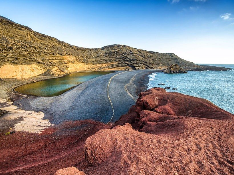 Tenerife, for example, has both black volcanic beaches and snow-capped peaks, while Lanzarote is known for its dunes and lava fields.
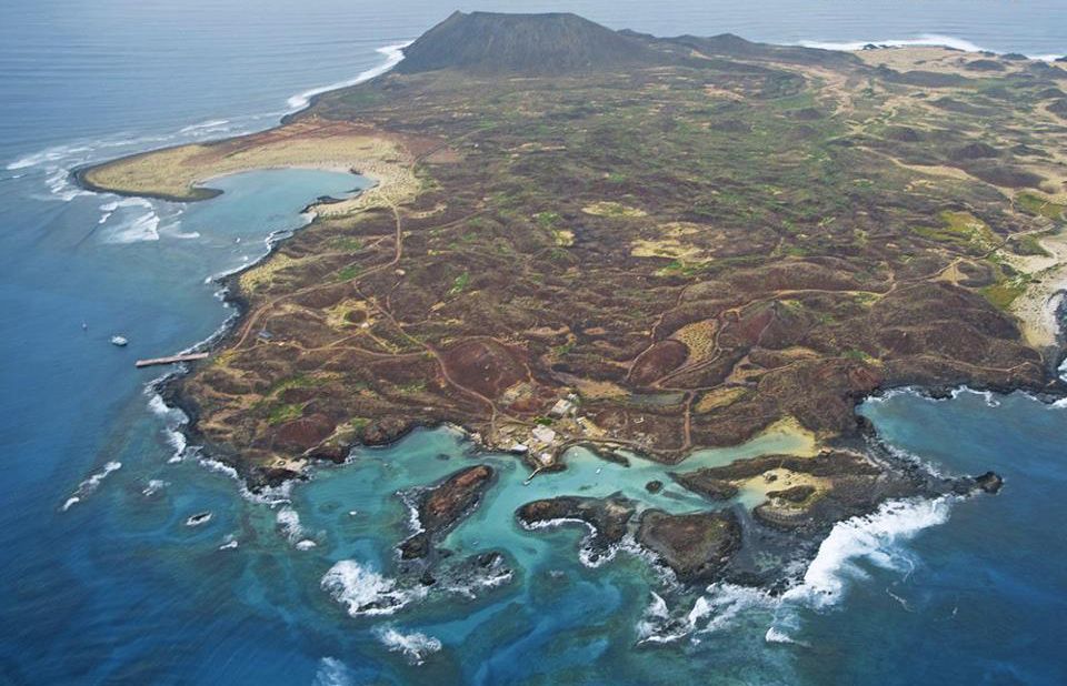 It may be a little colder than the rest of the islands during the winter months on El Hierro, La Palma, and along the northern coasts of Tenerife and Gran Canaria. Snow frequently falls on top of Teide volcano in December and January.
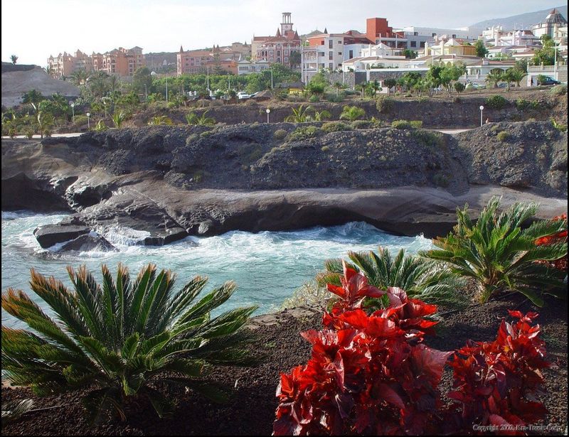
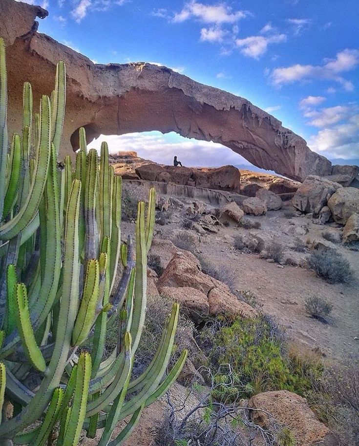
 However, English and German are also commonly spoken. Almost all commercial establishments on the islands, such as shops, restaurants, hotels, and so on, have at least one person that speaks English or German. Furthermore, information boards and signs are available in Spanish, English, and German, making them easy to comprehend.
 A. (TITSA)

 The third-largest volcano in the world, it is still considered an active volcano today, but it is entirely safe to visit and attracts over 2 million tourists each year. The fit may walk up to El Teide by foot, but it can be tough going at 2,200m, especially in the summer. There is also a cable car lift that takes 10 minutes to reach the 3,550m viewpoint. The view is breathtaking whether you climb or take the car; you can see all of Tenerife on a clear day.
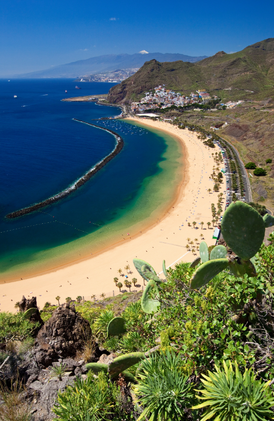 The laurisilva, which flourished in great numbers millions of years ago, is now rare and found only in a handful of places throughout the world. Garajonay National Park‘s lush 4,000-hectare vegetation is one of these locations where nature continues to reign supreme.
 What people don’t know about this island chain is that it also boasts some real architectural masterpieces. The European Gothic and Neoclassical architectural styles were introduced during the Spanish colonial period. Canarian architecture has evolved over time, but classic style, modernism, and ecology coexist in perfect balance on the archipelago.
 It is also the longest and highest arch bridge ever built in Spain, a true feat of engineering.
 Despite its historic architectural style, it was only built in the early 20th century and took less than 70 years to complete. The current San Juan Bautista Church occupies the site of an earlier church established in 1515.
 For 15 days, color, rhythm, and flamboyance spill out onto the city’s streets. Because of its distinctive flavor and spectacular display, the event is described as “more Brazilian” than other Spanish carnivals.
 The cuisine is hearty and delectable, relying on the islands’ produce. Papas arrugadas, the Canarian potato grown from volcanic soil, go with grilled meat and fish (usually tuna or swordfish). These potatoes, which are wrinkled and smaller than the regular ones, are cooked whole in their skin, salted, and served with flavorful pepper sauces: mojo verde, mojo rojo, and mojo picon. They’re suitable for snacking or as part of a meal.
 Tenerife has several vineyards, although the most unique are found on Lanzarote. The Canaries’ wines, including Malvasia and Palomino grapes, all have a distinct flavor profile.
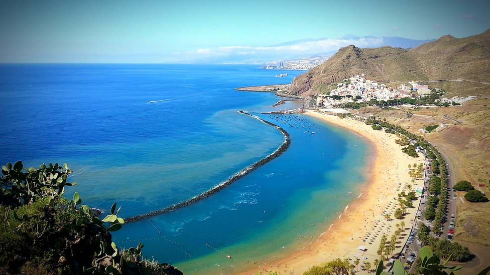 Crystal clear waters, breathtaking geological
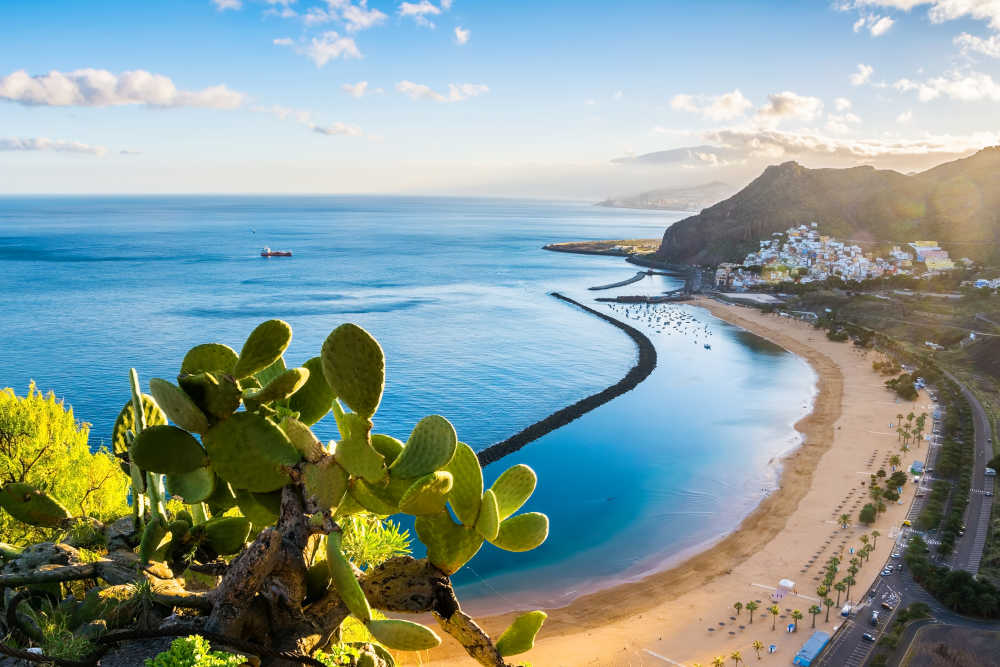 7/5 Good! (275 reviews)
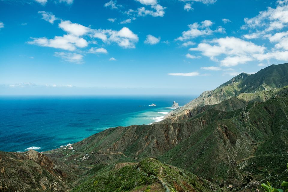 So many items of drinks and food were ‘pay extra’ that it was more like a full board offering than all inclusive.
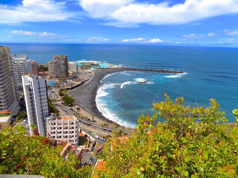 7/5 Exceptional! (427 reviews)
 Learn more about Canary Islands
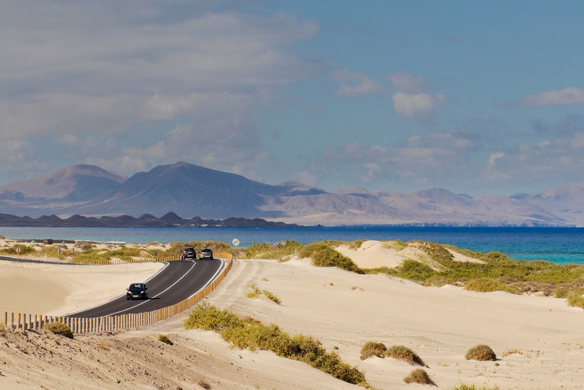
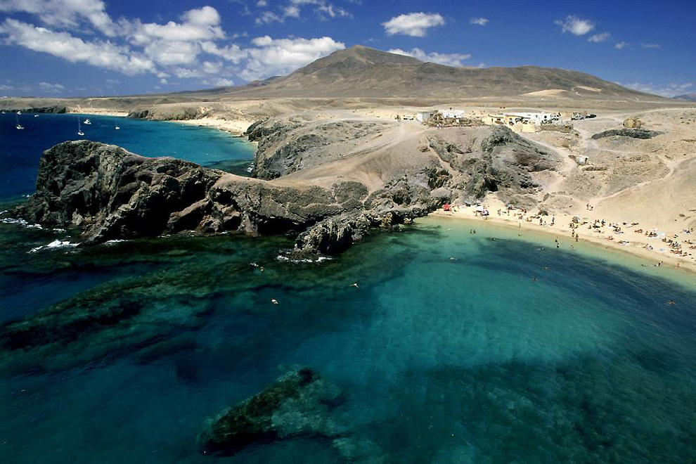 5/5 Wonderful! (379 reviews)
 Prices and availability subject to change. Additional terms may apply.
 Just bundle everything together. Hotels, rental cars and flights — combine whatever you need into a Canary Islands vacation package and save up to $366. Score even more bargains when you add extras such as sightseeing tours to your booking. But here’s the most impressive part. You have the flexibility to customize your trip your way. We offer more than 550 air carriers and 1,000,000 properties across the globe, so that everyone has a chance to travel and fulfill those vacation dreams.
 If you’re vacationing on a budget, you might want to avoid , which is considered to be the most expensive time of year. is usually when you’ll score the best deals. To experience the atmosphere of peak season, pack your bags for . are the quietest months to visit and a good idea if you want to get away from the crowds.
 You’re the boss! When you bundle your bookings with Expedia, you’ll enjoy discounts you won’t find elsewhere.
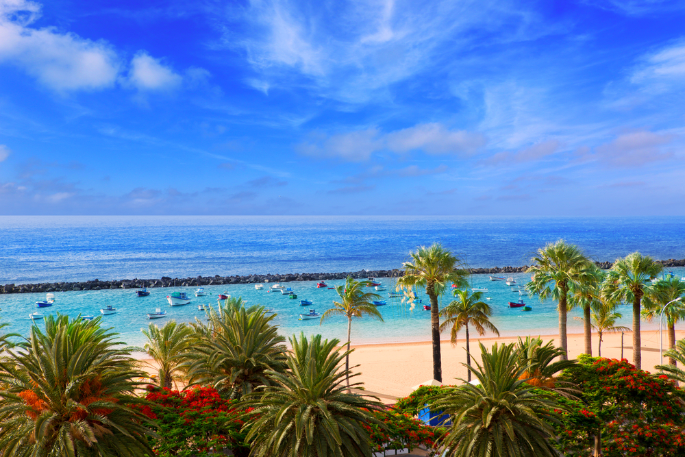 With all that choice at your fingertips, finding the ideal carrier to whisk you off to Canary Islands won’t be hard.
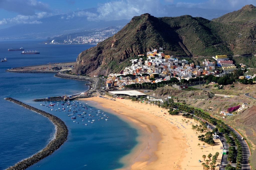 We recommend that you check the information on the official agency links before travelling.
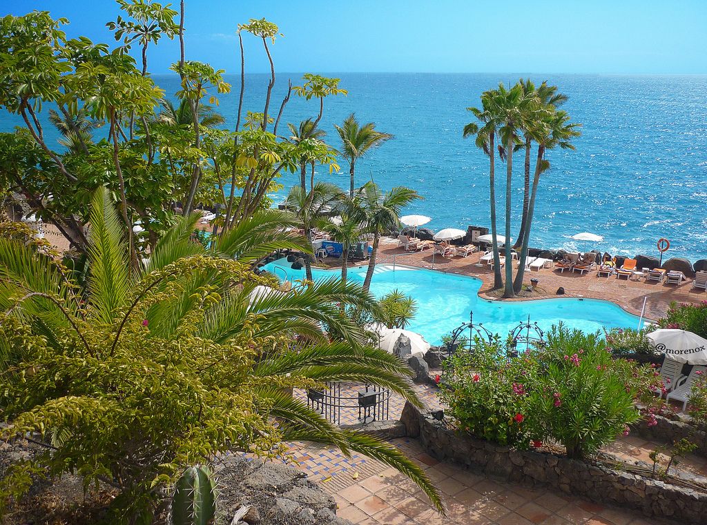


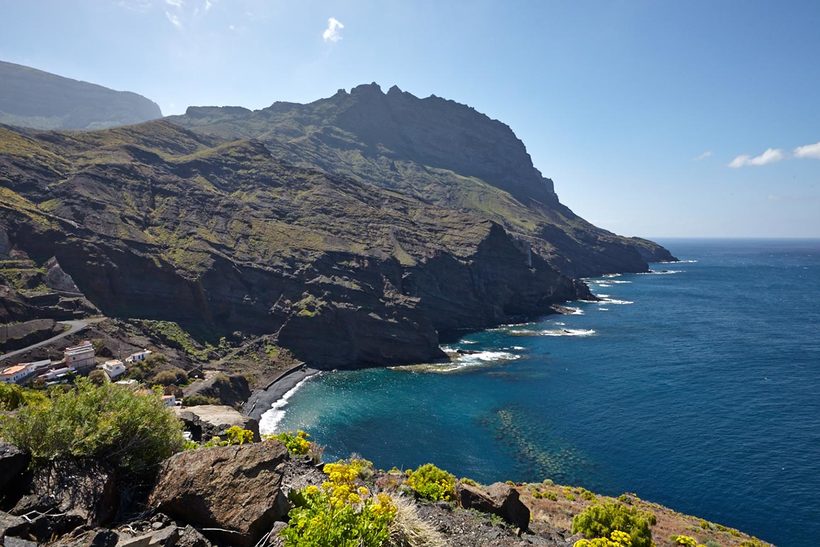
 mscbs.gob.es and https://www.spth.gob.es.
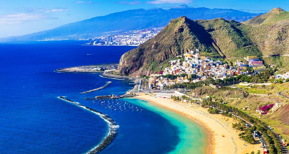
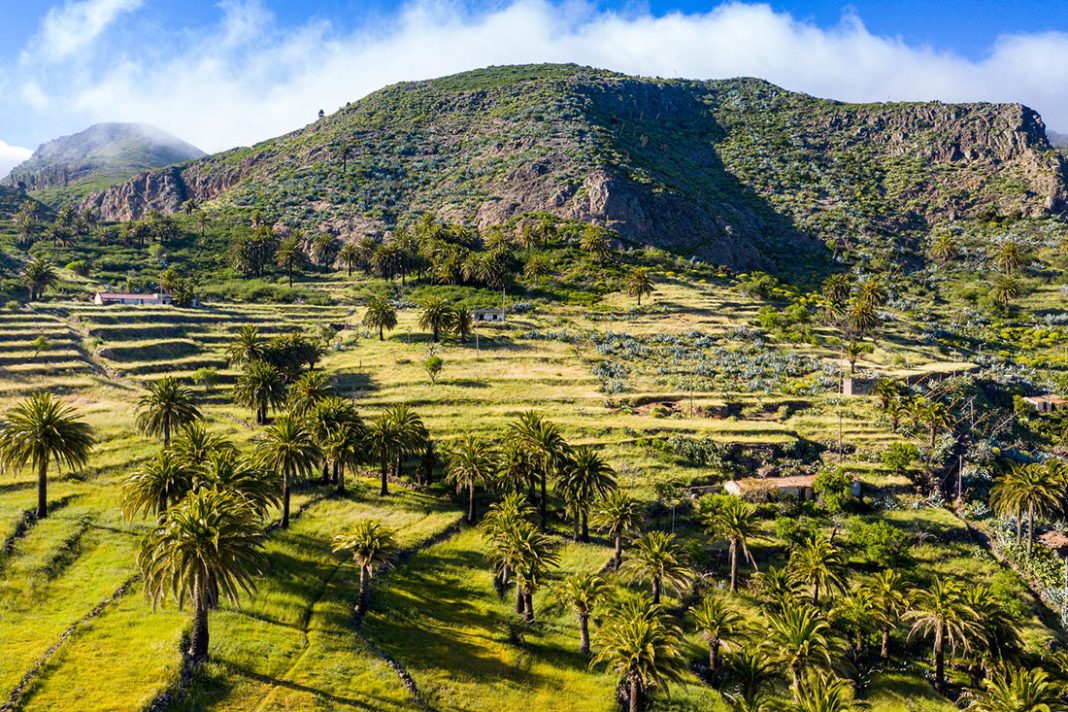

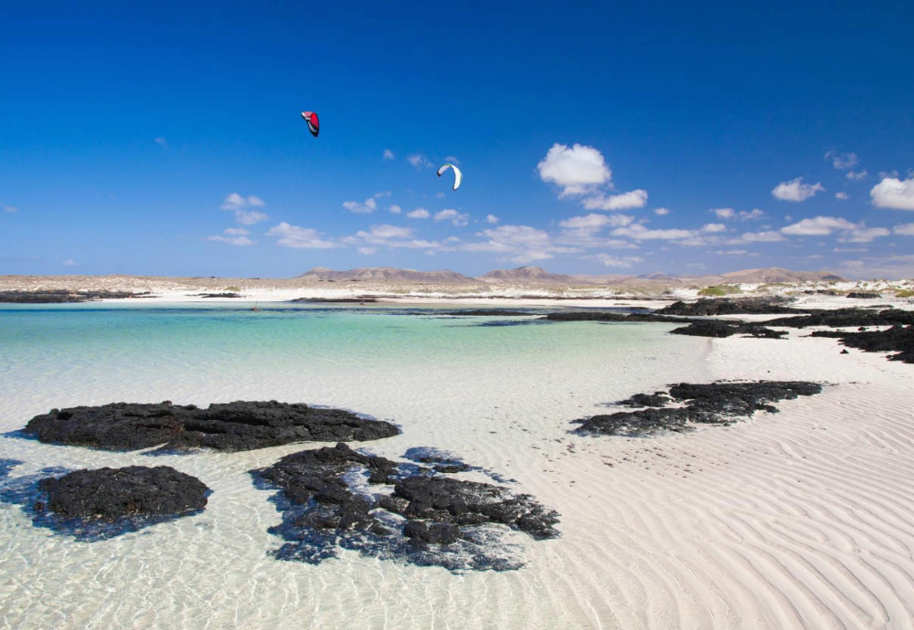
 However, restrictions can be applied at regional level including local curfews, so you should monitor local news.
 Further to this, travellers will be subject to temperature check, a visual health assessment and must fill in a health declaration form 48 hours prior to travelling to indicate the address where they will be staying, their contact details and history of exposure to COVID 19. Please note that due to a surge in cases, you will be required to quarantine on your return to the UK and other EU countries.

 You should book these in advance for smaller islands.
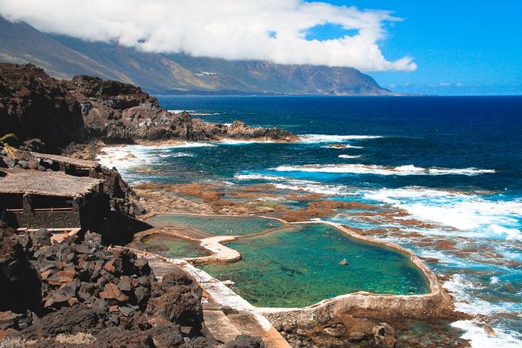 S. Embassy Las Palmas de Gran Canaria

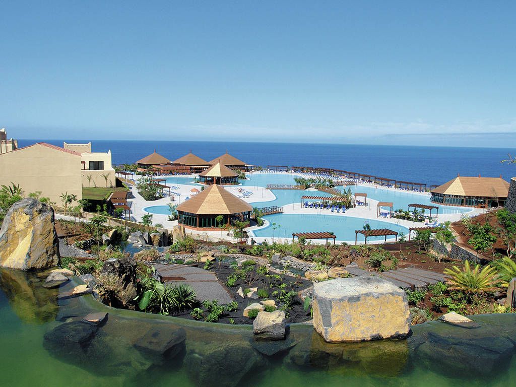


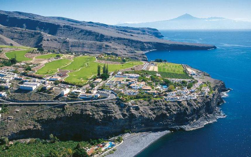

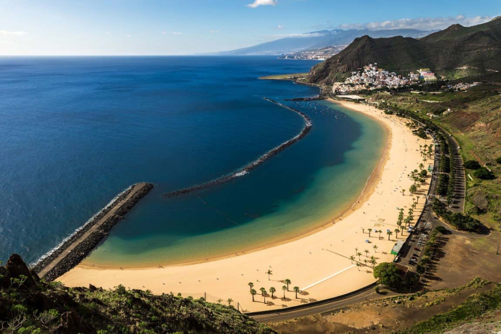

 No more than that (no cold guaranteed!). Water temperature varies from 22º C in summer to 19º C in winter. Occasionally, in La Palma, Tenerife and Gran Canaria you may find tropical rains from time to time, while Fuerteventura and Lanzarote are very dry and guarantee sunshine almost without interruption.
 outlets will fit the Europlug – round two-pin plugs.
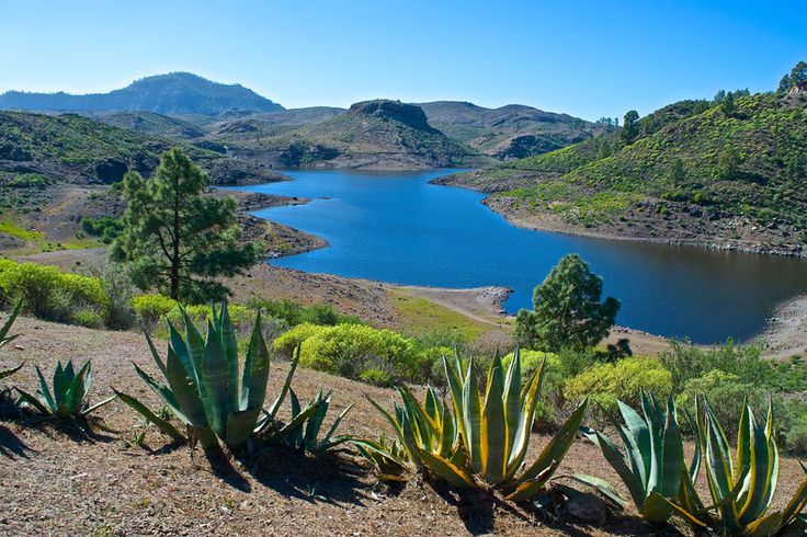
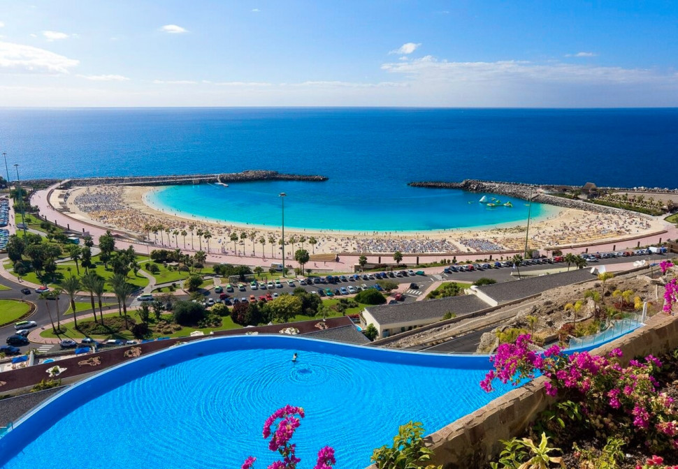 It is a legal requirement for foreigners to show some form of identification on request.
 High 27ºC. Winds S at 10 to 20 mph.
 High 26ºC. Winds S at 10 to 15 mph. Chance of rain 80%.
 High 26ºC. Winds SSE at 10 to 15 mph. Chance of rain 80%.
 High 26ºC. Winds E at 10 to 20 mph. Chance of rain 40%.
 High 27ºC. Winds ENE at 10 to 20 mph.
 High 27ºC. Winds ENE at 10 to 20 mph.
 High 27ºC. Winds ENE at 10 to 20 mph.
 High 27ºC. Winds E at 10 to 20 mph.
 High 26ºC. Winds E at 10 to 20 mph.
 High 26ºC. Winds E at 10 to 15 mph.
 High 26ºC. Winds E at 10 to 15 mph.
 High 26ºC. Winds E at 10 to 20 mph.
 High 27ºC. Winds ESE at 10 to 20 mph.
 High 27ºC. Winds ESE at 10 to 15 mph.
 And on the average day it rains or snows, we get Infinity in (Infinity mm) of precipitation. In more common terms of how much that is, some would describe it as heavy, pouring rain.
 9 hours. This graph shows the average amount of sunshine in Golf del Sur in July based on historical data.

 Golf del Sur, Province of Santa Cruz de Tenerife, Canary Islands, Spain

 ..+75 °FPartly cloudy sky
 ..+73°F, dew point: +64,526°F; ratio of temperature, wind speed and humidity: Somewhat uncomfortable for most people at upper edge;
 ..+75°F, dew point: +67,1°F; ratio of temperature, wind speed and humidity: Somewhat uncomfortable for most people at upper edge;
 ..+73 °FPartly cloudy sky
 ..+77 °FPartly cloudy sky
 ..+75°F, dew point: +66,092°F; ratio of temperature, wind speed and humidity: Somewhat uncomfortable for most people at upper edge;
 ..+77°F, dew point: +66,344°F; ratio of temperature, wind speed and humidity: Somewhat uncomfortable for most people at upper edge;
 ..+73 °FPartly cloudy sky
 ..+77 °FLight rain
 ..+73°F, dew point: +65,534°F; ratio of temperature, wind speed and humidity: Somewhat uncomfortable for most people at upper edge;
 ..+77°F, dew point: +67,334°F; ratio of temperature, wind speed and humidity: Somewhat uncomfortable for most people at upper edge;
 ..+73 °FLight rain
 ..+75 °FPartly cloudy sky
 ..+73°F, dew point: +65,03°F; ratio of temperature, wind speed and humidity: Somewhat uncomfortable for most people at upper edge;
 ..+75°F, dew point: +66,65°F; ratio of temperature, wind speed and humidity: Somewhat uncomfortable for most people at upper edge;
 ..+73 °FPartly cloudy sky
 ..+77 °FPartly cloudy sky
 ..+73°F, dew point: +67,064°F; ratio of temperature, wind speed and humidity: Somewhat uncomfortable for most people at upper edge;
 ..+77°F, dew point: +64,184°F; ratio of temperature, wind speed and humidity: Comfortable;
 ..+77 °FPartly cloudy sky
 ..+73°F, dew point: +65,444°F; ratio of temperature, wind speed and humidity: OK for most, but all perceive the humidity at upper edge;
 ..+75°F, dew point: +68°F; ratio of temperature, wind speed and humidity: OK for most, but all perceive the humidity at upper edge;
 ..+73 °FPartly cloudy sky
 ..+77 °FPartly cloudy sky
 ..+73°F, dew point: +66,992°F; ratio of temperature, wind speed and humidity: OK for most, but all perceive the humidity at upper edge;
 ..+77°F, dew point: +65,318°F; ratio of temperature, wind speed and humidity: Comfortable;
 ..+73°F, dew point: +61,574°F; ratio of temperature, wind speed and humidity: OK for most, but all perceive the humidity at upper edge;
 ..+73 °FLight rain
 ..+72°F, dew point: +61,844°F; ratio of temperature, wind speed and humidity: Comfortable;
 ..+72 °FPartly cloudy sky
 ..+72°F, dew point: +58,01°F; ratio of temperature, wind speed and humidity: Very comfortable;
 ..+72°F, dew point: +60,206°F; ratio of temperature, wind speed and humidity: Comfortable;
 Find out more about our data sources.
  There are normally 6 days in December with some rain.

 6°C
6°C This is noticeable after heavy rain or after prolonged periods of strong winds. Some downstream winds cause cold, deep waters to replace surface waters that have been warmed by the sun.
 Guided hiking tours are available and are not a bad option since many of the less frequented paths can become difficult due to overgrowing plants.
 It is one of Spain´s top National parks, a tittle reserved to the best natural areas of the country. But there are many more natural areas that can be enjoyed in La Palma. La Ruta de los Volcanes is a great example. It can be enjoyed from Fuencaliente and offers a moon-like landscape. The Northern part of La Palma also offers excellent natural areas: from cliffs in the least explore areas in the northern coast, to the amazing laurel forests in the north east.
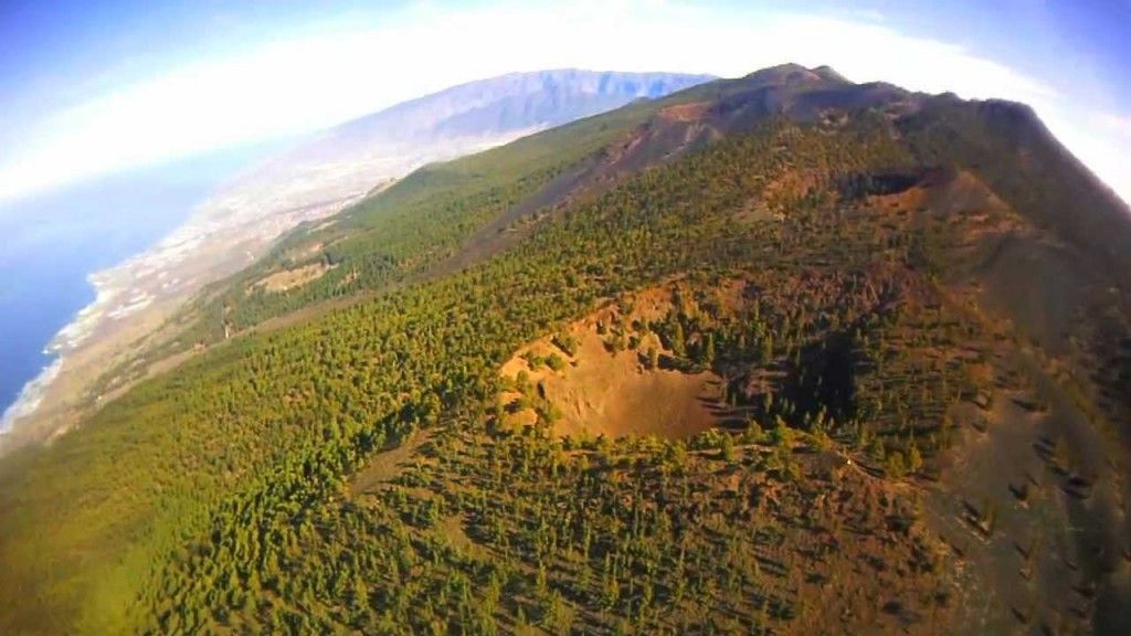 Local “benahoaritas” were described as the tallest of all inhabitants in the Canary Islands, and women described as “Amazonian” and fierce fighters. Due to its geography, La Palma was one of the last islands to be conquered.
 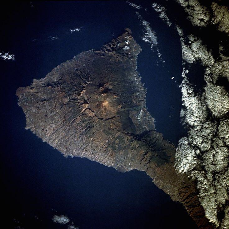 The Garajonay national park boasts the most impressive laurel forest in the archipelago. Locals from La Gomera have managed to keep some of its ancient traditions and culture. These include the Silvo, a way to communicate which is unique to La Gomera.
 Its dark soils and blue waters contrast with white houses and vineyards caved in the ground. Learn more about this magical gift of nature and how to spend a superb holiday riding camels, enjoying art, fantastic hotels and the best waves in the Canary islands
 Now they are recovering, and the island is welcoming tourists to explore again! Each Canary Island has its own charm, and La Palma certainly does live up to that. Keep reading and you’ll learn why!
 There are also several direct ferries from Tenerife with Fred Olsen and Armas. The ferry from La Gomera is at 7 am, and doesn’t happen every day, so make sure you check schedules beforehand.
 However, it is still required on public transportation.
 So it is common to find signs, menus, and such in both English and German.
 Some of our favorite things that you should try include:


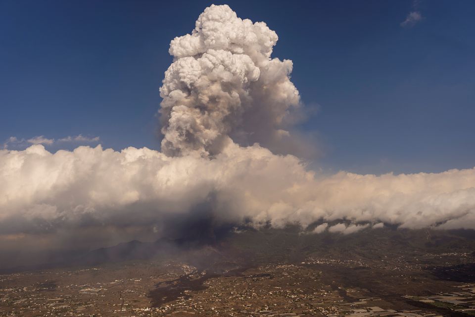

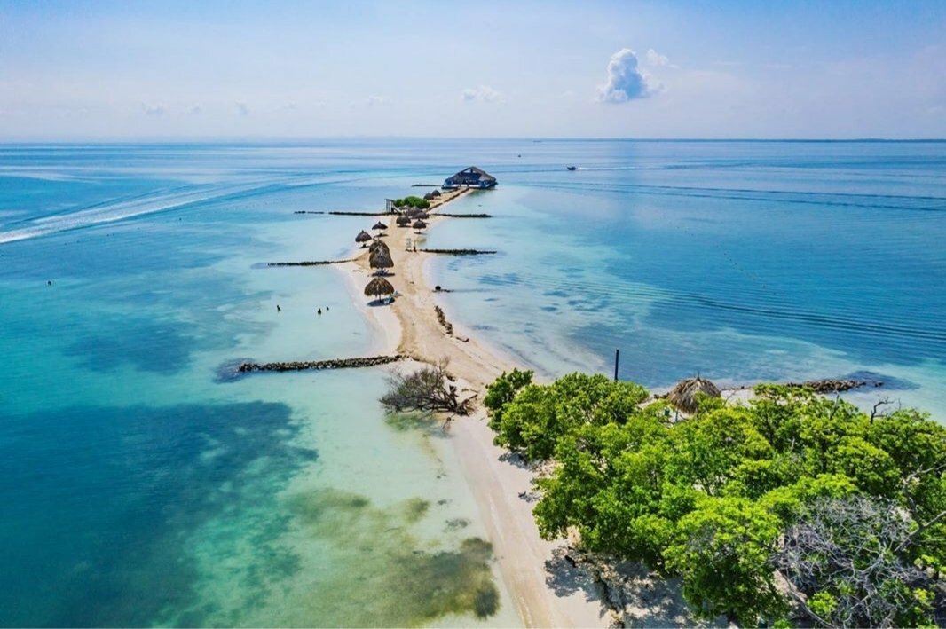

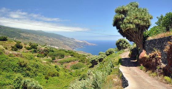
 Santa Cruz is located near the airport. and is where the port is. It is a great place to be able to easily get almost anywhere on the island, and has plenty to offer (although the weather can be temperamental).

 The volcano is mesmerizing, and there is a variety of landscapes for its visitors to enjoy.
 Thanks for being here!
 Dubbed as wild beauty of the Canaries, La Palma is a place of eternal spring, evergreen nature, and splendid land and seascapes. In general, this gem is a great place to connect with nature under clear skies, relax on isolated beaches or hike through deep gorges and past volcanoes.
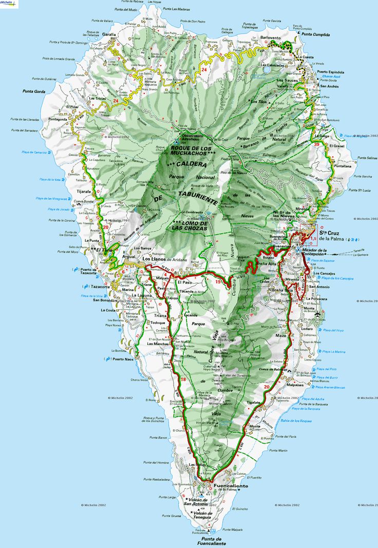
 Soak up the colonial atmosphere and follow the cobbled streets that lead to the Church of Los Remedios. In front of this 17th-century church is Plaza de Espana which houses some of the oldest Indian Laurel Trees in the archipelago. Wandering around this pedestrian zone, visitors can’t help but admire the well-preserved traditional houses. Quaint cafes also dot the area, perfect for those who want to savor local delicacies while passing the time.
 Set in the elevated part of the town, visitors can have a delightful peek into the island’s past all the while savoring the views of the Atlantic Ocean. Tazacorte is also known for its Banana Museum, the only museum in Europe dedicated to the tropical fruit. Opened in 2004, it houses interesting exhibits about the origin, variations and the fruit’s significance to the history and economy of La Palma.
 Thanks to its gorgeous sunny climate and a fantastic location in the Atlantic Ocean, visitors can pack as many swimsuits as they want any time of the year. Home to tens of unspoiled beaches, La Palma, is a beach and nature lovers’ paradise. Endless spits of dark volcanic sands and azure waters await.
 As such, this beach is a favorite among families with kids in tow. The calm waves are soothing to the senses and ideal for a relaxing swim.
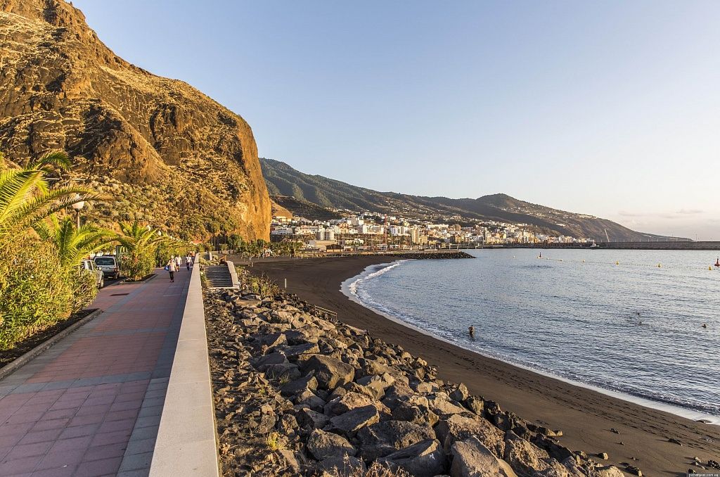 There are also some kiosks on the beach offering refreshing drinks and even sundresses. As the day ends, the promenade comes to life with its slew of bars, restaurants, and cafes for every taste and budget.
 Indeed, it’s astonishing landscape and indigenous flora and fauna inspire visitors to explore each corner of the island.
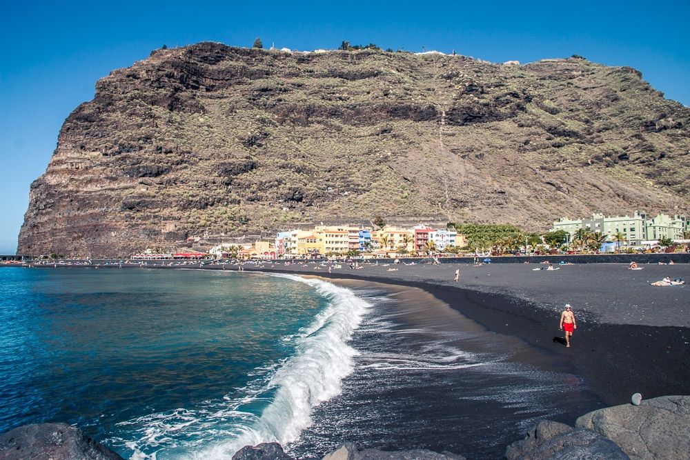
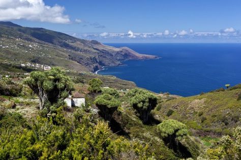 But visiting some of these spots should offer a closer look at the island’s rich history.
 Visitors will find excellent exhibits ranging from Guanche items to stuffed endemic animals. Delightful Hispanic-American paintings and top quality contemporary art are also carefully displayed in galleries.


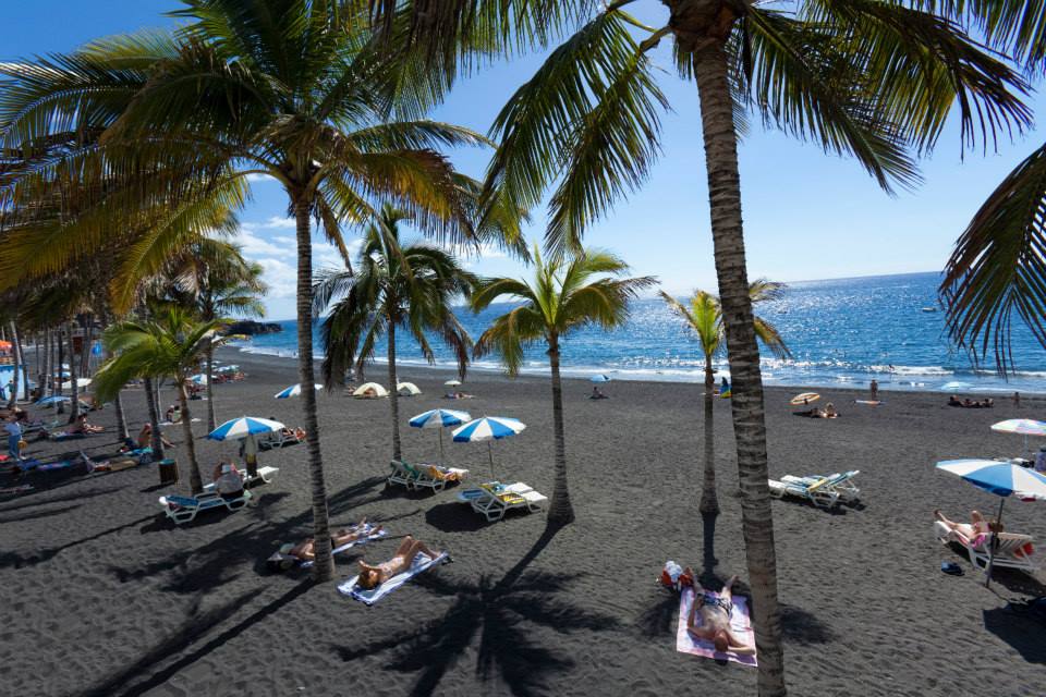
 With a multitude of restaurants serving affordable yet mouthwatering selections, visitors looking to stretch their budgets in La Palma will never run out of options.
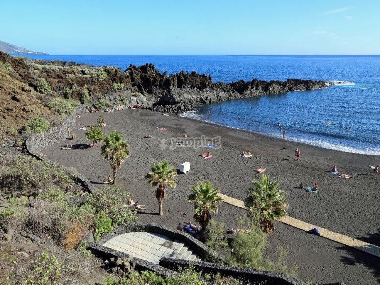 Every facility, from the restaurant that has an ocean view terrace to the pools skimmed by palm gardens, is designed for relaxation and taking it easy.
 Its rooms are spacious and comfortable with views of either the ocean or the mountains.
 It sports a countryside atmosphere with panoramic views of the Atlantic Ocean. There is a bus stop conveniently located some 50 meters away for those wishing to explore the nearby places.
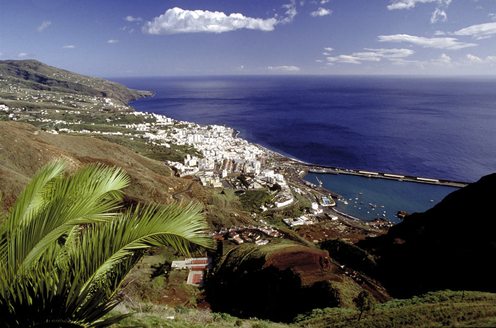 The capital’s dreamy old town, age-old baroque churches, and excellent museums all add up to the beauty of this island. And, provided unimpeded development stays at bay, it is likely to remain that way.
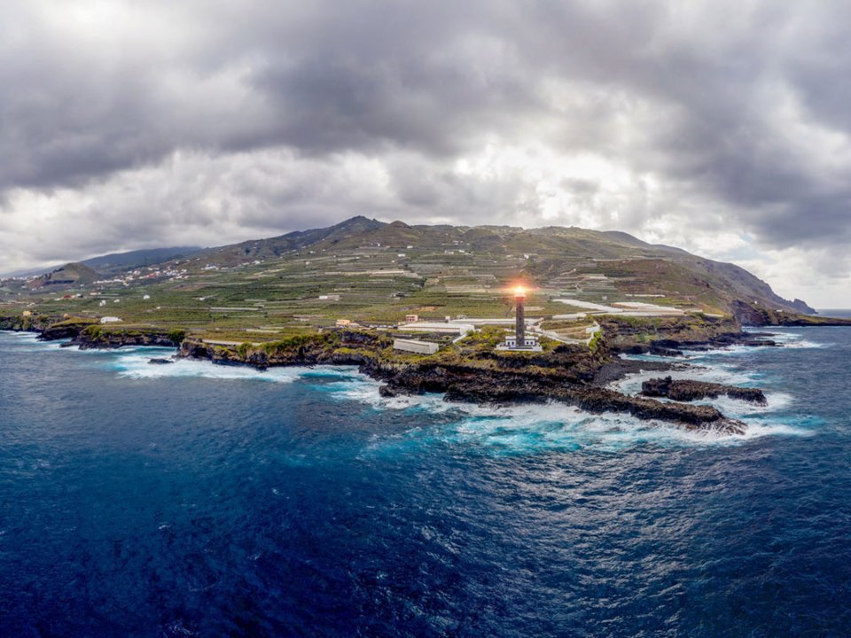 Among the most popular are the Caldera de Taburiente National Park, the Volcano Route , and the springs of Marcos y Cordero-Los Tilos. But be warned: these are among the longest ones!
 If you don’t know what it is, just ask and give it a try!
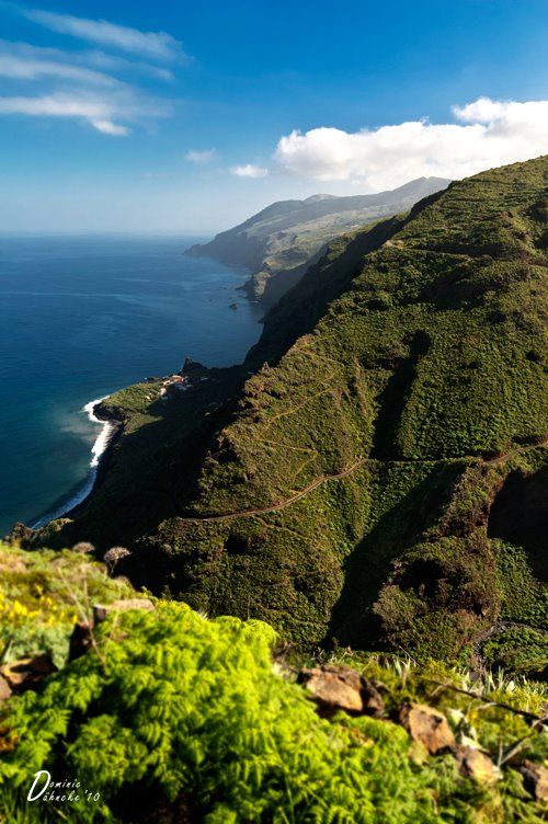
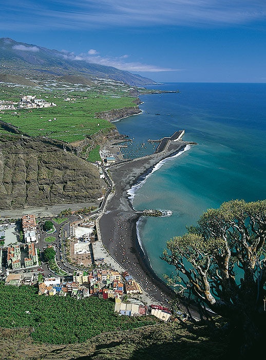

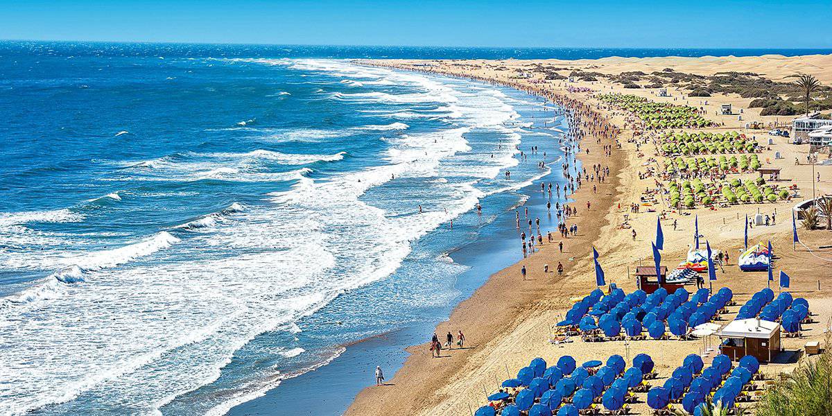
 net
net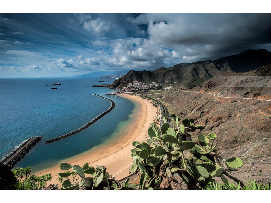 4°C
4°C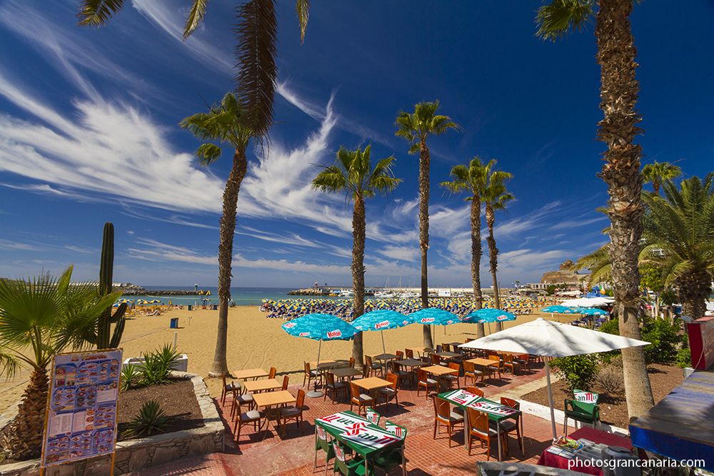
 net
net 2°C
2°C Warm Atlantic breezes take the edge off the heat, making the long sunny days more bearable. We’ve looked at the most up-to-date weather data for Gran Canaria, covering the last 12 years up to 2022, plus we’ve asked our team of travel bloggers for their first-hand experiences in order to answer the most frequently asked questions about Gran Canaria weather in June.
 In other words, you shouldn’t see any of the wet stuff. You’re not likely to see a thunderstorm during your trip.
 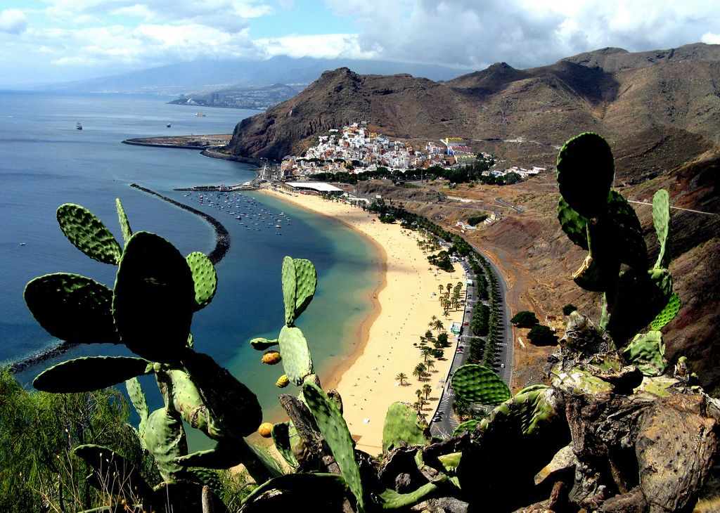 You can learn so much from a destination just by taking a stroll around the local market and learning about which are the most common products sold there. Gran Canaria surprised me with delicious dishes cooked with the freshest local produce grown on the island. The best food in Gran Canaria is based on simple ingredients that highlight flavour instead of a complex cooking process….
 …
… …
…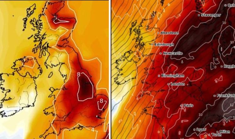 It’s popular for its black lava and white sand beaches. But what other places can we explore in Gran Canaria? What other adventures can we do? In this article, we’ll let you know all the things that you could possibly do during the weekend while enjoying your stay on this wonderful island of Gran Canaria. …
 Here’s a look at our top picks.Beach HolidaysGran Canaria, Canary IslandsThe temps are definitely cooler…
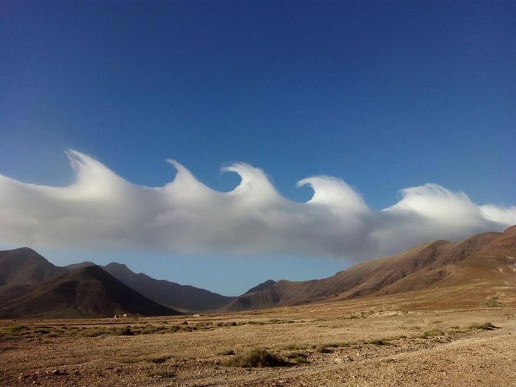
 Combined with the surreal Unesco-listed 73-sq-mile Parque Nacional del Teide, this impossibly spectacular volcanic moonscape serves up some of the most exciting hiking in all of Spain. Only 200 walkers a day can tackle the five-hour ascent to the summit: book ahead online. Across the island, other jaw-droppingly beautiful walks lead past charismatic villages, through perfumed Canarian pine woods or down plunging valleys such as the 4-mile (6.5km) Barranco del Infierno.
 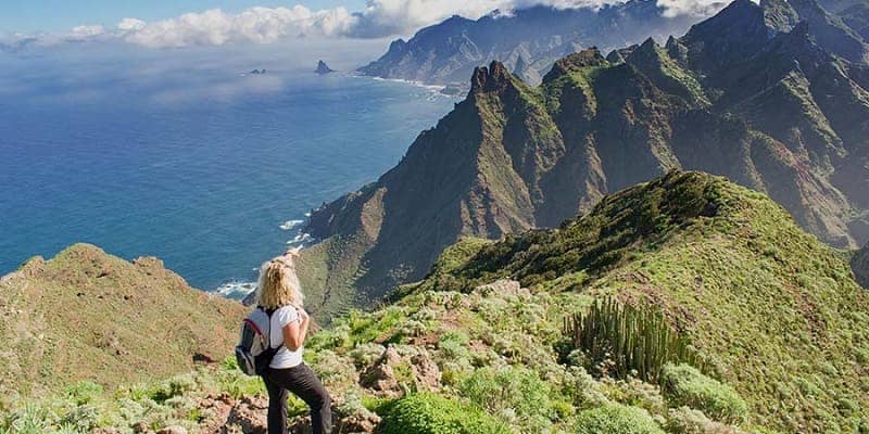 Hotel Alhambra in La Orotava sleeps guests in an art-packed 18th-century manor.
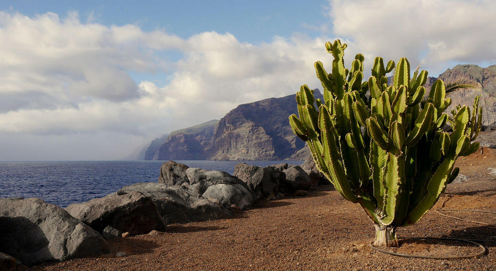


 At the heart of it all lies the 20-sq-mile Parque Nacional de Timanfaya. Savor this otherworldly volcanic landscape by scrambling up the sprawling Caldera Blanca on a 5.5-mile (9km) hike at the park’s edge.
 There are wonderful restaurants all over the island (both local-style and creatively international), with the best food found well beyond the resorts. Canarian-international La Cantina is a beloved dining spot in delightful Teguise.
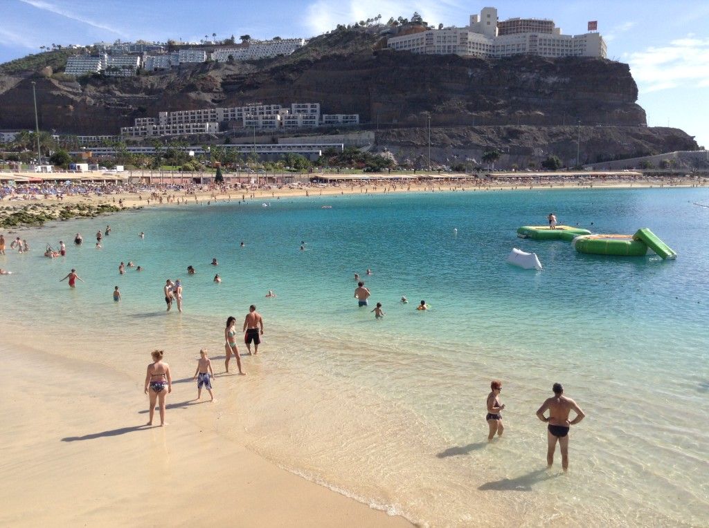 Wind-lashed and evocatively arid, Fuerteventura is graced by the archipelago’s dreamiest sands: the honey-colored dunes of the protected Parque Natural de Corralejo, surf-mad El Cotillo (originally a fishing village) and blissfully undeveloped pale-gold Playa de Cofete on the island’s southern tip. You can go surfing, sailing, windsurfing, kitesurfing and diving (even freediving), and venture out on some excellent hikes, including around the Isla de Lobos nature reserve.
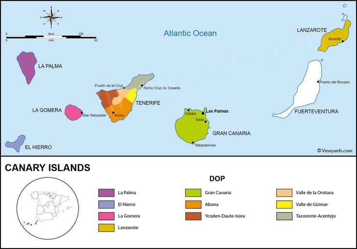 Restaurante Avenida rustles up classic Canarian cuisine.
 The 7-mile (11.4km) round-trip climb to the 6082ft-high summit of Pico de Bejenado is a view-laden showstopper of scattered pines, sharp ridges and mysterious petroglyphs.
 Book ahead to sample the fresh-produce cooking at locally loved restaurant Enriclai.
 5-mile downhill Alto–Hermigua hike), while elsewhere, thrilling paths cling to sheer valley walls or meander along the blackened volcanic coastline. When you’re all hiked out, stroll the pastel-painted streets of sea-hugging capital San Sebastián de la Gomera and dig into hearty local specialities like potaje de berros (watercress stew), miel de palma (palm honey) or fresh goat’s cheese.
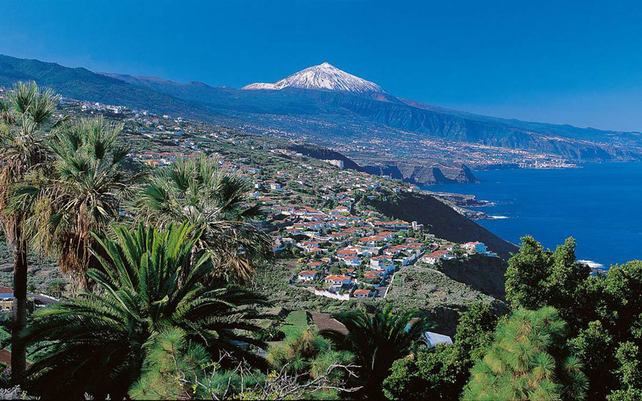 The island’s international community has introduced a few other flavors too, especially in Valle Gran Rey, which hosts some good fusion and vegetarian restaurants alongside its traditional offerings. Don’t miss the outstanding home cooking at much-loved restaurant Casa Efigenia.
 Here, on what feels like the edge of the earth, quiet hiking trails such as the historic 16-mile (27km) Camino de la Virgen weave through flower-filled fields and scented pine forests. Other paths, like the spine-tingling 2.7-mile (4.4km) Camino de Jinama, traverse sheer cliff faces above lava-hewn landscapes. Meanwhile, the warm, glass-clear Atlantic waters off El Hierro’s craggy coastline unveil the finest diving in the Canaries, especially around the tranquil Mar de las Calmas near sunny La Restinga in the south.
 The lack of tourist traffic ensures restaurants are catering mainly to a local clientele, which means higher standards. Dine at the elegant Restaurante Mirador de la Peña, designed by César Manrique.
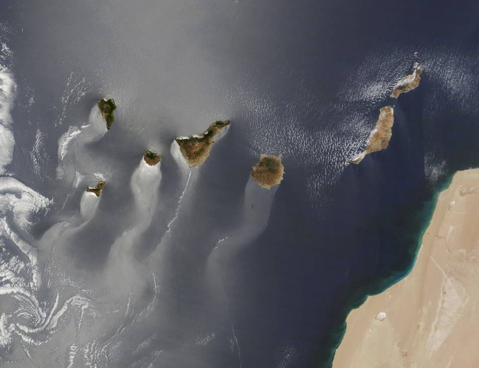 Most visitors arrive on day trips from Órzola on Lanzarote, but if you stay a few nights on La Graciosa, you’ll feel worlds away from the Canary Islands’ buzz. Hike or bike over to remote Playa de las Conchas or secluded Playa Francesa before settling in for a seafood feast in low-key “capital” Caleta de Sebo.
 The countryside is green and lush, and it’s an ideal time to enjoy the many hikes across the island. Temperatures average around 20°C, with day-time highs in the mid-20s, nudging up to the high 20s towards the end of the month. Majorca, the largest of the islands, is home to the charming Balearic capital of Palma, and has a host of superb resorts that suit everyone, from party-central Magaluf to family favourite Puerto de Pollensa. Menorca is a drowsy, relaxing island with a fascinating city – Mahon and Ciutadella – at either end, and rolling hills and enchanting coves in the middle. Ibiza won’t yet be in full party mode in June, and it’s the perfect time to soak up the island’s enticing, if often overlooked, rural charms.
 To escape the heat, head to one of the greener islands, such as Zante and Corfu, where you can hike through forested hills. If you’re in search of the perfect tan, make for Kos, where temperatures hit the low 30s by the end of June.
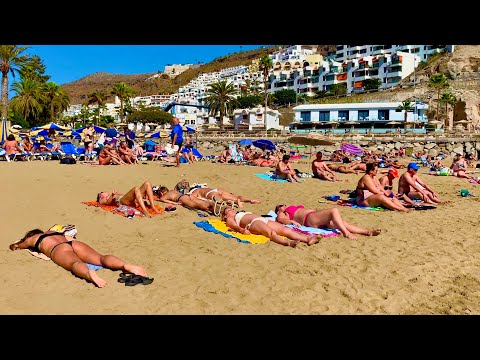
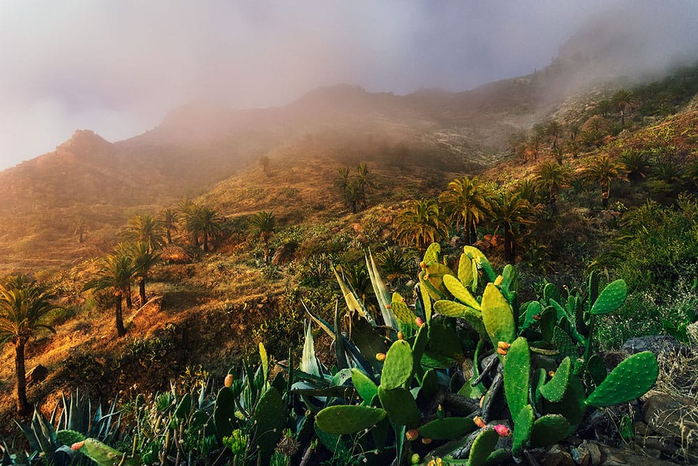 Temperatures will be a steamy 28-33°C, with high humidity and occasional storms, but you can escape the heat in the sea – which is warm and inviting year-round.
 Do you want to go on holiday to the Canary Islands? We have listed some of the best places to visit for you.
 The south also has beautiful beaches. This part of the island is therefore the most popular among holidaymakers. The Dunas de Maspalomas nature reserve is a special place to visit. The high sand dunes completely surround you and make you feel as if you are in another world.
 The beaches are popular not only with water sports enthusiasts, but also with sunbathers.
 It is the greenest Canary Island. You can walk through special nature parks and picturesque villages. Parque Nacional Caldera de Taburiente is a beautiful walking destination. Here you can see an enormous crater with steep walls and an impressive waterfall.

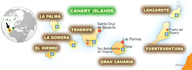 Our average monthly climate data is based on data from the past 30 years.
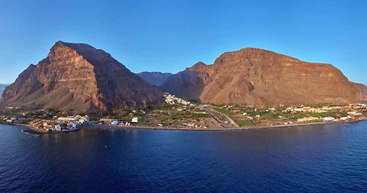


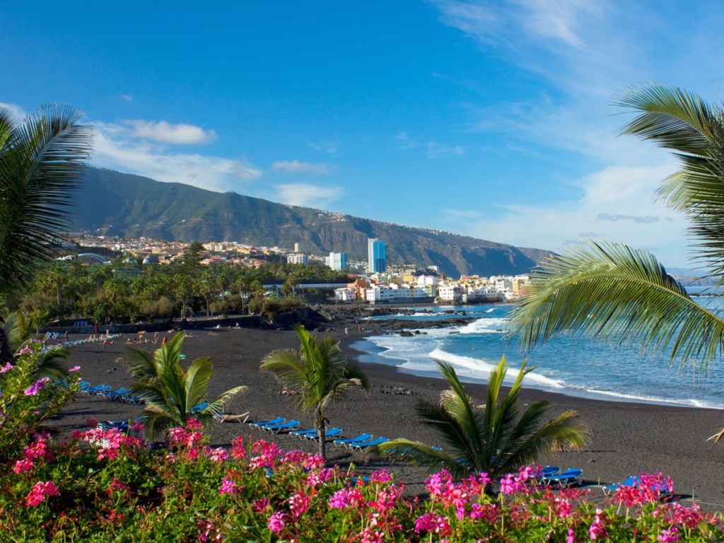 12 Euro
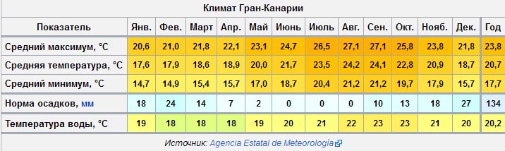
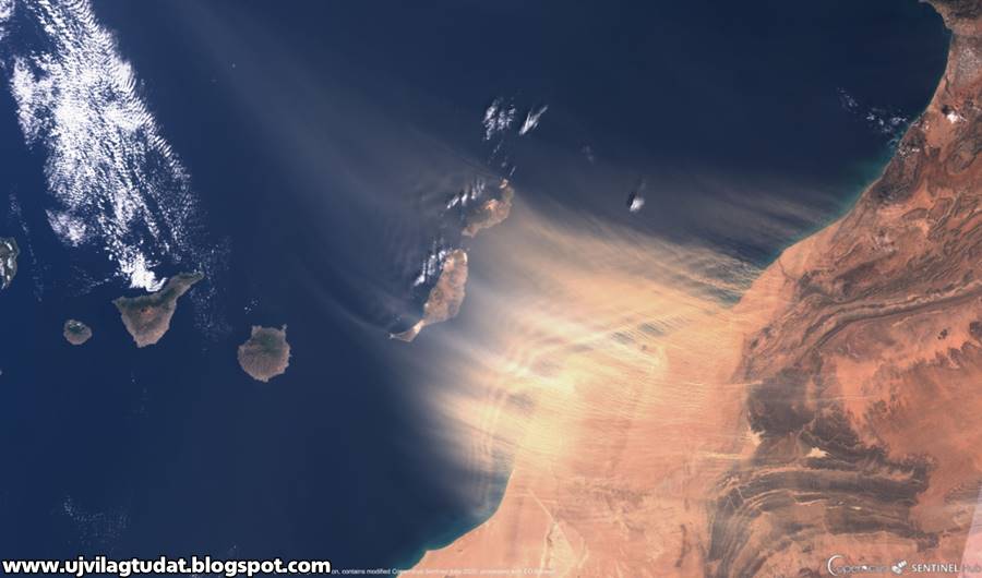 2
2 5
5 The records, especially the cold ones, show how mild the climate is in these islands: in winter, the minimum at sea level almost never drops below 10 °C (50 °F).
 Apart from some rare rainy and windy periods in late autumn and winter, those of Calima are the only unpleasant moments of this climate, which for the rest is almost always enjoyable.
 5 °C (70.5 °F) in August, so it’s definitely cooler than in Santa Cruz, the largest city of Tenerife.
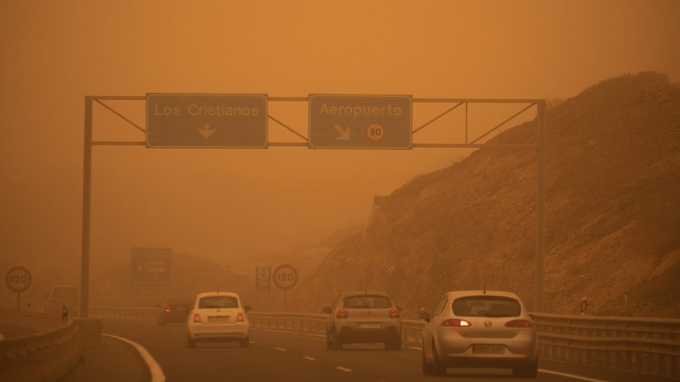 The cool and breezy weather conditions can make it pleasant to sunbathe and to do other outdoor activities, but it must be remembered that the tropical sun’s rays (as mentioned, we are just north of the Tropic of Cancer) are very strong, so there’s the risk of sunburn without appropriate precautions. The sun is strongest from late May to late July.
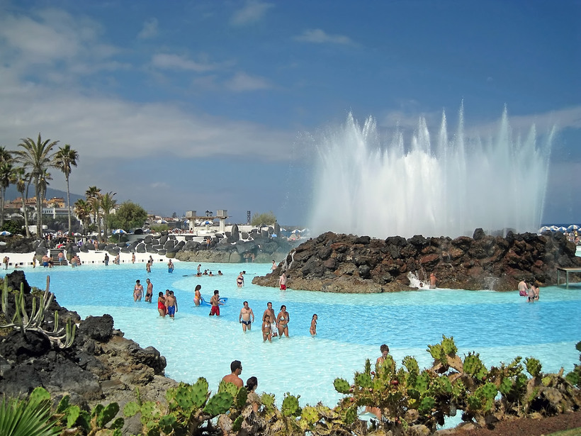
 2
2 5
5 On the central islands (Tenerife, Gran Canaria), the water temperature ranges from 19 °C (66 °F) between winter and early spring to 23/24 °C (73/75 °F) between August and October, which therefore is the best period for swimming. However, with a little courage, you can try to swim even in winter. On the western islands (La Palma, El Hierro), even though the Saharan wind blows more rarely, the sea is slightly warmer because the cold current flows near the coast of Morocco, ie in the east. For the same reason, on the easternmost islands (Lanzarote and Fuerteventura), the sea is slightly cooler (about one degree Celsius less than in Tenerife).
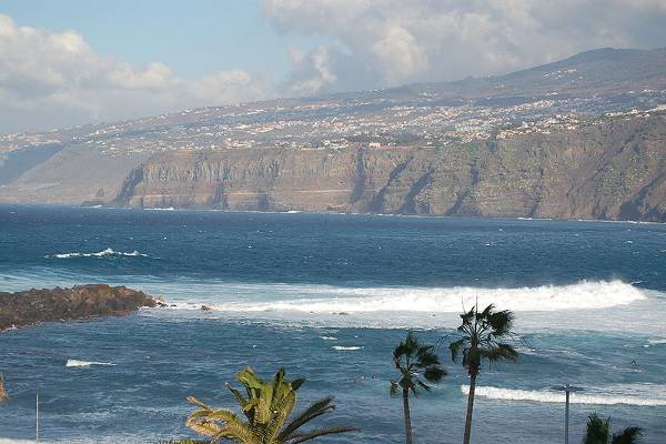 3
3 For Lanzarote and Fuerteventura, a light scarf for the wind and the wind-borne desert sand and dust. To climb mountains, and in particular Mount Teide, hiking shoes, a sweatshirt and a jacket for the highest elevations.
 com
com
 Holidays in Spain in June will also delight shopaholics. There are many shops offering attractive discounts. To meet tourists there are not only fashionable boutiques and fine restaurants, but also ancient fortresses, monasteries, beautifully decorated stone houses and spacious squares.
  Precipitation is rare.
 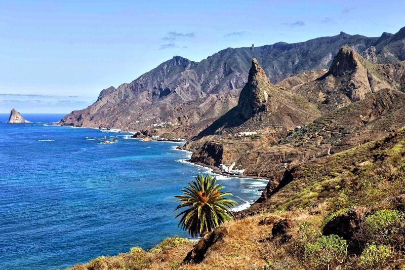 .. + 20 °.
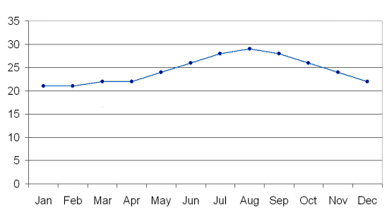
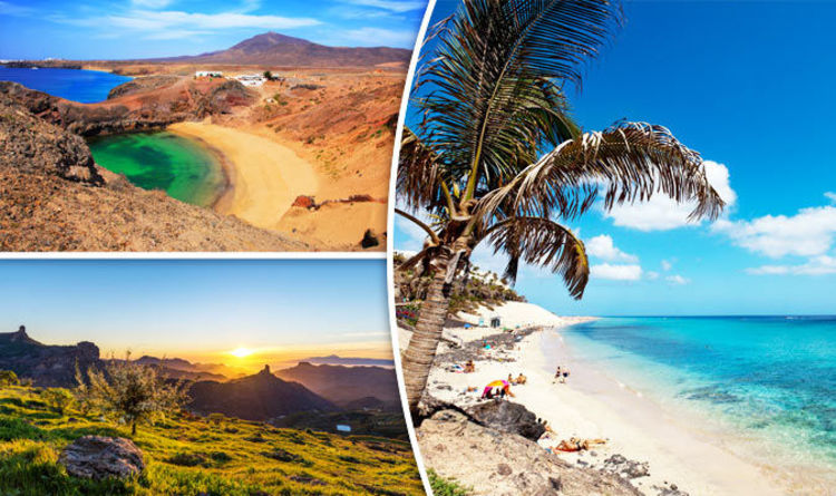
 [/info-box]
  And in between visiting boutiques, you can drink a cup of hot scalding coffee or a glass of cool heady wine in one of the local cafes. [/info-box]
  The swimming season on the peninsula starts in June, but already in May it is quite warm here – during the day it is consistently above +20 °C. It is warmest at this time in the west of Crimea – in Evpatoria and Sevastopol. At the beginning of May, the water temperature is still low – up to +18 ° C, but by the end of the month it “raises up”.
  But it is not hot and there are no long rains, so you can book excursions to local attractions or climb mountains.
 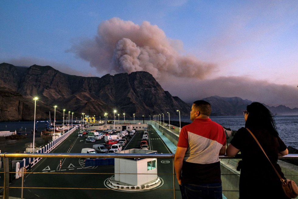 Most of them can be visited with children.

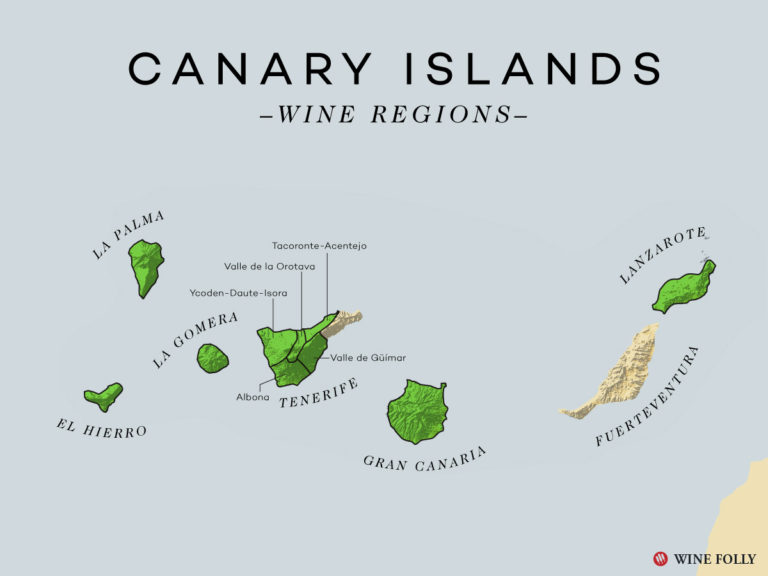 But no one canceled the beauty of the Baltic Sea, so a trip to Kaliningrad, Svetlogorsk or Zelenogradsk is not a bad idea, especially since it is not crowded here at the end of spring.
  However, it does get chilly in the evening.
  Especially tourists are attracted by the island of Crete: in the middle of spring there is actually summer weather here. However, it is better to go to the island in the second half of May, when there is almost no precipitation, and the water in the sea becomes warm. Even near the coast there is practically no wind.
  First of all, this is local cuisine with real wines, cheeses and pizza, and secondly, shopping, without which not one trip to this country is complete.
  In addition to the opportunity to relax at sea, this country also pleases with affordable prices for holidays in May 2022.

 You can rent equipment on the beach.


 8 days with at least 0.04 inches of precipitation.


 The shaded overlays indicate night and civil twilight.

 From the start to the end of the month, the length of the day decreases by 54 minutes, implying an average daily decrease of 1 minute, 52 seconds, and weekly decrease of 13 minutes, 1 second.

 From bottom to top, the black lines are the previous solar midnight, sunrise, solar noon, sunset, and the next solar midnight. The day, twilights (civil, nautical, and astronomical), and night are indicated by the color bands from yellow to gray.
 The black lines are lines of constant solar elevation (the angle of the sun above the horizon, in degrees). The background color fills indicate the azimuth (the compass bearing) of the sun. The lightly tinted areas at the boundaries of the cardinal compass points indicate the implied intermediate directions (northeast, southeast, southwest, and northwest).
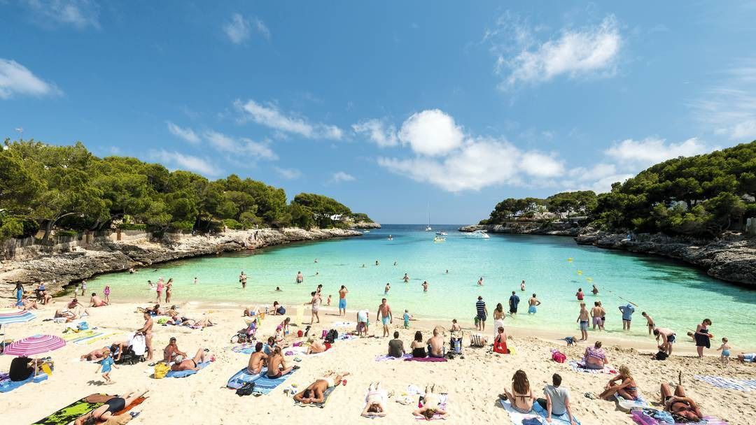 The shaded overlays indicate night and civil twilight.
 Lower dew points feel drier and higher dew points feel more humid. Unlike temperature, which typically varies significantly between night and day, dew point tends to change more slowly, so while the temperature may drop at night, a muggy day is typically followed by a muggy night.

 0 mphNov 112.0 mphNov 3012.7 mphNov 3012.7 mphNov 1612.6 mphNov 1612.6 mph
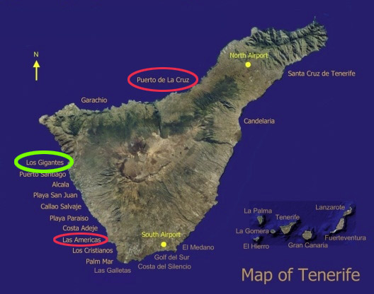 35
35 This number is based on the percentage of all Tripadvisor reviews for this product that have a bubble rating of 4 or higher.

 3 mi$ • Irish • Bar • European
 8 miBeaches
 Tripadvisor performs checks on reviews.
 Tripadvisor performs checks on reviews.
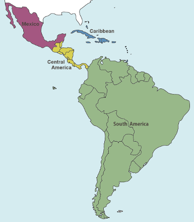
 They seem only to be using the North and Links and not the South course at this moment, which causes jams on the first tee and thereafter, making for some unhappy clients. The course is in good condition, fast greens and good fairways. Yes the bunkers are the black sand not favoured by most of us and the terrain is challenging, wayward shots are punished, and careless putts cost shots. It was very slow, too. However it is a scenic experience and has great views from most holes. The staff Starters and Marshalls know what they are doing which helps, but it was definitely too slow on the first 9. We teed off late, (should have been 2.50 but was 3.15 pm) and finished in the dark. Unlucky ? Anyway we would play there again and hope for a better pace of play. Last played here ten years ago and it’s still a good challenge.


 02 mi) The Beer Trap
 It’s a very thin line between safety and danger, especially when the wind blows across the open hillside. Palm trees dot the left boundary of the hole, but it’s the surface beneath them that offers the true intimidation. Mean-looking, black sand bunkers surround the bases of the trees and extend up the entire left side of the deep, narrow green.”

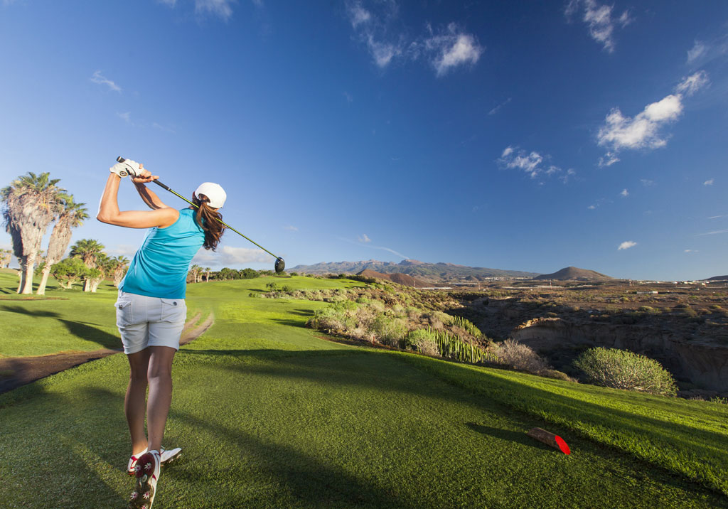 The rental clubs were not good given the price we paid for them (you paid for each extra club you needed in the bag, what’s that about?). We played the Links and North in that order, I kind of like the Links routing even though the North is supposed to be better. But as always the wind is howling on this part of the island, even though we started around 9.30 am. Don’t get me wrong I like a challenge but this was a little bit too much for my taste, and it has been like this the other times I played here as well. Also the nonstop flights going over the course spoils the fun a little bit. The course itself has a few fun holes to play (I like holes 3, 5 and 6 on the Links and holes 3, 4 and 6 on the North) but the condition on the course was nothing to cheer about in my opinion. The greens looked kind of bad and blemished but they rolled okay and the fairways were dry and burned on certain spots on the course, and somewhere they were too wet. The clubhouse and all facilities look like they need facelifting and also everything from tee to green needs a little bit of TLC if I’m being honest.
 The original nine holes (called Sur) have a great layout with nice views on the sea. Traditional lava stone walls around the tee boxes and hole descriptions from especially elaborately made tiles
 Worth playing however just to see the black bunkers, created by the volcano at the islands centre
 The green is well guarded by two sidebunkers and the prevailing wind. You immediately see a buena vista over the dry plains and ravines all the way to the lone rock near the airport accompanied by the scorching sun. The start is quite good actually, leading the player to the very edges of the property and exploring all the nice corners of it. This is also the most undulated part of it and it is quite interesting. The second is a par 3 with a shallow green guarded by bunkers and the 3rd a par 5 with a ravine along the entire right side of the hole. There is more than enough room on the left but also a chance to get home in two for those who want to play the hero. I also liked the par 4 4th, which with the right wind is reachable. There is a fairway left for the conservative, and the more agressive the line of the tee, the deeper the drop for the balls that won’t make it. Those will be treated a blind second from deep rough or a bunker. The green has a semi-punchbowl on the left side and drops down on ts front right, giving a great sight over the island.
 After the fourth, we proceed to the inner part of the property. There are some nice parkland holes but nothing too spectacular. Just solid. The back nine starts off with a nice awkward short par 4 with a dogleg right to a higher green running off tot he left. The wind will try to blow it there. The 2nd is the most famous hole on the course and maybe the island, a par 3 with many tee options played to an island green surrounded by the volcanic black sand that the bunkers at Golf del Sur consist of. The green appears to be lying on the side of a subtle hill and it makes for a beautiful natural green site with a deceiving perspective as seen from the teebox. The remaining holes are all quite nice, without any obvious standout holes. I liked the par 5 14th and the short par 4 16th which has a cross ravine which makes you think from the tee that you can easily carry it while it actually isnt. Because it runs cross the fairway diagonally, much depends on the line you take from the tee. And you’ll have guessed that this goes hand in hand with the risk you are willing to take.
 Writing this, it occurs to me that you shouldn’t probably go for it at all as a lay up leaves a pretty straight forward pitch to a flat green. This hole certainly got me, that’s for sure… holes like these make Golf del Sur a nice place to play with some really good strategic golf holes. I’m still mad I did not get any wedges but I might consider returning anyway, when I’d travel to Tenerife again.
 .. this means it is windy and you have plans coming into land above your head.
 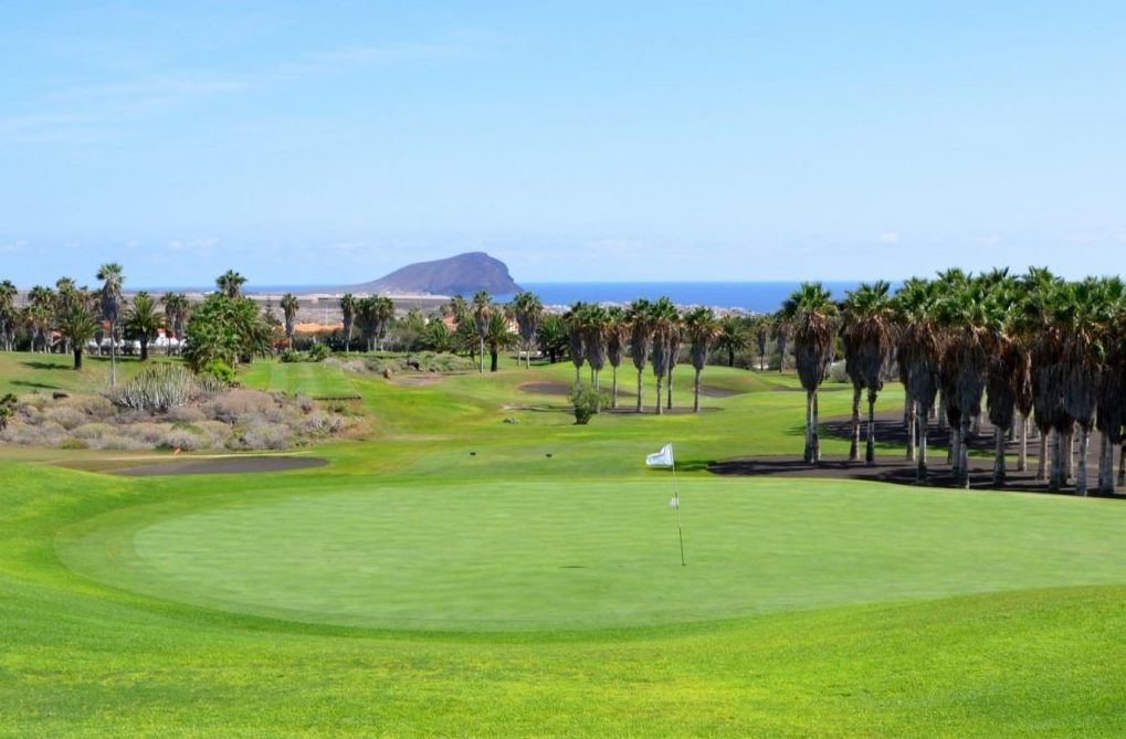 It is an attractive looking course with the lush green frequently framed by black sand (although often more like gravel!) and the conditioning of both fairways and greens was good. Personally I feel the North and South are the best of the 27 holes, the links feels compromised by the land they had to squeeze the holes into and with hazards rather clumsily added giving it an unnatural feel. It is generous from the tee and a solid challenge even from the yellows, the key defence the course has is the wind which seems to always blow hard from the airport and it sure makes the course a great deal tougher. On one of the days we played it was blowing 15 mph+, will little natural cover it made the round something of a grind. One really disappointing element was the pace of play, 5 hour+ rounds seem the norm and the club doesn’t seem to do much to control the standard of golfers or have marshals out to speed up play, given it was low season I can’t imagine how long a round takes during the peak months.
 Personally I rate Adeje and Las Americas higher than Gold Del Sur.

 This is undoubtedly a good layout but the course was looking a little tired and unloved on our visit. This time of year is regarded as the low season in Tenerife and most courses charge accordingly so maybe this was a factor in the mediocre presentation. There are some very good holes here, my favourites on the North being the 3rd and 4th alongside the canyon and the 7th over water. The pace picks up straightaway on the South with attractive bunkering on the 1st hole followed by the stunning short 2nd, the green surrounded by black volcanic sand. The black sand is an attractive feature and is hopefully here to stay, unlike nearby Adeje which has replaced it with white. The run of holes between the 4th and 8th are all very good but watch out for the road on the long 9th. One of our fourball hooked his tee shot left almost hitting a car in the process. Definitely a heart stopping moment! I plan to play the Links nine on my next visit when hopefully the course will be playing at its best again.
 Brian W
 The black volcanic waste areas look really good though. Service was good. Since I enjoyed the other courses more, I doubt that I´ll play here again. Competition on the island is getting tougher…
 The championship layout is ideal for golf, as their 18 holes makes for exciting play, perfect for golfers of any ability but enough of a challenge.
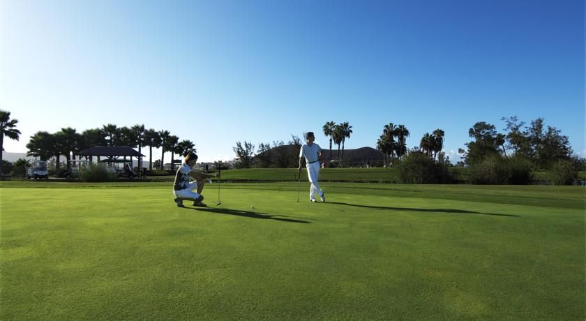
 The North loop is 3,225 yards from the tips and the South is slightly longer at 3,233. These are the original loops, and are arguably the most challenging.
 8
8 .. and I think the beauty of the course here stands out; the bunkers are filled with black volcanic sand and against the lush green grass really catches the eye.
 9
9 7
7 5 °C
5 °C 6 °C
6 °C The rain in Barcelona falls mostly in the winter, with relatively little rain in the summer. This location is classified as Csa by Köppen and Geiger. In Barcelona, the average annual temperature is 16.5 °C. In a year, the average rainfall is 612 mm.
 2
2 6
6 Temperature °C (°F)
 Temperature °C (°F)
 The winters are rainier than the summers in Madrid. The Köppen-Geiger climate classification is Csa. The average annual temperature is 13.7 °C in Madrid. The rainfall here averages 450 mm.
/cdn.vox-cdn.com/uploads/chorus_asset/file/19376297/1170766196.jpg.jpg) 1)
1) 1)
1) Temperature °C (°F)
 3)
3) The winter months are much rainier than the summer months in Seville. This climate is considered to be Csa according to the Köppen-Geiger climate classification. The average annual temperature is 18.6 °C in Seville. In a year, the average rainfall is 576 mm.
 9
9 3
3 Temperature °C (°F)
 Temperature °C (°F)
 The winter months are much rainier than the summer months in Granada. According to Köppen and Geiger, this climate is classified as Csa. In Granada, the average annual temperature is 15.5 °C. Precipitation here averages 450 mm.
 7
7 9
9 Temperature °C (°F)
 4)
4) During the year, there is little rainfall in Palma de Mallorca. The climate here is classified as BSk by the Köppen-Geiger system. The average annual temperature in Palma de Mallorca is 16.8 °C. The rainfall here averages 453 mm.
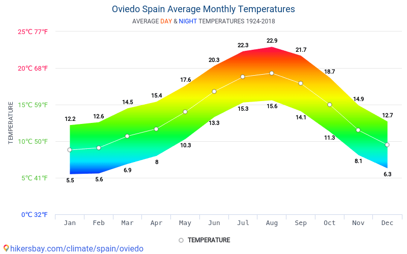 4)
4) 1)
1) Temperature °C (°F)
 3)
3) The winters are rainier than the summers in Málaga. The climate here is classified as Csa by the Köppen-Geiger system. The average annual temperature in Málaga is 18.4 °C. The rainfall here averages 520 mm.
 A section of the southeast and central areas has a semi-arid climate (Köppen BSh, BSk) predominantly. Many areas in the northeast and mountains above the altitude of 1000 meters display a continental climate (Köppen Dfb). Alpine, sub-arctic, tropical, and desert climate types are also evident in different parts of the country. Spain lies on the Iberian Peninsula and includes a few islands off the African Coast and the Mediterranean Sea. The Atlantic Ocean and Portugal lie to the west of Spain, France and Andorra are in the north, and the Mediterranean Sea lies to the south and east. The location in the temperate latitudes, proximity to the Atlantic Ocean and the Mediterranean Sea significantly influence the climate.
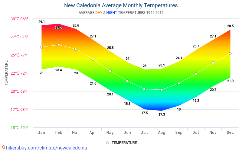 The Meseta Central is a vast plateau in Spain, with many mountains, rivers, and even glaciers at the apex. The Tagus River, the longest in the Iberian Peninsula, separates a chain of low mountain ranges from the Sistema Central in the north. The Pyrenees and the Basque Mountains lie in the northeast region. The mountains of Sierra Morena, Sistema Iberico, and Cordillera Cantabrica, in the Meseta Central rarely rise above 2300 meters in altitude. The Andalusian Plain is a major lowland region in the southwest. The Balearic Islands lie in the Atlantic Ocean, fifty miles off the east coast of Spain. The Canary Islands are of volcanic origin and lie fifty-five miles off the west coast of Africa.
 Winters are mildly cold, with few nights below freezing in the interior and the northern regions. The southern coastal strips have the warmest winters in Europe, with January nights mostly above 7.8°C (46°F). Snowfall is substantial only on the high slopes of the mountains above 3000 meters in the north and south. Spring is dry, with moderate temperatures in the north that turn high by May in the south. Autumn is mild and wet in much of Spain.
 The annual sunshine in Spain ranges from 1800 hours in the north to 2900 hours in the south, with the longest days in June and the shortest in December. The northwestern sea coasts are always fresh and rarely register average temperatures above 21.1°C (70°F).
 The southern region, including Andalusia, faces an additional threat of tornadoes in addition to earthquakes and fires. Volcanic and seismic risks are high in the third hazard zone that lies in the Canary Islands. Teide, La Palma, and Lanzarote in the Canary Islands are active volcanoes that have an explosive history of eruptions close to human populations. The southeastern region, in particular, faces water shortages during the long and dry summer. Saltwater intrusion is a problem in large areas near the Mediterranean.
 Weather in January »
 Streams are full of water, and rivers flow in full splendor, as the land is under the blanket of lush greenery. Weather in April »
 Seville, Murcia, and Granada register scorching heat, with average daily high temperatures in the 33.3°C (91.9°F) to 35.6°C (96.1°F) range. The daylight extends to more than 16 hours, and the long evenings offer plenty of activities in comfortable settings. Weather in July »
 The northeast sees comfortable conditions, with average temperatures in Saragossa in the 10.6°C (51.1°F) to 20.6°C (69.1°F) zone. A rise in precipitation adds to the thrill of outdoor excursions. Weather in October »
 As in Central Europe, precipitation is sometimes persistent and cold. Summers, on the other hand, are much warmer. The further you get away from the Atlantic and closer to the Mediterranean Sea, the warmer the summers become and the milder the winters. This is mainly due to the Mediterranean influences of the protected Mediterranean Sea.
 Also in the foreland the winters are considerably longer and colder. Summers remain short and comparatively cool.
  For detailed climate data click on the name of the region.
 0 %
0 % 6 °C
6 °C Here the temperature dropped to -21.0 °C in January 2021. Teruel lies at an altitude of 902 meters above sea level. The coldest winter (January to March) was in 1950 with an average temperature of 8.4 °C. In Spain, it is usual to have about 2.4 degrees more at 10.8 °C for this three-month period.
 If a station fails during the summer or winter months, it does not provide any values and falsifies the average again. The subsequent long-term development was therefore reduced to only 3 measuring points in order to have actually comparable data over as long a period as possible.
 The mean average of annual temperatures range from a high of 20.11°C (68.2°F) in Andalusia to a low of 13.02°C (55.44°F) in Basque Country.
 09(48.36)
 78(1.57)
 11°C | 68.2°F
 1°C | 55.58°F
 8 in
8 in Temperatures
 ..
.. Please wait…
 Please wait…
 Please wait…
 Bilbao has a significant amount of rainfall during the year. This is true even for a dry month. The Köppen-Geiger climate classification is Cfb. The temperature here averages 13.5 °C. 1149mm – average annual rainfall.

 With an average of 191 mm, the most precipitation occurs in January.
  1
1  6
6  7
7


 “
“

 As an example to his men he lived on 4 ounces of rice a day when the siege was at its height.
 a great triumph for General Eliott!
 nytimes.com/2019/07/07/world/europe/gibraltar-island-games.html
 ”
” ”
” Many of the islands are under British sovereignty, but the list includes one Greek island, Rhodes, as well as one of the Spanish islands that form the Balearic archipelago, Minorca. Britain gained sovereignty over Minorca at the same time that it took over Gibraltar, but Spain then regained Minorca under another European treaty signed in 1802.


 I know, pretty fantastic, right? You should see the number of people buying cigarettes and booze at the shops on the way out of the country.

 I would recommend one of these options:
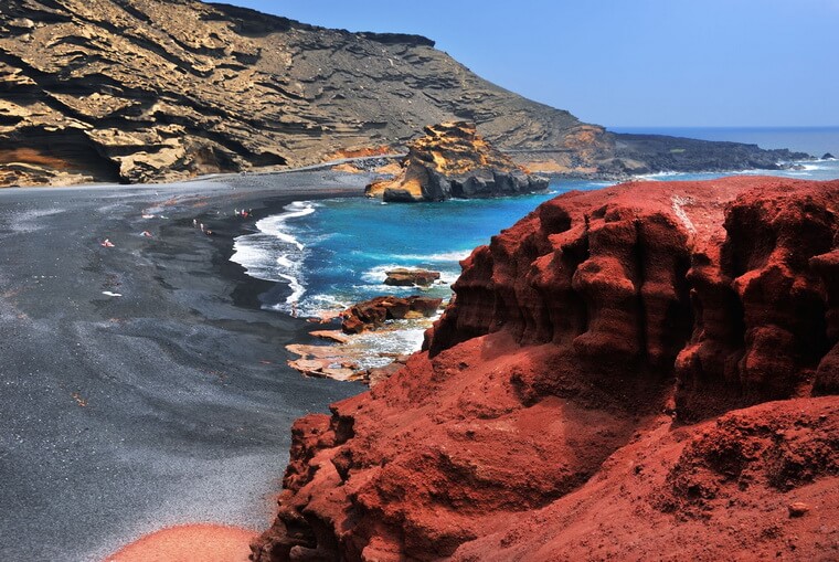
 The odd thing, though, is that Gibraltar didn’t always have all these beaches.


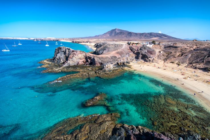

 36.
36. The only remnants that remained in the empire in the Western Hemisphere were Cuba and Puerto Rico and across the Pacific in Philippines Islands, and the Carolina, Marshall, and Mariana Islands (including Guam) in Micronesia.
  José Rizal, a member of a wealthy mestizo family, resented that his upper mobility was limited by Spanish insistence on promoting only “pure-blooded” Spaniards. He began his political career at the University of Madrid in 1882 where he became the leader of Filipino students there. For the next ten years he traveled in Europe and wrote several novels considered seditious by Filipino and Church authorities. He returned to Manila in 1892 and founded the Liga Filipina, a political group dedicated to peaceful change. He was rapidly exiled to Mindanao. During his absence, Andrés Bonifacio founded Katipunan, dedicated to the violent overthrow of Spanish rule. On August 26, 1896, after learning that the Katipunan had been betrayed, Bonifacio issued the Grito de Balintawak, a call for Filipinos to revolt. Bonifacio was succeeded as head of the Philippine revolution by Emilio Aguinaldo y Famy, who had his predecessor arrested and executed on May 10, 1897. Aguinaldo negotiated a deal with the Spaniards who exiled him to Hong Kong with 400,000 pesos that he subsequently used to buy weapons to resume the fight.
 But sentiment to enter the conflict grew in the United States when General Valeriano Weyler began implementing a policy of Reconcentration that moved the population into central locations guarded by Spanish troops and placed the entire country under martial law in February 1896. By December 7, President Cleveland reversed himself declaring that the United States might intervene should Spain fail to end the crisis in Cuba. President William McKinley, inaugurated on March 4, 1897, was even more anxious to become involved, particularly after the New York Journal published a copy of a letter from Spanish Foreign Minister Enrique Dupuy de Lôme criticizing the American President on February 9, 1898. Events moved swiftly after the explosion aboard the U.S.S. Maine on February 15. On March 9, Congress passed a law allocating fifty million dollars to build up military strength. On March 28, the U.S. Naval Court of Inquiry finds that a mine blew up the Maine. On April 21 President McKinley orders a blockade of Cuba and four days later the U.
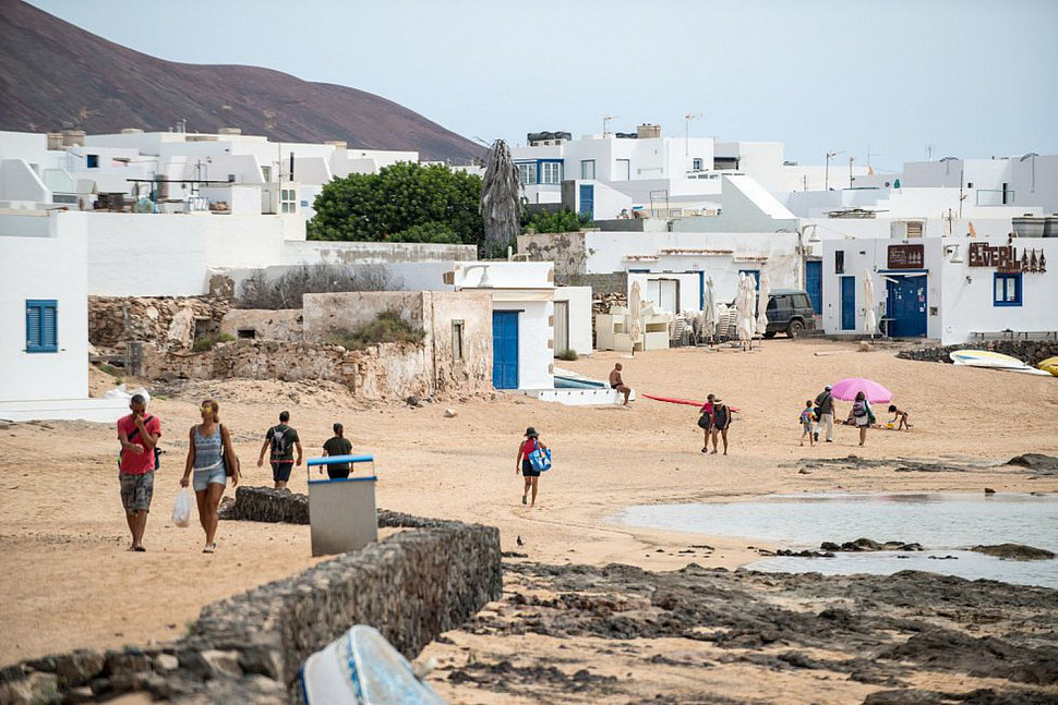 S. declares war.
 On June 22, U.S. troops landed at Daiquiri where they were joined by Calixto García and about 5,000 revolutionaries.
 The war had cost the United States $250 million and 3,000 lives, of whom 90% had perished from infectious diseases.