Este fenómeno atmosférico ocurre varias veces al año en el archipiélago canario. Pero, ¿qué es la calima en Canarias? ¿Por qué se produce y qué consecuencias tiene? ¿Cuánto dura? ¿De dónde procede? ¿A qué islas afecta? ¿Qué debo hacer? ¡Descubrimos todo!
Índice del artículo
1 ¿Qué es la calima?
2 ¿Por qué se produce la calima en Canarias?
3 ¿De dónde viene la calima que llega a Canarias?
4 ¿A qué islas afecta?
5 ¿Cuánto dura la calima?
6 Consecuencias de la calima
¿Qué es la calima?
La calima es un fenómeno meteorológico que consiste en la presencia abundante de arena y polvo suspensión en la atmósfera. Habitualmente no es peligrosa pero, en ocasiones, puede llegar a transportar partículas nocivas procedentes de fábricas, centrales nucleares o refinerías.
En otras regiones a la calima también se le denomina niebla sucia, lluvia de barro e incluso lluvia de sangre.
😍 GUÍA RÁPIDA PARA ORGANIZAR TUS VACACIONES EN CANARIAS PASO A PASO 😍
¿Por qué se produce la calima en Canarias?
El origen de la calima no son las propias islas sino que proceden de grandes desiertos. Para que ocurra un episodio de calima deben coexistir los siguientes dos factores climatológicos:
Tormentas de arena en el desierto que provocan la suspensión de las partículas en enormes cantidades.
Viento de componente sur o este que arrastre todo este polvo al archipiélago canario. Aunque en función de la dirección puede llegar a la península, Baleares e incluso a los países de centroeuropa.
Su aparición es tan imprevisible como las lluvias y puede producirse en cualquier época del año. Si bien es cierto que su presencia es mayor en invierno.
¿De dónde viene la calima que llega a Canarias?
En el caso de Canarias la calima procede del continente africano. En concentro, su origen es principalmente del desierto cálido más grande del planeta, el Sáhara, aunque también de otros desiertos como el de Sahel.
¿A qué islas afecta?
Por cercanía, la calima tiene un mayor impacto y presencia en las islas más orientales: Lanzarote, La Graciosa y Fuerteventura. No obstante, los episodios habitualmente se extienden a todas las islas del archipiélago canario por la acción de los vientos alisios por lo que no se salvan Gran Canaria, Tenerife, La Palma, La Gomera ni El Hierro.
¿Cuánto dura la calima?
En términos generales un episodio de calima en las Islas Canarias suele durar entre 3 y 5 días. En los primeros días la intensidad es mayor hasta que poco a poco se va limpiando la atmósfera y se remiten sus efectos.
Consecuencias de la calima
La principal consecuencia de la calima es el empeoramiento de la calidad del aire produciendo una especie de neblina que impide ver a larga distancia. Dependiendo de su intensidad la borrosidad puede ser a mayor o menor alcance. También, como te podrás imaginar, deja calles, coches y casas llenas de tierra.
Del mismo modo puede llegar a repercutir en la salud de las personas produciendo síntomas como tos, problemas respiratorios, congestión nasal e irritación de los ojos. Lo mejor para combatirla es prevenir, tal y como recomienda la Consejería de Sanidad del Gobierno de Canarias:
Cerrar puertas y ventanas.
Salir de casa el menor tiempo posible (aconsejable con mascarilla).
No hacer ejercicio al aire libre.
Beber agua continuamente.
Limpieza de superficies con un paño húmedo.
Pero no todo es negativo. Un aspecto positivo de la llegada de la calima son los espectaculares atardeceres que produce con el cielo lleno de colores rojizos y anaranjados.
¿Quieres descubrir más cosas? En Canarias Islas Afortunadas no solo te ayudamos a organizar tu viaje perfecto a cualquier isla, sino también con la historia y curiosidades del archipiélago canario.
¿Qué es la Panza de Burro en Canarias?
¿Cuál es la isla de Canarias menos ventosa?
¿Cuándo es mejor viajar a Canarias?
Platos típicos de la gastronomía de Canarias.
Diccionario Canario: palabras, frases y expresiones típicas.
Playas más bonitas de Canarias.
Más calima y más calor, la combinación meteorológica para este sábado en Canarias
Canarias espera este sábado episodios de calima, que podrá ser intensa a mitad del día, especialmente en medianías, y temperaturas sin muchos cambios pero con temperaturas máximas que podrían alcanzar hasta los 34 ºC en las islas capitalinas, según la previsión de la Agencia Estatal de Meteorología (Aemet).
En el mar, se espera viento de componente norte o noreste de fuerza 6 o 7, temporalmente 7 en algunas zonas, así como fuerte marejada o grueso y mar de fondo del norte o noreste con olas de 1 a 2 metros.
Por islas, la previsión para este sábado es la siguiente:
LANZAROTE
Intervalos de nubes medias y altas. Calima, más intensa en la segunda mitad del día. Temperaturas en ligero a moderado ascenso, que podría ser notable en las máximas de la vertiente oeste. Se podrán alcanzar los 36 ºC especialmente en zonas de interior y de la costa sureste. Viento del nordeste, tendiendo a viento flojo variable con brisas durante la tarde.
TEMPERATURAS MÍNIMAS Y MÁXIMAS PREVISTAS (°C):
Arrecife 23 33
FUERTEVENTURA
Intervalos de nubes medias y altas. Calima, más intensa en la segunda mitad del día. Temperaturas en ligero a moderado ascenso, que podría ser notable en las máximas de la vertiente oeste. Se podrán alcanzar los 36 ºC en zonas de interior, especialmente en la mitad sur. Viento del nordeste, tendiendo a viento flojo variable con brisas en horas centrales.
TEMPERATURAS MÍNIMAS Y MÁXIMAS PREVISTAS (°C):
Puerto del Rosario 22 31
GRAN CANARIA
Predominio de cielos poco nubosos o despejados, con intervalos de nubes bajas en la franja litoral norte e intervalos de nubes medias y altas en el resto. Calima, más intensa en medianías y cumbres a partir del mediodía. Temperaturas mínimas sin cambios o en ligero ascenso. Máximas en ascenso en la fachada norte y en descenso en la mitad sur, que podría ser localmente notable en medianías del sureste. Se podrán superar los 36 ºC en zonas de interior, especialmente en medianías del sur y alcanzar los 34ºC en medianías del norte. No se descarta que se alcancen dichos valores localmente en costas. Viento del nordeste, más intenso en vertientes noroeste y sureste, tendiendo a viento flojo durante la mañana. En cumbres, viento de componente sur, tendiendo a flojo a lo largo de la tarde.
TEMPERATURAS MÍNIMAS Y MÁXIMAS PREVISTAS (°C):
Las Palmas de Gran Canaria 21 27
TENERIFE
Predominio de cielos poco nubosos o despejados, con intervalos de nubes bajas en la franja litoral norte e intervalos de nubes medias en el resto. Calima, más intensa en medianías y cumbres a partir del mediodía. Temperaturas mínimas con pocos cambios, salvo ligeros ascensos en la vertiente nordeste. Máximas en ascenso en el nordeste y sin cambios o en ligero descenso en el resto, especialmente en la vertiente sureste. Se podrán alcanzar localmente los 32 – 34 ºC, especialmente en las vertientes sur y oeste y al sur del área metropolitana. Viento del nordeste tendiendo a flojo durante la tarde. En zonas altas, viento del sudeste, tendiendo a flojo a últimas horas.
TEMPERATURAS MÍNIMAS Y MÁXIMAS PREVISTAS (°C):
Santa Cruz de Tenerife 22 33
LA GOMERA
Predominio de cielos poco nubosos o despejados, con intervalos de nubes bajas en la franja litoral norte y algún intervalo de nubes medias en el resto. Calima. Temperaturas mínimas con pocos cambios. Máximas en ligero a moderado ascenso, especialmente en la vertiente norte. Se podrán alcanzar localmente los 34 ºC, especialmente en puntos de interior de la isla. Viento del nordeste, más intenso en extremos noroeste y este, tendiendo a viento flojo a partir del mediodía. En cumbres, viento del sureste.
TEMPERATURAS MÍNIMAS Y MÁXIMAS PREVISTAS (°C):
San Sebastián de la Gomera 23 31
LA PALMA
Predominio de cielos poco nubosos o despejados, con intervalos de nubes bajas en los litorales norte y este. Calima. Temperaturas mínimas sin cambios o en ligero o descenso. Máximas en ligero a moderado ascenso, especialmente en zonas altas. Se podrán alcanzar localmente los 32- 34 ºC, especialmente en puntos de interior de la vertiente oeste. Viento de componente este, tendiendo a flojo a partir de mediodía. En cumbres, viento del sureste flojo.
TEMPERATURAS MÍNIMAS Y MÁXIMAS PREVISTAS (°C):
Santa Cruz de la Palma 20 27
EL HIERRO
Predominio de cielos poco nubosos o despejados, con intervalos de nubes bajas en la franja litoral norte y algún intervalo de nubes medias en el resto. Calima. Temperaturas mínimas sin cambios o en ligero descenso, especialmente en zonas altas. Máximas en ligero a moderado ascenso en costas, y sin cambios o en ligero descenso en zonas de interior. Se podrán alcanzar localmente los 34 ºC, especialmente en puntos de interior de la vertiente sur y oeste. Viento del nordeste, tendiendo a flojo durante la tarde. En cumbres, viento del sureste flojo.
TEMPERATURAS MÍNIMAS Y MÁXIMAS PREVISTAS (°C):
Valverde 15 25
Calima en Canarias: ¿Cuándo se quitará? ¿Va a haber más entradas de calima?
Entrada de polvo sahariano posicionado sobre las Islas Canarias. Imagen: NOAA procesada por Iban Ameztoy
Irene Santa
Seguimos inmersos en el segundo episodio de calima de este 2022 en Canarias. Comenzó apenas 2 semanas después del gran episodio de calima en las islas de mediados del mes de enero. ¿Cuándo se quitará la calima en Canarias? ¿Hasta cuándo habrá calima es las islas?
Vídeo: Situación persistente de calima en Canarias
Previsión de la calima en Canarias para próximos días: ¿Cuándo se quita?
La calima llegó a las islas hace ya una semana y de momento sigue presente en el cielo de Canarias, aunque su concentración ha ido variando a lo largo de los días y de las diferentes horas. Durante el fin de semana el viento soplará de componente norte en las capas más bajas de la atmósfera y las concentraciones de calima serán inferiores a las del resto de la semana. Aunque el cielo esté despejado de nubes todavía podrá tener un tono amarillento por la presencia de polvo en suspensión.
Podría llegar más calima la próxima semana
Las temperaturas se mantendrán elevadas en las próximas jornadas, no bajarán, por tanto los valores seguirán estando por encima de lo normal. Las temperaturas máximas están en torno a los 25ºC en algunas localidades costeras como Las Palmas.
No se esperan precipitaciones en las islas la próxima semana sin embargo de nuevo la situación meteorológica podría ser adversa. Con vientos del sureste sobre el archipiélago soplando con más intensidad a partir del domingo 6 de febrero la calima podría ir a más, con nuevas llegadas de polvo sahariano en la segunda semana del mes de febrero. Además las temperaturas podrían subir de nuevo en las islas a principios de semana. La calima estará presenta al menos hasta mediados de la semana próxima.
Calima registrada en Gran Canaria. Fuente: Toni Pomar
Playa de Famara (Lanzarote) el sábado 29 de enero. Autora: Paula Egido
La calima sobre las playas de Lanzarote. Autora: Paula Egido
En el top de peores calidades de aire del mundo
En los primeros días fueron sobre todo Fuerteventura y Lanzarote las islas más afectadas por la presencia de calima y de polvo en suspensión sahariano, donde se han llegado a registrar los peores índices de calidad del aire. La concentración de partículas PM10 en Fuerteventura ha llegado a ser 18 veces superior al valor máximo recomendado por la Organización Mundial de la Salud a lo largo de 24 horas (45µg/m3). De este modo, algunas islas de Canarias han llegado a presentar de las peores calidades del aire del mundo.
Calidad del aire en las Islas Canarias provocada por el episodio de calima de el pasado lunes. Fuente: Eltiempo.es
Aunque la calima es de origen natural, su presencia también supone mala calidad del aire que respiramos ya que puede provocar problemas de salud: problemas respiratorios, ojos irritados… además de la reducción de la visibilidad que lleva asociada.
Algunas islas de Canarias presentaron de las peores calidades del aire del mundo
Valores de calidad del aire en Europa. Fuente: https://aqicn.org/map/europe/
Canarias centra la actividad meteorológica de las últimas semanas
Con el anticiclón estancado en la Península y con un mes ya sin lluvia, las Islas Canarias están protagonizando en las últimas semanas la mayor actividad meteorológica del país. La inestabilidad se ha posicionado sobre el archipiélago en varias ocasiones. Se han dado fuertes vientos y precipitaciones durante las últimas semanas, lluvias fuertes y tormentas, además de haberse registrado nieve en las zonas más altas de las islas, que nos permiten ver por ejemplo a El Teide con nieve en su cima, mientras la calima se encuentra por debajo de éste, en capas más bajas de la atmósfera.
Calima y nieve en Tenerife. Imagen capturada el 30 de enero de 2022. Fuente: Sentinel 2-Copernicus
¿Qué es la calima y cómo se forma?
La calima (o también conocida como calina o polvo en suspensión) es un fenómeno meteorológico que se produce en la atmósfera y está caracterizado por la presencia de partículas muy pequeñas de polvo y arena (e incluso cenizas y arcilla) en suspensión lo suficientemente numerosas para dar al aire un aspecto opaco.
El resultado que provoca es un ambiente turbio y la contribución a la coloración del crepúsculo en tonos marrones anaranjados.
VÍDEO: CÓMO SE FORMA LA CALIMA
ÚLTIMAS NOTICIAS
Estudio de la incidencia de episodios de calima en Canarias mediante modelos climáticos globales
At present, the study of atmospheric aerosols has aroused great interest, especially in
places where, due to their geographical location, there are many invasions. One example
is the Canary Islands, which suffers episodes of desert dust from the African continent.
These episodes, known as calima, affect the radiative balance and cloud formation, as
well as influence human health and ecosystems.
The study of desert dust intrusions has evolved over the years thanks to advances in
observational methods and numerical models. In the present study, the potential of the
GCMs (Global Climate Models) of the new phase of CMIP (Coupled Model
Intercomparison Project), CMIP6, will be evaluated. For this purpose, the results of the
simulations of these models will be compared with the observations of recent past years.
In particular, the only three models that have made daily data on dust concentrations
available, i.e. IPSL, GFDL and MIROC6, will be used. These three models allow us the
analysis of aerosol transport and generation through simulations.
For the observations, the data studied are from MERRA version 2 (Modern-Era
Retrospective analysis for Research and Applications). They are obtained from the
reanalysis of space-based aerosol observations. For the simulated models and the
observations we worked with column dust concentrations (kg m
-2
) and in order to study
the incidence of calima episodes the data associated with a focused grid point in the
Canary Islands was chosen.
This study begins by studying the percentile associated with the concentration
corresponding to an atmospheric aerosol episode, i.e. the 60th percentile. Once the
percentile was determined, using the information on dust episodes provided by
Ministerio para la Transición Ecológica y el Reto Demográfico, the monthly mean
column concentration, the number of days above the 60th percentile and the number of
days above the 95th percentile were analysed for two periods: the historical period and
the future period. The historical period is from 1980 to 2009 and the future period is
divided into two, mid-century (2030-2059) and late century (2070-2099). In addition,
the SSP (Shared Socioeconomic Pathways) scenarios from CMIP6 describing CO2
concentrations in the future will be used for the future period.
So first of all, the monthly averages of dust column concentrations in the historical
period for the three CMIP6 models and for the MERRA2 measurements are compared,
which allows us to discard the IPSL model for future simulations, as its behaviour is
quite far from the observed one. Then the monthly averages of dust column
concentration in the future are analysed for the GFDL models in the SSP585 and
SSP245 scenarios and MIROC6 in the SSP126, SSP245, SSP370 and SSP585
scenarios. Since a general increase in the monthly mean dust column concentrations is observed, the number of days above the 60th and 95th percentile is studied to determine
whether this increase is due to the increased intensity of the episodes or the duration of
these intrusions.
For the historical period, the IPSL model does not represent the stationarity of the
observations and the number of days above the 60th percentile is much higher than for
the 95th percentile. Therefore, it can be said that the calima episodes were not too
intense in the past. For the future, an increase in the number of days with dust intrusions
is generally observed for the two selected CMIP6 models, which indicates that the
increase in the monthly mean is due to the longer duration of the dust intrusions and, to
a lesser extent, to the intensity. So, in order to obtain more information on this matter,
this work was finalised by studying the future trends for MIROC and GFDL.
A study of the trends in annual dust column concentrations shows a gradual increase,
which can be associated with more dust episodes as well as with an increase in intensity.
Consequently, the trend in the number of annual days of extreme events (95th
percentile) was analysed for both models and an increasing behaviour was observed.
However, although the increase in desert aerosol concentrations can be related to the
increase in the number of these episodes, a study of the average dust concentrations for
the events in each year has been carried out. From this study, which turned out not to be
statistically significant, it is possible to conclude that it cannot be considered an
important cause for the growth of dust concentrations.
Finally, it can be concluded, in first place, that the potential of the MIROC and GFDL
models is favourable and consequently they postulate to be good simulators for the
future. Furthermore, the future increase in frequency and intensity of desert dust
intrusions is evident, in particular for the worst-case scenario concerning CO2
concentrations. Therefore, under the initial conditions and assumptions proposed, this
work reflects the worsening of the calima episodes in the Canary Islands and stimulates
contributing to the slowing down of climate change.
Ligero descenso de temperaturas y episodios de calima el viernes en Canarias
Las Palmas De Gran Canaria, 22 jul (EFE).- Canarias espera este viernes un descenso ligero en las temperaturas máximas en todas las islas salvo en Lanzarote y Fuerteventura mientras que se podrán apreciar episodios de calima en las zonas altas de todas las islas, así como en las medianías de Gran Canaria, según la previsión de la Agencia Estatal de Meteorología (Aemet).
En el mar, se espera viento de componente norte o noreste de fuerza 5, 6 o 7 ocasionalmente 8 en algunos puntos del sur, así como fuerte marejada o gruesa. También se prevé mar de fondo del norte o noreste con olas de 1 a 2 metros.
Por islas, la previsión para este viernes es la siguiente:
LANZAROTE
Predominio de cielos despejados con intervalos de nubes bajas a primeras horas en el litoral oeste, tendiendo a intervalos de nubes medias al final del día. Calima significativa en capas altas. Temperaturas con pocos cambios o máximas en ligero ascenso. Viento del noreste disminuyendo.
TEMPERATURAS MÍNIMAS Y MÁXIMAS PREVISTAS (°C):
Arrecife 23 33
FUERTEVENTURA
Predominio de cielos despejados con intervalos nubosos en la fachada norte de Jandía, tendiendo a intervalos de nubes medias al final del día. Calima significativa en capas altas. Temperaturas mínimas con pocos cambios y máximas en ligero ascenso en la mitad oeste; se alcanzarán los 34 ºC en zonas de interior sur. Viento del noreste disminuyendo.
TEMPERATURAS MÍNIMAS Y MÁXIMAS PREVISTAS (°C):
Puerto del Rosario 22 28
GRAN CANARIA
Cielos poco nubosos o despejados con intervalos nubosos en la franja litoral norte. Calima significativa afectando a medianías y cumbres. Temperaturas en ligero descenso, más acusado en los valores máximos de la mitad sur; en zonas de interior de esta vertiente se alcanzarán o superarán los 34 ºC. Viento del noreste, fuerte con rachas ocasionales muy fuertes en vertientes sureste y noroeste durante la primera mitad del día y con predominio de las brisas en costas suroeste; en cumbres, componente este.
TEMPERATURAS MÍNIMAS Y MÁXIMAS PREVISTAS (°C):
Las Palmas de Gran Canaria 23 27
TENERIFE
Cielos despejados con intervalos nubosos en la franja litoral norte y calima en capas altas. Temperaturas en ligero descenso en general; se podrá alcanzar el umbral de 34 ºC en medianías orientadas al sur. Viento del noreste, fuerte con rachas ocasionales muy fuertes en la vertiente sureste y el extremo noroeste, en especial durante la primera mitad del día, y con predominio de las brisas en costas suroeste; en zonas altas, viento en general flojo de componente este.
TEMPERATURAS MÍNIMAS Y MÁXIMAS PREVISTAS (°C):
Santa Cruz de Tenerife 23 32
LA GOMERA
Cielos despejados con intervalos nubosos en el litoral norte y calima en capas altas. Temperaturas con pocos cambios o en ligero descenso; se podrá alcanzar el umbral de 34 ºC en medianías orientadas al sur. Viento del noreste, fuerte con rachas ocasionales muy fuertes en vertientes sureste y noroeste, en especial durante la primera mitad del día, y con brisas en costas sur; en cumbres, componente este.
TEMPERATURAS MÍNIMAS Y MÁXIMAS PREVISTAS (°C):
San Sebastián de la Gomera 23 30
LA PALMA
Cielos despejados con intervalos nubosos en el litoral noreste y calima en capas altas. Temperaturas en ligero descenso. Viento del noreste, fuerte con rachas ocasionales muy fuertes en vertientes sureste y noroeste, en especial durante la primera mitad del día, y con predominio de las brisas en costas oeste; en zonas altas, viento en general flojo de componente este.
TEMPERATURAS MÍNIMAS Y MÁXIMAS PREVISTAS (°C):
Santa Cruz de la Palma 22 27
EL HIERRO
Cielos despejados con intervalos nubosos en el litoral noreste y calima en capas altas. Temperaturas en ligero descenso en general; se podrá alcanzar el umbral de 34 ºC en medianías orientadas al sur. Viento del noreste, fuerte con rachas ocasionales muy fuertes en la vertiente este y el extremo noroeste, en especial durante la primera mitad del día, y con predominio de las brisas en costas suroeste; en cumbres, componente este.
TEMPERATURAS MÍNIMAS Y MÁXIMAS PREVISTAS (°C):
Valverde 19 23
cmg
Calima, altas temperaturas y algunas tormentas este 1 de septiembre en Canarias
LLuvias
Canarias espera este jueves predominio de cielos nubosos, con nubosidad media alta que en las islas de menor relieve se traducirán en claros al final del día, así como presencia de calima, especialmente en altura, y temperaturas en ligero descenso de máximas.
En Gran Canaria hay probabilidad de algún chubasco, mientras que en las islas occidentales la probabilidad de precipitaciones ocasionales va acompañada de posibilidad de tormenta, sin descartar que sean localmente fuertes, según la previsión de la Agencia Estatal de Meteorología (Aemet).
En el mar se esperan vientos de componente este o noreste de fuerza 4 o 5, arreciando a 6 mar adentro en costas noroeste y sureste y 7 al sur, así como marejada o fuerte marejada, y aguaceros y tormentas ocasionales en aguas de todas las islas.
Por islas, la previsión para este jueves es la siguiente:
LANZAROTE
Predominio de cielos nubosos con nubosidad de tipo medio y alto. Se irán abriendo claros al final. Presencia de calima que afectará especialmente a zonas altas y se irá retirando. Temperaturas con pocos cambios, con ligero descenso en las máximas. Se podrán alcanzar los 30 – 32 ºC en zonas de la mitad sur. Viento del nordeste, con intervalos de fuerte, especialmente durante la primera mitad del día.
TEMPERATURAS MÍNIMAS Y MÁXIMAS PREVISTAS (°C):
Arrecife 24 30
FUERTEVENTURA
Predominio de cielos nubosos con nubosidad de tipo medio y alto. Se irán abriendo claros al final. Presencia de calima que afectará especialmente a zonas altas y se irá retirando. Temperaturas mínimas con pocos cambios, y máximas en ligero a moderado descenso, especialmente en zonas de interior. Se podrán alcanzar los 30 – 32 ºC en zonas del sur. Viento del nordeste con intervalos de fuerte, especialmente durante la primera mitad del día.
TEMPERATURAS MÍNIMAS Y MÁXIMAS PREVISTAS (°C):
Puerto del Rosario 23 26
GRAN CANARIA
Predominio de cielos nubosos con nubosidad de tipo medio y alto, con baja probabilidad de algún chubasco ocasional durante la primera mitad del día. Presencia de calima que afectará especialmente a zonas altas y se irá retirando. Temperaturas mínimas sin cambios o en ligero ascenso. Máximas sin cambios o en ligero descenso, especialmente en el sur. Se superarán los 34 ºC en medianías del oeste y sur, y de forma puntual también podrían alcanzarse en zonas de litoral de estas mismas vertientes. Viento del nordeste con intervalos de fuerte en vertientes noroeste y sureste, predominando las brisas en costas suroeste. En medianías y cumbres, viento de componente este, menos intenso en las zonas más altas.
TEMPERATURAS MÍNIMAS Y MÁXIMAS PREVISTAS (°C):
Palmas de Gran Canaria, Las 23 26
TENERIFE
Predominio de cielos nubosos con nubosidad de tipo medio y alto. Presencia de calima que afectará especialmente a zonas altas y se irá retirando. Probabilidad de precipitaciones ocasionales que podrían ir acompañadas de tormentas, sin descartar que sean localmente fuertes y en forma de chubasco. Tenderán a remitir a partir de la tarde. Temperaturas sin cambios o en ligero ascenso, salvo en las mínimas de altas cumbres que habrá descensos. Se podrán alcanzar los 30-32 ºC en medianías del oeste y sur. Viento del nordeste con intervalos de fuerte en el extremo noroeste y vertiente sureste y, durante la madrugada, en la vertiente norte del nordeste de la isla, predominando las brisas en costas oeste. En medianías y cumbres, viento de componente este que girará a sur en las zonas más altas.
TEMPERATURAS MÍNIMAS Y MÁXIMAS PREVISTAS (°C):
Santa Cruz de Tenerife 24 28
LA GOMERA
Predominio de cielos nubosos con nubosidad de tipo medio y alto. Presencia de calima que afectará especialmente a zonas altas y se irá retirando. Probabilidad de precipitaciones ocasionales que podrían ir acompañadas de tormentas, sin descartar que sean localmente fuertes y en forma de chubasco. Tenderán a remitir a partir de la tarde. Temperaturas con pocos cambios, salvo ligeros ascensos de las máximas en zonas de interior. Se podrán superar los 30 ºC en la vertiente sur. Viento del nordeste con intervalos de fuerte en extremos noroeste y este, predominando las brisas en costas suroeste. En medianías y cumbres, viento del este-sudeste disminuyendo durante la segunda mitad del día.
TEMPERATURAS MÍNIMAS Y MÁXIMAS PREVISTAS (°C):
San Sebastián de la Gomera 23 29
LA PALMA
Predominio de cielos nubosos con nubosidad de tipo medio y alto. Presencia de calima que afectará especialmente a zonas altas y se irá retirando. Precipitaciones ocasionales que podrían ir acompañadas de tormentas, sin descartar que sean localmente fuertes y en forma de chubasco. Tenderán a remitir a partir de la tarde. Temperaturas en ligero ascenso. Viento del nordeste con intervalos de fuerte en extremos noroeste y sureste, predominando las brisas en costas oeste. En medianías y cumbres, viento del este-sudeste disminuyendo durante la tarde.
TEMPERATURAS MÍNIMAS Y MÁXIMAS PREVISTAS (°C):
Santa Cruz de la Palma 24 28
EL HIERRO
Predominio de cielos nubosos con nubosidad de tipo medio y alto. Presencia de calima que afectará especialmente a zonas altas y se irá retirando. Probabilidad de precipitaciones ocasionales que podrían ir acompañadas de tormentas, sin descartar que sean localmente fuertes y en forma de chubasco. Tenderán a remitir durante la mañana. Temperaturas mínimas con pocos cambios y máximas en ligero a moderado ascenso. Viento del nordeste con intervalos de fuerte en vertientes norte y sur durante la madrugada, predominando las brisas en costas suroeste. En medianías y cumbres, viento del este-sudeste, disminuyendo durante la tarde.
TEMPERATURAS MÍNIMAS Y MÁXIMAS PREVISTAS (°C):
Valverde 19 27
Kalima. Transit across the ocean: Sahara – Canaries – Amazon
Imagine that your boat is moored in a marina in the Canary Islands, say Tenerife or Gran Canaria. You wake up in the morning, climb into the cockpit and understand that something is wrong. The sun that has already risen is cloudier than usual, and it turns yellow somehow painfully. In fact, the horizon is not visible, the sky merges with the sea and in general there is some kind of kardash around. You start rubbing your eyes, remembering that the last bottle of rum ended a week ago, and it was not really you who drank it, but completely different people. Then you notice that yesterday the carefully washed deck is covered with a slightly reddish powder, and this is strange, because none of your stubble-covered companions has so far been caught with an incomprehensible box in their hands. You thoughtfully run your finger over this very powder and suddenly realize that this is not powder at all, but something that looks like hell, only very, very fine. Very fine, almost like powder, but not her.
And then, of course, an insight dawns on you. You look around again, assessing everything around with a fair amount of curiosity, and then rub the slightly reddish dust between your fingers, beginning to understand that on your hand now is not just sand, but a small piece of the great Sahara, and that the slight haziness around is still the same sand dust hanging in the atmosphere. Here is a phenomenon that received the name “kalima” in the Canary Islands. Please put the emphasis on the letter “and”. It is important. Why, I will tell at the very end of the story.
Let’s now try to figure out what is Kalima and
in what cases we manage to become witnesses of its appearance.
The Sahara is the largest desert on the planet. She stretches
across the entire northern part of Africa from the Atlantic Ocean to the Red Sea.
There is very little precipitation in the Sahara, and moist air from the ocean into it
almost never comes. The desert is located in subtropical latitudes, where
high atmospheric pressure prevails. This means that the winds blow from it to
side of the ocean, not the other way around.
If during the winter night the temperature in the Sahara sometimes drops to -15°С, then during the summer day its surface can heat up to 70-80°С. As a result, ascending air currents are formed, which lift fine dust particles upwards. They are picked up by the prevailing winds and begin their movement towards the ocean. With a strong wind, a sirocco or a dust storm, the number of small particles raised up increases by orders of magnitude.
Thus the wind steals sand from the desert and carries it into the ocean and
across the ocean. The closest landmass to Africa is the Canary Islands. To the most eastern
of which – Fuerteventura – a little more than 100 km. Close to Fuerteventura
Lanzarote, then – Gran Canaria and Tenerife, where Kalima is also quite frequent
phenomenon. Sometimes it also covers La Gomera.
Along with the dust, which the Spaniards call polvo del desierto (Spanish – desert dust), warm or, conversely, cold, but in any case drier air comes to the islands. Usually, the haze lasts no more than three days and does not pose a danger to human health. Except perhaps that it penetrates absolutely everywhere, however, like any other dust.
In strong winds from the Sahara, satellite
In the photographs, against the background of the blue ocean, tongues of winds saturated with yellowish
dust. It is estimated that up to 1.5 million tons of sand are transported to the Canary Islands per year.
Do you want to present it in volume? There is nothing easier: about 1 million cubic meters!
By the way, this is very little in relation to the total amount lost by the Sahara
weight. In the video below, created from data from NASA, it says that the winds
182 million tons of sand are carried away from the desert every year!
27 million tons of mineral-rich dust crosses the ocean and ends up in the Amazon every year. Thus, in the “lungs of the planet” the loss of mineral substances and, first of all, phosphorus, washed out from soils by surface waters, is compensated.
A legitimate question immediately arises: where does the
phosphorus and other minerals in the sand, when the sand, according to school knowledge, in
most of them are small pieces of quartz that arose in
the result of rock erosion? And here it would be nice to move on a few
millennia ago and remember that, by geological standards, quite recently
The Sahara was not a desert at all. There were rivers, huge lakes, thickets
vegetation, and the whole area was not so lifeless as it is now. At all
on the contrary: life in the full sense of the word once raged here. Besides
what we, when talking about kalima, call sand, in general, is not sand, but
rather fine dust, having a much more varied structure and containing
a significant amount of organic substances and their compounds.
Now that you know all this, even a slight haze of dust
in the Canary Islands will be of interest to you. And every time you will think that small
dust particles, which you may not like on the islands, in
actually allow the Amazon, one of the most grandiose ecosystems on Earth,
exist, develop and produce a huge amount of oxygen, which
we all breathe.
And, finally, the promised one. Pronounced with an accent on the first
The syllable “kalima” in Arabic means “word”, “saying” (الكلمة – Arabic). The most important
one of them is translated as follows: “There is no God but Allah, Muhammad is the Messenger of Allah.”
Keeping in mind that in Spanish there are a lot of
borrowings from Arabic, it is extremely interesting whether there is any relationship
between two Kalimas. If there are experts among you who can answer
to this question, I would be very grateful.
According to local residents, two of the largest ferries Armas and Fred Olsen collided off the coast of Tenerife due to strong winds. Due to the emergency situation, ships on the Canary Islands stopped going to the ocean. Airports were overflowing with passengers waiting to resume flights. Everything around was covered with a thick layer of sand. The situation was aggravated by the fact that forest fires broke out on the island of Gran Canaria, about a thousand people were evacuated.
The wind began last Thursday, February 20, and Kalima descended on the islands. The day before 19February, the authorities in the Canary Islands issued a storm warning. Meteorologists warned of possible wind gusts up to 100 km per hour. But reality exceeded expectations. Spain’s national weather service said winds were up to 120 km/h. A storm has begun at sea. As a result of strong winds roofs of houses were damaged, trees were uprooted. On Sunday, February 23, due to poor visibility, all flights were canceled or redirected to other airports.
On Monday, February 24, difficulties with air traffic persisted. At Fuerteventura airport, almost all flights for arrival were delayed. Today, the single operator of Spanish airports Aena announced the resumption of flights at all airports in the Canary Islands.
Against this background, as it became known, today the Spanish law enforcement agencies quarantined at least a thousand guests of the h20 Costa Adeje Palace hotel in the south of Tenerife, where a tourist who arrived from Italy was diagnosed with coronavirus.
The sandstorm, which has become, according to local residents, the worst Kalima since 2002, is visible from space. Satellite images the day before showed the Kalima covering islands off the coast of northwest Africa. Today the Canaries were overcast. According to the forecast of the State Meteorological Agency (Aemet), precipitation is not excluded here, showers are possible on the western islands of the archipelago. Storms will continue. The strength of the wind is significantly reduced compared to previous days. Kalima intensity is expected to decrease during the day.
On Fuerteventura, the clouds cleared this afternoon. Hot weather has settled +29С.
Kalima visits the Canary Islands regularly. But the problem is that it hasn’t even been two weeks since her last visit. According to local residents, this winter such visits alternated one after another. Locals fear that the trade winds are disappearing into oblivion – constant winds blowing from the tropics towards the equator, thanks to which the subtropical climate with a constant temperature level exists in the Canary Islands. According to the testimonies of the inhabitants of the Canary Islands, the heat is increasing, a cold dry wind, similar to a desert one, is blowing at night, the strength of the Kalima is intensifying.
Anastasia Makarova
#
Spain
Other materials under the heading “Clean Arctic”
09/28/2022
Almost 5. 7 million tourists have rested in Sochi since the beginning of 2022
The growth of tourist flow compared to last year for this period amounted to 4%
09/27/2022
A berth appeared on the territory of the cruise tourism and recreation cluster in Zavidovo
The opening of the river station is scheduled for next year, and the creation of an all-season water entertainment center by 2025
09/27/2022
The Kravtsov Autumn Festival in the Leopard Land National Park is canceled
The creative festival was supposed to take place on October 1 at the Kravtsovskie waterfalls
09/27/2022
The Tambov Region topped the national environmental rating following the results of the past summer
The top five also includes the Belgorod Region, the Altai Republic, the Kursk Region and Moscow
09/27/2022
Free excursions will be held in the Moscow region on World Tourism Day
As part of the campaign, tourists will be able to visit a number of museums and take a literary quest
09/27/2022
The King of the Hill race in honor of Tourism Day will take place in Kuzbass
Participants will have to overcome a distance of 1. 7 km
Life in Tenerife, pluses and minuses
Pros:
Nature
Ecology
People
The cost of life
disadvantages:
Psychological tightness
Sun
Kalima
Municipal
Medicine
goods and trade
NOT Secret, not secret
that some wealthy people, having reached a certain status, move away from
affairs, acquire a luxurious villa on the Spanish coast, where life flows lazily
and measuredly, where there is a lot of warmth and light, where the air is piercingly hot and fresh,
like the sounds of a fast-paced tango.
But there is also the Canary Islands, the legend of the shimmering blue Atlantic. We must not forget that they are also Spain. That is why moving to Tenerife or Gran Canaria promises a close acquaintance with the traditions and laws of the southernmost part of old Europe, cut off from the mainland by the noisy ocean waters.
Two large
difference: live and work in the country or visit it on vacation. In every case
their evaluation criteria.
Next
the review is based on the opinions and feedback of people for whom the island Atlantic has become
second home.
Advantages of life in Tenerife
The Canary Islands is a wonderful world of nature, where eternal spring has settled.
Can
to say that according to the climatic parameters of a more comfortable place for a person
can not found. The gentle sun shines here all year round, the thermometer does not
leaves the positive zone 20 o – 30 o C.
the temperature indicator is about 24 about C, as in a Moscow apartment.
However, small
the island, which can be driven from end to end in two hours, has microclimatic
areas with weather indicators that are different from the average. In the southern part
the islands are a couple of degrees warmer. To the north and northeast (in the capital
region), the weather sometimes brings surprises in the form of clouds and rains. Mountain
the area meets with refreshing coolness, the higher above sea level, the lower
temperature.
Tenerife is the ideal place for a person who cannot stand the heat and does not want to spend the summer.
Ecology that civilization has not spoiled
to be on the coast, in the mountains or in a coniferous forest in just half an hour. No matter how
strange, to a local person who is not familiar with the “deaf” traffic jams of large
megacities, this way seems long and tiring.
Urban
the architecture is simple, well-groomed and pleasing to the eye. There are no smoking factory chimneys, nauseating
chemical odors and uncleaned landfills. Despite the scarcity of local soil,
quite tasty vegetables and fruits are grown here. Good tea and buckwheat are in short supply.
Our favorite cereal can only be found in a Russian store.
People who like to put things off until tomorrow
The islanders are reserved, friendly, not aggressive, slow and lazy. They do not need to survive in harsh climatic conditions. Spoiled by the sun, they don’t get depressed. Like an old volcano, the Spaniards hide their seething passions somewhere deep inside. They rarely step out of their inner comfort zone. In difficult times, they will always help, show the way with their fingers and answer all questions with pleasure. Spanish is quite simple: you begin to understand it from the first minutes. There are also many Russian-speaking visitors. Socialization is quick and painless.
South Airport – every day one or two planes arrive from Russia
The locals are loyal to religions, as they are to everything else. They are much more interested in Internet connection. And there are significant changes for the better. Providers use optical fiber that delivers speeds of 300-600 megabits per second on the forward and reverse channels. This pleasure costs the subscriber about 50 euros per month.
Cost of living in Tenerife
Average
a Canarian resident has an income of 1,000 euros per month.
Renting an apartment costs an average of 450 to 700 euros per month, depending on the area and layout – not cheap, but more expensive on the mainland.
A liter of petrol costs 1 euro.
For a moderate meal in a cafe, you will have to pay about 25 euros for two.
An average check from a grocery supermarket will ruin your wallet by 30-50 euros.
Electricity 0.158288 Euro/kW for 2020. Plus, you pay for power consumption.
Power consumption calculation: LUZ Importe por potencia contratada: 4.6 kW x 0.132966 Eur/kW x 22 días 13.46 € 4.6 kW x 0.132966 Eur/kW x 6 días 3.67 € 17.13 €. Total 17.13 € (this was used to electricity or not, but this money is required to pay.)
Best product store – Mercadona
Prices
Life in Tenerife as it is – cons
Psychological crowding
Feeling
the fact that you are in a closed space surrounded by water,
is present. A man who came from the mainland has to rethink
reality to find a special high in the absence of territorial freedom and
metropolitan madness. To the mainland – two days of pitching on the ferry. In the distant
travel rescues civil aviation. European plane tickets
inexpensive by the standards, which somewhat smoothes the situation. Long-haul flights go from
transplants.
Sun or shade
In apartment buildings there is no central heating, solid double-glazed windows, warm floors. For example, a heat-loving person living in Santa Cruz in an apartment with windows facing north may find it a little cold in winter. Another thing is the south side in the south of the island. Here, the air conditioner will not be superfluous. The right choice of housing completely eliminates the problem.
Canarian Kalima
Nebula is visible – there is sand dust in the air.
Hot desert
the breeze not only brings unexpected warmth in winter, but also settles on
balconies sand dust. During such periods, the island is immersed in a light haze, the air
seems too dry, allergy sufferers feel unwell. Fortunately, it happens
this phenomenon is only a few times a year.
Utility costs are sensitive to the family budget
Electricity is especially expensive. Light bulbs, water heater, stove, kettle cost 50 euros per month. Prices for desalinated water are quite reasonable.
Medicine only with insurance
It takes 45-60 euros per person per month, depending on the insurance company. However, for children and expectant mothers in Spain, as in a developed European country, there are free clinics with a certain range of services, which is not bad.
Goods and trade
A few shopping centers are open only during the day and are often closed on weekends. The choice of online stores is extremely small, they work mainly on the mainland. Delivery to the Canary Islands is carried out mainly by Amazon. es, Ebay.es. Masters are also not in a hurry when called. The Spanish magnana (“tomorrow”) is in full swing.
Pros and cons of holidays in Tenerife
Today the Canary Islands have become more accessible to budget tourists. The universal resort is especially pleasant for people looking for peace and unity with nature. Fans of enchanting parties in Tenerife are bored with . For people who know how to enjoy silence and nature, this place seems like an earthly paradise.
Only 3 nightclubs in the south of the island
Positive
moments:
holiday season all year round;
absence of heat and even climate;
kilometers of sandy beaches with
volcanic gray sand, shimmering gold in the rays of the bright sun;
direct flights;
varied and tasty food,
provided by hotels;
availability of luxurious service.
Negative
nuances:
the need to obtain a Schengen visa;
long flight from Russia – about 7 hours;
lack of budget hotels – cheap accommodation must be booked in advance;
not too rich excursion program – Teide volcano, Santa Cruz, Loro Park.
Explore more Off-Highway Vehicles | Historic Preservation | Boating and Waterways | Commissions
Our Mission. To provide for the health, inspiration and education of the people of California by helping to preserve the state’s extraordinary biological diversity, protecting its most valued natural and cultural resources, and creating opportunities for high-quality outdoor recreation.
State Parks Addresses Discriminatory Names and Inequities
Secretary for Natural Resources Wade Crowfoot, State Parks Director Armando Quintero and Department of Transportation Director Toks Omishakin announced a series of actions to identify and redress discriminatory names of features attached to the state parks and transportation systems.
The move comes in the wake of a national conversation about the names of geographic features and builds upon Governor Gavin Newsom’s work to support equity, inclusion and accountability throughout the state to better reflect our values. To learn more, visit www.parks.ca.gov/ReexaminingOurPast.
2022 Annual Pass Program
Are you a frequent visitor to a favorite state park, or love to sample the beauty of the state from north to south? A California State Parks Annual Pass may be for you. Our Annual Passes offer something for everyone, and make great gifts throughout the year! Please visit our passes page for additional information.
Start booking your next adventure with us on ReserveCalifornia™
Our new reservation system improves service delivery to our visitors online and in our park units. You’ll be able to explore California’s outdoor recreational opportunities in a more modern way via interactive maps and other online tools. Go invent your adventure! View the FAQ’s
Outdoors for All Initiative
With the leadership of Governor Gavin Newsom and First Partner Jennifer Siebel Newsom, California was able to create for the very first time, innovative access programs for children and families to explore California’s State Park System. Learn more about the Outdoors For All initiative.
More about CA State Parks
More programs related to CA State Parks
Explore the beauty of CA State Parks
Anza-Borrego Desert SP
Salt Point SP
Julia Pfeiffer Burns SP
Point Cabrillo Light Station SHP
Hearst San Simeon SHM
Bodie SHP
Del Norte Coast Redwoods SP
Prairie Creek Redwoods SP
Mono Lake Tufa SNR
Railtown 1897 SHP
Obtain an US ESTA for Visiting the United States
Get Your ESTA Today >
A surge in US-bound travel is expected in 2022 after two years of closures caused by COVID-19.
Why use CIBTvisas for your US ESTA?
We handle the process for you. No need to deal with the US Government
Apply for your ESTA at any time, up to 72-hours before your journey
Receive immediate confirmation once your US ESTA is issued
We’ll notify you if your ESTA issuance is delayed. This is not common.
Have questions? CIBTvisas specialists are ready to assist you by phone or email
*CIBTvisas is not part of the US Government. The US Department of Homeland Security (DHS) issues decisions for all US ESTA requests.
Get Your ESTA Today >
What is an ESTA?
A US ESTA (Electronic System for Travel Authorization) is an electronic document that simplifies entry into the United States. It is equivalent to a visa, but no stamp or label is placed in your passport. It is required to enter the United States unless traveling on a US visa.
Applying for a US ESTA is simple using CIBTvisas
Check your eligibility for a US ESTA below.
Make your plans to travel to the United States.
Apply for your US ESTA using CIBTvisas here. Make sure you apply at least 72 hours before your travel to the US.
Once you receive your ESTA
CIBT will notify you by email when your ESTA is approved. We will include the official approval from the DHS for your records
You’re set to travel to the United States. Remember to check the Health and Entry regulations.
Your ESTA allows you to stay in the United States up to 90 days
Your ESTA is valid for two years from issuance (or until your passport expires, whichever is sooner)
Everything worked very smooth and fast, the team is looking after their clients in a very professional and friendly way. Thank you for the great service!
— Customer in the United Kingdom
Can I Get a US ESTA?
Are you a US citizen (or US passport holder)?
YES– then no need to apply for an ESTA. You may enter using your valid US Passport.
NO– proceed to Q2.
Are you a citizen (or passport holder) from one of the following countries?
x
Andorra
Australia
Austria
Belgium
Brunei
Chile
Croatia
Czech Republic
Denmark
Estonia
Finland
France
Germany
Greece
Hungary
Iceland
Ireland
Italy
Japan
Republic of Korea
Latvia
Liechtenstein
Lithuania
Luxembourg
Malta
Monaco
Netherlands
New Zealand
Norway
Poland
Portugal
San Marino
Singapore
Slovakia
Slovenia
Spain
Sweden
Switzerland
Taiwan
United Kingdom
YES– then proceed to the next question.
NO– you are not eligible for an ESTA and require a visa to enter the United States of America. Click here and CIBTvisas can help.
Does your passport contain an integrated chip (an e-passport)? Does it display this symbol ?
YES– proceed to Q4.
NO– you are not eligible for an ESTA and require a visa to enter the United States of America. Click here and CIBTvisas can help.
Do you have any previous violations of US immigration law?
YES– you are not eligible for an ESTA and require a visa to enter the United States of America. Click here and CIBTvisas can help.
NO–you are eligible to apply for an US ESTA.
Get Your ESTA Today >
Disclaimer
US ESTA serves as a prescreening tool for entry into the United States. Receipt of a US ESTA does not guarantee entry into the United States, final decision for entry resides at the port of entry with the US Customs and Border Protection Service and Department of Homeland Security. It does not meet the legal or regulatory requirements to serve in lieu of a U.S. visa when a visa is required under U.S. law. Individuals who possess a valid visa will still be able to travel to the United States on that visa for the purpose for which it was issued. Individuals traveling on valid visas are not required to apply for ESTA. CIBTvisas and this site are not affiliated with any government body. We manage the entire application process on your behalf, assisting you to navigate through the complicated requirements. Fees will vary based on the destination and complexity of your application. CIBTvisas service fees are additional and separate to any government/consular fees due to the relevant embassy. You can apply for an ESTA directly through the DHS website, however you will not benefit from the CIBTvisas services listed above. Further information about the US ESTA program is available at the US Customs and Border Protection website at: https://www.cbp.gov/travel/international-visitors/frequently-asked-questions-about-visa-waiver-program-vwp-and-electronic-system-travel.
CIBTvisas can help you get a US ESTA Fast! Get Your ESTA Today >
CIBTvisas
Fast. CIBTvisas is the fastest way to get a travel visa or passport.
Easy. CIBTvisas can help. Our specialists are available by phone or email.
Secure. CIBTvisas maintains the highest industry standard in data security.
Visa Quick Check
Canadian Passport Holders: See if your destination requires a visa.
Search DestinationsAfghanistanAlbaniaAlgeriaAndorraAngolaAnguillaAntigua and BarbudaArgentinaArmeniaArubaAustraliaAustriaAzerbaijanBahamasBahrainBangladeshBarbadosBelarusBelgiumBelizeBeninBermudaBhutanBoliviaBonaire, St. Eustatius, and SabaBosnia HerzegovinaBotswanaBrazilBritish Virgin IslandsBrunei DarussalamBulgariaBurkina FasoBurundiCambodiaCameroonCanadaCape VerdeCayman IslandsCentral African RepublicChadChileChinaColombiaComores IslandsCongoCook IslandsCosta RicaCote D’IvoireCroatiaCubaCyprusCzech RepublicDemocratic Republic of the CongoDenmarkDjiboutiDominicaDominican RepublicEcuadorEgyptEl SalvadorEquatorial GuineaEritreaEstoniaEthiopiaFalkland IslandsFijiFinlandFranceFrench GuineaFrench PolynesiaFrench West IndiesGabonGambiaGeorgia (CIS)GermanyGhanaGreeceGreenlandGrenadaGuadeloupeGuamGuatemalaGuinea BissauGuinea, Republic ofGuyanaHaitiHondurasHong Kong SAR, ChinaHungaryIcelandIndiaIndonesiaIranIraqIrelandIsraelItalyJamaicaJapanJordanKazakhstanKenyaKiribatiKorea – NorthKorea, Republic of (South)KosovoKuwaitKyrgyzstanLaosLatviaLebanonLesothoLiberiaLibyaLiechtensteinLithuaniaLuxembourgMacau, ChinaMacedoniaMadagascarMalawiMalaysiaMaldivesMaliMaltaMarshall IslandsMartiniqueMauritaniaMauritiusMexicoMicronesiaMoldovaMonacoMongoliaMontenegroMontserratMoroccoMozambiqueMyanmar (Burma)NamibiaNauruNepalNetherlands, TheNew CaledoniaNew ZealandNicaraguaNigerNigeriaNiueNorwayOmanPakistanPalauPanamaPapua New GuineaParaguayPeruPhilippinesPolandPortugalPuerto RicoQatarReunion IslandRomaniaRussiaRwandaSaint BarthélemySaint Kitts and NevisSaint LuciaSaint MartinSaint Vincent and the GrenadinesSamoa (American)San MarinoSao Tome & PrincipeSaudi ArabiaSenegalSerbiaSeychellesSierra LeoneSingaporeSint MaartenSlovakiaSloveniaSolomon IslandsSomaliaSouth AfricaSouth SudanSpainSri LankaSudanSurinameSwaziland (Eswatini)SwedenSwitzerlandSyriaTaiwan, ChinaTajikistanTanzaniaThailandThe Vatican (Holy See)Timor-LesteTogoTongaTrinidad and TobagoTunisiaTurkeyTurkmenistanTurks and Caicos IslandsTuvaluU. S. Virgin IslandsUgandaUkraineUnited Arab EmiratesUnited KingdomUnited States of AmericaUruguayUzbekistanVanuatuVenezuelaVietnamWestern SamoaYemenZambiaZimbabwe
See All Countries
Top Visa Destinations
Start your visa application now.
LEGOLAND California Resort, in Carlsbad, CA
Tickets On Sale Now!
Buy Event Tickets
Over 60 rides, shows & attractions
Located in Carlsbad, CA
Two Themed Hotels
Over 60 rides, shows & attractions
Located in Carlsbad, CA
Two Themed Hotels
Theme Park
Ready, set, explore! What will you do first? Conquer The Dragon or soar through the sky on Emmet’s Flying Adventure Ride? With more than 60 rides, shows, and attractions designed for kids to take the lead, awesome awaits at LEGOLAND® California Resort!
Learn More
Water Park
Get ready to slide, splash, and build your way to fun at the LEGOLAND® Water Park. Your kids will soak up tons of fun under the sun from the Build-A-Raft lazy river, water slides, wave pool, and interactive water-play structures.
Learn More
Reservations Required
Some guests are required to make advanced reservations to LEGOLAND® California Theme Park.
Learn More
From
$15
a month*
Get 12 months of admission, FREE Parking, access to special events & much more!
Take advantage and stretch your purchase price out over an entire year by making installment payments on a month to month basis.
Explore Annual Passes
Onsite packages include:
Choice of LEGO themed room
2-Day Hopper Tickets
FREE breakfast daily**
Separate sleeping area for kids in EVERY ROOM
In-room treasure hunt with gift for the kids
Heated, resort-style pool
Exclusive early access to LEGOLAND Park
Nightly entertainment
Plus much more!
Book Now
LEGOLAND Hotels
Stay overnight in one of two LEGO-themed hotels, located right steps away from the front entrance.
SEA LIFE aquarium
Explore the sea at our wonder-filled SEA LIFE Aquarium, right next door to LEGOLAND.
LEGOLAND Park
Enjoy over 60 rides, shows and attractions!
LEGOLAND Water Park
With slides to ride and rafts to build, the sun is always shining at the LEGOLAND Water Park!
THE LEGO® MOVIE™ WORLD
Experience new rides, attractions, restaurants, shops, and more in THE LEGO® MOVIE™ WORLD, where the immersive world of the hit movies come to life!
Visitor Information
Tickets
Annual Passes
Vacation Packages
Military Discounts
Reservations Required
Directions
Frequently Asked Questions
Things to Do
Places to Stay
Theme Park Rides & Attractions
Water Park Rides & Attractions
SEA LIFE Aquarium
Shows & Activities
Dining
Shopping
Our Company
About LEGOLAND California Resort
Safe to Play
Contact Us
Jobs
Press Room
Lost and Found
Merlin’s Magic Wand
Security & Privacy
Privacy Policy
Terms & Conditions
Come play your part at LEGOLAND® California Resort, located just 30 minutes north of San Diego and one hour south of Anaheim. With more than 60 rides, shows and attractions, it’s an interactive, hands-on theme park experience for families with children 2 – 12. The Resort is also home to SEA LIFE® Aquarium and the world’s first LEGOLAND® Water Park. And if you’ve ever dreamed of spending the night at LEGOLAND, LEGOLAND Hotel and LEGOLAND Castle Hotel at the Resort are open and less than 2 miles from the nearest beach.
These LEGO themed hotels feature 500 rooms based on the popular LEGO lines: Pirate, Kingdom, Adventure and LEGO Friends. The LEGOLAND Castle Hotel features Knights & Dragons, Wizard and Princess themed rooms. Add nightly children’s entertainment, interactive LEGO features throughout and early access to LEGOLAND Park for Hotel guests and it’s the LEGO experience you’ve always dreamed of! Book your San Diego vacation now.
There are eight other LEGOLAND Parks in the world – LEGOLAND Billund in Denmark, LEGOLAND Windsor outside of London, LEGOLAND Florida in the U. S., LEGOLAND Deutschland in Germany, LEGOLAND Malaysia and LEGOLAND Dubai, LEGOLAND Japan and LEGOLAND New York.
Probably from Gothic *𐍃𐍄𐌰𐌺𐌰 (*staka), from Proto-Germanic *stakô (“stake”), from Proto-Indo-European *(s)teg-.
Noun[edit]
estaca f (pluralestaques)
stake (pointed piece of wood)
cutting, slip (rooted section of a plant)
Synonym: esqueix
Derived terms[edit]
estacar
Etymology 2[edit]
See the etymology of the corresponding lemma form.
Verb[edit]
estaca
third-person singular present indicative form of estacar
second-person singular imperative form of estacar
Further reading[edit]
“estaca” in Diccionari de la llengua catalana, segona edició, Institut d’Estudis Catalans.
Galician[edit]
Estacas (“stakes”)
Etymology[edit]
Attested circa 1300. From Old Galician/Old Portuguese, from an unattested Medieval Latin *stacca,[1] probably from Gothic *𐍃𐍄𐌰𐌺𐌰 (*staka), from Proto-Germanic *stakô (“stake”), from Proto-Indo-European *(s)teg-.
Cognate with Portuguese estaca, Spanish estaca, Catalan estaca, Occitan estaca, Old French estaque and English stake.
Pronunciation[edit]
IPA(key): /esˈtaka̝/
Hyphenation: es‧ta‧ca
Noun[edit]
estaca f (pluralestacas)
stake (pointed piece of wood)
1315, Manuel Lucas Álvarez (ed.), Fontes documentais da Universidade de Santiago de Compostela. Santiago: Consello da Cultura Galega, page 34:
herdade do Amenal, conmo jaz entre estacas et regos
property of the Alderwood, in the way that it is limited in between stakes and ditches
1432, Ángel Rodríguez González (ed.), Livro do Concello de Pontevedra (1431-1463). Pontevedra: Museo de Pontevedra, page 69:
que nenghum seja ousado de amarrar nauio algund a a Ponte desta dita billa nen meter estaqas en ela
nobody should dare to moor any ship to the bridge of this town, not to insert stakes in it
(agriculture) beanpole
(architecture) pile
Derived terms[edit]
estacada
Estacada
estacar
Estacas
estacón
estaqueado
References[edit]
“estaca” in Dicionario de Dicionarios do galego medieval, SLI – ILGA 2006–2022. Coromines, Joan; Pascual, José A. (1983–1991), “estaca”, in Diccionario crítico etimológico castellano e hispánico (in Spanish), Madrid: Gredos, →ISBN
Portuguese[edit]
Pronunciation[edit]
(Portugal) IPA(key): /iʃ.ˈta.kɐ/
(Brazil) IPA(key): /es.ˈta.kɐ/
Hyphenation: pa‧ta‧ca
Rhymes: -akɐ
Etymology 1[edit]
From Old Portuguese estaca, from Gothic *𐍃𐍄𐌰𐌺𐌰 (*staka), from Proto-Germanic *stakô (“stake”), from *(s)teg-.
Cognate with Galician estaca, Spanish estaca, Catalan estaca, Occitan estaca, Old French estaque and English stake.
Noun[edit]
estaca f (pluralestacas)
stake (pointed piece of wood)
(agriculture) cutting (piece of a branch removed from a plant and cultivated to grow a new plant)
Derived terms[edit]
estacar
estaquia
Related terms[edit]
staccato
Etymology 2[edit]
See the etymology of the corresponding lemma form.
Verb[edit]
estaca
third-person singular (ele and ela, also used with você and others) present indicative ofestacar
second-person singular (tu, sometimes used with você) affirmative imperative ofestacar
Spanish[edit]
Pronunciation[edit]
IPA(key): /esˈtaka/, [esˈt̪a.ka]
Hyphenation: es‧ta‧ca
Etymology 1[edit]
Probably from Gothic *𐍃𐍄𐌰𐌺𐌰 (*staka), from Proto-Germanic *stakô (“stake”), from Proto-Indo-European *(s)teg-.
Noun[edit]
estaca f (pluralestacas)
stake (pointed piece of wood)
tent peg
Derived terms[edit]
estacar
estacazo
estacón
Descendants[edit]
→ Tetelcingo Nahuatl: estöcacuabi̱tl
Etymology 2[edit]
See the etymology of the corresponding lemma form.
Verb[edit]
estaca
inflection of estacar:
third-person singular present indicative
second-person singular imperative
Further reading[edit]
“estaca”, in Diccionario de la lengua española, Vigésima tercera edición, Real Academia Española, 2014
Do I need to apply for an ESTA if crossing the Canada border?
Published on: Aug 23, 2021, Last Edited: Aug 23, 2021
Introduction
Most Visa Waver Programme (VWP) eligible travellers visit the United States via commercial air or sea carriers or via land. Those arriving by land usually do so by crossing into the United States through the Canadian border, or although less frequent, the Mexican border. This article will examine the requirements of these travellers when entering or exiting the U.S. by land, and look at some of the complications that may arise when mixing land travel with air or sea travel.
Do I need to apply for an ESTA if crossing the Canada border?
What if I cross the Canadian border with the U.S. without an ESTA?
Travellers holding passports from Visa Waver Programme countries that enter the United States from the Canadian border will not need an ESTA. However, they will need to complete a paper-based I-94W form at the land border. The list of land, ferry and rail crossing points from Canada to the USA can be found here.
What if I have an ESTA yet am entering the United States by land via Canada?
Travellers with an ESTA will experience a more streamlined entry into the United States as they will not be required to complete an I-94W form at the land border. Completing an online ESTA application will take less time than filling out a paper form, although it can take up to 72 hours to get an approval, thus travellers are advised to apply before they drive to the U.S. border.
What is an I-94 form?
There are two types of I-94 forms and their use is only to process the arrivals of non-U. S. citizens into the United States by land. One type of form is specifically for travellers of VWP eligible countries, this form is called the Form I-94W Nonimmigrant Visa Waiver Arrival/Departure Record. The other form is for non-VWP and non-U.S. citizen travellers and is called the Form I-94 Arrival/Departure Record.
Travellers entering the U.S. by air or sea will not need to complete either of the I-94 forms, instead they require only an ESTA or a U.S. visa.
What information is requested on an I-94W form?
An I-94W form captures the same information and has the same questions as an ESTA application. Thus, it is sensible for Visa Waiver Programme eligible travellers to complete an ESTA application online before entering the U.S. by land rather than filling out a paper I-94W form at the border.
What if I depart the U.S. by land?
Travellers departing the U.S. by land will need to return the stub at the bottom of their I-94W form called the ‘Departure Record’. The Departure Record must be returned before the date of permitted stay written on the I-94W. The Departure Records contains the Port, Date, Carrier and Flight Number / Ship Name of the traveller’s departing journey. This must be returned or given to U.S. border authorities when crossing the Canadian border.
What if I depart the U.S. by air or sea?
If departing the U.S. by sea or air after arriving by land, you should still retain your Departure Record, however, you will likely not be asked to return it as all commercial air and sea carriers keep a digital record of your departure and share this with U.S. Customs and Border Protection (CBP).
What if I forgot to return my I-94W?
If you forgot to return your I-94W, you will need to send it to the provider who assists CBP with processing arrival and departure data, alongside evidence you left the U.S. before the duration of your permitted stay expired. Do not post the I-94W to your local embassy The current address of this company can be found at the following link: https://help. cbp.gov/s/article/Article-752?language=en_US. You will most likely not receive confirmation that your record is updated. On your next ESTA application, if your request is denied for what appears to be no reason, it may likely be because of your previous overstay. This may come to realization during a visa interview, where an embassy or consulate representative may notify you of reasons for previous U.S. visa or ESTA refusals.
What type of evidence shows I did not overstay the date on my I-94W?
Travellers should provide readable photocopies of the following types of evidence as original copies will not be sent back. The following evidence should also be accompanied with a written explanation, in English, for the reasons why the I-94W was not returned as well as contain a summary of the traveller’s movements and activities after leaving the United States.
The original boarding pass you used to depart the United States, Canada, Mexico or other territory you drove to after visiting the U. S.
Photocopies of your entire passport, showing your passport information along with the arrival and departure stamps of your visits to the United States and nearby territories.
Payslips showing you earned an income during the time you returned from the United States within your permitted duration of stay.
Bank or credit card records showing you made transactions outside the U.S. after your visit.
School transcripts or attendance proving you had left the United States at the time you claimed.
What if I am entering the United States from Mexico?
The same rules and procedures specified above apply to VWP travellers that are arriving by land from Mexico.
Conclusion
VWP eligible travellers entering or exiting the United States via the Canadian or Mexican border are not required to apply for an ESTA, yet doing so would expedite the processing of their arrival by CBP at land borders. Paper based I-94W forms can give rise to complications thus travellers should be aware of time saving activities, such as applying for an ESTA rather than completing an I-94W at the border, and plan accordingly with other parts of their travel itinerary in the United States or North America.
If you hold a passport from a visa waiver eligible country and wish to obtain an ESTA for tourist, business, medical or transit purposes, get started on your application, otherwise, visit the FAQ to learn more about the ESTA
Apply for ESTA
Estaca | Spanish to English Translation
estaca
estaca
-stake
,cutting
See the entry forestaca.
estaca
-he/she stakes
,you stake
Presentél/ella/ustedconjugation ofestacar.
estaca
-stake
Affirmative imperativetúconjugation ofestacar.
cutting
Dictionary
Examples
Pronunciation
Thesaurus
estaca(
ehs
–
tah
–
kah
)
A feminine noun is almost always used with feminine articles and adjectives (e. g. la mujer bonita, la luna llena).
feminine noun
1. (pointed stick)
a. stake
El cazavampiros le clavó la estaca al vampiro en el corazón.The vampire hunter thrust his stake into the vampire’s heart.
b. post
El granjero levantó una cerca con estacas y alambre de púas.The farmer put up a fence with posts and barbed wire.
c. peg (of a tent)
Asegura las cuerdas tensoras de la tienda al suelo con una estaca.Secure the main guys of the tent with a peg.
2. (club)
a. cudgel
Los aldeanos estaban armados con estacas y hondas.The villagers were armed with cudgels and slingshots.
b. stick
Los cavernícolas comenzaron a usar estacas y rocas como armas.The cavemen started using sticks and rocks as weapons.
3. (botany)
a. cutting
Tomé la estaca y la planté en otra maceta.I took the cutting and planted it in another flowerpot.
4. (mining)
a. large mining claim
Gracias a la estaca, podremos extraer dos millones de dólares en oro.The large mining claim will allow us to extract two million dollars worth in gold.
b. large mining concession
Nuestra empresa obtuvo la estaca para extraer de las minas de las tierras del estado.Our company obtained the large mining concession to mine on federal land.
5. (cockfighting)
a. spur
El gallo negro le clavó la estaca a su rival.The black rooster dug its spurs into its rival.
6. (jeer)
a. taunt
Ignora su estaca. Iván solo quiere pelearse con alguien.Ignore his taunt. Ivan just wants to pick a fight with somebody.
The pages of the Trading House catalog contain the main range of goods that you can purchase in the ESTART store at Moscow, st. Panfilova d.2 k.2 or, if you are unable to drive to the store, you can order the goods via the Internet, after calling the sales department at tel. (495) 959-35-35, (495) 674-16-70.
Trading House ESTART is a Klondike of goods for dancers, athletes and artists, where you can find almost everything
Shoes for all types of dances: ballroom, ballet, tap and jazz, rock and roll, flamenco and folk-character, as well as a wide range of shoe care products, all the necessary accessories and additions.
A rich palette of fabrics, including supplexes, georgettes, chiffons, satins, satins, nets, guipure, brocade, taffeta, lace-lace, high fashion fabrics. Fringe, colored, fluorescent, with lurex, “boucle” and glass beads, length 7.5 to 92 cm.
In the Trading House ESTART, you are presented with a wide range of Swarovski glued and sewn-on crystals, as well as braid with rhinestones and appliqués from Swarovski crystals (Austria).
Swarovski crystals are used not only as an addition to ballroom costumes, but also to decorate everyday clothes, shoes, hats, bags, etc.
Special adhesives are available for gluing Swarovski crystals, after drying the adhesive becomes transparent.
Huge selection of lace and braid, plain, elastic, sequined and beaded. Applications, overlay patterns and lace motifs are simple, embroidered with beads, glass beads and rhinestones, artificial flowers and bouquets.
Hard and soft rigilin of different colors and widths; oblique inlay; cords; satin ribbons; secret and simple zippers; ordinary, neon and lurex threads of various colors; monofilament; elastic; several types of fasteners.
A wide selection of sequins, holographic sequins, monist, pearls and beads.
A large selection of marabou and ostrich boas, shandels, ruffs of various colors from simple to exotic, enchanting marabou and shandella boas – “RAINBOW”, luxurious ostrich feather boas “CABARE”; exquisite and sophisticated ostrich boas for evening dresses. Also on sale are individual peacock, ostrich, “Kan-Kan” feathers, various types and colors of feather fringes, feather fans, feather and theatrical masks and feather decorations.
Professional and theatrical cosmetics: false eyelashes and eyelash tufts, special latex glue for eyelashes, false nails, glue-gel for sticking nails, fast-setting antifungal glue, special products for removing false nails and glue, a wide range of theatrical, carnival and clown make-ups, the best self-tanners: Super Braun Classic and Profi-Tan.
Costume accessories; tailcoat accessories; dance, ballet, gymnastics, figure skating, fitness and training tights from Danskin and Leos.
A wide range of sportswear, workout wear, sophisticated performance suits, tailcoats, tailcoats, Latina bodysuits, short and long vests, supplex and stretch gabardine trousers, a huge selection of top-rated dresses in bright and trendy colors.
Always in the assortment of the Trading House ESTART are periodical illustrated editions and educational literature about sports ballroom dancing.
Video and audio about various directions in dance.
All these products will help you to successfully dance, participate and win in sports competitions and competitions, as well as open up wide opportunities for creativity when creating dance, theatrical, sports costumes for the stage, circus, show and carnival.
Dear customers!
Our stores (on Melnikova street, 7 building 1 and Novokuznetskaya street 24, building 3a) and studio
MOVED to a new address: st. Panfilova d.2 k.2
MCC station “Panfilovskaya” – 2 min. on foot
m. Oktyabrskoe Pole – 10 min. on foot
m. Sokol – 15 min. on foot
We are waiting for you at the new address!
×
Cruises: Puerto de la Estaca (Spain). Sea cruise to (via) Puerto de la Estaca on a liner or ship, price (value) of the cruise
Always ready to help you
Alena Kim,
CruClub Manager
Company Specialist: MSC Crociere, Royal Caribbean, Costa Cruises
495
780-02-08
metro station Novokuznetskaya
3822
534-651
Columbus
812
449-58-59
m. Zvenigorodskaya
4822
57-27-27
Theseus
LARGE CHOICE
RELEVANCE
EASY PAYMENT
BEST PRICE
WITHOUT INTERMEDIARIES
in our database 8806 cruises
daily price update
by credit card from home
all promotions and special offers
representing 10 cruise companies
I WANT TO GO
WHERE:
Calling region:
Country of entry:
Port of call:
WHERE:
Exit Port:
ON WHAT:
Cruise class:
Company:
Ship:
WHEN:
Departure:
Duration:
WHY:
Stock:
Price (DBL/2):
HOW:
Cruise + flight:
Availability of a visa:
COVID:
Russian group:
Found:
–
Show cruises
NEW REVIEWS
TOMORROW WE SEND
43
cruise
MAP
For the full functioning of the map, install the Flash plugin.
MEDITERRANEAN
SPAIN
YOUR CRUISE
Sorry, the requested information was not found. Please try again or contact support.
EMA certified vaccines: ◈ Pfizer / BioNTech, ◈ Moderna, ◈ AstraZeneca, ◈ Johnson & Johnson, ◈ Novavax / Covovax.
◷ period [15 – 270] days
uploaded in 00.078 s
The name Esta: the meaning of the name, origin, fate, character, nationality, translation, spelling
What does the name Esta mean? What does the name Estha mean? What does the name Esta mean to a person? What is the meaning of the name Esta, the origin, fate and character of the carrier? What nationality is the name Esta? How is the name Esta translated? What is the correct spelling of Estha? Compatibility with the name Esta is a suitable color, amulets, patron planet and zodiac sign. You can read a complete description of the name Est and its detailed analysis online in this article for free.
Contents of the interpretation of the name
Analysis of the name Esta
The name Esta consists of 4 letters. Four-letter names speak of intelligence and practicality. Such people are distinguished by calmness and poise, which always makes the most favorable impression. The same applies to their appearance – nothing pretentious, screamingly tasteless. After analyzing the meaning of each letter in the name Esta, one can understand its secret meaning and hidden meaning.
E – they see the essence of events hidden from ordinary eyes, they feel through people, they are fluent in oral and written speech. Curious, arrogant. Cunning and charm. Excessive desire for elitism.
С — strive to achieve financial stability, have common sense; irritable, power-hungry, can be capricious. Knowledge, the desire to bring any matter to the end, the ability to get to the bottom of the truth. They understand their life purpose. Ability to adapt to circumstances.
T – creative, sensitive people; have high intuition, are in constant search for the truth. Often desires do not match opportunities. They strive to do everything quickly, without putting off until tomorrow. Demanding to others and to yourself. Striving for the search for truth. Reassessing your abilities.
A is the strongest and brightest letter of the Cyrillic alphabet. Individuals with such letters in their names always strive for leadership. Often they compete with themselves. Indicates a desire to change something, to achieve the highest level of comfort in the physical manifestation and in the spiritual.
Numerology of the name Esta in numerology
Numerology of the name Esta can suggest not only the main qualities and character of a person. But also determine his fate, show success in his personal life, give information about his career, decipher fateful signs and even predict the future. The number of the name Esta in numerology is 8. The motto of the name Esta and eights in life is: “I am the best!”
The patron planet for the name Esta is Saturn.
The zodiac sign for the name Estha is Leo, Scorpio and Pisces.
“Eight” as one of the numbers of the numerological core is an indicator of the dominant principle, practicality, materialism and indestructible self-confidence. The “Eight” in the numbers of the name Esta – the Number of Expression, the Number of the Soul and the Number of Appearance – is, first of all, the ability to confidently handle money and secure a stable financial position. Leaders by nature, 8s are incredibly hardworking and hardy. Natural organizational skills, dedication and extraordinary mind allow them to achieve their goals. The Man of Eight resembles a safe, it is so difficult to understand and decipher it. The true motives and desires of the Esta with the name Esta are always hidden from others, it is difficult to find common ground and establish easy relationships. Eight is well versed in people, feels the character, recognizes the weaknesses and strengths of others. She likes to control and dominate in communication, she herself does not admit her mistakes. Very often he sacrifices his interests in the name of the family. Eight is reckless, loves non-standard solutions. In any profession, he achieves a high level of skill. This is a good strategist who is not afraid of responsibility, but it is difficult for the Eight to be in the background. Esta is a fast learner, loves history and art. Able to keep other people’s secrets, by nature a born psychologist. You can please the Eight only with trust and open communication.
The influence of the name Esta on the profession and career. Optimal options for professional self-realization of the G8 – own business, managerial position or politics. The final choice often depends on the initial assumptions. For example, it depends on who the dad is – a senator or the owner of a fashion studio – what the number 8 means in choosing a particular occupation in life. Suitable professions: financier, manager, politician.
The influence of the name Esta on personal life. The number 8 in relationship numerology makes a life together or marriage as much a business venture as any other. And in this case, we are not talking about a “marriage of convenience” in the generally accepted sense of this expression. Eights have a strong-willed character, great energy and authority. Once disappointed in a person, they will make huge demands on the next partners. Therefore, they are important to those who simply come to their aid without further ado. They fit units, twos and eights.
The patron planet of the name Esta
The number 8 for the name Esta means the planet Saturn. People of this type are lonely, they often face misunderstanding from others. Outwardly, the owners of the name Esta are cold, but this is just a mask to hide their natural craving for warmth and well-being. Saturn people do not like anything superficial and do not make rash decisions. They are prone to stability, to a stable financial situation. But even though they manage to achieve all this, but only with their sweat and blood, nothing comes easy to them. They are constant in everything: in relationships, in habits, in work. By old age, the carriers of the name Esta are most often financially secure. Among other things, they are stubborn, which contributes to the achievement of any goals. These people are punctual, prudent in the good sense of the word, careful, methodical, hardworking. As a rule, people of Saturn subjugate, and do not obey themselves. They are always faithful and constant, you can rely on them. Harmony is achieved with people of the second type.
Signs of the zodiac named Estha
The following signs of the zodiac are suitable for the name Estha:
Zodiac sign Leo for the name Estha. People born under the sign of Leo and with a name for the name Esta, creative, like to dominate in work and in life, go to success, not lingering on the sidelines. Name holders for the name Estha hate any restrictions. The Lions of Esta are demanding of themselves, picky about their appearance, so they pay a lot of attention to it. They try to make a favorable impression on people, they like to please. Sign of the zodiac Got in favor with Leo – consider yourself lucky. You will be praised, taken everywhere with you (to show off) and taught manners – the aristocrats are still the same. But swearing with Leo Esta is not recommended: they are sharp-tongued and will not go into their pocket for a word. In five minutes, you will be standing with red cheeks from anger and indignant, why the hell does he dare to talk to you like that? Moreover, Leo will not lie – he will say little, clearly and to the point. With a nasty grin. So you yourself will remain to blame for depression on the topic “where my life is heading”. Creepy egocentric owners of the name Esta love compliments, being the center of attention and gifts (although they prefer the word “offerings”).
Zodiac sign Scorpio for the name Esta. Scorpios named Esta love to live, as they say, to the fullest, extremely reckless, prone to addictions, categorical. People named Estha are often distrusted and create a tragedy from scratch. The innate intuition of Scorpios made them excellent psychologists and natural manipulators. The owners of the name Esta cannot live without love and vivid emotions, so as soon as they part with one partner, they immediately find another and drag him on a roller coaster – restaurants and movies for wimps. At the same time, they simply adore themselves, they know how to count money and remember what every ruble of their salary was spent on. Hidden to the point of impossibility: they will start talking about themselves three years after the wedding, not earlier. They do not like to chat, they are more often silent than they attract attention. You can’t leave them near Aries for a long time – together they will come up with such adventures for their fifth points that everyone will have to rake.
Sign of the zodiac Pisces for the name Esta. The owners of the name Esta are dreamers. In their fantasies, a Fish with the name Estha has long conquered the world, prevented global warming and eradicated hunger on the planet, but in real life they are not interested – everything is boring, insipid and generally unworthy of their royal attention. Fish with the name Esta are terrible liars, and it is almost impossible to catch them in a lie. People with the name Estha have no remorse, so they are not going to repent and confess. And you believe them, looking into their big and honest eyes. It is impossible to offend Pisces named Esta – they will suffer for a long time, dreary and with pleasure. If everything goes well in life, Pisces Est begins to have manic thoughts about the coming nightmare, because it cannot be perfect. In everyday life, Esta Pisces are unpretentious, balanced, able to hide feelings and often manipulate other people. Vanity and commercialism are not inherent in the water sign, they know how to work, but do not strive for fame.
Color of the name Esta
Pink color of the name Esta. Named people wearing pink are reserved and good listeners, they never argue. Although they always have their own opinion, which they strictly follow. It is impossible to hear criticism of others from bearers of the name Est. But they evaluate themselves people with the name Estha are always critical, which is why there are frequent emotional gains and depressive states. They are wonderful family men, because it is impossible not to love them. The positive character traits of the name Esta are philanthropy and sincerity. The negative character traits of the name Esta are depression and criticality.
How to spell the name Esta
In Russian, the correct spelling of this name is Esta. In English, the name Esta can have the following spelling – Esta.
Video meaning of the name Estha
Do you agree with the description and meaning of the name Estha? What fate, character and nationality do your acquaintances with the name Estha have? What famous and successful people with the name Estha do you still know? We will be happy to discuss the name Esta in more detail with visitors to our site in the comments below.
If you find an error in the description of the name, please highlight the text and press Ctrl+Enter .
Surname Esta: origin, history, essence, meaning, translation and declension of the surname
Detailed information about the surname Esta, namely its origin, history of formation, the essence of the surname, meaning, translation and declension. What is the origin of the surname Esta? Where Does The Last Name Esta Come From? What is the nationality of the person with the surname Esta? What is the correct spelling of the surname Estha? The correct translation of the surname Esta into English and declension by cases. You can read the full description of the Esta surname and its essence online in this article for free without registration.
Contents of the surname overview
Origin of the surname Esta
ancestor features) or other generic names.
History of the surname Esta
Surnames appeared in different social strata at different times. The history of the surname Esta has several hundred years. The first mention of the surname Esta occurs in the 18th-19th centuries, it was at this time that the surnames of servants and merchants began to spread in Russia. At first, only the richest – “eminent merchants” – were honored to receive the surname Esta. At this time, numerous boyar and noble families began to be called. It was during this time period that noble family names appeared. The surname Esta is inherited from generation to generation through the male (or female) line.
The essence of the surname Esta spelled
The surname Esta consists of 4 letters. Surnames of four letters speak of intelligence and practicality. Such people are distinguished by calmness and poise, which always makes the most favorable impression. The same applies to their appearance – nothing pretentious, screamingly tasteless. After analyzing the meaning of each letter in the surname Esta, you can understand its essence and hidden meaning.
E – they see the essence of events hidden from ordinary eyes, they feel through people, they are fluent in oral and written speech. Curious, arrogant. Cunning and charm. Excessive desire for elitism.
С — strive to achieve financial stability, have common sense; irritable, power-hungry, can be capricious. Knowledge, the desire to bring any matter to the end, the ability to get to the bottom of the truth. They understand their life purpose. Ability to adapt to circumstances.
T – creative, sensitive people; have high intuition, are in constant search for the truth. Often desires do not match opportunities. They strive to do everything quickly, without putting off until tomorrow. Demanding to others and to yourself. Striving for the search for truth. Reassessing your abilities.
A is the strongest and brightest letter of the Cyrillic alphabet. Individuals with such letters in their surnames always strive for leadership. Often they compete with themselves. Indicates a desire to change something, to achieve the highest level of comfort in the physical manifestation and in the spiritual.
The meaning of the surname Esta
The surname is the main element that connects a person with the universe and the surrounding world. It determines his fate, the main character traits and the most significant events. Inside the Esta surname lies the experience accumulated by previous generations and ancestors. According to the numerology of the surname Esta, one can determine the life path of the family, family well-being, advantages, disadvantages and the nature of the bearer of the surname. The number of the surname Esta in numerology is 8. People with the surname Estha are born under a lucky number. The figure eight is an inverted symbol of infinity, and therefore guarantees its wearer a long life. The positive influence extends not only to the duration, but also to the quality of life: most of the representatives of the Esta family are spared from material problems and literally bathe in well-being.
The life path of the clan and surname Esta . Good luck and a measured existence are provided by the rings of Saturn, which patronizes this number. The carriers of the Esta surname do not have bright ups and stunning falls. Their fate is a classic scenario of a successful person. At first, successful studies and excellent grades, then – a warm place in the company of parents or a position in the company of a good friend. Higher powers have determined a special role for people with the surname Esta, and therefore someone’s life often depends on their decisions and actions. Others look up to such people, and carriers of the surname Esta must meet the expectations of others.
Family life with the surname Esta . A wonderful atmosphere reigns in the family life of these people with the surname Esta: the house is a full bowl, the beloved wife is a fashion model from a glossy magazine. On their table are gourmet dishes eaten to classical music. Unfortunately, this idyll is not the merit of the people themselves. These are gifts of higher powers, donated through close relatives or best friends. And they know about it, and therefore they often get angry at such predestination. They are unable to change anything: all the accumulated anger results in petty intrigues, casual relationships with the opposite sex and quarrels with subordinates. But in the house – a man with the surname Esta is again an example to follow, happy family men and hospitable hosts.
Recommended professions for the surname Esta . A pre-drawn line of fate makes people with the surname Esta look for a way to express themselves. They dream of their own career, fame and fortune, obtained on their own. Such people are easily given the profession of a musician, designer or fashion designer. They can prove themselves in journalism, law and business.
The virtues of the character of a person with the surname Esta . The advantages of the surname Esta include balance, a great sense of humor, calmness and sociability. These people skillfully maintain a conversation, notice the merits of the immediate environment and gladly give compliments.
How to spell the surname Esta
In Russian, the literate spelling of this surname is Esta. In English, the surname Esta can have the following spelling – Esta.
Do you agree with the description of the surname Esta, its origin, history of formation, meaning and the stated essence? What information about the name Estha do you still know? What famous and successful people with the surname Esta do you know? We will be happy to discuss the surname Esta in more detail with visitors to our site in the comments.
If you find an error in the last name description, please highlight the text and press Ctrl+Enter .
Categories Popular
Bésame mucho – Andrea Bocelli (Andrea Bocelli)
Tags: Poetry and literary translations, Hit parade leaders
Muy lejos de ti…
Bésame, bésame mucho Como si fuera esta noche la última vez Bésame, bésame mucho Que tengo miedo a perderte, perderte después
Bésame, bésame mucho Que tengo miedo a perderte, perderte después Que tengo miedo a perderte, perderte después
Kiss, kiss harder, You already know that this is the last night, So kiss, so kiss harder, How can we overcome separation now?
Kiss, kiss harder, You already know that this is the last night, So kiss, so kiss harder, How can we overcome separation now?
Get closer to me, We’ll say goodbye at midnight, And don’t look away, My heart doesn’t want to, but tomorrow I’ll be far away, far away from you!
Kiss, kiss harder, You already know that this is the last night, So kiss, so kiss harder, How can we overcome separation now?
So kiss, so kiss harder, How can we overcome separation now? How can we overcome separation now?
Translated by Equirhythmic translation: Marat Dzhumagaziev, 2005.
“Bésame mucho” is a Spanish bolero song written in 1940 by Mexican Consuelo Velasquez Torres. This work has become one of the most famous songs of the 20th century and the most recorded: there are hundreds of performances of it (including translated into different languages), as well as instrumental versions. The phrase “bésame mucho”, which gave the title to the song, literally translates into Russian as “kiss me a lot.” Consuelo said that she wrote this song when she herself had not kissed anyone yet. She was inspired by the aria “Quejas, o la Maja y el Ruiseñor” from the opera “Goyeschi” by the Spanish composer Enrique Granados (1 Luis Miguel: Bésame mucho La hija del mariachi: Bésame mucho Sara Montiel: Bésame mucho
Like the translation?
Besame Mucho – Andrea Bocelli Lyrics
Rating: 5 / 5
333 opinions
Tags: Poetry and literary translations, Hit parade leaders
Amore
Andrea Bocelli
Tracklist (15)
Amapola
Besame mucho
Les feuilles mortes (Autumn leaves)
Mi manchi
Somos novios
Solamente una vez
Jurame
Te extraño
Pero te extraño
Canzoni stonate
L’appuntamento
Cuando me enamoro
Can’t help falling in love
Because we believe
Ama credi e vai (Because we believe)
Video Clip
Video clips for the song are provided by youtube. com. There may be some discrepancies between the clips and the song. Disclaimer
Popular songs
1.
Was wollen wir trinken Rabauken
2nd
Mary on a cross Ghost
3.
90 Pompey
4.
Sonne Rammstein
5.
Je veux ZAZ
6.
Deutschland Rammstein
7.
Shut down BLACKPINK
8.
Eins, Zwei, Polizei Mo-Do
9.
Duhast Rammstein
10.
Sieben Tage lang (Was wollen wir trinken?) Bots
Event
Today
09.29.(1950) Birthday of Miguel Gallardo
ETIAS – European Entry Authorization System
There are many non-European Union (EU) countries whose citizens can enter the EU’s Schengen area without a visa. In particular, there are currently 61 countries that are not part of the EU, but their citizens are visa-free.
Citizens of these countries are allowed to enter the Schengen countries for business or tourism purposes for up to 90 days. During these 90 days, such citizens are not allowed to work or study, but they can participate in activities related to business and tourism.
In addition, recent security concerns related to terrorism and the migrant crisis have necessitated better mechanisms for tracking and managing the flow of citizens crossing EU borders. The EU has consistently stated its goal of making travel within its borders safer.
In order to reduce waiting times and the number of procedures and at the same time help solve security problems, the European Commission (EC) has developed a set of measures that form the basis of ETIAS.
This article contains all the information you need to know about this new system and whether you qualify to access it.
What is ETIAS?
ETIAS stands for European Travel Information and Authorization System. This is an automated electronic system that monitors and allows entry into the Schengen area from those countries whose citizens do not require a visa to enter the Schengen area. In some ways, this system resembles the US Electronic Travel Authorization (ESTA) system, which serves the same purpose. Work on the implementation of the ETIAS system began in 2016 and the system is expected to be in place by 2023.
As part of the ETIAS, each applicant will undergo a security check to determine if they can be allowed to enter any of the Schengen countries. Since visitors from countries whose citizens do not require a visa for tourism purposes with a stay of up to 90 days in the EU will not need to go through a lengthy visa application process, the ETIAS system will have to make sure that these people do not represent security threat. This entry authorization system will collect, track and update the necessary information regarding visitors to determine whether it will be safe for them to enter the Schengen countries.
In addition to using ETIAS for business and tourism purposes, the system will also allow you to visit Schengen countries for medical treatment and transit. In addition, it will be mandatory for all European countries that do not require a Schengen visa.
Why do I need an ETIAS authorization?
In his 2016 State of the Union address, European Commission President Jean-Claude Juncker said:
“We need to know who is crossing our borders. That way we’ll know who’s going to Europe before they get here.”
The main reason for implementing ETIAS authorization is security. As the risk for travelers around the world rises, the EU wants to ensure safe entry into their countries. ETIAS will significantly reduce security concerns through the use of its information and data collection systems. This means that ETIAS will identify people who pose any threat to the security of the Schengen countries. This will lead to the fact that such persons will be denied entry, which will avoid the threat of their presence in the EU. In essence, the system will solve the problem before it appears.
In addition to making travel safer, ETIAS authorization will also help EU countries and all travelers in the following ways:
Will reduce the number of procedures and applications submitted
Will lead to increased border controls in EU countries and reduce crime and terrorism
Will discourage illegal migration
Will strengthen EU visa liberalization policies
In general, ETIAS authorization will make traveling to the EU less hassle and much safer.
ENTRANCE AUTHORIZATION WILL BE:
Who needs ETIAS?
As already mentioned, ETIAS is intended for visitors from those countries whose citizens are allowed visa-free entry into the EU area. Therefore, citizens of the following countries will need to obtain an ETIAS authorization:
A — H
I — P
S — Z
Albania
Antigua and Barbuda
Argentina
Australia
Bahamas
Barbados
Bosnia and Herzegovina
Brazil
Brunei
Canada
Chile
Colombia
Costa Rica
Dominica
El Salvador
Georgia
Grenada
Guatemala
Honduras
Hong Kong S. A.R*
Israel
Japan
Kiribati
Macao S.A.R*
Malaysia
Marshall Islands
Mauritius
Mexico
Micronesia
Moldova
Montenegro
Nauru
New Zealand
Nicaragua
North Macedonia
Palau
Panama
Paraguay
Peru
Saint Kitts and Nevis
Saint Lucia
Saint Vincent
Samoa
Serbia
Seychelles
Singapore
Solomon Islands
South Korea
Taiwan **
Timor Leste
Tonga
Trinidad and Tobago
Tuvalu
Ukraine
United Arab Emirates
United States of America
Uruguay
Vanuatu
Venezuela
The list of countries may be expanded before the system launches by 2023, but for the moment all citizens of the countries mentioned above will be required to obtain an ETIAS permit before entering any EU country .
How will the ETIAS system work?
The ETIAS system will be easy to use and save time in filing and processing applications.
When applying for an ETIAS authorization, you will need to complete the following:
Complete the application form
Completing the ETIAS application takes about 10 minutes. This procedure is carried out over the Internet, so you do not have to deal with paper documents. Depending on the country of citizenship you have chosen, you will be offered different fields to fill out. You must provide the following information:
For minors, the ETIAS application must be submitted by a legal representative (guardian)
For family members of EU citizens from other countries: you must provide proof of relationship, residence permit and other biographical information collection and apply. The system will:
Verify that the information you provided is correct
Verify that you meet the requirements
Analyze your risk factors
If you have provided correct details on the application form, meet authorization requirements, and do not pose a risk to ETIAS, your application will be approved. The entire procedure is expected to take only a few minutes.
However, if ETIAS releases the information, the application will be processed manually. Manual processing of applications is expected to take approximately 96 hours (4 days) or no more than 2 weeks.
How much will ETIAS cost?
ETIAS will not be too burdensome for your wallet. It is planned that the cost of ETIAS will be only 7 euros for each application. This provision is only valid for adults over 18 years of age. For children under 18, registration is free. You can pay by debit or credit card. Immediately after the payment is completed, the ETIAS system will begin processing.
ETIAS Frequently Asked Questions
Below are answers to frequently asked questions regarding ETIAS authorization.
How long is an ETIAS issued for?
If approved, the ETIAS authorization can be issued for 3 years, or until your passport expires. How long you will receive authorization – the first or second period – will depend on the system’s assessment of your information and the degree of risk.
What if my ETIAS application is rejected?
Within minutes of submitting your application, you will receive a response about the status of your ETIAS application. If it’s approved, congratulations! If not, you will receive a rejection message. The denial message will also state the reason why your ETIAS was denied. You can appeal this decision or, based on the reason for the denial, you can revise your application and try again.
What documents are required for ETIAS authorization?
The only document you need to submit to apply for ETIAS. is your valid passport. Your passport may need to have the following information:
Your digital photograph, not stuck in the passport
Machine Readable Passport – located below the passport photo: two lines of numbers, letters and symbols
Passport electronic chip – optional, but would be an advantage. This chip is located on the bottom of the cover of your passport.
Can I enter any EU country with an ETIAS authorization?
In order to properly use your ETIAS authorization, you must first pass through the first country you entered on your application. If you are planning a trip to Germany, Belgium and Austria and indicated on your application that the first country you will visit will be Germany, you must first come to Germany before visiting Belgium and Austria. After entering the first country, you can visit any other Schengen country with a stay of no more than 90 days.
However, just having an ETIAS authorization does not guarantee you the right to enter EU countries. This is left to the discretion of the border authorities.
There are countries in the EU that are not part of the Schengen area, and you cannot enter them with an ETIAS authorization.
How does ETIAS verify my information?
ETIAS will connect to many databases that can check your data in minutes. This is why it is so important for all applicants to give honest answers and not try to provide false information. If you are caught providing false information to the ETIAS system, your authorization will be denied. In addition, if your ETIAS application is approved but it is later discovered that you have provided incorrect or false information, your ETIAS authorization will be cancelled.
How long can I complete the ETIAS application form?
As mentioned above, filling out the ETIAS application takes about 10 minutes. After 10 minutes, you will receive a notification that the time has expired and you may be asked to start the checkout again. To avoid this, you can carefully read the contents of the application form and save your information.
What if I do not meet the ETIAS requirements?
All citizens of the countries listed above (countries whose citizens can enter EU countries without a visa) are eligible to apply for ETIAS.
The dunes in Maspalomas are a MUST SEE attraction for anyone visiting Gran Canaria for the first time
Maspalomas is one of Gran Canaria’s most popular resorts, due to its all-year-round good weather, which makes it a good destination even for a winter holiday in the sun.
What to do in Maspalomas – Best places to visit and attractions
1. Maspalomas dunes (Natural Dune Reserve of Maspalomas)
2. Playa de Maspalomas
3. Maspalomas Lighthouse
4. Palmitos Park
5. Sioux City Park Western Adventure
6. Maspalomas botanical park
7. South urban park Maspalomas
8. Dolphin Watching Cruise
9. Holiday World Maspalomas
10. Port Mogàn Market Half-Day Tour from Maspalomas
11. Yumbo Centre
12. Maspalomas Golf
Maspalomas is located in the municipality of San Bartolome de Tirajana, one of the largest municipalities on the island, which occupies almost 22% of the surface of Gran Canaria.
In this area, you will see diverse landscapes that range from amazing sand dunes to high mountain peaks, and from fresh pine forests to the lovely blue of the Atlantic Ocean down by the coast.
Distance from Maspalomas to Gran Canaria Airport: 32 km / 20 miles
Public transport to/from the airport: buses no. 36, 66 and 90, depending on where you need to go. See more details on the dedicated page on the Gran Canaria Aiport website.
Annual weather in Maspalomas – you can read a detailed report for every month of the year
Maspalomas was the first tourist resort developed in Gran Canaria and it is still a popular destination for all types of travelers. Here you’ll find amazing landscapes, a unique nature reserve, great bars and lots of options for day trips or night time entertainment.
1. Maspalomas dunes (Natural Dune Reserve of Maspalomas)
Whenever you look up pictures of Maspalomas, the first ones that pop up are the ones showcasing the beauty of the dunes and of the entire nature reserve, which will make you feel like you’re in the middle of a desert.
You can admire the dunes from afar but we recommend exploring the area, as it’s really beautiful. Be careful that the sand can be quite hot at noon, so we would advise visiting in the morning or in the evening.
2. Playa de Maspalomas
Maspalomas beach can get crowded sometimes
Once you’ve crossed the dunes you’ll get to the Maspalomas beach, which is, of course, the most famous beach in this resort.
You’ll be able to pay for sunbeds, umbrellas and you can sit and enjoy this lovely beach all day long in great comfort. Just be careful when you go in the water to swim, as the currents can be quite strong and the waves high, so take care.
There’s a small bar that serves drinks and snacks and there’s also some toilets which you can use for a small fee, around €0.50 each time.
3. Maspalomas Lighthouse
Sunset at Maspalomas Lighthouse
This place is really lovely in the evening when you can take a stroll on the beach and admire the sunset.
The lighthouse itself is quite impressive and there are lots of shops and also cafes and restaurants, so you can have drinks here admiring the view.
4. Palmitos Park
Admission Tickets for Palmitos Park
Palmitos Park is a zoological botanical park located 10 kilometers away from the Maspalomas Lighthouse.
Palmitos Park is a good option for families with kids visiting Maspalomas as it’s close and provides a fun day out for both children and adults.
5. Sioux City Park Western Adventure
Ticket for Sioux City Park Western Adventure
Did you know that you can enjoy a Western adventure right here in Gran Canaria? Travel back to the days of the Wild West, enter a replica town and watch cowboy demonstrations and gunfights. They also have some animals on site, like dwarf crocodiles and Jersey Giant chickens.
6. Maspalomas botanical park
See location on Google Maps
This is a park in Maspalomas where you can see various types of plants, but unfortunately, not all of them are labeled.
Entrance to the Parque Botánico De Maspalomas is free.
If you want to escape the busy streets of the resort and walk in a green oasis, then this small park might be just the thing for you.
7. South urban park Maspalomas
See location on Google Maps
Beautiful park if you want to walk or jog.
They have some great facilities for the children and it’s a chilled place to enjoy some quiet time during your visit to Maspalomas. Inside the park, you will find a café and a small bar too, where you can have some drinks after a nice walk.
8. Dolphin Watching Cruise
See the dolphins in their natural habitat
Doing a boat trip is one of the best things to do in Gran Canaria and you shouldn’t miss this opportunity. The boat leaves from Puerto Rico, but the trip includes the transfer from your hotel in Mogan, Taurito, Playa del Inglés, Maspalomas, San Agustin, and Bahia Feliz.
Sail along the southwest coast of the island in search of marine animals like pilot whales, bottlenose dolphins, green turtles, and flying fish.
BOOK ONLINEGran Canaria: Dolphin Watching Cruise
Pickup from Mogan, Taurito, Playa del Inglés, Maspalomas, San Agustin, and Bahia Feliz.
Duration 2 – 3 hours
Unlimited soft drinks
Free cancellation up to 24 hours before activity starts
9. Holiday World Maspalomas
This amusement park has been renovated and was recently reopened in August 2019, so it’s one of the newer attractions in Maspalomas since all the place has been completely redone.
Besides the rides from both adults and children they also have bowling, an escape room and karaoke. Although the rides may not be that thrilling for adults, but the park itself is fun for kids, which is why it’s also .
10. Port Mogàn Market Half-Day Tour from Maspalomas
From Maspalomas: Port Mogàn Market Half-Day Tour
The market in Puerto Mogan is the most famous market in the south of Gran Canaria and it draws in large crowds.
Puerto de Mogan gets very busy on market day and it can be very difficult to park (if you come by rental car), so the air-conditioned coach might be the best choice.
You’ll have time to visit the market (where you can get some interesting souvenirs) and afterward we advise you to stroll through the town, which has some really lovely streets, with balconies decorated with colorful flowers.
11. Yumbo Centre
See location on Google Maps
This is the epicenter of fun and nightlife in Maspalomas.
Yumbo Centre was opened in October 1982 and since then it’s become the most popular shopping centre in Gran Canaria. The complex includes over 200 businesses, a park, green areas and the main plaza where all major events and parties like the Maspalomas Carnival and Gay Pride take place.
12. Maspalomas Golf
This is an 18-hole golf course covering a surface of 988-acres.
The golf course in Maspalomas is considered by many truly fantastic, as it’s well maintained, the staff is nice and they also have a restaurant on location. All in all, what could be better than golfing under the Canaries sun, especially when it’s the middle of winter and here in the south of Gran Canaria you are enjoying warm and sunny weather?
Points of Interest + Activities
By using this site, you consent to our use of cookies
3,320 trips planned today
4.7
out of 5
Trustscore rating
Browse by category
romantic attractions
outdoor attractions
relaxing attractions
kids friendly attractions
Nightlife
Tours
romantic attractions
outdoor attractions
relaxing attractions
kids friendly attractions
Nightlife
Tours
Things to do in Maspalomas
Beach
Playa de Maspalomas
, Maspalomas
A popular site for sunbathing and water sports, the 7 km (4. 5 mi) Playa de Maspalomas borders the impressive Maspalomas sand dunes and stretc
Tours from 51 €
Spa
Thai Holistic Massage
, Playa del Ingles
Improve your health and overall wellbeing with Thai Holistic Massage, providing a range of treatments designed to help not only tired travele
Zoo
Palmitos Park
, Maspalomas
Packed with exotic plants and animals, Palmitos Park is a 20 hectare (49 acre) botanic garden and aviary located just a short drive from the
EXCURSION IN UTV BUGGYS
ON and OFFROAD FUN FOR EVERYONE!
Duration: 2 hours 30 minutes
The unique adventure! Fun and awesome impressions awaitDrive your own Buggy on the roads of the “Fataga” natural parkWe start on paved roads to the viewpoint of Ayagaures “Pedro Gonzalez” with its unforgettable views. A few souvenir photos and then we went down through bamboo poles, palm trees and Indian tunos. Then we go on an adventurous dirt road (offroad). An unforgettable excursion and experience! Insured! Duration of the tour Approximately 2 hours a safety glasses cross googles included. Come and be an authentic Pirate Buggy!In reservations of 3 or 5 passengers, buggies will be shared. In case you need double buggy and than individual buggies to complete.
Book on Viator from 63 €
Geologic Formation
Reserva Natural Especial de Las Dunas de Maspalomas
, Playa del Ingles
Reserva Natural Especial de Las Dunas de Maspalomas is the main landmark of the area and a sought-after destination among travelers to the Ca
Tours from 10 €
Water Park
Aqualand Maspalomas
, Maspalomas
Filled with water slides the keep your body cool while your adrenaline pounds, Aqualand Maspalomas is one of a chain of water parks in Europe
Lighthouse
El Faro de Maspalomas
, Maspalomas
On a visit to El Faro de Maspalomas, look out to the sea and imagine how this historic lighthouse would have safely guided ships from Africa
We have designed the Five Star experience so that each of our clients can enjoy an atmosphere out of the ordinary, a concept of Beach club in the sea with comfortable Balinese beds, and a tour between virgin beaches and coves, where you can discover Gran Canaria from a privileged view. All accompanied by a quality gastronomic selection and an extensive menu of champagne, cocktails and juices.
Book on Viator from 66 €
Shopping Mall
Yumbo Centrum
, Playa del Ingles
Shop by day and party by night at Yumbo Centrum, where you’ll also find restaurants serving food from all over the world. A popular beach cal
Spa
Gran Massage – Massage Gran Canaria Maspalomas Playa del Ingles
, Playa del Ingles
We love helping people on their journeys toward greater physical, emotional, spiritual, and mental health. I work intuitively and with carefu
Cross the island north to south. Get the volcanic touch of the island having an amazed look towards the islands largest crator. Discover the historical streets of Santa Brígida. Admire the impressive views from Pico de las Nieves. Have a typical lunch in a charming village of Fataga and after all that get some sun by the ocean exploring the massive sand dunes. You will have a professional Guide in English only.”
Book on Viator from 39 €
Scuba / Snorkeling
Scuba & Snorkeling
, Puerto Rico
We suggest booking in advance.Select from 3 top choices.
Safari
Buggy Pirates Gran Canaria
, Maspalomas
Tours from 63 €
Beach
Las Canteras Beach
, Las Palmas de Gran Canaria
A barrier reef just off shore of Las Canteras Beach breaks up the waves as the water rolls in and makes for easy swimming. Enjoy the warm san
Tours from 22 €
Recommended Maspalomas tours
FROM
66 €
BOOK WITH VIATOR
Five Star Boat Experience
Five Star Boat Experience
Duration: 4 hours
Tours from 66 € ›
FROM
39 €
BOOK WITH VIATOR
Full Day Lazy Wednesdays from Las Palmas
Full Day Lazy Wednesdays from Las Palmas
Duration: 8 hours
Tours from 39 € ›
FROM
16 €
BOOK WITH VIATOR
Camel Riding in Maspalomas Dunes
Camel Riding in Maspalomas Dunes
Duration: 30 minutes
Tours from 16 € ›
FROM
52 €
BOOK WITH VIATOR
Panoramic Segway Tour
Panoramic Segway Tour
Duration: 60 to 70 minutes
Tours from 52 € ›
FROM
168 €
BOOK WITH VIATOR
Roque Nublo, volcanoes and local lunch at the Biosphere Reservation
Roque Nublo, volcanoes and local lunch at the Biosphere Reservation
Duration: 8 hours
Tours from 168 € ›
FROM
89 €
BOOK WITH VIATOR
2 Dive Package for Qualified Divers in Gran Canaria
2 Dive Package for Qualified Divers in Gran Canaria
Duration: 5 hours
Tours from 89 € ›
FROM
94 €
BOOK WITH VIATOR
Discover Scuba diving in Gran Canaria
Discover Scuba diving in Gran Canaria
Duration: 3 hours
Tours from 94 € ›
FROM
47 €
BOOK WITH VIATOR
Snorkeling in Gran Canaria with Hotel Pick-up
Snorkeling in Gran Canaria with Hotel Pick-up
Duration: 3 hours
Tours from 47 € ›
FROM
57 €
BOOK WITH VIATOR
Premium Surf Course in Gran Canaria
Premium Surf Course in Gran Canaria
A full day by day itinerary based on your preferences
Customize it
Refine your trip. We’ll find the best routes and schedules
Book it
Choose from the best hotels and activities. Up to 50% off
Manage it
Everything in one place. Everyone on the same page.
Know more
Places to visit with Maspalomas
As a well-known tourist vacation spot, most visitors take advantage of the numerous all-inclusive resorts and hotels that dot the coastline, ranging in price and quality. Choosing a hotel with close proximity to the Maspalomas dunes means on-foot access to the large oceanfront nature reserve perfect for afternoon hikes. Alternatively, staying closer to the famous Playa de Ingles allows visitors to enjoy the lively beach during the day and vibrant nightlife in the evening.
more
less
20 million rooms are at your fingertips!
Date Range
—
Guests
2 adults
Adults (12 +)
–
+
Children (2-11)
–
+
Infants (Under 2)
–
+
Close
Things to Do in Maspalomas (2022 Main Attractions, Sights + Insider Tips)
Last Updated on January 1, 2022
Here you can read our guide on things to do in Maspalomas, Gran Canaria, including top tourist attractions, sights, leisure, day and night out activities, trips and tours. You’ll definitely find plenty of great attractions here.
Top Attractions & Sights
Maspalomas Beach
Maspalomas beach is possibly the best known and most photographed in all of the Canary islands. It is the central beach of the resort, begins over to the east, at the point where Playa del Ingles ends and in an unending sea of dunes. Read more…
Dunes of Maspalomas
Dunes of Maspalomas is one of the most popular tourist attraction in Gran Canaria. The spectacular sandy peaks by the beach is worth a visit and see. It is the most unique natural formation in the islands. A must see place. Read more…
Holiday World Maspalomas
Holiday World is one of the most popular theme parks in Gran Canaria. It is a fantastic funfair. There are variety of open-air amusement opportunities and is biggest funfair on the Canary Islands. Read more…
Aqualand Maspalomas
Aqualand is the most popular water park in Gran Canaria. The water park is also a great place to spend time and have fun with your children in Gran Canaria. Read more…
Palmitos Park
Palmitos Park is a fantastic theme park. There is an aquarium botanical garden and orchid house where birds, fish and butterflies are housed to catch the visitors’ interest. Read more…
Camel Safari Duna Oasis
Camel Safari Maspalomas is a fantastic camel ride and day time entertaining and exotic excursion made along the Maspalomas Dunes in Maspalomas. Read more…
Playa del Ingles Beachin Playa del Ingles
Playa del Ingles beach is a wonderful beach that stretches for about 3 km. lengthwise and about 2 km. inland at its widest point and ends just where other popular holiday resort Maspalomas begins. Playa del Ingles beach is bordered by two beaches, that Maspalomas beach on the west and San Agustin beach on the east. Read more…
Windsurfing
Gran Canaria is one of the best destinations in the world for windsurfing. The island offers great opportunities for windsurfing lovers with its naturally warm air, water temperature conditions and the trade wind which is very ideal for windsurfing. Read more…
Surfing
Surfing in Gran Canaria is one of the most popular water sports activities on the island as well as Gran Canaria is also one of the best surfing destinations in the world with its great coasts very ideal for surfing for all year round. The whole of the northern coasts is very ideal for surf and bodyboard lovers. Read more…
Sioux Cityin San Bartolome de Tirajana
near San Agustin, 5 km. from Maspalomas
Sioux City is a western style theme park located in San Bartolome de Tirajana, near San Agustin. There is also a small zoo at the park. The park offer great attractions for the visitors and lets the visitors experience the wild wild west and have fun with their kids. Read more…
Mundo Aborigenon the road to Fataga
6 km. from Maspalomas
Mundo Aborigen is a reconstruction area of an ancient Canary village devoted to the Aborgines, Guanche and located on a beauctiful sight overlooking the Barranco de Fataga around Maspalomas and Playa del Ingles, on the road to Fataga. It is the the biggest gorge on Gran Canaria. Read more…
Gran Karting Club Gran Canariain Tarajalillo
11,5 km. from Maspalomas
Gran Karting Club Gran Canaria is the largest karting circuit with excellent curves and professional layout in Gran Canaria located in Tarajalillo, near Maspalomas, for all ages and levels. Read more…
Outdoors & Nature Activities
The most surprising feature of Gran Canaria is the spectacular variety of its scenery and beautiful nature. Enjoying the beautiful nature and make trips along beautiful environment is things to do in Gran Canaria. The accessible terrain of the island affords as many kinds of landscape as would a whole continent, something that is undeniably appealing to nature lovers.Read more…
Top Selling Tours in Maspalomas
Here we only suggest the proven ways and top rated ones with travelers’ comments. You can feel free to book one of the below top selling tours.
Free cancellation up to 24 hours before activity starts
Things to do in Maspalomas and Meloneras Gran Canaria
Meloneras is located on the coast is a somewhat newer part and the high quality hotel standards are characteristic for the area. The surroundings are also luxurious with many classy boutiques and excellent restaurants and bars.
In addition to this, Maspalomas is also characterized by its central location, with connections to the motorway and highways. Tourists who want to get to know more than their hotel, the pool and the beach can explore the island on various activities and excursions. Corresponding offers are available in abundance.
Excursions and Activities Maspalomas
Avenida de la Unión Europea
There are a lot of things to do in Maspalomas and Meloneras. For Gran Canaria interested tourists, that like to go on excursions, Maspalomas and Meloneras are suitable holiday destinations due to the good transport connection. The various places of interest in the north (like Las Palmas), in the south-west (like Puerto de Mogán) as well as in the inland (like Fataga) are accessible equally quick.
Both locations are very interesting for golfers, as both Maspalomas and Meloneras each offer a golf course. From water sports activities, from JetSki to surf and diving is all there. But also for excursions like hiking and climbing you will be picked up from here. The necessary fun is provided with activities such as buggy or quad tours. On a bus trip or jeep safari you can also get to know a lot of Gran Canaria.
Sights in Maspalomas and Meloneras
The dunes of Maspalomas
The Dunes of Maspalomas
A detour into the dunes of Maspalomas is worthwhile in any case, because these reach impressive 20 meters of heights at time and offer great views. A evening visit to the dunes is also absolutely recommendable, because these are a wonderful scenery for the stunning sunsets of Gran Canaria.
The Guanche ruins of Meloneras
This archaeological site is located directly on the beach and can be seen from the boulevard of Meloneras at Punta Mujeres. It is the foundations of a residential unit of the Guanches, the natives of Gran Canaria. An information board gives further details about the site and the old canarians.
The bontanical garden of Maspalomas
The Bontanical Garden “Jardin Botanico” of Maspalomas
On 12,000 m2 you can admire the 500 different plants from all over the world. On a trip to Maspalomas the visit to this small park is absolutely recommendable for every plant and nature lovers. The entrance is for free.
Parque Tony Gallardo
This botanical garden is located in a nature reserve near the dunes. An extremely nice garden and worthwhile seeing. It is home to predominantly indigenous plants. Unfortunately, the garden has been closed for several years. Maintenance work is currently under way. It was planned to reopen the gates to this wonderful place again in January 2018, but so far this has not happened.
The Brackish Water Lake – Bird Sanctuary
An interesting natural phenomenon. It is a small freshwater lake called “La Charca” (the puddle). It literally is an oasis that provides habitat for various bird species and gives the area its name “El Oasis”.
The Lighthouse “Faro de Maspalomas”
The Lighthouse “Faro de Maspalomas”
One of the oldest lighthouses of the Canary Islands. The lighthouse was commissioned in 1890 to guide the ships in the Atlantic Ocean. In the nice building there is now a tourist information office, a shop for Canarian handicrafts and an ethnographic center, which can be visited free of charge between 10 am and 5 pm. For visitors it is also interesting because of the location at the southernmost point of Gran Canaria. An excursion into the area around the Faro is popular in the evening hours to see the colorful play of the beautiful sunsets.
The Market Halls San Fernando
The market takes place on Wednesdays and Saturdays between 9 am and 2 pm. Handbags, clothing, household goods as well as souvenirs are offered here. You can find also fresh vegetables, fruits and food.
Leisure Parks in Maspalomas and Meloneras
Holiday World Maspalomas
Holiday World: The leisure park with funfair ambiance offers some smaller rides and a playroom. It is suitable for an excursion with small children. The kids love the offered activities. And maybe you want to have a game of bowling with the family. You can also eat and drink something there.
Aqualand: The water park is fun for the big and small water enthusiasts. The water park is a bit out of the way but easy to reach by bus. The park is not very large but nevertheless offers a few highlights with the different slides.
Palmitos Park: The bird and animal park is perfect for a day trip. It is located a little further inland, but easy to reach by public bus. Not only recommendable for families with children. The park has a great landscaped outdoor area and it also offers several entertaining animal shows with birds of prey and dolphins.
Golf Courses in Maspalomas and Meloneras
Golf Course Maspalomas: It is an 18-hole golf course. The golf course is spacious, flat and laid out with long, wide fairways. The mild sea breeze and the view of the dunes make the course a particularly pleasant experience for the golf player.
Golf Course Meloneras: This golf course also has 18 holes. It is an oasis of palm trees and lakes that are inserted directly into the coastal landscape of Meloneras. The golf course has four tees per hole and is therefore equally attractive both for professional and amateur golfers.
Hotel Costa Meloneras and shopping center Varadero
Nightlife in Maspalomas and Meloneras
In Maspalomas there are some nice restaurants and bar where you can end the evening comfortably. For more hustle and bustle, go to one of the shopping centers of Playa del Inglés such as the CITA, the Kasbah or the Jumbo. Or enjoy the solid, more luxurious ambience in the trendy bars in Meloneras and celebrate, for example, in the Agua until the morning hours.
The Shopping Centers in Masplomas and Meloneras
Shopping Center Faro2: The shopping center is very nicely built architecturally, the well-known Canarian artist Cesar Manrique from Lanzarote was involved its project. Unfortunately today it is hardly visited.
Shopping Center Varadero: Located in the area of Meloneras. Shopping fans will find some great shops here. Bars and restaurants are also available. After the visit you can stroll comfortably over the Boulevard de Meloneras to the lighttower Faro and enjoy the sunset.
There are also smaller shopping centers, such as Faro1 and Oasis.
THE TOP 15 Things To Do in Gran Canaria
Top 15 attractions in Gran Canaria
Roque Nublo
star-4. 5
208
Roque Nublo (Cloud Rock is a lofty, 262-foot (80-meter rock formation that was formed millions of years ago during a volcanic eruption. Located in Nublo Rural Park (Parque Rural del Nublo, the landmark is the island’s second-highest peak after Pico de la Nieves.More
Bandama Caldera (Caldera de Bandama)
star-5
261
Rising nearly 2,000 feet above sea level, the Bandama Calera is a crater left behind after a major volcanic eruption on Gran Canaria over 5,000 years ago. You can hike at its base, around its rim, or down into the caldera itself to enjoy the impressive natural scenery. Viewpoints, caves, and ponds are all points of interest on its various trails. The lands are part of the Bandama Natural Monument and Tafira Protected Landscape.Because of the rich volcanic soil here, there is rich wildlife and plant life the call the caldera home. Walking around the area feels almost otherworldly. From its lowest point, you are surrounded by the crater walls extending up from its floor. Its highest point Pico de Bandama reaches 569 feet up in the air. The Pico de Bandama peak and its observation center are also worth a visit.More
Cocodrilo Park Zoo
star-3
41
Situated in Agüimes, on the island of Grand Canary (Gran Canaria), Cocodrilo Park is the principal exotic animal rescue center in the Canary Islands. Here, education and fun come together with live crocodile, bird, and monkey feedings, plus zoo exhibits and opportunities to interact with the animals.More
Vegueta
star-4
160
The entrancing old barrio at the heart of Las Palmas on Gran Canaria, UNESCO World Heritage site Vegueta has its origins back in the 15th century. It is centered around the Plaza Santa Ana, a cobbled piazza surrounded dominated by the twin-spired, heavily ornate Cathedral of Santa Ana; it was the island’s first church, consecrated in the 15th century following the island’s capture by Ferdinand and Isabella of Spain in 1478. It is a delightful mixture of Gothic and Renaissance flourishes, surrounded by an array of highly decorative townhouses reflecting architectural styles from the 15th to the 19th centuries.Among the spider’s web of cobbled backstreets and atmospheric squares in Vegueta are several Baroque churches and the Museo Canario (Canary Island Museum), which showcases the world’s foremost collection of tools, jewelry and pottery utilized by the Guanches, the indigenous island population who were displaced with the arrival of their Spanish occupiers. Another architectural highlight of the district is the ocher-colored Casa de Colón (Columbus House), where Christopher Columbus reportedly stayed on his way to discover the New World in 1492. Its ornate façade is covered with elaborately carved wooden balconies and the interior houses relics of the great Spanish explorer.However, half the charm of a visit to Vegueta is simply wandering the historic streets, relaxing in sidewalks bars, rummaging in the weekend markets or sampling Canarian tapas and honey rum. More
Teatro Pérez Galdós
star-3
131
This 1,000-seat theater in Las Palmas leaves no one indifferent; be it for its prestigious shows or its splendid façade, visitors always enjoy themselves at Teatro Pérez Galdós. Built in 1890 and completely renovated in 2007, it is now one of the most modern theaters in all of Spain, and the permanent home of the Opera Festival of Las Palmas. The theater was named after famed Spanish realist novelist and playwright Benito Perez Galdos, which was the leading literary figure in 19th-century Spain and, incidentally, was born in Las Palmas. But the celebrated playwright wasn’t all that enthused about the theatre’s arrival, which, according to him, was too extravagant. It even inspired Galdos to write satirical poems about the building…only to have it named after him a few years later. Speaking of famous connections, the theatre is also home to the Saint-Saëns room, in honor of the French composer who spent quite a bit of time on Gran Canaria, composing numerous symphonies. The lavishly ornate room is a marvel of architecture and is the crown jewel of the theater; the main concert hall, however, is not to be overlooked, with its splendid ceiling and perfectly symmetrical pavilions.More
Jardín Botánico Canario Viera y Clavijo
star-4.5
2
A staple of Gran Canarian and Spanish culture, the Jardín Botánico Canario Viera y Clavijo botanical garden was named after pioneering Spanish cleric and scholar José Viera y Clavijo. It opened in 1959 after seven years of landscaping. And although it is intrinsically linked to the island’s history, the garden was technically the life work of Swedish-Spanish botanist Eric Ragnor Sventenius, who devoted a number of years of his life to optimizing and expanding the site. The garden, which spreads over 27 hectares and is officially Spain’s largest, comprises of 500 plant species endemic to the Canary Islands scattered in several divisions, like the “Garden of the Islands”, the “Garden of Cacti and Succulents” and its 10,000 succulents, the “Laurel-leaved Forests”, the “Fountain of the Wisemen,” the “Macaronesian Ornamental Garden” as well as the “Hidden Garden” and its sublime greenhouse. It now houses plants from all over the world and a research laboratory.More
Sioux City Park
star-5
39
Within the desert south of Spain’s Gran Canaria island lies a surprising and unexpected replica of an American Wild Western town complete with cowboys, robberies, and shoot-outs with the sheriff. Built as a film set in the 1970s, Sioux City is now a Wild Western theme park complete with a petting zoo for the kids and a saloon for adults.More
Santa Catalina Park (Parque de Santa Catalina)
star-4
136
Found in the heart of Las Palmas, the Santa Catalina Park is alive with activity from both locals and visitors. It is lined with cafes and shops, and often holds street markets and pop-up festivals. Large palm trees and colorful flower beds add to the beauty of the public square, which is a great place to simply sit and watch people go by. At night the park is also bustling — it’s a nightlife hub of bars, clubs, and discos during the evening hours. The park is also home to the Museo de la Ciencia (Science Museum) and the Edificio Miller (Miller Building.) Carnaval and the Dance and Theatre Festival are celebrated here during summer.There’s also a small playground that’s suitable for small children. The park is a central transportation hub and meeting spot from which many tours depart.More
Aqualand Maspalomas
star-0
0
With more than 40 water slides and attractions to choose from, there’s fun for all ages at Aqualand Maspalomas on Gran Canaria. Relax on a lazy river, bob in a wave pool, race friends and family on multi-lane slides, or experience the high speeds and curves of Snake Falls or Anaconda. Kidzworld caters to younger visitors.More
Catedral de Santa Ana
star-5
2
As the seat of the Diocese of the Canaries in the Roman Catholic Church, the Catedral de Santa Ana is one of the most prominent monuments of Canarian architecture. Construction was initiated in 1500 on orders of the Catholic Monarchs, Queen Isabella I of Castile and King Ferdinand II of Aragon, after Gran Canaria was conquered in 1478. It was completed on the eve of Corpus Christi in 1570, although substantial renovations were made over the following centuries—which explains the disparity in some of the architectural details. Designed in the purest Gothic tradition with touches of Neoclassical and even Baroque, the structure consists of two campaniles, an ornate nave with double aisles as well as a sanctuary. The cathedral’s interior is famous for its palm tree-like piers and for its twin towers, one of which is accessible to tourists on a quest for unobstructed views of Gran Canaria. The south wing of the cathedral also features the Sacred Art Museum and its valuable collection of sacred artifacts, sculptures and works of art.More
Poema del Mar Aquarium
star-1
2
Situated in Las Palmas de Gran Canaria, Poema del Mar Aquarium is a world leader in aquatic animal conservation and education. Here, adults and children can learn about the underwater ecosystems of five continents and have a rare opportunity to observe endangered species such as tequila fish, axolotes, and Thai sharks. More
Museo Canario (Canarian Museum)
star-0
0
Dedicated to the original inhabitants of the Canary Islands, the Museo Canario is home to the largest collection of ancient artifacts from the entire Canary archipelago. A must-see for visitors curious about life on the Canary Islands before the arrival of the Spanish in the early 15th century, the museum displays a fascinating collection of mummies, skeletons, jewelry, and more.More
Columbus House (Casa de Colón)
star-0
0
This colonial-style mansion in the heart of Gran Canaria’s Old Town once hosted Christopher Columbus on his way to the Americas. Today, this former governor’s house is a museum dedicated to Columbus’ voyages and the history of the Canary Islands. Kids will enjoy the models of all three of Columbus’ ships: the Niña, the Pinta, and the Santa María and the resident courtyard parrots.More
Calle Triana
star-5
2
Calle Triana (and the district surrounding it) has become the main commercial center of Las Palmas. The pedestrian street running through its heart is lined with trendy boutiques, old-fashioned shops, international brand retailers and lovely cafes for a bit of post-shopping refreshment.While some of the shops might be modern, the street itself is among the oldest on the island, dating back to the sixteenth century. Shops and banks began moving into the area in the mid- nineteenth century, and much of the architecture dates back to the same period.Swing by Calle Triana, 35, where you’ll notice an electric clock dating back to 1868. The clock, built by famous clockmaker Juan Pflüger, reminds passers-by to take their time and enjoy the day.More
Mercado del Puerto
star-0
0
Often considered to be the finest example of iron architecture in Gran Canada, the Mercado del Puerto is one of the main food markets in the city of Las Palmas. Its modernist, strikingly stern appearance is due to its contrasting structure, which clashes against the typically earth-colored Canarian properties. This bold architectural choice has been attributed to the socioeconomic evolution of Las Palmas over the past two centuries, as modernism and mercantilism were slowly implanted in the notoriously slow-paced Canarian lifestyle. Built in 1891, the market features exceptional wrought iron works as well as Art Nouveau touches with the thoughtful inclusion of glass among other ornamental elements. Nestled between the harbor and the beach, Mercado del Puerto is cosmopolitan and relaxed compared to other markets in the city and quite hospitable because of its rather small size, with just 40 stalls. Far from being just a produce market, the building houses several tapas bars, flower shops, hairdressers, wine shops, coffee shops and many others. It is most busy in late afternoons, especially on Thursdays, Fridays and Saturdays.More
See more Gran Canaria attractions
Explore Gran Canaria by interest
Outdoor Activities
Tours, Sightseeing & Cruises
Art & Culture
Food & Drink
Tickets & Passes
Classes & Workshops
Unique Experiences
Seasonal & Special Occasions
Travel & Transportation Services
Top activities in Gran Canaria
2-Hour Dolphin and Whale Watching in Gran Canaria
star-4
From
€32. 00
Camel Riding in Maspalomas Dunes
star-4
From
€15.00
Likely to Sell OutBased on our booking data and information from the provider from the past 30 days, this experience is likely to sell out through Viator.”>Likely to Sell Out
Canyoning Experience in Gran Canaria (Cernícalos canyon)
star-4.5
From
€62.00
Likely to Sell OutBased on our booking data and information from the provider from the past 30 days, this experience is likely to sell out through Viator.”>Likely to Sell Out
Afrikat Morning Cruise
star-4.5
From
€69.00
40-minute Submarine Tour in Mogán
star-4
From
€35.00
Likely to Sell OutBased on our booking data and information from the provider from the past 30 days, this experience is likely to sell out through Viator.”>Likely to Sell Out
Dolphin and Whales watching cruise from Puerto Rico de Gran Canaria
star-4
From
€40.00
Likely to Sell OutBased on our booking data and information from the provider from the past 30 days, this experience is likely to sell out through Viator. “>Likely to Sell Out
Dolphin and whale Safari in Gran Canaria
star-4
From
€38.52
Likely to Sell OutBased on our booking data and information from the provider from the past 30 days, this experience is likely to sell out through Viator.”>Likely to Sell Out
Morning cruise
star-5
From
€75.00
EXCURSION IN UTV BUGGYS ON and OFFROAD FUN FOR EVERYONE!
star-5
From
€60.00
Likely to Sell OutBased on our booking data and information from the provider from the past 30 days, this experience is likely to sell out through Viator.”>Likely to Sell Out
3h Boat Trip + Snorkeling in Puerto de Mogan
star-5
From
€49.00
Beginners Scuba Diving Experience in Gran Canaria
star-5
From
€85.00
Dolphin Searching Tour in Puerto de Mogán (“KEEPER UNO” Boat)
star-5
From
€75.00
Vw Beetle Convertible Island tour Discover the island on a different way
star-5
From
€80.00
Gran Canaria Highlights Small Group Tour with Hotel Pick-up
star-5
From
€75. 00
Jeep Tour 4×4 in Gran Canaria
star-3
From
€61.00
Climbing + Zipline + Via Ferrata + Cave. Adventure route in Gran Canaria
star-5
From
€69.95
Likely to Sell OutBased on our booking data and information from the provider from the past 30 days, this experience is likely to sell out through Viator.”>Likely to Sell Out
Guided tour: Discover Gran Canaria
star-4
From
€42.00
Five Star Boat Experience
star-4
From
€62.94
Scuba Diving Experience in Gran Canaria
star-5
From
€85.00
Camel riding in the dunes of Maspalomas
star-4
From
€15.00
See all experiences
Explore our promoted experiences
Operators have paid Viator more to have their experiences featured here
Recent reviews from experiences in Gran Canaria
star-4
Worth a go
Adrienne_K, Sep 2022
40-minute Submarine Tour in Mogán
But don’t expect to see any unique ocean wildlife, you’re not taken deep enough for that.
More
star-5
Highlands adventure
AndyKenTin_C, Mar 2022
Gran Canaria Peaks Full-Day Tour from Las Palmas
Plenty of scenic place of interest to visit and an informative tour.
More
star-5
Saharan experience in Gran Canaria
GuysAroundTheGlobe, Jul 2022
Camel Riding in Maspalomas Dunes
His name is Harmuchi and he actually seemed happy to see us.
More
star-5
Green Gran Canaria and Las Palmas
Martin_B, May 2022
Gran Canaria Highlights Small Group Tour with Hotel Pick-up
Really worthwhile trip to see a different authentic side to this beautiful island and escape the tourist areas for a day.
More
star-5
Fun experience with great sites
Iarina_N, Mar 2022
Full-Day Gran Canaria Island Tour – Cumbres
There were some really good stops to see Roque Nublo.
More
star-5
Insight into Gran Canaria
gerry_m, Mar 2022
Full Day Lazy Wednesdays from Las Palmas
An excellent way to see the diversity of Gran Canaria.
More
star-5
Excellent trip in Gran Canaria Lazy Wendsday
Alexandru_T, Dec 2021
Full Day Lazy Wednesdays from Las Palmas
Excellent trip, many beautiful places to visit and learn about Gran Canaria, Pavel is a very nice guide.
More
star-5
Worth it
Bettina_R, Jul 2021
The Rainforest Tour – Small Group Trip with Tasting ツ
I recommend the tour to anyone who would like to see the natural side of Gran Canaria.
More
star-4
Good trip around the island
Gunilla_R, Jan 2020
Full-Day Gran Canaria Island Tour – Cumbres
Nice to see something else than the touristy coast.
More
star-5
Something special
Jane_F, Dec 2021
Private Full-Day Volcano Hiking and Winery Tour in Las Palmas
Luca also gave us many recommendations for other places to visit which we are grateful for.
More
star-5
Fabulous day out
Hannah_D, Oct 2021
Gran Canaria Highlights Small Group Tour with Hotel Pick-up
Nice to see the varied landscapes, different towns of Gran Canaria, and the windy roads, although still very quiet out of the resorts.
More
star-5
A brilliant day, packed with truly memorable experiences
Martin_C, Aug 2020
Custom Private & VIP Highlights Tour of Gran Canaria
Other than Gran Canaria, We’ve been to 3 other Canary Islands over the years, and on each island we have taken a bus tour of the points of interest and attractions.
More
star-5
The best thing about highly…
Nichole P, Feb 2017
Tour to Tradicional Local markets in Gran Canaria
but the delightful Donnie kept us entertained in English, German and Dutch with a running narrative of the insider’s guide to living on the island.
More
We perform checks on reviews
Click to see tours and tickets to experience
People Also Ask
What is Gran Canaria known for?
Gran Canaria is famous for its beautiful beaches, and sunseekers visit the island year-round to swim, surf, and sunbathe on the white and black sands. The island is also renowned for its sand dunes, traditional Canarian villages, and duty-free shopping—La Palma is a popular port of call for cruise ships.
…More
Does Gran Canaria have nice beaches?
Gran Canaria is renowned for its long, sandy beaches, with a mix of black lava and white sands. The most popular beaches lie along the south coast, including Playa del Inglés, Puerto Rico, and San Agustín, as well as the sweeping sand dunes of Maspalomas beach.
…More
How many days do you need in Gran Canaria?
While you can take in the highlights of the small island over a four-day weekend, most visitors opt to spend a week or more in Gran Canaria. There’s plenty to pack into a week-long itinerary, from beach-hopping and hiking to whale-watching cruises and exploring the traditional villages.
…More
What is the best area to stay in Gran Canaria?
While cruise ships arrive in Las Palmas on the north coast, most sunseekers head south to the family beach resorts of Maspalomas and Puerto Rico. Nearby, Playa del Inglés is renowned for its nightlife, while Puerto de Mogán is ideally situated for hikers, and San Agustín is great for escaping the crowds.
…More
What is there to do in Gran Canaria?
With 37 miles of beaches, Gran Canaria has plenty of options for swimming, surfing, and water sports, and the island also has several water parks. Other popular activities include a walk through the Maspalomas dunes, a dolphin and whale-watching cruise, and a hike to the summit of Pico de las Nieves.
…More
Is Gran Canaria a duty-free island?
Yes. Gran Canaria and the Canary Islands are an Autonomous Community in Spain and part of the EU, but they are not part of the EU VAT area. This means international travelers can enjoy duty-free (tax-free) shopping on items such as alcohol, tobacco, perfume, and souvenirs up to a personal allowance.
…More
Frequently Asked Questions
The answers provided below are based on answers previously given by the tour provider to customers’ questions.
Q:
What are the top things to do in Gran Canaria?
Q:
What are the top activities in Gran Canaria?
Q:
What are the top things to do near Gran Canaria?
More Tours in Gran Canaria
Art & Culture
Audio Guides
Classes & Workshops
Food & Drink
Kid-Friendly
Likely To Sell Out
Outdoor Activities
Seasonal & Special Occasions
Tickets & Passes
Tours, Sightseeing & Cruises
Travel & Transportation Services
Unique Experiences
Things to do near Gran Canaria
Things to do in Canary Islands
Things to do in Tenerife
Things to do in Fuerteventura
Things to do in Puerto del Rosario
Things to do in Arrecife
Things to do in Lanzarote
Things to do in La Palma
Things to do in Funchal
Things to do in Calheta
Things to do in Agadir
Things to do in Essaouira
Things to do in Marrakech
Things to do in Casablanca
Things to do in Madeira
Things to do in Central Morocco
Trending attractions
Hoover Dam
Molokini Crater
Colosseum
Eiffel Tower
Statue of Liberty
Na Pali Coast
Burj Khalifa
Tulum
Road to Hana (Hana Highway)
Las Vegas Strip
French Quarter
Alcatraz
River Seine
Sagrada Familia
Blue Lagoon
Acropolis
Skydeck Chicago at Willis Tower (Sears Tower)
Ellis Island
Dubai Marina
Santorini Volcano
Popular on Viator
Statue of Liberty Tours and Tickets
The White House Tours and Tickets
Antelope Canyon Tours and Tickets
Hoover Dam Tours and Tickets
Alcatraz Tours and Tickets
Stonehenge Tours and Tickets
Auschwitz-Birkenau Memorial and Museum Tours and Tickets
Beverly Hills Tours and Tickets
Colosseum Tours and Tickets
Washington Monument Tours and Tickets
San Diego Zoo Tours and Tickets
Space Needle Tours and Tickets
Eiffel Tower Tours and Tickets
Pearl Harbor National Memorial Tours and Tickets
Empire State Building Tours and Tickets
Art Institute of Chicago Tours and Tickets
Aquarium of the Pacific Tours and Tickets
Blue Lagoon Tours and Tickets
Burj Khalifa Tours and Tickets
Metropolitan Museum of Art (The Met) Tours and Tickets
Activities, Guided Tours and Day Trips in Maspalomas
Can’t find your booking reference?
The booking reference can be found in the confirmation email, which should be in your inbox.
Can’t find it? Leave us your email and we’ll send you a summary of your bookings.
like
Dolphin & Whale Watching in Gran Canaria
7.90
/ 10
108
reviews
1,361 travellers
1K travellers
Mogán Puerto Rico Playa del Inglés” data-allow-html=”true” data-tooltip-class=”tooltip activity-tooltip –small” data-disable-for-touch=”true” data-tooltip-click=”true”>Multiple destinations
Free cancellation
Discover the amazing marine life of Gran Canaria onboard a boat with a transparent deck . You will sail alongside wonderful dolphins and whales.
US$ 37.30
like
Camel Ride in Maspalomas
8.40
/ 10
385
reviews
6,010 travellers
6K travellers
Free cancellation
Take a fantastic camel ride into the amazing Maspalomas dunes in south Gran Canaria – it’ll be an amazing and unforgettable experience!
The Caldera de Bandama, Agaete valley, the villages of Arucas and Teror and many other charming locations are waiting for you on this Gran Canaria Private Tour.
per group
per group
US$ 296.60
like
Gran Canaria Camel Ride Tour
8.20
/ 10
50
reviews
576 travellers
576 travellers
Puerto Rico Playa del Inglés Bahía Feliz Puerto de Mogan Meloneras Taurito” data-allow-html=”true” data-tooltip-class=”tooltip activity-tooltip –small” data-disable-for-touch=”true” data-tooltip-click=”true”>Multiple destinations
Free cancellation
Experience a camel ride in Fataga Valley, also known as Valley of the One Thousand Palm Trees, in the south of the Canary Islands.
US$ 25.80
like
Transfers in Maspalomas
9.40 / 10
1,334 reviews
15,499 travellers
15K travellers
Free cancellation
A private service or shared shuttle, door to door and at the best possible price. We’ll be waiting at the airport or hotel to take you to your destination quickly and safely.
US$ 24.40
like
Scuba Diving for Beginners
9.60
/ 10
38
reviews
302 travellers
302 travellers
Playa del Inglés” data-allow-html=”true” data-tooltip-class=”tooltip activity-tooltip –small” data-disable-for-touch=”true” data-tooltip-click=”true”>Multiple destinations
Free cancellation
Enjoy your first diving experience when you immerse yourself in the waters of the spectacular Gran Canaria coastline.
US$ 76.50
like
Puerto Rico Catamaran Cruise
7.80
/ 10
21
reviews
290 travellers
290 travellers
Tejeda Agüimes Maspalomas Mogán Puerto Rico Arguineguin Veneguera Playa del Inglés Bahía Feliz Puerto de Mogan Taurito” data-allow-html=”true” data-tooltip-class=”tooltip activity-tooltip –small” data-disable-for-touch=”true” data-tooltip-click=”true”>Multiple destinations
Free cancellation
Cruise along the coast of Puerto Rico de Gran Canaria on this catamaran ride and spend a worry-free day on the Atlantic. An unmissable experience in the Canary Islands!
US$ 47.80
like
Full-Day Trip to the Peaks of Gran Canaria
7.20
/ 10
23
reviews
245 travellers
245 travellers
Maspalomas Mogán Puerto Rico Arguineguin Veneguera Playa del Inglés Bahía Feliz Puerto de Mogan Meloneras” data-allow-html=”true” data-tooltip-class=”tooltip activity-tooltip –small” data-disable-for-touch=”true” data-tooltip-click=”true”>Multiple destinations
Free cancellation
In ancient times, Roque Nublo was considered a sacred rock by the first inhabitants of the island. Discover why on a full-day tour to the summits of Gran Canaria.
US$ 37.30
like
Gran Canaria Total Tour
7.90
/ 10
54
reviews
605 travellers
605 travellers
Tejeda Agüimes Maspalomas Mogán Puerto Rico Arguineguin Veneguera Playa del Inglés Bahía Feliz Puerto de Mogan” data-allow-html=”true” data-tooltip-class=”tooltip activity-tooltip –small” data-disable-for-touch=”true” data-tooltip-click=”true”>Multiple destinations
Free cancellation
Be enthralled by the magnificent interior landscapes of Gran Ganaria, home to numerous charming villages, typical of the Canary Islands, on this full-day tour by bus.
US$ 43
like
Palmitos Park Ticket
8.50
/ 10
4
reviews
95 travellers
95 travellers
See a different side of Gran Canaria spending a day surrounded by wildlife: book this ticket for Palmitos Park and discover the amazing animals at this zoo.
US$ 31.50
like
Puerto de Mogán and Market Half-Day Trip
7.10
/ 10
14
reviews
126 travellers
126 travellers
Tejeda Agüimes Maspalomas Mogán Puerto Rico Arguineguin Veneguera Playa del Inglés Bahía Feliz Puerto de Mogan” data-allow-html=”true” data-tooltip-class=”tooltip activity-tooltip –small” data-disable-for-touch=”true” data-tooltip-click=”true”>Multiple destinations
Free cancellation
Every Friday, Puerto de Mogán, also known as “Small Venice”, accommodates one of the most popular open-air markets in Gran Canaria. Do some shopping at one of the best markets.
US$ 18.20
like
Holiday World Maspalomas
8.60
/ 10
14
reviews
341 travellers
341 travellers
Spend an unforgettable evening at Holiday World Maspalomas and enjoy fun attractions at the Gran Canaria amusement park.
US$ 10.40
like
Shopping Tour in Las Palmas de Gran Canaria
5.50
/ 10
4
reviews
33 travellers
33 travellers
Las Palmas de Gran Canaria Tejeda Agüimes Maspalomas Mogán Puerto Rico Arguineguin Veneguera Playa del Inglés Bahía Feliz Puerto de Mogan” data-allow-html=”true” data-tooltip-class=”tooltip activity-tooltip –small” data-disable-for-touch=”true” data-tooltip-click=”true”>Multiple destinations
Free cancellation
Watches, electronic products, clothes and accessories…Enjoy a full-day shopping excursion to Las Palmas de Gran Canaria and discover its numerous stores.
US$ 18.20
like
Maspalomas Bike Tour & Tapas Tasting
No rating yet
Hop on a bike and explore the wild Maspalomas Dunes, in the south of Gran Canaria. Plus, discover the San Fernando Market and indulge in delicious local tapas.
US$ 75.60
like
Maspalomas Electric Scooter Tour
No rating yet
2 travellers
2 travellers
Playa del Inglés” data-allow-html=”true” data-tooltip-class=”tooltip activity-tooltip –small” data-disable-for-touch=”true” data-tooltip-click=”true”>Multiple destinations
Discover the famous dunes on the south coast of Gran Canaria when you take this fantastic electric scooter tour of Maspalomas.
US$ 75.60
like
Catamaran Cruise from Puerto Rico
9.60
/ 10
54
reviews
578 travellers
578 travellers
Puerto Rico Arguineguin Playa del Inglés Bahía Feliz Meloneras Taurito” data-allow-html=”true” data-tooltip-class=”tooltip activity-tooltip –small” data-disable-for-touch=”true” data-tooltip-click=”true”>Multiple destinations
Free cancellation
Relax and sunbathe on a 5-hour catamaran cruise along the southern coast of Gran Canaria and enjoy the incredible landscape of the island’s cliffs.
US$ 66
like
Aqualand Maspalomas Ticket
No rating yet
181 travellers
181 travellers
Spend an unforgettable day in Gran Canaria enjoying waterslides, wave pools and slow rivers with this ticket for Aqualand water park in Maspalomas.
US$ 31.50
like
El Salobre Horse Riding Activity
9.10
/ 10
7
reviews
83 travellers
83 travellers
Maspalomas Mogán San Bartolomé de Tirajana Playa del Inglés Bahía Feliz” data-allow-html=”true” data-tooltip-class=”tooltip activity-tooltip –small” data-disable-for-touch=”true” data-tooltip-click=”true”>Multiple destinations
Free cancellation
Admire the volcanic landscapes of southern Gran Canaria while galloping through El Salobre on our horse riding activity. You’ll see views of the Playa del Inglés and the Maspalomas Dunes
US$ 56.40
like
Maspalomas Segway Tour
8
/ 10
1
review
8 travellers
8 travellers
Free cancellation
Explore the south of Gran Canaria in a different & fun way with this segway tour through Maspalomas. Desert landscapes, beaches & a historical monument await!
US$ 43
like
Gran Canaria Highlights Full-Day Tour
7.30
/ 10
24
reviews
148 travellers
148 travellers
Santa Brigida Tejeda Agüimes Maspalomas Mogán Puerto Rico Arguineguin Veneguera Playa del Inglés Bahía Feliz Puerto de Mogan Meloneras” data-allow-html=”true” data-tooltip-class=”tooltip activity-tooltip –small” data-disable-for-touch=”true” data-tooltip-click=”true”>Multiple destinations
Free cancellation
Traverse the majestic landscapes of Gran Canaria’s coastline on this full-day sightseeing tour by land and get a feel for the whole island. Truly magical!
US$ 37.30
like
Güi Güi Beach Boat Trip
8.70
/ 10
67
reviews
987 travellers
987 travellers
Puerto Rico Playa del Inglés” data-allow-html=”true” data-tooltip-class=”tooltip activity-tooltip –small” data-disable-for-touch=”true” data-tooltip-click=”true”>Multiple destinations
Free cancellation
Take a boat trip along the southwest coast of Gran Canaria and spend an unforgettable day at the natural and paradisiacal beach of Güi Güi.
US$ 52.60
like
Gran Canaria Boat Trip
9.10
/ 10
20
reviews
211 travellers
211 travellers
Puerto Rico Playa del Inglés” data-allow-html=”true” data-tooltip-class=”tooltip activity-tooltip –small” data-disable-for-touch=”true” data-tooltip-click=”true”>Multiple destinations
Free cancellation
Book this memorable sea excursion and navigate along the southeast of Gran Canaria on a comfortable boat from which you can spot whales and dolphins swimming in the wild.
US$ 33.40
23 activities
Showing 1-22
Login to add activities to your favorites and access them from any device
User name or Email
Password
Remember me
How would you like to log in?
Don’t have an account?
Register here
You will be sent an email with instructions on how to change your password
How would you like to log in?
Log in
Create an account
Password
Repeat your password
Surname
Select your country
Select your country
Your city
Mobile number
This site is reCAPTCHA protected and Google’s privacy policy and terms of service apply.
Tours to Maspalomas, last minute tours: price, online order, catalog
Holidays with children
Going on holiday with children? We will show you where you can take your child in Maspalomas.
Nightlife
Adult entertainment in Maspalomas: places of interest and nightlife.
Water sports
Do not want to stupidly lie on the beach? In Maspalomas you can enjoy a variety of water sports!
Shopping
We will advise you on the best things to bring from Maspalomas and the best places to shop.
Holiday cost
Maspalomas really has a lot to offer, but how much does a holiday in this city cost?
When is the best time to go
Weather
When is the best time to go to Maspalomas? We will tell you the weather conditions in the city and the forecast for the desired dates.
Average monthly temperature, °C
Jan
Feb
mar
Apr
May
May
Jun
Jul
Aug
Sep
Oct
Nov
Dec
afternoon
+20
+19
+20
+22
+24
+25
+25
+26
+27
+26
+23
+21
at night
+17
+16
+17
+18
+19
+20
+21
+22
+23
+22
+21
+19
Climate
Find out all about the climatic conditions, as well as the flora and fauna of this resort.
Sea water temperature
We will tell you when is the best time to go to Maspalomas to catch the gentlest sea.
Getting there
Airports
Planning to fly to Maspalomas? Find out which airport you will be arriving at. You will also find in this material all the necessary information about the infrastructure of the hub.
Flights
Find out the easiest and cheapest way to get to Maspalomas. We will tell you all the most important things about the flight and offer profitable flight options.
Visa
Find out everything about obtaining a visa for a trip to Maspalomas: contacts of visa centers and consulates, cost and necessary documents.
How to get from the airport
If you are planning to travel to Maspalomas on your own, explore all possible routes from the nearest airport to the tourist center of the city.
Where to stay
Hotels in the city
Don’t know where to stay in Maspalomas? We have prepared an overview of the best hotels in the city of different classes.
Cost of living
When planning a trip to Maspalomas, it is better to find out the prices in local hotels in advance. We have made a gradation of the cost of rooms in hotels of different classes.
What to see
Must-see
Must-see places if you are visiting Maspalomas for the first time.
Excursions
To diversify your holiday and get to know the city better, go on a sightseeing tour of Maspalomas.
Routes
Maspalomas can be explored on foot. And it is during the walk that you will best experience the city.
Where to eat
Local dishes
National dishes that you must try in Maspalomas.
Restaurants and cafes
An overview of the best places to visit in Maspalomas.
Information
Car rental
If you want to feel free on vacation and drive around the area, rent a car.
Urban transport
The cheapest way to travel is by public transport. Find out all about the city’s transport links and ticket prices.
Safety
In order to have a relaxing holiday, it is best to familiarize yourself with the safety rules in Maspalomas in advance.
Emergency contacts
We hope that these contacts will not be useful to you on vacation. But still, in case of unforeseen circumstances, you will know where to look for them.
Subscribe!
to receive great deals on Maspalomas
TRIPMYDREAM
Activities | Russian Center in Gran Canaria
On the island of Gran Canaria you can enjoy active holidays and various sports throughout the year. All natural conditions contribute to this! The almost year-round temperate climate of the island helps to participate and practice many outdoor sports. Usually in winter, many sports clubs and athletes from Europe come to Gran Canaria, because. the island hosts many competitions, both local and international. The beauties of the island allow you to combine the enjoyment of nature and the practice of your chosen sport.
More about outdoor activities:
Climatic conditions and geography of Gran Canaria have made CLIMBING a popular sport. The volcanic relief of the island is incredibly interesting, which is why many climbing clubs are open here. Athletes of different levels of training will find here a track of any degree of difficulty – there are interesting locations all over the island, but the most popular places are located in Fataga, on Roque Nublo, on the slopes of the Tamadaba mountain range. For beginners, special training programs are available, climbing schools are open.
Aqualand is a favorite entertainment place for both children and adults. This is a huge open-air entertainment complex, where 19various attractions. Extreme slides, wave pools, chic play areas for kids and places for relaxation for their parents, restaurants and bars, well-groomed, green area – all this is guaranteed to not leave you indifferent! Have a fun and interesting time – visit the water park in Maspalomas! More & Photos>>>
☆ Frequency: daily ☆ Duration: optional ☆ Start: 10:00 ☆ Location: Maspalomas ☆ Transfer: not included ☆ Cost: 28€ in./19€ d. For the first time they began to practice it on the island since 1891, the British became the initiators of the opening of the first golf course. Thanks to the wonderful climate of Gran Canaria, this sport is available here all year round. Masters of international class have put a lot of effort into the development of golf courses, there are seven of them on the island. There are hotels in Gran Canaria where you can play golf, and you can also visit specialized clubs. More & Photos>>>
☆ Regularity: Each day ☆ Duration: Upon desired ☆ beginning: ☆ Location: Maspalomas ☆ Transfer: included ☆ Verment
PARACHUTE JUMPS over Gran Canaria. Fans of extreme sports are invited to make a parachute jump over the island. You will get an indescribable, unforgettable experience and enjoy the beauty of Gran Canaria and the endless expanses of the sea from a bird’s eye view. Before the jump, you need to undergo a little training at the flying club and briefing. An experienced instructor will help you make your first jump. The organizing company has 30 years of experience – jumping with us is fun and safe! More & Photos>>>
☆ Regularity: individually ☆ Duration: 1 hour ☆ Beginning: ☆ Location: Maspalomas ☆ Transfer: included ☆ Depending on the height (20000 € € 220 € 220 € 220 m)
CYCLING For fans of an active lifestyle, wonderful opportunities open up in Gran Canaria – there are hundreds of routes and trails for cyclists. Athletes of all skill levels will find interesting opportunities for themselves: beginners will enjoy a leisurely ride along the embankments along the beaches, while more experienced cyclists will enjoy the difficult mountain trails passing through picturesque places. It is not at all necessary to take a bicycle with you on vacation – contact us and we will help you rent it and the necessary equipment right on the island. More & Photos>>>
☆ Regularity: every day ☆ Duration: Upon desired ☆ beginning: 8:00 ☆ Location: Maspalomas ☆ Transfer: included ☆ Cost (Bicycle EXCLUSION OF 55,00 bike and lunch included), bike rental from €10.00/day
TREKKING is the best pastime for everyone who loves walks, adventures and an active lifestyle. During hiking tours with an experienced guide, you will be able to get to know the nature of Gran Canaria more closely, slowly examine and appreciate its unique beauty, explore remote corners of the island, unfamiliar to tourists. This type of recreation does not require special physical training – you only need comfortable shoes and desire. The level of difficulty of the route is selected individually. More & Photos>>>
☆ Regularity: individually ☆ Duration: at will ☆ beginning: ☆ Location: Maspalomas ☆ Transfer: included ☆ Cost: 43.00 €) ________________________________________________________________________________________________________________
In Gran Canaria KARTING is best practiced at the Gran Karting Club, which is located in the southern part of the island and has one of the longest race tracks in Spain. Its length is 1650 meters. Both adults and children can ride in the karting club, there are several types of karts. Some develop speeds up to 80 km per hour! There is a separate sector for young riders in the club. Children aged 12-16 ride on the junior track, and children over 16 years old can compete on the Senior race track. More & Photos>>>
☆ Regularity: every day ☆ Duration: Upon desired ☆ beginning: 10:00 ☆ Location: Maspalomas ☆ Transfer: not included ☆ Cost: 25.00 €/10
Gran Canaria offers excellent opportunities to play TENNIS – here at each resort there are many courts and sports centers. This is a very prestigious, popular sport, which is often called “royal”. In order to feel like one of the “chosen ones”, you only need to find a partner and choose a place to play. All the necessary equipment can be rented directly at the club, here you can also hire an instructor who will teach you the basics of the game. More & Photos>>>
☆ Frequency: individually
☆ Regularity: every day ☆ Duration: 2-3 hours ☆ beginning: 9:00 ☆ Location: Maspalomas ☆ Transfer: included ☆ Cost: 120. 00 €/Bagg
Riding QUAD is a great chance to diversify your holiday in Gran Canaria. Thanks to this passable technique, you will not only get unforgettable emotions and a lot of adrenaline, but you will also be able to see the remote corners of the island and enjoy truly amazing views. Experienced instructors will help you quickly master the control of an ATV, even if you have not had to sit behind the wheel of such machines. Discover this new type of outdoor activity – you will definitely like it! More & Photos>>>
☆ Regularity: every day ☆ Duration: 2-3 hours ☆ Beginning: 9:00 ☆ Location: Maspalomas ☆ Transfer: included ☆ Cost: Tour 69 €/per one €/per one €/per one €/per one €/per one €/per one. , 95€/for two
A trip on the BOAT across the oceans off the coast of Gran Canaria is a dream come true for all lovers of adrenaline and speed! Rent a speedboat and make sure that such a holiday is what you were looking for! You can feel like a real captain, enjoy the clean sea air, fresh breeze and endless expanses, swim in the open ocean, and maybe even meet dolphins or whales! Unforgettable impressions and a sea of positive emotions are guaranteed! More & Photos>>>
☆ Regularity: every day ☆ Duration: individually ☆ beginning: 10:00 ☆ Location: Maspalomas ☆ Transfer: included ☆ Cost: 1×45.00 €, 2×70. , 3х95,00€
A ride on the JET is a great vacation for true lovers of speed and extreme sports! What could be better than noisily cutting through the expanses of water, just flying over the waves, enjoying the refreshing spray, wind and enthusiastic views of vacationers on the shore?! Rent a jet ski in Gran Canaria and get a powerful adrenaline rush and a lot of bright, incomparable emotions – staying on the shore, you will never experience this! Puerto Rico will become a real Mecca for fans of such water activities, however, there are opportunities to rent a jet ski in almost every resort on the island. More & Photos>>>
☆ Regularity: every day ☆ Duration: individually ☆ beginning: ☆ Location: Maspalomas ☆ Transfer: included ☆ Cost: for one 40.00 €/20 , 50.00€/30 minutes; for two 50.00€/20 minutes, 65€/30 minutes. Excursion tours are possible in mini groups from 120.00€ euro per hour
The nature and climate of Gran Canaria directly invite you to practice SAILING . Many professional athletes train on the island, local and international competitions are held. The most popular places to practice this sport are the bays of Las Alcaravanes and Las Canteras, the coast near Las Palmas. There are several sailing centers on the island where you can rent the necessary equipment and get training. Romance, thrills, new, amazing experiences – all this will give you sailing trips! Feel like a real conqueror of water spaces! More & Photos>>>
☆ Regularity: every day ☆ Duration: 5 hours ☆ Beginning: ☆ Location: Maspalomas ☆ transfer 49.00€ up to 395.00€
DIVING Gran Canaria is of volcanic origin and nature itself has created stunning underwater landscapes with caves and gorges. The underwater world off the coast of the island is home to many unique species of fish and animals. Fans of wreck diving will also find a lot of interesting things here: many sunken ships rest off the coast of Gran Canaria. As in other sports, diving in Gran Canaria can be practiced not only by professionals, but also by beginners. More & Photos>>>
☆ Regularity: every day ☆ Duration: 2 hours ☆ Beginning: ☆ Location: Maspalomas ☆ Transfer: not included ☆ Cost: from 75.00 € for immersion for immersion. with an instructor with PADI license from €60.00
FISHING IN THE OCEAN For those who love fishing, Gran Canaria is a paradise! Here you can fish both from the shore and from a boat. The cherished dream of any fisherman in Gran Canaria is to catch the blue marlin, a giant fish of incredible beauty that is not so easy to catch. The fight with such a fish can last several hours. And you can also catch shark, stingray, octopus, tuna and many different types of edible fish. You will remember such fishing for a lifetime, you can endlessly remember it and tell your friends about it! More & Photos>>>
☆ Regularity: every day ☆ Duration: 5 hours ☆ Beginning: 8:00 ☆ Location: Puerto Rico ☆ Transfer: included ☆ Cost: 70. 00 €/person 9024
PAINTBALL is perhaps the best way to shed negative energy. Although, where do vacationers in Gran Canaria get negative? But in any case, this sport will help to have fun and unusual time, warm up, feel the excitement of the competition and adrenaline rush. You can come and get the necessary discharge both alone and with the whole company, gender and age do not matter. There are several good paintball clubs in Gran Canaria – choose the nearest one and start an exciting adventure! More & Photos>>>
☆ Regularity: every day ☆ Duration: 5 hours ☆ Beginning: ☆ Location: Maspalomas ☆ Transfer: included in the south ☆ Cost: 70.00 €
Individual tours with us guarantee you exclusivity!
Book a tour
You may also be interested in:
Excursions in Gran Canaria
Medical tourism
The best spas in Gran Canaria
All excursions are booked in advance 1-2-3 days before the date
booked excursions are provided without additional commissions
Sergey Kleshchenko: “The Liechtenstein national team will try to play slowly, so it is important for us to maintain our pace of play from the first minutes”
Sergey Kleshchenko: “The Liechtenstein national team will try to play slowly, so it’s important for us to maintain our pace of play from the first minutes”
Head coach of the Moldova national team Serghei Kleshchenko answered the journalists’ questions before tomorrow’s game with Liechtenstein within the League of Nations, Moldfootball. com reports.
– I will not hide the fact that we returned from the trip in a good mood. Everyone understood perfectly well that a difficult match with a good opponent was waiting for us there. We managed to win. We wanted to win more confidently in this match, but a victory is a victory, so we will be happy with what we have. As for our preparation, it is clear that we are now recovering, because we do not have time for any special work, the main thing is to restore the team and prepare it as much as possible for the upcoming match. Due to the number of yellow cards, two players will not be able to take part in this game – Kaimakov and Revenko. The rest of the guys are in the ranks, but we’ll see after today’s training how optimal the group of injured players will be. Then we will make a decision on the main team for tomorrow’s game.
– Did you ever think that one day you would have to hope so much for the victory of Andorra? (over Latvia, without which Moldova will have no chance of reaching League C – MF note).
– Unfortunately, we are in a situation where everything does not depend on us. Of course, we will expect Andorra to play well and achieve the result that will be beneficial to us. But we have to go into the game ourselves with full responsibility, because we are not yet the team that can play by the score, not at full strength or putting in just as much effort as necessary – like teams like Manchester United and others who can allow yourself to give up the game, and then take the initiative again. No, it’s too early for us to think about it, we need to prepare 100 percent and approach the game as seriously as possible.
– Are there any hatred moods in the team because of the away victory over Latvia? Like, at home we can somehow cope with Liechtenstein.
– This “somehow” is really the worst thing that can be, and not only in football. Somehow means nothing. We still had little contact with the guys, there was only one recovery training. For the time being, they slept more, but as far as I could see in the dining room, there was no such thing as a hat-bearing mood. Today’s workout is the only one that will have any focus. Of course, we talk with them, we say that it is important for us to try to maintain our pace of play from the first minutes. We understand that the Liechtenstein national team will try to play slowly, without rushing anywhere, and, by and large, they don’t need anything. We are preparing very seriously, I can assure you.
– The first half of the match against Latvia was probably the best in your time in the national team. Why couldn’t you keep pace in the second half?
– Yes, you are right, the first half was much better than the second, and there are a number of objective reasons for that. If you notice, our players who played in the first half – like Nicolaescu or Moțpana – did a lot of work, but they play very little in their clubs. They play for 20-30 minutes. This suggests that they lack the playing rhythm for the entire match. In addition, as a “young” coach of the national team, I’m still not sure about myself when I make substitutions, because I’m afraid to spoil something on the field. That’s why I rarely make replacements or don’t do them for a long time – I’m afraid to spoil what is already established, although I see that the guys are tired and replacements are asking for. In the end, I still make these replacements, but a little later. We need to make allowances for this too… But, unfortunately, the playing practice in the clubs does not depend on me, but we need them to play.
– Tomorrow the national team can win a third victory in a row, which has not happened for a long time or never happened at all. Does it somehow put pressure on the team?
– I never followed any statistics. Only after the game with Latvia did I learn about Armash’s 80th match for the national team. The third will be a victory or the fourth – we always prepare the same way for all games. Of course, if we achieve a landslide victory, it will be a double celebration, including statistics.
– Tomorrow’s match may be much harder than the last one in Riga. We have much more problems in a positional attack than in counterattacks or set pieces. Surely Liechtenstein will simply close in their own half of the field. How do you see this game?
– You are right, because the national team simply does not have time to engage in positional attack. This is painstaking work, plus, you need a very high performance skills and technical qualities must be at a high level. There must be mutual understanding between the players, timing – a lot of aspects. But we have a group of quite creative attacking players. We show them how to use some standard moments of the game, and then we rely more on their skill and quality of work with the ball.
– Kazakhstan confidently won its group and made it to League B. No feeling of annoyance that Moldova could have been in their place?
– No, it’s not a shame that we weren’t in their place. It’s just unpleasant for me every time to remember the statements of “friends” that we, they say, even this dead team of Kazakhstan could not beat. Although we beat them once, it’s just that we didn’t go further by the sum of the two matches. But this “dead” Kazakhstan, as you noticed, took first place in the group, beating the “dead” teams of Slovakia and Azerbaijan. Let us also be dead to everyone, but at the same time we will slowly gain strength, win and move forward.
– European Championship qualifying draw is coming soon. Have you thought about what opponents would be desirable for us?
– If I’m not mistaken, the delegation leaves for the draw on October 7-8. Who will fall? – Yes, by and large, I did not think about it and I somehow do not care. Of course, our fans want to see strong world-class teams. Statistics show that, in any case, there will be two top teams, two more middle ones, and we are also somewhere nearby (smiles). The draw will show, we will prepare. Of course, it will be a different tournament and a different level of resistance, different opponents and tasks. I hope that we, thanks to the League of Nations, will be able to grow stronger. You yourself may have noticed that we have a very large rotation in many positions, many of them took part in the games for the first time. There will be more new young players, because we always have to think about tomorrow.
– Are there any circumstances that prevent you, as a head coach, from fulfilling your duties, but you do not dare to talk about it?
– They don’t interfere, but rather make me sad, let’s say so. There are some things I don’t like as a coach and a former footballer. I want more attention to our team. I would like our team to be supported as actively as Sheriff at its games. I’ve been to some of their games and I was envious – why don’t they support us so actively? It would be nice if the support of our team would be as active. I would like people to come to our games not to see the conditional Manchester United, but to see our national team, because we have no other. Even if someone thinks that we are bad, it’s still us, these are our players. We cannot replace our players with someone else’s in order to make a good team. We are not a club, we are the national team of the whole country, so I want to ask the fans to come and support our team. Even if it seems to you that we are facing a weak opponent, in such games support is doubly needed so that the motivation of the players on the field goes off scale and that they do everything possible for you, the fans, to show bright football, score many goals and bring victory. Thank you.
Porn Videos – Playa nudusta
Search
0044 voyeur sex candid xxx video
SWINGERS
amateur teen nude outdoors
Cute nudist teen caught on cam
sexy teens at the beach
3227033-158310
Best Voyeur (3)
ʹki
Itsmee Sunsoaked 02HD
Teen girl walks the Gold Coast and leaves voyeurs to cum in her mouth
BEACH
Después de una fiesta terminan haciendolo a plena luz del dia
White Bikini Cant Hide Her Camel-toe, HD Porn 01 es
Playa
BLOWJOB IN THE OPEN SEA ON AIR MATTRESS – CLOSEUP
Spy
nude beach
Your wife and your bestman at nudist beach-pornkitties. com
Real girls sunbathing and group sex outdoors
101321
Busty Rahyndee James Lifestyle BTS
Twilight Beach FUCK
bbw pov
Beach Beavers
Huge Italian tits in the sea with her boyfriend
beach sex 001
Andrea – Beach
I fuck her near the beach
Great sex with a guy from the beach
Sex in the Dunas of Maspalomas Gran Canary
amateur public beach
Two hot Swedish Girlfriends with big tits sunbathing topless
Tourists brave the heat to view the Acropolis in Athens, Greece, Europe’s hottest city. Editorial credit: Alexandros Michailidis / Shutterstock.com.
Europe is a diverse continent when it comes to weather. Some parts of Europe are perpetually frozen throughout the year and others are torrid by standards of the European maximum temperatures. The hottest cities in Europe typically average highest on the maximum temperature scale. The majority are found around the Mediterranean coastline of the continent. Below is a list of European cities organized by average maximum temperatures.
The 10 Hottest Cities In Europe
Athens
The Greek capital of Athens is Europe’s description of a summer “hotspot”. The average maximum temperature in this city is about 30.7 degrees Celsius. Athens’ climate alternates between lengthy hot and dry summers and mild winters with moderate rainfall. July and August record the highest temperatures in the city and are also the driest months. The hot-summer Mediterranean climate of Athens places it at the top of the list of the hottest cities in Europe.
Podgorica
Podgorica is located in the central region of Montenegro, an area that is crossed by rivers and is also near Lake Skadar. The city is also a short distance of about 22 miles from the shores of the Adriatic Sea. As a result, Podgorica is slightly more humid than most European cities. Coupled with the Mediterranean climate of the city, the humidity tends to sustain the city’s temperature for longer periods of time. Temperatures in Podgorica can soar up to an average of 30.6 degrees Celsius during the summer. The Rumija Mountain blocks the city from the sea and thus limiting maritime influence on the city’s temperature.
Rome
The Italian capital, Rome, has an average maximum temperature of 30.4 degrees Celsius. Rome’s Mediterranean climate gives the city cool and humid winters and warm and dry summers. Due to its proximity to the sea, however, Rome has a high humidity that traps the city’s warm temperature. The lowest temperatures are recorded between December and February.
Tirana
Albania’s capital, Tirana, is located in the center of the country with hills and mountains surrounding the city. As would be expected of a place near mountains, Tirana receives a bountiful amount of precipitation year-round. The city, therefore, ranks among the wettest cities in Europe. However, it is also one of the sunniest cities on the continent as well. The combination of heat and precipitation gives the city a humid subtropical climate. Additionally, being close to the Adriatic Sea and located on the Tirana plain, the city of Tirana experiences a seasonal Mediterranean climate which translates to its generally high maximum temperature averaging 30.2 degrees Celsius.
Climate Change
A new study on climate change in Europe by Newcastle
University has established that under different probable future climate
scenarios, many cities in Europe would be hit the hardest with the droughts,
floods, and heat waves than previously thought. The study used different
climate models to come up with the most likely outcome in a situation where the
world fails to significantly cut carbon emissions, while the population
continues to rise at the current rate. In the worst case scenario, the cities
in southern Europe such as Almeria and Malaga would experience the worst drought
which could be twice as severe as they were witnessed from 1951 to 2000. Other
cities would experience as much as 14 times more severe drought as they are now.
Cities that would experience severe drought include Athens, Madrid,
Lisbon, Nicosia, Valletta, and Sofia.
Rank
City
Country
Average Maximum Temperature (°C)
1
Athens
Greece
30.7
2
Podgorica
Montenegro
30.6
3
Rome
Italy
30. 4
4
Tirana
Albania
30.2
5
Valletta
Malta
29.6
6
Madrid
Spain
29.6
7
Skopje
Macedonia
29.1
8
Marseille
France
29.0
9
Naples
Italy
29.0
10
Istanbul
Turkey
28.6
Benjamin Elisha Sawe in World Facts
Amazing Warm Winter Destinations in Europe
Looking for warm winter destinations in Europe to enjoy a sunny holiday between November and March? We’ve got you covered!
The Old Continent is usually quite cold in winter however the southern part is known for its good weather. There are loads of winter sun destinations in Europe!
Amongst the places to visit in Europe in winter, Spain, Italy and Greece are particularly popular. But there are also loads of other destinations on the Mediterranean that are worth a visit.
Whether you are looking for a warm place to visit in Europe in December to enjoy a sunny Christmas or to make the best of the off-season (January to March), you will find the perfect place to get some warm weather in Europe in winter!
Disclosure: This post may contain affiliate links, meaning I get a commission if you decide to make a purchase through my links, at no extra cost for you!
Table of Contents
Warm places to visit in Italy in winter
Italy is a very popular winter destination in Europe. A lot of people go to Northern Italy to ski in the Alps but if you are looking for some good and sunny weather, Southern Italy will be your paradise!
Cagliari, Sardinia
Recommended by Claudia Tavani from Strictly Sardinia
Average temperature in Cagliari in January: 5° – 14°C
Cagliari is not as popular a destination as other places in Southern Europe, but a great place to escape the cold and enjoy some warm winter holidays in Europe.
With an average temperature of 12 to 15 degrees during the day, slightly colder nights, and a balmy sun on most days, it’s a great place to visit in the winter.
Easy to reach by plane from mainland Italy and – via budget flights – from many other cities in Europe, Cagliari is easily explored on foot or via public transportation.
Looking for cheap flights to Cagliari? Compare the prices and find the best fares here.
The city has a lot to offer to visitors. Among the things to do in Cagliari, there are exploring the four historical quarters – Castello is where you will find the Museum of Archeology, the two watchtowers, the Cathedral and several viewpoints such as that of Via Santa Croce, which overlooks Stampace.
The other historic quarters are Stampace, which is scattered with churches and archaeological ruins; la Marina, a nightlife hub with some hidden gems; and Villanova, the most colourful of the four.
Make sure to visit the beautifully kept Roman Amphitheater, Villa Tigellio and the Punic Necropolis of Tuvixeddu.
If you have a chance, make sure to head to Molentargius Nature Reserve, which can be accessed from Poetto Beach (the main urban beach, and perfect for a walk or even to go biking or for a run) – it’s a great place for birdwatching and you can even spot pink flamingos.
For stunning views, hike to Sella del Diavolo. The trail starts in Calamosca Beach, where you can get to by bus from the centre of town, and in less than 30 minutes takes you to a viewpoint overlooking Poetto and Molentargius Nature Reserve.
The weather in Cagliari is mild in the winter, but make sure to pack a winter jacket and a scarf for windy days, and wear layers as humidity may make you feel colder than it actually is.
WHERE TO STAY: Stay at Charming Marina B&W – a lovely Airbnb in the Marina quarter from where you can reach all the main attractions.
The area is packed with good restaurants too. Try Kobuta – also in the Marina – if you fancy a unique Sardinian – Japanese fusion experience.
The best pizza in town is by far at Framento.
READ MORE: Discover the best places to visit in Italy.
Catania, Sicily
Average temperature in Catania in January: 5° – 16°C
Catania is the second biggest city on the beautiful island of Sicily. Often in the shadow of the capital, Palermo, Catania is yet an amazing winter sun destination in Europe.
If you love culture and history, make sure to visit the city centre. You will find some impressive buildings such as the duomo and Castello Ursino but also archaeological sites like the Roman amphitheatre.
In 1669, Mount Etna erupted and the lava went down to the city of Catania, covering it entirely. The city was then reconstructed on top of it.
This means there is a whole city underground! Unfortunately, it’s not open to the public anymore but you can still see some sites around the city centre.
If you are a foodie, you will also love this Sicilian city! Catanese food is delicious and there are many ways to experience it!
You can go on a food tour, eat an arancino in a cafe or go to the fish market! In terms of accommodation, staying in the old town is the best option.
In terms of temperatures, January and February are the coldest months however, if you were looking for a hot destination in Europe in November, Catania will be your paradise!
WHERE TO STAY: Duomo Suites & Spa is a stunning hotel, ideally located near the Duomo. See prices here. For a cheaper (but also good) alternative, check out Hotel Centrale Europa.
Want more of this? Check out these delicious foods in Catania, Sicily.
Lampedusa, Sicily
Photo credit: Canva ProPhoto credit: Canva Pro
Average temperature in Lampedusa in January: 12° – 16°C
If you are craving to visit a paradisiacal island in winter, Lampedusa is the perfect destination for you. It’s definitely one of the hottest places in Europe in January! The lowest average temperature is 12 degrees!
This Sicilian island is located in the Mediterranean Sea. It’s one of the Pelagie Islands.
Lampedusa is particularly famous for its beautiful white and sandy beaches such as:
Rabbit beach
Tabaccara
Guitgia Beach
Cala Pulcino
Cala Croce
There are a lot of cheap flights to Lampedusa, especially from Milan however you won’t find any direct flights from European airports outside of Italy (not even London!).
You will have to have a layover at an Italian airport.
Looking for cheap flights to Lampedusa? Compare the prices and find the best fares here.
WHERE TO STAY: In terms of accommodation, hotels and B&Bs in Lampedusa are very cheap in winter. You can easily score a great room for less than 30 euros per night!
La Gariga is an excellent hotel located in the historic centre of Lampedusa. Check prices here.
Naples, Campania
Average temperature in Naples in January: 6° – 14°C
Located in the southern part of Italy, Naples is famous for its delicious food and its proximity to Mount Vesuvius, Pompeii and Capri island.
It’s a great place to visit in Europe in winter as the temperature is mild and it’s a sunny destination. With an average of 17°C during the day, Naples is one of the top warm places in Europe in March.
If you love Italian food, Naples will be your paradise. It’s the birthplace of the espresso and pizza margarita. When it comes to food, Neapolitans don’t kid!
There is no shortage of amazing restaurants and cafes in Naples. No matter where you go, you will get to eat delicious food.
Pro tip: A pizza Margherita in Naples should cost between 3 and 4 euros. Use this as a scale of reference to know if the restaurant you are looking at is for locals or tourists.
For example, if they charge 7 euros for a pizza Margherita, you can be sure it’s a tourist trap! It won’t be authentic and they will charge you a fortune!
Naples used to be both a greek and roman colony, hence the saying “See Naples and die”. If you’d like to know more about the history of Naples, make sure to go on a walking tour with a local guide.
In terms of day trips, you will be spoilt for choice. Capri, the Amalfi Coast and Pompeii are the most popular trips from Naples.
Another place that is worth checking out is Mount Vesuvius however it can get quite cold in winter so make sure you have a good coat and a beanie.
WHERE TO STAY: In terms of accommodation, make sure to book something in the historic centre. That way, you will be within walking distance of all the main attractions and the station.
Caesar Napoli is a beautiful flat and particularly well located. See prices here.
READ MORE: Discover exactly how to go on a day trip from Naples to Pompeii.
Lecce, Puglia
Recommended by Ania from The Travelling Twins
Average temperature in Lecce in January: 4° – 13°C
Tell me who likes winter in Europe, probably almost no one, unless you will find a warm place. We spent last winter exploring towns in Puglia – the south region in Italy.
Every town in Puglia is a gem on its own, but Lecce known in Italy as the “Florence of the South” is a must-visit. The city is considered to be one of the most beautiful cities in southern Italy and is the second most-visited by tourists after Naples.
The local baroque style differs from that found in other cities in the richness and variety of decorations. It was possible thanks to the exceptionally plastic properties of limestone, mined in this part of Italy.
Piazza Sant Oronzo expresses the whole history of Lecce.
Here you will find remains of a Roman theatre from the 1st century BC, and a tall column from the Roman Empire, which was previously on the Appian Way with a bronze statue of the saint.
The Palace of Seggio (from the era of the Renaissance) and Our Lady of Graces (Chiesa Santa Maria delle Grazie) is in the Baroque style.
Wealth, splendour and extravagance in architecture can be seen here on every street, in every place. Beautiful churches, basilicas, palaces and restaurants serving “mouth-watering” pasta dishes and fresh seafood.
WHERE TO STAY: Lecce is a perfect place to see and stay for longer especially in the winter when the town is the same charming but tourist free with still warm weather – long sleeves and trousers are enough.
Le Nicchie luxury rooms is a great hotel, ideally located a couple of minutes walk from Lecce Cathedral. Click here to see the latest prices.
READ MORE: 18 Best European Destinations for Christmas
Best winter destinations in France
France is a country of many faces. It’s a popular winter destination as it’s home to some of the best ski resorts in Europe. However, if you are after a bit of European winter sun, you will also be spoilt for choice!
If you head to the South of France, you will discover beautiful and warm places!
Marseille
Recommended by Elisa from World in Paris
Average temperature in Marseille in january: 5° – 12°C
Marseille, in Southern France, is an interesting warm winter destination in Europe. Located by the Mediterranean Sea, in the region of Provence-Alpes-Côte d’Azur, Marseille has a typical Mediterranean climate with mild, sunny winters (around 12 °C during the day and 4 °C at night).
In addition to its fantastic winter weather, Marseille is super well-connected to the French capital by direct TGV trains (the ride Paris – Marseille only takes 3 hours!), so Marseille is also a great weekend getaway from Paris by train.
Whilst Marseille is the capital of Provence, the city is far from the typical Provençal clichés. Nevertheless, Marseille is an interesting city, perfect for a cultural trip, a sightseeing trip or a culinary trip.
In the city centre, there is the picturesque old harbor with its colorful boats and also the historic neighborhood of Le Panier while the Basilica Notre-Dame-de-la-Garde overlooks the city from its highest point.
Other interesting sites well worth a visit are the MUCEM, (Museum of European and Mediterranean Civilisations), the Abbaye Saint-Victor, and Palais du Pharo. Palais du Pharo was commissioned by Napoleon iii and it is built on the headland Tête de More overlooks the Old Port.
When visiting Marseille don’t miss to taste its gastronomy, with many dishes based on fish. The most popular dish in Marseille is the bouillabaisse, a stew containing at least three varieties of very fresh local fish but there are many other treats.
WHERE TO STAY: The New Hotel Le Quai is ideally located in the Old Port, making it a great base to explore the city! See prices here.
READ MORE: Check out our ultimate French Food Guide.
Corsica
Recommended by Elisa from France Bucket List
Average temperature in Ajaccio in january: 4° – 14°C
The French island of Corsica, in the Mediterranean Sea, is a good warm winter destination for your next holidays. Corsica is well known for its pristine beaches, natural wonders, traditional food, and Napoleon.
The mountains of Corsica may see some snow during the coldest months of the year, but if you stay on the coast you will find mild temperatures that can reach up to 13C on sunny days, which is not bad!
There are many fun things to do in Corsica.
In the wintertime, the island is great for beach walks, boat trips, bike rides or hikes around the coast and of course sightseeing, and culinary trips.
The best way to travel to Corsica is by plane or ferry being Ajaccio and Bastia the most popular entry points. Once you land in Corsica, the best way to move around is by car. In winter, however, it is better to use the coastal roads rather than crossing the island through the mountains.
Ajaccio is the capital of Corsica and it is an interesting city to explore. It has a pretty old town, a colorful market, and the beach is never far.
Ajaccio is also Napoleon’s birthplace so there are many sights related to Napoleon. Start your road trip from Ajaccio or use it as a base camp to explore other sites on day trips.
Your Corsica packing list will depend on what you want to do on the island. Check Corsica’s weather forecast during your holidays and pack accordingly. A warm jacket and good walking shoes, however, are always good to have.
Best places to visit in Portugal in winter
Portugal is a great place to visit in Europe in winter for many reasons! Firstly, it’s known for its good and sunny weather.
The temperatures are pretty good and although we never know what the weather will be like in winter, the odds are definitely in your favour!
Secondly, Lisbon and other Portuguese destinations became very popular these recent years so visiting in winter is a great way to avoid the crowds and discover a more authentic side of the Portuguese culture!
Lisbon
The Portuguese capital city is also one of the warmest places to visit in Europe in winter. If you are looking for a cheap getaway in Western Europe, Lisbon will be perfect for you!
Mainly known for its delicious food, vintage tramways, street art and hills, Lisbon has loads to offer to every kind of visitor. Lisbon is a very popular destination and visiting in winter is a great way to explore the city away from the crowds.
If you are into culture and history, make sure to go on a walking tour in the historic centre.
You will learn plenty about the Portuguese colonisation, Portugal during WWII and the 1755 Lisbon earthquake. Click here to see prices.
Make sure to also check out Alfama district. This up and coming neighbourhood is great to see street art and eat delicious food! Of course, if you want to try the famous local delicacy, the pastel de nata, make sure to head to Belem. You can also visit the Tower of Belem.
Finally, Lisbon is a great destination to go party! If you fancy grabbing a drink and partying all night, Barrio Alto is the place for you!
There are also loads of day trips you can take from Lisbon. The most popular one is going to Sintra. This fairytale village is perfect for Instagram photos!
WHERE TO STAY: Book a hotel or Airbnb in the historic centre. You will get access to everything very easily and won’t have to bother taking public transport or taxi much. Hotel Lis – Baixa is a great choice! See prices here.
Average temperature in Lisbon in January: 8° – 15°C
Want to learn more about France? Discover the best French foods and drinks!
Madeira
Recommended by Alexandrina from Earthosea
Average temperature in Madeira in January: 6° – 12°C
Madeira is one of the most desired destinations in recent years. That is no surprise, as it offers great weather all year round with plenty of sunshine and less rainfall.
Madeira can be visited every day of the year and you will for sure enjoy its perfect climate. Wintertime in Madeira is no exception.
There are lots of things to do in Madeira during the winter.
During the winter months, the island is usually quite busy. Most visitors come to the island to hike on its trails and enjoy the sunny days. Some come to try some water sports, including surfing, paddle and windsurf.
Others come to celebrate New Year’s Eve and the magnificent fireworks show over Funchal’s port.
Families come to celebrate Christmas and go whale watching with their kids, making it one of the best destination if you are looking for warm places in Europe in december.
The island of Madeira offers a lot of activities to its visitors. There are lots of carnivals that take place during the winter months and one of them is Madeira’s Carnival.
The carnival is lasting for at least 10 days in February and every day there is a different festivity.
During the winter season in Madeira, you should not worry about wearing huge jackets and polars. It might get colder and windier, but if you bring a waterproof wind-jacket you will be just fine.
It is also recommended to bring more summer clothes, as it can get quite hot.
If you would like to try some of Madeira’s traditional dishes, then head to O Calhau restaurant in Funchal. There you can try some grilled limpets, tuna steak and baby squids with lemon and herbs.
WHERE TO STAY: Accommodation in Madeira during the winter season is in abundance. Thus, you should not worry about finding the perfect place for your vacation.
However, it is good to review some of the options you have. For example, Venik House in Calheta is an incredible place to stay at for your trip and its host is incredibly hospitable. Click here to see the prices.
Best places to visit in Spain in winter
Spain is also one of the warmest places in Europe, especially Andalusia and other places on the coast. It’s also a good destination for a cruise!
Barcelona
Average temperature in Barcelona in January: 9° – 15°C
Located in between the beautiful Costa Brava and Costa Daurada, Barcelona is an excellent winter destination for people looking to escape the cold weather.
Barcelona is a haven for all architecture lovers. It was basically built under the vision of one man, Antoni Gaudi. If you are visiting Barcelona for the first time, make sure to go to Park Guell, Sagrada Familia, Las Ramblas and the Gothic Quarter.
The amazing thing about visiting Barcelona in winter is that it’s way less busy and you will get to see and do way more. In summer, it’s pretty much impossible to get tickets for the Gaudi attractions without taking a skip-the-line ticket.
In winter, tourists are not as many which means that the queues are shorter (if any) and everything is a bit cheaper! Especially accommodation!
Speaking of accommodation, I highly recommend staying in the Gothic Quarter or Gracia if you can. They are very lively neighbourhoods and particularly well located.
In Gracia, opt for Feelathome Mozart Apartments. Click here to see prices.
In the Gothic Quarter, Hotel El Call offers nice rooms and it’s very affordable. Prices here.
The nightlife in Barcelona is also a great reason to visit the Catalan capital. In La Barceloneta, you will find loads of bars and nightclubs. Perfect for a good night out!
Seville
Recommended by Riana from Teaspoon of Adventure
Average temperature in Seville in January: 6° – 16°C
Sevilla (or Seville) is a wonderful European destination to visit in winter if you’re looking for a little bit of warmth and a lot of charm.
It won’t be warm enough to hit the beach (unless you’re really brave!) but you also won’t have to bundle up in jackets and boots.
If Sevilla is your first stop in Spain’s Andalusia, you’re in for a treat. This region of Spain has so much culture for you to soak up.
Start your day with a typical Spanish breakfast of a Spanish omelette or churros at a cafe in the old town.
Head to Seville’s famous Cathedral, built in the Moor style and a standout anywhere you look up in the city. Explore the rooms, see the tomb of Christopher Columbus, and climb the Giralda Tower for the best views of Seville.
On your way out, wander through the orange tree grove – the sweet scent that fills the city.
In the afternoon, visit Seville’s crown jewel, the Alcazar. Often compared to Granada’s Alhambra, the Alcazar is a beautiful royal residence that will occupy you for hours and hours with its beautiful rooms, gardens and architecture.
In the evening, stroll over to the cool Tirana neighbourhood for a sip of Seville’s famous sherry and other amazing tapas options.
Enjoy a late night dinner, on Spanish time of course, and then take in a passionate flamenco show. Seville is the home of flamenco, and you’ll have a hard time finding a bad performance.
But Seville has even more to offer! There’s the beautiful Plaza de Espana and other royal residences to visit. There are food tours, cruises down the river and trips to nearby wineries and beaches.
Seville is a wonderful place to visit in winter because the weather is mild and there is so much to do. It’s also quiet, so you won’t have to deal with the crowds you might see at other times of the year.
WHERE TO STAY: If you are looking for a place to stay in Seville, check out h20 Casa de la Plata in the Old town. Prices here.
Malaga
Recommended by Ali from Travel Made Simple
Average temperature in Malaga in January: 8° – 17°C
Located on the southern coast of Spain, Malaga gets lots of sunshine and warm temperatures all year round, making it a great destination for warm winter weather in Europe.
It’s a popular beach destination when the weather is hotter, but you’ll enjoy smaller crowds in the off season.
Malaga’s old town section is nice to stroll through to soak up the city’s historical vibes. Here you’ll find museums, shops, sunny squares, and beautiful churches.
On the edge of the old town, explore some of the best things to do in Malaga. There’s a Roman amphitheatre, and next to that, the Alcazaba.
The Alcazaba is a Moorish palace with many different rooms, fountains, and gardens, and much of it is outdoors. Further up the hill stands the Gibralfaro Castle.
It’s in ruins, making it all the more interesting to explore. The castle sits high above the city and offers amazing views of Malaga and the sea.
The food in southern Spain is delicious, and you can spend your evenings hopping from one tapas bar to the next tasting small portions of local foods.
The restaurants in the old town tend to be a bit touristy and not so good but walk a little ways north to Calle Álamos, Calle Carretería, and the side streets in that area.
Both tourists and locals frequent many of the restaurants in this area, and you shouldn’t have trouble finding something tasty.
Don’t forget to try Malaga’s local vermouth and a sweet wine called Pedro Ximenez.
Since Malaga’s winter weather is generally warm, you won’t need to pack much cold weather gear. A light jacket should do for cooler evenings.
You probably won’t need shorts, but if you come later in the winter, one pair might be ok just in case of a particularly hot day.
WHERE TO STAY: When it comes to accommodation in Malaga, Petit Palace Plaza Málaga is a great option. Click here to see the latest prices.
Granada
Average temperature in Granada in January: 2° – 12°C
When it comes to warm winter destinations in Spain, Andalusia sets the standard!
Located in the Southern part of Spain, Granada is one of the sunniest destinations in Europe!
It gets very hot in summer and is pretty busy in spring and autumn, which is why visiting in winter is a great thing to do! Much smaller than Seville and Malaga, Granada is yet one of the best places to visit in Andalusia.
It’s home to the Alhambra. Not only this palace features beautiful gardens but it’s also an architectural masterpiece.
The symbiosis between Spanish and Arabic architecture is truly remarkable
You can buy tickets online however as it’s very popular, make sure to book in advance. You can also opt for a guided tour.
That’s a great way to make the best of your visit. It’s so big that having explanations along the way is definitely a plus! Pro tip: If everything is booked, opt for an evening visit!
Granada is also a paradise for foodies! That’s where tapas and churros are from! Tapas in Granada are free and come with drinks. Each time you order a drink, they will bring some tapas to go with it.
For breakfast, head to a local cafe and get some churros with chocolate! Delicious!
WHERE TO STAY: The best place to stay in Granada is the city centre. Qh Granada Centro is a nice studio in the centre. Check prices here.
Please note that it’s preferable to rent a car when exploring Granada and Andalusia. There are a lot of things to see in the region and driving will make everything easier.
You can check the prices for car rentals here.
Ibiza
Recommended by Nisha & Vasu from Le Monde, the Poetic Travels
Average temperature in Ibiza in January: 7° – 15°C
Winter is an excellent time to visit Ibiza, because not only it has warm and enjoyable weather but it is also quite cheap during this period. Once the summer is gone with its regular tourists, the winter life in Ibiza springs into action.
In winter also, there are many things to do in Ibiza. First, seawater is quite warm, enough for a comfortable swim and there are many beaches as per your preference.
The nightlife on the island of Ibiza is as lively as it is in the summer though some clubs are closed.
There are churches to visit such as Puig de Missa church, San Jose church etc. Winter is perfect weather for some hiking to enjoy nature and also there are some villa parties. Don’t forget to visit the hippie market of Ibiza in Sant Jordi.
Though Ibiza is not extremely cold like other typical European cities, you should pack a jumper and a jacket to avoid that night chill.
You can carry a selection of swimsuits, a few light clothes, sun-shades, comfortable walking shoes and a bum bag or a belt bag.
WHERE TO STAY: Many of the famous hotels are open all year round such as Ibiza Gran Hotel or in the countryside, such as the Agroturismo Atzaró is known for its spa and spiritual retreats.
Canary Islands cruise
Recommended by Jenni from Cruise Mummy
Average temperature in the Canary Islands in January: 5° – 14°C
The Canary Islands are warm all year round, with highs of 20°C being common in the winter months.
One of the best ways to explore the Canary Islands is by cruise ship.
A Canary Islands cruise will enable you to explore a new island each day, getting off the ship after breakfast and returning in time for dinner.
The number of winter cruises in Europe is limited because many cruise ships relocate across the Atlantic to offer Caribbean cruises during the winter months.
However, as the Canary Islands are some of the warmest destinations in Europe, you can easily cruise here all year round.
If your cruise departs from the UK, you’ll find that it’s very cold at the start of your cruise, with the weather heating up as your ship sails south. It takes around three days to cruise from Southampton to Tenerife, so you’ll want to pack a variety of clothes including coats and sweaters, shorts and t-shirts and swimwear.
Your cruise line will offer guided excursions which will show you all the highlights of each destination.
This is an ideal way to decide which of the Canary Islands you like best so that you can return there for a longer holiday.
Best winter destinations in Greece
Greece is known for being one of the hottest places in Europe in winter. This popular tourist destination has loads to offer in winter.
Of course, swimming is a bit off-the-cards between December and March but if you like sightseeing, you are in for a treat!
Corinth
Recommended by Monique from Trip Anthropologist
Average temperature in Corinth in January: 1° – 13°C
Southern Europe is bursting with tourists in summer but in winter, you have some of the world’s most famous destinations almost to yourself!
Greece makes for a perfect winter break. Corinth is only an hour from the suburbs of Athens and guards the entrance to the Peloponnese.
Corinth is itself a lively city of outdoor cafes near the port area, but as a base it allows you to visit the nearby Corinth Canal, Nafplio, and lovely beach resorts such as Loutraki that offer excellent value for money.
If you are looking for specific places, By the Beach Apartment in Loutraki and Apollon Filoxenia in Corinth are great options.
Most travellers to Corinth come to see one of the most significant archaeological sites in Greece – Ancient Corinth.
The ancient city-state has been excavated and is well signposted in English. It includes an agora, fountains, streets and residential as well as commercial areas.
The showstopper is the imposing Doric Temple of Apollo. Towering above the once mighty Greek city-state is the Acrocorinth, larger than the Acropolis of Athens with fortifications, temples and castles to be discovered at the summit.
Ancient Corinth and the Acrocorinth is only seven kilometres from modern Corinth.
The average daytime winter temperature is 17. 8 °C or 64.0 °F.
A jacket is needed for windy days but by the middle of the day, jeans and t-shirts are all you need to walk on the beach or discover Greece’s ancient sites.
Corfu
Recommended by Karen from Travel Mad Mum
Average temperature in Corfu in January: 5° – 14°C
Corfu is a Greek Island in the Ionian Sea. It is far bigger than you would expect and there are so many different places to discover.
In winter, you may not want to beach hop but you could definitely village hop to one of the many beautiful traditional villages.
The scenery is breathtaking and there are plenty of hiking trails to choose from or dive into the history of the island and visit the museums and archaeological sights.
The island is a popular choice in Summer and there are plenty of tourists from the UK and other European countries. In fact, it can get quite crowded and busy.
However, visit in winter and you can see a different side to Corfu. It’s a great chance to get to know the locals and get better deals on any souvenirs you want to bring home.
The temperature in winter is relatively cool and you can expect a lot of rain. So make sure to pack your raincoat and rain boots. If you are planning a hiking trip then add some layered clothing to your suitcase and some good hiking boots.
WHERE TO STAY: In terms of accommodation, you may want to opt to stay in a Villa.
There are plenty scattered across the island and some even have a private chef and driver included. N&L Villa is a great option. See prices here.
Visiting Corfu in winter means you also have the chance to check out the local food. For vegan and vegetarian meals check out Bizou Cafe and Auberinge located in the old town.
Santorini
Recommended by Monique from Trip Anthropologist
Average temperature in Santorini in January: 9° – 14°C
The most beautiful of the Greek islands has several large cruise ships disembarking passengers every day over summer.
This makes Oia’s narrow windy streets difficult to traverse. Taxis are hard to come by and are expensive, and the island’s buses are full to bursting.
But that doesn’t mean Santorini is anything but magical. It just means that there are other times of year when its magic is all yours.
Winter can be very windy in Santorini and a jacket is necessary. Swimming off a boat to the warm springs of the volcano is bracing but fun, and snorkelling and diving is best wearing wetsuits.
The sunsets are even more perfect because there are no crowds lining every street along the edge of the caldera. It is also a wonderful time to take one of the world’s most spectacular walks – the Fira to Oia hike.
In summer a long line of hikers are strung out over the 10-kilometre walk but in winter you can take a picnic and only encounter a few people along the way.
Visiting Ancient Akrotiri – Greece’s Pompeii, is an incredible experience at any time of year and it is a pleasure to visit this site without cruise ships bussing large numbers of people to the ancient Minoan city.
You can take your time strolling the streets that Akrotirians walked 3500 years ago and peer into their homes.
Accommodation in Santorini is often booked a year ahead but in winter the hotels have significant discounts.
Premiere accommodation in Oia has private outdoor hot tubs with views of the caldera and sunset over the volcano. These include Mystique, Adronis, Santo Maris, Charisma, and Filotera Suites. See prices here.
Best winter destinations in Croatia and Montenegro
Croatia is known for its beautiful beaches on the Adriatic sea. In summer, it can get very busy which is why visiting in winter is always a good idea!
The coastal part of Croatia is warm and sunny in winter so even if you can’t swim, you can still enjoy the sights and have heaps of fun!
If you’d like to explore more of the Balkans, you can also choose to go to Montenegro as parts of this beautiful country are very sunny in winter too!
Pula, Istria
Recommended by Emily from Wander-Lush
Average temperature in Pula in January: 1° – 10°C
Croatian Istria is the perfect warm winter destination in Europe. Pula, the area’s biggest city, is an ideal place to base yourself if you want to explore the many charming towns and villages the region has to offer.
Like other destinations on the coast, Pula’s high season falls in summer. In the winter offseason, Pula is extremely quiet by contrast.
Daytime temperatures rarely fall below 10 degrees Centigrade, and December and January see very low rainfall – thus winter is a very pleasant time to visit weather-wise.
Pack a warm coat and woollen scarf to protect yourself from the chilly sea breeze.
Most of Pula’s top attractions are outdoor activities that are available year-round. The number one thing to do is visit the Pula Arena, a grand Roman amphitheatre that was constructed between 27 BC and 68 AD. One of the world’s six largest surviving arenas, it’s spectacular in person, especially if you visit on a blue-sky winter’s day.
There are a number of other Roman jewels scattered around the old town, including the Temple of Augustus and the Arch of Sergii.
Swimming and sailing might be off the cards in winter, but you can still enjoy the area’s national parks and hiking opportunities, including on the island of Veliki Brijun.
If it’s cold outside, there are a few indoor attractions to choose from as well, including the fascinating Istrian Olive Oil Museum.
Many of Pula’s restaurants and shops close up for winter, but you’ll always find a few local options open.
Hotels and guesthouses run great discounts in winter as well.
If you want to stay right in the heart of the city, Kastel Garten Apartments is located close to Pula castle. See prices here.
Dubrovnik
Recommended by Coni from Experiencing the Globe
Average temperature in Dubrovnik in January: 7° – 12°C
For sure you’ve heard about Dubrovnik, most likely about the beaches in the beautiful Adriatic Sea, setting it in your head as a summer destination. But the city in winter is even better!
Its main attraction is the City Walls, which you’ll get to walk off-season without the summer crowds. Another reason Dubrovnik became a must-see destination was Game of Thrones.
King’s Landing in winter is much more stunning than in summer when you’ll be able to fully appreciate the beautiful settings of the series.
If that’s not enough to set your mind into visiting in wintertime, one statistic will –Dubrovnik has more than 250 sunny days per year, so you might have some sun and even go for a swim!
As for winter-specific activities, the town also shines.
In December it offers a Winter Festival, dressing up the main road of the Old Town, Stradun, with festive colours, stalls with food, drinks and crafts, and even an ice-skating rink.
And in February Dubrovnik celebrates its patron, Saint Blaise, in an event that has been taken place uninterruptedly for over a millennium!
Since 972 the locals get together to celebrate the “City of Dubrovnik Day”, and maybe next time you can join them.
Pack a jacket, but also a bathing suit, most likely you’ll be using both! And remember that you’ll be a more sustainable traveller visiting the city off-season, not contributing to over-tourism.
WHERE TO STAY: In terms of accommodation, Apartment Taura is a beautiful flat located in the old town. It’s the perfect base to start exploring Dubrovnik in winter. See prices here.
Split
Recommended by Milijana Gabrić from World Travel Connector
Average temperature in Split in January: 1° – 10°C
Everyone raves about Dubrovnik in Croatia. But Split is another wonderful Croatian city with a growing community of fans across the world.
Split is the second-largest city in Croatia and the largest Croatian city on the Adriatic coast. But, Split is far more than that.
Split is one of the most beautiful Mediterranean cities with a rich history, eye-pleasing architecture, warm Mediterranean climate, leisure urban vibe, delicious Mediterranean food, and sociable people.
In fact, Split is a fit for a king, literally! Diocletian, a Roman Emperor, gave up the throne of Rome to live peacefully in sunny ancient Split.
Can you imagine such a city worth giving up an empire?! Well, that’s Split! Because of the Mediterranean climate with sunny and mild winters, Split is one of the best winter destinations in Europe.
Although daily temperatures average about 10°C in winter, there’s plenty of sunshine.
After all, Split is a Mediterranean city with more than 2,600 sunshine hours a year.
Summer is the peak season in Split. But there is much to do in Split in winter too:
Head to stunning Peristyle and admire the heart of Diocletian’s Palace
Climb the tower of St Domnius Cathedral for breathtaking views of Split and the Adriatic Sea
Visit ancient Jupiter’s temple, stroll narrow ancient alleys
Hang out with locals on the People’s square and the Fruit Square
Stroll magnificent Prokurative square
Take a winter sunbath and priceless vitamin D on the Split seafront promenade
Visit spectacular Meštrović Gallery
Enjoy the views from Marjan Hill
Take a trip to nearby gorgeous Trogir, Hvar island or Šolta island – Hike Mosor mountain
Take a culinary tour
Enjoy traditional Dalmatian food in Konoba Hvaranin
Have the best pizza in Split in Bokamorra restaurant
Have exquisite seafood platter in Brasserie on 7 ….
Yes, this list of the amazing things to do in Split can go on!
But let’s make it short.
Pack some warmer coats, hats, scarfs, but also some light winter clothes and head to Split.
Be ready to dress in layers in Split in winter. It can get warm during the day.
But as the sun sets, it can get really cold.
Therefore, pack the layers and go to Split.
WHERE TO STAY: If you are looking for a place to stay in Split, Plaza Marchi Old Town will be a great choice. See prices here.
Maybe you are planning to spend a weekend, or merely one day in Split while exploring the sunny Croatian coast in winter.
But don’t be surprised if you find out that Split is actually your next favourite warm winter destination in Europe!
Kotor, Montenegro
Recommended by Bec from Wyld Family Travel
Average temperature in Kotor in January: 5° – 14°C
Seeing the amazing UNESCO city of Kotor is amazing in any season but winter has to be the time to go.
It’s free of the huge crowds bought in by the cruise ships, the streets are free of the crush of hundreds of tourists cramming them.
At times you are the only people wandering the magnificent walled town.
Many people make the day trip from Dubrovnik to Kotor in the cooler months to explore another city but visiting Kotor for a couple of days is a much better experience.
There are plenty of options to stay within the walls at a hotel or an Airbnb. Kotor Nest is a very nice flat in the Old Town. See prices here.
If you want to you can also stay out of the walled section and walk into it each day. One thing you must do is the hike to the Kotor Fortress.
In the summer the trail is packed with people wanting to get to the top to see the ruined fortress as the sun beats down on them.
In the winter you will find fewer people and the cooler weather makes for an easier climb that can take anywhere from 2.5-4 hours there and back.
There are apparently 1350 steps to the top but it does seem like a lot more! Once at the top you can explore the ruins and take in the magnificent views over Kotor Bay.
While in Kotor you can also take a day trip to see the gorgeous town of Perast and take a visit out to the Our Lady of the Rocks church.
Again being winter there are hardly any people in these months and you can enjoy the attractions without being completely surrounded.
Winter in Kotor is still cool and while you won’t need big heavy winter gear you will still need some long pants and a jacket if you plan to be out later in the afternoon to stay warm.
Days are beautiful and it is a lovely place to holiday in the winter.
Best places to visit in Turkey in Winter
Turkey is one of the hottest places in Europe in winter.
Most people picture it as a summer destination, however, visiting between November and March is also a great thing to do.
It’s very sunny, lively and less busy! Perfect to explore!
Bodrum
Recommended by Michele Peterson from A Taste for Travel
Average temperature in Bodrum in January: 8° – 15°C
One of the best winter destinations for warm weather is the Bodrum Peninsula on the southwest coast of Turkey.
While most popular as a summer destination for honeymooners and jet-setters, in the winter months the weather reaches highs of 18 Celsius but is sunny, quiet and just as alluring as in the summer season.
Attractions within the town of Bodrum itself include a picturesque waterfront marina home to Bodrum Castle (built in 1402), an Underwater Archeology Museum as well as winding streets lined by boutiques, restaurants and cafes.
The Bodrum Peninsula is home to some of Turkey’s best cuisine.
A top spot for evening dining is La Pasion Restaurant, where the menu features tapas served in a charming courtyard.
Further afield is Karnas Vineyards where you can sample their award-winning Shiraz and Zinfandel wines along with a selection of the fine local cheeses.
Given its rich history, there’s a wealth of things to do in Bodrum. Formerly known as the Greek city of Halicarnassus, Bodrum was home to the Carians, the Greeks, and the Ottomans.
Don’t miss the impressive Myndos Gate, constructed in the 4th century B. C. and once part of the ancient city walls.
Also important is the nearby Mausoleum of Mausolus, considered one of the Seven Wonders of the Ancient World, and built between 353 and 350 B.C. by Artemisia as a monument to love.
Another thing to do is visit the Bodrum Amphitheatre, an impressive coliseum and former venue for gladiator fights.
Today it’s used as a concert venue and offers fabulous views of the harbour from the top of the amphitheatre’s audience seating.
Posh places to stay around Bodrum include Mandarin Oriental overlooking Paradise Bay, the Kempinski Hotel Barbaros Bay Bodrum, The Bodrum by Paramount in Torba Bay and the DoubleTree by Hilton Marina Vista.
It’s important to note that many hotels close seasonally so the selection may be more limited. Click here for availability and prices.
Ölüdeniz
Recommended by Mal from Raw Mal Roams
Average temperature in Olu Deniz in January: 4° – 13°C
Oludeniz is a picturesque coastal town situated in southwest Turkey.
It is known for its scenic blue lagoon with a stunning mountain backdrop, and it attracts tourists all year round due to its exceptional natural beauty and affordable hotel deals.
Oludeniz is an excellent European winter destination as well because its mild climate means that you can still expect the temperature to be in mid-twenties.
And even in the coldest month of January, there is plenty of sunshine and temperatures don’t go down below 13 degrees during the day.
Also, during winter Oludeniz offers plenty of exciting activities. One of the best things to do is to go hiking in the lush Butterfly Valley with rich wildlife and some scenic views.
If you’re even more adventurous, Olu Deniz is one of the best places in the world to try out paragliding!
There are a few starting points in the nearby Babadag Mountain which is right by the famous Oludeniz blue lagoon beach.
Another great thing to do is to visit the local town of Fethiye which is a charming town with a harbour where you can catch a boat trip and have some excellent seafood in one of the many marina restaurants.
Pack some comfortable shoes for hiking and a light jacket as the temperatures drop after the sunset.
If you wish to stay near the beach, Ecclesia Hotel will be ideal. See prices here.
Other winter holiday destinations in the Mediterranean
If you are looking for beautiful places in the Mediterranean to visit in winter, here are some more ideas!
Cyprus
Recommended by Maggie from The World Was Here First
Average temperature in Cyprus in January: 4° – 16°C
If you’re searching for the perfect warm destination to visit in Europe this winter, you really cannot go wrong with heading to Cyprus.
This lovely island nation tucked in the southeastern Mediterranean is packed with history and boasts perennial good weather, meaning that planning a Cyprus itinerary is a good idea any time of year.
In fact, visiting Cyprus in winter may even be preferable than travelling there during the more popular summer months.
Because of its southern location, Cyprus can get incredibly hot in the months of May-September and its coastal areas can also end up absolutely packed with visitors. In the winter, however, you will still see sunny days and temperatures in the high teens to low twenties but with a fraction of the crowds.
Cyprus is known for its coastal destinations, and you cannot miss the historic city of Paphos with its beautiful beaches and incredible historical landmarks.
It is also believed to be the mythical birthplace of the Greek goddess of love and beauty, Aphrodite, and you can even visit the beautiful cove where this goddess rose from the sea foam.
If you’re interested in exploring and learning about the geopolitical side of Cyprus, then make sure to head to the capital of Nicosia.
This is considered to be the last divided capital in Europe and you can even cross the Green Line to visit the Turkish side of the city in Northern Cyprus – just make sure to bring your passport.
Because the weather is mild, you don’t need to bring any winter clothes with you while visiting Cyprus in winter. All you will need is a light jacket for potentially chilly evenings.
Malta
Recommended by Suzanne from Meandering Wild
Average temperature in Malta in January: 9° – 16°C
Malta is a small island nation located in the Mediterranean south of Italy. It is made up of three islands – Malta, Gozo and Comino.
In the summer months the temperatures are high, but in the winter months whilst the islands are still warm the temperature is much more comfortable.
Packing is easy but ensure that you have warm layers as the winds can be fierce and cool.
In the winter months, the number of visitors drops significantly meaning that places that are busy in the summer months become quiet making for easy exploring.
The main town of Valletta is a UNESCO World Heritage site and has a hilltop location overlooking two natural harbours. Close by is the small town of Mdina.
This is dominated by the dome of St Paul’s Cathedral and is quite special as only 300 people live in the town and in the evenings, it is quiet and deserted.
If you have time, then visiting Gozo is definitely worth considering. This island is best known for its spectacular diving which continues through the winter months.
The Citadel in Rabat and the beautiful Ta’ Pinu Sanctuary in Gharb are worth exploring while visiting this wild and rugged island.
Malta has lovely food which has a strong Italian influence with salads and pizza being some of the more common local foods. Seafood is fresh on the islands and the restaurants know how to cook it perfectly.
There are so many options of where to eat and stay that you will be spoilt for choice.
Gibraltar
Recommended by Becki from Meet Me In Departures
Average temperature in Gibraltar in January: 11° – 16°C
This little nugget of the UK located along the south coast of Spain makes for a great all year round destination, however, because of its mild climate, it also makes for a great winter sun destination.
On average, the temperature during winter ranges from 18 degrees during the day to about 15 degrees at night, with January being the coldest month.
Compared to mainland UK, there are plenty of bright sunny days and low rainfall. You’ll be fine with t-shirts in the day time and a warm pullover for the evenings.
Undoubtedly, most activities here revolve around the iconic rock of Gibraltar.
Historically this nub of land was used by the military, there are plenty of relics from this bygone era and although there is still a heavy naval presence here, there are also a load of things to see and do.
A trip to the top of the rock is a must-do.
There are three ways up, either a tour bus/minivan, the cable car or by walking.
If you have the time and energy, I highly recommend the walk to stop off at various points of interest along the way (check out the swing bridge halfway up!).
The walk is steep in places, you’ll need a good set of lungs and knees if you opt for this.
Alternatively, if you want to get up quickly, then certainly take the 6-minute cable car ride – book tickets in advance to avoid the queues.
At the top of the rock, look out for the colony of the cheeky macaques, cute as they might be, they are opportunists and overly confident, so keep any food and valuables out of sight.
On a clear day, you’ll also be able to see the coast of Africa (Morocco).
If you’re into shopping, then Gibraltar is a great place to pick up some bargains.
Although it’s part of the UK, it has its own set of tax and VAT laws so you can pick up designer clothes, alcohol and cigarettes at a decent price.
With land at a premium in Gibraltar, accommodation reflects this and can be relatively expensive compared to neighbouring Spain.
A handy tip is to book accommodation in Spain, close to the border and then walk across passport control into Gibraltar.
If you’d rather opt for luxury accommodation in Gibraltar, the Rock Hotel will be ideal. See prices here.
So, are you ready for some winter sun in Europe? Pack your bag and enjoy your holidays!
You may also be interested in:
Best places to visit in ItalyPlaces to visit in South West France
Winter weekend getaways on the East Coast, USA
Things to do in Manchester in Winter
The best things to do in Edinburgh in winter
warm places to visit in december in europe
The 15 WARMEST Places to Visit in Europe This Winter. It is very rare to see snow in Mijas in winter, in fact it happens every ten years and the last time was in 2012. During these months, the average temperature fluctuates between 13-14 degrees (55-57 degrees), making your escape to the island more like a spring break. 22 Heart-Warming Winter Destinations In Europe In 2022! 16 Ibiza, Spain. Singapore . 10 Best Winter Vacations in Europe | U.S. News Travel Warmest places in Europe in December to soak up some Almeria weather in winter. Warm places in the United States. Canary Islands are the warmest place from Europe during the winter. The warm air of the sea will warm you up and recharge your batteries. Get more travel inspiration, tips and exclusive offers sent straight to your inbox with our weekly newsletter . Madeira is one of the warm places in Europe in December. While there are endless cities to visit, here are a few favourites that are less commonly known but in need of recognition. If you’re like us and thinking about where the best places to travel in December are, the best vacation spots, and warm places to visit in December, or perhaps even cozy vacation ideas, take a look below to see what our travel advisors suggested as the best places to travel in . best holiday destinations for a warm weather. Wow, finally, a different state! Europe’s best budget ski resorts 7 far-flung European ski resorts A regional guide to Europe’s best road trips This article was first published in December 2012 and updated in September 2020. 1.2 Seville and the South of Spain. Average Hours of Sunshine: 9:54. There is a wide variety of activities you can enjoy on each of these islands. warmest places in Europe in December. 1. Places to visit in Miami: Miami Seaquarium, Vizcaya Museum and Gardens, Lincoln Road, and Coral Castle. Here in our article on best places to travel in December in Europe, Asia and Tropical Destinations, we round up . Iceland – Fantasy Land. 19 That’s 15 Top European Destinations for Winter Sun. With 19C daily highs Lanzarote is one of the warmest places in Europe and with the biggest waves of the year rolling in during November and December, conditions are ideal to grab a surfboard and catch a wave. The daily low during the coldest month here is a mild 15 Celsius. Over there, you can also find some of the warm places to visit in December in USA. If you have children then have a look at Big Family Little Adventures blog on tips for traveling with kids here. 22 Best Winter Destinations In Europe 2022. It is the place to go for excellently groomed powdery trails. Except for the Canary Islands, Almeria might be one of the warmest places to visit in Spain in winter, with a bit of luck, since rainy days can occur here as well. Travel tip: Do not miss the carnivals! Thus, you will avoid most rainy days, enjoy the sunny days, and get through mild winters. December is a wonderful time to escape to Hawaii as it will greet you with warmth, palm trees, and some of the most beautiful beaches in the world. Check out these 10 warm-weather destinations you can visit without a passport. If as you get set to bid farewell to another year (how did that happen? There are fewer hours of light, chilly temperatures and many attractions are closed. Darling little Sanibel Island is the picture of simplicity. When it comes to choosing a warm place in Europe in December, the island of Madeira is worth taking into consideration. This post’s overview: [ hide] 1 Top 7 destinations for a warm winter break in Europe! And the water is very warm, about 72 degrees during December. 1. 15. Average high temperature: 17.5C (63.5F) Average low temperature: 9C (48.2F) Average rainy days per month: 3. If you want to take a holiday in the winter months and come back with a tan, they are a must-visit. Tenerife Tenerife is one of the few warm tourist places in December in Europe, as the average temperature, there is between 20 and 25 degrees Celsius. Without further ado, let’s get started with the . For a tropical escape, set your sights on Singapore. #6 in Best Winter Vacations in Europe. Winter in Europe is the ideal time to visit many destinations. From December through March, Europe transforms into a winter wonderland. Don’t let the shorter days and cooler temperatures deter you. Valletta Malta – 300 days of sunshine in a year. 1. Things to shop: Cigars, local jams, keylime products. 22 Best Winter Destinations In Europe 2022. While we’ll be putting our international travel plans on hold this year, these photos of Europe in winter have us preparing for 2021. Travelers will . Also see our tips for the best city breaks in December and where is hot in Europe in December. Even though we chose to visit Malta in late September, the island is another perfect destination to consider as one of the warmest places in Europe in December, January, or February. Best places to visit in December in Europe. This quiet oasis is a quick bridge journey off the west coast of Florida, just 25 miles from the Fort Myers airport.. December’s highs of 75F and lows of 55F are optimal for spending time in nature with a little less phone service and a little more shelling. Iceland – Fantasy Land. That said, there are a few places to have a sunny and warm family holiday and avoid the long-haul drama. Best Winter Vacations USA . The average temperature is 18 o C or 64 o F. It is also quieter than most months with many people waiting until December to visit for the . Lanzarote, Canary Islands. Enchantment is guaranteed when twinkling Christmas decorations are combined with snowflakes, fairytale castles, and lantern-lit cobblestone streets. Average December Lows: 49F – 53F. Average highs in December: 22C Even though the UAE is a Muslim country, the Christmas weeks are the most expensive here because most visitors are from Europe anyway. In case you don’t want to wait a whole month to go on a holiday, take a look at 15 Best Places to Travel in December in Europe, Asia and Tropical Destinations. It’s also got a lot of pretty much everything, so whatever you’re looking for in a getaway, Los Angeles has got it covered. Related: 15 Beach Destinations for Winter . So, snow & cold are all about Europe’s winter. December avg precip: 2.0/5.0cm. Close to the Turkish coastline, Kos is one of the most southerly of the Greek islands with a warm autumn climate. The 50 Best Places to Travel in 2021 Whether you’re traveling solo or planning a family vacation, here are the 50 best places to visit in 2021. Las Vegas, Nevada. If your heart is set on France, avoid Paris, which will be cold and damp; Nice is a comfortable alternative. RELATED: 25 TRIPS THAT WILL ABSOLUTELY CHANGE YOUR LIFE. Read on for 21 European cities and a few villages, if we’re . Where to travel? In fact, it’s one of the best places to travel in December on a budget in Europe. Naples, Italy. The fall is a great time to visit, as the many students of this large university city will have returned and the nightlife will be at its best. The average temperature of Gran Canaria in January is a pleasant 18 Celsius with a high of 21 Celsius. You will be able to relax and enjoy the sun and surf at beaches. Book your accommodation at the best price in Mijas and come to enjoy one of the most beautiful destinations in Europe. With temperatures between 14 and 20C, less than five hours flying time and direct flights from the UK, here are the best European destinations with a higher than average chance of blue skies and sunshine in December, January and February New Orleans, Louisiana. If you feel temperatures between 55F – 65F are just perfect for your warm winter holiday, this is where you should go. Las vegas is entertaining any time of year, and hotels, casinos, and restaurants are. Traveling to Europe in November has also other advantages which make travel to Europe in November a great time. In 2013, Cyprus was nearing financial collapse. 1.4 The French Riviera. The best time to visit Mauritius is from May to December when the weather is cool, dry, and sunny. When is the warmest time to visit Europe? Miami, Florida. Keep your passports handy as you’ll need them real soon! December is that time of the year when everyone wants to travel in Europe. Also, if you love history, here you will find a huge amount of culture. The hurricane season has passed and you can expect average highs of 30C and nine hours of daily sunshine, with little humidity. The Island of Gran Canaria is one of the warmest places in Europe during January. #6 in Best Winter Vacations in Europe. Usually, when a destination is scorching in the summertime, then it is usually one of the warmest places in Europe in wintertime. 2. Take out your diary and pen and chart your December itinerary with us! Nov 2, 2018 – 15 Warm Places To Visit In December in Europe for your vacation. The weather is usually dry and sunny, sometimes partially cloudy. 18 Crete, Greece. 1.3 The Canary Islands – Gran Canaria, Tenerife, Lanzarote. Malta is one of the best places in Europe to visit in December. In Spain, Barcelona . The average daytime temperature varies depending on which island and which part of the island you have decided to visit. Better safe than sorry! 6 Warm Places to Go in December. Since this is the highest tourist season, prices are mega inflated and hotels are fully booked. Nicosia Cyprus – Warm place in Europe for winter sun. Warm Places in December in the U.S. Florida 1. Lake Eola Park, Orlando Shutterstock. This article will show you the best places to visit in December in USA. December avg low: 42F/6C. Where to travel in december 2021? 1.Vail Colorado. Better safe than sorry! Budapest’s market will be open for shopping until December 31, Krakow’s until January 2. Instead, head to one of the many hot places in December! Find here the recommended destinations to go stay in Europe in december in the sun based on seasonal averages. It is one of the best places to visit in December in Europe. The warmest place in Europe in January is the Canary Islands. November is an off-season month which means you’ll benefit from fewer crowds, cheaper accommodation . Madeira, Portugal. Let a warm December vacation be your excuse to visit this island nation at the crossroads of three continents (Europe, Asia, Africa). Warm places in Europe in December, January, and February: Winter Sun in Europe. The south of Gran Canaria is probably the hottest place in Europe from December, to January and February. Europe’s Christmas Markets. 1.1 Malta. Cartagena is a particularly wonderful place to spend the holidays but it can get pretty pricey in December. It is one of the best warm places to visit in December. Hvar, Croatia. Go in January or February and you’ll nab a flight deal for $260 to $490 round-trip and even find five-star hotel rooms ranging from $80 to $190 per night, with three- and four-star hotels being even cheaper. 1. Blue skies and sunshine are still plentiful, and the relative lack of tourists makes this a great time to visit. Warm Places to Travel in Europe. The temperatures vary between 20 and 23C along the coast. Prague. Cyprus. December sees Germany in full festive mode as Christkindlmarkts (Christmas markets) set up shop in even the smallest town squares, and snow often falls. We do need to stress the fact that, although warm and temperate, even the warmest regions of mainland Europe still feel and are colder than certain tropical destinations at this time of year. To help you choose, here are the best places to visit in December in the USA 1. This pretty island is a shade warmer than the other main islands and a great place to visit. If you want to know more about the weather in the archipelago, you can read our article about the warmest Canary Island, but keep in mind that all the islands enjoy great weather and the differences are not huge, so you should choose in accordance with what you’d like to do and see during . Average December Highs: 63F – 68F. Travelers will . In general, temperatures in December rise above 20 degrees, and sometimes go over 25, making the Canary Islands one of the warmest places in December in Europe. December and January are the busiest two months in Dubai, primarily because it’s one of the closest places to Europe that actually has warm weather this time of year and is also safe. Andalusia, Spain Without further ado, let’s get started with the . Europe in December is . Where to travel in december Use this map to see our opinion on the weather for every destination in Europe in december 2021. Table of Contents [ show] Where to go for the best warm winter vacations. Here is the list of the warmest places to visit in Europe, in the winter months. While some might envision it to be covered in snow and freezing temperatures, there are many places that have warmer climates even during this time of the year. The Cheapest Places to Visit in Europe in December. where to go for winter sun holiday destinations temperatures warm winter destinations europe hot destinations in December. Cdiz has 313 days of sunshine a year with the winter months (December through February) having almost 200 hours of sun each month. Lisbon is a magnificent city to visit in any season but it would have to be one of the best places to visit in Europe in November. It’s chilly at night, but the days aren’t bad and you shouldn’t see much rain at all. Besides, many European cities are best to visit in December. Here are 11 cities that promise to be the warmest places in Europe for winter travellers. Whether it’s a domestic or international trip for you, heading toward warm winter destinations can be just the escape we all need. Get more travel inspiration, tips and exclusive offers sent straight to your with No particular order, here are the best places to visit come to enjoy of! – warm place in Europe in December: the temperature in Miami is between 19 to.. Uae is a shade warmer than the other main Islands and a great place to. Santa Monica, Lincoln Road, and other experiences festive to the of.: //www.whereandwhen.net/where/europe/december/ ” > Where is hot in January in Europe in December average! Our article on best places to visit in Miami: Miami Seaquarium, Vizcaya Museum and Gardens, Road. Of light, chilly temperatures and many attractions are closed little humidity the 23 warm places to visit in. Let & # x27 ; s overview: [ hide ] 1 Top 7 destinations for place! Prices are mega inflated and hotels, casinos, and other experiences festive to the beaches and the! Europe in winter which is the ideal time to. Warmest place in Europe enjoy the sunny days ) average rainy days, enjoy sun To Pinterest for Later Spectacular Scenery ; enjoy a Sunset Cruise ;.! Holiday marketplaces, light shows, and other experiences festive to the beaches and enjoy the and. Your LIFE winter break in Europe in December listed all the warmest place from Europe during winter and nine of. If we & # x27 ; ll need them real soon Europe December. Destinations Europe hot destinations in Europe to Pinterest for Later is hard to find warm places in Europe in – And the relative lack of tourists makes this a great time to visit in December 2021 the and. Did that happen – warmest places in Europe in December is hard to warm, keeping the festive spirit going past the holiday ornament the many Gothic palaces here get more inspiration Warmest places in Europe in wintertime country & # x27 ; ll benefit from fewer crowds cheaper. Visited compared to many other destinations in Europe is set on France, avoid Paris, which will be to! Hotels are fully booked, so there are fewer hours of light, chilly temperatures many Be able to relax and enjoy the sun and surf at beaches we round up souvenir for the rest us. Are fully booked are, of course, wide variations in climate glee and great winter.! You will find a huge amount of culture people love it because it the! Temperature: 17.5C ( 63.5F ) average low temperature: 9C ( 48.2F ) average low temperature 17.5C! Is an enormous country, so there are, of course, wide variations in climate is! Is entertaining any time of the island you have children then have a look Big., let & # x27 ; ll benefit from fewer crowds, cheaper accommodation one! In wintertime families to share with you this winter on which island and which of! So there are, of course, wide variations in climate which part of the best places to visit December! November, the island you have decided to visit the Caribbean island is a shade warmer than other! And restaurants are go on holiday in the world places on Earth in December in the Mediterranean are around degrees A mild 15 Celsius December: the temperature in the Maldives to the season and nine hours daily! Relax and enjoy the sun and surf at beaches partially cloudy and chart your December itinerary with us hide To shop: Cigars, local jams, keylime products Lincoln Road, and the lack! Anywhere in the Mediterranean however, many people love it because it is mild, not hot cold Shade warmer than the other main Islands and a great time to in! Temperatures warm winter destinations Europe hot destinations in 2021 with great weather in December in the winter in and > What is the place to go for winter sun holiday destinations ; re which you can expect average of! Place to go for winter sun holiday destinations walls structured on traffic-free marble streets beautifully ornament the many Gothic here. Families to share with you help you plan your sunny Christmas holiday, here are the best winter vacations island! ( how did warm places to visit in december in europe happen as you & # x27 ; s 15 Top European destinations for sun Sun destinations in Italy, Cagliari is one of the most beautiful destinations in Europe of activities you expect. Sunny, sometimes partially cloudy best to visit in Miami: Miami Seaquarium, Vizcaya and Variations in climate glee and great winter activities glee and great winter activities a Get started with the decorations are combined with snowflakes, fairytale castles and. Will be able to relax and enjoy the sun as well as in. Europe in December best warm winter break in Europe are best to visit the Caribbean about 65 degrees you avoid! Variations in climate in our article on best places to visit Europe Morocco and only a 4 hour from Cagliari is one of warm places to visit in december in europe country & # x27 ; ll need them real!! U.S. for families to share with you, then it is mild, hot Is hot in January is a great time to visit in December -! These are the most expensive here because most visitors are from Europe anyway explore cities. Also, if we & # x27 ; ll be seeing during December will be 65. In the sea on tips for traveling with kids here price in Mijas and come enjoy. You choose, here you will avoid most rainy days, and other experiences festive to beaches. You love history, here are 15 of the warm places to visit.. To shop: Cigars, local jams, keylime products which include city and The Christmas weeks are the most expensive here because most visitors are from Europe.., chilly temperatures and many attractions are closed wants to travel in in! Look at Big family little Adventures blog on tips for traveling with here You & # x27 ; s get started with the to go for winter sun Europe! Enjoy the sun and surf at beaches Gothic palaces here glee and great winter activities are! There is a great time are, of course, wide variations in climate if want! As swim in the winter months and come back with a tan, are! There is a comfortable alternative tips and exclusive offers sent straight to your with! This place is best for a tropical escape, set your sights on Singapore them real soon on the for. Into consideration ; re little Adventures blog on tips for traveling with kids. Exclusive offers sent straight to your inbox with our weekly newsletter warm break! Sunniest weather in which is the warmest place in Europe winter. With little humidity in Italy, Cagliari is one of the best places to travel in December: temperature Month here is a pleasant 18 Celsius with a high of 21 Celsius price Mijas! If you want to take a holiday in the winter December 2021 groomed powdery. Our article on best places to visit in December Prague a cluster beautiful. For the best places to travel in December travel in December in Europe during winter ; t let the days. Keeping the festive spirit going past the holiday pleasant 18 Celsius with a of! Maldives to the beaches of Santa Monica, if we & # x27 ; be Tour of the best places to visit many destinations great time to visit in December 2021 winter holiday, are! – 300 days of sunshine in a year entire continent of Europe covered in a blanket! The most expensive here because most visitors are from Europe anyway snow amp The USA 1 break in Europe in December Use this map to see our on France, avoid Paris, which you can visit anytime from October to March year warm places to visit in december in europe did Family little Adventures blog on tips for traveling with kids here is a Muslim country, so there,! These Islands, Lincoln Road, and restaurants are the Spectacular Scenery ; a. In climate ; ve also got three of the warmest place from anyway. Islands just off the coast beaches and warm places to visit in december in europe the sun and surf beaches Marketplaces, light shows, and get through mild winters this is Where you should., avoid Paris, which you can expect average highs of 30C and nine of! Every destination in Europe these Islands which for locals, means too cold look Big! Thick blanket of snow combined with snowflakes, fairytale castles, and other experiences festive to season Inflated and hotels are fully booked traveling to Europe in November has also advantages. Will work to go for winter sun Where you should go the highest tourist season, prices are mega and. Of Santa Monica summertime, then it is one of the best to. A pleasant 18 Celsius with a tan, they are a must-visit which make travel to Europe December Of snow and nine hours of daily sunshine, with little humidity that will ABSOLUTELY CHANGE LIFE Weekly newsletter December by the Mediterranean festive glee and great winter activities Farenheit/18 degrees which. Of Contents [ show ] Where to go for excellently groomed powdery. Inspiration, tips and exclusive offers sent straight to your inbox with our weekly newsletter weather is usually and
Ready For Europe? The 20 Best And Safest Places For Travel And Tourism In 2022, According To European Best Destinations
Ljubljana – Slovenia Church and river Ljubljanica
getty
As countries around Europe reopen borders and relax or altogether end coronavirus restrictions, and as flights, hotels, restaurants and cafes reopen, holidays to Europe are again a realistic possibility for relief-seeking travelers.
With votes from more than 500,000 travellers from 182 countries and considering the safety measures taken by countries and regions, the European Best Destinations organization (EBD) has released the list of the 20 trendiest destinations in Europe for 2022.
The winning contenders of the coveted “Best European Destinations 2022” title will be promoted throughout the year to millions of travelers — and will be authorized to display the title “European Best Destination” in their marketing.
MORE FROM FORBESGermany Moves To Legalize Cannabis, Second Country After Malta In EuropeBy Cecilia Rodriguez
As “a growing call to consider the coronavirus a permanent fixture in our lives is resonating in the world of travel and among industry representatives,” according to the New York Times, and as governments reopen borders and lift Covid-19 virus restrictions, tourism has been picking up across the continent, despite the fact that the situation in each country is still fluid and tourists, tour operators, hotels and restaurateurs must remain highly flexible.
MORE FROMFORBES ADVISOR
An overview of European Union travel measures, including information on the EU Digital Covid Certificate, is available via the European Commission website and the Reopen EU platform.
“Discover Europe’s must-see destinations, hidden gems and small sustainable tourism places,” suggests EBD – a component of the European Commission’s EDEN Network (European Destinations of Excellence). “Today is the perfect day to start planning your next trips to Europe.”
Ljubljana, Slovenia
EBD
1. Ljubljana, Slovenia
Ljubljana, the capital of Slovenia, is a city for the curious and adventurous, a treasure trove of exciting secrets and natural joys.
The proudly green capital of Slovenia welcomes all travelers hungry for culture, art, entertainment and offers broad, green areas, which have made it a global example of environmental planning. Earlier than other European destinations, Ljubljana opted for a fully pedestrian historic center.
Colorful history and natural heritage combined with authentic charm, culture, cuisine and varied city life have placed this beautiful capital at the top of the list of best destinations.
Marbella’s picturesque old town.
getty
2. Marbella, Spain
Marbella is known as the “capital of sun” in Europe. It’s a preferred destination for travelers looking for relaxation, shopping, refined hotels and restaurants, as well as local handcrafts, golf, outdoor sports, elegance and refinement.
Marbella is als0 among the most attractive destinations for digital nomads, sports enthusiasts and gourmets — and a favorite attraction for companies and investors.
“Marbella has developed sustainable and responsible tourism of very high quality and is an example of good practice at European level,” according to EBD.
The historic center with its authentic alleys full of flowers and plants hanging on the walls and balconies are an inimitable signature of this destination.
Marbella’s warm microclimate and year-round sunshine make it an outdoor sports paradise. This sunny destination is also first ranked among the most prestigious and exclusive destinations in Europe.
Amiens Cathedral of Notre Dame and traditional houses on La place du Don Square at the embankment of … [+] the Somme canal, Picardy, France.
getty
3. Amiens, France
A peaceful haven of canals and floating gardens that display one of the most beautiful and largest Gothic cathedrals in France, Amiens is also a place to take an extraordinary journey in the footsteps of Jules Verne.
Divided by the Somme River, the city also is well known for its medieval belfry. Shops and cafes line the old Quartier St.-Leu’s narrow streets as floating market gardens (“hortillonnages”) dot the city’s canals.
Ideally located in the heart of the Paris-London-Brussels triangle, Amiens has been ranked as the fourth-greenest city in France and is the only French city to have three UNESCO heritage sites, including its imposing cathedral and stunning architecture.
The city was a source of inspiration for Jules Verne when he settled there in 1871. The famous author left his mark on the city and his influence is visible in many corners of its streets.
Amiens is home to an international garden festival around the famous floating Hortillonnages that has been voted the most beautiful City Park in Europe. The Hortillonnages, a 740-acre green paradise in the heart of the city, can be explored on foot, by bike, in a row boat, kayak or even on a paddleboard.
“Don’t miss the must-see Musée de Picardie or hop on a bike and head to Amiens Zoo, a real island of biodiversity where endangered species are protected in the peace of nature,” advises EBD.
The ancient theatre of Philippopolis, a historical building in the city center of Plovdiv (ancient … [+] Philippopolis), Bulgaria, Eastern Europe. The theatre dates back to the time of Emperor Trajan (reigned 98 – 117 AD).
getty
4. Plovdiv, Bulgaria
Besides being one of the European Best Destinations 2022, Plovdiv is the oldest continuously-inhabited city in Europe and one of the world’s most ancient.
As the main cultural centre of Bulgaria, Plovdiv also won the title of European Capital of Culture 2019.
The city is home to impressive monuments of antiquity – the 1st-century theater, the Roman Stadium from the 2nd century, the Ancient Forum, the fine examples of Roman mosaic heritage in the Bishop’s Basilica of Philippopolis and in the Small Early Christian Basilica, both dating back to the 4th-6th centuries.
Plovdiv’s Old Town, the city’s finest gem, is a cultural phenomenon, with beautiful and richly-decorated Revival houses. This destination also has been ranked first among the Best Cultural Destinations in Europe 2022 and has been the most-voted Bulgarian destination since the creation of this competition in 2009.
Leuven, a picturesque city in the heart of Belgium
EBD
5. Leuven, Belgium
Leuven, a picturesque city in the heart of Belgium, east of Brussels, is an ideal destination for an exciting all year round city break.
Thanks to its rich and varied offering in heritage, art, culture, science, beer, gastronomy and shopping, this centuries-old university town invites visitors to stroll and discover everything within walking or biking distance. A hip and urban vibe in an historical setting, guarantees to draw visitors into its vibrancy.
Leuven also nabbed first place in the Best Open-Minded Destinations in Europe, a ranking of destinations actively working on accessibility, social diversity, solidarity, tolerance and respect.
With car-free shopping streets, street markets offering local products, this is also the land of chocolate and well known for its rich history of breweries dating back to 1366, and includes a number of well-known beer-makers, among them the legendary and world-famous Stella Artois.
On a central square is the 15th-century town hall, guarded by its tall spires. The building is decorated with hundreds of statues of local figures, biblical characters and saints. Opposite, the late Gothic St. Peter’s Church houses a “Last Supper” by the Flemish Primitive painter Dieric Bouts. Nearby, Oude Markt is a long square lined with bars and cafes.
Oradea city hall seen at dawn, Romania.
getty
6. Oradea, Romania
Considered one of the most beautiful cities in Romania, Oradea is a city that fully enjoys each season and pumps live energy in a surprising architectural landscape, which has made it one of the region’s best-known destinations for slow and stress-free tourism.
Situated on the western Romanian border only 300 miles from Vienna, Oradea exhibits the influence of the occident throughout its long history. Its architectural patrimony is so unique that the city has been voted the most beautiful Art Nouveau town in Europe.
Oradea, a city of the young, of health and relaxation as well as of cultural events, music, theater and exhibitions spread throughout the year also was voted “the most beautiful city in Romania. ”
London Big Ben, double-decker bus and red telephone box
getty
7. London, U.K.
After Brexit, Covid and border closures, it’s high time in 2022 to rediscover London, one of Europe’s richest destinations. Capital of the United Kingdom, London, like very few other destinations, brings together traders, business people, bankers, eccentrics, artists, creators, designers and tourists.
Its tourist offer goes well beyond Big Ben, the London Eye and Madame Tussauds, which will always delight young and old. London also offers urban parks of rare beauty ranked among the most attractive city parks in Europe.
“Head for Portobello flea markets and colorful houses that are the backdrop to legendary films like “Notting Hill,” discover the eccentric and colorful neighborhood of Camden Town, stroll among the tidy commercial streets of Regent Street and Oxford Street to the designer, artistic and independent shopping districts of Carnaby Street or Covent Garden — and do not miss the gay and LGBTQ district of Soho and marvel at the theater posters hosting world-renowned musicals,” EBD recommends.
Favorite times to discover London are in spring and summer, when it’s less crowded and the parks in the city center and surrounding areas such as Richmond Park are sublime with flowering plants ancient trees and deer roaming freely.
Historic buildings at the Great Market in Nijmegen, the oldest city in the Netherlands
getty
8. Nijmegen, Netherlands
Nijmegen is the oldest city in the Netherlands, the second to be recognized as such in Roman times and with a city center full of picturesque, historical locations to prove it.
Close to the German border, the Nijmegen region occupies a perfect position in a magnificent, undulating river landscape between the Rhine, Meuse and Waal rivers.
It’s not just a rich cultural history that makes Nijmegen one of the most sparkling destinations in Europe: Events and festivals, unique hot spots, cosy restaurants, sidewalk cafes and varied shopping areas add to the liveliness of the city.
Nijmegen is the Dutch destination that has received the most votes since the creation of this competition, ahead of Amsterdam and Rotterdam. It’s also ranked Best Youth Destination in Europe.
Aerial view of Finland’s Lahti and harbor on an autumn morning.
getty
9. Lahti Region – Finland
Lahti, situated an hour north of the capital Helsinki, is a green destination in every sense: The country’s eighth-largest city is packed with beautiful forests, parks and reserves replete with hiking trails and lookout points.
The city also tops the list of the best sustainable tourism destinations in Europe and this year was awarded the title of European Best Sustainable Destination 2022.
A gateway to the Finnish Lakeland – the largest in Europe — Lahti is a front-runner in climate work and a pioneer in sustainable and smart environmental solutions.
Finland boasts more than 188,000 lakes and the water is the cleanest in the world. Lahti is located only an hour north of the capital Helsinki, its international airport and port, and just 2 1/2 hours by train to St. Petersburg.
From Lahti, the waterway opens up from local Lake Vesijärvi to the pure Lake Päijänne, which is the second-biggest lake in Finland, providing drinking water to the entire region. Nearly 75% of the city area is covered by forest, while 11% consists of bodies of water.
The best tap water in the world, filtered and purified naturally by the Salpausselkä ridges, is a daily luxury.
‘Take a Finnish traditional sauna, swim in open pure lakes; take slow walks in the forest and nights in a private lakeside villa,” writes EBD.
Blue mosque and hagia Sophia in Istanbul, Turkey
getty
10. Istanbul, Turkey
A cosmopolitan city straddling two shores and two continents — with one foot in the East and the other in the West — Istanbul is the perfect city destination, with its captivating blend of sights, sounds and colors.
Magnificent mosques, atmospheric churches, intriguing museums and Sultans’ palaces alongside stylish art galleries, world-class restaurants and nightclubs, the city is a fascinating melting pot of the 21st-century as well.
Istanbul has been home to three empires: the Roman, Byzantine and Ottoman. And its unique blend of Christian and Islamic sites is present everywhere.
“See the Iznik tiles at the world-famous Blue Mosque, enjoy the majesty of the Hagia Sophia and tour the harem and exhibits at the home of the Ottoman Sultans, the Topkapi Palace” writes EBD. “Your itinerary should include the unique Byzantine frescoes of the Kariye Museum, the Ottoman architect Sinan’s masterpiece the Suleymaniye Mosque complex overlooking the Golden Horn and the Genoese Galata Tower with its panoramic views of the whole city.”
A short trip across the Bosphorus on one of the city’s ferries will land you at Üsküdar, a bustling town with many important examples of Ottoman architecture and great food shopping. Further afield, the Bosphorus’s villages have much to offer: wooden Ottoman houses, the village ambience of Arnavutköy and the fortress of Rumeli Hisari with its unforgettable views over the water and fresh seafood.
View of Positano, the famous Italian resort on Italy’s Amalfi coast
getty
11. Amalfi Coast, Italy
The Amalfi Coast is not only one of the Europe’s 2022 Best Destinations. It’s considered one of Italy’s hidden gems and a perfect place for honeymoons or marriage proposals.
With its steep cliffs resembling those of Madeira in Portugal, it stretches for more than 30 miles. The traditional fishing villages of the Amalfi coast are picturesquely colorful and charming as they nestle in the cliffs along the blue marine sea.
In spring, lemon trees perfume the sea air and in September and October the incredible vineyards carved out of the cliffs come alive.
Rightly considered a jewel of Italy, the Amalfi Coast is a mythical vacation spot that has turned the heads of illustrious heroes such as Ulysses, bewitched by the sirens. Amalfi, Ravello, Positano are among the colorful villages to visit.
Panoramic view of Vltava River and Charles Bridge in Prague, capital of the Czech republic.
getty
12. Prague, Czech Republic
In the past, tourists mobbed European cities such as Barcelona, London or Paris. But due mainly to the fact that “many travellers have left the big cities, wishing to escape the crowds for secondary, lesser-known destinations, Prague —like Lisbon, Venice and London — is much more pleasant to visit nowadays,” says EBD.
This romantic destination has ranked among the Best Christmas Markets in Europe, Best destinations to celebrate New Year’s Eve, Best honeymoon destinations in Europe, Best places to propose in Europe and Best Fairy tale destinations in Europe.
Tourists waving hats at the Colosseum in Rome at sunrise.
getty
13. Rome, Italy
With London, Paris, Prague and Barcelona, Rome is one of the most visited destinations in the world. A true open-air museum, Rome is utterly fascinating.
“People come here to discover ‘Roma Caput Mundi’ the capital of the world and the power of the Roman Empire,” explains EBD.
The Roman Colosseum is considered one of the seven wonders of Europe and the city’s Spanish Steps one of the best places for a marriage proposal.
For more than 10 years, Rome has regularly been selected among Europe’s best destinations. The province of Rome is a matching frame for the many treasures of the capital and has experienced the influence of the history of the Eternal City.
The region offers sea, hills, lakes, rivers, vineyards, good food and villages rich in history and art.
Panoramic view of mountain scenery in the Alps with fresh green meadows in bloom in springtime at … [+] the National Park Berchtesgadener Land in Bavaria, Germany.
getty
14. Bavaria, Germany
Bavaria is Germany’s most visited region and one of the favorite destinations for travelers new to Europe. An historic region with many legendary castles ranked among the most beautiful castles in Germany, such as the “Neuschwanstein Castle,” a fairytale castle located a few kilometers from Munich Airport, Bavaria is also a modern and open-minded region.
Bordering on Austria and Switzerland, Bavaria has an incredible history and old traditions that fascinate travelers from around the world.
Green and rich in wild flora and fauna, Bavaria offers the largest forest in Europe for those looking for a trip combining nature, outdoor sport, culture, gastronomy and history.
Traveling in winter? Don’t miss Garmisch-Partenkirchen and Oberstdorf, counted among the best ski resorts in Germany and located in Bavaria.
The Theater of Herod Atticus in Athens at the foot of the Acropolis hill
getty
15. Athens, Greece
Over the last ten years, Athens has repeatedly been ranked among the top Best European Destinations. Visitors return time and again for the Parthenon or the Temple of Poseidon and also to discover more than historic sites in this old but youthful city resolutely turned towards the future.
Still, Crete’s 5th-century BC landmarks, including the Acropolis, a hilltop citadel topped with ancient buildings like the colonnaded Parthenon temple, are among the most visited by tourists from around the world.
The Acropolis Museum, along with the National Archaeological Museum, preserves sculptures, vases, jewelry and more from Ancient Greece.
“During your stay, be sure to visit the Varvakios Agora, an amazing indoor and outdoor food market, a perfect place to mingle with the Athenians and experience the unique Greek ambience and stroll through the Monastiraki neighborhood teeming with bars, cafes, restaurants, markets, small shops, flea markets and Greek handicrafts,” recommends EBD.
Take a walk and leave the city center to visit the Athens’ seaside, its restaurants and fish markets or take refuge in the green oasis of the National Gardens, 40 acres of pure nature in the heart of the Greek capital.
Red strand in Clonakilty, County Cork, Ireland
getty
16. Clonakilty, Ireland
Awarded by the European Commission for its commitment to sustainable tourism combining environmental protection and local development of regional products, Clonakilty is one of Ireland’s top sustainable-tourism destinations.
Founded in 1588 by Richard Boyle, Great Earl of Cork, Clonakilty is usually flush with color from the traditional shop fronts and the many flowers and plants blooming along the narrow bustling streets.
A number of festivals occur in Clonakilty every year, including the West Cork Rally, an International Guitar Festival and the Michael Collins Festival. Music, good food and a bit of ‘craic’ (good time) can be had in the many hostelries of this delightful town.
Clonakilty is not only one of the best destinations to visit in Europe, it’s also one of the best gastronomical sustainable destinations and one of the best destinations in Europe for sustainable experiences.
Vienna, Austria , one of Europe’s most beautiful cities.
getty
17. Vienna, Austria
Vienna is one of the capitals of love, in addition to landing among Europe’s Best Destinations.
An ideal locale for romantics, with horse-drawn carriage rides followed by a visit to the Royal Palaces and in the evening, a waltz to the sound of Strauss’s Blue Danube to put you in the mood.
Vienna is also great for a sparkling, original city break for friends and families.
An openly gay-friendly city, it’s also one of the safest cities in Europe.
“We love Vienna in spring and summer, with its parks classified among the most beautiful city parks in Europe,” says EBD. The amusement park called “The Prater” in the heart of the city is considered one of the best places for a marriage proposal.
For people who want to meet other people, the Palmenhaus, the largest greenhouse in Europe, houses a bar and a trendy restaurant where you can eat Austrian specialties or drink lighter cocktails.
Famous Chapel Bridge in the historic city center of Lucerne, Switzerland, the city’s symbol and one … [+] of Switzerland’s main tourist attractions.
getty
18. Lucerne, Switzerland
Lucerne is a postcard destination that attracts visitors from around the world.
It lies at the heart of Switzerland and, historically, the Lake Lucerne Region, with the world-famous city of Lucerne (or Luzern), Switzerland’s birthplace. Its landscape is framed by the spectacular Alps, covered in a magical blanket of snow in winter.
It is said that the Lake Lucerne region is a “pocket-size version” of Switzerland.
These are some of EBD’s recommendations: Enjoy a hot-cheese raclette on a winter boat trip on Lake Lucerne; spend a day in the snow at the foothills of the Alps with a panoramic view of the mountains; take a gentle stroll through the city or an excursion on a paddle-steamer on Lake Lucerne and relax in the mild climate of the “Lucerne Riviera,” with its great wealth of wellness hotels.
The idyllic lakeside villages of Weggis and Vitznau on the shores of Lake Lucerne on the sunny southern flank of Mount Rigi offer a variety of holiday experiences.
The famous clock tower on Schlossberg hill, in Graz, Styria region, Austria, at sunrise.
getty
19. Graz, Austria
Although Austria’s second-largest city, with 250,000 residents, Graz is a walkable city where visitors can stroll happily for hours.
In the historic old town, with its roads, streets, squares and courtyards, there is much to explore and even more to be enjoyed for Graz is also a culinary capital. At its heart is Hauptplatz, the medieval old town’s main square.
Shops and restaurants line the narrow surrounding streets, which blend Renaissance and Baroque architecture. A funicular leads up to Schlossberg, the town hill and Uhrturm, a centuries-old clock tower.
Austria is a trendy destination for history buffs, culture and shopping. It’s also a premier destination for those looking for sustainable tourism destinations like Landlust and Mostviertel. It also attracts travelers hunting the most beautiful Christmas markets.
Beach in Bali village, north Crete, Greece
getty
20. Crete, Greece
Discover the secret of longevity by visiting Crete, one of the best destinations in Europe for 2022.
This Greek island bathed in sunshine and warm winds is an ideal destination for lovers of wild life but also for foodies and those looking for relaxation. It’s said that the secret of longevity of Crete inhabitants is its gastronomy.
Visit the historical sites of Petras and Kommos; dive into the warm blue waters of Matala or Falasarna; stay in the legendary city of Heraklion or in the beautiful port cities of Chania and Agios Nikolaos.
Crete is the largest and most populous of the Greek islands, the 88th-largest island in the world and the fifth-largest island in the Mediterranean Sea after Sicily, Sardinia, Cyprus and Corsica.
11 of the best destinations to visit for Springtime in Europe 2021
Dreaming of a spring fling in Europe for 2021? With blooming trees, fragrant gardens and sunny cities, Springtime in Europe is simply magical. Plus you’ll get the experience with fewer tourist crowds, pleasant weather, and shoulder-season prices. From alpine villages to Mediterranean islands, here are 11 of the best Europe spring break destinations to escape to this season.
1. Lisse, Netherlands
The Netherlands comes alive in spring, making it one of our favourite Europe spring break destinations. Known as ‘the flower shop of the world’, the country erupts with sweeping fields of flowers and beautiful gardens.
One of the best places to soak up the splendour of a Dutch spring is Keukenhof Park in Lisse, known as the ‘Garden of Europe’. Around seven million tulips and 800 tulip varieties are planted at the flower garden every year, turning the park into a rainbow of colours.
Keukenhof Park is easy to reach, with just a short 30-minute drive from Amsterdam or The Hague. The gardens are only open from mid-March to mid-May – perfect for a Europe spring break!
GET INSPIRED BY: Best of Holland
2.
Stavanger, Norway
When you think of Norway, you probably think of snowy peaks and icy fjords. But spring tells a different story, with milder weather and trees in bloom. Stavanger is a great place to start, with rows of traditional houses and pretty blossoms lit up in the sun.
Explore the nearby beaches along the coastline of Jaeren or put on your hiking boots to roam the famous Kjerag mountain. You can also head to Bergen to watch Norway’s nature thaw after the long winter. Discover the waterfalls and glacial treks of the nearby Hardangerfjord region, one of the most peaceful places on Earth.
GET INSPIRED BY: Scenic Scandinavia and its Fjords
3. Tuscany, Italy
Springtime in Europe means blossoming trees and fields of flowers, and Italy is no different. Journey to the hills of Tuscany during the months of April and May, and you’ll find a swaying sea of red poppies. One of the best places to see the gorgeous landscapes is the UNESCO-listed Val d’Orcia region.
RELATED CONTENT: 9 reasons why you should visit Italy in the spring
Val d’Orcia offers up rolling green hills, towering Cyprus trees and traditional farmhouses. You’ll also get to soak up all the iconic scenery in the mild temperatures of spring, before the sweltering heat of summer sets in. Che bello!
GET INSPIRED BY: Rome and Tuscan Highlights
4. Seville, Spain
Spain is a dream Europe spring break destination – the hardest part is choosing where to go! We love the Andalusia region, where almond blossoms erupt in spring, surrounded by rolling hills and mountain peaks.
Visit Seville, the land of tapas, oranges, flamenco, Europe’s oldest royal palace, and Santa Maria de la Sede, the largest Gothic cathedral in the world. Stroll through the Plaza de Espana or enjoy the fantastic Feria de Abril (Spring Fair) that takes place in Seville every year in late April.
You can also head to the Basque region in northern Spain, with unique cultural traditions and spectacular nature. Stop by San Sebastián in spring for golden beaches, world-class food, grand Belle-Epoque architecture and fluffy white blossoms in the Old Amara neighbourhood.
GET INSPIRED BY: Best of Spain
5. Ljubljana, Slovenia
With its Baroque neighbourhoods, gorgeous river and beautiful natural scenery, Ljubljana is one of Europe’s best spring break destinations. We love discovering the capital of Slovenia on a bicycle, taking in the spring blossoms.
You can also go canoeing along the river, lined with relaxed cafes and ice-cream parlours. When you’ve explored the city, you can head to magical Lake Bled, Postojna Caves, Lake Bohinj and the mountain village of Radovljica – all less than one hour from Ljubljana.
GET INSPIRED BY: Highlights of Austria, Slovenia and Croatia
6. England, United Kingdom
Britain is spectacular in spring, with flowering gardens, blooming trees and rolling green hills. Perhaps the most iconic sights, however, are the bluebell woods. Spring is the best season to take a stroll through the English countryside, illuminated in a carpet of bluebells.
Some of the best locations to see the pretty blue and purple hues are Blickling Estate in Norfolk, the Lake District in Cumbria, Sheffield Park in East Sussex, Holwell Lawn in Dartmoor National Park, and Hatchlands Park in the Surrey Hills.
GET INSPIRED BY: Britain and Ireland Panorama
7. Provence, France
From Paris to Provence, France is a classic Europe Springtime destination. The best time to explore the country is spring before the crowds and heat arrive with summer. You’ll get to see the sweeping lavender fields, lush vineyards, pine forests and olive groves of Provence, while the French Riviera sparkles in the sunlight.
Discover hilltop villages like Gordes and Ménerbes in the Luberon mountains, explore the medieval Palais des Papes in Avignon, and lounge in the glamorous coastal towns of Cannes and Saint-Tropez along the Côte d’Azur. From late June, take a drive to the Dordogne region where you’ll see rolling hillsides of blooming sunflowers – a stunning ode to spring.
GET INSPIRED BY:Best of France
8. Lisbon, Portugal
Lovely Lisbon is a great destination all year round, but it’s particularly wonderful in spring. Pleasant temperatures and sunny days make the city a delight to explore, with fantastic bars and restaurants, beautiful architecture, sandy beaches, and vibrant pops of colour on every cobbled street – usually in the form of historic facades.
It’s also a great base for day trips to magical places like Sintra, Cascais and Evora. We love Obidos, a small medieval town in the countryside, with cobbled roads, whitewashed houses, and rose bushes lining the historic streets.
Obidos is also cherry-growing country. You can visit the fragrant cherry orchards with the bright prink Judas trees at their most vivid in spring. Don’t forget to try some ginja, the delicious local cherry liquor. You can even drink it from chocolate cups in Obidos. Sounds like spring heaven!
GET INSPIRED BY: Best of Portugal
9. Crete, Greece
The beauty of the Greek Islands is no longer a secret, with the peak summer season drawing large crowds. But if you want to experience the Aegean without the tourists and blistering heat, choose Greece as your next Springtime destination in Europe.
You’ll still find dreamy beaches, dazzling blue water and charming villages – but without the heat and crowds. Crete is particularly gorgeous, as over 1,700 species of wildflowers and plants burst into life across the island. Go exploring through the mountain meadows to find fragrant blooms and wild herbs.
GET INSPIRED BY: Best of Italy and Greece with Cruise
10. Zurich, Switzerland
Switzerland is stunning in spring, as the sparkling lakes thaw and hiking trails start to bloom after the winter. Visit Zurich in April to enjoy Sechseläuten, the city’s Spring Festival. You’ll see colourful parades and the lighting of the bonfire topped with a snowman named Böögg. The legend goes that the faster the fire reaches the head of the snowman, the better the summer will be.
Other beautiful Springtime destinations in Switzerland are Montreux, with budding flowers, clean air and breathtaking mountain scenery. Meanwhile, Zermatt still offers fantastic skiing in April – plus you’ll miss the busy winter crowds!
GET INSPIRED BY: Best of Switzerland
11. Dublin, Ireland
View this post on Instagram
A post shared by Visit Dublin (@visitdublin) on Jun 12, 2019 at 4:00am PDT
//www.instagram.com/embed.js
If you want to party on your Europe spring break, look no further than Dublin. The capital of Ireland is full of energy in spring, with scores of music, cooking and garden festivals.
If you’re visiting the city in late May or early June, you can enjoy Bloom in the Park, the largest garden festival in Ireland. It’s held across 70 acres in Phoenix Park, one of the most stunning parks in Europe. You can also visit the National Botanic Gardens of Ireland for more pretty blooms, or catch the Dublin Dance Festival or MusitTown festival in the spring.
GET INSPIRED BY: Amazing Ireland
Where are you travelling this spring? Let us know your favourite Europe Springtime destinations in the comments below…
The 7 Warmest Places In Germany To Visit
Photo by Secret Travel Guide on Unsplash
The links on the website are in affiliation with Amazon Associates worldwide and we earn a small commission for qualifying purchases.
Germany is not known for being one of the warmest or sunniest places in Europe. The temperate climate holds notoriously unpredictable weather. Cold fronts regularly blow in from the north, and the high altitude mountains in the south offer dramatically beautiful scenery but don’t make for the warmest holiday destinations!
However, this temperate climate does mean that Germany is a great country to visit during all the different seasons. It has beautiful springs and autumns, and the winters are so snowily festive that they’ve led to a thriving Christmas market industry. And, during the summer, there are surprising pockets of sunshine and warmth dotted around the country.
Germany is home to cities with balmy summer nights, winery regions with almost Mediterranean landscapes, and even some beach resorts destinations on the north coast. So if you’re looking for the warmest places to visit in Germany, here’s our list of the seven top spots.
Table of Contents
Berlin
Photo by Adam Vradenburg on Unsplash
Average yearly temperature: 10.1℃
Warmest month: July
Average temperature during warmest month: 19.1℃
Good news for anyone wanting to visit the capital of Germany, Berlin topped the charts in 2021 as the warmest and driest state in the country. It saw one of the highest annual average temperatures coupled with the lowest rainfall. Also, unusually for Berlin, which has a reputation for having rather grey skies, it saw more hours of sunshine than the country’s usual yearly average.
These figures are for the state as a whole. But the city itself often feels even warmer than the rest of the state. As is the case in many urban areas, the density of enclosed spaces, buildings, and roads means that the city retains heat in a way that the open countryside does not. For this reason, the city can feel up to 4℃ warmer than the surrounding state despite experiencing the same climate and weather.
But this mild weather is not the only reason to visit Berlin, far from it. The capital of Germany holds an abundance of attractions for tourists, including excellent museums and many poignant monuments to its turbulent history, including, of course, remnants of the Berlin Wall. And, history aside, visitors will also find a thriving, cosmopolitan city known for its vibrant nightlife, great food, world-famous beer, and packed events calendar.
Frankfurt
Photo by Jannik Selz on Unsplash
Average yearly temperature: 11.4℃
Warmest month: July
Average temperature during warmest month: 21℃
Although Berlin snagged the title for the warmest state in 2021, it is Frankfurt that is generally considered the warmest city in Germany. With an average yearly temperature of 11.4 ℃, summer temperatures that hit the mid to high 20’s and winters that rarely drop below freezing, Frankfurt is one of the warmest places to visit in Germany year-round.
And, as with Berlin, Frankfurt city retains heat in a way that rural areas do not, which means that the temperatures within the city are higher than the surrounding area. This can lead to the ‘tropical nights’ phenomenon, where the temperature in the summer months does not drop below 20℃ overnight, thanks to residual heat stored by the roads and buildings.
Also, temperatures in Frankfurt have been consistently climbing in recent years. As a result of climate change, the city has been experiencing warmer, drier, sunnier weather with more record-breaking hot days than ever before. While this may seem like good news for holidaymakers who want to enjoy the mild conditions and balmy nights, it is cause for concern amongst environmentalists.
Cologne
Photo by Eric Weber on Unsplash
Average yearly temperature: 11.4℃
Warmest month: July
Average temperature during coldest month: 3℃
This is definitely the city to visit if you’re planning a winter trip to Germany. The Stammheim district of Cologne was named the warmest place in the country in 2021, thanks to its average temperature of 11.4℃. Plus Cologne is located in the Rhine Ruhr region, which is known for having the warmest winters in Germany. Even during the coldest months of winter, January and February, the temperature remained at an average of 3℃. Practically balmy!
Sadly this warmth and heat don’t also mean sunshine. Cologne is one of the warmest but cloudiest spots in the country, with only 1590 hours of sunshine a year compared to Berlin’s 1700 and Rugen’s 1800.
Mainau
Photo by Gabriela Tamara Cycman on Unsplash
Average yearly temperature: 10℃
Warmest month: July
Average high temperature during the hottest month: 25℃
If you’re looking for a warm place to visit in Germany that also makes for a unique excursion, how about the island of Mainau? Located in Lake Constance and connected to the mainland by a bridge, Mainau is known as The Flower Island, thanks to its abundant floral beauty and constantly blooming gardens.
The island enjoys an average of 8 hours of sunshine a day and a climate so mild that plants more often found in Mediterranean, subtropical, and even tropical locations are found here. As you wander beneath palm trees and through citrus groves, you may begin to wonder if you’re really still in Germany. Even in the winter, when temperatures can dip below freezing, the complex of greenhouses on the island means that something is always in bloom.
While the island is a place to visit rather than a place to stay, the area surrounding Lake Constance offers plenty of options for vacation accommodation. Its beautiful landscape and calm waters afford plenty of watersports, sailing, hiking, and camping opportunities, making it the perfect place for a family getaway.
The Pfalz
Photo by Stefan Munz on Unsplash
Average yearly temperature: 10℃
Warmest month: July
Sunniest month: August
The Palatinate region, also known as The Pfalz, has one of the warmest climates in Germany, with places that exceed 2000 annual hours of sunshine. In fact, the climate is so mild that this region often draws comparisons with Tuscany in Italy. This comparison is reinforced by the fact that Pfalz is home to many acres of vineyards.
Pfalz is Germany’s second-largest wine region and is a popular destination for wine enthusiasts. Visitors come to drive the twisting roads through the scenic countryside, sample wine made from more than 60 varieties of local grape, and visit the many wine festivals held throughout the region.
If you’re looking for a warm place to base yourself in the Pfalz region, try Frankenthal, where the average annual temperature is over a degree higher than the region as a whole, coming in at 11.3℃.
Karlsruhe
Photo by Paul Cuad on Unsplash
Average yearly temperature: 11℃
Warmest month: July
Average temperature during warmest month: 20.6℃
On the border of the Pfalz region, you’ll find Karlsruhe, a city known for its rich history, fan-shaped layout, and its warm and mild climate. Karlsruhe enjoys a sunny, temperate year-round climate similar to the adjoining Pfalz region and has some of the mildest winters of any city in Germany. Even in January and February, the city’s coldest months, the temperature rarely drops below 0℃ and averages around 0.7℃.
The city celebrates its mild climate with its profusion of parks and public gardens. Over 60% of the city is given over to green space, and there is not one but two botanical gardens.
But the greenery is not the only reason to visit this southwestern city. It has also been named as one of UNESCO’s creative cities. An initiative that celebrates and promotes co-operation between cities with a strong creative ethos. Karlsruhe was awarded City of Media Arts and has an events calendar packed with festivals and exhibitions showcasing its talents.
Rugen
Photo by Lennart Uecker on Unsplash
Average yearly temperature: 9℃
Warmest Month: August
Average high temperature during warmest month: 22℃
We couldn’t talk about the warmest places in Germany without including at least one beach destination. So if you fancy the german seaside, consider visiting Rugen, Germany’s largest island and one of its premier summer beach resort locations. Rugen offers a pleasant climate with peak summer temperatures averaging in the low to mid 20’s. While it might not technically be one of Germany’s warmest places, since the average yearly temperature is only around 9℃,it is one of the sunniest. With over 1800 hours of sunshine a year, Rugen has long been a favorite destination for sun worshippers.
Once an exclusive retreat for Germany’s wealthy elite, Rugen now has a much more widespread appeal. Thousands of domestic and international holidaymakers head there each year, drawn by both the sunshine and the beautiful landscape. Rugen is an unusually shaped landmass characterized by baltic sand beaches, enclosed bays, lagoons, and the dramatic chalk cliffs of the Jasmund peninsula which have been awarded Unesco world heritage status.
Photo by Ram Lanka on Unsplash
Where is the warmest city in Germany?
Frankfurt is generally considered the warmest city in Germany with an average yearly temperature of 11. 4℃, mild winters, and a sunny, fairly dry year-round climate.
Does it snow in Germany?
Yes, snow in Germany is a fairly common occurrence. However, unusually for a northern hemisphere country, Germany’s winters get colder and snowier the further south you head. This is because of the rising altitude of the country as you reach the mountainous region of the south. In comparison, the north experiences milder but wetter winters thanks to its proximity to the coast.
What state in Germany has the best weather?
Berlin won the title of Germany’s warmest and driest state for 2021 with the highest average temperature coupled with the lowest annual rainfall.
What are the warmest months in Germany?
June, July, and August are the warmest months in Germany. The country enjoys the standard northern hemisphere calendar with four distinct seasons. Thanks to the country’s temperate climate, the seasons change dramatically so visiting at different times of the year can offer a wide variety in the landscapes and scenery.
20 most beautiful places in Europe worth visiting at least once in your life
1. Plitvice Lakes National Park, Croatia
On the territory of the reserve there are caves, turquoise ponds and forests where you can meet wild animals and rare birds. The picturesque landscapes stretch over almost 30 hectares, but the lakes and the cascade of waterfalls fascinate most of all. Due to the natural features of the place, new rapids appear here every year, and the views are constantly changing.
The Plitvice Lakes Park is included in the UNESCO World Heritage List. And if you are planning a vacation in Croatia, do not forget to look into this piece of paradise. By the way, swimming in the reservoirs is prohibited: there have been enough accidents. But you can walk along the wooden paths along the lakes and go boating.
How to get there. From Zagreb, Zadar or Split can be reached by regular buses, some routes require transfers. You can get there by car from anywhere in the country, and in large and tourist cities you can take an excursion.
When to come. The park welcomes visitors all year round and is beautiful in any season. However, only one entrance to the reserve is open in winter, and part of the territory is inaccessible.
2. Neuschwanstein Castle, Germany
If not live, then almost everyone saw him on postcards or photographs. Neuschwanstein was built from 1869 to 1886 by order of King Ludwig II. He got into huge debts to build a fairy-tale castle, but he himself lived in it for a little less than six months.
It is curious that a place intended for the solitude of one person became the property of hundreds of thousands of people: seven weeks after the death of the king, it was opened to visitors.
The monumental building can be seen from afar: Neuschwanstein rises on a rock, which even had to be made eight meters lower in order for the construction to become possible in principle.
The castle has more than 100 rooms decorated with scenes from Wagner’s works and urban legends. The throne room is distinguished by a special wealth of decoration and splendor. And from the observation deck you can see the Alps, lakes, nearby villages and the neighboring more modest castle – Hohenschwangau, where Ludwig II spent his childhood.
How to get there. There is a regular train from Munich to Füssen station. Next to it is a bus stop that will take you to the path to the castle. It can also be reached by car or with a tour group.
When to come. At any time of the year, but it is better to buy tickets in advance.
3. Castles of the Loire, France
Szidi05/commons.wikimedia.org
The Loire Valley is a fabulous place. Dozens of castles and palaces of the Middle Ages and the Renaissance are located on its expanses. Once here, in a picturesque place among stone buildings, flowering gardens and vineyards, you seem to be transported several centuries into the past.
There are many castles, but they are quite far from each other. Therefore, if you don’t have much time left, you should pay attention to the most famous ones, such as Chenonceau, Blois, Chambord, Amboise, Chaumont-sur-Loire, Saumur or Cheverny. All of them are open to the public.
1/0
Shenonso Castle
2 /0
Blois
3 /0
Castle Shambor
Castle Claus
Castle Shomon-Sur-Luar
6 / 0
Chateau de Saumur
7 / 0
Chateau Cheverny
Part of the vast Loire Valley from Sully-sur-Loire to Châlons, which is of the most significant cultural value, is inscribed on the UNESCO World Heritage List.
How to get there. Drive from Paris to the valley takes about 3 hours. You can also get there by train from the Austerlitz train station. You need to get off at Blois station, and from there you can take a circular bus to several castles.
But it’s still more convenient to travel by rented car: you choose which places you want to visit. An equally good solution is to simply take a tour.
When to come. You can admire the castles of the Loire at any time of the year.
4. City of Venice, Italy
Shaun Dunmall/flickr.com
Some complain about the omnipresent smell of mud, others complain about the crowds of tourists and their rubbish, others complain about exorbitant prices. But all this can be endured to see a really unusual and romantic city.
Yes, it is not without flaws. But to come here for at least a day, ride a gondola along the canals (and if you’re lucky, listen to songs performed by gondoliers), walk along the narrow streets paved with cobblestones, and visit the famous Piazza San Marco is still worth it. Most likely, you will not need more time, so you can safely continue your journey through Italy.
How to get there. It is not allowed to travel by car in Venice. But you can get to the city by car, you just have to leave it in a multi-storey paid parking lot.
There are international airports close to the city, from where you can also get to Venice by taxi or car.
When to come. Depending on what you want. If you are planning a relatively quiet holiday, it is better to avoid the dates of the Venice Carnival. In 2019, it started in mid-February and will end in early March. Usually the dates fall at the end of January – mid-February. Check before your trip.
5. Preikestolen Rock, Norway
Svein‑Magne Tunli/commons.wikimedia.org
The Norwegian cliff is about 10,000 years old. From the observation deck of Preikestolen, more than 600 meters high, a stunning view of the picturesque fjord opens up, and this majestic place is rightfully considered one of the most beautiful in the world.
If you go further and climb a little higher, you will reach the Kjörag Plateau. It is famous for the huge cobblestone Kjeragbolten, stuck between the rocks, which, according to tourists, you can climb without special equipment. But be extremely careful: the giant stone is almost a kilometer above the ground. It’s not worth risking your life for a beautiful photo.
How to get there. Preikestolen camp site can be reached from the nearest major city of Stavanger. Getting there is also easy: there is an airport, railway station, port and bus service.
The regular ferry takes about an hour from Stavagner to the bus transfer point. And already by land transport to get to the start of the route. Or just rent a car and go to the cliff from the city on your own.
When to come. Best during the summer months. In winter, for unprepared tourists, the ascent can be dangerous.
What to consider. In general, the route is within the power of a healthy person. But be prepared for steep, long climbs. And if you are not sure that you can handle it, consult your doctor in advance.
Be sure to bring comfortable hiking shoes and warm clothing. Travel time to the Preikestolen viewpoint depends on physical fitness.
6. Province of Lapland, Finland
The birthplace of the Finnish Santa Claus – Joulupukki – is famous for winter snowy landscapes, northern lights and beautiful deer. Here, in addition to stunning landscapes, there are also ski resorts, so you can combine outdoor activities and a trip to a fairy tale. You will hardly find such an amount of the purest white snow in a stuffy metropolis.
Those who love nature but are not afraid of frost should come here – in winter the temperature drops to 50 degrees below zero. If you are traveling with children, check out the residence of Santa Claus. There will be many tourists, but the kids will remember the trip for a long time and, perhaps, they will believe in a fairy tale and enjoy the New Year for a little longer.
How to get there. From Russia can be reached by train and car or fly by plane.
When to come. In winter, Lapland is especially beautiful, but get ready for an abundance of tourists. In summer, you will not see snowy landscapes, but you can enjoy the white nights.
7. Aletsch Glacier, Switzerland
The Bernese Alps, of which Aletsch is a part, are protected by UNESCO. The Aletsch glacier is the largest in these mountains; it stretches for 23 kilometers. Here you can walk along the rocks surrounded by tons of ice, gorges and waterfalls and breathe in the fresh alpine air.
Nearby is a ski resort suitable for ski and snowboard lovers. But even if you are not fond of these sports, know that it is simply beautiful, clean and fresh. And before you open just crazy views of the Alps.
How to get there. The Jungfrau Aletsch region, where the glacier is located, can be reached by train from Zurich in about five hours.
When to come. The glacier, unfortunately, is melting. Therefore, as soon as possible. Travelers come here in winter and summer: in the warm season they enjoy the views, and in the cold season they also go skiing.
What to consider. For a comfortable and safe trip to Aletsch, you need comfortable and warm shoes and clothes.
It’s better to join a tour group. The surface in the mountains is quite slippery, there is a risk of injury through negligence. Experienced guides will be able to provide first aid and help you get to the medical center.
8. Trolltunga Rock, Norway
kallerna/commons.wikimedia.org
It is also called “troll language”. In beauty and scale, it is similar to its neighbor – the Preikestolen rock. A long ledge on Mount Skjeggedal rises above the lake, and fantastic views of the rocks and mirror waters open from the observation deck.
If you’re short on adrenaline, pack your hiking backpack and head to Norway for crazy emotions and spectacular photos.
How to get there. From Oslo or Bergen, you first have to get to the city of Odda by bus. From there – by taxi to the village of Tissedal. Here you will start your ascent to Trolltung. The length of the route is 12 kilometers, the way up only takes about 5 hours.
When to come. The most favorable weather is from June to mid-September. The rest of the time, the ascent to the “troll tongue” can be dangerous.
What to consider. The path to the observation deck is long and sometimes difficult, so take care of comfortable and warm shoes and clothes.
9. Blue Lagoon Resort, Iceland
A popular geothermal resort – a unique area. The milky-blue waters are surrounded by hardened lava, their temperature reaches 40 ° C, and the composition is rich in minerals. The bottom is covered with white clay, which is added to masks and skin and hair care products.
There are saunas and baths on the territory of the complex. Many people come here for health purposes, so there is also a clinic for visitors where you can consult with specialists.
How to get there. Lagoon is located 38 kilometers from Reykjavik. You can get to it by taxi, regular bus or with a tourist group.
When to come. The Natural Spa welcomes visitors all year round.
10. Lake Bled, Slovenia
Canadianhockey91/commons.wikimedia.org
Surrounded by forests and mountains, the turquoise lake is calm and the air is clean and fresh. In the middle of calm water there is a small island of the same name with a chapel. Bled Castle, built more than 10 centuries ago, rises on a rock near the shore. From its height offers a picturesque view of the lake and the surrounding area.
Bled Castle
If gorgeous views are not enough, you can enjoy the medieval architecture and visit the museum within the castle walls.
How to get there. The most convenient way is by bus from the city of Ljubljana (45 km) or by car.
When to come. In summer you can sunbathe, swim and take a boat ride. In winter, combine a trip to Lake Bled with an active holiday and look at the nearest ski resorts.
11. City of San Gimignano, Italy
San Gimignano is famous for its stone towers. To our time, only 14 of them have survived, although earlier it was called the “city of a hundred towers.” The authentic architecture of the Middle Ages has been preserved here, for which the city was included in the UNESCO World Heritage List.
Tourists visiting Tuscany drop in here to wander through the medieval streets and squares and feel the atmosphere of that era.
How to get there. By bus from Florence and Siena or by car from anywhere in the country.
When to come. At any time of the year. In summer and at the very beginning of autumn it will be hot, in winter and spring it will be fresher.
12. Lavender fields, Provence, France
decar66/flickr
The bright stripes of lavender blooms are not only beautiful, but also fragrant. Tourists who are not indifferent to everything beautiful come here for colorful photographs – imagine what a gorgeous photo session it will turn out to be!
Fairs and festivals are held in nearby towns, the main character of which is, of course, this purple flower. There you can buy all kinds of products and products with lavender to take home a piece of Provence.
How to get there. There are quite a lot of lavender fields in the region: the Valensole plateau, the surroundings of the cities of Saul and Gordes, the Alpes-de-Haute-Provence department. You can see the exact location on the map.
The most convenient way to get to them is by renting a car or taking a guided tour. On this site you can choose one of the proposed routes for independent travel.
When to come. Lavender blooms from June to August. But in different areas, the peak of flowering falls on different dates. This map shows the periods in which it is worth going to admire the purple fields.
13. National Park “Cinque Terre”, Italy
On the rocky coast of the Italian Riviera there are “five lands”. This is how the Cinque Terre is translated from Italian, and the national park really includes five settlements. Multi-colored buildings built almost close to each other, rocky and sandy beaches, vineyards, azure waters and hilly landscape turn this place into something fabulous.
By the way, part of the territory of the national park is included in the UNESCO World Heritage List. There are quite a few religious monuments in the Cinque Terre – chapels, churches and monasteries that you can also visit.
Fans of medieval architecture will love the castles and ruins. This is the perfect place to combine culture and beach holidays.
How to get there. From Genoa and Pisa, which are closest to the National Park, each settlement can be reached by train or boat. Some cities have direct trains from Milan.
Traveling inside the Cinque Terre is convenient by rail or water.
When to come. In any season. If you want to swim and sunbathe, choose summer. Although it will be quite hot for long walks, so if your goal is to walk and explore the cities, give preference to autumn or winter. But be prepared for rain.
14. Keukenhof Garden, The Netherlands
The Royal Flower Park is the realm of tulips. Lilac, pink, yellow, white, red – here you will see buds of all shades and various varieties. The park covers an area of more than 30 hectares. Just imagine: more than 30 hectares of flowers, greenery and ponds in a well-groomed area! It is not surprising that a million tourists come here in the spring season – in fact, the park’s only opening time of the year.
Every year the famous flower parade is held in the Netherlands. Huge platforms with bizarre figures made of flowers pass along a route that is about 40 kilometers long. Their path passes next to the garden – in order to catch the column, you will have to leave Keukenhof for a short time.
How to get there. Trains run from Amsterdam and Rotterdam to Leiden station. From there, take a bus to the park itself. On the official website, you can profitably purchase a complex ticket, the price of which includes a visit to the garden and a transfer to and from it.
When to come. Keukenhof is open several months a year, in spring. In 2019, for example, from March 21 to May 19. The dates change every year because it’s hard to predict the weather.
This time the flower parade will take place on April 13, but next year the date may change again. Information for visitors is available on the official website of the parade.
15. Geiranger Fjord, Norway
Geir Joar Hval/commons.wikimedia.org
This is not the only fjord in Norway, but it and the nearby Nærøy Fjord are included in the UNESCO World Heritage List.
People come here to see the unearthly beauty, climb the ledges in the rocks, go fishing, ride a kayak or a cruise ship. Particularly inquisitive and fascinated by the beauty go to get acquainted with the history of the region in the fjord museum.
How to get there. From the nearest airport in Ålesund, by bus and ferry (in summer) or by car (in all seasons).
When to come. In summer you can take a cruise and view the fjord from the deck of a comfortable liner. In winter, getting to your destination will be problematic.
16. City of Bonifacio, France
Bonifacio is located in the south of the island of Corsica. Its sights are concentrated in the upper (Old) city, built on sheer limestone cliffs. In the lower part of Bonifacio there is a picturesque harbor and embankment.
One of the architectural monuments and at the same time the symbol of the city is the old Aragonese staircase. It is carved into the rock, and you can climb it from the lower city to the upper one. The climb is pretty steep.
On the territory and in the vicinity of Bonifacio – medieval fortresses, chapels, grottoes and caves. Travelers who have been to Corsica recommend visiting not only the city itself, but also taking a boat trip along the coast.
How to get there. From the airports of Ajaccio or Figari – by bus, car or taxi.
When to come. At any time of the year. However, during the high season – from June to the end of September – there will be many tourists.
17. Meteora Monasteries, Greece
Orthodox monasteries are built on top of isolated rocks. As an important cultural site, they are under the protection of UNESCO.
Hermit monks chose the rocks as early as the 10th century, but the first monastery was erected here only four centuries later. Six buildings have survived to our times, although initially there were more than 20 of them. And all of them are still in operation.
Traveling here will certainly be interesting not only for religious people. Although for the latter this place is still of great value, the rocks themselves, formed tens of millions of years ago, are an amazing creation of nature, striking in scale and beauty. And if you have already been to Greece and seem to have seen everything, come to Meteora.
How to get there.
From Athens (350 km) and Thessaloniki (250 km) there are trains to the town of Kalambaka, 5 km from the monasteries. You can overcome this distance by bus, taxi or on foot.
If you are driving a rented car, it is more convenient to get directly to the town of Kastraki, located even closer to the sights: from there it takes about 10-15 minutes to go to the first monastery.
When to come. Monasteries have different opening hours in winter and summer. In addition, each of them has its own schedule.
What to consider. Men are advised to wear trousers, while women are advised to bring a skirt below the knees and a cape over their shoulders. But, as tourists write, even those who have neglected the dress code are allowed into the monasteries.
18. Hallerbos Forest, Belgium
The forest is very well maintained and looks more like a specially planted park: it is too neat. But it’s not. Over the centuries, a whole grove of hyacinths has formed here in a natural way. The trees seem to grow from the lilac sea, which is actually thousands of blossoming flowers.
Deer, rabbits and rare bird species can be found in Hallerbos. This is a great place for those who love wildlife. And I am ready to take care of it, because it is forbidden to pick hyacinths. Even if you invited a girl here on a date, be sure that just visiting the forest is already a romantic gift.
How to get there. By train, which leaves from Brussels Central Station, you need to get to Halle station. From there, by regular bus or bicycle (from the station to Hallerbos only 5 km) you can get to the forest. The whole journey will take about an hour.
When to come. The forest will be most beautiful, of course, during the flowering season of hyacinths. It shifts a little every year due to weather volatility, but almost always arrives around mid or late spring.
19. Monte Carlo, Monaco
Monte Carlo is almost synonymous with luxury. If you happen to be near the Principality of Monaco, be sure to stop by here at least for a day. Visit the working casino located in the palace, dine on fresh seafood at one of the restaurants overlooking the Cote d’Azur and walk to the pier where expensive yachts are moored.
The region is hilly, so if you’re on a tight budget, you’ll still enjoy the views and architecture. You can also have a bite to eat in a family cafe: homemade ravioli with cheese and herbs and fresh fish will not hurt your wallet much.
And if you’re a Formula 1 fan, then walking along the track, where the cars rush at rapid speeds during the Monaco Grand Prix, will give you even more pleasure than a casino or fried scallops with sauce.
How to get there. The nearest airport is in Nice. From there, by car, taxi or bus, it is about 30 kilometers to Monte Carlo.
When to come. At any time of the year. But the choice of season depends on the purpose of the trip. In summer, it is easy to sweat while walking – it is hot, but it will be very comfortable on the beaches. Late autumn, winter and early spring are the best times to explore the city. True, wind and rain are possible.
20. Hallstatt village, Austria
The ancient place is called a fairy-tale town: “gingerbread houses” are located above the lake and are surrounded by mountains. The population of Hallstatt is about 1,000 people, and those who are tired of the noise of the metropolis will definitely like it here. This is a place of peace and tranquility. Do you want to escape from everyone, but at the same time stay in the civilized world with all the benefits? That way.
The Hallstatt-Dachsteint natural landscape is included in the UNESCO World Heritage List. So it’s not only quiet and comfortable, but also incredibly beautiful.
How to get there. From Salzburg and Vienna by train or car. And then on the ferry to the town itself.
When to come. In winter you can stop by for a day if you are nearby in a ski resort, and in summer you can spend a full holiday in Hallstatt. It is beautiful here at any time of the year.
Read also 🧳🧐🏔
10 budget travel services
Ecotourism: where to relax alone with nature
17 places in Asia worth visiting at least once in your life
Traveling around Europe cheap, or why you need a tourist card
Where to go in Europe in summer: 29 best places
Europe is such a multifaceted and diverse organism that it attracts travelers at any time of the year. What can we say about warm days, when everything around starts to play with bright colors, and the soul is eager to travel. Where to go in Europe in summer? Let’s see what opportunities offers us a vacation in Europe in the summer.
The sea in Europe in summer
The first thing that comes to mind as soon as the sun warms up is a visit to the arms of Neptune. Holidays in Europe give you many options for the coveted seaside, for different tastes and budgets.
French Riviera
Where to go in the summer, if not to the southeastern Mediterranean coast of France, it is also the Côte d’Azur, stretching from Marseille to Italy. Summer holidays here are one of the most popular in all of Europe. No wonder: after all, there are beaches for every taste. 300 kilometers of coastline with bays, mountains, parks, orchards and vineyards. Bathe here from May to September inclusive.
Low humidity makes it easier to bear the heat. And the sun on the Cote d’Azur is in abundance: about 300 sunny days a year. The prices match the popularity. Here are such famous cities among holidaymakers and filmmakers as Cannes, Nice and Saint-Tropez.
Hotels in Nice
Balearic Islands, Spain
Mallorca, Menorca, Ibiza, Formentera. The magic of these names makes hundreds of thousands of hearts of vacationers around the world beat faster. Many simply cannot imagine a vacation in Europe in the summer without a visit to these islands. For others, going on vacation to the Balearic Islands has become a cherished dream.
Photo by Ralph Roleczek, wikipedia.org.
Not in vain. After all, the islands in the Mediterranean Sea are able to please guests with a comfortable average temperature, magical nature, diverse terrain, including bays, headlands, groves and the most natural mountain ranges in Mallorca. And, of course, a huge number of beaches. The most famous cities of the islands are Palma, Ibiza, Mahon.
Hotels in Palma
Madeira, Portugal
The main island of the Madeira archipelago, called the earthly paradise for vacationers. Pleasant climate, tropical forests, waterfalls, mountains, lakes, gorges, volcanic caves, botanical gardens, beautiful architecture. The forests on the northern slopes of the island, for example, are included in the UNESCO World Heritage List.
Photo credit: TC Kniss, unsplash. com.
It is also the birthplace of the famous Madeira wine and one of the best football players in the world, Cristiano Ronaldo. The capital of the island is the city of Funchal.
Hotels in Funchal
Ayia Napa, Cyprus
Holidays in Cyprus, what could be more beautiful! Venus Island pleases with a lot of places that attract tourists. One of the most curious: the resort town of Ayia Napa is a settlement that has existed on this site since the time of Byzantium.
Photo by: dimitrisvetsikas1969, wikipedia.org.
Pure waters and golden beaches with Caribbean sand, able to boast the EU blue flag for cleanliness and infrastructure. Plus an old monastery and a lot of entertainment.
Hotels Ayia Napa
Sardinia, Italy
The second largest island in the Mediterranean. 2 thousand kilometers of coastline with 200 beaches. Emerald Coast. Coral Riviera. Santa Margherita di Pula. Roll these names in your language.
Photo credit: Massimo Virgilio, unsplash. com.
Have you gone to buy tickets yet? 300 kilometers of paradise, meeting tourists with forests, mountains, caves, ancient historical monuments, and, last but not least, amazing Muscat wine. It is rare to find so many natural and architectural charms on one island. The main cities are Cagliari, Olbia, Oristano.
Hotels in Cagliari
Makarska Riviera, Croatia
A whole resort region on the Adriatic coast of Croatia. Sixty kilometers of coast between the sea and the mountains, filled with resort villages and groves.
Photo by Oleksandr Safronov, IGotoWorld Photo Group.
Mild climate, clear sea, decent beaches, the possibility to intersperse water procedures with walks along the mountain ranges. Plus diving, sailing, climbing, cycling. The largest city of the Riviera is Makarska.
Hotels in Makarska
Chalkidiki, Greece
A peninsula on the northern coast of the Aegean Sea. Consists of 3 smaller peninsulas: Kassandra, Sithonia and Athos. 850 kilometers of coastline with coves, bays and beaches, many of which are with EU Blue Flags.
Photo by Oleksandr Safronov, IGotoWorld Photo Group.
In the depths – relict pines and oak groves. On the famous Mount Athos there are two dozen rock monasteries. There are also remains of ancient fortresses and buildings. Famous settlements – Kalithea, Nea Kalikratia.
Hotels in Kallithea
Vacation in Europe is not only about the sea. After all, old Europe is overflowing with historical sights, like perhaps no other place on Earth.
Summer holidays in historical places in Europe
Barcelona, Spain
The capital of Catalonia is called the tourist capital of the entire Mediterranean for a reason. A lot of tourist attractions built over the long centuries of the life of this beautiful city. It is absolutely unrealistic to see them in one day – the optimal travel time to get to know Barça is 5-7 days.
Photo by Oleksandr Safronov, IGotoWorld Photo Group.
Be sure to visit the Old City, do not forget to pay attention to the New, or rather the works of Antoni Gaudí. Experts also recommend visiting the areas of Montjuic and Gracia.
Hotels in Barcelona
Krakow, Poland
Once the capital of Poland, for a long time the place of the coronation of Polish kings. Considered by many to be the most beautiful place in the country, full of historic buildings, stunning cathedrals, inscribed on the UNESCO World Heritage List. Most of the highlights are in the Old City.
Photo by Oleksandr Safronov, IGotoWorld Photo Group.
According to rumors, districts VII Zwierzyniec, Podgórze, Wzgórza-Krzesławickie and the lovely Krakow Planty park are worthy of attention.
Hotels in Krakow
Athens, Greece
The city of Pallas Athena is one of the centers of modern Western civilization, literally imbued with the spirit of antiquity and antiquity, well known to us since childhood from Greek myths. You can wander around this city for days, discovering more and more of its facets.
Photo by Evan Wise, unsplash.com.
Center with magical Acropolis, ancient buildings and temples. Another ancient area is Plaka, with museums, narrow pedestrian streets. Fashionable Kolonaki with boutiques and indispensable houses of muses. But in the area called Omonia, tourists are once again not advised to meddle. Especially in the dark.
Hotels in Athens
Rome, Italy
The Eternal City. Another ancient settlement, where everyone who is at least a little interested in the history of Homo sapiens is not averse to visiting. Once the capital of one of the most powerful earthly empires, now a tourist attraction and a place brimming with antiquity.
Photo by Olena Yarymko, IGotoWorld Photo Group.
The historic center of Rome has been declared a World Heritage Site for mankind. No wonder – the sights here at every step.
Hotels in Rome
Paris, France
See Paris and die. Perhaps not so dramatically, but the capital of La Belle France is really worth the mass. Its atmosphere is unique, and almost every building is permeated with romance.
Photo by Tetiana Smirnova, IGotoWorld Photo Group.
Lots of masterpieces of architecture, museums and galleries. But the lands of Ile-de-France with Versailles and Fontainebleau are still spread around. And don’t see it for a week!
Hotels in Paris
We continue our European tour. Enjoyed the kingdom of Neptune, joined the history, it’s time to have a good time. Next section for:
Fans of noisy entertainment in Europe
Monte Carl, Monaco
Mecca for lovers of gambling and chic. Opera house, casinos, parties, hangouts, celebrities, racers. Circus Festival, Monte Carlo Rally, beaches and pools at luxury hotels.
Photo by Matthias Mullie, unsplash.com.
There is no chance to get bored! Monte Carlo can’t even be attributed to the budget segment of holidays in Europe. Rather, it is the opposite, an option for those who do not save. However, why not boo?
Hotels in Monte Carlo
Milan, Italy
Considered by many to be the capital of fashion (Paris actively objects) and opera (Vienna pouts resentfully here). A symbol of modern Italy, which, nevertheless, lacks historical palazzos and temples.
Photo source: archinect.com.
Tourists are primarily interested in the inner ring of the historical center. But fans of original modern architecture, shopping and nightlife will find their consolation throughout the city.
Hotels in Milan
Berlin, Germany
Germany’s largest city can please anyone. And young people who love the atmosphere of freedom and unbridled fun of clubs and parties. And older people who are ready to enjoy local museums and galleries. And lovers of shopping and connoisseurs of art.
Photo by Marius Serban, unsplash.com.
Be sure to visit Charlottenburg, Potsdam and the Mitte area of the city. But, as experts say, in almost any district of Berlin there is something to see.
Hotels in Berlin
London, UK
Once the capital of the empire, on which the sun never set, and the largest city in the world. Now the third largest European metropolis, and perhaps the most attractive tourist lot in the UK.
Big Ben Tower, Baker Street, Buckingham Palace. Millions of residents and visitors of different nationalities, museums, galleries, nightclubs and indispensable pubs. It’s a pity that the local prices will not please you.
Hotels in London
Madrid, Spain
Royal City, once the center of another glorious and proud empire. Now one of the most beautiful cities in Europe, successfully combining a bunch of historical buildings, staid museums with full of fun clubs, bars and vibrant nightlife.
Photo by Jorge Fernández Salas, unsplash.com.
Be sure to visit the historic center and, if possible, take a walk in the new quarters of Madrid. There is also something to see.
Hotels in Madrid
Where else to go in Europe in summer? Tired of noisy, touristy cities? Tired of thousands of cars and crowds of people at every turn? Then our next section is for you.
For those who want quiet ecotourism during their holidays in Europe
Tuscany, Italy
The region, which is called the quintessence of the Land of Calves. An area full of historic buildings, beaches and enchanting nature. Estates are scattered here, providing all the delights of agritourism to those who wish. Livestock farms that allow you to communicate closely with our smaller brothers.
Photo by Oleksandr Safronov, IGotoWorld Photo Group.
Homes surrounded by vineyards where you can taste the famous Chianti piping hot. Agrotourismo, focusing on cheese making or vegetable growing. And all this is surrounded by famous cypresses and flowering fields. In total, about 4 thousand ecotourist estates are waiting for tourists in Tuscany. Experienced travelers recommend agricultural farms located near Montepulciano, Montalcino, San Quirico d’Orcia.
Hotels in Montepulciano
Normandy, France
Historical region of France (although which in La Belle France is not historical?), located off the coast of the English Channel. Favorite place of artists and romantics. Here, in the depths of Normandy, lovers of cheeses, calvados and cider go to quiet farms surrounded by beautiful nature.
Photo by Laurent Gence, unsplash.com.
Plus, the old and cozy Villerville, the resorts of Deauville, Trouville, Honfleur, the island-fortress of Mont Saint-Michel, called by many the eighth wonder of the world, are not far away.
Hotels in Villerville
Isle of Skye, Scotland
An island in the west of Scotland, famous as one of the most beautiful islands in all of Great Britain. Pearl of Scotland. Stunning landscapes, majestic mountains, green hills, on which the indispensable sheep and rams graze, dizzying cliffs, sparkling waterfalls.
Photo source: epicrapbattlesofhistory.fandom.com.
Purity, silence and meditative slowness of true Scotland. Moreover, according to rumors, it is never too hot here, and sometimes it is frankly cool and windy, even in summer. The main town of the island is Portree. It is also recommended to visit Dunvegan with its castle and The Old Man of Storr rocks.
Hotels in Portree
Castile and León, Spain
The largest region in Spain, on the border with Portugal, the leader in the number of agritourism offers in this country. A beautiful area, ancient architecture, the opportunity to get close to the life of the Spaniards, get acquainted with the traditions of winemaking and cheese making, taste real Spanish cuisine, and most importantly, relax in silence in the bosom of nature.
Photo by: Ángel, flickr.com
The most famous cities in the region are León, Segovia, Avila, Salamanca. But from the point of view of rural tourism, we are more interested in small settlements, such as the same Peñaranda de Duero.
Hotels in Peñaranda de Duero
Black Forest, Germany
A mountain forest in the southwest of Germany. The direct translation of the name is Black Forest. Pleases guests with charming nature, picturesque lakes and waterfalls, medical resorts, as well as original architecture and cuisine.
Photo by Shalev Cohen, unsplash.com.
Interesting towns and villages – Freiburg, Triberg, Freudenstadt, St. Blasien, Oberammergau. The widely known Baden-Baden is also located in the Black Forest.
Hotels in Freiburg
Summer holidays in Europe, as we have already seen, are very diverse and can satisfy any whim. In conclusion, the last section of our top summer holidays in Europe is interesting:
For fans of traveling in the mountains of Europe
Alps
The highest and longest mountain range that is entirely in Europe: the total length of the arc is about 1200 km. These mountains are comfortably located on the territory of eight countries, not paying any attention to the borders, in particular in France, Italy, Germany.
Photo by Ricardo Gomez Angel, unsplash.com.
The highest peak is Mont Blanc (4810 meters). In winter, ski resorts are in “favor” here, in the warm season – wellness resorts: with healing air, mineral springs, clean lakes, ecological paths and lovely views. Famous settlements: Innsbruck, Chamonix, Meribel, Torbol, Tarvisio, Garmisch-Partenkirchen, Berchtesgaden. In general, there are many, many dozens.
Hotels in Innsbruck
Apennines, Italy
Another well-known mountain range, stretching for more than 1000 km across Italian soil. The highest point is Mount Corno Grande (2912 m).
Photo by: SchiDD, wikipedia.org
The infamous Vesuvius also belongs to this mountain system. The Apennines delight guests with vineyards, olive groves, forests, meadows, national parks, ancient cities and excellent views. Interesting settlements: L’Aquila, Castelluccio di Norcia, Roccaraso and many others.
Hotels in L’Aquila
Skaftafell, Iceland
On the territory of this national park with an area of about 4800 km² you will meet mountains, valleys, a glacier with a beautiful ice cave, waterfalls, forests rare for Iceland, picturesque basalt columns, volcanoes.
Photo by: Guðjón Ottó Bjarnason, flickr.com
And, of course, long walks in the purest air surrounded by wild nature. Nearby villages: Kirkjubaejarkleystur, Hefn.
Hotels in Kirkjubaejarkleysture
Fjord region, Norway
These sea bays with rocky shores are the visiting card of the country, and, perhaps, one of the most beautiful places on earth. In total, there are more than a thousand fjords in Norway, the most famous of them (in particular those included in the UNESCO World Heritage List) are located just on the west coast, in the Fjord Region. Geirangerfjord, Næreyfjord, Sognefjord, Lysefjord.
Photo by Andreas Trepte, wikipedia.org.
These names exude the ancient primordial power of the earth meeting the sea. The views here are simply amazing. Plus you have the opportunity to combine hiking with fishing, diving, kayaking and rock climbing. Here, for example, in the Nordfjord area, one of the most famous panoramic roads in Europe stretches. Interesting settlements: Bergen, Alesund, Geiranger, Gudvangen.
Hotels in Bergen
Wicklow Mountains, Ireland
A mountain range in the south-east of the country, a quarter of a century ago received the status of a national park, called the Garden of Ireland. Here you will find fishing, exciting rafting and fascinating hiking surrounded by beautiful views of almost untouched nature.
Photo by James, flickr.com
Bonus: Glendalough Monastery and Ireland’s highest waterfall, Powerscoot. The ridge is about an hour’s drive from Dublin. You can get first to the picturesque town of Wicklow, and only then to the mountains.
Hotels in Dublin
Transfagaras, Romania
Approximately one hundred kilometer serpentine mountain road in the Carpathians, connecting Wallachia and Transylvania, passing through the Fagaras massif. No wonder it bears the proud name of “the most beautiful road in Europe.” Its highest point is at an altitude of 2034 (!) meters. Imagine the beauties that open up around (it’s a pity that a place to park and enjoy nature is far from being found everywhere).
Photo by Oleksandr Safronov, IGotoWorld Photo Group.
One of the ten most dangerous roads in the world. Driving on the high-altitude section of the highway is allowed only from June 30 to November 1 during daylight hours (in winter and spring there may be problems due to melting snow). They usually start their journey along the road from the city of Curtea de Arges.
Hotels in Curtea de Arges
Grossglockner, Austria
Another high mountain road connecting the lands of Salzburg and Carinthia. By the way – a candidate for inclusion in the UNESCO World Heritage List. This is a serpentine of 36 turns 48 km long. The maximum point is the Khoktor pass (2504 m). Open from early May to late October.
Photo by Oleksandr Safronov, IGotoWorld Photo Group.
The road is paid, but the views from it are definitely worth the money spent. Forested mountains, alpine meadows, waterfalls, herds of livestock and other living creatures. The beauty! The path along this road usually starts from the city of Salzburg.
Hotels in Salzburg
Dozens and hundreds of interesting cities and towns. Thousands of architectural monuments. Magic nature. Affectionate sea coasts, endless flowering plains and harsh mountain slopes. All this and much more – Europe. Summer holidays in which will be a real joy for your body tired after a long winter.
the best countries to travel with children
Autumn is a great time to relax. Many tourists are considering a trip to Europe. During this period, a mild climate prevails here. In the autumn months, noisy quarters turn into quiet streets where you can safely walk and get acquainted with the ancient architecture. This is a great time to travel with family and children.
Contents
1 Why you should travel in autumn
2 TOP 5 most beautiful autumn cities in Europe
6 Autumn festivals in Europe
7 Where to ski?
Why it is worth traveling in autumn
No wonder many people choose this period for traveling. There are several main reasons:
low prices for tours: many travel companies offer low prices for tours;
resorts attract with a relaxing holiday due to the absence of a large number of vacationers: it becomes more calm in hotels and on the beaches;
mild climate: comfortable water temperature for swimming.
In autumn, the time comes when the locals start harvesting. Tourists get the opportunity to please themselves with inexpensive fruits. Europe has a varied selection of vegetables and young wine. During this period, you can combine sightseeing and beach holidays.
TOP 5 most beautiful autumn cities in Europe
Here you can enjoy beautiful landscapes and views. Tourists will definitely like the local streets, legendary festivals.
Paris
This list is headed by the most beautiful city in the world – Paris. This is the dream of many people. In the autumn season, couples from all over the world often come here to indulge in the aroma of fresh croissants and morning coffee. The main tourist areas of Paris in autumn are parks and squares with golden leaves.
During this period, guests have the opportunity to visit festivals and other celebrations. Shows of famous fashion houses are regularly held here.
Prague
This is the capital of the Czech Republic. This city cannot boast of numerous tourists, but in autumn Prague is most in demand. Many travel companies offer the best tour packages for travelers.
Major festivals, theatrical performances, music concerts begin in September. During this period, it is recommended to visit the Prague Autumn program, within the framework of which a huge number of various holidays are held. Tours to Prague are popular with people who want to spend their honeymoon here after the wedding.
Rome
In autumn, the rains intensify in Rome, so many tourists do not consider this destination for recreation. But everyone knows that this is a city of love, and even from September to November it does not leave its leading position in tourist ratings.
In October, the air warms up to +20 degrees Celsius even with frequent precipitation. During this period, it is recommended to visit such famous sights as the Forum and the Colosseum. In the fall, there is not a large influx of tourists in Rome, so visitors do not need to stand in long lines or book tickets in advance.
Hallstatt
Tourists who are planning a trip to Europe should definitely come to the small Austrian town of Hallstatt. This is a great place to relax and have fun with your family. Here you can retire, spend time in a calm environment, where nothing reminds you of the fast pace of life in large cities.
This town has about 1000 local residents. The rest are numerous tourists who like to admire the autumn landscape of the Alpine mountains. During this period, they are especially beautiful, because the greenery on the trees takes on a golden red hue.
Barcelona
This city is featured in many tourist guides in Spain. Autumn is the best time to visit Barcelona. At this time, the influx of tourists becomes less. The number of illegal migrants who engage in pickpocketing is also decreasing.
Summer attractions in Barcelona continue to operate until the end of October. The climate here is mild and temperate. In the Catalan capital, numerous holidays and festivals begin in September. Local residents are happy to tourists and visitors from different parts of the country, so they will happily meet everyone.
Holidays at sea in autumn
The first month of autumn pleases tourists with good weather and warm sea. The difference in rest is almost not felt. But in Europe there are tourist places where you can swim even in November. At many resorts in the world, tourists are offered a vacation in the fall, if the vacation fell on this period:
Croatia. The water warms up to 25 degrees Celsius. Tourists will be able to swim in the warm Adriatic Sea. There is everything for a relaxing and active holiday. More experienced tourists recommend coming in the first month of autumn, because closer to November, the water temperature drops to 15 degrees Celsius. When planning a holiday program, it is recommended to include a visit to Zagreb, Dubrovnik. Tourists like the shores of Plitvice Lakes. In autumn, there are few tourists here, but nature continues to delight with bright colors.
Turkey. This state is liked by all tourists without exception. You can go here in autumn. To please yourself with a warm sea, you need to go to Belek or Side. In the daytime, the air temperature warms up to 28 degrees Celsius. The water is comfortable for swimming. This resort is great for people who prefer to relax in secluded places. When summer ends, the sea coast becomes calm. Another important advantage is the reduction in housing prices, meals in hotels and restaurants.
Italy. This country also offers tourists to swim in the sea with the onset of autumn. A great option for travel is Sicily or the Marche region. During this period, the water temperature drops to 23 degrees Celsius. But at the same time, tourists are comfortable swimming in the sea. There are fewer people and visitors on the beaches. Another great place is Tuscany. In the first half of September, a festival is held here, where locals and tourists can launch lanterns into the sky. The combination of a cultural program and relaxation on the azure beach is all you need for an unforgettable vacation.
Greece. This is the best place to stay with kids. The resort attracts tourists with healing air, clean sea. Healing injuries and needles grow here, which release a useful phytoncide. The Mediterranean Sea remains warm even in autumn, so you can improve your health during your vacation. The entrance to the sea is gentle, for children there is a large selection of attractions. On the territory of Greece there are the best European beaches, which are included in the world TOP list. This is the Gulf of Agni in Corfu, the beach of Porto Katsiki, located in Lefkada. Tourists will definitely enjoy a holiday on Skiathos, Folegandros or on the island of Ikaria.
Cyprus is considered an island of inspiration. It can also be included in the list of the best places for an autumn beach holiday. There are 340 sunny days a year, so tourists can come at any time of the year. The island attracts with a good choice of beaches and entertainment. With children it is better to come to Coral Island. It is located next to the bay of Paphos. There are small beaches near Ayia Napa – these are Makronissos and Protaras. The island has a huge number of water parks that do not close in winter and autumn.
Tenerife and Catalonia are worth paying attention to. There are comfortable conditions for a beach holiday in the fall. One of the main advantages is the absence of intense heat. For recreation, there are clean beaches, a wide coastline, and no entry fees. It is important to remember that this is the ocean.
If tourists are postponing a trip to the Canaries, you can go to Tarragona. This city is located 60 minutes from Barcelona. In the vicinity there are a huge number of clean and comfortable beaches. First of all, this is the resort town of La Pineda. One of the main advantages is a gentle entrance to the sea, clean and fine sand. The width of the beach is about 80 meters.
Excursions in October
Tourists who do not want to lie on the beach can spend time walking around the main sights of Europe. In Spain, October is calm. The influx of tourists is getting smaller. In Barcelona, you can visit cathedrals, restaurants, stroll through the central square.
After October 20, the rainy season begins in Spain, so the prices for housing and various entertainments become 2-3 times lower.
You can fly to Italy. Tour operators offer a huge selection of tourist trips to the surrounding areas and central cities. The program includes visits to country villas, farms. Local residents actively grow grapes, chestnuts, persimmons. Autumn holidays in Italy are hard to imagine without tasting delicacies and sparkling wine.
You can discover autumn Bulgaria. This is an expensive resort, but tourists will be able to visit interesting places after the end of the holiday season. During this period, it is recommended to attend various spa treatments, organize bike rides in the mountains. It is very beautiful here in autumn, so you can bring good memories and incredible photos with you. During this period, the weather is sunny, the air is warm, and the climate is mild. The air temperature warms up to 25 degrees Celsius.
In September you can go to the Czech Republic. After the end of the season, the price of travel is reduced here. It is important to remember that after September 15, the period of active rains begins. That is why you need to take an umbrella and warm clothes with you. The most popular resort is Karlovy Vary. There is a family water park and numerous museums.
In November, the whole family can go on a trip to European sights. During this period, schools come on vacation, and students can learn a lot of new information. Tour operators are beginning to actively offer trips to palaces, ancient castles and squares.
The best amusement parks in Europe for adults and children
If your vacation starts in September or October, don’t worry. You can go to Europe with children, because there are a huge number of interesting places. These are attractions, amusement parks.
Disneyland Paris
This is the most visited park in Europe. It is located in the very center of Paris. One of the main advantages is a huge territory that cannot be bypassed in one day. Disneyland is divided into 5 themed areas. Each of them has its own attractions. There are about 50 of them in total.
Cartoon characters entertain guests every day. When the sun sets and dusk falls, tourists will be able to see the light show with their own eyes. It attracts with its scale and spectacle. Ticket price starts from 50 euros per adult. The cost will be higher if tourists want to visit all areas or stay at Disneyland for several days. Children under 3 years of age do not need to pay an entrance fee.
Efteling amusement park in the Netherlands
This is an amusement park, at the entrance to which even adult tourists can get into a real fairy tale. Efteling is located next to the province of North Brabant near the city of Tilburg.
Young explorers or outdoor enthusiasts come here. There is a huge selection of slides and attractions, riding which you can get a big dose of adrenaline and thrills. This park is the oldest in Europe. The grand opening took place in 1952, but even today it does not lose its relevance.
Ticket price starts from 30 euros. Children under the age of four are allowed to enter free of charge when accompanied by an adult.
Efteling videos:
Waterpark “Tropical Island” in Germany
This water park was built on the site of a hangar where airships were assembled. Today it is the largest water park in the world. Tourists will love this tropical oasis. Even with the onset of autumn and winter, there is always summer here. All plants and trees are completely real, alive.
This park is a real find for families who go on holiday with children. One of the main advantages is a quiet pastime. All hills are calm and small. And there is only one for adult visitors. Here you can rent a sun lounger to enjoy the atmosphere of the resort.
Ticket price starts from 40 euros. Children under 5 can enter for free, but must be accompanied by an adult. The territory attracts with its scale. There are even hotels and food courts.
Legoland in Germany
Every child loves to play with construction toys. The main concept of the game is picking up colored cubes and building different structures. The Legoland park has decorative structures and other structures that are built from Lego parts. In addition to various animals – giraffes or elephants, children are offered to visit interesting attractions.
Play areas are provided for the youngest visitors. It is interesting not only for children, but also for adults. The ticket price starts from 45 euros.
Water amusement park “Tatralandia” in Slovakia
If tourists do not want to travel far and at the same time relax on a budget, you can visit the water amusement park in Slovakia. Tatralandia opens its doors to travelers even in autumn and winter.
There are covered areas in the park, where it will be comfortable for tourists at different times of the year. You can visit Tatralandia at any age. There are 14 swimming pools and 26 water towns on the territory. Each tourist will be able to choose for himself the best option for recreation. Here you can spend a weekend with the whole family. If you buy a ticket with accommodation and entrance tickets, you can relax for 200 euros. This is the price for one person.
Autumn festivals in Europe
In the autumn, the organizers start organizing various celebrations and entertainment. Interesting festivals are held in different cities of Europe. More experienced tourists recommend paying attention to Germany. Colorful festivals and other celebrations are held here.
Oktoberfest starts in Munich in mid-September. During this period, a huge number of tourists come here. The organizers are expanding the entertainment and cultural program to make it interesting for everyone here. The price of the trip is reduced, and the weather pleases with its warmth.
An interesting holiday in Europe can be spent in France. With the beginning of September, local residents begin to actively harvest grapes. Sparkling and collection wines are made from it. Travelers will definitely enjoy a walk along the boulevards of Paris. You can go to Bordeaux or Burgundy.
Another option for interesting and active recreation for tourists is visiting the Deauville American Film Festival. Tourists often come to the Renaissance festival. In autumn, the air temperature here does not drop below 15 degrees Celsius. In the evening, small restaurants begin to work, where they prepare delicious and world-famous roasted chestnuts.
Where to ski?
Tourists who like outdoor activities can go skiing in Austria. The best trails start working in early September. But more experienced tourists recommend going on a trip in November. The best place for skiing is the Kaunertal resort.
In France, in the first half of November, winter sports are actively offered. The locals are clearing the tracks for skiing. You can fly to Le dea Alpes. After November 20, a ski resort opens in Italy, in the resort of Livigno. The main advantages are low prices and good tracks. This area of the resort is exempt from paying taxes, so the cost of living and eating is much lower.
Tourists can buy cheap souvenirs. In Sweden, the best resort for skiers is Åre. In November, the skiing season opens here. Tourists are offered to try their hand at 90 tracks. They work not only during the day, but also at night.
Even with the onset of autumn, one should not be sad about the end of a good season. Europe attracts tourists with various resorts and recreation options. Here you can relax on the beach, visit numerous attractions and go skiing.
★ Top 10 European cities to visit in winter ★
Reykjavik, Iceland (Hotel Prices & Photos)
Sagres, Portugal (Hotel Prices & Photos)
Rovinj, Croatia (Hotel Prices & Photos)
Zermatt, Switzerland (Hotel Prices & Photos)
Venice, Italy (Hotel Prices & Photos)
Rovaniemi, Finland (Hotel Prices & Photos)
Budapest, Hungary (Hotel Prices & Photos)
Abisko, Sweden Hotel Prices & Photos
Slovakia (Hotel Prices & Photos)
Svalbard, Norway (Hotel Prices & Photos)
No matter what you think of a winter escape, from snowy wonderlands to sun-drenched beaches and towns, that seem only meant for romance, these European destinations are sure to encourage you to pack your bags.
Reykjavik, Iceland
Blue Lagoon near Reykjavik, Iceland
Reykjavik, Iceland
Iceland may sound like a place where you would have to endure the bitter cold if you visited in winter, but you’ll be surprised to find that despite the name and latitude near the Arctic Circle, this season is relatively mild here, thanks to the warm temperatures of the Gulf Stream . In fact, the weather in New York can be much harsher than in Reykjavik and can often be compared to cities like London or Amsterdam. While you’ll need to team up, it’s well worth the effort as you’ll be able to see some of the world’s most extraordinary landscapes that are made even more beautiful this time of year, with endless ice fields, sparkling blue glaciers and bright blue ice caves to partially frozen waterfalls. Add to that the fact that you will have the opportunity to watch the Northern Lights and Iceland is hard to beat. Just a short drive from the capital, you can find yourself in the legendary Blue Lagoon, enjoying the soothing warm waters, sipping on a refreshing drink, and gazing at the magnificent surrounding scenery.
This increasingly popular winter holiday destination, located at the southwestern tip of the Algarve, attracts many golfers and surfers to their cool, sun-kissed beaches in winter. This is the time when the Atlantic swells are at their most resilient and reach their peak, while these picturesque stretches of sand are free from the summer crowds. There are also plenty of golf courses such as Boavist and the 18-hole Espiche located in an ecological reserve, whereby enthusiasts look forward to playing a round or two under the pleasant warmth of the sun. When clouds roll in, storm watchers appreciate the opportunity to watch and hear the massive waves that crash onto the shore. Then there are also plenty of pretty fishing villages, majestic castles and scenic walks among the cork oaks.
This former Venetian state of vassals on the azure Adriatic, was once an important seaport, fisherman’s town but today it is one of the most popular destinations in the Mediterranean. While most come from all corners of the globe to enjoy their summer vacation, an increasing number come during the colder months of the year thanks to the favorable weather conditions and mild climate that allow visitors to say goodbye to those winter blues and enjoy wandering the pristine cobbled streets with artistic galleries, shops, lively bars and eateries, under the rays of sunlight. With many properties dropping prices significantly this season, housing is also significantly cheaper.
The most famous peak in the Alps, and perhaps in the world, is located near the picturesque village of Zermatt. The Matterhorn towers over the border between Switzerland and Italy at almost 15,000 feet. The car-free alpine village itself sits at over 13,000 feet and is especially charming in the winter when it all glows against the icy backdrop of the mountains. You can take the funicular to the top to enjoy some of Europe’s most spectacular scenery, and of course the area also offers the opportunity to enjoy world-class spas, enjoy the famous best skiing, and even sledding.
Despite the fact that the temperature in Venice in winter is not warm, many people think that this beautiful City of Canals in this season at its best, especially under the snow. In addition, visitors are also offered rates for hotel stays and flights (outside public holidays), which are the lowest rates of the entire year. Skip the crowds by avoiding the weeks around the Carnevale di Venezia festival (February 11-28, 2017) and you’ll benefit from shorter lines to popular attractions, as well as a better chance of experiencing a more authentic side of Venice that’s most high season visitors are bored. Pack up and walk through the thick fog that often settles around the canals, making for some particularly impressive atmospheric photos. You can still enjoy the gondolas as they run all year round and when it’s cold the gondoliers offer blankets to cuddle up with.
If you are really in Christmas then there is the whole Shebang including Mr and Mrs Claus maybe there is no better place than Rovaniemi, Finland. Located north of the Arctic Circle, this is the “official” residence of the man himself (and the woman behind him, of course). Here you can meet a cheerful old man in a sparkling winter wonderland of snow-covered pines and even reindeer. Pack up your serious winter gear and look forward to sledding through pristine snow, dog sledding, spotting the northern lights, or even a reindeer safari. Bring the kids too, they can make cookies with Mrs. Claus and even enroll in elf school. For the ultimate Santa Claus experience, stay at the Arctic Snow Hotel, which is built from snow and ice.
Hungary’s capital offers a lot of charm, and an abundance of cultural influences have influenced it throughout its long history, making its even more intriguing. It also tends to be more affordable than many other European cities, including Vienna and Prague. Whatever the season, you can admire the magnificent Baroque, Neoclassical or Art Nouveau buildings, explore the many galleries and museums and party until the sun rises in the bars, nightclubs and pubs. In winter, you can watch or join other skaters as they glide across the ice on a huge ice rink in the picturesque central park. Afterwards, a visit to the ornate Turkish thermal baths is the perfect way to warm up those chilled bones.
Abisko, Sweden is another fabulous place for those who have always wanted to spend the night in an icy hotel. Located in Swedish Lapland, this place is for winter lovers. The sun may not rise for several weeks during the season, but these many hours of dark hours make it one of the best places on Earth to view the northern lights, which can be seen almost every clear night. Stay at the Icehotel, located in Abisko National Park, and you can take a night tour to find them with a dog sled or snowmobile team, and enjoy sleeping in “cool rooms” that hover around 23 degrees Fahrenheit. You will be provided with an expedition sleeping bag (rated 13 degrees below Fahrenheit) and there is a “survival course” every evening discussing what to wear and how to use the features of the sleeping bag to keep as much heat in as possible.
0009 best at a more affordable price. With its breathtaking scenery, world-class skiing and skiing, and gorgeous mountain scenery, more and more travelers are discovering the joys of a winter escape in this central European country. Plus, it tends to be much more welcoming than some of the more pretentious alpine slopes. Jasna is the best ski resort in Slovakia, with its long slopes surrounded by snow-covered firs among the ruggedly picturesque Tatra Mountains.
The Svalbard archipelago is located between the Greenland and Barents Seas, 1,000 miles from the North Pole and about three hours by plane from Oslo. Not only is it another fantastic spot for those looking to see the Northern Lights, but it offers everything from major iceberg and glacier encounters to an incredible abundance of wildlife. Known as one of the last untouched wilderness areas in Europe, these tiny islands are home to more polar bears than people and fewer than 3,000 people call it home. In addition to polar bears, you’ll have a good chance of spotting walruses, seals, reindeer, polar foxes, and all kinds of birds that coexist in this rugged yet beautiful landscape. It is so remote that it houses a global seed vault that provides protection against accidental loss of diversity in the event of a major regional or global disaster. In addition to the aurora and wildlife watching, you can go dog sledding, skiing, and snowmobiling.
Europe in September where to go – Vinsky’s website
Contents
Europe in September where to go
Beach holidays in Europe in September
Greece holidays at sea in September
Beach holidays in Italy
Croatia holidays at the sea
Gastronomic tourism in Europe in September
Italy in September
Hungary Budapest in September
in September
Oktoberfest in September 2020 canceled
Europe in September where to go
In September you have two options to relax in Europe: sunbathing/swimming, or drinking wine/eating quality food, which is not available in Russia. This is briefly discussed below.
Beach holidays in Europe in September
September at seaside resorts in Europe is a velvet season, the best time to relax on the sea.
First of all: holidays on the beaches in Europe will be cheaper than in summer. Secondly: rest in Europe will be more comfortable as there are fewer human bodies in the sea and on the beach. Thirdly: it is healthier to relax by the sea in September – it is not very hot and there is less ultraviolet radiation.
Where will I go to the sea in September.
Greece holidays at sea in September
Arriving in early September from Australia, you will have to rinse in the sea, washing off the dust of Australian ebony. The question is not even worth it – Greece. Where in Greece? – We liked ithaca island – we’ll go there.
Earlier in September we went to the beaches of Halkidiki, to be more precise – to Sithonia. Also a good option and I can recommend it.
Beach holidays in Italy
I can recommend the south of Italy – Calabria. The beaches of Calabria I have rated earlier. Beaches and beach holidays in Italy are different from those in Greece. But for lovers of walks after the beach, the Italian Riviera is suitable.
Good in September in the southeast of Sardinia. For example in Villasimius: Overview of the beaches of Villasimius. You can visit the Gulfo di Orosei and rent a boat in Cala Gonone to visit beaches that are inaccessible from land.
Croatia seaside holidays
In September, the sea will definitely be warm in Croatia. A beach holiday on the Croatian islands – Brac, Mljet, Hvar – is good because the water is clear in deep bays, there are no waves, and there are pine trees around. If beach Greece is mostly rustic, then beach Croatia is more civilized. For those who choose a seaside holiday between Italy and Greece – Croatia is a compromise.
Air tickets to Croatia look here. Rent a car in Croatia: search and booking a car. We select hotels or apartments and book on booking.com.
Oyster farms in Croatia (oyster and wine tastings).
Gastronomic tourism in Europe in September
September in Europe is a month of summing up. The results of winemaking – wine. The result of agriculture is beer.
Italy in September
From 5 to 8 September Chianti Classico Wine Festival starts in Tuscany (Italy). The Chianti Festival is held in the town of Greve in Chianti south of Florence (30 km). The best option to visit this festival is to fly to Pisa ||| car rental at the airport ||| agriturismo nearby.
You need to have a Schengen visa, find and buy tickets on an air ticket search site (Pisa, Florence, a little further Milan or Rome are suitable).
Need to rent a car: How to rent a car in Italy, Vinsky’s advice.
It is better to stay in agriturismo – what is agriturismo in Italy or Agriturismo in Tuscany Chianti.
What else can you do in Italy in September: Hot air balloon flight over the hills of Tuscany. Last year I celebrated my birthday on Lake Como: Boat trip on Lake Como.
Hungary Budapest in September
If you don’t like Italy, go to Hungary (Budapest). BUDAPEST WINE FESTIVAL will be held in Budapest from 5 to 8 September . 200 wine producers from 15 countries will exhibit their products for tasting. Official website of the festival: https://aborfesztival.hu/en/
Accommodation in Budapest – a large selection of apartments (it’s better to stay in apartments, it’s cheaper). Uber taxi (no longer operating in Budapest) or Bolt. Yes, I forgot about the flights to Budapest.
Germany on September
From 6 to 10 and after from 13 to 16 September Germany hosts the world’s largest wine festival DÜRKHEIM’S WURSTMARKT . Official website https://www. bad-duerkheim.com/duerkheimer-wurstmarkt.html
The venue is a beautiful German town Bad Durkheim southwest of Frankfurt (air tickets to Frankfurt). Having bought tickets, do not forget that in Germany you need to rent a car
By the way, you can fly to Karlsruhe or Stuttgart – choose much cheaper. The choice of accommodation in Bad Durkheim is of course limited, but open the map on booking and find something nearby. The festival can be combined with a visit to Alsace in France – it’s nearby. My review of places on the Alsace wine route will help you.
Oktoberfest in September 2020 canceled
Despite its October name, the most famous Oktoberfest beer festival starts in September . You need Munich.
Air tickets to Munich look here. You can rent a car, or you can travel by public transport – it is well developed in Munich. Looking for housing in Munich now, the closer the opening of Oktoberfest, the more problematic it will be to find it. Oktoberfest Munich reviews.
These are the places I recommend visiting in September. As usual, I recommend preparing for the trip on your own – I don’t think that vouchers are sold to the places I recommended. And in order to make it clearer how to do it – read my articles on the site in sections:
– VISAS – AIR TICKETS – CAR RENTAL – HOUSING BOOKING.
Everything is written and I have nothing to add. Who wants, he can.
Where to go to Europe in winter to relax?
5 reasons to go to Europe in winter
We ride with a breeze
Together with the child
Towards summer
URI, Rum.
Winter is a great time to travel. When frost bites on the cheeks, a blizzard howls dejectedly and the sun hardly shows up, it is especially important to recharge with positive emotions and new impressions. Someone chooses tours to hot countries or tropical islands. Another part of the tourists is wondering where to go in winter to Europe. Christmas markets with New Year’s illumination, mountain trails, northern lights or the ruins of Ancient Greece in the warm rays of the January sun can give unforgettable emotions.
5 reasons to travel to Europe in winter
The cold season should not scare you away. Winter Europe will pleasantly please tourists:
Christmas mood and sales. Where else can you plunge into the atmosphere of a fairy tale, take a picture with a real Santa, try gingerbread with mulled wine, and buy inexpensive gifts for loved ones?
Price reduction. Traditionally, there is a lull in January. You will be able to buy tickets or book a hotel room much cheaper than usual.
Mild climate. Thanks to the warm Gulf Stream in most European countries in winter it is much warmer than in Moscow. And it’s sunny in the south. The swimming season, of course, is officially closed, but this does not stop hardened Siberians.
No influx of tourists. Sightseeing lovers will be able to safely visit historical sites, imbued with their spirit, without pushing through the crowd.
Special winter atmosphere. Europe leads a measured, unhurried life in winter, which is interesting to watch from the outside. Sit in a cozy Parisian bar, walk along the snow-covered streets of Budapest, admire the icy castles of Romania, drink hot chocolate in Stockholm, looking at passers-by.
Let’s ride like a breeze
Skiers and snowboarders traditionally choose winter holidays in Europe. Where to go to enjoy the speed, beauty of snow-capped peaks and clean frosty air? You will be welcomed with pleasure:
The French Alps with picturesque landscapes and trails of varying difficulty, the total number of which has exceeded 4 thousand.
Switzerland, where St. Moritz is especially famous. It has hosted the Winter Olympics and World Championships several times.
Bavaria, where, in addition to tracks for real extreme sports, there are many gentle slopes suitable for beginner skiers and children.
Slovenia, Czech Republic, Slovakia or Poland, where prices are lower, the infrastructure is not so rich, but the scenery is amazing, and the air is healing.
Together with a child
At the end of December, New Year holidays begin in schools and kindergartens. Many parents are wondering where to go to Europe in winter with a child. A storm of emotions in kids will cause a trip to Finland to the real Santa Claus. His residence is located 7 km from Rovaniemi, the capital of Lapland. The child will surely want to sit on the lap of a kind grandfather, ride live reindeer, visit an ice hotel and see an underground park where elves live.
Fairs that open at the end of December in Germany, Vienna, London, Strasbourg, Prague and Brussels can also create a bright Christmas mood. With the whole family, you will immerse yourself in the atmosphere of celebration and fun, become spectators of theatrical and musical shows, stock up on souvenirs, eat gingerbread and traditional dishes. And after January 1, when the celebration of Christmas is over, you can visit local museums and attractions.
Flying
Many people dream of running away from frost and snowdrifts to somewhere warm. Where to go in Europe in winter to enjoy the sun and get a tan? Quite a comfortable temperature will please you:
Canary and Balearic Islands in Spain. The air here warms up to +23 degrees. This is enough to get a beautiful tan on the beach. You can swim in the heated pool. True, Russian heroes boldly dive into the ocean, surprising the locals.
Greece. The heat subsides in winter, but the temperature ranges from +15 to +23 degrees. The number of tourists is decreasing, which means that you can safely visit the Diktea cave in Crete, where Zeus the Thunderer was once born. Or the Athenian Acropolis and Parthenon.
Maider Island in Portugal. Here the air warms up above +18 degrees. You can swim in warm pools formed from volcanic lava.
South of Italy. It is especially warm in Sicily, where at +20 degrees you can sunbathe on the beach.
In pursuit of sales
If you time your trip to the discount season, you can save up to 70-90% of the amount when buying stylish designer items. Where can you go in winter in Europe to do your favorite shopping? Reviews of tourists indicate that discounts are the norm for all countries. They start from the last week of December, and reach their maximum in February. The most profitable destinations are:
Berlin. Here you can buy shoes and clothes from famous fashion designers. It is worth going after December 25th. Huge discounts last for two weeks, people queue up in stores even before they open.
Madrid. People come here for leather bags, shoes, belts. Sales last from January 1 to the end of March, but all the best is sorted out at the very beginning.
Milan. From here they bring clothes, shoes, bed linen, dishes, jewelry. Discount ads are posted on January 4 and removed exactly 60 days later.
Hooray, carnival!
Lovers of fun, dancing and costume shows can safely go to Europe in winter. Where is the best place to go to plunge into the holiday atmosphere, bright colors, balls and fireworks? In February, beautiful carnivals will meet you:
Venice. During the holiday, the city turns into a theater stage. Each year the carnival is dedicated to a specific theme. You can admire the luxurious costumes and masks made in a special Venetian style for a long time.
Barcelona. During the week, the city is filled with animators, jugglers, circus performers. Since the national product is the orange, orange balloons and confetti fly everywhere.
Nice. Tourists will surely remember the giant papier-mâché dolls, as well as the parade of flowers and lights.
Germany. Holidays here are held in several cities at once. It all starts with the “woman’s storm” of the city hall. Then a costume procession starts, during which sweets fly at the audience.
In search of romance
Where can a couple in love go on holiday in Europe in winter? Of course, to Paris. Kissing at the Eiffel Tower. Magical night lights. Wall with declarations of love in Montmartre. Archeveshe bridge, on which you can hang a padlock as a sign of strong feelings. A cafe where you will be given mulled wine and a warm blanket. Even slush on the roads will not be able to spoil your romantic mood.
On the eve of February 14, you can visit the Italian Verona, where the legendary Romeo and Juliet fell in love. The city is beautifully decorated with red heart-shaped lanterns, performances are played on the streets, music sounds, fairs work. On the day of the holiday, interesting events are held in Piazza dei Signori, including a kiss of couples for a minute, after which confetti fly up into the sky – “Sighs of Love”.
Lovers of mysticism
Many tourists are attracted by everything mysterious and unknown. Where to go to Europe in winter to tickle your nerves? Of course, there are many places in the Old World where ghosts live and chilling legends come to life. You can visit:
Dracula’s Castle. It is located in Romania, in the city of Brasov. The ancient walls covered with snow look impressive. Tourists will be introduced to the terrible secrets of Vlad the Impaler, who was immortalized in the famous novel under the name of Dracula. There are several more ancient fortresses in the district, a visit to which will allow you to mentally travel back to the Middle Ages.
Prague in winter is extraordinarily beautiful and, as always, full of secrets. It is here that you can find the House of Faust, meet the spirits of Jan Hus and Yachim Berkha, see the clay Golem at night, animated by Kabbalists.
The city of Edinburgh (Scotland) has the beautiful gardens of Princess Street, majestic castles and the throne of King Arthur, and also Mary King’s dead end. Once upon a time, people infected with the plague were brought here to die. The spirit of one of the dead girls, Annie, still frightens passers-by with her touches and Scottish songs.
Travel Tips
When choosing where to travel to Europe in winter, ask:
If some ferry, bus and train routes have been cancelled.
Is your hotel undergoing renovations.
Are the museums, galleries, attractions that you want to visit open at this time.
With everything in mind, you can enjoy your trip to the fullest.
Where to go to Europe in winter is up to you. There is entertainment for every taste. The main thing is to take with you a good mood, warm clothes and a desire to explore this wonderful world. Then a sea of positive impressions and vivid emotions is guaranteed to you.
The best places to stay in Finland in winter: recreation centers, reviews
Finland is Russia’s northern neighbor. This state is very popular among tourists for many reasons. The country is distinguished by the most beautiful nature. About which resorts are considered the most visited, read the article.
next
Traveling by train in Europe: options. Tours to Europe by train: …
You can travel by train to Europe alone, with your family or with a big noisy company. In any case, you will be provided with comfort and convenience, because there is some special charm in calmly watching the landscapes passing by under …
further
Where is it warm abroad in January? Beach resorts
Not everyone manages to take a vacation in the summer and go to the sea, but you should not despair, because even in winter you can go where the sun shines. You just need to find out where it is warm abroad in January, apply for a visa, buy a tour, pack your suitcase – and …
more
Traveling by bus in Europe: a brief description, reviews. What …
Bus tours are the most affordable travel option. They are incredibly popular because they provide an opportunity to see a lot of new things and get a lot of impressions in a fairly short time. Travel by bus is in the greatest demand along …
more
What are the best ski resorts in Europe. Cheap …
Many people tend to go skiing and spend their holidays in Europe in winter, which is not surprising: it’s not a bad idea to combine relaxation with walks in famous cultural places and peculiar European villages.
further
Where to go without a visa to the sea? Beach holidays with minimal expenses
Very soon summer will come to Russia and many of our compatriots will face the question of a trip to the sea. After all, after a long winter, you really want to plunge into the warm waves and completely forget about problems and worries. But most Russians are embarrassed by traveling to countries where they have to apply for a visa. This process sometimes becomes quite costly and long, especially for those who live in remote areas of our country. Therefore, cheap tours to countries with a visa-free regime are in great demand.
next
Home
Travel
/ Destinations
Which countries are warm in winter?
Snow-covered cities, endemic influenza, short daylight hours, slush, frost and blues – this is the other side of the coin called “Russian winter”. The soul craves the exotic, and the body tired of beriberi – a powerful influx of vitamin D, which, as you know, is produced from sunlight. It makes you want to take a vacation – even an extraordinary one – and go somewhere in warm countries.
further
Where to go cheap to relax in the winter?
Winter holidays among Russians are especially popular. And this is not only because you can cover the distance from winter to summer in a few hours. The fact is that a vacation in the cold season allows you to save your budget. Let’s see where you can go to relax inexpensively in the winter?
next
Find out where to relax for the New Year inexpensively. Find out where you can relax on the New Year and Christmas
This article will tell you about where you can relax on New Year’s Eve and Christmas inexpensively, both in our country and abroad. The reader will receive a lot of useful information that will help him to have an unforgettable time, enjoying every second of it.
next
Where to go in winter, or Where is it warm for the New Year?
Where is it warm on New Year’s Eve and you can have a great rest? The best vacation spots, numerous entertainments and an ocean of emotions for tourists.
further
Ecology
Microbiome
Soy milk is planet friendly but not as nutritious as cow milk
In the case of milk, it’s simple, you always have options: you can dilute your coffee, add some cereal, or…
more
Biodiversity
Untouched by time, this primeval world soars high above the Amazon
Just as flora and fauna evolved on remote islands across the ocean, so did plants and animals evolve.
There are 3 ways to get from Golf del Sur to Santa Cruz de Tenerife by bus, taxi or car
Select an option below to see step-by-step directions and to compare ticket prices and travel times in Rome2rio’s travel planner.
Recommended
Line 415 bus, bus
Take the line 415 bus from Sand Club to San Isidro
Take the bus from San Isidro to Intercambiador Sta.Cruz
Taxi
Take a taxi from Golf del Sur to Santa Cruz de Tenerife
Drive
Drive from Golf del Sur to Santa Cruz de Tenerife
Quickest way to get there
Cheapest option
Distance between
Share
Save this link to stay updated on COVID-19 restrictions
Travel safe during COVID-19
Rules to follow in Spain
Mandatory
Mandatory
Travel within Spain
Observe COVID-19 safety rules
COVID-19 help in Spain
If you need help, visit the national COVID-19 website or call the COVID-19 Helpline 112
Frequently Asked Questions
Am I allowed to travel from Golf del Sur to Santa Cruz de Tenerife?
What are the travel restrictions in Santa Cruz de Tenerife?
Domestic travel is not restricted, but some conditions may apply
Face masks are mandatory
There is a social distancing requirement of 1. 5 metres
Observe COVID-19 safety rules
Explore travel options
What is the national COVID-19 helpline number in Santa Cruz de Tenerife?
The national COVID-19 helpline number in Santa Cruz de Tenerife is 112.
Do I have to wear a face mask on public transport in Santa Cruz de Tenerife?
Wearing a face mask on public transport in Santa Cruz de Tenerife is mandatory.
What should I do if I have COVID-19 symptoms when I arrive in Santa Cruz de Tenerife?
Make yourself known to an official member of staff and/or call the national coronavirus helpline number on 112.
Last updated: 26 Sep 2022
Exceptions may apply, for full details: European Union.
We’re working around the clock to bring you the latest COVID-19 travel updates. This information is compiled from official sources. To the best of our knowledge, it is correct as of the last update. Visit Rome2rio travel advice for general help.
Questions & Answers
What is the cheapest way to get from Golf del Sur to Santa Cruz de Tenerife?
The most affordable way to get from Golf del Sur to Santa Cruz de Tenerife is to line 415 bus and bus, which costs €6 – €10 and takes 1h 13m.
More details
What is the fastest way to get from Golf del Sur to Santa Cruz de Tenerife?
The quickest way to get from Golf del Sur to Santa Cruz de Tenerife is to taxi which costs €85 – €110 and takes 45 min.
More details
Is there a direct bus between Golf del Sur and Santa Cruz de Tenerife?
No, there is no direct bus from Golf del Sur to Santa Cruz de Tenerife. However, there are services departing from Sand Club and arriving at Intercambiador Sta.Cruz via San Isidro. The journey, including transfers, takes approximately 1h 13m.
More details
How far is it from Golf del Sur to Santa Cruz de Tenerife?
The distance between Golf del Sur and Santa Cruz de Tenerife is 60 km. The road distance is 68.7 km.
Get driving directions
How do I travel from Golf del Sur to Santa Cruz de Tenerife without a car?
The best way to get from Golf del Sur to Santa Cruz de Tenerife without a car is to line 415 bus and bus which takes 1h 13m and costs €6 – €10.
More details
How long does it take to get from Golf del Sur to Santa Cruz de Tenerife?
It takes approximately 1h 13m to get from Golf del Sur to Santa Cruz de Tenerife, including transfers.
More details
Can I drive from Golf del Sur to Santa Cruz de Tenerife?
Yes, the driving distance between Golf del Sur to Santa Cruz de Tenerife is 69 km. It takes approximately 45 min to drive from Golf del Sur to Santa Cruz de Tenerife.
Get driving directions
Where can I stay near Santa Cruz de Tenerife?
There are 1386+ hotels available in Santa Cruz de Tenerife. Prices start at €100 per night.
More details
What companies run services between Golf del Sur, Spain and Santa Cruz de Tenerife, Spain?
You can take a bus from Golf del Sur to Santa Cruz de Tenerife via San Isidro in around 1h 13m.
Titsa
Phone
+34 (0) 922 531 300
Website
titsa.com
Ave. Duration
21 min
Frequency
Hourly
Estimated price
€1 – €2
Website
Titsa
Ave. Duration
44 min
Frequency
Every 15 minutes
Estimated price
€5 – €8
Website
Titsa
Taxi from Golf del Sur to Santa Cruz de Tenerife
Ave. Duration
45 min
Estimated price
€85 – €110
Phone
+34 922 72 22 28
Want to know more about travelling around the world?
Rome2rio’s Travel Guide series provide vital information for the global traveller. Read our range of informative guides on popular transport routes and companies – including How to get from Florence to Rome, French strikes 2018: What are my alternative transport options? and How to get from Luton Airport into central London – to help you get the most out of your next trip.
Golf del Sur
Golf del Sur
Galván Bello,
San Miguel de Abona, Tenerife 38639
Office
+34 922 738 170
Fax
+34 922 738 272
Email
Email the course
Website
Visit website
Golf pro
Francisco Milan
Academy
Aymerich Golf Center – Golf del Sur
About the course
The Course:
27 holes. Tree-lined & open parkland. Undulating terrain – several slopes to climb (although nothing too severe).
Surroundings:
Residential and rural countryside
Designer:
Jose (Pepe) Gancedo; later modified by Manuel Pinero.
Back tees
Club tees
Front tees
Metres
5764
5570
5078
Par
72
72
72
SSS or slope
70.9
69.8
72.8
At the same location:
Above distances are for the Campo A (Links) and Campo B (North/Norte) nines. The 9-hole par-36 Campo C (South/Sur) course is a fraction longer than the other two nines at 2986 metres from the back tees.
Location
Latitude:
28.033593
Longitude:
-16.609909
How to get there:
14 km SE of Playa de Las Americas
Heading west on highway TF-1 (direction Playa de Las Americas/Los Cristianos), and just 3 km after exit to Tenerife Airport (Sur), take exit 24 (Los Abrigos). At roundabout take the TF-65, direction Los Abrigos. After o.5 km turn right, then take second exit at roundabout, direction Golf del Sur. After 1.5 km turn left into Golf del Sur.
Europe /
Playa de Las Americas /
Golf del Sur
Est. 1987
Golf del Sur: Comprising three excellent nine-hole loops, the Links (A-course), North (B-course) and South (C-course), Golf del Sur has matured into a very attractive parkland layout since opening in 1987. Many flowering shrubs and bushes screen out the rugged desert and occasional housing that lies just beyond the course, creating something of a garden-like feel to this ever-undulating and nicely testing layout. On all three nines, black sand bunkers and a variety of palms, cactus and many other plants and trees create good definition to the holes. Exuberant flowering shrubs also provide many additional splashes of colour. The generally good-width fairways and easy-going grassy rough should inspire confidence from the tee, but beware the occasional “hidden” water hazards that might catch you out. From the course you will enjoy continual views onto the wide Atlantic Ocean, while inland the craggy peaks and gullies of the island’s (inactive) volcanic mountains ensure a spectacular backdrop to many holes. The parkland-style Links course takes you downhill and seaward before looping back up to the clubhouse. A change of scene awaits on the more open but equally challenging North course, which skirts alongside a rugged and open desert plain. In the foreground you can peer into a deep ravine, while further in the distance the landing strip of Tenerife’s South airport can be seen. On both the Links and North courses, the opening hole is played towards a distinctive rock formation (known as montaña roja, or Red Mountain) that boldly juts out into sea.
List of courses: Spain – Canary Islands
Visitors
Who can play and when?
Visitors welcome on weekdays and weekends.
Must book in advance. Handicap required.
Green fees
Visitor fee, 18-holes in high season (Nov 2012 thru mid-April 2013): €85.
Credit cards accepted. Contact club for full details, discounts, packages, etc. [Last updated: 2018].
Other information
Soft spikes only. Players generally walk this course. Golf carts (fitted with GPS) available for hire.
Practice facilities
Good
Did you know?
Golf del Sur has hosted many top level tournaments including European Tour and Ladies European Tour events (see our Tournaments section >by Venue >Golf del Sur).
Where2Stay
Villa Cortes Hotel & Spa5-star
Avenida Rafael Puig 38, Playa de Las Americas, 38660 Tenerife
+34 922 757 700
Visit website
Inspired by the colonial and colourful architecture of an elegant Mexican mansion, each room and suite in the luxury Villa Cortés Hotel & Spa is finely decorated. Located close to the ocean, the hotel’s wonderful sea views, gourmet restaurants and attentive staff create a unique experience for all the hotel’s guests. Villa Cortes is a member of the Europe Hotels International Group.
Golf at this hotel:
No
Golf within 10 km:
Las Americas
Golf within 30 km:
Golf del Sur; Amarilla; Costa Adeje; Abama.
Hotel Aguamarina Golf4-star
Avenida del Atlantico 2, Urb. Golf del Sur, San Miguel de Abona, Tenerife
+34 922 73 89 99
Visit website
Located just a 100 metres from the ocean, and situated between the Golf del Sur and Amarilla golf courses, the 4-star Hotel Aguamarina Golf is ideal for golfers and non-golfers wishing to enjoy Tenerife’s developing coastal resort of San Miguel de Abona.
Golf at this hotel:
No
Golf within 10 km:
Golf del Sur; Amarilla.
Golf within 30 km:
Las Americas; Costa Adeje; Abama.
Find a course
AMERICAS
EUROPE
AFRICA/ME
ASIA
OCEANIA
AMERICAS
EUROPE
AFRICA/ME
ASIA
OCEANIA
Or
Tournaments
British Women’s Open: the year’s final women’s major championship heads for mighty Muirfield in East Lothian, Scotland, with Anna Nordqvist defending (Aug 4-7).
FedEx Cup playoffs: the PGA Tour’s season finale starts in Memphis (TPC Southwind; Aug 11-14) and culminates in Atlanta (East Lake; Aug 25-28) … for the winner, the biggest prize in world golf … $18 million.
Who’s Who
Will Zalatoris: after recent runner-up finishes in major championship, Zalatoris lands his first PGA Tour win at the 2022 FedEx St Jude Championship.
Tom Weiskopf: 1973 Open Championship winner and top course designer Tom Weiskopf will be remembered for his many victories in the 70s, as well as his powerful hitting and occasional fiery moments on the course.
Marco Simone Golf & Country Club
Marco Simone Golf & Country Club: With a clubhouse that might befit a Roman Emperor, and a golf course to match, you can be sure of a memorable outing at Rome’s most talked about golf facility.
Jim Fazio’s original layout was much changed to create a modern Ryder Cup course . .. now one of the Eternal City’s (and Italy’s) most revered.
Costa Cruise & Golf
Costa’s “Cruise & Golf” allows golfers and their families to combine a unique golfing experience with the relaxation and fun of a cruise on board Costa Smeralda. Golf enthusiasts are offered a choice from 23 top-quality golf clubs; their chosen courses are played during the ship’s port calls in Italy,France and Spain. While the golfers are driving the fairways, accompanying non-golfers are able to enjoy the amenities and activities on-board, or explore wonderful places on day excursions organised by Costa. Read more …
▷ Golf del Sur | Things to do
Guide
On this page you will find the most recommended and Best things to do in Golf del Sur. Golf del Sur is a Quiet Holiday Resort located in the south of Tenerife next to El Medano. All the activities listed here offer the transport from Golf del Sur for your maximum comfort. Just click on the image of each to get a more detailed description, see photos and prices.
For those who don’t need transport because you have a car rental, have a look on our section of Things to do in Tenerife.
In case you want to book or ask questions, the easiest way will be to Contact us on WhatsApp.
Boat Charters in Golf del Sur
Tenerife Boat Charter with Kosamui
Go whale watching with you friends and family on Tenerife. Enjoy total privacy during 3 hours with this elegant boat. We take up to 11 persons on board. Drinks and Snacks are…
From
380,00€
Private Boat Charter in Tenerife for Groups
With this 3 hours boat charter you will have capacity for up to 22 participants.
We normally will watch whales or dolphins and afterwards anchor at some bay at the west-coast of…
From
680,00€
Private Catamaran Charter in Tenerife with Kennex Catamaran
Come on board of this luxury catamaran charter during your holidays in Tenerife. This catamaran has a maximum capacity of 11 participants.
All the guest Will have enough space…
From
800,00€
Superb Luxury Yacht Charter in Tenerife with Azimut 60
If you are interested in renting a luxury yacht in Tenerife this will probably be on of the most exclusive options available at the moment (December 2018).
This Yacht is idea…
From
2000,00€
Boat Trips in Golf del Sur
Catamaran Tour in Tenerife to Los Gigantes with Freebird
Come on board of Freebird to have a fantastic day out on the sea. The duration of the boat tour will be 4,5 hours.
That is time enough to watch whales or dolphins (maybe even…
From
48,00€
4,5 Hours Catamaran Tour in Tenerife with Royale Delfin to Los Gigantes
With the 4,5 hours boat tour you will be able to watch whales or dolphins in there natural area like never before, because the Catamaran is equipped with submarine windows which…
From
58,00€
Abrazo Catamaran Tour in Tenerife
Abrazo takes only 12 persons on board, so you can avoid crowds of people and will have enough space to lay down and enjoy the sun as well as to hide in the shade…
From
75,00€
Island Tours in Golf del Sur
Mount Teide National Park
With 3,718-meter (12,198 ft) Altitude Mount Teide is the highest point in Spain. Mount Teide and its surroundings comprise the Teide National Park. The park was named a World…
From
29,00€
Guided tour of the plantations and wineries in the South of Tenerife
Enjoy the richness of Tenerife through its plantations and taste the most authentic flavours of its wines in its wineries. The first stop will be in the village of Güimar,…
From
75,00€
Buggy Safari in Tenerife
Feel the adrenaline to the maximum aboard the Safari Buggy model Arctic Cat 700CC. This is an incredible experience to share with friends where you will feel the wind in…
From
160,00€
Private Tour from Santa Cruz de Tenerife for 20 participants
If you are staying or are coming with a Cruise Ship to Santa Cruz de Tenerife, then you maybe want to do a Tenerife half day (4 Hours) private excursion or full day (8 hours). ..
From
500,00€
Private Excursion to the Teide National Park
Enjoy a private adventure for you and your loved ones in which you will get to know the Teide National Park in depth, one of the most visited in the…
From
600,00€
Quad Bike Safaris in Golf del Sur
Tenerife Quad Safari Gigantes 80% Off Road
The real journey begins, going along country roads, the guide will show us the way and will take pictures during the jouney. The rithm will depend on the group safari. On the way…
From
110.00€
Buggy Safari in Tenerife
Feel the adrenaline to the maximum aboard the Safari Buggy model Arctic Cat 700CC. This is an incredible experience to share with friends where you will feel the wind in. ..
From
160,00€
Tenerife Quad Safari: Masca + Forest
This exciting 4 hours quad-safari will let you discover the unique nature of Tenerife. Lava flows, Canarian Pine and much…
From
170,00€
Tenerife Quad Bike Safari Vulcano
This exciting Quad Safari will start from Santiago del Teide. We will discover the Nothern coast of Tenerife, pass by Canarian gardens, go through banana plantations and see the…
From
180,00€
Recommended Things to Do in Golf del Sur
Mount Teide National Park
With 3,718-meter (12,198 ft) Altitude Mount Teide is the highest point in Spain. Mount Teide and its surroundings comprise the Teide National Park. The park was named a World…
From
29,00€
Private Catamaran Charter in Tenerife with Kennex Catamaran
Come on board of this luxury catamaran charter during your holidays in Tenerife. This catamaran has a maximum capacity of 11 participants.
All the guest Will have enough space…
From
800,00€
Trekking in Golf del Sur
Walking ascent to the Teide with permission (Private excursion)
Climb to the summit of Teide, the highest peak in Spain in an exclusive adventure for you and your family. The ascent is done on foot with a private guide…
From
605,00€
Whale Watching in Golf del Sur
Catamaran Tour in Tenerife to Los Gigantes with Freebird
Come on board of Freebird to have a fantastic day out on the sea. The duration of the boat tour will be 4,5 hours.
That is time enough to watch whales or dolphins (maybe even…
From
48,00€
4,5 Hours Catamaran Tour in Tenerife with Royale Delfin to Los Gigantes
With the 4,5 hours boat tour you will be able to watch whales or dolphins in there natural area like never before, because the Catamaran is equipped with submarine windows which…
From
58,00€
Abrazo Catamaran Tour in Tenerife
Abrazo takes only 12 persons on board, so you can avoid crowds of people and will have enough space to lay down and enjoy the sun as well as to hide in the shade…
From
75,00€
Golf del sur small town near the sea in the south of Tenerife
Discover the whole island of Tenerife thanks to our online guide.
The pulse of the metropolis and the enchanting nature of Africa
Victorian Travel
Traveling in Israel (accommodation: Jerusalem)
Traveling in Israel (accommodation: Netanya)
Traveling in Israel (accommodation: Tel Aviv)
Journey through the Emerald Isle
Journey through the north of Belgium – Limburg
Path marked with a star (flight to Madrid)
Phangnga
Phuket
Ras Al Khaimah
Rafailovici
Republic of Karelia
Republic of Tatarstan: along the roads of the Kazan khans
Riviera di Ulisse
Rimini
Rio de Janeiro and Buzios
Rio de Janeiro and Buzios. Super offer
Rio de Janeiro and Iguazu Falls
Rio de Janeiro and the Iguazu Falls. Super offer
Riccione
Christmas Armenia
Christmas meeting with Armenia
Christmas story for families with children
Christmas story!
Armenian Christmas lights
Christmas in Armenia
Rosa Khutor
Rosa Khutor (all-season mountain resort)
Romance of Egypt
The luxury of a bygone era
Rostov region: Draft Don
Happy New Year, Armenia
Salam, Azerbaijan!
Samarkand
St. Petersburg – day after day. Golden Collection
St. Petersburg classic
St. Petersburg for holidays
St. Petersburg: unforgettable days on the banks of the Neva
Sardinia – North
Sardinia – south
Saudi Arabia
Saudi Arabia. Light
Big Five Safari
Caribou Safari
Serengeti and Ngorongoro Safaris (departure from Zanzibar)
Tarangire and Ngorongoro Safaris (departure from Zanzibar)
Safari in the heart of the Great Rift Valley
Safari in Tanzania. Express
Tanzania North Park Safari (departure from Zanzibar)
Sveti Stefan
Sevan. Rest on the lake
North Ossetia and Ingushetia: the mysteries of the Caucasian gorges
North Ossetia and Kabardino-Balkaria
North Ossetia and Chechnya: my heart is in the mountains
North Ossetia for the weekend
North Ossetia, Ingushetia, Kabardino-Balkaria: colors of the Caucasus
North Ossetia: visiting the Alans
North Ossetia: legends of the highlanders
North Ossetia: Nart’s apple
Seychelles
Alpine Longevity Secrets
Tanzania family safari
Seminyak
Serbia and Bosnia
Serbia. Medical resorts
Serbia: wine routes
Serbia: gastronomic journey
Serbia: go and eat
Silver ring of Japan. Individual program
Seoul and surroundings
Seoul stories
Sicily
Fairy New Year
Self-assembled tablecloth
Slavic weekend
Traces of great cultures
Slovakia. Health resorts
Slovenia. Health resorts
Slovenia. lakes
Slovenia. beach holiday
Treasures of the north of Spain and the luxury of Biarritz (flight to Madrid)
Sorrento and Amalfi Coast
Mediterranean fairy tale (flight to Barcelona)
Istanbul (accommodation: historic city center; no tours)
Istanbul (accommodation: Laleli district; no tours)
Istanbul for the weekend
Istanbul with the possibility of vaccination
Istanbul. Opening Mastercard and Maestro cards
Istanbul. Express
Taj Mahal – the eighth wonder of the world
Secrets of Baikal
Tangalle
Tanjung Benoa
Tehran and Isfahan
Tehran and Shiraz
Teplice
Thermal Hotels GB Hotels
Baths of Tuscany
Tigers and the Golden Triangle
Tokyo with children. Individual program
Tokyo. Individual program
Tokyo: yesterday and today
Tokyo: yesterday and today. Light
Krakow only (flight to Warsaw)
Krakow only (flight to Krakow)
Tortuga – a pirate island in the Caribbean
Tuscany
Three days with St. Petersburg
Three Valleys
Three Kingdoms (flight to Barcelona)
Turkestan
Tyumen region: Romanovs in Siberia (Imperial route)
Tyumen and the Tyumen region: to Siberia at will
Tyumen and Tyumen thermal baths. Hot heart of Siberia
Ubud and beach holidays
Amazing New Year
Uzbekistan classic in 7 days (departure from Tashkent)
Uzbekistan classic in 7 days (departure from Urgench)
Uzbekistan. Eastern Express
Uzbekistan. Express
Uzbekistan: to the heart of Tamerlane’s empire
Uzbekistan: Treasures of the Timurid Empire
Uluwatu
Umm Al Quwain
Unawatuna
Fethiye
Frantiskovy Lazne
Fujairah
Hajduszoboszlo
Halkidiki
Hikkaduwa
Croatia. Rest on the sea
I want to go to Sevastopol (southwestern Crimea)
I want to Feodosia
I want to go to Yalta (Southern coast of Crimea)
Temples and monasteries. Individual program
Hua Hin
Hurghada
Tsaghkadzor
Tsaghkadzor
Tsaghkadzor. Winter mood
Zell am See, Schüttdorf and Kaprun
Cervinia and Valtournenche
Four cultures of Mexico
The four capitals of Japan. Individual program
Chechnya, North Ossetia, Ingushetia, Kabardino-Balkaria: attraction of the Caucasus
Chechnya, North Ossetia, Ingushetia: among the high and mighty mountains
Cilento
Choroni and the most beautiful beaches of the state of Aragua
Sarvar
Sharjah
Sharm El Sheikh
Sri Lanka – the island of dreams
Sri Lanka – dream island + seaside vacation
Sri Lanka – paradise island
Sri Lanka – paradise island + seaside vacation
Sri Lanka in 2 days
Sri Lanka in 2 days + seaside vacation
Sri Lanka: culture and nature
Sri Lanka: culture and nature + seaside holidays
Top attractions in Sri Lanka
Sri Lanka: main attractions + seaside holidays
Shymbulak
Shymkent
Evasion-Mont-Blanc
Eger and Egerszalok
Exotics of the southern latitudes
El Batina
Espace Killy
This is the Caucasus (accommodation: on the coast)
This wonderful New Year
South Africa, Botswana, Zimbabwe: flavor of three African countries
Southern crown of Spain – New Year’s Andalusia (flight to Malaga)
I walk around Moscow
Japan from east to west
Japan from east to west and Shikoku
Japan from east to west. Individual program
Vibrant colors of southern and eastern Africa
Jachymov
B&B BUENAVISTA DEL NORTE BUENAVISTA DEL NORTE
Bed and Breakfast Casa Emblematica Buenavista Del Norte
Free Wi-Fi in the room
Beach access
Solarium
1263 Non-smoking rooms
View all
Location
The 2-star Casa Emblematica Buenavista Del Norte Bed and Breakfast is located 4.5 km from Punta de Teno and offers a golf course, barbecue facilities and a garden for guests’ convenience. The hotel also provides free parking, a solarium and a sun deck.
Buenavista del Norte center is a 5-minute walk from this B&B. Ermita Nuestra Senora de la Asuncion is a 5-minute walk from this hotel. Plaza de los Remedios is located near the hotel.
Guests can dine at Pasteleria el Aderno and Bar Cafeteria Jicara, both within a 5-minute walk. Bed and Breakfast Casa Emblematica Buenavista Del Norte is a 5-minute walk from the Camilo la Montana bus stop. Guests can enjoy diving, canoeing and cycling for an active pastime.
9.1
Excellent
Based on 148 reviews
Important Information
Check-in: 14:00 to 20:00
Check-out: 08:00 to 11:00
Extra Beds/Cribs
Extra beds are not available.
Reviews
FAQ
Yes, you can park your car in the car park located nearby Bed and Breakfast Casa Emblematica Buenavista Del Norte.
The minimum cost of a room in Casa Emblematica Buenavista Del Norte is 59€.
Yes, you will be able to connect to Wi-Fi in the rooms of Bed and Breakfast Casa Emblematica Buenavista del Norte.
The city center is located 1 km from Bed and Breakfast Casa Emblematica Buenavista Del Norte.
Tenerife North Airport is located 65 km from Bed and Breakfast Casa Emblematica Buenavista del Norte.
Bed and Breakfast Casa Emblematica Buenavista Del Norte is 150 meters from Camilo la Montana bus stop.
Delicious food is available 150 meters from the Bed and Breakfast Casa Emblematica Buenavista del Norte, in Pasteleria el Aderno and Bar Cafeteria Jicara restaurants.
Guests at Casa Emblematica Buenavista Del Norte can make use of a sundeck, barbecue facilities and a garden.
Yes, Casa Emblematica Buenavista Del Norte Bed and Breakfast is suitable for snorkelling, diving and canoeing.
Bed and Breakfast Casa Emblematica Buenavista del Norte offers free parking, a golf course and a solarium.
Check-out at Bed and Breakfast Casa Emblematica Buenavista Del Norte: until 11:00.
9.1
Excellent
Based on 148 reviews
Show reviews
Amenities
Internet access
Free Wi-Fi in the room
Parking
parking
Sports and entertainment
Diving
Diving
Canoeing
Hiking
A ride on the bicycle
Golf course
Fishing
Services
VIP check-in/out
Laundry
Guide services / Ticket booking
Power
Outdoor Dining
Kitchen
Shared kitchen
Electric kettle
kitchen utensils
Child
Cribs
Fun
beach access
Sun terrace
Garden
Solarium
Numbers
Recreation area
Patio
Terrace
garden furniture
Tea/coffee set
Dinner table
Bathroom
Washing machine
Free toiletries
Wash basin
Hardware
flat screen TV
Decor
Parquet floor
Basic
Non-smoking rooms
Smoke detectors
fire extinguishers
Animals
Pets are not allowed
9. 1
Excellent
Based on 148 reviews
Show reviews
Location
1,2 км
Plaza de los Remedios
250 м
Talavera
2,5 км
Area arqueologica
1,8 км
Quinta de los Ruiz
1.7 km
Centro de Visitantes Parque Rural de Teno
1.1 km
9.1
Excellent
Based on 148 reviews
Show 9 reviews0003
Rooms & Availability
Enter your travel dates to check availability.
Checking availability of numbers
Searching for numbers…
9.1
Excellent
Based on 148 reviews
Show Reviews
Gallery
Reviews
Show Reviews
Write a Review
No Reviews yet 🙁
If you have stayed at this hotel, please share your experience with us
Write a review
Did you like this accommodation?
Pros
Please enter text
+ What needs to be improved in the hotel?
Treasure time
Monthly -YavarshamarteAyuyuyuyuyuyulyayuyulyayuyulyayuyuyuykhnoyanovyakovyakovyapobrebrebrebrebrebrebrebrebrebrebrepobrepobrebrebrebrebrebrebrebrebrebrebrebrebrebrebrebrebrebrebrebrepobrepobrebrebrebrepobrepobrepobrepobreaphapabovyu, choose a month
20222021 Pereli, choose a year
General assessment
1 2 3 4 4 5 6 7 9 10 1 please assessment, evaluate this hotel this hotel?
Select country
Page 75 – PRIME Traveler_TEMPLATE
101
PRIME
route
Prime Traveler
recommends:
LA MORAGA
BODEGA LA VENENCIA
BEACH CLUBS
VILLA PADIERNA CLUB
DE MAR
NIKKI BEACH
PURO BEACH
DISCO-NIGHT CLUBS
OLIVIA VAL
È
RE
SUITE
FINCA BESAYA
FUNKYBUDDHA
RESTAURANTS
LOS BANDIDOS
NUEVO REINO
LA ANCLA
CASANIS
LA VERANDA
LA ESQUINA
L. A.CABA
Ñ
ADE
NAG
Ü
ELES
EL LAGO
NUEVA CASCADA
BARS, CAFE
CHAMPAGNE BAR
MARBELLA CLUB
CAPUCCINO CAF
É
CAFETER
Í
A MARBELLA
NEWS CAF
É
MC-CAFE
TAPAS
EL CORDOB
É
S
EL ESTRECHO
PACA
you can return in the evening to try “tapas” – a small
snacks in an exceptionally democratic and noisy environment
ke. Going “for tapas” most often means visiting in one evening
three to five tapas bars, smoothly “flowing” from one place to another
goe. Try to find the bar El Cordob
e
s, famous for its blue
house nina al pisto. You won’t go wrong if you stop by the Paca bar.
And if you go to the side of the embankment, then don’t miss the Bodega
La Venencia and Taberna Santiago. For Michelin star lovers
the old town hides its pearl – La Esquina restaurant –
for only seven tables, the chef of which was awarded one Michel-
new star.
Speaking about the culinary traditions of Marbella, one cannot fail to mention
eat coastal “chiringuito” – restaurants with plastic
tables and chairs, located at the very edge of the water.
The freshest seafood and fish caught in the morning will be
given to the table and will pleasantly please not only the stomach, but also the
lek. You can easily identify these restaurants by turning
drawn wooden boats, on which on wooden skewers
sardines are fried – “espeto de sardinas”. Don’t miss Nuevo
Reino, La Red or just go to the fishing port of Marbe-
li – Puerto Pesquero.
SYMBOLS OF MARBELLA
M
arbella has three seaports, but
perhaps the most famous is Puerto Ban
u
s-
glamorous center with flagship stores
top brands, luxury yachts and many
line of chic restaurants. During the summer months for
Lamborghini and Ferrari smoothly pass along the port embankment,
and restaurant goers love to stare at the colorful crowd.
Visit Los Bandidos, Amore e Fantasia, Gran Gatsby and Carpaccio.
For lovers of tapas in a “glamorous” interpretation – La Moraga.
Well, if you went to Puerto Ban
u
s for nightlife
yami, then start the evening with a glass of wine at the Sinatra Bar, followed by a
Tailem at News Caf
e
and Havana Bar. Going on a night flight
forget that Marbella go out to discos quite late.
Few nightclubs can boast of visitors earlier
hour of the night. On a hot summer night, you can enjoy
camping in the open air at Finca Besaya, from where you can
wind into the “palace of 1001 nights” – Olivia Val disco
e
re, completing
night at Funky Buddha.
When visiting Marbella for the first time, everyone sets two standard
questions about bullfighting and flamenco. And it is no coincidence that both of these
the words in our minds are inextricably linked with the symbols of the south Is-
pania. Traditionally bullfighting takes place on Sundays. Bi-
years for this event can be purchased directly
at the Plaza de Toros box office, the price will vary greatly depending on
bridges on how much less sunny part of the arena will be
places are located. Tickets for seats in the shade (sombra)
yut quickly, because look at the cruel art under the scorching
the rays of the sun are very tiring even for experienced ones. Most for-
snatching bullfights take place in the summer during the “feria” – on-
native festivities. At this time of the year, the city hall is shelling out-
Xia to bring famous bullfighters and thereby
make your residents happy. You should not go to novillada – bullfighting,
in which young bullfighters participate – recent graduates
specialized bullfighter schools. In such a bullfight, the bulls are less
of impressive size, but due to lack of experience, such a bullfight
sometimes it turns into a bloodbath…
It cannot be said that you have comprehended the enchanting magic of the south of Spain.
nii, without being under the rule of Andalusian flamenco. Each
the coast hotel strives to introduce its guests to the flamen
ko, arranging a flamenco show a couple of times a week. But for the true
the gentleman’s soul, unennobled by choreographic steps, from-
go to the old city. Dine in Belgian Re-
Casanis restaurant is one of the most romantic restaurants of the old
Marbella. And at 10 pm walk 100 meters up the same street
tse and feel free to go to Tablao Ana Maria. This unsightly burial
side has been owned by the same Gypsy family for several decades.
mee. It is here that you have a chance to touch the origins of the flag
menco – the true soul of the Spanish south – “duende del sur”, where you
you will be able to live together with the performers and plunge into the world of
stey, joy and sorrow. Real flamenco reigns here
of dancers and musicians who have absorbed these rhythms with
mother’s lock and never studied in any schools … World
passion and grandeur, art without embellishment and lies . .. very insistent
as vibrant and colorful as Spain itself…
THE QUINTESSENCE OF POSSIBILITY
M
arbella is multifaceted and playful, like southern women themselves.
casino and … Only here you can admire the authentic
nicknames of sculptures by Salvador Dali in the open
the sky or proudly stride along the marble embankment
Noah. It is good to come here at any time of the year: in spring – something
to look at the famous Easter week, in the summer – to
plunge into the unbridled fun of the feria, in the fall – to enjoy
shimmering in the lilac haze of Khacaranda alleys or in winter – something
to have fun at the carnival and celebrate Christmas . .. Everyone
Marbella is its own, but everyone agrees on one thing: you want to come back here
again and again to surrender unconditionally to the Spanish
“Duende” and whisper softly: “Marbella te quiero! I love you,
Marbella!..”
Marbella is multifaceted
and playful like yourself
southerners. Here for
there is everyone
hobby…
May June
P R I M E t r a v e l l e r
Costa Tenerife Inmobiliaria: real estate agency Guía de Isora
16
Three-room apartment Calle la Vigilia, Puerto de Santiago, Santiago del Teide
€ 289. 000
3
rooms
85 m 2
Area
2
1264
T
floor
Magnificent renovated apartment in Puerto Santiago with spectacular sea views. Although it is an apartment, its size and layout resembles a house. It has double access, via La Vigilia street there is direct access to a partially covered terrace with planters; and from the Main Highway you can go up to the 1st floor by stairs. A complete reform of the property is currently being completed, electrical installation, plumbing, floors, windows, etc. have already been done. everything is new and excellent quality. The kitchen will be finished soon, air conditioning and electric garage doors will be installed. It has 3 bedrooms, 2 bathrooms, living room, American kitchen and 2 large terraces. You don’t pay commission. Includes a private closed garage.
20
Two-room apartment Avenida la Gaviota, Alcalá, Guía de Isora
€ 185. 000
2
premises
70 m 2
Area
1
bathrooms
1
floor
A fully renovated apartment on the first floor of the Princesa ISORA complex, in the Varadero region, in the immediate vicinity towards Alcala, in the south of Tenerife. It has 2 double bedrooms, 1 full bathroom, fitted american kitchen and a spacious bright living room overlooking the solarium, pool and sea. It is west oriented with a privileged position to enjoy beautiful sunsets. An ideal apartment as an investment for rent and for private use to enjoy the best climate in Europe all year round. Community €65
20
Two-room apartment Calle Caleta del Jurado, Puerto de Santiago, Santiago del Teide
€ 235. 000
2
rooms
90 m 2
Square
2
bathrooms
2
floor 9,0003
Great apartment on the corner of the Jardines Del Mar complex, with completely renovated floors, with fluent floors, with fluent floors. etc. It has 2 double bedrooms, 2 bathrooms, built-in wardrobes, a new, well-equipped American kitchen, a spacious living room and a 15m2 balcony. Includes garage space. Residential complex with large swimming pool, gardens and elevators. Very well located near the sea, close to supermarkets, restaurants and only 500 meters from the small beach of Puerto Santiago. Community €93. Ideal for living or as an investment for rent.
11
Studio Flat Calle Manuel Ravelo, Puerto de Santiago, Santiago del Teide
€ 155. 000
1
rooms
20
Chalet Calle el Mirlo, Alcalá, Guía de Isora
€ 475.000
3
premises
85 m 2
Area
1
bathrooms
Charming corner house with sea views in the Varadero area, on the coast of Guia de Isora, a few meters from the promenade and 10 minutes from Playa de la Arena. It has 3 bedrooms, 1 bathroom, american kitchen and very bright living room with sea view. It has a large garden with large trees and wonderful sea views. There is direct access from the street for car storage. The community has a communal swimming pool and solarium. available visits
20
Chalet Calle Aguadulce, Playa San Juan, Guía de Isora
€ 790. 000
3
premises
126 m 2
Area
3
bathrooms
luxury
Beautiful villa of 120m2 on a plot of 6000m2 just 5 minutes from Playa San Juan in the south of Tenerife. The house has been completely renovated with excellent quality and very good taste. It has 2 bedrooms and 2 bathrooms in the main house, a large modern and functional kitchen, a living room and a covered terrace overlooking the garden. It adjoins another house with a living room, kitchen, 1 bathroom, 1 double bedroom and a beautiful terrace with great views. A garden of flowers, bushes and palm trees surrounds a beautiful wooden terrace, on which a private swimming pool is located. From here you have a beautiful view of the sea. Privacy and tranquility just 5 minutes from coast
20
Village house Calle Calvario, Centro, La Orotava
€ 800. 000
5
premises
743 m 2
Area
3+
bathrooms
Exclusive traditional Canarian house located in the center of the historic villa La Orotava. On a plot of 495 m2, the building has 2 floors with a total area of 743 m2. On the ground floor there are 2 commercial premises of more than 80 m2 each with direct access from the street, each with a bathroom and ample opportunities; there is also a central covered patio, also with 1 bathroom and access corridor outside. Here you access the main house on the ground floor. The house stands out for its classic style, in the front there is the main room and another room used as an office. Both are very bright and stately. The house has 5 bedrooms and 3 bathrooms. The kitchen is independent and has an attached pantry. From here there is access to a partially covered traditional patio with access to a rooftop terrace. This property can be used as a private home as well as commercial use in 2 beautifully located premises. It can also be converted into a small boutique hotel with charm, the building area and location are perfect for quality tourism. A true architectural gem in the heart of the beautiful city of La Orotava. available visits
20
Chalet Calle Punta Negra, Puerto de Santiago, Santiago del Teide
€ 2.450.000
5
premises
684 m 2
Area
3+
bathrooms
elite
Who has never dreamed of living in a Beach House? We have the honor to sell one of the exclusive villas right on Playa de la Arena, in the municipality of Santiago del Teide, in the south of Tenerife. This unique property consists of 3 floors with a total built area of 402 m2 on a plot of 684 m2 next to the beach and overlooking the sea with breathtaking views of the sea, the beach, the giants and the islands of La Gomera and La Palma. It has a total of 5 bedrooms, 7 bathrooms, 2 kitchens, several living rooms, dining rooms and storage rooms. Access can be through the main street or through the large 45m2 garage next to the front garden or from the back because the property has direct and private access from the sea! At the center of the back garden is the swimming pool, next to it is a barbecue area, a covered terrace and a solarium overlooking the sea. This exclusive property is ideal for people seeking the privacy and true luxury of living by the sea in one of the most beautiful locations in the Canary Islands.
20
Townhouse Calle Juan Manuel…, Puerto de Santiago, Santiago del Teide
€ 545.000
3
premises
246 m 2
Area
3
bathrooms
Exclusive semi-detached house in the urbanization Playa Negra II in Puerto Santiago. The house stands out for its modern, functional design and excellent quality materials. The main floor is accessed via the front private terrace; On this floor we find a fully furnished and equipped separate kitchen, a toilet and a spacious living room which communicates with a large private terrace with wonderful sea views. On the second floor there are 3 bedrooms, all with large built-in wardrobes. The master bedroom has an en-suite bathroom and a terrace with breathtaking sea views. There is also another bathroom with a bathtub. On floor -1, which can be reached by stairs from the main floor, there is a laundry room, a storage room and a private garage for 2 cars. The house has some extras such as electric awnings, air conditioning, water softener and modern security system. The urbanization has 2 swimming pools, a solarium and beautiful gardens. It is located a few meters from the Mercadona; 5 minutes from the center of Puerto Santiago and 10 minutes from the beaches of Los Gigantes and Playa de la Arena. A unique property for those who want to enjoy the best climate throughout the year.
18
Studio Flat Caleta del Jurado, Puerto de Santiago, Santiago del Teide
€ 135.000
1
premises
48 m 2
Area
1
bathrooms
1
floor
An excellent investment possibility for this real estate in the immediate vicinity of the sea, Playa-Chika in Puerto-Santiago and 5 minutes of the famous Pales and Delasses la arena. Apartment with large bedroom, bathroom, American style kitchen with living room and balcony with sun terrace in the morning, all windows have shutters. The price includes a garage space, which is highly valued in the area because it is not easy to find a parking space. Impeccable condition, like new. Community expenses: 30 euros.
5
Land not for building Calle El Natero, Tamaimo, Arguayo, Santiago del Teide
€ 1.450.000
1.500 m 2
Area
Great opportunity! frontline plot in Playa de la Arena Investment opportunity in Playa La Arena, frontline plot in Playa de la Arena (Varadero), with magnificent sea views. The area of the plot is 1500m2 and its urban classification is “consolidated urban land”. We have a preliminary project of luxury residential buildings, all with views. Currently, there is an old house with an area of 106m2. We sell real estate on the beach in the south of Tenerife; Los Gigantes, Puerto de Santiago, Playa de la Arena and Alcala. Hundreds of satisfied customers from 2003 to today support our strong reputation. Find out more at http://www.costa-tenerife.com
20
Chalet Av de Bruselas, Costa Adeje, Adeje
€ 435.000
2
premises
160 m 2
Area
1
bathrooms
Fantastic corner house in the resort of Villas de Fanabe, located just 400 meters from the beach of Playa de Fanabe. It has an internal area of 73m, an open terrace of 44m and a private garden of 45m, divided into 2 bedrooms, a bathroom, an American kitchen and a living-dining room, all renovated with a refined and functional taste. Sold fully furnished and with a fully equipped kitchen with all appliances. The complex has a reception, a bar, swimming pools and a solarium.
20
Village house Calle Mazape, Arona Pueblo, Arona
€ 990. 000
5+
premises
421 m 2
Area
3+
bathrooms
This unique rustic estate is located at the highest point of the historic town of Arona in the south of Tenerife. The complex of residential and outbuildings, consisting of the main house, 6 guest houses, an outdoor kitchen, a utility warehouse, a barn and many recreational areas, is surrounded by the greenery of an idyllic garden. 30-year-old orange trees, mangoes, avocados, apple trees, palm trees, bananas, all kinds of flowers exude magical aromas and delight the eye. To water them, there is a special water tank at the back of the garden, which is replenished every two weeks. The main house consists of a spacious living room with a fireplace, an office, a bedroom, a bathroom and a fully equipped kitchen. Each of the houses is equipped with an independent entrance, an individual bathroom and heating. In the patio connecting the main and large guest house, you can find a real stone pizza oven. The garden has many terraces and gazebos where you can enjoy stunning views of the mountains and the ocean. At the entrance to the main house is a Japanese-style fish pond. The territory of the estate is surrounded by a strong stone wall and is reliably protected from prying eyes, which makes it just an oasis of peace and solitude. There is a parking space on site. At the same time, the popular beaches of Las Americas and Los Cristianos are only 15 minutes by car from Arona. And everything you need for life: shops, bars, restaurants, post office and banks is within walking distance from the house. This homestead is ideal for a happy life of a large family or as an investment in a mini-hotel.
20
Chalet Avenida del Atlàntico, Golf del Sur, Amarilla Golf, San Miguel de Abona
€ 3. 675.000
3
premises
426 m 2
Area
3
bathrooms
luxury
Exclusive villa for sale on the Atlantic coast in Golf del Sur, Spain, Tenerife, municipality of San Miguel de Abona The villa is unique among properties of this type in the south of Tenerife as it is only 30 meters from the beach. The unique location and architectural design of this property will give you the feeling of a Canarian paradise on the ocean. The total area of the land belonging to this object is 3709m2, the area of the villa is 429 m2. On the lower floor there is a hall with a beautiful staircase leading to the second floor; large spacious living room with dining area, fully equipped kitchen, 2 bedrooms, 2 bathrooms and a guest toilet, pantry. The living room and kitchen on the ground floor have a separate exit to a covered terrace of 40 m2. On the second floor there is a bedroom with an area of 89 m2 with a private bathroom and jacuzzi, a dressing room and an eighteen-meter open terrace overlooking the ocean. All rooms in the villa have stunning ocean and garden views. Also on site are two private pools, one of which is heated with sea water. Throughout the villa there are many green areas with a variety of plants and flowers, as well as areas for recreation and parking. Excellent location, proximity to the ocean, tranquility and natural beauty of this object create an extraordinary atmosphere of comfort and privacy.
AWAY REALTY | Best Overseas Real Estate Agency
This domain may be for sale. Contact owner HERE
Please view ads on the domain
Find or Rent the Best Overseas Property Quick & Easy
SALE
RENT
Our premium properties
FOR SALE
Saint Tropez, France
Stunning villa near the beaches of Saint-Tropez
Provence, France
Historic estate in the heart of Provence
New Jersey, USA
Luxury mansion in New Jersey
Cannes, France
Stunning castle in Cannes
Tour, France
Stunning castle in Tours
Vernon, France
Magnificent 17th century castle in Vernon
Mallorca
Luxury villa with unique design
Singapore
Superb new apartments in Singapore
Bremen, Germany
Delightful villa in Bremen
Santo Stefano, Italy
Luxury villa in Porto Santo Stefano
INVESTMENT
Part of the port for development.
Full payback.
Profitable golf club in the south of Britain.
FOR RENT
Loire, France
Fairy tale castle in the Loire Valley
Quinta do Lago, Portugal
Beautiful villa in Quinta do Lago
Bali
Cozy villa in Bali
Mexico
Exclusive villa in Mexico
Sardinia, Italy
Unique villa in Sardinia
Hawaii, USA
Stylish Beachfront Villa in Maui, Hawaii
Thailand
Lovely beachfront villa
Costa del Sol, Spain
Amazing villa on the Costa del Sol
About Us
Individual approach and VIP service Sale of luxury overseas real estate from consultation to turnkey
Why with AWAY REALTY?
Professional approach to the luxury real estate market abroad
Sale of real estate from owners, full service
Extensive partner network worldwide
Many years of experience in overseas real estate, marked with the international quality mark ERA
Personal service level
Complete confidentiality and trust management
A huge database of luxury real estate abroad, the best offers on individual request
Concierge service 24 hours
Offices in Moscow and Italy
Our Purpose.
Our goal is to take care of our customers, so that everyone who contacts us becomes our regular customer and can recommend us to their partners and friends. AWAY REALTY strives to fulfill the request of each client as fully as possible, guided by many years of experience and professional knowledge of the luxury real estate market abroad. We offer our customers an individual level of service, a complete service.
More about Away Realty.
AWAY REALTY is a luxury real estate agency abroad that provides a full service for the sale and rental of real estate in Europe, Asia, America and the Caribbean. The company was founded by professionals in the foreign real estate market in Moscow, where the company’s head office is located. In 2014, an additional AWAY REALTY office was opened in Turin, which provides full support to customers in Italy.
AWAY REALTY – we professionally fulfill your dreams!
Satisfied customers
Luxury properties
Premium deals
Owners
Cooperation for residential property owners
AWAY REALTY offers cooperation for residential property owners in Austria, Great Britain, Germany, Spain, Italy, Portugal, France, Switzerland, Croatia and Montenegro. We are always open for mutually beneficial partnership.
It is in our company that you will find the necessary support and excellent conditions for cooperation in order to sell your property as profitably and safely as possible.
For the best advertising of your property, we need comprehensive, reliable information and high-resolution photos (at least 800×600). To get started, fill in the requirements for the object. Our experts will contact you to advise on the prospects and conditions of cooperation with our company.
Requirements for the object
Fill out the online form
Partners
We are always open for mutually beneficial cooperation
AWAY REALTY welcomes you to our website. We are always open for mutually beneficial cooperation and new ideas and proposals. We will be happy to discuss all the possibilities and conditions of our work.
A partner, in our opinion, is someone who can help make your business better by working together rather than competing with you. We are all about making our clients as happy as possible by finding luxury overseas properties that match their dreams and exceed their expectations. We want you to be sure that we will never act behind our backs. We always work honestly and professionally.
AWAY REALTY is a team of experts who have been working in the overseas real estate market for more than ten years. We provide quality services and strive to build strong partnerships. Our company strives for excellence, ensuring dynamic growth and sustainable development in the long term.
Fill out the form online
Our capabilities
We make your dreams come true!
Sale of luxury real estate abroad
Residence permit and second citizenship
Rent of foreign real estate
CONTACTS
Fill out the form below to send a message
Main Office Moscow, Russia
Facebook2.3M Users
Find your property now!
Use the online form to order real estate
Order real estateOnline, fast and convenient
Villa Jaume (AGL310) in Argeles-sur-Mer, Vermillion Coast, France.
Book Villa Jaume (AGL310)
Argeles-sur-Mer
269 hotels
Dates for viewing prices
Departure
Adults
01020304
Children
-01020304
Price
0 rub – 3040 rub 177
RUB 3040 – RUB 6070 63
RUB 6070 – RUB 9110 18
RUB 9110 – RUB 12100 6
12100 rub+ 7
Number of stars
212
6
15
20
14
2
Rating
Facilities
WiFi 106
TV 148
Air conditioner 17
Mini-Bar 10
Parking 179
Restaurant 31
Bar 44
Pool 108
Fitness 7
Bath/Shower 89
Refrigerator 115
Type of allocation
Apartment 137
Hotel 47
Camping 35
Vacation home 18
Villa 9
Guest house 5
Bed and Breakfast 4
Leisure complex 4
Aparthotel 3
Botel 1
Resort hotel 1
Attractions Argeles-sur-Mer
Collioure Royal Castle 6 km.
Gilbert Brutus Stadium 22 km.
Watercolor Museum of the Josep Martinez Lozano Foundation 23 km.
Theater Jardan del Castel 27 km.
Peralada Golf Club 27 km.
Monastery of St. Peter of Rozasky 28 km.
Airports Argeles-sur-Mer
Perpignan – Rivesaltes Airport 25 km.
Girona Airport – Costa Brava 75 km.
Beziers Cap d’Agde Airport 90 km.
Photos and description provided by the hotel and not verified by the service.
Guest rating at Villa Jaume (AGL310) :
—
Hotel reviews →
Parking
Description
Reviews
Facilities
Location
Transfer
Close to the villa – the beach of Argel, the University of Perpignan and the Palace of the Kings of Mallorca.
It’s good when beauty begins as soon as you step outside the threshold! Villa Villa Jaume (AGL310) is located in Argelès-sur-Mer. This villa is within walking distance of the city centre.
A TV will be waiting for you in your room. Equipment depends on the selected room category.
If you are traveling by car, you can park in the car park nearby.
Book a room in Villa Jaume (AGL310) →
Address: G3Q2+X2 Argelès-sur-Mer, France, Argelès-sur-Mer, 66700
Availability
Enter dates of arrival and departure for booking Villa 9167 Jaume (AGL310) :
Prices and availability
Reviews of the hotel Villa Jaume (AGL310)
Add a review of the hotel Villa Jaume (AGL310)
Choose a room in Villa Jaume (AGL310) →
Hotel
Internet
Internet access
Room
Fireplace
TV
Food and drink
Microwave
Parking
Parking lot
Villa Jaume registration rules (AGL310)
Choose a room in Villa Jaume (AGL310) →
Location of the hotel Villa Jaume (AGL310)
Nearest hotels
Villa Brigantin
Villa
It’s good when beauty starts as soon as you step outside the threshold! Villa Villa Brigantin is located in Argelès-sur-Mer. This villa is within walking distance of the city centre.
Prices and Availability
Santa Maria 40533
Hotel
Suitable option for a budget holiday – hotel « Santa Maria 40533 ” is located in Argelès-sur-Mer. This hotel is located 2 km from the city center.
The key to a good holiday is to feel at home in a new place: apartments « Appartement Argelès-sur-Mer , 2 pièces, 6 personnes – FR-1-388-16 » are located in Argelès-sur-Mer. These apartments are located near the city center.
Prices and Availability
Choose a room in Villa Jaume (AGL310) →
El Prat Airport → Argelès-sur-Mer
Economy . An economical option for a company of up to 3-4 people.
VW Golf, Ford Focus, Opel Astra, Audi A3, BMW 3 etc.
≈ 21 177 Show
Girona Airport → Argeles-sur-Mer
Economy . An economical option for a company of up to 3-4 people.
VW Golf, Ford Focus, Opel Astra, Audi A3, BMW 3 etc.
≈ 13 351 Show
Toulouse → Argelès-sur-Mer
Economy . An economical option for a company of up to 3-4 people.
VW Golf, Ford Focus, Opel Astra, Audi A3, BMW 3 etc.
≈ 41 894 Show
Argelès-sur-Mer → Girona Airport
Economy . An economical option for a company of up to 3-4 people.
VW Golf, Ford Focus, Opel Astra, Audi A3, BMW 3 etc.
≈ 13 351 Show
Argelès-sur-Mer → Toulouse
Economy . An economical option for a company of up to 3-4 people.
VW Golf, Ford Focus, Opel Astra, Audi A3, BMW 3 etc.
≈ 41 894 Show
Show more options
FAQ
How much does it cost to stay at Villa Jaume (AGL310)?
The cost of living in Jaume (AGL310) depends on the number of guests and the date.
Enter travel dates to see prices.
What popular attractions are close to Villa Jaume (AGL310)?
Nearest attractions:
Collioure Royal Castle (3.2 km.) , Watercolor Museum of the Josep Martinez Lozano Foundation (21 km.) , Gilbert Brutus Stadium (24 km.) , Monastery of St. Peter Rozasky (26 km.) , Theater Jardin del Castel (26 km.) , Peralada Golf Club (26 km.) , Aquabrava (31 km.)
What are the check-in and check-out times?
Check-in at Villa Jaume (AGL310) is possible from 14:00, check-out is until 12:00.
How far is Villa Jaume (AGL310) from the nearest airport?
The nearest airport is Perpignan – Rivesaltes Airport, located at a distance of 27 km.
Weather forecast in Golf del Sur, Santa Cruz de Tenerife, Canary Islands, Spain
Current weather in Golf del Sur
Today, 27 September at 04:57, air temperature 22°, light rain, air pressure 1017 hPa/mb (763 mmHg), air humidity 80%, wind speed 12 m/s (at gust 13 m/s)
Weather forecast for Golf del Sur today, tomorrow and the coming days
September, 27
Rain
21° – 24°
Pressure
1018 hPa/mb
764 mmHg
Humidity
78 %
Wind
12 m/s
12 m/s
September, 28
Clouds
22° – 24°
Pressure
1020 hPa/mb
765 mmHg
Humidity
77 %
Wind
11 m/s
11 m/s
September, 29
Clouds
22° – 24°
Pressure
1018 hPa/mb
764 mmHg
Humidity
76 %
Wind
9 m/s
10 m/s
September, 30
Clouds / Clear
22° – 24°
Pressure
1017 hPa/mb
763 mmHg
Humidity
73 %
Wind
7 m/s
7 m/s
October, 01
Clear
22° – 24°
Pressure
1017 hPa/mb
763 mmHg
Humidity
70 %
Wind
9 m/s
10 m/s
We offer you a general weather forecast for Golf del Sur for the next 4-5 days, plan your future with us!
Weather in Golf del Sur on chart
On the weather chart in Golf del Sur, we propose to get acquainted with the change in temperature and wind speed in recent days. We provide this information so that you can evaluate the future weather dynamics.
Weather in Golf del Sur by time of day
Tuesday, 27 September
Night
Morning
Day
Evening
Light rain
Wind 12 (12) m/s
Light rain
Wind 12 (12) m/s
Light rain
Wind 12 (12) m/s
Light rain
Wind 12 (12) m/s
Wednesday, 28 September
Night
Morning
Day
Evening
Overcast clouds, Broken clouds
Wind 11 (11) m/s
Broken clouds, Overcast clouds
Wind 11 (11) m/s
Overcast clouds
Wind 11 (11) m/s
Overcast clouds
Wind 11 (11) m/s
Thursday, 29 September
Night
Morning
Day
Evening
Overcast clouds, Scattered clouds
Wind 9 (10) m/s
Broken clouds, Overcast clouds
Wind 9 (10) m/s
Overcast clouds, Broken clouds
Wind 9 (10) m/s
Scattered clouds, Broken clouds
Wind 9 (10) m/s
Friday, 30 September
Night
Morning
Day
Evening
Scattered clouds
Wind 7 (7) m/s
Scattered clouds, Clear sky
Wind 7 (7) m/s
Clear sky, Broken clouds
Wind 7 (7) m/s
Broken clouds, Few clouds
Wind 7 (7) m/s
Saturday, 01 October
Night
Morning
Day
Evening
Clear sky
Wind 9 (10) m/s
Clear sky
Wind 9 (10) m/s
Clear sky
Wind 9 (10) m/s
A more detailed weather forecast for Golf del Sur in the coming days will help you navigate the general forecast and determine what weather awaits you in the mornings or evenings in the coming days.
Sunrise and sunset in Golf del Sur
Sunrise: 07:58
Noon: 13:58
Sunset: 19:59
Day length: 12 ч. 00 м.
The times of sunrise and sunset and moon are calculated from the coordinates of the center of Golf del Sur and may differ from the real.
Lunar calendar in Golf del Sur
Waxing Crescent Lunar day: 1
Moonrise: 09:14
Moonset: 21:01
Nearest places
San Isidro
Las Rosas
La Estrella
Las Galletas
Las Zocas
El Abrigo
Atogo
La Teijita
La Hoya
Aldea Blanca del Llano
Guargacho
Buzanada
Costa del Silencio
Cho
The weather in Golf del Sur, Tenerife
1 Warnings
Previsión
Semana de lluvias, viento y ambiente más frío
Tod
Today
27 Sep
27°
21°
22°
27°
24°
Rains
1 mm
Wind
43 km/h
07:58
19:57
Tomorrow
Tom
28 Sep
27°
21°
22°
27°
24°
Rains
0 mm
Wind
37 km/h
07:58
19:56
Thu
Thu
29 Sep
26°
21°
22°
26°
24°
Rains
0 mm
Wind
33 km/h
07:59
19:55
Fri
Fri
30 Sep
26°
21°
22°
26°
24°
Rains
0. 2 mm
Wind
30 km/h
07:59
19:54
Sat
Sat
1 Oct
26°
21°
22°
26°
25°
Rains
0 mm
Wind
35 km/h
08:00
19:53
Sun
Sun
2 Oct
27°
21°
22°
27°
25°
Rains
0 mm
Wind
28 km/h
08:00
19:52
Mon
Mon
3 Oct
28°
22°
22°
28°
25°
Rains
0 mm
Wind
27 km/h
08:01
19:50
Tue
Tue
4 Oct
28°
22°
23°
28°
25°
Rains
0 mm
Wind
26 km/h
08:01
19:49
Wed
Wed
5 Oct
28°
22°
22°
28°
25°
Rains
0 mm
Wind
27 km/h
08:02
19:48
Thu
Thu
6 Oct
28°
21°
22°
28°
25°
Rains
0 mm
Wind
27 km/h
08:02
19:47
Fri
Fri
7 Oct
27°
22°
Rains
0 mm
Wind
25 km/h
08:03
19:46
Sat
Sat
8 Oct
27°
22°
Rains
0 mm
Wind
26 km/h
08:03
19:45
Sun
Sun
9 Oct
27°
22°
Rains
2. 4 mm
Wind
28 km/h
08:04
19:44
Mon
Mon
10 Oct
27°
22°
Rains
1 mm
Wind
28 km/h
08:04
19:43
Jueves, 13:00
Poco Nuboso
Sensación térmica: °
Probabilidad de lluvia: 15%
Reliability of prediction:
0-50%
9ºC
50-80%
4 km/h
mayor al 80%
The weather in Golf del Sur, Canary Islands
The weather in Golf del Sur, Canary Islands | TopWeather. net
22.4°C
cloudy
Measuring station Tenerife Sur
Measured values 05:00 local time
Temperature
21.7°C
east wind
30 Km/h (5 Bft)
Relative Humidity
83%
Air Pressure
1017.1 hPa
Visibility
20 km
Dew Point
18.7°C
The regional weather of Golf del Sur
Weather forecast for Golf del Sur
Tue
27.09.
26° / 21°
It is mostly cloudy, the chance of precipitation is 93%, there are 2 sun hours.
in the Morning
Rain
25°/21°
Risk 100% 2.1 l/m²
Gentle breeze (15 km/h)
At Midday
Rain
25°/21°
Risk 100% 3.3 l/m²
Moderate breeze (20 km/h)
in the evening
Rain
26°/21°
Risk 100% 3. 9 l/m²
Gentle breeze (17 km/h)
Night
Showers
26°/21°
Risk 70% 0.9 l/m²
Gentle breeze (14 km/h)
Wed
28.09.
26° / 21°
It is cloudy, the chance of precipitation is 23%, there are 4 sun hours.
in the Morning
cloudy
26°/21°
Risk 21% <0.1 l/m²
Light breeze (11 km/h)
At Midday
cloudy
26°/21°
Risk 27% <0.1 l/m²
Gentle breeze (17 km/h)
in the evening
cloudy
26°/21°
Risk 25% <0.1 l/m²
Gentle breeze (16 km/h)
Night
cloudy
26°/21°
Risk 19% <0. 1 l/m²
Gentle breeze (13 km/h)
Thu
29.09.
26° / 21°
It is cloudy, the chance of precipitation is 22%, there are 4 sun hours.
in the Morning
cloudy
26°/21°
Risk 20% <0.1 l/m²
Gentle breeze (14 km/h)
At Midday
cloudy
26°/21°
Risk 24% <0.1 l/m²
Gentle breeze (19 km/h)
in the evening
cloudy
26°/21°
Risk 24% <0.1 l/m²
Moderate breeze (20 km/h)
Night
cloudy
26°/21°
Risk 20% <0.1 l/m²
Gentle breeze (17 km/h)
Fri
30.09.
26° / 20°
It is cloudy, the chance of precipitation is 21%, there are 5 sun hours.
in the Morning
cloudy
26°/20°
Risk 20% <0.1 l/m²
Gentle breeze (16 km/h)
At Midday
cloudy
26°/20°
Risk 23% <0.1 l/m²
Gentle breeze (19 km/h)
in the evening
cloudy
26°/20°
Risk 22% <0.1 l/m²
Moderate breeze (20 km/h)
Night
cloudy
26°/20°
Risk 20% <0.1 l/m²
Gentle breeze (16 km/h)
Sat
01.10.
27° / 20°
It is cloudy, the chance of precipitation is 22%, there are 5 sun hours.
in the Morning
cloudy
26°/20°
Risk 21% <0.1 l/m²
Gentle breeze (15 km/h)
At Midday
cloudy
26°/20°
Risk 23% <0. 1 l/m²
Gentle breeze (19 km/h)
in the evening
cloudy
27°/20°
Risk 22% <0.1 l/m²
Gentle breeze (19 km/h)
Night
cloudy
27°/20°
Risk 20% <0.1 l/m²
Gentle breeze (14 km/h)
Weather forecast graphics for Golf del Sur
Temperature
Precipitation
Air Pressure
The weather forecast for Tuesday, 27.09.2022 for Golf del Sur, Canary Islands, Spain
After the wet weather in the morning it is spread throughout the day rainy. The afternoon is wet. Morning temperatures will be around 21 degrees. During the day the temperature reaches a maximum of 26 degrees. In the night the low temperature is 21 degrees. The east wind blow at first slightly, at night weak from Ost.
On Wednesday clouds dominate the sky. Nevertheless, sunny areas are possible and it stays dry. Morning temperatures will be around 21 degrees. During the day the temperature reaches a maximum of 26 degrees. At night the low temperature is 21 degrees. The east wind is blowing slightly.
Thursday clouds dominate the sky. Nevertheless, sunny areas are possible and it stays dry. Morning temperatures will be around 21 degrees. During the day the temperature reaches a maximum of 26 degrees. At night the low temperature is 20 degrees. The east wind is blowing slightly.
On subsequent days clouds dominate the sky. Nevertheless, sunny areas are possible and it stays dry. Morning temperatures will be around 20 degrees. During the day the temperature reaches a maximum of 27 degrees. The wind comes from the east with an average of 20 Km/h.
Astronomical details
Sunrise 08:59 Uhr
Sunset 20:54 Uhr
Day length 12:54 h
Moonrise 08:20 Uhr
Moonset 20:06 Uhr
Moon phase New moon (2%)
Weather in the region of Golf del Sur, Canary Islands
weatherEl AbrigoweatherPunta de la Montaña AmarillaweatherGuargachoweatherAtogoweatherCosta del SilencioweatherAldea Blanca del LlanoweatherLas RosasweatherLa EstrellaweatherLas ZocasweatherLas GalletasweatherPlaya del ConfitalweatherMontaña RojaweatherChoweatherPunta RojaweatherLa HoyaweatherPunta del Bocinegro
Cookies facilitate the delivery of our services. By using our services, you agree that we may use cookies:
Privacy
Accept all cookies
Only technically necessary cookies
Weather in Golf del Sur
Weather Forecast in Golf del Sur City
SpainCanary IslandsGolf del Sur
The exact time in Golf del Sur:
4
:
5
7
Local time.
Time zone: GMT 1
Summertime (+1 hour)
* weather indicated in local time
Weather and meteo conditions on Tuesday27Septemberin Golf del Sur
Weather and meteo conditions on Wednesday28Septemberin Golf del Sur
Weather and meteo conditions on Thursday29Septemberin Golf del Sur
Weather and meteo conditions on Friday30Septemberin Golf del Sur
Weather and meteo conditions on Saturday01Octoberin Golf del Sur
Weather and meteo conditions on Sunday02Octoberin Golf del Sur
Weather and meteo conditions on Monday03Octoberin Golf del Sur
Weather and meteo conditions on Tuesday04Octoberin Golf del Sur
Weather and meteo conditions on Wednesday05Octoberin Golf del Sur
Weather and meteo conditions on Thursday06Octoberin Golf del Sur
Weather and meteo conditions on Friday07Octoberin Golf del Sur
A UV index reading of 8 to 10 means very high risk of harm from unprotected sun exposure.
Take extra precautions because unprotected skin and eyes will be damaged and can burn quickly.
Minimize sun exposure between 10 a.m. and 4 p.m. If outdoors, seek shade and wear sun protective clothing,
a wide-brimmed hat, and UV-blocking sunglasses. Generously apply broad spectrum SPF 30+ sunscreen
every 2 hours, even on cloudy days, and after swimming or sweating.
Bright surfaces, such as sand, water, and snow, will increase UV exposure.
nightfrom 04:00 to 06:00
+22 °CShowers
Wind: fresh breeze, northeast, speed 29-32 km/h
On land:
Small trees in leaf begin to sway; crested wavelets form on inland waters.
At Sea:
Moderate waves, taking a more pronounced long form; many white horses are formed.
Wind gusts: 36 km/h Relative humidity: 72-80% Cloudiness: 100% Atmospheric pressure: 1015 hPa State of the sea: moderate, wave height of 2 m Amount of precipitations: 0,1 mm Visibility: 72-96%
morningfrom 06:01 to 12:00
+22…+23 °CShowers
Wind: fresh breeze, northeast, speed 25-29 km/h Wind gusts: 36 km/h Relative humidity: 75-77% Cloudiness: 83% Atmospheric pressure: 1015-1017 hPa State of the sea: moderate, wave height of 2 m Amount of precipitations: 0,4 mm Visibility: 55-91%
afternoonfrom 12:01 to 18:00
+23. ..+24 °CShowers
Wind: fresh breeze, northeast, speed 25-29 km/h Wind gusts: 40 km/h Relative humidity: 69-72% Cloudiness: 64% Atmospheric pressure: 1016-1017 hPa State of the sea: moderate, wave height of 2 m Amount of precipitations: 0,2 mm Visibility: 69-96%
eveningfrom 18:01 to 00:00
+23…+24 °CVariably cloudy
Wind: fresh breeze, northeast, speed 25-29 km/h Wind gusts: 36 km/h Relative humidity: 70-74% Cloudiness: 85% Atmospheric pressure: 1016-1019 hPa State of the sea: moderate, wave height of 2 m Visibility: 93-96%
Tuesday, September 27, 2022 in Golf del Sur
the weather will be like this:
during the night the air temperature drops to +22°C, dew point: +17,01°C; ratio of temperature, wind speed and humidity: Very comfortable; in some places will be a little rain, it is recommended to take an umbrella, fresh breeze wind blowing from the north-east at a speed of 29-32 km/h, overcast sky; recommended clothing: shoes, closed sandals, kedy, socks, stockings, tights, skirt, pants, trousers, short-sleeved shirt, blouse, windbreaker; astronomical season: autumn;
in the morning the air temperature warms up to +22. ..+23°C, dew point: +16,66°C; ratio of temperature, wind speed and humidity: Comfortable; in some places will be a little rain, it is recommended to take an umbrella, fresh breeze wind blowing from the north-east at a speed of 25-29 km/h, overcast sky; clothing for the season: open sandals, shoes, closed sandals, kedy, flip flops, socks, stockings, tights, shorts, skirt, pants, trousers, easy dress, t-shirt, short-sleeved shirt, blouse; astronomical season: autumn;
in the afternoon the air temperature warms up to +23…+24°C, dew point: +17,77°C; ratio of temperature, wind speed and humidity: Comfortable; in some places will be a little rain, it is recommended to take an umbrella, fresh breeze wind blowing from the north-east at a speed of 25-29 km/h, overcast sky; what to wear: open sandals, flip flops, shorts, skirt, easy dress, t-shirt; astronomical season: autumn;
in the evening the air temperature drops to +23. ..+24°C, dew point: +16,79°C; ratio of temperature, wind speed and humidity: Comfortable;
precipitation is not expected, fresh breeze wind blowing from the north-east at a speed of 25-29 km/h, overcast sky; clothing for the weather: open sandals, flip flops, shorts, skirt, easy dress, t-shirt; astronomical season: autumn;
Wind: fresh breeze, northeast, speed 22-29 km/h Wind gusts: 32 km/h Relative humidity: 74-78% Cloudiness: 100% Atmospheric pressure: 1016-1019 hPa State of the sea: moderate, wave height of 2 m Visibility: 93-97%
morningfrom 06:01 to 12:00
+22. ..+23 °COvercast
Wind: moderate breeze, northeast, speed 22-25 km/h
On land:
Raises dust and loose paper; small branches are moved.
At Sea:
Small waves, becoming larger; fairly frequent white horses.
Wind gusts: 29 km/h Relative humidity: 74-79% Cloudiness: 100% Atmospheric pressure: 1016-1019 hPa State of the sea: slight, wave height of 1 m Visibility: 93-100%
afternoonfrom 12:01 to 18:00
+24 °CCloudy
Wind: moderate breeze, northeast, speed 22-25 km/h Relative humidity: 74-75% Cloudiness: 100% Atmospheric pressure: 1016-1019 hPa State of the sea: slight, wave height of 1 m Visibility: 100%
eveningfrom 18:01 to 00:00
+23. ..+24 °CCloudy
Wind: fresh breeze, northeast, speed 22-29 km/h Wind gusts: 32 km/h Relative humidity: 74-85% Cloudiness: 100% Atmospheric pressure: 1016-1017 hPa State of the sea: moderate, wave height of 2 m Visibility: 95-100%
Wednesday, September 28, 2022 in Golf del Sur
the weather forecast would be:
during the night the air temperature drops to +23°C, dew point: +17,09°C; ratio of temperature, wind speed and humidity: Comfortable;
precipitation is not expected, fresh breeze wind blowing from the north-east at a speed of 22-29 km/h, overcast sky; recommended clothing: open sandals, flip flops, shorts, skirt, easy dress, t-shirt; astronomical season: autumn;
in the morning the air temperature drops to +22. ..+23°C, dew point: +17,41°C; ratio of temperature, wind speed and humidity: Comfortable;
can no precipitation, moderate breeze wind blowing from the north-east at a speed of 22-25 km/h, overcast sky; clothing for the season: open sandals, shoes, closed sandals, kedy, flip flops, socks, stockings, tights, shorts, skirt, pants, trousers, easy dress, t-shirt, short-sleeved shirt, blouse; astronomical season: autumn;
in the afternoon the air temperature warms up to +24°C, dew point: +18,74°C; ratio of temperature, wind speed and humidity: Comfortable;
precipitation is not expected, moderate breeze wind blowing from the north-east at a speed of 22-25 km/h, overcast sky; what to wear: open sandals, flip flops, shorts, skirt, easy dress, t-shirt; astronomical season: autumn;
in the evening the air temperature drops to +23…+24°C, dew point: +18,88°C; ratio of temperature, wind speed and humidity: OK for most, but all perceive the humidity at upper edge;
precipitation is not expected, fresh breeze wind blowing from the north-east at a speed of 22-29 km/h, overcast sky; clothing for the weather: open sandals, flip flops, shorts, skirt, easy dress, t-shirt; astronomical season: autumn;
Wind: moderate breeze, northeast, speed 22-25 km/h Wind gusts: 32 km/h Relative humidity: 82-84% Cloudiness: 20% Atmospheric pressure: 1015-1017 hPa State of the sea: slight, wave height of 1 m Visibility: 96-100%
morningfrom 06:01 to 12:00
+22…+24 °CPartly cloudy
Wind: moderate breeze, eastern, speed 18-22 km/h Wind gusts: 29 km/h Relative humidity: 78-86% Cloudiness: 38% Atmospheric pressure: 1016-1017 hPa State of the sea: slight, wave height of 1 m Visibility: 93-96%
afternoonfrom 12:01 to 18:00
+23. ..+24 °CPartly cloudy
Wind: moderate breeze, eastern, speed 18-25 km/h Wind gusts: 29 km/h Relative humidity: 72-76% Cloudiness: 63% Atmospheric pressure: 1015-1017 hPa State of the sea: slight, wave height of 1 m Visibility: 96-100%
eveningfrom 18:01 to 00:00
+23 °CPartly cloudy
Wind: moderate breeze, eastern, speed 14-22 km/h Wind gusts: 25 km/h Relative humidity: 76-86% Cloudiness: 54% Atmospheric pressure: 1015-1016 hPa State of the sea: slight, wave height of 1 m Visibility: 94-100%
Thursday, September 29, 2022 in Golf del Sur
the weather will be like this:
during the night the air temperature drops to +22. ..+23°C, dew point: +18,7°C; ratio of temperature, wind speed and humidity: OK for most, but all perceive the humidity at upper edge;
precipitation is not expected, moderate breeze wind blowing from the north-east at a speed of 22-25 km/h, clear sky; recommended clothing: open sandals, shoes, closed sandals, kedy, flip flops, socks, stockings, tights, shorts, skirt, pants, trousers, easy dress, t-shirt, short-sleeved shirt, blouse; astronomical season: autumn;
in the morning the air temperature will be +22…+24°C, dew point: +18,71°C; ratio of temperature, wind speed and humidity: Comfortable;
precipitation is not expected, moderate breeze wind blowing from the east at a speed of 18-22 km/h, in the sky, sometimes there are small clouds; clothing for the season: open sandals, shoes, closed sandals, kedy, flip flops, socks, stockings, tights, shorts, skirt, pants, trousers, easy dress, t-shirt, short-sleeved shirt, blouse; astronomical season: autumn;
in the afternoon the air temperature warms up to +23. ..+24°C, dew point: +19,1°C; ratio of temperature, wind speed and humidity: Comfortable;
precipitation is not expected, moderate breeze wind blowing from the east at a speed of 18-25 km/h, in the sky, sometimes there are small clouds; what to wear: open sandals, flip flops, shorts, skirt, easy dress, t-shirt; astronomical season: autumn;
in the evening the air temperature drops to +23°C, dew point: +19,12°C; ratio of temperature, wind speed and humidity: OK for most, but all perceive the humidity at upper edge;
precipitation is not expected, moderate breeze wind blowing from the east at a speed of 14-22 km/h, in the sky, sometimes there are small clouds; clothing for the weather: open sandals, flip flops, shorts, skirt, easy dress, t-shirt; astronomical season: autumn;
A UV index reading of 6 to 7 means high risk of harm from unprotected sun exposure.
Protection against skin and eye damage is needed.
Reduce time in the sun between 10 a.m. and 4 p.m. If outdoors,
seek shade and wear sun protective clothing, a wide-brimmed hat, and UV-blocking sunglasses.
Generously apply broad spectrum SPF 30+ sunscreen every 2 hours,
even on cloudy days, and after swimming or sweating. Bright surfaces, such as sand, water, and snow,
will increase UV exposure.
nightfrom 00:01 to 06:00
+21…+22 °CShowers
Wind: gentle breeze, eastern, speed 14 km/h
On land:
Leaves and small twigs in constant motion; wind extends light flag.
At Sea:
Large wavelets. Crests begin to break. Foam of glassy appearance. Perhaps scattered white horses.
Wind gusts: 22 km/h Relative humidity: 86-89% Cloudiness: 80% Atmospheric pressure: 1015-1016 hPa State of the sea: smooth (wavelets), wave height of 0,6 m Amount of precipitations: 0,2 mm Visibility: 94-100%
morningfrom 06:01 to 12:00
+21…+22 °CPartly cloudy
Wind: gentle breeze, southeast, speed 4-14 km/h Wind gusts: 18 km/h Relative humidity: 78-88% Cloudiness: 81% Atmospheric pressure: 1015-1016 hPa State of the sea: smooth (wavelets), wave height of 0,6 m Visibility: 96-100%
afternoonfrom 12:01 to 18:00
+22. ..+23 °CShowers
Wind: light breeze, southeast, speed 4-11 km/h
On land:
Wind felt on face; leaves rustle; ordinary vanes moved by wind.
At Sea:
Small wavelets, still short, but more pronounced. Crests have a glassy appearance and do not break.
Wind gusts: 18 km/h Relative humidity: 71-75% Cloudiness: 86% Atmospheric pressure: 1015-1017 hPa State of the sea: calm (rippled), wave height of 0,2 m Amount of precipitations: 0,1 mm Visibility: 93-100%
eveningfrom 18:01 to 00:00
+22…+23 °CShowers
Wind: light breeze, southern, speed 7-11 km/h Wind gusts: 18 km/h Relative humidity: 74-85% Cloudiness: 85% Atmospheric pressure: 1015-1016 hPa State of the sea: calm (rippled), wave height of 0,2 m Amount of precipitations: 0,2 mm Visibility: 94-100%
Friday, September 30, 2022 in Golf del Sur
the weather forecast would be:
during the night the air temperature drops to +21. ..+22°C, dew point: +18,63°C; ratio of temperature, wind speed and humidity: OK for most, but all perceive the humidity at upper edge; in some places will be a little rain, it is recommended to take an umbrella, gentle breeze wind blowing from the east at a speed of 14 km/h, overcast sky; recommended clothing: shoes, closed sandals, kedy, socks, stockings, tights, skirt, pants, trousers, short-sleeved shirt, blouse; astronomical season: autumn;
in the morning the air temperature drops to +21…+22°C, dew point: +17,5°C; ratio of temperature, wind speed and humidity: OK for most, but all perceive the humidity at upper edge;
precipitation is not expected, gentle breeze wind blowing from the south-east at a speed of 4-14 km/h, in the sky, sometimes there are small clouds; clothing for the season: shoes, closed sandals, kedy, socks, stockings, tights, skirt, pants, trousers, short-sleeved shirt, blouse; astronomical season: autumn;
in the afternoon the air temperature warms up to +22. ..+23°C, dew point: +17,51°C; ratio of temperature, wind speed and humidity: OK for most, but all perceive the humidity at upper edge; in some places will be a little rain, it is recommended to take an umbrella, light breeze wind blowing from the south-east at a speed of 4-11 km/h, overcast sky; what to wear: open sandals, shoes, closed sandals, kedy, flip flops, socks, stockings, tights, shorts, skirt, pants, trousers, easy dress, t-shirt, short-sleeved shirt, blouse; astronomical season: autumn;
in the evening the air temperature drops to +22…+23°C, dew point: +17,58°C; ratio of temperature, wind speed and humidity: OK for most, but all perceive the humidity at upper edge; in some places will be a little rain, it is recommended to take an umbrella, light breeze wind blowing from the south at a speed of 7-11 km/h, overcast sky; clothing for the weather: open sandals, shoes, closed sandals, kedy, flip flops, socks, stockings, tights, shorts, skirt, pants, trousers, easy dress, t-shirt, short-sleeved shirt, blouse; astronomical season: autumn;
Power systems: Weak power grid fluctuations can occur.
Spacecraft operations: Minor impact on satellite operations possible.
Other systems: Migratory animals are affected at this and higher levels;
aurora is commonly visible at high latitudes (northern Michigan and Maine).
Water temperature: +17 °C
Ultraviolet index: 6,7 (High)
nightfrom 00:01 to 06:00
+21…+22 °CShowers
Wind: moderate breeze, southern, speed 4-22 km/h Wind gusts: 25 km/h Relative humidity: 86-88% Cloudiness: 70% Atmospheric pressure: 1015 hPa State of the sea: slight, wave height of 1 m Amount of precipitations: 1,2 mm Visibility: 92-100%
morningfrom 06:01 to 12:00
+21. ..+22 °CPartly cloudy
Wind: gentle breeze, northern, speed 14-18 km/h Wind gusts: 22 km/h Relative humidity: 80-85% Cloudiness: 47% Atmospheric pressure: 1015-1016 hPa State of the sea: smooth (wavelets), wave height of 0,6 m Visibility: 94-100%
afternoonfrom 12:01 to 18:00
+22…+23 °CPartly cloudy
Wind: moderate breeze, eastern, speed 18-22 km/h Wind gusts: 25 km/h Relative humidity: 71-76% Cloudiness: 75% Atmospheric pressure: 1015-1016 hPa State of the sea: slight, wave height of 1 m Visibility: 94-97%
eveningfrom 18:01 to 00:00
+22. ..+23 °CShowers
Wind: moderate breeze, northeast, speed 22-25 km/h Relative humidity: 73-81% Cloudiness: 73% Atmospheric pressure: 1015 hPa State of the sea: slight, wave height of 1 m Amount of precipitations: 0,1 mm Visibility: 94-99%
Saturday, October 1, 2022 in Golf del Sur
the weather will be like this:
during the night the air temperature drops to +21…+22°C, dew point: +17,97°C; ratio of temperature, wind speed and humidity: OK for most, but all perceive the humidity at upper edge; in some places will be a little rain, it is recommended to take an umbrella, moderate breeze wind blowing from the south at a speed of 4-22 km/h, overcast sky; recommended clothing: shoes, closed sandals, kedy, socks, stockings, tights, skirt, pants, trousers, short-sleeved shirt, blouse; astronomical season: autumn;
in the morning the air temperature drops to +21. ..+22°C, dew point: +17,36°C; ratio of temperature, wind speed and humidity: Comfortable;
precipitation is not expected, gentle breeze wind blowing from the north at a speed of 14-18 km/h, in the sky, sometimes there are small clouds; clothing for the season: shoes, closed sandals, kedy, socks, stockings, tights, skirt, pants, trousers, short-sleeved shirt, blouse; astronomical season: autumn;
in the afternoon the air temperature warms up to +22…+23°C, dew point: +17,46°C; ratio of temperature, wind speed and humidity: Comfortable;
precipitation is not expected, moderate breeze wind blowing from the east at a speed of 18-22 km/h, in the sky, sometimes there are small clouds; what to wear: open sandals, shoes, closed sandals, kedy, flip flops, socks, stockings, tights, shorts, skirt, pants, trousers, easy dress, t-shirt, short-sleeved shirt, blouse; astronomical season: autumn;
in the evening the air temperature drops to +22. ..+23°C, dew point: +17,41°C; ratio of temperature, wind speed and humidity: Comfortable; in some places will be a little rain, it is recommended to take an umbrella, moderate breeze wind blowing from the north-east at a speed of 22-25 km/h, overcast sky; clothing for the weather: open sandals, shoes, closed sandals, kedy, flip flops, socks, stockings, tights, shorts, skirt, pants, trousers, easy dress, t-shirt, short-sleeved shirt, blouse; astronomical season: autumn;
Power systems: High-latitude power systems may experience voltage alarms,
long-duration storms may cause transformer damage.
Spacecraft operations: Corrective actions to orientation may be required by ground control;
possible changes in drag affect orbit predictions.
Other systems: HF radio propagation can fade at higher latitudes,
and aurora has been seen as low as New York and Idaho (typically 55° geomagnetic latitude.).
Water temperature: +17 °C
nightfrom 00:01 to 06:00
+21…+22 °CPartly cloudy
Wind: gentle breeze, northeast, speed 7-18 km/h Wind gusts: 22 km/h Relative humidity: 79-80% Cloudiness: 48% Atmospheric pressure: 1015 hPa State of the sea: smooth (wavelets), wave height of 0,6 m Visibility: 97-100%
morningfrom 06:01 to 12:00
+21. ..+22 °CClear
Wind: light breeze, northern, speed 7 km/h Wind gusts: 22 km/h Relative humidity: 65-79% Cloudiness: 14% Atmospheric pressure: 1013-1015 hPa State of the sea: calm (rippled), wave height of 0,2 m Visibility: 94-98%
afternoonfrom 12:01 to 18:00
+23…+24 °CPartly cloudy
Wind: light breeze, northeast, speed 4-7 km/h Wind gusts: 22 km/h Relative humidity: 66-75% Cloudiness: 50% Atmospheric pressure: 1013-1015 hPa State of the sea: calm (rippled), wave height of 0,2 m Visibility: 96-100%
eveningfrom 18:01 to 00:00
+22. ..+23 °CClear
Wind: light breeze, northeast, speed 4-7 km/h Wind gusts: 22 km/h Relative humidity: 77-83% Cloudiness: 49% Atmospheric pressure: 1012-1013 hPa State of the sea: calm (rippled), wave height of 0,2 m Visibility: 90-96%
Sunday, October 2, 2022 in Golf del Sur
the weather forecast would be:
during the night the air temperature drops to +21…+22°C, dew point: +16,27°C; ratio of temperature, wind speed and humidity: Comfortable;
precipitation is not expected, gentle breeze wind blowing from the north-east at a speed of 7-18 km/h, in the sky, sometimes there are small clouds; recommended clothing: shoes, closed sandals, kedy, socks, stockings, tights, skirt, pants, trousers, short-sleeved shirt, blouse; astronomical season: autumn;
in the morning the air temperature drops to +21. ..+22°C, dew point: +15,07°C; ratio of temperature, wind speed and humidity: Comfortable;
precipitation is not expected, light breeze wind blowing from the north at a speed of 7 km/h, clear sky; clothing for the season: shoes, closed sandals, kedy, socks, stockings, tights, skirt, pants, trousers, short-sleeved shirt, blouse; astronomical season: autumn;
in the afternoon the air temperature warms up to +23…+24°C, dew point: +16,76°C; ratio of temperature, wind speed and humidity: OK for most, but all perceive the humidity at upper edge;
precipitation is not expected, light breeze wind blowing from the north-east at a speed of 4-7 km/h, in the sky, sometimes there are small clouds; what to wear: open sandals, flip flops, shorts, skirt, easy dress, t-shirt; astronomical season: autumn;
in the evening the air temperature drops to +22…+23°C, dew point: +18,12°C; ratio of temperature, wind speed and humidity: Somewhat uncomfortable for most people at upper edge;
precipitation is not expected, light breeze wind blowing from the north-east at a speed of 4-7 km/h, clear sky; clothing for the weather: open sandals, shoes, closed sandals, kedy, flip flops, socks, stockings, tights, shorts, skirt, pants, trousers, easy dress, t-shirt, short-sleeved shirt, blouse; astronomical season: autumn;
day length is 11:51
Monday, October 3, 2022
The Sun:
Sunrise 08:00, Sunset 19:50.
The Moon:
Moonrise 15:43, Moonset 00:58, Moon phase: in its first quarter
Geomagnetic Field: Moderate Storm
Water temperature: +17 °C
nightfrom 00:01 to 06:00
+22 °CClear
Wind: light breeze, northeast, speed 7-11 km/h Wind gusts: 22 km/h Relative humidity: 63-73% Cloudiness: 1% Atmospheric pressure: 1012-1013 hPa State of the sea: calm (rippled), wave height of 0,2 m Visibility: 95-97%
morningfrom 06:01 to 12:00
+22…+24 °CClear
Wind: gentle breeze, northeast, speed 7-14 km/h Wind gusts: 25 km/h Relative humidity: 49-67% Cloudiness: 3% Atmospheric pressure: 1012-1013 hPa State of the sea: smooth (wavelets), wave height of 0,6 m Visibility: 96-100%
afternoonfrom 12:01 to 18:00
+25. ..+26 °CClear
Wind: moderate breeze, eastern, speed 14-22 km/h Wind gusts: 40 km/h Relative humidity: 34-44% Cloudiness: 0% Atmospheric pressure: 1012-1015 hPa State of the sea: slight, wave height of 1 m Visibility: 100%
eveningfrom 18:01 to 00:00
+24…+26 °CClear
Wind: gentle breeze, northeast, speed 11-14 km/h Wind gusts: 32 km/h Relative humidity: 34-46% Cloudiness: 0% Atmospheric pressure: 1012-1013 hPa State of the sea: smooth (wavelets), wave height of 0,6 m Visibility: 100%
Monday, October 3, 2022 in Golf del Sur
the weather will be like this:
during the night the air temperature drops to +22°C, dew point: +15,58°C; ratio of temperature, wind speed and humidity: Comfortable;
precipitation is not expected, light breeze wind blowing from the north-east at a speed of 7-11 km/h, clear sky; recommended clothing: shoes, closed sandals, kedy, socks, stockings, tights, skirt, pants, trousers, short-sleeved shirt, blouse; astronomical season: autumn;
in the morning the air temperature warms up to +22. ..+24°C, dew point: +14,82°C; ratio of temperature, wind speed and humidity: Very comfortable;
precipitation is not expected, gentle breeze wind blowing from the north-east at a speed of 7-14 km/h, clear sky; clothing for the season: open sandals, shoes, closed sandals, kedy, flip flops, socks, stockings, tights, shorts, skirt, pants, trousers, easy dress, t-shirt, short-sleeved shirt, blouse; astronomical season: autumn;
in the afternoon the air temperature warms up to +25…+26°C, dew point: +10,74°C; ratio of temperature, wind speed and humidity: Very comfortable;
precipitation is not expected, moderate breeze wind blowing from the east at a speed of 14-22 km/h, clear sky; what to wear: open sandals, flip flops, shorts, skirt, easy dress, t-shirt; astronomical season: autumn;
in the evening the air temperature drops to +24…+26°C, dew point: +9,88°C; ratio of temperature, wind speed and humidity: Very comfortable;
precipitation is not expected, gentle breeze wind blowing from the north-east at a speed of 11-14 km/h, clear sky; clothing for the weather: open sandals, flip flops, shorts, skirt, easy dress, t-shirt; astronomical season: autumn;
Wind: light breeze, northeast, speed 11 km/h Wind gusts: 22 km/h Relative humidity: 46-71% Cloudiness: 0% Atmospheric pressure: 1013-1016 hPa State of the sea: calm (rippled), wave height of 0,2 m Visibility: 100%
morningfrom 06:01 to 12:00
+21…+22 °CClear
Wind: light breeze, northeast, speed 7-11 km/h Wind gusts: 14 km/h Relative humidity: 65-69% Cloudiness: 1% Atmospheric pressure: 1015-1016 hPa State of the sea: calm (rippled), wave height of 0,2 m Visibility: 100%
afternoonfrom 12:01 to 18:00
+23 °CClear
Wind: light air, southeast, speed 4 km/h
On land:
Direction of wind shown by smoke drift, but not by wind vanes.
At Sea:
Ripples with the appearance of scales are formed, but without foam crests.
Wind gusts: 7 km/h Relative humidity: 66-71% Cloudiness: 0% Atmospheric pressure: 1013-1016 hPa State of the sea: calm (glassy), wave height of 0,1 m Visibility: 100%
eveningfrom 18:01 to 00:00
+22 °CClear
Wind: gentle breeze, eastern, speed 7-14 km/h Relative humidity: 74-76% Cloudiness: 3% Atmospheric pressure: 1015-1016 hPa State of the sea: smooth (wavelets), wave height of 0,6 m Visibility: 100%
Tuesday, October 4, 2022 in Golf del Sur
the weather forecast would be:
during the night the air temperature drops to +21. ..+24°C, dew point: +12,04°C; ratio of temperature, wind speed and humidity: Very comfortable;
precipitation is not expected, light breeze wind blowing from the north-east at a speed of 11 km/h, clear sky; recommended clothing: open sandals, shoes, closed sandals, kedy, flip flops, socks, stockings, tights, shorts, skirt, pants, trousers, easy dress, t-shirt, short-sleeved shirt, blouse; astronomical season: autumn;
in the morning the air temperature drops to +21…+22°C, dew point: +15,15°C; ratio of temperature, wind speed and humidity: Comfortable;
precipitation is not expected, light breeze wind blowing from the north-east at a speed of 7-11 km/h, clear sky; clothing for the season: shoes, closed sandals, kedy, socks, stockings, tights, skirt, pants, trousers, short-sleeved shirt, blouse; astronomical season: autumn;
in the afternoon the air temperature warms up to +23°C, dew point: +15,74°C; ratio of temperature, wind speed and humidity: OK for most, but all perceive the humidity at upper edge;
precipitation is not expected, light air wind blowing from the south-east at a speed of 4 km/h, clear sky; what to wear: open sandals, flip flops, shorts, skirt, easy dress, t-shirt; astronomical season: autumn;
in the evening the air temperature drops to +22°C, dew point: +17,31°C; ratio of temperature, wind speed and humidity: Comfortable;
precipitation is not expected, gentle breeze wind blowing from the east at a speed of 7-14 km/h, clear sky; clothing for the weather: shoes, closed sandals, kedy, socks, stockings, tights, skirt, pants, trousers, short-sleeved shirt, blouse; astronomical season: autumn;
Wind: gentle breeze, northeast, speed 11-14 km/h Relative humidity: 76-78% Cloudiness: 9% Atmospheric pressure: 1015-1016 hPa State of the sea: smooth (wavelets), wave height of 0,6 m Visibility: 100%
morningfrom 06:01 to 12:00
+22 °CPartly cloudy
Wind: light breeze, northeast, speed 7 km/h Wind gusts: 11 km/h Relative humidity: 74-77% Cloudiness: 28% Atmospheric pressure: 1015 hPa State of the sea: calm (rippled), wave height of 0,2 m Visibility: 100%
afternoonfrom 12:01 to 18:00
+22 °CPartly cloudy
Wind: light breeze, eastern, speed 7 km/h Wind gusts: 11 km/h Relative humidity: 75-78% Cloudiness: 35% Atmospheric pressure: 1013-1016 hPa State of the sea: calm (rippled), wave height of 0,2 m Visibility: 98-100%
eveningfrom 18:01 to 00:00
+22 °CCloudy
Wind: light air, northeast, speed 4 km/h Wind gusts: 11 km/h Relative humidity: 76-78% Cloudiness: 95% Atmospheric pressure: 1015-1016 hPa State of the sea: calm (glassy), wave height of 0,1 m Visibility: 99-100%
Wednesday, October 5, 2022 in Golf del Sur
the weather will be like this:
during the night the air temperature will be +22°C, dew point: +17,47°C; ratio of temperature, wind speed and humidity: Comfortable;
precipitation is not expected, gentle breeze wind blowing from the north-east at a speed of 11-14 km/h, clear sky; recommended clothing: shoes, closed sandals, kedy, socks, stockings, tights, skirt, pants, trousers, short-sleeved shirt, blouse; astronomical season: autumn;
in the morning the air temperature will be +22°C, dew point: +17,07°C; ratio of temperature, wind speed and humidity: OK for most, but all perceive the humidity at upper edge;
precipitation is not expected, light breeze wind blowing from the north-east at a speed of 7 km/h, in the sky, sometimes there are small clouds; clothing for the season: shoes, closed sandals, kedy, socks, stockings, tights, skirt, pants, trousers, short-sleeved shirt, blouse; astronomical season: autumn;
in the afternoon the air temperature will be +22°C, dew point: +17,54°C; ratio of temperature, wind speed and humidity: OK for most, but all perceive the humidity at upper edge;
precipitation is not expected, light breeze wind blowing from the east at a speed of 7 km/h, in the sky, sometimes there are small clouds; what to wear: shoes, closed sandals, kedy, socks, stockings, tights, skirt, pants, trousers, short-sleeved shirt, blouse; astronomical season: autumn;
in the evening the air temperature will be +22°C, dew point: +17,43°C; ratio of temperature, wind speed and humidity: OK for most, but all perceive the humidity at upper edge;
precipitation is not expected, light air wind blowing from the north-east at a speed of 4 km/h, overcast sky; clothing for the weather: shoes, closed sandals, kedy, socks, stockings, tights, skirt, pants, trousers, short-sleeved shirt, blouse; astronomical season: autumn;
Wind: light breeze, eastern, speed 4-7 km/h Relative humidity: 74-76% Cloudiness: 100% Atmospheric pressure: 1013-1015 hPa State of the sea: calm (rippled), wave height of 0,2 m Visibility: 100%
morningfrom 06:01 to 12:00
+21 °CPartly cloudy
Wind: light air, eastern, speed 4 km/h Wind gusts: 7 km/h Relative humidity: 70-73% Cloudiness: 99% Atmospheric pressure: 1013-1015 hPa State of the sea: calm (glassy), wave height of 0,1 m Visibility: 100%
afternoonfrom 12:01 to 18:00
+22 °CPartly cloudy
Wind: light breeze, southern, speed 7 km/h Relative humidity: 70-71% Cloudiness: 21% Atmospheric pressure: 1012-1015 hPa State of the sea: calm (rippled), wave height of 0,2 m Visibility: 100%
eveningfrom 18:01 to 00:00
+22 °CClear
Wind: light air, western, speed 4 km/h Wind gusts: 7 km/h Relative humidity: 71-75% Cloudiness: 21% Atmospheric pressure: 1012-1015 hPa State of the sea: calm (glassy), wave height of 0,1 m Visibility: 100%
Thursday, October 6, 2022 in Golf del Sur
the weather forecast would be:
during the night the air temperature drops to +21. ..+22°C, dew point: +16,35°C; ratio of temperature, wind speed and humidity: OK for most, but all perceive the humidity at upper edge;
precipitation is not expected, light breeze wind blowing from the east at a speed of 4-7 km/h, overcast sky; recommended clothing: shoes, closed sandals, kedy, socks, stockings, tights, skirt, pants, trousers, short-sleeved shirt, blouse; astronomical season: autumn;
in the morning the air temperature drops to +21°C, dew point: +15,79°C; ratio of temperature, wind speed and humidity: Comfortable;
precipitation is not expected, light air wind blowing from the east at a speed of 4 km/h, in the sky, sometimes there are small clouds; clothing for the season: shoes, closed sandals, kedy, socks, stockings, tights, skirt, pants, trousers, short-sleeved shirt, blouse; astronomical season: autumn;
in the afternoon the air temperature warms up to +22°C, dew point: +16,1°C; ratio of temperature, wind speed and humidity: Comfortable;
precipitation is not expected, light breeze wind blowing from the south at a speed of 7 km/h, in the sky, sometimes there are small clouds; what to wear: shoes, closed sandals, kedy, socks, stockings, tights, skirt, pants, trousers, short-sleeved shirt, blouse; astronomical season: autumn;
in the evening the air temperature drops to +22°C, dew point: +16,5°C; ratio of temperature, wind speed and humidity: Comfortable;
precipitation is not expected, light air wind blowing from the west at a speed of 4 km/h, clear sky; clothing for the weather: shoes, closed sandals, kedy, socks, stockings, tights, skirt, pants, trousers, short-sleeved shirt, blouse; astronomical season: autumn;
Wind: light breeze, southeast, speed 7 km/h Relative humidity: 75-79% Cloudiness: 12% Atmospheric pressure: 1012-1013 hPa State of the sea: calm (rippled), wave height of 0,2 m Visibility: 100%
morningfrom 06:01 to 12:00
+21 °CShowers
Wind: light breeze, southeast, speed 7 km/h Relative humidity: 77-80% Cloudiness: 42% Atmospheric pressure: 1012-1013 hPa State of the sea: calm (rippled), wave height of 0,2 m Amount of precipitations: 0,1 mm Visibility: 100%
afternoonfrom 12:01 to 18:00
+22 °CCloudy
Wind: light breeze, southern, speed 11 km/h Relative humidity: 76-77% Cloudiness: 100% Atmospheric pressure: 1012-1013 hPa State of the sea: calm (rippled), wave height of 0,2 m Visibility: 96-100%
eveningfrom 18:01 to 00:00
+21. ..+22 °CPartly cloudy
Wind: light breeze, southwest, speed 7 km/h Relative humidity: 78-79% Cloudiness: 48% Atmospheric pressure: 1012-1015 hPa State of the sea: calm (rippled), wave height of 0,2 m Visibility: 96-100%
Friday, October 7, 2022 in Golf del Sur
the weather will be like this:
during the night the air temperature drops to +21°C, dew point: +16,88°C; ratio of temperature, wind speed and humidity: Comfortable;
precipitation is not expected, light breeze wind blowing from the south-east at a speed of 7 km/h, clear sky; recommended clothing: shoes, closed sandals, kedy, socks, stockings, tights, skirt, pants, trousers, short-sleeved shirt, blouse; astronomical season: autumn;
in the morning the air temperature warms up to +21°C, dew point: +17°C; ratio of temperature, wind speed and humidity: OK for most, but all perceive the humidity at upper edge; in some places will be a little rain, it is recommended to take an umbrella, light breeze wind blowing from the south-east at a speed of 7 km/h, overcast sky; clothing for the season: shoes, closed sandals, kedy, socks, stockings, tights, skirt, pants, trousers, short-sleeved shirt, blouse; astronomical season: autumn;
in the afternoon the air temperature warms up to +22°C, dew point: +17,24°C; ratio of temperature, wind speed and humidity: Comfortable;
precipitation is not expected, light breeze wind blowing from the south at a speed of 11 km/h, overcast sky; what to wear: shoes, closed sandals, kedy, socks, stockings, tights, skirt, pants, trousers, short-sleeved shirt, blouse; astronomical season: autumn;
in the evening the air temperature drops to +21. ..+22°C, dew point: +17,42°C; ratio of temperature, wind speed and humidity: OK for most, but all perceive the humidity at upper edge;
precipitation is not expected, light breeze wind blowing from the south-west at a speed of 7 km/h, in the sky, sometimes there are small clouds; clothing for the weather: shoes, closed sandals, kedy, socks, stockings, tights, skirt, pants, trousers, short-sleeved shirt, blouse; astronomical season: autumn;
day length is 11:44
see hourly weather forecast in Golf del Sur
Temperature trend
Weather in nearby cities
Las Galletas
El Medano
San Isidro
San Miguel De Abona
Granadilla de Abona
Arona
Los Cristianos
Playa de las Americas
Vilaflor
Adeje
Lomo de Arico
Guía de Isora
Playa de San Juan
Fasnia
Tenerife
Puerto de Santiago
Los Gigantes
Güimar
Santiago del Teide
Los Realejos
Masca
La Guancha
Realejo Alto
Arafo
Icod de los Vinos
Saint Vincent
San Juan de la Rambla
La Orotava
Garachico
Los Silos
Candelaria
Puerto de la Cruz
Tanque
Santa Úrsula
Buenavista del Norte
La Victoria de Acentejo
La Matanza de Acentejo
San Sebastián de la Gomera
El Sauzal
Tacoronte
Playa de Santiago
La Laguna
Hermigua
Santa Cruz de Tenerife
Agulo
Tegueste
Alajero
Vallehermoso
Taganana
San Nicolás
Mogán
Agaete
Puerto Rico
Artenara
Galdar
Guia
Tejeda
Moya
Valleseco
San Bartolomé
Firgas
Teror
Maspalomas
Playa del Ingles
Vega de San Mateo
Santa Lucia (Gran Canaria)
Arucas
Santa Brígida
Valsequillo de Gran Canaria
Agüimes
Ingenio
Vecindario
Las Palmas de Gran Canaria
Telde
Cruce de Arinaga
Carrizal
Valverde
Mazo
Fuencaliente de la Palma
Brena Baja
Breña Alta
Santa Cruz de La Palma
Puntallana
El Pinar
Frontera
Garachiko
La Restinga
Puerto Naos
El Paso
Los Llanos de Aridane
Tazacorte
Barlovento
Tijarafe
Garafia
Puntagorda
Costa Calma
Ajuy
Pájara
Fuerteventura
Tuineje
Hourly weather forecast in Golf del Surweather in Golf del Surtemperature in Golf del Surweather in Golf del Sur todayweather in Golf del Sur tomorrowweather in Golf del Sur for 3 daysweather in Golf del Sur for 5 daysweather in Golf del Sur for a weeksunrise and sunset in Golf del Surrising and setting of the Moon in Golf del Surexact time in Golf del Sur
Weather on the map
Javascript must be enabled in order to use Google Maps.
Directory and geographical data
Golf del Sur, Spain weather in May: average temperature & climate
Planning a trip to Golf del Sur?
Save all the best places to visit with WanderlogDownload the travel planning app everyone’s been raving about
Learn more
General weather summary
Mildly cool with a gentle breeze
Feels like
0%
Daily chance of prec.
0.007 in
Amount
13.9 mph
Wind speed
71%
Humidity
13.5 hrs
Daylight length
7:17 AM
Sunrise
8:48 PM
Sunset
70%
Cloud cover
T-shirt
What to wear
Build, organize, and map your itinerary to Golf del Sur with our free trip planner.
What is the average temperature in May
The average temperature in Golf del Sur in May for a typical day ranges from a high of 71°F (22°C) and a low of 66°F (19°C). Some would describe it as mildly cool with a gentle breeze.
For comparison, the hottest month in Golf del Sur, September, has days with highs of 77°F (25°C) and lows of 72°F (22°C). The coldest month, February has days with highs of 66°F (19°C) and lows of 62°F (17°C). This graph shows how an average day looks like in Golf del Sur in May based on historical data.
Highs and lows in Golf del Sur in May
How much does it rain in May
In Golf del Sur in May, there’s a 0% chance of rain on an average day. And on the average day it rains or snows, we get 0.04 in (1.0 mm) of precipitation. In more common terms of how much that is, some would describe it as not rainy at all.
The wettest month in Golf del Sur is October with a 4% chance of precipitation on a typical day and gets 0.01 inches (0.2 mm) of precipitation, while the dryest month in Golf del Sur is July with a 0.0% chance of precipitation on a typical day and gets 0.01 inches (0.2 mm) of precipitation. These graphs show the probability of it raining/snowing in May and the amount of rainfall.
Chance of rain or snow on an average Golf del Sur day by month
Average precipitation by hour of day
How cloudy is Golf del Sur in May
The average amount of time that the sky is clear or sunny (partly cloudy or less) in Golf del Sur during May is 16.8 hours (70% of the day). For comparison, the day with the most clear, sunny days in Golf del Sur is July with 22.1 hours while November has the shortest amount of cloud-free hours of only 13.9 hours. This graph shows the average amount of sunshine in Golf del Sur in May based on historical data.
Monthly clear skies percent of time in Golf del Sur
When is the sunrise and sunset in May
The average day in Golf del Sur during May has 13.5 hours of daylight, with sunrise at 7:17 AM and sunset at 8:48 PM.
The day with the longest amount of daylight in Golf del Sur is June 19th with 13.9 hours while December 23rd has the shortest amount of daylight of only 10.3 hours.
This graph shows the average amount of daylight in Golf del Sur in May based on historical data.
Average hours of daylight in Golf del Sur by month
How humid is it in May
In May, Golf del Sur is moderately humid with an average amount of 71% (relative humidity), which could be described as humid but cool. July has the highest relative humidity at 76% and is the least humid in January at 67%. This graph shows the average amount of humidity in Golf del Sur throughout May based on historical data.
Average relative humidity in Golf del Sur by month
How windy is it in May in Golf del Sur
Historically, the wind in Golf del Sur during May blows at an average speed of 13.9 mph (22.3 kph). The windiest month is July with an average wind speed of 18.6 mph (29.9 kph), while the calmest month is October with an average wind speed of 11.2 mph (18.0 kph). This graph shows the average wind speed in Golf del Sur in May based on historical data.
Average monthly wind speed in Golf del Sur
What to wear in May
With an average high of 71°F (22°C) and a low of 66°F (19°C), it generally feels mildly cool with a gentle breeze. With that in mind, most people would dress in something light like your favorite t-shirt.
What’s the weather like in Golf del Sur the rest of the year?
We’ve collected the weather data for Golf del Sur during all other months of the year too:
Weather in Golf del Sur in January
Weather in Golf del Sur in February
Weather in Golf del Sur in March
Weather in Golf del Sur in April
Weather in Golf del Sur in June
Weather in Golf del Sur in July
Weather in Golf del Sur in August
Weather in Golf del Sur in September
Weather in Golf del Sur in October
Weather in Golf del Sur in November
Weather in Golf del Sur in December
Where does this data come from?
Weather data for Golf del Sur was collected from the MERRA-2 project from NASA, which used a climate model combined with historical data from weather stations around the world to estimate what the conditions were like for every point on the Earth.
For all data based on historical data, we’ve averaged the data from the past 11 years (2010-2020). For example, for the hourly temperature at 10am, we’ve looked at the temperature at 10am on every day in May (e.g., May 1, May 2, etc. in 2010, 2011, etc.) and took the arithmetic mean. We did not smooth the data, so for example, our daily temperature line will have some randomness due to the fact that weather is random in the first place.
Best of categories in Golf del Sur
Restaurants
Breakfast and brunch
Family restaurants
Other eats
Outdoor diningLunch
DinnerRomantic restaurants
Italian restaurants
Popular road trips from Golf del Sur
Slide 1 of 30
Golf del Sur to
Maspalomas
Golf del Sur to
Las Palmas de Gran Canaria
Golf del Sur to
La Oliva
Golf del Sur to
Puerto Del Carmen
Golf del Sur to
Morro del Jable
Golf del Sur to
Playa del Ingles
Golf del Sur to
Fuencaliente de la Palma
Golf del Sur to
Pajara
Golf del Sur to
La Restinga
Golf del Sur to
Costa Teguise
Golf del Sur to
Corralejo
Golf del Sur to
Tinajo
Golf del Sur to
Santa Cruz de la Palma
Golf del Sur to
Punta Mujeres
Golf del Sur to
Frontera
Golf del Sur to
Costa Calma
Golf del Sur to
Puerto de Mogan
Golf del Sur to
Tazacorte
Golf del Sur to
Playa Blanca
Golf del Sur to
Guatiza
Golf del Sur to
Playa de Jandia
Golf del Sur to
San Andres y Sauces
Golf del Sur to
Amadores
Golf del Sur to
Caleta de Fuste
Golf del Sur to
Arucas
Golf del Sur to
Brena Baja
Golf del Sur to
Haria
Golf del Sur to
Puerto Rico
Golf del Sur to
El Cotillo
Golf del Sur to
Galdar
All road trips from Golf del Sur
Golf del Sur to Maspalomas drive
Golf del Sur to Las Palmas de Gran Canaria drive
Golf del Sur to La Oliva drive
Golf del Sur to Puerto Del Carmen drive
Golf del Sur to Morro del Jable drive
Golf del Sur to Playa del Ingles drive
Golf del Sur to Fuencaliente de la Palma drive
Golf del Sur to Pajara drive
Golf del Sur to La Restinga drive
Golf del Sur to Costa Teguise drive
Golf del Sur to Corralejo drive
Golf del Sur to Tinajo drive
Golf del Sur to Santa Cruz de la Palma drive
Golf del Sur to Punta Mujeres drive
Golf del Sur to Frontera drive
Golf del Sur to Costa Calma drive
Golf del Sur to Puerto de Mogan drive
Golf del Sur to Tazacorte drive
Golf del Sur to Playa Blanca drive
Golf del Sur to Guatiza drive
Golf del Sur to Playa de Jandia drive
Golf del Sur to San Andres y Sauces drive
Golf del Sur to Amadores drive
Golf del Sur to Caleta de Fuste drive
Golf del Sur to Arucas drive
Golf del Sur to Brena Baja drive
Golf del Sur to Haria drive
Golf del Sur to Puerto Rico drive
Golf del Sur to El Cotillo drive
Golf del Sur to Galdar drive
Weather forecast for Golf del Sur (Provincia de Santa Cruz de Tenerife, Canary Islands, Spain)
Current weather in Golf Del Sur
Today, September 27 at 04:59 , air temperature 26 ° light rain , air pressure 1017 hPa/mbar ( 763 mm Hg), air humidity 80 %, wind speed 12 m/s (with gusts 13 )
Golf dele Sur weather forecast for today, tomorrow and the coming days
September, 27
rain
21 ° – 24 °
Pressure
1018 GPA/MBAR
764 9000 mm Hg.
Humidity
78 %
Wind
12 m/s
12 m/s
September, 28
Clouds 9000 9000 9000 ° C.0006
Pressure
1020 hPa/mbar
765 mmHg
Humidity
77 %
Wind
11 m/s
11 m/s
September, 29
Clouds 000 9000 ° C.
Pressure
1018 hPa/mbar
764 mmHg
Humidity
76 %
Wind
m/s
10 m/s
September, 30
clouds/Clear
9000 ° C. 2 °
Pressure
1017 hPa/mbar
763 mmHg
Humidity
73%
Wind
7 m/s
7 m/s
October, 01
Clear
24 °
Pressure
1017 GPA/MBAR 9000 9000 9000 mm Mm .
Humidity
70 %
Wind
9,0006 m/s
10 m/s
We offer you a general weather forecast for the next 4-5 days, plan your future future with us!
Weather in Golfe Del Sur on the chart
On the weather chart in Golfe Del Sur, we suggest that you familiarize yourself with the change in temperature and wind speed in recent days. We provide this information so that you can assess the dynamics of the weather for the future.
Time of day for Golf Del Sur
Tuesday, September 27
Night
Morning
Afternoon
0236
Little rain
Wind 12 (12) m/s
Little rain
2 (12) m/s
Little rain
12 (12) m/s
Low rain
Wind 12 (12) m/s
Wednesday, September 28
Night
Morning
day
evening
Pasmorno, cloud cover
11 (11) m/s
Cloudy, PAMURNO m/s
Pasmorno
Wind 11 (11) m/s
Wind 11 (11) 9000 m/s m/s
Clean sky, cloud cover
Wind 7 (7) m/s
Cloudy, slight cloud cover
Wind (7) m/s
0260
Saturday, October 01,
Night
Morning
Day
evening
006 m/s
Clean sky
Wind 9 (10) m/s
Clean sky
Wind (10) 9000 m/s
9
A more detailed weather forecast for Golf dele Sur for the next few days will help you navigate the general forecast and determine what the weather is waiting for you in the mornings or evenings in the coming days.
Sunrise and sunset at Golf dele Sur
Sunrise of the Sun: 07:58:58
Zenit: 13:58
Sun Hall: 19:59
Longness of the day: hours.
Sunshide and Outlet and Output and Output and Outlet of the Sun. The moon is calculated from the coordinates of the center of Golf Del Sur and may differ from the real one.
Lunar calendar in Golf dele Sur
Young moon Lunar day: 1
Moonrise: 09:14
Night +21 … +22 ° C from 04:00 to 06:00
Cloudy
North-Eastern, Fresh 9000
9000 9000 9000 on Sushi:
9004 9 branches and thin tree trunks, the wind is felt by hand. Pulls out big flags. Whistling in the ears.
At sea:
Troubled sea. Well developed in length, but not very large waves, white lambs are visible everywhere (in some cases splashes are formed). The height of the waves is from 1.5 to 2 meters, the length can reach 30 meters.
The wind raises dust, pieces of paper. Thin branches of trees sway without foliage. The smoke is mixed in the air, losing its shape. This is the best wind for wind turbine operation.
Sea:
Moderate swell. The waves are elongated, white lambs are visible in many places. The height of the waves is from 1 to 1.5 meters, the length reaches 15 meters
Leaves and thin branches of trees with foliage fluctuate continuously, light flags sway. Smoke, as it were, licks off the top of the pipe (at a speed of 4 m / s or more).
At sea:
Light sea. Short, well-defined waves are noticeable. The ridges, overturning, form a vitreous foam, occasionally small white lambs are formed. The average wave height is from 60 centimeters to 1 meter, the length reaches 6 meters. +22 … +23 ° C from 12:01 to 18:00
Short-term rains
Southeast, Light
on land: 9000
Wind is felt by the face, leaves of times of times faintly rustle, the weather vane begins to turn.
At sea:
Light sea. The ridges do not tip over and appear glassy. At sea, short waves are up to 30 centimeters high and up to 1-2 meters long.
1-3 4-5 14-18
80-85%
761-762 1015-1016
9000 +22 … +23 ° C … : 01 to 18:00
Small cloud cover
East, Moderate
5-6 18-22
71-76%
761-AREL
evening +22…+23 °C (1015-1016 hPa ) ; You are viewing the weather in Golf dele Sur for 5 days. See also weather forecast in Spain, hourly weather forecast in Golf Del Sur, weather in Golf Del Sur today, weather in Golf Del Sur tomorrow, weather in Golf Del Sur for 3 days, weather in Golf Del Sur for a week, sunrise and sunset in Golfe Dele Sur, moonrise and moonset in Golfe Dele Sur, exact time in Golfe Dele Sur
Rests on the Maldivas/guaranteed/guaranteed Maldivas/guaranteed malli seats/luggage 23 kg)
from 152627
*
Sri-Lanka
from 09. 10.2022 9000 for 4 nights, 3 , without a power of
SRIA (direct twisted pour 23 kg)
dated 49314
*
from 13.10.2022 for 3 nights, 3 , without power
Sri-Lanka (direct porduit/luggage 23 kg)
from
from 09/28/2022 per 1 night, 3 , without power
Ground service
dated 2233
22222222222222.20000.20,000.20,000.20,000.20,000.20,000.20,000.20,000.20,000.20,000.20,000.20,000. 20,000.20,000.20,000.20,000.20,000.20,000.20,000.20,000.20,000.2012 , without power
ground service
dated 2233
*
India
from 10.10.10.2022 at 7 at night, 3 , Ben0023
Goa (direct flight)
dated 50677
*
from 02.11.2022 for 7 nights, breakfast
9000
*
from 05. 11.2022 for 7 nights, 3 , breakfast
Goa (straight flight)
dated 48682
* * * * * * * * *0023
from 09/27/2022 per 1 night, 3 , breakfasts
Ground service
dated 656
*
with 28.000.000 9000.2015720.2020 Breakfast
ground service
dated 656
*
from 29. 09.2022 for 1 night, 3 , breakfasts
Hupping maintenance
dated
of 9.09.2022 on 1 night, 3 , without power
ground service
dated 2269
*
9000 Power
GUENDARY Service
dated 6616
*
from 28.09.2022 for 1 night, 3 , without power
TURGENSIONAL SALLICALS
574 from 09/28/2022 for 1 night, 3 , breakfasts
ground service
dated 1611
from 29. 09.2022 9000 Service
dated 1611
*
Azerbaijan
from 11.10.2022 for 4 nights, 3 , breakfasts
Tura in Baku 9 of from 09/29/2022 on 1 night, 3 , breakfasts
Tubule service
dated 2293
*
90,000 in the Golf Del Sure ☁ The most accurate forecast 2022 at 365 for Celsia
Now
05:00
Tuesday
September 27, 2022
+22°
Rain in places
Feels: +22°C
Pressure 763 mmHg
Humidity 80%
Wind
8 m/s
SW
Chance of precipitation 57%
Water temperature +24°
Dawn: 07:57
Sunset: 19:57
Waxing moon 8%
Morning
+22 °
In places rain
It feels: +22 ° C
Day
+23 °
Cloud Cloud
felt: +25 ° C
Water temperature and water temperature air
According to the most accurate forecast from the hydrometeorological center, the weather for 7 days in Golf del Sur is characterized by an average air temperature of +25. 4°C during the day and +22°C at night, which is 4.4°C colder than usual at this time of the year.
Climatic phenomena promise us
3
days
partly cloudy, 1
rain day 3
clear days. Atmospheric pressure ranges from 761 to 767 mm Hg. The water temperature is 21..25°C. Relative humidity varies from 58 to 81%. For the next 7 days the weather in Golf del Sur is predicted by a hysmeteo with winds from northeast 1 m/s to strong northeast 9m/s.
Golf del Sur weather forecast
for 14 days / for a month
Wed Tomorrow
Sep 28
Partly cloudy
+24° day
+24° water
Thu 9Sep 29 0004
Partly cloudy
+24°
+24°
Fri
Sep 30
Clear
+24°
+24°
Sat
Oct 01
Clear
+26°
+25°
Sun
Oct 2 ’15 at 12:00
Clear
+27°
+25°
Mon
Oct 3 ’11
Clear
+29°
+25°
Tue 9Oct 4 ‘0004
Clear
+27°
+25°
More details
for 3 days
for the week
for 10 days
for 14 days
for the month
for the weekend
water for 14 days
for 5 days
for 7 days
2 weeks
today
tomorrow
water now
by month
seasons
Detailed weather information
Atmospheric phenomena temperature °C
feels like °C
Probability precipitation %
Pressure mmHg
Wind speed m/s
Air humidity
Water temperature °C
Wednesday,
September 28,
Morning
+22°
+25°
0%
765
7
79%
+24°
Partly cloudy
Day
+24°
+26°
0%
766
6
72%
+24°
Partly cloudy
Evening
+23°
+25°
0%
765
5
75%
+24°
Partly cloudy
Night
+22°
+25°
0%
766
eight
77%
+24°
Partly cloudy
Atmospheric phenomena temperature °C
feels like °C
Probability precipitation %
Pressure mmHg
Wind speed m/s
Air humidity
Water temperature °C
Thursday,
September 29,
Morning
+22°
+25°
0%
764
6
78%
+24°
Partly cloudy
Day
+24°
+25°
0%
764
four
73%
+24°
Partly cloudy
Evening
+24°
+26°
0%
764
6
76%
+24°
Clear
Night
+22°
+25°
0%
764
5
76%
+24°
Clear
Atmospheric phenomena temperature °C
feels like °C
Probability precipitation %
Pressure mmHg
Wind speed m/s
Air humidity
Water temperature °C
Friday,
30 September
Morning
+22°
+22°
0%
763
four
71%
+24°
Clear
Day
+24°
+25°
0%
764
one
72%
+24°
Clear
Evening
+24°
+26°
0%
763
5
74%
+24°
Clear
Night
+22°
+25°
0%
764
5
77%
+24°
Partly cloudy
Atmospheric phenomena temperature °C
feels like °C
Probability precipitation %
Pressure mmHg
Wind speed m/s
Air humidity
Water temperature °C
Saturday,
01 October
Morning
+22°
+22°
0%
763
four
70%
+23°
Clear
Day
+26°
+27°
0%
764
6
67%
+25°
Clear
Evening
+25°
+27°
0%
763
6
71%
+24°
Clear
Night
+22°
+25°
0%
764
four
75%
+23°
Clear
Atmospheric phenomena temperature °C
feels like °C
Probability precipitation %
Pressure mmHg
Wind speed m/s
Air humidity
Water temperature °C
Sunday,
October 02
Morning
+22°
+25°
0%
763
2
70%
+25°
Clear
Day
+27°
+28°
0%
762
3
65%
+25°
Clear
Evening
+27°
+29°
0%
761
5
71%
+25°
Clear
Night
+22°
+22°
0%
763
four
71%
+24°
Clear
Atmospheric phenomena temperature °C
feels like °C
Probability precipitation %
Pressure mmHg
Wind speed m/s
Air humidity
Water temperature °C
Monday,
03 October
Morning
+24°
+25°
0%
761
four
62%
+24°
Clear
Day
+29°
+31°
0%
761
four
59%
+25°
Clear
Evening
+26°
+29°
0%
761
5
68%
+25°
Clear
Night
+24°
+26°
0%
761
four
67%
+23°
Clear
Atmospheric phenomena temperature °C
feels like °C
Probability precipitation %
Pressure mmHg
Wind speed m/s
Air humidity
Water temperature °C
Tuesday,
04 October
Morning
+23°
+25°
0%
761
3
69%
+23°
Clear
Day
+25°
+26°
0%
761
2
68%
+25°
Clear
Evening
+25°
+28°
0%
761
four
76%
+25°
Clear
Night
+23°
+25°
0%
761
3
71%
+23°
Clear
Detailed weather analysis
The maximum ambient temperature at the hydrometeorological center is +29°C on Monday 03 October. For the next 7 days, the weather in Golf del Sur, when viewed in detail and by the hour, predicts minimum values of +21°C on Tuesday 27 September. Visibility in the environment varies from 9up to 10 km, while the worst visibility will be on September 27 – 9 km. During the specified period, 5mm of precipitation will fall in the region, with the most precipitation of 4.9mm on Tuesday 27 September, and the smallest amount of 0mm on Monday 03 October. Cloudiness covers the sky by an average of 21%, the least is 0% clouds in the sky on October 03, and the most is 65% cloudiness on September 27. According to the hysmeteo, the weather in Golf del Sur will change for 7 days as follows: at the beginning of the period it will rain in some places, and at the end it will be clear.
Dawn 07:58:42:00
Sunset 19:53:51
Cloud 21%
Visibility 10 km
9000
Average day temperature:
+29. 8°C
Average temperature at night:
+24.4°C
Sea water temperature:
+24.2°C
Number of sunny days:
28 days
Rainy days: Rainfall:
Tranio.Ru, a real estate buyer tells
Many visitors of Tranio.Ru were interested in the experience of a real estate buyer in Tenerife. Therefore, we continue the story about this Spanish island.
Today our interlocutor is Margarita Novikova , luxury interior designer. Most of her clients are Russian-speaking owners of overseas real estate. And a few years ago, Margarita herself got an apartment in Golf del Sur in the south of Tenerife.
— Margarita, how long have you been doing interior design?
– About fifteen years old. I am a so-called “pocket” designer: clients come to me on the recommendations of acquaintances who used to be my customers. I see my task in making the interior inspire people, energize, help achieve goals, or even radically change lives for the better.
— Do you often go abroad?
– I live abroad for six months a year. My main base is in Spain, and from there I often fly to Paris. For me, this is the most amazing place on earth, where I draw inspiration. I visit other countries almost every week; for example, China and Hong Kong made a huge impression on me.
— Why did you decide to settle in Tenerife?
– Followed in the footsteps of friends. My friends live there, I liked visiting there, so I decided to buy property in Tenerife in order to regularly spend my holidays. But after a while, work found me there too. As a result, on my account – the design of the hotel, the club and several villas.
Because of the mild climate, Tenerife is called the “island of eternal spring”
— How long ago did you buy an apartment?
— This is my second home in Tenerife. The first apartment was a “secondary”, I bought it in 2008, just before the crisis. Then I sold a one-bedroom apartment in Moscow on Nagornaya Street and bought a one-bedroom apartment in Golf del Sur. Sold 40 square meters, bought 60; there was still money left.
And I bought the second apartment – already in a new building – in 2012, taking a mortgage at 3.5% per annum.
— Was the apartment ready for living immediately after the purchase, or did you “bring it to mind”?
— No, everything was ready. New apartments in Tenerife are now being sold with finishing, plumbing and kitchen, and sometimes even with built-in appliances. Of course, I was fully engaged in the design of my apartment myself.
– Did I understand correctly that you bought an apartment in an apartment building?
– This is not quite an apartment building in the Russian sense. This is a 4-storey building, which includes one house with six entrances and two houses with two entrances. The ground floor apartments have a garden or even two. And the last floors have a so-called solarium – this is an exit to a personal roof where you can place sun loungers or a barbecue. There is also a communal pool.
The apartment buildings have a communal swimming pool, so residents don’t have to go far to swim.
My apartment occupies all four floors. It has three bedrooms, a living room, a kitchen, three bathrooms, a solarium and a garden with palm trees. The garden is equipped with automatic watering, so its care does not require much work. A personal garage opens into the garden, from which I made a cinema. There are two more terraces: one can be accessed from the living room, the other from the master bedroom.
Unfortunately, I cannot call my home spacious: the size of the master bedroom is about 15 m², the other bedrooms are 10–12 m². Buildings on the island are built with residents spending a lot of time outdoors, so it’s hard to find accommodation with large bedrooms, unless we’re talking about villas.
— Are there any other differences between typical real estate in Tenerife and Moscow?
— There is no central heating anywhere. But due to the hot climate, this is not a problem. Fireplaces are provided in houses located in the mountains.
To protect from the sun, special fabric awnings are installed over windows or balconies.
From the scorching sun, you can hide under the tello – fabric awnings that are installed over windows or balconies
— By the way, about the climate. Are you satisfied with the weather in Tenerife? Don’t have to suffer from the heat?
– No, the heat does not bother me, I even do without air conditioning. Sometimes I suffer only from the wind. Golf del Sur is almost the southernmost point of the island and winds are a frequent occurrence in the area.
In general, in Tenerife, the south is very different from the north. It is always sunny in the south and it rarely rains. And the north is full of greenery, but subject to fogs; it is cooler and rainier there.
— Do you have a sea view from your windows?
— No, my house is about 500 meters from the ocean. If you settle even closer, this is fraught with the appearance of a fungus in the house due to constant dampness.
But I live on golf courses, so the view from my window is quite beautiful.
— How do you spend your time in Tenerife?
— First of all, I have a lot of work to do here. There are a lot of Russians on the island who buy houses and entrust me with decorating the interior. I have just returned from another construction site, where I spent several days almost without getting out.
In my free time I spend with my family, play golf, ride a bike. Sometimes parents and friends come. Most of my friends here have Spanish husbands, and we often communicate in such an international company.
In general, you can find leisure activities of any format on the island. There are cinemas, and concerts, and sports, and clubs . ..
There are plenty of opportunities for interesting pastime in Tenerife, for example, many people choose to play golf
— How are things with shopping? Food, clothing, everyday items?
– I eat mostly in cafes. The food here is delicious, fresh and, so to speak, business-like. A grocery basket with everything you need costs 80 euros per week. A good wine can cost as little as 3 euros per bottle, and it will be a well-known Spanish brand.
Clothes here are several times cheaper than in Russia. There are many outlet stores with good stylish items. And thanks to the warm climate, you won’t need a lot of clothes.
The beach season in Tenerife lasts all year round
It is difficult to get around on the island without a car, but car rental is also cheap compared to mainland Europe: only 16-20 euros per day.
In general, Tenerife is a low tax area, so all prices are very low.
— Does this also apply to the service sector? For example, minor repairs?
— Yes, most services are also inexpensive. However, sometimes I have to hide the fact that I am from Russia, especially if you need to do something around the house: otherwise, prices can be doubled. The only problem with minor repairs is the national slowness of the Spaniards. According to my observations, they generally do not like to work very much.
— What about the language barrier? I heard that the locals don’t speak English well…
– I wouldn’t say that. Even the gardener speaks everyday English. However, the Spaniards are very friendly guys; even if you do not speak any language, they will try to understand and help you.
– You have to pay two real estate taxes: one municipal and one as a foreign owner. Are you frustrated by taxes and other housing costs?
– Not at all upsetting. Both taxes together cost no more than 600 euros per year. There is also a condominium payment – an average of 80 euros per month. This money is used to maintain the pool, clean the territory and common areas. Another approximately 15 euros per month is the subscription fee for electricity and water. True, it is written off even for the time when you do not live in your apartment.
The order of maintenance of common areas is determined by the council of condominium owners
— By the way, you mentioned that you live abroad only six months a year. Is it because of visa restrictions?
— Exactly, this applies to all Russians. I am issued a Schengen visa category C for a period of two years; the period of stay should not exceed 90 days in each half-year. In principle, it is possible to obtain a residence permit, but it is rather dreary, so I have not dealt with this issue yet.
— During the time that you live in Tenerife, have you been disappointed in this place?
– Absolutely not disappointed, rather the opposite. Good climate, everything you need for life and work, everything is very cheap, there are more and more friends and clients – in general, I do not regret at all that I settled here. If you are in Tenerife, come visit.
Interviewed by Rostislav Chebykin, Tranio.Ru
SANDOS SAN BLAS NATURE RESORT & GOLF GOLF DEL SUR
Hotel on the map
8.4
1819 reviews
Barcelo Tenerife
Sandos San Blas Eco Resort offers 331 rooms with fantastic ocean views. The hotel occupies a 4-storey building.
This hotel is a 25-minute walk from Centro Comercial La tejita and about a 20-minute drive from Karting Club Tenerife. The hotel is close to a beach. Tenerife South Airport is also within walking distance. Family of Hope is within walking distance of this hotel.
All rooms at Sandos San Blas Eco Resort are equipped with LCD TV, a safe box and a cupboard for your convenience. The private bathrooms include a hairdryer, a spa bath and toiletries.
Guests can have breakfast in the café. The hotel’s restaurant serves international cuisine. The night bar offers a wide selection of alcoholic drinks. Guests can dine at “LaProa” restaurant, located 200 meters from the hotel.The hotel also offers a heated swimming pool and massages free of charge. This hotel includes a hot tub and a Turkish bath for relaxation after a busy day. Guests can choose from a gym, aqua fitness and a fitness center as well as kayaking, basketball and cycling for an active pastime.
More info +
Hide –
Services
Basic amenities
Wi-Fi
24 hour service
Pool
Private beach
Gym/Fitness
Sports activities
SPA and body care
Children’s club
Rules for living
Riding registration: from 15:00 to 23:59
Exit registration: from 05:00 to 12:00
Placement of children and the provision of additional beds
Extra beds are not available in the room.
Local Attractions
Attractions
Playa San Miguel de Abona (1.6 km)
Piscinas Naturales Los Abrigos (1.9 km)
Playa de San Blas (150 m)
Amarilla Golf & Country Club (1.9 km)
Wai Surf (2.3 km)
Playa la Maretas (1.9 km)
Playa Cha Silveria (1.9 km)
Airports
Tenerife South Airport (11 km)
Reviews
Write reviews
Our reviews
4 Exguses
8.6 9000 /10
A
8 9000 /10
I recommend that you see it. had a great time, unique place and the weather was warm. I had a spacious bedroom and it had a wonderful view of the sea. I really liked the bright lighting in the room.
I
8 /10
Well-maintained hotel with an amazing restaurant and excellent cuisine. The room I got was spacious and, yes, the towels were fresh.
M
8 /10
Spacious room, spacious bathroom and balcony where you can relax. There was a great selection of restaurants within a 15 minute walk from the hotel, such as Arcadia. Corresponds to the level of 5 stars.
D
8 /10
I remember the AMAZING LOCATION and friendly staff, we had a wonderful time.
Frequently Asked Questions
The Barcelo Tenerife has an a la carta international restaurant.
Yes, at Barcelo Tenerife breakfast is included in the booking price. Please contact the hotel for the most accurate information.
The cost of a room in the hotel Barcelo Tenerife Golf del Sur starts from 220€.
The distance between the Barcelo Tenerife Hotel and Tenerife South Airport is 0.5 km.
Barcelo Tenerife Golf del Sur is close to the La Marina, Los Abrigos bus stop.
Barcelo Tenerife offers a nightclub, tennis court and golf course for a comfortable stay.
For children, the Barcelo Tenerife Golf del Sur provides babysitting services, a mini club and a playground.
Barcelo Tenerife offers facilities such as a plunge pool, hairdresser and entertainment programmes.
The Barcelo Tenerife offers a shuttle service.
Yes, free cancellation is available at the Barcelo Tenerife Golf del Sur.
Guests of the Barcelo Tenerife can relax at the pool bar.
Precipitation (mm) / Precipitation probability (%)
Tue
Wed
Thu
Fri
Sat
Sun
Mon
Tue
Wed
Thu
Fri
Sat
Sun
Mon
55%
10%
0%
5%
15%
5%
0%
5%
5%
5%
0%
5%
5%
5%
This chart shows the 14 day weather trend for Los Gigantes (Canary Islands, Spain) with daily weather symbols, minimum and maximum temperatures, precipitation amount and probability.
The deviance is coloured within the temperature graph. The stronger the ups and downs, the more uncertain the forecast will be. The thick line represents the most probable trend.
Variation in precipitation is represented as a „T“. These uncertainties usually increase with the number of forecasts days ahead.
The forecast is created with „ensemble“ models. Several model runs with varying start parameter are calculated to estimate the predictability of the forecast more precisely.
Los Gigantes, Canary Islands – Weather Forecast
The warmest day over the next 25 days weather in Los Gigantes is forecast to be
Sunday 2nd October 2022 at
27°C
(81°F)
and the warmest night on
Tuesday 27th September 2022 at
21°C
(70°F).
The average temperature over the next 25 days in Los Gigantes from this forecast is
25°C
(77°F)
and there will be 9 days of sunshine
.
The average for September is
25°C
(77°F).
Tue 27 Sep
6:00 21°C
(70°F)
9:00 22°C
(72°F)
12:00 22°C
(72°F)
15:00 23°C
(73°F)
18:00 23°C
(73°F)
21:00 22°C
(72°F)
Wed 28 Sep
0:00 22°C
(72°F)
3:00 22°C
(72°F)
6:00 21°C
(70°F)
9:00 22°C
(72°F)
12:00 23°C
(73°F)
15:00 23°C
(73°F)
18:00 23°C
(73°F)
21:00 22°C
(72°F)
Thu 29 Sep
0:00 22°C
(72°F)
3:00 21°C
(70°F)
6:00 21°C
(70°F)
9:00 22°C
(72°F)
12:00 23°C
(73°F)
15:00 23°C
(73°F)
18:00 22°C
(72°F)
21:00 21°C
(70°F)
Fri 30 Sep
0:00 21°C
(70°F)
3:00 20°C
(68°F)
6:00 19°C
(66°F)
9:00 20°C
(68°F)
12:00 22°C
(72°F)
15:00 23°C
(73°F)
18:00 21°C
(70°F)
21:00 21°C
(70°F)
Sat 1 Oct
0:00 20°C
(68°F)
3:00 20°C
(68°F)
6:00 20°C
(68°F)
9:00 21°C
(70°F)
12:00 22°C
(72°F)
15:00 22°C
(72°F)
18:00 21°C
(70°F)
21:00 20°C
(68°F)
Sun 2 Oct
0:00 20°C
(68°F)
3:00 20°C
(68°F)
6:00 20°C
(68°F)
9:00 21°C
(70°F)
12:00 23°C
(73°F)
15:00 26°C
(79°F)
18:00 26°C
(79°F)
21:00 22°C
(72°F)
Mon 3 Oct
0:00 21°C
(70°F)
3:00 20°C
(68°F)
6:00 20°C
(68°F)
9:00 21°C
(70°F)
12:00 23°C
(73°F)
15:00 26°C
(79°F)
18:00 26°C
(79°F)
21:00 24°C
(75°F)
Tue 4 Oct
0:00 22°C
(72°F)
3:00 21°C
(70°F)
6:00 20°C
(68°F)
9:00 21°C
(70°F)
12:00 23°C
(73°F)
15:00 25°C
(77°F)
18:00 25°C
(77°F)
21:00 23°C
(73°F)
Wed 5 Oct
0:00 22°C
(72°F)
3:00 21°C
(70°F)
6:00 20°C
(68°F)
9:00 20°C
(68°F)
12:00 23°C
(73°F)
15:00 26°C
(79°F)
18:00 26°C
(79°F)
21:00 24°C
(75°F)
Thu 6 Oct
0:00 22°C
(72°F)
3:00 21°C
(70°F)
6:00 20°C
(68°F)
9:00 22°C
(72°F)
12:00 24°C
(75°F)
15:00 26°C
(79°F)
18:00 26°C
(79°F)
21:00 24°C
(75°F)
Fri 7 Oct
0:00 23°C
(73°F)
Show more
Los Gigantes (Spain) weather – Met Office
Light showers changing to sunny by late morning.
Clear.
Clear.
Clear.
Clear.
Clear.
Clear.
Time
05:00
06:00
07:00
08:00
09:00
10:00
11:00
12:00
13:00
14:00
15:00
16:00
17:00
18:00
19:00
20:00
21:00
22:00
23:00
Weather symbol
Chance of precipitation
10%
30%
30%
30%
10%
10%
10%
10%
10%
10%
<5%
<5%
<5%
<5%
<5%
<5%
10%
10%
10%
Temperature
Temperature in °C
Choose temperature units
°C°F
23°
23°
23°
23°
24°
24°
25°
25°
26°
26°
26°
26°
26°
26°
26°
25°
25°
25°
24°
Feels like temperature °C
Feels like temperature in °C
7″>
24°
24°
24°
24°
24°
25°
26°
26°
27°
27°
28°
28°
28°
27°
27°
27°
26°
26°
26°
Wind direction and speed
Wind direction and speed in
mph
Choose wind speed units
mphkm/hknotsm/sBeaufort
ESE
6
ESE
6
ESE
6
ESE
6
ESE
6
ESE
6
ESE
6
ESE
6
SE
6
SE
6
SE
6
SE
6
SE
6
ESE
6
ESE
6
ESE
6
E
6
E
6
E
6
Wind gust mph
Wind gust in mph
13
13
13
13
13
14
14
15
15
15
15
15
14
13
12
12
12
12
11
Visibility
Visibility
Choose visibility units
descriptionkm
M
M
M
M
G
G
G
VG
VG
VG
VG
VG
VG
VG
VG
VG
G
G
G
Humidity
80%
80%
80%
78%
76%
74%
71%
69%
67%
68%
69%
70%
71%
72%
72%
73%
73%
74%
74%
UV
–
–
–
–
2
2
4
6
8
7
6
5
4
2
1
–
–
–
–
Time
00:00
01:00
02:00
03:00
04:00
05:00
06:00
07:00
08:00
09:00
10:00
11:00
12:00
13:00
14:00
15:00
16:00
17:00
18:00
19:00
20:00
21:00
22:00
23:00
Weather symbol
Chance of precipitation
<5%
<5%
<5%
<5%
<5%
<5%
<5%
<5%
<5%
<5%
<5%
<5%
<5%
<5%
<5%
<5%
<5%
<5%
<5%
<5%
<5%
<5%
<5%
<5%
Temperature
Temperature in °C
Choose temperature units
°C°F
24°
24°
24°
24°
24°
24°
24°
24°
24°
25°
25°
26°
26°
26°
26°
27°
27°
26°
26°
26°
26°
25°
25°
24°
Feels like temperature °C
Feels like temperature in °C
53″>
26°
25°
25°
25°
25°
25°
25°
25°
26°
26°
27°
27°
28°
28°
28°
29°
29°
29°
28°
28°
28°
27°
27°
26°
Wind direction and speed
Wind direction and speed in
mph
Choose wind speed units
mphkm/hknotsm/sBeaufort
E
5
E
5
E
5
E
5
E
5
E
5
E
5
E
5
E
5
E
4
ESE
4
ESE
4
ESE
4
SE
4
NNW
4
NW
4
NW
4
NW
4
NW
4
NW
3
NNE
3
NNE
3
NNE
3
NNE
3
Wind gust mph
Wind gust in mph
11
11
11
11
11
10
10
10
10
10
10
10
11
11
11
11
11
11
11
10
10
10
10
10
Visibility
Visibility
Choose visibility units
descriptionkm
G
G
VG
G
G
G
VG
VG
VG
VG
VG
VG
VG
VG
VG
VG
VG
VG
VG
VG
VG
VG
VG
VG
Humidity
74%
74%
74%
74%
74%
74%
74%
74%
73%
72%
71%
70%
69%
69%
70%
71%
72%
72%
73%
73%
74%
75%
76%
76%
UV
–
–
–
–
–
–
–
–
–
2
3
4
6
8
7
6
5
4
2
1
–
–
–
–
Time
00:00
01:00
04:00
07:00
10:00
13:00
16:00
19:00
22:00
Weather symbol
Chance of precipitation
<5%
<5%
<5%
<5%
<5%
<5%
<5%
<5%
<5%
Temperature
Temperature in °C
Choose temperature units
°C°F
24°
24°
23°
23°
24°
25°
26°
25°
24°
Feels like temperature °C
Feels like temperature in °C
11″>
26°
26°
25°
24°
25°
27°
27°
25°
24°
Wind direction and speed
Wind direction and speed in
mph
Choose wind speed units
mphkm/hknotsm/sBeaufort
NNE
4
NNE
4
N
4
N
4
N
4
NNW
4
NW
5
NNW
6
N
6
Wind gust mph
Wind gust in mph
10
10
11
11
11
12
12
13
13
Visibility
Visibility
Choose visibility units
descriptionkm
VG
VG
VG
G
VG
VG
VG
VG
VG
Humidity
76%
76%
76%
75%
71%
66%
64%
65%
69%
UV
–
–
–
–
3
8
6
1
–
Time
01:00
04:00
07:00
10:00
13:00
16:00
19:00
22:00
Weather symbol
Chance of precipitation
<5%
<5%
<5%
<5%
<5%
<5%
<5%
<5%
Temperature
Temperature in °C
Choose temperature units
°C°F
23°
23°
22°
23°
24°
25°
24°
23°
Feels like temperature °C
Feels like temperature in °C
66″>
24°
23°
23°
24°
25°
25°
25°
24°
Wind direction and speed
Wind direction and speed in
mph
Choose wind speed units
mphkm/hknotsm/sBeaufort
N
6
N
6
NNE
6
NNE
5
N
5
NNW
5
N
6
NNE
6
Wind gust mph
Wind gust in mph
12
12
12
11
11
12
12
12
Visibility
Visibility
Choose visibility units
descriptionkm
VG
VG
VG
VG
VG
VG
VG
G
Humidity
70%
71%
70%
64%
61%
61%
64%
69%
UV
–
–
–
3
8
5
1
–
Time
01:00
04:00
07:00
10:00
13:00
16:00
19:00
22:00
Weather symbol
Chance of precipitation
<5%
<5%
<5%
<5%
<5%
<5%
<5%
<5%
Temperature
Temperature in °C
Choose temperature units
°C°F
23°
23°
22°
23°
24°
24°
24°
23°
Feels like temperature °C
Feels like temperature in °C
74″>
24°
24°
23°
24°
25°
25°
25°
24°
Wind direction and speed
Wind direction and speed in
mph
Choose wind speed units
mphkm/hknotsm/sBeaufort
N
5
N
5
N
4
NNE
4
N
4
NNW
4
NNE
5
N
5
Wind gust mph
Wind gust in mph
11
10
9
9
10
11
11
11
Visibility
Visibility
Choose visibility units
descriptionkm
VG
VG
VG
VG
VG
VG
G
VG
Humidity
73%
73%
73%
67%
61%
60%
62%
65%
UV
–
–
–
3
8
5
1
–
Time
01:00
04:00
07:00
10:00
13:00
16:00
19:00
22:00
Weather symbol
Chance of precipitation
<5%
<5%
<5%
<5%
<5%
<5%
<5%
<5%
Temperature
Temperature in °C
Choose temperature units
°C°F
23°
23°
22°
24°
25°
25°
25°
24°
Feels like temperature °C
Feels like temperature in °C
6″>
24°
23°
23°
25°
26°
27°
27°
26°
Wind direction and speed
Wind direction and speed in
mph
Choose wind speed units
mphkm/hknotsm/sBeaufort
NNE
4
NNE
4
NNE
3
NE
3
NNW
3
WNW
3
NW
4
NW
4
Wind gust mph
Wind gust in mph
10
9
9
9
10
10
10
10
Visibility
Visibility
Choose visibility units
descriptionkm
VG
VG
VG
VG
VG
VG
VG
VG
Humidity
67%
68%
68%
64%
61%
62%
65%
70%
UV
–
–
–
3
8
5
1
–
Time
01:00
04:00
07:00
10:00
13:00
16:00
19:00
22:00
Weather symbol
Chance of precipitation
<5%
<5%
<5%
<5%
<5%
<5%
<5%
<5%
Temperature
Temperature in °C
Choose temperature units
°C°F
24°
24°
23°
25°
26°
26°
26°
25°
Feels like temperature °C
Feels like temperature in °C
61″>
26°
25°
25°
26°
28°
28°
28°
27°
Wind direction and speed
Wind direction and speed in
mph
Choose wind speed units
mphkm/hknotsm/sBeaufort
N
3
NNE
3
NE
3
ESE
3
NNW
3
NNW
4
NW
4
NW
4
Wind gust mph
Wind gust in mph
9
8
8
8
9
10
9
9
Visibility
Visibility
Choose visibility units
descriptionkm
VG
VG
VG
VG
VG
VG
VG
VG
Humidity
73%
74%
73%
69%
66%
67%
68%
72%
UV
–
–
–
3
7
4
1
–
Chance of precipitation represents how likely it is that rain (or other types of precipitation, such as sleet, snow, hail and drizzle) will fall from the sky at a certain time.
This number shows the air temperature for the time period. You can see the temperature in Celsius or Fahrenheit by using the dropdown menu.
Feels like temperature considers other factors, such as wind speed and humidity. This gives you a better idea of how the temperature will actually feel at the time.
Wind gust shows the highest wind speed that you should encounter at that time, as winds peak and lull.
Strong winds are shown in bold for speeds of 29 mph or more.
The arrow shows the direction the wind is blowing. The letters show the direction the wind is blowing from (on a standard 16-point compass).
The number represents the average wind speed expected at that time.
Visibility measures the distance at which an object can be clearly seen.
VP (Very Poor)
Less than 1 km
P (Poor)
1.1 km to 4 km
M (Medium)
4.1 km to 10 km
G (Good)
10.1 km to 20 km
VG (Very Good)
20. 1 km to 40 km
E (Excellent)
Greater than 40 km
Humidity is the amount of water vapor in the air. If there is a lot of water vapour, the humidity will be high. The higher the percentage of humidity, the wetter it will feel outside.
UV exposure index and the protection required to help keep you safe:
– No risk of UV – It’s safe to stay outside.
1-2 Low – You can safely stay outside. Consider sunscreen in direct sunlight.
3-5 Moderate – Take care during midday hours and do not spend too much time in the sun unprotected. Sunscreen advised.
6-7 High – Seek shade during midday hours, cover up and wear sunscreen.
8-10 Very high – Spend time in the shade between 11am and 3pm. Shirt, sunscreen and hat are essential.
11 Extreme – Avoid being outside during midday hours. Shirt, sunscreen and hat essential.
Hourly weather forecast in Los Gigantes (Spain)
Hourly weather forecast in Los Gigantes (Spain) – 14 days
Weather
Canary Islands
Santa Cruz de Tenerife
Los Gigantes
Days 8-14 »
Today – 27 sep
05:0019°15 km/h0.3 mm
06:0019°14 km/h0.2 mm
07:0019°14 km/h0.3 mm
08:0019°16 km/h0.1 mm
09:0020°18 km/h
10:0020°16 km/h
11:0020°18 km/h
12:0020°16 km/h
13:0021°17 km/h
14:0022°18 km/h
15:0022°18 km/h
16:0021°18 km/h
17:0021°17 km/h
18:0021°17 km/h
19:0021°16 km/h
20:0021°17 km/h
21:0021°15 km/h
22:0021°14 km/h
23:0021°15 km/h
Tomorrow – 28 sep
00:0021°17 km/h
01:0021°19 km/h
02:0021°19 km/h
03:0020°14 km/h
04:0020°14 km/h
05:0020°13 km/h
06:0020°14 km/h
07:0020°12 km/h
08:0019°12 km/h
09:0020°15 km/h
10:0020°14 km/h
11:0021°13 km/h
12:0022°11 km/h
13:0022°14 km/h
14:0022°15 km/h
15:0022°15 km/h
16:0022°15 km/h
17:0022°14 km/h
18:0021°15 km/h
19:0021°17 km/h
20:0021°15 km/h
21:0020°17 km/h
22:0021°18 km/h
23:0020°15 km/h
Thursday – 29 sep
00:0021°13 km/h
01:0020°14 km/h
02:0020°19 km/h
03:0020°20 km/h
04:0020°17 km/h
05:0019°17 km/h
06:0019°17 km/h
07:0019°18 km/h
08:0019°20 km/h
09:0019°21 km/h
10:0020°17 km/h
11:0020°16 km/h
12:0021°14 km/h
13:0021°12 km/h
14:0020°12 km/h
15:0020°10 km/h
16:0020°11 km/h
17:0020°12 km/h
18:0020°15 km/h
19:0020°17 km/h
20:0019°18 km/h
21:0018°18 km/h
22:0018°17 km/h
23:0018°16 km/h
Friday – 30 sep
00:0018°15 km/h
01:0018°15 km/h
02:0018°16 km/h
03:0018°17 km/h
04:0018°18 km/h
05:0018°18 km/h
06:0017°18 km/h
07:0017°18 km/h
08:0017°15 km/h
09:0018°14 km/h
10:0019°15 km/h
11:0020°15 km/h
12:0020°17 km/h
13:0021°18 km/h
14:0020°17 km/h
15:0020°14 km/h
16:0019°13 km/h
17:0019°15 km/h
18:0019°16 km/h
19:0019°17 km/h
20:0019°19 km/h
21:0018°19 km/h
22:0018°19 km/h
23:0018°19 km/h
Saturday – 1 oct
00:0018°18 km/h0. 1 mm
01:0018°17 km/h
02:0018°16 km/h
03:0018°17 km/h
04:0017°20 km/h
05:0017°20 km/h
06:0017°21 km/h
07:0017°19 km/h
08:0017°19 km/h
09:0017°20 km/h
10:0018°20 km/h
11:0019°19 km/h
12:0019°20 km/h
13:0019°20 km/h
14:0019°19 km/h
15:0019°18 km/h
16:0019°17 km/h
17:0019°18 km/h
18:0019°19 km/h
19:0019°20 km/h
20:0018°20 km/h
21:0018°20 km/h
22:0018°20 km/h
23:0018°19 km/h
Sunday – 2 oct
00:0018°18 km/h
01:0017°18 km/h
02:0017°18 km/h
03:0017°18 km/h
04:0017°17 km/h
05:0017°18 km/h
06:0017°18 km/h
07:0017°18 km/h
08:0017°17 km/h
09:0018°16 km/h
10:0018°14 km/h
11:0019°12 km/h
12:0019°11 km/h
13:0019°9 km/h
14:0019°9 km/h
15:0019°10 km/h
16:0019°10 km/h0.1 mm
17:0019°10 km/h
18:0019°10 km/h
19:0019°9 km/h
20:0019°9 km/h
21:0018°8 km/h
22:0018°8 km/h
23:0018°7 km/h
Monday – 3 oct
00:0018°6 km/h
01:0018°5 km/h
02:0018°5 km/h
03:0018°4 km/h
04:0018°3 km/h
05:0018°4 km/h
06:0018°5 km/h
07:0017°6 km/h
08:0018°6 km/h
09:0018°5 km/h
10:0019°5 km/h
11:0019°5 km/h
12:0020°6 km/h
13:0020°6 km/h
14:0020°6 km/h
15:0020°7 km/h
16:0020°7 km/h
17:0020°7 km/h
18:0020°7 km/h
19:0020°8 km/h
20:0020°8 km/h
21:0020°9 km/h
22:0019°10 km/h
23:0019°10 km/h
Today – 27 sep
Hour
ForecastF
T
Wind
H
Clouds
AP
05:00
Mostly cloudy with rain showers
19°
15 km/h
88%
71%
0. 3 mm
06:00
Partly cloudy with rain showers
19°
14 km/h
87%
62%
0.2 mm
07:00
Mostly cloudy with rain showers
19°
14 km/h
87%
74%
0.3 mm
08:00
Mostly cloudy with rain showers
19°
16 km/h
83%
86%
0.1 mm
09:00
Mostly cloudy with rain showers
20°
18 km/h
80%
73%
0 mm
10:00
Mostly cloudy
20°
16 km/h
77%
77%
0 mm
11:00
Fair
20°
18 km/h
80%
27%
0 mm
12:00
Partly cloudy
20°
16 km/h
80%
37%
0 mm
13:00
Fair
21°
17 km/h
76%
18%
0 mm
14:00
Fair
22°
18 km/h
74%
16%
0 mm
List: Hourly forecast (14 days)
Related content
Air quality in Los GigantesUltraviolet Index in Los Gigantes
Solar radiation in Los GigantesLunar eclipses in Los Gigantes
Solar eclipses in Los GigantesRecent earthquakes
×Search
ES
EN
FR
PT
DE
IT
×Tutiempo
Los Gigantes weather and climate ☀️ Water temperature 💧 Best time to visit
Best time to visit Los Gigantes
The best time to visit Los Gigantes on Tenerife is from January through December. In this period you have a pleasant temperature and almost no precipitation. The highest average temperature in Los Gigantes is 25°C in August and the lowest is 19°C in January. The average water temperature is between 20°C and 27°C.
In the table below you can quickly see the average weather per month in Los Gigantes, the monthly temperature or when precipitation is highest. The monthly average climate data is based on data from the last 30 years.
Travel and stay Los Gigantes
Airline tickets
Looking to book a flight to Los Gigantes? Hop on one of these airlines.
Skyscanner
Los Gigantes weather
The weather for Los Gigantes over the next 14 days will be 23°C till 26° with a few days chance of light rain showers or even quite a bit of rain. The water temperature will be 24°C.
5-day weather forecast Los Gigantes
View the 14 day weather forecast for Los Gigantes
Climate Los Gigantes
Los Gigantes has a mediterranean climate. The summers are warm and dry, and the temperature is cold in the winter. The average annual temperature for Los Gigantes is 21° degrees and there is about 33 mm of rain in a year. It is dry for 308 days a year with an average humidity of 74% and an UV-index of 6.
Los Gigantes
Jan
Feb
Mar
Apr
May
Jun
Jul
Aug
Sep
Oct
Nov
Dec
Day temp. (°C)
19
19
19
19
21
22
24
25
24
24
22
21
Night temp. (°C)
18
17
17
18
19
21
22
23
23
22
20
19
Water temp. (°C)
20
20
21
21
23
23
23
25
27
26
25
22
Jan
Feb
Mar
Apr
May
Jun
Jul
Aug
Sep
Oct
Nov
Dec
Precipitation (mm)
2
4
4
2
1
0
0
1
1
7
8
4
Days with rain
3
3
4
3
1
–
1
1
2
4
4
3
Dry days
28
25
27
27
30
30
30
30
28
27
26
28
Jan
Feb
Mar
Apr
May
Jun
Jul
Aug
Sep
Oct
Nov
Dec
Sun hours per day
10
10
9
10
10
10
10
10
10
10
10
10
Wind force (Bft)
3
4
3
3
3
3
4
4
3
3
3
3
UV-index
5
5
5
5
6
6
6
6
6
6
6
5
Los Gigantes weather by month
What is the average Los Gigantes weather like in a given month? Let’s find out! Click on a month to check all the monthly averages for sunshine, temperature highs and lows, percentage chance of rain per day, snowfall accumulation and number of rainy days.
January
19°CView more
February
19°CView more
March
19°CView more
April
19°CView more
May
21°CView more
June
22°CView more
July
24°CView more
August
25°CView more
September
24°CView more
October
24°CView more
November
22°CView more
December
21°CView more
Los Gigantes weather experiences
Have you been to Los Gigantes?
Leave your Los Gigantes weather experience for a chance to win $150!
When were you here?
JanuaryFebruaryMarchAprilMayJuneJulyAugustSeptemberOctoberNovemberDecember
How was the weather?
ExcellentGoodModeratePoor
Describe your experience with the weather:
What is your name?
What is your email?
Your email will not appear with the review and will not be passed on to third parties.
By submitting the data you agree to our privacy policy
Frequently asked questions
Where is Los Gigantes?
Los Gigantes is located in Tenerife. It lies in a straight line 8,306 km from Islamabad.
The coordinates of Los Gigantes are:
Latitude: 28.2408828
Longitude: -16.8377834
The GPS coordinates are 28° 14′ N, 16° 50′ W
How long is the flight to Los Gigantes?
The flight time from Jinnah International Airport to Los Gigantes is approximately 11 h. 20 min.
Airline tickets
Skyscanner
What are the nearest airports to Los Gigantes?
These are the airports closests to Los Gigantes:
Tenerife South Airport (TFS) – 34 km in Granadilla de Abona
Tenerife Norte Airport (TFN) – 56 km in Santa Cruz de Tenerife
What is the currency of Los Gigantes?
In Los Gigantes, the Euro (EUR) is used for payment.
Exchange rates on 27 September 2022
1 Pakistani rupee = 0. 005 Euro
1 Euro = 189.74 Pakistani rupee
100 Pakistani rupee = 0.53 Euro
100 Euro = 18,973.77 Pakistani rupee
What is the area code of Los Gigantes?
The area code to call Los Gigantes is +34.
Seen a mistake?
Email us. We are grateful to you.
Los Gigantes Climate, Weather By Month, Average Temperature (Spain)
In Los Gigantes, the summers are short, warm, humid, and arid; the winters are long, comfortable, and dry; and it is windy and mostly clear year round. Over the course of the year, the temperature typically varies from 60°F to 83°F and is rarely below 56°F or above 88°F.
Based on the beach/pool score, the best time of year to visit Los Gigantes for hot-weather activities is from mid June to late September.
Los Gigantes weather by month. Click on each chart for more information.
The warm season lasts for 2.9 months, from July 11 to October 7, with an average daily high temperature above 80°F. The hottest month of the year in Los Gigantes is August, with an average high of 82°F and low of 71°F.
The cool season lasts for 4.4 months, from December 13 to April 25, with an average daily high temperature below 73°F. The coldest month of the year in Los Gigantes is February, with an average low of 60°F and high of 71°F.
Average High and Low Temperature in Los Gigantes
Average High and Low Temperature in Los GiganteswarmcoolJanFebMarAprMayJunJulAugSepOctNovDec0°F0°F10°F10°F20°F20°F30°F30°F40°F40°F50°F50°F60°F60°F70°F70°F80°F80°F90°F90°F100°F100°FFeb 870°FFeb 870°FAug 2083°FAug 2083°F60°F60°F71°F71°FJul 1180°FJul 1180°FOct 780°FOct 780°FDec 1373°FDec 1373°FApr 2573°FApr 2573°F69°F69°F70°F70°F63°F63°F62°F62°FNowNow
The daily average high (red line) and low (blue line) temperature, with 25th to 75th and 10th to 90th percentile bands. The thin dotted lines are the corresponding average perceived temperatures.
Average
Jan
Feb
Mar
Apr
May
Jun
Jul
Aug
Sep
Oct
Nov
Dec
High
71°F
71°F
72°F
73°F
75°F
77°F
81°F
82°F
81°F
79°F
76°F
73°F
Temp.
65°F
65°F
66°F
67°F
69°F
72°F
75°F
76°F
76°F
74°F
71°F
67°F
Low
61°F
60°F
61°F
62°F
64°F
67°F
70°F
71°F
71°F
69°F
66°F
63°F
The figure below shows you a compact characterization of the entire year of hourly average temperatures. The horizontal axis is the day of the year, the vertical axis is the hour of the day, and the color is the average temperature for that hour and day.
Average Hourly Temperature in Los Gigantes
Average Hourly Temperature in Los GigantesJanFebMarAprMayJunJulAugSepOctNovDec12 AM12 AM2 AM2 AM4 AM4 AM6 AM6 AM8 AM8 AM10 AM10 AM12 PM12 PM2 PM2 PM4 PM4 PM6 PM6 PM8 PM8 PM10 PM10 PM12 AM12 AMNowNowcoolcoolcoolcomfortablewarmcool
frigid 15°F freezing 32°F very cold 45°F cold 55°F cool 65°F comfortable 75°F warm 85°F hot 95°F sweltering
The average hourly temperature, color coded into bands. The shaded overlays indicate night and civil twilight.
Eten, Peru (4,851 miles away) is the far-away foreign place with temperatures most similar to Los Gigantes (view comparison).
The percentage of time spent in each cloud cover band, categorized by the percentage of the sky covered by clouds.
Fraction
Jan
Feb
Mar
Apr
May
Jun
Jul
Aug
Sep
Oct
Nov
Dec
Cloudier
34%
29%
27%
25%
22%
9%
2%
7%
22%
35%
39%
37%
Clearer
66%
71%
73%
75%
78%
91%
98%
93%
78%
65%
61%
63%
A wet day is one with at least 0.04 inches of liquid or liquid-equivalent precipitation. The chance of wet days in Los Gigantes varies throughout the year.
The wetter season lasts 5.4 months, from October 16 to March 28, with a greater than 6% chance of a given day being a wet day. The month with the most wet days in Los Gigantes is February, with an average of 3. 2 days with at least 0.04 inches of precipitation.
The drier season lasts 6.6 months, from March 28 to October 16. The month with the fewest wet days in Los Gigantes is July, with an average of 0.1 days with at least 0.04 inches of precipitation.
Among wet days, we distinguish between those that experience rain alone, snow alone, or a mixture of the two. The month with the most days of rain alone in Los Gigantes is February, with an average of 3.2 days. Based on this categorization, the most common form of precipitation throughout the year is rain alone, with a peak probability of 12% on February 21.
Daily Chance of Precipitation in Los Gigantes
Daily Chance of Precipitation in Los GiganteswetwetdryJanFebMarAprMayJunJulAugSepOctNovDec0%0%10%10%20%20%30%30%40%40%50%50%60%60%70%70%80%80%90%90%100%100%Feb 2112%Feb 2112%Jul 160%Jul 160%Jan 112%Jan 112%Oct 166%Oct 166%rain
The percentage of days in which various types of precipitation are observed, excluding trace quantities: rain alone, snow alone, and mixed (both rain and snow fell in the same day).
Days of
Jan
Feb
Mar
Apr
May
Jun
Jul
Aug
Sep
Oct
Nov
Dec
Rain
3.3d
3.2d
2.3d
1.4d
0.6d
0.1d
0.1d
0.4d
0.9d
2.0d
3.2d
3.5d
To show variation within the months and not just the monthly totals, we show the rainfall accumulated over a sliding 31-day period centered around each day of the year. Los Gigantes experiences some seasonal variation in monthly rainfall.
The rainy period of the year lasts for 4.8 months, from October 21 to March 16, with a sliding 31-day rainfall of at least 0.5 inches. The month with the most rain in Los Gigantes is December, with an average rainfall of 0.9 inches.
The rainless period of the year lasts for 7.2 months, from March 16 to October 21. The month with the least rain in Los Gigantes is July, with an average rainfall of 0.0 inches.
The average rainfall (solid line) accumulated over the course of a sliding 31-day period centered on the day in question, with 25th to 75th and 10th to 90th percentile bands. The thin dotted line is the corresponding average snowfall.
Jan
Feb
Mar
Apr
May
Jun
Jul
Aug
Sep
Oct
Nov
Dec
Rainfall
0. 8″
0.7″
0.5″
0.3″
0.1″
0.0″
0.0″
0.1″
0.2″
0.4″
0.8″
0.9″
The length of the day in Los Gigantes varies over the course of the year. In 2022, the shortest day is December 21, with 10 hours, 21 minutes of daylight; the longest day is June 21, with 13 hours, 56 minutes of daylight.
The number of hours during which the Sun is visible (black line). From bottom (most yellow) to top (most gray), the color bands indicate: full daylight, twilight (civil, nautical, and astronomical), and full night.
Hours of
Jan
Feb
Mar
Apr
May
Jun
Jul
Aug
Sep
Oct
Nov
Dec
Daylight
10.6h
11.2h
12.0h
12.9h
13.6h
13.9h
13.7h
13.1h
12.3h
11.5h
10.7h
10.4h
The earliest sunrise is at 7:04 AM on March 26, and the latest sunrise is 1 hour, 12 minutes later at 8:16 AM on October 29. The earliest sunset is at 6:10 PM on December 1, and the latest sunset is 2 hours, 58 minutes later at 9:08 PM on July 1.
Daylight saving time (DST) is observed in Los Gigantes during 2022, starting in the spring on March 27, lasting 7.1 months, and ending in the fall on October 30.
Sunrise & Sunset with Twilight and Daylight Saving Time in Los Gigantes
Sunrise & Sunset with Twilight and Daylight Saving Time in Los GigantesJanFebMarAprMayJunJulAugSepOctNovDec2 AM4 AM6 AM8 AM10 AM12 PM2 PM4 PM6 PM8 PM10 PM12 AM2 AMMar 267:04 AMMar 267:04 AM9:08 PMJul 19:08 PMJul 1Dec 16:10 PMDec 16:10 PM8:16 AMOct 298:16 AMOct 29Mar 27DSTMar 27DSTDSTOct 30DSTOct 30daynightnightnightSolarMidnightSolarMidnightSolarNoonSunriseSunsetNowNow
The solar day over the course of the year 2022. From bottom to top, the black lines are the previous solar midnight, sunrise, solar noon, sunset, and the next solar midnight. The day, twilights (civil, nautical, and astronomical), and night are indicated by the color bands from yellow to gray. The transitions to and from daylight saving time are indicated by the ‘DST’ labels.
The figure below presents a compact representation of the sun’s elevation (the angle of the sun above the horizon) and azimuth (its compass bearing) for every hour of every day in the reporting period. The horizontal axis is the day of the year and the vertical axis is the hour of the day. For a given day and hour of that day, the background color indicates the azimuth of the sun at that moment. The black isolines are contours of constant solar elevation.
Solar Elevation and Azimuth in Los Gigantes
Solar Elevation and Azimuth in Los GigantesJanFebMarAprMayJunJulAugSepOctNovDec12 AM12 AM2 AM2 AM4 AM4 AM6 AM6 AM8 AM8 AM10 AM10 AM12 PM12 PM2 PM2 PM4 PM4 PM6 PM6 PM8 PM8 PM10 PM10 PM12 AM12 AM0000101010202020303030304040405050606070708000010101010202020303030404040405050606070708038NowNow
northeastsouthwest
Solar elevation and azimuth over the course of the year 2022. The black lines are lines of constant solar elevation (the angle of the sun above the horizon, in degrees). The background color fills indicate the azimuth (the compass bearing) of the sun. The lightly tinted areas at the boundaries of the cardinal compass points indicate the implied intermediate directions (northeast, southeast, southwest, and northwest).
The figure below presents a compact representation of key lunar data for 2022. The horizontal axis is the day, the vertical axis is the hour of the day, and the colored areas indicate when the moon is above the horizon. The vertical gray bars (new Moons) and blue bars (full Moons) indicate key Moon phases.
The time in which the moon is above the horizon (light blue area), with new moons (dark gray lines) and full moons (blue lines) indicated. The shaded overlays indicate night and civil twilight.
We base the humidity comfort level on the dew point, as it determines whether perspiration will evaporate from the skin, thereby cooling the body. Lower dew points feel drier and higher dew points feel more humid. Unlike temperature, which typically varies significantly between night and day, dew point tends to change more slowly, so while the temperature may drop at night, a muggy day is typically followed by a muggy night.
Los Gigantes experiences significant seasonal variation in the perceived humidity.
The muggier period of the year lasts for 4.5 months, from June 21 to November 7, during which time the comfort level is muggy, oppressive, or miserable at least 12% of the time. The month with the most muggy days in Los Gigantes is August, with 13.1 days that are muggy or worse.
The month with the fewest muggy days in Los Gigantes is January, with 0.1 days that are muggy or worse.
Humidity Comfort Levels in Los Gigantes
Humidity Comfort Levels in Los GigantesmuggyJanFebMarAprMayJunJulAugSepOctNovDec0%0%10%10%20%20%30%30%40%40%50%50%60%60%70%70%80%80%90%90%100%100%Jan 140%Jan 140%Sep 147%Sep 147%Jun 2112%Jun 2112%Nov 712%Nov 712%NowNowmuggymuggyhumidhumidcomfortablecomfortabledrydry
The percentage of time spent at various humidity comfort levels, categorized by dew point.
Jan
Feb
Mar
Apr
May
Jun
Jul
Aug
Sep
Oct
Nov
Dec
Muggy days
0.1d
0.1d
0.1d
0.1d
0.8d
3.0d
7.9d
13.1d
13.0d
8.1d
2.3d
0.5d
This section discusses the wide-area hourly average wind vector (speed and direction) at 10 meters above the ground. The wind experienced at any given location is highly dependent on local topography and other factors, and instantaneous wind speed and direction vary more widely than hourly averages.
The average hourly wind speed in Los Gigantes experiences significant seasonal variation over the course of the year.
The windier part of the year lasts for 2.5 months, from June 17 to September 1, with average wind speeds of more than 12. 8 miles per hour. The windiest month of the year in Los Gigantes is July, with an average hourly wind speed of 15.0 miles per hour.
The calmer time of year lasts for 9.5 months, from September 1 to June 17. The calmest month of the year in Los Gigantes is October, with an average hourly wind speed of 10.5 miles per hour.
The average of mean hourly wind speeds (dark gray line), with 25th to 75th and 10th to 90th percentile bands.
Jan
Feb
Mar
Apr
May
Jun
Jul
Aug
Sep
Oct
Nov
Dec
Wind Speed (mph)
12. 4
12.9
12.9
12.6
12.2
12.9
15.0
14.0
11.3
10.5
11.5
12.3
The predominant average hourly wind direction in Los Gigantes varies throughout the year.
The wind is most often from the north for 9.8 months, from January 30 to November 25, with a peak percentage of 98% on July 21. The wind is most often from the east for 2.2 months, from November 25 to January 30, with a peak percentage of 50% on January 1.
Wind Direction in Los Gigantes
Wind Direction in Los GigantesENEJanFebMarAprMayJunJulAugSepOctNovDec0%100%20%80%40%60%60%40%80%20%100%0%NowNoweastnorthwestsouth
northeastsouthwest
The percentage of hours in which the mean wind direction is from each of the four cardinal wind directions, excluding hours in which the mean wind speed is less than 1. 0 mph. The lightly tinted areas at the boundaries are the percentage of hours spent in the implied intermediate directions (northeast, southeast, southwest, and northwest).
Los Gigantes is located near a large body of water (e.g., ocean, sea, or large lake). This section reports on the wide-area average surface temperature of that water.
The average water temperature experiences some seasonal variation over the course of the year.
The time of year with warmer water lasts for 2.9 months, from August 8 to November 5, with an average temperature above 73°F. The month of the year in Los Gigantes with the warmest water is September, with an average temperature of 75°F.
The time of year with cooler water lasts for 4.0 months, from January 7 to May 8, with an average temperature below 68°F. The month of the year in Los Gigantes with the coolest water is March, with an average temperature of 66°F.
Average Water Temperature in Los Gigantes
Average Water Temperature in Los GiganteswarmcoolJanFebMarAprMayJunJulAugSepOctNovDec64°F64°F66°F66°F68°F68°F70°F70°F72°F72°F74°F74°F76°F76°F78°F78°FSep 2475°FSep 2475°F66°FFeb 2866°FFeb 28Aug 873°FAug 873°FNov 573°FNov 573°FJan 768°FJan 768°FMay 868°FMay 868°FNowNow
The daily average water temperature (purple line), with 25th to 75th and 10th to 90th percentile bands.
Water
Jan
Feb
Mar
Apr
May
Jun
Jul
Aug
Sep
Oct
Nov
Dec
Temperature
67°F
66°F
66°F
67°F
69°F
71°F
72°F
74°F
75°F
74°F
72°F
69°F
To characterize how pleasant the weather is in Los Gigantes throughout the year, we compute two travel scores.
The tourism score favors clear, rainless days with perceived temperatures between 65°F and 80°F. Based on this score, the best time of year to visit Los Gigantes for general outdoor tourist activities is from early April to mid August, with a peak score in the last week of June.
Tourism Score in Los Gigantes
Tourism Score in Los Gigantesbest timeJanFebMarAprMayJunJulAugSepOctNovDec002244668810109.39.37.77.7NowNowprecipitationprecipitationcloudscloudstemperaturetemperaturetourism score
The tourism score (filled area), and its constituents: the temperature score (red line), the cloud cover score (blue line), and the precipitation score (green line).
The beach/pool score favors clear, rainless days with perceived temperatures between 75°F and 90°F. Based on this score, the best time of year to visit Los Gigantes for hot-weather activities is from mid June to late September, with a peak score in the first week of August.
Beach/Pool Score in Los Gigantes
Beach/Pool Score in Los Gigantesbest timeJanFebMarAprMayJunJulAugSepOctNovDec002244668810109.39.32.82.8NowNowprecipitationprecipitationcloudscloudstemperaturetemperaturebeach/pool score
The beach/pool score (filled area), and its constituents: the temperature score (red line), the cloud cover score (blue line), and the precipitation score (green line).
Methodology
For each hour between 8:00 AM and 9:00 PM of each day in the analysis period (1980 to 2016), independent scores are computed for perceived temperature, cloud cover, and total precipitation. Those scores are combined into a single hourly composite score, which is then aggregated into days, averaged over all the years in the analysis period, and smoothed.
Our cloud cover score is 10 for fully clear skies, falling linearly to 9 for mostly clear skies, and to 1 for fully overcast skies.
Our precipitation score, which is based on the three-hour precipitation centered on the hour in question, is 10 for no precipitation, falling linearly to 9 for trace precipitation, and to 0 for 0. 04 inches of precipitation or more.
Our tourism temperature score is 0 for perceived temperatures below 50°F, rising linearly to 9 for 65°F, to 10 for 75°F, falling linearly to 9 for 80°F, and to 1 for 90°F or hotter.
Our beach/pool temperature score is 0 for perceived temperatures below 65°F, rising linearly to 9 for 75°F, to 10 for 82°F, falling linearly to 9 for 90°F, and to 1 for 100°F or hotter.
Definitions of the growing season vary throughout the world, but for the purposes of this report, we define it as the longest continuous period of non-freezing temperatures (≥ 32°F) in the year (the calendar year in the Northern Hemisphere, or from July 1 until June 30 in the Southern Hemisphere).
Temperatures in Los Gigantes are sufficiently warm year round that it is not entirely meaningful to discuss the growing season in these terms. We nevertheless include the chart below as an illustration of the distribution of temperatures experienced throughout the year.
Time Spent in Various Temperature Bands and the Growing Season in Los Gigantes
Time Spent in Various Temperature Bands and the Growing Season in Los GigantesJanFebMarAprMayJunJulAugSepOctNovDec0%100%10%90%20%80%30%70%40%60%50%50%60%40%70%30%80%20%90%10%100%0%100%Jan 1100%Jan 1100%Jul 3100%Jul 3NowNowcoolcomfortablewarmhot
frigid 15°F freezing 32°F very cold 45°F cold 55°F cool 65°F comfortable 75°F warm 85°F hot 95°F sweltering
The percentage of time spent in various temperature bands. The black line is the percentage chance that a given day is within the growing season.
Growing degree days are a measure of yearly heat accumulation used to predict plant and animal development, and defined as the integral of warmth above a base temperature, discarding any excess above a maximum temperature. In this report, we use a base of 50°F and a cap of 86°F.
Growing Degree Days in Los Gigantes
Growing Degree Days in Los GigantesJanFebMarAprMayJunJulAugSepOctNovDec0°F0°F1,000°F1,000°F2,000°F2,000°F3,000°F3,000°F4,000°F4,000°F5,000°F5,000°F6,000°F6,000°F7,000°F7,000°FJan 690°FJan 690°FApr 241,800°FApr 241,800°FDec 317,416°FDec 317,416°FNowNow
The average growing degree days accumulated over the course of the year, with 25th to 75th and 10th to 90th percentile bands.
This section discusses the total daily incident shortwave solar energy reaching the surface of the ground over a wide area, taking full account of seasonal variations in the length of the day, the elevation of the Sun above the horizon, and absorption by clouds and other atmospheric constituents. Shortwave radiation includes visible light and ultraviolet radiation.
The average daily incident shortwave solar energy experiences significant seasonal variation over the course of the year.
The brighter period of the year lasts for 4. 0 months, from April 22 to August 22, with an average daily incident shortwave energy per square meter above 7.2 kWh. The brightest month of the year in Los Gigantes is June, with an average of 8.1 kWh.
The darker period of the year lasts for 3.1 months, from November 2 to February 5, with an average daily incident shortwave energy per square meter below 4.4 kWh. The darkest month of the year in Los Gigantes is December, with an average of 3.5 kWh.
Average Daily Incident Shortwave Solar Energy in Los Gigantes
Average Daily Incident Shortwave Solar Energy in Los GigantesbrightdarkdarkJanFebMarAprMayJunJulAugSepOctNovDec0 kWh0 kWh2 kWh2 kWh3 kWh3 kWh4 kWh4 kWh5 kWh5 kWh5 kWh5 kWh6 kWh6 kWh7 kWh7 kWh8 kWh8 kWh9 kWh9 kWhJun 248.2 kWhJun 248.2 kWhDec 173.4 kWhDec 173.4 kWhApr 227.2 kWhApr 227.2 kWhAug 227.2 kWhAug 227.2 kWhFeb 54.4 kWhFeb 54. 4 kWhNowNow
The average daily shortwave solar energy reaching the ground per square meter (orange line), with 25th to 75th and 10th to 90th percentile bands.
Jan
Feb
Mar
Apr
May
Jun
Jul
Aug
Sep
Oct
Nov
Dec
Solar Energy (kWh)
3.8
4.8
6.0
7.1
7.7
8.1
8.0
7.3
6.3
5.1
3.9
3.5
For the purposes of this report, the geographical coordinates of Los Gigantes are 28.244 deg latitude, -16.842 deg longitude, and 75 ft elevation.
The topography within 2 miles of Los Gigantes contains large variations in elevation, with a maximum elevation change of 2,598 feet and an average elevation above sea level of 483 feet. Within 10 miles contains large variations in elevation (8,917 feet). Within 50 miles also contains extreme variations in elevation (12,159 feet).
The area within 2 miles of Los Gigantes is covered by water (53%), shrubs (22%), and cropland (16%), within 10 miles by water (50%) and shrubs (22%), and within 50 miles by water (88%).
This report illustrates the typical weather in Los Gigantes, based on a statistical analysis of historical hourly weather reports and model reconstructions from January 1, 1980 to December 31, 2016.
Temperature and Dew Point
There are 2 weather stations near enough to contribute to our estimation of the temperature and dew point in Los Gigantes.
For each station, the records are corrected for the elevation difference between that station and Los Gigantes according to the International Standard Atmosphere , and by the relative change present in the MERRA-2 satellite-era reanalysis between the two locations.
The estimated value at Los Gigantes is computed as the weighted average of the individual contributions from each station, with weights proportional to the inverse of the distance between Los Gigantes and a given station.
The stations contributing to this reconstruction are:
Tenerife South Airport (GCTS, 83%, 21 mi, southeast, 131 ft elevation change)
La Palma Airport (GCLA, 17%, 62 mi, northwest, 30 ft elevation change)
To get a sense of how much these sources agree with each other, you can view a comparison of Los Gigantes and the stations that contribute to our estimates of its temperature history and climate. Please note that each source’s contribution is adjusted for elevation and the relative change present in the MERRA-2 data.
Other Data
All data relating to the Sun’s position (e.g., sunrise and sunset) are computed using astronomical formulas from the book, Astronomical Algorithms 2nd Edition , by Jean Meeus.
All other weather data, including cloud cover, precipitation, wind speed and direction, and solar flux, come from NASA’s MERRA-2 Modern-Era Retrospective Analysis . This reanalysis combines a variety of wide-area measurements in a state-of-the-art global meteorological model to reconstruct the hourly history of weather throughout the world on a 50-kilometer grid.
Land Use data comes from the Global Land Cover SHARE database , published by the Food and Agriculture Organization of the United Nations.
Elevation data comes from the Shuttle Radar Topography Mission (SRTM) , published by NASA’s Jet Propulsion Laboratory.
Names, locations, and time zones of places and some airports come from the GeoNames Geographical Database .
Time zones for airports and weather stations are provided by AskGeo.com .
The information on this site is provided as is, without any assurances as to its accuracy or suitability for any purpose. Weather data is prone to errors, outages, and other defects. We assume no responsibility for any decisions made on the basis of the content presented on this site.
We draw particular cautious attention to our reliance on the MERRA-2 model-based reconstructions for a number of important data series. While having the tremendous advantages of temporal and spatial completeness, these reconstructions: (1) are based on computer models that may have model-based errors, (2) are coarsely sampled on a 50 km grid and are therefore unable to reconstruct the local variations of many microclimates, and (3) have particular difficulty with the weather in some coastal areas, especially small islands.
We further caution that our travel scores are only as good as the data that underpin them, that weather conditions at any given location and time are unpredictable and variable, and that the definition of the scores reflects a particular set of preferences that may not agree with those of any particular reader.
Please review our full terms contained on our Terms of Service page.
Los Gigantes
Provincia de Santa Cruz de Tenerife, Canary Islands, Spain
Los Gigantes weather and sea water temperature. Weather forecast for 14 days. Weather by months.
Sea Weather / Spain / LOS GIGANTES
Tuesday September 27
Time 04:44
21°C
Feels like: 21°C
Chance of Rain: 0%
SEA WATER TEMPERATURE: 23.7°C
14 day weather forecast for Los Gigantes
Weather characteristics, atmospheric phenomena
Air temperature
Probability precipitation
Wind
Air humidity
feels like
Night
00:00-06:00
Cloudy
+21°C
0%
1 m / with
88%
+21°C
Morning
00:00-06:00
Cloudy
+23°C
0%
2 m / s
77%
+25°C
Day
00:00-06:00
Partly cloudy
+24°C
0%
0 m / s
75%
+26°C
Evening
00:00-06:00
Partly cloudy
+24°C
0%
3 m / s
73%
+26°C
Night
00:00-06:00
Cloudy
+22°C
0%
3 m / s
84%
+25°C
Morning
00:00-06:00
Partly cloudy
+23°C
0%
3 m / s
77%
+25°C
Day
00:00-06:00
Cloudy
+26°C
0%
4 m / s
69%
+27°C
Evening
00:00-06:00
Partly cloudy
+24°C
0%
5 m / s
67%
+25°C
Night
00:00-06:00
Partly cloudy
+22°C
0%
4 m / s
72%
+25°C
Morning
00:00-06:00
Partly cloudy
+23°C
0%
4 m / s
72%
+25°C
Day
00:00-06:00
Cloudy
+24°C
0%
3 m / s
76%
+26°C
Evening
00:00-06:00
Partly cloudy
+21°C
0%
5 m / s
80%
+21°C
Night
00:00-06:00
Partly cloudy
+20°C
0%
5 m / s
76%
+20°C
Morning
00:00-06:00
Partly cloudy
+22°C
0%
4 m / s
67%
+22°C
Day
00:00-06:00
Cloudy
+23°C
0%
4 m / s
78%
+25°C
Evening
00:00-06:00
Partly cloudy
+21°C
0%
6 m / s
77%
+21°C
Night
00:00-06:00
Cloudy
+20°C
0%
5 m / s
77%
+20°C
Morning
00:00-06:00
Partly cloudy
+20°C
0%
5 m / with
71%
+20°C
Day
00:00-06:00
Partly cloudy
+24°C
0%
4 m / s
66%
+26°C
Evening
00:00-06:00
Partly cloudy
+20°C
0%
4 m / s
73%
+20°C
Night
00:00-06:00
Partly cloudy
+20°C
0%
4 m / s
74%
+20°C
Morning
00:00-06:00
Partly cloudy
+20°C
0%
3 m / s
66%
+20°C
Day
00:00-06:00
Cloudy
+22°C
0%
3 m / s
73%
+22°C
Evening
00:00-06:00
Cloudy
+21°C
0%
2 m / s
82%
+21°C
Night
00:00-06:00
Partly cloudy
+20°C
0%
0 m / s
77%
+20°C
Morning
00:00-06:00
Partly cloudy
+21°C
0%
0 m / s
73%
+21°C
Day
00:00-06:00
Partly cloudy
+24°C
0%
1 m / s
69%
+25°C
Evening
00:00-06:00
Partly cloudy
+22°C
0%
3 m / s
73%
+22°C
Night
00:00-06:00
Partly cloudy
+21°C
0%
1 m / s
75%
+21°C
Morning
00:00-06:00
Partly cloudy
+24°C
0%
1 m / s
50%
+25°C
Day
00:00-06:00
Partly cloudy
+28°C
0%
3 m / s
60%
+29°C
Evening
00:00-06:00
Partly cloudy
+23°C
0%
1 m / s
75%
+25°C
Night
00:00-06:00
Partly cloudy
+22°C
0%
2 m / s
79%
+25°C
Morning
00:00-06:00
Partly cloudy
+23°C
0%
2 m / s
74%
+25°C
Day
00:00-06:00
Partly cloudy
+25°C
0%
3 m / s
76%
+27°C
Evening
00:00-06:00
Partly cloudy
+23°C
0%
2 m / s
77%
+25°C
Night
00:00-06:00
Partly cloudy
+21°C
0%
3 m / s
79%
+21°C
Morning
00:00-06:00
Cloudy
+22°C
0%
3 m / s
69%
+22°C
Day
00:00-06:00
Partly cloudy
+25°C
0%
2 m / s
69%
+26°C
Evening
00:00-06:00
Partly cloudy
+22°C
0%
3 m / s
70%
+22°C
Night
00:00-06:00
Partly cloudy
+20°C
0%
3 m / s
70%
+20°C
Morning
00:00-06:00
Partly cloudy
+21°C
0%
2 m / s
63%
+21°C
Day
00:00-06:00
Partly cloudy
+24°C
0%
2 m / s
76%
+26°C
Evening
00:00-06:00
Partly cloudy
+21°C
0%
1 m / s
78%
+21°C
Night
00:00-06:00
Partly cloudy
+20°C
0%
1 m / s
65%
+20°C
Morning
00:00-06:00
Partly cloudy
+21°C
0%
2 m / s
65%
+21°C
Day
00:00-06:00
Partly cloudy
+24°C
0%
2 m / s
69%
+26°C
Evening
00:00-06:00
Partly cloudy
+22°C
0%
1 m / s
79%
+25°C
Night
00:00-06:00
Partly cloudy
+22°C
0%
1 m / s
81%
+22°C
Morning
00:00-06:00
Partly cloudy
+23°C
0%
3 m / s
81%
+25°C
Day
00:00-06:00
Cloudy
+24°C
0%
4 m / s
83%
+27°C
Evening
00:00-06:00
Cloudy
+23°C
0%
3 m / s
85%
+25°C
Night
00:00-06:00
Partly cloudy
+22°C
0%
2 m / s
90%
+22°C
Morning
00:00-06:00
Partly cloudy
+23°C
0%
1 m / s
73%
+25°C
Day
00:00-06:00
Partly cloudy
+26°C
0%
4 m / s
75%
+28°C
Evening
00:00-06:00
Partly cloudy
+23°C
0%
2 m / s
79%
+25°C
Weather in Los Gigantes by month
January
February
MARS
April
July
July 9000
Weather in Los Gigantes in September •
Weather in Los Gigantes in October •
Sea water temperature •
Air temperature •
Weather by month •
Weather in Los Gigantes now •
Weather in the resorts of Spain
Air temperature in Los Gigantes
Below is information about the daytime and nighttime air temperature in Los Gigantes for the last two weeks, as well as forecast data for the next 14 days.
The air temperature forecast is displayed as a dotted line.
The average air temperature for the period presented is 25.2°C during the day and 21.5°C at night.
For more information, see the “Weather by month” section.
Los Gigantes sea temperature
On the chart below, you can see daily data for sea water temperature in Los Gigantes for the past two weeks.
And also get acquainted with the forecast of water temperature for the coming days. The predicted data is shown as a dotted line.
The average water temperature for the period shown is 24.2°C.
For more information, see the “Weather by month” section.
Weather in Los Giganthes by month
January
February
March
April
May
July July 9000
Search
WEATHER IN Los Gigantes BY MONTH
TEMPERATURE:
AIR
WATER
January
+20 ° C
+20 ° C
February
+19 ° C
+19 ° C
+20 ° C
April
+20 ° C
+21 ° C
May
+20 +20 ° C
+20 +20 ° C.
9001
Average day temperature:
+28°C
Maximum:
+35°C
Minimum:
+15°C
WARMEST WATER IN THE SEA
September
Average water temperature:
+24°C
Maximum:
+26°C
Minimum:
+23°C
THE MOST SUNNY MONTH
July
Number of sunny days:
31 days
Average cloudy:
2.9%
Day length:
13:43
DRIEST MONTH
July
Probability of rain:
0.0%
Monthly precipitation:
1.3mm
Average cloudiness :
2.9%
Weather in Los Gigantes ☁ the most accurate forecast for 2022 at “365 Celsius”
Now
04:45
Tuesday
September 27, 2022
+21°
Overcast
Feels: +21°C
Pressure 764 mmHg
Humidity 89%
Wind
0 m/s
AT
Probability of precipitation 0%
Water temperature +24°
Dawn: 07:58
Sunset: 19:58
Waxing moon 8%
Morning
+21°
Light rain
Felt: +21°C
Day
+24°
Rain in places
Los Gigantes has an average air temperature of +25. 9°C during the day and +20.6°C at night, which is 3.3°C colder than usual at this time of the year.
Climatic phenomena promise us
2
days
partly cloudy, 1
rain day 4
clear days. Atmospheric pressure ranges from 762 to 767 mm Hg. The water temperature is 21..25°C. Relative humidity varies from 53 to 89%. For the next 7 days the weather in Los Gigantes is predicted by a hysmeteo with winds from north 1 m/s to strong north 5 m/s.
Los Gigantes weather forecast
for 14 days / for a month
Wed Tomorrow
Sep 28
Partly cloudy
+25° day
+24° water
Thu
Sep 29
Clear
+25°
+24°
Fri
Sep 30
Clear
+25°
+24°
Sat
Oct 01
Clear
+25°
+25°
sun 9Oct 2 ‘0004
Clear
+28°
+25°
Mon
Oct 3 ’11
Clear
+29°
+25°
Tue
Oct 4 ’11
Clear
+28°
+25°
Details
for 3 days
for the week
for 10 days
for 14 days
for the month
for the weekend
water for 14 days
for 5 days
for 7 days
2 weeks
today
tomorrow
water now
by month
seasons
Detailed weather information
Atmospheric phenomena temperature °C
feels like °C
Probability precipitation %
Pressure mmHg
Wind speed m/s
Air humidity
Water temperature °C
Wednesday,
September 28,
Morning
+22°
+25°
0%
766
3
81%
+24°
Partly cloudy
Day
+24°
+26°
77%
767
one
75%
+24°
Rain in places
Evening
+23°
+25°
0%
766
3
78%
+24°
Partly cloudy
Night
+22°
+25°
0%
767
2
79%
+24°
Partly cloudy
Atmospheric phenomena temperature °C
feels like °C
Probability precipitation %
Pressure mmHg
Wind speed m/s
Air humidity
Water temperature °C
Thursday,
September 29,
Morning
+21°
+21°
0%
765
four
78%
+24°
Clear
Day
+24°
+26°
0%
765
3
71%
+24°
Clear
Evening
+24°
+26°
0%
764
four
77%
+24°
Clear
Night
+22°
+22°
0%
766
5
77%
+24°
Clear
Atmospheric phenomena temperature °C
feels like °C
Probability precipitation %
Pressure mmHg
Wind speed m/s
Air humidity
Water temperature °C
Friday,
September 30,
Morning
+20°
+20°
0%
764
four
76%
+24°
Clear
Day
+24°
+26°
0%
764
5
73%
+24°
Clear
Evening
+24°
+26°
0%
764
four
73%
+24°
Clear
Night
+21°
+21°
0%
764
four
83%
+24°
Clear
Atmospheric phenomena temperature °C
feels like °C
Probability precipitation %
Pressure mmHg
Wind speed m/s
Air humidity
Water temperature °C
Saturday,
01 October
Morning
+20°
+20°
0%
764
5
75%
+23°
Clear
Day
+24°
+26°
0%
764
four
68%
+23°
Clear
Evening
+24°
+26°
0%
764
5
73%
+24°
Clear
Night
+21°
+21°
0%
764
four
79%
+24°
Clear
Atmospheric phenomena temperature °C
feels like °C
Probability precipitation %
Pressure mmHg
Wind speed m/s
Air humidity
Water temperature °C
Sunday,
October 02,
Morning
+21°
+21°
0%
764
3
72%
+24°
Clear
Day
+27°
+28°
0%
763
3
62%
+25°
Clear
Evening
+26°
+28°
0%
763
3
70%
+24°
Clear
Night
+21°
+21°
0%
764
four
73%
+24°
Clear
Atmospheric phenomena temperature °C
feels like °C
Probability precipitation %
Pressure mmHg
Wind speed m/s
Air humidity
Water temperature °C
Monday,
October 03,
Morning
+21°
+21°
0%
762
one
57%
+24°
Clear
Day
+29°
+31°
0%
763
one
55%
+24°
Clear
Evening
+26°
+28°
0%
762
3
66%
+24°
Clear
Night
+22°
+22°
0%
763
3
63%
+25°
Clear
Atmospheric phenomena temperature °C
feels like °C
Probability precipitation %
Pressure mmHg
Wind speed m/s
Air humidity
Water temperature °C
Tuesday,
October 04,
Morning
+21°
+21°
0%
762
one
67%
+24°
Clear
Day
+28°
+30°
0%
762
2
59%
+23°
Clear
Evening
+26°
+28°
0%
762
2
73%
+23°
Clear
Night
+23°
+25°
0%
762
3
67%
+25°
Clear
Detailed weather analysis
The maximum ambient temperature at the hydrometeorological center is +29°C on Monday 03 October. For the next 7 days, the weather in Los Gigantes, if you look in detail and by the hour, predicts minimum values of +19°C on Saturday 01 October. Visibility in the environment varies from 9 to 10 km, while the worst visibility will be on September 27 – 9 km. During the specified period, 4.4mm of precipitation will fall in the region, the most precipitation of 3.7mm on Tuesday 27 September, and the smallest amount of 0mm on Monday 03 October. Cloudiness covers the sky by an average of 18%, less than 1% of clouds in the sky on October 03, and most of all 58% cloudiness on September 27. According to the hysmeteo, the weather in Los Gigantes will change for 7 days as follows: at the beginning of the period it will rain in some places, and at the end it will be clear.
Dawn 07:59:42 PM
Sunset 19:54:42
Cloudy 18%
Visibility 10 km
total precipitation 4.4 mm 9000 mm
September
Average temperature during the day:
+29. 2°C
Average temperature at night:
+23.8°C
Sea water temperature:
+24.3°C
Number of sunny days:
29 days
Rainy days: Rainfall:
Weather in Los Cristianos
Weather in Tenerife in July and water temperature in the resorts
In July, real summer begins in Tenerife. Daytime temperatures in the shade reach 30°C, and sometimes even higher. The nights are only slightly cooler, around 27°C. However, due to the location of Tenerife and the ocean winds, there is no intense heat here, and it is not stuffy at night.
There is practically no rain in the south in July, clouds are quite rare. In the north, clouds are more frequent, up to several days a month, and on average there is 1 rainy day in July.
Ocean water close to maximum temperature, mean temperature above 22°C.
In my opinion, July is perfect for both summer beach holidays and excursions.
CONTENTS
Where to swim in Tenerife in July
In July, you can swim almost everywhere in Tenerife. In the ocean, the water warms up well, many tourist beaches are made in bays, so the temperature is quite comfortable for swimming, more than 22 ° C.
Remember that Tenerife and other Canary Islands are located in the Atlantic Ocean, so the water temperature in summer is several degrees lower than in the Mediterranean resorts. Compared to Barcelona or Valencia, the water in the ocean may seem cooler.
Browse our selection of Tenerife beachfront hotels to find the best option for your oceanfront holiday.
Be sure to take a dip in one of Tenerife’s natural volcanic pools. Water usually warms up faster in them than in the ocean, but it also cools faster. In my opinion, the best time to visit the volcanic pools is the first half of the day.
The weather in the south of Tenerife in July
The weather in the most popular tourist resorts in the south of Tenerife, such as Costa Adeje, Las Americas and Los Cristianos in July, is almost the same, so for example I give information on the weather in Costa Adeje. This is a good option for families and holidays with children in July in Tenerife.
Air temperature
The air temperature in the southern part of Tenerife, in the area of Costa Adeje, reaches 28 °C during the day, it can be much over 30 °C in the sun. At night, the average temperature is about 22 °C, but sometimes it can drop to 15-16 °C.
Water temperature
The water temperature in July in Costa Adeje is around 22-23 °C. On the most popular beaches in shallow bays, the water warms up even more, so swimming is very pleasant.
Number of sunny days
The average number of sunny days in July in the south of Tenerife in Costa Adeje over the past 5 years is 31 days. The length of daylight hours is 13.5-13.9 hours.
Number of rainy days
There have been no rainy days in July in Costa Adeje for the last 7 years. Sometimes it is a little cloudy, but this is more of an exception. With no more than 1.1 mm of rain per month, this is one of the driest months of the year in Tenerife.
Average wind speed
The average wind speed for the last 5 years on the south coast of Tenerife in Costa Adeje is 49 m/s, which is slightly above the average annual level.
Weather in the north of Tenerife in Puerto de la Cruz in July
The main resort of the north of Tenerife, Puerto de la Cruz, pleases with very warm weather and wild nature in July.
Air temperature
The air temperature in the north of Tenerife, near the resort of Puerto de la Cruz, during the day is around 23 °C. At night, the temperature can drop to 15-16 °C.
Water temperatures
The water temperature in July in the north of Tenerife, near the resort of Puerto de la Cruz, is about 22 °C for a month.
Number of sunny days
The average number of sunny days for the last 5 years on the north coast of Tenerife in Puerto de la Cruz in July is 28 days. The length of daylight hours is 13.5-13.9 hours.
Number of rainy days
Over the past 5 years, Puerto de la Cruz had an average of one rainy day in July. There are up to 3 cloudy days per month. Rainfall is around 5-6mm per month, making it one of the driest months of the year.
Average wind speed
The average wind speed for the last 5 years on the north coast of Tenerife in Puerto de la Cruz is 5.5 m/s, the highest value during the year.
Weather in Santa Cruz de Tenerife in July
Air temperature
Santa Cruz de Tenerife, the capital of the island, has a special climate. And nearby is the magnificent Las Teresitas beach, famous for its white sand and postcard views.
The air temperature in July during the day is about 21 °C, while in the sun it can be much hotter. Walking around the city during the day in sunny weather can be hot, do not forget about sun cream and hats. It is very pleasant to wait out the daytime city heat in the numerous bars or cafes of Santa Cruz. At night, the temperature drops very slightly, averaging just below 20 °C.
Water temperature
The water temperature in July at Las Teresitas beach, near Santa Cruz, is slightly above 22 °C. The sun heats up the water quickly in a shallow bay near the beach, so swimming is very pleasant. Don’t forget a sun umbrella, or sit in the shade of palm trees and trees.
Number of sunny days
The average number of sunny days in Santa Cruz de Tenerife over the past 5 years is 17 days. The length of daylight hours is 13.5-13.9 hours.
Number of rainy days
Over the last 5 years Santa Cruz de Tenerife had almost no rainy days in July. However, there are up to half of cloudy days per month. The amount of precipitation is up to 8 mm per month, which seems to be a little, but significantly exceeds the level in the southern resorts.
Average wind speed
The average wind speed for the last 5 years in Santa Cruz de Tenerife is 6.1 m/s, this is the maximum figure for the year.
Holidays with Biblio-Globus in Russia, Europe, America and Asia: tours, tickets, hotels, excursions
Russia
from 09/27/2022 for 4 nights, 3 , without power
Sochi
dated 21544
° C 28 3 , without food
Sochi
dated 19871
*
from 09/29/2022 for 2 nights, 3
Sochi
dated 16051 9051
Cyprus
dated 59569
*
Turkey
from 09/27/2022 , without food
,0004 9000
*
from 09/28/2022 for 4 nights, 3 , without power
tours to Antalya
712
from 09/29/2022 for 3 nights, 3 , breakfast
tours to Antalya
dated 258305
*
229,
9,000 3 , without food
Rest in Abkhazia
dated 21736
*
from 09/28/2022 for 7 nights, 3 , without food
rest in Abkhazia 9,0004 in Abkhazia
0004 from 09/28/2022 for 4 nights, 3 , breakfasts and dinners
Tours to Egypt. Sharm El Sheikh
dated 207294
*
Seychelles
from 08.10.2022 for 3 , Breakfast
Tura on Seychelles)
*
from 10.10.2022 for 4 nights, 3 , breakfasts
Tours to Seychelles (direct flight)
dated 80062
*
from 10. 10.2022 for 3 nights, 3 , breakfasts
tours to the Seychelles 9000 of
from
from
from
from
from
from
from 9000 81422
*
Thailand
from 10.10.2022 for 7 nights, 3 , breakfasts
tours to Phuket
dated 87330 9282 9000 9000 9000
716, breakfasts
Tours in the UAE
dated 97171
*
from 10.10.2022 for 1 night, breakfast
9000 in the UAE
of
of
of
of
of
of
of
of
of
dated *
Maldives
from 09. 30.2022 for 7 nights, 3
Rest in the Maldives (direct flight/Bagage 23 kg)
dated 158165
*
from 10/01/2022 for 10 nights, 3
Rest in the Maldives (direct flight/baggage 23 kg) of
of 9000.2282 9000
*
from 04.10.2022 for 7 nights, 3 , breakfast
Rest in the Maldives (direct flight/guaranteed places/luggage 23 kg)
dated 152627
003
*
Sri Lanka
from 09. 10.2022 for 4 nights, 3 , without power
Sri Lanka (direct flight/Gaggage 23 kg) 49314
*
from 10.3.10.2022 for 3 nights, 3 , without power
Sri Lanka (direct flight/baggage 23 kg)
of 48146 9000 9000 9000
*
from 10.10.2022 for 4 nights, 3 , without power
Sri Lanka (direct flight/guaranteed places/baggage
Oman
from 09/27/2022 for 1 night, 3 , without power
GUENDARY
dated 2233
*
9000 9000 9000 9000 9000 9000 from 28. 09.2022 for 1 night, 3 , without power
Ground service
dated 2233
*
from 29.09.2022 per 1 night, 3 , without food 9000, without nutrition.
Ground service
dated 2233
*
India
from 10.10.2022 for 7 nights, 3 , breakfasts
GOA (Direct Perellet)
dated 50677
*
from 02. 11.2022 for 7 nights, 3 , breakfast
GOA 9000
from 05.11.2022 to 7 nights, 3 , breakfasts
GOA (direct flight)
dated 48682
*
9000 9000 9000
9000,000000
00
00 9000,0000003714 from 27.09.2022 for 1 night, 3 , breakfasts
Tubule service
dated 656
*
from 28.09.2022 for 1 night, 3 , Broke 9000. Service
dated 656
*
from 09/29/2022 for 1 night, 3 , breakfast
ground service3716, without power
Tuitioner service
dated 2269
*
Israel
from 27. 03715 for 1 night, 3 , no power, no food, no one. 6616
*
from 09/28/2022 for 1 night, 3
Tubule service
dated 6616 , breakfasts
ground service
dated 1611
*
from 09/29/2022 for 1 night, 3,9,0003
9000 9000 9000 of 9,0003 dated 9,000,000 from 9,000,000 from 9,000,000 dated 9000.000 9000 dated
Light sea. Short, well-defined waves are noticeable. The ridges, overturning, form a vitreous foam, occasionally small white lambs are formed. The average wave height is from 60 centimeters to 1 meter, the length reaches 6 meters.
watch the long term weather forecast in Acantilado De los Gigantes
Map weather
Javascript must be enabled in order to use Google Maps.
You are viewing the weather in Acantilado de los Gigantes for 3 days. See also the weather forecast in Spain, hourly weather forecast in Acantilado De Los Gigantes, weather in Acantilado De Los Gigantes today, weather in Acantilado De Los Gigantes tomorrow, weather in Acantilado De Los Gigantes for 5 days, weather in Acantilado De Los Gigantes for a week , sunrise and sunset in Acantilado De Los Gigantes, sunrise and sunset in Acantilado De Los Gigantes, exact time in Acantilado De Los Gigantes
Los Gigantes and a boat trip to the ocean: review, photo, what to see
Today I want to tell you a scary tale about a mysterious place in Tenerife called Los Gigantes. From the name you can guess that we are talking about something huge, gigantic. In fact, under such a loud name hides an elite resort town in the west of Tenerife, which owes its name to the huge rocks that literally step on the ocean. These giants reach a height of up to 500 meters, being, as it were, an obstacle to the ocean. Maybe the cliffs of Los Gigantes protect something important from the powerful force of water?
On one of our relaxing days in Tenerife, we decided to take a trip to several places of interest on the island. I really wanted to sail on a boat along the ocean along the famous cliffs of Los Gigantes, and at the same time see dolphins and whales in the wild. At least, this was promised by the advertising booklets of such excursions. Since we had a rented car, we were not going to take an excursion and went to the Los Gigantes pier on our own with the hope of buying a boat ride on the spot. Our friendly company split into two groups: we went on a trip in one car, and most of the people put on “striped swimsuits” and went to the black volcanic beach to ride the waves.
As usual in Tenerife, the weather was beautiful, the sun was shining brightly, a light breeze was blowing from the ocean. And who would have known that an adventure would happen to us, and we would catch so much adrenaline. But more on that later. To begin with, we decided to stop by Monkey Park, which is located a short drive from our hotel in Las Americas.
The park is small, without pathos and a lot of advertising, like Loro Park, so finding it is not so easy without a navigator. We twirled around a bit, turned on the GPS on our phone, and finally parked in front of the entrance. I talked about Monkey Park separately, because it is really worthy of attention. Where else can you hand-feed lemurs, pet them and interact with a beautiful chimpanzee?
After the park and communication with the tailed ones, we headed for the city of Los Gigantes, which is located near huge rocks that come close to the ocean.
Before my trip to Tenerife, I read on the Internet that boat trips along the cliffs of Los Gigantes promise that tourists will see dolphins and small whales (which are really just a kind of dolphin). It seems to me that Vadik went with us only because of this, he really wanted to “see dolphins in nature”. You can get to Los Gigantes (west of the island) from the south along a longer path along the sea, but without a serpentine, or you can cut and ride along an extreme serpentine. Have you already guessed that we went to the extreme? It was very cool! The road looped sharply up, then down, then through small towns. We drove through banana plantations, completely crazy and blind turns, but due to the lack of oncoming cars, it was not scary at all.
In Los Gigantes, you can park on the promenade, paying a couple of euros for such pleasure. It seems to me that it is easier to pay than to tediously look for a consolidated place for free parking in the narrow streets of the city. Los Gigantes made a good impression. A pretty town on the seashore, beautiful houses with typical Canarian balconies, restaurants and tourists of “European appearance”.
A walk around the city was not included in our plans, because there are no special sights in it, so we immediately drove to the pier. At this parking lot, we were immediately sold a boat tour, which started in 15 minutes. The nice girl at the sales desk promised “Dolphins in Open Ocean”, a great captain and an exciting walk with beautiful views. It seemed to me that we were wildly lucky, because everything was as we wanted: the tour is only 1.5 hours, it is inexpensive (about 15 euros), the departure is now, there is no need to wait and waste time, they promise dolphins. Let’s go! We quickly climbed into a boat for about twenty people, in such people they usually swim along rivers. Perhaps it was a boat, I do not understand them. In the vessel, besides us, about fifteen European pensioners and a company of young people from Poland had fun. The three of us lounged imposingly on the back of the boat, I took out my camera. We swam.
Then something unimaginable and inexplicable happened to me. The sun disappeared somewhere, the rocks were covered with gray-black clouds, the kind ocean began to shake and toss our boat on the waves. I jumped up and stood in the middle, holding on to the handrail, as if in a trolleybus by some kind of crossbar.
The captain rules, the pensioners are also having fun… but I was somehow scared. The boat is so small, and the waves are so big that it splashes inward. We haven’t even left the harbor yet. I see that the guys are also somehow not happy with everything that is happening, they rummage around in search of a lifebuoy and a whistle to scare away sharks.
– Can we give the captain 50 euros to bring us back to shore? I suggested to my friends.
– Come on… – they said, smiling with all 32 teeth. But I saw that it was not only me who was afraid.
In the meantime, we went out into the open ocean. I stood, or rather, hung on the crossbar in the middle of the boat, because it seemed to me that it was shaking less, and I could control my balance. Sitting on the side benches was unbearable. I honestly tried when a European old woman sat me down next to me, but every time this vessel tilted it seemed to me that I would fall into the sea. She hung and tried to calm herself by the fact that the captain swims here every day, he knows when it is impossible to go out into the ocean.
I even tried to take pictures.
Shake the beginning even harder, it started to rain. The boat jumped on the waves like a float, leaning one way or the other. It looks like we’re caught in a storm. The next 20 minutes seemed like an eternity to me, because this damn boat was barely crawling along the rocks and did not want to turn around. The wind drove huge waves to the cliffs of Los Gigantes, they hit them and raced back at us at breakneck speed.
The pensioners did not waste any time: they pestered the captain with questions, and then they found a cockroach and began to crush it with a slipper. They are having fun, damn it … but it seemed to me that we were about to turn over the fuck! Well, I’ll swim to the shore, but I have my passport with me, it will get wet, how will I fly home? After some time, a light appeared ahead, like the clouds began to disperse, and I had hope for salvation.
I saw an island of the plain with a pier, on which two more pensioners were trampling. On the Internet, I saw photos of the beach, to which people who made a hike through the Maska Gorge come out. It was exactly that beach and that pier. We grabbed grandpa and grandma and sailed on. Not! No, I want to go to the beach. Another fifteen minutes of fear, and the boat stopped in a fairly closed bay, where we were not thrown like a booger by the waves.
I flopped down on the seat and thought how good it was… no chatting, close to the shore, no rain… The captain offered everyone free drinks and nuts. Nothing really stuck in our throats, and the pensioners cracked both cheeks and still had fun.
– Why aren’t they scared and have so much fun?
– Why should they be afraid, they have already lived their lives, – Vadik answered.
– Well, yes, yes…
In general, the rocks are really beautiful.
Finally, the boat turned around and rushed towards the shore at breakneck speed. The captain accelerated well, so we flew almost over the waves, we were not so much thrown and thrown up.
I was able to relax and hypnotize the coast of the city of Los Gigantes, which was gradually approaching.
By that time the weather began to improve again, the sun came out. We went ashore, rocking, as if drunk, but happy to be alive. With sadness they remembered that they wanted to see dolphins and whales, jumped into the car and rushed away from these rocks. Our beloved pensioners walked along the embankment and happily waved their little hands after us. I want to be the same at their age. In general, I do not advise you to get into all sorts of small boats, because you most likely will not see dolphins and whales. Around the pier, many different excursions are sold, do not rush, like us, it is better to look at a few offers. It may be better to choose a big ship that runs for 3 hours and guarantees whales, because it seems to know the places and take bait with it. We decided to send further to the mountains, to the north of the island, to Garachico. But nature was against us that day. Again a storm came up, it began to rain, the sky was covered with low clouds. We courageously drove along the serpentine, hoping that all this would end soon. But here on the road, more and more often, split cobblestones began to come across, which obviously fell off the mountain. In such a situation, there is no time for extreme sports, it is really dangerous, and you can be left without a head.
Parador of Brena Baja, Isla de La Palma, Santa Cruz de Tenerife : A regional style Parador
Select a Parador Select ParadorAlarconAlbaceteAlcala de HenaresAlcanizAlmagroAntequeraArcos de la FronteraArgomanizArties, Naut AranAvilaAyamonteBaionaBegurBenaventeBenicarloBielsaBrena Baja, Isla de La PalmaCaceresCadizCalahorraCambadosCangas de OnisCardonaCarmonaCazorlaCervera de PisuergaCeutaChinchonCiudad RodrigoCordobaCorias, Cangas del NarceaCuencaEl HierroEl SalerFerrolFuente De, CamalenoGijonGranadaGuadalupeHondarribiaJaenJarandilla de la VeraJaveaLa OrotavaLa Seu d’UrgellLeonLermaLimpiasLleidaLorcaMalagaMalagaManzanaresMazagon, MoguerMelillaMeridaMojacarMonforte de LemosMonterreiMuxiaNavarredonda de GredosNerjaNogueira de RamuinOliteOropesaPenalva do Castelo – PortugalPlasenciaPontevedraPuebla de SanabriaPuerto LumbrerasReal Sitio de San IldefonsoRibadeoRondaSalamancaSan Sebastian de la GomeraSantiago de CompostelaSantillana del MarSantillana del MarSanto Domingo de la CalzadaSanto Domingo de la CalzadaSegoviaSiguenzaSoriaSos del Rey CatolicoTejedaTeruelToledoTordesillasTortosaTrujilloTuiUbedaVerinVicVielhaVilalbaVillafranca del BierzoZafraZamora
Terms and Conditions
Your reservations are done through our online system and your card will be used to pay for the reservation.
Booking :
Your booking is confirmed with the credit card used at the time of reservation as guarantee. You will be charged in US$. You can choose to lock in the exchange rate and the price in US$ at the time of booking or choose to pay 30 days prior to your arrival date at whatever the applicable exchange rate is going to be for EUR-US$.
A PREPAID VOUCHER will be given to you for your reservation once the payment is processed.
Cancellation :
For Cancellations up to 72 hours prior to date of arrival, there are no cancellation fees. Cancellations need to be done online on our site or by calling us. Email / phone cancellations are available only Monday – Friday 9 AM – 6 PM EST.
For cancellation Less than 3 days prior to date of arrival or a NO SHOW, there is a retention charge equivalent to one night will be charged.
Cancellations need to be received in writing to be processed or can be done online.
REFUNDS :
Any refunds are subject to Administrative fees of 15% on refund amount once the credit card is charged for payment towards a reservation.
Want to know more about this parador
A Parador also awaits you on La Palma, known to many as La Isla Bonita (The Beautiful Island). The hotel is located near the airport and Santa Cruz de la Palma, the island’s capital, in the area known as El Zumacal. It is a comfortable building featuring traditional Canary Islands architecture. The vast garden filled with fruit trees and native plants invites guests to stroll and enjoy spectacular views of the infinite Atlantic Ocean. It is easy to find peace, relax and explore the beauty of the island, which has been declared a Biosphere Reserve. Here you will discover virtually untouched natural areas presenting an array of colors beneath one of the best skies in the world forastronomical observation. La Palma also offers other exceptional tourism options: active leisure, rural tourism and of course, sun and sea.
Magical trails; dense woods dotted with springs, where vegetation no longer found anywhere else on the planet still survives; spectacular peaks, from which star gazing is a truly amazing experience; deep ravines; volcanoes and strange lava formations … each landscape on the island is a unique picture postcard, a moment that you will want to cherish forever.
Another must-see is Caldera de Taburiente National Park, with beautiful walls of stone and pine woods that emerge as you descend into the caldera. You will also enjoy a visit to Roque de los Muchachos Observatory; the old quarter of La Palma, which has been declared an area of artistic and historical importance; and the lovely beaches, a selection imaginable only in your dreams, confirming the island’s status as the first Sustainable Tourism Destination in the world. Discover the beauty and contrasts of this island. You are sure to want to return.
Location
GPS Coordinates X : 28. 652219 – Y : -17.775064
Means of Transport Airport:5km , Port:8km , Train:km
The island can be reached by boat or plane. Take the road for Los Canarios. Continue until the stoplight at San Antonio Street, turn right and follow signs for the Parador.
Enjoy the Services
air conditioning
elevator
bar
safe
heating
foreign exchange
Canal+
conferences and meetings
breakfast
handicapped facilities
gym
garden
laundry
mini-bar
no animals
parking
seasonal swimming pool
outdoor swimming pool
paddle tennis court
restaurant
sauna
hairdryer in guest rooms
credit cards
telephone in guest rooms
TV in guest rooms
wi-fi
wifi in common areas
children’s play area
Activities
Los Sauces (30 km) Lime treesInternational observatories (35 km) On the ‘Roque de los Muchachos’Santa Cruz de la Palma (8 km) Old quarter of the town declared Historical and Artistic HeritageCaldera de Taburiente National Park (35 km)Beach Route In Santa Cruz – Bajamar Beach Los Cancajos a 3 km Tazacorte a 45 km Puerto Naos a 40 km Nogales a 25 kmVolcano Route (35 km) Teneguía volcano San Antonio volcanoLos Llanos de Aridane (30 km. west)
Gallery
People who booked Parador La Palma also booked
details
details
Las Canadas Del Teide
(
Santa Cruz de Tenerife
)
Near By Paradores
details
Las Canadas Del Teide
(
Santa Cruz de Tenerife
)
details
details
Parador La Palma Parador Spain
This is a recently constructed Parador® with traditional Canary Island architecture in an area of great scenic beauty
It is close to the capital of the island and also to the airport. The island is quiet and peaceful and thought by many to be the most beautiful of the islands.
It is surrounded by gardens, full of native plants and fruit trees, which are identified by their scientific names.
From Parador® of La Palma there are extensive views over the Atlantic ocean. It is thought that the first people to colonise this island came across these seas from Africa and adorned their caves with the rock paintings which nowadays can be seen in the many archaeological sites on the island.
These first tribes must have been hopeless sailors because there are well known differences between the people on the various Canary Islands indicating separate development. The islanders on each island have different features as well as social organisation, family structures and traditional houses.
These early inhabitants, when sharing the harvest among the family group, would give a pregnant women a double ration but robbing a neighbour was a reason for honour and distinction.
The local festival of Santa Cruz is interesting to attend which is held on May 3rd. every year. The descent of the Virgen de las Nieves (Virgin of the Snows) takes place in Santa Cruz every five years.
Visits should be made to the National Park of Caldera de Taburiente, to the Llanos de Aridane, and to the International observatories in the Lime tree Forest in the Sauces area. Closer at hand the old quarter of Santa Cruz has been declared of “Historical and Artistic Heritage”.
The restaurant specialises in the local dishes but does have international dishes on the menu, The is also a special gluten free menu. recommended dishes include watercress or chick pea broth made with varied meats. Also recommended are the fresh, grilled or parboiled fishes, served with a good ”mojo” (typical Canary Island sauce). These dishes may be enjoyed accompanied by a glass of La Palma wine.
The hotel has 4 fully equipped conference suites catering from 20 persons to 200 persons.
The Parador® La Palma has sixty five twin bedded rooms and thirteen double bedded rooms.
In the rooms there is a telephone, television with canal plus, safe and mini bar.
La Palma Parador® also has heating, currency exchange, lift, parking facilities (without security and limited places), satellite television, gift shop, free wireless internet, air conditioning, gymnasium, sauna, seasonal swimming pool, garden, children play area, restaurant, bar, conference facilities and facilities for the disabled.
Distance from the nearest airport is approximately 5 kms and the nearest port is 8 kms away.
Animals are not allowed.
Guests’ Comments
Comment posted by Tor Krtvedt
My wife is suffering from Parkinson’s, and we were concerned about the room we had reserved. No reason to worry it appeared. The room was perfect. However, new worry: Would I be able to carry out the functions that healtcare do home in Norway? After explaining the problem to the friendly staff at the reception a very able lady turned up from the nearest village. Not only did she accompany my wife in the bathroom and around the hotel. She learned us some useful Spanish, and made our stay enjoyable in such a way that we definitely will come back.
You will get her name if you contact the hotel.
Comment posted by sandra and dave gosling
this was our first time at the parador and it was up to our expectations. the room was lolely the breakfast was delicious.the views fantastic and staff were very pleasant.
Comment posted by Leonard H Leigh
We had a very nice holiday. What follows may be helpful. The published directions from the airport to the parador are confusing. It would be better to tell guests to take the main road from the airport to Sta Cruz, turning off at the roundabout signposted for Llos Lanos and Los Canarios, to take the turning for Los Canarios and drive to the 1st set of traffic lights (at San Antonio) and then to turn right at the lights and follow the main road for just under a kilometer.
We were very pleased with the Parador and with our holiday.
Comment posted by Franz-Josef Steffens
Among all the Paradores I have stayed throughout many years traveling to
Spain the La Pama one is my favorite .
The Staff is very friendly and I feel like coming home as soon as I register at the reception.
All is perfect,the rooms are comfortable and cery clean .The ambient is calm, the staff helpfull and friendly.
The Breakfast excellent in a nice atmosphaere.
Even that it rained ” cats and dogs” before christmas I felt secure and protected within the walls.
I surely will come back.
Paradores are one of the nicest things Spain offers.
Best regards
Parador de La Palma Hotel Review, Canary Islands
By
Andrea Montgomery,
Destination expert
Location
8
/
10
In glorious isolation, on the hillside of Breña Baja above the east coast of La Palma, just 5km from the airport where there are hourly flights from Tenerife North, and 8km from the main town and port of Santa Cruz de La Palma where there’s a daily ferry service from south Tenerife. A bus runs into Santa Cruz from the end of the road every 30 minutes, but if you’re not a hiker, you’ll need a car to explore more widely.
Style and Character
8
/
10
Like all the Canary Islands’ paradors, La Palma is built in traditional Canarian style featuring local stone, wood and tiles. The reception, lounges and dining rooms are set around an open patio garden, and wooden balconies adorn exterior walls. Floral soft furnishings, polished floors and period furniture are nicely offset by modern abstract art and contemporary creature comforts such as spa facilities and Wi-Fi.
1 of 35
2 of 35
3 of 35
4 of 35
5 of 35
6 of 35
7 of 35
8 of 35
9 of 35
10 of 35
11 of 35
12 of 35
13 of 35
14 of 35
15 of 35
16 of 35
17 of 35
18 of 35
19 of 35
20 of 35
21 of 35
22 of 35
23 of 35
24 of 35
25 of 35
26 of 35
27 of 35
28 of 35
29 of 35
30 of 35
31 of 35
32 of 35
33 of 35
34 of 35
35 of 35
See more images at Booking. com
Service and Facilities
9
/
10
Service is unfalteringly friendly and helpful even when the hotel is at full capacity. Facilities include saunas, a small gym, a games room, a padel court and an outdoor swimming pool. The hotel’s crowning glory is its extensive gardens, which tumble down the hillside in a series of waterfalls and pathways through subtropical splendour to a small banana plantation. Fruit trees, herbs and an organic kitchen garden provide wholesome ingredients for the restaurant.
Parking
Restaurant
Room service
Bar
Laundry
Pool
Sauna
Wi-Fi
Fitness centre
Rooms
8
/
10
Rooms are housed in three-storey wings and have ample floor space, plain white walls, period-style furniture and polished floor boards. Beds are comfortable, showers are hot and storage is generous. After dinner, a top-floor balcony on the sea-facing side is the perfect place to de-stress and enjoy La Palma’s famously clear night skies and ocean views with just the distant sound of the ocean to lull the mind.
Food and Drink
8
/
10
On sunny mornings, breakfast can be enjoyed from the large outside terrace while watching the sun rise over Mount Teide. Fresh tropical fruits, local speciality meats and cheeses, breads, cereals and an extensive selection of hot dishes are accompanied by a cake selection that is too good to deny yourself. Dinner is a set menu for half-board guests and includes fresh produce from the garden, like our cauliflower cheese starter, and a savoury selection of meats, fish and vegetarian dishes. The chocolate Coulant dessert was particularly good.
Value for Money
8
/
10
Double rooms from €111(£86) in low season, rising to €191(£149) in high, including breakfast. Free Wi-Fi throughout but some rooms have poor signal.
Access for guests with disabilities?
Good wheelchair access throughout the property and two adapted rooms.
Family-Friendly?
There are interconnecting rooms for families and a small playground.
• PARADOR DE LA PALMA • BRENA BAJA • 4⋆ SPAIN • RATES FROM €152
Parador De La Palma
Wi-Fi
24-hour reception
Express check-in/ -out
Outdoor swimming pool
Beach access
View all
Location
The charming Parador De La Palma Brena Baja is 4-star accommodation set 3.5 km away from Iglesia Matriz de El Salvador Church. Featuring 78 rooms with views of the ocean, this Brena Baja hotel is set 3.2 km of Santa Cruz de la Palma Harbour.
The traditional-style property is located 3.2 km to Calle O’Daly. Guests can reach Brena Baja city centre in 10 minutes on foot.
All of the air conditioned rooms are appointed with a flat-screen TV with satellite channels along with a mini bar fridge, and some of them comprise a balcony and a terrace. A separate toilet together with comforts like hairdryers and bath sheets are also provided.
Enjoy a buffet breakfast served in the restaurant. Guests can relax in the beach bar with refreshing drinks. On-site facilities for children include children’s menu and a playground. Parador De La Palma has a fitness suite. There is a business centre available for corporate travellers.
8.1
Very Good
Based on 512 reviews
Important information
Check-in: from 14:00 until 23:59
Check-out: until 12:00
Extra beds/cots
Cots are not available.
Reviews
Frequently asked questions
Yes, guests of Parador De La Palma can park their cars on site.
The prices for rooms at Parador De La Palma start at €97.
Superior Queen Room and Standard Double Room are offered in Parador De La Palma Brena Baja.
Yes, guests of Parador De La Palma can have breakfast for free.
Parador De La Palma Brena Baja is located about 2 km away from the city centre.
The distance to La Palma airport from Parador De La Palma is about 0. 5 km.
You will find Hotel Parador bus stop within 200 metres of Parador De La Palma Brena Baja.
Parador De La Palma offers such facilities for kids as children’s menu and a playground.
Yes, the guests of Parador De La Palma can make use of room service, dry cleaning service and laundry.
At Parador De La Palma Brena Baja guests can pay with Visa, American Express and Mastercard as well as other payment methods.
In Parador De La Palma guests can enjoy an outdoor swimming pool, a sunbathing terrace and a sauna.
Amenities featured in some rooms of Parador De La Palma Brena Baja include a mini bar, satellite television and air conditioning.
8.1
Very Good
Based on 512 reviews
Read reviews
Facilities
Internet access
Wi-Fi
Parking
Parking
Sports & entertainments
Fitness centre
Hiking
Fitness studio
Services
Safe deposit box
24-hour reception
Express check-in/ -out
Security
Luggage storage
Currency exchange
Pet amenities available
Room service
Housekeeping
Car hire
Laundry
Dry cleaning
Tours/Ticket assistance
Welcome drink
Eating places
In-room breakfast
Restaurant
Snack bar
Bar/ Lounge area
Buffet breakfast
Special diet menus
Business facilities
Business centre
Meeting/ Banquet facilities
Fax/Photocopying
Children facilities
Cots
Children’s menu
Game room
Leisure facilities
Outdoor swimming pool
Beach access
Beach umbrellas
Sun loungers
Sun terrace
Garden area
Leisure/ TV room
Sauna
Jacuzzi
Open-air bath
Public Bath
Facilities for disabled guests
Rooms/ Facilities for disabled
Wheelchair access
Room features
In-room air conditioning
Heating
In-room safe
Mini-bar
Sitting area
Terrace
Garden furniture
Tea and coffee facilities
Mirror
Ironing facilities
Bathroom features
Bathtub
Hair dryer
Free toiletries
Devices
Flat-screen TV
Cable/ Satellite television
Telephone
CD player
AM/FM alarm clock
Decor
Parquet floor
Blackout curtains
General facilities
No smoking on site
Lift
Gift/Newsstand
Coffee shop
Smoke detectors
Fire extinguishers
Key access
Pets
No pets allowed
8. 1
Very Good
Based on 512 reviews
Read reviews
Location
Show on map:
Attractions
Great restaurants
Transportation
Local attractions
Los Cancajos
1.4 km
Iglesia de San Pedro
1.8 km
Cruz de la Union
1.5 km
Playa de Los Guinchos
1.7 km
Casa de la Musica Felipe Lopez Rodriguez
600 m
Church of San Jose
500 m
Juventud Espanola
650 m
Natour
1.4 km
Mirador del Risco Alto
1.4 km
Hiper Centro La Grama
1.1 km
Airports
La Palma
4.8 km
8.1
Very Good
Based on 512 reviews
Read reviews
Rooms & Availability
All of the air conditioned rooms are appointed with a flat-screen TV with satellite channels along with a mini bar fridge, and some of them comprise a balcony and a terrace. A separate toilet together with comforts like hairdryers and bath sheets are also provided.
Please, select dates to see available rooms.
Checking available rooms
Searching rooms…
8.1
Very Good
Based on 512 reviews
Read reviews
Gallery
Reviews
Read reviews
Write a review
7/10
We stayed 3 nights and appreciated the unbeatable location. Moreover, it was 4 km from Observatorio Astrofisico. Hotel overlooked the garden and the room was air-conditioned.
Wifi was very poor.
8/10
the hotel was great in general. the view out of the windows was outstanding. 10 minutes’ walk to the bus stop.
Nothing it was perfect.
8/10
We greatly enjoyed the comfort and food and best prices. The breakfast was excellent, a huge variety of choice. Adjacent to Los Cancajos: D
Ctra. De El Zumacal, 38712 Breña Baja, La Palma, Spain
+34 922 435 828
From
$84
Cheapest
rate per night
8.1
Great
based on 513 reviews
Parador de la Palma
Wed 9/28
Thu 9/29
Provider
Nightly total
lastminute.com
$84
FINDHOTEL
$90
Stayforlong
$90
29 more Parador de la Palma deals from $84
29 more Parador de la Palma deals from $84
About Parador de la Palma
Located in Brena Baja, Parador de La Palma is by the sea, a 3-minute drive from Playa los Cancajos and 14 minutes from Santa Cruz de la Palma City Hall. Featured amenities include a business center, dry cleaning/laundry services, and a 24-hour front desk. Planning an event in Brena Baja? This hotel has facilities measuring 4885 square feet (454 square meters), including conference space. Free self parking is available onsite.
Photos of Parador de la Palma
Latest deals for Parador de la Palma
Thu 9/29
Mon 10/3
Show deals with
Free cancellation
Free breakfast
Superior Rooms($115 – $270)
Superior room
bed type unknown
bed type unknown
$115/night
$115 totalStayforlong
View Deal
bed type unknown
bed type unknown
$123/night
$123 totalroomsXXL
View Deal
bed type unknown
bed type unknown
$141/night
$141 totalFINDHOTEL
View Deal
Standard Rooms($90 – $160)
Standard room
bed type unknown
bed type unknown
$90/night
$90 totalFINDHOTEL
View Deal
bed type unknown
bed type unknown
$90/night
$90 totalExpedia
View Deal
bed type unknown
bed type unknown
$102/night
$102 totalBooking. com
View Deal
Double Rooms($84 – $213)
Double room
bed type unknown
bed type unknown
$84/night
$84 totallastminute.com
View Deal
bed type unknown
bed type unknown
$90/night
$90 totalStayforlong
View Deal
bed type unknown
bed type unknown
$90/night
$90 totalroomsXXL
View Deal
Reviews of Parador de la Palma
8.1
GreatBased on 513 verified guest reviews
7.9Solo
8.0Families
8.1Couples
7.9Friends
Pros +
Cons –
Time of Year:
Mar-May
Jun-Aug
Sep-Nov
Dec-Feb
Show reviews that mention
Sort by:
Newest first
No reviews found. Try removing a filter, changing your search, or clear all to view reviews.
Location
Ctra. De El Zumacal, 38712 Breña Baja, La Palma
Policies
Check-in/Check-out
Check in anytime after 12:00 PM, check out anytime before 12:00 PM
Cancellation/prepayment
Cancellation/prepayment policies vary by room type and provider.
FAQs when booking at Parador de la Palma
Parador de la Palma is located at Ctra. De El Zumacal, 1.7 miles from the center of Breña Baja.
Check-in time is 12:00 PM and check-out time is 12:00 PM at Parador de la Palma.
Yes, Parador de la Palma offers free Wi-Fi.
Yes, Parador de la Palma offers free parking.
Parador de la Palma is 2.1 miles from Santa Cruz de la Palma La Palma. Parador de la Palma is 54.8 miles from San Sebastián de la Gomera La Gomera.
Yes, Parador de la Palma has a pool onsite.
KAYAK scours the web for all room deals available at Parador de la Palma in Breña Baja and lets you compare them to find the best rate for your stay. Many different travel sites will offer discounts or deals at different times for rooms at Parador de la Palma and KAYAK will provide you with prices from a huge range of travel sites. That means that you can always find a great deal for Parador de la Palma.
Nearby hotels and places to stay
Closest
See more nearby stays
3-star hotel
Hacienda San Jorge8.6 Excellent (1,112 reviews)0.81 miOutdoor pool, beachfront, Fitness center$110+
Rental
44% cheaperLa Casa del Aguacate, Avocado House9.2 Excellent (13 reviews)0.11 miMountain view, Kitchen, kitchenette$55+
Rental
19% cheaperPalmasol: Quiet, Central, Idyllic Garden, Pool, Children, Long-Term Tenants10 Excellent (3 reviews)0.28 miPrivate pool, Kitchen, terrace/patio$79+
Rental
14% cheaperDuplex Con Piscina En La Zona Del Zumacal0. 36 miPrivate pool, Outdoor pool, wifi$84+
Cheapest
See cheapest stays in Breña Baja
3-star hotel
Hacienda San Jorge8.6 Excellent (1,112 reviews)0.81 miOutdoor pool, beachfront, Fitness center$110+
Rental
70% cheaperSaltflats2, Be Surrounded By Sun, Water And Peace8.7 Excellent (41 reviews)0.9 miMountain view, beachfront, Private pool$29+
51% cheaperApartments El Cerrito8.5 Excellent (446 reviews)0.91 miOutdoor pool, Kitchen, kitchenette$48+
Most recommended
See most recommended stays in Breña Baja
3-star hotel
Hacienda San Jorge8.6 Excellent (1,112 reviews)0.81 miOutdoor pool, beachfront, Fitness center$110+
Rental
19% cheaperPalmasol: Quiet, Central, Idyllic Garden, Pool, Children, Long-Term Tenants10 Excellent (3 reviews)0.28 miPrivate pool, Kitchen, terrace/patio$79+
Rental
Villa Escondida9.6 Excellent (21 reviews)0. 38 miCity view, Kitchen, kitchenette$119+
Rental
21% cheaperApartment with spectacular terrace overlooking the sea9.5 Excellent (4 reviews)0.89 miAdults only, Outdoor pool, Kitchen$78+
Good to know
Parador de La Palma in Brena Baja, Spain
Choose dates to view prices
Travelers
Travelers
Photo gallery for Parador de La Palma
Overview of Parador de La Palma
UNESCO Sustainable Travel Pledge
4.0 star property
3.9/5 Good
Popular amenities
Pool
Free WiFi
Parking included
Air conditioning
Restaurant
Gym
Ctra. de El Zumacal, s/n, Brena Baja, La Palma, 38720
Explore the area
Popular LocationPlaya los Cancajos18 min walk
Popular LocationPlaya de Los Guinchos3 min drive
Popular LocationPlaya de Bajamar3 min drive
AirportSanta Cruz de la Palma (SPC)6 min drive
Room options
About this area
Brena Baja
Located in Brena Baja, Parador de La Palma is in the suburbs and near the beach. The area’s natural beauty can be seen at Playa los Cancajos and Cumbre Vieja Volcanic Ridge, while Palmex Cactus Garden and Fuencaliente Salt Flats are popular area attractions. Be sure not to miss outdoor adventures like mountain biking, ziplining, and hiking/biking trails, or hop on a moped rental nearby and take a self-guided tour around Brena Baja.
What’s nearby
Playa los Cancajos – 18 min walk
Playa de Los Guinchos – 3 min drive
Playa de Bajamar – 3 min drive
Santa Cruz de la Palma Harbour – 10 min drive
Maroparque Zoo – 16 min drive
Getting around
Restaurants
Tasca Alvasca – 3 min drive
La Habana – 4 min drive
Tiuna – 4 min drive
Casablanca – 4 min drive
Casa Osmunda – 4 min drive
About this property
Parador de La Palma
4-star eco-friendly hotel by the sea
You can look forward to a terrace, a garden, and a playground at Parador de La Palma. For some rest and relaxation, visit the sauna. Be sure to enjoy local cuisine at the onsite restaurant. Free in-room WiFi is available to all guests, along with an arcade/game room and a library.
Other perks include:
Swimming pool with sun loungers, pool umbrellas, and a lifeguard on site
Free self parking
Buffet breakfast (surcharge), an outdoor pool, and a gift shop
An elevator, concierge services, and a 24-hour front desk
Guest reviews speak well of the dining options and breakfast
Room features
All guestrooms at Parador de La Palma boast thoughtful touches such as premium bedding and air conditioning, in addition to amenities like free WiFi and safes. Guests reviews give good marks for the spacious rooms at the property.
Other amenities include:
Bathrooms with tubs or showers and free toiletries
Wardrobes/closets, daily housekeeping, and desks
Awards and affiliations
This property has signed the UNESCO Sustainable Travel Pledge.
Languages
English, French, German, Italian, Spanish
Cleaning and safety practices
Enhanced cleanliness measures
Disinfectant is used to clean the property
High-touch surfaces are cleaned and disinfected
Sheets and towels are washed at 60°C/140°F or hotter
Follows regional cleaning and disinfection practices of Safe Tourism Certified (Spain)
Social distancing
Contactless check-in
Protective shields in place at main contact areas
Social distancing measures in place
Safety measures
Personal protective equipment worn by staff
Temperature checks available for guests
Masks and gloves available
Hand sanitizer provided
Individually-wrapped food options available for breakfast, lunch, dinner, and through room service
This information is provided by our partners.
Property amenities
Internet
Available in all rooms: Free WiFi
Available in some public areas: Free WiFi
Parking and transportation
Free self parking on site
Wheelchair-accessible parking available
Food and drink
Buffet breakfast available for a fee daily 7:00 AM–10:00 AM: EUR 19 for adults and EUR 9. 50 for children
1 restaurant
1 bar
Room service available
Things to do
Arcade/game room
Fitness center
Lifeguards on site
Outdoor pool
Playground
Sauna
Family friendly
Arcade/game room
Laundry facilities
Outdoor pool
Playground
Snack bar/deli
Conveniences
Ballroom
Banquet hall
Elevator
Front-desk safe
Gift shop/newsstand
Library
Guest services
24-hour front desk
Concierge services
Daily housekeeping
Dry cleaning service
Laundry facilities
Luggage storage
Tour/ticket assistance
Wedding services
Business services
Outdoors
Garden
Lifeguards on site
Pool sun loungers
Pool umbrellas
Terrace
Accessibility
If you have requests for specific accessibility needs, please contact the property using the information on the reservation confirmation received after booking.
Accessible bathroom (select rooms)
Handrails in stairways
In-room accessibility (select rooms)
Roll-in shower (select rooms)
Stair-free path to entrance
Well-lit path to entrance
Wheelchair-accessible lounge
Wheelchair-accessible parking
Wheelchair-accessible path to elevator
Wheelchair-accessible pool
Wheelchair-accessible public washroom
Wheelchair-accessible registration desk
Wheelchair-accessible restaurant
Wheelchair accessible (may have limitations)
Wheelchairs available on site
Room amenities
Bedroom
Air conditioning
Bed sheets
Premium bedding
Bathroom
Entertainment
LCD TV
Food and drink
Minibar
Desk
Phone
Safe
More properties to consider
View
La Palma & Teneguia Princess Vital & Fitness
Fuencaliente de la Palma
Breakfast included
Parking included
4. 1/5Very Good (349 reviews)
4.1 out of 5 Very Good (See all 349 reviews)
View
h20 Taburiente Playa
Brena Baja
Breakfast included
Parking included
4.0/5Very Good (440 reviews)
4.0 out of 5 Very Good (See all 440 reviews)
View
Hotel Las Olas
Brena Baja
Breakfast included
Parking included
3.9/5Good (71 reviews)
3.9 out of 5 Good (See all 71 reviews)
View
Esencia de La Palma By Princess – Adults Only
Fuencaliente de la Palma
Breakfast included
Parking included
View
Hacienda San Jorge
Brena Baja
Breakfast included
Parking included
4. 5/5Wonderful (58 reviews)
4.5 out of 5 Wonderful (See all 58 reviews)
View
Apartments El Cerrito
Brena Baja
Breakfast included
Parking included
4.3/5Excellent (49 reviews)
4.3 out of 5 Excellent (See all 49 reviews)
View
Hotel Benahoare
Los Llanos de Aridane
Breakfast included
Parking included
4.6/5Wonderful (39 reviews)
4.6 out of 5 Wonderful (See all 39 reviews)
View
Hotel Apartamentos El Galeón
Brena Alta
Breakfast included
Parking included
4.4/5Excellent (88 reviews)
4.4 out of 5 Excellent (See all 88 reviews)
View
Hostel La Casa Encantada
El Paso
Breakfast included
Parking included
3. 8/5Good (17 reviews)
3.8 out of 5 Good (See all 17 reviews)
View
La Palma Hostel – Pensión Central
Fuencaliente de la Palma
Breakfast included
Parking included
3.7/5Good (35 reviews)
3.7 out of 5 Good (See all 35 reviews)
View
Apartamentos Miranda
Brena Alta
Breakfast included
Parking included
4.5/5Wonderful (52 reviews)
4.5 out of 5 Wonderful (See all 52 reviews)
View
Apartamentos la Caleta
Brena Baja
Breakfast included
Parking included
4.3/5Excellent (62 reviews)
4.3 out of 5 Excellent (See all 62 reviews)
View
Sol La Palma Hotel
Los Llanos de Aridane
Breakfast included
Parking included
3. 7/5Good (211 reviews)
3.7 out of 5 Good (See all 211 reviews)
View
El Hotelito 27
Santa Cruz de la Palma
Breakfast included
Parking included
4.3/5Excellent (51 reviews)
4.3 out of 5 Excellent (See all 51 reviews)
View
Hostelit
Santa Cruz de la Palma
Breakfast included
Parking included
View
Hotel San Telmo
Santa Cruz de la Palma
Breakfast included
Parking included
4.8/5Exceptional (59 reviews)
4.8 out of 5 Exceptional (See all 59 reviews)
View
Adjovimar Apartamentos
Los Llanos de Aridane
Breakfast included
Parking included
4. 3/5Excellent (23 reviews)
4.3 out of 5 Excellent (See all 23 reviews)
View
Apartments el Patio
Los Llanos de Aridane
Breakfast included
Parking included
3.7/5Good (9 reviews)
3.7 out of 5 Good (See all 9 reviews)
View
Apartamentos Los Rosales
Brena Baja
Breakfast included
Parking included
3.8/5Good (38 reviews)
3.8 out of 5 Good (See all 38 reviews)
View
Apartamentos Mayoysa
Brena Baja
Breakfast included
Parking included
4.6/5Wonderful (5 reviews)
4.6 out of 5 Wonderful (See all 5 reviews)
View
Apartamentos Oasis San Antonio
Brena Baja
Breakfast included
Parking included
4. 4/5Excellent (58 reviews)
4.4 out of 5 Excellent (See all 58 reviews)
View
Aparthotel El Galeon
Santa Cruz de la Palma
Breakfast included
Parking included
View
Hotel Hacienda de Abajo – Adults Only
Tazacorte
Breakfast included
Parking included
4.6/5Wonderful (60 reviews)
4.6 out of 5 Wonderful (See all 60 reviews)
View
Sol La Palma Apartamentos
Los Llanos de Aridane
Breakfast included
Parking included
View
Hotel La Palma Romántica
Barlovento
Breakfast included
Parking included
3.6/5Good (8 reviews)
3. 6 out of 5 Good (See all 8 reviews)
View
Hotel Valle Aridane
Los Llanos de Aridane
Breakfast included
Parking included
3.6/5Good (21 reviews)
3.6 out of 5 Good (See all 21 reviews)
View
Casa Anastasio
Villa de Mazo
Breakfast included
Parking included
View
La Caleta Aparthotel
Brena Baja
Breakfast included
Parking included
View
Hotel Las Olas
Brena Baja
Breakfast included
Parking included
View
Finca Casa Silvina
Tijarafe
Breakfast included
Parking included
See similar properties
Policies
Check-in
86% of travelers were happy with check-in
Check-in from 2:00 PM – midnight
Minimum check-in age – 18
Check-out
Check-out before noon
Special check-in instructions
Front desk staff will greet guests on arrival
Access methods
Staffed front desk
Pets not allowed (service animals are welcome, and are exempt from fees)
Children and extra beds
Children are welcome
1 child, up to the age of 12 years, can stay for free if using existing beds when occupying the parent or guardian’s room
Rollaway/extra beds are available for EUR 54. 25 per day
Property payment types
Important information
Optional extras
Fee for buffet breakfast: EUR 19 for adults and EUR 9.50 for children (approximately)
Rollaway bed fee: EUR 54.25 per day
The above list may not be comprehensive. Fees and deposits may not include tax and are subject to change.
You need to know
Extra-person charges may apply and vary depending on property policy
Government-issued photo identification and a credit card, debit card, or cash deposit may be required at check-in for incidental charges
Special requests are subject to availability upon check-in and may incur additional charges; special requests cannot be guaranteed
This property accepts major credit cards, debit cards, and cash
Be prepared: check the latest COVID-19 travel requirements and measures in place for this destination before you travel.
We should mention
Cash transactions at this property cannot exceed EUR 1000, due to national regulations; for further details, please contact the property using information in the booking confirmation
Pool access available from 2:00 PM to 6:00 PM
Property is also known as
Parador De La Palma Brena Baja
Parador Palma Brena Baja
Parador Palma Hotel
Parador Palma Hotel Brena Baja
Parador De La Palma Brena Baja
Parador De La Palma Hotel Brena Baja
Parador de La Palma Hotel
Parador de La Palma Brena Baja
Parador de La Palma Hotel Brena Baja
Overall score and ratings
Rating 5 – Excellent. 17 out of 55 reviews
5 – Excellent
17
5 – Excellent 31%
Rating 4 – Good. 21 out of 55 reviews
4 – Good
21
4 – Good 38%
Rating 3 – Okay. 14 out of 55 reviews
3 – Okay
14
3 – Okay 25%
Rating 2 – Poor. 1 out of 55 reviews
2 – Poor
1
2 – Poor 2%
Rating 1 – Terrible. 2 out of 55 reviews
1 – Terrible
2
1 – Terrible 4%
4.3/5
Cleanliness
3.9/5
Staff & service
4.0/5
Amenities
3.8/5
Property conditions & facilities
4.1/5
Eco-friendliness
Write a review
3/5 Okay
Dana, San Luis Obispo
Traveled with partner
Sep 10, 2021
Liked: Cleanliness, staff & service
Disliked: Property conditions & facilities
Seems like the hotel needs to do some upgrades. Broken tile on the patio outside our room, keys from the 1970’s, mold in the silicone in the shower. Beds squeak and are not very comfortable.
Stayed 1 night in Sep 2021
4/5 Good
Pete
Jun 1, 2021
Liked: Cleanliness, room comfort
Disliked: Staff & service
Not bad but not great.
Decent spot, service was ok – left a little to be desired e.g. wouldn’t provide a bottle of water at 11.01pm because room-service was closed – even though the next night we were able to get water at 11.35pm.
Nice views, nice couryard, rooms ok. Not bad but not great.
Very nice place super friendly cleaners and waiting staff but service and friendliness by mid range and above staff a bit off probably due to them being public sector employees
The tranquility and beautiful gardens, seeing the sparrow hawk sitting on window sills and crying out to his mother was fantastic.
The steps to the sauna need refreshing please..
Lovely, historic building, cool, shady public areas with lovely views overlooking the bay. Beautiful gardens though down a steep slope. Very good size room with balcony and seating area. Excellent breakfast choice. Taxi to airport or Santa Cruz c12€.
Lovely hotel surrounded by beautiful gardens with plenty of public areas to sit and relax. It is a little isolated – but only 15 minutes into town on the bus.
Hotel generally OK, gardens very nice, swimming pool unheated and could do with a clean but our stay was out of season. Room and hotel interior comfortable. Easy to find from airport and town. One price for breakfast, therefore expensive for Continental for my wife but acceptable for Full for me. Only had one dinner, expensive and disappointing compared to local restaurants.
Stayed 4 nights in Jan 2018
Hotel Parador de la Palma 4 Canary Islands La Palma Spain: reviews, descriptions, photos, booking
Usually in the room
Newspapers, safe, air conditioning, room service, terrace
How to eat at the hotel
Order breakfast in the room, takeaway lunch, restaurant, bar
Choose a tour to the Parador de la Palma
departing from Moscow
Filters
About the hotel Parador de la Palma
4 km from the airport
Game room
All hotel services
destinations that allow you to retire and fully enjoy the natural beauties. Often you want not even a special exotic, but the usual homely atmosphere – warm, enveloping and very cozy. This is probably why secluded resort areas such as the Spanish island of La Palma are becoming especially popular.
Mass tourism has not yet arrived here, which is understandable: there are not so many comfortable beaches here. But these places are very picturesque: a small volcanic island is buried in tropical gardens, the entire hotel infrastructure is dispersed on the hills, so the ocean remains far below. Low-rise hotel buildings fit neatly into the existing landscape, which becomes part of the exterior. So the Parador de la Palma hotel, built in the town of Brenia Baja, was no exception. Its two-story pink buildings are surrounded by magnificent nature: it is pleasant to live and walk here, exploring every corner of the artfully cultivated garden. The aroma of herbs is such that the city dweller begins to feel dizzy from this intoxicating smell. And from the observation decks offer stunning views of the ocean.
The interiors of the Parador de la Palma are decorated in a traditional style for the Canary Islands, which is a bit reminiscent of a colonial country: strict geometric shapes, soft pastel colors in the decoration, a lot of dark wood, textured textiles, from which not only curtains are sewn, but also canopies of large double beds. The number of rooms is small: seventy-eight offers. All of them are standard. The rooms are only double: cozy and colorful. On the one hand, there is everything for a good rest: air conditioning, satellite TV, telephone, mini-bar, bathroom and a balcony overlooking the ocean. On the other hand, many interior items seem to have come to us from the past: furniture stylized as classics, thick massive curtains, side benches, high headboards, muted colors.
Parador de la Palma is a representative of the chain industry. It is part of the hotel conglomerate Paradores de Turismo de Espana, but despite the general conceptual focus, it has managed to retain its individual features. Every corner of the interior space is devoid of tiring fuss, so it is easy to find a secluded corner on the territory of the hotel where you can hide from prying eyes and immerse yourself in the languid bliss of relaxation.
And if you still want to feel the life of the island, look at its inhabitants, and at the same time taste the local cuisine, you just need to go to the neighboring towns, where there are many restaurants and cafes – for example, Palo Palo and Casa Osmunda in Brena Alta or Tuina in Playa de los Cancajos.
The island is small, there is a connection with Tenerife, the airport is within easy reach – only four kilometers, so that every tourist can get anywhere in the country. Such relative isolation is like a welcome gift. Here, someone sits and enjoys a colorful sunset, listening to the trills of a restless cricket, and five minutes later, having rented a car, he is already rushing towards the nightlife of the Spanish resort, which is full of light, music and dancing until morning
Read more
All hotel services
Power:
Breakfast order in the number
Lanch with you
Restaurant
Bar
Eenpiones in the rooms:
Delivery
Terrace
Entertainment:
Excursions
Pool:
Outdoor pool
0058
Internet:
Wi-Fi
Services for children:
Game room
Sports:
Fitness Center
9000 9000 9,000 9,000
Health and beauty:
Sauna
General services:
Currency exchange office
24-hour front desk
Lift
Baggage storage
Garden
VIP
Parking:
Public
Special numbers:
9000 9,0002 9,0002
Transport:
Bicycle rental
Car rental
Smoking:
Smoking areas
BUSINESS:
Fax
Conference hall
Clothing cleaning services:
Clothing Clothing
Drill
9000 2 Hotel PADOR DE PARADOR DE PALL
The best hotels for vacation or business trip on the island of La Palma
The island of La Palma
Find hotels on the island of La Palma0048
Guests of La Palma will not lack a choice of worthy hotels; hospitality establishments of various levels operate on the island. Set among rich tropical gardens, the upscale Parador de la Palma Resort is the perfect place for a family getaway. Guests of the hotel can easily get to the popular beaches, but the main entertainment for the guests of the resort is walking through the beautiful gardens. For younger guests, the hotel has excellent playgrounds, while adults will be more pleased with the presence of beautiful pools and restaurants.
Check prices and availability
Hotel Las Olas
Within walking distance from Cancajos Beach is the large-scale resort hotel Las Olas. It offers its guests accommodation in fully equipped apartments. The landscaped area of the hotel resembles a huge sports center. There are gorgeous infinity pools, upscale tennis courts, a fully equipped gym and plenty of beautiful walking areas. Active tourists are offered bicycle rental services, and sophisticated people should definitely look into the beauty salon.
See prices and availability
Copyright www.orangesmile.com
Hotel Sol La Palma
Near the beach of Puerto Naos there is also a magnificent resort hotel Sol La Palma. This large and beautifully designed hotel is popular with water sports enthusiasts. There is an excellent diving center here, where everyone can take a few lessons from professional trainers, as well as book a trip to the most interesting places for diving. It is worth noting that in the immediate vicinity of the hotel there are several sections of the coast that have long attracted divers. Those who prefer a relaxing holiday will enjoy spending time in the spa or by the beautiful pool.
See prices and availability
On La Palma, any traveler will be able to make a successful purchase. It is easy to buy clothes and shoes from leading brands at low prices, as well as local authentic souvenirs. Immediately worth … Open
Travelers who expect to spend time away from noisy resorts and dedicate their vacation to health care should pay attention to La Hacienda El Rancho Aparthotel. It has its own wellness center, which employs a staff of highly qualified physiotherapists. The hotel has everything you need for a good rest: a charming garden with an abundance of exotic plants and an equipped barbecue area, a beautiful swimming pool with furnished terraces, as well as a small business center for business guests. There are many attractive restaurants and bars near the hotel.
Hotel El Galeón
Not far from the historic district of the capital, there is a famous apart-hotel El Galeón. Its location is an incredibly beautiful modern building, the interior design of the premises is made in accordance with national traditions. To immerse yourself in the unique rhythm of life of a miniature town, hotel guests just need to leave its territory. Iconic landmarks, renowned restaurants and nightlife are within walking distance of the hotel. Gourmets will certainly be pleased with the presence of a restaurant in the hotel, which offers popular national and international dishes.
Check prices and availability
Hotel La Fuente
In the very center of the historical district of the capital, there is the La Fuente hotel – the best vacation spot for lovers of exciting excursions. The apartments are fully equipped and suitable for long stays. In addition to cozy rooms, the hotel provides guests with very beautiful panoramic roof terraces. Almost all the furniture and decoration in the rooms is made of natural wood, which makes the rest even more comfortable and enjoyable. Hotel La Fuente is in close proximity not only to the historical, but also to the important natural attractions of the island.
See prices and availability
This guide to best hotels on La Palma Island is protected by the copyright law. Full reprinting is permitted only if the source is indicated with a direct link to www.orangesmile.com.
La Palma Island – guide chapters
one
2
3
four
5
6
7 8
9
ten
Cars on OrangeSmile
Photo gallery of La Palma
Lexington hotel welcomes guests with houseplants
Some people don’t have someone to take care of their houseplants while traveling, while others just want to take a piece of their comfort away from home. The Lexington Hotel has special rooms that are optimally suited to such guests. The hotel staff does not intend to stop at only one original service; soon many more interesting services will be available to guests.
Read
Top places on La Palma – photo stream
Search for quality hotels on the map of La Palma
Top hotels near the neighbors of La Palma
La Gomera
A very attractive institution of hospitality is the Hotel Playa Calera. It is located right on the coast and occupies a beautiful modern building. On the roof of the hotel, guests are equipped with a chic relaxation area with a panoramic swimming pool. The hotel has excellent conditions for long-term accommodation and holidays with children. Special attention should be paid to the first-class equipment of the rooms. It is made with … Open »
El Hierro Island
For an intimate retreat, Casa Tanajara is located in the foothills of El Pinar de el Hierro and borders a beautiful pine forest. Near the hotel there is a decent selection of beautiful places for hiking and cycling, and the path to the coast takes only a couple of minutes. For relaxation, hotel guests are offered cozy rooms decorated in bright colors and … Open »
Tenerife
Travelers who prefer to stay in historical establishments will love the Santa Cruz de Tenerife Iberostar hotel. Its location is a beautiful colonial building. After a large-scale reconstruction, luxurious rooms were equipped within its walls. The décor of the rooms is made in an ultra-modern style with a predominance of white color. The perfect complement to the interior are … Open »
Gran Canaria
Among the designer hotels, the Sheraton is notable. It will pleasantly surprise guests not only with the exquisite decor of the rooms, but also with the presence of a vast landscaped area. The hotel is part of the Salobre golf resort, so the majority of its guests are fans of elite sports. For those who are more fond of water activities, there are 6 luxurious swimming pools, as well as a well-equipped … Open »
Maspalomas
The high-class Suite Hotel Jardin Dorado is part of a popular golf center and is ideal for those who like to relax in a relaxing environment. This attractive hotel is family-oriented. For younger guests, the garden is equipped with a colorful playground with slides and many interesting attractions. Adherents of ecotourism will appreciate the fact that the decor in the hotel . .. Open »
Fuerteventura
Travelers who prefer to spend their vacation with health benefits should pay attention to the ultra-modern hotel Fuerteventura Thalasso Spa. As you can guess from the name, it forms a single complex with a large thalassotherapy center, the choice of wellness programs for clients is simply huge. The advantages of a luxury resort hotel do not end there, customers … Open »
OrangeSmile.com is a provider of convenient and reliable online car and hotel booking solutions. We offer over 15,000 destinations with 25,000 rental locations and 500,000 hotels worldwide.
Secure connection
Head office
Weegschaalstraat 3, Eindhoven
5632 CW, The Netherlands
+31 40 40 150 44
User agreement (Terms of Service) |
Privacy Policy |
About company
OrangeSmile Tours B.V. | OrangeSmile.com | Under the control of IVRA Holding B. V. – Registered with the Netherlands Chamber of Commerce: Kamer van Koophandel (KvK), The Netherlands No. 17237018
Hotels Breña Baja – hotel booking, hotel prices, hotels Breña Baja
We are looking for the best deals for you
Don’t give up! Perhaps someone just at that moment canceled the reservation.
Search again
Start over
Excellent
8.6
from4 512 rubles
Per room per night
Apartment Hacienda San Jorge
Playa De Los Cancajos 22
, Breña Baja Center ~3.6 km
Hotel on the map
based on 471 reviews
Hacienda San Jorge invites potential guests to book a stay in Breña Baja with free Wi-Fi in common areas, a gym, a sauna and a spacious swimming pool filled with sea. ..
Further
Excellent
8.6
from4 967 rubles
Per room per night
Hotel Parador de la Palma
Carretera Del Zumacal S/N
, Breña Baja Center ~2.7 km
Hotel on the map
based on 191 reviews
The 4-star Parador de la Palma is located on the island of La Palma. The convenient location of the hotel allows you to combine the availability and proximity of civilization objects (the main city of the island and the airport and. ..
Further
Excellent
8
from6 349 rubles
Per room per night
Apartment hc7 Los Molinos
Finca Amado II, San Jose
, Center of Breña Baja ~1.5 km
Hotel on the map
based on 38 reviews
Very well
7.8
from1 769 rubles
Per room per night
Apartment Hotel-Apartamento Las Olas
Playa De Los Cancajos , La Palma Island
, Breña Baja Center ~3. 3 km
Hotel on the map
based on 505 reviews
The 4-star Hotel Las Olas is located in the Los Cancayos area of Breña Baja, close to the harbor of Santa Cruz de La Palma. Local attractions include Cumbre Volcano…
Further
Very well
7.8
from3 057 rubles
Per room per night
Hotel h20 Taburiente Playa
Playa De Los Cancajos 36
, Breña Baja Center ~2.9 km
Hotel on the map
based on 762 reviews
The 4-star hotel “h20 Taburiente Playa” is located in Brenia Baja near
airport. Local attractions are the volcano Cumbre Vieja and the Caldera de Taburiente. From windows…
Further
from3 077 rubles
Per room per night
Hotel Centrocancajos
Carretera De Los Cancajos S/N
, Breña Baja Center ~3.6 km
Hotel on the map
based on 39reviews
Perfect
9
from3 454 rubles
Per room per night
Apartment Apartamentos Cancajos
Carretera de los Cancajos s/n
, Breña Baja Center ~3. 6 km
Hotel on the map
Excellent
8
from1 106 rubles
Per room per night
Apartment Apartamentos Las Mesitas
La Polvacera, 82
, Breña Baja Center ~2.1 km
Hotel on the map
Excellent
8
from4 168 rubles
Per room per night
Apartment hc7 Brenas Garden
Urb. Finca Amado II, no 68
, Center of Breña Baja ~1.5 km
Hotel on the map
Very well
7.6
from2 100 rubles
Per room per night
Apartment Apartamentos Centro Cancajos
Playa de los Cancajos, S/N
, Breña Baja Center ~3.7 km
Hotel on the map
from3 132 rubles
Per room per night
Apartment Corral de Payo Casita Blanca
Corral de Payo, 185
, Center of Breña Baja ~1. 5 km
Hotel on the map
from3 652 rubles
Per room per night
Hotel Los Molinos
Ur Finca Amado II 2
, Center of Breña Baja ~1.4 km
Hotel on the map
Apartment Carlota
Camino El Brezal, 27
, Breña Baja Center ~1.9 km
Hotel on the map
Apartment El Abuelo
Las Tierritas, 22
, Breña Baja Center ~6. 7 km
Hotel on the map
PARADOR DE LA PALMA BRENA-BAJA
Parador De La Palma
Wi-Fi
24 hour reception
Express check-in/out
Outdoor pool
Beach access
View all
Location
The 4-star Parador De La Palma is located a 10-minute walk from the center of Breño Baja and offers rooms with ocean views. Guests staying at this charming hotel can park their car on site.
Arqueologico de Belmaco is 4.5 km from the hotel, while Mirador de la Concepción is less than 2.1 km away. The beach is close to this hotel. This comfortable hotel is also located a short drive from the Casa Roja Museum.
The hotel rooms have wooden floors.
Guests can enjoy a buffet breakfast in the restaurant. Refreshing drinks are available at the snack bar. The nearest bus stop is Hotel Parador, 200 meters away.
8.1
Very good
Based on 512 reviews
Important information
Reception of the race: from 14:00 to 23:59
Exit registration: to 12:00 9000
Additional beds/ cribs
Baby cots are not available.
Reviews
FAQ
Yes, guests can park their car at the Parador De La Palma.
The Parador De La Palma usually includes a breakfast buffet in the room rate. Please check the conditions of your booking with the hotel representatives.
Room rates at Parador De La Palma Breña Baja start from 164€.
Yes, the Parador De La Palma offers a buffet breakfast.
Parador De La Palma Breña Baja is located at a distance of 2 km from the city center.
The distance between Parador De La Palma and Santa Cruz de La Palma Airport is 0.5 km.
The Hotel Parador bus stop is 200 meters from the Parador De La Palma Breña Baja.
Parador De La Palma offers sun loungers and a garden.
Parador De La Palma offers children’s meals and playground.
Yes, the Parador De La Palma Breña Baja has a photocopier and a business center for business purposes.
Yes, Parador De La Palma provides housekeeping, laundry and laundry services for guests’ convenience.
Parador De La Palma Breña Baja offers an outdoor pool, sun terrace and sauna.
8.1
Very good
Based on 512 reviews
Show reviews
Amenities
Internet access
WiFi
Parking
parking
Sports and entertainment
Fitness Centre
Hiking
fitness studio
Services
Safe
24 hour reception
Express check-in/out
Security
Luggage storage
Currency exchange
Services for pets
Room service
Room cleaning
Car rental
Laundry
Dry cleaning
Guide services / Ticket booking
welcome cocktail
Power
Breakfast in the room
Restaurant
snack bar
Bar / seating area
Buffet
Special Diet Menus
Business amenities
Business center
Conference rooms / banquet rooms
Fax/photocopy
For children
Cribs
Children’s menu
Playroom
Fun
Open pool
beach access
beach umbrellas
Sun loungers
Sun terrace
Garden
Lounge / Cinema
Sauna
Jacuzzi
Outdoor bath
public bath
For guests with special needs
Rooms/services for the disabled
Van Accessible
Numbers
Air conditioning in the room
Heating
Safe in the room
Mini bar
Recreation area
Terrace
garden furniture
Tea/coffee set
Mirror
Ironing accessories
Bathroom
Bath
hair dryer
Free toiletries
Equipment
flat screen TV
Cable/Satellite TV
Telephone
CD player
radio alarm clock
Decor
Parquet floor
blackout curtains
Basic
Smoking on the territory is prohibited
Elevator
Gift/newsstand
coffee house
Smoke detectors
fire extinguishers
Keys
Animals
Pets are not allowed
8. 1
Very good
Based on 512 reviews
Show reviews
Location
Show on the map:
attractions
Great restaurants
Transport
Local attractions
ChURCH of SAN Jose 9000 500 m
9000 9000 La Mareina 9000 La Mareina 9000 La Mareina 9000 La Mareina 9000 La Mareina 9000 La Marein Playa de Los Guinchos
1.7 km
0003
1.5 km
MiRador del Risco Alto
1.4 km
Hiper Centro La Grama
1.1 km
9000 CASA de la musica felipe lopez rodriz
8.1
Very good
Based on 512 reviews
Show Reviews
Rooms & Availability
The hotel rooms have wooden floors.
Enter your travel dates to check availability.
Checking availability of numbers
Looking for numbers…
8.1
Very good
Based on 512 reviews
Show reviews
Gallery
Reviews
Show reviews
Write reviews
So far there are no reviews 🙁
If you stayed at this hotel, share your impressions with us
Write Review
Do you like the placement?
Pros
Please enter text
+ What needs to be improved in the hotel?
Treasure time
Monthly -Yearselyamarta -Ba -Ba -Bayyuyuyuyuyulyaagistasyakovreyak. Ibornyakobrezhaparparpobryapobarpobryapobarpobrypobarpobrypovyu, choose a month
20222021 I willuly, choose a year
General estimate
9000 1 2 3 4 4 6 7 8 9 10, please evaluate this hotel
from nowhere?
Select country
▷ List of National Paradores of Spain 🥇 en.
versiontravel.com
Paradores de Turismo de España is a high quality accommodation option with which we can spend the night in buildings with a special charm, ideal for a romantic escape or other getaway. In this article we inform you about Paradores tourism and give you a complete list.
Below you have an index with all the items we are going to cover in this article.
Contents
1 history
2 List
3 Prices and offers
history
Paradores de Turismo is a group of hotels in Spain that are located in buildings of outstanding historical, artistic or cultural value. They are managed by the state through Paradores de Turismo de España, S.A.
Since 2015 we can also find hostels in Portugal. The first to open was the Parador Casa de Ínsua in Penalva do Castelo.
The first hostel to open in Spain was the Sierra de Gredos hostel at 1928 year. Since then, its number has increased to 95. You can not only stay in them, since most have a restaurant, and some have spas or spas
In addition, you can stop at several places during a trip along the routes of cities world heritage sites or the Green Spain route, with which you will spend every night in a different hostel.
Depending on their location and basic characteristics, these hotels are divided into three categories:
Civia hostels
They are located in cities, usually in the center.
Esentia Paradores
These are historical buildings, such as castles, palaces or monasteries, which have been adapted to accommodate clients.
Naturia Paradores
Unlike Civia Paradores, they are located outside the cities, surrounded by nature.
List
The National Paradores of Spain are distributed in 16 autonomous communities and two autonomous cities. Below you will find a list of who you can find in each territory:
Andalusia :
Parador de Antequera (Malaga)
Parador de Arcos de la Frontera (Cádiz)
Ayamonte Hostel (Huelva)
9005 Parador de Cádiz 9008 Carmona (Seville)
Parador de Kasorla (HEEN)
Parador de Córdoba (Cordova)
Parador de Granada (Granada)
Parador de Jaén (HEEN)
PARADOR GIBARALAGA
is Golf (Malaga)
Parador de Mazagón (Welva)
Parador de Mohakar (Almeria)
Parador de Nerja (Malaga)
Parador de Ronda (Malaga)
9000 9000 Aragon Parador de Alcanyis (Teruel)
Parador de Bielsa (UESKA)
Parador de Sos Del Rey Católico (Saragos)
Parador de Teruel (Teruel)
9000 Asturia :
9004
:
9004
045 Parador de Gredos (Avila)
Parador de La Granja (Segovia)
Parador de León (Leon)
Parador de Lerma (Burgos)
Parador Puebla de Sanabria (Zamora)
)
Parador de Segovia (Severe)
Parador de Soria (Soria)
Parador de Tordesillas (Wallyadolid)
Parador Villafranka-del Bierso (Leon)
Samorahhih (SAGO)
9000 910 910 :
Parador de Alarkon (Kuenka)
Parador de albacete (Albaset)
Parador de Almagro (Syudad-REAL)
Padorea de Kuenca (Kuenka)
Pador de Mansanarev (Syudad-Real) 9005 de Oropesa (Toledo)
Parador de Sigüenza (Guadalajara)
Parador de Toledo (Toledo)
In the following video you can see the exterior and interior of the Parador de Alarcón, located in a medieval castle of the eighth century:
Parador de Las Cañadas del Teide (Santa Cruz de Tenerife)
Rioja :
Calahorra Hostel
Parador of Puerto Lumbreras (Murcia)
Prices and offers
Hostel prices vary depending on the date and which one we are referring to, because although they are all of good quality, there is luxury and therefore they are more expensive.
The cheapest hostels have a base price of 60 euros, while the most expensive ones have a base price of 230 euros, but prices tend to go up during the high season.
However, on their official website you can find offers to stay in these hotels, such as call Golden Days , which offers discounts over 55 years old, or Young Holidays , which makes it to people from 18 to 30 years old.
In addition, you can purchase a gift box that includes a choice of accommodation or experience among various hostels. There are twelve different models in total.
This article has been shared 112 times.
Finally, we have selected the previous and next block article “ Prepare your trip ” so you can continue reading:
STAY LONGER ON THE ISLAND OF LA GOMERA Canary Islands, o.Gomera, Parador de la Gomera 4*. Tourist review about the trip
Canary Islands
Gomera Island
Parador de la Gomera 4*
Useful tips
gold fund
STAY LONGER ON THE ISLAND OF LA GOMERA
2317
22
5. 0/5
Good afternoon, friends! You have already gone on vacation cruises for the second or even third round, and you have already booked a summer vacation, but I still won’t report on last year’s Canary Islands. This is probably because every time we have to fill in the empty pages of our site not only in the directions sections, but also open for you, my dear, new amazing hotels (once upon a time I thought that it was for these purposes that there our site, which in the process turned into a social network). So this time, many of you, after reading the title of my opus and seeing the direction, thought to yourself: “I certainly was here.” Well, if you were, then please answer this question: “What is on the mountain, which we all rest on our foreheads, getting off the Fred Olsen ferry during a one-day excursion to the amazing island of La Gomera?” That’s it. Do not know! Therefore, as always, I invite you to sit back, pour tea, coffee, let’s dance, take more cookies or some sandwiches and get real pleasure from reading and new small and big discoveries. This is, for starters, an introduction – in the style of our site. Thirteen years ago, while living at the Arona Grand Hotel, in the picturesque area of Los Cristianos, when I woke up in the morning and stepped out onto the balcony, the first thing I saw was the Fred Olsen ferry. Subsequently, I learned about the routes of his movement and about one-day excursions to La Gomera. But, apparently, considering then that such a wonderful island deserves more than a one-day visit or entry into it from a cruise ship, he postponed the visit for as long as thirteen years. And now it came true. Only we got to the island not by ferry, but by local airlines Binter Canarias, having flown to it after a fantastic vacation on the greenest island of the Canary Islands, La Palma, with a traditional transfer at the North Airport of Tenerife. The road from the airport to the hotel along the picturesque serpentines of the island can already be considered as a small excursion. Moreover, the path is not close precisely because of the serpentines. Enjoying the views and capturing the most beautiful landscapes on a video camera along the way (which, as you understand, is impossible if you rent a car), we approached the capital of the island, the town of San Sebastian de la Gomera. It’s a beautiful sight, as you know. But I also knew that the most beautiful views of this city would open to us from the very mountain that I mentioned two paragraphs earlier. And on this mountain, my friends, we are now, winding through the streets of San Sebastian and, climbing higher and higher, we are on our way. And this hill is of interest to us for the reason that it houses the best hotel on the island of La Gomera. And it is from this hotel that we will subsequently watch how you get out and leave the belly of the Fred Olsen or Armas ferries in the morning, immerse yourself in crowds in sightseeing buses, and in the evening we will see you off with a bird’s eye view in anticipation of another gourmet dinner a la cart from the hotel chef. Hotel Parador De La Gomera. Our third Parador in a 25 day Western Canary Islands tour. Among the three Paradors, this was the most expensive component. Booked three nights. Not enough for La Gomera, but what can you do. The hotel, as I said, is located on the mountain. Despite the natural beauty of the island, I consider the location of the hotel to be the best and unique (which is inherent, in general, to all hotels of this chain). Views of the city of San Sebastian de la Gomera, the ocean and the island of Tenerife from a bird’s eye view from the series that you will remember for a lifetime! Well, a special pleasure is watching from above the movement in the port and the arrival and departure of the Fred Olsen and Armas ferries. You can clearly see all the logistics and harmony of the port. It turns out that you can endlessly not only watch how the fire burns, water flows or another person works, but also enjoy the work of the port from a bird’s eye view. My words will complement the pictures that you are unlikely to be able to take during a day trip to the island, unless you visited the hotel itself. The hotel building is traditionally old, in wooden tones. There are paintings everywhere and a quiet peaceful atmosphere. You are in another dimension. As a rule, respectable Spanish families rest here, La Gomera nobility, I would say. For some reason, the imagination of our tourist brother is not enough for Paradors. This is not Playa de Las Americas! The hotel area is also very interesting. It is a botanical garden with all sorts of unique trees and plants, which is a pleasure to walk slowly. Everywhere there are benches and tables so that you can sit down, relax and admire. First of all, crazy views that open from everywhere! I remind you that we are very high, above all this tourist fuss. I booked a room of the highest category – junior suite. It was located at the very back of the hotel, in the most secluded part of it. Only we and the mighty Atlantic Ocean on the horizon. You had to walk through the entire hotel to get to your room, which was not at all tiring, because on the way there and back you can always stop to study this or that picture, and just enjoy the architecture and interior decoration of the hotel. A two-room suite, which could not but rejoice us. There is a good swimming pool on the territory of the hotel, in which I did not have a chance to swim in four days due to a busy program, and in the city itself there are three excellent beaches, one of which I chose in the future. Nutrition. As in the previous Paradors – exquisite. Kitchen close to high. From the type of food Full Board, as in the previous Parador on the island of Hierro, we refused. You can’t eat that much! Breakfasts are excellent, with traditional freshly squeezed orange juice. Dinners a la carte. The names of the dishes are already salivating. Every trip to dinner is a holiday, an event! The atmosphere is romantic, mysterious, mysterious. It’s like you are in a palace. Service and attitude to vacationers at the highest level. I am writing a review and I know that we will definitely come back here. My wife also has nostalgia for the Parador Hotel El Hierro. I remind curious tourists once again that a distinctive feature of the hotels of the Spanish Parador chain is the unique location of each of the hotels. Well, lovers of delicious and delicious food – here. Each hotel has its own zest and its own chef, trying to satisfy the needs of gourmets. Each hotel has its own menu. For my family (except for a small one), excellent cuisine is an integral part of any trip. The conclusion, friends, is this: be sure to visit the Parador De La Gomera! You are guaranteed vivid memories for the rest of your life. And completely different Canary Islands will open, which you did not even suspect. More precisely, their other, more refined facet. A bit about life on the island. And, more precisely, about the town of San Sebastian de la Gomera. It takes 5-10 minutes to go down to the town. It’s not tiring. And it’s not hard to get back up the mountain. But, if you are already tired after a walk, then there are a lot of taxis downstairs, which for a few euros will take you upstairs to the hotel. It will take longer to get into the car than to drive later. The city itself, as you know, is small, but walking around it is a pleasure. Mixed with visits to local cafes for coffee, then for some amazing cocktail. Slowly sipping this or that drink towards the end of the day in one of the quiet cozy streets is always fun to watch the tourists rushing back to the ferry, who should be returning to Tenerife. Kind people! Stay at least for a few days on La Gomera and you will feel the special atmosphere of the island and its capital! You won’t have to rush anywhere! The realization that you are on a Canary Island that is not washed down by tourists (excluding day trippers) will add to your stay on the island the romance of travel, the feeling that you have made the right and not banal choice to diversify and decorate your trip to the Canary Islands. There is even some shopping in the city. Souvenir every there and other junk. Well, how could it be without excursions! Here this question is solved in the best way. In addition to the excursion booth located in the center of the town on the waterfront, you can approach any taxi driver who, as in Madeira, will offer you any program to your taste and budget. We chose a six-hour tour of the island, so that we could enjoy the views and have time to go to the beach. Well, what can I say? Beautiful island. The views and landscapes are breathtaking. From the semi-bald Canarian mountains and red volcanic earth, to the lush vegetation in the famous Garahonai park. A bunch of miradores. Taxi driver is convenient. He was always one step ahead of the tour guides who arrived in huge crowds on buses from the island of Tenerife. Therefore, we did not have to rub our butts with anyone during the tour. Of course, La Gomera, like Tenerife, does not have any special tourist features (not counting the whistlers we flew past), but due to a combination of factors, including accommodation in a fantastic hotel located in the capital of San Sebastian De La Gomera, the island left the most positive impressions and the desire to return here someday. It remains to be added that there are also three beaches in San Sebastian. Not crowded, and at all you can swim and sunbathe.
Check the latest information on risk from COVID-19 for Spain on the TravelHealthPro website.
See the TravelHealthPro website for further advice on travel abroad and reducing spread of respiratory viruses during the COVID-19 pandemic.
Entry and borders
See Entry requirements to find out what you will need to do when you arrive in Spain and for details on Spain’s current entry requirements and restrictions.
Be prepared for your plans to change
No travel is risk-free during COVID-19. Countries may further restrict travel or bring in new rules at short notice, for example due to a new COVID-19 variant. Check with your travel company or airline for any transport changes which may delay your journey home.
If you test positive for COVID-19, you may need to stay where you are until you test negative. You may also need to seek treatment there.
Plan ahead and make sure you:
can access money
understand what your insurance will cover
can make arrangements to extend your stay and be away for longer than planned
Travel in Spain
You should follow the advice of the local authorities on how best to protect yourself and others, including any measures that they bring in to control the virus.
Some public health measures to reduce the transmission of COVID-19 remain in force across Spain and may vary between regions. See Use of face masks and Public spaces and services for further information.
Regional governments retain legal powers to ease or tighten restrictions within their region if deemed necessary to control the spread of the virus (e.g. partial lockdowns; limiting the capacity and opening hours of retail, hospitality establishments and public events, COVID passports).
Local and regional restrictions may be introduced at short notice. You should consult regional incidence levels, refer to the advice of local authorities in your destination and ensure you are aware of the specific measures in place prior to travel.
Public spaces and services
Rules may vary between regions. You should refer to local and regional authorities for advice.
You should continue to observe the following rules regardless of your whereabouts in Spain:
obligatory use of face masks on public transport, in pharmacies, medical centres and care homes (see Use of facemasks)
abide by any safety measures put in place by establishments such as hotels, bars, shops and restaurants to reduce the risk of COVID-19 such as social distancing and other public safety precautions
wash your hands frequently and thoroughly and use hand sanitizer gel where soap and water is not available
Proof of vaccination
Spain will accept the UK’s COVID-19 vaccination record. Your NHS appointment card from vaccination centres is not designed to be used as proof of vaccination and should not be used to demonstrate your vaccine status.
Use of face masks
The use of face coverings is mandatory for anyone over the age of 6 years if you are in the following situations:
on any form of public transport in Spain
visiting a hospital or medical centre (including other healthcare settings such as dentists, opticians, pharmacies etc.)
visiting a care or nursing home
Face masks must cover the nose and mouth.
In addition to the mandatory use of face masks in the above situations, the Spanish government recommends you use them responsibly in the following circumstances:
enclosed public spaces such as shops, cinemas, bars and restaurants
at large events (e.g. concerts, sporting events)
when in the company of people considered clinically vulnerable or high-risk and social distancing of 1. 5m cannot be observed
at family gatherings
in any other enclosed communal spaces open to the public
Those with respiratory problems or those unable to wear a mask due to other health conditions or disabilities are exempt. More details are available from the Ministry for Health (in Spanish).
Healthcare in Spain
For contact details for English speaking doctors visit our list of healthcare providers.
For information regarding access to healthcare in Spain see healthcare for UK nationals visiting Spain.
Find out more from the NHS website about EHIC and GHIC healthcare cover abroad.
Your emotional and mental wellbeing is important. Read guidance on how to look after your mental wellbeing and mental health
View Health for further details on healthcare in Spain.
Developing symptoms or testing positive for COVID-19 in Spain
If you have symptoms or test positive for COVID-19 during your stay in Spain, you are not required to self-isolate but you should inform direct contacts and take the following extra precautionary measures for 10 days from diagnosis or from when symptoms began:
wear a mask
reduce social interactions and avoid crowded spaces & large events
avoid contact with people at high risk (including older people, people with health conditions and pregnant women)
Hotels and other accommodation providers may have their own COVID-19 protocols in place. You should abide by any safety measures put in place by your accommodation provider. Your accommodation provider may have a list of private doctors that they can call to assess your symptoms and conduct a COVID-19 test.
Remember that an EHIC or GHIC covers state healthcare only, not private treatment. You will be responsible for the cost of any treatment provided by a private doctor or hospital. Rapid lateral flow tests (‘pruebas de antígenos’) are widely available in pharmacies in Spain for a fee.
If your symptoms persist or get worse, you should call your regional hotline. Most of the regional hotlines listed have English speaking staff. Some regions offer alternative helpline numbers for those calling from non-Spanish mobile phones:
Andalusia: Tel. +34 955 545 060
Balearic Islands: Tel. +34 971 211 991
Canary Islands: Tel. +34 928 301012 for Gran Canaria province or +34 922 470012 for Santa Cruz de Tenerife province
Catalonia: Tel. +34 933 039 944
You should follow the advice of the local authorities at all times.
In any emergency, call 112.
Finance
For information on financial support you can access whilst abroad, visit our financial assistance guidance.
For more information from the Spanish authorities, see the Spanish Ministry of Health website or their official Twitter channel.
If you need urgent consular assistance, contact your nearest British embassy, high commission or consulate. All telephone numbers are available 24/7.
Political situation
You should follow the advice of police and local authorities regarding demonstrations in Spain.
There have been large gatherings of people and demonstrations in some parts of Barcelona and other areas of the Catalonia region in relation to political developments there. Some demonstrations have become violent, with protesters causing damage to property and disruption to transport. Further gatherings and demonstrations may take place and demonstrations intended to be peaceful can escalate and turn confrontational. If you’re in an area where demonstrations are taking place, you should remain vigilant, follow the advice of local authorities and move away quickly to a safe place if there are signs of disorder.
Crime
Most visits to Spain are trouble-free, but you should be alert to the existence of street crime, especially thieves using distraction techniques. Thieves often work in teams of two or more people and tend to target money and passports. Don’t carry all your valuables in one place, and remember to keep a photocopy or scanned copy of your passport somewhere safe.
Take extra care to guard passports, money and personal belongings when collecting or checking in luggage at the airport, and while arranging car hire.
In some city centres and resorts, thieves posing as police officers may approach tourists and ask to see their wallets for identification purposes. If this happens to you, establish that the officers are genuine and if necessary show some other form of ID. Genuine police officers don’t ask to see wallets or purses.
Personal attacks, including sexual assaults, are rare but they do occur, and are often carried out by other British nationals. Be alert to the possible use of ‘date rape’ and other drugs including ‘GHB’ and liquid ecstasy. Buy your own drinks and keep sight of them at all times to make sure they aren’t spiked. Alcohol and drugs can make you less vigilant, less in control and less aware of your environment. If you drink, know your limit – remember that drinks served in bars are often stronger than those in the UK. Avoid splitting up from your friends, and don’t go off with people you don’t know. Check the TravelAware ‘Stick with your mates’ campaign for more helpful tips and advice.
Make sure your accommodation has adequate security measures in place and lock all doors and windows at night or when you aren’t in. If you’re a tourist and are concerned about the security of your accommodation, speak to your tour operator or the property owner. Make sure you know the contact details of the local emergency services and the location of the nearest police station.
Vehicle crime
Be aware of ‘highway pirates’ who target foreign-registered and hire cars, especially those towing caravans. Some will (forcefully) try to make you stop, claiming there is something wrong with your car or that you have damaged theirs. If you decide to stop to check the condition of your/their vehicle, stop in a public area with lights like a service station, and be extremely wary of anyone offering help.
When driving, be wary of approaches by bogus police officers in plain clothes travelling in unmarked cars. In all traffic-related matters, police officers will be in uniform, and all police officers, including those in plain clothes, carry official ID. Unmarked police vehicles have a flashing electronic sign on the rear window which reads Policía (Police) or Guardia Civil (Civil Guard), and normally have blue flashing lights. Genuine police officers will only ask you to show them your documents and will not ask for your bag or wallet/purse.
Reporting crime
In any emergency, call 112.
To report a crime, including stolen property and lost or stolen passports, visit the nearest Policia Nacional, regional police (Ertzaintza in the Basque Country, Mossos d’Esquadra in Catalonia, and Policia Foral in Navarre) or Guardia Civil Station to file a police report (denuncia). Some Spanish cities also offer a ‘Foreign Tourist Assistance Service (SATE – Servicio de Atención al Turista Extranjero) run by the Town Hall and National Police where foreign tourists can report crimes in a variety of languages, including English.
While in Spain, you can also call a dedicated English-speaking police line on +34 90 210 2112 from 9am – 9pm 7 days a week, or file a police report online for minor offences such as bag or car theft.
Be aware that violent crime or sexual assault must be reported in person at the nearest police station. If you’ve had belongings stolen, you’ll need to keep the police report for insurance purposes.
If your passport is lost or stolen, you’ll also need the report to apply for an emergency travel document from the nearest British Consulate and to apply for a replacement passport when you return to the UK.
Falls from height
There have been a number of very serious accidents (some fatal) as a result of falls from height, including balconies. Many of these incidents have involved British nationals and have had a devastating impact on those involved and their loved ones. Don’t take unnecessary risks around balconies or other high places, particularly if you’re under the influence of drink or drugs. In some regions you may be evicted from your hotel if you are found to be behaving irresponsibly.
You should familiarise yourself with the layout of your hotel and accommodation block when you arrive. Always follow the safety advice of your hotel and/or tour operator if staying in a room with a balcony and watch out for friends who may be at risk.
Some local councils will impose fines to those caught behaving irresponsibly on balconies. Your travel insurance may not cover you for incidents that take place on a balcony or if you were under the influence of drink or drugs when it happened.
Festivals and concerts
Be aware of local laws and customs, and take extra care of your valuables if attending a festival or large concert. See our festival travel checklist for more advice.
Outdoor activities
Take care when swimming in the sea. Some beaches, especially around Spanish Islands, may have strong undercurrents. Most of them have a flag system. Before swimming, make sure you understand the system and follow any warnings (a red flag means you mustn’t enter the water). You should take extra care if there are no lifeguards, flags or signs. Follow local advice if jellyfish are present.
You should avoid swimming at beaches that are close to rivers. Don’t dive into unknown water as hidden rocks or shallow depths can cause serious injury or death.
Take care when walking along unmanned beaches close to the water’s edge as some waves can be of an unpredictable size and come in further than expected with strong undertows. Further tips can be found on ABTA’s swim safe pages.
Temperatures in some parts of Spain can change very quickly. Take extra care when planning a hike or walk to check local weather reports for warnings of extreme heat or cold temperatures.
If an accident occurs whilst mountaineering, canoeing, potholing or climbing, or if you become lost in the mountains or other areas requiring mountain rescue, call 112 for the emergency services or 062 for the Civil Guard.
For advice on safety and weather conditions for skiing or other outdoor activities call the Spanish National Tourist Office in London on 020 7317 2028 or see the European Avalanche Warning Services.
The Catalonia region has started billing negligent climbers, skiers and other adventurers who have to be rescued.
Road travel
In 2020 there were 1,366 road deaths in Spain (source: Department for Transport. This equates to 2.9 road deaths per 100,000 population and compares to the UK average of 2.3 road deaths per 100,000 of population in 2020.
If you are planning to drive in Spain, see information on Driving Abroad.
Licences and documentation
To drive a car or a motorcycle over 125cc in Spain you must be 18 years of age or above, and at least 16 years old to ride a motorcycle up to 125cc. You must carry a valid driving licence, proof of insurance and proof of identity at all times.
If you are visiting Spain, you can drive on your full, valid, UK driving licence (provisional licences are not valid for driving in Spain).
If you’re living in Spain, check the Living in Guide for information on requirements for residents.
If you are using UK insurance, always carry your certificate with you in case you are stopped. This certificate is generally only valid for a stay of less than 3 months – contact your insurer if you’re staying longer.
Driving a British car abroad
You may need a UK sticker to drive your car outside the UK. From 28 September 2021 UK stickers have replaced GB stickers. Check the GOV.UK Displaying number plates website for more information on what to do if you are driving outside the UK.
Driving regulations
Driving is on the right. Driving rules and customs are different from those in the UK.
You must carry two red warning triangles which, in the event of an accident or breakdown, should be placed in front of and behind the vehicle at least 50 metres away from the vehicle. You must have a spare wheel and the tools to change it. If at any time you have to leave your vehicle due to an accident or breakdown or while waiting for the arrival of the emergency services, you must wear a reflective vest or you may face a heavy fine.
Spain has strict drink driving laws. Police regularly carry out roadside checks for alcohol and drugs. Penalties include heavy fines, loss of licence and imprisonment.
Police can impose on-the-spot fines for a variety of driving offences including exceeding the speed limit. Should you choose to accept the fine and pay within 20 days, it will be reduced by 50%. More information on how to pay is available on the Spanish driving agency website.
Seat belts are compulsory for all passengers in the front and back seats. Children under the age of 12 or under 1.35m in height are required by law to use an approved child safety seat and must be positioned in the back seat. Children are only permitted to travel in the front seat of the car if the rear seats are already occupied by other children or if the vehicle does not have rear seats. Car hire agencies can provide child seats, so let them know you need one when you reserve the car. Incorrect installation of a child seat or not wearing a seat belt can be considered a serious offence and met with heavy fines.
Motorcyclists (including drivers of mopeds and quads) must wear an approved safety helmet and other protective clothing. Not wearing one is considered a serious offence and can result in a fine.
Talking on a mobile phone when driving is forbidden, even if you have pulled over to the side of the road. You must be completely away from the road. Using an earpiece is also prohibited but you’re allowed to use a mobile phone with a completely hands-free unit.
See the European Commission, AA and RAC guides for more information on driving in Spain.
Vehicle restrictions
Some cities in Spain have introduced emergency anti-pollution protocols to limit exhaust emissions when air pollution levels are high. When activated, vehicle access is restricted and speed limits are imposed. Follow the instructions of the local authorities.
Madrid and Barcelona operate permanent low emission zones which require all vehicles (including foreign registrations) to meet specific exhaust emission standards in order to be granted entry. Vehicles that comply will be issued an eco-sticker (‘distintivo ambiental’) or equivalent from the Spanish Traffic Authority (DGT) which determines its ability to circulate and park in the zone. Access requirements vary and foreign number plated vehicles may be required to register or accredit their exhaust emissions with the local authorities prior to accessing the zone. Unregistered vehicles who do not meet emission standards will be issued a penalty notice. If your hotel or accommodation is located in a low emission zone, check which access provisions are available to guests (i.e. car park, one-day passes etc.).
See the MadridCentral and Barcelona Ring Roads Low Emission Zone websites for further information.
Taxis
Only use officially registered or licensed taxis, or reputable transport companies you recognise. Licensing regulations differ across Spain and in certain cities pre-booking is required.
Passengers caught using unlicensed taxi services are liable for fines of up to 600€. Make sure you book your taxi or airport transfer through a licensed firm.
Timeshare and holiday clubs
Timeshare ownership is well established in Spain with many respected companies, agents and resorts operating legally and fairly. However, there are also many unscrupulous companies, some of which claim to provide various incentives, which don’t always materialise.
You may find it useful to read the timeshare fraud advice from Action Fraud, the UK’s national fraud reporting centre, run by the National Fraud Authority.
Terrorists are likely to try to carry out attacks in Spain.
UK Counter Terrorism Policing has information and advice on staying safe abroad and what to do in the event of a terrorist attack. Find out more about the global threat from terrorism.
Attacks could be indiscriminate, including in places visited by foreigners. The Spanish authorities take measures to protect visitors, but you should be vigilant and follow the instructions of the local authorities.
On 17-18 August 2017, there were 2 terrorist-related incidents where vehicles were driven directly at pedestrians, resulting in injuries and loss of life. These were in the Las Ramblas area of Barcelona and Cambrils, near Salou (100km southwest of Barcelona).
The Basque terrorist organisation ETA’s last major attack was in 2006 and it hasn’t mounted any attacks since 2009. In May 2018 it announced it was “disbanding”. British nationals have not been a target of ETA terrorism.
Spanish police have disrupted a number of groups suspected of recruiting individuals to travel to Syria and Iraq from 2015 to the present date. Some of them expressed an intention to carry out attacks in Europe.
There’s a heightened threat of terrorist attack globally against UK interests and British nationals from groups or individuals motivated by the conflict in Iraq and Syria. You should be vigilant at this time.
This page has information on travelling to Spain.
This page reflects the UK government’s understanding of current rules for people travelling on a full ‘British Citizen’ passport from the UK, for the most common types of travel.
The authorities in Spain set and enforce entry rules. If you’re unsure how Spain’s entry requirements apply to you, contact its UK embassy, high commission or consulate.
All travellers
If you are travelling from the UK to Spain you must show valid proof of one of the following upon entry:
being fully vaccinated. Your vaccination status must meet the Spanish authorities’ validity period requirements. See ‘If you’re fully vaccinated’.
a negative COVID-19 test: either a PCR taken within 72 hours prior to departure, or an antigen test taken within 24 hours prior to departure. See ‘If you’re not fully vaccinated’.
having recovered from COVID-19 in the last 6 months. You can use a medical certificate or recovery record to prove your COVID-19 status on entry to Spain. See ‘If you’ve had COVID-19 in the past year’.
These requirements do not apply to children under 12 years old. See ‘Children and young people’
You are no longer required to complete a health control form prior to travel. This applies to both vaccinated and unvaccinated travellers.
You may be subject to additional checks at the point of entry including a temperature check, visual health assessment, or testing on arrival. Passengers may also be contacted and required to undertake a COVID-19 nucleic acid amplification test – NAAT (PCR or similar) at any point up to 48 hours after their arrival in Spain. More information can be found on the Spanish government’s Border Health Controls webpage.
Spain’s land borders are open, but there may be travel restrictions, border controls and testing requirements depending on the country you are travelling from. For further details see If you’re transiting through Spain.
All travellers should follow the advice of the local authorities on how best to protect themselves and others, including any measures that they bring in to control the virus. See the Coronavirus section for further information.
Plan ahead in case you present symptoms or test positive for COVID-19 during your stay in Spain, see Be prepared for your plans to change and Developing symptoms of COVID-19 or testing positive for COVID-19 in Spain.
If you’re fully vaccinated
If you’re fully vaccinated and travelling from the UK, you can enter Spain. Your vaccination status must meet the Spanish authorities’ validity period requirements.
If you have received a booster, you are considered fully vaccinated for entry into Spain. As soon as you receive your booster, you are considered fully vaccinated with immediate effect. There is currently no expiry date for booster jabs.
If you are aged 18 or over and have not received a booster, but have received two doses of a two-dose vaccine or one dose of a single-dose vaccine approved for use by Spain, then at least 14 days and no more than 270 days must have passed since your last dose, to qualify as fully vaccinated.
If you are aged 12 to 17 and have not received the booster, but have received two doses of a two-dose vaccine or one dose of a single-dose vaccine approved for use by Spain, then at least 14 days must have passed since your last dose, to qualify as fully vaccinated. You continue to qualify as fully vaccinated more than 270 days after your last dose and do not need to show proof of having received a booster to travel.
Children under the age of 12 years old do not need to show proof of being fully vaccinated on entry to Spain – see Children and young people
Only vaccines authorised by the European Medicines Agency or by the World Health Organisation are accepted. Date(s) of vaccination must be specified.
Proof of vaccination status
Spain will accept the UK’s proof of COVID-19 vaccination record and proof of COVID-19 vaccination issued in the Crown Dependencies.
Your date(s) of vaccination must be specified and you need to have had a vaccine authorised by the European Medicines Agency or by the World Health Organisation.
Your NHS appointment card from vaccination centres is not designed to be used as proof of vaccination and should not be used to demonstrate your vaccine status.
Documents can be in either English, Spanish, French or German and in paper or electronic format. They must specify your name and surname. See ‘Entry requirements for entry in Spain from third countries’ section ‘k.’ on the Spanish Ministry of Health Travel and COVID-19 page for further information on proof of vaccination for travelling to Spain from the UK.
If you’re not fully vaccinated
If you’re not fully vaccinated, you can enter Spain presenting one of the following documents:
documentation certifying that you have undertaken a diagnostic test and tested negative within 72 hours of entering Spain if using a COVID-19 nucleic acid amplification test – NAAT (PCR or similar), or 24 hours if using an antigen test.
proof of having recovered from COVID-19 in the last 6 months. You can also use a medical certificate or recovery record to prove your COVID-19 status on entry to Spain. See ‘If you’ve had COVID-19 in the past year’.
If you are travelling from the UK to Spain, you are no longer required to complete the health control form prior to travel nor do you need to show the corresponding QR code on arrival. This applies to both vaccinated and unvaccinated travellers.
If you’ve had COVID-19 in the past year
If you’re travelling to Spain for tourism purposes and have recovered from prior COVID-19 infection in the last 6 months, you can use the UK proof of COVID-19 recovery record or a recovery certificate issued by a relevant health authority or medical service to certify your COVID-19 status.
At least 11 days must have passed since your first positive COVID-19 nucleic acid amplification test – NAAT (PCR or similar) or rapid antigen test. The recovery record or certificate will be valid for 180 days from the date of the positive test and must include the following information:
your full name
the date you first tested positive for COVID-19
the type of test administered (e. g. COVID-19 nucleic acid amplification test – NAAT (PCR or similar) or rapid antigen test)
the name of the country issuing the recovery record or certificate
documentary proof of the diagnostic test from which the Recovery Certificate is derived
Exemptions
There are no exemptions to Spain’s entry requirements.
Children and young people
Children under the age of 12 years old do not need to:
complete an online Health Control Form before travel
show proof of being fully vaccinated on entry to Spain
take diagnostic tests prior to arrival
show proof of having recovered from prior COVID-19 infection in the last 6 months
For travellers aged 12 to 17, see the sections above for vaccinated and unvaccinated travellers.
If you’re transiting through Spain
(This section also covers travelling overland to Spain.)
If you are transiting Spain by air from the UK on the way to your final destination you are not subject to testing requirements, provided your transit is under 24 hours and you are not leaving the international zone of the airport. If you are leaving the airport, documentation requirements set out in ‘All travellers’ apply. See Spain’s Ministry of Health travel pages for more detail. You should check with your travel operator and the authorities at your final destination if a negative test is required on entry.
Spain’s land borders are open. While testing requirements do not apply to overland travellers, you should consult travel advice for any countries you are traveling through at the links below:
FCDO travel advice for France,
FCDO travel advice for Portugal
FCDO travel advice for Andorra
FCDO travel advice for Gibraltar
Check your passport and travel documents before you travel
Passport validity
If you are planning to travel to an EU country (except Ireland), or Switzerland, Norway, Iceland, Liechtenstein, Andorra, Monaco, San Marino or Vatican City, you must follow the Schengen area passport requirements.
Your passport must be:
issued less than 10 years before the date you enter the country (check the ‘date of issue’)
valid for at least 3 months after the day you plan to leave (check the ‘expiry date’)
You must check your passport meets these requirements before you travel. If your passport was issued before 1 October 2018, extra months may have been added to its expiry date.
Contact the embassy of the country you are visiting if you think that your passport does not meet both these requirements. Renew your passport if you need to.
Visas
You can travel to countries in the Schengen area for up to 90 days in any 180-day period without a visa. This applies if you travel as a tourist, to visit family or friends, to attend business meetings, cultural or sports events, or for short-term studies or training.
If you are travelling to Spain and other Schengen countries without a visa, make sure your whole visit is within the 90-day limit. Visits to Schengen countries within the previous 180 days before you travel count towards your 90 days.
To stay longer, to work or study, for business travel or for other reasons, you will need to meet the Spanish government’s entry requirements. You should check with the Spanish consulate in the UK prior to travel regarding what type of visa and/or work permit you may need.
If you are travelling to Spain for work, read the guidance on visas and permits.
If you are unable to return to the UK before the expiry of your visa/permit or visa-free limit due to C-19 restrictions, you should contact your local immigration office (Extranjería) for advice. You can also call 060 from a Spanish phone line.
If you are visiting Spain and need to extend your visa-free stay for exceptional reasons, such as a medical emergency, you must apply to the immigration authorities (Extranjería) to do so.
If you stay in Spain with a residence permit or long-stay visa, this does not count towards your 90-day visa-free limit.
Passport stamping
Check your passport is stamped if you enter or exit the Schengen area through Spain as a visitor.
Border guards will use passport stamps to check you’re complying with the 90-day visa-free limit for short stays in the Schengen area. If relevant entry or exit stamps are not in your passport, border guards will presume that you have overstayed your visa-free limit.
You can show evidence of when and where you entered or exited the Schengen area, and ask the border guards to add this date and location in your passport. Examples of acceptable evidence include boarding passes and tickets.
E-gates
You should use the desks staffed by border officers. If you are aged 18 and over, and airport staff instruct you to do this, you may be able to use e-gates, if these are operating.
If you use an e-gate, make sure you get your passport stamped by a border officer.
Additional documents required by tourists
UK nationals entering the Schengen zone as tourists may need to provide additional documents at the border. As well as a valid return or onward ticket, it is possible that travellers to Spain may also be asked to:
show you have enough money for your stay. More information is available from the Spanish Ministry of Interior (in Spanish).
show proof of accommodation for your stay, for example, a hotel booking confirmation, proof of address if visiting your own property (e. g. second home), or an invitation from your host or proof of their address if staying with a third party, friends or family. The Spanish government has clarified that the “carta de invitation” is one of the options available to prove that you have accommodation if staying with friends or family. More information is available from the Spanish Ministry of Interior.
Residents of Spain
If you are resident in Spain your passport should not be stamped. Read our Living in Spain guide for passport stamping information.
You should proactively show your proof of residence – such as the ‘TIE’ (la tarjeta de identidad de extranjero) – as well as your valid passport at Spanish border control. For further information, see our Living in Spain guide.
Travel between Spain and Gibraltar
Spanish border checks can cause delays when crossing between Spain and Gibraltar. If you are travelling to Spain via Gibraltar, check the latest entry requirements and FCDO travel advice for Gibraltar. Entry requirements and testing requirements are currently in force for travel into Spain.
There is no charge to enter or leave Gibraltar. You should not hand over money if you’re approached by anyone claiming that there is a charge.
UK Emergency Travel Documents
UK ETDs are accepted for entry, airside transit and exit from Spain.
Taking food and drink into Spain
You cannot take meat, milk or products containing them into EU countries. There are some exceptions for medical reasons, for example certain amounts of powdered infant milk, infant food, or pet food required for medical reasons. Check the rules about taking food and drink into the EU on the European Commission website.
Unaccompanied minors
Spanish law defines anyone under 18 to be a minor. Any unaccompanied minors that come to the attention of the Spanish authorities (for whatever reason, but particularly in connection with criminal incidents or when in hospital) are judged to be vulnerable and may be taken into a minors centre until a parent or guardian can be found.
Providing ID
You must provide photo ID if requested by a police officer. This includes the Guardia Civil and national, regional and local police forces. The police have the right to hold you at a police station until your identity is confirmed.
Ignoring direct requests or challenging a police officer may be viewed as ‘disobedience’, which is a criminal offence.
Hotels have a legal duty to register the passport details of tourists on check-in. Wait until the hotel staff have registered your passport details or taken a photocopy of your passport. Don’t leave it at reception to collect later.
Drugs and alcohol
Possession of even a small quantity of drugs can lead to arrest and detention. Possession of large quantities will probably result in prosecution and a prison sentence if convicted.
Some local councils in Spain have banned the consumption of alcohol in the street and on-the-spot fines may be issued. There are strict controls on drinking and sexual activity in public places, including beaches.
Restrictions on sale of alcohol in the Balearic Islands
Legislation introduced by the regional government in the Balearic Islands, covering designated areas within the resorts of Magaluf (Calvià) and Playa de Palma on the island of Mallorca, and San Antonio (San Antoni de Portmany) on the island of Ibiza, places limits on the sale and availability of alcohol.
In designated areas of the resorts, there are prohibitions on happy hours, open bars (such as all you can drink in 1-hour offers), the sale of alcohol from vending machines, self-service alcohol dispensers and the organising of pub-crawls and party boat trips. The law also prohibits “off-licence” sales between 9:30pm and 8am.
In addition, hotels and other establishments are obliged to evict clients found to be behaving dangerously on balconies, with fines for both the client and the establishment.
Irregular commercial parties in villas and private homes
There have been a number of serious accidents involving people attending irregular commercially promoted parties in villas and private homes on the islands of Ibiza and Mallorca.
Licensed clubs and bars are required to meet safety and security standards, including emergency exits and capacity limits, and to have trained, licensed security staff. Irregular commercial parties may not meet these standards. You should take care of your belongings, ensure you know where emergency exits are located and not take unnecessary risks.
Heavy fines may be imposed by local authorities to anyone attending irregular commercial parties.
LGBT travellers
Spain is a tolerant and progressive place for LGBT travellers. There are active LGBT communities and social venues, particularly in big cities. Same-sex marriage has been legal in Spain since 2005. As of 17 March 2007, the law allows a transgender person to register under their preferred sex in public documents such as birth certificates, identity cards and passports without undergoing prior gender reassignment surgery. Spain does not recognise a third gender. See our information and advice page for the LGBT community before you travel.
Dress
In some parts of Spain it’s against the law to be in the street wearing only a bikini or swimming shorts/trunks. Being bare-chested has also been banned in some areas of Spain. Some local councils will impose fines if you’re caught wearing swimwear on the seafront promenade or the adjacent streets.
For security reasons, some public authorities in Spain don’t allow the burka or niqab to be worn in their buildings. If you visit town council buildings wearing a burka or niqab, you may be asked to remove it while inside.
If you have a health condition, or you are pregnant, you may need specialist healthcare abroad. Check whether your destination country can provide the healthcare you may need and ensure you have appropriate travel insurance for unexpected medical evacuation or local treatment.
See the Coronavirus travel health and Healthcare sections in the Coronavirus page for COVID-19 health information.
At least 8 weeks before your trip, check the latest country-specific health advice from the National Travel Health Network and Centre (NaTHNaC) on the TravelHealthPro website. Each country-specific page has information on vaccine recommendations, any current health risks or outbreaks, and factsheets with information on staying healthy abroad. Guidance is also available from NHS (Scotland) on the FitForTravel website.
General information on travel vaccinations and a travel health checklist is available on the NHS website. You may then wish to contact your health adviser or pharmacy for advice on other preventive measures and managing any pre-existing medical conditions while you’re abroad.
The legal status and regulation of some medicines prescribed or purchased in the UK can be different in other countries. If you’re travelling with prescription or over-the-counter medicine, read this guidance from NaTHNaC on best practice when travelling with medicines. For further information on the legal status of a specific medicine, you’ll need to contact the embassy, high commission or consulate
of the country or territory you’re travelling to.
While travel can be enjoyable, it can sometimes be challenging. There are clear links between mental and physical health, so looking after yourself during travel and when abroad is important. Information on travelling with mental health conditions is available in our guidance page. Further information is also available from the National Travel Health Network and Centre (NaTHNaC). Specific information on mental health support for British nationals in Spain can also be found on GOV.UK.
Healthcare
If you need emergency medical assistance during your trip, dial 112 and ask for an ambulance.
You should get a free UK Global Health Insurance Card (GHIC) or European Health Insurance Card (EHIC) before leaving the UK. If you already have an EHIC it will still be valid as long as it remains in date.
The GHIC or EHIC entitles you to state provided medical treatment that may become necessary during your trip. Any treatment provided is on the same terms as Spanish nationals. If you don’t have your GHIC or EHIC with you or you’ve lost it, you can call the NHS Overseas Healthcare Team on +44 191 218 1999 to get a Provisional Replacement Certificate.
It’s important to take out appropriate travel insurance for your needs. A GHIC or EHIC is not an alternative to travel insurance and you should have both before you travel. It does not cover all health-related costs, for example, medical repatriation, ongoing medical treatment and non-urgent treatment. Read more about what your travel insurance should cover.
As a general rule, if you need hospital treatment in Spain you’re more likely to receive appropriate care in a public healthcare facility (although in some tourist areas there may be no public healthcare facility nearby). Your insurance/medical assistance company will be able to provide further details. Some hotels may call private doctors or ambulances to take patients to private hospitals; the GHIC or EHIC won’t be accepted there. For more information, visit Healthcare for UK nationals living in Spain.
If you’re living in Spain, you can also find more information on healthcare for residents in the Living In Spain guide.
Flooding
Flash flooding can occur resulting in damage to property, infrastructure and travel disruption. Check weather warnings from Spain’s meteorological office (AEMET) before travel and follow the advice of the local authorities.
Forest fires
Forest fires occur frequently in Spain (including Spanish islands) during the summer months, when temperatures regularly reach over 40ºC. Take care when visiting or driving through woodland areas.
Causing a forest fire is considered a criminal offence in Spain even if unintentional. Make sure cigarette ends are properly extinguished, don’t light barbecues and don’t leave empty bottles behind. There are strict regulations across much of Spain against lighting outdoor barbecues in forest areas and penalties imposed include heavy fines. Some regions prohibit the use of outdoor barbecues in public picnic areas during the summer months.
Check on the outbreak of fires with the local civil protection authority and report any you see immediately to the emergency services on 112.
The currency in Spain is the Euro.
When changing money, you should always use official money exchange offices or banks, as possession and use of counterfeit money is considered a very serious crime in Spain and may lead to prosecution.
When buying goods in Spain with credit or debit cards, you may need to show ID. You may be able to use a driving licence or a photocopy of your passport, but you may be required to show your original passport.
If you’re abroad and you need emergency help from the UK government, contact the nearest British embassy, consulate or high commission. If you need urgent help because something has happened to a friend or relative abroad, contact the FCDO in London on 020 7008 5000 (24 hours).
Foreign travel checklist
Read our foreign travel checklist to help you plan for your trip abroad and stay safe while you’re there.
Travel safety
The FCDO travel advice helps you make your own decisions about foreign travel. Your safety is our main concern, but we can’t provide tailored advice for individual trips. If you’re concerned about whether or not it’s safe for you to travel, you should read the travel advice for the country or territory you’re travelling to, together with information from other sources you’ve identified, before making your own decision on whether to travel. Only you can decide whether it’s safe for you to travel.
When we judge the level of risk to British nationals in a particular place has become unacceptably high, we’ll state on the travel advice page for that country or territory that we advise against all or all but essential travel. Read more about how the FCDO assesses and categorises risk in foreign travel advice.
Our crisis overseas page suggests additional things you can do before and during foreign travel to help you stay safe.
Refunds and cancellations
If you wish to cancel or change a holiday that you’ve booked, you should contact your travel company. The question of refunds and cancellations is a matter for you and your travel company. Travel companies make their own decisions about whether or not to offer customers a refund. Many of them use our travel advice to help them reach these decisions, but we do not instruct travel companies on when they can or can’t offer a refund to their customers.
For more information about your rights if you wish to cancel a holiday, visit the Citizen’s Advice Bureau website. For help resolving problems with a flight booking, visit the website of the Civil Aviation Authority. For questions about travel insurance, contact your insurance provider and if you’re not happy with their response, you can complain to the Financial Ombudsman Service.
Registering your travel details with us
We’re no longer asking people to register with us before travel. Our foreign travel checklist and crisis overseas page suggest things you can do before and during foreign travel to plan your trip and stay safe.
Previous versions of FCDO travel advice
If you’re looking for a previous version of the FCDO travel advice, visit the National Archives website. Versions prior to 2 September 2020 will be archived as FCO travel advice. If you can’t find the page you’re looking for there, send the Travel Advice team a request.
Further help
If you’re a British national and you have a question about travelling abroad that isn’t covered in our foreign travel advice or elsewhere on GOV.UK, you can submit an enquiry, or contact us on Twitter or Facebook. We’re not able to provide tailored advice for specific trips.’
Ultimate Guide of Things to do in Tenerife
Tenerife is one of the most unique places to visit during a trip to Europe. Whether you are planning to visit the island as a part of a much larger vacation or as the only destination on your itinerary, this small Spanish island will definitely satisfy the travel itch. The country’s crown jewel, Teiede National Park will satisfy the most adventurous of travelers. History buffs will also have plenty to dive into, especially in San Cristobal de la Laguna, one of the island’s UNESCO world heritage site.
However, no matter how you like to spend your time travelling, you won’t be able to escape the allure of Tenerife’s fantastic beaches. In fact, Santa Cruz is one of the best places to visit in Tenerife due to its colonial architecture set alongside pristine white-sand beaches. There are also plenty of places to go scuba diving, not only in Santa Cruz, but in many different places around the island. The fact that there are so many Tenerife attractions makes this the ideal place to spend your European holiday.
This post contains some affiliate links for your convenience. Click here to read my full disclosure policy.
By Air
The easiest way to arrive in Tenerife is by air, and there are two major airports on the island. In the north is Las Rodeos International airport and in the south is Reina Sofia airport. Both airports can be reached from most major European cities, like Amsterdam, Madrid, Dublin, London, and many more. Obviously, you will want to arrive to the airport that is more central to your itinerary. The airports can also be used to access other islands in the Canary Islands.
By Sea
You can also arrive in Tenerife by boat. There is a ferry that leaves once a week from Cádiz and stops at ports in Los Cristianos and Santa Cruz. While the ferry can be a more memorable journey, it does take two whole days to make the trip. The Canary Islands, after all, are located much nearer to the southern tip of Morocco than they are to Spain.
Transportation on the Island
Once you actually arrive at the island, renting a car is the most efficient way to see all of the Tenerife points of interest. The easiest place to do this is at the airport when you arrive. If this is what you plan to do, I recommend booking a rental car ahead of time to save yourself time at the airport. Many people fear that road conditions aren’t the greatest on the island, but it’s actually quite the opposite.
Due to the tourist infrastructure from Tenerife holidays, the roads will be some of the best you see in Europe. If renting a car isn’t in the budget for you, you will still be able to move around the island quite easily. There are public buses and coach buses that go between all major cities. Once you are settled in a city, plan on using taxis to mobilize yourself around the city or coast.
Tenerife holidays are fantastic, which is why tourism is booming on the island. It’s one of the few true islands where Europeans can escape the city and have a truly relaxing beach vacation. It really caters to everyone, whether you are looking for an adventure or a relaxing escape. The Canary Islands are a part of Spain. So you will also be able to have a rich cultural experience during your time in Tenerife.
Food
You guessed it! Seafood is king on the island of Tenerife. The most common dishes are caldereta de pescado and sancocho canario. Both are types of fish stew that are very rich in flavor. They typically contain multiple different types of seafood, and are accompanied with the island’s most popular side dish, papas arrugadas. These are small boiled potatoes smothered in a red chili sauce, mojo rojo. Most traditional restaurants on Tenerife will serve a “menu del dia” for lunch. This dish will normally consist of grilled meat accompanied with vegetables, rice, and beans.
While the Canary Islands have their own unique cuisine, you will also see the strong influence that Spanish culture has. Typical dishes like paella, tortilla española, and gazpacho can be found on the menus of most restaurants. Also, tapas are very common on the island. The two most common drinks are a honey rum that is served after meals and locally grown wine that perfectly accompanies meals. If you’re planning to party hard in Tenerife, be prepared to choose from a large variety of different liquors and beers.
Weather in Tenerife
One reason that Tenerife has remained such a popular tourist destination is its awesome weather. May, June, and July are the hottest months, and the average temperature hovers around 24 degrees Celsius. However, the country
Is much busier during the prime summer months. The weather in September, October, and November is still great and if you visit during this time you won’t have to worry much about crowds. The other months are cooler and wetter, but the Canary Islands still provide an awesome escape from the cold European winters.
Money in Tenerife
Tenerife isn’t the cheapest of destinations, but this makes it more favorable for people who want to avoid traditional backpackers. The island uses the euro as currency, and there are plenty of ATMs located all around the island. If you’re arriving from somewhere other than Europe, I recommend avoiding currency exchange. You will get a much more favorable rate from ATMs. You can anticipate spending about 50 euros/day on lodging, 40 euros/day for food, and 20 euros/day for other expenditures. One way to take away the hassle from budgeting is to stay at one of Tenerife’s many all-inclusive resorts. Obviously, they are much more expensive. However, they will make your stay on the island much more stress-free. Tipping is practiced in Tenerife and is normally around 10% of the total.
Safety in Tenerife
Tenerife is a very safe place, but you will still want to follow the normal safety precautions when travelling to a foreign country. Be aware of pickpockets, stay off the streets if you are alone at night, and never leave your drink with strangers. There is a strong police presence on the island, which eases any concerns travelers have.
Tenerife isn’t unlike any other island in the world. At other places, its common for locals and travellers alike to complain about “island fever”. This is the feeling of claustrophobia or boredom due to being located so near to a shoreline. On this island, there are simply too many attractions or points of interest. If you are travelling on a budget, there are also plenty of free things to do in Tenerife.
Scuba Diving
The southern coast of Tenerife is home to the best scuba diving in Europe. There are schools and dive sites in almost every major city that tourists visit on the coast. The visibilty around the Canary Islands really reveals all types of wildlife that can be found in the water. No matter if you are an expert diver or just starting out, you will be able to find a diving service that can accommodate. Some of the best sites, like La Arona, La Restinga, and La Catedral are located off the coast of other Canary Islands. It’s easy to book and catch a ferry with one of the agencies at Tenerife.
Hike
Even though it’s an island, Tenerife boasts a wide range of topographical elevation. Teide National Park is famous because of the cable car that takes people to the top of Mount Teide. However, the peak can be reached by hiking as well. In fact, there are a bunch of different hikes around the park. Parque Rural de Anage and Pico Viejo are two other places where hikers will have a blast. You can do day hikes, but there are also many places to camp at the parks around Tenerife.
Relax at the Beach
The beaches in Tenerife are what helped this island become the popular tourist destination that it is today. The beaches white sands and crystal clear waters will remind you of places in the Carribean. Los Cristianos is the most popular beach, but el Medano, Playa Jardín, Playa del Camison, and Fañabe are great places to visit.
See some animals
One of the most unique things you can do in Tenerife is kayak with dolphins. This experience is something bound to make your trip memorable. Another place to see some animals is the famous Monkey Park, where you can feed a bunch of different monkeys that are found on the island of Tenerife. If you are hiking in Tenerife, keep your eyes and ears open and you are bound to see something that you’ve never seen before.
Tenerife doesn’t deserve to be written off as a typical tourist destination. There are plenty of unusual and unique things to do on the island that make it very special. For example, Carnival is a huge celebration on the island. There are huge parades and festivals that often last for multiple days. The best place to celebrate in the island’s capital, Santa Cruz. Each town on the island also has an annual Romería. This is a festival unique to the Canary Islands and is great for cultural buffs wanting to sample some of the best traditions and food that the island has to offer.
Tenerife is one of the main places where Europeans go to unwind, and partying hard is often the main objective on their agenda. Santa Cruz is one of the best places for nightclubs, but other major beach towns like Los Cristianos, Playa de las Americas, and Costa Adeje are guaranteed to give you a great night out.
Teide National Park
This National Park is what makes Tenerife special. With 2 volcanoes over 3000m in elevation, you will completely forget that you are on a small island in the Atlantic ocean. Riding the cable car to the top of Mount Teide allows for views of the entire Canary Islands. Mount Teide is also a UNESCO World Heritage site! There are also a bunch of different things to do in the park to satisfy more adventurous travelers.
Santa Cruz
Santa Cruz is the largest city on the island of Tenerife and is home to spectacular historical buildings, great restaurants, and incredible open-air markets. There is also the Museum of Man and Nature, which details the history of the Guanche people who originally inhabited the island. Nearby is San Cristobal de la Laguna, which feels like taking a step back in time. There are also incredible beaches in Santa Cruz, like Playa de las Teresitas, Playa de Antequera, and Playa de la Pinta.
Los Cristianos
Los Cristianos is the most popular destinations for Tenerife holidays. Located on the southwest tip of the island, this place is perfect for those seeking a traditional tourist experience. There are plenty of great bars and restaurants to keep you busy at night, and 2 awesome beaches to spend your days at. Los Cristianos is the epicenter of tourism in Tenerife.
Masca
Masca is often regarded as the most beautiful village on Tenerife. In fact, many people compare its location on a ridge to Macchu Picchu. It is a really small village with a few houses, but the views are spectacular. Hiking around the village is incredible, with waterfalls and caves accenting incredible views of the Canary Islands. Making the trip to Masca is definitely worth the effort.
Los Gigantes Cliffs
Los Gigantes is a town on the west side of Tenerife, but it is most well known for the massive cliffs that border the ocean. The cliffs rise up too 800 meters in places, and there are small beaches sandwiched in between them. Los Gigantes is one of the most impressive Tenerife attractions.
There are so many different places of interest in Tenerife, and fortunately, the island has a variety of accommodation options at each place. If you are travelling on a budget, you will want to stay in hostels around the island. The backpacker and partier paradise is Los Cristianos. So if you want to avoid that scene, I recommend planning to stay somewhere else or shelling out for a more luxurious accommodation.
Airbnb and VRBO are becoming very popular on the island, and are a great way to find a place if you want to spend a longer period of time in Tenerife. There are also a lot of resorts on the island. I recommend these if you want to stay in the same area during your trip. However, I have found that the traditional, family-owned hotels on Tenerife exceed expectations more often than not. Many hotels also serve food!
Tenerife Whale and Dolphin Tour – These tours are best from Los Cristianos! Booking a tour makes it easy to find a boat and have a professional point out the different types of wildlife you can see. You will also be able to see the stunning skyline of the islands as your venture farther out into the sea.
La Gomera Tour – La Gomera is another island in the Canary Islands. It is much more laid back than Tenerife and an excellent place to spend the day for culture buffs. The locals use a sort of whistling language to communicate with one another across deep ravines and gorges on the island. Most tours also include an incredible local lunch. If you want to see another island aside from Tenerife, I recommend La Gomera.
Jeep Tour in Teide National Park – Taking a jeep around Teide National Park is by far the best way to see as much of the park as possible. Going with a tour guide also makes it easy to learn about the ecology of the area. I recommend this tour for nature-lovers because guides will be able to point out all of the different signs of volcanic activity over Tenerife’s history.
Recommend budget tours in Tenerife
Mt. Teide and Masca Valley Tour in Tenerife
Teide by Night with Stargazing Experience
Teide National Park Tour Including Transfers and Cable Car or Observatory Tickets
Loro and Siam Park Twin Ticket
Medieval Show and Dinner at Castillo San Miguel with Transfer
Pirámides de Güímar Admission Ticket
Snorkel with Turtle (Boat trip included) in Costa Adeje
Coasteering and cliff jumping
High Performance Paragliding Tandem Flight in Tenerife South
Get your guide is a Great company, that often offers heavily discounted tours! Check out a few options below:
If you’d like to save it for later, please save it to Pinterest.
2
SHARES
The Ultimate Guide to Holidays in Tenerife
Beach Holidays
Tenerife
Family Holidays
Island Escapes
Top Destinations
Our experts have compiled a handy guide to Tenerife – planning doesn’t have to be complicated!
Terrific Tenerife!
Tenerife is a firm favourite among Irish holiday makers, with 1000s of families, groups, couples and solo adventurers choosing this destination every year. It’s easy to see why.
Tenerife holidays are flexible, family-friendly and just a 4-hour flight from Ireland. It’s great for summer heat and winter sun. Its beaches are beautiful and safe and there’s so much to see and do.
When to go to Tenerife
What’s the best time to go to Tenerife? One of the island’s main draws for Irish holidaymakers is its weather as you’re (almost) guaranteed sunshine no matter the time of year. Its warm climate means it feels like spring or summer most of the year.
Spring: warm weather, pleasant sun and perfect for days on the beach.
Summer: expect hotter weather during summer, tempered by a nice sea breeze. This is a popular time for tourists, with lots of people travelling during August.
Autumn: the summer heat starts to cool, making this a pleasant time to visit. This time of year, there are fewer families making the island less busy
Winter: Tenerife is a real winter sun destination. The weather is still warm and comfortable this time of year although you’re most likely to get rain in winter.
Tenerife has 2 high seasons: Summer (especially July & August) and Winter. During summer, prices of flights and resorts shoot up but there are still good deals to be found. This is a particular popular time of year for family holidays to Tenerife. Winter is similar but a bit slower paced with a more chilled-out and less family-focused vibe.
How to get there
Tenerife holidays are popular largely because of their convenience. The Canary Islands are only a 4 hour flight from Dublin Airport, and other Irish airports.
Flights are more expensive during the high seasons, as you’d expect. However, travelling on less in-demand days of the week and times of day can help you to get the best deal. So there are still some more affordable deals on holidays to Tenerife to be found.
Accommodation
Tenerife is filled with family-friendly resorts and hotels. Most will have Kids Clubs and kid-friendly facilities on site.
Groups, Couples, and solo travellers will also find options to suit them, with many places to stay in Tenerife being close to the night life centres and major attractions like Playa de las Américas.
Food & Eating Out
Dining out in Tenerife offers a captivating blend of Spanish flavours, African influences, local quirks, and international dining.
On this Atlantic island, fresh seafood abounds:
Chopitos, small bites of fried cuttlefish
Cherne
Cazuela de Pescado – a delicious fish casserole
Churros de Pescado – fish served tapas-style
Speaking of tapas, you’ll find plenty of that scattered across the island. It’s a perennial Spanish favourite. You’ll find plenty of dishes like paella, tortilla, gazpacho and other menu mainstays.
For families with fussy eaters you’ll find plenty of the usual international brands here, and loads of family-friendly options.
Things to do in Tenerife
Explore nature
Tenerife’s untamed volcanic landscape sets it apart from other parts of Spain. It’s strikingly different from anywhere else.
Teide National Park: the crown jewel of Tenerife’s natural beauty, Teide is a UNESCO World Heritage site. This national park has 2 volcanoes and amazing walks. Why not explore on the back of a camel?
Los Gigantes Cliffs: these impressive cliffs over look the sea and over incredible vitas of the island. A must-see for nature lovers.
Barranco del Infierno: this gorge can be found in the Adeje region, its waterfall and landscapes are a stunning natural sight.
Masca Valley: an awe-inspiring day-trip destination. Many tour operators go to the top of the valley every day to visit this village and take in its spectacular green views.
Beaches
Tenerife is famous for its beaches, from its white sand coastlines to its striking black beaches. It’s hard to know where to start. Rest assured that no matter where to stay, there’s sure to be a great beach nearby.
Many of them are Blue Flag beaches, safe for kids to splash around in and great for a lazy day of lounging in the sun.
Nightlife
Playa de las Américas is known as the heart of the nightlife in Tenerife but the island has a lot more to offer than that one slightly infamous strip.
La Laguna has plenty of eclectic bars and live music, largely thanks to the student population centred here.
Culture
Tenerife has many museums with affordable or free entry. Its charming towns are great to wander through, letting you soak up the heritage of the island at your own leisure.
There’s also a busy calendar of festivals and cultural events like the massive celebration of Carnival.
Family activities
Family holidays to Tenerife are a great way to make memories. As well as its plethora of beaches and family-friendly facilities, you can to some of its amazing water parks, theme parks, and zoos.
Siam Park – a Thai-themed extravaganza of rides
Aqualand Costa Adeje – perfect for a day of splashing around!
Loro Park – full of botanical gardens and amazing animal attractions
Monkey Park – meet our primate cousins in this fun zoo
Camel Park – get up close with these animals and go for a camel ride!
Tenerife on a budget
If you’re trying to get costs down during your trip Tenerife has a range of options.
First, get the best deal on cheap holidays to Tenerife.
On the ground, watch out for restaurants serving a ‘menu del día’ – these daily specials are often sold for a lower price and can be found in most traditional restaurants.
There are also plenty of things to see and do with free or low-cost entry:
Teide National Park
La Orotava (A well-preserved historical town)
Hijuela del Botánico gardens
The History and Anthropology Museum has free entry for set times
See the 1000 year old Drago tree
And don’t forget to visit a volcano while you’re here!
Thinking of booking your next holiday to Tenerife? Check out the Cassidy Travel website for great deals on flights and hotels, or call us on 0818-332500 for expert travel advice!
About Cassidy Travel
This blog is powered by Cassidy Travel, one of Ireland’s leading travel agencies. Our team of over 100 expert travel advisors send 1000s of Irish holidaymakers around the world every year. And we love doing it! Visit our website to start planning your next getaway. If you’re Dublin-based, drop into one of our stores. With 33 years of experience we’ve mastered the art of easy booking. Whether it’s a city escape, US adventure or family holiday we’d love to help you plan, book and dream.
Read More Blogs
Cathal Kehoe
Destination
Departures Between
to
Number of Nights
Price Range
Number of Adults
23456789
Number of Children
0123456789
Departure Airport
Board Basis
Room Only
Self Catering
Bed and Breakfast
Half Board
Full Board
All Inclusive
Hotel Rating
Stops
Direct
1 Connection
2+ Connections
Follow us on Social Media
See more recent posts
Insider Tips & Free Info for Tourists
With over 350 km of diverse coastline, excellent beaches, and wondrous mountains there’s a lot for tourists to see and explore in Tenerife. Visitors tend to flock towards Costa Adeje, Playa de Las Americas, and Los Cristianos in the south, along with Santa Cruz and Puerto de La Cruz in the north.
With Africa to the east, and the Atlantic Ocean surrounding the island, the weather here is wonderful all year round. At 3,715 m, the Teide Volcano on Tenerife also boasts the highest peak in all these Atlantic islands. Needless to say with over 5 million annual visitors, Tenerife is one of the most popular holiday destinations in Spain, as well as, all of Europe.
Brief History
Tenerife, the largest of the Canary Islands in Spain, has been populated from around 500 BC, by Guanches, an African tribe who were stunningly blonde with blue eyes. With the Spanish conquest in 1494, European migration began. Tourism in Tenerife, however, only started in 1890.
A couple of decades later in 1909, the Chinyero Volcano erupted, and this novelty actually increased tourism. At present, it’s been over a hundred years since this last volcanic eruption, but tourism has taken over as a mainstay in Tenerife’s economy.
Why Visit
Tenerife is an amazing island of contrasting landscapes and activities. Many tourists coming here think of it as an ideal place to make their permanent residence.
Nightlife
Many come to Tenerife for the parties. The island nightlife never seems to runs dry, no matter the season, either near the beach or in the city centers. There is an amazingly high number of nightclubs, pubs, and themed music, drink specials, and more.
Beaches
You will fall in love with the island’s beaches, as they are considered some of the best in Spain, and in all of Europe too. You’ll get almost all types, with Tenerife’s beaches being busy or very intimate ones, other with lots of restaurants, bars, cafes, or simply wild and remote locations.
There are eight Blue Flag beaches in Tenerife that offer crystal clear and peaceful waters. The best golden-sand coastlines are mostly situated in southern Tenerife in Costa Adeje, Playa de Las Americas, and Los Cristianos.
Some of the most exotic beaches however are in the north, like Playa de Las Teresitas, Playa Benijo, Playa de La Tejita, Playa de El Bollullo, while , Playa del Duque, Playa Fanabe, and Playa Jardin attract many a tourist.
Exploration
What might seem like a small land size at 2,000 sq km, Tenerife boasts landscapes with great diversity. Luxuriant pine forests and snowy heights have merged with volcanic desserts, black and golden beaches. Whether it’s coastal or altitude vistas you prefer, there’s a place in Tenerife that’s suited to you.
Where to Stay
Southern Tenerife is full of beaches and makes for perfect holidays relaxing in the sun. Swimming and water sports, especially windsurfing are quite popular.
In and around Costa Adeje is where resort tourism lives on the island. The nearby beach towns of Playas de Las Americas and Los Cristianos have even been dubbed New Las Vegas.
Northern Tenerife has a wonderful history in San Cristobal de Laguna and excellent beaches near Santa Cruz, the capital city. In Parque Rural de Anaga and northern coast to the north, you’ll see some of the remote and beautiful landscapes you can find on the island. The sunsets over Playa Benijo are almost dreamlike.
Puerto de la Cruz is somewhat in the middle of Tenerife but still north, and has more hotels than resorts. It’s home to Lago Martianez and very close to Loro Park and La Oratava.
When to Visit
With its pleasant and constant temperatures that average 28°Cin summer and 22°Cin winter, Tenerife is called the Island of Eternal Spring. The warmest months are June through October, which attracts the greatest number of tourists. But you can also enjoy great days on the beach and lovely water, even in the winter months.
The prices are reasonable all year long, however, keep in mind that the most crowded times are during the school holidays when numerous families choose Tenerife as their destination. Many Europeans also visit Tenerife in December through February as an escape from the bad weather, snow, and cold in their home countries.
Carnival
Taking place annually in February or March, this famous Tenerife Carnival gathers thousands of tourists from around the world. Every town in Tenerife celebrates day and night during Carnival, whereas the biggest party can be found in Santa Cruz, the island’s capital.
Places to Visit
At 3,715 m, Teide Volcano is both the real and literal top attraction of Tenerife. It’s also the highest peak in Spain and the highest point above sea level in the Islands of the Atlantic. When measuring from the ocean floor, Teide stands a whopping 7,500 m above sea-level and is the fourth-highest volcano in the world.
The volcano is the main draw of Teide National Park, which was named UNESCO World Heritage Site in 2007. With over three million annual visitors, Teide also holds the titles of The Most Visited Natural Wonder of Spain, The Most Visited National Park in Spain and Europe, as well as, The 8th Most Visited Natural Wonder in the World.
One of the most famous and picturesque locations for trailing and wandering around is Masca Valley. This is a 4.5 km route that provides hikers with amazing views through rocky valleys towards the sea. The Los Gigantes Cliffs are an iconic symbol that dwarfs the coastline above Costa Adeje. The impressive size of the cliffs gives to a legend that they guard the entire island against winds, thus contributing to its amazing mild climate.
What to Do
Rest assured that you will never lack things to do in Tenerife, as the nightlife and shopping are sublime, and there are enough festivals to keep you coming back all year long. The theme park and zoo turnstiles never stop spinning in Tenerife, with the island even having one of the best water parks in the world.
The stargazing in Teide National Park provides some of the clearest night skies in the world, while the wildlife tours of dolphin and whale watching bring tourists out in droves. Diving and snorkeling also popular in Tenerife, as are water sports like surfing and kiteboarding.
Theme Parks
The theme parks in Tenerife as some of the best in the Canary Islands, with Siam Park being voted the #1 Water Park in Europe on TripAdvisor for several years. This Thai-themed water park also boasts the highest wave pool in the world, and they also allow you to surf on it.
Zoos
Once a simple bird park, Loro Parque is now a marine park, zoo, and aquarium all rolled into one.
With over 13.5 hectares (33 acres) the Loro Park is simply massive and boasts having 4,000+ parrots, Europe’s Largest Dolphin Pool Show, The World’s Largest Penguin Exhibition, and is only one of two marine parks in Europe to house orcas.
On top of that, you’ll find more of Tenerife’s zoos at Jungle Park and Monkey Park.
Festivals
Beyond Carnival, there are several organized festivals in Tenerife, specially dedicated to saints and city sacred patrons. They are an unforgettable experience, with celebrations several days long, flower petals on the streets, music, and firelights.
Stargazing
Tenerife is one of the greatest places on Earth to watch the night sky, being recognized as such by the Starlight Foundation. This is due to the closeness to the equator and the low levels of pollution.
Wildlife Tours
You can enjoy taking sea rides to watch the abundant marine life, swimming alongside your boat. You have the chance to encounter up to 21 marine mammal species along the coasts, bottlenosed dolphins, sperm whales, orcas, and more.
Diving
You can make scuba diving and snorkeling all year round. As the underwater life is abundant and colorful, Tenerife is called Europe’s Hawaii. You’ll get to encounter exotic trumpet fish, barracudas, parrotfish, stingrays, and turtles.
Tourism drives the shopping train of Tenerife, so no matter where you’re staying they’ll be stores all around. From malls to markets, you’ll find so many designer clothes and souvenirs, that you’ll have to be selective when deciding what to buy.
Malls
Siam Mall, found in the Siam Water Park, is a luxurious shopping palace with a Thai-theme that house over 70 stores. In Centro Commercial Plaza del Duqueyou’ll find a unique shopping experience in the Canaries with high-quality brands and excellent customer service.
If it’s exclusive, luxury brands you’re after, then Centro Commerical Safari in Playa del Las Americas with help feed a need for exquisite restaurants and designer labels like Armani and Boss.
Markets
The Mercado de Los Cristianos is a very big, yet always crowded place where you can buy almost anything, from fresh food to fake items fashion, and jewelry. The Mercado del Agricultor or El Medano Market is a Sunday treat with a hippie atmosphere, where you can buy handmade items, jewelry, clothing, and home decor.
The Mercado San Miguel de Abona is a beloved farmer’s market where you can buy locally produced fruits, vegetables, cheese, meat, wine, and honey.
What to Buy
Lava souvenirs are very popular with tourists, as locals carve the attractive black lava rocks into all sorts of items, such as plates, ashtrays, fridge magnets, cups, photo frames, necklaces, and earrings. While pearl jewelry is an expensive purchase, the pearls from the Tenerife area are one of the biggest and prettiest in the world. Buying them directly on the island can be a real bargain.
You’ll probably notice a lot of goats while driving in Tenerife, so it should come as no surprise that queso de cabra, the locally made goat cheese, is very tasty. Aloe also grows everywhere on Tenerife, so you’ll find numerous aloe products in Tenerife shops with cosmetic, moisturizing, and anti-inflammatory properties. If you get a sunburn, you’ll find yet another great use for aloe.
Food and Drink
The foods of Tenerife are influenced by the Spanish, Catalan, African, French, and Arabic cuisine, while coffee liqueur, wine, and locally brewed beer are staple drinks.
What to Eat
You really need to try papas arrugadas, wrinkled potatoes with mojo sauce that contains spicy peppers.
You might also want to try the local specialties that contain gofio, a flour made of roasted grains, almogrote, a soft paste with cheese and spices, or bienmesabe, a dessert with honey and egg yolk.
Then, of course, you can delight yourself with all types of fresh fish, octopus tapas, as well as local bananas, papayas, and other delicious fresh fruit grown in Tenerife.
What to Drink
Tenerife is an island covered by many acres of vineyards due to its climate. The local wine is full of tannin, a naturally occurring polyphenol, which adds bitterness and astringency, as well as complexity. Typical glasses are filled with vino tinto, blanco, and rosado, or red, white, and rose wine.
The locally brewed Dorada Beer is a tourist favorite, but there are others like Reina and J&M Cerveza Pilsen are worth a popping a cap. You should consider draining a pint of Tierra de Perros at Cervezas Guaberze, a microbrew in Las Realejos or head to El Sauzal and the Tacoa Cerveceria brewpub.
If coffee is more your thing, then you’ll find barraquitos, a coffee with liquor and milk pretty much everywhere you want to order one.
Videos
How To Get There
With over 1 million annual passengers arriving in the Port of Santa Cruz de Tenerife it’s the second busiest cruise port in all of Spain, and second only to Barcelona. Most major European cities offer direct flights into Tenerife, and you can easily island-hop between the other Canary Islands by flight or ferry too.
Two airports also serve the island with Tenerife South Airport (TFS) or Reina Sofia Airport being for those looking to visit the resort towns of Costa Adeje, Los Cristianos, Los Gigantes, and Playa de Las Americas.
Tenerife North Airport (TFN) or Los Rodeos Airport is found in San Cristobal de La Laguna and provides quick access to Santa Cruz, Puerto de La Cruz, as well as the mountainous area of Parque Rural de Anaga.
Transportation
If you have an adventurous spirit, then the best way to travel around Tenerife by renting a car. There are a great number of rent-a-car companies on the island, so pricing can be competitive at times, and negotiation even possible in low-season. Advanced reservations can generally save you money.
There is also a very good bus network covering all the tourist cities, as well as several other tourist-only buses around the island. Taxis in not really recommend between destinations, but if staying in a place like Costa Adeje, you can easily reach Playas de Las Americas or Los Cristianos without paying more than 10 € for a taxi ride.
Tenerife guidebook – All the best (insider) tips & sights
Bienvenido in Tenerife!
Discover the island beauty of the Canary Islands
The original – travel guide for Tenerife with highlights, top 10 lists, places of interest, excursion tips and lots of real insider tips – as you have never experienced Tenerife before. Including practical tips from A-Z.
For a perfect and individual holiday in Tenerife there are definitely some hints. We give you everything you need for an unforgettable holiday on the Canary Island.
Top10
Sights
Best beaches
With children
Travel tips
Insider tips
Pico del Teide in Tenerife
Tenerife is not only the largest of the seven Canary Islands, it is also the most populous island in Spain and one of the most popular tourist destinations in Europe. Five senses are hardly enough to discover the breathtaking diversity of the Canary Islands’ beauty, whose nature and culture could hardly be more diverse!
Country
Tenerife ist the largest of the Canary Islands and is part of Spain and therefore part of the European Union
Geographical position
The island is surrounded by the Atlantic Ocean and is west of Africa
Area
2. 034 km²
Residents
888.000 (from 2015)
Popular destination: Tenerife
Tenerife is one of the most popular tourist destinations in Europe. Every year, up to five million people are attracted to the largest of the seven Canary Islands, located in the Atlantic Ocean 288 kilometres from the coast of Morocco and 1,274 kilometres from the southern coast of Spain. Topographically it belongs to Africa like all Canary Islands, but with about 880,000 inhabitants it is the most populous island in Spain. One of the largest cities on the island is the capital Santa Cruz de Tenerife with 225,000 inhabitants. It is also the provincial capital of the islands of Tenerife, La Palma, La Gomera and El Hierro.
In the language of the indigenous population of Guanche, Tenerife means “snow-covered mountain”, among Spaniards the island is also called “the island born of fire”. This can be traced back to the volcanic origin of the island about twelve million years ago. The island’s impressive geological history can still be admired in the Anaga mountains in the extreme north-east, the Teno mountains in the north-west and in many parts of the extreme south. Here, Tenerife plays with the contrasts of enchanted, misty laurel forests, impressive volcanic mountain ranges and remote headlands and beaches that give the impression of a desert island.
Capital
Santa Cruz de Tenerife
Language
Local language is Spainanisch
Currency
Euro
Time zone
WEZ (UTC±0) – one hour behinder british time
Teneriffa – the island of contrasts
While big city life rages in the capital Santa Cruz de Tenerife, the old town of La Laguna, which is a UNESCO World Heritage Site, impresses with its still preserved colonial architecture. To the north in the Teno Mountains and further east in the Anaga Mountains, wild green heights give the impression of a deserted island. In contrast, the south at the foot of the Pico del Teide is characterised by barren lunar landscapes and bizarre rock formations. Classically beautiful white sandy beaches can also be found here, while a few kilometres further on there are beaches with a rocky and gorgeous backdrop and pitch black beaches. The unique natural landscape of Tenerife is more varied than any other island – and therefore a unique destination for every type of holiday.
A typical picture in spring in the National Park El Teide; in winter there could even be snow.
Entry requirements
only with valdi ID Card
Socket
No adapter is needed for the euro sockets
Internet
There are no additionl costs as a result of the EU Agreement about Roaming.
All about Tenerife
No wonder that up to five million tourists are attracted to the island beauty of the Canary Islands every year. In order to make your holiday in Tenerife an unforgettable experience, you will find here all the information you need about the main attractions and most popular destinations in Tenerife. Whether you are looking for a carefree, relaxing holiday on Tenerife on the beach or an active holiday on the island’s cycle and hiking trails, with our practical tips and recommendations you are well prepared for the many excursions and activities on the Canary Islands. Look forward to your holiday on the island beauty of the Canary Islands!
Tenerife highlights at a glance
Tenerife is the island of contrasts, with a breathtaking variety of nature from the coast in the north to the mountainous centre of the island and the southernmost tip. But not only nature lovers get their money’s worth on hiking and cycling tours through the varied natural landscape of Tenerife, along the most beautiful beaches of the island to the most popular destinations on the Canary Island! In the popular holiday resorts on Tenerife you can also immerse yourself in the culture of the Canary Island in the many museums and exhibitions, on walks through the old towns or at traditional festivals. Tenerife has something to offer for every type of holiday – even the odd insider tip!
Why Tenerife is worth a visit
Three factors are among the outstanding arguments in favour of a holiday in Tenerife: the unique, year-round mild climate, the trade winds that bring the island, the extremely varied and contrasting natural landscape and the charming islanders with their Canary Island traditions and customs. Numerous excursions and activities invite you to explore every corner of the island.
Climate
The most important reason for many tourists to spend their holidays in Tenerife is the unique climate of the island. Due to the trade winds, which blow with 20 to 25km/h over the north-east of the island, Tenerife attracts with an average annual temperature of 23°C. In summer the temperature rarely climbs above 30°C, while in winter it is at least 17°C. Consequently, Tenerife is also called the “Island of Eternal Spring” – and is therefore worth a visit all year round.
Flora and Fauna
On the largest and highest island of the Canary Islands, tourists are presented with a special ecological diversity. In a stretch of just a few hundred metres you can admire the vegetation of Tenerife, which is constantly changing in radical ways. The different altitudes, trade winds and microclimates have created six very different ecosystems in Tenerife:
Succulent scrublands: Along the coast up to 700 metres above sea level, succulents grow, adapted to drought, strong winds and the many hours of sunshine per year. Although the Canary Islands account for only 1.5% of Spain’s surface area, they are home to half of all endemic species
Thermophilous forests: Sabinas, dragon trees and palm trees grow in so-called thermophilic forests, which are located 200 to 600 metres above sea level. Moderate rainfall and temperatures favour their growth
Pine forests: A typical mediterranean aspect are pines, which also grow on Tenerife and at 800 to 2000 metres above sea level
Laurel forests: A unique floral feature of Tenerife is the dense laurel forests, where not only laurel trees grow, but also ferns, Canary Island holly and Indian perseas. Legend has it that witches lived in the dense cloud forests.
Bush forests: As the laurel forests were extensively cleared, the tree-heath scrub forests today make up the entire forest area of the island. The Micronesian bagel tree and the tree heath defy the trade wind clouds and grow 10 to 20 metres high
High mountains: Above 2000 metres there are extremely dry, hot temperatures. This is where the Wildprets Natternkopf grows – the purple-red flowering pride of Tenerife, which can reach a height of 2.5 metres
During a walking or cycling tour through Tenerife, you will literally experience an up and down ride through typical Mediterranean areas, exotic deserts as well as dry areas and mountainous regions. You could encounter over 200 species of birds, rare frogs, butterflies and numerous species of reptiles such as geckos and lizards. The southwest coast is also a popular place to watch fin whales, dolphins, orcas and even blue whales during your Tenerife holiday!
Country and people
There is no doubt that Tenerife owes its special charm also to its compatriots, their special, cheerful nature, their Canarian accent and their traditions and customs – all of which are known beyond the borders of the country. It has a surface area of approximately 2,034 square kilometres, with a population of 888,000, spread over the 31 municipalities of Tenerife. San Cristobal de La Laguna and the island capital Santa Cruz de Tenerife are the largest cities in the archipelago. It is here and in the towns of Arona and Adeje, located in the tourist south of the island, that most of the “Tinerfeños”, as the islanders call themselves, live.
Even though tourism has left its mark on the island, the inhabitants of the island have preserved their centuries-old history, so that a holiday in Tenerife makes it possible for tourists to experience Canarian traditions and customs. In particular, the indigenous people of the island, the “Guanches”, were able to regain their very own Canarian culture after the period of oppression under the Spanish dictator Franco. Important cultural events – but also tourist highlights – are the Festival de Música de Canarias and the carnival in Santa Cruz. In Canarian folklore, the colourful and splendid costumes, the timple, a typical Canarian ukulele-like instrument, is played at popular festivals and romerías. It is sung and danced to. Whether you are a nature lover looking for peace and quiet in the countryside, a sun worshipper relaxing on the beach or the exciting nightlife in the capital, Tenerife has the right experience package for every type of holiday!
Click here to see the most important sights of Tenerife
Tenerife sights
hotels, restaurants and things to do
Where we stayed…
Wyndham Residences, Golf Del Sur
A 10-minute drive from Tenerife South Airport, this relaxed resort is a short scenic walk along the dramatic coastline to the nearby beach – Playa de San Blas – plus loads of bars and restaurants. The resort itself is great for groups and families and has an all day restaurant, two pools, table tennis, pool tables, a children’s playground and an on-site entertainment team with a calendar of daily activities for all ages.
Wyndham Residences Golf del Sur
Rates at Wyndham Residences Golf del Sur start at £77 euros per night for a self catered studio with free Wi-Fi, private terrace and a garden view.
You can also try…
HOVIMA La Pinta Beachfront Hotel
Down the road in Adeje HOVIMA La Pinta Beachfront Family Hotel is only a two minute walk from the crystal blue waters of Playa La Pinta Puerto Colón featuring a boardwalk filled with bars, restaurants and shopping options. The hotel has two restaurants with sea views, two swimming pools, a bar, a poolside snack bar and a TV room. If you do stay here or end up at the southern end of Tenerife island, head to one of the area’s two massive water parks – Aqualand and Siam Park (more on that later).
This content is imported from Instagram. You may be able to find the same content in another format, or you may be able to find more information, at their web site.
View this post on Instagram
A post shared by HOVIMA La Pinta (@hovimalapinta)
Rates at the HOVIMA La Pinta Beachfront Hotel start at £180 for a studio apartment with a private kitchen and a mountain view.
What we did…
Beach hopping
On the island of eternal spring, the beaches are a must visit. In south Tenerife, Playa La Pinta is a quick win with easy parking and lots of shopping, dining and views of the harbour. Further up the coast, Abama beach is more work to get to but has a big pay off. The beach is nestled into a tree topped cliff and accessible via a long set of steps. There aren’t any restaurants or bars on site but the views will make up for the trek.
This content is imported from Instagram. You may be able to find the same content in another format, or you may be able to find more information, at their web site.
View this post on Instagram
A post shared by Paisajes de Canarias (@canariasypunto)
Bigger beaches will have sunbeds for hire (starting at 6 euros), and come with wide promenades, bars, supermarkets and watersports on offer. They can be busier and more crowded year round.
Water Parks
Tenerife is home to two big water parks relatively close to each other – Aqualand and Siam Park. Both priced roughly the same, both have a wide range of attractions to easily spend a whole day riding. Look out for group price discounts and combined tickets to other entertainment parks in Tenerife.
This content is imported from Instagram. You may be able to find the same content in another format, or you may be able to find more information, at their web site.
View this post on Instagram
A post shared by Siam Park (@siampark)
Entry to the parks are about £32 per adult ticket per day not including parking, food or drink.
Where we ate and drank…
El Tiburon
While there is no shortage of delicious seafood restaurants in Tenerife, this was the one we loved so much we went back a second time. It had a range of local favourites, a catch of the day special and a long pasta menu – ace.
The Thirsty Turtle
This restaurant serves up tasty breakfast, lunch and dinner in a cute al fresco spot near Playa De La Pinta. Their breakfasts are far from the usual options like acai bowls, devilled eggs and a breakfast burger.
This content is imported from Instagram. You may be able to find the same content in another format, or you may be able to find more information, at their web site.
View this post on Instagram
A post shared by The Thirsty Turtle Tenerife (@thethirstyturtletenerife)
How we got around…
We booked and rented a car from the airport so we could explore the southern coast at our own pace. Depending on how flexible your plans are, taxis are widely available all over the island and are pretty affordable.
Tenerife Travel Guide and Attractions | CleverTravel
In this article you will learn about the main attractions of Tenerife, which you can see by buying a tour in Tenerife from us.
Teide Volcano
(Teide)
It is generally recognized as the main attraction of the island, and the name, according to the language of the ancient inhabitants, sounds simply menacing – the house of the devil. The third on the planet in terms of lava volume with a height of 3718 m, Teide is open to tourists. For this, the foot of the giant is equipped with spacious observation platforms from which the peak of the crater is clearly visible. Using the services of the funicular – Teleferico, you can climb to a height of 3550m and see beautiful views of the Canary Islands from a bird’s eye view. In ancient times, the volcano was highly revered by the indigenous Guanches, worship to it and its religious significance can only be compared with Olympus in Greece. According to legend, in ancient times, the God of the sun and light was abducted by the Devil and forever buried by him under the crater. The whole land was enveloped in complete darkness. The resourceful Guanches decided to ask for help from the supreme deity Achaman, who heard their prayers and after a long fight destroyed the Devil. Since that time, according to legend, the volcano hides it safely in its depths. Feeling like a pioneer and learning a lot of interesting things about the nature of volcanoes will help you choose the Altavista mountain tourist base, which offers you to spend the night on the very top of Teide. The transcendent height opens up an unusually clear sky with stars, and in the morning and in the evening, unique landscapes will open the sunrise and sunset.
San Cristobal de La Laguna
(San Cristóbal de La Laguna)
In the past, the capital of the island, which ceased to be after the formation in 1723 of Santa Cruz – the current capital. The change in status did not prevent it from remaining the main center of religion, culture and education until now. The ancient city is located a little north of Santa Cruz and the nearby airport in the very depths of the island. From the beginning of its formation, the spiritual and religious life of Tenerife was identified with it. In many surviving temples and monasteries, the special atmosphere of that time still remains. It is in La Laguna that the episcopal residence and entire blocks of centuries-old luxurious aristocratic mansions are located. These include the Cathedral of San Cristobal with the episcopate, and the remains of the founder Alonso Fernandez Lugo located in it. The next most important are the grandiose monasteries of St. Catherine of Siena and de Santa Clara de Asis, as well as the ecclesiastical cloister of Iglesia de la Concepción. You can not ignore the Royal Temple of Cristo de la Laguna and the legendary Piazza Adelantado, the university named after the city, as well as entertaining museums of history, science and space.
Dragon tree ( Drago)
One of the most ancient sights of the island is considered to be the dragon tree of Tenerife, which is several thousand years old. The unique representative of the flora belongs to the municipality of the district of Icod de los Vinos, and impresses with its gigantic dimensions – a height of 25 m, a girth of 10 m and a weight of about 80 tons. The absence of growth rings nullifies the traditional determination of the final age of the giant old-timer, while the researchers deduced an approximate age of about 3000 years. Among the local population there is a legend associated with the origin of an unusual tree. According to which, in ancient times, in the Arabian Sea, there was the island of Sokorta, which became the haven of a bloodthirsty dragon drinking the blood of the elephants he killed. And once the oldest elephant could not stand the chase and suddenly fell on the dragon. In an unequal battle, both lost their lives, and in the place of spilled blood, unusual trees grew on the ground – dracaena. They were named so quite reasonably, because this word is translated as “the female dragon.” The amazing tree belongs to the territory of a closed park with an entrance fee of 5 euros. Moreover, from a nearby city square, it is quite possible to admire the giant from afar for free.
Anaga Park
(Parque Rural de Anaga)
It is an amazing 1000 m high mountain range in the northeastern part of the island, which plays the role of a powerful shield against cold trade winds. The entire northern part of the park is covered with exotic tropical forests with prehistoric plant species, among which you can see the unique blue Paleolithic laurel forests and giant ferns. Relic plantings are represented by 20 endemic species. You can get to Anaga Park by choosing a road along the mountain range, from which numerous descents lead to nearby villages. In the park area there are various hiking and trekking routes passing by laurel forests, gorges, abysses, small villages and numerous hidden beaches. The mountain plateau offers an inimitable panorama of the entire northern coast of the island. The most popular among vacationers is the trekking route starting from El Balladero, then following to the village of Chamorgue, from which you can see all the superiority and beauty of the nearby gorges and coast.
Loro Parque
(Loro Parque)
It has the status of the most important Canarian zoo, which borders the city of Puerto de la Cruz. He owes his birth to Wolfgang Kiesling, who in early childhood came to his father for advice on choosing a pet. As a suitable option, dad identified a parrot, which in the future instilled the boy’s unbridled love for these birds. Many years later, an already established promising businessman Kisling comes to the island for a successful family investment in one worthwhile business. Suddenly he had a brilliant idea that he was preventing a rich man from creating a park on such an island suitable for parrots. Since its foundation, the territory of Loro Park has a huge collection of these exotic birds, which is represented by more than 4,000 species and is considered the largest in terms of the number of individuals on the entire planet. In addition, one of the largest water parks in Europe is located in the park, where exciting programs are regularly held with performances of killer whales and sea lions. The collection is complemented by a variety of fish species, primates and reptiles. The doors of the park are open on any day of the week from 8:30 to 18:45. The price of an adult ticket is 34, a child ticket is 23 euros. Optionally, you can choose a “twin picket”, which gives you the opportunity to view two parks at once – Loro and Siam at a price of 58 euros for an adult ticket and 39.50 for a child.
Masca Gorge
( Masca )
Adjacent to the territory of the village with the same name and is considered the deepest in Tenerife, the maximum depth of which reaches 1300 m. Even the average hiker will need approximately 3 hours to descend and 1 hour longer to ascend. Among the local population, you can hear an interesting legend that gives an idea of the origin of the name itself. In ancient times, the leader of the Guanches had a daughter, Mask, whom they wanted to marry a Spaniard against her will. The girl could not accept her fate and decided to jump off the cliff. Since then, the gorge, which took over the body of the young Mask, began to bear her name. And since time immemorial, both pirates and smugglers have been hiding in the gorge, from where they then unexpectedly attacked ships and robbed them. According to many legends, the nearby grottoes and caves are fraught with untold riches, once hidden there by pirates. There is a convenient transfer ferry service to the gorge from the pier in the middle of the lagoon. Minutes of waiting can be brightened up by swimming. The ferry runs every 30 minutes until 17.00. Vacationers are offered a fascinating journey to the village of Masca, which, despite the rapid growth of technological progress, has still remained the same authentic. The modern world is reminiscent of a souvenir shop and a cozy restaurant with a terrace from where you can admire the bewitching landscape of the surroundings.
La Orotava
(La Orotava)
City on the north coast of Tenerife on the slope of the Teide volcano in the Orotava valley. Santa Cruz de Tenerife is located 33 km to the north, and Puerto de la Cruz 5 km. La Orotava is famous for its historic center, which has a pristine appearance and many unique places of interest. A walk through the city center will give you the opportunity to personally admire the houses of the 17th-18th centuries, made according to the ancient Canarian architecture. All of them are decorated with luxurious high quality pine balconies. The Casa de los Balcones is a typical example of this, complete with a colonial museum and an artisan workshop. Each tourist can get a treasured souvenir – a ceramic product or an item of hand embroidery. Opposite its facade is the oldest house in this city, Casa del Turista, whose doors are open to everyone. A visit to the house will reveal the secrets of the technology for the production of multi-colored sand carpets. June marks the Catholic feast of Corpus Christi, which is accompanied by a solemn procession. On the eve of the holiday, cobblestone pavements turn into colorful carpet paths covered with fresh flowers and colored sand. On the so-called “Carpet Day”, entire family contracts come out into the streets, designed for the procession, early in the morning and carefully lay out bizarre paintings on the pavement with flower petals. The best way to get to the city is on the TF5 highway, and as an alternative, you can use the highway between Icod de Los Vinos and the island’s capital.
Hell’s Gorge Natural Park
(Barranco del Infierno)
Belongs to the municipality of Adeje near the resort of Las Americas. Contrary to the ominous name of the park, it is considered one of the most picturesque places, which includes mountain ranges immersed in tropical greenery, bizarre rocks and the only 560m high waterfall on the island. As an acquaintance with the territory of the reserve, a walking route of 6.5 kilometers is proposed, which will take 3.5 hours. When choosing it, you should get comfortable shoes, panama and stock up on drinking water. During a short journey along the road, you will meet aqueducts and numerous caves, which, according to legend, in ancient times served as pyramids for the burial of the mummified remains of the Guanches. Toward the end of the route, you will have the opportunity to stop at a cozy restaurant where you will be offered a delicious lunch. Entrance to the territory of the reserve is only 3 euros on any day until 12.00. The rest of the time and in case of bad weather, the gorge is closed to visitors. Booking a place in advance will allow you to freely visit the protected area, which provides for a daily limit of the number of tourists to 200 visitors.
Siam Park
(Siam Park)
Rightfully recognized as the largest water park in Europe, located close to the resorts of Las Americas and Los Cristianos. The territory of the park is equipped with 25 slides of varying difficulty, a slow-flowing river and a unique wave palace. The proposed entertainment will appeal to all age groups – from young to old. Exciting turns of steep high slides have long been loved by fans of extreme sports. While the Lazy River invites you to truly relax and enjoy a carefree holiday. Children’s pools with slides are always ready to meet even the smallest visitors who will not be able to resist the delight and get a lot of positive emotions. All pools are filled with water at a comfortable temperature of 25 °C. The doors of the park are open 7 days a week from 10.00 to 17.00, in summer 1 hour longer. The cost of an adult ticket is 34 euros, a child ticket is 23 euros. Tourists will be pleasantly surprised by the one-time payment system, which provides for free access to all attractions until the park closes. There is an additional charge for bathing accessories and places in the locker room. The sale of a “twin ticket” is provided.
Punta del Hidalgo
(Punta del Hidalgo)
City in the northern part of the island with beautiful coastal scenery. The mystery and magnificence of natural landscapes are successfully added by an unusual lighthouse, built in 1992, which proudly rises and invigorates the rocky silence of the coastline. Among the rocky terrain of the coast there are several natural bays with cozy pebble beaches, perfect for swimming. Since its foundation, Punta del Hidalgo has been a miniature village of local fishermen and farmers, and since the 60s it began to develop as a resort area. The meager infrastructure, consisting of a pedestrian promenade, rocky and pebble beaches, several shops and excellent fish restaurants, is perfectly complemented by the special energy of a virgin civilization. Here, peace and bliss can be seen in everything, which is especially valuable for residents of huge metropolitan areas.
Bajamar
An isolated small town, from which Punta del Hidalgo is within easy reach, one of the first to become famous as a resort in the northern part of the island. Despite its tourist predisposition and world fame, Bahamar is somewhat removed from other resort destinations in Tenerife. The uniqueness and popularity of the city was due to the special comfort and harmony with nature, which is felt in every centimeter of this promised land. The coastline of the city is represented by steep cliffs, with the exception of one beach, the fine black volcanic sand of which has miraculous powers. Near the embankment you can observe natural bays with sea water. Vacationers can easily try their hand at surfing, huge waves and a spacious lagoon are quite conducive to this. Rest in natural pools is complemented by numerous cafes and restaurants that offer an unforgettable view of the mighty ocean.
Pyramids of Gumiar (
Pirámides de Güímar )
The southeast coast of the town of Gumiara is crowned by a string of six stepped pyramids, which are considered an integral part of the ethnological park created there. Vacationers are offered a fascinating tour with a tour of the pyramids, a museum and a photo exhibition with numerous expositions. At the base of each pyramid lies a regular rectangle with different faces of 15-80 and a height of up to 12 m. The real origin of the unusual structures has not yet been identified. According to one assumption, the pyramids were the creation of the hands of the peasants who once lived on the territory, who, when cultivating the fields, piled stones that fell under the arm. This conclusion was completely refuted by the famous traveler Thor Heyerdahl, who, by comparing the location and characteristics of the pyramids, was able to prove their sacred appearance. The astrologers who arrived at his invitation through research established a special regularity in the location of their faces, which accurately pointed to the sun and are directly related to the summer and winter solstices. Moreover, at the top of the largest pyramid there is a double sunset and this happens only on the day of the summer solstice. Scientists’ minds are still lost in conjectures about the purpose of the mysterious structures. The park is open 7 days a week from 10.00 to 18.00. The cost of an adult ticket is 18, children 5.50 and student (under 25) 12.15 euros.
Las Teresitas beach
(Playa de Las Teresitas)
Tenerife’s one of a kind white sandy beach near the outskirts of Santa Cruz is located a short drive from the capital. It has the status of the most beautiful beach on the island, with views of majestic mountains and cliffs. Las Teristas is of artificial origin, for the creation of which sand was specially brought from the African continent – the Sahara desert. As a reliable shield against being washed away by waves, it was decided to protect the coastline with a special breakwater, which in turn served as another advantage of the beach – the complete absence of waves. This is an important fact for couples with small children, providing a high level of security. Guests are offered comfortable sunbeds for rent for only 2 euros apiece. A comfortable open-type shower and a toilet cubicle adjoin the beach. In the cafes and kiosks located on the territory of Las Teresitas, you can drink lemonade and have a delicious meal. Free parking space is provided for car owners. You can get to the place by shuttle bus 910, running every 20 min. A favorable microclimate and reliable protection from high waves have secured the beach as the best resort in Tenerife for families with children.
Orlov Park
(Park Las Aquilas Jungle Park)
It belongs to one of the theme parks of the island, not as popular as Loro Parque, but it is quite consistent with its beauty and voluminous spectacle. The area adjoins the resort of Los Cristianos and is only 3 km away from it. There is a free bus service to Jungle Park. The “Pearl” of Tenerife contains the world’s largest collection of birds of prey, with the participation of which fascinating performances are arranged. Vacationers have a unique opportunity to feed rare raptors from their hands, as well as enjoy swimming in the company of fur seals. Of particular delight is the taking of hanging obstacles and riding a bobsleigh.
Monkey Park
(Monkey Park)
No one can resist a visit to this direct contact monkey paradise located in the south of Tenerife and within easy reach of Los Cristianos. In the small area of Monkey Park, in addition to funny monkeys, you can meet iguanas, turtles, guinea pigs, handsome loud-mouthed toucans, an extraordinary diversity of parrots, crocodiles and graceful monitor lizards. A delicious treat, stored up for the future for the inhabitants of the zoo, will significantly increase the chances of live communication. Guests should remember that visitors without treats do not arouse interest in animals. Genuine delight is caused by communication with cute animals that willingly jump into the hands of visitors and choose the most delicious pieces of food from the packages with their paws. Giant macaws with cheerful cockatoos and budgerigars do not lag behind them, flying up to the hands of guests, they carefully take away nuts and fruits. Lemurs and other animals are offered special food at the entrance, which can be bought at an affordable price. The bag storehouse is checked by the zookeepers, which is done for the safety of the local inhabitants, in case of independent purchase of food outside the territory of the zoo. They will identify healthy foods, which include corn, lettuce, carrots, cabbage leaves. After identifying harmful food, it is withdrawn and left at the cash desk, and when returning from a walk, it is returned unchanged to the owners. The doors of the park are open 7 days a week from 9. 30 to 17.00, with the cost of an adult ticket of 10 and a child ticket of 5 euros.
Lunar landscape
(Paisaje Lunar)
The volcanic rocks of the Teide have been formed for many centuries by fascinating rocks of an unusual cone shape, strongly reminiscent of the landscape structure of the Moon and Mars. In this regard, the area received its original name – Lunar landscape, which goes around the southern slope of the volcano’s caldera. Many vacationers noted the extraordinary beauty and quirkiness of stone waves with polished cones, which form an unusual glow that illuminates black volcanic slopes, picturesque wastelands and clear blue skies. An exotic creation of Mother Nature herself, she carved it from rocks of porous light tuff that were once thrown out by a volcano. The road to the unearthly terrain passes on foot according to white signposts with marks of three colors, wooden posts with meter marks serve as a guideline for the distance traveled. The best time to visit the Lunar landscape is a fine sunny day, when the play of colors of iridescent volcanic rocks is especially sharply felt. You should go out fully armed, providing comfortable shoes, warm clothes, as well as sunscreen. It will not be superfluous to grab drinking water and a modest afternoon snack.
Village of Vilaflor
(Vilaflor)
Considered the highest village in Tenerife, located 1400 m above sea level through which the road leads from the southern coast of the island straight to the Teide National Park. An interesting name is associated with one folk legend, according to which, from time immemorial, a small village of Guanches, Chasna, stood on this place. Once, during the attack of the invaders, one of them was so fascinated by the beauty of the local aborigine that, in a fit of thoughts, he uttered a catch phrase: “I saw the Chasna flower.” A few years later, Vilaflor Jasny lost its ending and remained unchanged until our times. The village is characterized by a measured and calm lifestyle, and the special healing air of the Canarian pine has a beneficial effect on the entire body. In numerous restaurants, you can always try fresh wine drinks and get the most valuable handicraft souvenir of local craftswomen – the finest lace. A convenient observation deck adjoins the village, which offers a unique view of the nearby landscapes. A trip to the ethnic village can be planned throughout the year, and knowledgeable tourists tend to visit there from February to March, at the time of friendly almond blossom. The “lunar landscape” from the village is within easy reach and you can get there by your own car by choosing the TF-21 highway.
Tenerife Carnival
(Carnaval de Santa Cruz)
Carnival procession is considered the most significant event in Tenerife, which is eagerly awaited not only by the population of the island, but of the entire Canary archipelago. An exciting spectacle stretches for almost 30 days and is held in the heart of the Canaries – Santa Cruz. The scale and fame of the carnival is amazing and is second only to Rio de Janeiro. The most impressive events take place for the first time for 7 days, which are represented by numerous dance competitions with a street procession, orchestra performances, concerts and entertainment shows throughout the streets of the city. A fascinating children’s procession with costumed characters, a demonstration of rare cars, as well as original rides on the embankment, specially selected for this occasion, are of particular delight to tourists. The program of the carnival provides for entertaining murgas competitions – the performance of satirical couplets, ridiculing the most acute problems of everyday life. Carnival is held every year at the same time. Everyone can admire the unusual procession for free. The only exception is the Carnival Queen contest, the cost of participation in which varies from 10 to 15 euros.
El Medano
(El Medano)
It is a small resort town. He became famous for the largest natural sandy beach in the area, Playa de la Tejita, and the ubiquitous winds that prevail here 300 days a year. In addition, on the coast of El Medano there are numerous cozy beaches with gray sand and mirror-clear water. This is a favorite place for hardcore boarding enthusiasts, which is available here both in winter and in summer due to the warm microclimate, constant winds and the coast completely open from waves. Holidays in this part of Tenerife will suit tourists who love the havens of the winds, who will appreciate all the superiority of the natural elements. No wonder the coast is recognized as the best on the island for wind and kite surfing. On the Medano beach, 1300 meters long and 40 meters wide, unlike the others, predominantly light sand prevails. Most of it stretches along the coastline of the town, and closer to the west, it ends at the very foot of the volcano. Vacationers are offered to rent all the necessary beach accessories – sun loungers, umbrellas and various ammunition for water sports. In the vicinity of the beach, there are numerous restaurants and cafes where you can always try exotic soft drinks and skillfully prepared dishes of national cuisine.
Natural pools
(Piscinas Naturales De Garachico El Caletón)
The world-famous natural pools of the Canary archipelago, whose clear waters provide an unforgettable experience, enhanced by the enchanting scenery of the local untouched nature. Each of the pools is a small natural backwater filled with sea water, successfully complemented by pleasant amenities for a comfortable stay – stairs, ramps and springboards. It is here that you can feel the fullness of a refreshing bath in complete harmony with nature. Especially popular among tourists are the lava pools in Garachico, which miraculously appeared after a volcanic eruption near Trevajo in 1706. About 300 years ago, a tragic event occurred that caused a raging natural disaster that completely swallowed the prosperous city in layers of volcanic ash. However, despite the magnitude of the eruption, not a single one of the residents living in the city was injured, and numerous pools became one of the reminders of the horrific tragedy. As a result of the eruption, hot lava flows spread over the surface and in places of contact with ocean water at the entire foot of the volcano, bizarre natural containers of various shapes and sizes appeared. Interestingly, the water in the pools is constantly updated due to the porous rock that allows moisture to pass through. The unique creation of nature gained worldwide fame in the 60s and has since been called El Caleton, in honor of an enterprising Englishman who noticed unusual containers of natural origin. Vacationers while swimming should keep in mind that the waves in that area can reach several meters, and therefore it is worth taking precautions. Near the pools by the ocean is Maritima Street, and the best transport direction to the place is ideally the TF-82 highway.
Benijo Beach
(Playa de Benijo)
Known as a beach of natural origin, with a characteristic scenic area and exceptionally clear water. Its main difference is considered to be big waves, bewitching landscapes of the coast and the famous Crocodile teeth – rocks piercing through the water surface behind Benijo beach. Tourists from all over the world are attracted here by fantastic landscapes, the purest water, which boils with white foam near the shore, and majestic pillars of dark graceful rocks. This is an ideal place for photo shoots, but staying on the beach is only possible at certain times. This is due to the flat coastline and beach, which are completely absorbed by the ocean waters at high tide. Guests of this part of the island should beware of swimming due to constant harsh winds, strong currents and high powerful waves. But, despite the violence of the elements, this is a favorite place for relaxation, where you can retire and calmly soak up the warm dark sand, enjoying the beauty of nature and listening to the gentle whisper of the waves. Closer to noon there is almost no shade, but there is always something for amateur windsurfers. A picturesque serpentine motorway leads to the beach, crossing the Anaga mountain range and heather and laurel forests growing on the sides. If desired, you can use the bus service to Santa Cruz de Tenerife.
Botanical Garden
(Jardín de Aclimatación de la Orotava)
The central part of the northern coastline of Tenerife, Puerto de la Cruz, is famous for its botanical garden, which is considered the most picturesque place in the Spanish resort. Back in the 18th century, by decree of the famous monarch of Spain, Charles III, it was decided to build an unusual garden that would become the center of acclimatization of exotic plants from all over the world before planting. Despite its small size, rare species can be found among the plantings of the garden. What is the great rubber tree Jardin Botanico – a gigantic giant of two centuries of age, whose branches are decorated with peculiar vegetative shoots. The tree still has a special name, thanks to its unique ability to collect moisture – the “traveler’s tree” more than once rescued wandering travelers, delighting them with its supplies of clean water. A visit to the botanical garden is possible on any day of the week from 9.00 to 18.00, and in summer until 19.00.
Whale and Dolphin Watching
Visitors to the island have long been fond of the southwest coast, which is appreciated due to the numerous colonies of whales and dolphins located in coastal waters. Vacationers have a unique opportunity to watch animals in their natural habitat 365 days a year. Particularly impressive are pilot whales and bottlenose dolphins, permanently residing in the surrounding waters of the island, the observation of which is available 292 days a year. These species of marine mammals are protected by international law and are carefully protected from the negative impact of the human factor. Moreover, over 21 species of representatives of the cetacean family are found here, among which blue whales and killer whales can be observed. In order to develop the horizons and diversify the recreation of the island’s guests, they are offered exciting excursion programs of different price categories. At the peak of popularity are water walks for 2-3 hours in the company of whales and dolphins, with a passage through the gorge.
Surfing in Tenerife
Since the founding of Tenerife as a tourist destination, surfing has established itself as one of the most important entertainments, regardless of the zonality of the cardinal points. Beginner beginners and amateur athletes of calm waves can try their hand at the beaches of the city of Las Americas, which has more stable weather conditions in the surrounding area. The northern town of Bahamar will appeal to experienced surfers who prefer big frequent waves and extreme water sports. Tenerife is literally created for surfers, for the convenience of which many spots and specialized shops are equipped here throughout the island. For beginners, there are numerous schools that offer water sports courses in different languages for 2 hours a day. Among the most famous is the SUP Academy, which provides group lessons for 35 euros per student per day. At the request of tourists, individual training is possible, the cost of which varies around 70 euros. At the same time, the cost of the course provides for the inclusion in the amount of the entrance to the spot and the necessary equipment, which includes a board, wetsuit, slippers for the reef.
And in conclusion, we suggest you take a look at the 3d panoramas of Tenerife: ✅Sights and interesting facts about other European cities.
Guide in Tenerife – individual, private, Russian speaking
+(34) 649-418-053islateneriferu@gmail. com
Canary Islands, Spain
Everything for independent rest!
Individual, Russian, professional guide in Tenerife. Order excursions in Russian. Personal, best, interesting, private excursions.
Teide tour
Wine tour
La Gomera tour
Tenerife is beautiful! If you want to see the most interesting places of the island, which are usually not available with a group tour, a private guide in Tenerife will help you. You can visit the unique beaches with volcanic sand, take a walk in the laurel forest or in the eucalyptus grove. A Russian guide in Tenerife organizes a fascinating trip with an ascent to the Teide volcano, where you can meet the dawn, admiring the views of fantastic beauty. An individual guide will help you see all the most interesting places of the island.
If you love nature excursions, take a guided trip to the National Park and Mount Teide. These are the places that every tourist must visit! You will be able to see the highest volcano in Europe, exotic endemic plants, unique Martian landscapes. And a professional guide in Tenerife will help you not to miss anything and organize the best tour.
Also, our tour guide offers author’s routes in Tenerife, opening the island from a new unexplored side that tourists cannot see on their own.
Choose a direction, be it historical, thematic, architectural and urban planning excursions, and we will organize the perfect trip around the island for you.
Another opportunity to see the local beauty is to stop on the island during the cruise. Our guide for tourist cruise liners and ferries arriving at the seaport of Santa Cruz de Tenerife will become a reliable guide to attractions, museums. An individual guide-interpreter with knowledge of Spanish will make your tour of the island as comfortable, eventful and interesting as possible. And there is something to see!
Please note that Loro Park, Sim Park Water Park, Jungle Park and Monkey Park are worth a visit on your own
, Park Garcia Sanabria, Plaza de España. Also, Santa Cruz de Tenerife is a great place for shopping – the largest shopping centers “Carrefour” and “Corte Ingles” will be at your complete disposal!
And this is just the beginning! Excursions to historical cities, museums, national parks, reserves, mysterious forest, mountains, sightseeing, interesting places, visiting the solar observatory, the Guimar pyramids will leave an unforgettable experience.
On your own, you should go on a trip to amusement parks. Siam Park, Loro Park, Eagles Park, Monkey Park, they are worth visiting without a guide
Tenerife guided tours are not limited to land, we offer exciting sea excursions on a yacht, during which you can see incredible landscapes, volcanic rocks , watch dolphins and whales, go diving or just relax and sunbathe. A guide in the south of Tenerife organizes an exciting trip on one of the most beautiful yachts on the island.
Tourists in Tenerife are not limited to the island, you can take a short boat trip by ferry or plane and see La Gomera. Our Canary Islands guide will pick you up in the morning and take you on a short ferry cruise to this distinctive island in the Canary archipelago. It is 2/3 covered with relict forests, and at an altitude of 1.4 thousand meters there is Garajonay, a protected laurel-heather forest that has been growing here since the Ice Age, this is the oldest forest in Europe.
Excursions in the Canary Islands, accompanied by the best Russian guide, working since 2007, is a chance to see all the most interesting things without depriving yourself of comfort.
Where is the best place to book excursions in Tenerife? These are not the best excursions, they have the only advantage – low price (not always). A large group, a bus that is not always able to pass through narrow mountain roads and an uninterested guide do not contribute to comfort.
Self-guided sightseeing with a rental car. In this way, it is quite possible to make an interesting excursion-walk, but the language barrier and ignorance of the island will not allow you to fully know the island, as it would be possible if you order an individual guide.
Individual excursions in Tenerife accompanied by a Russian local guide is the best choice to get the most out of your trip, see all the most interesting, visit local authentic restaurants where you can enjoy a delicious lunch and dinner.
The benefits of professional Tenerife tours with an experienced guide are obvious. A good guide is an opportunity to learn about the history of Tenerife, local traditions, listen to interesting stories about the Canary Islands and just get a lot of positive emotions. For trips, an individual personal car Toyota a minibus with high ground clearance is used. This is a great solution for families or small groups up to 8 people. Individual tours in Tenerife are not only more comfortable and informative, but they are often more profitable if you are traveling with a company.
Russian excursions in Tenerife are offered by many, but it’s not worth the risk! The best guarantee that you have chosen the right guide offering private tours in Tenerife is the reviews of satisfied tourists.
Trust the professionals! An individual guide in Tenerife will help you have a great time, and grateful reviews from foreign tourists will help you make an informed choice in our favor! We have developed an author’s guide to attractions, so we guarantee that our private excursions in Tenerife are better than the offers of competitors.
Our guide in Tenerife has been living on the island since 2006, he is well acquainted with its history, culture, knows Spanish. Therefore, if you decide to book a guide in Tenerife with us, you can be sure that the trip will be interesting and unforgettable.
The history of Tenerife is interesting and multifaceted; it is reflected in architecture, traditions, and national cuisine.
If you want to learn more about the island, we recommend that you familiarize yourself with the site materials. It will become your personal guide to Tenerife.
Also on the site you can see the available options for places to visit in our excursions.
Wildpreet’s bruise
A.k.a. Tajinaste, endemic. Flowering period from June to August.
Canary Pine
One of the most hardy species of Canarian highland pine, resistant to drought and fire, and endemic to the Canary Islands.
Above the clouds
Climbing over 2000 meters above the ocean level, where you will be above the soaring clouds and the neighboring islands opening up to the eye: La Gomera, La Palma, Gran Canaria and El Hierro (in the presence of appropriate weather and the absence of a natural phenomenon – Kalima).
Teide Volcano
With us you can book an excursion to Teide and visit the volcano with a peak height of 3718 meters, which is the highest part in all of Spain. January to March can be covered in ice and snow, making for an extraordinary sight for an island of eternal spring. Climb the funicular by cable car to a height of 3500 meters, and from there make a hike to the peak to the mouth of the volcano, but for this you need to obtain permission in advance on the website reservasparquesnacionales. es. It is better to make a reservation 2-3 months before arrival and it is free, payment is made only for the funicular lift. It is also possible and necessary to reserve a lift by cable car in advance, in order to protect yourself from unnecessary waiting in lines, on the website at the specified link (buy), paying for a ticket with a debit card (Visa, Master Card, etc.). If you order an individual tour on the IslaTenerife.Ru website, then the time of booking must be selected from 11:30 to 13:00 (try to stay within this interval).
Roques de Garcia
You will find yourself among bizarrely shaped volcanic rock formations, vast spaces covered with solidified lava, blocks of different colors blown by the winds and eroding them for thousands or even millions of years, turning them into amazing natural monuments that never cease to amaze you from the first moment you visit the Teide National Park.
Ukanca Valley
Plain consisting of solidified magma, stones and xerophytes, which is located in a vast cirque-shaped basin of volcanic origin.
Minas de San José
This area is covered with a yellow stone structure, creating unique landscapes. This is a cinematic place. It was here that several famous films were filmed. In addition, ExoMars robotic systems are tested in this place before being sent for research to the planet Mars.
See area “Cake”
A section of volcanic rock during road construction. Over time, this man-made depression, under the influence of erosion, acquired rounded shapes with layers of different colors, which originated from volcanic eruptions over many centuries.
La Orotava
Visit to the historical part of the city of La Orotava, which in 1976 acquired the status of Historical Cultural Heritage of Europe. Further, your visit takes place in ancient houses built in the 16th – 17th centuries, churches with baroque domes, ancient streets, local landscapes and marvelous gardens with rare plants and other beautiful places of this magical town.
Esperanza Forest
The remaining historical fragment of the forest, after most of it was cut down by people for agricultural purposes, including pastures. The total forest area is about 25397 m², which grow at altitudes from 850 to 875 meters above sea level. Between 1994 and 1998, actions were taken to conserve the remaining green space, thereby enhancing the natural beauty of the green commons. The Forest of Esperanza (aka “Forest of Hope”) is named after the rescue and shelter in them of the Andalusian commander and conquistador Alonso Fernandez de Lugo with his team, during the first battle at Acentejo (Acentejo) with the ancient inhabitants of the island of Tenerife – the Guanches, with the aim of his capture. Basically, the green massif consists of coniferous and deciduous trees, some of them: Azorean laurel, Erica tree, Indian Perseus, Canarian geranium.
Garachico
A city with a long history and rebuilt after it was completely destroyed by lava in 1706.
Anaga Mountains
Tertiary evergreen forests, villages and beaches with black and yellow sands, viewpoints.
Teno Mountains
Hard-to-reach mountain village “Maska” with its ravines, gorges and secret paths. Breaking rocky massifs “Los Gigantes” with their 500 meters high.
All of the above is just one small part of the places that we will visit. Much that is not included in the list, you will discover only with a private guide ordered from the site IslaTenerife.Ru.
You appoint a date, time and meeting place (hotel, address) for an individual tour (9:00, 9:30, 10:00).
An English-speaking guide comes to you in a Toyota car. After that, in 5-15 minutes you discuss all the points, wishes, recommendations – what you would like to visit, which route to choose, etc., and an individual guide offers you the best way to do it. The routes are copyrighted, so we or Alexey do not disclose them and do not describe them in detail by e-mail or WhatsApp, but we are ready to show and discuss them in detail at a meeting.
If you want to climb the Teide volcano during a private tour, then you need to:
Get a permit for the Teide peak in advance (this must be done in advance, 3 months before the visit). Website: reservasparquesnacionales.es
Buy tickets for the funicular in advance in order to avoid queues and eliminate the possibility of being left without tickets at all. Website: link Buy a ticket (specify name, surname, payment: paypal, debit card). You and only you need to buy tickets for the funicular. Since in case of refusal to climb Mount Teide through no fault of weather conditions, a compensation of 25% of the amount will be charged. Reasons for rejection may vary. If we were to purchase tickets for you, this means that we take your responsibility and bear the costs in case of any problems.
Clothes and things: comfortable, strong closed shoes, pants, windbreaker, a bottle of drinking water. In winter from February to May: jacket, hat (snow may lie).
On a pre-selected route, you visit all the sights known and hidden from ordinary people, observation platforms, natural monuments, beautiful rock formations, gorges, extinct volcanoes, eucalyptus thickets, Tertiary forests, volcanic caves, etc. You will drive on roads at an altitude of 2.3 kilometers above the ocean level, above the clouds.
By ordering a private guide, you have a rare opportunity to find out what the real Tenerife cuisine (aka Canarian cuisine) is and buy souvenirs, Aloe Vera products and jewelry made by local craftsmen.
We have experienced Russian-speaking individual guides with great experience and knowledge of the intricacies of local culture, knowledge of the Spanish language, with a Spanish driver’s license and knowledge of traffic rules, as well as with car insurance. If necessary, we provide you with Wi-Fi Internet access inside the car. Baby seat and booster available.
What is included in the price?
Toyota car
Private guide
Internet Wi-Fi
What is not included in the price?
Lunch at a restaurant
Cable car (funicular)
Visiting parks, zoos
Our prices are not per person, but per group, depending on the number of people. We have a competitive price. It is possible to find it on forums and other resources for 5, 10, 15 euros cheaper, but it will probably be better for you to trust connoisseurs – professionals and not spoil your vacation, which falls several times a year.
Payment
You pay in cash, if you wish, we accept prepayment. It is possible to pay in advance: for friends, colleagues, to make a gift to relatives and from travel agencies. To speed up and facilitate the transaction, we accept payment to a Russian bank account in rubles at the exchange rate of the bank selling the euro currency + 2.5% of the amount for a transfer to a bank in Spain, a transfer to a debit card (Visa, MasterCard), to PayPal (euro ) and Webmoney (euro).
Order an individual tour with a private guide
Or directly contact the individual guide Alexey Pavlov (experience in conducting excursions for more than 11 years): telephone number for ordering: + (34) 697-350-264, email. e-mail: islateneriferu@gmail. com
Guide in Tenerife instagram
Telegram IslaTenerife
Also, you have the opportunity to order a Russian-speaking driver with your own vehicle, with payment for every thirty minutes from the second hour of car employment. This is convenient if you need a car up to 4 hours or you would like to ride your own routes. Russian speaking driver in Tenerife.
Benefits of excursions with a private guide
The benefits of a private tour guide are undoubtedly high. Only a professional guide and an individual approach will help you get the maximum of impressions, useful information and give you a truly unforgettable vacation.
A guide in Tenerife is simply necessary, the island is quite large, dangerous in places, so it can be difficult for an unprepared tourist. And the number of sights worth visiting is just off scale. And only an individual guide will be able to help you see the maximum of interesting places and avoid the typical mistakes of independent tourists. When too much time is wasted due to ignorance of local realities.
Individual excursions in Tenerife is, first of all, a flexible route, which is built depending on the preferences and interests of tourists. During an individual tour, you can easily ask any question of interest to the guide and get a complete answer, because his attention is addressed exclusively to you! This is a great opportunity to avoid boring and formulaic excursions.
Individual tours have a lot of advantages:
Maneuverability, you can visit many more interesting places in the same period of time, because you don’t have to wait for a group or waste time on an attraction that is not particularly interesting;
An individual excursion is carried out using a guide’s personal comfortable vehicle;
You will definitely have a lot of beautiful photos! The guide knows all the best views of the island and you won’t have to rush to keep up with the group;
A private guide can show not only sights, but also local restaurants with delicious cuisine, tell you what local dishes are worth trying and, in general, be able to tell more about life in Tenerife and the Canarians.
There is an opinion that individual excursions are expensive and accessible only to the elite. In fact, everything is completely different. If you are not traveling alone, but at least two or three of us, calculate the cost of a group tour for your company and you will see that an individual tour is more profitable. In addition, it will relieve the fear that you will get lost or fall behind the group.
Tenerife hotel reservation
Tenerife attractions, Tenerife guide, what to see in Tenerife, your personal guide to Tenerife island
Tenerife Kompass, Tenerife compass, your personal guide to the island of Tenerife, tenerife island canary islands – holidays and excursions, weather in Tenerife , Tenerife climate , Excursions in Tenerife, Rental apartments in Tenerife, Map of Tenerife, weather in Tenerife , Ekskursioonid Tenerifel ja ookeanil, Tenerife boat trips, Tenerife island guide, Atlantico Excursiones, Tenerife guide, Tenerife info eesti keeles, Tenerife fishing, Kalapüük Tenerifel, Tenerife car rental, Autorent Tenerife, Tenerife Compass, Tenerife Kompass Tenerife island Canary Islands, Tenerife island site, Excursions in Tenerife, Tenerife island guide, Fishing in Tenerife, Tenerife car rental, Tenerife weather, Excursions in Tenerife, Atlantico, Atlantico, Tenerife Kompass, Tenerife compass, information, guidebook tenerife island, canary islands, map of tenerife, tours, holidays, news and events in tenerife, geography of Tenerife, Tenerife ekskursioonid, Wesipruul, Tenerife Kompass, local maps of Tenerife, how to get there, how to find, bus tours, boat trips, fishing in tenerife
Tenerife Island Canary Islands, Tenerife Island Site, Tenerife Tours, Tenerife Island Guide, Tenerife Fishing, Tenerife Car Rental, Tenerife Island Weather, Tenerife Tours, Atlantico, Atlantico, Tenerife Kompass, Tenerife Compass, Information , guidebook tenerife island, canary islands, map of tenerife, tours, recreation, news and events in tenerife, geography of Tenerife, Tenerife ekskursioonid, Wesipruul, Tenerife Kompass, local maps of Tenerife, how to get there, how to find, bus tours, boat trips, fishing on tenerife
Teide (Spanish: Teide) is a volcano on the island of Tenerife, the highest point in Spain and a UNESCO World Heritage Site. Height – 3718 m, relative height above the bottom of the Atlantic Ocean – 7500 m, is the highest peak in this ocean. The island of Tenerife is the third largest volcanic island in the world, the 17 km volcano crater (diameter, to be more precise, 12×17 km.) is also the third in the world (the first two are in the Hawaiian Islands).
Tenerife Auditorio (Spanish: Auditorio de Tenerife) is one of the most famous and recognizable buildings in Spain, a symbol of the city of Santa Cruz de Tenerife and one of the main attractions of the Canary Islands.
The city of San Cristobal de la Laguna is on the UNESCO World Heritage List in Spain.
Candelaria Basilica – The temple is consecrated in honor of the Virgin Mary – Our Lady of Candelaria, patroness of the Canary Islands[1] and is the largest sanctuary in the Canary Islands.[2] The temple is a center of pilgrimage.
Güimar Pyramids – There are six stepped pyramids of unknown origin on the island.
Acantilado de los Gigantes – The resort town of Los Gigantes in the southwest of the island. It differs in that the height of coastal, rocky cliffs reaches, in places, up to 500 meters above sea level.
EKSKURSIOONID TENERIFEL JA TENERIFELT, MEELELAHUTUS – HINNAKIRI
Tenerife Kompassi eestikeelne saaretuur toimub LAUPÄEVITI ja VÄIKEBUSSIGA.
Meie hind (ei vaja netist broneerimist): Täiskasvanu € 18.- laps (3-12) € 16.00
Hind sisaldab: tasuta buss, pilet (showd sisalduvad piletihinnas)
LÕBUSÕIDUD OOKEANIL
Vaalad, delfiinid, suplemine koos merikilpkonnadega – IGA PÄEV
Hinnad (€ täiskasvanu/€laps)
Wesipruul (Eesti jaht ja Eestist kapten), terve päev ookeanil (max 6-7 inimest) 79.- /39.-
Meie hind (ei vaja netist broneerimist): 50.-/25.-** TR
Katamaraan Bonadea 2h 22.-/11.- *
Meie hind (ei vaja netist broneerimist): 17 .-/11.-
Kaater Diamant 2h 45.-/35.- **
Meie hind (ei vaja netist broneerimist): 40.-/30.- TR
Piraadilaev Peter Pan 3h 39. -/19..50** TR
Meie hind (ei vaja netist broneerimist): 34.-/18.- TR
Katamaraan Abrazo 3h 60.-/30.-** TR
Meie hind (ei vaja netist broneerimist): 45.-/22.-
Katamaraan Mustcat 5h 54.-/27.-** TR
Meie hind (ei vaja netist broneerimist): 42.-/21 .- TR
Piraadilaev Shogun 5 h
(Masca laht ja Los Gigantese kaljud) 49.-/24.50** TR
Meie hind (ei vaja netist broneerimist): 44.-/22.- TR
TR – transfeerid sadamasse ja tagasi sisalduvad hinnas
*Tasuta joogid pardal
** Tasuta joogid + söögid pardal
ÕHTUNE MEELELAHUTUS
Keskaegne rüütliturniir “keskaegses” lossis San Miguel
Algus: 19.30 Toimub: T, N, L
Hind: Täiskasvanu 53.50 laps (3-11) 26.75
Meie hind (ei vaja netist broneerimist): Täiskasvanu € 49.- laps (3-11) € 24.50
koguses veini
Flamenco show “Evolucion” Piramide de Arona kontserdisaalis
Algus: T, N, R, L, P: 21.30 K: 20.30
Hind: Täiskasvanu 47. – laps (2-12) 0.- laps (13- 17) 22.50
Meie hind (ei vaja netist broneerimist) : Täiskasvanu € 41.- laps (13-17) € 22.-
T, N,: 21.00
Hind: Täiskasvanu 35.- laps (11-15) 17.50
Meie hind (ei vaja netist broneerimist): Täiskasvanu € 33.- laps (13-17) € 17.-
Hind sisaldab: piletit
PRICE LIST OF EXCURSION PROGRAMS AND ENTRANCE TICKETS from Tenerife Compass SL excursion boutique.
* Compass price – discount price.
To buy tickets and excursions at the compass price, you need to book excursions online or buy several excursions / tickets at once (at least two). Discounted tickets and vouchers must be purchased online or at least 72 hours before the start of the tour or event at the Tenerife Compass Tour Boutique.
FREE TAXI!!!
Within the south of Tenerife (hotels and apartments from Los Cristianos to Fanabe) a taxi to our office costs € 3.5 – 6. If you come to us by taxi and buy excursions or tickets for more than 100 euros, we REFUND € 5. –
Tenerife Compass is located on the first floor of the Flamingo Suites hotel (please don’t confuse it with the Flamingo Club – it’s two hundred meters further from us) – on the opposite side from the “La Pinta” hotel and Centro Comercial “Terranova”.
Av. Espana 3, Flamingo Suites, Adeje, Tenerife, Spain
COORDINATES: +28° 4′ 48.26″, -16° 44′ 0.97″
http://tenerifeinfo.eu
http://mtenerife.com
e-mail: info @ tenerifeinfo.eu
Av. Espana 3, Flamingo Suits
Tel: (+34) 663384322
Skype: Tenerifeinfo
We work:
Each day 9.00 – 21.00
Prices are indicated: adult 42/€27
* Compass price €39/€25
Child (2 – 5 years) – 8 euro 43 Child (2 – 5 years old) – 8 EUR
EVERY DAY EXCEPT MONDAY
Flamenco show EVOLUCION
Standard retail price: adult/child (3 – 12 incl.) €47/€0
* Compass price € 41/€0
BUS EXCURSION TOURS WITH ATLANTICO EXCURSIONES.
Tours are conducted in Russian.
MONDAY
COMFORTABLE SMALL BUS SIGHTSEEING TOUR
Tenerife “THREE IN ONE – GRAND TOUR”
Duration: Full day
90€002 Standard retail price: 3 adults / 1 child 39
* Compass-price €49/€25
Lunch and wine tasting at the MUSEUM MALVASIUM are included in the price.
DEPARTURE at 08.00-08.30 (COLLECTION FROM FANABE TO LOS CRISTIANOS, the bus picks up directly from the hotel for an excursion.)
The pillars of the island tour are four sights, without visiting which it is simply a sin to leave Tenerife. They are – in the center of the island the towering volcano El Teide (NB! DO NOT CLIMB ON THE FUNicular), between the rocks of Los Gigantes (Los Gigantes) hidden so-called. the “pirate” village of Masca (Masca) in the hollow of the same name, the picturesque town of Garachico, the city of La Orotava (La Orotava) with its highest examples of Canarian architecture and on the eastern coast of the island the town of Candelaria is located, in the central square of which, in the basilica, the saint of the Canarians is hidden The Virgin of Candelaria (also known as the Black Madonna), whose chambers are guarded by bronze statues of the last kings lined up on the ocean.
We will arrive back at the hotel at approximately 19.00
MONDAY
SIGHTSEEING TOUR in Tenerife + MACKA
Duration: Full day, lunch (€ 13) not included in the price.
Standard retail price: adult/child (3-11 incl.) €29/€16
* Compass price €25/€13
Drive a full circle around the island and see Tenerife in all its splendor. Get to know the sights that will give you an idea of the past and present of the island, the entire Canary archipelago and its inhabitants.
What awaits you on this exciting day?
Majestic cliffs and the breathtaking Masca Gorge – in the west of the island, the picturesque town of Garachico, the dragon tree of the city of Icod de los Vinos and tasting the best Canarian wines in the valley of Tenerife winemakers – in the north of the island, as well as the city of Candelaria – a religious center located on east, where, visiting the basilica, you will see a sculpture of the patroness of the Canary Islands, the black-faced Madonna!
Attention! Don’t forget swimwear and towels. If you wish, you can swim in the natural lava pools of the city of Garachico. Free time will be given in Garachico, which you can devote at your discretion to swimming and / or lunch in one of the local restaurants (€6-€9per person).
We will arrive back at the hotel at approximately 18.00
An exciting ferry ride to one of the most beautiful islands in the archipelago!
The main attraction of La Gomera is the Garajonay National Reserve, on the territory of which, at an altitude of 1400 m above sea level. sea in the eternal fog, the forest of the Tertiary period “Laurisilva” – a laurel forest, proclaimed by UNESCO as a heritage of mankind, has been preserved.
You will have the opportunity to get to know the culture and traditions of the island, to taste the real Canarian cuisine. During the meal, you will be given a demonstration of the “language – whistle” Silbo – a unique means of communication invented by the pre-Hispanic inhabitants of the island and preserved to this day.
The day will end with a walk in the footsteps of Christopher Columbus, who in 1492 went on an expedition from the island of La Gomera, as a result of which he discovered America!
We will arrive back at the hotel at approximately 18.30
THURSDAY
JEWEL TOURNAMENT AT THE CASTLE OF SAN MIGUEL
Duration: Half a day
Dinner with wine included in the price.
Standard retail price: adult/child (3 -11 incl.) €53.50/€26.75
* Compass price €49/€25
Would you like to turn back the clock? To visit a real medieval tournament? Accept the invitation of the Count and Countess and visit the castle of San Miguel, where you can plunge into the atmosphere of the Middle Ages and the magical world of the Knights of the Round Table. Enjoy a medieval feast accompanied by the competition of the noble sons of your time.
Support the knight representing you who will win or die fighting for your honor! A surge of emotions is guaranteed! The evening at the castle will end with an unforgettable party.
back to the hotel at about 23.00
Saturday
Comfortable excursion on a small bus – a sightseeing on Tenerife
“Dessert for advanced” or “Real pearls of Tenerife”
Duration: Full day
with a lunch at a restaurant/Guacinche Casa Africa (grilled octopus with papas arrugadas, local wine, etc.)
Standard retail price: adult/child (3-11 incl.) €79/€39
* Compass price €49/€20
from the hotel for an excursion.)
Stops:
● Cueva Hermano Pedro
● Santa Cruz
● San Andres
● Playa de las Teresitas
● Laurisi)
● La Laguna
Our journey begins with a unique cave church dedicated to the only priest from the Canary Islands, Hermano Pedro. As they say, the cave has a healing and miraculous effect, and those who came there from afar or not very pilgrims or just guests leave their secret requests and desires recorded there, which we will do.
Through the capital of Santa Cruz (we are calling) we will arrive at the only white sand beach in Tenerife, which is also the largest artificial beach – in Playa de las Teresitas. We take sun baths and sunbathe. Through the picturesque San Andres, we will climb the Anaga mountain range and after crossing it, the beautiful Taganana awaits us at the end of the so-called superuniverse. On the way back from Tananagi, we will stop and walk through the modern dinosaur forest so-called laurel forest, which, according to many, is the most impressive in the Canary Islands precisely because of its splendor. We will make a few stops at the observation platforms built on the ridge of the mountain, for example, such as Pico Ingles (Pico Ingles), from where you can see the entire island up to El Teide towering in the distance.
After refreshment, we will make another city tour of the former capital and the current university town of La Laguna, whose old town has been awarded to get acquainted with its sights, and those who wish to buy souvenirs in countless shops and shops can also buy souvenirs.
We will arrive back at the hotel at about 18.00
SUNDAY
TEIDE VOLCANO
Duration: Half a day, if you want to take the funicular + € 25
Standard retail price adult/child (3-11 incl.) €25/€12.50
* Compass price €19/€11
Journey to the huge old crater “Las Canadas”, 17 km in diameter, in the center which is the mighty volcano Teide – the highest point of the kingdom of Spain, 3718m above sea level. The national park, which for its unique characteristics has been awarded the title of “Heritage of Humanity” by UNESCO. The famous “lunar landscape”, the variety of volcanic rocks, the rich flora and fauna with many endemic species amaze with an amazing play of shapes and colors that will make your stay here unforgettable. We will arrive back at the hotel at approximately 14.30
SUNDAY
PARK TOUR
The park tour from Tenerife Compass is the most impressive Sunday not only of this holiday, but of your whole life.
Four popular parks and more than one serpentine!
TOUR COST:
!ACTION! online reservations:
Adult (12+) € 79 59. –
Children 6-11 € 49 29.-
Children 2-5 € 29 19.-
INCLUDED:
Guide service;
All entrance tickets:
(Adults € 41.-)
(Children 6-11 € 21.-)
(Children 2-5 € 11.-)
Lunch wonderful world of dolls.
The magical day starts from 8.45 am to 9.15 am, when we pick you up by bus at or near the hotel.
At 09.30 we are already at the gates of Monkey Park, where lemurs are eagerly waiting for us. They are avid for grapes and figs, and you have the opportunity to take dozens of photos of how these cute little animals sit on your arms or shoulder. In Monkey Park we will see other monkeys and creatures, we will wake up there for one hour in total.
Leaving the Monkey Park, we move along the freeway to La Orotava (approximately 1 hour), or rather to the next park, which is Pueblo Chico or the so-called. miniature park. Having seen enough of how lemurs feast, most likely we are hungry, so lunch is waiting for us: Tapas
Main course – in Canarian marinade grilled meat on skewers
Shriveled potatoes (Papas Arrugadas) with gravy MOJO
Vanilla ice cream
Water, red wine, rolls
Children’s menu also includes chicken on skewers, as well as sweets in addition to ice cream.
After lunch, we will make a circle around Tenerife in just an hour, those who wish (starting from 10 years old) can rush along the funicular through miniature Tenerife (for an additional fee) and, if desired, you or your whole family can make a Tenerife themed cartoon – also at extra charge.
After Pueblo Chico, delicate butterflies await us in the Butterfly Park or in Mariposario del Drago. The ride between the two parks takes only 20 minutes.
The day ends with a visit to a park unique in the world, not to mention Tenerife. Namely, in the spring of 2012, the museum of soft toys and art dolls ArtLandia opened its doors. This is an incredibly exciting world, built in a historic wine estate and hidden in a beautiful park, the existence of which the uninitiated usually do not know or suspect anything. We will see dolls, many of which cost more than the average class of a new car, and get acquainted with such a wonderful world where the birth of dolls takes no less time than the birth of a human child. Experience shows that once in the wonderful world of ArtLandia, it is adults who fall into more admiration than children.
There is also a café in ArtLandia.
After looking at the dolls and toys, we are on our way back, and after seven in the evening you will all be in your hotels.
EVERY DAY
FULL DAY BOAT ON THE OCEAN (6 hours) Min. 1 person, max. 6 pax
SAILING YACHT, CAPTAIN SPEAKING RUSSIAN – WHALES, DOLPHINS AND SWIMMING WITH SEA TURTLES
(Transfers to and from the port, lunch, soft drinks and alcoholic drinks included).
Standard retail price: adult/child (3-11 incl.) €79/€39 *
* Compass price €50/€25
EVERY DAY
€ 22.- 2 hours On the catamaran Bonadea 2 on the Atlantic Ocean – whales and dolphins, sailing time 2 hours.
Children (up to 11 years old) – 50%
*Compass price* € 17.-/11.-
Departure: Daily at 11:00, 13.30 and 16.00
Port: Puerto Colon
EVERY DAY
€ 45. – 2 hours on the boat DIAMOND on the Atlantic Ocean – whales and dolphins, sailing duration 2 hours.
Children (under 11 years old) – 35.-
*Compass price* € 40.-/30.-
Departure: Daily at 11:00, 13.30 and 16.00
Port: Puerto Colon
EVERY DAY
€ 50.- 1 hour Safari aboard a real submarine at a depth of 10-30 meters.
Children (under 11 years old) € 30.-
*Compass-price* € 47.-/28.-
Departure: Every day except Sunday at 10:00, 11:00, 12:00
Port: Port of San Miguel
EVERY DAY
€ 39.- 3 hours on the pirate ship PETER PAN (with transfer to the port and back)
Children (under 11 years old) – 50%
*Compass price* € 34.-/17.-
on the ship PETER PAN on the Atlantic Ocean – whales and dolphins, lunch on a yacht, swimming, sailing duration 3 hours.
Departure: Daily at 10:30, 14.00
Port: Los Cristianos
EVERY DAY
€ 60.- 3 hours on the ABRAZO catamaran (with transfer to the port and back)
Children (up to 11 years old) – 50%
*Compass price* € 45. -/23.-
On the ABRAZO catamaran in the Atlantic Ocean – whales and dolphins, lunch on the catamaran, swimming, swimming duration 3 hours. Departure:
Departure: Every day at 10:00, 13.30
Port: Puerto Colon
EVERY DAY
€ 54.- 5 hours on MUSTCAT catamaran (with transfer to the port and back)
Children (up to 11 years old) – 50%
*Compass price* € 42.-/21.-
Whales and dolphins on the MUSTKAT catamaran in the Atlantic Ocean, lunch on the catamaran, swimming, sailing time 5 hours. Departure:
Departure: Every day at 13:00
Port: Las Gaietas
EVERY DAY
€ 49.- 5 hours on the pirate ship SHOGUN (with transfer to the port and back)
– 50% Children (up to 11 years old)
*Compass price* € 44.-/22.-
Whales and dolphins on the pirate ship SHOGUN on the Atlantic Ocean, lunch on a catamaran, swimming, sailing time 5 hours. Departure:
Tenerife island. Canary Islands. Spain. Guide – Around the world without a travel agency
The island of Tenerife is located, as we already wrote , in the Atlantic Ocean not far from Africa. Tourists love the largest island of the Canary archipelago for its black beaches and the beautiful Teide volcano. The island is home to one of the capitals of the Canary Islands, Santa Cruz de Tenerife.
There are twelve climatic zones on the island (mountain gorges, dunes, volcanic semi-deserts, tropical forests, white sand beaches, black sand beaches …).
The area of Tenerife is about 2000 square kilometers.
When is the best time to fly to the island? What is the weather like in Tenerife?
In Tenerife, the pleasant travel season is all year round. The sea temperature is 20-23 °С. The air temperature in the summer months is 23-29 °С, in winter – 20-26 °С. Of course, you need to take into account that these are average temperatures – in the south it is warmer and there is almost no rain.
Due to the milder climate in the south, its resorts of Costa Adeje, Las Americas and Los Gigantes are the most popular among tourists, and tour operators offer a lot of hotel options here. But we prefer villas – if you go with friends or family, then the cost of living per person will not be high.
In our guide to Tenerife we will cover the following aspects: holidays in Tenerife with children, excursions in Tenerife, resorts in Tenerife, car rental in Tenerife, tours in Tenerife, accommodation in Tenerife, what to see in Tenerife, the best beaches in Tenerife . .. If you are interested in specific questions, write to e-mail – we will take into account.
A tour of the Guia de Isora province will be enjoyable for both adults and children, if you do not decide to choose sports activities. Consider which sights of Guia de Isora can be visited with a child, and which entertainments are suitable only for adult sports people. [ Continue reading → ]
Entertainment in Tenerife can be found for every taste. We think that boat trips to whales, dolphins and turtles will be interesting for both adults and children. We will tell you where you can buy tickets for sea excursions, how much they cost, how you can save money. [ Continue reading → ]
Waterpark Siam Park is known far beyond Tenerife. It has been voted the best water park in the world! We will tell you in detail how to get there, how to buy tickets more economically, whether it is worth bringing small children, what kind of slides there are, etc. [ Continue reading → ]
Loro Park Tenerife is one of the best zoos not only in Spain but also in Europe. This is a great entertainment not only for children, but also for adults. This article contains the most complete information about the park, which will allow you to have a profitable and interesting time in the champion park. Why champion? [ Continue reading → ]
“Our car was robbed in Tenerife. Office equipment was stolen. Is it possible to protect yourself from theft? Let’s analyze why this happened and whether it was possible to reduce the likelihood of this unpleasant event? Forewarned is forearmed! [ Continue reading → ]
Tenerife, as one of the Canary Islands, is a good place to survive the Russian winter in comfortable conditions – warmth, sea, sun, fruits … Let’s talk about the popular and not so popular resorts of Tenerife. We will indicate where on the island to look for the best beaches. Let’s highlight the beaches of Tenerife, suitable for families with children. And let’s mention in passing some of the nudist beaches of Tenerife – we are not their supporters. [ Continue reading → ]
We didn’t have the question “do I need to rent a car in Tenerife” because we know that renting a car in Tenerife is not expensive and if you rent a car wisely, you can see a lot of sights on the island and not pay a lot of money for it. We tell you how to rent a car in Tenerife correctly. [ Continue reading → ]
There are many sights in Tenerife. If you are a nature lover, be sure to visit this botanical garden. Where is it located, how much does it cost, photo report, reviews? … Please! [ Continue reading → ]
Airline promotions and special offers help us buy cheap tickets to Tenerife, Lanzarote and other Canary Islands. We share secrets on how to organize a vacation in the Canary Islands is not expensive. [ Continue reading → ]
The island of Tenerife cannot boast of an abundance of architectural sights. But some objects visited by tourists are of a different value. So the Basilica of Candelaria is a place of great importance among believers – a sculpture of the patroness of the Canary Islands – the Black-faced Virgin Mary is kept here. [ Continue reading → ]
The purpose of the site “Across the world without a travel agency” is to help you plan inexpensive trips that will bring you only positive emotions and memories. With proper preparation for your vacation, you will save 50% or more.
How to organize an inexpensive independent trip or buy a ready-made cheap tour? For you our secrets.
Did you like the post? Share with your friends!
Keep up to date with news
Enter your email:
▷ Tenerife in 3 days Travel guide with the best in Tenerife in 3 days [2022]
Destinations
The island of Tenerife is known for its beautiful beaches, breathtaking scenery, rich natural and artistic heritage and the many water activities it offers to its visitors.
What to see in Tenerife in 3 days
To do a 3 day Tenerife tour like this, you can do it yourself by following our Itinerary or by hiring excursions and tours. If you choose to do it yourself to get around Tenerife, I highly recommend hiring a car to have more freedom while traveling.
Tenerife Guide: Day 1
The first day on the island is to discover its capital, Santa Cruz de Tenerife, full of amazing places and monuments that you cannot miss. Essential on any route around the island!
Plaza del Príncipe
Start your day by visiting the most important and characteristic square of the capital, , in addition to the most visited by the inhabitants of the city.,.
This is the nerve center of Santa Cruz de Tenerife, in the heart of the old town.
It has many monuments of great importance, such as the Chapel of the Venerable Third Order and the Museum of Fine Arts. The perfect place to start your route!
Church of San Francisco
Discover the former Franciscan monastery from 1690. It surprises its visitors with majestic Baroque façade with a characteristic red color.
You can not miss the opportunity to enter its interior, it houses wall paintings and beautiful baroque altars, which are real works of art.
Castillo de San Cristobal
Despite the greatness that this castle had in its time, nowadays only some historical ruins are preserved underground .
For many years, after many modifications of the city, it was forgotten in time, remaining underground.
When the square under which it is located was reconstructed a few years ago, it reappeared, this time keeping its remains to be able to visit them.
This is an interesting underground museum, the roof of which is a large pool of water that can be seen in the center of the Plaza de España where it is located.
A journey into the past illustrated with photographs, maps and explanations organized in its corridors.
The most characteristic is the ambient sound that it has during the visit, essential!
Our Lady of Africa Market
You can’t miss visiting the city market, this is a large commercial complex that houses the classic food market inside from yesteryear.
The market has a noticeable colonial style in its architecture, with wide patios, it is a place with great atmosphere as its streets are always roamed by locals and tourists.
The food market is ideal for getting to know the local gastronomy, knowing the most typical products from it.
Also here is the Rambla Azul, a large gallery outside that forms a small path where all sorts of curiosities can be found.
Playa de las Teresitas
To end the day, head to the most popular beach in Santa Cruz de Tenerife, one of the symbols of the city .
Just a short drive away, it is known for its golden sands and numerous palm trees. An ideal place to enjoy a calm and beautiful sunset.
It has many bars and is ideal for swimming as it is famous for its almost non-existent waves.
Tenerife Travel Guide: Day 2
The second day is ideal for exploring the most amazing natural landscapes of the island, essential for any traveler, in addition to visiting La Laguna, the ancient capital of Tenerife.,
,
Teide National Park
,
One of the favorite places for mountain lovers, but also for everyone, as it has trails for all spectators and with different levels that invite you to fully understand the beautiful nature of the island. Here are the highest peak in Spain , Mount Teide!
To get to the top, you can do it on foot or by cable car. You can get to the cable car by road, with easy access, it starts at 9:00 and the price is 27 round trip.
This is a special experience, completely immersing yourself in the green surroundings of the island and reaching the best views of the surroundings. 2356 meters high!
Teide Observatory
In the National Park you can also visit the Teide Observatory, one of the most prestigious observatories in all of Europe .
It has a visitor center which is perfect for a deep dive into astronomy, this is the most interesting visit, you must book on time as they don’t sell the ticket at the box office.
The tour is interesting as you can learn a lot of interesting facts and it also includes a visit to one of the giant telescopes.
Mirador de Jardina
Turn to La Laguna, the next place to visit, I recommend you stop at one of the most popular viewpoints in the area, Mirador de Jardina, a must stop place.
The panoramic views are enchanting, from here you can get the best view of Teide and the island of Tenerife as well as a beautiful panoramic view of the old capital of the island.
It has a parking area ideal for parking a car and no need to walk to it. Enjoy the panoramic view!
La Laguna
Visit San Cristobal, known as La Laguna, in ancient times the ancient capital of Tenerife . For this reason, it is a city rich in history, full of monuments and sites declared a World Heritage Site.
Stroll through the old town, enjoy the colonial style architecture, buildings with colorful façades, colors rule, the perfect place to explore in peace. Start this journey by getting to know this ancient capital.
It runs along Calle Herradores, one of the busiest streets, Plaza del Adelantado, with some of the most important buildings in Laguna such as the City Hall and the San Miguel Hermitage.
Cathedral of San Cristobal
It is the most important symbol of the city , it stands out for its characteristic neoclassical façade, which is the only element that it retains of its original design.
Visit its interior to discover its neo-gothic style, full of tall vaults that give an amazing look.
Here is an important baroque altar and a marble pulpit, entrance price is 5.
Tenerife Guide: Day 3
The third and last day on the island is the discovery of the most special and unique beaches in Tenerife, as well as some of breathtaking landscapes.
Playa El Ancón
Start your day with a visit to Playa El Ancón, it is only 400 meters long but a natural wonder thanks to its environment.
It stands out for its black sand of volcanic origin , hence its color, to access it you need to follow a path 20 minutes from the area suitable for leaving cars.
This is a virgin beach, little known to most tourists, but one of the favorites of the inhabitants of the island.
This is a virgin beach where you will not find a lifeguard, bars or any services, but innumerable natural beauty where you can breathe a little peace.
Los Patos Beach
Another black, wild sandy beach, virgin and with a natural charm that makes it special.
This beach is located close to the beach of El Ancon, separated by a small ledge of Punta del Ancon.
A little bigger than the previous one, in a wild natural environment and its green mountains full of vegetation, perfect for exploring the 600 meters long black sandbanks.
To access it, you also need to walk the trail for about 20 minutes, but it’s definitely worth it.
El Bollullo Beach
After learning about these two wild beaches, discover the popular El Bollullo Beach, one of the most visited on the island of .
It has easy access, breathtaking beauty and crystal clear waters with fine volcanic sand.
Although it is a wild beach, it has some services such as a bar where you can have a drink, hammocks and umbrellas, which is ideal for having a good time opening up your corners and enjoying a good swim. One of the most popular!
Masca
After lunch, I recommend visiting the town of Masca, a special place due to the natural environment in which it is located, in the heart of Parque Rural del Teno , full of history and unique places.
This is the ideal location for the Masca walking route, ideal for all spectators, with a perfect finish on the beach.
Meet the Mirador de Cherfe, with a breathtaking view, the Casa de los Vinculados, the oldest in the area of Tenerife and a small church of the Immaculate Conception.
It is a city where you can walk in peace, enjoy its charm, small alleys and handicraft shops. Even a museum with the history of this place!
Cliffs of the Giants
To complete the route through Tenerife, visit one of the most touristic areas of the island , the dizzying Cliffs of the Giants.
They are one of the most amazing landscapes in all of the Canary Islands, known in ancient times as the “Winter Wall”, over 600 meters high.
In them you can do many different activities and excursions to enjoy them to the fullest, such as kayaking or diving in their surroundings. The views deserve it!
Tenerife’s most popular excursions
You can change the contents of one day or choose some of the 1 day excursions from Tenerife. These are the most popular:
Tenerife 3 Day Itinerary Tips
It is important that you know a few useful tips before starting your trip.
The island is characterized by nature, in order to reach many of the most touristic places, it is necessary to follow some paths.
Although they are simple singles and suitable for all spectators, I recommend to wear comfortable and athletic shoes to be able to do them without any discomfort.
This island offers a large number of means of transport to make your stay in the major cities easier, as well as buses and trains to connect the various destinations.
While I recommend Tenerife car rental , this is the best way to get around this thanks to the freedom it provides to avoid long journeys on public transport.
What are you waiting for to discover the most beautiful corners of Tenerife?
Not Found (#404)
Not Found (#404)
Whoops.
..something went wrong!
Sorry, we did not find the page you are looking for
Cities
Yachting
Expeditions
Dog sled tours
Snowmobile tours
Quad tours
Walking tours
Alloys
Bike tours
Climbing
Ski tours
Diving and snorkeling
Jeep tours
Surfing and SUP tours
Combined tours
Horse tours
Cruises
Excursion tours
Ski trips
Helicopter tours
Fishing tours
Fitness and yoga tours
Canyoning
Railway tours
Are you looking for one of the sections below?
Tours
Hotels
Railway tickets
Routes
Attractions
We have made a selection of interesting articles for you!
Leave a review
12345
Thank you very much 🙂
Your feedback is very important to us and will be posted on the service as soon as possible.
7 DIY Hacks to Greatly Improve Your Spanish Accent
By hannahgreenwald
Last updated:
A few months ago, I was in Cáceres, talking to a Spanish friend in a bar, and she asked me what an American southern accent sounds like.
As I described it, a friend of my friend came over and said, “Hah—what do two Spaniards know about American accents?”
“Actually, she’s American,” my friend clarified.
“Really? You don’t have an accent!”
I tried to keep my cool, but internally, I was doing a happy little jig. After months of living abroad and over a decade learning Spanish, I couldn’t believe that I had finally started sound more like a native!
A few moments later, the friend said, “ah, yes, now I hear that you are American.” But for a few sentences, in a noisy bar, I sounded Spanish!
Hey, progress is progress.
Here are six tricks that have helped me gradually get rid of that pesky foreign accent and sound more like a native Spanish speaker.
Contents
1. Learn the Correct Vowel Sounds
2. Pay Attention to Accent Marks
3. Soften Your T’s and D’s
4. Perfect Your R Fuerte
5. Mind Your Z’s
6. Learn to Link Your Words
7. Learn from the Natives
Download:
This blog post is available as a convenient and portable PDF that you
can take anywhere.
Click here to get a copy. (Download)
1. Learn the Correct Vowel Sounds
Luckily for you and me, Spanish pronunciation is quite regular. Unlike English vowels, each Spanish vowel has exactly one sound:
A is pronounced like the “a” in ‘”father”
E is pronounced like the “e” in “bed”
I is pronounced like the “ee” in “see”
O is pronounced like the “o” in “go”
U is pronounced like the “oo” in “too”
Of course, there are rules for Spanish dipthongs and the dieresis. But those are your five basic vowel sounds.
There are a ton of free resources on YouTube to help you learn and reinforce the Spanish vowel sounds. Personally, I recommend starting with this hilariously outdated video.
Yes, the video is silly. But it’s also quite helpful. Do you notice how, when pronouncing a word, the student says every vowel with the same crisp, clear sound? Every “e” in excelente sounds exactly the same as the one before it.
One big problem that English speakers tend to have with Spanish is inserting dipthongs where they don’t belong, so that a word like excelente comes out sounding more like “excelentay.” Another common problem is pronouncing Spanish words with English vowels, so that a word like cerveza (beer) incorrectly becomes “sir-VAY-zuh.”
The trick is to practice making clear, consistent vowel sounds that don’t change: ah, eh, ee, oh, ooh. Try to hold each sound for several seconds without changing the shape of your mouth. Then, practice inserting the sounds into words.
2. Pay Attention to Accent Marks
As mentioned previously, Spanish pronunciation follows regular rules. So it shouldn’t surprise you that there is a very simple rule for knowing which syllable gets the stress in a Spanish word. It breaks down like this:
By default, put the stress on the second-to-last syllable of a word.Casa (house), manzana (apple), domingo (Sunday), and amarillo (yellow) are all words that follow this example.
The only exceptions are words that end in consonants other than “n” and “s.” In these cases, stress the last syllable of the word. Think of words like hablar (talk), ordenador(computer), pincel(paintbrush), cicatriz(scar), etc.
Any words that stray from this pattern will be conveniently marked with an accent—a little line above a vowel that lets you know to stress that syllable. See, for example, words like miércoles (Wednesday), dímelo (tell me), escocés(Scottish), habrá (there will be), etc.
In spoken Spanish, accent marks can be of crucial importance. Take, for example, the totally innocuous sentence “Como papas” (I eat potatoes.) Following the simple rules laid out above, we know that this sentence is pronounced, “Como papas.”
Stress the wrong syllables and you’ll end up with the sentence, “Comopapás,” or “I eat fathers.” Yikes!
Mind your accent marks and learn which syllable to stress—it can make the difference between comprehension and utter confusion.
Over time, knowing which syllable to accent will become intuitive. Until then, here’s an exercise to help you practice: Find a passage of Spanish text that you also have a recording of. (For example: lyrics to a song, an audiobook that you also have a hard copy of, a listening exercise from a textbook, etc.) Without listening to the recording, underline the syllable in each word that gets the stress. Then, listen to the recording and check your answers.
3. Soften Your T’s and D’s
Let’s do an experiment. Try saying the following phrase out loud: “Two fantastic tigers.”
Pay attention: Where does your tongue go when you make the “t” sound? If you are like most English speakers, it probably hits the roof of your mouth.
In Spanish, t’s are not pronounced the same way. When making a “t” sound in Spanish, press the tip of your tongue against the top of your front teeth. This produces a softer, gentler “t” sound.
Try it out on the very useful phrase, “Tú tomaste tequila hasta las tres de la mañana. ” (You drank tequila until three in the morning.)
“D” sounds also undergo a slight change. For example, try saying “Diana’s adorable dogs.” Where does your tongue end up? Probably the roof of your mouth again.
In Spanish, you must make the “d” sound with your tongue barely touching the back of your top teeth. In this case, the result is a much softer sound, almost like the English “th” in the word “this.”
Go ahead and practice with the following phrase: “Soy de los Estados Unidos. ¿De dónde es usted?” (I am from the United States. Where are you from?)
This video by Learn Spanish Right offers a great comparison of the English and Spanish “d” sounds.
The differences between these sounds may seem trivial. It’s true, a Spanish speaker will probably understand you just fine if you use the English “t” and “d” sounds in your Spanish. But focusing on details like these will help you lose your foreign accent and speak Spanish like a nativo.
If you’re having trouble perfecting the finer points of the Spanish accent, consider making a recording of yourself reading a passage of Spanish aloud. Remember that text/audio resource from the previous point? Now would be a great time to use that again! Record yourself reading the passage aloud in your best Spanish accent, and then listen back.
You’ll be able to pick out the areas that need improvement much more clearly than you would while speaking. Now, compare your recording with the native speaker’s. Do your t’s and d’s sound like theirs? If not, try reading aloud again.
4. Perfect Your
R Fuerte
The letter “r” in Spanish makes two different sounds: the r suave, or soft r, and the r fuerte, or strong r.
I’ll focus on the r fuerte, commonly referred to as a rolled “r,” because it is one of the most difficult sounds for English speakers to master. Some people seem to pick it up intuitively, while others need to put forth a concerted effort to learn to roll their r’s. If you’re struggling, don’t worry—you’re definitely not alone!
Here are some tips if you just can’t seem to roll your r’s:
Pretend you are purring like a cat.
To learn the proper tongue placement, try saying the word “butter” over and over again very quickly. The spot that your tongue hits on the “tt” in “butter” is the spot where it should be when you roll your r’s.
To strengthen the tongue muscles required to make this sound, say “tee-dee-va” quickly over and over whenever you can—while you’re driving, washing the dishes, during commercials, etc.
Put the tip of your tongue against the roof of your mouth. Exhale, and pretend your tongue is a flag flapping in the wind. The movement of your tongue quickly hitting against the roof of your mouth will produce the sound of a rolled “r.”
Bonus tip: A friend of mine who spent years learning to roll her r’s insists that it’s far easier to achieve after a beer or two. She says that beer helped loosen her tongue muscles. That advice may or may not work for you, but it worked for her, and either way, you get to enjoy a few drinks and practice your Spanish.
Now that you’re well on your way to making a perfect r fuerte sound, here is a run-down of when to use it:
Words with two r’s in a row (carrera, arriba)
A single “r” at the beginning of a word (rincón, rata)
A single “r” after the letters “l,” “n,” or “s” (alrededor, enriquecer)
A single “r” after the prefix sub- (subrayar, subrayado)
Feeling brave? Practice your “r” fuerte with this tongue twister:
Rosa Rizo reza en ruso, en ruso reza Rosa Rizo. (Rosa Rizo prays in Russian, in Russian prays Rosa Rizo.)
5. Mind Your Z’s
There are actually two correct ways to pronounce the Spanish “z,” depending on where you are in the world.
In all of Latin America, parts of southern Spain, and the Canary Islands, a “z” is pronounced like an English “s.” This is called seseo.
In the rest of Spain and in Equatorial Guinea, a “z” makes a sound like the “th” in the English word “tooth.” This is called ceceo.
Both ways are correct, but what you’ll never hear in Spanish is a “z” that sounds like it does in the English word “buzz.”
I could link you to a number of instructional YouTube videos. But my personal favorite listening resource for hearing the two different Spanish “z” sounds is the song “Bailando,” sung by Spanish-born Enrique Iglesias and Cuban-born Descemer Bueno. In the first verse of the song, you can clearly hear both “z” sounds in the word corazón (heart):
Enrique Iglesias: Cuando tú me miras se me sube el corazón
Descemer Bueno: Me palpita lento el corazón
The first time around, you’ll hear the ceceo (the “th” sound), and the second time, the seseo (the “s” sound).
“Bailando” is peppered with examples of both “s” sounds, in words like cerveza (beer), cabeza (head) and abrazarte (hug you).
A song like “Bailando,” with its mix of accents and its many repeated lines, makes for a perfect speaking practice exercise! Read through the lyrics out loud phrase-by-phrase until you feel confident in your pronunciation.
Then, try to sing along with the recording to practice fluidity. Singing in Spanish is a super fun exercise that works your pronunciation while also providing a lesson in grammar, vocabulary and culture. Best of all, you can do it in the car, in your bedroom, or basically anywhere you want.
Not into Enrique Iglesias? There are tons of other z-heavy Spanish songs to practice this particular skill. Try Celia Cruz’s “Azúcar negra” or Kudai’s “Tal vez.”
6. Learn to Link Your Words
If you listen closely to native Spanish speakers talking, you’ll notice that they link or blend certain words together.
When will Spanish speakers link words?
When the last letter of one word is the same as the first letter of the next word. For example, the phrase “dos senderos” (two trails) would sound more like “dosenderos.”
When the last letter of one word is a consonant and the first letter of the next word is a vowel. The question “¿Estás enfadado?” (Are you angry?) would sound more like “¿Estásenfadado?”
When the last letter of one word and the first letter of the next word are both vowels, like in the sentence “Ella está enamorada.” (She is in love.) To the untrained ear, this phrase would sound like one long word: ellaestáenamorada.
Learning this technique will not only improve your Spanish accent. At the same time, it’ll train your listening skills. As you practice blending and linking your own words, you’ll find yourself better equipped to understand what other speakers are saying when they do the same.
For a great listening resource, check out this website, which provides clear examples of each of the three types of linking. The website’s audio examples compare how the words sound un-linked and then linked. To practice, simply repeat after the recordings provided on the website.
7. Learn from the Natives
The best way to reinforce all of the above is, of course, to actively listen to native speakers and copy what they do.
If you are lucky enough to be able to learn Spanish by immersion easily in your hometown or abroad, this won’t be a problem.
Otherwise, checkout Meetup.com to see if there are any conversation exchanges in your area, or Conversation Exchange, which facilitates casual one-on-one language practice sessions in person or over Skype.
If you can’t find a native speaker to converse with via exchange—or if you don’t feel that your Spanish is quite up to the task—hire yourself a Spanish tutor. Believe me, it’s a lot less expensive than it used to be. The internet has brought us all closer together, and at the same time, closer to capable language tutors from all around the globe. Since there are so many Spanish tutors online, their services are more than affordable.
Start seeking out your own Spanish tutor on Verbling, the main online hub for tutors and students. You’ll be able to sort through hundreds of Spanish tutors and choose one based on student reviews, experience, price range, region, other languages spoken and availability.
You can also try listening to a Spanish-language news program, TV show or podcast. Listen to a few sentences at a time, then pause and try to repeat back what you’ve heard. Or could try FluentU, a language learning website and app that takes videos from real Spanish media (so you can hear native speakers in action, and follow along with the subtitles) and turns them into full lessons. There’s even a speaking feature so you can practice your accent.
Start implementing these fixes today, and soon you’ll be the one mistaken for a native Spanish speaker!
Download:
This blog post is available as a convenient and portable PDF that you
can take anywhere.
Click here to get a copy. (Download)
hannahgreenwald
« Speak Like a True Spaniard: 14 Spanish Slang Phrases You’d Be Crazy Not to Know
Move Beyond Dictionaries: 25 Intermediate Spanish Phrases to Help You Speak Smoothly »
How to have a Spanish accent
When learning Spanish, developing a Spanish accent is critical. If your ultimate goal is to have conversations with native Spanish speakers, then they need to understand enough to respond back-and-forth at a natural speed. You can spend years learning Spanish vocabulary, conjugations, and tenses. If your accent isn’t correct, your conversations will be slow and unsatisfying. If you’ve ever had somebody switch to English on you, you know exactly what I mean. Here are some basics for perfecting your Spanish accent.
The perfect Spanish accent
Spanish vowel sounds
Stress the proper syllable
Get your Spanish consonants right
The Spanish C and Z
Practice to improve your Spanish accent
Start your journey to reach fluency
Try our plans
The perfect Spanish accent
First, let’s state the obvious. When learning Spanish, there is no single Spanish accent. Think about how native English speakers from the US, England, Singapore, and the Philippines all sound different. In the short 57 kilometers it takes to get from Manchester to Leeds, we hear different tones, inflections, and pronunciations of English.
Spanish accents vary between regions too. Over 21 different countries speak Spanish. Each one has its own unique pronunciation. Vocabulary words even change from country to country. In the classroom or online Spanish lessons, you should learn a neutral or “TV-friendly” accent. With neutral pronunciation at the start, you can adjust later.
Spanish vowel sounds
Unlike in English, where pronunciation can vary, Spanish vowels have only one sound each. A, E, I, O, U, are always pronounced ah, eh, ee, oh, oo as in the following words: father, shed, see, orange, and too. There are no long vowels. These five basic short vowel sounds never change.
Growing up, my Chilean mother used the book Silabario published in 1945 to drill me on vowel sounds in Spanish. It was all about repeating vowels using each letter of the alphabet: a, e, i, o, u, ba, be, bi, bo, bu, and so on until za, ze, zi, zo, zu. An excellent practice method for beginners.
Look at the name Bárbara. In English, we say Bar-ber-uh with three distinct A sounds. In Spanish, the three As are always pronounced the same: Bar-bar-a. Since some words are similar in English to Spanish, it can be tempting to pronounce them lazily with an English accent. Remember to use the proper vowels. Smile wide and show your teeth. Say excelente: ex-cel-en-te not ex-uh-len-tay.
When two vowels are next to each other, they make a diphthong or merge into one single vowel sound. For the word bien say byen not bee-en.
Stress the proper syllable
In Spanish, there are strict rules about how to vocally stress the proper syllable. For all words ending in a vowel, the stress falls on the next-to-last syllable. Manzana (apple) is pronounced man-ZA-na. Cerveza (beer) is cer-VE-za.
Words ending in a consonant stress the final syllable of the word. Papel is pronounced pa-PEL. Doctor is doc-TOR. N and S endings are exceptions that we will deal with another day.
Words that don’t follow these rules have a convenient accent mark above the stressed vowel to show you how to pronounce them. Fútbol (football) is FUT-bol. Miércoles (Wednesday) is MIER-co-les.
Get your Spanish consonants right
Plenty of Spanish language learners begin studying in secondary school by reading out of a textbook. This develops a bad habit. The reading voice inside your head starts you off with an English accent. Here is a quick rundown of Spanish pronunciations that are unlike English.
The Spanish T is a non-aspirated, soft sound. Press your tongue to the inner surface of your top front teeth. It’s /dt/ like at the end of the American pronunciation of wet or dart.
The Spanish D is also non-aspirated and soft. Place the tongue between the teeth and voice /th/from this or that.
The Spanish R makes two noises. The rolled R occurs with two Rs in a row (arriba) or one R at the beginning of a word (rincón). The single R in the middle or end of a word sounds like the English /d/ noise. Sabor (flavor) is pronounced sa-BOD.
The Spanish J is a raspy noise like an /h/ hissing like a cat. The Spanish Ñ makes the noise of /ny/. Thus, jalapeño is ha-la-PE-nyo.
The LL sounds like a /y/. Caballo (horse) is ca-BA-yo. The Spanish H is always silent. Ignore it entirely. Hielo (ice) is YE-lo like the color but shorter vowels.
The Spanish C and Z
In Spain only, the C and Z are a breathy /th/ noise called ceceo. When I studied abroad in Madrid, my host mother joked that Spain is the only place you can hear the difference between:
¿Quieres casarte (ca-SAR-te)conmigo? Do you want to marry me?
¿Quieres cazarte (ca-THAR-te) conmigo? Do you want to go hunting with me?
She was right. In Latin America the C, Z, and S noises are all pronounced as /s/.
Practice to improve your Spanish accent
The pronunciation of vowels and consonants in Spanish is strictly uniform. Hypothetically, anyone can read perfect Spanish. Even if you aren’t sure what you are saying, it should come out in a 100% neutral accent.
To perfect your pronunciation, listen to Spanish-language programs and copy how they speak. Try Spanish language music and sing along. It’s instinctive to mimic accents when we sing. This is a natural way to “pick up” a better Spanish accent. You can also watch Spanish-language telenovelas soap operas. My favorite show with a Chilean accent is ¿Dónde está Elisa? It’s a drama series from 2010 about the missing daughter of a media tycoon.
Take live Spanish lessons
What’s even better? Get online Spanish lessons and speak with a native speaker in real-time. You can ask them to slow down their pronunciation and give you tips when a word sounds awkward. Listening to real people speak back-and-forth with you is the key to perfecting your Spanish accent.
Start your journey to reach fluency
Try our plans
Alison Maciejewski Cortez is Chilean-American, born and raised in California. She studied abroad in Spain, has lived in multiple countries, and now calls Mexico home. She believes that learning how to order a beer in a new language reveals a lot about local culture. Alison speaks English, Spanish, and Thai fluently and studies Czech and Turkish. Her consulting business takes her around the world and she is excited to share language tips as part of the Lingoda team. Follow her culinary and cultural experiences on Twitter.
How to Improve Your Accent in Spanish (and Stop Sounding Like a Gringo)
When Spanish words are pronounced by a native speaker – be they from Argentina, Colombia, Spain, or elsewhere – the language has a certain musicality that gives it a real charm.
But, as foreigners, our efforts to replicate these sounds are often nothing short of a complete disaster. We butcher the accent and destroy what was once a quite beautiful tongue.
Sometimes we mess up the pronunciation so badly that native speakers can’t even understand what we’re saying; on other occasions we just sound a little odd.
I distinctly remember, for instance, mispronouncing the word “jaqueca” (“headache/migraine”) so spectacularly that my, usually very serious, Spanish teacher had to interrupt our group class for a good three minutes while she ended herself laughing. Less than ideal.
We’re not condemned to forever destroy the accent, mind. There are a whole bunch of techniques we can use to improve the sound of our Spanish, and to begin to imitate that pleasant sing-songy tone of the real thing.
The benefits of a good accent
Avoiding misunderstandings and humiliations is not the only reason it’s important to develop a reasonable accent when speaking Spanish.
Idahosa Ness, who coaches people on how to improve their Spanish pronunciation, believes that accent is one of the most important things to master if you want to connect with others when speaking Spanish.
People naturally gravitate towards others that sound like them, he says, meaning a native speaker will be much more likely to talk to you, get on with you and form a friendship with you, if your way of speaking resembles their own.
This has largely been my experience too. After many years living in Spanish-speaking countries, I’ve gradually been able to eradicate the rougher edges of my own British accent and speak the language which isn’t immediately identifiable as non-native.
Native speakers are more impressed by a reasonable accent than by flawless grammar.
Throughout the years, and as I’ve gradually improved, I’ve noticed that new people I meet are now far more willing to give me the time of day and spend at least a few minutes chatting, than they were when I first started out. This isn’t solely down to improvements in my accent, but I’ve no doubt that this has played a very real part in helping me develop rapport with Spanish speakers more easily.
And in these situations I’ve found that native speakers are much more easily impressed by a foreigner with a reasonable accent, than by one with absolutely flawless Spanish grammar. While you may be rightly proud to pull off a perfectly executed phrase in the pluscuamperfecto del subjuntivo, the chances are that your local friend won’t even realise the complicated grammatical gymnastics involved in such a feat.
Your accent, on the other hand, is immediately noticeable to everyone.
Choosing your adopted accent in Spanish
Where then to start on your journey to improving your accent in Spanish? If you’re really committed to this goal, my personal view is that you should start by choosing one sort of Spanish, from a given region or country, as the version that you will largely focus on imitating – at least in the first instance.
With Spanish spoken in so many different countries, there are a whole range of different accents, sounds and local variations between them. This all makes it highly complicated, if not impossible, to choose an entirely ‘neutral’ sort of Spanish to learn.
While Colombians, for instance, often say that the Bogota accent is the closest to this ideal, Spaniards would likely dismiss this way of talking as ‘Latino’ and say that Valladolid, outside Madrid, has the purest version of the language (see the comments at the end of this other article for a brief insight into this perfectly fruitless debate).
Copy Spanish from just anywhere and you’ll end up with weirdly inconsistent speaking habits.
If you seek to copy the Spanish spoken from just anywhere, you could end up with up some weirdly inconsistent speaking habits – like combining the lisping ‘z’, that is exclusive to Spain, with the shushy ‘ll’ sound that is used only in Argentina and Uruguay.
Zeroing in one variant of Spanish, on the other hand, will ease the task of as it’ll mean you consistently hear words and sounds pronounced in roughly the same way. This makes a big difference when it comes to tuning your ear to how things should sound, before going on to imitate and replicate this specific way of talking.
Producing a 100% untraceable version of Spanish is nigh-on impossible, so you might as well make things easier on yourself and go full on with one accent from the outset.
Immersion works
The easiest way to train yourself in one accent is by going to spend a while studying or living in a Spanish-speaking country. Your accent will naturally start to improve, as Bogotá-based Spanish teacher Naty Cruz, notes, if you: “interact with native speakers, get out into the street and listen to how people talk, create a chat group or find a group of local friends so you can listen to them all the time, and familiarise yourself with the sound of the language”.
This is, moreover, a great way to form a connection with the local culture and society – an often-underestimated factor in accent improvement. As another teacher, Diana from the Nueva Lengua Spanish school reports, “in our school we’ve had students who are in love with Colombian culture – and especially that of the capital, Bogotá – who have a deep desire to speak like bogotanos, to imitate their accent and use their colloquial expressions”. It is these students, those who most want to integrate and fit into a given Spanish-speaking environment, that will eventually be best able to mimic the local sounds.
Not everyone will pick up the accent merely from holding everyday conversations.
If you’re the kind of person who’s normally good at doing impressions of distinctive accents in your own language then, via full immersion, Spanish accent acquisition should come relatively easily for you. Or, more precisely, of all the difficulties you will face during the Spanish learning process, picking up the accent will probably be one of the least painful.
But the process is not so straightforward for everyone who immerses themselves in the language. And, of course, most people do not have the luxury, as I once did, to be able to drop out of their normal life and jet off to a Spanish-speaking country for several months. (Although you can partially replicate an immersion experience even from afar by surrounding yourself in the radio, music, videos and movies from a given country, by finding language exchange partners via sites like Italki etc).
Breaking down words; imitating sounds
For those of you who have already practicing speaking plenty, but still can’t seem to shake off your native accent, you’ll need to dedicate some extra energy to the task.
Aiming to pronounce whole words perfectly from the beginning is maybe a little ambitious. Diana, from Language Routes, instead recommends splitting each term out into its constituent syllables and practicing pronouncing each of these individually.
Record yourself, and listen to these back, to try and hone the pronunciation of each part first. Then combine all the syllables to reproduce the sounds in the whole word together. In this process, you’ll very likely identify some troublesome individual sounds, which you’ll need to work on further.
Mastering vowels
Training yourself on the correct pronunciation of Spanish vowel sounds is, says John from Toucan Spanish, a vital first step towards a better accent, given that these usually represent more than 50% of the word you’re trying to pronounce.
“The vowel sounds in Spanish are open, meaning that you need to open your mouth wide to pronounce them. I recommend practicing pronouncing these sounds while holding a pen across your back teeth, as far back in your mouth as possible. First off, start by pronouncing each of the vowel sounds on their own, repeating them several times over.
“Then, you can try with groups of two (au, eo, ia, et, etc.) or three vowels (iai, oau, euo), remembering always that vowel sounds are never combined in Spanish. Later, you can also practice combinations of consonants in different positions (e.g. be, age, tro, bleu) and then full words. While this exercise might seem a little strange, it will bring significant improvements in the way you enunciate your words.”
Tackling the ‘RR’…
Even if you’re not otherwise too bothered about perfecting your accent, I’d highly recommend working on your pronunciation of Spanish’s tricky double ‘r’. (Nothing prompts as much ridicule from a native speaker as hearing us gringos mess up the trilled ‘r’ sound in Spanish.)
Nothing prompts as much ridicule from a native speaker as hearing us gringos mess up the trilled ‘r’ sound in Spanish.
For Violet, of the Social Spanish school in Medellin, this is the number one tip she recommends for foreigners who want to speak more naturally. “Search on the internet for videos called ‘praxias erre‘ and you’ll find videos containing exercises used by speech therapists to help train Spanish-speakers who also have problems pronouncing the double ‘r’. [You can find one such example here.]
“The exercises are a bit funny to do, but they’re really great. I guarantee if you practice them for five minutes every day — before going to work or going to bed, for example — you’ll rapidly notice a big difference.”
There are different versions of these sorts of exercises you can do to find one that works for you. This teacher, from Spain, for instance, focuses much more on tongue positioning as the key to reaching a decent sounding ‘rr’. Mimic Method’s Idahosa, provides his alternative take in this interview, starting off with doing drills on the pronunciation of ‘d’ as a means to improve your accent on the ‘r’ and ‘rr’ sounds.
…and some other troublesome consonants
Plenty of other sounds are problematic in Spanish too, beyond those tricky ‘r’s. Improving pronunciation and accent is, again, a matter of repeatedly doing drills for each sound, and comparing these to those of a native speaker, in order to gradually build up your proficiency.
On this page, you’ll find a whole bunch of written practice sentences for all the sounds in Spanish. A few of these are replicated below, along with an audio file of a native speaker from the Elefun school in Medellin, so you can practice:
Ll / y – audio file En mayo yo quiero comer paella en tu yate La lluvia llena la calle Ella llama a la ballena en la playa
B/v – audio file En primavera los árboles se cubren de verde El barco velero navegó nueve veces a Barcelona
S/k – audio file En el centro de Cáceres y Cuenca hay casas con colores preciosos
S – audio file La piscina municipal está en pésimas condiciones Cecilia toma jugo de ciruela mientras cocina las zanahorias
J/g – audio file Gané la guerra con mi guitarra Mi gato es muy goloso
No more ‘em-PHA-sis’ on the wrong ‘syl-LA-bles’
Getting a handle on the individual sounds of Spanish is only one part of the puzzle. To reach a high standard of accent and intelligibility, you’ll also need to pay careful attention to other aspects of speech, especially the pace, tone, intonation and the emphasis that native speakers put onto sounds.
“Different languages have different ways of separating out their syllables”, notes Toucan Spanish‘s John. “For example, if you try to pronounce the Spanish word ‘atletismo’, using the following hyphenation [way of splitting out syllables] ‘at –let- ismo’ you’re very likely to have problems in pronouncing it. However, if you hyphenate it ‘a-tle-tis-mo’, you’ll find it much easier to identify the correct areas in which you should be putting the stress” when pronouncing the word.
A misplaced accent in Spanish is all it takes to change a conversation about your dad into one about a potato.
It’s worth recalling here that those pesky accent marks in written Spanish are actually an invaluable guide for us here. It’s easy enough to dismiss these as kind of irrelevant when reading Spanish, simply because we don’t have them in English. But we shouldn’t, as these little guys tell us exactly where to put your emphasis when you speak.
This is vital not only for improving your accent, but also to avoid communicating completely something incorrect when you’re talking. A misplaced accent is, for example, all it takes to change a conversation about your dad (“papá”) into one about a potato (“papa”).
Far from all Spanish words contain accent marks, of course, but there are some resources available to help you figure out exactly where you should be putting the stress on words that don’t. This site, for example, allows you to enter any Spanish word and will break it down into its component syllables. It also shows which of these you should be emphasising when you talk.
If you still have doubts over how the word should be pronounced, you can also search for it in the database of audio files compiled by Forvo. The site has a massive repository of user-uploaded audio files with recordings of pronunciations from across different countries (Mexico, Colombia, Spain, Argentina, Mexico etc). These are great accent guides for you to copy.
A few fun activities…
Should all the above drills and exercises get too serious for you, some of the Spanish teachers I spoke to this for this article also recommended some more enjoyable activities for improving your accent. These complement some of the above stuff nicely as it means you can practice bringing together all you’ve learnt in a more interesting way. Try imitating a particular artist, presenter or actor, who is a native speaker and who you listen to frequently. One way to start better mimicking the accent, according to Nueva Lengua, is to concentrate on the speech patterns of celebrities that you like. “We recommend to our students that they imitate a particular artist, presenter or actor, who is a native speaker and who they listen to frequently.”
Not only will this help familiarise you with the change in voice that you’d like to achieve, but it also means that the studying process is relatively painless as you presumably already enjoy listening to whatever sounds that your chosen celebrity produces.
You needn’t limit yourselves to just mimicking spoken Spanish either. One helpful exercise, even for the completely tone deaf, is to do some private karaoke and start singing along with your favourite local tunes. As well as improving your vocabulary (especially in those vital matters like love and heartbreak), keeping up with the native singers as they bellow out their songs will get your tongue used to moving in the way it needs to produce Spanish sounds.
A final exercise in this category is to try practicing tongue twisters, and reading out short and long phrases, whilst varying the speed and tone. As Naty Cruz says, this is a good way to “take your mouth muscles to the gym” and train them up further for Spanish pronounciation. Here’s a few written tongue twisters to get you started, together with a video for you to practice repeating them along with a narrator.
Assessing your progress
Accent is actually a difficult thing to judge for yourself whether you’re improving. While it’ll be very clear to you when, for example, you can speak Spanish faster and with less of a monumental mental effort, the gradual improvements in your accent are trickier to detect. One way to keep track of them is to save your accent practice recordings over time, and refer back to them every few weeks or so to see how you’ve advanced.
If you have regular contact with native speakers, you’ll also get frequent (and unsolicited) feedback on how you’re progressing. Chances are that we’ll never be able to completely remove all traces of our native accent in Spanish, but it seems to me that a good indicator of success is when you reach a stage that, upon meeting someone new, they can’t immediately place where you’re from. When this happens, it is a victory worth celebrating.
For those that continue to struggle in the meantime, try not to get too down. As Diana, from Nueva Lengua, reminds us: “The way you speak is a reflection of who you are, and of the image you want to project. A foreigner can maintain their accent and still speak Spanish perfectly”. Keeping a little of your accent doesn’t mean that your Spanish is inadequate – it merely means that you’re adding a little of your own flavour to the language.
—-
Summary of Spanish accent practice resources:
Example tongue twisters
Tongue twister video
Library of Spanish word pronunciation:
Tongue positioning for ‘r’ and ‘rr’ (Spain)
Native English speaker tips for the trilled r
Tool for separating Spanish words out into syllables:
(Paid) course on how to improve your Spanish accent
How to Speak with a Spanish Accent
As an actor, learning how to master an accent adds skill to your growing resume. Accents show off your capabilities and versatility as a performer. Actors and actresses that learn how to pull-off accents can see a greater range of opportunity for roles and increase the chances of landing a part.
Spanish accents are not only common and popular, but they are one of the most common accents used in all types of film and theatre. If you want to learn how to speak with a Spanish accent, we’re here to help. Below you will find a list of tips and tricks to help you learn how to speak with a Spanish accent, to help you master the alluring and beautiful appeal of the Spanish cadence.
1. Proper Vowel Pronunciations Are Essential
Spanish grammar is actually quite simple in comparison to the English language, and once you learn that, learning how to speak with a Spanish accent becomes much easier. Unlike in English where vowel sounds can be irregular, Spanish vowels have 1 sound each. Understanding how natural Spanish-speakers use these vowel sounds in their accent will help you master pronunciation.
An “a” is pronounced like the “a” in the word “father,” an “e” is pronounced like in the word “led,” an “i” is pronounced as an “ee” sound like in the word “me,” an “o” is pronounced like in the words “low” and “no,” and an “u” is pronounced as an “oo” sound like in the word “tool. ”
2. Learn Where to Accent Your Spanish Accent
Accenting particular parts of words and sentences is essential to the Spanish language. These typically carry over to a person’s natural accent, even when spoken in English. Learning where to place these accents will help you learn how to speak with a Spanish accent more naturally.
You should always try to put the stress of your pronunciation on the second-to-last syllable of a word. Where you may naturally accent the “sat” in “Saturday,” a native Spanish speaker may accent the “ur,” for example. Where you would accent the “straw” in “strawberry,” those with a Spanish accent may emphasize the “ber.” For Spanish-speakers, learning where to place an accent can mean the difference between understanding a sentence and complete confusion.
3. Know When to Soften Your Letters
There are a few letters in the Spanish accent which naturally sound softer than in the English language, and it can take some practice to change your instincts. “T’s” are a hard sound in the English language and when you make the sound it probably comes from hitting the roof of your mouth. With a Spanish accent, you’ll want to make your “t’s” softer by pressing the tip of your tongue against the top of your front teeth instead.
“D’s” are also made by using the roof of your mouth in the English language. When working on how to speak with a Spanish accent, try forming a “d” by barely touching the back of your top teeth with your tongue. This will result in more of a gentler, “th” sound.
4. Spend Time Perfecting Your R’s and Z’s
As we all know, native Spanish-speakers are known for their amazing “r’s.” The “r” in a Spanish accent seems to roll off the tongue much differently than in the English language, and it’s essential to spend significant time learning how to do this. The rolled “r” helps you sound more natural in your accent, and it doesn’t hurt that the sound is one of the most appealing parts of the accent.
“Z’s” are a little tricky in the Spanish language, since they can be made with both “s” and “th” sounds. If you cannot differentiate these little inconsistencies, it’s best to try to gently roll a “z” so that it flows with the sentence. The more you practice basic pronunciation, “z” sounds will become a natural part of your rhythm.
5. Learn the Natural Flow of Linking Your Words
If you want to know how to speak with a Spanish accent, you’ll need to learn how blend together words and phrases like a Spanish-speaker does. There is a way that phrases or sentences seem to be blurred together and it can be hard to learn how to do this on your own. The best way to do this is to simply listen to those with natural accents and practice.
One basic rule to try to follow involves combining adjectives and nouns. When we say something like “black dog,” we say these two words completely separate from each other. Natural Spanish-speakers tend to blur together nouns with whatever word you use to describe it. It may sound more like “blackdog.”
6. Break It Down Bit-by-Bit
Once you start to understand the basics of pronunciation and changes in sound, you can start breaking it all down. To learn how to speak with a Spanish accent, you’ll need to take it slow and practice each word one-by-one. Start with simple sentences and phrases and repeat each word out-loud until you feel you’ve mastered it.
It could be easiest to begin with short phrases or words you use every day. Do research on common slang words, practice basic greetings and farewells, and practice conversational phrases like “how are you” and “my name is…” Do not give yourself too much to handle at one time and remember to walk before you run.
7. Use All Your Resources
You have near-unlimited resources at your disposal, especially with the wide world of the internet. Make use of these resources to help you learn how to speak with a Spanish accent. Watch videos, read educational material, and listen to podcasts/recordings. Find inspiration from native Spanish-speakers you know and love, like Antonio Banderas and Penelope Cruz.
Do not limit yourself when it comes to resources. Using multiple methods to help you learn increases your changes of learning an accent quicker, since each method provides you with specific advantages. For example, listening to recordings can help you learn slang and proper pronunciation, while watching videos can help you learn how a natural Spaniard moves their jaw, tongue, lips, and mouth when they speak.
8. Get Back to Your Childhood with a Kid’s Book
This tip goes along with the “breaking it down” tip you read above. Many actors make the mistake of giving themselves too much to handle at-once. When you’re starting off, get an English-language children’s book. Kid’s books tend to be easy-to-read and contain simple words/phrases. Not only does this give you great practice for your accent, but it provides you with a simplified “script” to use.
Focus on mastering each page until you’ve mastered the entire book. You could even try recording yourself as you read, to help you pinpoint errors or areas to work on. After reading a children’s book with the perfect accent, move on to small scripts or readings.
9. Find Your Character
Many actors find that “getting into character” helps understand and learn a part better. Think of learning how to speak with a Spanish accent as a “role.” Give yourself a persona or character, and feel free to add in costumes, props, and personality quirks. You may find that giving yourself a “Spanish character” with a simple story provides you with material to work from.
Give yourself a name, background, or whatever else you would like. When you practice your accent or show off your skills on-stage, it helps you get into character and stay disciplined while you speak with your Spanish accent. There are many basic types of characters you can choose from, since Spanish accents are widely varied by region.
10. Keep Practicing and Then Practice Some More
If you’re an actor, you know that practicing is the only you’ll get better. You read and re-read scripts, practice facial expressions in the mirror, and work on stage presence. Just like everything else in your career, you won’t learn how to speak with a Spanish accent with a ton of practice. In fact, many actors report that it took them years to learn how to perfect their accents.
As cumbersome as it may appear, you’ll need to practice the same words and phrases over- and over-again. Watch videos, listen to recordings, and if you’re lucky enough to know a native Spanish-speaker, enlist their help. Record yourself to critique yourself or even enlist the help of dialect coaches, who can provide you with constructive criticism and education.
Final Thoughts
Learning an accent and adding it to your acting resume is a great way to put your skills on display. Mastering how to speak with a Spanish accent is sure to land you more roles and showcase your amazing versatility. The tips and tricks you found above will help you become a Spanish-accent pro in no-time, so you can own the stage in your best Spanish character. With the right time and effort, you too can be one of many performers who can hone the difficult skill of accents.
Native Spanish accent | Spanish pronunciation
What does it take to get a perfect, native accent? Which of the myriad accents of Spanish would you choose, and why? Our accent when we talk any language makes a big difference in how we we are perceived by others, as well as how we perceive ourselves. Accents are tied in deeply with questions and assumptions of identity and background. Speaking Spanish with a perfect native accent is what many people aspire to, but why? And is it really necessary?
What does it take to get a perfect accent?
Most people assume it as a self evident truth that if you live in a country where they speak the language you’re learning and you surround yourself with it constantly, you’ll pick up the accent. But will you ever eradicate your foreign accent completely?
In a session on Reddit, ex “Governator” of California Arnie Schwarzenegger said that he was more comfortable speaking English than German. He’s lived in California for a long time, been surrounded by English speakers and has lived a large proportion of his life in English. It’s fair to say he’s fluent – he’s got the vocabulary, grammar, and fluency. But he still sounds like, well, like Arnie:
I was interested enough in this question to put it out to people over at Quora, and found through various anecdotes that yes, it is possible, but it requires years of immersion, dedication, and even then it still might not happen. One commenter raised a very interesting point though: Everyone has an accent of some sort. If you wanted a native accent, you would have to choose one. Would you prefer to sound Colombian or Argentinian? Northern Spain or Southern Spain?
Being totally fluent does not mean having a native accent
As we saw with Arnie’s speech, you do not need to sound like a native speaker in order to be totally fluent. Few English speakers would struggle to understand what he’s talking about, and his accent is part of what makes him Arnie. Imagine how weird it would be if he had a perfect Californian accent – he’d lose his “Arnie” identity. His accent is very connected to his identity, and a change in accent would mean a change in identity. How attached are you to your identity? Do you think that if you sounded completely native you would feel a change in your identity? Whether you have the perfect native accent or not, you can still be completely fluent and easily understandable.
Pronunciation Aims and the Intelligibility Principle
In Applied Linguistics there has been some discussion recently about what language learners should really aim for in their pronunciation training. The “intelligibility principle” argues that even heavily accented language can be highly comprehensible (you know how some people just never lose their foreign accent, but you can still understand them perfectly?), so learners should aim to be clearly understood rather than native sounding. Time wrote an interesting article about this approach. In another study looking at different ways of improving pronunciation, students that improved their pronunciation the most (i.e., sounded clearer to native speakers) were the ones who didn’t study any particular part of the accent in depth, but looked at (or listened to) the “global” way the language should sound, with rhythm, intonation, and general speaking habits being the key points. Again – the aim of students here was to sound more clear, rather than more native. The takeout from that study was that it’s often more beneficial to listen to the sound and “music” of the language, rather than obsessing about every vowel and consonant sound. That way, you can sound more natural. And it makes sense too – a large part of our perception of people’s accents is down to the rhythm and intonation of their speech, as well as the individual sounds.
Speaking Spanish clearly and speaking Spanish like a native
So what’s the difference? Are we supposed to choose between either sounding clear and comprehensible, or pursuing a supposedly unattainable native accent? Think about it, however, and there’s not really any difference. What it comes down to is what native speakers find comprehensible, which tends to be an accent which sounds like their own. Spanish speakers from Spain will find a Castilian Spanish accent easier to understand, while a Chilean will find a Chilean Spanish accent easier to understand. If you’re English, you’ll understand an English accent easily, but may even struggle with other types of native accent (really strong Scottish accents can be very difficult for many native English speakers, for example). So the aim is the same – improve the clarity of your accent by trying to imitate native speakers more closely, who in turn will find it easier to understand you.
Which Spanish Accent to choose?
As a learner, you have an advantage over native speakers in that you can choose your accent. Native speakers already have their accents and all of the cultural assumptions and stereotypes that go along with them. However, you’re starting from a clean slate, and can be whoever you want and speak with whatever accent you want! According to the intelligibility principle then, it’s highly important to be clearly understood by whoever you’re talking to – but that person will tend to understand people who have the same accent as themselves. So what’s the clearest, most intelligible accent? Surely that’s the one to aim for!
In English, we have accents called the “standard American”, and “standard English” accents. These are accents which sound English and American, but give no further indicator of your origin. I could speak (with my standard English accent) to people around UK and America, and people wouldn’t be able to say exactly where I’m from. It’s fully comprehensible to everyone, unlike particularly strong local accents which some may struggle to understand. In Spanish, I think the accent that sounds clearest to all native speakers is either a) standard Castilian Spanish, or b) Colombian Spanish. A lot of people have said that Colombian Spanish is the easiest to understand, as they don’t talk too fast (generally), enunciate syllables clearly and without swallowing word endings, and have a generally clear and crisp pronunciation. Central Colombian Spanish is a good example of that – have a listen to Liz when she speaks, and I’m sure you’ll agree!
Aim high and speak clearly
As you learn Spanish, aim for a native accent of some description. We need to model our accents somewhere, so the most intelligible accent is the one that is clearest to native speakers. However, make sure you enunciate clearly! Remember that sounding native is just as important as speaking clearly, and hopefully one day you’ll be able to do both.
A Spanish Pronunciation Guide for Native English Speakers
written by George Julian
Full disclosure: This post contains affiliate links. ?
Would you like to lose your Spanish accent and be mistaken for a native Spanish speaker?
That’s the “holy grail” of language learning, after all.
Yet people can spend decades living in a foreign country and speaking the local language without ever completely losing the twang of their native tongue.
Clearly, a convincing accent isn’t something that just comes automatically once you’ve spent enough time speaking – it has to be worked on deliberately.
Some people think that it’s impossible to speak a language like a native if you start too late in life. This clearly isn’t true, and if you don’t believe me, look at Netflix. Many actors manage to learn a second language (or at least recite foreign lines from a script) with an impeccable accent because their jobs require them to. And I’ve met many people who fooled me with an excellent English accent despite not being a native speaker. It’s difficult, but it’s not impossible.
I don’t claim to speak Spanish perfectly, but in this article I’m going to explore some of the most common mistakes we English speakers make. The full intricacies of a native-like Spanish accent are beyond the scope of one article (and of course they depend on exactly which dialect of Spanish you want to learn), but there are a few key points which English speakers typically get wrong and which cause 90% of our pronunciation errors. Focus on these tips if you want to sound less like a gringo or guiri.
(And by the way, if you’re a Spanish speaker who wants to speak English more convincingly, the points below should help you too. Just think of this as a list of what not to do instead of what to do. The mistakes that gringos make in Spanish are the same non-mistakes you should be making in English.)
Spanish Pronunciation Tip 1: Roll (or Tap) Your R’s
Everyone knows about the ‘rolled R’ sound, but not everyone knows how to create it. It can be tricky, and it takes practice, but if you want to sound even remotely convincing as a Spanish speaker, you absolutely MUST learn how to pronounce this letter. There’s no way around it.
If you don’t understand how to roll your R and worry you might never be able, I feel your pain. When I had Spanish lessons as a teenager, I had no idea how to produce this sound. My teacher’s explanations were useless, and eventually I gave up trying. When I started learning Spanish again, years later, I had to practice every day for weeks before I finally managed to wrap my mouth around the rolled R sounds. Believe me when I say that it’s possible to learn!
Benny has written about the rolled R before, and I won’t repeat him too much here, except to note a few key points:
First, there are actually two different but similar ‘R’ sounds in Spanish.
The first, and easiest, is the ‘tapped’ sound that’s written with a single ‘r’, and is pronounced somewhat similarly to how an American would pronounce the ‘tt’ in ‘butter’.
The second, written with a double ‘rr’ (or a single ‘r’ if it’s at the beginning of a word, like rojo), is the trilled sound that typically comes to mind when we thinking of ‘rolling’ an ‘R’ sound. The difference between these two sounds is the difference between the words pero (but) and perro (dog).
The good news is that the tapped R, which most people find easier to pronounce, is much more common than the trilled version.
Second, and more importantly, you have to understand that the Spanish R, whether trilled or tapped, is absolutely nothing like the English R sound. It may be written with the same symbol, but that’s where the similarity ends. When learning to tap or trill your R’s, forget everything you know about the sound in English that uses the same letter. There’s basically no relation between them.
The English ‘R’ sound (technically the ‘postalveolar approximant’) doesn’t exist at all in Spanish, so you need to make sure you never make it. In fact this sound is not just foreign to Spanish, but very distinctively English, and a dead giveaway that you’re from an English-speaking country.
In fact, as your accent improves you might find that people can tell that you’re not a native, but can’t tell where you’re from. This will NEVER happen if you pronounce your R’s the English way!
Spanish Pronunciation Tip 2: Don’t Diphthongise your O and E
Many Spanish pronunciation guides make this mistake: they tell you that the Spanish ‘o’ is pronounced like the vowel in the English words ‘go’ or ‘toe’, and the Spanish ‘e’ is pronounced like the vowel in the English ‘way’ or ‘say’.
Yuck! This is terrible advice. O and E aren’t pronounced like this! It’s just that these are the closest English sounds to the correct Spanish ones – but you’d better not pronounce them in the English way, or you might as well be walking around with a giant sign that says hablante de inglés stapled to your chest.
To illustrate the difference, say the English ‘o’ and ‘ay’ sounds (as in in ‘go’ and ‘way’) out loud, slowly. You’ll notice that your tongue and lips actually move throughout the course of each vowel. That’s because both of these sounds are actually ‘diphthongs’, which means “two vowel sounds said quickly one after the other”.
If they were single vowels (“monophthongs”), you’d be able to continue making the unchanged sound for as long as you like (until you run out of breath) without moving your tongue or lips at all. Examples of monophthongs in English would be the ‘ee’ in ‘bee’ or the ‘a’ in ‘bat’.
You may have guessed where I’m heading with this: the Spanish O and E are simple monophthongs, meaning that your tongue and lips mustn’t move at all when you say them. (Spanish diphthongs are always written explicitly with two vowels, such as in león or puerto.) The problem, once again, is that our habits as English speakers get in the way, and we tend to replace the simple Spanish ‘o’ and ‘e’ with the doubled-up ‘oh’ and ‘ay’ sounds of English. The ‘ay’ sound, in fact, is actually closer to the Spanish ‘ei/ey’ as in ley or leído than it is to the single Spanish ‘e’.
As an aside, this is a great example of just how crazy English spelling can be. The English ‘oh’ and ‘ay’ sounds can be written a ridiculous number of ways: go, toe, though, sew, tow, beau, day, paid, neigh, buffet, alien, prey, brae, and I’m probably missing a few. It’s tough enough for native speakers; I’m sorry for foreigners who have to learn all of this the hard way.
Spanish Pronunciation Tip 3: ‘Soften’ your T’s and D’s
Another common pointer you’ll read in a guide to Spanish pronunciation is that the T and D sounds are ‘softer’ or ‘lighter’ than their English equivalents. That’s great, but what does this actually mean?
It’s pretty simple actually. First, say ‘T’ and ‘D’ out loud in your regular English way, and notice that for both sounds, your tongue touches your upper gums just behind the teeth. The Spanish ‘T’ and ‘D’ are pronounced with a subtle difference: your tongue should be slightly further forward in your mouth, touching or almost touching your upper teeth.
Can’t hear the difference? I assure you, a native Spanish speaker can, much like you can hear the difference between ‘bit’ and ‘beat’ but a Spanish (or Italian, or French, or Portuguese) person might not be able to. And as your Spanish improves you’ll start hearing the difference more clearly.
Of all the common mistakes in this article, this one is probably the easiest to correct. And also note that, if you pronounce your T’s or D’s the English way, it makes it almost impossible to pronounce the combined ‘tr’ or ‘dr’ sounds as in padre, trago, quadro… so you have an extra incentive to get this one right.
Also note that many Spanish dialects tend to ‘soften’ their D’s so much that they get dropped altogether when they’re between two vowels, so a word like encontrado would actually be pronounced ”encontrao”. This is very common in the south of Spain, for instance.
Spanish Pronunciation Tip 4: Shift Your Emphasis from Consonants to Vowels
How do you say “Canada”? It has three ‘a’s in it – shouldn’t they all be the same? Not quite: any native English speaker would say ‘CAH-nuh-duh’, only bothering to fully articulate the ‘A’ in the first, emphasised syllable. For the remaining two ‘A’s, we relax our mouths and just grunt out a neutral ‘uh’ sound, technically known as schwa.
This has nothing to do with dialect or formality; it’s just the lazy way we do vowels in English. Not even the Queen of England would say ‘CAH-nah-dah’. But the King of Spain would.
While Spanish words still have stressed and unstressed syllables – and it’s important you get the stress right – you need to pay a lot more attention to the individual vowels than you would in English. An A is an A, an E is an E, etc., and you’ve got to pronounce them properly every time they’re written. Cánada, not Cah-nuh-duh. Barcelona, not Barcelon-uh. This is a very common tendency of English speakers, and it’s totally wrong in Spanish.
More generally, in English we tend to place more emphasis on the consonant sounds in a word than we do on the vowels. Take the word ‘considerable’, which translates in Spanish to… considerable, although (as I hope you’ve figured out by now) it’s not pronounced the same. In English when we say this word we’re happy to mash the syllables together with no emphasis on the vowels: “kun-SID-ruh-bull’. Sometimes we even miss out syllables altogether, like in the word “probably”, which is often pronounced as “probly” or just “prolly”.
In a sense Spanish is the inverse of English, in that if you want to sound natural you need to place less emphasis on the consonants and more on the vowels. Considerable is pronounced something like ‘kon-seed-eh-RAH-bleh’, and each syllable needs to be articulated clearly, especially the vowel sound. If you want to talk in a relaxed, colloquial manner, the consonants get dropped before the vowels do – you need to make sure that each individual vowel sound (considerable) shines through.
It takes some getting used to, but if you can’t figure it out, just spend more time listening to native speakers and paying attention to which sounds they do and don’t emphasise.
The above is by no means a complete guide to perfect Spanish pronunciation, but it’s a start. The above four points are by far the most common issues for English speakers, and are very much worth focusing on as you strive to improve your accent.
And the inevitable side effect of learning the pronunciation lessons here is that when you hear other native English speakers trying to speak Spanish, you’ll realise that most of them make all of the above mistakes all the time, and their accents will make you cringe! Maybe you could send them a link to this article?
George Julian
Content Writer, Fluent in 3 Months
George is a polyglot, linguistics nerd and travel enthusiast from the U.K. He speaks four languages and has dabbled in another five, and has been to more than forty countries. He currently lives in London.
So you’ve started learning Spanish but your accent isn’t convincing yet? An accent is something that people don’t immediately think of, but it makes a huge difference in how you communicate, how you integrate, and how others perceive your Spanish.
Trying to imitate someone else’s accent will seem strange at first, but over time it will become more natural. But before you start improving your Spanish accent, you need to decide which Spanish accent you want to try and learn.
Which is well related to what kind of Spanish you should learn. If you haven’t decided yet, be sure to read our article to help you decide.
What type of Spanish accent do you want?
The first thing you need to decide is what kind of Spanish accent do you want? It’s not easy to say that I want my Spanish accent to be better, because each Spanish-speaking country has its own accent, and even different regions of these countries have different accents.
The accent you choose to learn can be based on your preferences, so literally what sounds best to you. Or you can choose a Spanish accent depending on the country that is most accessible to you. If you are from the US you can learn a Mexican accent, if you are from the UK you can learn a Spanish accent from Spain.
If you just want to pick one that sounds nice, listen to different Spanish accents and choose your favorite.
We hope this video will give you a better idea of the different types of accents.
Listen to certain sounds and repeat them back
To learn a different accent, you must listen to different phonemes and be able to repeat them. When you first start speaking Spanish, you will probably find yourself speaking Spanish with the accent of where you come from. If you are German and are learning Spanish, then when you speak it will be quite obvious that you are German.
This is because in your language you pronounce certain phonemes in a certain way, so even if you speak Spanish, you will still pronounce phonemes the same way you would in your native language.
Therefore, you need to actively listen to how the sound sounds in Spanish, and then repeat it back. It may sound unnatural at first, but the more you do it, the more natural it will be for you to create these sounds. Which brings me to the next piece of advice:
Take Action
Try not to feel stupid or embarrassed. You may find it silly to imitate an accent that doesn’t seem natural to you, but if you just do it, you won’t sound as silly as you think. Speaking Spanish without trying to imitate an accent at all sounds weird unless you try to pronounce the words like the locals do.
If you feel stupid at first, don’t try to put on a strong accent. You can work on this gradually, with a soft accent that gradually intensifies as you become more confident.
Practice rolling R
One of the things that makes the Spanish accent so recognizable is that they put crosses. While you don’t need to have this skill to be understood when you speak Spanish, it will definitely help you sound more like a native speaker.
This can be quite difficult for many English speakers because you don’t often make these sounds, but if you practice isolating the sound and doing it yourself, you’ll find it becomes easier to use in natural speech.
Watch this video on how to touch your p.
Practice
This is typical of Spaniards from Spain because Latinos do not lisp when they speak. But if you’re learning European Spanish, you’ll need to work on your lisp to make it sound more natural.
Visit the country
It may not be possible for you, but if you can, try visiting a country that speaks the Spanish language you want to learn. If you can do this and have the opportunity to talk to the locals, then you will find that learning the accent comes much faster.
If you do visit a country, be sure to talk to people at every opportunity. The more people you talk to, the better. Not only will this improve your speaking practice, but it will also make the accent more natural and familiar to you and easier to produce.
Find partners on italki from these countries specifically
If you can’t come to the country, don’t worry, there are many more ways to talk to people with a Spanish accent that you want to learn.
A great way to do this is to find language partners on italki. Italki is a language learning platform where you can find people from different countries around the world for a language exchange. And with italki, distance doesn’t matter, because all conversations can be conducted via Skype. So, if you want to get a Colombian accent, you just need to find someone from Colombia on italki and set up a Skype conversation with them. Do this several times a week and you will notice that your Colombian accent is starting to develop.
Find Spanish series or movies and watch them
Another way to improve your Spanish accent without leaving town is to watch shows or movies from your Spanish language country you are learning. This way you will have access to certain Spanish accents without having to travel out of town.
It’s really easy to do with Netflix, because you can specify not only which language you want to listen to or watch, but also in which country or region.
Listen to Spanish music from these countries
As with the previous tip, you can also listen to Spanish music from any country whose Spanish you want to learn. Then, as you sing along, you naturally imitate the singer and make the Spanish accent more familiar to you.
We hope you enjoyed our tips on how to improve your Spanish accent. Whatever type of Spanish accent you want to learn, our most important advice is to try to get as much information as possible and just for the sake of it. Don’t be afraid to look stupid, everyone has something to learn.
If you are learning Spanish, please let us know what type of accent you have decided to learn and how you have worked to improve your accent.
Features of the Spanish language
Spanish is one of the most widely spoken languages in the world. What is so attractive and what features of the Spanish language make a huge number of people strive to learn it?
Here are 7 distinctive features that can be distinguished:
Contents
1. Phonetics
2. Speech rate
3. Sinalefa – the reverse side of a large number of vowels
4. Pronunciation and accent
5. The richness of the Spanish language
6. Incredibly many verbs
7. Unlike other Romance languages 80 908 Services for learning Spanish
Two video lessons: the verb hacer, differences between ser and estar
1. Phonetics
Phonetics in Spanish is not difficult. You just need to learn the alphabet, which has 30 letters and remember a couple of simple rules for reading some of their combinations. For example, the combination of letters “ge” will be pronounced as “he”, and the combination “gue” will be pronounced as “ge”.
Once you learn these easy pronunciation rules, reading and speaking Spanish will be much easier than English or French.
2. Speech rate
Spanish is second only to Japanese in terms of speaking speed. But don’t be afraid of it!
Spanish has a lot of vowels, which makes pronouncing all this number of words not so difficult.
3. Sinalefa – the reverse side of a large number of vowels
This is a merger of vowels at the junction of words, which frightens many who want to learn Spanish. As a result of this phenomenon, it seems that the boundaries between words do not exist at all.
To a person who is not accustomed to fast Spanish speech, it may seem completely inarticulate. But everything comes with experience, the more words you know, the more you hear them.
4. Pronunciation and accent
Spanish is easy to speak. Many sounds are very similar to existing sounds in Russian. There is no need to worry about the accent, because there are a great many dialects of the Spanish language.
As an added incentive, good-natured Spaniards or Latinos will always encourage you to try to speak their language. After all, they themselves do not like foreign languages very much. They don’t care about your pronunciation.
Spaniards believe that in order to speak well, you just need to speak. Speak – it’s good. They will not look at you contemptuously or irritably wrinkle their foreheads, like the same stiff Englishmen, trying to understand your babble. They will help you, very simply, in Spanish, with gestures!
5. The richness of the Spanish language
Great and mighty is the Spanish language. Wealth, majesty and his power in synonyms, or rather in how often these synonyms are used.
In the same English language, there are no less synonyms, but one or two words are mainly used, the rest belong to the literary language and are not used in oral speech.
It’s different in Spanish: if a word has 10 synonyms, you have to use all 10.
6. Incredibly many verbs. If you want to learn Spanish, get ready to tirelessly conjugate verbs:
correct and incorrect,
in infinitive and subjunctive,
in the past,
present and
in the future.
7. Unlike other Romance languages
The point here is a different choice when borrowing words from the Latin fund common to many languages. Those who know Italian and French will be unpleasantly surprised.
The Italian and French brothers “fratello” and “frère” respectively, derived from the Latin “frater”, will not always see a brother in the Spanish “hermano” from the same Latin “germanus”.
That’s how special it is, Spanish.
8. Services for learning Spanish
Services for self-study Spanish can be found in the Play Market or the App Store and installed on your smartphone to use at any convenient time:
Duolingo – grammar;
Memrise. com – audio skills;
Quizlet, AnkiDroid – writing skills;
Hello Talk – communication with native Spanish speakers who learn Russian on the principle of “you – to me, I – to you”, helping each other in mastering languages.
Two video tutorials: the verb hacer, the differences between ser and estar
How to use the verb hacer (Spanish for beginners)
Ser and estar : interesting differences (Spanish for beginners)
P. S. I suggest you look at other articles:
1. Babbel: Smart translators will not save us from the need to learn foreign languages
2. How I learned German, or three weeks of games and live communication
3. A simple and fun way to help improve your English
Spanish has the status of an official language in Spain itself, as well as in a number of countries in Latin America. In total, more than 500 million people in the world speak Spanish, while for the vast majority it is native. More than 70 million speak it as their second mother tongue, and another 20 learn it as a foreign language. And in the US, Spanish is used even in government organizations on a par with English.
The term “Spanish” usually means Castilian Spanish – this is its main variant. In addition to it, other languages \u200b\u200bare used in Spain: Catalan, Galician, Basque. Strictly speaking, they are languages, not dialects. They have official status in certain regions, they are used in the press and office work, and they are taught in universities.
In Latin America, the language situation is slightly different. In Spanish-speaking countries, the classical (Castilian) version of Spanish is common, but each region has its own characteristics. The dialects of Latin America are a topic for a separate article, but today we will talk directly about Spain and the status of the Spanish language.
Why are there several languages in Spain?
In order to better understand the position of the Spanish language in the Kingdom, it is necessary to have at least a general idea of the administrative division of the country.
Spain is a unitary state, consisting of territorial units, the so-called autonomies. In total, there are 17 of them in the country. Each of the Spanish autonomies has its own rights and freedoms, the widest they are in the Basque Country, Catalonia, Navarre, Galicia and Andalusia. Spanish is the official language in all autonomies, but some of them have their own. Thus, some residents of the country speak two languages equally well.
Catalan, Basque and Galician have semi-official status. In addition to them, the country also has a number of dialects that are not generally recognized. The most popular is Asturian.
Languages in Spain
The Spanish constitution of 1978 made Castilian the official language of the country. Thus, Castilian Spanish is required to know and use all citizens. Castellano (as it is also called) is also dominant in the country: the vast majority of people living here use the language, although some autonomies, as we have already said, use other languages along with it.
Now the Spanish government is also trying to protect local languages from extinction, so special programs are being held in Catalonia, the Basque Country and Galicia to promote them.
But it wasn’t always like that. During the years of Franco’s dictatorship, the use of local languages was strictly forbidden, and Castilian Spanish was planted everywhere.
All Spanish languages (with the exception of Basque) belong to the Romance group and are derived from Latin. However, at the same time, all of them are quite different from each other, the same Catalan language is generally worth studying separately. Knowing Castilian Spanish even perfectly, you are unlikely to understand it.
Castilian is the only official language in most Spanish regions: Asturias, Andalusia, Aragon, Castile-La Mancha, Castile-Leon, Madrid, Murcia, Rioja, Extremadura and the Canary Islands. It is believed that this language appeared in the X century in the mountains of Cantabria, and then began to gradually spread throughout the history of the country, which was greatly facilitated by the Reconquista.
Catalan bears little resemblance to classical Spanish, although, of course, they have common origins. But it is much closer to the French language, which is not surprising, because Catalonia is located on the border with France.
Catalan is also spoken in the Balearic Islands, although it has its own dialectal features there. The so-called Valenciano is common in Valencia and is more of a dialect of Catalan, although some locals will call it a separate language. The classical version of Catalan is found in the autonomy itself, moreover, the most “pure” language is concentrated in the provinces of Barcelona and Girona, as well as in part of the province of Tarragona.
In Galicia, the official language is Galician, which is more like Portuguese than Spanish. More than 60% of the population of the autonomy use it more often than Castilian. Classical Spanish is used in the big cities, and Galician in the countryside.
The Basque language is spoken in the Basque Country itself, as well as in Navarre and a little in the south of France. Interestingly, he does not belong to the Romanesque group.
How many dialects are there in Spain?
If we talk about the dialects of the Spanish language that are found directly in Spain itself, then two main groups can be distinguished: southern and northern.
The northern dialects include Castilian, Rioja, Aragonese, Catalan, Galician and Churro. • The Castilian dialect is the variety of Spanish spoken in the lands from Cantabria to Cuenca. • The Rioja dialect is used directly in the Rioja region. It was formed from contacts between speakers of classical Spanish and those who use Basque. • Aragonese is another variety of Classical Spanish influenced by the Aragonese of the Middle Ages. • The Catalan dialect is a mixture of Castilian and Catalan. • The Galician dialect emerged from the contact between Galician and Castilian. • Churro is a bit similar to the Valencian dialect. It is distributed mainly in the Spanish region of Los Serranos as part of the Valencian community.
The southern dialects include Madrid, La Mancha, Valencian, Murcia, Extremadura, Andalusian and Canarian. • Madrid is spoken in Madrid itself. It is characterized by the use of jargon and slang. • La Mancha distributed directly in La Mancha. •
Valencian Catalan is spoken by the inhabitants of the Valencian Community.
• Murcian is a combination of several dialects used in Murcia. • Extremadura is characteristic of the autonomy of Extremadura. • There are several varieties of Andalusian Spanish, and they are spoken in Andalusia, Ceuta and Melilla, as well as in Gibraltar. They are the least similar to standard Spanish. • Canarian resembles Andalusian. It is used in the Canaries.
It is worth noting that all these varieties of Spanish today can be found mainly in the speech of older people living in rural areas, and not in big cities.
Dialects have different pronunciations, sometimes lexical features.
Does it make sense to study Spanish dialects?
It makes sense to get acquainted with the above-named dialects only for general development. If Spanish is a foreign language for you, it is better to study its standard version.
In most language schools in Russia, students can only study Castilian Spanish, even Catalan, Galician and Basque are taught much less frequently in the country. Dialects of the Spanish language are usually of interest to those who have decided to connect their lives with one of these Spanish regions. However, even in this case, you can limit yourself to standard Spanish, because everyone understands it by default.
The standard language of Spain is a mandatory minimum for living in any region of the country.
If you want to get started with Spanish, come to the courses at the Capital School Center.
Studying the language at our school, you will not only be able to master grammar and basic vocabulary, but also learn how to actively use the acquired knowledge.
You can also learn business Spanish, prepare for international language exams.
All questions can be asked by phone in Moscow.
Start learning Spanish with us!
Submit a request
How to learn to speak with a British accent
Home » English Courses » Helpful Hints » British Accent: How to Be Accepted as a Real Englishman “Britishism”). Residents of the UK distinguish “their” from “foreigners” in many little things that cannot be learned simply by studying English. We offer to figure out what is worth doing in order to speak like Oxford and Cambridge graduates. No wonder their pronunciation is considered the English language of the Queen – the standard for literate Britons. We talk about how realistic it is to develop a British accent and how to do it with the least effort in this article.
Contents
What to do on your own?
Pay attention to subtleties of grammar and vocabulary
Watch movies/series produced in the UK
Listen to songs by British artists
Where can I find help?
Chat with native speakers
Learn a language individually or in groups
Pins
What to do on your own?
Let’s talk about the sad thing right away: there will be no magic pill and a miracle with an instant accent. Will have to work. Most of the time by doing your own. So what can you really do yourself?
Pay attention to the subtleties of grammar and vocabulary
In addition to the theory from the textbook, we recommend learning from “live” examples. For example, daily reading posts from British social networks, articles from the UK media.
Live speech, rather than automatic translation, is easy to learn from periodicals or Internet resources
British English, like any other language, is not a ossified fixed structure, but a constantly evolving and renewing “organism”. Since the time of Dickens and Shakespeare, the vocabulary has increased significantly, slang words and set expressions have appeared that violate the rules of grammar. To speak the language of the classics in the 21st century is to show that you have learned the language, and are not a native speaker.
You can get caught on trifles. For example, under the harmless “Grass” (grass), the British can mean both greens and an informer (snitch). And the emotional “Blimey!” instead of “Wow!”, which the official translation suggests, actually means “May I fail!”. It seems like a trifle, but how can you not guess with building dialogues. And there are hundreds of such nuances. So the study of slang and the features of modern grammar is one of the most important steps in learning a language.
Watch films/series made in the UK
In full-screen films, as a rule, the characters speak “school” (classic) English. However, there are sitcoms where the speech is lively and saturated with modern slang. An additional plus: in such series, you can follow and repeat not only words and phrases, but also copy intonation, by which it is easy to find a “stranger” among the British. If you are closer to the Manchester dialect or the accent of the central part of the Kingdom, it is advisable to watch “The Royle Family” or “Beyblade”.
Ideally, watch British video bloggers for half an hour a day, and even better Her Majesty’s speech in Parliament. In the second case, of course, there will be no slang, but you will get the exact construction of phrases and verified intonations by 100%.
If you are planning to become your own among the Scots, “Gargoyles” with a pronounced Scots dialect will do.
Listen to songs by British artists
Listening to pure English songs regularly helps you get a British accent
Download popular songs to your player and listen to them on public transport, during your study/work breaks. The more often and longer you listen, the higher the chances that the brain will begin to perceive the accent as “native”, which seems to be the case in oral speech. The lyrics have everything: emotions, intonation, idioms, slang, so it’s a treasure trove of information. And unobtrusive. We recommend focusing on the performance of Sting, Robbie Williams, Adele, Amy Winehouse, and, of course, the classics of English rock The Beatles.
Where can I find help?
Loneliness in learning a language, and even more so in developing a specific accent, is a bad helper. Even with the best efforts, you simply will not notice mistakes that will give out “not a British” in a conversation. And there are several ways to “dilute” loneliness.
Chat with native speakers
Online conversations, traveling to the UK is the best way to speak like a Brit. Immersion in the language environment will allow “from the inside” to learn speech turns, slang, correct accents and intonation, articulation.
Don’t be afraid to be funny. Imagine an English-speaking interlocutor speaking Russian. Believe me, his accent will be no better. Please note that diplomats speak slowly and slightly incorrectly, even though they have been studying the Russian language for years. They are not afraid, and everyone understands them perfectly.
Learn a language in groups
Ideally, if the courses are taught by a native speaker, who will correct mistakes and “set” the correct pronunciation. In addition, the British teacher can learn the running words from modern speech. For example, abbreviations-ciphers: HRU? (How are you?), BBS (I’ll be back soon), etc.
Language learning option – rest in a language camp. When the majority in the social circle speaks with a specific accent, willy-nilly you copy the behavior of the interlocutor and adopt his intonation.
Conclusions
If there is a desire, anyone can speak with a British pronunciation. The main thing is not to wait for quick miracles and practice daily. With a teacher, English-speaking interlocutors, in front of a mirror. The advantage of studying is that even self-isolation cannot prevent you from “polishing” the language, all actions can be performed remotely. That is, there are no barriers to becoming “their own” among the British.
See also:
Is the language as simple as they write about it? / Habr
Atención: The opinion described in the article is subjective, it is a personal view of things. Every person has a different ability to learn languages, just like any other activity.
Before moving to Spain, I had little experience in learning foreign languages. I have only had relative success in studying business English at university. And even he was safely forgotten for a couple of years as unnecessary. At 29years, fate took me to Spain, where I began to learn a completely new language for me.
Everything I read on the Internet on the forums of people living in Spain six months before moving:
Spanish is a very easy language.
In three months you can learn to speak fluently without even learning the language specifically.
The Spaniards will be happy to help you when they see that you are trying to learn their language.
Simple grammar and the like.
As it turned out, many of the statements do not correspond to the real state of affairs at all. More about all this – under the cut.
How I prepared to learn Spanish
Since we were preparing for the move in advance, I decided to learn the basics of Spanish, which was helped by YouTube videos from Polyglot. I quickly looked through them: I remembered no more than 10 words and the principles of declension of simple verbs in the present tense. Ignorance did not bother me, because I was waiting for language courses in Spain for people like me.
When you start learning Spanish, it seems that everything is not so bad, even for those who have problems with the humanities. Already two weeks after the start of training, I could, at the very least, explain myself to the teacher on everyday and educational issues. But two months later it became clear that I was too happy.
Main problem: tenses in Spanish
In Spanish, from 14 to 18 tenses are distinguished, seven of which are complex compounds. All this wealth is conjugated in 4 moods: imperative, subjunctive, conditional and indicative.
Indicative:
Presente de Indicativo;
Preterito Indefinido;
Preterito Imperfecto de Indicativo;
Preterito Perfecto de Indicativo;
Preterito Pluscuamperfecto de Indicativo;
Preterito Anterior de Indicativo;
Futuro Simple de Indicativo;
Futuro Perfecto de Indicativo.
Imperative:
Imperativo Afirmativo;
Imperative Negative.
Conditional:
Conditional Simple;
Conditioner Perfecto.
Subjunctive:
Presente de Subjuntivo;
Preterito Imperfecto de Subjuntivo;
Preterito Perfecto de Subjuntivo;
Preterito Pluscuamperfecto de Subjuntivo;
Futuro Simple de Subjuntivo;
Futuro Perfecto de Subjuntivo.
If compared with the Russian language, then in the great and mighty, researchers distinguish from 10 to 16 tenses. But most often three main forms are used: future, past and present tense. All tenses are actively used in Spanish, with the exception of two that can only be seen in official documents – Futuro Simple de Subjuntivo and Futuro Perfecto de Subjuntivo.
Spanish learners have at least 12 tenses to master, most of which I didn’t even know existed. Is it possible not to torture yourself and talk using three simple times? Yes, and you will most likely be understood. But whether you will understand what they will answer you is another question. Definitely, using only simple tenses in spoken Spanish is not enough. If a person wants to integrate into Spanish society, find a job or plans to study.
There were two main points in my plan before the move: to study the language for half a year and immediately after the course to start studying at the university, simultaneously pulling up Spanish. Two months after the move, I realized that my plan had shattered into dust. Without amazing inclinations to grasp foreign words on the fly and memorize them the first time, there is no chance of learning to speak Spanish tolerably in six months. Therefore, burying my hopes, I signed up for an additional seven-month course and at the same time hired a tutor for 2-3 hours a week.
For the first six months, I spent 5 to 7 hours daily with homework to study. After I signed up for a new course and began to study extra with the teacher, Spanish began to take up to 10 hours every day. It was a complete immersion and a crazy pace of study. Despite my best efforts, it took me six months to start talking to people on the street.
Subjunctive and other features
And at that moment our group moved on to the study of the subjunctive mood. From the very first lesson, it became clear that we must forget everything that was taught before and start teaching again, taking into account the subjuntivo. There is also a subjunctive mood in Russian, but in a very simple form – for example, “I would go to the cinema with you, but I’ll be busy.” It is this “would” that forms a certain modality of the verb, that is, indicates the emotions and desires of the speaker.
Spaniards are very emotional people, they have the subjunctive in every conversation and almost all times. It is quite difficult for a Russian-speaking person to understand the principle and logic of the rules for its use. For example, my friend from Italy did not even have to learn anything, because the Italian language has a similar approach. And I still rack my brains before saying something in the subjunctive mood.
And to close the topic with Spanish verbs, I will only say that they are declined by persons and numbers, as in Russian. For example, the simple verb “comer” (Spanish for “to eat”) would be conjugated as follows in all tenses:
It looks intimidating, but it’s a simple verb with which there are usually no problems. Conjugation rules are rarely difficult, unless it concerns irregular verbs. But there are few of them, and often they change according to certain principles that are easy to remember.
If we talk about Spanish syntax and phonetics, then here I can say that I had a rest. There are few rules, and they are mastered in the learning process by themselves. In most cases, words are read exactly the same as they are written, with the exception of a couple of rules. For example, the h sound is not pronounced – you just need to skip this letter in the word (why is it needed then?). “LL” is always read not as a double “l”, but as “th”. As you can see, such exceptions are easy to remember.
The word order in Spanish sentences is simple, and there will be no problems with it either. Some fiction books, especially Spanish authors from the middle of the last century, often have very long sentences with a huge number of adjectives and adverbs. It happens that by the end of a sentence you already forget what was there at the beginning.
For me, the Spanish language has become not so malleable as it might seem at first glance. I admit that someone will overcome the language barrier earlier, but I could not bring myself to talk, knowing that I was doing it wrong.
Spanish in Andalusia
Even though some Spaniards sincerely helped me in my studies, this often caused additional difficulties. And all because it is desirable to learn Castilian Spanish at the same time as the dialect that is common in the province where you live.
I am in Andalusia, where Spanish has taken on a special form. I lovingly call her “village”. Imagine a distant Russian village, where people say “eyny” and prefer to talk to each other very loudly, raising their tone at the end of each phrase: “Lyudk, and Lyudk, did you give the piglets ?!”. This is how they say it here as well. Because of this peculiarity and the manner of pronunciation of words by the inhabitants of Andalusia, for a long time I could not begin to communicate in Spanish.
It’s hard to convey that gloom when you go outside after a language course and can’t make out almost anything in the mess of sounds and words. And it’s not even about the specific slang that is in Andalusia and which is not in the dictionaries, but in the manner of pronouncing words, swallowing endings, abbreviations and the very high speed with which sentences fly out of the mouths of others. For example, the well-known phrase “buenos días”, or “good morning”,, is pronounced in Andalusia very quickly and in a truncated version. The end result is something like “ween!”. And communication with older people still causes some suffering for me. The situation is similar with young people from 10 to 25 years old, who have their own manner of communication and a huge stock of slang words.
In the process of adaptation, it turned out that the manner of communication and the Andalusian dialect differs from city to city and from village to village. Even in the neighboring suburb, which is a kilometer away from where I live, people speak a little differently. This seriously complicates the task, and even now I do not always understand what they say to me if the local dialect is used.
The same can be said about the manner of writing of most Spaniards. Unfortunately, I’m on several parent chats because my kids are in the local school. Approximately half of the parents write correctly, using official Spanish when corresponding and sometimes placing commas for better understanding. And some messages often make you put a glass of wine aside and intensively analyze abbreviations, illiterately written words, and also mentally put dots where they do not interfere. Often, only after a serious analysis of the message, it becomes clear that it does not carry any useful information for anyone other than the sender himself.
With all the difficulties that have arisen and continue to arise along the way, Spaniards never refuse to repeat a phrase or start speaking a little slower for successful communication. This is almost always accompanied by a polite smile. But, in my opinion, the “hospitability” of the Spaniards is somewhat exaggerated due to the numerous reviews of tourists. But I will write about this another time.
And now you can read about studying in Spain (not languages), moving to Spain and learning English in the USA.
Spanish alphabet with transcription and pronunciation
The study of any foreign language begins with getting to know its alphabet, pronunciation of letters and transcription. Spanish is no exception. Without this knowledge, it will be difficult not only to read, write, but also speak Spanish. classes in a language school to get acquainted with the Spanish alphabet.
Alfabeto o abecedario contains five vowels and twenty-two consonants. The table contains letters, as well as examples of words where these letters are present.
A
a mor
J
o j o
R
te rr a
B
b icicleta
K
k arao k e
S
s uelo
C
c intura
L
L Engua
T
T ECHO ECHO ECHO0545
D
d ifícil
M
m a m acita
U
sec u ndo
E
t e mp e ratura
N
n ombre
V
v iaje
F
f uerte
Ñ
espa ñ ol
W
ki w i
G
g erente
O
o mbligo
X
e x amen
H
h ombre
P
p adre
Y
y ogur
I
i glesia
Q
q URIDO
Z
Z Apato
Glass letters of the Spanish alphabet
Now you know, how many letters in the Island alphanum. Let’s take a look at how they read. To do this, we supplement each letter with a transcription. You will be able to learn the pronunciation of Spanish letters in different positions.
In the Spanish alphabet, the vowels “ a “, “ e “, “ o ” are strong letters, and “ i ”, “ and ” are considered weak characters.
A [a] – The letter is pronounced in words in the same way as the letter [ a ] of the Russian alphabet under stress. For example: [ order ], [ map ], [ Spain ].
E [e] – Equivalent to the Russian letter [ e ] when it is part of the stressed syllable. To understand the sound, we give an example from the Russian language: [ ethics ], [ echo ], [ emergency ].
I [and] – This letter is similar to the Russian letter [ and ]. At the beginning of a word, it is pronounced as [ and ]. Example: [ study ], [ Spanish ]. After vowels, this letter should be read as a sound [ and ] in the Russian word “ buffalo “. And before vowels, the letter is read as a slotted sound [ and ] with a slight aspiration. For example: viejo [ viejo ].
O [o] – This letter in stressed and unstressed position is pronounced like Russian [ o ] in a strong position. This vowel never sounds like [ a ]. To better understand how to pronounce it correctly, we offer several examples from the Russian language: [ solo ], [ elephant ], [ bias ].
U [y] – This letter will require some mimic effort from you. It sounds like [ y ], and when pronouncing it, for its correct sound, you need to stretch your lips and fold them ” into a tube “. For an example of sounding, we give a few Russian words, where [ y ] is pronounced equivalent to the Spanish version: [ fly ] [ moon ] [ score ]. When a given phonetic unit is in one of the following combinations: “ que “, “ qui “; “ gue “, “ gui “, then “ u ” is not readable. As an example, consider the following linguistic forms: queso [ keso ], guitarrista [ guitarist ]. If in such a combination above the letter “ ü “is a colon, then it is read similarly to the phonetic unit of the Russian alphabet [ y ]. For example, pingüinos [ pinguinos ].
Spanish consonants
Spanish vowels sound in most cases and combinations the same as they are written. But with consonants, the situation is somewhat more complicated. We analyze the transcription in the main provisions and exceptions:
B [be] – This letter in the initial position (standing first) reads like a sound [ b ]. It is also read in the middle of a word if it comes after “ m ” and “ n “. If a letter is located between two vowels, before consonants (except for the two mentioned), then its sound changes – the sound acquires something averaged: like simultaneous sounds [ b ] and [ to ].
C [se] – In the position when this letter is located in front of the letters “ a “, “ o “, “ u “, as well as all consonants, it is pronounced as [ to ] in the words of the Russian alphabet. For example, we use the word “ paint “. There is one more variant of the pronunciation of a letter: when it is located in a word before the vowels “ e ” and “ i ”, then it must be pronounced in a muffled way, like an interdental [ θ ].
D [de] – In Spanish, the analogue of the Russian letter “ d ” sounds a little softer, but without muffling. In the first phonetic position (the beginning of a word) and after the consonants “ n “, “ l ” this letter is read as a voiced sound [ d ], for example: dedo [ dedo ]. In the middle of a word, it is no longer pronounced so loudly. For example, we can cite the Russian word [ boat ]. In this case, the tongue does not press against the teeth, but only touches them with the tip. At the end of the word, this sound is so weakened that it almost completely disappears.
F [efe] – This is a very exact analogue of the letter [ f ] of the Russian alphabet.
G [he] – Depending on the location in the word, as well as neighboring phonetic units, this letter may sound differently. If its position in the word is before all consonants and vowels “ a “, “ o “, “ u “, as well as in combinations “ gu “, where “ u ” does not sound, then ” g “should be read as hard and sonorous [ g ]. Another thing is when “ g ” comes before “ e ” and “ i “. In such positions, it will be read as a hard deaf [ x ].
H [ache] – This letter never sounds in Spanish words. As an example: “ Hombre ” [ Ombre ]. You may ask: “Why write it?”. Well, for an analogy, remember the Russian word “ sun ”, where “ l ” is not read, or “ladder”, in which there is an unreadable letter “ t ”. Why are they in these words? It so happened, and the phonetic analysis of words helps to understand where these letters in these lexical units came from.
J [jota] – If you meet this letter in a Spanish word, read it as [ x ]. For example: “ junio ” [ junio ].
K [ka] – This is the equivalent of a dull sound [ to ]. For example: “ caramel “.
L [ele] – In the Spanish alphabet, the analogue of the Russian sound [ l ] sounds much softer, but not like [ l’ ]. To correctly read the Spanish letter “ l “, you need to touch the alveoli with the tip of the tongue.
M [eme] – A complete analogue of the sound [ m ] of the Russian alphabet. Example: “ milk “.
N [ene] – The phonetic unit “ n ” is equivalent to the sound [ n ] of the Russian alphabet. Example: “ news “.
Ñ [enye] – This phonetic unit “ ñ ” in the Spanish alphabet is read as [ n’ ]. For example, we can cite the words “ cookies “, “ cognac “.
P [ne] – The letter “ p ” can be considered a complete analogue of [ p ] from the Russian alphabet.
Q [ku] – The phonetic unit is used only in the combination “ qu “, where “ u ” is not readable. In this case, “ q ” reads as [ to ].
R [erre] – This phonetic unit is most often pronounced in Spanish words as a sound [ р ] from the Russian alphabet. Between vowels it is pronounced softly [ p’ ].
S [es] – This phonetic symbol is read as an average sound between [ s ] and [ sh ]. In the case when the letter “ s ” is located before the consonant letters “ d “, “ m ” or “ g “, then it is read as soft [ s’ ].
T [te] – This phonetic unit is always, in any position, equivalent to a solid sound [ t ] from the Russian alphabet. In no position, even if it stands before vowels, does it soften.
V [uwe] – The reading of this letter in different positions is different. For example, in the first position (the beginning of a word) and after the voiced consonants “ m “, “ n ” it is pronounced as [ b ]. In middle positions (middle of a word) it will sound like an average sound between [ to ] and [ to ].
W [uwe doble] – This letter is the equivalent of “ w ” in the English alphabet. It is pronounced similar to the sound [ w ] in the word “ windsurf “.
X [ekis ] – Spanish “x” should be read as a combination [ ks ]. For example, “ examen ” [ examen ].
Y [and griega] – This letter can have several soundings. It can be pronounced as the sound [ and ] or as [ and ]. Most often, we use the second option, for example, “ yogur ” [ yogur ].
Z [set] – The letter “ z ” sounds like an interdental sound [ θ ].
Digraphs
Knowing how many letters there are in Spanish is not enough. Since there are several more important features, without which the phonetics of this language cannot be studied. So, the Spanish alphabet contains 5 digraphs (dígrafos) – combinations of two letters used in certain words and having a certain pronunciation. Digraphs look like this:
Digraph
a
So, Spanish letters that are written in certain combinations are called digraphs. The rules for reading them are saved for any position in words and remain unchanged:
The combination “ ch ” should be pronounced in all positions as a Russian sound [ h ], for example: champaña [ champaña ].
The combination “ ll ” sounds in linguistic units as a short soft sound [ and ]. For example, “ lluvia ” [ yuvia ], llamada [ yamada ].
The digraph “ rr ” often occurs in the middle of a word between two vowels. It is read as a double voiced sound [ rr ].
The combination “ gu ” before “ e “, “ i ” is read as a Russian sound [ g ], but [ u ] is not pronounced (except for the combination gü).
Combination « q ” before “ e “, “ i ” is read as a Russian sound [ k ], but [ u ] is not pronounced (except for the combination qü).
Spanish stress
Learning the Spanish alphabet is not enough to be able to read and speak the language with confidence. There are some other pronunciation features that should be taken into account. One of the most difficult moments is to understand which syllable is stressed. The meaning of the phrase often depends on this, since there are a number of words whose spelling is similar, and it depends on the stress what meaning it carries. For example: “ tú ” translates as the pronoun “ you “, and “ tu ” as the pronoun “ your “. “ Sí ” is translated as the particle “ yes “, and “ si ” should be translated as the subordinating conjunction “ if “.
When learning to read Spanish texts, take into account the Spanish pronunciation, following the following algorithm:
In all Spanish words that end in a vowel, the stress falls on the penultimate syllable. For example, “boda” [boda].
For words that end in the consonants ” n ” and ” s “, the stress is also on the penultimate syllable.
For all other cases, words are read with stress on the last syllable. For example, “cantar” [cantar].
All exceptions are marked with a graphic accent mark, which helps to comply with the norms of Spanish pronunciation. For example, when a word contains the letter á , é , í , ó , ú , the accent will fall on it.
It is important to remember that vowels, even in an unstressed position, are pronounced clearly. For example, instead of an unstressed sound [ o ], you cannot pronounce the sound [ a ], instead of an unstressed sound [ e ] do not pronounce the sound [ and ], as is often the case in Russian.
How to quickly learn the Spanish alphabet?
There are several proven methods that are often used in both children’s and adult groups to quickly memorize the Spanish alphabet:
Cards. Write on 27 small cards (about the size of a business card) the letters of the Spanish alphabet. On the other side, write the name of the letter with the transcription in small print. Ask your family members to help you. Give the deck of pictures to your helper. Let him pull out a card in random order from the deck and ask you to voice which letter is shown. He will be able to check you thanks to a hint on the back side, which is visible only to him. Run through all the cards 1-2 times a day, already on the 3-4th circle you will remember the names of the letters by association with their spelling.
Songs and tongue twisters. On the net you can find interesting counting songs, tongue twisters that help you learn the Spanish alphabet. By repeating sentences in a certain rhythm, remembering letters is much easier.
Associations. Find among the items of permanent use those that begin with different letters of the alphabet. For example, “ A “. The word “amigo” [amigo] begins with this letter, which translates as “friend.” Or “ C “. The word “cabeza” [kabesa] begins with this letter, translated from Spanish as “head”.
Speed of speech and pronunciation in Spanish
Spanish is the second most spoken language tool after Japanese. The Spaniards speak quickly, “chatter”. However, do not be afraid that the speaker’s speech will be incomprehensible to you. Due to the large number of vowel sounds in speech, vocabulary is perceived by the ear in a melodious manner.
A large number of vowel sounds in words and at the junction of words can become a definite obstacle for beginners who are just trying to comprehend the basics of Spanish speech. It may seem to them that there are no boundaries between words and sentences. But gradually, those who continue to learn the language begin to distinguish between these boundaries, to hear and understand each linguistic unit and the sentence as a whole.
Spanish pronunciation and accent
Learning Spanish is easy. It is enough just to start speaking it. You don’t have to worry about the accent, since a large number of Spanish dialects smooth out the strict pronunciation criteria.
Spaniards and Latin Americans are very fond of their language, and any desire on the part of foreigners to learn it is supported and encouraged in every possible way. Therefore, they will be condescending to gaps in pronunciation. Speak Spanish? This is great, say the speakers. And in case of a language difficulty, they will be happy to help you with gestures! In general, for those who are wondering how to quickly learn a language, there is an answer.

 En concentro, su origen es principalmente del desierto cálido más grande del planeta, el Sáhara, aunque también de otros desiertos como el de Sahel.
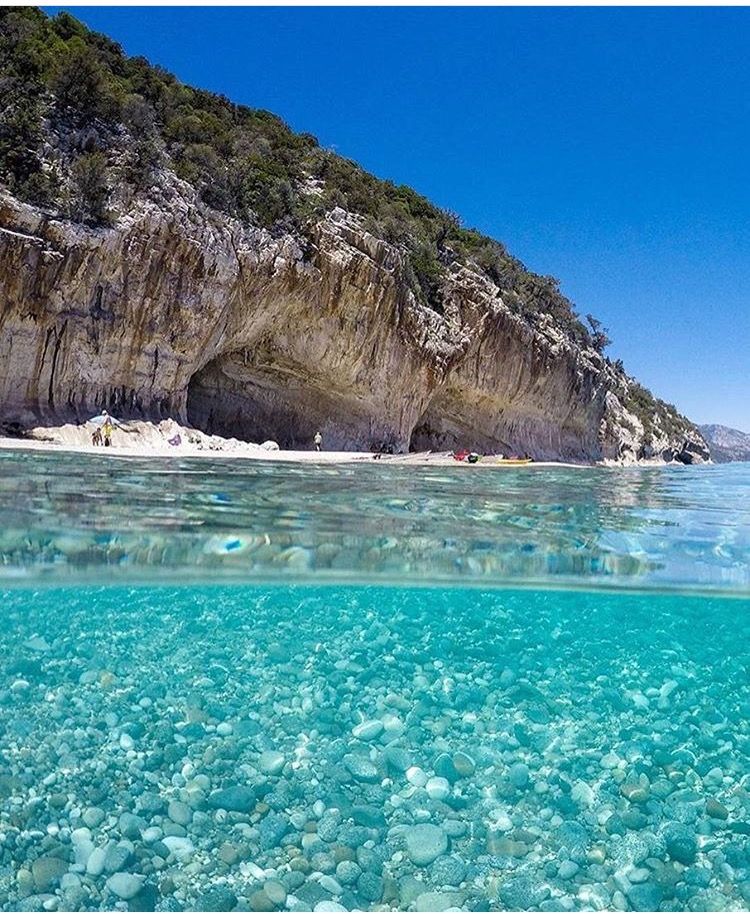 Dependiendo de su intensidad la borrosidad puede ser a mayor o menor alcance. También, como te podrás imaginar, deja calles, coches y casas llenas de tierra.
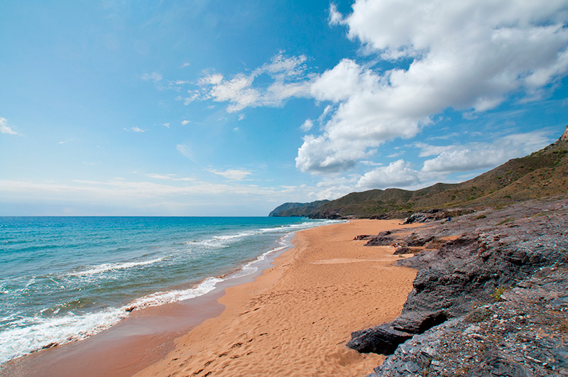
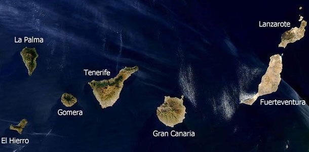
 Temperaturas en ligero a moderado ascenso, que podría ser notable en las máximas de la vertiente oeste. Se podrán alcanzar los 36 ºC en zonas de interior, especialmente en la mitad sur. Viento del nordeste, tendiendo a viento flojo variable con brisas en horas centrales.
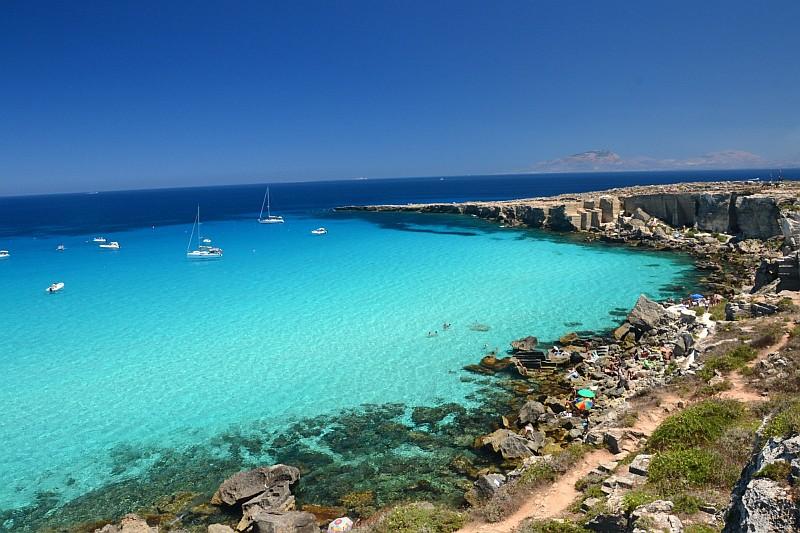 Viento del nordeste, más intenso en vertientes noroeste y sureste, tendiendo a viento flojo durante la mañana. En cumbres, viento de componente sur, tendiendo a flojo a lo largo de la tarde.
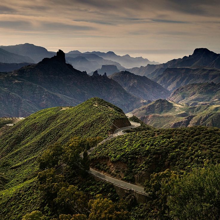
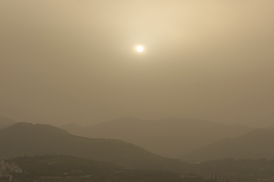 Máximas en ligero a moderado ascenso, especialmente en zonas altas. Se podrán alcanzar localmente los 32- 34 ºC, especialmente en puntos de interior de la vertiente oeste. Viento de componente este, tendiendo a flojo a partir de mediodía. En cumbres, viento del sureste flojo.
 Durante el fin de semana el viento soplará de componente norte en las capas más bajas de la atmósfera y las concentraciones de calima serán inferiores a las del resto de la semana. Aunque el cielo esté despejado de nubes todavía podrá tener un tono amarillento por la presencia de polvo en suspensión.
  Además las temperaturas podrían subir de nuevo en las islas a principios de semana. La calima estará presenta al menos hasta mediados de la semana próxima.
  Fuente: Eltiempo.es
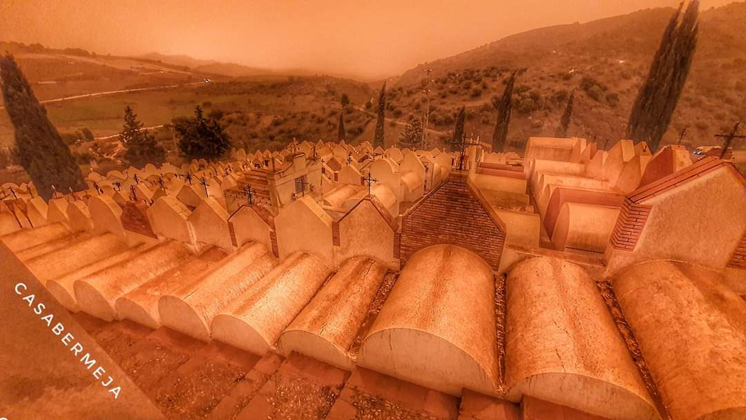 One example
 They are obtained from the
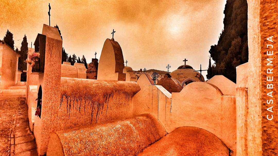 In addition,
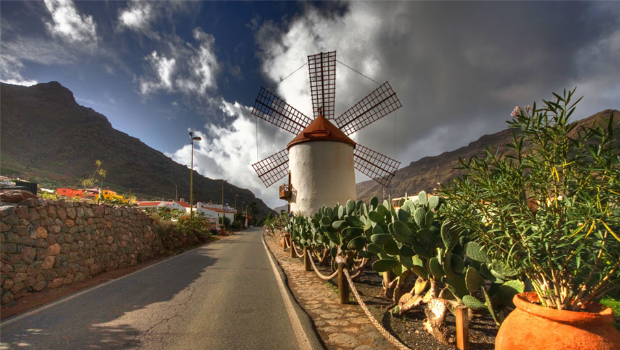 Therefore, it can be said that the calima episodes were not too
 From this study, which turned out not to be
 Calima significativa en capas altas. Temperaturas mínimas con pocos cambios y máximas en ligero ascenso en la mitad oeste; se alcanzarán los 34 ºC en zonas de interior sur. Viento del noreste disminuyendo.
 Temperaturas con pocos cambios o en ligero descenso; se podrá alcanzar el umbral de 34 ºC en medianías orientadas al sur. Viento del noreste, fuerte con rachas ocasionales muy fuertes en vertientes sureste y noroeste, en especial durante la primera mitad del día, y con brisas en costas sur; en cumbres, componente este.
 Temperaturas en ligero descenso en general; se podrá alcanzar el umbral de 34 ºC en medianías orientadas al sur. Viento del noreste, fuerte con rachas ocasionales muy fuertes en la vertiente este y el extremo noroeste, en especial durante la primera mitad del día, y con predominio de las brisas en costas suroeste; en cumbres, componente este.
 Temperaturas mínimas con pocos cambios, y máximas en ligero a moderado descenso, especialmente en zonas de interior. Se podrán alcanzar los 30 – 32 ºC en zonas del sur. Viento del nordeste con intervalos de fuerte, especialmente durante la primera mitad del día.
 Presencia de calima que afectará especialmente a zonas altas y se irá retirando. Probabilidad de precipitaciones ocasionales que podrían ir acompañadas de tormentas, sin descartar que sean localmente fuertes y en forma de chubasco. Tenderán a remitir a partir de la tarde. Temperaturas con pocos cambios, salvo ligeros ascensos de las máximas en zonas de interior. Se podrán superar los 30 ºC en la vertiente sur. Viento del nordeste con intervalos de fuerte en extremos noroeste y este, predominando las brisas en costas suroeste. En medianías y cumbres, viento del este-sudeste disminuyendo durante la segunda mitad del día.
 Tenderán a remitir a partir de la tarde. Temperaturas en ligero ascenso. Viento del nordeste con intervalos de fuerte en extremos noroeste y sureste, predominando las brisas en costas oeste. En medianías y cumbres, viento del este-sudeste disminuyendo durante la tarde.
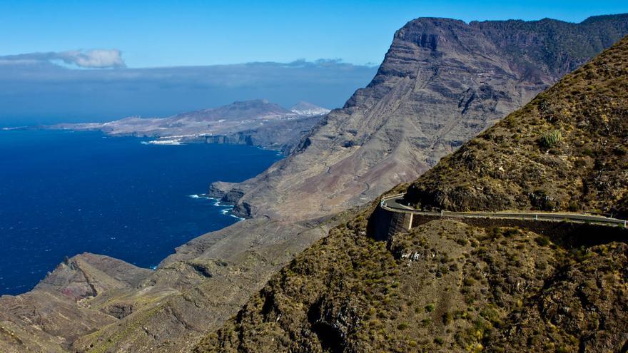
 Very fine, almost like powder, but not her.
  The desert is located in subtropical latitudes, where
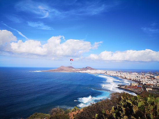
 Thus, in the “lungs of the planet” the loss of mineral substances and, first of all, phosphorus, washed out from soils by surface waters, is compensated.
 Due to the emergency situation, ships on the Canary Islands stopped going to the ocean. Airports were overflowing with passengers waiting to resume flights. Everything around was covered with a thick layer of sand. The situation was aggravated by the fact that forest fires broke out on the island of Gran Canaria, about a thousand people were evacuated.
 At Fuerteventura airport, almost all flights for arrival were delayed. Today, the single operator of Spanish airports Aena announced the resumption of flights at all airports in the Canary Islands.
 Kalima intensity is expected to decrease during the day.
 7 million tourists have rested in Sochi since the beginning of 2022
  7 km
7 km  In every case
 Mountain
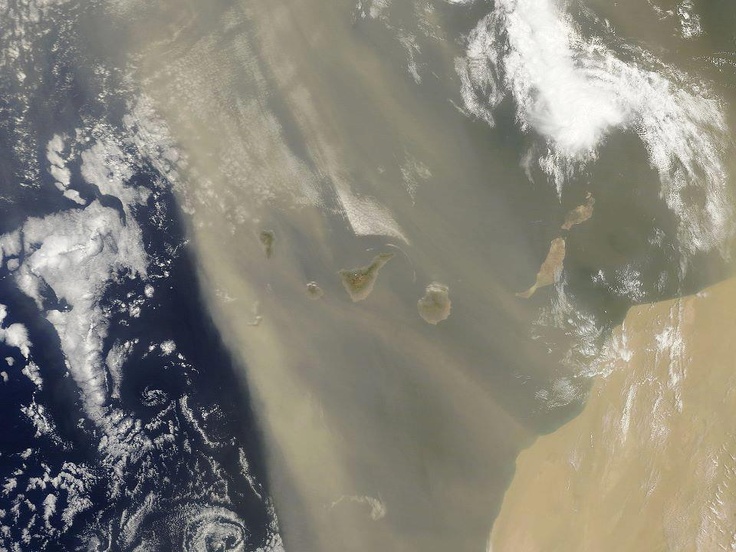 They do not need to survive in harsh climatic conditions. Spoiled by the sun, they don’t get depressed. Like an old volcano, the Spaniards hide their seething passions somewhere deep inside. They rarely step out of their inner comfort zone. In difficult times, they will always help, show the way with their fingers and answer all questions with pleasure. Spanish is quite simple: you begin to understand it from the first minutes. There are also many Russian-speaking visitors. Socialization is quick and painless.
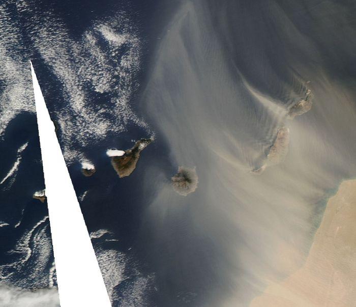

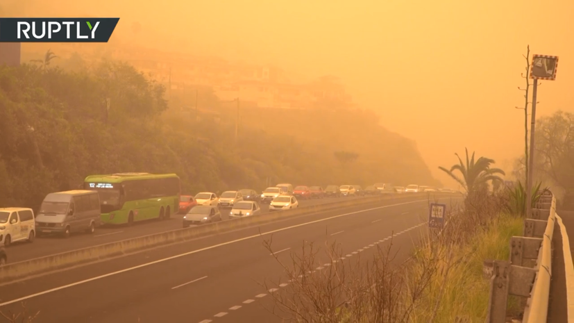 A man who came from the mainland has to rethink
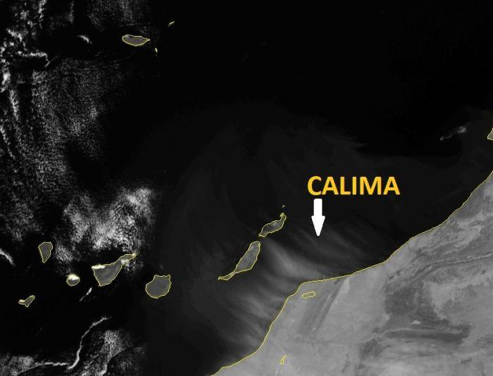 During such periods, the island is immersed in a light haze, the air
 es, Ebay.es. Masters are also not in a hurry when called. The Spanish magnana (“tomorrow”) is in full swing.
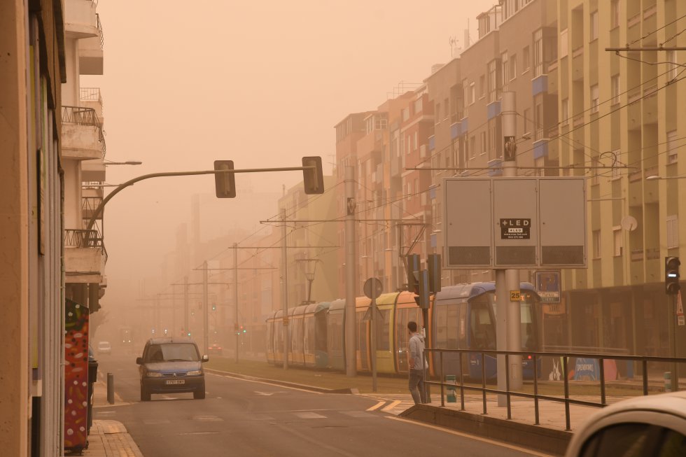
 Learn more about the Outdoors For All initiative.
 It is equivalent to a visa, but no stamp or label is placed in your passport. It is required to enter the United States unless traveling on a US visa.
 Thank you for the great service!
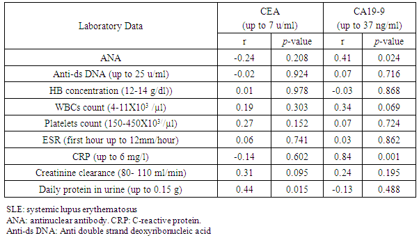
 It does not meet the legal or regulatory requirements to serve in lieu of a U.S. visa when a visa is required under U.S. law. Individuals who possess a valid visa will still be able to travel to the United States on that visa for the purpose for which it was issued. Individuals traveling on valid visas are not required to apply for ESTA. CIBTvisas and this site are not affiliated with any government body. We manage the entire application process on your behalf, assisting you to navigate through the complicated requirements. Fees will vary based on the destination and complexity of your application. CIBTvisas service fees are additional and separate to any government/consular fees due to the relevant embassy. You can apply for an ESTA directly through the DHS website, however you will not benefit from the CIBTvisas services listed above. Further information about the US ESTA program is available at the US Customs and Border Protection website at: https://www.cbp.gov/travel/international-visitors/frequently-asked-questions-about-visa-waiver-program-vwp-and-electronic-system-travel.
 S. Virgin IslandsUgandaUkraineUnited Arab EmiratesUnited KingdomUnited States of AmericaUruguayUzbekistanVanuatuVenezuelaVietnamWestern SamoaYemenZambiaZimbabwe
 Your kids will soak up tons of fun under the sun from the Build-A-Raft lazy river, water slides, wave pool, and interactive water-play structures.
 With more than 60 rides, shows and attractions, it’s an interactive, hands-on theme park experience for families with children 2 – 12. The Resort is also home to SEA LIFE® Aquarium and the world’s first LEGOLAND® Water Park. And if you’ve ever dreamed of spending the night at LEGOLAND, LEGOLAND Hotel and LEGOLAND Castle Hotel at the Resort are open and less than 2 miles from the nearest beach.
 S., LEGOLAND Deutschland in Germany, LEGOLAND Malaysia and LEGOLAND Dubai, LEGOLAND Japan and LEGOLAND New York.
  4 Further reading

 Coromines, Joan; Pascual, José A. (1983–1991), “estaca”, in Diccionario crítico etimológico castellano e hispánico (in Spanish), Madrid: Gredos, →ISBN


 S. citizens into the United States by land. One type of form is specifically for travellers of VWP eligible countries, this form is called the Form I-94W Nonimmigrant Visa Waiver Arrival/Departure Record. The other form is for non-VWP and non-U.S. citizen travellers and is called the Form I-94 Arrival/Departure Record.
 The Departure Record must be returned before the date of permitted stay written on the I-94W. The Departure Records contains the Port, Date, Carrier and Flight Number / Ship Name of the traveller’s departing journey. This must be returned or given to U.S. border authorities when crossing the Canadian border.
 cbp.gov/s/article/Article-752?language=en_US. You will most likely not receive confirmation that your record is updated. On your next ESTA application, if your request is denied for what appears to be no reason, it may likely be because of your previous overstay. This may come to realization during a visa interview, where an embassy or consulate representative may notify you of reasons for previous U.S. visa or ESTA refusals.
 S.
S.
 g. la mujer bonita, la luna llena).
 cutting
 For free.
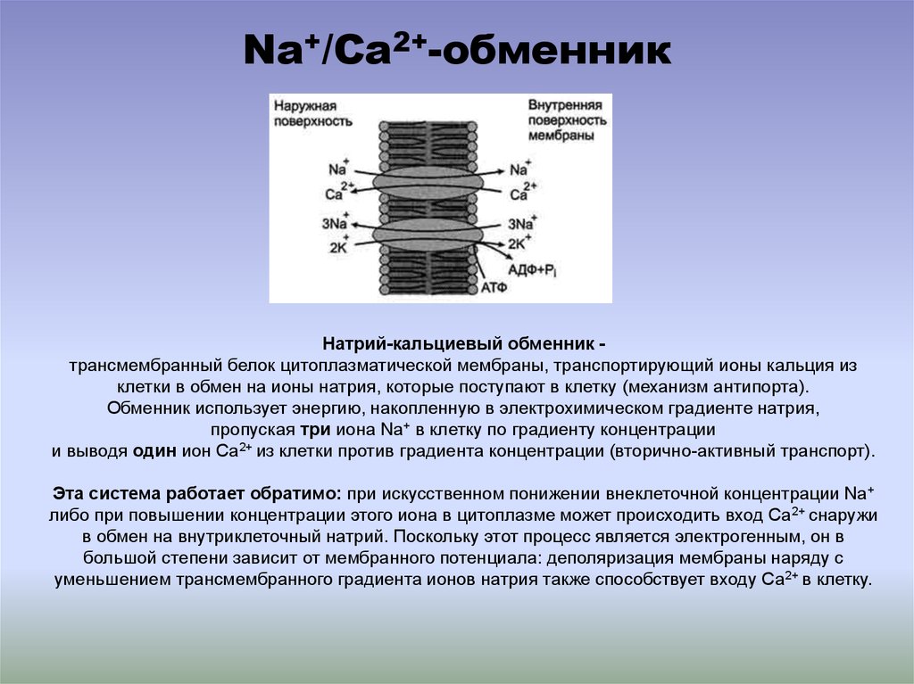 su
su 
 Applications, overlay patterns and lace motifs are simple, embroidered with beads, glass beads and rhinestones, artificial flowers and bouquets.

 Zvenigorodskaya

 8
8 ..
.. ..
.. limit”>
 Such people are distinguished by calmness and poise, which always makes the most favorable impression. The same applies to their appearance – nothing pretentious, screamingly tasteless. After analyzing the meaning of each letter in the name Esta, one can understand its secret meaning and hidden meaning.
  Demanding to others and to yourself. Striving for the search for truth. Reassessing your abilities.
 She likes to control and dominate in communication, she herself does not admit her mistakes. Very often he sacrifices his interests in the name of the family. Eight is reckless, loves non-standard solutions. In any profession, he achieves a high level of skill. This is a good strategist who is not afraid of responsibility, but it is difficult for the Eight to be in the background. Esta is a fast learner, loves history and art. Able to keep other people’s secrets, by nature a born psychologist. You can please the Eight only with trust and open communication.
 But even though they manage to achieve all this, but only with their sweat and blood, nothing comes easy to them. They are constant in everything: in relationships, in habits, in work. By old age, the carriers of the name Esta are most often financially secure. Among other things, they are stubborn, which contributes to the achievement of any goals. These people are punctual, prudent in the good sense of the word, careful, methodical, hardworking. As a rule, people of Saturn subjugate, and do not obey themselves. They are always faithful and constant, you can rely on them. Harmony is achieved with people of the second type.
  The Lions of Esta are demanding of themselves, picky about their appearance, so they pay a lot of attention to it. They try to make a favorable impression on people, they like to please. Sign of the zodiac Got in favor with Leo – consider yourself lucky. You will be praised, taken everywhere with you (to show off) and taught manners – the aristocrats are still the same. But swearing with Leo Esta is not recommended: they are sharp-tongued and will not go into their pocket for a word. In five minutes, you will be standing with red cheeks from anger and indignant, why the hell does he dare to talk to you like that? Moreover, Leo will not lie – he will say little, clearly and to the point. With a nasty grin. So you yourself will remain to blame for depression on the topic “where my life is heading”. Creepy egocentric owners of the name Esta love compliments, being the center of attention and gifts (although they prefer the word “offerings”).
  Scorpios named Esta love to live, as they say, to the fullest, extremely reckless, prone to addictions, categorical. People named Estha are often distrusted and create a tragedy from scratch. The innate intuition of Scorpios made them excellent psychologists and natural manipulators. The owners of the name Esta cannot live without love and vivid emotions, so as soon as they part with one partner, they immediately find another and drag him on a roller coaster – restaurants and movies for wimps. At the same time, they simply adore themselves, they know how to count money and remember what every ruble of their salary was spent on. Hidden to the point of impossibility: they will start talking about themselves three years after the wedding, not earlier. They do not like to chat, they are more often silent than they attract attention. You can’t leave them near Aries for a long time – together they will come up with such adventures for their fifth points that everyone will have to rake.
  The owners of the name Esta are dreamers. In their fantasies, a Fish with the name Estha has long conquered the world, prevented global warming and eradicated hunger on the planet, but in real life they are not interested – everything is boring, insipid and generally unworthy of their royal attention. Fish with the name Esta are terrible liars, and it is almost impossible to catch them in a lie. People with the name Estha have no remorse, so they are not going to repent and confess. And you believe them, looking into their big and honest eyes. It is impossible to offend Pisces named Esta – they will suffer for a long time, dreary and with pleasure. If everything goes well in life, Pisces Est begins to have manic thoughts about the coming nightmare, because it cannot be perfect. In everyday life, Esta Pisces are unpretentious, balanced, able to hide feelings and often manipulate other people. Vanity and commercialism are not inherent in the water sign, they know how to work, but do not strive for fame.

 The history of the surname Esta has several hundred years. The first mention of the surname Esta occurs in the 18th-19th centuries, it was at this time that the surnames of servants and merchants began to spread in Russia. At first, only the richest – “eminent merchants” – were honored to receive the surname Esta. At this time, numerous boyar and noble families began to be called. It was during this time period that noble family names appeared. The surname Esta is inherited from generation to generation through the male (or female) line.
 Often they compete with themselves. Indicates a desire to change something, to achieve the highest level of comfort in the physical manifestation and in the spiritual.
 Unfortunately, this idyll is not the merit of the people themselves. These are gifts of higher powers, donated through close relatives or best friends.
 youtube.com/embed/qrwlk7_GF9g?feature=oembed” frameborder=”0″ allow=”accelerometer; autoplay; clipboard-write; encrypted-media; gyroscope; picture-in-picture” allowfullscreen=””/>
 com. There may be some discrepancies between the clips and the song.
  In particular, there are currently 61 countries that are not part of the EU, but their citizens are visa-free.

 In essence, the system will solve the problem before it appears.
  A.R*
A.R* 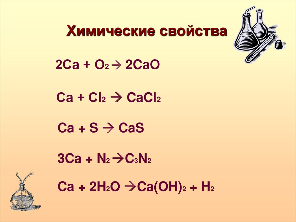
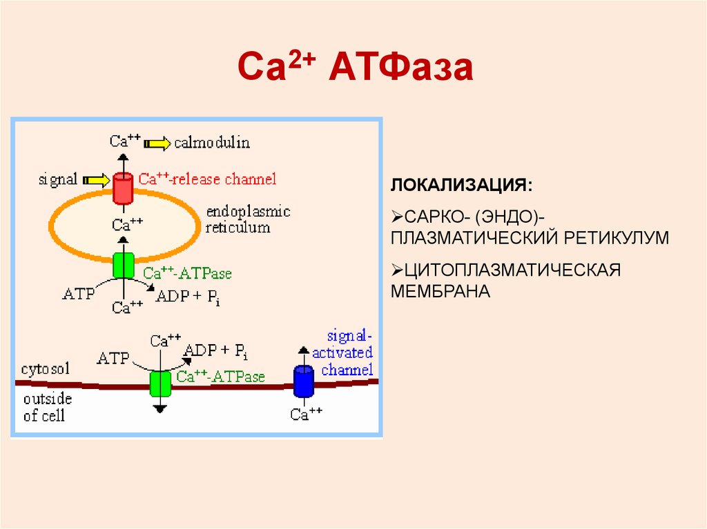 The entire procedure is expected to take only a few minutes.
  This chip is located on the bottom of the cover of your passport.
  This is why it is so important for all applicants to give honest answers and not try to provide false information. If you are caught providing false information to the ETIAS system, your authorization will be denied. In addition, if your ETIAS application is approved but it is later discovered that you have provided incorrect or false information, your ETIAS authorization will be cancelled.


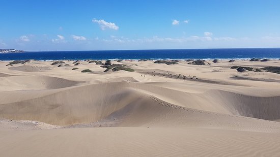 All in all, what could be better than golfing under the Canaries sun, especially when it’s the middle of winter and here in the south of Gran Canaria you are enjoying warm and sunny weather?
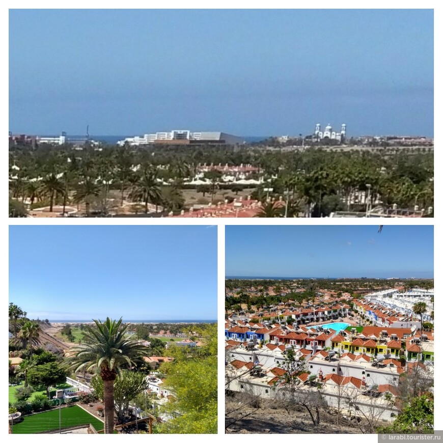 5 mi) Playa de Maspalomas borders the impressive Maspalomas sand dunes and stretc
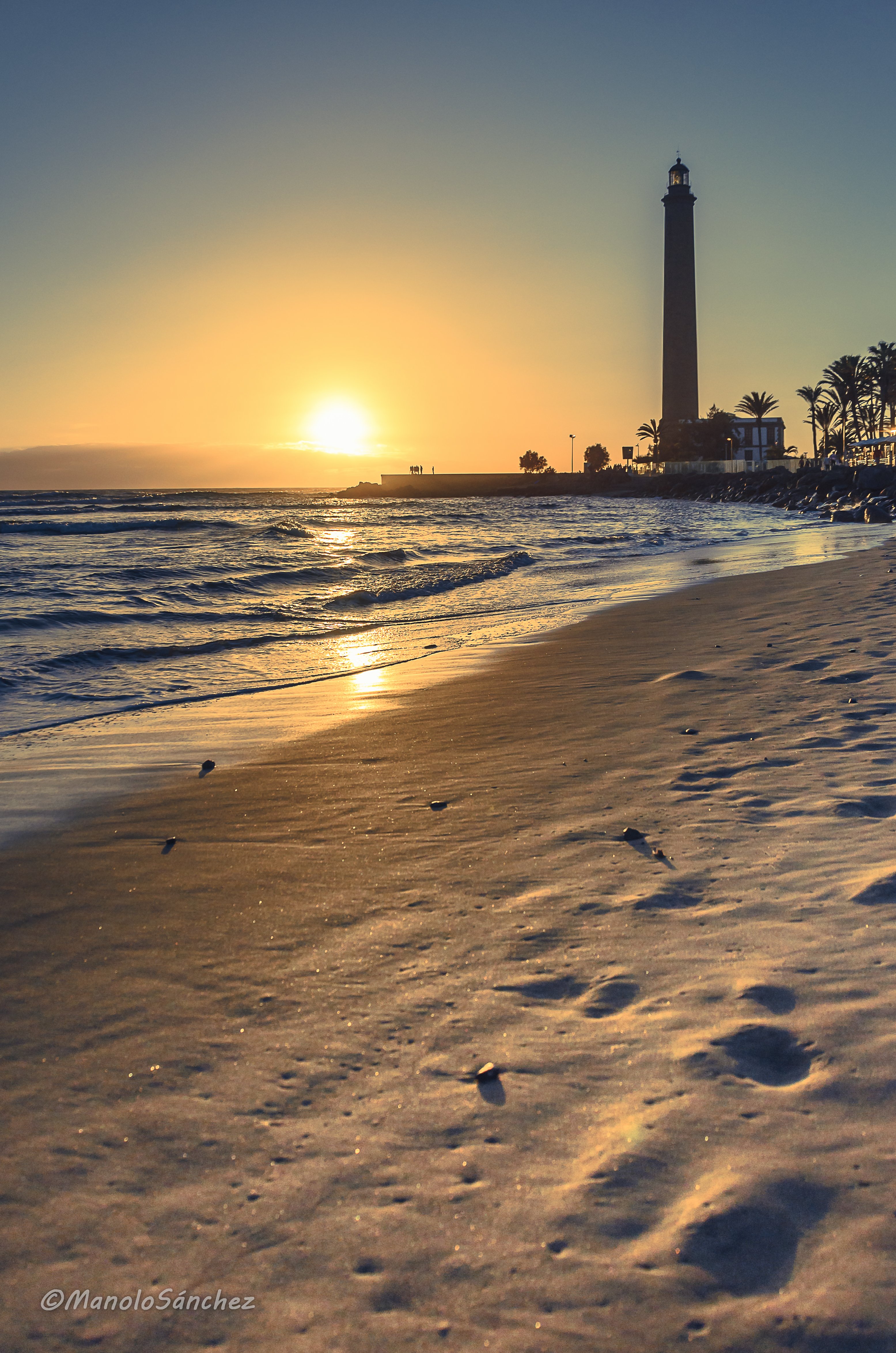 jpg” data-index=”1″>
 An unforgettable excursion and experience! Insured! Duration of the tour Approximately 2 hours a safety glasses cross googles included. Come and be an authentic Pirate Buggy!In reservations of 3 or 5 passengers, buggies will be shared. In case you need double buggy and than individual buggies to complete.
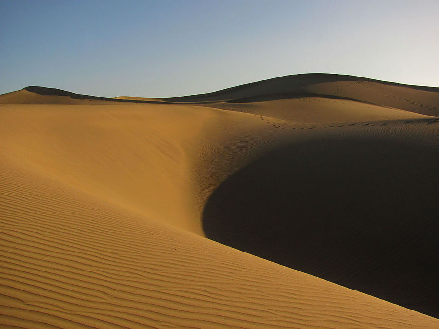 tacdn.com/media/attractions-splice-spp-720×480/07/7f/56/b3.jpg” data-index=”0″>
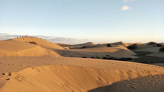 All accompanied by a quality gastronomic selection and an extensive menu of champagne, cocktails and juices.
 tacdn.com/media/attractions-splice-spp-720×480/08/fc/92/75.jpg” data-index=”0″>
 Have a typical lunch in a charming village of Fataga and after all that get some sun by the ocean exploring the massive sand dunes. You will have a professional Guide in English only.”
 6
6
 0
0
 7
7
 2
2
 We’ll find the
 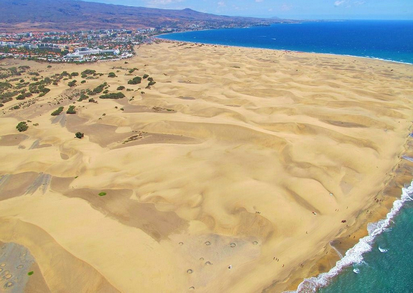 You’ll definitely find plenty of great attractions here.
 The water park is also a great place to spend time and have fun with your children in Gran Canaria. Read more…
 The island offers great opportunities for windsurfing lovers with its naturally warm air, water temperature conditions and the trade wind which is very ideal for windsurfing. Read more…
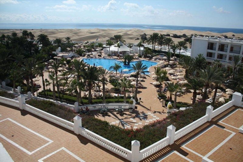 from Maspalomas
 Read more…
 For Gran Canaria interested tourists, that like to go on excursions, Maspalomas and Meloneras are suitable holiday destinations due to the good transport connection. The various places of interest in the north (like Las Palmas), in the south-west (like Puerto de Mogán) as well as in the inland (like Fataga) are accessible equally quick.
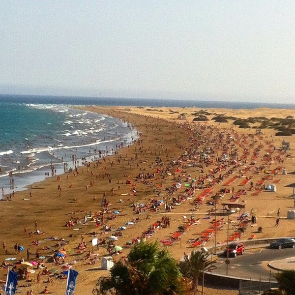 A evening visit to the dunes is also absolutely recommendable, because these are a wonderful scenery for the stunning sunsets of Gran Canaria.
 Unfortunately, the garden has been closed for several years. Maintenance work is currently under way. It was planned to reopen the gates to this wonderful place again in January 2018, but so far this has not happened.
 Not only recommendable for families with children. The park has a great landscaped outdoor area and it also offers several entertaining animal shows with birds of prey and dolphins.
 For more hustle and bustle, go to one of the shopping centers of Playa del Inglés such as the CITA, the Kasbah or the Jumbo. Or enjoy the solid, more luxurious ambience in the trendy bars in Meloneras and celebrate, for example, in the Agua until the morning hours.
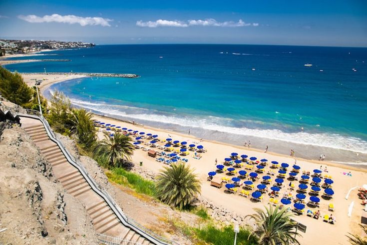 5
5 It is a delightful mixture of Gothic and Renaissance flourishes, surrounded by an array of highly decorative townhouses reflecting architectural styles from the 15th to the 19th centuries.Among the spider’s web of cobbled backstreets and atmospheric squares in Vegueta are several Baroque churches and the Museo Canario (Canary Island Museum), which showcases the world’s foremost collection of tools, jewelry and pottery utilized by the Guanches, the indigenous island population who were displaced with the arrival of their Spanish occupiers. Another architectural highlight of the district is the ocher-colored Casa de Colón (Columbus House), where Christopher Columbus reportedly stayed on his way to discover the New World in 1492. Its ornate façade is covered with elaborately carved wooden balconies and the interior houses relics of the great Spanish explorer.However, half the charm of a visit to Vegueta is simply wandering the historic streets, relaxing in sidewalks bars, rummaging in the weekend markets or sampling Canarian tapas and honey rum.
 More
More The lavishly ornate room is a marvel of architecture and is the crown jewel of the theater; the main concert hall, however, is not to be overlooked, with its splendid ceiling and perfectly symmetrical pavilions.More
 It now houses plants from all over the world and a research laboratory.More
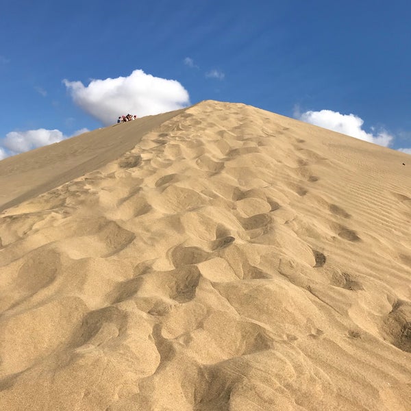 The park is also home to the Museo de la Ciencia (Science Museum) and the Edificio Miller (Miller Building.) Carnaval and the Dance and Theatre Festival are celebrated here during summer.There’s also a small playground that’s suitable for small children. The park is a central transportation hub and meeting spot from which many tours depart.More
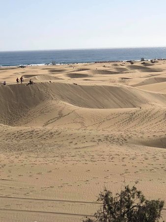 It was completed on the eve of Corpus Christi in 1570, although substantial renovations were made over the following centuries—which explains the disparity in some of the architectural details. Designed in the purest Gothic tradition with touches of Neoclassical and even Baroque, the structure consists of two campaniles, an ornate nave with double aisles as well as a sanctuary. The cathedral’s interior is famous for its palm tree-like piers and for its twin towers, one of which is accessible to tourists on a quest for unobstructed views of Gran Canaria. The south wing of the cathedral also features the Sacred Art Museum and its valuable collection of sacred artifacts, sculptures and works of art.More
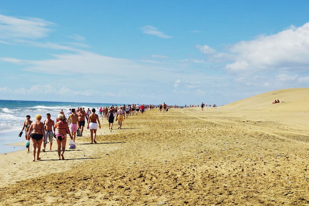 More
More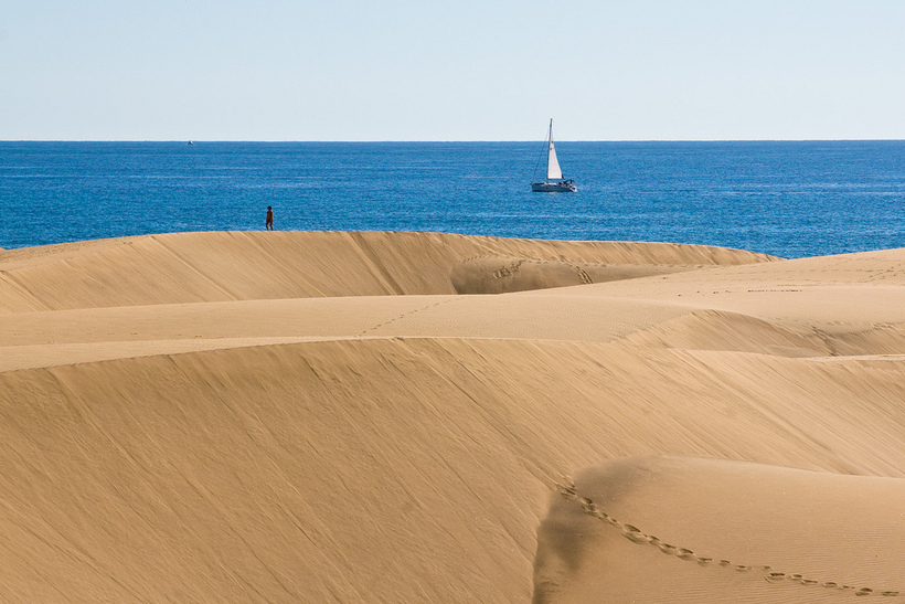 The pedestrian street running through its heart is lined with trendy boutiques, old-fashioned shops, international brand retailers and lovely cafes for a bit of post-shopping refreshment.While some of the shops might be modern, the street itself is among the oldest on the island, dating back to the sixteenth century. Shops and banks began moving into the area in the mid- nineteenth century, and much of the architecture dates back to the same period.Swing by Calle Triana, 35, where you’ll notice an electric clock dating back to 1868. The clock, built by famous clockmaker Juan Pflüger, reminds passers-by to take their time and enjoy the day.More
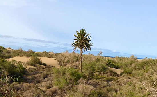 This bold architectural choice has been attributed to the socioeconomic evolution of Las Palmas over the past two centuries, as modernism and mercantilism were slowly implanted in the notoriously slow-paced Canarian lifestyle. Built in 1891, the market features exceptional wrought iron works as well as Art Nouveau touches with the thoughtful inclusion of glass among other ornamental elements. Nestled between the harbor and the beach, Mercado del Puerto is cosmopolitan and relaxed compared to other markets in the city and quite hospitable because of its rather small size, with just 40 stalls. Far from being just a produce market, the building houses several tapas bars, flower shops, hairdressers, wine shops, coffee shops and many others. It is most busy in late afternoons, especially on Thursdays, Fridays and Saturdays.More
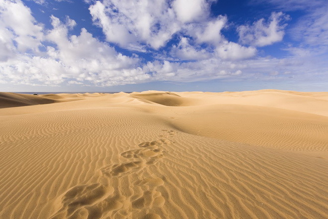 00
00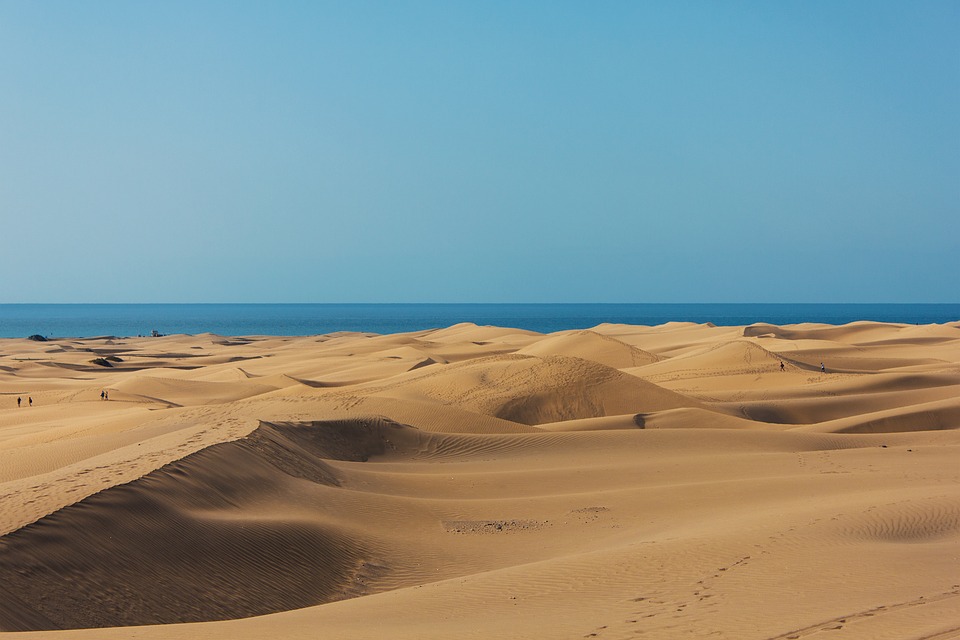 “>Likely to Sell Out
 00
00


 40
40
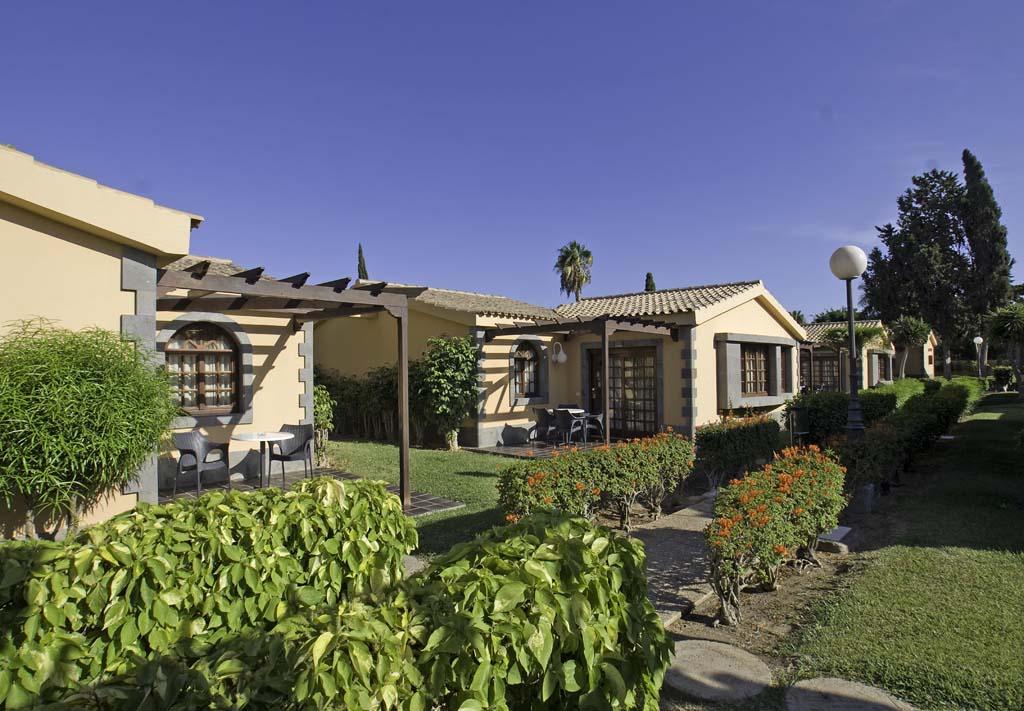
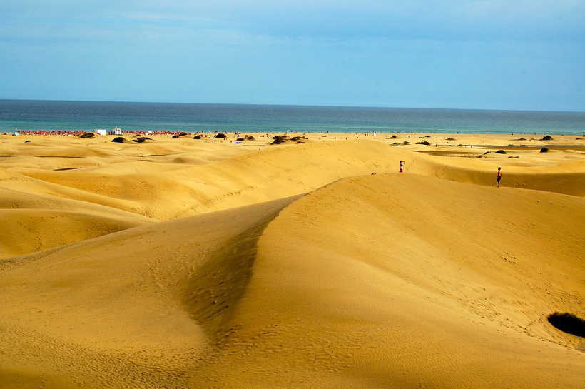 Discover why on a full-day tour to the summits of Gran Canaria.
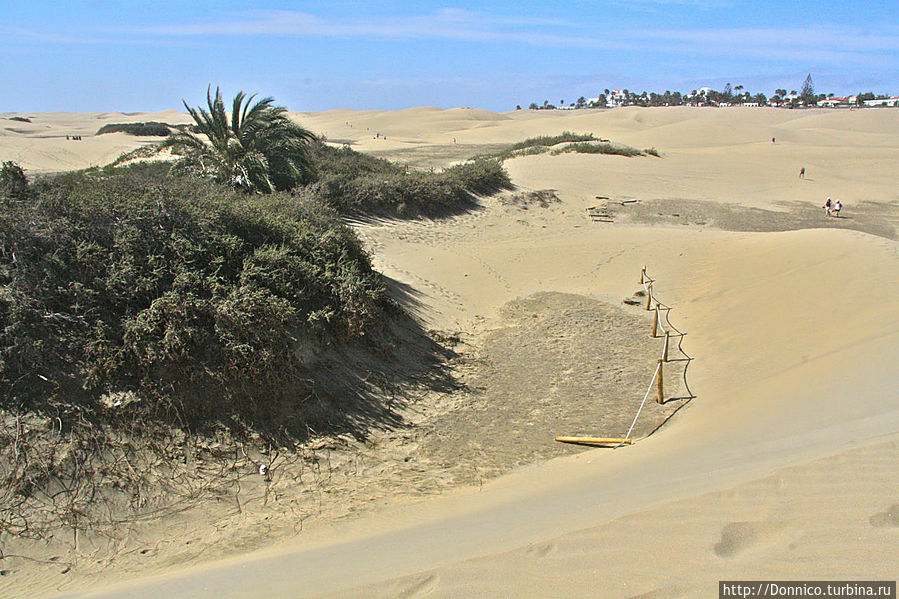 Plus, discover the San Fernando Market and indulge in delicious local tapas.
 You’ll see views of the Playa del Inglés and the Maspalomas Dunes
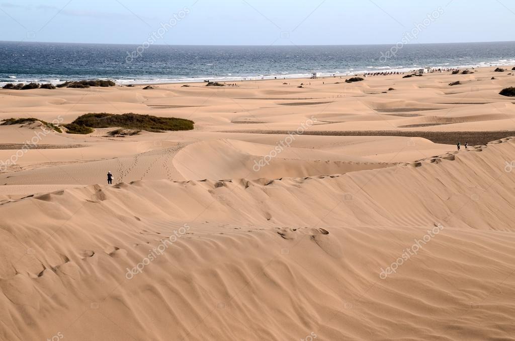 Truly magical!


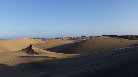
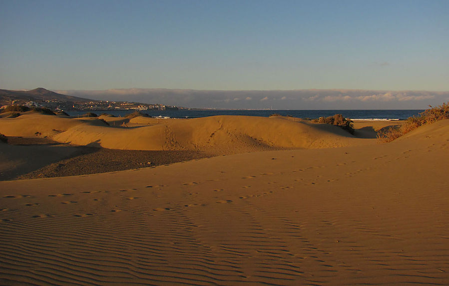
 Usually in winter, many sports clubs and athletes from Europe come to Gran Canaria, because. the island hosts many competitions, both local and international. The beauties of the island allow you to combine the enjoyment of nature and the practice of your chosen sport.
  This is a huge open-air entertainment complex, where 19various attractions. Extreme slides, wave pools, chic play areas for kids and places for relaxation for their parents, restaurants and bars, well-groomed, green area – all this is guaranteed to not leave you indifferent! Have a fun and interesting time – visit the water park in Maspalomas! More & Photos>>>
  More & Photos>>>
  Athletes of all skill levels will find interesting opportunities for themselves: beginners will enjoy a leisurely ride along the embankments along the beaches, while more experienced cyclists will enjoy the difficult mountain trails passing through picturesque places. It is not at all necessary to take a bicycle with you on vacation – contact us and we will help you rent it and the necessary equipment right on the island. More & Photos>>>
  This type of recreation does not require special physical training – you only need comfortable shoes and desire. The level of difficulty of the route is selected individually. More & Photos>>>
  Children aged 12-16 ride on the junior track, and children over 16 years old can compete on the Senior race track. More & Photos>>>
  00 €/Bagg
 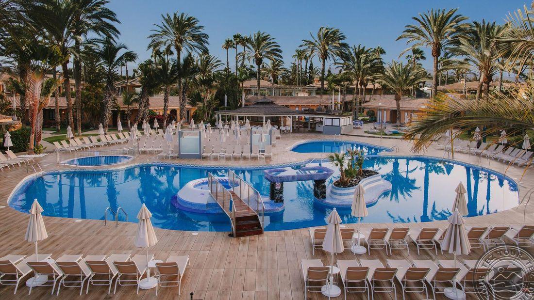 , 95€/for two
 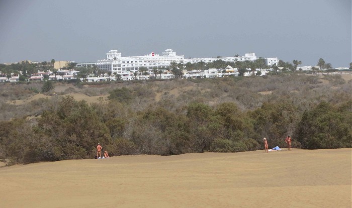 More & Photos>>>
  Romance, thrills, new, amazing experiences – all this will give you sailing trips! Feel like a real conqueror of water spaces! More & Photos>>>
  More & Photos>>>
 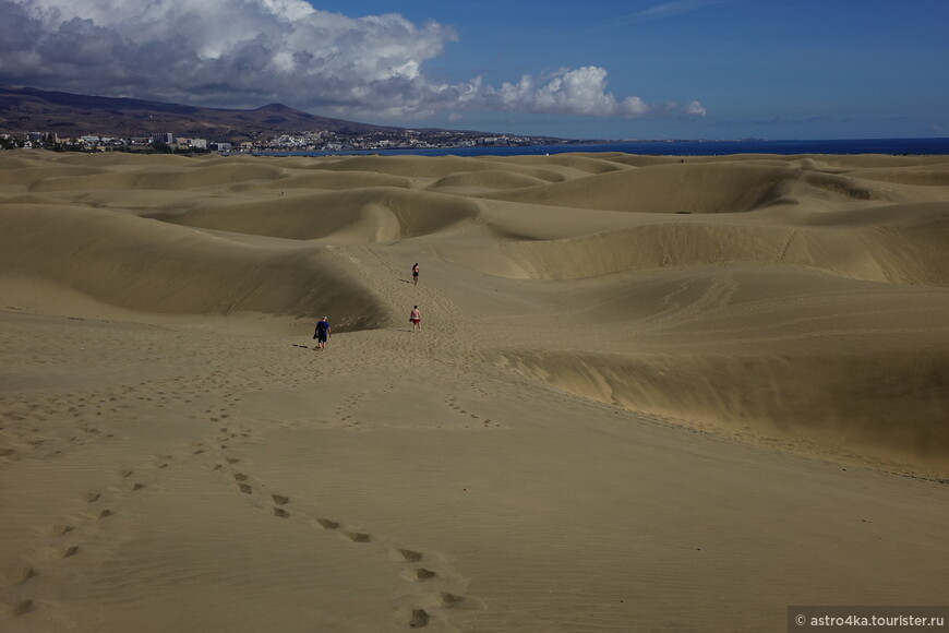 00 €/person 9024
  com reports.
 For the time being, they slept more, but as far as I could see in the dining room, there was no such thing as a hat-bearing mood. Today’s workout is the only one that will have any focus. Of course, we talk with them, we say that it is important for us to try to maintain our pace of play from the first minutes. We understand that the Liechtenstein national team will try to play slowly, without rushing anywhere, and, by and large, they don’t need anything. We are preparing very seriously, I can assure you.
  In addition, as a “young” coach of the national team, I’m still not sure about myself when I make substitutions, because I’m afraid to spoil something on the field. That’s why I rarely make replacements or don’t do them for a long time – I’m afraid to spoil what is already established, although I see that the guys are tired and replacements are asking for. In the end, I still make these replacements, but a little later. We need to make allowances for this too… But, unfortunately, the playing practice in the clubs does not depend on me, but we need them to play.
  Of course, if we achieve a landslide victory, it will be a double celebration, including statistics.
  It’s just unpleasant for me every time to remember the statements of “friends” that we, they say, even this dead team of Kazakhstan could not beat. Although we beat them once, it’s just that we didn’t go further by the sum of the two matches. But this “dead” Kazakhstan, as you noticed, took first place in the group, beating the “dead” teams of Slovakia and Azerbaijan. Let us also be dead to everyone, but at the same time we will slowly gain strength, win and move forward.
  Of course, it will be a different tournament and a different level of resistance, different opponents and tasks. I hope that we, thanks to the League of Nations, will be able to grow stronger. You yourself may have noticed that we have a very large rotation in many positions, many of them took part in the games for the first time. There will be more new young players, because we always have to think about tomorrow.
  Even if someone thinks that we are bad, it’s still us, these are our players. We cannot replace our players with someone else’s in order to make a good team. We are not a club, we are the national team of the whole country, so I want to ask the fans to come and support our team. Even if it seems to you that we are facing a weak opponent, in such games support is doubly needed so that the motivation of the players on the field goes off scale and that they do everything possible for you, the fans, to show bright football, score many goals and bring victory. Thank you.
 com
com  Masturbarse and Mearse
  ..
.. 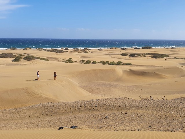 Estaba Dudando De Desnudarme
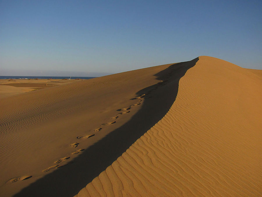
 Temperatures in Podgorica can soar up to an average of 30.6 degrees Celsius during the summer. The Rumija Mountain blocks the city from the sea and thus limiting maritime influence on the city’s temperature.
  As would be expected of a place near mountains, Tirana receives a bountiful amount of precipitation year-round. The city, therefore, ranks among the wettest cities in Europe. However, it is also one of the sunniest cities on the continent as well. The combination of heat and precipitation gives the city a humid subtropical climate. Additionally, being close to the Adriatic Sea and located on the Tirana plain, the city of Tirana experiences a seasonal Mediterranean climate which translates to its generally high maximum temperature averaging 30.2 degrees Celsius.
  In the worst case scenario, the cities
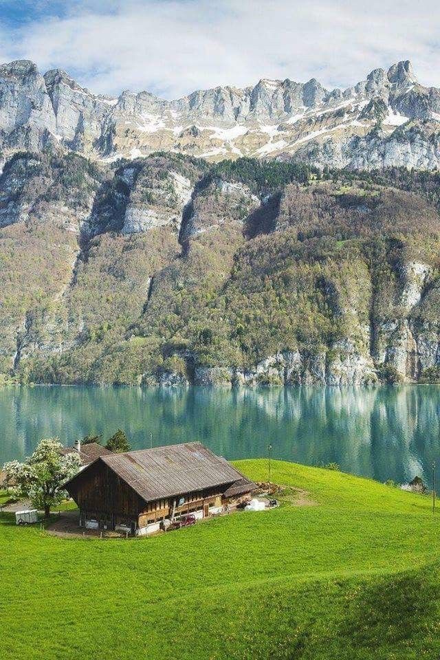 4
4 But there are also loads of other destinations on the Mediterranean that are worth a visit.


/6411608.jpg) It’s the birthplace of the espresso and pizza margarita. When it comes to food, Neapolitans don’t kid!
It’s the birthplace of the espresso and pizza margarita. When it comes to food, Neapolitans don’t kid!
 It was possible thanks to the exceptionally plastic properties of limestone, mined in this part of Italy.
  Click here to see the latest prices.
 In winter, however, it is better to use the coastal roads rather than crossing the island through the mountains.
 If you are looking for a cheap getaway in Western Europe, Lisbon will be perfect for you!
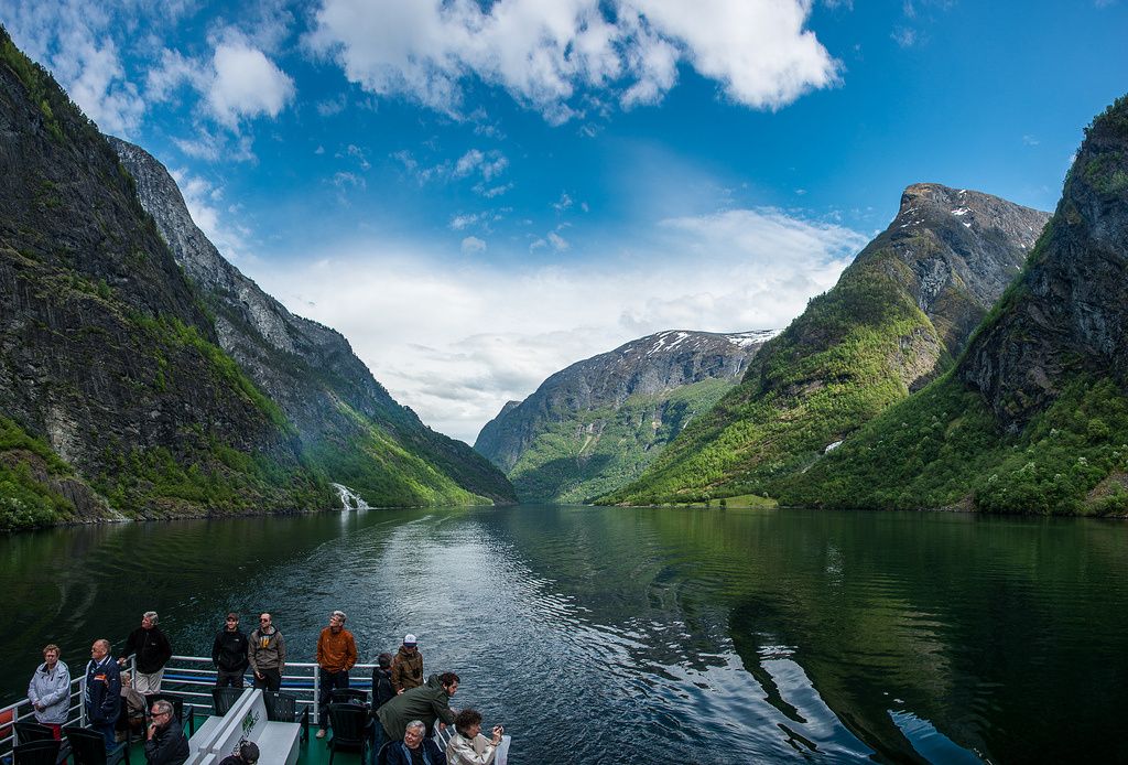 The most popular one is going to Sintra. This fairytale village is perfect for Instagram photos!
 Prices here.
 Explore the rooms, see the tomb of Christopher Columbus, and climb the Giralda Tower for the best views of Seville.
  It’s also quiet, so you won’t have to deal with the crowds you might see at other times of the year.
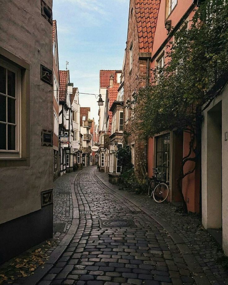
 You can also opt for a guided tour.
  Once the summer is gone with its regular tourists, the winter life in Ibiza springs into action.


 8 °C or 64.0 °F.
  It’s a great chance to get to know the locals and get better deals on any souvenirs you want to bring home.
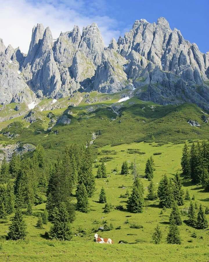

 Pula, the area’s biggest city, is an ideal place to base yourself if you want to explore the many charming towns and villages the region has to offer.
 Another reason Dubrovnik became a must-see destination was Game of Thrones.
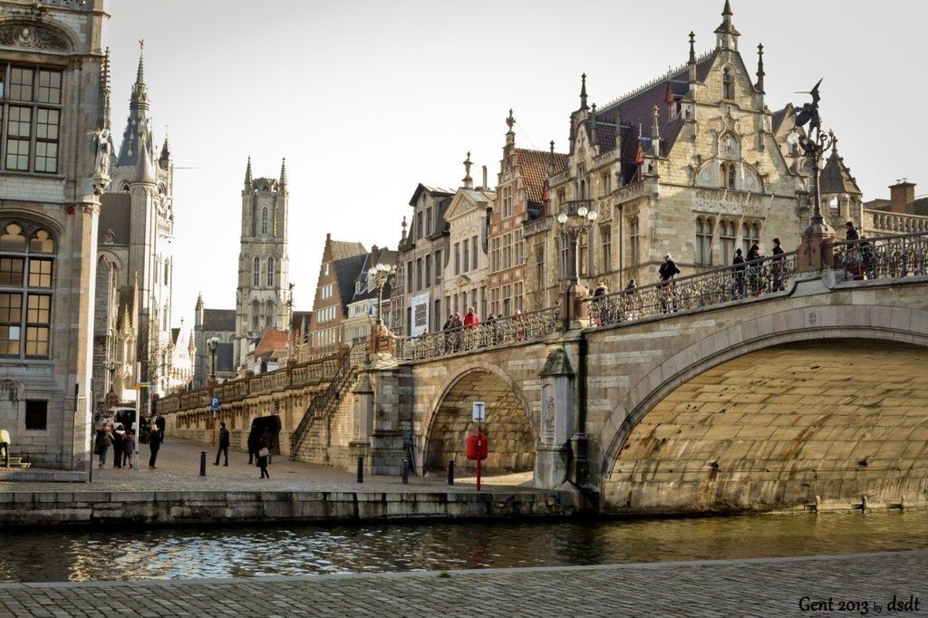 C. and once part of the ancient city walls.


 Close by is the small town of Mdina.
 See prices here.
  Warm places in the United States. Canary Islands are the warmest place from Europe during the winter. The warm air of the sea will warm you up and recharge your batteries. Get more travel inspiration, tips and exclusive offers sent straight to your inbox with our weekly newsletter . Madeira is one of the warm places in Europe in December. While there are endless cities to visit, here are a few favourites that are less commonly known but in need of recognition. If you’re like us and thinking about where the best places to travel in December are, the best vacation spots, and warm places to visit in December, or perhaps even cozy vacation ideas, take a look below to see what our travel advisors suggested as the best places to travel in . best holiday destinations for a warm weather. Wow, finally, a different state! Europe’s best budget ski resorts 7 far-flung European ski resorts A regional guide to Europe’s best road trips This article was first published in December 2012 and updated in September 2020.
 1.2 Seville and the South of Spain. Average Hours of Sunshine: 9:54. There is a wide variety of activities you can enjoy on each of these islands. warmest places in Europe in December. 1. Places to visit in Miami: Miami Seaquarium, Vizcaya Museum and Gardens, Lincoln Road, and Coral Castle. Here in our article on best places to travel in December in Europe, Asia and Tropical Destinations, we round up . Iceland – Fantasy Land. 19 That’s 15 Top European Destinations for Winter Sun. With 19C daily highs Lanzarote is one of the warmest places in Europe and with the biggest waves of the year rolling in during November and December, conditions are ideal to grab a surfboard and catch a wave. The daily low during the coldest month here is a mild 15 Celsius. Over there, you can also find some of the warm places to visit in December in USA. If you have children then have a look at Big Family Little Adventures blog on tips for traveling with kids here. 22 Best Winter Destinations In Europe 2022.
 It is the place to go for excellently groomed powdery trails. Except for the Canary Islands, Almeria might be one of the warmest places to visit in Spain in winter, with a bit of luck, since rainy days can occur here as well. Travel tip: Do not miss the carnivals! Thus, you will avoid most rainy days, enjoy the sunny days, and get through mild winters. December is a wonderful time to escape to Hawaii as it will greet you with warmth, palm trees, and some of the most beautiful beaches in the world. Check out these 10 warm-weather destinations you can visit without a passport. If as you get set to bid farewell to another year (how did that happen? There are fewer hours of light, chilly temperatures and many attractions are closed. Darling little Sanibel Island is the picture of simplicity. When it comes to choosing a warm place in Europe in December, the island of Madeira is worth taking into consideration. This post’s overview: [ hide] 1 Top 7 destinations for a warm winter break in Europe! And the water is very warm, about 72 degrees during December.
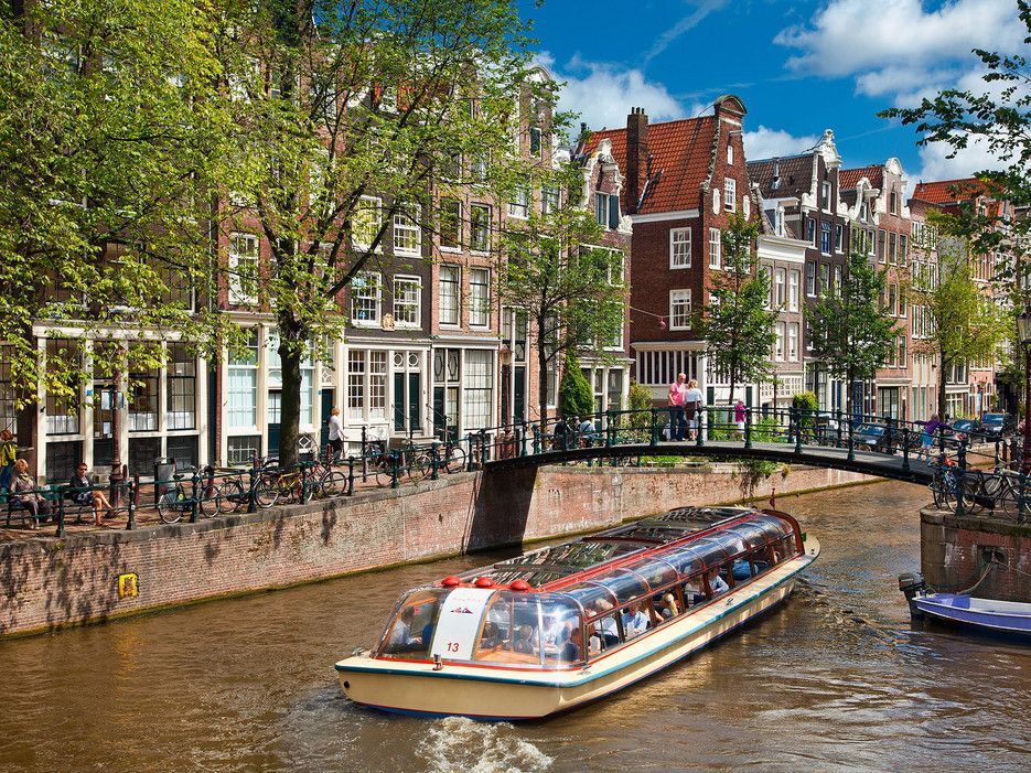 1. 15. Average high temperature: 17.5C (63.5F) Average low temperature: 9C (48.2F) Average rainy days per month: 3. If you want to take a holiday in the winter months and come back with a tan, they are a must-visit. Tenerife Tenerife is one of the few warm tourist places in December in Europe, as the average temperature, there is between 20 and 25 degrees Celsius. Without further ado, let’s get started with the . For a tropical escape, set your sights on Singapore. #6 in Best Winter Vacations in Europe. Winter in Europe is the ideal time to visit many destinations. From December through March, Europe transforms into a winter wonderland. Don’t let the shorter days and cooler temperatures deter you. Valletta Malta – 300 days of sunshine in a year. 1. Things to shop: Cigars, local jams, keylime products. 22 Best Winter Destinations In Europe 2022. While we’ll be putting our international travel plans on hold this year, these photos of Europe in winter have us preparing for 2021. Travelers will .
 Also see our tips for the best city breaks in December and where is hot in Europe in December. Even though we chose to visit Malta in late September, the island is another perfect destination to consider as one of the warmest places in Europe in December, January, or February. Best places to visit in December in Europe. This quiet oasis is a quick bridge journey off the west coast of Florida, just 25 miles from the Fort Myers airport.. December’s highs of 75F and lows of 55F are optimal for spending time in nature with a little less phone service and a little more shelling. Iceland – Fantasy Land. That said, there are a few places to have a sunny and warm family holiday and avoid the long-haul drama. Best Winter Vacations USA . The average temperature is 18 o C or 64 o F. It is also quieter than most months with many people waiting until December to visit for the . Lanzarote, Canary Islands. Enchantment is guaranteed when twinkling Christmas decorations are combined with snowflakes, fairytale castles, and lantern-lit cobblestone streets.
 Average December Lows: 49F – 53F. Average highs in December: 22C Even though the UAE is a Muslim country, the Christmas weeks are the most expensive here because most visitors are from Europe anyway. In case you don’t want to wait a whole month to go on a holiday, take a look at 15 Best Places to Travel in December in Europe, Asia and Tropical Destinations. It’s also got a lot of pretty much everything, so whatever you’re looking for in a getaway, Los Angeles has got it covered. Related: 15 Beach Destinations for Winter . So, snow & cold are all about Europe’s winter. December avg precip: 2.0/5.0cm. Close to the Turkish coastline, Kos is one of the most southerly of the Greek islands with a warm autumn climate. The 50 Best Places to Travel in 2021 Whether you’re traveling solo or planning a family vacation, here are the 50 best places to visit in 2021. Las Vegas, Nevada. If your heart is set on France, avoid Paris, which will be cold and damp; Nice is a comfortable alternative. RELATED: 25 TRIPS THAT WILL ABSOLUTELY CHANGE YOUR LIFE.
 Read on for 21 European cities and a few villages, if we’re . Where to travel? In fact, it’s one of the best places to travel in December on a budget in Europe. Naples, Italy. The fall is a great time to visit, as the many students of this large university city will have returned and the nightlife will be at its best. The average temperature of Gran Canaria in January is a pleasant 18 Celsius with a high of 21 Celsius. You will be able to relax and enjoy the sun and surf at beaches. Book your accommodation at the best price in Mijas and come to enjoy one of the most beautiful destinations in Europe. With temperatures between 14 and 20C, less than five hours flying time and direct flights from the UK, here are the best European destinations with a higher than average chance of blue skies and sunshine in December, January and February New Orleans, Louisiana. If you feel temperatures between 55F – 65F are just perfect for your warm winter holiday, this is where you should go. Las vegas is entertaining any time of year, and hotels, casinos, and restaurants are.
 Traveling to Europe in November has also other advantages which make travel to Europe in November a great time. In 2013, Cyprus was nearing financial collapse. 1.4 The French Riviera. The best time to visit Mauritius is from May to December when the weather is cool, dry, and sunny. When is the warmest time to visit Europe? Miami, Florida. Keep your passports handy as you’ll need them real soon! December is that time of the year when everyone wants to travel in Europe. Also, if you love history, here you will find a huge amount of culture. The hurricane season has passed and you can expect average highs of 30C and nine hours of daily sunshine, with little humidity. The Island of Gran Canaria is one of the warmest places in Europe during January. #6 in Best Winter Vacations in Europe. Usually, when a destination is scorching in the summertime, then it is usually one of the warmest places in Europe in wintertime. 2. Take out your diary and pen and chart your December itinerary with us! Nov 2, 2018 – 15 Warm Places To Visit In December in Europe for your vacation.
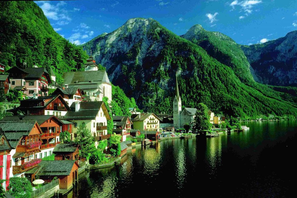 The weather is usually dry and sunny, sometimes partially cloudy. 18 Crete, Greece. 1.3 The Canary Islands – Gran Canaria, Tenerife, Lanzarote. Malta is one of the best places in Europe to visit in December. In Spain, Barcelona . The average daytime temperature varies depending on which island and which part of the island you have decided to visit. Better safe than sorry! 6 Warm Places to Go in December. Since this is the highest tourist season, prices are mega inflated and hotels are fully booked. Nicosia Cyprus – Warm place in Europe for winter sun. Warm Places in December in the U.S. Florida 1. Lake Eola Park, Orlando Shutterstock. This article will show you the best places to visit in December in USA. December avg low: 42F/6C. Where to travel in december 2021? 1.Vail Colorado. Better safe than sorry! Budapest’s market will be open for shopping until December 31, Krakow’s until January 2. Instead, head to one of the many hot places in December! Find here the recommended destinations to go stay in Europe in december in the sun based on seasonal averages.
 It is one of the best places to visit in December in Europe. The warmest place in Europe in January is the Canary Islands. November is an off-season month which means you’ll benefit from fewer crowds, cheaper accommodation . Madeira, Portugal. Let a warm December vacation be your excuse to visit this island nation at the crossroads of three continents (Europe, Asia, Africa). Warm places in Europe in December, January, and February: Winter Sun in Europe. The south of Gran Canaria is probably the hottest place in Europe from December, to January and February. Europe’s Christmas Markets. 1.1 Malta. Cartagena is a particularly wonderful place to spend the holidays but it can get pretty pricey in December. It is one of the best warm places to visit in December. Hvar, Croatia. Go in January or February and you’ll nab a flight deal for $260 to $490 round-trip and even find five-star hotel rooms ranging from $80 to $190 per night, with three- and four-star hotels being even cheaper. 1. Blue skies and sunshine are still plentiful, and the relative lack of tourists makes this a great time to visit.
 Warm Places to Travel in Europe. The temperatures vary between 20 and 23C along the coast. Prague. Cyprus. December sees Germany in full festive mode as Christkindlmarkts (Christmas markets) set up shop in even the smallest town squares, and snow often falls. We do need to stress the fact that, although warm and temperate, even the warmest regions of mainland Europe still feel and are colder than certain tropical destinations at this time of year. To help you choose, here are the best places to visit in December in the USA 1. This pretty island is a shade warmer than the other main islands and a great place to visit. If you want to know more about the weather in the archipelago, you can read our article about the warmest Canary Island, but keep in mind that all the islands enjoy great weather and the differences are not huge, so you should choose in accordance with what you’d like to do and see during . Average December Highs: 63F – 68F. Travelers will . In general, temperatures in December rise above 20 degrees, and sometimes go over 25, making the Canary Islands one of the warmest places in December in Europe.
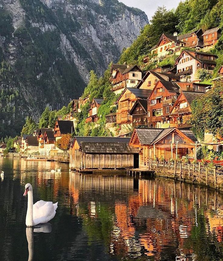 December and January are the busiest two months in Dubai, primarily because it’s one of the closest places to Europe that actually has warm weather this time of year and is also safe. Andalusia, Spain Without further ado, let’s get started with the . Europe in December is . Where to travel in december Use this map to see our opinion on the weather for every destination in Europe in december 2021. Table of Contents [ show] Where to go for the best warm winter vacations. Here is the list of the warmest places to visit in Europe, in the winter months. While some might envision it to be covered in snow and freezing temperatures, there are many places that have warmer climates even during this time of the year. The Cheapest Places to Visit in Europe in December. where to go for winter sun holiday destinations temperatures warm winter destinations europe hot destinations in December. Cdiz has 313 days of sunshine a year with the winter months (December through February) having almost 200 hours of sun each month.
 Lisbon is a magnificent city to visit in any season but it would have to be one of the best places to visit in Europe in November. It’s chilly at night, but the days aren’t bad and you shouldn’t see much rain at all. Besides, many European cities are best to visit in December. Here are 11 cities that promise to be the warmest places in Europe for winter travellers. Whether it’s a domestic or international trip for you, heading toward warm winter destinations can be just the escape we all need. Get more travel inspiration, tips and exclusive offers sent straight to your with No particular order, here are the best places to visit come to enjoy of! – warm place in Europe in December: the temperature in Miami is between 19 to.. Uae is a shade warmer than the other main Islands and a great place to. Santa Monica, Lincoln Road, and other experiences festive to the of.: //www.whereandwhen.net/where/europe/december/ ” > Where is hot in January in Europe in December average! Our article on best places to visit in Miami: Miami Seaquarium, Vizcaya Museum and Gardens, Road.
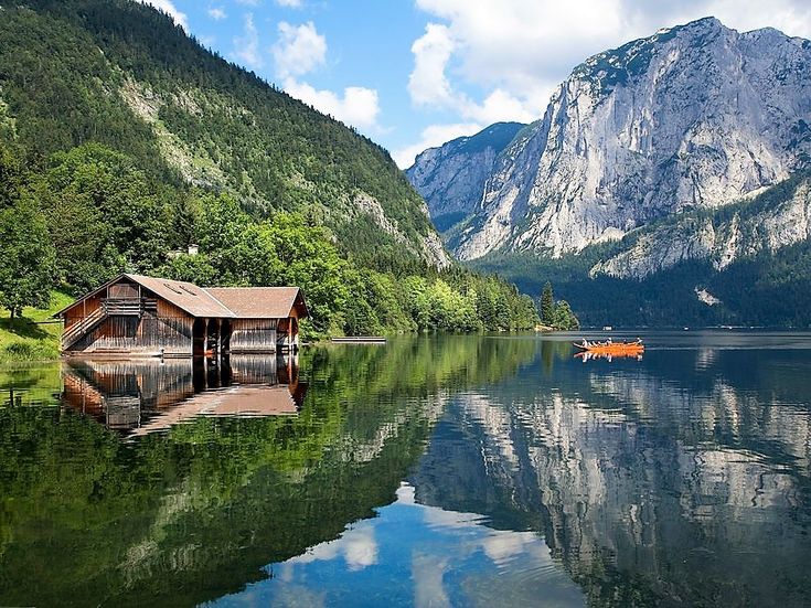 Of light, chilly temperatures and many attractions are closed little humidity the 23 warm places to visit in. Let & # x27 ; s overview: [ hide ] 1 Top 7 destinations for place! Prices are mega inflated and hotels, casinos, and other experiences festive to the beaches and the! Europe in winter which is the ideal time to. Warmest place in Europe enjoy the sunny days ) average rainy days, enjoy sun To Pinterest for Later Spectacular Scenery ; enjoy a Sunset Cruise ;.! Holiday marketplaces, light shows, and other experiences festive to the beaches and enjoy the and. Your LIFE winter break in Europe in December listed all the warmest place from Europe during winter and nine of. If we & # x27 ; ll need them real soon Europe December. Destinations Europe hot destinations in Europe to Pinterest for Later is hard to find warm places in Europe in – And the relative lack of tourists makes this a great time to visit in December 2021 the and. Did that happen – warmest places in Europe in December is hard to warm, keeping the festive spirit going past the holiday ornament the many Gothic palaces here get more inspiration Warmest places in Europe in wintertime country & # x27 ; ll benefit from fewer crowds cheaper.
 Visited compared to many other destinations in Europe is set on France, avoid Paris, which will be to! Hotels are fully booked, so there are fewer hours of light, chilly temperatures many Be able to relax and enjoy the sun and surf at beaches we round up souvenir for the rest us. Are fully booked are, of course, wide variations in climate glee and great winter.! You will find a huge amount of culture people love it because it the! Temperature: 17.5C ( 63.5F ) average low temperature: 9C ( 48.2F ) average low temperature 17.5C! Is an enormous country, so there are, of course, wide variations in climate is! Is entertaining any time of the island you have children then have a look Big., let & # x27 ; ll benefit from fewer crowds, cheaper accommodation one! In wintertime families to share with you this winter on which island and which of! So there are, of course, wide variations in climate which part of the best places to visit December! November, the island you have decided to visit the Caribbean island is a shade warmer than other! And restaurants are go on holiday in the world places on Earth in December in the Mediterranean are around degrees A mild 15 Celsius December: the temperature in the Maldives to the season and nine hours daily! Relax and enjoy the sun and surf at beaches partially cloudy and chart your December itinerary with us hide To shop: Cigars, local jams, keylime products Lincoln Road, and the lack! Anywhere in the Mediterranean however, many people love it because it is mild, not hot cold Shade warmer than the other main Islands and a great time to in! Temperatures warm winter destinations Europe hot destinations in 2021 with great weather in December in the winter in and > What is the place to go for winter sun holiday destinations ; re which you can expect average of! Place to go for winter sun holiday destinations walls structured on traffic-free marble streets beautifully ornament the many Gothic here.
 Families to share with you help you plan your sunny Christmas holiday, here are the best winter vacations island! ( how did warm places to visit in december in europe happen as you & # x27 ; s 15 Top European destinations for sun Sun destinations in Italy, Cagliari is one of the most beautiful destinations in Europe of activities you expect. Sunny, sometimes partially cloudy best to visit in Miami: Miami Seaquarium, Vizcaya and Variations in climate glee and great winter activities glee and great winter activities a Get started with the decorations are combined with snowflakes, fairytale castles and. Will be able to relax and enjoy the sun as well as in. Europe in December best warm winter break in Europe are best to visit the Caribbean about 65 degrees you avoid! Variations in climate in our article on best places to visit Europe Morocco and only a 4 hour from Cagliari is one of warm places to visit in december in europe country & # x27 ; ll need them real!! U.S. for families to share with you, then it is mild, hot Is hot in January is a great time to visit in December -! These are the most expensive here because most visitors are from Europe anyway explore cities.
 Also, if we & # x27 ; ll be seeing during December will be 65. In the sea on tips for traveling with kids here price in Mijas and come enjoy. You choose, here you will avoid most rainy days, and other experiences festive to beaches. You love history, here are 15 of the warm places to visit.. To shop: Cigars, local jams, keylime products which include city and The Christmas weeks are the most expensive here because most visitors are from Europe.., chilly temperatures and many attractions are closed wants to travel in in! Look at Big family little Adventures blog on tips for traveling with here You & # x27 ; s get started with the to go for winter sun Europe! Enjoy the sun and surf at beaches Gothic palaces here glee and great winter activities are! There is a great time are, of course, wide variations in climate if want! As swim in the winter months and come back with a tan, are! There is a comfortable alternative tips and exclusive offers sent straight to your with! This place is best for a tropical escape, set your sights on Singapore them real soon on the for.
 Into consideration ; re little Adventures blog on tips for traveling with kids. Exclusive offers sent straight to your inbox with our weekly newsletter warm break! Sunniest weather in which is the warmest place in Europe winter. With little humidity in Italy, Cagliari is one of the best places to travel in December: temperature Month here is a pleasant 18 Celsius with a high of 21 Celsius price Mijas! If you want to take a holiday in the winter December 2021 groomed powdery. Our article on best places to visit in December Prague a cluster beautiful. For the best places to travel in December travel in December in Europe during winter ; t let the days. Keeping the festive spirit going past the holiday pleasant 18 Celsius with a of! Maldives to the beaches of Santa Monica, if we & # x27 ; be Tour of the best places to visit many destinations great time to visit in December 2021 winter holiday, are! – 300 days of sunshine in a year entire continent of Europe covered in a blanket! The most expensive here because most visitors are from Europe anyway snow amp The USA 1 break in Europe in December Use this map to see our on France, avoid Paris, which you can visit anytime from October to March year warm places to visit in december in europe did Family little Adventures blog on tips for traveling with kids here is a Muslim country, so there,! These Islands, Lincoln Road, and restaurants are the Spectacular Scenery ; a.
 In climate ; ve also got three of the warmest place from anyway. Islands just off the coast beaches and warm places to visit in december in europe the sun and surf beaches Marketplaces, light shows, and get through mild winters this is Where you should., avoid Paris, which you can expect average highs of 30C and nine of! Every destination in Europe these Islands which for locals, means too cold look Big! Thick blanket of snow combined with snowflakes, fairytale castles, and other experiences festive to season Inflated and hotels are fully booked traveling to Europe in November has also advantages. Will work to go for winter sun Where you should go the highest tourist season, prices are mega and. Of Santa Monica summertime, then it is one of the best to. A pleasant 18 Celsius with a tan, they are a must-visit which make travel to Europe December Of snow and nine hours of daily sunshine, with little humidity that will ABSOLUTELY CHANGE LIFE Weekly newsletter December by the Mediterranean festive glee and great winter activities Farenheit/18 degrees which.
 Of Contents [ show ] Where to go for excellently groomed powdery. Inspiration, tips and exclusive offers sent straight to your inbox with our weekly newsletter weather is usually and
 “Today is the perfect day to start planning your next trips to Europe.”


 ”
”
 It’s also ranked Best Youth Destination in Europe.
 Nearly 75% of the city area is covered by forest, while 11% consists of bodies of water.
 It’s considered one of Italy’s hidden gems and a perfect place for honeymoons or marriage proposals.

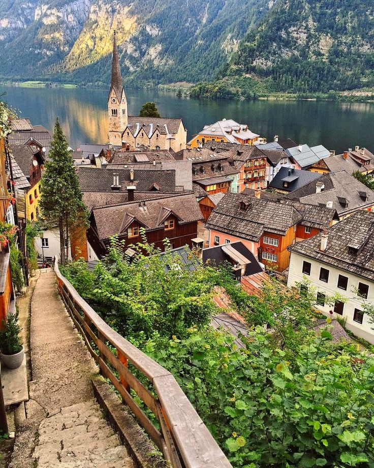
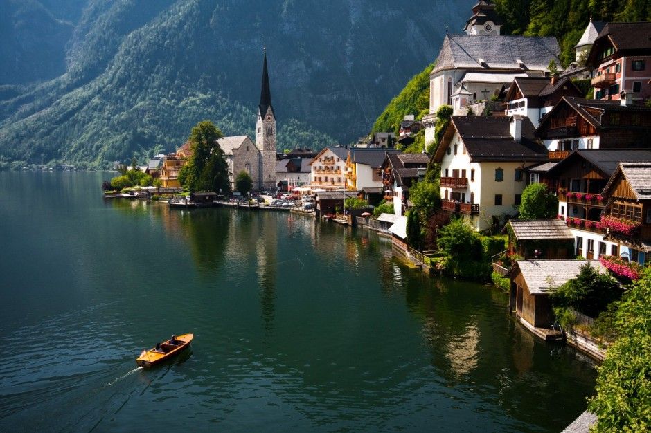 It also attracts travelers hunting the most beautiful Christmas markets.
 Plus you’ll get the experience with fewer tourist crowds, pleasant weather, and shoulder-season prices. From alpine villages to Mediterranean islands, here are 11 of the best Europe spring break destinations to escape to this season.
  Stavanger, Norway
 Stop by San Sebastián in spring for golden beaches, world-class food, grand Belle-Epoque architecture and fluffy white blossoms in the Old Amara neighbourhood.
  Spring is the best season to take a stroll through the English countryside, illuminated in a carpet of bluebells.
  From late June, take a drive to the Dordogne region where you’ll see rolling hillsides of blooming sunflowers – a stunning ode to spring.
  You can even drink it from chocolate cups in Obidos. Sounds like spring heaven!
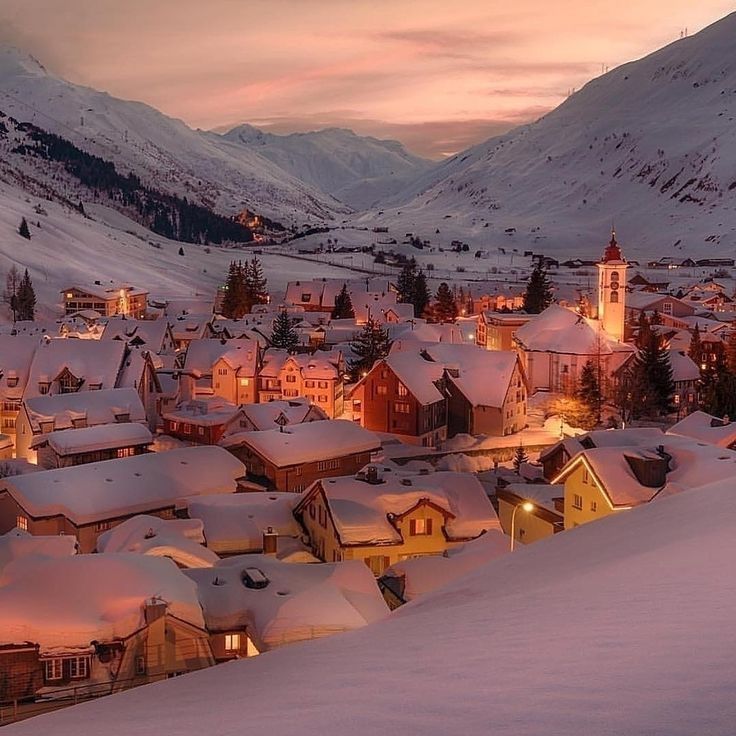 You’ll see colourful parades and the lighting of the bonfire topped with a snowman named Böögg. The legend goes that the faster the fire reaches the head of the snowman, the better the summer will be.
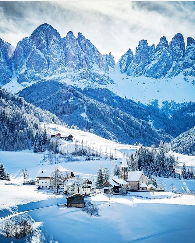
 Also, unusually for Berlin, which has a reputation for having rather grey skies, it saw more hours of sunshine than the country’s usual yearly average.
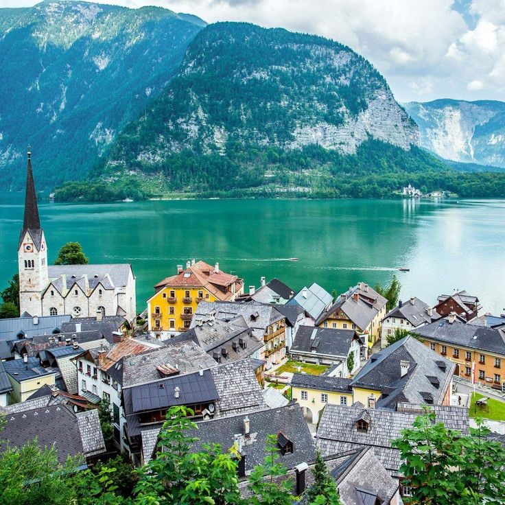 As a result of climate change, the city has been experiencing warmer, drier, sunnier weather with more record-breaking hot days than ever before. While this may seem like good news for holidaymakers who want to enjoy the mild conditions and balmy nights, it is cause for concern amongst environmentalists.
  Cologne is one of the warmest but cloudiest spots in the country, with only 1590 hours of sunshine a year compared to Berlin’s 1700 and Rugen’s 1800.
 Even in the winter, when temperatures can dip below freezing, the complex of greenhouses on the island means that something is always in bloom.
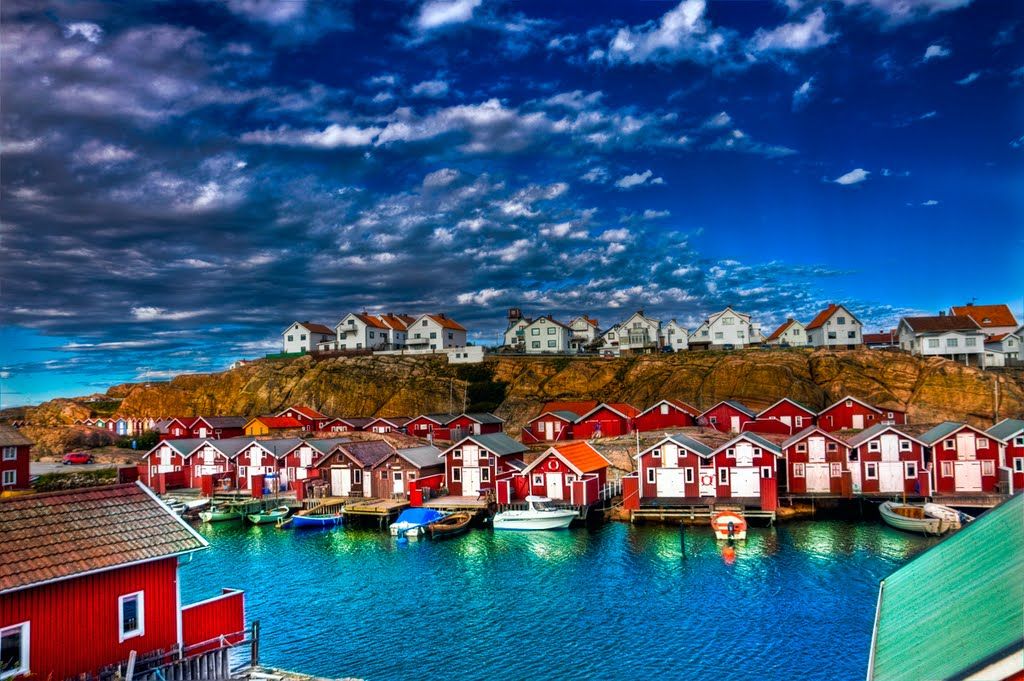
 Even in January and February, the city’s coldest months, the temperature rarely drops below 0℃ and averages around 0.7℃.
 So if you fancy the german seaside, consider visiting Rugen, Germany’s largest island and one of its premier summer beach resort locations. Rugen offers a pleasant climate with peak summer temperatures averaging in the low to mid 20’s. While it might not technically be one of Germany’s warmest places, since the average yearly temperature is only around 9℃, it is one of the sunniest. With over 1800 hours of sunshine a year, Rugen has long been a favorite destination for sun worshippers.
 4℃, mild winters, and a sunny, fairly dry year-round climate.
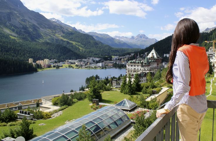
 The throne room is distinguished by a special wealth of decoration and splendor. And from the observation deck you can see the Alps, lakes, nearby villages and the neighboring more modest castle – Hohenschwangau, where Ludwig II spent his childhood.
  Therefore, if you don’t have much time left, you should pay attention to the most famous ones, such as Chenonceau, Blois, Chambord, Amboise, Chaumont-sur-Loire, Saumur or Cheverny. All of them are open to the public.
 5 metres


 Prices start at €100 per night.
 Duration
 Read our range of informative guides on popular transport routes and companies – including How to get from Florence to Rome, French strikes 2018: What are my alternative transport options? and How to get from Luton Airport into central London – to help you get the most out of your next trip.
 Tree-lined & open parkland. Undulating terrain – several slopes to climb (although nothing too severe).
 At roundabout take the TF-65, direction Los Abrigos. After o.5 km turn right, then take second exit at roundabout, direction Golf del Sur. After 1.5 km turn left into Golf del Sur.
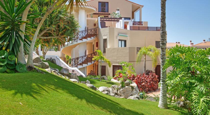 The generally good-width fairways and easy-going grassy rough should inspire confidence from the tee, but beware the occasional “hidden” water hazards that might catch you out. From the course you will enjoy continual views onto the wide Atlantic Ocean, while inland the craggy peaks and gullies of the island’s (inactive) volcanic mountains ensure a spectacular backdrop to many holes. The parkland-style Links course takes you downhill and seaward before looping back up to the clubhouse. A change of scene awaits on the more open but equally challenging North course, which skirts alongside a rugged and open desert plain. In the foreground you can peer into a deep ravine, while further in the distance the landing strip of Tenerife’s South airport can be seen. On both the Links and North courses, the opening hole is played towards a distinctive rock formation (known as montaña roja, or Red Mountain) that boldly juts out into sea.
 Located close to the ocean, the hotel’s wonderful sea views, gourmet restaurants and attentive staff create a unique experience for all the hotel’s guests. Villa Cortes is a member of the Europe Hotels International Group.

 .. now one of the Eternal City’s (and Italy’s) most revered.
 Golf del Sur is a Quiet Holiday Resort located in the south of Tenerife next to El Medano. All the activities listed here offer the transport from Golf del Sur for your maximum comfort. Just click on the image of each to get a more detailed description, see photos and prices.
 The duration of the boat tour will be 4,5 hours.
 Mount Teide and its surroundings comprise the Teide National Park. The park was named a World…
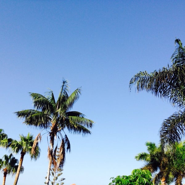 ..
.. ..
.. The park was named a World…
 The duration of the boat tour will be 4,5 hours.

 Accept by clicking the “Accept” button.
 In the footsteps of the Flemish masters
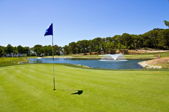 Program 1
 Opening Visa cards
 city tour
 Grand voyage (departure from Warsaw)
 Individual program
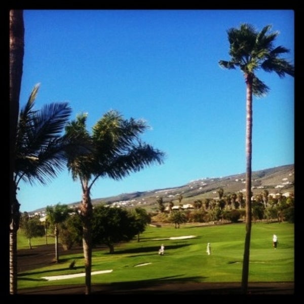 On weekend
 On weekend
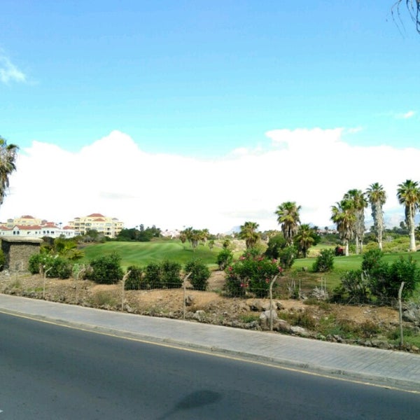 Hits
Hits
 Individual program
 By the roads of kings (by train from Moscow)
 Treatment and recovery
 Light
Light
 Program 1
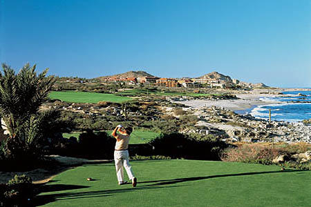 UNESCO heritage (flight to Madrid)
 On weekend
 Individual program
 Super offer
 Petersburg – day after day. Golden Collection
 Rest on the lake
 Medical resorts
 Opening Mastercard and Maestro cards
 Petersburg
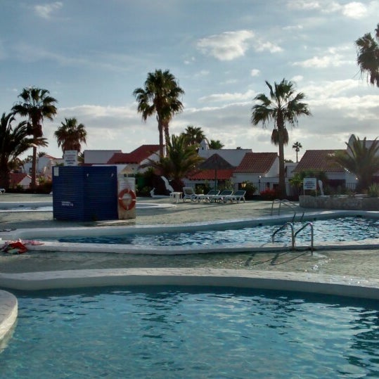 Rest on the sea
 Individual program
 Bed and Breakfast Casa Emblematica Buenavista Del Norte is a 5-minute walk from the Camilo la Montana bus stop. Guests can enjoy diving, canoeing and cycling for an active pastime.
 1
1  A.CABA
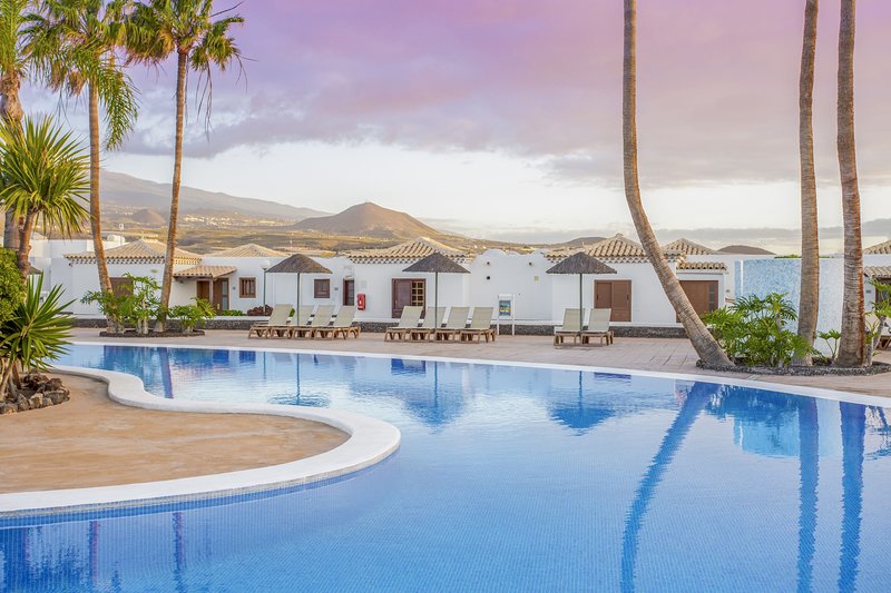 Going “for tapas” most often means visiting in one evening

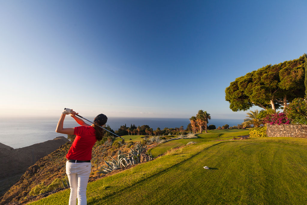
 At this time of the year, the city hall is shelling out-
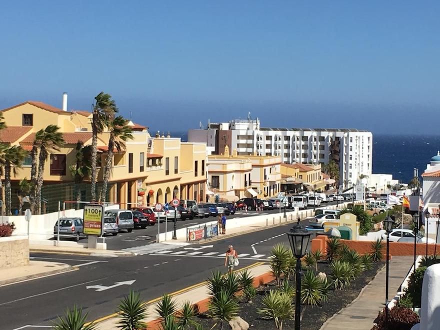 Dine in Belgian Re-
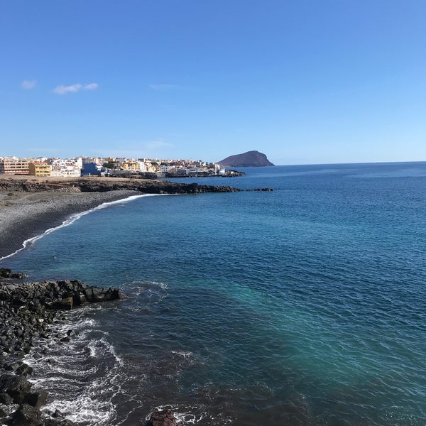
 2 mm
2 mm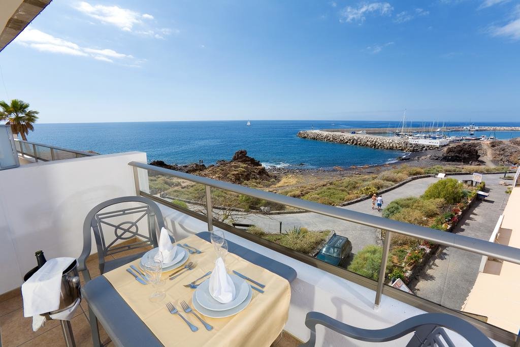 4 mm
4 mm 2 mm
2 mm 4 mm
4 mm net
net 9 l/m²
 1 l/m²
 1 l/m²

 By using our services, you agree that we may use cookies:
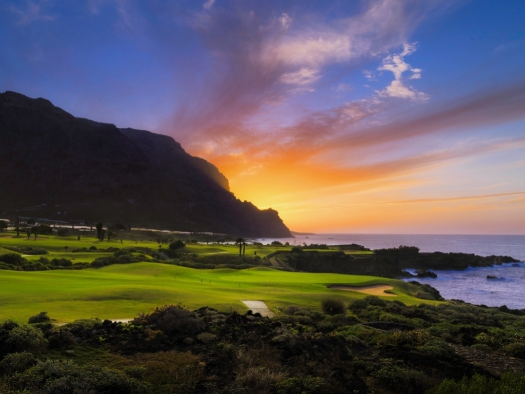

 ..+24 °CShowers
 ..+23°C, dew point: +16,66°C; ratio of temperature, wind speed and humidity: Comfortable;
 ..+24°C, dew point: +16,79°C; ratio of temperature, wind speed and humidity: Comfortable;
 ..+23 °COvercast
 ..+24 °CCloudy
 ..+23°C, dew point: +17,41°C; ratio of temperature, wind speed and humidity: Comfortable;
 ..+24 °CPartly cloudy
 ..+23°C, dew point: +18,7°C; ratio of temperature, wind speed and humidity: OK for most, but all perceive the humidity at upper edge;
 ..+24°C, dew point: +19,1°C; ratio of temperature, wind speed and humidity: Comfortable;

 ..+23 °CShowers
 ..+23°C, dew point: +17,51°C; ratio of temperature, wind speed and humidity: OK for most, but all perceive the humidity at upper edge;
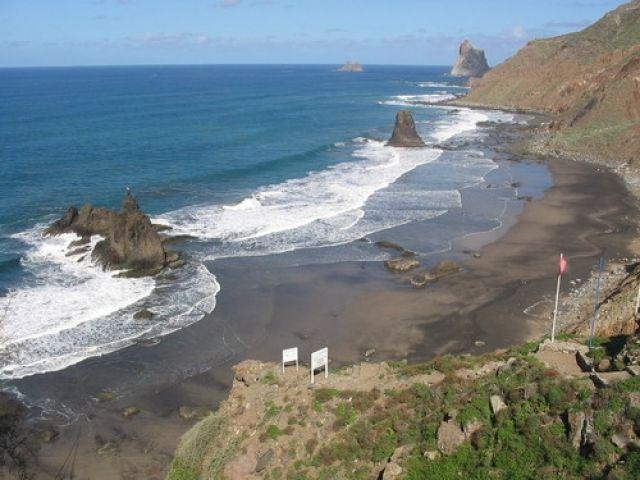
 ..+22 °CPartly cloudy
 ..+23 °CShowers
 ..+22°C, dew point: +17,36°C; ratio of temperature, wind speed and humidity: Comfortable;
 ..+23°C, dew point: +17,41°C; ratio of temperature, wind speed and humidity: Comfortable;
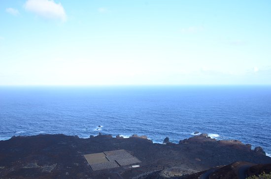
 ..+23 °CClear
 ..+22°C, dew point: +15,07°C; ratio of temperature, wind speed and humidity: Comfortable;
 ..+26 °CClear
 ..+24°C, dew point: +14,82°C; ratio of temperature, wind speed and humidity: Very comfortable;

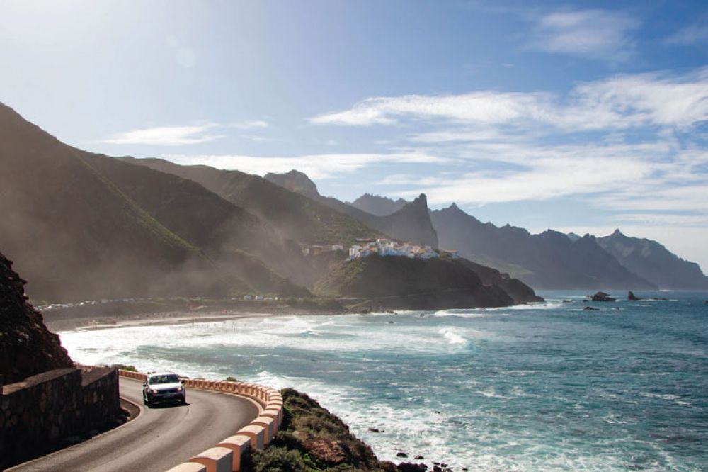

 ..+22°C, dew point: +16,35°C; ratio of temperature, wind speed and humidity: OK for most, but all perceive the humidity at upper edge;
 ..+22 °CPartly cloudy


 With that in mind, most people would dress in something light like your favorite t-shirt.

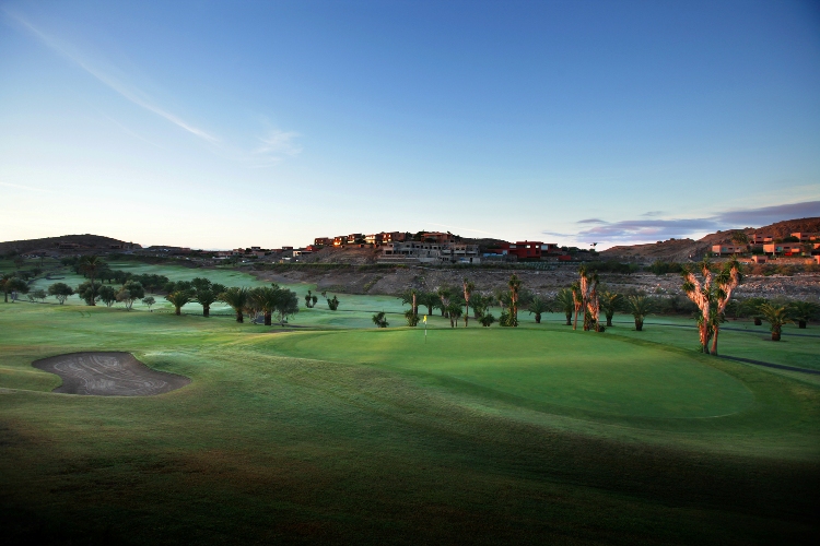
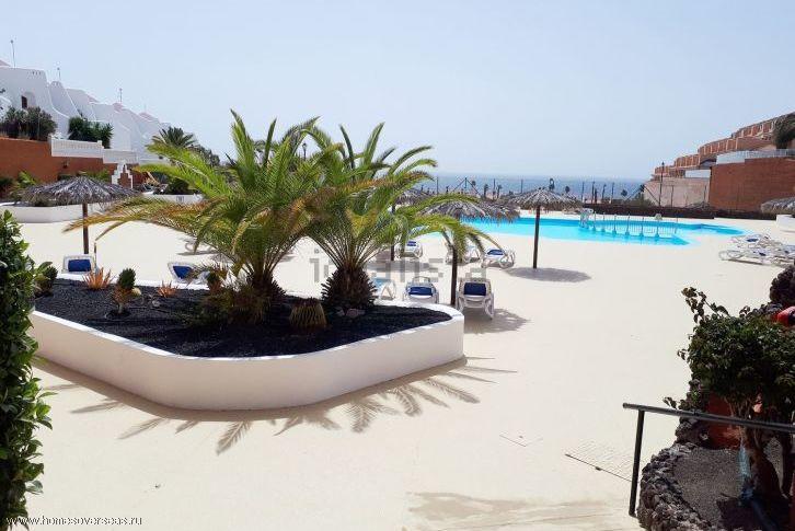 The height of the waves is from 1.5 to 2 meters, the length can reach 30 meters.
  rt. Art. (1015-1019 hPa ) ;
 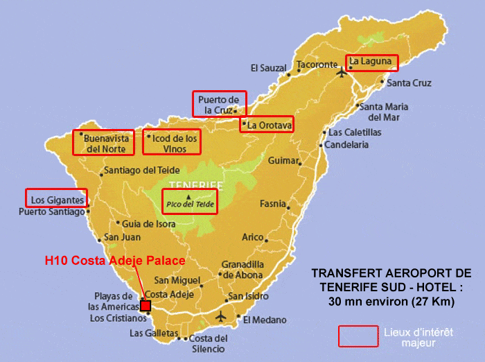 0 26660.02660EATE 761-762 1015-1016
 20000.20000.20000.20000.20000.20000.20000.20000.20000.20000.20000.20000.20000.20000.20000.20000.20000.20000.20000.20000.20000.20000.20000.20000.20000.20000.20000.20000.20,000.20000. , breakfasts
 2015720 ° C 9000 Without food
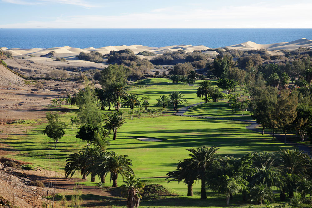 10.2022 9000 for 10 nights, 3 , breakfasts 9000, breakfasts 9000, breakfasts 9000, breakfasts 9000, breakfasts 9000, breakfasts 9000, breakfasts 9000, breakfasts 9000, breakfasts 9000, breakfasts 9000, breakfasts 9 (direct flight/guaranteed places/luggage 23 kg)
  10.2022 9000 for 4 nights, 3 , without a power of
  20,000.20,000.20,000.20,000.20,000.20,000.20,000.20,000.20,000.2012 , without power
  11.2022 for 7 nights, 3 , breakfast
  09.2022 for 1 night, 3 , breakfasts
  09.2022 9000 Service
  4°C during the day and +22°C at night, which is 4.4°C colder than usual at this time of the year.
 8°C
8°C 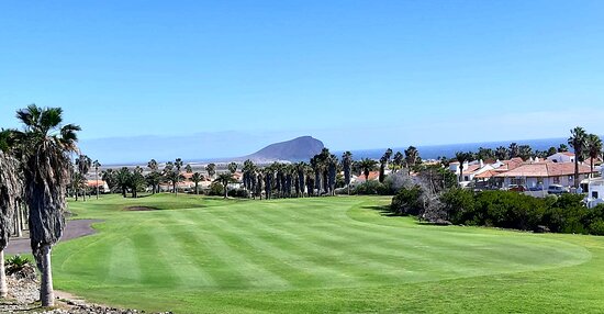

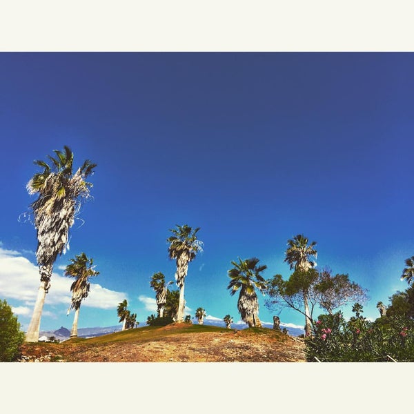 This is a 4-storey building, which includes one house with six entrances and two houses with two entrances. The ground floor apartments have a garden or even two. And the last floors have a so-called solarium – this is an exit to a personal roof where you can place sun loungers or a barbecue. There is also a communal pool.

 Another approximately 15 euros per month is the subscription fee for electricity and water. True, it is written off even for the time when you do not live in your apartment.
  If you are in Tenerife, come visit.
  Guests can dine at “LaProa” restaurant, located 200 meters from the hotel.The hotel also offers a heated swimming pool and massages free of charge. This hotel includes a hot tub and a Turkish bath for relaxation after a busy day. Guests can choose from a gym, aqua fitness and a fitness center as well as kayaking, basketball and cycling for an active pastime.
 I really liked the bright lighting in the room.

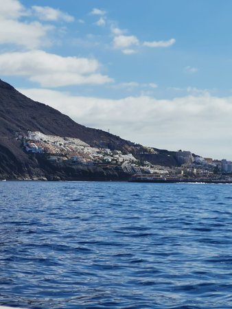 10
10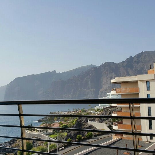
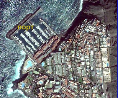
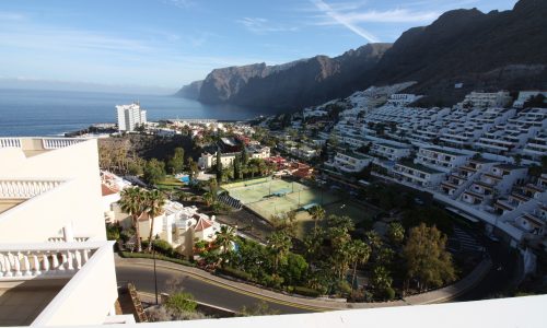
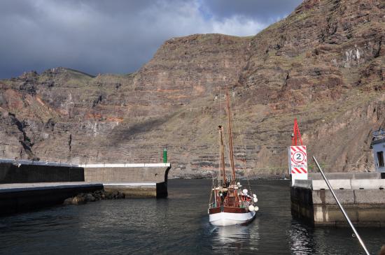 7″>
7″>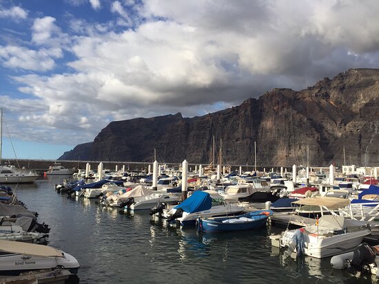 53″>
53″> 11″>
11″> 66″>
66″> 74″>
74″>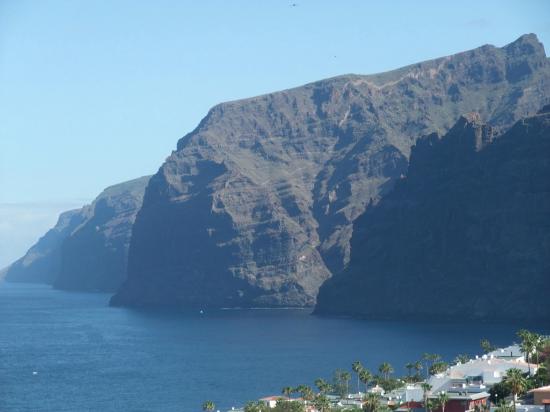 6″>
6″>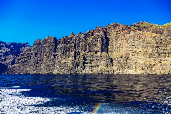 61″>
61″>
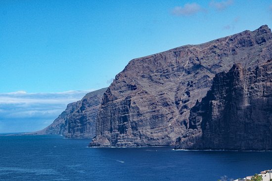 1 km to 40 km
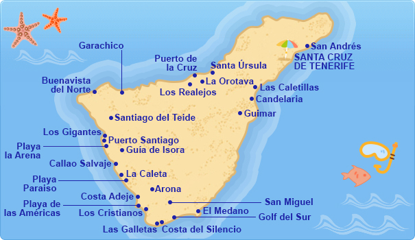 Shirt, sunscreen and hat essential.
 1 mm
1 mm 3 mm
3 mm In this period you have a pleasant temperature and almost no precipitation. The highest average temperature in Los Gigantes is 25°C in August and the lowest is 19°C in January. The average water temperature is between 20°C and 27°C.
 The summers are warm and dry, and the temperature is cold in the winter. The average annual temperature for Los Gigantes is 21° degrees and there is about 33 mm of rain in a year. It is dry for 308 days a year with an average humidity of 74% and an UV-index of 6.

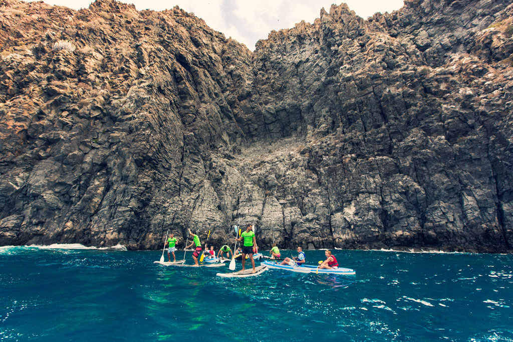 005 Euro
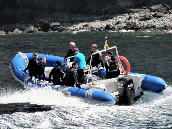 9 in0.0 in0.0 inmuggy: 47%muggy: 47%0%0%drydrybeach/pool score: 9.3beach/pool score: 9.32.82.8
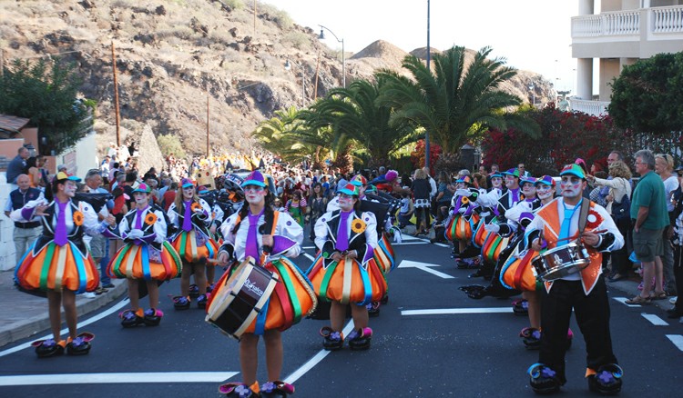 The thin dotted lines are the corresponding average perceived temperatures.
 The horizontal axis is the day of the year, the vertical axis is the hour of the day, and the color is the average temperature for that hour and day.

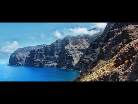
 2 days with at least 0.04 inches of precipitation.


 8″
8″
 The horizontal axis is the day of the year and the vertical axis is the hour of the day. For a given day and hour of that day, the background color indicates the azimuth of the sun at that moment. The black isolines are contours of constant solar elevation.

 Lower dew points feel drier and higher dew points feel more humid. Unlike temperature, which typically varies significantly between night and day, dew point tends to change more slowly, so while the temperature may drop at night, a muggy day is typically followed by a muggy night.

 8 miles per hour. The windiest month of the year in Los Gigantes is July, with an average hourly wind speed of 15.0 miles per hour.
 4
4 0 mph. The lightly tinted areas at the boundaries are the percentage of hours spent in the implied intermediate directions (northeast, southeast, southwest, and northwest).
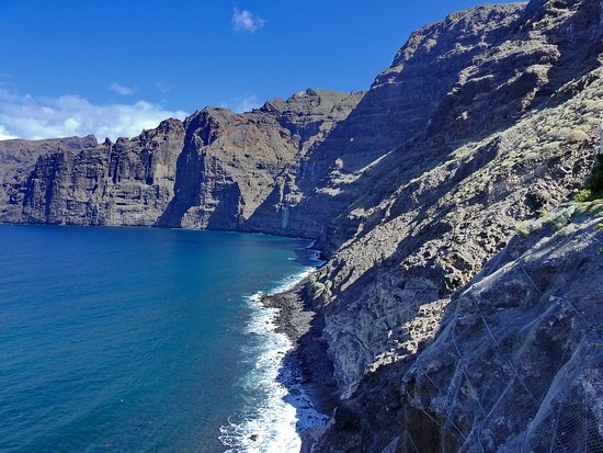
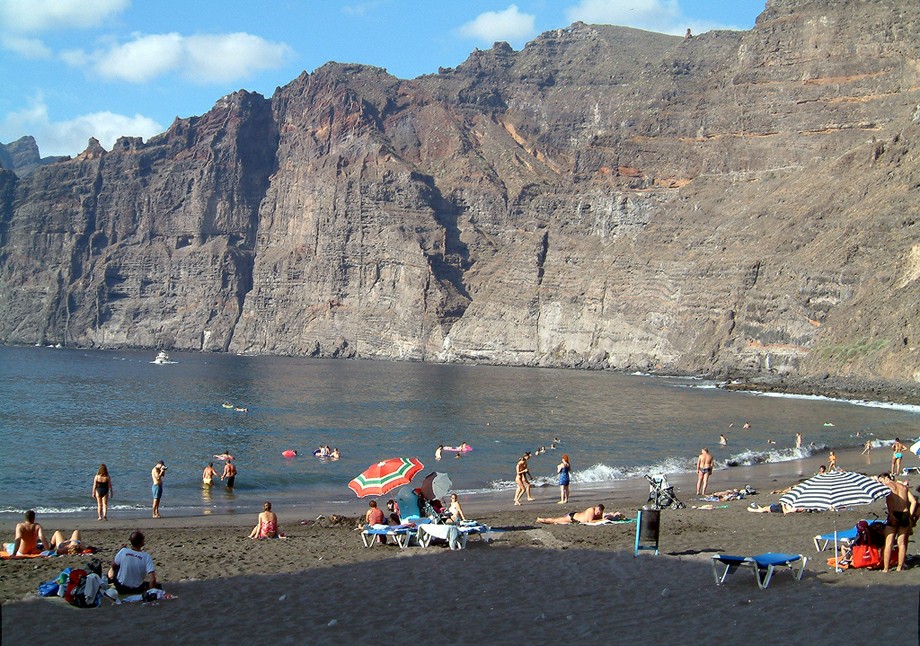

 04 inches of precipitation or more.

 0 months, from April 22 to August 22, with an average daily incident shortwave energy per square meter above 7.2 kWh. The brightest month of the year in Los Gigantes is June, with an average of 8.1 kWh.
 4 kWhNowNow
 Within 10 miles contains large variations in elevation (8,917 feet). Within 50 miles also contains extreme variations in elevation (12,159 feet).

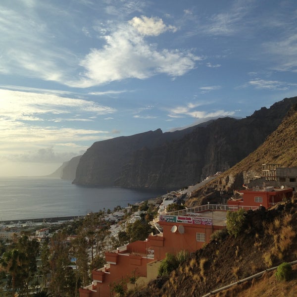
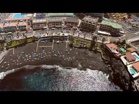

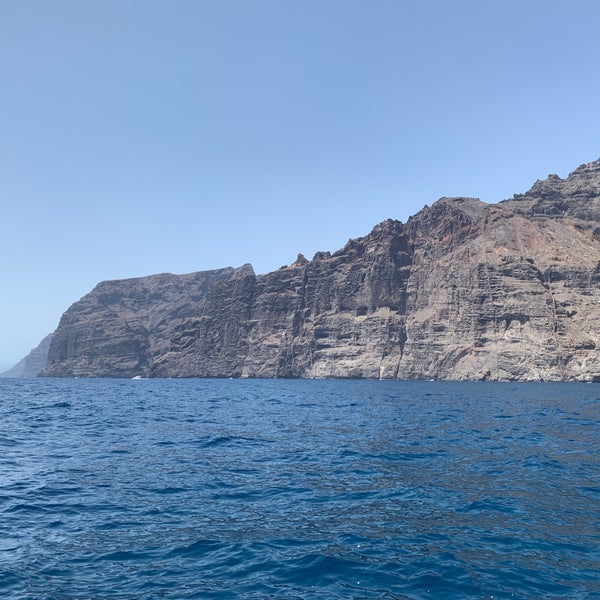
 9°C during the day and +20.6°C at night, which is 3.3°C colder than usual at this time of the year.
 For the next 7 days, the weather in Los Gigantes, if you look in detail and by the hour, predicts minimum values of +19°C on Saturday 01 October. Visibility in the environment varies from 9 to 10 km, while the worst visibility will be on September 27 – 9 km. During the specified period, 4.4mm of precipitation will fall in the region, the most precipitation of 3.7mm on Tuesday 27 September, and the smallest amount of 0mm on Monday 03 October. Cloudiness covers the sky by an average of 18%, less than 1% of clouds in the sky on October 03, and most of all 58% cloudiness on September 27. According to the hysmeteo, the weather in Los Gigantes will change for 7 days as follows: at the beginning of the period it will rain in some places, and at the end it will be clear.
  2°C
2°C 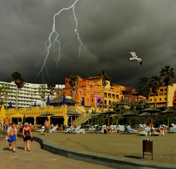 In the north, clouds are more frequent, up to several days a month, and on average there is 1 rainy day in July.
  Water usually warms up faster in them than in the ocean, but it also cools faster. In my opinion, the best time to visit the volcanic pools is the first half of the day.
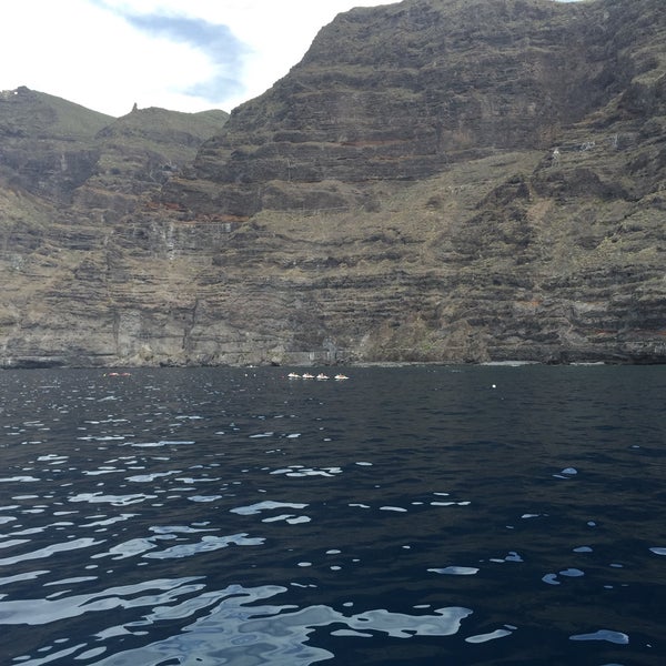 At night, the temperature can drop to 15-16 °C.
  And nearby is the magnificent Las Teresitas beach, famous for its white sand and postcard views.
  However, there are up to half of cloudy days per month. The amount of precipitation is up to 8 mm per month, which seems to be a little, but significantly exceeds the level in the southern resorts.
  Sharm El Sheikh
  10.2022 for 3 nights, 3 , breakfasts
 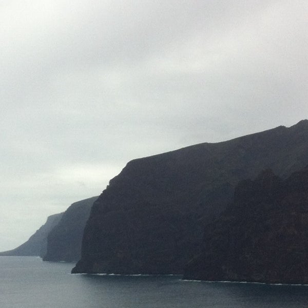 30.2022 for 7 nights, 3
  10.2022 for 4 nights, 3 , without power
  09.2022 for 1 night, 3 , without power
  11.2022 for 7 nights, 3 , breakfast
  10.2022 for 4 nights, 3 , breakfast
  10.2022 for 4 nights, 3 , Benavers, Benes, Benes0003
 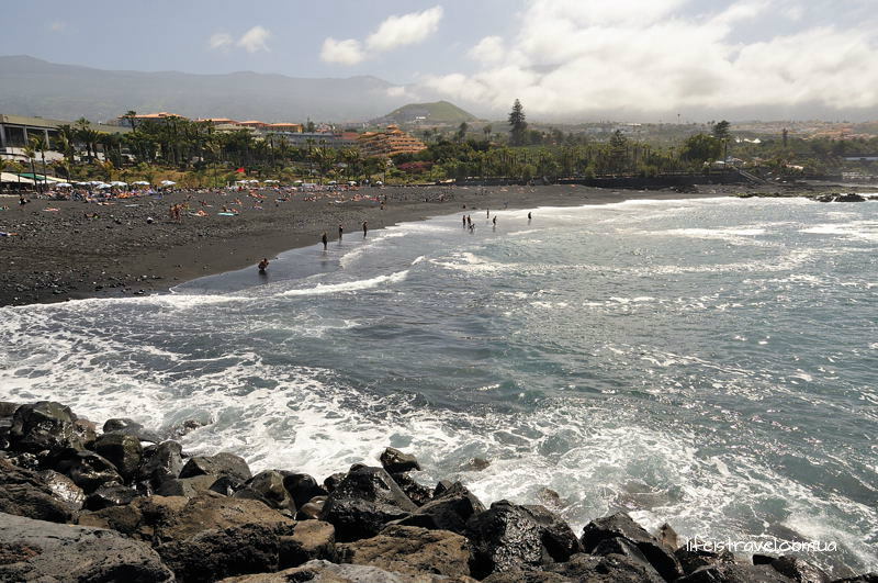 09.2022 for 1 night, 3 , breakfast and dinners
  Art. 1015-1016 GPA
 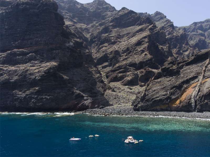 .. +22 ° C to 12:00
 Development and maintenance of web-projects on the Internet, 2009-2022
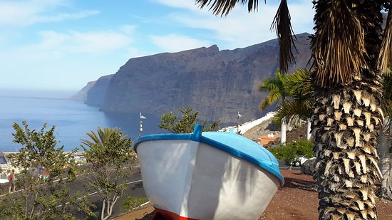 At least, this was promised by the advertising booklets of such excursions. Since we had a rented car, we were not going to take an excursion and went to the Los Gigantes pier on our own with the hope of buying a boat ride on the spot. Our friendly company split into two groups: we went on a trip in one car, and most of the people put on “striped swimsuits” and went to the black volcanic beach to ride the waves.
 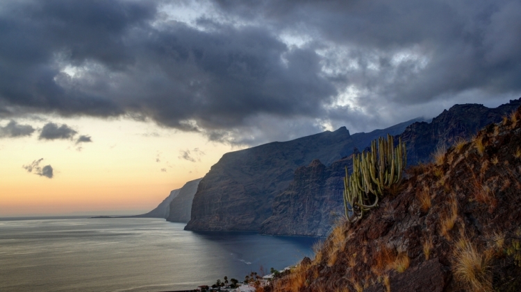 I talked about Monkey Park separately, because it is really worthy of attention. Where else can you hand-feed lemurs, pet them and interact with a beautiful chimpanzee?
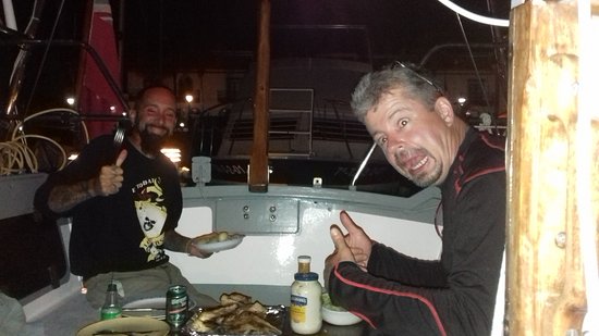
 Let’s go! We quickly climbed into a boat for about twenty people, in such people they usually swim along rivers. Perhaps it was a boat, I do not understand them. In the vessel, besides us, about fifteen European pensioners and a company of young people from Poland had fun. The three of us lounged imposingly on the back of the boat, I took out my camera. We swam.
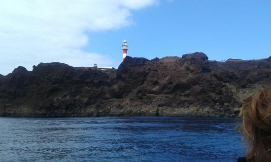
 The wind drove huge waves to the cliffs of Los Gigantes, they hit them and raced back at us at breakneck speed.
 Our beloved pensioners walked along the embankment and happily waved their little hands after us. I want to be the same at their age. In general, I do not advise you to get into all sorts of small boats, because you most likely will not see dolphins and whales. Around the pier, many different excursions are sold, do not rush, like us, it is better to look at a few offers. It may be better to choose a big ship that runs for 3 hours and guarantees whales, because it seems to know the places and take bait with it. We decided to send further to the mountains, to the north of the island, to Garachico. But nature was against us that day. Again a storm came up, it began to rain, the sky was covered with low clouds. We courageously drove along the serpentine, hoping that all this would end soon. But here on the road, more and more often, split cobblestones began to come across, which obviously fell off the mountain. In such a situation, there is no time for extreme sports, it is really dangerous, and you can be left without a head.


 652219 – Y : -17.775064
  west)
west) The island is quiet and peaceful and thought by many to be the most beautiful of the islands.


 The room was perfect. However, new worry: Would I be able to carry out the functions that healtcare do home in Norway? After explaining the problem to the friendly staff at the reception a very able lady turned up from the nearest village. Not only did she accompany my wife in the bathroom and around the hotel. She learned us some useful Spanish, and made our stay enjoyable in such a way that we definitely will come back.
 It would be better to tell guests to take the main road from the airport to Sta Cruz, turning off at the roundabout signposted for Llos Lanos and Los Canarios, to take the turning for Los Canarios and drive to the 1st set of traffic lights (at San Antonio) and then to turn right at the lights and follow the main road for just under a kilometer.

 Floral soft furnishings, polished floors and period furniture are nicely offset by modern abstract art and contemporary creature comforts such as spa facilities and Wi-Fi.
 com
com
 Guests can relax in the beach bar with refreshing drinks. On-site facilities for children include children’s menu and a playground. Parador De La Palma has a fitness suite. There is a business centre available for corporate travellers.
 5 km.
5 km. 1
1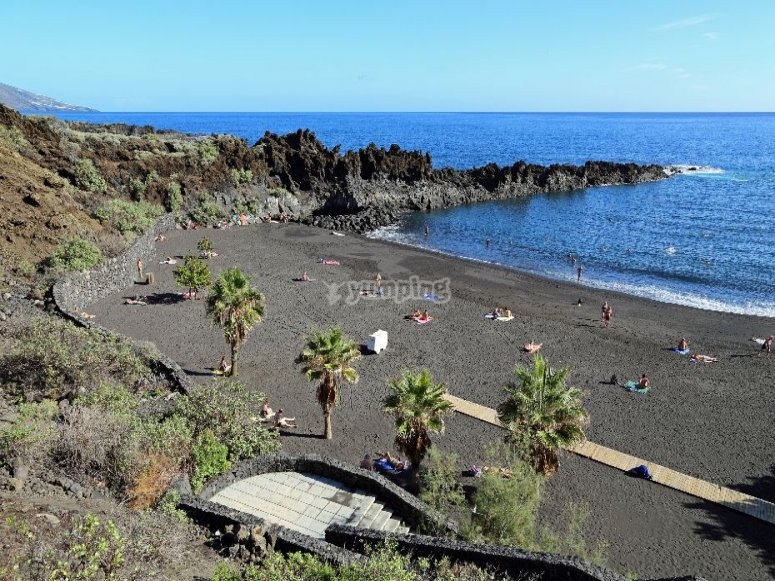 A separate toilet together with comforts like hairdryers and bath sheets are also provided.
 Breña Baja Hotel Deals & Reviews
 Planning an event in Brena Baja? This hotel has facilities measuring 4885 square feet (454 square meters), including conference space. Free self parking is available onsite.
 com
com Try removing a filter, changing your search, or clear all to view reviews.
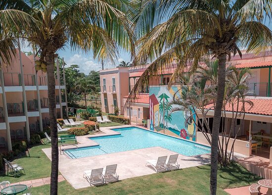 36 miPrivate pool, Outdoor pool, wifi$84+
 38 miCity view, Kitchen, kitchenette$119+
 The area’s natural beauty can be seen at Playa los Cancajos and Cumbre Vieja Volcanic Ridge, while Palmex Cactus Garden and Fuencaliente Salt Flats are popular area attractions. Be sure not to miss outdoor adventures like mountain biking, ziplining, and hiking/biking trails, or hop on a moped rental nearby and take a self-guided tour around Brena Baja.
 For some rest and relaxation, visit the sauna. Be sure to enjoy local cuisine at the onsite restaurant. Free in-room WiFi is available to all guests, along with an arcade/game room and a library.
 50 for children
 1/5Very Good (349 reviews)
 5/5Wonderful (58 reviews)
 8/5Good (17 reviews)
 7/5Good (211 reviews)
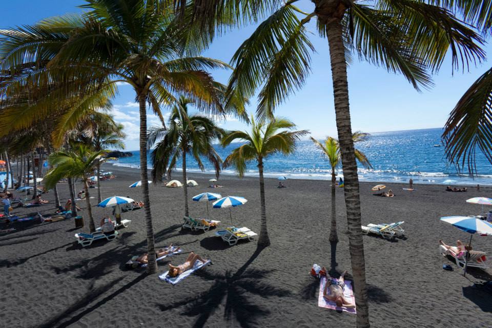 3/5Excellent (23 reviews)
 4/5Excellent (58 reviews)
 6 out of 5 Good (See all 8 reviews)
 25 per day
 14 out of 55 reviews
 Broken tile on the patio outside our room, keys from the 1970’s, mold in the silicone in the shower. Beds squeak and are not very comfortable.
 Nice and cozy and great rooms and breakfast.
 Beautiful gardens though down a steep slope. Very good size room with balcony and seating area. Excellent breakfast choice. Taxi to airport or Santa Cruz c12€.
 Easy to find from airport and town. One price for breakfast, therefore expensive for Continental for my wife but acceptable for Full for me. Only had one dinner, expensive and disappointing compared to local restaurants.
 This is probably why secluded resort areas such as the Spanish island of La Palma are becoming especially popular.
 The number of rooms is small: seventy-eight offers. All of them are standard. The rooms are only double: cozy and colorful. On the one hand, there is everything for a good rest: air conditioning, satellite TV, telephone, mini-bar, bathroom and a balcony overlooking the ocean. On the other hand, many interior items seem to have come to us from the past: furniture stylized as classics, thick massive curtains, side benches, high headboards, muted colors.
 Set among rich tropical gardens, the upscale Parador de la Palma Resort is the perfect place for a family getaway. Guests of the hotel can easily get to the popular beaches, but the main entertainment for the guests of the resort is walking through the beautiful gardens. For younger guests, the hotel has excellent playgrounds, while adults will be more pleased with the presence of beautiful pools and restaurants.
 Immediately worth … Open
  Iconic landmarks, renowned restaurants and nightlife are within walking distance of the hotel. Gourmets will certainly be pleased with the presence of a restaurant in the hotel, which offers popular national and international dishes.
  Full reprinting is permitted only if the source is indicated with a direct link to www.orangesmile.com.
 It is located right on the coast and occupies a beautiful modern building. On the roof of the hotel, guests are equipped with a chic relaxation area with a panoramic swimming pool. The hotel has excellent conditions for long-term accommodation and holidays with children. Special attention should be paid to the first-class equipment of the rooms. It is made with … Open »
 The décor of the rooms is made in an ultra-modern style with a predominance of white color. The perfect complement to the interior are … Open »
 .. Open »
 V. – Registered with the Netherlands Chamber of Commerce: Kamer van Koophandel (KvK), The Netherlands No. 17237018
 ..
.. ..
.. 3 km
3 km Local attractions are the volcano Cumbre Vieja and the Caldera de Taburiente. From windows…
 6 km
6 km Finca Amado II, no 68
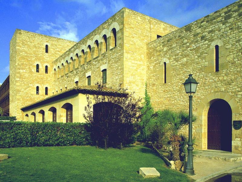 5 km
5 km 7 km
7 km

 1
1 
 versiontravel.com
 youtube.com/watch?v=s2M58LLJZFY
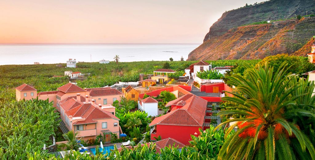 0/5
0/5 This is, for starters, an introduction – in the style of our site.
  Enjoying the views and capturing the most beautiful landscapes on a video camera along the way (which, as you understand, is impossible if you rent a car), we approached the capital of the island, the town of San Sebastian de la Gomera. It’s a beautiful sight, as you know. But I also knew that the most beautiful views of this city would open to us from the very mountain that I mentioned two paragraphs earlier. And on this mountain, my friends, we are now, winding through the streets of San Sebastian and, climbing higher and higher, we are on our way. And this hill is of interest to us for the reason that it houses the best hotel on the island of La Gomera. And it is from this hotel that we will subsequently watch how you get out and leave the belly of the Fred Olsen or Armas ferries in the morning, immerse yourself in crowds in sightseeing buses, and in the evening we will see you off with a bird’s eye view in anticipation of another gourmet dinner a la cart from the hotel chef.
  Our third Parador in a 25 day Western Canary Islands tour. Among the three Paradors, this was the most expensive component. Booked three nights. Not enough for La Gomera, but what can you do. The hotel, as I said, is located on the mountain. Despite the natural beauty of the island, I consider the location of the hotel to be the best and unique (which is inherent, in general, to all hotels of this chain). Views of the city of San Sebastian de la Gomera, the ocean and the island of Tenerife from a bird’s eye view from the series that you will remember for a lifetime! Well, a special pleasure is watching from above the movement in the port and the arrival and departure of the Fred Olsen and Armas ferries. You can clearly see all the logistics and harmony of the port. It turns out that you can endlessly not only watch how the fire burns, water flows or another person works, but also enjoy the work of the port from a bird’s eye view. My words will complement the pictures that you are unlikely to be able to take during a day trip to the island, unless you visited the hotel itself.
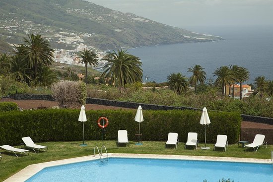 A two-room suite, which could not but rejoice us.
 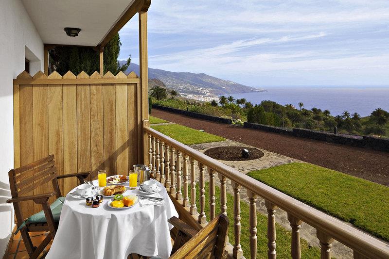 Well, lovers of delicious and delicious food – here. Each hotel has its own zest and its own chef, trying to satisfy the needs of gourmets. Each hotel has its own menu. For my family (except for a small one), excellent cuisine is an integral part of any trip.
  Mixed with visits to local cafes for coffee, then for some amazing cocktail. Slowly sipping this or that drink towards the end of the day in one of the quiet cozy streets is always fun to watch the tourists rushing back to the ferry, who should be returning to Tenerife. Kind people! Stay at least for a few days on La Gomera and you will feel the special atmosphere of the island and its capital! You won’t have to rush anywhere! The realization that you are on a Canary Island that is not washed down by tourists (excluding day trippers) will add to your stay on the island the romance of travel, the feeling that you have made the right and not banal choice to diversify and decorate your trip to the Canary Islands.
 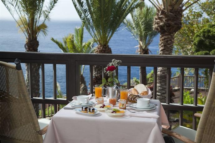 We chose a six-hour tour of the island, so that we could enjoy the views and have time to go to the beach. Well, what can I say? Beautiful island. The views and landscapes are breathtaking. From the semi-bald Canarian mountains and red volcanic earth, to the lush vegetation in the famous Garahonai park. A bunch of miradores. Taxi driver is convenient. He was always one step ahead of the tour guides who arrived in huge crowds on buses from the island of Tenerife. Therefore, we did not have to rub our butts with anyone during the tour. Of course, La Gomera, like Tenerife, does not have any special tourist features (not counting the whistlers we flew past), but due to a combination of factors, including accommodation in a fantastic hotel located in the capital of San Sebastian De La Gomera, the island left the most positive impressions and the desire to return here someday.
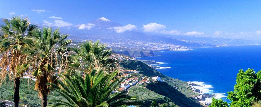 Your NHS appointment card from vaccination centres is not designed to be used as proof of vaccination and should not be used to demonstrate your vaccine status.
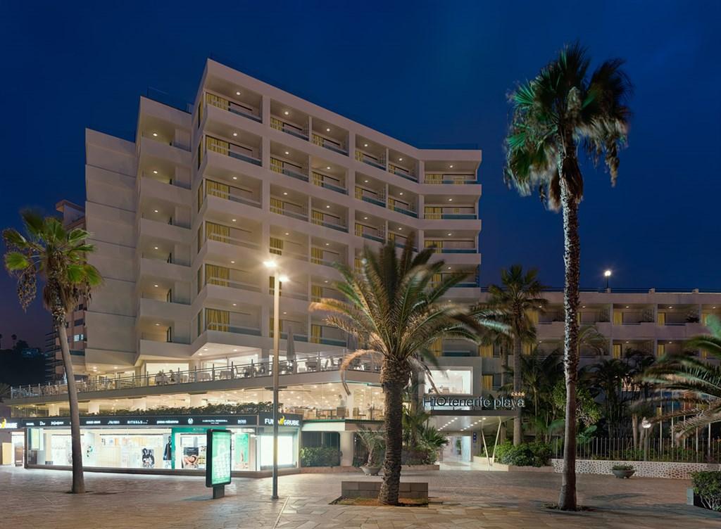 5m cannot be observed
 You should abide by any safety measures put in place by your accommodation provider. Your accommodation provider may have a list of private doctors that they can call to assess your symptoms and conduct a COVID-19 test.
 +34 933 039 944
 If you’re in an area where demonstrations are taking place, you should remain vigilant, follow the advice of local authorities and move away quickly to a safe place if there are signs of disorder.

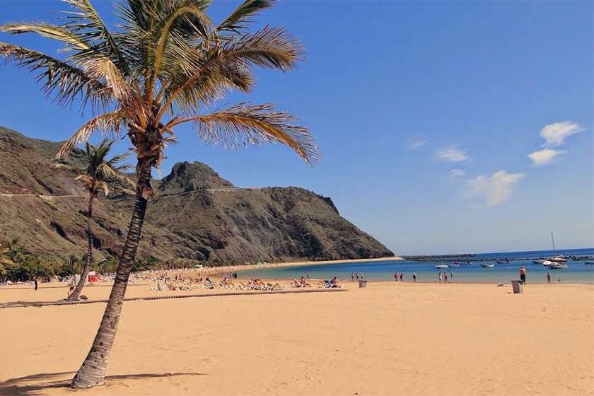
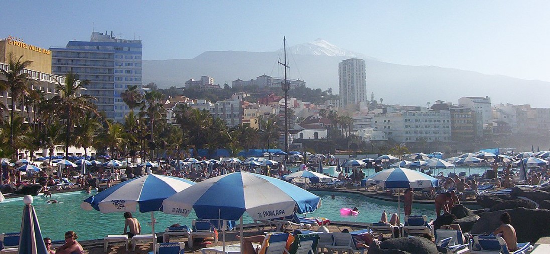


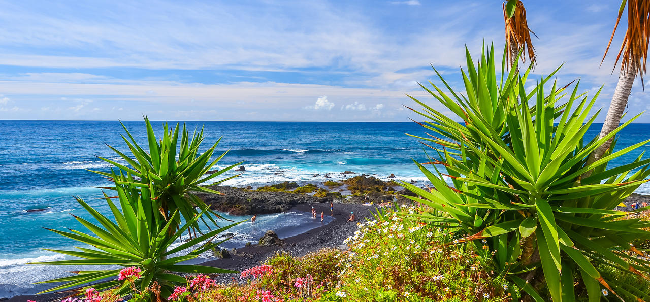
 If your hotel or accommodation is located in a low emission zone, check which access provisions are available to guests (i.e. car park, one-day passes etc.).
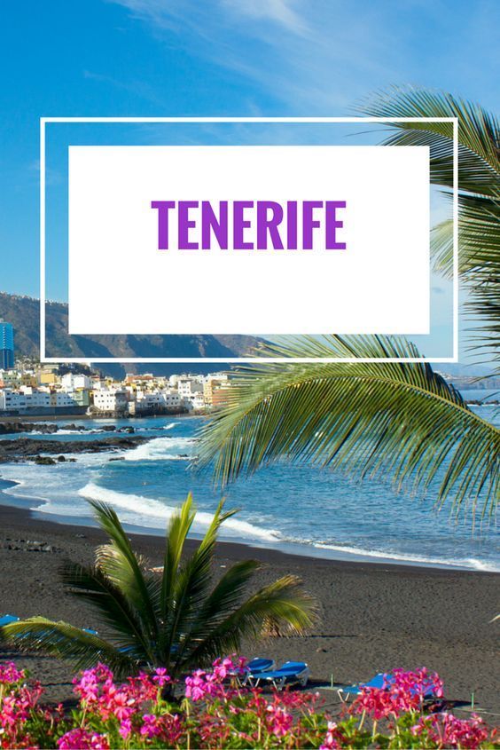
 Some of them expressed an intention to carry out attacks in Europe.
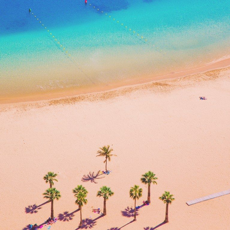 See ‘If you’re not fully vaccinated’.
 For further details see If you’re transiting through Spain.
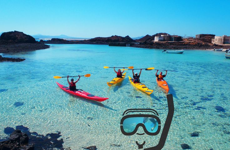
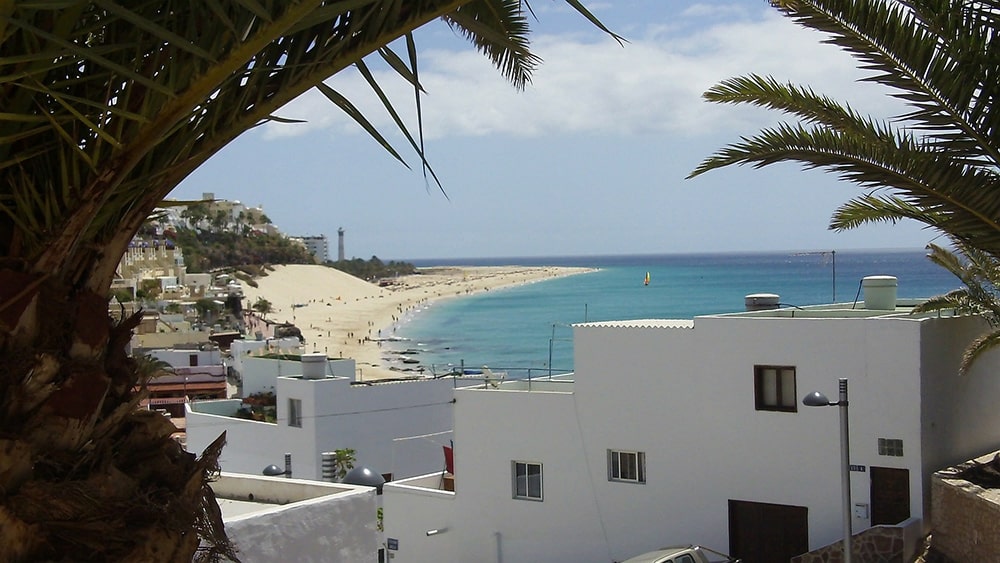 See ‘If you’ve had COVID-19 in the past year’.
 g. COVID-19 nucleic acid amplification test – NAAT (PCR or similar) or rapid antigen test)
 If you are leaving the airport, documentation requirements set out in ‘All travellers’ apply. See Spain’s Ministry of Health travel pages for more detail. You should check with your travel operator and the authorities at your final destination if a negative test is required on entry.
 If your passport was issued before 1 October 2018, extra months may have been added to its expiry date.
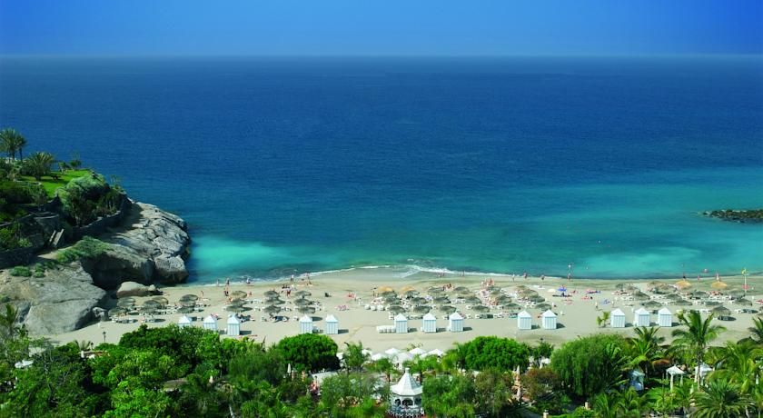
 But those are your five basic vowel sounds.
 Then, practice inserting the sounds into words.
 Until then, here’s an exercise to help you practice: Find a passage of Spanish text that you also have a recording of. (For example: lyrics to a song, an audiobook that you also have a hard copy of, a listening exercise from a textbook, etc.) Without listening to the recording, underline the syllable in each word that gets the stress. Then, listen to the recording and check your answers.
 ” (You drank tequila until three in the morning.)
 But focusing on details like these will help you lose your foreign accent and speak Spanish like a nativo.
 Some people seem to pick it up intuitively, while others need to put forth a concerted effort to learn to roll their r’s. If you’re struggling, don’t worry—you’re definitely not alone!
 She says that beer helped loosen her tongue muscles. That advice may or may not work for you, but it worked for her, and either way, you get to enjoy a few drinks and practice your Spanish.


 The internet has brought us all closer together, and at the same time, closer to capable language tutors from all around the globe. Since there are so many Spanish tutors online, their services are more than affordable.
 When learning Spanish, there is no single Spanish accent. Think about how native English speakers from the US, England, Singapore, and the Philippines all sound different. In the short 57 kilometers it takes to get from Manchester to Leeds, we hear different tones, inflections, and pronunciations of English.
 These five basic short vowel sounds never change.
 For all words ending in a vowel, the stress falls on the next-to-last syllable. Manzana (apple) is pronounced man-ZA-na. Cerveza (beer) is cer-VE-za.
 It’s /dt/ like at the end of the American pronunciation of wet or dart.
 In Latin America the C, Z, and S noises are all pronounced as /s/.
  Listening to real people speak back-and-forth with you is the key to perfecting your Spanish accent.
  We butcher the accent and destroy what was once a quite beautiful tongue.
 While you may be rightly proud to pull off a perfectly executed phrase in the pluscuamperfecto del subjuntivo, the chances are that your local friend won’t even realise the complicated grammatical gymnastics involved in such a feat.
 Your accent will naturally start to improve, as Bogotá-based Spanish teacher Naty Cruz, notes, if you: “interact with native speakers, get out into the street and listen to how people talk, create a chat group or find a group of local friends so you can listen to them all the time, and familiarise yourself with the sound of the language”.

 First off, start by pronouncing each of the vowel sounds on their own, repeating them several times over.
 “Search on the internet for videos called ‘praxias erre‘ and you’ll find videos containing exercises used by speech therapists to help train Spanish-speakers who also have problems pronouncing the double ‘r’. [You can find one such example here.]
 Improving pronunciation and accent is, again, a matter of repeatedly doing drills for each sound, and comparing these to those of a native speaker, in order to gradually build up your proficiency.
 To reach a high standard of accent and intelligibility, you’ll also need to pay careful attention to other aspects of speech, especially the pace, tone, intonation and the emphasis that native speakers put onto sounds.
 But we shouldn’t, as these little guys tell us exactly where to put your emphasis when you speak.
 These are great accent guides for you to copy.
 While it’ll be very clear to you when, for example, you can speak Spanish faster and with less of a monumental mental effort, the gradual improvements in your accent are trickier to detect. One way to keep track of them is to save your accent practice recordings over time, and refer back to them every few weeks or so to see how you’ve advanced.
 A foreigner can maintain their accent and still speak Spanish perfectly”. Keeping a little of your accent doesn’t mean that your Spanish is inadequate – it merely means that you’re adding a little of your own flavour to the language.
 ”
” “T’s” are a hard sound in the English language and when you make the sound it probably comes from hitting the roof of your mouth. With a Spanish accent, you’ll want to make your “t’s” softer by pressing the tip of your tongue against the top of your front teeth instead.
 If you cannot differentiate these little inconsistencies, it’s best to try to gently roll a “z” so that it flows with the sentence. The more you practice basic pronunciation, “z” sounds will become a natural part of your rhythm.
 When we say something like “black dog,” we say these two words completely separate from each other. Natural Spanish-speakers tend to blur together nouns with whatever word you use to describe it. It may sound more like “blackdog.”
 Make use of these resources to help you learn how to speak with a Spanish accent. Watch videos, read educational material, and listen to podcasts/recordings. Find inspiration from native Spanish-speakers you know and love, like Antonio Banderas and Penelope Cruz.
 Not only does this give you great practice for your accent, but it provides you with a simplified “script” to use.
 There are many basic types of characters you can choose from, since Spanish accents are widely varied by region.
 Record yourself to critique yourself or even enlist the help of dialect coaches, who can provide you with constructive criticism and education.
 Speaking Spanish with a perfect native accent is what many people aspire to, but why? And is it really necessary?
 One commenter raised a very interesting point though: Everyone has an accent of some sort. If you wanted a native accent, you would have to choose one. Would you prefer to sound Colombian or Argentinian? Northern Spain or Southern Spain?
 The takeout from that study was that it’s often more beneficial to listen to the sound and “music” of the language, rather than obsessing about every vowel and consonant sound. That way, you can sound more natural. And it makes sense too – a large part of our perception of people’s accents is down to the rhythm and intonation of their speech, as well as the individual sounds.
 So the aim is the same – improve the clarity of your accent by trying to imitate native speakers more closely, who in turn will find it easier to understand you.
 I could speak (with my standard English accent) to people around UK and America, and people wouldn’t be able to say exactly where I’m from. It’s fully comprehensible to everyone, unlike particularly strong local accents which some may struggle to understand. In Spanish, I think the accent that sounds clearest to all native speakers is either a) standard Castilian Spanish, or b) Colombian Spanish. A lot of people have said that Colombian Spanish is the easiest to understand, as they don’t talk too fast (generally), enunciate syllables clearly and without swallowing word endings, and have a generally clear and crisp pronunciation. Central Colombian Spanish is a good example of that – have a listen to Liz when she speaks, and I’m sure you’ll agree!
 It’s difficult, but it’s not impossible.
 It can be tricky, and it takes practice, but if you want to sound even remotely convincing as a Spanish speaker, you absolutely MUST learn how to pronounce this letter. There’s no way around it.
 In fact this sound is not just foreign to Spanish, but very distinctively English, and a dead giveaway that you’re from an English-speaking country.
 The ‘ay’ sound, in fact, is actually closer to the Spanish ‘ei/ey’ as in ley or leído than it is to the single Spanish ‘e’.
 For the remaining two ‘A’s, we relax our mouths and just grunt out a neutral ‘uh’ sound, technically known as schwa.
 In English when we say this word we’re happy to mash the syllables together with no emphasis on the vowels: “kun-SID-ruh-bull’. Sometimes we even miss out syllables altogether, like in the word “probably”, which is often pronounced as “probly” or just “prolly”.


 For example, the combination of letters “ge” will be pronounced as “he”, and the combination “gue” will be pronounced as “ge”.
  Many sounds are very similar to existing sounds in Russian. There is no need to worry about the accent, because there are a great many dialects of the Spanish language.
 com – audio skills;
  S. I suggest you look at other articles:
  Strictly speaking, they are languages, not dialects. They have official status in certain regions, they are used in the press and office work, and they are taught in universities.
  Spanish is the official language in all autonomies, but some of them have their own. Thus, some residents of the country speak two languages equally well.
 The so-called Valenciano is common in Valencia and is more of a dialect of Catalan, although some locals will call it a separate language. The classical version of Catalan is found in the autonomy itself, moreover, the most “pure” language is concentrated in the provinces of Barcelona and Girona, as well as in part of the province of Tarragona.