
Temperatures in april in europe: April Temperature Averages in European Cities
April Temperature Averages in European Cities
Average temperatures for April at major cities throughout Europe are listed below in degrees Celsius and Fahrenheit.
The cities range from Amsterdam to Zurich and from Reykjavík to İstanbul. They are listed alphabetically and you can jump ahead to the section for Amsterdam to Kiev, Leeds to Pristina and Reykjavík to Zurich.
Included in this list are Europe’s national capitals plus cities with a metropolitan population of over one million people.
The tables give the normal maximum and minimum monthly temperatures based on historical weather data collected over a long period, in most cases 30 years.
| High °F | Low °F | City | High °C | Low °C |
|---|---|---|---|---|
| 56 | 40 | Amsterdam, Netherlands | 14 | 5 |
| 61 | 41 | Andorra la Vella, Andorra | 16 | 5 |
| 67 | 53 | Athens, Greece | 19 | 11 |
| 64 | 47 | Barcelona, Spain | 18 | 9 |
| 64 | 47 | Belgrade, Serbia | 18 | 8 |
| 56 | 40 | Berlin, Germany | 13 | 4 |
| 55 | 39 | Birmingham, United Kingdom | 13 | 4 |
| 61 | 41 | Bratislava, Slovakia | 16 | 5 |
| 58 | 42 | Brussels, Belgium | 14 | 5 |
| 64 | 42 | Bucharest, Romania | 18 | 6 |
| 62 | 45 | Budapest, Hungary | 17 | 7 |
| 60 | 42 | Chisinau, Moldova | 16 | 6 |
| 58 | 38 | Cologne, Germany | 14 | 4 |
| 50 | 36 | Copenhagen, Denmark | 10 | 2 |
| 54 | 40 | Dublin, Ireland | 12 | 5 |
| 53 | 39 | Glasgow, United Kingdom | 12 | 4 |
| 54 | 38 | Hamburg, Germany | 12 | 3 |
| 48 | 32 | Helsinki, Finland | 9 | 0 |
| 63 | 48 | İstanbul, Turkey | 17 | 9 |
| 48 | 33 | Kazan, Russia | 9 | 1 |
| 56 | 41 | Kiev, Ukraine | 14 | 5 |
| High °F | Low °F | City | High °C | Low °C |
|---|---|---|---|---|
| 51 | 38 | Leeds, United Kingdom | 11 | 3 |
| 57 | 42 | Lille, France | 14 | 5 |
| 67 | 53 | Lisbon, Portugal | 19 | 12 |
| 60 | 41 | Ljubljana, Slovenia | 15 | 5 |
| 58 | 43 | London, United Kingdom | 15 | 6 |
| 54 | 38 | Luxembourg, Luxembourg | 12 | 3 |
| 61 | 44 | Lyon, France | 16 | 7 |
| 64 | 45 | Madrid, Spain | 18 | 7 |
| 55 | 41 | Manchester, United Kingdom | 13 | 5 |
| 65 | 48 | Marseille, France | 19 | 9 |
| 63 | 45 | Milan, Italy | 17 | 7 |
| 52 | 35 | Minsk, Belarus | 11 | 2 |
| 63 | 50 | Monaco, Monaco | 17 | 10 |
| 51 | 35 | Moscow, Russia | 10 | 2 |
| 55 | 37 | Munich, Germany | 13 | 3 |
| 65 | 47 | Naples, Italy | 18 | 8 |
| 63 | 50 | Nice, France | 17 | 10 |
| 50 | 35 | Nizhny & Novgorod, Russia | 10 | 2 |
| 48 | 33 | Oslo, Norway | 9 | 1 |
| 60 | 45 | Paris, France | 16 | 7 |
| 66 | 48 | Podgorica, Montenegro | 19 | 9 |
| 56 | 36 | Prague, Czech Republic | 13 | 2 |
| 60 | 40 | Pristina, Kosovo | 16 | 4 |
| High °F | Low °F | City | High °C | Low °C |
|---|---|---|---|---|
| 42 | 33 | Reykjavík, Iceland | 6 | 0 |
| 50 | 34 | Riga, Latvia | 10 | 1 |
| 66 | 44 | Rome, Italy | 19 | 7 |
| 61 | 43 | Rostov-on-Don, Russia | 16 | 6 |
| 56 | 40 | Rotterdam, Netherlands | 14 | 4 |
| 47 | 33 | Saint Petersburg, Russia | 8 | 1 |
| 53 | 36 | Samara, Russia | 12 | 2 |
| 62 | 44 | San Marino, San Marino | 17 | 7 |
| 59 | 40 | Sarajevo, Bosnia & Herzegovina | 15 | 4 |
| 65 | 44 | Skopje, Macedonia | 18 | 7 |
| 60 | 40 | Sofia, Bulgaria | 15 | 5 |
| 47 | 34 | Stockholm, Sweden | 9 | 1 |
| 47 | 32 | Tallinn, Estonia | 8 | 0 |
| 66 | 46 | Tirana, Albania | 19 | 8 |
| 62 | 42 | Turin, Italy | 17 | 6 |
| 51 | 31 | Ufa, Russia | 11 | 0 |
| 59 | 41 | Vaduz, Liechtenstein | 15 | 5 |
| 66 | 53 | Valletta, Malta | 19 | 12 |
| 61 | 43 | Vienna, Austria | 16 | 6 |
| 51 | 35 | Vilnius, Lithuania | 11 | 2 |
| 60 | 41 | Volgograd, Russia | 15 | 5 |
| 55 | 37 | Warsaw, Poland | 13 | 3 |
| 61 | 41 | Zagreb, Croatia | 16 | 5 |
| 58 | 37 | Zurich, Switzerland | 15 | 3 |
Top 10 Best Destinations to Visit
Europe in April is at the peak of Spring Season before the scorching summer sun settles in from May and June. April is the most comfortable month for European Holidays as the continent’s weather transforms from the freezing winters to a quite comfortable one during this time.
Also during this time, you get to see so many beautiful flowers blooming in the gorgeous settings of Europe and also enjoy the European Spring fruits and vegetables. This is the last month in Europe to avail of the discounts on airfare and hotels as right after this month, the summer tourist season begins and everything slowly starts getting expensive.
However, it is the incredible scenic beauty, and enjoyable sightseeing tour, a comfortable climate, or a budget-friendly trip. April serves perfection in all aspects, making it an ideal month for Europe vacations.
What is the weather in Europe in April?
April in Northern Europe though it remains cold, unlike the winters, it has plenty of sunshine during this time, so the weather gets comfortable for traveling. The temperature improves from the freezing one and comes around 9 degrees approximately.
In Western Europe, there is more of a spring flavor, and the temperature ranges from 12 to 13 degrees being absolute pleasant and days getting too much longer.
The Eastern side, on the other hand, enjoys complete Spring season in April with a temperature of around 15 degrees and a mixed climate while Middle Europe has quite a warmer weather during this time having a temperature of approximately 20 degrees.
So to help you prepare your holidays, the following list gives you exposure to the best places to travel in Europe in April. And will provide you a respective forecast about the weather in Europe in April.
Table of Contents
- Europe in April: Top 10 Best Destinations to Visit
- Dubrovnik, Croatia
- Ghent, Belgium
- Prague, Czech Republic
- Bologna, Italy
- Barcelona, Spain
- Florence, Italy
- Tallinn, Estonia
- Budapest, Hungary
- Paris, France
- Venice, Italy
- Are you on Pinterest? Pin this for later read!
Europe in April: Top 10 Best Destinations to Visit
Dubrovnik, Croatia
Dubrovnik is a world-famous tourist destination in Croatia located on the Adriatic Sea. It has a pretty comfortable climate during April having temperatures between 14 to 17 degrees. It receives an excellent long 9 to 10 hours of sunshine during April and is among the best places in Europe to visit in April.
The city has impressive architectural works and breathtaking scenic beauty which get a flawless look in the Spring Season in April. The old part of the town is just like a created movie set featuring broad lanes, old marvel houses, narrow winding streets having a cinematic view. April in Dubrovnik is packed with spring festivals and events that help you discover the city from different dimensions.
Festivals like Christian Cultural Day in the first week of April, there are musical events and parties like Club Lazareti in the middle week of April, Easter Brunch Festival, St.Blaise Day, one-week event of Tisuna Molim, Dubrovnik Carnival, Aklapela Vocal Groups Festival and so many to cherish for.
Apart from events, these gorgeous sightseeing attractions like Old City Walls, Stradun of Dubrovnik, City gates, Square of the Loggia, Dubrovnik’s Gibraltar, Recor’s Palace and other numerous beautiful locations will make your vacation worthwhile in the springtime.
Ghent, Belgium
Ghent is a beautiful painted city of Belgium that follows a medieval architecture. You can explore the picturesque town by walking as well as on a boat ride sailing through the city.
While the days have temperatures between 10 to 14 degrees at night, it can drop to 6 degrees even. The weather remains cold with moderate sunshine. The spine thrilling city attractions are amazing to explore in the pleasant spring weather of April like The Count’s Castle, Cathedral of St.Bavo, the breathtaking gothic fortress “Gravensteen,” The belfry, Town Hall, Ruins of Sint –Baafsabdij, Ghent Museum, Museum of Fine Arts, Graslei, and many more.
April also helps you enjoy amazing shopping Sundays in Ghent at various shopping destinations of the city, and you can also check out the Ghent Old market. All museums, historical circles, cultural associations conduct various colorful local events in springtime.
The city has some of the most beautiful street arts, so you can also opt for a graffiti tour and enjoy the nights with musical concerts and nightclubs.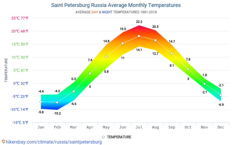
Prague, Czech Republic
Being the capital of the Czech Republic, Prague is crowded with millions of tourists throughout the year due to its packed in attractions. Be it the best places to go in Europe in April or the best European cities to visit in April, Prague ranks in top position in both the categories.
Prague in April bids farewell to the winter season and so the weather mostly remains cold having temperatures between 9 to 14 degrees while at night it may drop to 4 degrees. April is the best time to explore the city attractions, closed parks, and gardens or take a walking city tour.
Various festivals and exhibitions are organized during this time like Exhibition at the Jewish Museum, City Museum, Karel Zeman Museum, etc.
Easter celebrations generally last till April in Prague, and another entertaining event is the ‘Witches Night’ on April 30, which is pretty much like Halloween. It is celebrated to bid goodbye to the freezing winters with bonfire night, creepy colorful costumes, and with hard drinks boozing the entire night.
Other fun events include cruising and jazzing in the jazz boat in the entire April month, the artistic Hieronymous Bosch event, fun Saturdays with shopping and eating at Naplavka riverside market, Spiritual Music concert, and many other big and small events.
Bologna, Italy
Bologna in Italy enjoys a pleasant spring in April having temperatures between 13 to 17 degrees with 6 hours of sunshine. The city has got a significant historical and cultural background that has fallen under the reign of various ruling kingdoms.
April month in Bologna is a hub of exhibitions and cultural events like Dali Experience. The famous portrait of Rittrato d’uomo at Palazzo d’Accursio, Lavoro in Movimento exhibition, San Giacomo Music Festival, Eureka dance show. The musical festival ‘Hair’ celebrating the hippie culture of 1960, the Ocarina Music Festival and the list go on.
Many mesmerizing portraits done by the ancient Italian painter are exposed to the public during this time. The art and music lovers are surely going to love Bologna in April.
Apart from the events, you can also take day and evening tours of the city attractions like Leaning towers, Piazza Maggiore, San Petronio, Archiginassio, Bologna National gallery, Oratory of Battuti and many more. You can spend the nights shopping at la Piazzola Market and dining at the finest city restaurants.
Barcelona, Spain
Spain is one of the hot European countries in April having the peeking of the summer season. Barcelona has the best weather in Europe in April that is neither too hot, nor too cold. The temperatures vary between 13 to 18 degrees with a good amount of sunshine. April is one of the fun times to visit Barcelona due to its entertaining events and comfortable weather.
Festivals like Sant Jordi’s day celebrates the city crowded with roses as on this occasion men gift red roses to their lady love, Feria de Abril which is the April fair organized in the last week of the month.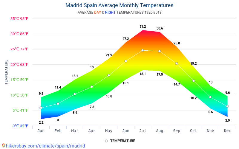
The Cursa de Bombers which is a racing event of the firefighters on April 22. Semana Santa is conducting religious parades, and the Barcelona International Auteur Film Festival and many other activities.
Apart from cherishing the events, you can spend the day with the sightseeing tour and taste the lip-smacking Spanish cuisines. It features in the top 5 list of the best places to travel in Europe in April.
Florence, Italy
Florence is among the most romantic destinations in Italy that are loved by tourists across the world. The old architectures, narrow cobbled streets, exotic wines, opera theatres make the city more charming like a painted old town.
Florence is another city to have the best weather in Europe in April with temperatures between 14 to 19 degrees with 9 hours of sunshine. The climate is excellent to explore its local attractions like Museums, Art galleries, cathedrals, and other gorgeous tourist destinations. A lot of festivals embark the April month in Florence like Easter Celebration at the beginning of April Month.
Festival of Scarperia in the first Sunday of the month, Handicrafts and other vintage display exhibits at Aprilante in the first Sunday of the month, Greve in Chianti in the 4th Sunday of April, last Florence supper on April 5 at the churches, running and cycling festival at Vivicita in the middle week of April, the beautiful spring nursery blooming with flowers in Borgo San Lorenzo, Handicrafts Trade Fair in the last week of April Florence bike festival, and many other events in honor of welcoming the spring season.
You cannot get enough of the evens in Florence in April and the fantastic nights at the classic Opera theatres. So if you are thinking of where to travel in Europe in April, don’t miss Florence at any cost.
Tallinn, Estonia
Tallinn is a beautiful city of Estonia that seems to come straight from the fairyland. The temperature here ranges between 6 to 11 degrees having a cold climate and at night sometimes even drop to 0 degrees.
If you are a scenic beauty admirer, this is the place you should visit in April, to see the colorful conical roofs peeking through the city in daylight accompanied by the blue seas and colorful red trees. The town looks breathtaking drowned in the flavors of Springs.
The city hosts many cultural events during this time like Tallinn Craft beer festival at the beginning of April, Tallinn TV Tower Run in the April 3, Estonian Musical concerts in the middle week of April, Handicraft Fair in the last week of the month, Tallinn International Festival Jazzkaar in the last week of April, Simple Session festival featuring the BMX and snowboarding event, and many more. You can also go to city attractions and cathedrals during the daytime.
Budapest, Hungary
Budapest in Hungary ranks among the best places in Europe to visit in April due to its numerous festivals, concerts, exhibitions, and cultural events for the tourists and residents during this time.
The scenic beauty is also lovely in Budapest during April with blooming flowers beautifying the lush greeneries that make the entire city look bright and gorgeous under the spring sky.
The temperature of Budapest in April is around 11 to 15 degrees offering cold and pleasant weather for sightseeing, city tours and enjoying the festivals.
Be it walking under the Chain Bridge, tasting the exotic Hungarian food and wines, go for cruising at the Danube river, take a dip in the Szechenyi Baths.
Explore the caves of Budapest, spend quality time at the Buda castle or taste the traditional Hungarian food and go for a city touring.
Everything feels worthwhile under the Spring sky of April. The festival events like spring fair, Budapest Spring Festival, Budapest Art week, International Book Festival, Vince Festival, and Exhibitions at museums are going to make your trip extremely fun and entertaining.
Paris, France
Paris is one such beautiful destination of France that looks breathtaking irrespective of season and climate. It is a favorite European destination for all tourists and also a famous honeymoon destination. In April, Paris has a temperature between 11 to 16 degrees with moderate sunshine.
The city looks like a painted picture during spring bordered by the greeneries, beautiful structures, and streets and shining under the blue sky.
April is the month of the photographers to take some million dollar shots of the beautiful city. Various events are conducted during this time like Easter celebrations, Paris marathon, and exhibitions at the Grand Palais, and Paris Art fair. There are colorful and fun events for the kids at Disneyland, funfairs, Trades shows, Music concerts, and lots of cultural events.
Apart from these, you can go to the city attractions like Eiffel Tower, Notre-Dame Cathedral, Musse du Louvre, and many other attractive locations.
Venice, Italy
Venice, which is also known as the paradise of Italy, is excellent to travel in April. The temperatures are quite pleasant, varying between 12 to 16 degrees. April has a lovely beginning in Venice with the Easter celebrations, classical music concerts, and the event of Benedizione del Fuoco organized at Saint marks basilica.
The second and third week houses the events like Festa di San Marco in the last week of April, Venice Jazz festival, Italian Liberation Day celebration on April 25, plenty of opera concerts, and many more cultural events.
Also, this time has lesser city crowds, and hence you can breathe the beautiful city exploring and cruising through the attractive destinations. The city has an enchanting beauty in the springtime blooming with flowers and reflecting brightly with the amazing blue water bodies.
Are you on Pinterest? Pin this for later read!
128
shares
Surface air temperature for April 2022
cross
close
image/svg+xmlEuropean Commission
Copernicus | Europe’s eyes on Earth
IMPLEMENTED BY ECMWF
April 2022 was globally around the sixth warmest April since records began. April temperatures over much of Europe were close to average values for 1991-2020. Temperatures were unusually high from north-eastern Africa across the Middle East to central and southern Asia. Pre-monsoon temperatures were extremely high over Pakistan and northern India.
April 2022
Surface air temperature anomaly for April 2022 relative to the April average for the period 1991-2020. Data source: ERA5. Credit: Copernicus Climate Change Service/ECMWF.
DOWNLOAD THE ORIGINAL IMAGE
DOWNLOAD THE ORIGINAL IMAGE
Surface air temperature anomaly for April 2022 relative to the April average for the period 1981-2010. Data source: ERA5. Credit: Copernicus Climate Change Service/ECMWF.
DOWNLOAD THE ORIGINAL IMAGE
DOWNLOAD THE ORIGINAL IMAGE
Average temperatures for April 2022 differed little from the 1991-2020 April average over northern, western and southern Europe. They were colder than average over central and parts of eastern Europe and warmer than average over the far south-east of the continent.
An extensive region of much-above-average temperatures stretched from north-eastern Africa across the Middle East to central and southern Asia. Pre-monsoon temperatures were exceptionally high over Pakistan and northern India, following record highs in March; the heatwave led to critical water and power shortages as well as damage to crops. Heatwave conditions were also experienced in Egypt and Sudan. High spring temperatures were reported in the Central Asian Republics. Temperatures were also much higher than average over Greenland, easternmost Russia, and the Ross and Weddell sectors of Antarctica. Other regions of above-average temperature include the southern and south-western USA, Mexico, parts of the Far East, and northern Australia.
April 2022 was much colder than average over central and western Canada and much of the ice-covered Arctic Ocean. Temperatures were also below the 1991-2020 average over several other land regions, including north-western Africa, South East Asia, southernmost Africa, south-western Australia and East Antarctica.
Air temperatures were substantially above average over parts of all the major ocean basins. Below-average marine air temperatures were located in the tropical and southern sub-tropical eastern Pacific, indicative of continuing La Niña conditions.
Monthly global-mean and European-mean surface air temperature anomalies relative to 1991-2020, from April 1979 to April 2022. The darker coloured bars denote the April values. Data source: ERA5. Credit: Copernicus Climate Change Service/ECMWF.
ACCESS TO DATA | DOWNLOAD THE ORIGINAL IMAGE
Monthly global-mean and European-mean surface air temperature anomalies relative to 1981-2010, from April 1979 to April 2022. The darker coloured bars denote the April values. Data source: ERA5. Credit: Copernicus Climate Change Service/ECMWF.
ACCESS TO DATA | DOWNLOAD THE ORIGINAL IMAGE
Globally, April 2022 was:
- 0.28°C warmer than the 1991-2020 average for April
- the sixth warmest April on record, though only marginally colder than April 2018
- more than 0.2°C cooler than the warmest Aprils, which were in 2016 and 2020
- marginally warmer than April 2010, the warmest April prior to April 2016.
European-average temperature anomalies are generally larger and more variable than global anomalies. The European-average temperature for April 2022 was 0.42°C lower than the 1991-2020 average. The month was 2.4°C colder than the warmest April, which occurred in 2018, but 0.4°C warmer than April 2021.
The last 12 months – May 2021 to April 2022
Surface air temperature anomaly for May 2021 to April 2022 relative to the average for 1991-2020. Data source: ERA5. Credit: Copernicus Climate Change Service/ECMWF.
DOWNLOAD THE ORIGINAL IMAGE
DOWNLOAD THE ORIGINAL IMAGE
Surface air temperature anomaly for May 2021 to April 2022 relative to the average for 1981-2010. Data source: ERA5. Credit: Copernicus Climate Change Service/ECMWF.
DOWNLOAD THE ORIGINAL IMAGE
DOWNLOAD THE ORIGINAL IMAGE
Temperatures averaged over the last twelve-month period were:
- above average over most land areas and the majority of the ocean surface
- markedly above the 1991-2020 average in a region stretching from northern Arabia to western Siberia, and over northern Siberia, central North America, north-western and central Africa, East Antarctica and the Weddell Sea
- close to average over much of Europe, but above average in the east of the continent, and to a lesser extent over a band eastward from Ireland to southern Scandinavia
- below average over some land areas, including parts of northern Canada and Alaska, north-eastern South America, southern Africa, India, Australia and Antarctica
- below average over the eastern equatorial Pacific, where the La Niña event that peaked in late 2020 reintensified later in 2021 and continued into 2022
- also below average over the Chukchi Sea, parts of the eastern North Pacific and several oceanic areas in the southern hemisphere.


Running twelve-month averages of global-mean and European-mean surface air temperature anomalies relative to 1991-2020, based on monthly values from April 1979 to April 2022. The darker coloured bars are the averages for each of the calendar years from 1979 to 2020. Data source: ERA5. Credit: Copernicus Climate Change Service/ECMWF.
ACCESS TO DATA | DOWNLOAD THE ORIGINAL IMAGE
Running twelve-month averages of global-mean and European-mean surface air temperature anomalies relative to 1981-2010, based on monthly values from April 1979 to April 2022. The darker coloured bars are the averages for each of the calendar years from 1979 to 2020. Data source: ERA5. Credit: Copernicus Climate Change Service/ECMWF.
ACCESS TO DATA | DOWNLOAD THE ORIGINAL IMAGE
There is more variability in average European temperatures, but values are more certain due to the relatively dense observational coverage of the continent. The average for this twelve-month period is 0.41°C above the 1991-2020 average. 2020 is the warmest calendar year on record for Europe by a clear margin, with a temperature 1.2°C above the 1991-2020 average.
Note on global values from ERA5 and other temperature datasets
The spread in global averages from various temperature datasets has been reported previously to have been relatively large over recent years. An updated version of the dataset principally responsible for this spread was released in mid-December 2020. This version agrees much better with other datasets for the latest few years. This version does however show a larger warming since 1850-1900 than its predecessor, which has an influence on the ‘pre-industrial’ estimate as mentioned above. Read more in the Temperature indicator.
There is general agreement among datasets that the period from 2015 to 2020 is much warmer globally than any previous such period. There is also agreement that the global temperature has risen at an average rate close to 0. 2°C per decade since the late 1970s. There is nevertheless still some spread between the datasets for recent years, such as for 2020, and the annual average temperature anomalies for these years from ERA5 are generally higher than those from the five other datasets considered. The differences range from 0.02 to 0.08°C for 2016-2020. The range is 0.00 to 0.07°C if air temperature over sea is replaced by sea-surface temperature for ERA5 and the other dataset for which sea-surface temperature was not used by design. The remaining differences depend partly on the extent to which datasets represent the relatively warm conditions that have predominated over the Arctic and Antarctic during these years. Differences elsewhere in estimates of sea-surface temperature and surface air temperature over land have been further factors.
The average surface air temperature analysis homepage explains more about the production and reliability of the values presented here, but has yet to be updated to include the new information on dataset spread mentioned above.
Back to top
*April Forecast* Weather patterns are now adjusting to the Polar Vortex collapse, creating a weak jet stream as we head deeper into Spring
April weather across the Northern Hemisphere will be shaped by the Polar Vortex collapse event from last month. Unseasonably cold weather events will continue over North America, with a weakened circulation and a disrupted jet stream pattern.
The Polar Vortex is a very powerful short-to-medium term weather driver during every cold season. For this reason, we monitor the activity high above in the stratosphere.
The Polar Vortex underwent a strong collapse event in late March, with the effects now coming down from the higher levels of the atmosphere. The already weak circulation will receive a new wave of disruption.
THE RISE AND FALL OF THE POLAR VORTEX
Every year as we head into autumn, the polar regions receive less and less sunlight. With less solar energy, cooling begins over the north pole.
But as the polar temperatures drop, the atmosphere further south is still relatively warm as it continues to receive light and energy from the Sun.
You can see the winter solstice in the image below. The polar regions receive little to zero solar energy, compared to regions further south, which still continue to receive plenty of sunlight and warmth.
But, as temperature drops over the polar regions, so does the pressure. With colder temperatures over the pole, the temperature difference towards the south increases.
This causes a strong global pressure difference from the poles to the equator, and a large low-pressure (cyclonic) circulation starts to develop across the Northern Hemisphere. It extends from the surface layers, far up into the stratosphere.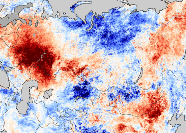 This is known as the Polar Vortex.
You can see the layers of the atmosphere in the image below. The troposphere (blue layer) and the weather are on the bottom and the stratosphere (green layer) with the ozone layer above it.
We produced a 3-dimensional model of the Polar Vortex, extending from the lower levels up into the Stratosphere. The vertical axis is greatly enhanced for better visual purposes. You can see in the image below what the actual structure of the Polar Vortex looks like.
The Polar Vortex behaves like a very large cyclone, covering the whole north pole, down to the mid-latitudes. It is connected through all atmospheric levels, from the ground up, but usually has different shapes at different altitudes.
In the next image below, we have the bottom of the polar vortex at around 5km/3miles. The closer to the ground we go, the more deformed the polar vortex gets because it has to interact with the mountains and overall terrain.
Be aware of its “arms” extending into the lower latitudes, bringing along colder air and snowfall.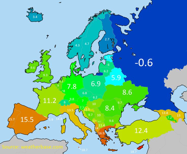 These arms also pack a lot of energy and can create strong winter storms, like a Noreaster’ in the United States or powerful cyclones in the North Atlantic.
We are typically focusing more on the Stratospheric Polar Vortex, as it plays a very important role in the weather development throughout the season. It is known for its strong influence down from the stratosphere.
A strong Polar Vortex usually means strong polar circulation. This usually locks the colder air into the Polar regions, creating milder conditions for most of the United States and Europe.
In contrast, a weak Polar Vortex can create a weak jet stream pattern. It has a much harder time containing the cold air, which can now escape out of the polar regions, into the United States and/or Europe. Image by NOAA.
Typically, a polar vortex circulation is disrupted due to a rise in temperature and pressure in the stratosphere. That is called a Sudden Stratospheric Warming (SSW) event, which collapses the Polar Vortex.
To put the Polar Vortex into a perspective, we produced a high-resolution video, which shows the recent collapse event of the Polar Vortex.
Video shows the 10mb level (30km/18.5miles) from the GFS model. We can see the Polar Vortex first being split apart, followed by a strong displacement and disintegration.
The main takeaway from the video should be that the Polar Vortex is not just one single winter storm or a cold outbreak that moves from the Midwest into the northeastern United States.
It is a large cyclonic area that is spinning over the entire Northern Hemisphere, from the ground up to the top of the stratosphere, reaching over 50km/31miles in altitude.
POLAR VORTEX COLLAPSE EVENT
We typically use the 10mb level, when analyzing the polar vortex in the stratosphere. That is around 30km (17-20 miles) in altitude.
This layer is considered to be in the mid-stratosphere and is generally a good representation of the strength and status of the stratospheric polar vortex.
The strength of the polar vortex is most often measured by the power of the winds that it produces. This is typically done by measuring the westerly zonal (west to east) wind speeds around the polar circle (60°N latitude).
In the image below we have the seasonal average zonal wind speed for the Polar Vortex at 10mb level. The black line is the long-term average, and the blue line is the analyzed polar vortex strength in the 2021/22cold season.
For the majority of the cold season, the polar vortex was stronger than normal. But in March we can see the rapid collapse of the polar vortex. When the zonal (westerly) winds are reduced below zero in a sharp/rapid event, that is considered a breakdown of the circulation.
But not just winds, the temperature is also of major importance. The colder the polar vortex gets, the stronger it becomes.
Below we have the 2021/2022 season analysis of the stratospheric temperature at 10mb from NASA. The red/pink line is the 21/22 season, which shows the colder than normal polar vortex at the 10mb level in the stratosphere.
But notice the pink line, which shows a rapid temperature from February into March. You can see three distinct warming waves, each stronger than the last one. The final “strongest” peak, was produced in the collapse of the Polar Vortex.
But what exactly was happening up in the higher levels of the atmosphere? And how is it still influencing our weather down here?
Looking at the polar vortex in mid-March below, we can see the vortex was already under pressure from the European and the North Pacific sector. It had an oval shape, and it already began the separation in its core, creating two centers.
Taking a look at the temperature profile at the 10mb level (30km/18.5mi), we can see a warming wave developing over eastern Siberia and a weaker one over northern Canada. Here we can also see the separation of the core into two separate entities.
The collapse process can also be seen in the 3D structure of the polar vortex. The vortex at this point was breaking apart, developing two cores.
The vertical pressure anomaly reveals a connection between the stratosphere and the lower levels. It shows the stratospheric low-pressure areas separated into two cores in mid-March.
Currently, the polar vortex is defeated, and the polar circulation is reversed. The remains of the stratospheric polar vortex are over the eastern north hemisphere, with a high-pressure system taking over.
The 3D structure shows that only the lower level circulation remains. The upper stratospheric part of the polar vortex is gone until the next cold season 2022/23.
The influence of such an event can be seen below. This graphic shows the vertical temperature anomaly. We can see the three warming waves, coming down further from the upper stratosphere.
The final warming event can be tracked now still progressing down, forecast to reach the upper levels of the troposphere.
As you will see now, we can track these stratospheric events in the lower level circulation. That means that it will effectively also influence the weather that we feel.
FROM THE POLAR VORTEX TO THE SURFACE
This first graphic is probably the most important. It shows the vertical pressure anomaly from the surface up into the upper stratosphere. The red square marks the polar vortex collapse event.
We can see by the arrows, that the high-pressure anomaly resulting from the collapse is propagating down. It is connecting to the weather patterns, most strongly in the coming days and into the mid-month.
We can see an anomaly extension around the 10th of April. That coincides with a negative phase of the PNA, seen in the forecast below.
PNA stands for the Pacific North American index, explaining the pressure pattern over North America. A negative phase means lower pressure over western Canada and the western United States.
The weather pattern in the next few days can be seen below and is very disrupted already. High-pressure anomalies are present over the polar circle, with low-pressure systems scattered around. Main low cores are forecast over Scandinavia and the eastern United States.
This pattern is what a weak polar circulation looks like, with a disrupted jet stream. Such weather patterns can generally bring unseasonable (warm/cold) weather to the mid-latitudes.
Such a pattern in the next few days will translate into colder air over northern Europe under the low-pressure system. But the low-pressure system over the eastern United States is bringing down colder weather into the eastern half of the country. Warmer weather remains over the southwestern United States, under the high-pressure.
Taking a closer look at this cold shot over the United States, we can see the colder than normal temperatures spreading over much of the central and eastern United States. Warm weather in the southerly flow prevails over the west coast and western Canada.
The air will be cold enough to bring fresh snowfall into much of the northern United States. This cold outbreak will spread snowfall down from Midwest into the Ohio Valley.
MID-MONTH WEATHER PATTERN
Going into next week, we will be witnessing a shift in the weather pattern. The polar vortex collapse wave will reach further down. We can see stronger high-pressure anomalies building around the polar circle. A strong low-pressure system will descend into western Canada and the western United States.
This is the negative PNA pattern, that was forecast, linked to the overall pressure changes from the Polar Vortex Collapse event.
The temperature forecast for this period shows the cold air following the strong low-pressure system over western Canada and the United States. At the same time, a southerly flow will be established ahead of this low-pressure system, bringing warmer temperatures into the eastern United States and Canada.
Warmer weather will also prevail over western Europe, as colder conditions remain to the east.
Looking closely at this period over the United States, we can see a strong cold air spilling down from Canada into the western United States next week. We can see a strong temperature contrast, with the northerly flow in the west and the southerly warm flow in the northeast.
With such a strong cold air outbreak, more snowfall is expected from the Rockies into the Midwest. The final amount is not yet clear, as the event is too far out, but we can see the early distribution pattern.
NOAA OFFICIAL 8-14 DAY WEATHER OUTLOOK
This is all nicely captured below on the official NOAA/CPC 8-14 day weather forecast. Colder than normal temperatures will prevail over much of the United States, as the low-pressure system crosses the country. Warmer temperatures will move out into the far eastern and southeastern states.
Looking at the official NOAA precipitation forecast, we have a signal for more precipitation over the eastern half of the United States. Less precipitation is expected under the drier cooler northerly flow in the west-central United States, and in the southwest.
WEATHER PATTERNS EVOLVE INTO LATE MONTH
Looking into the second half of the month, the high pressure will remain around the polar circle. Two main low-pressure areas will be again over the eastern United States and northeastern Pacific. The low pressure over the eastern United States is actually the same system that will be moving in from the west next week.
At the same time, a ridge builds again over the western United States, while one remains over western Europe.
In the temperature anomalies for this period, we can see the colder air following behind the low-pressure system in the eastern United States. At the same time, a warmer airmass spreads into the western United States, with the developing ridge.
Looking closer at the United States pattern, we have an example forecast below, showing a possible scenario. The idea is that the low-pressure system next week will move further towards the east, bringing down more cold into the eastern half of the country.
At the same time, a building high-pressure ridge will expand a warmer air mass in the western half.
The precipitation anomaly forecast below shows that the cold air is mostly dry. The main precipitation area is pushed towards the southeastern and eastern parts of the United States.
We do have to repeat, that this is further out in the forecast period, so it serves as an example of a possible scenario. The ensemble forecast supports the disrupted circulation, which is supportive of further cold air intrusions into the United States.
Further down we will also cover the weather trends for late April and early May, and after that, we will look at the seasonal weather into early Summer.
LATE APRIL – EARLY MAY WEATHER PATTERN
The latest extended-range forecast from ECMWF was released this Monday, so we can look at some late April and early May trends.
The pressure pattern forecast for late April shows higher pressure over the lower latitudes. A broad low-pressure zone remains over Siberia and a weaker one is signaled over Canada.
Looking at the temperature forecast for Europe in the same period, we can see mostly warmer than normal temperatures. Colder than normal air is likely to remain mostly over Scandinavia.
The temperature forecast for North America shows the colder temperatures remaining mostly in Canada. An extension is likely into the northern United States. The rest of the country is expected to be warmer than normal under the high-pressure zone.
Going into early May, the high-pressure zones remain. But we have a better signal for low-pressure areas over Canada and northwestern Europe.
Temperatures for this period over Europe are more neutral/normal. It can also be a hint for a likely cold air spill into central Europe around this period.
Over North America, we can see the colder anomalies over Canada. But we can also see a larger neutral extension into the Midwest and towards the central United States. This is likely another cold outbreak event in development, triggered by the low-pressure zone over Canada.
NOAA/NCEP also releases regular weekly forecasts, produced by their CFS model. Below is the temperature anomaly forecast for the same period as the ECMWF extended range above.
The late April forecast on the left also shows the colder air over northern parts of the United States. And going into early May, we have the same hints of a new colder air outbreak down into the Midwest and the eastern United States.
We will now quickly look at the latest seasonal forecast below, extending our look at the weather trends in the coming months.
SPRING TO SUMMER WEATHER OUTLOOK
We typically use the ECMWF long-range model (SEAS-5), as it is often referred to as “the best” solution for long-range forecasting.
The forecast period we will be focusing on is May-June-July (MJJ 2022). This period covers the remaining month of meteorological spring and the first two months of meteorological summer.
In the pressure pattern forecast from ECMWF below, we can see a La Nina high-pressure system remaining in the North Pacific. It extends into the western United States.
A similar high-pressure pair is found over the northeastern United States and over western Europe. A low-pressure area is hinted over northern Europe.
The global temperature distribution of course follows this pattern. Over North America, we see warm pooling over the western United States. That is the warmer airmass under the high-pressure anomaly.
Europe features mostly warmer than normal conditions over the south-central and western parts. Northern Europe however is seen neutral, under a likely low-pressure area.
Looking closer at Europe, we see warm anomalies over most of the continent. But the exception is northern Europe, which will be under the influence of a low-pressure system.
Over North America, we can now better see the warm pooling over much central and western United States. The southeastern United States however does feature a neutral area, hinting at a possible partial northerly flow on the eastern side of a ridge.
Warm anomalies are also forecast over much of central and eastern Canada, and also the northeastern United States. That region is under the influence of the high-pressure system in the region.
The precipitation forecast shows drier conditions over most of the central and northwestern United States. But parts of the southeastern and southwestern United States, and eastern Canada have a higher chance of wetter conditions.
Normal to wetter conditions will prevail over northern Europe under the low-pressure zone. But the rest of the continent is expected to be drier than normal, under the high-pressure anomaly.
This forecast raises concerns about severe drought conditions in much of the western United States. The drought conditions are already present strongly over the west and south, as seen in the analysis below by the United States national drought monitor service.
Looking at the NOAA official temperature outlook, most of the United States is warmer than normal. The core warm anomalies are so far focused on the southern and southwestern United States.
The official precipitation forecast is quite similar to the model forecast. We see an equal-to-higher probability for more precipitation over the northeast. But most of the western United States, however, is forecast to have a drier than normal season from late spring and into summer.
We will release regular weekly and monthly updates on weather development, so make sure to bookmark our page, and also, if you have seen this article in the Google App (Discover) feed, click the like button (♥) there to see more of our forecasts and latest articles on weather and nature in general.
SEE ALSO:
The Gulf Stream continues to slow down, new data shows, with freshwater creating an imbalance in the current, pushing it closer to a Collapse point
Best Time for Northern Europe Cruises (Climate Chart and Table)
On this page, you will find information about the climate and the best time to visit Northern Europe Cruises. We created climate tables and charts for the locations of Bergen, Kirkenes, Reykjavik, Kiel und Copenhagen. These contain details about temperatures, precipitation and more.
Furthermore, we analyzed all climate data and provide a recommendation about which months are best to visit Northern Europe Cruises for your holiday.
Climate Overview
-13 °C to 22 °C
2 °C to 16 °C
0.94 – 11.14 in (3 – 22 Days of Rain)
Average Annual Temperature is between 0 °C (Kirkenes) and 9 °C (Kiel)
Show temperatures in degree
Beach Vacation in March
Diani Beach
29 °C 33 °C
2.2 in
Best Time to Visit Northern Europe Cruises: Overview
|
JanuaryJan MaximumMax. 5 °C |
FebruaryFeb MaximumMax. 5 °C |
MarchMar MaximumMax. 8 °C |
AprilApr MaximumMax. 12 °C |
MayMay Best time to traveltime PerfectPerf. climate in |
JuneJun Best time to traveltime PerfectPerf. climate in |
|
JulyJul Best time to traveltime PerfectPerf. climate in |
AugustAug Best time to traveltime PerfectPerf. climate in |
SeptemberSep Good time to traveltime PerfectPerf. climate in |
OctoberOct MaximumMax. 13 °C |
NovemberNov MaximumMax. 7 °C |
DecemberDec MaximumMax. 5 °C |
 6 °C
6 °C 8 °C
8 °CBest Time to Visit the Regions
Find the best time to visit the regions (Northern Europe Cruises) in the following overview.
| Location | Best Time to Travel |
|---|---|
| Bergen | May, June, July, and August |
| Kirkenes | May, June, July, August, and September |
| Reykjavik | May, June, July, August, and September |
| Kiel | May, June, July, August, and September |
| Copenhagen | May, June, July, August, and September |
Climate Charts Northern Europe Cruises
In the following, you will find climate charts for the regions.
Furthermore, there are some charts you can use for quick comparison of climate between the regions.
Show Climate Chart for BergenKirkenesReykjavikKielCopenhagenComparison Day TemperaturesComparison Night TemperaturesComparison Average TemperaturesComparison Water TemperaturesComparison PrecipitationComparison Hours of SunshineShow all
Bergen
Show temperatures in degree
Kirkenes
Show temperatures in degree
Reykjavik
Show temperatures in degree
Kiel
Show temperatures in degree
Copenhagen
Show temperatures in degree
Day Temperatures
Show temperatures in degree
Night Temperatures
Show temperatures in degree
Average Temperatures
Show temperatures in degree
Water Temperatures
Show temperatures in degree
Precipitation
Hours of Sunshine per Day
Source of Data: German Weather Service (Offenbach) and Wikipedia
Climate Tables Northern Europe Cruises
In the following, you will find some climate tables for Northern Europe Cruises, containing information about Temperatures, Precipitation, Water Temperatures, and Hours of Sunshine.
Show climate table for BergenKirkenesReykjavikKielCopenhagenAll
Temperatures, Precipitation, Sunshine in Bergen (Northern Europe Cruises)
| Jan | Feb | Mar | Apr | May | Jun | Jul | Aug | Sep | Oct | Nov | Dec | |
|---|---|---|---|---|---|---|---|---|---|---|---|---|
| Day Temperature | 3° | 3° | 5° | 8° | 13° | 16° | 17° | 17° | 14° | 10° | 6° | 4° |
| Night Temperature | -1° | -1° | 0° | 2° | 6° | 9° | 10° | 11° | 9° | 6° | 2° | -0° |
| Precipitation (inch) | 7.48 | 5.98 | 6.69 | 4. 49 49 |
4.17 | 5.2 | 5.83 | 7.48 | 11.14 | 10.67 | 10.2 | 9.25 |
| Rainy days | 20 | 15 | 17 | 13 | 14 | 11 | 15 | 17 | 20 | 22 | 17 | 21 |
| Hours of Sunshine | 1 | 2 | 3 | 5 | 6 | 6 | 5 | 5 | 3 | 2 | 1 | 0 |
Show temperatures in degree
Temperatures
The annual average temperature in Bergen is 6.9 °C.
For comparison: London 11 °C, NYC 12 °C, LA 17.9 °C
Warmest month: August (13. 8 °C)
8 °C)
Coldest month: February (0.8 °C)
Precipitation
Overall annual precipitation: 88.58 inch on 202 rainy days
For comparison: London 24.06 in, NYC 41.57 in, LA 12.01 in
Rainy season (months with more than 6.9 in of precipitation): January, August, September, October, November, and December
Overall precipitation in the rainy season: 56.22 in
Months that have possible snowfall: January, February, March, April, November, and December
Sunshine
As our climate table shows, June is the sunniest month with an average of 6.3 hours of sunshine per day. Over the year, there are 3.2 hours of sunshine per day on average. For comparison: London has 4.1, NYC has 7 and LA has 8.9 hours of sunshine per day on average.
Temperatures, Precipitation in Kirkenes (Northern Europe Cruises)
| Jan | Feb | Mar | Apr | May | Jun | Jul | Aug | Sep | Oct | Nov | Dec | |
|---|---|---|---|---|---|---|---|---|---|---|---|---|
| Day Temperature | -6° | -6° | -4° | 1° | 6° | 12° | 15° | 13° | 9° | 2° | -3° | -4° |
| Night Temperature | -13° | -12° | -9° | -5° | -1° | 5° | 8° | 8° | 4° | -1° | -6° | -11° |
| Precipitation (inch) | 1. 3 3 |
1.22 | 1.02 | 1.1 | 0.94 | 2.01 | 2.44 | 2.28 | 1.61 | 1.85 | 1.42 | 1.38 |
| Rainy days | 4 | 3 | 3 | 4 | 8 | 12 | 13 | 13 | 13 | 11 | 6 | 5 |
Show temperatures in degree
Temperatures
The annual average temperature in Kirkenes is 0 °C.
Warmest month: July (11.6 °C)
Coldest month: January (-9.7 °C)
Precipitation
Overall annual precipitation: 18.58 inch on 95 rainy days
There is no rainy season (months with more than 6.9 in of precipitation).
Months that have possible snowfall: all except June, July, and August
Temperatures, Precipitation, Sunshine in Reykjavik (Northern Europe Cruises)
| Jan | Feb | Mar | Apr | May | Jun | Jul | Aug | Sep | Oct | Nov | Dec | |
|---|---|---|---|---|---|---|---|---|---|---|---|---|
| Day Temperature | 2° | 3° | 3° | 6° | 9° | 12° | 13° | 13° | 10° | 7° | 3° | 2° |
| Night Temperature | -3° | -2° | -2° | 0° | 4° | 7° | 8° | 8° | 5° | 2° | -1° | -3° |
| Water Temperature | 6° | 6° | 6° | 7° | 8° | 9° | 11° | 11° | 10° | 8° | 8° | 7° |
| Precipitation (inch) | 3. 5 5 |
2.52 | 2.44 | 2.2 | 1.65 | 1.65 | 1.97 | 2.2 | 2.64 | 3.7 | 3.07 | 3.11 |
| Rainy days | 13 | 13 | 14 | 12 | 10 | 11 | 10 | 12 | 12 | 15 | 13 | 14 |
| Hours of Sunshine | 1 | 2 | 4 | 5 | 6 | 5 | 6 | 5 | 4 | 3 | 1 | 0 |
Show temperatures in degree
Temperatures
The annual average temperature in Reykjavik is 4.4 °C.
Warmest month: July (10. 8 °C)
8 °C)
Coldest month: January (-0.6 °C)
The maximum water temperature in Reykjavik is 11 °C. You cannot take a bath with these temperatures.
Precipitation
Overall annual precipitation: 30.67 inch on 149 rainy days
There is no rainy season (months with more than 6.9 in of precipitation).
Months that have possible snowfall: all except June, July, and August
Sunshine
As our climate table shows, May is the sunniest month with an average of 6.2 hours of sunshine per day. Over the year, there are 3.5 hours of sunshine per day on average.
Temperatures, Precipitation, Sunshine in Kiel (Northern Europe Cruises)
| Jan | Feb | Mar | Apr | May | Jun | Jul | Aug | Sep | Oct | Nov | Dec | |
|---|---|---|---|---|---|---|---|---|---|---|---|---|
| Day Temperature | 5° | 5° | 8° | 12° | 16° | 19° | 21° | 21° | 17° | 13° | 7° | 5° |
| Night Temperature | 0° | 0° | 2° | 4° | 7° | 10° | 13° | 13° | 10° | 7° | 3° | 0° |
| Precipitation (inch) | 2. 83 83 |
1.98 | 2.43 | 1.67 | 1.79 | 2.78 | 3.46 | 2.82 | 2.92 | 2.86 | 2.24 | 3.02 |
| Rainy days | 12 | 12 | 12 | 9 | 8 | 12 | 11 | 10 | 11 | 11 | 11 | 12 |
| Hours of Sunshine | 1 | 2 | 3 | 6 | 7 | 8 | 7 | 7 | 5 | 3 | 2 | 1 |
Show temperatures in degree
Temperatures
The annual average temperature in Kiel is 9 °C.
Warmest month: July (17. 1 °C)
1 °C)
Coldest month: January (2.3 °C)
Precipitation
Overall annual precipitation: 30.79 inch on 131 rainy days
There is no rainy season (months with more than 6.9 in of precipitation).
Months that have possible snowfall: January, February, March, April, November, and December
Sunshine
As our climate table shows, June is the sunniest month with an average of 7.6 hours of sunshine per day. Over the year, there are 4.4 hours of sunshine per day on average.
Temperatures, Precipitation, Sunshine in Copenhagen (Northern Europe Cruises)
| Jan | Feb | Mar | Apr | May | Jun | Jul | Aug | Sep | Oct | Nov | Dec | |
|---|---|---|---|---|---|---|---|---|---|---|---|---|
| Day Temperature | 2° | 2° | 5° | 11° | 16° | 20° | 22° | 21° | 18° | 12° | 7° | 4° |
| Night Temperature | -2° | -3° | -1° | 3° | 8° | 11° | 14° | 14° | 11° | 7° | 3° | 1° |
| Water Temperature | 3° | 2° | 3° | 5° | 9° | 14° | 16° | 16° | 14° | 12° | 8° | 5° |
| Precipitation (inch) | 2. 01 01 |
1.22 | 1.65 | 1.65 | 1.69 | 2.13 | 2.72 | 2.48 | 2.44 | 2.32 | 2.44 | 2.28 |
| Rainy days | 11 | 7 | 10 | 8 | 8 | 9 | 9 | 9 | 10 | 10 | 13 | 10 |
| Hours of Sunshine | 1 | 2 | 4 | 6 | 9 | 9 | 8 | 7 | 6 | 3 | 2 | 1 |
Show temperatures in degree
Temperatures
The annual average temperature in Copenhagen is 8.5 °C.
Warmest month: July (17. 7 °C)
7 °C)
Coldest month: February (-0.2 °C)
The maximum water temperature in Copenhagen is 16 °C. Bathing would be very uncomfortable.
Precipitation
Overall annual precipitation: 25.04 inch on 114 rainy days
There is no rainy season (months with more than 6.9 in of precipitation).
Months that have possible snowfall: January, February, March, April, November, and December
Sunshine
As our climate table shows, June is the sunniest month with an average of 8.8 hours of sunshine per day. Over the year, there are 4.7 hours of sunshine per day on average.
Popular Activities
More attractions
From Reykjavik: Jökulsárlón Glacier Lagoon Full-Day Trip | Iceland: Northern Lights Bus Tour from Reykjavik | From Reykjavik: Golden Circle Full Day Tour | Keflavik Airport (KEF): Transfer to/from Reykjavik | Copenhagen: 1-Hour Canal Cruise from Ved Stranden or Nyhavn | Keflavík Airport (KEF): Bus Transfer to/from Reykjavik | From Reykjavik: Whale Watching Tour |
Current Weather and Forecast
Current Weather in Bergen
broken clouds, 9. 3 °C
3 °C
Clouds: 75 % Wind: 16 mph SSO
Air Pressure: 1017 hPa Humidity: 53 %
Last updated: 12th Mar 2022, 11:40 pm
The next days …
| 6th Mar 2022 | 7th Mar 2022 | 8th Mar 2022 | 9th Mar 2022 | 10th Mar 2022 | 11th Mar 2022 |
|---|---|---|---|---|---|
| -1 °C to 4 °C | 0 °C to 5 °C | 0 °C to 6 °C | 1 °C to 8 °C | 4 °C to 6 °C | 4 °C to 8 °C |
| -1 °C to 4 °C | 0 °C to 5 °C | 0 °C to 6 °C | 1 °C to 8 °C | 4 °C to 6 °C | 4 °C to 8 °C |
| Clouds: 7 % | Clouds: 100 % | Clouds: 43 % | Clouds: 35 % | Clouds: 100 % | Clouds: 76 % |
| No Precipitation | No Precipitation | No Precipitation | No Precipitation | 0.48 in of rain | 0.05 in of rain |
Weather information provided by OpenWeatherMap. (CC BY-SA)
Show temperatures in degree
Cruises: Regions
Northern Europe Cruises is part of the holiday destination Cruises.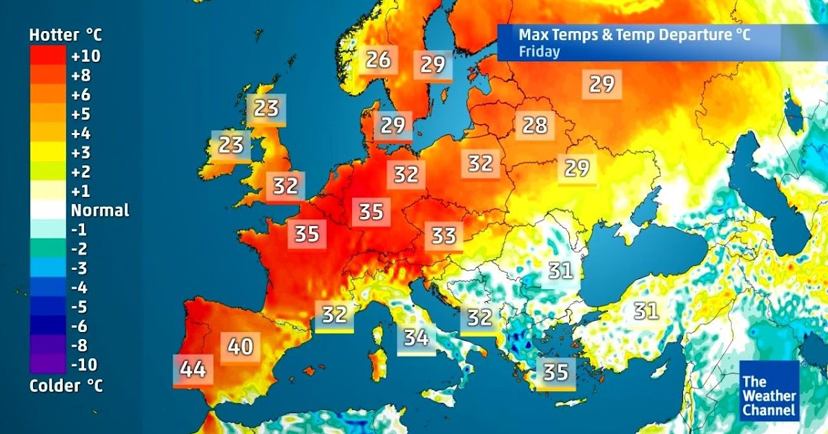 We analyzed the climate for additional regions, in order to provide you with information about the best time to visit and the expected holiday weather:
Cruises | Mediterranean Cruises | Caribbean Cruises | Canary Islands Cruises | Middle East Cruises | Asia Cruises | Baltic Sea Cruises | Alaska Cruises | South America Cruises | South Pacific Cruises | Northern America Cruises | Nile River Cruises | Danube River Cruises | Rhine River Cruises | Hawaii Cruises |
Hottest Month
July: 22 °C
Day Temperature in Copenhagen
Coldest Month
January: -13 °C
Night Temperature in Kirkenes
Rainiest Month
September: 11.14 in
Rain in Bergen
Driest Month
May: 0.94 in
Rain in Kirkenes
Maximum Water Temperature
July: 16 °C
Water Temperature in Copenhagen
Sunniest Month
June: 8. 8 hours/day
Sunshine in Copenhagen
Activities and Attractions
Distances to Northern Europe Cruises
| London | New York | Los Angeles | |
|---|---|---|---|
| Bergen | 650 mi | 3490 mi | 5180 mi |
| Kirkenes | 1590 mi | 3920 mi | 5090 mi |
| Reykjavik | 1170 mi | 2620 mi | 4310 mi |
| Kiel | 470 mi | 3800 mi | 5610 mi |
| Copenhagen | 590 mi | 3840 mi | 5600 mi |
Show Bergen on Map
Show Kirkenes on Map
Show Reykjavik on Map
Show Kiel on Map
Show Copenhagen on Map
Continent: Europe
All Holiday Destinations in Europe
Proof of Image Sources
Share your Experience and Win
We want to know: how was the weather during your Northern Europe Cruises holiday? You can win a travel coupon of 1000 $. The price will be raffled among all submissions.
JanuaryFebruaryMarchAprilMayJuneJulyAugustSeptemberOctoberNovemberDecember When was your Northern Europe Cruises holiday?
5 (Excellent)4 (Good)3 (Mixed)2 (Tricky)1 (Mostly bad)0 (Catastrophic) Please rate the weather with 0 to 5 stars.
Describe the travel weather during your holiday in your own words!
First Name
years old
E-Mail (voluntary disclosure, will not be shared)
All information entered will be stored according to our privacy policy.
Arctic Ocean: Powered by Nature
Destinations in the Vicinity …
The Best Time to Visit Eastern Europe for Weather, Safety, & Tourism
The best times to visit Eastern Europe for ideal weather are
May 28th to August 19th
based on average temperature and humidity from NOAA (the National Oceanic and Atmospheric Administration). Read below for more weather and travel details.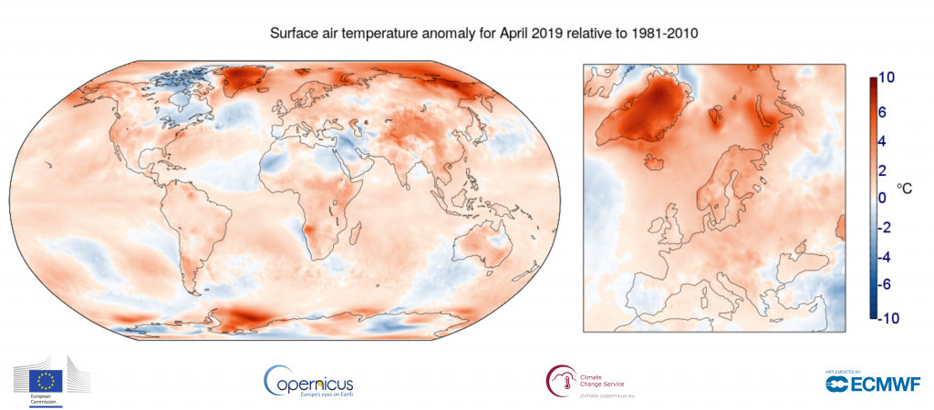
Eastern Europe Travel Guide
- Weather
- Temperature
- Perceived Temperature
- Rain and snow
- Humidity and wind
Other Eastern Europe Travel Info
Weather in Eastern Europe
Temperature
Average temperatures in Eastern Europe vary an incredible amount. Considering humidity, temperatures feel cold for most of the year with a low chance of precipitation most of the year. The area is less temperate than some — in the 33rd percentile for pleasant weather — compared to tourist destinations worldwide. Weeks with ideal weather are listed above. If you’re looking for the very warmest time to visit Eastern Europe, the hottest months are July, June, and then August. See average monthly temperatures below. The warmest time of year is generally mid July where highs are regularly around 77.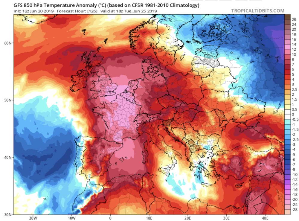 4°F (25.2°C) with temperatures rarely dropping below 54.6°F (12.6°C) at night.
Eastern Europe Temperatures (Fahrenheit)
Key
High
Average
Low
Eastern Europe Temperatures (Celsius)
Key
High
Average
Low
“Feels-Like” Temperatures
The way we experience weather isn’t all about temperature. Higher temperatures affect us much more at higher humidity, and colder temperatures feel piercing with high winds. Our perceived temperatures factor in humidity and wind chill to better represent how hot or cold the day feels to a person.
Eastern Europe Perceived Temperature (F)
Key
High
Average
Low
Eastern Europe Perceived Temperature (C)
Key
High
Average
Low
Average Eastern Europe Temperatures by Month
Daily highs (averaged for the month) usually give the best indication of the weather. A significantly lower mean and low generally just means it gets colder at night.
Show Fahrenheit
| Month | Avg. High (°F) | Avg. Mean (°F) | Avg. Low (°F) |
|---|---|---|---|
| Jan | -0.4 | -7.3 | -16.3 |
| Feb | 7.5 | 0.2 | -9.5 |
| Mar | 23.1 | 15.7 | 4.1 |
| Apr | 41.1 | 33.8 | 24.2 |
| May | 53.7 | 45.4 | 34.6 |
| Jun | 70.8 | 62.3 | 50.4 |
| Jul | 73.7 | 65 | 53.6 |
| Aug | 66.2 | 57.7 | 47.3 |
| Sep | 52.2 | 45.4 | 37.4 |
| Oct | 32.8 | 28.1 | 21.5 |
| Nov | 16.9 | 10.9 | 2.2 |
| Dec | 10 | 4.2 | -4.1 |
Show Celsius
| Month | Avg. High (°C) | Avg. Mean (°C) Mean (°C) |
Avg. Low (°C) |
|---|---|---|---|
| Jan | -18 | -21.8 | -26.8 |
| Feb | -13.6 | -17.7 | -23.1 |
| Mar | -4.9 | -9.1 | -15.5 |
| Apr | 5.1 | 1 | -4.3 |
| May | 12.1 | 7.4 | 1.4 |
| Jun | 21.6 | 16.8 | 10.2 |
| Jul | 23.2 | 18.3 | 12 |
| Aug | 19 | 14.3 | 8.5 |
| Sep | 11.2 | 7.4 | 3 |
| Oct | 0.4 | -2.2 | -5.8 |
| Nov | -8.4 | -11.7 | -16.6 |
| Dec | -12.2 | -15.4 | -20.1 |
Precipitation (Rain or Snow)
If dry weather is what you’re after, the months with the lowest chance of significant precipitation in Eastern Europe are January, December, and then February. Note that we define “significant precipitation” as .1 inches or more in this section. The lowest chance of rain or snow occurs around early January. For example, on the week of January 1st there are no days of precipitation on average. By contrast, it’s most likely to rain or snow in early June with an average of 3 days of significant precipitation the week of June 4th.
When can you find snow in Eastern Europe? Weather stations report far greater snow than most tourist destinations snow through most of the year likely to be deepest around March, especially close to mid March. The best time to ski (if at all) in Eastern Europe is often around around March 12th when fresh powder is deepest. Please note that a value of 0 for snow in the graph below may either mean there was no snow, or that snow is unreported.
Chance of Precipitation
The graph below shows the % chance of rainy and snowy days in Eastern Europe.
Key
Days with precipitation
Snow on the Ground
The graph below shows the average snow on the ground in Eastern Europe (in).
Key
Snow depth
Average Rain and Snow by Month
Show Inches
| Month | Daily Chance of Rain | Average Snow Depth (in) | Total Precipitation (in) |
|---|---|---|---|
| Jan | 6% | 24.5 | 0.9 |
| Feb | 7% | 30.9 | 0.8 |
| Mar | 8% | 35.1 | 0.9 |
| Apr | 11% | 25.1 | 1.1 |
| May | 17% | 3.4 | 1.8 |
| Jun | 18% | 0 | 2 |
| Jul | 24% | 0 | 2.8 |
| Aug | 25% | 0 | 3.4 |
| Sep | 25% | 0 | 3 |
| Oct | 21% | 4.8 | 2 |
| Nov | 9% | 8.6 | 1 |
| Dec | 6% | 18.3 | 0.8 |
Show Centimeters
| Month | Daily Chance of Rain | Average Snow Depth (cm) | Total Precipitation (cm) |
|---|---|---|---|
| Jan | 6 | 62. 2 2 |
2.3 |
| Feb | 7 | 78.5 | 2 |
| Mar | 8 | 89.2 | 2.3 |
| Apr | 11 | 63.8 | 2.8 |
| May | 17 | 8.6 | 4.6 |
| Jun | 18 | 0 | 5.1 |
| Jul | 24 | 0 | 7.1 |
| Aug | 25 | 0 | 8.6 |
| Sep | 25 | 0 | 7.6 |
| Oct | 21 | 12.2 | 5.1 |
| Nov | 9 | 21.8 | 2.5 |
| Dec | 6 | 46.5 | 2 |
Humidity and Wind
Eastern Europe has some extremely humid months, with other moderately humid months on the other side of the year. The least humid month is May (47.3% relative humidity), and the most humid month is October (81.4%).
Wind in Eastern Europe is usually calm. The windiest month is April, followed by March and October. April’s average wind speed of around 7.9 knots (9.1 MPH or 14.6 KPH) is considered “a gentle breeze.” Maximum sustained winds (the highest speed for the day lasting more than a few moments) are at their highest in mid March where average top sustained speeds reach 14.8 knots, which is considered a moderate breeze.
Relative Humidity (%)
The graph below shows the average % humidity by month in Eastern Europe.
Key
Avg. Relative Humidity
Wind
The graph below shows wind speed (max and average) in knots.
Key
Max Sustained Wind
Average Daily Wind
Average Wind Speeds
Show Wind Speeds
All wind speeds are in knots. 1 knot = 1.15 MPH or 1.85 KPH.
| Month | Avg. Wind | Avg. Wind Feel | Sustained High Wind | High Wind Feel |
| Jan | 6 | Light breeze | 9. 8 8 |
Gentle breeze |
| Feb | 6.3 | Light breeze | 10 | Gentle breeze |
| Mar | 7.8 | Gentle breeze | 12.7 | Gentle breeze |
| Apr | 7.9 | Gentle breeze | 13.4 | Significant breeze |
| May | 7.6 | Gentle breeze | 12.8 | Gentle breeze |
| Jun | 6.5 | Light breeze | 11.4 | Significant breeze |
| Jul | 6.3 | Light breeze | 11.3 | Gentle breeze |
| Aug | 5.9 | Light breeze | 10.5 | Gentle breeze |
| Sep | 6.5 | Light breeze | 11.3 | Gentle breeze |
| Oct | 7.6 | Gentle breeze | 12 | Significant breeze |
| Nov | 7.1 | Gentle breeze | 11 | Gentle breeze |
| Dec | 7 | Gentle breeze | 10. 7 7 |
Gentle breeze |
Show Relative Humidity by Month
| Month | Avg. Relative Humidity |
|---|---|
| Jan | 63.9% |
| Feb | 66.7% |
| Mar | 62.8% |
| Apr | 56.1% |
| May | 47.3% |
| Jun | 50% |
| Jul | 55.1% |
| Aug | 64.9% |
| Sep | 71.2% |
| Oct | 81.4% |
| Nov | 78.6% |
| Dec | 74.5% |
Is it Safe to Travel to Eastern Europe?
Our best data indicates this area is somewhat safe, but with extra warnings in a few regions. As of Oct 07, 2019 there are travel warnings and regional advisories for Russia; exercise a high degree of caution and avoid some areas. Check this page for any recent changes or regions to avoid: Travel Advice and Advisories. This advisory was last updated on Aug 22, 2019.
The Busiest and Least Crowded Months
The busiest month for tourism in Eastern Europe is May, followed by February and March. Prices for hotels and flights will be most expensive during these months, though you can save if you purchase well in advance. Tourists are unlikely to visit Eastern Europe in December. Those willing to visit at these times will likely find it the least expensive month.
Estimated Tourism by Month
Most Popular Months to Visit
Key
Tourists Seeking Accommodations
Tourism graph is based on Google searches for services used by tourists relative to the rest of the year. Tourism data for this area is extrapolated based on nearby areas. Displayed data is calculated relative to the peak, so a score of 62.7 in December means 62.7% of the tourists vs. May.
Overall Eastern Europe Travel Experience by Season
Spring (March through May)
Humidity and temperatures combine to make this season feel very cold. Highs range from 59.6°F (15.3°C) and 16.9°F (-8.4°C) with far warmer temperatures in the later months. Rain is rare with 2 to 5 days of significant precipitation per month. Spring is the busiest for tourism, which makes it a good time for those looking for things to do.
Summer (June through August)
The middle-year months have comfortably cool weather with high temperatures that are comfortable. These months see the most precipitation with 5 to 8 days of precipitation per month. June – August is the second busiest season for tourism in Eastern Europe, so lodging and other accommodations may cost slightly more.
Fall (September through November)
Fall daily highs range from 57.4°F (14.1°C) and 13.9°F (-10.1°C), which will feel very chilly given the humidity and wind. It rains or snows a significant amount: 3 to 8 days per month. Tourism is the slowest during these months due to the weather, so hotels may be affordably priced.
Winter (December through February)
Weather is far too cold this time of year in Eastern Europe to be enjoyable for warm weather travelers. The average high during this season is between 18.4°F (-7.6°C) and -7.7°F (-22.1°C). On average, it rains or snows a smalll amount: consistently 2 times per month. These times of year are fairly slow with tourists.
Best Times to Travel › Eastern Europe
Similar Destinations
- Nizhnevartovsk, Russia
- Surgut, Russia
- Nefteyugansk, Russia
- Novy Urengoy, Russia
- Omsk, Russia
- Leninskiy, Russia
- Novosibirsk, Russia
- Kirovskiy, Russia
- Pavlodar, Kazakhstan
- Seversk, Russia
Popular Destinations
- Chennai, India
- Stockholm, Sweden
- Lisbon District, Portugal
90,000 weather in Germany in April / Weather map
Germany in April on the Weather map
Weather
Water temperature in the sea
Now
February
March
April
May
June
June July July July
July
August
September
October
November
December
This weather map is fully interactive. You can switch months, as well as zoom and move the visible area of the map to view other resorts.
The weather in April is very favorable for hiking. The air is clean and spring-like fresh, flowers bloom everywhere, it gets warmer every day and the sun often peeps out. By the end of the month, the air warms up in the warmest regions of the country even up to +17 … +18 degrees, which allows you to walk just in a T-shirt during the daytime. Night temperatures are also warmer now, and an evening outing will also require no warmer clothing than a light jumper and windbreaker. However, unexpected rain is also very likely at this time, so going for a walk even on the sunniest day, you should take an umbrella with you – the clouds can gather very quickly and shed a quick, but very heavy rain.
The weather in April in the German capital is warmer than in early spring, but it rains more often and the number of sunny days is less. Despite the predominantly cloudy weather, during the day the air is already warming up to +13…+14 degrees Celsius, and at night there are also positive temperatures – about +3…+4 degrees. Weather forecasters promise only two sunny days and nine rainy days this month, so when you go to Berlin at such a time, be sure to take care of an umbrella and waterproof shoes. This will give your trip comfort and safety. Rainfall is unlikely to be heavy or long, with total monthly rainfall of just 40mm. Humidity after winter decreases significantly and amounts to 76%.
Dresden is also getting warmer at this time. During the day the air temperature rises to +13…+14 degrees, at night it is also warm – +2…+3. The amount of precipitation is not yet high – 48 mm, and it rains mainly at the end of the month, because the coming May will be much more generous in precipitation here. However, tourists who come for the most part not to walk directly around the city, but to visit numerous museums and galleries, are not embarrassed, because the expositions are located under the roof.
In the north of the country, in Bremen, the weather is very similar to Dresden, although these cities are located quite far from each other. During the day, the same +13 … +14, and at night about +3 degrees. During the month, only two millimeters more precipitation falls. Humidity is also almost the same, despite the proximity of the coast.
Also similar weather conditions are observed in the middle of spring in Munich – the capital of Bavaria, which is the southernmost province of the country. During the day, the air warms up to +13…+15 degrees, at night it still gets significantly colder to +3…+4, but without the likelihood of frost. The amount of precipitation is not much higher than that observed in other regions of the state – about 50 mm during the month. Humidity is at 70%. In general, the weather in April in this region is already quite comfortable for travel.
Somewhat warmer in the west of the country, in Cologne and Düsseldorf. Here during the day the temperature rises to +15 degrees, and at night it does not fall below +5 degrees. Humidity is 70%, but despite this, the amount of precipitation is noticeably higher than in March and is 60 mm. The western regions of Germany are adjacent to the Netherlands, so the weather here is similar. In April, tulips are still actively blooming, visiting parks or squares, you will be convinced that the pictures that you have seen on the Internet can only remotely convey the natural beauty of blooming April.
At ski resorts, April is the end of the season, which will open again not earlier than October-November, and then in a favorable cold and snowy year. But at the very beginning of the month, under favorable circumstances, you can still go skiing or snowboarding from the mountains.
Going to Germany, you can count on the weather in April to be favorable to you and the trip from this point of view will be very pleasant. Comfortable shoes, fairly light clothes and an umbrella – that’s all you need for comfort in the middle of spring in any region of the most developed country in the European Union. Visiting the country during this period is still good because the tourist flows are still moderate, as well as prices, which is important. At the same time, according to the calendar, Christian holidays often fall precisely in April, and if you come here at this time, you can become a participant in many holidays and festivals that the Germans love to celebrate. Have a nice holiday.
Where is the best place to relax in Germany in April?
This table will help you determine which German resorts are warmest in April, find out where there is less rain and more clear days.
Do you want to know where is the warmest sea? We also provide information about the water temperature in seaside resorts.
| Resort name | Air temperature day / night |
Cloudy | Rainy days / rainfall |
Sea water temperature | Solar clock * |
|
|---|---|---|---|---|---|---|
| Aachen | 12.6°C | 5.5°C | 47.0% |
2 days (36.4 mm.) |
– | 08h. 20m. |
| Augsburg | 13. 2°C 2°C |
4.5°C | 45.6% |
4 days (46.5 mm.) |
– | 08h. 27m. |
| Bavaria | 13.0°C | 5.1°C | 46.0% |
4 days (47.4 mm.) |
– | 08h. 25m. |
| Bad Reichenhall | 13.0°C | 2.4°C | 46.7% |
7 days (91.7 mm.) |
– | 08h. 16m. |
| Baden Baden | 14.3°C | 5.7°C | 44.4% |
3 days (53.5 mm.) |
– | 08h. 37m. |
| Berlin | 14.0°C | 6.8°C | 48.3% |
2 days (28.2 mm.) |
– | 08h. 12m. |
| Berchtesgaden | 13.1°C | 2.3°C | 47.2% |
7 days (89.8 mm.) |
– | 08h. 12m. |
| Bonn | 14.4°C | 6.2°C | 44. 5% 5% |
2 days (36.5 mm.) |
– | 08h. 41m. |
| Bochum | 13.8°C | 7.1°C | 47.5% |
2 days (35.3 mm.) |
– | 08h. 17m. |
| Bremen | 12.7°C | 5.3°C | 47.8% |
3 days (40.0 mm.) |
8.7°C | 08h. 18m. |
| Wiesbaden | 14.7°C | 7.3°C | 42.1% |
2 days (31.8 mm.) |
– | 08h. 59m. |
| Würzburg | 13.5°C | 5.5°C | 44.5% |
2 days (37.7 mm.) |
– | 08h. 39m. |
| Hamburg | 12.3°C | 5.3°C | 48.1% |
2 days (36.6 mm.) |
8.3°C | 08h. 17m. |
| Hanover | 13.2°C | 5.6°C | 48.1% |
3 days (39.7 mm. |
– | 08h. 14m. |
| Garmisch-Partenkirchen | 11.6°C | 0.1°C | 49.3% |
7 days (101.3 mm.) |
– | 07h. 55m. |
| Heidelberg | 14.6°C | 6.5°C | 43.0% |
2 days (34.8 mm.) |
– | 08h. 50m. |
| Dortmund | 13.8°C | 6.8°C | 47.7% |
3 days (39.7 mm.) |
– | 08h. 16m. |
| Dresden | 12.6°C | 5.5°C | 48.7% |
3 days (42.2 mm.) |
– | 08h. 07m. |
| Dusseldorf | 14.3°C | 7.6°C | 45.1% |
2 days (30.1 mm.) |
– | 08h. 37m. |
| Karlsruhe | 15.4°C | 7.1°C | 41.7% |
1 day (27.9 mm.) |
– | 09h. 00m. 00m. |
| Kassel | 13.0°C | 4.5°C | 48.0% |
2 days (36.8 mm.) |
– | 08h. 12m. |
| Koln | 14.7°C | 7.2°C | 43.5% |
2 days (33.0 mm.) |
– | 08h. 50m. |
| Keel | 10.8°C | 4.8°C | 47.2% |
1 day (31.1 mm.) |
6.5°C | 08h. 26m. |
| Leipzig | 13.5°C | 5.6°C | 46.6% |
2 days (30.4 mm.) |
– | 08h. 25m. |
| Lübeck | 11.6°C | 4.8°C | 46.6% |
1 day (31.8 mm.) |
6.1°C | 08h. 30m. |
| Magdeburg | 13.6°C | 6.0°C | 45.2% |
2 days (32.2 mm.) |
– | 08h. 37m. |
| Mainz | 14. 8°C 8°C |
7.2°C | 42.8% |
2 days (27.5 mm.) |
– | 08h. 53m. |
| Mannheim | 15.2°C | 7.5°C | 41.8% |
1 day (30.1 mm.) |
– | 09h. 01m. |
| Munich | 13.4°C | 4.8°C | 46.7% |
5 days (61.4 mm.) |
– | 08h. 17m. |
| Nuremberg | 13.9°C | 5.4°C | 44.3% |
2 days (36.6 mm.) |
– | 08h. 40m. |
| Regensburg | 14.2°C | 5.5°C | 43.1% |
2 days (38.4 mm.) |
– | 08h. 49m. |
| Rostock | 10.8°C | 5.4°C | 44.2% |
2 days (36.3 mm.) |
7.5°C | 08h. 51m. |
| Rust | 15.1°C | 6.0°C | 40. 3% 3% |
2 days (40.4 mm.) |
– | 09h. 10m. |
| Saarbrücken | 14.1°C | 5.9°C | 45.0% |
3 days (41.6 mm.) |
– | 08h. 33m. |
| Freiburg | 14.2°C | 4.9°C | 41.3% |
3 days (48.0 mm.) |
– | 09h. 01m. |
| Frankfurt am Main | 14.8°C | 7.0°C | 41.2% |
2 days (31.5 mm.) |
– | 09h. 07m. |
| Füssen | 10.2°C | 0.3°C | 50.3% |
9 days (117.2 mm.) |
– | 07h. 47m. |
| Herscheid | 12.0°C | 5.4°C | 50.4% |
4 days (51.0 mm.) |
– | 07h. 53m. |
| Stuttgart | 13.9°C | 5.9°C | 43.2% |
3 days (41. |
– | 08h. 48m. |
| Essen | 14.0°C | 7.3°C | 46.9% |
1 day (26.4 mm.) |
– | 08h. 22m. |
 )
) 0 mm.)
* Sundial – an indicator that displays the average number of hours per day during which direct sunlight reaches the earth’s surface. This indicator is influenced by both the length of daylight hours and cloud cover in the daytime.
Tourist reviews of the weather in Germany in April
Finally, I visited Germany, I dreamed of it for a long time! Of course, I wanted to go at the end of summer or autumn, but it turned out that we went in April. In the spring there, too, it is very good. We were in the middle of the month, the temperature was +9 and rose to +14, it was sunny. There was no rain at all, not even clouds. Flowers are already blooming in gardens and parks, everything is green, the most beautiful are tulips, there are a lot of them. I really liked that it was not hot, so I did not regret that we went in the spring.
See all reviews
Castles of the Rhine. Koblenz, Rüdesheim.
Year after year, millions of visitors come to the romantic Middle Rhine Valley, where between Rüdesheim and Koblenz, there is the largest number of medieval castles in the world.
Castles of the Rhine + Fireworks!
Year after year, millions of visitors come to the romantic Middle Rhine Valley, where between Rüdesheim and Koblenz, there is the largest number of medieval castles in the world.
Two rivers: Moselle and Rhine.
Cochem, Reichsburg Castle and the famous German Corner.
Castles of the Moselle
Eltz, Cochem, Beilstein.
Not Found (#404)
Not Found (#404)
Whoops…something went wrong!
Sorry, we couldn’t find the page you were looking for
Tours
Hotels
Railway tickets
Route
Countries and cities
Location
Cities
Yachting
Expeditions
Dog sled tours
Snowmobile tours
Quad tours
Walking tours
Alloys
Bike tours
Climbing
Ski tours
Diving and snorkeling
Jeep tours
Surfing and SUP tours
Combined tours
Horse tours
Cruises
Excursion tours
Ski trips
Helicopter tours
Fishing tours
Fitness and yoga tours
Canyoning
Railway tours
Are you looking for one of the sections below?
Tours
Hotels
Railway Tickets
Routes
Attractions
We have made a selection of interesting articles for you!
Leave a review
12345
Thank you very much 🙂
Your feedback is very important to us and will be posted on the service as soon as possible.
time!
Weather in Germany in April 2022-2021 at “365 Celsius”
What is the weather in Germany in the month of April is highly dependent on the region. The air warms up at night to +6.5°C, and during the day up to +17.3°C, it rains for 12 days and 18.6 mm of precipitation falls per month. And, for example, in Ribnitz-Damgarten, the weather conditions are not very good, since the air is up to + 8.9 ° C, cloudy and rainy days are at least 11. The best cities to relax at this time are Bonn, Bremen, Nuremberg. The air temperature in April is +14.4°C.
Climate
| Average temperature during the day: | +14.4°C | |
| Number of sunny days: | 13 days | |
| Rainy days: Rainfall: |
12 days 18. |
Is it worth it to come to rest in Germany in April?
The weather in Germany in April is great for holidays, this month’s rating is 4.5 out of five. The weather is not very good, there are few tourists. It rains a lot, about 12 days a month, with 18.6 mm of precipitation. Sunny skies for at least 13 days. The weather in Germany at the end of April at the beginning and middle of the month is presented on the graph. The air temperature in April is +14.4°C. At this time, the best climatic conditions in 3 cities:
| Weather in April Frankfurt am Main | April weather Karlsruhe | Weather in April Taunusstein | |||
|
4 |
air: +16.6°C rain: 3 days sun: 14 days |
4 |
air: +17.3°C rain: 1 day sun: 15 days |
4 |
air: +15. rain: 12 days sun: 16 days |
Best climate in cities in April
| City | Air temperature | Water temperature | Rainy days (precipitation) | |
| Nuremberg | +15.5°C | – | 3 days (33.8mm) | |
| Landau | +15.8°C | – | 12 days (14.45mm) | |
| Cologne | +16.2°C | – | 3 days (25.8mm) | |
| Seligenstadt | +15.8°C | – | 10 days (14. |
|
| Worms | +15.9°C | – | 10 days (11.03mm) | |
| Freiburg | +15.5°C | – | 6 days (46.3mm) | |
| Rodgau | +15.8°C | – | 10 days (14.97mm) |
Full list of cities
Quick city search
Air temperature in Germany in April
The difference in daily air temperature throughout the year is 20.7°C, but due to the presence of the sea, the climate in Germany is quite mild for months. The coldest month is January when the air warms up to +2.7°C, and the warmest month is July with +23. 4°C. The air temperature in April is +14.4°C.
Water temperature in Germany
The beach season here lasts: . The temperature in the sea at this time of the year is from – to – conducive to a pleasant swim. Worst weather in Germany and water temperature recorded in November -. The air temperature in April is +14.4°C.
Number of rainy days and precipitation in April
Unlucky month for travel – July, it rains on average 16 days. The maximum monthly rainfall is 44.3 mm. The air temperature in April is +14.4°C.
Rating of comfortable rest in April
The rating is calculated by months, taking into account the average air temperature, the amount of rain and other indicators. Over the course of a year in Germany, the score ranges from 4.2 in December to 5.0 in August, out of a possible five. The air temperature in April is +14.4°C.
| Month | Air temperature during the day | Water temperature | Solar days |
Rainy days (precipitation) |
| December | +4.2°C | – | 6.5 | 13 days (42.7 mm) |
| January | +2.7°C | +0.0°C | 5.3 | 11 days (37.9 mm) |
| February | +4.0°C | +0.0°C | 8.9 | 9 days (22.9 mm) |
| March | +8. |
– | 9.2 | 11 days (22.1 mm) |
| April | +14.4°C | – | 12.9 | 12 days (19.9 mm) |
| May | +17.8°C | – | 15.8 | 15 days (38.1 mm) |
| June | +20.9°C | – | 14.9 | 15 days (39.2 mm) |
| July | +23.4°C | – | 16.4 | 16 days (44.3 mm) |
| August | +23.1°C | – | 20.1 | 14 days (35. |
| September | +19.0°C | – | 16.6 | 11 days (25.2 mm) |
| October | +13.5°C | – | 9.5 | 11 days (26.3 mm) |
| November | +8.3°C | – | 7.8 | 11 days (27.2 mm) |
Number of sunny days in April
Beautiful sunny weather will delight tourists in August – as many as 21 sunny days per month. Great time to relax in Germany. The air temperature in April is +14.4°C.
- Please note:
- Weather in Germany in March: rating 4.2 (out of 5), air +8.
9°C , rain 11 days
- Weather in Germany in May: rating 4.7 (out of 5), air +17.8°C , rain 15 days
Malta, Budapest, Prague, Vienna, Madeira, Amsterdam
April holidays are great! You can change the situation and relax your body and soul in April in Europe – there at this time of the year it is warm, sunny and the aromas of ripe fruits are in the air.
Weather
The weather in Malta, though not hot in April, is warm enough for Russian tourists who miss summer. The air at this time of the year warms up to [info-box type=”bold”] +20 degrees[/info-box] of heat, water – up to [info-box type=”bold”]+16[/info-box]. The weather in Madeira is also quite warm: the average air and water temperature during the day in April reaches [info-box type=”bold”]+17…+ 18 degrees[/info-box] Celsius. The weather in Paris, according to tourists, is conducive to pleasant romantic walks in April. The air warms up to [info-box type=”bold”]+14 degrees[/info-box].
[info-box type=”warning”]Be aware that strong winds and rains are possible in Paris at this time of the year, so you should carefully consider your wardrobe when going on vacation to the French capital.[/info-box]
The weather in Prague in April 2019 is striking in its variety and inconsistency, but the overall feeling is comfortable, as it is quite dry. The air temperature during the day reaches the mark of [info-box type=”bold”]+12 degrees[/info-box] Celsius.
No Schengen visa
For tourists who do not have the possibility of obtaining a Schengen visa, a holiday in Montenegro is perfect in April. The weather is conducive to a cultural holiday, and tourists can enjoy the beauties and sights of Montenegro comfortably and calmly.
Montenegro flourishes at this time of the year: the traveler will remember the rest with unique walking and car tours, museums, monasteries and architectural monuments.
Events of interest
Madeira surprises tourists with both the weather and the sugar cane festival in April. [info-box type=”bold”]The program includes a sugar fair, tours of the production of molasses and cane cutting[/info-box].
[info-box type=”fact”]Madeira will also host the world’s greatest multi-distance cross-country race. Registration for this race takes place from the beginning of the year. Spending a vacation in Europe in April, you should not count on a beach pastime, but there will be a lot of cultural events and excursions. For example, Prague has everything you need to enjoy the beauties of architecture and envelops the tourist with the unique aromas of blooming flowers and trees in April. The snow in Prague melts back in March, and the pavements are dry and comfortable. [info-box type=”bold”]Prague is getting ready for Easter, and all the fairs and decorations of the city are dedicated to this event[/info-box].
Where to go in April and which European country to choose depends on the preferences of the tourist. Each of the countries will allow the traveler to discover all the charms of ancient and modern cities. So, Budapest in April also welcomes its guests with an abundance of architectural sights. Narrow streets immerse tourists in the atmosphere of the Middle Ages. The weather in Madeira in April will give the traveler many hours of pleasure – it is ideal for visiting cultural and historical monuments. Comfortable, warm, there is no sweltering heat inherent in the summer period.
Where to relax in Europe inexpensively and spend holidays in ski resorts? You can catch the closing of many tourist bases in the Alps.
And in some northern European countries the ski season lasts until the end of spring.
Czech Republic
April in the Czech Republic, according to tourists, is the most favorable time to explore local attractions. The weather is mild, warm and conducive to long walks in Prague and other cities.
Bright colors fill the Czech Republic – blooming tulips, fragrant magnolias and other plants, no less exotic for a Russian, fill the April air in the Czech Republic with delicious smells. Czech walks are relatively inexpensive and comfortable, since the tourist season is not yet open and there are not many people on the streets of Prague, according to tourists.
The Netherlands
The Netherlands is a good choice when traveling to Europe. Amsterdam in April, according to tourists, will give a lot of unforgettable and enthusiastic impressions: [info-box type=”bold”]a sea of tulip fields, rose gardens, unique Amsterdam architecture[/info-box] – all this will make your vacation incomparable.
Austria
Vienna in April, according to reviews, meets vacationers with slightly windy, but quite warm weather. Like most European countries, Austria is flourishing and at a crossroads at this time – [info-box type=”bold”]the ski season is coming to an end, and the summer influx of tourists has not yet arrived[/info-box]. Travelers in Vienna in April will be able to enjoy the rich historical heritage of the country in the most comfortable conditions.
[info-box type=”info”]They will be able to visit small cozy cafeterias and sales, as well as enjoy the flowering streets and the incomparable aromas of blossoming flowers.[/info-box] .
Italy and France
Italy and France are beautiful in April – these countries will envelop vacationers with an inexpressible love atmosphere. There is no influx of tourists at this time of the year, and the trip will become intimate and unforgettable.
Interesting
Germany in April 2023 – rest and weather in Germany
April is the month when the cold finally recedes. Nature is reborn and flourishing, and more than ever you want new vivid impressions. Many decide to go to another country, arranging a mini-vacation for themselves. This article will focus on the features of the April holiday in Germany.
Contents
In April, the country is dressed in floral decorations, every day it gets warmer and warmer, but the evenings still do not give an opportunity to forget about warm clothes
When is the best time to visit Germany? | January | February | March | April | May | June | July | August | September | October | November | December
= “d” .$placeID ?>
} else {
?>
= “ddd” .$placeID ?>
}
?>
Weather in Germany in April
In April, climatic spring finally and irrevocably comes to Germany – with lush greenery, an abundance of flowers and dozens of delicate aromas. The point of return to winter cold is finally behind us. The dull time of the transition period is replaced by sunny, friendly days, the amount of rain is gradually waning. The heavenly body rises higher and higher above the horizon, and the days are noticeably lengthening. Instead of heavy, thick March clouds, weather forecasters promise partly cloudy weather. The dim shades of water in the reservoirs begin to reflect the piercing blue of the skies, from which the soul sings and rejoices. Constantly warming sun rays gradually warm the air, creating a pleasant atmosphere for a long stay outside. Weather changes are directly related to tourist baggage: it is significantly reduced. Despite the improvement in weather conditions compared to March, it will not be possible to completely abandon warm clothes, as the nights remain cool. The current wardrobe includes a demi-season jacket or coat, trousers and waterproof comfortable shoes.
Berlin
+13
Baden-Baden
+16
Dusseldorf
+14
Munich
9000 +13
Gamburgg 9000 +13 9000 14
Frankfurt
+15
Cologne
+15
Germany 14 day weather forecast →
If evening “outings” are planned, it will not be superfluous to grab a scarf and a hat, because with the onset of darkness it becomes dank, and the wind often increases. In the capital, the weather portends very good indicators. The maximum indicators often exceed +18°С, but still be guided by daytime +13..+14°С and nighttime +2..+4°С. In Munich, where it is traditionally a few degrees cooler, daily temperature fluctuations can be from +2°С to +17°С. If we talk about average indicators, then during the day they are about +14°С, and in the evening – about +3..+4°С. In both cities, the chance of rain equates to 10-12 wet days per month. In April, snow rapidly disappears from the mountain slopes, the influx of fans of ski holidays stops until the next season. By the end of the month, snow cover remains only at high altitudes, and streams flow with might and main at the lower stations. The western regions are slightly warmer than the eastern ones. In Cologne, Düsseldorf, Hamburg, Frankfurt am Main and Bremen, +15..+17°С is recorded at noon, and +5..+6°С as dusk falls.
What to do in Germany in April?
The weather is conducive to the study of the rich arsenal of historical, cultural, natural wealth of Germany. There are so many attractions in the country that there will be no time to be bored. The absence of queues at ticket offices and crowding in public places will save a lot of precious vacation time, which in the summer is often wasted due to the big hype. The second month of spring is a good period for traveling with children: it is no longer cold, but not yet hot, and most importantly, numerous attractions, playgrounds and entertainment centers are already open at this time of the year. In addition, April is ideal for admiring the natural beauty, thanks to which Germany has a particularly advantageous position among its European neighbors.
Entertainment and excursions
In April, gardens, squares and parks are rapidly acquiring delicate greenery, and the air is saturated with the sweet smell of flowering magnolias, cherries, bird cherry and daffodils. This is a great time for leisurely walks, picnics, playing badminton, reading books and watching scenes of German life. Summer is still far away, but it is not so difficult to speed up its arrival if you go to one of the largest indoor water parks in the world, Tropical Islands, which is 60 km away. south of Berlin. In addition, no trip is unthinkable without shopping. The sales season is long over, but fashion outlets offer discounts all year round. In Berlin, for example, the first thing people go to for shopping is Designer Outlet Berlin and Priva Fashion-Club. If you are in the capital, do not miss the chance to look into the most famous museums in Germany, which are not yet crowded with visitors.
Among them: the Egyptian Museum, Kulturforum, New National Gallery and Museum Island. In Dresden, the Gallery of Old Masters is very interesting. And if you prefer noisy gatherings and glamorous parties to viewing the exhibits, prestigious metropolitan nightclubs and crazy discos are at your service. In addition to Berlin, Munich is also in the center of attention of the daring youth. Its main feature is the famous beer parties. In institutions called “4004” and “WWII” a lot of colorful audience gathers. In bad weather, seek refuge in authentic taverns and cozy bars serving delicious Bavarian sausages and the best beer in the world. Fans of urban landscapes and architectural styles will take plenty of photos and bring home great photos. In April, there are not as many visitors in Germany as in summer, so the process of photographing will take place in an easy and relaxed atmosphere. It should be noted that this month, the doors of many palaces, fortresses and other memorial structures that were closed during the low season swing open. And they offer visits at discounted prices. If the purpose of your visit is relaxation and serene rest, pay attention to the thermal baths and wellness complexes, where there is everything to relieve stress, rejuvenate and improve your health.
What are the prices for holidays in Germany in April?
April is still the off-season, with its characteristic low prices and discounts. Hotels in the middle of spring are not overloaded, and there are a lot of accommodation options. The exception, perhaps, is the Easter week, when in some cities there is an influx of visitors. If your vacation falls on any major holidays, we advise you to take care of booking accommodation in advance. Also consider buying tickets. Major airlines such as Aeroflot, Air Berlin and Lufthansa, around the end of January – in February, can sell seats on board at reduced prices.
Remember that you can buy a tour to Germany cheaper at
Travelata. ru – search for tours through hundreds of tour operators! Use our promo codes
AF2000turcalendar for add. discount of 2000 rubles (tours from 100tr),
AF1500turcalendar 1500 rubles (from 80tr) and
AF1000turcalendar 1000 rub (from 60tr)!
Pick up a tour to Germany for April →
Find flights to Germany →
Prices for hotels in Germany →
How to relax in Germany in April on your own
Already chosen where to go in Germany in April? For a solo trip you need:
- We book a hotel – do not overpay! We check prices at once on all booking sites at HotelLook
- We buy air tickets on AviaSales – we compare the cost of tickets to Germany from all agencies and airlines
- Book excursions on Tripster – choose and book excursions for April
- Rent a car – compare the prices of all car rental companies. Holidays in Germany in April will be more interesting with a car
- We arrange insurance – prices from all insurers at Cherehapa
- Transfer and taxi – proven service KiwiTaxi
In general, April is a great month for traveling in Germany. The weather acquires features of stability and less and less upsets with unpleasant surprises. There are still relatively few tourists, and sights that are not working in winter are progressively resuming their work. Nature is filled with delightful flowering and incomparable fragrance, which makes the environment very attractive. We can say that this month is shown to those who like to relax brightly, but not noisily.
Weather in Berlin in April 2023
Check the weather for April before planning your holiday in Berlin.
Average weather data includes daytime highs and nighttime lows in temperature, rainfall, hours of sunshine, and water temperature data.
9 2022In April 2021 in April 2020 In April 2019 in April 2018 in April 2017 in April 2016 12 ° C 9,000 9,000 9,000 4 ° C 12 ° C 4 ° C 14 ° C 5 ° C 14 ° C 5 ° C 14 ° C 5 ° C 14 ° C 6°C 15°C 7°C 15°C 7°C 15°C 6°C 10 907 14°C 6°C 11 apr. 15°C 5°C 12 apr. 15°C 6°C 13 Apr. 14°C 6°C 14 apr. 13°C 4°C 15 apr. 14°C 5°C 16 apr. 15°C 5°C 17 apr. 15°C 6°C 18 apr. 15°C 6°C 19 apr. 17°C 7°C 20 apr. 17°C 8°C 21 apr. 17°C 8°C 22 apr. 17°C 7°C 23 apr. 18°C 8°C 24 apr. 17°C 8°C 25 apr. 16°C 7°C 26 apr. 16°C 7°C 27 apr. 17°C 7°C 28 apr. 17°C 7°C 29 apr. 18°C 8°C 30 apr. 18°C 8°C
Daily water temperature in April11 Apr. 12 Apr. 13 Apr. 14 Apr. 15 Apr. 16 Apr. 17 Apr. 18 Apr. 19 Apr. 20 Apr. 21 Apr. 22 Apr. 23 Apr. 24 Apr. 25 Apr. 26 Apr. 27 Apr. 28 Apr. 29 Apr. 30 Apr.
Precipitation by dayLight rain – up to 2.5 mm per hour, moderate rain – up to 8 mm per hour, heavy rain – more than 8 mm per hour, heavy rain from 30 mm. 0.5000 MM 0. 0.5000 MM 0.8750 MM 1.2500 MM 0.2500 MM 0.1250 MM 0.1250 MM 0.0000 MM 10 APR. 0.2500 mm 11 apr. 0.3750 mm 12 Apr. 0.6250 mm 13 apr. 1.1250 mm 14 apr. 1.0000 mm 15 apr. 0.8750 mm 16 apr. 0.5000 mm 17 apr. 0.5000 mm 18 apr. 0.5000 mm 19 apr. 0.1250 mm 20 apr. 0.0000 mm 21 Apr. 0.0000 mm 22 apr. 0.2500 mm 23 apr. 0.8750 mm 24 apr. 0.3750 mm 25 apr. 0.6250 mm 26 apr. 1.5000 mm 27 apr. 0.6250 mm 28 apr. 0.0000 mm 29 apr. 1.1250 mm 30 Apr. 1.3750 mm The maximum daytime temperature in Berlin is 18.0000 °C, the minimum nighttime temperature is 3.5556 °C. The amount of precipitation in April is usually not more than 50 mm, and the number of hours of sunshine is not less than 9. Weather in April at other resorts in GermanyBavaria 16°С Baden Baden 17°С Berlin 17 °С Hamburg 15°С Hannover 15 ° C Dresden 15 ° C Dusseldorf 17 ° C CELN 17 ° C Munich 16 ° C Frankfurt – on – Mine 9000 17 ° C Show all resorts Monthly weather in Berlin
Reviews for vacation in AprilAll reviewsAndrii April 29, 2022 Living Hotel Großer Kurfürst By Derag Berlin photo hotel location Location, relatively close to the center, within walking distance of the metro Lanzarote temperature april: Average weather April in Lanzarote, Canary IslandsCosta Teguise, Spain weather in April: average temperature & climatePlanning a trip to Costa Teguise? Save all the best places to visit with WanderlogDownload the travel planning app everyone’s been raving about Learn more General weather summaryMildly cool and breezy Feels like 1% Daily chance of prec. 0.009 in Amount 15.8 mph Wind speed 75% Humidity 12.8 hrs Daylight length 7:29am Sunrise 8:19pm Sunset 64% Cloud cover T-shirt What to wear Build, organize, and map your itinerary to Costa Teguise with our free trip planner. What is the average temperature in AprilThe average temperature in Costa Teguise in April for a typical day ranges from a high of 67°F (19°C) and a low of 63°F (17°C). Some would describe it as mildly cool and breezy. For comparison, the hottest month in Costa Teguise, September, has days with highs of 75°F (24°C) and lows of 72°F (22°C). Highs and lows in Costa Teguise in Apr How much does it rain in AprilIn Costa Teguise in April, there’s a 1% chance of rain on an average day. And on the average day it rains or snows, we get 0.01 in (0.2 mm) of precipitation. In more common terms of how much that is, some would describe it as not rainy at all. The wettest month in Costa Teguise is February with a 6% chance of precipitation on a typical day and gets 0.01 inches (0.2 mm) of precipitation, while the dryest month in Costa Teguise is July with a 0.0% chance of precipitation on a typical day and gets 0.01 inches (0.2 mm) of precipitation. These graphs show the probability of it raining/snowing in April and the amount of rainfall. Chance of rain or snow on an average Costa Teguise day by month Average precipitation by hour of day How cloudy is Costa Teguise in AprilThe average amount of time that the sky is clear or sunny (partly cloudy or less) in Costa Teguise during April is 15. Monthly clear skies percent of time in Costa Teguise When is the sunrise and sunset in AprilThe average day in Costa Teguise during April has 12.8 hours of daylight, with sunrise at 7:29 am and sunset at 8:19 pm. The day with the longest amount of daylight in Costa Teguise is June 16th with 14.0 hours while December 20th has the shortest amount of daylight of only 10.3 hours. This graph shows the average amount of daylight in Costa Teguise in April based on historical data. Average hours of daylight in Costa Teguise by month How humid is it in AprilIn April, Costa Teguise is moderately humid with an average amount of 75% (relative humidity), which could be described as humid but cool. Average relative humidity in Costa Teguise by month How windy is it in April in Costa TeguiseHistorically, the wind in Costa Teguise during April blows at an average speed of 15.8 mph (25.4 kph). The windiest month is July with an average wind speed of 21.0 mph (33.7 kph), while the calmest month is October with an average wind speed of 12.9 mph (20.7 kph). This graph shows the average wind speed in Costa Teguise in April based on historical data. Average monthly wind speed in Costa Teguise What to wear in AprilWith an average high of 67°F (19°C) and a low of 63°F (17°C), it generally feels mildly cool and breezy. With that in mind, most people would dress in something light like your favorite t-shirt. What’s the weather like in Costa Teguise the rest of the year?We’ve collected the weather data for Costa Teguise during all other months of the year too:
Where does this data come from?Weather data for Costa Teguise was collected from the MERRA-2 project from NASA, which used a climate model combined with historical data from weather stations around the world to estimate what the conditions were like for every point on the Earth. For all data based on historical data, we’ve averaged the data from the past 11 years (2010-2020). For example, for the hourly temperature at 10am, we’ve looked at the temperature at 10am on every day in April (e.g., April 1, April 2, etc. in 2010, 2011, etc.) and took the arithmetic mean. We did not smooth the data, so for example, our daily temperature line will have some randomness due to the fact that weather is random in the first place. Best of categories in Costa Teguise Restaurants Cafes Cheap eats Other eats Outdoor diningLunch Michelin star restaurantsRomantic restaurants Dinner Breakfast and brunch Breweries and beer Romantic places Family restaurants Kid-friendly attractions Italian restaurants Places to eat Rooftop bars Popular road trips from Costa TeguiseSlide 1 of 30 Costa Teguise to Barcelona Costa Teguise to Madrid Costa Teguise to Lisbon Costa Teguise to Maspalomas Costa Teguise to Puerto de la Cruz Costa Teguise to Seville Costa Teguise to Las Palmas de Gran Canaria Costa Teguise to Marrakech Costa Teguise to Valencia Costa Teguise to Pajara Costa Teguise to Granada Costa Teguise to Porto Costa Teguise to Cordoba Costa Teguise to Malaga Costa Teguise to Morro del Jable Costa Teguise to Los Cristianos Costa Teguise to Benidorm Costa Teguise to Palma de Mallorca Costa Teguise to Toledo Costa Teguise to Albufeira Costa Teguise to Bilbao Costa Teguise to Bordeaux Costa Teguise to Salou Costa Teguise to Zaragoza Costa Teguise to Salamanca Costa Teguise to San Sebastian – Donostia Costa Teguise to Playa del Ingles Costa Teguise to Segovia Costa Teguise to Ronda Costa Teguise to Evora All road trips from Costa Teguise
Weather in LanzaroteClimate in Lanzarote is really mild. The most warm period in Lanzarote is summer, July to September. Average high temperature reaches 30 degrees, sometimes can reach even 40 degrees Celsius. Spring weather in Lanzarote
Average low and high temperature in March varies from 15 to 23 degrees Celsius. So it is still good time to visit the island. Maybe not for sunbathing or swimming but for sightseeing in the capital Arrefice, Playa Blanca or another town. Temperature in April and May is couple degrees higher. Average precipitation in March reaches about 16 mm. And in April and May in decreases significantly to 2 mm. Sun shines about 8 – 9 hours per day during these months. Weather in Lanzarote in March. In March average air temperature is 18 – 19 degrees Celsius or about 65 degrees Fahrenheit. There are only 12 mm precipitation in whole month that is almost zero when counting for one day. Car Rental in LanzaroteWeather in Lanzarote in April. April is a bit warmer in Lanzarote. Average temperature grows to 19 – 20 degrees Celsius. That means daytime we have more than 20 degrees Celsius and at night temperature drops to about 16 degrees Celsius. Precipitation is still very low – only 6 mm per month. Weather in Lanzarote in May. In May air temperature in Lanzarote increases one more degree is reaches 20 degrees Celsius average. 25 degrees daytime and 17 degrees at night. Precipitation reaches only 2 mm per month. Summer weather in Lanzarote
June can still be assigned to spring. The real summer in Lanzarote starts in July and lasts till October. Average low temperature during these months does not drop below 20 degrees Celsius and the average high temperature reaches 27 – 27 degrees Celsius. Also, there are almost zero precipitation during these months and sun shines 10 -11 hours per day. Weather in Lanzarote in June. Summer begins! But it is not the warmest month in Lanzarote island. During June temperature can reach 26 or more degrees Celsius daytime and decrease to 19 degrees Celsius at night. No precipitation. Almost 14 hours of sunshine – longest day in the year. Weather in Lanzarote in July. Still not the warmest month in year. Average temperature is 24 degrees Celsius. Daytime temperature rises to 28 or more degrees Celsius and at night drops to 20 degrees Celsius. No precipitation. Weather in Lanzarote in August, September. August and September are warmest months in Lanzarote island. It is the best time to spend your holidays in Lanzarote. During these two months temperature averagely rises to 29 or more degrees Celsius or 84 degrees Fahrenheit. There is no precipitation and a lot of sunshine. Autumn weather in Lanzarote
Temperature starts dropping from September and keeps decreasing till January when it slowly starts to grow. In October average temperature is about 22 degrees and in November – about 17. You can still enjoy the weather in Lanzarote during autumn, especially when less tourists visit the island. Precipitation amount significantly increases in November and reaches average 24 mm. Sunshine during October December reaches only 6 – 7 hours. But it is still enough to spend your holidays in Lanzarote. Weather in Lanzarote in October. Temperature slightly decreases. But it still reaches 27 degrees Celsius or more. At night can drop to 19 degrees average. Only 6 mm of precipitation in whole month and eleven and a half hours of sunshine. Weather in Lanzarote in November. Daytime temperature reaches 24 degrees Celsius average. At night temperature can drop to 17 degrees Celsius. There are little bit more precipitation – 15 mm per month. Winter weather in Lanzarote
Winter in Lanzarote? Well, average low temperature during winter in Lanzarote does not drop below 14 degrees Celsius. So you can say there is no winter in Lanzarote. Even though, when average high temperature reaches 20 Celsius or more! But precipitation, started to grow in November reaches its’ max in December – 35 mm. And decreases below 20 mm in February, below 15 – in April. Least sunshiny days in Lanzarote are in November (6 hours) and December – January (7 hours). All amount of precipitation during the year in the island is about 125 – 150 mm. So you can compare it to your living area amount of precipitation and decide whether it is much or not. Free hotels reservation in Lanzarote Allready decided when to go for holidays in Lanzarote? Check out our best hotel offers in Lanzarote! Save your money and book now! Just press on See all Deals 🙂 Booking. Weather in Lanzarote in December, January. Weather in December and January is quite the same. During these months average air temperature drops to 18 degrees. At day it can reach 22 degrees Celsius and at night it can be 14 degrees Celsius. December and January has highest precipitation rate reaching 26 mm per month. Weather in Lanzarote in February. Weather in February is quite the same as in January. Average daily high and average low is the same, 21 degrees Celsius during day and 14 degrees Celsius at night. The difference between weather in Lanzarote in January and in February is that in February there are a little bit less precipitation – 18 mm. Daytime in February – 11 hours. As you can see, climate in Lanzarote is mild, even during winter. So, don’t doubt and pack your luggage – full of sun and sandy beaches island is waiting for you!
Quick Answer: Can You Sunbathe In Lanzarote In April?▲ Asked By: Carl Morgan Date: created: Jul 25 2021 Which Canary Island is the hottest in AprilAnswered By: Horace Jenkins Date: created: Jul 28 2021 LanzaroteLanzarote and Fuerteventura are the hottest islands in April, though Gran Canaria remains warmer at night. Fuerteventura is the driest, with only 5mm of rain predicted for the month.. Asked By: William Parker Date: created: Sep 20 2021 Is Tenerife hotter than LanzaroteAnswered By: Aaron Nelson Date: created: Sep 22 2021 Tenerife and Gran Canaria are the warmest islands in the Canaries during the months of December, January and February. … Lanzarote and Fuerteventura usually have more cloudy days, which makes the weather seem cooler compared to Tenerife. Asked By: Antonio Alexander Date: created: Feb 01 2022 Is Lanzarote hot in AprilAnswered By: Albert Russell Date: created: Feb 04 2022 Weather in Lanzarote in April The average temperature in April in Lanzarote is of 19.5°C, but during the daytime temperatures will usually be around their mid 20s°C. You can easily spend your days on the beach without being too hot, like it is the case with months like July or August. Asked By: Clifford Baker Date: created: Apr 30 2022 Which is the best area to stay in LanzaroteAnswered By: James Jones Date: created: May 02 2022 We look at the ten best places on the island next. Asked By: Jayden Green Date: created: Aug 13 2022 How hot is Costa del Sol in AprilAnswered By: Simon Campbell Date: created: Aug 14 2022 around 12 to 20 degrees CelsiusAverage temperatures in April in the Costa del Sol move around 12 to 20 degrees Celsius (54 and 68º F) in the first half of the month, approaching to the end of the month increasingly 20 degrees; is not unusual that there may be magnificent days where the thermometers go up to 25 degrees (77º F) or more. Asked By: Daniel Thomas Date: created: May 18 2021 What countries are hot in AprilAnswered By: Hunter Jackson Date: created: May 21 2021 Where is hot in AprilCyprus. Average temperature in April: 24ºC. … Malta and Gozo. Asked By: Clifford Evans Date: created: Jun 09 2021 Is April a good time to visit LanzaroteAnswered By: Bryan Harris Date: created: Jun 11 2021 The best time to visit Lanzarote is in spring or autumn for slightly cooler weather. March marks the end of winter and the region enjoys an average temperature of 23°C. … The average water temperature is 22°C in the summer that cools to 18°C towards the winter months. Asked By: Jose Ross Date: created: Jun 14 2021 Which is hotter in April Tenerife or LanzaroteAnswered By: Simon Bryant Date: created: Jun 14 2021 Tenerife and Gran Canaria will now warm to an average temperature of 19 Celsius. Asked By: Cody Cox Date: created: Aug 10 2021 Is Lanzarote busy in AprilAnswered By: Jonathan Smith Date: created: Aug 13 2021 In fact, unlike virtually every other European resort, Lanzarote’s high season is between November and April, getting busy again in the ‘conventional’ European peak season of July and August. … As we said at the beginning, there is never a bad time to visit the enchanting land of Lanzarote, the choice is yours. Asked By: Gregory Perry Date: created: Aug 19 2021 Can you sunbathe in Lanzarote in MarchAnswered By: Landon Smith Date: created: Aug 21 2021 March can be mixed from a sunshine point of view – there’s a reasonable chance of some cloudy days during the month, but the UV is starting to get quite high, so you’ll still tan (and burn) even on the odd cloudy day. Asked By: Steven Lewis Date: created: Nov 16 2021 What is the nicest part of LanzaroteAnswered By: Jason Gonzales Date: created: Nov 18 2021 The best areas to stay in LanzarotePuerto del Carmen. Puerto del Carmen was the very first “resort area” to have popped up on the island. … Playa Blanca. … Costa Teguise. Asked By: Geoffrey White Date: created: Dec 02 2021 What is the warmest part of LanzaroteAnswered By: Cody Ross Date: created: Dec 02 2021 ArrecifeWhen its hot, Arrecife is the hottest place. Asked By: Angel Price Date: created: Nov 11 2021 Where is the weather nice in AprilAnswered By: Harry Sanchez Date: created: Nov 14 2021 Where’s hot in April?CountryCityAverage temperature in AprilUSAOrlando22°C / 72°FEgyptCairo21°C / 70°FMoroccoMarrakech28°C / 64°FUSALas Vegas22°C / 66°F6 more rows•Aug 28, 2020 Asked By: Elijah Hayes Date: created: May 30 2022 Is it warm enough to swim in Lanzarote in AprilAnswered By: Thomas Powell Date: created: May 30 2022 Can You Swim In The Sea In April In Lanzarote? Thanks to Lanzarote’s year-round mild temperatures, the average sea temperature for the waters around the island is a warm 19°C which is certainly warm enough to go swimming. Asked By: Horace Hall Date: created: Dec 05 2021 Which is hottest Canary IslandAnswered By: Lucas Powell Date: created: Dec 06 2021 TenerifeTenerife and Gran Canaria are the warmest islands with average daily temperatures hitting the low 70s, about six hours of sun a day and only six rainy days a month. Lanzarote and Fuerteventura can be distinctly cooler – mid-60s – and are prone to strong winds. Asked By: Anthony Coleman Date: created: Aug 08 2021 Where should you not go in LanzaroteAnswered By: Brian Carter Date: created: Aug 11 2021 3 Places you should avoid in LanzarotePlaya Blanca Area. www.tripadvisor.com. … Costa de Papagayo. Among the worst, it might be the best option. … From Puerto del Carmen to Costa Teguise. photo by https://www.tuigroup.com. … 3 thoughts on “3 Places you should avoid in Lanzarote” Marta. Asked By: Tyler Brooks Date: created: Jun 28 2021 Is it windy in Lanzarote in AprilAnswered By: Gilbert Wright Date: created: Jun 30 2021 From April through to October, the weather in Lanzarote is under the influence of the moderate north-easterly winds (known as the trade winds). Outside of these months, the wind can come from any direction. Daytime temperatures rarely rise above 32°C during the summer months. Asked By: Jesse Ward Date: created: Jul 27 2021 Is the sea cold in LanzaroteAnswered By: Hugh Young Date: created: Jul 28 2021 The sea in Lanzarote is cool because of the cold sea current, called Canary Current, which flows in the ocean to the west of Morocco: the sea temperature is around 19 °C (66 °F) in January, and 18 °C (64 °F) in February, March and April, while it reaches 22 °C (72 °F) in the period from August to October. Asked By: Dennis Hall Date: created: Dec 26 2021 What is Lanzarote like in AprilAnswered By: Ethan Murphy Date: created: Dec 29 2021 This means the island has a warm climate all year round, with temperatures rising in April. Asked By: Christopher White Date: created: Mar 17 2022 Where can I go for Sun in AprilAnswered By: Aaron Kelly Date: created: Mar 18 2022 If you’re tired of the ‘April showers’, April can be a great month to get away for some early summer sunshine.Albufeira, Portugal.Costa del Sol, Spain.Kos, Greece.Bodrum, Turkey.Lanzarote.Las Vegas.Marrakech, Morocco.Cairo, Egypt.More items… Asked By: Michael Perry Date: created: Jun 11 2021 Where is the sea warm in AprilAnswered By: Evan Rodriguez Date: created: Jun 11 2021 Egypt is hot all year round and, for many, the summer months are unbearably so. In April, temperatures in the Red Sea resorts such as Sharm el Sheikh and Hurghada, as well as the historic Nile city of Luxor are a little cooler…. Related Question AnswersAlexander HernandezProfessional Which Card Gives Free Movie Tickets?Is SBI Elite card worth it? The SBI Care ELITE is not the best premium card on the market, due to its below average general spending rewards rate and high fee, but has decent travel benefits.In terms of hotel rewards, the card offers cardholders a 10% discount on top of a 2.50% rewards rate (10 points per Rs….100, 1 point = Rs.0.25).. Is it cheaper to get movie tickets online? Buying tickets online is convenient, right? … Most booking sites charge $1 to $2 for you to use the service, making your tickets even more expensive. Even if you want to snag tickets for a hot movie in advance, head right to the box office and don’t pay added fees. How can I get off movie tickets? Book 2 or more movie tickets at BookMyShow and get up to Rs 125 discount, or 50% off on the total transaction value,… Geoffrey GarciaProfessional How do you use Maunder in a sentence?What is the full meaning of Gallivant?Intransitive verb definition of gallivant: 1. Steven RiveraProfessional Quick Answer: Can You Use Fandango Gift Cards For Snacks?Additionally, unlike other movie theater gift cards, you can’t use this one to buy concessions. Brandon DavisProfessional Quick Answer: How Do You Pre Order Movie Tickets?How do you pre book movie tickets? Suggested clip · 62 seconds How to Prebook Bahubali 2 Movie Tickets via Bookmyshow – YouTube YouTube Start of suggested clip End of suggested clip How many days before can we book movie tickets? Usually 3-4 days before the date of screening. Kyle RussellProfessional Question: How Much Is Cineworld Tickets?How much are tickets at Cineworld? Cineworld Prices (UK) AGETICKET PRICEChildren (ages 1-14)£6.50 – 10.25Adult (15+)**£8.70 – £11.50Senior/Student£6.30 – £10.25Family (2/2 or 1/3)£25.00 – £32.5084 more rows How much is a ticket at the cinema? Regal Ticket Prices AGETICKET PRICEMovies (matinee)Children (<11 years)$10. Evan ThomasGuest Quick Answer: How Much Is Cineworld Booking?How much is a ticket at Cineworld? Cineworld Prices (UK) AGETICKET PRICEAdult (15+)**£8.70 – £11.50Senior/Student£6.30 – £10.25Family (2/2 or 1/3)£25.00 – £32. Neil RobertsGuest Question: Is Cineworld Cheaper On A Tuesday?Cineworld are now offering reduced price tickets to see any film, at any time, on any Tuesday. Christopher WardGuest Quick Answer: What Are Fandango Tickets?How do you get your tickets from Fandango? Go to Fandango. Neil MillerGuest Can Movie Tickets Be Refunded?To refund cinemark.com ticket purchases at the theatre (minus the online fee), the confirmation number and credit card or gift card used in the online purchase must be presented at the box office to process a refund. Cameron MorrisGuest Quick Answer: How Do I Get My Tickets From Fandango?After you complete your purchase, you’ll see a confirmation page for methods to pick up your tickets.Depending on the theater and your device, you may print your tickets at home, pick up at the box office or kiosk with a valid credit card, or use a mobile ticket (if available). Diego HendersonProfessor Quick Answer: How Can I Watch A Movie Cheap?Here are a few great ways to watch movies you love and keep your cash in your wallet. Set up a workplace DVD exchange. Upgrade to Amazon Prime. Visit your public library. Find a Red Box. Look up free screenings. Use Free On Demand. Gerld BakerProfessor Question: Does It Cost More To Buy Movie Tickets Online?Don’t Buy Your Tickets Online Most online booking sites will charge you a fee to buy tickets online, so it’s always best to go a little early and buy the tickets from the actual box office.For example, AMC charges a “convenience” fee to order tickets online. Albert DavisProfessor Is Fandango VIP Free?Fandango VIP is a free program that gives you special perks and benefits on Fandango.With your Fandango VIP account you can write movie reviews, save your favorite theaters, access free insider perks, special discounts + more. Robert WilliamsProfessor Quick Answer: How Early Can You Buy Movie Tickets?Can you buy movie tickets a day early? For most movies, you can typically purchase tickets anywhere from 1-10 days in advance. Justin StewartProfessor Quick Answer: How Can I Get Cheap Movie Tickets?Are movie tickets cheaper online? Buying tickets online is convenient, right? Too bad you get charged a fee for that convenience. Philip CooperUser Quick Answer: Are Movie Tickets Cheaper In The Morning?Starting today, all AMC theaters in the U.S.will lower ticket prices for movie showings before noon in a program dubbed “A. Aidan ScottUser Quick Answer: Do You Have To Print Online Movie Tickets?Do I need to print my movie tickets? After you complete your purchase, you’ll see a confirmation page for methods to pick up your tickets. Jeremiah ClarkUser Quick Answer: How Do I Get A Refund From Fandango?1 Answer.Sign in to your Fandango VIP account you used to make the order.Find the order you want to refund and click Can’t make the show?Choose if you want to request a cash refund (minus convenience fee) or exchange for Fandango credit. Julian AndersonUser Can You Use Your Phone For Fandango Tickets?Mobile tickets Consumers can buy the movie tickets via their mobile device and take their handset straight to the theater ticket-taker, who scans the phones’ bar code.According to the Fandango, this allows the customer to bypass the box office windows and kiosks. Julian MartinUser Question: Are Cineworld Tickets Cheaper Online?Is it cheaper to order movie tickets online? Most online booking sites will charge you a fee to buy tickets online, so it’s always best to go a little early and buy the tickets from the actual box office.For example, AMC charges a “convenience” fee to order tickets online. Sea water temperature in Lanzarote in April Is it warm enough to swim in Lanzarote in April? The highest sea water temperature in Lanzarote in April was 20.4°C, and the lowest was 17.3°C. The average sea temperature in Lanzarote in April is 18.7°C and therefore not suitable for comfortable swimming. To get an accurate forecast for the water temperature in Lanzarote for any chosen month, compare two years within a 10 year range using the chart below. You can also see the data in the form of a graph of temperature changes in April. In addition to the sea water temperature in Lanzarote, for the selected years, the table also shows the maximum and minimum temperatures for each day in April. Water temperature Sea state Weather forecast Choose two years to compare:
Year 1: 2007200820020112012201320142015201620172018201
20212022 20212022 900 ° C 900 ° C 900 ° C 900 ° C 900 ° C 900 ° C 900 ° C 900 ° C 900 ° C 900 C
July
9048EAL0487 Would you like to know where the water temperature is suitable for swimming in April? Select the continent you are interested in, the day of the month and the desired water temperature
22232425262728293031 Medium temperature Nearest cities with average water temperature in April. If you have interesting photos of this place and want to show them, upload them here. Photos for viewing will be available after their verification by the moderator Current rating: (0 votes cast) If you know this place (Lanzarote island) and want to leave a comment or rate it, please fill out the form below. All fields are optional and you can fill in any
Your rating for this place:12345 This place has a Blue Flag award Water Temperature Widget The water temperature in Lanzarote is calculated using satellite data together with the results of observations at ground stations. Weather in Lanzarote on April 22. Weather Forecast Lanzarote
– 1030m | 28°2′35″N,15°34′44″W | Map (OSM) Lanzarote 23:00 Fri Today Showers. Wind min +20 °C Sat Tomorrow Showers. Wind min +20 °C Sun Sep 18 Rain min +19 °C Mon Sep 19 Light rain min +19 °C Tue Sep 20 Partly rain min +19 °C Climate norm in Lanzarote April 22
is” (as is). On this page you can see the weather for April 22 in Lanzarote, as well as compare air temperature data with the climate norm for this date. You may be interested – for comparison, the actual weather on April 22 for previous years is presented. Santa Curus-de-Tenerife Lansarot Adehe Arafo Aria Arresif Fuincalent-de-La-Palma Fuertegration Garachiko GIA-de-de-canor 9 resorts
Male, +29°
Victoria, +28°
ibiza, +26°
Denpasar, +28°
Phuket, +28°
sharm el sheikh, +32°
hurghada, +30°
Antalya, +27°
Sochi, +24° Typical weather in the Canary Islands during the year.
Home – Europe – Spain – Canary Islands What kind of weather can you expect – Canary IslandsCanary Islands is part of Spain. The climate of Spain is temperate. You can expect clear and hot summers in the interior, but more moderate and cloudy summers along the coast. Winters are quite often cloudy and cold in the interior, but cloudy and cool along the coast. The northern part of the country has an oceanic climate and snow can be expected in winter. In the southeastern part of the country, the climate is semi-dry. The climate is Mediterranean. In the mountains, you can expect colder weather. Speaking of the usual weather in this area, the information is relevant, for example, for these popular places: Arrecife, Central Gran Canaria, Corralejo, Costa Teguise, Eastern Gran Canaria, El Hierro, El Médano, Fuerteventura, Garachico, Gran Canaria, Icod de los Vinos, La Gomera, La Orotava, La Palma, Lanzarote, Las Palmas, Los Cristianos, Los Gigantes, Northern Gran Canaria, Playa Blanca, Playa de las Américas, Puerto de la Cruz, Puerto del Carmen, Puerto del Rosario, San Cristóbal de La Laguna, Santa Cruz de Tenerife, Southern Gran Canaria, Teide National Park, Tenerife, Valle Gran Rey, Western Gran Canaria. Let’s see what kind of weather you can expect in the area around Las Palmas AND in many other cities. The warmest month here is August, with an average high temperature of 28.2 ℃ (82.76 ℉). The average minimum temperature this month is 21.9 ℃ (71.42 ℉). The coldest month here is January, the average maximum temperature is 20.8 ℃ (69.44 ℉). The average minimum temperature this month is 15.4℃ (59.72℉). The rainiest month here is December, with an average of 7.2 rainy days. The weakest month here is July, the average number of rainy days is 0.2. When traveling around the Canary Islands, always consider the altitude of this place. As a reminder, the highest point in Spain is Pico de Teide (Tenerife) on Canary Islands (3718 m) and the lowest point is Atlantic Ocean (0 m). Thus, in this country there are huge differences in altitude, and therefore they have very different weather. Keep in mind that the temperature usually decreases by 1.2 – 1.9 ℃ (2.2 – 3.5 ℉) per 200 m (656 ft), depending on other conditions. Please note that this is not a weather forecast, but rather general (average) weather information. This will help you decide when is the best time to go to the Canary Islands. More details about typical weather for the individual months below: January – February – March – April – May – June – July – August – September – October – November – December in January is: The average highest temperature in Canary Islands in January is 20.8 ℃ (69.44℉). The average low temperature is 15.4℃ (59.72℉). From the beginning of the month of January you can expect higher temperatures, with an average high of around 21.7℃ (71.06℉). From the end of the month of January you can expect higher temperatures, with an average high of around 21.05℃ (69.89℉). The average average temperature for rainy days in January is 5.7. Average Precipitation Average Precipitation 16. Typical weather in Canary Islands in February is this: The average highest temperature in Canary Islands in February is 21.3 ℃ (70.34 ℉). The average low temperature is 15.4℃ (59.72℉). From the beginning of the month of February you can expect lower temperatures, with an average high of around 21.05℃ (69.89℉). From the end of the month of February you can expect higher temperatures, with the average high being around 21.95 ℃ (71.51 ℉). Typical weather in Canary Islands in March is this: The average highest temperature in Canary Islands in March is 22.6 ℃ (72.68 ℉). The average low temperature is 16.2℃ (61.16℉). From the beginning of the month of March you can expect lower temperatures, with an average high of around 21.95℃ (71.51℉). From the end of the month of March you can expect higher temperatures, with an average high of around 22. Typical weather in Canary Islands in April is this: The average highest temperature in Canary Islands in April is 22.8 ℃ (73.04 ℉). The average low temperature is 16℃ (60.8℉). From the beginning of the month of April you can expect lower temperatures, with an average high of around 22.7℃ (72.86℉). From the end of the month of April you can expect higher temperatures, with an average high of around 23. Typical weather in Canary Islands in May is this: The average highest temperature in Canary Islands in May is 23.8 ℃ (74.84 ℉). The average low temperature is 17.7℃ (63.86℉). From the beginning of the month of May you can expect lower temperatures, the average maximum temperature is around 23.3 ℃ (73.94℉). From the end of the month of May you can expect higher temperatures, with an average high of around 24. Typical weather in Canary Islands in June is: The average highest temperature in Canary Islands in June is 26 ℃ (78.8 ℉). The average low temperature is 19.1℃ (66.38℉). From the beginning of the month of June you can expect lower temperatures, with the average high being around 24.9℃ (76.82℉). From the end of the month of June you can expect higher temperatures, with an average high of around 26. Typical weather in Canary Islands in July is this: The average highest temperature in Canary Islands in July is 27.5 ℃ (81.5 ℉). The average low temperature is 20.8℃ (69.44℉). From the beginning of the month of July you can expect lower temperatures, with the average high being around 26.75℃ (80.15℉). From the end of the month of July you can expect higher temperatures, with an average high of around 27. Typical weather in Canary Islands in August is this: The average highest temperature in Canary Islands in August is 28.2 ℃ (82.76 ℉). The average low temperature is 21.9 ℃ (71.42 ℉). From the beginning of the month of August you can expect lower temperatures, with an average high of around 27.85℃ (82.13℉). From the end of the month of August you can expect lower temperatures, with an average high of around 28℃ (82. Typical weather in Canary Islands in September is this: The average highest temperature in Canary Islands in September is 27.8 ℃ (82.04 ℉). The average low temperature is 21.4℃ (70.52℉). From the beginning of the month of September you can expect higher temperatures, with an average high of around 28℃ (82.4℉). From the end of the month of September you can expect lower temperatures, with an average high of around 27. Typical weather in Canary Islands in October is this: The average highest temperature in Canary Islands in October is 26.9 ℃ (80.42 ℉). The average low temperature is 20.5℃ (68.9℉). From the beginning of the month of October you can expect higher temperatures, with an average high of around 27.35℃ (81.23℉). Typical weather in Canary Islands in November is this: The average highest temperature in Canary Islands in November is 24.3 ℃ (75.74 ℉). The average low temperature is 17.9 ℃ (64.22 ℉). From the beginning of the month of November you can expect higher temperatures, with an average high of around 25. Typical weather in Canary Islands in December is this: The average highest temperature in Canary Islands in December is 22.6 ℃ (72.68 ℉). The average low temperature is 16.3℃ (61.34℉). Below are averages so you can consider them as typical weather in the Canary Islands at these locations.
less than 2.5 mm (0.1 in.) per hour. For moderate rain this number is 2.5 mm to 10 mm (0.4 in), for heavy rain it is 10 mm to 50 mm (2.0 in). Very heavy rain has this number above 50 mm per hour.
©2018-2022 UsualWeather.com, Main data sources: MWDI, WikiVoyage, Wikipedia, CIA, WMO Publisher: Bispiral, s.r.o. | About us | UsualWeather.com site rules and privacy protection what is the weather, water temperature and where to go in April? (season 2022) Spain is one of the most interesting tourist destinations, designed for a fascinating acquaintance with ancient sights, immersion in a unique atmosphere of cultural and active recreation. Contents:
What is the weather like in April in Spain?The southern climate of Spain and the proximity of the Mediterranean Sea allow tourists visiting the country in April to enjoy the widest range of opportunities offered by each resort. Air and water temperatureSpain in April – blooming landscapes, bright and warm rays of the sun, warming from the very morning, as well as the absence of cloudy days and quite comfortable conditions for relaxation.
Especially nice to be in the south of Spain. Here, in the region of Valencia and Barcelona, during the day the thermometer warms up to +21-23 degrees. Warm and dry weather lasts throughout the month, but at night it can still be a little cool – up to +14 degrees. In the central part of Spain, especially in such tourist cities as Madrid, León and Toledo, intermittent downpours are inevitable. Rains are typical for the first half of the month, but by the end of April you can forget about them. The air temperature in this region is a couple of degrees lower than in the south of the country – during the day the thermometer freezes at +19°C, and at night the air cools down to +11°C.
On the coast of Spain, in such significant resorts as the Costa Brava, Salou, and the Costa Dorada, in early April the air temperature is +17-18 degrees, but at the end of the month it becomes a little warmer on the coast . In island resorts in countries the temperature of air and water is slightly different:
back to contents ↑ Peculiarities of weather conditions Heavy rains and wind ended in Spain in March, and in April beautiful spring weather reigns throughout the country. The most humid region is the north-eastern part of the country . Precipitation is observed here, which fall no more often than 7-9once a month. For this reason, many tourists flock to the south to relax where dry and clear weather prevails.
back to contents ↑ April vacationWhen planning a trip to Spain for April, you should not worry about bad weather, and also that it will be boring here during your trip. In every city there are a lot of places where you can have a good time, spending it on something interesting. Pros and cons The main advantage of the weather in April is absence of wind and precipitation. During this period, ferries from the mainland of Spain to the Canary and Balearic archipelago begin to run, which will allow tourists to get to the warmest resort in the country – Tenerife .
Separately, it is worth noting, low prices for holidays in April. Since the holiday season in the country opens only in May, tourists have the opportunity to book a hotel and tours at an attractive cost. At the same time, all the sights and museums of the country are open as usual, so this vacation promises to be eventful and interesting. back to contents ↑ How to dress? If during the daytime the air warms up so well that you can walk down the street in light clothing and comfortable shoes , and take a swimsuit and sunglasses with you on a trip, then at night it becomes quite chilly. Where to go?If you want more warmth and pleasant sensations in April, then you should go to island resorts Spain – on any of the Canary Islands, such as Tenerife, Gran Canaria, Lanzarote. In this region, even in winter, there is resort weather, and in April the air warms up so well that you can devote your vacation to a beach holiday, as well as exploring various attractions.
back to contents ↑ What to do this month?Regardless of the season, Spain and its many resorts, as well as the holiday feeling in every city, attract tourists from all over the world, giving them the opportunity to have a very pleasant holiday. Beach holiday – is it possible to swim? The coast of Spain is full of a wide variety of beaches designed for those who want to spend time on a budget, but with taste, sunbathing under the gentle rays of the sun, surrounded by the gentle waves of the Mediterranean Sea. For a beach holiday it is worth going to beaches of Tenerife :
In this region, the water temperature already at the beginning of the month warms up to +19 degrees, for this reason, some tourists decide on water procedures .
to contents ↑ Excursions and entertainment The most attractive for excursions in April are Madrid and Barcelona . In Madrid, it is worth visiting the historic district, the Royal Palace and the Prado Museum, and in Barcelona – the heritage of the great Gaudí, as well as the Picasso Museum. to contents ↑ Holidays and festivalsSpain celebrates bright holidays every month, and in April the main event in this country is Easter . During the week before and after the event, shows are organized everywhere, as well as street processions and parades. By the end of the month – April 23 – in Spain they celebrate their own Valentine’s Day, which is called St. George’s Day .
See in this video what the weather is like in April on the Spanish coast:
It’s interesting: Subscribe to our interesting Vkontakte group: created a truly subtle harmony of late spring and early summer in the archipelago of the Canary Islands. Not a single island of fabulous Eden has either sub-zero temperatures even in the coldest months, or long rainy seasons. The influence of the Sahara desert is softened by the trade winds blowing from the northeast, which makes it possible to have a year-round holiday, especially on such islands of the archipelago as Tenerife, Fuerteventura, Lanzarote, La Palma and Gran Canaria.January The first month of the year in the CIS countries is frost, slush and snowfalls. But not in the Canary Islands. If you go to the largest island of the archipelago – Tenerife, then the rest will be great, because the maximum daytime temperature during the day exceeds + 20 ° C, at night it does not fall below + 14 ° C, and the water temperature in the Atlantic Ocean (+ 19 ° C) is comfortable for swimming.
Weather in spring At least 24 degrees Celsius in spring in the Canary Islands MarchThe air warms up to +24- +25 degrees. But it’s still low season, not many tourists AprilApril is considered the best month for families with children. It is already noticeably warmer, during the day the air warms up to +25, but it is still not hot, this allows you to acclimatize to climate change more easily than in the summer months. May Many Russians spend the May holidays in the Canary Islands. FebruaryThe second month of the year simply has a depressing effect on the residents of the CIS, making them chilly to wrap themselves in winter clothes and dream of coming home as soon as possible, climbing into warm beds or taking a hot bath with warming drinks. The Canary Islands are waiting for Russians, Ukrainians and Belarusians who are tired of the lack of sun and a long cold winter. Moreover, this month there are 2 wonderful holidays: Valentine’s Day on February 14 and Defender of the Fatherland Day on February 23, which can be a plausible occasion to present an extraordinary gift to your soulmate.
Tourist seasons of the Canary Islands The Canary Islands are amazing in their weather. On average, the temperature in the Canary Islands shows a comfortable +22°C. There is no sultry heat and sub-zero temperatures – the difference between the peak values does not exceed 10 degrees, which allows a person to quickly adapt upon arrival in the Canary Islands and not feel temperature changes during the day, night and change of seasons. The best “beach” time is from May to October. The high season is August-October, when the water is warmed up to the maximum. In the winter months there is a small “rainy season” – it’s only 5-6 days when a tropical storm can pass through the islands. Spring and autumn are the off-season, when prices are lower, but the weather continues to create conditions for a comfortable stay. March Spring in the CIS countries does not even think about coming into its own yet, and the Canary Islands have already seen warming by 1-2°C. And it’s easy to find a reason: International Women’s Day on March 8th. Don’t our most beautiful women in the world deserve a little rest for at least one week on the ocean?
In order to properly plan your trip and get the most out of your vacation, we advise you to read our review: Weather in Spain by months. A detailed guide to Tenerife we have prepared here. If you think that holidays in the Canary Islands are available only to moneybags, then you are deeply mistaken. Check out our review of prices for tours in the Canary Islands and you will see that the prices are quite affordable, and their level is already approaching the prices for tours to Turkey. April Many leading tour operators advise to visit the Canary Islands this very month , as airlines make significant discounts on air travel, trying to attract as many travelers as possible to their destinations. Moreover, gradual warming continues on all the islands of the archipelago, and the ocean waters warm up even more by 1-2°C.
MayThere are so many holidays in May that the speech “russo touristo” is increasingly heard on the islands of the Canary archipelago. And our tourists do the right thing. Those who have a good rest in May will work well in the summer, easier to bear the dust and smog of capitals and traffic jams at rush hour. After a holiday in the Canary Islands, the gray matter will work more actively, bringing a lot of creative ideas to work, and a significant income in your pocket.
The park has numerous hiking trails, as well as a volcanic rock and the Gorge of Fear. It will be interesting for hardy tourists of athletic build to climb the trail Roque de los Muchachos (Roca de los Muchachos) , from the top of which a stunning panoramic view of the walls of the crater will open. For tourists who do not want to burden themselves with difficult endurance routes, you can climb the easiest and shortest trail – Lomo de las Chosas. JuneAnyone who wanted to relax this season on one of the islands of the archipelago without crowds of ubiquitous tourists should choose this particular month. June is reminiscent of the calm before a huge storm, when millions of tourists rush to the waters of the Atlantic Ocean. It is worth hurrying, especially since the weather will delight you throughout your vacation.
The area of the reserve with numerous hiking trails is 5 sq. km. There are both long and difficult trails with steep climbs, as well as simple ones. One of these easy trails leads to the observation deck of Mirador Las Barrandas. A difficult 6km track will lead to Caldera de Marcos y Cordero, from where you will have a breathtaking view of the picturesque waterfalls. Climatic conditions in different parts of SpainConventionally, Spain can be attributed to the Mediterranean climate, which is divided into 3 types:
July The tourist season is in full swing. On the island you can meet travelers from all over the world, representatives of all faiths and with different views on life. Those who choose this month for a vacation should take care of booking a hotel and seats on the plane in advance.
Monthly weather in the Canary Islands: Table
Data: 1991 – 2021 Min. Temperature °C (°F), Max. Temperature °C (°F), Precipitation / Rainfall mm (in), Humidity, Rainy days. Playa del Inglés weather and climate for further monthsPlaya del Inglés in January Playa del Inglés in February Playa del Inglés in March Playa del Inglés in May Playa del Inglés in June Playa del Inglés in July Playa del Inglés in August Playa del Inglés in September Playa del Inglés in October Playa del Inglés in November Playa del Inglés in December Playa del Inglés weather in April // weather averagesbeta
Data: 1999 – 2019 The Canary Guide Weekend Tips 1-3 April 2022 : The CanaryApril begins with a few clouds and an occasional shower, but there are a few big fairs happening around the island this weekend, a great chance to really start to celebrate the Spring as we relentlessly move towards the Easter holidays. The island is enjoying some beautiful greenery due to the long-needed rainfalls over the past weeks, and Springtime blooms pepper the mountainsides. Sunday’s weather forecast and the start of the new week warn of a possibility of further rains, especially in the north and mountainous areas, so be wary of adverse weather possibly causing cancellations or postponements of outdoor events. Upcoming bank holidays: Upcoming events:
Spanish State Meteorological Agency, AEMET, forecast a weekend starting with light breezes and some cloud cover possible, even in the southern municipality of Mogán. Friday, Saturday and Sunday look pretty good all around the island, so great days for any adventure. So far, the weather forecast is for rain for Sunday, in many places around the island, so good to be prepared for that possibility. All in all average daytime temperatures should stay springlike with average of 21ºC in the shade, though certainly a touch colder up in the summits, and much hotter in direct sunlight on the coasts. Rain showers are predicted to start this first week of April 2022. Weather at this time of year can be quite changeable, and hard to predict, even just a short distance inland from the usually much sunnier coastal weather on the south.
*** Check the regular markets and a range of other events on our main calendar at The Canary Guide website*** 1-3 April, GáldarENORTE 2022 The 20th edition of the Business Fair of the North of Gran Canaria, one of the biggest fairs of its type on the island, in the ancient pre-hispanic Gran Canarian Royal Capital, Gáldar. It will be the seventh occasion the municipality of Gáldar hosts ENORTE since the fair started with the aim of supporting the revitalisation of the Open Commercial Zones (ZCAs). There will be at least one hundred stands from companies, social and cultural groups, as well as institutional tents for tourism promotion in the municipalities that make up the Mancommunidad, Commonwealth, of the North of Gran Canaria. Agaete, Artenara, Arucas, Firgas, Fáldar, La Aldea de San Nicolás, Moya, Santa María de Guia, Tejeda and Valleseco. The fair is held in the parking area La Quinta, just next to the municipal sports centre. Opening hours:
1-3 April, Vega de San MateoFeria Institucional de Canarias de Productos de la Tierra The 9th Institutional Fair of the Canary Islands Products of the Land is on throughout this weekend, 1-3 April in the beautiful historic town centre and Plaza de la Solidaridad (the new square) of Vega de San Mateo. From Friday to Sunday authentic produce and crafts from the Canary islands, agriculture, music, tourism and much more. The fair brings together producers of: cheeses, black pig products, honey, wine, mojo, sweet potato, baked goods, jams, organic vegetables, pastries, oils, derivatives of honey, dairy products derived from sheep’s milk, olives, gofio, nougat, sausages, water, cider and apple candy, beer and artisanal ice cream. <nam nam>… all things Canarian, delicious and delightful. Activities for children will be on Plaza de la Solidaridad on Friday 16:00-19:00 on Saturday 11:00-14:00 and 16:00-19:00 as well as on Sunday 11:00-14:00. Opening Hours: On Friday 12:00-20:30, Saturday 2 April, TejedaMercado de Tejeda por el Carnaval Normally, Tejeda celebrates their monthly market every first Sunday of the month. This time Tejeda’s agricultural and handicraft market takes place on Saturday, and in full Carnival Style. As always there will be craft stalls, accessories, tastings, children’s entertainment and surprises, The market is held from 10:00 to 15:00 at Plaza Nuestra Señora del Socorro. Come dressed up for Carnival and have a great time! From 11:00 to 12:00, there is a street parade with the Banda Isleña. At 12:30 a performance by La Chichimurga and later at 15:30 a performance by the “viejos conocidos” (“old acquaintances”) the Chirimurga del Timple with their new show. A really wonderful opportunity to visit one of the most beautiful villages in Spain, located in the mountainous central part of island and more than 1000 meters above sea level. Saturday 2 April, La AldeaMercadillo y muestra de artesanía y complementos La Aldea de San Nícolas the Market, Crafts and Accessories is a lovely local market to visit in the westernmost municipality of the island, with local produce, artisans and music on offer every first Saturday of each month. From 09:00 to 14:00, in the Open Commercial Area of La Aldea de San Nicolás, you will find different artisan crafts and gastronomy stands in addition to all the shops in the municipality, a live performance, children’s entertainment activities located on Calle Matías Vega and live performance by Chê Pedro. The market on April 2 also includes oil tastings ( prior registration tel 928 89 06 91), and a route through the museums ( prior registration tel 928 89 06 91)
1-3 April, Las Palmas«Mujeres con narices» “Women with noses” returns to Doramas Park from Friday to Sunday with a fun program that brings together clowns from Italy, Austria, Chile, Germany, Mexico, Portugal, Argentina, Galicia, Bilbao and the Canary Islands.
Saturday 2 April, Mogán
| |||||||||||||||||||||||||||||||||||||||||||||||||||||||||||||||||||||||||||||||||||||||||||||||||||||||||||||||||||||||||||||||||||||||||||||||||||||||||||||||||||||||||||||||||||||||||||||||||||||||||||||||||||||||||||||||||||||||||||||||||||||||||||||||||||||||||||||||||||||||||||||||||||||||||||||||||||||||||||||||||||||||||||||||||||||||||||||||||||||||||||||||||||||||||||||||||||||||||||||||||||||||||||||||||||||||||||||||||||||||||||||||||||||||||||||||||||||||||||||||||||||||||||||||||||||||||||||||||||||||||||||||||||||||||||||||||||||||||||||||||||||||||||||||||||||||||||||||||||||||||||||||||||||||||||||||||||||||||||||||||||||||||||||||||||||||||||||||||||||||||||||||||||||||||||||||||||||||||||||||||||||||||||||||||||||||||||||||||||||||||||||||||||||||||||||||||||||||||||||||||||||||||||||||||||||||||||||||||||||||||||||||||||||||||||||||||||||||||||||||||||||||||||||||||||||||||||||||||||||||||||||||||||||||||||||||||||||||||||||||||||||||||||||||||||||||||||||||||||||||
 3 hours (64% of the day). For comparison, the day with the most clear, sunny days in Costa Teguise is July with 21.4 hours while October has the shortest amount of cloud-free hours of only 13.7 hours. This graph shows the average amount of sunshine in Costa Teguise in April based on historical data.
 August has the highest relative humidity at 85% and is the least humid in January at 68%. This graph shows the average amount of humidity in Costa Teguise throughout April based on historical data.
 Weather is suitable for all year round travelling. Coldest months are January – February, when temperature can drop to 14 degrees Celsius or even more.
 Daytime reaches almost 12 hours.
 So, the summer in Lanzarote is the most attractive season. The weather is perfect to sunbathe, to go swimming, diving or just enjoy awesome beaches.
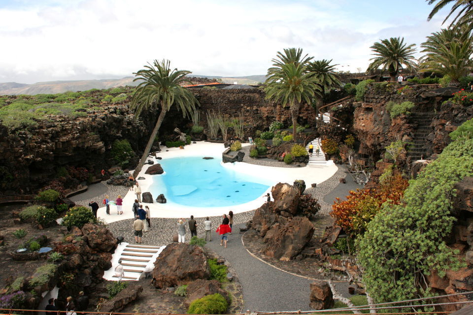
 That is still not much.
 com
com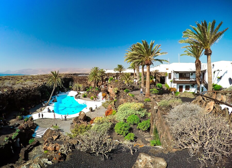
 Arrecife. The port city of Arrecife is the capital of Lanzarote. … Puerto del Carmen. One of the most tourist crowded places on Lanzarote is Puerto del Carmen. … Costa Teguise. … Playa Blanca. … Famara. … Puerto Calero. … San Bartolomé … Arrieta.More items…
 Average temperature in April: 22ºC. … Sardinia. Average temperature in April: 21ºC. … Seville. Average temperature in April: 25ºC. … Marrakech. Average temperature in April: 25ºC. … The Gambia. Average temperature in April: 33ºC. … Barbados. … Maldives.More items…•
 … The Sea temperature across the islands will now be 20 Celsius. Warmest Canary Island in April – Lanzarote. The eastern islands are the place to head during this month as the average temperature is warmer.
 … The ocean is starting to get warmer and in late March will reach 20 degrees.

 … You’ll get lots of sunshine and hardly any rain on holiday in Lanzarote at this time.
 Egypt.Average Temperature20-30°CFlight Time From UK4.5-5.5 hours1 more row
 to travel, roam, or move about for amusement; 2. to go about usually ostentatiously or indiscreetly with individuals of the opposite sex.What does the word digressive mean?Digressive is defined as an adjective that tends to diverge from the main topic or touch on a variety of topics. Examples include “amusingly digressive with satirical thrusts at womens fashions, among other things.” Synonyms include discursive, excursive, and rambling indirect.What does appeasing someone mean?Placaters, who work hard to appease others in order to keep the peace, fear being hurt in some way. — Mike Cote. transitive verb. 1: pacify, conciliate especially: to make concessions to (someone, such as an aggressor or a critic) often at the sacrifice of principles.Where does the name Maunder come from?The surname Maunder is believed to have originated from the Middle English word “maund,” which means “basket.”…
 However, Fandango has signs posted making it appear as though you can use it for that purpose. Can you use a Fandango gift card for concessions? Can you use a Fandango gift card for concessions? After reviewing the Fandango website, it makes no mention being able to use a gift card of this type for any cinema concessions at all. In fact it also states that you can not use your Fandango balance in person at the venue to purchase tickets. What can you use a Fandango gift card for? You can use Fandango gift cards to buy any ticket on Fandango.com or Fandango’s mobile app for any showtime available for a theater in the Fandango network, including AMC, Regal, Cinemark, Marcus and many more nationwide. Can you use Fandango gift card at MovieTickets? Fandango gift…
 How do I collect movie tickets booked on BookMyShow? How do you pick up movie tickets bought online? After you complete your purchase, you’ll see a confirmation page for methods to pick up your tickets. Depending on the theater and your device, you may print your tickets at home, pick up at the box office or kiosk with a valid credit card, or use a mobile ticket (if available). Can you buy movie tickets in advance? For most movies, you can typically purchase tickets anywhere from 1-10 days in advance. Movie theaters usually update their showtimes on Monday-Thursday for the upcoming…
 00 – $13.00Adults$10.50 – $13.50Seniors (ages 60+)$10.00 – $13.0080 more rows How do I book Cineworld tickets? Yes, Cineworld is currently offering advance online booking for all Unlimited members for all Cineworld cinemas*. All you need to do is register for a My Cineworld account online at www.cineworld.com/mycineworld/login#register and enter your Unlimited Card number where indicated. What is a student ticket at Cineworld? Children up to and including the age of 14 can use child tickets. 15 to 17 year olds are charged as a student price (proof of age may be required). 18 years and above should purchase adult or student tickets (proof of student status will…
 50*Some Cineworld cinemas offer before 5pm pricing only on weekdays.**Customers aged 15-17 can receive student pricing, proof of age may be required.84 more rows Can you book Cineworld tickets by phone? The Cineworld Cinemas Advance Booking Service is a system linking you with the Box Office in real time via www.cineworld.com. It is open 24 hours a day via the internet. It is possible to book tickets using the ‘quick book’ engine at the top of the Cineworld home page at www.cineworld.com. Can you book seats at Cineworld? Guarantee your seats when you book online or in the cinema itself. By being able to book a seat in advance, you’ll have a place in your local Cineworld guaranteed – all the better for enjoying the latest and greatest movies.…
 Includes all current releases. How do you get 2 for 1 cinema tickets? HOW TO GET YOUR 2 FOR 1 CINEMA TICKETS Download the MEERKAT MOVIES app or visit comparethemarket.com.Log into or set up your comparethemarket.com account to activate your membership and claim your voucher code. You have one voucher code to use every Tuesday or Wednesday at any ODEON cinema. How much is it for a ticket at Cineworld? Cineworld Prices (UK) AGETICKET PRICEChildren (ages 1-14)£7.50 – £11.00Adult (15+)£10.30 – £13.00Senior/Student£8.50 – £11.00Family (2/2 or 1/3)£34.30 – £45.0084 more rows How do you get discounts on Cineworld? Click on the ‘See Code’ button & go to the Cineworld site to book your ticket. Once you’ve found a movie, register for a My Cineworld account or continue as a guest. Choose your ticket type,…
 com or our free mobile app on iOS or Android (gift cards can’t be redeemed in person at the theater) Use our search box to find showtimes and theaters near you. Select a show time and checkout. Under the payment section, click on Use Gift Card and enter your gift card code and pin (if available). How much is a movie ticket on Fandango? The precise amount is dependent on a number of factors, but it will be between $0.75 and $2.50. Officially, Fandango says the fee is for “showtimes, movie listings, and theater information,” though there are lots of movie showtime apps for Android that do the same thing. How do I avoid Fandango convenience fee? How to Get the Fandango Convenience Fee Waived Check Out Online Coupon Sites. Join Fandango VIP. Purchase Your Tickets Directly Through the Theater…
 How do you use Fandango tickets at the theater? How To Use A Fandango Gift Card Visit Fandango.com or the Fandango app.Choose a movie using the search box and pick a showtime.Specify the type and amount of tickets.Log into your account or check out as a guest.Under payment specific ‘Use Fandango Gift Card’Enter the gift card number and PIN and click ‘Apply’Click ‘Complete My Purchase’ Can you show Fandango tickets on your phone? Get the Fandango app. Searching for movie theaters that accept Fandango Mobile Tickets is even quicker using your iOS or Android phone. For Android users, the app’s…
 Head to Hulu. Visit Goodwill. What is the cheapest way to watch Netflix? The Cheapest Ways to Get Netflix on Your TV Dirt Cheap: Connect a Computer via HDMI ($8) If you want to watch Netflix on your TV for less than $10, all you need is an HDMI cable and a computer. Cheap and Simple: Google Chromecast ($35) With a Remote: Roku Express ($30) For 4K TVs: Roku Premiere ($39) Where can I watch films for free? However, there are a lot of free movie apps that will let you watch and download movies.Here are the best free movie apps available. Tubi TV. Popcornflix. Yidio.…
 Currently that fee will cost you $1.42 per ticket. Is Fandango cheaper than the theater? While some theater companies only allow you to buy online tickets through Fandango, others have their own sites. Those convenience fees might be more expensive or less expensive than Fandango’s, so make note of that. Also, consider joining your theaters rewards club if they have one. How can I get discounted movie tickets? How to Get Cheap Movie Tickets: 8 Ways to Save at the Cinema Click the banner below for local movie deals on our site. Purchase a dinner-and-a-movie package. Go to the matinee. Check for a senior discount.…
 Fandango’s privacy policy can be viewed here: http://www.fandango.com/PrivacyPolicy.aspx.25 Feb 2015 Does Fandango VIP charge a fee? Fandango has a rewards program called Fandango VIP. It’s free to join, and offers several benefits to members, including: Points earned for every Fandango purchase. Access to advanced screenings.24 Jun 2018 Does a Fandango account cost money? There is no cost at all to set up a FandangoNOW account. There is also no monthly subscription cost and no commitment whatsoever. You only pay for the movies and TV shows you want to watch. The cost for rentals or purchases varies by title. Does Fandango still do VIP points? A: Yes! As a Fandango VIP, you’ll now earn VIP+ Points…
 Movie theaters usually update their showtimes on Monday-Thursday for the upcoming Friday-Thursday (excluding major holidays and Wednesday releases, these are usually slightly different). How many days before can we book movie tickets? Usually 3-4 days before the date of screening. How do I collect movie tickets booked on BookMyShow? Can you buy AMC tickets ahead of time? AMC also allows you to reserve any ticket for any movie — even days in advance. There’s no need to rush to the theater hours before showtime on the day of the movie. Plus, AMC offers something that MoviePass does not: the ability to see more than one film in a day and the ability to see a film more than once. Are movie tickets cheaper in the morning? Starting today, all…
 Most booking sites charge $1 to $2 for you to use the service, making your tickets even more expensive. Even if you want to snag tickets for a hot movie in advance, head right to the box office and don’t pay added fees. Does Regal have $5 Tuesdays? All day Tuesday enjoy $6.45 tickets. Find Tickets and Showtimes! All day Tuesday enjoy $7.00 tickets. Find Tickets and Showtimes! Do all AMC theaters have $5 Tuesdays? Every Tuesday, the theater chain offer its AMC Stubs and AMC Stubs Premiere members $5 Ticket Tuesdays — get a ticket for just $5. Even better, AMC Stubs Premiere members can also get a Cameo Combo for just $5 on Tuesdays. The combo includes a Cameo-sized fountain drink and popcorn. Are movie tickets cheaper…
 M.Cinema.” Depending on the market, tickets for morning shows will cost between $4 and $6. Why are movies cheaper in the morning? Morning movies are cheaper, and less crowded, and overall more enjoyable. They’re an indulgence that still allows for productivity, a way to relax that still leaves you time to get everything you need done that day. How can I get cheap movie tickets? How to Get Cheap Movie Tickets: 8 Ways to Save at the Cinema Click the banner below for local movie deals on our site. Purchase a dinner-and-a-movie package. Go to the matinee. Check for a senior discount. Check for a student discount. Browse discount movie ticket apps like DealFlicks. Find a free screening. Does AMC have a discount day? Discount Tuesdays benefits are available for…
 Depending on the theater and your device, you may print your tickets at home, pick up at the box office or kiosk with a valid credit card, or use a mobile ticket (if available). Do you have to print out AMC tickets? It will tell you whether you need to bring your credit card, bring a confirmation number, or print out your tickets on your computer. Print your tickets. This step is only necessary for theaters that offer the “print at home” service. Print out your confirmation page by clicking “File” in your browser then “Print.” How do e tickets work for movies? Available e-ticketing theaters in your area will appear at the top in the list view of theaters on the app, and with a…
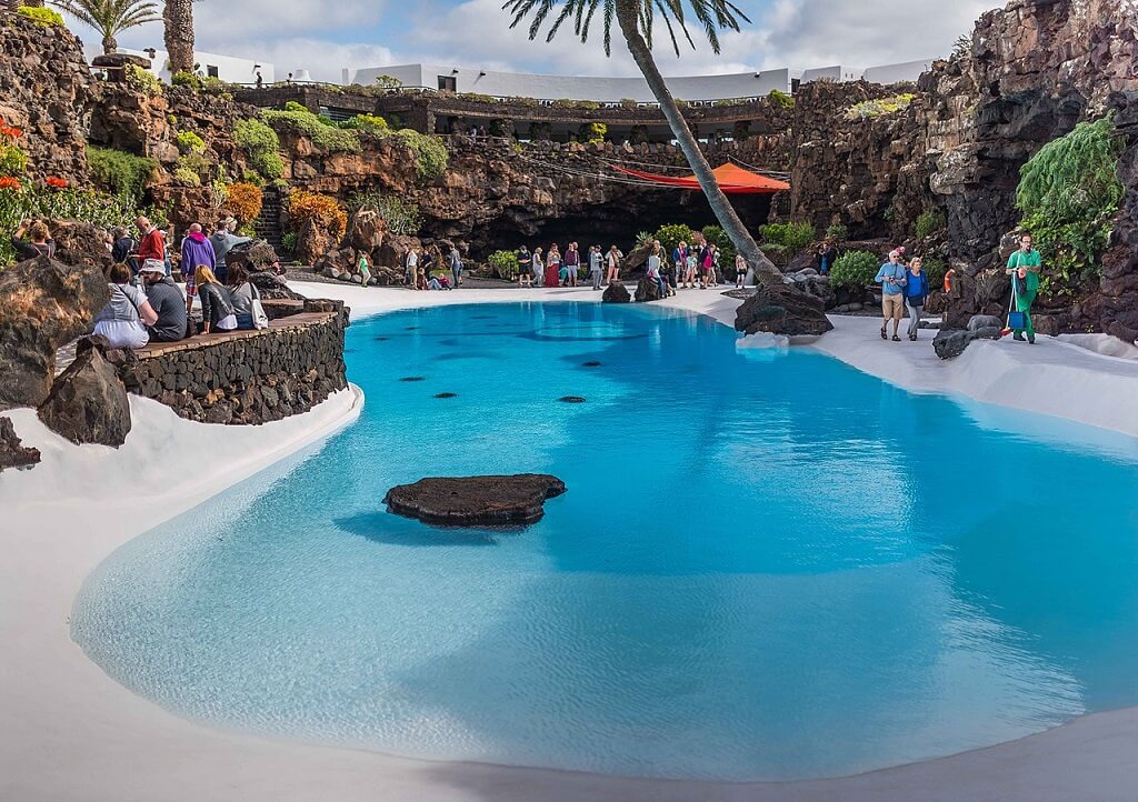 How do I cancel my Fandango tickets? Suggested clip · 95 seconds How to Exchange Fandango Movie Tickets – YouTube YouTube Start of suggested clip End of suggested clip How do I get a refund on movie tickets? Request a refund now. Refund or exchanges at the theatre’s box office: Tickets may be exchanged or refunded at the theatre’s box office any time before the showtime. To exchange cinemark.com ticket purchases at the theatre, the credit card or gift card used in the purchase must be presented at the box office. How do I use my Fandango credit? Go to Fandango.com or our free mobile app on iOS…
 How do you use Fandango tickets at the theater? How To Use A Fandango Gift Card Visit Fandango.com or the Fandango app.Choose a movie using the search box and pick a showtime.Specify the type and amount of tickets.Log into your account or check out as a guest.Under payment specific ‘Use Fandango Gift Card’Enter the gift card number and PIN and click ‘Apply’Click ‘Complete My Purchase’ How do I redeem my Fandango Mobile Ticket? Go to Fandango.com or our free mobile app on iOS or Android (gift cards can’t be redeemed in person at the theater) Use our search box to find showtimes and theaters near you. Select a…
 Currently that fee will cost you $1.42 per ticket. How much is a ticket at Cineworld? Cineworld Prices (UK) AGETICKET PRICEAdult (15+)**£8.70 – £11.50Senior/Student£6.30 – £10.25Family (2/2 or 1/3)£25.00 – £32.50*Some Cineworld cinemas offer before 5pm pricing only on weekdays. **Customers aged 15-17 can receive student pricing, proof of age may be required.84 more rows Can you book Cineworld tickets online with meerkat movies? Alternatively, where online booking is available, customers may be able to book their tickets online at www.cineworld.com. Please note that online customers must select a minimum of two tickets on the booking page and enter the Meerkat Movies…
Air temperature (MAKS-MIN) byPredict for April 2000 April 2022 April 2021 April 2020 April 2019 April 2018 April 2017 April 2016 2016 0003 17 ” 17 ° C 21 ° C 17 ° C 21 ° C 17 ° C 22 ° C 17 ° C 10 April. 22°C 17°C 11 apr. 22°C 18°C 12 apr. 22°C 17°C 13 apr. 22°C 17°C 14 apr. 22°C 16°C 15 apr. 23°C 16°C 16 apr. 24°C 18°C 17 apr. 24°C 19°C 18 apr. 24°C 18°C 19 apr. 23°C 17°C 20 Apr. 22°C 17°C 21 apr. 22°C 18°C 22 apr. 22°C 17°C 23 apr. 23°C 18°C 24 apr. 23°C 18°C 25 apr. 23°C 17°C 26 apr. 23°C 17°C 27 Apr. 23°C 17°C 28 apr. 23°C 17°C 29 apr. 23°C 17°C 30 apr. 23°C 18°C
Water temperature in April by day11 Apr. 12 Apr. 13 Apr. 14 Apr. 15 Apr. 16 Apr. 17 Apr. 18 Apr. 19 Apr. 20 Apr. 21 Apr. 22 Apr. 23 Apr. 24 Apr. 25 Apr. 26 Apr. 27 Apr. 28 Apr. 29 Apr. 30 Apr.
Precipitation by day Light rain – up to 2.5 mm per hour, moderate rain – up to 8 mm per hour, heavy rain – more than 8 mm per hour, heavy rain from 30 mm. 0.1111 mm 0.0000 mm 0.5556 mm 0.3333 mm 0.0000 mm 0.0000 mm 0.0000 mm 0.0000 mm 0.0000 mm 10 апр. 0.0000 mm 11 Apr. 0.0000 mm 12 apr. 0.4444 mm 13 apr. 0.3333 mm 14 apr. 0.0000 mm 15 apr. 0.1111 mm 16 apr. 0.0000 mm 17 apr. 0.0000 mm 18 apr. 0.7778 mm 19 apr. 0.0000 mm 20 Apr. 0. 21 apr. 0.0000 mm 22 apr. 0.0000 mm 23 apr. 0.0000 mm 24 apr. 0.0000 mm 25 apr. 0.1111 mm 26 apr. 0.0000 mm 27 apr. 0.0000 mm 28 apr. 0.0000 mm 29 Apr. 0.0000 mm 30 apr. 0.1111 mm The maximum daytime temperature in Playa del Inglés is 24.2222 °C, the minimum nighttime temperature is 16.4444 °C. Rainfall in April is usually not more than 1 mm, and the number of hours of sunshine is not less than 8. Weather in April in other resorts in SpainBarcelona 19°С Valencia 21°С Ibiza
Reviews for vacation in AprilAll reviewsIrina_Karelka April 15, 2017 Parque Cristobal Gran Canaria Playa del Inglés photo Good day to all! photo I’m writing from the hotel, I haven’t moved in yet, but I’m being forced to. Yesterday, at breakfast in the hotel restaurant, my daughter found healthy cockroaches near the coffee machine. Since the ants got her in the room before, she planted this cockroaches… Read more Very cool apart hotel for very modest money, 5-10 minutes to the sea (depending on the step), right opposite the Yumbo center, there is a good pool, modern rooms, a simple bedroom and two beds… Read more Weather in Playa del Inglés in April. Sea water temperature in April. Weather by months.Sea weather / Spain / Weather in Playa del Ingles / Weather in APRIL
Monthly weather in Playa del InglésJanuary February March April May June July August September October November December 9000
Weather in Playa del Inglés now • Air temperature in Playa del Inglés in April
The graph below provides detailed information about the daytime and nighttime temperatures in Playa del Inglés in April.
The average air temperature in April over the past 5 years is 21.8°C during the day and 18.0°C at night. Data for: 2022 2021 2020 2019 2018 Sea temperature in Playa del Inglés in April
The graph below provides detailed information about the water temperature in Playa del Inglés in April.
The average sea temperature in Playa del Inglés in April for the past 5 years is 19.4°C. Data for: 2022 2021 2020 2019 2018 Sunny days in Playa del Inglés in April
The graph below shows the number of sunny, cloudy and overcast days you can expect in Playa del Inglés in April. Rainy days in Playa del Inglés in April
The graph below displays the chances of rainfall of varying strengths in Playa del Inglés in April. Windy days in Playa del Inglés in April
The chart below shows information on how strong the wind can be in Playa del Inglés in April.
Water temperature in the sea
+21 ° C +21 ° C | |||||||||||||||||||||||||||||||||||||||||||||||||||||||||||||||||||||||||||||||||||||||||||||||||||||||||||||||||||||||||||||||||||||||||||||||||||||||||||||||||||||||||||||||||||||||||||||||||||||||||||||||||||||||||||||||||||||||||||||||||||||||
+21 ° C
+21 ° C
+21 ° C
+21 ° C
+21 ° C 9007
| Alicante | +29 ° C | |
| Barcelona | +31 ° C | |
| Grand Canarius | +28 ° C | 9000 9000 9000 |
| Lloret-de-Mar | +26 ° C | |
| MAYORKA | ||
| Palma-de-Mayorca | +29 ° C | 9000 | Tenerife | +26 ° C |
| Torrevieha | +31 ° C | |
WARMEST MONTH
August
Average daytime temperature:
+28°C
|
Maximum: +37°C |
Minimum: +17°C |
WARMEST WATER IN THE SEA
Maximum:
+26°C
Minimum:
+22°C
SUNNY MONTH
July
Number of sunny days:
30 days
|
Average cloudy: 5. |
Day length: 13h 41m |
DRIEST MONTH
June
Probability of rain:
0.0%
|
Monthly precipitation: 0.6mm |
Average cloudiness 7.7% |
Weather in Playa del Ingles in April 2020 – water and air temperature
Weather in Playa del Ingles in April 2020 – water and air temperature
April weather
Playa del Inglés
| Average daily air temperature | +20. |
|
| Day air temperature | +22.3°C | |
| Air temperature at night | +18.2°C | |
| Water temperature | +19.2°C | |
| Rainfall | 4 mm. | |
| Number of rainy days | 0 days | |
| Relative air humidity | 18% | |
| Sunrise time | 07:38 | |
| sunset time | 20:27 | |
| Daylength | 12. |
|
| Number of sunny days | 26 | |
| Wind speed | 5 m/s |
Weather in Playa del Inglés in other months
January
February
March
April
May
June
July
August
September
October
November
December
Air temperature in Playa del Inglés in April
3
|
Beach holiday |
5/10 | ||
|
Excursions and walks |
9/10 | ||
|
Hiking |
8/10 |
What are the prices for holidays in April
View
tours on Travelate
Prices
on vacation in Spain
April weather archive
- 2021
- 2020
- 2019
- 2018
- 2017
1
April
+17°
+21°
+19°
2
April
+17°
+22°
+19°
3
April
+17°
+23°
+19°
4
April
+18°
+24°
+19°
5
April
+19°
+23°
+19°
6
April
+18°
+24°
+19°
7
April
+18°
+23°
+19°
8
April
+17°
+22°
+19°
9
April
+18°
+23°
+18°
10
April
+17°
+23°
+18°
11
April
+17°
+22°
+18°
12
April
+17°
+23°
+19°
13
April
+17°
+23°
+19°
14
April
+17°
+24°
+19°
15
April
+18°
+25°
+19°
16
April
+19°
+25°
+19°
17
April
+20°
+25°
+20°
18
April
+20°
+25°
+20°
19
April
+19°
+25°
+20°
20
April
+18°
+23°
+19°
21
April
+19°
+24°
+19°
22
April
+20°
+27°
+20°
23
April
+20°
+26°
+20°
24
April
+19°
+25°
+20°
25
April
+19°
+25°
+20°
26
April
+17°
+24°
+20°
27
April
+18°
+27°
+20°
28
April
+19°
+25°
+20°
29
April
+19°
+25°
+20°
30
April
+19°
+24°
+20°
1
April
+18°
+30°
+19°
2
April
+19°
+29°
+19°
3
April
+18°
+27°
+19°
4
April
+18°
+26°
+19°
5
April
+19°
+26°
+19°
6
April
+19°
+25°
+19°
7
April
+18°
+24°
+19°
8
April
+18°
+24°
+19°
9
April
+18°
+24°
+19°
10
April
+18°
+24°
+19°
11
April
+19°
+25°
+19°
12
April
+20°
+25°
+19°
13
April
+20°
+26°
+19°
14
April
+20°
+26°
+19°
15
April
+18°
+27°
+19°
16
April
+20°
+30°
+19°
17
April
+21°
+32°
+20°
18
April
+21°
+28°
+20°
19
April
+21°
+26°
+20°
20
April
+20°
+25°
+20°
21
April
+19°
+25°
+20°
22
April
+20°
+25°
+20°
23
April
+20°
+25°
+20°
24
April
+20°
+25°
+20°
25
April
+20°
+26°
+20°
26
April
+20°
+26°
+20°
27
April
+21°
+26°
+20°
28
April
+21°
+25°
+20°
29
April
+21°
+26°
+20°
30
April
+20°
+25°
+21°
1
April
+17°
+20°
+19°
2
April
+18°
+21°
+19°
3
April
+18°
+21°
+19°
4
April
+18°
+20°
+19°
5
April
+17°
+21°
+19°
6
April
+17°
+20°
+19°
7
April
+18°
+20°
+19°
8
April
+17°
+20°
+19°
9
April
+18°
+19°
+18°
10
April
+17°
+20°
+18°
11
April
+18°
+22°
+19°
12
April
+18°
+22°
+19°
13
April
+18°
+21°
+19°
14
April
+17°
+21°
+19°
15
April
+17°
+21°
+19°
16
April
+18°
+22°
+19°
17
April
+19°
+24°
+19°
18
April
+19°
+25°
+19°
19
April
+19°
+23°
+18°
20
April
+17°
+20°
+19°
21
April
+17°
+20°
+19°
22
April
+18°
+21°
+19°
23
April
+18°
+22°
+19°
24
April
+18°
+21°
+19°
25
April
+18°
+21°
+18°
26
April
+18°
+21°
+18°
27
April
+18°
+22°
+19°
28
April
+18°
+21°
+19°
29
April
+17°
+20°
+19°
30
April
+16°
+20°
+19°
1
April
+9°
+14°
+12°
-
702 mmHg
-
Yu, 1.
6 m/s
-
84.6%
2
April
+8°
+16°
+12°
-
700 mmHg
-
Yu, 1.3 m/s
-
78.6%
3
April
+9°
+15°
+12°
-
700 mmHg
-
Yu, 1.
8 m/s
-
77.5%
4
April
+8°
+15°
+12°
-
701 mmHg
-
Yu, 2.0 m/s
-
80.3%
5
April
+8°
+16°
+12°
-
704 mmHg
-
Yu, 2.
4 m/s
-
77.6%
6
April
+8°
+15°
+12°
-
706 mmHg
-
Yu, 3.0 m/s
-
72.9%
7
April
+7°
+16°
+12°
-
707 mmHg
-
Yu, 1.
6 m/s
-
73.9%
8
April
+8°
+16°
+12°
-
706 mmHg
-
Yu, 1.1 m/s
-
81.8%
9
April
+10°
+17°
+13°
-
746 mmHg
-
Yu, 3.
6 m/s
-
75.3%
10
April
+10°
+16°
+12°
-
711 mmHg
-
Yu, 3.6 m/s
-
68.5%
11
April
+10°
+16°
+12°
-
706 mmHg
-
Yu, 4.
3 m/s
-
70.8%
12
April
+10°
+17°
+12°
-
706 mmHg
-
Yu, 4.0 m/s
-
69.5%
13
April
+10°
+19°
+12°
-
704 mmHg
-
Yu, 3.
0 m/s
-
68.1%
14
April
+10°
+20°
+13°
-
704 mmHg
-
Yu, 2.3 m/s
-
60.6%
15
April
+10°
+20°
+13°
-
704 mmHg
-
Yu, 2.
4 m/s
-
68.0%
16
April
+12°
+21°
+14°
-
704 mmHg
-
Yu, 1.4 m/s
-
63.6%
17
April
+9°
+18°
+14°
-
702 mmHg
-
Yu, 1.
8 m/s
-
69.0%
18
April
+11°
+17°
+14°
-
704 mmHg
-
Yu, 3.3 m/s
-
73.1%
19
April
+10°
+18°
+14°
-
705 mmHg
-
Yu, 3.
4 m/s
-
68.8%
20
April
+10°
+17°
+14°
-
703 mmHg
-
Yu, 3.3 m/s
-
72.4%
21
April
+10°
+18°
+14°
-
702 mmHg
-
Yu, 2.
4 m/s
-
75.3%
22
April
+10°
+21°
+6°
-
702 mmHg
-
Yu, 1.6 m/s
-
62.9%
23
April
+11°
+18°
+13°
-
701 mmHg
-
Yu, 2.
3 m/s
-
75.1%
24
April
+9°
+17°
+14°
-
703 mmHg
-
Yu, 2.5 m/s
-
73.9%
25
April
+9°
+18°
+14°
-
705 mmHg
-
Yu, 2.
0 m/s
-
72.5%
26
April
+11°
+18°
+14°
-
706 mmHg
-
Yu, 2.9m/s
-
77.1%
27
April
+10°
+19°
+14°
-
705 mmHg
-
Yu, 2.
6 m/s
-
69.3%
28
April
+10°
+22°
+14°
-
704 mmHg
-
Yu, 2.0 m/s
-
69.4%
29
April
+12°
+23°
+15°
-
703 mmHg
-
Yu, 1.
6 m/s
-
56.8%
30
April
+13°
+24°
+16°
-
702 mmHg
-
Yu, 2.8 m/s
-
45.0%
1
April
+11°
+16°
+12°
-
701 mmHg
-
Yu, 3.
6 m/s
-
86.6%
2
April
+10°
+18°
+12°
-
702 mmHg
-
Yu, 3.5 m/s
-
85.4%
3
April
+12°
+16°
+13°
-
698 mmHg
-
Yu, 3.
1 m/s
-
92.5%
4
April
+11°
+20°
+13°
-
699 mmHg
-
Yu, 4.1 m/s
-
74.5%
5
April
+13°
+21°
+14°
-
703 mmHg
-
Yu, 3.
1 m/s
-
81.9%
6
April
+13°
+20°
+14°
-
705 mmHg
-
Yu, 4.8 m/s
-
88.1%
7
April
+13°
+20°
+15°
-
705 mmHg
-
Yu, 5.
1 m/s
-
73.3%
8
April
+14°
+22°
+15°
-
704 mmHg
-
Yu, 5.5 m/s
-
70.6%
9
April
+14°
+20°
+16°
-
705 mmHg
-
Yu, 5.
8 m/s
-
81.3%
10
April
+15°
+20°
+16°
-
705 mmHg
-
Yu, 7.3 m/s
-
83.9%
11
April
+14°
+19°
+16°
-
704 mmHg
-
Yu, 8.
6 m/s
-
84.5%
12
April
+12°
+16°
+16°
-
703 mmHg
-
Yu, 8.6 m/s
-
89.4%
13
April
+12°
+16°
+15°
-
701 mmHg
-
Yu, 5.
9 m/s
-
86.0%
14
April
+11°
+18°
+15°
-
699 mmHg
-
Yu, 5.5 m/s
-
85.0%
15
April
+11°
+17°
+15°
-
700 mmHg
-
Yu, 3.
9 m/s
-
78.1%
16
April
+11°
+19°
+15°
-
701 mmHg
-
Yu, 2.9 m/s
-
80.0%
17
April
+11°
+18°
+14°
-
701 mmHg
-
Yu, 2.
8 m/s
-
83.4%
18
April
+12°
+15°
+14°
-
700 mmHg
-
Yu, 6.0 m/s
-
90.5%
19
April
+12°
+17°
+14°
-
704 mmHg
-
Yu, 7.
5 m/s
-
84.5%
20
April
+12°
+18°
+14°
-
705 mmHg
-
Yu, 9.4 m/s
-
83.0%
21
April
+11°
+18°
+14°
-
704 mmHg
-
Yu, 2.
9 m/s
-
72.4%
22
April
+11°
+15°
+14°
-
703 mmHg
-
Yu, 7.1 m/s
-
75.8%
23
April
+12°
+15°
+14°
-
701 mmHg
-
Yu, 4.
6 m/s
-
89.1%
24
April
+12°
+15°
+14°
-
701 mmHg
-
Yu, 8.5 m/s
-
88.5%
25
April
+12°
+17°
+13°
-
703 mmHg
-
Yu, 7.
1 m/s
-
83.6%
26
April
+11°
+16°
+13°
-
703 mmHg
-
Yu, 4.1 m/s
-
85.8%
27
April
+9°
+18°
+13°
-
703 mmHg
-
Yu, 1.
1 m/s
-
76.3%
28
April
+13°
+19°
+14°
-
704 mmHg
-
Yu, 2.5 m/s
-
76.6%
29
April
+12°
+17°
+14°
-
706 mmHg
-
Yu, 6.
3 m/s
-
85.5%
30
April
+12°
+19°
+14°
-
707 mmHg
-
Yu, 6.0 m/s
-
84.8%
1
April
+11°
+18°
+14°
-
702 mmHg
-
Yu, 4.
6 m/s
-
80.9%
2
April
+11°
+17°
+14°
-
704 mmHg
-
Yu, 3.4 m/s
-
81.0%
3
April
+12°
+17°
+14°
-
702 mmHg
-
Yu, 5.
3 m/s
-
76.5%
4
April
+12°
+16°
+14°
-
702 mmHg
-
Yu, 4.1 m/s
-
76.0%
5
April
+11°
+16°
+14°
-
702 mmHg
-
Yu, 3.
4 m/s
-
74.6%
6
April
+10°
+18°
+14°
-
701 mmHg
-
Yu, 2.5 m/s
-
80.9%
7
April
+11°
+18°
+14°
-
701 mmHg
-
Yu, 2.
3 m/s
-
82.9%
8
April
+11°
+18°
+14°
-
703 mmHg
-
Yu, 3.1 m/s
-
83.8%
9
April
+13°
+20°
+14°
-
702 mmHg
-
Yu, 4.
6 m/s
-
80.6%
10
April
+12°
+19°
+14°
-
701 mmHg
-
Yu, 3.0 m/s
-
80.0%
11
April
+12°
+19°
+14°
-
702 mmHg
-
Yu, 3.
4 m/s
-
63.4%
12
April
+13°
+22°
+15°
-
704 mmHg
-
Yu, 4.3 m/s
-
69.6%
13
April
+15°
+22°
+15°
-
704 mmHg
-
Yu, 4.
4 m/s
-
69.0%
14
April
+13°
+20°
+16°
-
702 mmHg
-
Yu, 6.0 m/s
-
87.5%
15
April
+13°
+17°
+15°
-
702 mmHg
-
Yu, 7.
4 m/s
-
90.0%
16
April
+13°
+17°
+15°
-
702 mmHg
-
Yu, 8.0 m/s
-
90.3%
17
April
+13°
+16°
+15°
-
703 mmHg
-
Yu, 6.
5 m/s
-
85.3%
18
April
+13°
+18°
+15°
-
704 mmHg
-
Yu, 7.3 m/s
-
75.9%
19
April
+12°
+19°
+16°
-
704 mmHg
-
Yu, 7.
8 m/s
-
81.1%
20
April
+13°
+19°
+16°
-
703 mmHg
-
Yu, 8.4 m/s
-
84.6%
21
April
+13°
+19°
+16°
-
702 mmHg
-
Yu, 8.
0 m/s
-
84.4%
22
April
+12°
+20°
+16°
-
701 mmHg
-
Yu, 5.3 m/s
-
81.3%
23
April
+13°
+22°
+16°
-
701 mmHg
-
Yu, 5.
5 m/s
-
81.5%
24
April
+13°
+18°
+16°
-
699 mmHg
-
Yu, 6.1 m/s
-
75.1%
25
April
+12°
+17°
+15°
-
698 mmHg
-
Yu, 7.
1 m/s
-
84.0%
26
April
+13°
+18°
+15°
-
699 mmHg
-
Yu, 4.9 m/s
-
80.5%
27
April
+13°
+18°
+15°
-
699 mmHg
-
Yu, 3.
9 m/s
-
82.3%
28
April
+12°
+18°
+14°
-
699 mmHg
-
Yu, 2.5 m/s
-
85.0%
29
April
+12°
+17°
+14°
-
699 mmHg
-
Yu, 2.
1 m/s
-
91.4%
30
April
+13°
+15°
+14°
-
700 mmHg
-
Yu, 7.6 m/s
-
87.8%
1
April
+12°
+16°
+12°
-
702 mmHg
-
Yu, 3.
8 m/s
-
82.4%
2
April
+11°
+16°
+12°
-
699 mmHg
-
Yu, 2.4 m/s
-
72.6%
3
April
+10°
+17°
+13°
-
694 mmHg
-
Yu, 3.
8 m/s
-
85.0%
4
April
+11°
+14°
+12°
-
696 mmHg
-
Yu, 9.6 m/s
-
86.3%
5
April
+10°
+15°
+12°
-
705 mmHg
-
Yu, 6.
1 m/s
-
71.8%
6
April
+10°
+17°
+12°
-
706 mmHg
-
Yu, 5.8 m/s
-
71.9%
7
April
+11°
+16°
+12°
-
706 mmHg
-
Yu, 4.
6 m/s
-
75.6%
8
April
+9°
+17°
+12°
-
703 mmHg
-
Yu, 4.6 m/s
-
84.9%
9
April
+10°
+17°
+12°
-
699 mmHg
-
Yu, 4.
5 m/s
-
80.5%
10
April
+13°
+17°
+13°
-
700 mmHg
-
Yu, 7.4 m/s
-
82.6%
11
April
+12°
+16°
+13°
-
701 mmHg
-
Yu, 8.
9 m/s
-
87.0%
12
April
+12°
+16°
+13°
-
702 mmHg
-
Yu, 9.5 m/s
-
88.8%
13
April
+12°
+17°
+13°
-
702 mmHg
-
Yu, 9.
1 m/s
-
80.1%
14
April
+11°
+21°
+13°
-
702 mmHg
-
Yu, 4.8 m/s
-
70.0%
15
April
+13°
+21°
+13°
-
700 mmHg
-
Yu, 4.
1 m/s
-
57.3%
16
April
+19°
+29°
+15°
-
700 mmHg
-
Yu, 3.8 m/s
-
29.6%
17
April
+15°
+21°
+16°
-
700 mmHg
-
Yu, 5.
6 m/s
-
58.6%
18
April
+13°
+18°
+16°
-
701 mmHg
-
Yu, 5.0 m/s
-
83.6%
19
April
+11°
+15°
+16°
-
703 mmHg
-
Yu, 7.
1 m/s
-
68.0%
20
April
+11°
+14°
+16°
-
702 mmHg
-
Yu, 4.9 m/s
-
70.5%
21
April
+10°
+14°
+16°
-
701 mmHg
-
Yu, 2.
6 m/s
-
70.6%
22
April
+12°
+15°
+16°
-
701 mmHg
-
Yu, 2.0 m/s
-
65.4%
23
April
+11°
+14°
+16°
-
701 mmHg
-
Yu, 2.
3 m/s
-
66.8%
24
April
+11°
+15°
+16°
-
700 mmHg
-
Yu, 1.1 m/s
-
64.3%
25
April
+12°
+16°
+16°
-
700 mmHg
-
Yu, 3.
1 m/s
-
72.9%
26
April
+11°
+17°
+13°
-
703 mmHg
-
Yu, 5.9 m/s
-
73.4%
27
April
+11°
+19°
+13°
-
704 mmHg
-
Yu, 5.
1 m/s
-
78.8%
28
April
+12°
+18°
+13°
-
703 mmHg
-
Yu, 6.9 m/s
-
79.3%
29
April
+12°
+20°
+14°
-
704 mmHg
-
Yu, 6.
4 m/s
-
81.0%
Weather in Playa del Inglés on April 19, 2023 ☁ accurate forecast for “365 Celsius”
|
← April 18th |
Select date |
20 April → |
| Day |
Tuesday
April 19, 2023 |
|||
|---|---|---|---|---|
|
+21° Clear Feels: +22°C |
Pressure 764 mmHg Humidity 66% wind
Chance of precipitation 25% Water temperature +16° |
|||
|
||||
day
+21 °
Clear
is felt: +22 ° C
Night
+18 °
Clear
is felt: +18 ° C
Temperature change on April 19 by years
According to the history of observations on April 19, the air temperature for five years in Playa del Inglés was 21°C during the day and 18°C at night, wind speed was 6 m/s with gusts up to 2 m/s. At the same time, the weather feels like 22°C. Relative humidity 66%, atmospheric pressure 764 mm Hg.
What was the weather more often by years
Wind speed on April 19 by years
Weather history in Playa del Inglés for 5 years
|
April 19, 2022 in Playa del Inglés on April 19, 2022 clear, cloud cover was 88%. |
||||||
| Atmospheric phenomena temperature °C |
feels like °C | Probability precipitation % |
Pressure mmHg |
Wind speed m/s |
Air humidity | Water temperature °C |
|---|---|---|---|---|---|---|
|
Day +21° |
+21° |
88% | 762 |
6 |
66% | +19° |
|
Clear |
||||||
|
Night +18° |
+18° |
19% | 761 |
6 |
79% | +19° |
|
Clear |
||||||
|
April 19, 2021 April 19, 2021 the weather was as follows: clear, pressure 764 mm Hg. |
||||||
| Atmospheric phenomena temperature °C |
feels like °C | Probability precipitation % |
Pressure mmHg |
Wind speed m/s |
Air humidity | Water temperature °C |
|---|---|---|---|---|---|---|
|
Day +23° |
+25° |
20% | 764 |
four |
57% | +20° |
|
Partly cloudy |
||||||
|
Night +18° |
+18° |
0% | 764 |
5 |
72% | +20° |
|
Clear |
||||||
|
April 19, 2020 April 19, 2020 in Playa del Inglés clear, relative humidity 65%. |
||||||
| Atmospheric phenomena temperature °C |
feels like °C | Probability precipitation % |
Pressure mmHg |
Wind speed m/s |
Air humidity | Water temperature °C |
|---|---|---|---|---|---|---|
|
Day +21° |
+21° |
4% | 765 |
four |
65% | +20° |
|
Clear |
||||||
|
Night +17° |
+17° |
0% | 764 |
6 |
71% | +20° |
|
Clear |
||||||
|
April 19, 2019 April 19, 2019 light rain, wind speed was 9 m/s, at night 10 m/s. |
||||||
| Atmospheric phenomena temperature °C |
feels like °C | Probability precipitation % |
Pressure mmHg |
Wind speed m/s |
Air humidity | Water temperature °C |
|---|---|---|---|---|---|---|
|
Day +21° |
+21° |
2% | 766 |
9 |
65% | +19° |
|
Clear |
||||||
|
Night +18° |
+18° |
2% | 766 |
ten |
71% | +19° |
|
Partly cloudy |
||||||
|
April 19, 2018 The weather on April 19, 2018 in Playa del Ingles was with a temperature of 21°C, while it felt 21°C, clear. |
||||||
| Atmospheric phenomena temperature °C |
feels like °C | Probability precipitation % |
Pressure mmHg |
Wind speed m/s |
Air humidity | UV index |
|---|---|---|---|---|---|---|
|
Day +21° |
+21° |
11% | 763 |
9 |
75% | 5 |
|
Clear |
||||||
|
Night +17° |
+17° |
0% | 763 |
7 |
86% | – |
|
Clear |
||||||
Details
- for 3 days
- for week
- for 10 days
- for 14 days
- for month
- for the weekend
- water for 14 days
- for 5 days
- for 7 days
- 2 weeks
- today
- tomorrow
- water now
- by month
- seasons
Weather in Playa del Inglés
Local time.
Timezone: GMT 1
20:06 .
9000
Enhanced protection required. Wait out the afternoon hours indoors. Stay in the shade outdoors. Be sure to wear long sleeves, a hat, and use sunscreen.
| day from 16:00 to 18:00 | +27 … +28 ° C Small cloud cover |
Wind . north , speed 4-6 m/s
On land:
The wind raises dust and light pieces of paper. Thin branches of trees and without foliage sway. The smoke is mixed in the air, losing its shape. This is the best wind for wind turbine operation. Waves run through tall grass and crops.
At sea:
Moderate swell. The waves are elongated, the crests of some of them capsize, forming swirling foam in places – white lambs, which are visible in many places. Wave height from 1 to 1.5 meters, length up to 15 meters 758-760 mm. rt. Art.
excitement at sea: Light , wave height up to 1 m.
Visibility: 100%
| from 18:01 to 00:00 |
Wind: Moderate , North , speed 4-6 m/sec
GUIGRES OF WIN: m/sec 9007 air humidity: 58-69%
Clouds: 20%
Atmospheric pressure: 758-759 mm. rt. Art.
Sea roughness: light , wave height up to 1 m
Visibility: 99-100%
the nature of the weather will be as follows:
- in the afternoon the air will warm up to +27…+28°C, dew point: +17.71°C; temperature-humidity ratio: comfortable for most, but the upper limit of humidity is felt;
precipitation is not expected, moderate breeze wind blowing from the north at a speed of 4-6 m/s , in the sky, in places, small clouds; recommended clothing: open sandals, flip-flops, panama hat, cap, shorts, skirt, light dress, T-shirt; astronomical season: summer; - in the evening the air temperature drops to +25…+28°C, dew point: +17.22°C; temperature-humidity ratio: comfortable for most, but the upper limit of humidity is felt;
precipitation is not expected, moderate breeze wind blowing from the north at a speed of 4-6 m/s , in the sky, in places, small clouds; clothes for the season: open sandals, slippers, panama hat, cap, shorts, skirt, light dress, T-shirt; astronomical season: summer;
Duration of the day 12:18
Saturday, September 17, 2022
| Sun: | Sunshide Sun 07:48 , Hall of Sun 20:05 . |
| Moon: | Sunrise of the Moon 00:11 , Hall of Moon 14:35 , Phase of the Moon: Wirming Moon | Geomagnetic field: Active |
| Sea water temperature: +24 ° C | |
| Ultraviolet index: 9.5 (very high) |
| Night
from 00:01 to 06: from 00:01 to 06: 00 |
+24 … +25 ° C Small cloudy |
2 Wind: Weak , North , speed 4-5 m/sec
On land:
Leaves and thin branches of trees with foliage fluctuate continuously, the wind develops light flags. The smoke, as it were, licks off the top of the pipe and is pulled out by the wind almost horizontally (at a wind speed of 4 m / s or more). Tall grass and grain crops begin to sway.
At sea:
Light sea. Short, well-defined waves are noticeable. The crests of the waves capsize, forming a vitreous foam, occasionally small white lambs are formed. The average wave height is from 60 centimeters to 1 meter, the length reaches 6 meters.
Wind gusts: 7 m/s
Relative air humidity: 70-71%
Cloudiness: 24%
Atmospheric pressure: 2475 75 rt. Art.
Excitement at sea: Small , wave height up to 0.6 m.
Visibility: 99-100%
| Morning to 12:00 +24 … +26 °C Partly cloudy |
2 , the weather vane begins to turn. Flags and pennants fluctuate slightly
At sea:
Weak short waves at sea. The ridges do not tip over and appear glassy. At sea, short waves are up to 30 centimeters high and up to 1-2 meters long.
Wind gusts: 5 m/s
Relative air humidity: 62-72%
Cloudiness: 27%
Atmospheric pressure: 275 75 rt. Art.
Excitement at sea: Shtil , wave height up to 0.2 m.
Visibility: 99-100%
| 9005 +27°C Partly cloudy |
Wind: Light , North , Speed 1-3 m/sec
Wind gusts: 5 m/sec
Relative humidity: 53-64%
: 40%
Atmospheric pressure: 756-758 mm. rt. Art.
Sea roughness: calm , wave height up to 0.2 m.
Visibility: 100%0055 evening from 18:01 to 00:00
Wind: Light , South , speed 1- 3 m/s
Wind gusts: 6 m/sec
Relative air humidity: 68-87%
Cloudness: 21%
Atmospheric pressure: 756 mm. rt. Art.
Sea waves: calm , wave height up to 0.2 m.
the weather will be like this:
- at night the air temperature drops to +24…+25°C, dew point: +18.24°C; temperature-humidity ratio: comfortable for most, but the upper limit of humidity is felt;
precipitation is not expected, light breeze wind blowing from the north at a speed of 4-5 m/s , in the sky, in places, small clouds; what to wear: open sandals, slippers, shorts, skirt, light dress, T-shirt; astronomical season: summer; - in the morning the air temperature will be +24…+26°C, dew point: +18.24°C; temperature-humidity ratio: comfortable for most, but the upper limit of humidity is felt;
precipitation is not expected, light breeze wind blowing from the north at a speed of 2-3 m/s , in the sky, in places, small clouds; clothes according to the weather: open sandals, slippers, shorts, skirt, light dress, T-shirt; astronomical season: summer; - during the day the air will warm up to +27°C, dew point: +17.
5°C; temperature-humidity ratio: comfortable for most, but the upper limit of humidity is felt;
precipitation is not expected, light breeze wind blowing from the north at a speed of 1-3 m/s , in the sky, in places, small clouds; recommended clothing: open sandals, slippers, cap, shorts, skirt, light dress, T-shirt; astronomical season: summer; - in the evening the air temperature drops to +25…+27°C, dew point: +19.67°C; temperature-humidity ratio: unpleasant for most people ;
precipitation is not expected, light breeze wind blowing from the south at a speed of 1-3 m/s , in the sky, in places, small clouds; clothes for the season: open sandals, slippers, cap, shorts, skirt, light dress, T-shirt; astronomical season: summer;
Duration of the day 12:17
Sunday, September 18, 2022
| Sun: | Sunshide Sun 07:49 , Hall of Sun 20:04 . |
||||
| Moon: | Sunrise of the Moon 00:560013
| |
Sea water temperature: +24 ° C |
|
Ultraviolet index: 8 (very high) |
|
Wind: Light , South-West , speed 1-3 m/second : 4 m/s
Relative air humidity: 88-90%
Cloudiness: 26%
Atmospheric pressure: 755-756 mm. rt. Art.
Excitement at sea: Shtil , wave height up to 0.2 m.
Visibility: 100%
| Morning to 12:00 | 9005 + 23 … +24 °C Clear |
Wind: Weak , West , speed 3-4 m/sec
Relative humidity: 79-88%
Cloudness: 16%
Atmospheric pressure: 755-756 mm. rt. Art.
Excitement at sea: Small , wave height up to 0.6 m.
Visibility: 100%
| Day to 18:00 900 900 | + 25°C Short-term rains |
Wind: Weak , South-West , speed 4-5 m/sec
GOOPS OF WIND: 6 m/sec
Relative Air Air Air -82%
Clouds: 75%
Atmospheric pressure: 755-756 mm. rt. Art.
Sea waves: slight , wave height up to 0.6 m.
Precipitation: 0.3 mm.
Visibility: 98-100%
| evening from 18:00 to 00:00 |
Wind: Light , West , speed 1-3 m/sec
Hurry of wind: 4 m/sec
Relative humidity: 82-86%
Cloudy 61 %
Atmospheric pressure: 755-757 mm. rt. Art.
Sea waves: calm , wave height up to 0.2 m.
Rainfall: 0.6 mm.
Visibility: 98-100%
Sunday 18 September 2022 at Playa del Inglés
the nature of the weather will be as follows: temperature-humidity ratio: very humid and uncomfortable ;
precipitation is not expected, light breeze wind blowing from the south-west at a speed of 1-3 m/s , in the sky, in places, small clouds; what to wear: open sandals, slippers, shorts, skirt, light dress, T-shirt; astronomical season: summer;
precipitation is not expected, light breeze blowing from the west at a speed of 3-4 m/s , the sky is clear; clothes according to the weather: open sandals, slippers, shorts, skirt, light dress, T-shirt; astronomical season: summer;
it will rain in some places , it is recommended to take an umbrella, light breeze blowing from the south-west at a speed of 4-5 m/s , overcast sky; recommended clothing: open sandals, slippers, shorts, skirt, light dress, T-shirt; astronomical season: summer;
it will rain in some places , it is recommended to take an umbrella, light breeze blowing from the west at a speed of 1-3 m/s , overcast sky; clothing for the season: open sandals, slippers, shorts, skirt, light dress, T-shirt; astronomical season: summer;
day length 12:15
Monday, September 19 2022
| Sun: | Sunrise 07:49 , Sunset 9005 5 905 20:02. |
||
| Moon: | Sunrise of the Moon 01:45 , Hall of Moon 16:19 , Phase of the Moon: Last quarter | Geomagnetic field: Calm 9,0005 | Sea water temperature: +24°C |
| UV index: 7.8 (high)
Protection required. Stay in the shade during the midday hours. Wear long sleeves and a hat. Use sunscreen. |
| Night from 00:01 to 06:00 | +23 +24 ° C Small cloudy |
wind 9, , North-east , speed 2 m/sec
Wind gusts: 3 m/sec
Relative humidity: 87-88% 25%
atmospheric pressure:
atmospheric pressure:
atmospheric pressure:
atmospheric pressure:
atmospheric pressure:
atmospheric pressure:
atmospheric pressure:
atmospheric pressure:
atmosphere 756 mm. rt. Art.
Excitement at sea: Shtil , wave height up to 0.2 m.
Visibility: 86-100%
| Morning to 12:00 | +22 … +24 ° C Small cloudy |
Wind: Light , East , Speed 2 m/sec
Wind reagas:
Relative air humidity: 82-87%
Cloudiness: 62%
Atmospheric pressure: 756-758 mm. rt. Art.
Swell at sea: calm , wave height up to 0.2 m.
Visibility: 89-100%
| day from 12:00 | +24 ° C |
Wind: Light , South-East , speed 2-3 m/sec
Hurry gusts: 4 m/sec
Relative humidity: 81-83%
Cloudy: Cloud 49%
Atmospheric pressure: 757-758 mm. rt. Art.
Excitement in the sea: Shtil , wave height up to 0.2 m.
Visibility: 100%
| evening to 00:00 | 9005 + 23 … +24 ° C Small cloud cover |
Wind: Light , North-West , speed 1-2 m/sec
Wind runs: 3 m/s
Relative air humidity: 83-86%
Cloudiness: 50%
Atmospheric pressure: 757-758 mm. rt. Art.
Sea waves: calm , wave height up to 0.2 m
Visibility: 100%
the weather will be like this:
- at night the air temperature drops to +23…+24°C, dew point: +20.41°C; temperature-humidity ratio: is unpleasant for most people ;
precipitation is not expected, light breeze wind blowing from the north-east at a speed of 2 m/s , in the sky, in places, small clouds; what to wear: open sandals, slippers, shorts, skirt, light dress, T-shirt; astronomical season: summer; - in the morning the air temperature will drop to +22.
..+24°C, dew point: +19.84°C; temperature-humidity ratio: unpleasant for most people ;
precipitation is not expected, light breeze blowing from the east at a speed of 2 m/s , in the sky, in places, small clouds; clothes for the weather: open sandals, shoes, closed sandals, sneakers, slippers, socks, knee-highs, tights, shorts, skirt, pants, trousers, light dress, T-shirt, short-sleeved shirt, jacket; astronomical season: summer; - during the day the air will warm up to +24°C, dew point: +20.19°C; temperature-humidity ratio: unpleasant for most people ;
precipitation is not expected, light breeze wind blowing from the south-east at a speed of 2-3 m/s , in the sky, in places, small clouds; recommended clothing: open sandals, slippers, shorts, skirt, light dress, T-shirt; astronomical season: summer; - in the evening the air temperature drops to +23…+24°C, dew point: +20.
18°C; temperature-humidity ratio: unpleasant for most people ;
precipitation is not expected, light breeze wind blowing from the north-west at a speed of 1-2 m/s , in the sky, in places, small clouds; clothing for the season: open sandals, slippers, shorts, skirt, light dress, T-shirt; astronomical season: summer;
Duration of the day 12:13
Tuesday, September 20, 2022
| Sun: | Sunshide Sun 07:50 , sunset 20:01 . |
| Moon: | Sunrise of the Moon 02:39 , Hall of Moon 17:05 , Phase Moon: Last quarter | Geomagnetic field: Calm |
| Sea water temperature: +24 ° C | |
| Ultraviolet index: 7.8 (high) |
| Night
to 06:01 to 06:01 to 06:01 to 06:01 to 06:01 to 06:01 to 06:01 to 06:01 to 06:01 to 06:01 to 06:01 to 06:01 to 06:01 to 06:00 |
+23 ° C Clear |
Wind: Light , North-East , Speed 2-3 m/sec
Wind otigs: 9005 9 9913 M/S.
Relative humidity: 84-87%
Cloudiness: 21%
Atmospheric pressure: 758 mm. rt. Art.
Excitement at sea: Shtil , wave height up to 0.2 m.
Visibility: 98-100%
| Morning to 12:00 +23 … +24 °C Clear |
Wind: light , North-east , speed 2-3 m/sec
Wind gusts: 4 m/sec
Relative humidity: 74-81%
Clouds: 7%
atmospheric pressure atmospheric pressure : 758-759 mm. rt. Art.
Excitement at sea: Shtil , wave height up to 0.2 m.
Visibility: 100%
| Day to 18:00 | +24 … +25 ° C Small cloudy |
Wind: Light , East , Speed 3 m/sec
Blacks /sec
Relative humidity: 77-80%
Cloudiness: 47%
Atmospheric pressure: 758-759 mm. rt. Art.
Swell at sea: calm , wave height up to 0.2 m.
Visibility: 100%
| evening from 18:00 | +24 … 9005 +25 ° C Clear |
Wind: Weak , North-Eastern , speed 3-4 m/sec
GUESTIONS: 5 m/sec
Relative humidity: 78-79%
Clouds: 23%
Atmospheric pressure: 758-759 mm. rt. Art.
Sea waves: light , wave height up to 0.6 m.
Visibility: 98-100%
weather will be like this: temperature-humidity ratio: unpleasant for most people ;
precipitation is not expected, light breeze wind blowing from the north-east at a speed of 2-3 m/s , the sky is clear; what to wear: open sandals, slippers, shorts, skirt, light dress, T-shirt; astronomical season: summer;
..+24°C, dew point: +18.52°C; temperature-humidity ratio: comfortable for most, but the upper limit of humidity is felt;
precipitation is not expected, light breeze wind blowing from the north-east at a speed of 2-3 m/s , clear sky; clothes according to the weather: open sandals, slippers, shorts, skirt, light dress, T-shirt; astronomical season: summer;
precipitation is not expected, light breeze wind blowing from the east at a speed of 3 m/s , in the sky, in places, small clouds; recommended clothing: open sandals, slippers, shorts, skirt, light dress, T-shirt; astronomical season: summer;
precipitation is not expected, light breeze wind blowing from the north-east at a speed of 3-4 m/s , clear sky; clothing for the season: open sandals, slippers, shorts, skirt, light dress, T-shirt; astronomical season: summer;
day length 12:11
Wednesday 21 September 2022
| Sun: | Sunrise 07:50 , Sunset 20:00 . |
||
| Moon: | Sunrise of the Moon 03:34 , Hall of Moon 17:46 , Phase of the Moon: Wirming Moon | 9000 9000 9000. | Sea water temperature: +24 °C |
| night from 00:01 to 06:00 | 6 +23 … +24 ° C Clear |
Wind: Weak , North-East , Speed 3-4 m/sec
Wind impulses: 6 6 6 m/s
Relative humidity: 79%
Cloudiness: 0%
Atmospheric pressure: 758-759 mm. rt. Art.
Sea waves: slight , wave height up to 0.6 m.
Visibility: 100%
| Morning from 06:0 Weak , North-East , speed 4 m/sec Wind gusts: 6 m/sec Relative humidity: 72-78% Cloudy: 8% Atmospheric pressure: 758-759 mm. Excitement at sea: Small , wave height up to 0.6 m. Visibility: 99-100%
Wind: Weak , East , speed 3 m/sec | |
| Eve from 18:0:00 900 9000 + 23 … +25 °C Clear |
Wind: light , North-east , speed 3-4 m/sec
Wind gusts: 6 m/sec
Relative humidity: 74-80%
Clogys: 13%
Atmospheric pressure: 758-759 mm. rt. Art.
Sea waves: light , wave height up to 0.6 m.
Visibility: 99-100%0056
the weather will be like this:
- at night the air temperature drops to +23…+24°C, dew point: +18.67°C; temperature-humidity ratio: comfortable for most, but the upper limit of humidity is felt;
precipitation is not expected, light breeze wind blowing from the north-east at a speed of 3-4 m/s , clear sky; what to wear: open sandals, slippers, shorts, skirt, light dress, T-shirt; astronomical season: summer; - in the morning the air temperature will drop to +23…+24°C, dew point: +18.24°C; temperature-humidity ratio: comfortable for most, but the upper limit of humidity is felt;
precipitation is not expected, light breeze blowing from the north-east at a speed of 4 m/s , the sky is clear; clothes according to the weather: open sandals, slippers, shorts, skirt, light dress, T-shirt; astronomical season: summer; - during the day the air warms up to +25.
..+26°C, dew point: +18.93°C; temperature-humidity ratio: unpleasant for most people ;
precipitation is not expected, light breeze wind blowing from the east at a speed of 3 m/s , clear sky; recommended clothing: open sandals, slippers, shorts, skirt, light dress, T-shirt; astronomical season: summer; - in the evening the air temperature drops to +23…+25°C, dew point: +19.2°C; temperature-humidity ratio: comfortable for most, but the upper limit of humidity is felt;
precipitation is not expected, light breeze wind blowing from the north-east at a speed of 3-4 m/s , clear sky; clothing for the season: open sandals, slippers, shorts, skirt, light dress, T-shirt; astronomical season: summer;
day length 12:10
Thursday, September 22, 2022
| Sun: | Sunrise 07:51 , Sunset 19:59 . |
||
| Moon: | Sunrise of the Moon 04:31 , Hall of Moon 18:24 , Phase of the Moon: Wirming Moon | 9000 9000 9000. | Sea water temperature: +24 °C |
| Night from 00:01 to 06:00 | +23 ° C Clear |
Wind: Weak , North-East , Speed 4 M/ s
Wind gusts: 6 m/s
Relative air humidity: 79-81%
Clouds: 2%
Atmospheric pressure: 9085 mm rt. Art.
Sea waves: Small , wave height up to 0.6 m.
Visibility: 98-100%
Wind: Weak , North-Eastern , speed 4-5 m/sec
GUENS OF WIND: 8 m/sec
CON air humidity: 74-81%
Cloudiness: 10%
Atmospheric pressure: 759-760 mm. rt. Art.
Excitement at sea: Small , wave height up to 0.6 m.
Visibility: 99-100%
| 9005 +25 … +27 °C Clear |
4672
Wind gusts: 8 m/s
Relative air humidity: 69-72%
Clouds: 16%
Atmospheric pressure: 28.946 mm rt. Art.
Excitement in the sea: Small , wave height up to 0.6 m.
Visibility: 100%
Wind: Weak , North-East , Speed 4-5 m/sec
Wind gusts: 7 m/sec
Lady of air 73- 75%
Clouds: 29%
Atmospheric pressure: 758-759 mm. rt. Art.
Sea waves: light , wave height up to 0.6 m.0003
Thursday 22 September 2022 at Playa del Inglés
the nature of the weather will be as follows:
- at night the air temperature drops to +23°C, dew point: +19.41°C; temperature-humidity ratio: comfortable for most, but the upper limit of humidity is felt;
precipitation is not expected, light breeze wind blowing from the north-east at a speed of 4 m/s , clear sky; what to wear: open sandals, slippers, shorts, skirt, light dress, T-shirt; astronomical season: summer; - in the morning the air warms up to +23…+24°C, dew point: +19.38°C; temperature-humidity ratio: comfortable for most, but the upper limit of humidity is felt;
precipitation is not expected, light breeze wind blowing from the north-east at a speed of 4-5 m/s , clear sky; clothes according to the weather: open sandals, slippers, shorts, skirt, light dress, T-shirt; astronomical season: summer; - during the day the air warms up to +25.
..+27°C, dew point: +19.34°C; temperature-humidity ratio: comfortable for most, but the upper limit of humidity is felt;
precipitation is not expected, light breeze blowing from the east at a speed of 4-5 m/s , the sky is clear; recommended clothing: open sandals, slippers, cap, shorts, skirt, light dress, T-shirt; astronomical season: summer; - in the evening the air temperature drops to +24…+26°C, dew point: +18.49°C; temperature-humidity ratio: comfortable for most, but the upper limit of humidity is felt;
precipitation is not expected, light breeze wind blowing from the north-east at a speed of 4-5 m/s , clear sky; clothing for the season: open sandals, slippers, shorts, skirt, light dress, T-shirt; astronomical season: summer;
Duration of the day 12:08
Friday, September 23, 2022
| Sun: | Sunshide Sun 07:51 , Hall of Sun 19:58 . |
| Moon: | Sunrise of the Moon 05:27 , Hall of Moon 18:57 , Phase of the Moon: Wirming Moon | Geomagnetic field: Active |
| Sea water temperature: +24 ° C |
| Night from 00:00 | 9005 +23 … +24 ° C 9ATH Clear |
Wind: Weak , North-Eastern , speed 5 m/sec
Wind gusts: 7 m/sec
Relative air humidity: 76-81%
Clouds: 12%
Atmospheric pressure: 758-759 mm. rt. Art.
Excitement at sea: Small , wave height up to 0.6 m.
Visibility: 100%
0071 Wind gusts: 6 m/s
Relative air humidity: 72-80%
Cloudiness: 12%
Atmospheric pressure: 749429 mm. rt. Art.
Excitement at sea: Small , wave height up to 0.6 m.
Visibility: 100%
| Day to 18:00 900 900 | + 25 … +26 °C Clear |
Wind: Weak , North , Speed 2-4 m/sec
Wind gusts: 7 m/sec
relative humidity: 61-70%
: 23%
Atmospheric pressure: 758-759 mm. rt. Art.
Sea waves: light , wave height up to 0.6 m.
Visibility: 99-100%0006 evening from 18:01 to 00:00
Wind: Weak , North-East , Speed , Speed . 3-5 m/s
Wind gusts: 6 m/sec
Relative air humidity: 66-75%
Clouds: 9%
atmospheric pressure: 759-760 mm. rt. Art.
Sea waves: small , wave height up to 0.6 m.
the weather will be like this:
- at night the air temperature drops to +23…+24°C, dew point: +18.9°C; temperature-humidity ratio: comfortable for most, but the upper limit of humidity is felt;
precipitation is not expected, light breeze wind blowing from the north-east at a speed of 5 m/s , the sky is clear; what to wear: open sandals, slippers, shorts, skirt, light dress, T-shirt; astronomical season: autumn; - in the morning the air temperature will drop to +23.
..+24°C, dew point: +18.59°C; temperature-humidity ratio: comfortable for most, but the upper limit of humidity is felt;
precipitation is not expected, light breeze wind blowing from the north-east at a speed of 4 m/s , clear sky; clothes according to the weather: open sandals, slippers, shorts, skirt, light dress, T-shirt; astronomical season: autumn; - during the day the air warms up to +25…+26°C, dew point: +16.68°C; temperature-humidity ratio: comfortable for most, but the upper limit of humidity is felt;
precipitation is not expected, light breeze wind blowing from the north at a speed of 2-4 m/s , clear sky; recommended clothing: open sandals, slippers, shorts, skirt, light dress, T-shirt; astronomical season: autumn; - in the evening the air temperature drops to +23…+24°C, dew point: +17.62°C; temperature-humidity ratio: comfortable;
precipitation is not expected, light breeze blowing from the north-east at a speed of 3-5 m/s , the sky is clear; clothing for the season: open sandals, slippers, shorts, skirt, light dress, T-shirt; astronomical season: autumn;
Duration of the day 12:07
Saturday, September 24, 2022
| Sun: | |||
| Moon: | Moonrise 06:24 , Moonset 19:28 Wind gusts: 7 m/s Relative air humidity: 75-76% Cloudiness: 9% Atmospheric pressure: 759 mm. rt. Art. Excitement at sea: Small , wave height up to 0.6 m. Visibility: 100% Morning to 12:00 |
9005 + 22 … +24 °C Clear |
|
Wind: Weak , North-East , Speed 4 m/sec
Wind gusts: 5 m/sec
Relative humidity: 66-76%
Fervor: 3%
Atmospheric pressure: 759-760 mm. rt. Art.
Sea waves: light , wave height up to 0.6 m
Visibility: 100%0006 Day from 12:01 to 18:00
Wind: Weak , North , speed 2- 2- 2- 2- 2- 3 m/s
Wind gusts: 4 m/sec
Relative air humidity: 61-64%
Cloudness: 9%
Atmospheric pressure: 759-760 mm. rt. Art.
Sea waves: Small , wave height up to 0.6 m.
Visibility: 100%
| evening from 18:00:00 | 9005 +23 … + 24 ° C Clear |
Wind: Weak , North-East , Speed 3-5 m/sec
Wind gusts: 6 m/second
REMOVITIONAL HOME : 65-76%
Clouds: 22%
Atmospheric pressure: 759-760 mm. rt. Art.
Sea waves: light , wave height up to 0. 6 m.
Visibility: 100%
weather will be like this: temperature-humidity ratio: comfortable;
precipitation is not expected, light breeze blowing from the north-east at a speed of 5 m/s , the sky is clear; what to wear: shoes, closed sandals, sneakers, socks, stockings, tights, skirt, pants, trousers, short-sleeved shirt, jacket; astronomical season: autumn;
precipitation is not expected, light breeze wind blowing from the north-east at a speed of 4 m/s , clear sky; clothes for the weather: open sandals, shoes, closed sandals, sneakers, slippers, socks, knee-highs, tights, shorts, skirt, pants, trousers, light dress, T-shirt, short-sleeved shirt, jacket; astronomical season: autumn;
precipitation is not expected, light breeze wind blowing from the north at a speed of 2-3 m/s , clear sky; recommended clothing: open sandals, slippers, shorts, skirt, light dress, T-shirt; astronomical season: autumn; ..+24°C, dew point: +16.83°C; temperature-humidity ratio: comfortable;
precipitation is not expected, light breeze blowing from the north-east at a speed of 3-5 m/s , the sky is clear; clothing for the season: open sandals, slippers, shorts, skirt, light dress, T-shirt; astronomical season: autumn;
Duration of the day 12:05
Sunday, September 25, 2022
| Sun: | ||||
| Moon: | Moonrise 07:20 , Moonset 1 4 m/sec wind gusts: 5 m/sec Relative air humidity: 75% Clouds: 50% Atmospheric pressure: 759-760 mm. rt. Art. Excitement at sea: Small , wave height up to 0.6 m. Visibility: 99-100%
Wind: Weak , North-East , Speed 3-4 m/sec | Day from 12:01 to 18:00 | +23 … +24 ° C Small clouds |
Wind: Weak , North-East , North-East, , Speed 2-3 m/sec
Wind impulses: 4 m/sec
Relative humidity: 62-64%
Clouds: 57%
Atmospheric pressure: 758-759 mm. rt. Art.
Excitement at sea: Small , wave height up to 0.6 m.
Visibility: 100%
| evening from 18:01 to 00:00 . |
Wind: Weak , North-East , speed 3-4 m/sec
Relative humidity: 64-67 %
Clouds: 34%
Atmospheric pressure: 758-759 mm. rt. Art.
Sea waves: light , wave height up to 0.6 m.
Visibility: 100%
the weather will be like this:
- at night the air temperature drops to +22…+23°C, dew point: +17.14°C; temperature-humidity ratio: comfortable;
precipitation is not expected, light breeze blowing from the north-east at a speed of 4 m/s , in the sky, in places, small clouds; what to wear: open sandals, shoes, closed sandals, sneakers, slippers, socks, stockings, tights, shorts, skirt, pants, trousers, light dress, T-shirt, short-sleeved shirt, jacket; astronomical season: autumn; - in the morning the air temperature will drop to +21.
..+23°C, dew point: +16.1°C; temperature-humidity ratio: comfortable;
precipitation is not expected, light breeze blowing from the north-east at a speed of 3-4 m/s , in the sky, in places, small clouds; clothes for the weather: open sandals, shoes, closed sandals, sneakers, slippers, socks, knee-highs, tights, shorts, skirt, pants, trousers, light dress, T-shirt, short-sleeved shirt, jacket; astronomical season: autumn; - during the day the air warms up to +23…+24°C, dew point: +15.69°C; temperature-humidity ratio: comfortable;
precipitation is not expected, light breeze wind blowing from the north-east at a speed of 2-3 m/s , in the sky, in some places, small clouds; recommended clothing: open sandals, slippers, shorts, skirt, light dress, T-shirt; astronomical season: autumn; - in the evening the air temperature drops to +22…+23°C, dew point: +15.33°C; temperature-humidity ratio: comfortable;
precipitation is not expected, light breeze wind blowing from the north-east at a speed of 3-4 m/s , in the sky, in places, small clouds; clothes for the season: open sandals, shoes, closed sandals, sneakers, slippers, socks, knee-highs, tights, shorts, skirt, pants, trousers, light dress, T-shirt, short-sleeved shirt, jacket; astronomical season: autumn;
Duration of the day 12:03
Monday, September 26, 2022
| Sun: | Sun 07:53 , Hall of Sun 19:54 . |
| Moon: | Sunrise of the Moon 08:17 , Hall of Moon 20:30 , Phase Moon: New Moon | Geomagnetic field: Active
006 6 |
Sea water temperature: +24 ° C |
| Night from 00:00 | 9005 +21 +22 ° C |
Wind: Light , North-Eastern , speed 3 m/sec
Wind gusts: 4 m/sec
Relative humidity: 64-65% 900 Clouds: 34%
Atmospheric pressure: 758 mm. rt. Art.
Excitement at sea: Shtil , wave height up to 0.2 m.
Visibility: 100%
| Morning to 12:00 | 9005 + 20 … +22 ° C Clear |
Wind: Light , North-East , speed 2 m/sec
Wind gusts: 3 m/s
Relative air humidity: 56-64%
Cloudiness: 0%
Atmospheric pressure: 757-759 mm. rt. Art.
Excitement at sea: Shtil , wave height up to 0.2 m.
Visibility: 100%
| Day to 18:00 900 9000 | 9005 + 22 … +23 °C Clear |
Wind: Light , Southeast , speed 2 m/sec
Relative humidity: 55-59%
Clouds: 19%
Atmospheric pressure: 758-759 mm. rt. Art.
Excitement in the sea: Shtil , wave height up to 0.2 m.
Visibility: 100%
| evening to 00:00 | 9005 + 21 … +22 ° C Clear |
Wind: Tikhiy , North , speed 1 m/sec
on land:
Wind of EDVEDS, and then, and then, and then. only at times. The leaves of the trees are motionless. The smoke deviates slightly from the vertical direction. The direction of the wind is determined by the movement of the smoke, not the wind vane.
At sea:
Light sea. There are light ripples on the sea, the waves are weak, there is no foam on the crests of the waves. Wave height up to 10 centimeters, length up to 30 centimeters.
Wind gusts: 2 m/s
Relative humidity: 60-64%
Clouds: 57%
Atmospheric pressure: 20055 75 rt. Art.
Sea roughness: dead calm , wave height up to 0.1 m.
the nature of the weather will be as follows:
- at night air temperature drops to +21…+22°C, dew point: +13.55°C; temperature-humidity ratio: very comfortable;
precipitation is not expected, light breeze wind blowing from the north-east at a speed of 3 m/s , clear sky; what to wear: shoes, closed sandals, sneakers, socks, stockings, tights, skirt, pants, trousers, short-sleeved shirt, jacket; astronomical season: autumn; - in the morning the air temperature will drop to +20.
..+22°C, dew point: +12.59°C; temperature-humidity ratio: very comfortable;
precipitation is not expected, light breeze wind blowing from the north-east at a speed of 2 m/s , the sky is clear; clothing for the weather: shoes, closed sandals, sneakers, socks, stockings, tights, skirt, pants, trousers, short-sleeved shirt, long-sleeved shirt, jacket; astronomical season: autumn; - during the day the air warms up to +22…+23°C, dew point: +12.83°C; temperature-humidity ratio: comfortable;
precipitation is not expected, light breeze wind blowing from the south-east at a speed of 2 m/s , clear sky; recommended clothing: open sandals, shoes, closed sandals, sneakers, slippers, socks, stockings, tights, shorts, skirt, pants, trousers, light dress, T-shirt, short-sleeved shirt, jacket; astronomical season: autumn; - in the evening the air temperature will drop to +21…+22°C, dew point: +13.
8°C; temperature-humidity ratio: comfortable;
precipitation is not expected, light breeze wind blowing from the north at a speed of 1 m/s , clear sky; clothing for the season: shoes, closed sandals, sneakers, socks, stockings, tights, skirt, pants, trousers, short-sleeved shirt, jacket; astronomical season: autumn;
day length 12:01
Weather in Playa del Carmen in April 2023 ⋆ Weather forecast in Playa del Carmen in April ⇒ Mexico
+28° +24°
March 29
+28° +24°
March 30
+28° +23°
March 31
+28° +24°
April 1st
+28° +24°
April 2
+29° +25°
April 3
+29° +25°
April 4
+29° +25°
April 5
+29° +25°
April 6
+29° +24°
April 7
+29° +25°
April 8
+29° +24°
April 9
+29° +24°
April 10
+28° +24°
April 11
+29° +24°
April 12
+29° +25°
April 13
+29° +25°
April 14
+29° +25°
April 15
+29° +25°
April 16
+28° +24°
April 17
+29° +24°
April 18
+28° +24°
April 19
+29° +24°
April 20
+29° +24°
April 21
+29° +24°
April 22
+29° +24°
April 23
+29° +24°
April 24
+29° +24°
April 25
+29° +25°
April 26
+29° +25°
April 27
+29° +25°
April 28
+29° +26°
April 29
+29° +26°
April 30
+30° +26°
* Forecast based on 70 years of historical data
Max.
Weather in april in gran canaria: Gran Canaria Weather in April
|
Daily high temperatures are around 72°F, rarely falling below 68°F or exceeding 76°F. Daily low temperatures are around 62°F, rarely falling below 58°F or exceeding 66°F. For reference, on August 20, the hottest day of the year, temperatures at Gran Canaria Airport typically range from 72°F to 81°F, while on February 5, the coldest day of the year, they range from 60°F to 69°F. Average High and Low Temperature in April at Gran Canaria AirportApr11223344556677889910101111121213131414151516161717181819192020212122222323242425252626272728282929303056°F56°F58°F58°F60°F60°F62°F62°F64°F64°F66°F66°F68°F68°F70°F70°F72°F72°F74°F74°F76°F76°F78°F78°F80°F80°FMarMayApr 171°FApr 171°F62°F62°FApr 3072°FApr 3072°F63°F63°FApr 1171°FApr 1171°F62°F62°FApr 2172°FApr 2172°F62°F62°F The daily average high (red line) and low (blue line) temperature, with 25th to 75th and 10th to 90th percentile bands. The figure below shows you a compact characterization of the hourly average temperatures for the quarter of the year centered on April. The horizontal axis is the day, the vertical axis is the hour of the day, and the color is the average temperature for that hour and day.
Average Hourly Temperature in April at Gran Canaria Airport
|
|||||||||||||||||||||||||||||||||||||||||||||||||||||||||||||||||||||||||||||||||||||||||||||||||||||||||||||||||||||||||||||||||||||||||||||||||||||||||||||||||||||||||||||||||||||||||||||||||||||||||||||||||||||||||||||||||||||||||||||||||||||||||||||||||||||||||||||||||||||||||||||||||||||||||||||||||||||||||||||||||||||||||||||||||||||||||||||||||||||||||||||||||||||
 The shaded overlays indicate night and civil twilight.

 0 in0.0 in0.2 in0.2 in0.4 in0.4 in0.6 in0.6 in0.8 in0.8 in1.0 in1.0 inMarMayApr 10.2 inApr 10.2 inApr 300.1 inApr 300.1 inApr 110.2 inApr 110.2 inApr 210.1 inApr 210.1 in
 From bottom (most yellow) to top (most gray), the color bands indicate: full daylight, twilight (civil, nautical, and astronomical), and full night.
 The horizontal axis is the day of the year and the vertical axis is the hour of the day. For a given day and hour of that day, the background color indicates the azimuth of the sun at that moment. The black isolines are contours of constant solar elevation.
 The shaded overlays indicate night and civil twilight.
| Apr 2022 | Illumination | Moonrise | Moonset | Moonrise | Meridian Passing | Distance | |||||
|---|---|---|---|---|---|---|---|---|---|---|---|
| 1 | 0% | 8:08 AM | E | 8:44 PM | W | – | 2:25 PM | S | 240,691 mi | ||
| 2 | 2% | 8:39 AM | E | 9:41 PM | WNW | – | 3:08 PM | S | 243,201 mi | ||
| 3 | 6% | 9:11 AM | ENE | 10:38 PM | WNW | – | 3:52 PM | S | 245,660 mi | ||
| 4 | 11% | 9:45 AM | ENE | 11:34 PM | WNW | – | 4:37 PM | S | 247,880 mi | ||
| 5 | 18% | 10:21 AM | ENE | – | – | 5:24 PM | S | 249,673 mi | |||
| 6 | 27% | – | 12:31 AM | WNW | 11:02 AM | ENE | 6:13 PM | S | 250,861 mi | ||
| 7 | 36% | – | 1:26 AM | WNW | 11:47 AM | ENE | 7:03 PM | S | 251,306 mi | ||
| 8 | 45% | – | 2:20 AM | WNW | 12:36 PM | ENE | 7:54 PM | S | 250,919 mi | ||
| 9 | 50% | – | 3:10 AM | WNW | 1:29 PM | ENE | 8:44 PM | S | 249,683 mi | ||
| 10 | 65% | – | 3:56 AM | WNW | 2:25 PM | ENE | 9:34 PM | S | 247,649 mi | ||
| 11 | 74% | – | 4:37 AM | WNW | 3:23 PM | ENE | 10:22 PM | S | 244,946 mi | ||
| 12 | 83% | – | 5:15 AM | WNW | 4:21 PM | ENE | 11:08 PM | S | 241,767 mi | ||
| 13 | 90% | – | 5:50 AM | WNW | 5:20 PM | ENE | 11:54 PM | S | 238,357 mi | ||
| 14 | 93% | – | 6:23 AM | W | 6:19 PM | E | – | – | |||
| 15 | 96% | – | 6:56 AM | W | 7:20 PM | E | 12:39 AM | S | 234,996 mi | ||
| 16 | 100% | – | 7:29 AM | W | 8:23 PM | E | 1:25 AM | S | 231,965 mi | ||
| 17 | 100% | – | 8:04 AM | WSW | 9:28 PM | ESE | 2:14 AM | S | 229,513 mi | ||
| 18 | 98% | – | 8:44 AM | WSW | 10:37 PM | ESE | 3:06 AM | S | 227,824 mi | ||
| 19 | 93% | – | 9:28 AM | WSW | 11:47 PM | ESE | 4:02 AM | S | 226,988 mi | ||
| 20 | 85% | – | 10:20 AM | WSW | – | 5:03 AM | S | 226,994 mi | |||
| 21 | 75% | 12:55 AM | ESE | 11:18 AM | WSW | – | 6:07 AM | S | 227,744 mi | ||
| 22 | 64% | 2:00 AM | ESE | 12:22 PM | WSW | – | 7:11 AM | S | 229,082 mi | ||
| 23 | 50% | 2:57 AM | ESE | 1:29 PM | WSW | – | 8:13 AM | S | 230,829 mi | ||
| 24 | 41% | 3:46 AM | ESE | 2:35 PM | WSW | – | 9:11 AM | S | 232,827 mi | ||
| 25 | 30% | 4:29 AM | ESE | 3:39 PM | WSW | – | 10:04 AM | S | 234,955 mi | ||
| 26 | 20% | 5:05 AM | ESE | 4:40 PM | W | – | 10:52 AM | S | 237,139 mi | ||
| 27 | 12% | 5:39 AM | E | 5:38 PM | W | – | 11:38 AM | S | 239,337 mi | ||
| 28 | 6% | 6:10 AM | E | 6:35 PM | W | – | 12:21 PM | S | 241,527 mi | ||
| 29 | 2% | 6:40 AM | E | 7:31 PM | W | – | 1:04 PM | S | 243,684 mi | ||
| 30 | 0% | 7:11 AM | ENE | 8:28 PM | WNW | – | 1:47 PM | S | 245,766 mi | ||
We base the humidity comfort level on the dew point, as it determines whether perspiration will evaporate from the skin, thereby cooling the body.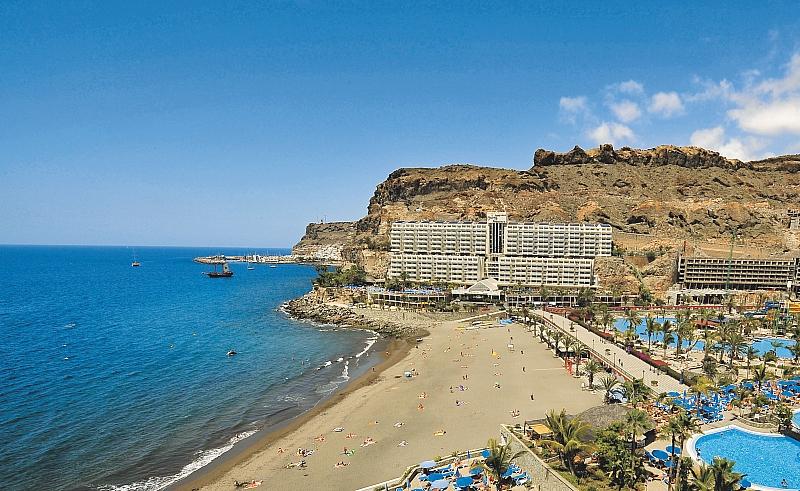 Lower dew points feel drier and higher dew points feel more humid. Unlike temperature, which typically varies significantly between night and day, dew point tends to change more slowly, so while the temperature may drop at night, a muggy day is typically followed by a muggy night.
The chance that a given day will be muggy at Gran Canaria Airport is essentially constant during April, remaining around 1% throughout.
For reference, on September 22, the muggiest day of the year, there are muggy conditions 44% of the time, while on January 12, the least muggy day of the year, there are muggy conditions 1% of the time.
Humidity Comfort Levels in April at Gran Canaria Airport
Humidity Comfort Levels in April at Gran Canaria AirportApr1122334455667788991010111112121313141415151616171718181919202021212222232324242525262627272828292930300%0%10%10%20%20%30%30%40%40%50%50%60%60%70%70%80%80%90%90%100%100%MarMayApr 11%Apr 11%Apr 302%Apr 302%Apr 111%Apr 111%Apr 211%Apr 211%humidhumidcomfortablecomfortabledrydrymuggymuggy
dry
55°F
comfortable
60°F
humid
65°F
muggy
70°F
oppressive
75°F
miserable
The percentage of time spent at various humidity comfort levels, categorized by dew point.
This section discusses the wide-area hourly average wind vector (speed and direction) at 10 meters above the ground. The wind experienced at any given location is highly dependent on local topography and other factors, and instantaneous wind speed and direction vary more widely than hourly averages.
The average hourly wind speed at Gran Canaria Airport is essentially constant during April, remaining within 0.1 miles per hour of 14.6 miles per hour throughout.
For reference, on July 17, the windiest day of the year, the daily average wind speed is 18.9 miles per hour, while on October 13, the calmest day of the year, the daily average wind speed is 12.1 miles per hour.
Average Wind Speed in April at Gran Canaria Airport
Average Wind Speed in April at Gran Canaria AirportApr1122334455667788991010111112121313141415151616171718181919202021212222232324242525262627272828292930300 mph0 mph5 mph5 mph20 mph20 mph25 mph25 mph30 mph30 mphMarMayApr 114. 5 mphApr 114.5 mphApr 3014.5 mphApr 3014.5 mphApr 1614.7 mphApr 1614.7 mph
The average of mean hourly wind speeds (dark gray line), with 25th to 75th and 10th to 90th percentile bands.
The hourly average wind direction at Gran Canaria Airport throughout April is predominantly from the north, with a peak proportion of 86% on April 30.
Wind Direction in April at Gran Canaria Airport
Wind Direction in April at Gran Canaria AirportApr1122334455667788991010111112121313141415151616171718181919202021212222232324242525262627272828292930300%100%20%80%40%60%60%40%80%20%100%0%MarMaynorthwesteast
northeastsouthwest
The percentage of hours in which the mean wind direction is from each of the four cardinal wind directions, excluding hours in which the mean wind speed is less than 1.0 mph. The lightly tinted areas at the boundaries are the percentage of hours spent in the implied intermediate directions (northeast, southeast, southwest, and northwest).
Gran Canaria Airport is located near a large body of water (e.g., ocean, sea, or large lake). This section reports on the wide-area average surface temperature of that water.
The average surface water temperature at Gran Canaria Airport is essentially constant during April, remaining within 1°F of 66°F throughout.
Average Water Temperature in April at Gran Canaria Airport
Average Water Temperature in April at Gran Canaria AirportApr11223344556677889910101111121213131414151516161717181819192020212122222323242425252626272728282929303064°F64°F65°F65°F66°F66°F67°F67°F68°F68°F69°F69°F70°F70°F71°F71°FMarMayApr 166°FApr 166°FApr 3067°FApr 3067°FApr 1166°FApr 1166°FApr 2166°FApr 2166°F
The daily average water temperature (purple line), with 25th to 75th and 10th to 90th percentile bands.
Definitions of the growing season vary throughout the world, but for the purposes of this report, we define it as the longest continuous period of non-freezing temperatures (≥ 32°F) in the year (the calendar year in the Northern Hemisphere, or from July 1 until June 30 in the Southern Hemisphere).
Temperatures at Gran Canaria Airport are sufficiently warm year round that it is not entirely meaningful to discuss the growing season in these terms. We nevertheless include the chart below as an illustration of the distribution of temperatures experienced throughout the year.
Time Spent in Various Temperature Bands and the Growing Season in April at Gran Canaria Airport
Time Spent in Various Temperature Bands and the Growing Season in April at Gran Canaria AirportApr1122334455667788991010111112121313141415151616171718181919202021212222232324242525262627272828292930300%100%10%90%20%80%30%70%40%60%50%50%60%40%70%30%80%20%90%10%100%0%MarMay100%Apr 16100%Apr 16coolcomfortablewarm
frigid
15°F
freezing
32°F
very cold
45°F
cold
55°F
cool
65°F
comfortable
75°F
warm
85°F
hot
95°F
sweltering
The percentage of time spent in various temperature bands. The black line is the percentage chance that a given day is within the growing season.
Growing degree days are a measure of yearly heat accumulation used to predict plant and animal development, and defined as the integral of warmth above a base temperature, discarding any excess above a maximum temperature. In this report, we use a base of 50°F and a cap of 86°F.
The average accumulated growing degree days at Gran Canaria Airport are rapidly increasing during April, increasing by 479°F, from 1,325°F to 1,804°F, over the course of the month.
Growing Degree Days in April at Gran Canaria Airport
Growing Degree Days in April at Gran Canaria AirportApr1122334455667788991010111112121313141415151616171718181919202021212222232324242525262627272828292930301,200°F1,200°F1,300°F1,300°F1,400°F1,400°F1,500°F1,500°F1,600°F1,600°F1,700°F1,700°F1,800°F1,800°F1,900°F1,900°F2,000°F2,000°FMarMayApr 11,325°FApr 11,325°FApr 301,804°FApr 301,804°FApr 111,486°FApr 111,486°FApr 211,651°FApr 211,651°F
The average growing degree days accumulated over the course of April, with 25th to 75th and 10th to 90th percentile bands.
This section discusses the total daily incident shortwave solar energy reaching the surface of the ground over a wide area, taking full account of seasonal variations in the length of the day, the elevation of the Sun above the horizon, and absorption by clouds and other atmospheric constituents. Shortwave radiation includes visible light and ultraviolet radiation.
The average daily incident shortwave solar energy at Gran Canaria Airport is gradually increasing during April, rising by 0.8 kWh, from 6.6 kWh to 7.4 kWh, over the course of the month.
Average Daily Incident Shortwave Solar Energy in April at Gran Canaria Airport
Average Daily Incident Shortwave Solar Energy in April at Gran Canaria AirportApr1122334455667788991010111112121313141415151616171718181919202021212222232324242525262627272828292930300 kWh0 kWh2 kWh2 kWh3 kWh3 kWh4 kWh4 kWh5 kWh5 kWh5 kWh5 kWh6 kWh6 kWh7 kWh7 kWh8 kWh8 kWh9 kWh9 kWhMarMayApr 16. 6 kWhApr 16.6 kWhApr 307.4 kWhApr 307.4 kWhApr 167.1 kWhApr 167.1 kWh
The average daily shortwave solar energy reaching the ground per square meter (orange line), with 25th to 75th and 10th to 90th percentile bands.
For the purposes of this report, the geographical coordinates of Gran Canaria Airport are 27.932 deg latitude, -15.387 deg longitude, and 69 ft elevation.
The topography within 2 miles of Gran Canaria Airport contains significant variations in elevation, with a maximum elevation change of 610 feet and an average elevation above sea level of 121 feet. Within 10 miles contains significant variations in elevation (5,758 feet). Within 50 miles also contains extreme variations in elevation (6,417 feet).
The area within 2 miles of Gran Canaria Airport is covered by water (36%), cropland (24%), artificial surfaces (21%), and sparse vegetation (16%), within 10 miles by water (54%) and shrubs (18%), and within 50 miles by water (92%).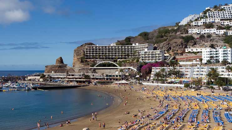
This report illustrates the typical weather at Gran Canaria Airport, based on a statistical analysis of historical hourly weather reports and model reconstructions from January 1, 1980 to December 31, 2016.
Temperature and Dew Point
Gran Canaria Airport has a weather station that reported reliably enough during the analysis period that we have included it in our network. When available, historical temperature and dew point measurements are taken directly from this weather station. These records are obtained from NOAA’s Integrated Surface Hourly data set, falling back on ICAO METAR records as required.
In the case of missing or erroneous measurements from this station, we fall back on records from nearby stations, adjusted according to typical seasonal and diurnal intra-station differences. For a given day of the year and hour of the day, the fallback station is selected to minimize the prediction error over the years for which there are measurements for both stations.
In this case, the only station close and reliable enough to use as a fallback is Tenerife South Airport.
Other Data
All data relating to the Sun’s position (e.g., sunrise and sunset) are computed using astronomical formulas from the book, Astronomical Algorithms 2nd Edition , by Jean Meeus.
All other weather data, including cloud cover, precipitation, wind speed and direction, and solar flux, come from NASA’s MERRA-2 Modern-Era Retrospective Analysis . This reanalysis combines a variety of wide-area measurements in a state-of-the-art global meteorological model to reconstruct the hourly history of weather throughout the world on a 50-kilometer grid.
Land Use data comes from the Global Land Cover SHARE database , published by the Food and Agriculture Organization of the United Nations.
Elevation data comes from the Shuttle Radar Topography Mission (SRTM) , published by NASA’s Jet Propulsion Laboratory.
Names, locations, and time zones of places and some airports come from the GeoNames Geographical Database .
Time zones for airports and weather stations are provided by AskGeo.com .
Maps are © OpenStreetMap contributors.
Disclaimer
The information on this site is provided as is, without any assurances as to its accuracy or suitability for any purpose. Weather data is prone to errors, outages, and other defects. We assume no responsibility for any decisions made on the basis of the content presented on this site.
We draw particular cautious attention to our reliance on the MERRA-2 model-based reconstructions for a number of important data series. While having the tremendous advantages of temporal and spatial completeness, these reconstructions: (1) are based on computer models that may have model-based errors, (2) are coarsely sampled on a 50 km grid and are therefore unable to reconstruct the local variations of many microclimates, and (3) have particular difficulty with the weather in some coastal areas, especially small islands.
We further caution that our travel scores are only as good as the data that underpin them, that weather conditions at any given location and time are unpredictable and variable, and that the definition of the scores reflects a particular set of preferences that may not agree with those of any particular reader.
Please review our full terms contained on our Terms of Service page.
Gran Canaria Airport
Provincia de Las Palmas, Canary Islands, Spain
© OpenStreetMap contributors
Gran Canaria Weather in April 2021
Puerto de Mogan in April on a lovely sunny day, with warm weather, typical for the south of Gran Canaria
April is somewhat of a transition month in Gran Canaria: the weather is starting to really warm up and the amount of rain the island sees drops by half compared to March.
- Weather in Gran Canaria in April
- Temperatures in Gran Canaria in April
- Rainfall in April
- Sunshine hours
- Sea temperature
- Can you swim in Gran Canaria in April?
- Things to do in Gran Canaria in April
- Events in April
Easter is usually happening in April on most years and that is the most popular week during the month. Semana Santa (Holy Week) is an important period in the Spanish culture, so many Spanish families from the continent will come on holiday to Gran Canaria as well to enjoy the beautiful and sunny weather.
Weather in Gran Canaria in April
THE NUMBERS MENTIONED IN THE ARTICLE (temperatures, sunshine hours, sea water temperature etc.) ARE FROM GRAN CANARIA AIRPORT WEATHER STATION
The temperatures during the day in Gran Canaria are between 22°C and 25°C, which means that the weather will be perfect for sunbathing on most days. Although the temperatures don’t vary much between March and April in Gran Canaria, the weather is considerably improving since it doesn’t rain as much, especially in the south of the island.
The biggest improvement comes in the form of longer days and more sunshine hours, which means that in April you will be able to enjoy long hours on the beach, compared to the first trimester of the year. Also, the water temperature is starting to rise, so you will probably be able to comfortably swim in the ocean, especially in the south.
But the weather in April in Gran Canaria is not only good for sunbathing, for walking and hiking as well. It is warm, but not as hot as during the summer months, so you can easily enjoy long walks in nature, without worrying about rain or bad storms.
One piece of advice, if you planning to come to Gran Canaria in April during Holy Week and Easter, make sure to book well in advance as prices go crazy during that time. School holidays are the most expensive periods to come on holiday to Gran Canaria, so at least book the airplane tickets in advance if you plan to go self-catering.
Temperatures in Gran Canaria in April
The average high temperature in April in Gran Canaria is around 21°C, while at night you can expect temperatures of around 16-17°C.
- Average high temperature: 22.6°C(72.7°F)
- Average low temperature: 16.2°C (61.2°F)
- Daily mean temperature: 19.4°C (66.9°F)
In Gran Canaria, the daily mean temperature is 19. 4°C (66.9°F) in April, which is calculated as a mean between the average high temperature of 22.6°C(72.7°F) and the average low of 16.2°C (61.2°F). As you can see, the temperatures are only slightly higher than they were in March.
Record low & record high temperatures
The highest temperature ever recorded in Gran Canaria in April (at Airport station) was 34.3°C and the lowest was 8°C.
- READ MORE: Maspalomas and Playa del Ingles weather in April
Rainfall in April
April can be considered the last of the “rainy” months before summer gets to Gran Canaria and the rainy days are over. We used quotes when talking about rainy months because in April the amount of rain the island gets is half as much compared to the amount of rain in March.
The average rainfall in April is 6.3 mm and this occurs during 1 or 2 days throughout the month. So, as you can see, it doesn’t rain much or often in Gran Canaria in April.
Sunshine hours
Gran Canaria gets an average of 7.5 hours of sunshine per day in April. As long as the sun is out the weather is usually nice and warm enough for T-shirts or short-sleeved blouses.
Sea temperature
- Average sea temperature in April: 19.2°C / 66.5°F
The average surface sea temperature in April at the Gran Canaria Airport station is approximately 19.2°C / 66.5°F, which is only a slight increase compared to the previous month.
Can you swim in Gran Canaria in April?
With an average temperature of 19.2°C / 66.5°F, the ocean might still be too cold for many people, although there are other visitors who swim all year round in Gran Canaria with no problems. If the ocean is too cold for you and you haven’t booked a place with a heated pool, there is always the option to ask at the hotels nearby if they have a heated pool and if you can pay to use their facilities for the day.
Things to do in Gran Canaria in April
The charm of Gran Canaria is that it’s a year-round destination and there are many places to visit on the island and activities that are suited for all age groups. April is a busy month around Easter time, but before that, it’s usually relaxed and quiet, as many of the people who had come here to spend winter have returned home by now.
- READ MORE: Canary Islands Weather in April
Participate in the Holy Week processions
If you are coming on holiday to Gran Canaria for Easter, then you might want to participate in the events leading to it, which are happening during Holy Week (Semana Santa). You will be able to find the program online at a closer date and you can also ask as the tourism offices.
Hike to Roque Nublo
This is a pretty popular hike in Gran Canaria, as it takes only 2 hours to complete. April is warm and perfect for discovering the beautiful nature of Gran Canaria since in summer it can get very hot and difficult to hike for long distances during the day.
Events in April
Easter in Gran Canaria
4 April 2021
Easter Sunday is on April 4th in 2021 and Gran Canaria is a beautiful place to spend the holiday on a family trip. This is a busy time on the island, so if you want to hire a car or have your Easter lunch/dinner at a certain special restaurant, make sure to book in advance. This way, especially with the car hire, you will get a better price than when booking last minute.
GRAN CANARIA WEATHER – MONTHLY REPORTS
- JANUARY
- FEBRUARY
- MARCH
- APRIL
- MAY
- JUNE
- JULY
- AUGUST
- SEPTEMBER
- OCTOBER
- NOVEMBER
- DECEMBER
Was this helpful?
© Copyright GuideToCanaryIslands 2022. All rigths reserved.
Gran Canaria weather in April 2023: How hot & sunny?
-
21
21°C max day temperature
-
8
8 hours of sunshine per day
-
2
2 days with some rainfall
-
15
15°C min night temperature
-
13
13 hours of daylight per day
-
0
No heat & humidity
-
11
11 mm of monthly rainfall
-
9
9 (Very High) UV index
-
19
19°C sea temperature
Below are average maximum temperatures at popular destinations in Gran Canaria in April. Select a destination to see more weather parameters.
-
21
Las Palmas
-
21
Maspalomas
-
21
Meloneras
-
21
Playa del Ingles
-
21
San Agustin
-
20
Amadores
-
20
Playa de Taurito
-
20
Puerto Rico
More destinations >>
TUI: Free child places for summer 2023
Sale
- Book family holidays for less in summer 2023
- Save with 1000s of free child places
- Spread the cost with £0 deposits & direct debit
Go to TUI deal >>
View all TUI offers
TUI deal finder
Recommended for Gran Canaria
-
TUI
-
British Airways
-
First Choice
-
Jet2holidays
The April weather guide for Gran Canaria (Maspalomas) shows long term weather averages processed from data supplied by CRU (University of East Anglia), the Met Office & the Netherlands Meteorological Institute.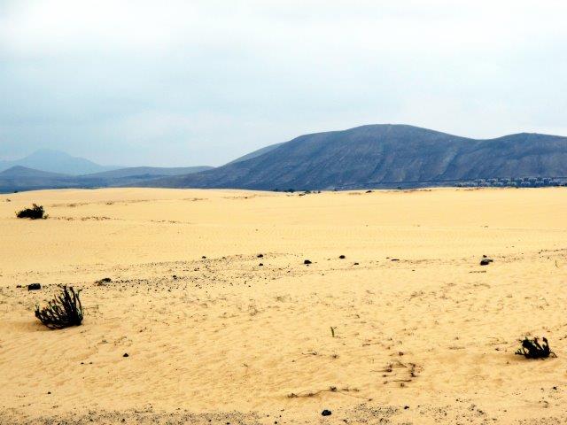 Find out more about our data sources.
Jan
Feb
Mar
Apr
May
Jun
Jul
Aug
Sep
Oct
Nov
Dec
Metric (°C / mm) | Imperial (°F / inches)
Back to top
Things to do in Gran Canaria in April 2023
If Easter’s late, Semana Santa takes place in April in Gran Canaria. Summer starts early on the island, however. At Gran Canaria’s first major outdoor festival of the year, 24 Grados (named after the south of the island’s average yearly temperature in centigrade), which is held in Maspalomas’ main football stadium.
It’s Gran Canaria’s legendary climate which attracts athletes to the island. They use GC as a warm weather training base in winter. As well as competing in spring events such as Gloria Challenge Mogán with its three triathlons.
Santa María de Guía’s famous for its queso de flor – flower cheese which gets its name from the fact it’s curdled with juice from the head of the artichoke thistle. So celebrated is this foodstuff it even has its own festival: the Fiesta del Queso, offering plenty of opportunities to bite into this cheesy delight, occurs on the last weekend of April in Guía’s historic centre.
Back to top
More about Gran Canaria
-
8 of the best family-friendly hotels in Gran Canaria
-
7 ways to get active on holiday in Gran Canaria
-
6 reasons to visit Gran Canaria
How hot is it in Gran Canaria in April?
Daytime temperatures usually reach 21°C in Maspalomas, Gran Canaria in April, falling to 15°C at night.
How sunny is it in Gran Canaria in April?
There are normally 8 hours of bright sunshine each day in Maspalomas, Gran Canaria in April – that’s 61% of daylight hours.
How warm is the sea around Gran Canaria in April?
The average sea temperature around Maspalomas, Gran Canaria in April is 19°C.
Does it ever rain in Gran Canaria in April?
There are usually 2 days with some rain in Maspalomas, Gran Canaria in April and the average monthly rainfall is 11mm.
Gran Canaria April sunrise & sunset times
Browse the sunrise and sunset times for Gran Canaria in April 2023. Select a month to view Gran Canaria sunrise and sunset times for the next 12 months. The Gran Canaria sunrise and sunset times shown below are for Maspalomas.
JanFebMarAprMayJunJulAugSepOctNovDec
Related posts
-
New airline routes & holiday destinations
-
Top 10 summer sun holiday destinations in October
-
Top 10 winter sun holiday destinations in December
Popular travel offers
-
TUI: £150 off Autumn + pay £0 deposits for 2023
-
Zest Car Rental: 5% off car hire booked online
-
Jet2holidays: Last minute deals + free child places
Top ^
*affiliate links: find out how we are funded and why this helps us remain free to use.
April Weather in Puerto Rico, Gran Canaria – 2023 – Winter Sun Expert
Located on the south-west coast of the Spanish island of Gran Canaria, Puerto Rico is a small holiday resort that attracts tourists and snowbirds from different parts of the world, all year round. Puerto Rico has a beautiful sandy beach and two small harbors.
Inland, there are many shops and restaurants in the area that many consider to be top class. Most of these shops and restaurants can be found in small shopping centers. One of the popular shopping centers, the Pasarela, is the closest to the beach. The main shopping centers, as well as other exclusive stores, are in the center of the town.
Puerto Rico is not bare of some Spanish flavor. Spanish is spoken widely, alongside English. From the restaurants, music, art, and craft, you are sure to find some Spanish culture in the area. Snowbirds can enjoy swimming, golfing, dolphin-watching cruises, boat trips, sailing, fishing, and a couple of other activities.
Weather April 2023 in Puerto Rico Gran Canaria:
Generally, April in Puerto Rico will be really nice, with an average temperature of around 75°F / 24°C. But due to the very high humidity, it can feel very uncomfortable. You can expect around 1 rainy days, with on average 0.1 inches / 2 mm of rain during the month of April.
Bengt Nyman – CC BY 2.0
Contents
- 1 April weather in Puerto Rico Gran Canaria
- 2 April weather in Puerto Rico Gran Canaria in more detail
- 2.1 – What will the temperature be in Puerto Rico in April
- 2.2 – Can you expect rain in April in Puerto Rico?
- 2.3 – What will the water temperature be in Puerto Rico for April
- 2.4 – Can you expect in April a lot of sunny days in Puerto Rico
- 2.5 – Will it be comfortable in April in Puerto Rico?
- 3 What to do in Puerto Rico Gran Canaria in April
- 4 Is it humid in Puerto Rico Gran Canaria in April?
- 5 Is April a good time to go to Puerto Rico Gran Canaria?
- 6 Does it rain all day in Puerto Rico Gran Canaria in April?
- 7 Is April the rainiest month in Puerto Rico Gran Canaria?
- 8 Is April the most sunniest month in Puerto Rico Gran Canaria?
- 9 Weather in Puerto Rico Gran Canaria in other months
April weather in Puerto Rico Gran Canaria
To get a good overview of the type of weather you can expect in April in Puerto Rico, we will look at the day and night temperature, minimum and maximum water temperature, and if April is comfortable or humid
Generally, April in Puerto Rico will be really nice. Historical data shows that you can expect an average temperature of around 75°F / 24°C. But due to the very high humidity, it can feel very uncomfortable. During the night, it will cool down to around 57°F / 14°C. Many will prefer a location with air conditioning due to the high humidity level.
Puerto Rico does not have a lot of rainy days in April. You can expect around 1 rainy days, with on average 0.1 inches / 2 mm of rain during the whole month.
The forecast for April 2023 is based on historical data and are averages. They will give a good indication what you can expect, but the daily temperature and rain will fluctuate during the month.
April weather in Puerto Rico Gran Canaria in more detail
To get a better feeling for the type of weather, you can expect in April in Puerto Rico, we will look at the temperature, rain, wind, humidity, water temperature, and sun and clouds
– What will the temperature be in Puerto Rico in April
Generally, you can expect in April an average temperature of 75°F / 24°C during the day and an average of 57°F / 14°C during the night. In April, during the warmest part of the afternoon, the temperature can often get as high as 84°F / 29°C, and at the end of the night, it can get as low as 51°F / 11°C.
When looking at the whole year, January and February are the coldest months, with an average temperature of around 71°F / 22°C. August and September are the hottest months, with an average temperature of around 84°F / 29°C. When comparing April with the temperature in the month before and after, this is almost equal to March, which sees an average maximum temperature of around 73°F / 23°C. And almost equal to May, which sees an average maximum temperature of around 77°F / 25°C.
Day and night temperature variation for Puerto Rico during the year.Day and night temperature variation for Puerto Rico during the year.
But average temperatures only tell half of the story. It is also good to check the maximum and minimum temperatures. When looking at the whole year, August is the hottest month, with a temperature of around 93°F / 34°C.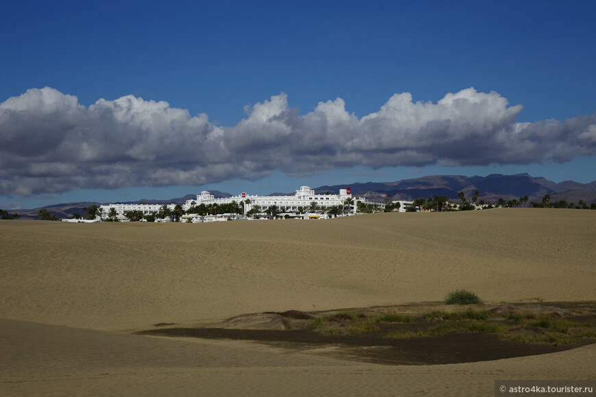 January and December are the coldest months, with a temperature of around 78°F / 26°C. When comparing April with the temperature in the month before and after, this is equal to March, which sees an average maximum temperature of around 84°F / 29°C. And almost equal to May, which sees an average maximum temperature of around 86°F / 30°C.
In the following graph, you can see how many cold and hot days you can expect in Puerto Rico each month:
Day and night temperature variation for Puerto Rico during the year.Day and night temperature variation for Puerto Rico during the year.
– Can you expect rain in April in Puerto Rico?
Generally, you can expect about 1 rain days in April, with on average 0.1 inches / 2 mm of rain.
When looking at the whole year, May and July are the driest months, with an average rainfall of around 0 inches / 0 mm. December is the wettest month, with an average rainfall of around 0.4 inches / 9 mmmm. When comparing April with the month before and after, this is slightly less than March, which sees around 0. 2 inches / 5 mm of rain. And almost equal to May, which sees around 0 inches / 0 mm of rain
Rain days for Puerto Rico during the year.Rain days for Puerto Rico during the year.
If we look at the number of days with rain, July is the month with the least amount of rain days with an average of between 0 and 1 days. December is the month with the most rain days with an average of between 2 and 3 days. When comparing April with the month before and after, this is almost equal to March, which sees an average of between 1 and 2 days of rain. And almost equal to May, which sees an average of between 0 and 1 days of rain
– What will the water temperature be in Puerto Rico for April
You can expect in April, the water temperature for Puerto Rico to be between 69°F / 21°C and 64°F / 18°C.
To compare the water temperature we will use the maximum water temperature. You can expect this temperature on a more sunny day, close to the shore, when the wind does not mix the relatively warmer and colder water.
September has the highest water temperature, with around 77°F / 25°C. March has the lowest water temperature, with an average of between 68°F / 20°C and 69°F / 21°C. When comparing the water temperature from April with the month before and after, April has a water temperature almost equal to March, with a water temperature of an average of between 68°F / 20°C and 69°F / 21°C. And almost equal to the water temperature from May, that is an average of between 69°F / 21°C and 71°F / 22°C.
Water temperature for Puerto Rico during the year.Water temperature for Puerto Rico during the year.
– Can you expect in April a lot of sunny days in Puerto Rico
Generally, you can expect around 6 sunny days in April and around 22 partly sunny days. The remaining days will be cloudy.
When looking at the whole year, December is the month with the highest number of sunny days, with an average of between 11 and 12 sunny days. August is the month with the lowest number of sunny days, with around 1 sunny day. When comparing April with the number of sunny days in the month before and after, it is almost equal to March, with around 7 sunny days. And almost equal to May, with around 7 sunny days
The number of sunny, partly sunny, and cloudy days for Puerto RicoThe number of sunny, partly sunny, and cloudy days for Puerto Rico
We have looked at the sunny days in Puerto Rico. Let’s also look at the cloudy or overcast days. January is the month with the highest number of cloudy days, with an average of between 4 and 5 cloudy days. July is the month with the lowest number of cloudy days, with around 1 cloudy day. When comparing April with the number of cloudy days in the month before and after, it is equal to March, with an average of between 2 and 3 cloudy days. And almost equal to May, with around 2 cloudy days
– Will it be comfortable in April in Puerto Rico?
Generally, April in Puerto Rico will have a very high humidity, and can feel very uncomfortable.
We use the humidity and temperature in Puerto Rico to calculate the Wintersun Expert Comfort level for each month. The lower the Wintersun Expert Comfort level, the more comfortable it will be. Only for certain people, extremely dry air can feel slightly uncomfortable.
When looking at the whole year, January has the lowest humidity, with a Wintersun Expert comfort level of “slightly uncomfortable” (moderately humid). July has the highest humidity, with a Wintersun Expert comfort level of “very uncomfortable” (very high humidity). When comparing April with the month before and after, this is almost equal to March, which has a Wintersun Comfort level of “slightly uncomfortable” (moderately humid). And almost equal to May, which has a Wintersun Comfort level of “extremely uncomfortable” (extremely humid)
Wintersun Expert Humidity / Comfort level for Puerto RicoWintersun Expert Humidity / Comfort level for Puerto Rico
What to do in Puerto Rico Gran Canaria in April
- The Europa Center: the Europa Center, also known as the Europa Centre Puerto Rico, is a great hub of top quality restaurants, entertaining bars, and other sorts of activities for snowbirds. It is one of the top spots in Puerto Rico.
- The Pasarela center: This is a great mall located close to the beach. It has some splendid stores that snowbirds can visit to make essential purchases, and also get a thing or two to take back home with them.
- Playa de Puerto Rico: this is a busy sandy beachside that is surrounded by multiple lodging & dining spots. It’s a great place to meet and socialize with other tourists, get a suntan, or just lay back with your feet in the sand and watch a beautiful sunset.
- Angry Birds Activity Park: for snowbirds traveling with younger children, this is a great location. There are lots of activities here like ziplining. It is a great way to allow children to have some fun while on holiday. Food, like burgers, pizza, and ice cream is also available here.
 It is one of the top spots in Puerto Rico.
Is it humid in Puerto Rico Gran Canaria in April?
A lot of people ask interested in the humidity or relative humidity for Puerto Rico Gran Canaria in April. But the real question they want to ask is not about humidity but the amount of moisture in the air. Or better, about comfort. Will it be comfortable in April in Puerto Rico, or will high humidity make it uncomfortable.
To answer this question, we have to look at the dew point. Relative humidity can change a lot in Puerto Rico during the day and night, as it changes when the amount of moisture changes and, but also when the temperature changes. It is a lot less reliable for comfort. Where the dew point only varies with the amount of moisture in the air.
Looking at the dew point, we can see that for the month of April, you can expect that Puerto Rico will have a very high humidity, and can feel very uncomfortable.
January is the month with the most comfort. It will be moderately humid, and can feel slightly uncomfortable for some. July is the most uncomfortable month. It will be extremely humid, and can feel extremely uncomfortable. In the graph, you can see that there is not a lot of difference between the most comfortable and most uncomfortable months.
Humidity level for Puerto RicoHumidity level for Puerto Rico
Is April a good time to go to Puerto Rico Gran Canaria?
Trying to answer the question of whether April is a good time to go to Puerto Rico is not as easy as it first seems. Some people like colder weather, and others prefer a warmer climate. Some are fine with some humidity, and others are not. If your location has air conditioning, the night temperature is less important.
These are some examples. I will try to answer the question with a more generic person in mind. The more detailed information in this article should be enough to check further if this applies to you as well.
If we look at the average temperature for Puerto Rico in April, we can see that it will be fine for most people. In April, you can expect it to be really nice, with an average temperature of around 75°F / 24°C. But due to the very high humidity, it can feel very uncomfortable. During the night, it will be around 57°F / 14°C.
As the number of overcast days is not high, you can enjoy the sun with around 6 sunny days and 22 partly sunny days.
The last aspect we will look at is rain. You can expect around 1 rainy days, with on average 0.1 inches / 2 mm of rain during April. If it were more than five days, the location would be slightly less attractive for a shorter stay.
We have looked at the average day temperature, the night temperature, humidity, the number of overcast days, and the rain. We think that April in Puerto Rico Gran Canaria is not the most optimal destination. But that doesn’t mean it is not a good time for you to go. As said before, each visitor has their own preferences when it comes to the weather.
Does it rain all day in Puerto Rico Gran Canaria in April?
In Puerto Rico, it does not rain all day in April. You can expect around 1 rainy days, with on average 0.1 inches / 2 mm of rain during the month.
Another way of looking at the rain is the number of sunny days. For Puerto Rico Gran Canaria, there are, on average 6 sunny days and 22 partly sunny days in April. That clearly shows that it is not raining all the time.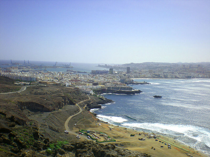
Is April the rainiest month in Puerto Rico Gran Canaria?
April is not the month with the most rainy days, and not the month with the most rain.
To answer what the rainiest month is in Puerto Rico, we will both look at the month with the most rain, and the month with the highest number of rainy days.
December is the month with the the highest number of rainiest days. On average, you can expect 3 days with rain. July is the month with the lowest number of rainy days, with aproximately 0 days.
December is the month with the most rain. This is not equal as the one with the most rainy days. On average, you can expect 0.4 inches / 9 mm of rain. July is the month with the least amount of rain. This is not the same month as the one with the lowest number of rainy days. You can expect approximately 0 inches / 0 mm of rain.
Is April the most sunniest month in Puerto Rico Gran Canaria?
April is not the month with the most sunny days, not the month with the most partly sunny days, and it is not the month with the lowest number of overcast days.
To answer what the sunniest month is in Puerto Rico, we will of course look at the month with the most sunniest days, but also look at the month with the biggest number of days that are sunny or partly sunny.
December is the month with the highest number of sunny days. On average, you can expect 6 sunny days, and 22 partly suny days. August is the month with the lowest number of sunny days.
July is the month with the highest number of sunny days and partly sunny days combined. While February is the month with the lowest number of sunny days and partly sunny days combined.
The last thing we will look at is the number of overcast days. July is the month with the lowest number of overcast days. While January is the month with the highest number of overcast days.
Weather in Puerto Rico Gran Canaria in other months
- Weather in Puerto Rico Gran Canaria for January
- Weather in Puerto Rico Gran Canaria for February
- Weather in Puerto Rico Gran Canaria for March
- Weather in Puerto Rico Gran Canaria for May
- Weather in Puerto Rico Gran Canaria for June
- Weather in Puerto Rico Gran Canaria for July
- Weather in Puerto Rico Gran Canaria for August
- Weather in Puerto Rico Gran Canaria for September
- Weather in Puerto Rico Gran Canaria for October
- Weather in Puerto Rico Gran Canaria for November
- Weather in Puerto Rico Gran Canaria for December
Click here for more information about the destination “Puerto Rico”
Las Palmas de Gran Canaria, Spain weather in April: average temperature & climate
Planning a trip to Las Palmas de Gran Canaria?
Save all the best places to visit with WanderlogDownload the travel planning app everyone’s been raving about
Learn more
General weather summary
Mildly cool and breezy
Feels like
0%
Daily chance of prec.
0.010 in
Amount
15.0 mph
Wind speed
74%
Humidity
12.8 hrs
Daylight length
7:37am
Sunrise
8:26pm
Sunset
63%
Cloud cover
T-shirt
What to wear
Build, organize, and map your itinerary to Las Palmas de Gran Canaria with our free trip planner.
What is the average temperature in April
The average temperature in Las Palmas de Gran Canaria in April for a typical day ranges from a high of 68°F (20°C) and a low of 64°F (18°C). Some would describe it as mildly cool and breezy.
For comparison, the hottest month in Las Palmas de Gran Canaria, September, has days with highs of 75°F (24°C) and lows of 72°F (22°C). The coldest month, February has days with highs of 66°F (19°C) and lows of 62°F (17°C). This graph shows how an average day looks like in Las Palmas de Gran Canaria in April based on historical data.
Highs and lows in Las Palmas de Gran Canaria in Apr
How much does it rain in April
In Las Palmas de Gran Canaria in April, there’s a 0% chance of rain on an average day. And on the average day it rains or snows, we get 0.02 in (0.6 mm) of precipitation. In more common terms of how much that is, some would describe it as not rainy at all.
The wettest month in Las Palmas de Gran Canaria is February with a 4% chance of precipitation on a typical day and gets 0.01 inches (0.3 mm) of precipitation, while the dryest month in Las Palmas de Gran Canaria is July with a 0.0% chance of precipitation on a typical day and gets 0.01 inches (0.3 mm) of precipitation. These graphs show the probability of it raining/snowing in April and the amount of rainfall.
Chance of rain or snow on an average Las Palmas de Gran Canaria day by month
Average precipitation by hour of day
How cloudy is Las Palmas de Gran Canaria in April
The average amount of time that the sky is clear or sunny (partly cloudy or less) in Las Palmas de Gran Canaria during April is 15.2 hours (63% of the day). For comparison, the day with the most clear, sunny days in Las Palmas de Gran Canaria is July with 21. 1 hours while November has the shortest amount of cloud-free hours of only 13.8 hours. This graph shows the average amount of sunshine in Las Palmas de Gran Canaria in April based on historical data.
Monthly clear skies percent of time in Las Palmas de Gran Canaria
When is the sunrise and sunset in April
The average day in Las Palmas de Gran Canaria during April has 12.8 hours of daylight, with sunrise at 7:37 am and sunset at 8:26 pm.
The day with the longest amount of daylight in Las Palmas de Gran Canaria is June 17th with 13.9 hours while December 22nd has the shortest amount of daylight of only 10.3 hours.
This graph shows the average amount of daylight in Las Palmas de Gran Canaria in April based on historical data.
Average hours of daylight in Las Palmas de Gran Canaria by month
How humid is it in April
In April, Las Palmas de Gran Canaria is moderately humid with an average amount of 74% (relative humidity), which could be described as humid but cool.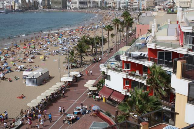 August has the highest relative humidity at 85% and is the least humid in January at 68%. This graph shows the average amount of humidity in Las Palmas de Gran Canaria throughout April based on historical data.
Average relative humidity in Las Palmas de Gran Canaria by month
How windy is it in April in Las Palmas de Gran Canaria
Historically, the wind in Las Palmas de Gran Canaria during April blows at an average speed of 15.0 mph (24.1 kph). The windiest month is July with an average wind speed of 21.4 mph (34.4 kph), while the calmest month is October with an average wind speed of 12.7 mph (20.5 kph). This graph shows the average wind speed in Las Palmas de Gran Canaria in April based on historical data.
Average monthly wind speed in Las Palmas de Gran Canaria
What to wear in April
With an average high of 68°F (20°C) and a low of 64°F (18°C), it generally feels mildly cool and breezy. With that in mind, most people would dress in something light like your favorite t-shirt.
What’s the weather like in Las Palmas de Gran Canaria the rest of the year?
We’ve collected the weather data for Las Palmas de Gran Canaria during all other months of the year too:
- Weather in Las Palmas de Gran Canaria in January
- Weather in Las Palmas de Gran Canaria in February
- Weather in Las Palmas de Gran Canaria in March
- Weather in Las Palmas de Gran Canaria in May
- Weather in Las Palmas de Gran Canaria in June
- Weather in Las Palmas de Gran Canaria in July
- Weather in Las Palmas de Gran Canaria in August
- Weather in Las Palmas de Gran Canaria in September
- Weather in Las Palmas de Gran Canaria in October
- Weather in Las Palmas de Gran Canaria in November
- Weather in Las Palmas de Gran Canaria in December
Where does this data come from?
Weather data for Las Palmas de Gran Canaria was collected from the MERRA-2 project from NASA, which used a climate model combined with historical data from weather stations around the world to estimate what the conditions were like for every point on the Earth.
For all data based on historical data, we’ve averaged the data from the past 11 years (2010-2020). For example, for the hourly temperature at 10am, we’ve looked at the temperature at 10am on every day in April (e.g., April 1, April 2, etc. in 2010, 2011, etc.) and took the arithmetic mean. We did not smooth the data, so for example, our daily temperature line will have some randomness due to the fact that weather is random in the first place.
Best of categories in Las Palmas de Gran Canaria
Restaurants
Cafes
Breakfast and brunch
Other eats
Outdoor diningDiners
DinnerFine dining
LunchRomantic restaurants
Bakeries
Family restaurants
Bars
Kid-friendly attractions
Nightlife
Science & space museums
Nightclubs
Spas
Top searches in Las Palmas de Gran Canaria
Slide 1 of 1
Popular road trips from Las Palmas de Gran Canaria
Slide 1 of 30
Las Palmas de Gran Canaria to
Barcelona
Las Palmas de Gran Canaria to
Puerto de la Cruz
Las Palmas de Gran Canaria to
Madrid
Las Palmas de Gran Canaria to
Lisbon
Las Palmas de Gran Canaria to
Seville
Las Palmas de Gran Canaria to
La Oliva
Las Palmas de Gran Canaria to
Marrakech
Las Palmas de Gran Canaria to
Valencia
Las Palmas de Gran Canaria to
Granada
Las Palmas de Gran Canaria to
Los Cristianos
Las Palmas de Gran Canaria to
Puerto Del Carmen
Las Palmas de Gran Canaria to
Porto
Las Palmas de Gran Canaria to
Cordoba
Las Palmas de Gran Canaria to
Malaga
Las Palmas de Gran Canaria to
Morro del Jable
Las Palmas de Gran Canaria to
Benidorm
Las Palmas de Gran Canaria to
Palma de Mallorca
Las Palmas de Gran Canaria to
Marseille
Las Palmas de Gran Canaria to
Toledo
Las Palmas de Gran Canaria to
Albufeira
Las Palmas de Gran Canaria to
Bilbao
Las Palmas de Gran Canaria to
Bordeaux
Las Palmas de Gran Canaria to
Salou
Las Palmas de Gran Canaria to
Zaragoza
Las Palmas de Gran Canaria to
Santa Cruz de Tenerife
Las Palmas de Gran Canaria to
Salamanca
Las Palmas de Gran Canaria to
Pajara
Las Palmas de Gran Canaria to
Adeje
Las Palmas de Gran Canaria to
San Sebastian – Donostia
Las Palmas de Gran Canaria to
Ronda
All road trips from Las Palmas de Gran Canaria
- Las Palmas de Gran Canaria to Barcelona drive
- Las Palmas de Gran Canaria to Puerto de la Cruz drive
- Las Palmas de Gran Canaria to Madrid drive
- Las Palmas de Gran Canaria to Lisbon drive
- Las Palmas de Gran Canaria to Seville drive
- Las Palmas de Gran Canaria to La Oliva drive
- Las Palmas de Gran Canaria to Marrakech drive
- Las Palmas de Gran Canaria to Valencia drive
- Las Palmas de Gran Canaria to Granada drive
- Las Palmas de Gran Canaria to Los Cristianos drive
- Las Palmas de Gran Canaria to Puerto Del Carmen drive
- Las Palmas de Gran Canaria to Porto drive
- Las Palmas de Gran Canaria to Cordoba drive
- Las Palmas de Gran Canaria to Malaga drive
- Las Palmas de Gran Canaria to Morro del Jable drive
- Las Palmas de Gran Canaria to Benidorm drive
- Las Palmas de Gran Canaria to Palma de Mallorca drive
- Las Palmas de Gran Canaria to Marseille drive
- Las Palmas de Gran Canaria to Toledo drive
- Las Palmas de Gran Canaria to Albufeira drive
- Las Palmas de Gran Canaria to Bilbao drive
- Las Palmas de Gran Canaria to Bordeaux drive
- Las Palmas de Gran Canaria to Salou drive
- Las Palmas de Gran Canaria to Zaragoza drive
- Las Palmas de Gran Canaria to Santa Cruz de Tenerife drive
- Las Palmas de Gran Canaria to Salamanca drive
- Las Palmas de Gran Canaria to Pajara drive
- Las Palmas de Gran Canaria to Adeje drive
- Las Palmas de Gran Canaria to San Sebastian – Donostia drive
- Las Palmas de Gran Canaria to Ronda drive
Looking for day-by-day itineraries in Las Palmas de Gran Canaria?
Get inspired for your trip to Las Palmas de Gran Canaria with our curated itineraries that are jam-packed with popular attractions everyday! Check them out here:
- 1-Day Las Palmas de Gran Canaria Itinerary
- 2-Day Las Palmas de Gran Canaria Itinerary
- 3-Day Las Palmas de Gran Canaria Itinerary
- 4-Day Las Palmas de Gran Canaria Itinerary
Gran Canaria sea water temperature in April
Is it warm enough to swim in Gran Canaria in April? Average water temperature in Gran Canaria in April is 19. 1°C and therefore is not suitable for comfortable swimming. The warmest sea in Gran Canaria in April is 20.7°C, and the coldest is 17.2°C. To find out the sea temperature today and in the coming days, go to Current sea temperature in Gran Canaria
To get an accurate forecast for the water temperature in Gran Canaria for any chosen month, compare two years within a 10 year range using the chart below. In addition to the sea water temperature in Gran Canaria, the selected years in the table also show the values of the maximum and minimum temperatures on each of the days of April.
Sea temperature
Tides
Weather forecast
You can choose any other years:
Year 1: 2007200820092010201120122013201420152016201720182019202020212022
Year 2: 2007200820092010201120122013201420152016201720182019202020212022
| Day | 2022 | 2021 | Min | Max |
|---|---|---|---|---|
| 1 April | 19. 1°C 1°C |
19.4°C | 18.1°C | 20°C |
| 2 April | 18.7°C | 19.3°C | 18.1°C | 20°C |
| 3 April | 18.9°C | 19.2°C | 18.1°C | 19.8°C |
| 4 April | 18.8°C | 19.1°C | 18.1°C | 19.7°C |
| 5 April | 18.7°C | 19°C | 18.1°C | 19.8°C |
| 6 April | 18.8°C | 19.5°C | 18°C | 19.6°C |
| 7 April | 18.7°C | 19.8°C | 17.9°C | 20.3°C |
| 8 April | 18.9°C | 19.5°C | 18.2°C | 20.2°C |
| 9 April | 18.9°C | 19.8°C | 18°C | 20.1°C |
| 10 April | 19.2°C | 19.6°C | 18.2°C | 20°C |
| 11 April | 19.1°C | 20.1°C | 18.2°C | 20.1°C |
| 12 April | 19.1°C | 20°C | 18.3°C | 20.1°C |
| 13 April | 19. 1°C 1°C |
20°C | 18.4°C | 20°C |
| 14 April | 19.2°C | 20.1°C | 18.4°C | 20.1°C |
| 15 April | 18.8°C | 20.2°C | 18.4°C | 20.2°C |
| Day | 2022 | 2021 | Min | Max |
|---|---|---|---|---|
| 16 April | 18.8°C | 20.1°C | 18.4°C | 20.3°C |
| 17 April | 18.7°C | 20.2°C | 18°C | 20.4°C |
| 18 April | 18.9°C | 20°C | 17.4°C | 20.4°C |
| 19 April | 18.8°C | 19.8°C | 17.2°C | 20.3°C |
| 20 April | 19°C | 19.8°C | 18.3°C | 20.2°C |
| 21 April | 18.8°C | 19.9°C | 18.2°C | 20.6°C |
| 22 April | 18.6°C | 19.9°C | 18.5°C | 20.6°C |
| 23 April | 18. 8°C 8°C |
19.8°C | 18.4°C | 20.3°C |
| 24 April | 19.1°C | 20.1°C | 18.4°C | 20.4°C |
| 25 April | 19.3°C | 20.2°C | 18°C | 20.7°C |
| 26 April | 19.4°C | 20.2°C | 18.1°C | 20.6°C |
| 27 April | 19.3°C | 20.3°C | 17.9°C | 20.5°C |
| 28 April | 19.4°C | 20.4°C | 18.4°C | 20.4°C |
| 29 April | 19.1°C | 20.7°C | 18.6°C | 20.7°C |
| 30 April | 19°C | 20.7°C | 18.8°C | 20.7°C |
Average water temperature in Gran Canaria in April over a decade
| 2013 | 2014 | 2015 | 2016 | 2017 |
| 19.9°C | 19.1°C | 18.4°C | 19°C | 19.4°C |
| 2018 | 2019 | 2020 | 2021 | 2022 |
18. 4°C 4°C |
19°C | 19.9°C | 19.9°C | 19°C |
Gran Canaria water temperature during other months:
You can also view information about water temperature for other months by clicking on the month button below
- January
- February
- March
-
April
- May
- June
- July
- August
- September
- October
- November
- December
Where is the warm sea water in April?
Want to know where the water temperature in April is good for swimming? Select the continent of interest, the day of the month and the required water temperature
- Region:
AfricaAsiaAustralia and OceaniaCentral America and the CaribbeanEuropeMiddle EastNorth AmericaSouth America - Date (day and month):
12345678910111213141516171819202122232425262728293031
JanuaryFebruaryMarchAprilMayJuneJulyAugustSeptemberOctoberNovemberDecember - Water temperature:
>=16°C>=17°C>=18°C>=19°C>=20°C>=21°C>=22°C>=23°C>=24°C>=25°C>=26°C>=27°C
Average temperature
Maximum temperature
Temperature in neighboring cities
The nearest locations with the average water temperature in April. In addition, the maximum and minimum water temperatures for that month, recorded over the last decade, are shown
| Avr | Min | Max | |
|---|---|---|---|
| Playa de Salinetas | 19.2°C | 17.2°C | 20.7°C |
| Playa de Melenara | 19.2°C | 17.2°C | 20.7°C |
| Taliarte | 19.2°C | 17.2°C | 20.7°C |
| Playa del Hombre | 19.2°C | 17.2°C | 20.7°C |
| La Garita | 19.2°C | 17.3°C | 20.7°C |
| La Estrella | 19.2°C | 17.3°C | 20.7°C |
| La Pardilla | 19.2°C | 17.3°C | 20.7°C |
| Valle de Jinamar | 19.2°C | 17.3°C | 20.7°C |
| Mercalaspalmas | 19.2°C | 17.3°C | 20.7°C |
| Tufia | 19.1°C | 17.1°C | 20.7°C |
Spain photo gallery
If you have interesting photos of this place, you can upload them here.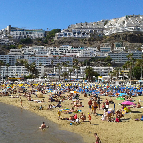 Photos will be available to all users after verification by the moderator.
Vote for Canary Islands best beach
Current rating: (0 votes cast)
If you know this place (Gran Canaria) and want to leave your comment or rate it, then fill out the following form. All fields are optional and you can fill in any
Your rating for this place:12345
Best season:Summer beachFall beachWinter beachSpring beach
Your comments for this place (water quality, сrowds, service etc.):
this place has the “Blue Flag”
this place is subject to rip currents
Beach type: sandy or pebbly
Get widget or API for your website
Our report for Gran Canaria is compiled using satellite data together with in-situ observations to get the most reliable daily data of sea surface temperatures, surf forecasts, current temperatures and weather forecasts.
Weather on Gran Canaria in April 2023, water temperature on Gran Canaria
Check the weather for April before planning your holiday in Gran Canaria.
Average weather data includes daytime highs and nighttime lows in temperature, rainfall, hours of sunshine, and water temperature data.
Air temperature (MAKS-MIN) by dayPhysics on April 2000 April 2022 April 2021 April 2020 April 2019 April 2018 April 2017 April 2016 2016 0003 16 ° C 23 ° C 16 ° C 23 ° C 16 ° C 22 ° C 16 ° C 22 ° C 16 ° C 23 ° C. 16 ° C 22 ° C 17 ° C 22 ° C 17 ° C 23 ° C 17 ° C 10 April. 22°C 17°C 11 apr. 23°C 17°C 12 apr. 23°C 17°C 13 apr. 23°C 16°C 14 apr. 23°C 17°C 15 apr. 23°C 16°C 16 apr. 24°C 17°C 17 apr. 25°C 18°C 18 apr. 24°C 18°C 19 apr. 23°C 17°C 20 Apr. 23°C 17°C 21 apr. 23°C 17°C 22 apr. 23°C 17°C 23 apr. 23°C 17°C 24 apr. 23°C 17°C 25 apr. 23°C 17°C 26 apr. 23°C 17°C 27 Apr. 24°C 17°C 28 apr. 23°C 17°C 29 apr. 24°C 16°C 30 apr. 24°C 17°C
Water temperature in April by day11 Apr. 12 Apr. 13 Apr. 14 Apr. 15 Apr. 16 Apr. 17 Apr. 18 Apr. 19 Apr. 20 Apr. 21 Apr. 22 Apr. 23 Apr. 24 Apr. 25 Apr. 26 Apr. 27 Apr. 28 Apr. 29 Apr. 30 Apr.
Precipitation by dayLight rain – up to 2.5 mm per hour, moderate rain – up to 8 mm per hour, heavy rain – more than 8 mm per hour, heavy rain from 30 mm. 0.0000 mm 0.1000 mm 0.5000 mm 0.4000 mm 0.0000 MM 0.0000 MM 0.0000 MM 0.0000 MM 0.0000 MM 9000 9000 9000 9000 9000 9000 AP. 0.0000 mm 11 Apr. 0.0000 mm 12 apr. 0.4000 mm 13 apr. 0.3000 mm 14 apr. 0.0000 mm 15 apr. 0.0000 mm 16 apr. 0.0000 mm 17 apr. 0.0000 mm 18 apr. 0. 19 apr. 0.0000 mm 20 Apr. 0.0000 mm 21 apr. 0.0000 mm 22 apr. 0.0000 mm 23 apr. 0.1000 mm 24 apr. 0.1000 mm 25 apr. 0.0000 mm 26 apr. 0.0000 mm 27 apr. 0.0000 mm 28 apr. 0.0000 mm 29 Apr. 0.0000 mm 30 apr. 0.2000 mm The maximum daytime temperature on Gran Canaria is 24. Weather in April in other resorts in SpainBarcelona 19°С Valencia 21°С Ibiza C Canary Islands 21 ° C Brava Costa 18 ° C Costa Drada 19 ° C Costa del Sol 21 ° C Mallorca 1 MALALA 9000 9000 9000 MAYAD °С Tenerife 21°С Show all resorts Monthly weather in Gran Canaria
Reviews for vacation in AprilAll reviewsSephiriotH April 13, 2022 Hotel The Fataga Centro De Negocios Las Palmas de Gran Canaria photo I arrived at the hotel at night (around 01:30). photo Hello, my name is Sveta. Why is there no phone number for the hotel management on this site? I would like to book tickets and fly out in the coming days with the whole family. April 22, 2019 Las Lanzas Aparthotel Las Palmas de Gran Canaria photo We went to the Chinese buffet, it is nearby, everything is fine, you can do several approaches with filling the plate! On the nearby main promenade, you can find a restaurant to your liking… Details Weather in Gran Canaria in April 2022-2021 🌊 and water temperature at “365 Celsius”
According to our rating system, which is confirmed by the reviews of tourists who have visited Spain, the weather is good in Gran Canaria in April, this month’s rating is 4. Temperature in Gran Canaria in April
Monthly weather comparison in Gran Canaria Should I go on vacation in April? 4 The climate in April is good and tourists come to have a rest. According to our data, the weather in Gran Canaria in April and the water temperature is good. At this time, the cold sea with an average temperature of +19.2°C. There is practically no rain, about 1 day per month, 6.5 mm of precipitation falls. Sunny weather lasts at least 27 days. According to the reviews of tourists who have visited Spain, it is worth going on vacation to Gran Canaria in April.
Details
Gran Canaria weather comparison by months Water temperature in Gran Canaria in April
Weather forecast and sea water temperature in Gran Canaria in April ranges from +18. Rating, rainy days and precipitation in April and other months.
The rating in a period of five months fluctuates from 3.7 to 4.6 points. The number of rainy days in April is 1, and it ranks 1st for this indicator for the year. Precipitation is 6.5 mm, this is the 8th place among all months. At the same time, in the previous period, 1.5 mm more rains, in the next month, 0.4 mm less. The weather in Gran Canaria in April in the first and second half of the month is shown in the summary table for 2018, 2019, 2020, 2021 years. Wind speedThe average speed in April is 6 m/s with maximum wind gusts up to 8.1 m/s. Climate summary
Weather nowGran Canaria+28° Feeling: +30°C From 6m/s Precipitation: 0% Forecast 10 days / 14 days
Weather in Gran Canaria in April.
Sea weather / Spain / Gran Canaria weather / APRIL weather
Weather on the Grand Capaunaria by monthJanuary February March April May June July Sepa Air temperature in Gran Canaria in April
The graph below provides detailed information about the daytime and nighttime temperatures in Gran Canaria in April.
The average air temperature in April over the past 5 years is 22.0°C during the day and 17.6°C at night. Data for: April 2022 2021 2020 2019 2018
The graph below provides detailed information about the water temperature in Gran Canaria in April.
| ||||||||||||||||||||||||||||||||||||||||||||||||||||||||||||||||||||||||||||||||||||||||||||||||||||||||||||||||||||||||||||||||||||||||||||||||||||||||||||||||||||||||||||||||||||||||||||||||||||||||||||||||||||||||||||||||||||||||||||||||||||||||||||||||||||||||||||||||||||||||||||||||||||||||||||||||||||||||||||||||||||||||||||||||||||||||||||||||||||||||||||||||||||||||||||||||||||||||||

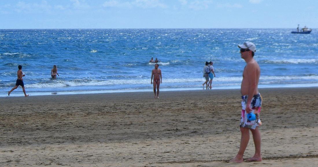

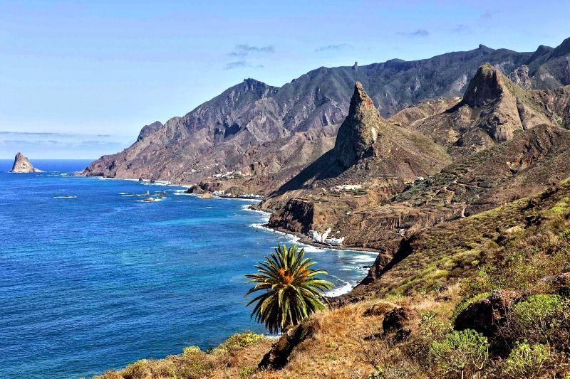
 8000 mm
  5000 °C, the minimum nighttime temperature is 16.2000 °C. Rainfall in April is usually not more than 1 mm, and the number of hours of sunshine is not less than 10.
  The set up went quickly. I really liked the cleanliness of the hotel and the quality of the service. Here are the pros: 1. Quick check-out and check-out (check-out time 12:00).2… Read more0003
  0 out of five.
 2°C , sea: +19.9°C,
 3°C to +19.9°C. At its lows, it can be considered not comfortable for swimming adults and children. In the previous month, the sea is colder by about 0.8°C. Next month the water is 0.7°C warmer. In April, according to the reviews of tourists in Gran Canaria, the climate is not very suitable for recreation, also due to the uncomfortable temperature of the water in the sea almost anywhere in Spain.
 7°C
7°C  6°C
6°C  2°C
2°C  7°C
7°C  3°C
3°C  2°C
2°C  2°C
2°C  3°C
3°C  2°C
2°C  2°C
2°C  Sea water temperature in April. Weather by months.
 4 mm
4 mm 
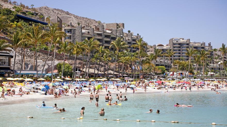
| September 17 | 27°C | 2 m / s | ||
| September 18 | 25°C | 3 m / s | ||
| September 19 | 24°C | 1 m / s | ||
| September 20 | 24°C | 4 m / s | ||
| September 21 | 27°C | 4 m / s | ||
| September 22 | 28°C | 6 m / s | ||
| September 23 | 27°C | 2 m / s | ||
| September 24 | 24°C | 2 m / s | ||
| September 25 | 23°C | 1 m / s | ||
| September 26 | 24°C | 1 m / with | ||
Water temperature in the sea
| September 12, | 23.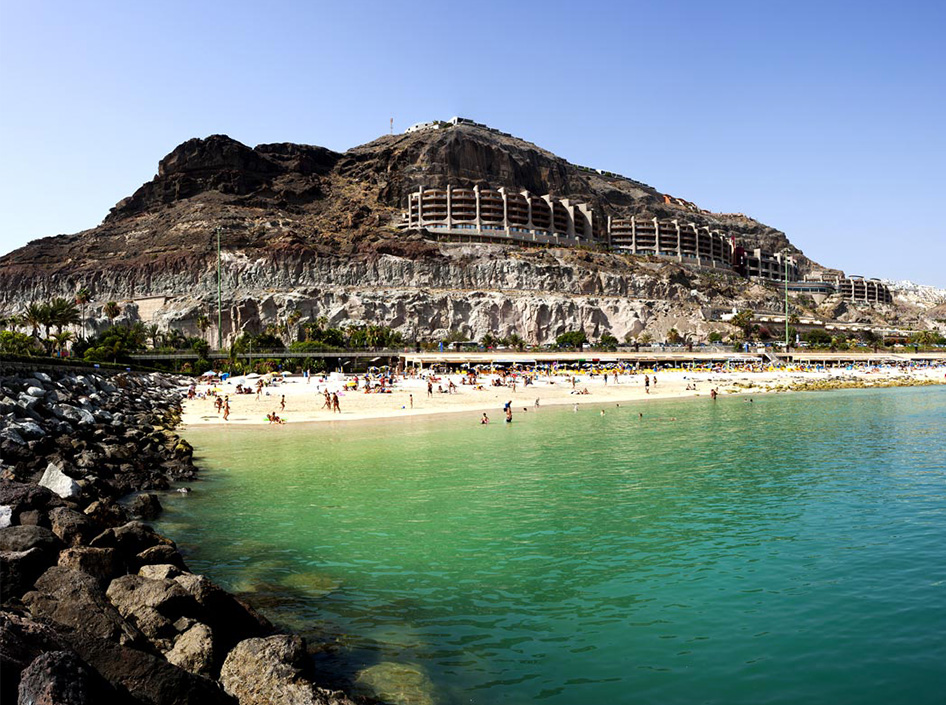 8 ° C 8 ° C |
|||
| September 13 | 23.9 ° C | 72 | 000 9000 6 24, September 14, September 14, September 14, September 14 | |
| September 15 | 24.1 °C1657 water | |||
| January | +20 ° C | |||
| February | 900 9000 9000 9000. ° C | +21 ° C | ||
| April | +19 ° C | +22 ° C | ||
| 9000 | ||||
| June | +21 ° C | +25 ° C | ||
| July | +23 ° C | +29 ° C | ||
| September | +23 ° C | |||
| 9000 OKTYAK +26 °C | ||||
| November | +22 ° C | +23 ° C | ||
| December | ||||
+2 ° C
+22 ° C 9007
| Alikante | +29 ° C | |||
| Barcelona | +31 ° C | |||
| Costa-Brava | +24 ° C | |||
| Mallorca | +27 ° C | |||
| MALAGA | ||||
| Palma-de-Mayorca | +29 ° C | 9000 9000 | Tenerife | +26 ° C |
| Torrevieha | +31 ° C | |||
 0006 +29 ° C
WARMEST MONTH
August
Average day temperature:
+29°C
|
Maximum: +36°C |
Minimum: +17°C |
WARMEST WATER IN THE SEA
Maximum:
+25°C
Minimum:
+22°C
SUNNY MONTH
July
Number of sunny days:
31 days
|
Average cloudy: 4.3% |
Day length: 13:42 |
DRIEST MONTH
June
Probability of rain:
0.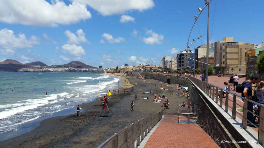 0%
0%
|
Monthly precipitation: 0.6mm |
Average cloudiness 7.2% |
Weather in Gran Canaria in April. Sea temperature in Gran Canaria in april Weather by months.
Monthly weather/Spain/Gran Canaria/April
Resorts in Spain
All resorts
Gran Canaria on the world map
Other countries
All countries
According to our observations, as well as reviews of tourists who visited Spain, we can say that the weather in Kemer in September is expected to be quite good. The average daily air temperature in April is 23.1 °С, while the sea water temperature will be 18.9 °С.
Weather in April
| Daytime average temperature Nighttime average temperature |
+23.1 °C +18.2 °C |
|||
| Sea water temperature | +18.9 °C | |||
| Number of sunny days Length of daylight hours |
27 days 12 hours 50 minutes |
|||
| Rainy days Rainfall |
0 days 6 mm |
|||
| Average wind speed | 20.0 m/s | |||
Is it worth going to Gran Canaria for a holiday in April?
Comfort
66. 3%
3%
Taking into account all the available data on the weather in Gran Canaria in April (air and water temperature, amount and intensity of rains, cloudiness, day length and wind strength), we calculated the level of comfort in this resort, which amounted to 66.3 %. Please also note that the comfort level in May will be higher and will be 68.9 %
Comfort level by months
On the graph below you can see the comfort level in Gran Canaria calculated by us for each month. The most comfortable months for a holiday in Gran Canaria are September, October and August. Months with the minimum level of comfort are March, January and February.
Monthly comparison of weather in Gran Canaria
Select the month you are interested in from the list below if you want to receive detailed information about the weather in Gran Canaria at other times.
December
January
February
March
April
May
June
July
August
September
October
November
Air temperature in Gran Canaria in April
During the day the air temperature in April fluctuates from 21.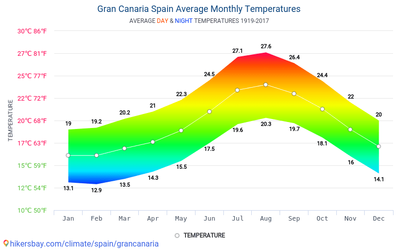 8°C to 25.2°C, at night from 17.1°C to 17.1°C respectively. At the same time, the average air temperature is 23.1 °C during the day, and 18.2 °C at night. The difference between daytime and nighttime air temperatures averages up to 5.0°C per month.
Water temperature in Gran Canaria in April
In April, the water in Gran Canaria can be chilly. The sea water temperature does not drop below 18.3°C, while the maximum figure can reach 19.5°C. The average water temperature in April is 18.9 °C, which is 0.6°C higher than in March and 1.1°C lower than in May.
Rainy days and precipitation in April
The average rainfall in Gran Canaria in April is 6 mm. This amount of precipitation is insignificant, and you will not notice rainy days. According to our observations and hysmeteo data, the probability of rainy weather is 1.1 %. Most of the time it will be moderate rain.
Sunny, cloudy and cloudy days
In Gran Canaria in April there are usually about 27 sunny, 3 cloudy and 0 cloudy days. The day length (from dawn to dusk) is 12 hours and 50 minutes. The number of hours of sunshine when the sun’s rays reach the earth’s surface, taking into account the average cloud cover for the month, is 11 hours and 17 minutes per day.
Wind in Gran Canaria in April
The graph below shows the probability of winds of different strengths during the month. The average wind speed in Gran Canaria in April is 20.0 m/s, making it one of the windiest months of the year.
Weather in April in other resorts in Spain
We bring to your attention a summary of the weather in other popular resorts in Spain in April. Select the resort you are interested in to get more detailed information.
| Name | Day air temperature | Air temperature at night |
Rainy days (rainfall) |
Water temperature | ||||
|---|---|---|---|---|---|---|---|---|
| Tenerife | 18. 3°C 3°C |
13.2°C | 1 day (24 mm) | 19.3°C | ||||
| Barcelona | 18.5°C | 12.4°C | 3 days (30 mm) | 14.6°C | ||||
| Mallorca | 20.9°C | 12.7°C | 1 day (24 mm) | 15.9°C | ||||
| Malaga | 22.5°C | 12.5°C | 1 day (12 mm) | 15.9°C | ||||
| Palma de Mallorca | 21.3°C | 12.1°C | 1 day (22 mm) | 15.9°C | ||||
| Valencia | 22.1°C | 13.4°C | 1 day (9mm) | 15.6°C | ||||
| Costa Brava | 19.1°C | 11. 9°C 9°C |
3 days (30 mm) | 14.0°C | ||||
| Salou | 19.8°C | 12.4°C | 3 days (35 mm) | 15.0°C | ||||
| Alicante | 21.8°C | 13.7°C | 1 day (12 mm) | 15.9°C | ||||
| Ibiza | 19.7°C | 15.8°C | 1 day (10 mm) | 15.9°C | ||||
| Gran Canaria | 23.1°C | 18.2°C | 0 days (6 mm) | 18.9°C | ||||
| Marbella | 21.8°C | 11.8°C | 1 day (19 mm) | 15.8°C |
| – January | – February | – March | – April | – May | – June |
| – July | – August | – September | – October | – November | – December |
Weather in Las Palmas de Gran Canaria in April 2023
What are the holidays like in Las Palmas de Gran Canaria in April? What is the air temperature, is there a chance of rain and is it possible to swim? Las Palmas de Gran Canaria in April – read on the Tour Calendar!
Contents
What is the weather like in April in Las Palmas de Gran Canaria? The thermometer in the city in the daytime rises to +21°C, at night +17.
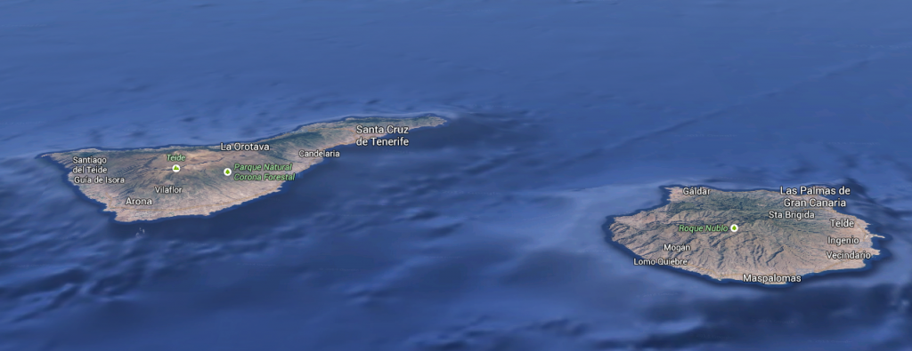 2°C. At this time, it rains occasionally in Las Palmas de Gran Canaria. The water temperature in April is +18.6 °C.
Average temperature
+19°
Air temperature during the day
+21°
Air temperature at night
+17°
Water temperature
+19°
Rainfall (mm)
11 mm
Rain
4 days
Sunny days
18 days
Humidity
66%
Day length
13 hours
All months May >
Air temperature in Las Palmas de Gran Canaria in April
Daytime air temperature in April in Las Palmas de Gran Canaria reaches +21 °C, nighttime: +17 °C.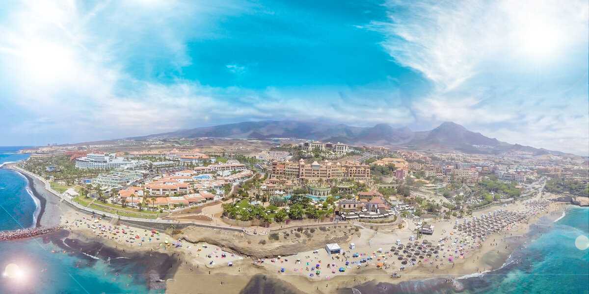 The maximum value for April in the afternoon was noted on 04/17/2022 and was equal to +30 °C, the minimum on 04/05/2018: +18 °C.
Water temperature in Las Palmas de Gran Canaria in April
The water temperature in April in Las Palmas de Gran Canaria is usually around 19°C, which is hardly suitable for swimming. The highest value for April was recorded on 04/30/2017 and amounted to +21 °C, the lowest on 04/01/2019: +17 °C.
How many sunny days per month
There are 18 sunny, 2 cloudy and 10 cloudy days per month, so the weather in Las Palmas de Gran Canaria in April is quite sunny.
Las Palmas de Gran Canaria in April Things to do?
Tour-Calendar assessed the possibility of types of recreation on a scale from 0 to 5 .
-
Beach holiday
3
-
Excursions
5
-
Bicycle
5
-
Sport
5
April weather archive in Las Palmas de Gran Canaria
Look at the weather in Las Palmas de Gran Canaria in recent years in April days.
| Happy | At night | |||
|---|---|---|---|---|
| Apr 1 | Partly cloudy | +21° | +16° | +18° |
| Apr 2 | Partly cloudy | +20° | +16° | +18° |
| Apr 3 | Partly cloudy | +22° | +16° | +18° |
| Apr 4 | Partly cloudy | +21° | +17° | +18° |
| Apr 5 | Partly cloudy | +20° | +15° | +18° |
| Apr 6 | Partly cloudy | +21° | +16° | +18° |
| Apr 7 | Partly cloudy | +21° | +16° | +17° |
| Apr 8 | Partly cloudy | +21° | +18° | +17° |
| Apr 9 | Partly cloudy | +20° | +16° | +17° |
| Apr 10 | Partly cloudy | +20° | +15° | +18° |
| Apr 11 | Partly cloudy | +22° | +16° | +18° |
| Apr 12 | Partly cloudy | +22° | +18° | +18° |
| 13 Apr | Partly cloudy | +21° | +15° | +18° |
| Apr 14 | Partly cloudy | +22° | +18° | +18° |
| Apr 15 | Partly cloudy | +23° | +18° | +18° |
| Apr 16 | Clear | +23° | +19° | +19° |
| Apr 17 | Clear | +30° | +21° | +19° |
| Apr 18 | Clear | +26° | +20° | +20° |
| Apr 19 | Partly cloudy | +21° | +18° | +20° |
| Apr 20 | Partly cloudy | +21° | +18° | +20° |
| 21 Apr | Partly cloudy | +21° | +15° | +19° |
| Apr 22 | Partly cloudy | +20° | +15° | +19° |
| Apr 23 | Partly cloudy | +19° | +16° | +19° |
| Apr 24 | Partly cloudy | +20° | +16° | +19° |
| Apr 25 | Partly cloudy | +24° | +16° | +19° |
| Apr 26 | Partly cloudy | +23° | +18° | +19° |
| Apr 27 | Partly cloudy | +22° | +17° | +19° |
| Apr 28 | Partly cloudy | +22° | +15° | +19° |
| Apr 29 | Partly cloudy | +23° | +18° | +19° |
| Apr 30 | Partly cloudy | +23° | +18° | +19° |
show all
Other months weather in Las Palmas de Gran Canaria:
January ·
February ·
March ·
April ·
May ·
June ·
July ·
August ·
September ·
October ·
November ·
December
Las Palmas de Gran Canaria Weather in April 2023: Temperature and climate
Are you planning a nice weather holiday in Las Palmas de Gran Canaria in April 2023? Here you can find all weather information for Las Palmas de Gran Canaria in April:
- >>Overview: Las Palmas de Gran Canaria Weather and climate in April
- >>Las Palmas de Gran Canaria monthly weather
- >>Las Palmas de Gran Canaria weather in April
- >>Current temperature and weather forecast for Las Palmas de Gran Canaria
Las Palmas de Gran Canaria monthly weather
<>
| Average temperature (°C) | minimum temperature (°C) | maximum temperature (°C) | Precipitation rate (mm) | Humidity (%) | Rainy days (D) | longitude of the day (hours) | |
|---|---|---|---|---|---|---|---|
| January | 16 | 14. 2 2 |
18.2 | 28 | 71% | 5 | 7.0 |
| February | 15.9 | 13.9 | 18.1 | 28 | 72% | 5 | 7.0 |
| March | 16.6 | 14.4 | 19.2 | 29 | 72% | 5 | 8.0 |
| April | 17.2 | 15.1 | 19.8 | 23 | 72% | 5 | 8.0 |
| May | 18.3 | 16.2 | 20.9 | 21 | 72% | 5 | 8.0 |
| June | 19.7 | 17.6 | 22.4 | 22 | 75% | 6 | 8.0 |
| July | 20.9 | 18.9 | 23.6 | 28 | 76% | 8 | 7.0 |
| August | 22 | 19. 9 9 |
24.7 | 20 | 76% | 5 | 8.0 |
| September | 21.9 | 20 | 24.6 | 16 | 76% | 3 | 9.0 |
| October | 21.2 | 19.2 | 23.7 | 25 | 76% | 4 | 8.0 |
| November | 19 | 17.3 | 21.2 | 29 | 73% | 5 | 7.0 |
| December | 17.4 | 15.6 | 19.5 | 30 | 72% | 5 | 7.0 |
| January | February | March | April | May | June | July | August | September | October | November | December | |
|---|---|---|---|---|---|---|---|---|---|---|---|---|
| Average temperature (°C) | 16 |
15.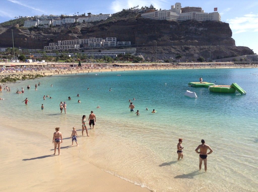 9 9
|
16.6 | 17.2 | 18.3 | 19.7 | 20.9 | 22 | 21.9 | 21.2 | 19 | 17.4 |
| minimum temperature (°C) | 14.2 | 13.9 | 14.4 | 15.1 | 16.2 | 17.6 | 18.9 | 19.9 | twenty | 19.2 | 17.3 | 15.6 |
| maximum temperature (°C) | 18.2 | 18.1 | 19.2 | 19.8 | 20.9 | 22.4 | 23.6 | 24.7 | 24.6 | 23.7 | 21.2 | 19.5 |
| Precipitation rate (mm) | 28 | 28 | 29 | 23 | 21 | 22 | 28 | twenty | 16 | 25 | 29 | thirty |
| Humidity (%) | 71% | 72% | 72% | 72% | 72% | 75% | 76% | 76% | 76% | 76% | 73% | 72% |
| Rainy days (D) | 5 | 5 | 5 | 6 | 5 | 6 | 9 | 5 | 3 | 4 | 5 | 5 |
| day length (hours) | 7. 1 1 |
7.0 | 7.7 | 7.9 | 7.8 | 7.7 | 7.2 | 7.9 | 8.6 | 8.2 | 7.1 | 7.2 |
Data: 1991 – 2021 minimum temperature (°C), maximum temperature (°C), Precipitation (mm), Humidity, Rainy days.
Data: 1999 – 2019: day length
Las Palmas de Gran Canaria weather and climate for the next months
Las Palmas de Gran Canaria in January
Las Palmas de Gran Canaria in February
Las Palmas de Gran Canaria in March
Las Palmas de Gran Canaria in May
Las Palmas de Gran Canaria in June
Las Palmas de Gran Canaria in July
Las Palmas de Gran Canaria in August
Las Palmas de Gran Canaria in September
Las Palmas de Gran Canaria in October
Las Palmas de Gran Canaria in November
Las Palmas de Gran Canaria -Canaria in December
Las Palmas de Gran Canaria weather in April // average weather
beta
<>
| Temperature (°C) | Temperature Max. (°C) (°C) |
Temperature Min. (°C) | Water temperature (°C) | Rainfall (mm) | longitude of the day (hours) | |
|---|---|---|---|---|---|---|
| April 1st | 17 °C | 19 °C | 15 °C | 18 °C | 0.0mm | 8.1 |
| 2. April | 17 °C | 19 °C | 15 °C | 18 °C | 0.0mm | 8.1 |
| 3. April | 17 °C | 19 °C | 15 °C | 18 °C | 0.0mm | 8.1 |
| 4. April | 17 °C | 19 °C | 15 °C | 18 °C | 0.0mm | 7.8 |
| 5. April | 17 °C | 20°C | 15 °C | 18 °C | 0.0mm | 8.2 |
| 6. April | 17 °C | 20°C | 15 °C | 18 °C | 0.0mm | 7.7 |
| 7. April | 17 °C | 20°C | 15 °C | 18 °C | 0.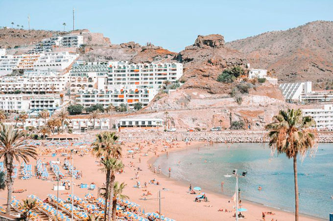 0mm 0mm |
8.3 |
| 8. April | 17 °C | 20°C | 15 °C | 18 °C | 0.0mm | 8.3 |
| 9. April | 17 °C | 20°C | 15 °C | 18 °C | 0.0mm | 8.2 |
| 10. April | 17 °C | 20°C | 15 °C | 18 °C | 0.0mm | 8.5 |
| 11 April | 17 °C | 19 °C | 15 °C | 18 °C | 0.0mm | 8.4 |
| 12 April | 17 °C | 19 °C | 15 °C | 18 °C | 0.0mm | 7.9 |
| 13 April | 17 °C | 19 °C | 15 °C | 18 °C | 0.0mm | 8.7 |
| 14 April | 17 °C | 19 °C | 15 °C | 18 °C | 0.0mm | 8.1 |
| 15 April | 17 °C | 19°C | 15 °C | 19 °C | 0. |
7.9 |
| 16 April | 17 °C | 20°C | 15 °C | 19 °C | 0.0mm | 7.8 |
| 17 April | 17 °C | 20°C | 15 °C | 18 °C | 0.0mm | 7.4 |
| 18 April | 17 °C | 20°C | 15 °C | 18 °C | 0.0mm | 7.3 |
| 19 April | 17 °C | 20°C | 15 °C | 18 °C | 0.0mm | 6.5 |
| 20 April | 17 °C | 20°C | 15 °C | 18 °C | 0.0mm | 7.5 |
| 21 April | 17 °C | 20°C | 15 °C | 19 °C | 0.0mm | 8.2 |
| 22 April | 17 °C | 20°C | 15 °C | 19 °C | 0.0mm | 7.7 |
| 23 April | 17 °C | 20°C | 15 °C | 19 °C | 0. |
8.2 |
| 24 April | 17 °C | 20°C | 16 °C | 19 °C | 0.0mm | 7.8 |
| 25 April | 17 °C | 20°C | 15 °C | 19 °C | 0.0mm | 7.6 |
| 26 April | 17 °C | 20°C | 15 °C | 19 °C | 0.0mm | 7.4 |
| 27 April | 18 °C | 20°C | 16 °C | 19 °C | 0.0mm | 7.6 |
| 28 April | 18 °C | 20°C | 16 °C | 19 °C | 0.0mm | 7.8 |
| 29 April | 18 °C | 20°C | 16 °C | 19 °C | 0.0mm | 7.3 |
| 30 April | 18 °C | 20°C | 15 °C | 19 °C | 0.1mm | 7.4 |
Data: 1991 – 2021.
 The prices may not be the lowest but the Riu Calypso offers great value for money.
 It used to be a starting point for local fishermen, and tourists can still catch a glimpse of a traditional fishing boat passing by, especially if you hit the beach early.
 The staff are exceptionally friendly and the food gives visitors a clear taste of the island’s culinary traditions without unnecessary fancy frills. This is good, hearty Spanish food at its best.
 Here you’ll be able to sunbathe and go home with a tan, while in most other places in Europe you’ll still need a jacket even during the daytime.
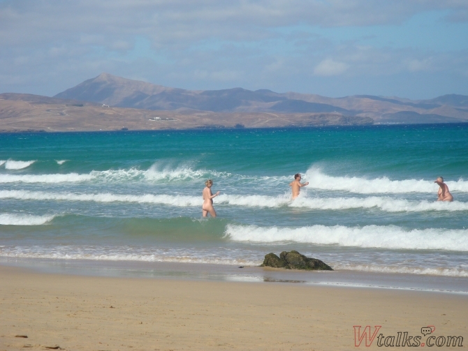 5°C in April, which is calculated as a mean between the average high temperature of 22.9°C and the average low of 16°C.
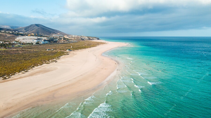
 8°C / 65.8°F
 There’s enough room on the beaches in Fuerteventura to do your thing without bothering anyone and it’s a nice way for parents to spend time with the little ones.

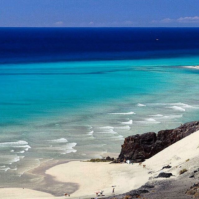
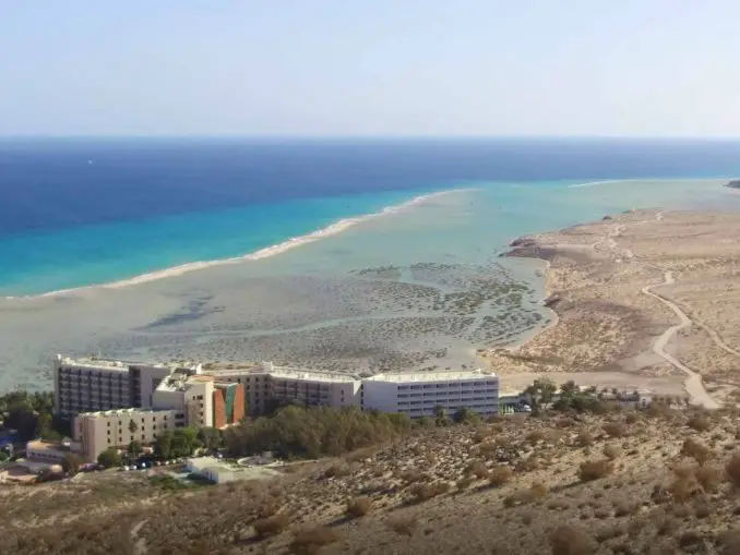


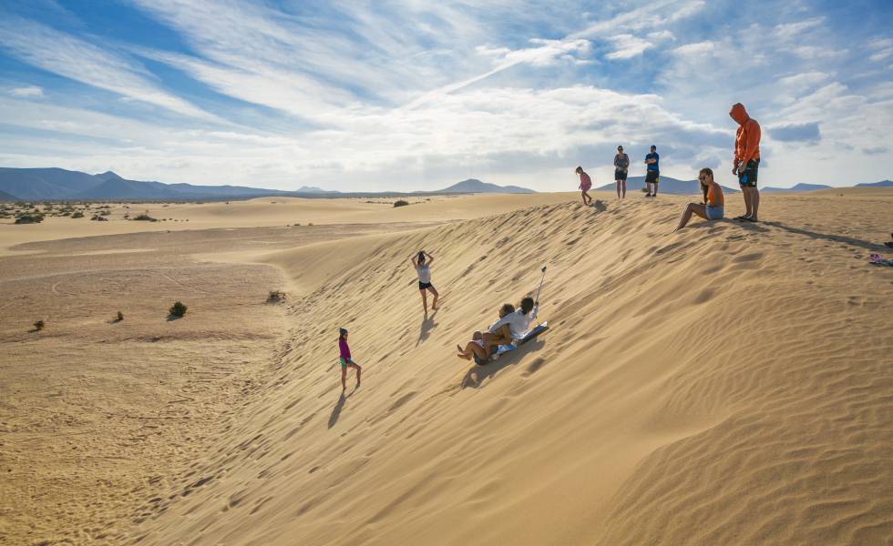
 From bottom to top, the black lines are the previous solar midnight, sunrise, solar noon, sunset, and the next solar midnight. The day, twilights (civil, nautical, and astronomical), and night are indicated by the color bands from yellow to gray.
 The black lines are lines of constant solar elevation (the angle of the sun above the horizon, in degrees). The background color fills indicate the azimuth (the compass bearing) of the sun. The lightly tinted areas at the boundaries of the cardinal compass points indicate the implied intermediate directions (northeast, southeast, southwest, and northwest).
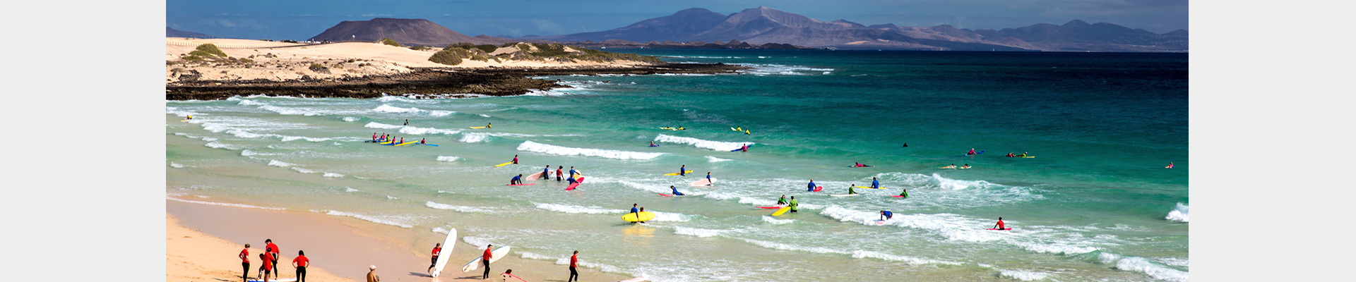 The shaded overlays indicate night and civil twilight.
 Lower dew points feel drier and higher dew points feel more humid. Unlike temperature, which typically varies significantly between night and day, dew point tends to change more slowly, so while the temperature may drop at night, a muggy day is typically followed by a muggy night.

 2 mphApr 114.2 mphApr 3014.3 mphApr 3014.3 mphApr 1614.6 mphApr 1614.6 mph
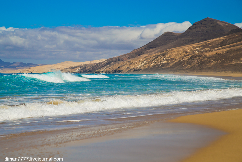
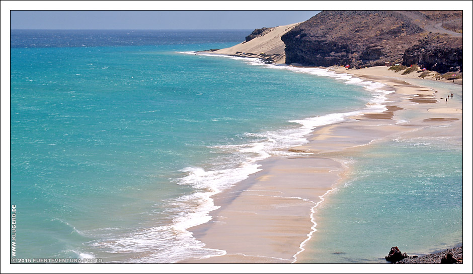 The black line is the percentage chance that a given day is within the growing season.
 5 kWhApr 307.5 kWhApr 167.1 kWhApr 167.1 kWh
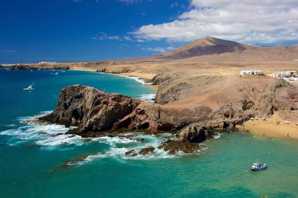
 However, the last volcanic activity in Fuerteventura occurred between 4,000 and 5,000 years ago.
 3 – What will the water temperature be in Fuerteventura for April
 Due to the dry air, it will feel very comfortable. During the night, it will cool down to around 57°F / 14°C.
 And equal to May, which sees an average maximum temperature of around 87°F / 31°C.
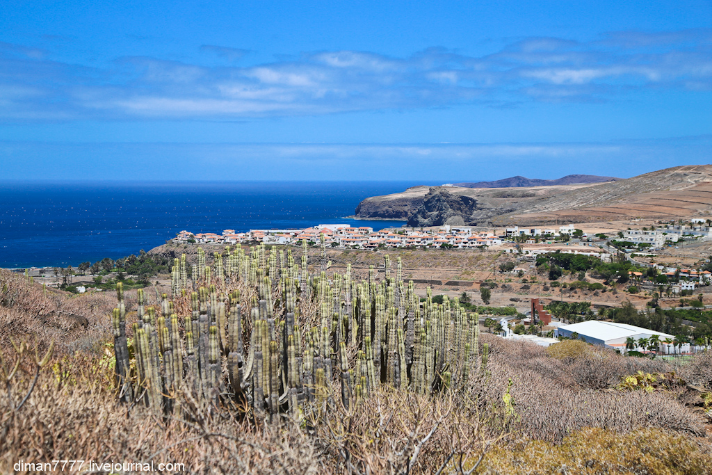 December is the month with the most rain days with an average of between 2 and 3 days. When comparing April with the month before and after, this is almost equal to March, which sees an average of between 1 and 2 days of rain. And almost equal to May, which sees an average of between 0 and 1 days of rain
 And almost equal to the water temperature from May, that is an average of between 69°F / 21°C and 71°F / 22°C.
 Let’s also look at the cloudy or overcast days. January is the month with the highest number of cloudy days, with around 4 cloudy days. June and July And are the months with the lowest number of cloudy days, with an average of between 0 and 1 cloudy days. When comparing April with the number of cloudy days in the month before and after, it is almost equal to March, with around 2 cloudy days. And almost equal to May, with an average of between 1 and 2 cloudy days
  August has the highest humidity, with a Wintersun Expert comfort level of “comfortable” (not very humid). When comparing April with the month before and after, this is almost equal to March, which has a Wintersun Comfort level of “very comfortable” (dry air). And slightly less than May, which has a Wintersun Comfort level of “very comfortable” (low humidty)
 August is the most uncomfortable month. It will not be very humid, and will feel comfortable. In the graph, you can see that there is some difference between the most comfortable and most uncomfortable months
 Due to the dry air, it will feel very comfortable. During the night, it will be around 57°F / 14°C.
 That clearly shows that it is not raining all the time.
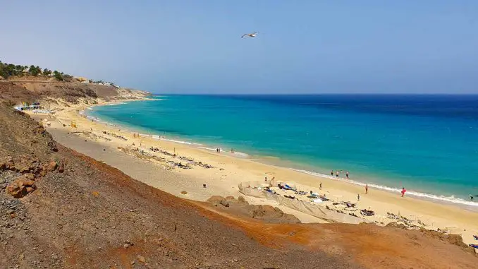 9°C and therefore is not suitable for comfortable swimming. The warmest sea in Fuerteventura in April is 20.6°C, and the coldest is 17.2°C. To find out the sea temperature today and in the coming days, go to Current sea temperature in Fuerteventura
 7°C
7°C 6°C
6°C 9°C
9°C In addition, the maximum and minimum water temperatures for that month, recorded over the last decade, are shown
 Photos will be available to all users after verification by the moderator.
 org/BreadcrumbList”>
 S. DollarSouth African RandUAE DirhamAustralian DollarCanadian DollarSwiss FrancEuroBritish PoundNew Zealand DollarTurkish New LiraU.S. DollarSouth African RandUAE DirhamAustralian DollarCanadian DollarSwiss FrancEuroBritish PoundMexican PesoNew Zealand DollarTurkish New LiraU.S. DollarSouth African Rand
 aggregatedDateTime | date:’HH:mm’ }}
 lastUpdate | date:’HH:mm’}}
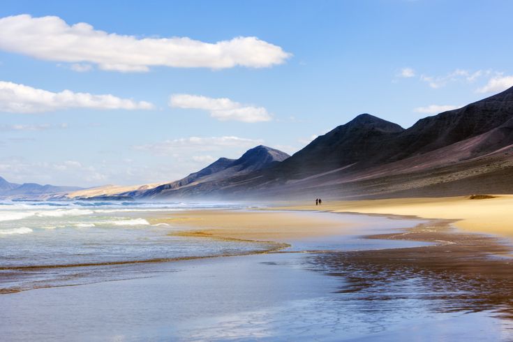 flightNumber}}
 You have the right to withdraw your consent at any time. Our privacy notice explains how we may use the information you provide to us, the reasons we may do so, and the rights you have under data protection legislation.
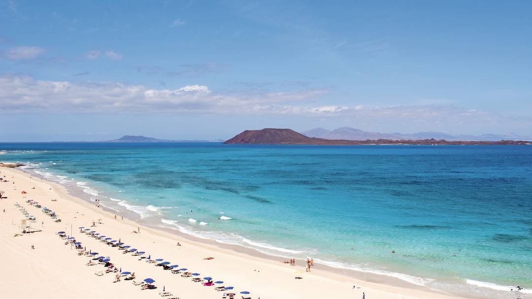
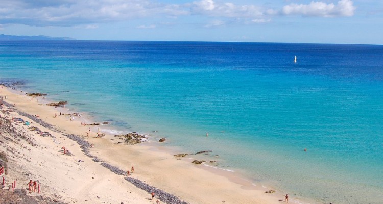
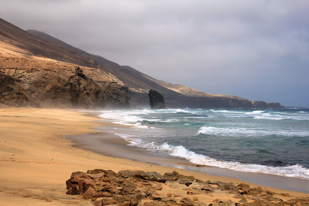

 0000 mm
  The shaded overlays indicate night and civil twilight.

 4 inApr 11.4 inApr 301.3 inApr 301.3 inApr 111.4 inApr 111.4 inApr 211.4 inApr 211.4 in
 From bottom (most yellow) to top (most gray), the color bands indicate: full daylight, twilight (civil, nautical, and astronomical), and full night.
 The horizontal axis is the day of the year and the vertical axis is the hour of the day. For a given day and hour of that day, the background color indicates the azimuth of the sun at that moment. The black isolines are contours of constant solar elevation.
 The shaded overlays indicate night and civil twilight.
 Lower dew points feel drier and higher dew points feel more humid. Unlike temperature, which typically varies significantly between night and day, dew point tends to change more slowly, so while the temperature may drop at night, a muggy day is typically followed by a muggy night.
 8 mphApr 110.8 mphApr 309.9 mphApr 309.9 mphApr 1610.4 mphApr 1610.4 mph
 The black line is the percentage chance that a given day is within the growing season.
 8 kWhApr 166.4 kWhApr 166.4 kWh
 9%, 110 mi, southeast, -98 ft elevation change)


 Built in the 1960s and fully restored in 1999, this hotel is a perfect base for your Marbella holiday. There are 64 comfortable rooms available and include a single room, double room or triple room. The rooms have full bathroom suites, air conditioning, satellite television, mini-bar and Wi-Fi. The rooftop features a terrace on which you can sunbathe and enjoy panoramic views.
 There is also a wellness area that includes an indoor heated pool, sauna and Turkish bath. All rooms provide views of the sea, mountains or gardens.
 The staff is always first class and accommodate diners as best they can. You will not be disappointed by anything you choose here, but if you are having trouble deciding, the tasting menu is a great option. The tasting menu consists of an Iberian pork tapa, burning mackerel, sushi de-fusion, ceviche, baby goat and a Spanish French toast.
 You will explore the coast, beaches and see unique architecture while a professional tour guide leads you. Each tour begins with a two minute training session, which is long enough to learn how to operate the Segway.
 And on the average day it rains or snows, we get 0.00 in (0.1 mm) of precipitation. In more common terms of how much that is, some would describe it as not rainy at all.
 5 hours. This graph shows the average amount of sunshine in Marbella in April based on historical data.

 Temperature °C (°F)
 7)
7) 4)
4) Temperature °C (°F)
 6 °C
6 °C Sun hours (hours)
 )
) 9 mm | 0.0 inch.
 6 mm | 0.1 inch.
 3 mm | 0.1 inch.
 3 mm | 0.1 inch.
 1 – What will the temperature be in Marbella in April
 Historical data shows that you can expect an average temperature of around 69°F / 21°C. Due to the dry air, it will feel very comfortable. During the night, it will cool down to around 51°F / 11°C.
 And slightly less than May, which sees an average maximum temperature of around 89°F / 32°C.
 December is the month with the most rain days with an average of between 8 and 9 days. When comparing April with the month before and after, this is almost equal to March, which sees around 7 days of rain. And almost equal to May, which sees an average of between 7 and 8 days of rain
 And almost equal to the water temperature from May, that is an average of between 68°F / 20°C and 69°F / 21°C.
 Let’s also look at the cloudy or overcast days. December is the month with the highest number of cloudy days, with an average of between 8 and 9 cloudy days. July is the month with the lowest number of cloudy days, with around 0 cloudy days. When comparing April with the number of cloudy days in the month before and after, it is almost equal to March, with an average of between 7 and 8 cloudy days. And almost equal to May, with an average of between 4 and 5 cloudy days
  July has the highest humidity, with a Wintersun Expert comfort level of “comfortable” (not very humid). When comparing April with the month before and after, this is almost equal to March, which has a Wintersun Comfort level of “very comfortable” (dry air). And slightly less than May, which has a Wintersun Comfort level of “very comfortable” (low humidty)
 You can visit the Old Town easily as it is located near the town center.
 But the real question they want to ask is not about humidity but the amount of moisture in the air. Or better, about comfort. Will it be comfortable in April in Marbella, or will high humidity make it uncomfortable.
 Some people like colder weather, and others prefer a warmer climate. Some are fine with some humidity, and others are not. If your location has air conditioning, the night temperature is less important.
 But a day with rain does not mean a day you can not enjoy.
 On average, you can expect 9 days with rain. July is the month with the lowest number of rainy days, with aproximately 1 day.
 March is the month with the lowest number of sunny days.
 It is based on the Costa del Sol towards the south of Spain in the Andalusia area. Often Marbella ia associated with glitz and glamour and can be thought of as a little tacky in areas, but there is so much more to this sunny area.
 April is also one of the best months to go because it offers some stunning views – especially at sunset and the Marbella weather in April is really rather lovely with an average high of around 23 degrees. Just picture walking along the paseo maritimo or pottering around the glitz and glamour of puerto banus.
 You have to visit the Basilica of Our Lady of Health or the church of our lady, if you want to see one of the most beautiful churches in Spain. Spain had many catholic monarchs over the years.One of the top attractions is also the Alcazaba fortress which was used as a royal residence since Moorish occupation. as well as the paseo maritimo, and puerto banus which are even lovely in the winter weather for looking at the wonderful boats.
 There are many cycling holidays based in Marbella with bike hire easily accessible as well as training camps for serious cyclists too. There are great routes around the area on websites like Bikemap and Komoot such as the difficult Virgen Del carmen loop for expert bike riders. There are also easier routes for the less experienced cyclist, like the 11 mile beach promenade Ruta Albero loop from El Ingenio. Certainly all of these routes no matter what the difficulty will be a pleasure in the April temperatures of around 16 degrees at the beginning of April to around 22 degrees at the end of April.
 Often Airbnb can be a cheaper option too that an expensive hotel.
 The city dates back to Islamic times and was described by hemingway as the most romantic town in Spain – maybe this is the place you should be thinking of proposing! Or better still why not look to get married here instead! there are several amazing wineries in the Ronda area if you need to have a few drinks before getting too romantic too! The wineries in the Ronda region are old school and manually harvested using low intervention wine making techniques in keeping with the history of this stunning region. There are many cultural walking tours and they all include most of the sites that you want to visit. From the avenida del mar to the lady of the incarnation, casco antiguo and alameda park and church of our lady. the Costa del sol destination certainly has plenty to see.
 It can be really hot in Marbella in the summer months and often hit 35 to 40 degrees in the peak on August with a really high temperature. The hottest time of year to visit in July and August is perfect for lying in the sun, getting out on the water and playing in the pool with the children. However the heat in the summer makes some of the more interesting things to do in marbella a little unpleasant.


 4°F)
4°F) Alicante has a beautiful urban beach Playa del Postiguet where you can take walks even on winter days, especially if it’s sunny.


 Puerto del Carmen is also a good option since it’s the largest and busiest resort and Costa Teguise can be windier, which makes it a favorite among visitors looking to practice water sports.
  Tenerife is a good holiday destination in every season of the year.
 Also the nights are really warm and this weather can become dangerous. Hot air together with hot wind from Africa dries out everything and the danger of fires in the nature rises. Tiny sparks can be enough to create a huge fire, so please do not throw cigarettes and thing like that in the nature. The danger of forest fires is very high in the summer. In winter the air is a bit colder and the danger is not as big as in summer but the danger is always present.
 A great time to go on a walking break with plenty of wine tasting thrown in
 ..
..
 The latter is also gateway to the tiny island of La Graciosa. You can study the stars on Fuerteventura, recently given Starlight Reserve status, for its constellations clarity and being, generally, out of this world.
 Toast that with a glass of chilled Malvasia or Moscatel.
 They are much more unspoilt that you would think.
 There is a surprising amount to do.. The most memorable or exciting part? Seeing whales so close to our boat. We had very good sightings of about 20 pilot whales on one trip and on another saw two Blainvilles dense beaked whales for about 20 minutes by the boat. Clare Galton on a whale and dolphin watching holiday in La Gomera
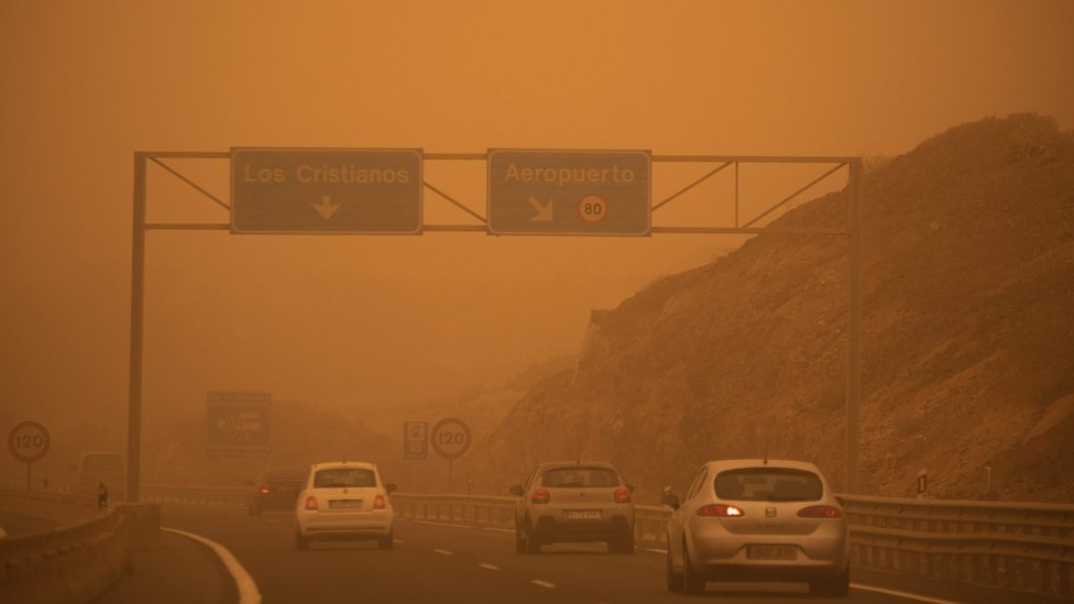 Our guide was extremely knowledgeable and passionate about astronomy. We particularly liked his storytelling style of his talk as he guided us through the night sky. This was perfectly balanced with the scientific input. Helen Kemp, stargazing in Fuerteventura


 ) | Min: 13 degrees (approx.)
 The rolling vineyards are a key attraction for wine aficionados, while the rugged wilderness is carved with walking trails. Kids in particular will love the wandering peacocks and getting involved in numerous water-sports activities, making this the ultimate Easter holiday destination!
 For something different, try the colourful local parrot fish – an opportunity not to be missed!
 Prefer an early night to catch the worms come morning? There are a variety of mountain hikes to enjoy, rewarding you with the most stunning sunrises if timed right.
  The Pablo Picasso museum is a must-see, but if you prefer to sip your cultural experiences, indulgent wine tastings are also available.
 Private swimming pools and alfresco dining spots will make it feel like the height of summer.

 I recommend them the islands Eastern, namely Lanzarote or Fuerteventura.
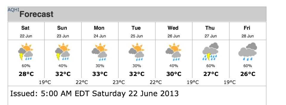 …
…

 They both have to offer impressive tourist experiences with beautiful scenes and amazing attractions.
 The summers are pretty warm and tend to be dry as well, with more than 14 hours of sunshine in the summer season.
 This climate means that the summers are hot and dry, but on the other hand, when the winter season arrives, the weather gets much colder and also quite dewy.
 But if we look at the wintertime, the Canaries are less cold than the Balearics, which get very mild in temperature.
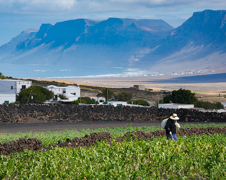
 May you have a great day ahead of you!
 6
6 9
9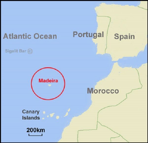 According to Unesco, Fuerteventura is home to the largest area of desert and semi-desert in Europe.

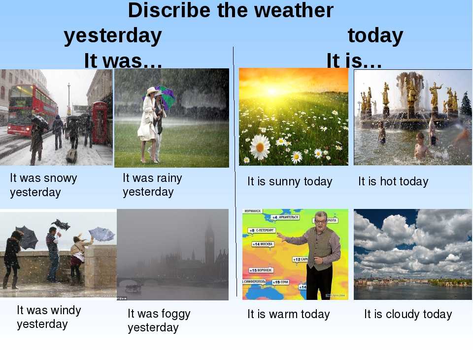 The weather in September is reminiscent of summer, and the outflow
 Well, of course, famous people start acting in winter
 I am satisfied with the service on the site. I will recommend to my friends.
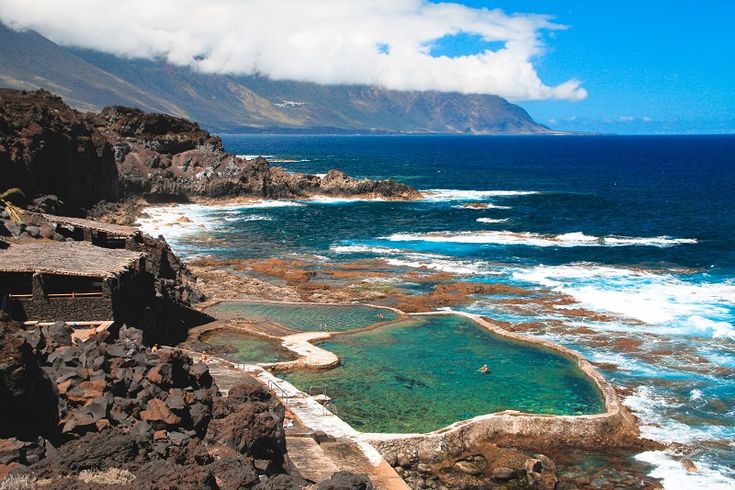
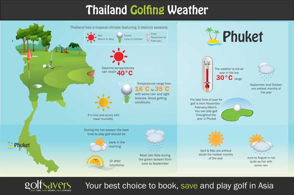

 Monthly weather in the Canary Islands will help you choose the best time to travel.
  In the northern part of the archipelago, the weather is more comfortable, there is more rainfall and greenery, and in the southern part the weather is more arid. At the same time, in the southern and southeastern parts of the archipelago, the water temperature is several degrees higher than in the north and northeast.
  The average daily air temperature in July is +22 – +27 °C, and water – +21 °C.

 The more daring can even swim in January.
  1-32.8
 From Barcelona there are high-speed trains throughout Spain.
  But this is an ideal time for excursions around the country. In summer +30 and warm sea up to +26 will please parents with children and lovers of bathing in “fresh milk”
 6/10.1/14.2/20
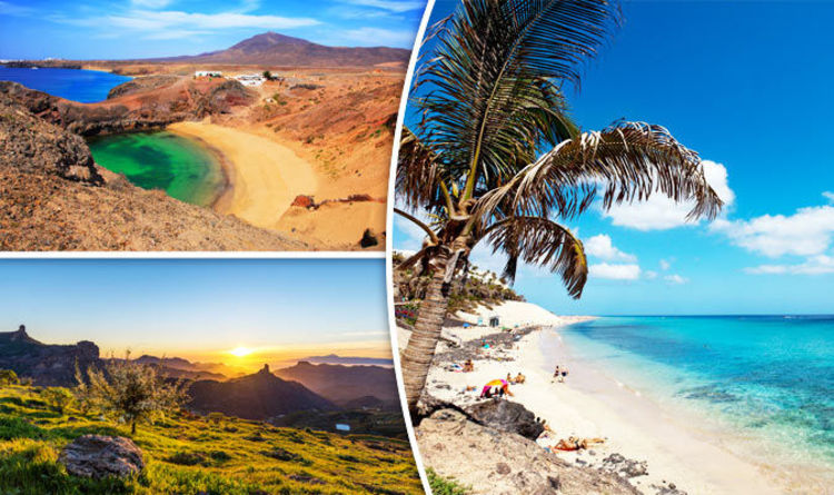
 Temperatures vary in different parts of the country. In the central part, the average temperature is 5-7 degrees. In the north of the country, the average temperature is 8-14 degrees, and in the highlands, snow, although rare, sometimes spoils local residents. The East is not much warmer – 12-15 degrees, but the water temperature is 14 degrees on average.
  In March in the north, the main rainy season. The water temperature warms up to 15 degrees.
  The temperature throughout the country reaches 30 degrees, and the water temperature is about 20 degrees.
 Winters in this part of the country are very mild and even warm with sleet, and summers are humid with frequent rains, but not too hot. The difference between night and day, as well as summer and winter temperatures is small.
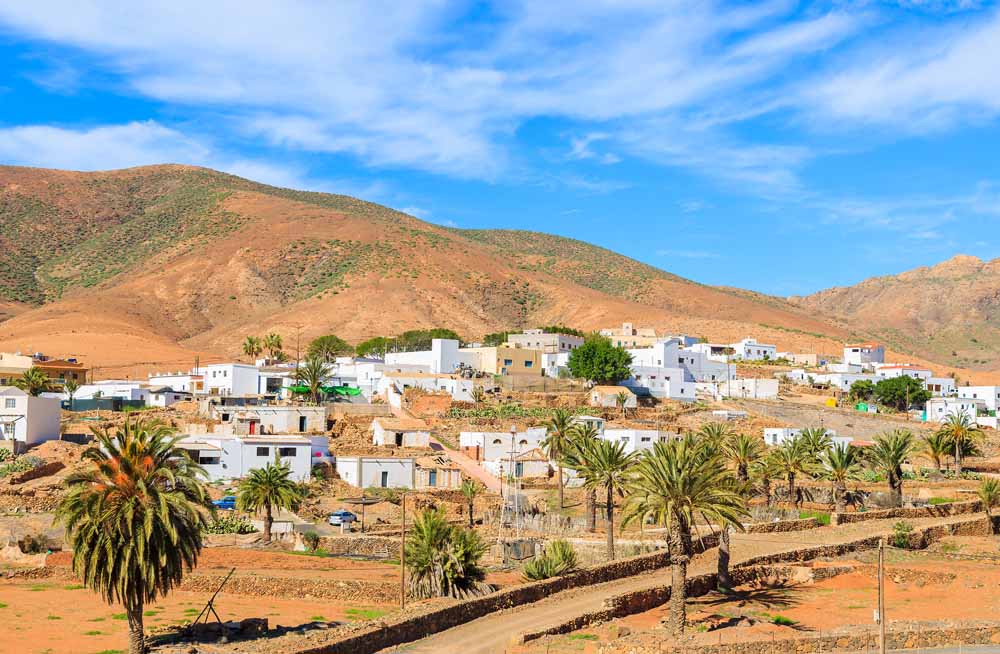 com
com The daily average temperature during April increases to 19 Celsius. April will see a daily high temperature of 23 Celsius and a low of 16 Celsius. The amount of rainfall again reduces from that of March with some 4 rainy days on average. The sea temperature remains at 19 Celsius and the hours of sunshine will stay at 8 hours.
 It will feel a little on the cool when first entering, but you’ll warm up quickly. Most kids will have no problem with this temperature, but those who feel the cold are unlikely to want to swim.
  You can learn so much from a destination just by taking a stroll around the local market and learning about which are the most common products sold there. Gran Canaria surprised me with delicious dishes cooked with the freshest local produce grown on the island. The best food in Gran Canaria is based on simple ingredients that highlight flavour instead of a complex cooking process….
 …
… It’s popular for its black lava and white sand beaches. But what other places can we explore in Gran Canaria? What other adventures can we do? In this article, we’ll let you know all the things that you could possibly do during the weekend while enjoying your stay on this wonderful island of Gran Canaria. …
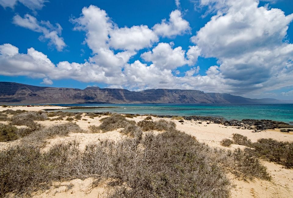 Here’s a look at our top picks.Beach HolidaysGran Canaria, Canary IslandsThe temps are definitely cooler…
 meteoblue was the most active company, contributing three posters and three presentations.

 Example SW: Wind is blowing from South-West (SW) to North-East (NE). Cape Horn, the southernmost land point of South America, has a characteristic strong west-wind, which makes crossings from East to West very difficult especially for sailing boats.
 ), we offer high resolution simulations with hourly data through point+, history+ and our API.
 However “climate justice” has not specifically been targeted to working populations.7
 8 All of these have documented occupational mortality and morbidity, likely to increase in a changing climate, including the effects of heat stress, Lyme disease, traumatic and chronic physical and emotional stress, and high rates of fatal falls. Vast numbers of workers potentially affected include those working in (at least) emergency response, construction, utility, demolition, clean-up, landscaping, agriculture, forestry, wildlife management, postal service and delivery, warehouse, heavy industry, and a number of manufacturing settings. These occupations and employment sectors are urban and rural, and outdoors and indoors. Even more are cataloged among the US Occupational Safety and Health Administration (OSHA) grim list of heat- related deaths: 112 since May 2008 (https://www.osha.gov/SLTC/heatillness/map_text.html).
 For instance, extreme temperatures will exacerbate the hazards of working at elevations, physically demanding work and long hours will take a greater toll, and chemical exposures combined with warmer temperatures will result in toxicity at lower levels.10 During higher temperatures, personal protective equipment such as respirators and protective clothing will be increasingly unbearable. Worker productivity will be negatively impacted, and both workers and employers will suffer the economic consequences.11 Additionally, inadequate attention has been paid to the hazards present in climate change mitigation employment, often labeled as “green jobs,” including safety hazards associated with wind and solar installation and maintenance, chemical exposures in isocyanate spray foam insulation, and the numerous hazards (including climate change exposures) present in biofuels agriculture.12,13
 Workers’ bodies have sounded the alarm in several cases of chemical exposure, such as the pesticide DBCP, the flavoring agent diacetyl, and latex as an allergen, which then lead to investigations of broader population impact. In those cases, as in the case of climate change effects, workers’ exposures are greater in frequency, duration, and intensity and, thus, represent the “sentinel cases” that sound the alert to the larger society health effects. One example of workers potentially serving as climate canaries may be witnessed in the world’s sugar cane fields. In the increasing heat intensity experienced in Central America sugar plantations, more than 20 000 workers have died from chronic kidney disease most likely caused by combined exposure to extreme temperature, pesticide exposures, a “piece work” payment system, and other employment conditions that prevent adequate hydration, rest, and protection from chemical exposures.14–19 (Ironically, global sugar agriculture is booming because of the demand for “climate-neutral” biofuels.
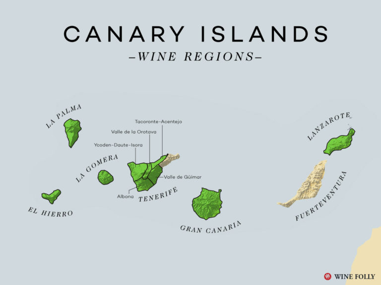 20) There is no global nor US surveillance system that can detect sentinel cases of climate-related occupational illness and injury, nor one to monitor, report, and respond to cases.5
 25 On the contrary, the media reports cases such as the AT&T workers in Texas who are prohibited from using air conditioning in their trucks and Amazon.com warehouse workers who work in 120-degree environments without relief.24,26–28
 The historical occupational health and safety regulatory pace spells doom in a scenario where urgent action is necessary. The infrastructure of change is nowhere near “nimble” enough to adequately respond to increased risks and to compel employers to reduce the impact of hazards by changing the work environment. There are several poignant examples of this major regulatory weakness headlined by OSHA’s inability to issue an emergency heat stress standard (http://www.citizen.org/documents/denial-of-heat-stress-petition.pdf).
 However, it is critical that efforts like the ongoing US Global Change Research Program’s Interagency Special Report on the Impacts of Climate Change on Human Health in the United States identify workers in vulnerability assessments.30
 gov/AR5/report. Accessed May 2, 2014.
 Glob. HealthAction. 2009;2 [PMC free article] [PubMed] [Google Scholar]
 Heat exposure, cardiovascular stress and work productivity in rice harvesters in India: implications for a climate change future. Ind Health. 2013;51(4):424–431. [PubMed] [Google Scholar]
 Mirabelli MC, Quandt SA, Crain R et al. Symptoms of heat illness among Latino farm workers in North Carolina. Am J Prev Med. 2010;39(5):468–471. [PMC free article] [PubMed] [Google Scholar]
 2012. Available at: http://www.citizen.org/hrg2042. Accessed March 29, 2014.
 US Environmental Protection Agency, Request for Public Engagement in the Interagency Special Report on the Impacts of Climate Change on Human Health in the United States. (Federal Register Notice [FRL–9906–16–OAR]) 2014. Available at: http://www.gpo.gov/fdsys/pkg/FR-2014-02-07/pdf/2014-02304.pdf. Accessed May 2, 2014.
 The city’s yearly temperature is 19.44ºC (66.99ºF) and it is 2.83% higher than Spain’s averages. Canary Islands typically receives about 21.93 millimeters (0.86 inches) of precipitation and has 33.63 rainy days (9.21% of the time) annually.
 0 mm)
0 mm) 63(61.93)
 01(0.12)
 14°C | 73.65°F
 0°C (69.8°F)
 07mph
07mph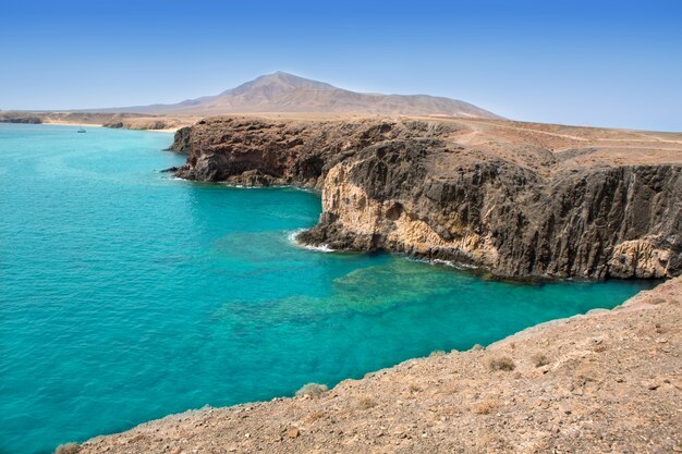 2
2 0 | 0.0
 6
6 8
8 98 km ( 6.20 mi)
 A paradise for tourists, where the tender sun is always shining, and the sea (that is, the Atlantic Ocean) is calling for a dip in the transparent waves. No wonder tourists from all over the world dream to come here, at least for a short while. After all, at any time of year the Canary Islands are fine (the weather by months is practically the same).
 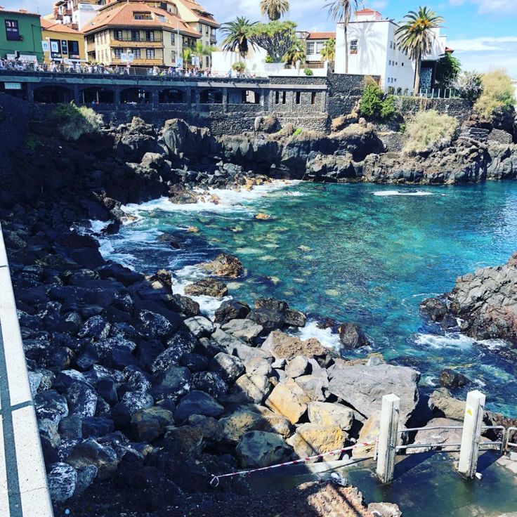 In the central part of the island for two kilometers rise the granite mountains, rugged deep ravines and gorges.
 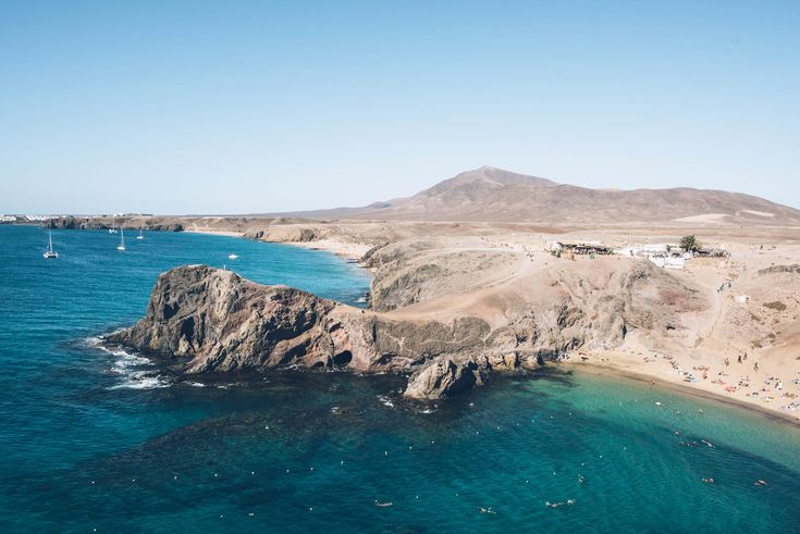 The last island is La Palma, which has very steep banks, amazing mountain ranges and lush vegetation.
 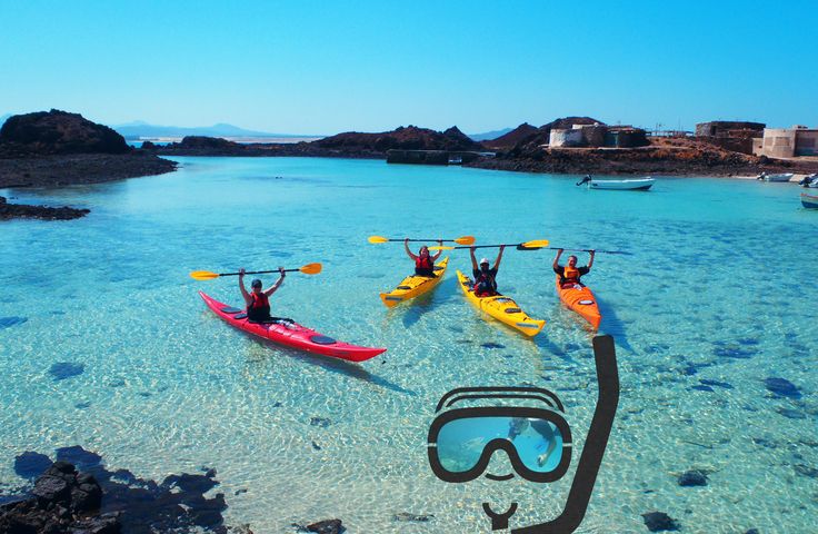 So they shed rains mainly in the north. At the highest peaks of the archipelago, even in summer, despite the high temperature of the air, you can see a snow cap.
 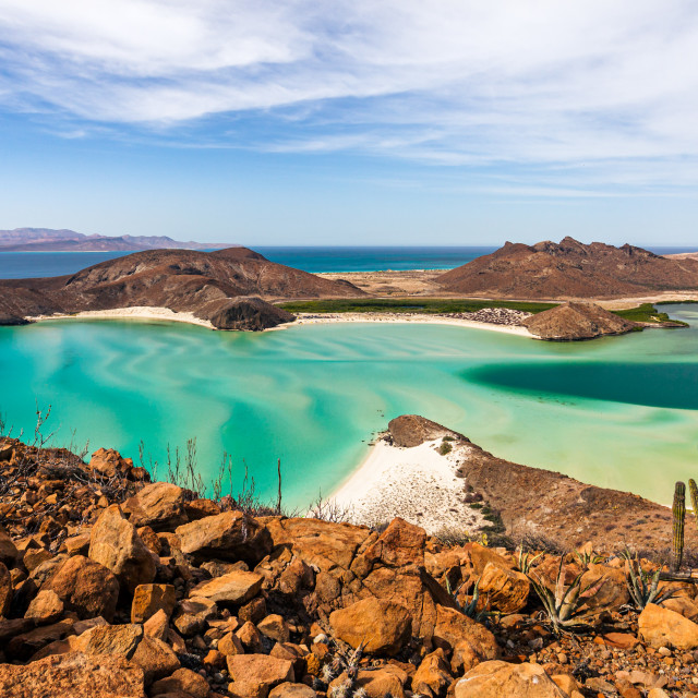 In December, tourists like to come here want to meet the New Year and Christmas in an unusual atmosphere. Indeed, your favorite holidays can be spent not on snowballs and modeling of a snowman, but on the beach. At this time you can swim (the water warms up to + 21 ° C) and sunbathe. In the afternoon the thermometer shows +23, and at night – +19. But if you are going to go high in the mountains, then it’s worth to take warm clothes. There it is much colder, in addition on some slopes there is snow.
 The air temperature in the daytime is +24, at night – +19.
 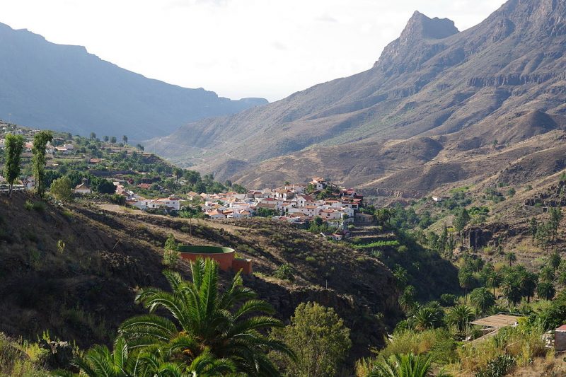 Water in the ocean warms up to +21.
 The water is still suitable for bathing (+ 24 ° C).
 But nevertheless, they amaze with their unique beauty and unique climate, recognized as the best on Earth. The archipelago consists of thirteen islands of different sizes. The main seven: Gran Canaria, Gomera, Tenerife, Fuerteventura, Hierro, La Palma and Lanzarote. Six more islets are small patches of land with peculiar landscapes. These are Graciosa, Roque del Este, Alegranza, Lobos, Montagna Clara, Roque del Oeste.
  So, the first on the way is the island of Lanzarote, whose landscape resembles the surface of the moon and space panoramas. It is worth visiting if only to realize how rich the fantasy of nature is.
  It is surrounded by a national park.
 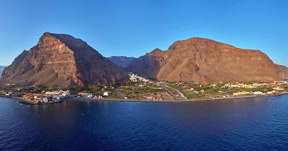 Winters are warm and mild, summers are not hot, and precipitation is moderate. As a resort, the Canaries are attractive all year round.
  For example, the southern and southwestern coasts of Hierro, Gran Canaria, Tenerife, Homer and Palma warm up better, so the sea here is always several degrees warmer than in the north and northeast. These parts of the land are cooled by the Canary Current and the trade winds. You can pay attention to this circumstance: the closer the island is to the shores of the Black Continent, the warmer the water in the ocean.
 It is +25°C during the day and +20 at night. So pack your bags and hit the road!
  Turquoise waves of the ocean warm up to +23°C.
  The weather in September differs little from summer or spring, except for a change in temperature. The thermometer drops to +27°C during the day and +22°C at night. Water warms up to +23°C. It gets colder towards the end of the month, but it will still be enough for a tourist to take light clothes with him: T-shirts, shorts, skirts.
  In addition to lazy lying on the sea coast, there is an opportunity to go on exciting excursions and boat trips, scuba dive and visit the mountains, learn the history of the islands from the architectural masterpieces of the past. Natural wonders in the form of national parks, reserves, picturesque gorges and small canyons will not leave anyone indifferent. Be sure to visit the cliffs of the Giants and the mountains of Anaga, Hell’s Gorge and Teide Park, Loro Park and Timanfaya. The pyramids in Guimard, the water park, the El Diablo restaurant on a sleeping volcano, the Cactus Garden are also worthy of your attention.


 The winds subside, the precipitation stops, and the air warms up to 29-30 ° C during the day, the water, however, is vigorous – 22-23 ° C. However, April is quite a good time to visit Eilat. Resting on the Dead Sea is also comfortable, which cannot be said about

 But it’s still too early to swim, as the water is still 14 degrees on average.
 And the month of June is the peak of the tourist season, as there is a good combination of air and water temperatures, as well as minimal natural precipitation.
  Rains are not uncommon in autumn, but the rest
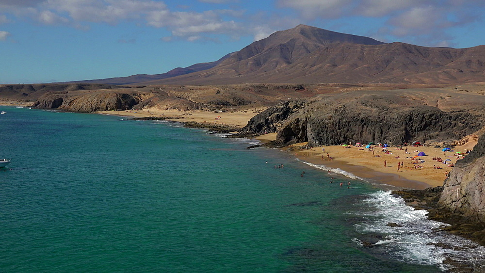 Sunbathing is recommended until 12:00
 Outside up to +15°C, there are winds and rains,
 There are three main types of climate that dominate the territory of the state:
  Winter in this region is usually cold and dry (temperature often drops to 0 degrees), summer is hot (up to +35 degrees). The main precipitation here falls in autumn and spring.
  With the onset of calendar spring, the air in different regions of the country warms up to +16 … +18 degrees on average (in the southern regions up to +20 degrees). There are many more sunny days, but, of course, it is still far from the opening of the beach season.
  Also this month, on the day of the death of the famous writer Cervantes, the day of books is celebrated. On April 28, the Toledo Olive Festival begins. Of the fruits in that period, the Japanese medlar ripens, the fruits of which are simultaneously similar in taste to apples, plums and apricots.
 Tourists continue to swim and enjoy the bright sunshine.

 This also applies to air temperature, it reaches +32°C. At this time, there is also a high season: Europeans, as a rule, prefer August, in June-July there are more Russian tourists. The hottest climate is in the Canary Islands, where the air temperature rarely drops below +20°C. One of the most popular Canary Islands is Tenerife. Detailed description monthly weather in Spain
 It rains a lot in Spain in February. However, in the Canary Islands everything is also +21°С.…
 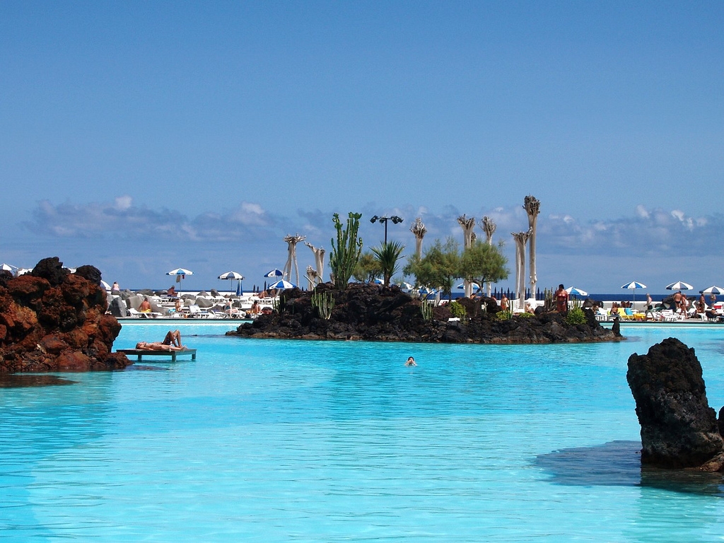 The water temperature here is about + 22 ° С …
  The average air temperature is kept at +28°С. The water in the sea is still kept at +24°C. weather in spain in november
 It is rather difficult to give a complete description of the weather conditions in Spain, since the climatic conditions in its various regions and islands vary significantly.
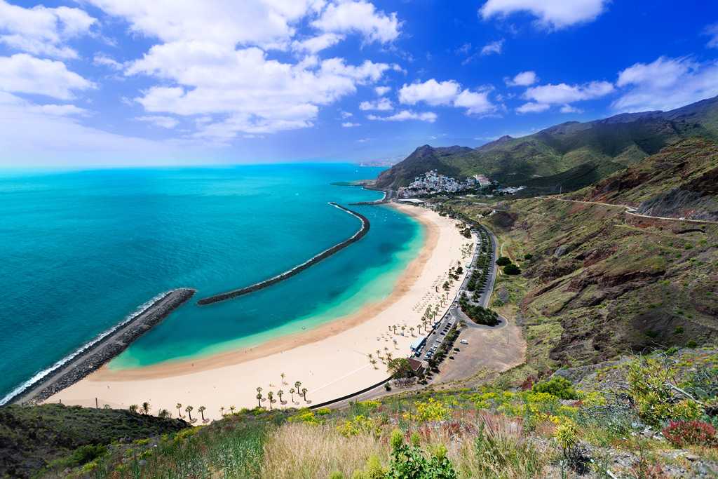
 During this period of the year, sea water warms up to +18°C -22°C. In June and July, stable hot weather sets in, the water temperature is about + 24°C-25°C.
 In Spain there are no laws prohibiting nudism like in some other countries.
 The northern regions are characterized by mild winters and warm summers. It is cooler in the mountainous regions. A sharply continental climate prevails in the center. Winters are cold and dry, and summers are hot. Mallorca, Ibiza and Minorca have a Mediterranean climate: the winter months are warm, with little snow. June-August are hot, the humidity level is low. The Canary Islands are consistently warm, without cold or sweltering heat.
  In mountainous areas, the temperature drops to zero and below, the peaks are covered with a thick layer of snow. Madrid will meet with temperatures of +3 °С…+10 °С. In Barcelona and Valencia, it rarely gets colder than +13 °С…+14 °С during the day. On the northwestern coast, the thermometer will show +12 °С during the day, and up to +17 °С on the southern coast. The Canary Islands are characterized by an air temperature of +22 °C, and water temperatures of around +18 °C…+19°C. In the rest of the territory, the sea warms up to +13 °С…+17 °С. In January, winter clothing sales begin, which will appeal to shopping lovers.
  At this time, a spectacular carnival takes place in Cadiz.
  By the end of the month, the sea warms up to +18 °С…+20 °С. In April, a 6-day fair is held in Seville with parades, concerts, bullfights, dances and traditional treats.
 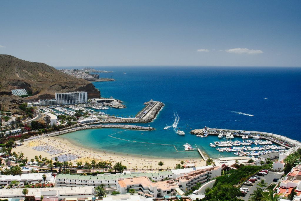 Music lovers should visit the Granada Music Festival in June.
 ..+27 °С and water temperatures of +22 °С…+23 °С. In Cordoba, on October 24, mass celebrations are held in honor of the day of St. Raphael.